Landscape architecture
MaeLys Merat

Maelys Merat
Landscape Architect
Growing up between southwest France and Brittany, I was constantly surrounded by majestic yet dramatically contrasting landscapes. It taught me about the incredible diversity and complexity of the French countryside and shaped my passion for landscape architecture and management.
During my studies, I realised that landscape is far more than the design of spaces—it is about preserving, interpreting, and enhancing the relationship between people and places. This passion quickly evolved into a deep desire to preserve and enhance exceptional natural landscapes. It was, therefore, a natural step for me to turn to the Grands Sites de France after earning my degree.
Over the past few years, I have worked on various projects that have continually refined my approach to landscape design. In January 2024, I moved to England to further develop my skills and contribute to international projects.
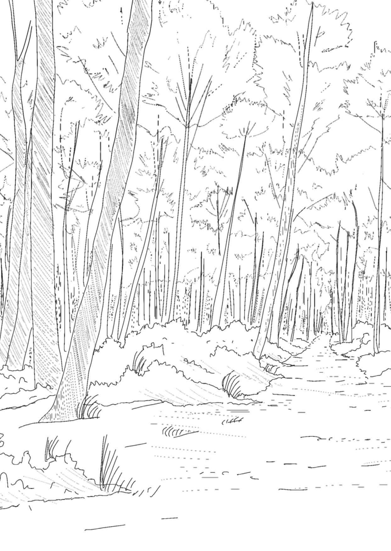
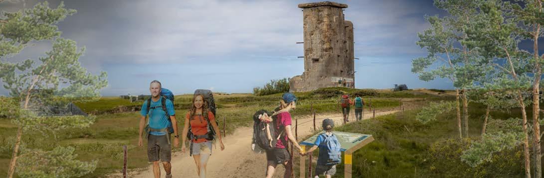
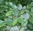
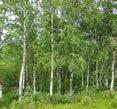
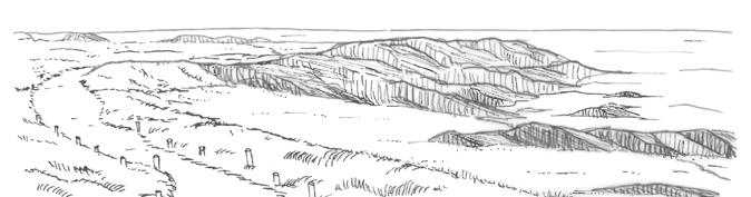
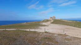
Quiberon Forest, Brittany, France
MaElyS MErat
ContaCt
24 Saint Chad’s View, Headingley, Leeds LS6 3PE
(+44) 7840 200674
maelys.merat@gmail.com

EduCation
My Port Folio
Engineering Diploma (Master’s degree)
Major : Landscape, specialising in "Landscape project, Site and Territorial management"
National Institute of Horticulture and Landscape Sciences (Agrocampus Ouest
- Institut Agro Rennes-Angers), Angers (France) 2013 - 2019
Master of Arts - Landscape Architecture
Leeds Beckett University, Leeds (UK) January 2024 - January 2025
SkillS
• Proficiency in design software (Adobe Creative Suite, AutoCAD, SketchUp, GIS, etc.)
• Landscape assessment and site analysis
• Ecological design and habitat restoration
• Construction detailing and documentation
• Artistic rendering and visual communication
• Effective written and oral communication
• Teamwork and collaboration
languagES
• French (native)
• English (fluent)
• Spanish (intermediate)
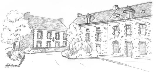
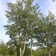
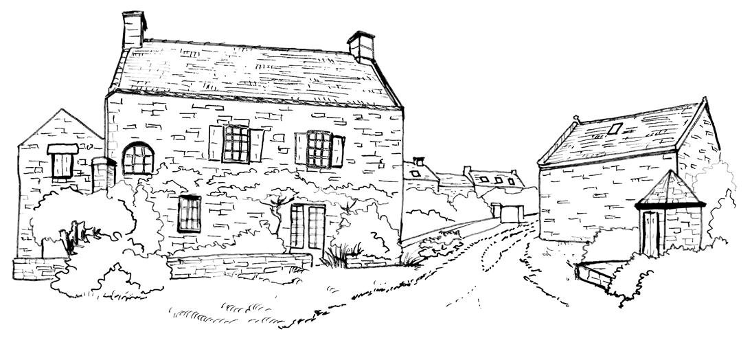
Plouhinec Village, Brittany, France
Work ExpEriEnCE
Landscape Project Manager
Syndicat Mixte Dunes Sauvages, France / 2021- 2023
• Elaboration of a workbook of landscape guidelines to create sustainable and integrated projects in a territory which received the “Grand Site de France” label.
• Technical support to city councils in their urban projects for the integration of the landscape guidelines (renovation of village squares, creation of green spaces, enhancement of small heritage sites, creation of viewpoints, etc.).
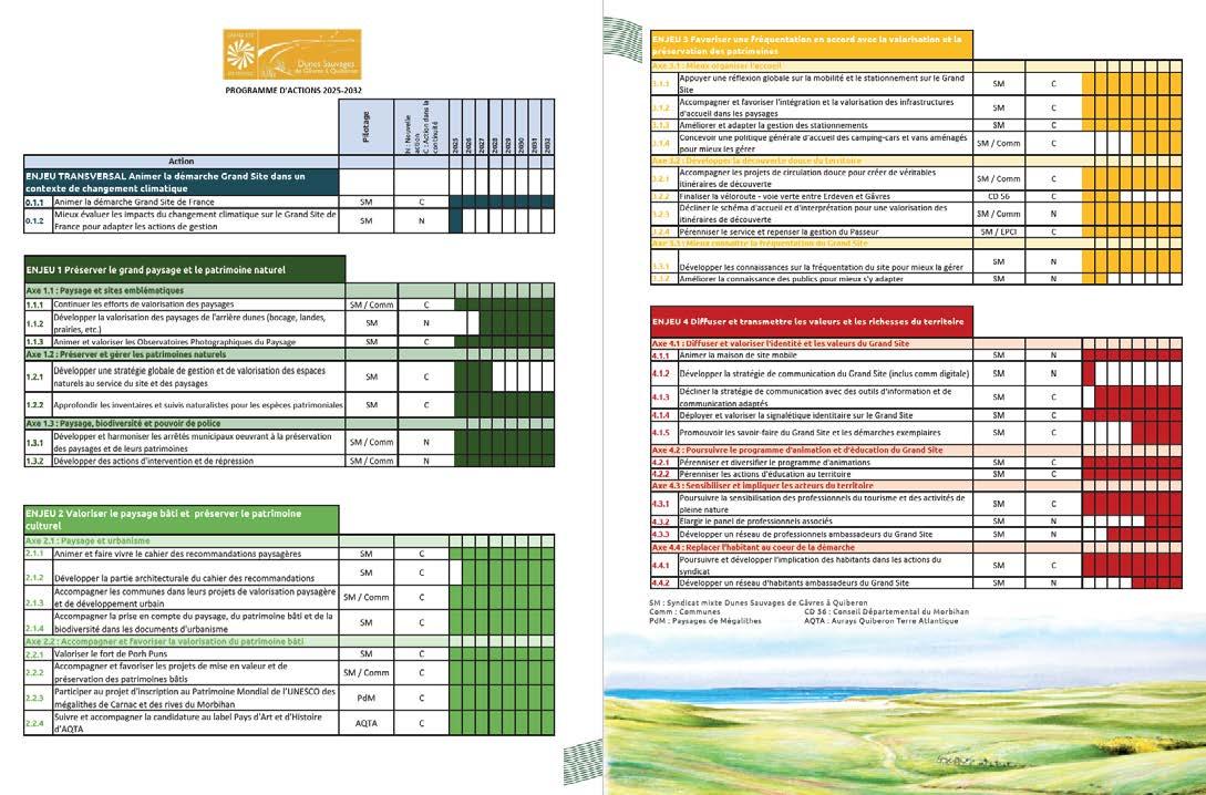
• Preparation of the application dossier for the renewal of the “Grand Site de France” label (review of the first label period, 2019-2024, and the actions carried out, preparation of the new action program for the period 2025 - 2032, drafting of the provisional budget, etc.).
Landscape Project Manager
Syndicat Mixte Baie de Somme - Grand Littoral Picard, France / 2019- 2021
• Creation of the technical, environmental and landscape guidelines for the extension of the Bay of Somme coastal path (+25km).
• Elaboration of educational panels and an illustrated guidebook for the coastal path and the other Bay of Somme tourist paths.
• Assistance and monitoring of the Syndicat Mixte landscape projects, for a sustainable management of the landscape and its heritage (integration and landscape enhancement of tourist infrastructures, car parks, foot paths, etc.) in accordance with the “Grand Site de France” label.
Final Year Internship
Syndicat Mixte Baie de Somme - Grand Littoral Picard, France / 2019
• Landscape assessment and analysis of the Bay of Somme coastal path (50 km), including landscape analysis, heritage inventory, and technical review.
• Landscape planning and tourism enhancement project proposals.
- Cyrano P
03 - LiVing riVerbanks - HoUsing deVeLoPments
LandsCaPe mUniCiPaL sUPPort
26
AMÉNAGER DANS LE PAYSAGE 02
07 - edUCationaL interPretation materiaLs 24
06 - aPPLiCation dossier - reneWaL of tHe «grand site de franCe» LabeL

Être au service du site et de
Le Grand Site de France Dunes Sauvages de Gâvres à Quiberon est reconnu ses paysages d'exception, de leur préservation, de leur gestion et de leur mise en valeur. Site de France, les projets d'aménagement ne peuvent donc se réduire à une simple et doivent servir l’esprit des lieux. Ils doivent combattre la standardisation ou la banalisation et rendre hommage au caractère du site et à la force de ses paysages. Chaque projet au sein du Grand Site de France doit donc intégrer un volet "Paysage" permettant paysagers et les valeurs portées par le label.
• Réaliser un diagnostic paysager préalable aux aménagements pour identifier sites et leur caractère ;
• Favoriser la réalisation de schémas d'intentions paysagères pour poser les d'actions définis collectivement lors de débat et déchange autours du volet "Paysage" entre les différents acteurs du projet et le syndicat mixte du Grand Site ;
• Favoriser des aménagements mimétiques pour que les projets puissent être derrière la nature et le caractère sauvage des sites. La discrétion des projets l'émotion et le plaisir de la découverte de milieux naturels uniques et préservés
• Favoriser des interventions douces et des techniques entre savoir-faire traditionnels pour réaliser des projets de moindre impact paysager.
32 08 - researCH & manifesto 28
ProjeCt - LandsCaPe Park
02 - WiLd dUnes ProjeCt - Visitor Centr
Fiches synthétiques
Extrait du projet d'aménagement de la pointe du Conguel, Quiberon. Schéma d'intentions paysagères de Beg Ar Vil.
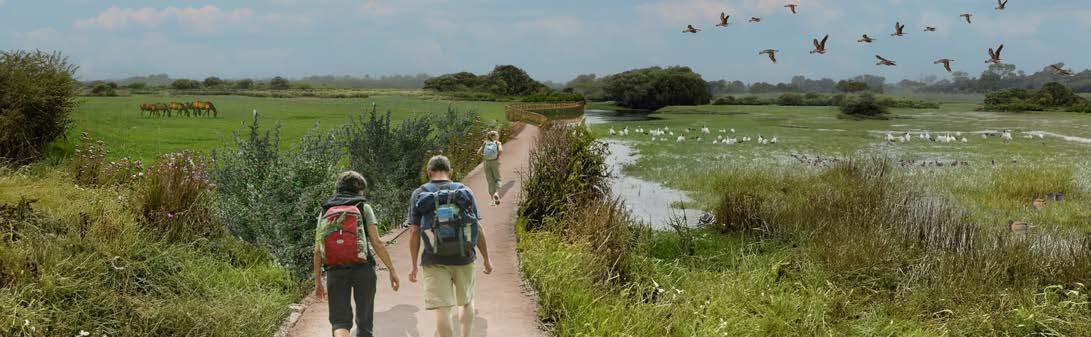
Living Riverbanks Project, Leeds, UK
UNIVERSITY PROJECTS
Landscape:
"The landscape is part of the land, as perceived by local people or visitors, whose character is the result of the action and interaction of natural and/or human factors." The European Landscape Convention (Florence, 2000)
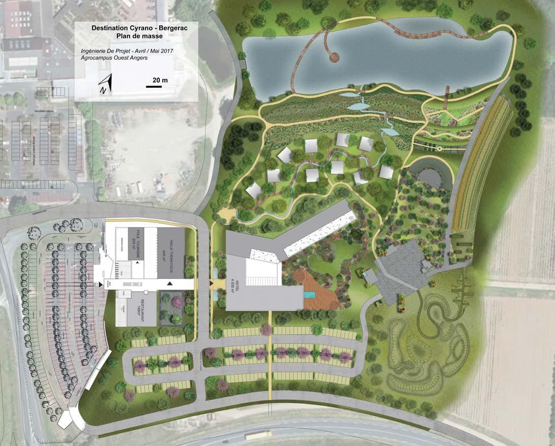
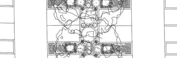
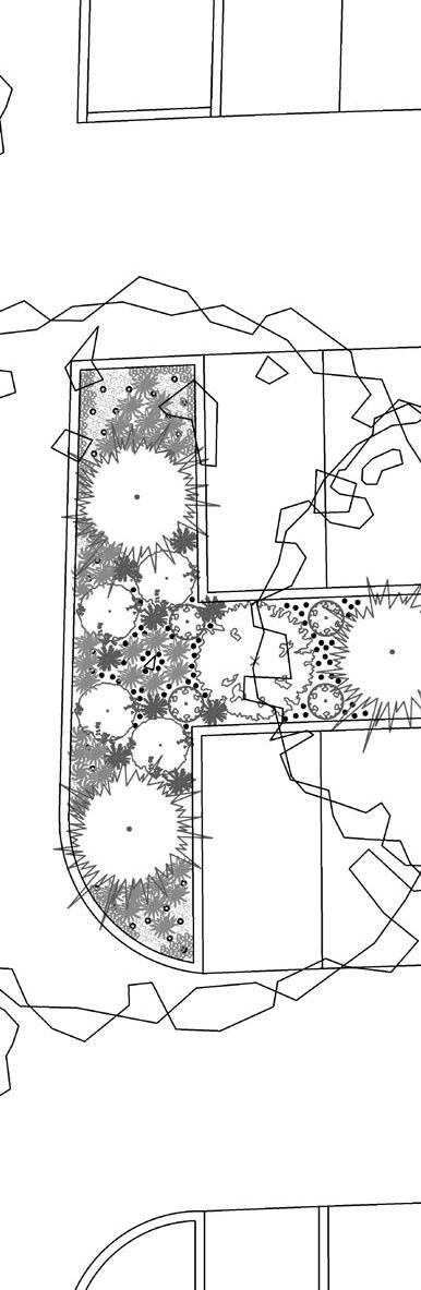
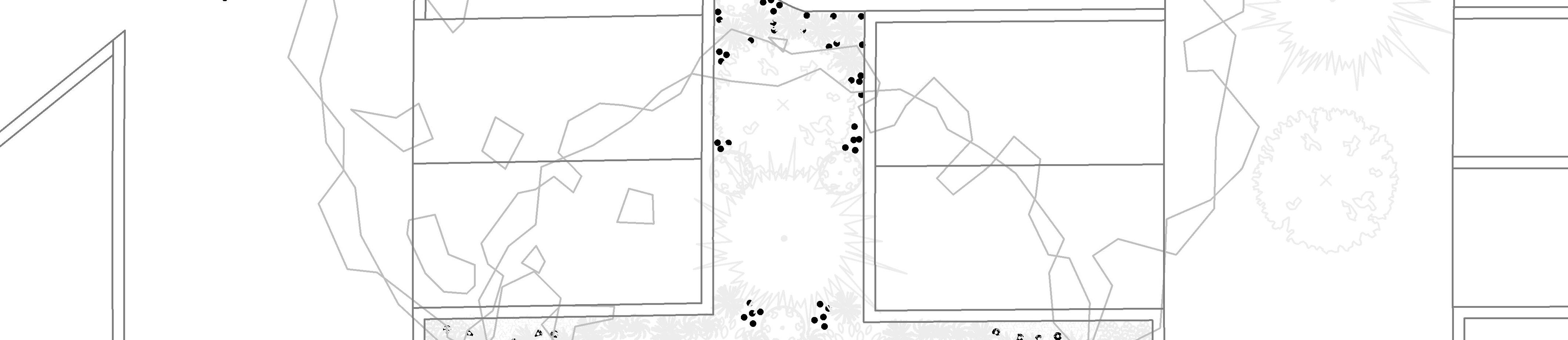
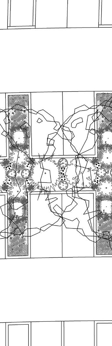
Cyrano ProjeCt - Creation of a LandsCaPe Park
Design of a landscape park around the play «Cyrano de Bergerac» by Edmond de Rostand
UniVersity ProjeCt, 2017 bergeraC, franCe
Creating a landscape is not just about aesthetics; the design must tell a story. This narrative should reflect the history of the territory in which it is situated.
During my studies at the National Institute of Horticulture and Landscape (Agrocampus Ouest), I, along with four other students, was commissioned to design a large park in Bergerac, France.
We decided to create a park that would tell two stories: first, the history of the area—Bergerac and the Dordogne—and second, the story of Cyrano de Bergerac, the famous play by Edmond Rostand.
We designed a landscape park made up of different gardens, each representing a scene from the play (the scene at the Hôtel de Bourgogne with the green theater, the balcony scene depicted by the rose garden and its balconies, the war scene with the sloping field serving as a playground, etc.).
The plant palette was selected to reflect the region in which the park is located, the Dordogne. We prioritized local species, banned invasive plants, and carefully shaped the site’s topography to create various viewpoints, or «balconies,» overlooking the Dordogne River as it winds through the valley.
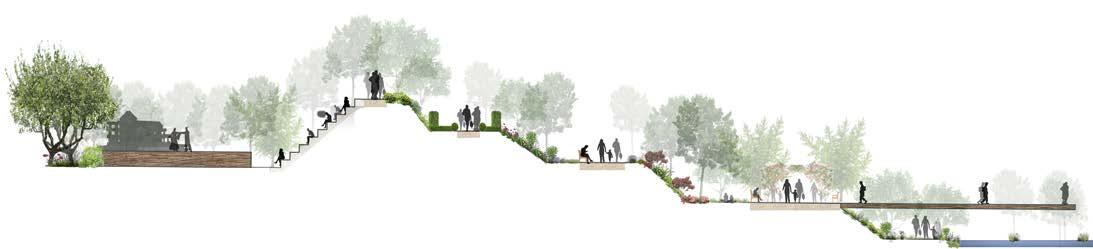
seCtion of tHe Cyrano ProjeCt: tHe green tHeater & tHe terraCed gardens
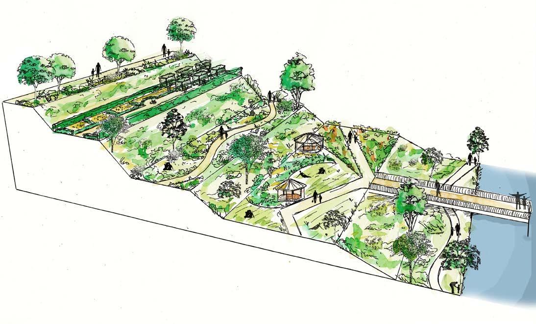
The Rose Garden
The Covent Herb garden
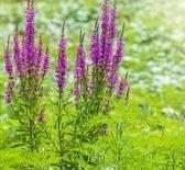
The poetry garden and its wild flowers
Dordogne, land of wines : The vine garden
Viewpoint overlooking the Dordogne River
The river walk
Pathway to the theatre
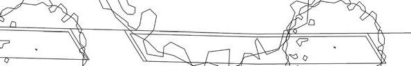
masterPLan of tHe Cyrano ProjeCt in bergeraC, franCe
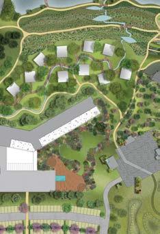
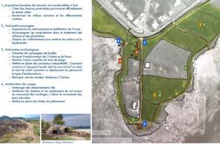
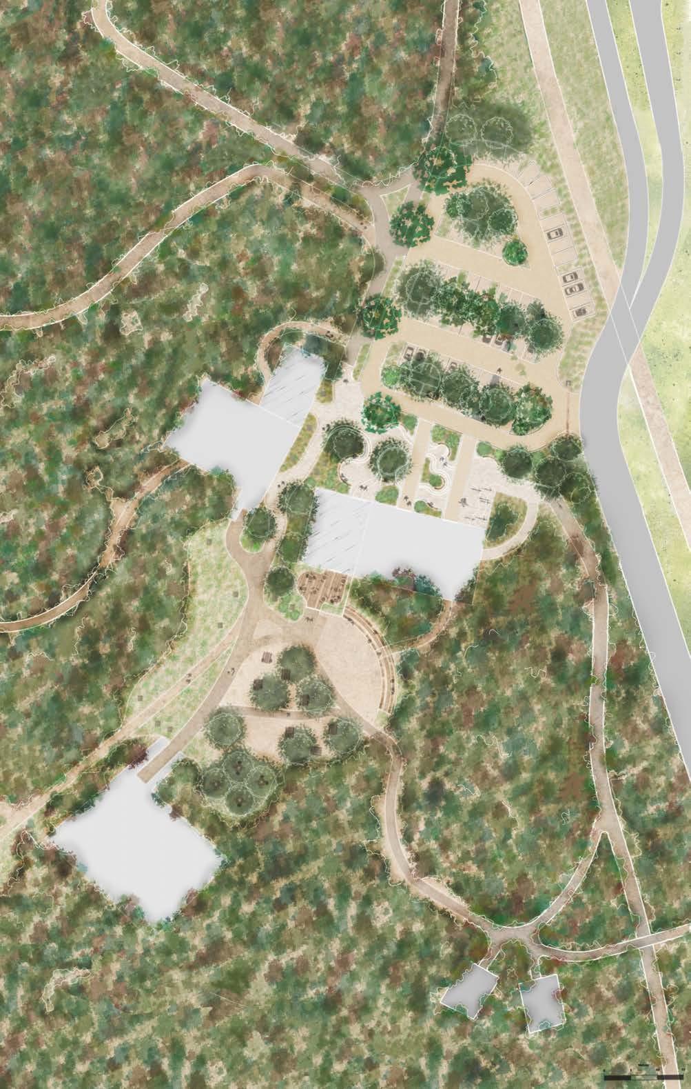
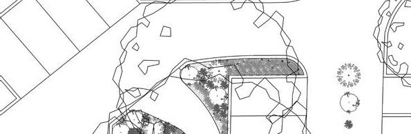
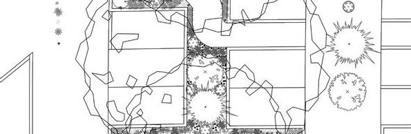
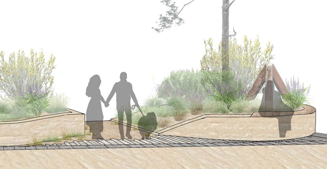
WiLd dUnes ProjeCt - design of a Visitor Centre in tHe dUnes
Reconciling heritage preservation and tourism in a highly attractive natural site
UniVersity ProjeCt, 2024 PLoUHarneL, franCe
Landscape architecture also plays a vital role in preserving the remarkable landscapes of our regions—this is the core objective of the territories engaged in the «Grand Site de France» initiative.
The Wild Dunes site is a hidden gem within the «Grand Site de France» des Dunes Sauvages de Gâvres à Quiberon (Brittany, France). With its unique historical context, Bego stands as one of the most significant military sites from the Second World War, rivalled only by those in Normandy. Additionally, its rich and
rare fauna and flora have earned it recognition as one of the most protected natural sites in France. However, the site currently lacks the infrastructure needed to manage tourism activities and safeguard its heritage.
The Wild Dunes project presents an ambitious vision centered on developing better infrastructure to facilitate the discovery and enjoyment of the site’s heritage while ensuring their preservation for future generations.
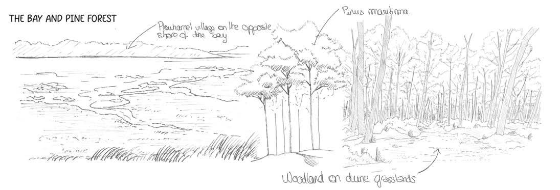
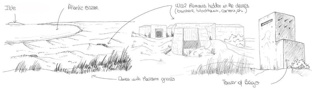
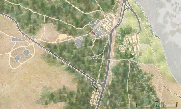
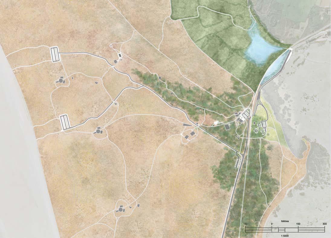
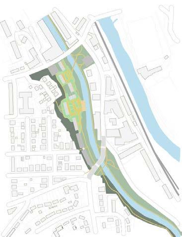
The Wild Dunes project is organized around four key areas: the Bego Dunes, Bego Dune Wetlands, the Chouannerie, and the Quiberon Forest along the bay’s banks. Each area focuses on restoring fragile habitats and improving tourism management.
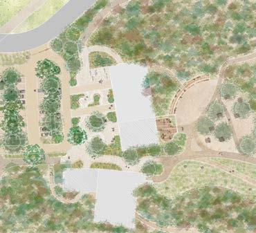
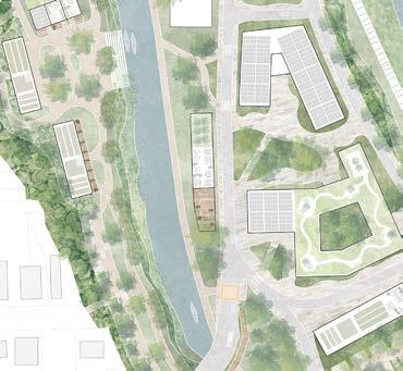
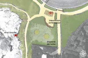
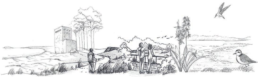
The Chouannerie is the central hub of the site. The Wild Dunes project envisions a complete redesign of this area, transforming it into a comprehensive visitor centre that connects all parts of the site and serves as the main gateway to the Grand Site de France.


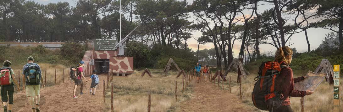
VisUaL for tHe memoriaL traiL: PreserVation and enHanCement of tHe dUnes Habitats & miLitary Heritage
VisUaL for tHe CHoUannerie: a CentraL HUb for aCCessing and exPLoring tHe dUnes
VisUaL of tHe WetLands traiL: restoration of tHe WetLands eCosystems sUPPorting a diVerse range of fLora and faUna, inCLUding migratory birds tHat dePend on tHese Habitats.
VisUaL of tHe ProPosaL for tHe bay traiL: disCoVering tHe bay of PLoUHarneL and its rare faUna & fLora

bUnker: grand site de franCe mUseUm bUnker: WorLd War ii mUseUm
& WasHroom faCiLities
oLd


HosPitaL bUnker: CHoUan (Post reVoLUtion) War mUseUm
HoCHe
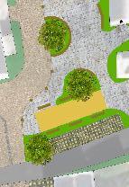
Centre foreCoUrt
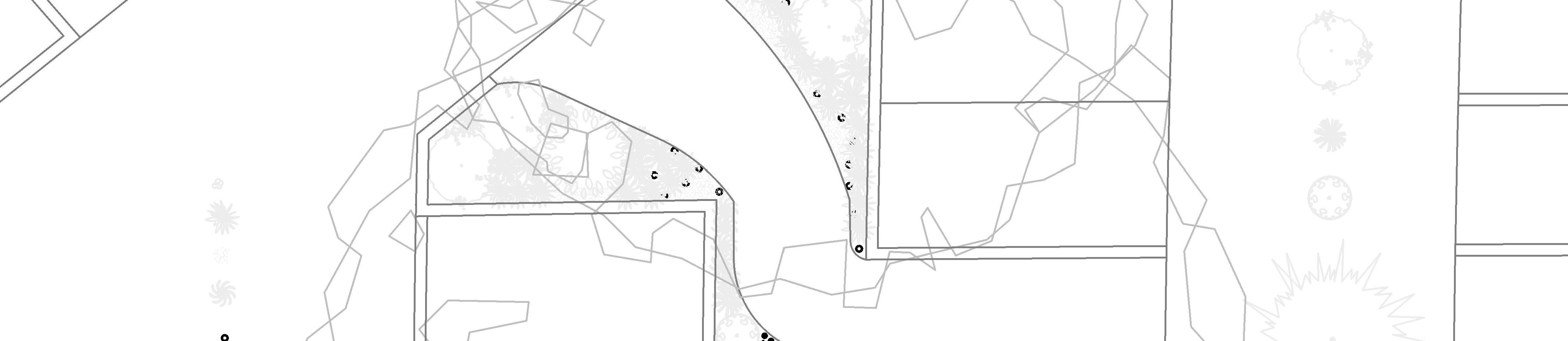
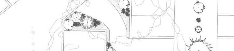
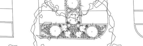


The planted beds offer shapes that echo the natural contours of the dunes. Benches are designed to follow these curves, providing seating for visitors, crafted from pine wood. Some military remains found on site are incorporated into the planted areas as decorative elements.
Thymus praecox
detaiLs - Car Park PLantings PLan & PLants seLeCtion
detaiLs - foreCoUrt seating and PLanting beds
Total area - 135 m2 Soil type: Sandy soil, well drained
detaiLs - Car Park PLantings & CoLoUr PaLette
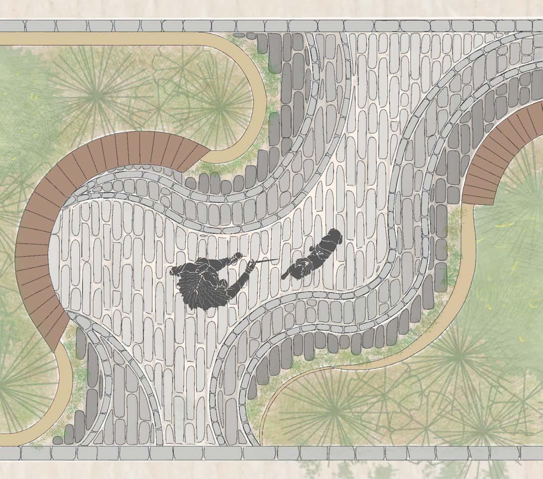
detaiLs - CoUntoUrs PaVement & PLanting beds
The forecourt paving, composed of three shades from beige to dark grey, mimics the contours and elevations of a topographical map of the dunes. The highest levels of these contours are marked by planted areas, allowing sand and plants to naturally blend with the paving stones, symbolizing the fluidity of the dunes.
Site concrete planting beds small walls
Granite cobblestones (border pavers)
Dark grey cobblestones
Light grey cobblestones
Permeable compacted aggregate base
Mixed grey and beige cobblestones
Sand setting bed
a v e
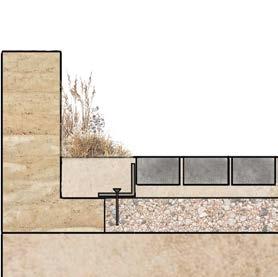
Corten steel edge restraint
10 cm Steel spike
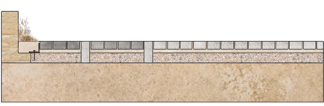
-foreCoUrt & CoUntoUrs PaVement
Existing soil
P
mentInstallation at Plantin g Edges
detaiLs
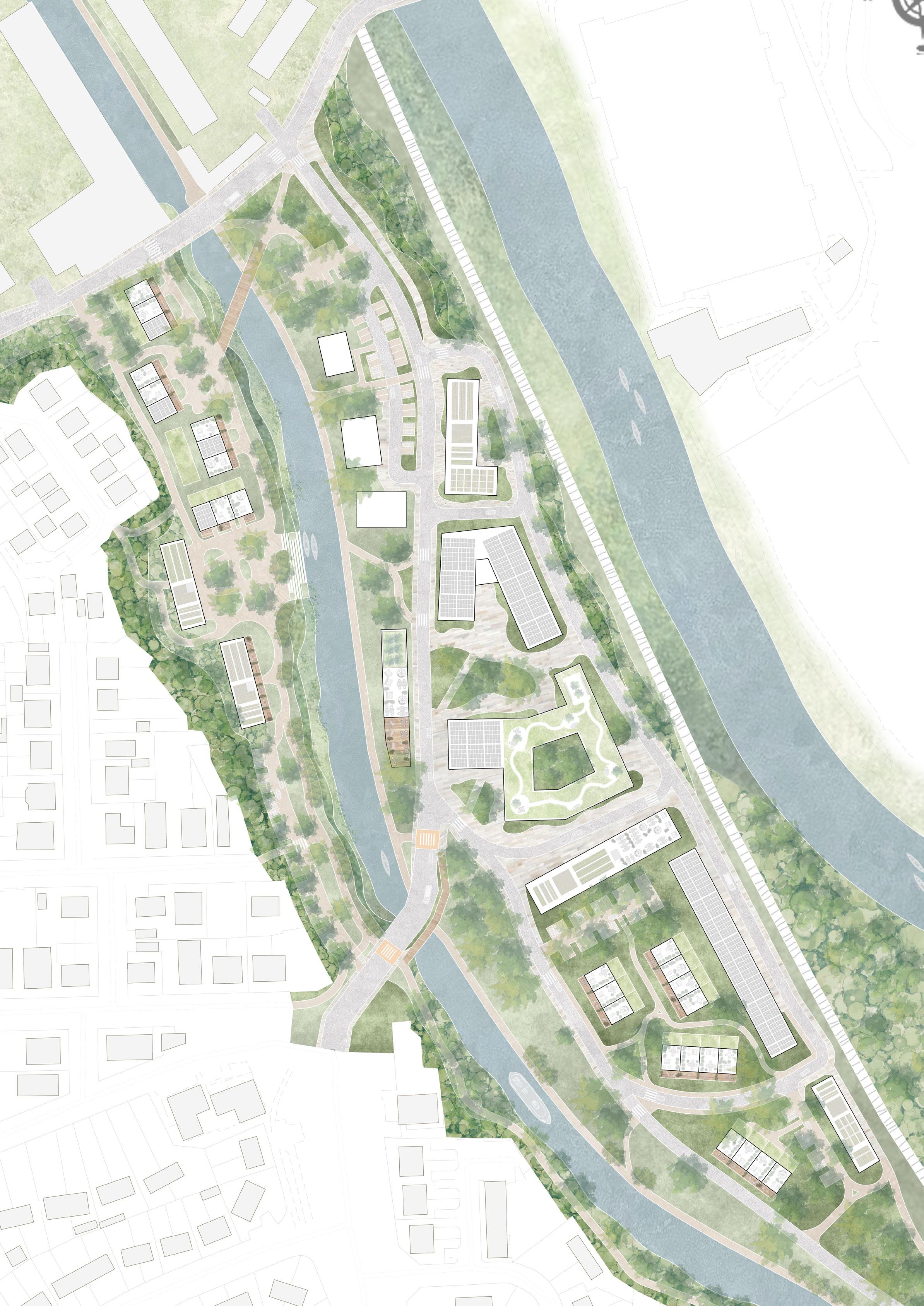
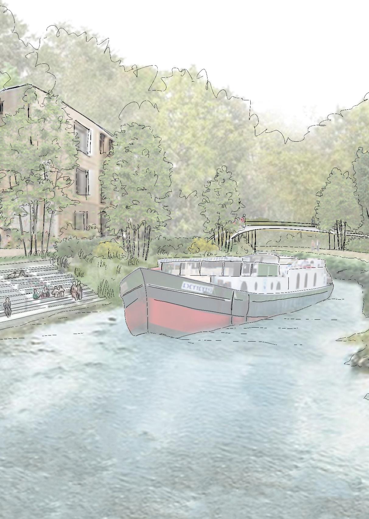
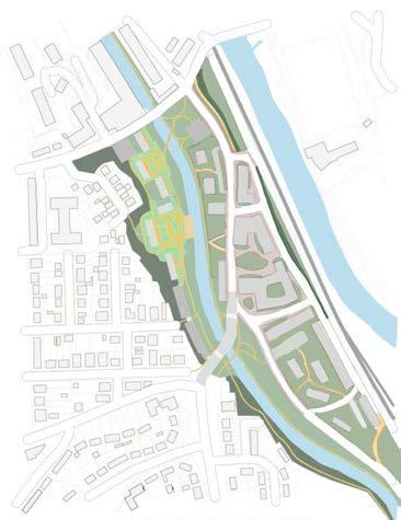
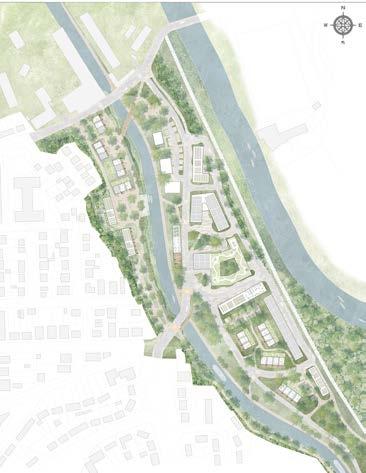
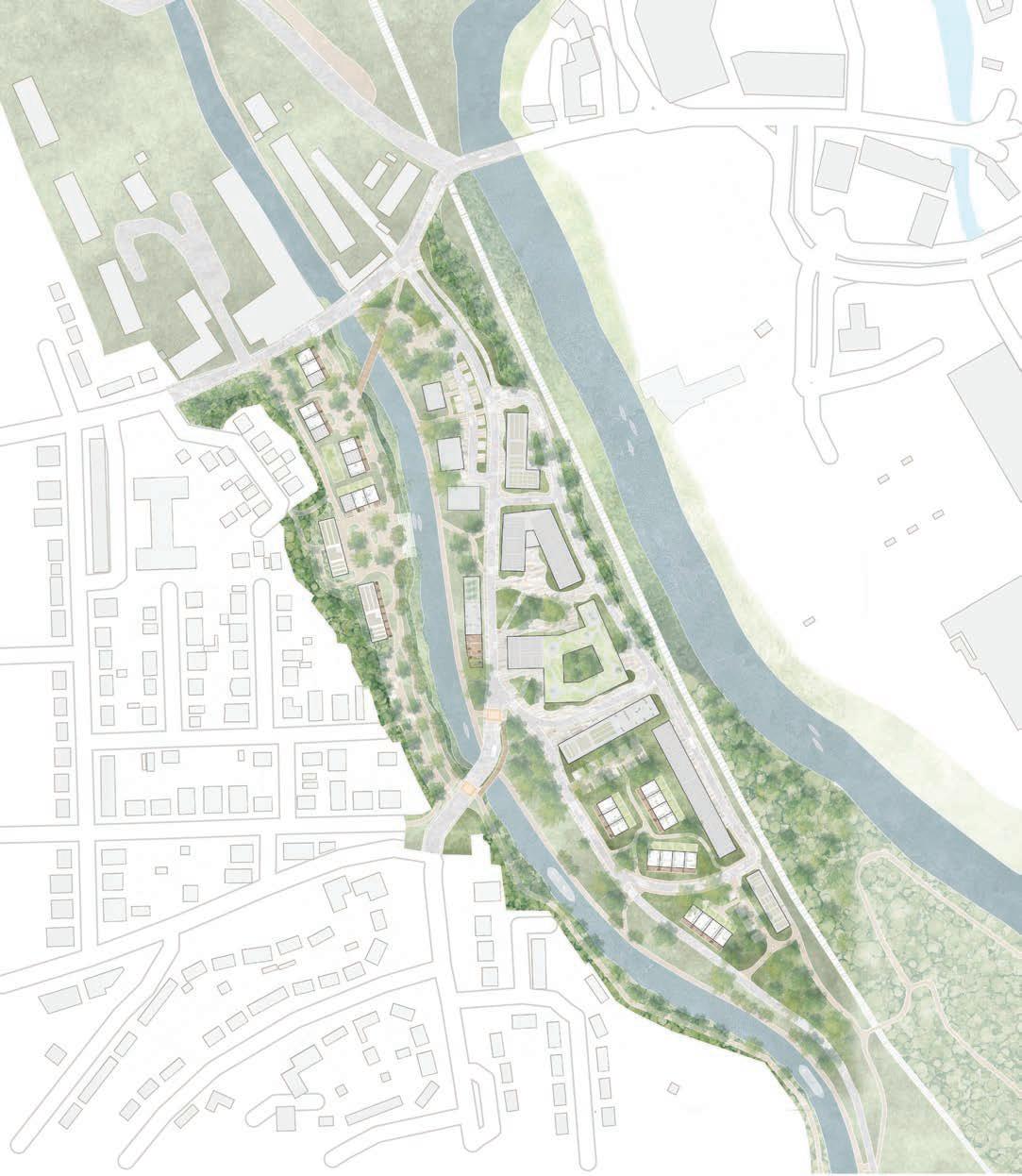
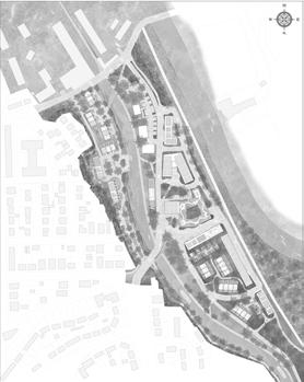
LiVing riVerbanks ProjeCtreimagining HoUsing deVeLoPments
Landscape Guidelines for Housing Developments in the Kirkstall Valley Using Blue and Green Infrastructure
UniVersity ProjeCt, 2024
Leeds, Uk
Using landscape as the foundation of a project can also help reimagine urban areas where cities and nature are closely connected.
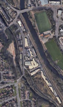
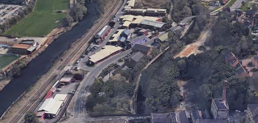
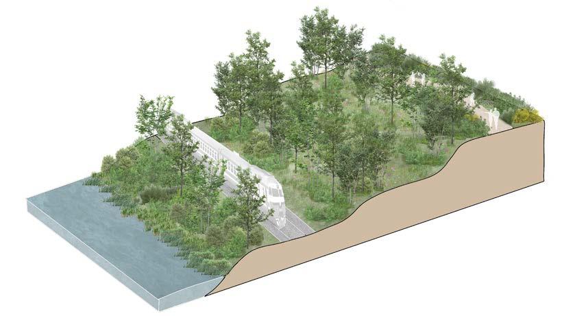
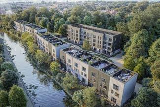
In Leeds, several development projects have emerged within the Kirkstall Valley. However, many of these fail to fully capitalise on the unique qualities of their location—such is the case with the Stall site. On this site, the current development proposed by CITU consists of housing in a highly enclosed area along the canal, facing an industrial zone with little visual or environmental appeal.
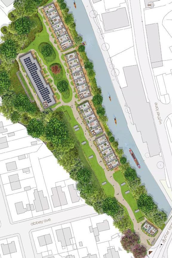
The Living Riverbanks project proposes to reimagine this development site with a broader vision that transforms the entire neighborhood. The goal is to create a vibrant new district within a re-naturalized environment, celebrating renewed connections to these once-forgotten waterways.

STALL
CitU masterPLan aeriaL VieW of tHe site
centre emerged, prime to the developments cultural housing in zone with just the vibrant, environment, green guided by

Kirkstall Breweries- University
Hollybush Conservation Centre Car parks
Terraced Houses with terrace rooftop and solar panels
Pedestrian riverside walk
Pedestrian bridge
Riverbank parks
Railway
Collective units
Tow path
Collective units with green roof
Pedestrian access
Preserved riverbanks
Commercial units
Offices with solar panels on the roof
Offices with green roof and patio
Secured pedestrian crossing
Pedestrian catwalk along the bridge
Mixed units with housings and commercial spaces.
Solar panels and green roofs
Forest path
Pedestrian path to Nature Reserve
Leeds Liverpool Canal River Aire
24 Kirkstall Valley Nature Reserve
25 Footbridge over the railway


Unlike the masterplan proposed by CITU, this Masterplan has been expanded to include an area extending to the river, thereby encompassing the entire commercial zone between the canal and the river.
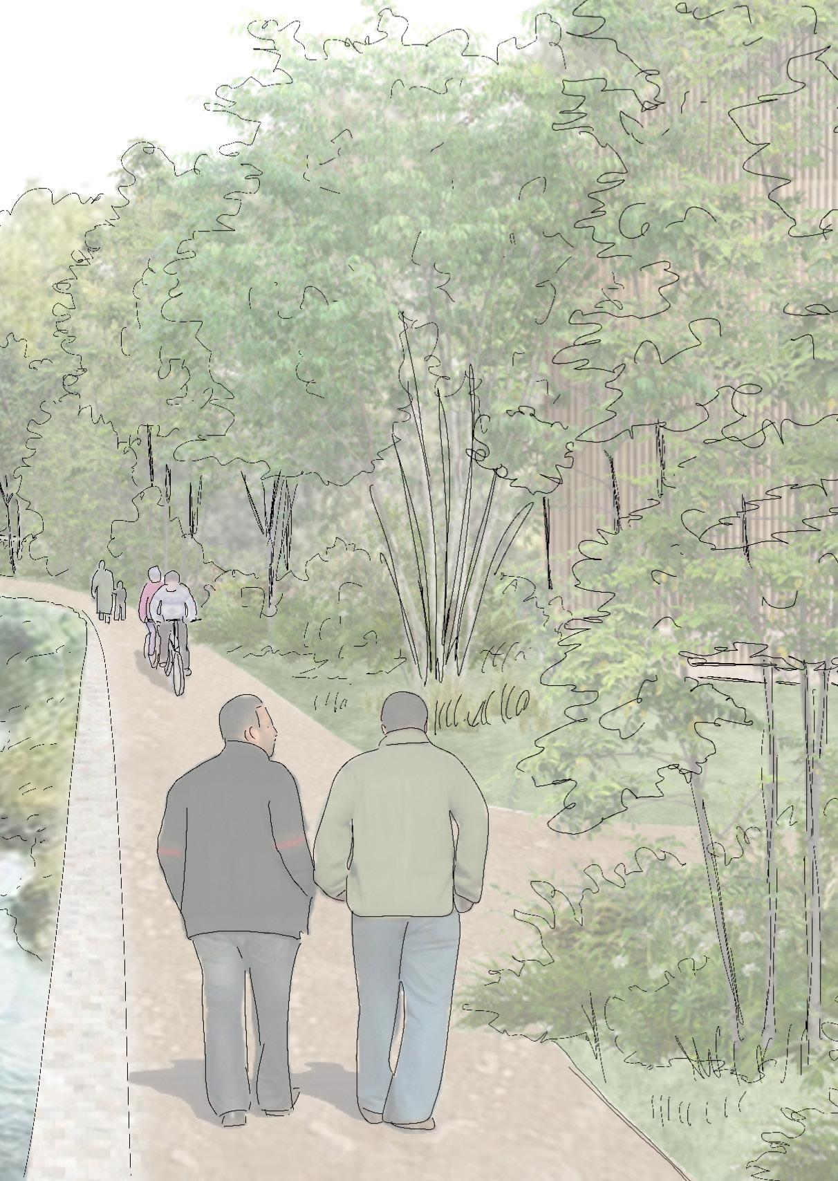
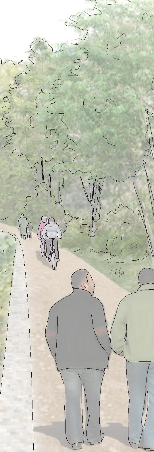
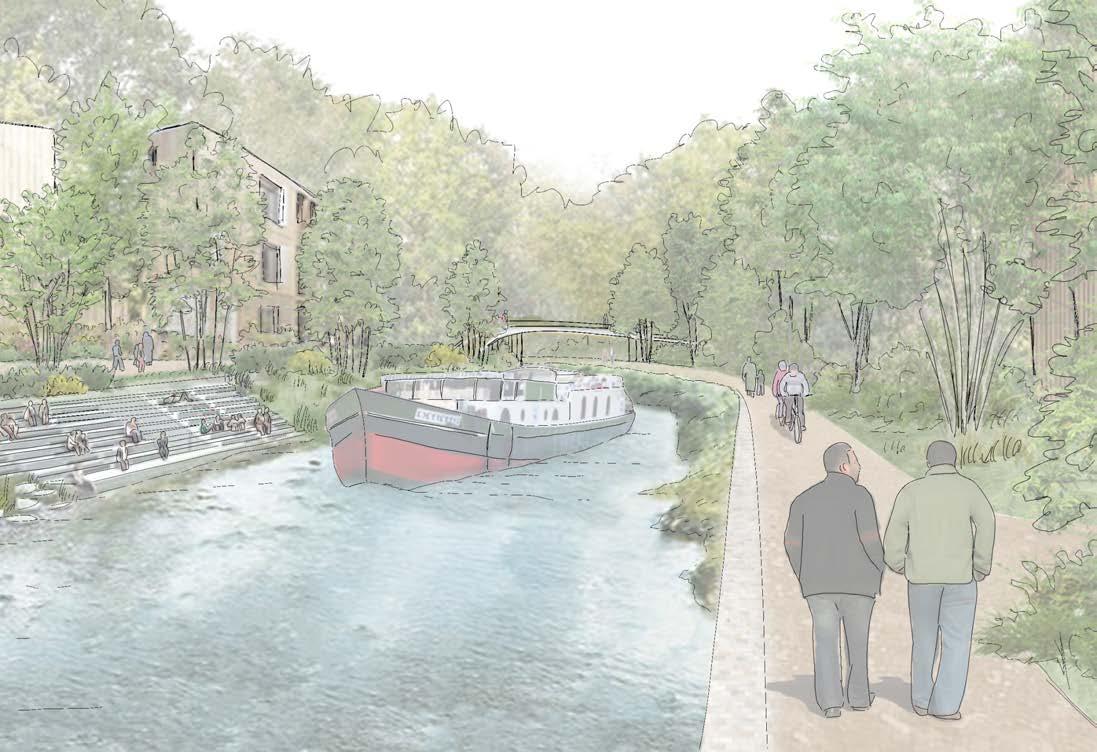
Creation of a public canalside walkway to support outdoor activities and leisure, surrounded by nature, while preserving views for the residents of nearby houses.
The masterplan is therefore divided into three zones: Stall, where CITU’s development project is located; the Canalside, the commercial area between the river and the canal; and finally, the New Stall, the expansion of the Stall district on the eastern bank of the canal.
Restructuring
Kirkstall
To Kirkstall Abbey
To Kirkstall Village To Kirkstall Village
To Kirkstall Retail Centre
To Kirkstall Forge
To Bramley Fall Park
To Bramley
To Bramley To Armley To Armley
To Kirkstall Valley Nature Reserve To Leeds City Centre and City Reach To Gotts Park
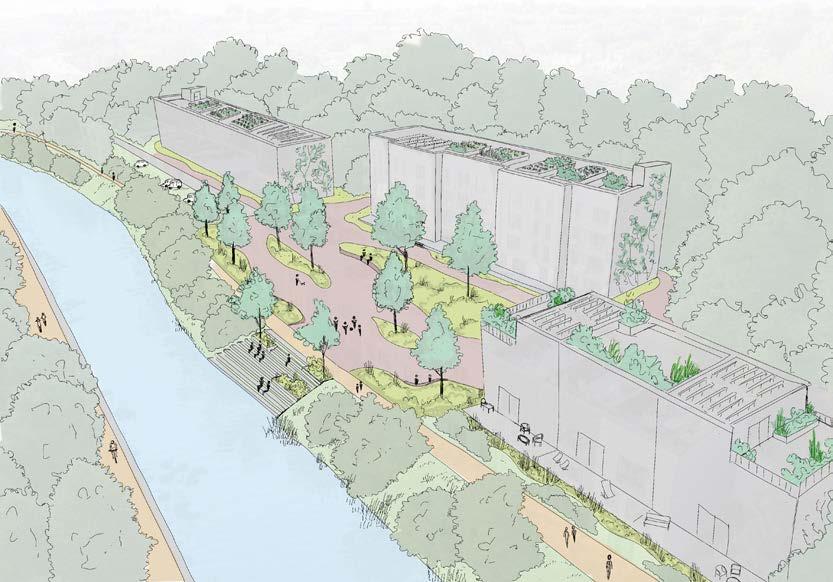
The Living Riverbanks Project also aimed to propose guidelines for new development within the Kirkstall Valley, in order to reconnect these urban spaces with nature. These guidelines explore how blue and green infrastructure can create healthier and more sustainable cities, and showcase how to transform privatised, inaccessible riverbanks into thriving, accessible, and ecologically resilient environments.
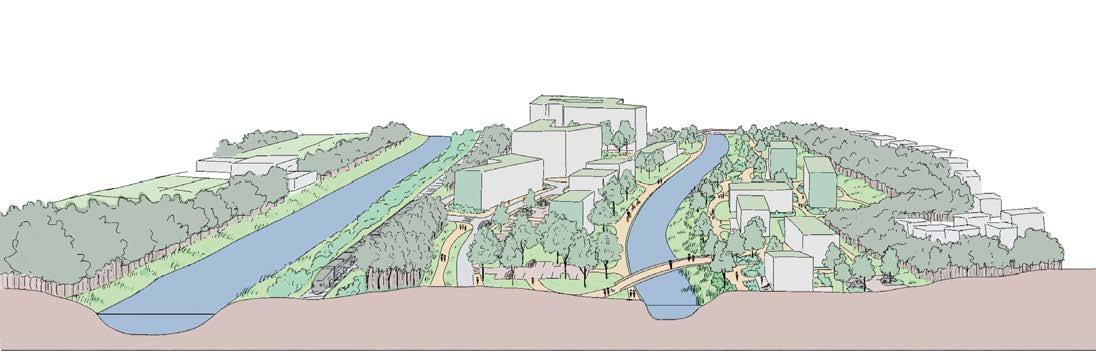
tHe Vision: a Vibrant, sUstainabLe distriCt set WitHin a re-natUraLized enVironment, reConneCting tHe CommUnity WitH tHe WaterWays and green sPaCes tHat HaVe Long been oVerLooked.
gUideLine 1: reVitaLizing CanaL banks to enHanCe biodiVersity and ConneCt Urban Life WitH natUre
Privatized banks, with private decks owned by and accessible only to residents. Restricted views over the canal for the apartements behind the houses
Very steep slope. Depleted riparian habitats
Development of a smooth transition between the canal’s natural environment and the urbanized area, with a public space designed to support wildlife and serve both residents and visitors.
CITU Proposal Living Riverbanks Project
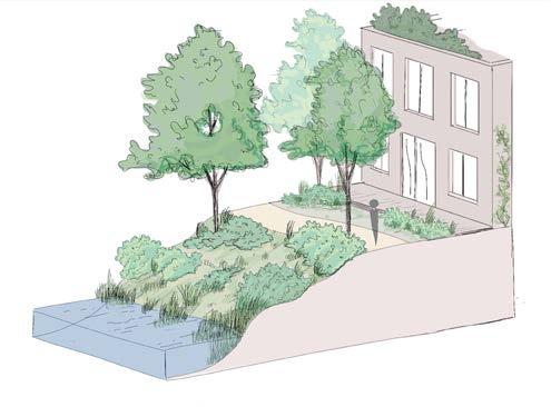
Creation of a public canalside walkway to support outdoor activities and leisure, surrounded by nature, while preserving views for the residents of nearby houses.
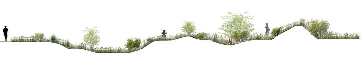
Restructuring and restoration of the banks to soften the slope and enhance biodiversity by creating a wider range of habitats.
gUideLine 2: re-natUre tHe riVerbank for natUraL fLood management - riVerside PoCket Parks
Creation of new habitats, including riparian woodlands and meadows, which will remain inaccessible to visitors to protect wildlife.
Creation of a new pedestrian path along the restored banks offering views of the river and enhancing the enjoyment of this once-forgotten waterway.
Terraced levels serving multiple functions:
Flood barriers: They control water flow and help slow its rise .
Noise barriers: They effectively reduce disturbances from the nearby railway.
riParian Habitat sPeCies
ALDER BIRCH WILLOW
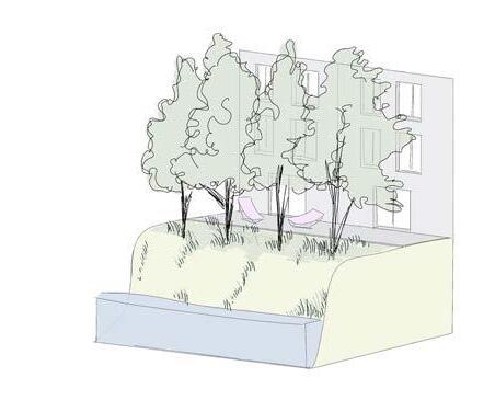
Collective units
Landscaped areas with plenty of seating and open spaces to encourage community gatherings and social activities.
Improved permeability with more green spaces and natural walkways made from hoggin
Direct access to the canal Seating area
Terraced houses
walkway
Solar panels to produce energy
Green wall
Rooftop terraces on each house designed for growing food or creating ornamental gardens.
Urban agriculture available to all residents
Canalside
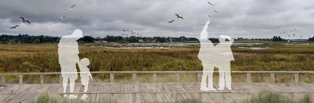
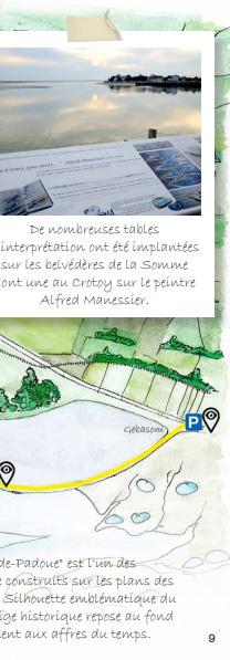
Bay of Somme Coastal Path Travel Book, France
PROJECTS MADE AS A LANDSCAPE
PROJECT MANAGER
«In a Grand Site de France, the aim is not to freeze the landscape, but to accompany and guide the changes it undergoes, in order to preserve what makes it unique and to avoid its trivialization.»
Grands Sites de France Network (RGSF)
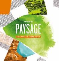
deVeLoPment of a LandsCaPe reCommendations Workbook
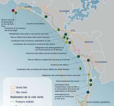
Landscape guidelines for the «Grand Site de France» - Dunes Sauvages de Gâvres à Quiberon
ProjeCt made as a LandsCaPe ProjeCt manager, 2021 - 2023 brittany, franCe
The Grands Sites de France initiative aims to preserve remarkable natural areas and safeguard historical and cultural heritage. However, it also focuses on improving the living environment and enhancing the value of «everyday landscapes».
To support this mission, I developed a workbook of landscape recommendations for the «Grand Site de France» Dunes Sauvages de Gâvres à Quiberon. This reference tool serves as a decision-making aid for all project leaders in the area, whether public or private, to promote the harmonious and balanced development of the territory.
It ensures the preservation of landscapes while affirming the «spirit of the place». Each recommendation is accompanied by design proposals that provide practical guidance on how to integrate these recommendations into the territory’s projects.
LandsCaPe reCommendations Workbook
The Landscape Recommendations Workbook is structured in three parts:
- a landscape analysis of the area, including its natural and built heritage, as well as past and ongoing changes in the territory;
- the definition of the landscape guidelines for the area;
- an action plan outlining detailed landscape recommendations presented in the form of action sheets.
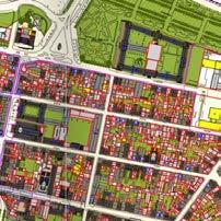
exCerPt from tHe LandsCaPe and Urban diagnosis of tHe grand site de franCe, LandsCaPe reCommendations Workbook
mUniCiPaL sUPPort for sUstainabLe
Urban LandsCaPe PL anning
Assistance to local authorities within the «Grand Site de France» - Dunes Sauvages de Gâvres à Quiberon
ProjeCts made as a LandsCaPe ProjeCt manager, 2021 - 2023 brittany, franCe
The creation of the recommendations workbook provided an opportunity to actively support municipalities in their development projects, connecting landscape guidelines to practical, real-world applications.
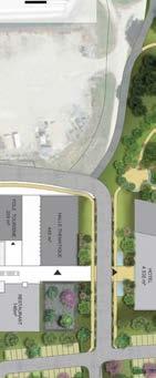
Support was offered for various projects, including the enhancement of town entrances, the design of roundabouts, the creation of green spaces, and the revitalization of village squares.
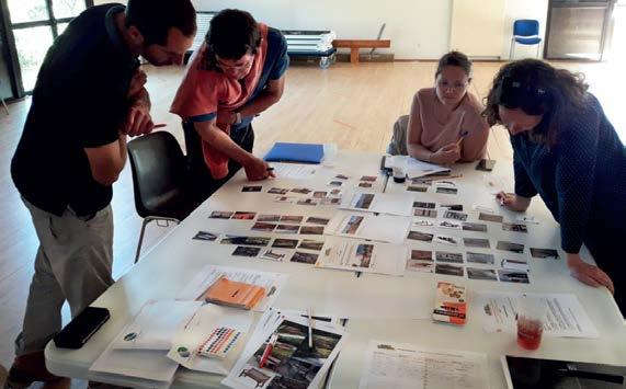
To aid decision-making, visual materials such as sketches, plans, photomontages, and image references were developed to effectively illustrate the proposals and streamline the decision-making process.
The support also fostered participation and collaboration within projects, whether between residents and local officials or among various local stakeholders.
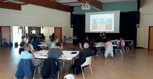
Projects were carried out collaboratively through a series of workshops, ensuring the development of shared initiatives aligned with the values and objectives of the Grand Site de France initiative.
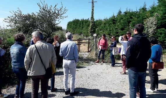
WaLkaboUt WorksHoPs - enHanCing WaLking traiLs (CoastaL PatH)
ConsULtation WorksHoPs - Harmonising street fUrnitUre
saint Pierre QUiberon, CostaL PatH
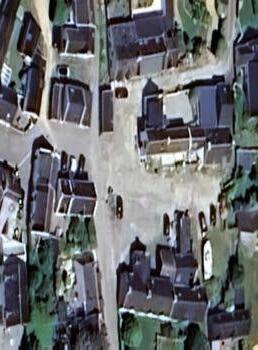
Current status
Creation of perennial beds, flowering reminiscent of the colours of the chapel’s stained glass windows
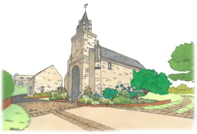
Creation of a real forecourt, demarcation of the forecourt by paving, use of local stones
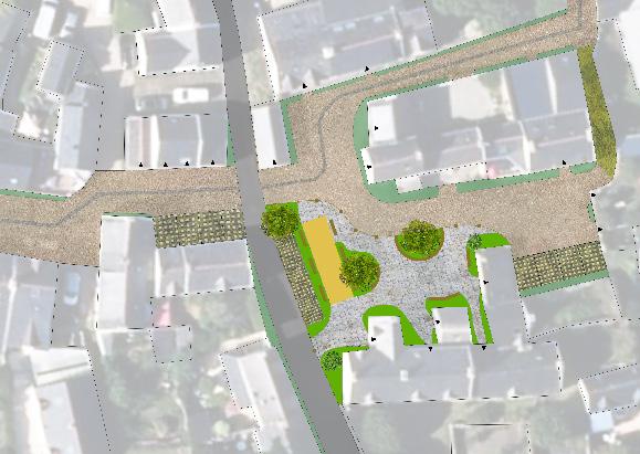
Creation of a viewpoint overlooking the Plouharnel dunes and the sea, featuring an informational panel about the visible landscapes and heritage.
Reduce soil waterproofing, creation of a small landscaped car park, management of run-off water, differentiation of the square by a sand-coloured deactivated concrete surface
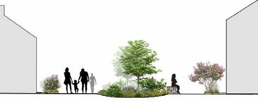
Creation of a promenade and meeting spaces (seats, picnic tables, etc.) in the chapel garden, integrated management of the garden
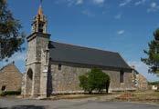
WorksHoP on enHanCing bUiLt Heritage: design ProPosaL for tHe sainte-barbe CHaPeL and its Listed stained gLass WindoWs
status
asPHaLt ConCrete deaCtiVated ConCrete PermeabLe PaVers grass joint PaVers
PLanting striPs benCHes PaVed gUtter WaLL-side borders
PetanQUe groUnd
on
WorksHoP
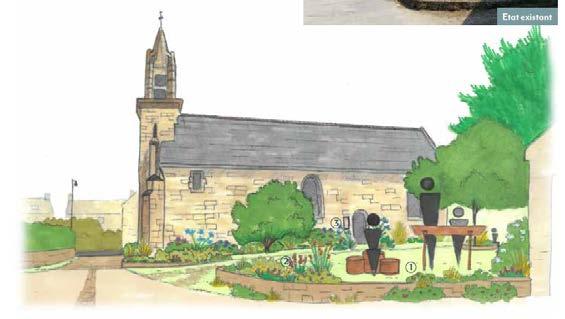
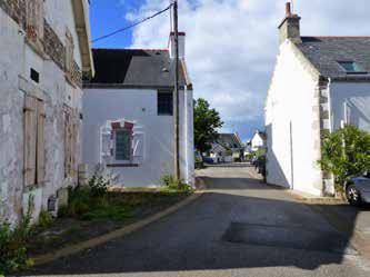
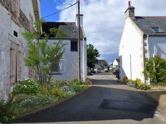
enHanCing ViLLage sQUare: design ProPosaL for kerne ViLLage sQUare (former Car Park)
Current
VisUaL for kerne ViLLage sQUare
VisUaLs before/ after for kerne ViLLage sQUare
aPPLiCation dossier for tHe reneWaL of tHe «grand site de franCe» L abeL
Elaboration of the application dossier for the «Grand Site de France» - Dunes Sauvages de Gâvres à Quiberon
ProjeCt made as a LandsCaPe ProjeCt manager, 2021 - 2023 brittany, franCe
The «Grand Site de France» label is awarded to highly renowned and heavily visited natural sites, on the condition that a management project is implemented in accordance with the principles of sustainable development. This approach must reconcile landscape preservation and the spirit of the place, a high-quality visitor experience, and the active participation of residents and partners in the life of the Grand Site. The label is selective and demanding, and is granted to the site manager for a renewable period of eight years.
To ensure the renewal of the label, each site manager must submit an application dossier. This must include an evaluation of the current management plan, along with a new action programme for the upcoming labelling period.
Within these territories, the landscape is at the heart of development policies and serves as a unifying element in territorial planning. As such, the responsibility for preparing the renewal application dossier fell to me. I structured the dossier and its new long-term management strategy around the landscape framework developed during the creation of the Landscape Recommendations Workbook.
The application dossier is structured into several sections:
- Landscape assessment, highlighting the characteristics and values of the Grand Site;
- Review of the previous labelling period;
- Presentation of the new territorial management plan for the forthcoming labelling period;
- Overview of project governance, including the provisional budget for the new management plan.
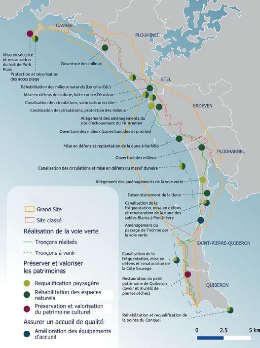
sPatiaL distribUtion of tHe 2019-2024 aCtion Programme
extraCt from tHe assessment of tHe 2019–2024 aCtion Programme – LandsCaPe enHanCement & CULtUraL Heritage aCtions
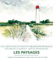
Creation of edUCationaL interPretation materiaLs
Creation of Educational Panels and a Travel Book for the «Grand Site de France» of the Bay of Somme
ProjeCts made as a LandsCaPe ProjeCt manager, 2021 - 2023 somme, franCe
Because the preservation of sites and their heritage also involves raising awareness of their richness, the Grands Sites de France are committed to educating both visitors and local residents, helping them to better understand the territories they traverse or inhabit.
To support this, I designed several educational interpretation tools to enhance understanding of the landscape, as well as the natural and cultural heritage of the Grands Sites de France I have worked on. Specifically, I created educational panels placed along paths, enabling visitors to discover key landscape features, local biodiversity, and the management practices employed to preserve these habitats.
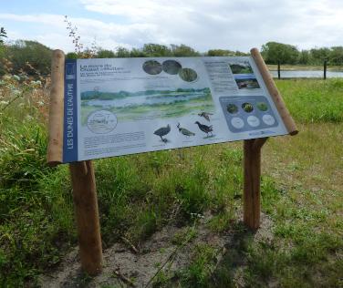
interPretatiVe PaneL on WiLdLife and Habitats of dUne sLaCks
interPretatiVe PaneL on tHe eVoLUtion of dUne LandsCaPes: from sHifting dUnes to Wooded dUnes
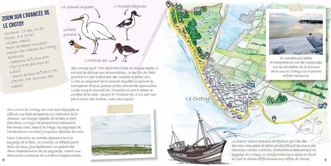
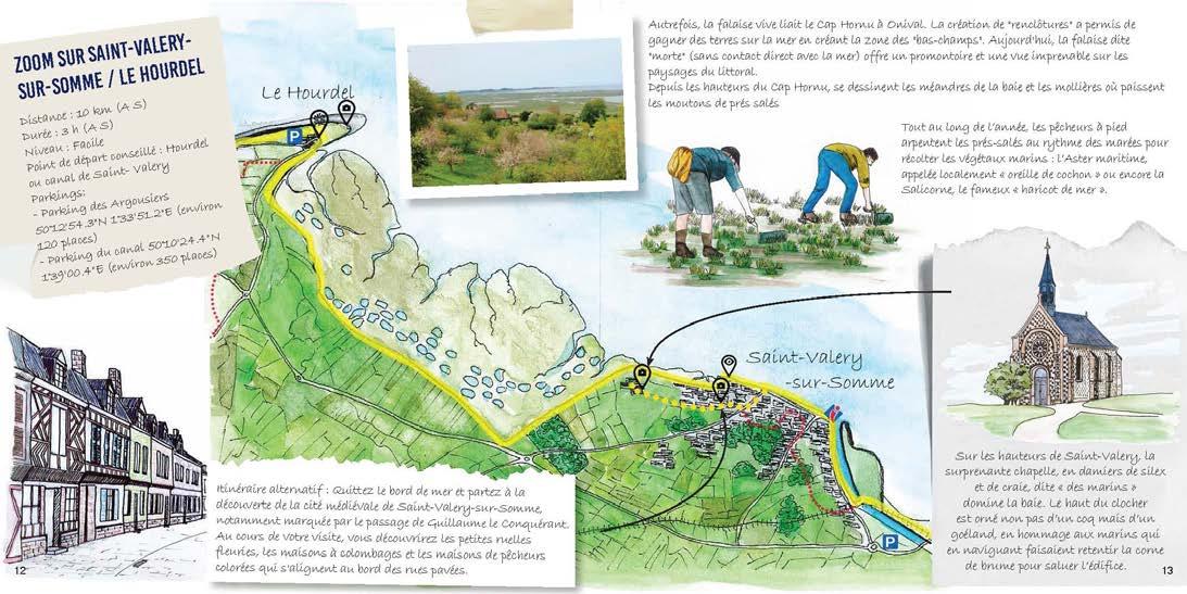
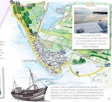
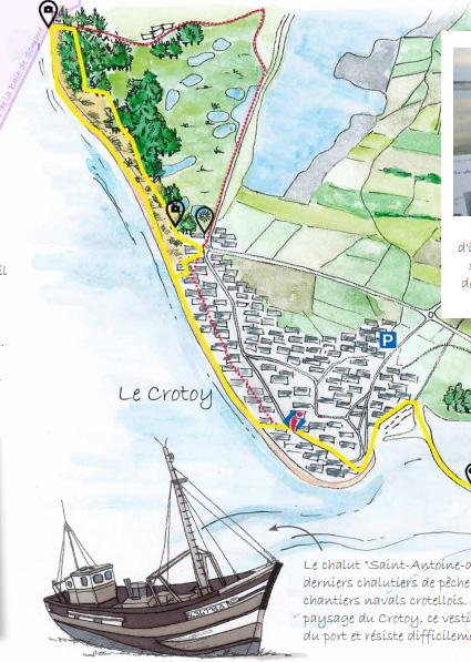
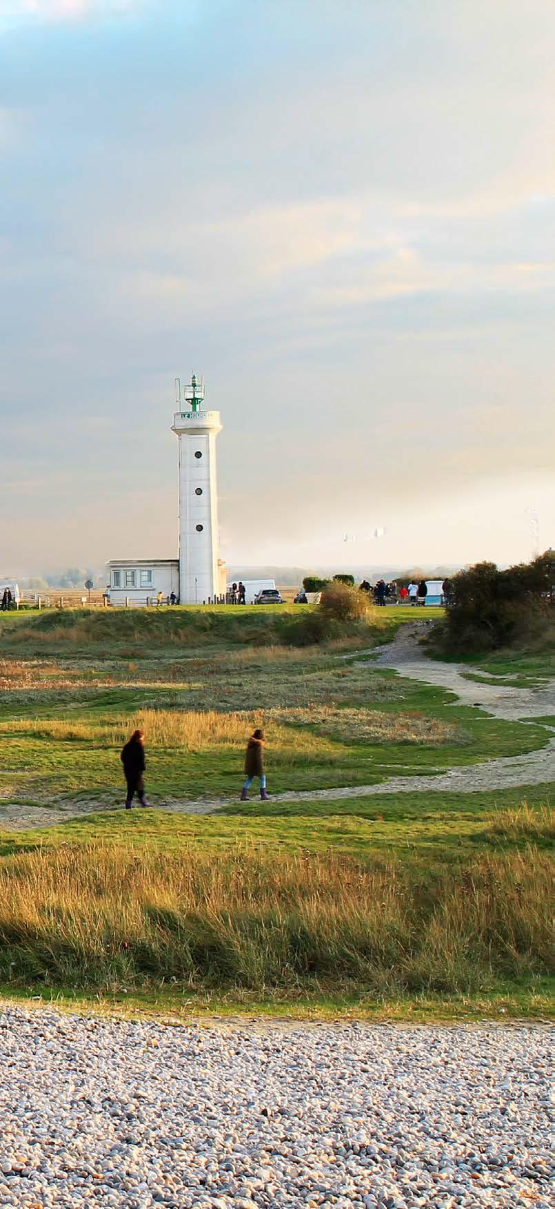
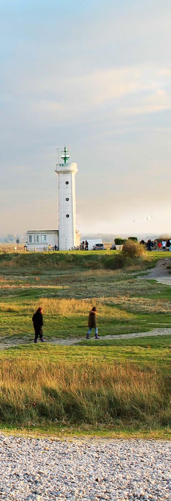
The Bay of Somme coastal path offers an exceptional diversity of landscapes: cliffs, dunes, marshes, estuaries, beaches, etc. It is an excellent itinerary for a slow and detailed discovery of the coastal landscapes and the richness of its heritages.
To promote the trail and the ecomobility in this «Grand Site de France», I created the coastal path travel book.
This booklet allows visitors to discover the landscapes through numerous sketches and photographs. The landscapes are described through short stories and fun facts about the history of the site and its heritage.
The travel book also helps to make hikers aware of the environment and promote good practices to respect the site.
extraCt from tHe bay of somme CoastaL PatH traVeL book
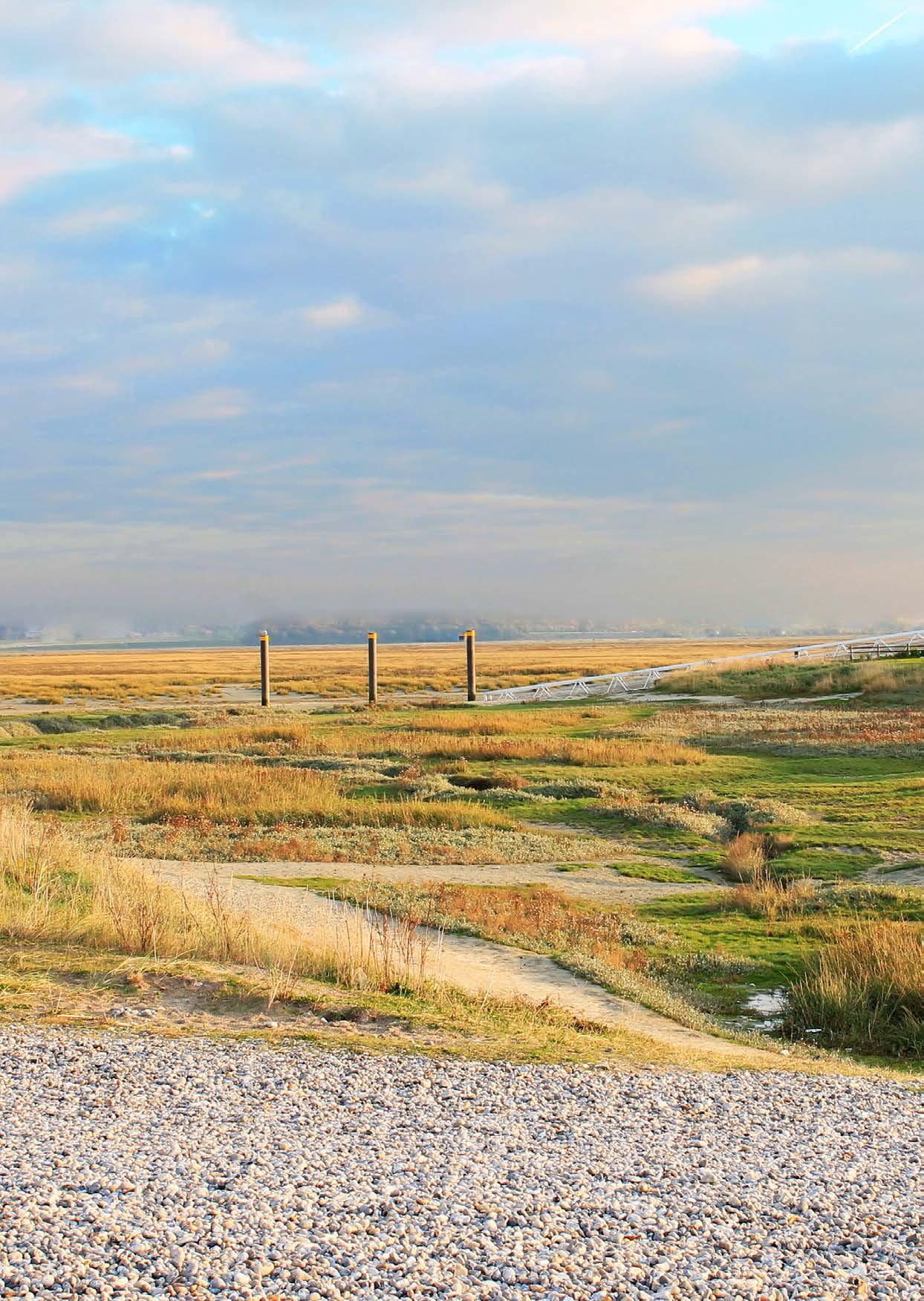
Bay of Somme, France
RESEARCH & MANIFESTO
«To think of the landscape as a project is to completely change perspective, thinking of the landscape not as the fortuitous consequence of human activities on the territory, but as an ambition that we set for ourselves.»
Bertrand Folléa, Landscape Architect, Meetings of the Grand Site de France Network (RGSF), 2016
stUdies in LandsCaPe arCHiteCtUre and territoriaL PL anning
Creation of Educational Panels and a Travel Book for the «Grand Site de France» of the Bay of Somme
UniVersity ProjeCts, 2024 - 2025
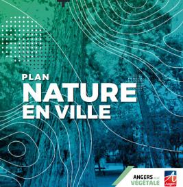
For the Personal Focus Portfolio module (MALA 702), I chose to focus on the Grand Site de France label and its potential adaptation to urban contexts.
This study has offered me a unique opportunity to explore the Grand Site de France label in depth, its underlying politics, and how it could meaningfully contribute to improving the living environment in urban areas.
It has allowed me to demonstrate that landscape can serve as a powerful tool for coordinating planning actions—bringing coherence not only to individual projects but also among the various actors involved. In this context, the label represents a real opportunity to structure territorial action around a shared, landscape-based vision.
As I delved deeper into the complexities of governance, planning tools, and territorial dynamics, I began to understand how the Urban Grand Site initiative could be even more impactful when acting as a bridge between fragmented policies—fostering an integrated and unified territorial vision.
Most importantly, this work has reinforced my belief that landscape architects and landscape planners have a crucial role to play in shaping the cities of tomorrow— and it has deepened my passion for this field. The preservation and enhancement of cultural landscapes in urban contexts, through a landscape-led approach, is a subject that will undoubtedly continue to shape my professional ambitions.
Fiches synthétiques
AMÉNAGER DANS LE PAYSAGE 02
Être au service du site et de ses paysages
Le Grand Site de France Dunes Sauvages de Gâvres à Quiberon est reconnu pour la qualité de ses paysages d'exception, de leur préservation, de leur gestion et de leur mise en valeur. Au sein du Grand Site de France, les projets d'aménagement ne peuvent donc se réduire à une simple prestation technique et doivent servir l’esprit des lieux. Ils doivent combattre la standardisation ou la banalisation de l’espace et rendre hommage au caractère du site et à la force de ses paysages. Chaque projet d'aménagement au sein du Grand Site de France doit donc intégrer un volet "Paysage" permettant de fixer les objectifs paysagers et les valeurs portées par le label.
• Réaliser un diagnostic paysager préalable aux aménagements pour identifier les singularités des sites et leur caractère ;
• Favoriser la réalisation de schémas d'intentions paysagères pour poser les bases des principes d'actions définis collectivement lors de débat et déchange autours du volet "Paysage" des projets entre les différents acteurs du projet et le syndicat mixte du Grand Site ;
• Favoriser des aménagements mimétiques pour que les projets puissent être discrets et s'effacer derrière la nature et le caractère sauvage des sites. La discrétion des projets permet de préserver l'émotion et le plaisir de la découverte de milieux naturels uniques et préservés ;
urban grand site landsCape-based projeCtFoundations oF the urban Grand site
• Favoriser des interventions douces et des techniques entre savoir-faire traditionnels et innovations pour réaliser des projets de moindre impact paysager.
diagram of tHe Urban grand site PLanning tooLs - Coordinating territoriaL PLanning, Heritage ConserVation, and LandsCaPe enHanCement tHroUgH a strategiC, LandsCaPe-based frameWork.
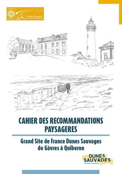
CAHIER DES RECOMMANDATIONS PAYSAGERES
The Urban Grand Site initiative supports the development of landscape-led strategies that both respect natural systems and reinforce cultural identity, by reconnecting cities with their geographical, historical, and ecological foundations.
As in existing Grands Sites, this initiative emphasizes the crucial role of landscape planning in bridging disciplines and guiding sensitive territorial transformation by encouraging the use of integrated planning tools (see diagram).
exCerPt from tHe researCH on adaPting tHe grand site de franCe aPProaCH to Urban areas: tHe Urban grand site initiatiVe

LANDSCAPE & TERRITORY MANIFESTO FOR LANDSCAPE-LED TERRITORIAL PLANNING: A LANDSCAPE ARCHITECT’S PERSPECTIVE
For a long time, the concept of managing and planning landscapes at the territorial level has remained rather vague and poorly considered in France, overshadowed by a more urbanistic vision of territorial planning. With the exception of protected natural landscapes, the scenic character of territories has thus long remained a consequence of the development of human societies and their activities.
However, in recent years, a true «landscape policy» has emerged. This policy aims to consider the landscape not only as a mere consequence but as a lever of action for territorial planning.
Today, the value of the landscape far exceeds the socio-cultural framework. Its added value in addressing current environmental challenges (climate change, biodiversity loss, pollution, soil degradation, resource depletion, etc.) is undeniable. The landscape also plays a key role in fostering social connections, helping to overcome societal divides that pose challenges to ecological transitions.
At the territorial level, the landscape can no longer be limited to mere aesthetic value, but must be a genuine lever of public policies, promoting sustainable development that meets
contemporary environmental, cultural, economic, and social requirements. Therefore, it is essential to promote and strengthen the work of landscape architects at the territorial level to fully exploit their potential in creating sustainable and resilient territories for present and future generations. We must move beyond limiting their role to site design and instead integrate them more deeply into territorial planning, placing the landscape at the heart of every development project.
As landscape architects, we must make the landscape much more than just a backdrop: it is the living fabric that connects our societies and shapes our future. To achieve this, we must commit to making the landscape a pillar of territorial planning.
Thus, it is imperative to emphasize the need to place the landscape at the heart of territorial planning. Landscape architects are catalysts for an integrated and sustainable approach, fostering harmonious and resilient development. By recognizing the diversity of landscapes and promoting a landscape culture, we are shaping a future in which the landscape is a pillar of creating sustainable, resilient, and harmonious territories that meet the needs of present and future generations.