Madison Lentz
Urban Planning Portfolio
1
RESUME
EDUCATION
University of Cincinnati, College of Design, Architecture, Art, and Planning, Cincinnati, OH
3.9 GPA Bachelor of Urban Planning with Horticulture Minor
Cincinnnatus Academic Scholarship Recipient
Lakota East High School, Liberty Township, OH
High Honors, 4.0 GPA ranked 18th out of 643 8 AP Courses
EXPERIENCE
Civic Studio Artist
ArtWorks, Cincinnati, OH
February 202023 -Present
• Collaborate with a group of 10 artists aged 18-24 to develop and implement a community engagement plan. Engagement events focus on input and representation of marginalized communities as part of a New Monuments Initiative which will reimagine and rebuild commemorative spaces within Cincinnati.
• Compile data gathered from the art-based research engagement method to create a final report that will inform the creation of future monuments in Cincinnati and be released to the public.
Urban Planning Co-Op
Keep Cincinnati Beautiful, Cincinnati, OH
August 2021 -May 2023
• Coordinate between arts, greenspace, environmental services, and volunteer programs which all work in different facets to build community and revitalize forgotten spaces around Cincinnati. Put projects on website with an interactive online map.
• Design and execute building facade murals on vacant building boarded windows and doors with three other artists and volunteer groups through the Future Blooms program.
• Transform underutilized spaces into community assets with landscaping and horticulture knowledge through the Spaces to Places program.
• Organize tools for large corporate volunteer cleanup events and lead groups of 10-20 people.
Cincinnati Parks Municipal Worker
Smale Riverfront Park, Cincinnati, OH
Class of 2024
Interests
• Environmental Sustainability
• Social Activism
• Visual Arts
Skills
• Microsoft Suite - Proficient
• Adobe Suite - Proficient
• SketchUp - Proficient
• ArcGIS - Proficient
• AutoCAD - Beginner
• Language: SpanishIntermediate
May 2021 -March 2022
• Maintained grounds in prominent park through mowing lawns, blowing brush, weed whacking, removing litter, and collecting trash throughout the premises.
• Assisted park patrons with questions and ensured that facilities were functional and well-kept.
• Managed the overall operation of the grounds department for upcoming events to maintain a safe and attractive space for events.
Service Manager
Chipotle, Cincinnati, OH
August 2020 -May 2021
• Began as crew member in August 2019, excelling in multiple positions as a cashier, line worker, prep worker, grill cook, Kitchen Manager to a Service Manager, with consistency under pressure, reliability, and steadfastness for customer satisfaction.
• Conducted shifts through communication, direction, and delegation to the current crew, in addition to training new hires.
• Responsible for counting inventory, ensuring food quality and safety, and maintaining facilities and equipment.
Senior Apprentice
Artworks, Cincinnati, OH
Summer 2019
• Cooperated with and assisted up to 10 youth apprentices in making individual projects for the BLINK Cincinnati parade, as well as worked with a teaching artist in a professional studio environment.
• Sourced found materials from various resources and used power tools to custom fit materials into wearable, durable, and light-up costumes.
Swim Team Coach
Dutchland Woods Dolphins Swim Team, Liberty Township, OH
• Coached a swim team of over 60+ kids, age range 5-18, daily and at weekly swim meet competitions with competing teams.
Summer 2017- Summer 2018
• Taught kids 4 different swim strokes and created daily swim practice exercises to encourage improvement in swimmer capabilities and speed, communicating as a team or through individual lessons. Organized swim meets based on swimmer strengths, age, and stroke.
May 2018
Awards
• Scholastic Art and Writing Awards Gold Key Portfolio (2018)
• Three Regional Governor Awards, art pieces selected by a board of judges (2018)
2
CONTENTS
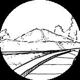
REGIONAL PLANNING
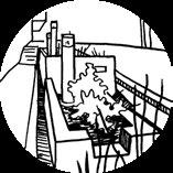
MILL CREEK VITALITY
ART ON CAMPUS
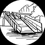
MURAL WORK
3
SCENARIO PLANNING

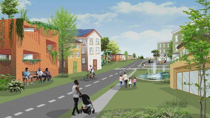
Regional scenario planning is a proactive approach to shaping the future by envisioning potential outcomes and strategically preparing for them. Predicted shifts in climate, equity, transportation, and the economy underscore the need for proactive measures. This foresight in planning becomes crucial to avert negative outcomes and optimize positive ones. This forward-thinking approach addresses critical issues such as climate change, equity, transportation, and the economy. By leveraging urban agriculture, green energy, and equitable resource allocation, we can tackle climate challenges while fostering a fair and interconnected society, safeguarding the region’s vitality for generations to come.
REGIONAL PLANNING
4
TRANSPORTATION
ENVIRONMENT
5
GOVERNMENT/ SOCIAL
RESILIENT-FLEXIBLE REGION
RANGES OF FOCUS
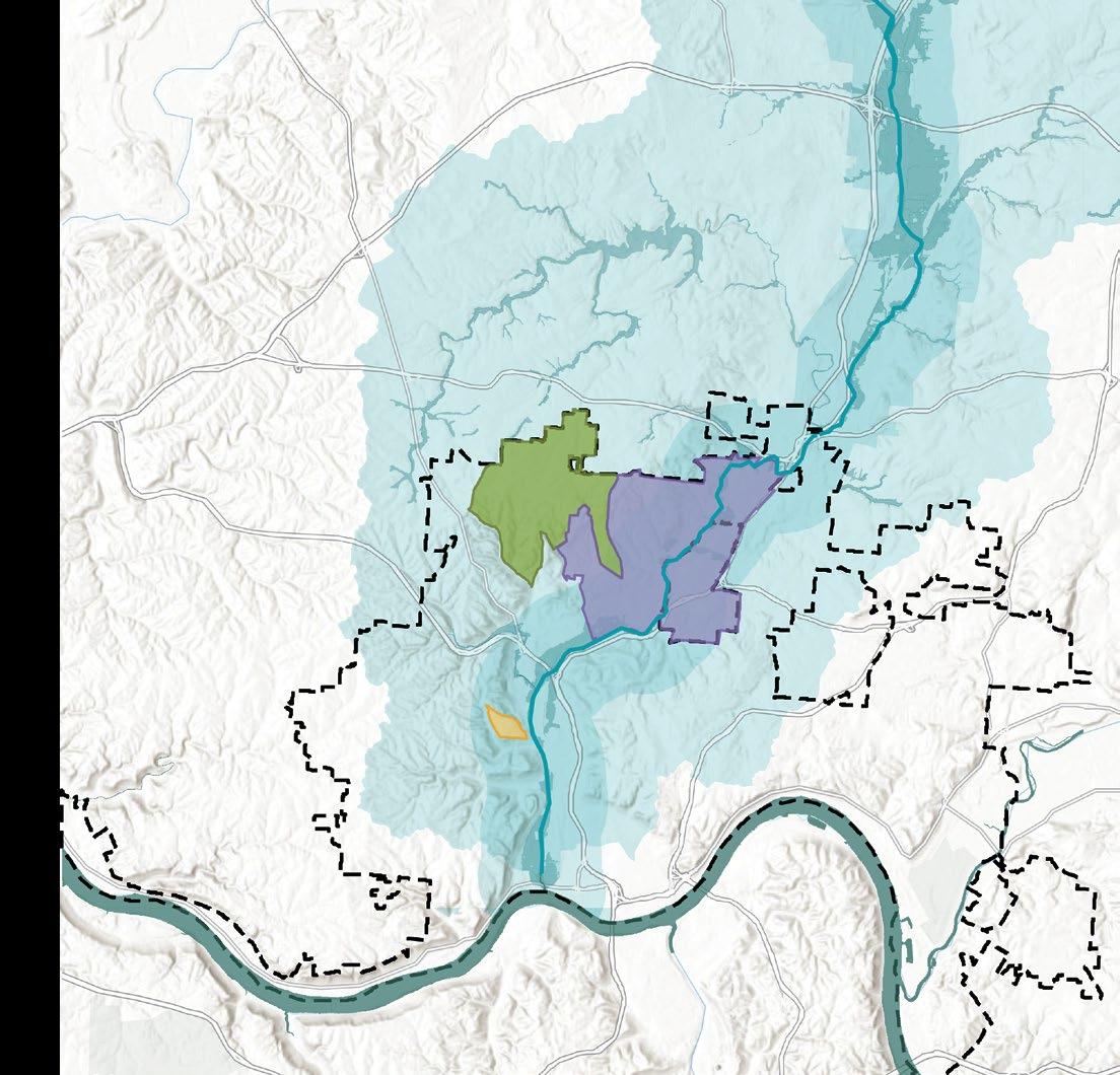
Mill Creek Corridor
The Mill Creek Corridor designates a targeted linear zone flanking the Mill Creek watercourse, encompassing adjacent lands within the region’s urban landscape. It has historically been the center for a lot of industry in Cincinnati, fostering an industrious culture that continues to this day.
CORE ELEMENTS OF RESILIENT FLEXIBLE PLAN
Mill Creek Watershed
The Mill Creek Watershed encompasses the entirety of land directly drained by the Mill Creek and its tributaries, constituting an interconnected hydrological system. The watershed is predominantly urban development with pockets of forest and a small amount of agricultural lands in the northern portion.
OKI Region
The OKI (Ohio, Kentucky, and Indiana) Region encompasses eight counties across three states. The planning organization, OKI Regional Council of Governments, facilitates coordinated planning and action across jurisdictional boundaries to address common regional goals.
Every plan aspect contributes to a future centered on equity. Each transformation cultivates a diverse, ecological, and inclusive region capable of accommodating new cultures, communities, and populations.
The Nomadic Lifestyle Balancing Sustainable Spaces
This lifestyle reimagines modern living by enabling unrestricted mobility within an interconnected network of flexible leases located within ecovillages and cohousing developments. Within this framework housing becomes a gateway to enriched experiences, economic empowerment, and a more connected society.
This visionary strategy blends urban vitality with the serenity of suburban and rural settings. Community spaces are optimized and denser living options are introduced into areas seeking the benefits of urban living. Future developments flourish sustainably, accommodating an increased population while limiting the expansion of urban sprawl.
Shaping Mobility Through Transportation
This comprehensive strategy establishes a robust public transit system that encourages a cultural shift away from automobiles and highways with reliable transportation. From buses and light rail to elevated bike paths and pedestrian-friendly routes, this multi-modal network forms an accessible system, making travel convenient.
6 0 2.5 5 7.5 10 1.25 Miles 0 2.5 5 7.5 10 1.25 Miles 0 7 14 21 28 3.5 Miles
Click here to view complete plan
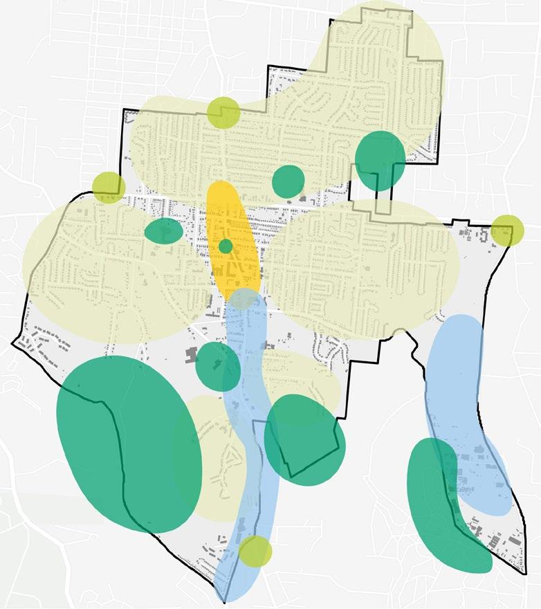
OVERALL RECOMMENDATIONS MAP
Dayton
Green Growth Hub
OKI County Boundary
Nomadic Lifestyle Developments
Cincinnati
As shown on the map there are 1.25 mile and 2 mile radii buffers to confine excessive development. Beyond the buffers agriculture zones supply food to the hubs. The green growth hubs are located in residential areas with low population density, lower income, limited grocery store/ amenity access, and fewer cars per household.
Mobility Plan
Diversity of Uses
Proposed Blue Trails
Green Growth Hub
Mixed-use buildings, local stores, and outdoor gathering spaces offer residents convenient access to amenities.
Increased Density
Higher density development curbs sprawl and guides future growth in low-density areas.
Urban Agriculture
Sustainable Infrastructure
Denser developments preserve suburban and rural charm while striving for net zero emissions.
Existing Green Trails
Pedestrian Friendly
Proposed Green Trails
Walkable and bikable neighborhoods enhance residents’ lives and promote car-independent communities.
7
Oxford
Wilmin
Middletown Hamilton
Made in Illustrator
ATLANTA REGIONAL GROWTH & INMAN PARK
In the city of Atlanta, GA the Atlanta and Edgewood Street Railroad was one of the first streetcar lines built. This line connected the neighborhood of Inman Park to downtown, making it Atlanta’s first streetcar suburb. Inman Park was first developed as an escape from the city reminiscent of garden city designs with wide open space and trees dotting either side of the roads. As the Atlanta region grew over time, the once suburban neighborhood became engulfed in the dense development around the city center, subsequently changing the people, density, zoning and land uses of the neighborhood.
Inman Park Roads Street Car Routes
1871-1900 Pre-Consolidation
The early growth of Atlanta’s streetcar system was through individual transit companies.
1901-1902 Post-Consolidation
During this time period two major companies were competing for control of the city’s transit system. In the end Georgia Railway & Electric Company (now called Georgia Power) gained control over all streetcar lines.
1878 Proposed Highway
Highways
Building Footprints
Railroad Tracks
INMAN PARK POPULATION
4,546
Streetcar Decline
3,148
3,679
1,626
2,628
8
1888 YEAR 1950 1970 1980 2010 2020
20th Century Consolidation
The transit system was controlled by Georgia Power who would eventually replace streetcars with trolleybuses.
2022 Current Highways and Streetcar
With the rise of the automobile in popularity it took over as the predominant form of transportation. No longer a luxury vehicle for the very rich, by 1920, the car had emerged as a necessity for all but the poorest citizens.
9 0 1 2 3 4 0.5 Miles
1928
0 1 2 3 4 0.5 Miles 1978 2022

10
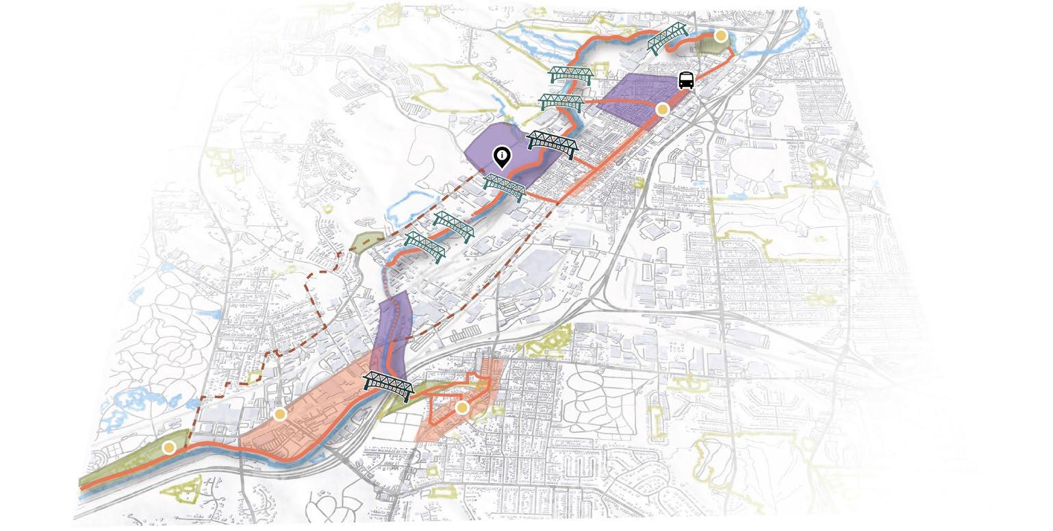
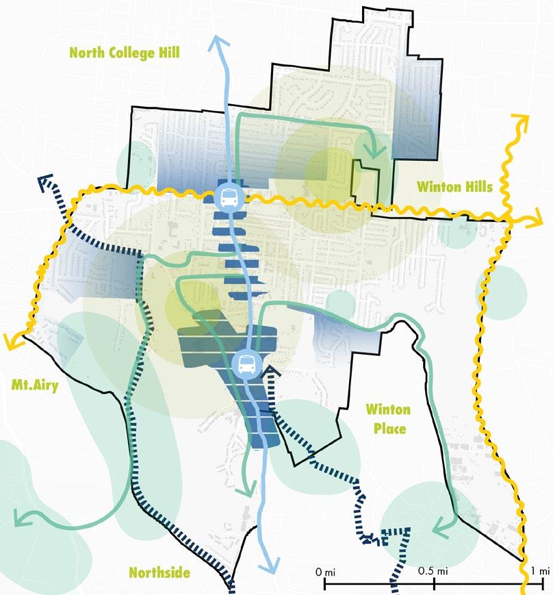
VITALITY Mill Creek Access Analysis 1 College Hill Neighborhood 2 English Woods Neighborhood 3
MILL CREEK
PROJECT SCOPES
Main Mill Creek Waterway Ohio River
ACCESS ANALYSIS
CONCEPTUAL FRAMEWORK
Click here to view complete plan

This project focuses on the Mill Creek, analyzing who can access and reap the benefits of the Mill Creek. At its core, access revolves around the audience—the individuals who will access the Mill Creek. This framework considers physical elements and perceptual aspects that might hinder people from reaching the river.
Cincinnati City Boundary
Mill Creek Watershed
Milll Creek Corridor
Intricate relationships influence access to the Mill Creek with three intermingling threads.
• Mobility addresses how people move through typical means, such a roads and infrastructure.
• Public Engagement centers on awareness and attitudes of individuals regarding public spaces and how to reach them.
• Economy relates to how businesses and jobs provide the necessary resources for the overall success of the framework.
Mill Creek Flood Zones
11
Infrastructure
Space Signage
to Economic Districts Car Ownership
MillCreek Economy
Road Network Open/Green
Proximity
Audience Physical
Engagement Mobility
Sidewalks/Crosswalks Universal Access Interactive Spaces Jobs Public Transit
Perceptual MicroScale MacroScale Public
Population’s Knowledge
ACCESS ANALYSIS
EVOLUTION OF CINCINNATI’S MODES OF MOBILITY RESIDENT INTERVIEWS
Horse-Drawn Omnibus
The first residents of Cincinnati moved around on horse-drawn carts.
Horsecar
In the 1850s, people traveled to and from places on horse-drawn railways that made their way into city streets.
Cable Car
There were 3 cable car lines in Cincinnati to scale the hills in the area.
Streetcar
Streetcars were the main form of public transportation with 222 miles of track. The last streetcar run was in 1951.
Transportation Today
92% of residents in Cincinnati now own at least one car. Now, people also get around by the Cincinnati Metro Bus, motorized scooters, bikes and walking.
Interviews were taken in the neighborhoods adjacent to the Mill Creek to get a better understanding of the people from the region and their understanding of the Mill Creek. Rebranding and creating a positive impression is key for the future of the Mill Creek.
4/15
Respondees had NEVER seen the Mill Creek
How do you perceive the Mill Creek?
“It is stinky and smells bad”
“It used to be really really gross, but it’s cleaner -Adam, Saint Bernard resident of 27 years
-Lorenzo, Winton Hills resident of 27 years
“When I was growing up I was told not to go near the water”
-Bob, Saint Bernard resident of 55 years
13/15
Respondees would NOT consider swimming in the Mill Creek
10/15
Respondees would NOT consider kayaking in the Mill Creek
“There’s a bunch of unknown that could kill somebody, and are probably bodies in there” -Tony, Winton Hills resident of 8
Would you
12
Have you ever seen the Mill Creek?
“It’s somewhere over there”
-Julius, Spring Grove Village resident of 6 years
PROJECT VISION
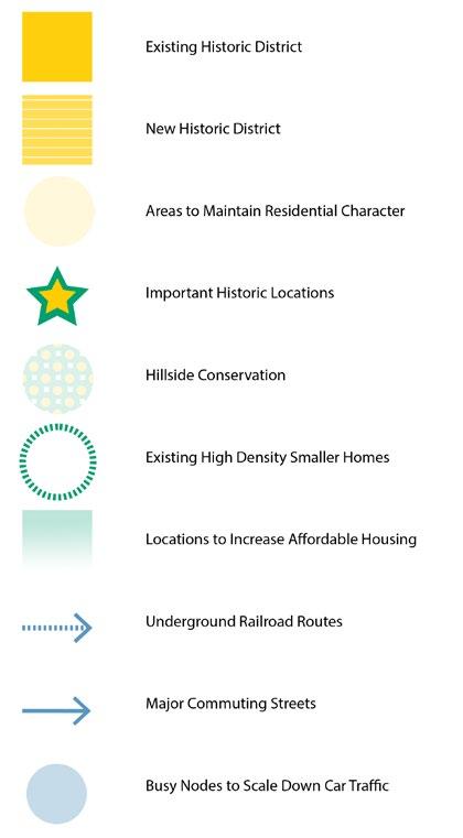
A Mill Creek District that highlights the unique urban landscapes and the personalities of the neighborhoods surrounding it through a cohesive and inviting trail network.
After conducting a comprehensive analysis of access along the Mill Creek gathered from community input, researched data, and site visits a plan could be developed in order to maximize the potential of the Mill Creek. Guiding this endeavor were three principal objectives to improve access that were then broken down further into five specific goals for creating an enriching access experience.
“It’s dirty water, stay away from it”
“People throw their trash there and make it bad”
-Milly, Winton Hills resident of 40+ years
-Linda, Carthage resident of 6 years cleaner now” unknown stuff and there there” 8 years
you ever kayak or swim in the Mill Creek?
“I wouldn’t swim in the Mill Creek or Ohio River unless it was a life or death situation”
-Greater Cincinnati Waterworks Storm-water Management employee
“I used to go creeking there with my buddies when I was a kid 65 years ago ”
-Mr. Bok, Winton Hills resident of 42 years
PRINCIPLE OBJECTIVES Visual
Increase visibility of the Mill Creek and the distinctly urban land uses around it.
Create destinations along the Mill Creek that reflect the personalities of each neighborhood in the district and engage visitors intellectually.
Provide access to necessary amenities for visitors and develop plan to clean and maintain the Mill Creek.
Create a singular, cohesive path that is adjacent to the water and adapts to the various landscapes along the creek.
Ensure universal access while encouraging alternative forms of transportation along the Mill Creek.
13
Access
Access
Access Visibility Amenities/ Maintenance Placemaking Continuity Multi-Modal
Perceptual
Physical
ACCESS ANALYSIS
PHYSICAL ACCESS IMPROVEMENT STRATEGIES
Continuity Actions
A. Continuous trail that runs from Salway Park to Fairgrounds
B. Connect commercial districts to the trail directly and indirectly
C. Adapt trail forms to the demands of the environment
D. Provide unique ways for people to safely cross the railroads and connect to the industrial history of the Mill Creek
E. Connect both sides of the Mill Creek through innovative bridges and tunnels
F. Create trail connections to other major systems such as Tri-State Trails and maybe the Cincinnati Riverfront

Docked Trails Railroad Crossings Park and Ride Transit Center Bike Amenities Essential Amenities
Success Metrics
• Less than breaks in the trail
• 1 bridge per neighborhood that has pedestrian & bike access
Multi-Modal Actions
G. Develop shared use path for pedestrians (including in wheelchairs) and bicyclists along Mill Creek
H. Create park & ride spaces at the two endpoints to discourage car transit along Mill Creek
I. Develop shuttle system for large events like the county fair
J. Create a transit center and connect it to the trail
Success Metrics
Amenities/Maintenance Actions
K. Provide bike amenities along path - bike racks, self-service station
L. Work with Mill Creek Alliance to establish regular trash cleanup - biweekly or monthly
M. Place essential amenities: “Clean up after your pet” stands, trash&recycling, bathrooms, water fountains
Success Metrics
• Place bathroom every half mile
• volunteers a month for maintenance opportunities
H H J C C C E E K K K K K M M K 5 M M
C E H J K M
4 10 ft 20% 10
PERCEIVED ACCESS IMPROVEMENT STRATEGIES
Visibility Actions
N. Redesign channelized sections of the creek to increase green space and human interaction
O. Remove invasive species to increase visibility
P. Install overlooks along the Mill Creek to highlight unique districts
Q. Place transit signs - bus, bike lanes, public parking area
R. Install brown highway signs (parks and recreation) that directs people to Mill Creek
Success Metrics
• of Mill Creek visible from 100ft away
Revitalized Canals Overlooks Highway Sign Interactive Spaces Public Art in Commercial Districts Signage
• or more self-sustaining native plants
• new signs with a cohesive branding
S. Install pedestrian-scale lighting along the path
T. Revitalize/create parks and interactive spaces connected to the trail
U. Place historic/informational plaques about the neighborhoods and “You are here” signs
V. Establish identifiable visual characteristics
W. Commission local artists to create public art along the trail network - some relating to neighborhood characters & Mill Creek
Success Metrics
Amenities/Maintenance Actions
X. Implement signage and wayfinding to navigate people to and around the Mill Creek
Y. Develop an interactive website that allows for people to submit points where there’s a lot of trash/needs repair
Z. Establish the Mill Creek as an official Cincinnati Park for dedicated funding & horticulture/ maintenance teams
Success Metrics
• No visible dumping sites & minimal trash around creek
15 W W W W W T T T T P P P R N N X X X X X
N P R T W X
T W X 10 30% 50% 50% 10
ACCESS ANALYSIS


CATALOG OF
Overlooks
16 Revitalized Canals
Highway Sign Development Time Cost Adapability Co-Benefits Development Time Cost Adapability Co-Benefits Development Time Cost Adapability Co-Benefits Essential Amenities Bike Amenities Signage Development Time Cost Adapability Co-Benefits Development Time Cost Adapability Co-Benefits Development Time Cost Adapability Co-Benefits Development Time Cost Adapability Co-Benefits Interactive Spaces Development Time Cost Adapability Co-Benefits Public Art in Commercial Districts Development Time Cost Adapability Co-Benefits Park and Ride Development Time Cost Adapability Co-Benefits Transit Center Docked Trails Railroad Crossings Development Time Cost Adapability Co-Benefits Development Time Cost Adapability Co-Benefits K M X N P R T W H C E J
Continuity Multi-Modal
STRATEGIES Visibility Amenities/Maintenance Placemaking
STRATEGIC PLAN
The primary objective of this trail plan is to create a continuous, uninterrupted pathway alongside the Mill Creek. Considering the intricate nature of the final trail components, various interim routes are proposed, accommodating the financial and time demands of the project. This approach ensures ongoing access to the Mill Creek while progress continues towards the comprehensive trail. Furthermore, three distinct sites along the trail have been strategically selected for additional development, improving visitor engagement and enjoyment.
Positive Site Impacts
• Lowered costs of managing storm water and air pollutants
• Increased sale tax from spending by visitors
• Medical savings from overall increased health of residents
• Increased human connections and safety from people invested in the park through financial donations and volunteer hours
• Lowered costs of managing storm water and air pollutants
Possible Negative Site Impacts
• 5% increase in property values for houses within 500 feet of a park is a conservative estimate of the change in property value
Interactive Space Enhancement
Carthage Economic District
Positive Site Impacts
• 2/3 of local merchants benefits from increased bike infrastructure
• Bicyclist spend the most at local business
• Improved pedestrian safety
• Increased human connections and safety from increased foot traffic and separation of cyclist from street
• Space for public art that reflects neighborhood character
Possible Negative Site Impacts
• Increased home values near bike paths
Positive Site Impacts
• Highlight the neighborhood’s history
• Attract the 67% of interviewed residents that would not kayak in Mill Creek
• Increased education (over 60 CPS schools) and awareness of Mill Creek and district neighborhoods.
• Well planned winter construction can reduce impacts on nesting and feeding wildlife
Possible Negative Site Impacts
• Slippery boardwalks make it unsafe for bicycles and motor vehicles
• Using the wrong materials to build the floating boardwalk can harm the ecology
Existing Bridges
Planned Bridges
Long-term Trail Plan
Floating Boardwalk
Alternative Paths
Red Bike Station
Existing Parks
Planned Sites
Economic Districts
17
Salway Park
Industrial District
Visitor Center
Transit Center
ACCESS ANALYSIS: SPECIFIC SITE PLAN DESIGN POTENTIAL USERS
Park Visitors Macro Scale
Parks enhance quality of life and regular visitors are invested in the parks around them.
Hamilton County serves its 800,000 residents with 96 regional and neighborhood parks and 143 miles of trails
Families
Meso Scale
Families and children are an important part of planning and plans that include children are inclusive for everyone.
26% Elmwood Residents
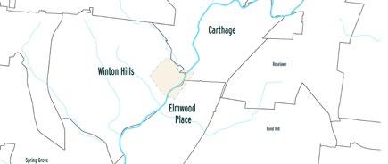
45% Winton Hills Residents
23% Carthage Residents Are under the age of 18.
Neighborhoods Adjacent to Proposed Site
Winton Hills, Elmwood Place, and Carthage are the neighborhoods closest to the 140acre site and stand the most to benefit from the park.
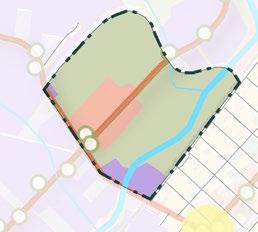
Current Land Use Proposed Land Use

Residents Meso Scale
A sense of community and home attracts people to stay in the same area as they grew up.
14% Elmwood Residents
9% Winton Hills Residents
29% Carthage Residents
Live in one of the census tracts they grew up in.
Sports Players Meso Scale
7 in 10 adults in Greater Cincinnati and Northern Kentucky are either overweight or obese.
Obesity continues to be a major cause of preventable chronic disease and healthcare costs in the United States
Suitability Criteria
Renters/ Owners Micro Scale
The U.S. Department of Housing and Urban Development indicates a deficit of more than 19,000 available and affordable units in Cincinnati.
Providing affordable housing allows for mixed income communities and makes new development accessible for the surrounding communities
Businesses
Micro Scale
Locating businesses around higher density communities creates the opportunity for a well-rounded live, work, play development. Providing local jobs can improve unemployment rates.
4.8% Elmwood Residents
23.4% Winton Hills Residents
6.1% Carthage Residents are unemployed
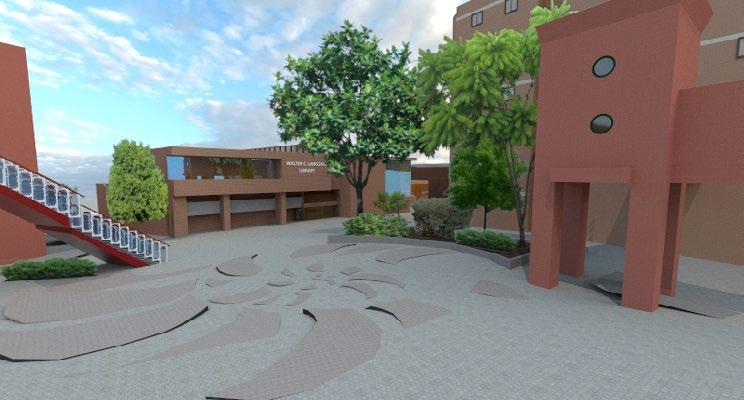
5 minutes walking from Library
10 minutes walking from Library
15 minutes walking from Library
minutes walking from Library
Commercial District
10 minutes walking from Library 15 minutes walking from Library Commercial District
100-year Flood Plain Parks
18
5
100-year
Parks Bus Route Local Street Collector Road Arterial Road Highway Arterial-Arterial Intersection Arterial-Collector Intersection Bus Stop Publicly Owned/Public Utilities Agriculture Industrial Commercia Residentia
Flood Plain
DEVELOPMENT PLAN
This section shows the middle of the site, directed North. The street layout consists of one parking, one bike, and two driving lanes on both sides of the street. A bioswale is located in the middle to increase stormwater management of the site.
Mixed Use (Commercial/ Residential) District Grocery Store
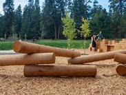
Playscapes
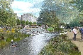
Case Precedent: Ohio Creek Watershed Resilience Park, By SCAPE
This plan looks at interactive spaces that are incorporated with greenery and help to engage visitors with the park.
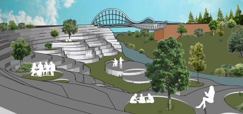
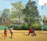
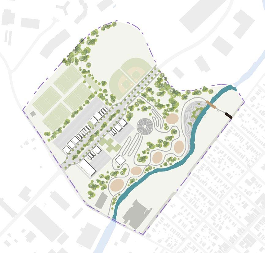
Athletic fields create space and resources for healthy lifestyles. These include football/soccer fields, tennis courts and baseball fields.
Bioswale Median
Visitors Center
LED Light Panels
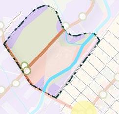
This section shows the inside of a tunnel located on the right portion of the site. Artistic LED panels line the walls, providing a source of light and safety to its users.
19
Bridge with Overlook
Tunnel underneath railroad track
Labyrinth Path
Flood-able Amphitheater
COLLEGE HILL NEIGHBORHOOD ANALYSIS
COMMUNITY WORDLE
To gather insights, it was important to listen to thoughts about College Hill directly from those individuals most intimately acquainted with the area— the people who live there!
This wordle was create by asking around 20 College Hill residents: “What is one word that describes your neighborhood?”
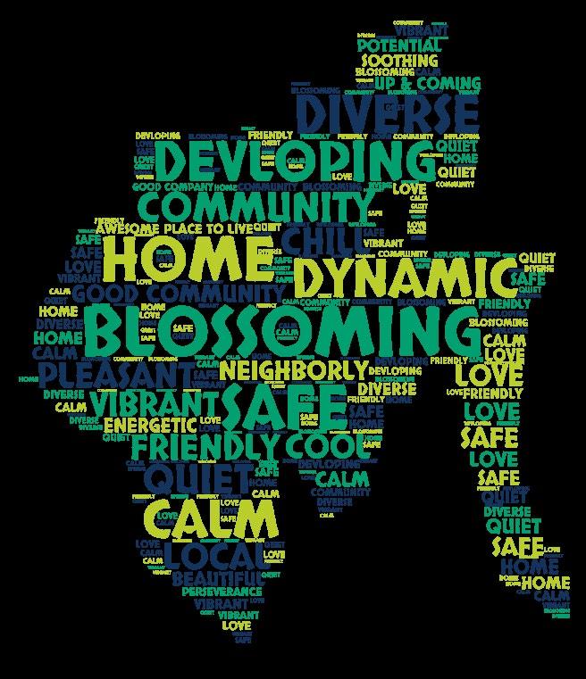
IN-DEPTH RESIDENT INTERVIEW
Asha White, a talented artist and proud resident of College Hill, provided our team with invaluable insights into her community’s family-oriented essence. Understanding these vital characteristics proved crucial in formulating our plans for the neighborhood’s future.
How would you describe the identity or character of College Hill?
Super diverse and it’s so very much family oriented. neighbors. If there’s somebody strange walking this person don’t live over here. And we all look And then my street is a really good split of Black block. So, like, super diverse and super family
Why do you love College Hill?
These quick interviews helped our group to have a better understanding of the identity of the neighborhood by seeing what residents enjoy most about their neighborhood and why they choose to live there. Some of the top words include things such as:
It’s my neighbors- it’s the neighbors and community would say that we grew up different. Different-ish, up in Cleveland, but we both feel like it reminds as children. I think it’s specifically for the community and looks out for everybody and speaks to everybody know, I I just love the family, it feels like a place
20
•
• Diverse • Friendly • Quiet
Community • Home
Click here to view complete plan
COMMUNITY CENTRIC RECOMMENDATIONS
Based off information gathered from College Hill’s people and the neighborhood’s history, institutions, schools, businesses, civic spaces, public art, social groups, and built form, a set of five fundamental strategies were refined to elevate the current community.
Space Activation
• Utilize existing parks and greenspaces for events
• Implement event programing/ entertainment in public spaces
oriented. I know that I know all of my walking down the street it’s like no because we know look out for each other, which is really nice. Black and white families really, on the whole entire family friendly is how we describe our home too.
Way-Finding
• Install gateway signage to welcome residents and visitors
• Create way-finding signage throughout neighborhood
Beautification
• Improve street facade and perceived safety by businesses
• Implement traffic slowing measures such as tree plantings
College Hill Resident: Asha Imani White
College Hill Resident: Asha Imani White community. It’s so funny me and my girlfriend, I Different-ish, right? She grew up in Boston and I grew reminds us so much of our neighborhoods community aspect where everybody knows everybody and compliments your yard. I don’t place where I would want to raise kids.
Preserve Existing Residences
• Plan policies to prevent displacement of current residents
• Improve existing infrastructure for more multi-model travel
Placemaking
• Give people a reason to want to go to the south side
• Position public art that represents the community
21
COLLEGE HILL NEIGHBORHOOD ANALYSIS
VISION AND MISSION
In 2050, College Hill will be a dynamic community where residents feel connected and empowered, spaces feel vibrant and inviting, and there is a culture of collaboration and a collective sense of identity.
To propel this vision forward, the mission strives to enrich the neighborhood’s character, cultivating inviting environments that forge strong bonds between individuals and their surroundings through effective connections. The three main mission goals are as follows:
Enhance the Identity of College Hill
Elevate the neighborhood’s communal spirit and collective community passion by revitalizing community spaces and bridging its resilient history with its present advocacy for change.
PRINCIPLES
Perceptions
Residents and visitors to College Hill see a welcoming, inviting, and safe neighborhood where there is a high quality of life and well-being.
Transform the Spaces of College Hill
Foster the creation of lively and inviting spaces through programming that takes advantage of currently underutilized spaces, coupled with the establishment of new cooperative and collaborative spaces.
Create Effective Linkages in College Hill

Facilitate both social and physical connections among people and new transformed spaces, creating a renew sense of identity through inclusive mobility and the cultivation of community partnerships.
Placemaking Accessibility Preservation Partnerships
Spaces are more than just utilitarian, they are places that inspire and promote social interaction and cultural exchange.
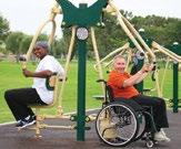
Pedestrian mobility is prioritized over car traffic and all individuals, regardless of their physical abilities can engage with the urban environment.
History of College Hill as a inclusive
abolitionist neighborhood is celebrated and brought into the present through equitable planning
Collaborative culture fosters shared decision-making, resource pooling, and knowledge exchange to achieve effective and holistic neighborhood outcomes.
22
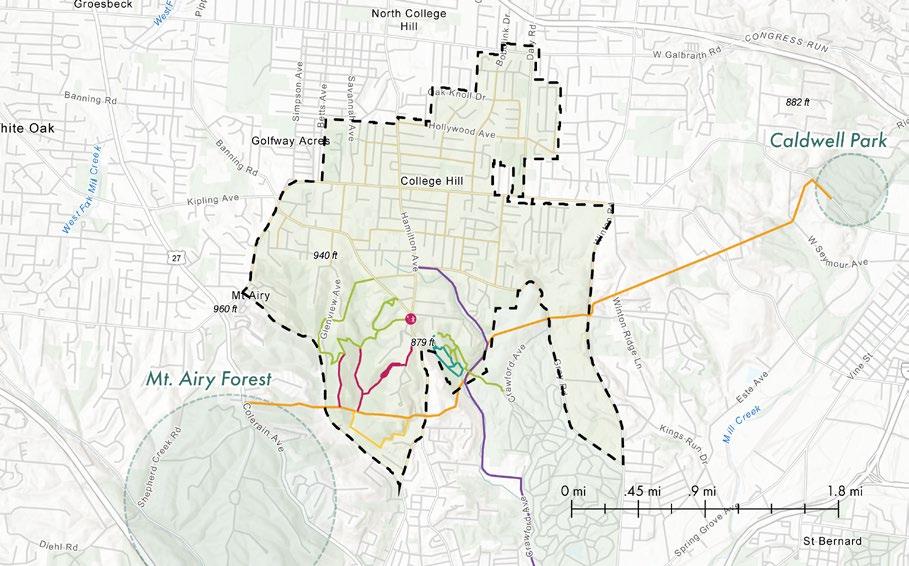
CORE PRINCIPLES MAPPED
This map overlays the frameworks and strategies for each principle, highlighting the top priority ideas that will have the most impact on the community. The principles of perception, placemaking, accessibility, preservation, and partnerships, along with the key actors who will be implementing them, are critical to ensuring a cohesive sense of connection between the currently disconnected northern and southern parts of the neighborhood. While residents take pride in the vibrant business district and its walkable appeal, they also desire a more engaging way to reach the southern portion of the neighborhood. Integrating key public institutions, parks, and community hubs throughout the neighborhood will extend the identity of College Hill beyond the Hamilton Avenue Business Corridor.
Perceptions Placemaking
Traffic Slowing Measures
Accessibility
Programming in Existing Greenspaces
Preservation
Improved Multimodel Linkages
Partnerships
BRT Hamilton Corridor Line

BRT Stops
Current Business District
New Historic District
Underground Railroad Routes
Locations to increase Affordable Housing
Collaborative Spaces Hub
23
COLLEGE HILL NEIGHBORHOOD ANALYSIS
PRESERVATION FRAMEWORK AND STRATEGIES
Preservation entails maintaining certain areas of College Hill and bringing the past forward to be enjoyed in the present. Increased knowledge of historical landmarks, buildings, and cultural heritage foster a sense of ongoing legacy and pride among residents. Moreover, conserving the large hillsides and affordable housing in the neighborhood further protects community assets for present and future generations to enjoy.
Enhanced Identity
Existing Historic District
• Install informational signage and story-telling path/trail
New Historic District Areas to Maintain Residential Character
• New Underground Railroad historic district around Hamilton Avenue and Belmont Avenue
• Plant street trees
• Implement acoustic medias to reduce noise
Transformation of Spaces
Important Historic Locations
• Highlight buildings that are a significant part of the neighborhood’s history
Hillside Conservation
• Prevent further development in these areas to conserve natural spaces
Existing High Density Smaller Homes
• Preserve higher density homes around business district and maintain affordable housing units
Locations to Increase Affordable Housing
• Implement policies for rent control
• Set a minimum percentage of affordable units
Underground Railroad Routes
• Create walking paths and increase awareness of Underground Railraod Routes
Creation of Effective Linkages
Major Roadways Busy Nodes to Reduce Car Traffic
• Main Hamilton and Northbend as the main identifiable routes
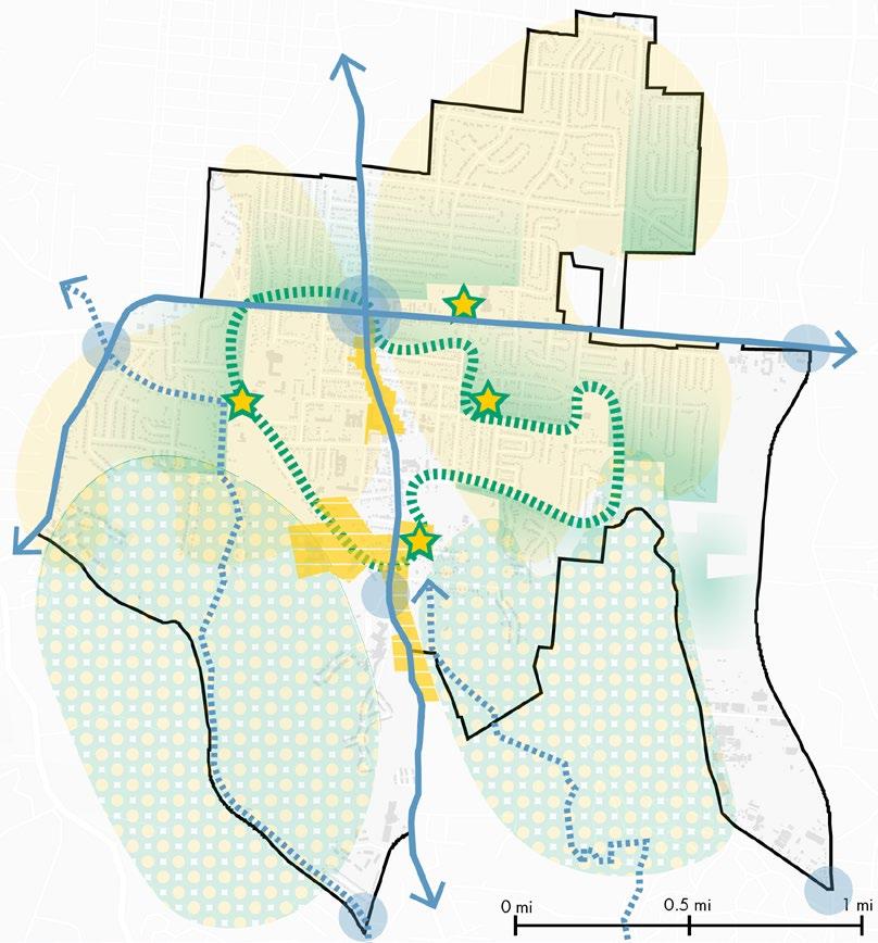
• Mitigate potential impacts of increased noise
• Control car traffic at busy node to account for dispersed traffic on secondary roads from the implementation of the BRT
24
PLACEMAKING FRAMEWORK AND STRATEGIES
Placemaking involves shaping spaces to promote health, well-being, and happiness for those that utilize or visit the neighborhood. Many of the culturally significant sites such as the namesake old colleges or the large public parks are located in the southern portion of the neighborhood. Making these community assets memorable and activating these spaces fosters a culture of collaboration and nurtures a shared sense of identity within the community.
Enhanced Identity
First Priority Public Space
• Smart lighting and improving sidewalks for pedestrians
Second Priority Public Space
• Promotion of mixed-use development
Third Priority Public Space
Transformation of Spaces
• Street facade improvements
Wayfinding Nodes
• Interactive kiosks with business directories
• Directional signage and other innovative navigational systems
Activation of Culturally Important Spaces
• Highlight historically significant buildings
Potential Places for Public Art
• Interactive art installations
• Utilize more outdoor music and concert venues
Programing in Existing Greenspaces
• More frequent markets for food and local businesses
• Community event boards/activities for different generations
• Micro-climate design
Improved Multimodal Linkages
• Implement more walking and biking paths
• Employ strategies that make waiting for the bus more enjoyable and dignified (benches, shade, public art, greenery, etc.)
25
Creation of Effective Linkages
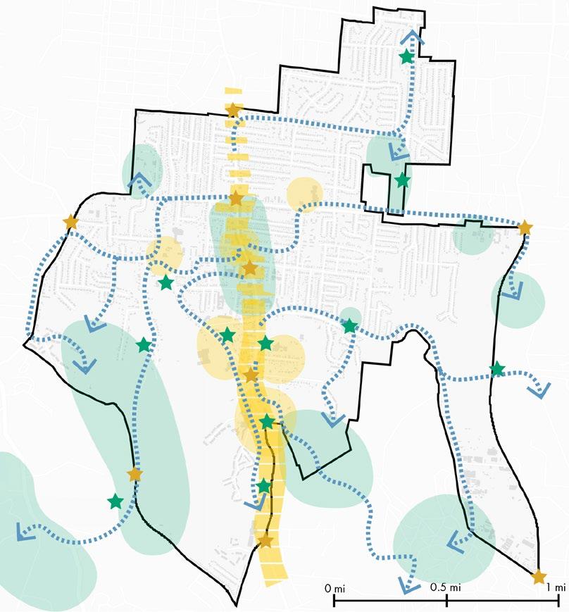
COLLEGE HILL TRAIL NETWORK PLAN
VISION
When people visit the College Hill hillsides, they will have a dynamic experience that fosters a rich sense of history, a connection with the natural environment, and a celebration of the neighborhood’s diverse and inclusive culture.
To guide the vision for College Hill, five smaller mission statements were created:
Use art as a catalyst to enrich and inspire the community through interactive installations.
Establish a standard that balances man-made experiences with the natural environment.
Provide opportunities to engage with nature and promote respect for the environment.
Cultivate an appreciation of College Hill’s history.
Create an exciting and easily navigable experience to connect people to the environment.
College Hill Neighborhood Boundary
Neighborhood Trails
Powerline Connector Trail
Arts and Play Trail
Heritage Trail
Environmental Stewardship Trail
Northside Connector Trail
(portion within College Hill is universally accessible)
Main Trailhead next to community recreation center
Outside Neighborhood Trailhead Parks
26
here to view complete plan
Click
NARRATIVE
This story delves into the daily life of a resident, adding a human touch to the planning process.
Their dad goes to work and takes the kids to school along the yellow line of the College Hill Loop.
Mia is a doctor at Cincinnati Children’s and a wife and mother of two.
The family uses the Northside Connector trail to have a picnic in the plaza with Ash, Mia’s sister, who lives in Northside with her partner.
Mia and the kids meet with their grandma to take a stroll on the art trail to the sculpture park nearby Twin Towers.
Mia loves living in College Hill where she and her family have access to everything they want and need.
On busy days her and her husband walk to a neighborhood experience greenspace a few blocks from their house.
Following a stressful day Mia likes to take the history trail or the environmental stewardship trail down to the meditation garden.
27
COLLEGE HILL TRAIL NETWORK PLAN
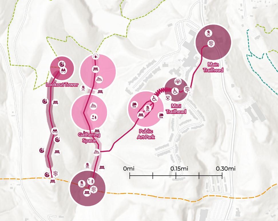

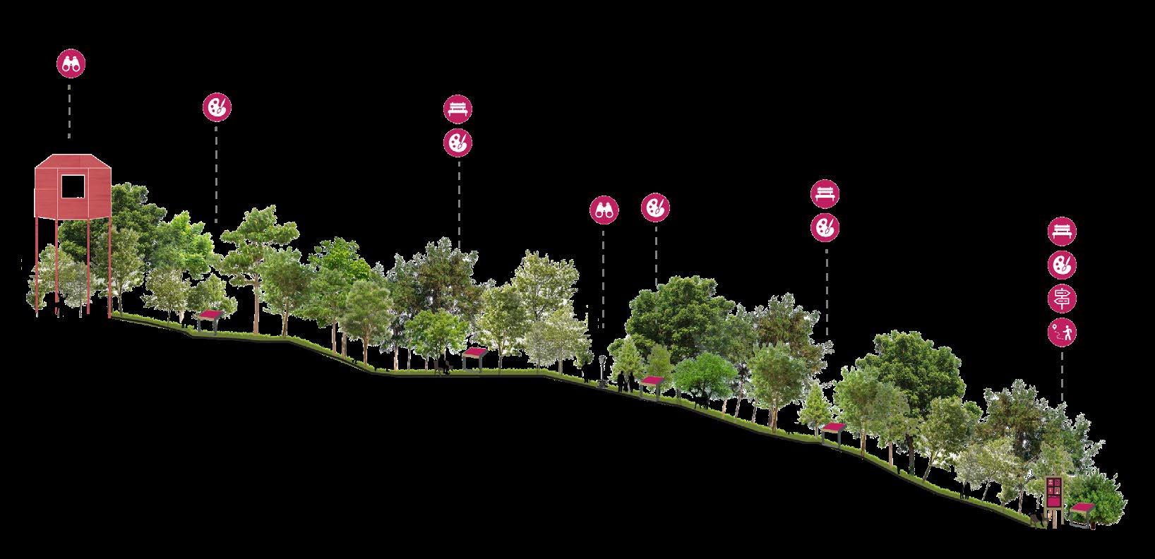
ARTS AND PLAY TRAIL FRAMEWORK


The Art and Play Trail offers distinct art playscapes, sculptures by minority artists, and a wheelchair-accessible sculpture park. Trail B, the highest point, showcases “paint the view” installations capturing the landscape from varied artistic perspectives, highlighting visible landmarks. At the top, it boasts a lookout tower for breathtaking city views. Trail C offers interactive art and family-friendly playscapes to inspire imagination in all ages. Trail A, near Twin Towers assisted living homes, features a wheelchair-accessible sculpture park. Its switchback descent ensures inclusivity for mobility-challenged individuals to fully enjoy the art. Emphasizing local creators, the trail celebrates diversity, fostering dialogue and understanding across different cultures and backgrounds.
Trail Arts & Play Trail


Views Trail Gathering Space/ Park
Trailhead


Lookout Tower Benches

Tree plantings around sculpture park protect the privacy of nearby residences

Art Installation
Water Fountain Bike Repair Station
Binoculars


Landscaping
Lookout Tower Picnic Area
28
Paint the View Art Playscape Way Finding Handicap Accessible Tree Planting
C C’ B’ B
B’ C’ C
Sensory Experience A B
A
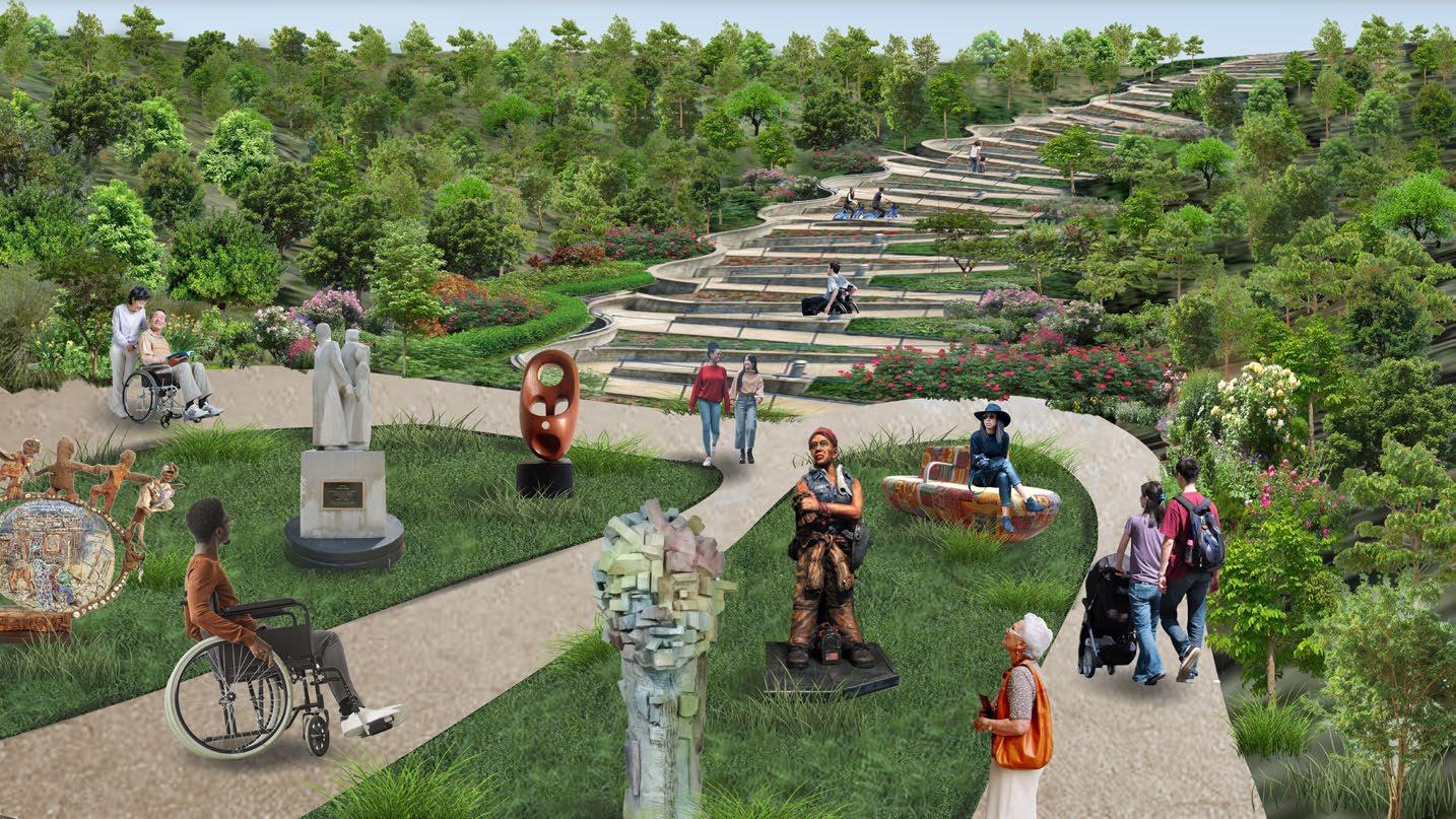
AACCESSIBLE SCULPTURE PLAZA RENDERING
Nestled beside Twin Towers’ assisted living homes, the wheelchair-accessible sculpture park offers a sanctuary for those with limited mobility, granting access to art and nature amidst College Hill’s typically steep and inaccessible terrain. Showcasing sculptures by predominantly local Black artists, the park finds its inspiration from local Black creators, such as resident Asha White, who works with Black Art Speaks. Partnerships with similar organizations or even local universities would elevate the park experience through captivating artistry.
Sculpture Park
29
Accessible Entrance
Kyle and Kelly Phelps
Omar Shaheed
Elizabeth Catlett
Aminah Lynn Robinson
CHUKES
COLLEGE HILL TRAIL NETWORK PLAN
VIEWS TRAIL CROSS SECTION
Total Distance: 0.39 mi


Maximum Elevation: 891 ft
Minimum Elevation: 767 ft

Ascent: 0 ft
Descent: 107 ft
Binoculars

30 7/28/2023 0 0.55 1.1 0.28 mi 0 0.9 1.8 0.45 km 1:42,544
Benches
B B’ B B’ Paint the View Way Finding Art Trail Gateway
AMENITIES
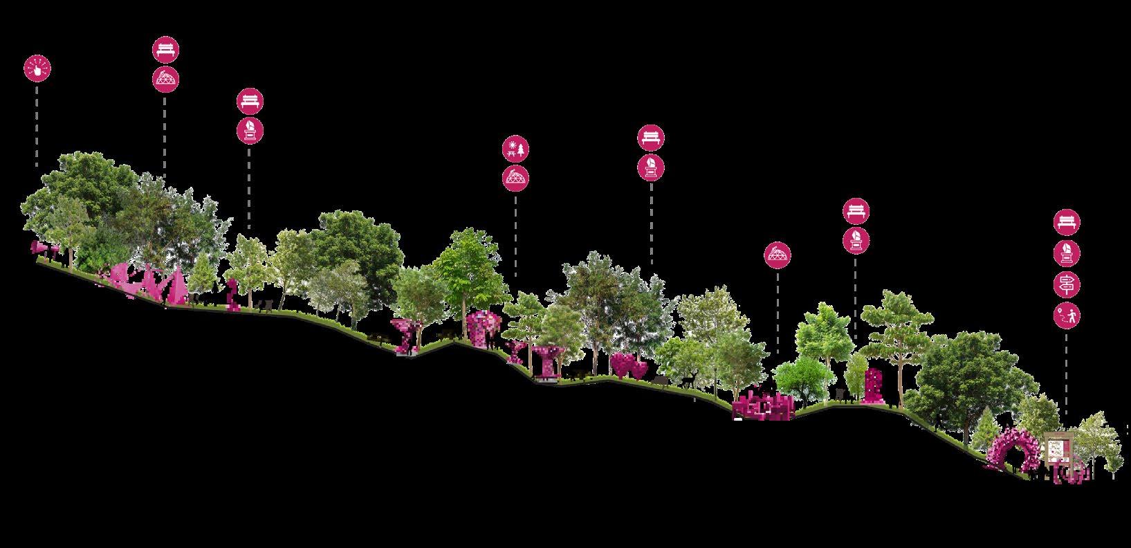


31 7/28/2023 0 0.55 1.1 0.28 mi 0 0.9 1.8 0.45 km 1:42,544 ARTS
C C’ C’ C Sensory Experience Black/Minority & Student Art Installation Way Finding Art Playscape Picnic Seating Area (Painted Roofs) Art Trail Gateway Benches AMENITIES Maximum Elevation: 763 ft Minimum Elevation: 627 ft Total Distance: 0.45 mi Ascent: 16 ft Descent: 144 ft
& PLAY TRAIL CROSS SECTION
ENGLISH WOODS NEIGHBORHOOD ANALYSIS
SUITABILITY ANALYSIS
These maps were used to determine the most appropriate uses for different areas of English Woods. Based on neighborhood existing zoning, watershed hydrology, soil reports, slope, existing utility infrastructure, and street hierarchy each grid square was scored based on the shown criteria. Those numbers were combined and mapped to determine the total suitability for each use.
Residential Suitability
Open Space for Pedestrian Trail Suitability
32 Residential Climate Soil Views Slope Infrastructure Noise Zoning Tree Canopy Residential Bad Weather Bad for Development Low Elevation Steep Slope No Infrastructure Loud New Zoning Heavily Forested Residential Moderate Weather Moderate for Development Moderate Elevation Moderate Slope Some Infrastructure Moderate Noise Modification of Zoning Some Trees Residential Good Weather Good for Development High Elevation Low Slope Multiple forms of Infrastructure Quiet No Zone Change Required No Trees 1 2 3 Pedestrian Trail Climate Soil Views Slope Proximity to Flora Watershed Residential Bad Weather Bad for Plants No Views No Slope No Plants No Water-flow Residential Moderate Weather Moderate for Plants Moderate View Moderate Slope Smaller Shrubs Some Water-flow Residential Good Weather Good for Plants Good Views Steep Slope Trees Presence of Water-flow 1 2 3 Institutional Soil Slope Infrastructure Zoning Accessibility Nearby Residential Residential Bad for Development Steep Slope No Infrastructure New Zone Only Small/No Streets No Residents Residential Moderate for Development Moderate Slope Some Infrastructure Modification of Zoning Larger Roadways Close to Residents Residential Good for Development Low Slope Multiple forms of Infrastructure No Zone Change Required Busing System Home Locations 1 2 3 15-18 Very Suitable 11-14 Moderately Suitable 7-10 Not Suitable Preexisting Homes Institutional Suitability 15-18 Very Suitable 11-14 Moderately Suitable 7-10 Not Suitable Preexisting Homes
15-19 Moderately Suitable 10-14 Not Suitable Preexisting Homes
20-24 Very Suitable
CONCEPTUAL NEIGHBORHOOD PLAN
Single Family Houses with View
Recreational Center Community Park with Sculptures and Playground
Active Recreation/ Trails

Arterial Roads


Local Streets
Pedestrian Paths/ Trails


Park
Mixed Use (Commercial and Residential)
Institutional
Single Family Residential


MOOSEWOOD


Multi Family Residential
YONKERS


Parking

33 SUTTER
BEEKMAN BALTIMORE WESTWOODNORTHERN YOAST
HARKNESS
HOPPLE
KNOB BLEECKER PULTE
MERREL BOLTWOOD HEATH BOWLINGGREEN
L I N D E N MO OS EWO O D HOPPLE . 0 0 15 0 3 0 075 Miles
BRINKMEIER
Apartment Building
Senior Housing
Commercial Plaza
Public Library
ENGLISH WOODS NEIGHBORHOOD ANALYSIS


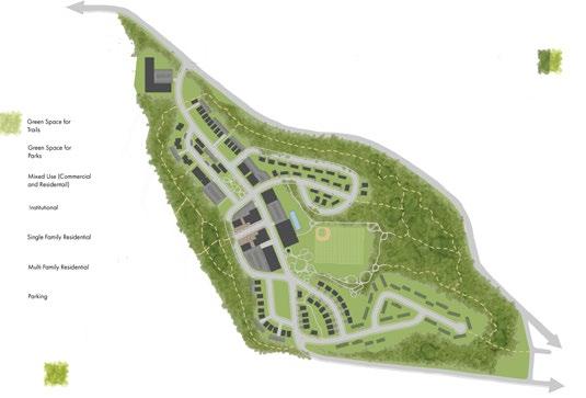
FINAL SITE DESIGN

The final design plan for English Woods aims to create a sustainable, walkable, and community-centered neighborhood that addresses the current lack of resources and community spirit. The residential area will be expanded to accommodate a diverse mix of housing types, promoting interaction among residents from various lifestyles and age groups. Central public facilities and a small commercial hub provide community spaces and offer groceries, services, and local jobs.
34 Green Space for Trails Mixed Use (Comme and Residentail) Green Space for Parks Institutional Single Family Residential Parking RM-2.0 Multi-family RM-1.2 Multi-family RM-0.7 Multi-family RMX Residential Mixed Trails Library Swimming Pool Recreation Center Sports Field Sculpture Park Senior Cottages Senior Center with Attached Housing Commercial Plaza Small Fresh Grocery Duplexes Lookout Tower Apartments SUTTER BEEKMAN BALTIMORE WESTWOODNORTHERN YOAST MOOSEWOOD HARKNESS KNOB BLEECKER PULTE HOPPLE MERREL BOLTWOOD HEATH BOWLINGGREEN YONKERS BRINKMEIER L I N D E N MO OS EWO O D HOPPLE . 0 0.15 0.3 0.075 Miles
Commercial Plaza Sport s Field Commercial Plaza Sports Field
CROSS SECTIONS


3D RENDERINGS


Central to the design is a sculpture park, serving as a dynamic social nexus and imbuing the site with distinct character. As the community flourishes, residents are encouraged to contribute and personalize the park. Adjacent to the sculpture park, an observation tower offers panoramic views, while strategic proximity to the sports field encourages cross-interest interaction.
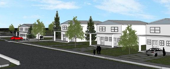
Within a designated residential zone along Sutter Ave, the design incorporates duplex homes that provide a harmonious blend of community cohesion and individual living spaces.

35
B B’ 50
A A’
A’ A
ft 500 ft
B’ B
Cross Road Section
50 ft 500 ft
Hillside Section
Sports Field
Lookout Tower
Made in SketchUp
Made in SketchUp
ART ON CAMPUS
36
THE POWER AND PRESENCE OF PUBLIC ART
Public art has a profound impact on urban environments, enhancing cultural identity, fostering community engagement, and contributing to economic growth. Its presence enriches aesthetics, encourages social interaction, and promotes mental well-being, creating inclusive and inspiring spaces.
Understanding how the strategic placement of public art enhances its visibility and accessibility to those on campus can illuminate ways to further positively shape the campus environment.
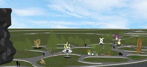
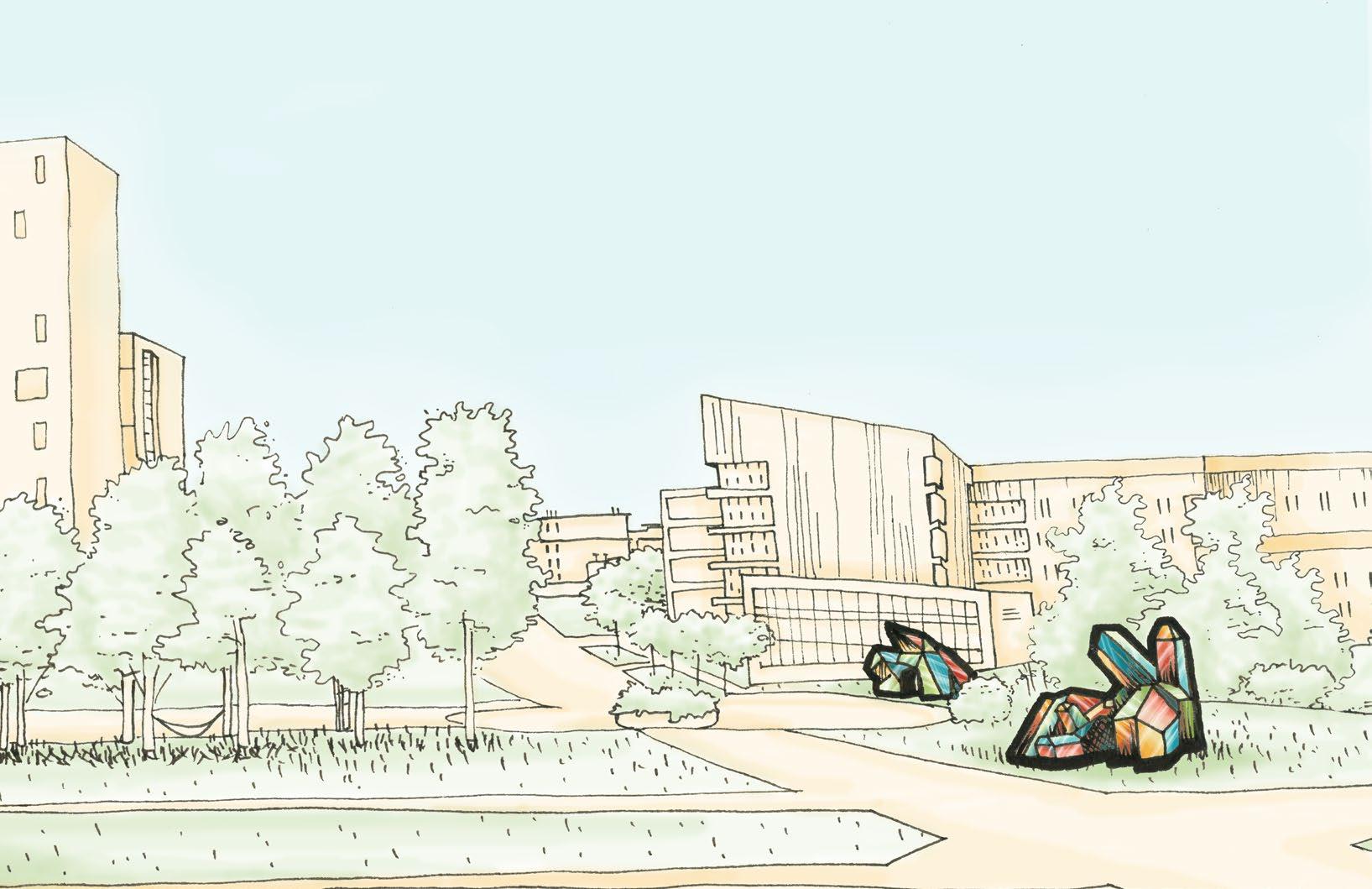
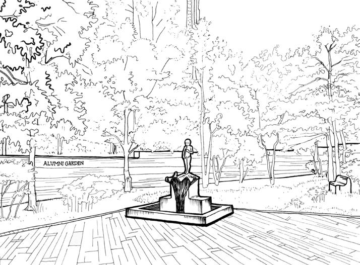
The Sigma Sigma Commons green space, pictured here, stands as a testament to the influential role of public art in enriching urban environments. Highly frequented by students, this area includes a dense array of art pieces, maximizing their impact. Wide open space allows these pieces to be seen and enjoyed by many. This well-placed and thoughtfully curated art defines the northeast side of campus.
UNIVERSITY OF CINCINNATI CAMPUS ART
VIEW-SHEDS OF CAMPUS ART
This map illustrates view-sheds of public art across the University of Cincinnati campus. The swaths of color depict areas of art visibility. Higher dot concentration signifies optimal viewing, while greater a lack or decrease of color indicates partial visibility.
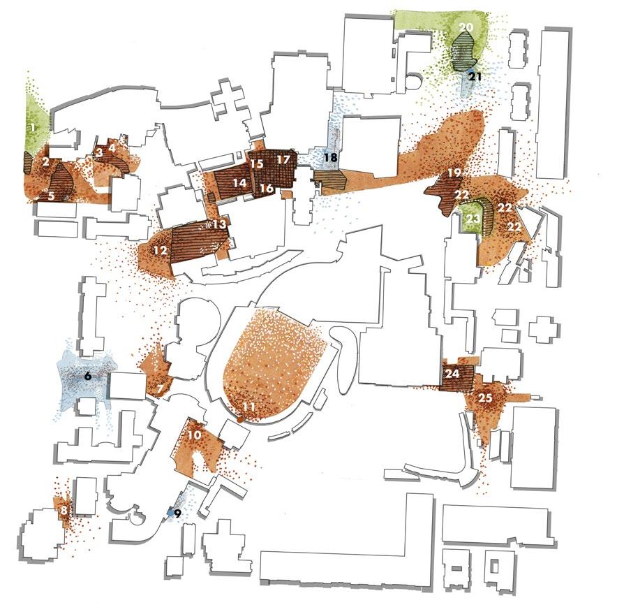
Where three view-sheds overlap


Where two view-sheds overlap View-shed
Art is categorized into three major types easy classification:
38
Better Worse
Quality of View
General Public Art
Landscape Art
Fountains
These sketches visually depict the 25 public art installations, as seen in the accompanying map. From thought-provoking abstract sculptures to grandiose fountains each piece tells a unique story and integrates into their natural surroundings. These artistic pieces breathe life into the campus, enriching the daily experiences of students, faculty, and visitors alike.


39
2 3 4 5 6 7 8 9 10 11 12 13 14 15 16 17 18 19 20 21 22 23 24 25
INVENTORY OF CAMPUS ART 1
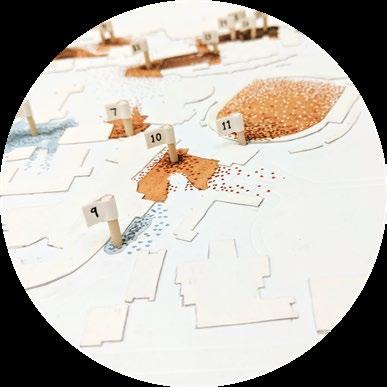
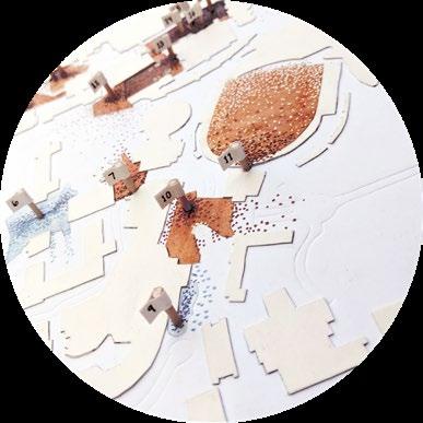
Picture of hand made map with embossed walkways and layered building footprints
Small numbered flags pinpoint the exact locations of the art around campus
UNIVERSITY OF CINCINNATI CAMPUS ART
ART AREAS AROUND CAMPUS
Concealed Gems
Isolated art pieces that are discretely tucked away form intimate sanctuaries for art enthusiasts. The space is intentionally designed to be sought out and provides personal space for meaningful interaction.
Langsam’s Unseen Grandeur
In front of Langsam Library, an abundance of art pieces awaits, their sheer scale often veiling them from preoccupied students navigating their way to classes. This space calls for a more deliberate observation of what one is walking on or through.
Navigating Art on Schneider Quadrangle
A well-trodden thoroughfare for students, Schneider Quadrangle contains only a couple of smaller art installations. These pieces may escape immediate attention, but their strategic placement along pathways incorporates artistic flair into the daily routines of passersby.
40
Located at #16, Made with V-Ray in SketchUp
Located at #12, Made with V-Ray in SketchUp
Located at #9
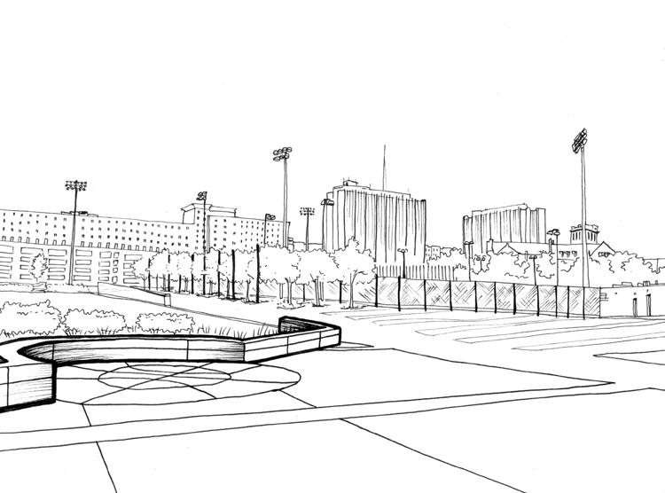
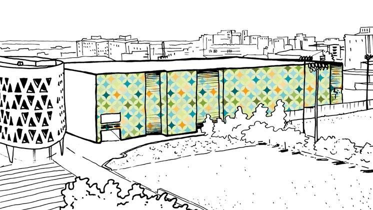
POTENTIAL FOR ARTISTIC GROWTH ON CAMPUS
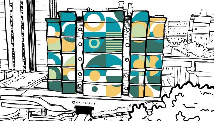
The athletic district in the southeast corner of campus presents a prime opportunity for additional art, whether it is a sculpture, mural, or both!
Moreover, if students are involved in the selection process it would foster a sense of ownership and connection to their campus art. Students themselves could participate in the mural-making process too or get involved in partnerships with organizations in Cincinnati’s vibrant art community.

New art on campus has the potential to nurture the creativity and collaborative spirit of the student body outside of the classroom and the field.
Fifth Third Arena Mural
Chemistry Biology Library Mural
Murals would add to the distribution and variety of art installations on campus and offer a dynamic solution that could adorn various walls across campus. Improved accessibility and diversity of artistic expressions will create an inspiring and enriching campus atmosphere.
41
Sheakley Lawn Sculpture
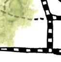
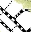
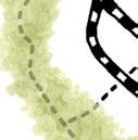
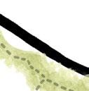
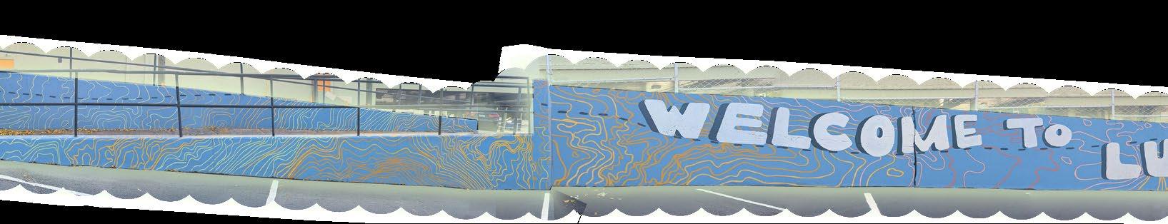
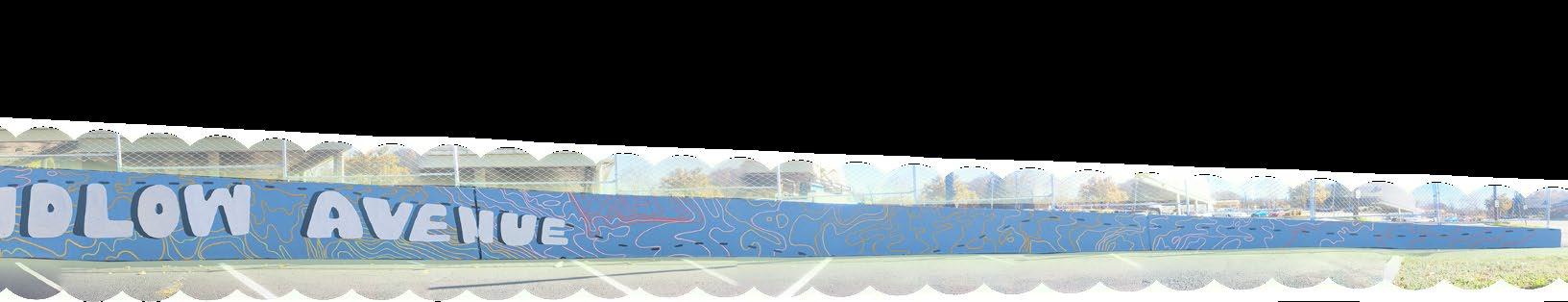
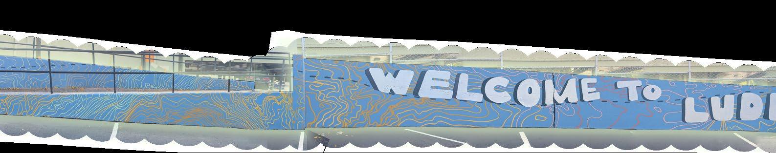
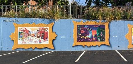
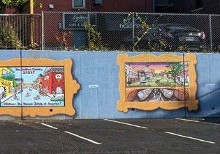
LUDLOW MURAL
WELCOME TO LUDLOW AVENUE
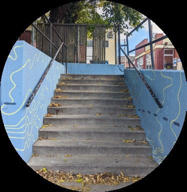
This commissioned mural titled “Welcome to Ludlow Avenue” was a collaborative work by Sarah Mackenzie and myself. It resides in the Merchant Parking Lot and was coordinated by Kip Eagen for the Clifton Business Association. The mural features continuous topography lines on a main retaining wall, tapering in size (pictured below), along with six framed segments on two adjacent retaining walls.
MURAL WORK
42
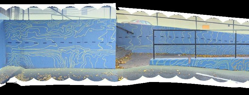
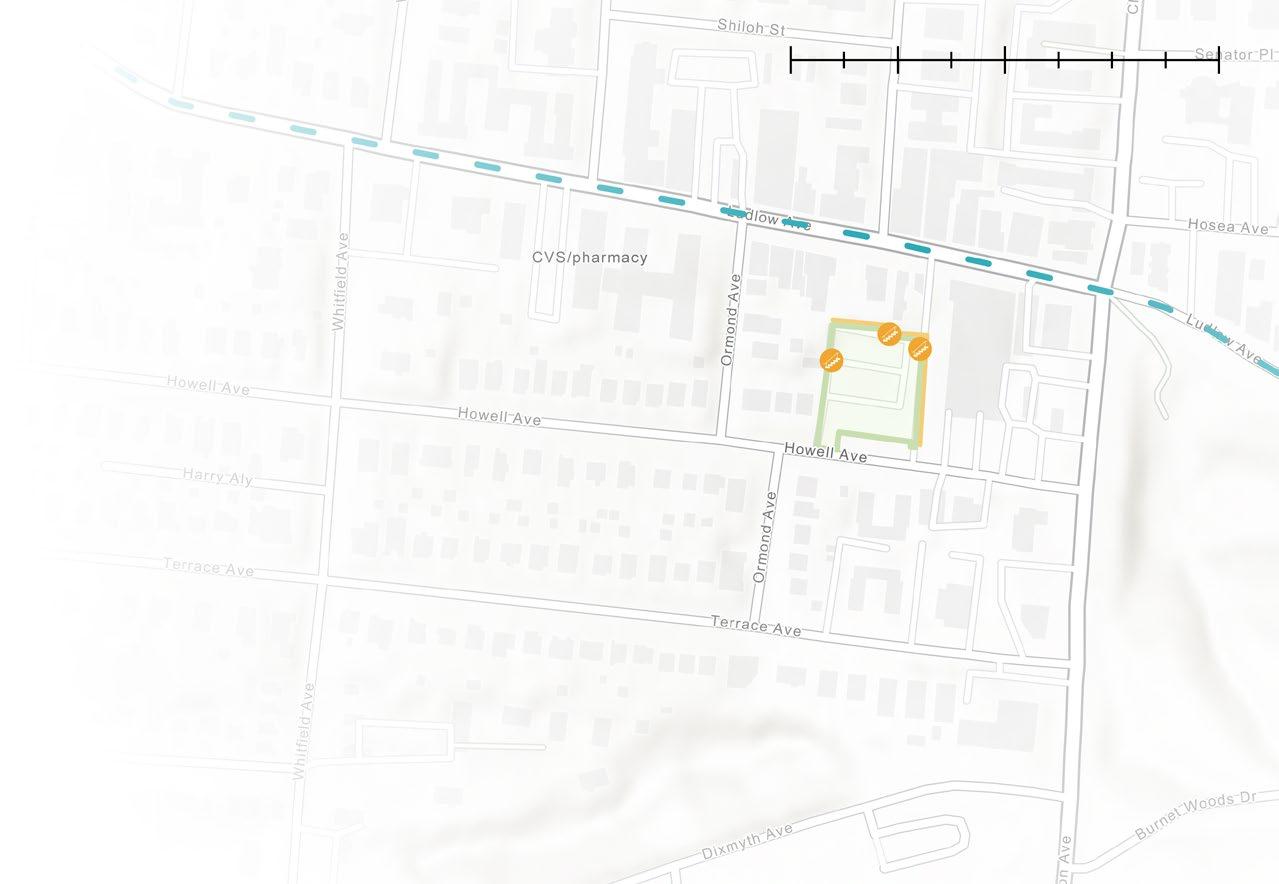
MURAL SITE
This map illustrates where the mural is visible within the Clifton Merchant Parking Lot. Accessible from Ludlow Avenue—the mural’s inspiration—and southern Howell Avenue, the site is sunken with three stairways leading to Ludlow Avenue. The depicted wall is located on the eastern painted surface.

Stairway Entrance
Mural Site Parking Lot
Painted Walls
Ludlow Avenue

43
0 mi .04 mi .07 mi .14 mi
LUDLOW MURAL
THE TOPOGRAPHIC MAP OF LUDLOW AVENUE
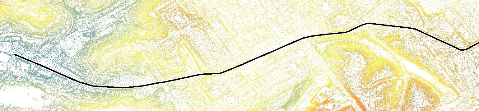
The original map inspiration for the topography lines that are seen on the finished mural. The black line traces the path of iconic Ludlow Avenue through the surround hills and structures. To accommodate the distinctive wall shape, the topography line map was rotated at three different points to align Ludlow Avenue with the narrow wall. The artwork blend topography lines, mirroring the landscape’s contours, with vivid colors that capture the area’s lively essence. The fusion of art and geography celebrate the harmonious relationship between nature and human creativity.
MURAL WALL CONFIGURATIONS
FINAL DESIGN
44
0 mi .075 mi .15 mi .3 mi .45 mi .6 mi N A A’ B B’ C C’ A A’ B D E
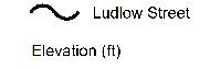
Word Typography Designed By: Sarah Mackenzie
Ludlow Street
Elevation (in feet)
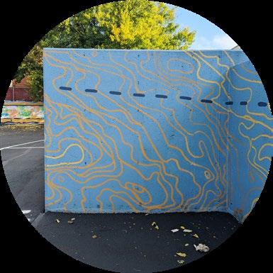
45 B’ C C’
DStairwell entrance that leads towards Ludlow Avenue and Clifton Market entrance.
E10ft wide wall at the end of the accessible ramp that transitions to another slope.
LUDLOW MURAL
LUDLOW AVENUE IN THE FUTURE
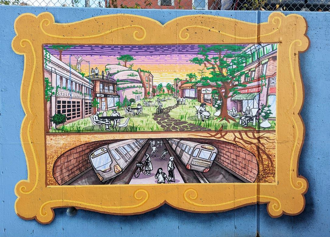
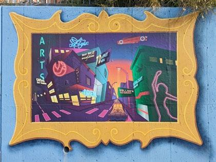
This piece was an individual commission depicting my vision of what the Ludlow Business district might look like in the future. It was designed by combining watercolor and digital art. The design was printed by Randy Mazzola and heat-sealed onto the wall. In addition, I designed and painted the encompassing frame and those of five more frames containing other artist renditions of Ludlow in the future.
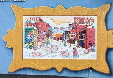
46
Artwork by: Leah Woodall
Northwest Painted Wall
Artwork by: Madison Lentz (Myself)
THE BUSINESSES OF LUDLOW

This map showcases Ludlow Avenue’s distinctive character by featuring neighboring businesses and spaces along its iconic roadway, which served as inspiration for various artist interpretations. The western wall of the mural site pays tribute to these local businesses by listing their names as a token of gratitude for their significant contributions to the project.
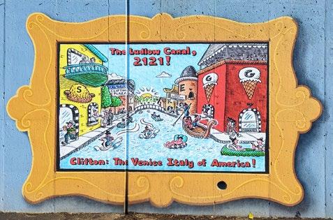
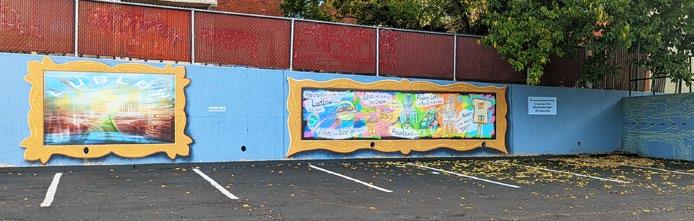
Ambar India
The Whole Bowl
The Ludlow Garage
Graeter’s Ice Cream
Esquire Theatre
Kilimanjaro African Art
Clifton Florist
Skyline Chili

Clifton Plaza Upside Coffee
Clifton Market
Clifton Fountain
Burnet Woods
47 0 mi .04 mi .07 mi .14 mi
J. Gumbo’s Clifton
Painted Walls Ludlow Avenue Stairway Entrance Mural Site Parking Lot
Artwork by: Jain Chen
Artwork by: Jim White
Artwork by: Randy Mazzola
Northeast Painted Wall
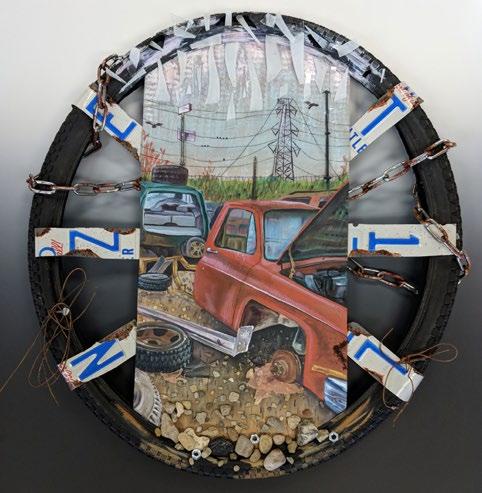
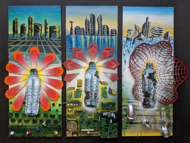
VISUAL ARTS
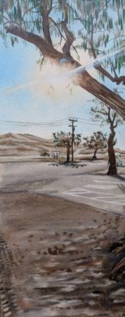
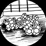
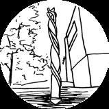
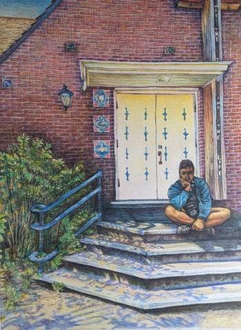
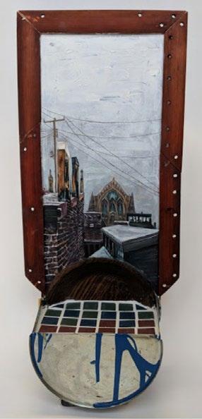
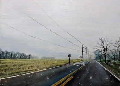
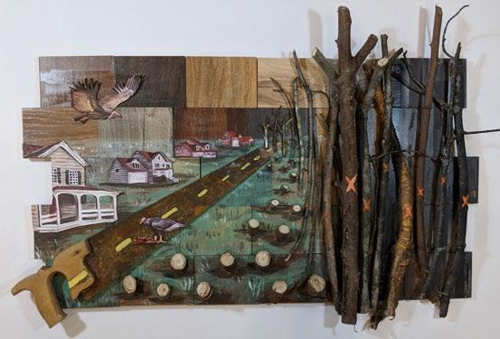
These pieces of art were made from 2018 to 2023, using a wide range of materials such as oil paint, colored pencil, and found objects.


48


49
50 lentzmo@mail.uc.edu (513)330-3951CO Contact me! THANK YOU!