PORTFOLIO

LIM
M.ARCH 2022
LYNUS
SUTD
Turning Tides Urban Planning
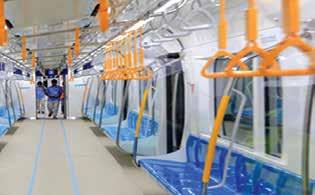
Mitigating land scarcity through machine learning strategies
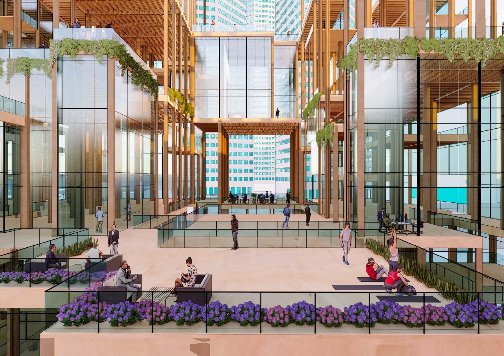
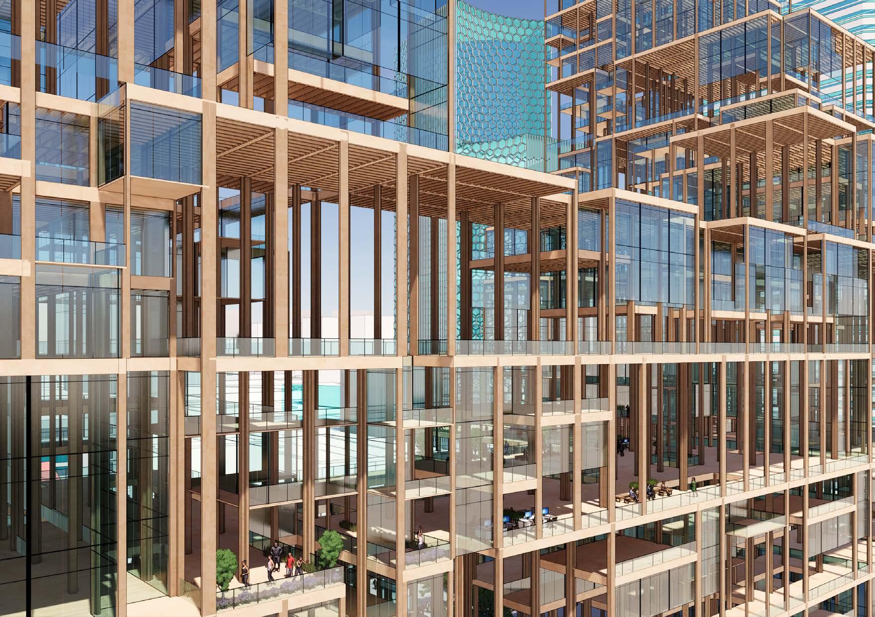
Paddle Pop Offices
A new office typology centred around fitness and wellbeing
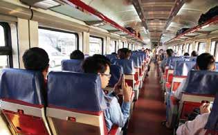
Timescapes Pavilion
Recollections of Tanjong Pagar’s Railway Station
The Urban Forest Housing
02 03 04 05
Iridescent Pavilion
Future housing typologies that promote entrepreneurship
Modular pavilion from sustainable materials
01
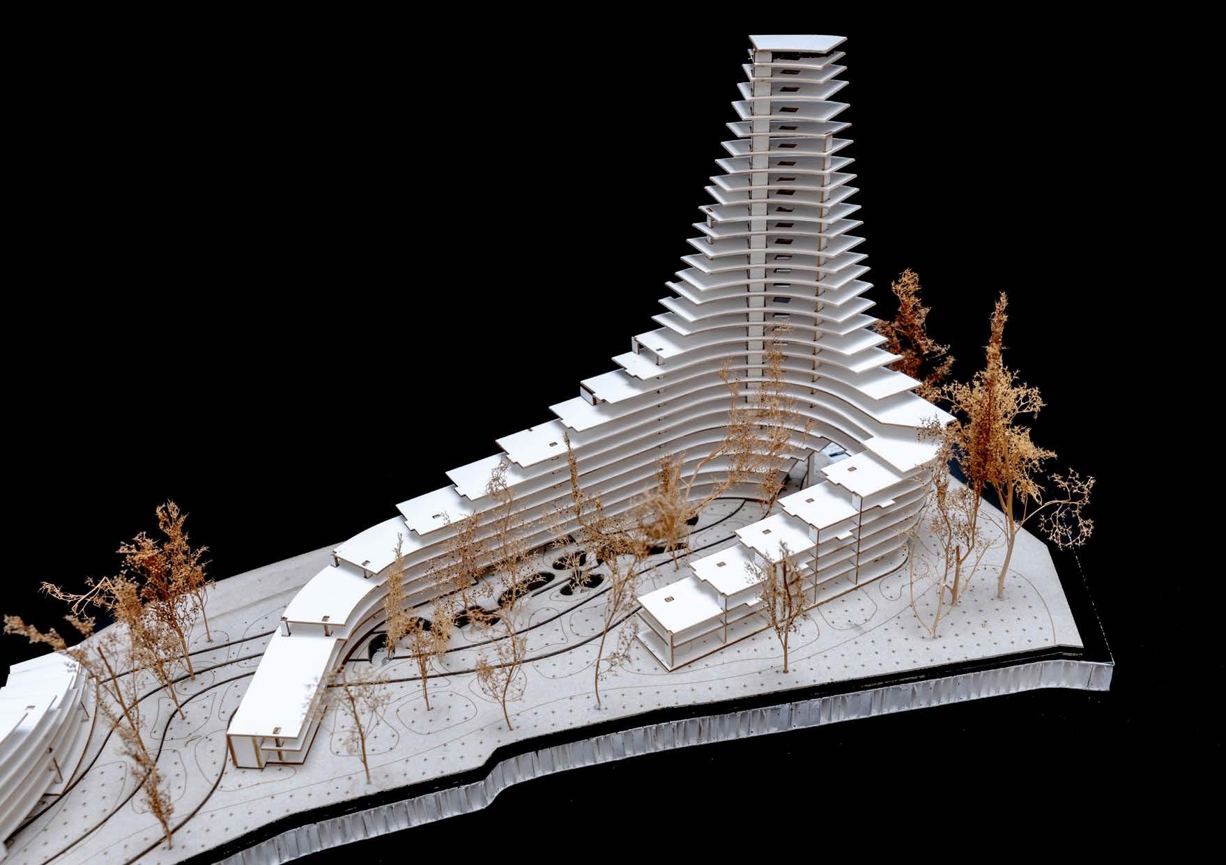
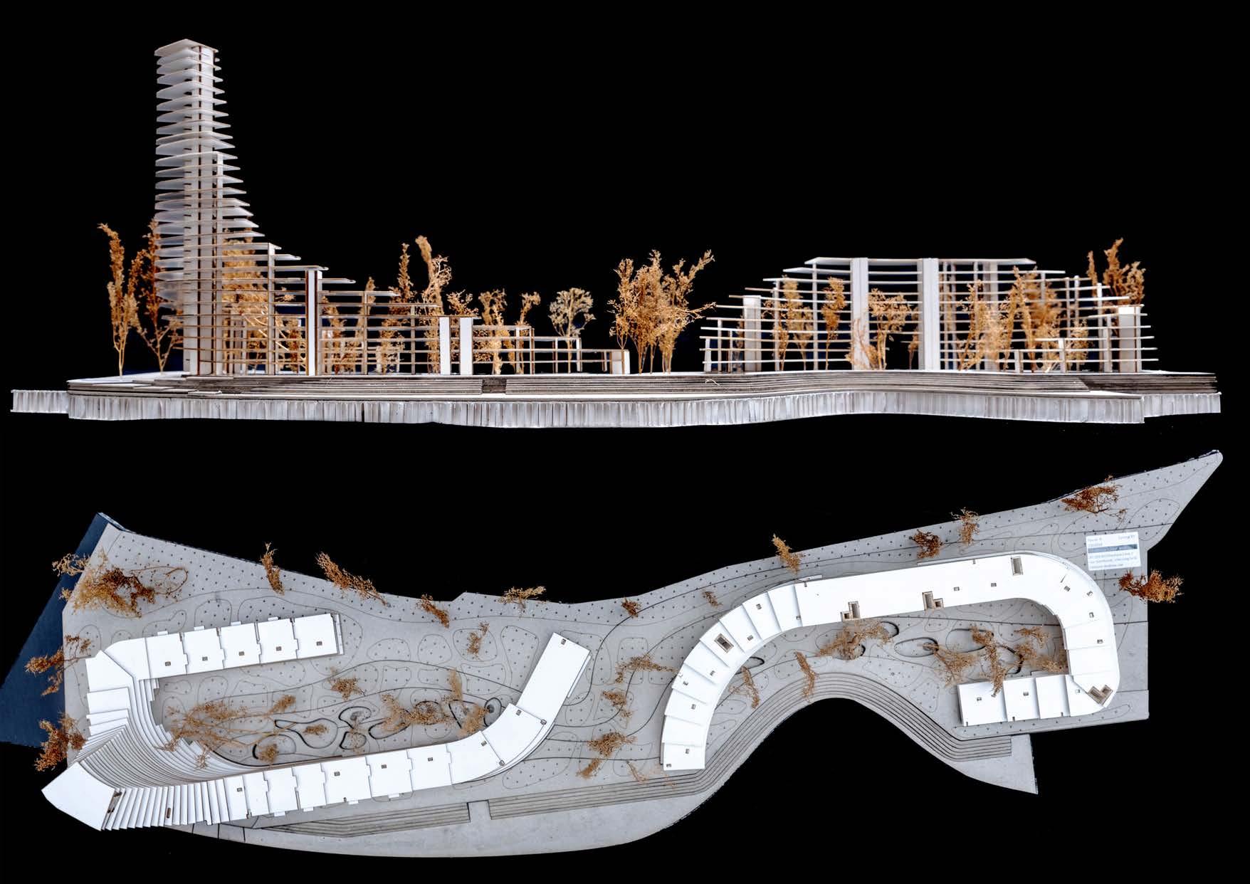
TURNING TIDES
discrete strategies for land at sea
Professor: Immanuel Koh
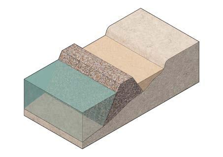
THE SCENARIO
coastal land parcel
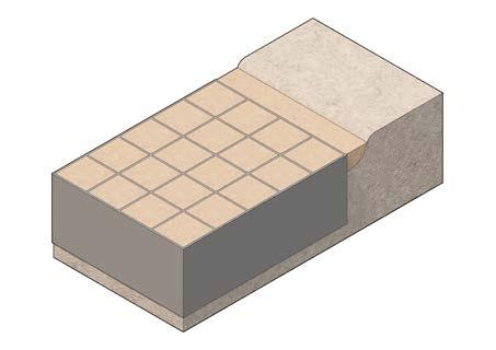
poldering
traditional Infill
deep cement mixing
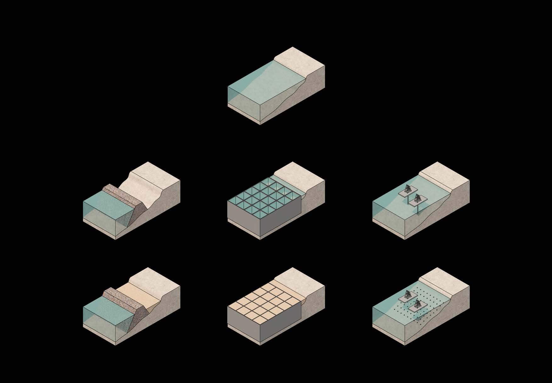
Less soil required
Lower construction cost
Less technologically-challenging
Lower maintenance cost
Less soil required
No leaching of toxic substances
deep
Higher flooding risk
Higher maintenance cost
Highly-energy dependent
Damage to seabed, marine life
Potential leaching of toxic substances
More soil required
Higher construction cost
Damage to seabed, marine life
Potential leaching of toxic substances
Limited feasible depth range
Higher construction cost
Require additional top-up or structure
Damage to seabed, marine life
poldering
traditional Infill
cement mixing
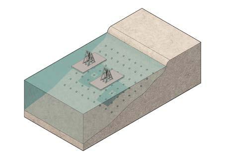
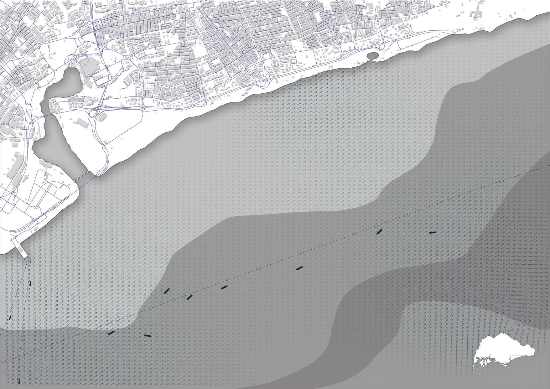
THE SITE
East Coast, Singapore
CURRENT VECTORS
COASTAL GEOMETRY
MARINE OBSTACLES
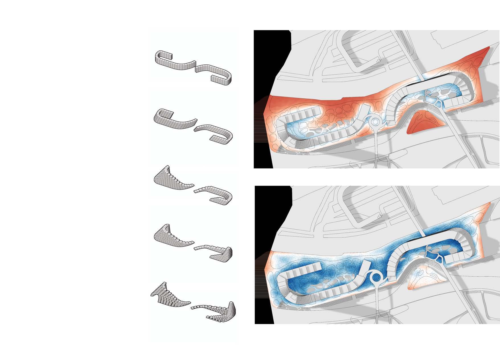
THE METHODOLOGY
Reinforcement Learning
Instead of the more common types of Machine Learning (Supervised or Unsupervised Learning), Turning Tides employs Reinforcement Learning (RL) to inform the architectural form. It involves training agents to make decisions from a trial-anderror approach, learning the best decision at each step.
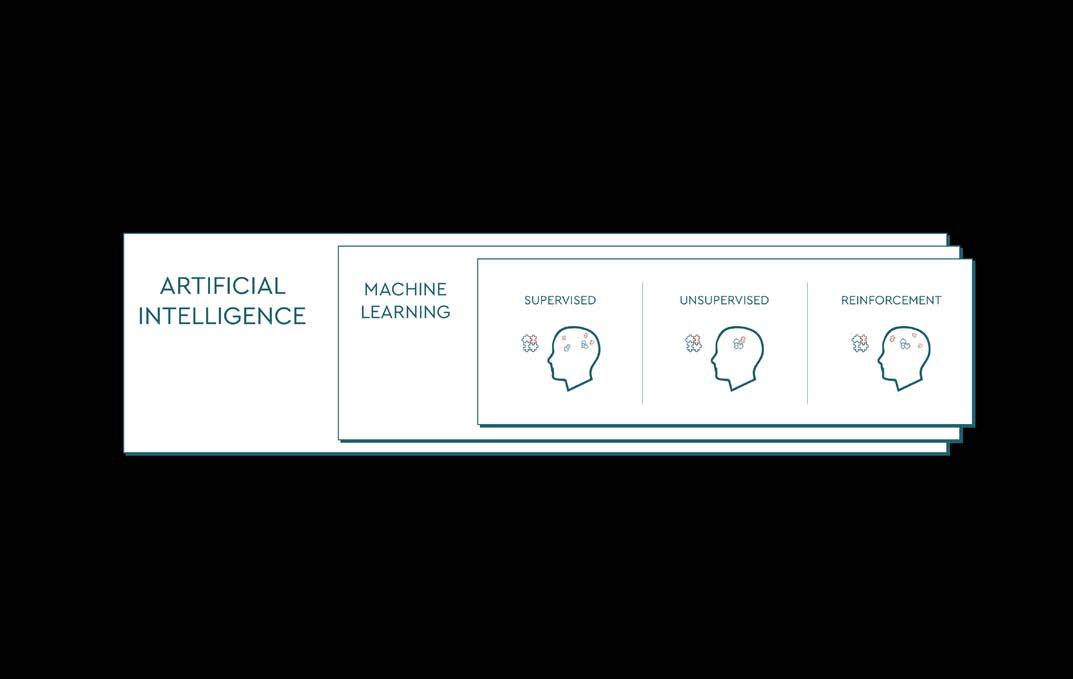
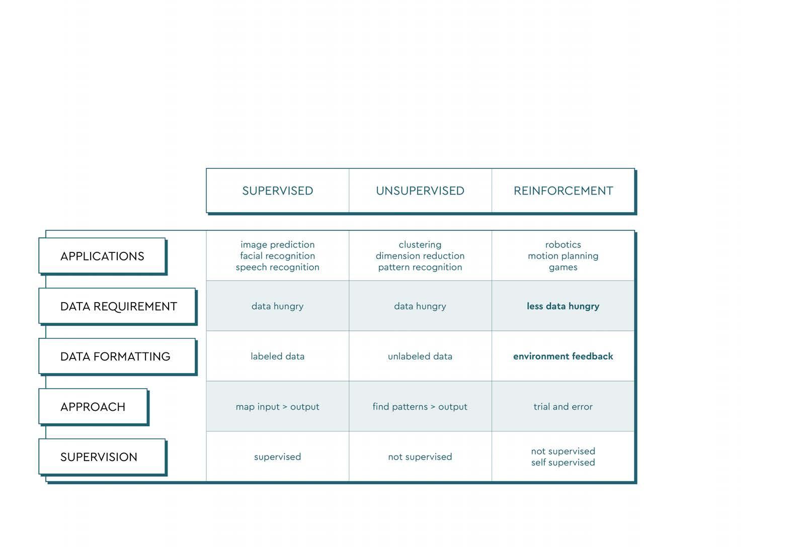
This makes RL better suited for tasks where the environment is dynamic and initially unfamiliar.


The agent(s) are placed in a user-defined environment and each decision made results in a reward or punishment, depending on whether the decision brings the agent closer to a pre-defined goal or not.
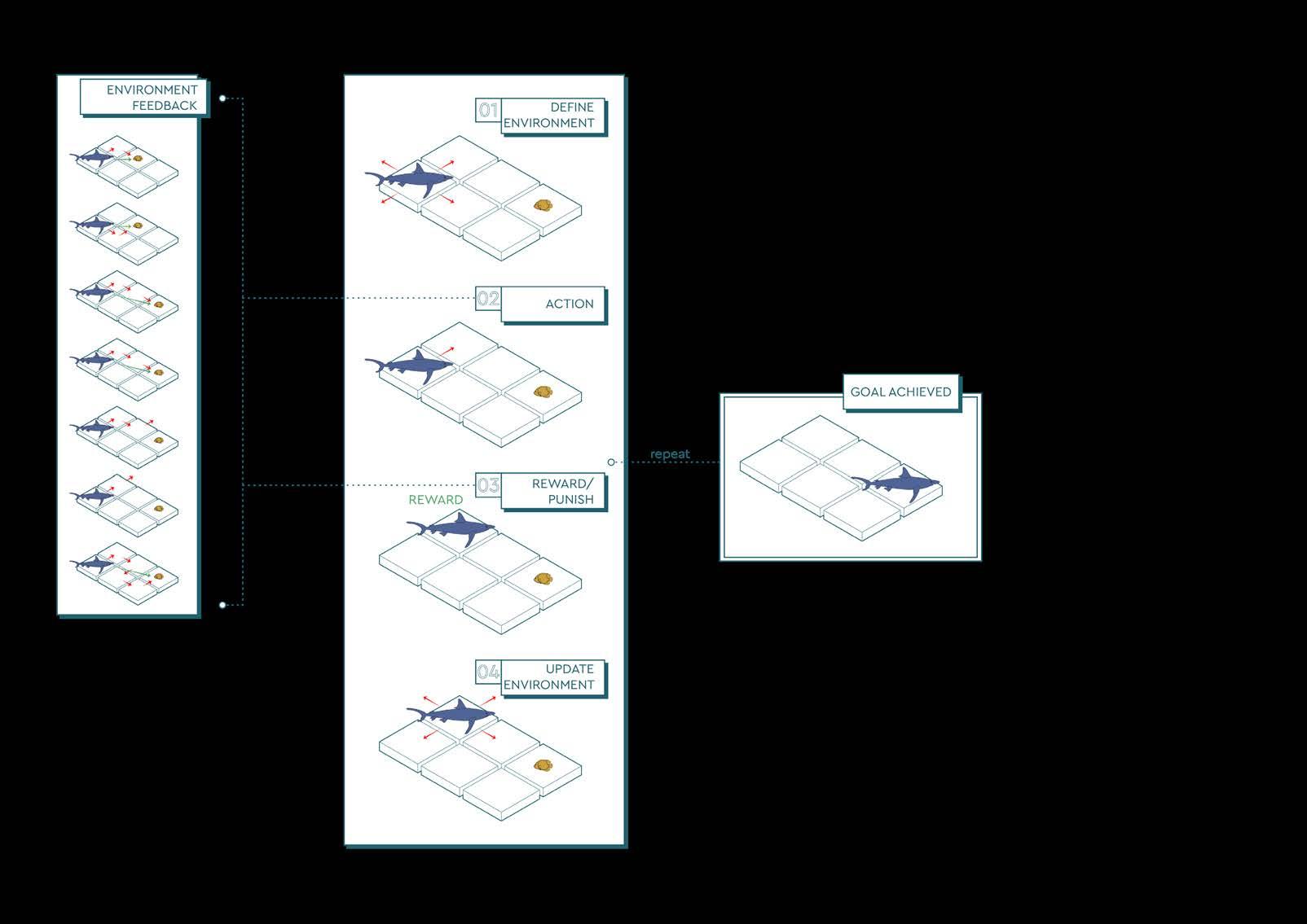
This prompts the agent to make decisions that bring greater cumulative rewards. The strategy employed by the agent is called the policy and they govern the interactions between the agent and the environment.
THE SYSTEM
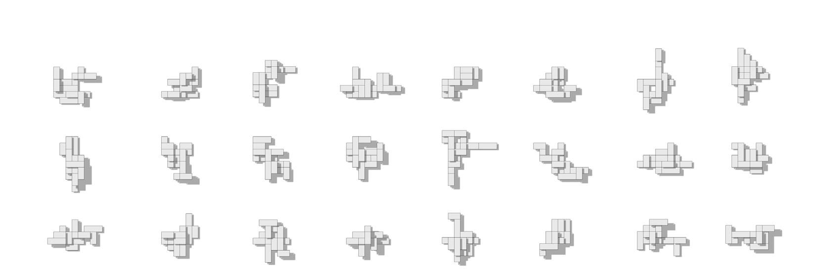
This thesis will frame the aggregation of floating modules as a discrete problem instead of a continuous one. The list of permissible actions is clearly defined instead of comprising vectors and rotations of variable magnitude and direction. Besides computationally simplifying the task, it also accurately represents the intended application of it.
Continuous Action Space: Variable range of actions
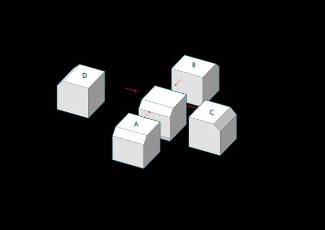
Initial tests: Aggregating along a guide path

In the case of this project, the floating modules are to be joined together at fixed distances and the action space can be clearly defined as a multi-discrete system.
A multi-discrete system features multiple decision trees where a discrete choice has to be made at each layer. The first step is choosing whether the next module added is a Square, Triangle or a Vertical. Secondly the module must be appended in a certain position, either to the left, the right or the front of the previous module. Lastly. the rotation of the module is decided. Each of these steps feature a unique action space, but they can all be described as discrete actions.
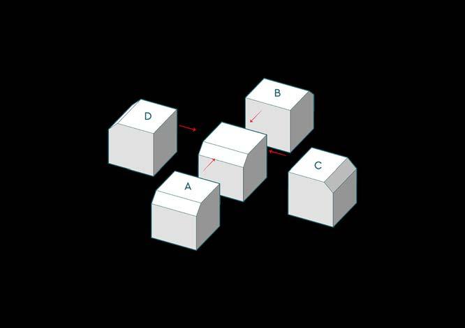
Discrete Action Space: Fixed range and set of actions
RL Workflow and tools at each junction
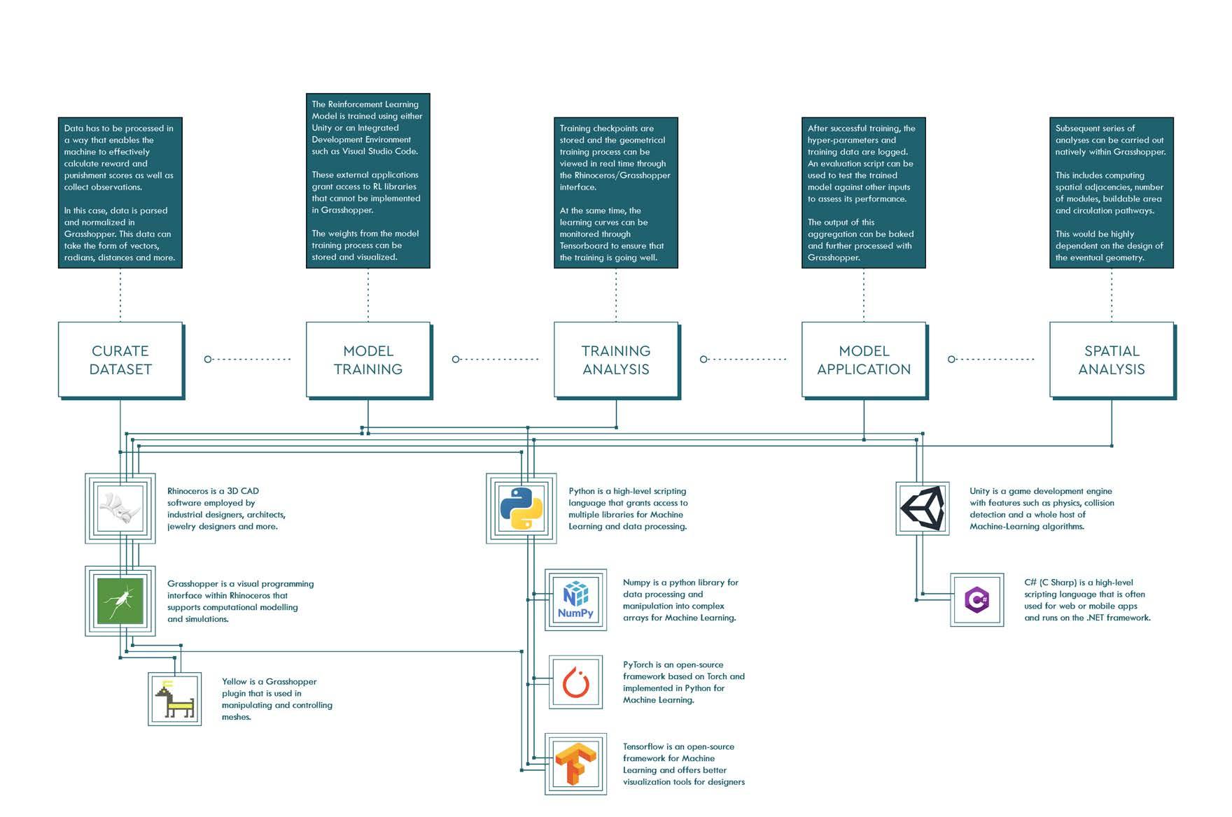
Currently, implementing RL in an architectural context is not straightforward. As there is no method to natively employ RL in standard architecture software, data has to be streamed between Grasshopper and other programmes or coding libraries capable of running it.
THE SYSTEM
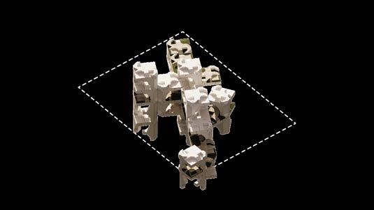
Aggregation phasing

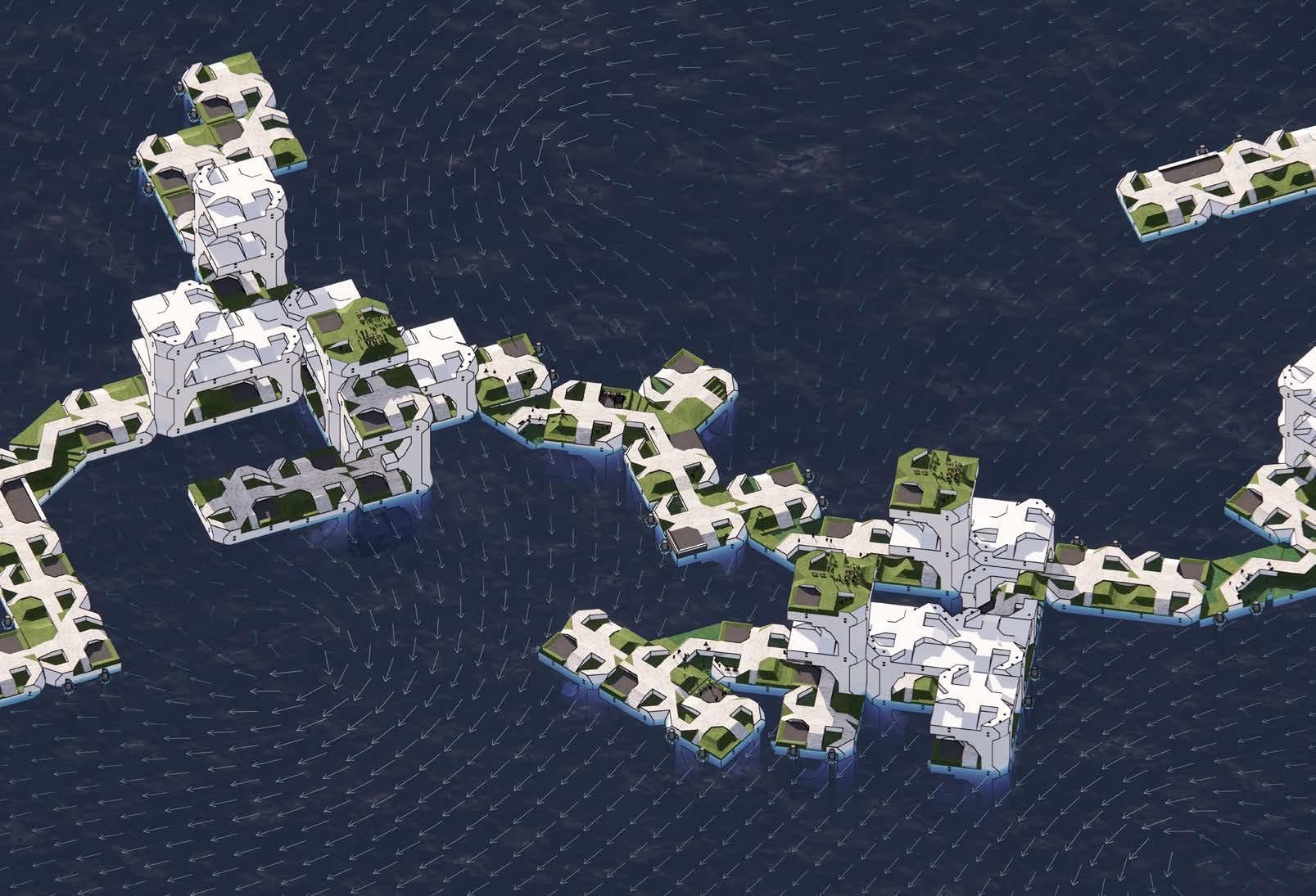
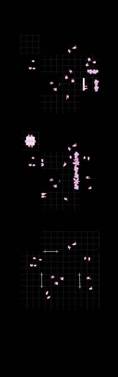
The aggregation process begins with coastline analysis. Potential segments of coastline are identified for development, while local sea surface currents are analysed to search for ideal locations to build infrastructure.
The construction hierarchy between these clusters of modules are determined by local and global proximity, searching for the optimal feasible path.
Finally, clusters branch out as modules are added, forming feasible connections to the coast and to each other.
Module concept diagrams
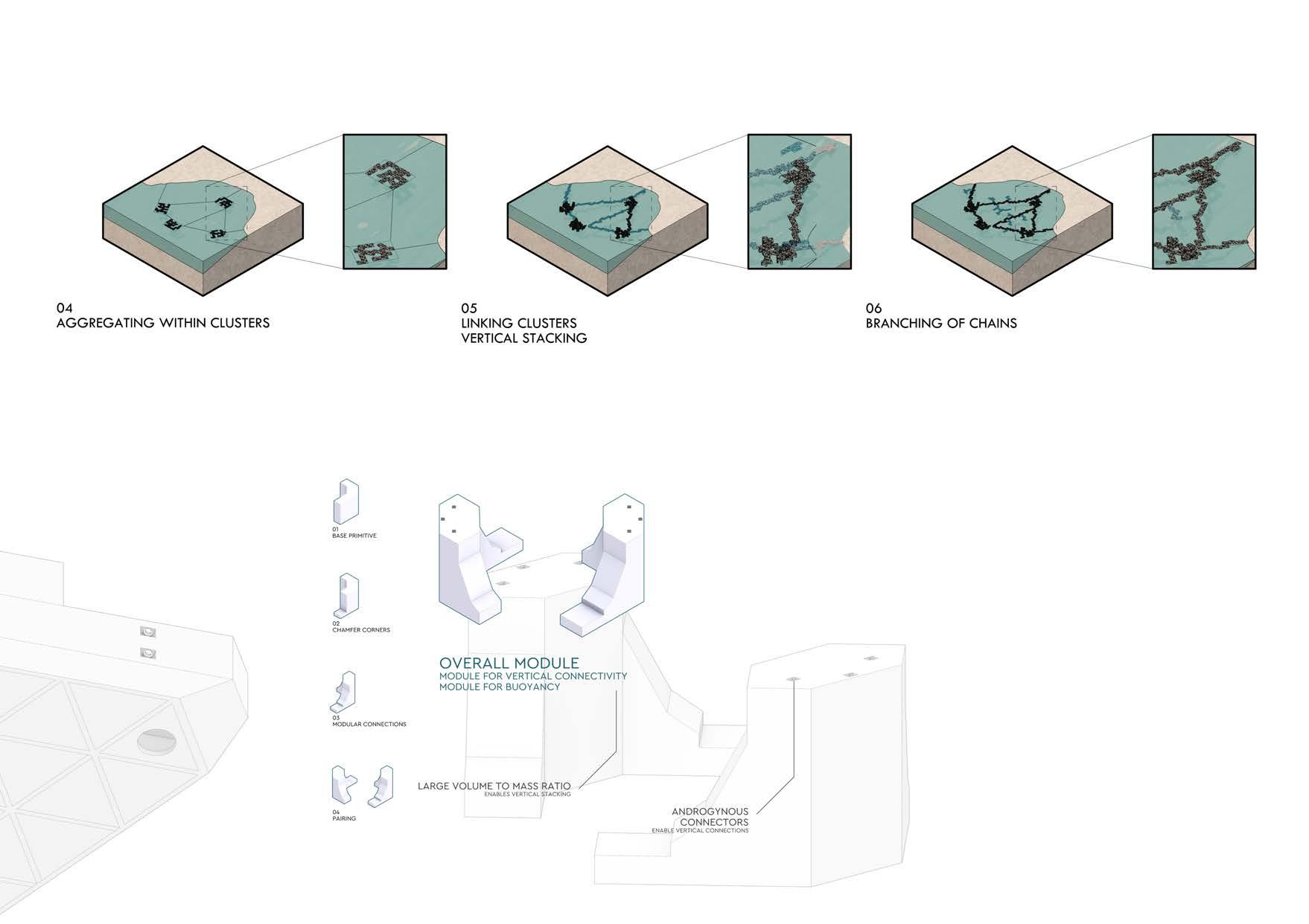
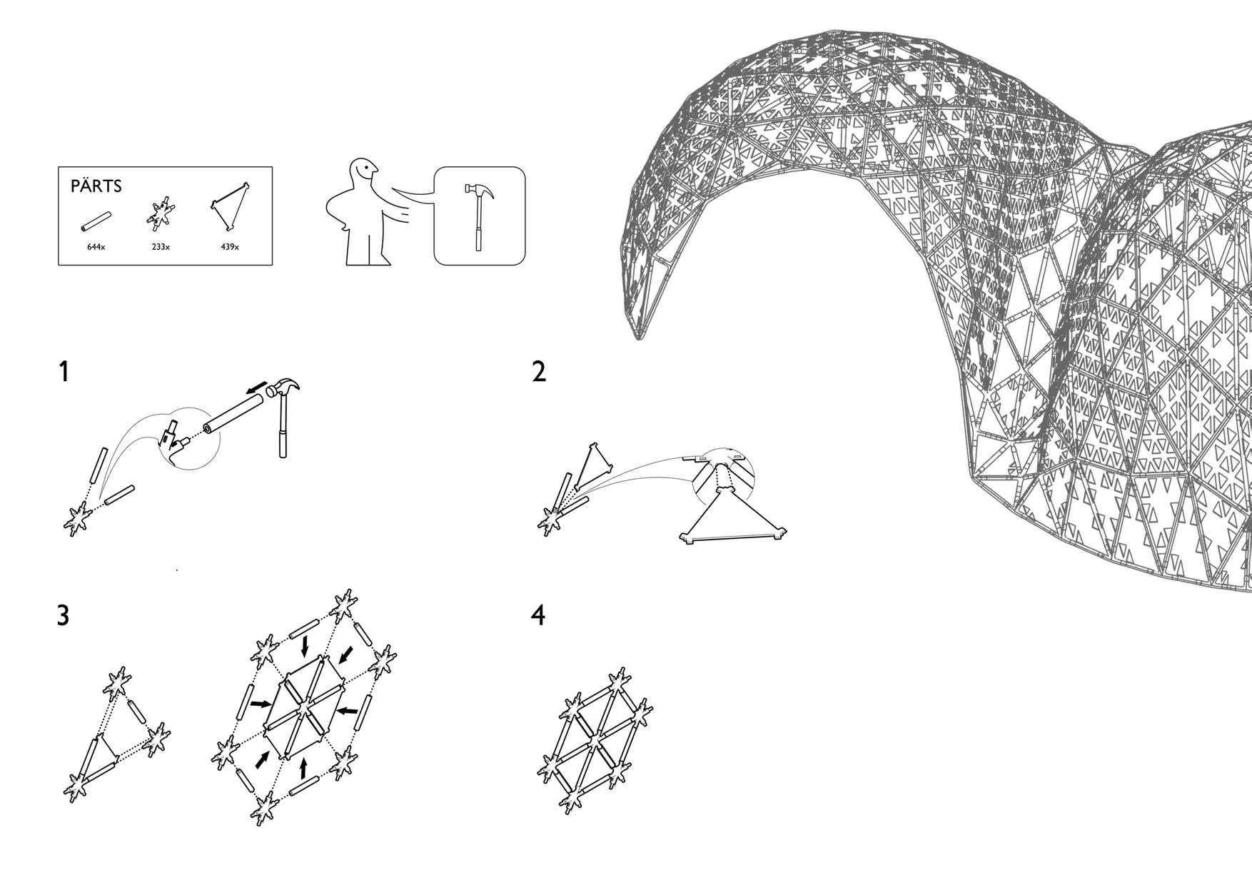
KIT OF ACTIONS
SQUARE-SQUARE TRIANGLE-TRIANGLE


SQUARE-TRIANGLE SQUARE-VERTICAL VERTICAL-VERTICAL
Potential permutations and combinations of two modules
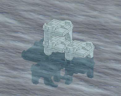
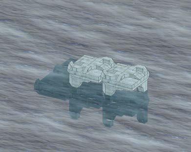
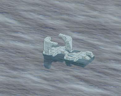
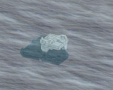
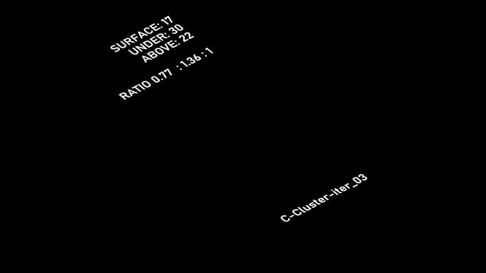
The robustness of the system allows for a mere 3 modules to give rise to 34 possible actions of aggregating 2 parts together.
With a constrained set of modules, construction feasibility is also improved and the system is more scalable.
This kit of actions serves as the underlying basis for how adequate land can be created with differentiated programming.
THE SYSTEM
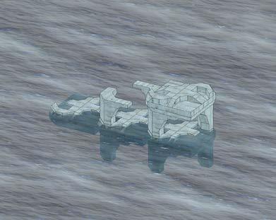
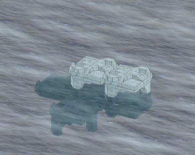
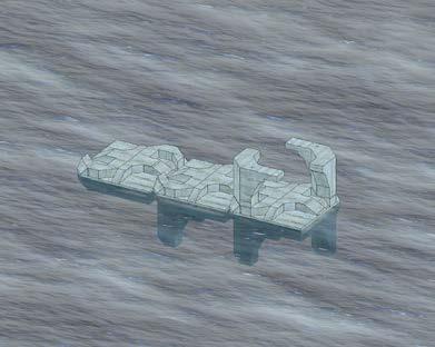
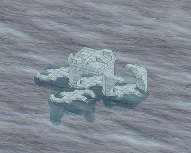
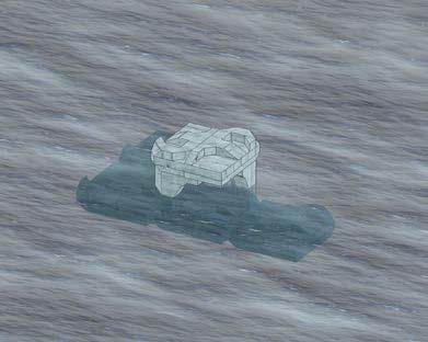
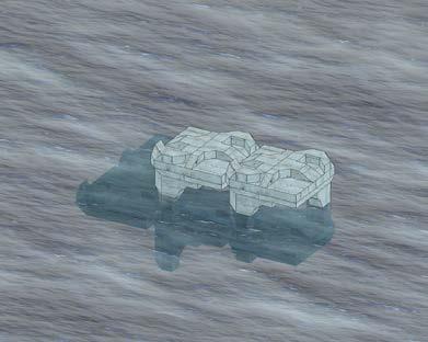
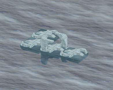
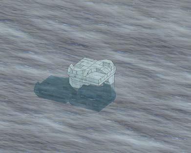
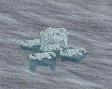
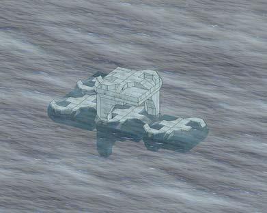
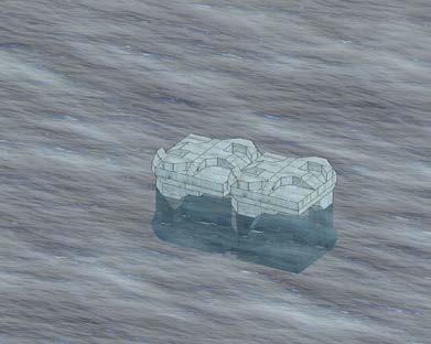

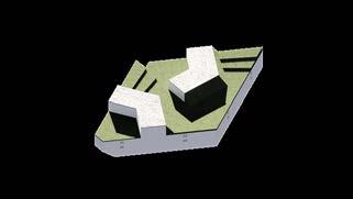
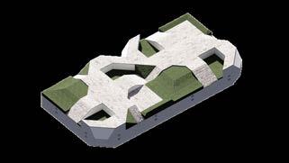
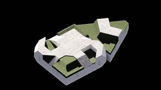
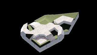
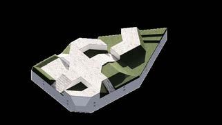
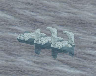
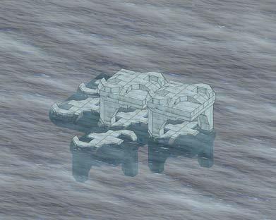
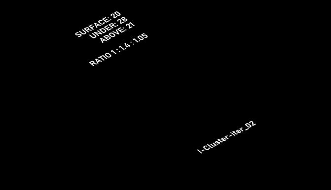
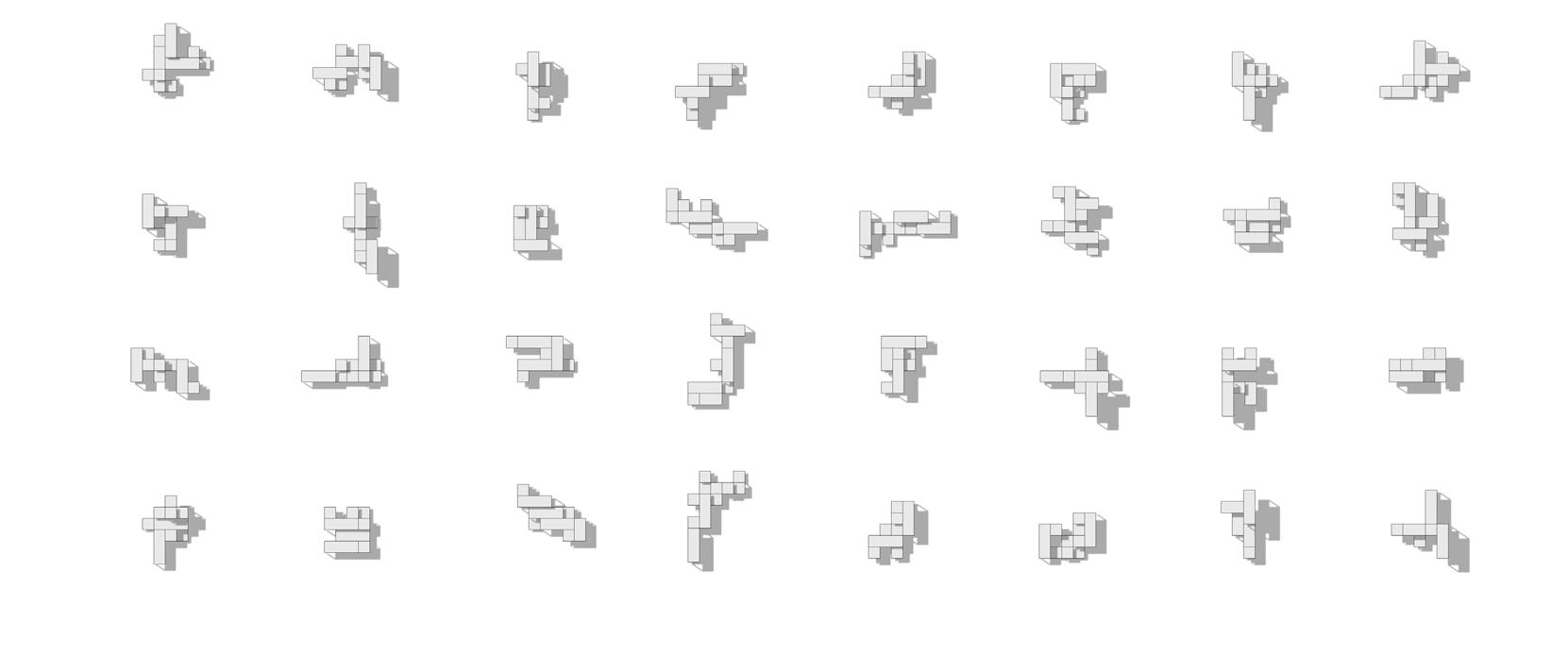
To be a feasible floating system, buoyancy simulations had to be conducted. A few potential aggregations were put together to explore their resting states and determine if their main land parcels would be mostly submerged, floating or a mixture of the two.
The specific material composition and geometry of each module contributes to different individual buoyancies that would not be easily determined without the use of a simulation.
As the level of submerged-ness of the clusters is linked to the programming, the number of each module as well as the placement is crucial.
Aggregation buoyancy studies
THE SYSTEM
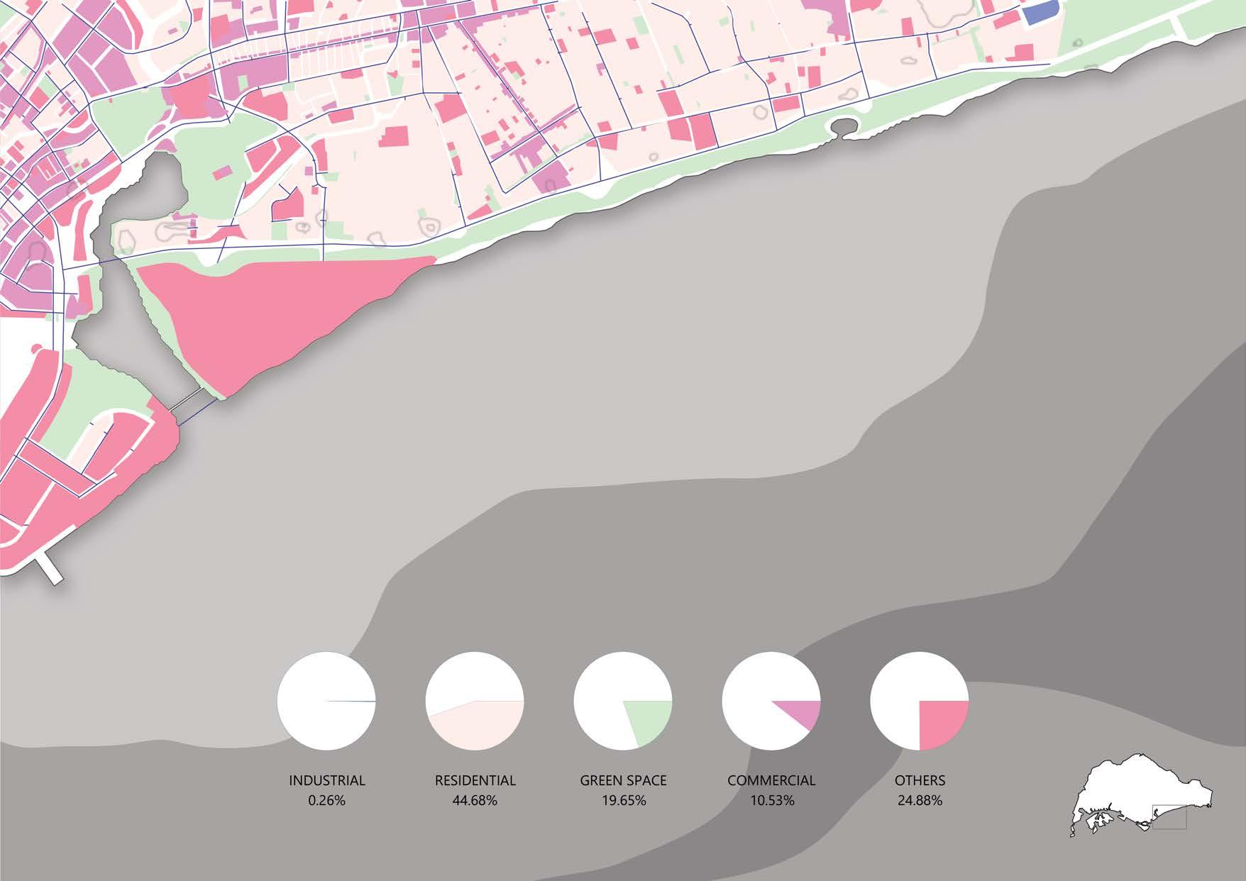
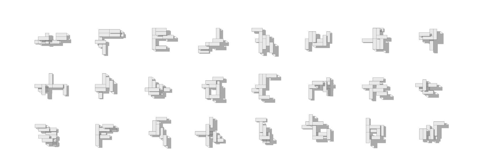
programme_”COMMERCIAL” programme_”INDUSTRIAL” programme_”GREEN”


programme_”OTHERS” programme_”RESIDENTIAL”
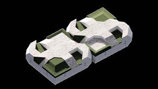
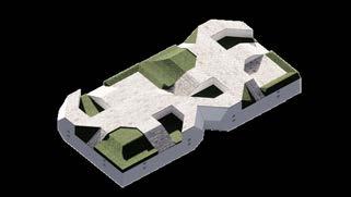
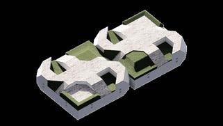
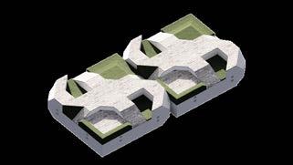
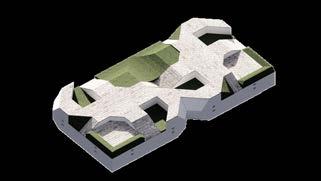
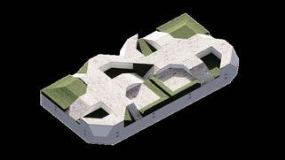
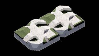
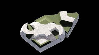
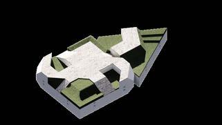
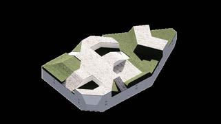
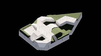
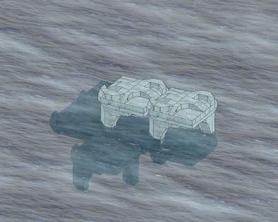
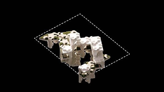
Modules are aggregated into larger clusters, depending on the site programming. These clusters can fulfil Commercial , Industrial , Green , Residential or Other needs.
More modules below surface-level contribute to increased buoyancy for heavy programmes, while more modules above surface level are opportune for high density developments.
Modules along the surface level help to increase the span of the cluster and confer stability.
Programme-influenced cluster aggregations


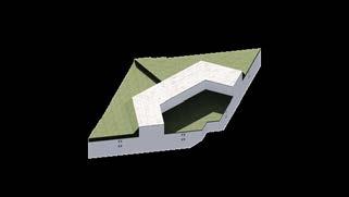
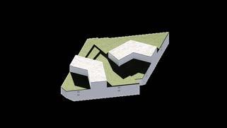
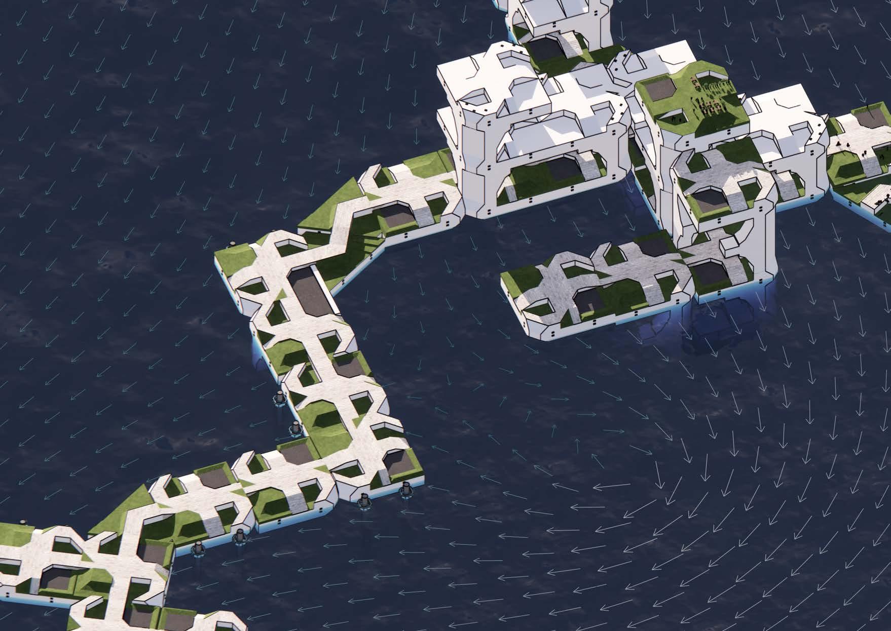 ROOFTOP GARDEN MINI LAGOON
WATERFRONT SEATING ROOFTOP GARDEN
COMBINED LAGOON
PADDLE
POP the future of offices
Professor: Kenneth Tracy
Groupmates: Nicholas Lim
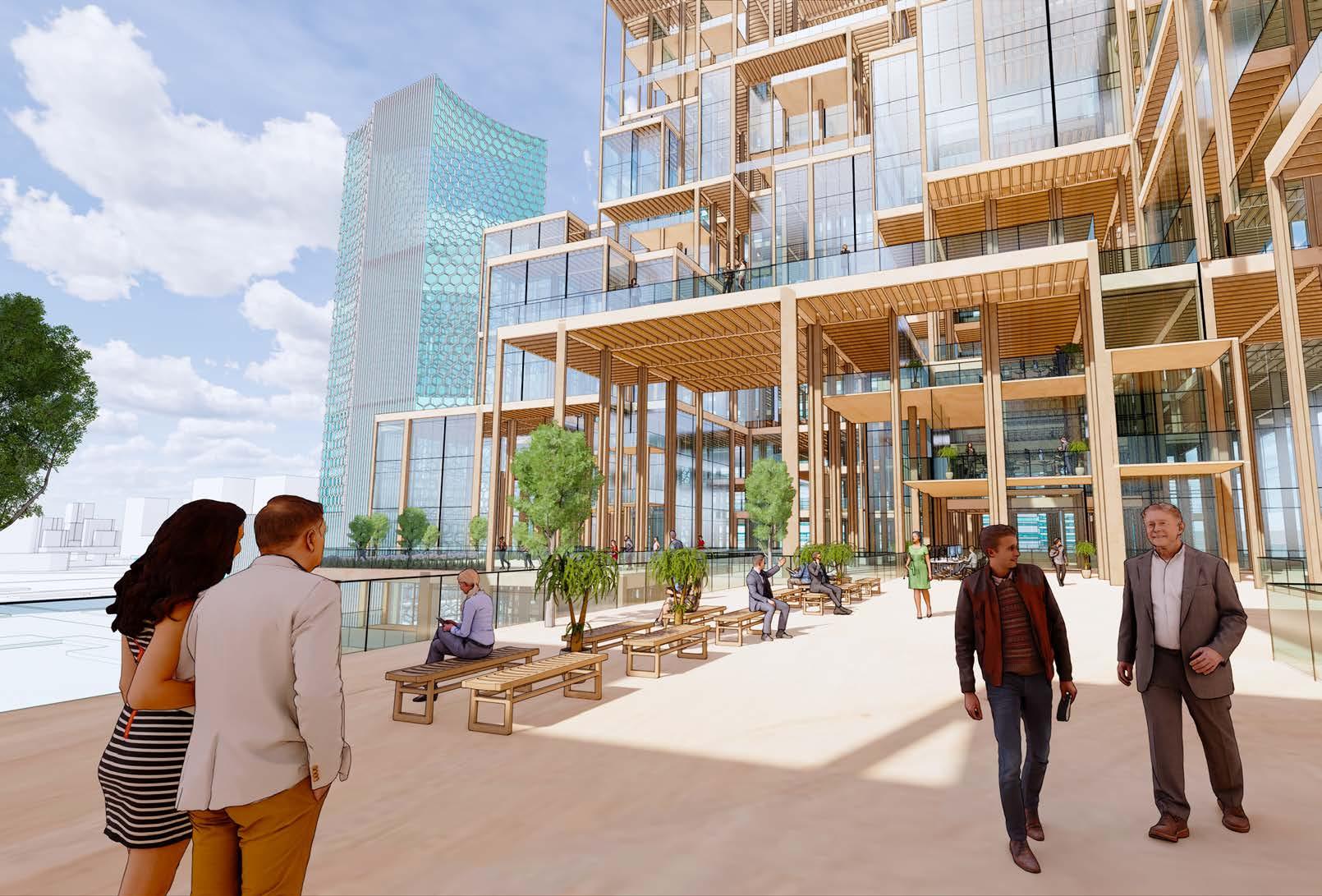
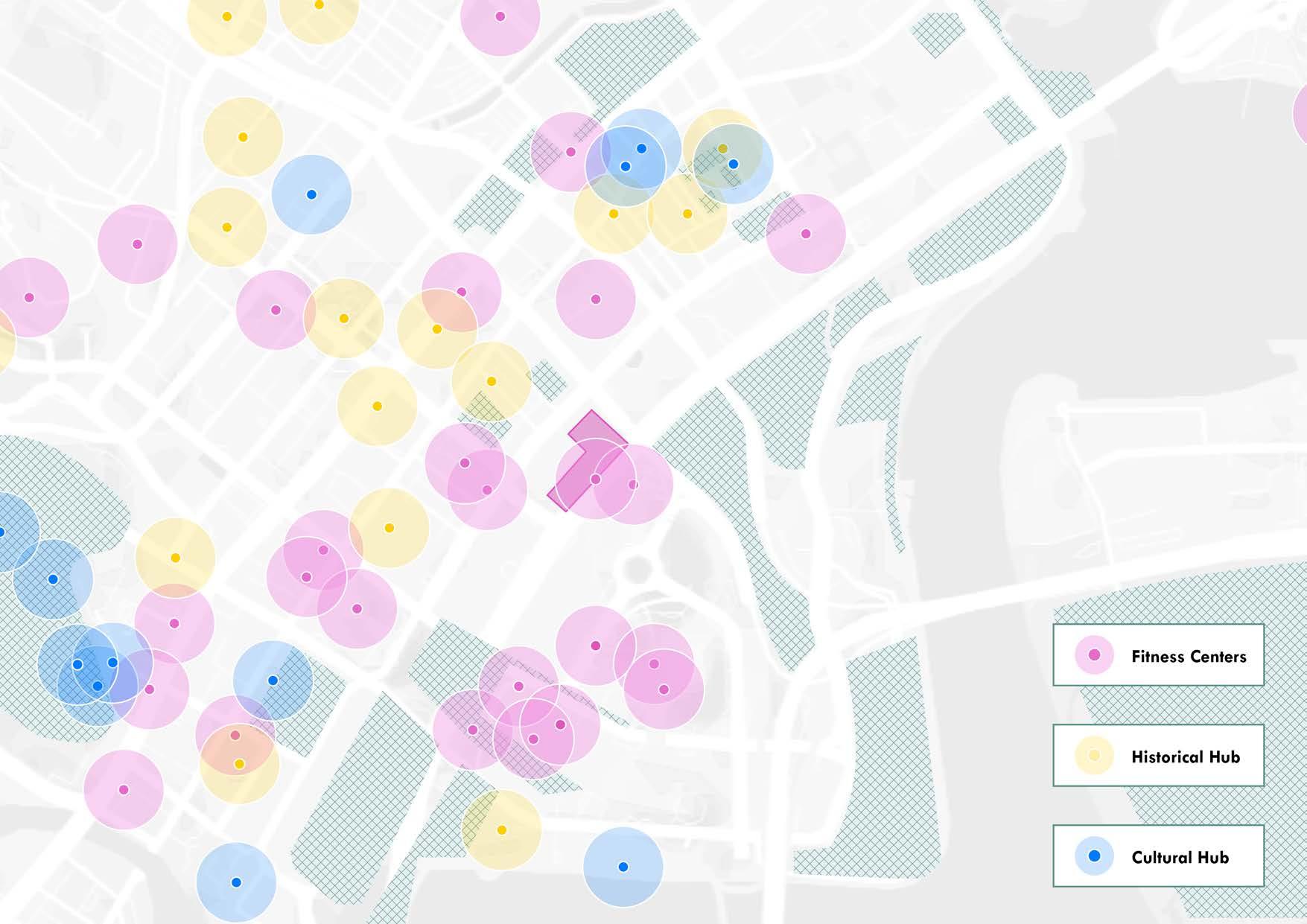
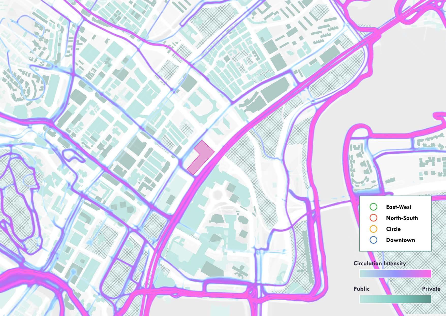
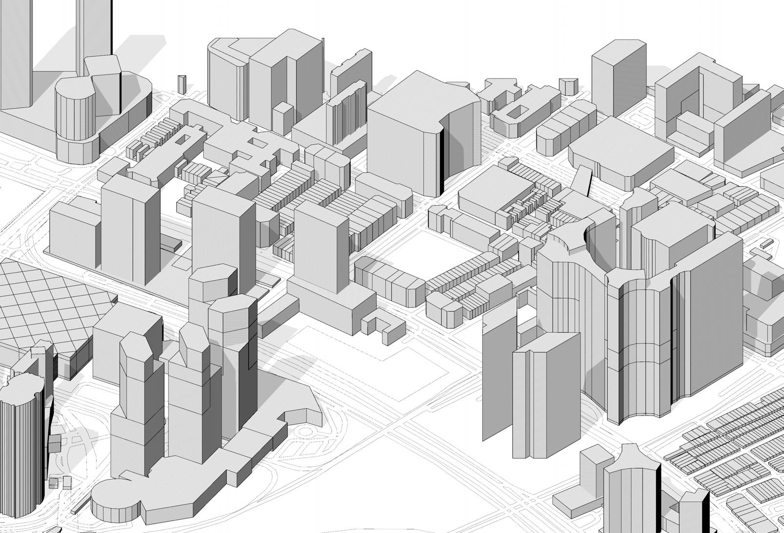
THE SITE
Bugis, Singapore
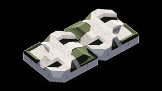
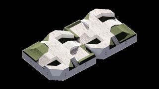
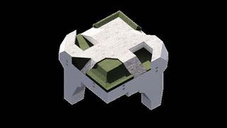
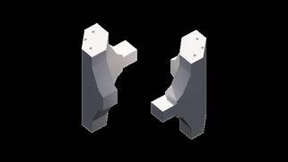
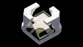
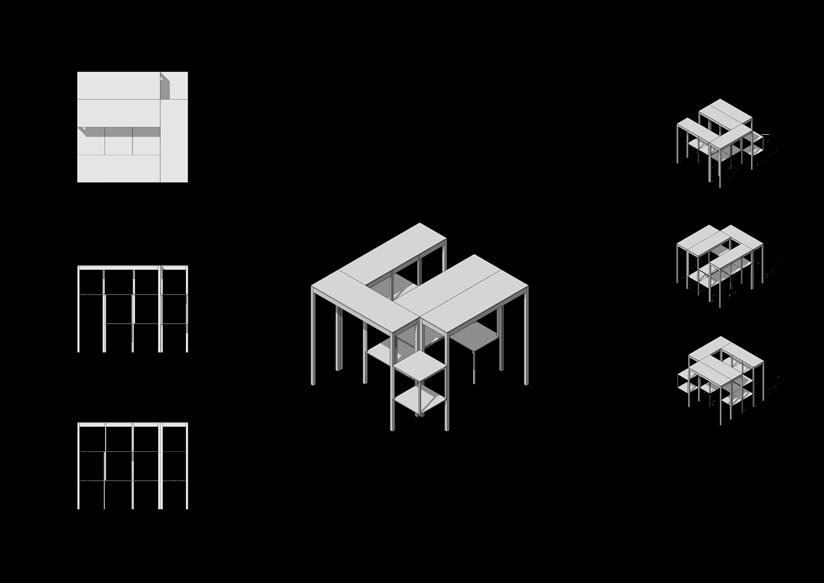
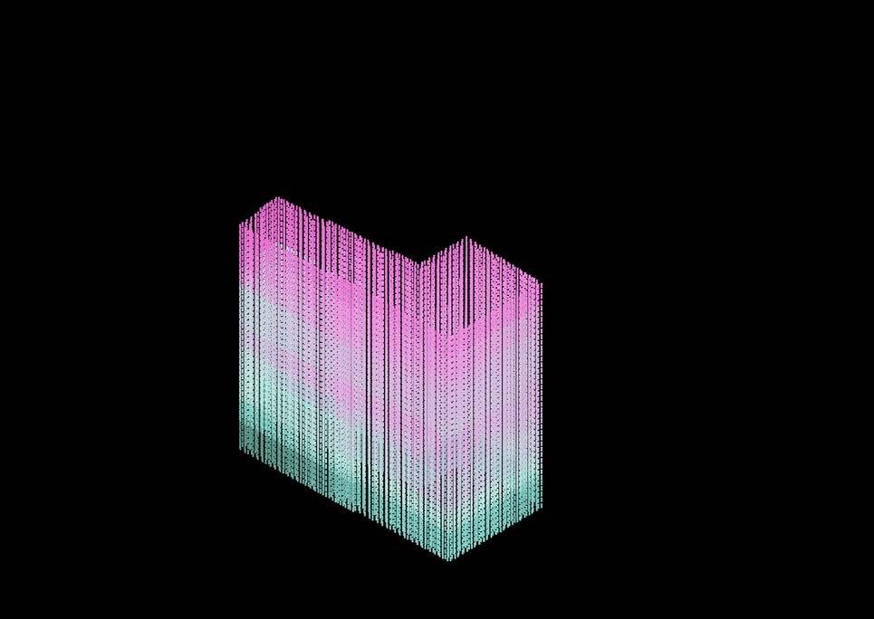
THE SYSTEM

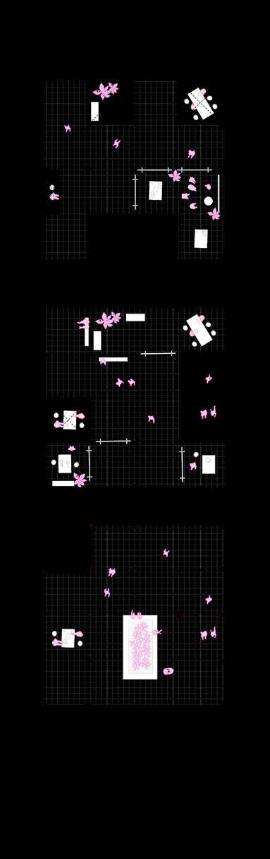
Base modules for programmatic clusters
Column aggregations determined by floor heights
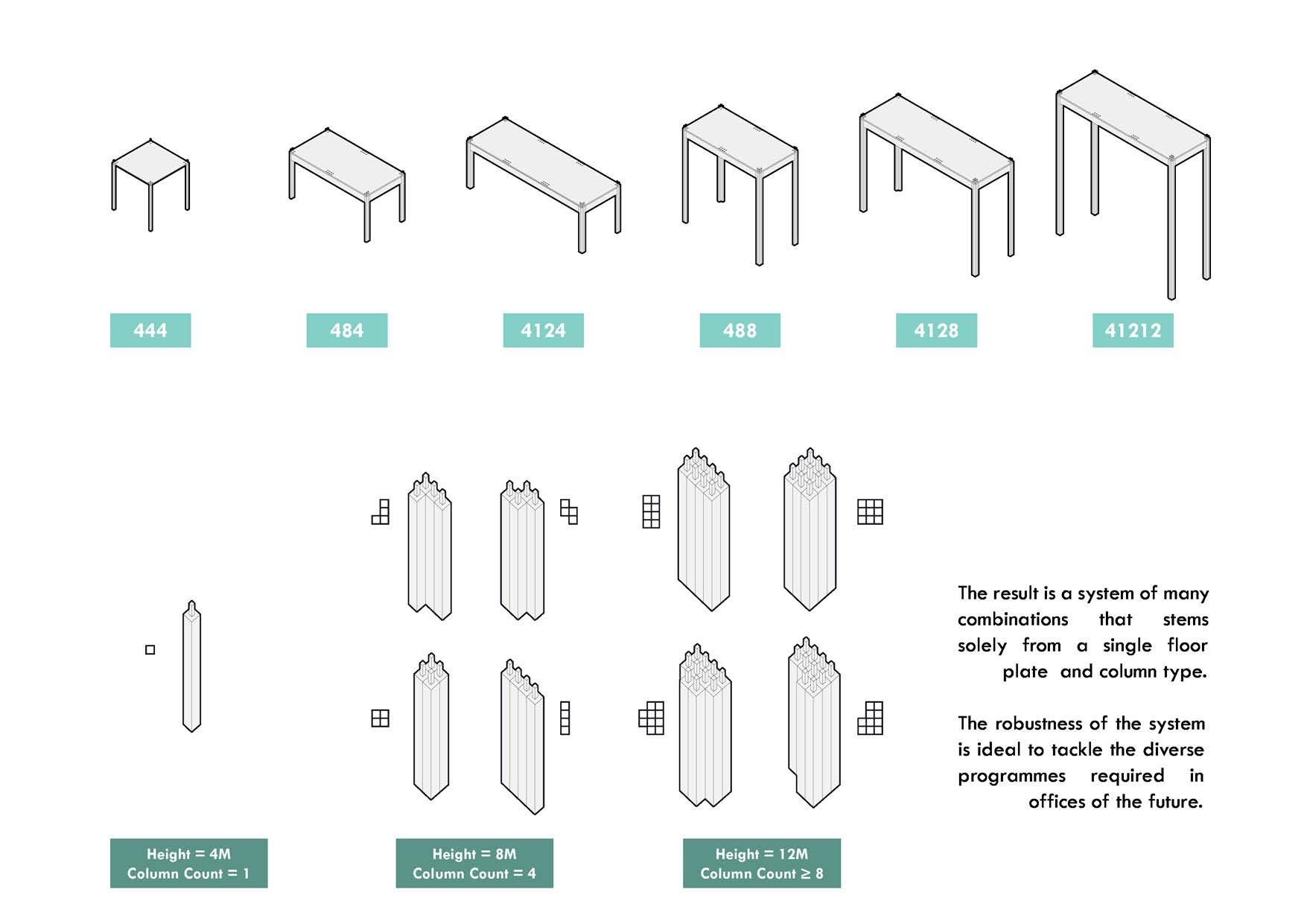
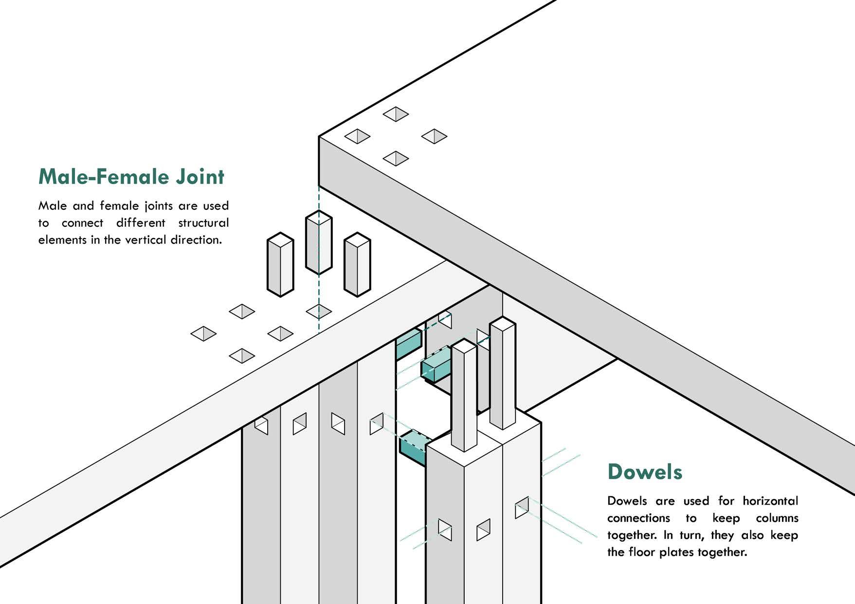
Joint system
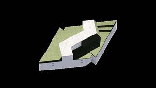
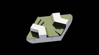
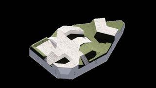
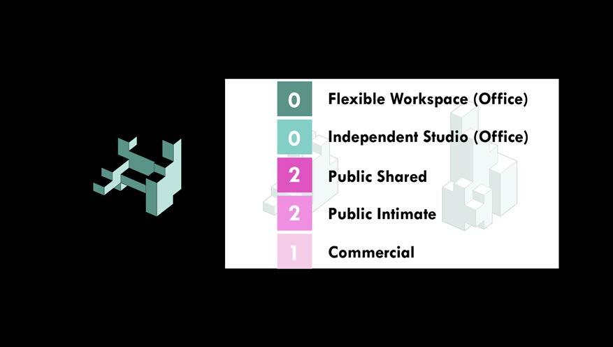
CLUSTER STRATEGY
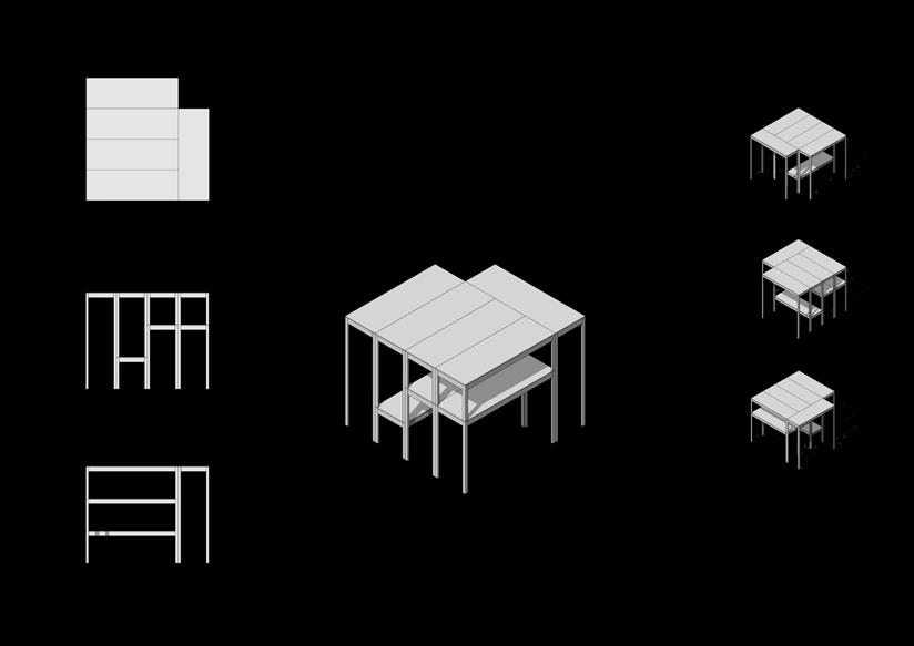

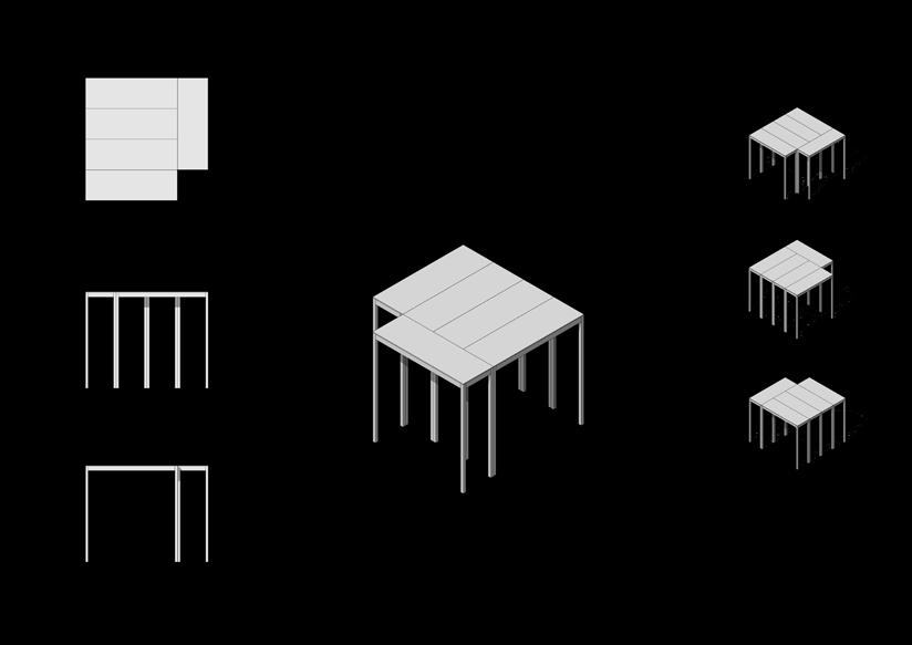
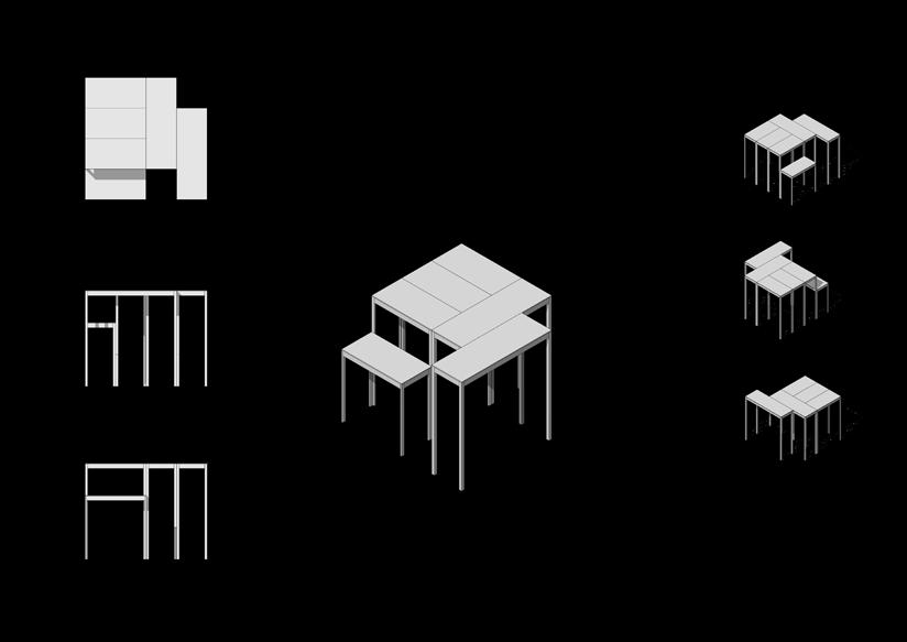
Sectional qualities of each cluster
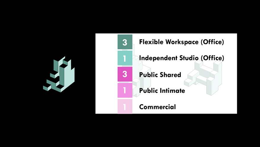
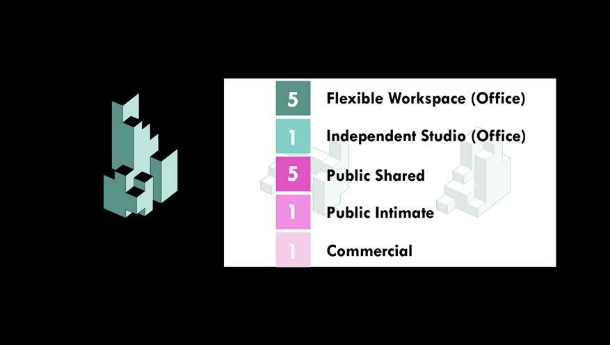
FIRST TYPOLOGY: OFFICE
In the new office, the boundary between work space, and public activity place is gradually broken. The office space gets rid of the parallel group working system. Different individuals and communities could choose and seek special spaces and organize their own work life personally.
SECOND TYPOLOGY: FITNESS
Health and fitness has shifted from an auxiliary aspect of lives to one at the forefront of urban living. The increasing awareness of self-care: both mentally and physically has spurred an increase in fitness activities in our lifestyles.
GRID AS A CUSTOMIZED UNIT
Based on the user-oriented environment, a flexible structure is needed for personalized customization. The grid provides a free choice of lattice space.
The modules of the system stem from a 4x4m grid. Several modules composed together are treated as a cluster. These clusters can be freely connected to each other, and they are in a state of free distribution on site. Customized points provide more possibilities for multiple choices, while different combination of clusters enhance the publicity and diversity of the building.
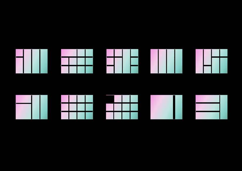 Programmatic clusters
MASSING STRATEGY


OFFSET
EXTRUDE
SPLIT
for site setback
to tower height
for key circulation SLICE for eastern sun
PODIUM concentrate public space


 PINCH for views
VOXELIZE for aggregation
VOIDS for lighting
Massing concept operations
PINCH for views
VOXELIZE for aggregation
VOIDS for lighting
Massing concept operations
MASSING STRATEGY

Low View Area High View Area Isovists by level
MASSING STRATEGY
Distribution of programmes in each part of massing
Short section

 TALL TOWER
BRIDGE
SHORT TOWER
TALL TOWER
BRIDGE
SHORT TOWER
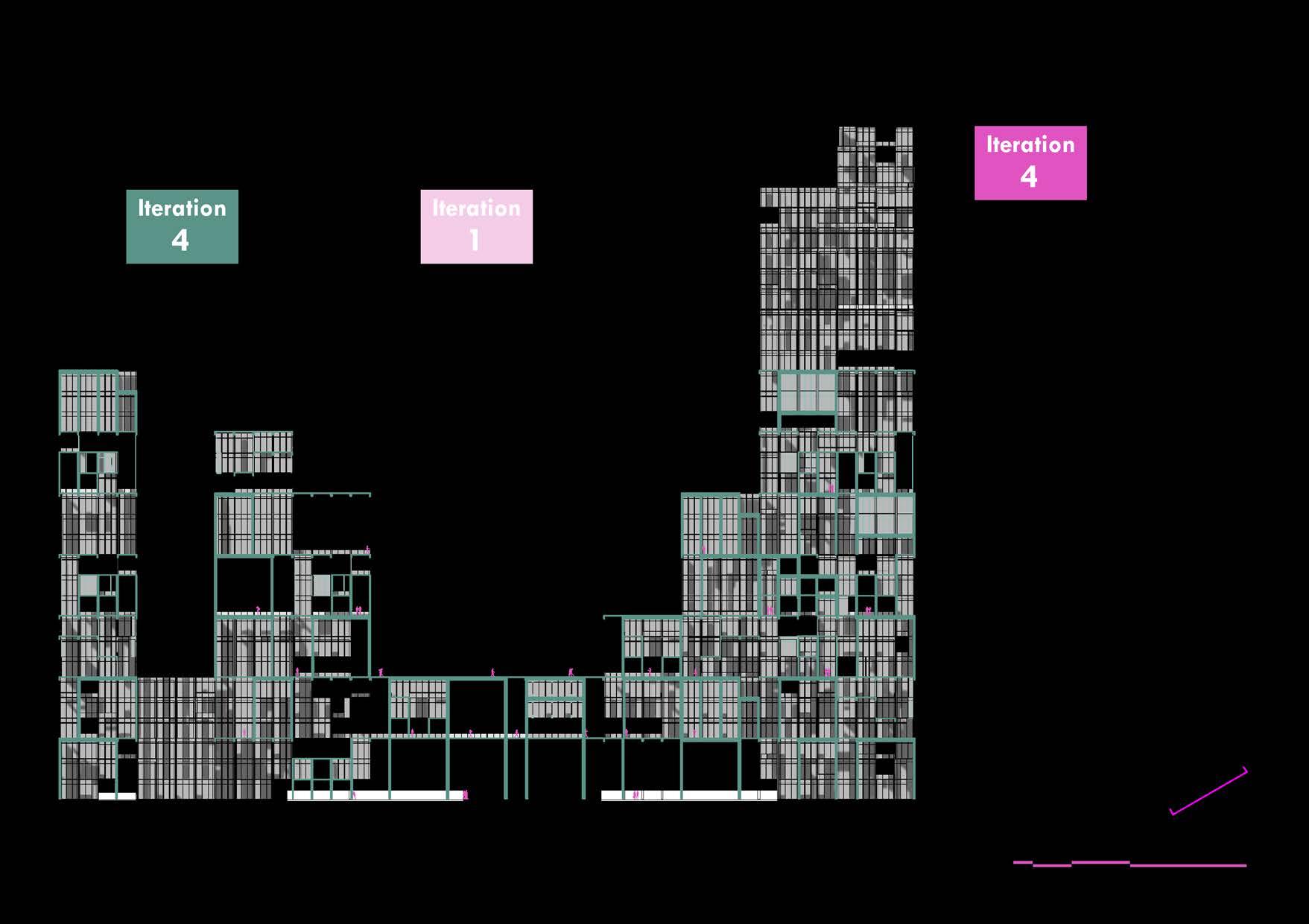
Long section
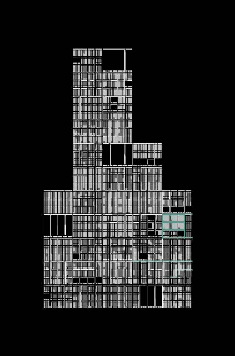
CLUSTER AND BUILDING PLANS
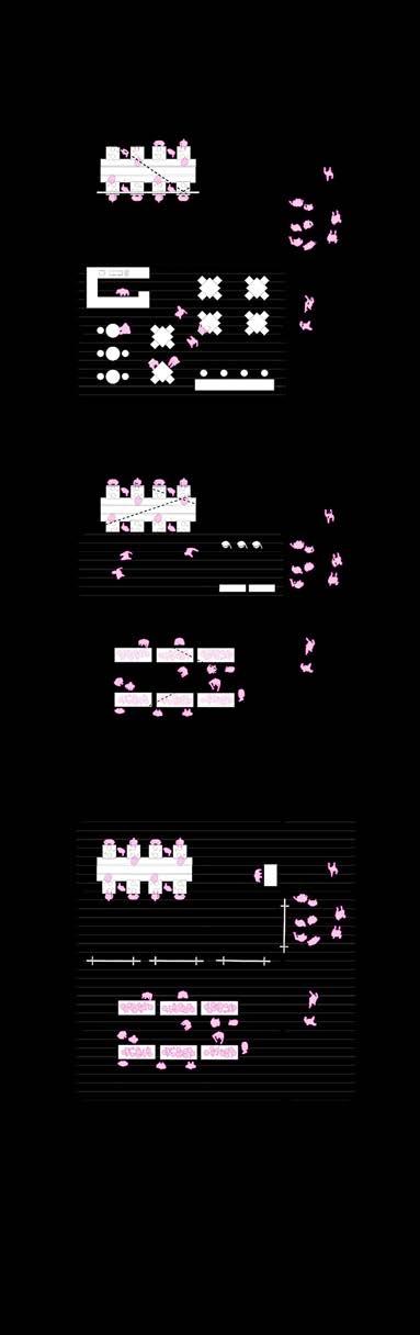
Cluster plans
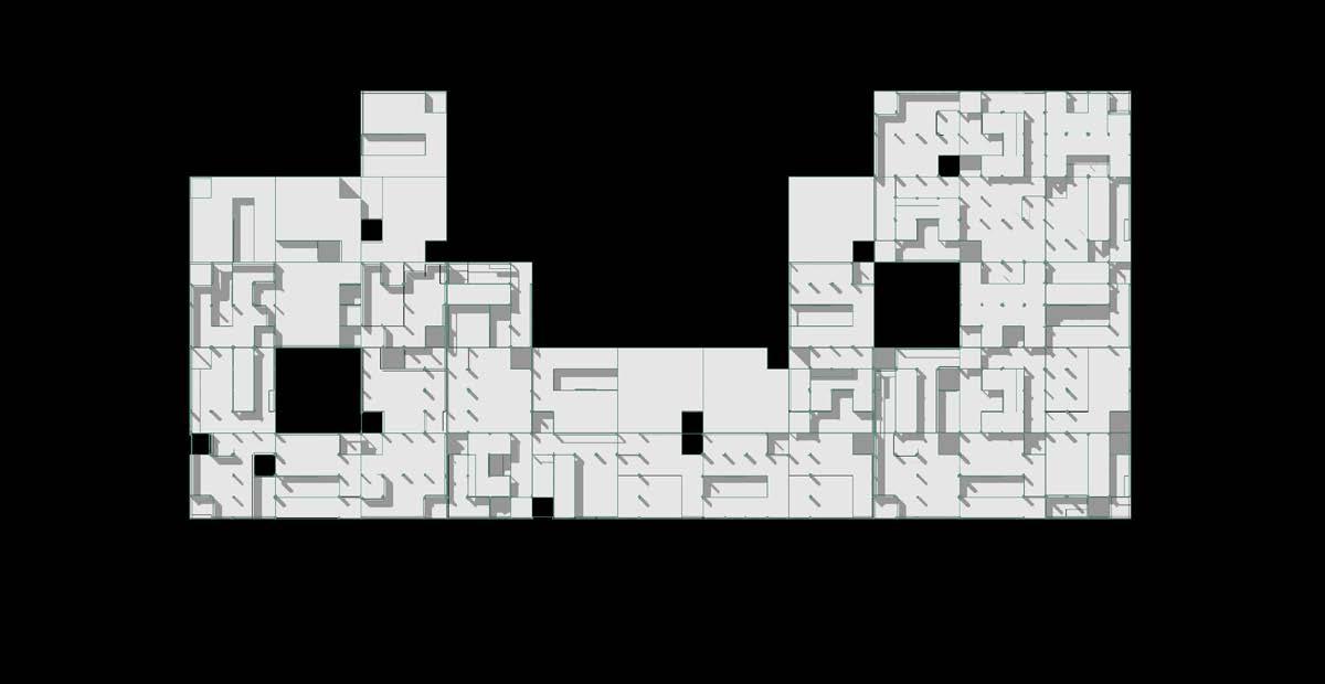
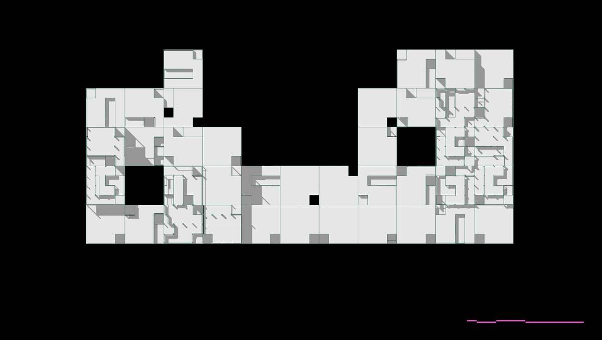
Massing plans
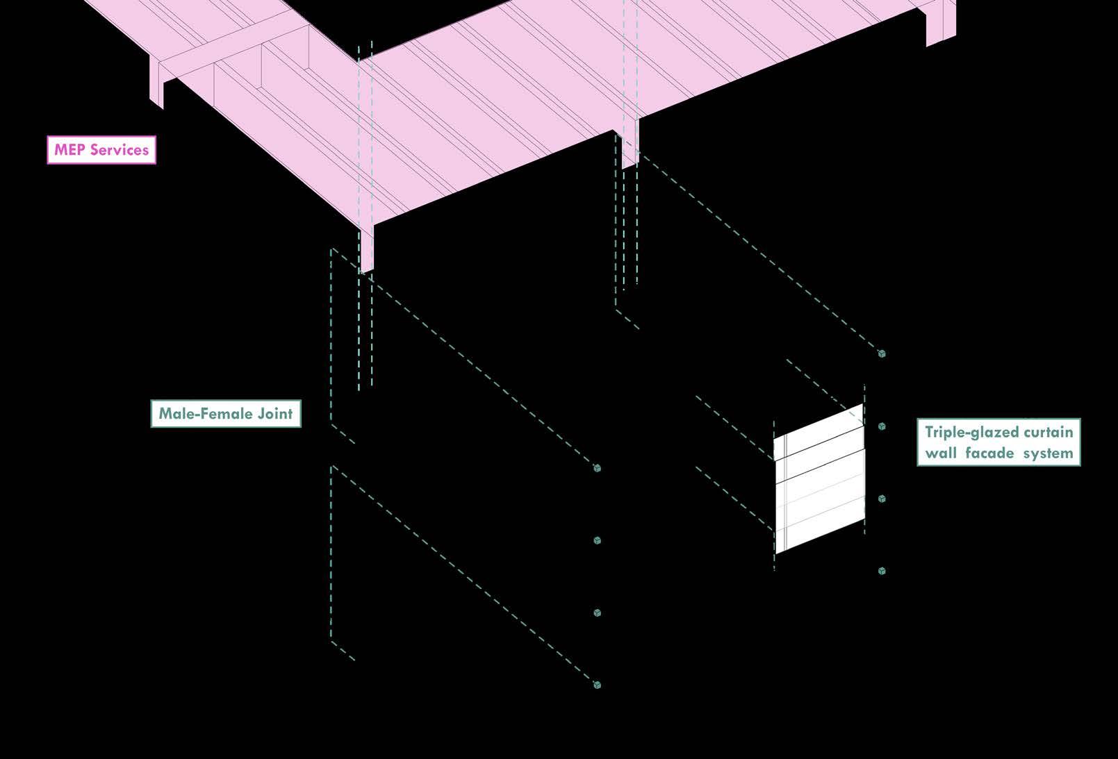
FACADE SYSTEMS
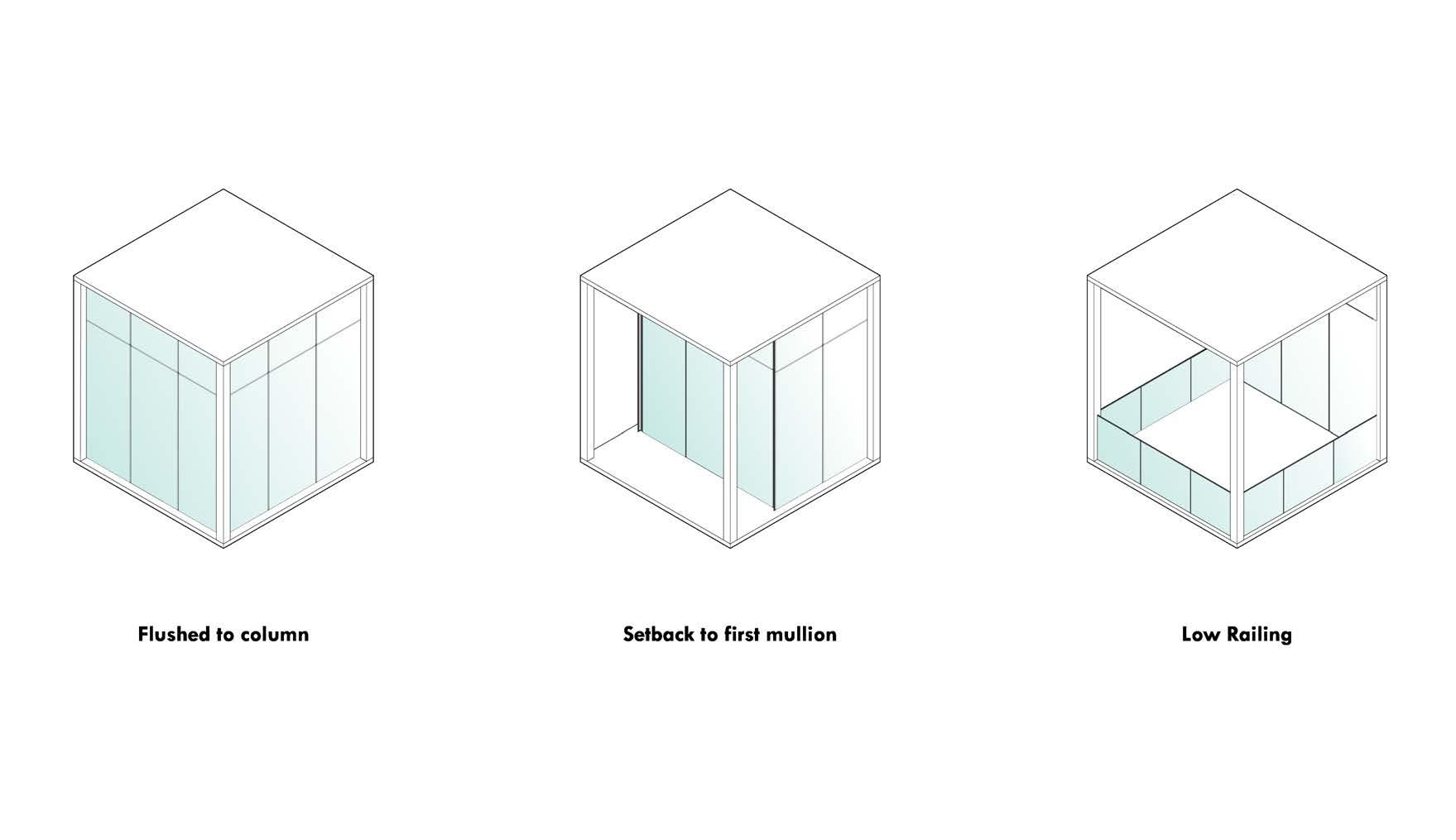
Type 01 Type 02 Type 03
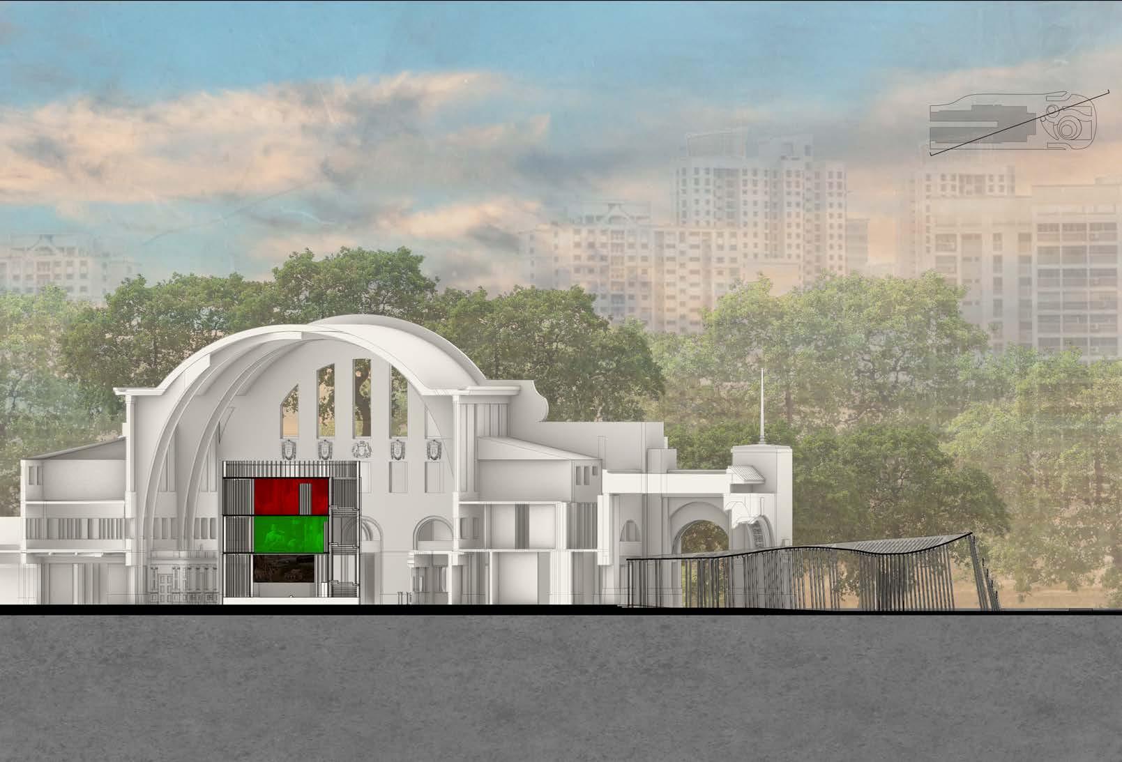
TIMESCAPES
Professor: Peter Ortner
Groupmates: Tan Zhi Sheng, Ashley Chen
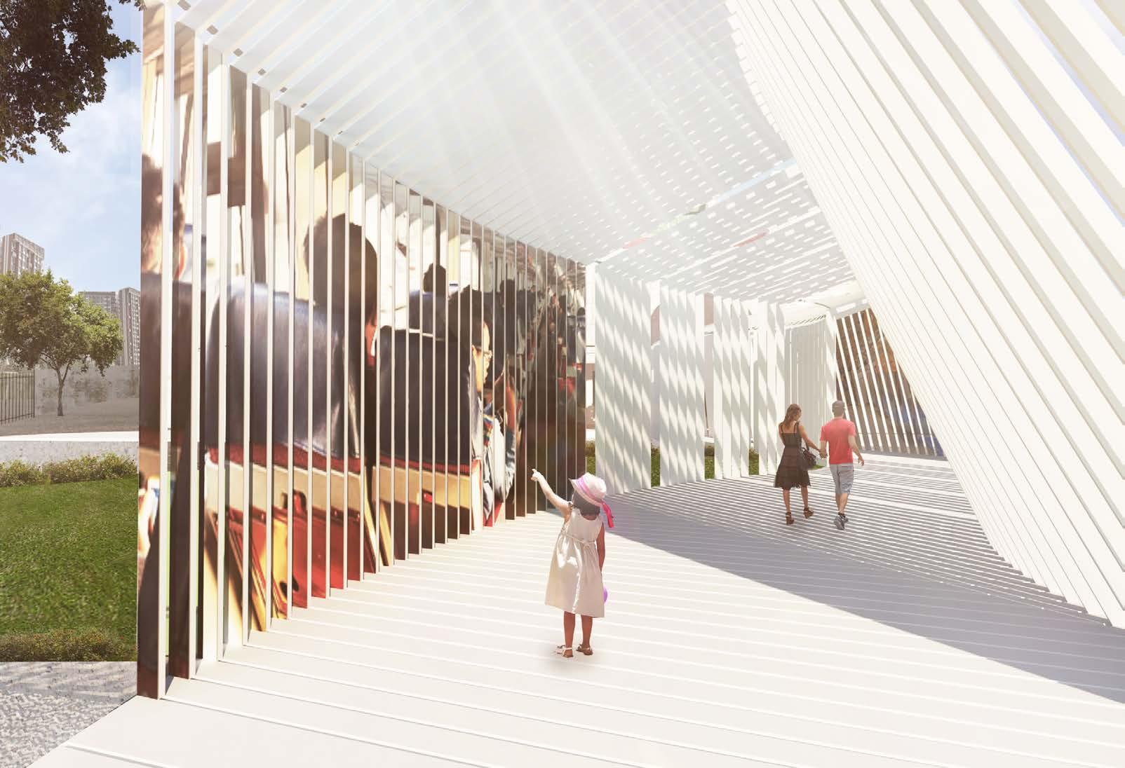
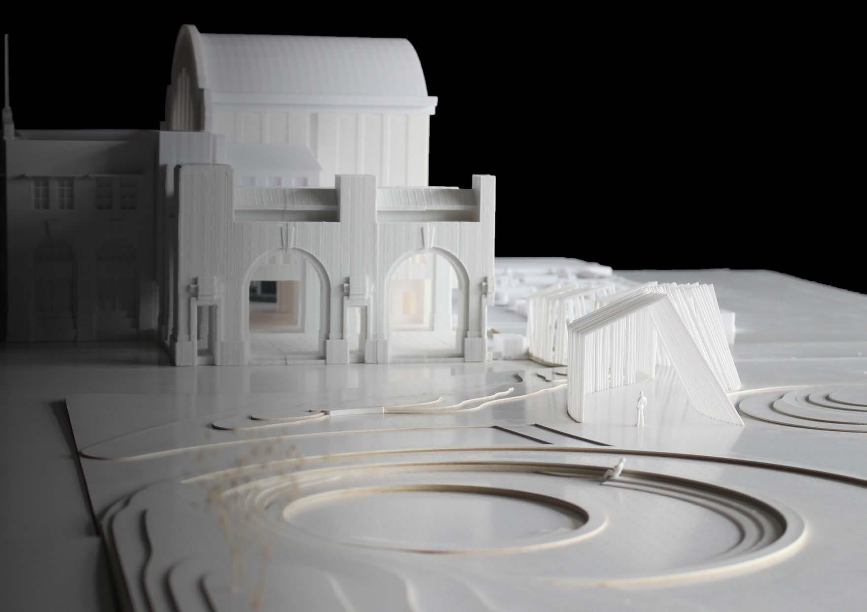
TPRS heritage pavilion
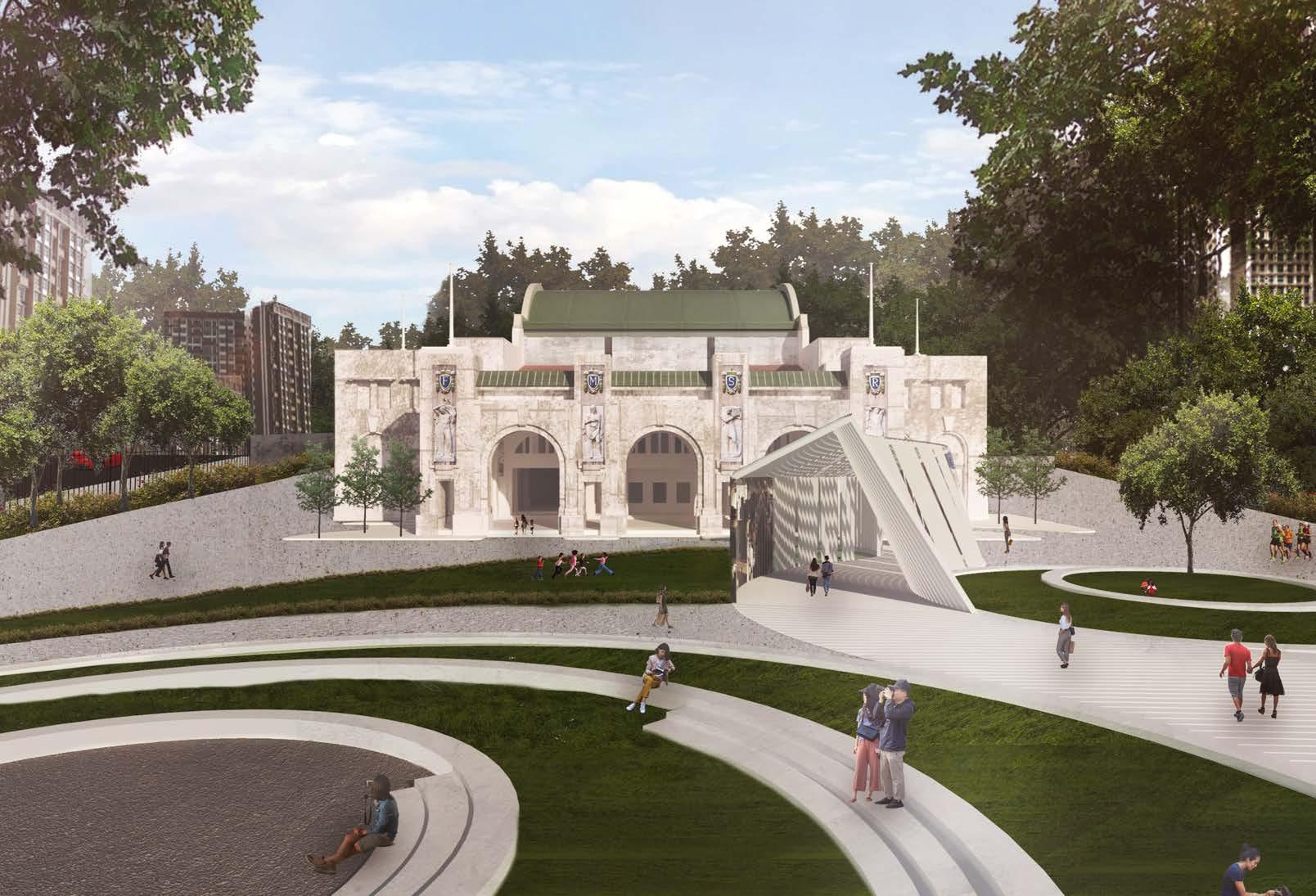
A historic railway station from the early days of Singapore, Tanjong Pagar Railway Station (TPRS) served as an important transport and commerce hub. No longer in use and having been gazetted as a national monument, this project explores the adaptive reuse of the iconic station.
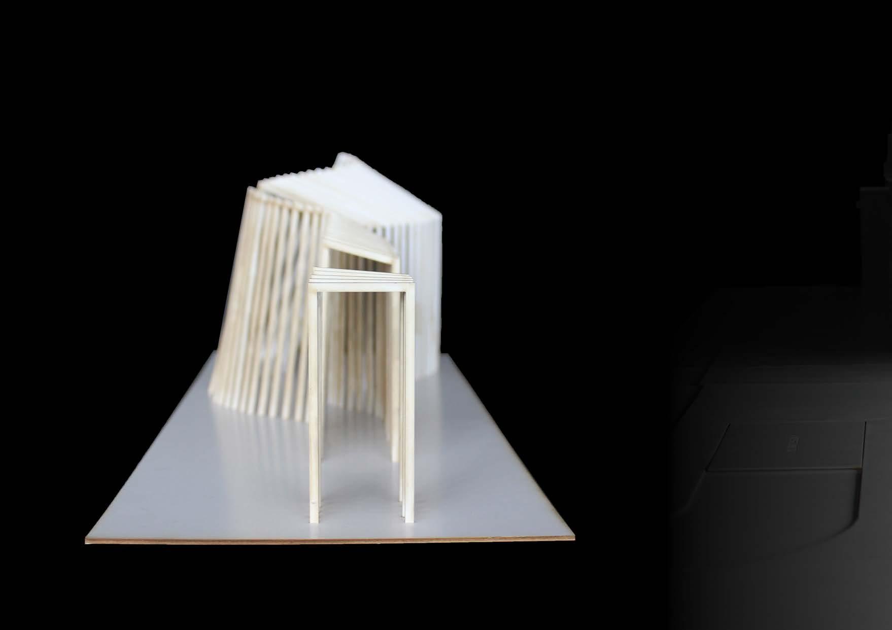
The evolution of transport in Singapore is displayed in the outer pavilion. The arches of the iconic station are abstracted into a mesmerizing series of white steel fins, shifting and creating a mysterious journey for users. At key locations, engaging the use of perspectives reveals the history of Singapore’s public transport system. The language of the fins carry through to an inner pavilion which brings to life the history of the iconic railway station, featuring important films in the form of projection mapped images.
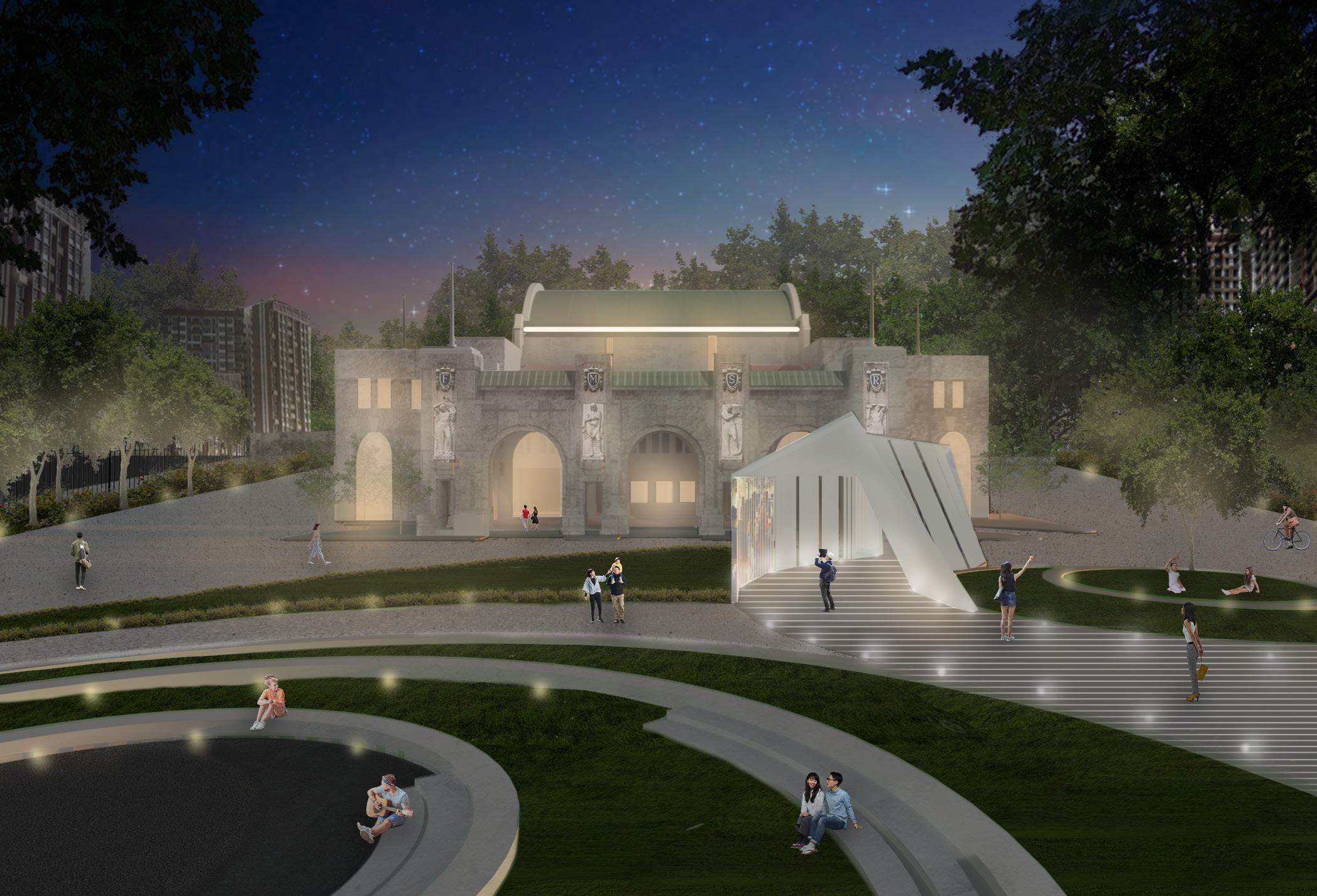
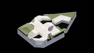
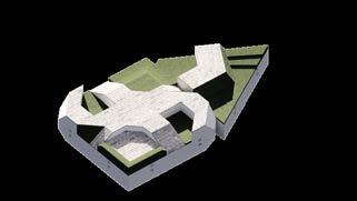
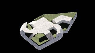
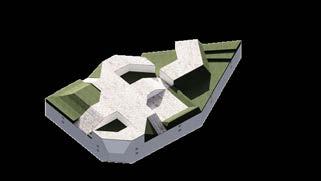
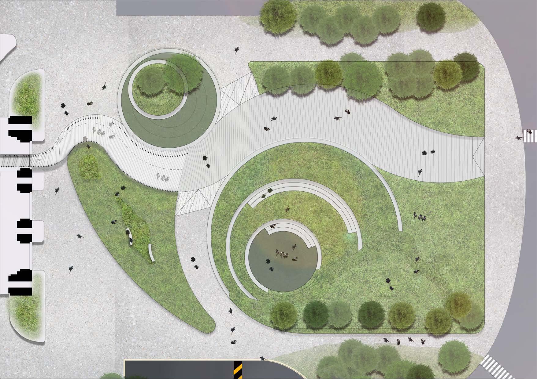
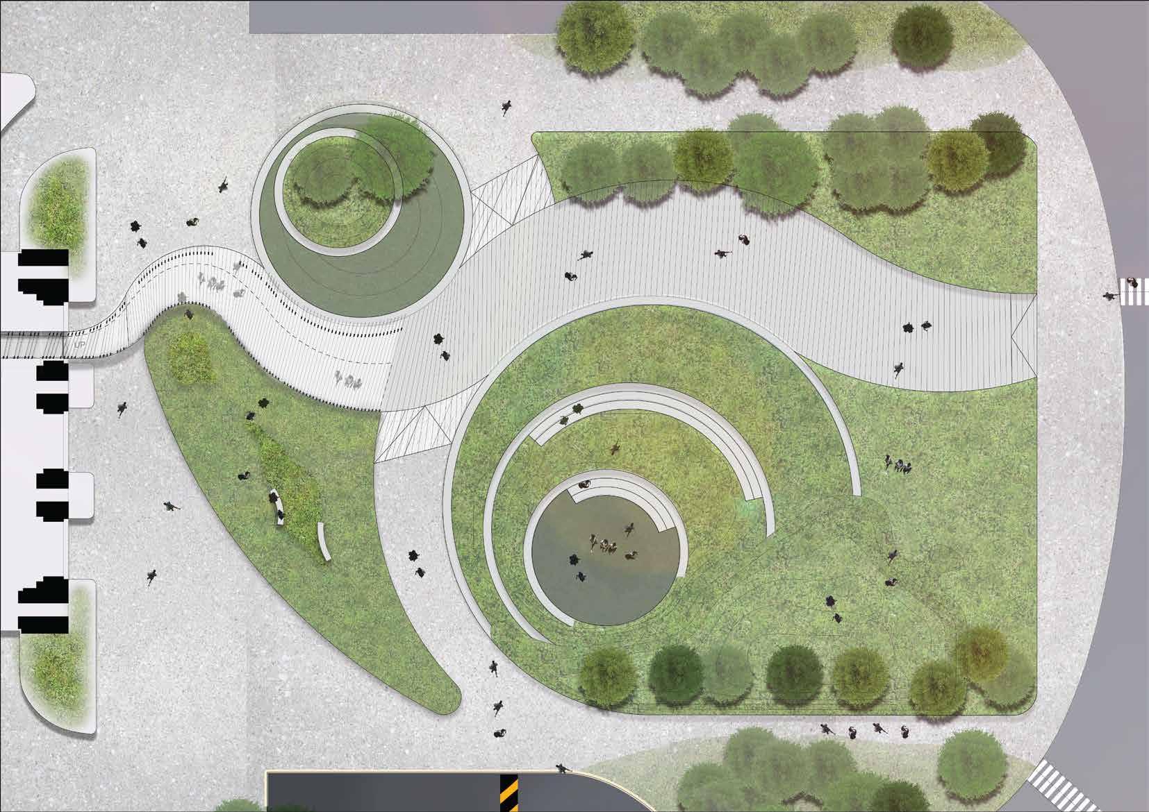
SITE PLAN
REFINING ALIGNMENT AND WIDTH
BASE STATE
SLANT_ANGLE OVERALL_HEIGHT
HEIGHT_STEP
FRAME_DENSITY
HERITAGE ARTIFACTS
2 3 1.2 1.1 1.1 1.2 2 3
MODELS
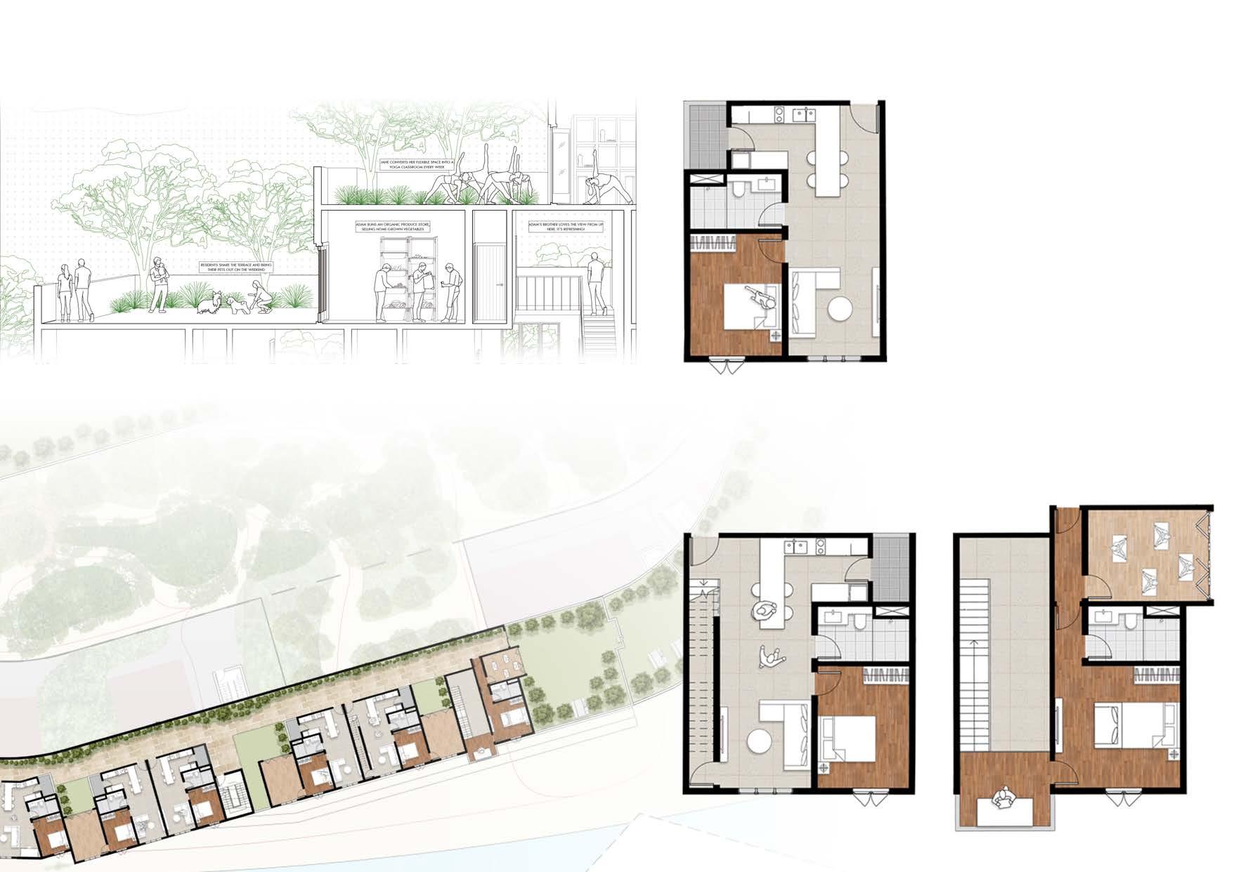
housing strategies
THE URBAN FOREST future
Professor: Andrew Lee
Groupmates: Ashley Chen
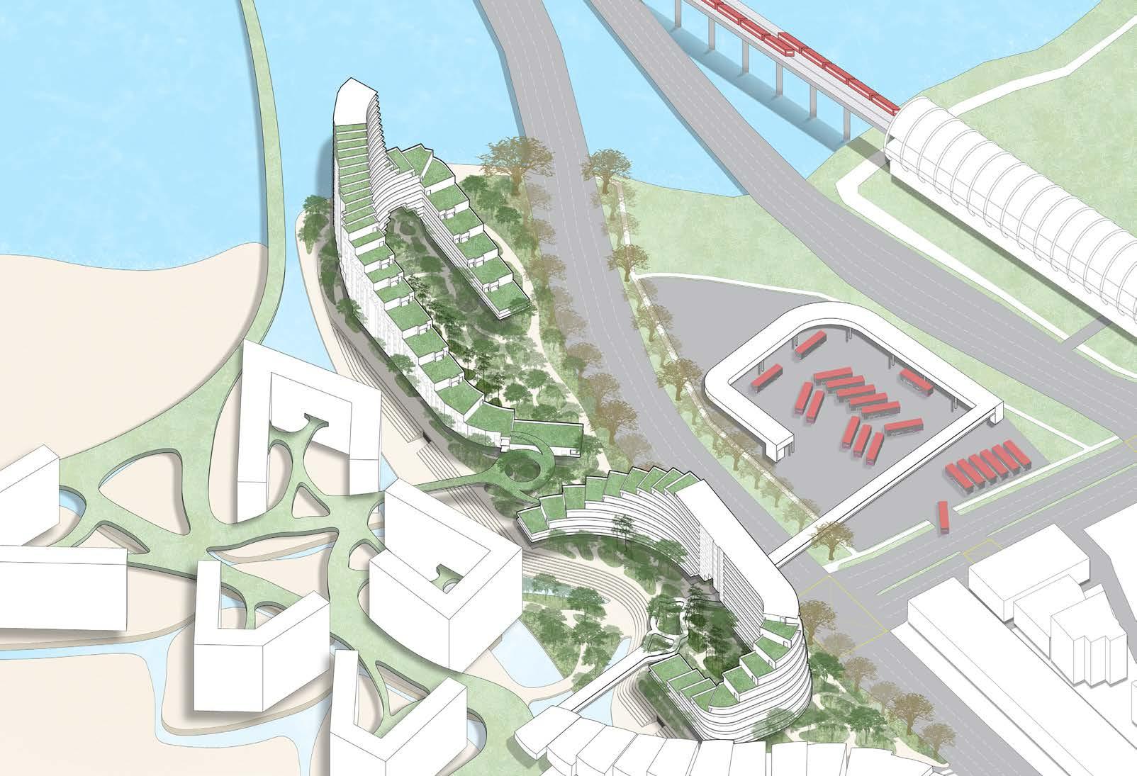
MASTER PLAN
COMPILED SECTION MAIN CUT
+ 1 2 + 1 2 + 9 + 6 + 0 + 0 + 0 + 0 + 3 + 6 + 9 + 1 2 + 3 + 0 + 0
Team:
Phoebe Kong, Diane Lee, Sruti Niranjan, Charlene Gwee, Sarah Omer, Lee Yin Jie, Chua Bing Lun, Matthew Tsou, Chong Yuan Wen, Kwang Kai Jie, Faizaanullah, Ashley Chen, Lynus Lim, Chew Yunqing
GREEN NETWORK
Green Network Layer
The studio started with a collective brief, designing a master plan for the Kallang precinct. This master plan integrated many layers, such as the water network, green network, public spaces, pedestrian pathways and more. An overall elevated deck was designed for more connectivity to adjacent plots, with the goal of pedestrianizing the entire housing district.
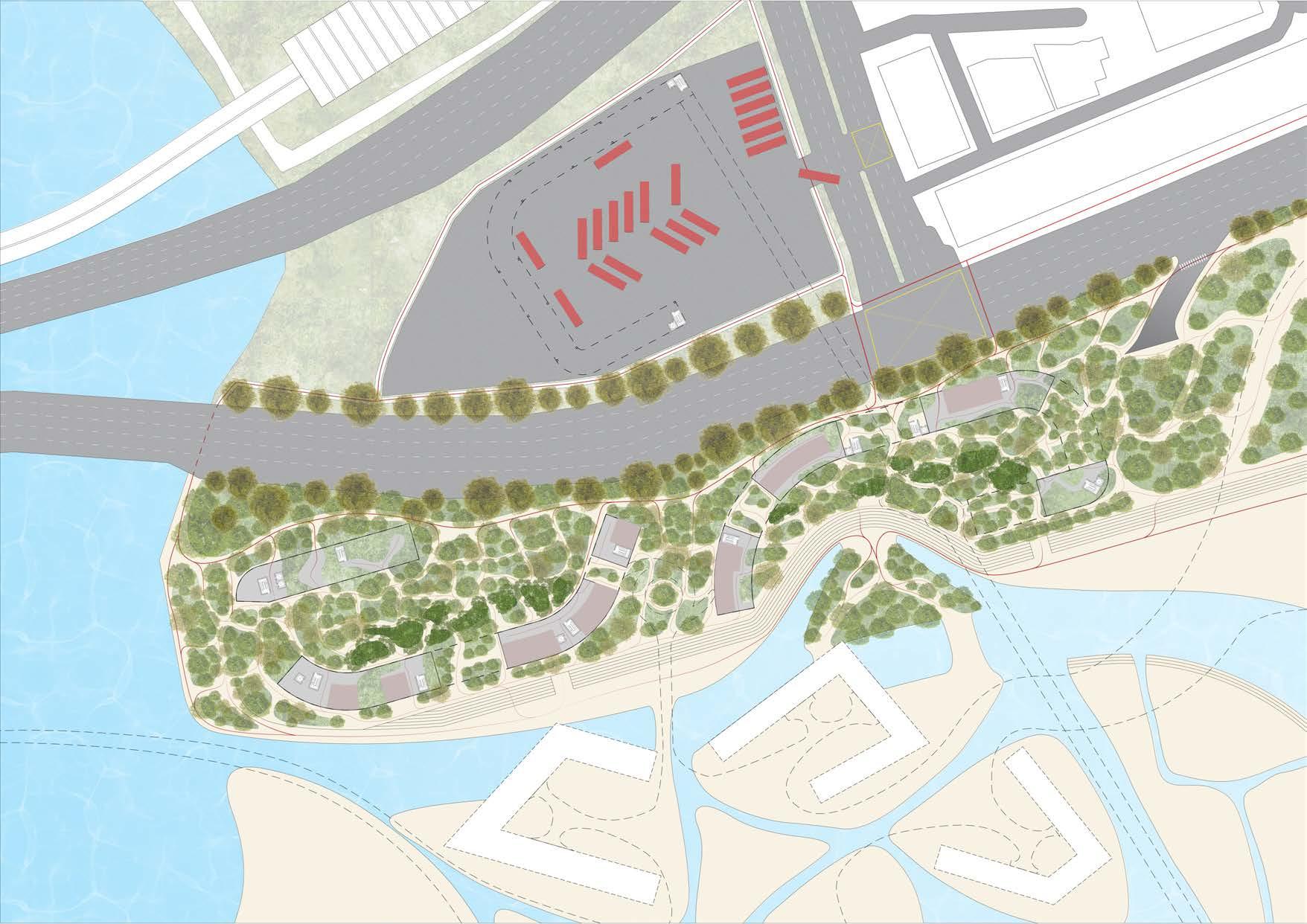
Greenery is employed as a medium to engage with the greater site context. The addition of a green deck over the precinct creates opportunities for interesting housing bands, of which we see the potential for an agriculture ‘zone’. Moving downwards, the flora attempts to enrich the ecological diversity of the site by connecting the waterfront to the adjacent land parcels. Greenery is then employed as a buffer to mitigate noise from the KPE and Nicoll Highway. Looping back into the heart of the precinct, a network of green pathways invites residents into the central activity space. The historic site is transformed into a series of parks and leisure zones that can be enjoyed by residents in a variety of ways.
The green network can be broken down into three major components. First, a large peripheral buffer of trees shields from vehicular traffic from the major roads. Next, a series of parks and walkways are provided for sports and recreation in the central zone of the district. Lastly, the elevated deck integrates multiple zones for urban farming alongside housing developments.
KALLANG X // Precinct 4
Key Data: 165,747 sqm Green Space primary nodearea secondary tertiary -65.0m -65.0m -65.0m primary nodearea secondary tertiary primary node node node area secondary tertiary area area secondary passage space/ place nodearea -65.0m -65.0m -65.0m primary nodearea secondary tertiary -65.0m -65.0m -65.0m -65.0m -65.0m -65.0m -65.0m -65.0m -65.0m Blue Network Ground Level Circulation Underground Circulation Air Mobility Network Upper Level Public Space Activities primary secondary tertiary primary secondary tertiary primary passage -65.0m -65.0m -65.0m -65.0m -65.0m -65.0m URBAN NETWORKS 03060 Scale 1:3,000 primary secondary tertiary -65.0m -65.0m -65.0m primary nodearea secondary tertiary primary node node node area secondary tertiary area area secondary passage space/ place nodearea -65.0m -65.0m -65.0m primary nodearea secondary tertiary -65.0m -65.0m -65.0m -65.0m -65.0m -65.0m -65.0m -65.0m -65.0m Blue Network Ground Level Circulation Underground Circulation Air Mobility Network Upper Level Public Space Activities primary secondary tertiary primary secondary tertiary primary passage -65.0m -65.0m -65.0m -65.0m -65.0m -65.0m Green Space primary node area secondary tertiary -65.0m -65.0m -65.0m Scale 1:1,000 01020 Scale 1:1,500 01530 Scale 1:3,000 03060 Scale 1:5,000 050100
SUPERDIVERSITY | Urban Living for All Spring 2021 | THE NEW URBAN GROUND 03060 Scale 1:3,000
SITE PLAN
SECTION PERSPECTIVE
STUDIO APARTMENT DISTRIBUTED THROUGHOUT
Plug-in modules and pocket parks are distributed adjacent to the apartments. These flexible spaces enable functions such as cafes, yoga studios or even just additional living space.
This increased versatility gives homeowners agency to decide what works best for them at that point in time. In the era of working from home and more home-based businesses, such flexibility is warranted.
BLOCK PLAN
DUPLEX APARTMENT ADJACENT TO LEVEL TERRACES
ENVIRONMENTAL SIMULATIONS

WIND STUDIES GROUND LEVEL +0.00 ELEVATED DECK LEVEL +15.00 HIGH FLOOR RESIDENTIAL UNITS +50.00 m/s 4.0 2.0 0.0
ENVIRONMENTAL SIMULATIONS
SOLAR RADIATION STUDIES
In attempting to create housing districts that are green and calming, environmental factors were the key drivers in determining the massing
WIND:
The overall building form was designed to capture the wind and divert it towards common areas such as courtyards. Massing studies were conducted and it was found that a porous ground floor enabled wind to flow from one side of the plot to the other and the slightly terraced form creates vortices that bring the wind upwards as well.
While the wind was analysed from both the North-East and South directions, the former was considered more heavily as it is the predominant wind that this plot experiences. The South of the plot is largely obscured by other buildings and is not within control.
SUN:
The ground condition was analyzed both with and without the greenery on the site. It proved the need for lush greenery to make the common spaces and connections comfortable.
This post-rationalization affirmed our decision to go ahead with the concept of tailoring the building to the existing greenery and preserving most of the trees on the site.
SHAPING CIRCULATION
CREATING SHADING
TERRACING
MAXIMIZING VIEWS
POROSITY
MODELS
IRIDESCENCE pavilion
Groupmates: Phoebe Kong
Kwang Kai Jie
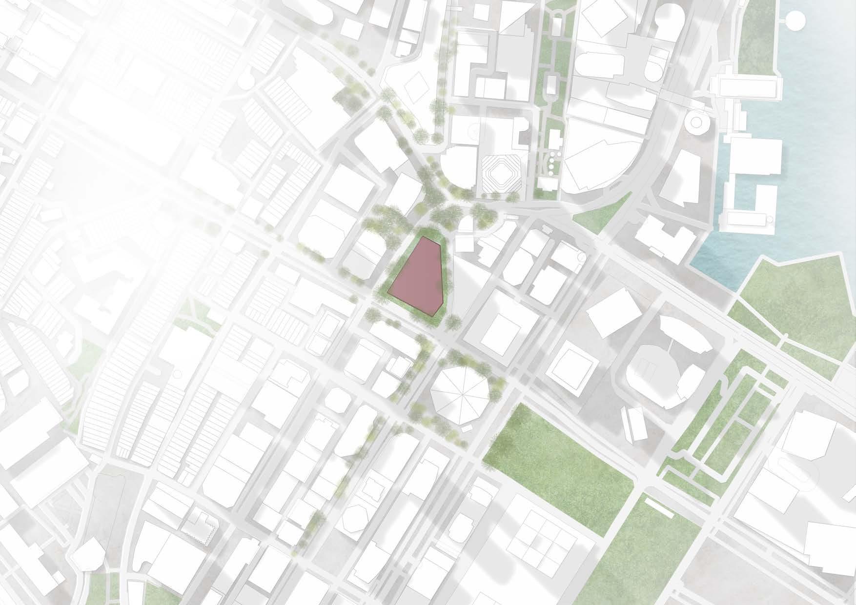
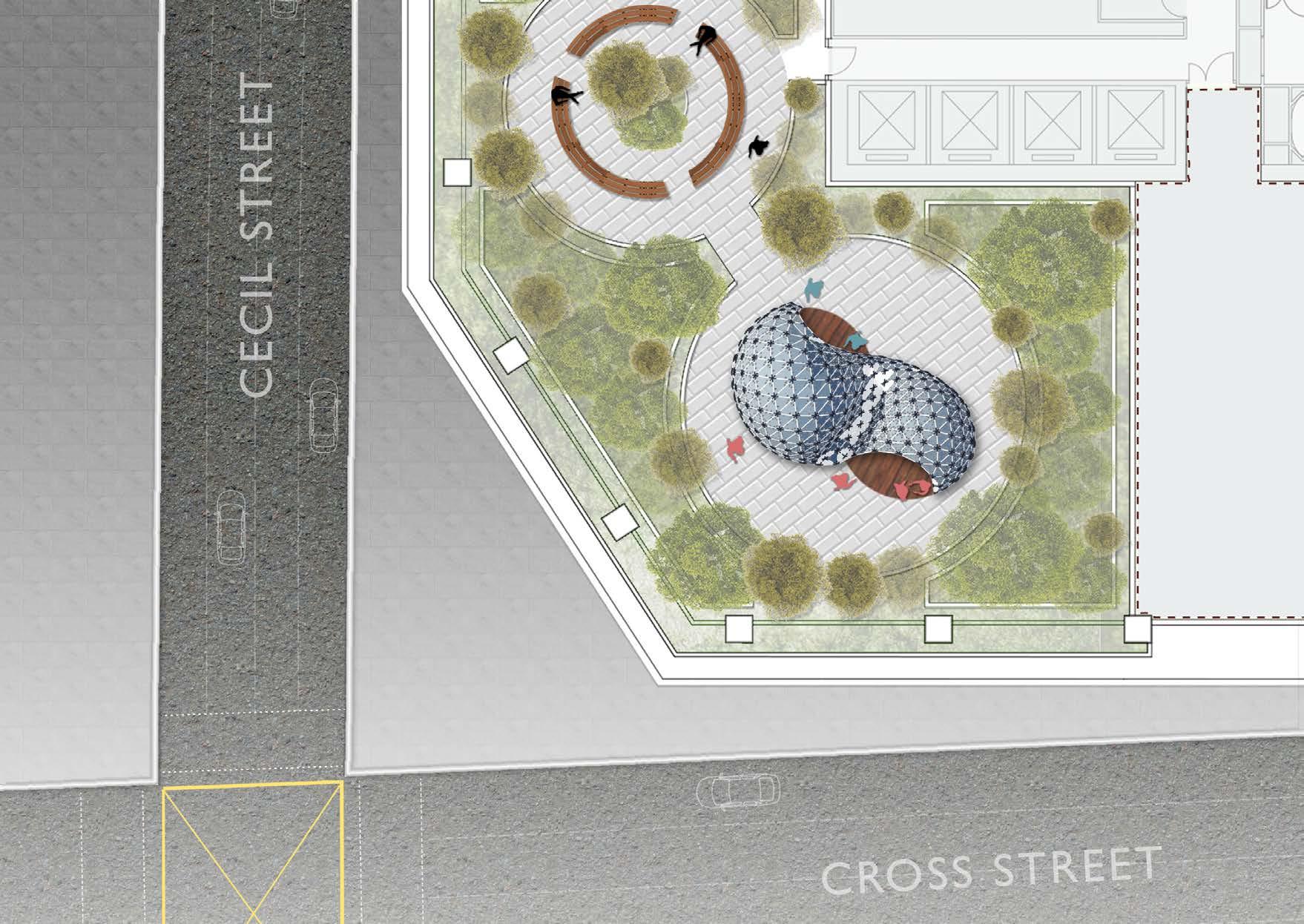
SITE PLAN
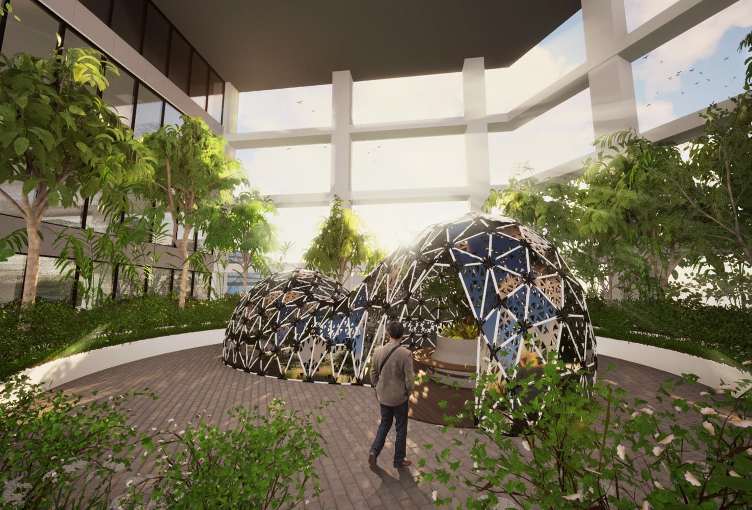
Iridescence aims to create a pavilion that is made of sustainable materials with modern technology. It features two different sections, one that caters for more social interaction and one for less.
Situated within an office building, it offers some respite from the stresses of work. At the same time, this pavilion can be disassembled quickly if it were to be relocated.
The primary material used is bamboo, which makes up the structural system in equal-length rods. The rods are joined by 3d-printed nodes and fitted with an aluminium mesh cladding that creates shading within the pavilion.
ENVIRONMENTAL SIMULATIONS
While the pavilion was designed with multiple potential sites in mind, the main location is within Singapore. As such, the environment is often hot and humid.
Environmental simulations were a big factor in the final design, ensuring that the harsh sun was mitigated while a light draft could ventilate the interiors.
To produce the overall form, a mesh was inflated using a soap-film algorithm. It gives control over the form to produce smoother curved surfaces that are still panelized. At the same time, we were able to control the length of the rods to ensure production simplicity.
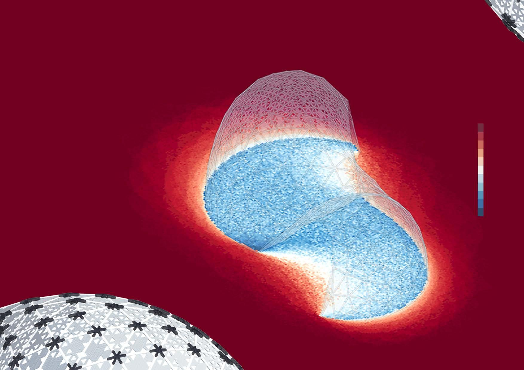
kWh/m2 1600 800 0

PLAN +0.00 PLAN +3.00 m/s 2.0 1.0 0.0
CONCEPT AND ASSEMBLY
CONTEMPLATIVE serene
place primary nodes
build main structure place cladding panels assembled!
SOCIAL energized
The contemplative zone features a larger area, for users to be more spread out and isolated.
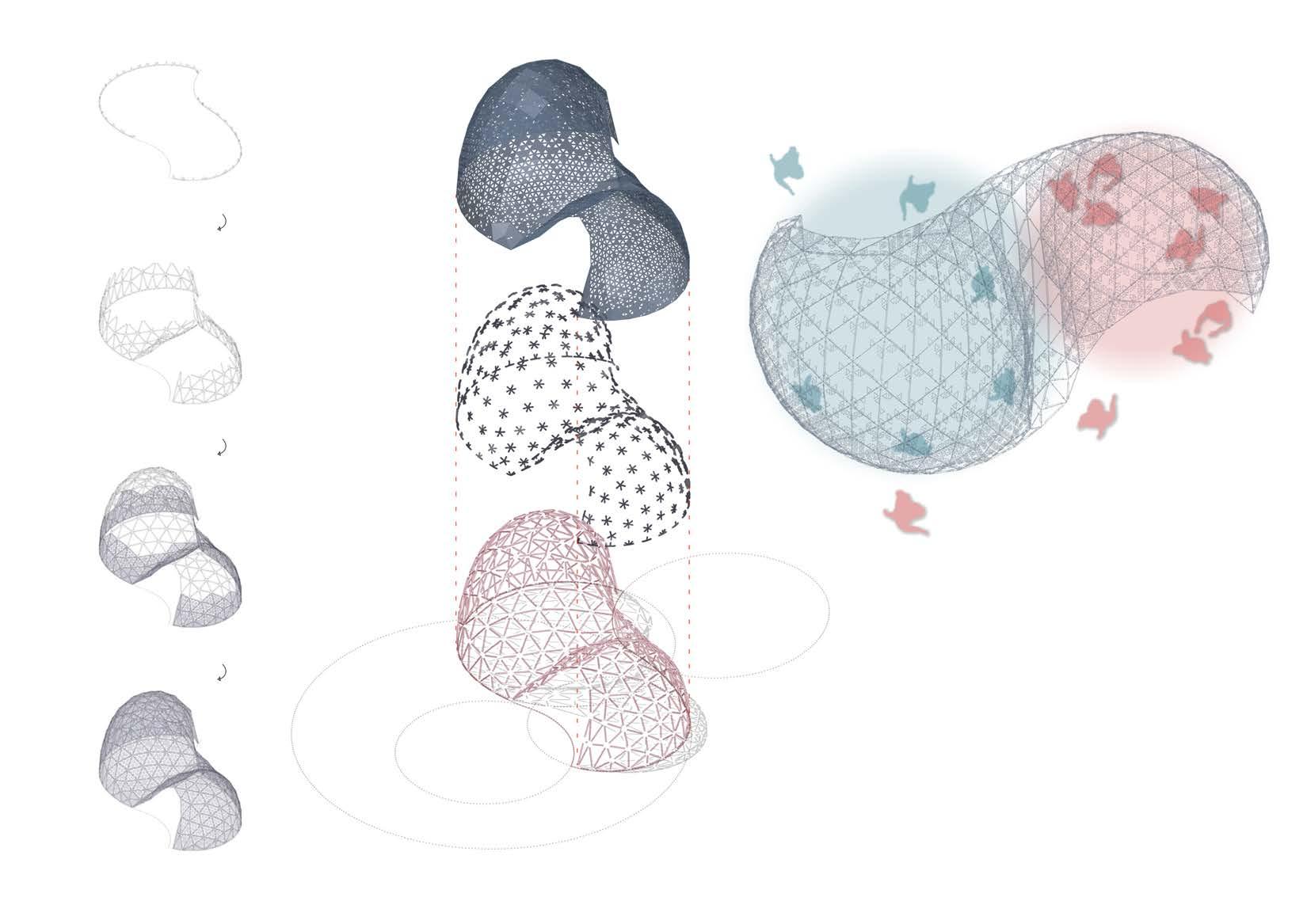
The social zone invites users to interact and mingle with one another.
Together, the pavilion democratizes the idea of rest and gives agency to the users, allowing them to pick the most suitable rejuvenation space for their current mood.
ASSEMBLY MANUAL