SYMBIOSIS WITH STORMWATER
Creating Resilient and Regenerative Hydrology in North Seattle
Water serves as the connecting element between Licton Springs Park, Green Lake and Ravenna Park in North Seattle. This historic hydrology facilitates the construction of a 'Sponge City' to enhance stormwater management, addressing the challenges posed by frequent rainfall and extreme climate events such as floods and droughts. This design vision aims to create a resilient and regenerative hydrology that also fosters community sharing, provides ecological services, and promotes environmental sustainability.
Master of Landscape Architecture
University of Washington
Advisor: Julie M. Johnson
 Lu He
Lu He
UW MLA CAPSTONE STUDIO 2024
BACKGROUND
Long-term Rainfall Climate in Seattle
An extreme storm for Seattle, WA is a 48-hour rainfall total greater than 0.7 inches. Historically, about 15.2" of rain (or the equivalent in snow) fell over about 12 storms each year. By 2050, about 18.3" of rain are projected over about 15 storms each year. The annual precipitation in Seattle, WA is projected to increase from about 35.4" to about 38.0".1


Residents of Seattle, are particularly vulnerable to the impacts of precipitation, high temperatures, and drought. The region experiences abundant rainfall in the winter, followed by drought and heat in the summer. 1https://climatecheck.com/washington/seattle

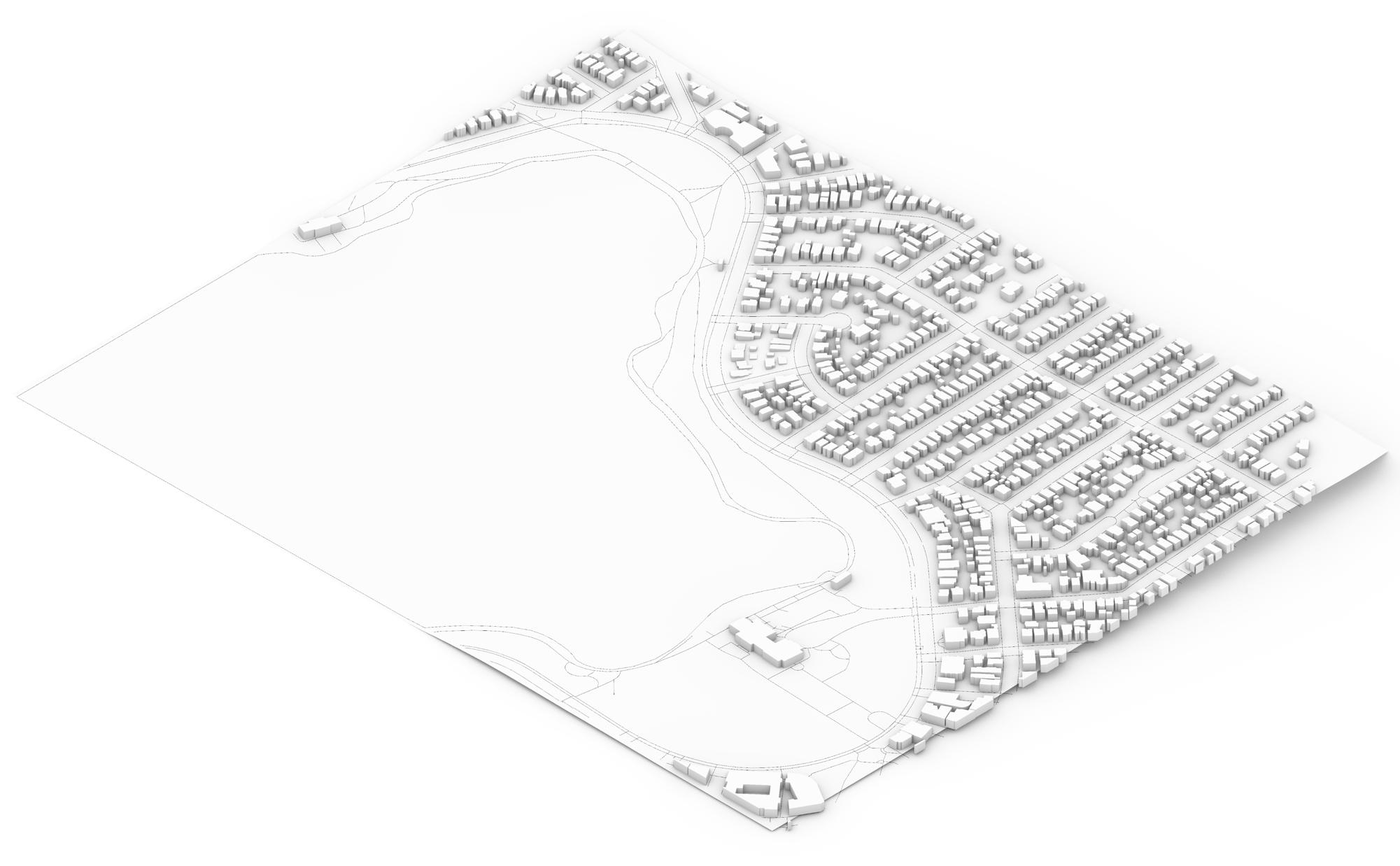
In addition to Thornton Creek, North Seattle also has another potential watershed, it's Licton Springs Park - Green LakeRavenna Park - Union Bay. Strengthening the stormwater management in this watershed will help enhance Seattle's resilience to weather changes and frequent rainfall.
Aerial View: google maps
Green Lake
Licton Springs Park
Thornton Creek
Ravenna Park
Union Bay
N
Data from March 2024
Preparing for Design by Studying Nearby Roads, Topography, and Land Use
Content Layers

Seattle Department of Construction & Inspections GIS

Neighborhood Residentatial Neighborhood Commercial Lowrise Multi-Family
The site's buildings and uses are mostly neighborhood residential, with some commercial and lowrise multi-family located on the east and north sides of Green Lake.

Green Lake Ravenna Park Licton Springs Park
Public green spaces near Green Lake are Licton Springs Park to the north, Ravenna Park to the southeast, and Woodland Park extending south from the lake.


A small amount of wetlands are around Green Lake's west and south shoreline. Existing riparian corridor at Ravenna Park helps with stormwater harvesting and transportation.

On-site Stormwater Management (OSM)
There is a lack of OSM between Green Lake with Licton Springs Park and Ravenna Park.

The local streets have poor rainwater infiltration capacity, given the lack of roadside green spaces. Additionally, the flat surface of the pavement hinders effective rainwater drainage in areas. The lakeside presents a sparse aquatic habitat, with scant vegetation, and lacks clear access points for people to observe, but not disrupt, the habitat and wildlife.
https://seattlecitygis.maps.arcgis.com/apps/webappviewer/index.html?id=f822b2c6498c4163b0cf908e2241e9c2
ANALYSIS
SITE
CADMAPPER: https://cadmapper.com Map Buildings Topography Minor Roads Major Roads Park Northgate I-5 Ravenna Park
Lake Park
Springs Park
Green
Licton
Green Lake
Park and Tree Canopy 2021
Local Streetscape
Wetland
Wetland and Riparian Corridor Zoning
Refining Sponge City Theory into Practical Implementation
Building Sponge Cities: Steps & Visions
Point Line Surface
During the design process, I use the principles of point, line, and surface, applying varied rainwater management methods across three distinct areas to address the needs of both the community and the ecology. This design vision aims to culminate in the realization of a sponge city design in North Seattle.
Sponge City Theory
This strategy reduces stormwater runoff by promoting natural retention and infiltration, not immediate drainage. It involves creating water bodies and green spaces like wetlands, green roofs, and rain gardens in cities.
The strategy lets rainwater soak into the ground naturally, recharging groundwater, reducing runoff, and preventing flooding and erosion. Urban infiltration methods include permeable pavements, rain gardens, bioswales, and green roofs.
The strategy involves capturing and holding rainwater for later use or controlled release. This reduces runoff, prevents flooding, and manages water supply. Urban storage practices include rain barrels, cisterns, detention basins, and green roofs.
The strategy improves water quality by removing contaminants through filtering and treating stormwater. Urban practices include constructed wetlands, bioretention cells, green roofs, and vegetated swales.
Applying Theory to Site

The strategy involves collecting and using rainwater for non-potable purposes to reduce the demand on potable water supplies. Common urban practices include rainwater harvesting systems for irrigation, toilet flushing, and cooling systems.

The strategy releases excess rainwater into natural water bodies or sewer systems to prevent flooding and erosion. Urban practices include outfalls, overflow channels, and storm drains to divert water from developed areas.
With the goal of constructing a sponge city, enhancing community sharing and ecosystem services promotes environmental sustainability. This design process involves six methods of sponge city construction, including Retention, Infiltration, Storage, Purification, Discharge, and Reuse.1


FRAMEWORK
ECOSYSTEM SERVICES COMMUNITY SHARING ENVIRONMENTAL SUSTAINABILITY URBAN CHANNEL CE O L O G I C A L CORRIDOR W E TLANDS + INFRASTRUCTURE 1. STREET 2. GREEN LAKE + WETLAND + CISTERN cycle 3. RAVENNA BOULEVARD Green space Drainge Rainwater Harvesting Rainwater Harvesting Surface Runoff Surface Runoff Habitat Swale Pedestrian Discharge Discharge Reuse Purification Infiltration Infiltration Retention Retention Storage
1Liu, Qianhui, et al. “Stormwater Management Modeling in ‘Sponge City’ Construction: Current State and Future Directions.” Frontiers in Environmental Science, vol. 9, 2022, https://doi.org/10.3389/fenvs.2021.816093. SPONGE CITY Retention Storage Purification Discharge Reuse Infiltration Stormwater Resource Management

Applying Sponge City Strategies in 4 Zones to Enhance Ecology and Community for Sustainable Environments
URBAN CHANN E L
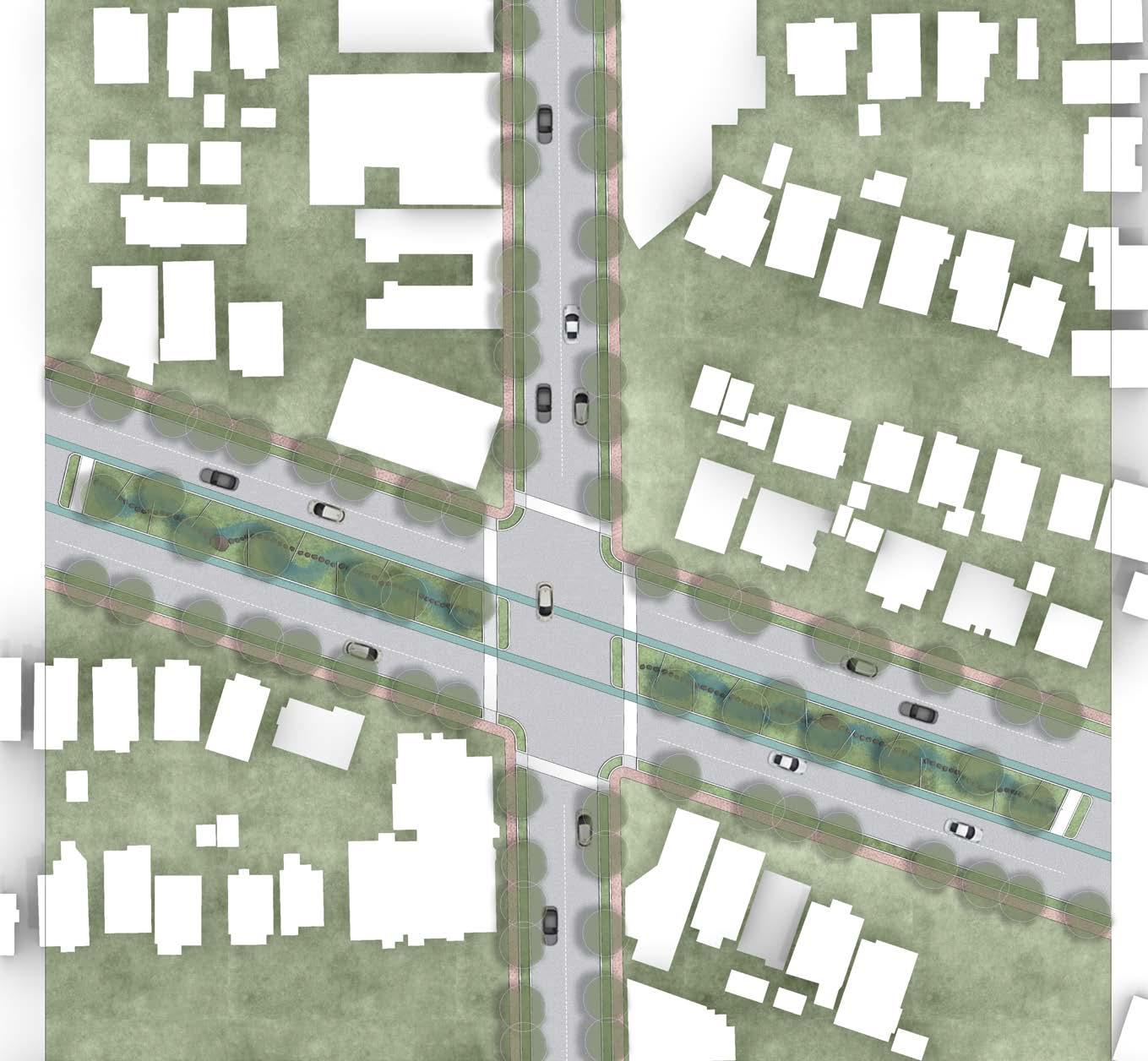
Urban Channel--providing raingardens and gathering spaces within a streetscape.

Wetlands + Infrastructure --with floating wetland habitats and interpretive boardwalk.


Wetlands + Infrastructure--with terraced filtering wetlands alongside paths and rainwater harvesting cisterns.
ECOLOG I CAL CORRIDOR

Ecological Corridor--with a swale that filters water and supports dense tree canopy to cool pedestrians and bicyclists on adjacent trail.
W E
WE TLANDS
C T U R E
+INFRASTRU
SPONGE CITY DESIGN FOR GREEN LAKE

Groundcover: Sarcococca hookeriana humilis


Groundcover: Veronica liwanensis
Flower: Iris pallida ‘Variegata’
Flower: Echinacea purpurea

Groundcover: Autumn Moor Grass

Groundcover: Mexican Feather Grass


Pedestrians: Permeable Pavers

Road: Permeable Pavement
CHANNEL STRATEGY
URBAN
Residential
Roadway
Pedestrian
Zone1: Carex obnupta
Zone2: Iris missouriensis
Zone3: Galanthus elwesii
Zone4: Ajuga reptens
Tree: Ginko biloba ‘Princeton Sentry’

URBAN CHANNEL
--PROVIDING RAINGARDENS AND GATHERING SPACES WITHIN A STREETSCAPE.
ECO: Roadside Rain Graden
COM: Book Share Box
COM: Parking Space
COM&ECO: This versatile green space functions as a rain garden in the winter and serves as an informal gathering area in the summer.
ECO: Green Roof
ECO: Permeable Pavers ECO: Permeable Pavement
Compacted Soil Drainage Pipe Drainage Pipe Organic materials that accommodate and filter rainwater
Base
Soil Fine
Adapted from Google Street View image
ECO: Rainwater
Harvesting
Crushed Stone
Gravel
Gravel
The resilient lakeshore can adapt to varying rainfall intensities

Filter Plant | Water Flowing | Waterfowl Habitat | Balance of Trace Elements in Water
Now
People have often walked to the shoreline edge and thus compacted the soil so that plants can't grow there.
Enhancements
Connect the lake shore, allowing people to immerse in nature without disrupting the shoreline vegetation.
The rainwater collection system under the square feeds a sustainable fountain with fresh water
Non-flood Season
Biological habitats increase, and the ecosystem improves
Flood Season
The lake's capacity to manage stormwater increases

Permeable Pavement Diving Platform
+ INFRASTRUCTURE STRATEGY
WETLANDS
Surface Runoff Subsurface Runoff Infiltration Rainwater Overflow Pipe Pump Basin Sedimentation Tank Water Storage Tank Water Storage Tank Water Supply Fountain
Green Roof
WETLANDS + INFRASTRUCTURE
--WITH FLOATING WETLAND HABITATS AND INTERPRETIVE BOARDWALK.

COM: Boardwalk in the lake promotes the integration of people with nature and wildlife.
COM: Educational signs convey information to visitors about the natural environment, animal behaviors and ecosystems.
COM: The steps connected to the boardwalk encourage people to engage in water activities.
ECO: Floating wetland provides additional habitats for nesting birds.
ECO: Duck Platform in the lake provides an animal-friendly resting area.
COM: Permeable surface trail around the lake.
Adapted from Google Street View image
Transportation
Design optimizes pedestrian and bicycle traffic by improving bike lanes, adding a pedestrian path and providing accessibility features (ADA).

Pavement Material
Increase permeability, reduce surface runoff, enhance rainwater management, and lessen the burden on the sewer system.
Sustainable Nature
Enhance stormwater management and recycle rainwater within the community.
Community interaction space
Integrate natural elements to foster resident interaction and harmonious coexistence with nature.
Improving Water Quality
The overflow weir controls water levels, drainage rocks help rainwater quickly infiltrate into the soil, preventing pooling, and filtering plants purify the water by absorbing and degrading pollutants.
Environmental Improvement
Increase tree plantings and enhance carbon cycling while also expanding habitats for biodiversity.
ECOLOGICAL CORRIDOR STRATEGY
ECOLOGICAL CORRIDOR
--WITH A SWALE THAT FILTERS WATER AND SUPPORTS DENSE TREE CANOPY TO COOL PEDESTRIANS AND BICYCLISTS ON ADJACENT TRAIL.

COM: This ADA path provides individuals with mobility impairments the opportunity to connect with nature.
ECO: Redesign the bike lane with permeable pavement.
COM: The wooden platforms in the corridor provide a recreational space for the neighborhood.
ECO: Two rows of street trees provide cooling for pedestrians and those who linger.
COM: The ecological corridor serves both as a rainwater filtration system and a habitat for wildlife.
Adapted from Google Street View image
URBAN CHANNEL


SYMBIOSIS WITH STORMWATER
Creating Resilient and Regenerative Hydrology in North Seattle
The project aims to transform North Seattle into a model sponge city, fostering a "Symbiosis with Stormwater" to mitigate the impacts of climate disruptions and cultivate a resilient and regenerative hydrology. By integrating sustainable design strategies such as green infrastructure, community involvement, ecological restoration, and rainwater harvesting, I envision a city that not only manages stormwater effectively but also enhances urban aesthetics, biodiversity, and quality of life.
The project long-term vision includes increased green space and habitat quality, improved water quality and access, enhanced urban resilience to rainfall, and reduced waterlogging of roads. Through these initiatives, I imagine a sustainable urban environment that thrives in harmony with natural water cycles, promoting ecological health and community wellbeing in North Seattle.
UW MLA CAPSTONE STUDIO 2024
CE O L O G I C A L
W E TLANDS + INFRASTRUCTURE cycle
CORRIDOR
 Lu He
Lu He


