Representation and sublimation of a vertical continuity
POLITECNICO
School of Architecture Urban Planning Constructing Engineering
Master Thesis in Landscape Architecture
MSc Landscape Architecture. Land. Landscape. Heritage Accademic Year 2020-2021
Supervisor: Prof. Paolo BOZZUTO
Co-supervisor:
Land. Arch. Arianna ZAMBELLI
Til mig selv, tak
Abstract - Ita
"Non domineremo mai completamente la natura: il nostro organismo, che è parte anch’esso di questa natura, rimarrà sempre una struttura transitoria, coi suoi limitati poteri di adattamento e di prestazione."
Sigmund Freud, Il Disagio della Civiltà, 1929
La presente tesi nasce dall'idea di sottolineare il ruolo principale svolto dal legame tra la sfera Uomo-Natura, che trova la sua massima rappresentazione nell'Orrido del Bögn.
L’area di progetto rafgura il valore e la qualità ambientale del dirupo situato lungo il Lago d'Iseo, un paesaggio dove la natura supera completamente il sistema artificiale dell’uomo. Per evidenziare il suo significato, il progetto si impronta su ideali di un approccio minimal e razionale, scelti per il disegno di uno spazio esperienziale piuttosto che sul solo sviluppo e pianificazione di un'area in quanto tale.
Ciò è chiaramente rafgurato dalla sublimazione e rappresentazione della continuità verticale del loop: un'esperienza di percezione e meditazione invocata dal paesaggio "orribile" del Bögn è stata combinata con la progettazione – basata sull'arte cinese dello Shan Shui - delle esperienze montane e lacustri. Sfruttando e combinando le “esigenze mistiche” della rappresentazione cineseSoglia, Sentieri e Nuclei – un approccio influenzato da sinuosità e continuità con il contesto circostante fornisce la strategia di progettazione: coesione e unione tra esistente e ciò che verrà proposto. Una proposta "leggera" che mira alla massima integrazione con il contesto e con le pratiche esistenti diventa quindi un'occasione per agire su un panorama accattivante, valorizzandone la qualità e l'esperienza ed evitando ogni tipo di intervento sovra-pianificato: è il design dello spazio e delle sue performances che lo migliorano e lo rendono il luogo ideale per una continua implementazione futura.
Abstract
- En
"We will never completely dominate nature; our organism, which is also part of this nature, will always remain a transitory structure, with its limited powers of adaptation and performance."
Sigmund Freud, Civilization and Its Discontents, 1929
The present thesis comes out from the idea to emphasize the leading role of the tie among the Human-Nature sphere, which finds its main representation in the Orrido del Bögn.
The site project depicts the strong value of the wild surrounding of the sharp ravine along the Lake Iseo, a landscape where nature completely overcomes the man-made system. To highlight its significance, the design focuses its ideals on a minimal and rational approach based on the definition of an experiential space rather than a new over planned area.
It is clearly illustrated by the sublimation and representation of the vertical continuity of the top-down system of the loop performance: a perceived and meditate experience of the horrible landscape has been combined with the physical planning approach – the Chinese art of Shan Shui - of the mountain and lake experiences.
By the blending process of the mystical requirements – Threshold, Paths and Cores – the sinuosity and continuity of the natural shape of the surrounding want to provide an ideal strategy based on cohesion and union among what is currently existing and what is going to be created.
A light proposal which aims at a maximum integration with the context and with the existing practices becomes therefore an opportunity to act on a captivating panorama, enhancing its quality and its experience and avoiding any kind of overplanned, invasive and manmade interventions: it is the design of the space and its performances that improve it and make it the ideal place for a continuous future implementation.
Introduction The essentials
Framing Site analysis and survey
Locus horridus et amoenus
From Sublime to Shan Shui
Design approach
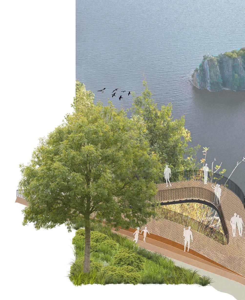
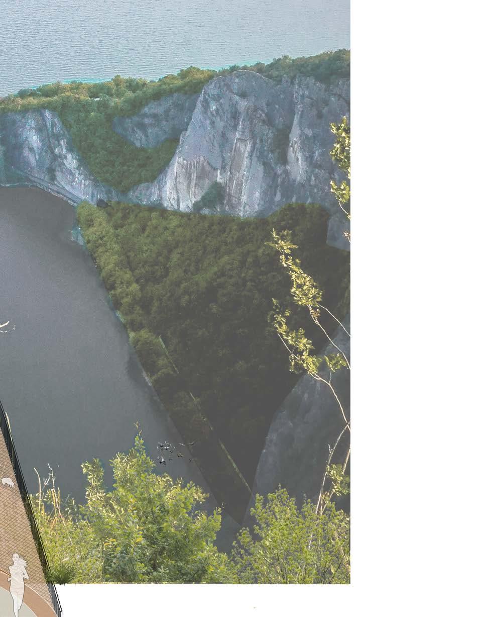
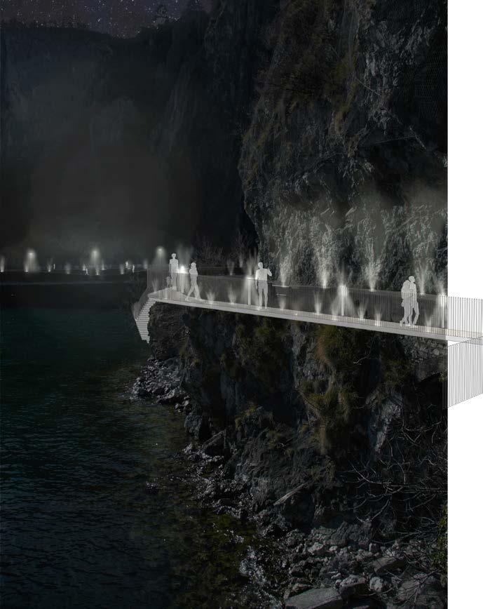
Vertical experience Looking to The on-going proposal
Design proposal
Loop between lake and mountain experience
Conclusion Effects Bibliography
Sitography
The essentials
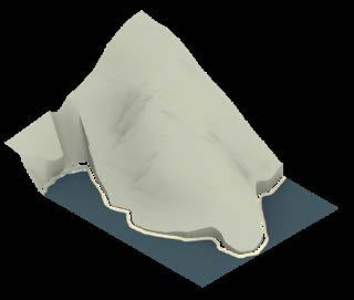
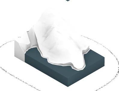
The vertical and natural combination defined among water, land and sky allows the process of meditation – and sublimation – of the wild mountain landscape which surrounds the observer. This irregular, disputable and complex environment could seem tough to be highlight in a scientific and physical way, but the subject can easily ponder over it.
Acting as a “theater of variety, order, purpose and beauty” where “each language loses its energy and all the numbers theirs measuring capacity” [cit. Immanuel Kant], the pure alpine surrounding had been considered an irrelevant and unsignificant place.
The inequalities and irregularities of the mountains have been the opposite representation to a perfect and static order: as imperfections or deformations of the earth’s crust, this landscape – defined as loci horridi, Orrido – has been treated as a useless, unfaithful and dangerous barriers to the action of man. Thus, a process of the contemplation – meditation and sublimation - of the order and harmony of this environment can occur in its observer and subject: it implies the aesthetic dimensions which, starting from the silence and thrill of wonder, goes back to beauty or sublime, to the emotional element that is the base of all its recognition.
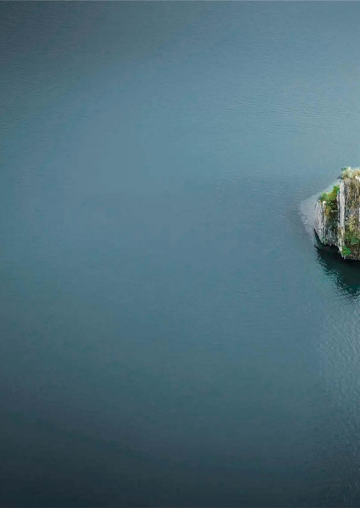
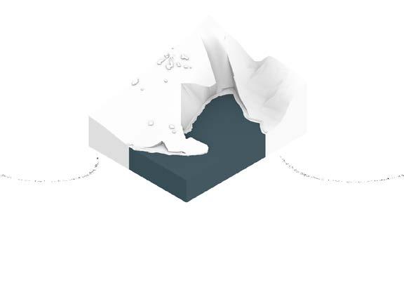
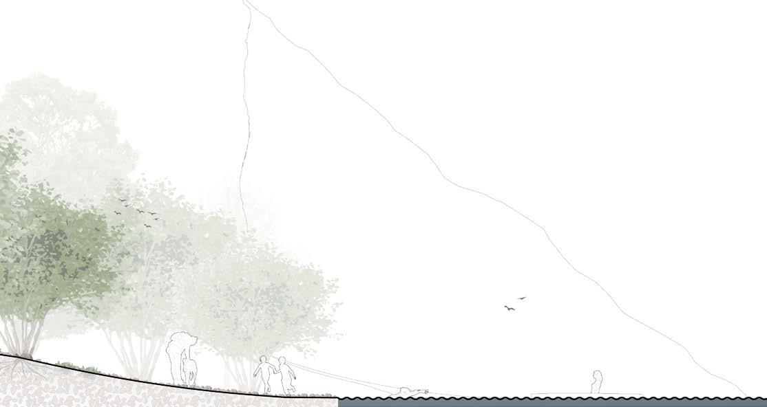
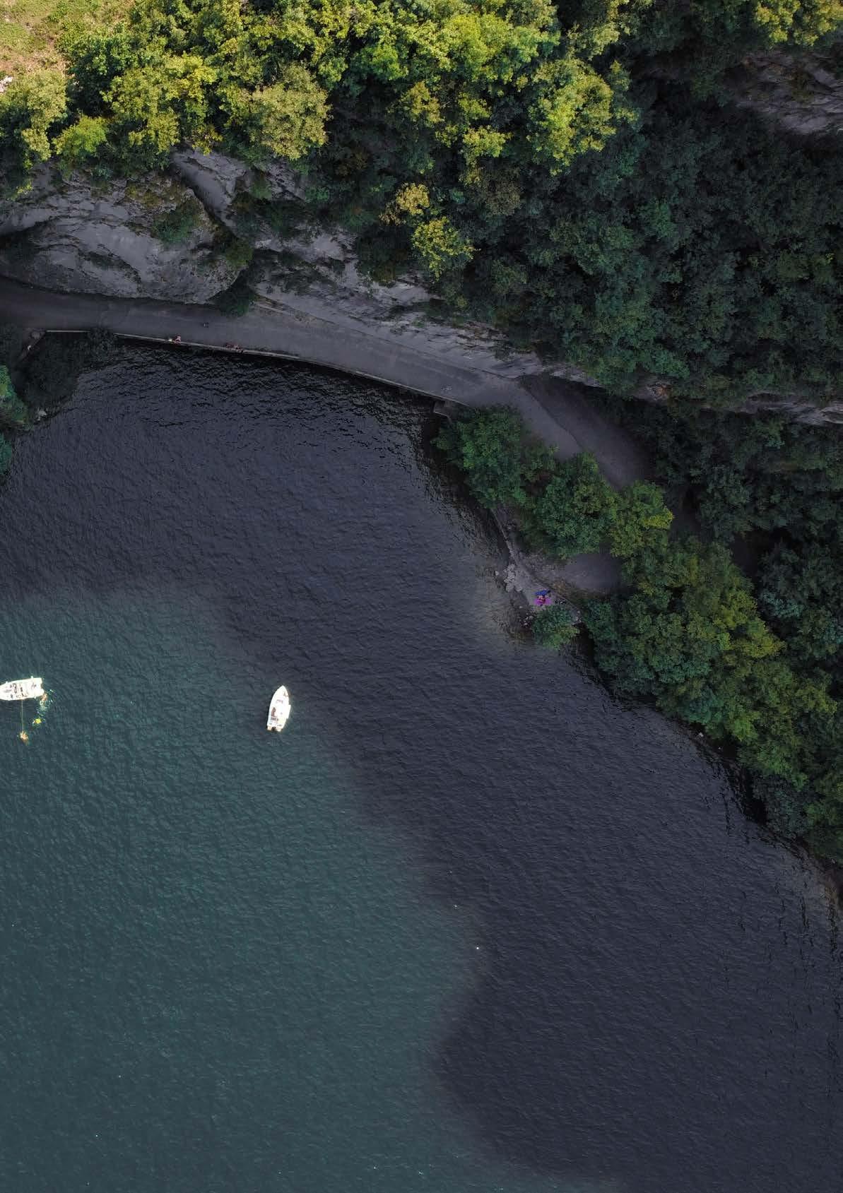
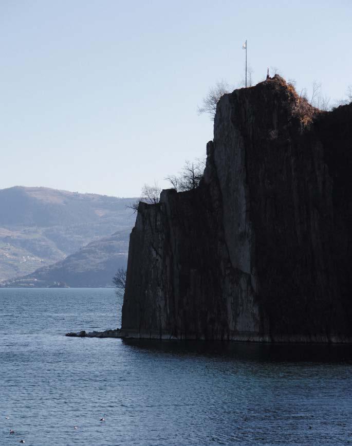
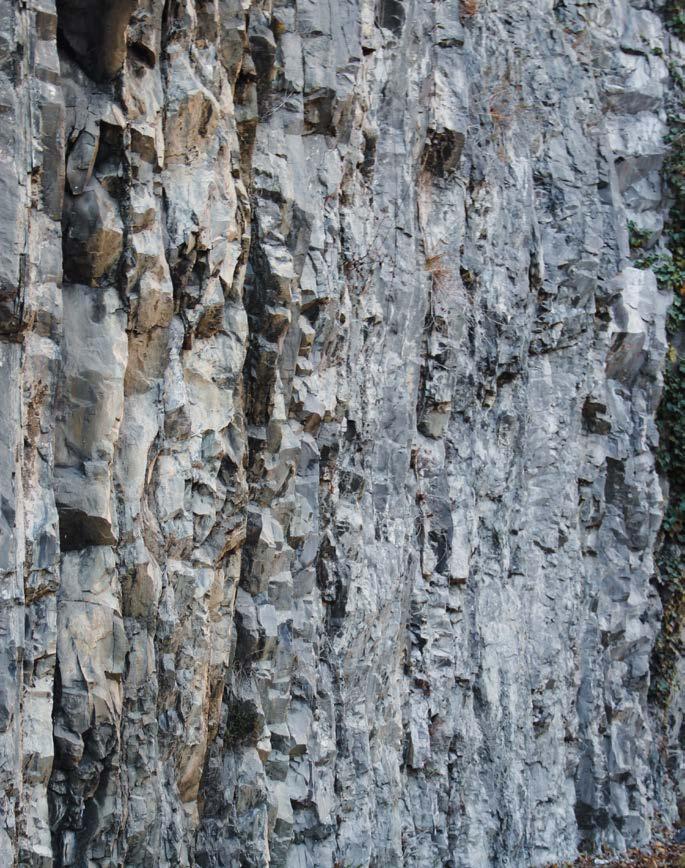
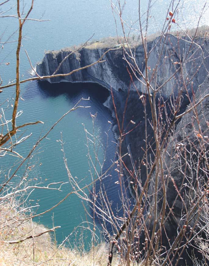
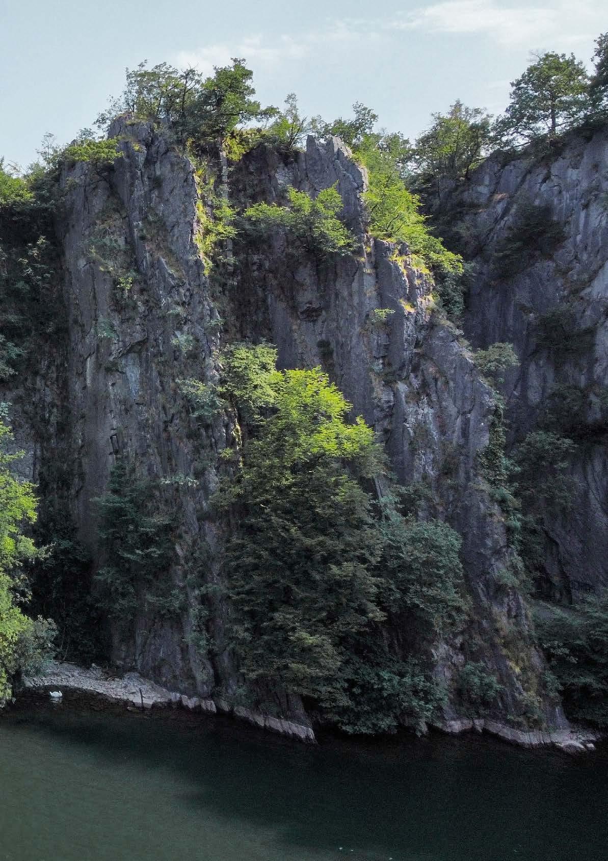
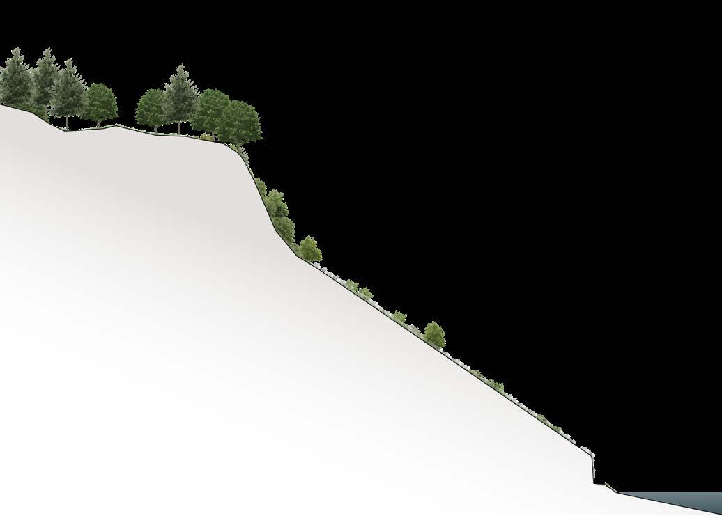
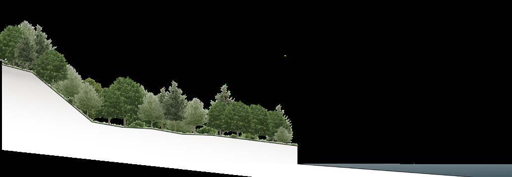
Order and disorder, regular and irregular, calm and chaotic, quiet and noise: the main manifestation of the tie among the steep green precipice and the bluish water body of the Orrido del Bögn.
This panorama becomes the workshop of the representation and sublimation of the vertical continuity of the project.
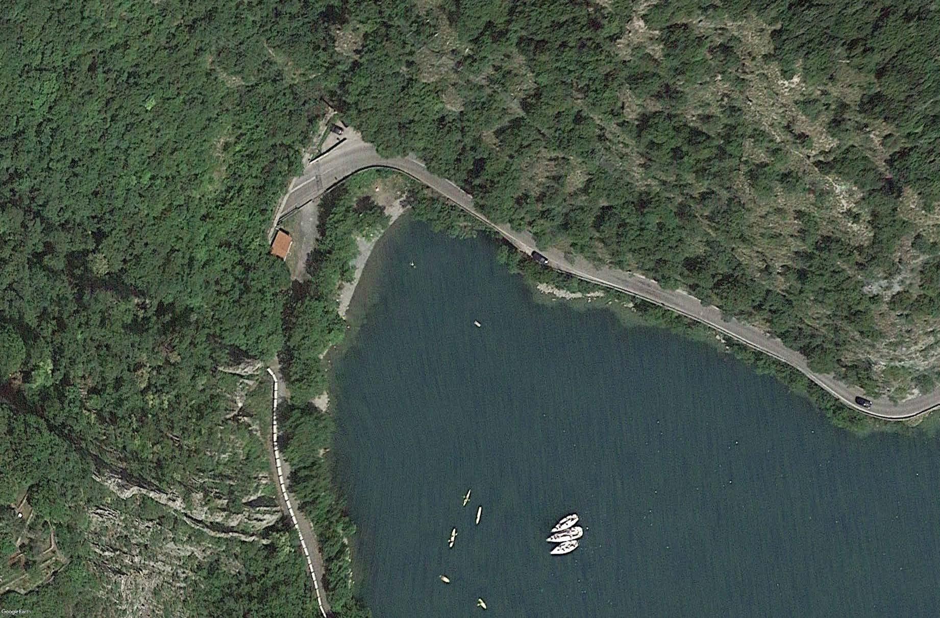
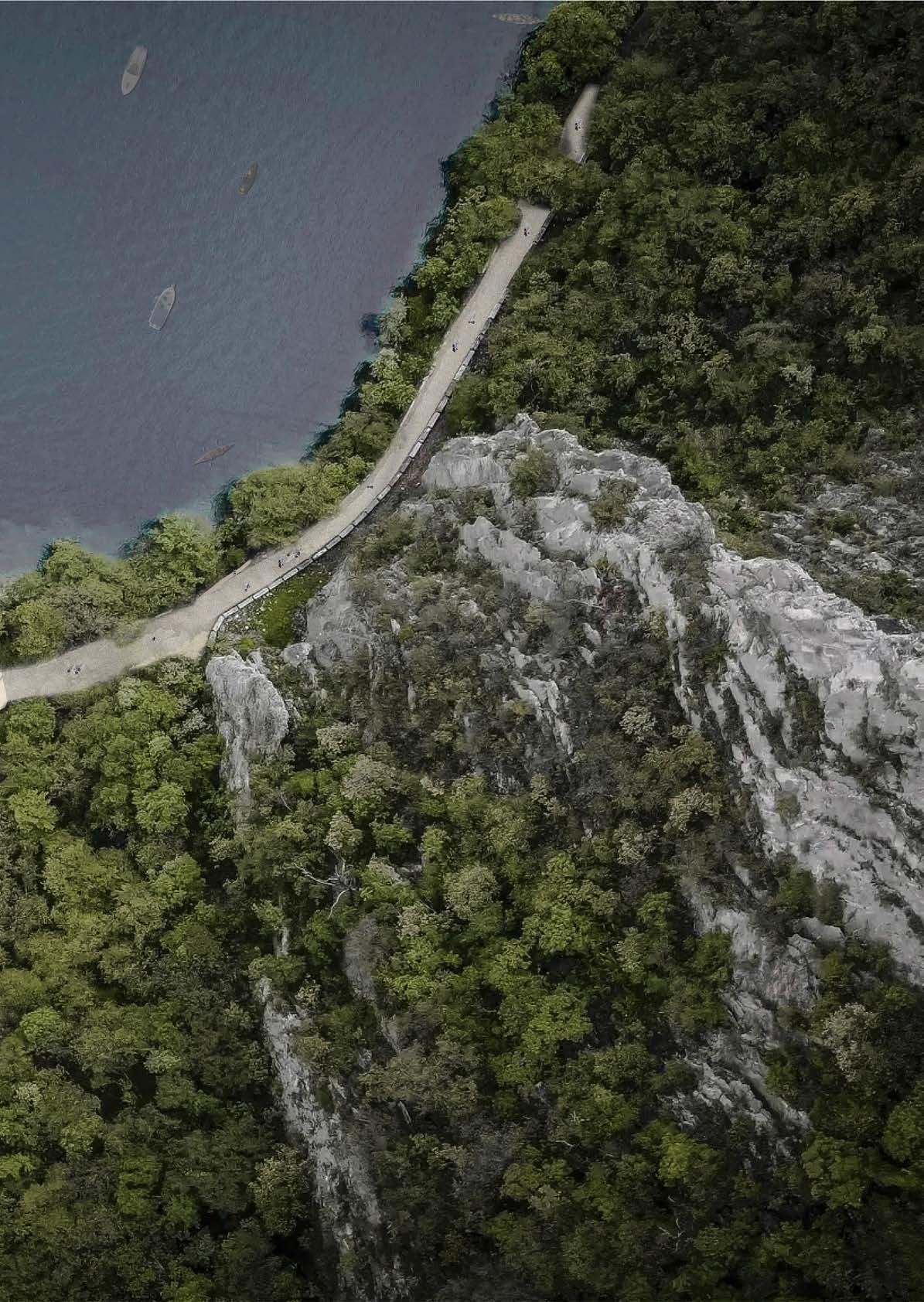
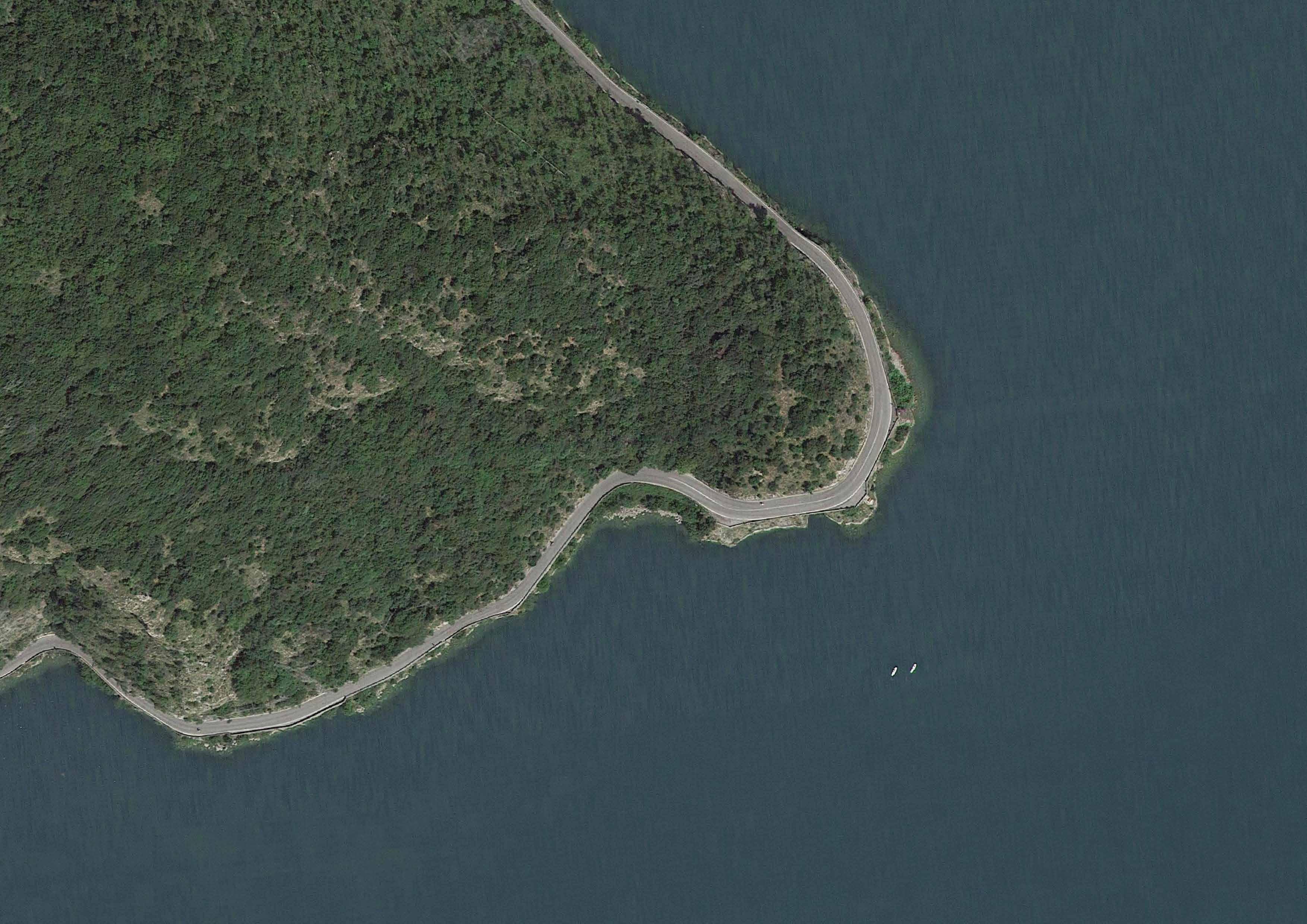
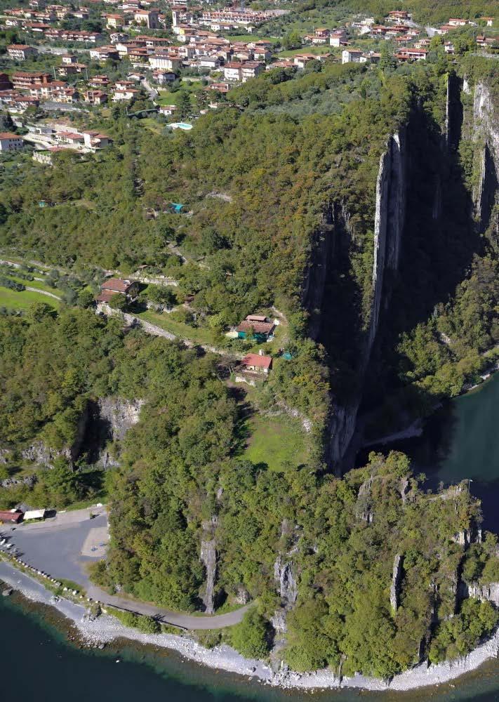
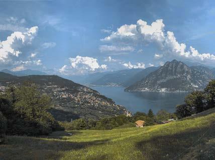
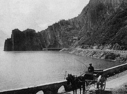
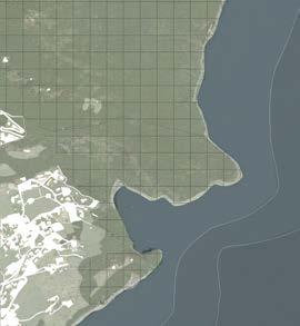
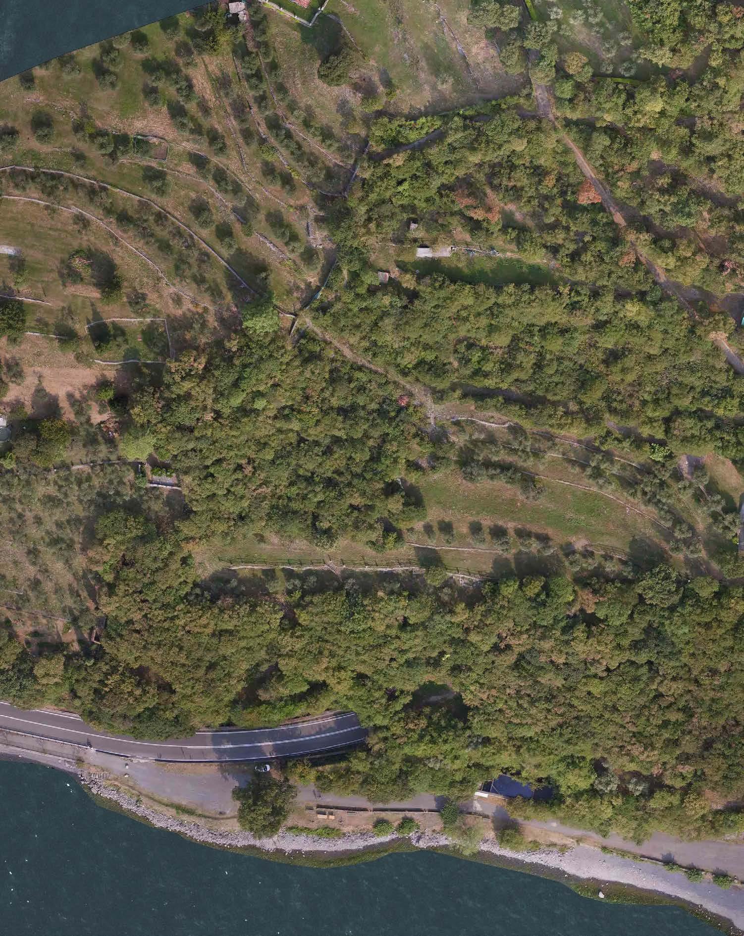
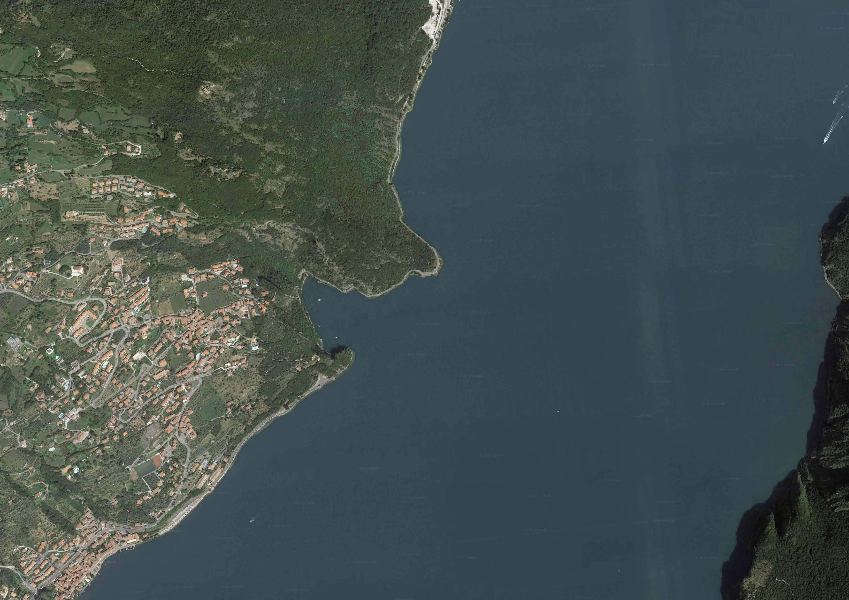
In the opening chapter, a first survey frames the area, looking at it in distinct way: around the Orrido di Zorzino – or Bögn, as the locals used to name it -, the captivating ravine which originates and is coasted by the Lake Iseo, situated in the north area of the Lombardy Region.
Looking closely, the reader has the chance to have a first contextual description of the mediaeval villages which compose the Municipality – Riva di Solto, “the shore lying between the lake and the overhanging slopes” – within which the Orrido is located.
A fundamental historical background – looking back at the origins – is necessary to highlight the district's leading role in the infrastructural structure of the Bögn, properly analyzed looking deeply into the urban, ecological and mobility system. Moreover, a first pragmatic glance is provided by a photographic narrative, a suggestive experience along the Orrido which runs from the lake till the highest peak of the rock.
The wild mountain landscape plays a principal role in the second chapter, where the locus horridus starts to be appreciated and combined to the captivating panorama of a locus amoenus
This idea comes from the word of the site project, the main representation and sublimation of the sharp green-grey ravine: the Italian term which gives name to the area, Orrido, is representative of two distinct – but combined – aspects, the physical and esthetical one.
Its material facet, Orrido – as a masculine noun – refers to ravine, gorge, precipice which is the product of the streambank erosion. While, using it as an adjective, the esthetical side prevails, arousing the sense of wild and horror of the area. Thus, two concepts specify the combination among these two sides of the same word: Sublime, attributed to Orrido as an adjective, and Shan Shui, related to it as a noun.
Romantic and Chinese art paintings can clearly emphasize the two approaches: through the depictions of distinct and astonishing landscape, the sublimation and representation of the natural environment is raised.
A following chapter provides an analysis of the current situation of Riva di Solto area, looking to the on-going projects gradually proposed after the land art installation of Christo and Jeanne-Claude.
Thanks to “The Floating pier” exhibit, Lombardy Region allocates 10 million euros as a co-financing contribution for redevelopment, enhancement and promotion interventions, proposed and summed up in the Territorial Development Framework Agreement. Riva di Solto is one of the 16 municipalities involved, and decides to suggest an extension project for the lakefront area.
The Architect Sergio Ghirardelli and his team, already included in some district’s proposal in 2018 (Olive tree walk project) have been dragged into the new design approach for the southern area of the Orrido del Bögn. As far as it has been concerned, the suggested interventions seem not to follow the natural shape of the area, but are rested on the land, on the landscape, covering and hiding it, reducing its environmental and cultural value. A physical limit – distance – between the human and wild sphere is visible and noticeable: the observers can perceive where the nature has been afected by manmade features.
These approaches emphasize the need to create a significant balance, composition and form for the Orrido di Zorzino area: hence, Shan Shui represents the design concept which has been involved in the project.
The vertical development and link among Mountain (Shan) and Water (Shui) proposes and combines a straight-up experience from the body of water to the natural elevation of land. Through its mystical requirements (Threshold, paths and cores), two main performances are developed along the vertical loop of the Orrido: the lake and mountain experiences
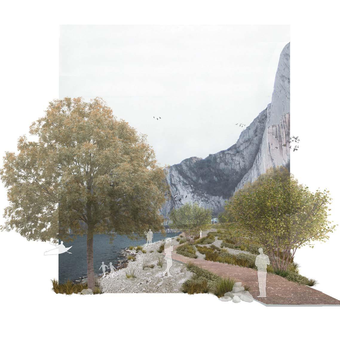
From a chaotic and dynamic site, the littoral area of beaches, main accessibility points and ways at the water level to a calm and silent space of resting and panoramic spots: minimal and reasonable design proposals are clearly depicted in the last and main chapter of the thesis.
Elegance, minimalism, continuity, integration and cohesion – combined with the Shan Shui design approach – are the key players which guide the project of the Orrido del Bögn.
When the landscape and its values prevail on the design ideas, the chance to think through a future growth and development goes up.
Framing
Looking around
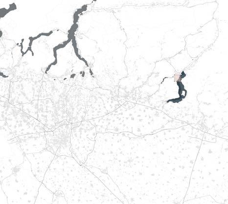
As a relevant UNESCO1 site for the landscape within it is located, Lake Iseo – known also as Sebino - acts as the main water feature for the several and tiny districts which run along it. Since it is situated in the north-east side of Lombardy Region, also the principal cities - such as Milan, Sondrio, Bergamo or Brescia - could reach it out easily and rapidly.
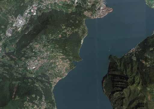
A fundamental role is played by two of these major Provinces, Bergamo and Brescia, which equally share the water element: as a matter of fact, the body of water – which is the fourth profoundest lake in Italy for a maximum depth of 251 meters – represents the landscape of the two sides, among which it is split into.
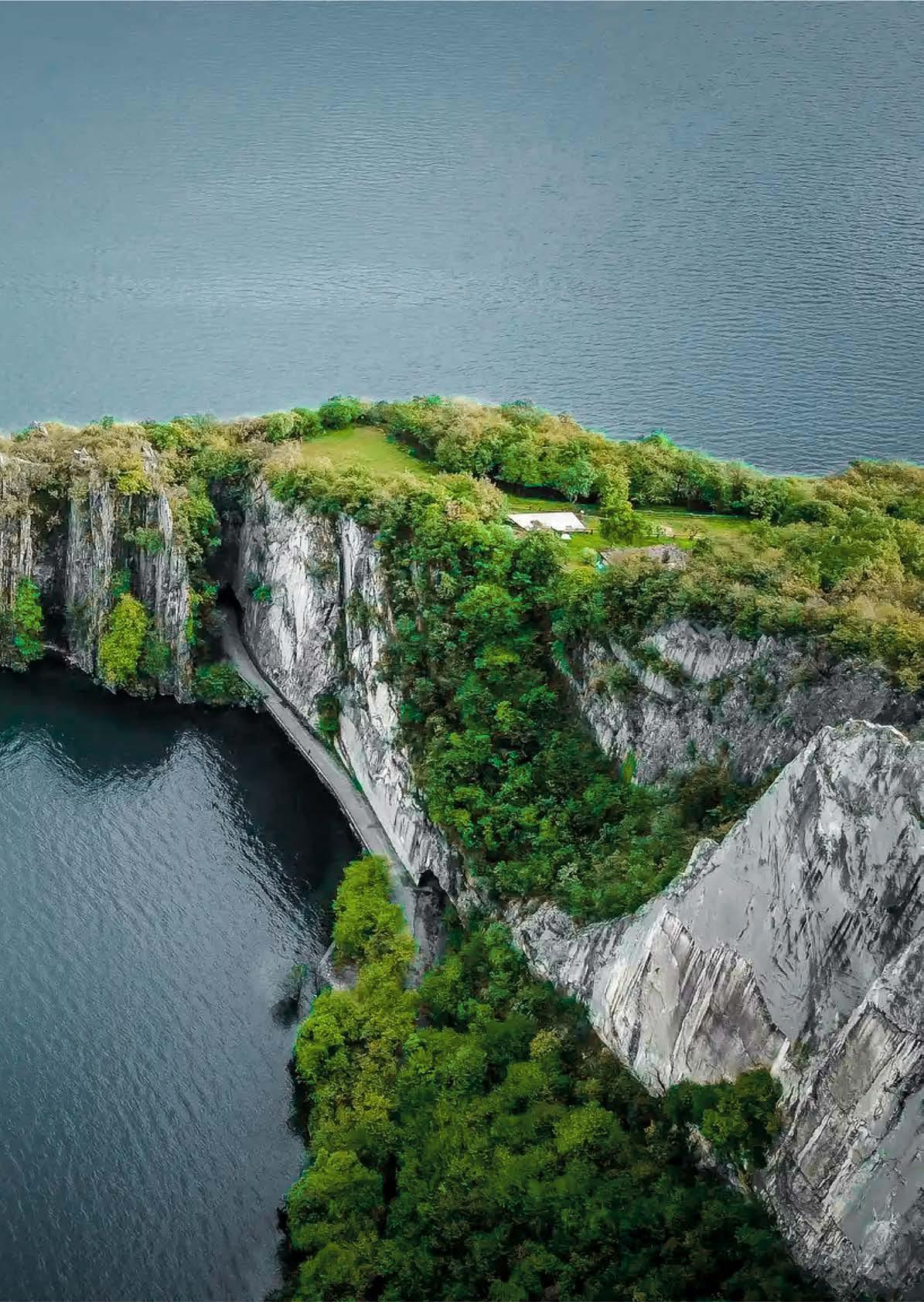
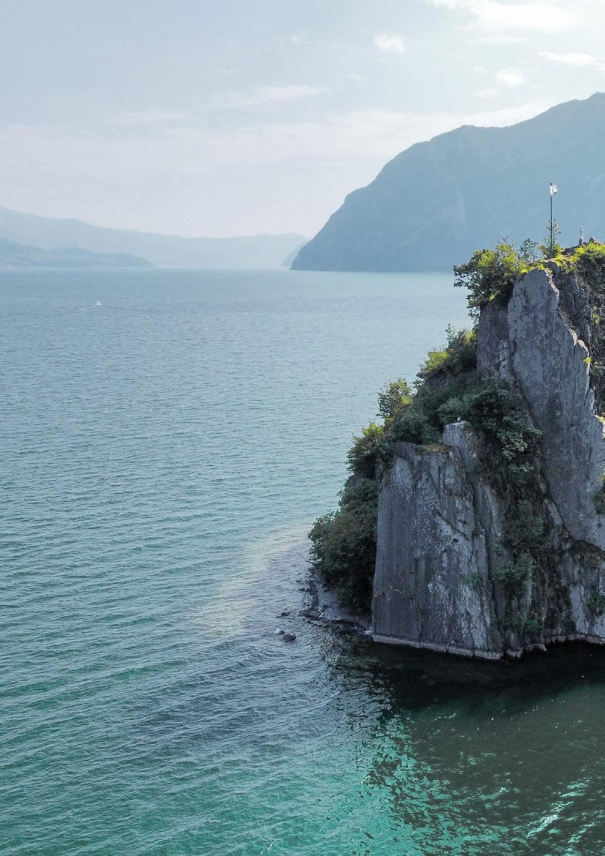
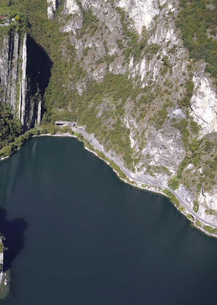
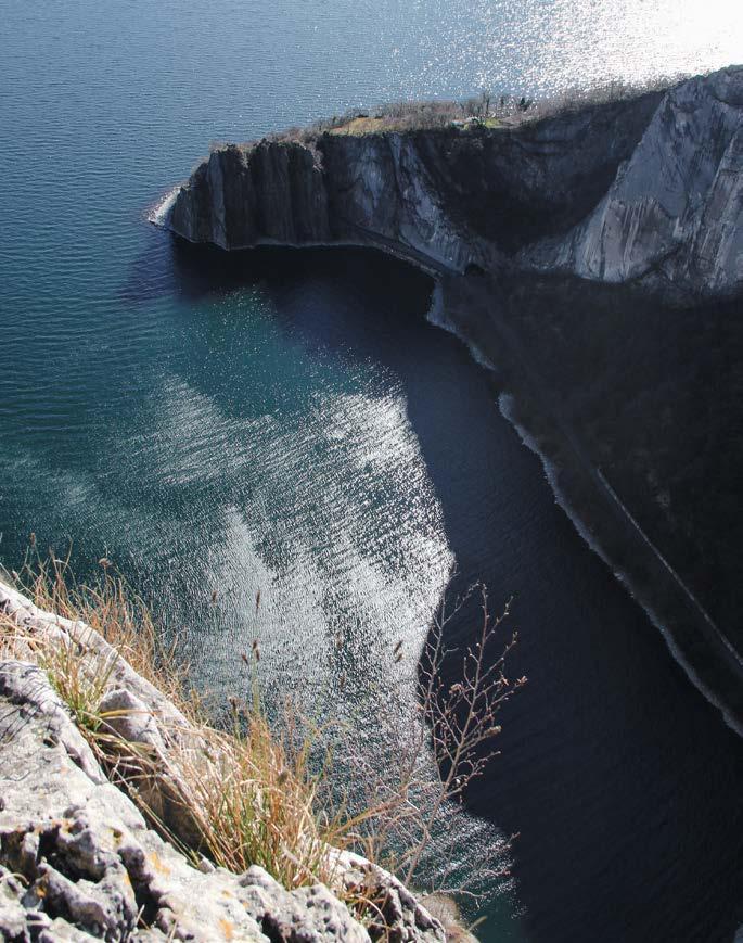
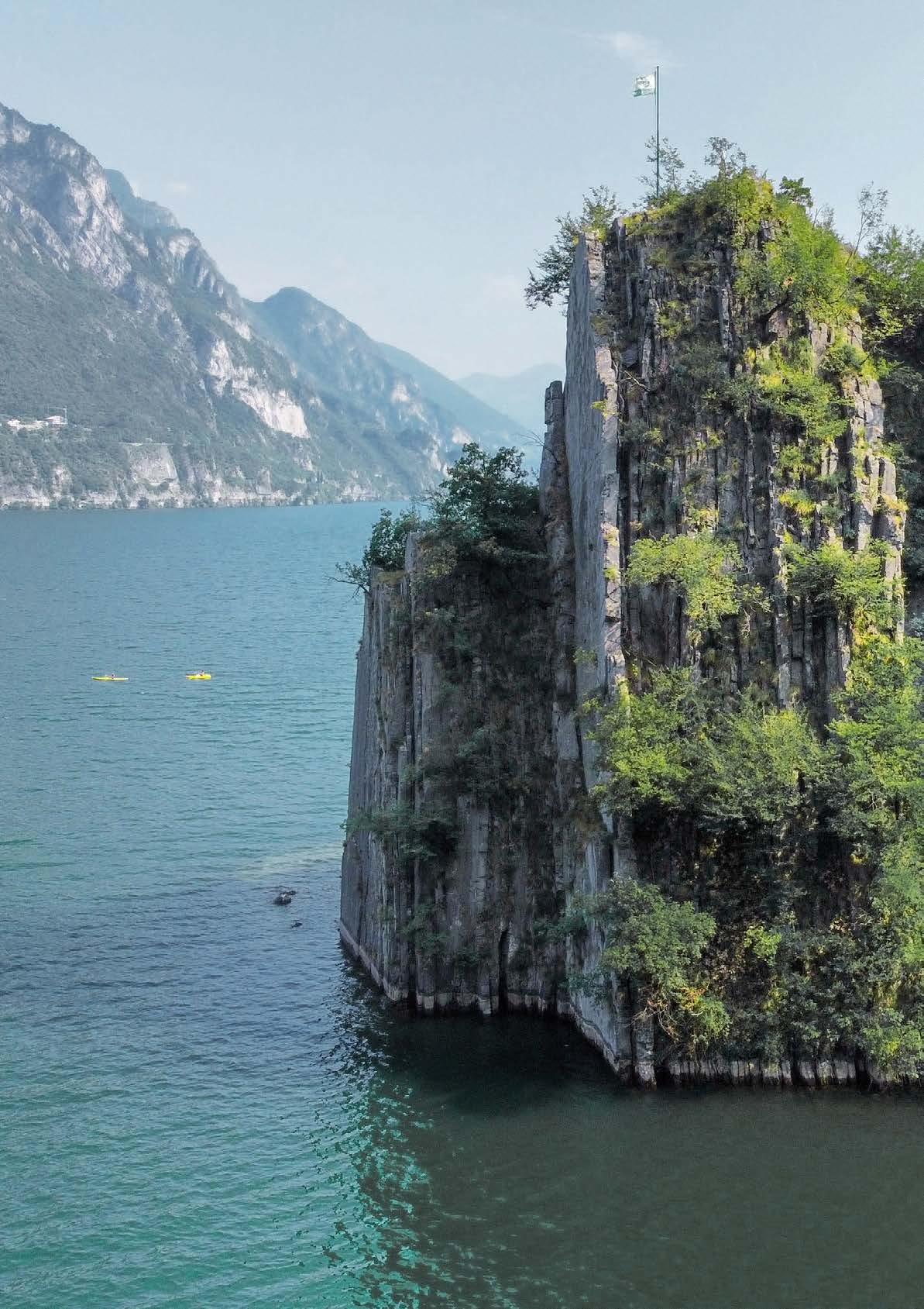
Nevertheless, these lakefronts have distinct features and ofer contrasting conditions: the oriental zone proposes diferent activities, merged within the environment and properly linked between each other due to the pedestrian-cycle path and the regional train, which coast the lake. On the other hand, the occidental side has a deeper lakebed, characterized by a wildest and rarely used landscape. This rough environment describes in an efcient way the surrounding of Lake Iseo and its formation: its elongated shape depends on the development of the existing valleys and districts, which were dug by the near-by rivers. Moreover, the Val Camonica glacier – situated in the northern side of Province of Brescia – had an intense efect on both sides of the lake, shaping its surrounding walls, known as Orridi (it) or Ravine (en), a deep-narrow valley with steep faces.
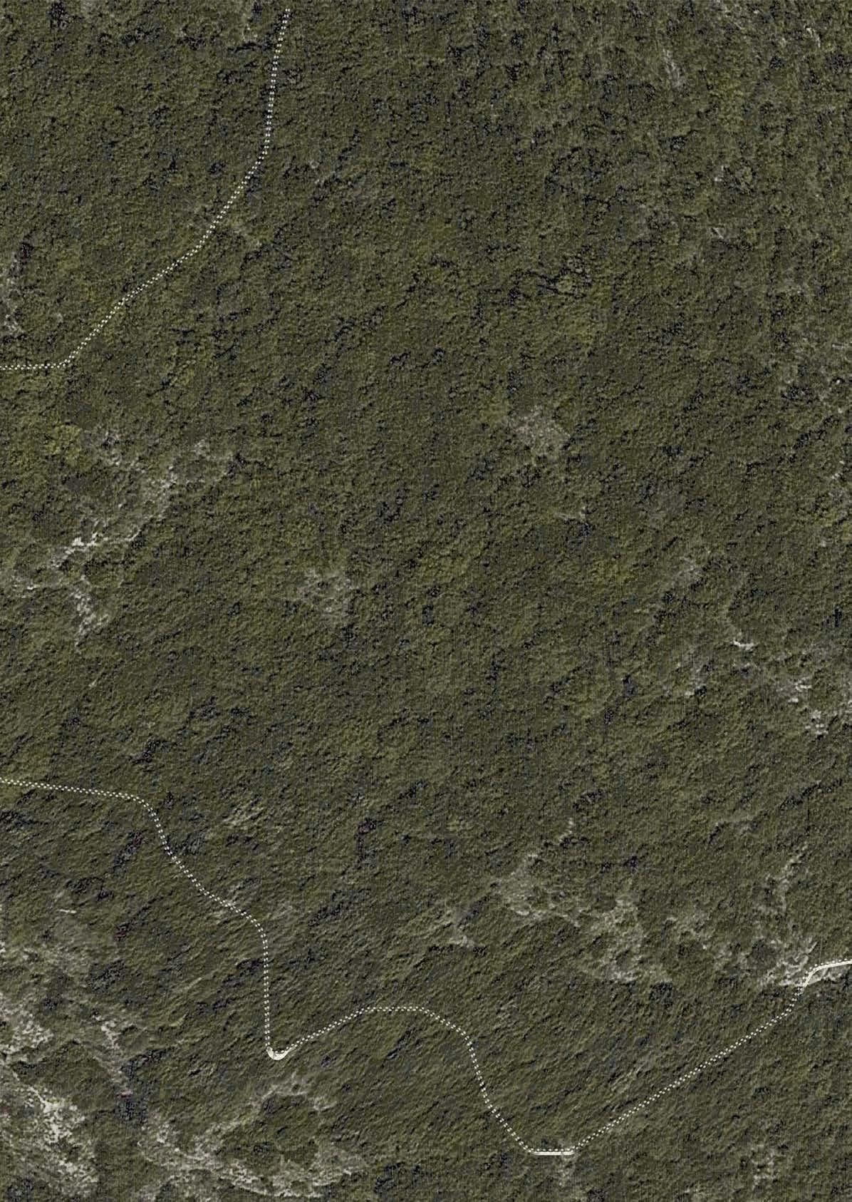
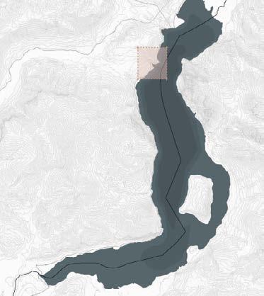
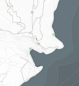
Orrido di Zorzino and Orrido di Castro define an edge within the project wants to act. The first ravine² is the one which will get the focus in the analysis and design approach.
Looking closely
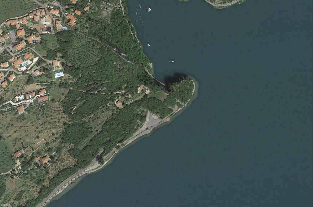
The wild and sensational gorge is situated in the north-west side of the Lake and represents a landmark for Riva di Solto, the agricultural municipality within which it is located. As its name suggests - “the shore lying between the lake and the overhanging slopes”³- it is located on the steep oriental lakeside and ofers several panoramic points of view on the surrounding and vegetated landscape. Three mediaeval villages – Gargarino, Zù and Zorzino - depict and are part of it, supplying an historical background by the presence of scattered fortification towers and religious and cultural buildings.
In particular, the vertical and straight ravine takes name from the district within which it is placed, Orrido di Zorzino: the site is also well known as Bögn, which can be translated as “coves” according to the dialect of the occidental side of the lake.
Looking back
The history of the sharp ravine is mainly related to the infrastructural system of the western zone of Lake Iseo. Before the 20th century, the accessibility to the area was allowed only by ferry: Riva di Solto’s port played a leading role, being considered one of the main harbors for both economic and social purposes.
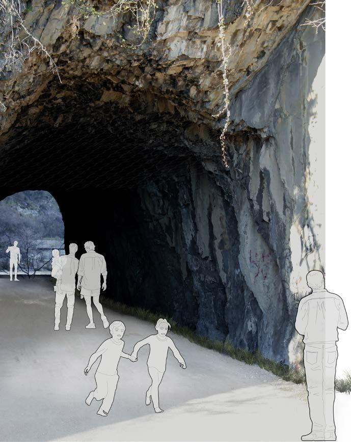
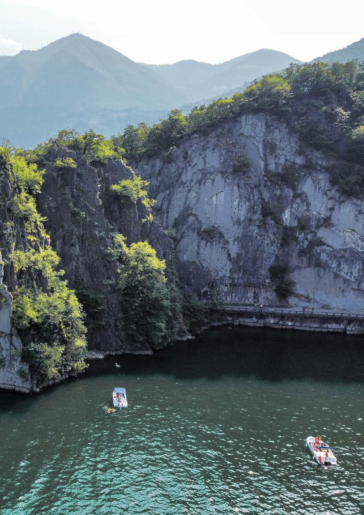
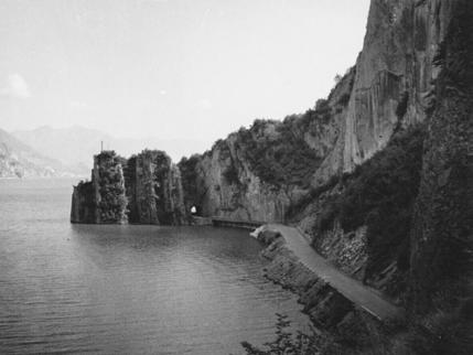
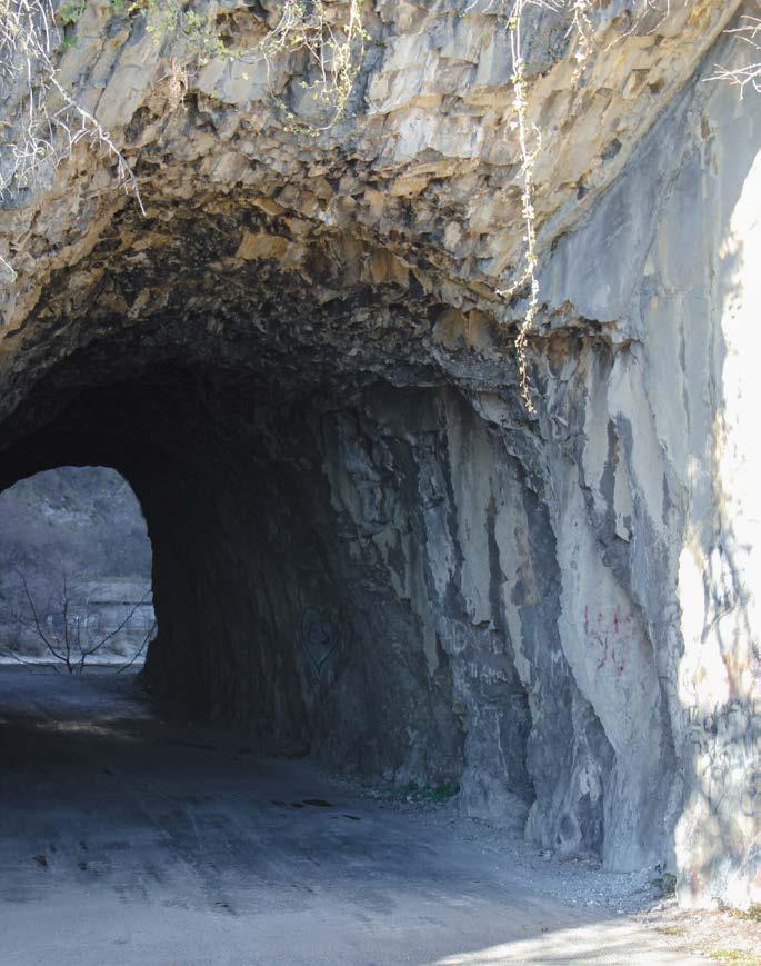
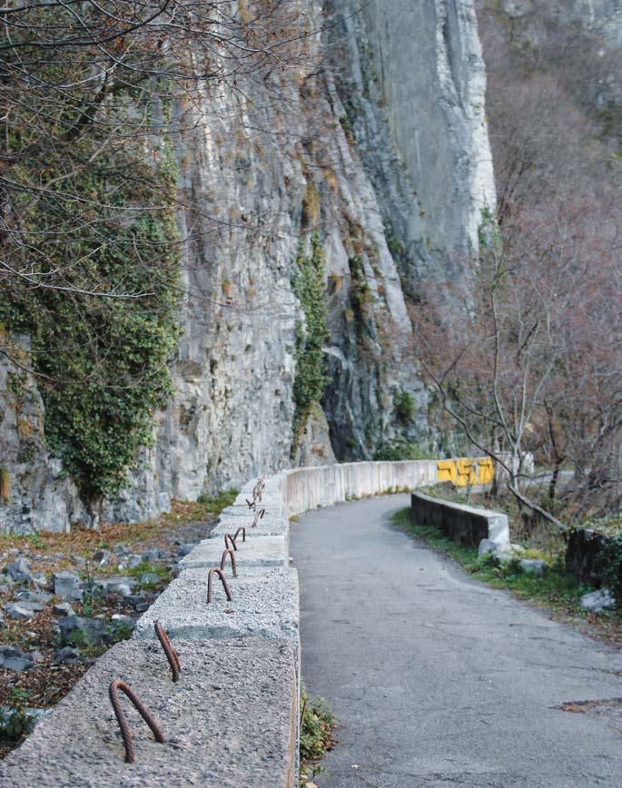
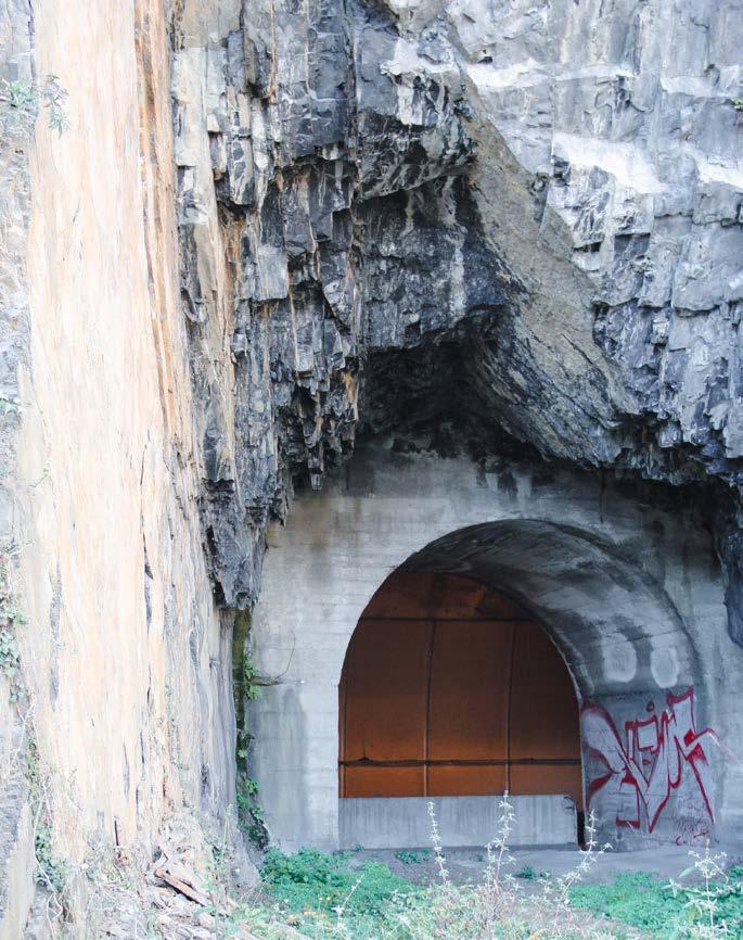
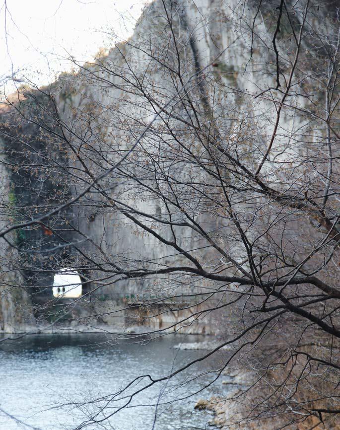
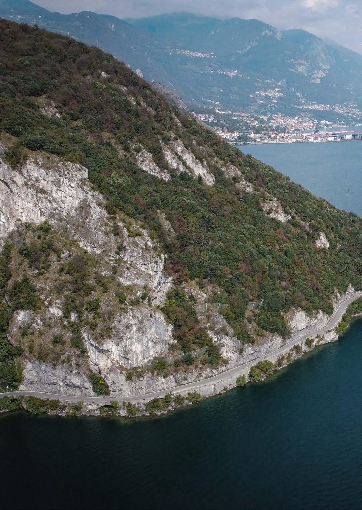
In 1910, the rocky walls were dug in, providing enough space to create the new – and still existing - littoral road (Strada della Rivierasca) and its system of "natural-artificial" tunnels: a first link by land was built up, defining a physical connection between the coastal villages. It emphasized the role covered by the vertical gorge, becoming a captivating site for those who run along it.
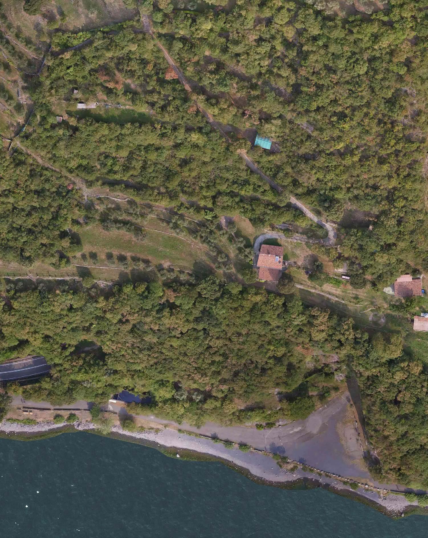
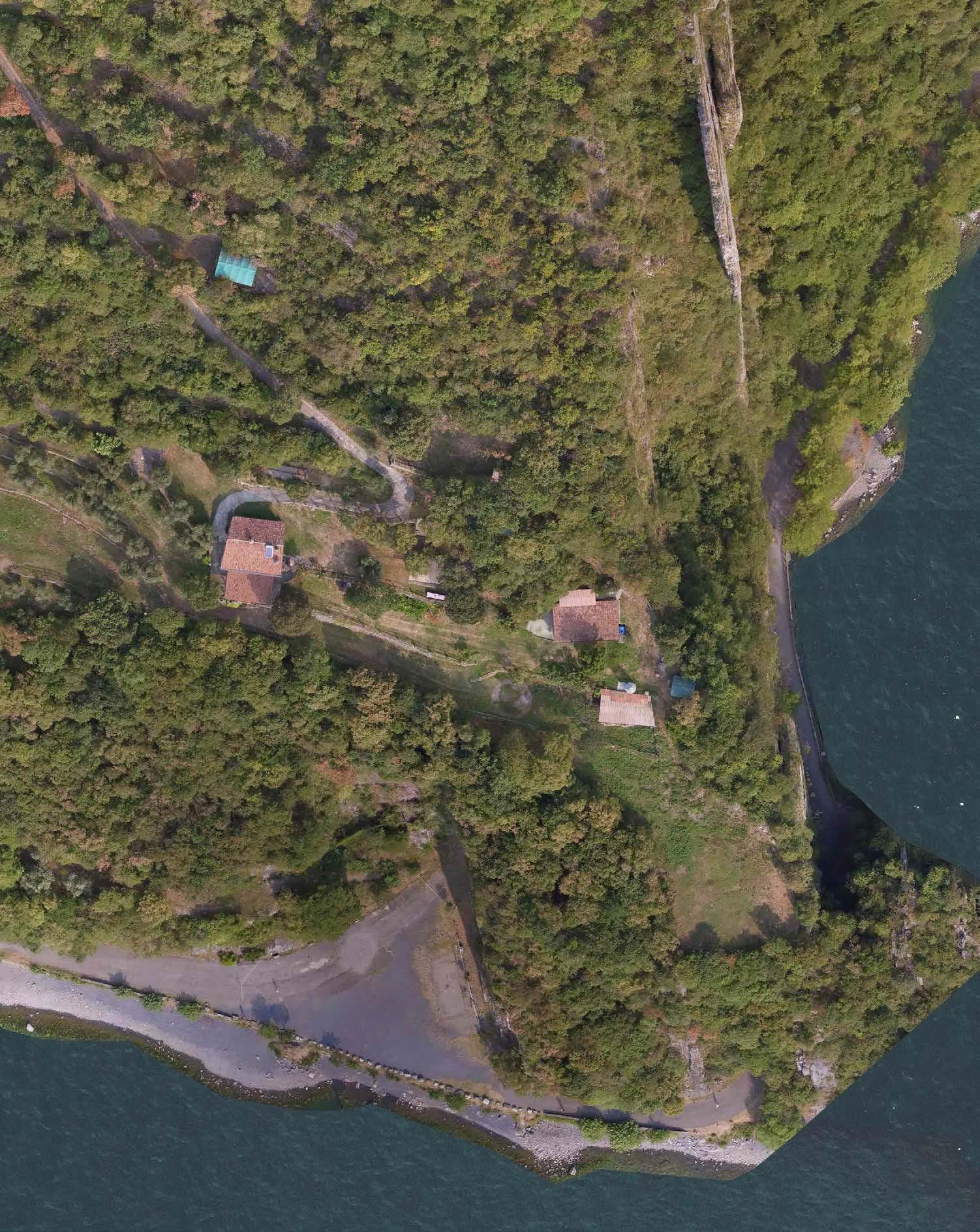
In order to define a proper leisure and cultural site in the Orrido di Zorzino area – today known as Natural amphitheater of the Bögn - in 2002 the littoral road was interrupted: a parallel and additional cut-andcover tunnel ⁴ was built, supplying a new infrastructural access to Riva di Solto municipality. It allowed to diversify – and physically split - the pedestrian and vehicular trafc, providing an historical, cultural and fascinating path running among the green-grey steep gorge and the bluish clear lake.
Infrastructural system
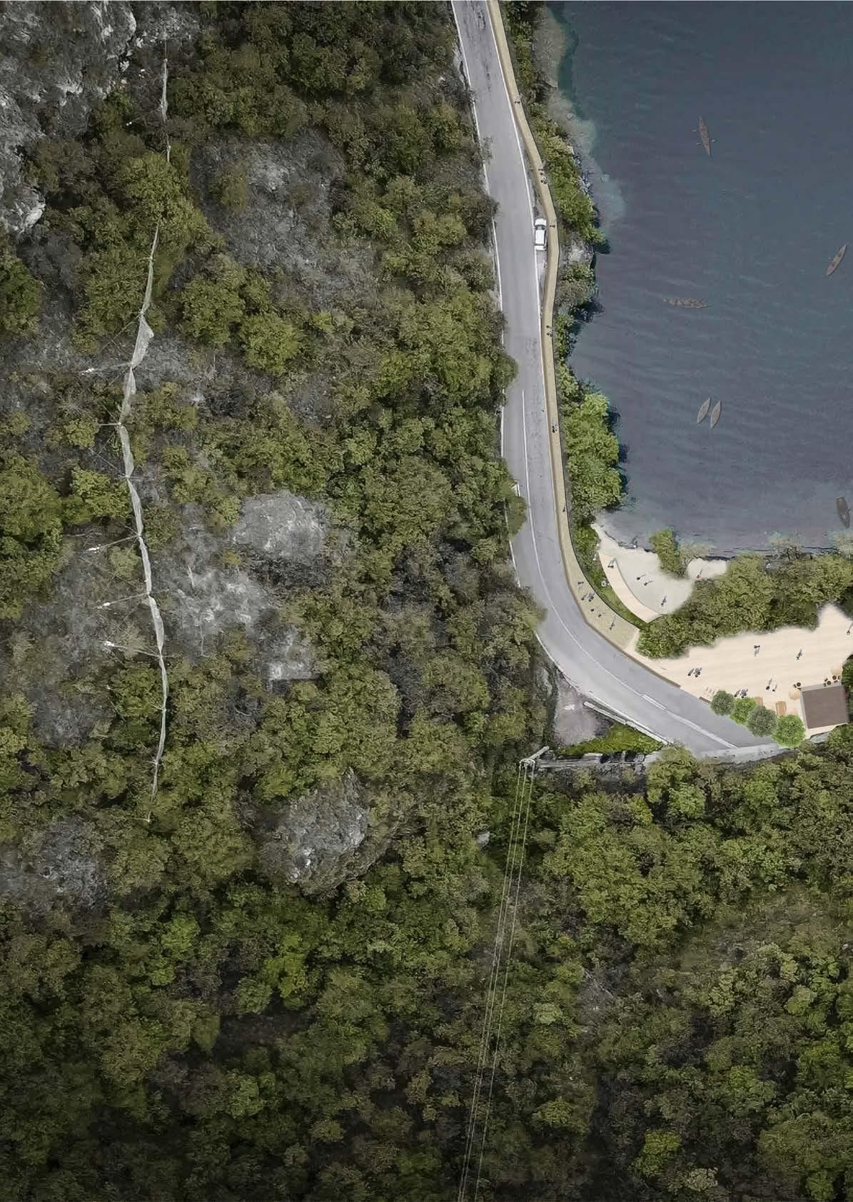
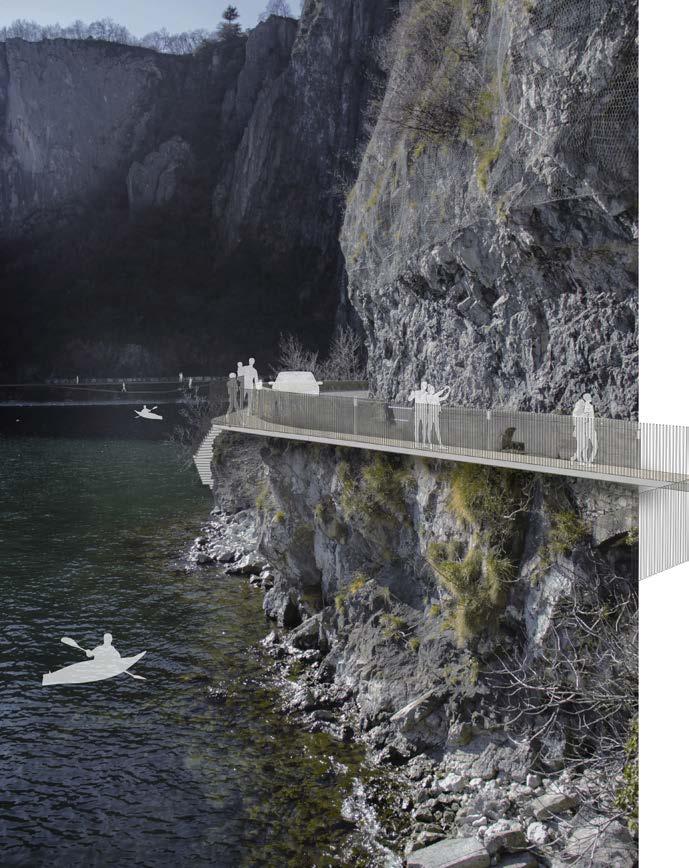
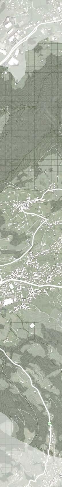
Since 1910 – and thanks to the 2002 intervention -, Riva di Solto is reachable through the principal road known as Rivierasca street, which runs along – and close - to the lakefront: it is characterized by the stony vertical walls of the Orrido di Castro and Zorzino, ofering a breathtaking panorama to its distinct users. Drivers, bikers and hikers tend to share the narrow road area which is considered quite risky for several reasons: due to its morphology, the main way which links Castro in the north to Riva di Solto in the south used to be closed for the high risk of collapsing rocks or landslide events
Furthermore, the safety of accessibility and usability of the space is considerably reduced, due to the confined 5 meters street area where pedestrians and cars must coexist.
In some specific circumstances, the Rivierasca street tends to be closed to vehicular trafc: it happens mainly during the summer season, when cultural and sporting events occur. “An overhanging walk on the Blue” is a proper example proposed by Riva di Solto and others near-by municipalities, which want to support the fascinating landscape, providing several activities along the lakefront.⁵
When the pedestrian flow prevails on the littoral road, a longer way links Castro and other northern municipalities to the Orrido and Riva di Solto area. A 20-minute section of the main road n.42 connects the north district to the southern one, driving in the inner landside of the valley. Another route provides an easy access from the meridional areas: the same coastal street – closed to vehicular trafc between Castro and Riva di Solto villages - is mainly used in the opposite way (south-north) by visitors who come from the southern cities such as Milan or Bergamo. For people who used to enjoy panoramic walks surrounded by nature, several hiking paths ofer the chance to get into Riva di Solto and the Looking deep
Orrido di Zorzino from their highest points – reaching a peak of around 600 meters.
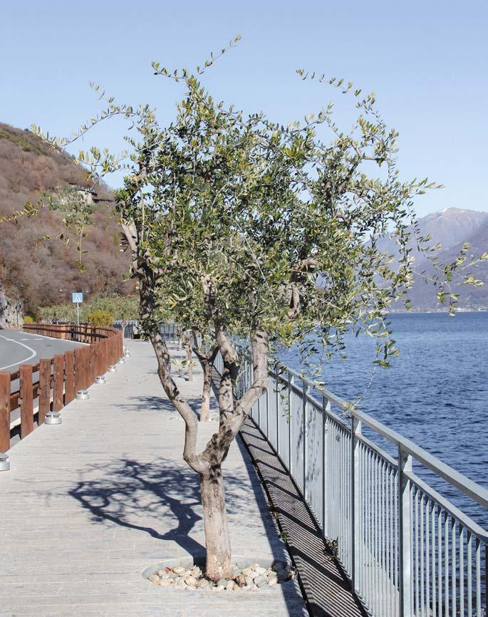
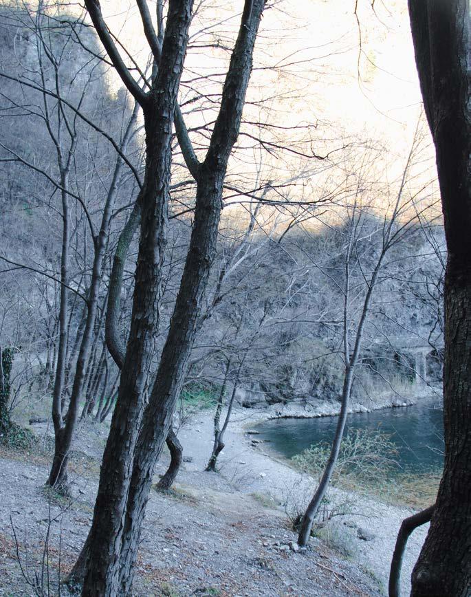
The distinct trails scattered among Castro and Riva di Solto provide various ways to visit the site and its surrounding such as the captivating Cold Valley, Marni quarry or Gré leisure area, supplying a great number of panoramic spots on the landscape. In particular, a small chapel on the top of the Orrido di Zorzino can be reached and be accessible from diferent points – and levels - thanks to several hiking routes. Moreover, a fascinating pedestrian walk coasts the Lake Iseo and the Orrido site: the Olive tree walk, planned in 2018, provides nice strolling and resting spots along the lakefront. The way starts in the city center of Riva di Solto and reaches the main core of the Bögn, walking through its surrouding and the natural tunnels (part of the 1910s littoral road) which split the site in two sides: the beach in the south and the wildest area in the north.
Urban and cultural system
The medieval village of Riva di Solto has an historical urban fabric, characterized by the great amount of ancient – and reused –structures: an old castle converted in a hotel, religious buildings still scattered around the district and some fortifications features, such as the Port Tower. Its old aspects are also noticeable by the interweaving of winding alleys perpendicular to the shore with several faces between ancient houses, some of which are surmounted by coast of arms. Furthermore, the municipality has a large reputation due to its black marble quarries: the well-known columns in the Basilica of San Marco, in Venice, were made thanks to the local extracted marble. Marini marble quarry - and the company who manages it - is still active along the Rivierasca street, providing raw materials and a nice spot along the fascinating lakefront of Sebino.
Additional panoramic points are scattered along the littoral road such as Gré site, a leisure area on the lakeside which is also well-known thanks to the extraction activity of its local material, Ceppo di Gré⁶. Likewise, Punta delle Croci Bergamasche ofers a captivating 360-degree view on the ravine and the landscape in front of it, the oriental side of Lake Iseo, Punta delle Croci Bresciane.
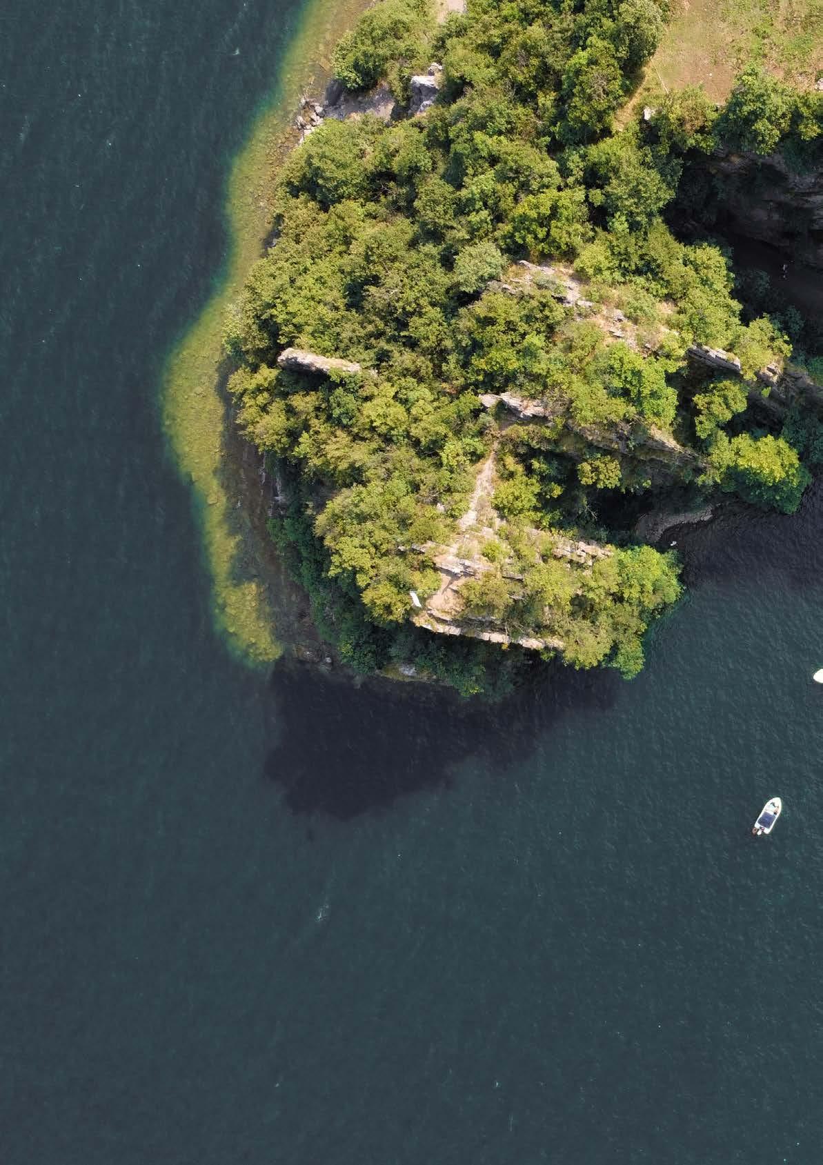
Besides, the gorge of Zorzino is not just a fascinating site to enjoy a walk or swim, but it also provides various panoramic points on its environment, from diferent perspectives and levels. The Madonna del Bögn, situated on the southern rocky mountain of the ravine - at around 250 msl - , ofers several views on its landscape: on the vertical walls of Riva di Solto and Castro, the oriental alpine side and the largest island of Lake Iseo, Monte Isola.
Astonishing sceneries are also depicted from the northern churches, located on the peak of the gorge – at around 600 msl: San Defendente church and the small chapel near-by, which are linked to the coastal level below by the panoramic hiking paths.
Ecological system
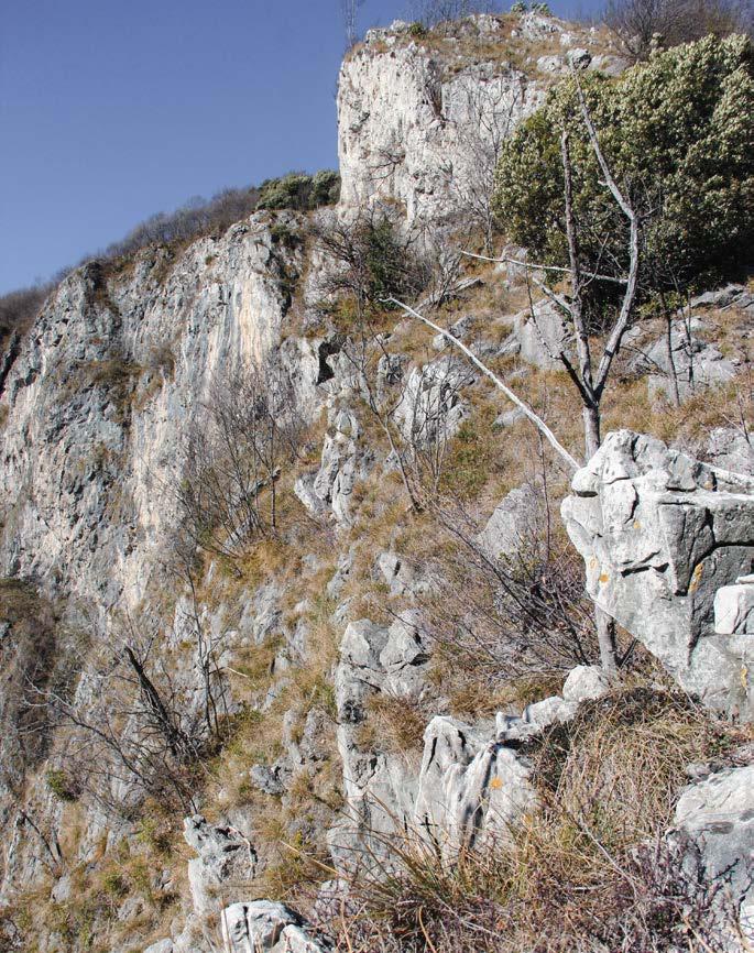
“From the lake up to the mountains”⁷, the Zorzino gorge is a great personification of the tie between land – which reaches a peak of 600 msl - and water (185 msl). The sharp stratification of the ravine, remote horizontal marine sediments, have been originated by the vertical eforts of the Alpine orogeny: these strengths have powerfully acted on the Lake Iseo ‘sides, bending, breaking and lifting the rocky walls of the mountain⁸.The picturesque landscape of the Orrido represents an impressive balance of wooded areas and rocky outcrops of carbonate rocks, which refer to the formation of the Zorzino limestone. In particular, the ravine consists of a succession of blackish limestone or dark-gray fetid percussion, which are locally interspersed with dolomite limestone and rare blackish marl.The main structural-geological feature of the site is defined by the tectonic element known as Faglia della Valle dei Cani (Faulf of Valle dei Cani), which splits the Zorzino limestone on the west side, to the Main Dolomite (Dolomia Principale) on the northern one.
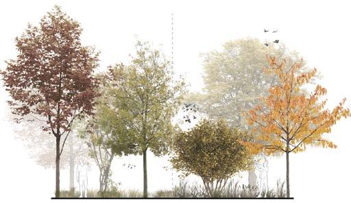
A fundamental role is also played by the plant population, in particular the preciousness of the Sebino flora which ofers an equally strong and fascinating surrounding: a great combination of deciduous forest, olive groves and vineyards, perennial shrubs and a wide variety of herbaceous species.
These main features attribute a significant natural value to the Orrido, which is defined as an “unicum” in the great lakes of Lombardy. In addition, for both the geomorphological and botanical peculiarities, the site is included within the “Area of Environmental Relevance Iseo-Endine"⁹ and in the Alto Sebino Park – which is part of the Regional Forestal Plan¹⁰
Notes
1. Lake Iseo is part of the “Riserva della Biosfera, Valle Camonica – Alto Sebino”, a UNESCO site since July 2018. From the water element (185 meter on the sea level) to Mountain Adamello (3.539 meters on the sea level), the MAB UNESCO area is an unparalleled set of landscapes and biodiversity that preserves an extraordinary heritage of historicalcultural, artistic, artisan, gastronomic and identity values.
2. Ravine: sloped area, mostly where a stream is forced to overcome with a gorge resistant rocks, among which the aters fall with thunder. Treccani definition
3. Riva di Solto name is a compound of Riva, “the shore”, and the name of the hill near the town, Solto, from latin Saltus, “wood” https://www. rivaoutdoor.it/storia-di-riva-di-solto/, http://www.comune.rivadisolto. bg.it/introduzione.aspx
4. Cut-and-cover tunnel is the oldest method of tunneling. The basic concept involves the digging of a trench, the construction of a rectangular tunnel and the cover of it using the original cut surface.
5. “An overhaning walk on the Blue” is an event happening in September, when the coastal road is closed to trafc from 9 to 19, providing diferent activities for all tourists and citiziens. A great combination of nature, sports, music and food. https://visitlakeiseo.info/en/eventi/astrapiombo-sul-blu-5/
6. Ceppo di Gré is a greyish-bluish natural stone: its name comes from the dialect meaning of “rocks made of pebbles” - Cepp - and the site where it is extracted, Gré situated between Castro and Riva di Solto villages. https://it.wikipedia.org/wiki/Ceppo_di_Gré
7. “Il Bögn di Zorzino, una “fessura” di roccia a picco sul Sebino” - “The Bögn of Zorzino, a crack in the rocky walls overlooking the Sebino, Lake Iseo”. Article by M.Cangelli, BergamoNews; https://www.bergamonews. it/2020/11/08/il-bogn-di-zorzino-una-fessura-di-roccia-a-piccosul-sebino/403257/
8. Naturalistic Ring of the Orrido di Zorzino. Around the picturesque coastal ravine of Lake Iseo in the Municipality of Riva di Solto; by A. Avogadri, naturalist.
Anello Naturalistico dell’Orrido di Zorzino, Attorno al suggestivo anfratto costiero del Lago di Iseo in Comune di Riva di Solto. A. Avogadri, Naturalista. Annuario a cura delle Sezione e Sottosezione CAI di Valle Camonica e Sebino.
9. Area of Environmental Relevance “Iseo-Endine” (L.R. November 30, 1983, No.8). Regional Plan of protected regional areas. Rules for the establishment and management of reserves, parks and natural monuments as well as areas of natural and environmental importance.
10. Forest plan – PIF, Piano di Indirizzo Forestale – protects wooded areas and enhances the pastoral agroforestry recourses of the mountain communities of the Bergamo Lakes.
Photograpic framing


Locus horridus et amoenus
Locus horridus et amoenus
The captivating ravine where the project wants to act has the chance to be representative of two distinct – but combined – aspects: the physical and esthetical sides of the Italian word which gives name to the site, Orrido.
Its material facet, Orrido – as a masculine noun - refers to a ravine, gorge, precipice which is the product of the streambank erosion. While, using the Italian word as an adjective, the esthetical side prevails, arousing the sense of wild and horror of the site.¹
Two main concepts will play the role to specify the distinction – and a kind of tie – between these two sides of the same word: Sublime, attributed to Orrido as an adjective, and Shan Shui, related to it as a noun.
“In the same place the nature was severe and wild. We walked, literally, on the edge of destruction; a misstep and life and its carcass were suddenly destroyed. The sense of all this produced in me diferent emotions, namely a pleasant horror, a terrible joy and, at the same time, as I was infinitely happy, I trembled”²
Jonh Dennis is the one who described some feelings perceived while he was looking at the majestic alpine landscape during his European journey: the perfect combination of what people feel while walking and observing the surrounding, both horror and harmony sensation
This manifestation of feelings is named by Edmund Burke as "delightful horror", “the horrendous that fascinates”, who describes a distinct way of perceiving the pleasure – considered as a positive sensation – and the delight. According to Burke, there is a kind of joy called diletto (delight), which is precisely negative or relative due to the fact that it flows from the disappearance of a pain or danger: it consists in a kind of tranquility obscured by horror, a kind of passion mixed with fear and wonder. Hence, the ability to provoke a feeling of delight or kind of sensations such as admiration, reverence and respect, is the assumption to speak about sublime, the strongest emotion the soul can feel ³
The Orrido di Zorzino acts as the great manifestation of it, where “the immeasurably great force of nature generates a sensation of fear and bewilderment on the viewer, that then result in attraction” ⁴ - as Immanuel Kant quoted, speaking of his concept of dynamical sublime. Thus, the site has the chance to raise these feelings, combining what scares and what enjoy, within which the principal role is played by the tie between the landscape and its audience.
A necessary distance among the perceiver and the observed panorama is a fundamental aspect in the concept of sublime. It comes out when the viewer faces the captivating surrounding which fascinates and terrifies at the same time and where a significant awareness of the environmental edge is needed: the sublime is “what is at the limit”, as the word itself
states ⁵
Therefore, the sublime must be contemplated as a “performance” by an audience placed at a certain distance, but capable of being involved empathically in the observed show: the mountain landscape becomes the place of sublimation, where the viewer can be “distracted” by an “unexpected spectacle” . Therefore, the panorama diverts the attention of the audience: it draws out the character from the closed of its inner soul and puts it in front of something which “does not leave indifferent” ⁶ The performance of the alpine panorama as something unpredictable can also be emphasized by the vertical perspective of observation: the landscape can be perceived in two distinct ways, bottom up or top-down. The natural scape ofered by the ravine, like the one of Zorzino, has the chance to amaze the observer, who is looking at it from a bottom-up viewpoint: the viewer, who is walking and looking at the surrounding, considers the height as a view in a straight-line of something overlying and - therefore - threatens, looms, powerfully rises above.
Conversely, the mountain scenery can ofer the agreeable kind of horror,⁷ a feeling perceived when the environment is experienced from an above point of view, where the axis summit/precipice has no solution of continuity and constitutes a symbolic and continuous line.
Romanticism
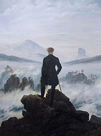
Great representations of the sublime are paintings by landscape artists such as William Turner and Caspar David Friedrich, based on the nature of Romanticism. The Romantic era is an attitude or intellectual orientation that characterized many works of literature, painting, music, architecture, criticism and historiography in Western civilization over a period from the later 18th to the mid19th century. Romanticism emphasizes the individual, subjective, irrational, imaginative, personal, spontaneous, emotional, visionary and transcendental aspects ⁸; moreover, a deepened appreciation concerns the beauties of nature and the emotions it can raise.
Physical
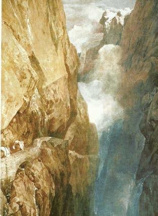
Among the English Romantic painters, Turner (1775-1851) is undoubtedly the most passionate and sensitive interpreter of the poetics of the sublime, that dynamical sublime – as Kant called it – which concerns the manifestation of nature: it is characterized by a great explosion of energy, which imposes itself grandiosely on man to stun his senses⁹
The subject of some of his most typical paintings are the destructive and frightful landscapes, in which the fury of the elements gives
dynamism to the composition. A majestic depiction of the sublime is Turner’s painting, “The Devil’s Bridge and Schöllenen Gorge"
This panorama represented a Turner's journey in Switzerland (1803), when he walked along the Devil’s bridge: therefore, the painting is only an exaltation of the sublime of nature, but also represents the feeling of dismay and wonder experienced by the artist during his journey. Moreover, the artist’s interest is catalyzed on the landscape where the high peaks loom over the viewer, also focusing on the most dramatic, and sublime, aspects of nature.
The work of art is occupied by the rock formations which, developed on both sides of the environment, fill the picture. The diagonals – formed by the stony walls – defined the space, which is intersected in the center, where Turner places the small Devil’s Bridge suspended in the void. A row of mountaineers, soldiers and mules are crossing it, while the background is characterized by the threat of the highest peak, half hidden from the clouds.
The steep ravines are combined with the natural flow of water, coming from the waterfall and sliding through the rocks. All these aspects, in particular the fascination aroused by the natural spectacle, are clearly emphasized using colors and light games.
The Orrido di Zorzino, considered as an alpine and mountain landscape, has a principal role in the manifestation of the vertical tie defined among the steep ravine and the water feature below, the Lake Iseo: thus, the meaning and use of the Italian word orrido as a noun well describe this link.
Translated as precipice, ravine or gorge, it is a geographical feature that is
usually narrower than a canyon and is often the product of streambank erosion: ravine is generally a fluvial slope landform of relatively steep sides. It can also not have active streams flowing along the downslope channel which originally formed them.
It is the case of the Orrido del Bögn which is originated by the Val Camonica Glacier, situated in the northern side of Province of Brescia: it had an intense efect on both sides of the Lake Iseo, shaping the surrounding of deep-narrow valley with steep facades.
Hence, the tie between mountain and water becomes not only a vertical and physical connection, but also a geological one, based on the origins of this landscape: an idea of perpendicular continuity attributes, to the action of water, the decisive role in the terrestrial morphology. Thus, the marine environment is a kind of continuity on the terrestrial one: as Le Clerc de Bufon says, the water is the main developer of the mountains, the valleys and the other inequalities of the earth; they transport the lands, which are arranged one above the other, in horizontal layers¹⁰
The main manifestation of this kind of landscape - within which the tie among mountain and water plays the principal role - is the concept of the Shan Shui, translates to Mountain-Water
It is the Chinese art of panoramic painting, extended to include gardening and landscape design: it usually depicts or involves scenery or natural environment, using a brush and ink rather than more conventional paints. Mountains, rivers and waterfall are typically the common subjects of shan shui painting.
Furthermore, Shan is the representation of the mountain as something static, silent, vertical and strong (Yang); while Shui depicts the dynamic, chaotic, horizontal and lying of the water lies on the earth (Ying) ¹¹
Notes
1. Òrrido adjective and masculine noun [from latin horridus, der. of horrere «be brisk, rough; horrify; feel horror»]. - 1. adj. That puts in the soul a sense of horror, of disgust, of fright, because ugly, wild, shabby, scary; said above all of places. 2. As true s. m. (also in the language of geographers), rocky sharp place, mostly there where a stream is forced to overcome with a gorge resistant rock, among which the waters fall with thunder. Treccani definition.
2. J. Dennis, The critical Works, ed. E.N Hooker, The Johns Hopkins Press, Baltimore, 1943, vol. II, pp. 380-81.
3. E. Burke, A philosophical Enquiry, cit., p. 36 tr. It. p. 71
4. The definition related to the dynamical sublime, which is the expression of the annihilating power of nature, before which man become aware of the limit. Immanuel Kant, “Critique of judgment”; dynamical sublime.
5. Sublime from Latin sub, below and limen, limit, threshold. Treccani definition.
6. Rousseau: landscape as a sublimation. P. Giacomoni, The laboratory of nature. Mountain landscape and natural sublim in Modern age. 2007
7. J.S. Addison, Remarks of Several Parts of Italy, 1705, in Miscellaneous works.
After travelling through Italy in 1699, Joseph Addison wrote how “The Alps fill the mind with an agreeable kind of horror. His observations helped spark an intense interest in the sublime as an aesthetic concept. https://www.rochester.edu/newscenter/comparative-literatureprofessor-explores-concept-of-the-sublime/
8. Romanticism, by https://www.britannica.com/art/Romanticism
9. The definition related to the dynamical sublime, which is the expression of the annihilating power of nature, before which man become aware of the limit. Immanuel Kant, “Critique of judgment”; dynamical sublime.
10. G.L. Le Clerc de Bufon, Historie naturelle, p. 98, tr. It. p. 75.
11. The art of Shan Shui; https://ponddoc.com/blog/the-art-of-shanshui
IIII III Looking to
Looking to
The on-going proposal
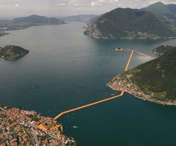
In 2016, Lake Iseo was the principal site appreciated by international and local tourists, thanks to the land art installation proposed by Christo and Jeanne-Claude1 , The Floating Piers: a temporary 70.000 square meters of yellow fabric, carried by a modular floating dock, created a walkable surface between some districts on the oriental side of the lake (Sulzano, Monte Isola and Island of San Paolo).
As a consequence of this attractive and meaningful exhibition, the awareness of the touristic value of Lake Iseo rises: the natural beauty of the landscape and the small villages scattered on the banks of both Brescia and Bergamo provinces are attractive features for a wide variety of visitors from all over Europe.
Therefore, Lombardy Region develops some improving activities, and it decides to keep going on the process of investment, promoting a constant development of the Sebino area
It allocates 10 million euros as a co-financing contribution for redevelopment, enhancement and promotion interventions, proposed in the Territorial Development Framework Agreement (Accordo Quadro di Sviluppo Territoriale, AQST). It proposes various goals that the 16 municipalities involved must reach out by the end of 2021: the development of the tourist attractiveness of the area, the environmental protection - paying attention to the territory and its infrastructural system - and the promotion of the cultural heritage of each site.
The project
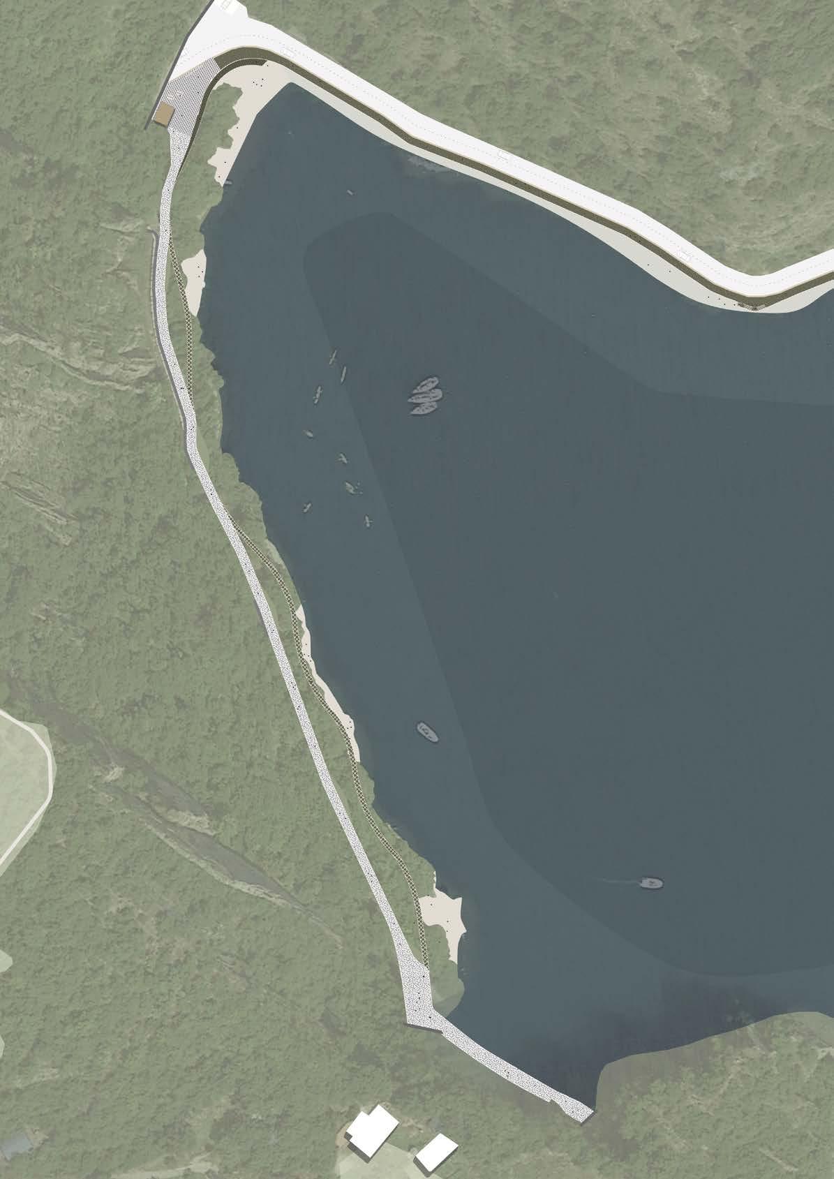
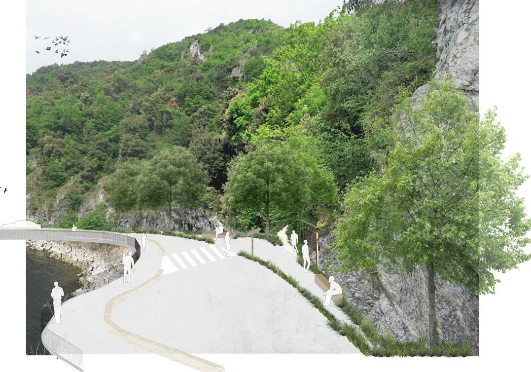
The Municipality of Riva di Solto joins the Territorial Agreement, applying for co-financing the public project known as “Valorisation of the cycle and pedestrian path along the lakefront area of Orrido del Bögn”, with the aim of securing and arranging the site, reopen a stretch of the old coastal road to the public use and enhance the landscape relevance of the area. Thus, in July 2021, the district and its institutions accepted and approved the project suggested by the architect Sergio Ghirardelli2– who had already designed the existing Olive tree walk3: indeed, the approach for the new site of the Orrido has a similar structure, trying to maintain a continuity and linearity in the design strategy and development. The requalification and enhancement actions concern mainly the site on the south of the tunnel, the beach area: nevertheless, in the general report, the architect and his team suggest some interventions for the northern and wildest side. Due to the fact that the steep ravine and the rocky tunnels - which characterize it - can be often afected by events of collapse and falling rocks, a great amount of work must deal with the security of the area, providing proper structures and measures to reduce the risk.
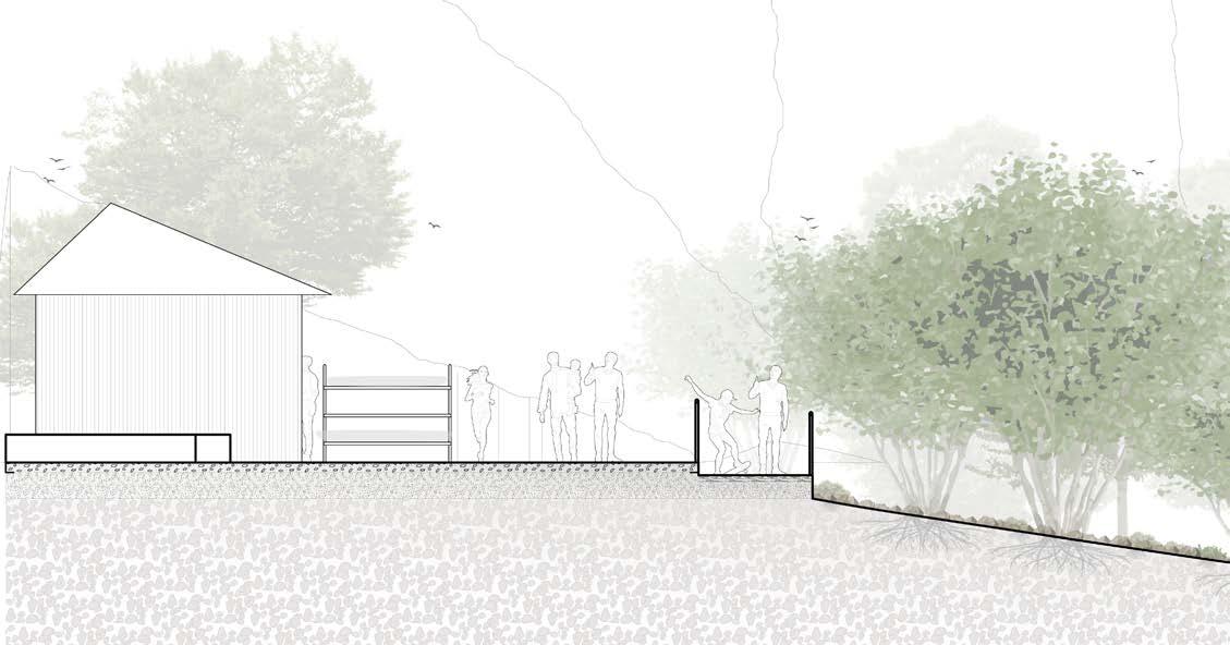
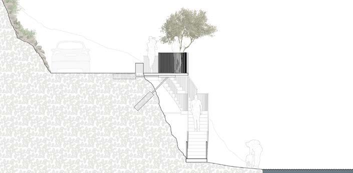
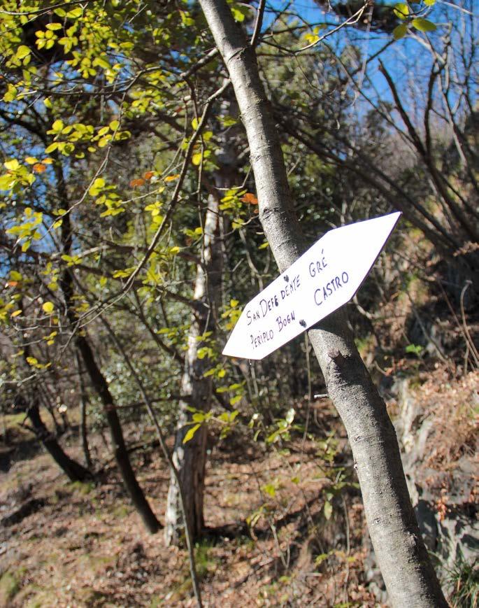
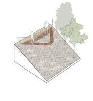
A relevant spot has been selected and designed to act as the entrance area, depicted by the gateway between the existing path and the new pedestrian area of the Bögn: parking for cars and bicycles has been planned. An existing – and maintained - tree, which supports a sign bearing the name of the area “Natural Amphitheater of the Bögn”, represents the cycle-pedestrian gate of the site.
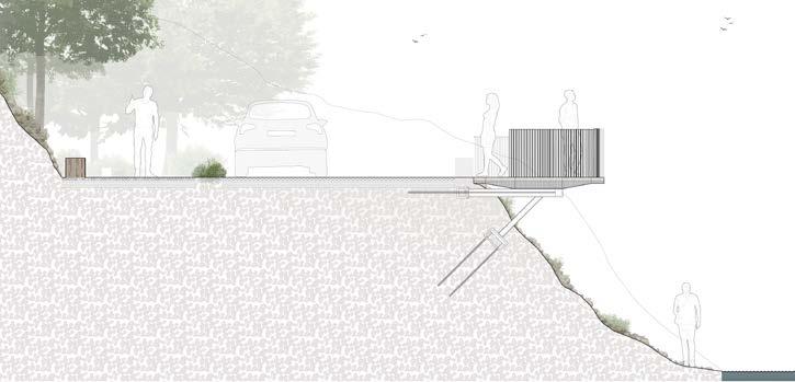
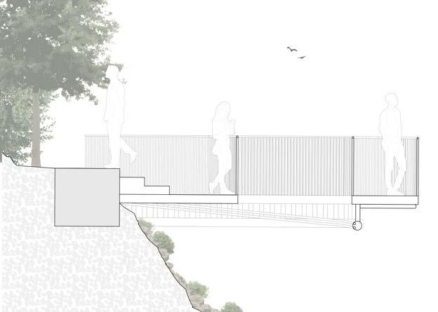
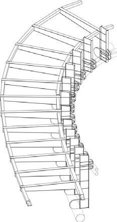
A secondary intervention concerns an existing building which will be partially demolished and requalified: a new service area will be supplied by the construction of a roof garden which – combined with the covered space at the ground floor - will ofer space for rest, sunbathing and picnics. Furthermore, a panoramic terrace is planned near-by: thanks to some stairs and ramps, it will allow the access to the beach and designed wooden platform scattered around.
Moreover, one fundamental action must afect the security of the site, provided by the introduction of mudguard nets and concrete barricades for any rocky debris: these invasive structures will be “covered” by the presence of tree plantings which partially mask the view on the rocks.
Should it go deeper?
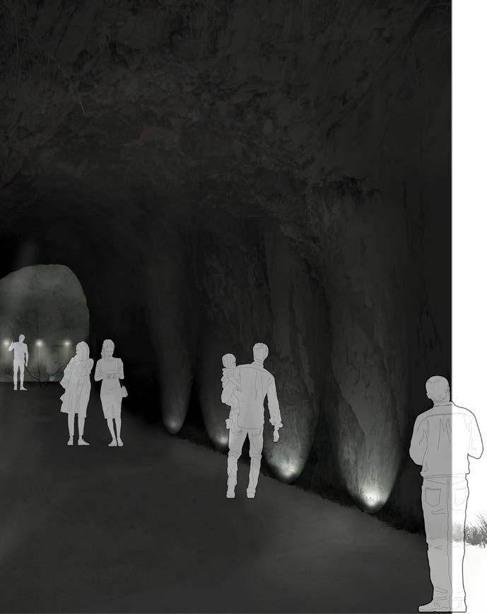
The rocky tunnels, part of the ancient coastal road of 1910, act as the dividing feature for the site: it splits the Bögn in south and north side, the bathing and sunny area and the wildest, rocky and risky one.
This border line has been emphasized by the project proposed by the architect and his team and approved by the Municipality of Riva di Solto. As the continuity of the Olive tree walk, the interventions act mainly on the beach area in the south, which remains sunnier during the day and therefore it is a proper site to hold a bathing spot. Therefore, the design follows the geometrical structure of the existing pedestrian walk along the lakefront (Olive tree walk), proposing some new “rectangular” panoramic terraces and wooden platforms.
Once again, the contrasting and dividing aspects associated to the tunnel are raised: the regular approach seems quite conflicting with the sinuosity and wildness of the landscape of the Bögn.
The unstable steep rock walls, the wild and mixed vegetation, the water level which increases or decreases according to the natural events: these features characterize the natural surroundings of the area which are not
strongly emphasized by a geometrical and linear pattern. The design does not follow the natural shape of the area, but it is “rested” on the land, on the landscape, covering and hiding it, reducing its environmental and cultural value.
A physical limit – distance – between the human and wild sphere is visible and noticeable: the observer can perceive where the nature has been afected by manmade features.
Notes
1. Christo and Jeanne-Claude were artists noted for their large-scale, site-specific environmental installations, often large landmarks and lanscape elements wrapped in fabric. https://christojeanneclaude.net/ life-and-work/
2. Enhancement of the cycle-pedestrian path in the lakefront area called “Bögn di Zorzino” by Riva di Solto Municipality. Proposal by Arch. S. Ghirardelli. All documents on Riva di Solto website (http://www. comune.rivadisolto.bg.it/news.aspx?id=455)
3. Olive tree walk - Passeggiata degli Ulivi. It is a 2018 project, when the intent of the Riva di Solto municipality concerned the development and enhacement of the promenade running along the Lake Iseo. The result is a pleasant walk in front of the lake, highly panoramic, interrupted by five balconies on the lake, equipped with benches, some with backs, which allow some resting spots to admire the surrounding landscape. More documents available on the Municipality website. http://www.comune.rivadisolto.bg.it/news.aspx?id=276

IIIII II
Design approach
Design appraoch
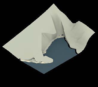
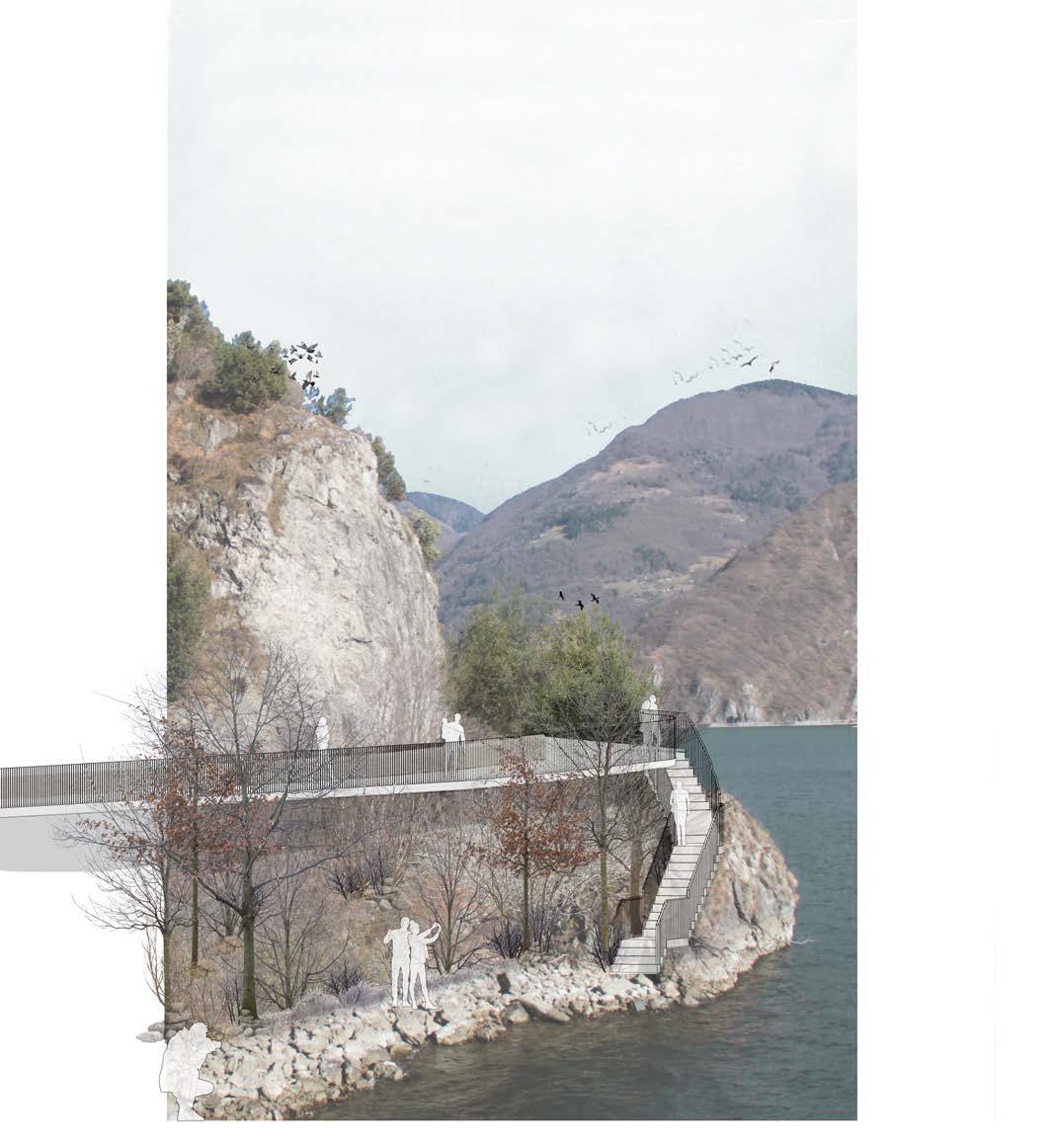
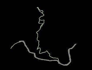
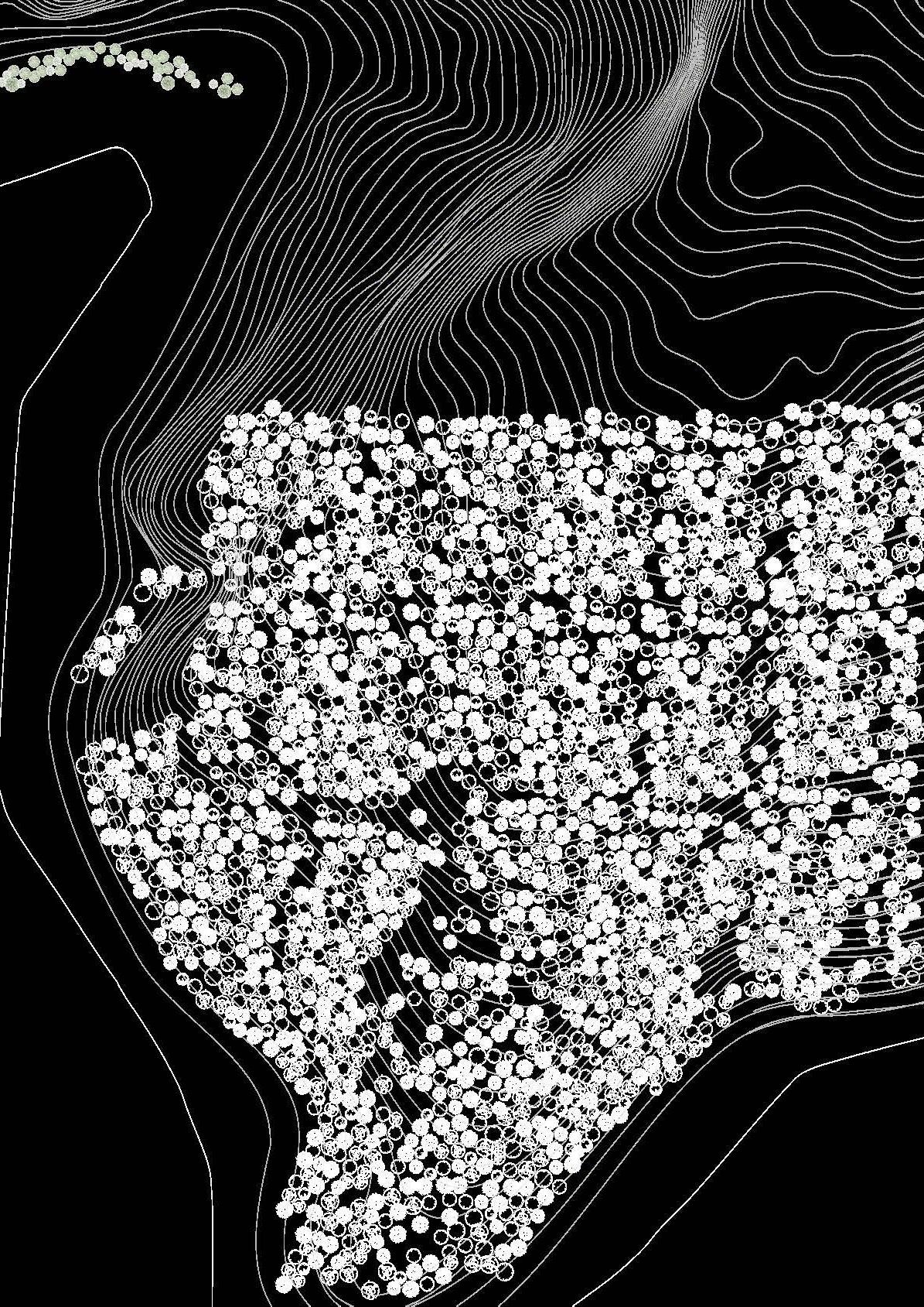
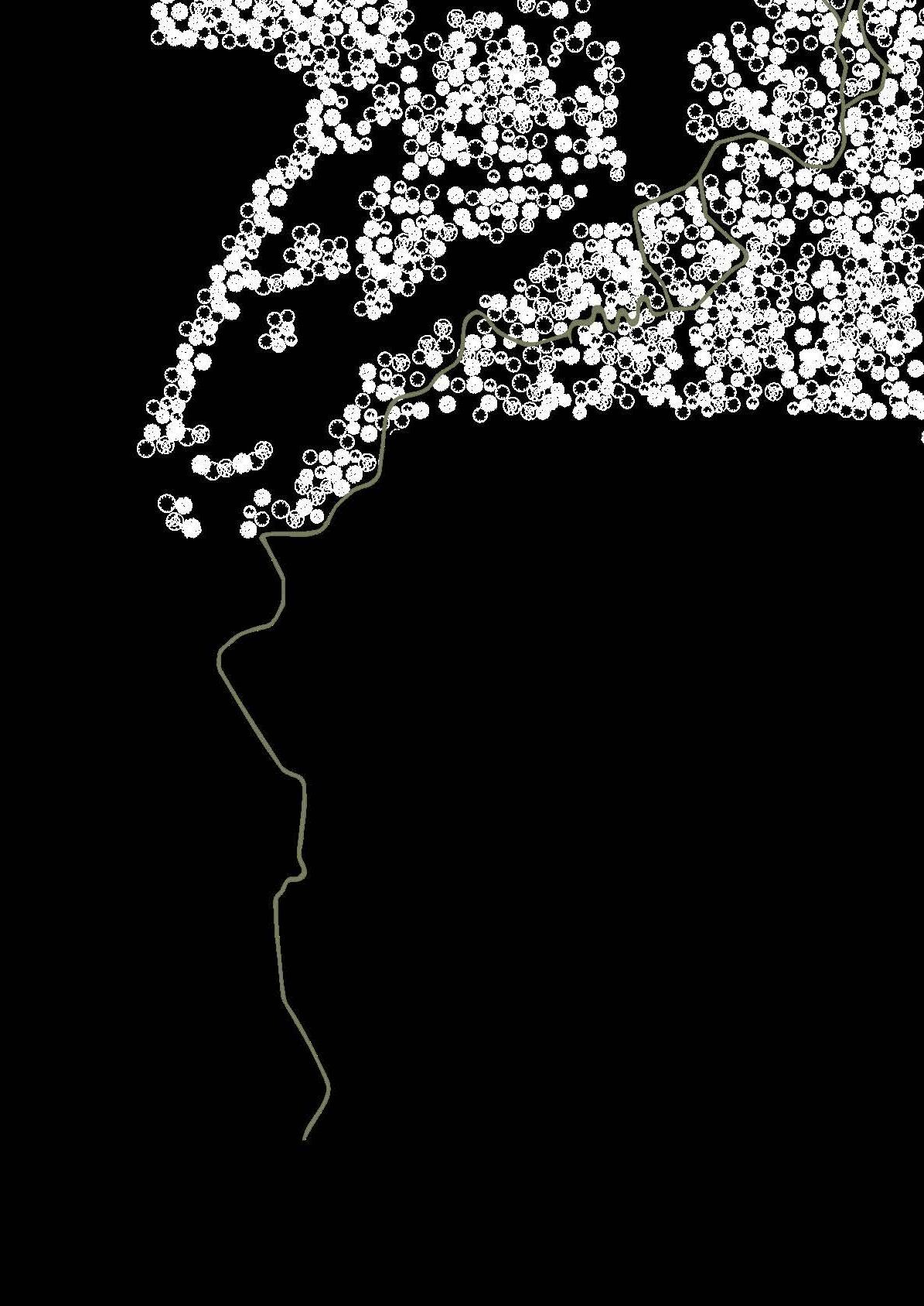
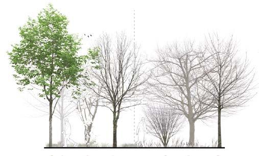
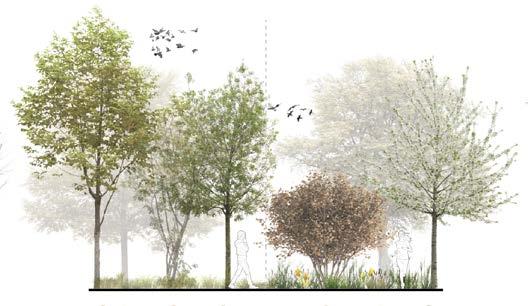
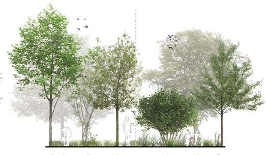
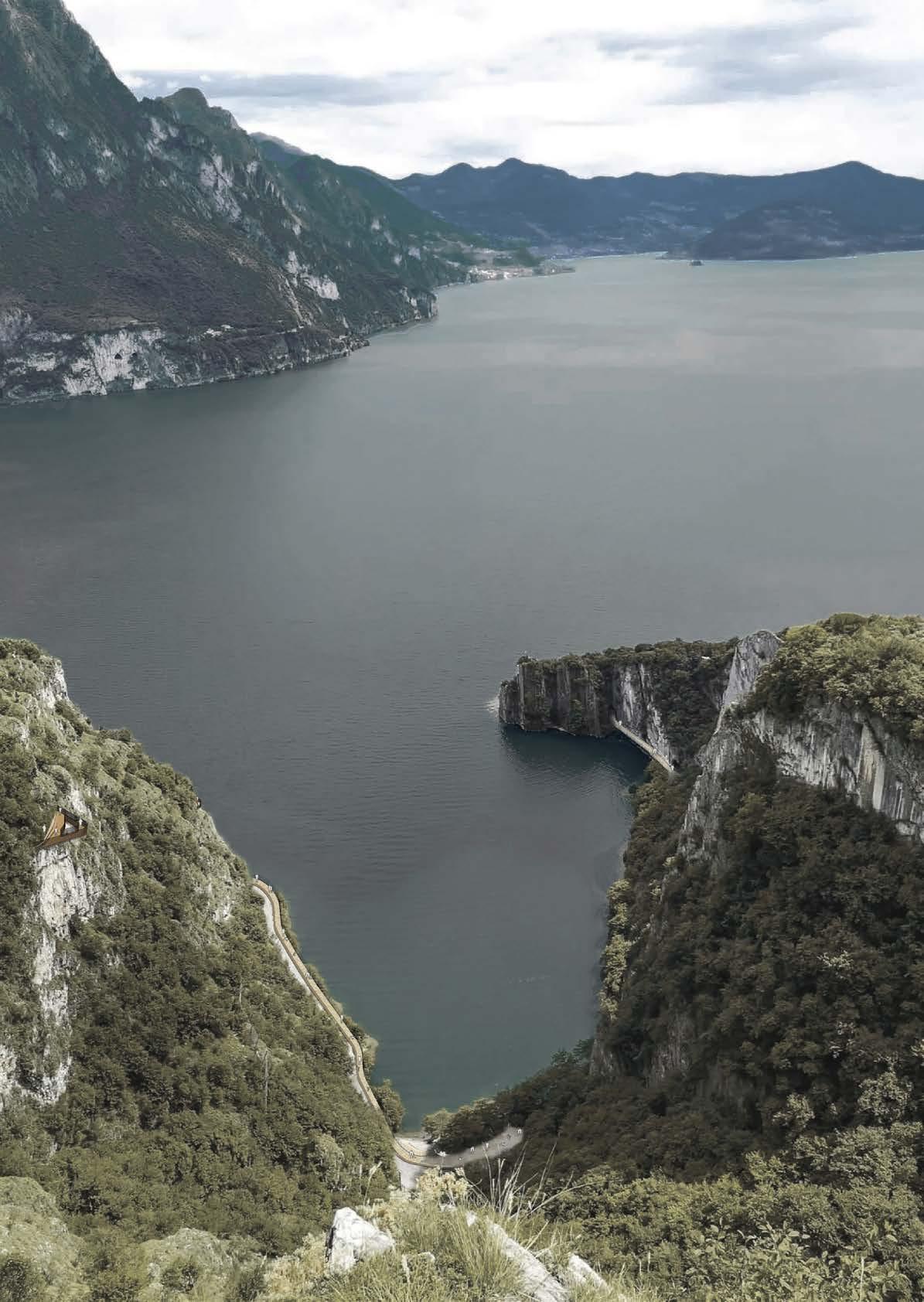
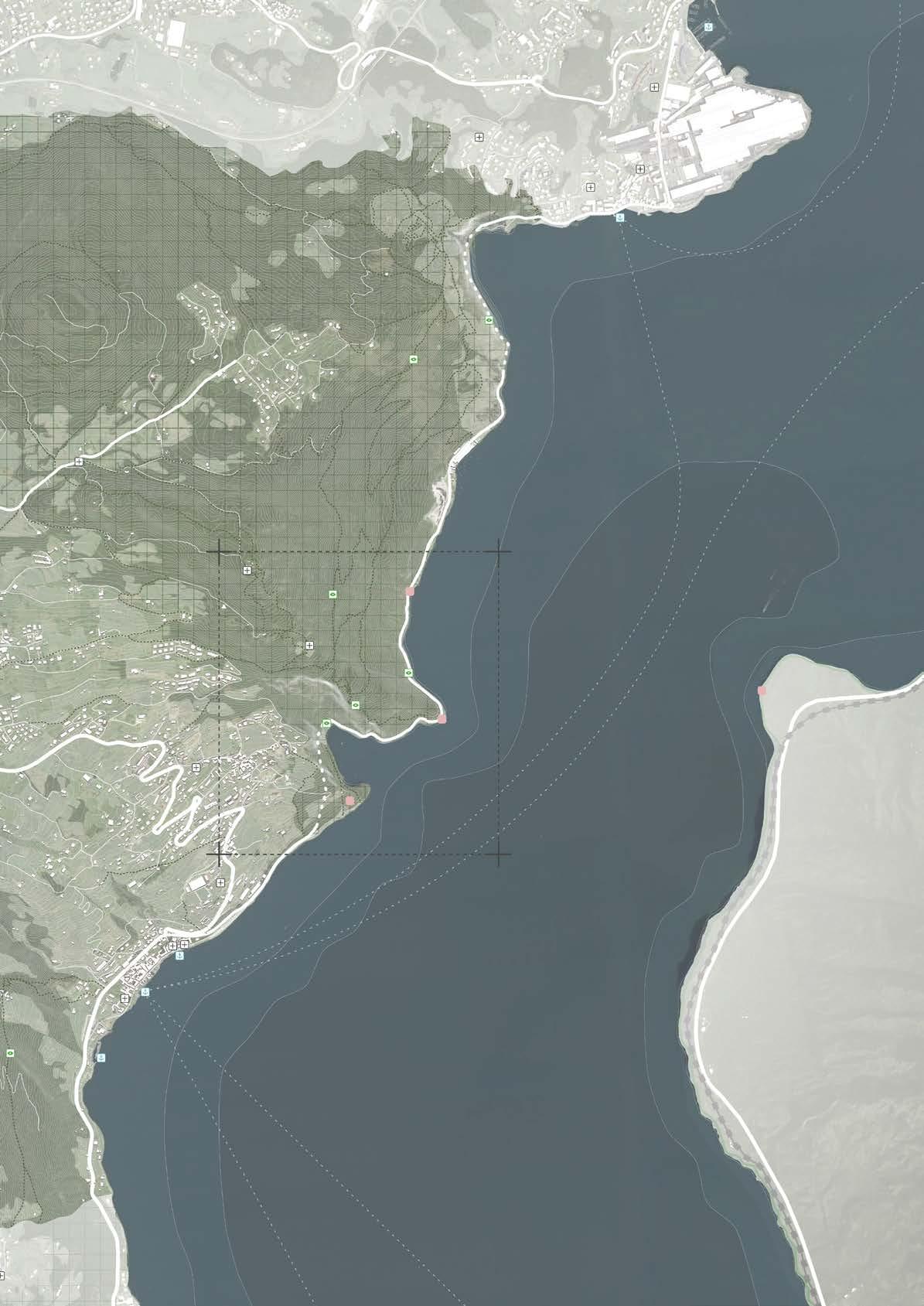
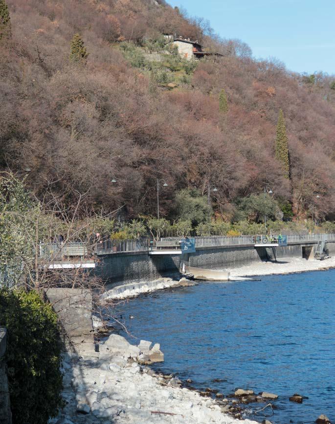
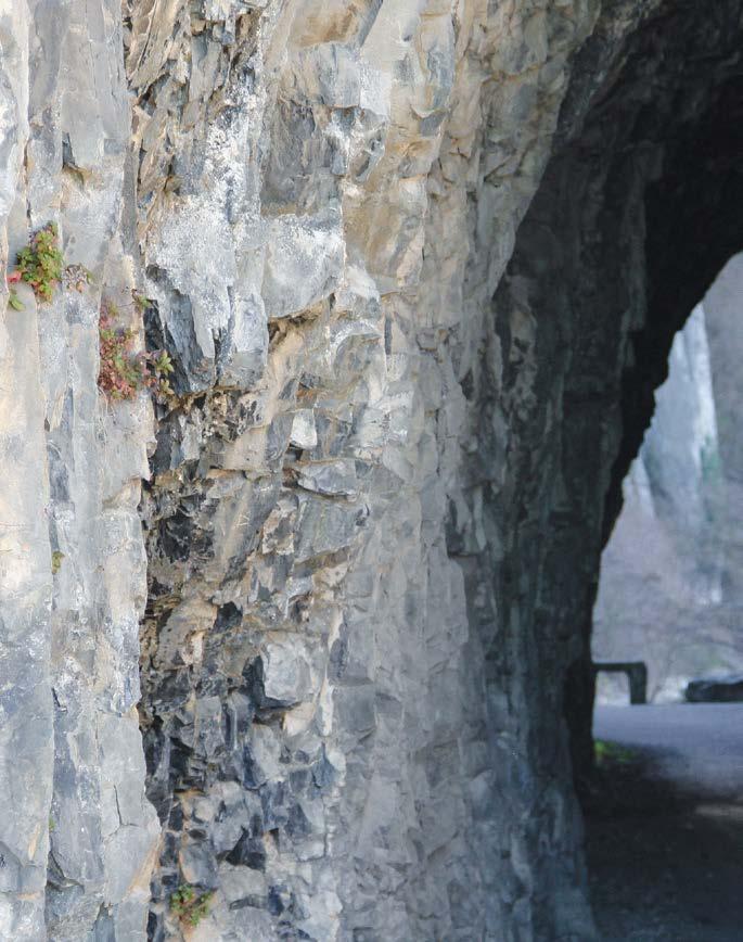
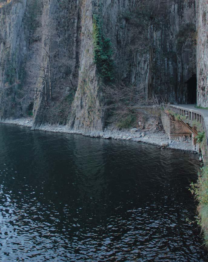
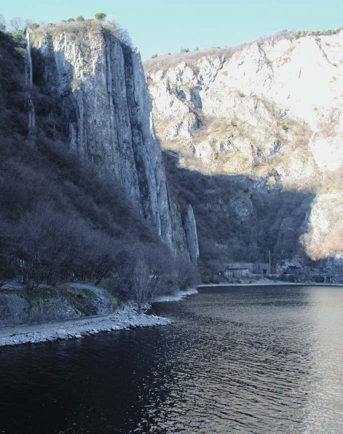
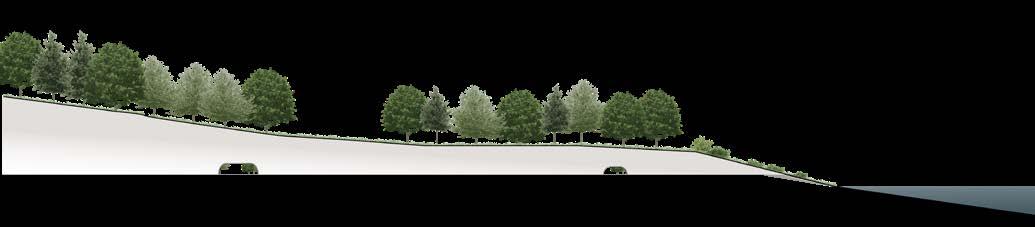
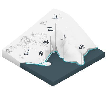
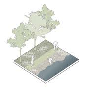
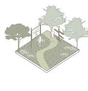
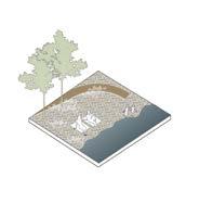
Various “performances” can be experienced by walking and observing the vertical development of the Orrido del Bögn: the mountain has distinct ways to be related to the lake, in terms of altitude and spaces
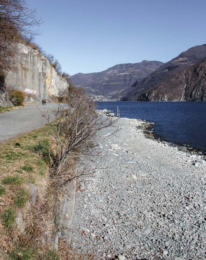
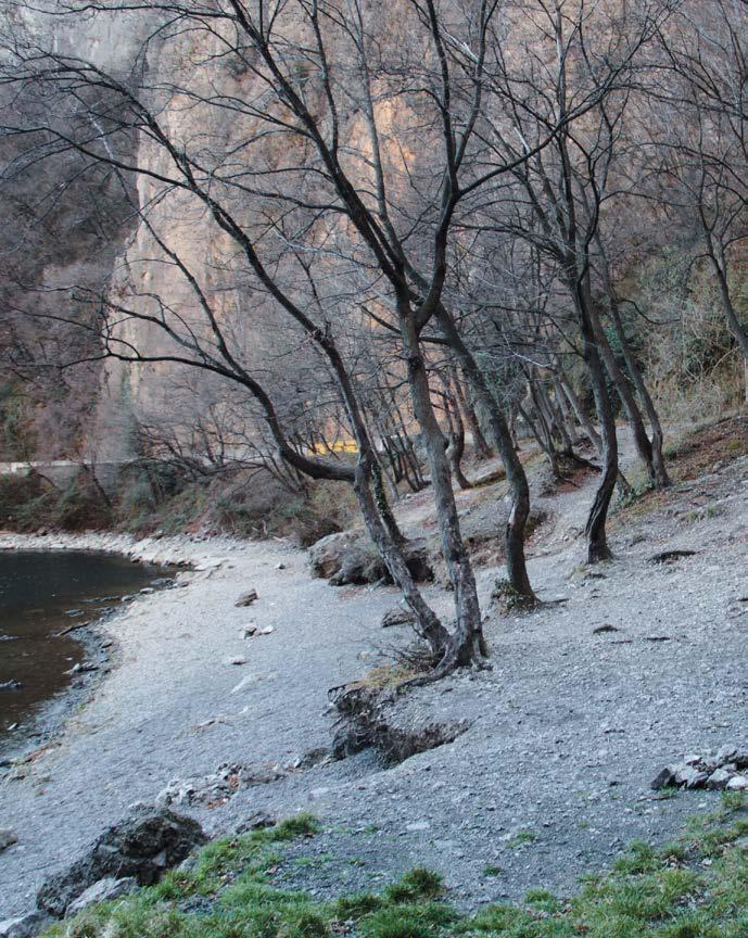
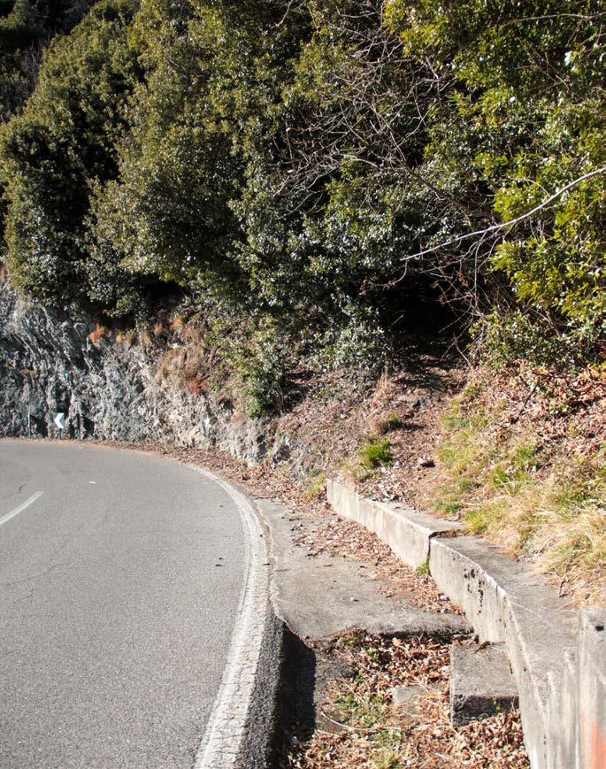
Running along the principal road [Fig. 1] to access the site, the rocky ravine develops stif and imposing upwards, capturing the view of those who coast it. A similar perception occurs and can be felt while walking along the beach area [Fig. 2], in the northern space of the Orrido: risky and captivating stony walls, merged within a wild natural panorama of olms, oak, hornbeam, “accompany” people through the lake experiences. It is at these two points, parallel with the road and the beach, that the
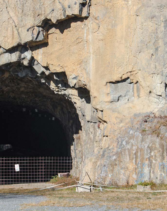
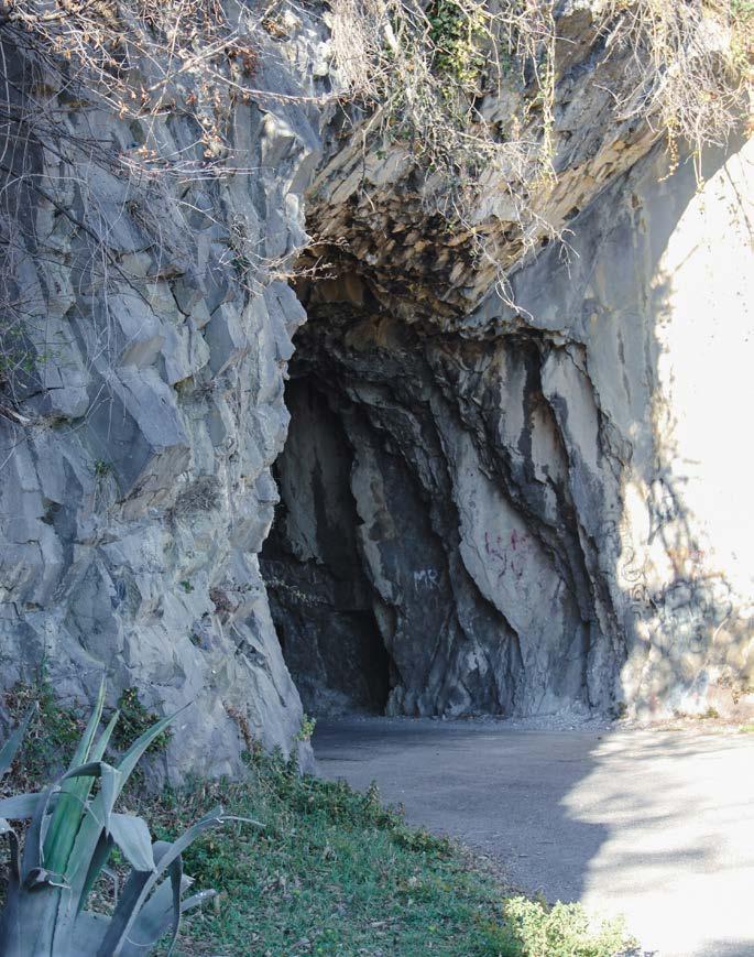
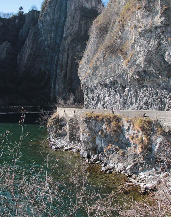
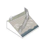
gorge reaches its highest level (around 600 meters on sea level). Whereas, on the southern side of the project area, the mountain gets to an elevation of around 250 meters on the sea level: in particular, beside the ancient bridge [Fig. 3] close to the gallery [Fig. 4] – the hole in the rocky wall - which was part of the first accessible way to the Municipality of Riva di Solto (1910).¹
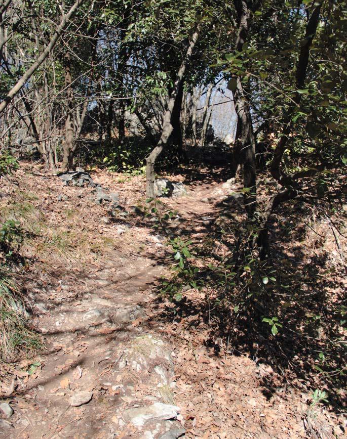
On the beach area near-by the entrance of the site, the condition is almost analogous [Fig. 5]: hence, the area seems safer than the northern one and able to provide more secure resting spots for tourists and citizens.

Shan shui as vertical experience
In order to create a significant combination of balance, composition and form for the Orrido di Zorzino area, Shan Shui is involved as a design approach, taking into account the kind of mystical requirements2 it proposed: the three main desired components which are the Threshold, the Heart and paths.
The Threshold, as the meaning of the described word sublime, is the reachable limit, the intangible moment where two experiences meet. According to Shan Shui, it embraces the viewer and provide a kind of welcome to the closest reality: it can be the mountain, its shadows on the ground or on the water.
The Heart are the cores, the focal points to which the viewer is lead to: it acts as the main character in the painting, able to emphasize the concept and meaning of the representation. While the paths are the elements which lead the subject to the main point: natural and sinuous ways should invite the viewer to explore and walk through the several spots located – and scattered – in the surrounding3
Hence, the Shan Shui composition wants to play a principal role in the design approach due to the explicit tie between Mountain and Water it emphasizes: this connection is plainly represented by the steep rocky ravine of Zorzino, where the green sharp forests are reflected – and tied – to the clear bluish water of Lake Iseo.
The vertical development and link – clarified by the concept of sublimation of the landscape and the Chinese painting movement 4– proposes a straight-up experience from the body of water to the natural elevation of land.
This intangible connection is the representation of one of the three mystical requirements of the Shan Shui, the Threshold: it depicts the moment in time, creating unique opportunities, shaping the spaces and the rhythm of what environment ofers 5
It guides the subject through the surrounding, from the Lake to the Mountain – or vice versa, according to how the person approaches the landscape – and concentrates a transition between these two realities. The vertical experience is not just a link between green and blue feature, but it also defines a kind of separation between the two of them.
Shan shui and sublimation of vertical continuity
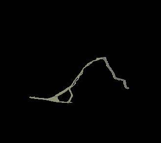
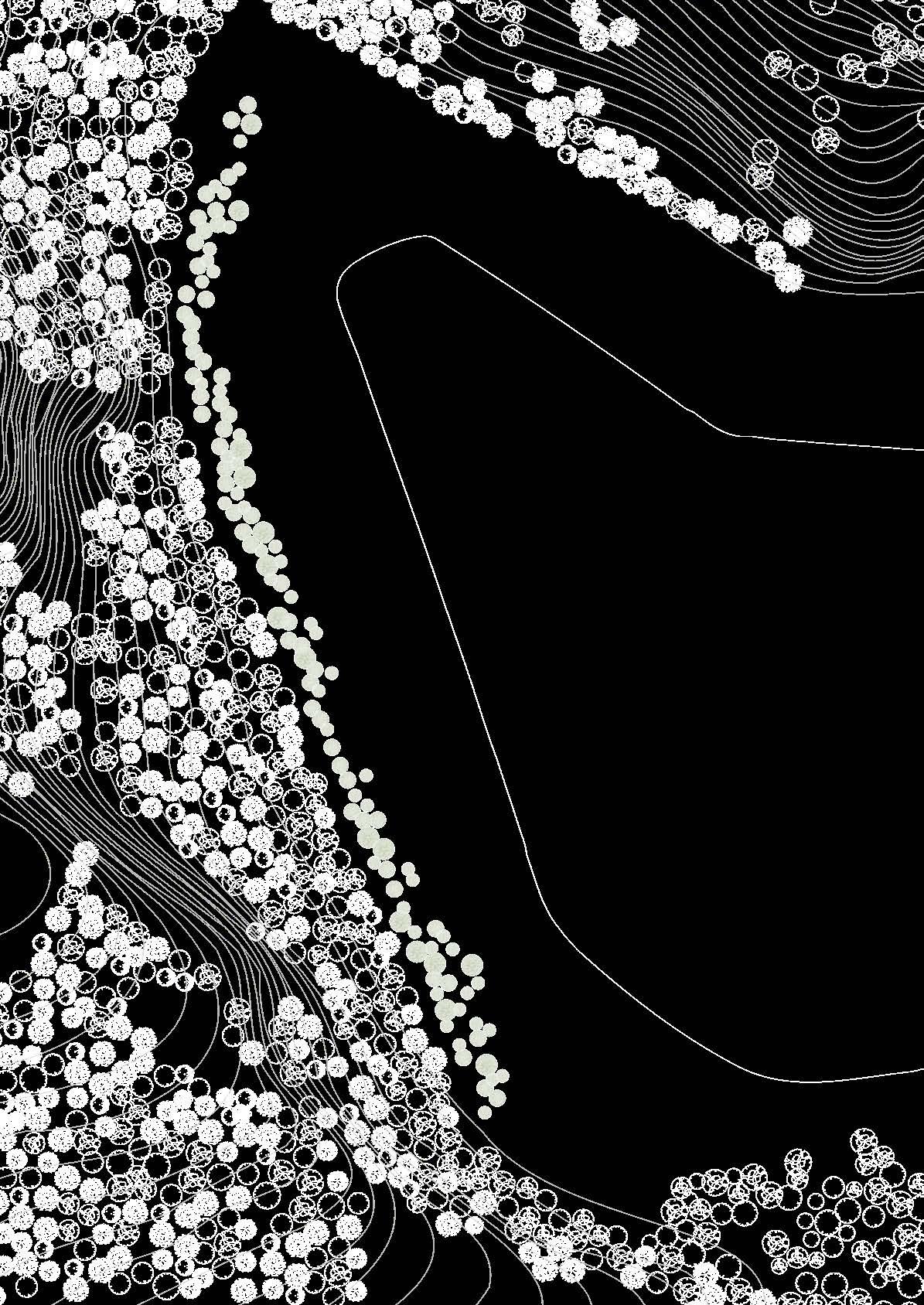
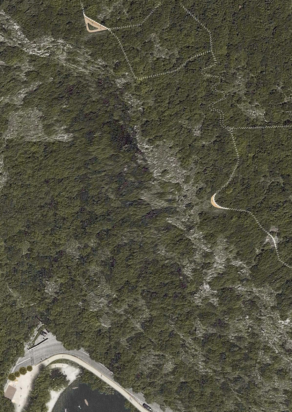
One on the top (Mountain ) and the other on the bottom (Lake), the two performances want to be representative of what Shan Shui names Heart, the focal points where distinct spaces will be developed: the mountain and lake experiences, the two principal cores where several and diferent activities will characterize the vertical linkage – and separation – of the landscape. From calm and silent space of resting spots, panoramic points and cultural buildings to a more dynamic and chaotic site, the littoral area of beaches, main accessibility points and ways at the water level. A fundamental role has to be played by the third component of the Chinese movement, the path: it will look for cohesion⁶, accessibility and will provide a tie between the scattered points in the surrounding. It will be the loop which will connect the up and down realities, significant pieces of the vertical experience.
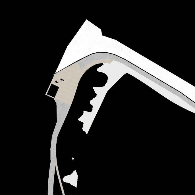
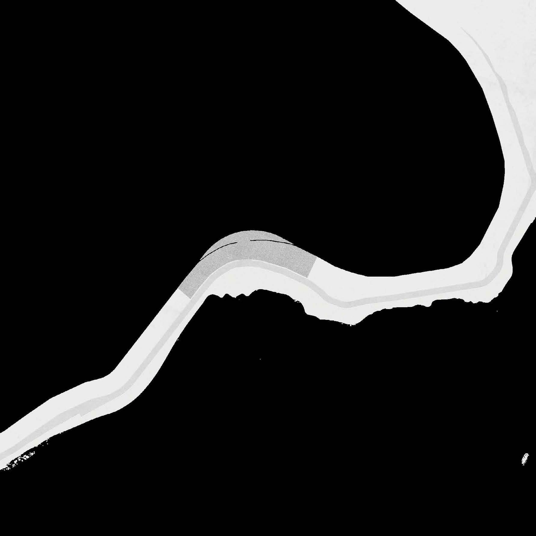
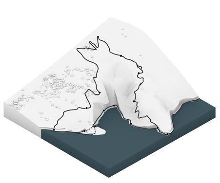
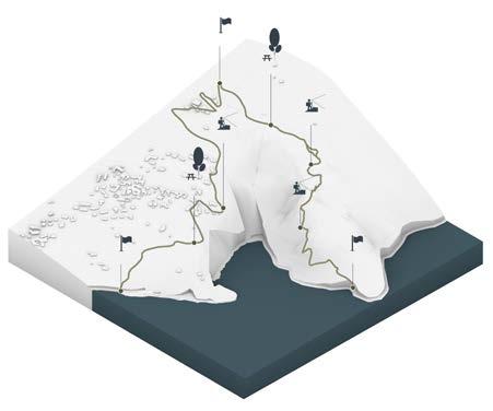
Project loop
Proposal plan by Arch.S.Ghirardelli
Strategical map - design approach
Relevant structures

Notes
1.1st chapter, Looking back. The littoral road was built in 1910 and was the first street which allowed the connection between Riva di Solto and Castro districts.
2. R. Wicks, "Being in the Dry Zen landscape”, 1954, The Journal of Aesthetic Education, Volume 38, Number 1, Spring 2004, pp. 112-122.
3. The art of Shan Shui, by https://ponddoc.com/blog/the-art-ofshan-shui
4. Esthetical and physical contents, 2nd chapter, p. 22 -25
5. Landscape Thresholds, LR Landscape Architects. https:// lovingerrobertson.com/blog/entry/landscape-thresholds
6. The cohesion aspires to act as the manifestaion of the project, which does not end up in its uniqueness.