
lucasbarddal@outlook.com
lucasbarddal@outlook.com
lucasbarddal@outlook.com
VI am a Brazilian urban designer and architect, with a multidisciplinary educational path, with an interest in environmental and ecological design and strategy.
Jan 2024 - ongoing...
Architect
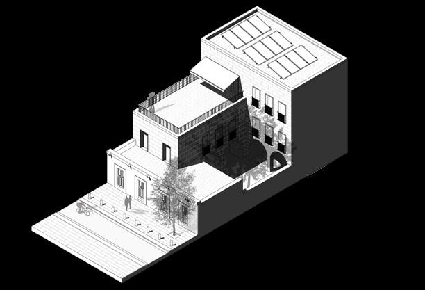
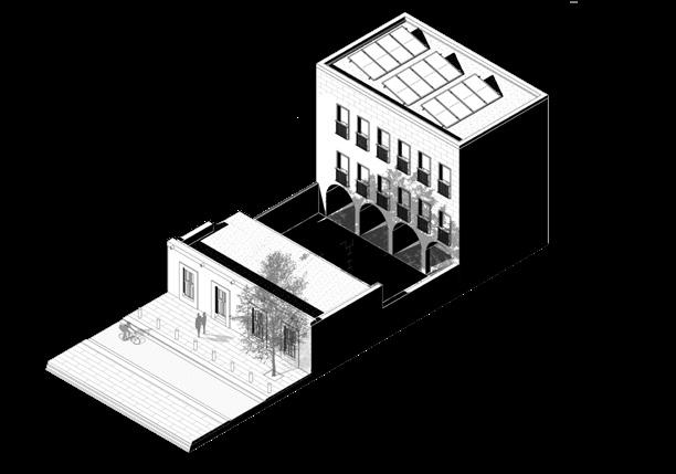
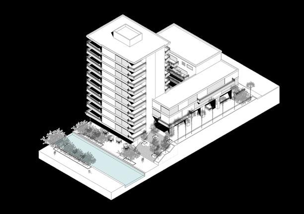
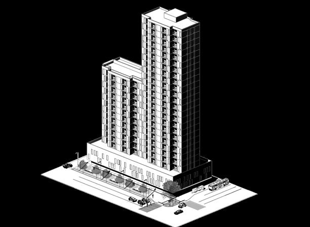
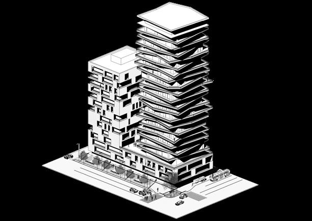
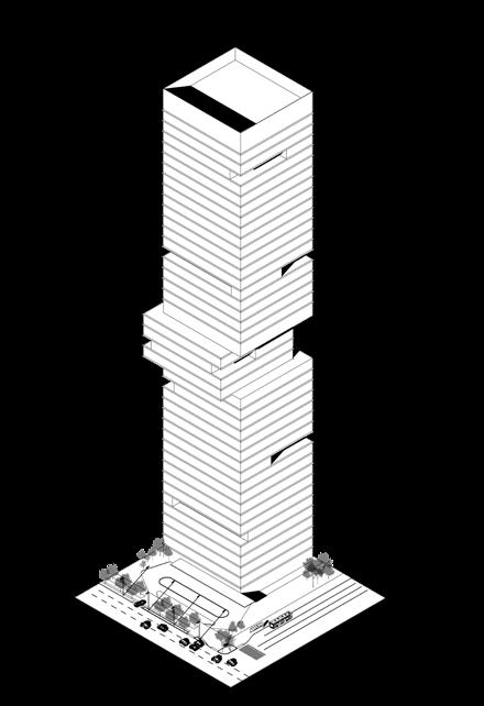
Triptyque Architecture | Paris - São Paulo
Architecture project development in Rehabilitation/ Technical detailing in 2d, 3d models.
May 2023 – Sept 2023
Internship
IMPLANc | Monterrey | Mexique
Assistance in the preparation of supporting documents for the new master plan of the city. With a focus on developing strategies for the city center.
Oct 2020 – Sept 2022
Senior Architect
Mandril Arquitetura | São Paulo
Architecture and interior design project development / Technical detailing in 2d, 3d models, composition of budget sheets, site management and client assistence.
Aug 2016 – Oct 2017
Social Helper
ADUS – Refugee’s | São Paulo
Refugee’s assistance with translation and obtaining documents, searching for jobs and housing.
2022 - 2023
Master’s Degree École d’Urbanisme de Paris
«ExpertiseInternational|VillesdesSuds»
Master’s program on urbanism in developing countries. With a focus on real estate market.
2020 - 2022
Post graduation Universidade de Brasília | FAU - UNB
Post-Graduate Program of the Applied Sustainability Lab «LASUS».
«Architectural and Urbanistic Sustainable Rehabilitation»
2013 - 2020
Architecture Degree FAU - Mackenzie University
Architecture Degree
Thesis - «Pneumatic collection of solid waste, a multifunctionalproposalforanurbaninfrastructuralproblem»
2018 - 2019
Exchange - Master I École Nationale Supèrieure d’Architecture Paris Val de Seine | ENSAPVS
Systemic design + Build with stone and rammed earth in the 21st century + High perfomance framing
Portfolio https://issuu.com/lucasbarddal/docs/caderno_in_2023_
MORE INFORMATION
201520162017201920232023-
Collaborator within the research group “Public Spaces: Interpretations and Project” coordinated by professor Luiz Guilherme Castro. Immersive semester at the Mackenzie School of Engineering (Taffic Engineering). Illustrator for the doctoral thesis of Professor Dr. Yara Baiardi, entitled «Node of transport and place.» Classes at “École du Louvre” on the funerary glyptothek and Flemish painting of the seventeenth century. Collaborator at the Nuevo Leon Research Laboratory (LabNL) within the research group «Somos Luz»
Published article «“ArcoTietê”,opportunity for urban expansion in the Tietê basin» at Paranoá magazine
Zone of cultural value
Zone of integration between neighborhoods
Zone of service connection
Zone of economic corridors of medium and high impact Metropolitan area of controlled access
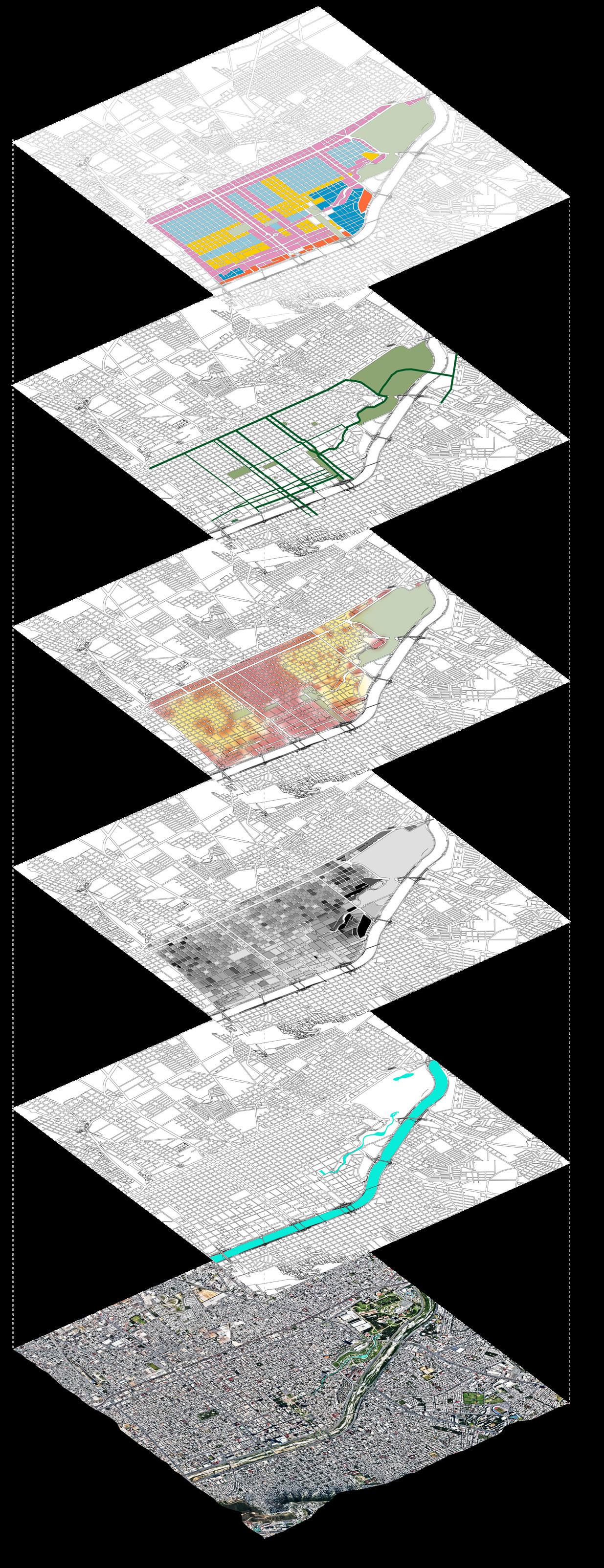
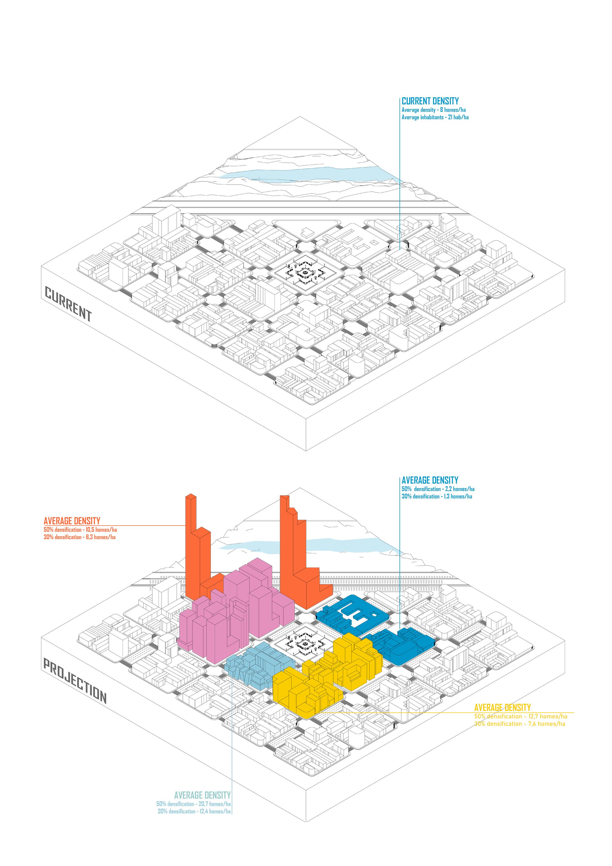
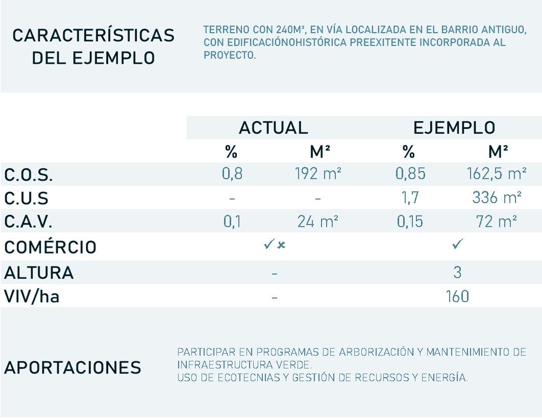
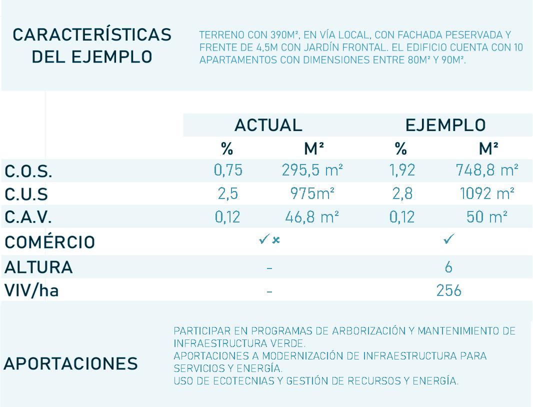
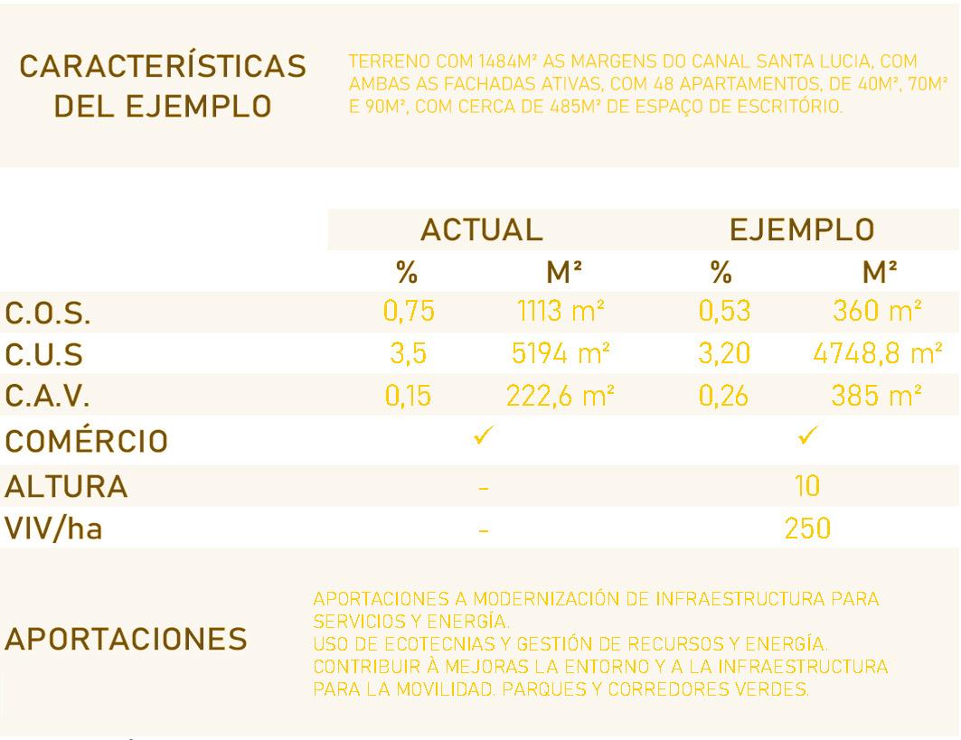
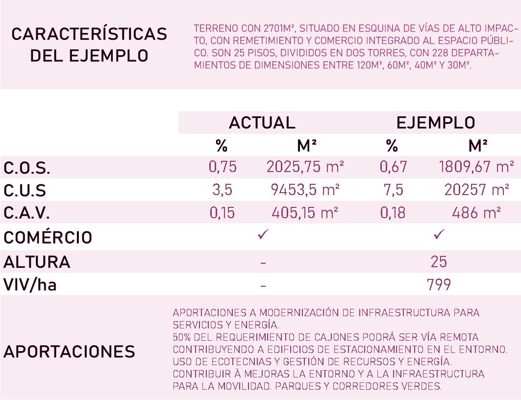
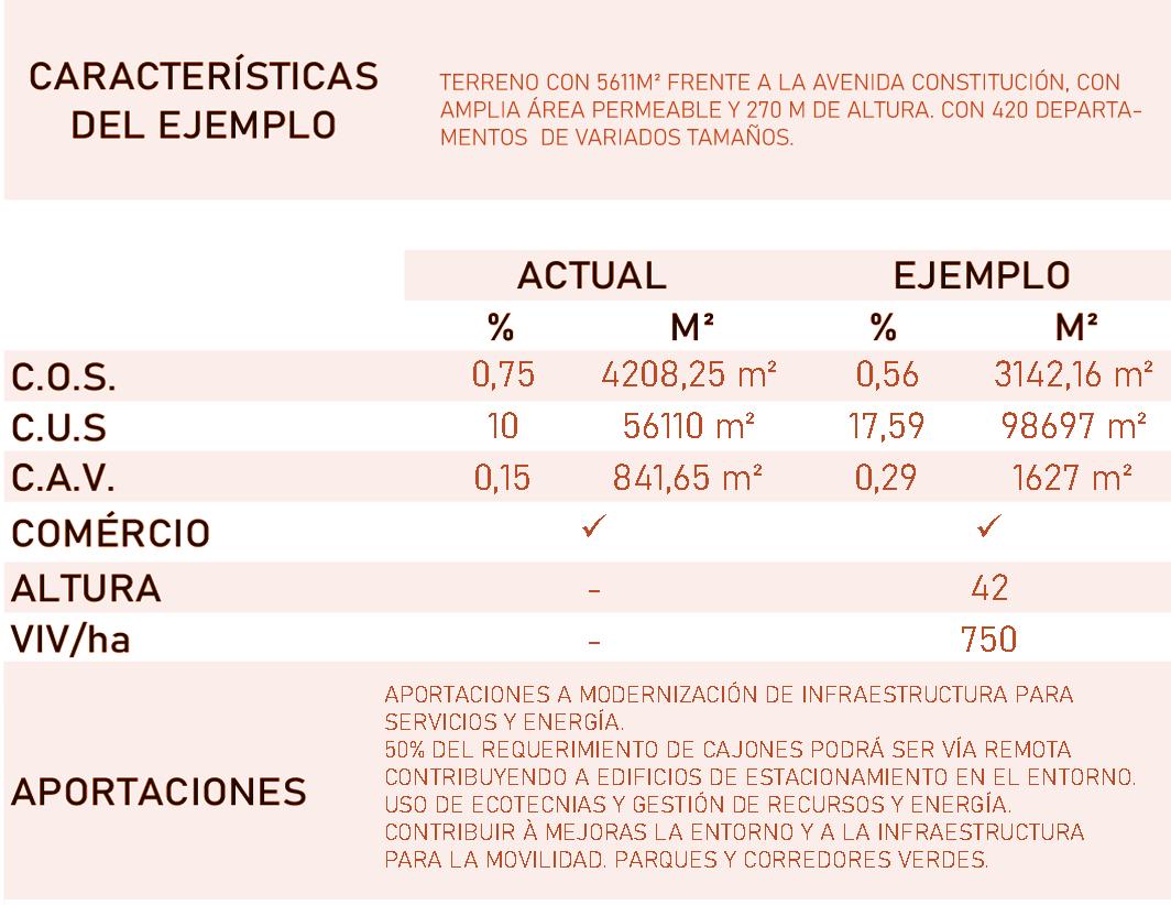
The downtown area of Monterrey has been going through a process of abandonment and population loss since the 1940s, having lost more than 150 thousand inhabitants during that period. This zone also suffers with degradation, lack of infrastructure and insecurity.
Faced by this, the authorities have been developing a project entitled “ Revive el Centro” that aims to bring people back to the area by reconfigurating the zooning strategies and upgrading the existing deficient infrastructure.
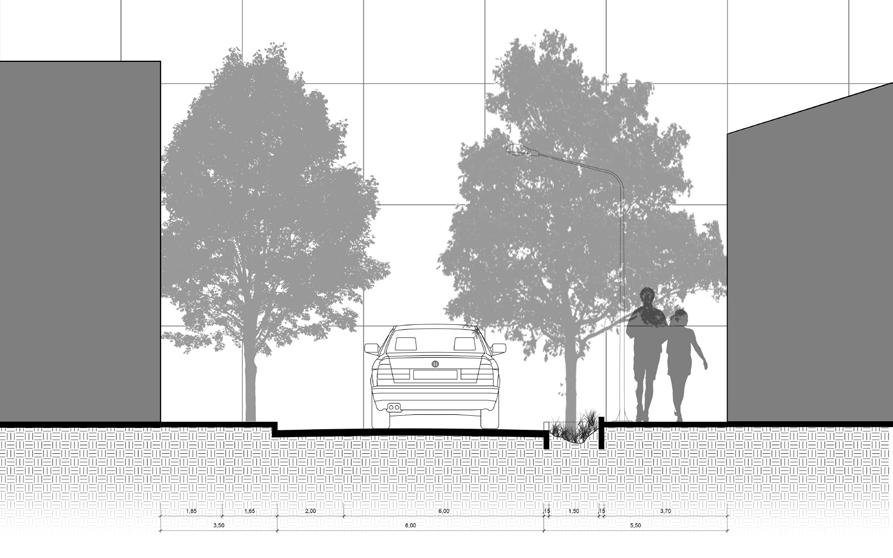
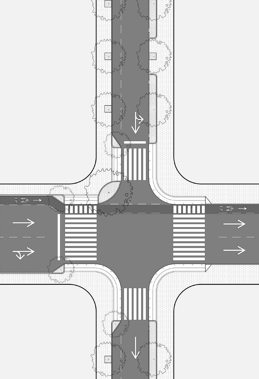
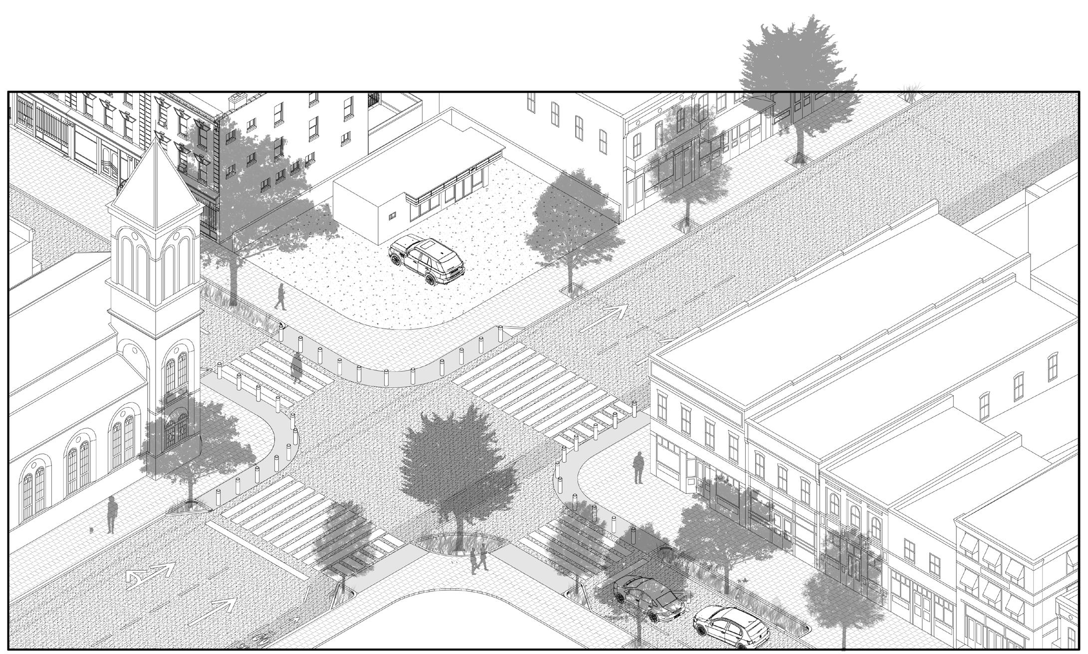
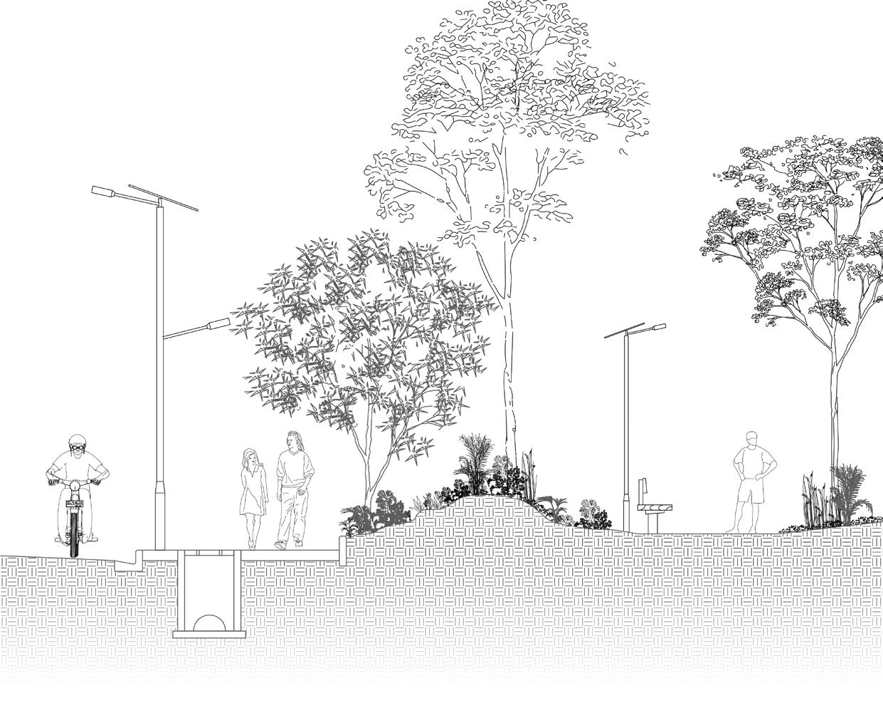
The initial diagnosis shown that the main issues here were the lack of inhabitants, especially in the central axis of the area, were only commerce and service stands today, an area that is very active during weekdays but becomes a desert when the night falls. This part of the city also lacks adequate pedestrian and cyclist infrastructure. Changing this could transorm the current car-dependent dynamic that exists in the city and bring back to life the historical and central part of the metropolitan area.
The changes on the zoning plan for the area aims to attract more inhabitants, investors and public interest to the area by increasing the density and the construction potential. In addition to that, the implementation of a system of interconnected green corridors has also been developed, whose objective is the adoption of resilience and walkability strategies that allow the creation of a city structure based on urban proximity.

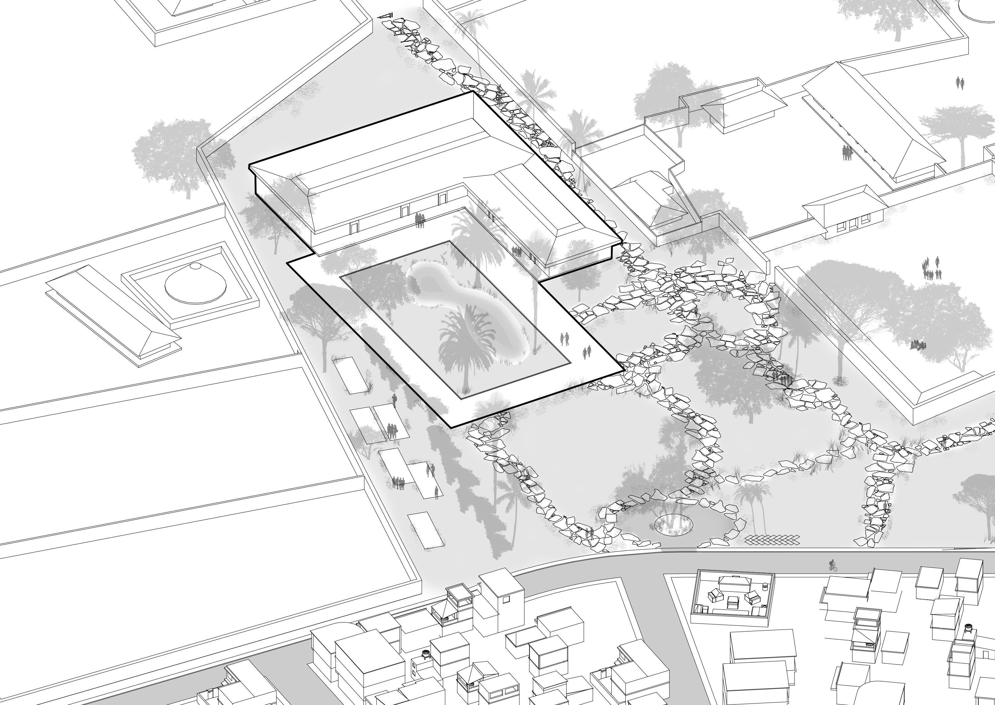
Abomey, historic city of the Republic of Benin, plays a leading role in the development of tourism in the country by relying on a remarkable heritage wealth and an opportunity under the new government action plan “Benin revealed” which aims to make tourism a lever for economic development. One of the flagship projects initiated by the government is the construction of the MuRAD (Museum of Kings and Amazons of Danxomè) and the rehabilitation of the site of the royal palaces of Abomey with the technical and financial support of the French Development Agency (AFD).
The project consists of two axes, the construction of a museum, designed by the architect Françoise N’Thépé, which will host the national collections; and the rehabilitation of the palatial sites. The future museum is designed as an international cultural facility whose after-opening attendance is estimated at 85,000 visitors per year, according to preliminary studies. As consultants hired by AFD, we were initiated the development of a diagnosis and the proposal of strategies for urban integration between the new museum and the square where it is currently inculcated “Court of the Amazons”.

Abomey, a city with multiple cultural and tourist resources beyond the UNESCO site and the history of the Dahomey kingdom. (Both tangible and intangible resources)
Who lack the means to be reserved, maintained, and promoted.
Understanding the “Court of the Amazons” as a living, multifunctional space that serves as an axis of connection between the eastern and western portion of the city. How will the construction of the new museum influence the dynamics that exist today?
Tourism policies are poorly articulated around different scales (national, local and territorial) and lack of access to resources at local level as a result of a strong top donwn policy.
How will the flow of tourists will influence the issues related to infrastructure, especially that of waste treatment and collection, which is practically non-existent? The same applies to the hotel infrastructure, still incipient in the city.
Conurbation area between Abomey - Bohicon shows a great opportunity for the development of intermunicipal projects. Risk of overlapping tourist policies.
Possible conflict between inhabitants and tourists, given the still very closed and traditional configuration of local society. Conflicts regarding the perception of the project by the inhabitants
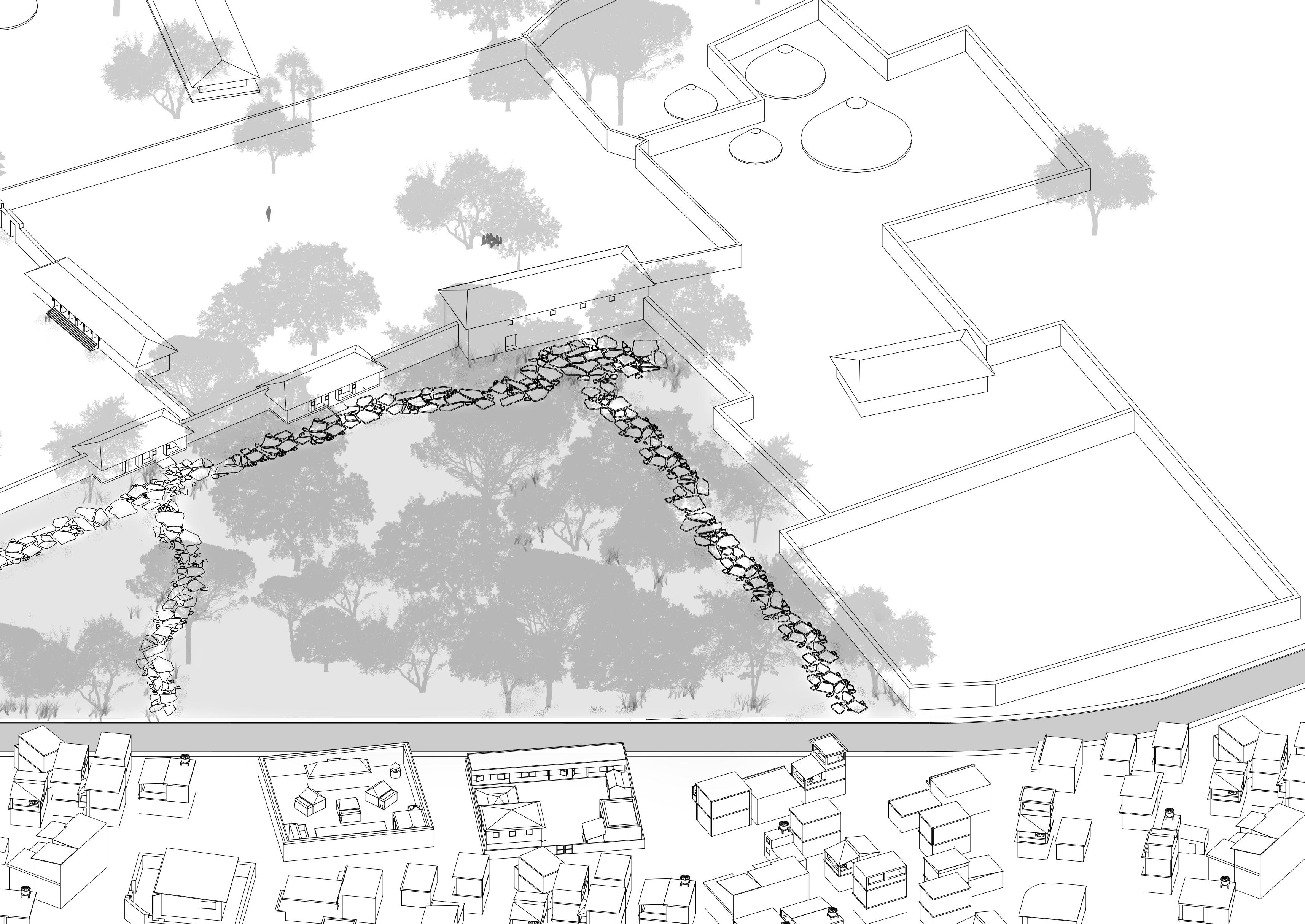
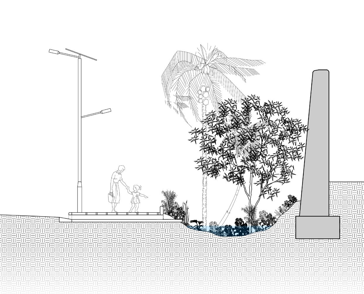
Soft barriers, elaborated from landscape and soil movement, between the city and the “ Court of the Amazons” in order to provide isolation to the sacred space without interrupting the view or creating rigid obstacles in the urban landscape.
SUse of existing moats for the creation of rain gardens. The city suffers from intense storms and could take advantage of the moats built in the nineteenth century around the city and the palaces as basins to contain rainwater and stimulate the preservation of native vegetation.
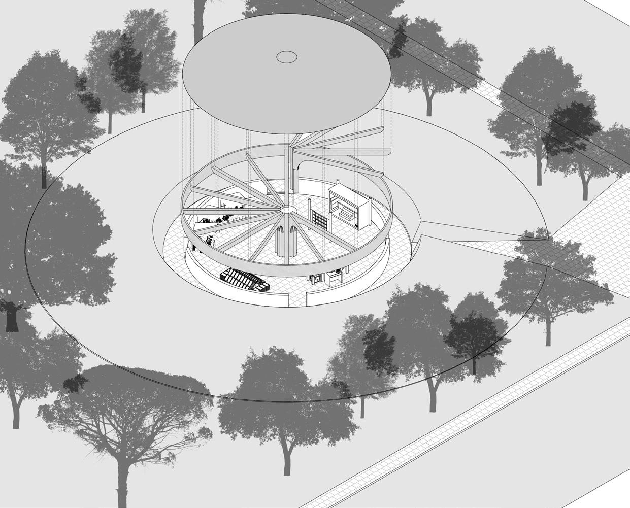
One of the major concerns of the local population regarding the construction of the new museum is related to the “artisans village” that would have to be dismantled or moved from the interior of the royal palace. We proposed the construction of a new “ artisans village “, located northwest of the museum.
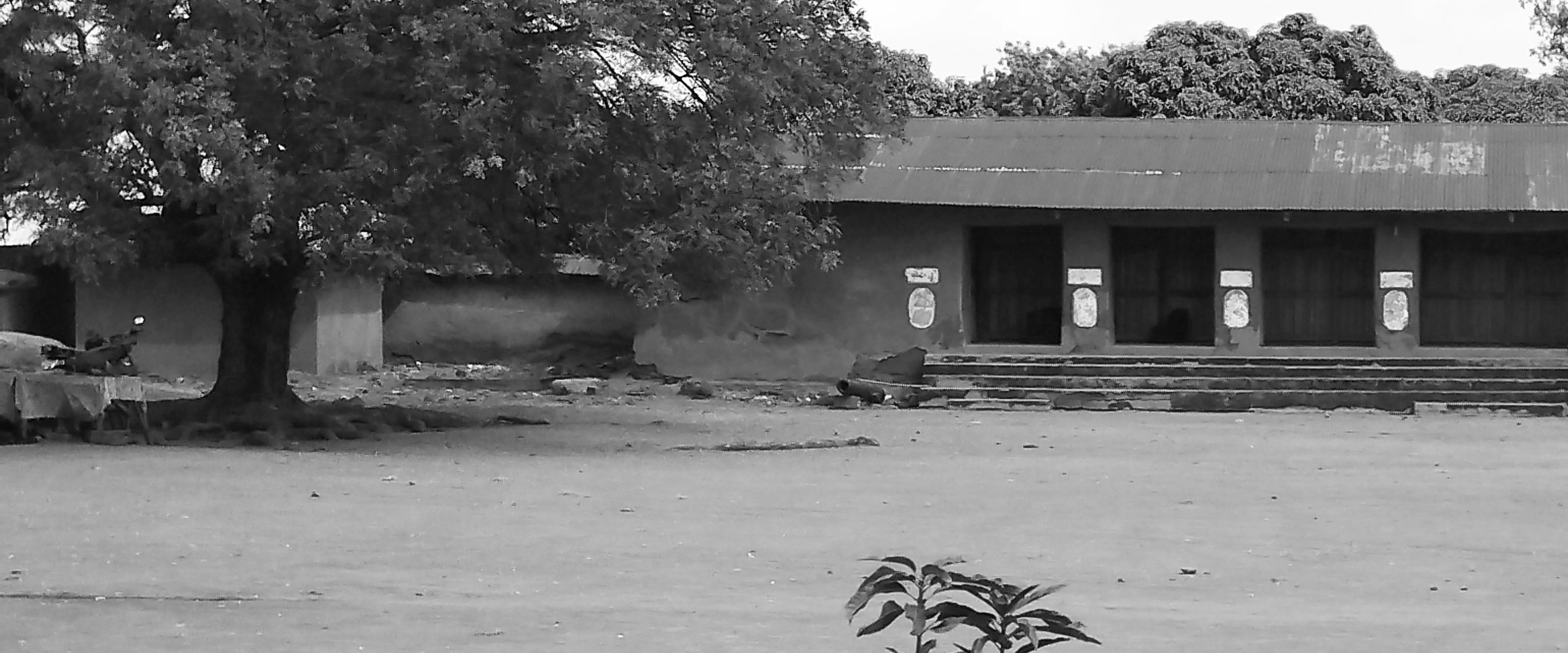
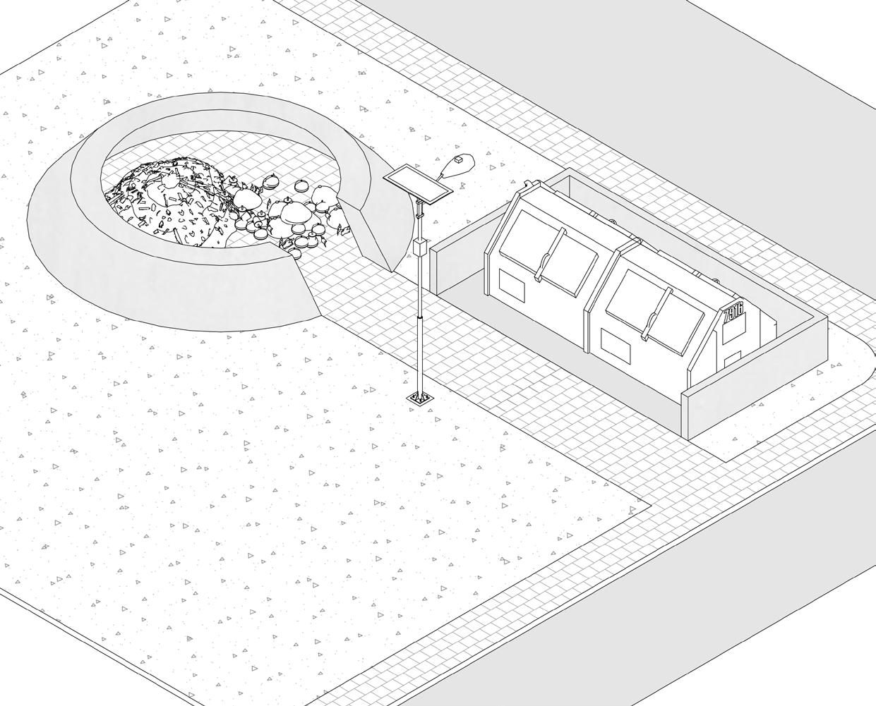
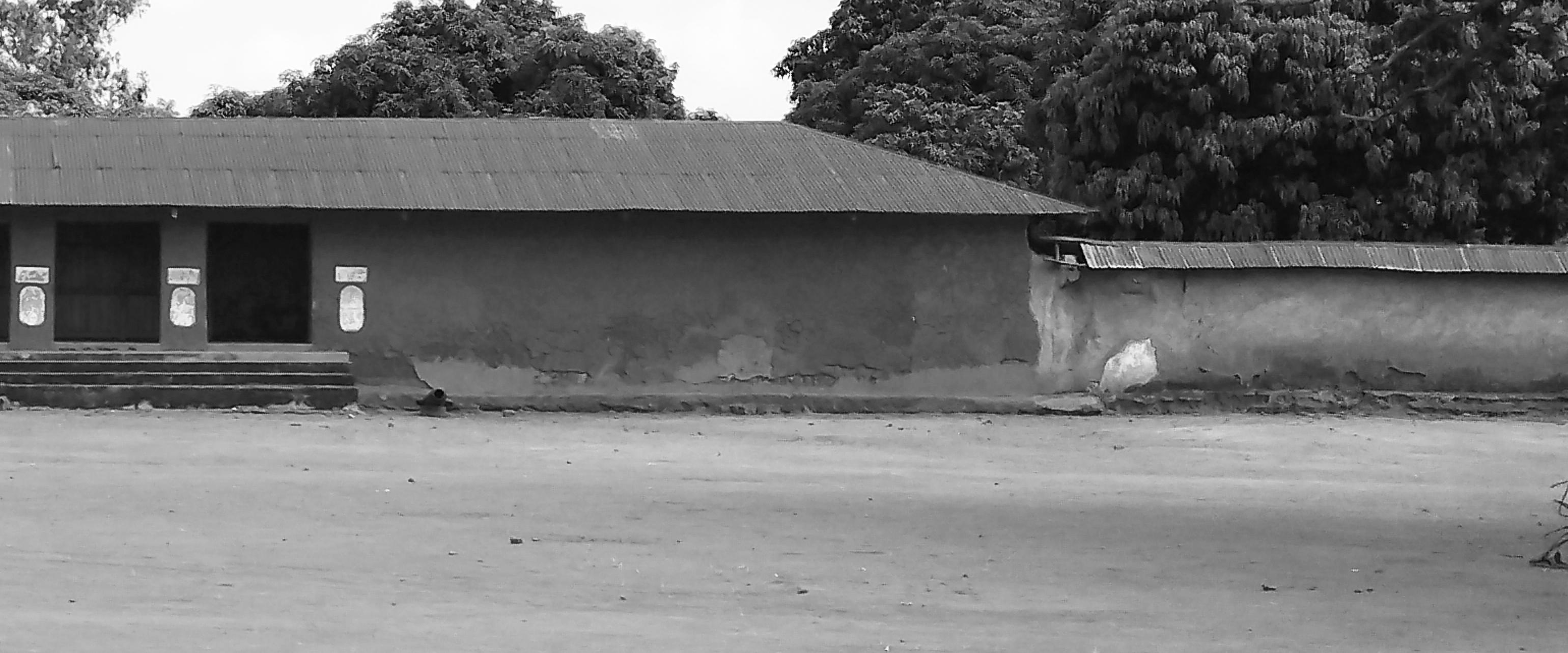
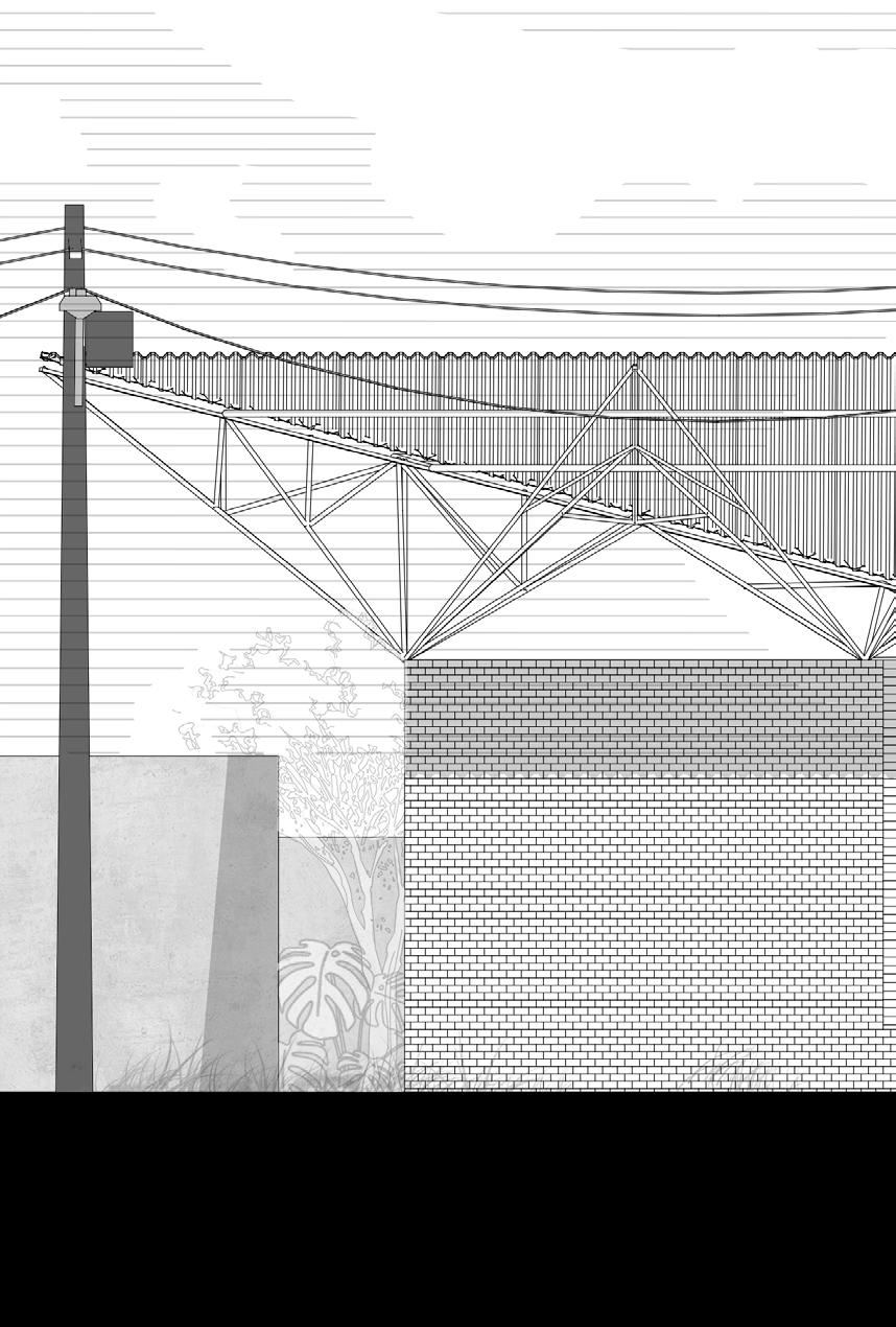
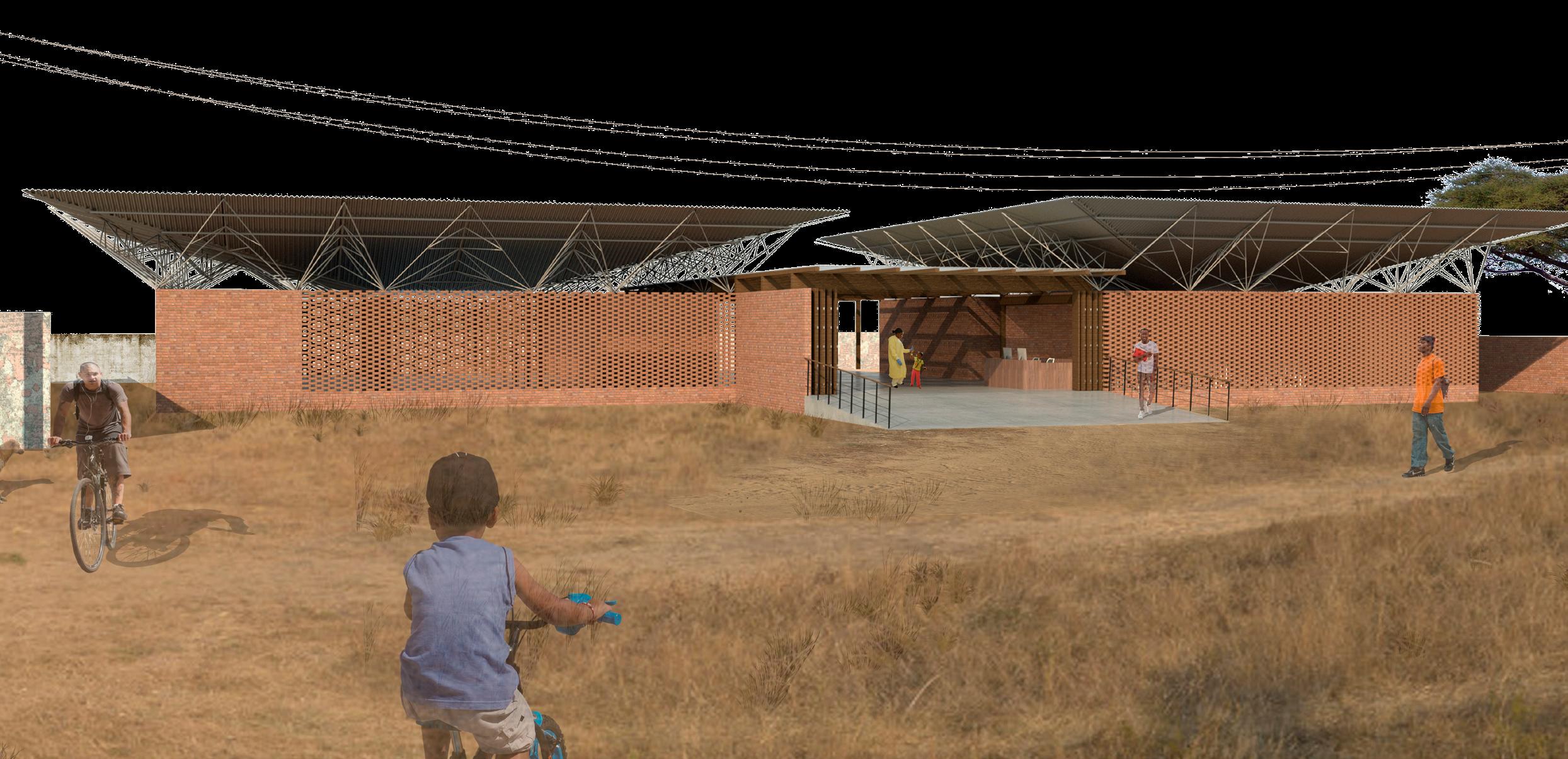
One of Abomey’s biggest urban problems is the collection and treatment of solid waste, which is now burned in front of homes or in the middle of the street sporadically throughout the day. We proposed structures that provide shelter to containers and a safe place for the burning of these waste.
Angola is marked by the struggle of committed and cheerful people. Its recent history went through the Portuguese occupation and domination, followed by an intense civil war that lasted for almost 30 years. As a consequence, even after almost half a century of freedom and two peaceful decades, despite its mineral wealth and abundance of oil, Angola is still a poor country with low levels of human development.
The Angolan health system is well structured from a theoretical and administrative point of view. Service is divided into 4 spheres: reference hospitals, general hospitals, municipal hospitals and health posts. Despite this, there are not enough facilities and they lack materials and professionals. Finally, there is a lack of standard between the units.
Many health problems faced in Angola could easily be solved with simple hygiene habits, which are hampered in the country due to serious structural problems such as the lack of basic sanitation. This work aims to structure and standardize the Angolan basic health unit in an attempt to positively reach the largest number of people with small actions that could be easy to put in place.

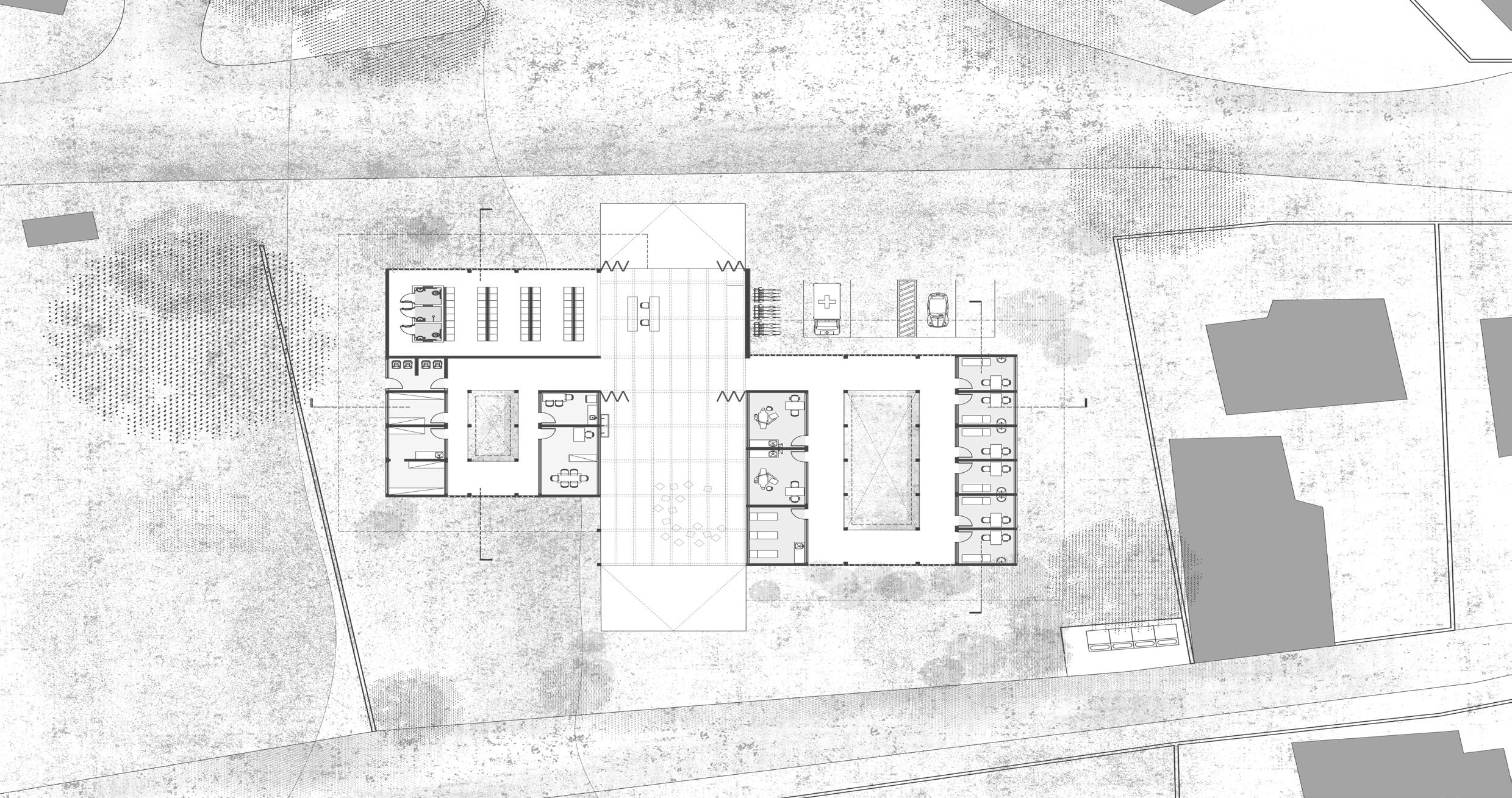
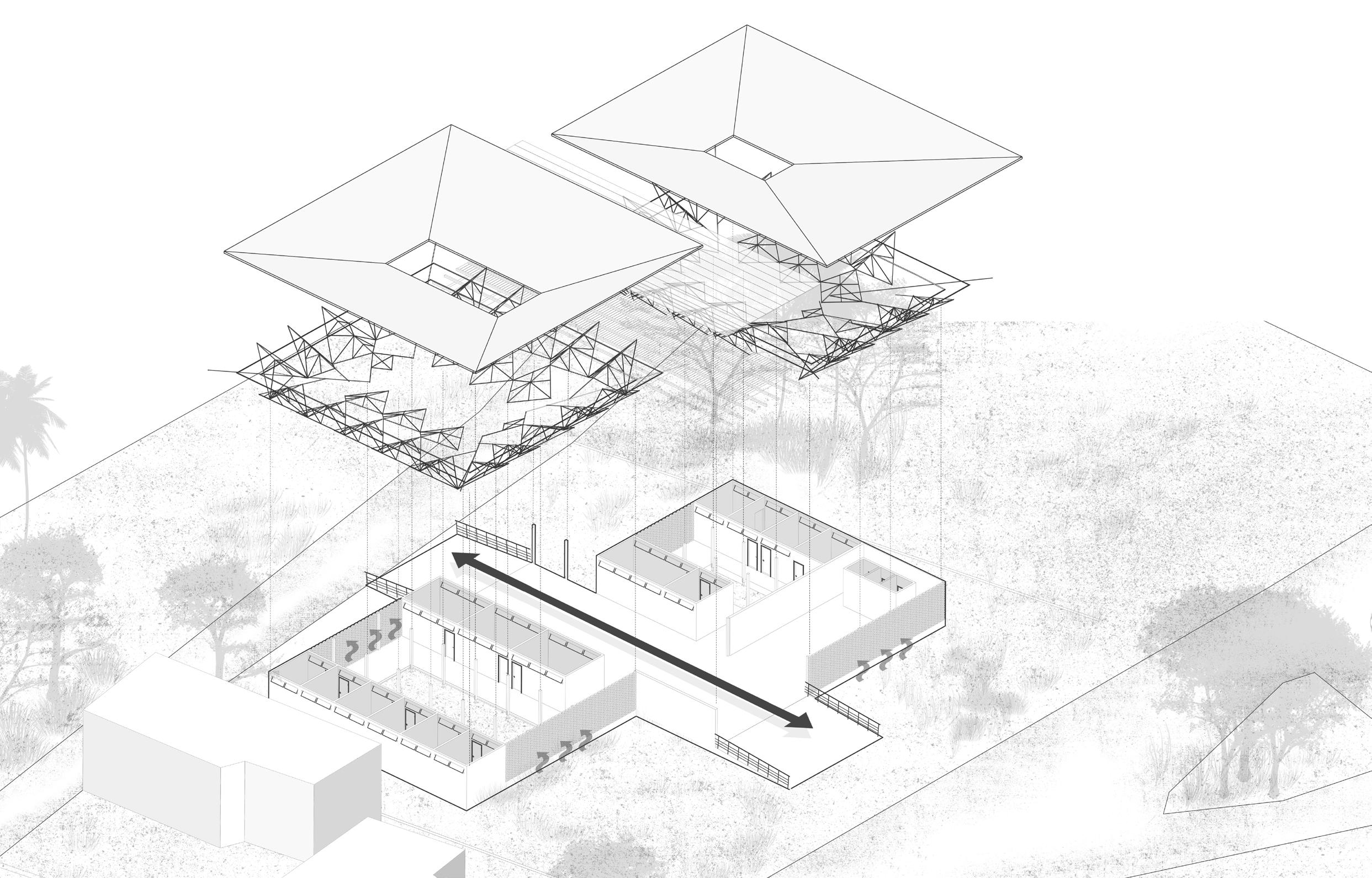
The chosen site at Múkua Street, close to it’s intersection with Kaope Road - two important pathways that structure the urban district of Sapú, Luanda province, a poor region of the capital with scarce health equipments. A health unit with a dual module and capacity for up to 8,000 people was proposed. The idea was to divide the program in administrative areas and health care facilities. Each of these areas faces a small internal garden. Simple and common construction techniques were used in the project, such as pressed brick and metal or wooden
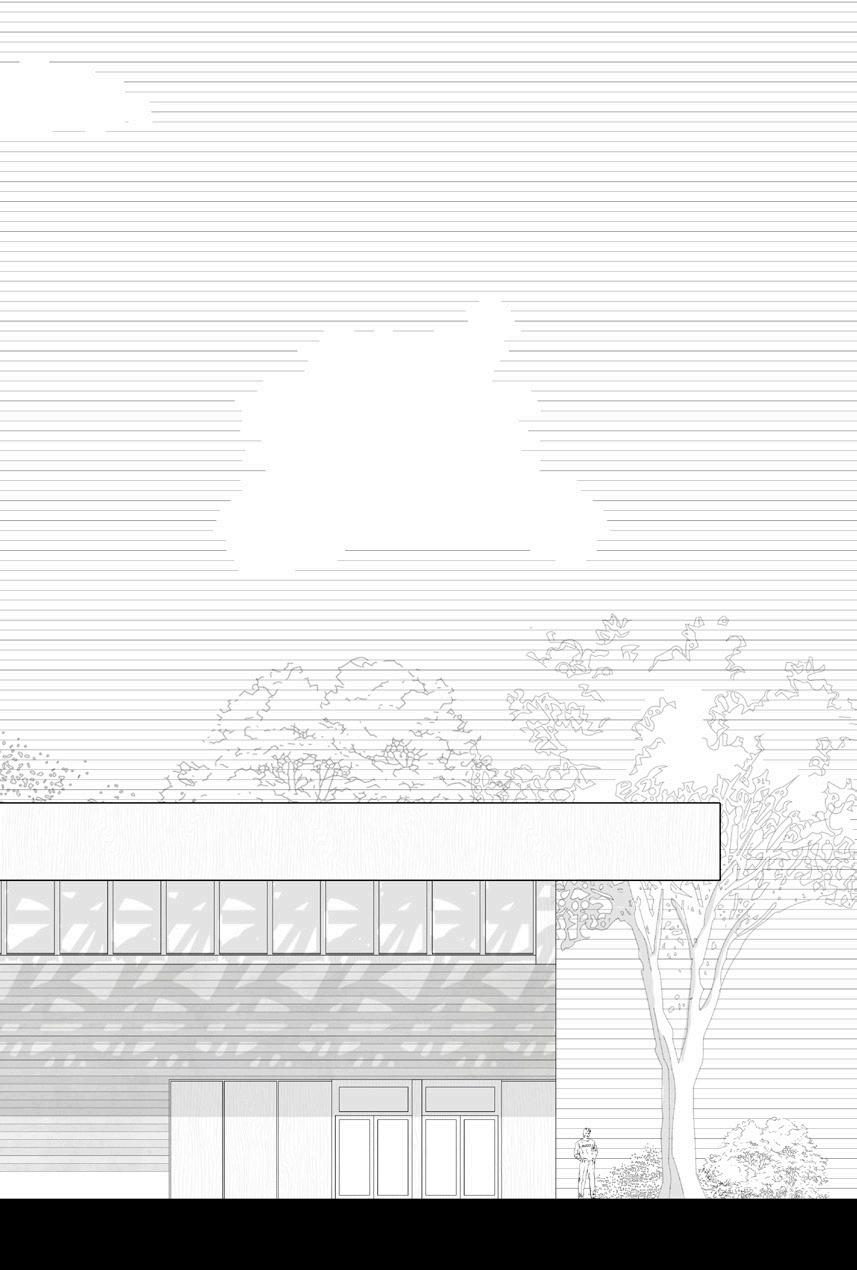

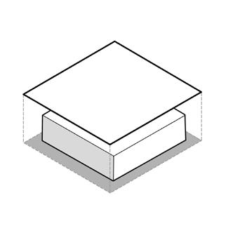

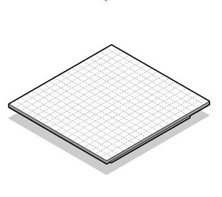
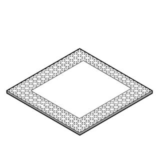
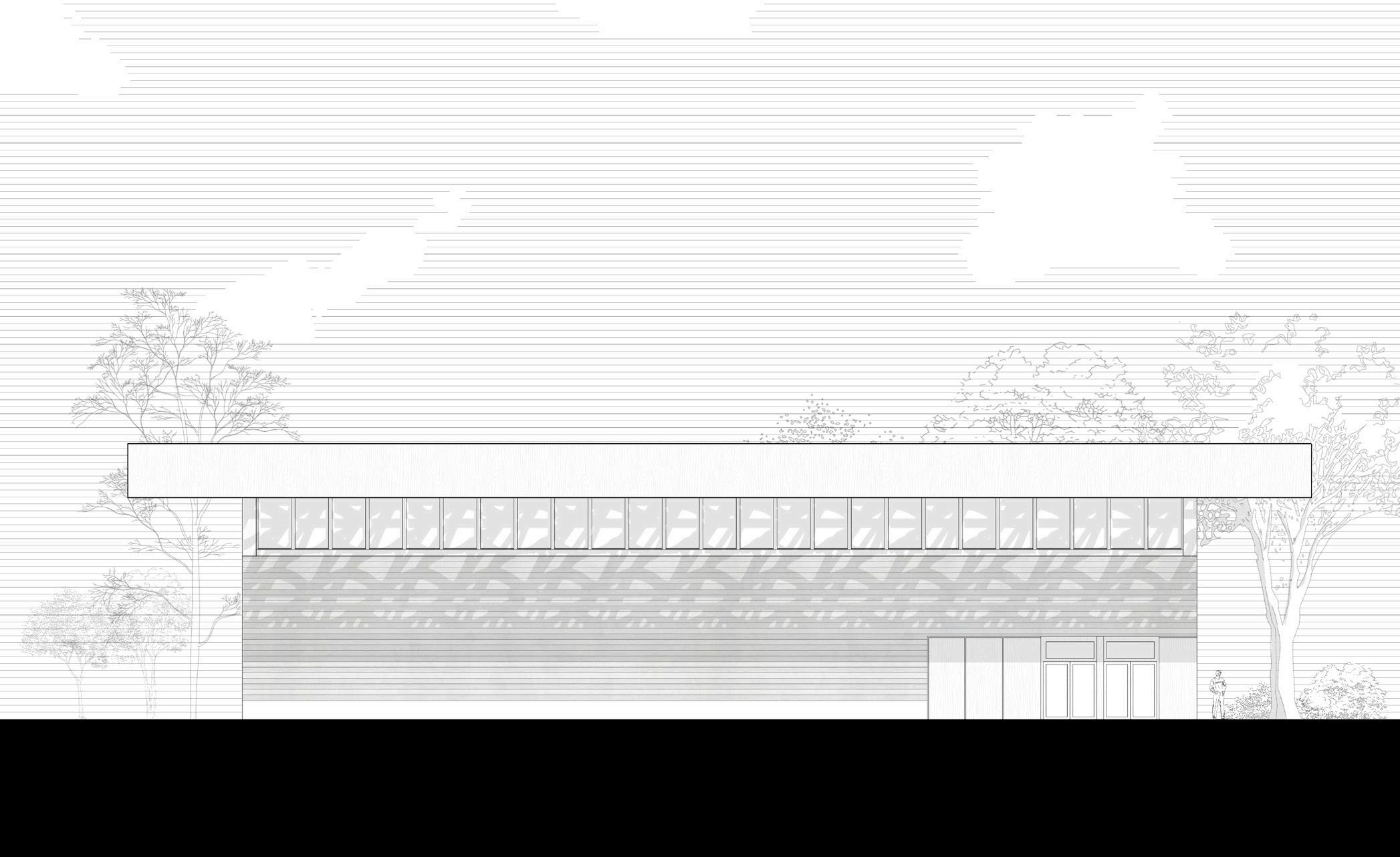
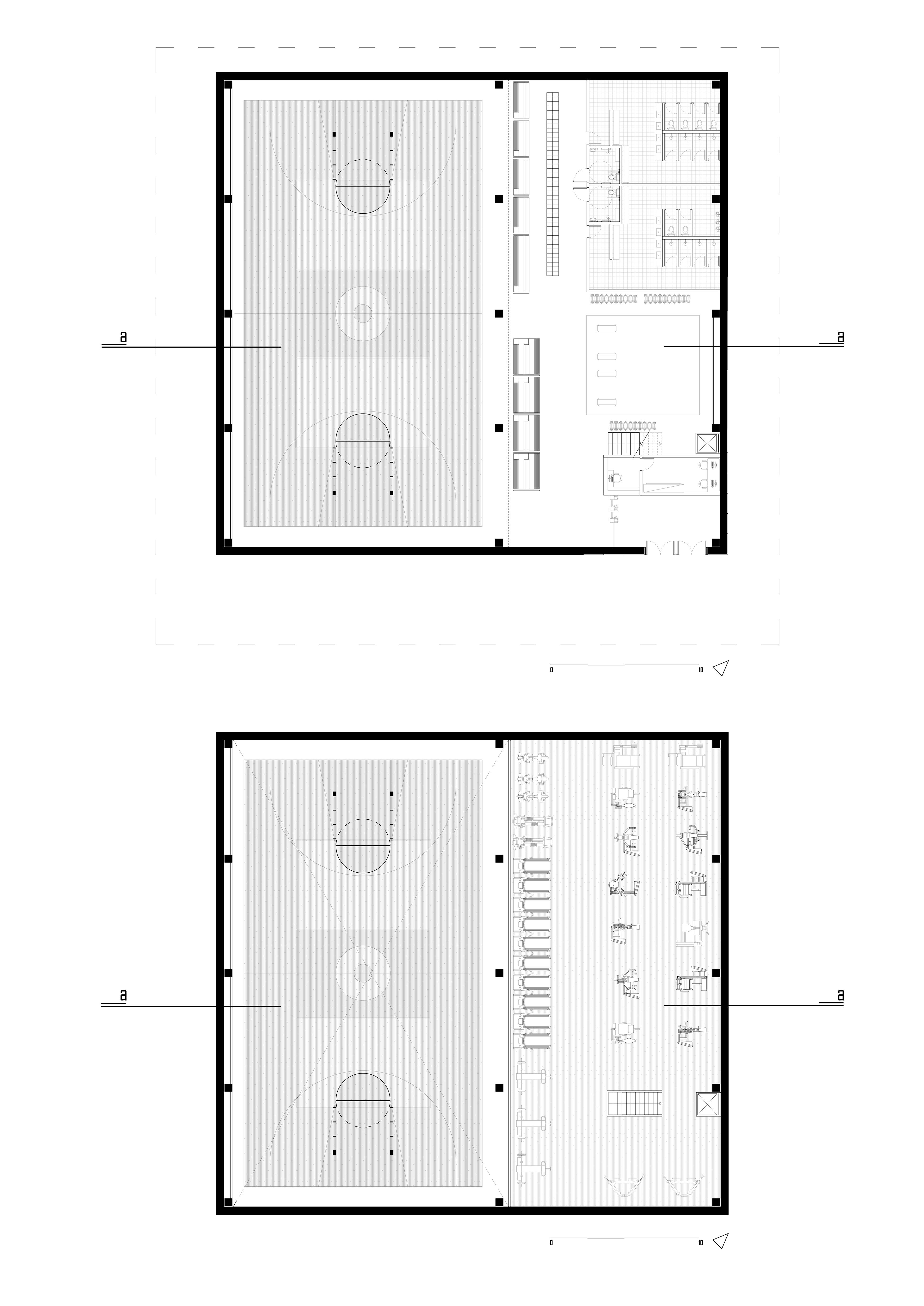
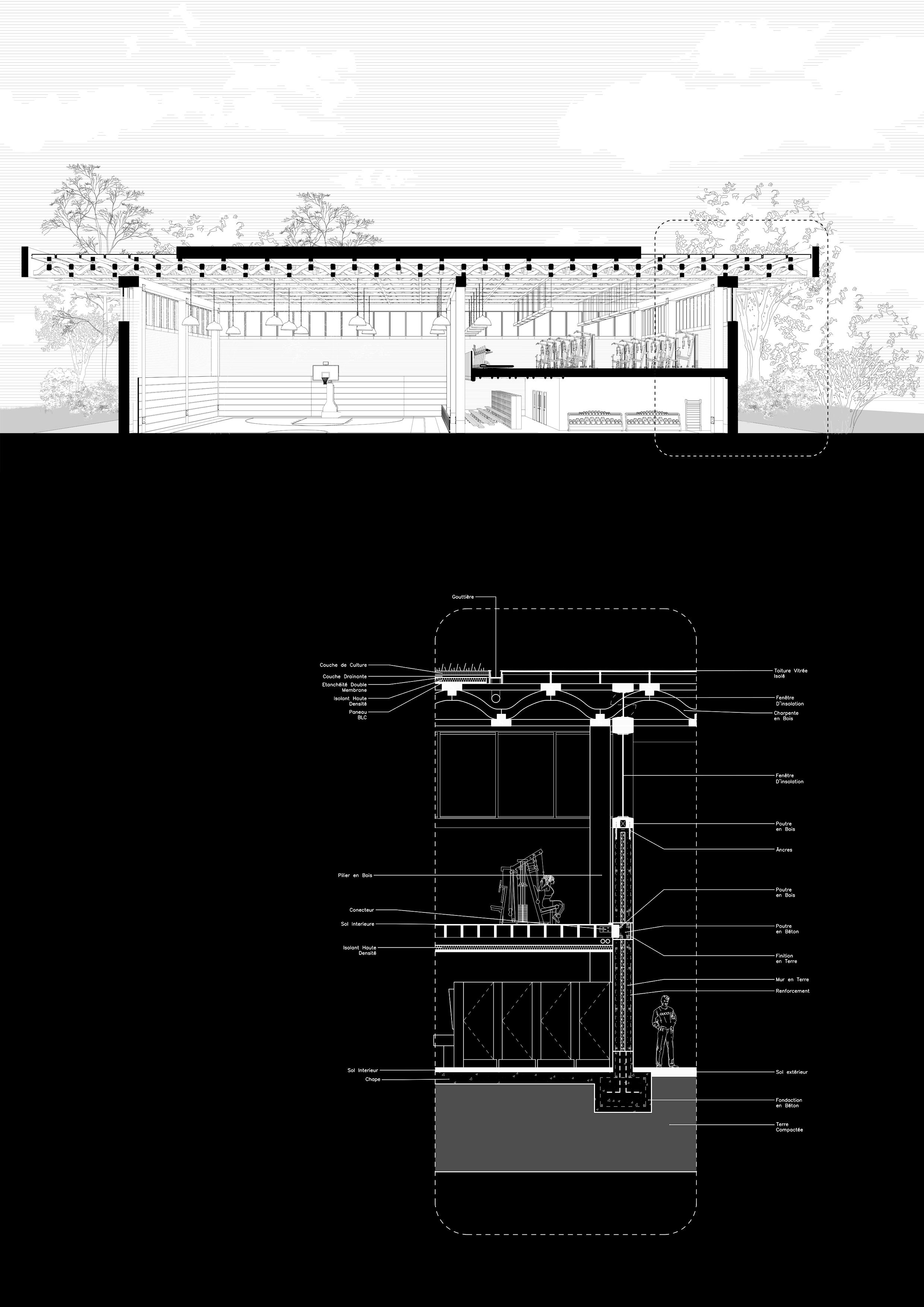
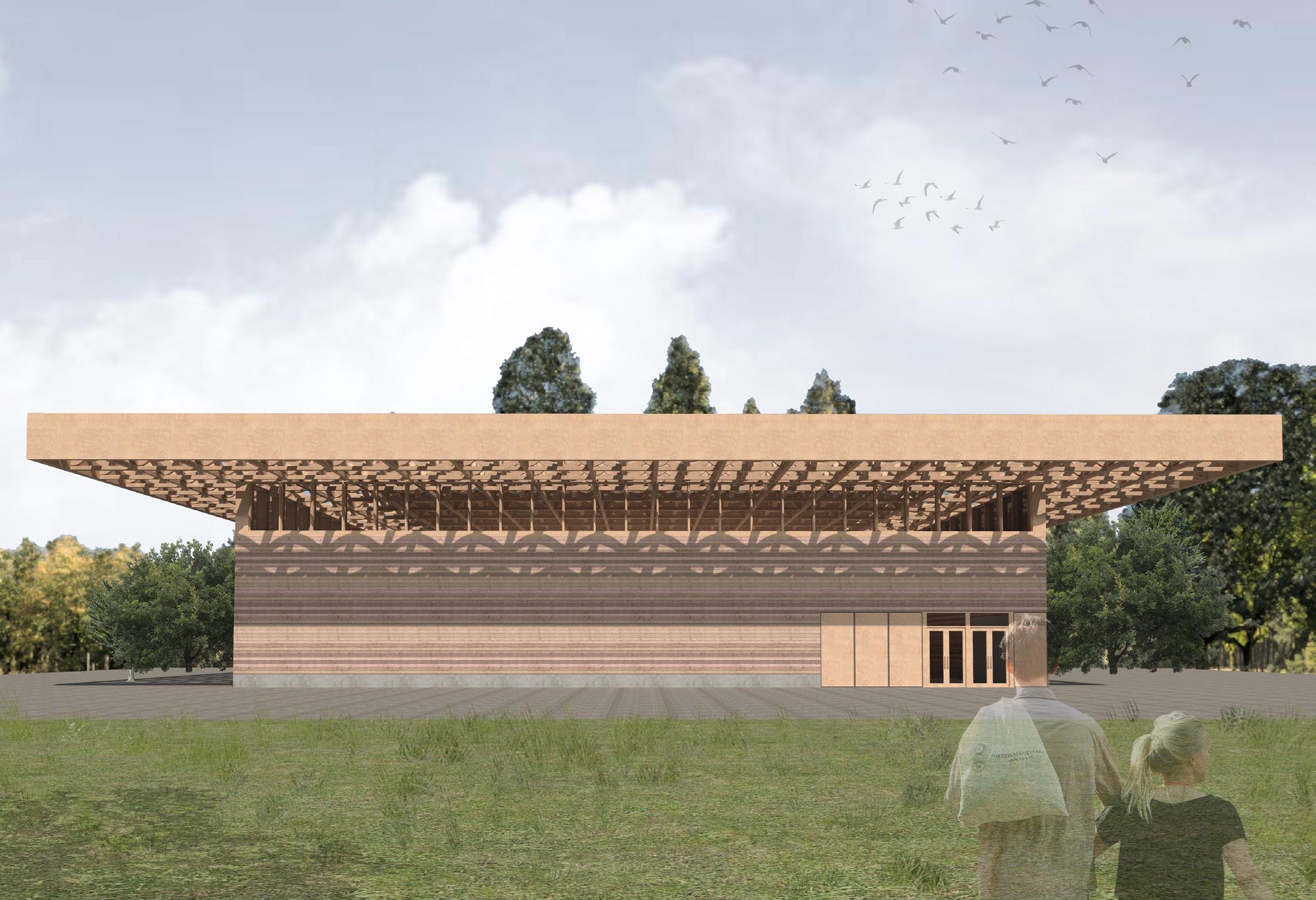
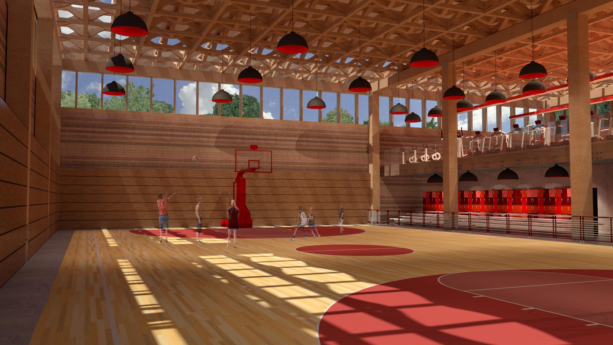
The absence of a communal equipment dedicated to indoor sports practice on the surroundings of the La Villette park in Paris oriented the design of a new local plan that resulted in this object, a local scale gymnasium with an integrated public gym, following the existing models in the city.
Understanding it’s integration with the surrounding park designed by Bernard Tschumi in 1987, it was imagined a construction that followed the same ruling ideas on the original grid established by the architects, its form is then elaborated from the 10m x 10m cube, that is multiplied to the necessary dimension of the program, its tectonic uses the red earth from the Roussillon, on the south of France, that presents a composition made out of 10% Goethite what grants its strong red coloring, another parameter adopted in the original project for the park. Finally, it’s wooden roof, was inspired by Shigueru Ban’s project for the Aspen art museum, it was elaborated and scaled in a way to dialogue with the great structures present in the park, reminiscent from the time the area held Europe’s largest livestock exchange deposit and slaughterhouse.
The final object holds a sober and brutalist language, that intends to create a dialogue with its surroundings, creating a balance without overshadowing the nature or the park anterior to this project.
Plan
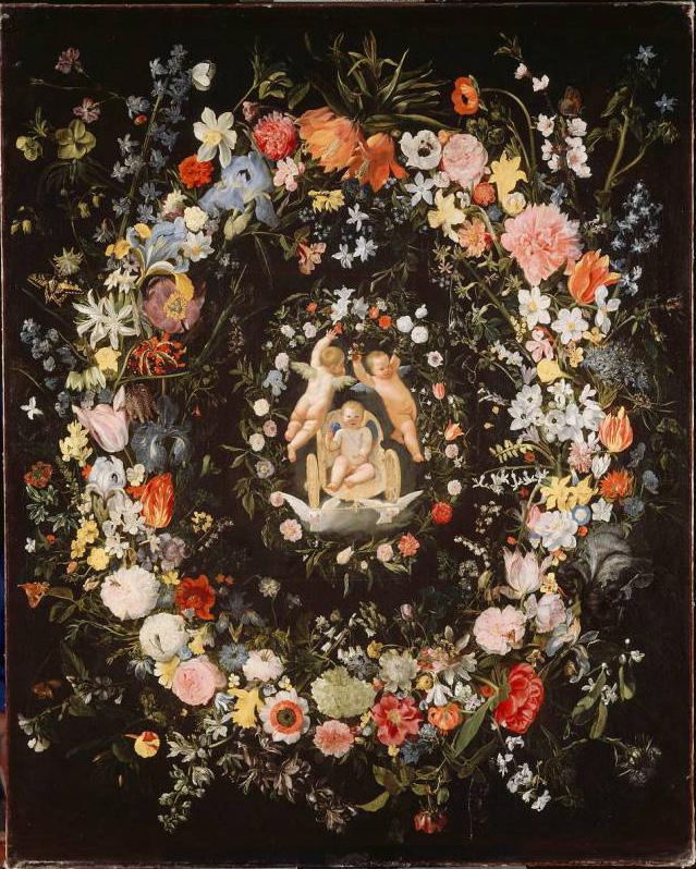
Le Triomphe de l’Amour avec entourage de fleurs 1633
Daniel SEGHERS
Anvers, 1590 - Anvers, 1661
Zampieri (Le Dominiquin)
Bologne, 1581 - Naples, 1641
Size
H. : 1,34 m. ; W. : 1,10 m
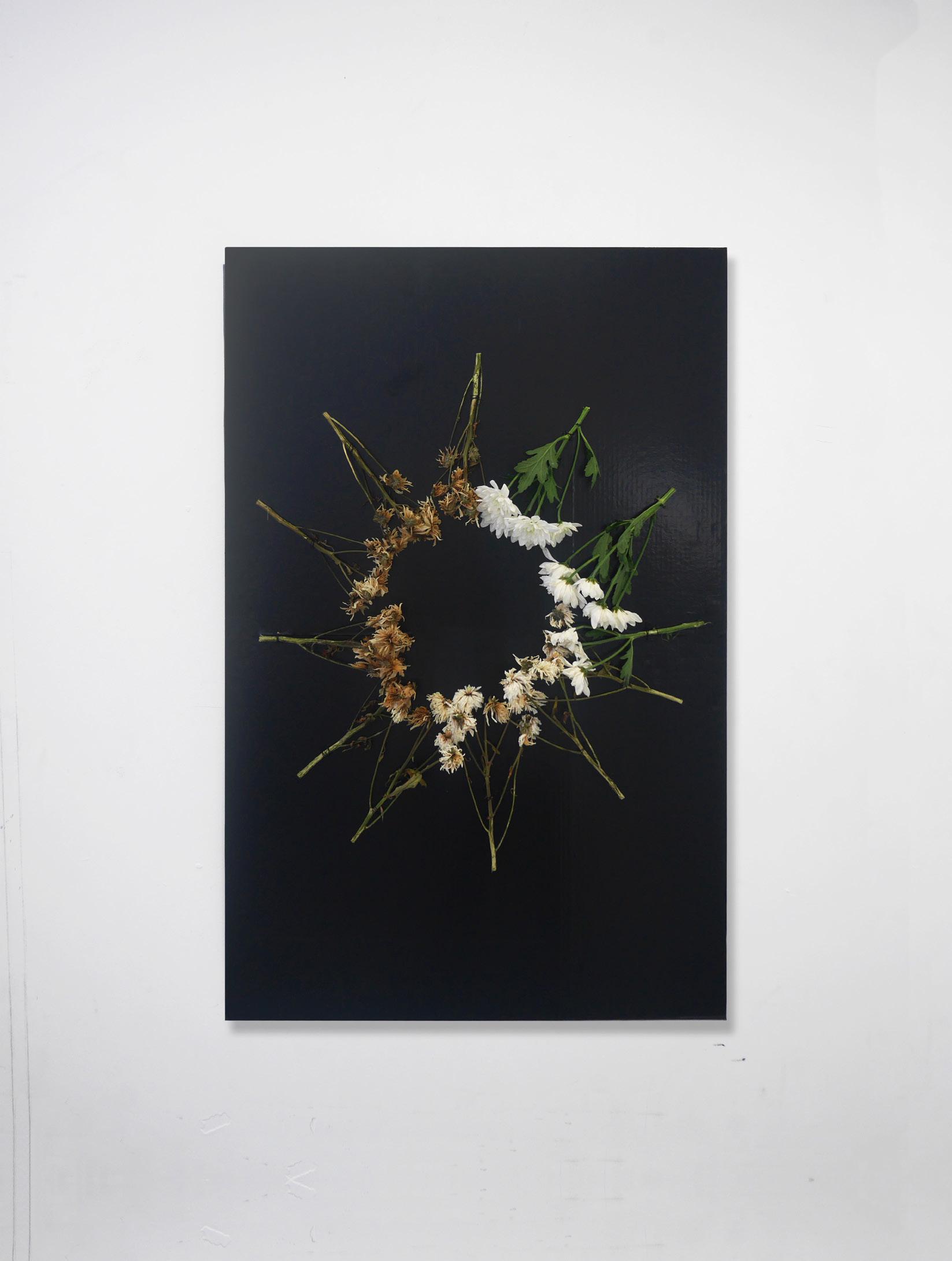
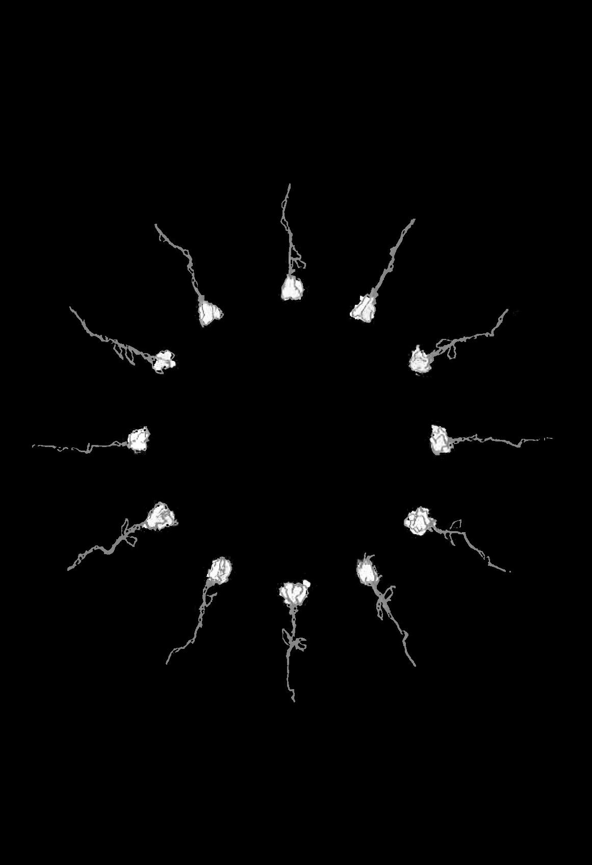
This work is the result of a class in witch we where supposed to study a certain motif, artist or movement to then produce a contemporary art piece driven from that research. I chose to study « Le Triomphe de l’Amour avec entourage de fleurs » by Daniel Seghers and Le Dominiquin, a masterpiece o flemish art, that consist in a wreath of flowers around a representation of the classic play “The Tryumps of Love”.
Fascinated by the meaning and the use of the wreath in flemish painting, but also how we, as a society have used and still use those flower motifs, I drove a reasearch that culminated in the perception of those flowers as symbols for the passage of time and the perception finitude but also the of life, of begining and renovation.
The habit of conceiving wreaths are present all over the globe since the beginning of times, and is common in most part of communities, what makes hard to trace its origins. We know the meridional europeans alongside with polynesian tribes used those wreaths as symbols of power and distingshment, but the american natives and the greeks had the habit to use them during funerary ceremonies, as a symbol for the passage of time. The christians incorporated this tradition during the victorian era, to represent the ressurection of Jesus.
The final result of the research consist of a wreath made up of 12 white chrysanthemums, a flower that in ocidental culture is a symbol for a rite of passage and purity of soul. Each posey is organized as a clock, in which the younger flower is positioned at the first spot and the oldest one being on the 12th spot. This is a representation of time and its action on something that ambiguously represents, its constant renovation.