LAUREN MIRALDI
M.S.CRP, M.S.UD, B.S.Arch
URBAN DESIGN PORTFOLIO
M.S.CRP, M.S.UD, B.S.Arch
URBAN DESIGN PORTFOLIO
O N T E N T S
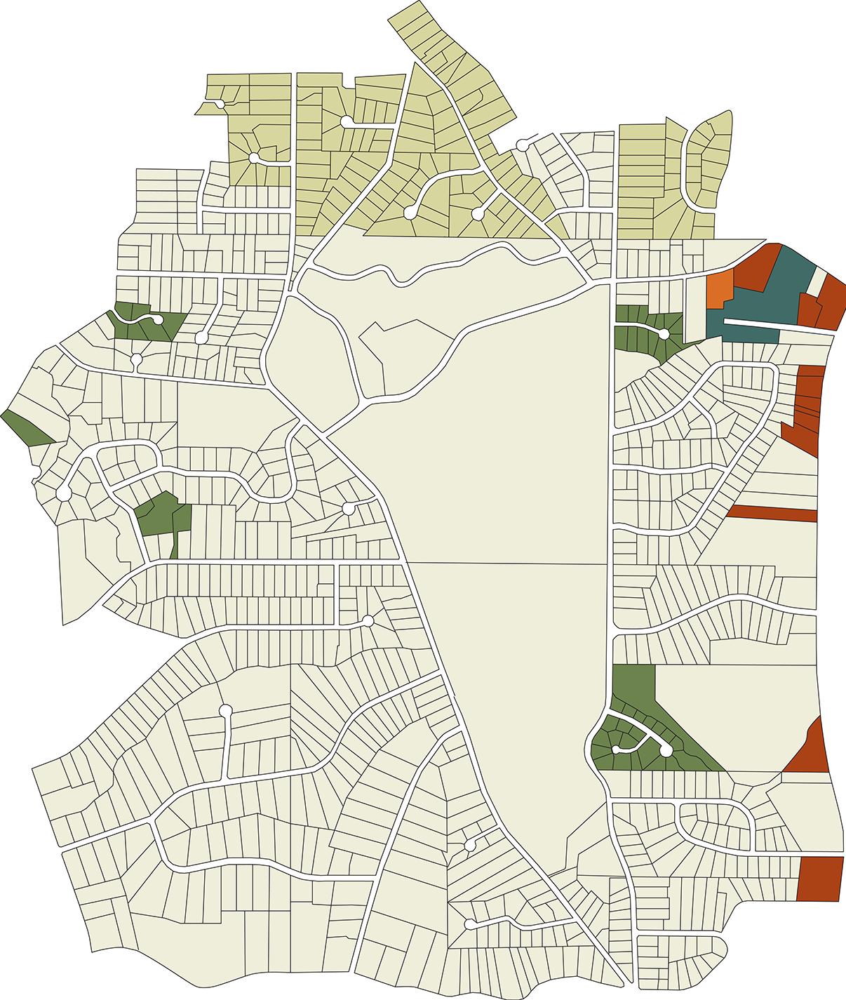
Lake Erie South Shore Waterfront Plan
ULI Hines Student Competition
University of Texas at Austin Spring 2025
TYPOLOGICAL INVENTORY
Catalog of Urban Strategies
Academic Project
University of Texas at Austin Fall 2024
Watershed River Keepers
Academic Project
Georgia Institute of Technology
Spring 2022
for the Capital Express Central UT Cap
Academic Project
University of Texas at Austin
Fall 2024
at the Chastain Park Ecovillage
Academic Project
Georgia Institute of Technology
Fall 2022
University of Texas at Austin
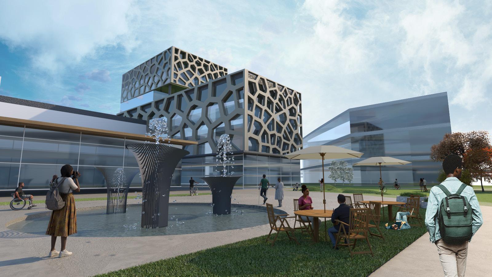
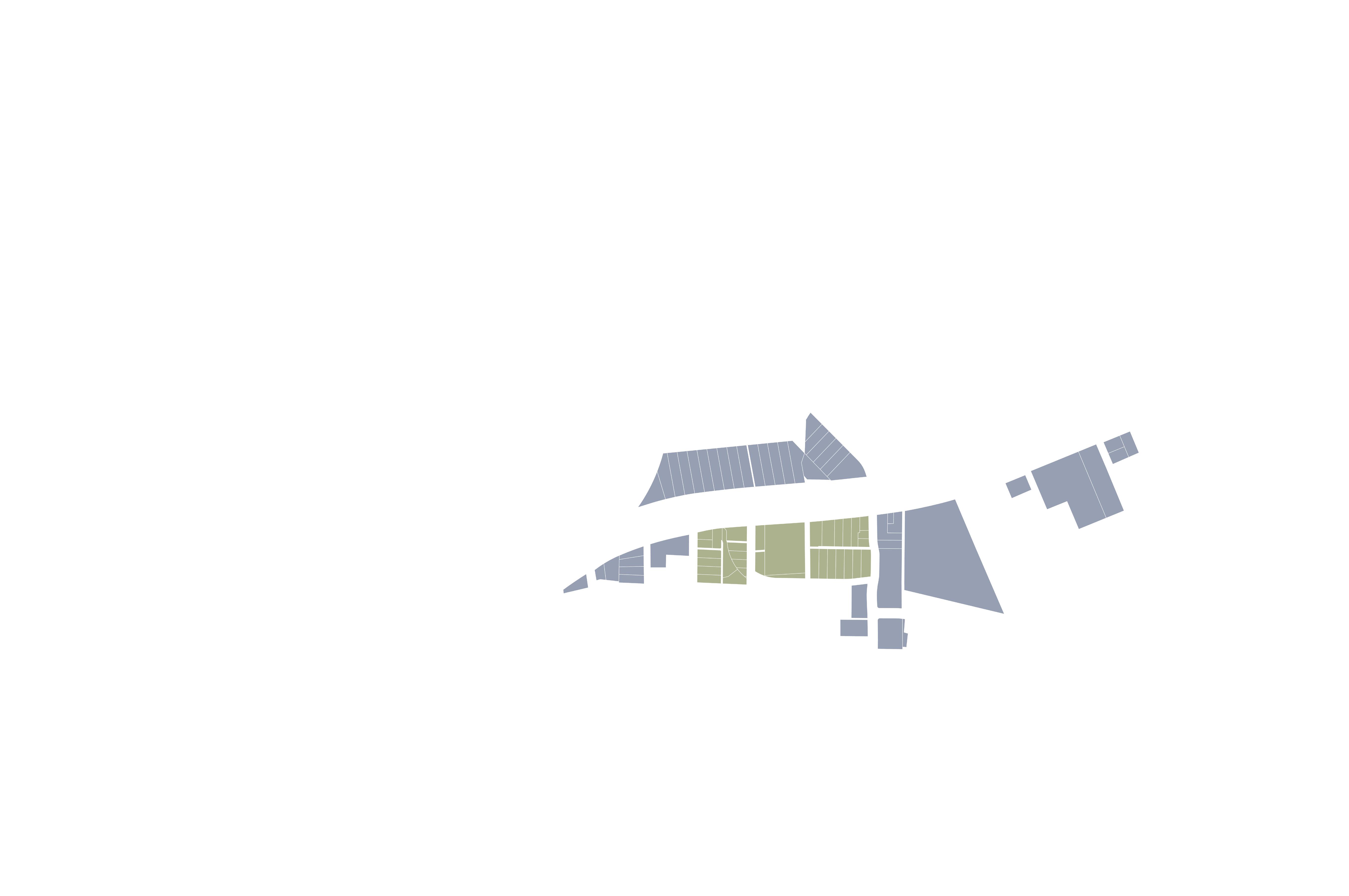
Team Members: Kimberlee Michaelis, Victoria Origel, Ivan Aguilar, Shreyas Khanjee
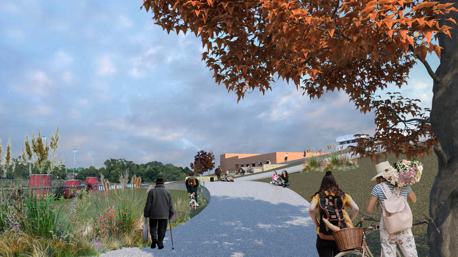
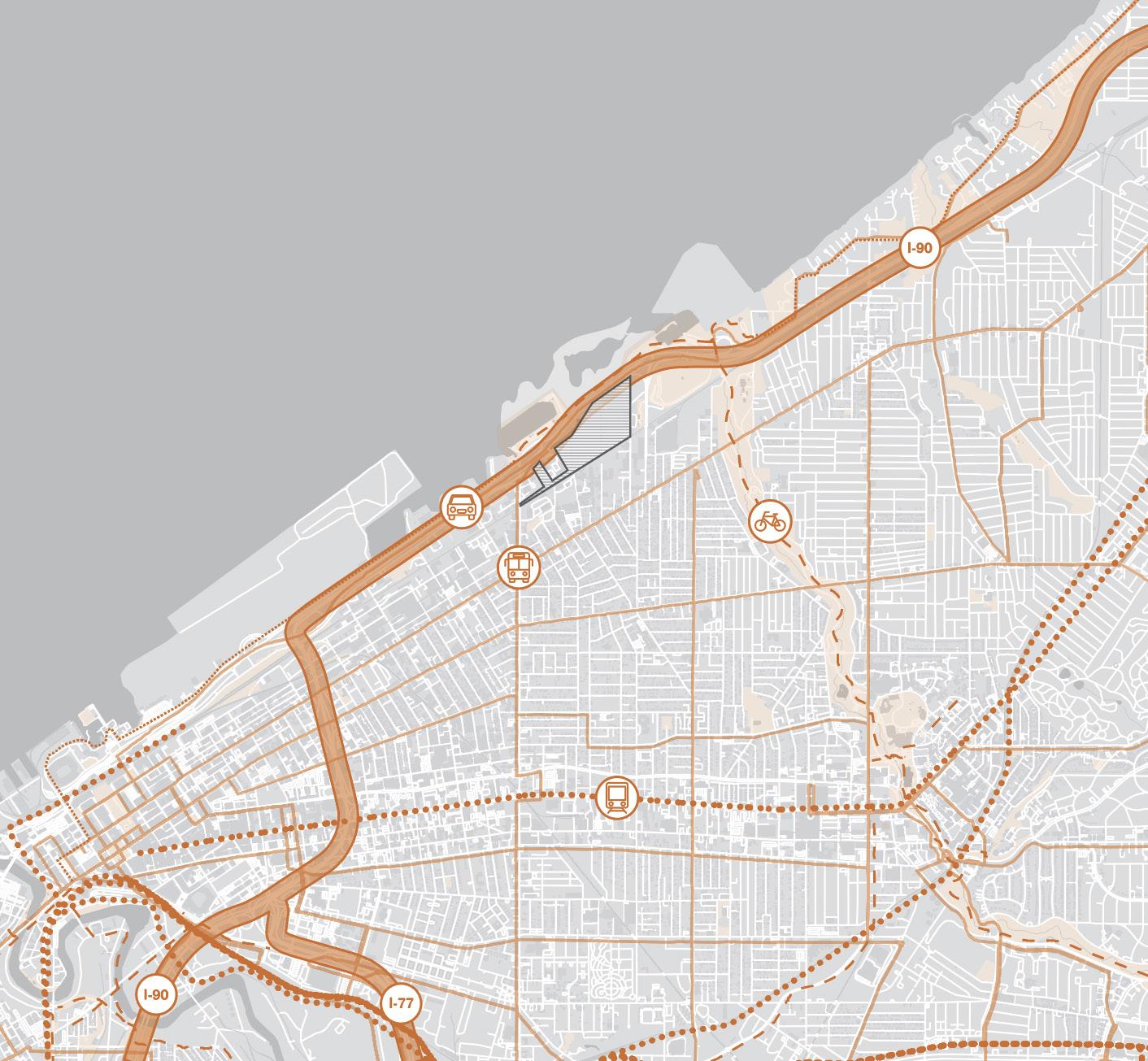
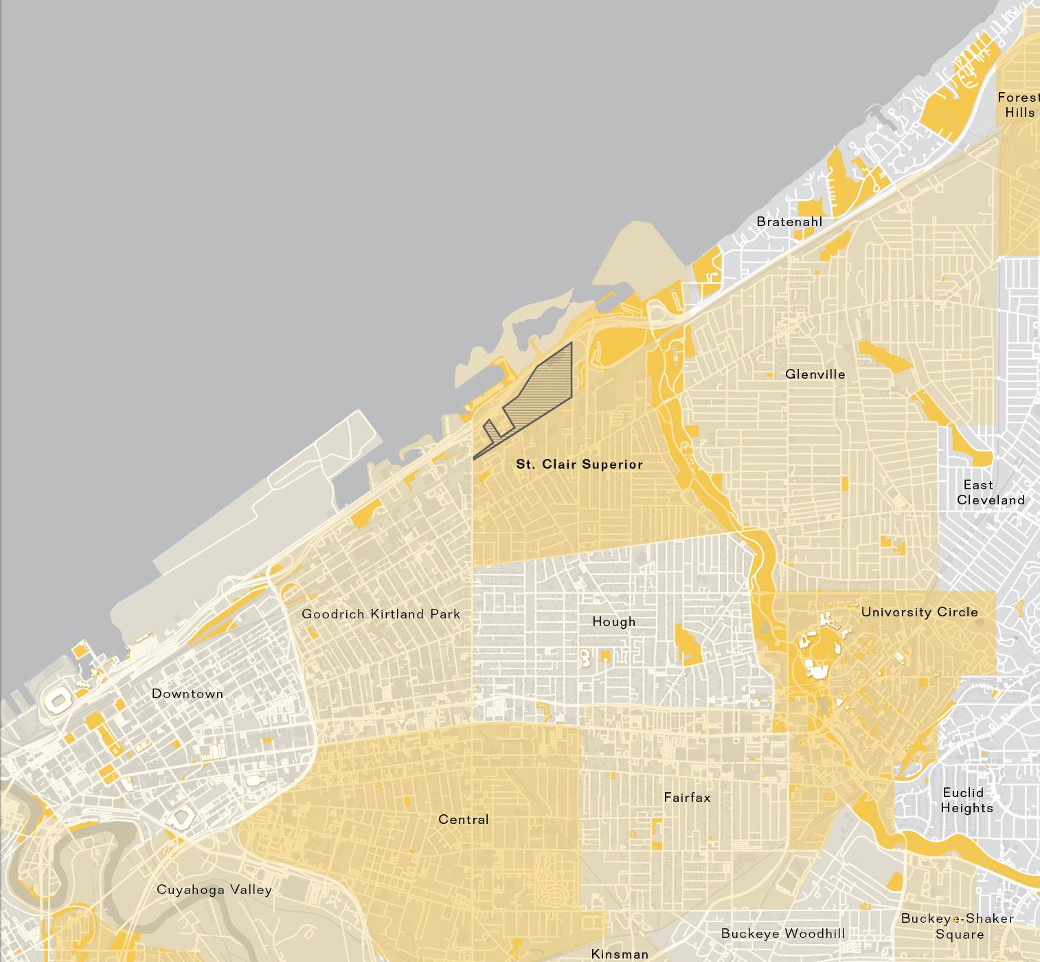
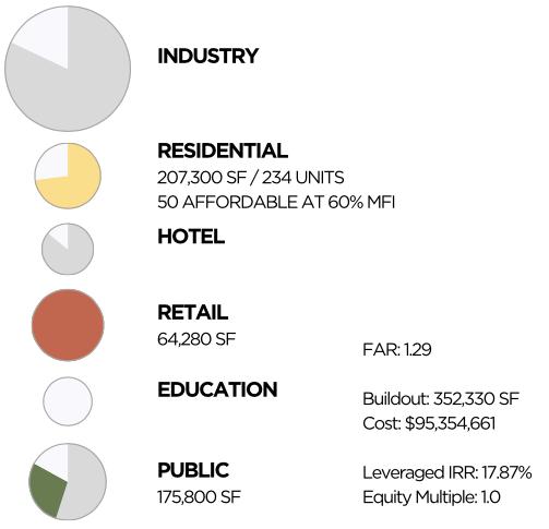
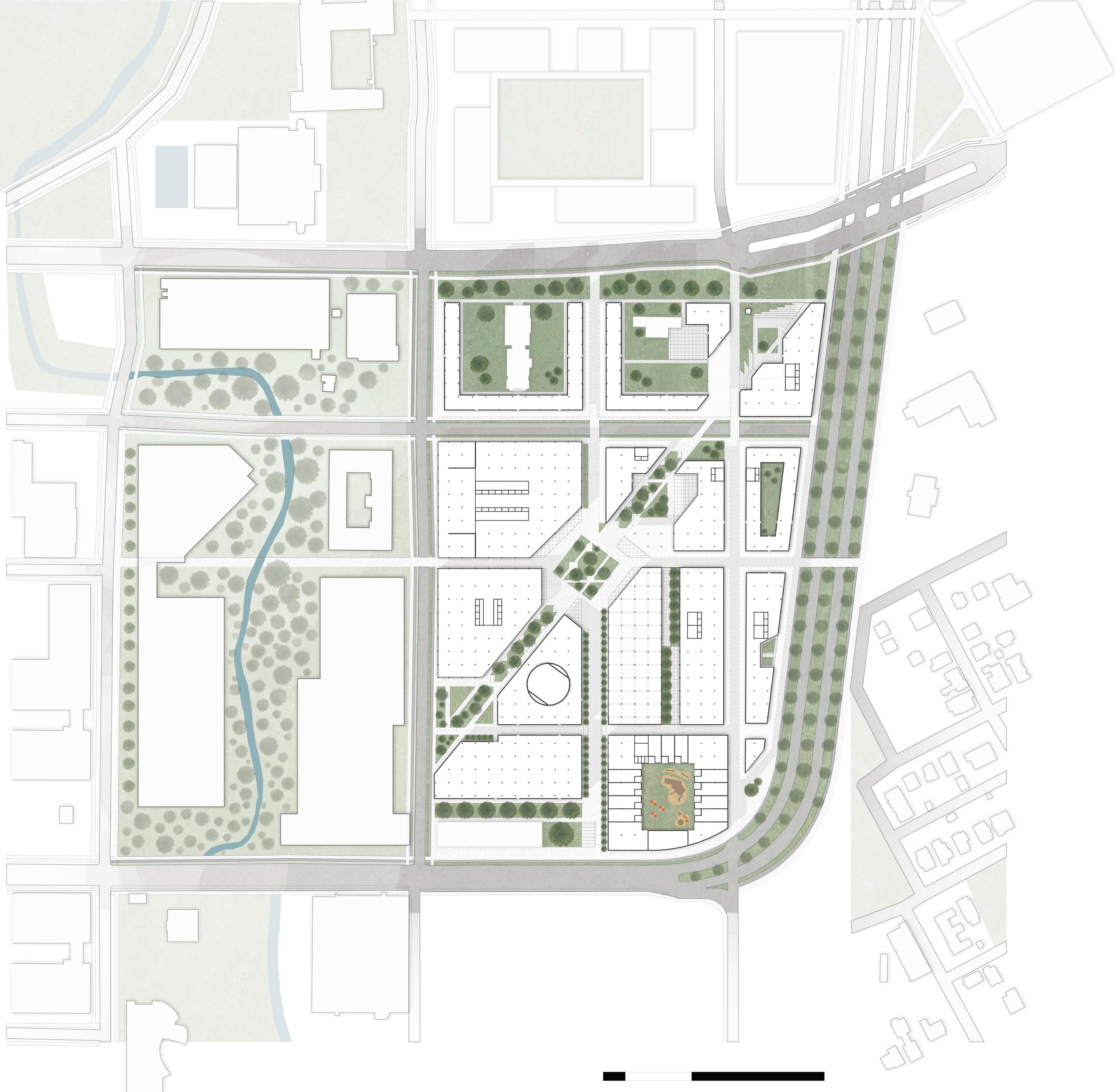
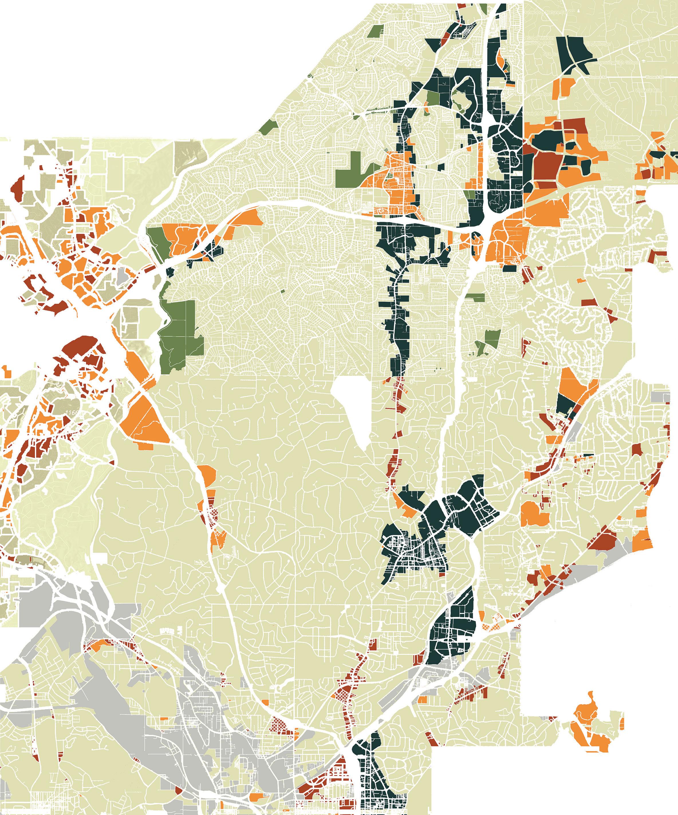
Site: Former Lake Shore Power Plant, Cleveland, OH
Amplify Cleveland, or “The AMP,” is a pivotal $683.3M mixeduse, mixed-income development along Lake Erie’s south shore. Amplify Cleveland integrates the city’s emerging healthcare economy and breaks ground for innovation, sustainability, recreation, and affordability.
Life Sciences catalyze the economic development of the project, leveraging the celebrated partnerships of University Hospitals with Cleveland Clinic and Case Western Reserve University. The AMP aims to link biomedical research and healthcare by cultivating a place for ideation, prototyping, and fabrication in light industrial maker spaces with manufacturing capabilities.
Amplify Cleveland envisions a diverse community that activates the surrounding neighborhoods. The Bass, Tenor, Alto, and Soprano apartments compose The Choir, a residential village central to The AMP that provides 322 housing units, 20% of which are affordable. This creates a lively mixed-income neighborhood that is mindful of Cleveland’s status as a shrinking city and current vacancy challenges. Local businesses and cultural venues encourage residents, workers, and visitors to gather, celebrate, and support one another. With a focus on human connection, The AMP will transform the St. Clair Superior and Goodrich Kirtland Park neighborhoods into a dynamic, interconnected community where everyone has the opportunity to contribute and grow.
For over a century, Cleveland has been an industrial and manufacturing center, with a strong foundation in steel and automotive production. As Cleveland evolves, it is now poised to become a leader in healthcare and technology.
Amplify Cleveland will be a vibrant nexus between Downtown and University Circle where community, environmental, and cultural health converge. This development will spur economic growth and exemplify resilient urban design.
Looking ahead, emerging technologies and shifting economies will certify Cleveland’s role at the forefront of healthcare innovation. The City of Cleveland should capitalize on this opportunity to transform this waterfront acreage into a mixeduse medical district that couples biomedical research and healthcare solutions, cultivating a place for ideation, prototyping, and fabrication through light industrial maker spaces with manufacturing capabilities.
Community
The AMP prioritizes economic vivacity and shared prosperity through the intersection of healthcare, research and innovation.
Maker spaces
Bio-Medical Research
Production Greenhouses
Youth in Medicine Program
Vocational Training
Manufacturing Lab
Medical Center
The AMP highlights connectivity through well-planned transportation links, pedestrian pathways, and bike lanes, ensuring smooth movement between old and new neighborhoods.
Increased Mobility
Micro-Mobility Oriented
Public Transit Connections
Future Development Connections
Green Belt Living Streets
Pedestrian Centered Urban Design
The AMP builds community by emphasizing equity, addressing housing affordability, food insecurity, and cultural visibility.
Recreational Spaces Fitness Amenities
Small Business Opportunities
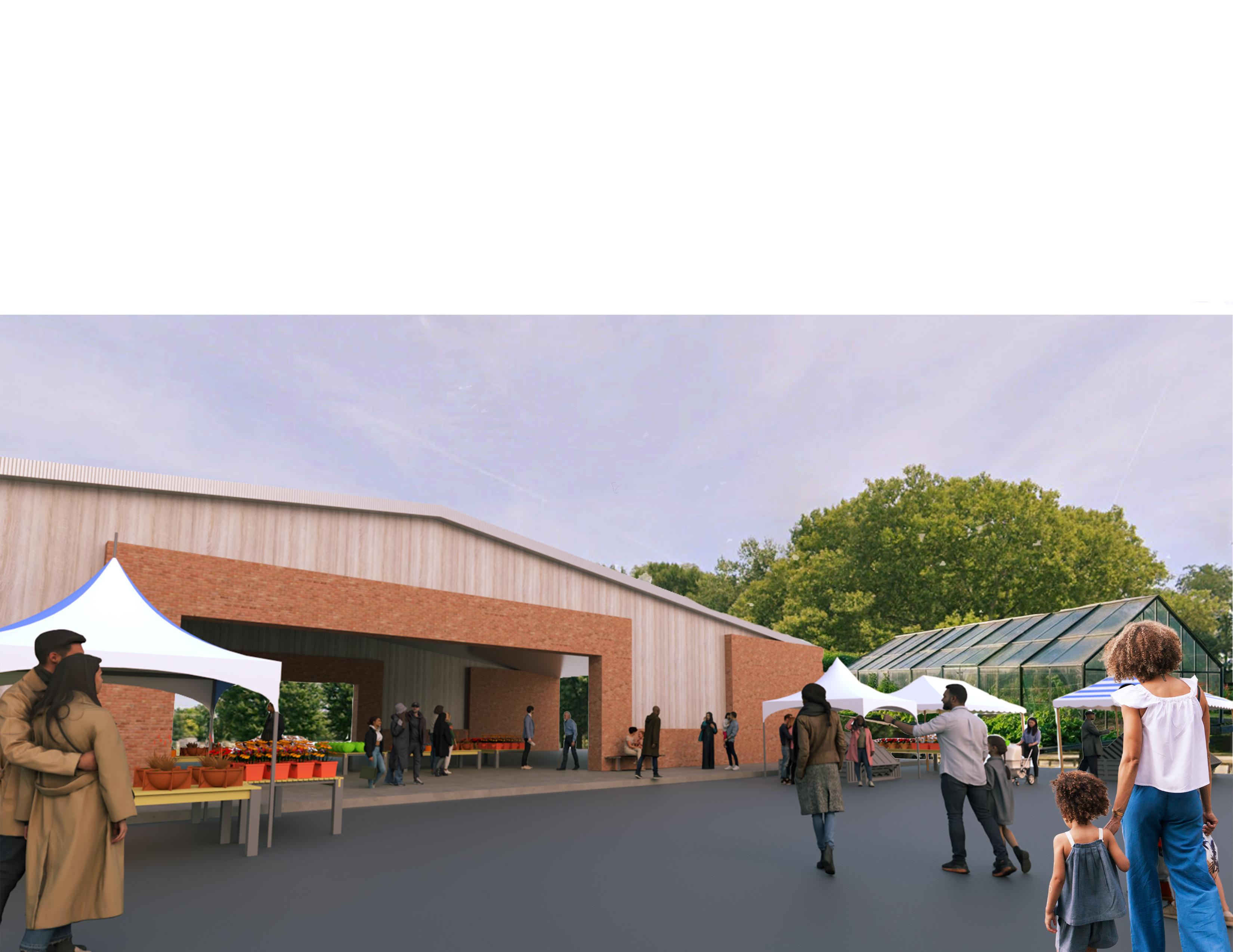
Local Grocery & Farmer’s Market
Affordable & Subsidized Housing
Public Art
“theString” toGordonPark totheharbor totheMarina
Strategic partnerships with Cleveland Clinic and University Hospitals foster medical innovation and attract talent
Mentorship programs between Regional Hospitals and Local High Schools offers educational and practical experiences for Cleveland’s youth
Cutting-edge research and development laboratories secure Cleveland’s leadership in Bio-Medical Research
Start-Up Centers and Maker spaces equip local residents with entrepreneurship and grass-roots innovation opportunities
Extension of RTA Bus Line 16 enhances accessibility to the project and reduces car dependency
Green belt corridor facilitates new connections to Gordon Park and Lake Erie’s south shore for workers, visitors, and residents
Pedestrian bridges link the project to East 55th Marina, the St. Clair Superior Neighborhood, and the future CHEERS development
Living streets capture the liveliness of the urban environment and accommodate for bottom-up urbanism
Mixed-income housing welcomes diversity and fosters and inclusive environment for all Clevelanders
On-site food production and food provision nurtures community health and cultivates relationships with local industries
Pocket parks weaved throughout community present dynamic program opportunities for residents, workers and visitors
Public art installations adorn public spaces, shaping community placemaking, culture, and wellbeing

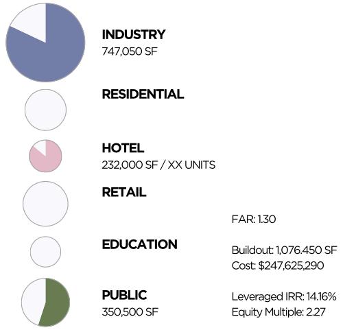
Total development cost (includes total spent on acquisition across all parcels, including any ground leases)
Public and private infrastructure investments and costs. P3 Agreement negotiated with city.
Studio: Advanced Urban Design Studio I
Semester: Fall 2024
Professor: Liang Wang
Site: East Riverside, Austin, TX
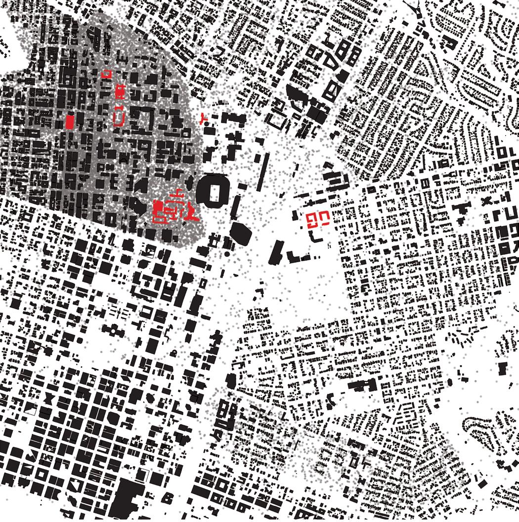
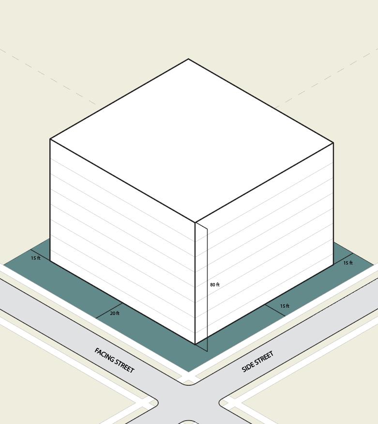
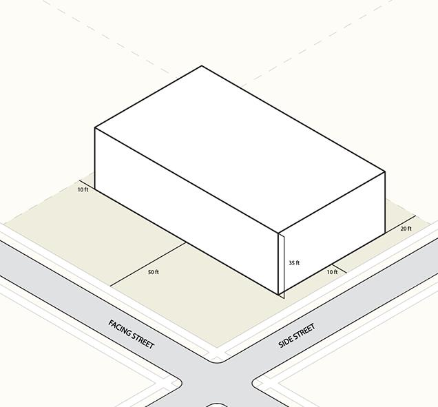
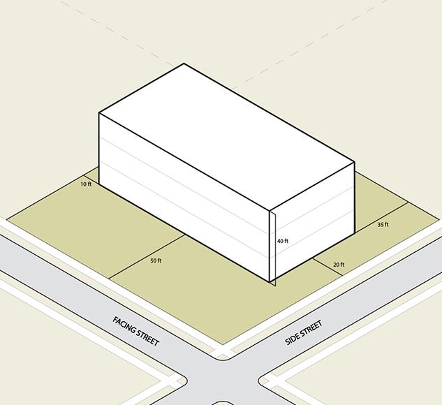
Typological Inventory is a catalog of urban strategies executed through the development of residential buildings and block configuration. Typological Inventory is also a speculative exercise to determine how the Austin urban block can accommodate a greater density, diversity, and connectivity through typological and morphological innovations, considering urban and domestic scales, block edge conditions, infrastructure networks and circulation, and larger ecological networks.
Located in Vienna, Austria, the Rabenhof social housing project designed by Schmidt and Hermann Aichinger is organized through a series of courtyards. Carabanchel 11 is a public housing project located in the suburbs of Madrid, Spain. Situated between existing traditional public housing projects, the architects, Morphosis, challenged the notion of the suburban housing block through recreating the character of a neighborhood within the envelope and at the scale of a single building, creating a “mat” typology. The Jiading Mini-block challenges the typical scale of the urban block in Chinese cities. Each block is a 40 meters by 40 meters cube; however, each building uses elevation variation or includes a system of voids to create a unique typology within the cohesive block structure.
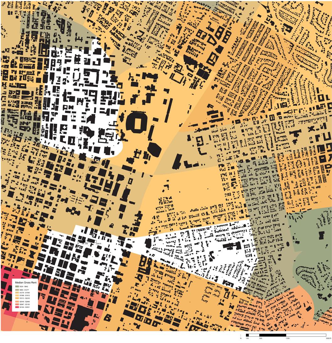
The East Riverside Drive Corridor Master Plan identified this neighborhood as a target for development, suggesting increasing residential density and commercial activity as well as expanding CAPMetro services along the corridor. Bounded by East Riverside Drive to the south, Lady Bird Lake to the north, Pleasant Valley Road to the east, and Tinnin Ford Road to the west, there is tension between the ecological conditions of the site and the implications of impending development. A significant portion of the site is located within 100-year and 500year floodplains. The commercial strip along East Riverside Drive prioritizes auto-centric modes of transportation with large parking lots situated between the street and businesses, so this project conceptualizes redeveloping the parking lots with higher density.
Suitability Analysis
Studio: WATERSH3D
Semester: Spring 2022
Professor: George Johnston
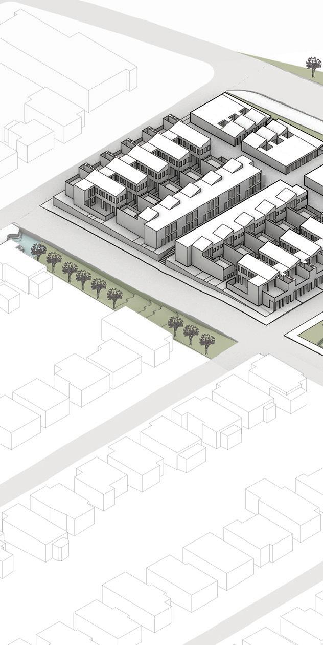
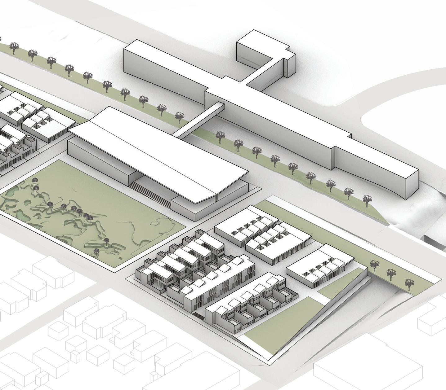
Site: East Lake MARTA Station, Atlanta, GA
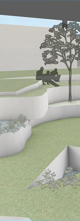
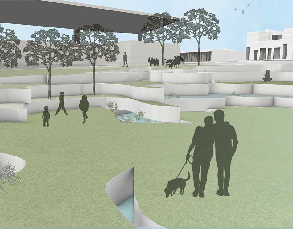
The East Lake Collective is an intentional neighborhood for those wishing to live among a community of riverkeepers. These riverkeepers protect water sources and promote ecological well-being in their environments. They are a politically active network with a penchant for environmental justice. In addition to housing these riverkeepers, the East Lake Collective is designed to amplify their voices and spread their message.
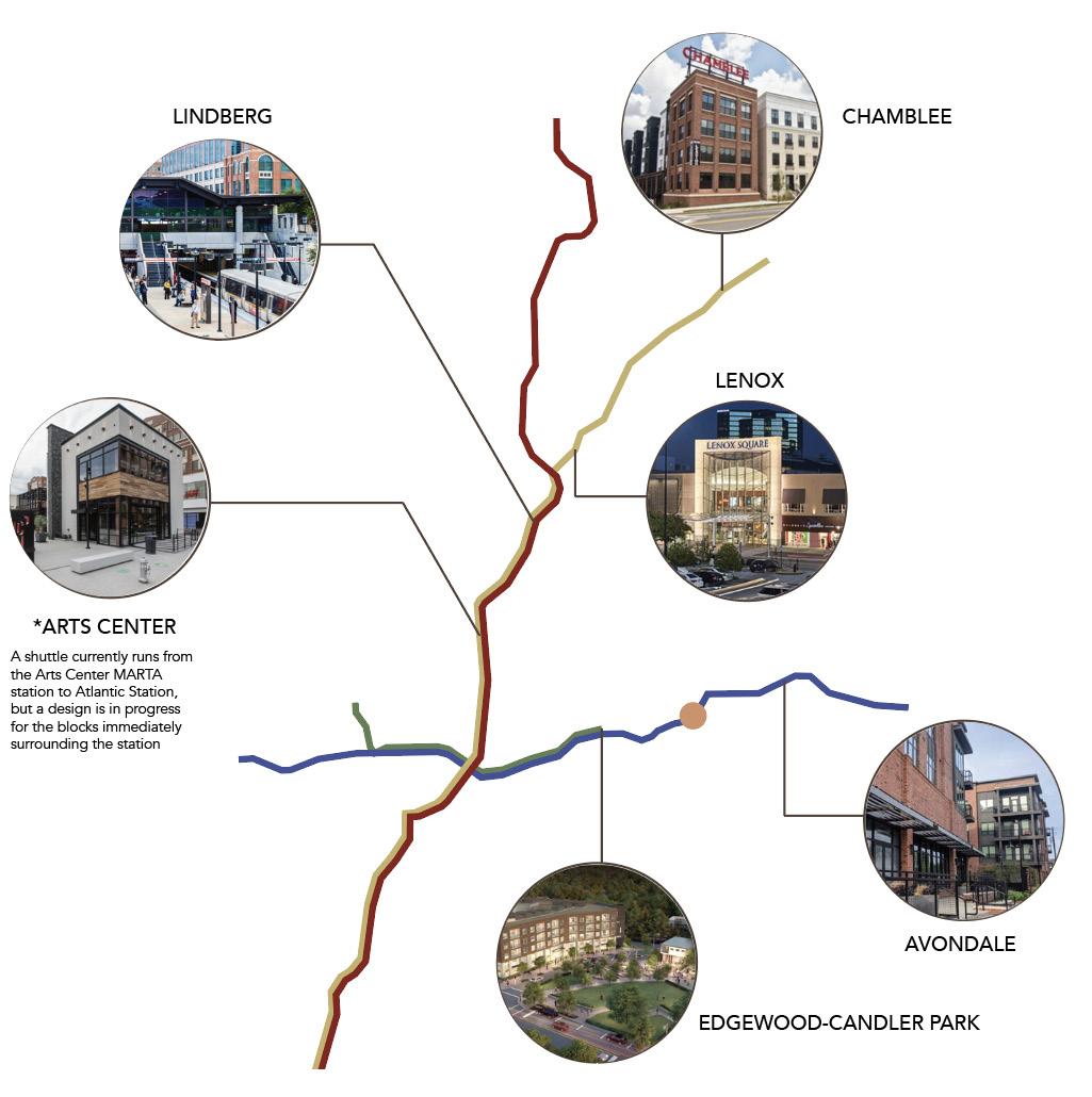
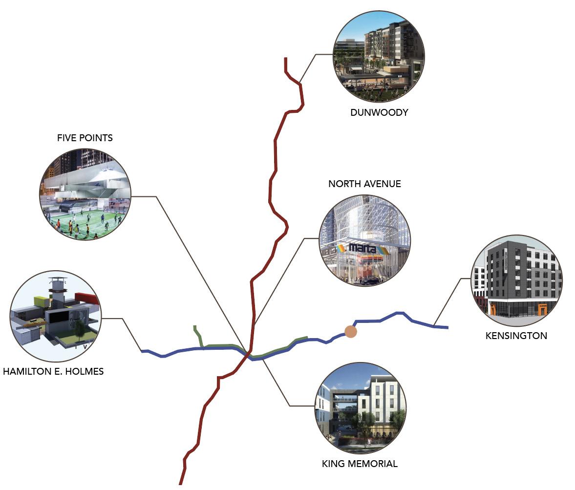
Proposed in the East Lake MARTA Station’s southern parking lot, this four-acre development includes courtyard housing, commercial spaces, office spaces, an expansion of the MARTA station, and a glass recycling center. This neighborhood restores medium-density housing that has been missing from urban areas. The housing options range from live-work studios to three-bedroom town homes. Residents can own and operate businesses within the envelop of their own homes through the mixed-use housing typology. On site office and retail spaces reduce the need for commuting to work and owning personal vehicles. The location of this development at a MARTA station connects residents of the East Lake Collective to Downtown Atlanta as well as the network of other transit-oriented developments in metro Atlanta.
POTENTIAL FOR FURTHER DEVELOPMENT
Restoring the Grid - Streets
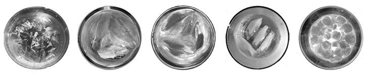
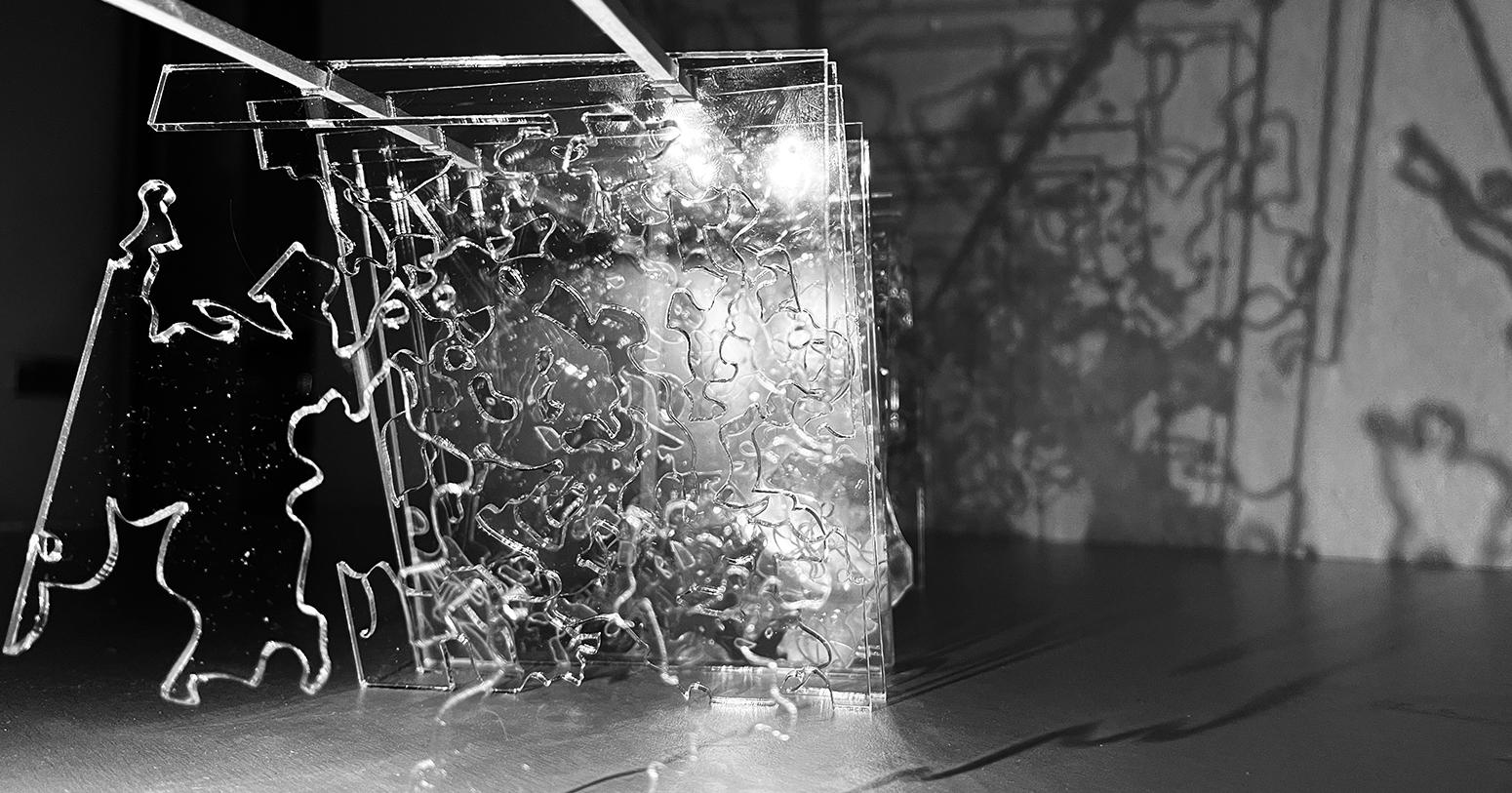
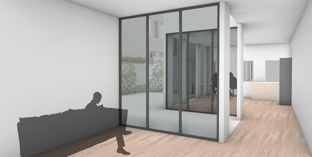
Lucent Projections is the result of a study on water, specifically the interaction between light, ice, and air. An analysis of photographs of light shining through different types of ice, with and without water, revealed patterns of structural systems within the ice. These systems were then simplified to single-line drawings, and those lines were etched into pieces of acrylic. Shining light through stacks of these acrylic sheets created projections of the structures onto the wall. The different opacities and densities in the acrylic as well as the angle of light created fluctuating patterns, much like light veins visible under water. This resulting effect was used to inspire the landscape of the wetland system in the central public garden.
O U R T Y A R
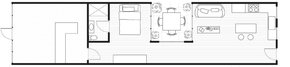
STUDIO FLOOR PLAN
GALLERY
DUPLEX FLOOR PLAN
TOWN HOME FLOOR PLAN
Studio: Advanced Urban Design Studio I
Semester: Fall 2024
Professor: Liang Wang
Site: UT Austin I-35 Cap in Austin, TX
Design Partner: Daniel Keenan
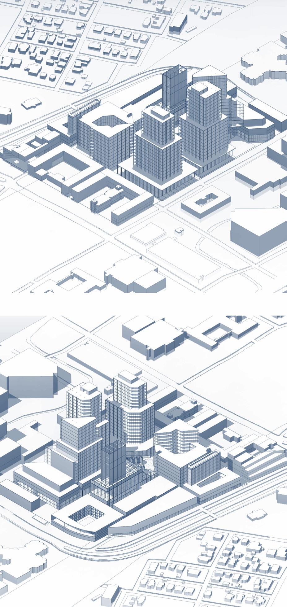
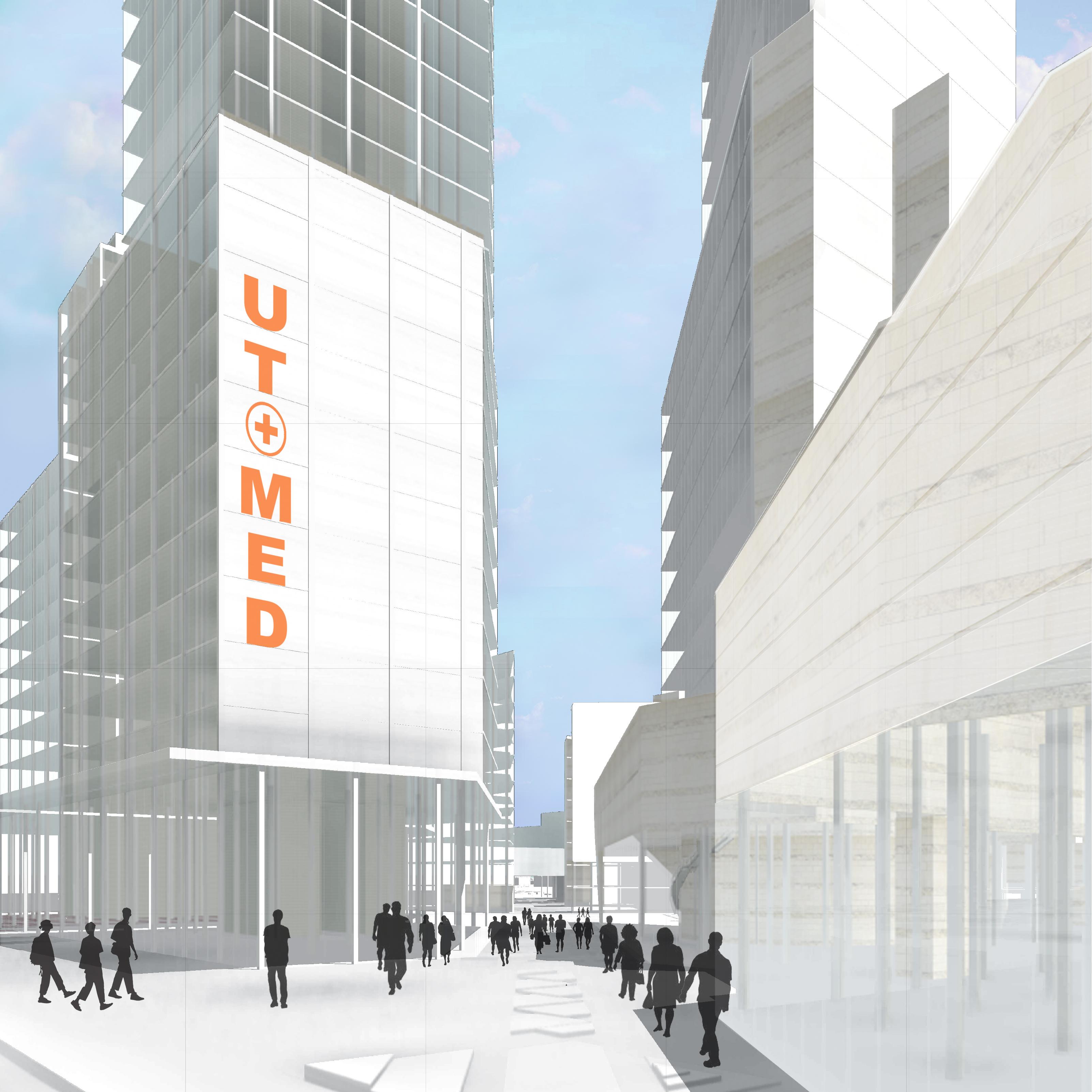
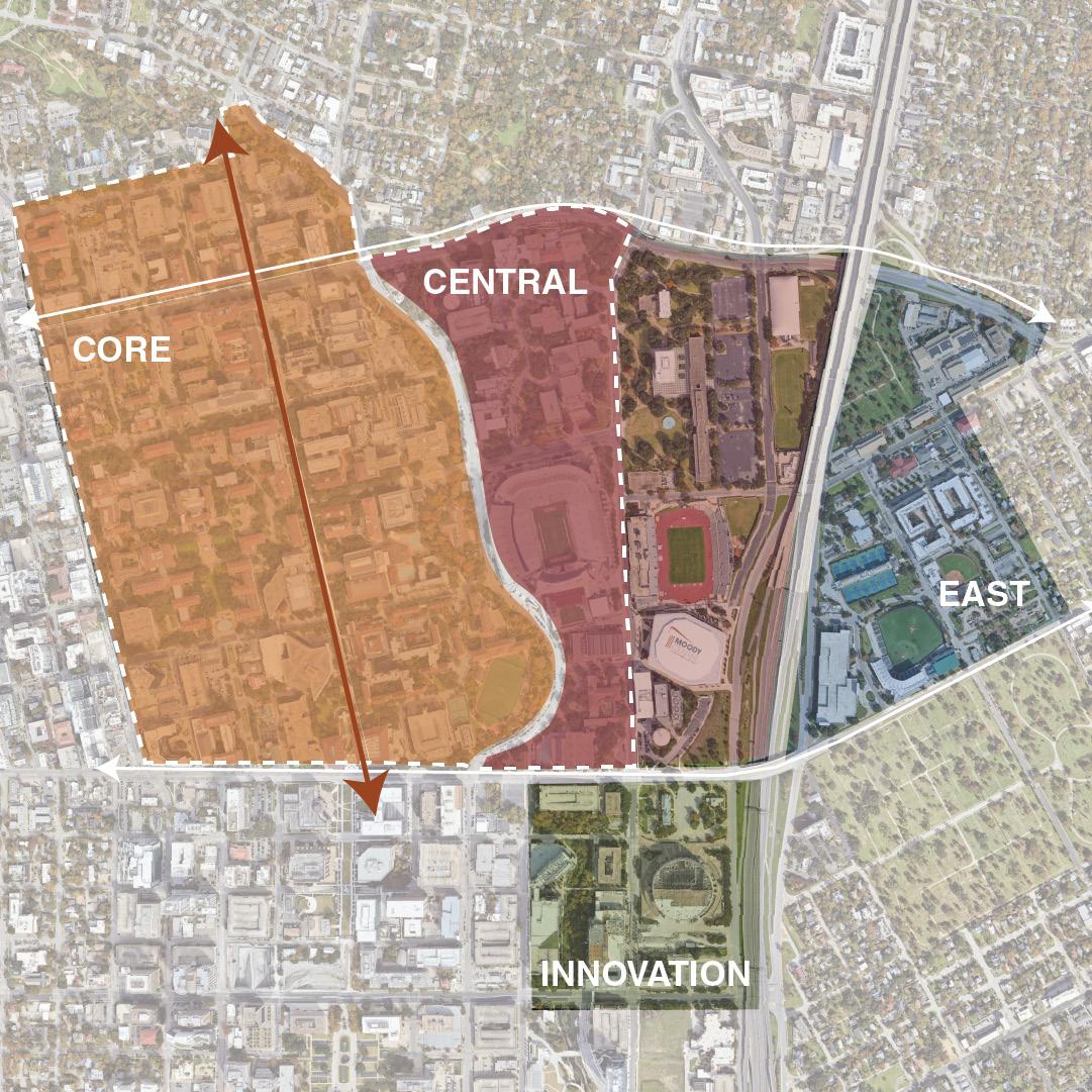
The Capital Express Central Project is a joint venture by the Texas Department of Transportation and the City of Austin in an attempt to increase affordable housing and public spaces, expand public transit, and restore cultural and ecological rifts created by the construction of the I-35 through the heart of Austin. This project will redevelop 8 miles of the I-35 corridor through a series of “Caps” and “Stitches.” The “UT Cap” will be the largest segment of this development and is estimated to reclaim 35 acres of developable land for the University of Texas at Austin. The University sees this cap as an opportunity to shift the center of campus east, providing more room for student housing, academic facilities, and athletic programming. Portions of the anticipated UT Cap and tangential Innovation District were allocated to teams in this studio to develop new urban design and landscape strategies, urban block morphologies, and building typologies for a more integral and sustainable urban framework. Situated just beyond the southern edge of the UT Cap, the Innovation District is the transition zone between the new program of the cap, the University of Texas’ and its growing medical school, and the rest of Austin through the proximity to Waterloo Park and the Waller Creek Greenbelt.
Percentage of Single-Family Housing by Census
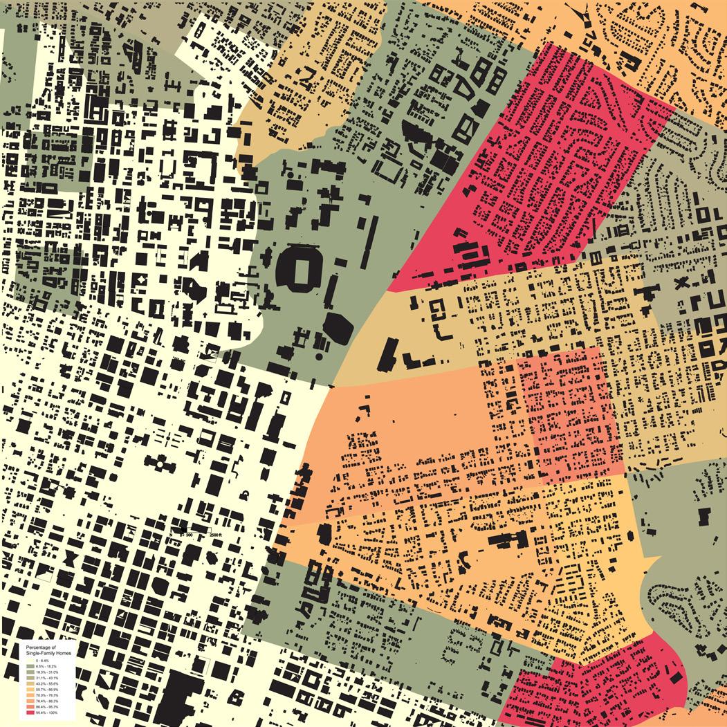
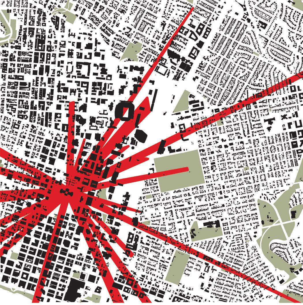
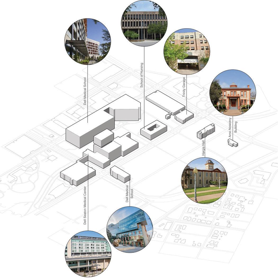
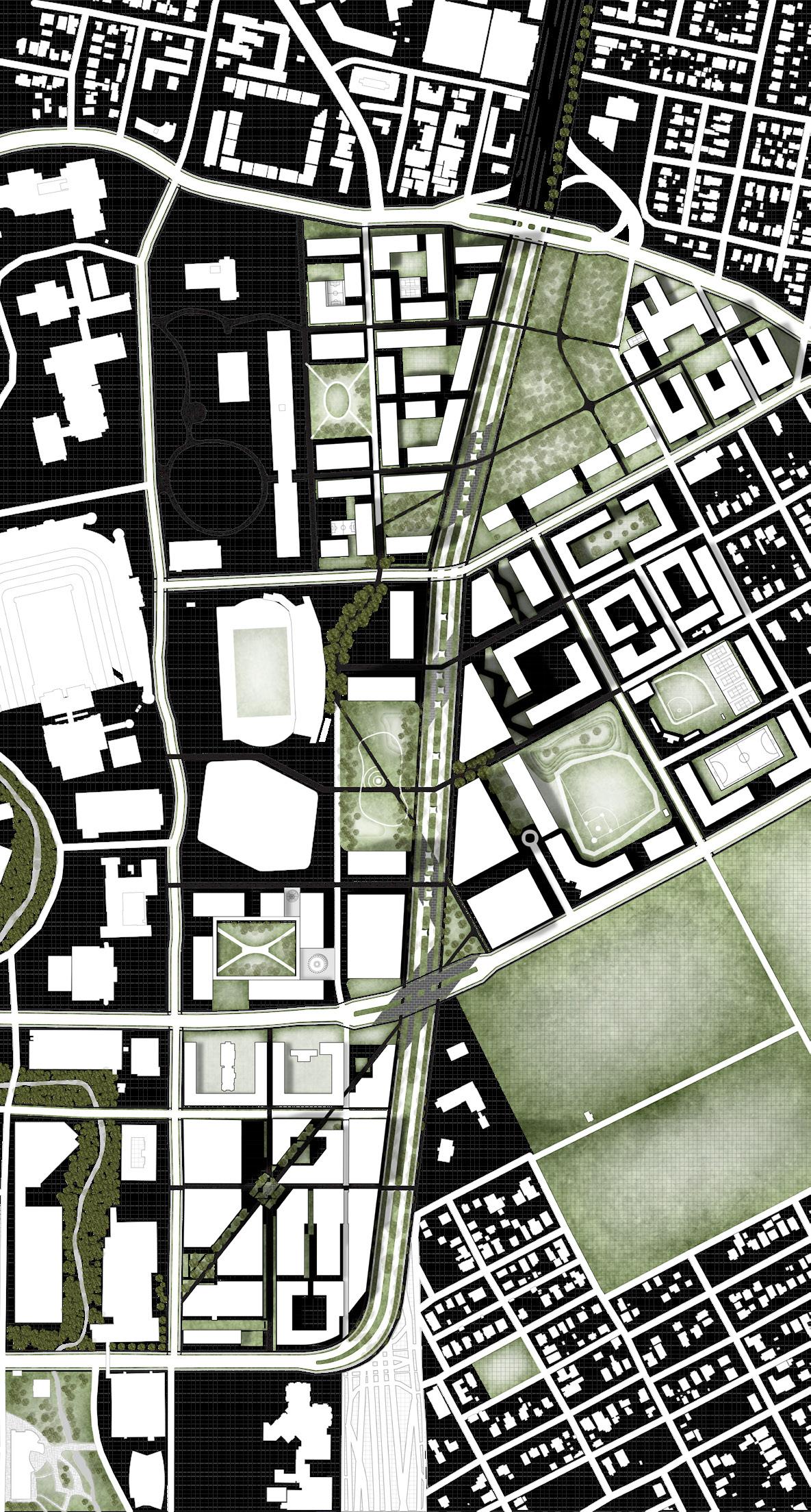
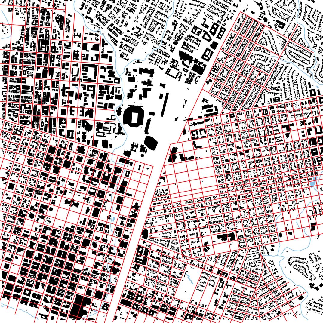
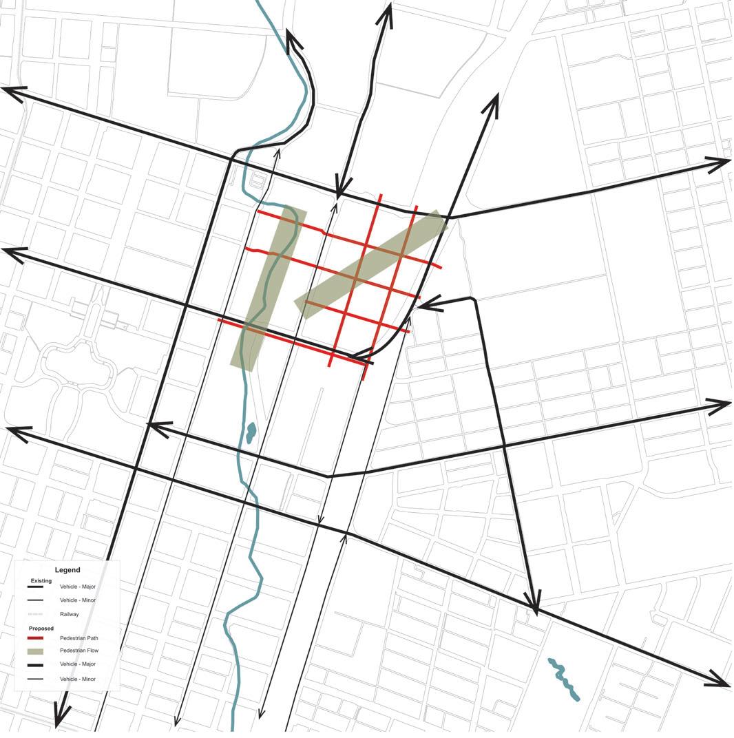
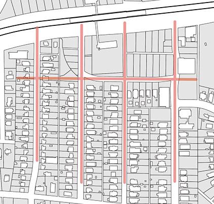
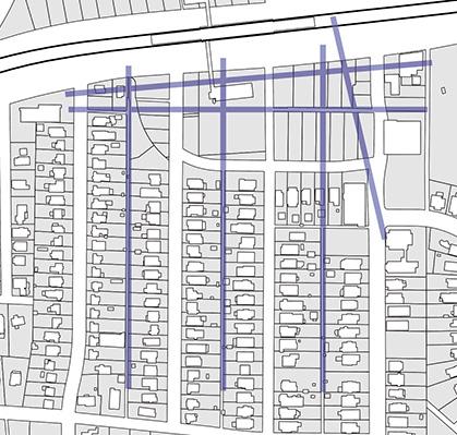
The design of the site is organized by a series of axes that promote mobility and open space and reflect the ecological and morphological convergences taking place on site. The first set of axes was defined by the City of Austin’s historic grid. The 300’ by 300’ grid was developed by the Waller Plan when Austin was first founded, and the location of the Innovation District was formerly the northwestern corner of the grid until it was interrupted to build the nowdemolished Erwin Center.
In order to develop a permeable, urban, medical complex, an opposing diagonal axis bisects the re-established Waller Grid and connects the Cap to Waterloo Park. A series of public gathering spaces are centered around this axis to create ground-level social places. A variety of programs, including restaurants, student and faculty housing, and light retail, are located around these open spaces to draw people into the site to create vibrant urban spaces.
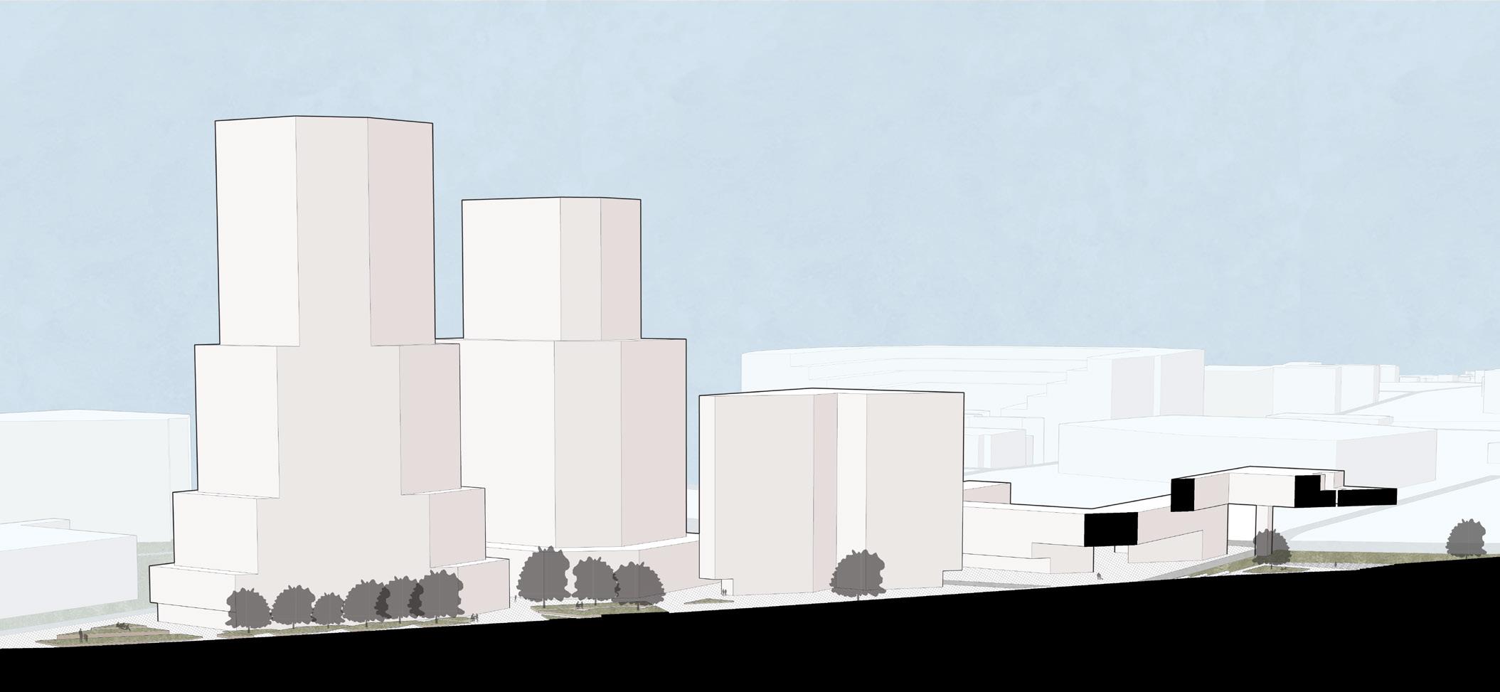
As the University of Texas seeks to add over 6 million square feet to the School of Medicine facilities, increased density is a necessity. Vertical density in the southern edge of the Cap allows for a transition between the skyscrapers of Downtown Austin and the growing apartment complexes and academic buildings surrounding UT’s original 40 acres of campus. Protected Capitol View Corridors intersect the airspace above the site, allowing for sculptural carving of the proposed medical school towers. A height gradient within the site enhances compatibility between the lower-density residential character of East Austin and the emerging height surrounding UT.
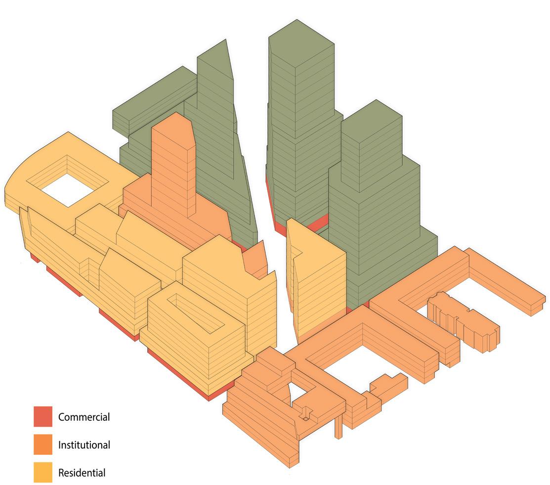
Program

Studio: Ecovillage
Semester: Fall 2022
Professor: Heather Potts
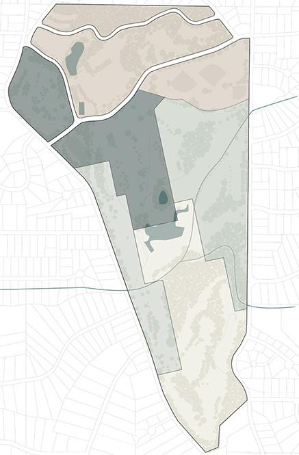
Site: North Fulton Golf Course, Atlanta, GA
An ecovillage integrates the pillars of sustainability into the everyday practices of its residents, the construction of buildings and infrastructure, and social interactions. Since golf courses are notoriously harmful to local ecosystems and watersheds, the Chastain Park Ecovillage will replace the North Fulton Golf Course in attempts to reverse those harms.
Located in Buckhead, a wealthy neighborhood in North Atlanta, the ecovillage proposes affordable housing in an area desperate for economic diversity.
MR Multi-Family
Residential District
R-3 Single-Family
Residential District
Proposed Zoning for Site
Commercial Center
Highest Density
Mixed Use
Residential District
Medium Density
Some Mixed Use
Recreational District
Lower Density
Commercial, Office, and Recreational Use
Industrial & Environmental District
Lowest Density
Utilities & Nature Preserves
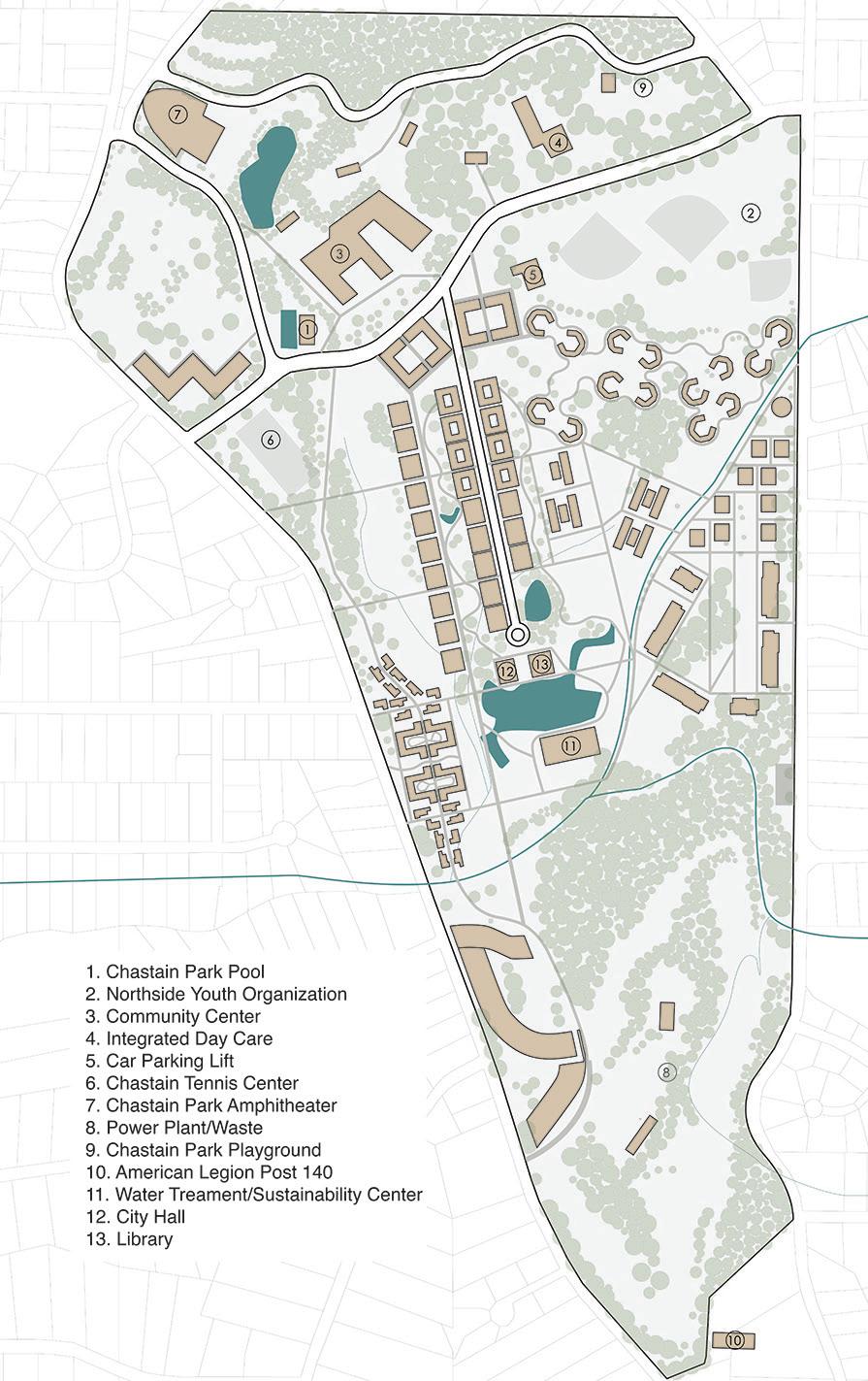
Existing public amenities in Chastain Park, such as the community pool, sports complexes, and a playground, informed the planning of the ecovillage. Additional amenities, such as a library, community center, and sustainability learning center, were added to serve incoming residents and the surrounding neighborhood. The ecovillage was subdivided into neighborhoods to offer different housing types and communal experiences to different personalities wishing to live in a larger, sustainably driven community. The 268 acres site will house 4,500 people without any single-family homes. Research on international ecovillages and other planned towns in the American Southeast inspired decisions made for the Chastain Park Ecovillage’s infrastructure, community services, and policies.
The master planning and site research portions of this ecovillage project were completed through the efforts of the entire studio. Neighborhood designs were done in small groups based on individual housing projects, so only the neighborhood I worked on is included for brevity. Drawings included in this section done by others are limited but noted. The Chastain Park Ecovillage Master plan to the right was completed by Kate Huether and Kayla Rinoski.
Provide Affordable Housing
• Affordable housing concepts

Promote Small Businesses
• Housing proposals contain offices or opportunities for retail
• Provide collaborative working environments
Collaborate with the Surrounding Economy
• The transition zone between the Chastain area and the ecovillage
• Contains commercial areas within the neighborhood for the surrounding community
• Well maintained parks and continuous landscapes throughout the neighborhood
• Green screen facades for each building
Beautification Strategies

• Living through shared interior spaces, live / work spaces, and courtyard spaces
• The different uses of landscapes invites interactions throughout the whole community
• Feeling of responsibility to take care of the garden that gives back to the community
• Promote volunteer work in garden and park
Promote Walkability and Accessibility
• Integration of paths that connect to the main street and run through the neighborhood
• Access to the tram stop and the main street
• Provide rooms available for those who may require ADA

• Preserving the existing wetland in the neighborhood by leaving the area undeveloped
Use Clean Energy

• Use solar panels along the path and on the housing proposals to collect energy
• Use energy provided by the solar farm and the bio-gas facility
• Incorporates the water treatment plant
Build with Sustainable Materials
• Bamboo, Brick, Wood, Stone, Glass, Concrete
Living Street Neighborhood Park Plan
Living Street Neighborhood Section Collaborative Section Drawing led by Riwayait Katia
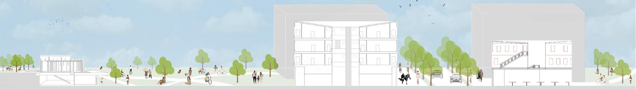
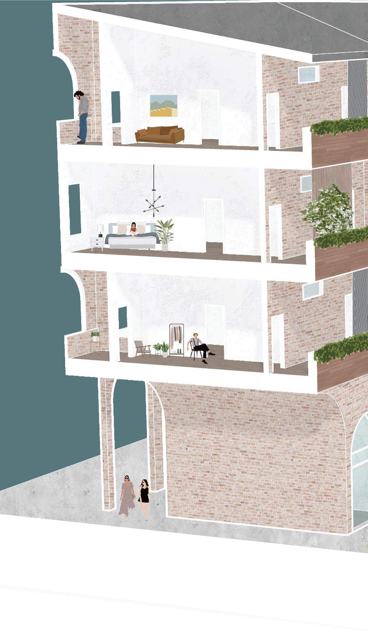
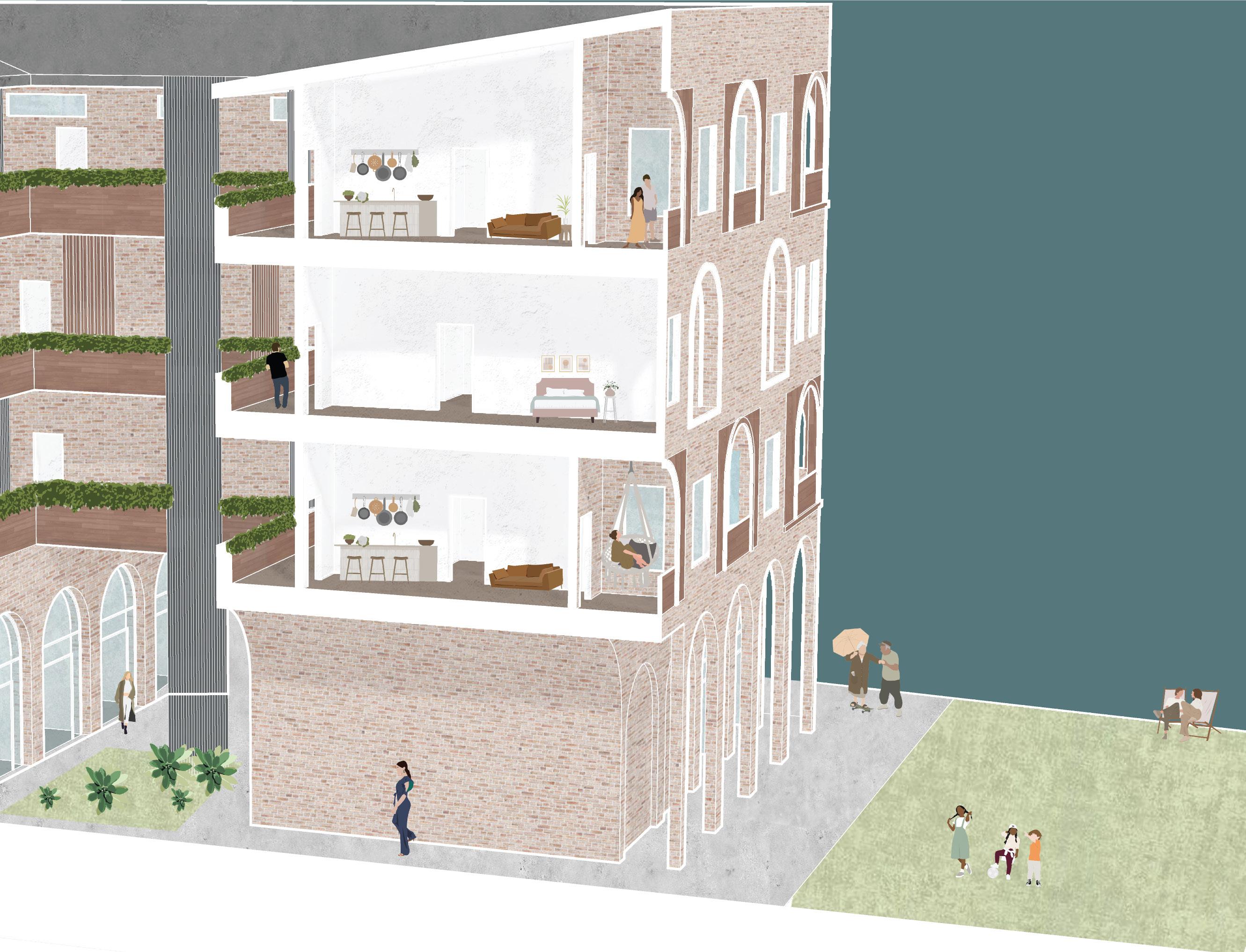
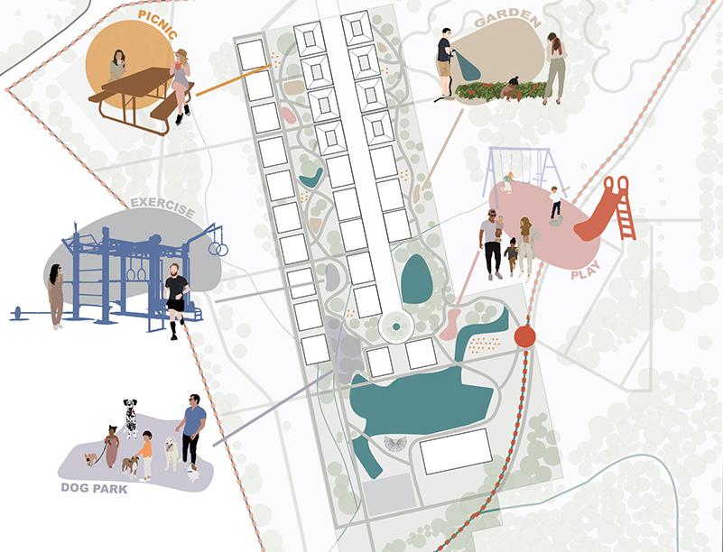
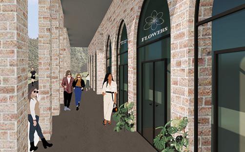
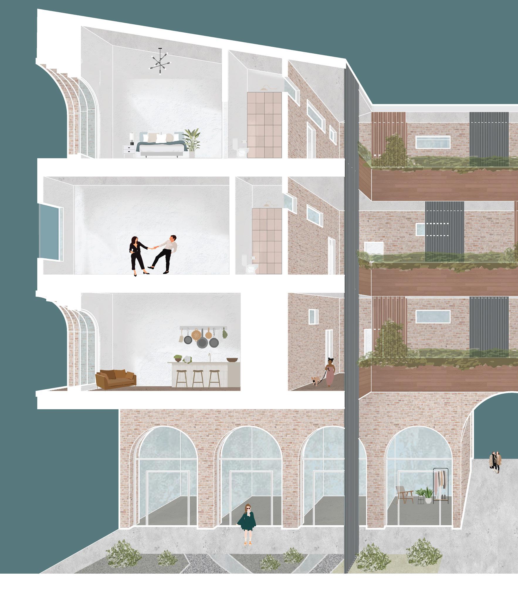
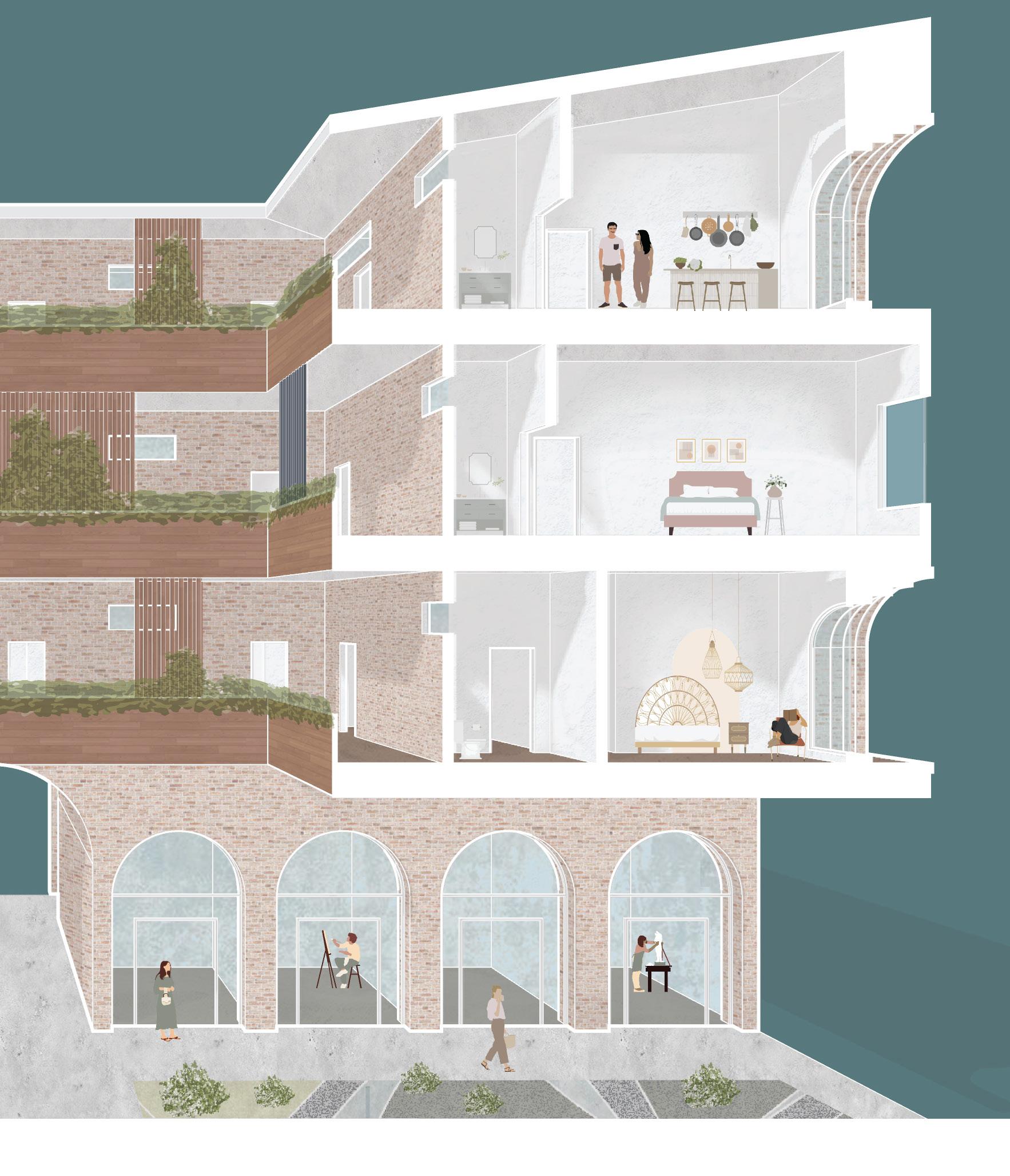
As an extension of the Living Street, the Chastain Terraces offer an innovative living experience that blends an active communal lifestyle with the comfort of private residences. While the building has a range of unit types available, they all have private balconies and access to a central terrace. The central terraces allow neighbors to gather, but the private balconies provide residents with their own personal space. Balconies face either the street or a string of parks, allowing residents to still experience the neighborhood’s vibrant activity from multiple floors above the street.
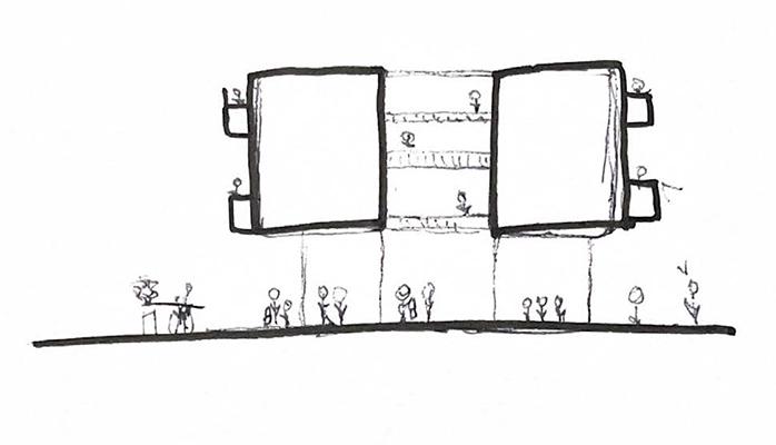
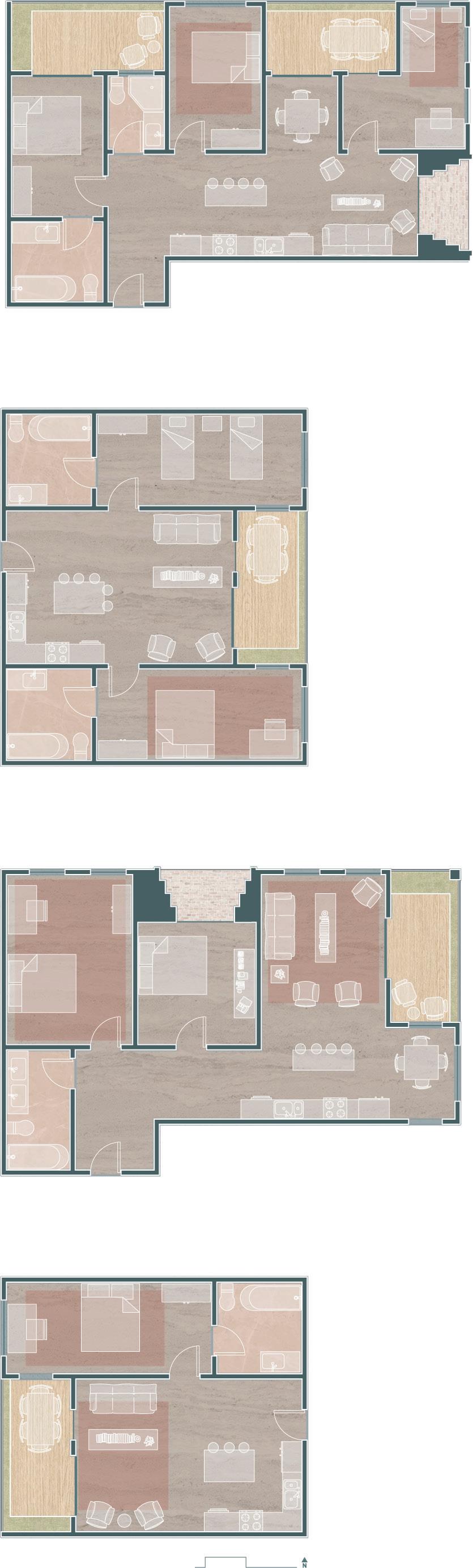
With a variety of unit types and expandable commercial spaces, Chastain Terraces has the perfect home for any household. This mix of unit types densifies the site in a way the Chastain Park neighborhood is currently lacking. Renters will have the option to buy their units over time, which helps their personal assets while encouraging dedication to the community. The chance to work in retail or office spaces on site, separate from their residence, further develops the community aspect of the building and reduces commute times. Each building has 27 units and can house 30 to 70 people.
Massing Moves
Unit Type Diagram
ONE BED
THREE BED
TWO BED TWO BATH
TWO BED ONE BATH
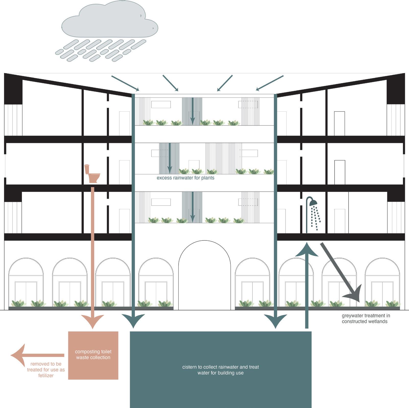
The facades of the building are made from aesthetically imperfect brick rejected from other construction jobs to reduce the embodied carbon and energy required to build the complex. Acetate wood is used for flooring as well as screening on balconies. Each building collects and filters
rainwater to reduce its reliance on City of Atlanta Water. Every toilet on site is a composting toilet, further reducing the demand for water. Excess rainwater is used to nourish communal vegetable gardens, and gray water is filtered and returned to the ground.