2021-2023
Linzhi Li
PORTFOLIO
University Of New South Wales "One designs not places, or spaces, or things , one designs experiences."
Landscape Architecture
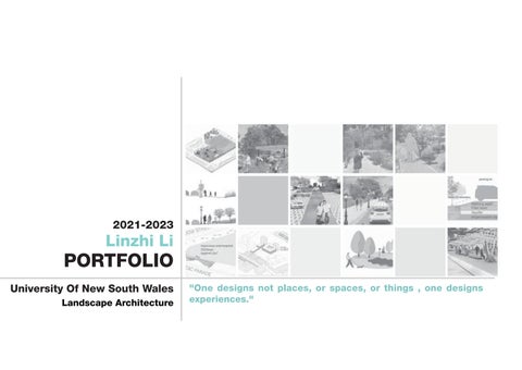
CONTENT Acknowledgement of Country 1,2 3,4 5 6 7,8,9,10 11,12,13,14 15,16,1718 19,20,21,22 23,24,25,26 27,28 Personal Statement Skills Audit Curriculum Vitae Project 1 Project 2 Project 3 Project 4 Design Process Other Works
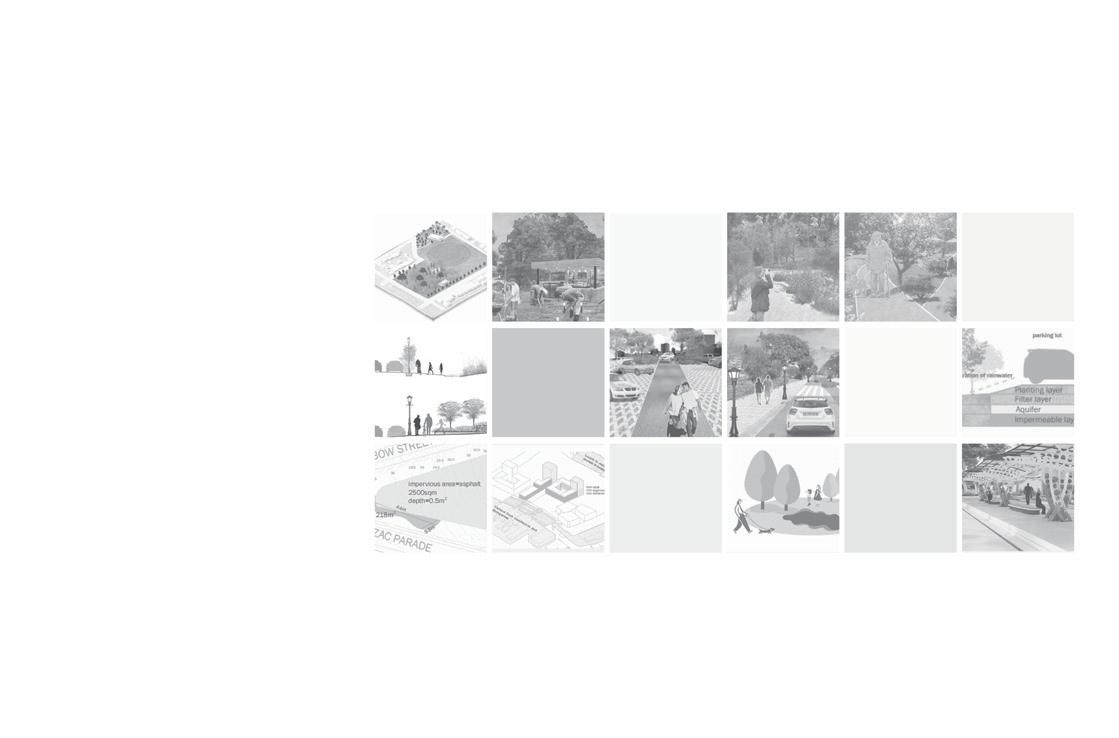
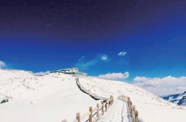
KENSINGTON CAMPUS (UNSW Archives CN551 1890)
1
Acknowledgement of Country
We respectfully acknowledge and pay our respects to the Bidjigal People, who have been the traditional custodians of the unceded lands, waters, and skies on which our campus is situated. We honor and recognize the enduring presence and wisdom of the Bidjigal Elders, both past and present, and their invaluable connection to this vibrant landscape.
We deeply appreciate the opportunity to learn from the Bidjigal People, as they graciously share their values, language, customs, and profound knowledge of the Australian landscape with us. This generous act allows us, as landscape architects, to gain a richer understanding of the intricate relationships between people, culture, and the environment.
As landscape architects, we recognize that we have a responsibility to listen, learn, and advocate for the rights and aspirations of Aboriginal and Torres Strait Islander peoples. We are humbled by the wisdom and resilience of the Bidjigal People and remain dedicated to the journey of reconciliation, fostering a more inclusive and sustainable future for all.
2
PERSONAL STATEMENT
TEL
+61422098759
l635230530@gmail.com
I am Linzhi Li from China, I completed my undergraduate degree in Landscape Architecture in China and I am currently in my second year of my Masters in Landscape Architecture at unsw.

Since I was a child, I have believed that one's life should be dedicated to realising one's true self and freeing one's mind. When I was introduced to Landscape Architecture, I realised that it could be used as a medium in the real world, as I was in constant dialogue with myself while studying the course.
The most interesting thing about landscape architecture for me is that it is so all-encompassing. It gives you access to history, literature, philosophy, geography and more, and ultimately the opportunity to put projects into practice that actually improve human life and maintain the health of nature. In a way, it's the perfect major for me, allowing me to develop my interests while making a real difference to the world and gaining a sense of achievement.
My strengths, which correspond to my interests, are my inclusiveness and my ability to observe and learn from life and combine it with landscape architecture. Secondly, one of my strengths is my ability to work collaboratively and coordinate the relationship and division of labour between the design team in the pre-study and post-study stages.
Linzhi Li
3
As an international student from China, I came to Australia to study and work in landscape architecture because I appreciate Australia's wild and nature-first approach to design as a whole. Australia shows a strong appreciation for history and nature, but at the same time gives its inhabitants plenty of freedom and does not want to control everything through design. Secondly, I wanted to experience the very different cultural differences and commonalities between the two countries and to broaden my horizons so that I could one day rise to the top of the landscape industry.
I think the one thing that remains constant in the landscape industry is its role as a bridge between humans and nature, and in the future, as urbanisation comes to an end and the artificial intelligence industry develops, I think the future opportunity for the landscape industry lies in the combination with emerging technologies, such as landscape responsive technology and the Internet of Things, and then providing a flexible element to cities in response to changes in urban infrastructure, buildings and looking at each home as a unique and undefined individual.
From a wider perspective, the future challenges facing the landscape are global warming, resource depletion and the threat of war. The solution to these problems is not only a matter for one industry, but the landscape should act as a moderator to improve the world in a subtle way.
4
SKILLS AUDIT
TECHNICAL SKILLS
Adobe Photoshop
Adobe Illustrator
Adobe Indesign
Adobe Indesign
AutoCAD
Rhino
PROFESSIONAL SKILLS
Site Analysis and Evaluation
Building Lighting Design
Architecture and Structural Design
Botany and Plant Selection
Arcgis Online
Sketchup
Lumion
Power Point Suites
DIALux-evo
Grasshopper
Grasshopper
Qgis
SoundPlan
Landscape Maintenance and Management
Community Engagement and Public Communications
Sustainable Design and Ecological Design
5
CURRICULUM VITAE
EDUCATION
2016 - 2020
Hainan Univers
Barchelor of Landscape of Architecture
TRANSFERABLE SKILLS
Questioning and critical spirit
Critical Thinking
2021 -2023
The New Southwales of University
Master of Landscape of Architecture
WORK EXPERIENCE
Yibin City Library, Sichuan Province
Part-Time Librarian
Danzhou Table Tennis Club, Hainan Province
Part-Time Table Tennis Coach
PROFESSINOAL MEMBERSHIP AND ENGAGEMENT
PROFESIONL BODIES
AILA Student Membership
OTHER ORGANIZATION MEMBERS
Member of Student Entrepreneurship Department of Hainan University
Member of Yibin Table Tennis Club
Member of Yibin Calligraphy Association
Coordination of contradictions
Leadership Inclusiveness
INTERESTS AND HOBBIEs
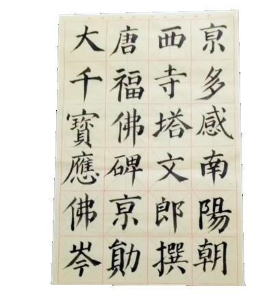
Traditional Chinese Calligraphy
Table Tennis
Swimming
Literary and Historical Fiction Reading
Self-Driving Tour
Cooking
2016.07--2016.09 2018.07--2018.09
6
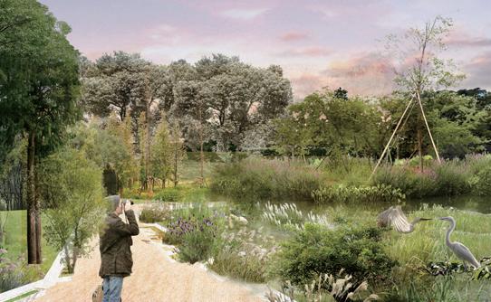
PROJECT 01
ROCKDALE WETLAND CORRIDOR, SYDNEY, AUSTRALIA
--The southernmost areas of Hawthorne Street Natural Area and Rotary Park and Tonbridge Street Reserve
Precedent: South Eveleigh Community Rooftop Garden, Sydney
Theories: 'Ethnic identity with in the community'
Year 2, Term 1
2023. 03 --- 2023. 05
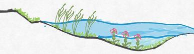
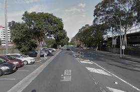
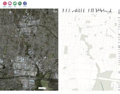
Rockdale Wetland Corridor in Bayside Council, Sydney, was used as my research site for the three-month process of Capstone studio Part 1. The focus of this studio was to investigate how urban landscape systems influence and shape urban settlements.
Rockdale Wetland Corridor is part of the Bayside priority green grid corridors spatial framework and is also part of the first phase of the M6 tunnel construction. Its significant location has the potential to radiate throughout southern Sydney. The corridor is also bordered by Botany Bay, which has unique ecological characteristics and community components that are of great development value.
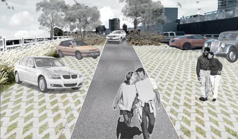
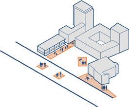
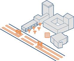
As a member of the studio, I chose the southernmost areas of Hawthorne Street Natural Area and Rotary Park and Tonbridge Street Reserve as the study site. I needed to activate this area while linking it to the other members' areas so that the Rockdale Wetland Corridor could be designed as a whole.
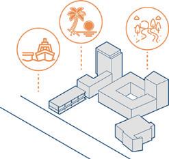
The reference point for my design is the Ethnic identity wihin the community, which aims to build a sense of community through the diversity of plants. The design principle is responding to the cultural backgrounds of different residents with plants to strengthen their sense of community identity.
Individual
Capstone studio Part 1
7
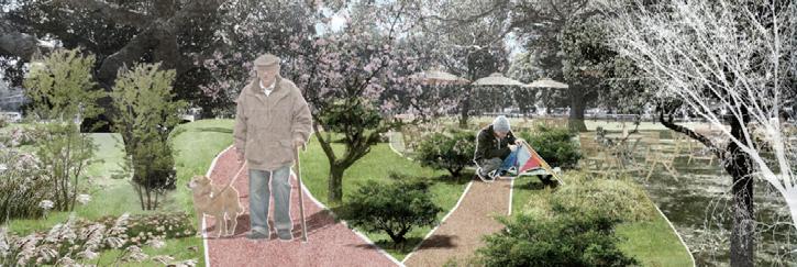
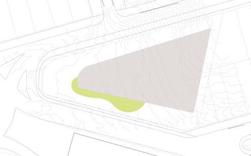
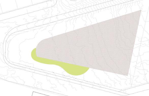
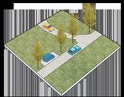
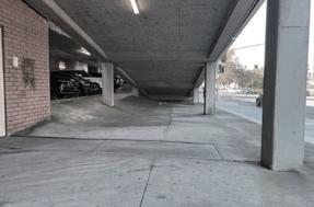
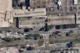
Tonbridge Street Reserve and Rotary Park and Hawthorne Street Natural Area
-Centrally located throughout Rockdale Wetlands Corrido
Size: 12.96 Ha
Land use: zone R4 & R1
Population: About 226
Current function: A football-focused city park with a playground for children
Site Analysis and Design Opportunities
Site type: Open
Future planning: The northern part of the site will be created as a key community park within the corridor and the southern part will remain as it is
Open space Access to nature reserves and parks
-Located in the path of
-vision changed from narrow to wide
-relatively narrow
Hawthorne Street Natural Area
-dominated by coniferous forests, with fragile ecosystems that need to be protected by making them inaccessible
Complex building
-public toilets bring ground to crowd gathering
-relatively narrow


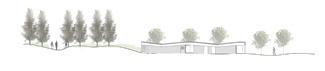
-abandoned football club can still be used as an indoor gathering place for future occupants of the venue
Parking space
Surrounded by main city roads, in the heart of the town
Life service building
Level ground with good turf
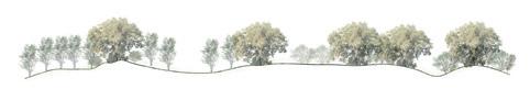
-scattered banyan trees provide good shade, which is conducive to various activities for the crowd
-the structural arrangement of banyan trees and other trees allows visitors to have a good walking experience
-vegetation, grassland and good view make this area very good ornamental value
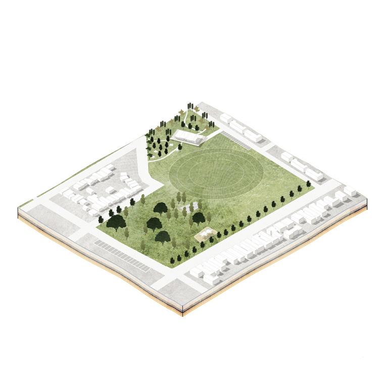
-no lighting
Parking spaces not connected to the site
Scattered banyan trees provide good shade, which is conducive to various activities for the crowd
Salt marshes
-salt marshes covered by pine forests that form low-lying areas when it rains
-provide conditions for attracting tourists -public toilets bring ground to crowd gathering -no canopy cover
Terrain gets progressively taller and lacks infrastructure and landscape value
Educational institutions and school districts
-attractive to a variety of people, conducive to crowd gathering
Chuter Avenue
-attractive to a variety of people, conducive to crowd gathering
4 pavilions
-Four gazebos with seating benches are good infrastructure, they are concentrated on the west side of the site, encouraging people to stay here
There are only pedestrian passages at the north and south ends of the site, and the connection between the residential area and the site is not strong
The diversity of plants in community gardens are inherently edible, medicinal, ornamental, palpable and smellable, and these characteristics bring different identities and behavioural patterns to visitors to community gardens. The combination between these two elements can strengthen the sense of connection and identity of community residents, thus creating a sense of community belonging.
-Firstly, the site is well accessible and as one of the few open.


Low density residential area
-there are pathways between the buildings and direct access to the city's arterials into the site, facilitating connections between residents -the grade of acidic sulfate soil on the east side of the site is low, while the grade on the west side is higher, which is not suitable for large-scale infrastructure construction
Life service building
-can contribute to healthy and well-functioning communities
Tonbridge Street Reserve
-the open and flat field provides a base for multiple people to carry out activities
Tonbridge Street Kids Playground
-adjacent to urban roads, its safety is guaranteed by trees and buffer areas

Football gate
-Helps encourage movement among residents and create a sense of community through shared activities
Low Food Risk. Precinct
Owertand Food Risk. Precinct
-Playing fields in the north are at medium risk of flooding, nature reserves in the north and parks in the south are at medium risk, and other areas are at little risk of flood erosion
0.15 -- 0.40m
-The salt marsh area and some areas on the left side of the park are at risk of flood erosion of 0.15-0.4m, other areas are not affected
ecosystems in the northern and southern spaces of the site provide the conditions for different plants to be planted, and the space will guide people to bring together and exchange their tangible and intangible results, thus creating new community outcomes. This is a sufficient condition for the establishment of a sense of belonging to the community.

Open Space Acquisition Diagram
Performance Opportunities
hanging fruit target
target
Landscape
Low
Aspirational
19th century: used by local early settlers
the connecting passage and in the center of the site, with the potential to hold common activities of the community -community service building including beauty and massage -traffic noise pollution is somewhat severe -the drainage performance is good, which is conducive to the growth of plant roots, and can be planted with larger trees -human intervention is required for water fixation -Insufficient storage capacity for nutrients, plant growth requires human intervention -soil compactness and texture vary Loose speckled grey-brown loamy sand Bleached loose sand Grey-brown mottled sand Black soft sandy organic pan Brown soft sandy iron pan Yellow massive sand. 4m 1.7m Acid sulfate soil risk L2 H2 FLOOD RISK PRECINCTS FLOOD EXTENT AND PEAK WATER DEPTHS --- 20% AEP Lighting -It is illuminated by tall led lights -lack of low street lights A’ B’ B A-A’ B-B’
8
DESIGN PRINCIPLE
PRINCIPLE 1
PRINCIPLE 2
PRINCIPLE 3
human interaction
overall interaction pattern
plants used for different purposes
paths to each space
spaces with different infrastructure
space experience map to spatial memory different emotions five senses
complete tour route
different roles
different behaviors associated with plants
different species of plants 9
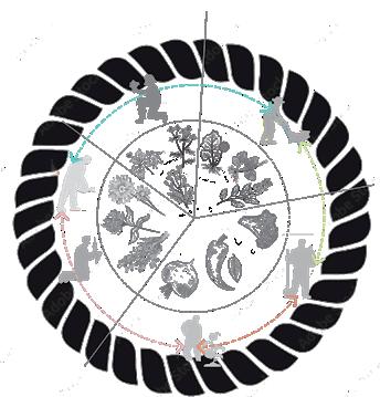
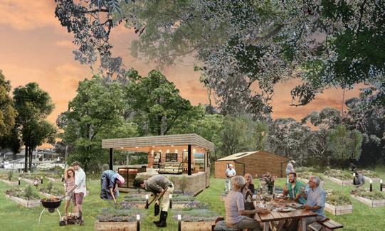
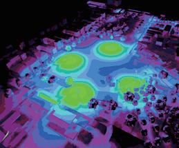
DESIGN SCENARIO
SHARED FARM
PERFORMANCE OUTCOMES
Provide residents with X of green food per year, and on-site processing plants reduce carbon emissions by Y% due to transportation.
ECOLOGICAL POND
X speaking engagements or public festivals per year, increasing visitor revenue by A$ Y
The physical health of the residents is promoted through X physical activities such as planting
Provides a more stable habitat for X species of organisms, enhancing the adaptability of the site.
Provides a more stable habitat for X species of organisms, enhancing the adaptability of the site.
Reference:
1. Dobele, M & Zvirbule, A 2020a, ‘The Concept of Urban Agriculture – Historical Development and Tendencies’, Rural Sustainability Research, vol. 43, no. 338, accessed 27 February 2023, <https://doi.org/10.2478/plua-20200003>.
2. Coffman, DL & BeLue, R 2009, ‘Disparities in sense of community: true race differences or differential item functioning?’, Journal of Community Psychology, vol. 37, no. 5, pp. 547–558, accessed 27 February 2023, DOI: 10.1002/jcop.20312.
10
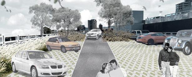
PROJECT 02
FLOODED CBD AREA IN BANKSTOWN, SYDNEY
--Bankstown Shopping Center And Adjacent Transport Corridors
Precedent: Southport Broadwater Parklands, Gold Coast
Theories: 'Coexist with water and maintain balance'
Year 1, Term 2
Studio 4: Constructed Ecologies
2023. 06 --- 2022. 08
Individual
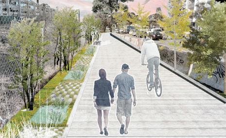
For this three-month project, studio4 has selected the salt pan creek corridor, which is within the control of bankstown council and canterbury council in sydney, as the study area. this area is also covered by the floodplain management of these two councils, which is part of the larger floodplain management australia program. the focus of this study is on how to mitigate flooding caused by stormwater erosion and scouring in the area.
The Salt Pan Creek open space corridor, which connects Bankstown to the Georges River, is an important open space corridor in the area, with significant ecological communities, mangroves, wetlands, recreational facilities and walking and cycling trails on both sides of the creek.
As a member of the studio, I chose the Bankstown Shopping Center And Adjacent Transport Corridors as the study site. My design intention was to reshape the relationship between stormwater and the city and the local population, making stormwater work for people while respecting it.
My design frame of reference is Coexist with water and maintain balance which aims to mitigate the impact of stormwater runoff on the commercial area and surrounding walkways through ecological rainwater ponds and landscape engineering practices, thus enhancing the connectivity of the area with other urban areas.
11
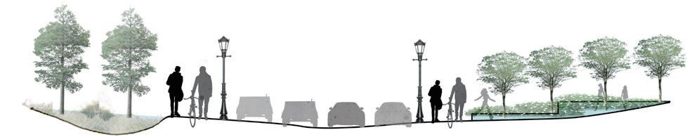
DESIGN SOLUTIONS FOR COEXISTENCE WITH WATER SECTION

DETAIL DESIGN
retention and filtration of rainwater parking lot Detention pond Green
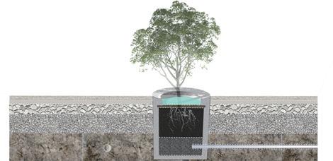
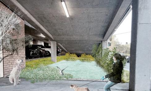
paving system Planting layer Aquifer Filter layer Impermeable layer 10 4 7.5 7.5 0.5 4 6 10 3 2.2 0.7 1.2 0.3 Shared roads for bicycles and pedestrians bioswale street lamp bridge Step Basins for rainwater harvesting 1:200 A basin for rainwater harvesting Fine gravel Permeable surface paving stormwater stormwater Gravel broken stone hardcore osmosis Ramming foundation soil Drain line Drain line 1:50 1:50
pervious
12
MASTER DESIGN PLAN
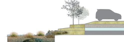
Grass block pavers are high-strength paver made entirely of concrete with permeable properties that allows lawns to grow. The pavement is very suitable for use in parking spaces.


Due to the abundant existing plants in the site, the newly planted plants of Eucalyptus camaldulensis with appropriate size were selected to provide shade while ensuring the activity space for pedestrians and cars.
H: 5m W: 3m
To cope with the effects of flood erosion and stormwater runoff, sidewalk paving should be made with waterproof paving materials.
wood-plastic
Using gravity and relying on terrain to build /basins for rainwater harvesting from high to low can effectively store and purify rainwater.
Adding small street lights throughout the complete pedestrian and cycleway system is especially important to bring light to the space under bridges.
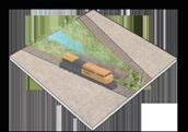
At the bottom of both sides of the railway track, bioswales are built almost running through the whole site in the east-west direction, and the permeable pavement and basins are connected to it through soft permeable pipes, so that these bioswales have the function of transporting and attenuating rainwater.
1:500
Due to the abundant existing plants in the site, the newly planted plants of Eucalyptus camaldulensis with appropriate size were selected to provide shade while ensuring the activity space for pedestrians and cars.

H: 7-11m W: 6m
Reference:
In the large amount of hard pavement in the site, some areas not used for traffic can be transformed into green space.

Replaced the original traffic barrier markings on the road with green barriers to make it more effective at slowing cars as they approach zebra crossings.
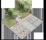
A shared street for bicycles and pedestrians is established throughout the site and interconnecting with sites 1 and 3, with a width of 4-8 meters. The areas of these roads come from previously undeveloped natural green
1. Fausey, NR 2015, 'DRAINAGE, SURFACE AND SUBSURFACE', Encyclopedia of Soils in the Environment, no.409, accessed 22 June 2022, <https://doi.org/10.1016/B0-12-348530-4/00352-0>.

2. Chinese Academy of Environmental Sciences 2021, accessed 24 June 2022, <https:// www.mee.gov.cn/xxgk2018/xxgk/xxgk06/202104/W020210430543446469098.pdf>

Urban roads remain the same, with no reduction in road width due to the heavy traffic conditions in the area.
 1. Grass block pavers
2. New small trees
composite
3. Sidewalk network
4. Basins for rainwater harvesting
5. New street lights
6. Bioswale
Legend
1. Grass block pavers
2. New small trees
composite
3. Sidewalk network
4. Basins for rainwater harvesting
5. New street lights
6. Bioswale
Legend
N
7. New trees
9. New bike lanes
11. City roads
10. Green barriers
8. Added green space
13
DESIGN STRATEGY AND DESIGN RESULTS
--Improve road accessibility for pedestrians and bicycles
The establishment of the bioswale
--Create fragmented basins for rainwater harvesting and bioswales
--Improve road accessibility for pedestrians and bicycles
-Create fragmented basins for rainwater harvesting and bioswales
-Permeable green paving
-The establishment of the bioswale
14
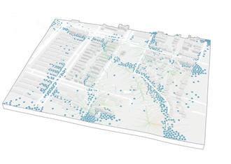
PROJECT 03
WATER SENSITIVE URBAN DESIGN
Theories: 'Technology For Designed Ecologies'
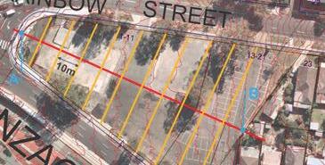
RAINBOW STREET ANZAC PARADE
The project consisted of a three-month comprehensive study with a total of two focuses. The first focus was on the use of landscape technology. A specific site at the intersection of Rainbow Street and Anzac Street, adjacent to the University of New South Wales, was selected as the primary area of investigation to improve the urban environment, while separately focusing on the advanced application of landscape technology without regard to the study site.
The second focus was to explore materials that can be applied to a variety of indoor and outdoor scenarios in relation to water sensitive design. The main objective was to investigate the practical application of water-sensitive related earthworks strategies in an urban context.
Year 1, Term 2
Landscape Technology 1
2023. 06 --- 2022. 08
Individual
The main objective is to study water-sensitive related earthwork strategies and the practical application of advanced and environmentally friendly materials in urban environments.
The project selected the urban hard area and three nearby intersections, and carried out targeted design interventions on them, aiming to enhance functionality and aesthetics. The goal is to create spaces for pedestrians and motorists that are safer and in harmony with water. Plant species that can improve water quality, paving materials that can be used for indoor stair restoration, and outdoor road paving materials are then explored.
During my three months of exploration, I extensively researched the application of technology in the landscape industry in relation to watersensitive design, including topography, existing infrastructure and earthworks.
15
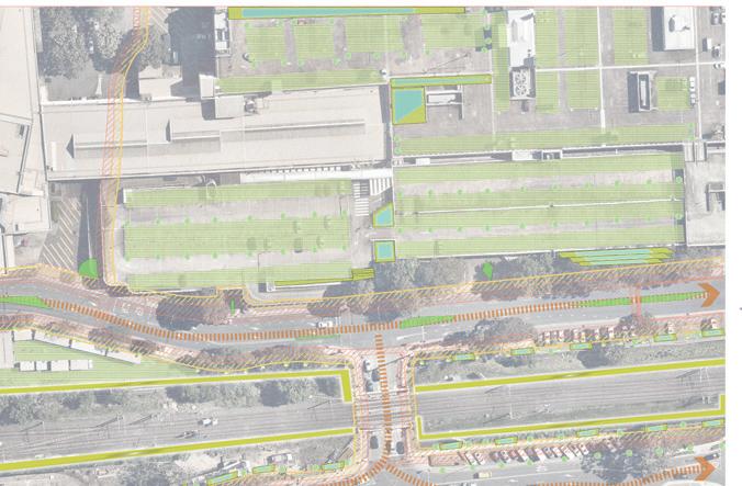
STREET DESIGN: APPLICATIONS
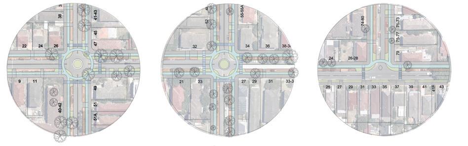
DUTCH-STYLE ROUNDABOUT” AND “PEDESTRIAN SAFE CROSSING
Tread = 120
When the number of steps is 23, the 23rd step intersects the site.
The number of steps = 23

access zebra crossing roadway 3.75m 3.75m 4.00m N 2.50m 2.50m 2.50m 2.20m 2.20m 2.20m 3.00m 3.00m 2.50m 0.50m 0.50m 0.50m 2.50m 2.50m 2.50m r=4.00m r=3.50m R=5.00m R=3.50m walkway parking bikeway isolation belt Forsyth Street Willis Street Rainbow Street Dutch-Style Dutch-Style Dutch-Style
=
30M 29M
R
10
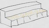
RAMP PLAN CALCULATION OVERVIEW 1 2 3 4 5 6 7 8 9 10 11 12 13 14 15 16 17 18 19 20 21 22 23 120 240 27 29 30 31 32 28 30 STAIRS RAMPS 2760 RAMP AND STAIR DESIGN 2*16.5=30=63 9 risers per run Total run = 8 * 30 + 150 = 390 Width of field = 150 + 150 + 100 = 400 30 3 3 2 3 4 5 6 7 8 9 10 11 12 16.5 13 14 15 16 17 18 390 150 300 90 1 16
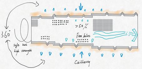
BIOSWALE DESIGN SELECTION OF PLANTS
RAINBOW STREET ANZAC PARADE
1. First of all, according to the direction of the contour line and the height difference, the bioswale is built in the lower left corner of the impervious area
2. Based on known areas of seepage, adjust the shape and size of the ecological wetland to match it.
3. In order to make the ecological wetland play a better role, it is also necessary to choose the plant type and distribution structure reasonably.

EARTHWORKS Steps of bioswale location selection Steps of bioswale location selection impervious area=asphalt 2500sqm depth=0.5m2 218m244m 9.8m 27.5 28 28.5 29 29.5 29.5 29.5 30 30.5 31 31.5
bioswale
phragmites australis nymphaea tetragona canna indica l thalia dealbata reed reed rising water levels ordinary water level levels Storm water channels are formed Build natural biological pathways Strong root system canna canna 17
BARRIER-FREE ACCESS AND WATERPROOF MATERIAL DESIGN

BARRIER-FREE ACCESS
WATERPROOF MATERIAL DESIGN
1. There are many uneven skins and deep cracks on the surface of the stone.


3. Fine sand powder is added to the liquid in the groove and artificially leveled, and the cracks and the liquid in the groove become solid at this stage, forming a preliminary repair of the staircase.

SOLUTION
Design principle: On the premise of ensuring the smooth passage of barrier-free roads, the route can pass through trees as much as possible. The visual and olfactory feelings brought by plants can effectively reduce the psychological barriers of disabled people.
Total Ramps length = 10 m+6.8m+3.2+10=30m
Max slope = 8%
Ramps width = 1.60 m
Landing width 1 = 1.60 m
2. KY50 Stone Sealant Mercerized Protective Film naturally flows into grooves and cracks on the surface of the staircase and fills these spaces.
4. By repeating the above steps several times, and finally manually leveling, the staircase becomes flat and sturdy again


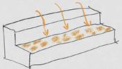

4. Apply a layer of paint evenly along the vertical direction with a rubber stick and let dry for 3-4 hours.


NOTICE: Avoid rain moisture and high humidity when painting.
5. A second coat is applied to give the stairs a second layer of paint and allow it to dry completely for 24 hours before being ready for use.
TOOLS:

31
PLAN 1:200 26m 20m 10m 1.6m 6.8m 1.6m 3.1m 3.2m 3.5m 10m 1.6m B B' A A' L3 L2 L1
Container and stir bar Figure 1 2 3 4 5: Acrylic Anti-slip Coating Paint and accompanying tools (INSL-X Shop, 2022) Paint bucket
Paint brush Paint agitator
1 2 3 4 5 31.5 10 18
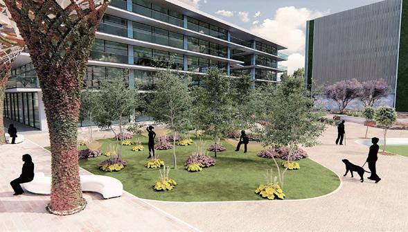
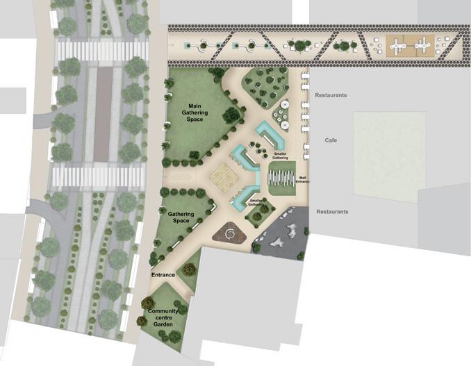
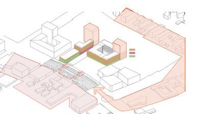
PROJECT 04
TWEED HEADS IN BRISBANE, QUEENSLAND
--WHARF STREET PLAZA
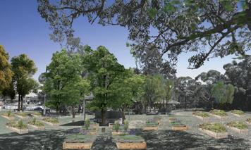
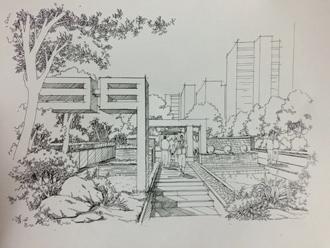
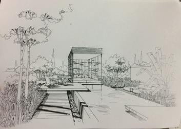
4.7 PLAZA PERSPECTIVE
Precedent: Morgan Court, Glenroy, Melbourne
Theories: A MEETING PLACE; WATER SUSTAINABILITY EXPERIENCE;
Year 1, Term 1
Studio 4: Constructed Ecologies
2022. 02 --- 2022. 04
Group work
Statement of Individual Contributions: I was involved in this project throughout, focusing on the plant configuration, public space typology design, and street design panels for the study site. We were a group of four members, each contributing similarly in terms of design concepts and drawing patterns.
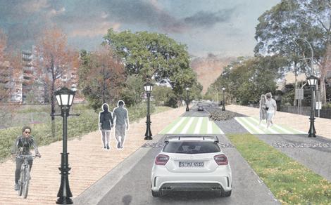
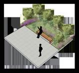
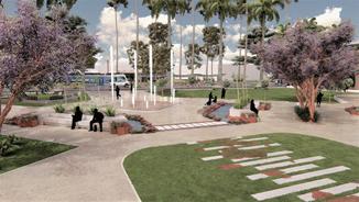
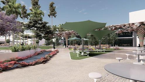
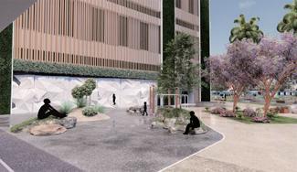
The study site for this studio: WHARF STREET PLAZA is located in front of the Tweed Mall on the Gold Coast, Australia, with great potential for landscape development. With its prime location and high footfall, the square offers the opportunity to create an attractive urban space that is both functional and aesthetically pleasing.
In this Studio, a three-month design exploration was carried out in a collaborative group mode. Under a broad research theme of public realm, the design principle of "engaging people to gather and experience water sustainability" was upheld. Through careful landscape planning and design, we endeavoured to create an engaging focal point and place to socialise.
We aim to create a space that invites people to stop, connect and enjoy socialising, while providing a combination of aesthetics and functionality.
At the same time, we incorporated water sustainability into the core of the design. By incorporating innovative water management strategies and design elements, we seek to make the efficient use and conservation of water an essential part of the design. We focus on water recycling, rainwater harvesting, and water feature design to achieve sustainable water use and environmental friendliness.
19
DESIGN PRINCIPLE
- Create visible rainwater collection structures to capture and store rainwater.
PRINCIPLE 1: A MEETING PLACE
ELEMENTS TO OUR SCENARIO ELEMENTSWATERMISSING
2.1 DESIGN PRINCIPLES 01. AN ATTRACTIVE FOCAL POINT AND MEETING PLACE
where our site is located has many water elements, such as harbour, but there is a missing water in the site. So the water the site to make it integrate with the surrounding area.
- Create rain gardens and drainage lines in street dividers.
- Create a water recirculation pond in the plaza that can drain and recreate a fountain by collecting rainwater.
RESILIENCE & NATURAL HAZARD ADAPTATION PARTICIPATION
PRINCIPLES
- Remove car parking.


NATURAL HAZARD ADAPTATION
LEGIBILITY GREENER PLACES
- Create obscured entrance and guided pedestrian paths to attract passersby and visitors with access to the plaza.

- Create a central water feature in the plaza with space for recreation and activity to encourage people to meet and participate.
- Create separate cycle lanes and a new light railway route, while reducing road traffic.
rainwater collection structures to capture and store rainwater. and drainage lines in street dividers. recirculation pond in the plaza that can drain and recreate a rainwater.
- Create dynamic water elements such as fountains and water falls to enhance the landscape quality and visual aesthetics, while providing a unique sensory experience.
ADD WATER ELEMENTS TO OUR SCENARIO
- Create more green spaces in the street to enhance the walking experience and reduce the reflection of heat into the atmosphere from the street.
RESILIENCE & NATURAL HAZARD ADAPTATION
PARTICIPATION
PRINCIPLE 2: WATER SUSTAINABILITY EXPERIENCE
obscured entrance and guided pedestrian paths to attract passersvisitors with access to the plaza.
- Create more public green spaces and planting shade in the plaza to enhance the visual and user experience.
feature in the plaza with space for recreation and activity meet and participate
water elements such as fountains and water falls to enhance and visual aesthetics unique sensory
PLACE
ATTRACTIVE FOCAL POINT AND MEETING PLACE PLACES
car parking. separate cycle lanes and a new light railway route, while reducing more green spaces in the street to enhance the walking experience the reflection of heat into the atmosphere from the street.
MULTIFUNCTIONALITY
- Create multifunctional spaces for recreation, resting, meeting and vibrant events in the walkside and in the plaza areas.
more public green spaces and planting shade in the plaza to enhance and user experience
LEGIBILITY
MULTIFUNCTIONALITY
ELEMENTSWATERMISSING RIVER HARBOUR SEA
WATER SUSTAINABILITY
RIVER
MULTIFUNCTIONALITY
20
6.1 POLICY RESPONSE AND STRATEGIES
POLICY RESPONSE AND STRATEGIES
Provide a series of community conversations, engagements and consultations¹
Rubbish collection, disposal and recycling services¹
Services
Biodiversity¹
Bushland¹ Coastal area¹

Waterways¹
Management
Create seating area
Utilise existing woodland and shade
By slightly altering the topography or designing stepped open rest areas
Create a small square

Create multi-functional and flexible stalls (can be used for selling, item exchange, etc.)
Open and simple center lawn
Playground for children
Recreation facilities and ground
Aquatic centres on the sea and beach
Suitable location and size of entrance (distance to public transport stops)
Some areas along the street can consider using a little fencing
Create separate bike lanes and pedestrian paths
Lights, mirrors or other facilities
Create cycle paths and walkways to encourage walking and riding
Healing Plants and Gardens
Increase connections to surrounding areas (sea, beaches, harbour, neighborhoods)
Connected
Sustainable
Improve sustainable alternative transport options
Improve walking attractiveness by focusing on the paving, accessibility and alongside planting of the road
Create more shared space
Acknowledge, protect and respect
Heritag
Art gallery
Mural
Potential Strategies and Assumptions
1 Community AMoving round Place Cultural
Historic
FOCUS
Pursuits Aboriginal
Figure HistoricEvents
e
Pu b l ic A r t s
Activity Recreation Social
Sites
Leisure
Healthy Safe Efficienct
1 Tweed Shire Council, n.d. Community Strategic Plan 2017–2027 Tweed Shire Council. [online] Tweed.nsw.gov.au. Available at: <https://www.tweed.nsw.gov.au/ files/assets/public/documents/council/strategies-and-plans/community-strategic-plan-2017-2027.pdf> [Accessed 1 March 2022].
21
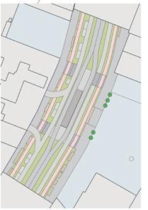
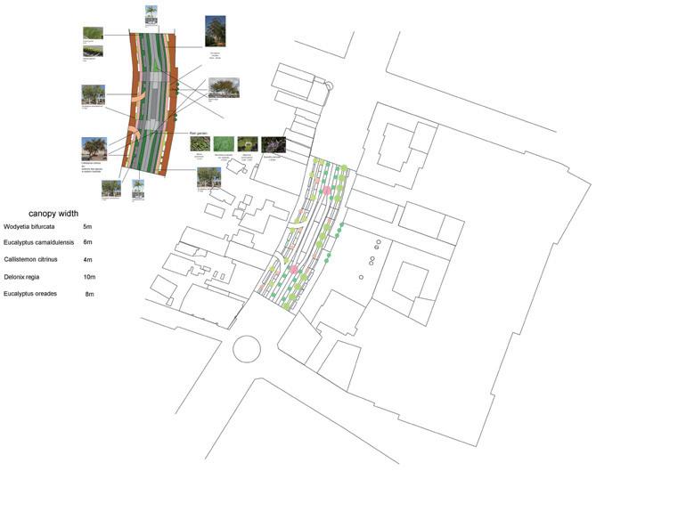
4.4 PLAZA PLAN MASTER PLAN AND DETAIL DESIGN
4.6 TREE PLANTING ON THE PLAZA
3.4 TREE PLANTING ON THE STREET
VEGETATION STRUCTURE ANALYSIS DIAGRAMS
VEGETATION STRUCTURE ANALYSIS DIAGRAMS
VEGETATION STRUCTURE ANALYSIS DIAGRAMS
Rain Water garden between light rail lines
PLAZA PERSPECTIVE
Planting tall trees next to the bike path
Plant tall trees next to bike paths and at connecting passages to provide good shade.
3.4 TREE PLANTING ON THE STREET
Trees with narrow crowns will be planted around the parking space and at the meeting place
Rain gardens collect rainwater and ease the erosion of rainwater runoff. Provide drivers with good visibility while maintaining road landscape.
VEGETATION STRUCTURE ANALYSIS DIAGRAMS
TREE SELECTION
Ensure the flow of pedestrians between areas.
3.4 TREE PLANTING
A bench surrounded by tree bushes Trees with narrow roots are planted at the junction of different areas Benches are laid in hard squares for pedestrians to rest in good shade.
VEGETATION STRUCTURE ANALYSIS
The selection of plants planted on the streets is based on adaptation to acidic soil conditions and to climate characteristics with heavy rainfall. Therefore, most tree species come from local native tree species, and on this basis, the choice of tree species is more from a functional point view.
AT THE EDGE OF DIFFERENT AREAS
Wodyetia bifurcata with a high canopy was used on both sides of the light rail track, which did not affect the safety of the light rail. Eucalyptus oreades. Delonix regia and Callistemon citrinus were chosen for both functionality and aesthetics, and their blooms will be set up at two important passages.
PARKING LOT GREEN BELT
DIVIDERS ON BOTH SIDES OF THE LIGHT RAIL
Planting tall trees next to the bike path
Rain Water garden between light rail lines Trees with narrow crowns will be planted around the parking space and at the meeting place
Plant tall trees next to bike paths and at connecting passages to provide good shade.
Rain Water garden between light rail lines
Callistemon citrinus
H: 5m W: 3m
TREE SELECTION
Eucalyptus
H: 8-20m W: Delonix regia
H: 10m W: 10m
Rain gardens collect rainwater and ease the erosion of rainwater runoff.
Rain gardens collect rainwater and ease the erosion of rainwater runoff. Provide drivers with good visibility while maintaining road landscape.
TREE
SELECTION
Eucalyptus oreades
The selection of plants planted on the streets Therefore, most tree species come from local native
The selection of plants planted on the streets is based on adaptation to acidic soil conditions and to climate characteristics with heavy rainfall. Therefore, most tree species come from local native tree species, and on this basis, the choice of tree species is more from a functional point view.
H: 8-20m W: 7m
Callistemon
PARKING LOT GREEN BELT
Eucalyptus oreades
Wodyetia bifurcata with a high canopy was used oreades. Delonix regia and Callistemon citrinus
H: 5m
Wodyetia bifurcata with a high canopy was used on both sides of the light rail track, which did not affect the safety of the light rail. Eucalyptus oreades. Delonix regia and Callistemon citrinus were chosen for both functionality and aesthetics, and their blooms will be set up at two important passages.
PARKING LOT GREEN BELT
W: 10m
Overall
DIVIDER
DIVIDER
Callistemon
H: 5m H: 7-11m W: 6m
H: 8m W: 5m
4.7 PLAZA PERSPECTIVE
4.7 PLAZA PERSPECTIVE
22
4.7 PLAZA PERSPECTIVE
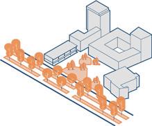
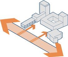
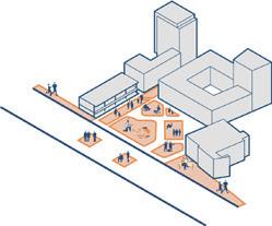
DESIGN PROCESS PROJECT

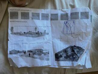
1
Development of design theory and design strategies
Estimation of Design Results
Outline the perceptual perception and understanding of the site
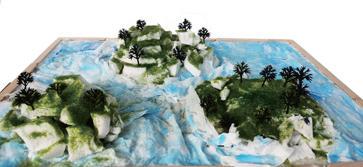
Site model construction and data simulation
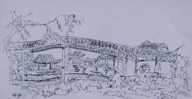
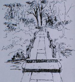
Renovation of the venue based on on-site photos
23
Iterative Design of Data Information Simulation
DESIGN PROCESS
PROJECT 2
Overlay contour lines and site satellite images to determine water flow trends
On-site photo shoots to determine how water-sensitive designs will be applied
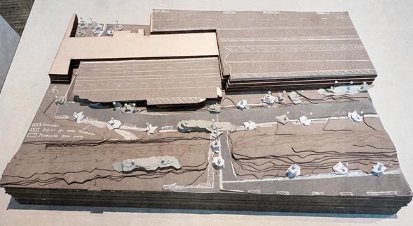 Laser cutting model
Map key geographic features
Laser cutting model
Map key geographic features
24
DESIGN PROCESS PROJECT
3
 Analysis of hand-painted plants
Exploration of drain pipe installation
Design Exploration of Drainage Pipeline
Analysis of hand-painted plants
Exploration of drain pipe installation
Design Exploration of Drainage Pipeline
25
Draw a site profile based on contour lines
DESIGN PROCESS PROJECT
4
Street Preliminary Design
Model Building
26
Design Exploration of Drainage Pipeline
OTHER WORKS
PAINTING AND CALLIGRAPHY

27
PHOTOGRAPHY AND HANDCRAFT


28