STRATEGIC


have created multiple flow charts to demonstrate how a user can select the strategies that best fit their project or needs.


have created multiple flow charts to demonstrate how a user can select the strategies that best fit their project or needs.


Community Garden - A semi-public land parcel gardened and harvested by a collective group of individuals united by their common geographic proximity
Courtyards - An unroofed area that is completely or mostly enclosed by the walls of a large building
Green Medians - The portion of the roadway separating opposing directions of the roadway, or local lanes from through travel lanes covered with native vegetation that provides ecological and environmental benefits, such as biodiversity support or cleaner air


Green Streets – A street with transit use that also incorporates environmental features like trees, rain gardens, infiltration planters, and permeable paving to capture, slow the course of runoff, and filter it naturally before it reaches major waterways and sensitive plant and animal life

Green Vacant Parcels - Pieces of land that do not contain buildings or structures and are intended to be developed for use of green infrastructure, biodiversity protection, or to support the environmental objectives of a community or local government


Greenway - A strip of undeveloped land near an urban area, set aside for recreational use or environmental protection.
Pedestrian Trails - Walking paths that can be integrated into the larger transportation network for daily travel or connected to a park for recreation
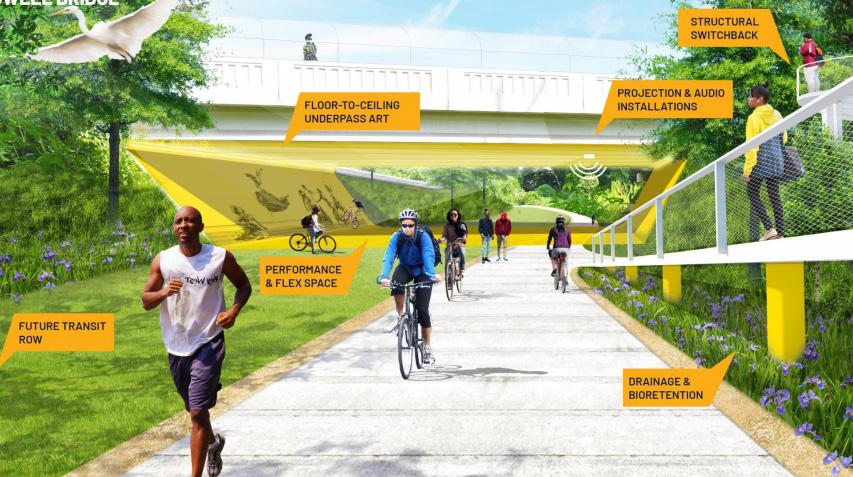
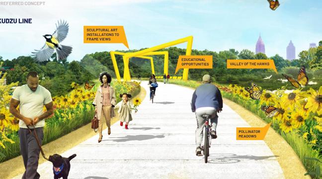
Plaza and Event Space - A public square, marketplace, or similar open space in a built-up area used for recreation or community activities
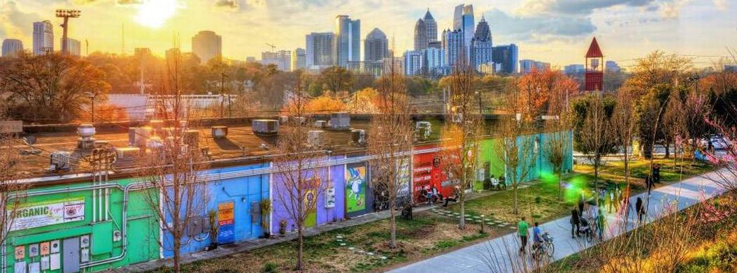


Riverfront Utilization - The way in which land or property along a river is used to balance societal and ecological needs

Wildlife Corridors - A strip of natural habitat connecting populations of wildlife otherwise separated by cultivated land, roads, etc.


Infiltration Basin Landslide Retaining Wall Living Walls
Bike Paths - A distinct path or road for only bicycles that can be incorporated into the street network to function with automobiles as part of comprehensive transit system.

Bioswale - a long, channeled depression or trench that receives rainwater runoff (as from a parking lot) and has vegetation (such as grasses, flowering herbs, and shrubs) and organic matter (such as mulch) to slow water infiltration and filter out pollutants
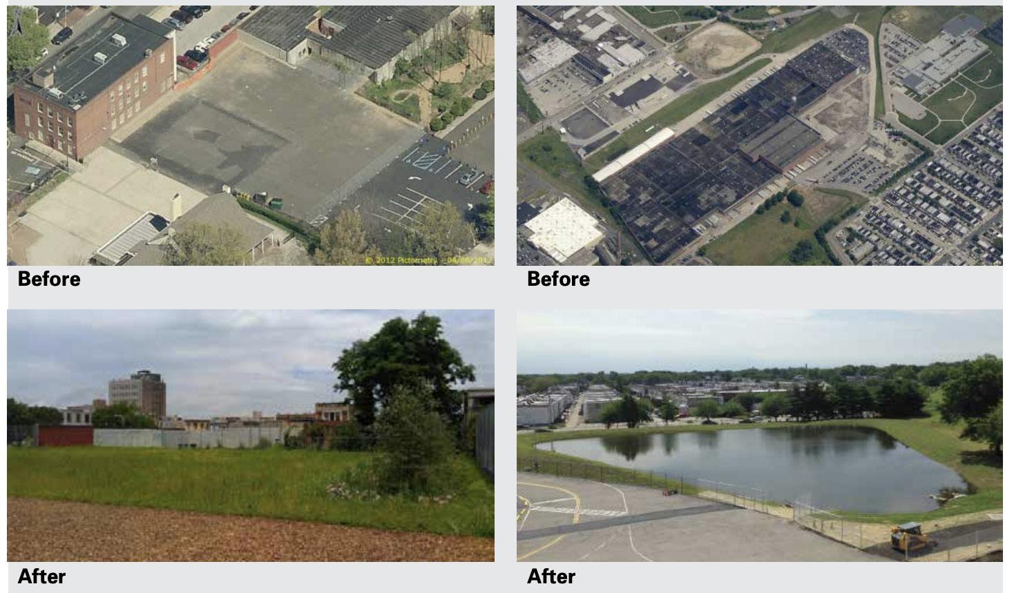


Flood Barriers - Any manmade obstruction which serves to prevent, hinder, restrict, bar or alter the passage of flood waters through usual and normal conveyance channels, other than any structure specifically approved as part of a flood control project, which has more than a purely localized effect on conveyance

Infiltration Basin - Infiltration basins are vegetated depressions designed to store runoff on the surface and infiltrate it gradually into the ground. They are dry except in periods of heavy rainfall
Retaining Walls – Engineered structures that stabilize sensitive areas with high landslide susceptibility

Living Walls - Self-sufficient vertical gardens that are attached to the exterior or interior of a building
Rainwater Storing Pavement – Permeable pavement that absorbs rainwater and retains it to cool surfaces as well as to lower and manage the temperature of areas impacted by the urban heat island effect
Renewable Energy Sources - Energy derived from natural sources that are replenished at a higher rate than they are consumed
Silty & Sand Loam Soil Replacement with Berm and Vegetation - A berm is a flat strip of land, raised bank, or terrace used to keep land vulnerable to landslides in place. Silty and sandy loam soil and vegetation stabilize earth that is vulnerable to landslides
Vegetative Retaining Walls – Retaining walls with native plants used to stabilize land that is vulnerable to landslides

Water Quality/Management- monitoring and control of the quality of the water directly affected by a drainage activity, as well as the receiving waters of a drainage activity, to ensure that minimal degradation in surface or ground water quality occurs.

Green/Sustainable Development – A real estate concept that prioritizes fostering economic growth and the expansion of the built environment while ensuring that natural assets continue to provide the resources and environmental services that allow people to live


Pedestrian Trails

Rainwater Storing Pavement Renewable Energy Sources
Pedestrian Trails- Walking paths that can be integrated into the larger transportation network for daily travel or connected to a park for recreation
Green Roof - A layer of vegetation planted over a waterproofing system that is installed on top of a flat or slightly sloped roof.
Silty/Sandy Soil Replacement with Berm and Vegetation Vegetative Retaining Walls Water Quality/ Management
Green/Sustainable Development Green Roofs

Aquisition
Land Availability
Impervious Surface Pavement Requirements –Regulations placed on the percentage of land in a development that must be constructed with materials that that do not interfere with natural absorption of water into the Earth’s ground water system

Land Acquisition - Acquisition of private land by the government (local, state or federal) in fee simple (through purchase or donation) to protect sensitive areas
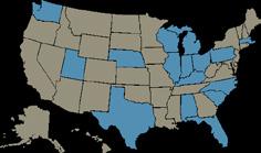
Land Availability Assessment - A Strategic Housing Land Availability Assessment (SHLAA) is a technical exercise to determine the quantity and suitability of land potentially available for housing development

SWOT Assessment – Strengths, Weaknesses, Opportunities, and Threats assessment that helps

local governments and organizations plan for future climate migration and environmental situations

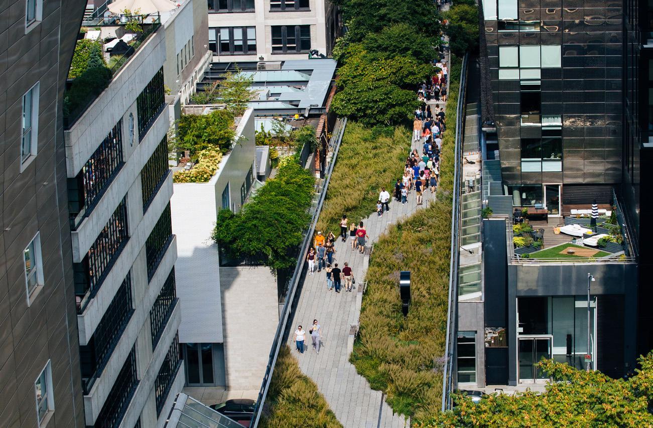
Tree Ordinances - Policies for how a community wants to maintain and protect its trees. They set standards for selection, planting, maintaining, and conserving community trees. Ordinances seek to establish a legal means of protecting the public interest. Provides environmental benefits such as lower pollution and temperatures



Urban Infill - The process of developing vacant or underutilized parcels within existing developed areas
Tax Incentives - a government measure that is intended to encourage individuals and businesses to spend money or to save money by reducing the amount of tax that they must pay














1. Bike Paths - A distinct path or road for only bicycles that can be incorporated into the street network to function with automobiles as part of comprehensive transit system.
2. Bioswale - a long, channeled depression or trench that receives rainwater runoff (as from a parking lot) and has vegetation (such as grasses, flowering herbs, and shrubs) and organic matter (such as mulch) to slow water infiltration and filter out pollutants
3. Community Garden - A semi-public land parcel gardened and harvested by a collective group of individuals united by their common geographic proximity
4. Courtyards - An unroofed area that is completely or mostly enclosed by the walls of a large building
5. Flood Barriers - Any manmade obstruction which serves to prevent, hinder, restrict, bar or alter the passage of flood waters through usual and normal conveyance channels, other than any structure specifically approved as part of a flood control project, which has more than a purely localized effect on conveyance.
6. Green Medians - The portion of the roadway separating opposing directions of the roadway, or local lanes from through travel lanes covered with native vegetation that provides ecological and environmental benefits, such as biodiversity support or cleaner air
7. Green Streets – A street with transit use that also incorporates environmental features like trees, rain gardens, infiltration planters, and permeable paving to capture, slow the course of runoff, and filter it naturally before it reaches major waterways and sensitive plant and animal life.
8. Green Vacant Parcels - Pieces of land that do not contain buildings or structures and are intended to be developed for use of green infrastructure, biodiversity protection, or to support the environmental objectives of a community or local government
9. Green/Sustainable Development – A real estate concept that prioritizes fostering economic growth and the expansion of the built environment while ensuring that natural assets
continue to provide the resources and environmental services that allow people to live
10. Greenroof - A layer of vegetation planted over a waterproofing system that is installed on top of a flat or slightly–sloped roof.
11. Greenway - A strip of undeveloped land near an urban area, set aside for recreational use or environmental protection.
12. Impervious Surface Pavement Requirements – Regulations placed on the percentage of land in a development that must be constructed with materials that that do not interfere with natural absorption of water into the Earth’s ground water system
13. Infiltration Basin - Infiltration basins are vegetated depressions designed to store runoff on the surface and infiltrate it gradually into the ground. They are dry except in periods of heavy rainfall.
14. Land Acquisition - Acquisition of private land by the government (local, state or federal) in fee simple (through purchase or donation) to protect sensitive areas
15. Land Availability Assessment - A Strategic Housing Land Availability Assessment (SHLAA) is a technical exercise to determine the quantity and suitability of land potentially available for housing development
16. Living Walls - Self-sufficient vertical gardens that are attached to the exterior or interior of a building.
17. Parks - Large public green areas in a place that are used for recreation or to protect wildlife and natural habitats
18. Pedestrian Trails- Walking paths that can be integrated into the larger transportation network for daily travel or connected to a park for recreation
19. Plaza and Event Space – A public square, marketplace, or similar open space in a built-up area used for recreation or community activities
20.Rainwater Storing Pavement – Permeable pavement that absorbs rainwater and retains it to cool surfaces as well as to lower and manage the temperature of areas impacted by the urban heat island effect
21. Renewable Energy Sources - Energy derived from natural sources that are replenished at a higher rate than they are consumed
22. Riverfront - The land or property along a river
23. Silty & Sand Loam Soil Replacement with Berm and Vegetation - A berm is a flat strip of land, raised bank, or terrace used to keep land vulnerable to landslides in place. Silty and sandy loam soil and vegetation stabilize earth that is vulnerable to landslides
24. SWOT Assessment – Strengths, Weaknesses, Opportunities, and Threats assessment that helps local governments and organizations plan for future climate migration and environmental situations
25. Tax Incentives - a government measure that is intended to encourage individuals and businesses to spend money or to save money by reducing the amount of tax that they must pay
26. Tree Ordinances - Policies for how a community wants to maintain and protect its trees. They set standards for selection, planting, maintaining, and conserving community trees. Ordinances seek to establish a legal means of protecting the public interest. Provides environmental benefits such as lower pollution and temperatures
27. Urban Infill - The process of developing vacant or underutilized parcels within existing developed areas
28. Vegetative Retaining Walls – Retaining walls with native plants used to stabilize land that is vulnerable to landslides
29. Water Quality/Management- monitoring and control of the quality of the water directly affected by a drainage activity, as well as the receiving waters of a drainage activity, to ensure that minimal degradation in surface or ground water quality occurs.
30.Wildlife Corridors - A strip of natural habitat connecting populations of wildlife otherwise separated by cultivated land, roads, etc.
How economic factors like growth, inflation and interest rates are affecting your decisions
• Will be a costly investment
• Benefits may not be apparent at first or may go unnoticed due to stable conditions
• Potential friction over best utilization of land parcels (direct money makers for the city and private sector versus indirect benefits for the public
• Greater connection of trails for pedestrians and bikes will stimulate future economic prosperity. May not seem cost effective given waiting period to evaluate full economic benefit
• Public-private buy in and partnership
• May not be perceived as a priority to the mayor with other immediate needs, such as homelessness
• Certain aspects may not be completed with changes in government officials
• Policies may be viewed as controversial to private sector
How government policy and legislation is impacting your decisions.
SOCIAL
How trends and lifestyle changes might impact your decisions
• Better connectivity to amenities through trails and green spaces which are important to mental health and overall wellbeing
• Quality of life and health enhancement through environmental benefits such as better air quality, lower temperatures, and fewer homes and lives lost to landslides and floods
• Social connections through public gathering spaces such as green spaces are likely to reduce isolation of vulnerable populations such as the elderly and children, which can improve opportunities and increase life expectancy
• Potential for less crime due to more people out using the green network
• Competing research for increasingly advanced technologies
• High funding needs to create and implement technology
• Potential for high maintenance costs
• Need for continuous research to maintain equilibrium as population growth and new climate threats emerge
How new technologies, automation and the pace of technological change are impacting your decisons.

• Northern Virginia Regional Commission. (2012). Conservation Corridor Planning. https:// www.novaregion.org/1102/Conservation-Corridors-Project
• PLAN NYC, & New York City Environmental Protection. (2010). NYC Green Infrastructure Plan: A Sustainable Strategy for Clean Waterways. https://www1.nyc.gov/site/dep/wa ter/green-infrastructure.page
• WRT Planning, & Stuart Weitzman School of Design University of Pennsylvania. (2011). Planning + Design: Greenplan Philadelphia. WRT. https://www.wrtdesign.com/work/ greenplan-philadelphia.
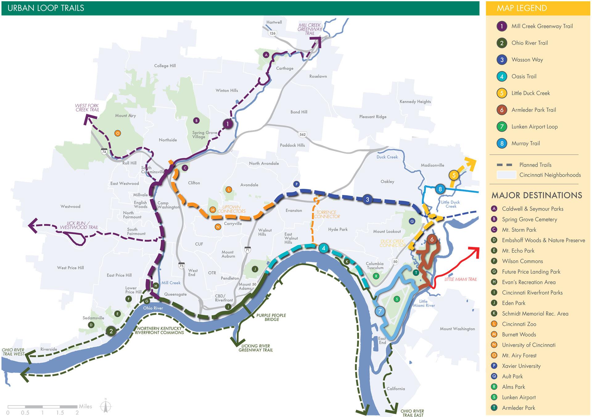
• Green Umbrella. (2021). Cincinnati connects is now Crown. Green Umbrella - Cincin nati Connects. Retrieved September 15, 2022, from https://greenumbrella.org/TriSta teTrails-CincinnatiConnects
• Stevenage Borough Council. (2021). Green space strategy. Green Space Strate gy. Retrieved October 25, 2022, from https://www.stevenage.gov.uk/environment/ green-spaces/green-space-strategy
• Mass Audubon. (2022). Land conservation strategy. Mass Audubon. Retrieved October 25, 2022, from https://www.massaudubon.org/our-conservation-work/land-conserva tion/strategy
• Denchak, M. (2022, July 25). Green Infrastructure: How to manage water in a sus tainable way. NRDC. Retrieved October 25, 2022, from https://www.nrdc.org/stories/ green-infrastructure-how-manage-water-sustainable-way
• Patva, J. (2020, June 3). Types of retaining walls. Civil Wale. Retrieved October 25, 2022, from https://civilwale.com/types-of-retaining-walls/#Crib_Retaining_Wall
• Law Insider. (2020). Strategy Definitions. Law Insider. Retrieved October 25, 2022, from https://www.lawinsider.com/dictionary/flood-barrier
• Law Insider. (2020). Strategy Definitions. Law Insider. Retrieved October 25, 2022, from https://www.lawinsider.com/dictionary/green-streets
• OECD. (2015). Green growth and sustainable development, what is green growth and how can it help deliver sustainable development? OECD. Retrieved October 25, 2022, from https://www.oecd.org/greengrowth/whatisgreengrowthandhowcanithelpdeliver sustainabledevelopment.htm
• Susdrain. (2020). Infiltration Basin. Susdrain. Retrieved October 25, 2022, from https:// www.susdrain.org/delivering-suds/using-suds/suds-components/infiltration/infiltra tion-basin.html
• Planning for Hazards. (2022). Land acquisition. Land Acquisition | Planning For Hazards. Retrieved October 25, 2022, from https://planningforhazards.com/land-acquisition
• London Government. (2020, March 4). Strategic Housing Land Availability Assessment. London City Hall. Retrieved October 25, 2022, from https://www.london.gov.uk/whatwe-do/planning/london-plan/new-london-plan/strategic-housing-land-availabili ty-assessment
• Green Over Grey. (2020). What are living walls. What are Living Walls? Definition of Green Wall and Vertical Garden. Retrieved October 25, 2022, from http://www.gree novergrey.com/living-walls/what-are-living-walls.php
• United Nations. (2017). What is renewable energy? United Nations. Retrieved October 25, 2022, from https://www.un.org/en/climatechange/what-is-renewable-energy
• Collins English Dictionary. (2022). Tax incentive definition and meaning. Tax incentive definition and meaning | Collins English Dictionary. Retrieved October 25, 2022, from https://www.collinsdictionary.com/us/dictionary/english/tax-incentive
• Law Insider. (2020). Water Quality Management. Law Insider. Retrieved October 25, 2022, from https://www.lawinsider.com/dictionary/water-quality-management
• Atlanta Beltline. (2022). Home. Atlanta Beltline. Retrieved October 25, 2022, from https://beltline.org/
• Valderrama, A. (2016, December 15). Wanted: Green acres: How Philadelphia’s Greened Acre Retrofit program is catalyzing low-cost green infrastructure retrofits on private property. NRDC. Retrieved October 25, 2022, from https://www.nrdc.org/resources/ wanted-green-acres-how-philadelphias-greened-acre-retrofit-program-catalyz ing-low-cost
• Arbor Day Foundation. (2022). Tree City USA. Tree City USA at arborday.org. Retrieved October 25, 2022, from https://www.arborday.org/programs/treeCityUSA/index.cfm
• Hausheer, J. E., Miller, M. L., Keffer, K., & Byington, C. C. (2018, October 8). Migration in motion: Visualizing Species Movements due to climate change. Cool Green Science. Retrieved October 25, 2022, from https://blog.nature.org/science/2016/08/19/migra tion-in-motion-visualizing-species-movements-due-to-climate-change/
• ArcGIS Online
• Cadmapper Software
• CAGIS Data