High school
aCademiC Career
Artistic school Paolo Candiani / September 2011 - June 2016
Architecture class
Final grade 88/100
Bachelor degree
Politecnico of Milano / September 2016 - July 2019
Department of Urbanistica: Città Ambiente Paesaggio
Final grade 102/110
Master degree
Politecnico of Milano / September 2019 - December 2021
Department of Landscape Architecture. Land Landscape Heritage
linda Chimento
Personal Profile

I am a Landscape Architect looking for new working experiences, I am skillful in working as a team and ready to test myself with new adventures. During my master degree I have increased interest in eco-sustainable design. The thesis that concluded the course of studies concerned water drainage systems applied to an urban context with a design of sustainable buildings in abandoned areas.
ContaCts
Email linda.chi@hotmail.it
Pec chimento.22665@oamilano.it
Phone 331 2803540
Linkedin www.linkedin.com/in/lindachimento
skills
English
C1 - TOEIC 2019 (listening, reading)
Organizational skills
Problem solving
Autocad
Adobe Illustrator
Adobe Indesign
Adobe Photoshop
Qgis
Sketchup
Archicad Graphisoft
Microsoft Word
Microsoft PowerPoint
Microsoft Office
Final grade 110/110
additional Courses
Adobe Certified Professional
Musa Formazione / June 2022 - waiting for exam dates
Graphic design course for Illustrator, Photoshop, Indesign and certified by the official certification Adobe Certified Professional.
Work exPerienCe
Politecnico of Milano / February 2018 - June 2018
Internship with professor Daniele Villa for the project Alpine Scapes. My main task for the project was the mapping of Valssassina’s territory.
Intern
Politecnico of Milano / February 2018 - June 2018
Internship with professor Daniele Villa for the project SCAR. The tasks had were mainly focused on the design of cultural path for the connections of different Milan’s suburbs and the schools in the neighborhoods to valorize public areas and heritage.
Workshop
Politecnico of Milano - Nivola museum Orani / 10 October 2018 - 18 October 2018
Urban planning workshop with Terra Viva Workshop association. Design of sustainable connections and path for the town of Orani (Sardinia), creating urban public areas to increase the slow tourism.
Waitress
Chatwin Cafè, Gallarate / October 2019 - October 2021
Junior Architect
Studio Tecnico BBCM, Legnano / June 2021 - ongoing Design of residential buildings and carrying out Ecobonus and 110% practices.
Intern Cat shelter’s volunteer
Volunteering
Protezione Animali Legnano ODV (PAL) / August 2019 - September 2020
Vezio - Lombardia
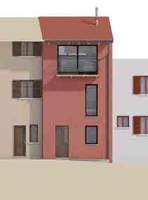
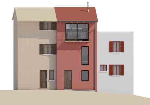
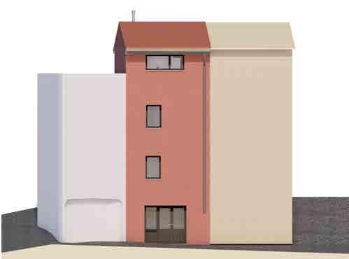
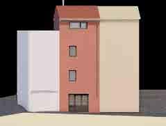
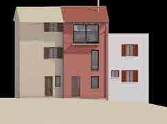
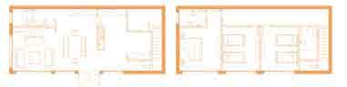
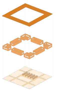
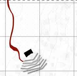
Archicad group project
Politecnico di Milano A.A. 2018/2019
Creation of a tridimensional model for the Casa Toffoletto in Pasquee in Vezio, Lombary using the 3D software Archicad.
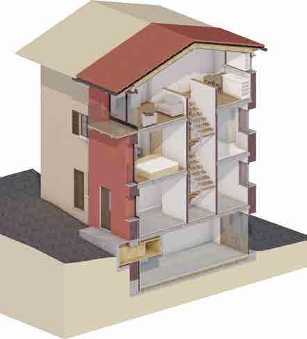
COSTRUZIONE & STRATIGRAFIA DEI MURI
step 1 Incongruenze rilevate nei disegni originali perimetri esterni delle quattro piante non coincidevano tra loro, portandoci ad ipotizzare che muri fossero inclinati in sezione. Tuttavia, in sezione non è presente nessuna inclinazione e muri sono uguali in spessore inclinazione.
step 2 Mediazione tra piante e sezioni Per realizzare modello è stata mantenuta l’inclinazione delle sezioni: abbiamo quindi cercato di costruire la pianta più fedelmente possibile, mediando tra disegni disposizione.
step 3 Costruzione delle diverse stratigrafie Gli schemi accanto mostrano le diverse stratigrafie dei muri ottenute attraverso la creazione di diverse Strutture composte e la collocazione di ogni tipologia nelle piante dell’edificio.
Per modulare tetto sono state osservate in particolare le sezioni e prospetti. Nella modulazione son state rintracciate delle difficoltà in quanto muri non sono paralleli e le travi sono rappresentate in sezione in modo incoerente.
Abbiamo supposto che potrebbe essere un errore di disegno, oppure semplicemente un’incoerenza dettata dalla stuttura “vecchia” del tetto. Si deciso quindi di apportare leggere modifiche rispetto al posizionamento degli elementi del tetto, mantenendo in generale la struttura come di seguito illustrato.
step 1 Costruzione della struttura portante Per la struttura portante sono stati realizzati due profiIi complessi in lamellare (le travi travetti). Rispetto alla sezione originale, deciso di abbassare leggermente travetti per avere l’incastro con la trave centrale e le travi laterali. La sagomatura esterna (entrambi lati) è stata realizzata attraverso un profilo complesso, poi nascosto nel layer “hidden”.
3. Sagomatura attrvaerso profilo della trave a vista 1. Trave in legno lamellare
2. Travetti in legno lamellare
4. Partizione in abete
step 2 / Falda Prima stratificazione Sono state realizzate due stratificazioni (falde con strutture composte. La prima stratificazione, interna ai muri, è forata dai travetti e parzialmente dalla trave centrale. Le travi rimangono parzialmente a vista. Sono state modificate (a seconda delle informazioni a disposizione) le proprietà fisiche dei materiali da costruzione.
4. Tavole in abete
3. Isolazione in lana di vetro
2. Barriera vapore
1. Rivestimento in pannelli d’abete
step 3 Falda Seconda stratificazione La seconda stratificazione prosegue esternamente ai muri. Composta da due strati più sottili, funge da appoggio ai controlistoni. Anche in questo caso, sono state modificate (a seconda delle informazioni disposizione) le proprietà fisiche dei materiali da costruzione.
step 4 / Listonatura controlistelli e listelli sono stati modellati come profili complessi, disposti parallelamente e poi perpendicolarmente attraverso la moltiplicazione. Si è cercato di costruire una trama verosimilmente parallela, ponendo attenzione all’orientamento delle travi.
step 5 Falda Coppi tetto stato completato attraverso la realizzazione dell’ultimo strato della falda, composto da coppi. A differenza delle prime due stratificazioni della falda, quest’ultima copertura è semplice (uno strato).
1. Coppi alla piemontese
2. Sottotetto Riwega Elephant 2. Listoni in abete
1. Perline in abete
1. Controlistoni in abete
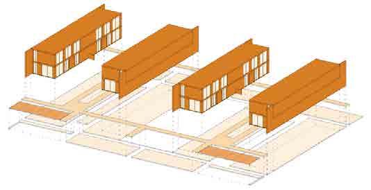
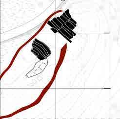
Nel modello sono stati abbozzati anche gli edifici adiacenti Casa Pasquee, per dare l’idea del contesto entro quale si inserisce Casa Pasquee. materiali che compongono la parete e la costruzione dei serramenti sono stati ricavati da varie fotografie.
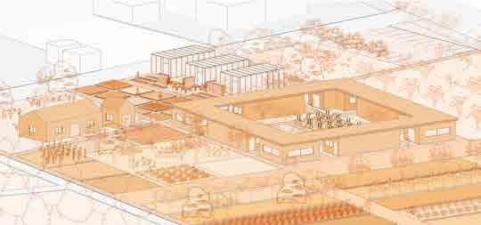
The coastal area of Lecce is a very particular place, at first one would think he will be in front of nice sandy beaches with different attractions while in reality something else is happening, the surge of informal settlements and touristic structures that emerged chaotically since the 50’s from people looking for a “second summer home”, took a big part of the valuable landscape and totally broke the bond with its surroundings causing different social and economic problems.
The goal of our project is to first identify these problems and then propose a strategy to solve them with a final purpose of making a change towards the coast and the whole area, transforming it to a place with various possibilities, a place more meaningful to live in.
Thus “Between the Walls”, a framework of strategies based on several transversal transects with different functions and new developments in key strategical locations mending the three different landscapes we are dealing with, stabilizing their elements and recreating their relationship, pushing the whole territory to work as a one.
Learning from the existing landscape, we used walls not as something that limits or encloses but as a tool to rethink the whole function of the given area, transforming the existing fragments of individuality to common public spaces with different functions, all while questioning the notion of vacancy and abandonment that causes urban decay and making new possibilities out of it.
The different transects have a wide range of common functions and also different ones, such as one of them is related to the agricultural system stretching all the way from the inland, with spaces as orchards, fields and green farming areas with a local market and a food hub with the aim of providing the area with a new sustainable food source and new economic activities with the participation of people, giving them a stronger feeling of connection and a greater sense of place.
Another one is the one related to the new form of housing settlements where we are demolishing illegal settlements and introducing a new layout made of different typologies and able to accommodate different household types and since one of our major goals is to increase the demand for the area among the younger fraction of population, we are proposing social and services vital facilities, workspaces and different shops, also for example a school that will probably be needed at first.
A wetland park area with public spaces will be introduced too in direct contact with the recovered coastal system, thus getting rid of the bottle neck effect and valorizing the existing dunes by creating a buffer zone between them and the urban areas, transforming them from a barrier to a habitat with a footpath system.
In order to connect these different cuts, we are reinforcing and transforming the existing transportation systems and proposing a new bike lane made of transversal links with different functions along the way, making use of some of the existing buildings in key sites while transforming their functions based on their locations also proposing common water related interventions, binding the whole project together as one homogeneous entity, that could change the exploitative relationship with the different landscapes to a productive, ecological and beautiful aesthetically one.
Seascape
The Maritime Seascape along the Adriatic, is a progressive landscape, the coast structure is saturated by water, sand reliefs and dunes. Two entities important for our project.
Built environment
The built environmentv is characterized by fragmented buildings and a discontinuous pattern, intermingled with the third landscape.
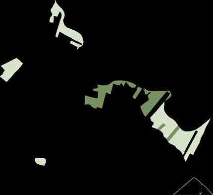
Green landscape
The Green landscape located inland and far from the sea is marked by humid zones and wetlands. The green relief stretches from the back towards the second landscape through small woods, natural hedges and grassland
Typology one
160sqm
Residential units
Parking lots
Pathways
Green areas
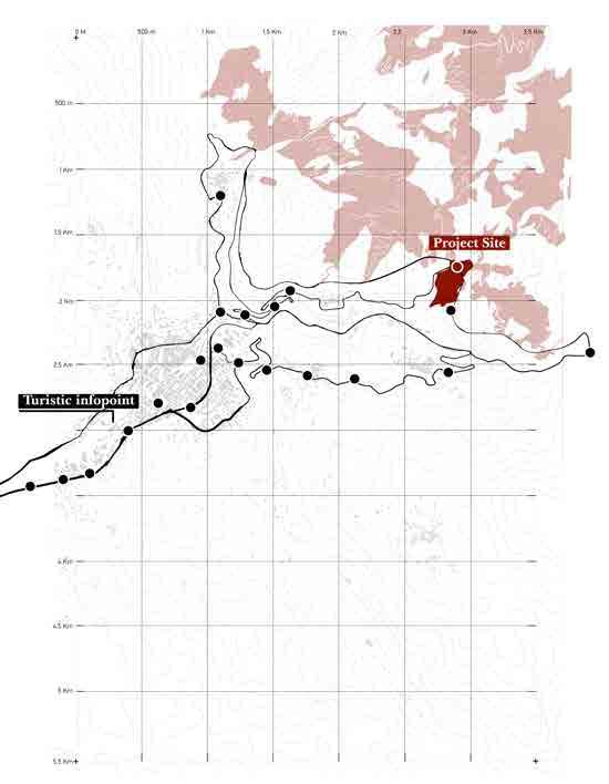
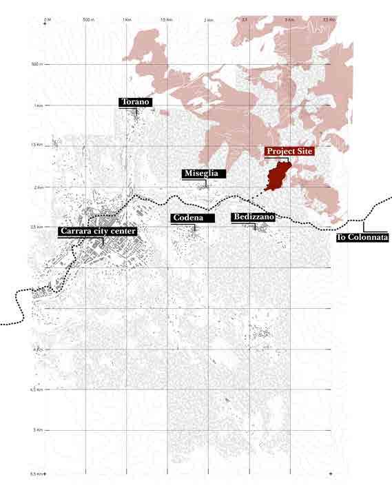
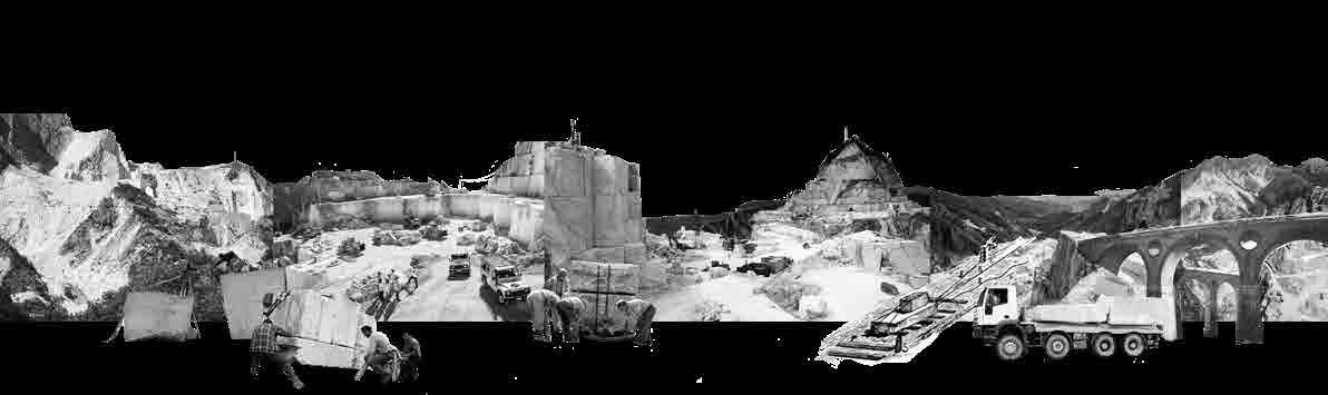
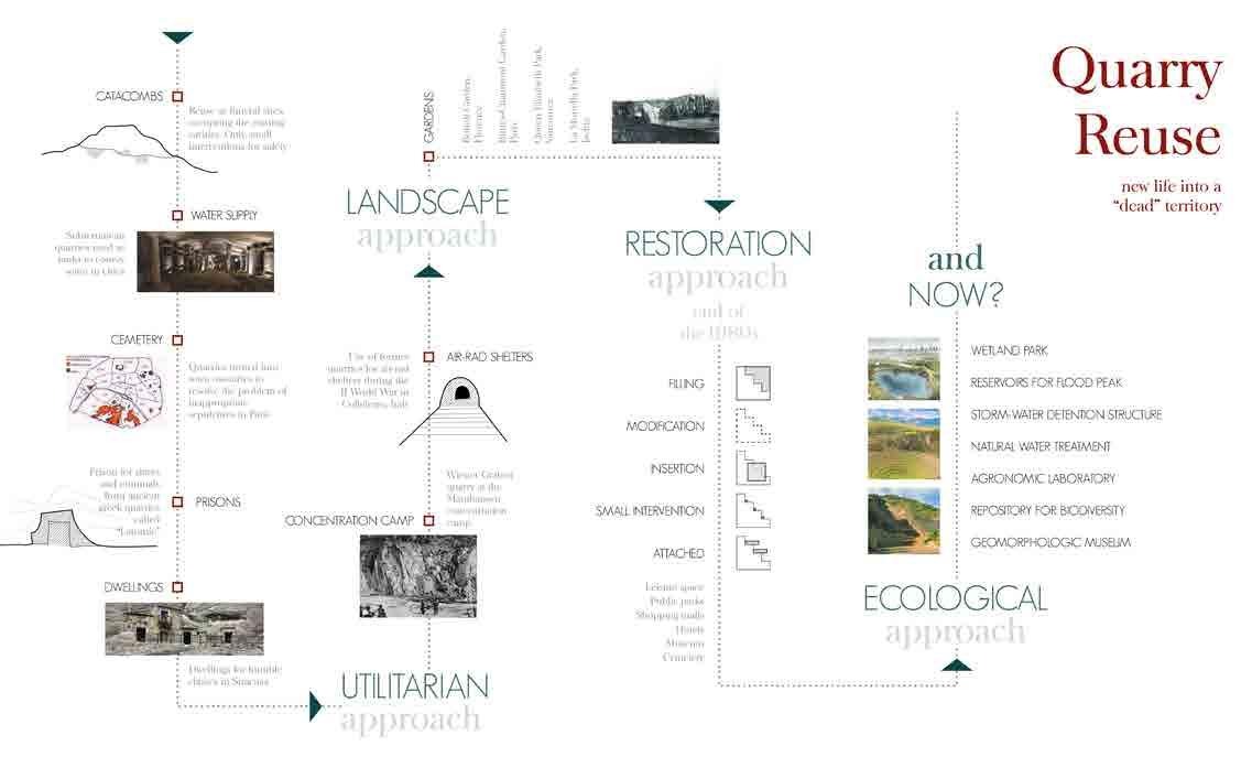
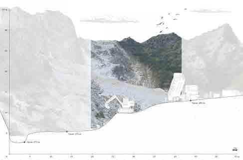
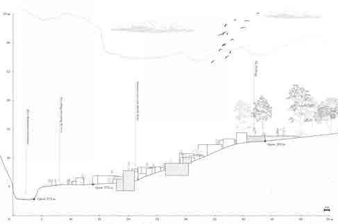
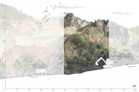
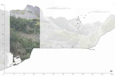
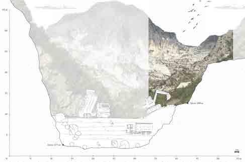
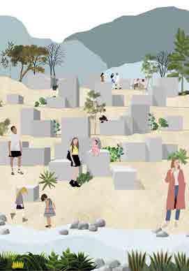
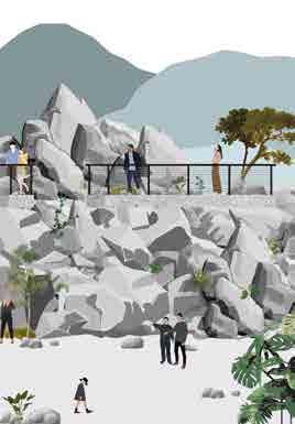
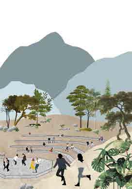
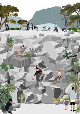
The area of the Apuan Alps, besides the relevant natural, historical and cultural meaning of its landscape, is known for being a heavily man shaped land through the extensive past and present quarrying activities, activities that are incredibly evocative and powerful with a huge impact on the territory. All the following puts us in front of a real need for a project with a new purpose and value in such a unique location with complex productive, ecological and cultural conditions like Carrara.
A landscape-based project that integrates a spectrum of land-recycling, restoration and reclamation measures, thus our design intent, creating the whole project as occurring all over the site and fitting its particularity and this by creating spatial open air “rooms“ occupying the voids of the quarry through addition and subtraction that allows the people to experience a landscape that seized to exist.
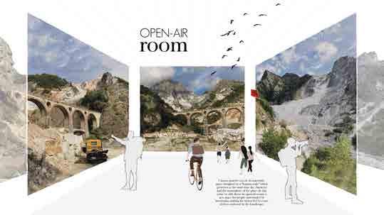
All while paying attention and assuring a smooth transition from the large scales of the quarry with the massive marble blocks to a more human scale size of spatial elements with
different functions (sitting areas, exhibition surfaces, circulation paths, activity spaces), creating real physical containers between the extraction sites and pushing for a positive space as opposed to a residual one.
Symbolically the rooms and the “fil rouge“ binding them together becomes a functioning project, a real generic matrix for specific activities, spreading beyond the limits and transforming this linear and monofunctional from A to B site into a polyfunctional one, all while operating in a space between the artificial and the natural, aiming to achieving simultaneously an artificial that is well defined in the existing landscape.
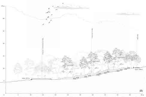
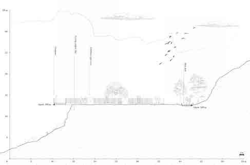
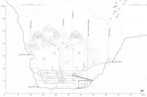
Floating quarries (in the forest)
Floating quarries (in-between the mountains)
Floating quarries (at the end of Carrione river)

Situated within a network of grey infrastructures
In the middle of an important geo-site

Mining dates back to 155 B.C. First monument made of marble from Polvaccio II
Luni quarries reached high altitudes:
155 B.C.
Theodosianus codex. Mining activity crisis and marble’s prices increase
700m above sea level 363 A.D.
210 A.D.
Explotation of Luni’s Quarries
The use of Lunense marbles expanded enormously throughout the entire Empire of Augusto.
476
Ends of Roman Empire. Marble use crisis.
The Lombards were defeated by Carlo Magno and Carrara became a feud of the bishops of Luni
773 A.D.
Otto I of Saxony gave the recognition to marble quarries as an important economical activity
962 A.D.
Low activity of marble quarries
The Carrione Valley returned under the jurisdiction of the Luni Bishop
Carrara has been removed from the Bishops from Frederick II and entrusted it to Guglielmo Malaspina 1230 A.D.
1215 A.D.
Landowners administer collective assets, free from the jurisdiction of the Bishop. Marbles activities resume and grow in importance.
1313 A.D.
End of the jurisdiction of Luni Bishop 1473 A.D.
Carrara returned to the domain of Malaspina 1554 A.D.
Carrara became the capital of the duchy
Maria Teresa Malaspina created the Leggi Estensi, an edict on the management of marble
1751 A.D.
Lots of political chages, edicts and regulations on the management of quarries and on the organization of trade.
Unification of the former duchy of Cybo to the Principality of Lucca assigned to Felice Baciocchi 1815 A.D.
1806 A.D.
Carrara became an autonomous Principality under the leadership of Maria Beatrice d'Este
A prolonged and intense cycle of productive expansion. Due to innovations in trasport and technologies
The beginning of Risorgimento: period of social and political revolutions
1848/61 A.D.
Carrara became the cradle of anarchism, particularly among quarry workers
1885 A.D.
Start of a recession period
II World War Block of marble extraction. The defense line of the Wehrmacht was placed in the plain of Luni
1939/45 A.D.
I World War
1915/18 A.D.
Carrara is the birthplace of the International Federation of Anarchists (IFA)
1968 A.D.
Economical Recession; sharp drop in sales by the Carrara marble processing plants
2008 A.D.
Widespread use of Carrara marble during fascism.
Marble Railway
Cranes to lift and trucks to transport
1570 A.D. Introduction of the Saw frame (telaio segagione)
Gounpower for mining
Varata technique
1831 A.D. Helicoidal wire
1885 A.D. Jackhammer
1908 A.D. Eletrification
1922 A.D.
Diamond wire
2000 A.D.
1970 A.D. Diamond Single-blade
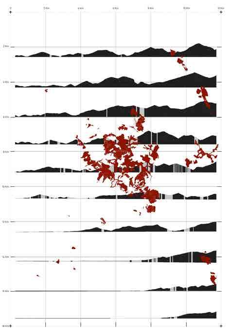
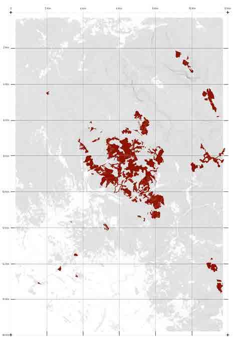
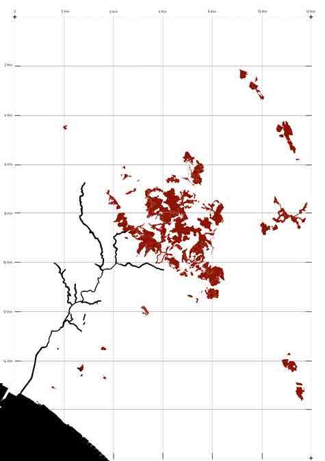
Which led to the creation of voids
Existing buildings / artefacts
What’s the future for these voids


Unprecedented changes in climate change are taking place. If we continue on our present course, life on earth will be inextricably altered. Most of the human activities are based on the use of fossil fuel and a no stop need of urbanization. If we continue our heavy dependence on those, we will double the amount of carbon dioxe in the atmosphere. As a consequence, the climate will rapidly become hotter and the damage we are causing will be irreversible.
The present thesis is based on the aim to understand what are the main consequences of climate changes and how to mitigate them.
At first, an exhaustive analysis will reveal all the different effects that climate change have on our planet and on the natural and artificial ecosystems, with a specific focus on the risk, exposure and vulnerability of urban areas. Then, a possible solution to mitigate those risks is proposed: the use of Nature Based Solution is becoming a clear way to help people and ecosystems.
A deeper analysis of the different types of Nature Based Solutions, their aim and their benefits will be taken into account to let a more accurate understanding possible.
Last, an example of the application of those Natural Systems is presented: the aim is to highlight how the totality of those solutions can be applicable and replicable to all the urban areas to create a more water sensitive and resilient city for the safety of citizens and ecosystems.
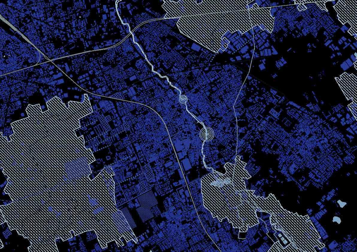
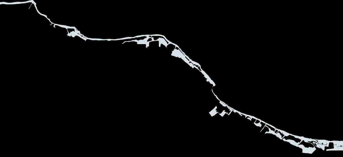
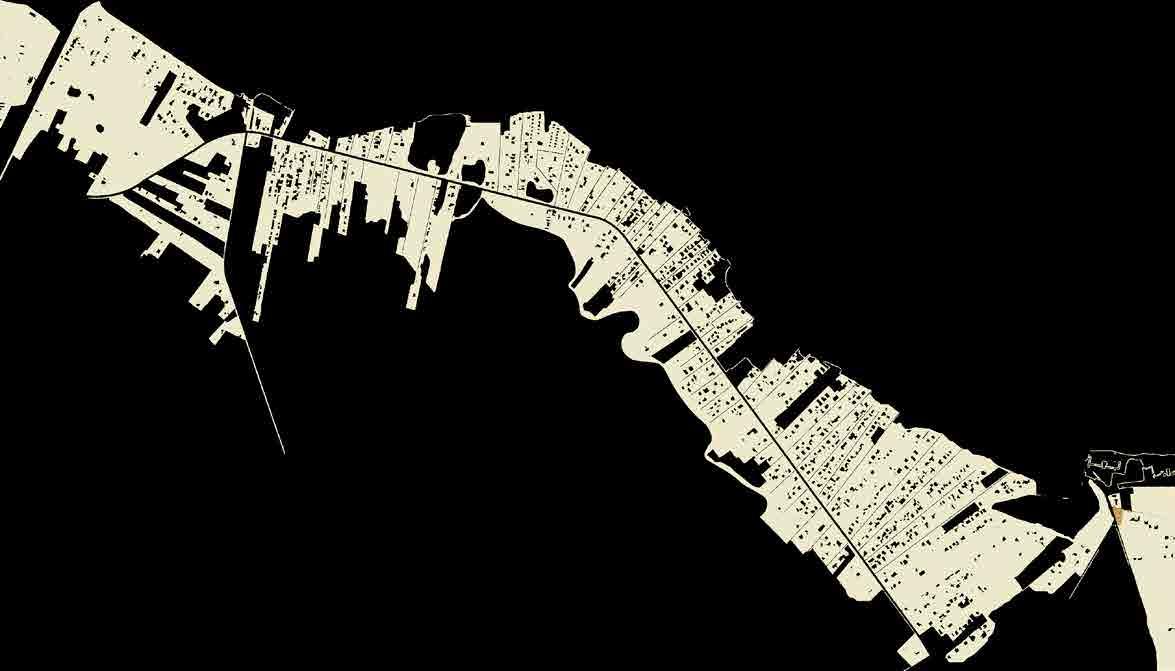
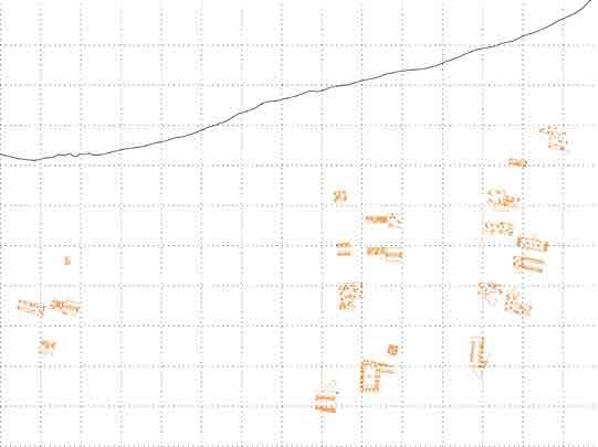
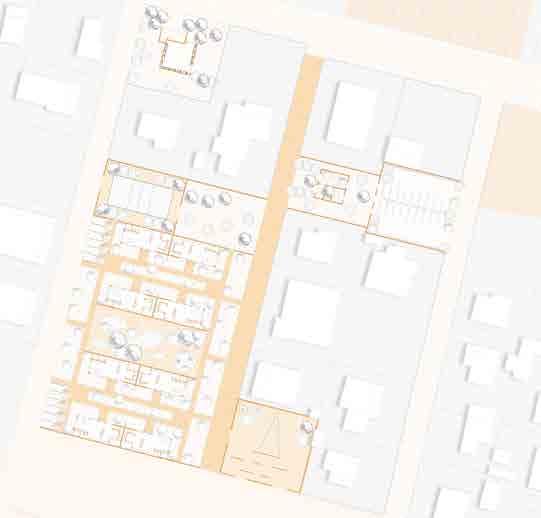
Railway: Milan to Varese legnano
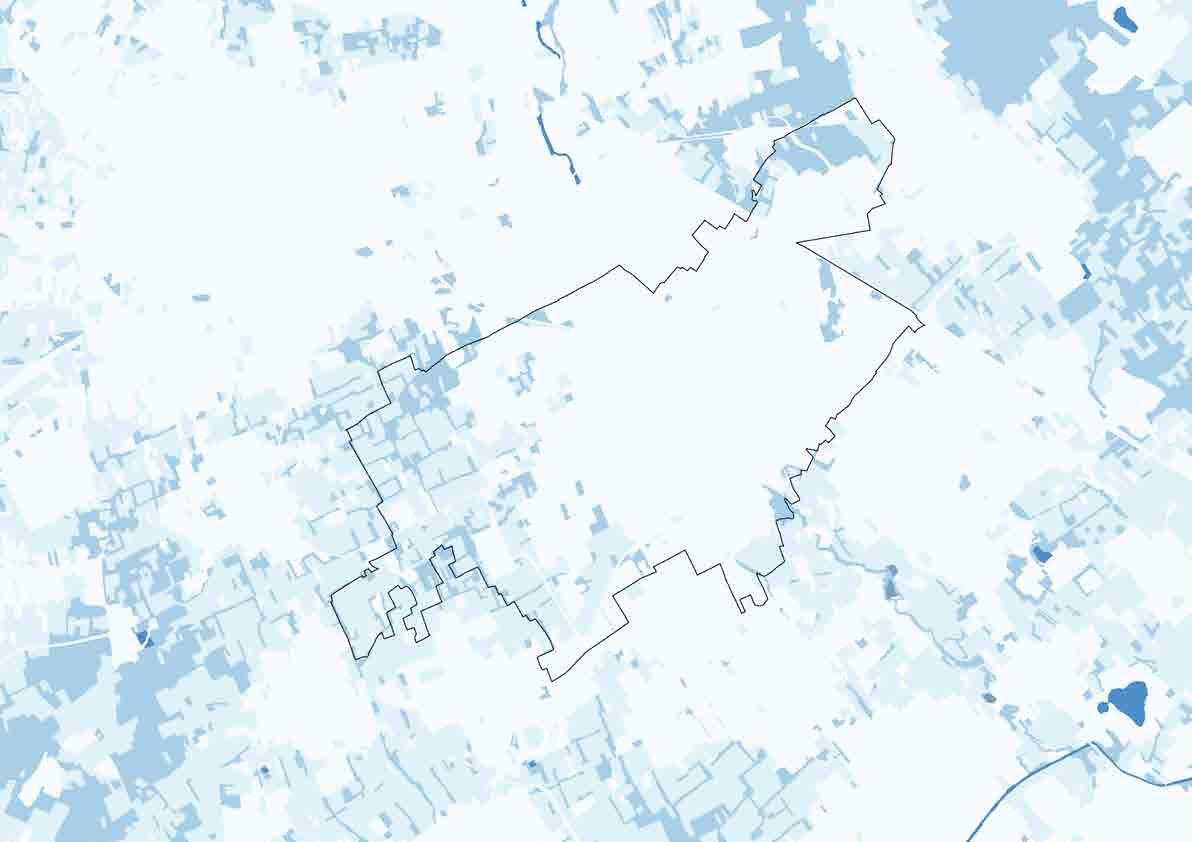
Legnano is an Italian town in the north-westernmost part of the Province of Milan, about 20 kilometres from the center of Milan.
With 58.938 citizens, it is the thirteenth-most populous township in Lombardy. Legnano is located in the Alto Milanese and is crossed by the Olona river
How dense is legnano?
Railway: Milan to Novara
Railway: Milan to Como
Railway: Milan to Lecco
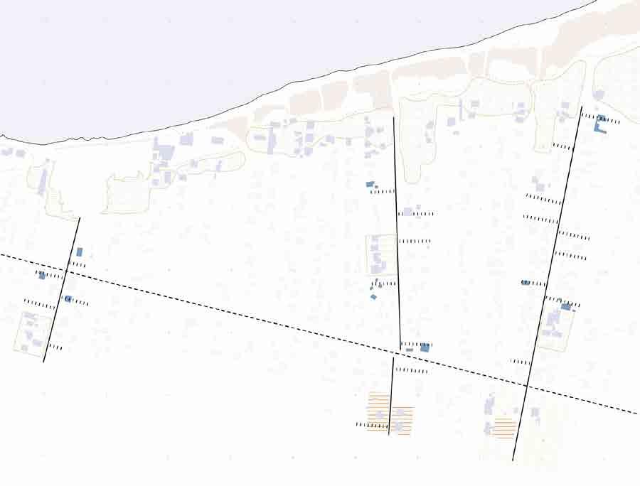
60.000 About citizens 17km2 of surface
3.32 ab/km2
Regional ecological coRRidoR witH low uRbanization
Corridors and ecological connections are fundamental elements for the ecological regional network (RER - Rete Ecologica Regionale in italian). Those have the aim to let species to move easily between the different natural areas but also control the water and organisms fluxes.
fiRst level elements of ReR
They include the protected areas (parks and reserves), the Natura 2000 sites and the Priority areas for biodiversity identified through an in-depth evaluation of the different fauna, botanical and ecological components of the Lombardia territory.
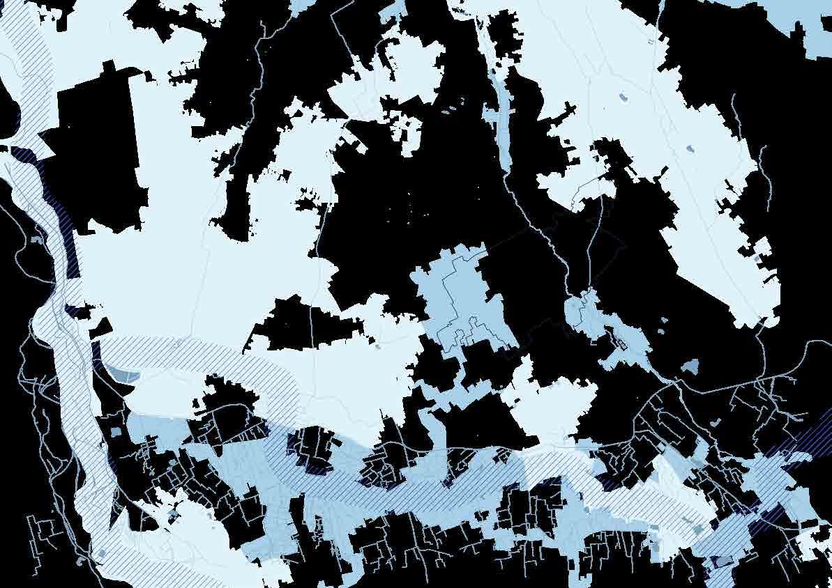
The preliminary characterization of the territory of Legnano from the point of view of ecosystsems refers to the different Ecological Network’s projects by Lombardy Region (RER - Rete Ecologica Regionale) and Milan Municipality (Rete Ecologica Provinciale - Dorsale Verde Nord).
The Dorsale Verde Nord covers the southeastern suburb of Legnano, the main purpose is the agriculture activity and it coincides with the Second Level element of the Ecological Regional Network (RER in Italian).
The RER network also identifies the river Olona as a second-level element, currently so compromised that it cannot act as an ecological corridor, also in consideration of the “artificial jumps” that do not allow the local faun the ascent of the river.
The 20% of the river is currently underground, other parts are completely surrounded by urbanization and without vegetation.
second level elements of ReR
They include areas important for biodiversity not included in the priority areas but considered functional to the connection between elements of the first level. The network of second level elements is particularly developed in the plain area and closely linked to the dense hydrographic network.
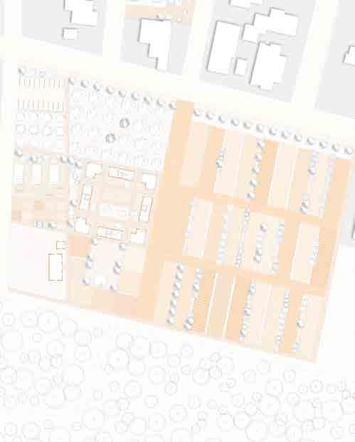
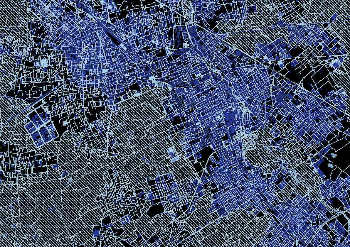
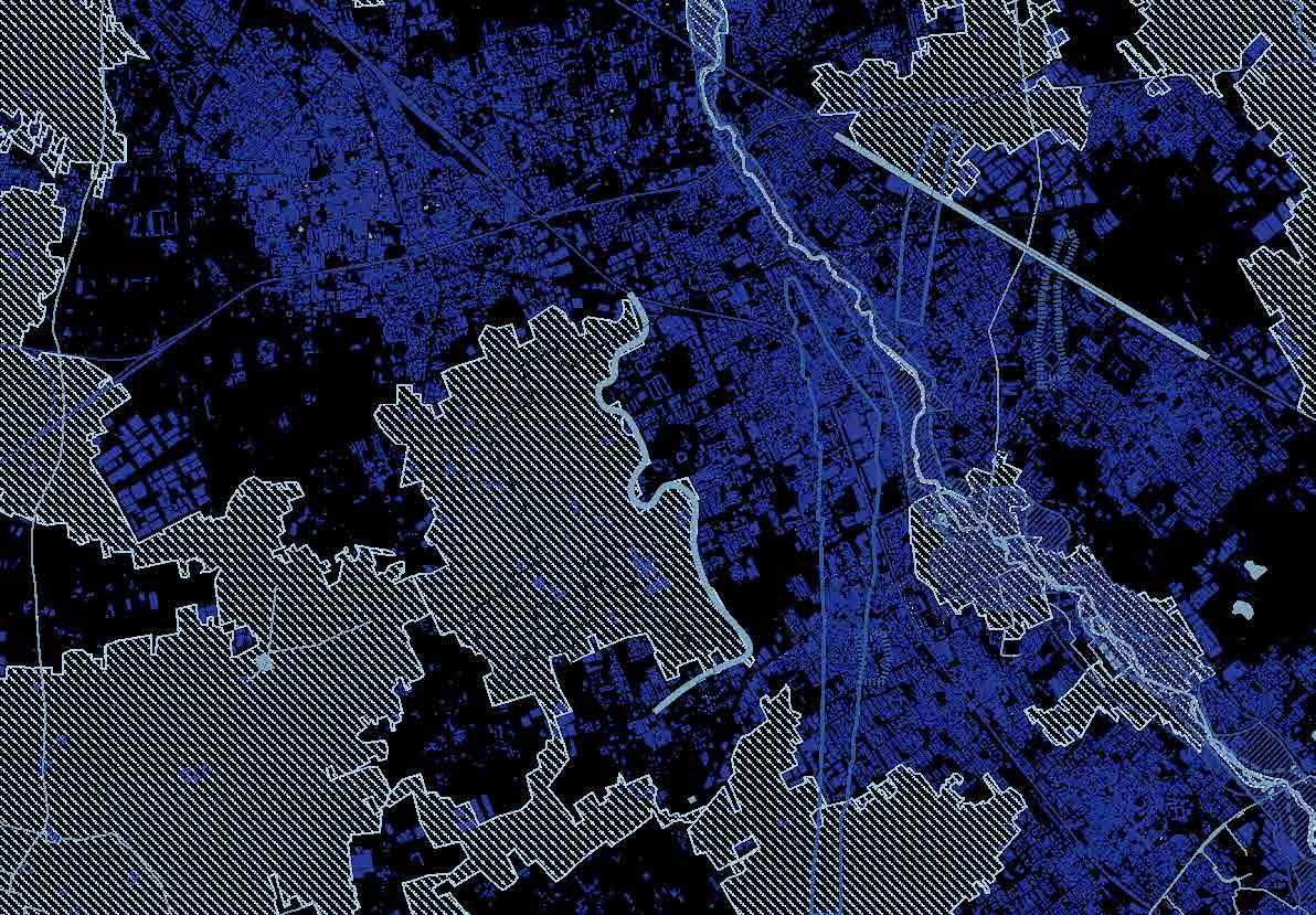
Most of the municipality of Legnano is covered by anthropized areas, most of them composed by impermeable surfaces not able to let water infiltrate into the ground: this 70% is divided by a 39% of urbanized areas, a 27% of productive areas and a remaining 4% of degradated and abandoned sites, important areas for the project.
A 21% of area is dedicated to another human activity: agriculture. Most of the agriculture areas are located in the southeastern suburb of Legnano and, as the previous map explained, it’s part of the Dorsale Verde Nord and is also a second level element of the Ecological Regional Network (RER). Only the 8% of the whole area of Legnano is dedicated to woodlands and more natural area, and, from the map, it’s also clear how those woodlands area are fragmented and divided by the urbanized ones.
Is it possible to increase the percentage of natural areas at the expense of urbanised areas?
8% woodlands
Legnano as a percentage Meso scale
21% agRicultuRe aReas
27% pRoductive aReas
1% umid aReas
4% abandoned and landfill sites
70% antHRopized aReas
39% uRbanized aReas
Source: Geoportale della Lombardia
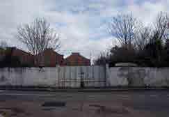
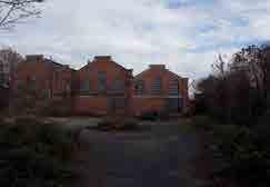
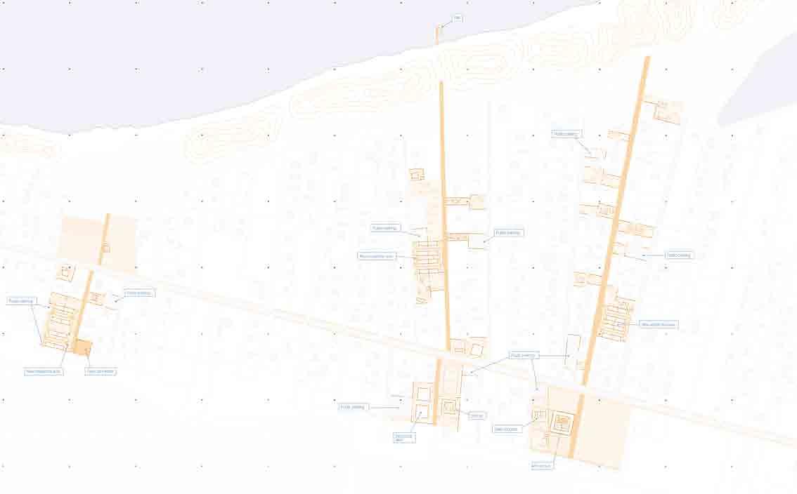
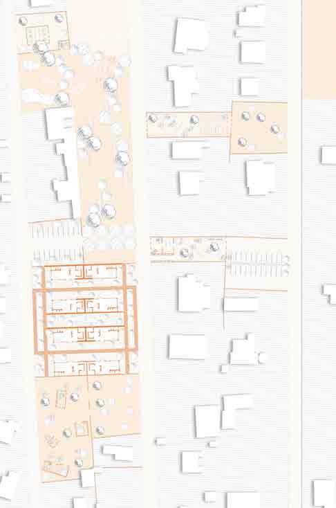
In the total area of Legnano thare are different abandoned and degradate areas.
Most of those areas are classifies areas of industrial architecture with a value for buildings with more than 50 years old. All those buildings where used during the maximum industrial expansion of the Valle Olona, know as an important distric for textile industry, infact most of them are located neat the Olona river.
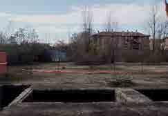
Someother areas are just empty and abandoned, often degradated and dangerous for people and environment.
Those voids could be useful for this sustainable project: they could be used for a specific renaturalization with different Nature Based Solutions.
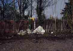
ex pensotti
Boiler industry of the 1908. It has 31600 square meters of land. The upper one has a value for buildings with more of 50 years old, the lower one is an empty area already cleared.
Manufacture industry of the 1890. It has 31600 square meters of land with a value for buildings with more of 50 years old and a bond of river respect.
ex legnano manufactuRe
Manufacture industry of the 1900. It has 41000 square meters of land with a value for buildings with more of 50 years old. already bought by Officine Mak association.
ex giannazza
Manufacture industry of the 1930. It has 8000 square meters of land with a value for buildings with more of 50 years old.
ex mabRotti manufactuRe
Manufacture industry of the 1900. It has 9200 square meters of land with a value for buildings with more of 50 years old and a bond of river respect.
Elements of the RER (Ecological Regional Network)
Transormation areas with a mandatory recovery of the historical industrial buildings
Transormation areas for urban development
Abandoned areas
In the current map different criticalities of Legnano municipality are highlighted to show a different point of view and also to tank into account the problems present in the city and to try to solve them with a sustainable project able to bring nature and connections between the dense urbanization.
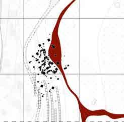
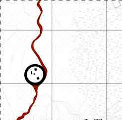
The Olona river has an high risk of flooding and most of the surrounding areas are classified as high risk areas.
As the percentage map showed, the natural and agricultural areas are fragmented and divided byan urban barrier . Final there is also the presence of contaminated ground by toxic chemical substances due to industrialization and misdisposal.
dangeR aRea foR tHe olona RiveR
The Ex Cantoni area, near the center of the legnano has been valuated as an high risk area for flooding events. For this kind of areas the return period is between 30 and 50 years.
(Ecological Regional Network)
Danger area for the main river network
River network
1995 Olona flooding
1992 Olona flooding
1951 Olona flooding
Hexavalent chromium contamination
Tetrachloroethylene contamination
Urban barriers for biodiversity and species movements
The area characterized by the presence of the Ecological Regional Network elements is strongly fragmented because the presence of an hard barrier of urban development.
Hexavalent cHRomium contamination
Hexavalent chromium produces dangerous toxic effects affecting entire biological systems It’s used in the manufacture of metal coatings, which give the products corrosion resistance, as a catalyst in the dyes and in the blackening of the skins, and finally for the preservation of the wood.
tetRacHloRoetHylene contamination
It appears as a colourless liquid with the smell of chlorine, denser than water. Dangerous to the environment and toxic to aquatic organisms. It is used in dry cleaners as a solvent for metal degreasing, in the chemical and pharmaceutical industry. In Italy, the law considers it as hazardous waste
With the first analysis of the possible metereological urban risks, the average temperature of Legnano during the summer of 2020 is taking into account. Infact we can see that the higher temperature are localized where the dense urbanization is.
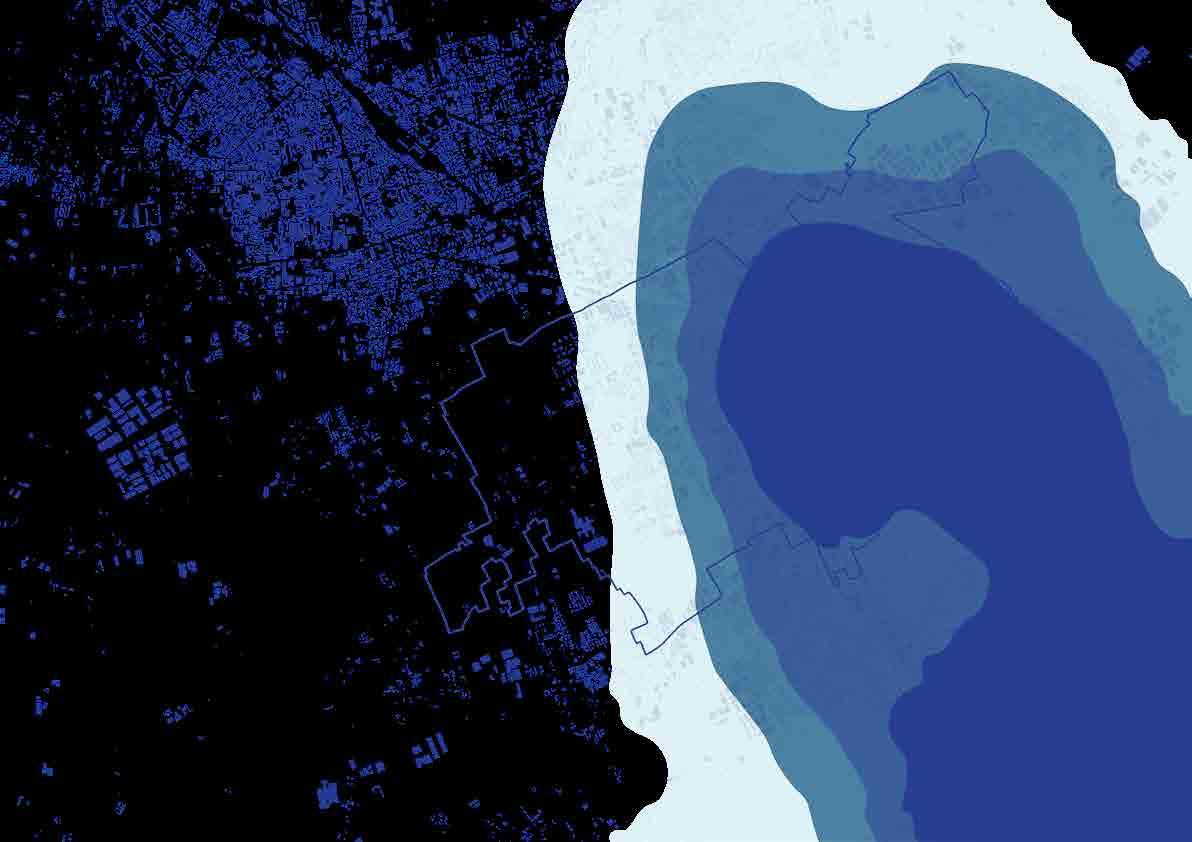
In the southeastern suburb of Legnano, which is full of agricultural areas and woods is visible how the average temperature is lower: between 23°C and 24°C.
Is there a need to bring nature between the dense urbanization?
Metereological urban risks: 2020 summer heat wave Meso scale
Temperature between 25,2 and 28,1 [°C]
Temperature between 24,8 and 25,2 [°C]
Temperature between 24,4 and 24,8 [°C]
Temperature between 23,7 and 24,4 [°C]
Data source: Progetto ClimaMI Graph made by the author
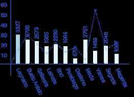
With the second analysis of the possible metereological urban risks, the average precipitation of 2019 in Lombardy region is taking into account.
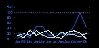
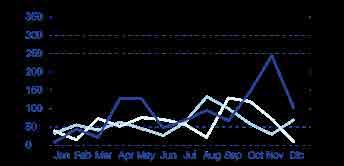
From the two graphs on the left it’s possible to see that the annual average rainfall and the consequent annual average runoff are at their highest point during the month of November 2019.
So, the main map is showing how the average rainfall is located on the whole Lombardy region. Legnano has an average rainfall between 100 and 150 mm during November 2019.
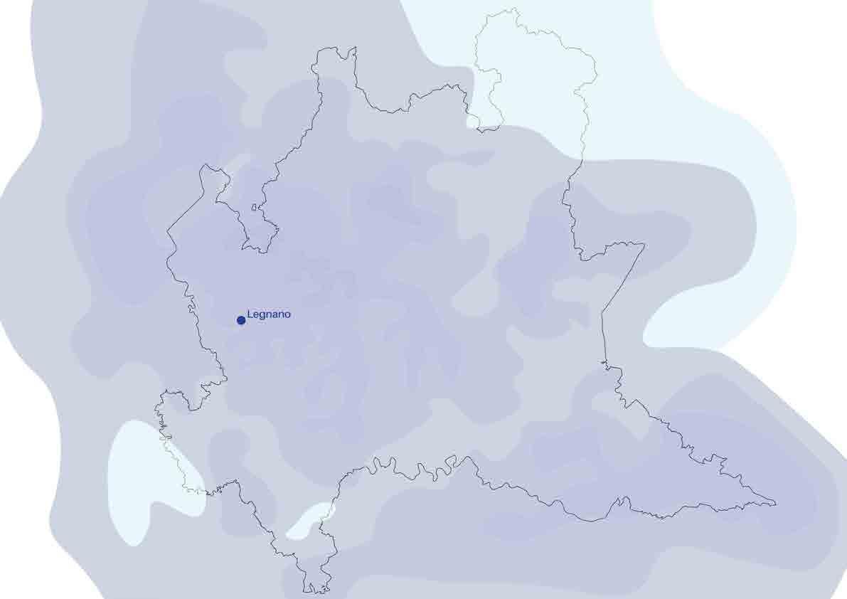
To mitigate the amount of runoff coming from rainfall is probably necessary to create natural district made of sustainable drainage systems and nature based solutions,.
Metereological urban risks: November 2019 average precipitation Meso scale
Data source: Progetto ClimaMI Graph made by the author
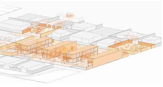
The strategial actions to create a more water sensitive and resilient city are basically four. Starting with some green infiltrations to let nature grown inbetween urbanization and break down the urban barriers. Then the choice of some abandoned areas to create a new natural community with residential or social services combined with sustainable solutions for water and ecosystems, as agroforestry or SuDs. The connection of those areas with a green cycle path. Last, identification of some specific areas to restore the river, reduce the flooding risk and enhance the ecosystems and biodiversity.