Landscape Architecture Master’s Thesis Summer Semester 2021

In this sense, what is being recovered is not the landscape of scenes and objects but the landscape of ideas, operations, and cultural significance. It is about the simple planting of seeds within the wilds of the landscape imagination, hopefully propagating a field more diverse and enabling than ever before.1

 ―James Corner
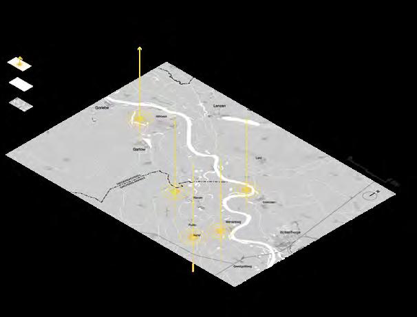
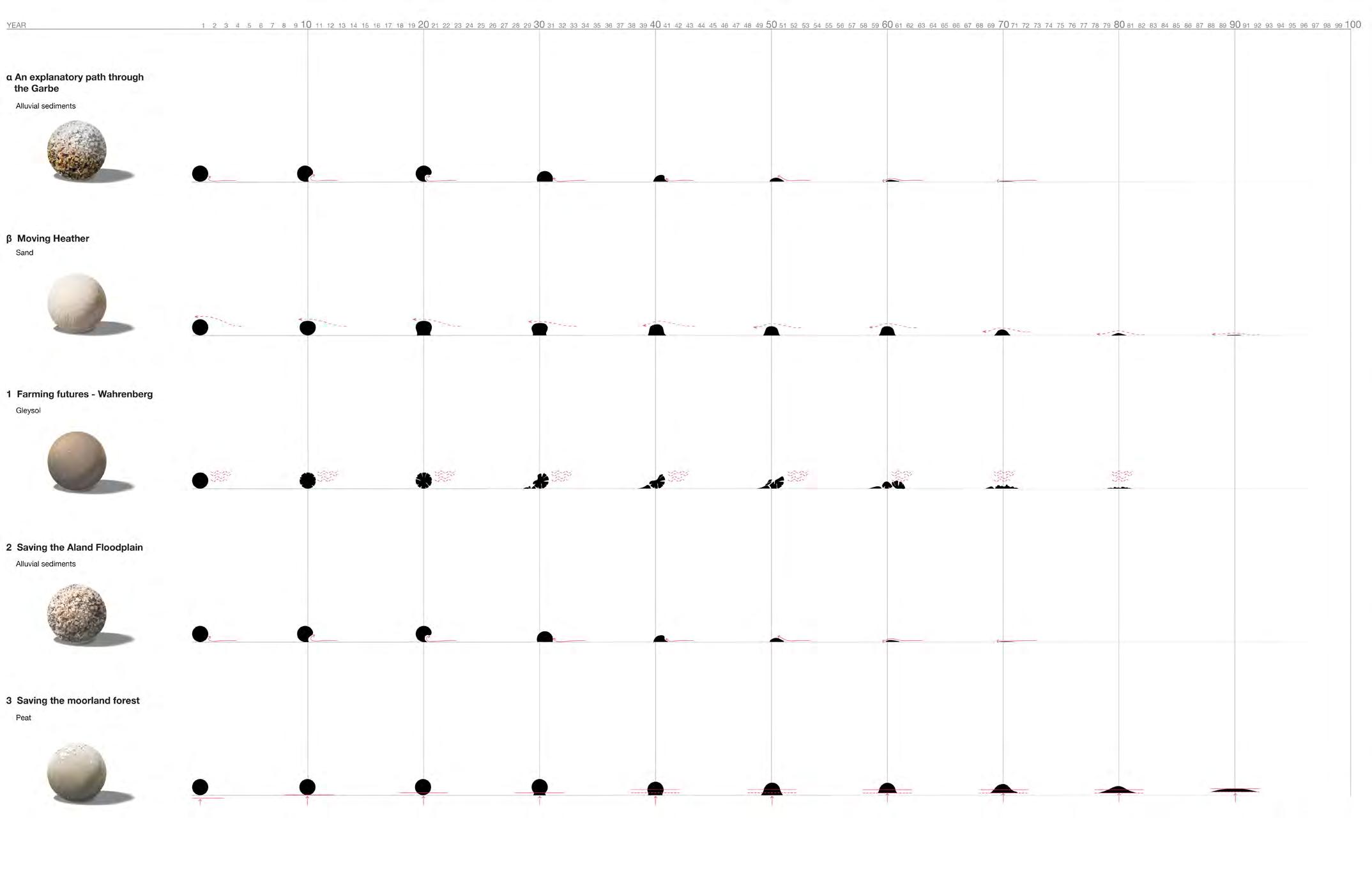
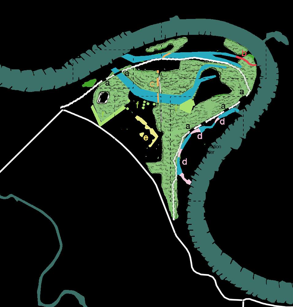
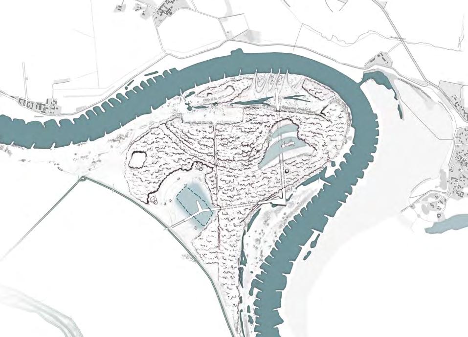
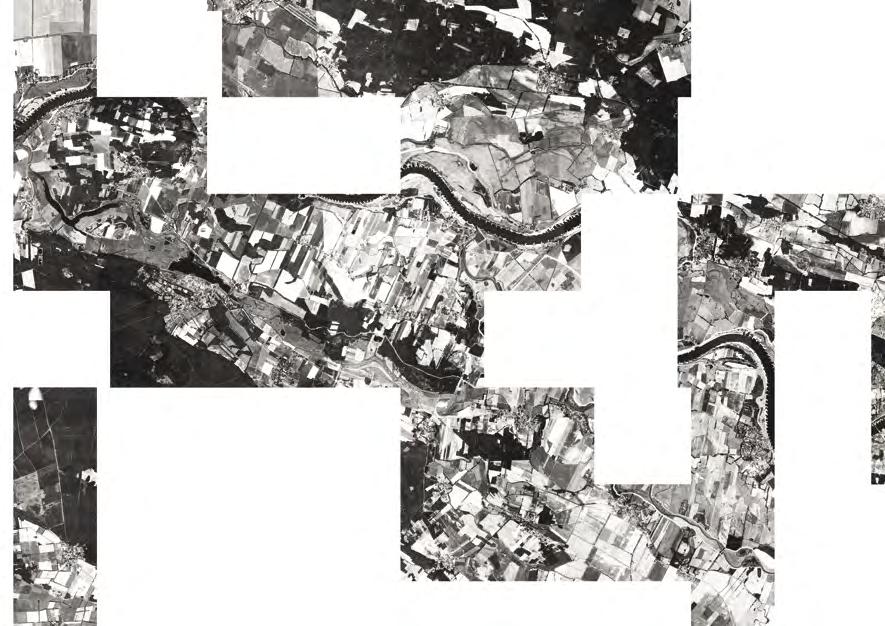
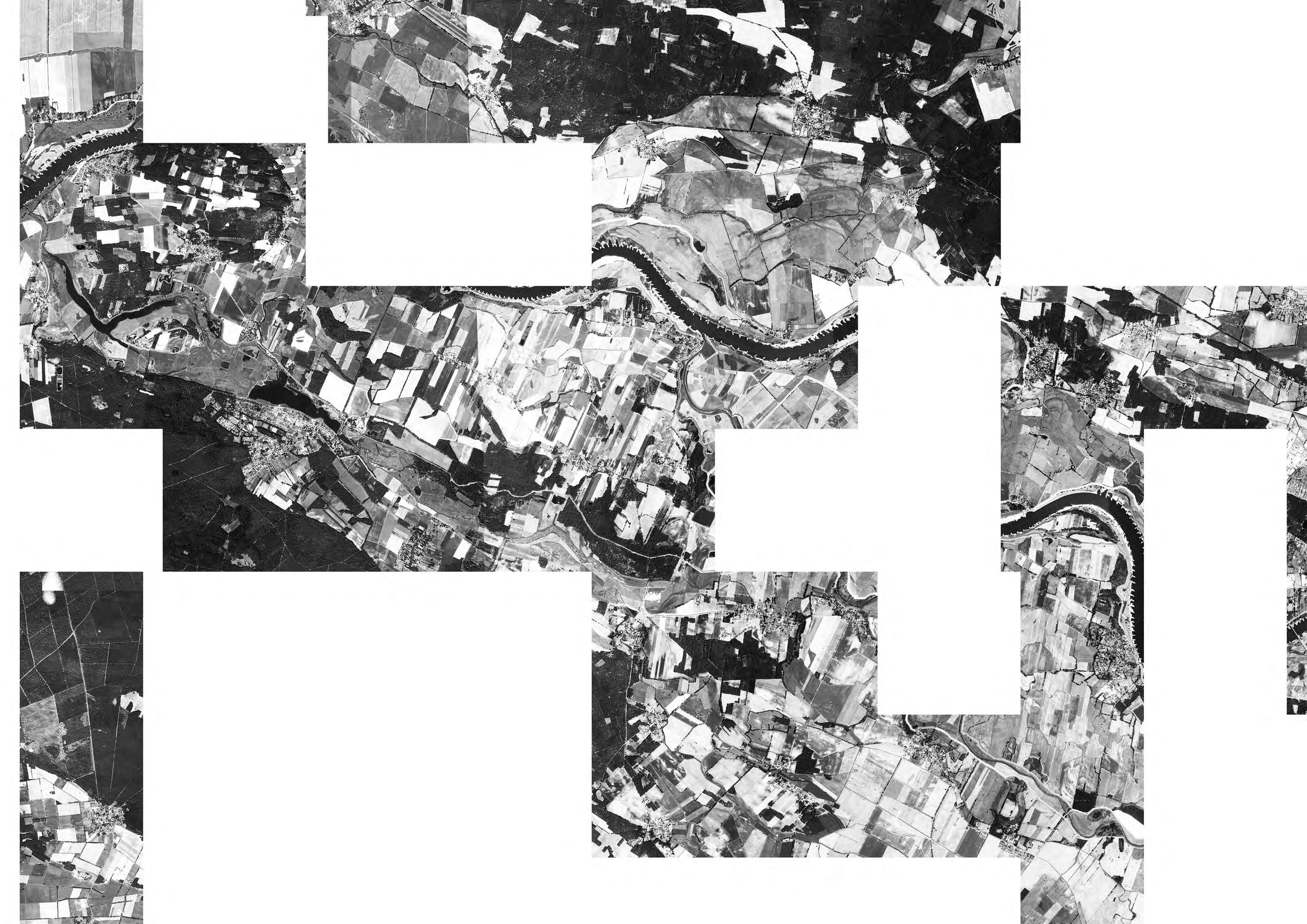
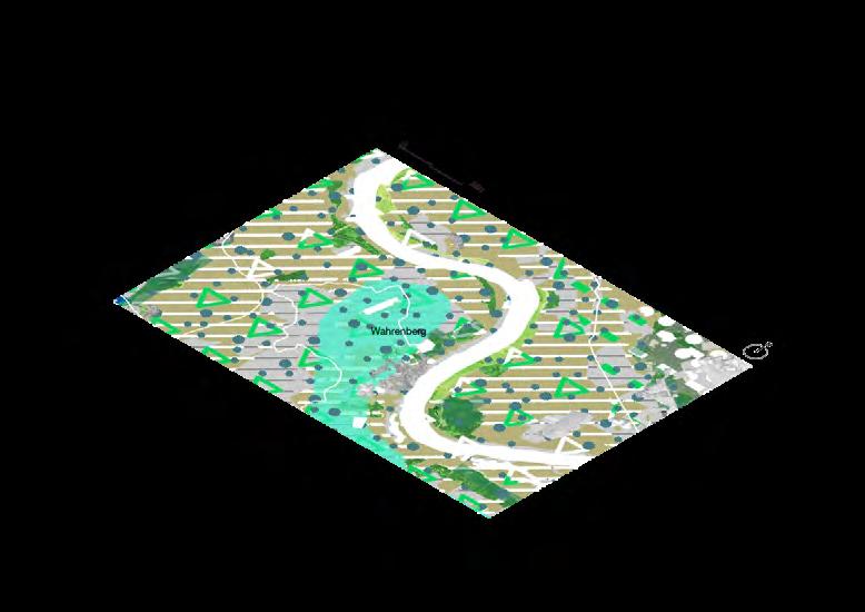
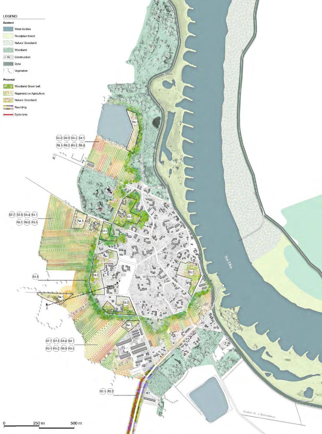
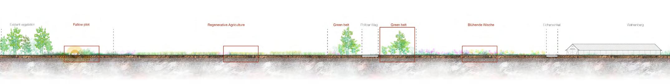
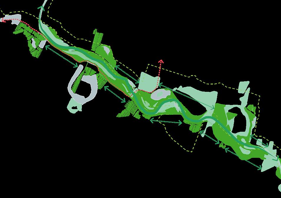
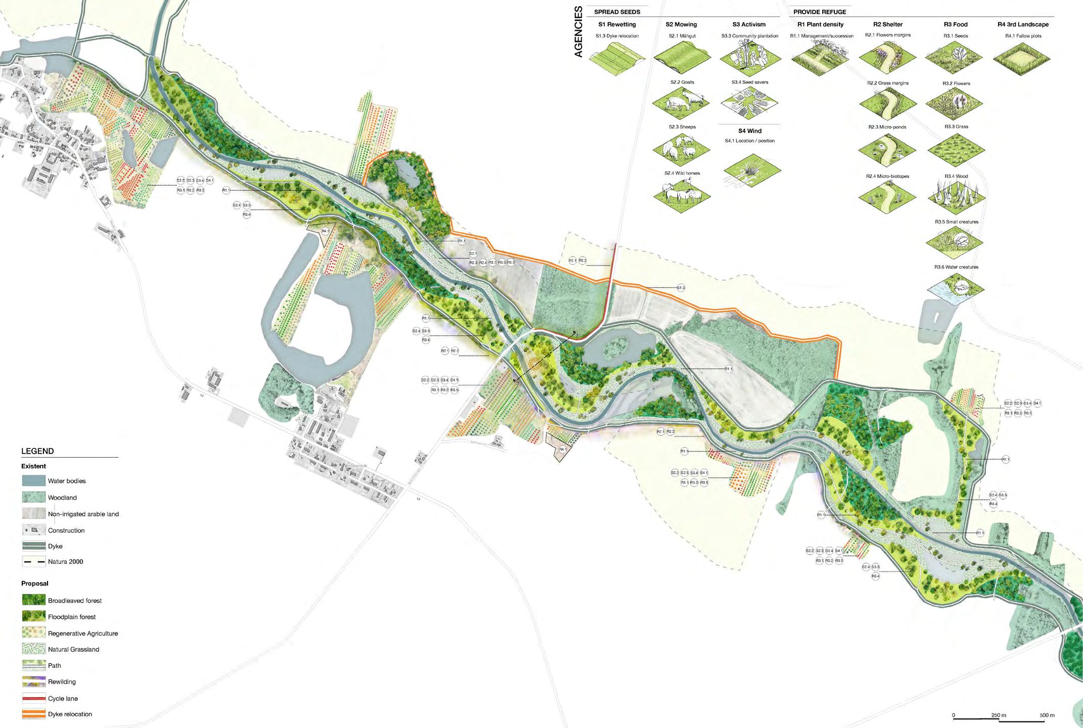
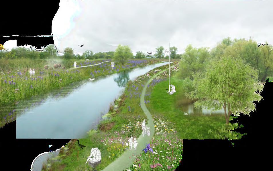
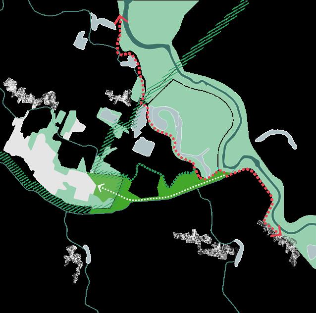
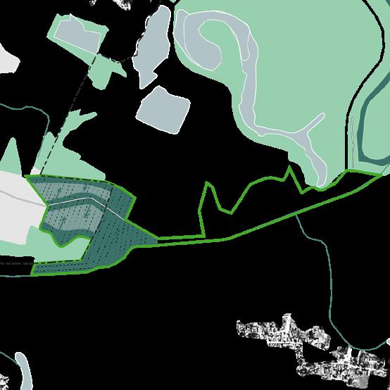
For the conception of new scenarios in the landscape (in plan: 1, 2, 3 and 4; and better explain in Chapter 7) it is first proposed the need for humans to become aware of geological processes over time. For this purpose, an exploratory path through the Garbe (in plan: α, and better explain in Chapter 6) aims to raise awareness of time in the river landscape, through different stations. It is important to emphasise that from the conception of this path then new scenarios will be possible in the future. That is how humans in relation to ‘companion species’ (including the soil), can “call to a union between forms of life that co-exist and co-evolve in mutuality constative relationships”2 to transform the landscape for possible futures on Earth.
By understanding the landscape as a constant flow in time, with a lot of motion and with moments of silence, then it is possible to be aware of a time that may not be comprehensible to us today. And more importantly, this awareness would lay the foundations of futures landscapes for the generations to come.
PROPOSAL
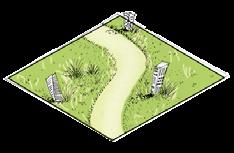
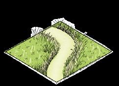
α An explanatory path through the Garbe
LANDSCAPE SCENARIOS
1 Moving Heather
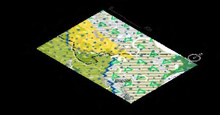
2 Farming futures - Wahrenberg

3 Saving the Aland Floodplain
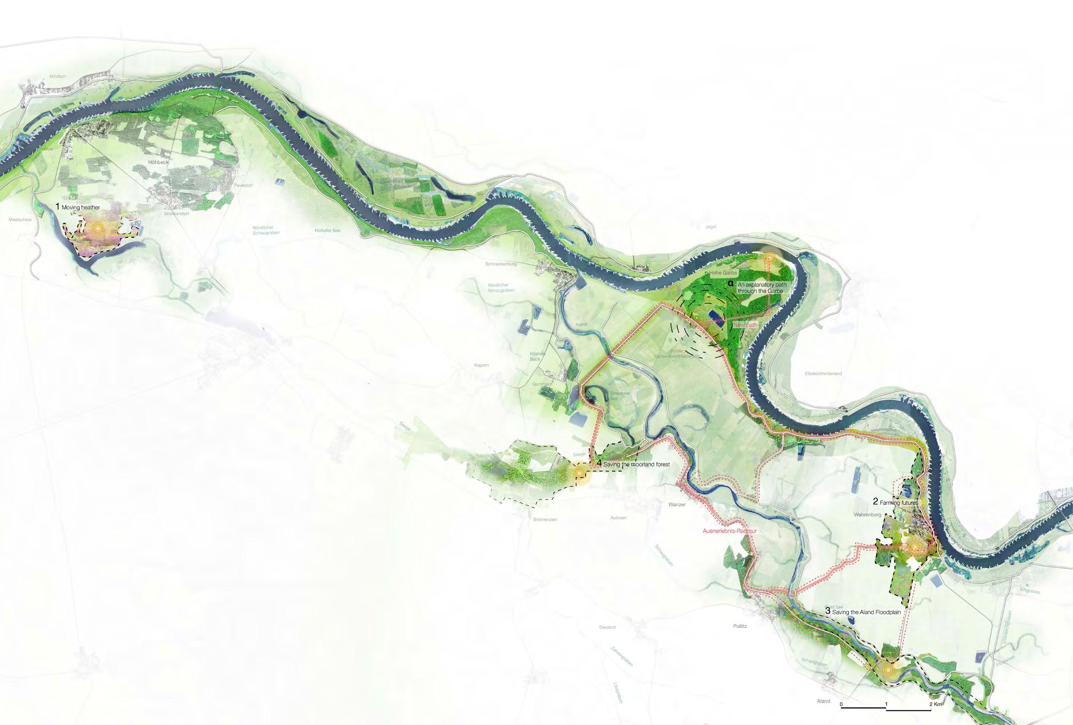
4 Saving the moorland forest
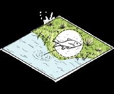
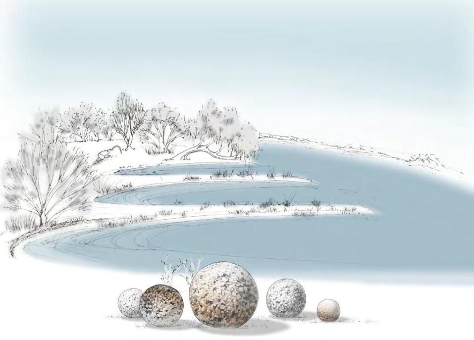
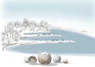
VIBRANT MATTER Spheres
This sense of a melting of cause and effect is also expressed in the ordinary usage of the term agent, which can refer both to a human subject who is the sole and original author of an effect (as in “moral agent”) and also to someone or something that is the mere vehicle or passive conduit for the will of another (as in “literary agent” or “insurance agent”).1
 ―Jane Bennett
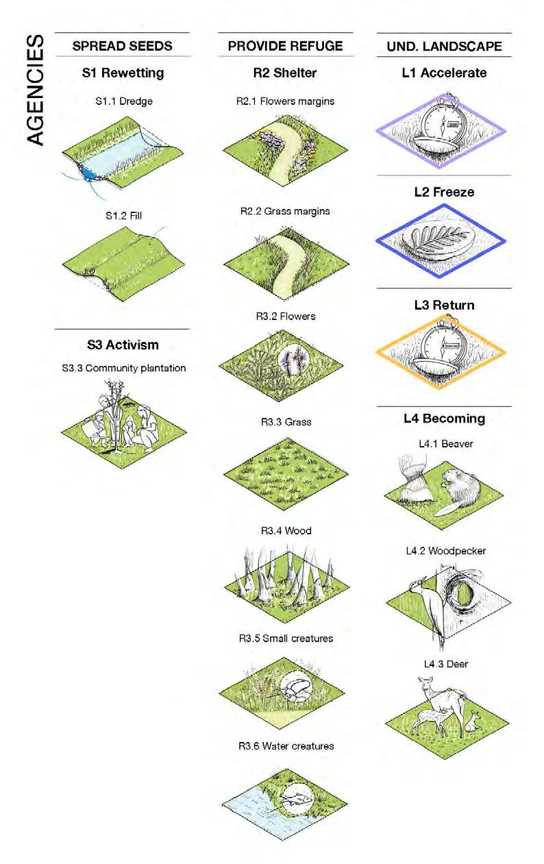
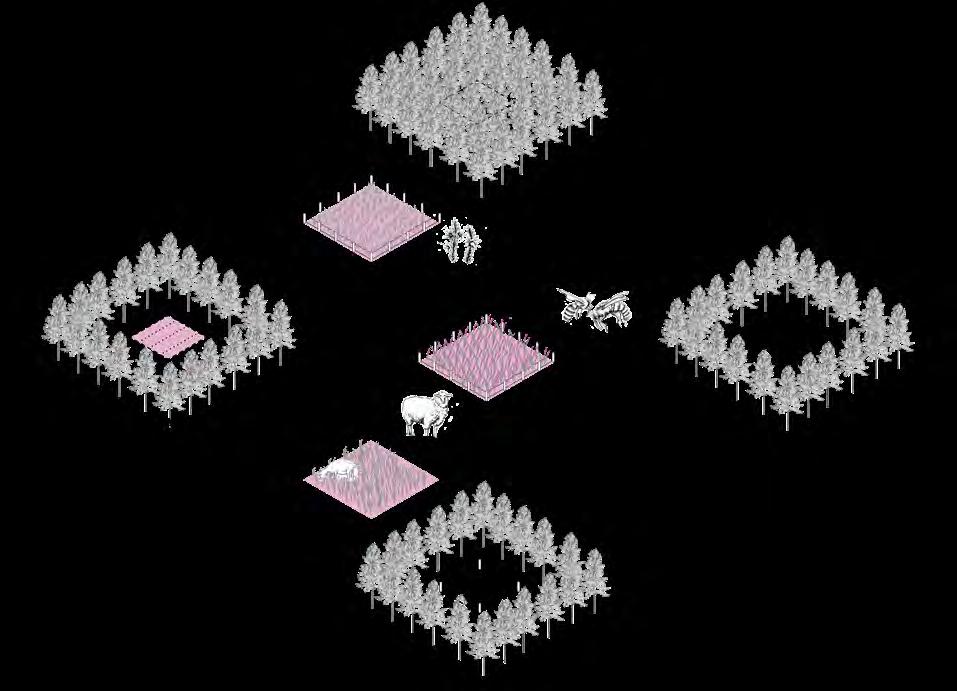
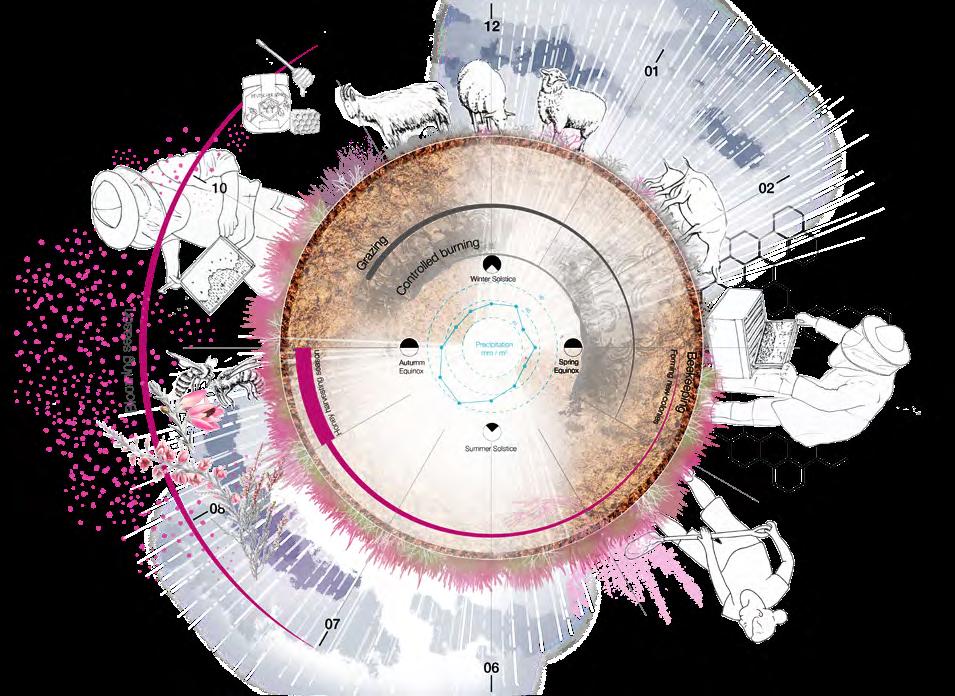
‘Agency’ is a punctual transformation occurring at a given moment. It can be the action of humans in collaboration with other species, of species being disturbed by human action, or of these species themselves self-organising. This action on a small scale produces a particular effect on a large scale and generates a new energy in the landscape. Thus, the term ‘agency’ is seen as the capacity to create and recreate by making it happen. In this thesis these actions produce an aptitude in time, raise vitality to think of ourselves collectively with other species and to let nature be. But ‘agency’, more than a cause-reaction effect, is an initiator of uncertain effects, ‘nonlinear, nonhierarchical, non–subject-centered’. It is the origin of other beginnings that we cannot predeterminate but desire to happen. And if actions have unpredictable consequences over time, we need to learn what means to live together on Earth. As Donna Haraway says, living with other organisms and sharing bonds with them, makes possible interactions and relations that contribute to connect us with nature. This is what this thesis refers to when talking about living with ‘companion species’.
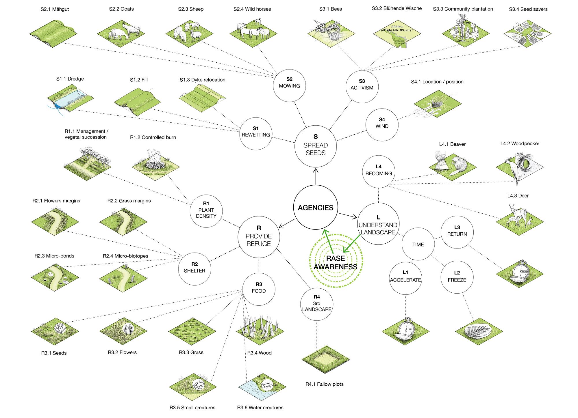
The ‘agencies’ of “Understand Landscape” are divided into four. The first three are related to time awareness and the last one, “becoming”, is inspired by the project “Symbiotic matorral”, which will be explained in more detail in chapter 6. This first group of ‘agencies’ is the one that lays the foundations of awareness and, consequently, by their presence the other agencies will strengthen over time. For this reason, they are the most important ‘agencies’, and the proposed path through the Garbe (chapter 6) applies these in their entirety.
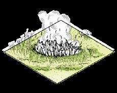
Through the implementation of different land art elements, the understanding of the landscape in time will become evident, when the landscape is “accelerated”, “frozen” and “returned” in time. The elements of land art are the desire to make comprehensible what is not intelligible because it is far away from us or unimaginable for many. “Becoming” is an attitude to understand some representative animals of the landscape. It aims to help us imagine how these species inhabit the landscape and make visible the bonds they have with us.
We thought that, by becoming a bird, a bear, or any animals that we can think of, to understand how their senses work, what they eat, who eats them, how they move, their size, etc., could help us to generate new ideas for the design of inhabitable space. This can work of course as far as we accept the fact that we can only reach an abstract reconstruction of their cognitive landscape (Pasini 2019, 19).
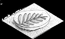
Seeds are the beginning of all natural landscapes. They make new life on Earth possible if the right conditions are given for them to germinate. This has a hint of miracle as well, because thanks to different factors coming together at a certain point and at a certain time this can be possible. But seeds are as well an ongoing relationship with nature, and by trading them, new bonds are created.
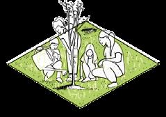
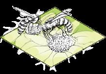
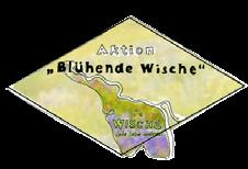
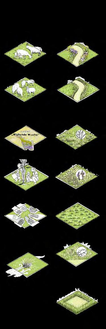
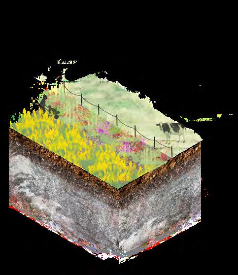
Rewetting, is the agency that uses water as an actor to enable the emergence of seeds deeply hidden there (due to soil compaction) or the transport for new ones that may arrive. Mowing refers to the process of mowing (by grazing diverse ecological effects ensure high species diversity) and of its product to transport seeds from one site to another (the material create certain microclimate to allow conditions for them to grow). Activism ‘agencies’ are different actions that are already happening on site, like the Blühende Wische (the Wische e.V. is offering seed bags to the locals of Rohrbeck and its surroundings to provide meadows for bees and butterflies), or community plantation actions, occurring in the Garbe and the Elbe. Two new activisms are proposed, one with bees as ‘companion species’, and the other one with the concept of seed savers, both will be better explained in chapter 7. The last ‘agency’ highlights the wind as an important actor in seed transportation.
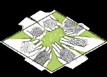
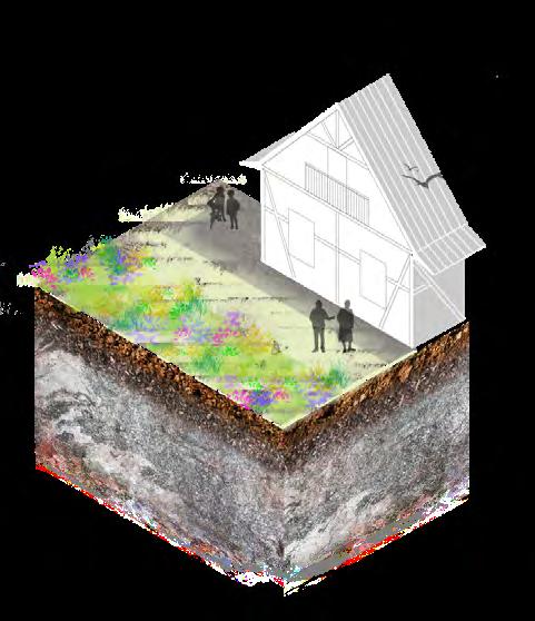
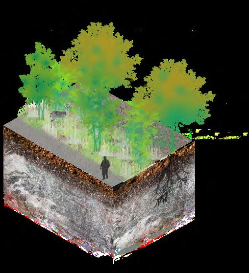
Provide refuge ‘agencies’ want by certain actions to provide conditions for creatures to inhabit ecosystems. Plant density is managed to create pathways or to control succession processes, for example on natural grasslands, or in the contrary, plant succession is allowed to enable bushes to advance. With controlled burns, certain habitats are mitigated from future fires or renewed to allow new plant development. Thus, each biotope depending on the qualities of plant density create refuge for certain species. The second group aims to provide shelter especially for small creatures, often overlooked because of their size. Furthermore, by the implementation of grass and flowers margins connectivity between habitats is ensured. The third group provides food with certain elements. Groups two and three are closely interlinked and highlight just a few of the vast services that these small interventions provide to the landscape.
In fact, what makes the event happen is precisely the contingent coming together of a set of elements (Bennett 2010, 34).
The last group, the Third Landscape, is based on the ideas of Gilles Clement and stresses the importance of the presence of fallow land, which constitutes a privileged space for biological diversity.
The Third Landscape - an undetermined fragment of the Planetary Garden -designates the sum of the space left over by man to landscape evolution - to nature alone.

 Gilles Clement
If matter itself is lively, then not only is the difference between subjects and objects minimized, but the status of the shared materiality of all things is elevated. All bodies become more than mere objects, as the thing-powers of resistance and protean agency are brought into sharper relief.1
 ― Jane Bennett
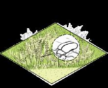
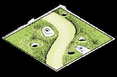
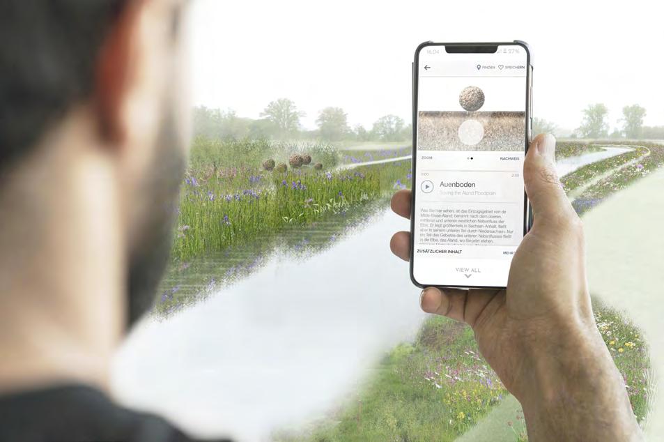
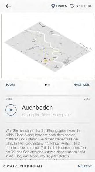
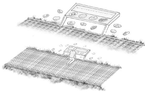
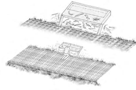
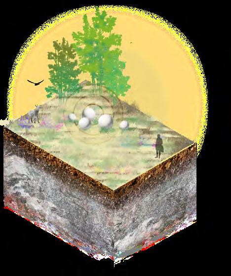
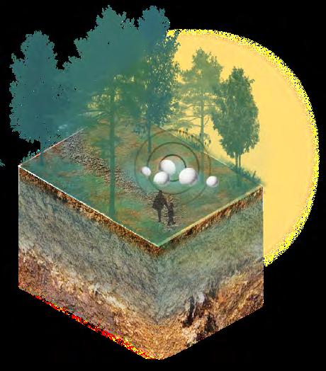
Challenging the traditional definition of matter as passive, inactive and inert, it can be defined as an essential part of everyday life. The focus in this thesis when talking about Vibrant Matter is on rocks, sediments and soil. They are alive, interconnected and make material transformation on earth possible. By revealing this in the form of spheres in each of the locations where the proposals are placed, this land art intervention aims to make visible something invisible to our eyes and to make it comprehensible. These spheres will transform over time due to the action of water, wind and temperature fluctuations. For a better discovery and understanding of the spheres, it is proposed to include them in the App “Auenerlebnistour an Elbe und Aland” which already works and has been very successful.
What we consider inert is not: there is no such distinction between life and matter. As Gilles Deleuze has described, there is a “hint of the animal in plants, and of the vegetable in animals” (Bennett 2010, 8) and to add it to ‘matter’, there is also a hint of the animate and the vegetable in it. All evident with patience and in great silence.
1 Vibrant Matter: A Political Ecology of Things (New York, USA: Duke University Press, 2010), 13.
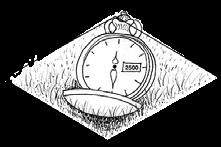
Our actions do not transform the world, they are part and parcel of the world’s transforming itself. And that is just another way of saying that they belong to time
― Tim Ingold (1993)Residence time defines the period during which an element does not change its composition and remains in the same circle — a reservoir in the geochemical sense — before migrating to another one, quicker or slower, depending on the kinetics of the reaction to be followed.1

As already said in Chapter 5: Overview and strategy, first achieving awareness about how landscape develops over time, then it is possible to lay the foundations of futures scenarios for the generations to come. With the proposal α. “An explanatory path to the Garbe”, then future landscapes 1 “Moving Heather”, 2 “Farming Futures”, 3 “Saving the Aland Floodplain” and 4 “Saving the Moorland Forest” can be opened (unlocked). Important to emphasise is that Understand Landscape ‘agencies’ are the one that lays the foundations of awareness. For this reason, the proposed path through the Garbe applies these in their entirety.
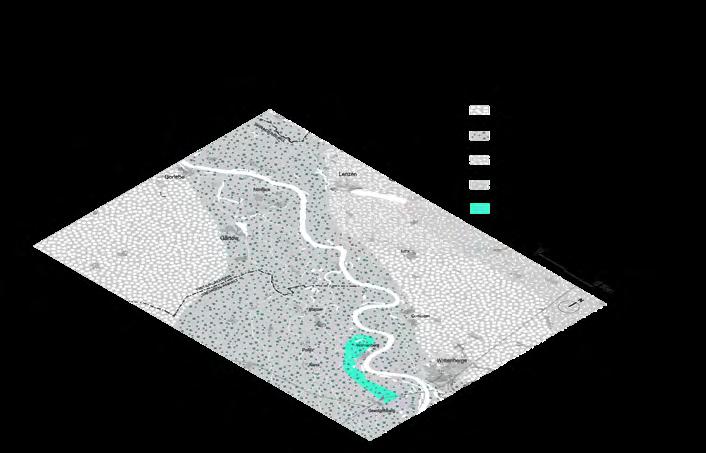
The proposal of a path through the Garbe is an explorative intervention to raise awareness about Deep time (geological time). Is a key that opens (reveals) the landscape to make something particular appear or occur in the future.
[…] bald wird dieses wichtige Naturschutzgebiet zur Kernzone des Biosphärenreservates Mittelelbe. Damit gewinnt nicht nur das Biosphärenreservat ein ökologisches Juwel, sondern auch das Umfeld der Hohen Garbe, insbesondere die Elbe-Aland-Niederung zwischen Seehausen und Schnackenburg an naturtouristischer Bedeutung.1
―Sonja Biwer
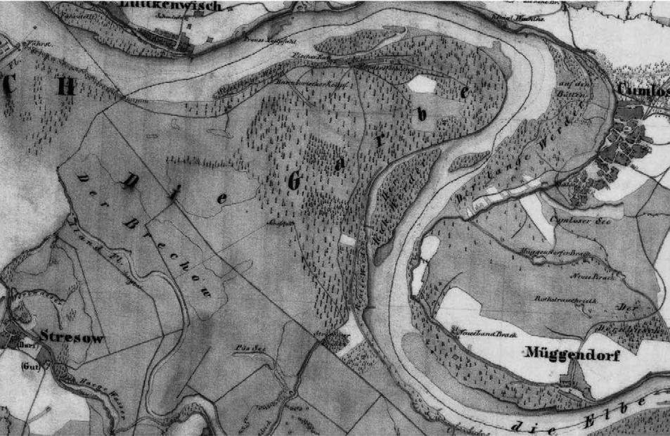
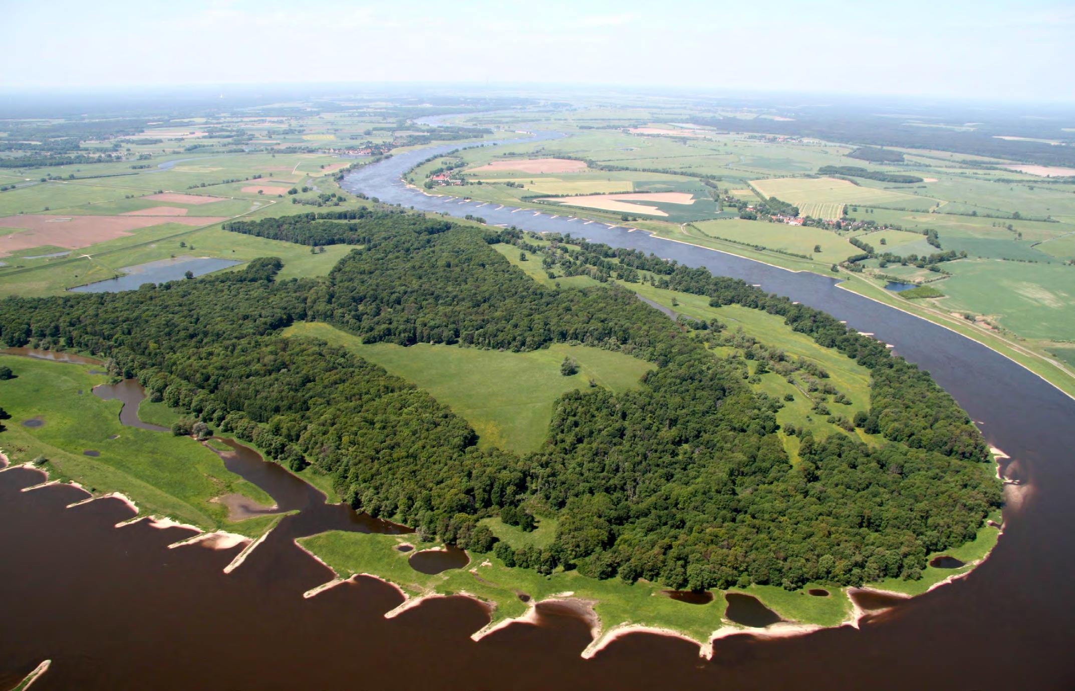
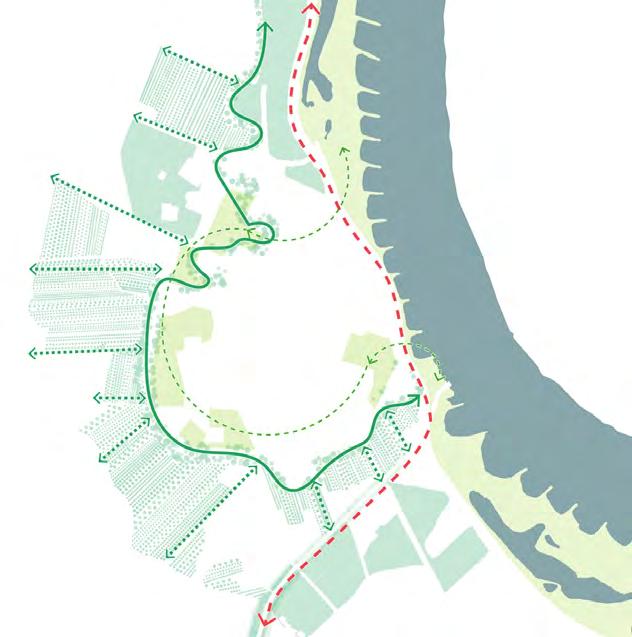
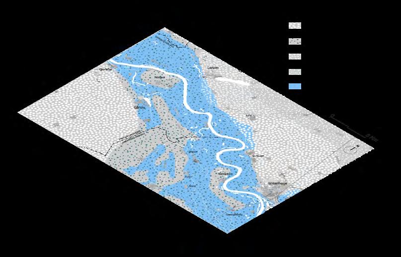
The Hohe Garbe is conceived to be the core zone of the reserve Biosphärenreservat Mittelelbe. Thanks to its special location and because it became an area of opportunity due to the deterioration of the dyke some years ago, the state of Saxony-Anhalt began a land readjustment process in 2012. Several measures are currently being implemented to renaturalize the dynamic of the river’s floodplain, giving more room to the river. Public access to the reserve is forbidden, but some parts are still used for grazing as a result of an agreement with some landowners. As seen in Chapter 3: Analysis, local activists and scientific experts do not doubt the possibility that in the future there could be a restricted public access path, in which external people, and most importantly, residents could have access to the reserve on specific occasions by means of guided visits.
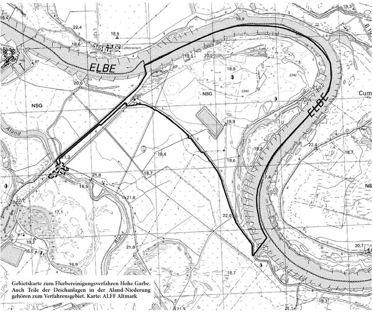
Between 1831 and 1870, the Hohe Garbe was mainly used for cattle under the administration of Friederich Reuter. He was also highly regarded for his forestry work at the site. In 1846 a summer dyke was built to supplement the existing winter dyke. The new one had four sluices that were opened to flood the Garbe. Then after 1945 with new ownership and use regulations, the land of the Garbe was not used for economic purposes. The area was still suitable for grazing but not for forestry. Furthermore, in the 1970s the NATURA reserve “Aland-Elbe-Niederung” was designated, so the area was further regulated.
With the construction of the new flood protection dyke in the 1980s, which today separates the “Aland-Elbe-Niederung” from the Hohe Garbe, the old summer dyke became functionless. Additionally, a new body of water was created: the excavation water. The excavated soil was used for the construction of the new dike. Thanks to this, a bathtub effect was created. The high waters of the Hohe Garbe can no longer flow into the Elbe River. This is associated with the fractures of the former summer dike as a result of the flood of 2002. This is not only a disadvantage for the pastures, but for the long-lasting moisture that is unfavourable to the oak trees.
Educating to a cognitive interpretation of objects and processes that emerge from natural or human modified landscape, while discovering and assigning values, seems one of the best strategies to reconcile humans with nature, enhancing ethical footprints and consciousness about the importance of natural systems for human life.1
―Roberto PasiniConsidering, the river landscape as one of the most important natural landmarks in the area and taking advantage of the existence of the renaturation project, a straight path is proposed that contrasts with the curvilinear shapes of the landscape. In addition, taking into consideration people’s lack of knowledge about natural processes in the landscape, and especially in the river (because they are used to being protected from it with artificial constructions such as dykes), it is of great importance to make landscape transformations understandable in a place like the Garbe.
This path has educational purposes and for this reason, is conceived as a guided pathway in the company of experts and giving priority access to residents.
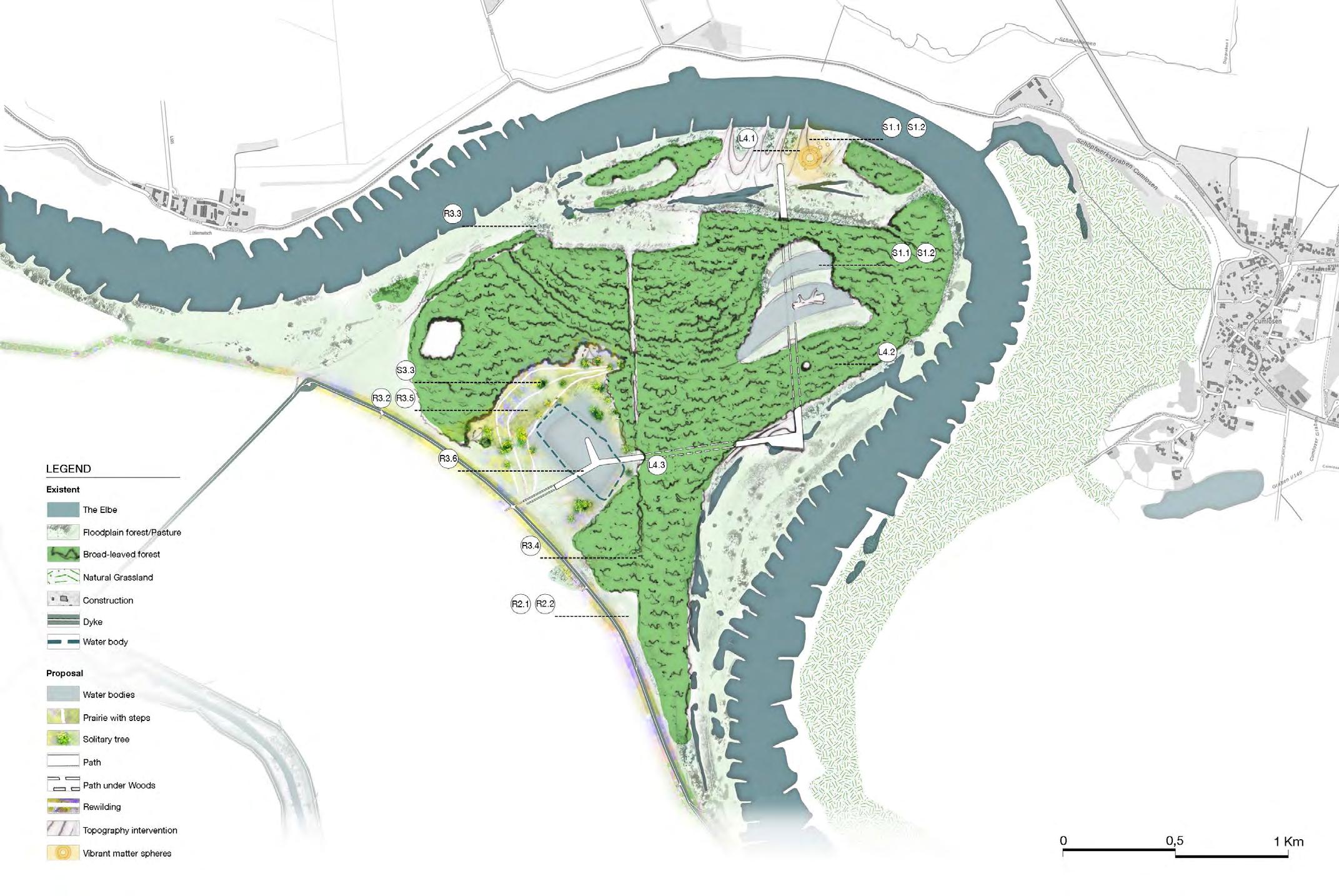
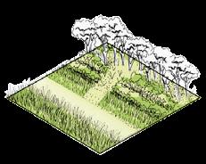
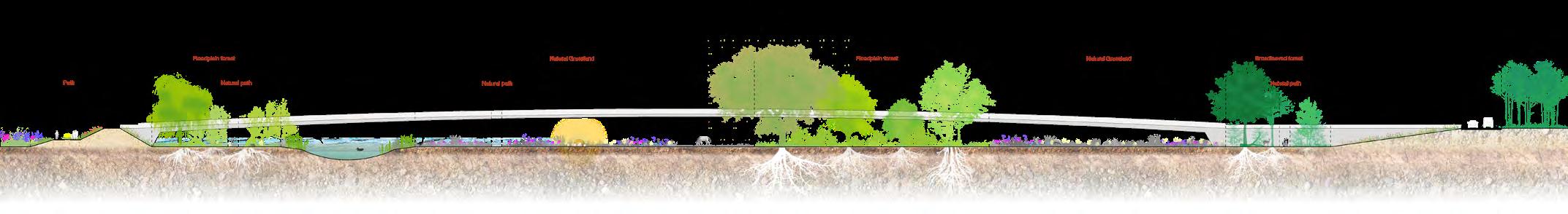
The path is first visualized in the excavation water zone as an elevated walkway that transforms into a ground-level path as it enters the forest after the portal. Approaching the island formation (Fig. 2 section 4) the path rises again and becomes an elevated bridge. Returning to the forest again, it returns to ground level, but getting closer to the riverside, sometimes only its edges are visible. Therefore, the materiality of the path is a guide, but it is also an approach to the floodplain wildness.
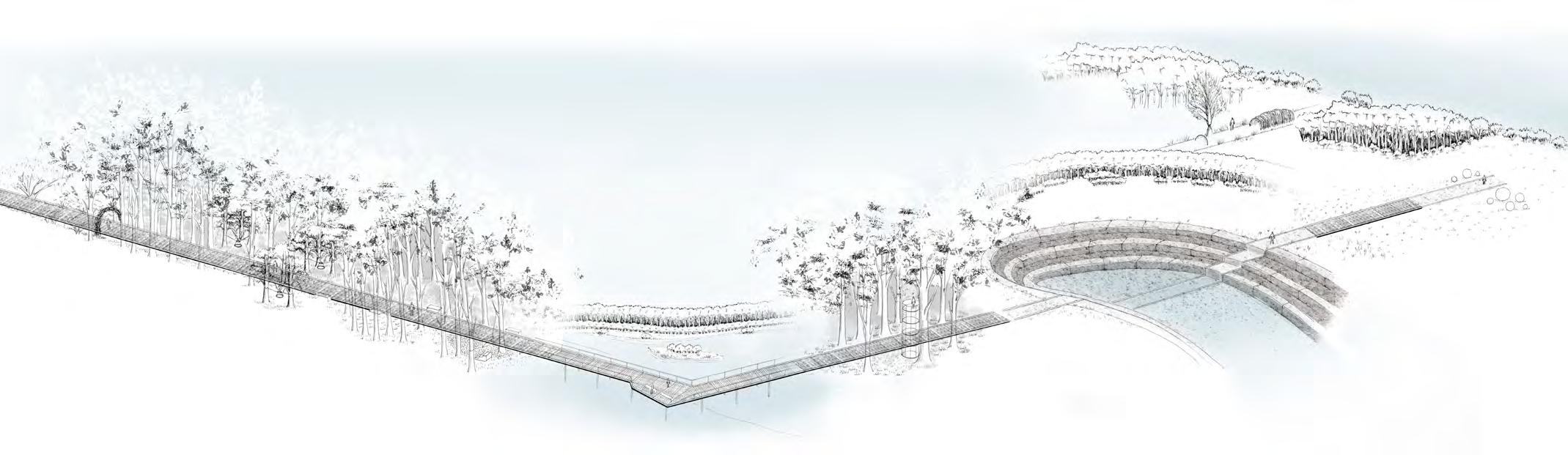
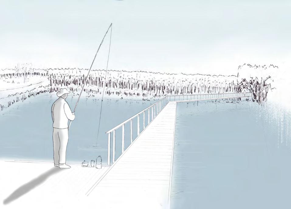
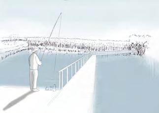
The access is conceived with an area to promote the encounter between the locals, with outdoor classrooms and some low vegetated steps. A bridge over the actual excavation water allows recreational fishing for the fishing club. As previously explained, the excavation water’s soil was used for the construction of the new dyke, in consequence, it offers hardly any natural structure. This area should serve nature as well as meet the wishes of the fishing club. For this reason, as part of various workshops, one was held with the anglers to develop proposals for the redesign of the waterbody. Some of the measures under discussion are considered in the proposal:
1. Steep banks are to be flattened by removing soil from the embankments. 2. Planting riparian trees together with the anglers.
3. shallow water zone should be protected from wave action, where young fish and other aquatic animals should be able to refuge. 4. create depressions that are only temporarily filled with water, which creates new breeding islands for diverse bird species1.
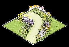
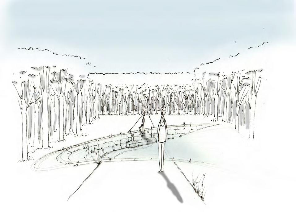
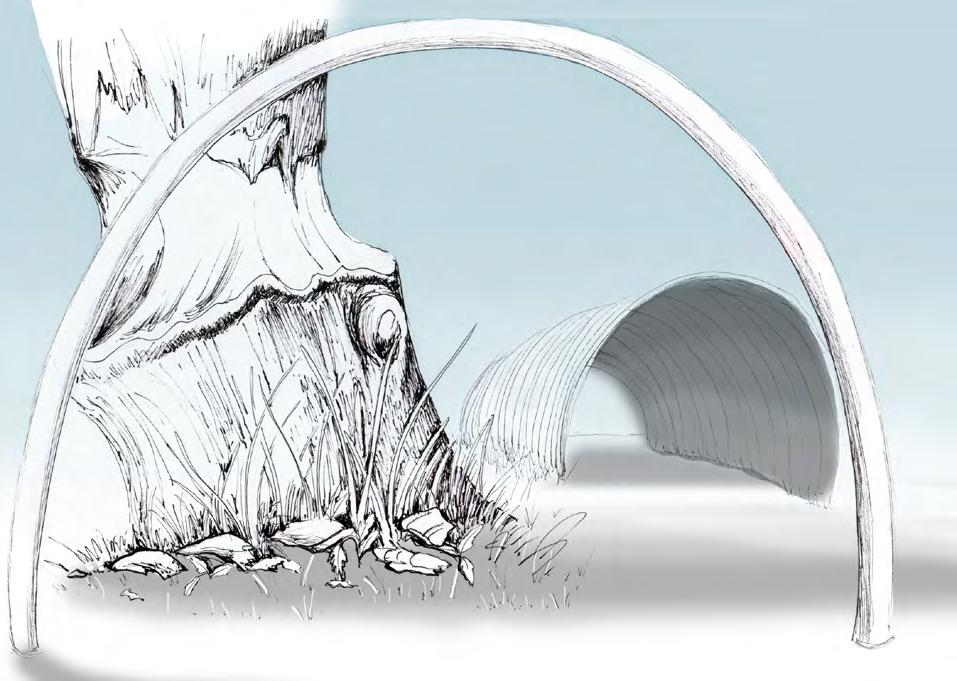
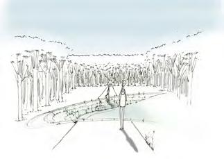
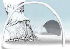
Then, after crossing the bridge, everything begins passing the portal. The vegetated arc welcomes the visitor to a journey through time.
1 Trägerverbund Burg Lenzen e. V. | BUND, Germany. Auenzeitung September 2016: www.bund.net/themen/fluesse-gewaesser/lebendige-elbauen/dialog/
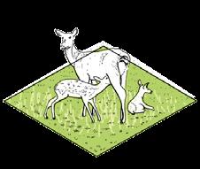
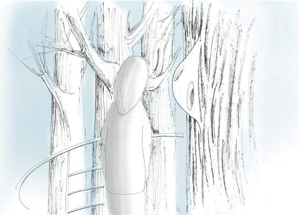
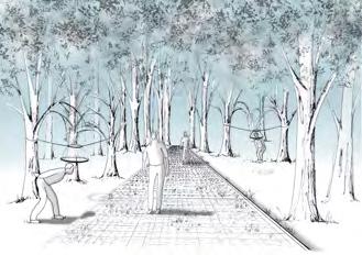
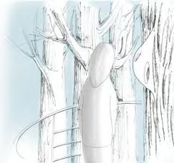
Known as herbivores of the deciduous forests in Germany, deer are famous because they feed on the leaves of trees. This is how the first station of “Becoming” appears in the woods immersed among the trees.
This companion species needs adequate forest or shrub cover to grow and develop. This is how these elements hanging from the trees, making people arrange their bodies as if they were going to feed on the leaves, tell a story about the bond between them and the landscape. As our body is disposed to browse the leaves, we understand this relationship.
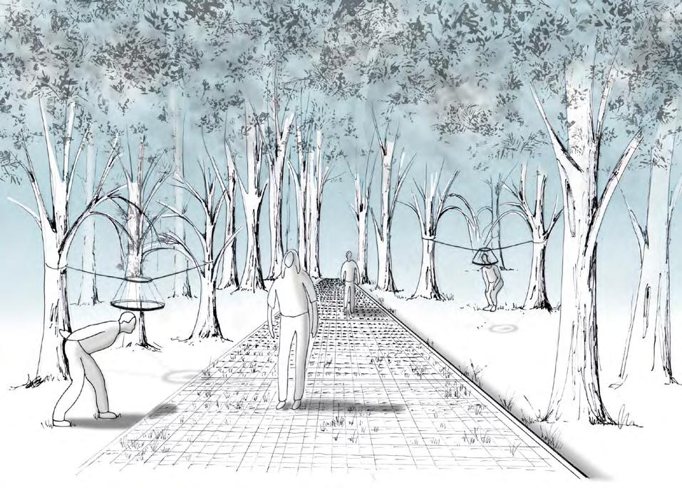
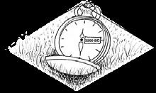
Looking at the ground are elements that make the surface appear larger in order to focus on some components of the terrain. One of them returns to pass time, to the beginning of our era, the Holocene, the other one freezes our time.
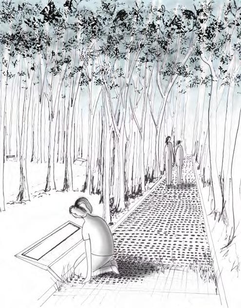
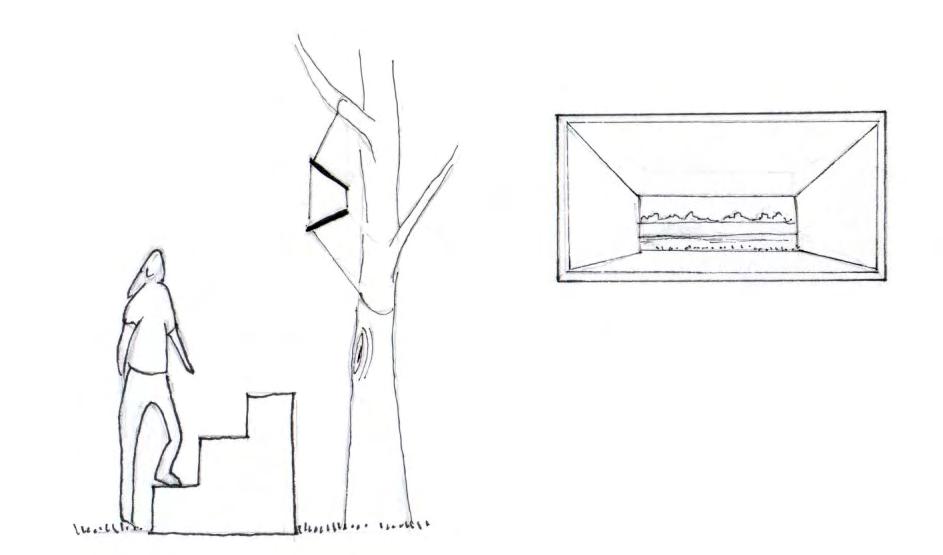
This installation is conceived with the purpose of making people think about the past, the present and the future of the landscape. It makes you think how time in the landscape is not a linear process but a cyclical one, not a repetition of the same, but a continual invention. Because what we see now as the present perhaps is what the river was before.
Or what we see now is the future to come. Therefore, “The future is now” is focusing on a point of the Elbe River (looking at the island formation) through a window hanging in the trees. It makes evident or explains how the current situation of the landscape could also be its future elsewhere in the Garbe, for example here, where the intervention is.
Now the path changes its direction and is time for a rest in silence with the landscape, to contemplate the river and its surroundings...
Because speaking about the movement of the landscape is also to speak of its stillness, and of the importance of recovering quiet places and moments of silence, where frenetic motion finally finds rest. It is also necessary to reserve and reestablish the solitude of the landscape as a place of awareness for fascination and respect for the Earth itself.
Entering again to the woods we encounter Woodpecker’s shelter. Important requisites for biotope for them are also decaying tree stumps, lying deadwood and trees infested with arthropods. The installation is standing in a free-standing and high-stemmed tree, such as these birds like, and which allows them the construction of breeding or roosting cavities.
Climbing the tower and getting a little closer to the woodpecker’s perception of the forest, here is a wooden element with holes (imitating the cavities the woodpecker makes), and which emits sounds. If we listen carefully, we discover that is the woodpecker song.
L1 Accelerate
The path then begins to disappear (its edges are still perceptible), we leave the woods, and we see the sky again without any obstacle. The feet get wet, it is uncomfortable, it is the river approaching.
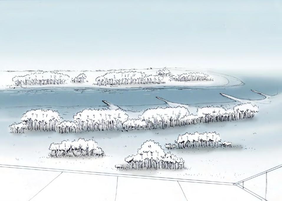
A large artificial imitation of the future arm of the river (Fig. 2 Flood channel connection 2) suddenly appears in a clearing in the woods. Conceive to be made of walls of compacted earth, this intervention accelerate time, makes it perceptible to humans. At a certain point, it will disappear to give rise to the natural course of the river.
And then the landscape opens, the river shows itself to us. It is immense, you can see the water moving and hear the movement of the wind. Being there, alone with the river, is pure melancholy. But remember, you are not alone.
On the riverside appear the vibrant matter spheres, showing with the degradation from white to brown the history of the change in time of the river’s sediments. Then, with a topographic intervention, the existing groins will accelerate in time and will materialize excessively eroded. At this moment we humans are here in silence, in the company of the subtle movements of the Elbe.
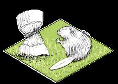
Beavers always live near water. On the riverbank, beavers build their castle or lodge with branches and mud, which are often inhabited by several generations. These have always entries below the water surface and consist of several tubes that open into a living chamber above the water. Beavers are herbivores, they regularly consume young shoots, stem wood and leaves of softwoods, as well grasses and herbaceous plants.
This intervention consists, first, of an arc where people squat down and look through the fallen pieces of wood that the beaver took from the tree, which he uses as a building material and for feeding (all this activity takes place mainly at night). In the end, there is an artificial beaver lodge (on a human scale) where people must bend down to perceive it as if they were a beaver taking shelter in the castle.
Silence is the time when the element rest, just before the transformation of things takes place. Then the change to another state becomes possible thanks to this period of stillness. Dwelling this renewal is to move with the landscape. Now it is possible to be aware of time and create future landscapes transformations over time.

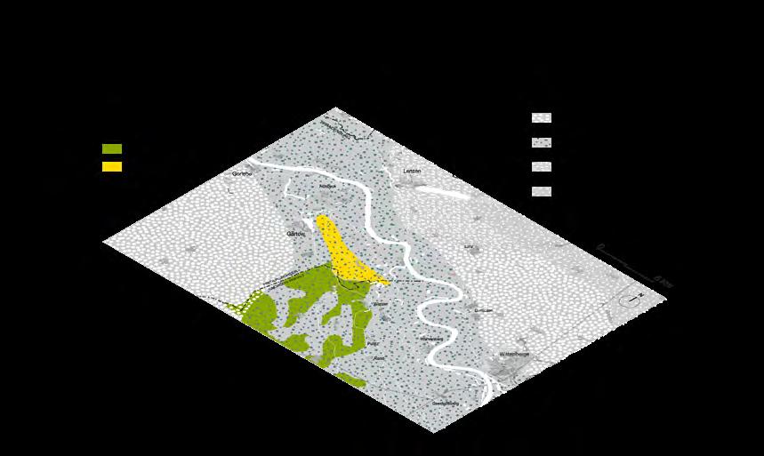
Heathers are cultural landscapes, that flourish thanks to the cooperation of human activity with the environment. Due to their lack of “economic benefit”, over the years heather landscapes in Germany have been enormously displaced and consequently have mostly disappeared. But heathers are of great importance. They offer shelter and home to a wide variety of reptiles, amphibians, invertebrates and birds. Because biodiversity is also diversity of habitats, as not all species want to live under deciduous forests. Their existence depends on the collaboration of different forces.
Moving Heather is the conception of an unpredictable heather land mosaic extension, in the southern part of Höhbeck. This “island” mountain in the glacial valley is a rock in a landscape of changes. Its geological significance (that which is frozen in time) as well as its constant transformation in time (which is perceptible to humans), makes us think of “returning” in time. Its presence makes us humans reconsider the importance of what was there and has now disappeared because of its fragility.
Two geological movements created Höhbeck: the formation of a salt dome and the subsequent advance of glacial masses in the “Ice Age”. The Gorleben-Rambow salt dome was formed by the increasing overburden pressure that compacted the sediments, except for the salt deposits, which became increasingly plastic and began to flow. First flat salt cushions were formed and later when the overburden was broken, high salt domes were formed.
The ice advanced and retreated several times during the Saale ice age
The “Ice Age” was decisive for the formation of Höhbeck. In the Saale period, the glaciers advanced (“Drenthe”) and retreated (“Warthe”) several times over a period of more than 100.000 years. With the first advance of the ice (Drenthe 1) about 235.000 years ago, a large terminal moraine chain was pushed upwards and raised what we recognise today as Höhbeck. It is possible that the depressions above the salt dome were the cause of the uplift and compression of the surface by the heavy glacier.
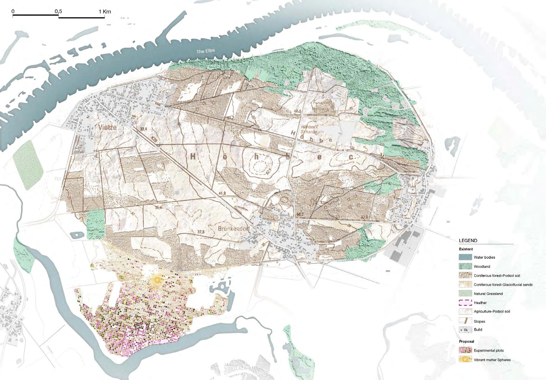
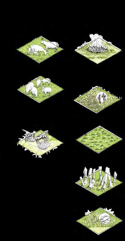

During the waning moon, the pines ready to be felled create a clearing in the forest to welcome the heather. First, the boundary is defined, then the soil is decompacted to allow planting, and finally, an enclosure is provided to protect the seedling’s growth. From this point, it only remains to wait approximately 6 to 15 years for the heath to become established. From this point on, beekeepers will be able to awaken the landscape in cooperation with the bees, and farmers with the goats and the sheep.
The bees will harvest the honey in the flowering season (August-September). By pollinating the flowers, they will contribute to spread the heather in the forest and to create one of the most appreciated kinds of honey in the world. Then, in October, goats and sheep are allowed to graze the heathland. They will cut it so that it will regenerate better and grow stronger until the following year when the heather will start a new cycle. Sometimes, from October to March, controlled burns are allowed to mitigate fire and manage vegetal succession.
Thanks to the mapping analysis and the site visit, Wahrenberg is seen as an opportunity for a new conception of more ecological use of land, taking into consideration the climate change-related impacts of agriculture in the future.
The lack of biodiversity in the fields around Wahrenberg dominates the picture of the landscape. But the village also stands out for its diversity. “Farming Futures” is conceived as a new conception of agricultural land use, based on regenerative concepts to heal soil and enhance the biodiversity of the site. The opportunity areas are here visualised for a future transformation of the landscape.

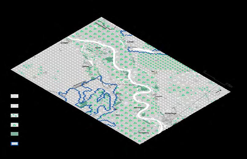
Moreover, this area is very well located to improve the connections between habitats. Connectivity refers to the functional aspects of the connection between landscape elements, such as patterns of movement and migration of organisms. Habitat fragmentation leads to habitat deterioration. That is why ecological connectivity, is of great importance. It allows flows between habitats, communities and ecosystems. Green infrastructure improves connectivity and other structures such as stepping stones enable flows. Only when flows between habitats are achieved, biodiversity rates will increase substantially.
In “Farming Futures” the green belt functions as a connector of the existent fragmented forest; the “Blühende Wische” which function as stepping stones, links the natural grassland of the
river floodplain and the river hinterland; flowers and seed margins of regenerative agriculture relate these habitats and other isolated systems on-site; and the connectivity corridor with the rewilding of the margins functions as a subtle ecological corridor through all areas.
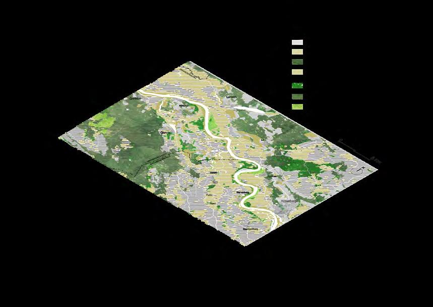
Land cover analysis shows the capacity of the “pasture, meadows and other permanent grasslands under agricultural use”, as a potential area of ecological connectivity between the existing fragmented habitats (in this case broadleaved forest). In this scenario, this opportunity area is conceived for the revival of the following novel habitats: Broadleaved forest, regenerative agriculture and natural grassland.
Besides that, the intensive use of gleysol soils for agriculture has led to a steady degradation of the groundwater and soil on site. Due to the predominance of alluvial clay, this area is characterised by an intermediate water storage capacity. In addition, these soils are characterised by the fact that they remain wet and cold in winter and dry out in summer. Furthermore, in this area, the soil was formed by the alluvial deposits of the floodplain of the Elbe River. One of its characteristics is the presence of many organisms, stratification and the existence of buried humus horizons. In conclusion, these soils are fertile and are suitable for grassland and cultivation, but they need to be regulated for good drainage and irrigation.
The ‘agency’ Seed savers is based on permaculture concepts for regeneration, local distribution and seed exchange practices. This new activism is proposed to build a network of people committed to collecting, conserving, and sharing local seeds and plants while educating people about the value of genetic and cultural diversity. Every year a local action can take place for this purpose and every three years an agroecological festival could be held for local people to understand and farmers to share their knowledge. Additionally, two concepts of regenerative agriculture are here proposed: Strip cropping with 6-Year’s crop rotation and rotational strip grazing.
Crop rotation means the systematic cultivation of different crops on the same land in a recurring sequence (Liebman and Dyck, 1993). This involves growing crops in a useful order considering crop-to-crop compatibilities and management processes. (…) A well-adapted crop rotation has positive effects on the soil fertility and all factors of the field ecosystem services like the water and nutrient cycle, humus content, and the diversity and density of yield supporting or reducing micro- and macro-organisms (Karlen et al., 1994)1
Considering the traditional and cultural significance of crop rotation practices in Germany, which have been reduced to short sequences of two to three years (leading to a decrease in crop diversity and affecting the biodiversity of agricultural landscapes), a hypothetical 6-year crop rotation cycle aims to improve the landscape condition. It is important to clarify that the selection of species and their positioning in the cycle depends to a large extent on the characteristics of the site and further research is needed.
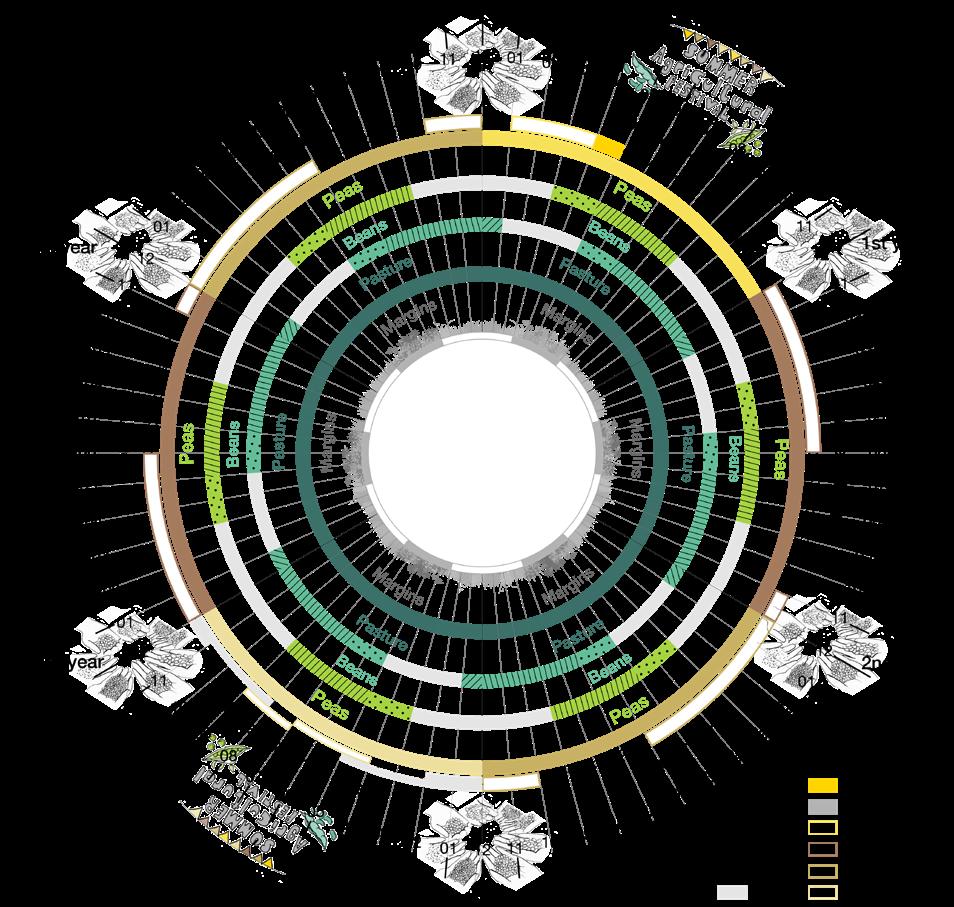
The repeated cultivation of the same crop with the same management practices has negative effects on the soil quality and increases the risk for an accumulation of harmful organisms like weeds, pests and diseases, which can result in yield decline (Karlen et al., 1994; Berzsenyi et al., 2000; Ball et al., 2005; Bennett et al., 2011)1 .
For this thesis, the cycle is based on some principles of Sussane Stein’ analysis, which explains that the most diverse sequence is associated with moderate humid climate and a medium-high livestock density in presence of maize, oilseed rape, sugar beet and winter wheat. Oilseed rape (dicotyledonous) and maize (monocotyledonous) are currently the predominant crops on site. Therefore, the fixed cycle is proposed for oilseed rape as the main crop with maize or summer cereals in the third year.
The classification of crops into leaf crops and cereal crops is an essential part of traditional crop rotation systematization approaches and is related to the physiological differences of monocots and dicots concerning the leaf surface, the root system and harvest residues with specific effect on the soil structure and humus content (Brinkmann, 1950; Koennecke, 1967)2
Additionally, with the implementation of strip cropping for beans and peas nitrogen can be fixed on the soil. They do this through a symbiotic relationship between the roots and soil bacteria. When peas or beans are grown, the crop immediately following them (when rotational strip cropping changes location) also benefits from the residue of nitrogen left in the soil. This means that farmers are not dependent on the use of nitrogen fertilizers, reducing the number of emissions in the soil.
Furthermore, rotational strip grazing increases the likelihood of healthy soil. According to Farmland LP, the grasses used for grazing mobilise the minerals that develop in their leaves, which are then ingested by the cattle and become part of the topsoil when the manure decomposes. While the land is not suitable for cultivation, the land can be used for rotational grazing until the soil heals. Furthermore, with a division of the strip grazing into four paddocks, pastures can rest.
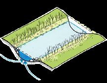
Saving the Aland Floodplain is a proposal to reinvent floodplain landscapes. As seen in “Chapter 4: Site Visit”, this tributary river of the Elbe is lacking in plant diversity and consequence in biodiversity. This river is highly constrained by dykes, thus its channelled profile dominates in the configuration of the entire landscape. However, like Wahrenberg, the Aland tributary river is seen as a great opportunity for a landscape transformation in collaboration with the ‘companion species’ of the floodplain.
The river itself is conceived as a connectivity corridor with the new conception of natural grassland and forest patches. Fragmented habitats are reconnected through new habitats such as regenerative agriculture (south) and broadleaved forest (north), acting as a stepping stones structure that allows new flows in the landscape. As in “Farming Futures” the connectivity corridor with the rewilding of the margins functions as a subtle ecological corridor through all the landscape transformation.
As can be seen in Fig. 17 a relocation of the dyke to the north side of the river is proposed. This is conceived to think of a river scenario in which the new habitats, acting as stepping stones, will function in the future as the first patches that will help in the establishment of a new floodplain for the river, so that the river can also gain room over time.
As said above, the mapping analysis shows the capacity of the “pasture, meadows and other permanent grasslands under agricultural use”, as a potential ecological connector between existing fragmented habitats. In this case this opportunity area is conceived for the revival of the following novel habitats: Broadleaved forest, floodplain forest, regenerative agriculture and natural grassland.
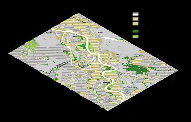
“Lithology at the surface and Water Storage Capacity” overlapping mapping shows results very similar to “Farming Futures” area. Gleysol soils under agriculture land have led to groundwater and soil degradation. This area is characterised by a predominantly intermediate water storage capacity due to the predominance of alluvial clay, which is sometimes found in the presence of water bodies with high water storage capacity.
A very important characteristic of these soils is that they are fertile, with the presence of many organisms and the existence of buried humus horizons. Like in Wahrenberg this is because they were formed by the alluvial deposits of the floodplain of the Elbe River. As in the previous scenario, these soils are suitable for grassland and cultivation, but they need to be regulated for good drainage and irrigation.
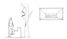
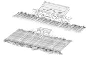
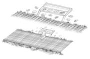
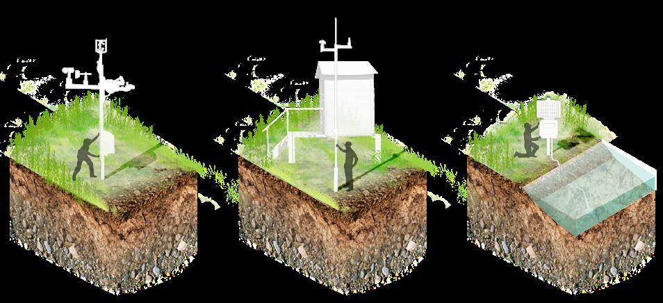
The thesis aims to highlight the importance of the existence of different devices that will be monitored by scientists to understand the transformations of the landscape and what is needed for its development. The drawings above show only a vague representation of what these three devices could be. These devices are not isolated elements, they must be designed with the landscape, be part of the environment and relate to it. It could also be envisioned that people could access the data they provide in a didactic way.
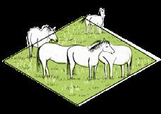
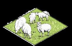
This scenario proposes an approach to the nature of the river through the application of plant succession management, in which different macro-biotopes are created for certain species, such as wild horses, goats and sheep; and optimal conditions are created for the existence of micro-biotopes for small creatures. In addition, mowing management creates different paths that allow humans to experience the landscape.
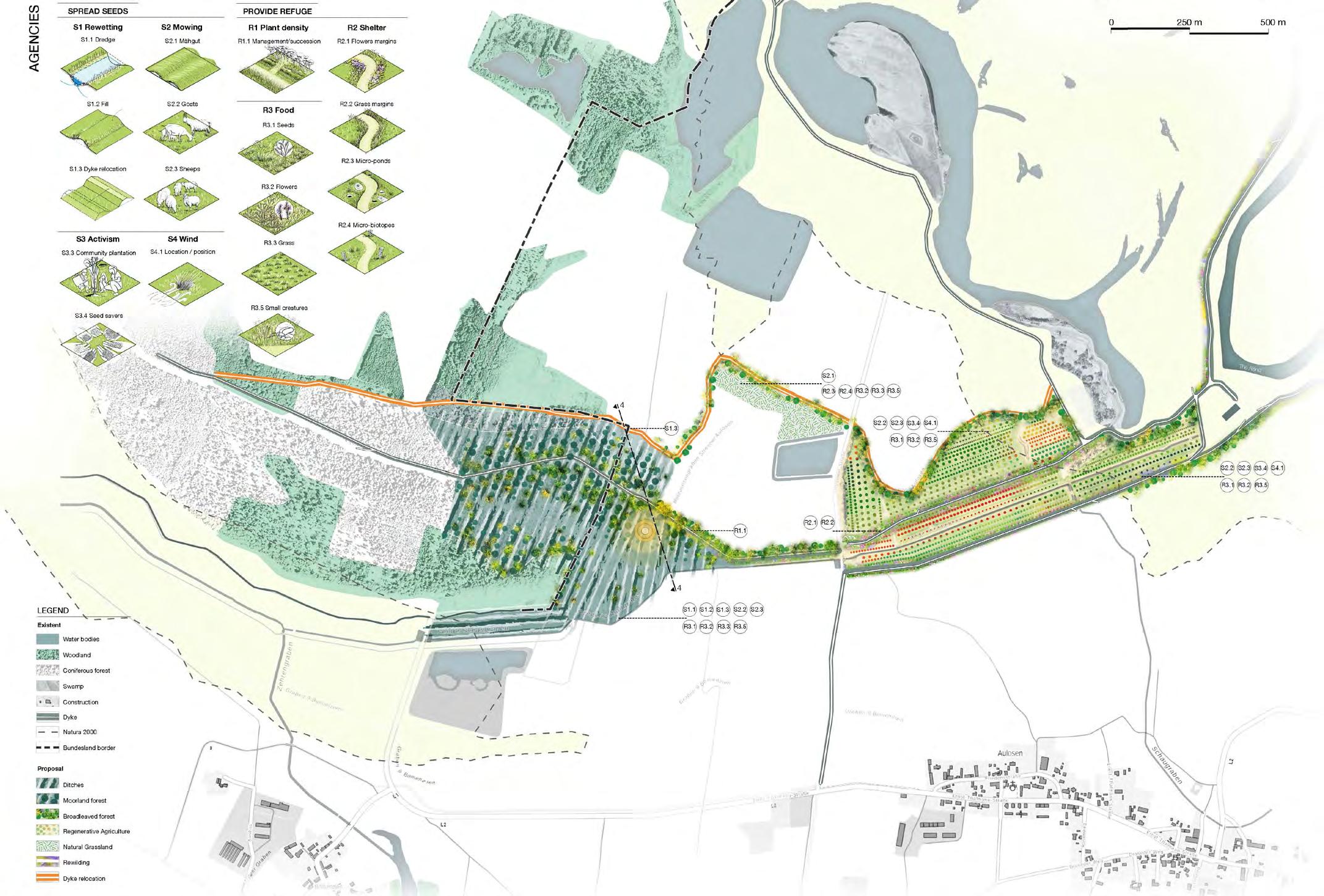
“Saving the Moorland Forest” is a landscape scenario that aims to highlight the significance of the moorland forest habitat, which is perhaps one of the most difficult for us to understand. These habitats are the embodiment of patience. Not only because the vegetation needs quite a long to develop, but because its degradation processes lead to the formation of peat soils, which takes thousands of years for it to occur.
Not only this but also this scenario creates a connection between the Grünes Band and the existing fragmented habitats, encompassing water bodies and also mixed forests. The opportunity area of “pasture, meadows and other permanent grasslands under agricultural use” is proposed to be used with regenerative agriculture and linear axes of flower-grass margins and broadleaved forest. The existing coniferous forest is also considered here as an opportunity area for the revival of a novel moorland forest.
With the conception of a dyke relocation corridor the connection is further accentuated, as there is more area, leading to a possible new scenario in the future where the land inside the dyke could become a new novel habitat. Moreover, as in the two previous scenarios, the connectivity corridor with the rewilding of the margins functions as a subtle ecological corridor through all the landscape transformation.
In the mapping analysis, the area of this scenario is denoted by the presence of low-moor peat soils. This means that the site has the right conditions for the establishment of a moorland forest.
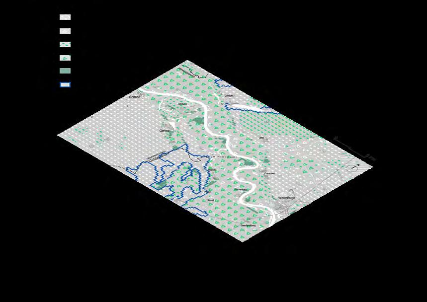
On one hand, these soils are characterised by an annual rate of biomass production that is faster than decomposition rates. This results in soils that have a highly acidic and nutrient-poor subsoil in the short term, but in the long term (after thousands of years) these soils develop peat soil deposits, with a very high percentage of organic matter. Due to the long life of these soils, they store large amounts of carbon, which is an important contribution to carbon dioxide storage. Their deterioration leads to the release of carbon, so saving this habitat also means saving its soil, which could reduce global warming rates. And as if that were not enough peat soils also provide records of past vegetation and climate. They are a timeline for the reconstruction of past environments, perceptible to the human eye thanks to the careful study of the pollen residues lying on them.
On the other hand, and according to the “Lithology at the surface and Water Storage Capacity” overlapping mapping, it is to be expected that this area has a very high storage capacity index due to the above mentioned.
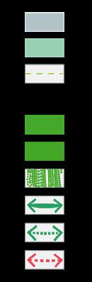
Existent Proposal
Water bodies
Woodland
Flood protection
Coniferous forest
Bundesland
Proposal area
Phase 1

Phase 2
Phase 3
Ditches
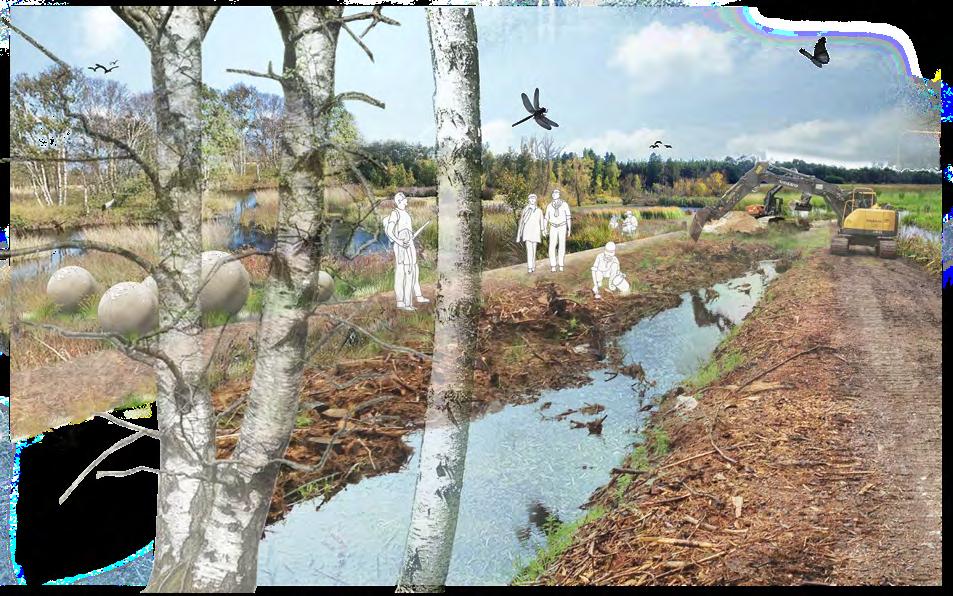
The phases for the development of the moorland forest are conceived with the realisation of two main ‘agencies’: S1. 1 Dredge and S.1.2 Fill. For the achievement of adequate rewetting, two main phases and a last phase for the south side area are proposed. The first phase is structured by a central axis (the existing dyke) and the northern and southern edges of the perimeter of the area of opportunity (coniferous forest). The land remaining between this first phase will then be developed with the realization of the ditches in the second phase.
This is a landscape of slow understanding and constant transformation, of which we will only notice small changes as long as we live on Earth. It will then be the task of our imagination to project this landscape into the future. Of course, the landscape will surprise us with small miracles, like little creatures flying or tiny mosses visiting the ground.
As in “Saving the Aland Floodplain” in this scenario, through the application of plant succession management, different atmospheres are created for various species to take refuge in this landscape. The idea is not to isolate it, but to make it part of our daily lives. This is the only way to understand its importance. Singular “companion species” meet us in this habitat.
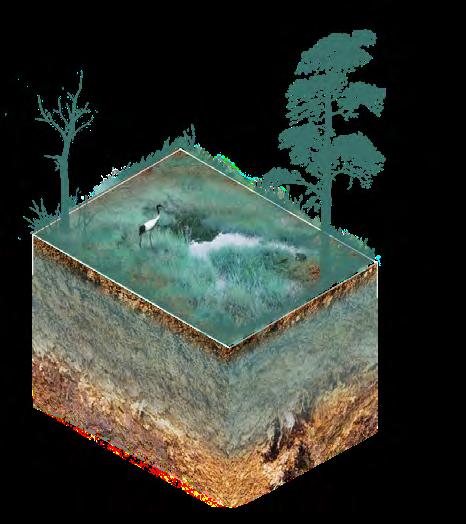
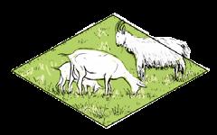
Goats graze on the moor, while different birds, such as the grus, take advantage of the wet meadows. Little by little, we will discover all that this landscape has to offer. We only need to wait in silence for the gradual change of the water in constant play with the soil to give shape to this new landscape scenario.
Masterarbeit | Lina Teresa Buitrago Gamboa | Sommersemester 2021 Prof. Christian Werthmann | Fachgebiet Landschaftsarchitektur und Entwerfen Institut für Landschaftsarchitektur | Fakultät für Architektur und Landschaft Leibniz Universität Hannover