Indian Hills Small Area Plan
An Amendment to the 2001 COMPREHENSIVE PLAN

LEXINGTON-FAYETTE URBAN COUNTY, KENTUCKY
Adopted: April 17, 2003
An Amendment to the 2001
Indian Hills Small Area Plan 1
Comprehensive
Plan

An Amendment to the 2001 COMPREHENSIVE PLAN
LEXINGTON-FAYETTE URBAN COUNTY, KENTUCKY
Adopted: April 17, 2003
An Amendment to the 2001
MAYOR
Teresa Ann Isaac
CHIEF ADMINISTRATIVE OFFICER
Milton Dohoney
Mike Scanlon, Vice Mayor
Chuck Ellinger, II
David B. Stevens, M.D.
George A. Brown, Jr.
Jacques Wigginton
Richard S. DeCamp
Linda Gorton
William L. Farmer, Jr.
Albert S. Mitchell
Bill Cegelka
Fred V. Brown
Jennifer Mossotti
Sandy Shafer
Paul Brooks
Gloria Martin
Don Robinson, Chairman
Keith E. Mays, Vice-Chairman
Lyle Aten, Secretary
Randall Vaughn, Parliamentarian
Dr. Thomas M. Cooper
Neill Day
Linda R. Godfrey
Dallam B. Harper, Jr.
Steve Kay
Frank Penn, Jr.
Joan Z. Whitman
Below is a table showing the dates of all Committee, Neighborhood, and Planning Commission meetings held during the IHSAP process:
Agendas for the IHSAP meetings and the IHSAP schedule are on file with the Long Range Planning Section of the Division of Planning and are available to the public.
Indian Hills Small Area Plan Committee Members:
Mr. Lyle Aten
Mrs. Amy Caudill
Mr. Walt Gaffield
Mr. Steve Kay
Mr. Ken Michul
Mr. Woodford Webb
Division of Planning Staff Members:
Chris King, Director, Division of Planning
Jennifer Brockman, Manager of Long Range Planning
Bill Sallee, Manager of Planning Services
Henry Jackson, Manager of Current Planning
Barbara Rackers, Administrative Officer
Janice C. Westlund, Long Range Planner
Brian Rauf, GIS Planning Technician
Linda Barnes, Administrative Specialist
The Planning Commission Agrees to Initiate a Small Area Plan to Resolve the Issue of the Developers’ Proposals Conflicting with the 2001 Comprehensive Plan’s Recommended Land Use
The following excerpt is from the Greenbrier Small Area Plan and explains the role of a Small Area Plan: “The 2001 Comprehensive Plan Update, adopted in December 2001, includes broad recommendations related to general land use, community facilities and transportation for the entire Urban County, including both Urban and Rural Service Areas. Occasionally, issues arise that require smaller areas of the community to develop and adopt Small Area Plans (SAPs) that refine previously adopted Comprehensive Plans and provide a greater level of planning detail for that area of the community. These SAPs are adopted as amendments to the Comprehensive Plan and serve as the basis for future zone map amendment decisions per KRS 100.”
As requested by the neighborhoods, to finally resolve the conflicts between the 2001 Comprehensive Plan and the developers, the Lexington-Fayette Planning Commission, on August 22, 2002, voted to approve a motion to initiate a Small Area Plan for a portion of the Indian Hills Subdivision. The boundary would include the lots fronting on the Harrodsburg Road service road from Rabbit Run to Corporate Drive, a total of approximately 9 acres. The motion carried 8 – 1. The properties within the Indian Hills Small Area Plan (IHSAP) have been subject to a variety of Comprehensive Plan future land use change requests, Board of Adjustment conditional use applications, and zone change applications in recent years. An Indian Hills Small Area Committee was formed, which consisted of two Planning Commission members, two neighborhood association presidents, and two developers. The IHSAP committee began work on the Small Area Plan in December 2002 and had its last meeting on March 25, 2003.
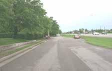
The Indian Hills Small Area Plan (IHSAP) boundary surrounds a total of 8.732 acres. This plan area is located within the Urban Service Area along the southeastern side of Harrodsburg Road, south of the intersection of New Circle Road and Harrodsburg Road. The neighborhood’s request for this SAP originally included three lots located at 3090, 3094, and 3098 Harrodsburg Road. However, the Planning staff recommended including all nine of the lots fronting on the Harrodsburg Road service road in the SAP, resulting in 3060 – 3116 Harrodsburg Road being encompassed in the plan boundary. These properties within the IHSAP are currently designated on the 2001 Comprehensive Plan Land Use Map as MD (Medium Density Residential), with the exceptions of the fire station lot being OPU (Other Public Uses) and the three lots nearer to Corporate Drive being PS (Professional Service).
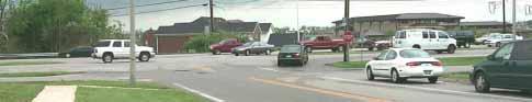
The 8.732-acre IHSAP area consists of four singlefamily home lots, the future location of a Masonic Lodge, one fire station, and three professional office buildings. The single-family home lots, the fire station property, and the future Masonic Lodge property are all currently zoned R-1B. The three professional office buildings are zoned P-1. The lots in the plan all have frontage and access (with the exception of 3060) along the Harrodsburg Road service road running parallel to Harrodsburg Road. There are two points of access to the service road from Harrodsburg Road. The first one is at the signalized intersection of Corporate Drive and Harrodsburg Road. The second access to the service road is at the intersection of Arrowhead Drive and Harrodsburg Road. The properties in this plan boundary collectively add up to 1,750 feet of frontage along Harrodsburg Road.
These lots along the Harrodsburg Road service road have not only been subject to a number of land use change proposals, zone change requests, and a conditional use request; but also public acquisition for the location of a fire station. Most of these lots, with the exception of the three P-1 lots nearer to Corporate Drive (3060-3080), were originally part of the Indian Hills Subdivision Unit 1. This plat was recorded in 1959 and depicts 104 single- family home lots on septic tanks, three connected local streets with one accessing Harrodsburg Road, and four stub streets for future connectivity to adjacent properties upon development.
(See Appendix 1)
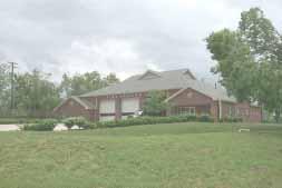
In 2000, the city acquired four lots and consolidated them on July 1, 1999 (plat cab. K, slide 913) to construct a new fire station facility. These lots included three fronting on Harrodsburg Road, starting at the corner of Arrowhead Drive going south, as well as one lot at the corner of Arrowhead Drive and Apache Trail, for a total of 2.12 acres. (See Appendix 2)
On October 19, 2000, the Planning Commission voted to disapprove a zone map amendment for the purpose of developing a site for an extended-stay hotel on two lots adjacent to the southeast of the fire station (3112 and 3116), both fronting on the Harrodsburg Road service road, plus two adjoining lots, 864 and 868 Apache Trail.
On February 15, 2001, the Planning Commission voted (based on staff’s recommendation of disapproval) to disapprove public requests for land use change for Cases #33 and #56, being 3098 Harrodsburg Road from Medium Density to Professional Services, and 3112 and 3116 Harrodsburg Road from Medium Density to Professional Services, respectively. Case #33 was for a branch bank and Case #56 was for professional office buildings. Both the Indian Hills Neighborhood Association and CIGAHR (Citizens for Intelligent Growth Along Harrodsburg Road) were in opposition to this request and desired the land use to remain Medium Density Residential.
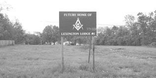
On September 28, 2001, the Board of Adjustment approved a request for a conditional use on the property located at 3112 Harrodsburg Road, and 864 and 868 Apache Trail for a Masonic Lodge. The single-family homes and accessory structures on 3112 Harrodsburg Road and 864 and 868 Apache Trail were razed, as well as several significant trees. The three lots were consolidated into one lot on January 22, 2003, as shown on the recorded plat cab. L, slide 858. (See Appendix 3)
On January 24, 2002, the Planning Commission had two tie votes on a zone change for the corner lot, 3098 Harrodsburg Road. The first motion was to disapprove changing the zoning to P-1, and the second one was for approving it. This proposal was for a two-story office building with access on both the service road and Arrowhead Drive. On February 14, 2002, the Planning Commission voted again, with members present that were not present at the tied vote hearing previously in January, and the zone change was disapproved 4 to 3. The Urban County Council also disapproved the zone change on April 28, 2002.
On August 22, 2002, the Planning Commission heard a request from the Indian Hills Neighborhood for a Small Area Plan for the lots on the front edge of the Indian Hills Subdivision. This request was a result of an Early Filing Request filed by the Webb Companies for the corner lot 3098 Harrodsburg, adding on the two adjacent single-family home lots, addressed as 3090 and 3094 Harrodsburg Road. The Planning Commission approved the initiation of this Small Area Plan for Indian Hills, and the early filing request was indefinitely postponed.
Transportation and Circulation:
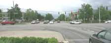
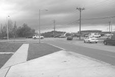
The IHSAP area is located along a service road running parallel to a major arterial, U.S. 68/ Harrodsburg Road. All of the parcels within the IHSAP have access to this service road except for one at the corner of Corporate Drive and Harrodsburg Road. There is a traffic light at this intersection, which also includes Beaumont Centre Drive on the other side of Harrodsburg Road. Corporate Drive completes a circle around Corporate Center Office Park and ends at the same intersection previously mentioned.
Approximately 1,050 feet from the lighted intersection at Corporate Drive is a non-lighted intersection at Arrowhead Drive and Harrodsburg Road. According to Subdivision Regulation 68(q)(2)(b), there should be a minimum of 1,600’ between access points along an arterial. This distance is non-conforming to our Subdivision Regulations, but this condition does exist. The Corporate Drive intersection is only about 1,300’ from the centerline of New Circle Road, which is also a non-conforming condition according to the Subdivision Regulations.
According to the “2002 Congestion Management Report: Travel Time and Delay Studies” for the Lexington Area MPO, traveling on Harrodsburg Road from Maxwell Street to Man o’ War Blvd. during the evening peak time had a travel rate index of 2.66, ranking it 4th worst in congestion of the arterial routes emanating from downtown to the suburbs. In this same study, traveling on
Harrodsburg Road from Man o’ War Blvd. to Maxwell St. during the morning peak time ranked 17th worst in congestion. This difference in congestion between going into the city in the morning vs. heading out of the city toward the suburbs in the evening may be due to a substandard interchange at Harrodsburg Road and New Circle Road.
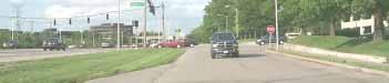
Widening of New Circle Road, from U.S. 27 to U.S 60 is the top ranked project on the “2003 Unscheduled Needs List”. Due to fiscal constraint requirements in the transportation planning process, there are no plans or funding identified to widen New Circle Road at this time; however, there have been discussions to make improvements to the New Circle/Harrodsburg Road interchange priority over the widening of Harrodsburg Road between New Circle and Man o’ War Boulevard. The Design Phase for widening of Harrodsburg Road to six lanes from New Circle to Man o’ War Blvd. has been planned and funded $400,000 to begin design work during fiscal year 2004 (or July 2003).
On the west side of Harrodsburg Road, across from the IHSAP area, the residential properties have second-floor windows at approximately the same elevation as the pavement for the lanes of Harrodsburg Road. The state does have additional right-of-way on this side; but widening Harrodsburg Road in the direction of this residential area with the existing drop in elevation would create unpleasant living conditions, as well as
extreme engineering measures to meet weight load capacity. Possibly, the medians would be used for the widening and/or possibly some of the right-ofway next to the service road.
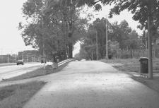
The service road begins at the intersection of Corporate Drive and Harrodsburg Road and runs parallel to Harrodsburg Road, down to the intersection of Arrowhead Drive and Harrodsburg Road, where it has access off of Arrowhead Drive. Then it continues, with access on the other side of Arrowhead, running parallel with Harrodsburg Road and terminating in a stub slightly past the property at 3116 Harrodsburg Road. The service road is maintained by LFUCG. Both intersections of the service road with Arrowhead Drive and Corporate Drive have existing traffic conflicts that will be an issue with increased development along the service road.
A Lextran bus route follows Harrodsburg Road, running south from New Circle down to Wellington Way, turning at Wellington and looping around Palomar Shopping Centre, to return back to Harrodsburg Road running north. There are no railroads nearby or in a .5-mile radius of the plan boundary. With the widening of Harrodsburg Road, improvements should include bike paths or bike lanes. The intersections of Harrodsburg Road and Corporate Drive should be carefully examined for safe bike routes, as well as for increasing the safety of pedestrians crossing at that intersection where a crosswalk now exists. Bike and pedestrian safety will become an increasing issue along the service road.
The fire station was built in 2000 on the southwest corner of Arrowhead Drive and Harrodsburg Road. The structure and driveways are located on the frontage portions of the newly consolidated lot, and an elevated green space with trees lies on the portion at the corner of Arrowhead and Apache Trail. The fire trucks leave the structure from a driveway with egress onto Arrowhead Drive and then return via the service road with ingress to a large radius driveway from the service road. The station was built so that it could house an additional Emergency Care Unit.
Currently, the three lots consolidated for the future location of the Masonic Lodge are vacant. Numerous conditions were recorded on the Certificate of Land Use Restriction, including a maximum building footprint of 8,280 square feet and limited access to Apache Trail. The single-family home and lot located at 3116 is not part of this proposal and remains. (See the Certificate of Land Use Restriction below.) To the right is a copy of the Board of Adjustment approved Site Plan for the future Masonic Lodge:
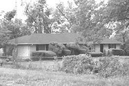
One of the remaining single-family homes is currently owner-occupied and the other three are renteroccupied. The single-family home at the end of the plan boundary, 3116 Harrodsburg Road, furthest from Corporate Drive, is a stone ranch home of approximately 1,400 square feet with a 1,400 squarefoot basement and it is situated on a .68-acre lot. The other three homes, 3090, 3094, and 3098, are smaller and are built on .66-acre, .57-acre, and .62-acre lots, respectively. These three rented homes were subject to some code enforcement action in 2002 for debris and appliance removal.
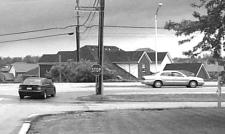
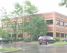
Located at the northern end of the plan boundary closest to Corporate Drive, are the three, currently zoned, P-1 lots. These three lots were developed according to the “Corporate Center Office Park” development plan. On the corner lot at Corporate Drive and Harrodsburg Road is 3060 Harrodsburg Road, which is currently occupied by a bank, with its related offices on the second floor. The building at 3060 is two stories with approximately 14,600 square feet. The buildings at 3070 and 3080 have 12,447 and 17,208 square feet, respectively, and both are two stories. It was reported that 3060 has no vacant office space, 3070 has 4,800 square feet vacant, and 3080 has 4,361 square feet vacant.
(See Appendix 4)
The 1996 Comprehensive Land Use Plan designated the three properties at 3060, 3070, and 3080 as Professional Services and the remainder of the lots in the IHSAP boundary as Medium Density Residential. The medium density residential land use did extend to the 8 lots fronting on Tomahawk Trail and Apache Trail behind the lots in the IHSAP area. The remainder of the Indian Hills Subdivision Unit 1 remained designated as Low Density Residential. The three lots designated as Professional Services were zoned P-1 in 1978. The Indian Hills Unit 1 Subdivision, which included the remainder of the lots in the IHSAP boundary, was zoned R-1B in 1968 and is R-1B today.
The 2001 Comprehensive Land Use Plan changed the recommended land use for the four lots that made up the fire station property to Other Public Uses. The rest of the land uses for the properties in the IHSAP boundary, as well as all lots abutting the IHSAP boundary, stayed the same as they were in 1996. A
Conditional Use for the Masonic Lodge development on 3112 Harrodsburg Road, plus two lots abutting it, 864 and 868 Apache Trail, was approved by the Board of Adjustment on September 28, 2001. Those three lots have been consolidated but construction has not begun to date.
To analyze the land use mix, the land located within a ½-mile radius of the IHSAP boundary was included in data collection. The table above displays the zoning mixture in the ½-mile buffer of the IHSAP.
The chart above shows the total acres for each zone in the .5-mile buffer of the IHSAP. These totals do include the acres within the plan itself. (Please note that much of the LD land shown in the table at the top of this page is already developed with R-1B and R-1C zoning, which means larger lots and a density at the lower end of the range for Low Density.)
Above is a chart showing the land uses from the 2001 Comprehensive Land Use Map for the same .5-mile boundary of the IHSAP. On page 13 is a map depicting the 2001 Comprehensive Plan Future Land Uses within 1/2-mile of the IHSAP, with the land uses and zoning, charted on this page, located within the oval boundary on the map.
The Land Use bar chart shows Low Density Residential (LD) as being a much greater land use than any other category, with Professional Services (PS) being the second greatest. LD makes up 52.84% of the land use and PS makes up 17.20%, which is one-third the amount of the LD. A visual inspection of the 2001 Land Use Map above shows this portion of Harrodsburg Road to be recommended as a Residential and Professional Office Corridor.
Current zoning of the land within the ½-mile boundary of the IHSAP shows 55.74% is zoned low-density zones, R-1B, R-1C, and R-1D. The 2001 Comprehensive Plan shows 52.84% LD. There are uses zoned R-1B and R-1D that are categorized as Other Public Uses and Semi-Public Uses on the 2001 Comprehensive Plan Land Use Map . Also, there are some properties zoned R-1B that are on the 2001 Comprehensive Plan Land Use Map as Medium Density Residential. This accounts for some of the differences between future land use and zoning.
Interestingly, if you look at the 2000 Census Summary File 3 data for the census tracts involved by this ½-mile
radius of the plan area (tracts 42.02, 36.00, and 29.00), an occupational trend exists. The majority of the people in these census tracts are employed as management, professional, and related occupations; and the second highest area of employment in these tracts is in sales and office occupations.
The small portion of the ½-mile boundary area, which lies inside New Circle Road on the southeasterly side of Harrodsburg Road, is part of Census Tract 9.00. This area is a small portion of the area captured by the ½-mile boundary. The areas of the ½-mile boundary outside of New Circle make up most of this analysis area. Those areas are in Census Tract 36.00 and 42.02. As you can see from the table below, Tracts 36 and 42.02 have a higher concentration of management, professional, and related type occupations than the County as a whole. About 81 to 85% of the employed people in Tracts 36 and 42.02 are in management, professional, sales, and office related occupations. Having more Professional Services land use in the vicinity of their place of residence reduces traffic congestion, air pollution, and travel time.
Below is a table showing data extracted from 2000 Census Summary File 3 Table: GCT-P13.
16 Years and
2000
E nce na e int a M ions t ccupa O
ion, oduct Pr %, ion Pr % ion, oduct on, uct o %, ion, t a t por ns a Tr l ia r e t a M nd a oving M ions t ccupa O

Soils for the plan area are Maury silt loam, which is prime Agriculture soil. This soil type is suitable for farming, as well as development. There are no mapped sinkholes, springs, steep slopes or significant tree stands. Contour lines and elevations on the topographic map indicate that surface storm water flows away from the Indian Hills Subdivision Unit 1 neighborhood, over the IHSAP properties towards swales and culverts along Harrodsburg Road. Only 3112 and 3116 Harrodsburg Road are properties where the surface storm water flows toward some lots in the Rabbit Run subdivision at the end of Blenheim Way, nearer to Harrodsburg Road.
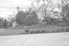
A portion of the fire station lot, which originally was 880 Apache Trail, is at a higher elevation than the surrounding properties. It is currently a green space with grass and several trees. This portion of the property is a good buffer to the fire station and creates a nice transition from the public use to the residential uses, although the existing trees did receive some damage from the 2003 ice storm. The fire station rear and side yards are screened by a wood privacy fence and trees.
Harrodsburg Road is a major arterial and it is planned to be widened. Therefore, noise is a concern for this established residential neighborhood. The fire station was a necessity and was developed with screening to try to buffer some of the noise and activity. And having CPR trained professionals in close proximity to a neighborhood with an aging population is a plus.
The Indian Hills Subdivision Unit 1 was developed in the early 60s with the homes using septic tanks. However, in the early to mid-90s, all of the homes were added to the sanitary sewer system. The sanitary sewer pipes to the future Masonic Lodge property have been capped since the structures have been razed.
According to LFUCG. Engineering staff, the storm water system in Indian Hills is “scant and overloaded.” Any additional water being directed into the Beaumont system would need to be input into that drainage study. A recent proposal for a motel included detention; and had it been approved, it would have required off-site pipe construction to get the water to the system.

At the first Neighborhood Meeting on January 27, 2003, written comment sheets and post-it notes were distributed and collected at the conclusion of the meeting. These were all entered into a list with like items grouped together. One response was also received in the mail and one by email. These were also added to the list. Below is the list, verbatim, except for some minor grammatical corrections. All of the originals have been kept in a file, as well as scanned and saved in a file on the computer network.
Traffic and Circulation Comments:
1. How can you make an effective small area plan if you have no idea how Harrodsburg Road is going to be widened?
2. Make sure all entrances and exits to frontage properties are all contained on the service road. No access into the neighborhood.
3. Try to make Harrodsburg Road/Service Road/Arrowhead Drive intersection less hazardous.
4. Traffic flow and numbers.
5. If Harrodsburg Road is widened to include service road, how will any buildings access this main artery?
6. The infrastructure problems associated with the area around the Harrodsburg Road-New Circle Road interchange almost require planning to not bring more traffic into this part of the corridor.
7. The plan should specifically state that the LFUCG should plan and implement improvements to the New Circle Road-Harrodsburg Road interchange and surrounding area. Existing transportation infrastructure will not support anticipated future growth in the area.
Masonic Lodge:
8. Make sure you don’t jeopardize the conditional use permit agreement with the Masonic Lodge #1.
9. Masonic Lodge use settled in detail in Board of Adjustment and should not change.
10. The Masonic Lodge property essentially should be left alone. The property has received significant attention from the Board of Adjustment and its use is settled.
Buffering Land Uses:
11. Development of these three lots as P-1 should necessitate significant landscape buffering, with special attention to the Willard’s home near the fire station. The buffering should include more than a fence and preferably should include significant landscaping.
12. Make sure you have fencing and 15’ landscaping buffers between zone changes.
13. Buffering from neighborhood.
14.Change should only impact frontage. Buffer from firehouse fronting on Apache should stay as green space.
15. Lighting confined to new development.
Land Use and Zoning:
16.The plan should recommend a change to P-1 for 3090, 3094, and 3098 Harrodsburg Road— please correct this if I have not remembered the lot numbers correctly between Corporate Center and the fire station.
17.Make sure you look at all options for conditional uses in R-1B and R-3, before you go to P-1. Also, no higher zoning than P-1. NO RETAIL!
Land Use and Zoning: (cont.)
18. Plan overall should specify that corridor is primarily professional office and residential and not retail.
19. Retail uses should be strongly discouraged or prohibited on the north side of Harrodsburg Road between New Circle Road and Man o’ War Boulevard.
20. Plan should specify that change to P-1 on south side of Harrodsburg Road is small and will not impact planning on north side.
21. Other properties currently marked as medium density be returned to R-1B on 5-year plan.
22.We feel P-1 would be a good proposal for 3098, 3094, and 3090. It can be done with landscaping and other features so it is compatible with surrounding uses.
23. Preference that 3090, 3094, and 3098 develop together.
24. 3090, 3094, and 3098 should change to P-1.
25. The Plan should state that the Harrodsburg Road corridor outside of Turfland Mall is principally a residential and professional office corridor. Retail, whether it is shopping center or highway service business, should serve the local area and not be so large as to serve a larger area. This has been the case for Harrodsburg Road for planning purposes for many years, and the infrastructure problems associated with the area around the Harrodsburg Road-New Circle Road interchange almost require planning to not bring more traffic into this part of the corridor.
26. Retail uses should be strongly discouraged or prohibited on the north side of Harrodsburg Road between New Circle Road and Man o’ War Boulevard.
27. The small area plan should include a finding that any expansion of professional office zoning should be so small as to have no impact on planning on the south side of Harrodsburg Road between New Circle and Man o’ War Boulevard.
28. A change to P-1 should not extend into the Indian Hills Neighborhood and should include the frontage only. As a corollary, the green space that is part of the fire station and extends into the neighborhood should stay as green space and the Comp Plan should not change the space to professional office. The small area plan should express a preference that the green space remains as green space.
Building Heights and Relationships:
29. Restrictions on the number of stories for each office building should be required. This relates to the buffering discussed above.
30. Building height or placement so they do not overwhelm adjacent housing.
31. P-1 should have buffer against neighborhood with possible limitation on number of stories.
32. Don’t allow a building on 3098 Harrodsburg to tower over 3004 Arrowhead Drive. Don’t negatively impact the property values of 3004 Arrowhead.
33. Special attention should be given to buffering Willard property.
Off-Street Parking:
34. Adjacent residential properties not to be used for additional parking.
35. No parking outside of frontage if frontage becomes P-1 (except for parking already approved for Masonic Lodge).
36. Parking in the residential area behind the frontage should be expressly prohibited even if allowable in the zoning ordinances.
Commercial Office Use Concern:
37. Vacancy within a 3-4 mile radius of proposed site plan is 10% currently; and within a few months, approximately another 30,000 s.f. will be available (12% vacancy). Additional office buildings are not needed in this area. In our opinion, there should not be additional offices built until we can increase occupancy in the existing office buildings.
Storm Water:
38. On-site retention of water should be required.
39. Water Retention and Runoff.
40. On-site water retention should require careful engineering review so as to not move water from any developed property at an accelerated rate. Any proposed underground storage of drainage should include an engineering study to determine the direction and amount of drainage. The entire area is cave and karst, and special care is necessary when dealing with underground retention. I question whether it would work.
RELEVANT GOALS, OBJECTIVES AND STRATEGIES FROM THE 2001 COMPREHENSIVE PLAN:
Goal #1: Provide Planning Processes Which Enable Widespread Citizen Participation and Benefit Lexington-Fayette County
Goal #10: Provide Diverse Business and Employment Opportunities for Lexington-Fayette County
H.Provide essential service, commercial and convenient employment areas which are compatible with residential neighborhoods and Lexington-Fayette County as a whole.
Goal #14: Preserve, Protect and Enhance the Character and Quality of Existing Neighborhoods
C.Develop, adopt, and periodically review Small Area Plans (SAPs) as tools to address neighborhood and community enhancement issues; develop SAPs in a systematic manner, ensuring that they are thoughtful and inclusive, with broad neighborhood participation.
Goal #19: Provide and Maintain a Range of Community Facilities and Services
A.Provide each neighborhood with adequate public safety and government service facilities in an aesthetically pleasing manner.
J.Assess the impact that new development/redevelopment may have on community facilities.
An
The Masonic Lodge property has been approved by the Board Of Adjustment as conditional use permit C-2001-97, with the Certificate of Land Use Restriction recorded in Book 10, Page 545, listing15 conditions that meet the neighborhood’s concerns. The IHSAP Committee discussed these conditions and the site plan for the future Masonic Lodge. The parking for the Lodge is shown on the site plan as being mostly on the portion of the property that was originally 868 Apache Trail (30 out of 32 parking spaces). The neighborhood’s comments reflected a desire to maintain the approved Masonic Lodge use, with the parking as shown on the site plan at the Board of Adjustment hearing. During the Board of Adjustment process, the Masonic Lodge cooperated with the neighborhood on addressing their concerns about parking and access. The neighbors and the committee both request to uphold the Masonic Lodge use as the Board of Adjustment has approved it.
The lots fronting on Apache Trail and Tomahawk Trail, which abut the IHSAP lots, are currently on the 2001 Comprehensive Plan Land Map as Medium Density. To implement Medium Density, the zone would have to be changed to R-3. In the R-3 zone, parking for abutting Professional Office and Business zones (except for B-2B) is a conditional use. The committee’s and the neighborhood’s desire from the beginning was to not allow conditional use off-street parking in the Medium Density Residential area as parking for uses on the service road lots. The neighborhood was in favor of considering Professional Office Use only if off-street parking was provided on the frontage lots and did not infiltrate into the neighborhood; or, in other words, the Medium Density land uses along Tomahawk Trail and Apache Trail.
In the event that the Masonic Lodge use is discontinued, the neighborhood and the committee also wanted to ensure that the back portion of the Masonic Lodge property, which was originally 864 and 868 Apache Trail on plat cab. C slide 219,
could not be used as conditional use parking for Professional Office Uses on the service road portion of the property, originally 3112 Harrodsburg Road on plat cab. C slide 219. Special Considerations were drafted to address the off-street parking concerns in the Medium Density land use.
Currently there are four single-family home service road lots (other than the Masonic Lodge property) within the IHSAP that are still zoned R-1B. While zoned R-1B, these lots are subject to possible conditional use applications. Conditional uses allowed in the R-1B zone include 12 categories of uses. These conditional uses include childcare, churches, recreational facilities, and schools. To alleviate the off-street parking concern for the lots abutting the service road lots, this was addressed in the Special Considerations. The committee wanted to ensure that no additional conditional use applications could result in lots fronting on Apache and Tomahawk Trail (872 - 876 Apache Trail, 3004 Arrowhead Drive, and 861 - 869 Tomahawk Trail) being used solely for off-street parking by being consolidated with service road lots.
Any new development in Fayette County requires on-site detention of storm water. Even with this requirement, the neighborhood is concerned about storm water, as it would leave new development and the current storm water situation in Indian Hills subdivision. At the first neighborhood meeting, many residents of Indian Hills Unit 1 expressed concerns about storm water in their neighborhood, especially coming from the retention pond in Corporate Center Office Park. Their concerns were relayed to the LFUCG Division of Engineering, since only storm water affected by the IHSAP properties can be addressed through this Small Area Plan. The neighbors were also concerned about development of the service road lots and increased storm water in their neighborhood.
At the second neighborhood meeting, a surface storm water flow diagram was presented; and it included the IHSAP area, Indian Hills Unit 1, and some adjoining lots in Rabbit Run and Corporate Office Park. The conclusion was that development of lots 3090 through 3098 Harrodsburg Road would not increase surface storm water flow in the Indian Hills neighborhood. The Masonic Lodge Property and the Carroll property at 3116 Harrodsburg Road do currently have surface storm water that flows toward drainage easements in Rabbit Run, which then flows to Harrodsburg Road. However, the Masonic Lodge site plan has an onsite detention area. The surface storm water from the developed Masonic Lodge site will be directed to that detention basin. If the 3116 property is developed, it will also require on-site detention. Due to the concerns of the neighbors and advice from the Division of Engineering, the committee decided to add a Special Consideration to address the issue of handling storm water as it leaves new development sites/detention basins. Upon the event of a zone change application, a preliminary development plan would be reviewed and certification contingent on acquiring the approval of the LFUCG Division of Engineering.
The neighborhood, the Long Range Planning Staff, and LFUCG Traffic Engineering staff are concerned about the traffic conflicts where the service road, Arrowhead Drive, and Harrodsburg Road intersect. The Long Range Planning staff consulted with an LFUCG Traffic Engineer, and he advised: “negotiating this intersection is already a tedious task. This situation will become worse if additional vehicles utilize the service roads.” He felt that “proper access management practices were not utilized in past designs” where service roads are as close to the major street, as in the cases of the intersections of Nicholasville Road where the service road runs parallel.
The Traffic Engineer presented his concern about the intersection at the January 27, 2003 Neighborhood Meeting. He offered a possible solution of moving the access point of the service road away from Harrodsburg Road about 200’
from the existing location, making the access point of the service road about half way between the Arrowhead/Harrodsburg Rd. intersection and the Tomahawk/Arrowhead intersection. Some members of the neighborhood were not happy with the idea of a local street possibly being built at the rear of their lots. The developer of the corner lot was not happy with that scenario, because it would take away a great deal of space on his property to accomplish relocation of the service road. Some of the neighbors were also concerned about a sight distance problem when turning onto Arrowhead Drive from Tomahawk Trail.
In addition to the traffic conflicts at the intersection of Arrowhead and Harrodsburg Road, the neighborhood is much concerned about limiting access for the IHSAP properties to only the service road. Currently, all of the IHSAP properties have access points on the service road, except for the corner lot at Corporate Drive, which has access to Corporate Drive. The fire station has an additional access point, but mostly for egress of the fire trucks onto Arrowhead Drive. There is a median cut south of the Arrowhead Drive intersection where access is possible directly from Harrodsburg Road to 3116 and 3112 Harrodsburg Road. The fire trucks also use this when returning to the fire station to access the back drive, which is their ingress off of the service road.
The committee added their recommendations for the traffic concerns to the list of Special Considerations. If the undeveloped land in the IHSAP were developed into apartments, it could generate as many trip ends as low to moderate office uses. The committee felt that specifics on traffic
circulation conflicts and trip generation issues should be left to the time of the zone change application when a preliminary development plan would have to be submitted, reviewed, and approved by Traffic Engineering, the Planning Commission, and ultimately, the Council. The committee felt that neighborhood, Traffic Engineering staff, and Planning staff concerns warranted the language set forth for this issue in the Special Considerations. The Planning staff fully expects a complete review by Traffic Engineering of any preliminary development plans submitted for the IHSAP properties in the future, as is the normal procedure.
The neighborhood had much concern about buffering the frontage road uses from the residential uses. One of the properties of much concern was 3004 Arrowhead Drive, since the house was situated much closer to the service road lots than any of the other homes. Article 18 in the Zoning Ordinance does mandate landscape buffering between certain zones. If the service road lots became P-1 (Professional Office), then Article 18-3(a)(1)2 would apply, which requires a 15’ landscape buffer (LB) with 1 tree/40’ plus a double row hedge or a 6’ fence, wall, or mound or a 5’LB with 1 tree/40’ plus a 6’ high wall or fence. If the service road lots became R-3 (Planned Neighborhood Residential), and developed into multi-family dwelling units, then Article 18-3(a)(1)7 would apply, which means only a 6’LB to the R-1B lots. The neighborhood wanted more than the minimum requirement of 5’LB if Professional Services and more than 6’ if Medium Density.
At the time of the application for a zone change to implement the IHSAP land use recommendation, the landscape buffering requirement details would be reviewed and the Planning Commission could make the approval contingent upon additional landscape buffering requirements. It was the consensus of the neighborhood that the landscape buffer between Professional Services and Residential be a minimum of 15’. The developers felt that the option for less should be kept open, since they felt they could provide a fence or wall and the 5’ requirement and still be effective. A
Special Consideration for this landscape buffer concern was added to the list of Special Considerations.
The fire station property’s “green space” was also discussed when buffering was an issue. The neighbors wanted the green space to remain as a buffer to their neighborhood. The Planning staff stated that it was a nice transition from the public use to the residential uses. Upon inquiry with the Fire Department, it was revealed that the existing structure was built with an extra bay for another emergency vehicle and that several parking spaces may be added along the existing pavement in the future. Planning staff invited a member of the Fire Department to address this topic at the 2 nd Neighborhood Meeting on March 4, 2003. A representative from the Fire Department stated that, in the future, there is a possibility of addition of structure or pavement to the “green space” portion of the Arrowhead fire station property; but it is not likely, due to budget constraints. Addition of parking off the front pavement was more likely, and the Fire Department could meet with the neighbors about landscaping and treatment around any new parking. A Special Consideration was created to address this concern.
The heights of any new buildings in the IHSAP were a concern of the neighborhood and an item greatly discussed at both committee and neighborhood meetings. The single-family homes in Indian Hills Unit 1 are mostly one story with some walk-out basements. The single-family home located at 3004 Arrowhead Drive would be the one most greatly
affected by new development along the service road lots. It fronts on Arrowhead, and is built at a much lower elevation than the others along Apache and Tomahawk Trail that abut the IHSAP properties. Implementing a MD residential land use would mean a zone change to R-3 zoning. In R-3, the maximum building height is 35’. Implementing a PS land use would mean obtaining P-1 zoning; and, in that zone, the maximum building height is 3:1 height-to-yard ratio.
The committee came to a consensus on a way to meet the concern of the neighbors and to protect the character of their established neighborhood. It recommended a Special Consideration to restrict the building heights and establish minimum distances between new buildings in the IHSAP and existing residential structures.
One of the concerns submitted at the first Neighborhood Meeting was the vacancy rate of office space in the area. A survey of vacant office space was conducted, and data collected from 85.3% of the existing office buildings revealed that there was a vacancy rate of 8% among built office buildings inside and intersecting the .5-mile buffer around IHSAP. Within this study area, there was 992,491 square feet of built office space and vacancy reports were not acquired for 146,538 square feet, or from ten addresses. Of the 845,953 square feet reported, there was 67,702 square feet of office space vacant as of 2-11-03. See the table on the next page.
An additional 411,157 square feet of office building space has been approved and certified on Development Plans for this same area. However, 297,000 square feet of this 411,157 is on the development plan for Lexington Clinic proposed at 3000 Beamont Centre Circle. This proposal is for
a 3-story medical clinic. However, the approval of this development plan took place in 1992; and according to Article 21-4(f)(2), if a building permit is not acquired within five years of Commission approval, then the plan must be reapproved by the Planning Commission. And, as reported by Building Inspection, a building permit was never issued for this development plan for 3000 Beaumont Centre Circle.
Furthermore, on March 29, 2001, the Planning Commission voted to accept staff’s recommendation to disapprove a land use change request (Case 36) for the 2001 Comprehensive Plan where the proposal was for 20 acres PS, 7.5 acres High Density Residential (HD), and 26.7 acres Retail Trade (RT) for the “Circle”, in other words, the area surrounded by Beaumont Centre Circle. Case 36 was disapproved but the staff’s recommendation of disapproval of Case 36 included these statements: “The validity of decisions made in the 1996 Beaumont Centre Plan Review Subcommittee Report still applies. The Subcommittee Report recommends PS for the circle with an alternative use of HD.” Conceivably, this “Circle” area of approximately 50 acres could be developed into residential.
On the next page is a table showing the data collected regarding office building space within or intersected by the .5-mile buffer of the IHSAP boundary. This table includes P-1 zoning inside and intersected by the .5-mile buffer of the IHSAP boundary. Those P-1 zoned properties that were partially within the .5-mile buffer were included due to the fact that access and building locations on the individual properties are not evident from the zoning map. Therefore, the area of land covered by this survey of office building space covers slightly more area than the total acres shown on the “Current Zoning Table” on page 10, which is 155.4 acres.
There was consensus among the committee members that the land use for the property within the Indian Hills Small Area Plan boundary should be Professional Service, with the exception of the existing Arrowhead Fire Station being Other Public Use, and the frontage portion of the Masonic Lodge to be designated Semi-Public Use, with the option of Professional Services upon discontinuance of the Masonic Lodge use. To address the many concerns of the committee and the neighborhood, a list of Special Considerations was compiled as a guideline for future development of the properties. On the next page is a map showing the recommended land uses for the Indian Hills Small Area Plan:
The IHSAP Committee discussed the following land use alternatives for the IHSAP properties on the 2001 Comprehensive Plan Land Use Map as Medium Density:
•Leave as is, Medium Density Residential
•Conditional Use Medium Density Residential
•Professional Service/Office
No other uses, such as Retail, were considered, since they were not appropriate in protecting the character of the established neighborhood. With the current zoning of R-1B for all but three of the lots in the IHSAP, conditional uses allowed in that zone are a possibility.
The IHSAP Committee’s recommendation for Professional Services/Office (PS), for all but two of the properties, was based upon the following findings:
• The undeveloped service road lots are at a lower elevation than surrounding homes.
• Two-story structures along the service road would enhance noise attenuation from Harrodsburg Road, which is planned to be widened.
• Office Use has less Noise Nuisance Reports than any other land use.
• Harrodsburg Road is generally a Residential and Professional Office Corridor.
• Addition of a Special Consideration that no conditional use parking be allowed on the Medium Density land uses, abutting the service road lots, for uses on the service road lots, other than the approved Masonic Lodge conditional use.
• The proximity of Harrodsburg Road to the service road lots and the future widening make it less desirable for residential uses due to noise and traffic on Harrodsburg Road.
• Developing 3 to 3.5 acres into Professional Office would have a negligible impact on the land use planning in the vicinity or within the .5-mile boundary of the IHSAP. The total amount of PS land being added by this plan is 3.29 acres; this includes the front portion of the Masonic Lodge property. These 3.29 acres make up only .4%, or .004, of the total land, 744.736 acres, within this .5-mile radius. There are currently 128.073 acres of PS land use within these 744.736 acres. This is a 2.6% increase in PS land use within this area.
• Landscape Buffer requirement

(To be used in conjunction with the recommended land uses of Professional Services* for 3060 through 3098, and 3116 Harrodsburg Road; Other Public Uses for 3100 Harrodsburg Road; and Semi-Public Use for 3112 Harrodsburg Road.)
1. There is to be no additional use of Medium Density Residential land in this area for off-street parking for the benefit of either planned Professional Services uses or Semi-Public uses in this area, other than that already approved as of the date of this plan.
2.On-site detention of storm water runoff and the handling of storm water as it leaves the detention area should be designed to ensure that new development does not exacerbate existing storm water concerns in the vicinity.
3.A minimum 15-foot Landscape Buffer is preferred along property lines where any Professional Services land abuts any existing or planned Residential land use, with any further landscape buffer details to be determined at the time of the development proposal. This would include any property lines of 3116, 3090, 3094, and 3098 Harrodsburg Road. The 15-foot screening easement along the 3080 Harrodsburg Road property line that abuts 861 Tomahawk should remain.
4.Building and parking lot lighting to be directed away from residential uses, as currently required by the Zoning Ordinance.
5.It is preferred that access to Professional Office Uses be limited to the service road running parallel to Harrodsburg Road, with approval of access points and vehicular circulation at the time of the development proposal. Office uses generating low to moderate trip ends are preferred.
6.Maximum building heights of any new buildings proposed for any lots within the plan boundary should not exceed one-third of the distance from the proposed building to the nearest existing residential structure, and be no greater than 35 feet in height.
7.Upon the event of future expansion of the Arrowhead Drive Fire Station facilities and/or pavement, the Fire Department should meet with the Indian Hill/Pera Place III Neighborhood Association to determine appropriate landscape buffering and/or screening of any future construction on the Fire Station property. This meeting or meetings should occur before it goes to Council for action.
8.*In the event that the Masonic Lodge is redeveloped in the future, the land use for the portion fronting on the service road, being the original 3112 Harrodsburg Road lot from plat cab. C slide 219, is recommended for Professional Services with the back portion of the property, originally 868 and 864 Apache Trail, to remain as Medium Density Residential, with the same restriction that the MD portion not be used for conditional use parking for Professional Services. Off-street parking for the Professional Services use would be provided only on the land designated as Professional Services, which means that residual parking that exists on MD may not be used for parking by a Professional Services use.
9.In the event that any of the properties within the IHSAP boundary are subject to a conditional use in the future, no parking will be allowed on the lots abutting the IHSAP. Those lots are 865 and 869 Tomahawk Trail, 3004 Arrowhead Drive, and 864, 868, 872, and 876 Apache Trail. The Masonic Lodge is the exception to this, since the Board of Adjustment has already approved this conditional use with the offstreet parking provided on 868 Apache Trail. The Masonic Lodge use will follow the recorded Certificate of Land Use Restriction conditions.
10.Commercial and Retail uses are inappropriate for any property within the IHSAP area and should be prohibited. Zoning categories B-6P, B-1, B-3, B-5P, B-4, P-2, and I-1 are not recommended.
Christopher D. King, AICP; Director
LONG RANGE PLANNING
Jennifer M. Brockman, AICP ............................................................................................................................................Planning Manager
James R. Rebmann.............................................................................................................................................................Senior Planner
Janice Westlund.*‡............................................................................................................................................................................Planner
Peter G. Bourne † ................................GIS Specialist
Joseph David ......................................................................................................................................................................GIS Specialist
Robert Rennard........................................................................................................................................................Planning Technician
Brian Rauf † ................................Planning Technician
TRANSPORTATION PLANNING
Max D. Conyers.........................................................................................................................................................Planning Manager
Marc Guindon.................................................................................................... ...............................................................Senior Planner
Robin A.Hammons, AICP.................................................................................................................................................Senior Planner
Andrea Schoninger............................................................................................................................................................Senior Planner
David Schaars....................................................................................................................................................................Senior Planner
Harika Suklun.....................................................................................................................................................................Senior Planner
Brian Rauf †..............................................................................................................................................................Planning Technician
PLANNING SERVICES
William L. Sallee, Jr. ....................................................................................................................................................Planning Manager
Barbara Rackers....................................................................................................................................................Administrative Officer
Joseph Lenney....................................................................................................................................................................Senior Planner
Jim Marx...............................................................................................................................................................................Senior Planner
Jimmy Emmons....................................................................................................................................................................SeniorPlanner
Gary Hahn.......................................................................................................................................................................................Planner
Cheryl Gallt......................................................................................................................................................................................Planner
Rhonda Cromer................................................................................................................................................................Planning Technician
Henry Jackson, AICP..................................................................................................................................................Planning Manager
Cynthia Deitz.......................................................................................................................................................................Senior Planner
Charles Norton....................................................................................................................................................................Senior Planner
ADMINISTRATIVE
Della Horton.............................................................................................................................................................................. ..Manager
Linda Barnes....................................................................................................................................................Administrative Specialist
Gina Phillips......................................................................................................................................................Administrative Specialist
Wanda Howard......................................................................................................................................................Staff Assistant Senior
Brenda Whittington..............................................................................................................................................Staff Assistant Senior
Patricia Wallace..................................................................................................................................................................Staff Assistant
Lisa Wilhite..........................................................................................................................................................................Staff Assistant
Jeanne Humston........................................................................................................................................................................Staff Assistant
Legal Counsel: Chris Westover, Dept. of Law
Jim Gallimore, Associate Traffic Engineer
