


05.23.24 Initial Concept Presentation
Samantha Castro, AICP, LEED-ND


Process // Recommended Areas // Vision // Project Goals // Where We’ll End Up
Potential as ‘gateway’ moments into the city Recommended
Identified by the Planning Commission on October 26, 2023
Total acreage of 2,833 acres
Spread across 5 approved areas, in three geographic edges of the Urban Service
Along major corridors


We’ll develop guiding principles for the expansion areas based on community input, market data, and an understanding of existing conditions.

The guiding principles will help us develop concepts for how urban development, transportation, parks, and infrastructure should be built in the areas.

We’ll gather public feedback on the concepts, make any needed revisions, and then create a detailed plan for how these concepts will be implemented.

Build Successful Neighborhoods through housing, neighborhood design, and community facilities
Protect the Environment, including Lexington’s waterways, carbon footprint, and natural resources
Improve Transportation Networks with complete streets, public transit, and better traffic management
Create Jobs & Prosperity by attracting jobs to Lexington, building up local businesses, and improving economic mobility
Promote Social & Racial Equity through housing, transportation jobs, and policy
Refined design concepts for each site

Advance design concepts that accomplish the following:
• Protect the environment
• Save natural features
• Plan for future connections
• Grid system
• Plan for neighborhood connections that allow for live/work/play
• Provide housing options


Concept Planning //
Design Workshop // Urban
Growth Fest
In the workshop, we:


Pre-Workshop
Understand the site conditions
Understand the surrounding context
Understand the market conditions
Develop a rough plan with big ideas
Get community feedback
At Workshop
Adjust big ideas We
Develop concept plans
Present Refined Concept Plan
Continue refining as needed
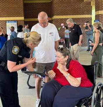
Apr 29-May 1, 2024: Opportunity to present and receive feedback on the initial concepts.
• 2 public presentations, stakeholder meetings, and open studio hours
• 130+ participants


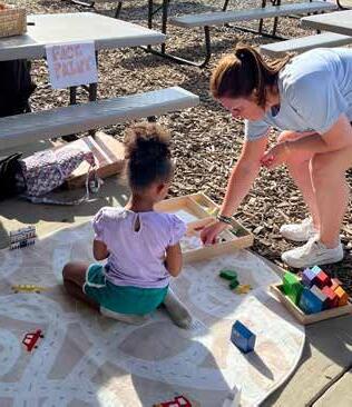
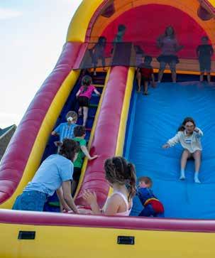
May 1, 2024: Community engagement by bringing the concepts to them.
• 240+ attendees, families, and community partners
• Smart growth exercises, informational booths, and family fun


Design Features of Smart
Growth // Dimensions of
Density // Inspiration
MIXED
GENTLE
CONNECTIVITY
MULTIMODAL TRANSPORTATION
SUSTAINABILITY

CONNECTIVITY
MULTIMODAL TRANSPORTATION
SUSTAINABILITY
Build Successful Neighborhoods

Create Jobs & Prosperity
Protect the Environment
Promote Social & Racial Equity
Improve Transportation Networks
What does a mix of uses and a diversity of uses achieve?
• More plentiful amenities/things to do
• More market support for retail, jobs
• Greater walkability and shorter trips
• Greater sense of discovery (“random encounters”)

Chapel Hill, NC
• Addresses different needs (own vs. rent, singles vs. families)
• Can promote affordability
• Provides visual diversity / interest


What does well-designed gentle density achieve?
• More connections with neighbors
• Collective open space
• A mix of uses (in some cases)
• Greater support for retail and other economic drivers
• Greater support for entertainment


Atlanta, GA
• Reduced isolation
• Reduced traffic congestion
• Greater transportation safety
• Greater flexibility/adaptability and change over time
• Greater opportunity for flexible transit service

Lexington, KY
Conventional suburban network: Well-designed connected network:
■ Lower traffic volumes on local streets
■ Perception of privacy
■ Perception of increased safety
■ Traffic delays, as all local streets feed to same collector street
■ Discourages walking/biking
■ Lower volume of transit users
■ Less adaptable over time
■ Disperses traffic, reducing high volumes on collectors
■ Reduced VMT
■ Encourages walking/biking
■ More transit-friendly
■ Faster emergency response
■ More adaptable over time
■ Potential for reduced privacy as network encourages more activity
■ Less space for auto-oriented businesses

What does multimodal transportation achieve?
• Provides a transportation network to serve ALL users
• Creates a shift in transportation equity
• Encourages active lifestyles and active transportation opportunities
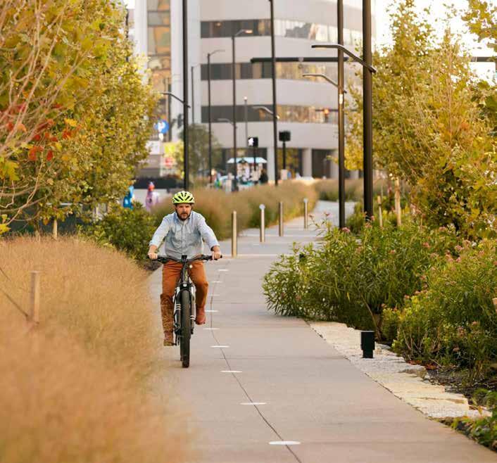
Lexington, KY

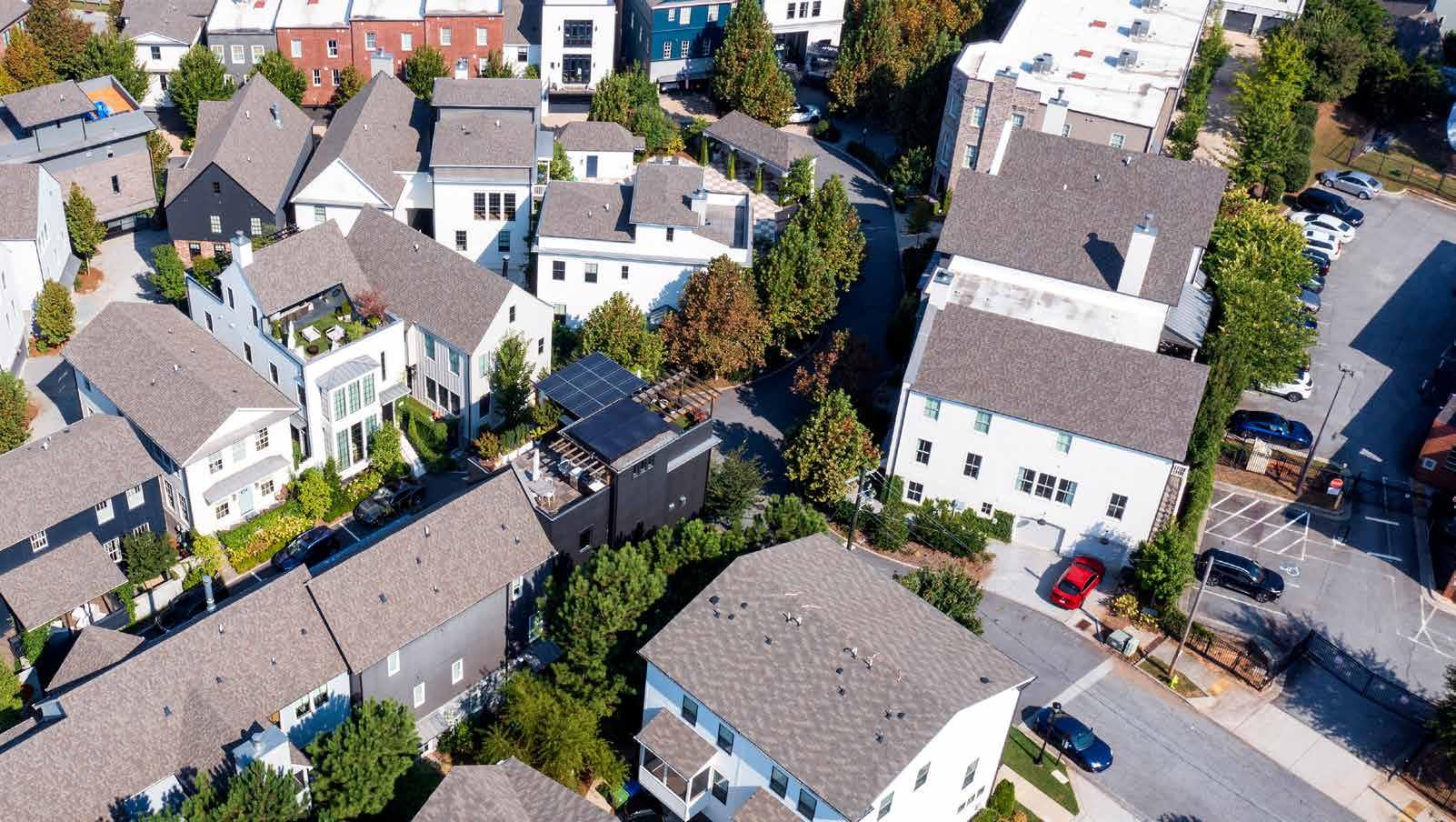
Townhouses along collector streets step down in intensity to single-family.
A street network made up of small blocks offers multiple ways to access the city beyond.
A park provides greenspace to neighbors, and also serves as the stormwater detention for the neighborhood.
Atlanta, GA


Norton Commons is well-connected by trails within open spaces, but along major boulevards as well.
Norton Commons features a mix of multifamily, ground-floor retail, and town-houses, creating a diverse, vibrant Town Center.
Different sections of Norton Commons have different densities, all responding to their surrounding context of that part of the neighborhood.
Louisville, KY

Examples from: Louisville, Atlanta, Lexington


Norton Commons
6.5+ units/acre
Units: 2,880
Types: SF, MF, Townhouses
Size: 595 acres (150 acres of parks and civic space)

~12.5 units/acre
Units: ~350
Types: Single-Family,
Multifamily, Townhouses
Lot Size: varies


Manchester
~15.5 units/acre
Units: ~113
Types: Single-Family,
Multifamily, Townhouses
Lot Size: varies


3.2 units/acre
Adjacent to: Area 1
Units: ~400
Types: Single-Family
Lot Size: 1/3-1/4 acre
Zoning: R-1C


Chilesburg/Hays Blvd
~7 units/acre
Adjacent to: Area 3
Units: ~1,680
Types: Single-Family, Multifamily
Lot Size: ~8,000 sq ft
Zoning: EAR-2


Walnut Creek
8.2 units/acre
Adjacent to: Area 3
Units: 82
Types: Single-Family
Lot Size: ~5,000-6,000 sq ft
Zoning: EAR-1


Adjacent to: Downtown
Types: Single-Family
Lot Size: ~4,500 sq ft
Zoning: R-2


the sweet spot for these areas


Framework Concepts // Refinement // Housing Typologies // Inspiration


General recommendations for:
• Groups of potential land uses (i.e. mixed use, townhouses, retail)
• Groups of intended densities
• Street network
• Open space
• Water
• Unbuildable areas


• Smallest of the 5 areas
• Total acres: 163
• Currently used as pastures
• Challenge of karst features
• Functional concerns along Parkers Mill
• Adjacent trail system
• Includes landscaped entry to Pine Needles Lane (Heritage Place HOA)


Recommendations
Connect back into existing neighborhood (Beaumont)
Connect to potential future urban growth areas
Commercial site along Man O War
Target non-buildable land for greenspace


• Largest of the 5 areas
• Total acres: 1016
• Single-family neighborhood along Hume Road, farms, WKYT News Station, and part of a power substation
• Several streams / floodplains
• Most likely opportunity for near-term transit
• Access concerns to Winchester Road


• Total acres: 640
• Crop and farm uses, Brenda Cowan Elementary and the back portion of Edythe J. Hayes Middle
• Several streams / floodplains / ponds
• Some steep slope concerns
• Access concerns to adjacent neighborhood and Athens Boonesboro Road


Knit
Multiple contact points along AthensBoonesboro Recommendations
Connect to
and Brenda Cowan ES
Protect natural systems


• Total acres: 496
• Large, agricultural tracts along Todds Rd
• Series of 10-acre lots along Canebrake Drive
• Significant steep slope concerns along Canebrake
• Potential for long-term vehicular connectivity
• Proximity to Blue Sky
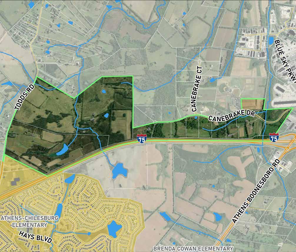

Recommendations
Natural connection into Area 3
Connect to potential urban growth areas
Reserve some acreage for light industrial (good location for it)


• Total acres: 514* (plus an additional 7 acres to parcel boundary)
• Blue Sky Rural Activity Center, highway serving uses, and the new Lexington Sporting Club
• Concerns with access along Athens Boonesboro / I-75
• Significant land disturbance
• Farthest from transit / trails
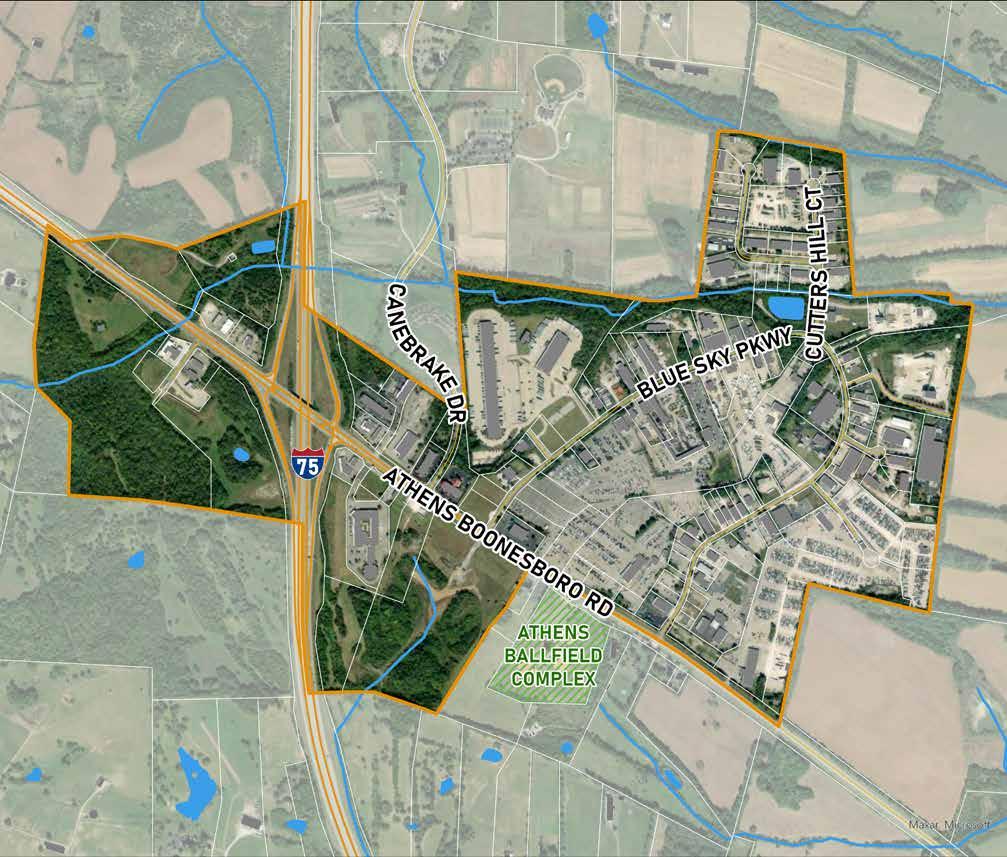
AREA TO BE CONSIDERED IN A FUTURE SMALL AREA PLAN
Recommendations
Natural connection into Areas 3 and 4
Increase opportunity for a district connected to new soccer stadium Consider highest and best use for I-75 corners Connect to potential urban growth areas


• Street network
• Specific buildings and their associated land uses (i.e. townhouses, retail, etc.)
• Open space
• Water, especially stormwater detention
• Parking
• Vegetation


Concept Example - Area 2
What types of housing might be appropriate for these expansion areas?
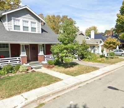
Definition: single-family homes arranged in a subdivision pattern with either narrow or shallow lots
Examples:


Definition: multi-family housing units attached by one or two shared walls, usually built in a linear pattern with narrow or nonexistent setbacks
Examples:


Definition: multi-family housing units 1-3 stories tall built around a shared courtyard or public space
Examples:


They’re missing middle!
Definition: a cluster of single-family homes arranged around a shared common space
Examples:


Definition: a small housing unit considered “accessory” to a single-family home, which can be attached or detached with an entrance typically behind or alongside the main building
Examples:


They’re missing middle!

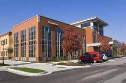
Definition:
Multi-family housing units ranging from 2-10 units per structure, typically standalone and either owneroccupied or leased by individual landlords


Refined design concepts for each site
Advance design concepts that accomplish the following:
• Protect the environment
• Save natural features
• Plan for future connections
• Grid system
• Plan for neighborhood connections that allow for live/work/play
• Provide housing options
