PORT FOLIO
Liu Landscape Architecture | Urban Design | Horticultural Science 919 807 9813 leozc@umich.edu
Zhicheng

EDUCATION
EDUCATION
Ann Arbor, MI | 919 807 9813 | leozc@umich.edu
University of Michigan, Ann Arbor, MI
Master of Landscape Architecture
Master of Urban Design
Expected May 2024
EXPERIENCE
B.S. Horticultural Science, Landscape Design 2016-2021
• Research assistant , University of Michigan School for Environment and Sustainability 2024
- Visualization work of Professor Joan Nassauer’s NSF project on pollinator garden alternatives in Cleveland neighborhoods with property vacancy.
- Research work on the effect of native and non-native plants on pollinators.
• Visualization work, Bailey Park Neighborhood Development Corporation Hub Project at Detroit 2023
- Generated a comprehensive 3D model of the Bailey Park hub landscape.
- Developed graphics for the Bailey Park Hub landscape project, presenting a model envisioning a sustainable Detroit neighborhood designed for the benefit of local residents.
• Team Lead, ULI Hines Student Competition at UMICH
- Managed timeline and tasks for a 5-person, multi-disciplinary team
- Developed urban design and landscape portion of a proposed mixed-use develop project in North Charleston, NC
• Landscape architecture intern, Yellow River Engineering Consulting, China
- Developed solutions and graphics to communicate urban design concepts related to water features for a large-scale tourist development.
TECHNICAL
SKILLS
AutoCAD
2023
04 - 07/2021
• ArcGIS Pro
Microsoft (Excel, Word, Powerpoint)
• Adobe Suite (Photoshop, Illustrator, InDesign)
• Rhino
• SketchUp
• DaVinci Resolve
3D Printing
• Lumion
• Enscape
Aerial photography/filming Sketching
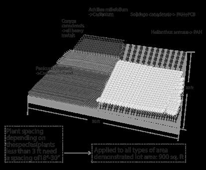
• Landscape Ecosystem Management-Can develop well-designed, installed, and maintained urban/suburban ecosystems offer significant economic and social benefits that directly improve the environment for people, plants, and animals.
• Materials and Methods - Study of construction materials, construction detailing, cost estimating, specifications, and the relationship of specifications to the construction document package.
• Planting Design - Developed and used a design process for creating meaningful and compelled ornamental planting designs. Used spatial articulation (form, enclosure, permeability), physical properties of plants (line, form, texture, color), and utilized principles of visual composition.
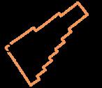
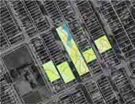
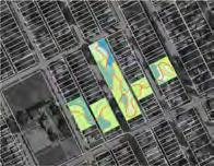
Childrenscape (Individual Project)
Blending interventions and ecology to foster human-wildlife harmony and community connectivity, Ann Arbor
June 2022
Weaving Culture (Group Project)
Weaving Cultural Heterogeneity Into the Urban farbric of Willow Point, Queens
Responsibility: Research, ArcGis, 3D Model (Rhino), Map diagrams, Plaza view renderings
Resilience Rain Park Communities (Group Project/video-only showing individual part)
Recycled Rainwater Irrigation System In Detroit Communities
Responsibility: Research, ArcGis, Developing strategies, 3D Model (Rhino), Video editing, Final renderings
March 2023
of Connection (Individual Project)
Blending interventions and ecology to foster human-wildlife harmony and community connectivity, Ann Arbor
December 2021
November 2022 01 02 03 04 05
Detroit Soil Marketplace (Group Project)
Transform the Industrial Legacy of Detroit Into A Sustainable Clean Soil Industry
Responsibility: Research, Developing narrative of the project, Diagrams, Actor network, Large Detroit map renderings
December 2023
Project)
Mine Recovery System of Silver Peak, Neveda
December 2023
(Working Experience) Three Sister Garden of Bailey Park Hub
Visualization work of Bailey Park Neighborhood Development Corporation Hub Project at Detroit
Responsibility: 3D site scanning, Site model making, Renderings, Planting design
September 2023
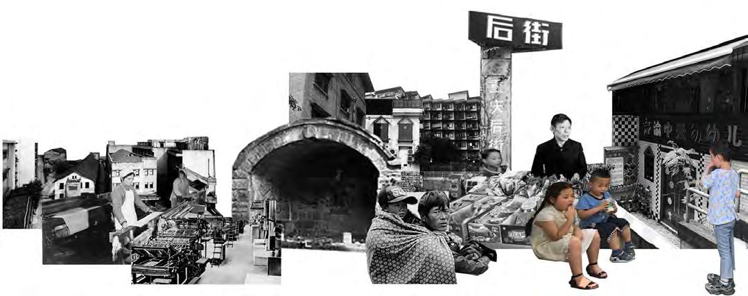
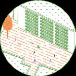
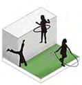
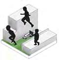
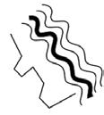
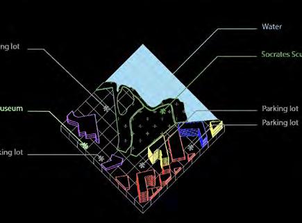
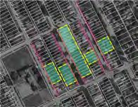
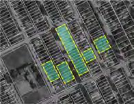
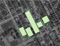
Children may not aware of the impact of a landscape’s absence, yet they envision a better one
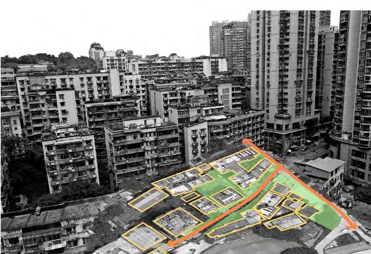
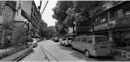
Migrant workers and low-income residents are settling in older communities as urbanization progresses in Chongqing. This has led to the birth of new generations in urban villages, where the landscape is deteriorating and children’s playgrounds are becoming hazardous.
While children may not vocalize concerns about the suitability of their play areas, their childhood experiences in these streets shape their memories indefinitely. Though unable to modify the existing landscape, they possess a keen awareness and evaluation of their surroundings.
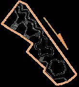
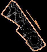
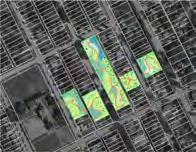
In response, I’ve gathered their perceptions to inform my design approach. By dividing the site into four zones and extracting the boundary forms of each zone, I aim to introduce new activity areas to enhance site utilization. Through subtle geometric interventions, I seek to heighten children’s environmental awareness, thereby crafting a more enriching urban landscape for them.


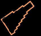
Amid Chongqing’s urbanization, rural migrants and low-income individuals are moving to older communities, swelling urban village populations. However, inadequate planning and aging landscapes compromise the safety of children’s playgrounds and overall environment.
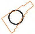
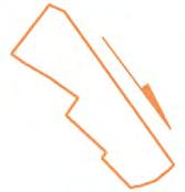
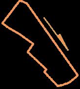
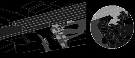
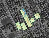
Urban Frabric surrounded The Site


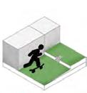
Children can consciously perceive the surrounding environment, and I investigate children's cognition of the existing site and understand their behavior patterns to guide design.
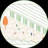
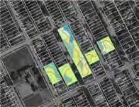
I prioritize creating safe and stimulating environments for children to explore and play. By integrating elements such as retail spaces, streets, fire fields, and farmer's stands into the design, we provide accessible and secure areas for their activities. Children possess innate curiosity and an eagerness to discover new surroundings.
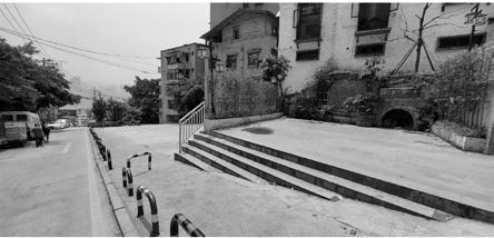
Simultaneously, my design strategy involves eliminating hazardous areas, including stairs, parking lots, and industrial zones. Leveraging children's selfawareness of their environment, we utilize their perceptions as the foundation of our design approach. Through thoughtful reformation and enhancement of these spaces, we aim to foster a more enriching and secure environment for children to thrive in.


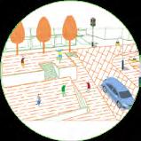
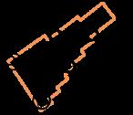
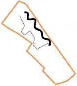
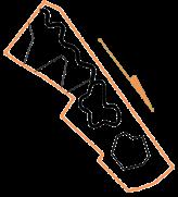
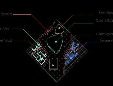
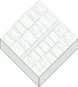
Existing Space And Activity Types Add The Basic Pattern


Rectangle form Oppression form


Team members | Zhicheng Liu, Jamie Chen, Cirilla Xue, Minghui Li
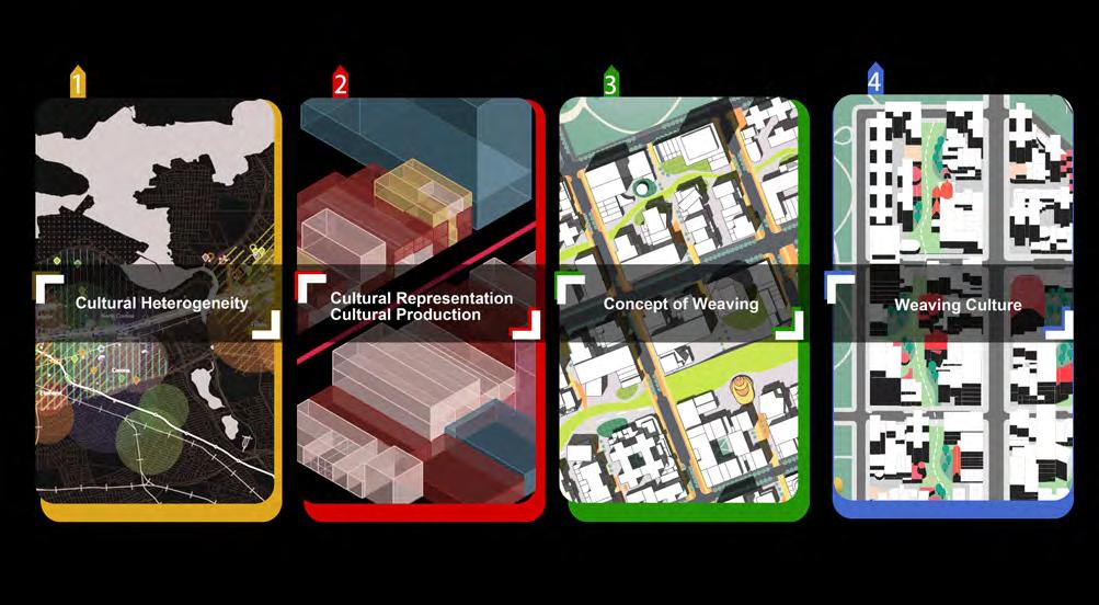
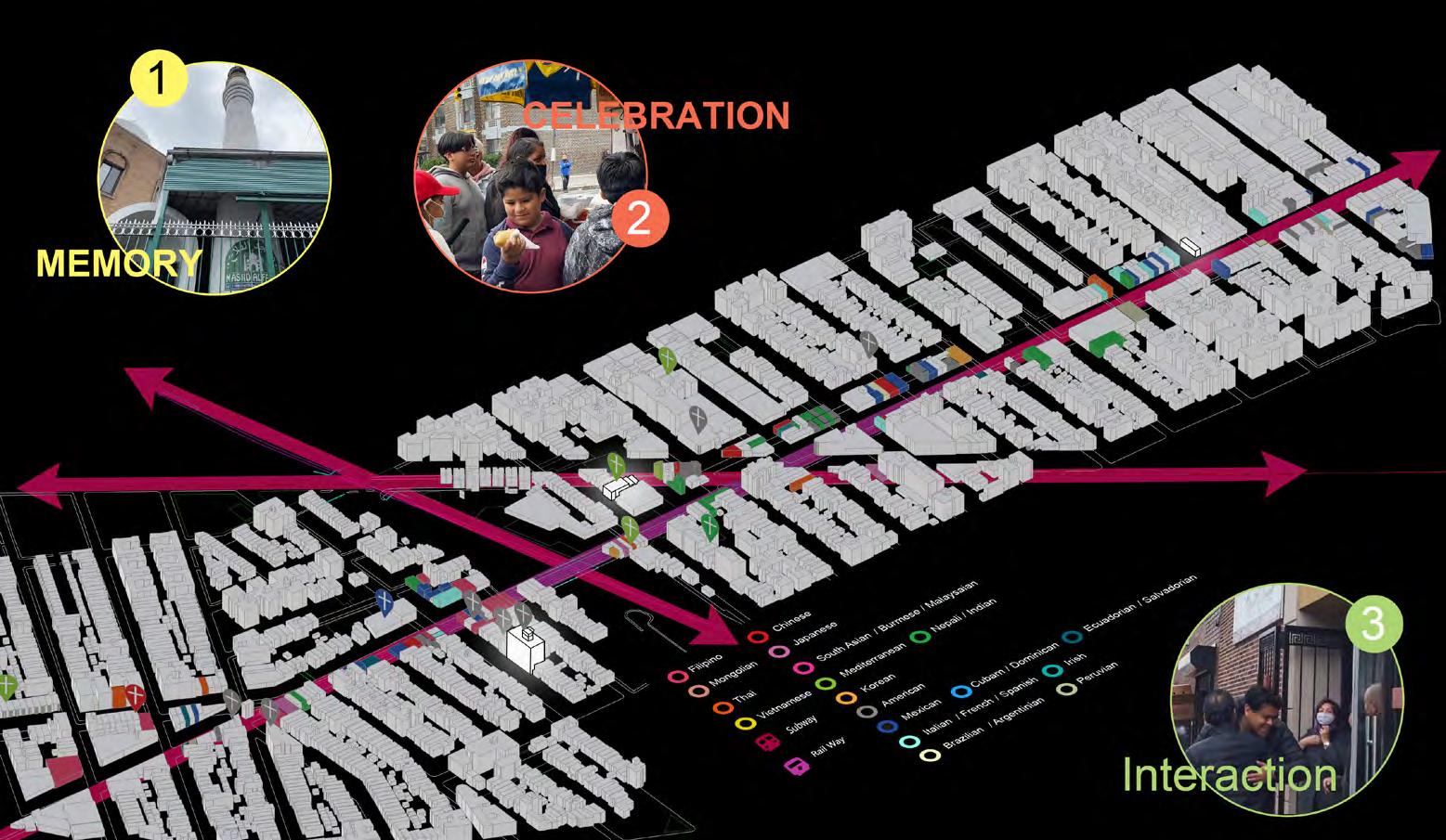
Our project is composed of 4 sections. First is cultural heterogeneity. We used GIS and other resources like Google Maps’ street view to collect the cultural heterogeneity of the area. Second, we identified the urban form typology of Queens and analyzed people’s life routes and the functions of the city. Then, we came up with the concept of weaving to emphasize our fascinating discoveries of Queens. Finally, the outcome of our project - weaving city.
COLLEGE ARCHITECTURE + URBAN PLANNING 2023 STUDENT SHOW: https://tcshow2023.cargo.site/MUD1_Clutter-Nazmeeva_Chen

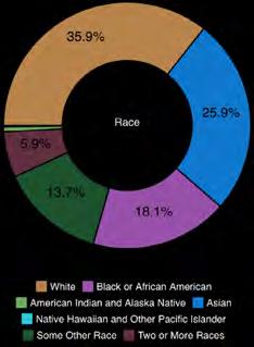

Queens is one of the most diverse places in the world, boasting a community with residents from over 100 countries. With a new influx of tourists, it is now realized that Queens offers a potpourri of cuisine, art, and lifestyle, marrying traditional and modern culture. Visitors can enjoy current attractions as well as popular institutions such as the World’s Fair and Queens Museum that have been around for decades.
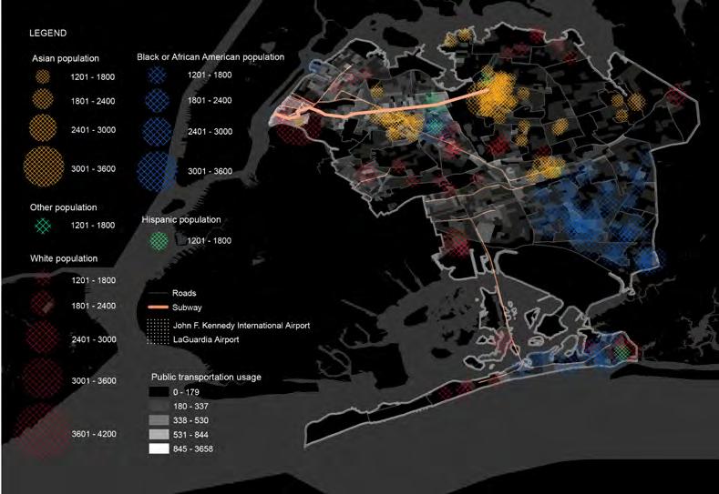
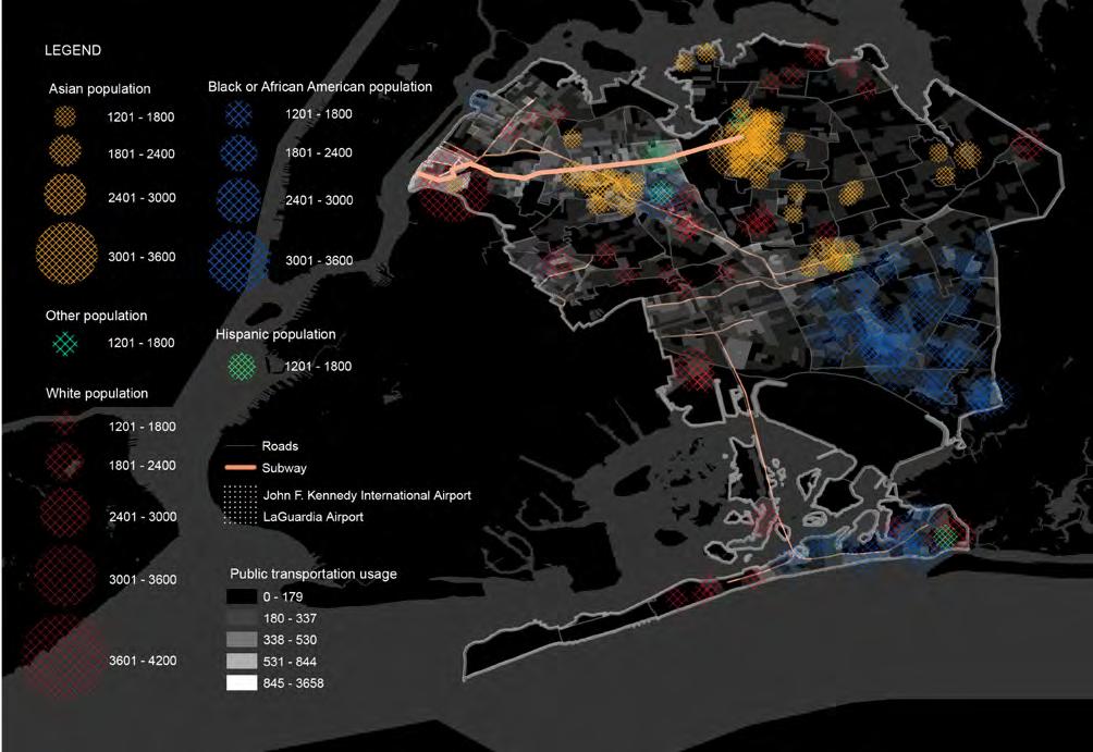
Through our research on demographics and people’s choice of public transportation, we found that the area along the 7 line is the most energetic and dynamic place for heterogeneity because it serves as a means of commuting for people from different ethnicities who live along this line. The 7 line integrates various ethnic groups, including Asian, African American, Hispanic, and others, earning it the nickname “the international express”.
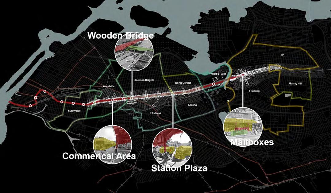
HETEROGENEITY ALONG THE 7 LINE


The subway line 7 passes through various neighborhoods, and when we looked at what was happening in the areas near the 7 line, we found that the subway has a significant influence on the urban spaces below it and the allocation of different facilities. The 7 train track above the road acts as a roof structure that creates a unique atmosphere for the street below, different from other road spaces. The magic of the 7 line, however, happens below ground. The space below is composed of commercial stores, featuring a variety of cuisines from different countries and all kinds of space forms that cater to people’s needs and cultural backgrounds.
CULTURE REPRESENTATION CHARACTERISTICS
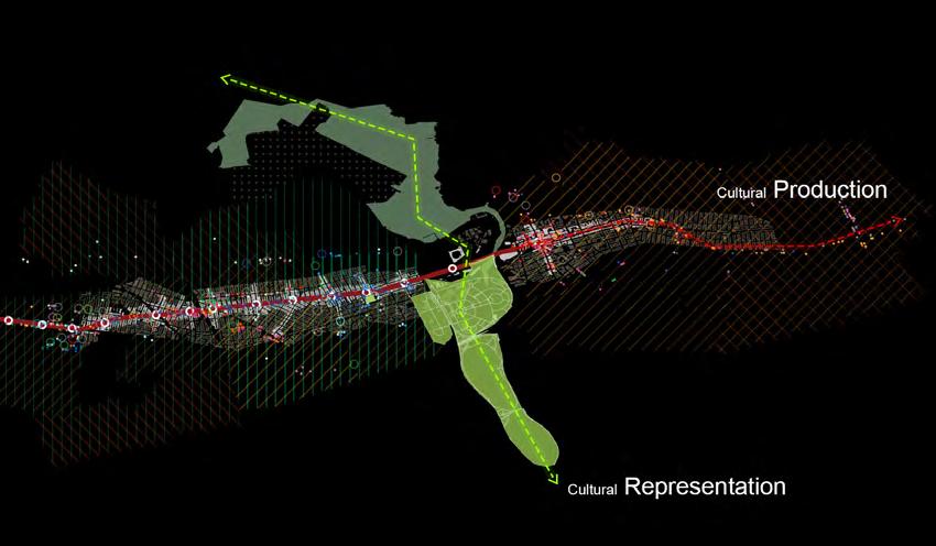
When we combined our findings onto one map, we discovered that our site, Willets Point, is positioned at the intersection of two systems. The cultural diversity along the 7 line intersects with the iconic cultural system of Flushing Meadow Park. We have identified these two systems as the axes of cultural production and cultural representation, respectively.
CULTURE REPRESENTATION CHARACTERISTICS
Cultural production refers to the creation and utilization of cultures in physical forms, such as cuisine and religious institutions like churches. Along the urban fabric adjacent to the 7 train, a mix of residential and commercial functions fosters a vibrant lifestyle.
On the other hand, Cultural Representation entails the portrayal of culture through iconic cultural buildings and public art within the landscape context. These two concepts form the foundation of our design approach, guiding our strategies and interventions.

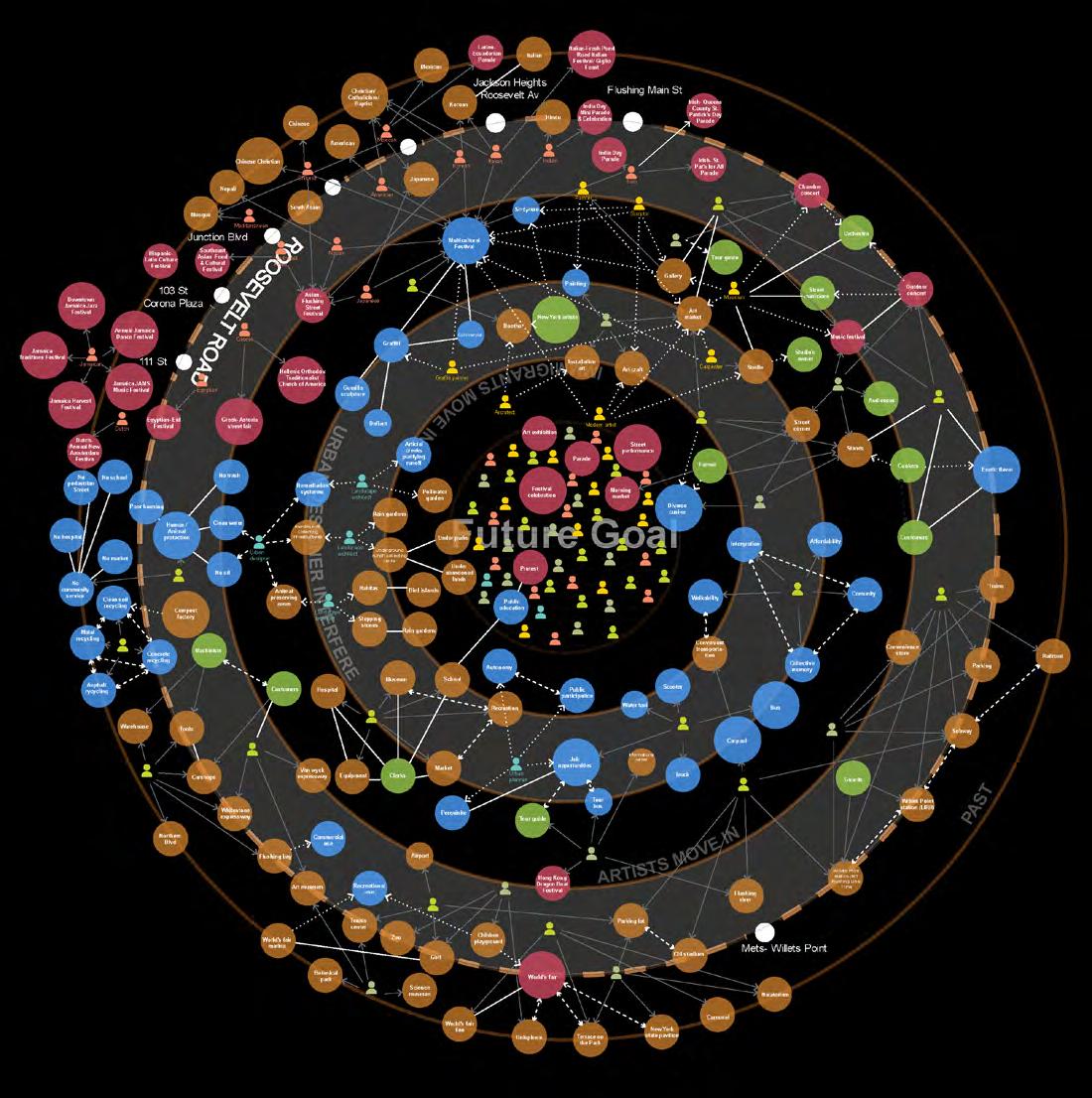
A cultural story happening along 7 Line
• Diverse cultural activities along the 7 line: Jackson Heights, Willets Point, and Flushing.
• Willets Point identified as having potential for a multicultural space due to its central location amidst diversity.
• Proposal for extending and displaying diverse culture in Willets Point through art.
• Concept of a theme park as a space for integrating diverse cultures and encouraging cultural activities.
• Importance of artists moving in to establish studios, exhibitions, and art practices.
• Formation of an art district attracting public attention and urban designers.
• Regeneration process involving restoration of brown land, provision of facilities, and job creation.
• Influx of immigrants contributing to a livable, multifunctional, artistic community in Willets Point.
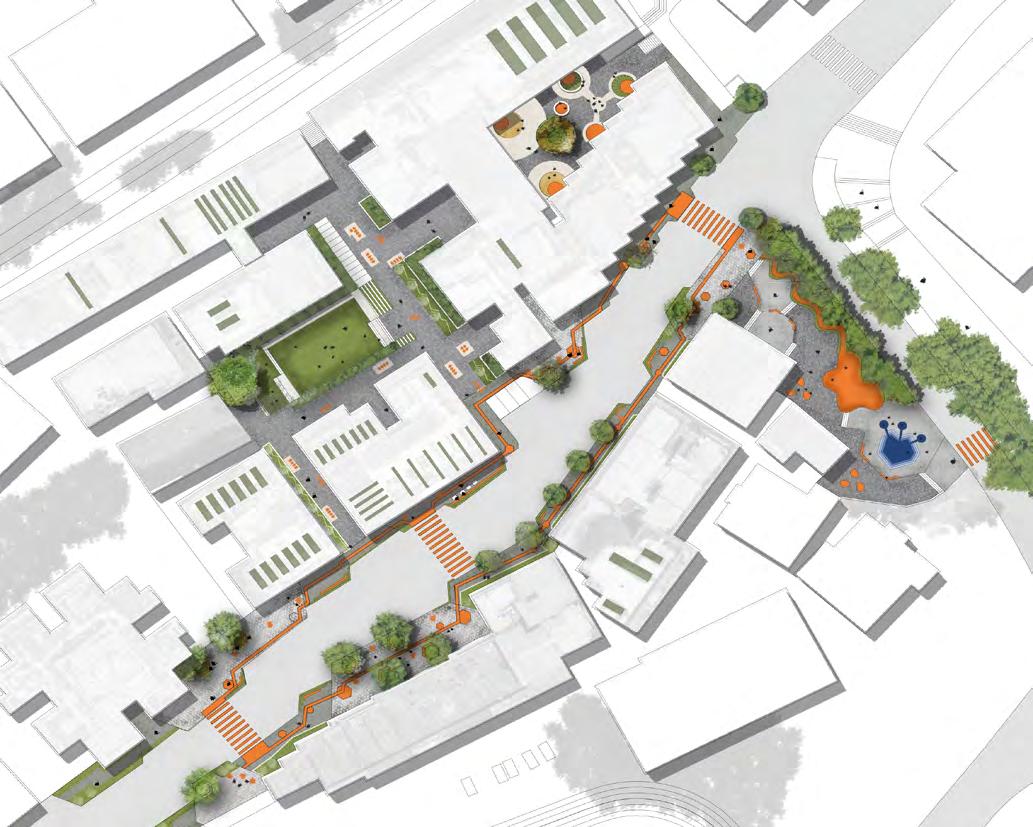
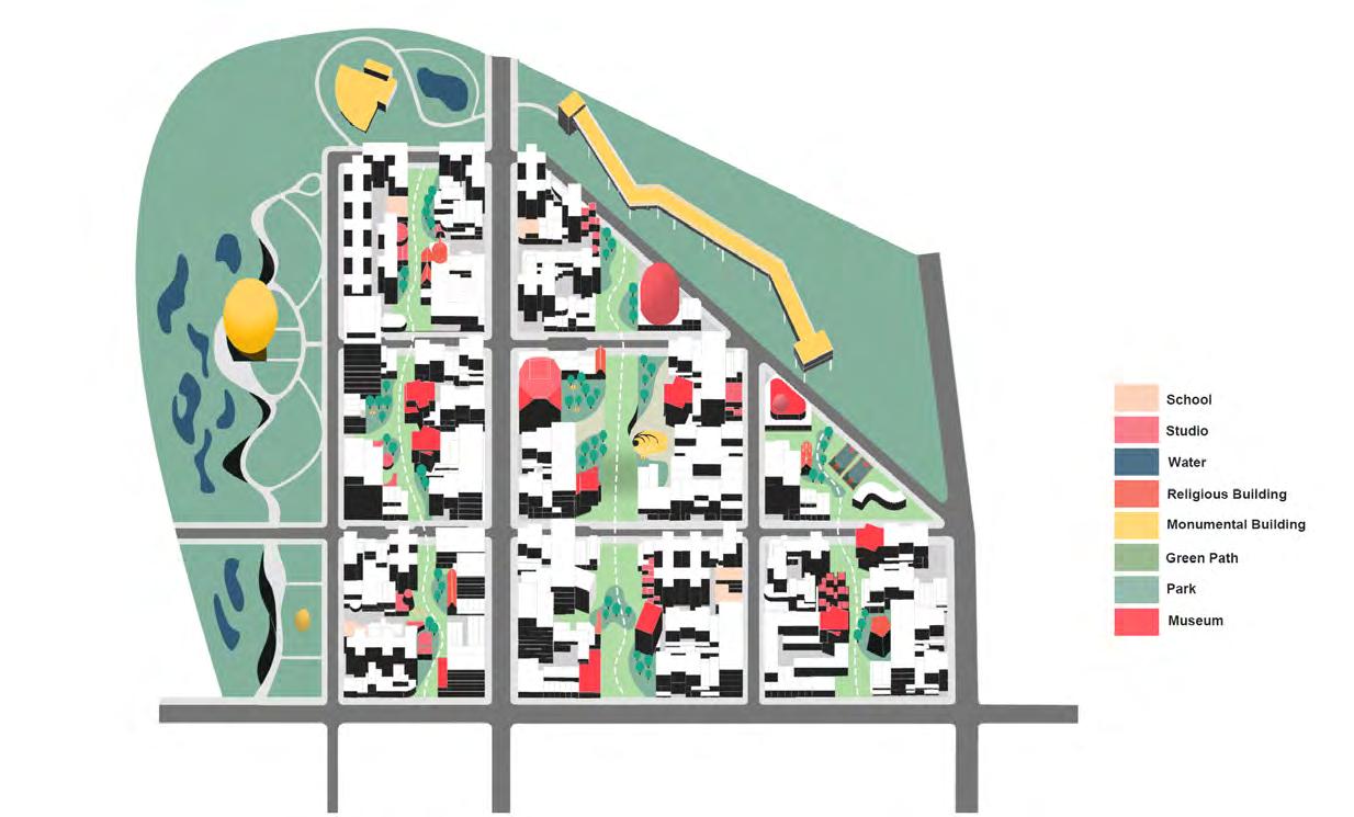
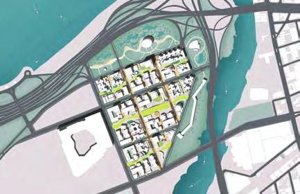
Our concept is called “Weaving Culture.” We began by analyzing cultural production along the 7 Line and cultural representation in Flushing Meadow Park. Next, we divided Willets Point into nine blocks based on the existing road network. We then extended cultural production into Willets Point, taking inspiration from the bustling commercial buildings along Roosevelt Avenue. Similarly, cultural representation permeated into Willets Point from the extension of Flushing Meadow Park. We used cultural buildings and open spaces to represent culture along these three corridors. Finally, we divided cultural representation into different widths and integrated it with the urban fabric, creating a cohesive tapestry of cultures.
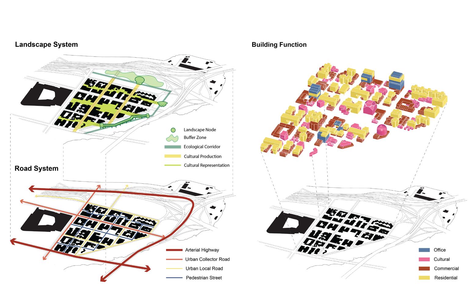
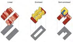
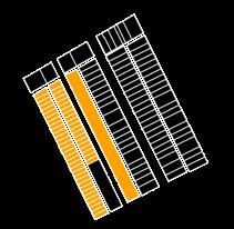
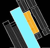
Along the 7 line, there are two primary block morphologies: linear and enclosed. The linear morphology involves stacking commercial buildings to create inner and outer pathways, while the enclosed morphology involves enclosing residential and commercial buildings to form a courtyard. In addition, we introduced a semi-enclosed morphology, which combines elements of both. This involves a mixed-use building inserted
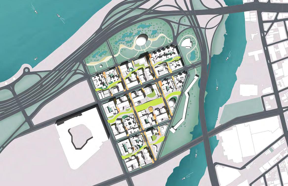
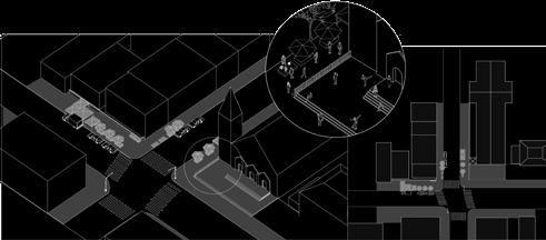
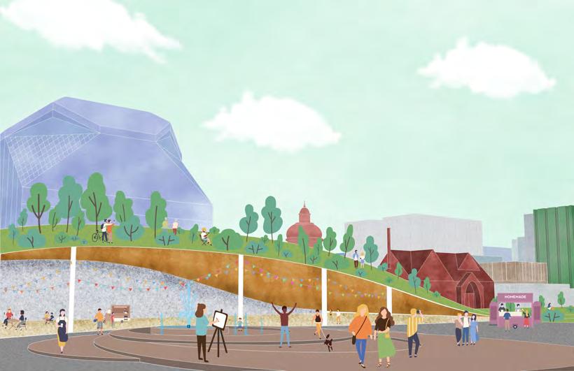
Here are the three curved Cultural Representation Corridors, spanning from west to east. These pathways, highlighted in green, prioritize the representation of cultural buildings and public art within the landscape context. Along these corridors, you’ll find various cultural institutions such as museums, artist studios, and religious buildings. Extending from the 7 Line, the roads transform into commercial streets, mirroring the atmosphere of Roosevelt Avenue. These streets constitute the Cultural Production zone, characterized by two main traffic lanes and three secondary pedestrian paths. This directional arrangement minimizes the distinction between the front and back sides of the commercial streets, promoting fluid circulation.
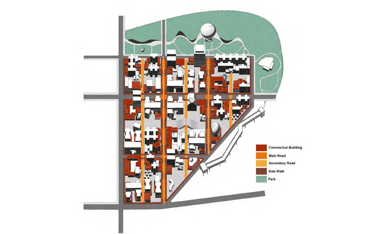

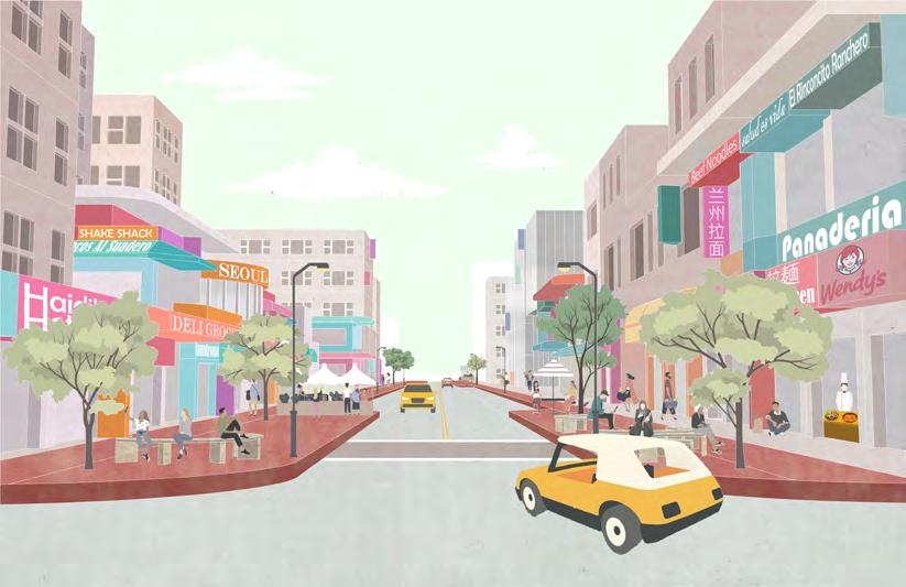
The secondary cultural production corridor inside the block is a relatively quiet and narrow street. As a pedestrian-oriented design, it provides residents with facilities and street furniture, creating a vibrant living alley.
Transitioning to the cultural representation corridor reveals a distinctly different environment from the cultural production area. This corridor is defined by its landscape design, characterized by numerous open spaces created by its curved path, ideal for various activities. Lining the corridor are numerous cultural buildings, with their spatial arrangement serving as the focal point of cultural representation.
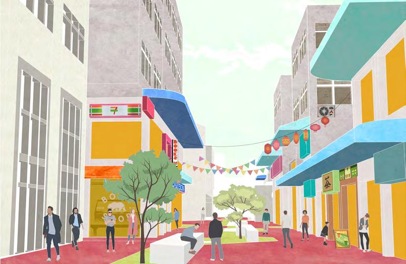 CULTURAL PRODUCTION | VIBRANT LIVING ALLEY
WEAVING CULTURE
WEAVING CULTURE
CULTURAL PRODUCTION | VIBRANT LIVING ALLEY
WEAVING CULTURE
WEAVING CULTURE
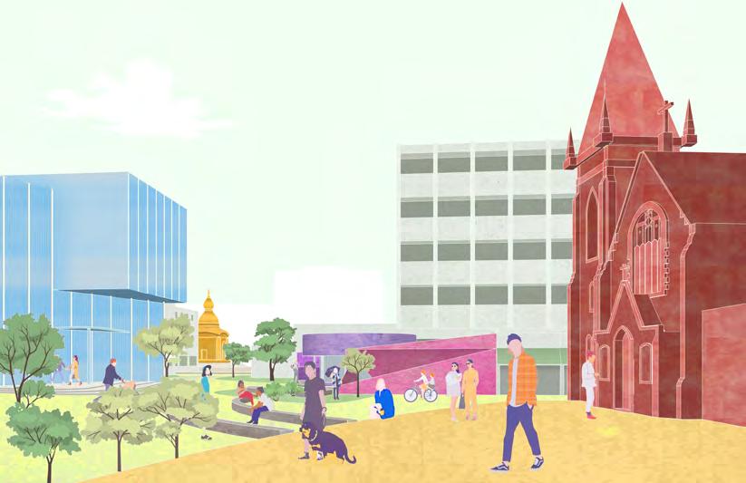
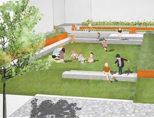
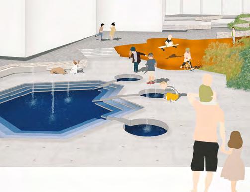
This is the culture club, at the centre of our design. Located at the junction of Cultural representation and secondary cultural production corridor It is a public space where architecture and landscape blend And also a monument in the neighbourhood, orienting people in the urban fabric. The fountain plaza and the landscape architecture provide for large-scale events to happen. Similarly, it is surrounded by many cultural buildings, creating a cultural centre square inside the block.
Jump to the cultural representation corridor. It shows a very different environment from Cultural production. The corridor is based on the landscape design. Many open spaces created by the curved path provide a place for activities. Many cultural buildings are along the corridor, and the spatial arrangement of them is the focus of Cultural representation.

Weaving Cultural Heterogeneity Into the Urban farbric of Willow Point, Queens
Responsibility: Research, ArcGis, 3D Model (Rhino), Map diagrams, Plaza view renderings
Location: Detroit, MI
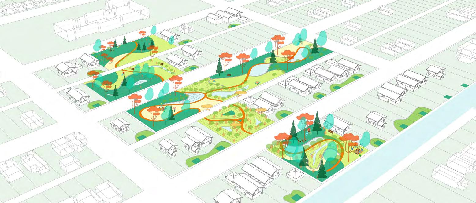
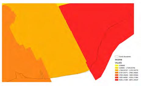
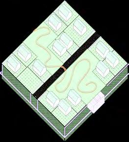
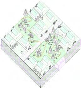
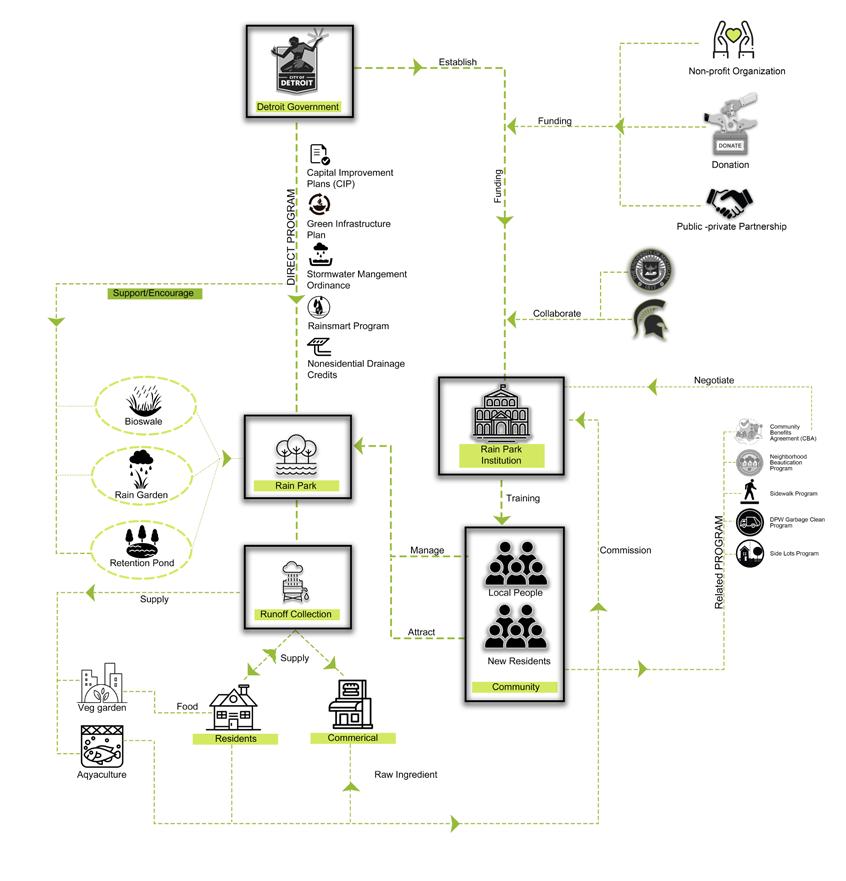
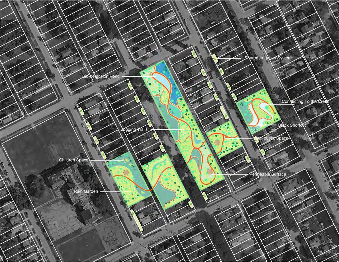
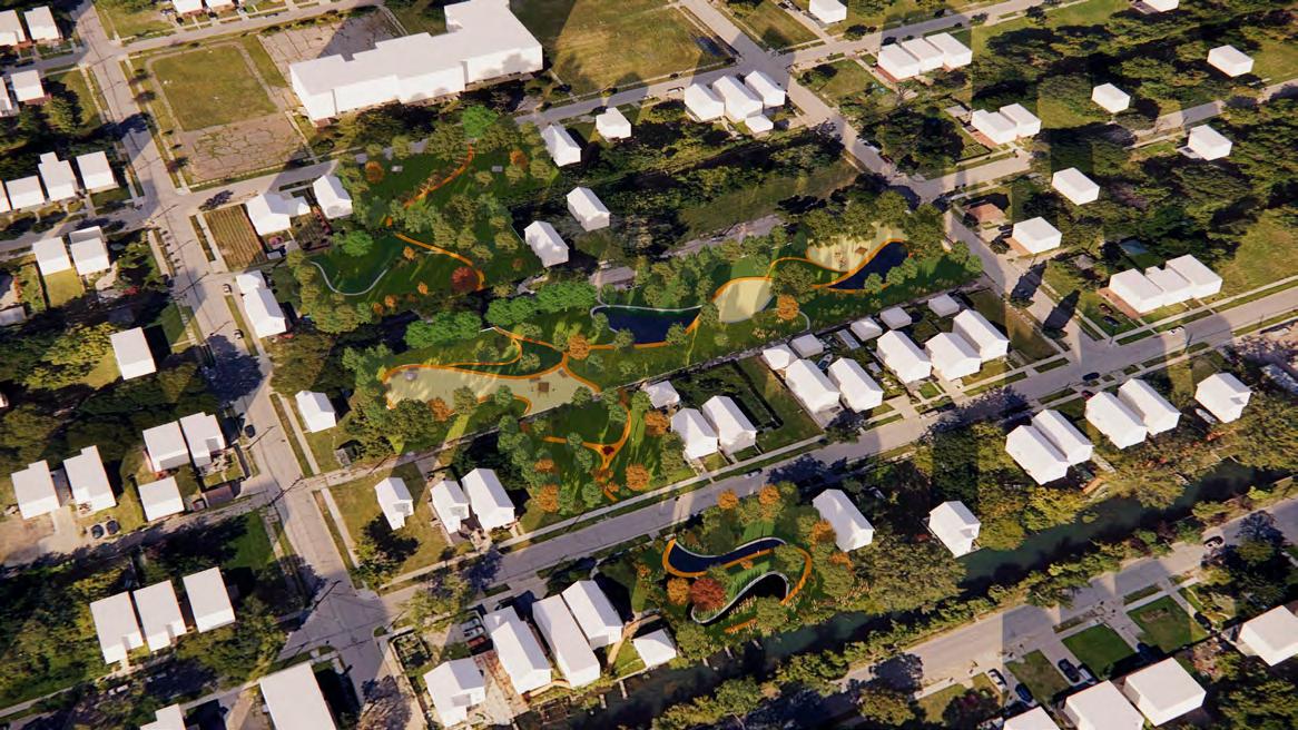
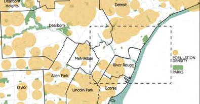
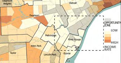
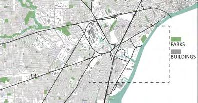
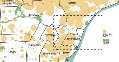
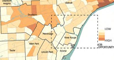
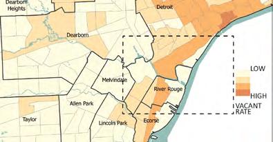
Detroit is facing significant challenges related to both flooding and vacant lots. The city’s aging infrastructure and limited resources have contributed to a growing problem of flooding, especially in low-lying areas, which has resulted in damage to homes and businesses. Additionally, Detroit has a large number of vacant lots, with many areas of the city experiencing blight and abandonment. These vacant lots present safety and health risks for residents while also hindering economic development. After our analysis of the Detroit neighborhood, we have created ecological strategies like rain parks and related programs to revive Detroit’s vacant land.
Video Link: https://youtu.be/1IFIZ0tmpdQ
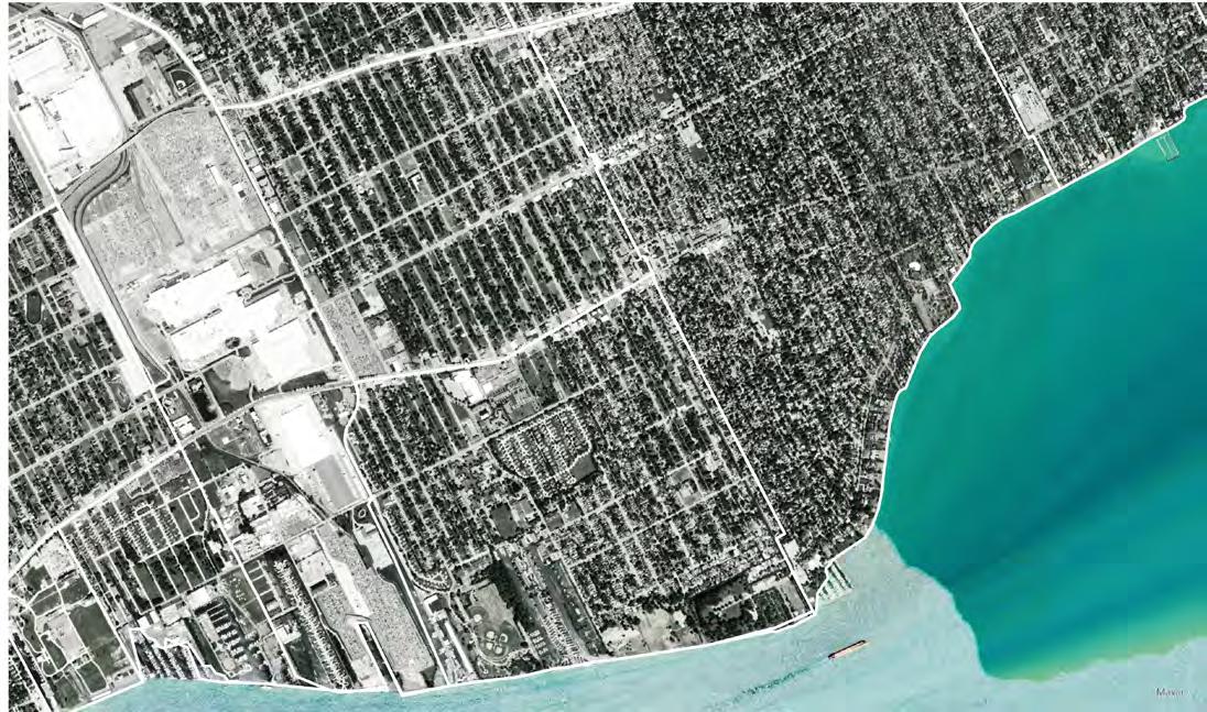
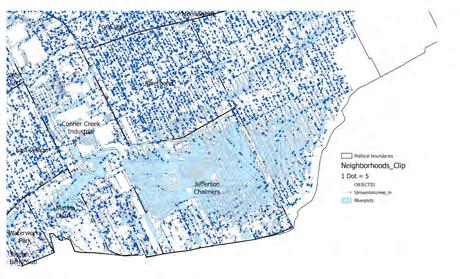
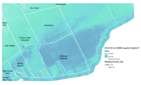
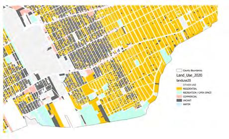
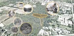
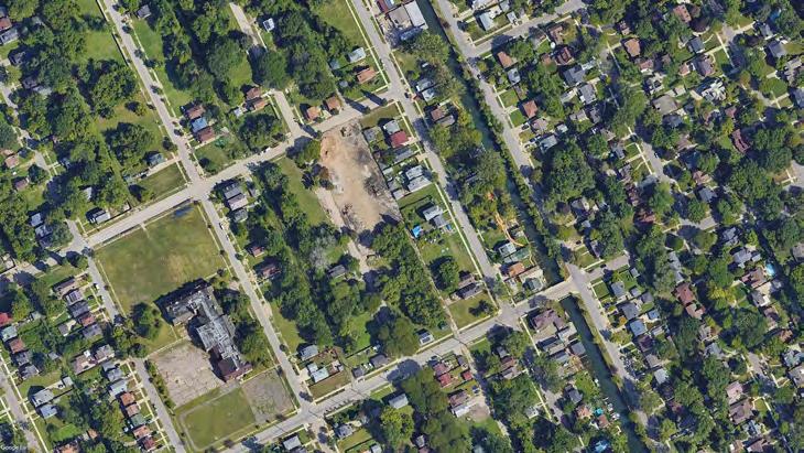
Nestled within the heart of Detroit, Jefferson Chalmers stands as a poignant reminder of the challenges faced by many urban neighborhoods. Characterized by pockets of poverty and a significant number of vacant properties, this community grapples with the effects of economic downturns and disinvestment that have left scars on its landscape. Once a thriving hub of activity, Jefferson Chalmers now bears the weight of neglect, with boarded-up buildings and overgrown lots serving as stark reminders of better days gone by.
The main component of this irrigation system is what we named “Rain Park,” a collective green infrastructure system installed in a park area that provides economic, social, and environmental benefits to the study area. The Rain Park can collect runoff from the neighborhood and purify it, allowing residents to use it for other purposes such as watering gardens, car washing, or landscaping instead of flushing it down into the sewer. This process could reduce residents’ utility costs and the workload of local water and sewerage systems. The irrigation system can also help with local urban farming to address the food security issue.


Lock of Basic Infrastructure
Impermeable Road Surfaces
Vacant Abandoned Houses And Land
• Poor quality of life
• Flooding issues
• Vermin
• Unauthorized occupants
Public Community Space
Path Cross Through Communities
Green Infrastructure
• Make use of vacant land(Rain park)
• Purple pipe&water cistern system
• Create more activity space
• Design ecological architecture typology
Green Roof Collecting Runnoff
Underground water cistern
• Reducing water utility bill
• Further reducing flooding issues
• Shaping anf revitalize community
The project aims to revolutionize urban landscapes by establishing a park system that not only mitigates environmental concerns but also fosters community growth and economic development. By repurposing runoff for irrigation and household use, and utilizing Tax Increment Financing (TIFs) and Community Benefits Agreements (CBAs) to finance the project, we envision a future where communities thrive, jobs are created, and vacant land is revitalized. Join my vsion of building a more sustainable and equitable future.
 Purple Pipe
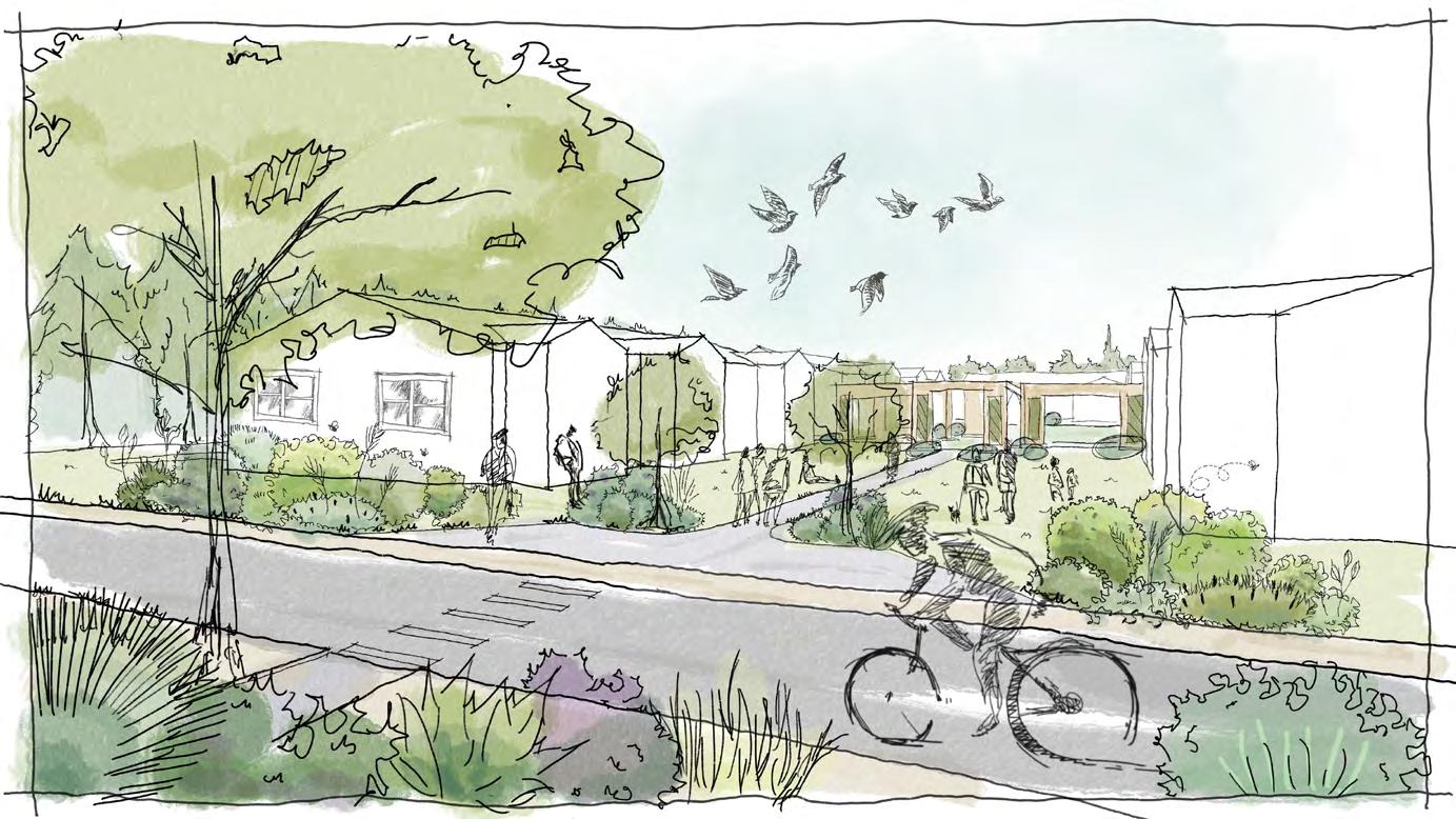
Many actors work together in this initiative, in close association with the community, the government, private investors, NGOs, and colleges. The Detroit government has direct and related programs that support rain park programs such as the Green Infrastructure Plan, Rain Smart Program, Side and Neighborhood Lots program, Nonresidential Drainage Credits, etc. We also propose a Rain Park Institution that will be established by the Detroit government in collaboration with colleges, which will train the community to manage the rain park together. The rain park brings benefits to residential areas, such as vegetable gardens, irrigated lawns, and car washes. Businesses can also utilize recycled water. The improved environment and emerging businesses attract new residents and alleviate the vacancy rate of the land. More and more activities are expected to happen on this land.
The initial phase of rain park development involves combining vacant lots and developing them as shared properties, incorporating a system of purple pipes to collect and store water within the community. We implement various features such as green roof eco-houses, rain gardens, lawns, permeable ground, and playground activity fields.
On sites adjacent to commercial boulevards, my focus is on backyard vegetable gardens and integrating the rain park water system through purple pipes. Additionally, there are markets, exhibition centers, and community playgrounds developed.
the site vacant lots for parks

Orginal Property line
Orginal Property line
Mix-use Road
Terrain Line
ground
Yet, within these challenges lies an opportunity for transformation, and our project offers a beacon of hope for Jefferson Chalmers and its residents.
At the forefront of our initiative is the adoption of ecological strategies, particularly the implementation of rain parks, to breathe new life into the vacant land and address flooding issues plaguing the neighborhood. By repurposing runoff for irrigation and household use, we not only combat environmental concerns but also alleviate financial burdens on local residents, providing a tangible solution to pressing problems.
But our vision extends beyond mere infrastructure improvements. We see Jefferson Chalmers as a canvas for community empowerment and economic revitalization. Through collaborative efforts with developers and residents, we aim to turn vacant lots into vibrant community spaces, where rain parks serve as hubs of activity, greenery, and opportunity.
 Proposed rendering
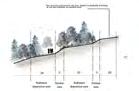
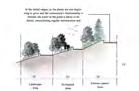
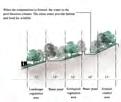
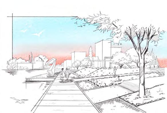
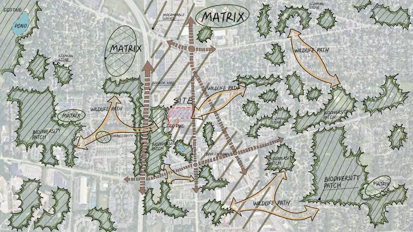
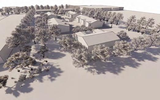
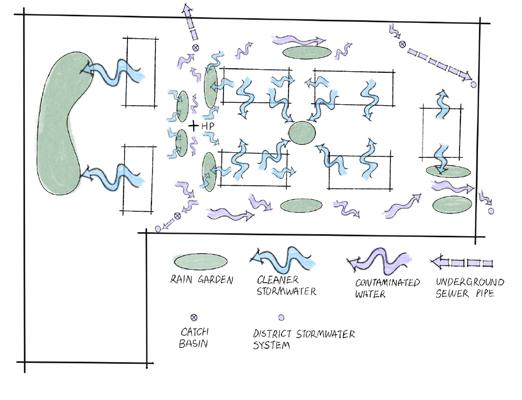
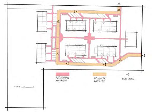
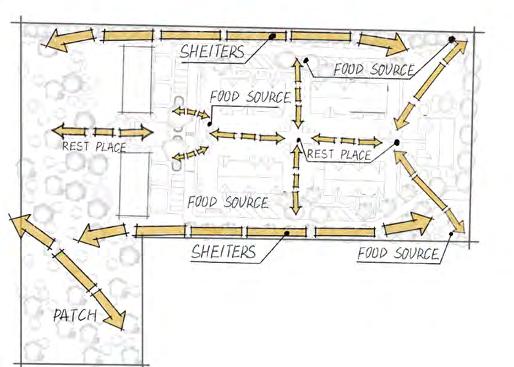
The overarching concept aims to foster human connectivity and enhance community interactions through strategic design interventions. Ecologically, this approach yields numerous advantages for wildlife, fostering harmonious cohabitation between animals and humans. Leveraging the geometrical configuration of pedestrian pathways augments community engagement. Additionally, strategically planting vegetation serves to regulate wildlife movement patterns, thereby optimizing their chances for thriving alongside human populations.
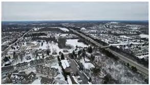
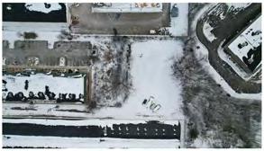
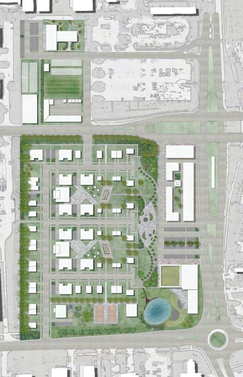
The site, situated to the west of Ann Arbor and adjacent to Interstate 94, finds itself within an ecological fault zone, primarily due to the heavy traffic and extensive presence of parking lots, which contribute to a fragmentation of habitat connectivity. Despite its relatively modest size, this location holds notable ecological significance. Its role in fostering habitat restoration and connectivity is pivotal for the broader ecosystem of the region. Therefore, while our site may not occupy a vast expanse, its impact is far-reaching, contributing significantly to the enhancement and preservation of the local ecosystem.
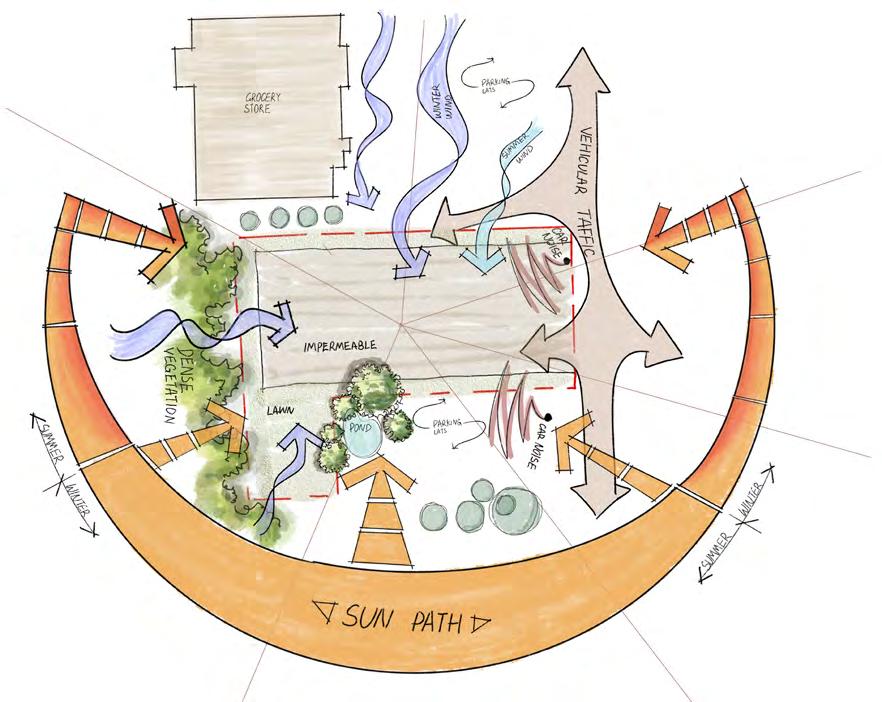


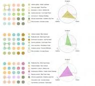
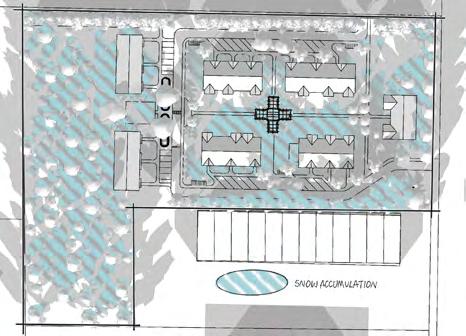
Strong winter winds facing can lead to increased heat loss, property damage, and discomfort for residents.

Traffic hazards can disrupt safety, peace, and community well-being, posing risks to pedestrians, cyclists, and children playing, while also increasing noise and pollution levels.
Heavy snow accumulation in residential areas can lead to transportation disruptions, property damage, and increased risk of accidents.
Excessive noise pollution can lead to sleep disturbance, increased stress levels, and decreased overall quality of life for residents.
Standing water poses risks of mosquito breeding, property damage, and potential health hazards.
A low site utilization rate can lead to inefficient land use, decreased housing availability, and limited community amenities, hindering overall urban development and livability.
Conceptual Diagram

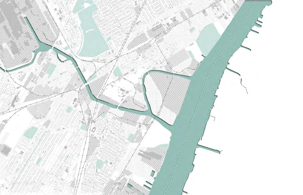
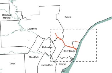
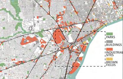
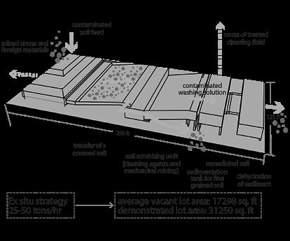
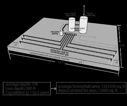
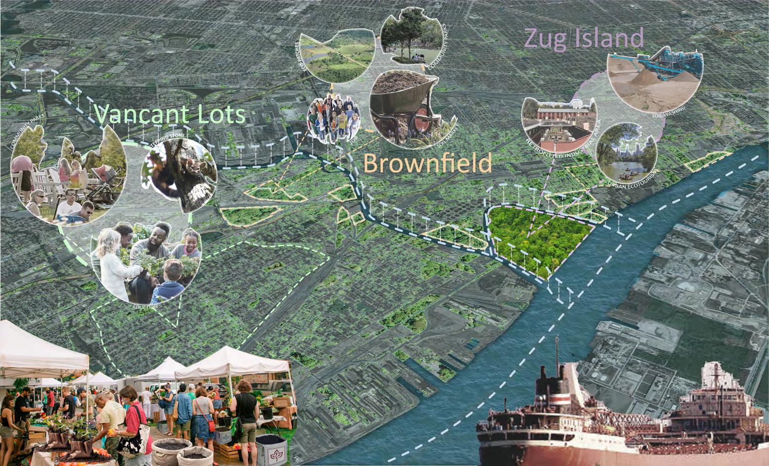
Detroit, born from heavy industry, faces decades of environmental pollution, notably around the Lower Rouge River. The Detroit Soil Marketplace sees contaminated soil not as a problem, but as an untapped resource. In the next 50 years, the initiative aims to remediate all polluted soil, revitalize the land for community use, and create a sustainable soil cleaning industry. This vision transforms the Lower Rouge into a hub for a clean soil industry, fostering economic, social, and environmental growth for Detroit.
INSTRUCTORS: LISA DU RUSSEL
Detroit
Michigan
MAIN POLLUTANTS:
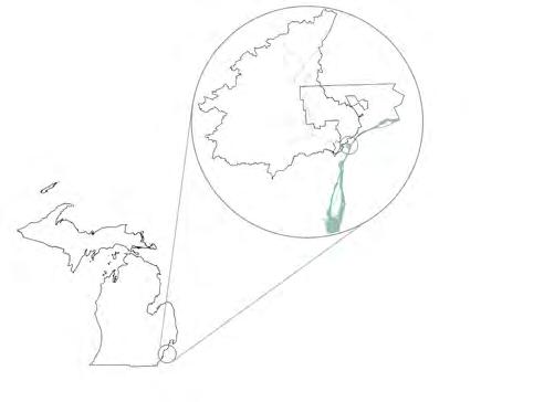
Rouge River Watershed
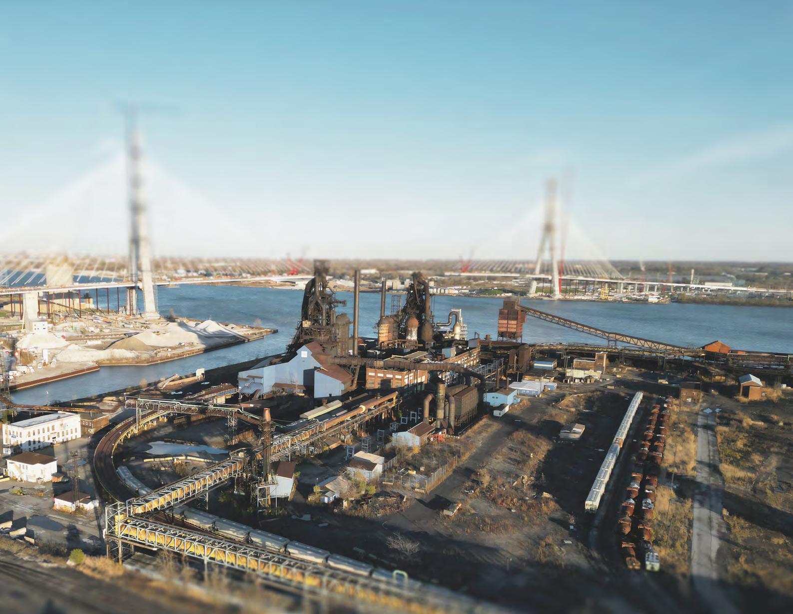
Zug Island
ZUG ISLAND WAS A THREE-QUARTERSMARSHY PENINSULA WITH A NATURAL SULFUR SPRING. 325 ACRES OF LAND WAS BOUGHT BY SAMUEL ZUG.
SAMUEL ZUG INVESTED TO CONVERTE THE NATURAL PENINSULA INTO A HUMAN-MADE ISLAND.
ZUG ISLAND WAS SOLD AND TRANSFORMED INTO INDUSTRIAL DEVELOPMENT.
SEVERAL BLAST FURNACES FOR STEEL PRODCTION WERE BUILT.
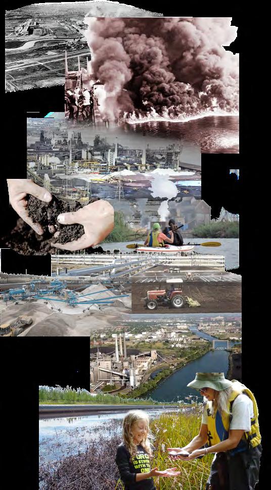
THE CANAL WAS ENLARGED AND FORD ROUGE PLANT WAS BUILT IN EARLY 1928. POLLUTANTS WERE DISCHARGED INTO THE LOWER ROUGE RIVER BEFORE 1970s, MAKING THE OLD CHANNEL A CONTAMINATED SEDMENT HOT SPOT.
ZUG ISLAND WHEN ROUGE RIVER CAUGHT FIRE.
70,000 CUBIC YARDS OF OF CONTAMINATED SEDIMENTS WERE CARRIED OUT AND REMEDIATED AT A COST OF $50 MILLION.
SOIL WASHING
PROPOSAL OF OUR PROJECT TO TRANSFER THE DREDGED SOILS FOR REMEDIATION.
1902 1859 1888 1891 1969 2018-2020 2023 2073
THE ROUGE RIVER TRANSPORTATION CHANNEL CONTINUES TO REQUIRE DREDGING EVERY 2-5 YEARS. CONTAMINATED DREDGED SOIL IS CURRENTLY BEING STORED AT POINTE MOUILLE CONFINED DISPOSAL FACILITY, WHICH WILL REACH CAPACITY IN 5-10 YEARS. CONTAMINATED SOIL IN SURROUNDING BROWNFIELDS & VACANT LOTS ALSO NEEDS TO BE REMEDIATED & REVITALIZED TO PREPARE FOR FUTURE GROWTH DUE TO CLIMATE & POLITICAL REFUGEES.
WETLAND WILL BE RESTORED. THE CONTAMINATED SITES WILL BE REVITILIZED BY THE “CLEAN” SOIL FOR SOCIAL EVENTS AND EXCHANGE IN MARKET.
SOCIAL SUSTAINABILITY
IMPROVE COMMUNITY HEALTH, CREATE COMMUNITY HUBS, & PROVIDE OPPORTUNITIES FOR FUTURE DEVELOPMENT TREAT CONTAMINATED SOIL THROUGHOUT THE LOWER ROUGE REGION & INCREASE GREEN SPACE
ECONOMIC SUSTAINABILITY
TURN AN UNUTILIZED RESOURCE INTO A SUSTAINABLE INDUSTRY THAT PROVIDES AN ONGOING SOURCE OF REVENUE AND JOBS FOR THE CITY
•
•
•
•
•
•
•
•
•
•
•

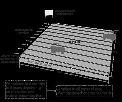
Our vision of the Detroit Soil Marketplace plays out across 3 different landscape typologies over 3 phases during the span of the project. The landscape typologies play different roles in the process of clean soil production and provide different social, economic, and ecological benefits over the different project phases. Different strategies for soil remediation are employed at each landscape typology based on the sources and types of contaminants present in the soil being treated, the destination of the remediated soil, and the location and size of the site.


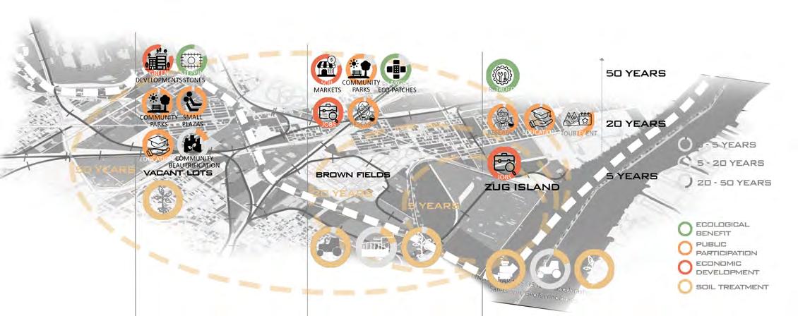
Ultimately, the whole lower rouge area will be a much more vibrant and environmentally friendly place to live, work, and play. Once-vacant lots will bring life back to the neighborhoods as places for local gathering, development, and ecological stepping stones. Former brownfields will serve as ecological patches and provide much-needed community green space and economic opportunities. Zug Island will be transformed into a beacon of the region’s industrial past with its retrofitted industry and its vast green space that will attract locals as well as tourists. The movement of soil through the area and production of clean soil will sustain the lower Rouge communities into the future and bring glory back to the city.
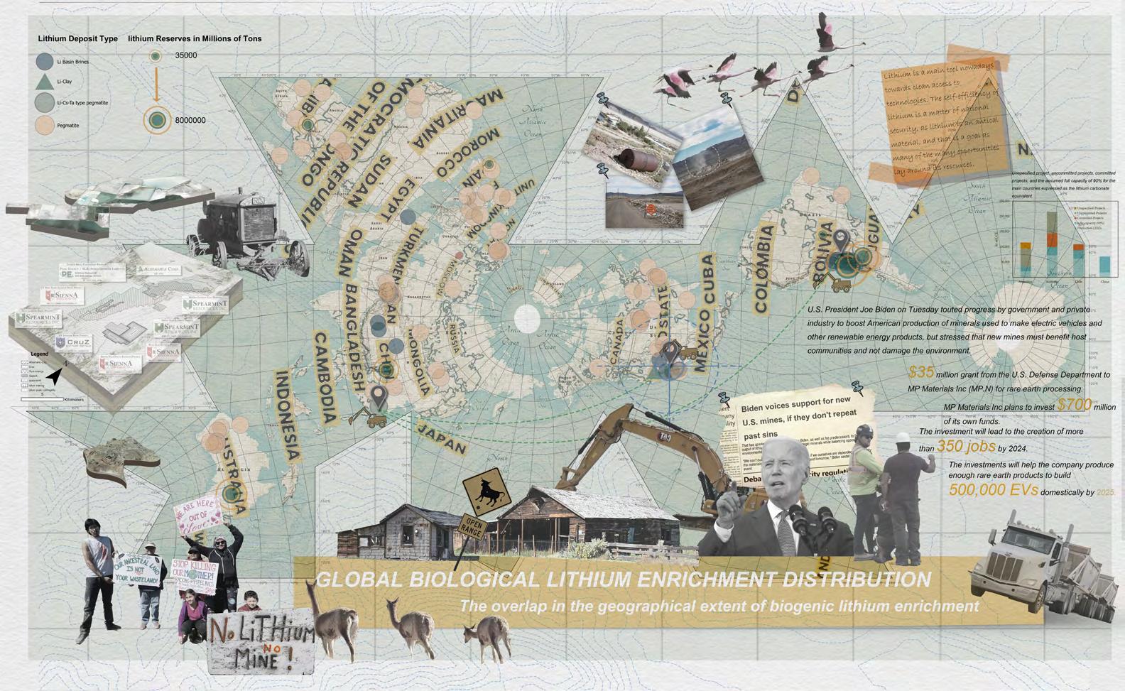
Today, the Biden administration is scaling up lithium mining to, surprisingly, address climate change. Mining causes water contamination and disrupts wildlife habitats, encroaching on lands inhabited by indigenous communities and leading to land rights conflicts and loss of cultural heritage. As a designer, I believe that we have been given a second chance to do it right this time.
We as designer can minimize the negative impact of the human footprint in mining lands and restore the ecosystem after the mine is decommissioned.
LithiMorphic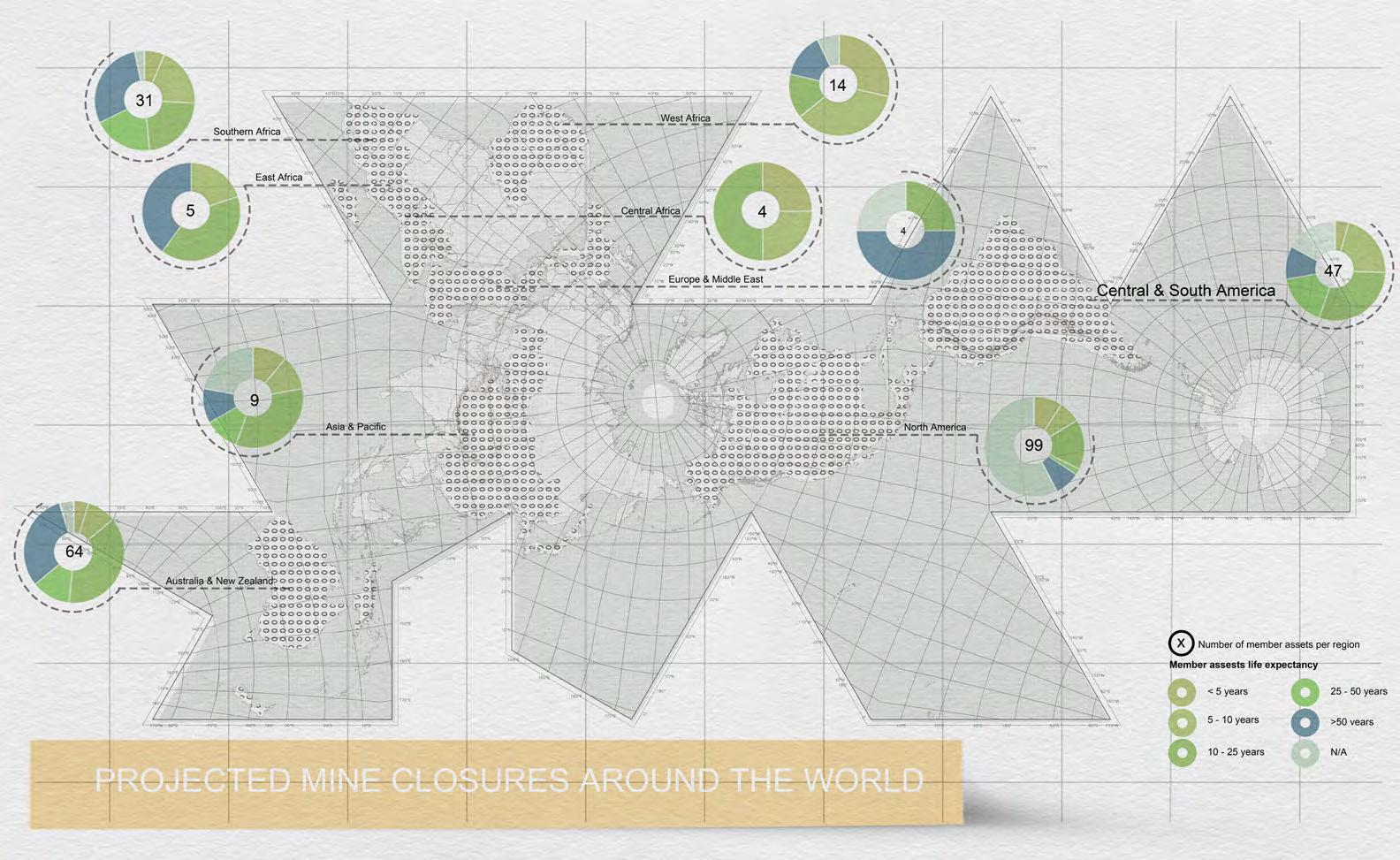
The mines involved in extracting rare earths, cobalt, copper, and other crucial elements for technologies like electric vehicles are unfortunately contributing significantly to environmental pollution. As new mines open, many others are anticipated to shut down in the coming years presenting a unique chance for positive change.
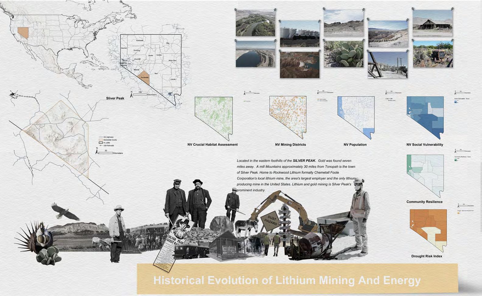
Now, I want to invite you to Nevada. In my research, I provide insight into the diverse landscapes prevalent in the region. From stunning ecosystems to the polluted or insufficient water sources, the images capture the complex environmental realities of this region. The lasting traces left behind by decades of mining and industrial activities offer a glimpse into the region’s history and future.
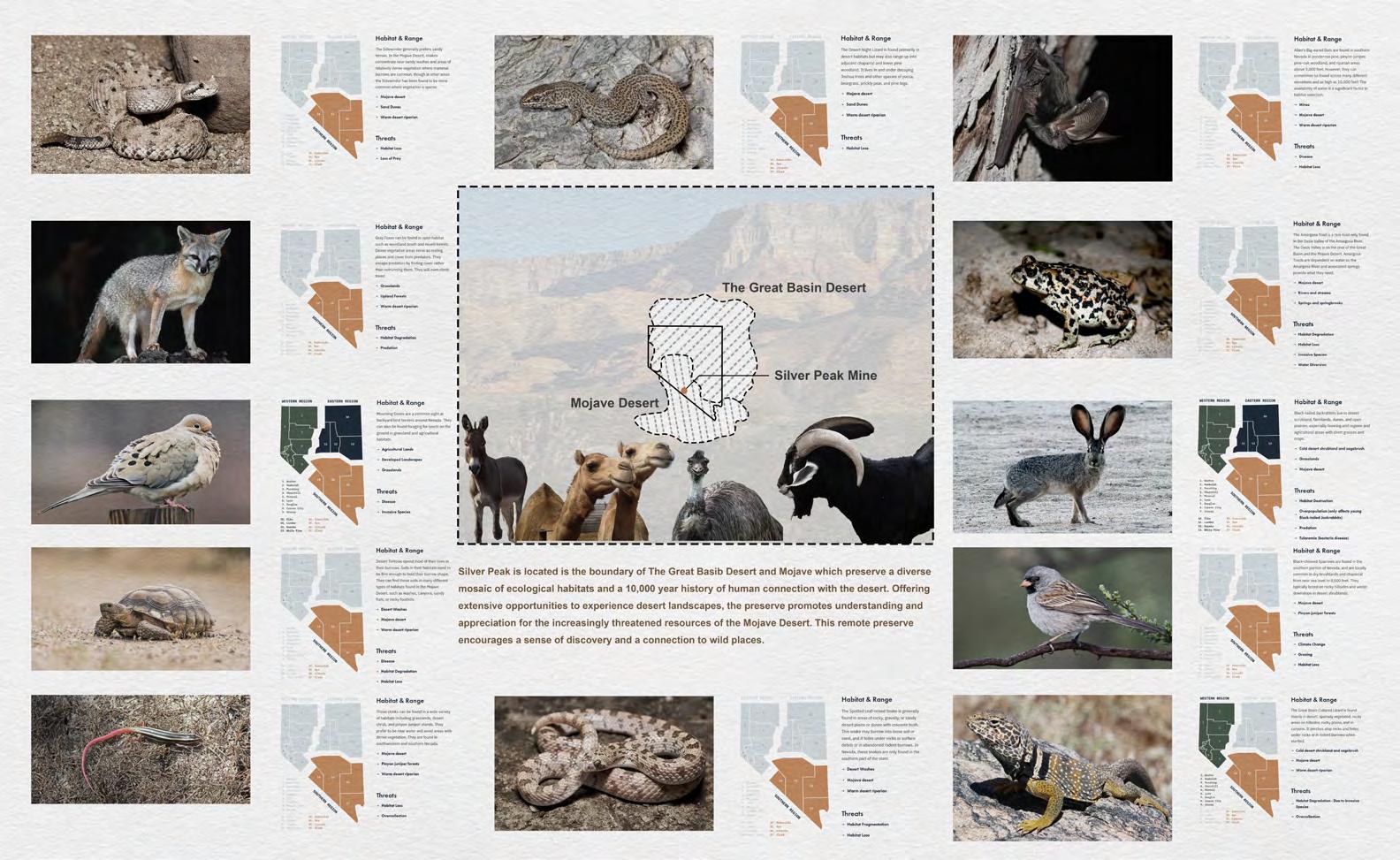
The area encourages a sense of discovery and a profound connection with wilderness. However, the impact of mining has taken a toll on many wildlife habitats and many of these species are no longer present.
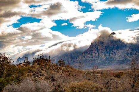
Silver Peak is located between the Great Basin Desert and the Mojave, preserving a diverse mosaic of ecological habitats and a rich 10,000-year history of human connection with the desert. The area encourages a sense of discovery and a profound connection with wilderness. However, the impact of mining has taken a toll on many wildlife habitats and many of these species are no longer present.
F-1 elongates the wind turbine pole to recharge itself by wind power while analyzing the tailing soil and preparing new soil.
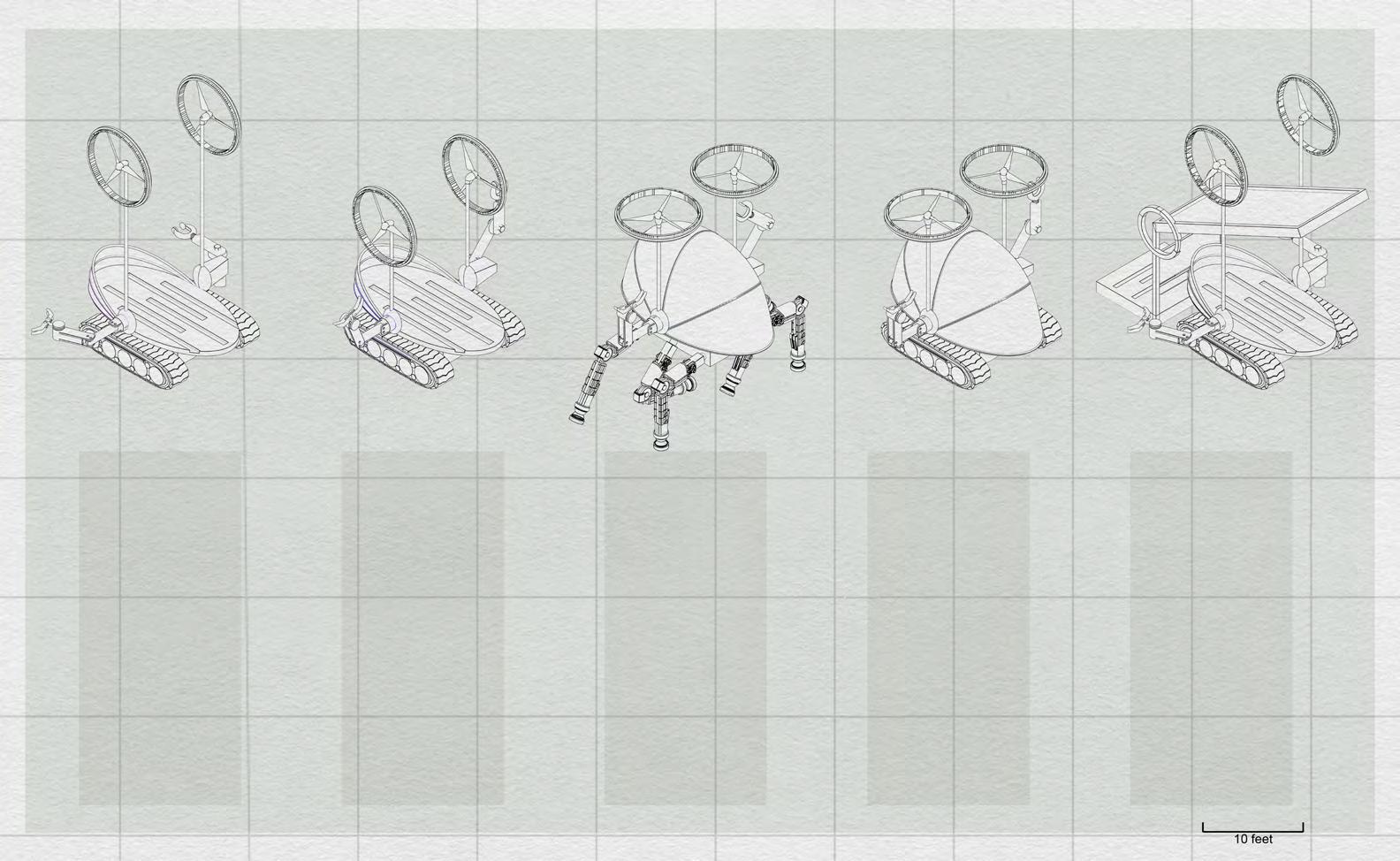
F-2 shortens its pole and uses the tracks that were designed for the mine pond to move around and transport materials
F-3 MorphoBot transforms wind turbines into Aircraft propellers so that they can travel for long distances and construct infrastructures on high places.
F-4 also transports materials and soil. Charging station for robots, equipped with solar panels to power up the robots.
Allow me to introduce you to MorphoBot, a versatile robotic solution designed to adapt to the various stages of the project. MorphoBot boasts four distinct forms, each serving a specific purpose to facilitate the project seamlessly.
EvapoBotwater collecting infrastructure strategically placed on the surface of the ongoing lithium mine pond, harnessing water from the vapor in the pond.
water tower takes center stage with a unique design featuring solar panels arranged in the shape of flower petals. This innovative configuration allows the solar panels to adjust their position, maximizing the reception of solar power.
The two silo infrastructures are containers for different materials aimed at remediating the contaminated mine site. Equipped with solar panels mounted on ring-shaped tracks, these panels move and adjust their positions, ensuring optimal exposure to sunlight for efficient energy harnessing.
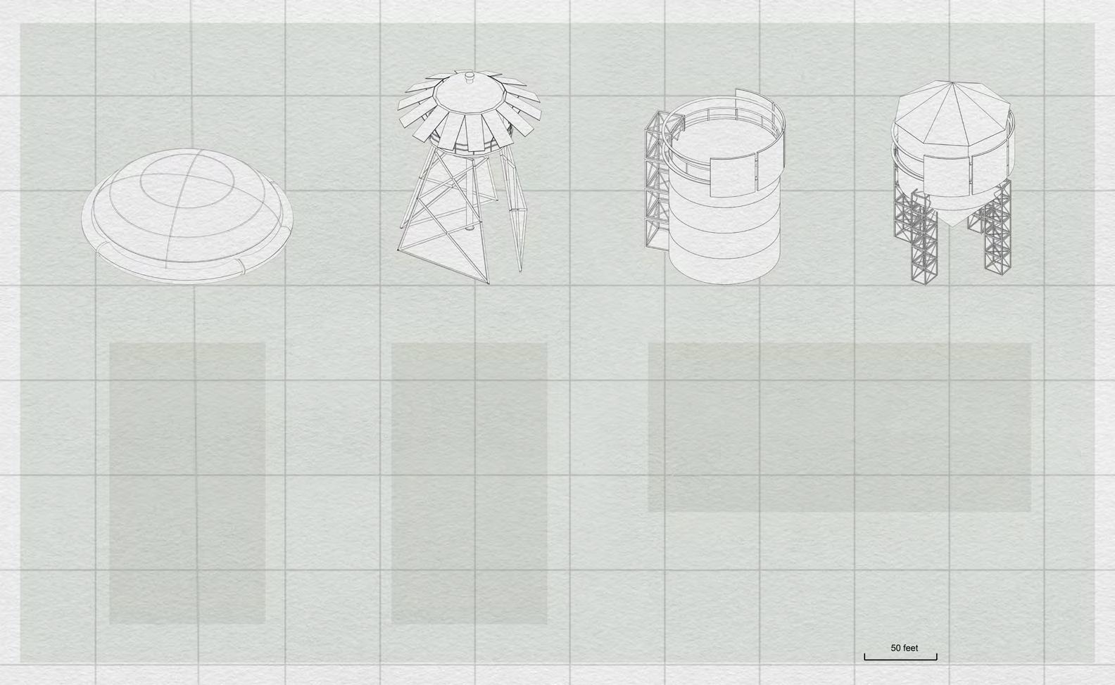
The companion infrastructures play a crucial role in the project’s success.
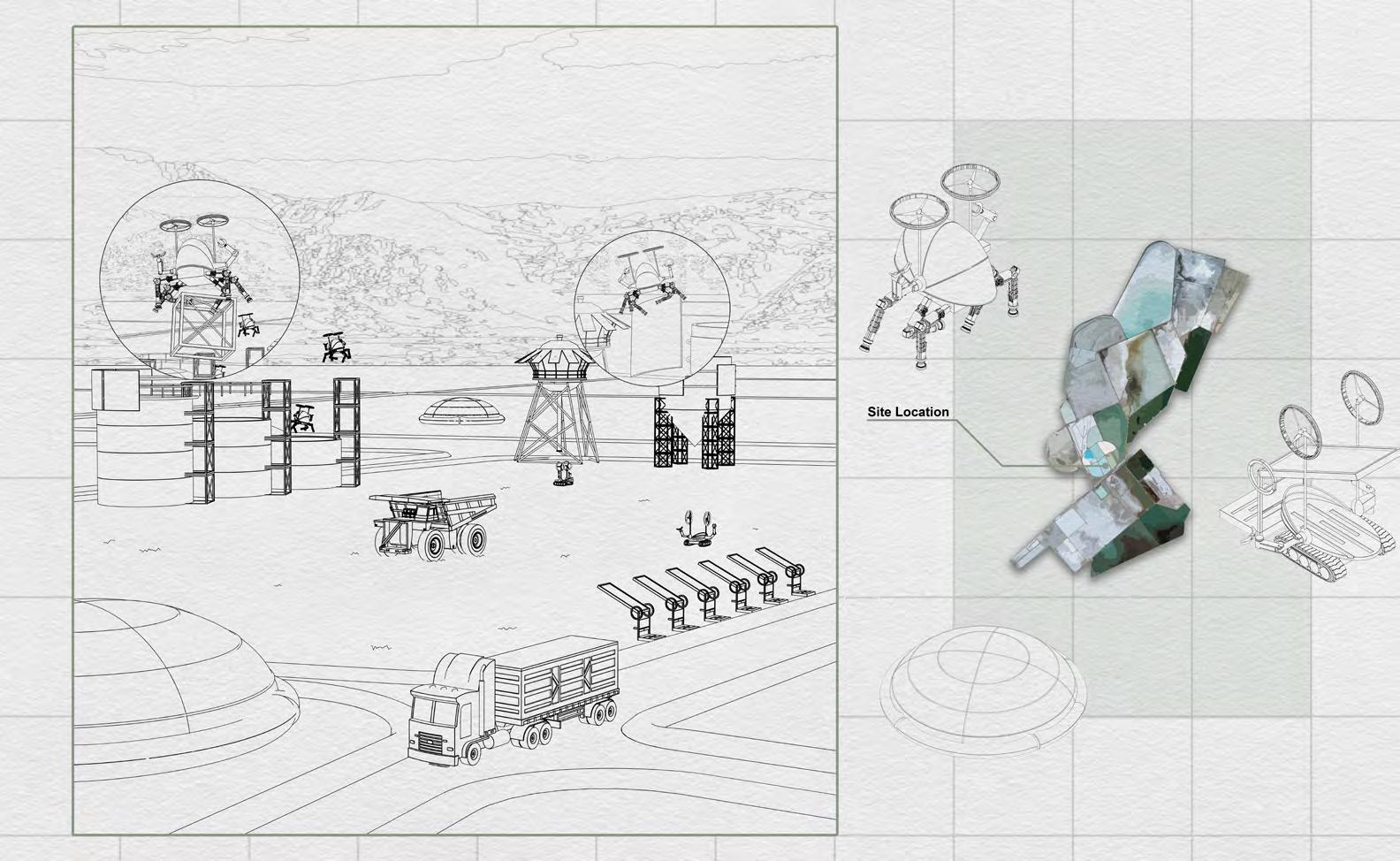
Now, let’s delve into the initiation phase of the project. Once the pond is decommissioned, trucks will transport the necessary materials, including MorphoBot and the components of the infrastructures, to the site. In a highly automated process, MorphoBot takes flight, skillfully maneuvering to assemble all the infrastructures with minimal human intervention.
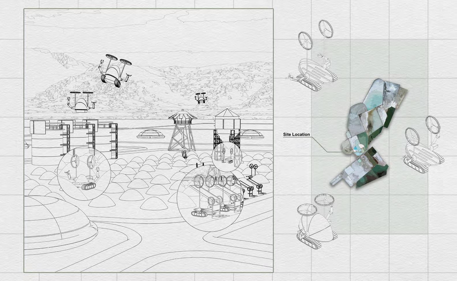
In the concluding stage of the project, just before the infrastructures are to be removed, MorphoBots take center stage. These versatile robots extract materials from the silos and prepare the soil on the plates contained within them. Subsequently, the MorphoBots strategically deposit the prepared soil onto designated locations, constructing the foundations for the new landscape. This phase represents the culmination of the project, showcasing the transformative impact of advanced technology on ecological restoration.
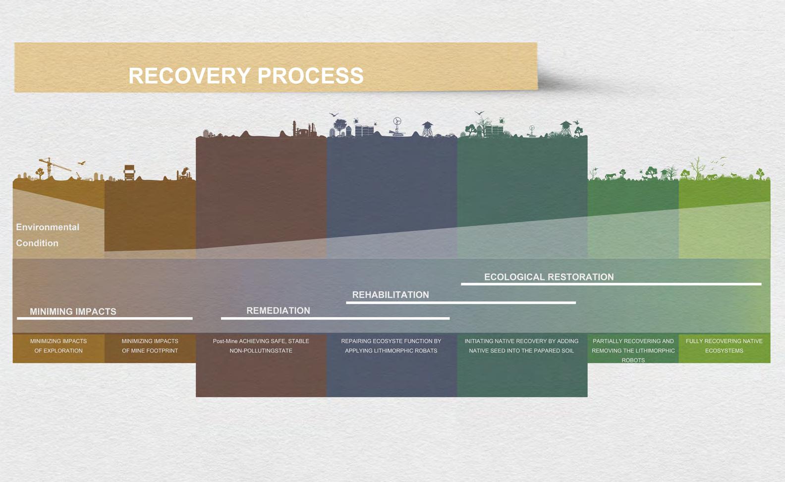
The project aims to transform a degraded ecosystem, restoring biodiversity. The project imagines working with the mining companies sponsorship to clean up the site.
Based on the unique environment of Silver Peak, I have developed a series of restorative practices portrayed in the image. My intervention focuses in the three central stages: Remediation, Rehabilitation and Restoration.
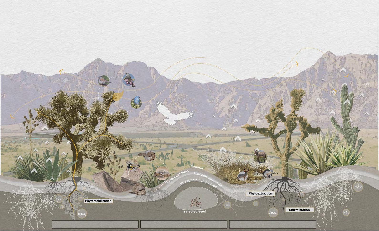
Given that the mine is operated by different companies, the decommissioning of ponds will unfold gradually over time. This slide illustrates the stepby-step process of the mine’s transformation and its gradual transformation. It depicts how the prepared soil mounts seamlessly integrate into the landscape, releasing essential materials such as phosphate compounds, microorganisms, and calcium carbonate to neutralize contamination. The preparation of the soil contributes to the multifaceted ecological restoration of the site, further enhancing its resilience and environmental sustainability.
While the site will never return to its former state after lithium extraction happen, the remediation of soil and careful reintroduction of wildlife can be choreographed. Incremental as the process of mining decommissioning that guides the exit of the companies, Lithium-Morphic aims to shape the processes that to turn waste into compost, accelerating the process of restoration.
post tailing location weathered mixed soil mount transition to the nature area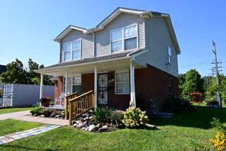
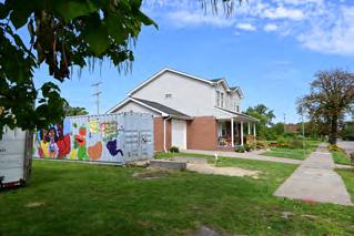
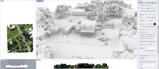
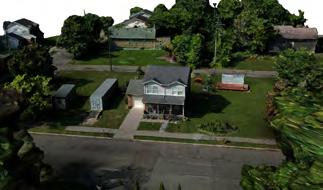
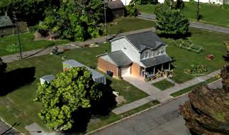
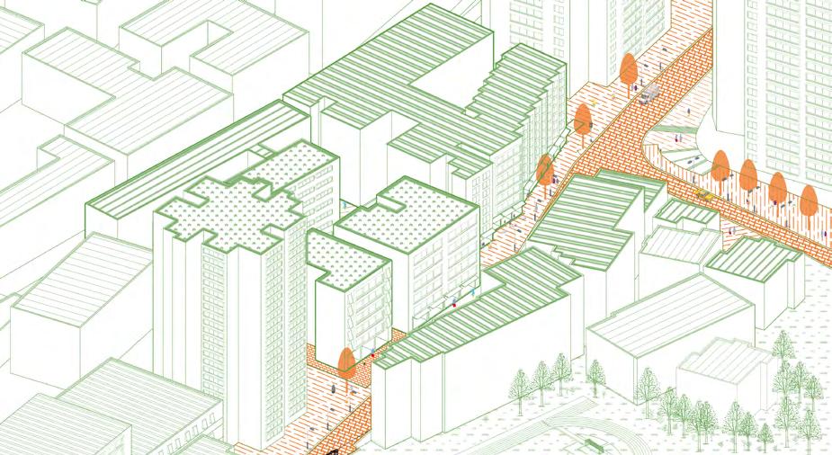
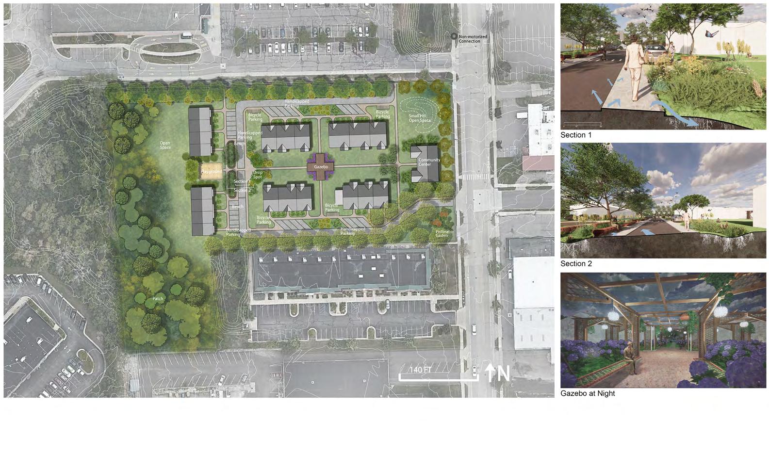
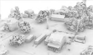
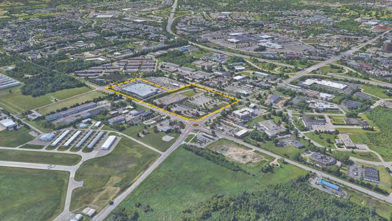
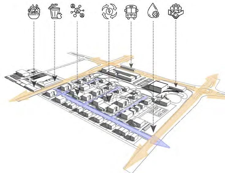
In my role focused on visualization work for the Bailey Park Neighborhood Development Corporation Hub Project in Detroit 2023, I created a detailed 3D model of the hub’s landscape. Additionally, I crafted graphics illustrating a sustainable vision for the neighborhood, prioritizing the well-being of its residents.
Subsequently, I continued my involvement with the Bailey Park Neighborhood Development Corporation Hub Project by incorporating it into my academic coursework for a planting design course.
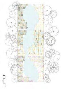
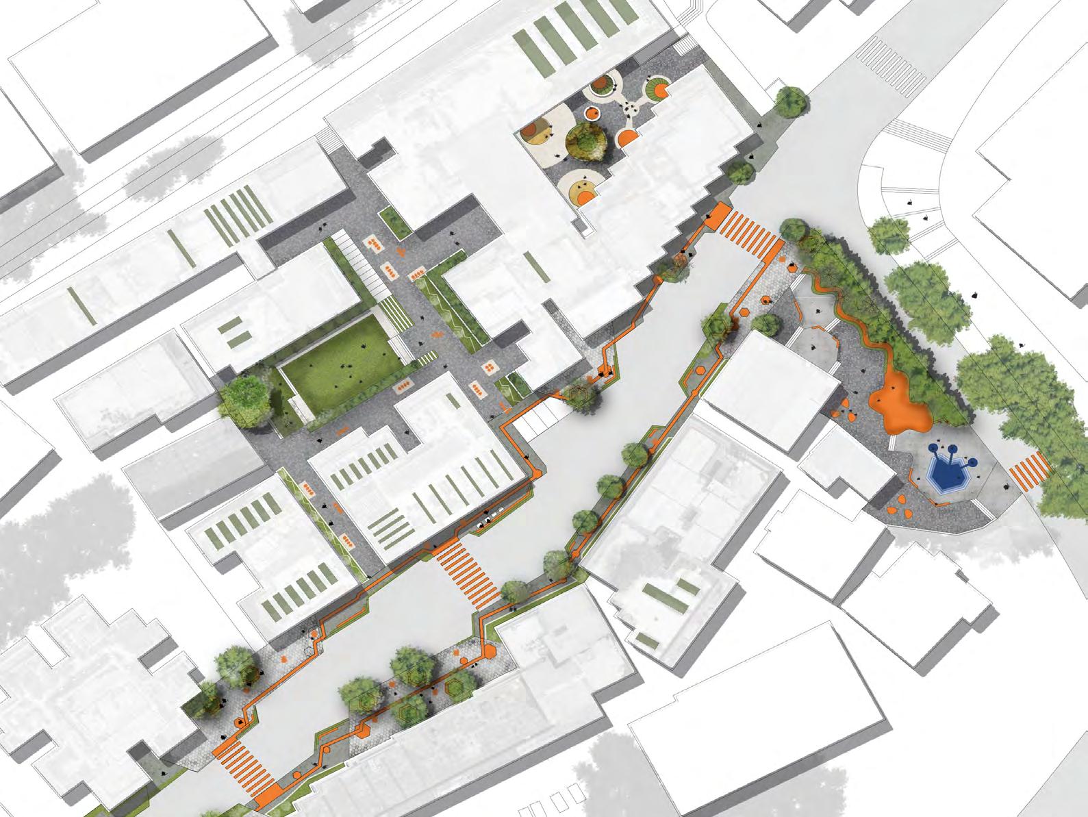
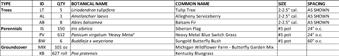
BAILEY PARK HUB: SITE PLAN - 9/15/2023
Acer rubrum
Cornus florida
Carya illinoinensis
Camellia sinensis
(3) Abies cephalonica
Camellia sinensis
(2) Acer rubrum
Camellia sinensis
(2) Abies cephalonica
Cornus florida
Camellia sinensis
Carya illinoinensis
Carya illinoinensis
Cornus florida
Camellia sinensis
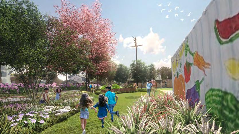
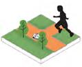
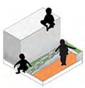
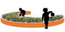
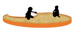
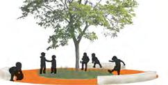
The side yard of the hub is envisioned as a vibrant space dedicated to a “Three Sisters” garden, a concept inspired by indigenous agricultural practices. This garden serves not only as a source of fresh vegetables but also as an interactive learning environment for children. Here, kids can engage in hands-on activities, play, and learn about the symbiotic relationship between corn, beans, and squash while enjoying the beauty of nature firsthand. It’s a space designed to foster curiosity, connection to the land, and sustainable living practices for generations to come.
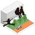
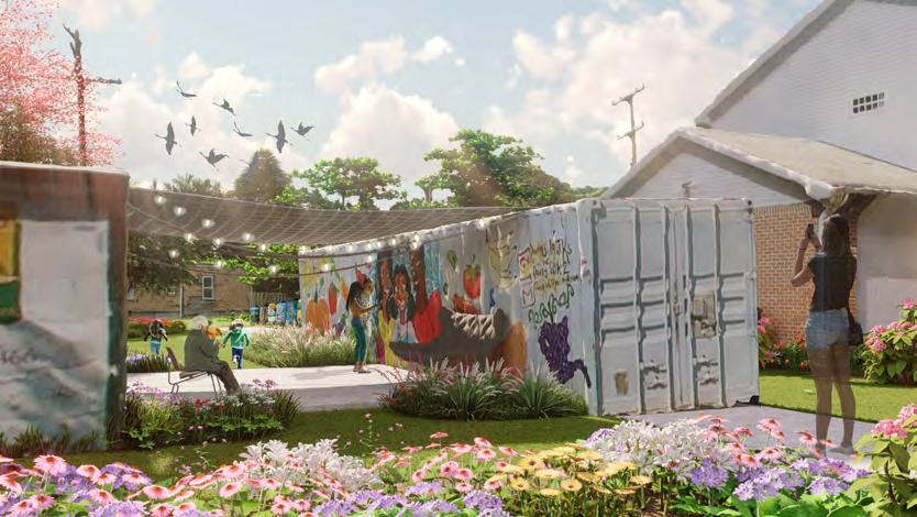
The enclosed space formed by the two existing shipping containers in the yard is set to transform into a leisure activity area, providing shade and relaxation. Through strategic integration of elements such as comfortable seating, lush greenery, and a stone patio, this space will evolve into a joyous oasis amidst the expanse of the Detroit neighborhood.
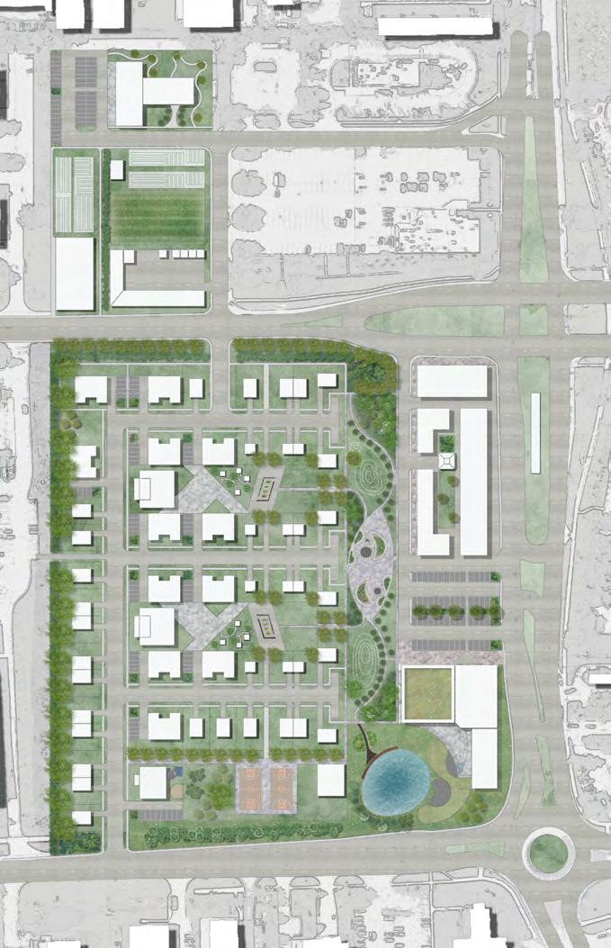


Water Terrace Planting Design --strategies for sediment control