Sentry Dynamics, Inc and its customers make no representations, warranties or conditions, express or implied, as to the accuracy or completeness of information contained in this report
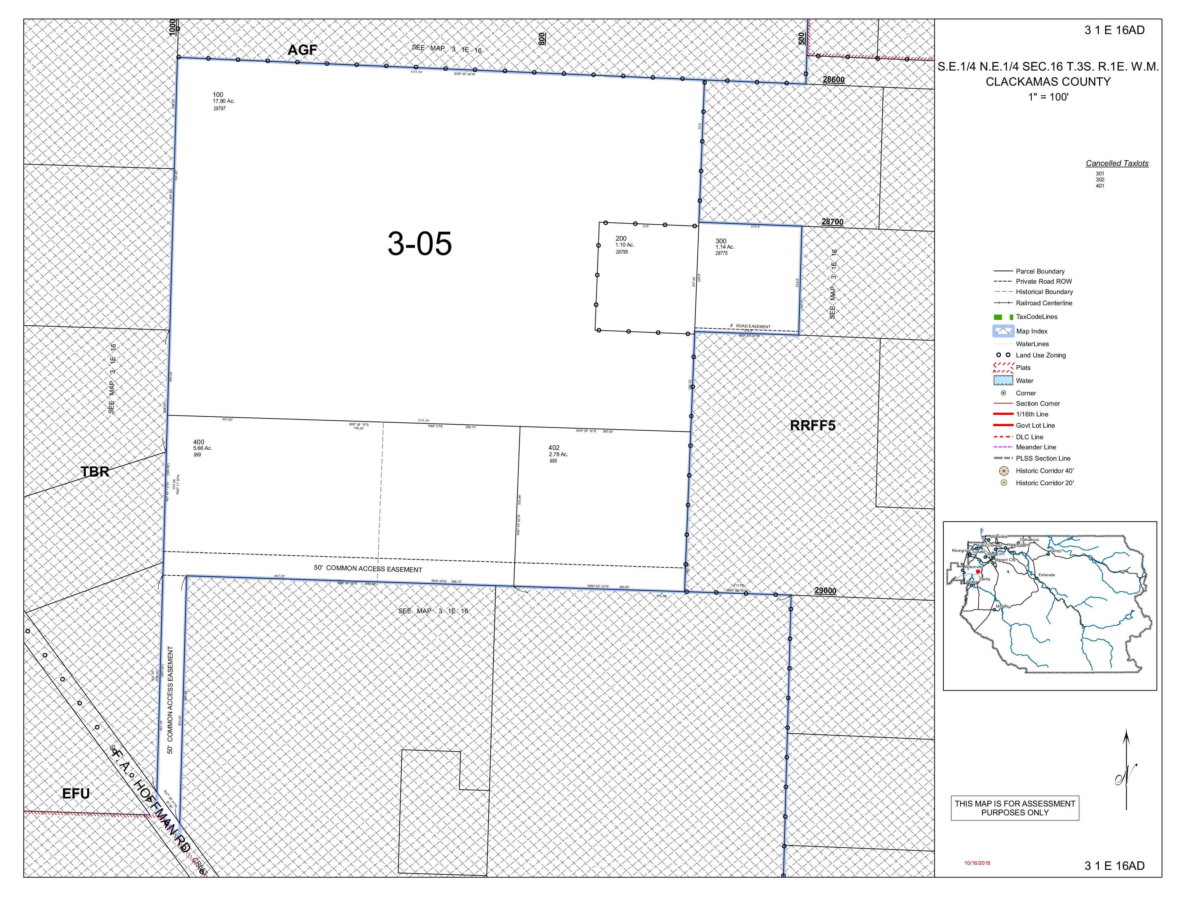
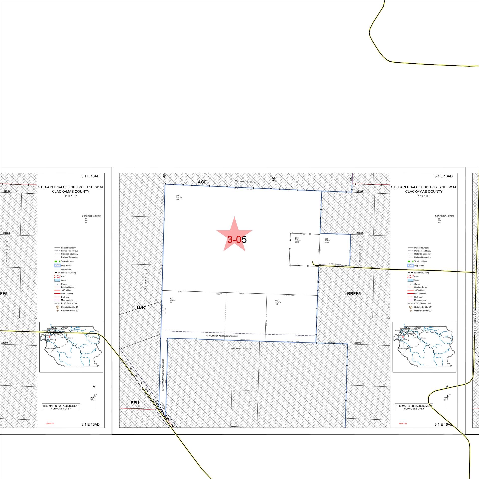
Parcel ID: 00766308
Sentry Dynamics, Inc and its customers make
report 07/31/2025 Prepared by:Tracy Shea
Parcel ID: 00766308
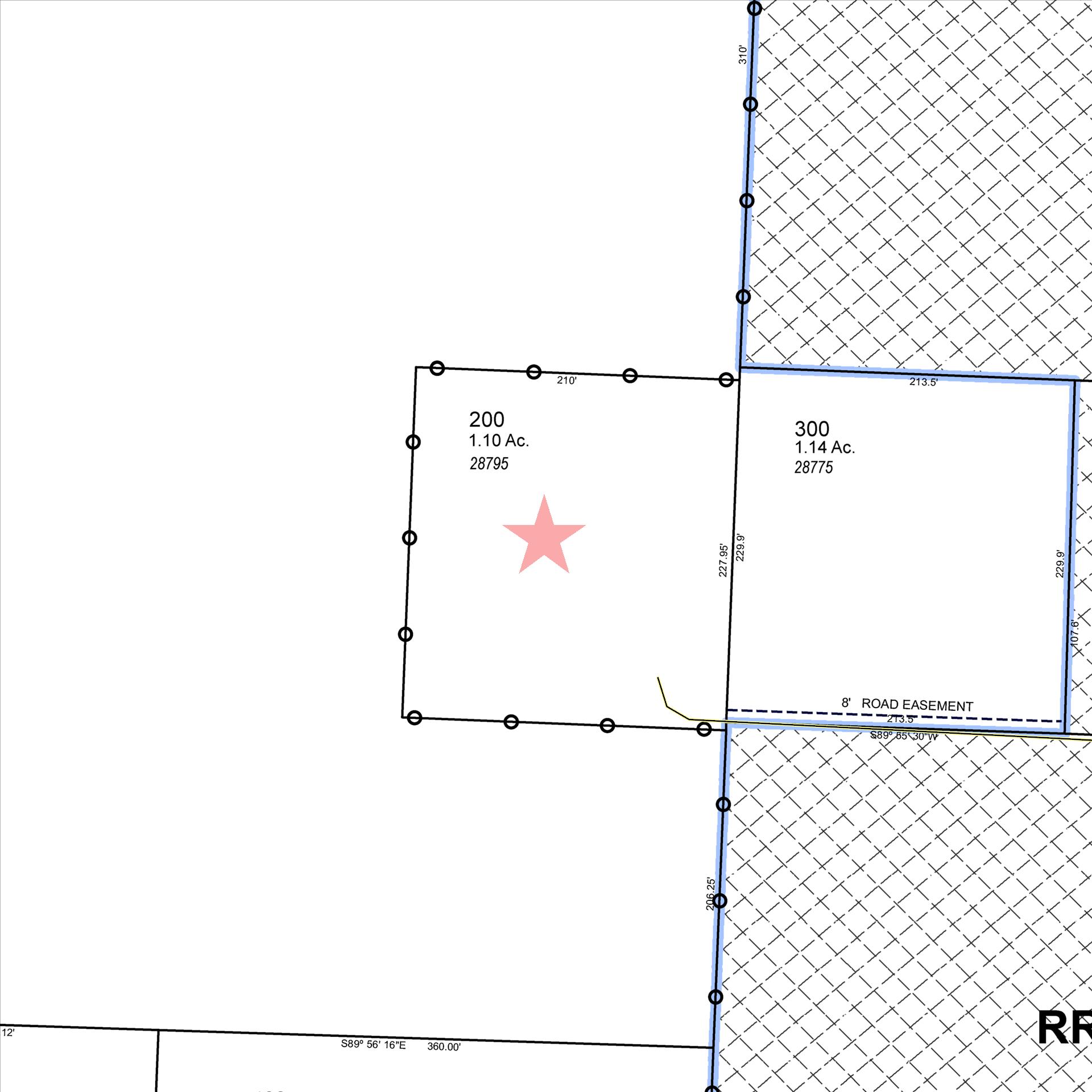
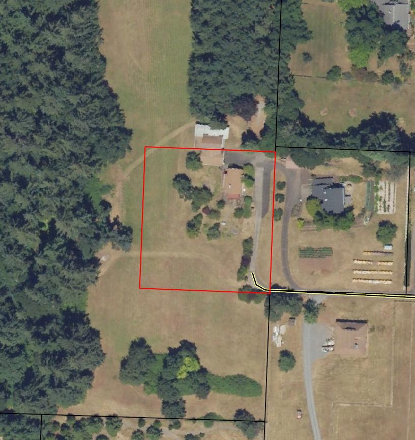
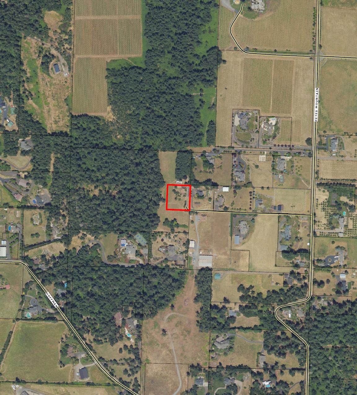
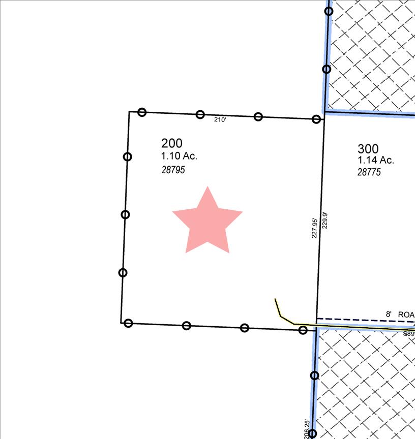
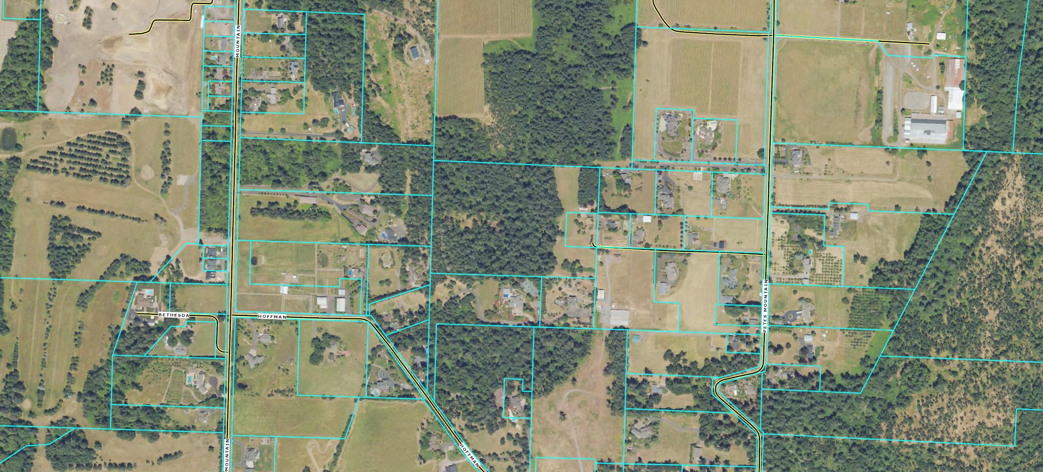
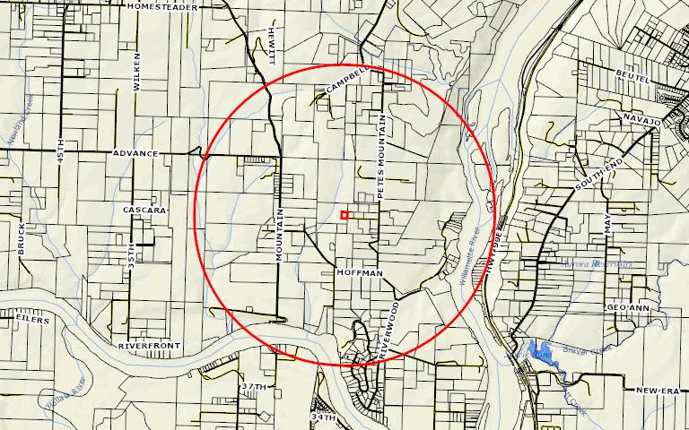
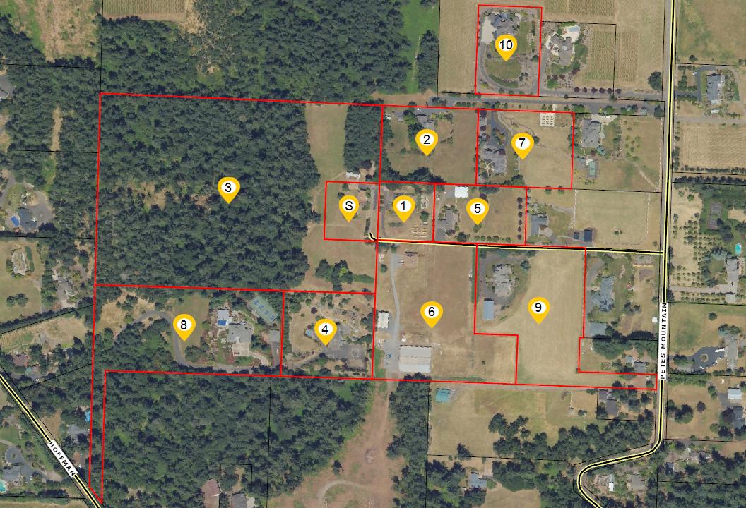
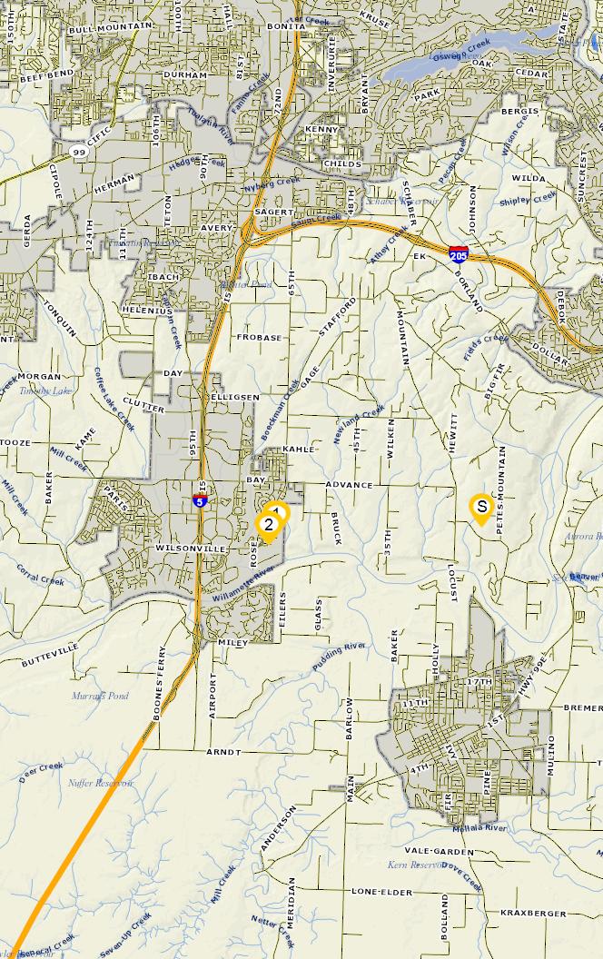
SiteAddress: 28795 SW Petes Mountain Rd
Sentry Dynamics, Inc and its customers make no representations, warranties or conditions, express or implied, as to the accuracy or completeness of information contained in this report
Parcel ID: 00766308
SiteAddress: 28795 SW Petes Mountain Rd
Sentry Dynamics, Inc and its customers make no representations, warranties or conditions, express or implied, as to the accuracy or completeness of information contained in this report
Subject Property
County Name: Clackamas
APN / Parcel Number: 00766291
Current Ownership: Stewart, Lavonne Dolores Trustee
Site Address: 28797 SW Petes Mountain Rd, West Linn OR 97068
Mail Address: 28795 SW Petes Mountain Rd, West Linn OR 97068 *Absentee Owner
Tract / Subdivision:
Census Tract / Block: 022702 / 2005
Lot / Block: 0100
Twn / Rng / Sec / Qtr: 03S / 01E / 16 / NE
Brief Legal Description: Section 16 Township 3S
Sale Information
Property Characteristics
Property Details
00766291
Sentry Dynamics, Inc and its customers make no representations, warranties or conditions, express or implied, as to the accuracy or completeness of information contained in this report
Parcel ID: 00766291
Sentry Dynamics, Inc and its customers make
report 07/31/2025 Prepared by:Tracy Shea
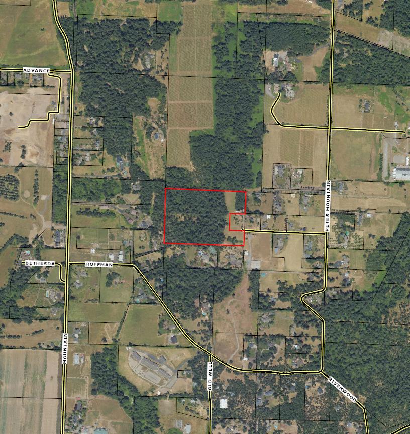
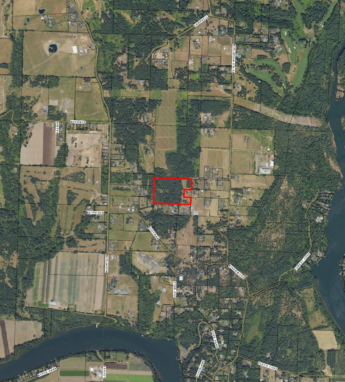
Aerial Photo
This map/plat is being furnished as an aid in locating the herein described land in relation to adjoining streets natural boundaries and other land, and is not a survey of the land depicted Except to the extent a policy of title insurance is expressly modi�ed by endorsement, if any, the company does not insure dimensions, distances, location of easements, acreage or other matters shown thereon
Parents
ParcelNo. Seg/MergeNo.
No Parents Found
Children
ParcelNo. Seg/MergeNo.
No Children Found
ActiveExemptions No Exemptions Found
Events
07/31/2019 07/31/2019 15:17:00 The situs address has changed by
02/06/2019 02/06/2019 09:06:00 The situs address has changed by HALLEYWUN
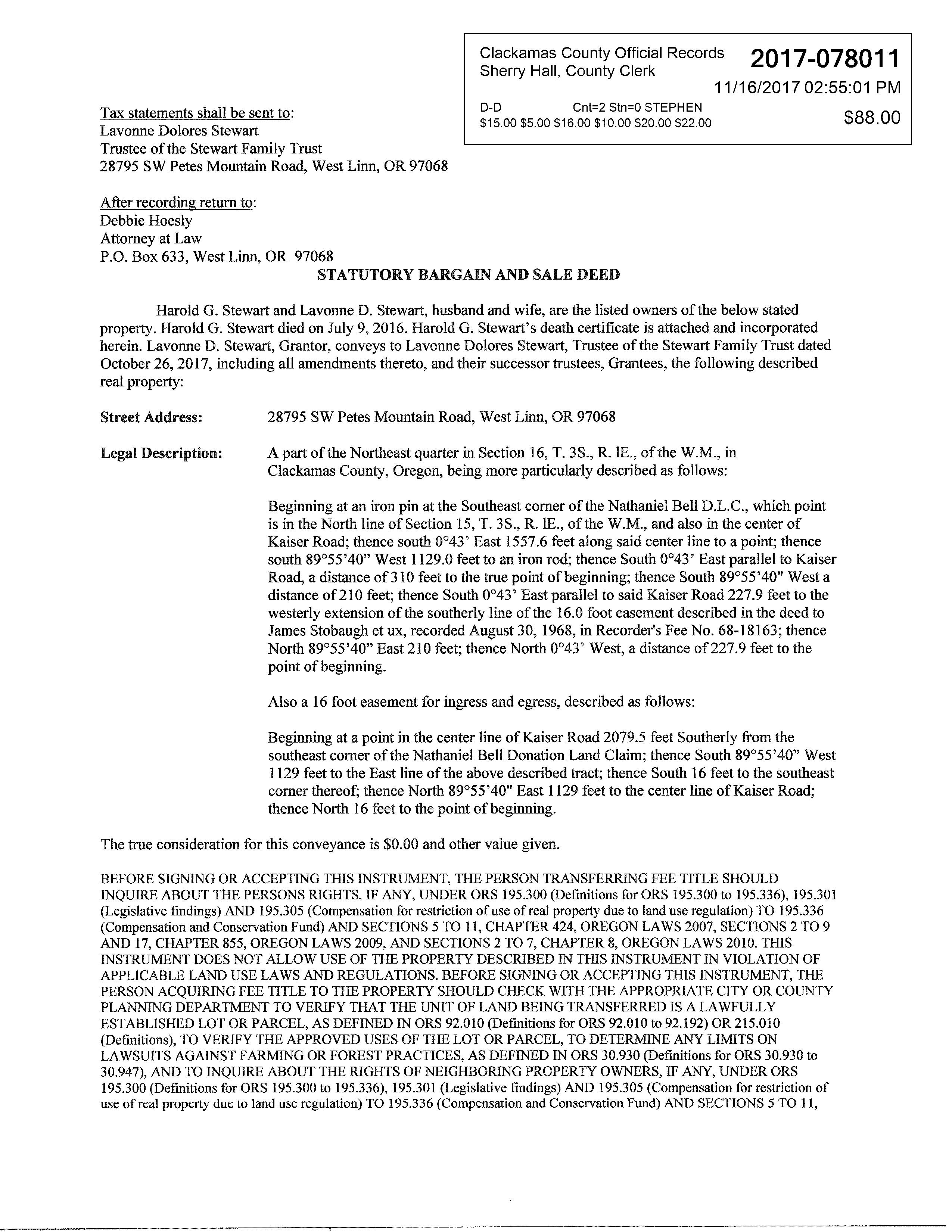
Harold G. Stewart and Lavonne D. Stewart, husband and wife, are the listed owners of the below stated property. Harold G. Stewart died on July 9, 2016. Harold G. Stewart's death certificate is attached and incorporated herein. Lavonne D. Stewart, Grantor, conveys to Lavonne Dolores Stewart, Trustee ofthe Stewart Family Trust dated October 26, 2017, including all amendments thereto, and their successor trustees, Grantees, the following described real property:
Street Address: 28795 SW Petes Mountain Road, West Linn, OR 97068
Legal Description: A part of the Northeast quarter in Section 16, T. 3S., R. IE., of the W.M., in Clackamas County, Oregon, being more particularly described as follows:
Beginning at an iron pin at the Southeast corner of the Nathaniel Bell D.L.C., which point is in the North line of Section 15, T. 3S., R. IE., of the W.M., and also in the center of Kaiser Road; thence south 0°43' East 1557.6 feet along said center line to a point; thence south 89°55'40" West 1129.0 feet to an iron rod; thence South 0°43' East parallelto Kaiser Road, a distance of310 feet to the true point ofbeginning; thence South 89°55'40" West a distance of210 feet; thence South 0°43' East parallel to said Kaiser Road 227.9 feet to the westerly extension of the southerly line ofthe 16.0 foot easement described in the deed to James Stobaugh et ux, recorded August 30, 1968, in Recorder's Fee No. 68-18163; thence North 89°55'40" East 210 feet; thence North 0°43' West, a distance of 227.9 feet to the point of beginning.
Also a 16 foot easement for ingress and egress, described as follows:
Beginning at a point in the center line of Kaiser Road 2079.5 feet Southerly from the southeast corner of the Nathaniel Bell Donation Land Claim; thence South 89°55'40" West 1129 feet to the East line of the above described tract; thence South 16 feet to the southeast corner thereof; thence North 89°55'40" East 1129 feet to the center line of Kaiser Road; thence North 16 feet to the point of beginning.
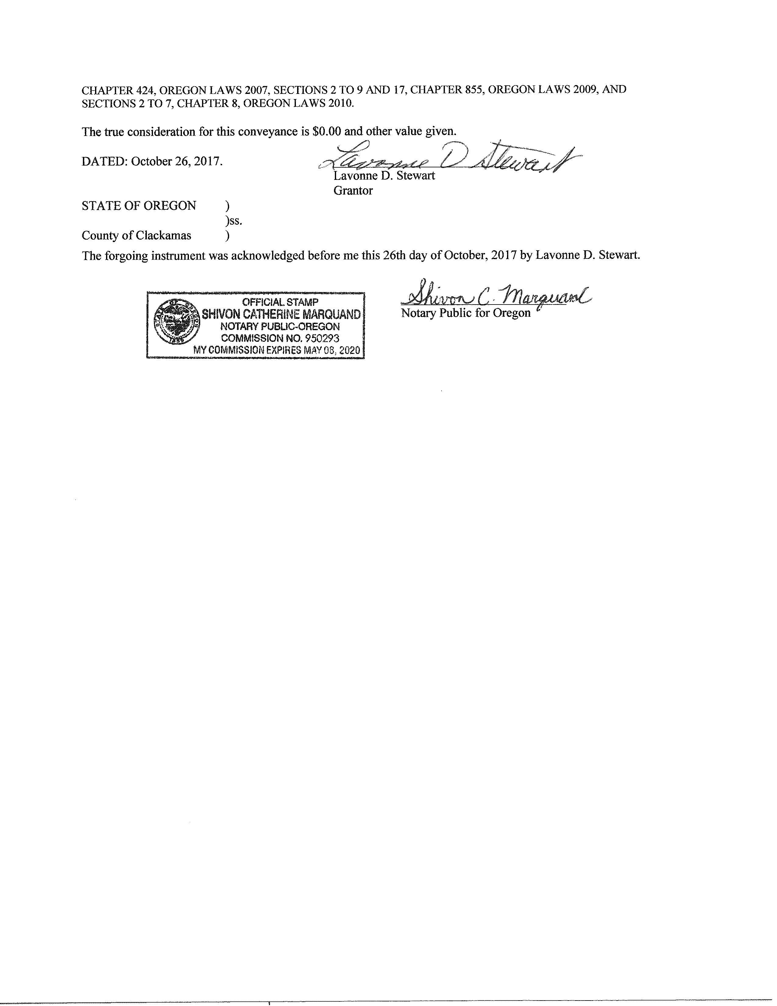
The true consideration for this conveyance is $0.00 and other value given.
BEFORE SIGNING OR ACCEPTING THIS INSTRUMENT, THE PERSON TRANSFERRING FEE TITLE SHOULD INQUIRE ABOUT THE PERSONS RIGHTS, IF ANY, UNDER ORS 195.300 (Definitions for ORS 195.300 to 195.336), 195.301 (Legislative findings) AND 195.305 (Compensation for restriction ofuse of real property due to land use regulation) TO 195.336 (Compensation and Conservation Fund) AND SECTIONS 5 TO 11, CHAPTER 424, OREGON LAWS 2007, SECTIONS 2 TO 9 AND 17, CHAPTER 855, OREGON LAWS 2009, AND SECTIONS 2 TO 7, CHAPTER 8, OREGON LAWS 2010. THIS INSTRUMENT DOES NOT ALLOW USE OF THE PROPERTY DESCRIBED IN THIS INSTRUMENT IN VIOLATION OF APPLICABLE LAND USE LAWS AND REGULATIONS. BEFORE SIGNING OR ACCEPTING THIS INSTRUMENT, THE PERSON ACQUIRING FEE TITLE TO THE PROPERTY SHOULD CHECK WITH THE APPROPRIATE CITY OR COUNTY PLANNING DEPARTMENT TO VERIFY THAT THE UNIT OF LAND BEING TRANSFERRED IS A LAWFULLY ESTABLISHED LOT OR PARCEL, AS DEFINED IN ORS 92.010 (Definitions for ORS 92.010 to 92.192) OR 215.010 (Definitions), TO VERIFY THE APPROVED USES OF THE LOT OR PARCEL, TO DETERMINE ANY LIMITS ON LAWSUITS AGAINST FARMING OR FOREST PRACTICES, AS DEFINED IN ORS 30.930 (Definitions for ORS 30.930 to 30.947), AND TO INQUIRE ABOUT THE RIGHTS OF NEIGHBORING PROPERTY OWNERS, IF ANY, UNDER ORS 195.300 (Definitions for ORS 195.300 to 195.336), 195.301 (Legislative findings) AND 195.305 (Compensation for restriction of use of real property due to land use regulation) TO 195.336 (Compensation and Conservation Fund) AND SECTIONS 5 TO 11,
Property Account Summary
GeneralInformation
AlternateProperty#
PropertyDescription
LastSalePrice
LastSaleDate
LastSaleExciseNumber
PropertyCategory
Remarks
AV Exception
Parents
ParcelNo. Seg/MergeNo. Status FromDate ToDate Continued DocumentNumber No Parents Found
Children
ParcelNo. Seg/MergeNo. Status FromDate ToDate DocumentNumber No Children Found
ActiveExemptions No Exemptions Found
Events
Effective Date EntryDate-Time
03/07/2024 03/12/2024 07:23:00 Recording Processed Property Transfer Filing No.: 439422, Bargain & Sale, Recording No.: 2024007934 03/07/2024 by BCROWE
03/07/2024 03/12/2024 07:23:00 Taxpayer Changed Property Transfer Filing No.: 439422 03/07/2024 by BCROWE
04/24/2017 04/24/2017 09:30:00 Property Characteristic Changed 2017 Manf Structure 1 changed from L257116 to L220874 by KATHYSWA
04/10/2017 04/10/2017 09:50:00 Property Characteristic Changed 2016 Manf Structure 1 changed from X154815R to L220874 by KATHYSWA
07/11/2008 07/11/2008 09:53:00
Current Use Removal--To Year Value Set Effective to year 2003 Designated Forestland by PAULAOAK
07/29/2004 07/29/2004 08:51:00 Property Use Approval 15.00 Acres for 2004 -Approved Small Tract Forestland Option by JEANBOR
Address: 6700 Sw Wilsonville Rd District: West Linn-Wilsonville Sd 3J Type: 1-Regular school
Charter: No
Title 1 Elig: 1-Yes
Male / Female: 242 / 226
2. Wilsonville High School
Magnet:
Title 1: 5-Title I schoolwide school
Students: 470
Grade Levels: Prekindergarten5th Grade
Distance: 3.17 mile(s)
Address: 6800 Wilsonville Rd District: West Linn-Wilsonville Sd 3J Type: 1-Regular school
Charter: No Magnet:
Title 1 Elig: 2-No
Male / Female: 671 / 588
3. Thomas R Fowler Middle School
Students: 1,263
Title 1: 6-Not a Title I school Grade Levels: 9th Grade - 12th Grade
Distance: 9.75 mile(s)
Address: 10865 Sw Walnut St District: Tigard-Tualatin Sd 23J Type: 1-Regular school
Charter: No Magnet:
Title 1 Elig: 2-No
Male / Female: 399 / 333
Title 1: 6-Not a Title I school
Students: 743
Grade Levels: 6th Grade - 8th Grade
STEPS IN A REAL ESTATE TRANSACTION
1
What is an Escrow?
THE LISTING AGREEMENT
The property owner (Seller) initiates a contract, or a listing agreement, with a licensed Real Estate Agent.
2
THE SALE
Property owner (Seller) enters into a purchase contract, typically referred to as an Earnest Money Agreement, with a Buyer.
3
ESCROW
As part of the purchase contract, Seller agrees to purchase a title insurance policy for the Buyer and both agree to close the transaction with a licensed escrow company. In Oregon, most title insurance companies also offer escrow services to facilitate a convenient “one-stop” approach to closing real estate transactions.
An escrow is a neutral third party depository for legal documents and funds necessary to complete a real estate transaction. The escrow agent will disburse funds and record documents for the proper recipients according to their written instructions.
What title insurance and escrow costs are incurred in a real estate sale?
The fee for escrow services is based on the sales price of the property. This fee is typically split equally between the Seller and Buyer. However, Buyers should check with their lenders if financing is involved because some federally insured lending programs do not allow borrowers to pay this fee. The Seller typically pays for a standard owner’s policy of title insurance which names the Buyer as the insured. Charges for this policy are based on the sales price of the property. The Buyer typically pays for a lender’s policy of title insurance and any required endorsements if s/he is obtaining a new loan to purchase the property. Charges for this policy are based on the loan amount.
What services does an escrow agent perform on behalf of the Seller and Buyer?
• Upon opening of escrow, escrow agent will order a preliminary title report, which will be sent to all interested parties involved in the transaction. The report will detail the current ownership, liens and encumbrances of the property.
• Closing statements will be prepared for each party, showing all credits and debits. The escrow agent will schedule appointments for all parties to sign their final necessary documents, including any funds needed to be deposited, to complete the transaction.
• Signed loan documents are returned to the Lender, for final review and funding approval.
• Recordable documents are released to the County Clerk’s office for recording.
• Once recorded, all funds are disbursed per written instructions.
• Final title policies are issued to the insured parties.
FROM PENDING TO SOLD
™
ESCROW FLOW CHART
Receive and review Earnest Money Agreement and Broker’s instructions.
Open escrow. Order title report.
Determine financing.
Information gathering from Buyer and Seller.
Receive title report. Send copies to all parties in the transaction.
Resolve any title issues. Order any payoff demands.
Review file. Are conditions satisfied? Contingencies removed?
Prepare closing statement, closing instructions and transfer deed
Obtain signatures on all escrow and loan documents. Collect any funds due from Buyer and/or Seller
Record applicable documents with the County Recorder's office.
Close file. Prepare final statements. Disburse funds.
Forward final documents to all interested parties - Buyer, Seller, Real Estate Agents, Lender, Broker, Attorney, etc.
NEW LOAN
Notify Escrow with name of new lender and loan officer.
Send title report to lender.
Notification of final loan approval. Are repairs complete?