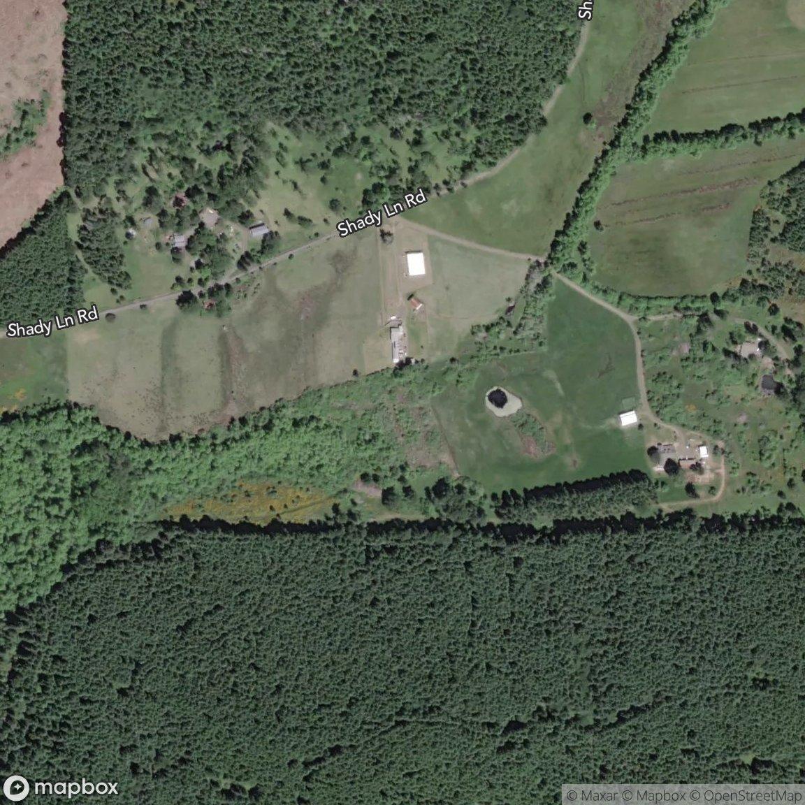
17610 Shady Lane Rd Monmouth, OR 97361 Julia Monaghan, PSA 503-735-5398 Oregon Real Estate Broker / Real Broker Diamond Platinum Masters Circle 2021-2024 Portland Monthly Five Star Award Winner 2017-2024

Property Profile HOMEBOOK


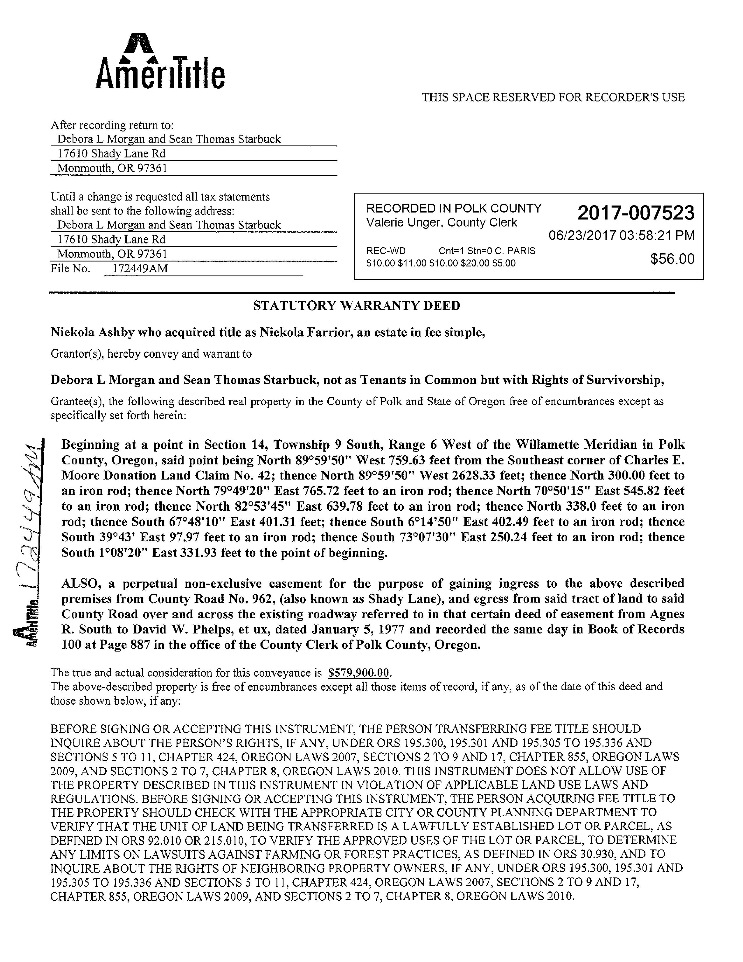
17610 SHADY LANE RD MONMOUTH, OR 97361-9536 Ownership Information Owner Name: DEBORA L MORGAN SEAN THOMAS STARBUCK Mailing Address: 17610 SHADY LANE RD MONMOUTH, OR 97361-9536 Property Description County: Polk Map / Tax Lot: 0961400/00109 Account Num: 453011 Census: 0204.00 Property ID: 453011 Owner Occ.: Yes Land Use: Single Family Residential Zoning: TC Subdivision: Legal Description: TWO STORY Property Characteristics Property Type: SINGLE FAMILY Building SF: 3,485 Heat: HEAT PUMP House Style: 2 STORY Living Area SF: 3,485 Cooling: Year Built: 1972 Square Feet: 3,485 Foundation: Bedrooms: 2 1st Floor SF: 3,107 Exterior: OTHER Bathrooms: 1.00 2nd Floor SF: 378 Roof Style: GABLE Lot Size: 1,413,522 3rd Floor SF: Roof Cover: COMPOSITION SHINGLE Acres: 32.45 Attic SF: Fireplaces: Y Garage Type: Bsmnt SF: Bsmnt Type: Garage SF: Fin Bsmt SF: Assessment Information Real Market Value: $ 870,050 Taxes: $ 3,155.71 Land Value: $ 372,690 Imp. Value: $ 497,360 Total Assessed Value: $ 263,623 Levy Code: 0228 Assessed Yr: 2023 Tax Year: 2023 M-5 Rate: Previous Sale Information Sale Amount: $ 579,900 Sale Date: 06/22/2017 Document Num: 2017-007523
Property Information Report
Transaction History

This information has been furnished, without charge, in conformance with the guidelines approved by the State of Oregon Insurance Commissioner. The Insurance division cautions intermediaries that this service is designed to benefit the ultimate insureds. Indiscriminate use only benefiting intermediaries will not be permitted. Said Services may be discontinued. No liability is assumed for any errors in this report.
AllinformationprovidedbyValueCheck,Incisdeemedreliable,butnotguaranteed. Accuracyoftheinformationmayvarybycounty.
Copyright © 2024 ValueCheck, Inc.
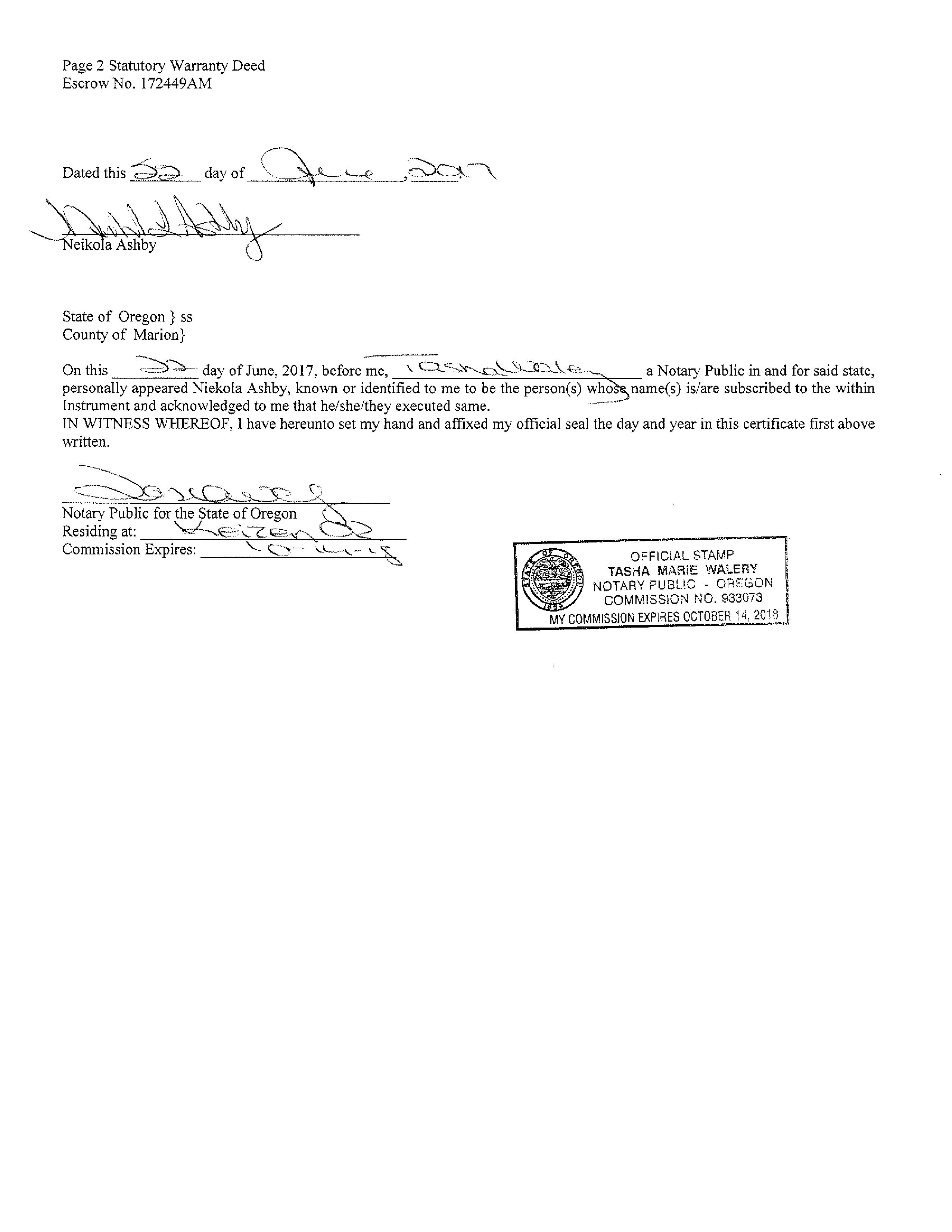
Sale Date Sale Amount HPI Sale Amount Document Type Reception Num Book/Page 6/22/2017 $ 579,900 $ 1,006,300 Wd 2017-007523 / 8/13/2008 $ 565,000 $ 1,161,800 Wd 2008-010236 /
101 102 101 100 109 106 103 2-28 N 0 1 2 4 0 0 W 8 0 0 0 C H 5 2 8 0 0 0 2 9 3 5 6 5 7 7 6 LOT 2 3 1 6 A C LOT 1 16 4 6 A C 8 0 0 1 0 4 0 2 4 9 9797 14921 3 1 8 8 0 1 7 2 1 0 1 7 63838 40151 71 3 27908 12967 3 8 0 0 6 9 7 54582 765 7 5 3 C H 3 1 0 0 0 4 8 1 9 9 8 10 2M 1 10 9M 1 10 6M 1 338 08 AC 19 35 AC 27 93 AC 32 45 AC 23 18 AC 19 29 AC 1 2 C H 3 1 1 10102 8 2 CH 4 8 2 2 4 C H 4 0 R O W 0 R O W ( O ( O ( O ( O ( O ( O ( O ( O ( O ( O ( O ( O ( O Ò Ò Ò Ò 9616 PRIEM N W CO RN ER ALPH EU S CH ER RY DLC N O 43 N E C OR NER DLC N O 43 AN GLE COR N ER DLC N O 44 N W CO RN ER AN DR EW J WELC H DLC N O 41 NT C OR NER DLC N O 43 N W CO RN ER AN DR EW J WELC H DLC N O 41 S W C ORN ER ALPH EU S CH ER RY DLC N O 43 S C OR NER DLC N O 44 S E C OR NER DLC N O 43 S W C ORN ER CH AR LES E M OO RE DLC N O 42 S E C OR NER DLC N O 42 N E C OR NER JOH N AL DR D GE DLC N O 47 NT C OR NER JOH N AL DR D GE DLC N O 47 N E C OR NER DLC N O 47 NT C OR NER DLC N O 41 E S E CORNER DLC NO 47 S W C ORN ER AN DR EW J WELC H DLC N O 41 INT CORNER RA A HOOKER DLC NO 48 INT C OR NER JOH N AL DR D GE DLC N O 47 S W CORNER DLC NO 41 E S E CORNER DLC NO 47 N CORNER IRA A HOOKER DLC NO 48 W S E CORNER DLC NO 41 N W CO RN ER RA A H OO KER DLC N O 48 E S E CO RN ER JOH N AL DR D GE DLC N O 47 S W C ORN ER AN DR EW J WELC H DLC N O 41 W S E C OR NER DLC N O 41 NT C OR NER RA A H OO KER DLC N O 48 S S E CO RN ER DLC N O 47 S O U T H 2 2 3 H I G H W A Y HTEBCM 9613 SHADY LANE ROAD (WEST) NO 9620 ROAD SHADY LANE (WEST) NO 9620 NO 9620 ROAD SHADY (WEST) LANE 10 11 14 15 11 12 13 14 15 14 23 22 14 13 24 23 See Map 9 6 11 S e e M a p 9 6 1 3 See Map 9 6 23 S e e M a p 9 6 1 5 THIS MAP IS F OR ASSESSMENT AND TAXATION PURPO SES O NLY Polk County SEC. 14 T.9S. R.6W. W.M. 1" = 400' 2/19/2 019 Canceled No 9.6.14 9.6.14 104 105 107 108
2023 ADVALOREM $0.00 $0.00 $0.00 $0.00 $3,155.71 Nov 15, 2023 2022 ADVALOREM $0.00 $0.00 $0.00 $0.00 $3,065.82 Nov 15, 2022 2021 ADVALOREM $0.00 $0.00 $0.00 $0.00 $2,986.22 Nov 15, 2021 2020 ADVALOREM $0.00 $0.00 $0.00 $0.00 $2,905.08 Nov 15, 2020 2019 ADVALOREM $0.00 $0.00 $0.00 $0.00 $2,825.23 Nov 15, 2019 2018 ADVALOREM $0.00 $0.00 $0.00 $0.00 $2,731.28 Nov 15, 2018 2017 ADVALOREM $0.00 $0.00 $0.00 $0.00 $2,605.03 Nov 15, 2017 2016 ADVALOREM $0.00 $0.00 $0.00 $0.00 $2,633.73 Nov 15, 2016 2015 ADVALOREM $0.00 $0.00 $0.00 $0.00 $2,581.37 Nov 15, 2015 2014 ADVALOREM $0.00 $0.00 $0.00 $0.00 $2,480.54 Nov 15, 2014 2013 ADVALOREM $0.00 $0.00 $0.00 $0.00 $2,303.97 Nov 15, 2013 2012 ADVALOREM $0.00 $0.00 $0.00 $0.00 $2,256.48 Nov 15, 2012 2011 ADVALOREM $0.00 $0.00 $0.00 $0.00 $2,235.11 Nov 15, 2011 2010 ADVALOREM $0.00 $0.00 $0.00 $0.00 $2,132.71 Nov 15, 2010 2009 ADVALOREM $0.00 $0.00 $0.00 $0.00 $2,135.21 Nov 15, 2009 2008 ADVALOREM $0.00 $0.00 $0.00 $0.00 $2,028.46 Nov 15, 2008 2007 ADVALOREM $0.00 $0.00 $0.00 $0.00 $2,113.26 Nov 15, 2007 2006 ADVALOREM $0.00 $0.00 $0.00 $0.00 $2,065.01 Nov 15, 2006 2005 ADVALOREM $0.00 $0.00 $0.00 $0.00 $2,047.97 Nov 15, 2005 2004 ADVALOREM $0.00 $0.00 $0.00 $0.00 $1,872.84 Nov 15, 2004 2003 ADVALOREM $0.00 $0.00 $0.00 $0.00 $1,768.15 Nov 15, 2003 2002 ADVALOREM $0.00 $0.00 $0.00 $0.00 $1,691.85 Nov 15, 2002 2001 ADVALOREM $0.00 $0.00 $0.00 $0.00 $1,660.21 Nov 15, 2001 2000 ADVALOREM $0.00 $0.00 $0.00 $0.00 $1,077.90 Nov 15, 2000 1999 ADVALOREM $0.00 $0.00 $0.00 $0.00 $1,164.22 Nov 15, 1999 1998 ADVALOREM $0.00 $0.00 $0.00 $0.00 $988.83 Nov 15, 1998 1997 ADVALOREM $0.00 $0.00 $0.00 $0.00 $1,003.84 Dec 15, 1997 1996 ADVALOREM $0.00 $0.00 $0.00 $0.00 $971.73 Nov 15, 1996 1995 ADVALOREM $0.00 $0.00 $0.00 $0.00 $1,036.67 Nov 15, 1995 1994 ADVALOREM $0.00 $0.00 $0.00 $0.00 $1,264.49 Nov 15, 1994 1993 ADVALOREM $0.00 $0.00 $0.00 $0.00 $1,381.50 Nov 15, 1993 1992 ADVALOREM $0.00 $0.00 $0.00 $0.00 $1,438.88 Nov 15, 1992 1991 ADVALOREM $0.00 $0.00 $0.00 $0.00 $1,402.60 Nov 15, 1991 1990 ADVALOREM $0.00 $0.00 $0.00 $0.00 $836.35 Nov 15, 1990 1989 ADVALOREM $0.00 $0.00 $0.00 $0.00 $925.48 Nov 15, 1989 1988 ADVALOREM $0.00 $0.00 $0.00 $0.00 $906.96 Nov 15, 1988
OF
POLK COUNTY TAX COLLECTOR 850 MAIN ST DALLAS, OREGON 97338-3184 (503) 623-9264 MORGAN DEBORA L & STARBUCK SEAN THOMAS 17610 SHADY LANE RD MONMOUTH OR 97361 28-Mar-2024 453011 Tax Account # Account Status Roll Type Situs Address A Real 17610 SHADY LANE RD MONMOUTH OR 97361 CLG - Guild Mortgage Company Tax Summary Tax Year Tax Type Total Due Current Due Interest Due Discount Available Original Due Due Date 0228 Mar 28, 2024 Lender Name Loan Number Property ID Interest To $0.00 $0.00 $0.00 $0.00 Total
STATEMENT
TAX ACCOUNT
STATEMENT OF TAX ACCOUNT POLK COUNTY TAX COLLECTOR 850 MAIN ST DALLAS, OREGON 97338-3184 (503) 623-9264 MORGAN DEBORA L & STARBUCK SEAN THOMAS 17610 SHADY LANE RD MONMOUTH OR 97361 28-Mar-2024 453011 Tax Account # Account Status Roll Type Situs Address A Real 17610 SHADY LANE RD MONMOUTH OR 97361 CLG - Guild Mortgage Company Tax Summary Tax Year Tax Type Total Due Current Due Interest Due Discount Available Original Due Due Date 0228 Mar 28, 2024 Lender Name Loan Number Property ID Interest To
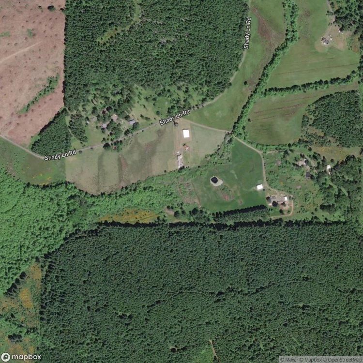
1field,34acresinPolkCounty,OR
countyavg($/ac.)
N/A
economicattributes
PolkCountyisahightaxcounty. Thislandisinalowlivestockdemandarea.
township/section 9S6W–14
physicalattributes
AnnualPrecipitation:53.58inches AnnualGDD:2351
Zoning&LandUse
LandUse:Grass/Pasture,Developed, Non-Cropland,Cropland ZoningCode:TC
NOTLICENSEDFORBUSINESSUSE
AcreValue©2024Ag-AnalyticsTechnologyCompanyAllRightsReserved. UseofthisreportissubjecttoAg-AnalyticsTechnologyCompany’sTermsofService.
Allinformationisprovidedwithoutanyexpressorimpliedwarrantiesofanykind. Landpricesareestimatesofvaluationandnotcertifiedappraisedvalues.
Ifyou’reinterestedinusing AcreValueforyourbusiness, contactAcreValueSupport aboutanEnterprise subscription.
Fields|PropertyInfo March28,2024
avgnccpi UpgradetoProPlustoview countyavg 47.0
field acres latitude longitude slope 2022crops avgnccpi CountyAvg.($/ac.) all 34.17 44.79290 -123.39003 8.10% 43%Grass/Pasture,31%Forest, 21%Non-Cropland,5%Other Upgrade N/A
Report:2921450PropertyInfo:1 of1
NOTLICENSEDFORBUSINESSUSE
*EstimatedPricePerAcrefromAcreValuemodel.
AcreValue©2024Ag-AnalyticsTechnologyCompanyAllRightsReserved. UseofthisreportissubjecttoAg-AnalyticsTechnologyCompany’sTermsofService. Allinformationisprovidedwithoutanyexpressorimpliedwarrantiesofanykind. Landpricesareestimatesofvaluationandnotcertifiedappraisedvalues.
Ifyou’reinterestedinusing AcreValueforyourbusiness, contactAcreValueSupport aboutanEnterprise subscription. Report:2921450SaleComps:1 of1
Fields|SaleComps March28,2024
township/section 9S6W–14
1field,34acresinPolkCounty,OR
boundary
TargetParcel Comp1 Comp2&3
Comp4 Comp1Comp2Comp3Comp4CompAvgsTargetParcel
county Polk,ORPolk,ORPolk,ORPolk,ORPolk,OR saleprice $806,000$470,000$470,000$688,500$689,208
MarketMarketMarketMarket purchase condition MortgageCashPurchaseCashPurchaseMortgage distance(mi) 0.302.322.323.152.02 acres 18.945.035.036.538.8834.17 topcrop NoneNoneNoneNoneGrass/Pasture NCCPI 71.471.371.374.571.964.3 $/NCCPI $596$1,310$1,310$1,416$949 tillable% 1.3%0.0%0.0%3.4%1.3%2.6%
$/ac.price $42,556/ac.$93,349/ac.$93,349/ac.$105,487/ac.$68,508/ac. saledate 02/28/2403/19/2403/18/2412/20/23 salecondition
NOTLICENSEDFORBUSINESSUSE
AcreValue©2024Ag-AnalyticsTechnologyCompanyAllRightsReserved. UseofthisreportissubjecttoAg-AnalyticsTechnologyCompany’sTermsofService. Allinformationisprovidedwithoutanyexpressorimpliedwarrantiesofanykind. Landpricesareestimatesofvaluationandnotcertifiedappraisedvalues.
Ifyou’reinterestedinusing AcreValueforyourbusiness, contactAcreValueSupport aboutanEnterprise subscription.
Fields|SoilSurvey March28,2024 1field,34acresinPolkCounty,OR township/section 9S6W–14 15C 36D 72 37D 67D 27C avgnccpi 64.3 countyavg 47.0 quality 24 90 Allfields 34ac. Source:NRCSSoilSurvey soil code soildescriptionacrespercentageof field soil class nccpi 72 Waldosiltyclayloam 13.65 39.9% 3 Upgrade 15C Chehulpumsiltloam,3to12percentslopes 9.01 26.4% 6 Upgrade 36D Jorysiltyclayloam,12to20percentslopes 5.81 17.0% 3 Upgrade 67D Steiwersiltloam,12to20percentslopes 3.12 9.1% 4 Upgrade 27C Dupeesiltloam,3to12percentslopes 1.58 4.6% 3 Upgrade 37D Jorysiltyclayloam,2to30percentslopes 1.00 2.9% 3 Upgrade 34.17 Upgrade
Report:2921450SoilSurvey:1of 1
NOTLICENSEDFORBUSINESSUSE
AcreValue©2024Ag-AnalyticsTechnologyCompanyAllRightsReserved. UseofthisreportissubjecttoAg-AnalyticsTechnologyCompany’sTermsofService. Allinformationisprovidedwithoutanyexpressorimpliedwarrantiesofanykind. Landpricesareestimatesofvaluationandnotcertifiedappraisedvalues.
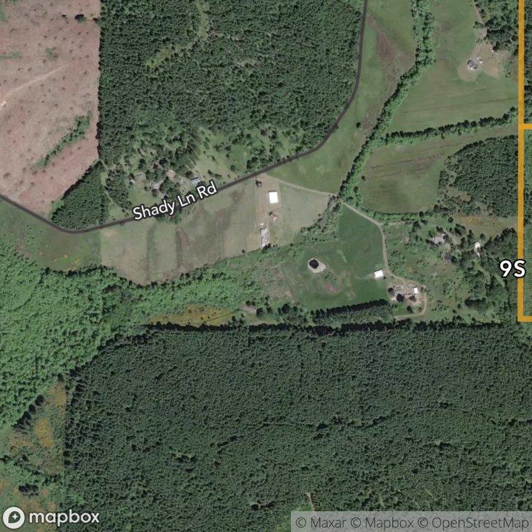
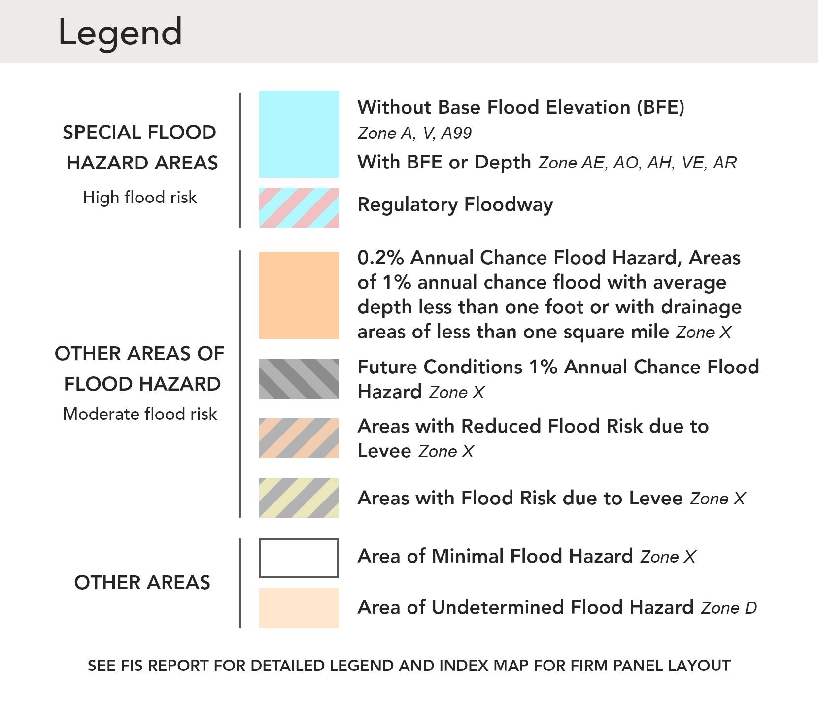
*HIGHFLOODRISK -areaswitha1%annualchanceorgreaterofflooding,also referredtoasbasefloodzonesor100-yearfloodzones.ClassifiedasSpecialFlood HazardAreas(SFHAs)byFEMA. MODERATEFLOODRISK -areasinbetweenthe limitsofthe1%annualandthe0.2%annual(or500-year)floodzones. MINIMAL FLOODRISK -areasthatareabovethe500-yearfloodzones. UNDETERMINED FLOODRISK -areaswherefloodanalysishasnotbeenconducted.
Ifyou’reinterestedinusing AcreValueforyourbusiness, contactAcreValueSupport aboutanEnterprise subscription.
Report:2921450FloodHazard:1 of1
Fields|FloodHazard March28,2024
township/section 9S6W–14 X A
1field,34acresinPolkCounty,OR
Allfields 34ac. Source:FEMANationalFloodHazardLayer flood zone floodrisk* floodzonesubtypeacrespercentageoffield X MINIMALAREAOFMINIMALFLOODHAZARD 18.01 52.7% A HIGH N/A 16.15 47.3% 34.17
NOTLICENSEDFORBUSINESSUSE
AcreValue©2024Ag-AnalyticsTechnologyCompanyAllRightsReserved. UseofthisreportissubjecttoAg-AnalyticsTechnologyCompany’sTermsofService. Allinformationisprovidedwithoutanyexpressorimpliedwarrantiesofanykind. Landpricesareestimatesofvaluationandnotcertifiedappraisedvalues.
Source:NASSCroplandDataLayer
Ifyou’reinterestedinusing AcreValueforyourbusiness, contactAcreValueSupport aboutanEnterprise subscription.
Report:2921450CropHistory:1 of1
Fields|CropHistory March28,2024
9S6W–14
34ac.
2019 2018 Grass/Pasture 43.5%44.9%32.4%36.5%37.4% Forest 31.1%32.4%41.9%33.3%32.1% Non-Cropland 20.6%17.8%20.8%25.3%26.3% Other 4.9%4.9%4.9%4.9%4.2%
1field,34acresinPolkCounty,OR township/section
Allfields
202220212020
PolkCounty,OR
AcreValue©2024Ag-AnalyticsTechnologyCompanyAllRightsReserved. UseofthisreportissubjecttoAg-AnalyticsTechnologyCompany’sTermsofService. Allinformationisprovidedwithoutanyexpressorimpliedwarrantiesofanykind. Landpricesareestimatesofvaluationandnotcertifiedappraisedvalues.
Ifyou’reinterestedinusing AcreValueforyourbusiness, contactAcreValueSupport aboutanEnterprise subscription.
March28,2024
Fields|Ownership
1field,34acresinPolkCounty,OR township/section 9S6W–14
field acres tax amount assessed value location owner (lastupdated) owneraddresslegaldescription all 34.17 3,065.82256,072.00 9S6W–14 APN:0453011 MORGAN,DEBORAL; STARBUCK,SEAN THOMAS(02/07/2022) UpgradetoProPlusto view Unknown
Report:2921450Ownership:1of 1
NOTLICENSEDFORBUSINESSUSE

Utilities HOMEBOOK

Please Use/Click on this Digital Utility Link

Most utility service providers require you to go online, fill out a form and e-mail back, or use their online service.

Neighborhood Information HOMEBOOK

Page 1
Report Subject Property Location Report Date: 04/04/2024 Property Address 17610 SHADY LANE RD Order ID: R144599650 City, State & Zip MONMOUTH, OR 97361-9536 County POLK COUNTY Property Use Single Family Residential Mailing Address 17610 SHADY LANE RD, MONMOUTH, OR 97361-9536 Parcel Number 09614-00-00109 Subject Property Address 17610 SHADY LANE RD, MONMOUTH, OR 97361 APN 09614-00-00109 Owner MORGAN DEBORA L & STARBUCK SEAN THOMAS Lot Size (SF/AC) 1,413,522/32.45 Bedrooms 2 Year Built 1972 Living Area (SF) 3,485 Bathrooms/Partial 1 Garage/No. of Cars Phones Nearby Neighbor #1 Address 17620 SHADY LANE RD, MONMOUTH, OR 97361 APN 09614-00-00106 Owner CASTOR BRITTON & JENNINGS RYAN Lot Size (SF/AC) 1,009,721/23.18 Bedrooms 5 Year Built 1943 Living Area (SF) 3,086 Bathrooms/Partial 2 Garage/No. of Cars Garage/6 Phones Nearby Neighbor #2 Address 17755 SHADY LANE RD, MONMOUTH, OR 97361 APN 09614-00-00103 Owner FERGUSON KAREN L & FERGUSON KIMBERLY M Lot Size (SF/AC) 840,272/19.29 Bedrooms 3 Year Built 1979 Living Area (SF) 2,088 Bathrooms/Partial 2/1 Garage/No. of Cars Carport/4 Phones Nearby Neighbor #3 Address 17600 SHADY LANE RD, MONMOUTH, OR 97361 APN 09614-00-00102 Owner CONNERLY, DAMON; CONNERLY, WENDY Lot Size (SF/AC) 842,886/19.35 Bedrooms 3 Year Built 1973 Living Area (SF) 1,768 Bathrooms/Partial 2 Garage/No. of Cars Phones Nearby Neighbor #4 Address 17590 SHADY LANE RD, MONMOUTH, OR 97361 APN 09611-00-00203 Owner MATIS DAVID S & CHERIE KAY Lot Size (SF/AC) 2,637,122/60.54 Bedrooms 3 Year Built 2017 Living Area (SF) 2,419 Bathrooms/Partial 2/1 Garage/No. of Cars Phones Nearby Neighbor #5 Address 17900 PRIEM RD, MONMOUTH, OR 97361 APN 09623-00-00100 Owner WEISENSEE-PRIEM INC Lot Size (SF/AC) 3,713,054/85.24 Bedrooms 2 Year Built 2003 Living Area (SF) 960 Bathrooms/Partial 1 Garage/No. of Cars Garage/2 Phones
Nearby Neighbors

Hereforthe OregonSchoolReportCards
School Information HOMEBOOK Click
Page 2 Public Schools Report Subject Property Location Report Date: 04/04/2024 Property Address 17610 SHADY LANE RD Order ID: R144599651 City, State & Zip MONMOUTH, OR 97361-9536 County POLK COUNTY Property Use Single Family Residential Mailing Address 17610 SHADY LANE RD, MONMOUTH, OR 97361-9536 Parcel Number 09614-00-00109 Public School Summary School Name Grades Distance from Subject Property LUCKIAMUTE VALLEY CHARTER SCHOOL Grade KG - Grade 8 4.17 miles FALLS CITY ELEMENTARY SCHOOL Grade KG - Grade 8 5.56 miles WHITWORTH ELEMENTARY SCHOOL Grade 4 - Grade 5 9.74 miles FALLS CITY HIGH SCHOOL Grade 9 - Grade 12 5.37 miles LUCKIAMUTE VALLEY CHARTER SCHOOL Address 12975 KINGS VALLEY HWY Kindergarten 18 MONMOUTH, OR 97361-9525 Grade 1 22 Phone Number 503-838-1933 Grade 2 25 Distance from Subject Property 4.17 miles Grade 3 10 Grades Grade KG - Grade 8 Grade 4 18 Student Teacher Ratio 1:26.1 Grade 5 18 Full Time Equivalent Administrators 5.4 Grade 6 18 API Score N/A Grade 7 5 Grade 8 7 Total 141 FALLS CITY ELEMENTARY SCHOOL Address 177 PROSPECT AVE Kindergarten 6 FALLS CITY, OR 97344-9754 Grade 1 7 Phone Number 503-787-3521 Grade 2 7 Distance from Subject Property 5.56 miles Grade 3 11 Grades Grade KG - Grade 8 Grade 4 6 Student Teacher Ratio 1:18.4 Grade 5 13 Full Time Equivalent Administrators 4.5 Grade 6 14 API Score N/A Grade 7 10 Grade 8 9 Total 83 WHITWORTH ELEMENTARY SCHOOL Address 1151 SE MILLER AVE Grade 4 217 DALLAS, OR 97338-2798 Grade 5 224 Phone Number 503-623-8351 Total 441 Distance from Subject Property 9.74 miles Grades Grade 4 - Grade 5 Student Teacher Ratio 1:21.9 Full Time Equivalent Administrators 20.1 API Score N/A
About Public Schools
The Public School Report lists schools closest to the subject property. For a complete listing of schools in your area, please go to http://www.nces.ed.gov /globallocator.
API Index
The Academic Performance Index (API) measures academic performance and growth of schools, which includes results of the Stanford 9. The API reports a numeric scale that ranges from 200 to 1000. A school's score or position on the API indicates the level of a school's preformance.
Page 3 FALLS CITY HIGH SCHOOL Address 111 NORTH MAIN ST Grade 9 11 FALLS CITY, OR 97344-0107 Grade 10 19 Phone Number 503-787-3521 Grade 11 18 Distance from Subject Property 5.37 miles Grade 12 11 Grades Grade 9 - Grade 12 Total 59 Student Teacher Ratio 1:11.5 Full Time Equivalent Administrators 5.15 API Score N/A SCHOOL DISTRICTS FALLS CITY SD 57 Address 111 N MAIN ST Pupil Teacher Ratio 15.8:1 No of Teacher Aids 7.7 FALLS CITY, OR 97344-0107 Total Enrollment 142 No of Guidance Counselors N/A Phone Number 503-787-3521 No of High School Graduates 12 No of School Administrators 1.6 Grades KG- 12 Number of Teachers 9.7 Number of Schools 2 DALLAS SD 2 Address 111 SW ASH ST Pupil Teacher Ratio 22.1:1 No of Teacher Aids 82.6 DALLAS, OR 97338-2299 Total Enrollment 3,335 No of Guidance Counselors 6.5 Phone Number 503-623-5594 No of High School Graduates 181 No of School Administrators 8.0 Grades KG- 12 Number of Teachers 151.6 Number of Schools 6
Page 4 Private Schools Report Subject Property Location Report Date: 04/04/2024 Property Address 17610 SHADY LANE RD Order ID: R144599652 City, State & Zip MONMOUTH, OR 97361-9536 County POLK COUNTY Property Use Single Family Residential Mailing Address 17610 SHADY LANE RD, MONMOUTH, OR 97361-9536 Parcel Number 09614-00-00109 Private School Summary School Name Grades Distance from Subject Property MONMOUTH MONTESSORI SCHOOL Prekindergarten - Kindergarten 4.59 miles FAITH CHRISTIAN SCHOOL Prekindergarten - Grade 5 10.94 miles MONMOUTH MONTESSORI SCHOOL Address PO BOX 242 Prekindergarten 15 MONMOUTH, OR 97361-0242 Kindergarten 10 Phone Number 503-838-6478 Total 25 Distance from Subject Property 4.59 miles Gender Coed Grades Prekindergarten - Kindergarten Affiliation Nonsectarian Student Teacher Ratio 1:3.8 Full Time Equivalent Administrators 2.6 FAITH CHRISTIAN SCHOOL Address 2290 E ELLENDALE AVENUE Prekindergarten 14 DALLAS, OR 97338-9353 Kindergarten 17 Phone Number 503-623-6632 Grade 1 7 Distance from Subject Property 10.94 miles Grade 2 4 Gender Coed Grade 3 5 Grades Prekindergarten - Grade 5 Grade 4 2 Affiliation Other Grade 5 5 Student Teacher Ratio 1:8.3 Total 54 Full Time Equivalent Administrators 4.8 About Private Schools As private schools are not subject to district boundaries, we list up to 15 of the schools closest to the subject property within a five mile radius of the subject property. Disclaimer THIS REPORT IS INTENDED FOR USE BY YOU AS AN END USER SOLELY FOR YOUR INTERNAL BUSINESS PURPOSES. YOU SHALL NOT RESELL, RELICENSE OR REDISTRIBUTE THIS REPORT, IN WHOLE OR IN PART. THE USE OF THIS REPORT BY ANY PARTY OTHER THAN YOURSELF FOR ANY PURPOSE IS STRICTLY PROHIBITED. THIS REPORT IS PROVIDED AS-IS WITHOUT WARRANTY OF ANY KIND, EITHER EXPRESS OR IMPLIED, INCLUDING WITHOUT LIMITATION, ANY WARRANTIES OF MERCHANTABILITY, NON-INFRINGEMENT, OR FITNESS FOR A PARTICULAR PURPOSE. INTERCONTINENTAL EXCHANGE, INC. (ICE) SHALL HAVE NO LIABILITY IN CONTRACT, TORT, OR OTHERWISE ARISING OUT OF OR IN CONNECTION WITH THIS REPORT. ICE DOES NOT REPRESENT OR WARRANT THAT THE REPORT IS COMPLETE OR FREE FROM ERROR. YOU UNDERSTAND AND ACKNOWLEDGE THAT THE AVAILABILITY, COMPLETENESS AND FORMAT OF THE DATA ELEMENTS MAY VARY SUBSTANTIALLY FROM AREA-TO-AREA. THE INFORMATION CONTAINED IN THIS REPORT IS DERIVED FROM PUBLICLY AVAILABLE SOURCES FOR THE SUBJECT PROPERTY OR COMPARABLE PROPERTIES LISTED ABOVE AND HAS NOT BEEN INDEPENDENTLY VERIFIED BY ICE THROUGH ANY FORM OF INSPECTION OR REVIEW. THIS REPORT DOES NOT CONSTITUTE AN APPRAISAL OF ANY KIND AND SHOULD NOT BE USED IN LIEU OF AN INSPECTION OF A SUBJECT PROPERTY BY A LICENSED OR CERTIFIED APPRAISER. THIS REPORT CONTAINS NO REPRESENTATIONS, OPINIONS OR WARRANTIES REGARDING THE SUBJECT PROPERTY'S ACTUAL MARKETABILITY, CONDITION (STRUCTURAL OR OTHERWISE), ENVIRONMENTAL, HAZARD OR FLOOD ZONE STATUS, AND ANY REFERENCE TO ENVIRONMENTAL, HAZARD OR FLOOD ZONE STATUS IS FOR INFORMATIONAL PURPOSES ONLY AND SHALL BE INDEPENDENTLY VERIFIED BY THE END USER. THE INFORMATION CONTAINED HEREIN SHALL NOT BE UTILIZED: (A) TO REVIEW OR ESTABLISH A CONSUMER'S CREDIT AND/OR INSURANCE ELIGIBILITY OR FOR ANY OTHER PURPOSE THAT WOULD CAUSE THE REPORT TO CONSTITUTE A "CONSUMER REPORT" UNDER THE FAIR CREDIT REPORTING ACT, 15 U.S.C. § 1681 ET SEQ.; OR (B) IN CONNECTION WITH CERTIFICATION OR AUTHENTICATION OF REAL ESTATE OWNERSHIP AND/OR REAL ESTATE TRANSACTIONS. ADDITIONAL TERMS AND CONDITIONS SHALL APPLY PURSUANT TO THE APPLICABLE AGREEMENT. Copyright CONFIDENTIAL, PROPRIETARY AND/OR TRADE SECRET. TM SM ® TRADEMARK(S) OF INTERCONTINENTAL EXCHANGE, INC. AND ITS SUBSIDIARIES AND AFFILIATES. © 2024 INTERCONTINENTAL EXCHANGE, INC. ALL RIGHTS RESERVED.