Prepared for:
Julie & Chris Hoem
Homes by Hoems Property(s)
2071 SW Pattulo Way
West Linn, OR 97068
This Packet Includes:
• Trio (s)
• CMAP
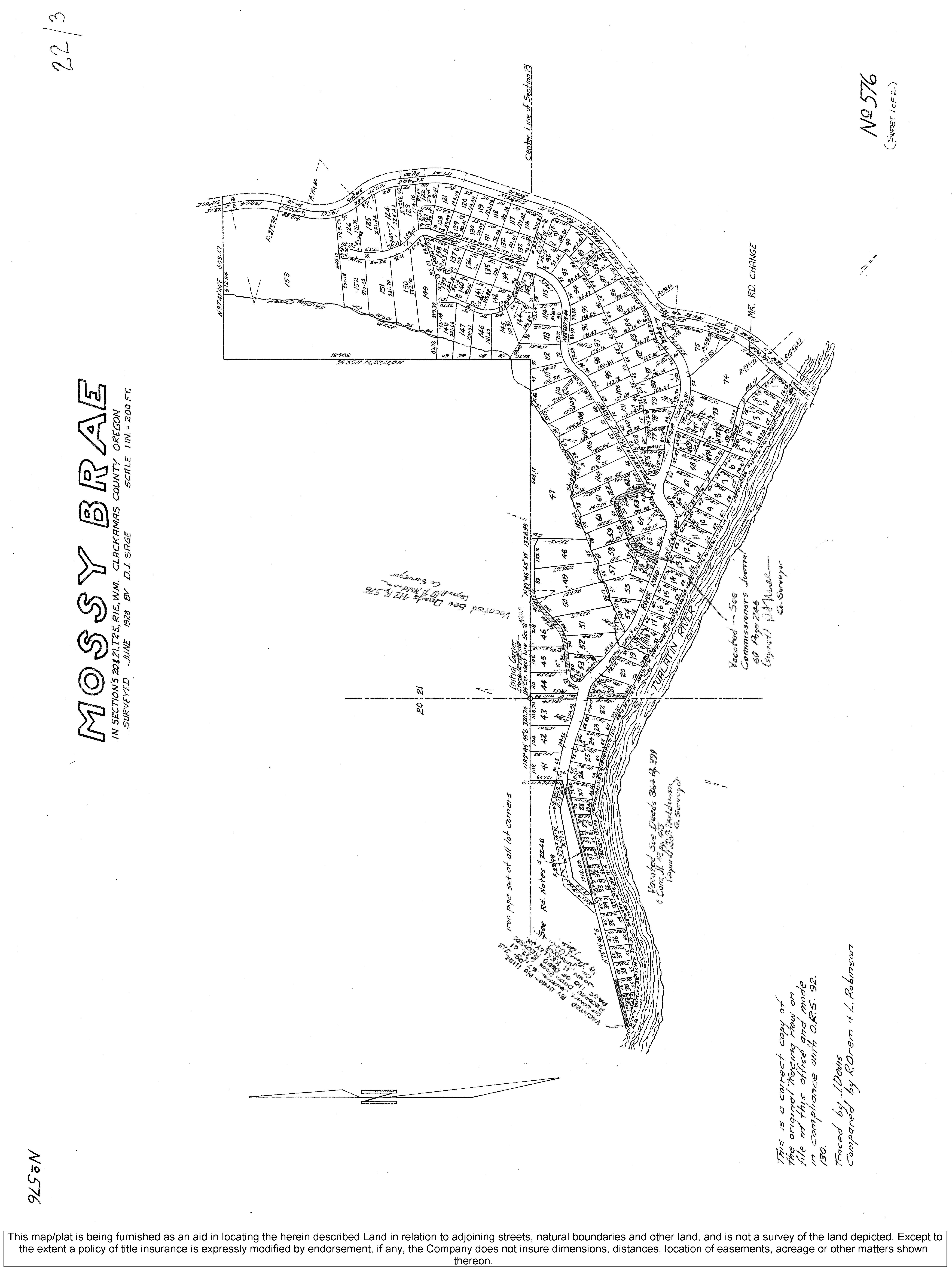
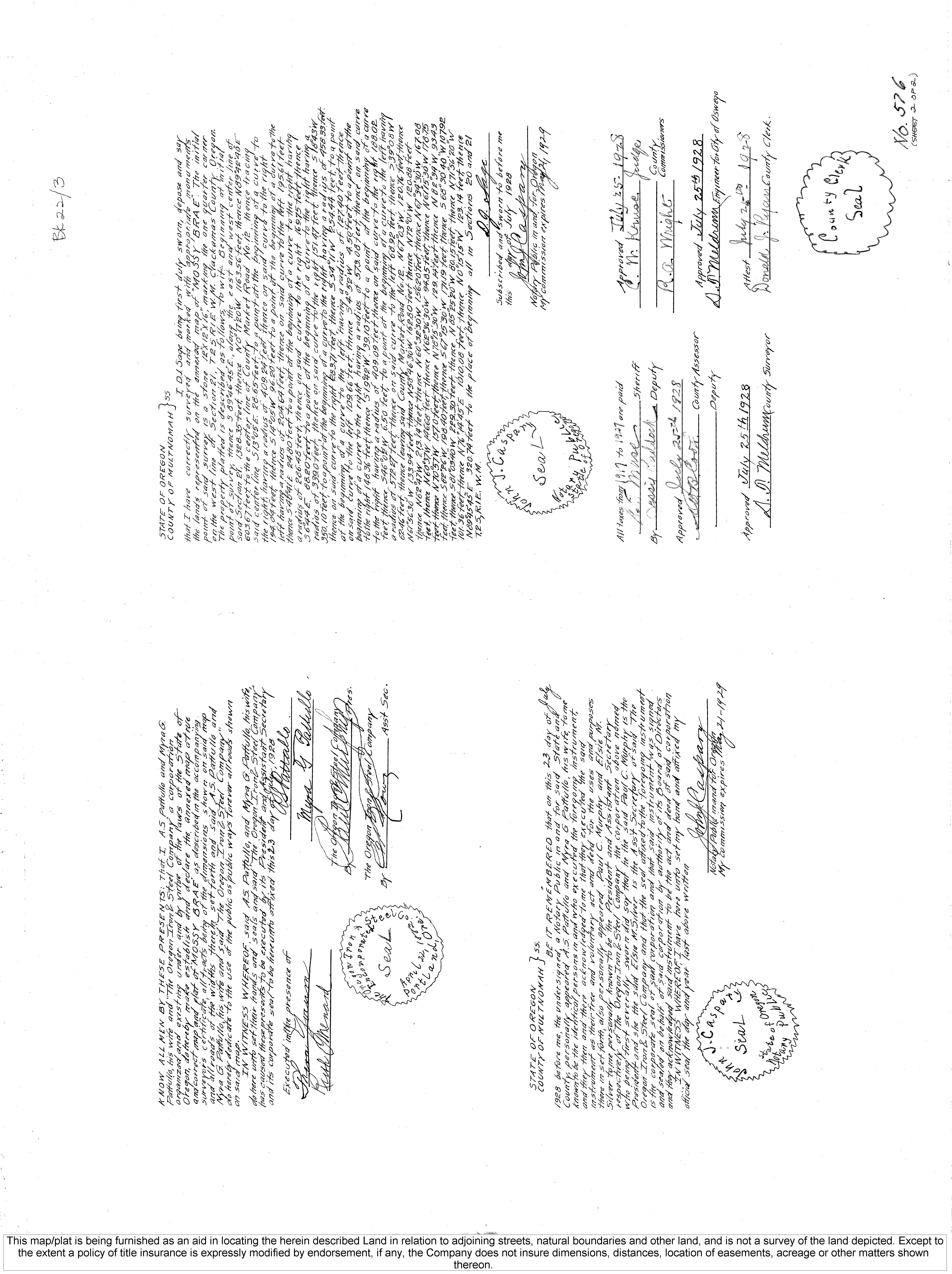
• Plat Map
• Topo Map
• Flood Map
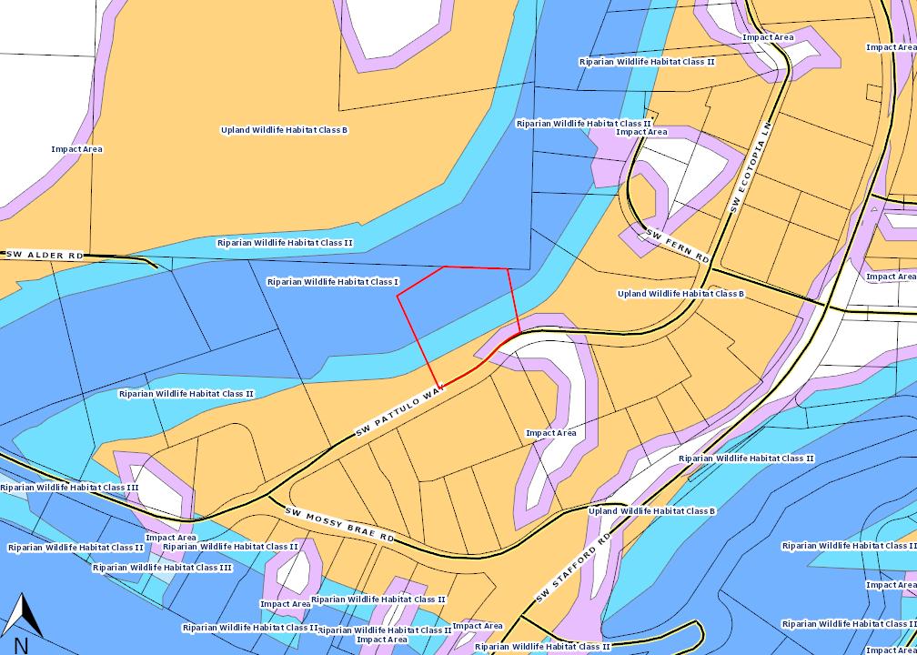
• Riparian & Upland Habitat
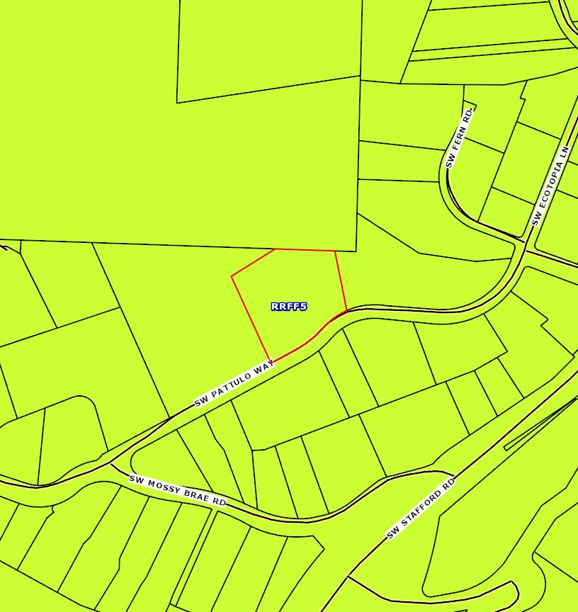
• Zoning Map
• Zoning Code - RRFF5 5 Acre Min.


Prepared for:
Julie & Chris Hoem
Homes by Hoems Property(s)
2071 SW Pattulo Way
West Linn, OR 97068
This Packet Includes:
• Trio (s)
• CMAP
• Plat Map
• Topo Map
• Flood Map
• Riparian & Upland Habitat
• Zoning Map
• Zoning Code - RRFF5 5 Acre Min.

ParcelInformation
Parcel#:00358188
TaxLot:21E21CB00100
SiteAddress:2071SWPattuloWay
WestLinnOR97068-9322
Owner:Sorenson,JamesLTrustee
Owner2:
OwnerAddress:377ELittleIsland
CathlametWA98612-9722
Twn/Range/Section:02S/01E/21/SW
ParcelSize:087Acres(37,767SqFt)
Plat/Subdivision:MossyBrae
Lot:47
Block:
MapPage/Grid:686-C4
CensusTract/Block:020403/2026
Waterfront:
BuildingUse:RS0-SingleFamily
Land
CntyLandUse:101-Residentiallandimproved
Zoning:ClackamasCo-RRFF5-RuralResidential FarmForest5AcreMin
Watershed:FannoCreek-TualatinRiver
PrimarySchool:StaffordPrimarySchool
TaxInformation
LevyCodeArea:003-015
LevyRate:171801
TaxYear:2022
AnnualTax:$5,25814
ExemptDescription:
AssessmentInformation
MarketValueLand: $273,87400
MarketValueImpr: $275,26000
MarketValueTotal: $549,13400
AssessedValue: $306,06000
LandUseStd:RSFR-SingleFamilyResidence
Neighborhood:Stafford-TualatinValley
SchoolDistrict:3J-WestLinn
MiddleSchool:AtheyCreekMiddleSchool HighSchool:WestLinnHighSchool
Improvement
YearBuilt:1978
Bedrooms:3
ExteriorWallType:Tongue& Groove/Channel
Stories:1
Bathrooms:25
BasementFin SqFt:
Heat:HeatPump RoofType-Cover:Composition
TransferInformation
Rec Date:04/25/2022
SalePrice:
Owner:SorensonJamesLTrust
Orig LoanAmt:
FinanceType:
SentryDynamics,Inc
LoanType:

DocNum:2022-024280
Fin SqFt:2,336
Garage:
Fireplace:
Grantor:SORENSONJAMESL
TitleCo:ATTORNEYONLY
Lender:
DocType:Deed
anditscustomersmakenorepresentations,warrantiesorconditions,expressorimplied,astotheaccuracyor completenessofinformationcontainedinthisreport
Objectid: 44940
PrimaryAddress: 2071 SW Pattulo Way, West Linn, 97068
Jurisdiction: Clackamas County (http://www.clackamas.us/)
Map Number: 21E21CB
Taxlot Number: 21E21CB00100
Parcel Number: 00358188
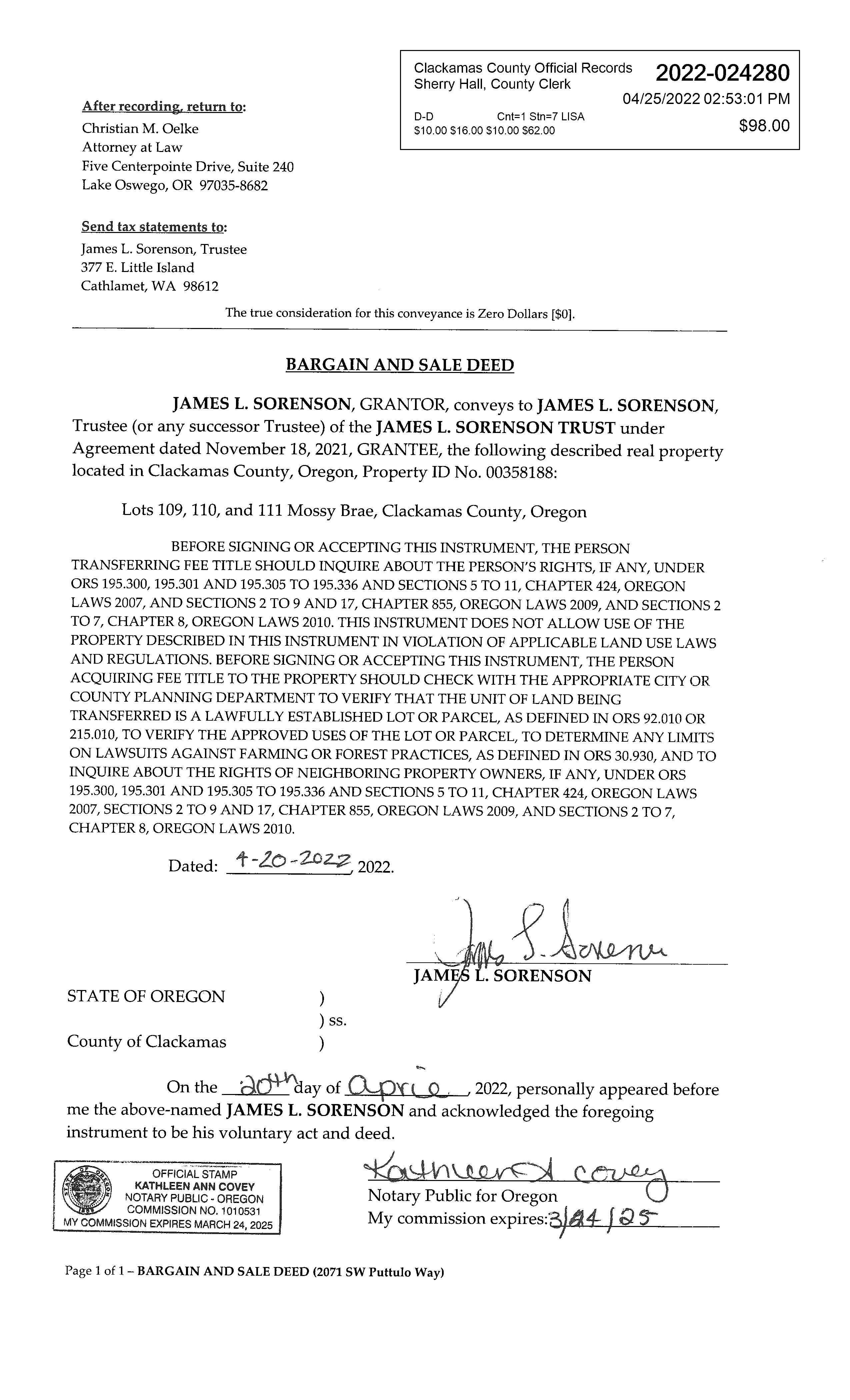
Document Number: 2022-024280
Census Tract: 020403
Landclass: 101
Assessment
EstimatedAcres: 0.87
CurrentYearAssessed Value: $306,060.00
Market Building Value: $275,260.00
Market Land Value: $273,874.00
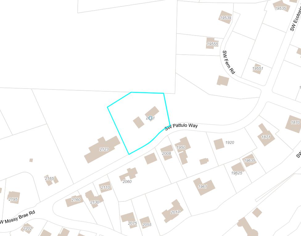
Market Total Value: $549,134.00
Sq Ft: 2336
Bedrooms: 3
Baths: 2
Year Built: 1978
Sale Price: $0.00
Doc Date: 04/20/2022
Doc Type: S
Taxcode: 003015
Schools
Elementary School
Stafford Primary (https://www.wlwv.k12.or.us/Domain/16)
WestLinn/Wilsonville
19875 SW Stafford Rd, West Linn, 97068
503-673-7150
Middle School
MeridianAthey Choice (http://www.wlwv.k12.or.us/Domain/8)
WestLinn/Wilsonville
2900 SW Borland Rd, West Linn, 97068
503-673-7400
High School
West Linn High (https://www.wlwv.k12.or.us/wlhs)
WestLinn/Wilsonville
5464 WestASt, West Linn, 97068 503-673-7800
Nearest Fire Station
Mountain Road Station #57
24242 SW Mountain Rd, West Linn 97068
Tualatin Valley Fire & Rescue
Nearest Police Station
Clackamas County Sheriff
Designation: RRFF5
Urban Growth Boundary: OUTSIDE
Voting Precincts: 321 State House District: 37
State Senate District: 19
Congressional District: 5
Utilities & Districts
Community Planning Organization
Stafford-Tualatin Valley
Sanitary Hauler
Republic Services (https://clackamas.us/recycling/garbage/company.html)
Rural Fee Zone
School District
West Linn/Wilsonville (http://www.wlwv.k12.or.us)
Water District
Mossy Brae (http://www.mossybrae.org)
Environmental & Hazards
Flood
Likely not in a flood zone.
Wildfire
You may be at moderate to high risk.
Earthquake Hazard
You may be at a higher risk.
Soils
13D - Cascade Silt Loam, 15 To 30 Percent Slopes
13B - Cascade Silt Loam, 3 To 8 Percent Slopes
Approximate Elevation
North Folk Dam Failure
Most likely not at risk of flooding due to dam failure
River Mill Dam Failure
Most likely not at risk of flooding due to dam failure
Timothy Dam Failure
Most likely not at risk of flooding due to dam failure
Parks
Nearby
Cooks Butte Park (https://www.ci.oswego.or.us/parksrec/cooks-butte-park)
2266 Palisades Crest Dr, Lake Oswego
0.75 miles
Luscher Farm (http://www.ci.oswego.or.us/luscher)
125 Rosemont Rd, Lake Oswego
0.93 miles
River Run Park (http://www.ci.oswego.or.us/parksrec/river-run-park)
19698 River Run Dr, Lake Oswego
1.11 miles
Stevens Meadows (https://www.ci.oswego.or.us/parksrec/stevens-meadows)
18600 SW Shipley Dr, Lake Oswego
0.60 miles
Westridge Park (https://www.ci.oswego.or.us/parksrec/westridge-park)
39 Westridge Dr, Lake Oswego
1.05 miles
Documents
Surveyor Documents
Survey - SN15731 (https://cmap.clackamas.us/survey/PSImages/2S1E/21/PS15731.tif)
Plat - 0576 (https://cmap.clackamas.us/survey/SDImages/2S1E/21/0576-P1.tif)
Plat - 0576 (https://cmap.clackamas.us/survey/SDImages/2S1E/21/0576-P2.tif)
Assessor Documents
Taxmap - 2S1E21CB (https://cmap.clackamas.us/taxmap/03_2s1e21cb.pdf)
District Maps
NoChargesarecurrentlydue.Ifyoubelievethisisincorrect,pleasecontacttheAssessor'sO�ice.

SentryDynamics,Inc anditscustomersmakenorepresentations, warrantiesorconditions,expressorimplied,astotheaccuracyor completenessofinformationcontainedinthisreport

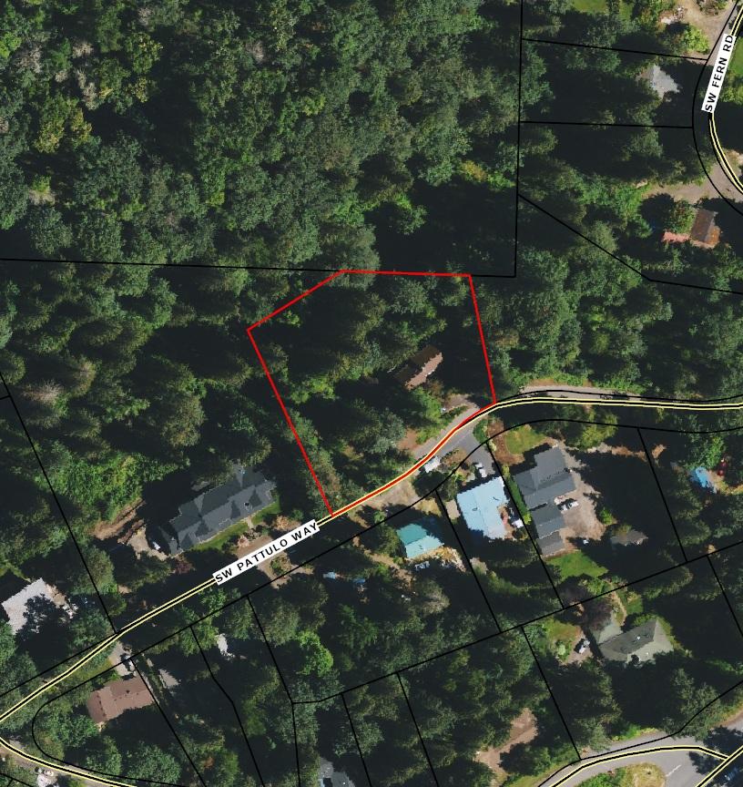
ParcelID:00358188
SiteAddress:2071SWPattuloWay

SentryDynamics,Inc anditscustomersmakenorepresentations, warrantiesorconditions,expressorimplied,astotheaccuracyor completenessofinformationcontainedinthisreport
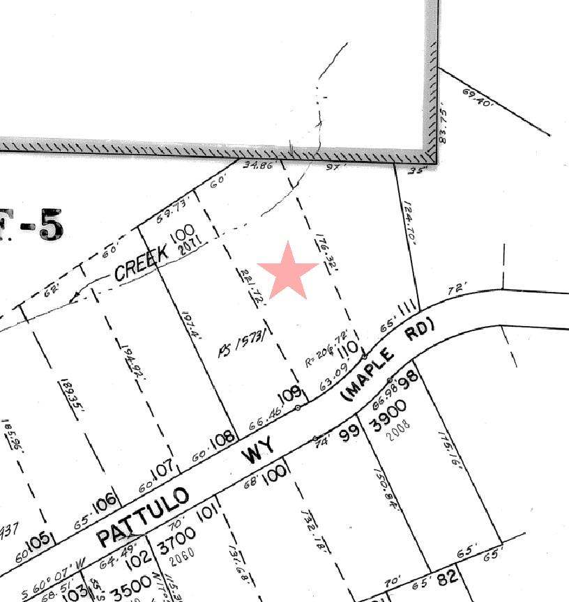
ParcelID:00358188
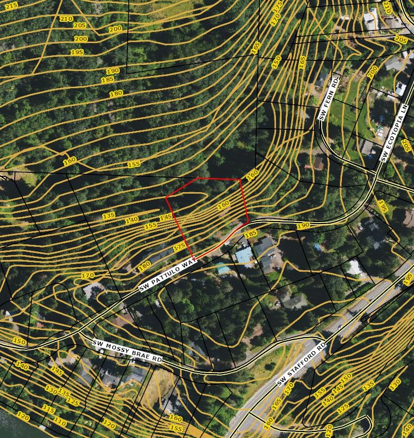
SentryDynamics,Inc anditscustomersmakenorepresentations, warrantiesorconditions,expressorimplied,astotheaccuracyor completenessofinformationcontainedinthisreport

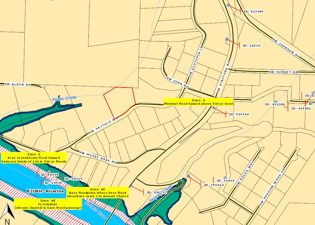
ParcelID:00358188
SentryDynamics,Inc anditscustomersmakenorepresentations, warrantiesorconditions,expressorimplied,astotheaccuracyor completenessofinformationcontainedinthisreport

316 RURAL AREA RESIDENTIAL 1-ACRE (RA-1), RURAL AREA RESIDENTIAL 2-ACRE (RA-2), RECREATIONAL RESIDENTIAL (RR), RURAL RESIDENTIAL FARM FOREST 5-ACRE (RRFF-5), FARM FOREST 10-ACRE (FF-10), AND FUTURE URBAN 10-ACRE (FU-10) DISTRICTS
316.01 PURPOSE
Section 316 is adopted to implement the policies of the Comprehensive Plan for Unincorporated Community Residential, Rural, and Future Urban areas.
Section 316 applies to land in the Rural Area Residential 1-Acre (RA-1), Rural Area Residential 2-Acre (RA-2), Recreational Residential (RR), Rural Residential Farm Forest 5-Acre (RRFF-5), Farm Forest 10-Acre (FF-10), and Future Urban 10-Acre (FU-10) Districts, hereinafter collectively referred to as the rural residential and future urban residential zoning districts.
A. Uses permitted in each rural residential and future urban residential zoning district are listed in Table 316-1, Permitted Uses in the Rural Residential and Future Urban Residential Zoning Districts. Uses not listed are prohibited.
B. As used in Table 316-1:
1. “P” means the use is a primary use.
2. “A” means the use is an accessory use.
3. “C” means the use is a conditional use, approval of which is subject to Section 1203, Conditional Uses
4. “CPUD” means the use is allowed as a conditional use in a planned unit development.
5. “X” means the use is prohibited.
6. “Type II” means the use requires review of a Type II application, pursuant to Section 1307, Procedures
7. Numbers in superscript correspond to the notes that follow Table 316-1.
C. Permitted uses are subject to the applicable provisions of Subsection 316.04, Dimensional Standards; Section 1000, Development Standards; and Section 1100, Development Review Process
A. General: Dimensional standards applicable in the rural and future urban residential zoning districts are listed in Table 316-2, Dimensional Standards in the Rural Residential and Future Urban Residential Zoning Districts. As used in Table 316-2, numbers in superscript correspond to the notes that follow the table.
B. Modifications: Modifications to the standards in Table 316-2 are established by Sections 800, Special Use Requirements; 903, Setback Exceptions; 1012, Lot Size and Density; 1107, Property Line Adjustments; and 1205, Variances.
316-2
Last Amended 7/1/22
Table
Accessory Buildings and Uses, Customarily Permitted, such as amateur (Ham) radio antennas and towers, arbors, bicycle racks, carports, citizen band transmitters and antennas, cogeneration facilities, courtyards, decks, decorative ponds, driveways, electric vehicle charging stations, family child care homes, fountains, garages, garden sheds, gazebos, greenhouses, HVAC units, meeting facilities, outdoor kitchens, parking areas, patios, pergolas, pet enclosures, plazas, property management and maintenance offices, recreational facilities (such as bicycle trails, children’s play structures, dance studios, exercise studios, playgrounds, putting greens, recreation and activity rooms, saunas, spas, sport courts, swimming pools, and walking trails), rainwater collection systems, satellite dishes, selfservice laundry facilities, shops, solar energy systems, storage buildings/rooms, television antennas and receivers, transit amenities, trellises, and utility service equipment
Last Amended 7/1/22
Recreational Uses, including boat moorages, community gardens, country clubs, equine facilities, gymnastics facilities, golf courses, horse trails, pack stations, parks, playgrounds, sports courts, swimming pools, ski areas, and walking trails21
Recreational Uses, GovernmentOwned, including amphitheaters; arboreta; arbors, decorative ponds, fountains, gazebos, pergolas, and trellises; ball fields; bicycle and walking trails; bicycle parks and skate parks; equine facilities; boat moorages and ramps; community buildings and grounds; community and ornamental gardens; courtyards and plazas; fitness and recreational facilities, such as exercise equipment, gymnasiums, and swimming pools; horse trails; miniature golf, putting greens, and sports courts; pack stations; parks; picnic areas and structures; play equipment and playgrounds; nature preserves and wildlife sanctuaries; ski areas; tables and seating; and similar recreational uses21
Retailing—whether by sale, lease, or rent—of any of the following new or used products: apparel, appliances, art, art supplies, beverages, bicycle supplies, bicycles, books, cameras, computers, computer supplies, cookware, cosmetics, dry goods, electrical supplies, electronic equipment, flowers, food, furniture, garden supplies, hardware, interior decorating materials, jewelry, linens, medications, music (whether recorded or printed), musical instruments, nutritional supplements, office supplies, optical goods, paper goods, periodicals, pet supplies, pets, plumbing supplies, photographic supplies, signs, small power equipment, sporting goods, stationery, tableware, tobacco, toiletries, tools, toys, vehicle supplies, and videos.
1 This use is permitted only inside of an urban growth boundary.
2 This use is permitted only outside of both an urban growth boundary and an urban reserve.
3 An accessory kitchen is permitted only in a detached single-family dwelling or a manufactured dwelling. Only one accessory kitchen is permitted in each single-family dwelling or manufactured dwelling.
4 Aircraft landing areas are permitted for use by emergency aircraft (e.g., fire, rescue) only.
5 This use is limited to alteration or expansion of a lawfully established child care facility.
6 As used in Table 316-1, farm uses do not include marijuana production, marijuana processing, marijuana wholesaling, or marijuana retailing. See separate listings in Table 3161 for these uses.
7 Even though it is prohibited in this category, this use is included in the “government use” category.
8 This use is limited to alteration or expansion of a lawfully established adult daycare service.
9 Except as allowed by Section 839, Accessory Dwelling Units, or Section 1204, Temporary Permits, each lot of record may be developed with only one of the following: detached single-family dwelling, duplex (only if approved as a conditional use in the RA-1 District), or manufactured dwelling.
10 This use is permitted only on lots larger than five acres.
11 In the RA-2, RRFF-5, FF-10, and FU-10 Districts, livestock is permitted as described under the use category of farm uses. In the RA-1 and RR Districts, livestock is permitted as described under the use category of livestock.
12 For land inside the Portland Metropolitan Urban Growth Boundary, refer to Subsection 1002.02 regarding a development restriction that may apply if excessive tree removal occurs.
13 Uses similar to this may be authorized pursuant to Section 106, Authorizations of Similar Uses
14 A use may be permitted as a home occupation, subject to Section 822, even if such use is also identified in another use listing in Table 316-1.
15 The portion of the premises used shall be located a minimum of 200 feet from all property lines.
16 This use is limited to alteration or expansion of a lawfully established place of worship.
17 A produce stand shall be subject to the parking requirements of Section 1015, Parking and Loading
18 In addition to selling produce grown on-site, a produce stand may sell agricultural products that are produced in the surrounding community in which the stand is located.
19 Public utility facilities shall not include shops, garages, or general administrative offices.
20 The base of such towers shall not be closer to the property line than a distance equal to the height of the tower.
21 This use may include concessions, restrooms, maintenance facilities, and similar support uses.
22 Equine facilities are a primary use, subject to the following standards and criteria:
a. The number of horses shall be limited to no more than one horse per acre or five horses in total, whichever is less. Horses owned by the operator of the equine facility, or owned by a 501(c)(3) organization and being temporarily fostered by the operator of the equine facility, do not count toward the maximum number of horses. The one-horse-per-acre standard shall be calculated based on the area of the lot of record or tract on which the equine facility is located.
b. Services offered at the equine facility, such as riding lessons, training clinics, and schooling shows, shall be provided only to the family members and nonpaying guests of the operator of the equine facility, the owners of boarded horses, or the family members and nonpaying guests of the owners of boarded horses.
23 Any principal building or swimming pool shall be located a minimum of 45 feet from any other lot in a residential zoning district.
24 Recyclable drop-off sites are permitted only if accessory to an institutional use.
25 The use is subject to the following standards and criteria:
a. The use shall be located in a planned unit development (PUD) with a minimum of 100 dwelling units. No building permit for the use shall be issued until a minimum of 100 dwelling units are constructed within the PUD.
b. The area occupied by all uses subject to Note 23 and located in a single PUD, including their parking, loading, and maneuvering areas, shall not exceed a ratio of one-half acre per 100 dwelling units in the PUD.
c. The use shall be an integral part of the general plan of development for the PUD and provide facilities related to the needs of residents of the PUD.
Last Amended 7/1/22
316-10
d. The use shall be located, designed, and operated to efficiently serve frequent trade and service needs of residents of the PUD and not persons residing elsewhere.
e. The use shall not, by reason of its location, construction, manner or hours of operation, signs, lighting, parking arrangements, or other characteristics, have adverse effects on residential uses within or adjoining the PUD.
f. The maximum building floor space per commercial use is 4,000 square feet except that no maximum applies to uses authorized under Oregon Statewide Planning Goals 3 and 4 and uses intended to serve the community and surrounding rural area or the travel needs of people passing through the area.
26 Schools are prohibited within the areas identified as Employment, Industrial, and Regionally Significant Industrial on the Metropolitan Service District’s 2040 Growth Concept Map.
27 This use is limited to alteration or expansion of a lawfully established school.
28 Components of a sewer system that serve land outside urban growth boundaries or unincorporated community boundaries are prohibited.
29 The use is limited to sewer systems that: are designed and constructed so that their capacity does not exceed the minimum necessary to serve the area within the boundaries described under ORS 660-011-0060(4)(b)(B), except for urban reserve areas as provided under OAR 660-021-0040(6); and do not serve any uses other than those existing or allowed in the identified service area on the date the sewer system is approved.
30 Temporary signs regulated under Subsection 1010.13(A) are a primary use.
31 Utility carrier cabinets are a conditional use if the combined volume of all cabinets located on a single lot exceeds the applicable maximum established pursuant to Subsection 830.01(A).
316-11
Last Amended 7/1/22
Table
1 The minimum lot size standards apply as established by Sections 1012 and 1107. Notwithstanding the minimum lot size standard, a lot of record may be developed subject to other applicable standards of this Ordinance, except minimum lot size standards of Section 800 apply.
2 In a planned unit development, there is no minimum individual lot size. However, the minimum average lot size is one acre except for lots to be developed with a duplex, in which case the minimum average lot size is two acres. The average lot size is calculated by determining the lot area of the land proposed for subdivision, partition, or replat and dividing by the number of lots or parcels in the proposed planned unit development.
3 The minimum lot size inside the Portland Metropolitan Urban Growth Boundary is 20 acres. The 20-acre minimum lot size is applicable to subdivisions, partitions, and Type II replats, but not to Type I replats or property line adjustments. Where this standard applies, it supersedes any other minimum lot size standard in Table 316-2.
4 For the purpose of complying with the minimum lot size standard, lots with street frontage on County or public road rights-of-way may include the land area between the front lot line and the centerline of the County or public road right-of-way.
5 The minimum lot size inside the urban growth boundaries of the cities of Canby, Estacada, Molalla, and Sandy is five acres.
6 The average lot size is calculated by determining the lot area of the land proposed for subdivision, partition, or replat and dividing by the number of lots or parcels in the proposed partition, subdivision, or replat.
7 In a planned unit development, the minimum individual lot size is two acres, except inside the urban growth boundaries of the cities of Canby, Estacada, Molalla, and Sandy, where the minimum individual lot size is five acres. In all cases, the minimum average lot size is 10 acres. The average lot size is calculated by determining the lot area of the land proposed for subdivision, partition, or replat and dividing by the number of lots or parcels in the proposed planned unit development.
8 In a planned unit development, the minimum front setback is 20 feet.
9 For a corner lot located above 3,500 feet in elevation, one of the minimum front setbacks is 10 feet, except 20 feet to garage and carport motor vehicle entries.
10 In a planned unit development, there are no minimum rear and side setbacks except from rear and side lot lines on the perimeter of the final plat. Where this standard applies, it supersedes any other rear or side setback standard in Table 316-2.
11 The minimum rear setback for an accessory building shall be five feet except as established by Note 10.
316-13
Last Amended 7/1/22
12 The minimum rear setback for an accessory building shall be 10 feet except as established by Note 10.
13 The minimum side setback for an accessory building shall be five feet except as established by Note 10.
[Added by Ord. ZDO-252, 6/1/15; Amended by Ord. ZDO-253, 6/1/15; Amended by Ord. ZDO-254, 1/4/16; Amended by Ord. ZDO-263, 5/23/17; Amended by Ord. ZDO-266, 5/23/18; Amended by Ord. ZDO-269, 9/6/18; Amended by Ord. ZDO-268, 10/2/18; Amended by Ord. ZDO-280, 10/23/21; Amended by Ord. ZDO-282, 7/1/22]
316-14
Last Amended 7/1/22