LAUREN JASPER
Master of Architecture in Urban Design Application Portfolio
Design at the Intersection of Form, Identity, and Narrative
The projects in my portfolio reflect a common curiosity and exploratory nature in addressing present challenges related to the built environment. In my work, value being intentional about whom I am designing for and the story want to tell, integrating intersections of race, class, and identity. I aim to address urban challenges, such as access to housing, vertical density, and the redevelopment of America’s inner cities, with playful forms and processes that involve constant learning through design
The five portfolio sections showcased include three semester-long studios, independent research on urban justice as background information for my upcoming undergraduate thesis, and visual art. Passion, attention to detail, and a hope for positive social change are values that I aim to maintain consistently throughout every page.
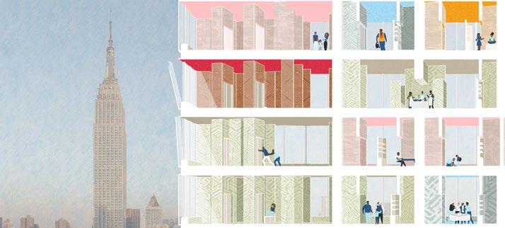
Penn Plaza Towers
An Affordable Housing Development Utilizing Vacant Office Buildings in New York City
Fall 2023: Cornell University, B.Arch Option Studio
Professor: Gary Bates
Collaboration: Francisco Ramirez Gonzalez and Katya Olsen
(Drawings shown are individually executed unless otherwise noted)
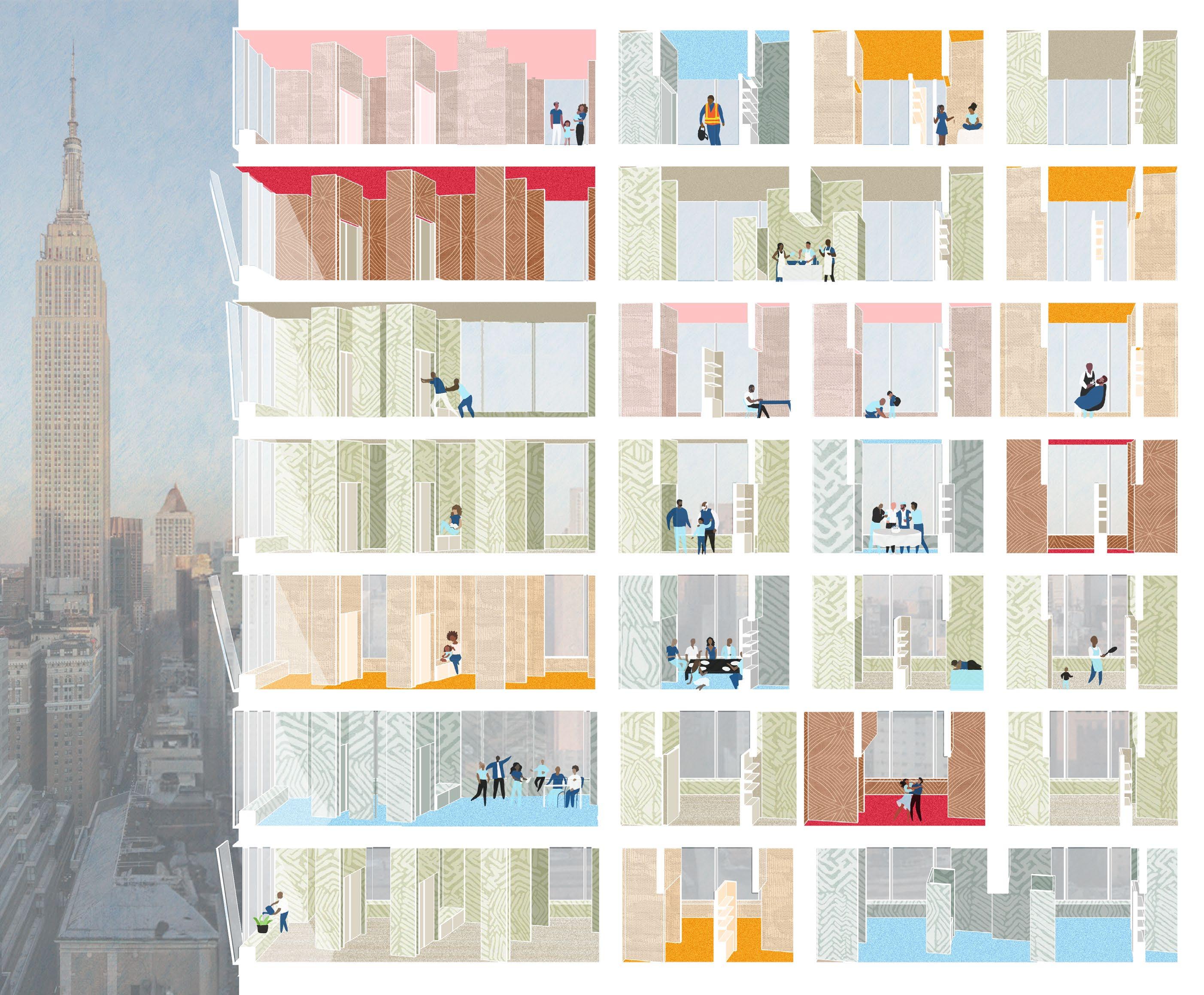
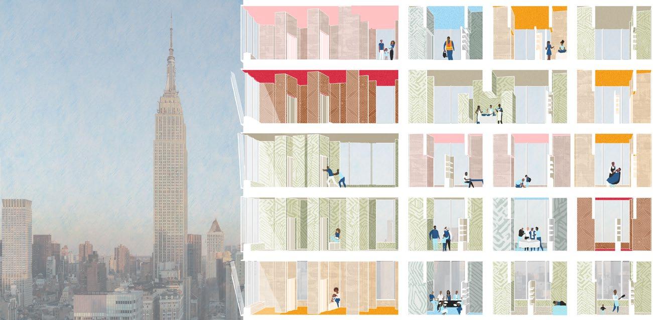
There are over 16,000 migratory service employees in the area surrounding New York City’s Penn Station and Madison Square Garden, formally called the Penn District, that commute to work each day. Considering that the area is virtually unlivable now due to noise, congestion, and traffic compounded with the lack of accessible food, education and affordable housing, the project asks “how can we make Penn Plaza suitable for affordable living for the thousands of people that occupy the space daily?”
The block surrounding Penn Station and Madison Square Garden becomes part of the scope, and two presently vacant or partially vacant office buildings, One Penn Plaza and Two Penn Plaza, are converted to affordable housing high rises. The goal is for this project to become a model for other office-to-housing conversions in New York City as more and more buildings need to be converted to address the city’s ever-growing housing crisis.
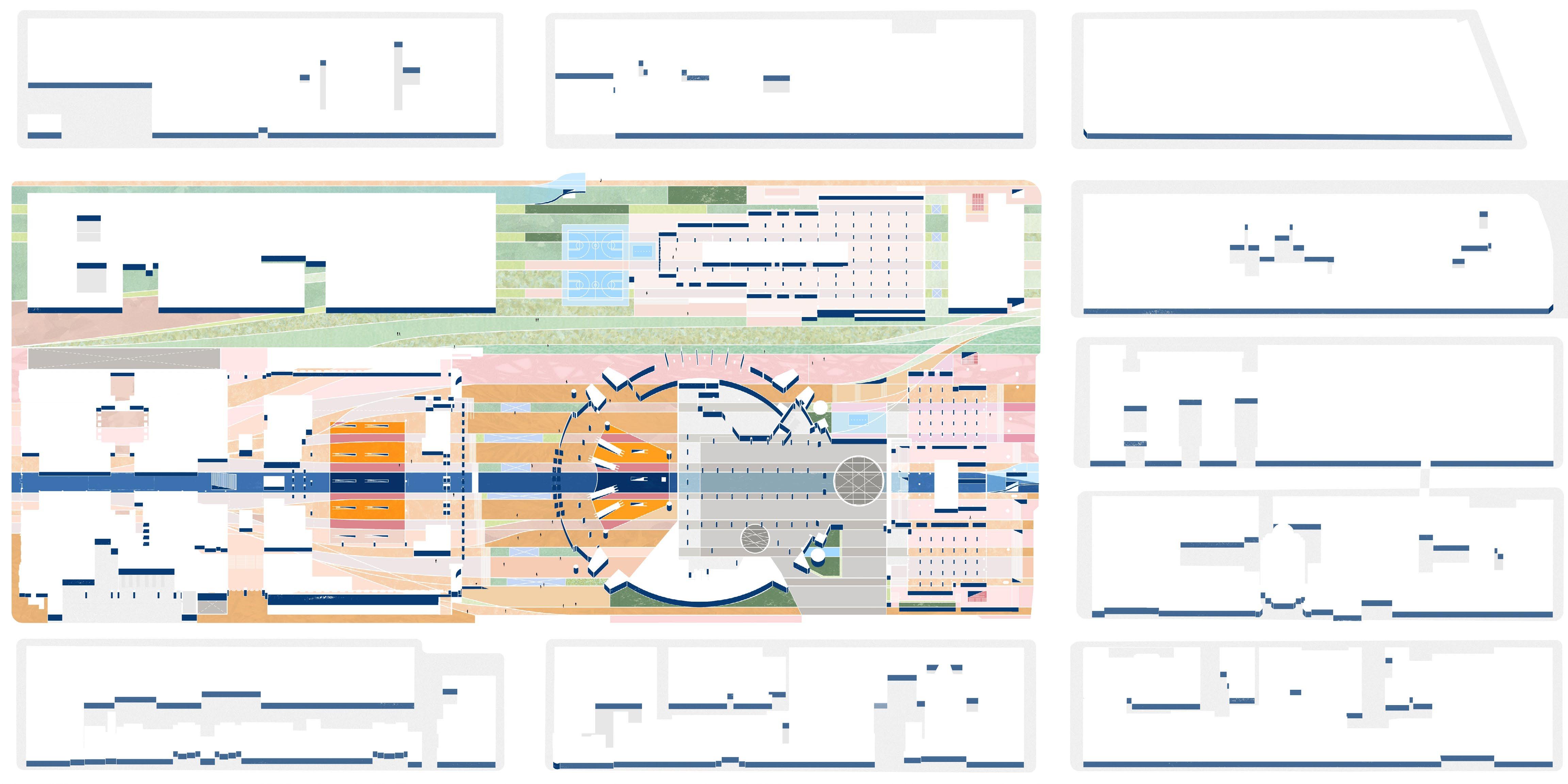
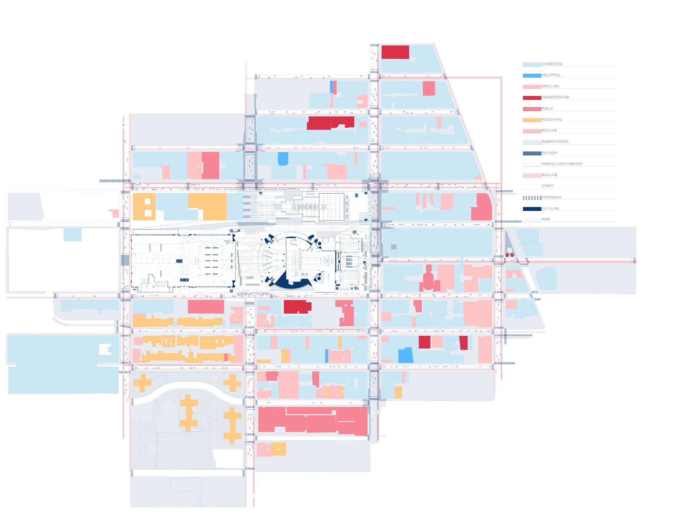
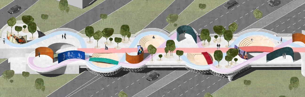
Proposed unrolled site section/elevation
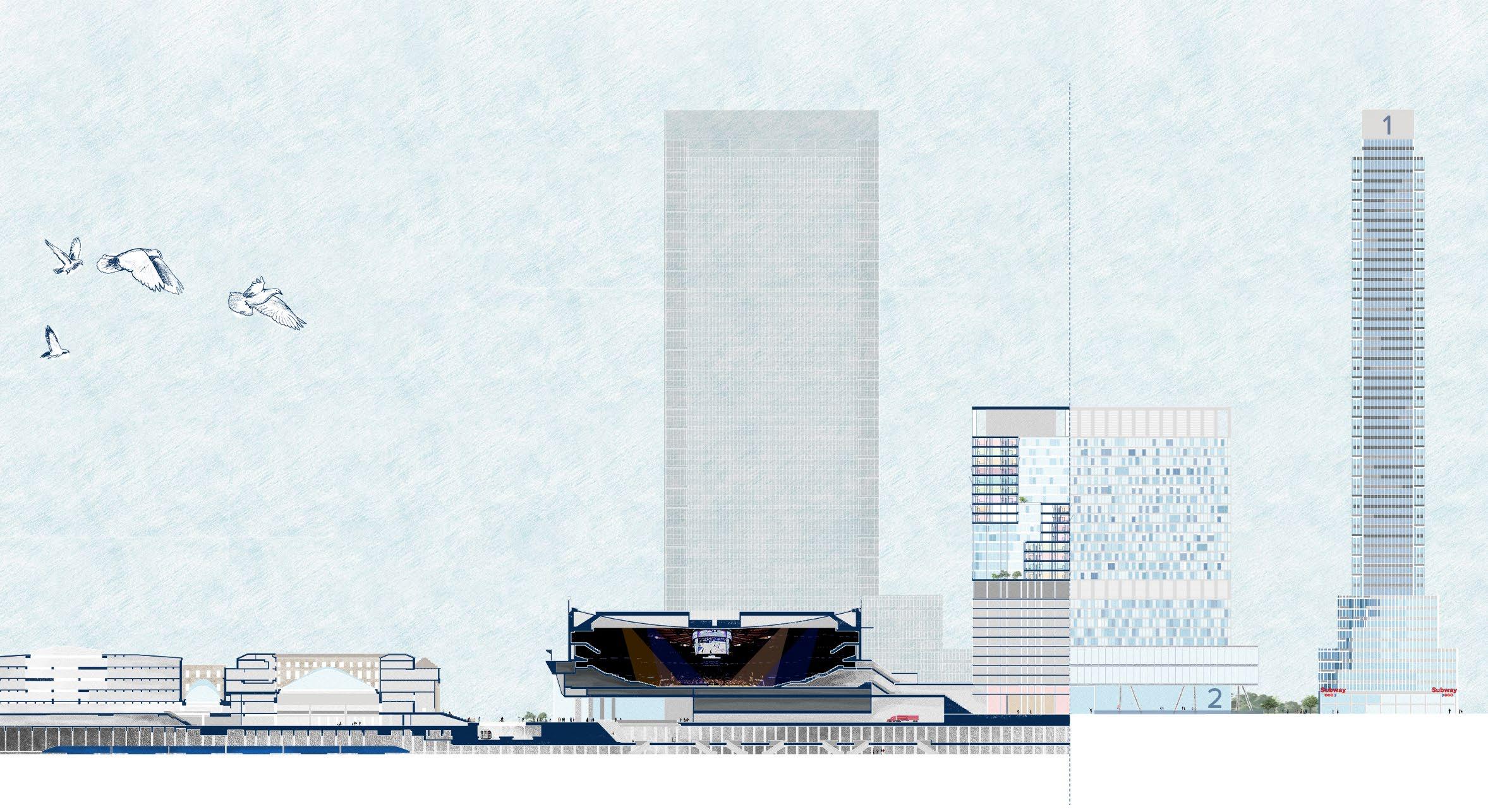
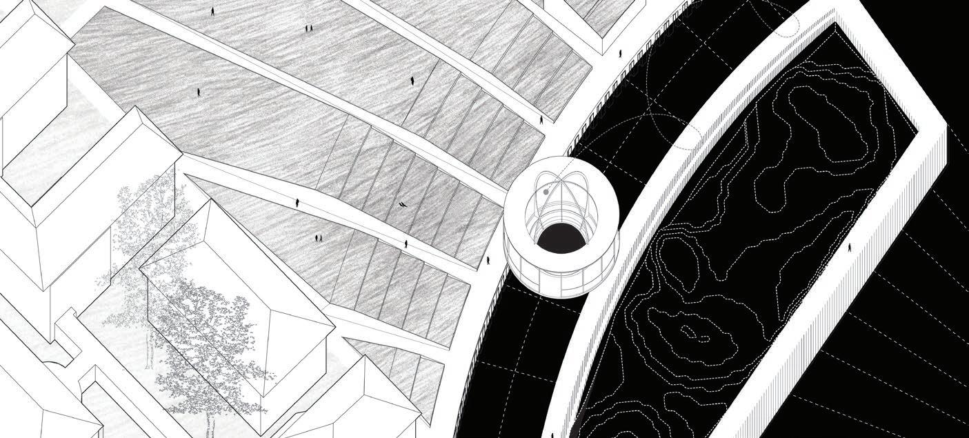
The project occupies the entire urban block. Beginning underground, it alters the transit network from Moynihan Train Hall to Penn Station by consolidating Penn station’s access points for improved way-finding and circulation.
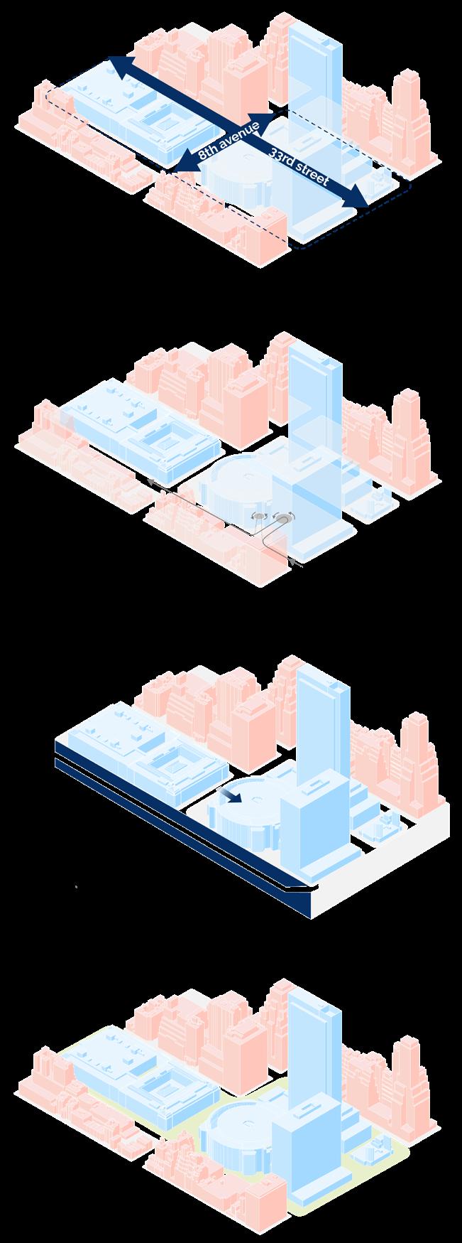
Reroute loading, service, and emergency vehicles
the block to become a new urban
Madison Square Garden
Moynihan Train Hall / Penn Station
Condense
Station to 1
Each site building is designed as a small city, and to make them livable, universal access to light, outdoor space, and basic needs were prioritized. Office and retail floors were kept to offset housing costs.
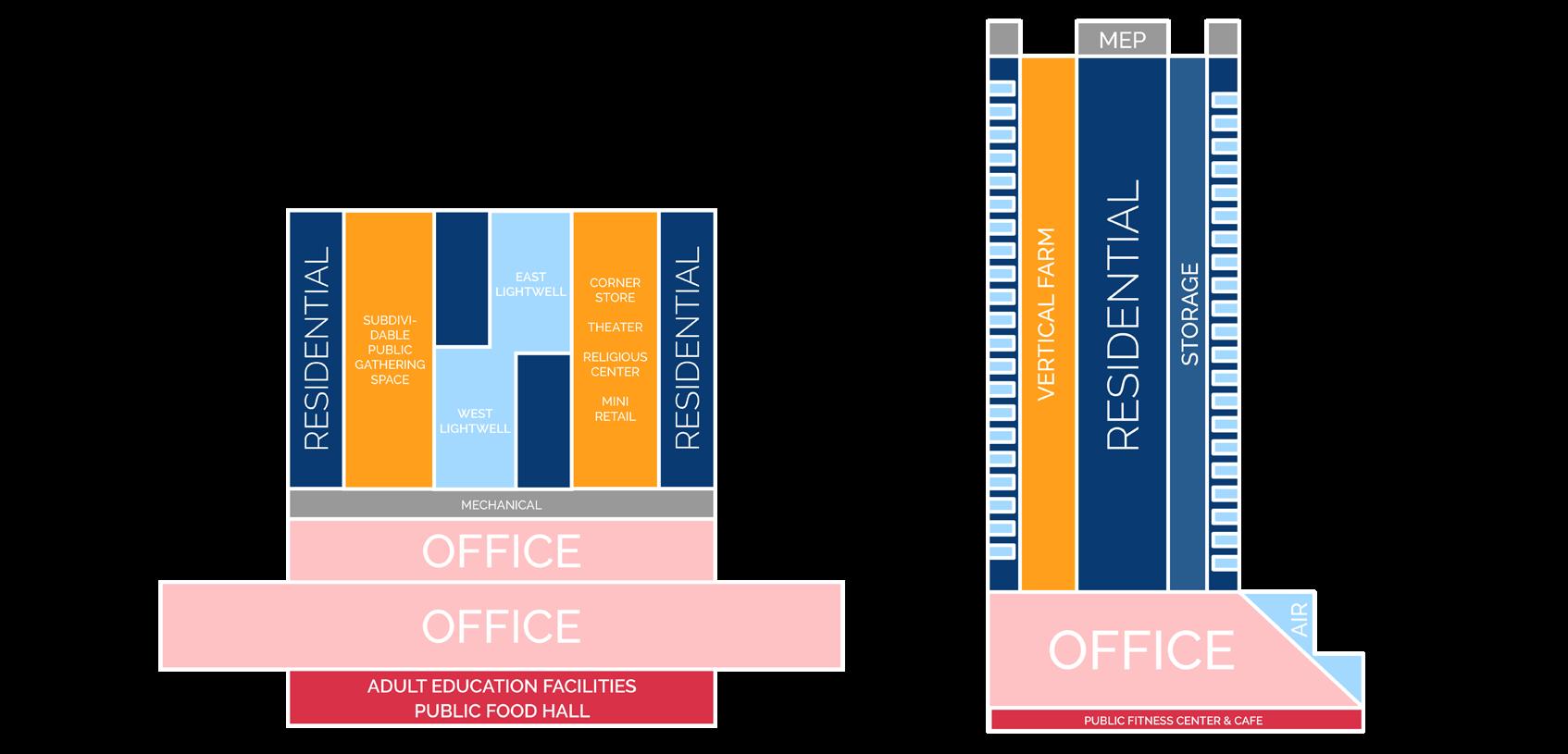
Drawing executed collaboratively
Proposed Office-Residential Split of Site Buildings
Penn 1 & 2 Breakdown
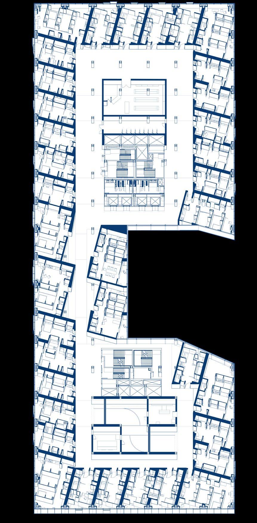
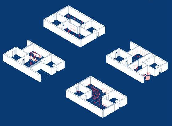
Units
“Every Room in One!”


“Units That Grow As You Do!”


The Pool
A Memorial of Hidden Histories of American Immigration
On Ellis Island
Spring 2022: Cornell University, 3rd-Year B.Arch Core Studio
Professor: John Zissovici
Gensler Rising Black Designer Scholarship Recipient
ZGF Emerging Black Architect Scholarship Recipient
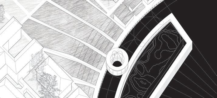
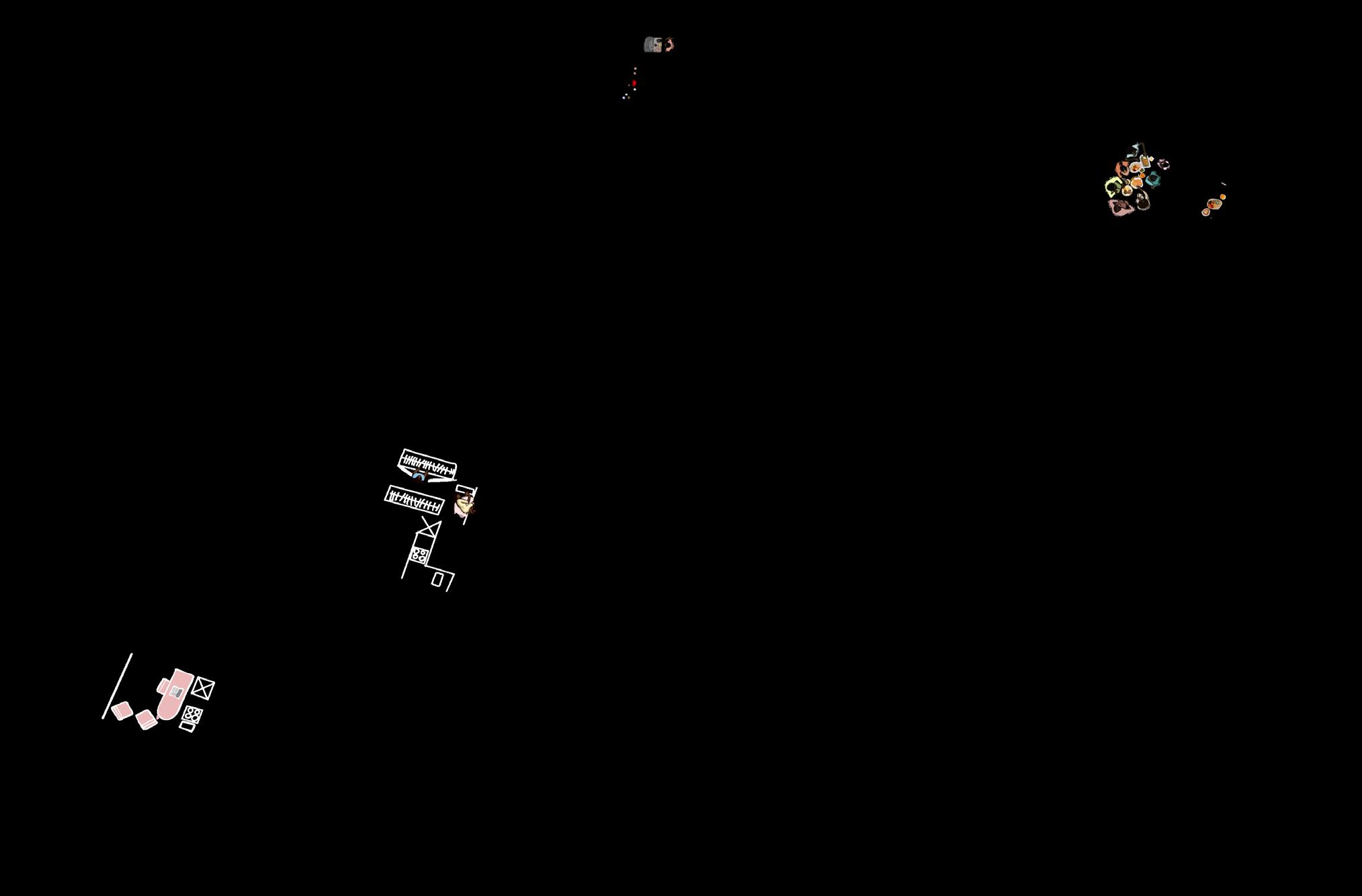
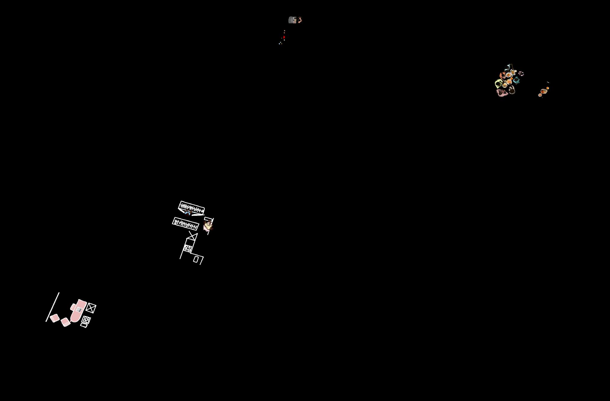
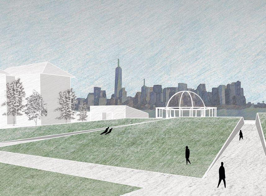
The project is an exploration of ‘pool’: a body of water sited on Ellis Island. The architectural intervention acts as a monument and memorial for recorded and non-recorded American immigrants.
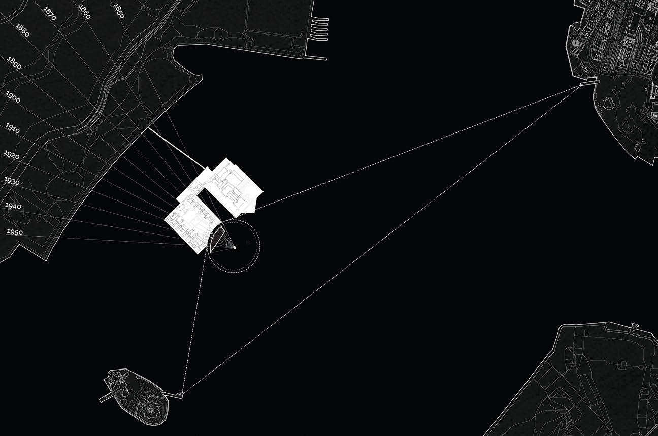
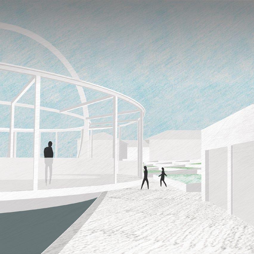
One side of the island uses terraced landscaping to represent the concrete and recorded number of immigrants that used it as a boundary through decades of time, while the other is a wade pool with a landscape hidden under the water surface to represent the stories of “hidden” immigrants and migrants coming into America whose stories may only be known through oral histories. The vessel that connects these two sides of the island is a moving pool that slowly rolls along the edge of one side such that pedestrians can get on and off of it without the pool having to stop.
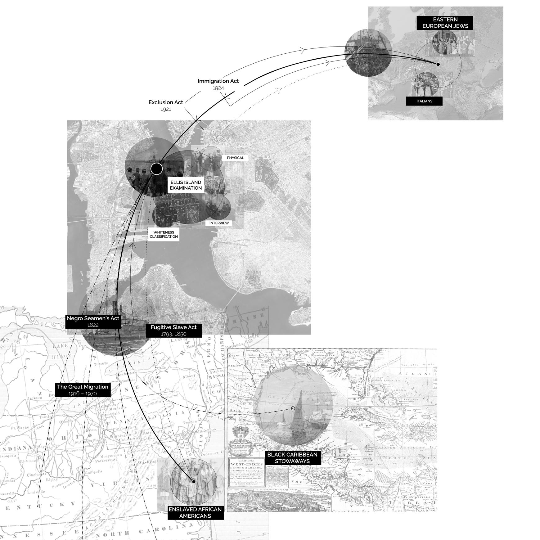
Site research on Ellis Island as a controlled boundary to become ‘American.’
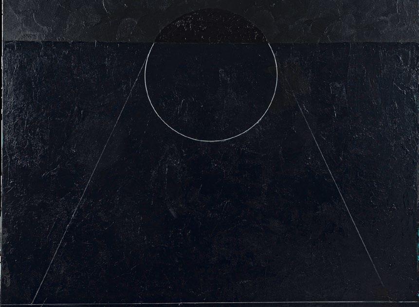

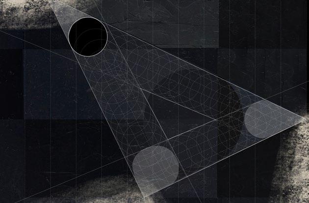
Concept drawing using Dyson’s hypershapes to depict the Transatlantic Slave Trade moving between three continents
Torkwase Dyson’s ‘Hypershapes’
Anthony Burns (hull=curve)
Henry “Box” Brown (box=square)
Harriet Jacobs (garret=triangle)
The project started with an artist analysis of Torkwase Dyson, who uses a technique called ‘hypershapes’ to depict liberation strategies of formerly enslaved peoples. In the architectural intervention, hypershapes are applied to describe the limited access to Ellis Island from Manhattan and the Statue of Liberty.

Hypershapes informing the Ellis Island Intervention
Torkwase Dyson: Space as Form: Movement 1 (Bird and Lava), 2020
Liberty Island
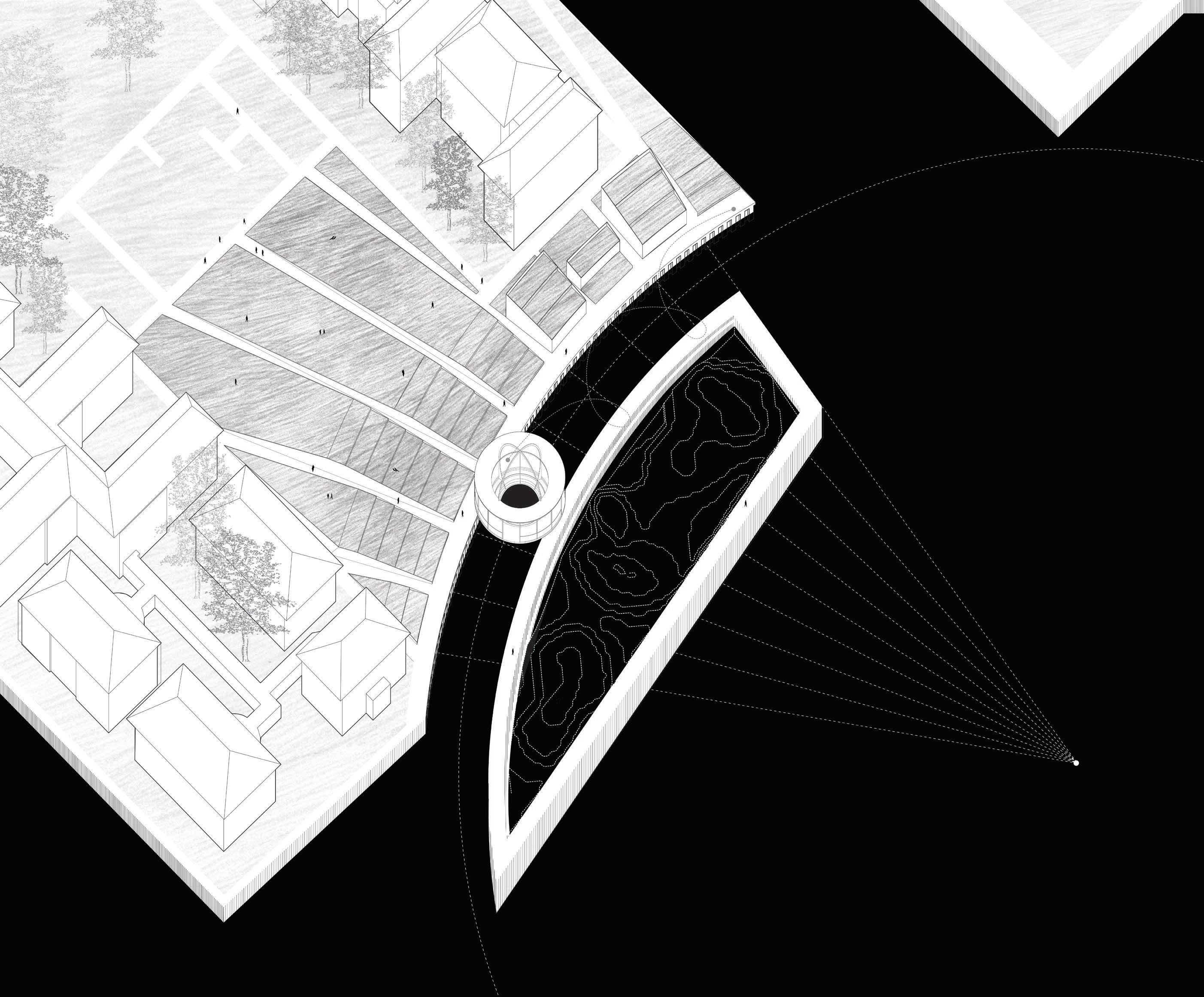
Terraces: The organization and number of terraces in each segment represent a symbolic graph of the number of documented immigrants coming through Ellis Island over decades of time.
Wade pool: Even though the topography (representing their journey) cannot be seen through the water above, it can be felt as one walks through the pool and feels the land moving beneath.
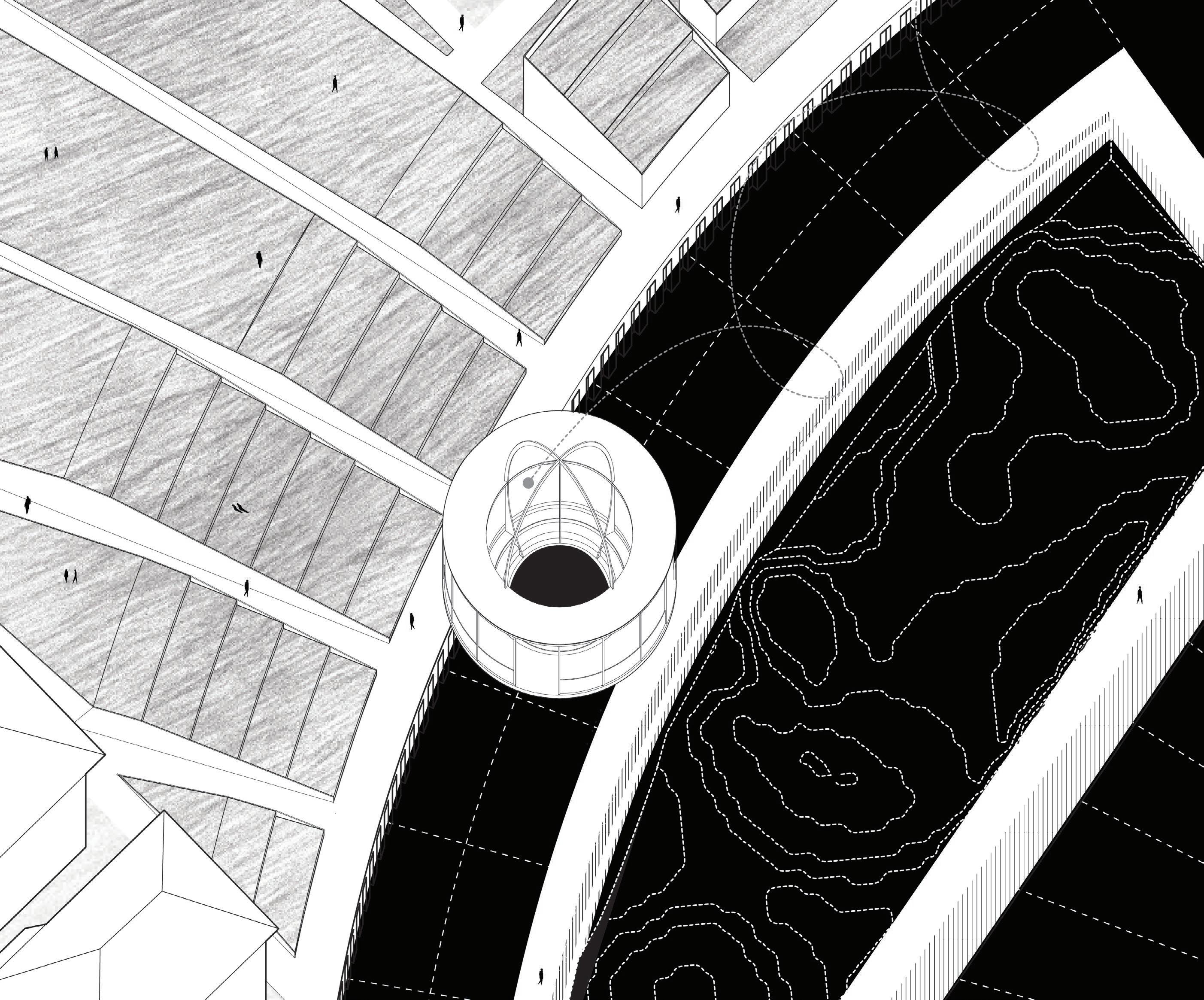
Concept site plan placing the intervention within the larger context of Ellis Island and its history
TERRACES
WADE POOL
MOVING POOL
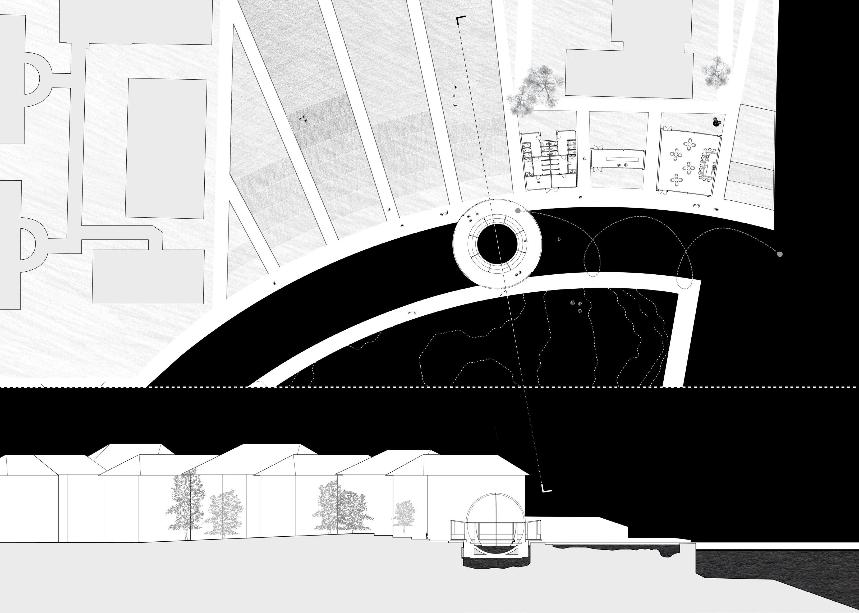
Experience on the moving pool is dependent on the time of day one arrives to the memorial
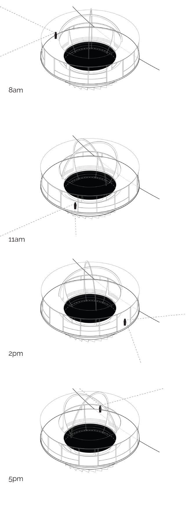
Plan of buildings and relationship between the moving pool and pedestrian path. The pool moves slowly enough for pedestrians to walk on and off as it rolls

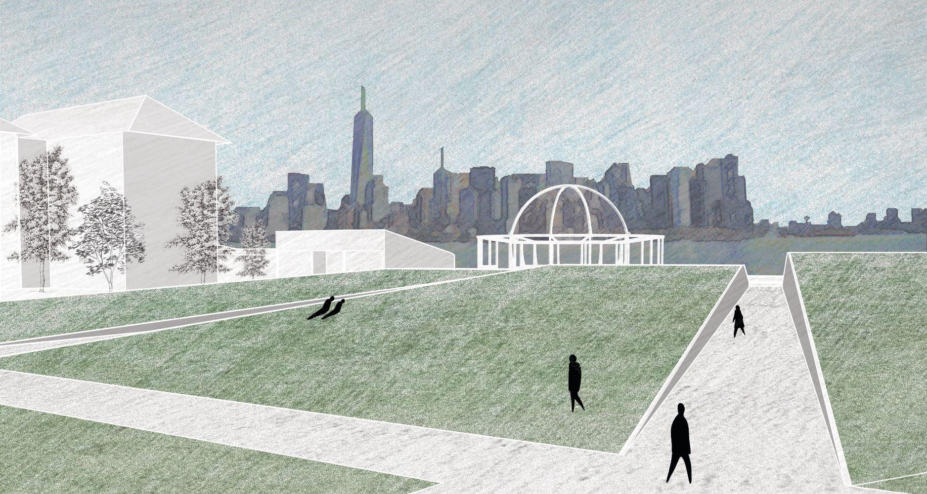
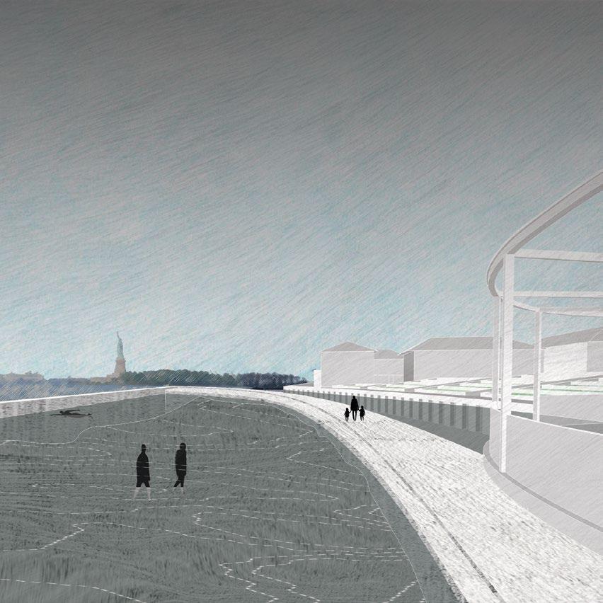
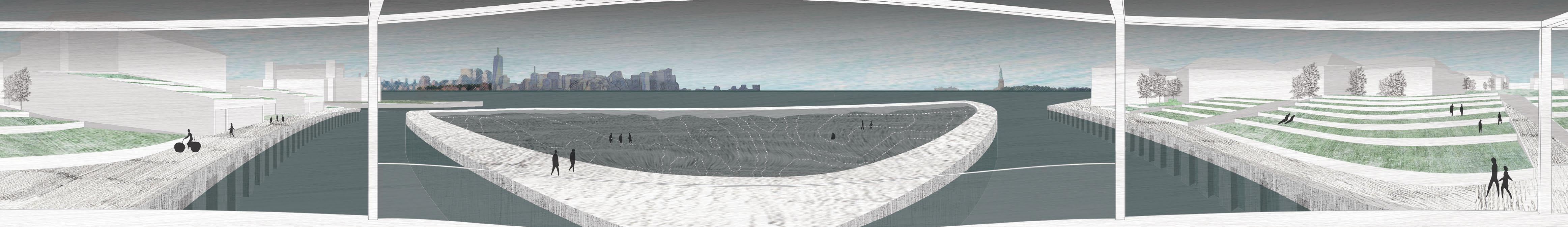
Panoramic perspective from the pool describing the views one would see along their journey
Harmonic Counterpoint
Fall 2022: Cornell University NOMAS Student Design Competition Submission Project Team role: Design co-leader
(All work shown is executed solely or in part by Lauren Jasper)
Competition team members: Lauren Jasper, Athena Lin, Desai Wang, Jeff Li, Jingwen Gu, Sophia Bachas-Daunert, Yue Lin, and Ziyan Jiang
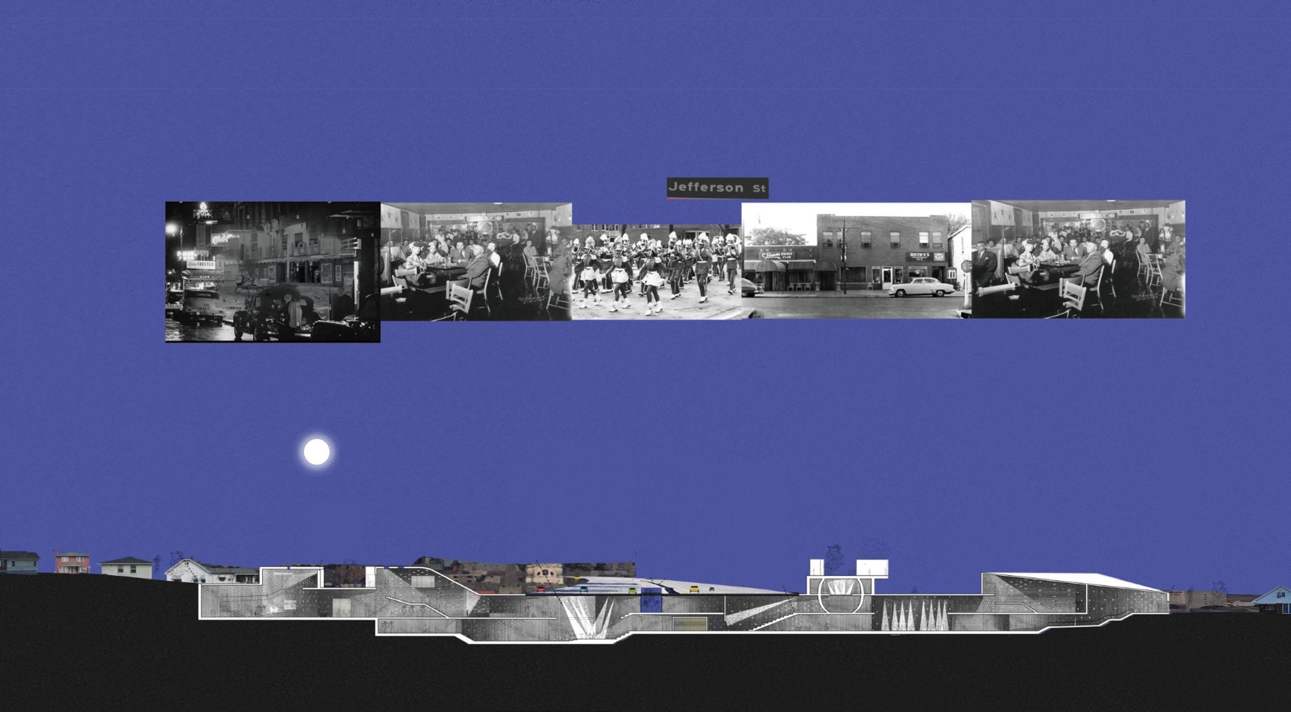
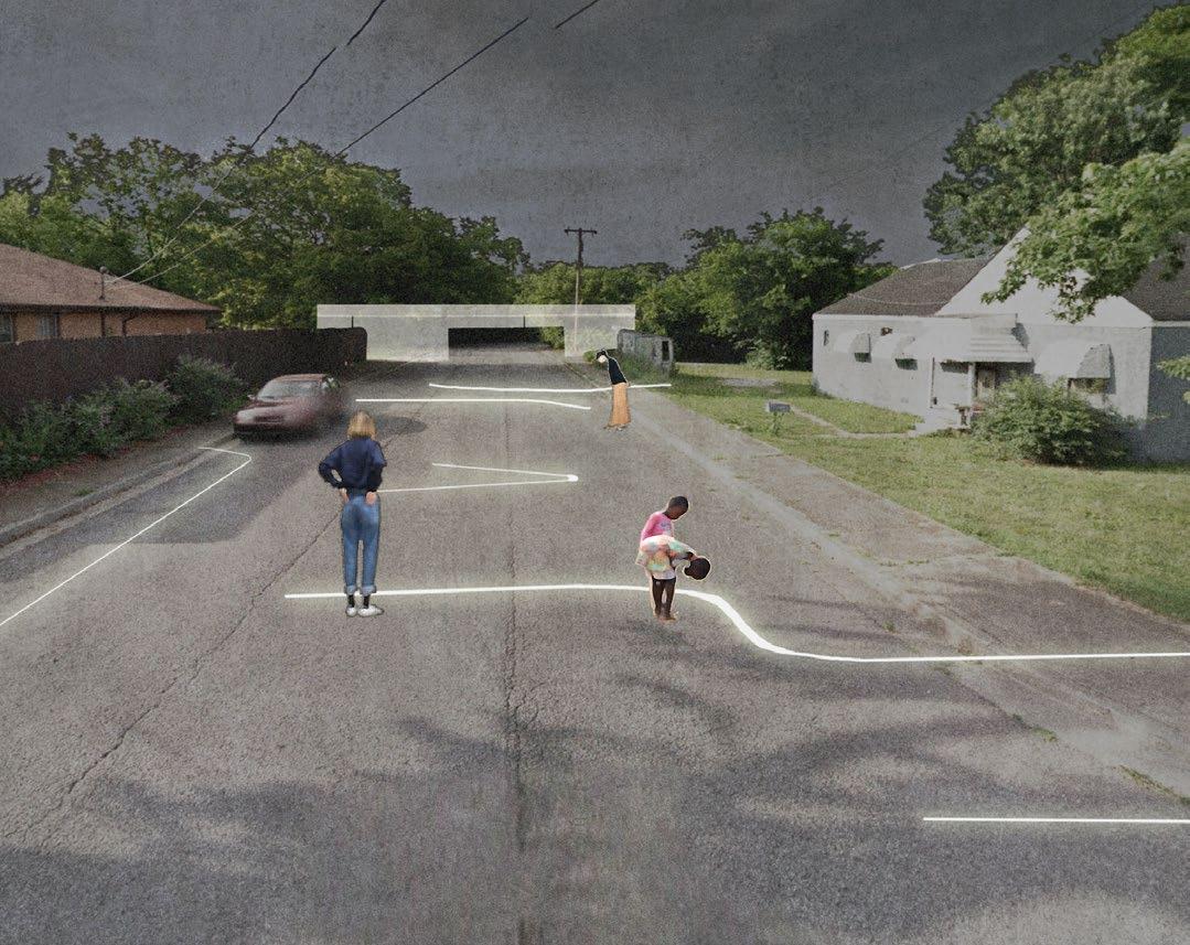
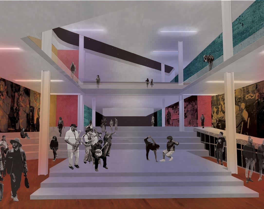
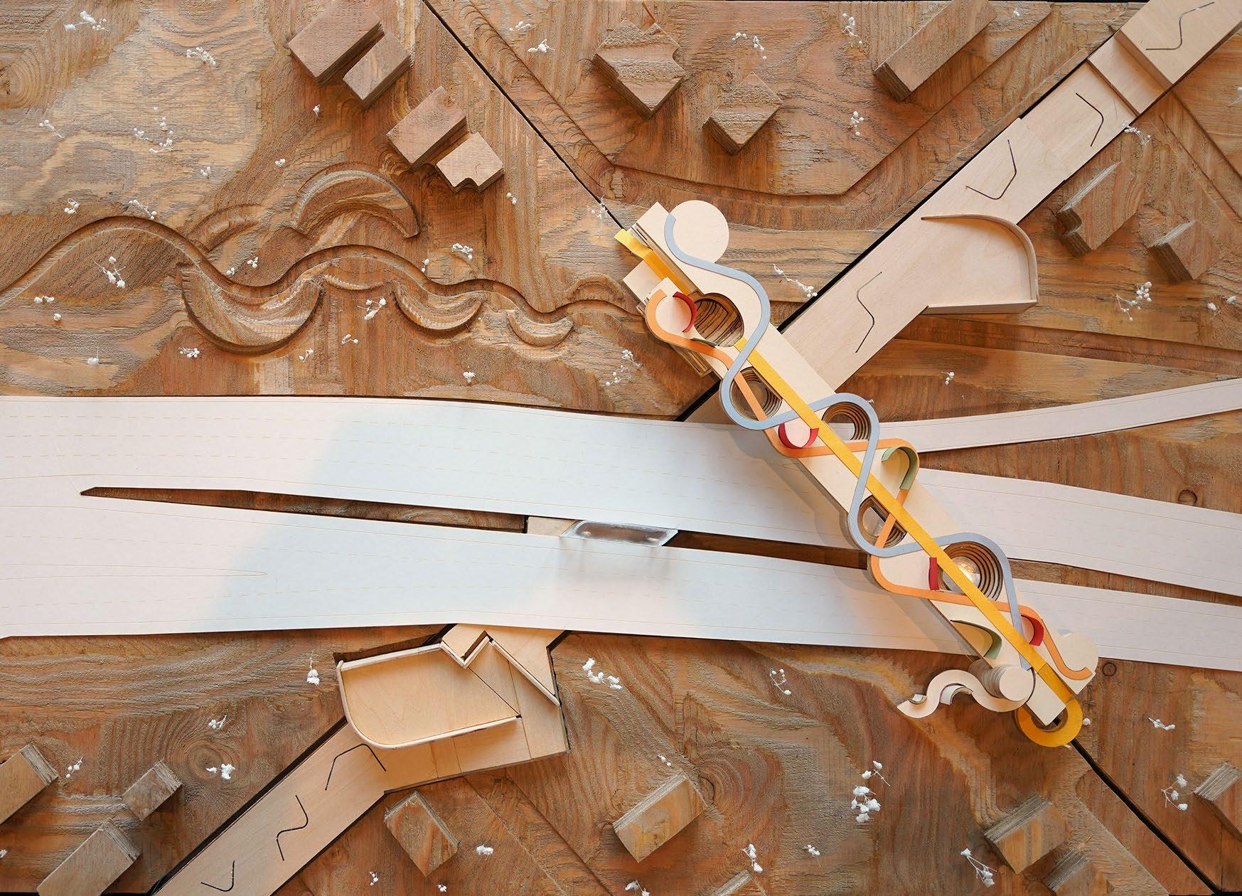
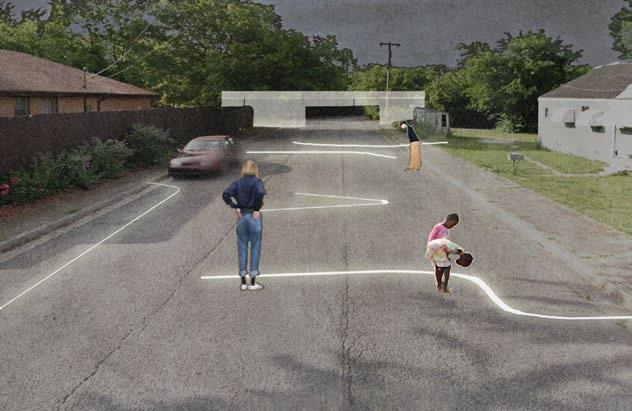
Stitching the roots of the North Nashville corridor back together, Harmonic Counterpoint seeks to restore the once vibrant and interconnected neighborhood surrounding Jefferson St. by visually bringing back roads that were demolished by the construction of I-40. Our new cultural center addresses displacement by reviving programs and businesses that occupied the North Nashville corridor prior to I-40’s construction.
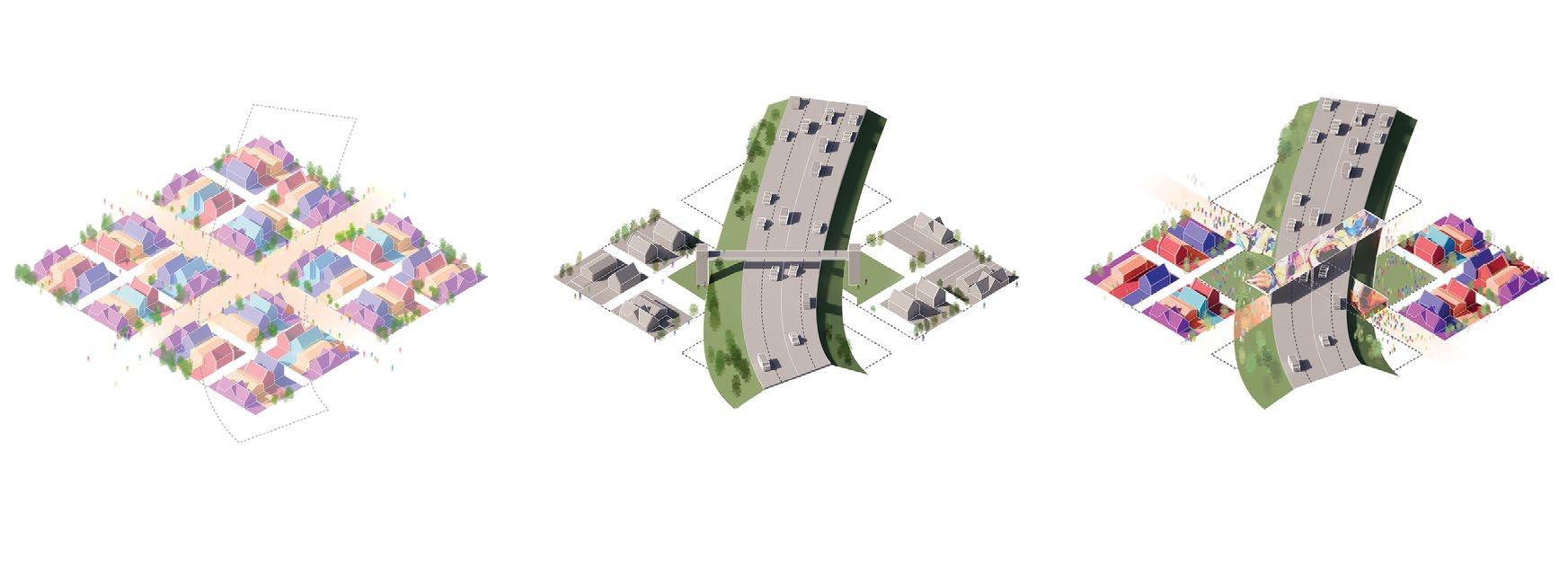
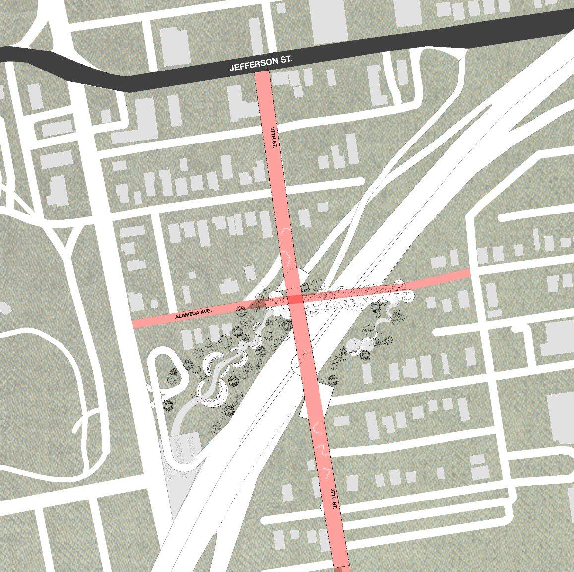
This intervention is organized into three areas through a parti that forms an ‘X’ where 27th Ave and Alameda Ave once intersected. Programs include performance spaces, recording studios, gathering areas, gardens, and spaces for walking, resting, and collaborating, all with the aim of bringing back businesses that were displaced.

A Public Bridge Proposal in the North Nashville Corridor
2022 NOMA Barbara G. Laurie National Student Design Competition 2nd Prize
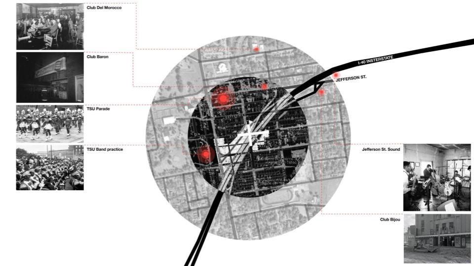
Research diagram illustrating the demolished Nashville roads and displaced businesses surrounding the once-prominent Jefferson St
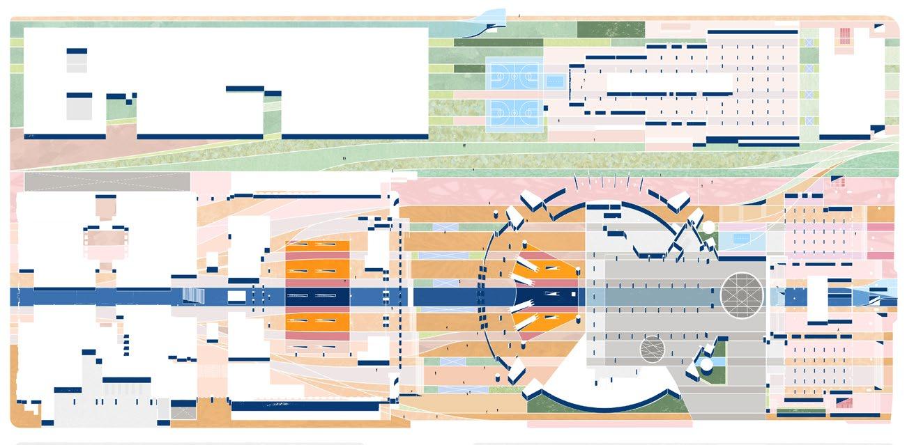
Site plan showing the demolished roads conceptually stitched back together through the intervention
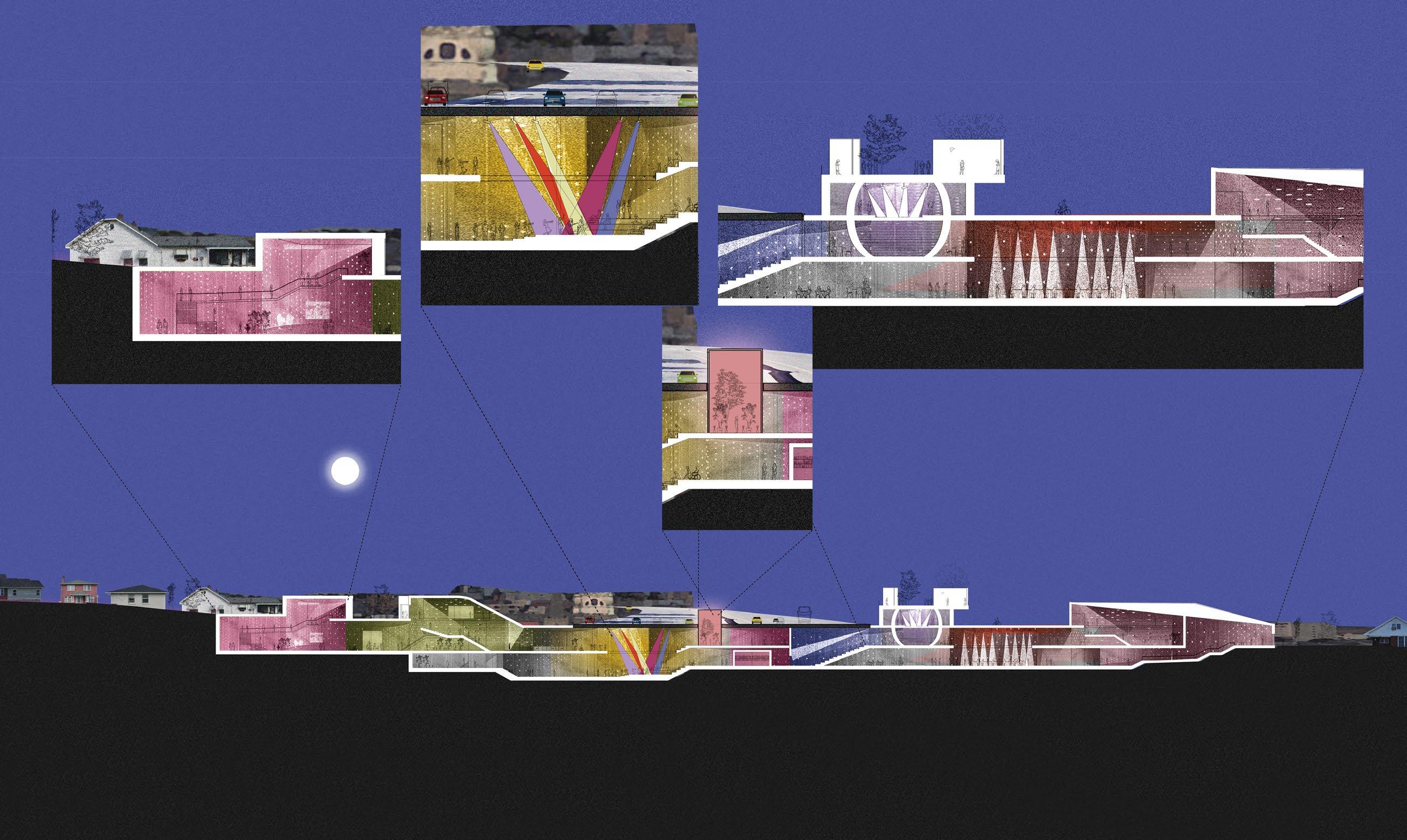
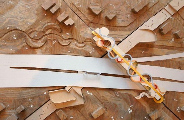
The proposal works above, below, and adjacent to the highway I-40
FORMER OFFRAMP PARK
OVER BRIDGE
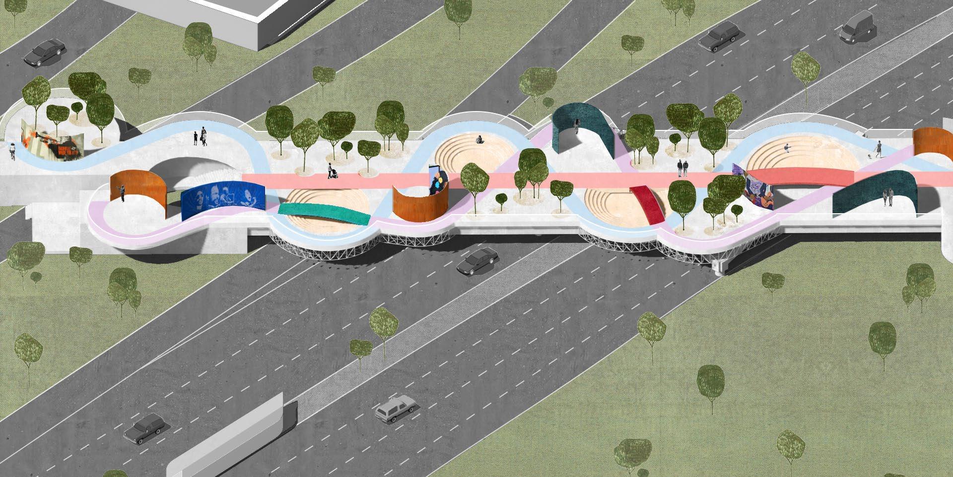
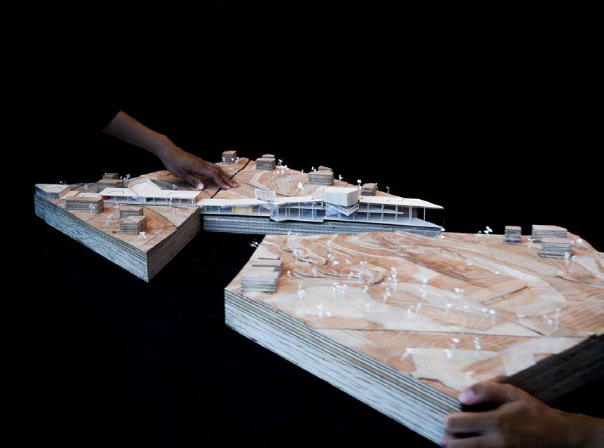
Overall axon and above-ground bridge configuration. The bridge combines public entertainment spaces such as amphitheaters and small stages with public art display walls for local Nashville artists.
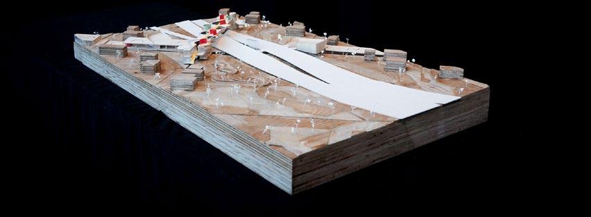
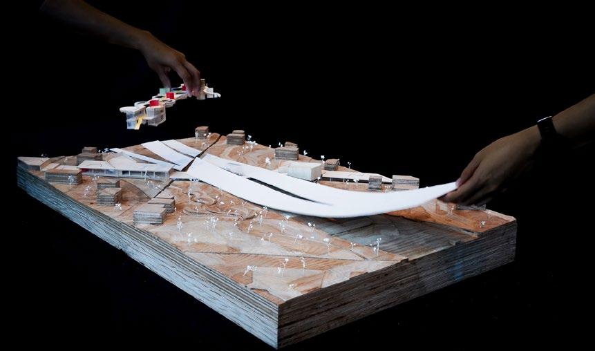
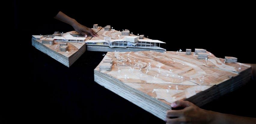
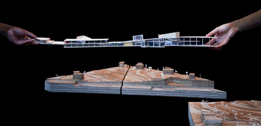
Physical model fully assembled and pulled apart
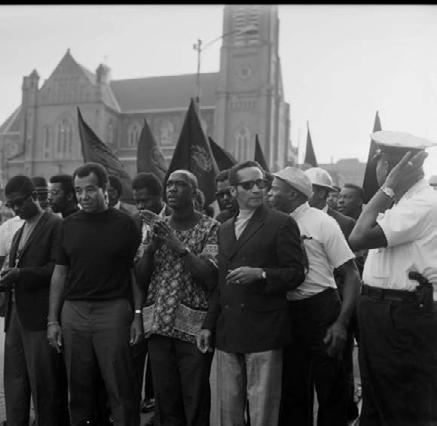
Restoring the Hill
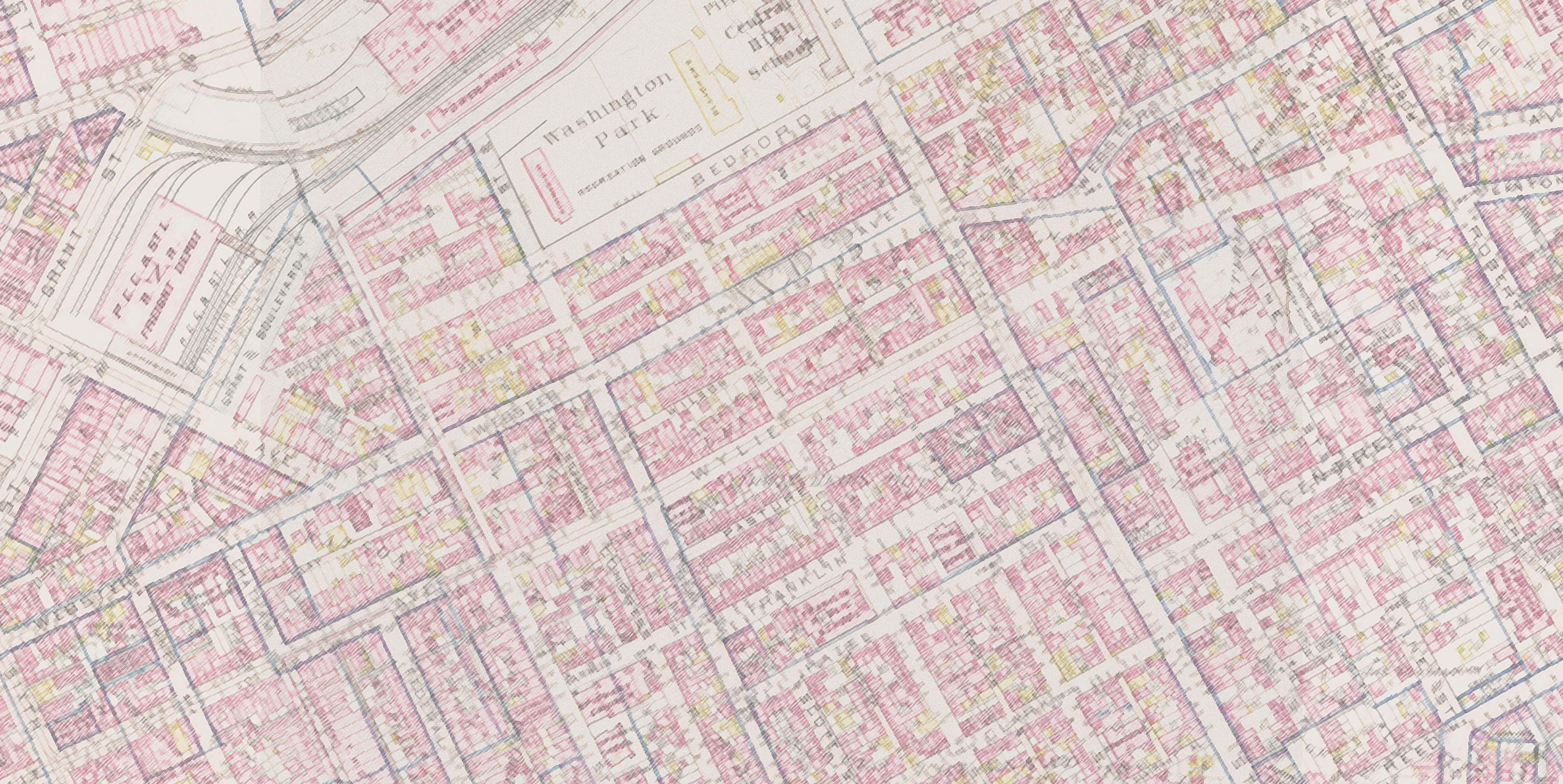
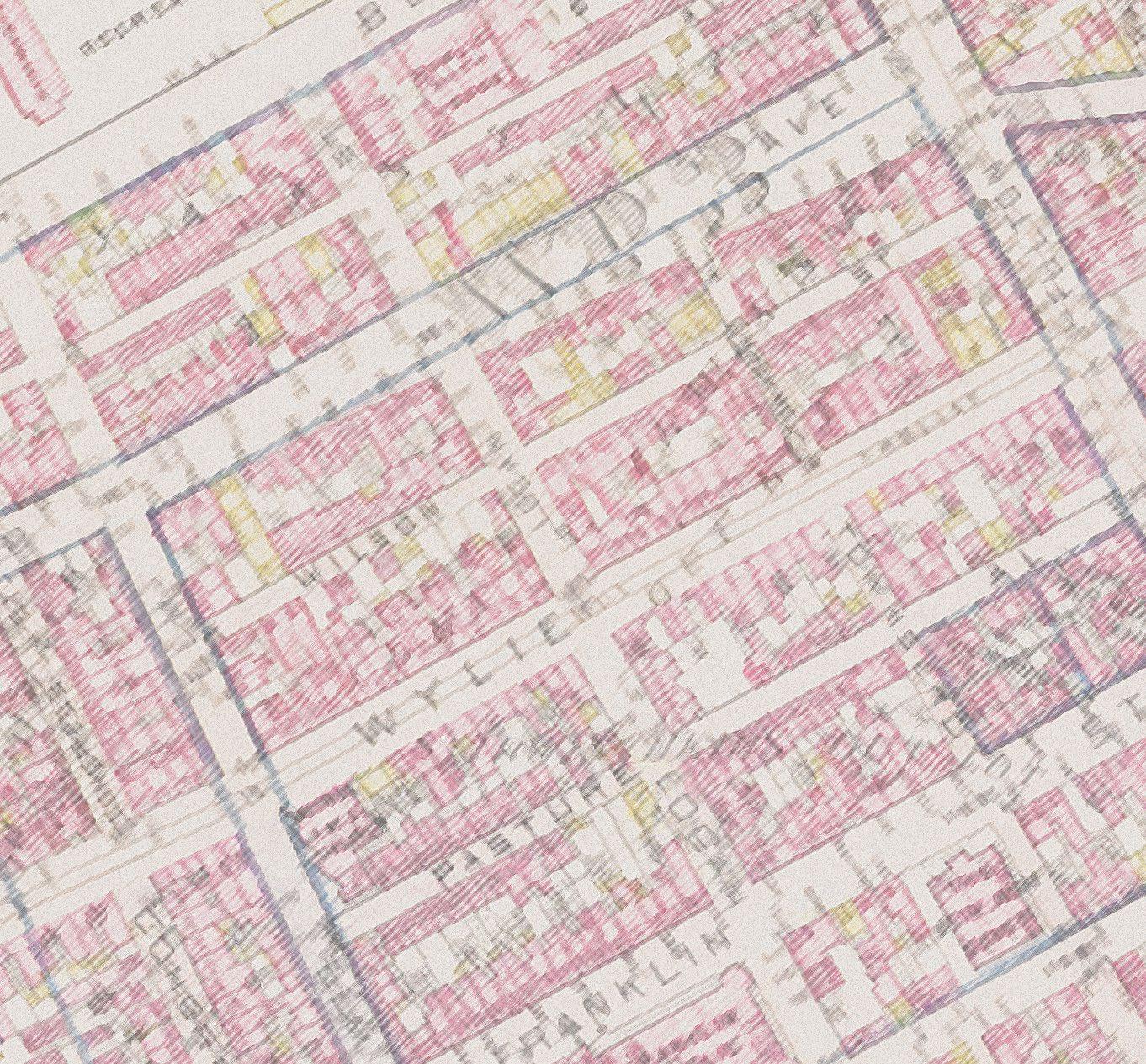
Urban Justice Research on Pittsburgh’s Hill District
Fall 2023: Independent pre-thesis research; self-directed
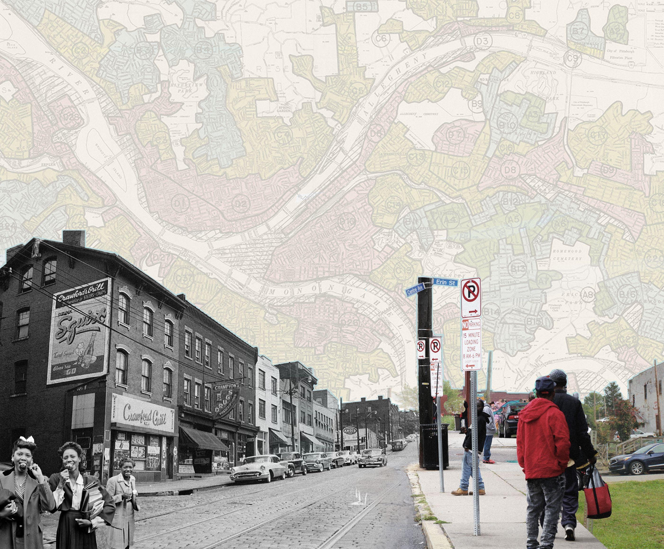
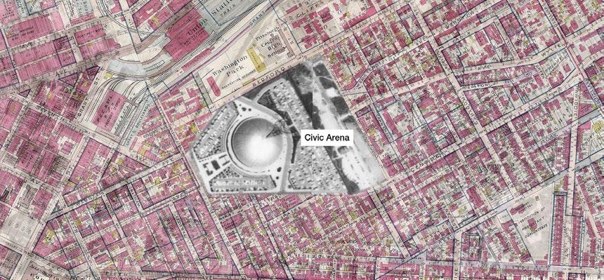
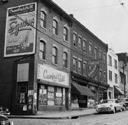
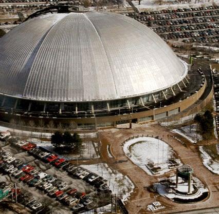
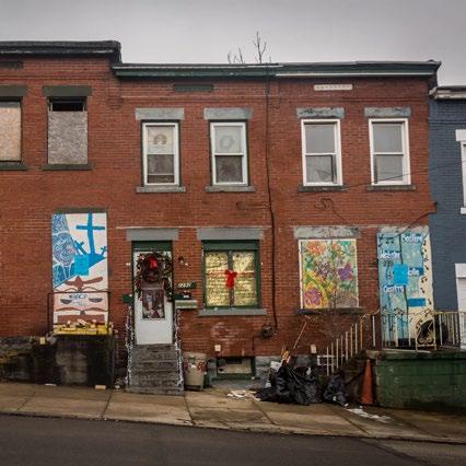
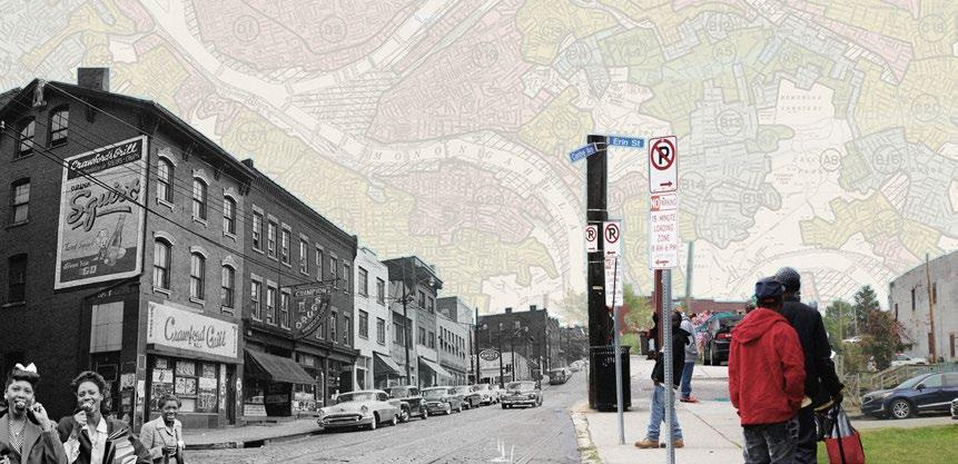
Pittsburgh, a Rust Belt city undergoing urban renewal, is one of the most segregated cities in the United States. The Hill district, a neighborhood that is 90% AfricanAmerican and was once known as “Little Harlem,” has faced decades of trauma as a result of past urban development initiatives. In the 1950s with the construction of the Civic Arena, over 8,000 residents were displaced and the area faced severe population and economic decline. Despite the disinvestment that has continued to this day, the Hill District continues to foster a resilient community united by shared history.
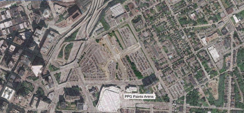
The current proposal to revitalize the Lower Hill District post-Civic Arena was begun in 2012 and has since encountered persistent controversy and delays. Tensions between developers and the Hill District Community Corporation revolve around a difference of perspective and responsibility in ensuring that residents are not further displaced based on revitalization.
This research seeks to understand this situation through a process management strategy, navigating collaboration among developers, community members, and designers. The goal for an upcoming thesis project is to create an urban design and architecture proposal benefiting current residents and uniting the development with the greater Hill District. Research involves delving into the site’s history academically and engaging in dialogues with community members and developers. The project aims to rectify historical injustices and produce strategies for other neighborhoods in the US with similar urban conditions.
“This is a very historic moment... This transformation is an example of how to go into urban neighborhoods and partner in a way that rights the wrong of redlining.”
– Bomani Howze, VP of Development at BPG (Lower Hill District developers)
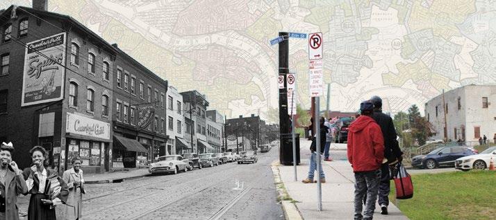
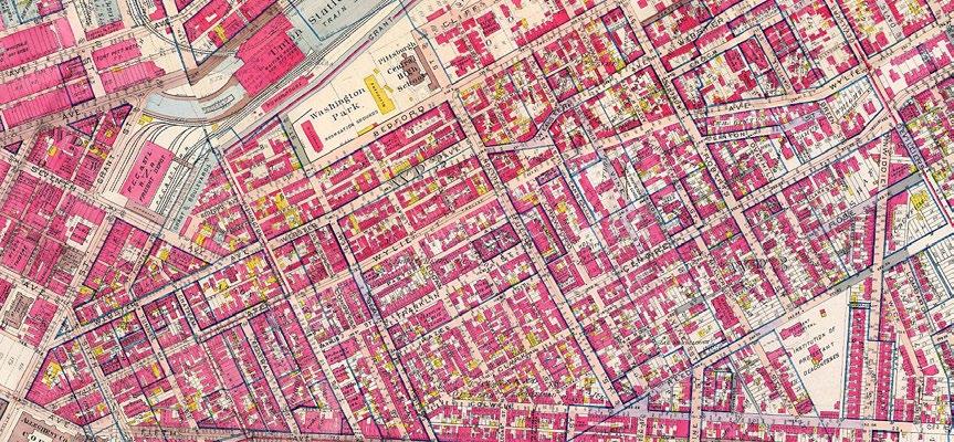
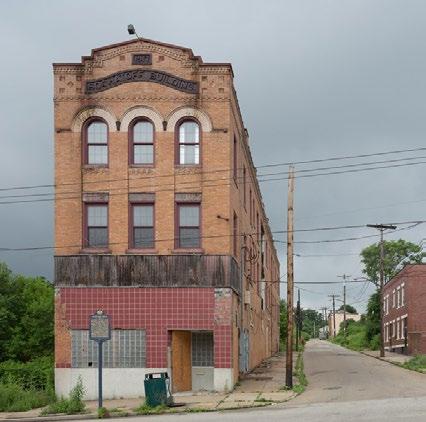
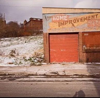
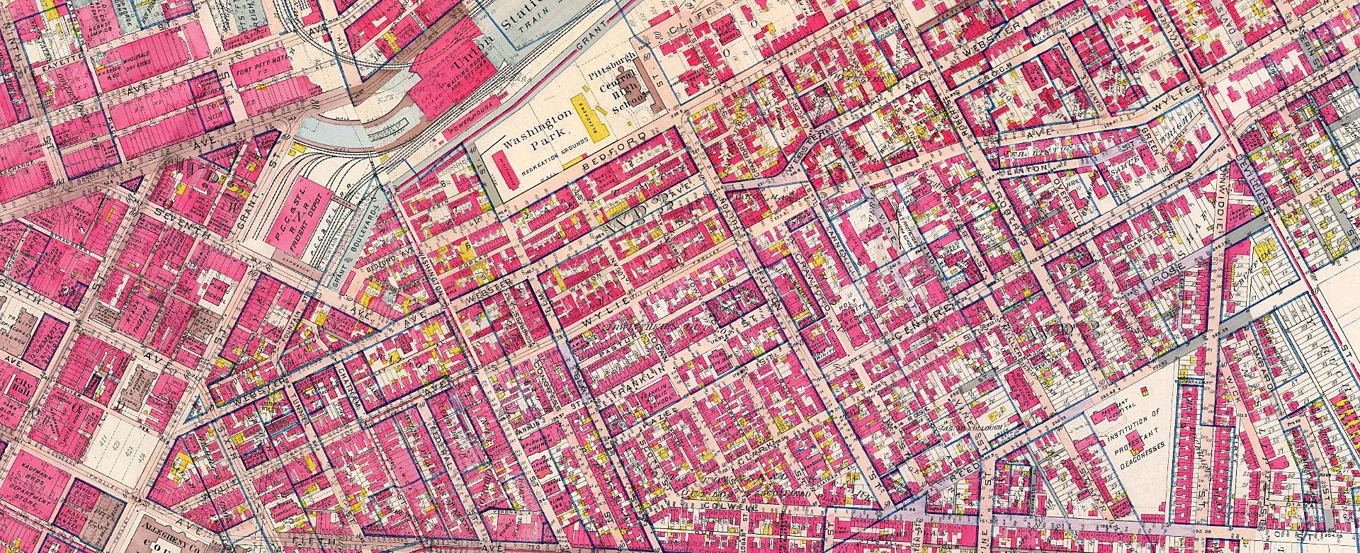
A History of Injustice Population Loss Timeline
Displacement maps illustrating the hundreds of businesses and streets that were demolished as part of Pittsburgh’s urban renewal practices beginning in the 1950s.
“At the core of friction between BPG and the Hill CDC is what power is. There’s a mindset that the leaders of the Hill CDC have that if you are born and raised in this community, you are the owner. In real estate, that’s not how it works.
”
– Bomani Howze, VP of Development at BPG
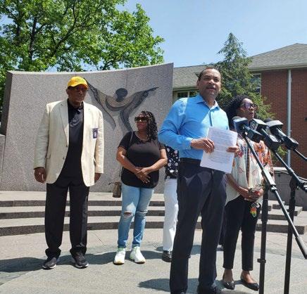
Current Redevelopment Proposal Research Process
PRIMARY RESEARCH
Discussions with contacts from each stakeholder group to understand their goals and why there may be friction
CONTACT: Bomani Howze
VP of Development at BPG & Hill District prominent figure
CONTACT: Marimba Milliones
President of the Hill CDC
CONTACT: Sala Udin
Politician and 70+ year resident of the Hill District
SECONDARY RESEARCH
Analyzing demographics and data from the Hill District’s history, including Population increase/decline
Racial and economic demographics
Decrease in economic vitality from mid-century – present
PRELIMINARY DESIGN FRAMEWORK
Use demographic data to understand housing needs
Community engagement and primary research as a method to:
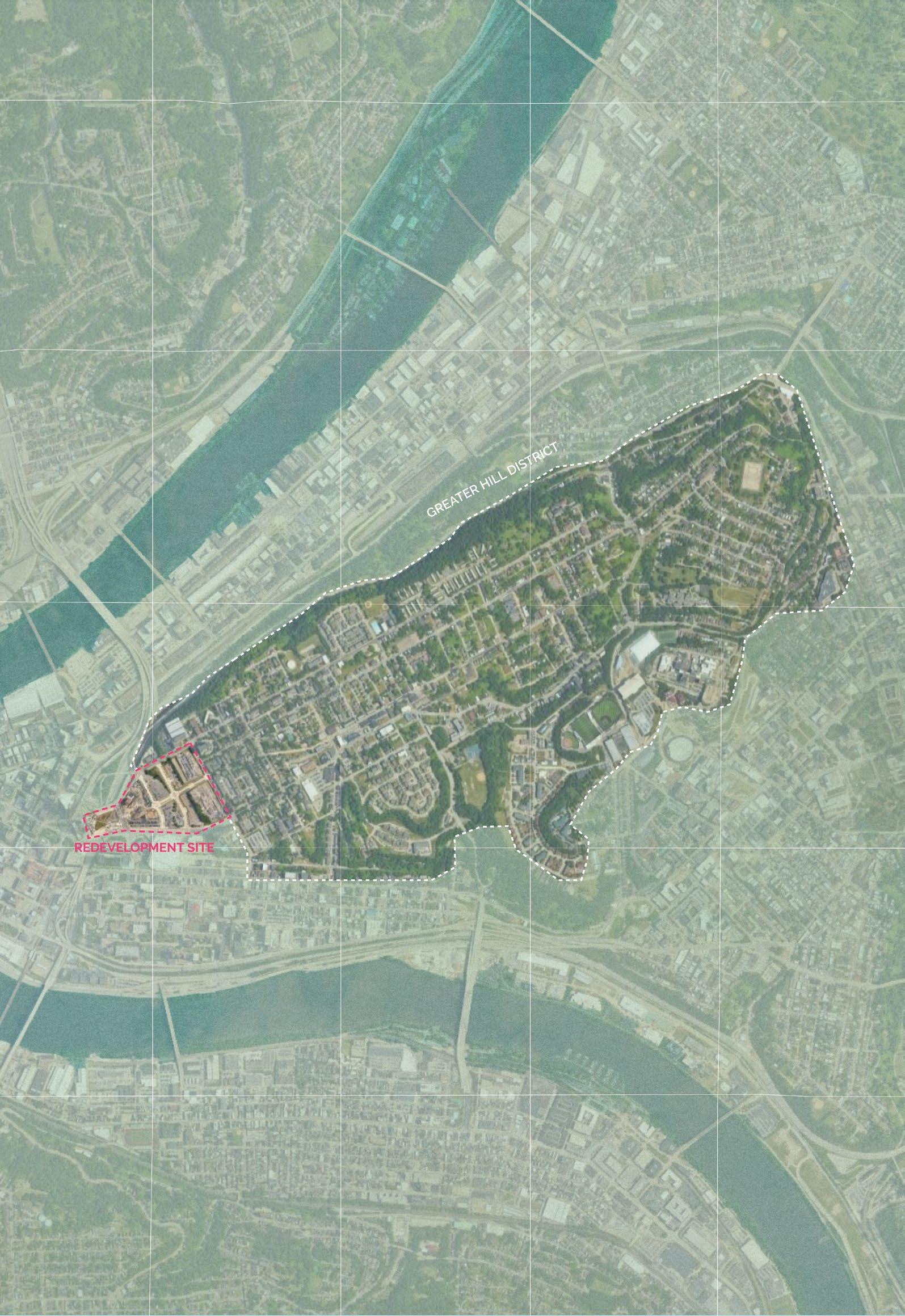
Culturally integrate the Lower Hill with the Greater Hill District
Economically integrate the development with downtown Pittsburgh
Respect and reflect on historic injustices and Hill’s Legacy of Black life in Pittsburgh
Data sourced from the Greater Hill District Master Plan Update 2022 and the ACS 2019 5-year Report
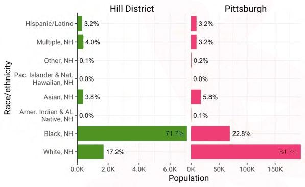
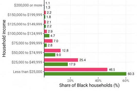
In 2019, just over 7,000 (about 72 percent) of Hill District’s population identified as Black,non-Hispanic/Latino
Sixty percent of Black household in the Hill Districts make less than $25,000 annually
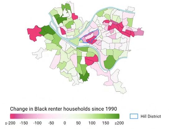
Since 1990 Black renter households decreased across much of Pittsburgh’s predominantly Black neighborhoods like Hill District
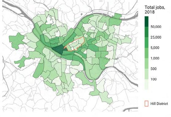
The Hill District has relatively few jobs, compared to other neighborhoods in Pittsburgh
Mapping Stakeholder Goals
Community
Minority & Women Business Enterprise Inclusion Workforce Development, Job Inclusion and Local Hiring Housing Inclusion and Home Ownership
Initiatives
Hill District Master Plan Goals: Build Upon the African American Legacy
Identity
Preservation
Safety
Family-Friendly Housing Development Without Displacement
Hill District Homeowner/Tenant Support
Housing Innovation Zone
Comprehensive Vacant Property Strategy
Economic Empowerment Through Commercial Development
Hill District Workforce Development
Hill District Business Incubator
Centre Avenue Business District
Sustainability and Quality Urban Design
Greenprint Implementation
Urban Agriculture
Play Spaces
Mobility, Transportation, and Parking
Neighborhood Transportation
Ridesharing Access
Streetscape Improvements
Complete Streets” Pilot
Comprehensive Parking Strategy
Collaboration and Implementation Plan (CCIP) Goals:
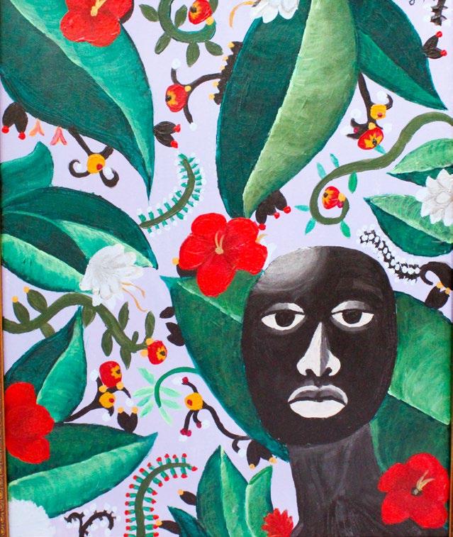
Visual Art
Lauren Jasper
Finding my Place In the Garden
24in x 30in
Acrylic paint on canvas, 2018
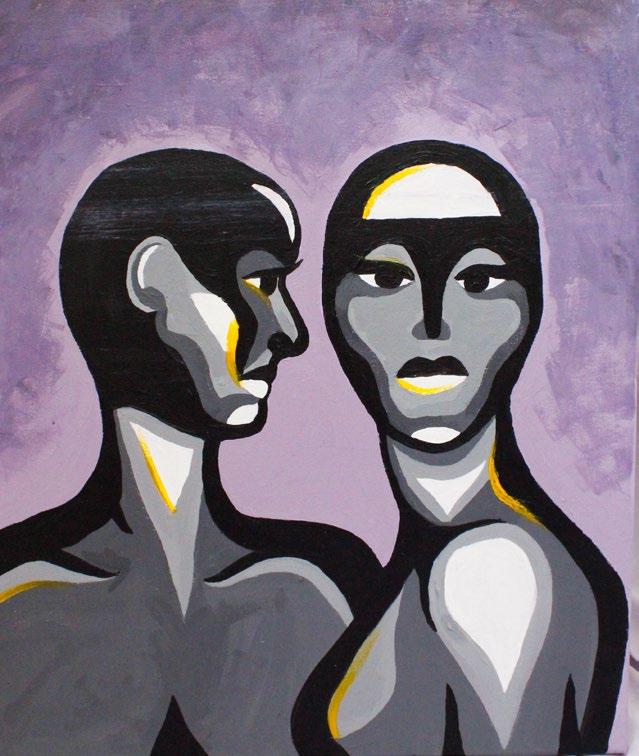
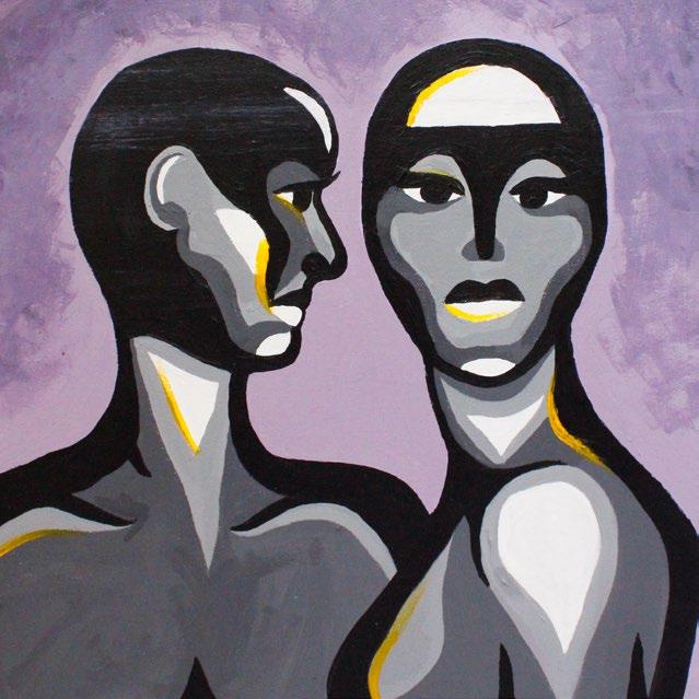
The Impostor
24in x 30in
Acrylic paint on canvas, 2021
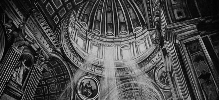
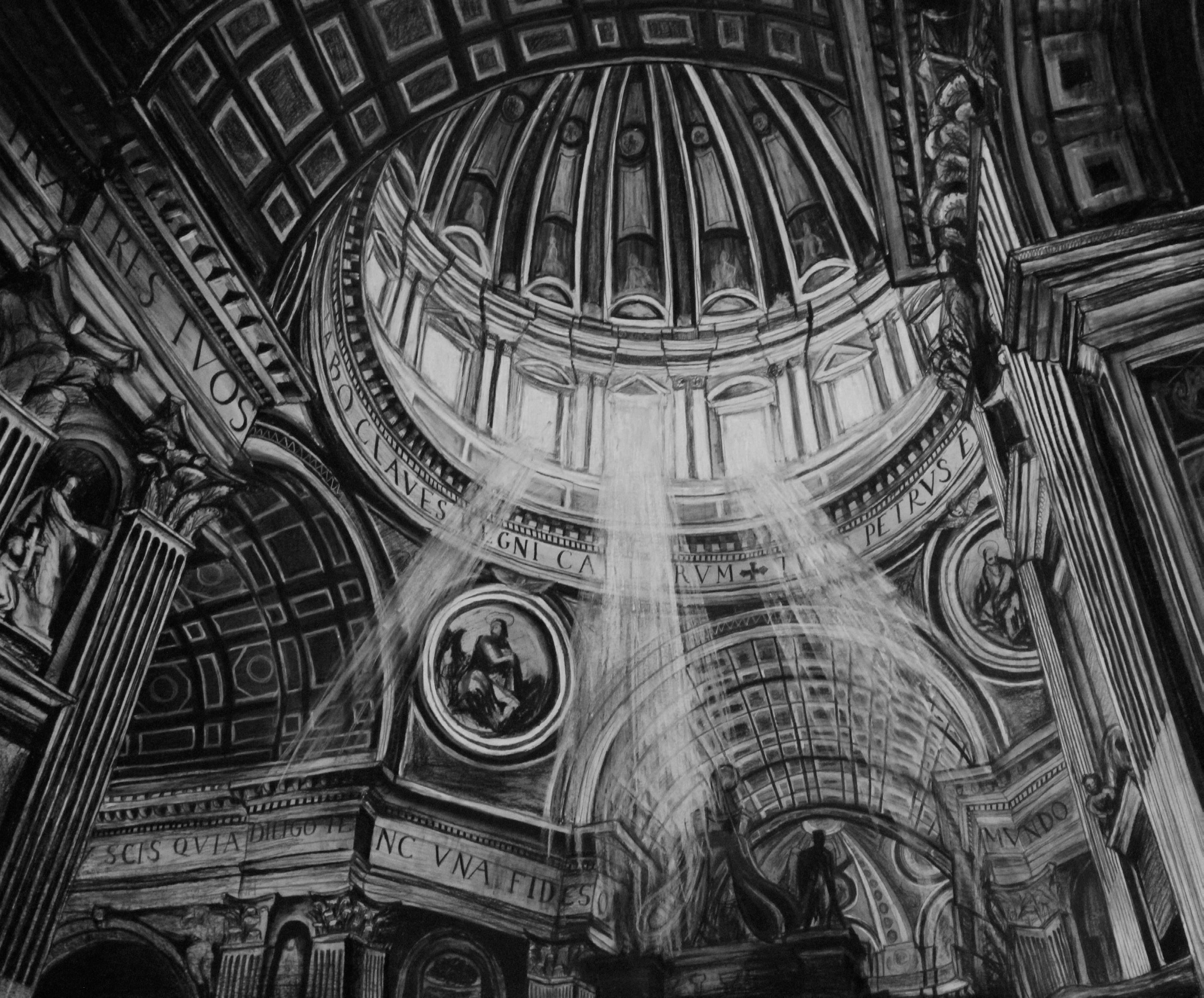
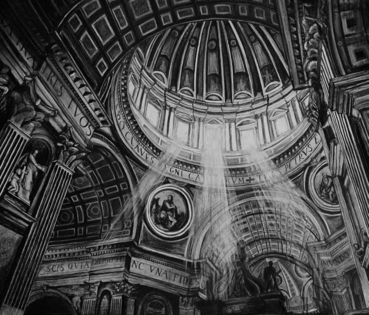
San Pietro
40in x 30in Charcoal, 2023
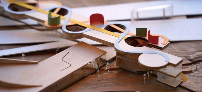
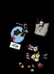
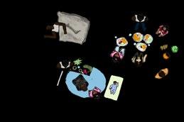
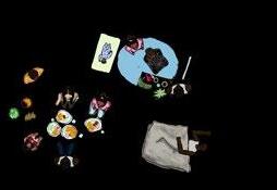
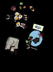
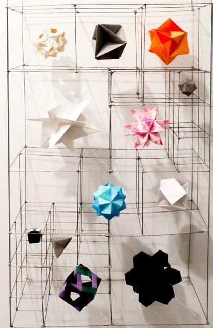
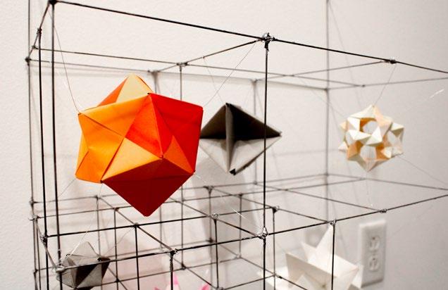
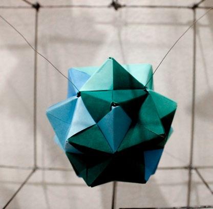
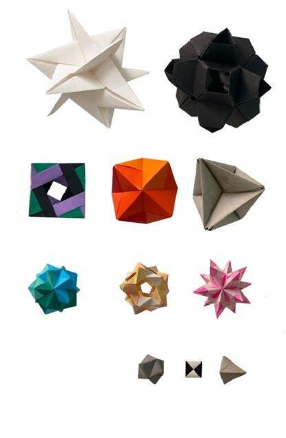
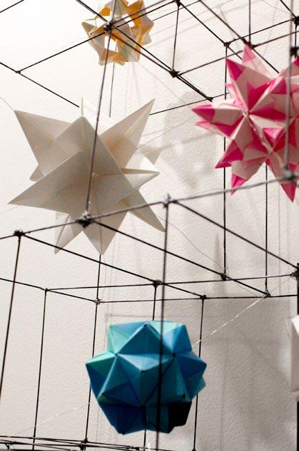
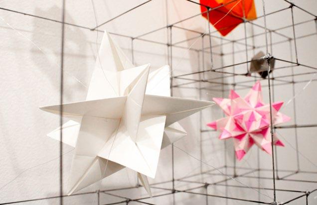
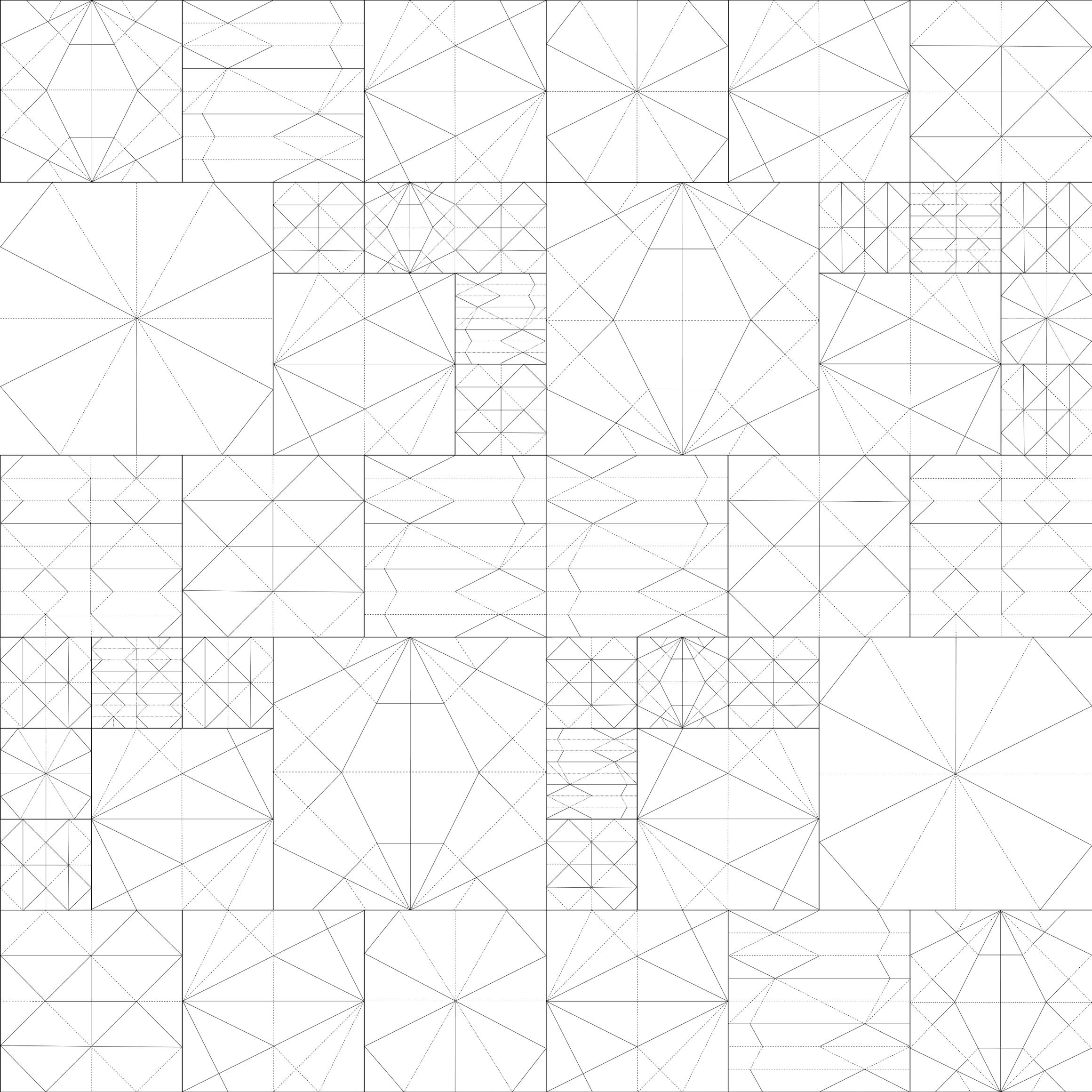
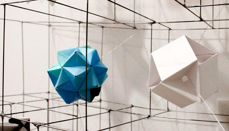
27in x 9in x 54in Paper, piano wire, 2021
This project is a metal container for my collection of modular origami pieces, each of which is made from several folded pieces of paper. The map on the left is each of these papers unfolded, leaving behind the creases that become a how-to guide for building the units again.

Work Summary
Lauren Jasper
LAUREN JASPER
Cornell University
College of Architecture, Art, and Planning
Bachelor of Architecture (2024)
Minor in Design + Environmental Analysis
Lauren Jasper