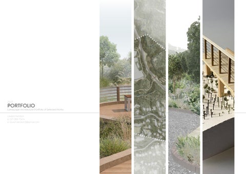
2023
PORTFOLIO
Landscape Architecture Portfolio of Selected Works

Lauren Kendon p. 021 086 70414
e. lauren.kendon3@gmail.com
ABOUT ME
I am a third-year undergraduate student studying a bachelor of Architecture majoring in Landscape Architecture at Victoria University of Wellington.
I am passionate about the outdoor environment and aim to create sustainable designs that mitigate the effects of climate change while restoring native ecology and creating a positive human experience, improving health and wellbeing.
I am a reliable and hard-working student with excellent interpersonal and organisational skills.
LAUREN KENDON
Contact:
p. 021 086 70414
e. lauren.kendon3@gmail.com
EDUCATION
Bachelor of Architecture majoring in Landscape
3rd Year Undergraduate Student
Victoria University of Wellington (2021 - Present)
NCEA Levels One, Two and Three
Wellington Girls’ College (2016 - 2020)
ACHIEVEMENTS
2022
Wellington Faculty of Architecture and Design Dean’s List
2021
Wellington Faculty of Architecture and Design Dean’s List
2020
Victoria University: Wellington Tangiwai Scholarship
2020
Wellington Girls’ College: Outstanding Service to the College
2020
Gold Duke of Edinborough Award
EXPERIENCE
Design Intern
Wellington City Council (Nov 2022 - Feb 2023)
Key Responsibilities
- Collaborating on projects with other team members
- Chairing meetings
- Liaising with clients about their needs
- Actively researching for developments currently being actioned
- Contributing towards masterplanning developments
PROFICIENCIES
- Photoshop
- Illustrator
- InDesign
- AutoCad
- Rhino
- SketchUp
- Vray
CONTENTS
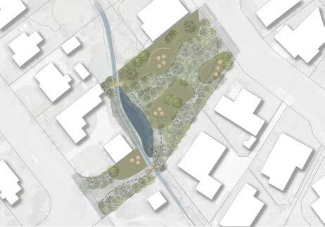
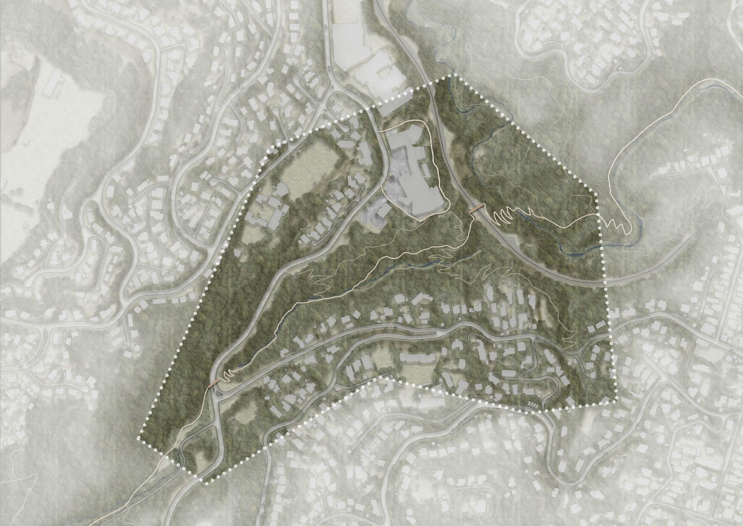
MAKOURA STREAM PARK
Masterton, Waiarapa, New Zealand
3rd Year Bachelor Project 2023
01.
pp. 4-13
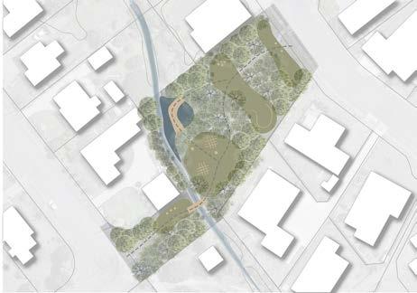
MAKOURA STREAM PARK 01.
Masterton, Waiarapa, New Zealand
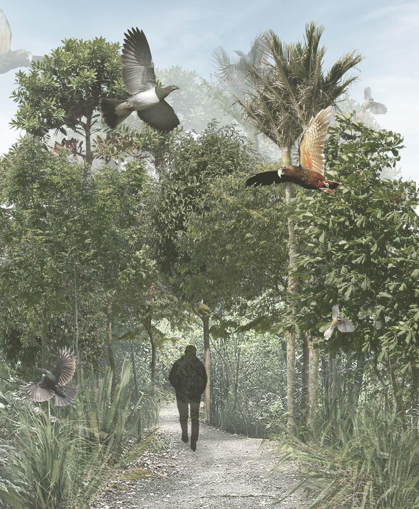
Introduction:
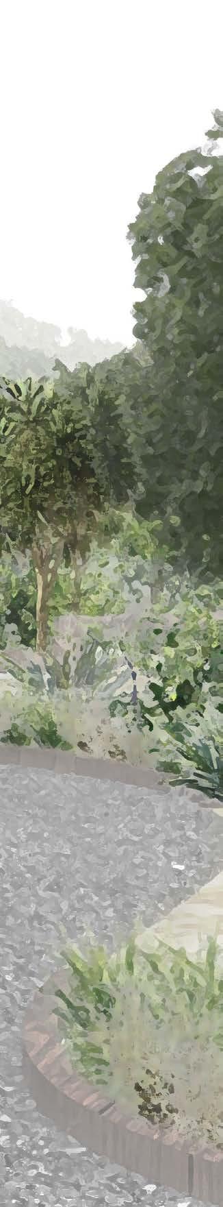
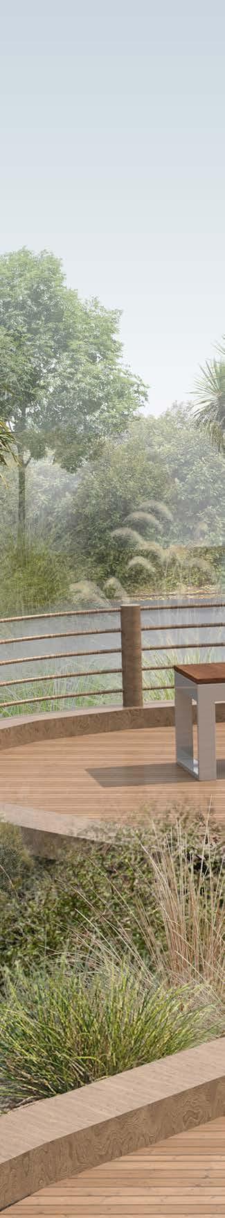
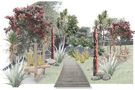
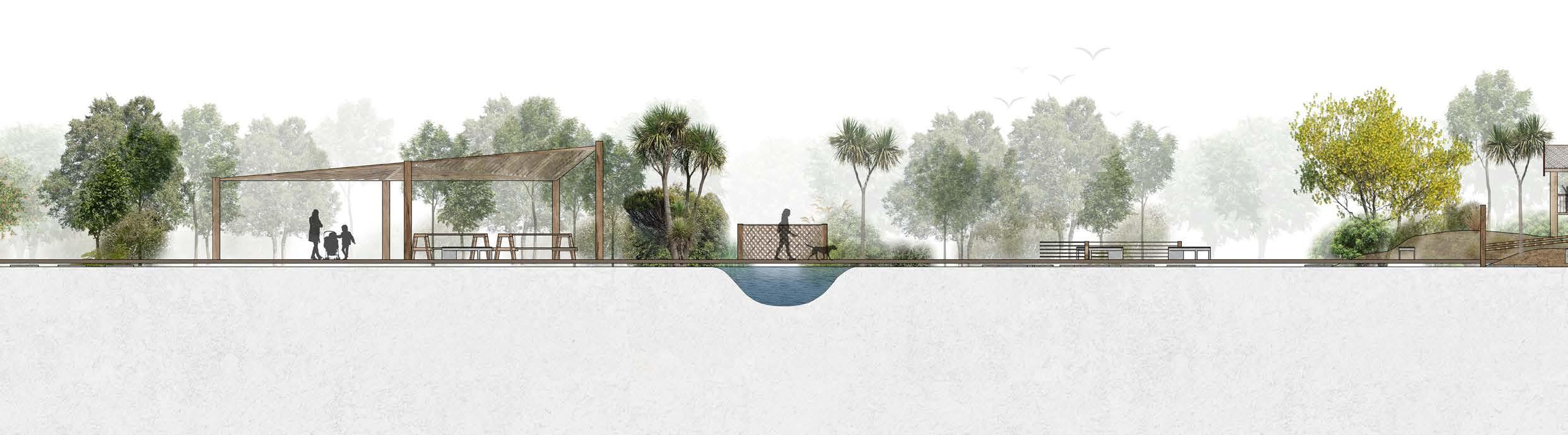
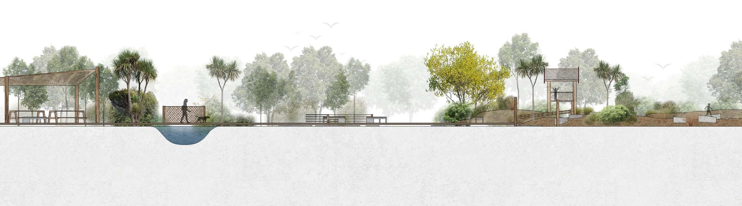
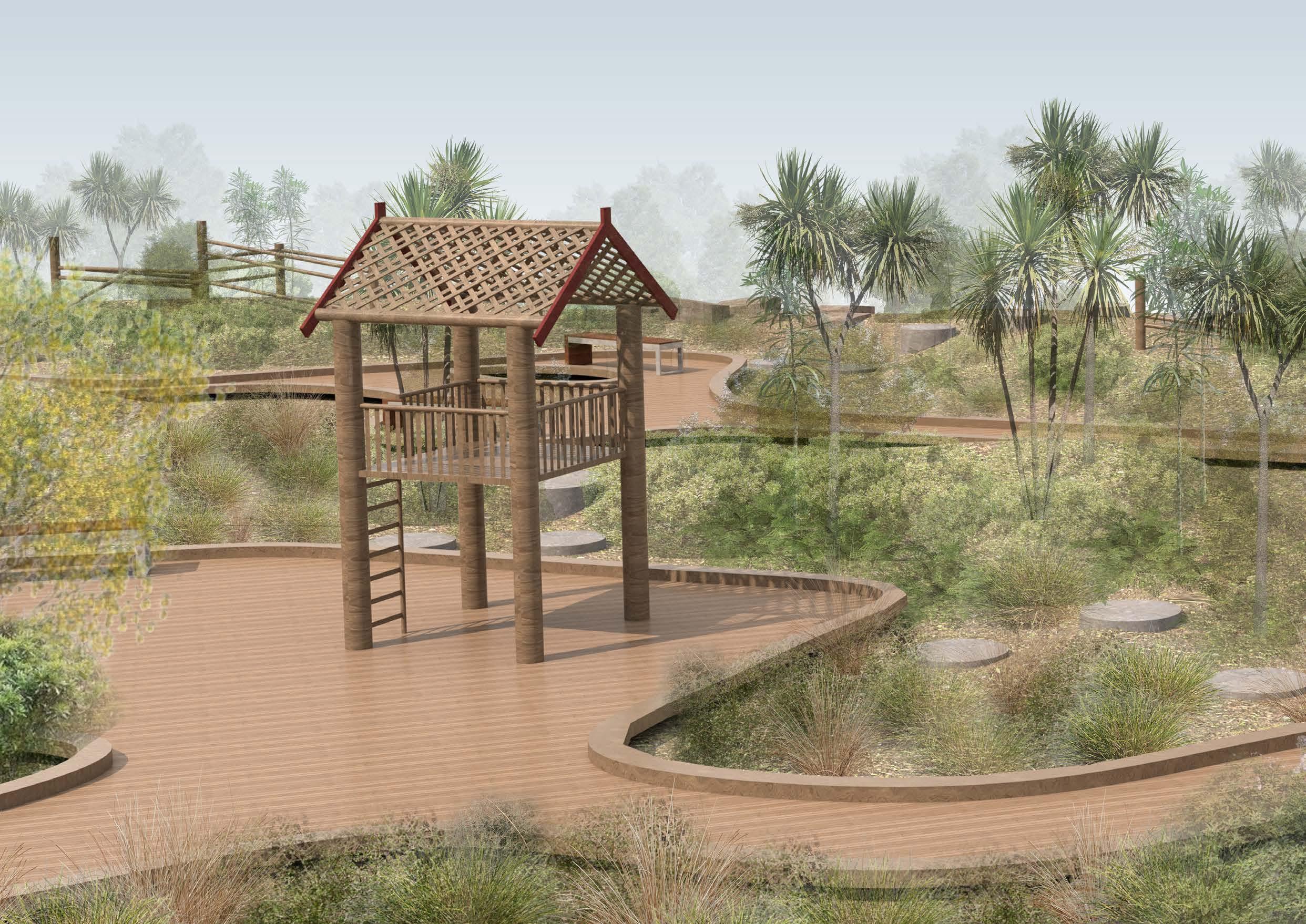
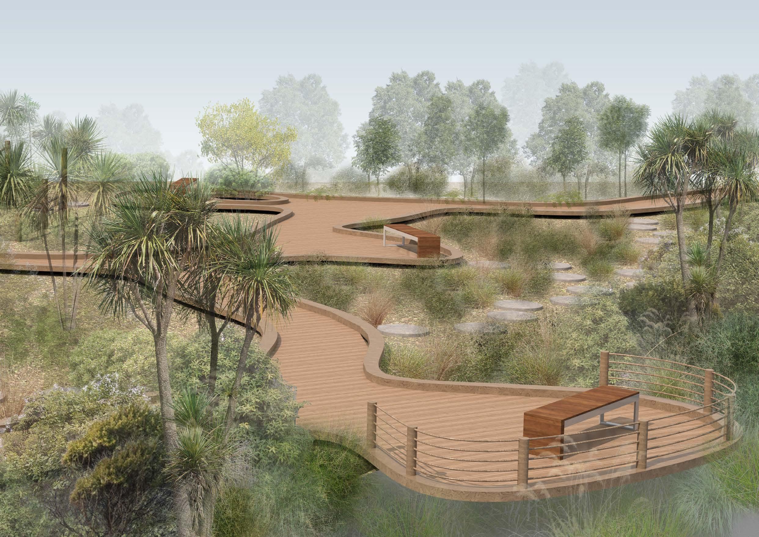
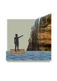
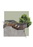
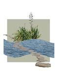
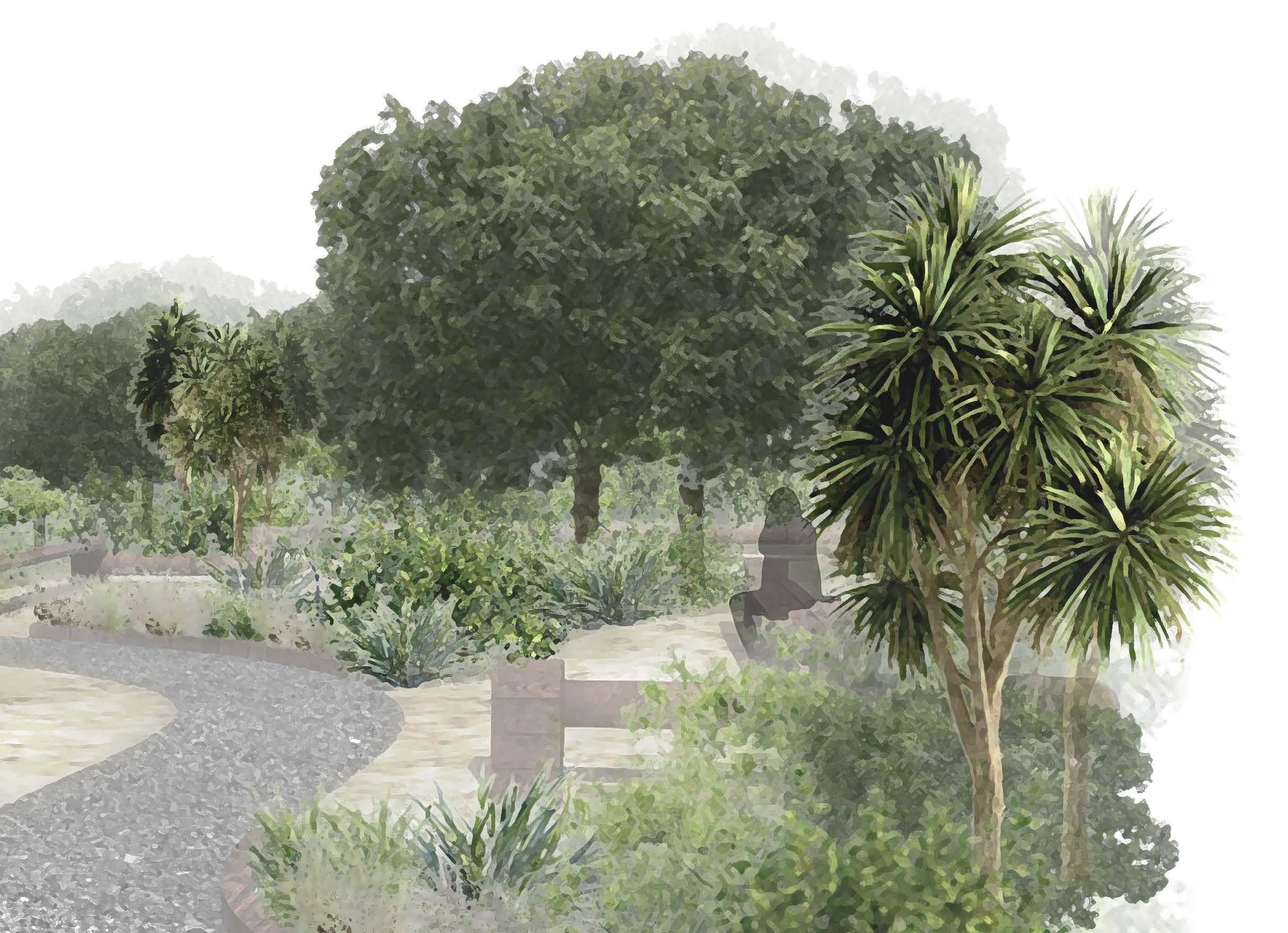
This project aims to restore Makoura Sream in Masterton, while encouraging people to interact and engage with the stream.
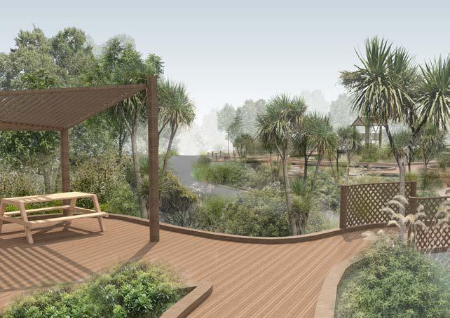
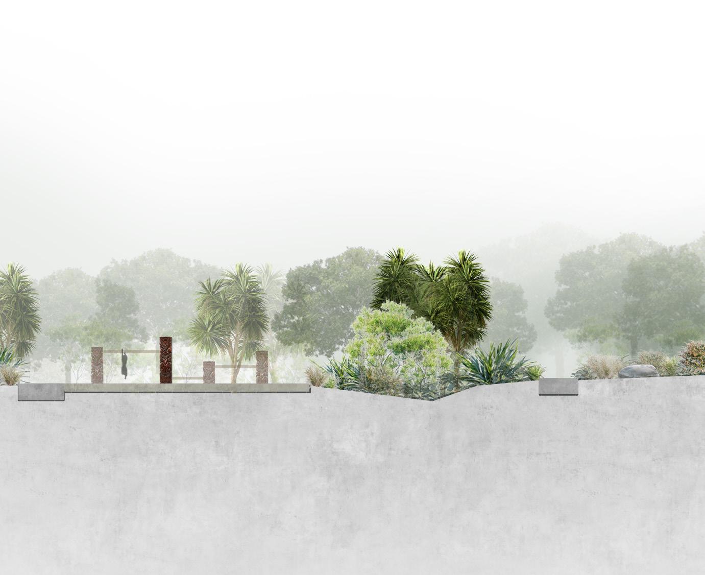
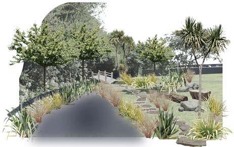
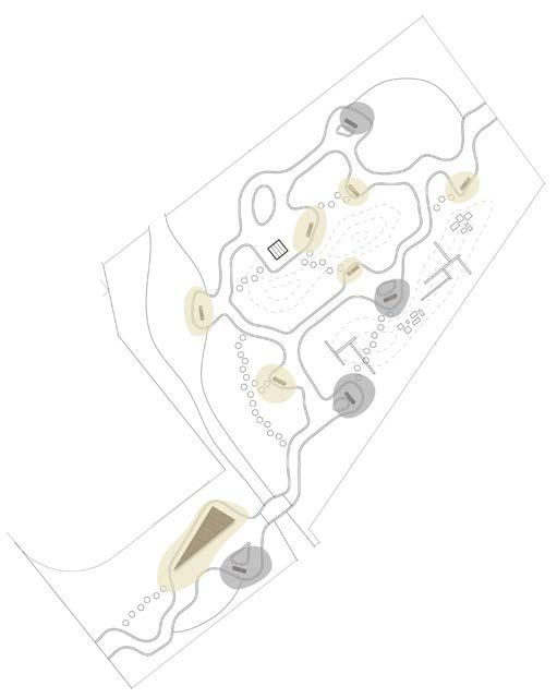
This park is provides a play area for families in the area, using natural play features such as wooden post climbing structures and angled rocks. Stepping stone shortcuts through the planted areas allow people to engage and interact with the plants around the site.
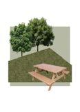
The picnic shelter provides a space for people to enjoy lunch next to the stream, while looking at the eels and picking fruit from the trees.
4
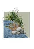
Support the health of the stream by providing riparian planting to filter the water, and overflow wetlands how help mitigate flooding risks.
HAUROPI
Enhance biodiversity through native planting, creating habitat for aquatic species through riparian planting and birds through restoration planting.
KOTAHITANGA
Create an engaging space that supports the identity and unity of the community while increasing their understanding of the stream history and ecology.
TANGATA WHENUA
Incorperate Maori naratives and values, including Kaitiakitanga, Whanaungatanga, and Wairuatanga.
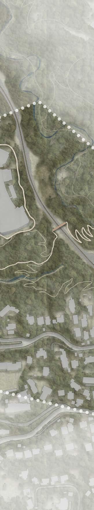
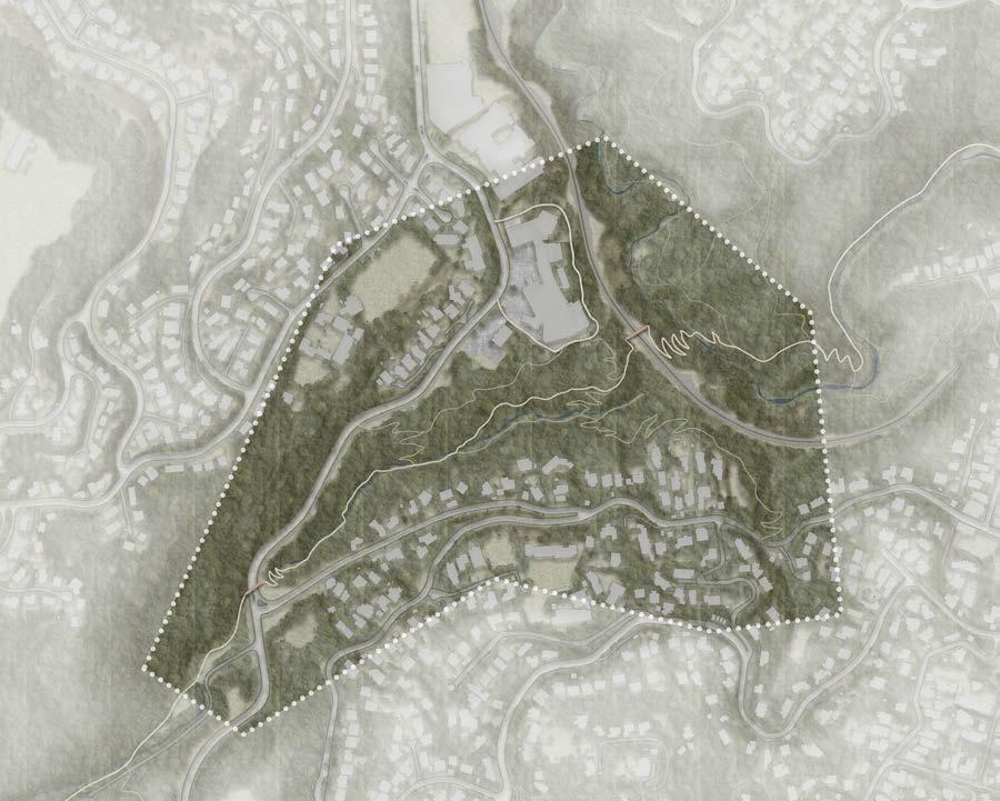
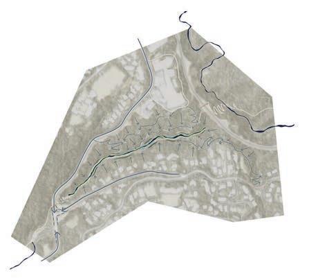
6 SITE ANALYSIS STRATEGY WAI
MASTERTON
Site Farmland Rivers Potential Sites Makoura Stream Roads Masterton Short Rotation cropland Streams Culturally significant sites Sites identified Parcel boundaries Orchard/ Vineyard Urban Park 0 2.5 5 kilometers Site Public Parks Roads Residential buildings Makoura Stream Parcel boundaries 0 0.5 1 kilometer
7
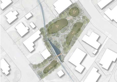
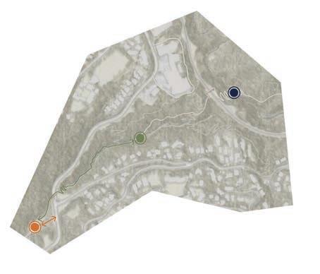
ITERATION 1 ITERATION 2 ITERATION 3 ITERATION 4
ITERATIONS
0 25 50 Meters
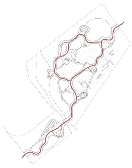
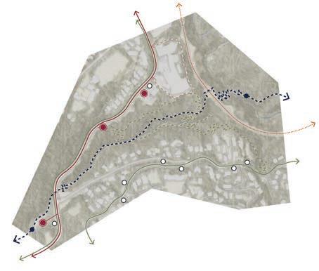
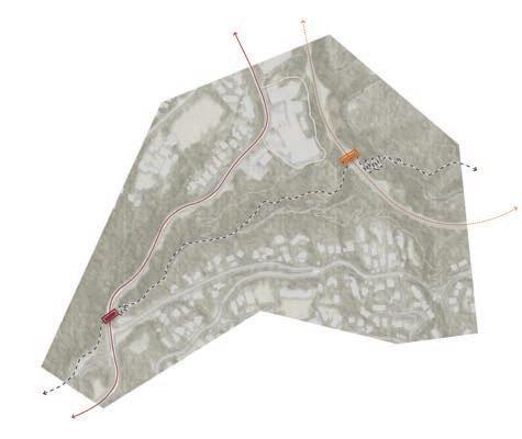
The primary circulation route is accessible for everyone, including wheelchairs and buggies. The other paths are explorative and allow users to explore the site.
The public seating areas create spaces for communal interaction. The semiprivate areas create opportunities for people to sit in a quieter area.
The structures and open grassy areas create spaces for kids to play and explore the site. The benches have been placed to create sight-lines for parents to watch their kids.
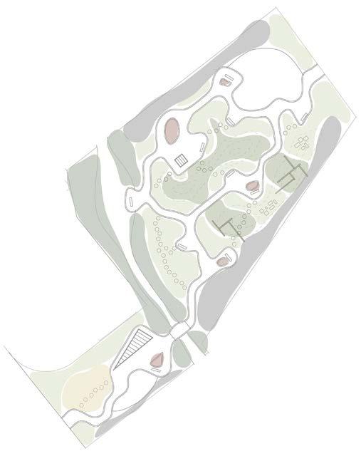
These zones of planting create different environments around the site.
All water around the site is directed to the stream. There are gutters around the paths that help direct the water toward the stream.
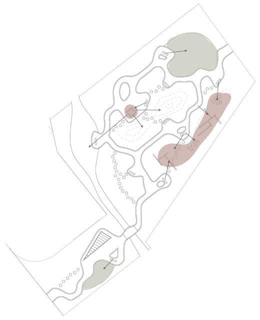
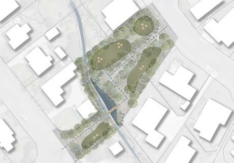
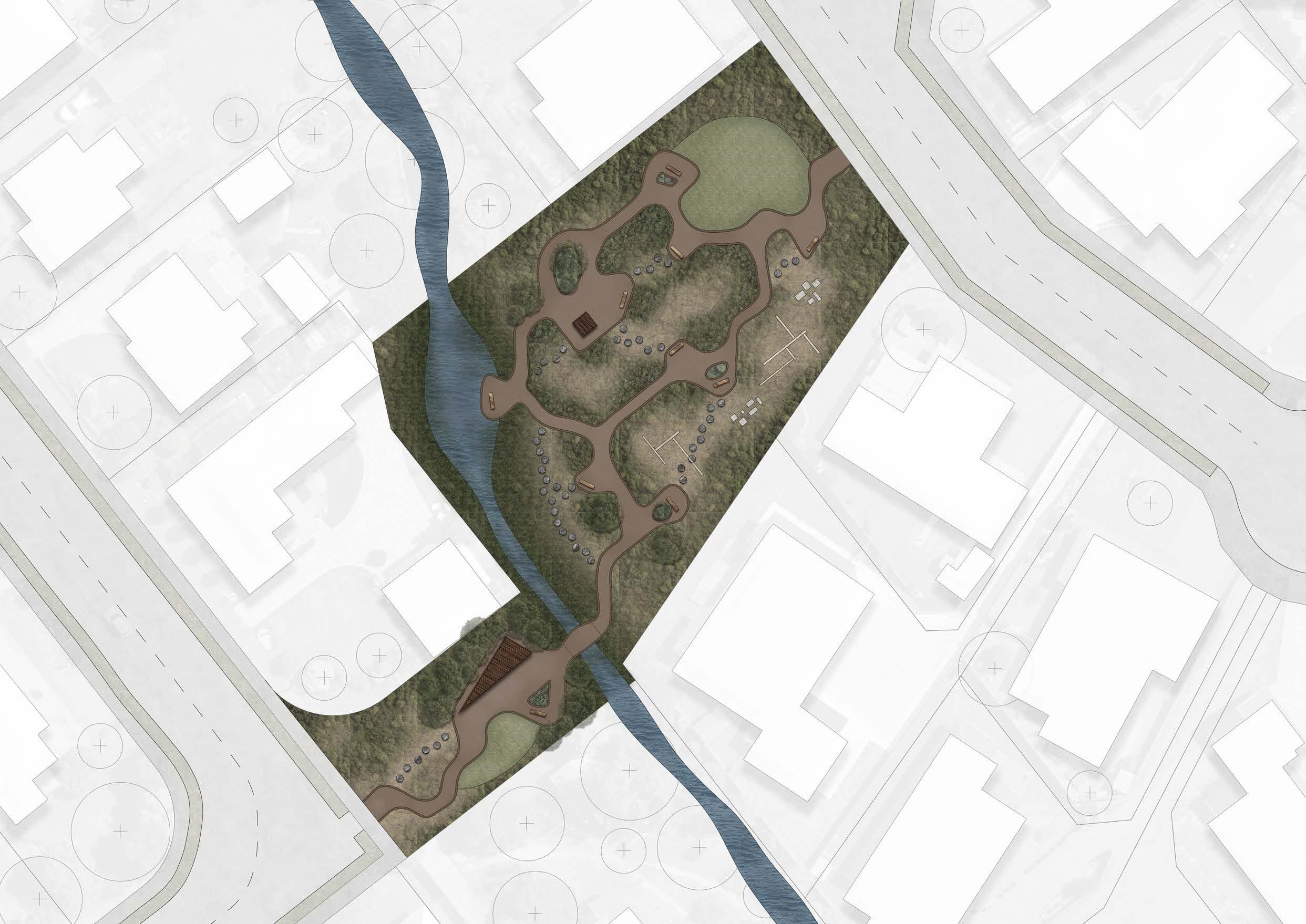
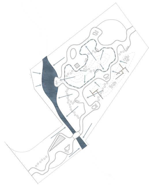
9 MASTERPLAN Primary Secondary Tertiary CIRCULATION COMMUNAL SEATING AREAS PLAY AREAS PLANTING ZONES HYDROLOGY
Edging Semi-private seating areas Riparian Planting Fruit Trees Public seating areas Path planting Low planting High planting Play structures Open grassy play areas Key sight-lines Stream Drainage Gutter
12
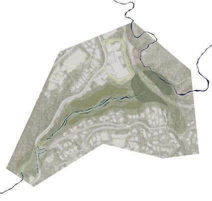
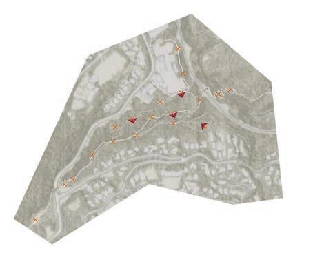
0 20 40 Meters PLANTING PLAN
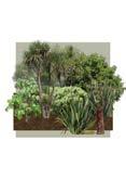
PLANTING STRATEGY
Zoom Area
PSCR
CASE
ASOB
CORH
GRLU
COCR
SOMI
HEAR
BETA
COCO
MYSA
PERO
ALEX
COAU
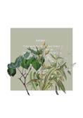
Pseudopanax crassifolius
Carpodetus serratus
Asplenium oblongifolium
Thick-leaved coprosma
Griselinia lucida
Coprosma crassifolia
Sophora microphylla
Hebe arborea
Beilschmiedia tawa
Corokia cotoneaster
Myrsine salicina
Pellaea rotundifolia
Alectryon excelsus
Cordyline australis
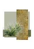
Carex comans x Carex testacea
Grass
13 0 5 10 Meters
ZOOM PLANTING PLAN
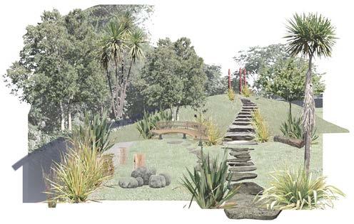
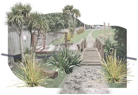
MISSING LINK 02.
Churchill Reserve, Wellington, New Zealand
Introduction:
This project focuses on the Kaiwharawhara Catchment in Wellington. The headwaters start in the Zealandia eco-sanctuary before the stream runs into the ocean at the bottom of Ngaio Gorge. Restoring this catchment is a key focus for many organisations with strategies including the Sanctuary to Sea Strategy by Zealandia.
The site that this project develops is an area currently not officially accessed by the public. It sits between the north end of Otari Wiltons Bush and Trelissick Park. Currently, it is maintained and restorative planting is undertaken by locals using the stream to navigate down the valley. There is a significant opportunity to introduce tracks to the area and restore the bush to a pre-human state, encouraging birds and other species back into the area.
14
KAIWHARAWHARA CATCHMENT
Crofton Downs Primary School
Trelissick Park
Kaiwharawhara Stream
Kaiwharawhara catchment
Streams
Parcel boundaries
Central Zones
Broadleaved Indigenous Hardwoods
Exotic Forest
Urban Parkland/Open Space
Gorse and/or Broom
Kaiwharawhara Stream
Schools
Streams Bowen Hospital
Sanctuary to Sea Walkway
Tracks
Main Roads
Buildings (Residential)
5m Contours
Crofton Downs Retirement Village
Central Shops
Johnsonville Train Line
Broadleaved Indigenous Hardwoods
Exotic Forest
Wadestown Primary School
16 SITE ANALYSIS
Zealandia
Wilton
Otari
Skyline
Wadestown
Khandallah Bowen Hospital
Retirement Village
Otari Bush
Te Ahumairangi
Wellington Central
Kaiwharawhara Stream kamoriK o Str eam
Karori
0 2.5 5 Kilometers
CONNECTION FACILITIES ECOLOGY
Create a link between Otari Wiltons Bush and Trelissick Park with a track network including the Sanctuary to Sea Walkway.
Close proximity to schools and Bowen Hospital create opportunities to educate and improve health and well-being
Restore bush with native planting to provide a habitat for birds and other living organisms.


HYDROLOGY HAZARDS
TOPOGRAPHY
Restore kaiwharawhara stream to support aquatic life and mitigate flooding risks due to increasing extreme weather.
Create safe pedestrian crossings over Churchill Drive and the Johnsonville train line., where the stream is piped.
Navigate the steep topography with carefully designed tracks and slope stability strategies.
17
HYDROLOGY ECOLOGY COMMUNITY MAORI HISTORY
Support the health of the stream while improving human interaction
Restore bush and provide a habitat for native birds and aquatic species
Create a space that brings people to the site to support community connection
Celebrate the history of the landscape through design influenced by Maori stories
18
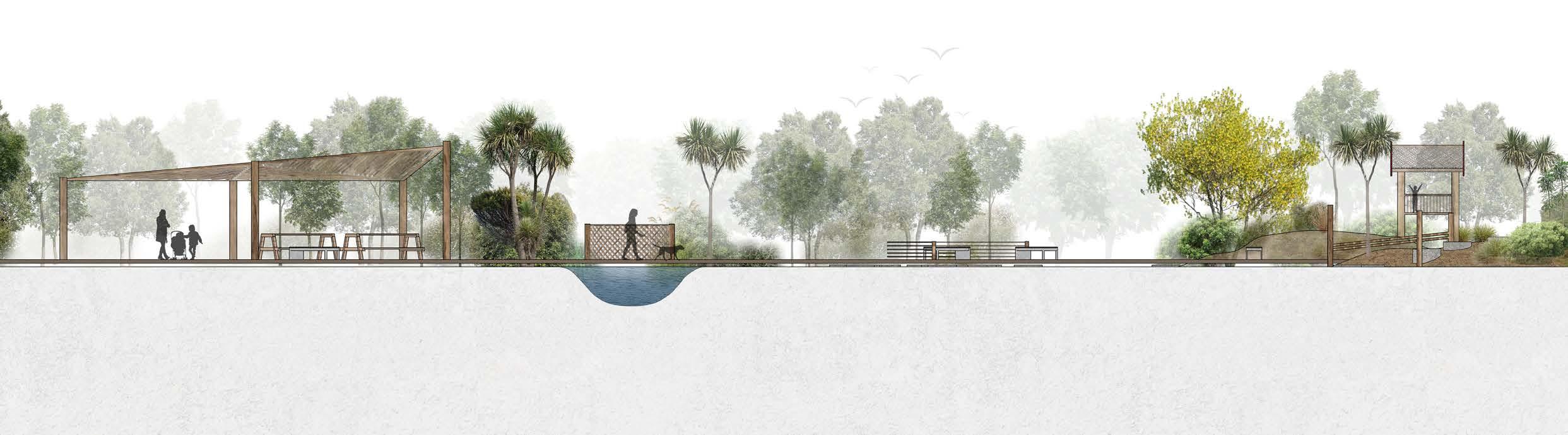
Forest Restoration Lookouts Sculptures
Stepping stones Water features Aquatic Habitat Bird Habitat Slope Stability Picnic areas Te Mara Hupara Riparian Planting Play areas Wharawhara: Astelia banksii Planting
Rain Garden Tree top walkway Rongoa Planting
STRATEGY
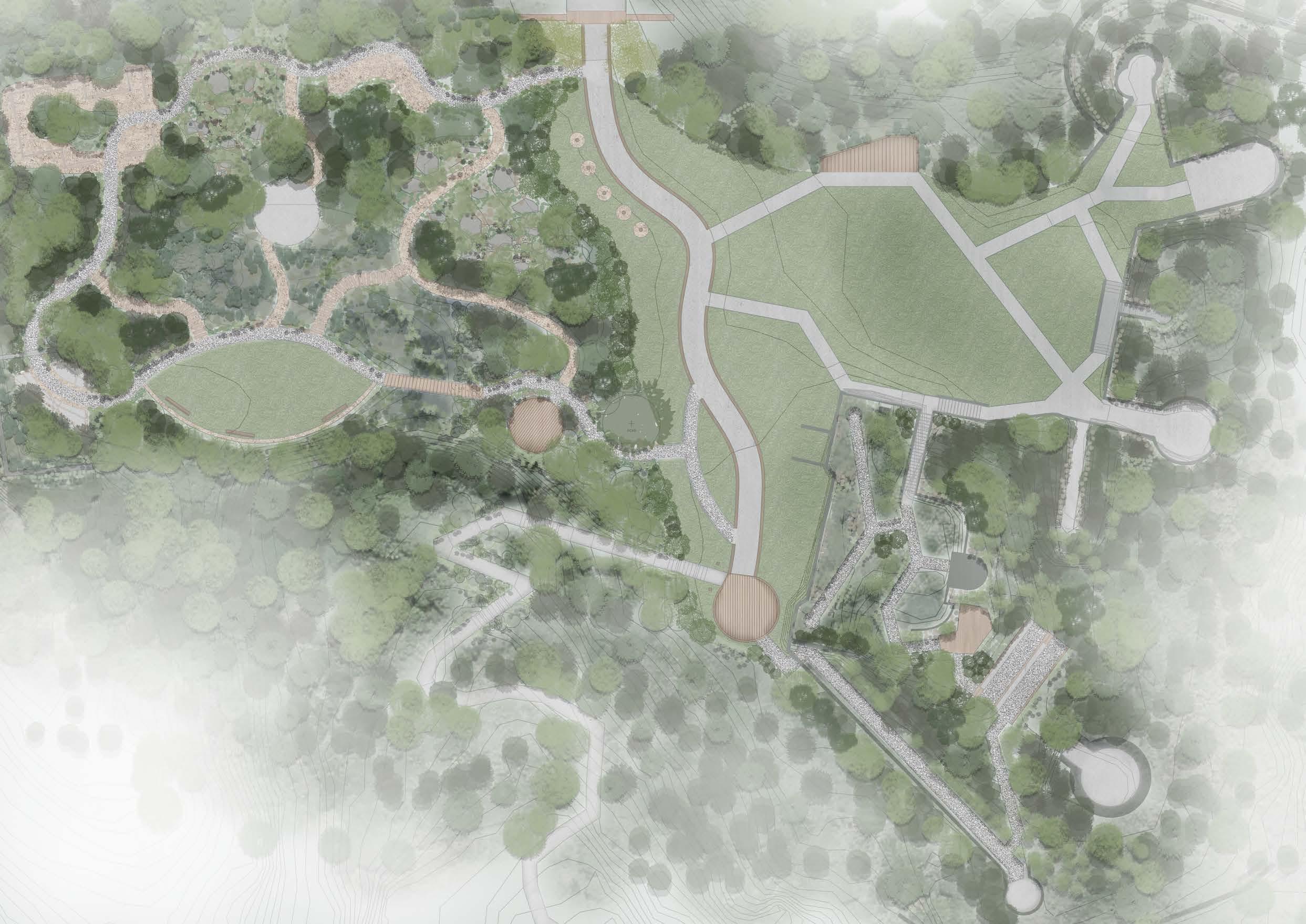
MISSING LINK
This park provides a link between Otari Wiltons Bush and Trelissick Park. It would take around 20 minutes to walk from one end to the other.
KEY FEATURES
1. Otari Wiltons Bush North Carpark
Includes Play area and Community Garden
2. Footbridge over Churchill Drive
3. New Sanctuary to Sea Walkway
Well-graded, accessible for many
4. Te Mara Hupara Clearing Play/ Picnic Area inspired by Maori naratives
5. Walking Tracks
6. Rongoa Healing Track
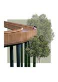
Treetop walkway around the hospital, accessible for elderly and disabled. Can be used by patients (when possible), visitors, and rest home patients Uses Rongoa Healing planting and Karakia inscriptions
7. Footbridge over train track
8. Stream confluence
Celebrates Kaiwharawhara pipe exit, fish ladder, and historic tunnel entrance
0 250 500 Meters 1 2 3 4 5 6 7 8
COMMUNITY SPACES ACCESS AND CIRCULATION REST AREAS AND LOOKOUTS
Kaiwharawhara Stream
Bus Routes Railway
Walking Tracks
Sanctuary to Sea Walkway (STS)
Rongoa Trail
Main Roads
Bus Stops
Car parks
Beginning/ End of New STS
Ciculation around the site is directed by 3 key paths. Sanctuary to Sea Track, Walking tracks and a Rongoa Healing Trail around the hospital.
BRIDGES
Kaiwharawhara Stream Main Road Railway Sanctuary to Sea Walkway Road bridge Train bridge
These bridges increase the safety of the Sanctuary to Sea Walkway. The pattern on the side is inspired by the flow of water from the stream below.
Play area + Community Garden
Te Mara Hupara Clearing Stream Confluence + Pipe Exit
These community spaces will provide key areas that facilitate community interaction and engagement with Kaiwharawhara stream.
Kaiwharawhara Stream Water direction
Riparian
Depressional Wetland
Seepage Wetland
Retention Ponds
Rain Gardens
This design manages all the water that falls on the site. Pathways direct the water to retion areas to slow the filtration into the ground.
Lookouts Benches
Lookouts highlight the key view over the catchment. Benches provide rest spots along the track.
Kaiwharawhara Stream
Riparian Planting
Wetland Planting
Slope Stability Planting
Restoration Planting
Rongoa Healing Planting
The planting zones on around the site are all native and aim to restore the bush with key historic species such as Totara and Rimu, and encourage birds back to the area.
20 DETAILS
HYDROLOGY
ECOLOGY
REGIONAL IMPACT

KAIWHARAWHARA CATCHMENT

Bus Routes Railway
Kaiwharawhara Stream Frequent
Walking tracks Sanctuary to Sea Walkway Main Roads Site
Zealandia
Otari
Trelissick Park
MAHANGA HISTORIC PARK 03.
Miramar, Wellington, New Zealand
Introduction:
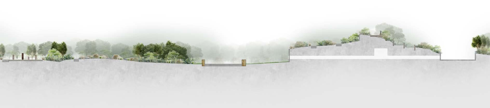
This project focuses on developing and restoring the area that is currently the historic fort balance bunkers in Miramar. The site has a rich history, first being Mahanga Pa, then the site of the war bunkers. Thirdly, houses were built on the site before being removed for cultural reasons.
This project aims to reflect this history through a destination park for people to travel to. There are play features inspired by each step of the landscapes features, as well as open grassy areas for open play. The bunkers provide exploration opportunities and the view down to the ocean are worth the walk up the hill.
22
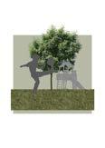
Walkway loop with different areas of play features inspired by the rich history of the site: Pa site > War Bunkers > Houses
Bunkers: Provide an exiting opportunity for exploration Open grassy area
24 CONCEPT
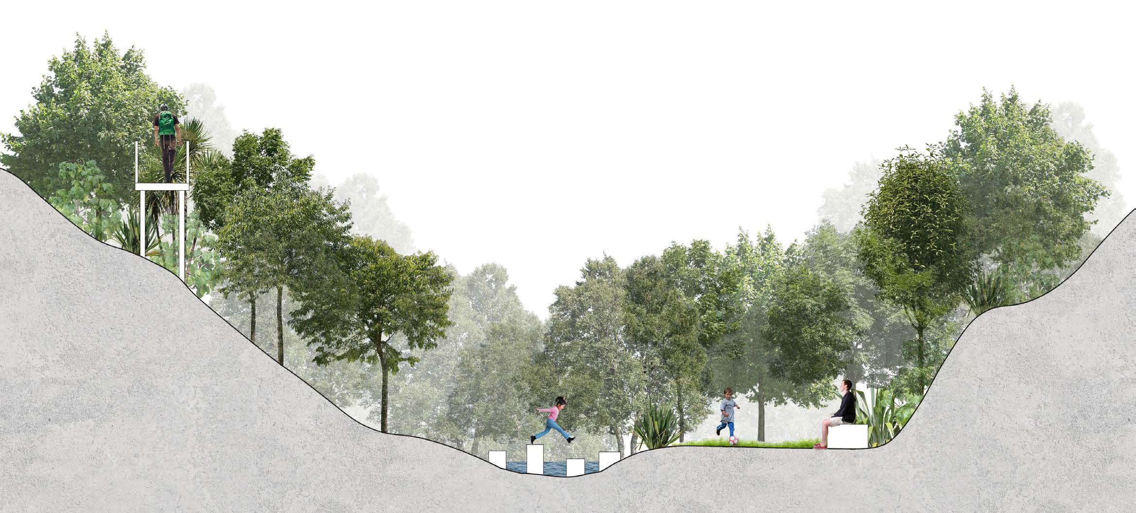
SECTION A-A’
KEY FEATURES
A A’
1. Play area inspired by Maori Pa forms and natural play
2. Play area inspired by footprint of historic house
3. Child friendly play area inspired by bunker forms
4. Open grassy area with views to the ocean
5. Lookout
6. Wetland Planting
7. Open grassy area
8. Pa inspired terraces on bunkers
1 2 3 4 5 5 5 5 6 7 8
The cut and fill is balanced to ensure that the soil remains on the site.
Cut
CUT AND FILL DRAINAGE PLANTING MATERIALS
This design ensures that all the water that falls on the site is directed to a series of wetlands.
Rain Garden Stage 1 drainage (damp tolerant plants)
Bio retenion basin
Direction of water
Open linear drain (side)
Sloped linear drain (width)
Closed linear drain (side)
Piped drain
The planting strategy consists of native planting that can survive in a coastal environment.
All of the materials are natural and blend in with the existing features of the site.
Wood Concrete Gravel Wood chip
Lighting
26 TECHNICAL
DRAWINGS
Fill Grass
Revegetation Existing vegetation Coastal bush Damp tolerant
Track edge Rain Garden Rock Garden Entrance Maori significance Bunker edge 1 1 5 5 9 9 2 2 6 6 10 10 3 3 7 7 4 4 8 8
Apodasmia
Carex testacea
Carex unciniata
Cordyline australis
Coprosma repens
Coprosma propinqua
Gahnia setifolia
Libertia ixioides
Myoporum laetum
Phormium cookianum
Piper excelsum
Podocarpus ferrugineus
Pseudopanax arboreus
Five-finger Tree Hebe
Removed contours
1m proposed contours
0.1 proposed contours
Open linear drain (side)
Closed linear drain (side)
Sloped linear drain (width)
Piped drain
Bio retention basin
Gravel
Wood chip path
Concrete
Planting reinforcement
Wooden decking
Note: All spot levels in meters
27
APOI CADI CATE CAUN COAU CORE COPR GASE LIIX MYLA PHCO PIEX POFE PSAR VEPA
PLANTING PLAN ZOOM PLAN
similis
Carex dissita
Veronica parviflora Oioi Purei NZ Sedge Hook sedge
Cabbage tree Taupata Mingimingi Mapere Mikoikoi Ngaio Coastal Flax Kawakawa Miro
52.5 52.3 52.7 47.0 1% 50% 50% 20%
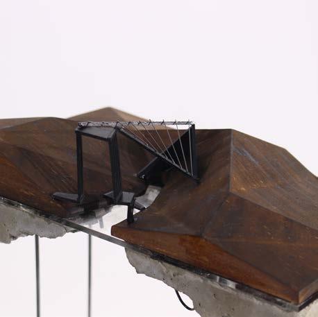
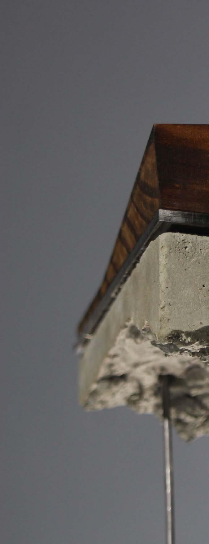
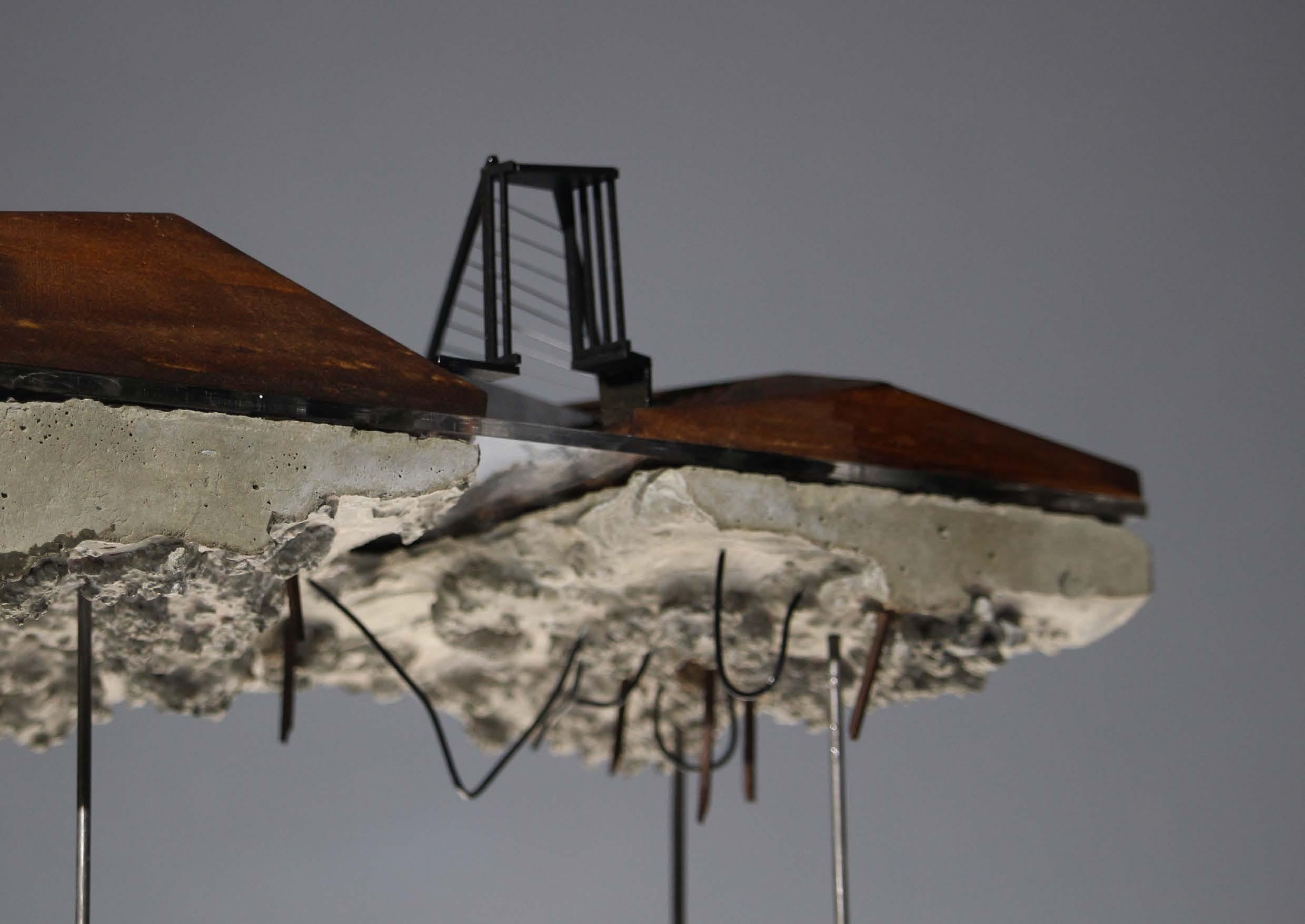
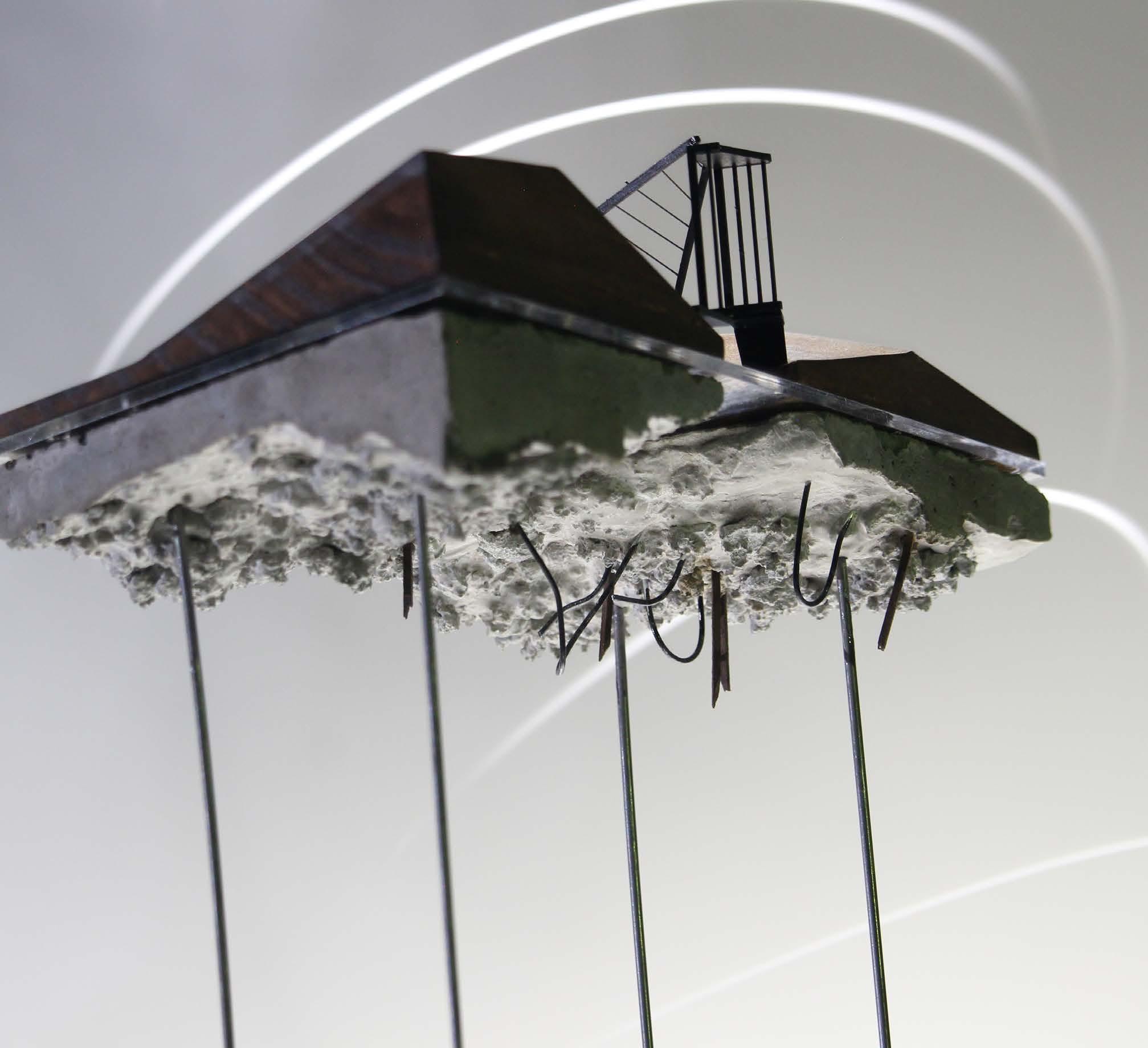
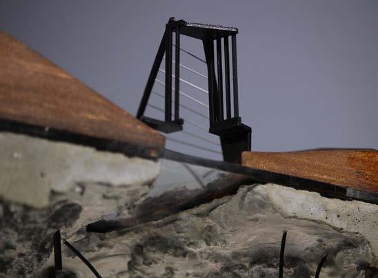
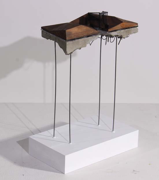
PHYSICAL MODELING 04.
Introduction:
This project explored the process of physical modeling from abstracted drawings. The drawings were completed at civic square in Wellington.
During this project I thoroughly explored different techniques and methods, developing an understanding of how different materials can represent forms, and how the same material can create different appearances when using different methods.
The final model used techniques I was unaware of, and technology that will be useful for future models including CNC routing and laser cutting.
28
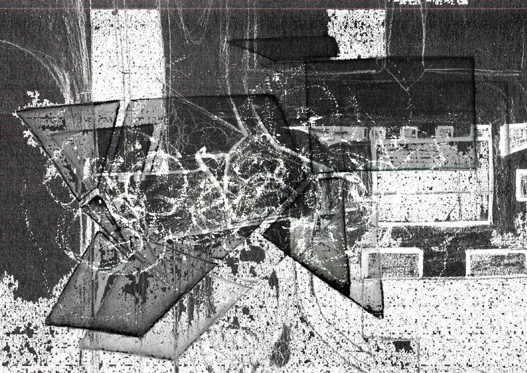
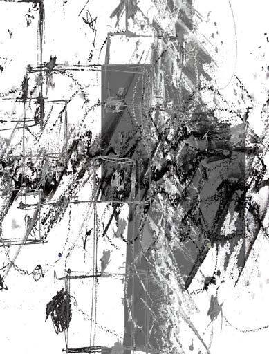
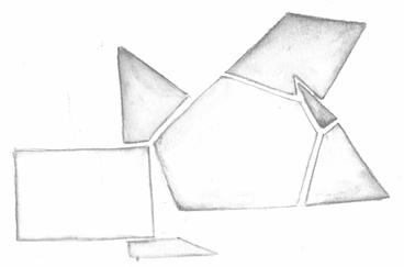
DRAWINGS
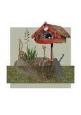
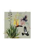
These drawings were the initial inspiration for the model. They are abstract representations of civic square in wellington during wet weather, depicting both tangible and intangible forms. The mediums used were graphite, charcoal and water colour. The contrast between geometric, clean forms and loose, textural forms, created the initial idea for the physcial model.

CONSTRUCTION

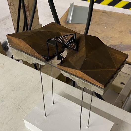
30 PROCESS
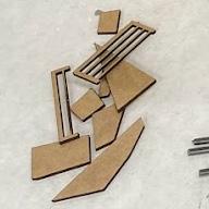
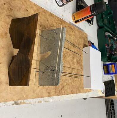
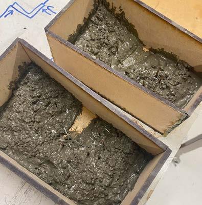
Concrete mold made with laser cut MDF wood.
Supports made with wire poles cut to length.
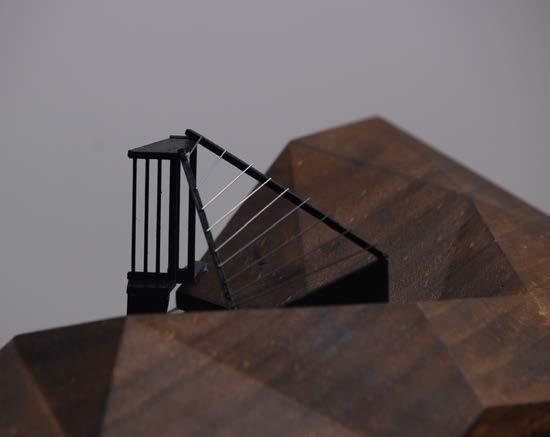
Pavilion structure constructed with laser cut board and wire.
Model assembled with a strong glue to ensure everything was secure.
01 02 03 04 05
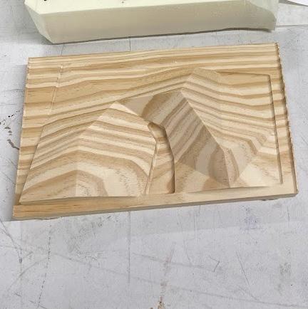
Pine wood block cut with CNC router programmed with a rhino model.
32 Thank you Lauren Kendon p. 021 086 70414 e. lauren.kendon3@gmail.com