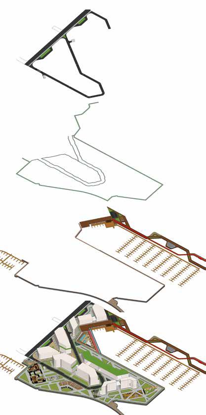
Mixed Use Development
The Anchor - Port credit


2
Lathish Punitharaj Mohamed Mustak Hamed Rafi Idris owolabi Paras jayesh shah
The Anchor - Port credit
We extend our sincerest gratitude to Dr. Hally El Kony, whose unwavering support and guidance were indispensable to the success of The Anchor project. Her continuous input significantly enhanced the accuracy, completeness, and quality of our work. Dr. El Kony’s encouragement to delve into and refine the design features of the park zone, emphasizing openness and interaction with the surrounding environment, greatly enriched the final submission. Her insights on 2D representations, master plan dimensions, and design components helped unify and enrich our presentation. Additionally, her encouragement to explore various massing options was instrumental in shaping the organic structure of our design.
We also express our heartfelt thanks to Prof. Eric Gordon, whose pivotal role in imparting the necessary software skills was instrumental in achieving the final output of The Anchor.
Furthermore, our gratitude extends to our fellow classmates and friends whose invaluable feedback and insights contributed immensely to the project. Their diverse perspectives provided clarity and depth to our work.
Port credit, Mississauga growing urban corridor with its rich history and neighborhood. Port credit surrounded by a scenic views and parks along the Lake Ontario. Our vision is to create a habitat a community that seamlessly blend with the neighborhood ideology for this place is to respect the first settlers and adopt the nature as it is with little intervention for the people to live as community. Design a habitat a people friendly environment and less car oriented. We designed this place pedestrian friendly as it can be accessible by all user irrespective of their need. Maximum use of build space composed of mixed use developments to create a vibrant community that will generate wealth along its way over time.
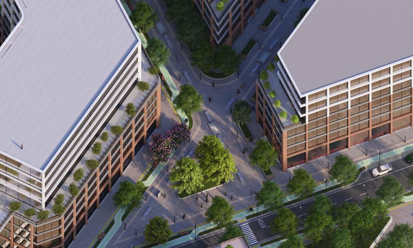
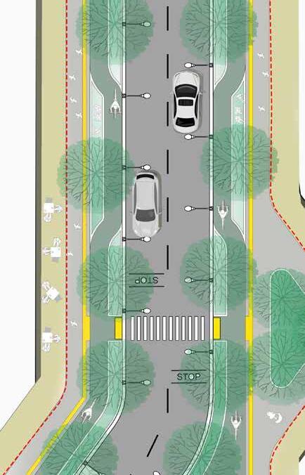
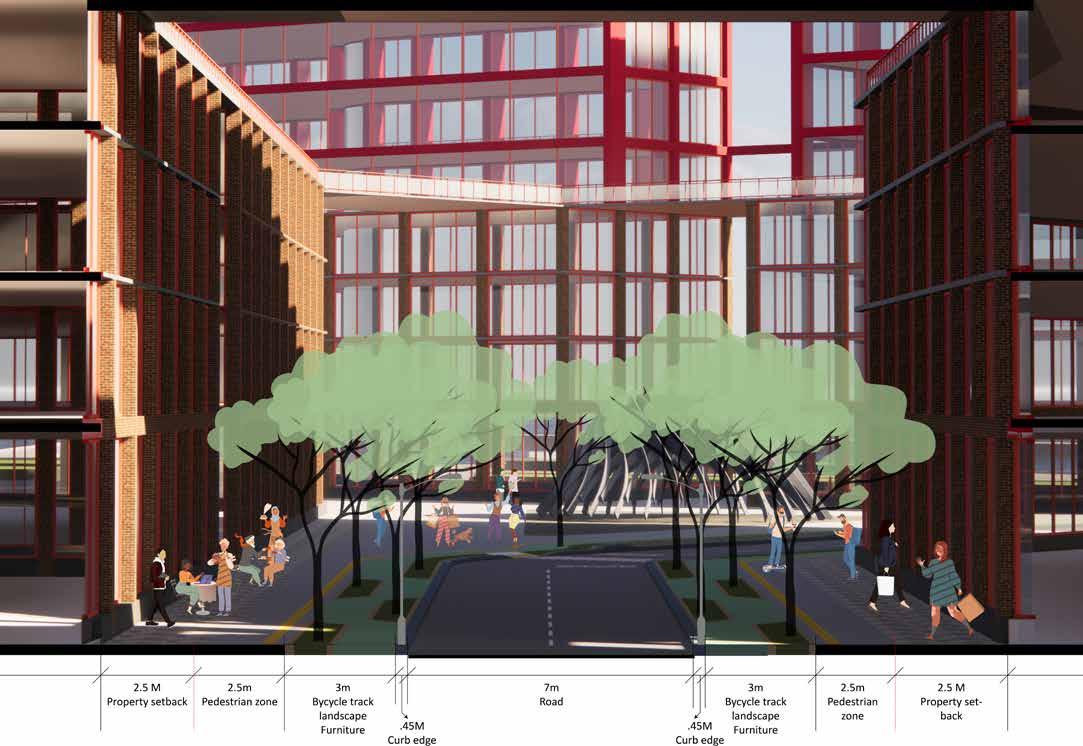
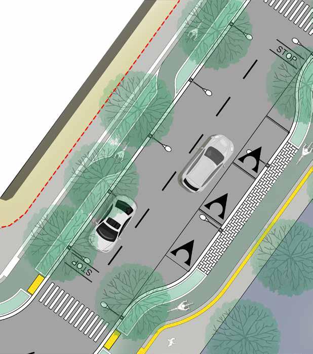
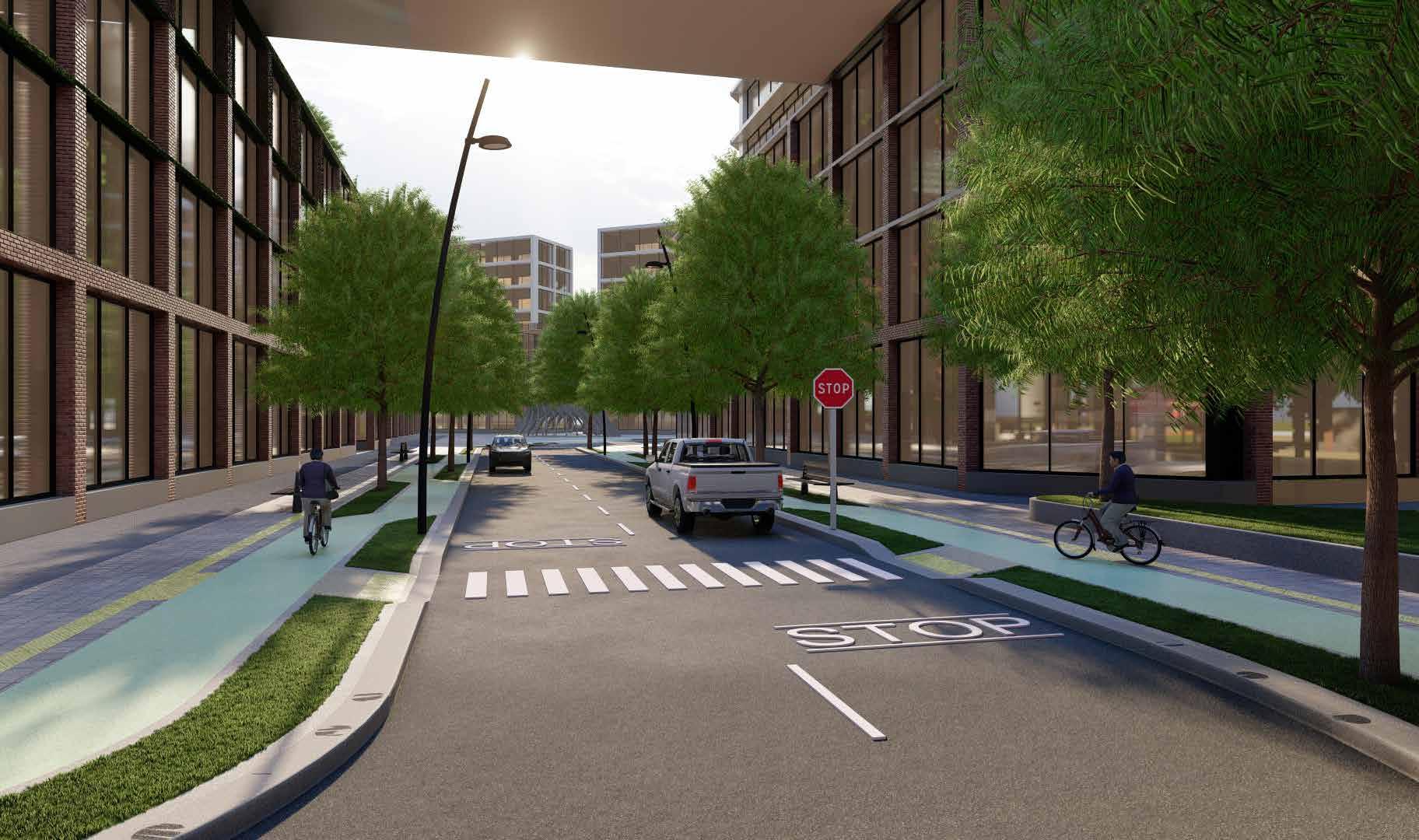
Our design is more of a pedestrian oriented, we try to connect all shorts of important nodes to one another to get a mobility network. Each nodes creates a vibrant space inside the development. Streets cape are designed properly to navigated along the edges of the building with a bicycle track that has a wave corridor into the lush garden along the road.
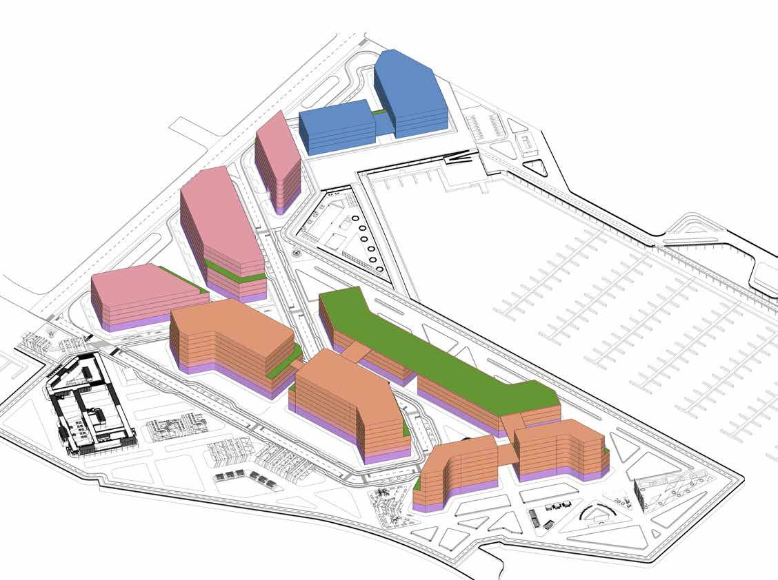
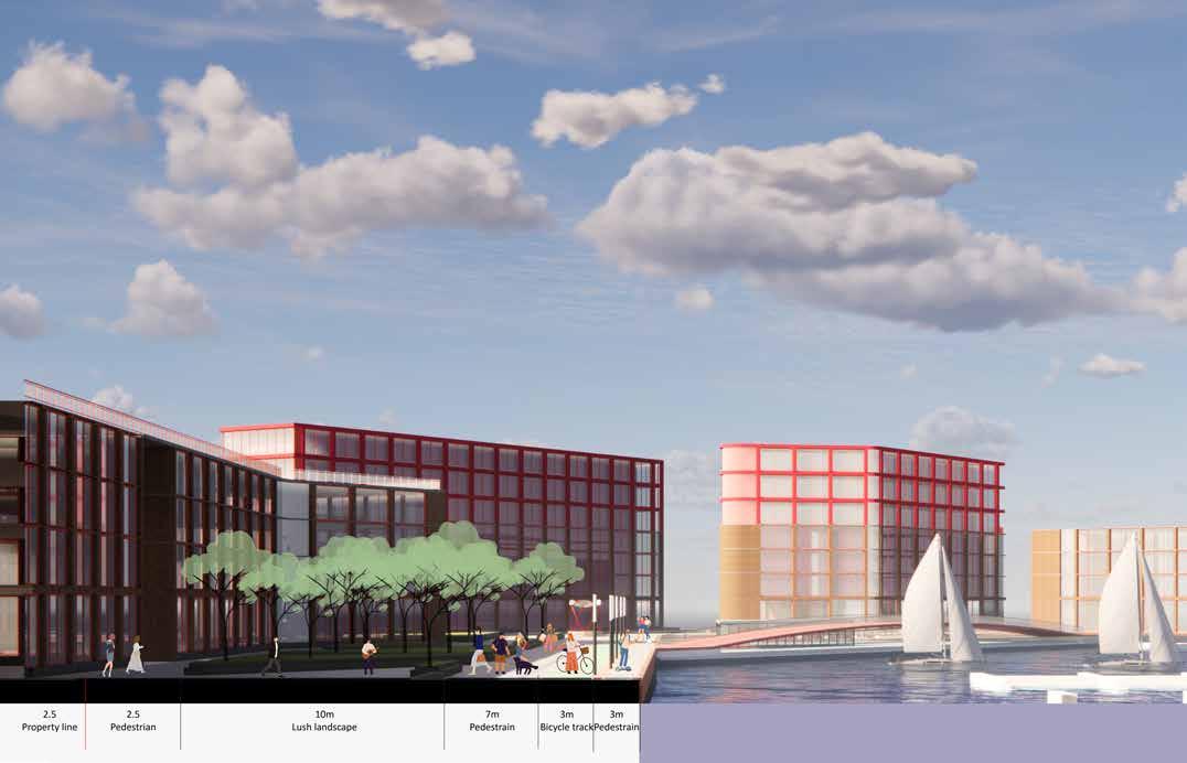
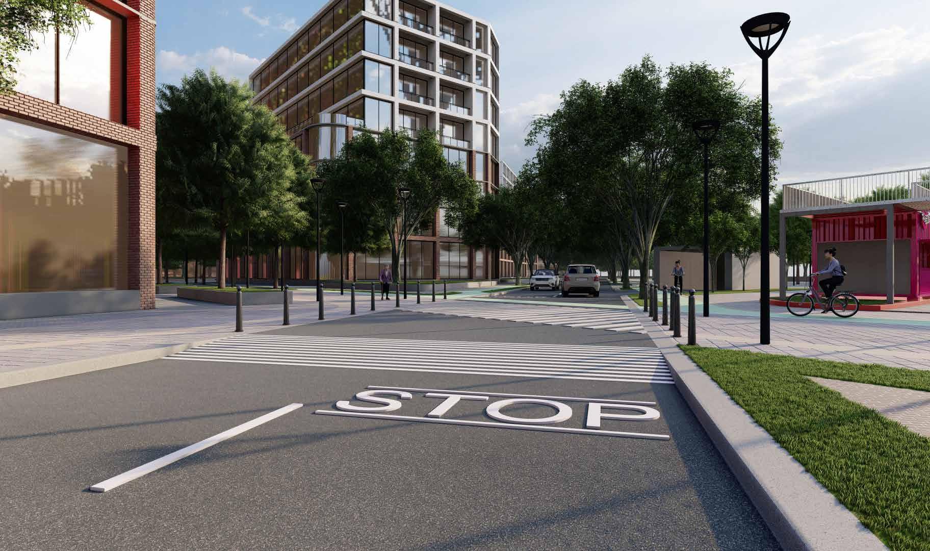
Design of building, a mixed use development composed of retail and commercial space on ground floor and residential units above. Designed strategically to maintain the wind and ample sunlight through out the day. Exterior of the building cl-added with brick till the podium level and merge with a contemporary design to create a skyline.
Anchoring all those ideology to the design to create a vibrant habitat.
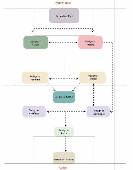
Ideology
The ideology is that we strive to capture the essence of its history by bring the neighbourhood into the structure that people can genuinely appreciate and interact with the build environment
Design as Nature
Our Vision for port credit development is to blending nature and build form , creating a balance between nature and our intervention as a build form. Try not to destroy the essence of the place.
Design as History
Port credit site hold a rich history of first settlers an indigenous people. Through our design we try to respect and be remembered their culture and lifestyle.
Design as Problem
Mississauga, a developing urban corridor were port credit has a biggest potential to thrive as development By designing the mixed use development in that location we are solving housing problem and we are trying to increases it wealth and economy of this place which will result to increases the livability of the people
Design as System
Public space are designed to be flexible allowing the path to easily adjust to events and activities. Designated areas designed for each use to systematically separate the crowd to all the place they trying to reach.
Design as Artifacts
Trying to create a valuable and respectful neighbourhood without alienating the existing port credit. Through our design language we merge existing architecture style and modernism to create a classic vibrant skyline for port credit.
Design as Place
We intent to create a memorable place that service it purpose i throughout the year irrespective of all season, and create a memorable space for living and passing through.
Design as Habitat
Habitat is a key element of the design incorporating low development technique, permeable surface. Those measures will help to maintain the ecosystem .
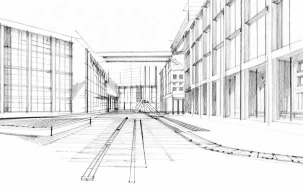
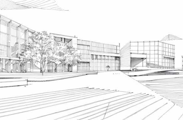
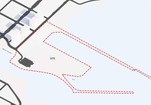
Fig:1 : Port Credit - Site

Fig:3 : Pedestrian point of interest in site
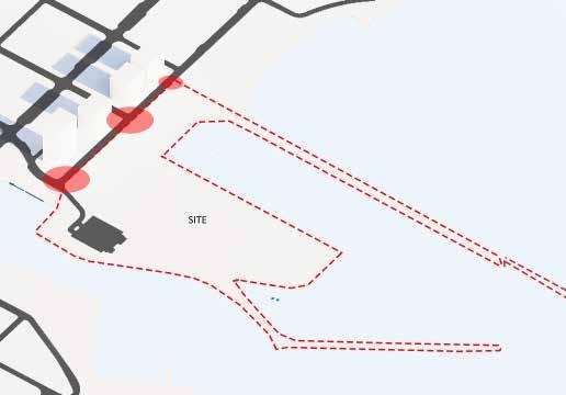
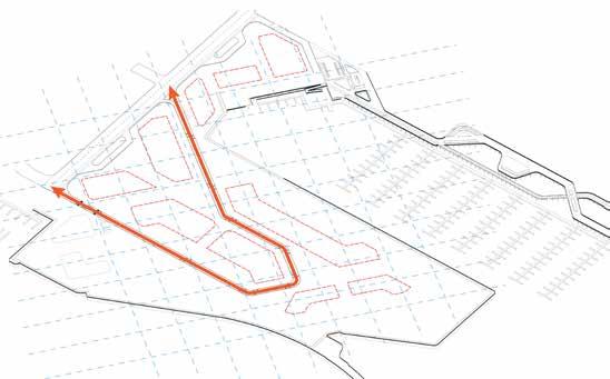
Fig:2 : Identifying important vehicular connectivity to the site
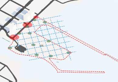
Fig:4 : Connecting all the point of interest to make it easily a accessible
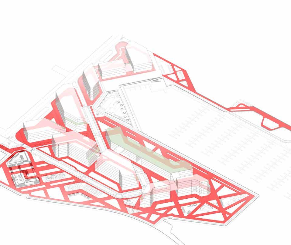
Reference grid - 50m * 50m
This grid separates the site equally.
Helps as a reference line for zoning the land use with maximum connectivity and and a break space .
Zoning ideology
Building form are designed based on the pedestrain grid
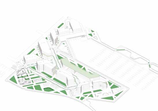
Landscape - Dense matured treescape planned accordlly to maintain the balance betweern buid form
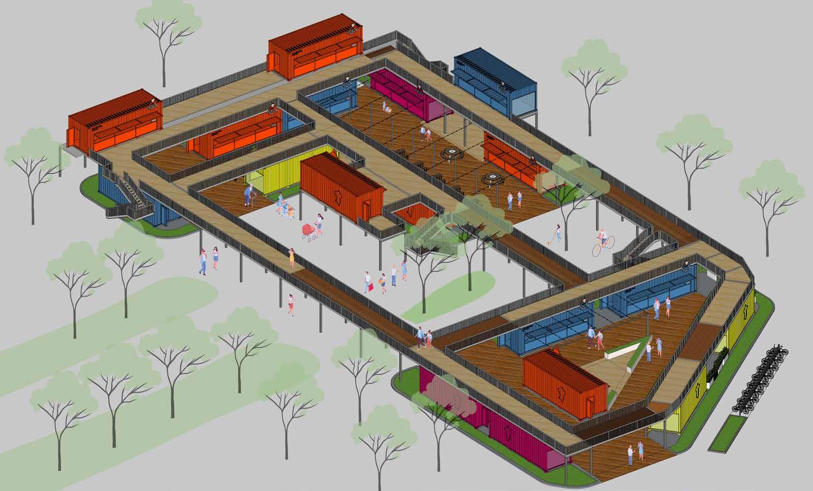
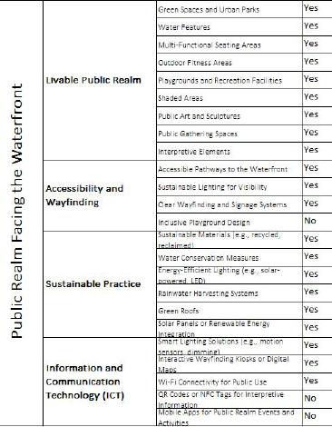
Anchor aims for a sustainable urban development through the fusion of green building technology, energy efficiency systems like solar powered streetlights, etc. The design promotes active transportation modes, features like only pedestrian pathways and cycle tracks which connects to a Port Credit’s existing waterside trail.
Pedestrain movement
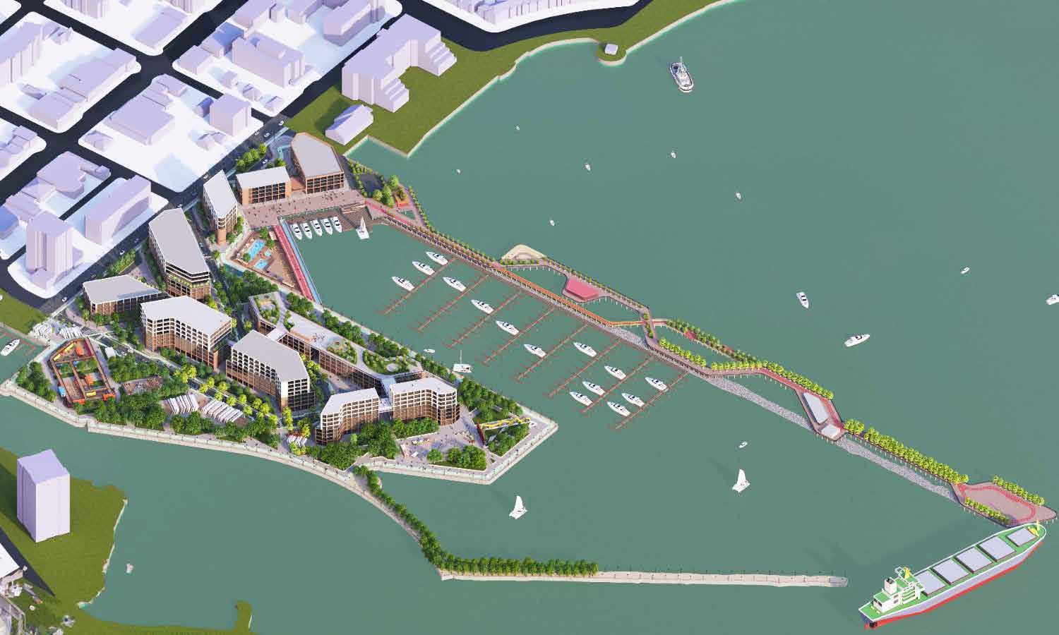

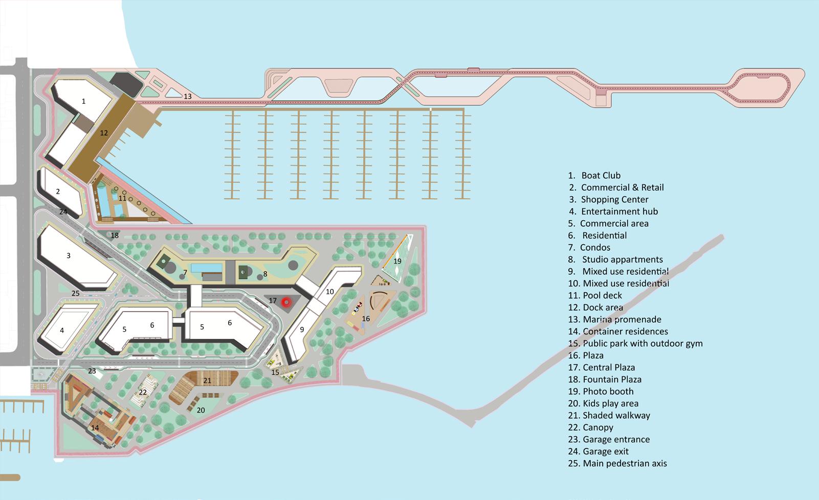


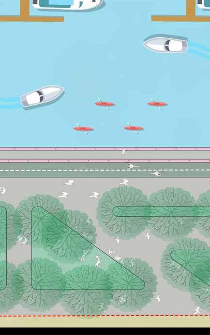
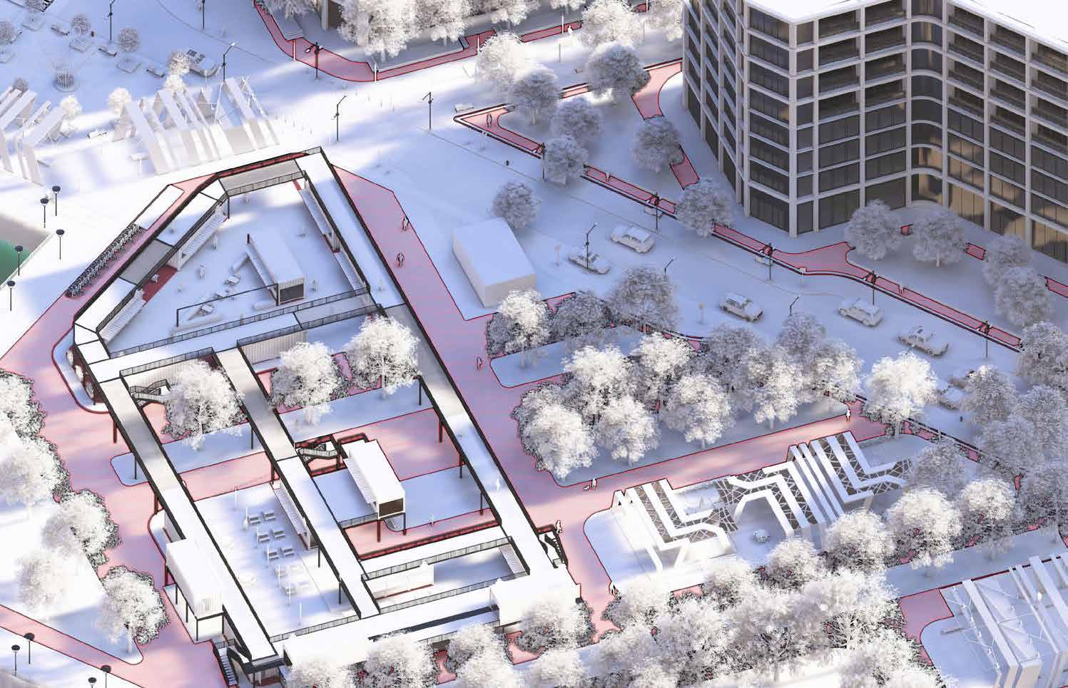


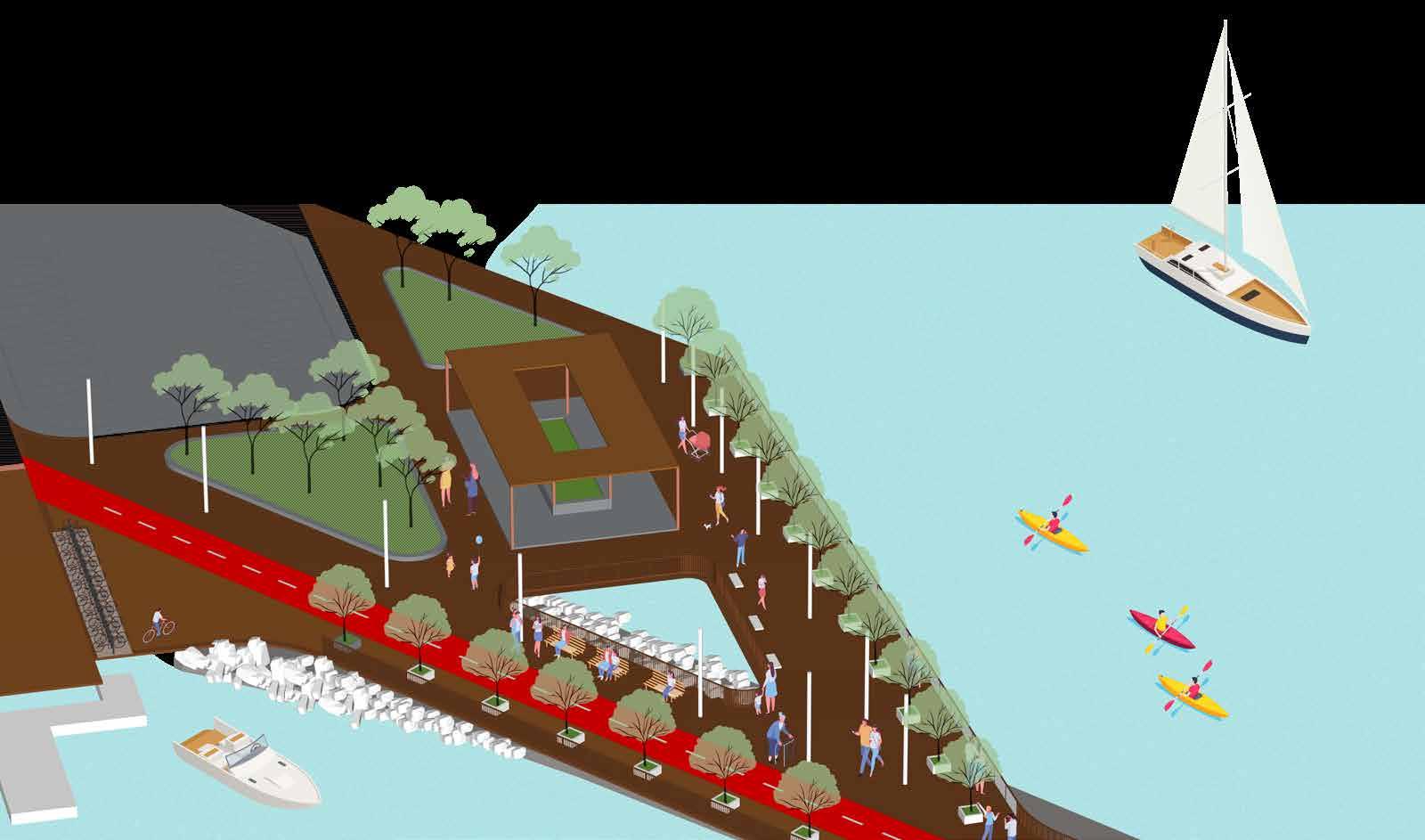

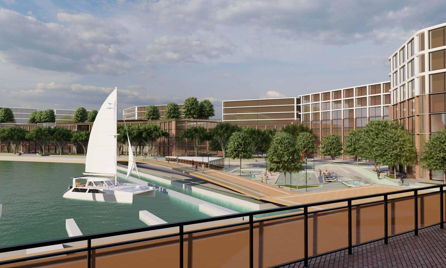
A scenic route begins from the boat club, featuring dedicated lanes for bicycles and pedestrians, along the pathway there are lakeside cafes which leads to a viewpoint that offers breathtaking views of the Toronto skyline.

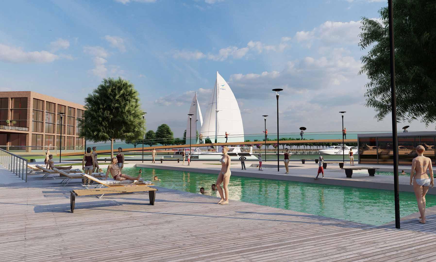
Public Swimming Pool: A trio of pools including a large diving pool, a kid friendly pool and a heated pool as well as, complemented by sauna facilities and essential amenities, designed to serve as a recreational central point for the families and fitness enthusiasts.
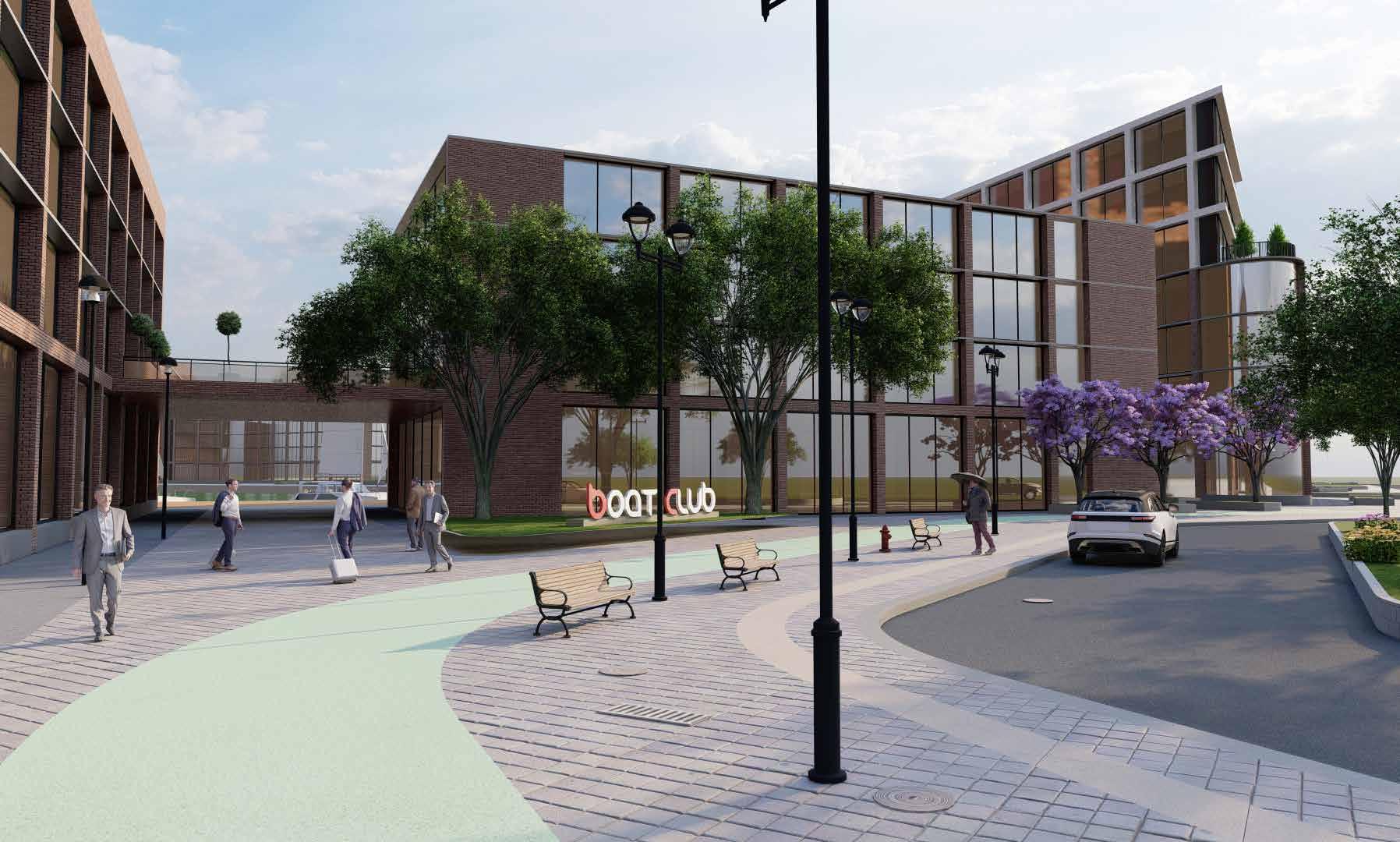
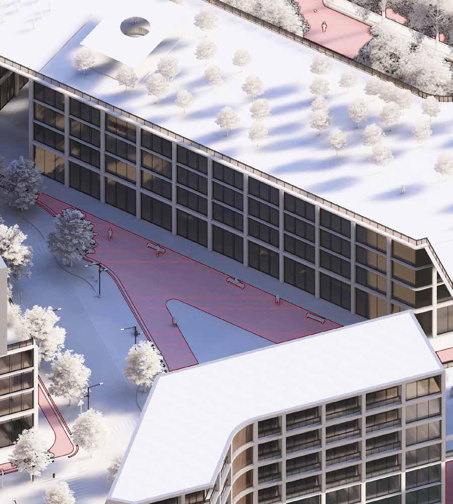
This place act as an entry point to one of the main attraction on site, the boat club, which is a private happening club for the marine community. The area is tucked away in the northwest corner of the site and it linked by the secondary vehicular access point. The view seen here portrays a bridge that connects two different block of the boat club.In this way the space under the bridge creates a framed view towards the waterfront.This enhances the quality of the space both visually and in terms of comfert level.
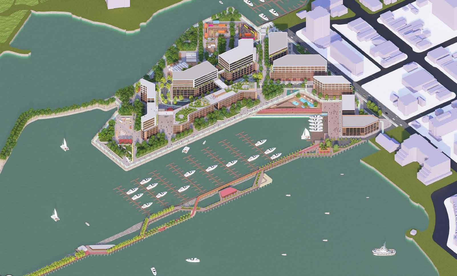
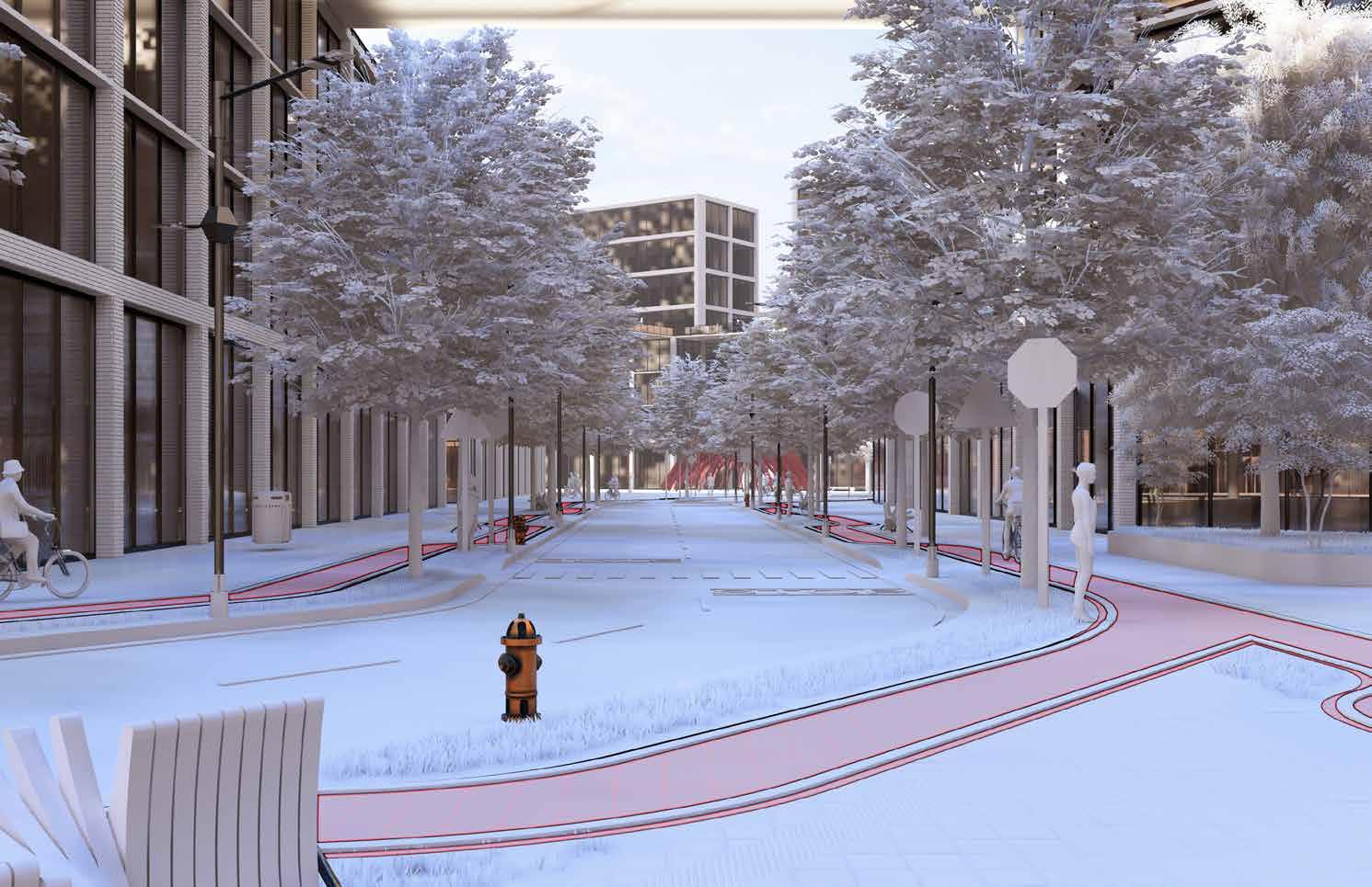
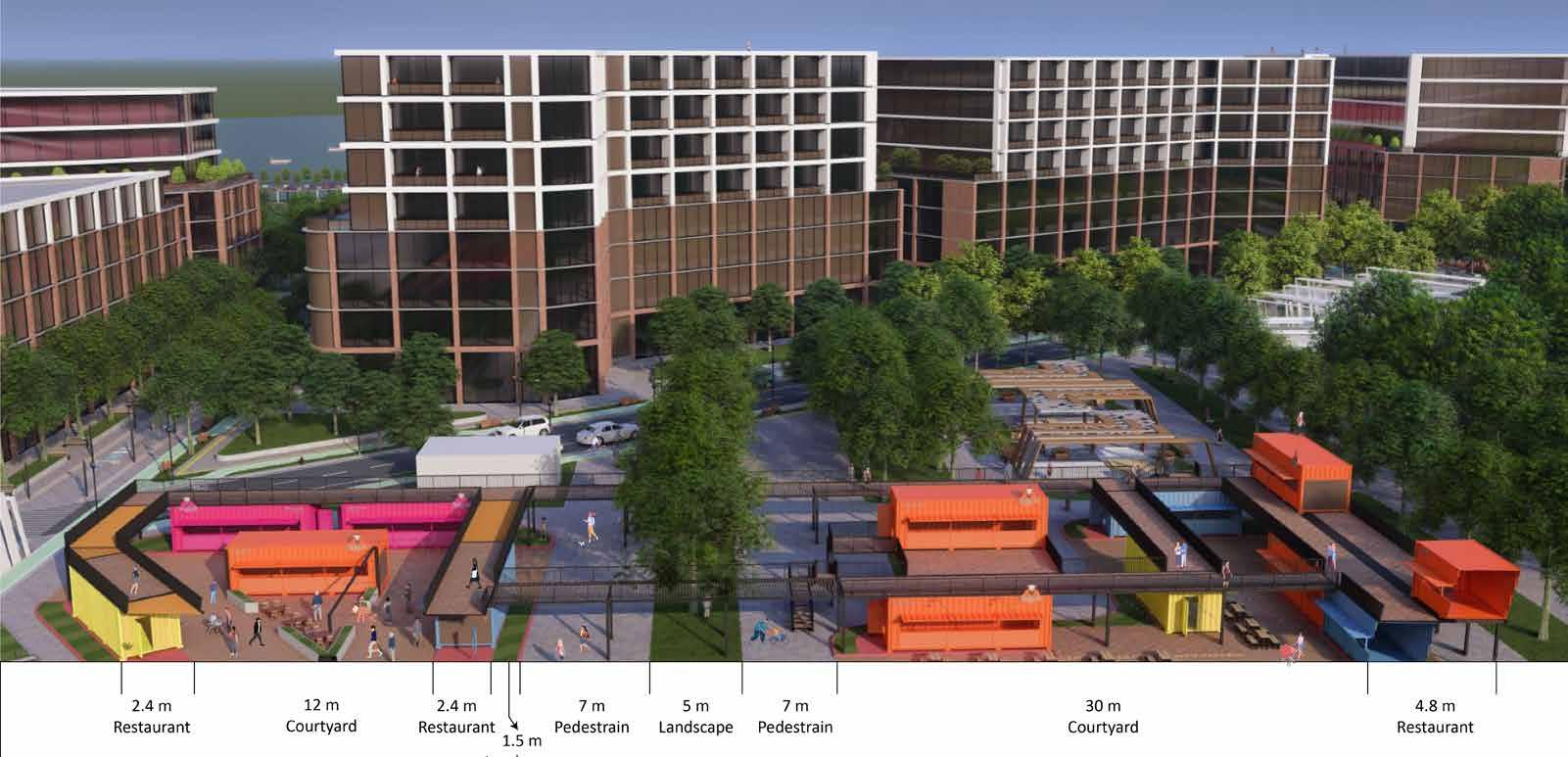
The entire stretch of the public realm has demarkated pedestrian and public lanes. It is tiled with the pavers that enable storm water drainage.
Egdes are also lined with buffer from the main vehicular path. There are adequate seating facilities placed at equal intervals to foster comfort of pedestrians and all user groups. For adequate lighting and looking into sutainable efforts, solar powered street lights enhance the space at night, in addition to the safety aspect.
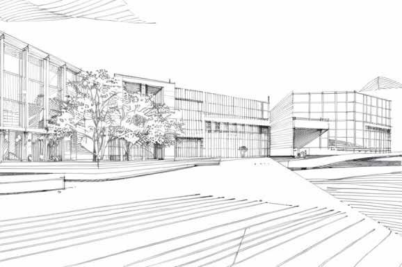
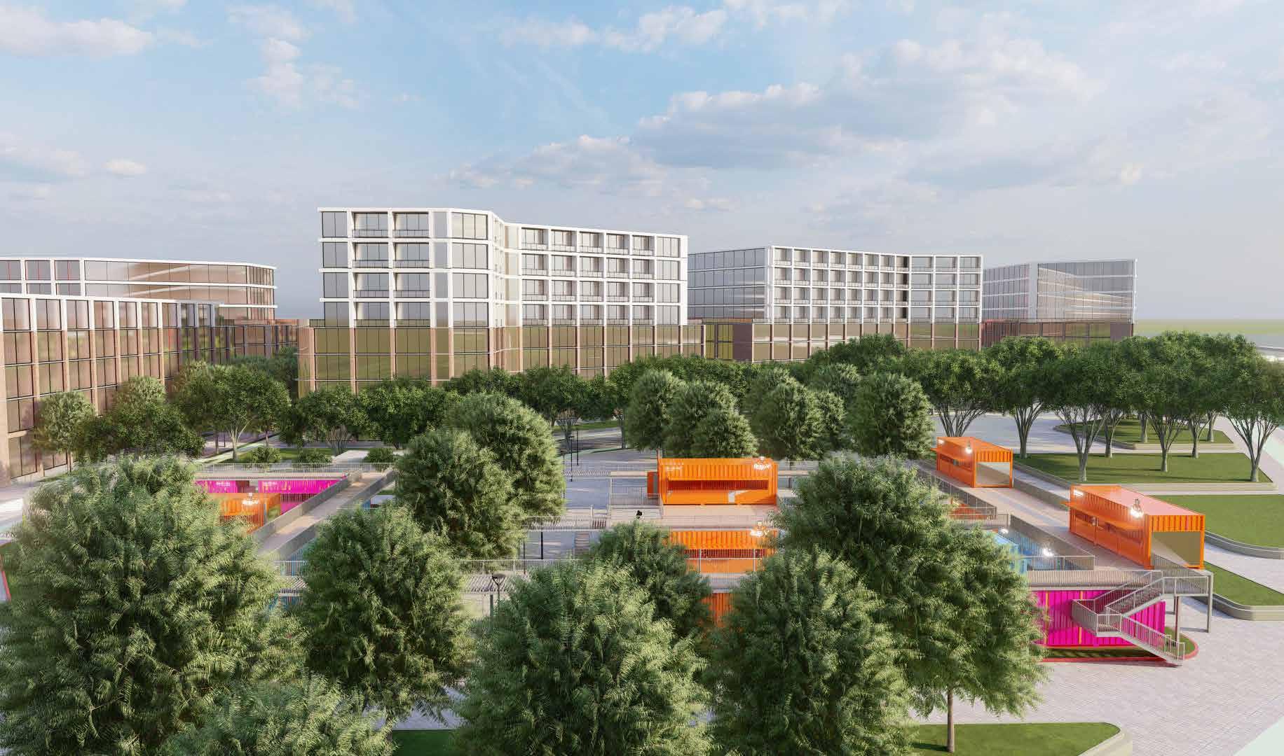
The focus of this frame is the boat club signage that acts as both a placemaking and way finding element. The flowering trees an add aesthetic appeal along with enhancing the micro climate of the pocket. The material pallette of the buildings follows a brownish shade, especially with brick, to blend well with the neighbouring context. The massing above the podium will however have a modern outlook with white louvres and glass facade. This irony in the building materials brings a character that stands out.
The backdrop of the frame is the vast sky that blends into the blue lake. Since the massing is mid rise, plenty of sunlight will flow through the space, making it well light and attractive throughout the day.
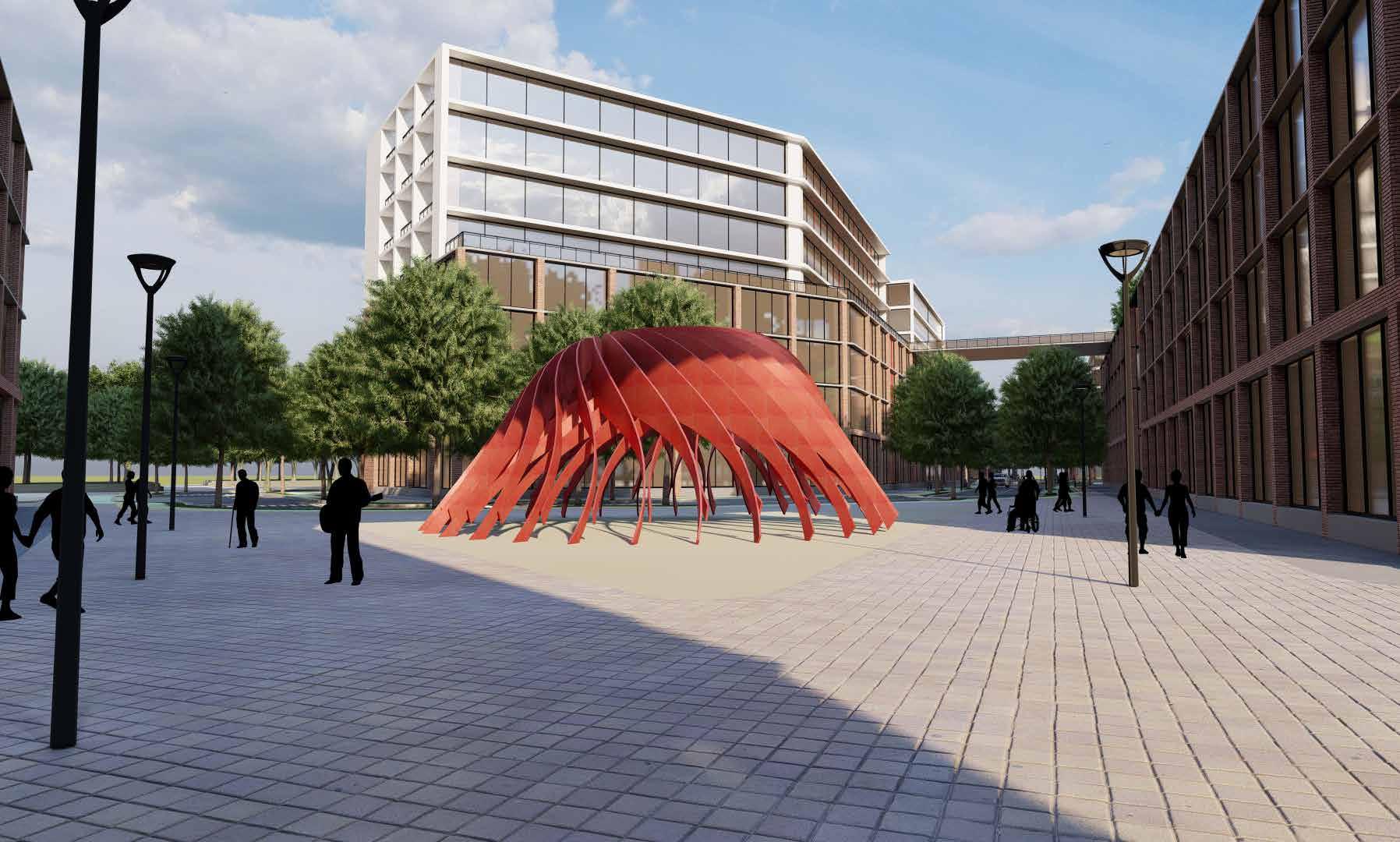
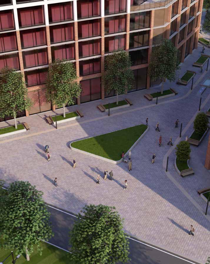
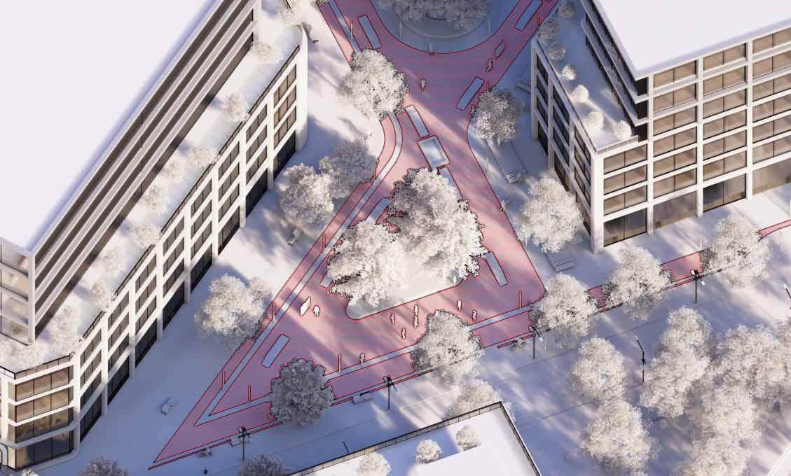
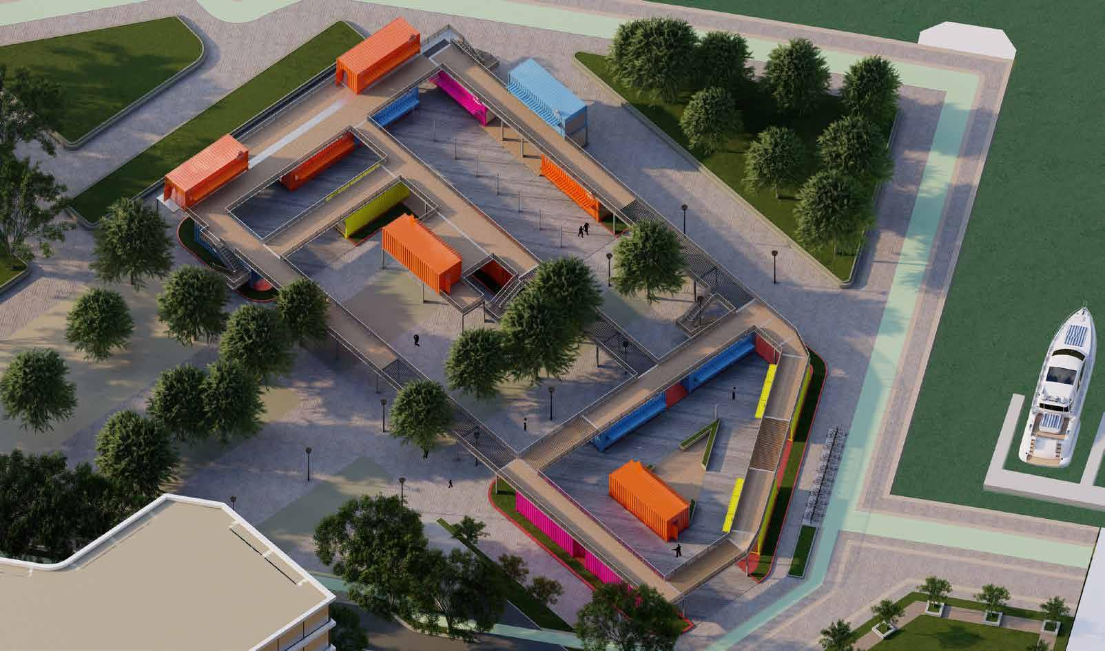
The public realm the whole area is pedestrian only zone were there is a abstract landmark. It can accomodate a huge crowd of people of any type of public gathering or a huge spaces in case of any emergeny as well.
The focus of this frame is the abstract landmark that acts as both a placemaking and way finding element. The tress in the give the people a soothing and refreshing effect and brings them closer to nature as well the scene were people can see the a little part of the building with the bridge connecting different building bring a character to stand out.
The backdrop of the frame is the vast sky that blend with the skyline as well as with the pinch of nature as well in the frame. This place act as an assembly point and only pedestrian zone between building. As well as the abstract landmark which also serves as a point which can be used as a directional point for the pedestrains. and this place is a transition between the build environment and landscape zone.
Place making analysis
lathish Punitharaj
Mohamed Mustak Hamed Rafi
Complied presentaion, zoning ideology illustration, renders, sketchup model, concept ,logo design, streetscection, public realms, place making analysis, lumion walkthrough moblity network illustration, ,lumion walkthrough, walkthrough complilation, sketchup model, public realm sections.
Idris owolabi
Helped with research illustration presentation, statements
Paras jayesh shah
Helped with research illustration presentation, and statements, designed open space, some sketches
The Anchor - Port credit