What is 3D Laser Scanning?
LaserScanning Ltd. HTTPS://LASERSCANNING.VN/
and its Benefits
About US
Content
Outline
Topics for discussion
What Is 3D Laser Scanning?
The benefits of 3D Laser
Scanning

Topics for discussion
What Is 3D Laser Scanning?
The benefits of 3D Laser
Scanning
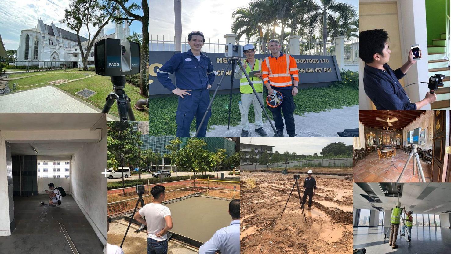
LaserScanning Ltd is a company in Vietnam that offers 3D Laser Scanning services for various areas such as as-builts, renovations, and new construction. We use advanced technology to capture and analyze data quickly and accurately, providing survey accurate 3D point clouds model. Our 3D Laser Scanning services can scan inaccessible areas and ensure the whole project is captured completely and safely.
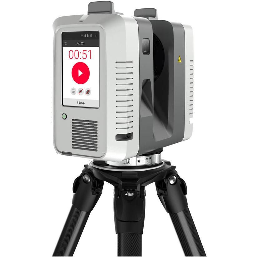
3D laser scanning provides Technics with a wider range of data collection and software output for clients alongside traditional survey technology. The technology is designed to automatically capture large volumes of 3D survey points – known as point cloud – on the surface of buildings and structures. The captured point cloud data can then be used by our BIM experts to accurately recreate a virtual model of the structure or area.
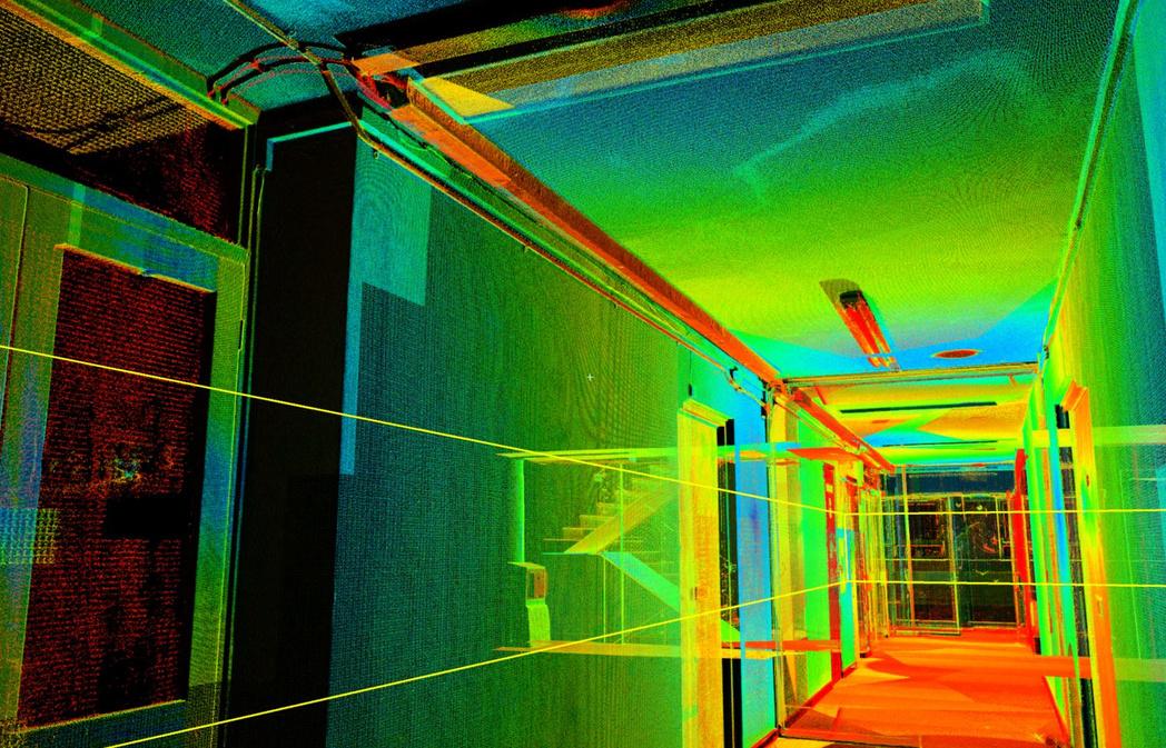

3D laser scanning collects large amounts of highly accurate data in seconds compared to more traditional methods. The speed at which data can be captured reduces time on site for our surveyors and the accuracy of the data results in less need for return visits to the site, both of which save the client time and money.

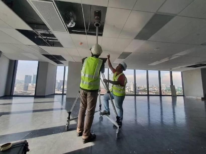
Laser scanning allows for anywhere to be surveyed. A great example of this is when all areas of a building including MEP systems above false ceilings are to be detailed and modelled. The laser scanner allows us to capture data above the false ceiling tiles effectively and precisely. The scanners can be attached to an extendable tri-pod and raised above the small tiles to capture a quick scan of the MEP systems and any structural beams, pillars etc

The risk of hazards to geospatial surveyors in complex or inaccessible areas is significantly reduced by using laser scanner techniques. With a survey range of up to 120 metres, all areas can be surveyed remotely, with high-speed data collection of up to one million points surveyed per second.
Due to the speed of our laser scanners, we are able to capture data quickly and discreetly with minimal or no disruption to other people working or living on the site.