


Our investigations have been carried out thanks to a crowdfunder which released approx £800 (after commission). With limited monetary resources and with the goodwill of many supporters we have produced this report as a resource to be used by authorities tasked with protecting the public and the environment from harm
Following advice from dowsers who carried out investigations on the route and toxicity of the pollution both remotely and onsite we sent a sample of silt for analysis of radio-toxic substances to a laboratory. It is clear that as well as the expected huge levels of iron and the presence of other substances associated with acid mine water such as cadmium, ammonia, and other metals including nickel (as found in the Environment Agency’s own limited tests) there is another substance, Americium 241
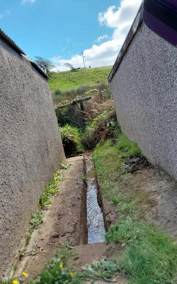
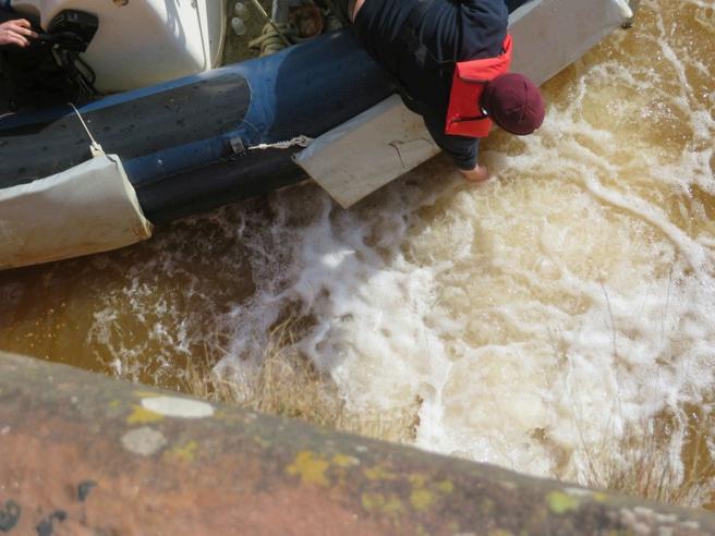
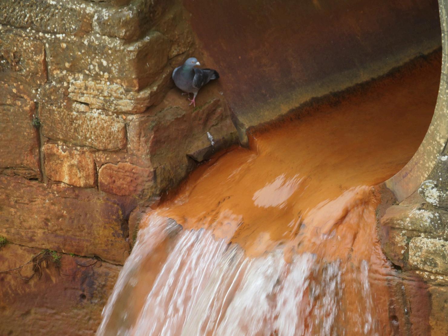
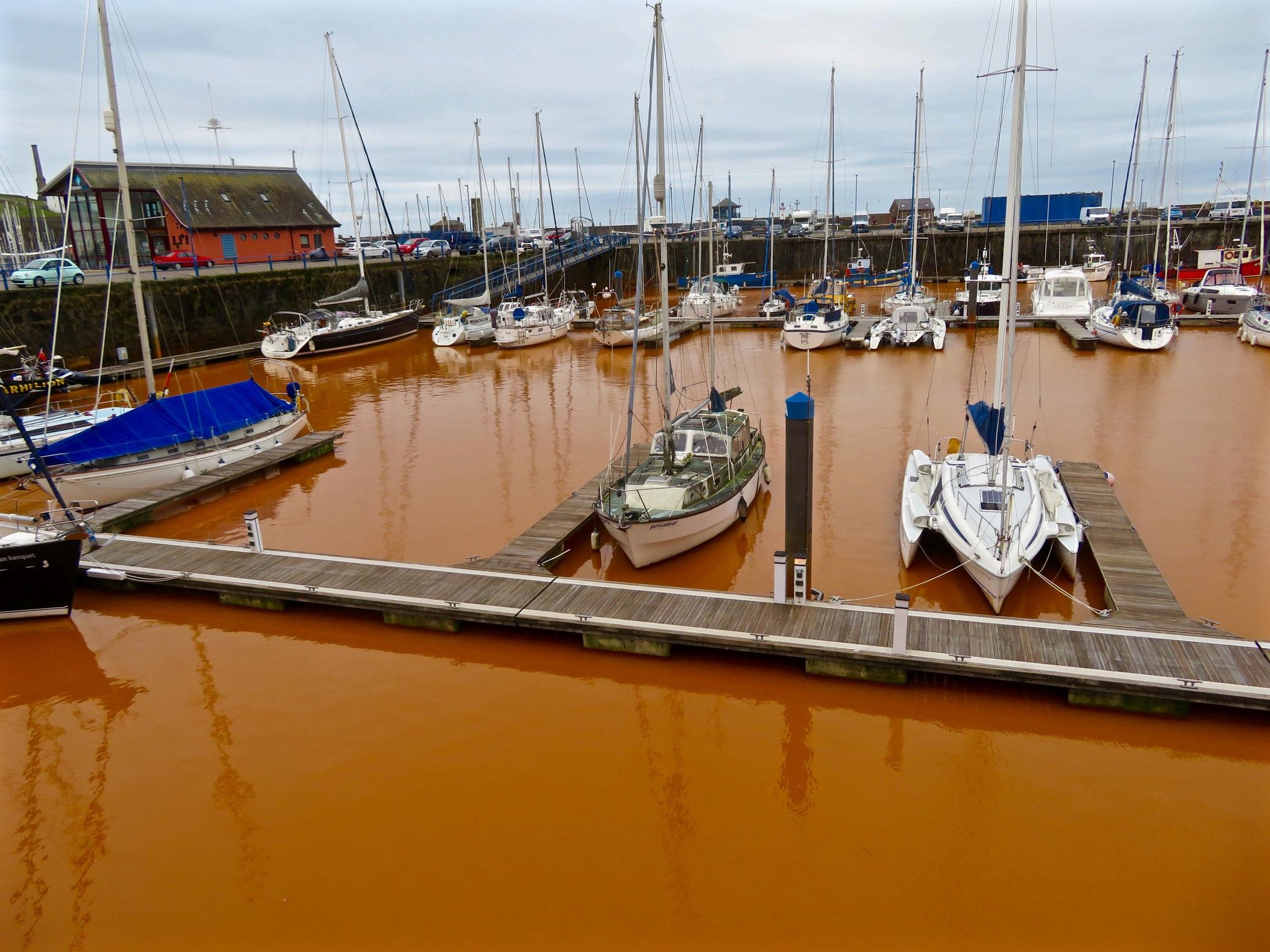
This radio-toxic substance(s) in the harbour silt should not be there in any quantities let alone the dangerous levels found by a world leader in nuclear analysis, Eberline Analytical Laboratory in the U S The presence of AM241 is a public health hazard as well as impacting marine life. The AM241 present in Whitehaven silt has activity higher than the U.S. laboratory’s calibration isotope of Am 243 at 36.27 kBq/g. The sample we provided to Eberline was a teaspoonful of dried silt We note that particulate is collecting at the lip of the culvert in Queen’s Dock through which the acid mine pollution continues to pour This, along with silt in the harbour, has not been tested by the authorities
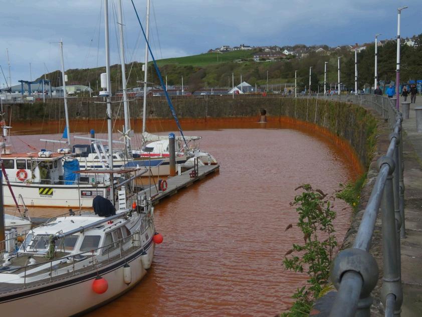
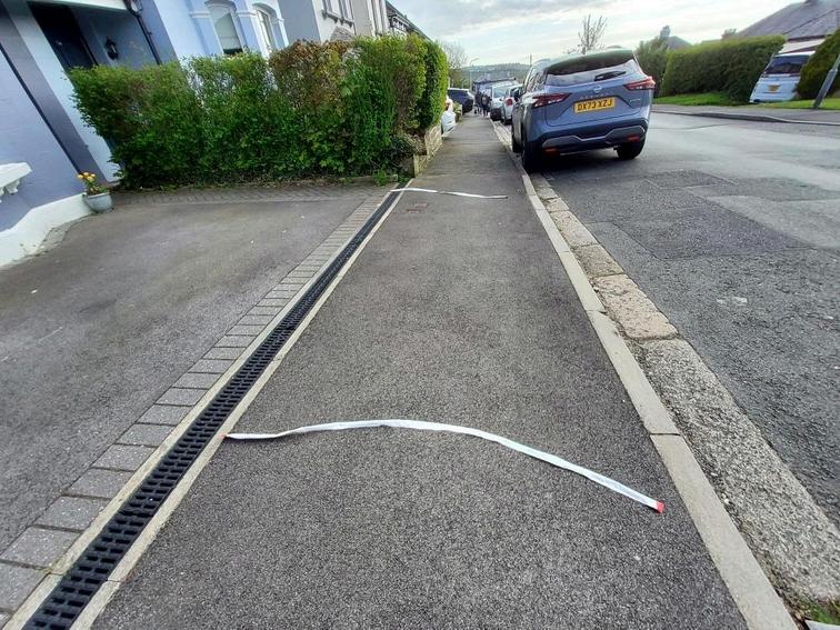
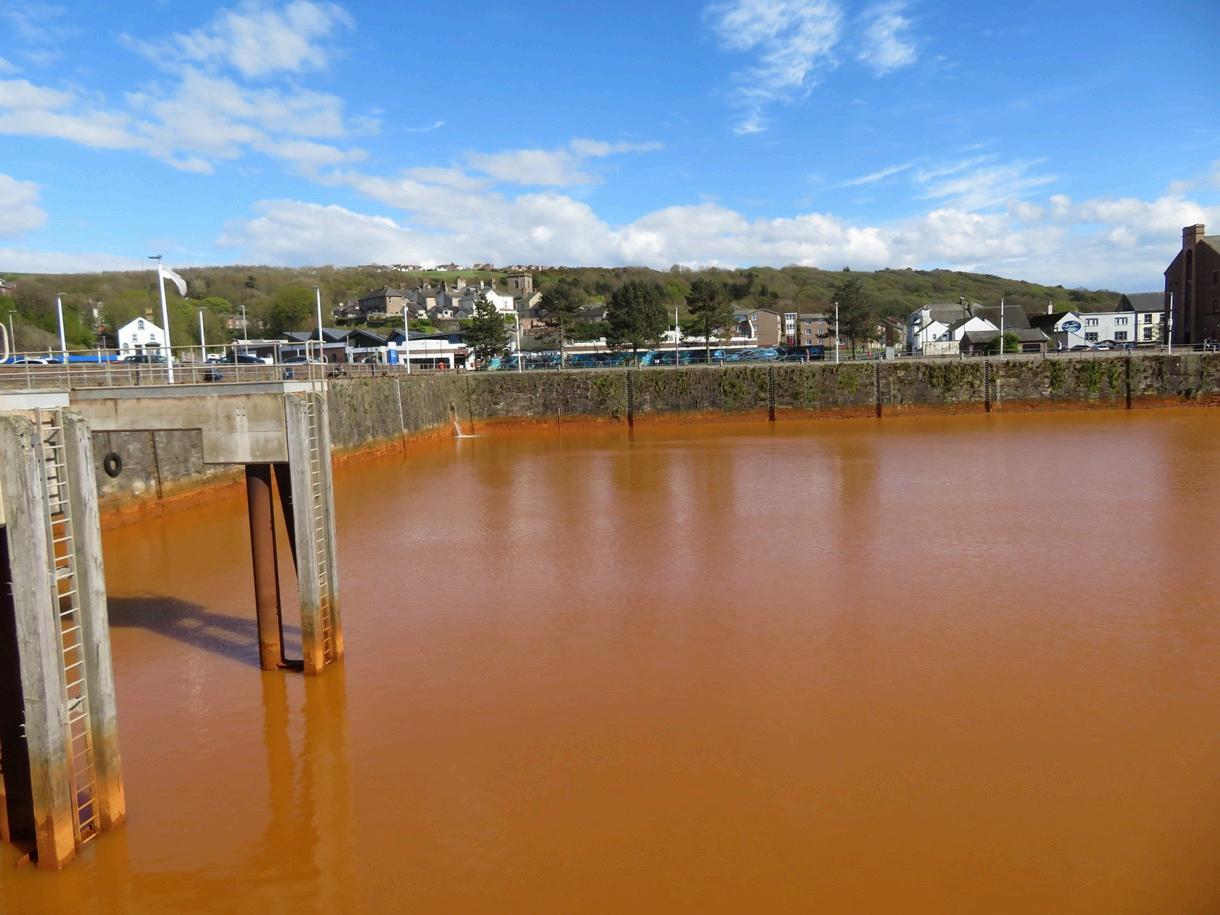
On December 7th 2022 the newly re-appointed Michael Gove Secretary of State for Levelling Up, approved the first deep coal mine in the UK in 30 years at the proposed Woodhouse Colliery, Whitehaven. Deep boreholes had already been drilled by the developers West Cumbria Mining to “investigate” the area’s geology. Ironically the approval of the coal mine was around the same time that iron coloured pollution started pouring into Whitehaven Harbour from the honeycomb of old mines dating back to medieval times.
A BBC news report of 14th February 2023 quoted the Coal Authority "The initial chemistry of the water suggests that it is not coming from the local historic coal mines.” (our emphasis). This suggestion has now been updated to ‘it is likely to be coming from historic mines’.
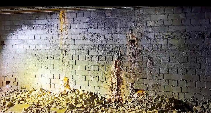
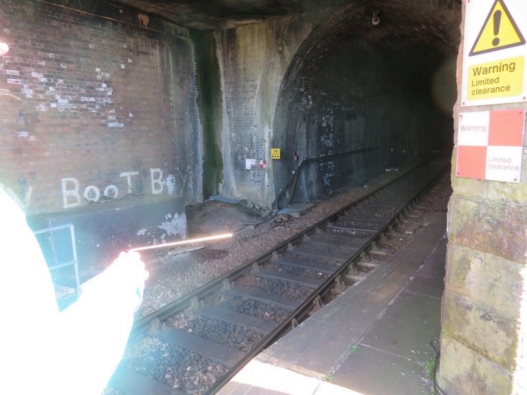
Network Rail are very concerned about the polluted water. Footage of the inside of the Bransty tunnel indicates that water has been seeping through the infrastructure of the Victorian built rail tunnel for some years. Network Rail’s concern is justified as this 1km tunnel beneath the town of Whitehaven is used by nuclear waste trains as well as other freight and passenger trains.
Below is an image of the inside of the The Bransty Tunnel through which nuclear waste trains have travelled for many decades from Whitehaven Railway Station to Corkickle Station enroute to Sellafield.
Network Rail told New Civil Engineer in November 2023 :
“The tunnel sits on the Cumbrian Coast line and takes trains 1km underground between Corkickle and Whitehaven. It has been known to flood and for this reason is connected to Whitehaven harbour via a culvert, allowing excess water to escape and maintain safety for trains. This simple system has worked for decades without issue, but since late 2022 the water in Whitehaven harbour has become rust coloured. The water has been found to contain iron ochre and is believed to be from historic mine workings in the area”.
Trains have been slowed to 10 miles an hour through the tunnel to try and prevent splash back onto the walls and onto the trains from the acid mine water Short term mitigation measures (non of which have happened 19 months on) such as filters at the point at which the culvert enters the harbour clearly will not be a “fix” for the impacted infrastructure of the Bransty tunnel and its surrounds beneath the town of Whitehaven.
Information in the public domain provided by the Environment Agency and other authorities on exactly what is in the harbour water has been sparse We asked under Freedom of Information for the results of tests. Up to March 2023 there had only been two sampling dates in Dec 2022 and Feb 2023
“HUGE Iron Levels”
The results obtained under FOI were shown to Dr. Marco Kaltofen, President of the Boston Chemical Data Corporation in the US Dr Kaltofen’s response was: “no wonder it turned orange, those iron levels are H U G E Cadmium, ammonia, and other metals (including nickel) are all elevated as well. They should have tested for arsenic and mercury too, especially given the elevated cadmium; but they did not I strongly suggest having mercury and arsenic tested in the water. A separate sample of suspended solids should also be collected and tested for all of these parameters (plus radium, thorium and uranium) in addition to the water sample already done The original material was likely highly acidic, but would be neutralized once it hits seawater ”
We also asked Marine Pollution expert Tim Deere-Jones who said that:
“I’d be very confident in raising coal mining as the source It would certainly be relevant to demand that the mine owners, Env Agency, MMO, NWS, DEFRA et’ al’ get on the case and identify exactly where the contaminated water came from, boreholes? faults in the seabed geology? old mine workings on land? If they refuse or fudge, it would be legitimate to postulate “in the absence of empirical evidence to the contrary” that all three (especially faulting and boreholing) were possible causes, that the new coal mine plan should therefore be abandoned and that clearly any sub seabed GDF in/near the relevant coal field was clearly and very strongly contra-indicated.”
The Clean Rivers Trust have noted that: “It is unusual for a mine to discharge water via another route not directly linked to the mine...The town and its harbour are intrinsically linked and a major visitor attraction and sailing base The economic damage to the town is getting worse The long-term treatment options that have yet to be considered will also rid the tunnel of its flooding. This is important for the town and for the nuclear industry just down the track Network Rail are needing to end this tad hoc drainage of these mines via the tunnel as well The water is not just slowing trains speed it is also damaging the track bed. Limestone is turning from hard rock to a slush which may require the track to be relaid ”
“Dowsing is a type of divination employed in attempts to locate ground water, buried metals or ores, gemstones, oil, gravesites, malign ‘earth vibrations’ and many other objects and materials without the use of a scientific apparatus
Dowsing is also known as divining (especially in reference to interpretation of results), or (when searching specifically for water) water finding or water dowsing ” British Society of Dowsers
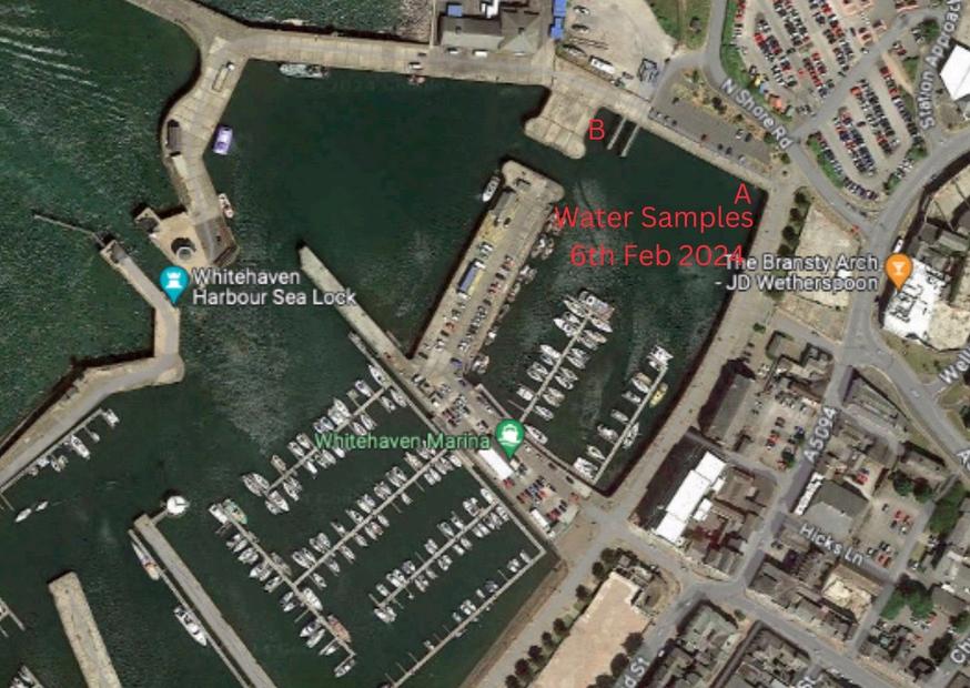
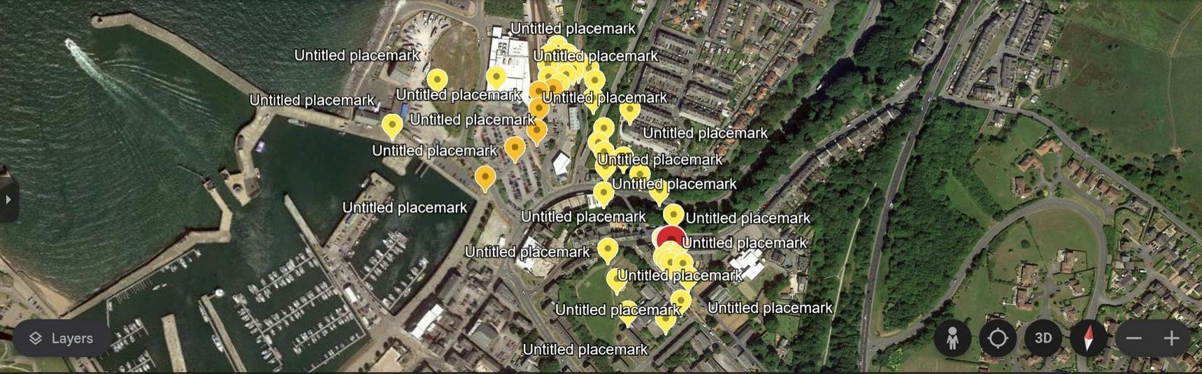
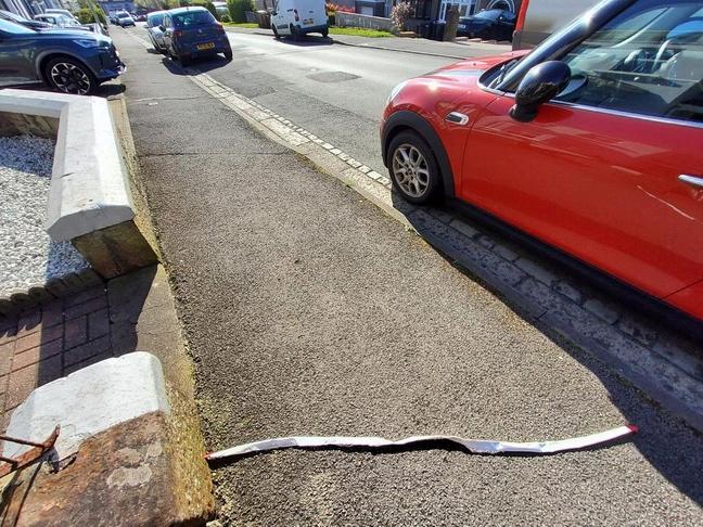
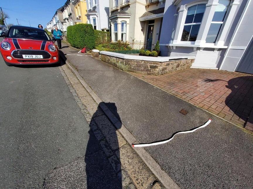
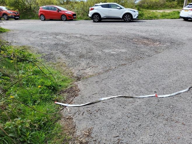
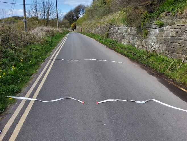
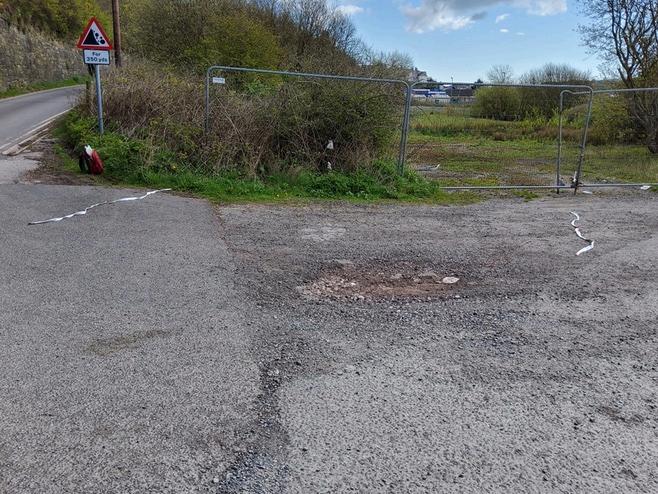
Water samples were collected from Whitehaven Harbour in February 2024 using a sterilised bucket lowered down into the water, wearing protective gloves for safeguarding (compare Sellafield sampling pg 16) and sent in secured packages to two participating dowsers to look at independently.
Sample Location A (culvert at Queen’s Dock)
Sample Location B (Queen’s Dock gate)
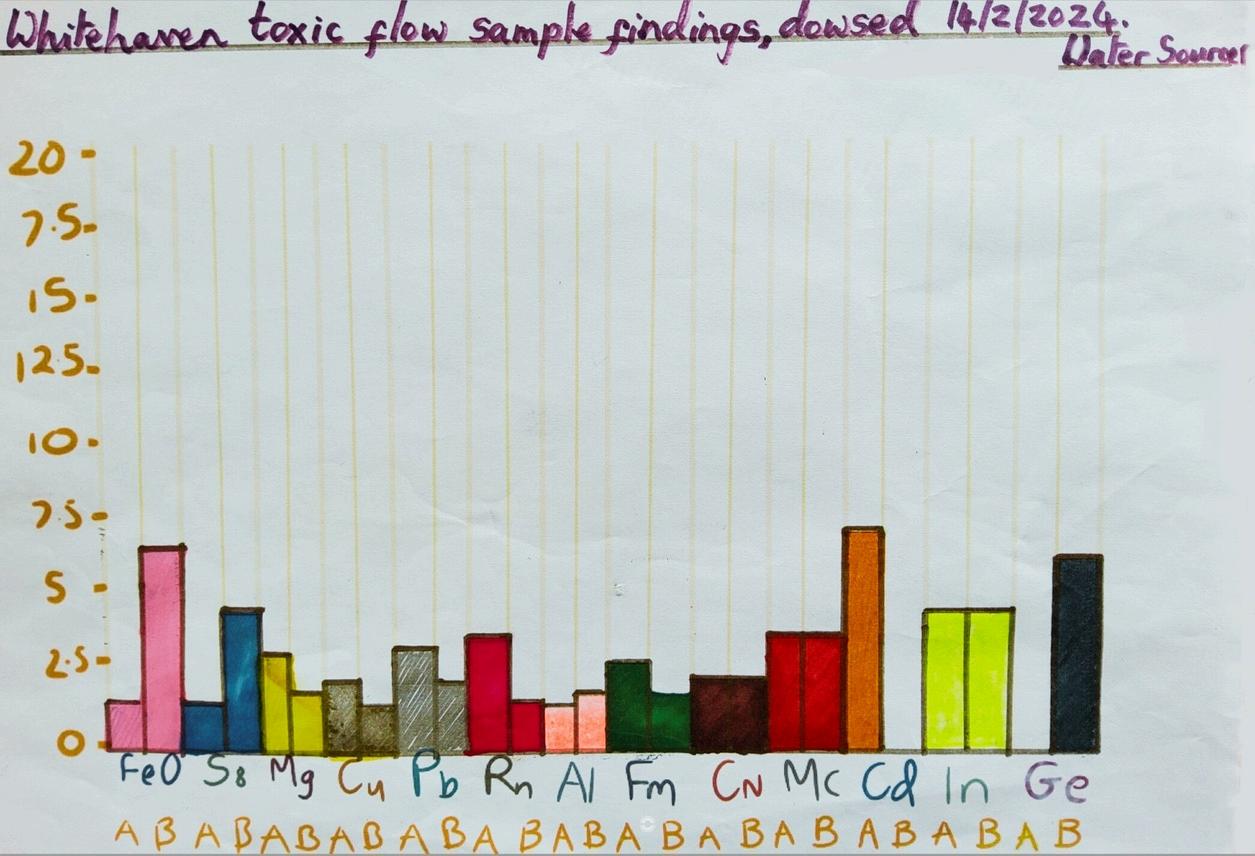
By using the periodic table alongside the Whitehaven harbour water samples both dowsers found elevated radioactive elements in the water with Dowser 1 noting that: “it can no longer be called water ”
Dowser 1: “very scary and I do not want to keep them now I now what's in them!
A sample: Copernicium 2 (highly radioactive),
Moscovium 3 (highly radioactive)
Cadmium 7, Indium 4
B sample: Copernicium 2 (highly radioactive), Moscovium 3 (highly radioactive),
Indium 4, Germanium 6
These are all toxic and several I have not heard of until this time The proportion appears the same in A B with one element variation which may help give a clue ”
Dowser 2 confirmed the presence of radioactive elements and noted “the amount of radioactive water in the harbour and whether it’s hazardous to health to the locals, should it be out of bounds or are the levels so low as not to be a worry? Strange how it’s not all on national news”
Dowsing blind from two vial samples: surprising number of radioactive findings as well as other noxious elements My scale shows ‘comparative proportion’ meaning how amounts compare to each other.
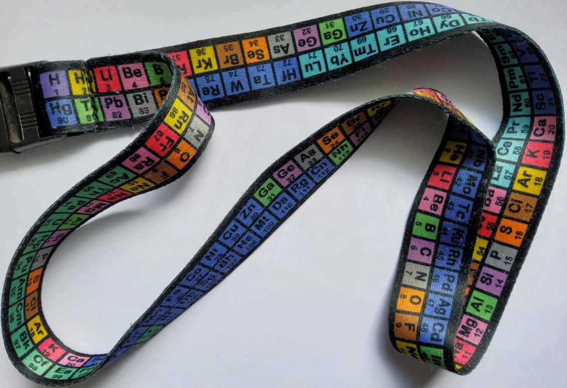
Dowsers learn basic skills on traditional courses and then develop their prowess with each new challenge They also develop their own techniques At the bottom of the page is my periodic table focus tool, similar to a traditional dowsing ‘witness’, to consider one element at a time, I do not need to be familiar with the element It is an art not a science However scientists, engineers and many Water Authorities use dowsing. Tiny particles of magnetite cause a muscle reflex when we interact with the earth’s magnetic field https://eos org/articles/human-brains-have-tiny-bits-ofmagnetic-material
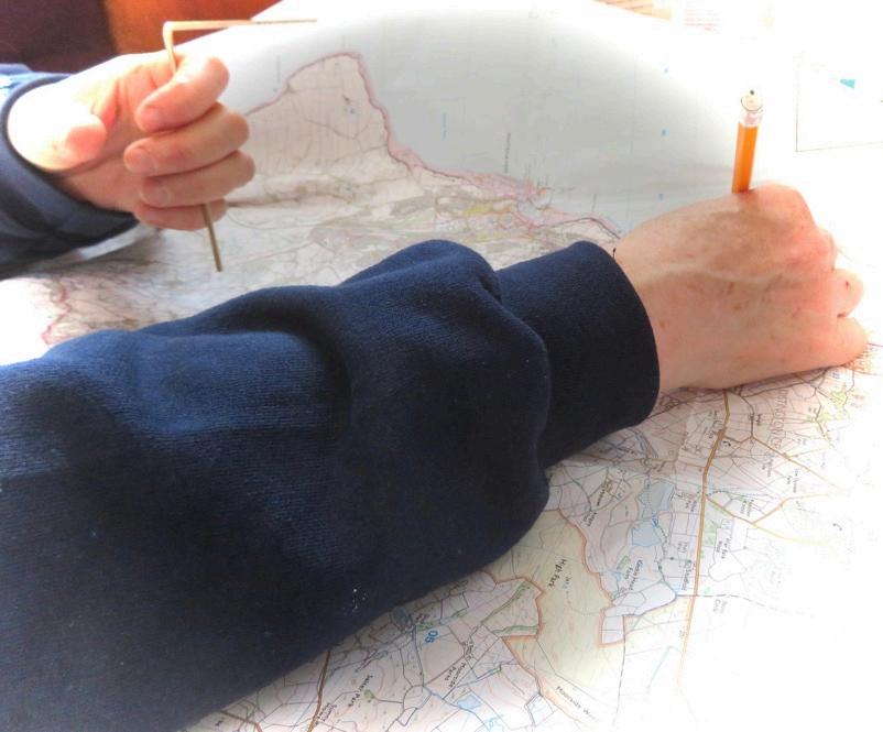
Remote dowsing has been around a long time, our dowsers used both traditional methods and new technologies to track the routes of the polluted water.
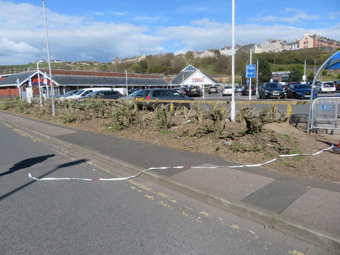
“I estimate that 10% of the ochre water flowing down in the direction of the sea becomes diverted into the previously mentioned pool area (near the station/beneath Tesco), the rest travels to the sea, the vast majority takes the route I have coloured orange. Dowsing on the land is more geographically accurate than by remote methods.” Dowser 1
“My images show both where the flow comes into close proximity of the railway tunnel below High Street and the large pool which has developed 6/7 feet underneath the station and adjacent car park from the flow en route to the sea. Some depths are already noted at the upper points where I have detected the ochre coloured pollution.” Dowser 1
“one is just a slight tad concerned to think that Britains nuclear waste is being trundled through a tunnel with bulging walls on tracks that are immersed in corrosive highly toxic and radioactive water and all they have done is slow the speed of the trains down from 40mph to 20mph (now 10 mph) thinking that that’s going to cut it “ , just beggars belief really.” Dowser 2
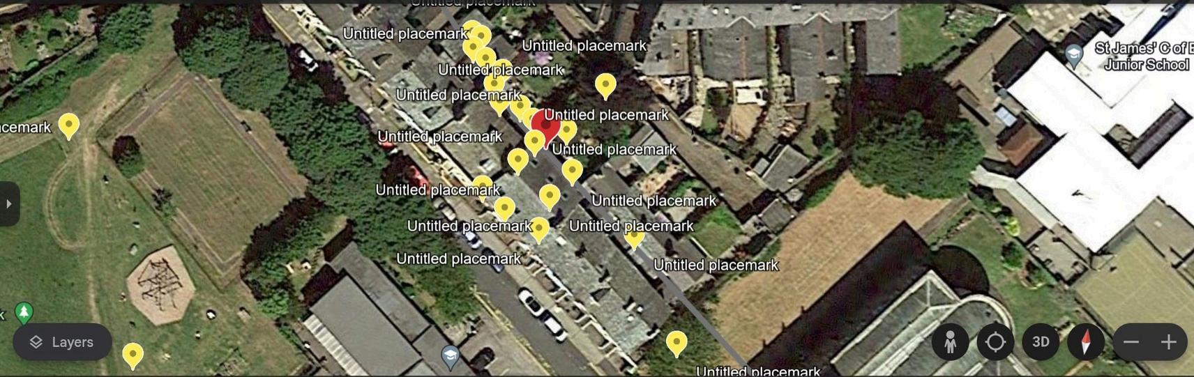
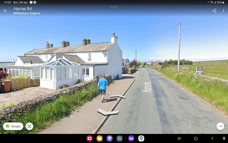
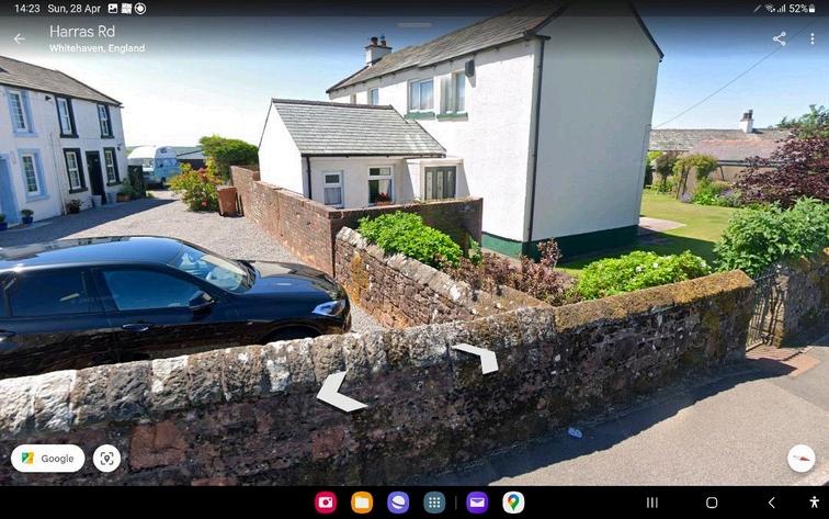
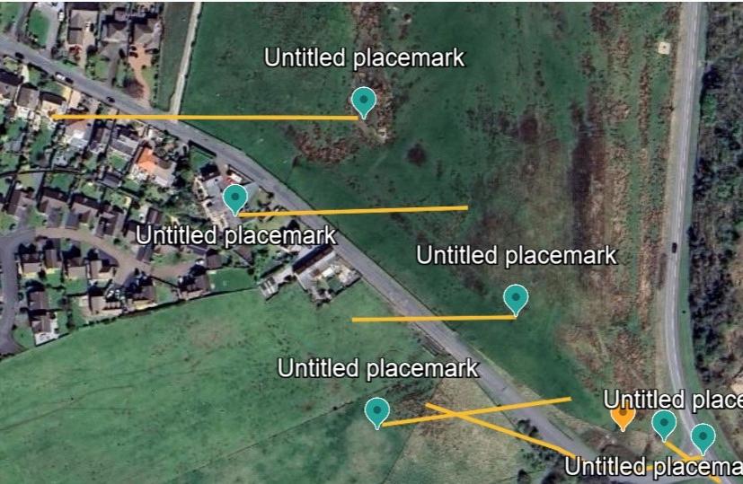
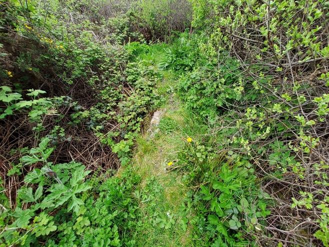
Notes from Dowser 1: Harras Road where it meets Red Lonning, then proceeding back to Victoria Road:
Locals told me the history of open cast mining on Harras Park from the 80s until it closed and the mess of rubble, some flooding where the field met Victoria Road
1 (No photo record)
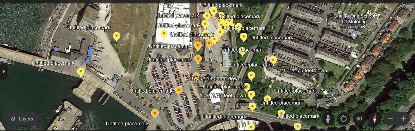
Mine working/tunnel 25 feet deep, 22 50 wide, dry, NE to SW direction ( Higher to lower)
2 (No photo record)
Mine working/tunnel 19 feet wide, 30 ft deep SE-NW, water 3 feet deep, route follows Harras Road
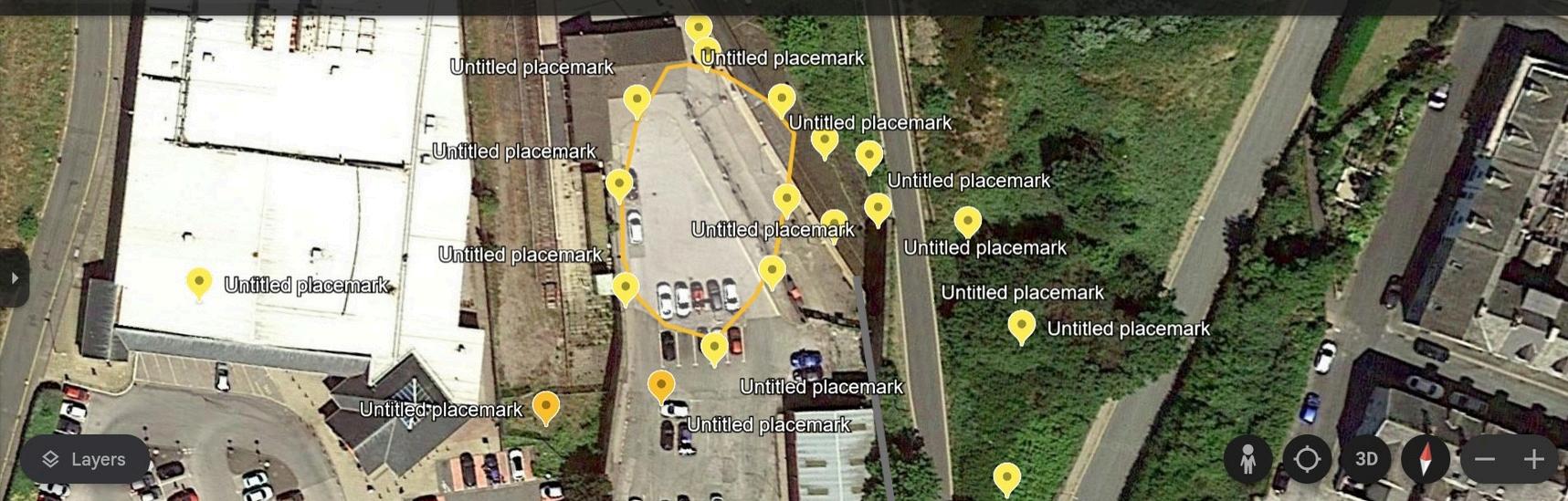
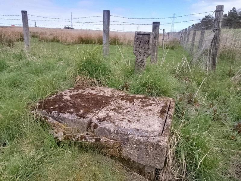
3. Photo no. 3. Air vent to former underground mine workings, shown as orange marker image 1 following page.
4 (No photo record)
Mine working/tunnel, 18 5 feet wide, NE - SW, 35 feet deep, 7 feet of water
5 (No photo record)
Mine working/tunnel 22 feet wide, NE - SW, 15 feet deep, water 75 foot deep
6.(No photo record).
Mine working/tunnel 19 feet wide NE -SW, 27 feet deep, 7.5 deep water.
7 (No photo record)
Mine working/tunnel 16 29 feet wide, NW - SE , 44 5 feet deep, 3 5 feet deep
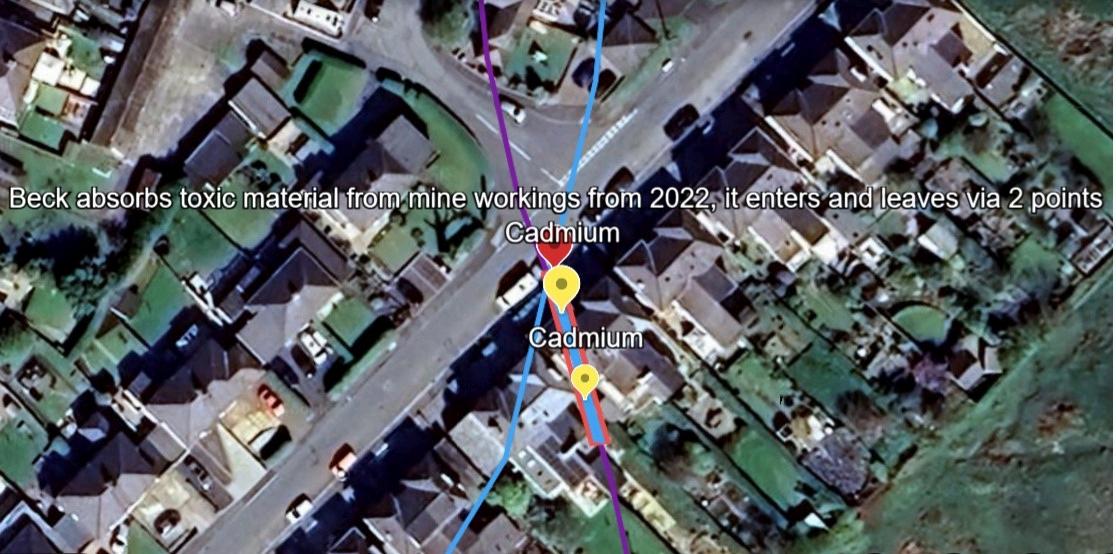
Underground Beck absorbs toxic material from the mine workings from 2022 it enters and leaves via 2 points
1. Victoria Road, E-W 20 feet deep mine working/ tunnel, 20.5 feet deep to ceiling, 7 feet deep, 1 75 feet deep 'water', contains toxic flow
2 Victoria Road, toxic flow, no mine tunnel, 16 75 feet to 'top' of disturbed ground, 9 feet deep, bottom is damp
Victoria Road, non toxic flow W to E, 26.75 feet total of non toxic flow, 7 feet deep
4 W-E Toxic flow, Victoria Road, 35 75 feet to top, ground disturbance 20 feet deep
5 W-E Outside Victoria, toxic, this flow doesn't enter harbour via Bransty Beck culvert.
6 outside Victoria Road, toxic, W-E, not flowing to Bransty beck culvert in harbour
Resident of Victoria Road, started seeing brown/yellow sludge, comes and goes They wrote and sent photos to Councillor which received no response
I have identified the direction of flow for the episode where the beck from the blind spring flows into the tunnel/workings containing toxic material. I dowsed the route of the beck I detected cadmium at this point although not at others, as well as a concoction of other nasties So will further examine that when there is time
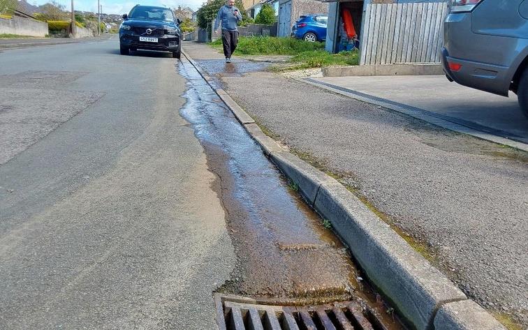
Beck which eventually flows into the Bransty culvert.
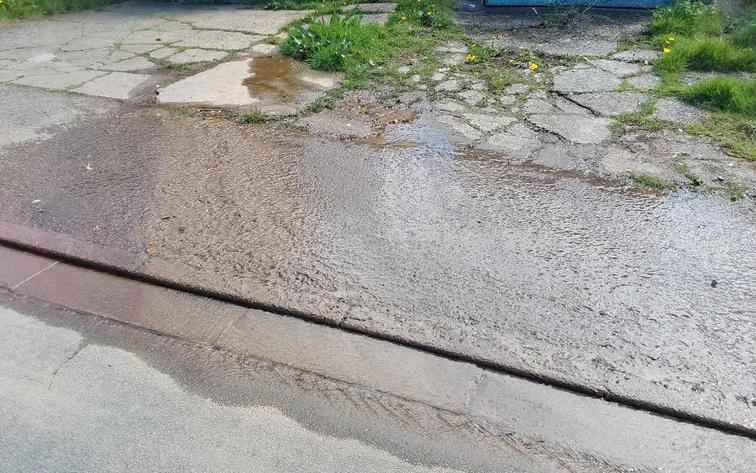
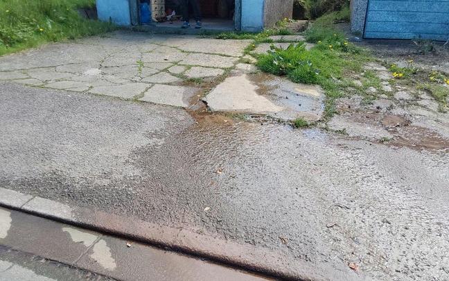
The first five images are not contaminated.
The sixth on the North side of the corner where Wellington Row meets George Street, is the point above where toxicity enters the beck from former mine workings

25th April 2024
Bransty Tunnel Entrance, Whitehaven Station
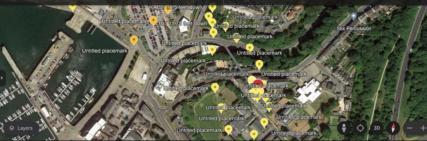
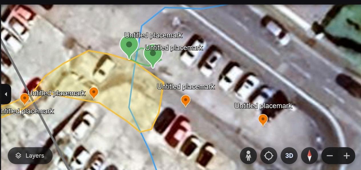
Flow number 2 (yellow on map below) beneath the marina towards harbour - not as polluted as Flow 1 (orange on map below) into the Culvert from station area .
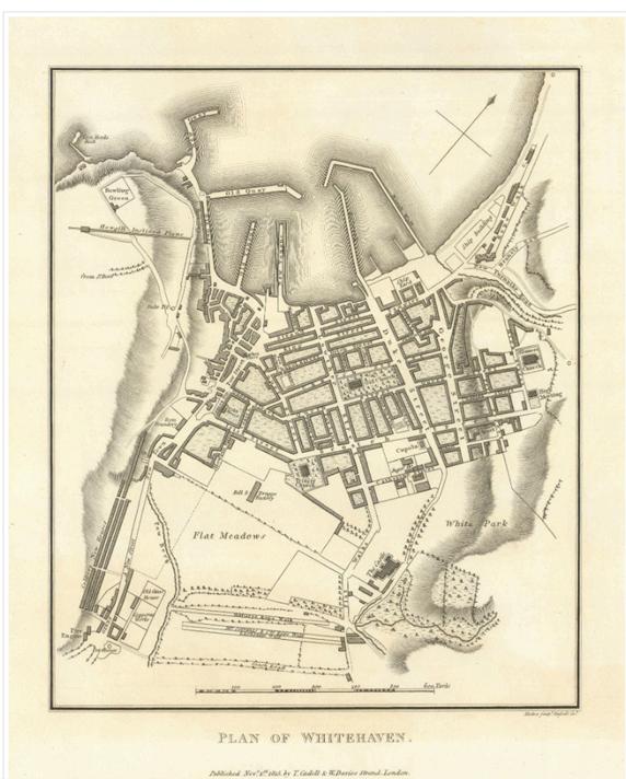
Historic plan of Whitehaven confirms dowser findings of Flow 2 “not as polluted, flow” into the Harbour Map is thanks to Clean Rivers Trust

26th April 2024 Day 3
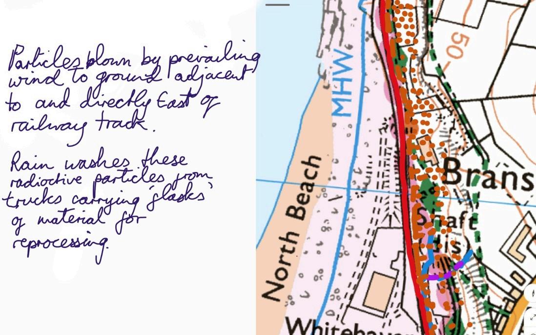
Bransty Beck, groundwater and the railway, radioactivity detected, access point identified for sampling (with great care due to the approx 10ft drop into undergrowth) in image 19 before the point radioactivity is detected. On site seaward from this point and before the railway line, there is a shaft filled in with dumped mine material This waste exaggerated the effect caused by particles falling off the sealed radioactive containers being transported to Sellafield from 38 to 22 years ago, these particles were blown by the prevailing wind onto the sealed mine shaft and dump, rainfall then sank down through the waste material, contaminating the Bransty Beck in the area the groundwater enters this beck Dowsing indicated that during this period anti-contamination procedures were less stringent.
Photograph no. 6 - underground Bransty Beck was 19.5 feet wide on 23rd April 2024, it flows to the right of the disused mine shaft and from September to April travels into and out of discrepancies in the masonry on it’s way to Culvert A into Whitehaven harbour.
Dowser 1 Notes continued: As far as the Bransty flows along that lower section it has been contaminated and of course carried on collecting contamination for the period I mentioned thanks to rain washing it down There is a trickle of water coming down the hill but I was saying how near I was advised we could get before there was an increase in radioactivity
The Bransty Beck flows between the shaft and the railway line From September to May it flows around the walls of the shaft washing in and flowing past, this causes some contamination to leak from the shaft underground and slowly travel seaward also any way it can as well as of course contaminating the soil In the summer the flow doesn't touch the shaft
Picture this problem everywhere the rail trucks regularly passed during this blasé period all round the UK! They travelled so far across the country to be reprocessed, all the power stations are so spread out Tests should be carried out in all waterways/harbours with a comparable risk Massive clean up job if it ever happened.
Another point is that some locals may assume the Bransty is to blame for the railway tunnel pollution, this cannot be possible as the Bransty is at a lower level than the railway. Maybe a map of the Bransty's route would be useful
I didn't manage to go on the train from Corkickle but maybe National Rail would take me down very slowly to identify the contaminated entrance points in the tunnel They may be persuadable with the above ground indications in the report?
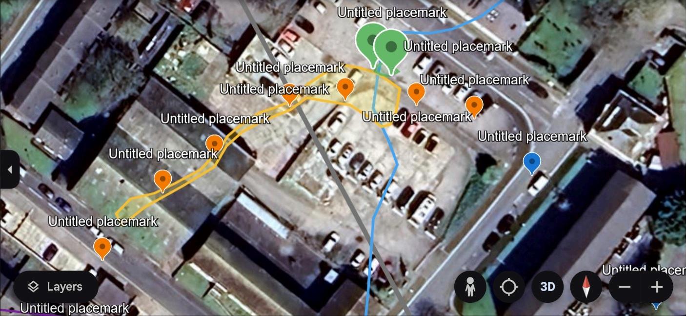
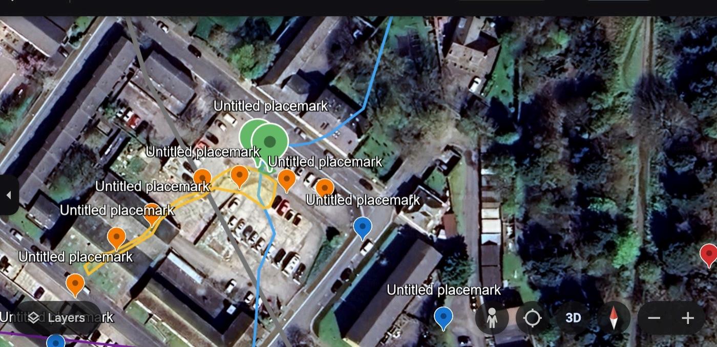
3 images of the area mentioned earlier, below the car park near St James Church and High Street. Toxicity beneath the surface is marked in orange and I am guided that to correct the contamination in the future 2 foot diameter boreholes can be drilled at the green markers The green area is the area of interest which will be prevented from allowing toxic flow into the railway tunnel There is an underground collection of contaminated water in the yellow edged area
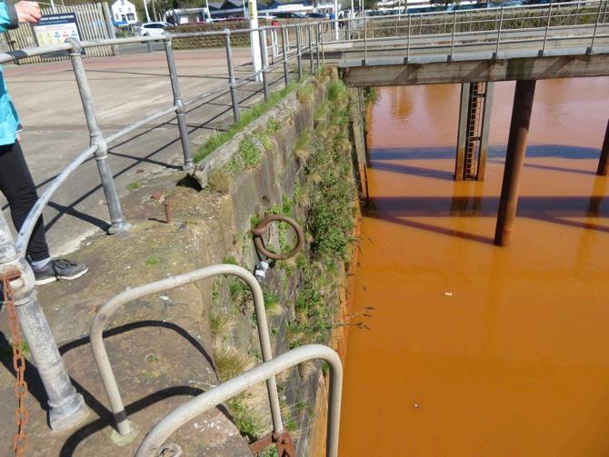
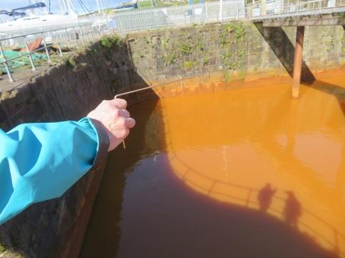
There has been no sampling carried out by the Authorities of the silt/sediment accumulating in the Bransty Tunnel or in the Harbour despite particulate based pollution pouring into the Harbour since December 2022. Given the evidence we recieved from dowsers we suspected radio-toxic materials had accumulated along with the iron rich acid mine pollution.
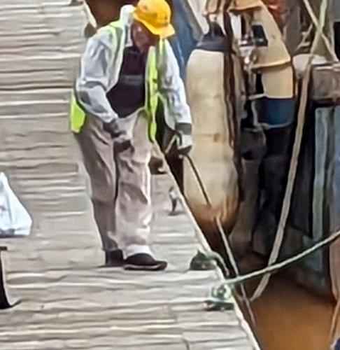
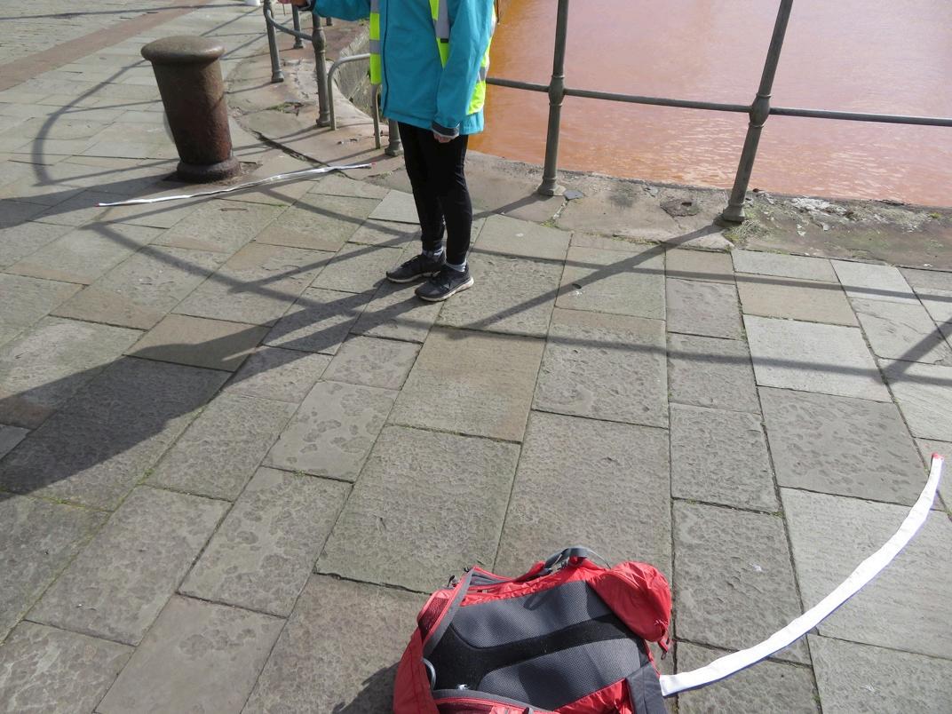
Citizen Scientist collecting silt sample from Whitehaven Harbour 11th March 2024
The sample was difficult to collect - a home-made contraption of chimney sweeping rods and attached sterilised metal can was used to take a surface scrape from beneath the water on the sea-bed in the harbour. This was then air dried, securely packaged and tested with a dosimeter (reading 0.12 uSv/hr) to protect postal workers before being sent to a laboratory for testing.
The laboratory used was Eberline Analytical/Oak Ridge Laboratory USA
“Eberline Analyticals’ Oak Ridge laboratory utilizes state-of-the-art analytical techniques and laboratory equipment Key personnel have over 100 years of combined technical experience in the nuclear industry ”
Eberline Analytical recieved the sample in the first week of May 2024 and we recieved a 65 page report back from them on 30th May 2024 (see Appendix) The report makes it clear that dangerous levels of Americium 241 are present in Queen’s Dock
The calibration used by Eberline (page 16 -19 of their Report) includes the use of AM 243 which was 36 27 kBq/g On page 44 of the report is a stark comparison It would be expected that if Americium was present at all at Queen’s Dock (it should not be there at all) then the Am 241 would be a far smaller spike than the calibration isotope of Am 243. The visual illustrates that the spike from Whitehaven Am 241 is bigger ie it is higher than the calibration isotope of Am 243 at 36 27 kBq/g The sample we provided to Eberline was a teaspoonful of dried siltvery red
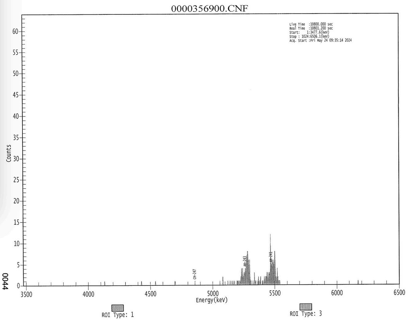
Pg 44 of Eberline Report
We felt that the authorities should be notified as soon as possible about the levels of Americium 241 in Queens Dock revealed by our citizen science sampling and the Eberline Analytical report A letter to the Office for Nuclear Regulation was sent on 4th June 2024 cc’d to Whitehaven Harbour Commissioners, Tim Farron MP for Westmorland and Lonsdale, North West Fisheries and Conservation, Trudy Harrison former MP for Copeland, Environment Agency, Leader of Cumberland Council and Whitehaven Town Council. Network Rail and the Coal Authority have also been notified.
sent by email 4th June 2024
Dear ONR
Radiation Free Lakeland are a voluntary group in Cumbria We have two ongoing campaigns: Lakes Against Nuclear Dump and Keep Cumbrian Coal in the Hole
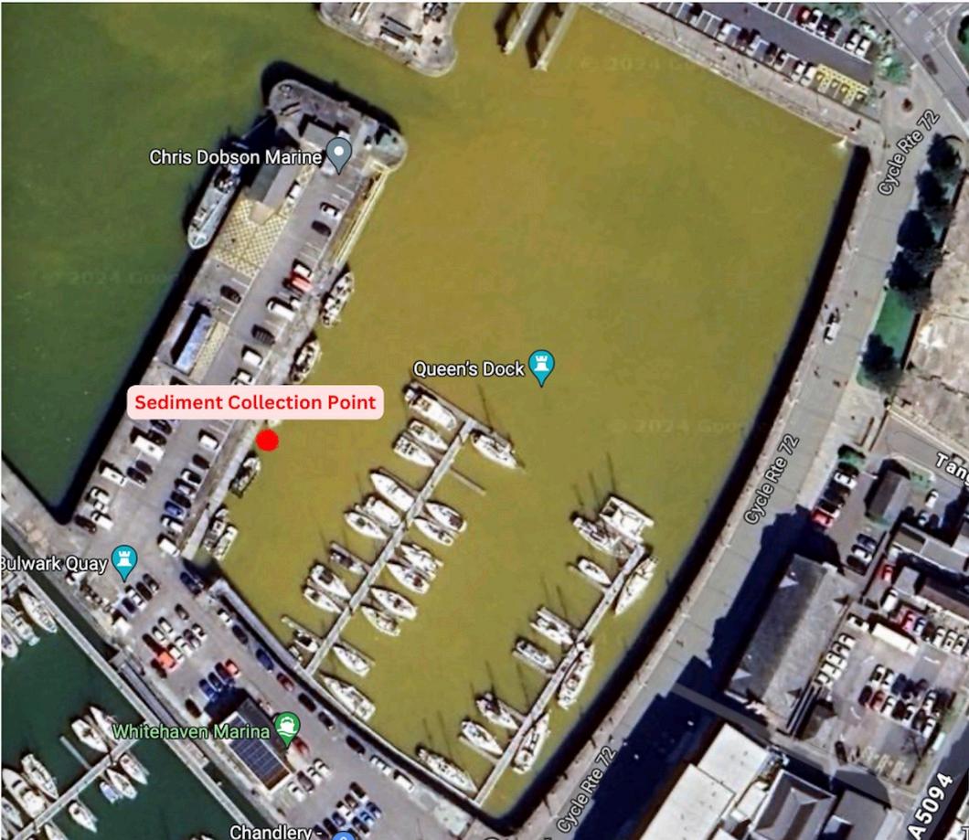
In the course of our investigations into the minewater pollution pouring into Whitehaven Harbour via the Queen's Dock culvert we took a sample of silt from Queen's Dock for analysis
We sent the sample to EBERLINE ANALYTICAL/OAK RIDGE LABORATORY OAK RIDGE, USA who are used by the US government
Their report is attached and clearly shows dangerous levels of Americium 241 present in the silt sample taken from Queen's Dock
We are currently preparing a report on the minewater pollution but as the presence of Americium 241 in the harbour is a dangerous and ongoing incident we felt we had to notify you at once
yours sincerely
Marianne Birkby Radiation Free Lakeland
cc'd
Whitehaven Harbour Commissioners
Tim Farron MP for Westmorland and Lonsdale North West Fisheries and Conservation
Trudy Harrison former MP for Copeland Environment Agency Leader of Cumberland Council
Whitehaven Town Council National Rail Coal Authority
“ Americium does not occur in nature, but its discovery in the fuel safely stored in the UK by the scientists at National Nuclear Laboratory makes it a very useful by-product The UK has plentiful supplies of Americium-241 within the stored fuel and this discovery is keeping the UK at the frontier of space technology This means that what was previously considered as surplus material is now a critical component to the European Space Agency’s missions from the late 2020s and beyond ” National Nuclear Laboratory
“Radionuclide Basics: Americium-241 Americium (chemical symbol Am) is a man-made radioactive metal that is solid under normal conditions Americium is produced when plutonium absorbs neutrons in nuclear reactors or during nuclear weapons tests Americium-241 is the most common form of Americium
Americium and Health Am-241 is primarily an alpha emitter, but also emits some gamma rays. It poses a more significant risk if ingested (swallowed) or inhaled. Once in the body, it tends to concentrate in the bone, liver, and muscle Americium can stay in the body for decades and continue to expose the surrounding tissues to radiation, increasing the risk of developing cancer ” United States Environmental Protection Agency
“In January 2019 the National Fire Chiefs Council (NFCC or voice of the UK Fire & Rescue Service) lobbied for the removal of Ionisation smoke alarms through legislation In December 2020 the Government revised the regulations in accordance with the manufacture, transportation, storage, handling and disposal of smoke alarms containing Americium-241.
Ionisation detectors although not yet banned in the UK have been banned in Germany, France and some other EU member states ” Electric Point
“The key question is this where does this Am-241 come from?
The answer is it's man-made for sure, as It's the decay product of Pu-241 via beta emission.
But Pu-241 is invariably found with Pu-239 - both the result of neutron activation inside a nuclear reactor ” Dr Ian Fairlie
“A certified and accredited American radiological laboratory, and quite possibly the very best commercial radiation lab in the World, has found dangerous levels of Americium-241 in the sediment you've provided
This lab does plenty of work for large corporations, the US Dept of Energy and the US military Their record has been excellent
This is a smoking gun as it were
This is radiotoxic stuff No one should be exposed to it No animals should have this in their habitat." Dr Marco Kaltofen
Whitehaven Harbour has been visibly polluted with acid mine water since December 2022. This is an ongoing environmental catastrophe with radiotoxic material in the hellish brew.
Our investigations have been carried out thanks to a crowdfunder which released approx £800 (after commission) of funding. With very limited monetary resources and with the goodwill of many supporters we have produced this report to be used as a resource by the authorities tasked with protecting the public and the environment from harm.
Following advice from dowsers who carried out investigations on the route and toxicity of the pollution both remotely and onsite we sent a sample of silt for analysis of radio-toxic substances to a laboratory It is clear that as well as the expected huge levels of iron and the presence of other substances associated with acid mine water such as cadmium, ammonia, and other metals including nickel (as found in the Environment Agency’s own limited tests) there is another substance, Americium 241
This radio-toxic substance in the harbour silt should not be there in any quantities let alone the dangerous levels found by a world leader in nuclear analysis Eberline Analytical Laboratory in the U S The presence of AM241 is a public health hazard as well as impacting marine life. The AM241 is present in Whitehaven silt in activity higher than the U S laboratory’s calibration isotope of Am 243 at 36 27 kBq/g The sample we provided to Eberline was a teaspoonful of dried silt We note that particulate is collecting at the lip of the culvert in Queen’s Dock through which the acid mine pollution continues to pour
We strongly advise that the authorities test the sediment now overhanging at the lip of the Queen’s Dock culvert for americium 241 and other radionuclides in high-end and independent laboratories. It is of great importance to identify if any radioactive pollution is entering the harbour via this pathway following decades of radioactive waste transports through the Bransty Tunnel. It is not clear if the AM241 pathway is via the culvert or via the Irish Sea from Sellafield’s ‘historic’ discharges- or possibly both The sediment should also be tested for a far wider range of substances ( including arsenic and mercury ) but clearly finding the pathway of AM241 contamination in Queen’s Dock is of primary importance
Americium 241 is a serious health hazard. Summer holidays often see children playing in the harbour area and we urge the authorities to warn people of the dangers of radio-toxic elements in the silt. The radioactivity is also amplified by metals from the mine pollution (see Tim Deere-Jones briefing: Synergistic effect of heavy metals from Coal Mine Acid water run off and Ionising Radioactivity )
“No Animals Should Have This in Their Habitat” - “A certified and accredited American radiological laboratory, and quite possibly the very best commercial radiation lab in the World, has found dangerous levels of Americium-241 in the sediment you've provided This lab does plenty of work for large corporations, the US Dept. of Energy and the US military Their record has been excellent This is a smoking gun as it were This is radiotoxic stuff. No one should be exposed to it. No animals should have this in their habitat " Dr Marco Kaltofen
Alongside comprehensive laboratory testing as described above we strongly advise the authorities make use of dowsing in finding the source/s and route/s of the acid mine and radio-toxic pollution as it is clear that modern conventional investigations have made little progress Our dowsers have made inroads into identifying the routes the acid mine pollution may be taking, where it enters the mine workings and how deep the flows are. Their findings are complex and multi-layered (please also see Memorandum 2)
Dowsing Results
Click here for mapviewable with Google Earth application installed
Evaluation of interactive effects of phosphorus-32 and copper on marine and freshwater bivalve molluscs. Jha, Awadhesh et al Faculty of Science and Engineering School of Biological and Marine Sciences, Plymouth Uni, published in International Journal of Radiation Biology Taylor and Francis 2020. Click here for PDF
Silt Sample Report for Radiation Free Lakeland by EBERLINE ANALYTICAL/OAK RIDGE LABORATORY OAK RIDGE, TN 0001 Click here for PDF
February 2024
Synergistic effect of heavy metals from Coal Mine Acid water run off and Ionising Radioactivity
Coal mining acid water runoff is widely reported to contain a range of toxic (heavy) metals, leached from the surrounding rock strata as a result of acid leaching which dissolves the metals The metals most commonly include copper, cadmium and lead and a number of other metals, usually at lower concentrations. These metals have enviro toxic characteristics and may be damaging to a number of marine species The degree of damage will depend on both the intensity of the pollution and the duration of the exposure
There can be no doubt that the exposures to marine life in the “near field” around the Whitehaven harbour have been both intense and prolonged and that the environmental impact of the metal toxicity will be significantly exacerbated by the smothering action of the particulate material in the runoff, which will be flocculating and sinking to the seabed as the “fresh” water discharge meets the saline marine water. I am not aware of any analysis of water sediment or marine life samples from “intermediate” or “far field” sites.
The presence of such metals is now shown to have a synergistic/additive effect with ionising radioactivity in the marine environment A 2020 study investigated the interactive effects of ionising radiation and a toxic metal (copper/Cu) on both freshwater and marine bivalves (mussel) The study reported that doses of copper were added to differing concentrations of beta emitting Phosphorus 32 (0 1 and 1 micro sievert). Phosphorus 32 has a half-life of around 14 days and is widely used as a radioactive tracer in nuclear medicine
The study reported that the copper had an “additive” effect on the Phosphorus 32 induced genotoxic response damage across species, cell types and dose rates. The additive effect included increased DNA damage and the expression of key stress related genes REF: “Evaluation of interactive effects of phosphorus-32 and copper on marine and freshwater bivalve molluscs ” Jha Awadhesh et al’:International Journal of Radiation Biology : 6/10/2020
It can be proposed, in the absence of any information to the contrary, that other metals found in the Whitehaven acid mine water runoff may also have a similar synergistic/additive effect on regional marine species when coupled with ionising radioactivity.
The implications of this study for wildlife in the Whitehaven area are clear The copper and other heavy metals present in the acid mine water run off entering the sea at, and via, Whitehaven harbour are shown to increase the impacts of the ionising radioactivity already present in the water column as a result of discharges from regional Nuclear Power Stations and Reprocessing sites
Tim Deere-Jones(Marine Radioactivity Research & Consultancy: Wales) February 2024
Personally speaking this project has been an opportunity to help the people of Whitehaven applying all my skills and continuing to refine my techniques I have surveyed water, health, toxicity, minerals, industry, land and underground cavities by way of onsite, map and remote dowsing It turns out this has been the most hazardous location I have dowsed but with the mention that a drilling company was boring for geological samples re future residential development in the Harras Moor area on day one of my survey, my perspective was to both find out the current dangers that are present for locals and make them clear for the authorities and culpable organisations
Clearly mining is responsible for the contamination in Whitehaven harbour which has been visible since 2022, not that this needs to be stated Former mine pollution of waterways exists widely across the globe
The fact that high levels of radioactivity exist in culvert water samples taken from the harbour, particularly Americium which only exists as a byproduct of nuclear weapon manufacture and spent nuclear fuel reprocessing, is unique
The presence of americium has been confirmed by a world leading American laboratory from a silt sample taken from Queen’s Dock by Radiation Free Lakeland
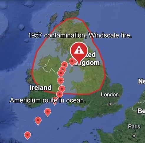
Please think about how long you spend in the lowest area of Whitehaven When moisture is picked up by the wind, the distance it travels is controlled by the strength of the wind Americium has also been detected on the railway line and land immediately landward of the track Evidently the build up of deposit over years from particles blowing off rail-borne ‘flasks’ accumulates day by day but the cause stems from the past and with time is slowly carried down into waterways, in the harbour and out to sea Another pathway into the harbour is via the Irish Sea from Sellafield discharges
Am-241 found in the environment is in the form of microscopic dust
When released into air, americium deposits particles in the soil and water Small particles in air can travel far from the release site
In water, americium will stick to particles in the water or to the sediment at the bottom Deposited on soil, americium will stick to surface particles, but not go very deep into the ground
Plants and vegetation growing in or nearby contaminated soil may take up small amounts of americium from the soil
Looking at the map, we need to examine cancer cases for an area from Scotland down to mid Wales Then there is the law regarding waste. Private citizens are liable to remove waste from their land, whoever placed it there, but there is a glimmer of hope In January 2023, Parliament approved a new legally-binding target to halve the length of rivers polluted by abandoned metal mines by 2038 This target, explained in the Environmental Improvement Plan, will be achieved through the Water and Abandoned Metal Mines (WAMM) Programme, a partnership between the Environment Agency, the Coal Authority and Defra
So for Whitehaven, it’s residents, visitors, businesses, for our children, for the planet, steps must be set in motion now to resolve this toxic pollution Relatively simple solutions can be applied in some cases One scenario is diverting subterranean flows/waterways before the influence of the contamination Whatever happens a widespread clear-up operation needs to take place before we can even start to see a recovery for this once thriving town.
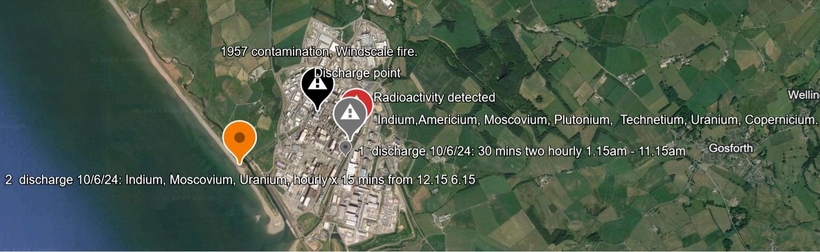
Daily Radioactive discharges 1 (red) and 2 (orange) dowsed for 10th June 2024 from the red point on map shown above.
Dowsing detected at 1: Indium, Americium, Moscovium, Plutonium, Technetium, Uranium and Copernicium
1: Radioactive elements discharged into River Calder every two hours for 30 minutes from 1 15am to 11 15am
-1.15/1.45,3.15/3.45,5.15/5.45,7.15/7.45,9.15/9.45,11.15/11.45, stop. -1.15
Dowsing detected at 2: Indium, Moscovium and Uranium.
2: Radioactive elements discharged into Irish Sea 30 minutes hourly from 1 15am to 6 15am
-12 15/12 30,1 15/1 30,2 15/2 30,3 15/3 30,5 15/5 30,6 15/6 30, stop
The black marker represents the 1957 Windscale (later Sellafield) fire. The point is not accurate