Upland City Council
Mayor Bill Velto
Mayor Pro Tem Rudy Zuniga, District 4
Councilmember Shannan Maust, District 1
Councilmember James Breitling, District 2
Councilmember Carlos A. Garcia, District 3
Upland City Staff
Alan French, Principal Engineer
Yesenia Diaz, Associate Engineer
George Dore, Traffic Engineer
Loralee Farris, Planning Manager
Kirk Swanner, Associate Engineer
Prepared by: KTUA
Joe Punsalan, Principal
Alex Samarin, Associate
Marina Varano, Senior Planner
Isabel Pérez, Senior Planner/Designer
Madeline Pysher, GIS Analyst
Katherine Padilla & Associates Inc.
Jessica Padilla, Senior Associate Xavier Sibaja, Outreach Specialist
Mark Thomas
Stephen Decker, Senior Project Manager
Marina Ramirez, Senior Planner


A special thank you to our Technical Advisory Committee members:
Alex Shippee, Omnitrans
Cuong Phu Trinh, Caltrans - District 8
Jeff Birchfield, San Bernardino County Fire District - Division 1
Jessica Escoto, City of Upland - Parks, Arts, Recreation, and Community Services
Linda Trawnik, Historic Downtown Upland Merchants
Marci Williams, Upland Police Department
Martin Gomez, Upland High School
Matthew Murphy, City of Rancho Cucamonga
Michele Glover, City of Rancho Cucamonga
Rhenda Curry, Upland Unified School District
Rudy Zuniga, Upland City Council
Stacey Morales, San Bernardino County Transportation Authority
Susie Fraize, Pedego Electric Bikes & Upland Chamber of Commerce
Travis Gasaway, Roy’s Cyclery
The Upland Mobility Master Plan was funded by a grant from Caltrans.
How often do you walk/roll (wheelchair, scooter, skateboard, etc.) in Upland?
Figure 3-3: What do you see as barriers to walking or rolling in Upland? ...........................................
Figure 3-4: What would make it feel
Figure
Figure
Figure A-31: Survey Question #22
Figure A-32: Survey Question #23 ................................................................................................................................
Figure
Figure
Table
Table
Chapter 1 provides an overview of mobility trends, benefits, and primary guidance, as well as applicable legislation and relevant regional and local planning documents. This foundational chapter introduces the purpose of the Plan and sets the stage for the rest of the document.
Easy access to safe, efficient, and affordable mobility options can transform a community and open the door to new opportunities and adventures. For some Uplanders, walking, riding a bicycle, or taking public transit is already a normal part of life. However, many community members face real barriers to viable non-vehicular travel routes, such as dangerous roadways, missing facilities, or a lack of service. Recognizing the importance of providing highquality and accessible mobility options for all, the City of Upland (City) developed the Upland Mobility Master Plan (Plan) to promote walking, bicycling, and public transit as desirable and enjoyable means of travel for community members of all ages, abilities, and socioeconomic demographics.
The Plan aims to remove barriers and improve access to non-vehicular mobility options throughout Upland while prioritizing improvements in underserved and high-need areas. The Plan’s recommendations - both physical and programmatic - are based on the findings of a comprehensive literature review, extensive data analysis, and a collaborative 18-month community engagement process. This data-driven and community-led Plan will provide the City with an ambitious, yet feasible implementation tool to unlock grant funding and deliver transformative mobility solutions to Upland, resulting in wide-ranging physical, environmental, economic, and recreational benefits to Uplanders for generations to come.
Much like transportation, mobility refers to the movement of people and goods by walking, using a wheelchair or mobility aid device, riding a bicycle, taking public transit, and driving a vehicle. However, where transportation typically hones in on physical infrastructure, mobility is an all-encompassing and inclusive concept that addresses many issues that impact the transportation experience, including accessibility, comfort, and well-being. In particular, this Plan focuses narrowly on improving active transportation (e.g., walking, hiking, using a mobility aid device, or riding a bicycle) and public transit facilities, services, and programs to facilitate a positive multimodal mobility experience for Uplanders. By enhancing active transportation and public transit options, Upland’s mobility system will become a safer and more efficient space for road users of all ages, abilities, and mobility needs.
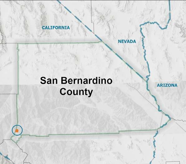
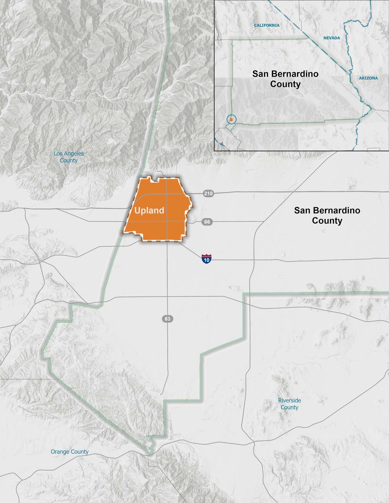
Upland is a 16-square-mile incorporated city located at the base of the San Gabriel Mountains in San Bernardino county, California. Upland lies 35 miles east of Los Angeles and 20 miles west of San Bernardino. The city is bordered by Rancho Cucamonga to the east, Claremont to the west, Ontario and Montclair to the south, and the San Gabriel mountains to the north.
Upland’s proximity to popular recreational destinations makes it a gateway to the Angeles National Forest and the Mount Baldy recreational area.
The Plan was developed to deliver the following outcomes to Upland:
1. Increase sustainable and equitable travel choices for community members.
2. Improve community safety and accessibility.
3. Reduce greenhouse gas emissions and improve public health.
4. Identify and prioritize opportunities to meet the needs of people walking, biking, and taking transit throughout Upland.
5. Position the City to apply for grants to get recommended improvements built.
6. Inform stakeholders about the benefits of a Mobility Master Plan and why their involvement matters in shaping a Plan that better responds to community needs and aspirations.
7. Engage traditionally underserved community members and those whose neighborhoods could be affected by projects to provide equitable opportunities for participation.
Creating an innovative and implementable Plan that adequately addresses the needs of Upland community members required a comprehensive and multi-faceted planning process. The graphic below displays the 18-month planning process that culminated in this Plan.
The Plan is organized into the following chapters:
f Executive Summary: The Executive Summary provides an overview of the entire document, identifies key issues and themes within Upland’s mobility system, and includes a summary of the Plan recommendations.
f Chapter 1 - Introduction: Chapter 1 provides an overview of mobility trends, benefits, and primary guidance, as well as applicable legislation and relevant regional and local planning documents. This foundational chapter introduces the purpose of the Plan and sets the stage for the rest of the document.
f Chapter 2 - Existing Conditions: Chapter 2 documents and analyzes the existing conditions of Upland’s mobility system. The chapter includes geospatial analyses of several relevant datasets, such as land use, activity centers, existing bicycle and pedestrian infrastructure, public transit, activity centers, collision hotspots, and more. The findings of this chapter were used, in combination with community input, to identify key mobility gaps, needs, and priorities and develop recommendations for improvement.
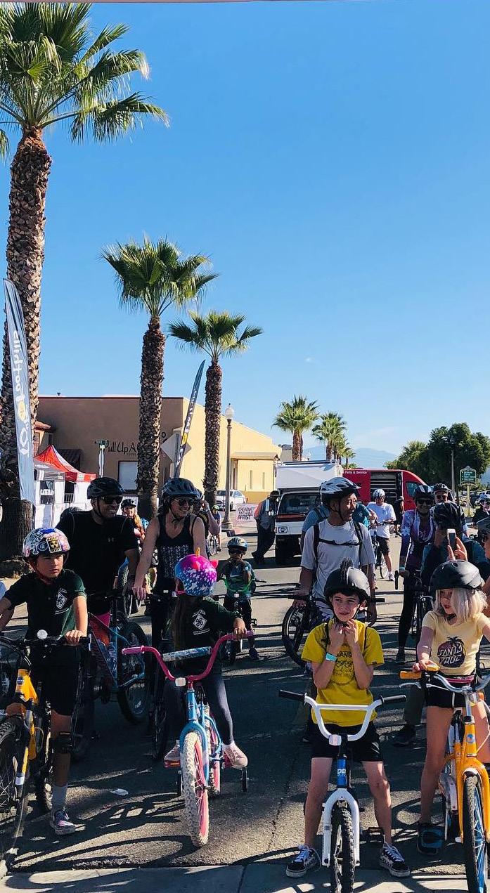
f Chapter 3 - Community Engagement: Chapter 3 summarizes the information gathered from an extensive community engagement process. The chapter includes key takeaways from public input collected through a community survey, three pop-up events, two community workshops, five technical advisory committee meetings, ten walk audits, and two Public Works Committee meetings. The chapter identifies key issues and priorities of the community and stakeholders, which guided the recommendations proposed in Chapter 5.
f Chapter 4 - Mobility Toolkit: Chapter 4 provides an overview of potential mobility infrastructure facilities based on the latest Federal and State guidelines. This chapter can be used as a toolkit of solutions to make it safer, easier, and more enjoyable to walk, roll, ride a bicycle, and take public transit in Upland. Many of the mobility “tools” described in Chapter 4 are included as recommended infrastructure improvements in Chapter 5.
f Chapter 5 - Recommendations: Chapter 5 proposes physical improvement projects and programmatic policies to facilitate and encourage walking, rolling, riding a bicycle, and taking public transit in Upland. Project recommendations are described in a table, while a selection of “priority projects” are displayed in cut sheets that depict the top projects in an easy-to-understand manner. Chapter 5 also includes guidance for phasing, implementation, and funding.
f Appendix: The Appendix contains descriptions of primary guidance and applicable legislation, as well as the complete results of community engagement efforts, including detailed summaries of pop-up events, workshops, stakeholder meetings, and the full results of the community survey.
Trends in active transportation and public transit planning have evolved significantly over the last decade. Communities across the country and throughout California have seen the growth of both conventional and progressive active transportation infrastructure. At the same time, public transit agencies are exploring new strategies to boost ridership, such as farefree transit, bus rapid transit, and ondemand rideshare services. Local leaders, community members, and advocates are showing ongoing interest in ensuring that walking, biking, public transit, and new mobility facilities are not only included but prioritized in their built environment.
The State continues to show its commitment to this movement through its Active Transportation Program, which draws from federal and state funds to provide between $200 and $400 million annually for bicycle and pedestrian projects across California.1 Since the program was launched in 2013, over 800 active transportation projects across California have been funded.2 Along the same lines, the United States Congress authorized the Active Transportation Infrastructure Investment Program as part of the Infrastructure Investment and Jobs Act and appropriated $45 million in funding to kick-start the program in 2023, with more funding to come in 2024.3
The benefits of active transportation are far-reaching and multi-faceted. Access to walking and bicycling facilities has long been proven to improve mental and physical health, as well as to serve as a focal point of community pride and social programming. Widespread active transportation benefits are reflected in nationwide activity numbers. For example, the Rails to Trails Conservancy reported in 2020 that “more Americans are walking, biking and using trails in 2020 than ever before—bike sales have boomed and trail use is up 60% over the same period in 2019.” To test the staying power of this early
COVID-19 pandemic-era trend, the Rails to Trails Conservancy reported in 2022 that these trends are holding steady as data shows “trail use in 2022 is 45% higher than in 2019, demonstrating enduring demand for trails across the country.4” Similarly, StreetLight Data reported that bicycle activity in the United States has increased substantially in 2020 and 2021, and held steady in 2022 with overall growth since 2019 at 37%.5” Contrastingly, StreetLight Data reported that walking activity in the United States has declined by 36% between 2019-2022, likely due to remote work and transitioning downtown areas drawing fewer pedestrians.6 While the pulse of interest in active modes for transportation and recreation is impossible to predict, investment in safety, infrastructure, and programming where it is needed most will support current levels of active transportation and encourage further adoption of these modes.
Supporting and encouraging walking and bicycling requires the provision of safe, protected, and connected facilities. In 2023, the Rails to Trails Conservancy released poll results that revealed people would walk and bike more with improved connectivity and increased active transportation infrastructure.7 Poll respondents indicated that the following factors would increase their use of active transportation modes: (1) more destinations within a 10-to-20-minute walking distance; (2) having friends and family join them; (3) trails and greenways separated and protected from traffic; (4) more sidewalks; and (5) more protected bike lanes.8 The Rails to Trails Conservancy also found nearly one-third of respondents said that interconnected trail networks would make it easier to walk or bike to their destination instead of driving.9
There is a growing trend toward facility types that physically separate vulnerable road users from vehicle traffic. While sidewalks and Class I multi-use paths have traditionally provided this separation, Class IV separated bikeways are a newer facility
type that fills this need, giving both vertical physical barriers and horizontal space from traffic. Class I multi-use paths and Class IV separated bikeways are being highlighted as the types of facilities that most encourage people to bicycle more to reach their local destinations.10 Pedestrian infrastructure such as enhanced crossings with rectangular rapid flashing beacons (RRFB) or pedestrian hybrid beacons (PHB) are being installed at higher rates since studies have shown increased safety for pedestrians.11
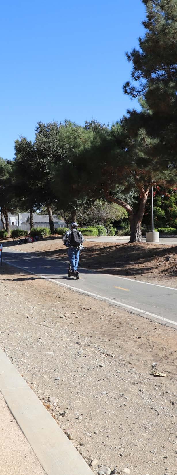
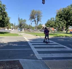
In the last several years, electric bicycles (e-bikes) - both personal and shared - have swept the nation. The increasing prevalence of e-bikes and e-scooters has welcomed an influx of new active transportation users by providing people with disabilities, seniors, and others with viable mobility options for reaching destinations near and far. People across the country now use personal and shared e-bicycles and e-scooters to get to work and school, run errands, and access community services, leisure activities, and recreational opportunities. The National Association of City Transportation Officials (NACTO) reported that shared e-bike and e-scooter trips in the United States and Canada have grown by 40 percent since 2018 and have increased 35-fold from 2010.12 In 2021 and 2022, there were 112 and 113 million shared e-bike and e-scooter trips in the United States, respectively. Along the same lines, e-bicycle sales in the United States increased by over 145 percent between 2019 and 2020.13 NACTO also underscored the reality that more people ride when cities build high-quality, protected bicycle lanes. As e-bikes become commonplace on our streets, bicycle lanes, and trails, it is important to design active transportation infrastructure, amenities, policies, and enforcement to facilitate the safe use of shared-use facilities for both motorized and non-motorized users.
Source: Omnitrans
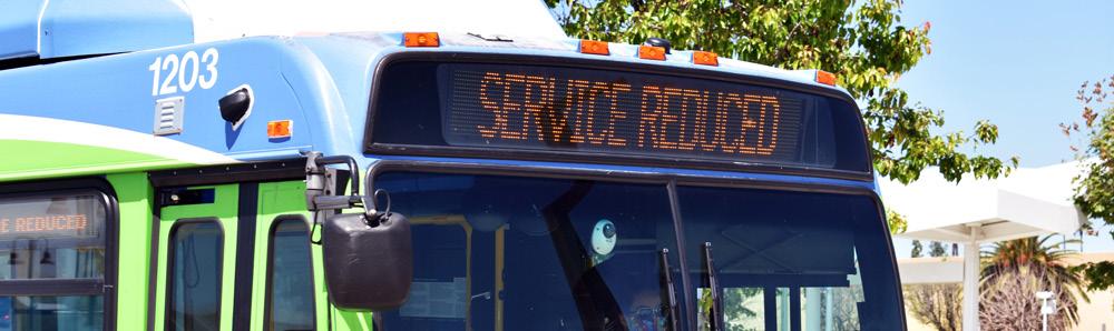
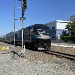
Unlike the increased interest in active transportation brought on during the COVID-19 pandemic, public transit ridership has been in decline since 2013 before dropping to historic lows when the pandemic began in March 2020.14 For example, monthly ridership in California dropped from 100 million in February 2019 to roughly 20 million in June 2020.15 And still, five years later, ridership numbers haven’t fully bounced back. As of June 2022, statewide monthly ridership increased to 60 million, indicating a slow return to pre-pandemic levels.16 A variety of factors play into the slow rebound of public transit, ranging from more people working from home to people feeling concerned about their safety and security while taking transit.17 With fewer riders, transit agencies have taken a financial hit due in part to the decrease in funds generated by trip fares and fees. Despite the decline in the popularity of public transit, this travel mode, when implemented well, is still a key sustainable and accessible mobility solution. This Plan is one tool that the City can use to improve and encourage public transit use in Upland.
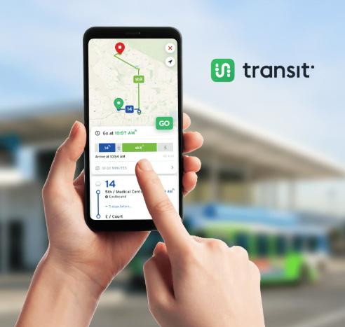
Well-integrated smartphone applications are another impactful way that transit agencies are making public transit a more attractive and efficient transportation option. Smartphone transit applications can include mobile ticketing, trip planning, route schedules, real-time arrival estimates, service change alerts, and more. This innovation in the public transit experience offers transit riders convenient and hasslefree options for payment and trip planning.
Mobility hubs are multimodal places of connectivity where people can make seamless connections between various transportation options. They allow for a combination of transportation options to gather in one space to encourage people to use transit, non-motorized, or shared transportation modes with ease. Mobility hubs are typically located along a bicycle facility and a transit stop and are paired with multimodal elements, such as bikeshare, scootershare, bicycle lockers, battery charging for e-bicycles, wayfinding signage, and ridesharing zones. Pedestrian amenities may include curb extensions, street furniture, and pedestrian-scale lighting. In Connect SoCal 2024, the Southern California Association of Governments (SCAG) recognized mobility hubs as a strategy to support transit and multimodal integration and recommended a regional mobility hub network.18
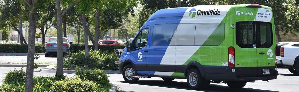
In recent years, public transit agencies across the country have explored microtransit as a tool to provide affordable mobility options to those who do not live near bus and train lines.19 Microtransit refers to a publicly provided on-demand rideshare service that offers the flexibility of a ride-hailing service like Uber or Lyft, but at heavily subsidized rates.20 Microtransit programs typically provide rides for short local trips with small shuttles within designated service zones. While the costs of offering microtransit are high, many public transit agencies continue to use on-demand rideshare as a solution for increasing transportation access and transit ridership.21 For example, the public transit agency serving the San Bernardino Valley - Omnitrans - offers a microtransit service in Upland called OmniRide. OmniRide offers affordable rides to locations within the designated service areas on weekdays from 6 am to 8 pm ($4 standard, and $1 for veterans, seniors, Medicare recipients, and people with disabilities). Upland Omniride offers service throughout the entire city.
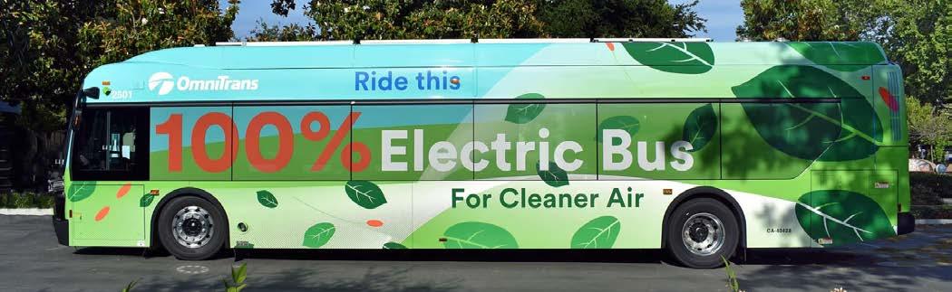
In 2018, the California Air Resources Board (CARB) adopted the Innovative Clean Transit regulation, which requires all transit agencies in California to transition to 100 percent zero-emission transit buses (ZEBs) that rely on battery-electric or hydrogen fuel cell technologies.22 Excitingly, many agencies are in the process of electrifying their bus fleets.23 For example, in 2022, the Antelope Valley Transit Authority became the first allelectric transit agency in North America. This monumental legislation is pushing public transit agencies to provide sustainable, clean-air vehicles, resulting in improved air quality and reduced GHG emissions in California communities. At the same time, this effort will require transit agencies to secure additional funding to invest in the higher upfront costs and supportive infrastructure required to transition to ZEBs.24
An investment in active transportation and public transit facilities and services is an investment in quality of life. The positive impacts of active transportation and public transit are plentiful and promise to deliver a wide range of environmental, health, and social benefits to Upland community members.
According to the United States Environmental Protection Agency (EPA), the transportation sector accounted for the largest portion of greenhouse gas (GHG) emissions (29 percent) in the United States in 2021.25 Light-duty vehicles (i.e., sport utility vehicles, passenger cars, minivans, and light-duty trucks) account for 58 percent of transportation-related GHG emissions and medium-and-heavy-duty trucks account for 23 percent.26 With roughly 81 percent of transportation-related GHG emissions in the U.S. attributed to personal and singleoccupancy vehicles, reducing the number of vehicle miles traveled in cars is imperative to mitigating climate change and can be accomplished, in part, by making active transportation and public transit a viable travel option. Walking and bicycling offer emissions-free transportation options, while light-rail systems and buses generate 62 percent and 33 percent less GHG emissions than personal vehicles, respectively.27 As public transit fleets continue to electrify, the difference in emissions will become even more substantial. Additionally, the construction of new bikeways, pedestrian infrastructure, and transit hubs will provide opportunities to design and introduce green infrastructure into the public realm. The EPA acknowledges the many benefits of green infrastructure, including treating stormwater at its source, reducing flooding, adding street trees, improving air quality, creating new habitats, and improving community pride.
Vehicle-generated air pollution contains harmful emissions such as carbon dioxide, carbon monoxide, methane, nitrous oxide, and volatile organic compounds. These pollutants and irritants can cause asthma, bronchitis, pneumonia, and decreased resistance to respiratory infections. Increasing access to active transportation, public transit, and other related clean mobility choices will decrease dependency on car-generated trips, contribute to the reduction of vehicle emissions, and, ultimately, improve air quality.
Other positive health benefits of active transportation include the facilitation of walking, bicycling, and spending time outdoors. While access to public transit has been shown to improve mental health outcomes for older adults and people with disabilities by facilitating access to community and social networking activities.28 Providing more non-motorized travel options will provide additional mode choices for residents and visitors while encouraging an active lifestyle. Regular exercise also reduces the risk of diabetes, high blood pressure, heart attacks, and strokes. Exercise has also been shown to improve mental health by relieving depression, anxiety, and stress. Trails, in particular, have been shown to improve quality of life, promote health and well-being, and foster a sense of community and belonging.29
The development of pedestrian and bicycle facilities that are physically separated from vehicular traffic will not only encourage more people to walk or bicycle to their destinations but will also significantly reduce the potential for collisions with vehicles. Data from the U.S. Department of Transportation’s National Highway Traffic Safety Administration shows that fatalities and injuries to pedestrians and bicyclists in traffic collisions are on the rise. In 2021, 7,388 pedestrians and 966 bicyclists were killed in traffic crashes (a 12.5 and 1.9 percent increase from 2020, respectively).30
Pedestrian and bicycle fatalities are unacceptable and demand aggressive improvements to active transportation facilities and programming to eliminate
these unnecessary tragedies. Off-street and protected bicycle and pedestrian facilities are among the current best practices for providing safe active transportation infrastructure and are overwhelmingly preferred by active transportation users.31
Developing an equitable and accessible transportation system starts with recognizing the reality that generations of injustices have left many communities, especially low-income and communities of color, with inequitable access to open space, employment opportunities, healthy food options, and other critical needs. Prioritizing active transportation projects and public transit services in disadvantaged and underserved communities helps to provide people with additional transportation options and to increase access to important services, resources, and opportunities. The Project for Public Spaces reported in 2021 that health equity and access are major themes across mobility planning. This is evident in the State’s Active Transportation Program, which has allocated over 85 percent of funds in every funding cycle toward projects that will benefit disadvantaged communities throughout California.32
In addition to locating active transportation projects and public transit services in communities with the greatest need for them, it is also important to design new facilities to be inclusive and accessible for everyone. Increasingly, trails and paths across the United States are incorporating inclusive design features, such as Americans with Disabilities Act (ADA)accessible trails, sensory trails, shared-use trails, trails for children, and trails designed for those with autism.33 This is especially important because people with disabilities rely on active transportation and public transit to a greater degree than those without disabilities.34 Other features, such as educational and wayfinding signage, welcoming public art, and inclusive marketing materials can help users feel safe, prepared, and welcome. Providing a variety of safe, affordable, accessible, and equitable transportation options is essential to community health, well-being, and vitality.
Studies show that investing in active transportation and public transit infrastructure produces far-reaching economic benefits for communities.35 Where each additional motor vehicle on the road creates wear on the asphalt that requires long-term maintenance, active transportation facilities are generally less costly to construct and maintain than infrastructure for motor vehicles. For example, active transportation projects cost, on average, 75 percent less to build per mile than motor vehicle-focused transportation projects and produce more jobs per dollar than road projects do.36 Additionally, because bicycles are lightweight and take up little space, they cause less wear on roads and increase the volume per hour a road can handle by seven to twelve times.37
Not only do active transportation facilities and public transit services reduce construction and maintenance costs, but they also generate revenue for cities, communities, businesses, and individuals. Cities could save as much as 24 dollars for every dollar spent on separated bike lanes due to the associated reduction in traffic, pollution, and healthcare costs.38 Homeowners often see an average property value increase of 3 to 15 percent due to nearby trail developments. 39Business owners see a benefit in sales, as affirmed by several studies showing that people who walk or bike through business districts are more likely to shop and spend supplementary money in the local economy than those who drive.40 Lastly, using active transportation and public transit instead of driving a motor vehicle saves individuals money. A 2023 report from the American Public Transportation Association showed that people who ride public transit instead of driving can save more than $13,000 per year due to transit fares remaining relatively unchanged while the costs of purchasing, insuring, fueling, and maintaining motor vehicles continue to rise.41
Active transportation design guidance has traditionally come from the California Department of Transportation (Caltrans) and the California Manual on Uniform Traffic Control Devices (CA MUTCD). National organizations also provide guidance on best practices, such as the National Association of City Transportation Officials (NACTO), the American Association of State Highway and Transportation Officials (AASHTO), and the Federal Highway Administration (FHWA).
Fortunately for California cities, there is increased flexibility in design guidance offered by both Caltrans and the FHWA. In 2014, Caltrans officially endorsed the NACTO Urban Street Design Guide and Urban Bikeway Design Guide as valuable toolkits for designing and constructing safe and attractive local streets. California cities may also apply for experimental designation from the FHWA for projects not in conformance with the CA MUTCD. The guidance documents used to inform this Plan are listed below and described in detail in Appendix A.
Since 2014, the CA MUTCD has been updated eight times, most recently in January 2024.* The standards set by CA MUTCD provide guidance to balance safety and convenience for everyone in traffic, including drivers, pedestrians, and bicyclists. Multimodal policies for safer crossings, work zones, and intersections are integrated into the CA MUTCD, with improvements including:
f Crosswalks Enhancements Policy
f Temporary Traffic Control Plans
f Traffic Control for School Areas
Additionally, NACTO guidance was analyzed to ensure flexibility and innovation in the design and operations of streets and highways in California. Much of the guidance provided in the CA MUTCD is consistent with the NACTO Urban Bikeway Design Guide.
In addition to the CA MUTCD, the following guidance documents were also used to guide the development of this ATP.
f AASHTO Guides for Pedestrian and Bikeway Facilities
f California Active Transportation Program
f California Transportation Plan 2050
f Caltrans’ Deputy Directive 64-R2
f Caltrans Design Information Bulletins (DIB-89-02 and DIB-94)
f Caltrans Highway Design Manual, Chapter 1000: Bicycle Transportation Design
f CEQA for Bicycle and Pedestrian Plans
f FHWA Bikeway Selection Guide
f FHWA Separated Bike Lane Planning and Design Guide
f NACTO Transit Street Design Guide
f NACTO Urban Bikeway & Street Design Guides
f NACTO Urban Street Stormwater Guide
*Caltrans is expected to release a revised CA MUTCD by January 2026 to conform with the new National MUTCD published by the FHWA in December 2023.
Active transportation in California is supported by legislation at the federal, state, and local levels. Legislation to advance active transportation is driven by a variety of factors, including safety; GHG emissions reduction; community health and well-being; equity and environmental justice; and more. The following section lists applicable federal and state policies that influence active transportation planning, decision-making, and funding. Descriptions for each piece of legislation can be found in Appendix A.
f Interim Approval for Optional Use of an Intersection Bicycle Box (IA-18)
f Infrastructure Investment and Jobs Act
f AB-32 California Global Warming Solutions Act
f AB-43 Traffic Safety
f AB-285 Forecast Impacts of Emerging Technologies
f AB-361 Vehicles: Photographs of Bicycle Lane Parking Violations
f AB-390 Pedestrian Crossing Signals
f AB-413 Vehicles: Stopping, Standing, and Parking
f AB-712 Tenancy: Personal Micromobility Devices
f AB-773 Street Closures and Designations
f AB-902 Traffic Violations and Diversion Programs
f AB-1096 Electric Bicycles as Vehicles
f AB-1193 Bikeways
f AB-1266 Bicycle Guidance Signs Through an Intersection
f AB-1358 Complete Streets Act
f AB-1371 Passing Distance/Three Feet for Safety Act
f AB-1774 E-Bike Modification
f AB-1778 E-Bike Pilot Age Restrictions
f AB-1909 Vehicles: Bicycle Omnibus Bill
f AB-2086 Transportation Accountability Act
f AB-2147 Pedestrians
f AB-2669 Banning Bridge Tolls for People Walking and Biking
f AB-2863 Green Building Standards: Bicycle Parking
f SB-1 Transportation Funding
f SB-288 California Environmental Quality Act: Exemptions: Transportation-related Projects
f SB-375 Redesigning Communities to Reduce Greenhouse Gases
f SB-400 Clean Cars 4 All Program
f SB-672 Traffic-Actuated Signals: Motorcycles and Bicycles
f SB-689 Bike Lanes in Coastal Areas
f SB-743 CEQA Reform
f SB-760 Transportation Funding: Active Transportation: Complete Streets
f SB-922 California Environmental Quality Act Exemption: Transportation-related Projects
f SB-932 General Plans: Circulation Element: Bicycle and Pedestrian Plans and Traffic Calming Plans
f SB-960 Complete Streets Bill
f SB-1000 Planning for Healthy Communities Act
f SB-1216 Limits on Class III Bikeways
f SB-1271 E-Bike Battery Safety Standards
f Governor’s Executive Order N-19-19
The Plan incorporates regional and local planning efforts directly related to walking, bicycling, trails, public transit, and safe routes to school. These efforts range from long-range regional planning to local plans and projects. Table 1-1 and the following pages summarize the planning documents evaluated as part of the Plan development. The checkmarks in Table 1-1 indicate if a planning document contains strategies (i.e., goals, objectives, etc.) or infrastructure projects (e.g., bicycle facilities, intersection improvements, pedestrian amenities, etc.) relevant to Upland.
Table 1-1: Planning Context Summary Matrix
City of Upland General Plan (2015)
Local Roadway Safety Plan (2022)
SBCTA Long Range Multimodal Transportation Plan (2025)
SBCTA Comprehensive Pedestrian Sidewalk Inventory Plan (2023)*
Omnitrans Bus Stop Safety Improvement Plan (2021)
SBCTA Countywide Transportation Plan (2021 Update)
SCAG Connect SoCal (2024)
San Bernardino County Active Transportation Plan (2020)
SBCTA Points of Interest Pedestrian Plan (2019)
San Bernardino County Regional Greenhouse Gas Reduction Plan (2019)
San Bernardino County Non-Motorized Transportation Plan (2011 with 2018 Revision)
SBTCA Regional Safe Routes to School Plan Phase II (2017)
SANBAG Complete Streets Strategy (2015)
*The SBCTA Comprehensive Pedestrian Sidewalk Inventory Plan documented sidewalk conditions and did not include strategy or project recommendations.
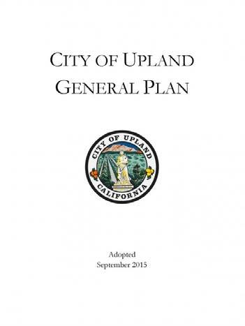
The City of Upland General Plan, adopted in 2015, established a comprehensive framework for future growth and development in Upland through 2035. The General Plan seeks to facilitate growth while preserving Upland’s “small town” community character by advancing the following community-identified key values:
1. Maintaining an Excellent Quality of Life
2. Strengthening Community Identity
3. Growing the Local Economy
4. Growing Green
5. Responsive Leadership
The General Plan is comprised of nine elements: (1) Land Use Element, (2) Focus Area Element, (3) Community Character, (4) Economic Sustainability, (5) Circulation, (6) Open Space-Conservation, (7) Public Facilities, (8) Healthy Community, and (9) Safety. Each element was reviewed during the planning process and relevant goals and policies were integrated into the development of this Plan, where appropriate. The planning team paid special attention to the Circulation Element, which directs transportation-related infrastructure and programming projects throughout Upland.
Upland General Plan: Circulation Element (2015)
The Circulation Element of the General Plan contains goals and policies designed to achieve the overarching vision of “a comprehensive, multimodal transportation system that provides all users with safe connections to homes, job centers, schools, community centers, open spaces, recreation areas, and visitor destinations.” The Element tackles five key components of Upland’s circulation system: (1) Roadway System, (2) Non-Motorized Transportation System, (3) Transportation Safety, (4) Parking, and (5) Freight Movement.
Each of these components has an overarching goal and supporting policies to guide improvements to the circulation system through 2035:
f Roadway System Goal: A transportation network that provides mobility and access for all modes of travel including automobiles, transit, bicyclists, pedestrians, and freight vehicles.
f Non-Motorized Transportation System Goal: An interconnected network of bicycle, pedestrian, and transit facilities that accommodate and encourage travel through non-automotive modes.
f Transportation Safety Goal: A transportation system that ensures safety for all modes of travel.
f Parking Goal: A parking system which provides an appropriate level of parking supply in public and private parking areas.
f Freight Movement Goal: A transportation system which accommodates the efficient movement of freight vehicles on appropriate routes.
Each goal and its supporting policies were reviewed and integrated into this Plan, as appropriate.
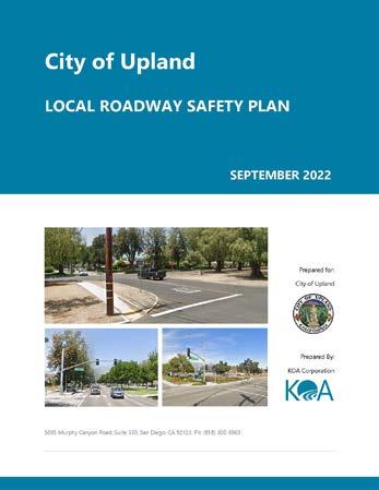
Upland was selected as one of 250 local agencies in California (as of April 12, 2021) to receive Caltrans funding to develop a Local Road Safety Plan (LRSP). Development of the Upland LRSP will enable the City to meet the eligibility requirements for Highway Safety Improvement Program (HSIP) grant funding, which Caltrans will require for all future HSIP cycles. The Upland LRSP is guided by the vision that improvements to traffic safety can be achieved by targeting high-collision areas with proven engineering countermeasures and traffic safety education and enforcement. The mission of the LRSP is to achieve a reduction in collisions, particularly fatal and serious injury collisions, through a multi-agency approach that utilizes education, enforcement, engineering, and emergency service strategies.
The goals of the LRSP are to:
f Save lives and prevent serious injuries on local roads and streets
f Reduce the severity of collisions through the reduction in travel speed, driving under the influence, and improper turning
f Provide needed infrastructure to address higher collision locations
f Improving safety in school zones
f Improving driver awareness of speeding, texting, and drinking while driving
To achieve these goals, the LRSP identified priority projects related to citywide signal hardware upgrades, signal timing improvements, signal installation, and safety enhancements to unsignalized intersections. This Plan serves to advance the momentum initiated by the LRSP by homing in on opportunities to facilitate safe and easy active transportation throughout Upland.
The City-adopted budget for Fiscal Year 2023/24 (FY 23/24) included Capital Improvement Projects (CIPs) related to the maintenance and improvement of Upland’s mobility infrastructure. Ongoing citywide infrastructure improvements include the replacement or upgrade of street surfaces, striping, signage, asphalt, concrete, and traffic signals. In addition to these ongoing maintenance projects, the following streetspecific CIPs were identified:
f Arrow Route Widening (Monte Vista to San Antonio Channel East): Bridge and roadway widening from 2 to 4 lanes, adding right and left-turn lanes, and upgrading signals.
f Arrow Route Widening (Central to Monte Vista): Bridge and roadway widening from 2 to 4 lanes, adding right and leftturn lanes, and upgrading signals. The project is part of the SBCTA Arterial Program.
f Phase II of the Metrolink Station Accessibility Improvement Project: Cooperative agreement with SBCTA to design and construct a new signalized pedestrian/ bicycle crossing at Campus Avenue and the SP/PE Trail; a pedestrian automated crossing safety gate at the railroad tracks located on Euclid Avenue, just south of “A” Street; enhanced crosswalks in the downtown area between “A” Street and Arrow Highway; and SP/PE Trail Improvements. Trail improvements will include a walking path and enhanced lighting from Euclid Avenue to Campus Avenue.
f Downtown Public Parking Improvement (South side of “A” St.): The project will include the removal of utilities infrastructure and allow for the reconfiguration of the existing parking lot with additional parking spaces.
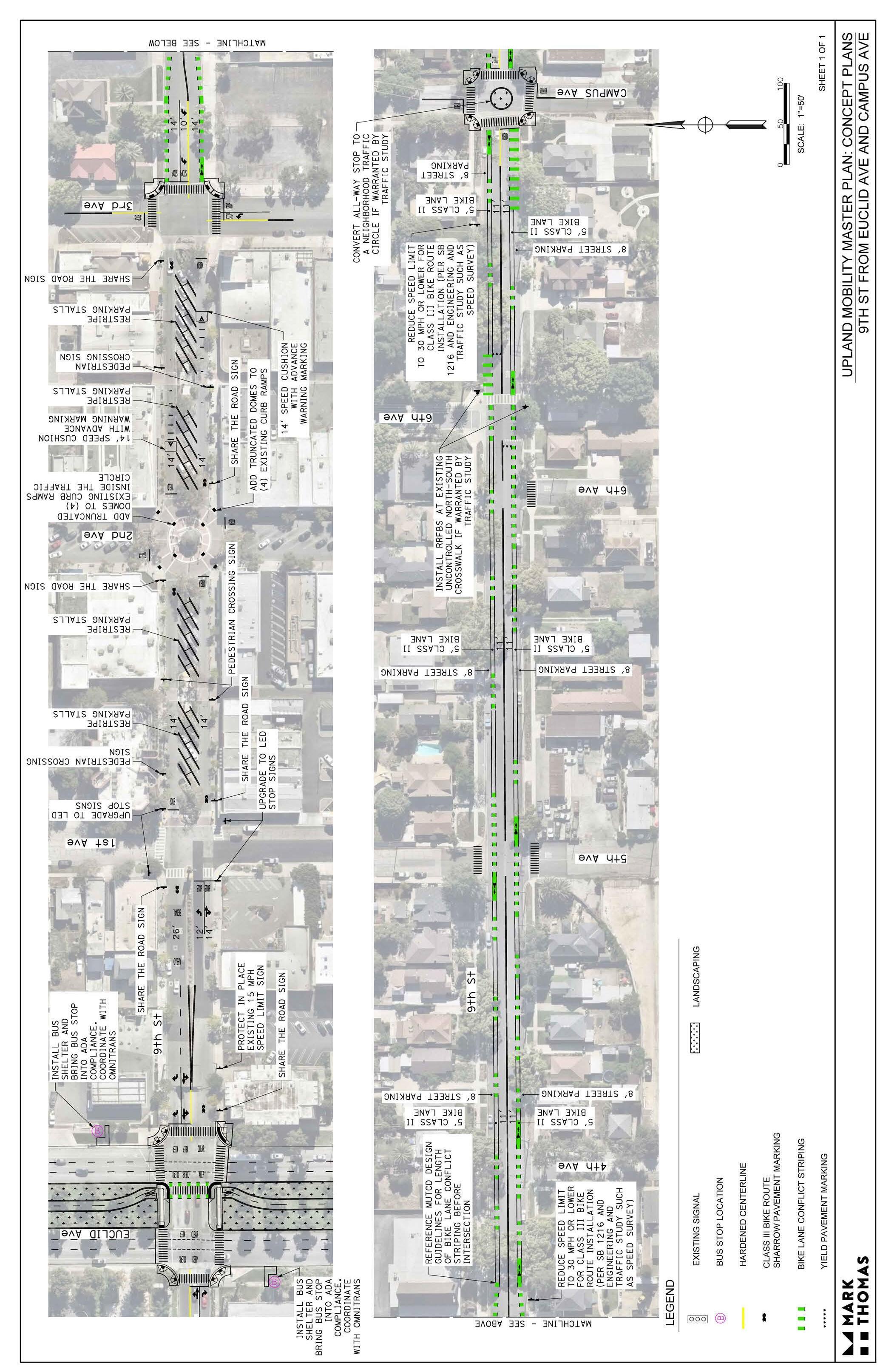
f Downtown Parklets: Four parklets with seating, landscaping, and public art are under construction at alley crossings on 2nd Avenue and 9th Street.
f I-10 Interchange and Bridge Improvement Projects: The City will partner with SBCTA to construct interchange improvements at Euclid Avenue, Mountain Avenue, and Monte Vista Avenue, as well as improvements to I-10 freeway bridges at Benson Avenue, Campus Avenue, San Antonio Avenue, and Sultana Avenue.
f Street Rehabilitation Projects: These projects, which involve repairing/upgrading the roadway surface, curb, gutter, sidewalks, curb ramps, and pavement markings, are planned, underway, or completed for the following streets:
f 1st Avenue (A Street to D Street)
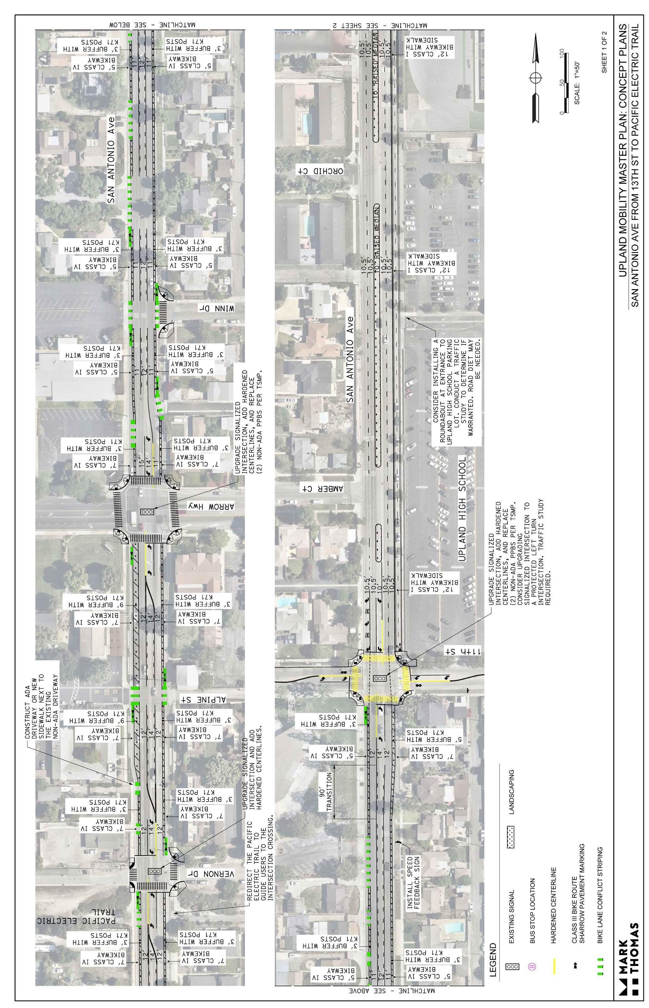
f 14th Street (Campus Avenue to Grove Avenue)
f 17th Street (San Antonio Avenue to Euclid Avenue) - Complete
f 18th Street (Mountain Avenue to Euclid Avenue)
f 19th Street (Mountain Avenue to Euclid Avenue)
f Alpine Street (West End to Palm Avenue)Complete
f Arrow Highway (Benson Avenue to Mountain Avenue and Mountain Avenue to San Antonio Avenue) - Complete
f C Street (Euclid Avenue to 3rd Avenue)
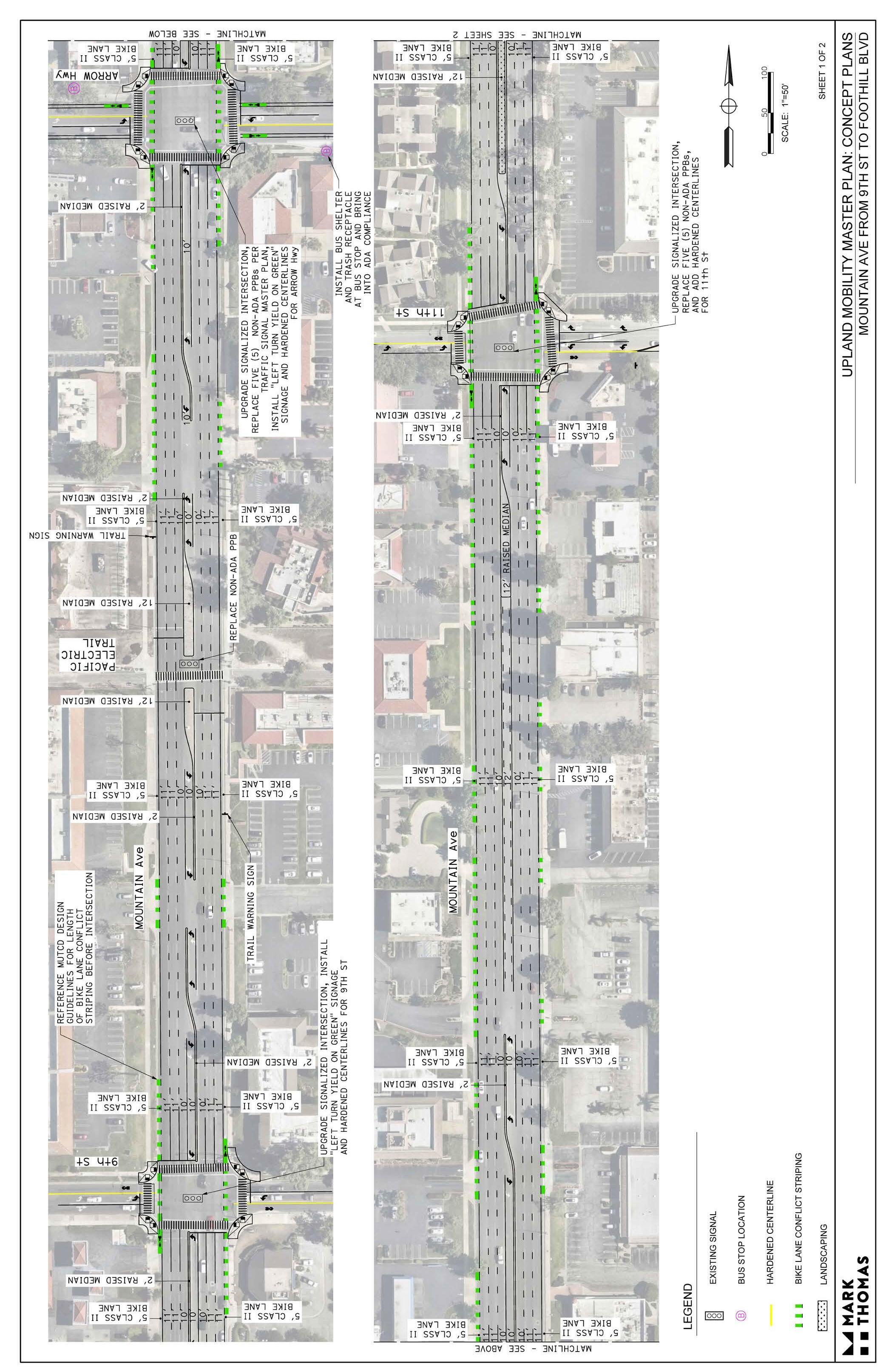
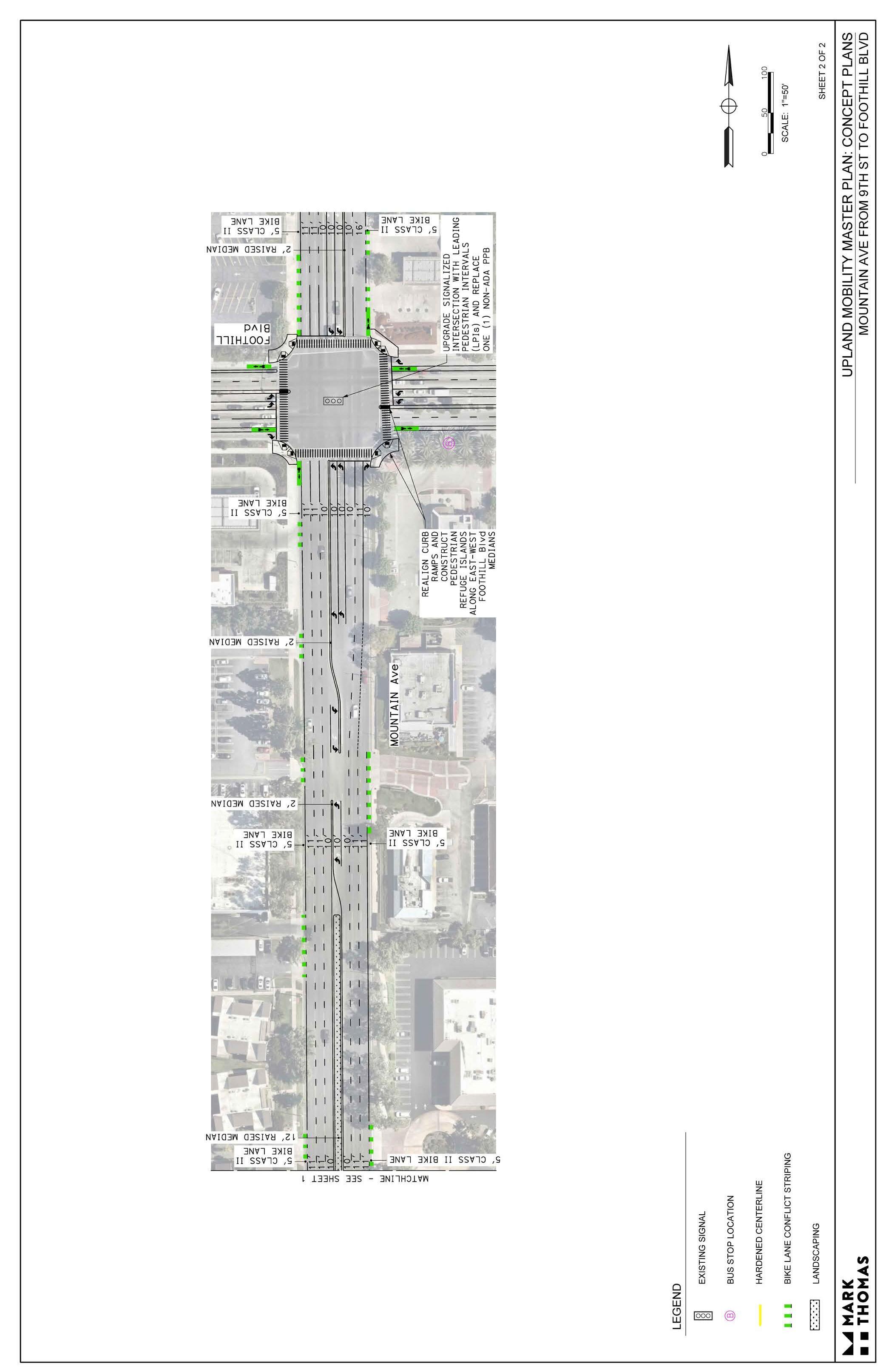
f Campus Avenue (9th Street to Foothill Boulevard)
f Foothill Boulevard (Central Avenue to Benson, Benson Avenue to Mountain Avenue, and Mountain Avenue to San Antonio Avenue)
f Grove Avenue (Foothill Boulevard to 15th Street)
f Lexington Street / 1st Avenue / 2nd Avenue
f Mountain Avenue (20th Street to 23rd Street)
f Mulberry Avenue (Foothill Boulevard to Pine Street)
f Palm Avenue (9th Street to Arrow Highway) - Complete
f Parking Lot (1st Avenue and A Street)
f Vernon Drive (West End to Palm Avenue) - Complete
In addition to CIPs, there are two planned development projects that will improve walkability in the Downtown area:
f Tom Thomas Magnolia Plaza along the Pacific Electric Trail: The project involves the development of a 0.69-acre urban open space located on the Pacific Electric Trail between 3rd Avenue and 2nd Avenue to be used as a Downtown Plaza. A conceptual plan has been approved and construction plans have been finalized.
f Downtown Parking Structure: The project involves the development of a four-level, 400-space parking structure in Downtown Upland at the City-owned lot at the corner of E. C Street and N. 1st Avenue. This project is partially funded by Metrolink.
The following Specific Plans were reviewed for relevance and consistency:
f Spanish Trails Specific Plan (2016)
f Upland Hills Country Club Specific Plan (2016)
f Enclave Specific Plan (2015)
f Upland Crossing Specific Plan (2014 Update)
f Colonies Specific Plan (2012)
f Historic Downtown Upland Specific Plan (2011)
f Park View Specific Plan (2008)
f Wyeth Cove Specific Plan (2006)
f Foothill Benson Terrace Specific Plan (2005)
f Foothill Walk Specific Plan (2005)
f College Park Specific Plan (2004)
f College Commerce Center Specific Plan (1999)
The following planning efforts are currently underway and were considered during the development of this Plan.
f Sidewalk Master Plan
f Americans with Disability Act (ADA) Master Plan
f Pavement Master Plan
f Traffic Signal Master Plan
f Water Master Plan
f Sewer Master Plan
The SBCTA Long Range Multimodal Transportation Plan (LRMTP) is a comprehensive, multimodal transportation vision for San Bernardino County through 2045/2050. The LRMTP includes strategies and projects to improve access, safety, connectivity, and sustainability for all travel modes. The LRMTP compiles regional strategies and projects from other planning efforts in one place to help facilitate the safe and efficient management, operation, and development of a regional multimodal transportation system. Local and regional agencies can use the LRTMP as a tool to support the development and implementation of multimodal transportation policies, programs, and projects.
Every four years the Southern California Association of Governments (SCAG) updates Connect SoCal, a long-range Regional Transportation Plan (RTP) to guide regional transportation, land use, and community planning across the six counties of Imperial, Los Angeles, Orange, Riverside, San Bernardino, and Ventura. In 2024, SCAG adopted the most recent iteration of Connect SoCal to outline the future development of the region’s communities and transportation system through 2050. Connect SoCal aims to reduce regional GHG emissions while also delivering major benefits to the region related to mobility, safety, public health, air quality, economic productivity, environmental justice, and
transportation level of service. Connect SoCal is categorized into four overarching pillars: Mobility, Communities, Environment, and Economy.
The Mobility pillar includes a comprehensive set of strategies aimed at building and maintaining an integrated, multimodal transportation network, including the following Transit and Multimodal Integration Strategies:
f Improve transit/rail safety and security for riders, including promoting best practices through SCAG advisory committees and working groups.
f Through land use planning, support residential development along high-frequency transit corridors and around transit/rail facilities and centers.
f Support community-led active transportation and safety plans, projects, and programs (e.g., Safe Routes to Schools).
Partner with local jurisdictions on demonstrations and quick-build projects through SCAG’s Go Human initiative.
f Expand the region’s networks of bicycle and pedestrian facilities. This includes creating more low-stress facilities, such as separated bikeways and bike paths, slow streets, and open streets.
f Reconnect communities by removing, retrofitting, or mitigating transportation facilities such as highways or railways that create barriers to community connectivity.
Connect SoCal allocates $751.7 billion of investment in the region’s transportation system, primarily in operations and maintenance, to ensure the continued performance of the existing network. Implementation of Connect SoCal 2024 will add 181,200 new miles of transit revenue service, 4,000 new miles of bike lanes, and 869 new miles to the Regional Express Lane Network, some of which include projects in Upland. Relevant policies and projects were reviewed by the planning team and considered during the development of this Plan.
The San Bernardino County Transportation Authority (SBCTA) worked with local jurisdictions to develop the Comprehensive Pedestrian Sidewalk Inventory Plan to support regional and local active transportation planning and implementation. Phase I of the planning effort included an inventory of 17,000 miles of sidewalk that documented sidewalk presence, width, condition, and material throughout San Bernardino County. Findings of the Phase I inventory are displayed in a public-facing ePlan under the Active San Bernardino Open Data Portal. Phase II of the planning effort expanded on the initial sidewalk inventory to help local agencies identify sidewalk gaps, pedestrian obstructions, and infrastructure deficiencies. The information collected during Phase II was used to create localfacing ePlans for agencies to use for local active transportation planning efforts, especially related to initiatives such as Safe Routes to Schools (SRTS), climate adaptation planning, and ADA Transition Plans.
Omnitrans, the public transit agency serving the San Bernardino Valley, adopted the Bus Stop Safety Improvement Plan (BSSIP) in 2021 to enhance safety at and while traveling to bus stops throughout the Omnitrans service area. While the BSSIP focused on analyzing and providing recommendations for nine census tracts (none of which were in Upland), it included policies, programs, and bus stop
design guidelines that can be applied to all bus stops in the San Bernardino Valley. The BSSIP included policy recommendations to provide safety amenities at bus stops; ensure ADA accessibility; utilize Complete Street strategies; develop local and regional programs to encourage transit use and safety; and create non-motorized access to transit that is direct, safe, and pleasant. Relevant policies were reviewed and used by the planning team to develop recommendations for improving the ease of access to public transit.
SBCTA updated the San Bernardino Countywide Transportation Plan (CTP) in 2021 to outline a strategy for long-term investment in and management of San Bernardino County’s regional transportation assets. This “interim update” is to be followed by a major update initiated in 2022.
The goals of the CTP are to:
f Focus on our transportation “customers” by building an integrated, multimodal network and managing that network to improve safety, mobility, and accessibility for the residents and businesses within San Bernardino County and the region.
f Plan and deliver transportation projects and services in a manner that promotes the County’s economic competitiveness, affordable housing, environmental quality, overall sustainability, and access by the full spectrum of system users.
f Promote stewardship of the public resources entrusted to SBCTA and other transportation agencies in the County through analysis and application of cost-effective, customer-focused, and technology-enabled approaches to the multimodal movement of people and goods.
f Promote the funding of transportation needs and efficient operation of transportation systems through collaboration with local, regional, state, and federal transportation agencies, together with private stakeholders.
f Support state, regional, and local environmental and sustainability goals.
San Bernardino County Active Transportation Plan (2020)
The San Bernardino County Active Transportation Plan was adopted in 2020 as an open data portal with data and recommendations related to active transportation across the county. The open data portal consolidated bicycling, walking, and Safe Routes to School recommendations from previously completed countywide plans, such as the Regional Safe Routes to School Plan (2017), SBCTA Points of Interest Pedestrian Plan (2019), and San Bernardino County Non-Motorized Transportation Plan (2018). For Upland, the open data portal identified three Safe Routes to School sites (Baldy View Elementary, Citrus Elementary, and Sycamore Elementary); three pedestrian points of interest (Downtown Upland and Civic Center, Mountain Avenue Retail Center, and Cabrillo Park and Baldy Park); and 24 planned bicycle facilities totaling 23.24 miles. The planned bicycle facilities included 3.12 miles of Class I, 18.52 miles of Class II, and 1.6 miles of Class III facilities. The existing and planned facilities in Upland listed in the open data portal were reviewed and incorporated into this Plan, where still relevant and applicable.
San Bernardino County Regional Greenhouse Gas Reduction Plan (2019)
In 2019, the San Bernardino Council of Governments (SBCOG) developed the San Bernardino County Regional Greenhouse Gas Reduction Plan (Reduction Plan) to inventory greenhouse gas (GHG) emissions and chart a path for regional GHG emissions reductions. The Reduction Plan contains greenhouse gas (GHG) inventories and GHG emissions reduction strategies for 25 local jurisdictions, including Upland. The Reduction Plan also includes comprehensive documentation of existing state and local GHG emission reduction policies that lay the foundation for future climate action across the region. Additionally, the Reduction Plan provides implementation guidance for local jurisdictions, including recommendations for securing funding, prioritizing projects, tracking and reporting progress, developing partnerships, and more.
The Reduction Plan states that the City of Upland has a goal to reduce GHG emissions to 2016 levels by 2030. The City plans to meet its goal through a combination of state (~70 percent) and local (~30 percent) measures that span different GHG emission sectors. The sectors that will have the greatest impact on GHG emissions are the building energy, on-road transportation, and waste sectors. Within the on-road transportation sector is a strategy to “Expand Bike Routes Including Pedestrian and Bicycle Friendly Streets” through the adoption and implementation of a bicycle master plan that sets a goal for miles of bicycle lanes to be constructed within the jurisdiction. Through the development and implementation of this Plan, the City will make progress on its GHG emissions reduction target.
SBCTA Points of Interest Pedestrian Plan (2019)
The SBCTA Points of Interest Pedestrian Plan (PIPP) aims to capture important locations in need of active transportation improvements that were not adequately captured in the original bicycle-centric Non-Motorized Transportation Plan (2018), the school sitefocused Safe Routes to School Plan (2018), or the broad SBCTA Complete Streets Strategy (2015). This PIPP provides a sample pedestrian plan for each of the 25 local jurisdictions, a list of additional pedestrian sites in need of pedestrian-focused improvements based on extensive data analysis, a framework for future plans that utilizes current best practices, and a suite of tools that can be used to expand the PIPP to other locations as needed.
For Upland, the PIPP identified three main pedestrian points of interest: Downtown Upland and Civic Center, Mountain Avenue Retail Center, and Cabrillo and Baldy Park (in order of priority). Other possible pedestrian points of interest included McCarthy Park, Magnolia Park/Magnolia Elementary School, Sierra Vista Park/Sierra Vista Elementary School, San Antonio Community Hospital/ Upland Memorial Park, and Upland Metrolink Station. The PIPP included the following suggested improvements for Downtown Upland and Civic Center:
f W. Arrow Highway/Euclid Avenue: Install pedestrian countdown timers for all intersection legs (Complete).
f A. Street/2nd Avenue: Install thermoplastic high-visibility crosswalks at the east, west, and south intersection legs (Incomplete).
f 3rd Avenue/D Street: Apply consistent crosswalk markings at all intersection legs and install yield lines and pedestrian signage for approaches with uncontrolled crossings (Complete).
f Bicycle Path Connections with 1st Avenue, 2nd Avenue, and 3rd Avenue: Install thermoplastic ladder-style crosswalk with both crosswalk signs and advanced crossing ahead signs (Complete).
f Euclid Avenue/C. Street: Install a curb ramp at the southwest corner of the intersection; install up-to-date pedestrian signage for each approach along Euclid Avenue; and install thermoplastic high-visibility crosswalks with yield lines and standardized signage (Incomplete).
f Euclid Avenue/Rail Tracks: Consider working with Metrolink to extend the protective barrier across the sidewalk to prevent pedestrians from crossing active tracks when trains are present (Incomplete).
f 9th Street/1st Avenue: The sidewalk on the western side of 1st Avenue between 9th Street and A. Street is narrow and should be widened with future development (Incomplete).
San Bernardino County Non-Motorized Transportation Plan (2011 with 2018 Revision)
SBTCA developed the Non-Motorized Transportation Plan (NMTP) in 2011 (revised in 2018) to support the development of a cohesive and integrated framework for delivering a safe, interconnected bicycling and walking system for San Bernardino County. The NMTP contains guiding goals and policies intended to provide a vision for the County, as well as cost estimates, design guidelines, implementation priorities, and funding opportunities to support local jurisdictions in implementation. The overarching goals of the NMTP are:
f Increased bicycle and pedestrian access: Expand bicycle and pedestrian facilities and access within and between neighborhoods, to employment centers, shopping areas, schools, and recreational sites.
f Increased travel by cycling and walking: Make the bicycle and walking an integral part of daily life in San Bernardino County, particularly (for bicycle) for trips of less than five miles, by implementing and maintaining a bikeway network, providing end-of-trip facilities, improving bicycle/ transit integration, encouraging bicycle use, and making bicycling safer and more convenient.
f Routine accommodation in transportation and land use planning: Routinely consider bicyclists and pedestrians in the planning and design of land development, roadway, transit, and other transportation facilities, as appropriate to the context of each facility and its surroundings.
f Improved bicycle and pedestrian safety: Encourage local and statewide policies and practices that improve bicycle and pedestrian safety.
The NMTP includes profiles for local jurisdictions, including the City of Upland, which document land use, relevant programs and municipal code policies, existing and proposed bicycle facilities, and priority improvements. When the NMTP
was updated in 2018, Upland had 39.95 miles of existing bicycle facilities and 21.64 miles of proposed improvements, which included upgrading 12.19 miles of Class III bicycle routes to Class II bicycle lanes. The projects identified for Upland have been integrated into the San Bernardino County Active Transportation Plan (2020) and were incorporated into the development of this Plan, where still appropriate.
SBTCA developed the Regional Safe Routes to School Plan Phase II (RSRTSP) in 2017 to guide strategic improvements to the safety and accessibility of non-motorized transportation networks around San Bernardino County schools. The ultimate goal of the RSRTSP is to promote walking and bicycling to school and improve community health by providing safer and more accessible bicycle and pedestrian facilities. The RSRTSP compiled findings from field observations and student travel pattern data collected from approximately ten percent of the County’s public schools; assembled an inventory of site-specific recommended school zone bicyclists and pedestrian network improvements based on data; provided resources for future implementation efforts at a regional scale; and developed a strategy for periodically collecting student data for monitoring and modeling purposes.
The goals of the RSRTSP are to:
f Support the overall Countywide Vision and implementation strategy for providing safe routes to schools in San Bernardino County that encourage alternate mode choices for students and parents.
f Build upon the Phase I inventory and prioritization study to better integrate SRTS sites and corridors with Countywide active transportation efforts including the other components of the Active Transportation Plan.
f Develop a student data collection strategy to document the benefits of active transportation to leverage more SRTS funding for local jurisdictions.
f Conduct and document walk audits to better identify their exact infrastructural needs and provide access accommodations for students to bicycle and walk to school.
f Define a series of possible implementation efforts to identify and remove barriers, over time, to active transportation for all of the schools in the County.
f Address both actual and perceived safety concerns, together with strategies that could significantly decrease bicycle and pedestrian facilities and injuries.
The RSRTSP selected 55 public schools in San Bernardino for data collection and implementation based on demonstrable need and willingness to collaborate, including three Upland schools (Baldy View Elementary, Citrus Elementary, and Sycamore Elementary). Volume II of the RSRTSP contained SRTS recommendations for the three selected schools in Upland, which proposed six engineering recommendations along 13th Street for Sycamore Elementary; six engineering recommendations along 11th Street for Baldy View Elementary; and seven engineering recommendations along 7th Street for Citrus Elementary. Engineering recommendations varied by school, but included improvements such as school signage, high visibility crosswalks, bulb-outs, ADA curb ramps, tree trimming, red curbs, traffic signals, sidewalk installation, and more. These engineering recommendations were reviewed to assist with SRTS recommendations.
The San Bernardino Associated Governments (SANBAG) Complete Streets Strategy (CSS) was developed in 2015 to help local jurisdictions implement Complete Streets policies and projects in their communities. Complete Streets are designed and operated to enable safe access for all street users, including pedestrians, bicyclists, motorists, and transit riders of all ages and abilities. The CSS encourages local jurisdictions to integrate Complete Streets policies into local planning projects, including General Plan amendments, and provides the necessary tools to adopt and implement Complete Streets policies with relative ease. For example, the CSS provides an overview of Complete Streets principles and statewide requirements, model language for Complete Streets Policies and General Plan, and best practices for integrating Complete Streets efforts with other planning projects. It is intended as an addendum to the San Bernardino County Nonmotorized Transportation Plan (NMTP) and provides additional resources for implementing key recommendations from the NMTP.
1 Caltrans. (2020). Active Transportation Program Fact Sheet. https://dot.ca.gov/-/media/dot-media/programs/local-assistance/documents/atp/2020/atpfactsheet20202024.pdf
2 Caltrans. (2020). Active Transportation Program Fact Sheet. https://dot.ca.gov/-/media/dot-media/programs/local-assistance/documents/atp/2020/atpfactsheet20202024.pdf
3 Rails to Trails Conservancy. (2023). Connecting America’s Active Transportation System. https://www.railstotrails.org/wp-content/uploads/2024/01/Connecting-Americas-Active-Transportation-System_factsheet_2023.pdf
4 Rails to Trails Conservancy. (2022). New Rails-to-Trails Conservancy Data Shows Strong Demand for Places to Walk, Bike and Be Active Outside. https://www.railstotrails.org/trailblog/2022/december/21/new-rails-totrails-conservancy-data-shows-strong-demand-for-places-to-walk-bike-and-be-active-outside/
5 StreetLight Data. (2023). Walking in America: Metro & Statewide Pedestrian & Mode Share Trends.
6 StreetLight Data. (2023). Bike Boom or Bust?: Metro & Statewide U.S. Bicyle Activity Trends.
7 Rails to Trails Conservancy. (2023). New Data Illustrates Importance of Connected Trail Infrastructure to the Nation. https://www.railstotrails.org/resource-library/resources/connected-trail-infrastructure/
8 Rails to Trails Conservancy. (2023). New Data Illustrates Importance of Connected Trail Infrastructure to the Nation. https://www.railstotrails.org/resource-library/resources/connected-trail-infrastructure/
9 Rails to Trails Conservancy. (2023). New Data Illustrates Importance of Connected Trail Infrastructure to the Nation. https://www.railstotrails.org/resource-library/resources/connected-trail-infrastructure/
10 NACTO. (2016). High-Quality Bike Facilities Increase Ridership and Make Biking Safer. https://nacto. org/2016/07/20/high-quality-bike-facilities-increase-ridership-make-biking-safer/; Urban Institute. (2022). Why US Cities Are Investing in Safer, More-Connected Cycling Infrastructure. https://www.urban.org/urban-wire/why-us-cities-are-investing-safer-more-connected-cycling-infrastructure
11 Federal Highway Administration. (n.d.) Proven Safety Countermeasures. https://highways.dot.gov/safety/ proven-safety-countermeasures
12 NACTO. (2022). Shared Micromobility in the U.S. and Canada: 2022. https://nacto.org/wp-content/uploads/2023/11/NACTO_sharedmicromobilitysnapshot_correctedNov3-2023-1.pdf
13 Glusac, E. (2021). Farther, Faster and No Sweat: Bike-Sharing and the E-Bike Boom. The New York Times. https://www.nytimes.com/2021/03/02/travel/ebikes-bike-sharing-us.html
14 Kamal, S. (2023). Why California public transit is at a pivotal moment. CalMatters. https://calmatters.org/ politics/capitol/2023/04/public-transit-california/
15 Kamal, S. (2023). Why California public transit is at a pivotal moment. CalMatters. https://calmatters.org/ politics/capitol/2023/04/public-transit-california/
16 Kamal, S. (2023). Why California public transit is at a pivotal moment. CalMatters. https://calmatters.org/ politics/capitol/2023/04/public-transit-california/
17 SCAG. (2024). Connect SoCal. https://scag.ca.gov/sites/main/files/file-attachments/23-2987-connect-socal-2024-final-complete-040424.pdf?1714175547
18 SCAG. (2024). Connect SoCal 2024 Mobility Technical Report. https://scag.ca.gov/sites/main/files/file-attachments/23-2987-tr-mobility-final-040424.pdf?1712795207
19 Brey, J. (2023). Microtransit Has Broad Appeal, Despite Clean Drawbacks. Governing. https://www.governing. com/transportation/microtransit-has-broad-appeal-despite-clear-drawbacks#:~:text=But%20many%20 transit%20advocates%20are%20wary%20of%20the%20trend.&text=In%20Brief%3A,t%20well%20served%20 by%20transit
20 Schank, J & Huang, E. (2022). Microtransit: A Good IDea Just Got Even Better. San Jose State University. https:// transweb.sjsu.edu/sites/default/files/2249-Schank-Demand-Responsive-Transportation-Shared-Mobility. pdf
21 Brey, J. (2023). Microtransit Has Broad Appeal, Despite Clean Drawbacks. Governing. https://www.governing. com/transportation/microtransit-has-broad-appeal-despite-clear-drawbacks#:~:text=But%20many%20 transit%20advocates%20are%20wary%20of%20the%20trend.&text=In%20Brief%3A,t%20well%20served%20 by%20transit
22 Graham, A. (n.d.). ZEB Regulation. California Transit Association. https://caltransit.org/Advocacy/ How-We-Advocate/Key-Issues/ZEB-Regulation#:~:text=The%20ICT%20regulation%2C%20which%20has,zero%2Demission%20technology%20by%202040
23 SCAG. (2024). Connect SoCal. https://scag.ca.gov/sites/main/files/file-attachments/23-2987-connectsocal-2024-final-complete-040424.pdf?1714175547
24 SCAG. (2024). Connect SoCal. https://scag.ca.gov/sites/main/files/file-attachments/23-2987-connectsocal-2024-final-complete-040424.pdf?1714175547
25 United States Environmental Protection Agency. (2023). Fast Facts on Transportation Greenhouse Gas Emissions. https://www.epa.gov/greenvehicles/fast-facts-transportation-greenhouse-gas-emissions
26 United States Environmental Protection Agency. (2023). Fast Facts on Transportation Greenhouse Gas Emissions. https://www.epa.gov/greenvehicles/fast-facts-transportation-greenhouse-gas-emissions
27 United States Department of Transportation: Federal Transit Administration. (2010). Public Transportation’s Role in Responding to Climate Change. https://www.transit.dot.gov/sites/fta.dot.gov/files/docs/PublicTransportationsRoleInRespondingToClimateChange2010.pdf
28 Lamanna, M., Klinger, C. A., Liu, A., & Mirza, R. M. (2020). The Association between Public Transportation and Social Isolation in Older Adults: A Scoping Review of the Literature. Canadian Journal on Aging / La Revue Canadienne Du Vieillissement, 39(3), 393–405. doi:10.1017/S0714980819000345
29 American Trails. (2020). Why Trails? https://www.americantrails.org/why-trails
30 U.S. Department of Transportation. (2023). Traffic Safety Facts - Pedestrians. https://crashstats.nhtsa.dot. gov/Api/Public/ViewPublication/813458; U.S. Department of Transportation. (2023). Traffic Safety Facts - Bicyclists and Other Cyclists. https://crashstats.nhtsa.dot.gov/Api/Public/ViewPublication/813484
31 The League of American Cyclists. (2022). Benchmarking Bike Networks. https://bikeleague.org/sites/default/ files/Benchmarking-Bike-Networks-Report-final.pdf
32 California Transportation Commission. (n.d.). Active Transportation Program. https://catc.ca.gov/programs/active-transportation-program
33 American Trails. (2020). Why Trails? https://www.americantrails.org/why-trails
34 Rails to Trails Conservancy. (2019). Active Transportation Transforms America. https://www.railstotrails.org/ media/847675/activetransport_2019-report_finalreduced.pdf
35 Smart Growth America (n.d.). Economic Benefits Activity-Friendly Routes to Everyday Destinations.https:// smartgrowthamerica.org/wp-content/uploads/2020/11/routes-to-destinations-economic-benefits.pdf
36 Flusche, D. (2012). Bicycling Means Business: The Economic Benefits of Bicycle Infrastructure. https://bikeleague.org/sites/default/files/Bicycling_and_the_Economy-Econ_Impact_Studies_web.pdf
37 Campbell, R., & Wittgens, M. (2004). The Business Case for Active Transportation The Economic Benefits of Walking and Cycling. https://nacto.org/docs/usdg/business_case_for_active_transportation_campbell. pdf
38 Northern Colorado Bike & Ped Collaborative. (n.d.). Why Invest in Active Transportation? https://nfrmpo.org/ wp-content/uploads/benefits-of-active-transportation.pdf
39 Crompton, J. (2020). The Impact of Trails and Greenways on Property Values. https://www.nrpa.org/ parks-recreation-magazine/2020/may/the-impact-of-trails-and-greenways-on-property-values/
40 Northern Colorado Bike & Ped Collaborative. (n.d.). Why Invest in Active Transportation? https://nfrmpo.org/ wp-content/uploads/benefits-of-active-transportation.pdf
41 Doyle, T. (2023, September 28). New APTA Report Says Public Transit Users Can Save $13,000 Annually. American Public Transportation Association. https://www.apta.com/news-publications/press-releases/releases/ new-apta-report-says-public-transit-users-can-save-13000-annually/
Chapter 2 documents and analyzes the existing conditions of Upland’s mobility system. The chapter includes geospatial analyses of several relevant datasets, such as land use, activity centers, existing bicycle and pedestrian infrastructure, public transit, activity centers, collision hotspots, and more. The findings of this chapter were used, in combination with community input, to identify key mobility gaps, needs, and priorities and develop recommendations for improvement.
Reimagining Upland’s mobility network with new and improved mobility options requires first developing a strong understanding of the community’s current needs and priorities. Chapter 2 presents the findings of a comprehensive existing conditions analysis based on community demographics, land use, roadway conditions, collision history, previously planned projects, and other foundational information. Each dataset in this chapter provides valuable information to paint a holistic picture of Upland’s current pedestrian, bicycle, and public transit network and key areas needing improvement.
The findings of this analysis, combined with the input from an extensive community engagement process, were used to develop a set of projects and programs to facilitate safe, comfortable, and enjoyable walking, bicycling, and public transit access throughout Upland. The recommended projects are presented in Chapter 5. Upland
A demographic profile was completed using the most current data available from the 2022 U.S. Census Bureau American Community Survey (ACS) 5-Year Estimates. Upland has a total population of 78,847 residents and 28,040 housing units within its 16-square-mile city boundary, resulting in a population density of 4,928 people per square mile.
Key demographics and comparisons with San Bernardino county and California statistics:
f Race & Ethnicity: The racial composition of Upland is 48.1 percent white, 10.3 percent Asian, 7.2 percent Black, 1.1 percent American Indian, 0.2 percent Native Hawaiian, 17.4 percent an other race, and 15.7 percent two or more races. Approximately 43.7 percent of Upland residents are Hispanic or Latino.
f Age: The median age of Upland (37.1) is higher than the average of San Bernardino county (33.9) and similar to that of California (37.3).
f Approximately 15.1 percent of Upland residents are 65 or older, which is higher than 11.9 percent countywide and similar to 14.9 percent statewide.
f Roughly 21.5 percent of Upland residents are under age 18, which is slightly lower than county and state percentages of 25.9 and 22.3 percent, respectively.
f Income & Poverty: Upland’s median household income of $93,994 is higher than the average of $77,423 for San Bernardino county and $91,905 for California. Additionally, the reported percentage of people in poverty in Upland (10.5 percent) is slightly lower than that of San Bernardino county (13.8 percent) and California (12.1 percent).
f Vehicle Availability: Most Upland households have access to one or more vehicles, with roughly 1.2 percent lacking access to a vehicle.
Source: U.S. Census Bureau. (2022). American Community Survey, ACS 5-Year Estimates Subject Tables DP05, S0101, S0801.
Transportation mode share is used to identify commuting patterns within a community. This Plan is particularly interested in supporting and encouraging the following mode shares as viable alternatives to driving in single-occupancy vehicles:
f Walking Mode Share: The walking mode share measures the percentage of workers aged 16 years and over who commute to work by foot. Walking mode share patterns are connected to the relative proximity of housing to employment centers. Walking mode share reflects how well infrastructure and land-use patterns support travel to work by foot.
f Bicycling Mode Share: Similar to the walking mode share, bicycling mode share measures the percentage of resident workers aged 16 years and over who commute to work by bicycle.
f Public Transit Mode Share: Public transit mode share measures the percentage of workers aged 16 years and over who commute to work by transit. This mode share reflects how well first-mile-last-mile infrastructure, transit routes, and land-use patterns support travel to work by transit.
Approximately 34,680 Upland residents commute to work by driving, walking, bicycling, taking public transit, or other means. Roughly 4,506 residents work from home. Currently, most Upland residents (73.3 percent) rely on personal vehicles to travel to and from work. This mode is followed in prevalence by working from home (11.5 percent), carpooling (9.1 percent), taxicab/ motorcycle/other (2.6 percent), public transportation (1.6 percent), walking (1.3 percent), and bicycling (0.6 percent). With nearly three-quarters of Upland commuters driving alone to work, there is a clear need for improved access to safe, efficient, and viable alternatives to single-occupant commuting, while also providing better mobility choices for short local trips.

Source: U.S. Census Bureau. (2022). American Community Survey, ACS 5-Year Estimates Subject Table S0801.
The average time it takes Upland commuters to get to work (across all travel modes) is estimated at 30.4 minutes. Roughly half of commuters have a commute time greater than 25 minutes, indicating a moderate amount of non-localized employment. However, 10.6 percent of commuters spend less than 10 minutes traveling to work, presenting an opportunity to help short-distance commuters opt for walking, bicycling, or public transit instead of driving.


Source: U.S. Census Bureau. (2022). American Community Survey, ACS 5-Year Estimates Subject Table S0801.
Figure 2-1 displays land use in Upland according to the City’s General Plan Land Use Map (adopted in 2015). Upland is dominated by low-density, single-family residential land uses with some pockets of multi-family, mixed-use, and rural residential housing. Community facilities, such as parks and schools, are interspersed with residential housing throughout the city. Upland has a small downtown area, which is generally bounded by Euclid Avenue to the west, Campus Avenue to the east, Arrow Highway to the north, and 8th Street to the south. Commercial and office land uses are concentrated in Downtown Upland and along major corridors, such as Foothill Boulevard, N. Mountain Avenue, N. Benson Avenue, and off of State Route 210. Large swaths of industrial land uses and public utilities are located along the western and eastern city limits with additional areas concentrated near the railroad line in southern Upland.
To be eligible for State funding, a city’s bicycle and pedestrian plan must address connections between specific activity center types. Activity centers are essential destinations within a community, including schools, parks, major employers, office buildings, industrial sites, government sites, retail centers, hospitals, and tourist attractions. Identifying these activity centers, and their distribution in a community, is essential to creating useful bicycle and pedestrian networks.
Figure 2-2 shows activity centers in Upland, such as City Hall, the Library, the Police Department, San Antonio Regional Hospital, the Metrolink Station, Cable Airport, and Downtown Upland, as well as schools, parks, and shopping areas. The mobility projects proposed in Chapter 5 are intentionally located along key corridors that will connect people to major destinations.
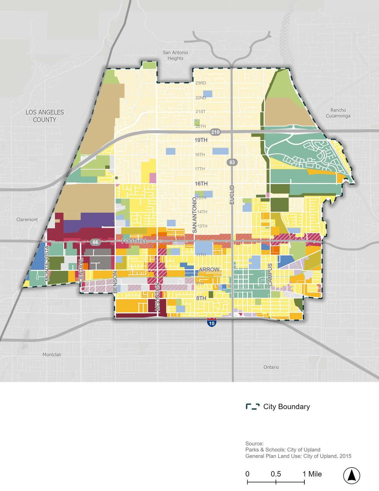
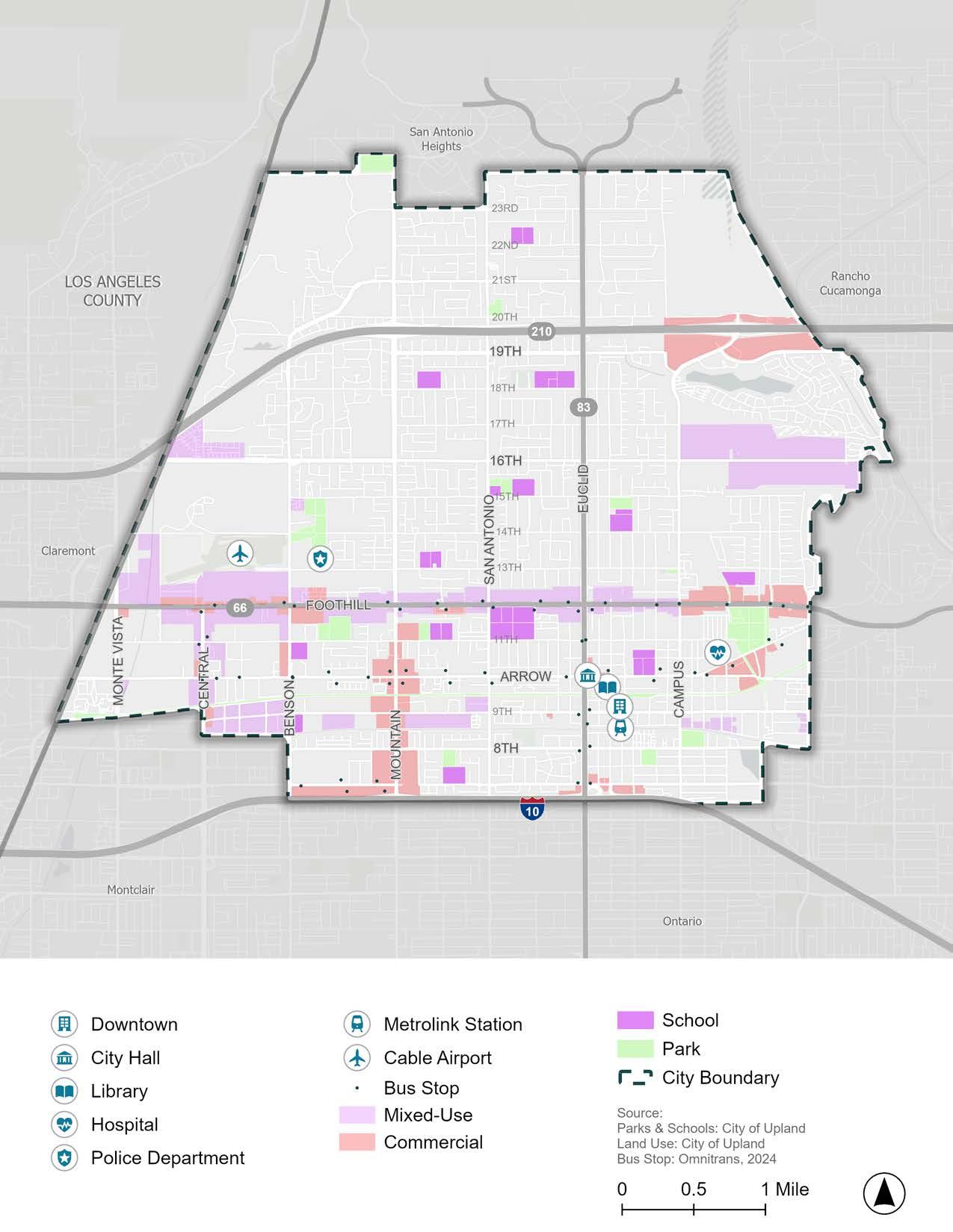
Figure 2-3 depicts Upland streets based on the following classifications: Major Arterial, Secondary Arterial, Collector Streets, and Local Roads. Interstate 10 (I-10) freeway runs along the south boundary of the city, providing regional access and connecting Upland with other parts of San Bernardino county and California. State Route 210 (SR210), also known as the Foothill Freeway, runs through the north part of the city, providing connections to Pasadena to the west and San Bernardino to the east. Euclid Avenue is part of State Route 83, a north-south route that connects Upland to Ontario and Chino to the south. Foothill Boulevard is part of State Route 66, an east-west route formerly part of U.S. Route 66.
Major and secondary arterials, which provide local access to major destinations throughout Upland, include:
f 8th Street
f 16th Street
f 19th Street
f Arrow Highway
f Baseline Road
f Benson Avenue
f Campus Avenue
f Central Avenue
f Euclid Avenue
f Foothill Boulevard
f Monte Vista Avenue
f Mountain Avenue
f San Antonio Avenue
The remaining collector and local streets provide access to residential housing, schools, parks, and other destinations. Knowing that the arterial roadways provide access to essential local destinations highlights the need for public transit routes, as well as active transportation facilities that support safe and comfortable nonmotorized travel along these car-oriented corridors.
Figure 2-4 displays the posted speed limits throughout Upland’s road network. Upland’s high-speed corridors (25 to 45 miles per hour) include:
f 8th Street
f 16th Street
f 19th Street
f Arrow Highway
f Baseline Road
f Benson Avenue
f Campus Avenue
f Central Avenue
f Euclid Avenue
f Foothill Boulevard
f Monte Vista Avenue
f Mountain Avenue
f San Antonio Avenue
The posted speed limit for these major and secondary arterials varies between 25 and 45 miles per hour (mph). None of the surface streets within Upland have posted speeds of 50 mph or above. Posted speed limits along major and secondary arterials play an important role in developing enhanced recommendations appropriate for these higher-speed streets. SPEED
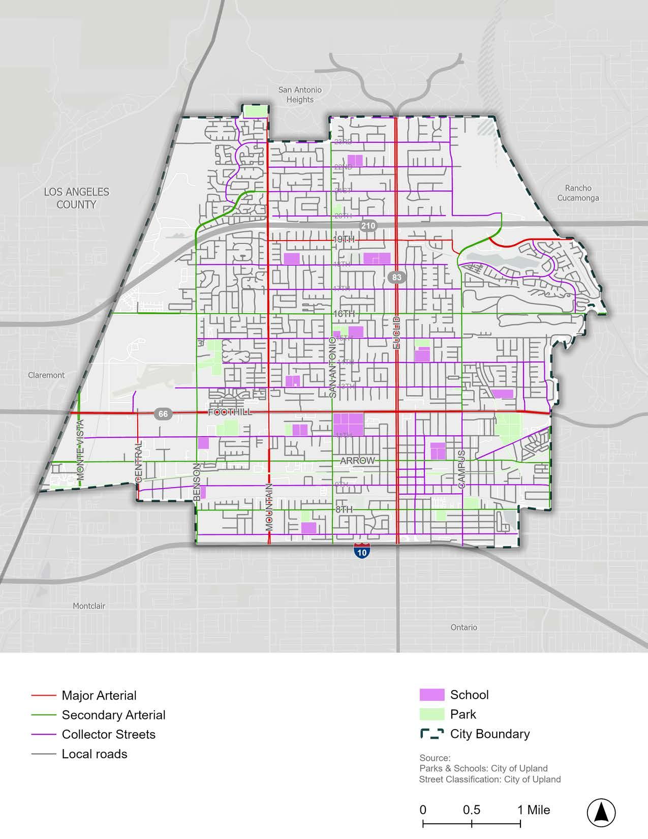
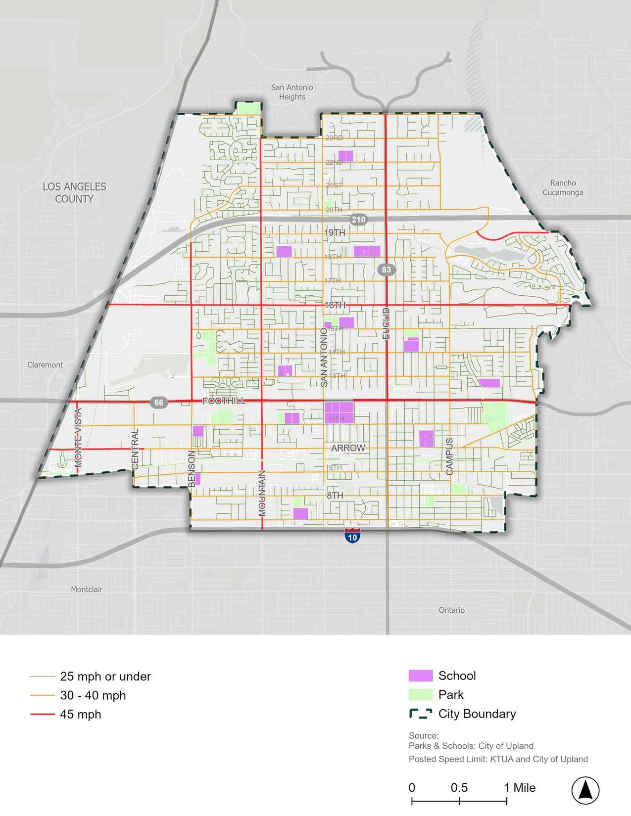
Figure 2-5 shows the average daily roadway traffic volumes for Upland’s street network. Corridors with high (red) and medium (orange) traffic volumes are generally along major and some secondary arterials:
f 16th Street
f Arrow Highway
f Baseline Road
f Benson Avenue
f Campus Avenue
f Euclid Avenue
f Foothill Boulevard
f Grove Avenue
f Monte Vista Avenue
f Mountain Avenue
f San Antonio Avenue
These higher-volume corridors reflect their importance in providing critical connections to regional and local destinations. Providing active transportation and public transit infrastructure along or near these highvolume corridors may give community members viable alternatives to traveling in single-occupancy vehicles. However, given the large volume of vehicular traffic along high-volume routes, traffic calming, physical separation, and other safety measures will be essential to prevent conflicts between drivers and other road users.
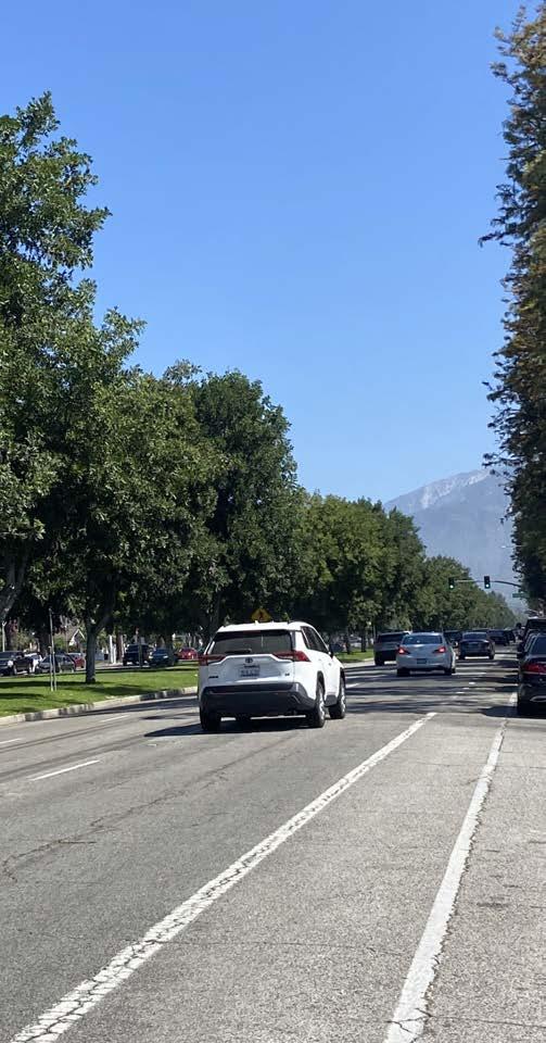
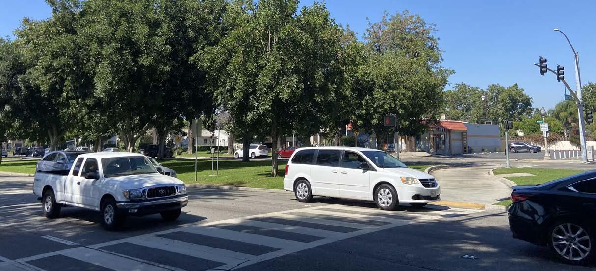
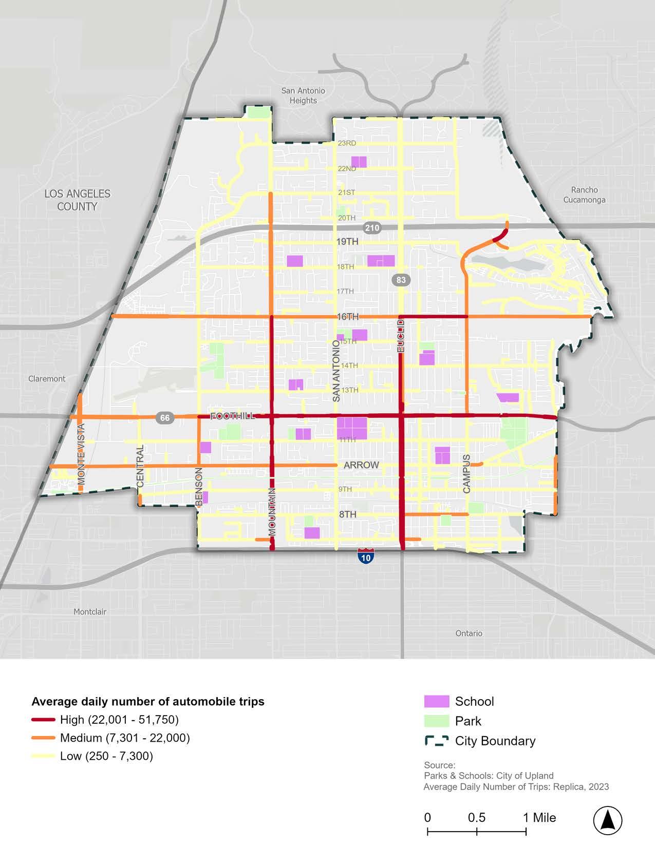

Understanding the geographic distribution of various social, economic, health, and environmental risks and burdens is essential to identifying the areas in greatest need of infrastructure improvements and supportive resources. Transportation, in particular, is a key component of healthy and equitable communities. For example, communities with safe and affordable multi-modal transportation options have expanded access to employment and education opportunities, healthy food sources, recreational spaces, and more. The provision of viable non-vehicular transportation options, such as public transit and bicycle and pedestrian facilities, enables people without access to a vehicle to reach their desired destination with relative ease. At the same time, improving the safety of problematic transportation corridors in underserved communities through traffic calming and other safety measures is another important way to improve comfort and quality of life.
Prioritizing the allocation of resources in underserved areas is an important step towards improving equity and quality of life for all community members, regardless of socioeconomic status. Additionally, many grant funding sources prioritize funds in underserved or disadvantaged communities. As a result, analyzing health and equity patterns in Upland is critical in leveraging funds from not only the Caltrans ATP grant but also other funding sources aimed at supporting healthy and equitable communities. Four data sources were analyzed for this assessment: (1) CalEnviroScreen 4.0, (2) SB 535 Disadvantaged Communities, (3) Transportation Equity Index, and (4) California Healthy Places Index.
CalEnviroScreen 4.0 is a mapping tool from CalEPA and the California Office of Environmental Health Hazard Assessment (OEHHA) that identifies areas most affected by an accumulation of environmental pollution, health burdens, and social
stressors. CalEnviroScreen provides a score based on the cumulative impacts experienced by a particular community, with higher scores experiencing greater burdens and lower scores experiencing lower burdens. These scores are used to identify and prioritize communities that are most burdened by environmental injustices.
Figure 2-6 displays the range of CalEnviroscreen scores across Upland. Census tracts with darker red colors (like south of Foothill Boulevard) have higher CalEnviroScreen scores and therefore have relatively high pollution burdens and population sensitivities. Census tracts with lighter green colors (like north of 15th Street) have lower scores, and correspondingly lower pollution burdens and sensitivities.
Senate Bill 535 (SB 535) directed that at least 25 percent of the proceeds of the State’s Cap-and-Trade Program go to projects that provide a benefit to disadvantaged communities and at least 10 percent of the funds go to projects located within those communities. SB 535 gave CalEPA the responsibility for identifying those communities. Figure 2-7 shows the Disadvantaged Communities designated by CalEPA for SB 535.
All areas from Foothill Boulevard to the southern city limit are designated as Disadvantaged Communities. These areas represent the 25% highest scoring census tracts in CalEnviroScreen 4.0, census tracts previously identified in the top 25% in CalEnviroScreen 3.0, census tracts with high amounts of pollution and low populations, and federally recognized tribal areas as identified by the Census in the 2021 American Indian Areas Related National Geodatabase. Locating mobility improvement projects in these areas will not only benefit those in greatest need of public investment, but these projects will also compete better for State grant funds.
In 2024, Caltrans launched the spatial screening tool, Transportation Equity Index (EQI), to identify transportation-based priority populations at the Census block level and operationalize Caltrans’ commitment to equity. Transportation-based priority populations are communities that are most burdened by the transportation system and receive the fewest benefits. The EQI integrates transportation and socioeconomic indicators into three “screens” to identify transportation-based priority populations.
A census block will meet the threshold of a transportation-based priority population if the Demographic Overlay, Traffic Exposure Screen, and Access to Destinations criteria are all met:
f Demographic Overlay: Communities with low-income and/or tribal land status. If either of the low-income household or Tribal Land criteria are met, the block is screened for inclusion for further analysis with the transportation-specific indicators (traffic exposure and access to destinations indicators).
f Traffic Exposure: Communities with low-income and/or tribal land status that are most burdened through high exposure to traffic and crashes. Exposure to traffic is measured by proximity, volume, and vehicle type for all interstates, highways, principal arterials, and minor arterials in the state. Exposure to crashes is measured through a statewide crash exposure calculation.
f Access to Destinations: Communities with low-income and/or tribal land status that have the greatest gaps in multimodal access to destinations. Access to destinations is measured by three unique access to destinations indicators designed to evaluate gaps in transit, bicycle, and pedestrian access to work and non-work destinations.
Because the EQI is a novel tool, the practical applications of the EQI are still being tested. For example, the EQI is currently being piloted for use in the Caltrans System Investment Strategy (CSIS). Other program-
specific use cases for the EQI are also under development. However, generally, the EQI was developed to identify transportation-based priority populations for applicable funding programs, to support planning- and projectlevel analysis, and to identify opportunities to advance equitable outcomes during project planning, development, and design. For these reasons, the EQI was used as one of five tools to evaluate health and equity in Upland.
Figure 2-8 displays the results of the EQI for Upland. The EQI has categorized several areas in Upland as transportation-based priority populations, including along Foothill Boulevard, Euclid Avenue, Campus Avenue, and between Benson Avenue and Mountain Avenue. The transportation-based priority populations shown in Figure 2-8 demonstrate areas that experience more transportation-related burdens than the rest of Upland and may benefit most from mobility improvements.
The California Healthy Places Index (HPI) is a peer-reviewed data mapping platform created by the Public Health Alliance of Southern California. The HPI maps data for social indicators that impact health, such as education, job opportunities, access to clean air and water, and more. Similar to CalEnvioScreen, HPI is a useful tool to help identify health inequities affecting neighborhoods across California.
Figure 2-9 displays the percentile ranking for different neighborhoods in Upland, with lower percentile areas (blue) experiencing less healthy conditions than higher percentile areas (green). Figure 2-9 shows that health conditions are lower in east central and southern Upland with an area south of Arrow Highway and east of Euclid Avenue having the worst health conditions in the city. The HPI scores help to demonstrate which areas would benefit most from infrastructure and programs aimed at improving community health and safety, access to opportunities, and quality of life.
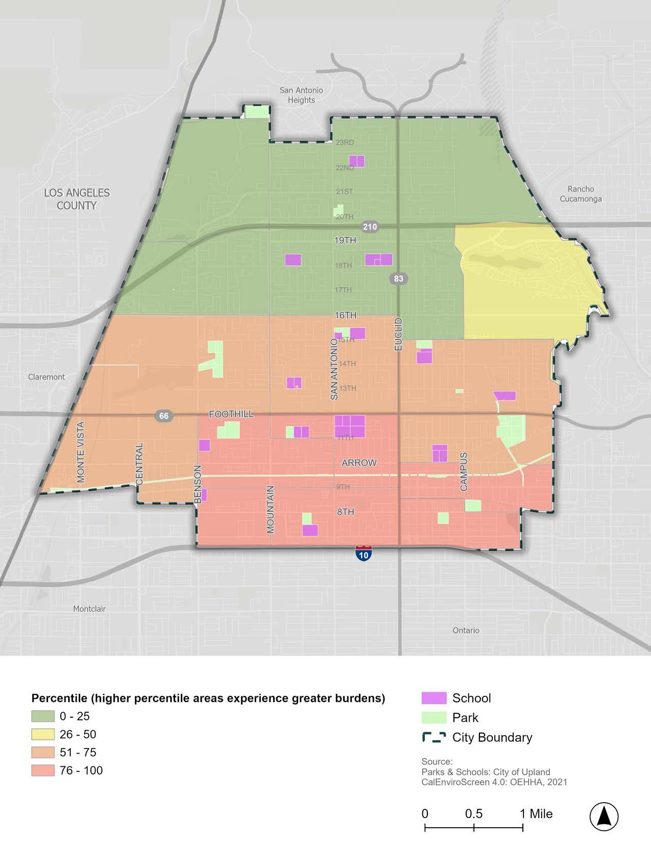
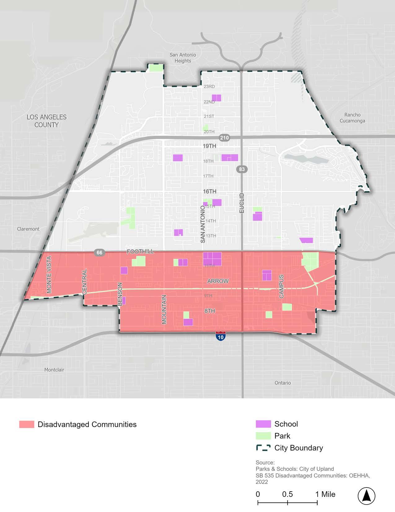
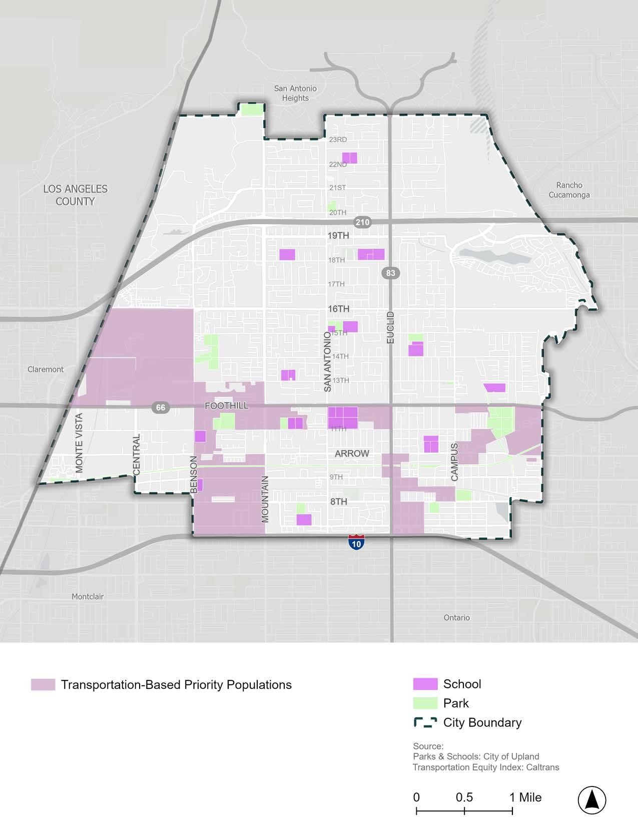
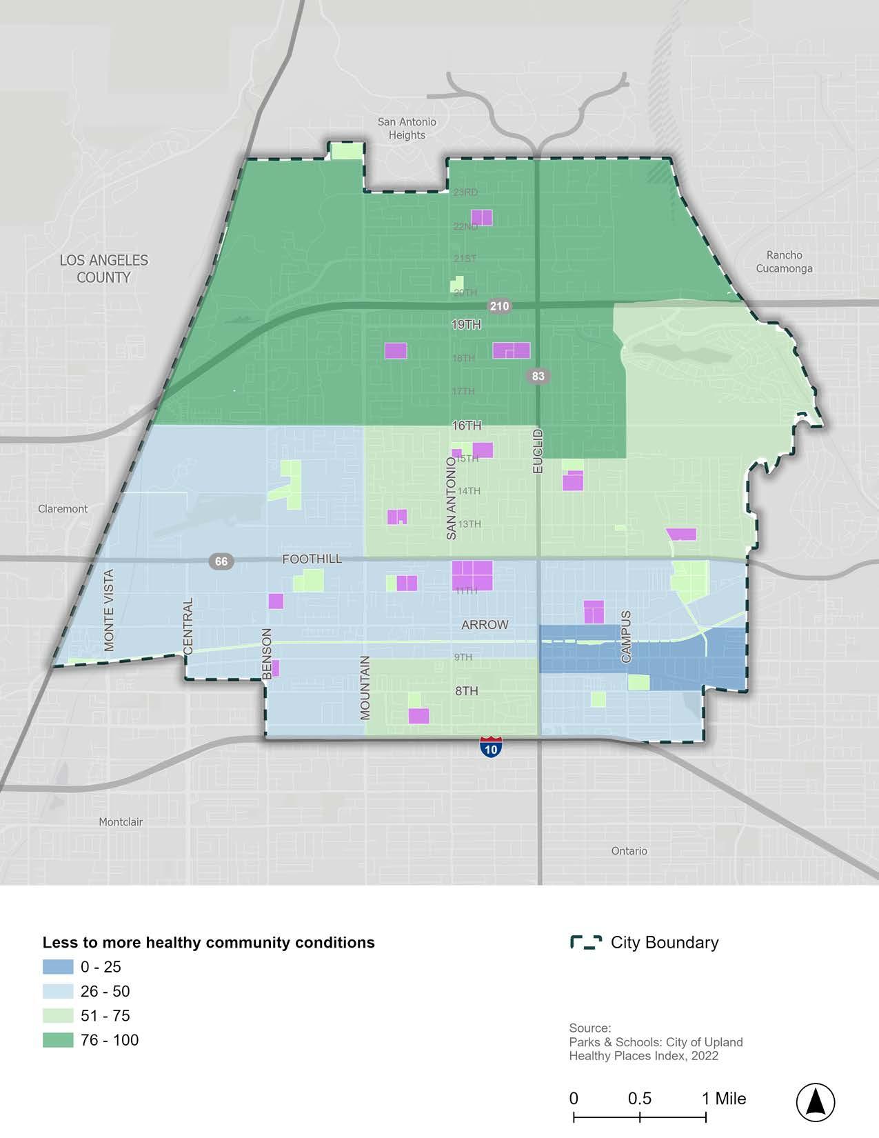
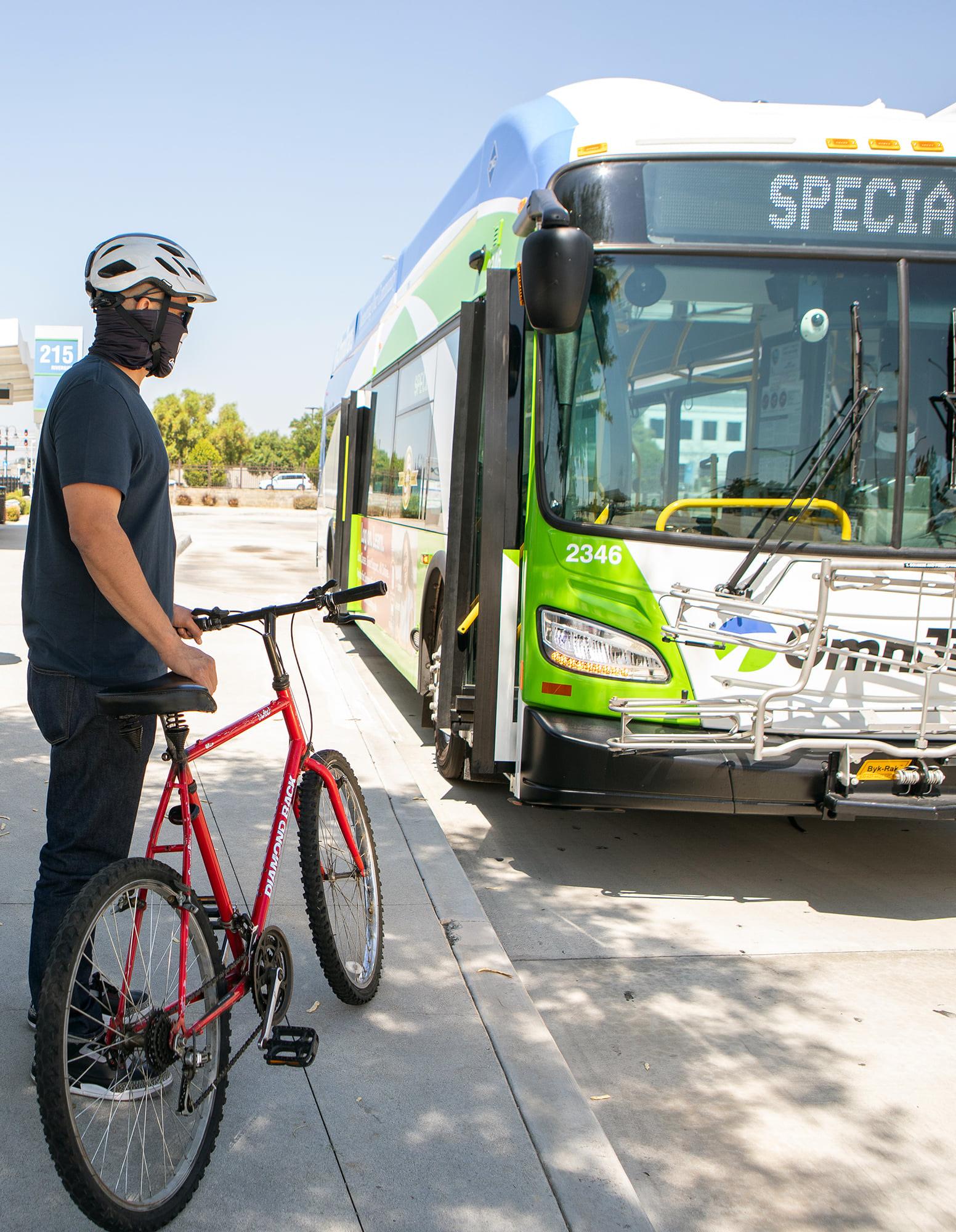
Source: Omnitrans
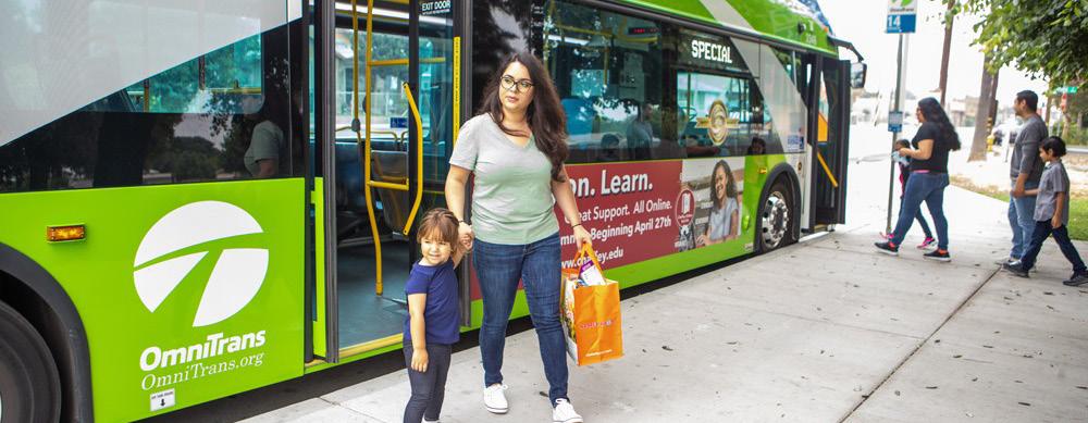
Public transit, when efficient and convenient, can offer a viable low-cost replacement to driving in a single-occupancy vehicle. Public transit in Upland is provided by Omnitrans and Metrolink. Currently, 1.6 percent of commuters in Upland use public transit as their primary mode of transportation to work. Enhancing public transit service to improve the experience for existing riders while also expanding accessibility and ease to attract new riders is essential to developing a multimodal mobility system. Additionally, improving active transportation facilities along bus routes can help address first-and-last-mile problems (i.e., the distance between a bus stop and the final destination) that often deter people from using public transit. Understanding the existing distribution, ridership patterns, and quality of public transit in Upland is an essential first step in identifying opportunities for improvement.
Omnitrans operates four fixed bus routes (Routes 66, 83, 84, and 85) that provide service in the southern parts of Upland, as shown in Figure 2-10
f Route 66 serves Fontana, Upland, and Montclair via Foothill Boulevard.
f Route 83 serves Upland and Chino via Euclid Avenue.
f Route 84 serves Upland, Chino, and Ontario via Mountain Avenue and Central Avenue.
f Route 85 provides service between the Chino Transit Center, Montclair, Upland, and Chaffey College in Rancho Cucamonga via Arrow Highway.
Route 66 provides weekday service every 20 minutes during peak hours and every 30 minutes during off-peak hours; and weekend service every 30 minutes. Routes 83 and 85 have a weekday service of every 30 minutes. Route 84 provides service every 60 minutes Monday through Sunday.
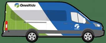
In addition to fixed bus routes, Omnitrans offers OmniRide, an on-demand microtransit service in Upland. OmniRide customers can reserve rides on a smartphone application, get picked up within 15 minutes, and be dropped off at a “virtual stop” close to their desired destination. OmniRide costs $4 per ride and includes a day pass to OmniTrans service on the day of travel. Veterans, seniors, people with disabilities, and Medicare enrollees can ride at a discounted rate of $1 per ride. OmniRide virtual stops are distributed evenly throughout Upland, providing affordable and convenient access to most of the city.
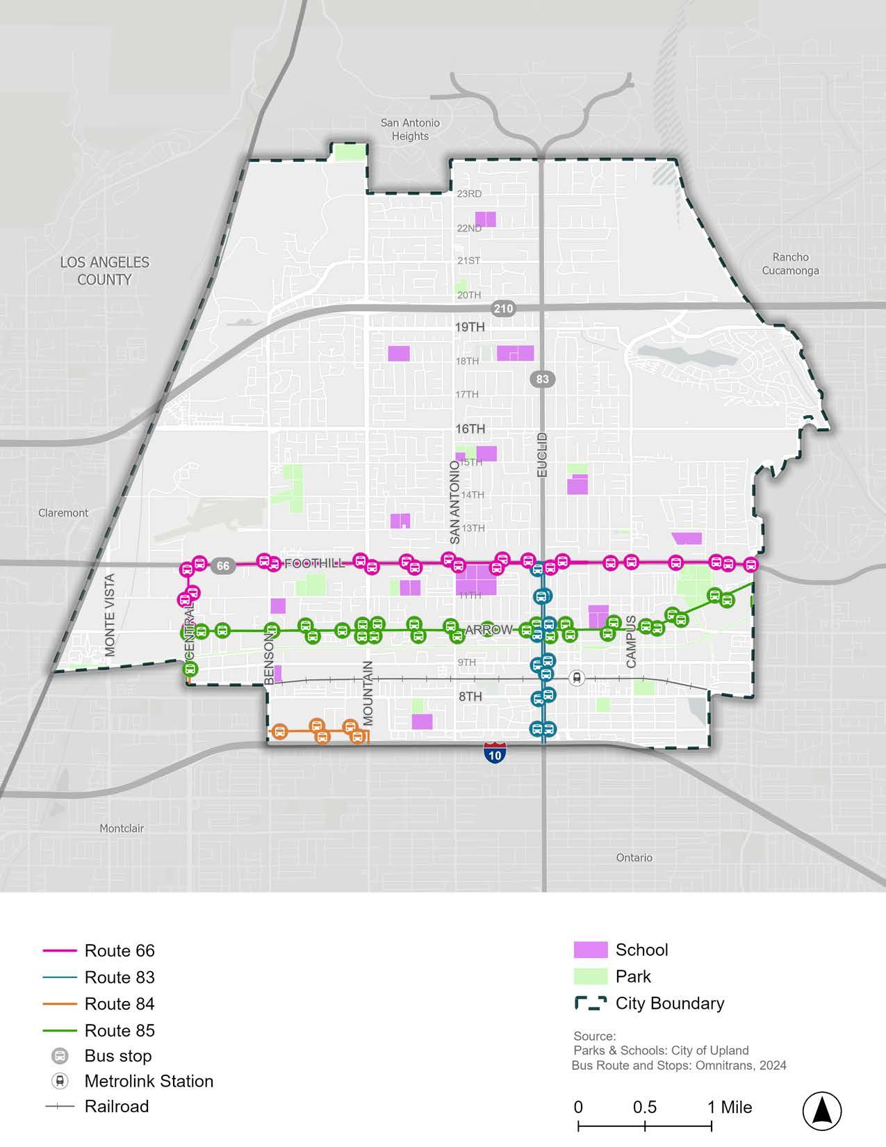
Making public transit accessible is an essential component of increasing public transit ridership. While public transit users may drive to access a regional transit route like Metrolink, people are more likely to walk or ride a bicycle to reach a local bus stop. Understanding the geographic distribution of public transit stops in Upland and the areas within walking distance of them can be used to identify gaps in easy access to public transit. Figure 2-11 displays the areas in Upland within a 10-minute walk (or halfmile) of a fixed bus stop (blue) or a “virtual” microtransit stop (yellow). The areas shown in (green) are where there is an overlap in coverage between fixed bus stops and virtual microtransit stops. The 10-minute walk zones displayed in Figure 2-11 illustrate which neighborhoods are within reasonable walking distance to public transit and which are not.
Because there are no fixed bus routes or stops north of Foothill Boulevard, easy access to regular public transit service is nonexistent for residents living north of 14th Street. Additionally, there are gaps in access south of Arrow Highway between Benson Avenue and Mountain Avenue, Mountain Avenue and Euclid Avenue, and Monterey Avenue and the eastern city limit.
While there are gaps in access to fixed public transit routes and stops, Omnitrans’ microtransit service, OmniRide, bridges this gap by picking riders up from a “virtual stop” and dropping them off close to their requested drop-off point. OmniRide’s wide distribution of “virtual stops” provides near total coverage of Upland, offering residents a convenient and affordable public transit option to get anywhere in the city.
Figure 2-12 displays the average number of people getting on (boarding) and off (alighting) Omnitrans buses on a typical weekday in Fall 2023. Figure 2-12 shows that the southbound bus stop at Euclid Avenue and Foothill Boulevard on Route 83 has
the highest average weekday activity with roughly 99 riders per day. More generally, many bus stops on Route 66 along Foothill Boulevard also have high weekday activity with several stops serving 40 to 60 riders per day. The popularity of these bus stops is likely due to the mix of commercial, office, and industrial destinations along these major arterials.
Transit stop amenities and ADA (Americans with Disabilities Act) accessibility can increase the comfort and safety of public transit users. Transit stop amenities can include posted route schedules, trash receptacles, lighting, sheltered waiting areas that protect from rain and sun, realtime arrival updates, Wi-Fi connectivity, and more. Transit stops that are ADA-compliant meet the following requirements:
f Bus stop has a curb ramp at the nearest intersection with a sidewalk connecting the intersection to the bus stop.
f ADA boarding area (also called a landing pad) is at least eight feet wide and five feet long.
f ADA boarding area connects the curb to the sidewalk.
f ADA boarding area is flat, paved, and clear of obstructions. Cracks must be less than 2 inches wide and the slope must be less than 2 percent.1
Figure 2-13 displays the basic amenities and ADA compliance of each bus stop in Upland. Several bus stops are not ADA-compliant, revealing a need for collaboration between the City and Omnitrans to increase the ADA accessibility of Upland’s bus system. Additionally, very few bus stops have both a shelter and a bench, indicating a major need for improved bus stop amenities.
While several bus stops are not ADA-compliant, Omnitrans makes accommodations for persons with disabilities per the ADA. Accommodations include but are not limited to wheelchair-accessible ramps or lifts and securement areas on all buses; low-floor kneeling buses; audio and visual on-board bus stop announcements; and TDD/TTY access via the California Relay Service, 711.2
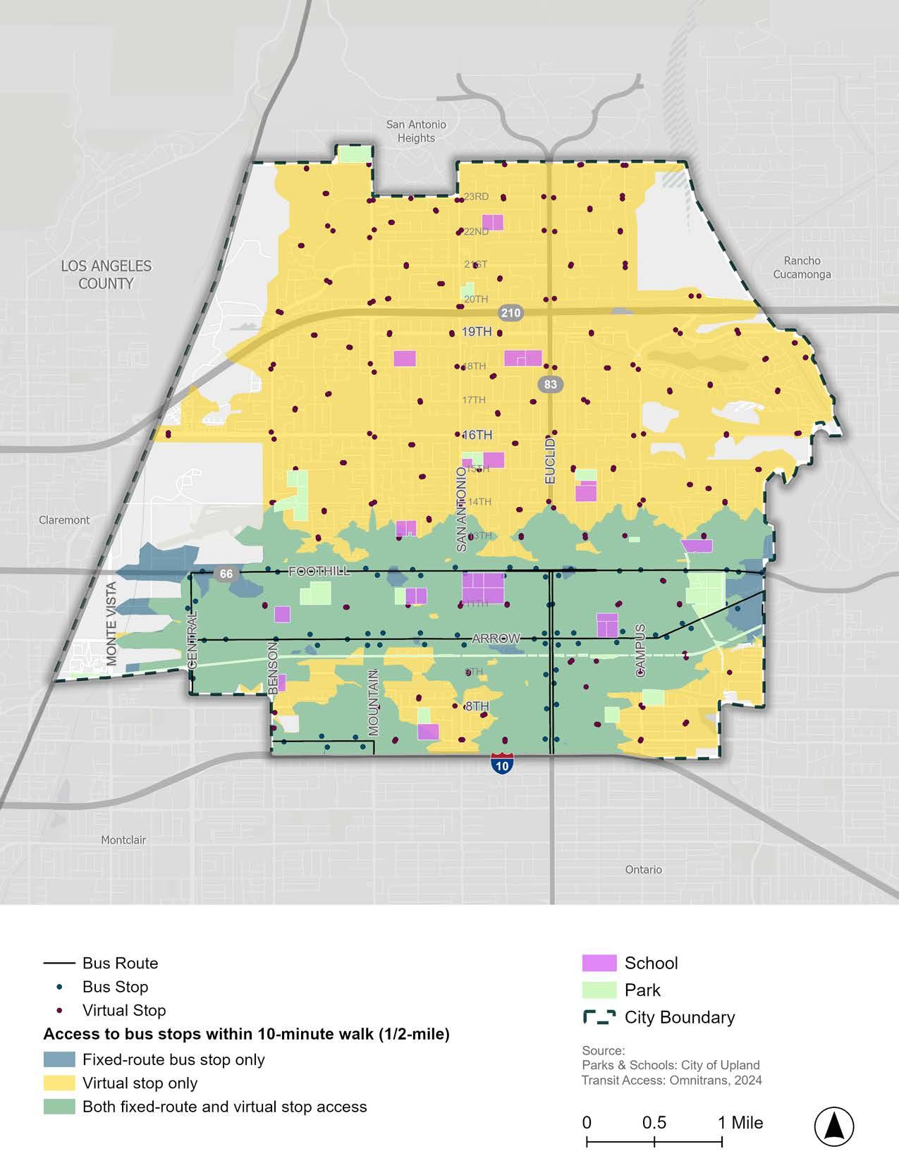
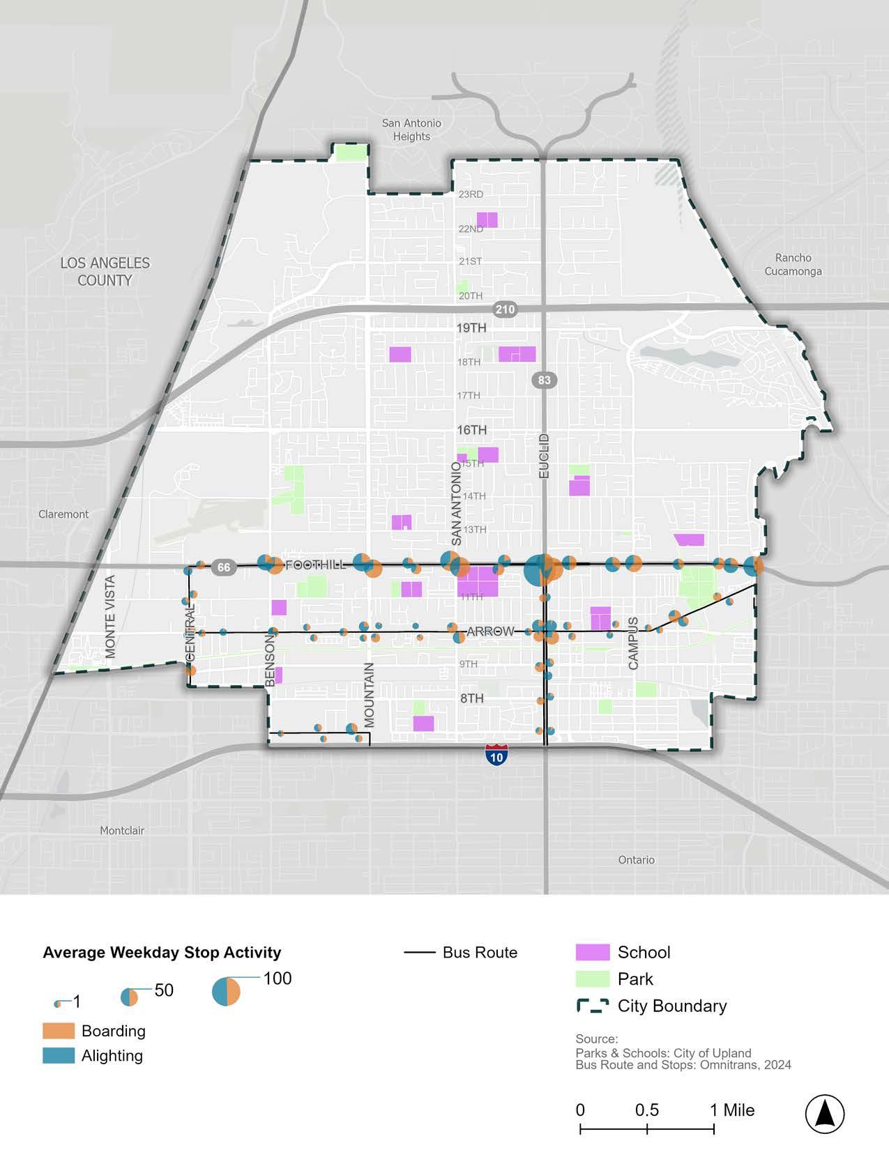
*Boarding and alighting data is not available for virtual bus stops and therefore not shown on this map.
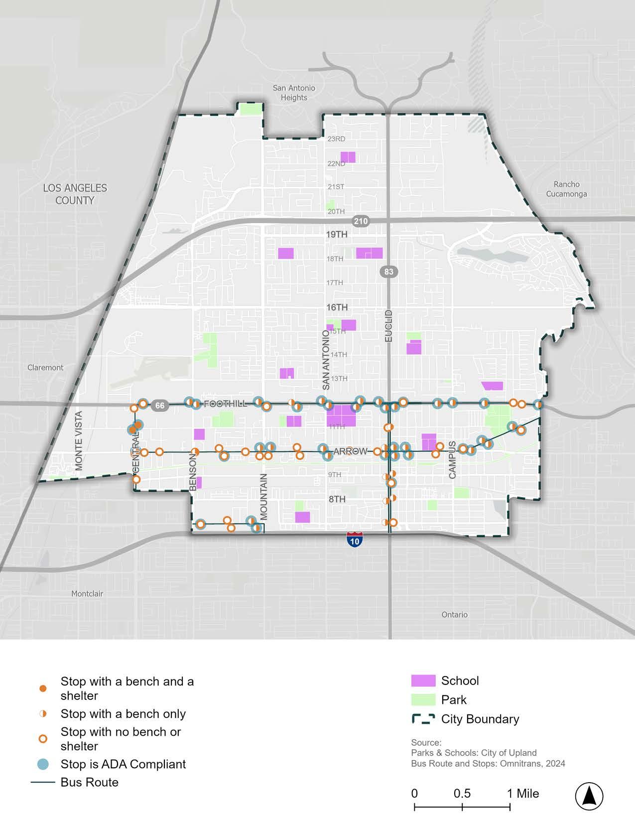
*Virtual bus stops do not have amenities and are therefore not shown on this map.
Metrolink is a commuter rail system that provides regional public transit service across six Southern California counties, including Los Angeles, Orange, Riverside, San Bernardino, and Ventura counties, as well as to Oceanside in San Diego County. Figure 2-14 displays the Metrolink rail system. The San Bernardino Metrolink line can be accessed at the Upland Train Station in Downtown Upland. From the Upland Train Station, riders can access hundreds of regional connections, including city buses, shuttle buses, light rail, and subway lines.
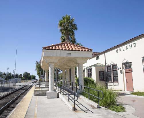
SunValleyBurbankAirportNorth(AVLine)
RanchoFontanaCucamongaRialto RedlandsRedlands-University –Downtown Redlands–Esri SanBernardino–Tippecanoe
The San Bernardino Line of the Metrolink commuter rail system travels through Upland and crosses eight intersections in the city: Central Avenue, Benson Avenue, Mountain Avenue, San Antonio Avenue, Euclid Avenue, 2nd Avenue, Campus Avenue, and Grove Avenue. Railroad crossings, without adequate safety measures, can present real and perceived safety risks and barriers to people crossing the intersection by foot, bicycle, or mobility aid device.
A pedestrian safety inventory of each Metrolink crossing in Upland was conducted to identify any needs for safety and accessibility improvements. Key findings are summarized in Table 2-1. A complete inventory can be found in Appendix B. The City can use the findings of this preliminary inventory to collaborate with Metrolink for future safety upgrades. Guidelines for pedestrian at-grade rail crossings can be found in Metrolink’s SCRRA Highway-Rail Grade Crossing Manual (2021) and Part 8 of the California Manual on Uniform Traffic Control Devices.
All railroad crossings in Upland have flashing-light signals, crossbuck signs, and automatic gates for vehicles to warn road users that they are approaching a railroad crossing. However, none of the sidewalks leading to the railroad crossings in Upland have detectable warning surfaces to alert pedestrians with visual impairments that they are approaching a hazard. Notably, while all railroad crossings in Upland have automatic gates to stop vehicular traffic for a passing train, nearly all (except for the northbound crossing at Mountain Avenue, both crossings at 2nd Avenue and Euclid Avenue, and the northbound crossing at Campus Avenue) are missing an automatic gate that serves the pedestrian crossing.
Central Avenue (North Bound)
Central Avenue (South Bound)
N. Benson Avenue (North Bound)
N. Benson Avenue (South Bound)
N. Mountain Avenue (North Bound)
N. Mountain Avenue (South Bound)
N. San Antonio Avenue (North Bound)
N. San Antonio Avenue (South Bound)
Euclid Avenue* (North Bound)
Euclid Avenue* (South Bound)
S. 2nd Avenue (North Bound)
S. 2nd Avenue (South Bound)
N. Campus Avenue (North Bound)
N. Campus Avenue (South Bound)
Grove Avenue (North Bound)
Grove Avenue (South Bound)
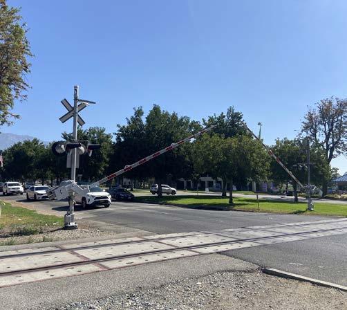
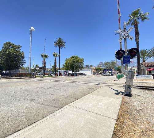
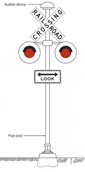
Flashing-light signal diagram
Source: MUTCD Part 8 (Modified by KTUA for simplcity)
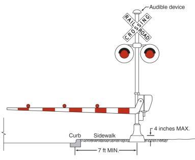
Shared pedestrian/roadway gate diagram
Source: MUTCD Part 8 (Modifed by KTUA for simplicity)
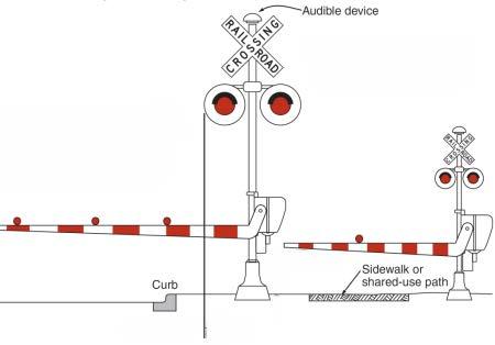
Separate pedestrian gate diagram
Source: MUTCD Part 8 (Modifed by KTUA for simplicity)
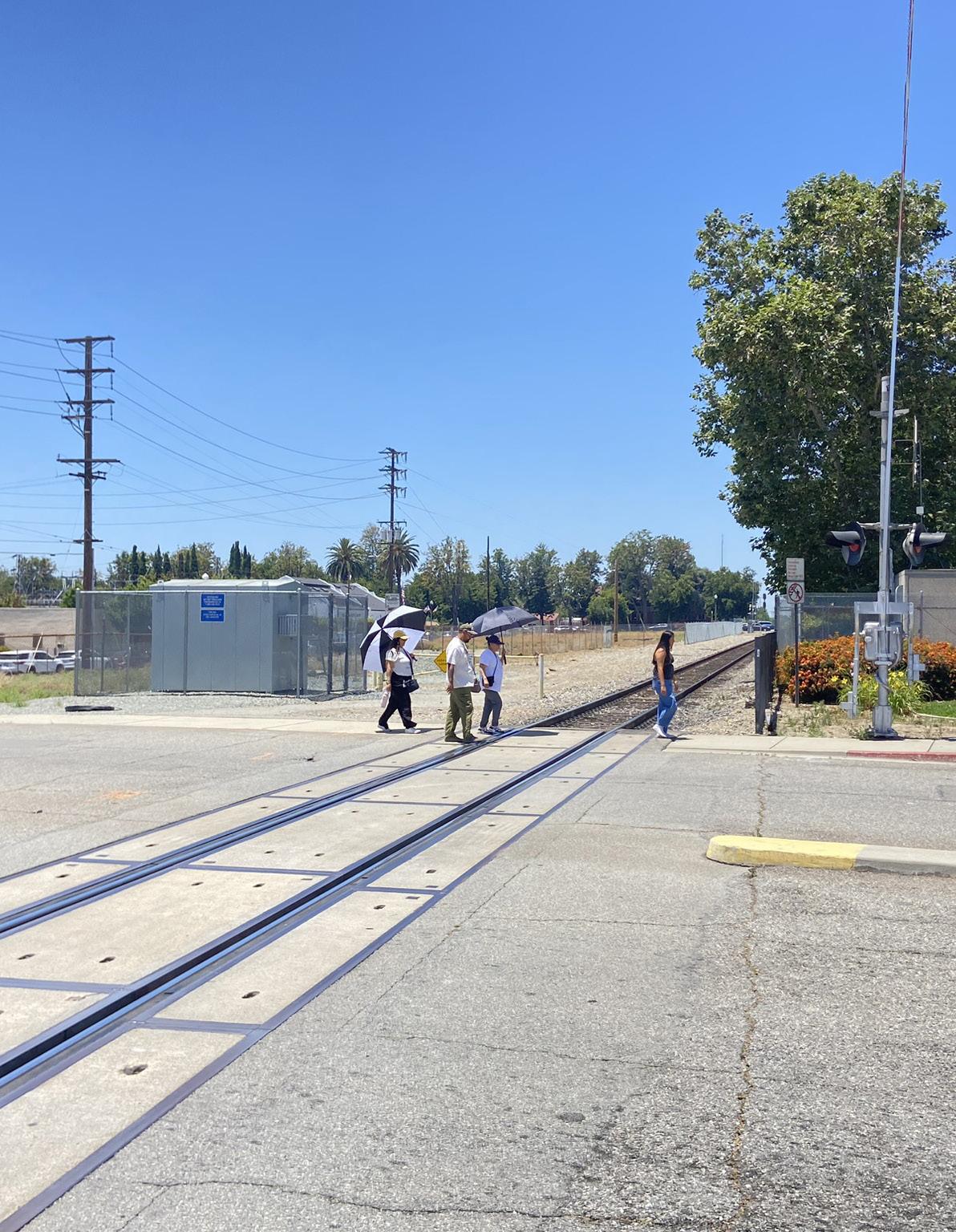
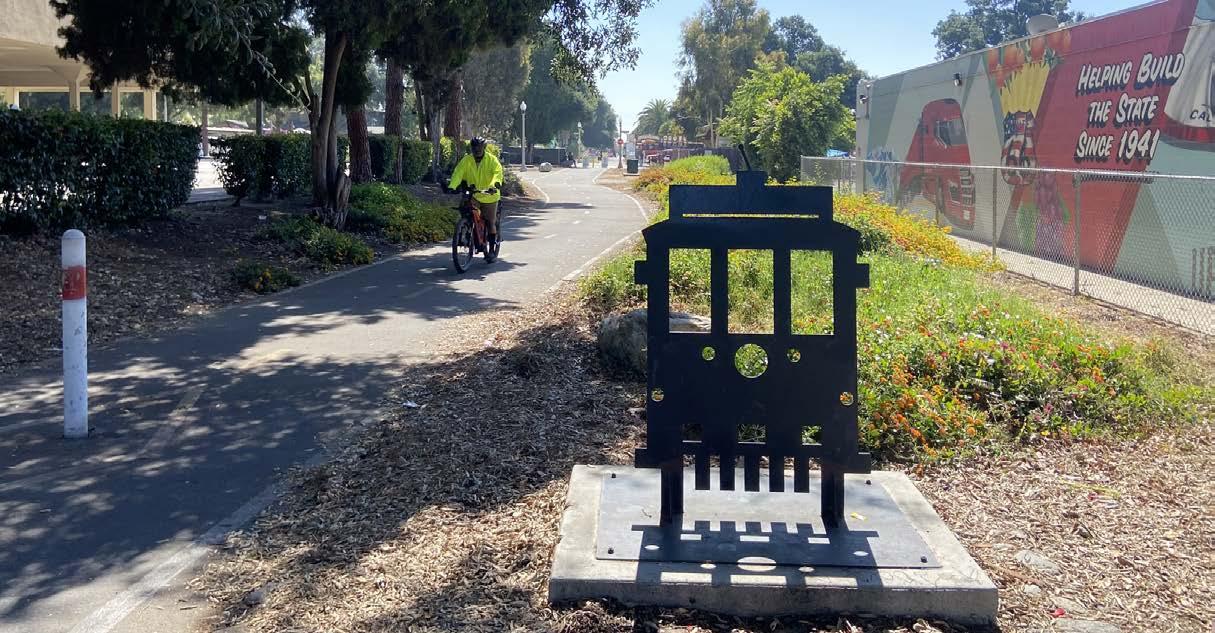
This Plan seeks to improve and expand active transportation facilities that will make it safer and easier for people to walk, ride a bicycle, or use a mobility aid device on a regular basis. The following analyses evaluate existing pedestrian and bicycle infrastructure, as well as usage patterns and collision history. Together, these datasets provide critical information needed to develop recommendations for future improvement.
Sidewalks, crosswalks, and curb ramps are foundational components of pedestrian infrastructure, yet in many cities, including Upland, these critical facilities are missing or require improved maintenance. Figures 2-15 through 2-17 document and evaluate existing pedestrian and ADA infrastructure throughout Upland. Additionally, Figure 2-18 displays Upland’s urban trail system.
As part of the City’s Sidewalk Master Plan, a separate planning endeavor from this Plan, sidewalk conditions were mapped and evaluated to identify areas in need of repair, maintenance, or improvement. The sidewalk conditions shown in Figure 2-15 are based on measurements from a Sidewalk Surface Tester. A Sidewalk Surface Tester is a small vehicle fitted with high-tech equipment that maps small irregularities such as cracks in sidewalk panels or separation between sidewalk panels. These irregularities, which pose safety risks and mobility barriers, were compared to current standards to give each sidewalk a score between 0 and 100.
Figure 2-15 shows that nearly all streets in Upland have complete sidewalks except for a small portion of Benson Avenue and Howard Access Road near Greenbelt Park and a few other areas. Streets missing sidewalks force pedestrians to walk alongside vehicular traffic in the street or avoid walking altogether. Additionally, Figure 2-15 shows many sidewalks in Upland are in fair or poor condition, which is consistent with commentary received from community members who participated in the community engagement process for this Plan. Figure 2-15 is a useful tool that can be used alongside pedestrian collision data and community feedback to identify potential sidewalk installation and improvement projects.
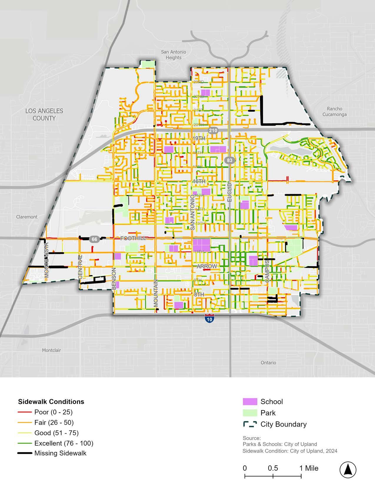
A curb ramp is a short ramp that facilitates access between a sidewalk and a roadway for people using wheelchairs, walkers, strollers, skateboards, scooters, mobility devices, or are otherwise limited in their mobility. ADA standards require that newly constructed curb ramps include detectable warnings to alert pedestrians with vision impairments of an upcoming hazard, such as passing traffic. Detectable warnings consist of a series of small domes, also known as truncated domes, that contrast in color with the surrounding sidewalk or street. Curb ramps with truncated domes allow people to safely access their desired destination.
Figure 2-16 shows the distribution of curb ramps with and without truncated domes, as well as pedestrian crossings that are missing curb ramps altogether at Upland’s major intersections. There are 47 major intersections missing one or more curb ramps at Upland’s main intersections. Of the major intersections mapped in Figure 2-16, 26 have curb ramps with truncated domes and 116 have curb ramps missing truncated domes. Detailed data for nearly all intersections in Upland is available, but was not summarized for this document.
The ADA requires state and local governments to provide curb ramps at pedestrian crossings and at public transportation stops where walkways intersect with a curb. The ADA also requires state and local governments to install curb ramps on any newly constructed or altered streets, roads, highways, and pedestrian walkways (aside from circumstances excepted by Title 28 Part 35 of the Code of Federal Regulations). Streets, sidewalks, roads, and highways that were built before the ADA went into effect may be missing curb ramps, as evidenced by the red circles in Figure 2-16. Collecting an inventory of missing curb ramps is the first step to identifying and prioritizing curb ramp installation projects that will make Upland more accessible for people with disabilities.
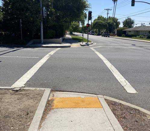
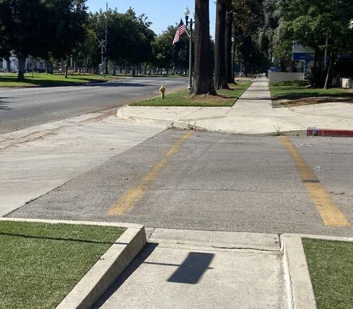
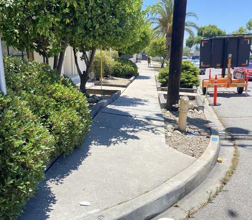
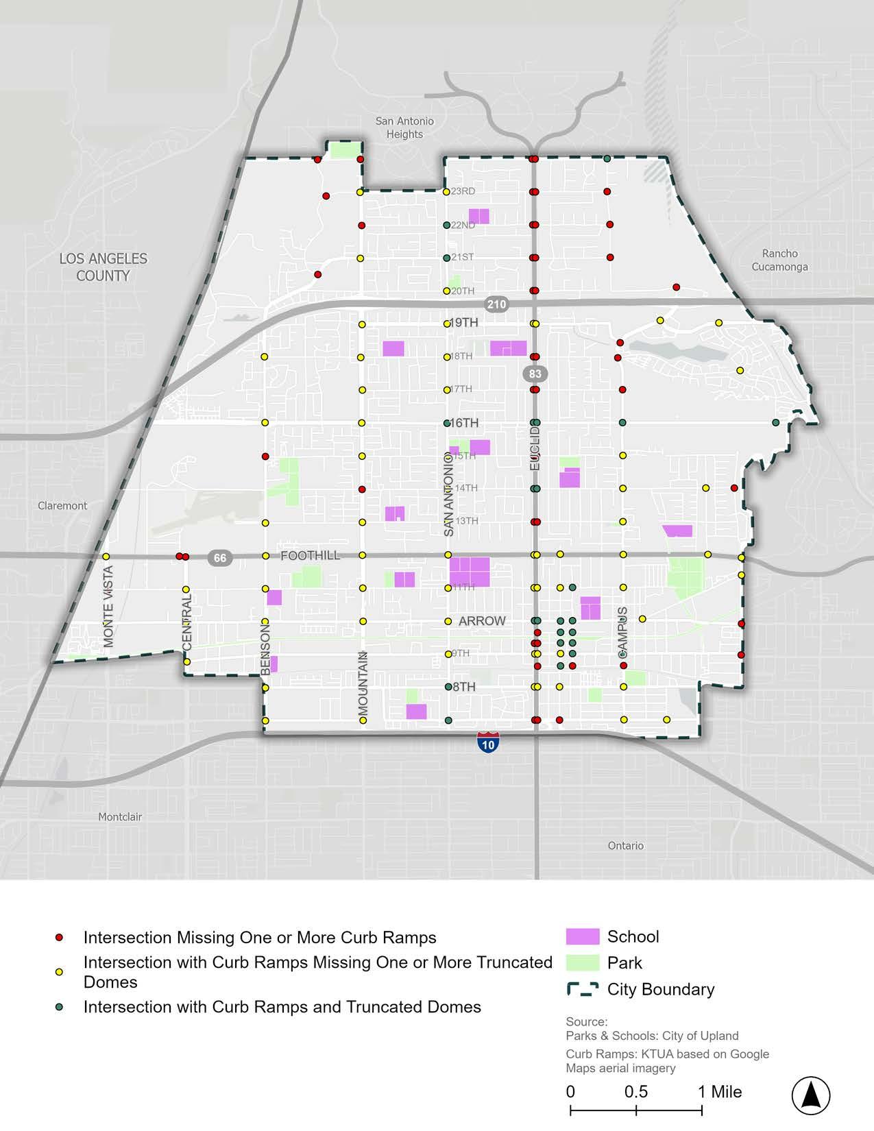
Crosswalks are designed to both guide pedestrians and alert drivers of a road crossing location. Crosswalks are noted by pavement markings that delineate pedestrian crossing paths within signalized intersections and on approaches to other intersections where traffic stops, such as at STOP signs. At nonintersection locations, such as a mid-block crossing, crosswalk markings legally establish the crosswalk. Crosswalk markings can be enhanced with perpendicular striping, in addition to parallel stripes, to enhance crossing visibility for drivers.
Figure 2-17 shows 74 of Upland’s major in’tersections are missing one or more crosswalks in Upland. Notably, all intersections along Euclid Avenue are missing crosswalks.
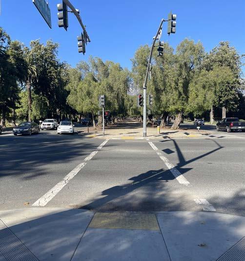
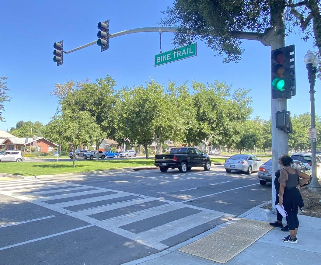
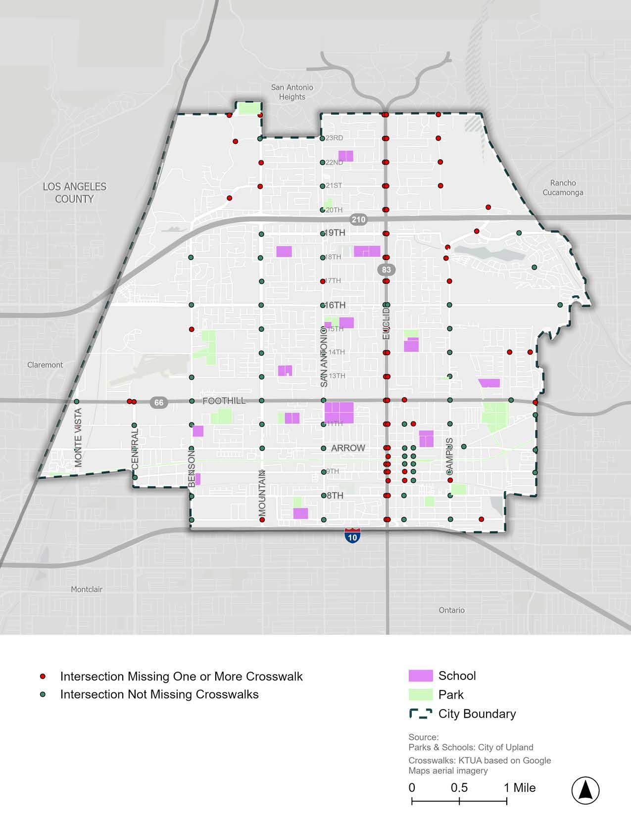
With Upland situated at the base of the San Gabriel Mountains, residents and visitors are close to numerous trailheads providing opportunities for outdoor recreation and nature exploration. While most hiking trails, such as Potato Mountain, Stoddard Peak, and Sunset Peak, are located north of Upland’s city limits, three urban trails exist within Upland. The urban trails shown in Figure 2-18 provide Uplanders with opportunities to recreate outdoors and travel from one place to another without a motor vehicle.
An urban trail is a public path that allows people to walk, use a mobility aid device, or ride a bicycle, scooter, or skateboard through an urban environment without feeling any threat from motor vehicles. Urban trails are often located alongside existing roads, waterways, utility rights of way, and abandoned railroad tracks. Ideal urban trails are long corridors that provide connections to popular destinations, such as parks, schools, housing, and commercial destinations.
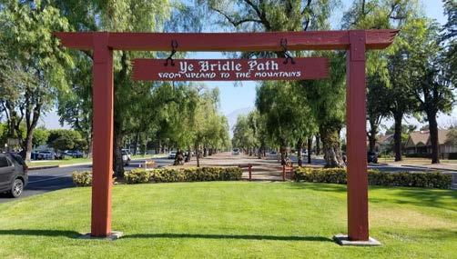
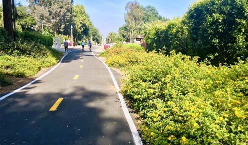
Ye Bridle Path (Bridle Path) is a roughly 3-mile-long trail that traverses a linear park in the center of Euclid Avenue between Foothill Boulevard and 24th Street. The trailhead is marked by a Madonna of the Trail monument and an entry gate. Despite being located on a median in one of the city’s major arterials, this tree-lined trail is a popular attraction for people walking, running, and riding bicycles. Even with its popularity, there are opportunities to improve the comfort and safety of trail users when crossing intersections along the path.
The Pacific Electric Trail is a roughly 20mile Class I multi-use path that travels through the communities of Upland, Rancho Cucamonga, Fontana, and Rialto. A Class I multi-use path is two-way path physically separated from motor vehicles. A 4.4-mile segment of the Pacific Electric Trail runs east to west through Upland, including through the heart of Downtown.
The Pacific Electric Trail is wide, flat, and paved; providing space for pedestrians, runners, bicyclists, and equestrians to share the corridor. Though the Pacific Electric Trail is physically separated from motor vehicles, trail users do encounter vehicles when crossing north-south intersections along the trail. While the Pacific Electric Trail is a widely used asset for Uplanders, community members and stakeholders have noted the need for trail improvements, such as landscaping, public art, and other amenities, as well as regular maintenance, to enhance the trail experience.
In addition to the trails described above, additional Class I multi-use paths exist along a County flood control channel in southwestern Upland; along Benson Avenue, Mildura Avenue, and Deakin Avenue in northwestern Upland; and along a short segment of Rancho Cucamonga’s Cucamonga Creek Trail as it passes through eastern Upland. The San Bernardino Flood Control District also maintains a system of natural surface paths around the Cucamonga Basin.
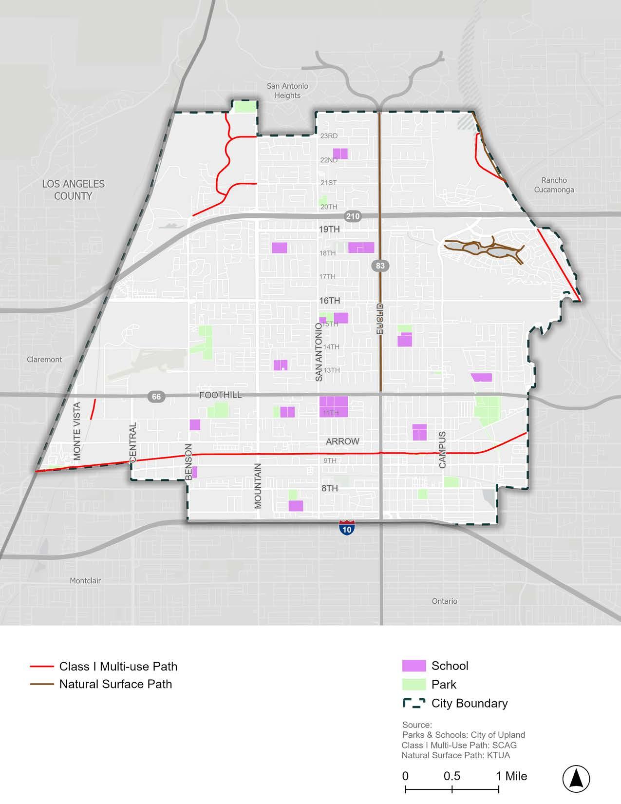
With data from SCAG, Figure 2-19 displays existing and previously proposed bicycle facilities in Upland, as well as how they connect to bicycle facilities in neighboring cities.
Currently, there are 37.6 miles of existing bicycle facilities in Upland, including:
f 8.1 miles of Class I multi-use paths
f 15.2 miles of Class II bicycle lanes
f 14.3 miles of Class III bicycle routes
The Upland General Plan Circulation Element (2015) and the SBCTA Active Transportation Plan (2020) proposed roughly 28 miles of additional bicycle facilities in Upland, including:
f 6.5 miles of Class I multi-use paths
f 19.9 miles of Class II bicycle lanes
f 1.6 miles of Class III bicycle routes
The previously proposed bicycle facilities documented in the Upland General Plan Circulation Element (2015) and the SBCTA Active Transportation Plan (2020) were considered in the development of the updated bicycle network proposed by this Plan in Chapter 5.
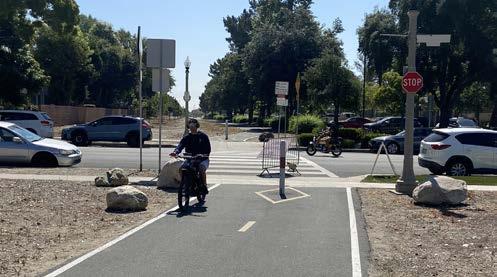
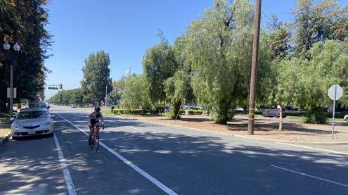
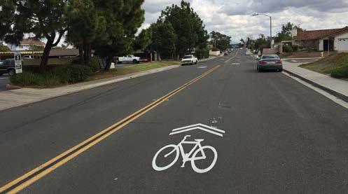
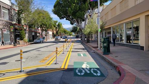
*Currently, there are no Class IV separated bikeways in Upland. However, the neighboring cities of Claremont and Rancho Cucamonga have Class IV separated bikeways on Foothill Boulevard leading up to Upland’s city limit.
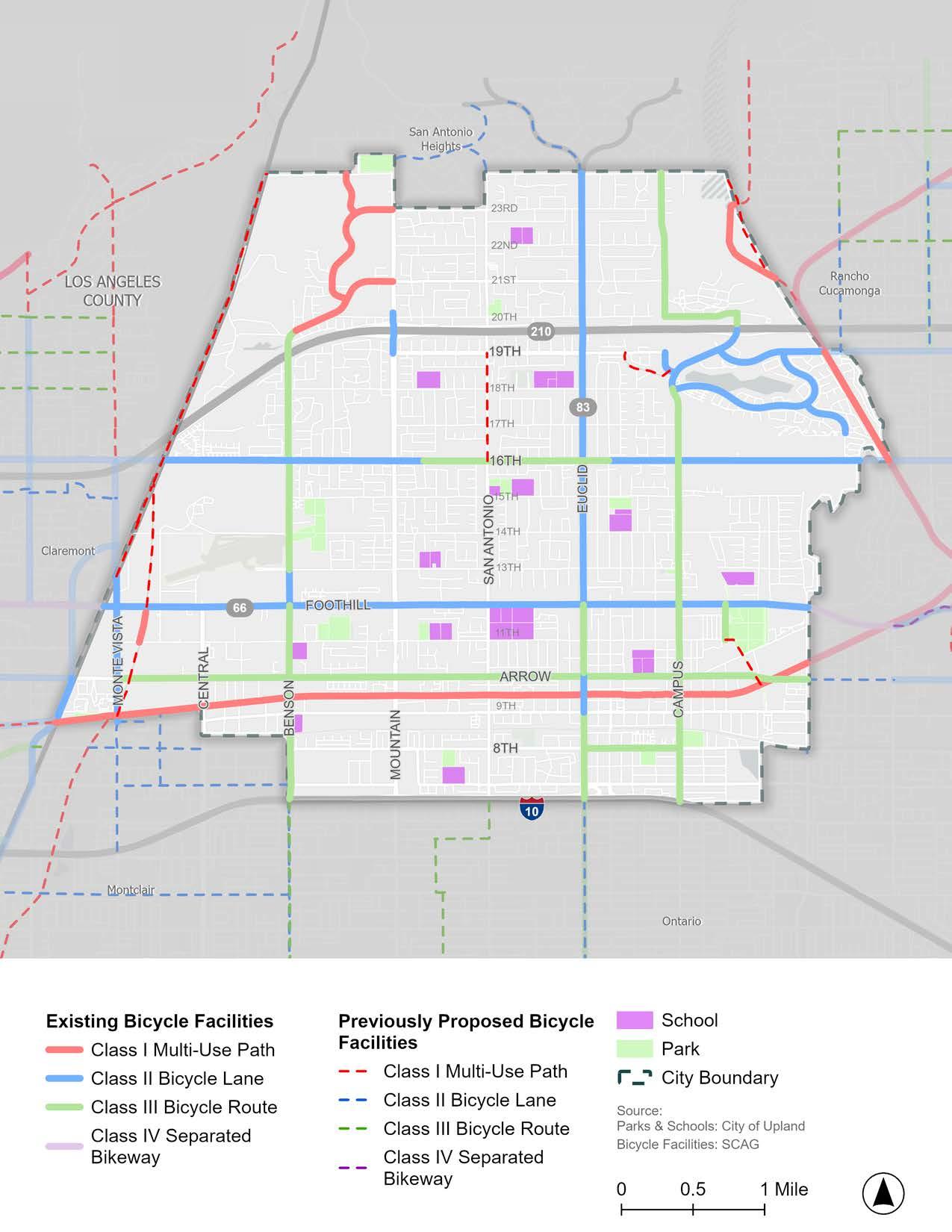
Knowing popular active transportation routes that community members take within Upland can help the City identify the corridors in which improvements would greatly impact those already using them. Figure 2-20 displays the most commonly used routes by people walking, rolling, and riding a bicycle based on data from Replica, an independent company used widely by planning professionals, including Caltrans, to analyze near real-time, high-quality data sources to understand mobility, land use, people, and economic activity patterns. Bicycle and pedestrian data from Replica is based on a vast array of datasets that use observed data from phones, vehicles, consumer spending transactions, survey data, counts, and more.
The popular active transportation routes displayed in Figure 2-20 are generally near activity centers, such as parks, schools, and shopping areas, as well as along commercial and mixed-use corridors, further supporting the need for high-quality active transportation facilities leading to popular community destinations. Figure 2-20 shows that active transportation trips are more predominant in southern Upland, indicating higher rates of walking and bicycling south of Foothill Boulevard. Additionally, high active transportation volumes are shown along Euclid Avenue (likely due to the Bridle Path) and near the Colonies Crossroads shopping center in northeastern Upland.
While the routes displayed in Figure 2-20 are already popular, many are along major and secondary arterials with medium-to-high vehicular traffic volumes, such as portions of Benson Avenue, Mountain Avenue, San Antonio Avenue, Euclid Avenue, and Campus Avenue. Riding a bicycle on arterials with medium-to-high vehicular traffic volumes tends to only be tolerable for experienced adult bicyclists, rather than comfortable for all ages and abilities. Providing safer active transportation facilities along these popular corridors would improve conditions for those who already use them while enabling new users of all ages and abilities to try walking, rolling, or riding to reach their destination.
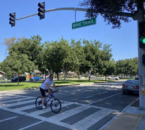
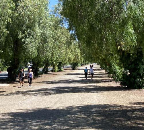
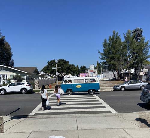
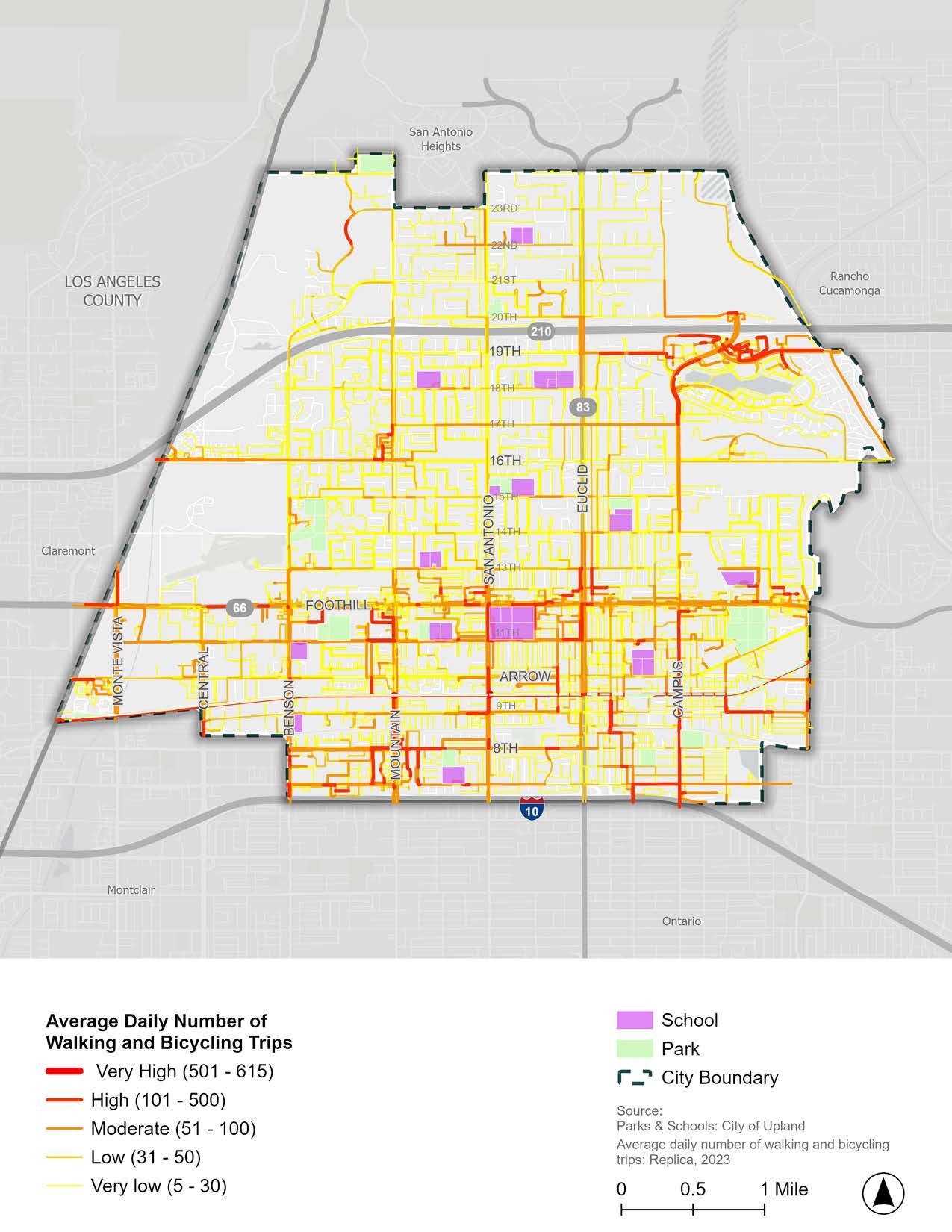
Bicycle and pedestrian collision data were obtained from the Transportation Injury Mapping System (TIMS) managed by SafeTREC to provide Statewide Integrated Traffic Records System (SWITRS) collision data. This dataset captures reported bicycle-vehicle, pedestrian-vehicle, and bicycle-pedestrian collisions that resulted in injury or property damage in Upland in the 11-year period of 2012 through 2022 (1/1/2012 to 12/31/2022).
During these 11 years, there were a total of 520 collisions involving pedestrians or bicyclists, which resulted in 530 injuries and 20 fatalities. Collision density and location data are displayed in Figure 2-21 Figure 2-21 shows that collision densities are highest along and south of Foothill Boulevard, particularly near intersections along Mountain Avenue and Euclid Avenue. It is important to note that collision hot spots are concentrated in SB 535-designated Disadvantaged Communities (shown in Figure 2-7), indicating more mobility hazards in underserved areas of Upland.
The bulk of both collision types resulted in visible injury (49.81 percent) or complaint of pain (38.85 percent), with 7.69 percent resulting in severe injury and 3.65 percent in death. It is important to note that collisions involving bicyclists and pedestrians are known to be under-reported, and therefore such collisions are likely under-represented in this analysis. Additionally, collisions on off-street paths are not reported in the dataset, though off-street collisions would likely be between active transportation users (rather than vehicle-involved), and would therefore point toward a different set of interventions and improvements than those involving vehicles.
Between 2012 and 2022, there were 216 collisions involving pedestrians in Upland, which resulted in 223 injuries and 19 fatalities. Most pedestrian-related collisions were caused by a pedestrian violation (37.5 percent) or a driver failing to yield to the pedestrian right-of-way (28.4 percent). A variety of driver, bicyclist, and pedestrian violations caused the remainder of the collisions. Of all pedestrian-related collisions, approximately 48.2 percent were categorized as the fault of drivers, 32.9 percent as the fault of pedestrians, and 18.9 percent were unclear or not listed.
Between 2012 and 2022, there were 306 collisions involving bicyclists in collisions in Upland, which resulted in 310 injuries and 1 fatality. Most bicycle-related collisions were caused by bicyclists failing to yield to the vehicle right-of-way (30.5 percent) or bicyclists being on the wrong side of the road (19.2 percent). A variety of driver, bicyclist, and pedestrian violations caused the remainder of the collisions.
Figure 2-22 displays collision locations with a focus on vulnerable age ranges - youth under the age of 18 and seniors over the age of 65. Collisions involving victims over the age of 65 are scattered throughout Upland. However, there are substantially more collisions involving victims under the age of 18 south of Foothill Boulevard, including many around Upland High School and along Mountain Avenue, San Antonio Avenue, 11th Street, and Foothill Boulevard. The prevalence of youth collisions in southern Upland further emphasizes the need for improved infrastructure and safety measures for bicyclists and pedestrians south of Foothill Boulevard.
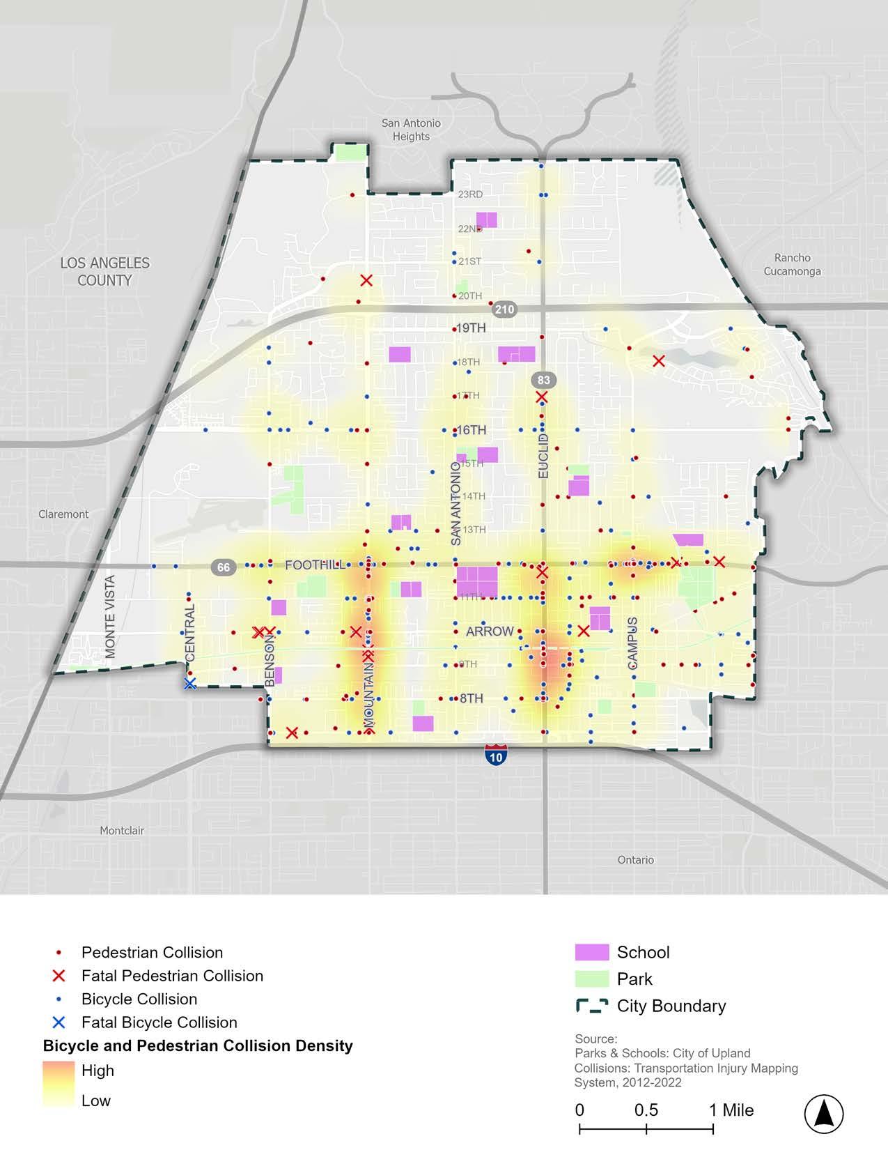
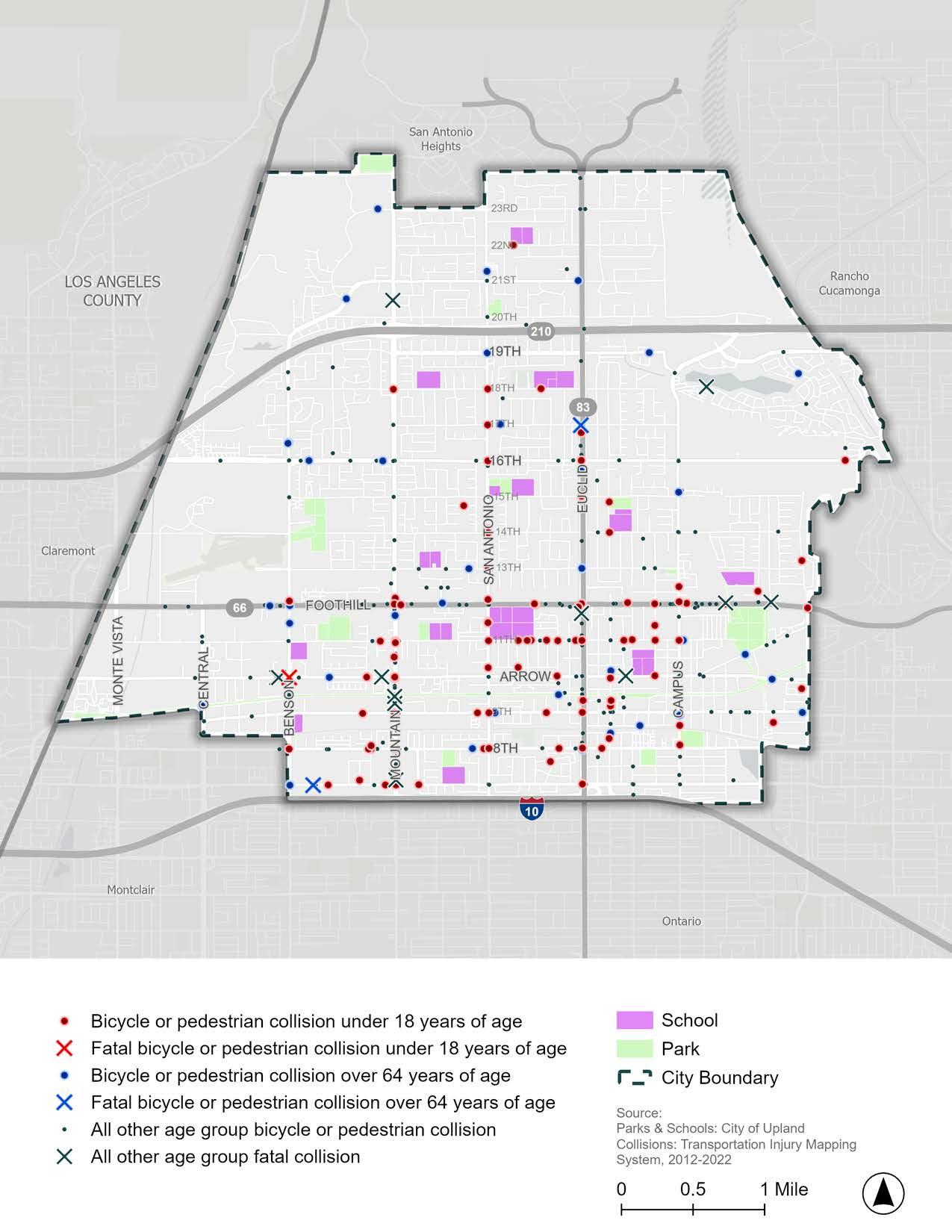
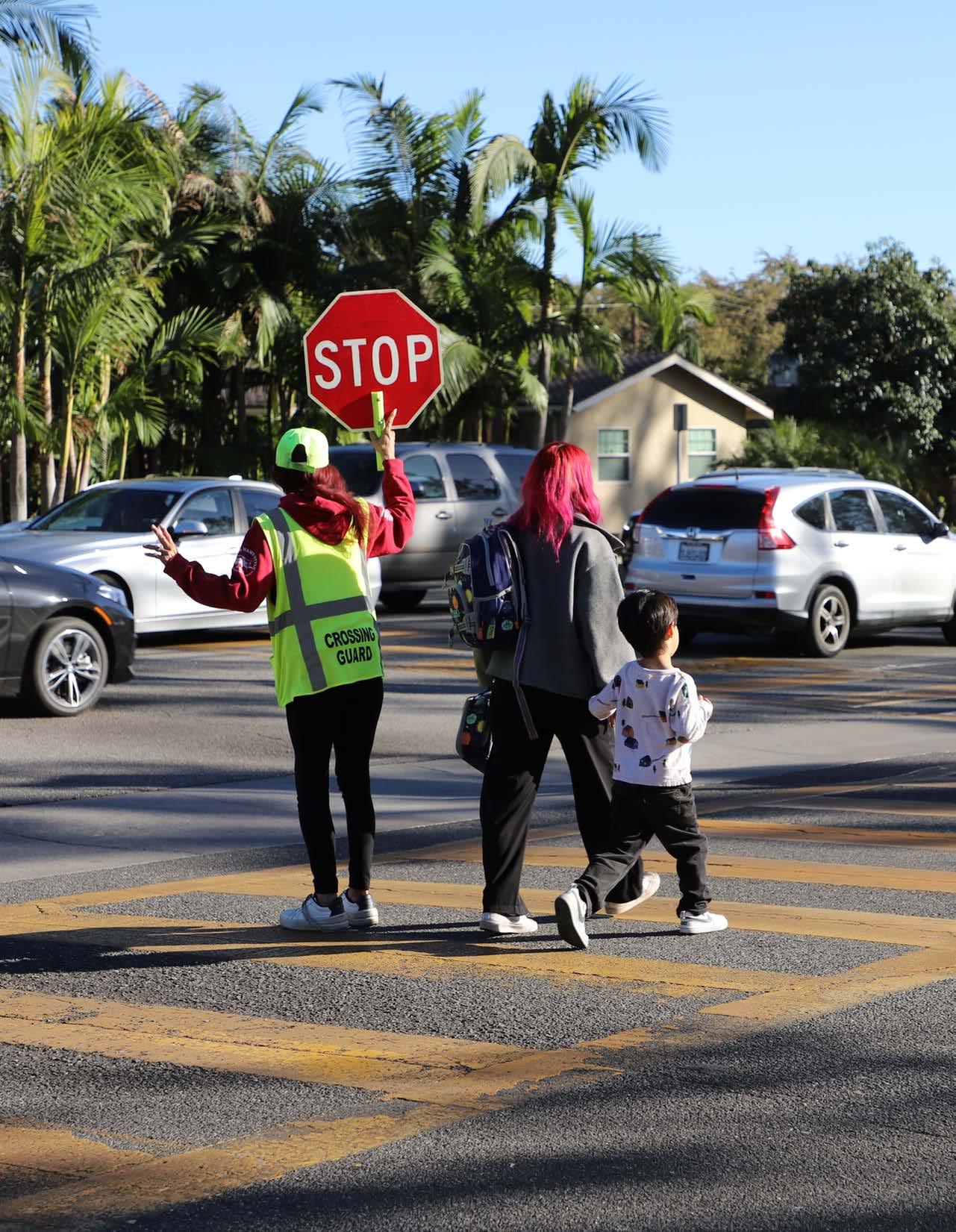
Safe Routes to School (SRTS) is a movement that promotes walking and bicycling to school through a combination of infrastructure improvements, educational campaigns, encouragement programs, and enforcement. Active transportation and traffic calming infrastructure near schools, combined with education and encouragement programs, can lead to more students getting to school by foot or bicycle, reducing traffic congestion and air pollution near schools and promoting active lifestyle habits for students and their families.
Upland contains 14 public schools, all within Upland Unified School District (Table 2-2). Section 2.11 includes information related to enrollment, collision history, and student poverty at each Upland school, which will be used in combination with community input, to develop and prioritize the SRTS recommendations presented in Chapter 5.
Source: National Center for Education Statistics (2023-2024 School Year)
Figure 2-23 and Figure 2-24 display reasonable walking (0.25 to 0.5 miles) and bicycling distances (1 to 2 miles) around Upland schools. As shown in Figure 2-23, many residential neighborhoods and parks are within walking distance of Upland schools, which helps inform the geographic extent of SRTS infrastructure improvements that should be considered and recommended. For added emphasis, Figure 2-24 displays the areas within bicycling distance to Upland schools and shows that nearly the entire city is within a five- to ten-minute bicycle ride to a school. Given that a substantial amount of the community lives within walking or bicycling distance of a school, the provision of safety programs and infrastructure improvements that would help youth and their families opt for active transportation can substantially impact Upland’s mobility patterns.
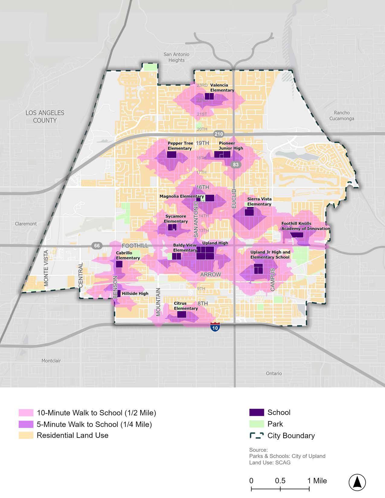
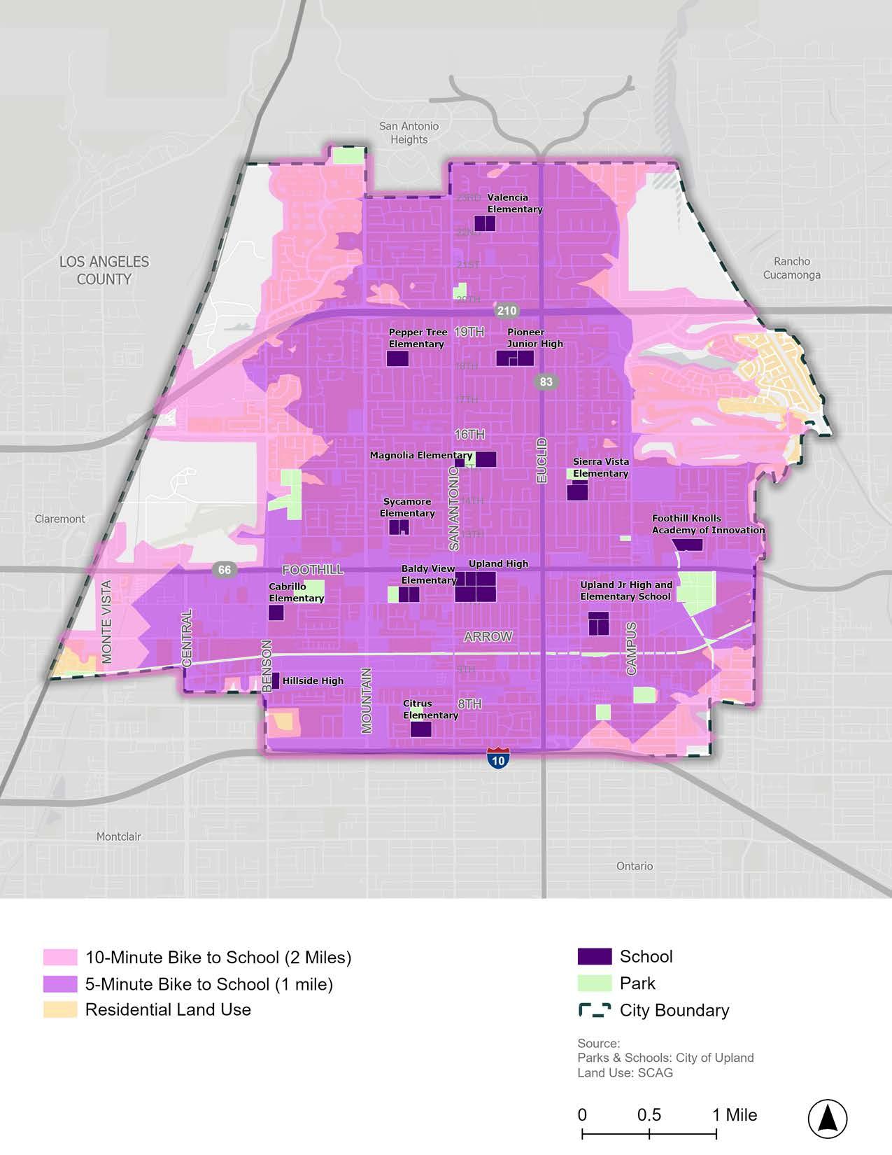
All students who live within walking or bicycling distance should have the opportunity to walk or ride a bicycle to school without fear or threat of collision. Unfortunately, in Upland, both perceived and real safety threats to pedestrians and bicyclists exist in the areas surrounding each school. For example, 627 pedestrian and bicyclist-related collisions have occurred within a half-mile radius of Upland schools between 2012 to 2022 (Table 2-3). Altogether, there were 265 pedestrian and 364 bicycle collisions over the 11-year period, which resulted in 240 complaints of pain, 317 injuries, and 17 fatalities.
The highest number of collisions occurred near Upland Elementary, Upland Junior High, Baldy View Elementary, and Upland High, while the lowest number of collisions occurred near Valencia Elementary. Notably, most of the schools with high collision rates are also located in SB 535-designated Disadvantaged Communities, suggesting that there are less safe conditions around the schools located in underserved areas of Upland. The substantial number of collisions near schools indicates a critical need for both infrastructure improvements and programmatic solutions to increase pedestrian and bicycle safety for students and their families.
TABLe 2-3: Upland Schools Ranked by Total Bicycle and Pedestrian Collisions
Source: Transportation Injury Mapping System. Safe Routes to School Crash Data. (2012-2022)
In the 2022–23 school year, California became the first state to implement a statewide Universal Meals Program for all school children. All students attending public school districts, county offices of education, and charter schools are eligible for breakfast and lunch at no charge, regardless of their eligibility for free and reduced-price meals. While all children are now eligible for free meals, the Free and Reduced Price Meal (FRPM) Eligibility dataset provided by the California Department of Education is still useful for measuring student poverty levels within schools. FRPM data uses specified family size and income standards to identify and distribute additional resources to students experiencing poverty.
Figure 2-25 and Table 2-4 show Upland schools ranked by the percentage of students eligible for the FRPM program within each school. Schools with greater percentages of students eligible for the FRPM program, such as Upland Junior High, Hillside High, Upland Elementary, Baldy View Elementary, and Citrus Elementary, should be prioritized for programs and projects aimed at improving safe and easy access to school as a way to uplift underserved students and their families.
2-4: Upland Schools Ranked by Student Poverty Percentages
Source: 2023-24 California Longitudinal Pupil Achievement Data System (CALPADS)
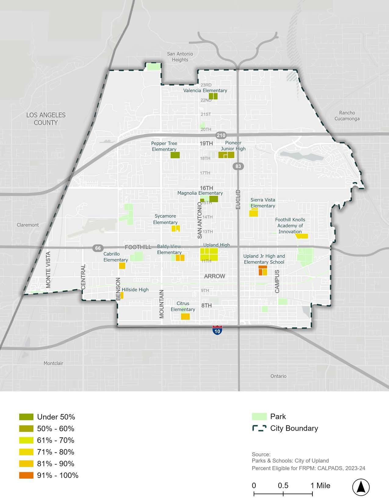
1 Transit Design Guidelines - ADA Compliance Checklist. Omnitrans (2023). https://omnitrans. org/busstops/
2 ADA compliance and mobility devices on the bus. Omnitrans. (n.d.). https://omnitrans.org/ ride-guide/ada-and-modification/
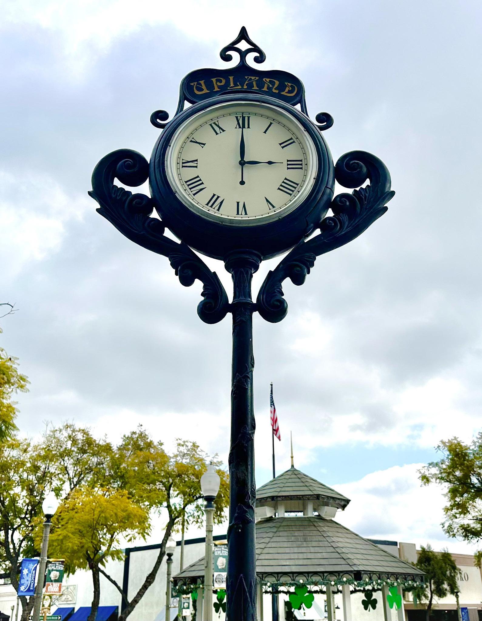
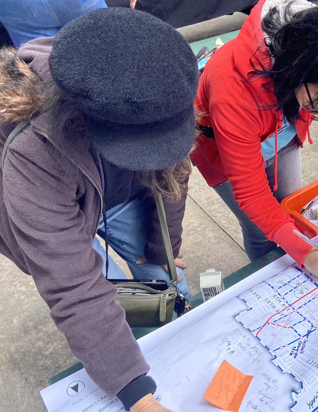
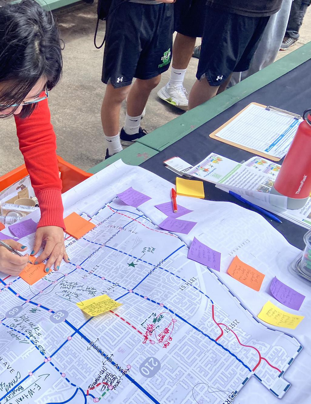
Chapter 3 summarizes the information gathered from an extensive community engagement process, including key takeaways from a community survey, pop-up events, community workshops, technical advisory committee meetings, walk audits, and Public Works Committee meetings. The chapter identifies key issues and priorities of the community and stakeholders, which guided the recommendations proposed in Chapter 5.
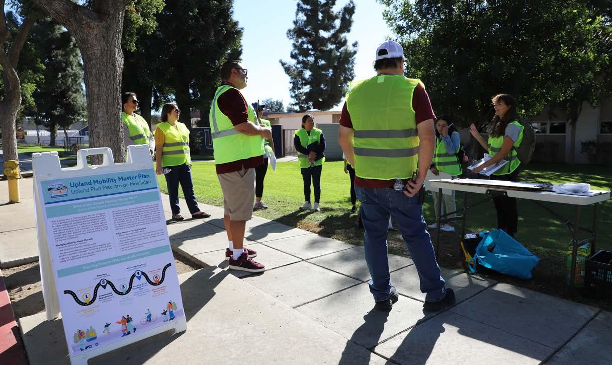
This Plan is designed to improve access to safe and convenient mobility options for everyone who lives, works, and plays in Upland. Creating a plan that adequately addresses Upland’s most pressing mobility needs could only be accomplished by facilitating an inclusive, accessible, and meaningful community engagement process. To cultivate a collaborative community engagement experience, residents, stakeholders, and City staff were invited to participate in a wide variety of engagement opportunities throughout the 18-month planning process. Additional emphasis was placed on under-served communities that disproportionately lack access to high-quality facilities and services.
The following methods were used to connect with Upland community members:
f Project Website & Online Comment Map
f Social Media
f Community Survey
f Five (5) Pop-up Events
f Two (2) Community Events
f Five (5) Technical Advisory Meetings
f Thirteen (13) Walk Audits
f One (1) Public Works Committee Meeting
Altogether, the input collected across these methods provided the City with invaluable insights into Upland’s greatest needs and opportunities for improvement. Chapter 3 presents the key findings from feedback gathered throughout the community engagement process. These findings were used to develop the recommendations presented in Chapter 5. The complete results of all community engagement efforts are in Appendix C
January 23, 2025
Technical Advisory Committee Meeting #4
November 2024 Walk Audits
July 8, 2025 Public Works Committee Meeting
April 9, 2025 Community Workshop
March 7, 2025 Pop-Up event #3: Gibson Senior Center
November 14, 2024
Technical Advisory Committee Meeting #3
June 25, 2025 Technical Advisory Committee Meeting #5
March 8, 2025
Pop-Up events #4 & #5: - Lemon Zest 5K & 1K - Upland Farmers Market
Several tools were used to inform the public about the Plan and engage community members in the planning process. Tools included social media posts, a project website, and distinct branding. All engagement materials were provided in both English and Spanish.
Distinct branding for the Plan was developed to promote project familiarity and distinguish the project as a new planning endeavor. A unique project logo and color palette was used for all outreach materials and presentations.
A website was created to provide information about the project, share project announcements, and gather community feedback. The website included an interactive online comment map that enabled community members to add location-specific comments about Upland’s mobility system.
Social media was used throughout the development of the Plan to share information and invite community members to participate in a collaborative planning process. The City posted on social media to publicize the Plan, promote events and feedback opportunities, and share project updates.
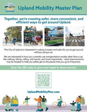
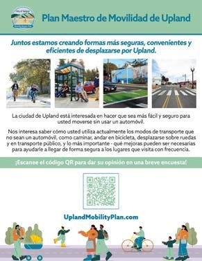
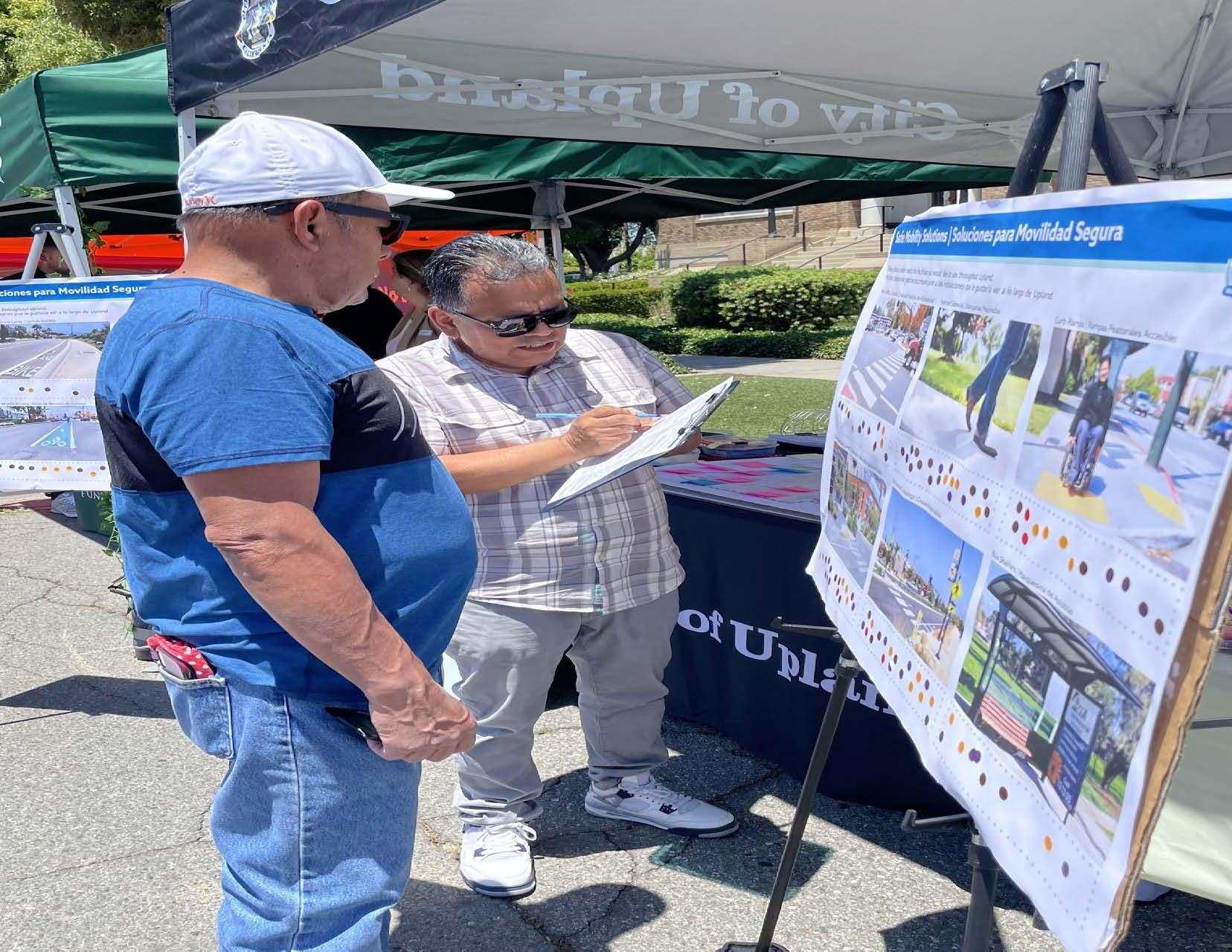
A pop-up booth was held on April 20th, 2024 at the Earth Day Celebration at Greenbelt Park. The booth engaged over 71 event attendees with interactive poster boards that invited people to provide input on Upland’s mobility system. Several locationspecific comments related to pedestrian, bicycle, ADA accessibility, transit, and driving concerns were made for a range of streets in Upland. The input collected at this event helped the planning team gain an initial understanding of community priorities and key problem corridors in need of better active transportation and public transit infrastructure.
A pop-up booth was held on June 14th and 15th, 2024 at the Upland Lemon Festival in Downtown Upland. Event attendees were invited to complete the community survey; add location-specific comments to citywide maps; vote on mobility infrastructure facilities; and share any other thoughts related to mobility in Upland.
Several location-specific comments related to driving, pedestrian, and bicyclist concerns were made for streets throughout Upland. While comments were placed on several streets, Foothill Boulevard received the most comments, mostly related to poor street pavement conditions. For the voting activity, the mobility infrastructure solutions that received the most votes from participants were improved sidewalks, enhanced crossings, curb extensions, Class IV separated bikeways, and Class I multiuse paths. The planning team interacted with over 110 people and used participant input to understand community needs and develop community-driven solutions.
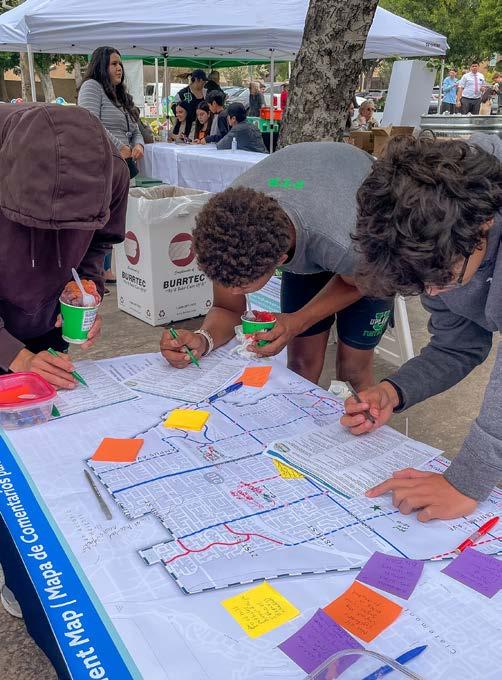
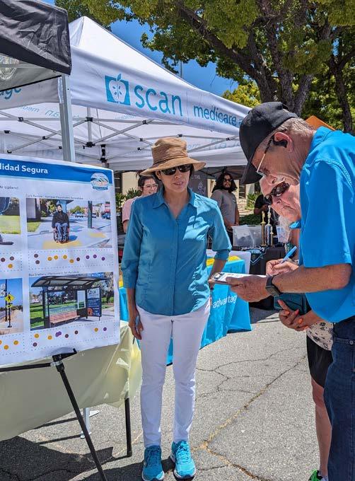
A pop-up booth was held on March 7th, 2025 at the Gibson Senior Center. About 32 seniors visited the booth to learn about the project, voice concerns, and share needs for mobility improvements, with a focus on the areas surrounding the Senior Center. The most common issues raised by participants were the need for curb ramps, sidewalk improvements, and additional street lighting.
A pop-up booth was held on March 8th, 2025 at the Lemon Zest 5K & 1K at Magnolia Park. Roughly 15 event attendees visited the booth to learn and ask questions about the project. As avid walkers and runners, participants expressed interest in the Plan and were pleased to hear the City is working to improve mobility in Upland.
The final pop-up booth was held on March 8th, 2025 at the Farmers Market in Downtown Upland. Over 148 event attendees stopped by the booth to learn about the project, review draft recommendations, and provide input. Many participants expressed appreciation for the City’s efforts to improve walking and bicycling throughout Upland.
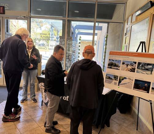
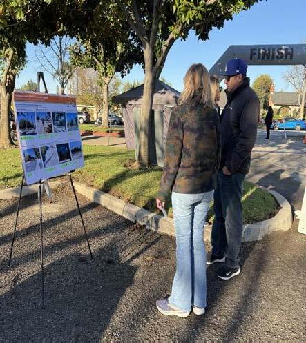
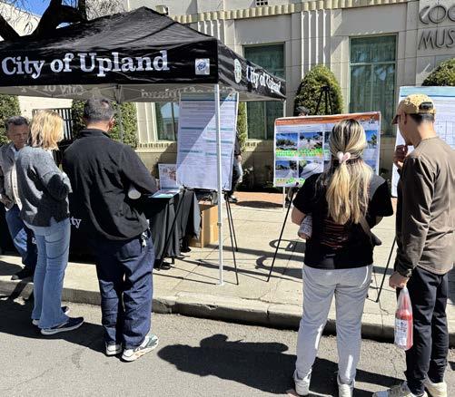
A community open house was held on August 27th, 2024 at the Carnegie Library. Open house attendees were invited to learn about the Plan and provide input by engaging with several exhibits. Interactive exhibits were designed to educate participants on the existing conditions of Upland’s mobility system and to solicit feedback on the current strengths, needs, and opportunities for making it easier and safer to walk, ride a bicycle, or take public transit.
Participants were invited to vote on their top mobility issues, add location-specific comments to citywide maps, and share any other ideas or concerns related to active transportation and public transit. Several location-specific comments related to pedestrian, bicycle, and other concerns were made for corridors throughout Upland. In particular, Euclid Trail, 11th Street, the Pacific Electric Trail, Campus Avenue, Foothill Boulevard, and Monte Vista Avenue received the most location-specific comments.
A community workshop was held on April 9th, 2025 at the Carnegie Library to present and collect public input on the Plan’s draft recommendations. The workshop began with an introductory presentation to give attendees an overview of the project before reviewing draft recommendations displayed in exhibits throughout the room.
Participants were invited to review and provide comments on draft recommendations, including the proposed future bicycle network, mobility programs, and conceptual design segments for the Plan’s priority projects. Participants shared support for many of the draft recommendations and offered new ideas for the planning team to consider, including site-specific needs for traffic calming measures, pedestrian and ADA improvements, bicycle facilities and amenities, and more. The planning team used the input to revise and modify the Plan’s recommendations to better address community needs.
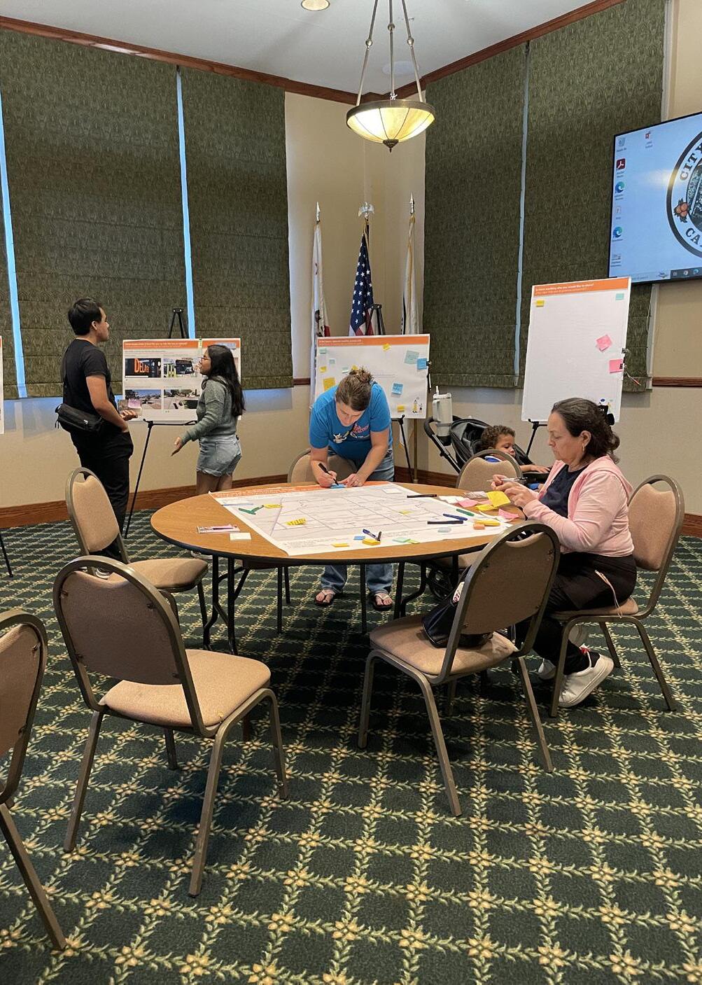
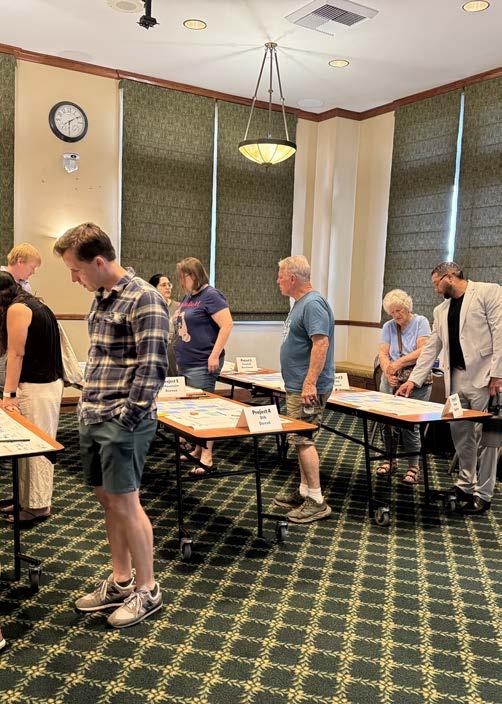
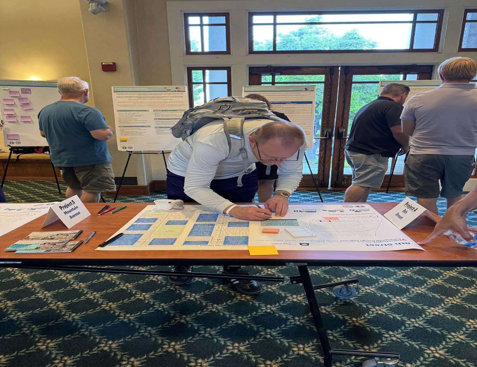
A community survey was used to understand the mobility needs, concerns, and priorities of Upland residents, stakeholders, business owners, and visitors. The survey was designed to yield results that could be used to develop recommendations to facilitate safe and efficient active transportation and public transit. The survey, available online and in print, was promoted on the City’s social media platforms, at community events, on the project website, and through intercept surveys. A total of 603 surveys were completed by community members. A summary of the survey results is included in this chapter.
Figures 3-1 through 3-8 represent a snapshot of survey results. Complete survey results can be found in Appendix C
Figure 3-1: What form(s) of transportation do you use in Upland, other than a car?
Select all that apply.
Figure 3-2: How often do you walk/roll (wheelchair, scooter, skateboard, etc.) in Upland?
Figure 3-3: What do you see as barriers to walking or rolling in Upland?
Select all that apply.
Sidewalks are narrow, damaged, or missing Dangerous driving behavior Not enough street lighting Safe crossings are too far apart Other (please specify)
Intersections lack crosswalks
Intersections lack curb ramps I don’t feel safe on overpasses/railroad crossings
Intersections are too wide I don’t experience any barriers I don’t walk/roll in Upland
Figure 3-4: What would make it feel easier and safer for you to walk/roll more in Upland?
Select four (4).
Figure 3-5: How often do you bike in Upland?
Figure 3-6: What do you see as barriers to bicycling in Upland?
Select
Figure 3-7: What would make it feel easier and safer for you to bicycle more in Upland?
Select four (4).
Figure 3-8: Where would you like to see better walking and bicycling routes to?
Select four (4).
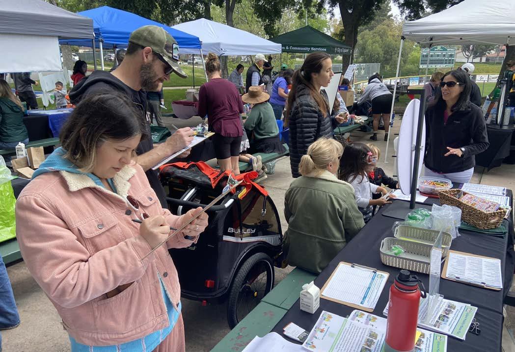
Key takeaways from the community survey include:
f Corridors of Concern: The top corridors that survey respondents avoid walking, rolling, or riding a bicycle on are Foothill Boulevard, Euclid Avenue, Mountain Avenue, Arrow Highway, and the Pacific Electric Trail.
f Priority Destinations: The top three destinations that survey respondents would like to see better walking and bicycling routes to are (1) shopping centers, (2) Downtown Upland, (3) and parks.
f Transportation Mode: Other than driving, walking was the most popular transportation mode among survey respondents (75.8 percent), followed by bicycling (37.7 percent), Metrolink (19.2 percent), and riding the bus (10.4 percent).
f Over half of survey respondents report walking or rolling (scooter, skateboard, or mobility aid device) in Upland on a daily or weekly basis.
f While roughly 15 percent of survey respondents ride a bicycle on a daily or weekly basis, nearly half of survey respondents report never riding a bicycle in Upland.
f Transportation Mode to School: Out of the survey respondents who are students or have students in the household, nearly 60 percent report commuting to school by driving or carpooling. The second most common mode of travel to school is walking (22 percent).
f Top Barriers to Walking/Rolling: Survey respondents ranked the top barriers to walking or rolling in Upland as (1) sidewalks are narrow, damaged, or missing, (2) dangerous driving behavior, (3) lack of street lighting, and (4) safe crossings too far apart.
f Desired Pedestrian/ADA Improvements: When asked what would make it easier and safer to walk or roll in Upland, survey respondents ranked continuous sidewalks, more multi-use paths, street lighting, and street trees/shade the highest.
f Top Barriers to Bicycling: Survey respondents ranked the top barriers to riding a bicycle in Upland as (1) dangerous driving behavior, (2) there are not enough bicycle lanes, (3) bicycle lanes are not clean or in a safe condition, and (4) lack of bicycle parking.
f Desired Bicycle Improvements: When asked what would make it easier and safer to ride a bicycle in Upland, survey respondents ranked feeling less exposed to traffic, bicycle lanes, and more multi-use paths the highest.
f Top Bus Issues: The top bus-related issues selected by survey respondents were (1) there is not a bus stop near enough to my house, (2) buses do not run on the streets or go to destinations that I need, and (3) bus stops do not feel safe.
f Desired Bus Service Areas: The top destinations that survey respondents would like to see bus service to are northern Upland and the Colonies Crossroads shopping center.
f Desired Upland Station Improvements: Survey respondents desire the following improvements at Upland Station: more/free parking, better security/safety, lighting, restrooms, bike parking, shade, and seating.
f Real and Perceived Risk of Crime: While the presence of people experiencing homelessness does not inherently equate to more crime, survey respondents repeatedly mentioned the presence of substance use and unhoused people as reasons for feeling unsafe walking or riding a bicycle in Upland.
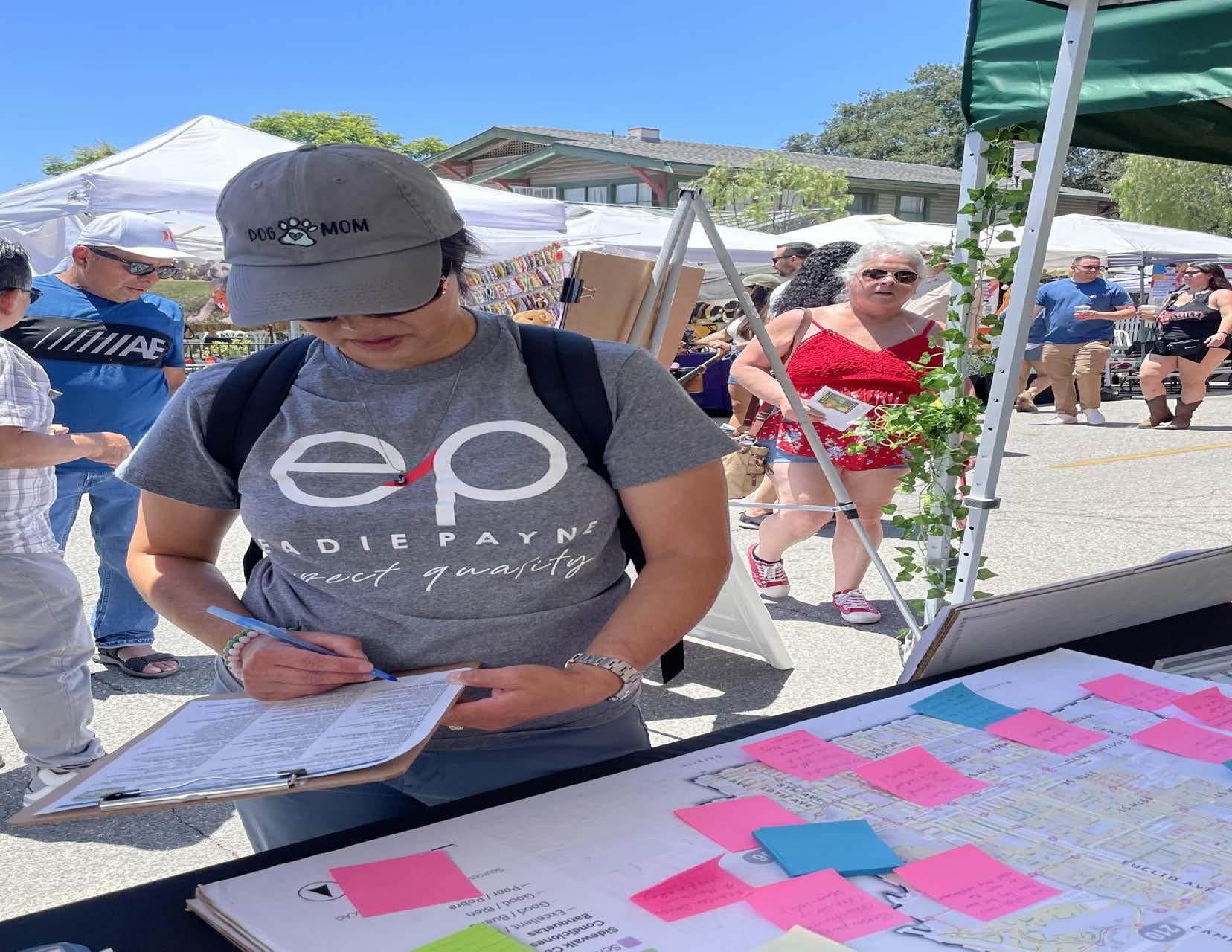
Five Technical Advisory Committee (TAC) meetings were held throughout the planning process. The TAC was comprised of representatives from local organizations, governmental agencies, schools, and businesses, as well as City staff. The five TAC meetings are summarized in this chapter. Complete minutes for all TAC meetings are provided in Appendix C
Representatives from the following organizations participated in the TAC:
f Caltrans - District 8
f City of Upland City Councilmember, District 4
f City of Upland Parks, Arts, Recreation, and Community Services Department
f City of Upland Public Works Department
f City of Rancho Cucamonga Engineering Services Department
f Historic Downtown Upland Merchants
f Omnitrans
The first TAC meeting was held virtually on June 26th, 2024. The meeting consisted of TAC member introductions; an informational presentation to introduce the Plan and report on progress to date; and an open discussion to understand the major concerns and goals of the TAC members. The open discussion involved resource and idea sharing, as well as establishing an initial set of desired outcomes for the Plan. Most notably, TAC members expressed their desire for the Plan to result in the following outcomes:
f Create safe streets for pedestrians, bicyclists, and motor vehicles throughout Upland.
f Increase awareness of pedestrian and bicyclist safety through public education.
f Improve and enhance the Pacific Electric Trail in Upland.
f Bring public transit stops into ADA compliance.
f Pedego Electric Bikes Upland
f Roy’s Cyclery
f San Bernardino County Fire District Division 1
f San Bernardino County Transportation Authority
f Upland Chamber of Commerce
f Upland High School
f Upland Unified School District
f Upland Police Department
The second TAC meeting was held virtually on September 11, 2024. The meeting consisted of TAC member introductions, a community engagement update, and a presentation of key findings from the existing conditions analysis. TAC members asked questions and provided input on community engagement methods and the existing conditions analysis.
The third TAC meeting was held as an inperson walk audit along Foothill Boulevard and Euclid Avenue on November 14, 2024. TAC members walked along the two corridors and documented mobility challenges and opportunities related to walking, riding a bicycle, using a mobility aid device, and taking public transit. TAC members observed gaps in Class II bicycle lane coverage, uneven and cracked sidewalks, non-ADA-compliant bus stops, faded crosswalk markings, and insufficient pedestrian crossing time at signals.
The fourth TAC meeting was held virtually on January 23, 2025. The meeting began with a progress update and summary of community engagement results to date, including major mobility needs and key corridors of community interest. Next, TAC members reviewed and provided input on the first draft proposed bicycle network and project prioritization criteria. When discussing the draft bicycle network, the TAC asked how bus stops, parking regulations, posted speed limits, and State legislation influenced draft recommendations and where there were opportunities for road diets and one-way roads. The conversation on project prioritization criteria included questions about ADA accessibility and suggestions to integrate the City’s ADA Transition Plan and SBCTA plans (e.g., Capital Project Needs Analysis, Congestion Management Plan, and Measure I Funding) into the Plan’s recommendations to ensure consistency across planning documents and increase eligibility for future funding.
The final TAC meeting was held virtually on June 25, 2025. TAC members were asked to review the draft Plan before the meeting and bring their feedback and questions to the meeting for group discussion. The planning team began the meeting with a presentation to summarize the project and provide an overview of draft recommendations. After the presentation, the TAC engaged in a group discussion about the draft Plan. TAC members shared suggestions to improve formatting and clarity, pointed out data and policies to update, and praised the comprehensive nature of the Plan’s recommendations. TAC feedback was used to revise the Plan.
An online comment map was hosted on the project website to enable community members to participate in the planning process from their own homes. The online comment map invited community members to share location-specific input by dropping a pin and leaving a comment related to pedestrian, bicyclist, ADA, driving, and other mobility-related issues. The issues that received the most comments were traffic calming, pedestrian concerns, and missing sidewalks. Euclid Avenue, 19th Street, Arrow Highway, 18th Street, 8th Street, and Foothill Boulevard were the locations that received the most comments.
The City of Rancho Cucamonga’s Connect RC Bicycle Subcommittee, which is a City-run volunteer group dedicated to promoting a more bicycle-friendly Rancho Cucamonga, invited the project team to present about the Upland Mobility Master Plan on June 4, 2025. The project team’s presentation provided an overview of the planning process and draft recommendations. After the presentation, subcommittee members suggested improving bicycle connectivity between the neighboring cities. In particular, they expressed the need for better bicycle connectivity from Rancho Cucamonga to the Colonies Crossroads and north of SR210. Specific ideas shared by subcommittee members were extending a pedestrian/ bicycle path east of 20th Street to connect to the Cucamonga Creek Trail and east of 24th Street across the Cucamonga Creek wash into Rancho Cucamonga. The planning team considered these suggestions and made note of these future connection opportunities.
The planning team conducted thirteen walk audits with community members, key stakeholders, TAC members, and City staff in November 2024. Walk audits allow community members and transportation planners to walk along a route and observe the safety, comfort, and accessibility of people walking, bicycling, or using mobility aid devices in a particular area. Walk audits enable the planning team to see firsthand what it feels like to experience a corridor through the eyes of the most frequent users. By observing mobility issues and opportunities alongside community members, the planning team gained valuable insights into the perspectives of people of different ages and abilities.
Figure 3-9 and Table 3-1 display the walk audit routes and provide high-level needs identified by participants. Using input from City staff and the TAC, walk audits were planned in areas with key destinations, such as schools, parks, commercial areas, and Downtown Upland. The complete notes from the walk audits are provided in Appendix C
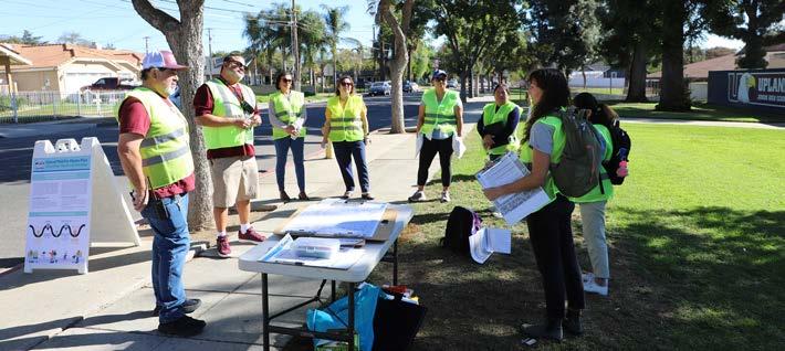
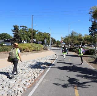
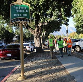
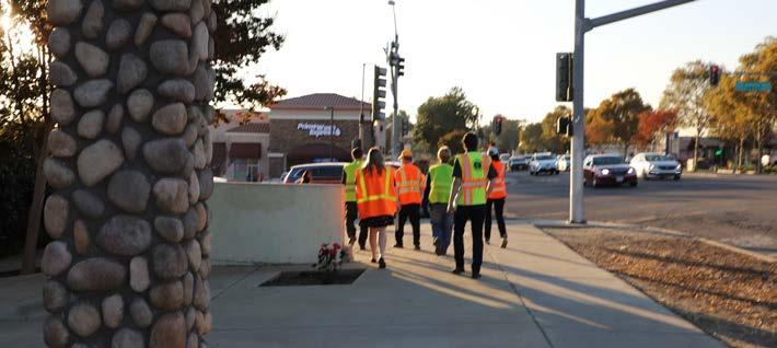
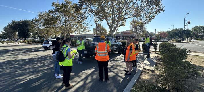
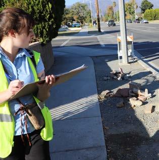
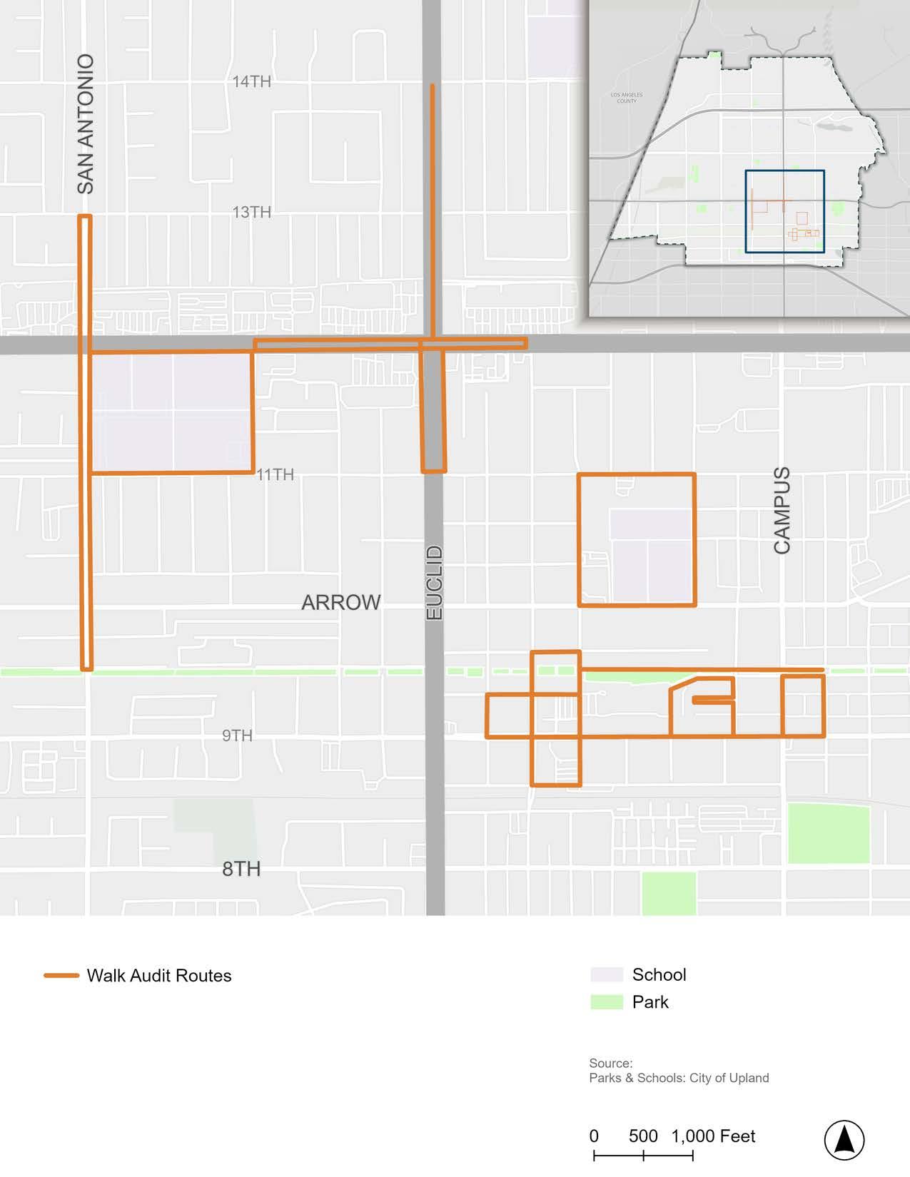
Upland Junior High & Upland elementary
Walk Audit #1 & #2 (November 7, 2024)
Block around Upland Elementary School and Upland Junior High School
f Route #1: East half of the block
f Route #2: West half of the block
Staff and parents from Upland Elementary School staff and Upland Junior High School and the planning team (KTUA & KPA)
Walk Audit #3 (November 7, 2024)
Pacific Electric Trail (from 2nd Avenue to 11th Avenue)
Planning team (KTUA & KPA)
Walk Audit #4 (November 7, 2024)
9th Street (from 2nd Avenue Street to 11th Avenue)
Walk Audit
Planning team (KTUA & KPA)
(November 7, 2024)
San Antonio Avenue (from 11th Street to the Pacific Electric Trail)
Planning team (KTUA & KPA) and City staff
Walk Audit #6 & #7 (November 13, 2024)
Downtown Upland
f Route #6: Loop around 1st Avenue, C Street, 3rd Avenue, and 9th Street
f Route #7: Loop around 2nd Avenue, D Street, 3rd Avenue, and A Street
Upland Chamber of Commerce, Historic Downtown Upland Merchants, City staff, and the planning team (KTUA)
f Improve maintenance of street trees and tree wells to reduce tripping hazards.
f Improve crosswalk visibility through LED stop signs and/or RRFBs.
f Improve organization and efficiency of student drop-off/pick-up.
f Repair uneven and cracked sidewalks.
f Replace faded street signs.
f Add truncated domes to curb ramps, where missing.
f Consider relocating the stop bar at 6th Avenue to before the PE Trail crosswalk.
f Repair uneven and cracked sidewalks.
f Improve crosswalk visibility through high-visibility crosswalk markings.
f Improve ADA accessibility along residential driveways.
f Consider road diet and traffic calming measures to reduce speeding and make space for bicycle facilities.
f Realign PE Trail to direct trail users to signalized crossing at Vernon Drive.
f Add more bicycle parking throughout Downtown and locate in highly visible areas.
f Install pet waste stations in high-need areas.
f Increase the brightness of pedestrian-scale lighting.
f Install signage to facilitate proper use of the gazebo roundabout for pedestrians.
f Implement consistent landscaping design standards throughout Downtown.
f Install curb extensions where PE Trail crosses streets in Downtown Upland.
Walk Audit #8 (November 14, 2024)
Foothill Boulevard (from 2nd Avenue to Redding Way)
TAC members, City staff, and the planning team (KTUA & Mark Thomas)
Walk Audit #9 (November 14, 2024)
Foothill Boulevard and Euclid Avenue (from 2nd Avenue to 11th Street)
TAC members, City staff, and the planning team (KTUA & Mark Thomas)
Walk Audit #10 (November 14, 2024)
Euclid Avenue (from Foothill Boulevard to 14th Street) Planning team (KTUA)
Walk Audit #11 (November 14, 2024)
Southeast Upland Loop (5th Avenue, Washington Street, 6th Avenue, C Street, Campus Avenue, 8th Avenue, and 9th Street)
Planning team (KTUA)
Walk Audit #12 (November 14, 2024)
San Antonio Avenue (from 11th Street to 13th Street)
Planning team (KTUA)
f Explore opportunities to increase bicyclist visibility and separation from motor vehicles.
f Adjust pedestrian signal timing at 2nd Avenue, 11th Avenue, and Euclid Avenue intersections with Foothill Boulevard.
f Improve lighting south of Foothill Boulevard.
f Repaint faded crosswalk markings.
f Install a high-visibility crosswalk at Foothill Boulevard and Redding Way.
f Conduct driver education campaigns to increase bicyclist and pedestrian safety.
f Bring the bus stop at Euclid Avenue and 11th Street into ADA compliance.
f Repair uneven and cracked sidewalks.
f Explore opportunities to increase bicyclist visibility and separation from motor vehicles.
f Install bicycle lanes where gaps exist.
f Infill sidewalk gaps where missing.
f Explore ways to increase separation between the bicycle lanes and motor vehicles.
f Install marked crosswalks where pedestrians must cross the street along the Euclid Trail.
f Extend Euclid Trail path to connect to the sidewalk at Foothill Boulevard.
f Repair uneven and cracked sidewalks and potholes, where noted as issue areas.
f Implement road diet and/or traffic calming to slow drivers along San Antonio Avenue.
f Repair uneven and cracked sidewalks and empty tree wells.
f Install truncated domes at curb ramps, where missing, such as at Orchid Court and Pine Street.
Walk Audit #13 (November 14, 2024)
Block around Upland High School
Upland High School Principal and student, City staff, and the planning team (KTUA & Mark Thomas)
f Add curb ramps along 11th Street, where missing.
f Implement road diet and/or traffic calming to slow drivers along San Antonio Avenue.
f Install mid-block crossing(s) along San Antonio Avenue at Orchid Court and/or Amber Court.
f Expand bus stop seating and shelter area at the heavily used bus stop along Foothill Boulevard.
f Improve drainage at the San Antonio Avenue and 11th Street intersection to prevent puddling from blocking pedestrian paths.
Across all community engagement methods, several key themes emerged as community priorities. Additionally, specific streets and locations were identified as areas of concern that demand special attention. These findings were used to develop the recommendations proposed in Chaper 5.
The top mobility needs mentioned by community engagement participants were:
f Repair uneven and cracked sidewalks and install sidewalks where missing.
f Increase pedestrian visibility by repainting faded crosswalks, installing high-visibility crosswalk markings, upgrading stop signs to LED stop signs, and installing pedestrian signals (e.g., Rectangular Rapid Flashing Beacon).
f Address real and perceived risk of crime for pedestrians and bicyclists by implementing Crime Prevention Through Environmental Design (CPTED) strategies along popular active transportation routes and continuing collaboration between the City, the Upland Police Department, and the Upland Community Resource Center to provide at-risk community members with resources.
f Enhance safety and comfort along the Pacific Electric Trail through improved maintenance, security measures, police patrols, lighting, and public art.
f Combat dangerous driving behavior through public education campaigns, traffic enforcement, and traffic calming measures.
f Provide an interconnected network of bicycle facilities that enable people of all ages and abilities to feel comfortable riding a bicycle to their desired destinations.
f Improve ADA accessibility by fixing uneven sidewalks, installing missing curb ramps, removing sidewalk barriers, and bringing bus stops into ADA compliance.
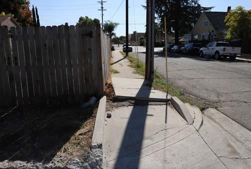
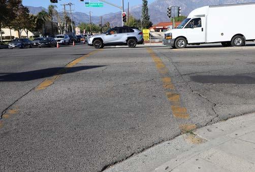
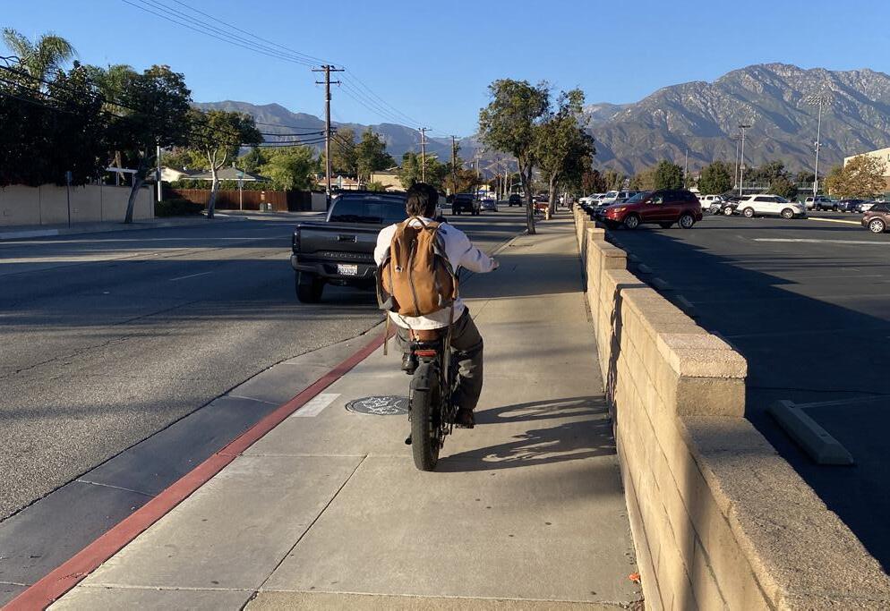
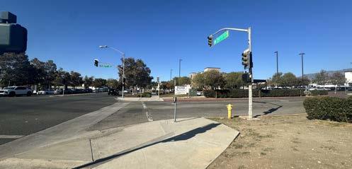
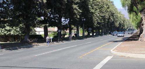
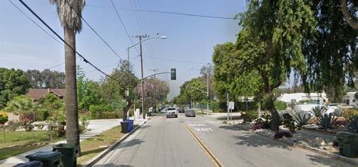
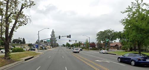
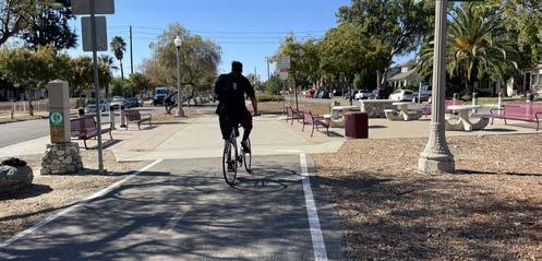
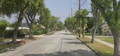
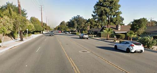
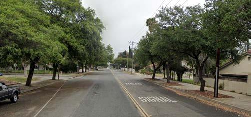
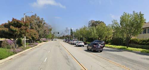
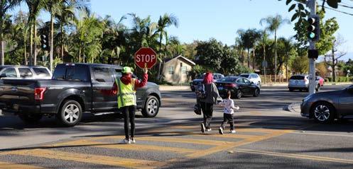
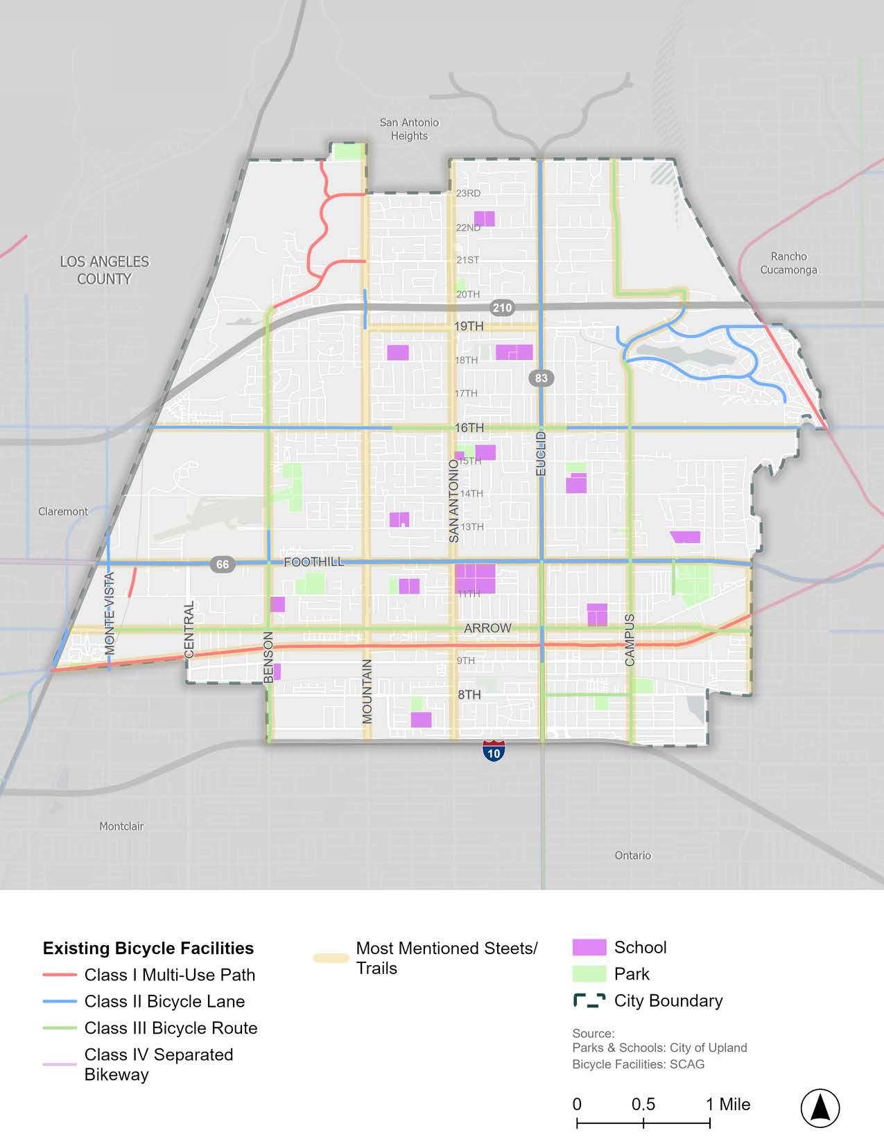
Really glad you are thinking about mobility for people who may not have as much access to cars and rely on walking/public transit! It is really important!
Patrol the drivers. Too many reckless drivers… around schools.
Please make sidewalks more ADA compliant...
Please more protected bike lanes!!! Take Claremont’s bike lanes and copy them!!! There’s no reason Foothill’s bike lane should be completely unprotected, sloped, and covered in bits of debris!!
Traffic is too fast and dangerous for kids to safely walk to school.
Need more police to enforce traffic violations, especially SPEEDING!
Making Upland more accessible to everyone is very important to me and many people that I know. The efforts to do so are very appreciated and we will do as much as we can to help make Upland (and hopefully neighboring cities) much more accessible.
I would be very happy to see more bus stops and bike lanes in this city.
Please pay attention to south Upland. So many improvements just benefit north Upland.
I would like to see a more public transportation oriented city; both within and in relationship to other surrounding cities.
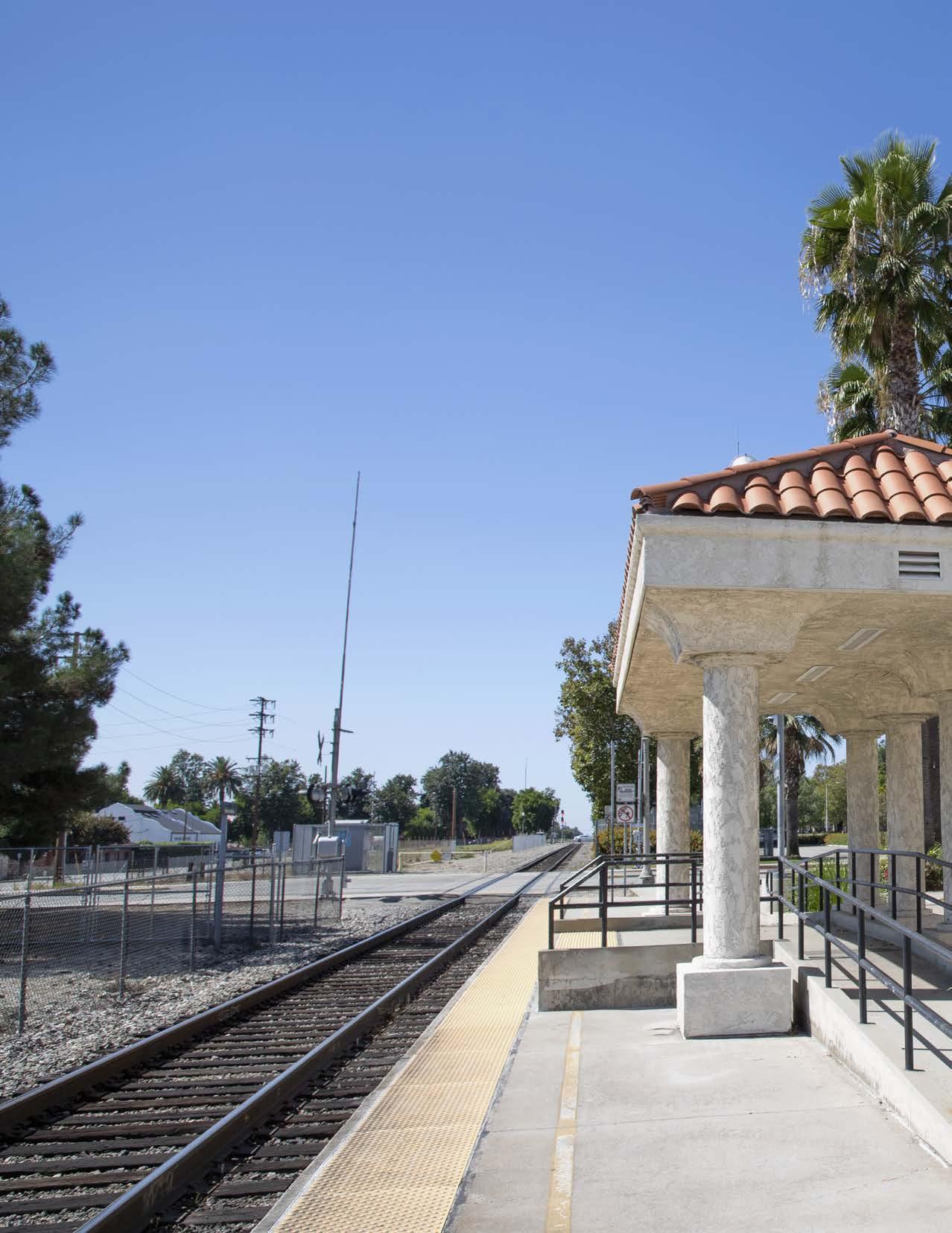
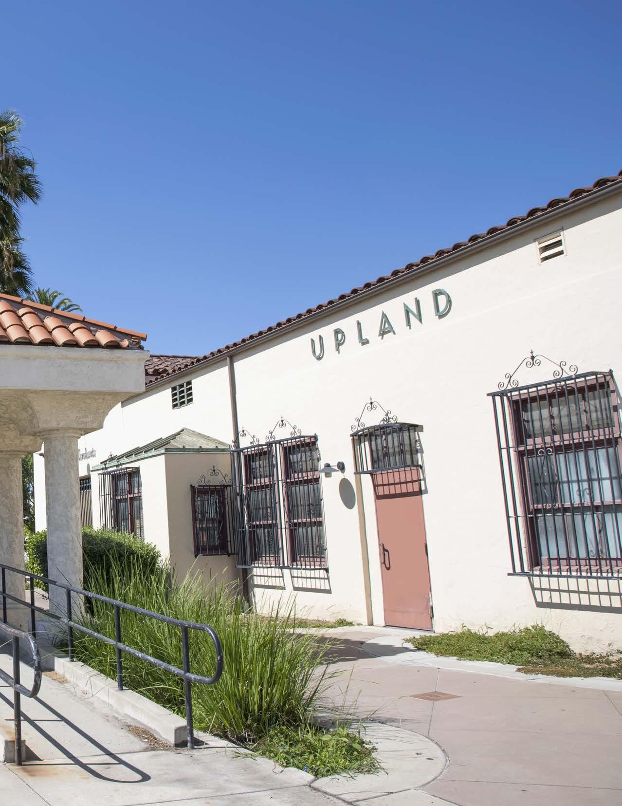
Chapter 4 provides an overview of potential mobility infrastructure facilities based on the latest Federal and State guidelines. This chapter can be used as a toolkit of solutions to make it safer, easier, and more enjoyable to walk, roll, ride a bicycle, and take public transit in Upland. Many of the mobility “tools” described in Chapter 4 are included as recommended infrastructure improvements in Chapter 5.
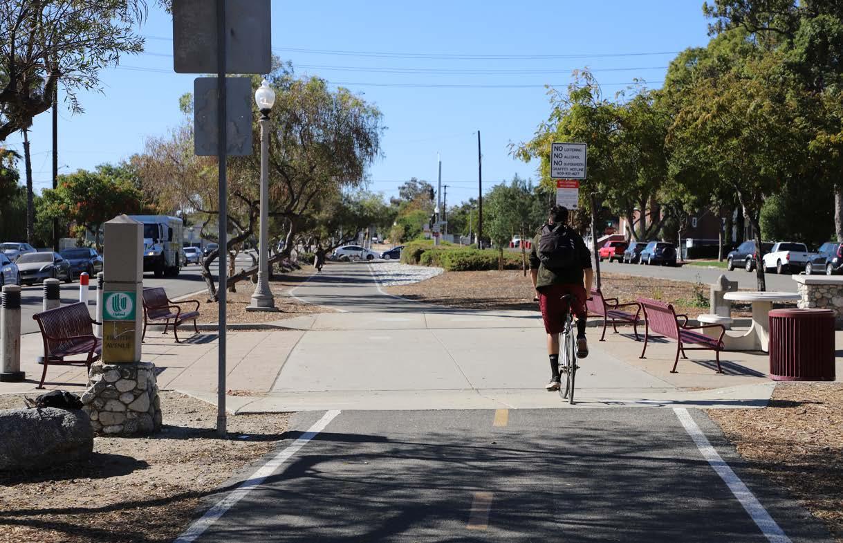
Creating pedestrian, bicycle, and public transit infrastructure that promotes safer and less stressful means of travel is a major focus nationwide. For example, the state of practice for bicycle travel has transformed over the last decade. Much of this may be attributed to bicycling’s changing role in the overall transportation system. No longer viewed as an “alternative” mode, bicycling is increasingly considered a conventional transportation mode that should be actively promoted as a tool for achieving environmental, social, and economic goals. While connectivity and convenience remain essential bicycle travel quality indicators, recent research indicates that increased acceptance and adoption of daily bicycling will require the provision of “low-stress” bicycle routes, which are typically considered to be those that provide bicyclists with separation from high-volume and high-speed vehicular traffic.
Similarly, pedestrian and ADA improvements are essential to an inclusive active transportation plan because they help to serve populations who cannot or do not want to drive or ride a bicycle. People are more likely to rely on walking or rolling (with a wheelchair or mobility aid) for recreation or their daily mobility needs when the road network feels safe, comfortable, and designed for pedestrians. Newer innovations like all-way pedestrian crossings (also known as pedestrian scrambles), modified signal timing, and flashing beacons are improving pedestrian visibility and creating safer streets for all.
This chapter provides an overview of both conventional and innovative forms of active transportation and public transit infrastructure to inform the recommendations proposed in Chapter 5. This “toolkit” includes recommendations for traffic calming, public transit enhancements, green street improvements, placemaking, and new mobility because they enhance the safety, comfort, and convenience of people walking, rolling, and bicycling. The toolkit can serve as a reference and starting point for the City in developing and implementing active transportation and public transit improvement projects across Upland. Many of the mobility “tools” described in this chapter are integrated into the site-specific recommendations provided in Chapter 5.
There are four conventional bikeway types recognized by Caltrans. Details of their design, associated wayfinding, and pavement markings can be found in the CA MUTCD and CA Highway Design Manual.
Class I multi-use paths (frequently referred to as “bicycle paths”) are physically separated from motor vehicle travel routes, with exclusive rights-of-way for non-motorized users like bicyclists and pedestrians. They require physical buffers to ensure the safety and comfort of the path user.
Class II bicycle lanes are one-way facilities that carry bicycle traffic in the same direction as the adjacent motor vehicle traffic. They are typically located between the adjacent travel lane and the curb, road edge, or parking lane. They are not physically separated from motor vehicle traffic.
Class III bicycle routes refer to a lane shared by bicyclists and motor vehicles. They are designated by signage and shared lane pavement markings (“sharrows”) and should be paired with traffic calming measures whenever possible. They are recommended where traffic volumes and roadway speeds are low (30 mph or less per SB 1216).
Class IV separated bikeways, also known as cycle tracks, are bicycle-specific facilities that combine the user experience of a multi-use path with the on-street infrastructure of a conventional bicycle lane. Separated bikeways are physically separated from motor vehicle traffic and are designed to be distinct from any adjoining sidewalk. Physical protection measures can include raised curbs, parkway strips, reflective bollards, or parked vehicles. Separated bikeways can be either one-way or two-way, depending on the street network, available right-of-way, and adjacent land use. The safety of two-way separated bikeways must be carefully evaluated because few motor vehicle drivers are accustomed to two-way separated bikeways and they may tend to look only to the left when deciding whether it is safe to proceed across the separated bikeways.
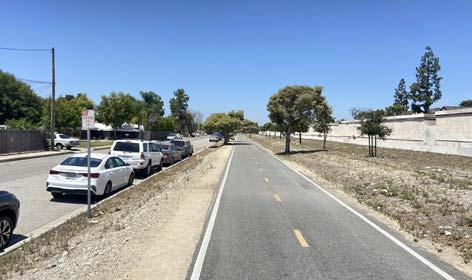
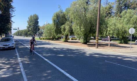
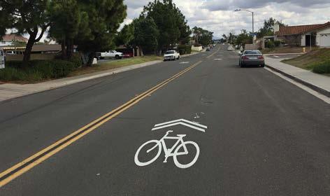
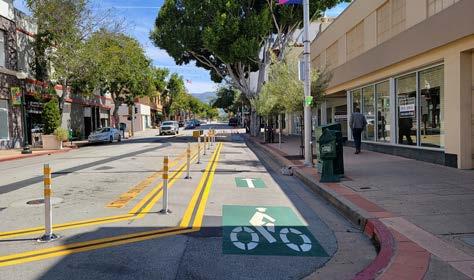
While conventional bicycle facility types can be found throughout the United States, there has been a distinct shift towards incorporating enhanced bicycle treatments that provide additional protection and visibility. These enhancements are low-cost, easy to install, and provide additional awareness about the likely presence of bicyclists. In many instances, the installation of these bicycle route enhancements can be coordinated as part of street resurfacing projects. For example, the use of green markings has also become a simple and effective way to communicate the likely presence of bicyclists and to denote potential conflict zones between bicyclists and vehicles.
An advisory bike lane is a preferred space for bicyclists and motorists to operate on narrow streets that would otherwise be a shared roadway. Roads with advisory bike lanes accommodate low to moderate volumes of two-way motor vehicle traffic and provide a safer space for bicyclists with little or no widening of the paved roadway surface. Due to their reduced cross-section requirements, advisory bike lanes have the potential to open up more roadways to accommodate comfortable bicycle travel.
Bicycle boulevards provide a convenient, low-stress bicycling environment for people of all ages and abilities. They are installed on streets with low vehicular volumes and speeds and often parallel higher volume, higher speed arterials. Bicycle boulevard treatments use a combination of signs, pavement markings, traffic diverters, and traffic calming measures that help to discourage through trips by motor vehicle drivers and create safe, convenient bicycle crossings of busy arterial streets. They are similar to Class III bicycle routes but tend to include more traffic calming and diversion infrastructure.
Bicycle detection is used at intersections with traffic signals to alert the signal controller that a bicycle crossing event has been requested. Bicycle detection can occur either through the use of push buttons or by automated means and is marked by standard pavement symbols.
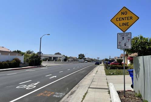
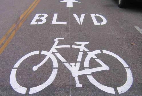
Bicycle signals include all types of traffic signals directed at bicyclists. These can include typical green/yellow/red signals with signage explaining the signal controls, or special bikeway icons displayed within the signage lights themselves. Nearside bicycle signals may incorporate a “countdown to green” display, as well as a “countdown to red.”
A bike box is a designated area at the head of a traffic lane at a signalized intersection that provides bicyclists with a safe and visible way to wait ahead of queuing traffic during the red signal phase. This positioning helps encourage bicyclists traveling straight through not to wait against the curb for the signal change.
Buffered bicycle lanes provide additional space between the bicycle lane and traffic lane, parking lane, or both, to provide a more protected and comfortable space for bicyclists than a conventional bicycle lane. The buffering also encourages bicyclists to avoid riding too close to parked vehicles, keeping them out of the “door zone” where there is the potential danger of drivers or passengers suddenly opening doors into the bicyclists’ path.
Colored pavement increases the visibility of bicycle routes, identifies potential areas of conflict or transition, and reinforces bicyclist priority in these areas. Colored pavement can be used as a corridor treatment, along the length of a bicycle lane, or within a protected bikeway. Additionally, it can be used as a spot treatment, such as crossing markings at particularly complex intersections where the bicycle path may be unclear. Consistent application of color across a bikeway corridor is important to promote clear understanding for all roadway users.

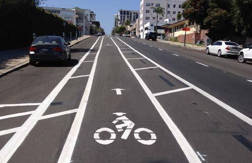
Green-colored striping can be used to highlight conflict areas between bicyclists and vehicles, such as where bicycle lanes merge across motor vehicle turn lanes or driveways.
Protected intersections maintain the integrity (low-stress experience) of their adjoining separated bicycle lanes by fully separating bicyclists from motor vehicles at intersections. Hallmark features of these protected intersections include two-stage crossings supported by an advanced queuing space, protective concrete corner islands, special bicycle-cross markings (parallel with crosswalks), and special signal phasing.
Shared lane markings, also known as sharrows, are commonly used where parking is allowed adjacent to the travel lane. It is now common practice to center them within the typical vehicular travel route in the rightmost travel lane to ensure adequate separation between bicyclists and parked vehicles. Many cities install sharrows over a green background to enhance visibility.
Signage and wayfinding on all streets and bicycle routes are intended to identify routes to both bicyclists and drivers, provide destination information and branding, and inform all users of changes in roadway conditions.
Two-stage left-turn queue boxes can provide a more comfortable left-turn crossing for many bicyclists because they entail two low-stress crossings, rather than one potentially high-stress one. They also provide a degree of separation from vehicular traffic, because they do not require merging with vehicle traffic to make left turns. Bicyclists wanting to make a left turn can continue into the intersection when they have a green light and pull into the green queue box. Bicyclists then turn 90 degrees to face their intended direction and wait for the green light of a new signal phase to continue through.
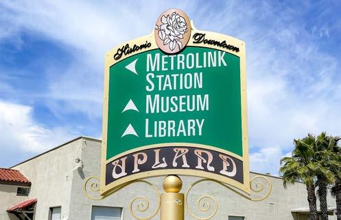
Sidewalks and ADA-compliant curb ramps represent essential and foundational elements of pedestrian infrastructure. However, additional pedestrian treatments help to facilitate a safer and more enjoyable pedestrian experience. These treatments help make pedestrians more visible to other road users, shorten crossing distances, and reduce opportunities for conflict.
Curb extensions, also called bulb-outs or neck-downs, extend the curb line outward into the travelway to reduce the pedestrian crossing distance. Curb extensions typically occur at intersections to increase pedestrian visibility, reduce the distance a pedestrian must cross, and reduce vehicular delay. Curb extensions must be installed in locations where they will not interfere with bicycle lanes or separated bikeways. If both treatments are needed, additional design features, such as ramps or half-sized curb extensions, should be considered.
Daylighting
Daylighting refers to the removal of parked cars next to crosswalks to allow people walking, bicycling, and driving to see each other better. Daylighting can be used as a tool to improve visibility and safety at intersections, particularly on highways and arterials. The 2023 MUTCD allows, for the first time, “daylighting” of intersections using only paint and flex posts.
Enhanced crosswalk markings with perpendicular striping, in addition to parallel stripes, can be installed at existing or proposed crosswalk locations. They are designed to both guide pedestrians and to alert drivers of a crossing location. The bold pattern is intended to enhance visual awareness.
A Leading Pedestrian Interval (LPI) is a signal timing technique that typically gives pedestrians a three to seven-second head start when entering a crosswalk with a corresponding green signal in the same direction of travel. LPIs enhance the visibility of pedestrians in the intersection and reinforce their right-of-way ahead of turning vehicles, especially in locations with a history of conflict. Generally, this leads to a greater likelihood of vehicles yielding. Depending on intersection volume and safety history, an otherwise legal right-turn-on-red (RTOR) might be explicitly prohibited during the LPI phase.
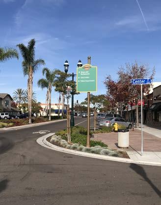
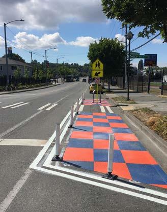
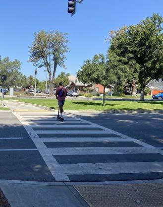
Mid-block crossings provide convenient locations for pedestrians and bicyclists to cross thoroughfares in areas with infrequent intersection crossings or where the nearest intersection creates substantial out-of-direction travel. Mid-block crossings should be paired with additional traffic-control devices, such as traditional pedestrian signals, pedestrian hybrid beacons, rectangular rapid flashing beacons, LED-enhanced flashing signs, and/or refuge islands.
Adjusting the timing, phasing, and actuation needed to cross high-volume and wide streets decreases waiting times and provides additional safety and comfort for pedestrians and bicyclists.
Pedestrian-scale lighting provides many practical and safety benefits, such as illuminating the path and making crossing pedestrians and bicyclists more visible to drivers. Lighting can also be designed to be fun, artistic, and interactive to enhance user experience.
Pedestrian scrambles, also known as allway pedestrian phases, stop vehicular traffic flow simultaneously in all directions to allow pedestrians to cross the intersection in any direction. These are used at intersections with particularly heavy pedestrian crossing levels. Unless cycle lengths can be kept under 90 seconds, Leading Pedestrian Intervals (LPIs) are generally preferred over pedestrian scrambles.
Refuge islands provide pedestrians and bicyclists a relatively safe place within an intersection and midblock crossing to pause and observe before crossing the next lane of traffic.
Designated senior zones can be enhanced with street signage, increased crossing times at traffic signals, benches, bus stops with shelters, and pedestrian lighting.
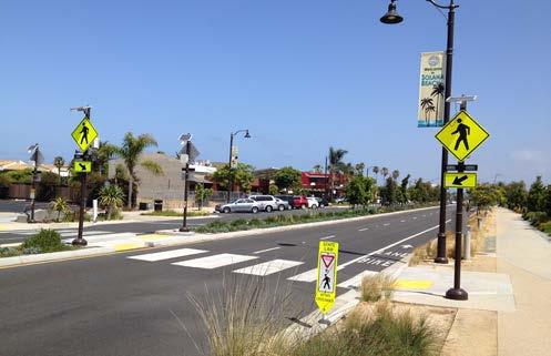
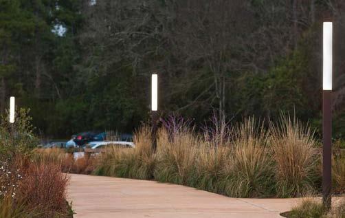
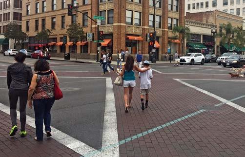
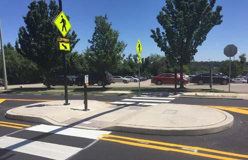
Traffic calming involves changes in street alignment, installation of barriers, and other physical measures to reduce traffic speeds and/or motor vehicle traffic volumes. Traffic calming is used to alter driver behavior and to improve street safety, livability, and other public purposes. Other techniques consist of operational measures, such as police enforcement and speed displays.
Traditional pedestrian signals with countdown timers remain the gold standard for high-quality pedestrian crossings, although some cases warrant new signal technologies. Pedestrian Hybrid Beacons (PHBs) and Rectangular Rapid Flashing Beacons (RRFBs) are special signals used to warn traffic at unsignalized locations and assist pedestrians crossing a street via a marked crosswalk. PHBs include a “red phase” that requires vehicles to come to a full stop while RRFBs are yield stops. Either of these devices should be installed at locations that have pedestrian desire lines connecting people to popular destinations, such as schools, parks, and retail.
Research has shown that PHBs tend to have a 90 percent motorist compliance rate versus RRFBs, which tend to have an 80 percent motorist compliance rate. Traditional pedestrian signals with countdown timers at signalized intersections tend to have a near 100 percent compliance rate.
Signals and warning devices should be paired with additional pedestrian improvements, where appropriate, such as curb extensions, enhanced crosswalk markings, lighting, median refuge islands, corresponding signage, and advance yield markings to mitigate multiple threat crashes on multilane roadways.
Chicanes are a series of narrowings or curb extensions that alternate from one side of the street to the other forming an S-shaped path. Chicanes reduce drivers’ speeds by causing them to shift their horizontal path of travel.
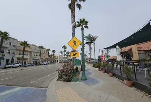
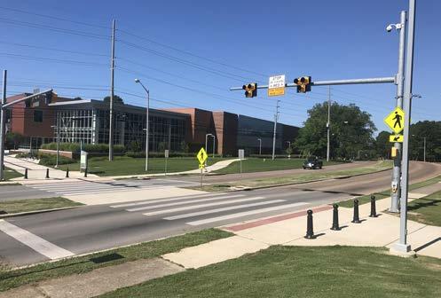
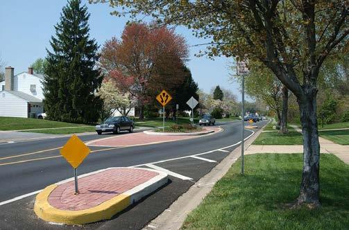
Hardened centerlines are small rubber barriers next to crosswalks that require people driving to make slower and more square left-hand turns. This small change has been shown to significantly slow down vehicle speeds at crosswalks and improve safety for people in the crosswalk.
Light-up stop signs are eye-catching stop signs that use flashing LEDs to encourage motor vehicle drivers to properly stop for pedestrians and bicyclists.
One-way couplets are a pair of parallel oneway streets with motor vehicle traffic traveling in opposing directions. Couplets are often used in high-volume areas to manage and increase the capacity of travel.
Edge friction is a combination of vertical elements, such as on-street parking, bicycle lanes, chicanes, site furnishings, street trees, and shrubs, that reduce the perceived street width, which has been shown to reduce motor vehicle speeds.
Neckdowns narrow a street by extending the sidewalk or widening the landscape area to give the perception that speeds should be reduced.
Reflective borders on signal heads improve the visibility of signal heads with a backplate and are made even more conspicuous by framing them with a yellow retroreflective border. These are more visible in both daytime and nighttime conditions.
A road diet is a transportation planning technique that reduces the number of travel lanes for motor vehicles to improve safety, comfort, and access for all road users. Road diets are often used to convert four-lane undivided roadways to three-lane roadways, with the extra space reallocated for other travel modes.
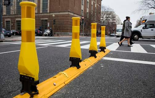
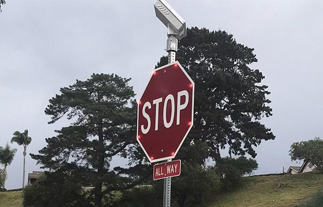
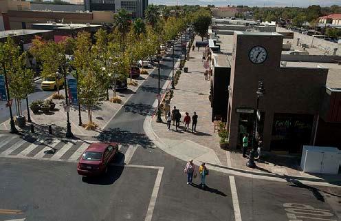
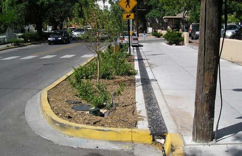
Roundabouts are circular intersections with yield control at their entry that allows a driver to proceed at controlled speeds in a counter-clockwise direction around a central island. Roundabouts are designed to maximize motorized and non-motorized traffic through their innovative design which includes reconfigured sidewalks, bikeway bypasses, high-visibility crosswalks, pedestrian flashing beacons, and other traffic measures. Roundabouts can be implemented on most streets but may require additional right-of-way.
Neighborhood traffic circles, also called mini-roundabouts, are small-scale traffic calming measures commonly applied at uncontrolled intersections on low-volume, local residential streets. They lower traffic speeds on each approach and typically avoid or reduce right-of-way conflicts because the overall footprint is smaller compared to roundabouts. Traffic circles may be installed using simple markings or raised islands but are best accompanied by drought-tolerant landscaping or other attractive vertical elements.
School pick-up/drop-off zones are designated areas typically managed by schools where school buses and parent and guardian motor vehicles can drop off and pick up children.
Speed cushions are a form of vertical traffic calming with wheel cutouts that allow emergency vehicles to easily pass. Speed cushions help to reduce vehicle speeds and enhance pedestrian safety.
Speed displays measure the speed of approaching vehicles by radar and inform drivers of their speeds using an LED display. Speed displays contribute to increased traffic safety because they are particularly effective in getting drivers traveling ten or more miles per hour over the speed limit to reduce their speed.
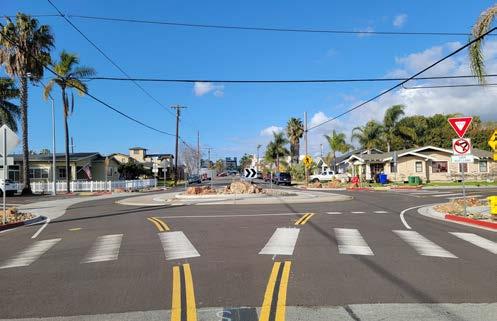
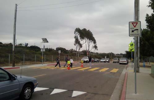
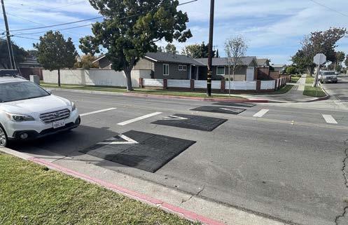
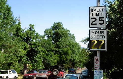
Raised crosswalks are flat-topped road humps, often constructed with textured surfacing on the flat section. Raised crosswalks help to reduce vehicle speeds and enhance pedestrian safety.
A traffic diverter is a roadway design feature placed in a roadway to prohibit vehicular traffic from entering into or exiting from the street, or both.
Truck aprons allow large vehicles, such as trucks, buses, and recreational vehicles, to turn without striking fixed objects or people walking, rolling, or bicycling. They are located between the road surface and the sidewalk, or inner circle of a roundabout. The pavement is raised slightly to encourage light vehicles to stay on the main road surface.
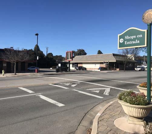
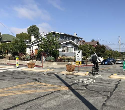
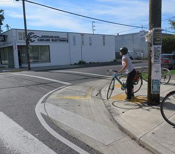
Public transit rider satisfaction and interest can be enhanced through the provision of safe, convenient, and fast service. By making public transit easy to access, comfortable to use, and efficient, transit providers can improve public perception and encourage increased use.
Bus Rapid Transit (BRT) is a high-quality busbased transit system that delivers fast and efficient service through the use of bus-only lanes, busways, traffic signal priority, off-board fare collection, elevated platforms, and enhanced stations. BRT offers more reliable and faster public transit service than regular buses because it is designed to avoid typical delays, such as waiting in traffic or waiting for a line of riders to pay.
Feeling safe and secure while taking public transit, including walking to, from, and waiting at a transit stop, should be foundational to the public transit experience. However, that is not always the case. Emergency call boxes at transit stops and along popular pedestrian routes to/from transit stops provide individuals with the means to reach out for help if needed.
A floating bus island is located between travel lanes and bicycle lanes where transit passengers board and alight transit vehicles. Pedestrians cross the bike lane when traveling to or from the platform where the bus stop is located. This eliminates conflict between bicyclists traveling in bike lanes and transit vehicles that must pull curbside to load and unload passengers.
Microtransit refers to a publicly provided ondemand rideshare service that offers the flexibility of a ride-hailing service like Uber or Lyft, but at affordable rates. Microtransit programs typically provide rides for short local trips with small shuttles within designated service zones, offering safe and convenient travel for quick trips. On top of already affordable rates, it is common for microtransit programs to offer reduced rates to seniors, people with disabilities, and/or Medicare recipients.
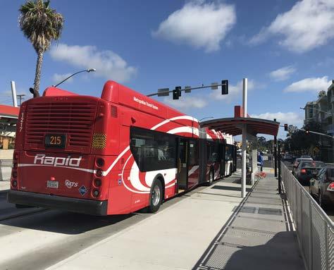
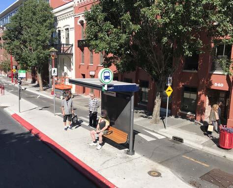
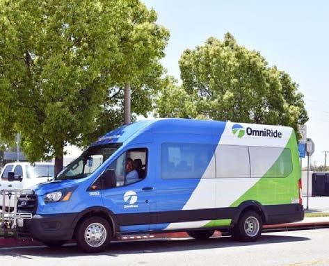
Mobility hubs offer an integrated suite of mobility options that serve a critical function in the regional transportation system as the origin, destination, or transfer point for a significant share of transit trips. They allow for a combination of transportation options to gather in one space to encourage people to use non-motorized forms of travel with ease. Mobility hubs are typically located along a bicycle facility and a transit stop and are paired with multimodal elements, such as bikeshare, scootershare, bicycle lockers, battery charging for e-bicycles, wayfinding signage, ridesharing pickup/dropoff zones, and pedestrian amenities, such as curb extensions, street furniture, and lighting.
Real-time bus information allows riders to predict their journey and manage their time more effectively. This increases the convenience of transit for riders by providing an accurate, updated location of their bus.
Transit stop amenities help to increase the comfort and safety of public transit users. Transit stop amenities can include posted route schedules, trash receptacles, lighting, sheltered waiting areas that provide protection from rain and sun, real-time arrival updates, Wi-Fi connectivity, and more. The provision of these amenities improves rider satisfaction and may encourage increased transit use.
Green street improvements incorporate tried and true stormwater management practices into transportation infrastructure to reduce stormwater runoff, prevent flooding, improve water quality, provide habitat for local flora and fauna, and create an enjoyable streetscape. These improvements can be installed alongside sidewalks, roadways, parking lots, medians, and more to create a more sustainable and resilient mobility system. The green street improvements listed below are from the U.S. Environmental Protection Agency’s Green Streets Handbook.
Bioswales, also known as bioretention swales or vegetated swales, are surface depressions that use bioretention soil media and vegetation to facilitate stormwater infiltration, retention, sedimentation, and pollution removal. Bioswales serve as stormwater conveyance treatment devices and are typically located along public rights-of-way, parking lots, sidewalks, road medians, and road shoulders to capture water flow from nearby impervious surfaces.
Infiltration trenches are excavated linear areas filled with layers of stone and sand wrapped in geotextile fabric. These trenches are covered with stone, gabion, sand, or grass with surface inlets. Stormwater is stored in the stone reservoir and slowly infiltrates through the bottom and sides of the trench. Infiltration trenches are ideal for linear spaces, such as along a roadway, parking lot, or median.
Permeable pavements allow stormwater runoff to infiltrate through void space into the ground below or another stormwater management system instead of becoming surface runoff. Types of permeable pavement include porous asphalt, porous recycled surface products, pervious concrete, and pavers arranged with void spaces. Permeable pavement can be used instead of impervious materials on parking lots, parking lanes, driveways, sidewalks, walking paths, bicycle lanes, parkways, road shoulders, and low-traffic roads.
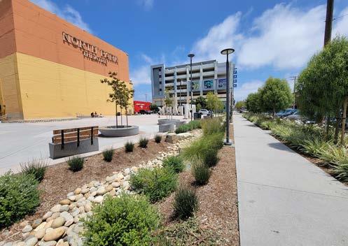
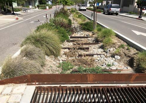
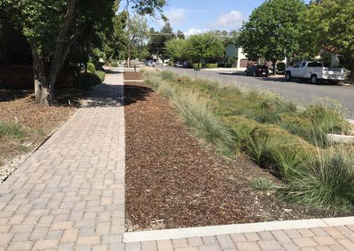
Stormwater curb extensions, or stormwater bump outs, combine two street improvements - traffic calming and stormwater filtration - to produce multiple streetscape benefits. This strategy involves filling the area behind the curb with a bioretention soil media and vegetation similar to a bioretention cell or bioswale. Stormwater curb extensions can be located at intersections, midblock crossings, neighborhood or collector streets, or any length of a roadway.
Stormwater planters are narrow, flat-bottomed landscaped areas designed to receive stormwater runoff from surrounding impervious surfaces, such as rooftop areas, sidewalks, and roadways. Stormwater planters are typically rectangular with vertical walls and are best suited for urban areas with limited space or areas with steep slopes.
Stormwater tree systems, such as tree pits or tree trenches, contain a tree or shrub planted in a bioretention soil mix and a gravel reservoir designed to capture stormwater. Stormwater tree systems are typically located along sidewalks, medians, and parking lots and receive stormwater runoff through a curb cut, catch basin, or stormwater inlet.
Street trees along roadways provide numerous benefits, such as shade, cooler temperatures, better air quality, on-street edge friction, and streetscape enhancement - all of which improve the overall pedestrian experience.
Subsurface infiltration and detention systems capture, temporarily store, and slowly release stormwater to reduce peak runoff discharge. Subsurface infiltration systems use an infiltrative chamber system made of concrete or plastic with perforated pipes, galleys, and chambers to store large amounts of runoff and slowly let it infiltrate into the ground. Subsurface detention systems temporarily store runoff before releasing it to a conveyance system downstream. These systems are most suitable for parking lots, sidewalks, and roadways.
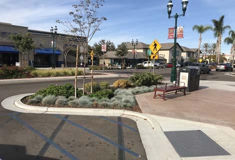
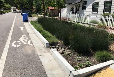
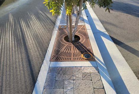
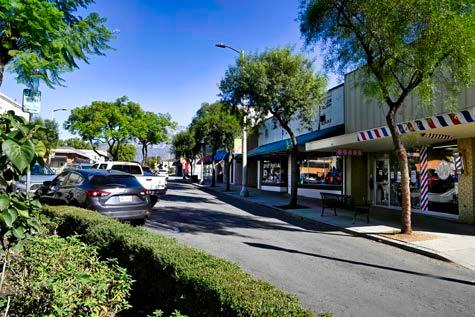
The inclusion of placemaking urban elements, such as parklets, encourages walking and provides usable space for all ages. In many cities, these elements have helped transform urban villages and downtowns into walkable destinations. Continued coordination with local Upland businesses and organizations, such as the great examples currently found in the Historic Downtown, may provide collaborative design and funding opportunities between the City, its businesses, residents, and visitors.
Parklets are conversions of one or two parking spaces for outdoor seating, dining, and other amenities. Parklets can be used to activate and improve the aesthetics of a streetscape.
Displaying community art is a great way to showcase the history, culture, and pride of an area and create a sense of place for residents and visitors alike. Community art can include murals, sculptures, artistic paths and benches, and more.
Special intersection paving and crosswalk art provide unique opportunities to highlight crossings or key civic or commercial locations at intersections while breaking the visual monotony of asphalt. Intersection paving treatments and crosswalk art can integrate context-sensitive colors, textures, and scoring patterns. Paving treatments and crosswalk art do not define a crosswalk and should not be seen as a safety measure. Standard transverse or longitudinal high-visibility crosswalk markings are still required.
Transit shelters, bicycle racks, seating, drinking fountains, and pedestrian-scale lighting are important amenities for the functionality, design, and vitality of the urban environment. They show that the street is a safe and comfortable place to be.

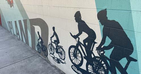
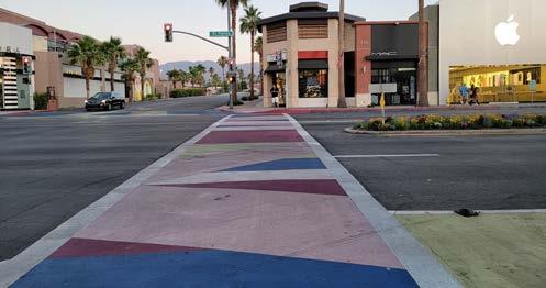
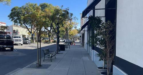
New mobility refers to evolving and emerging forms of clean and/or shared forms of transportation, which can include micromobility, ride-hailing, carpools, and automated and connected vehicles. These forms of transportation can provide alternatives to gas-powered, single-occupancy cars and help reduce air pollution and GHG emissions. Clean mobility and shared options also help address transportation equity by providing affordable transportation choices for lower-income households and those who are unable to drive or own a car.
Docked bikeshare is a shared transport service in which bicycles or e-bicycles are made available for shared use to individuals on a short-term basis for a price or for free. Docked bikeshare systems allow people to borrow a bicycle from a “dock” or station and return it to another dock belonging to the same system. Docked bikeshare systems often include electric-assist bicycles that provide extra comfort for users.
Scootershare programs are popular forms of shared transportation services that involve the rental of electric motorized scooters for short trips. These programs involve the use of a mobile app to look for, rent, pay, and park the rented scooter. Scootershare programs provide a high degree of flexibility for the individual user and can be an effective method for closing mobility gaps. Short trips to visit family members and access to schools, parks, commercial areas, and transit stops are all possible with a scootershare program.
An electric carsharing service could be established by purchasing a fleet of electric cars. These cars could be rented by residents to address their transportation needs, such as commuting to work, running errands, or getting to medical appointments. The City would have its own EV charging infrastructure which could be combined with other electric mobility options, such as electric shuttles and electric vanpool/carpool services.
Electric shuttles can help address gaps within a community by supplementing the existing transit network or by creating new transit routes where they currently don’t exist. Depending on the make and model, electric-powered shuttles can be used to offer transit services within a specified radius.
As electric vehicles (EVs) become more common, the need for publicly accessible EV charging stations will increase, especially for those who cannot install an EV charger at their home. Cities can help facilitate an equitable transition to EVs by installing publicly accessible EV charging stations at City-owned parking lots and structures. Not only can public EV charging stations support community members, but they can also attract new visitors into town.
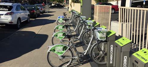
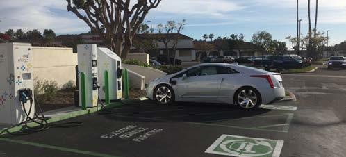
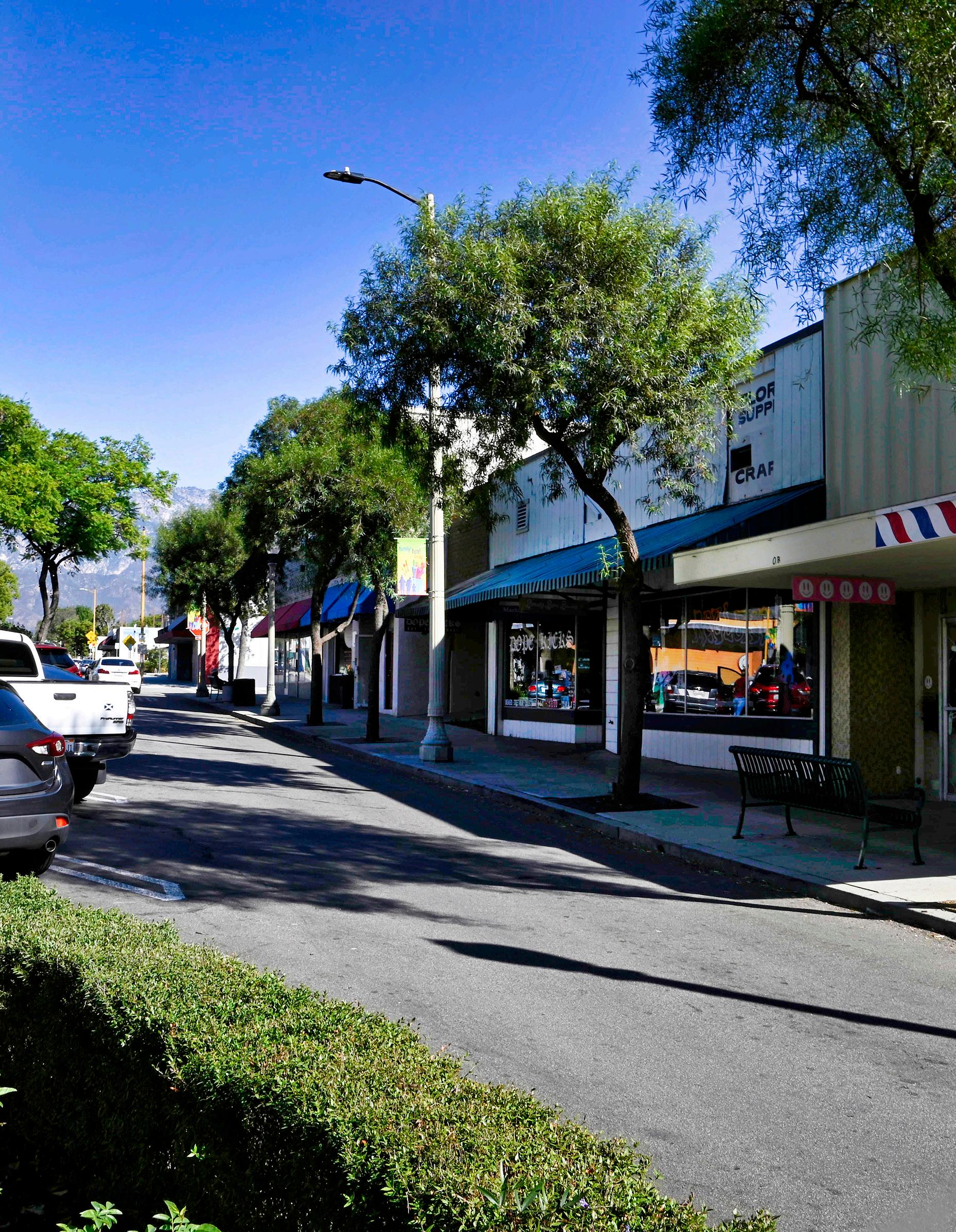
Chapter 5 proposes physical improvement projects and programmatic policies to facilitate and encourage walking, rolling, riding a bicycle, and taking public transit in Upland. Project recommendations are described in a table, while a selection of “priority projects” are displayed in cut sheets that depict the top projects in an easy-to-understand manner.

Chapter 5 proposes new and improved bicycle, pedestrian, ADA, and public transit facilities to expand safe and convenient non-vehicular mobility options for people of all ages and abilities throughout Upland. Proposed recommendations include both infrastructure solutions that improve multimodal safety and comfort, as well as programmatic recommendations that encourage and support active transportation and public transit modes.
The planning team developed infrastructure solutions to help the City bring appropriate mobility facilities to the areas that need them most. This chapter provides an overview of how these projects were created, assessed for feasibility, and prioritized. To support the City in securing funding for project implementation, the chapter contains maps and tables that provide key project information, such as type, location, and extent. To build momentum for future implementation, the Plan provides planning-level conceptual drawings for ten priority projects. The recommendations proposed in this chapter are meant to serve as a guide for the City to pursue and allocate funds as they become available through various sources. This chapter also contains programmatic recommendations to support, encourage, and celebrate active transportation.
Public transit is a critical transportation mode for people who cannot or choose not to drive a motor vehicle. When accessible, convenient, and efficient, public transit can make key destinations more accessible to those who experience barriers to driving a motor vehicle due to age, disability, or economic hardship. According to U.S. Census data, just 1.6 percent of Upland commuters over the age of 16 use public transit to travel to work, compared to 73.3 percent of workers who drive to work alone. Ten percent of respondents to the community survey for this Plan indicated using public transit, which is a significantly higher (though not statistically-valid) mode share than that in the U.S. Census ‘Means of Transportation to Work’ dataset.
To increase public transit ridership, the City can collaborate with Omnitrans and Metrolink to enhance service through improvements to public transit stop amenities, routes, and programs. The public transit recommendations in this chapter address the needs identified in the existing conditions analysis and expressed by community engagement participants.
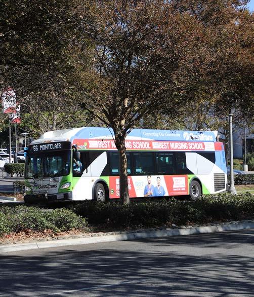
As shown in Figure 2-10 in Chapter 2, Omni2trans operates four fixed bus routes (Routes 66, 83, 84, and 85) that provide service in the southern parts of Upland. In addition to fixed bus routes, Omnitrans offers OmniRide, an on-demand microtransit service that provides public transit access to almost all of Upland (see Figure 2-11). Despite offering near full public transit coverage of Upland, some community engagement participants shared a desire for bus service to northern Upland and the Colonies Crossroads shopping center. The community’s desire for expanded bus service indicates that residents may not be aware of the OmniRide microtransit service that provides low-cost rides to almost anywhere in Upland. The City is encouraged to collaborate with Omnitrans to launch a public education campaign to promote the OmniRide microtransit service so more Uplanders are aware of the program. Additionally, the City may also work with Omnitrans to conduct a study to determine the need for extending an existing or adding a new fixed bus route to provide expanded service in northern Upland. Potential opportunities for bus route expansion are highlighted in Figure 5-1.
Bus route expansion may require a lengthy planning effort among multiple agencies that considers - among other factorsroute and stop feasibility, vehicle availability, impacts to existing headway, budget, and financial trade offs. Though public input indicated a desire for a larger bus service area, increasing public awareness of OmniRide may more effectively support transit demand than expanding fixed routes.
The City can collaborate with Omnitrans and Metrolink to promote public transit use. Potential programs include:
f OmniRide Microtransit Promotional Campaign
f Free OmniRide passes for youth
f Free Ride Day
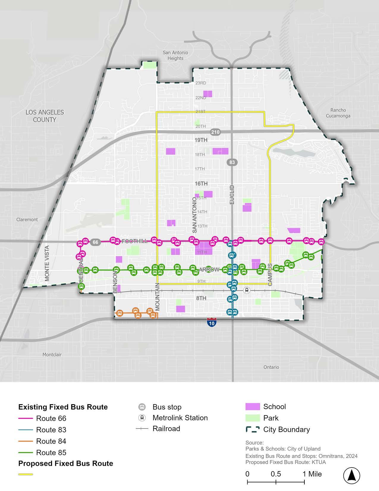
Community engagement participants shared that bus stops in Upland do not feel safe, which is often associated with the lack of comfort and safety amenities. Few bus stops in Upland have both a bench and a shelter, and not all stops are ADA accessible (Figure 2-13). Bus stops with these basic characteristics make a bus rider’s experience safer, more comfortable, and possibly make the bus a more attractive mode of transportation to non-transit riders. Additionally, making more bus stops ADA accessible will increase the transit accessibility and service area for ADA bus riders.
Omnitrans does not have a Passenger Amenity Agreement with the City, so bus stop amenities in Upland are provided by the City or a developer. Future collaboration between the City and Omnitrans is recommended to improve bus stops for safety, comfort, and ADA accessibility. Omnitrans’ 2023 Transit Design Guidelines designate standards per type of bus stop, differentiating minimum standards from “basic”, “preferred”, and other stop types.
Omnitrans designates the minimum standard bus stop type as an unobstructed area measuring 8’ from the back of the curb and 15’ along the curb, having a polemounted sign with route information, lighting, and ADA compliance. A 5’ curb length of this area is designated as a landing pad for boarding and unboarding passengers, particularly ADA passengers. The Omnitrans minimum standard bus stop includes no safety and comfort amenities like benches or shelters, recognizing likely site area constraints with these larger amenities. There is an opportunity for the City to identify bus stops that can feasibly accommodate safety and comfort amenities.
Omnitrans guidelines include safety and comfort amenities starting with the “basic” stop type, which includes a bench or lean bar. Bus shelters are included starting with the “preferred” stop type. Where possible to bring stops to a “preferred” type, Upland in collaboration with Omnitrans and
developers should strive to provide a bench and shelter in addition to the minimum standard ADA accessibility, lighting, and route signage. For stops with higher ridership (and presumably more people in the queue), a larger “premium” shelter should be provided where possible.
To include comfort amenities and ADA accessibility, existing stop locations will need to be studied for feasibility and design. Priority bus stops for feasibility study and design to accommodate safety and comfort amenities are those with the highest number of weekday boardings and alightings (Figure 2-12) and missing a bench or shelter (Figure 2-13). Bus stops on both sides of the street at the following intersections are priorities:
f Foothill Boulevard and Benson Avenue, Mountain Avenue, San Antonio Avenue, Euclid Avenue, Memorial Park, Campus Avenue
f Arrow Highway and Euclid Avenue
Bus stops at locations other than these priority intersections can still be considered in a feasibility study and design for comfort amenities. In particular, stops that have neither a bench nor shelter but have lower weekly ridership than stops along Foothill Boulevard and Euclid Avenue may also be considered. Many bus stops along Arrow Highway fall into this category.
To support and encourage bimodal bikebus trips, the City can identify bus stops that fit bicycle racks or lockers. Determining the feasibility of bicycle racks can be included in the same effort that evaluates the feasibility of benches and shelters at bus stops.
On-board bicycle racks can also encourage bimodal bicycle-bus trips. Omnitrans buses have bicycle racks on the front of the vehicle that carry two or three bicycles. Full racks are a common issue for bicyclists riding the bus, requiring bicyclists to wait for the next bus with available bicycle rack space. Omnitrans should strive toward a threebicycle capacity rack on the front of all buses to better support bimodal bicyclebus trips.

Located within walking distance of Downtown Upland and City Hall, the Upland Train Station (Metrolink Station) is a local asset that provides regional mobility alternatives to congested highways. Safety improvements and amenity enhancements at the Metrolink Station will support and encourage current and prospective Metrolink riders. Station improvements will also support nearby high-density multifamily residential developments that may attract residents who desire a small downtown environment while with car-free access to regional employment centers like downtown Los Angeles.
Community survey respondents expressed the desire for amenities to make the station feel more comfortable, accessible, and safe. Desired amenities include expanded and free public parking, improved security measures, easy passenger loading zones, and amenities like lighting, public restrooms, seating, shade structures, and bicycle parking. Many survey respondents also expressed a preference for Montclair’s Metrolink Station, which the City can look to as a case study for future improvements.
The City is already making strides to improve mobility conditions at and near the Upland Train Station and surrounding areas. For example, the City partnered with SBCTA to design and construct:
f A new signalized pedestrian/bicycle crossing where the Pacific Electric Trail intersects with Campus Avenue
f A pedestrian automated crossing safety gate at the railroad tracks located on Euclid Avenue
f Enhanced crosswalks in the downtown area between “A” Street and Arrow Highway
f Pacific Electric Trail improvements from Euclid Avenue to Campus Avenue.
Additionally, with funding from Metrolink, the City plans to build a new 400-space parking structure at the City-owned lot at the corner of E. C Street and N. 1st Avenue. This parking structure will support park-and-ride trips for Metrolink riders who need to drive to the station. As the surrounding areas are developed, the City is encouraged to continue partnering with Metrolink, SBCTA, and developers to enhance the Metrolink Station with new amenities to make the station more attractive to residents and visitors.
Two new affordable, multifamily housing developments are planned directly adjacent to the Upland Train Station, in between the railroad tracks and Stowell Street. As part of these transit-oriented development projects, the City secured grant funding from the Regional Early Action Planning (REAP) and Affordable Housing and Sustainable Communities (AHSC) programs to design and implement the following mobility improvements to facilitate access to the Upland Train Station and Downtown Upland:
f Stowell Street (Euclid Ave. to Sultana Ave.): Sidewalk, Class I multi-use path or other bicycle facility, and other improvements.
f 1st Avenue and 2nd Avenue (Stowell St. to 7th St.): Wayfinding signage and traffic study for one-way couplet conversion on 1st Avenue and 2nd Avenue to create space for one-way bicycle facilities.
f 7th Street (Euclid Ave. to 2nd Ave.): Wayfinding signage and a Class IV separated bikeway or other bicycle facility.
f 2nd Avenue (Stowell St. to A St.), A Street (2nd Ave. to 1st Ave.), and 1st Avenue (A St. and D St.): Class IV separated bikeway or other bicycle facility, bicycle/pedestrian connection to Pacific Electric Trail, enhanced crossing at A Street/1st Avenue, upgraded rail crossing with bicycle/pedestrian safety features, and other improvements.
f A Street (2nd Ave. to Campus Ave.), Campus Avenue (A St. to Arrow Hwy.), and Arrow Highway (Campus Ave. to 9th Ave.): Class IV separated bikeway or other bicycle facility, bicycle/pedestrian connection to Pacific Electric Trail, traffic signal modifications, wayfinding signage, and other improvements.
In partnership with SBCTA, the City recently completed a railroad crossing improvement project, which installed a pedestrian automated crossing safety gate at the railroad tracks located on Euclid Avenue. The City can continue to improve pedestrian safety and accessibility along railroad crossings in Upland by using the pedestrian safety inventory presented in Table 2-1, A-1, and A-2 to identify needs for future improvement projects and initiate collaboration with Metrolink. Guidelines for pedestrian at-grade rail crossings can be found in Metrolink’s SCRRA Highway-Rail Grade Crossing Manual (2021) and Part 8 of the California Manual on Uniform Traffic Control Devices.
Several common issues affecting the pedestrian experience were identified in the existing conditions analysis and affirmed through the community engagement process. For example, community engagement participants repeatedly mentioned key pedestrian issues, including uneven and cracked sidewalks, missing curb ramps, dangerous driving behavior, lack of pedestrian visibility, and fear of crime. Together, these issues make it uncomfortable, challenging, unsafe, and for some, impossible, to walk or use a mobility aid device to reach destinations in Upland.
This Plan proposes several recommendations to improve pedestrian visibility, reduce dangerous driving behaviors, and increase ADA accessibility to cultivate a safe and enjoyable pedestrian experience throughout Upland. Site-specific traffic calming, pedestrian, and ADA infrastructure projects were developed as part of the SRTS recommendations and the top 10 priority project corridors. In addition to the proposed pedestrian and ADA improvements at specific locations, the following overarching recommendations should be considered citywide:
f Use the City’s Sidewalk Master Plan (2024), ADA Transition Plan (2024), Traffic Signal Assessment & Master Plan (2024), and Local Road Safety Plan (2022) to guide the implementation of pedestrian and ADA improvement projects, with a focus on underserved areas south of Foothill Boulevard.
f Infill sidewalk gaps identified in Figure 2-15, adjacent to schools, parks, and commercial corridors, as funding becomes available.
f Install curb ramps where missing (as identified in Figure 2-16), with curbs leading to schools, parks, public buildings, and commercial destinations prioritized. Where possible, install curb ramps in a two-ramp corner installation (Caltrans Standard Plan A88A, Detail A) as opposed to a one-ramp corner installation (Detail B).
f Ensure all new curb ramps have detectable warnings to facilitate safe crossings for pedestrians with vision impairments.
f Retrofit existing curb ramps without detectable warnings (identified in Figure 2-16) to have truncated domes, with curbs leading to schools, parks, public buildings, and commercial destinations prioritized.
f Install high-visibility crosswalk markings at crosswalks adjacent to schools, parks, and commercial corridors.
f Modify signals for leading pedestrian intervals (LPI) and install accessible pedestrian signals (APS) at every signalized intersection adjacent to schools, parks, and commercial corridors.
f Install pet waste stations along popular pedestrian routes, such as the Pacific Electric Trail, Euclid Avenue Bridle Path, and Downtown Upland.
f Where feasible, upgrade medians at intersections to include a pedestrian safety island with a “nose” that extends past the crosswalk to protect people needing to wait on the median and slow turning drivers. It is preferable to have the crosswalk cut through the median.
Streetscape design and safety improvements can improve the perception, comfort, and enjoyment of all road users, particularly pedestrians. Streetscape enhancements can bring multiple benefits to a corridor, including beautification, placemaking, environmental sustainability, safety, and more. Streetscape enhancements can include street and pedestrianscale lighting, public art, street furniture, shade trees or structures, landscaping, pet waste stations, and more. In addition to installing new amenities, streetscape improvements can include removing items that create a negative pedestrian experience, such as graffiti, litter, overgrown landscaping, and empty tree wells. By adding new streetscape amenities and removing known issues, the City can facilitate a more comfortable and enjoyable pedestrian experience. Streetscape enhancements should be prioritized in areas with high foot traffic, such as Downtown Upland, as well as along the top ten priority projects (introduced on page 176).
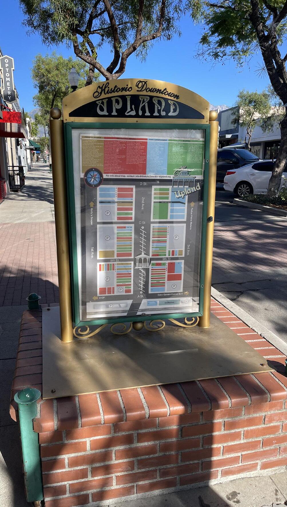
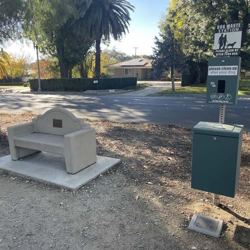
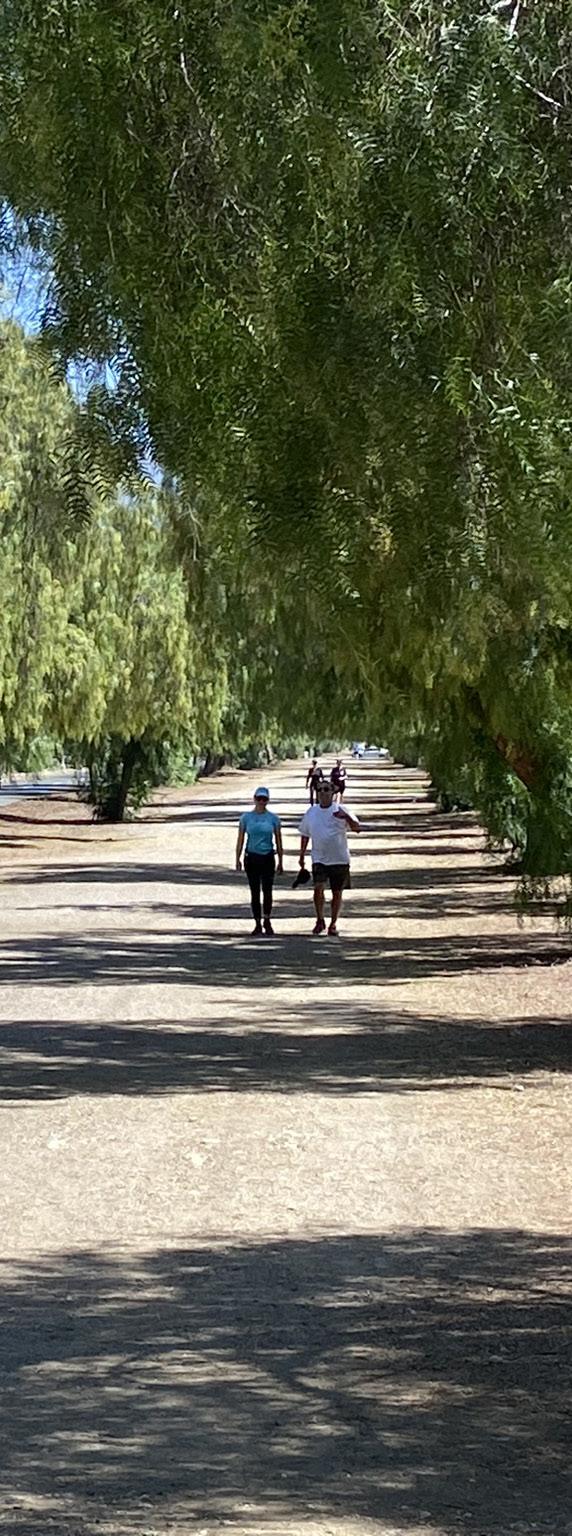
Upland has several popular natural surface and Class I multi-use paths that provide Uplanders with recreational opportunities and off-street corridors for traveling without a vehicle. The Plan identifies opportunities to build on the existing network of urban trails by improving existing paths and installing new ones for expanded connectivity.
The Plan proposes to expand the existing urban trail system network by adding new Class I multi-use paths along opportunity areas. Figure 5-2 shows 11.3 miles of proposed Class I multi-use paths along the San Antonio Creek Channel, Cucamonga Creek, San Antonio Avenue (from 23rd Street to 11th Street), Euclid Avenue (from Foothill Boulevard to 7th Street), and two utility corridors in the northeast corner of the city. Most of the proposed Class I multiuse paths would extend or connect to existing paths, expanding the recreational and transportation value of Upland’s urban trail system. Others, such as those along utility corridors in northeast Upland, would leverage off-street right-of-way that would not otherwise be developed. Trails along utility corridors can be built in such a way that improves - rather than hinder - utility access.
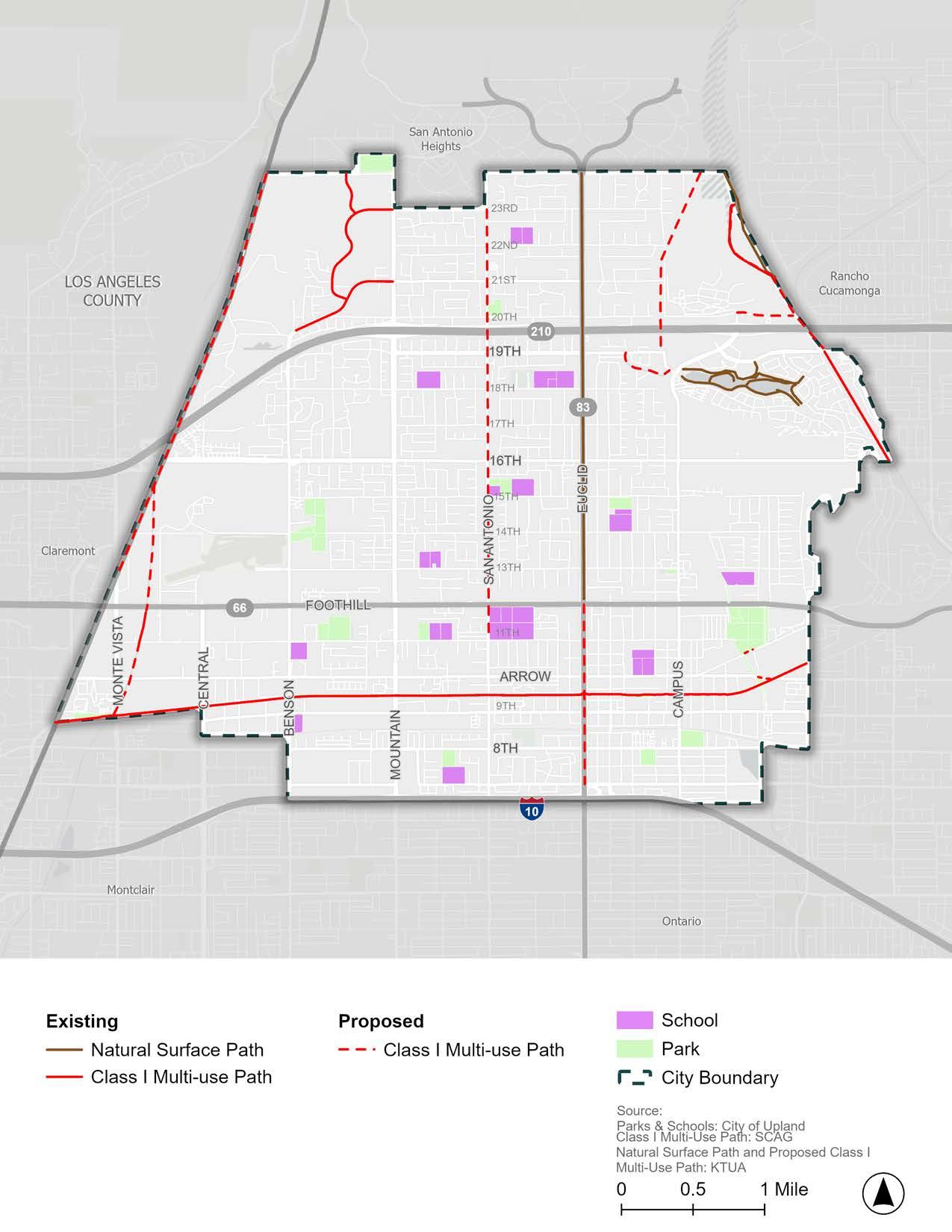
In addition to expanding Upland’s urban trail system, the Plan identifies opportunities to improve safety and comfort along Upland’s most popular urban trails: the Pacific Electric Trail and Ye Bridle Path (Euclid Avenue Bridle Path).
The Pacific Electric Trail is a community asset used by many for recreation and transportation. Knowing this, the City continues to seek opportunities to improve and enhance the Pacific Electric Trail for community members. For example, the City recently partnered with SBCTA to construct a new signalized pedestrian/bicycle crossing where the trail intersects with Campus Avenue and install a walking path and enhanced lighting along the trail from Euclid Avenue to Campus Avenue.
The City can continue to build on recent momentum by addressing concerns expressed during the community engagement process for this Plan. Many community engagement participants reported feeling unsafe or uncomfortable using the Pacific Electric Trail due to poor trail maintenance and the presence of substance use and people experiencing homelessness. While the presence of people experiencing homelessness does not inherently equate to more crime, many community engagement participants brought it up as a safety concern when using the Pacific Electric Trail.
To reduce crime and fear of crime, the City can explore opportunities to implement Crime Prevention Through Environmental Design (CPTED) principles along the Pacific Electric Trail. CPTED is a multi-disciplinary approach to reducing actual crime and the perception of crime through the intentional design and programming of public spaces. CPTED strategies are designed to deter crime by cultivating a sense of community and shared ownership of public space, increasing visibility and activating public spaces as a form of natural surveillance, addressing maintenance issues in a timely manner, and removing access to uncontrolled or unobservable areas.
Opportunities to implement CPTeD strategies along the Pacific electric Trail include:
f Continue to fund Park Ranger positions under the Upland Police Department. The Park Rangers are responsible for patrolling Upland parks, trails, and paths to deter and address crime.
f Continue to install public art along the Pacific Electric Trail, with a focus on installing murals on blank walls. Additional opportunities include crosswalk art along Pacific Electric Trail crossings, decorative pavement, sculptures, and more.
f Regularly maintain the Pacific Electric Trail to ensure the timely removal of graffiti and litter and the repair of issues.
f Install informational signage with instructions for how to report maintenance issues along the Pacific Electric Trail to the City’s Public Works Department.
f Increase tree canopy along the Pacific Electric Trail to provide shade and lower temperatures for trail users.
f Encourage new development to enhance the edge along the trail with public art, seating, landscaping, and active uses, such as cafes or commercial services.
f Encourage new development to face and provide views and access points to the Pacific Electric Trail. Orienting new and reorienting existing buildings toward the Pacific Electric Trail will both activate the trail and put more “eyes on the street,” therefore increasing public safety. The trail is a unique community and regional resource to be celebrated as it is an artery to neighboring communities.
The City can seek opportunities to incorporate crosswalk art along Pacific Electric Trail crossings. Crosswalk art can be a vibrant placemaking tool to increase pedestrian visibility and create a sense of place. Crosswalk art can showcase the unique character of the surrounding areas and feature work by local artists, students, and community members. Crosswalks near destinations like Downtown Upland, schools, and parks are strong candidates for art projects due to their proximity to activity centers. Refer to the CA MUCTD for guidance on the safe implementation of crosswalk art and monitor potential changes in guidance as best practices evolve.
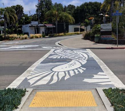
Ye Bridle Path, also known as the Euclid Avenue Bridle Path, is another heavily used recreational corridor in Upland. Building on the path’s popularity, the City proposes to extend the path south of Foothill Boulevard by installing a Class I multi-use path from Foothill Boulevard to 7th Street (see Figure 5-2). The path extension will also create a safer option for bicyclists interested in traveling on Euclid south of Foothill Boulevard, where the roadway is too constrained to add on-street bicycle facilities.
In addition to extending the path, the City is encouraged to implement improvements along the existing Euclid Avenue Bridle Path to enhance the safety and comfort of its users. While popular, the path is known to have safety issues, particularly where the path crosses vehicular traffic at the numerous mid-block intersections. Community engagement participants expressed the need for intersection improvements, better pedestrian visibility, safer crossings, and amenities along the Euclid Avenue Bridle Path.
Opportunities to improve safety along the euclid Avenue Bridle Path include:
f Conduct a future traffic study along Euclid Avenue to identify opportunities for improved multi-modal safety. Potential roadway modifications may include: limiting midblock crossings to one crossing per block (for example, on Euclid Avenue between Foothill Boulevard and 13th Street, closing all except the Eugene Street crossing); installing a median crosswalk of Foothill Boulevard, as is currently done at Baseline Road; the replacement of stop-controlled intersections with signalized intersections; and the implementation of road diets and other traffic calming measures.
f Install pedestrian crossing signage at all intersections where pedestrians must cross vehicular traffic to increase driver awareness.
f Evaluate street lighting along the Euclid Avenue Bridle Path to improve pedestrian visibility at night and facilitate safer nighttime use. Relocate street lights blocked by tree canopy as needed. Consider pedestal lighting designed for the pedestrian environment, and shielded lamps to minimize light pollution.
f Consider converting the intersection at Euclid Avenue and 13th Street to signalized intersection per the City’s LRSP or to a “Reduced Left-Turn Conflict Intersection” as a more cost-efficient treatment.
f Install path amenities to enhance the user experience, such as hydration, pet waste, and emergency call stations.
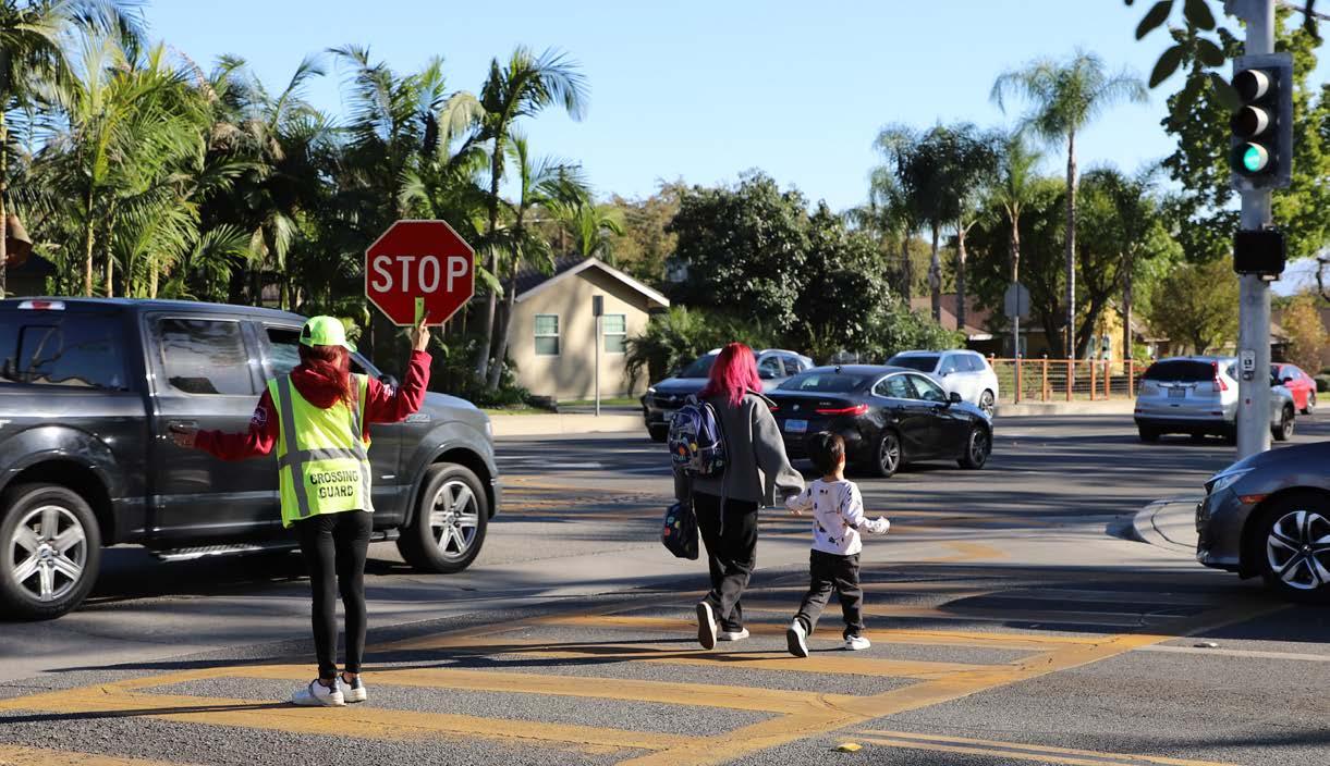
Throughout the community engagement process, many participants expressed discomfort with their children walking or riding a bicycle to school due to dangerous and speeding drivers. Making it safe for students and their families to walk, ride a bicycle, or use a mobility aid device to get to school is a top priority for the City. To support and encourage active transportation to schools, the Plan proposes several bicycle, pedestrian, ADA, and traffic calming recommendations for quarter-mile (or fiveminute walk) zones around each Upland school (shown in Figures 5-3 through 5-15).
The City can use these recommendations to pursue funding and implement SRTS projects at Upland schools. Additionally, the Plan proposes policies and programs to help facilitate safe and comfortable routes to schools. The City can use these recommendations to pursue funding and implement SRTS projects at Upland Schools.
f Install curb ramps (where missing) within a quarter-mile walk zone of Upland schools (as identified in Figure 5-3 through Figure 5-15).
f Retrofit existing curb ramps without detectable warnings to have truncated domes within a quarter-mile walk zone of Upland schools (as identified in Figure 5-3 through Figure 5-15).
f Infill sidewalk gaps within a quarter-mile walk zone of Upland schools (as identified in Figure 5-3 through Figure 5-15).
f Install high-visibility crosswalk markings at crosswalks within a quarter-mile walk zone of Upland schools (as identified in Figure 5-3 through Figure 5-15).
f Install LPIs and Accessible Pedestrian Signals at every signalized intersection within a quarter-mile walk zone of Upland schools (as identified in Figure 5-3 through Figure 5-15).
f Install LED speed feedback signs along corridors where high speeds are reported, such as 11th Street, 13th Street, and Arrow Highway.
f Monitor State legislation for changes in guidance on speed limits in school zones (e.g., CA MUCTD Update and AB 382).
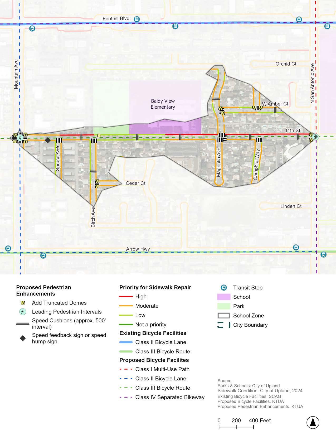
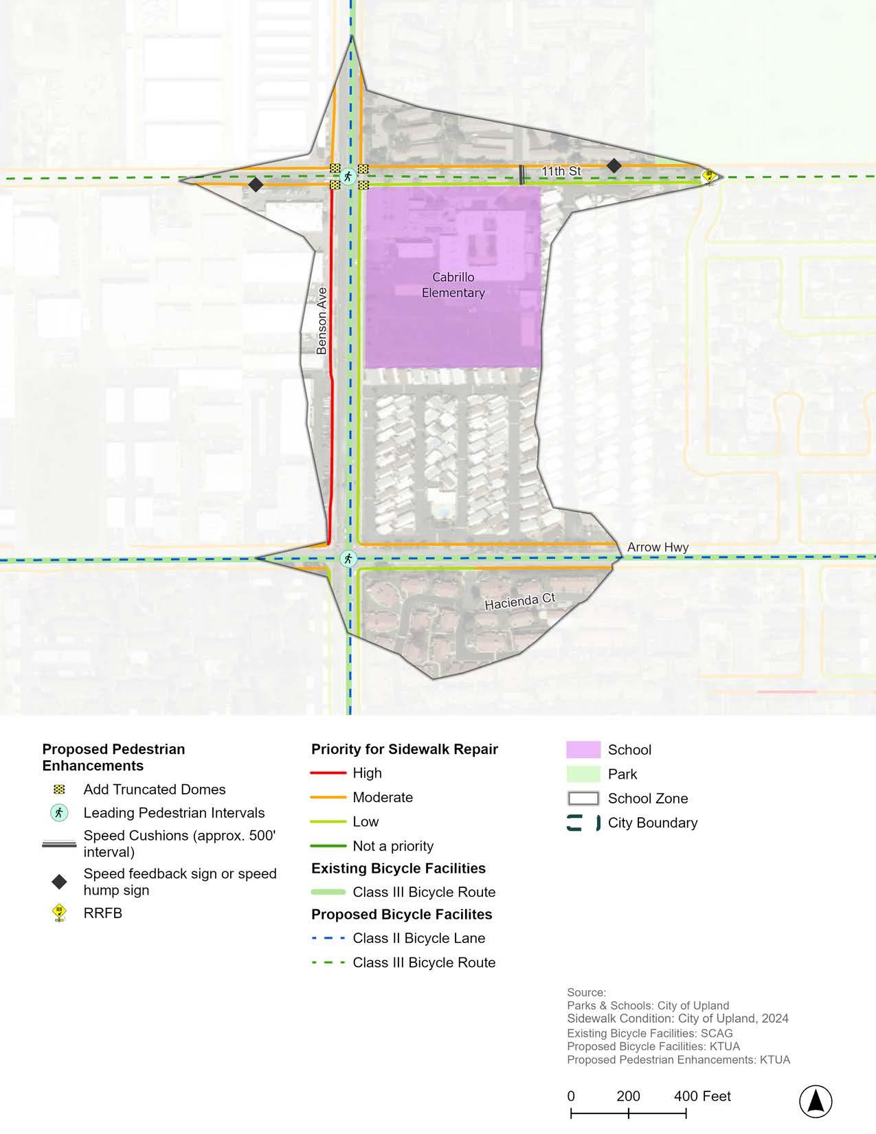
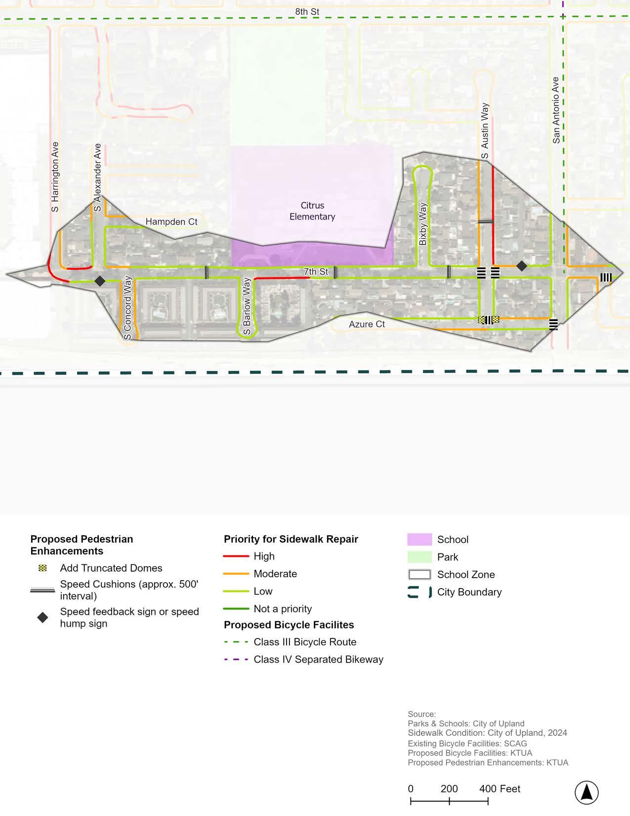
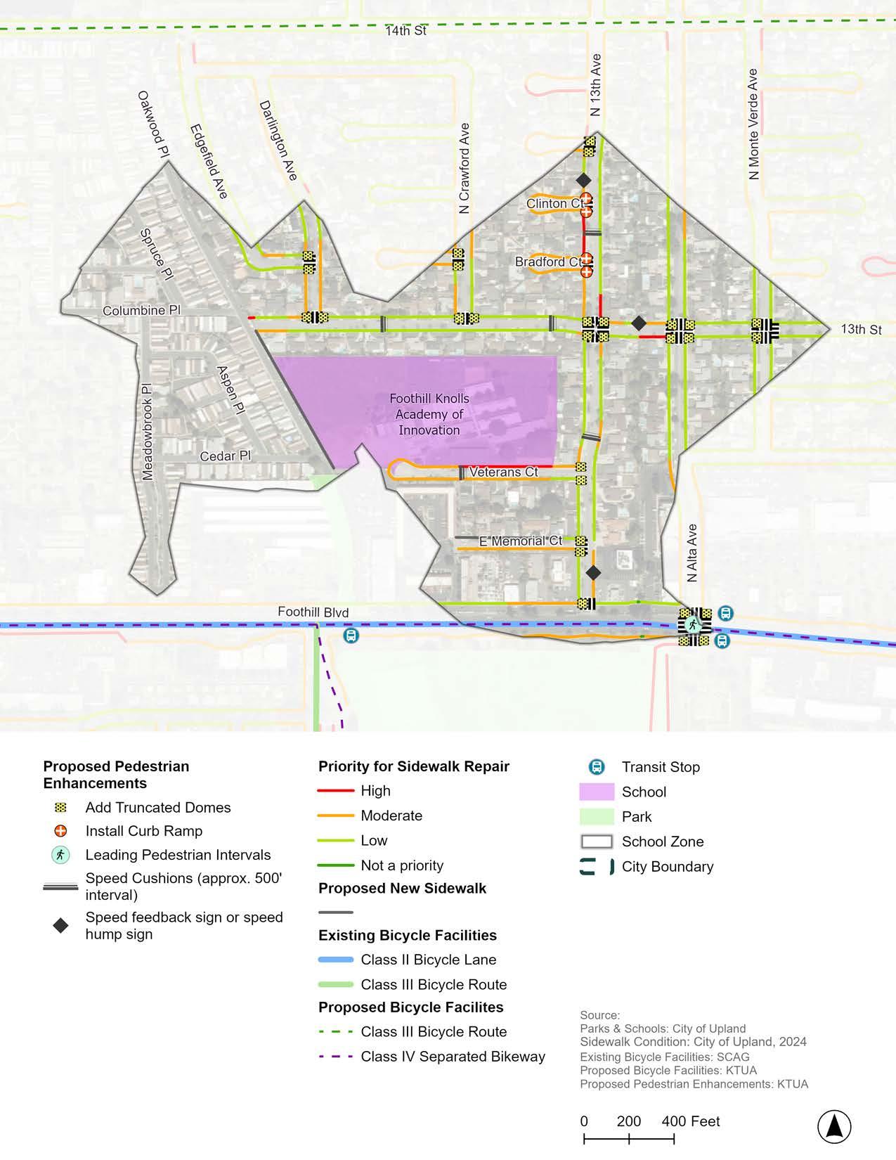
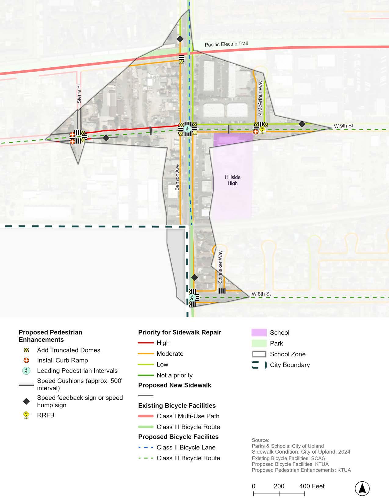
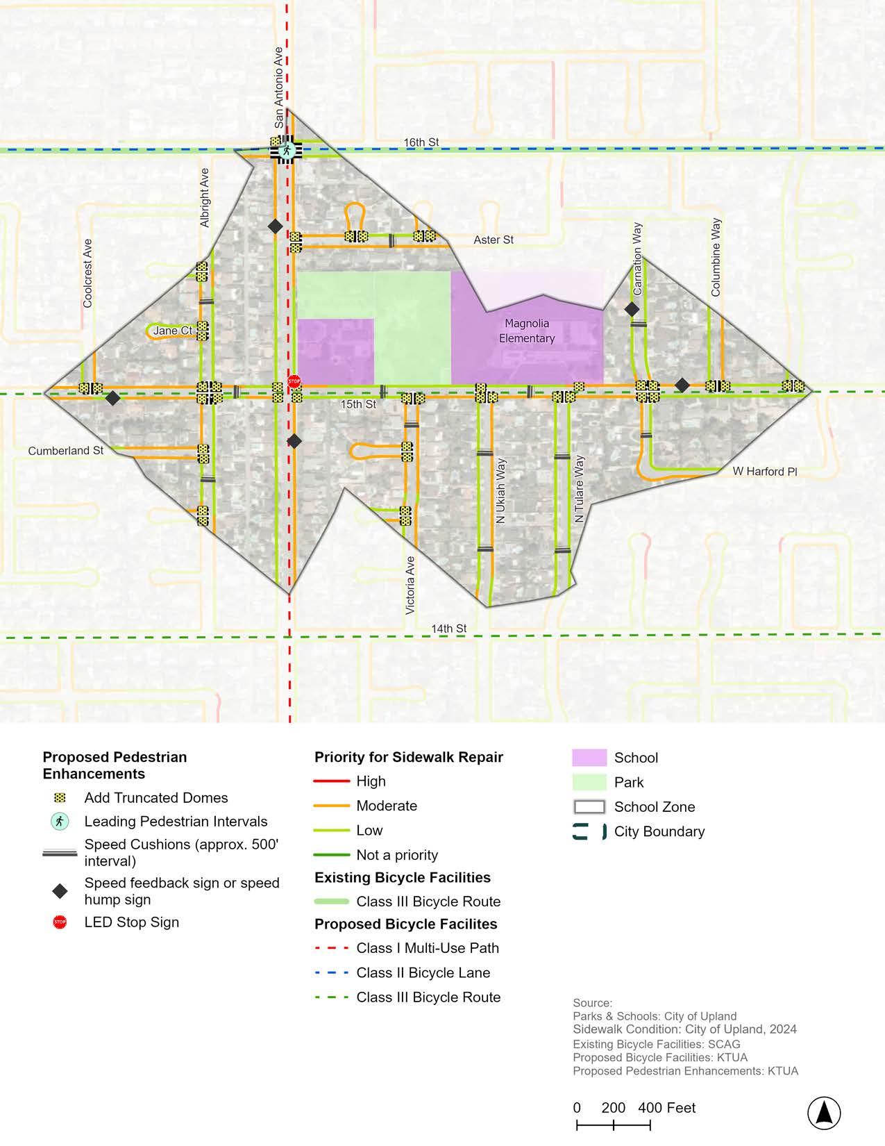
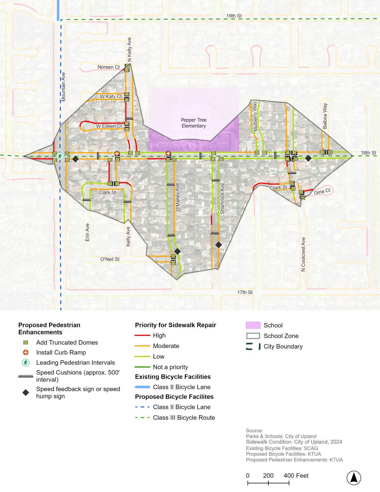
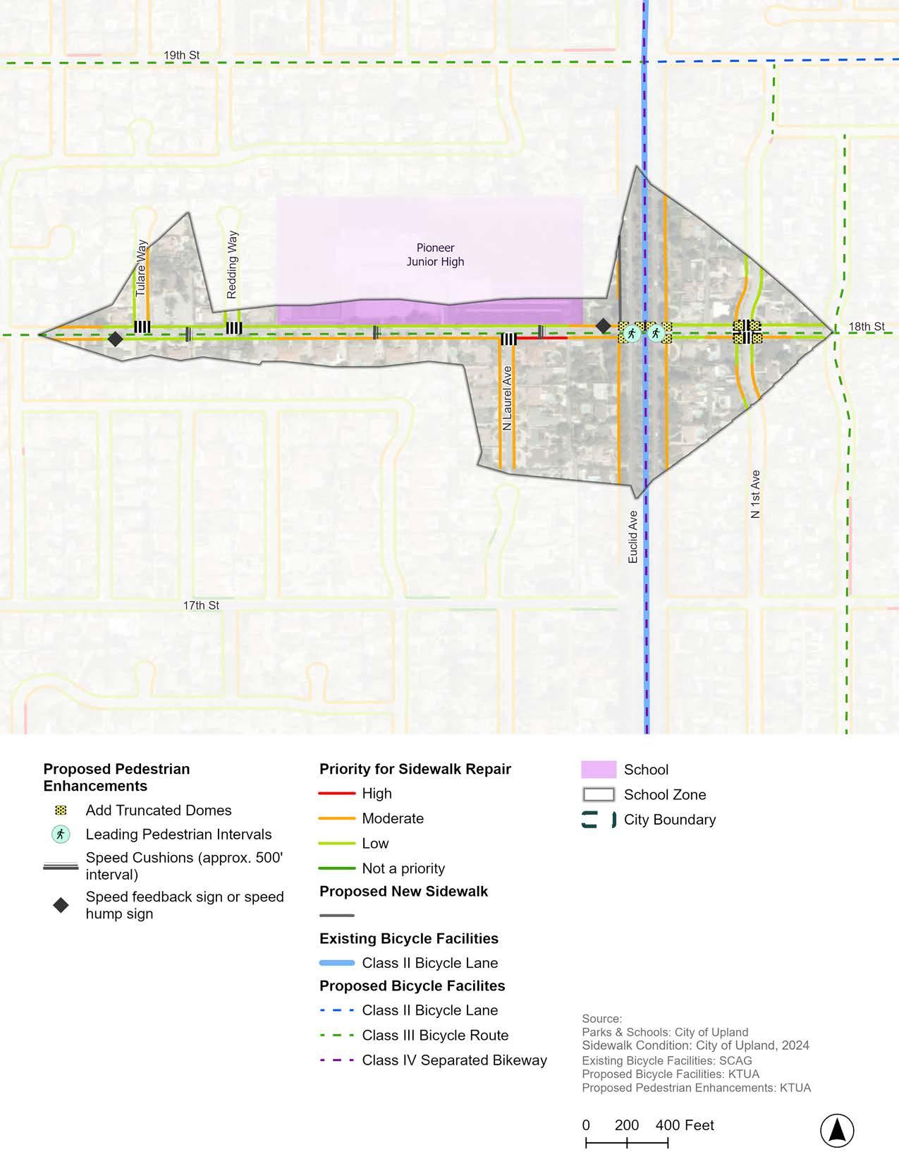
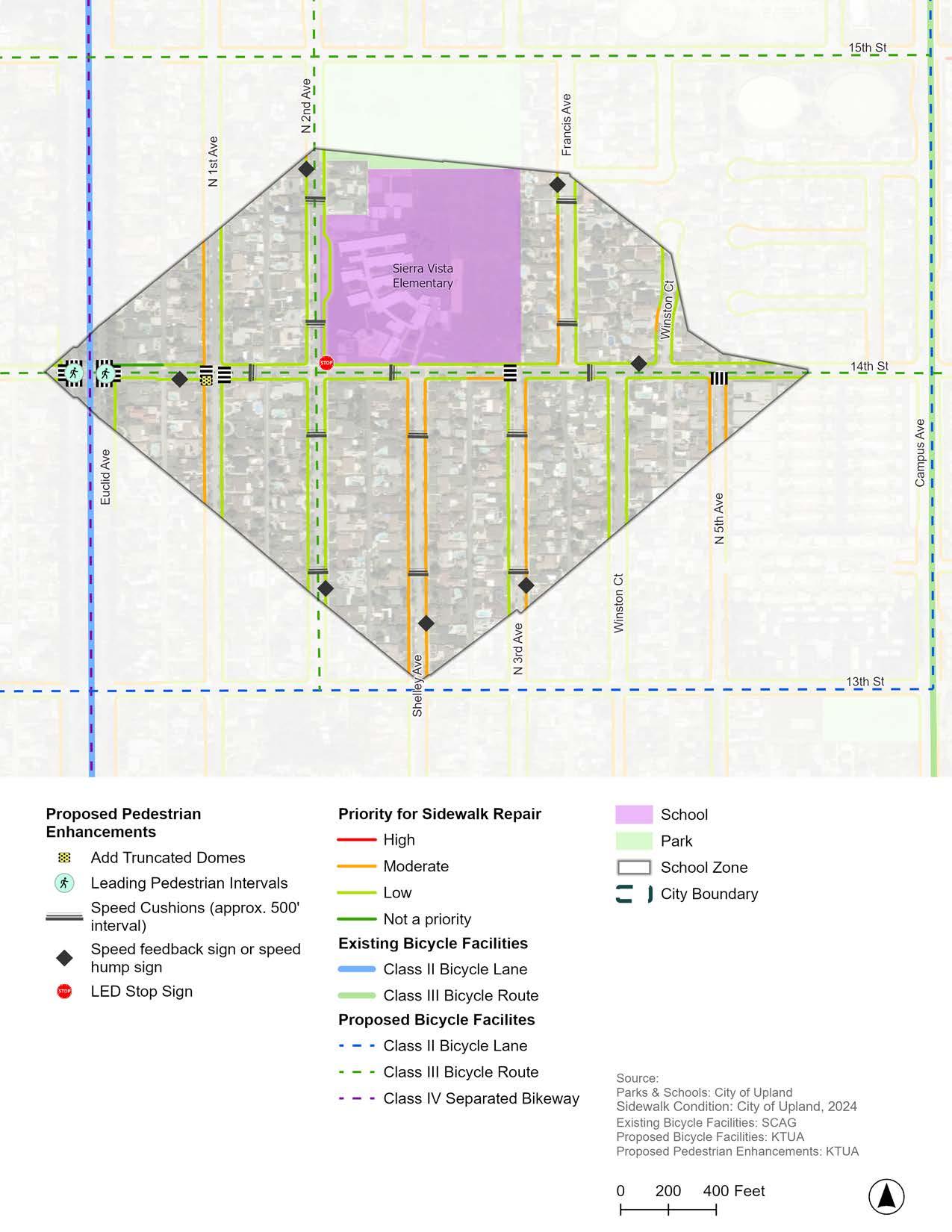
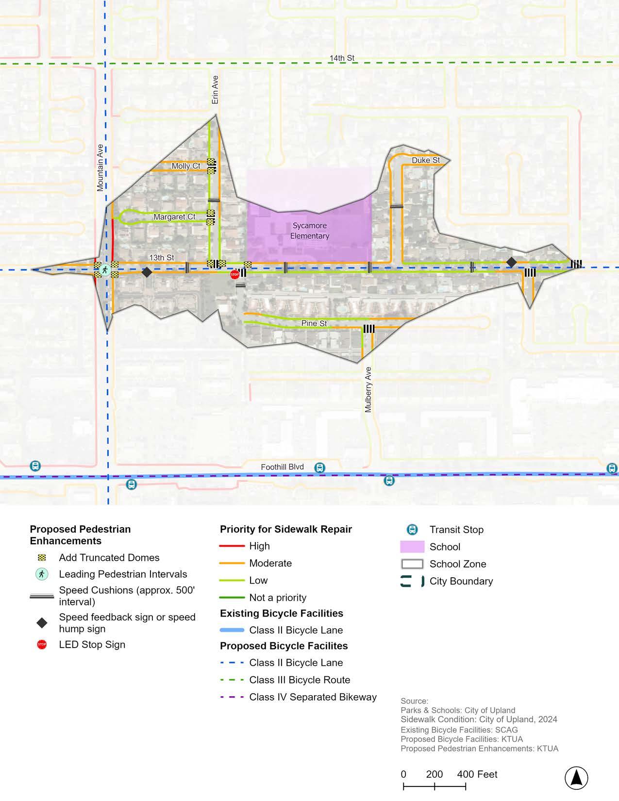
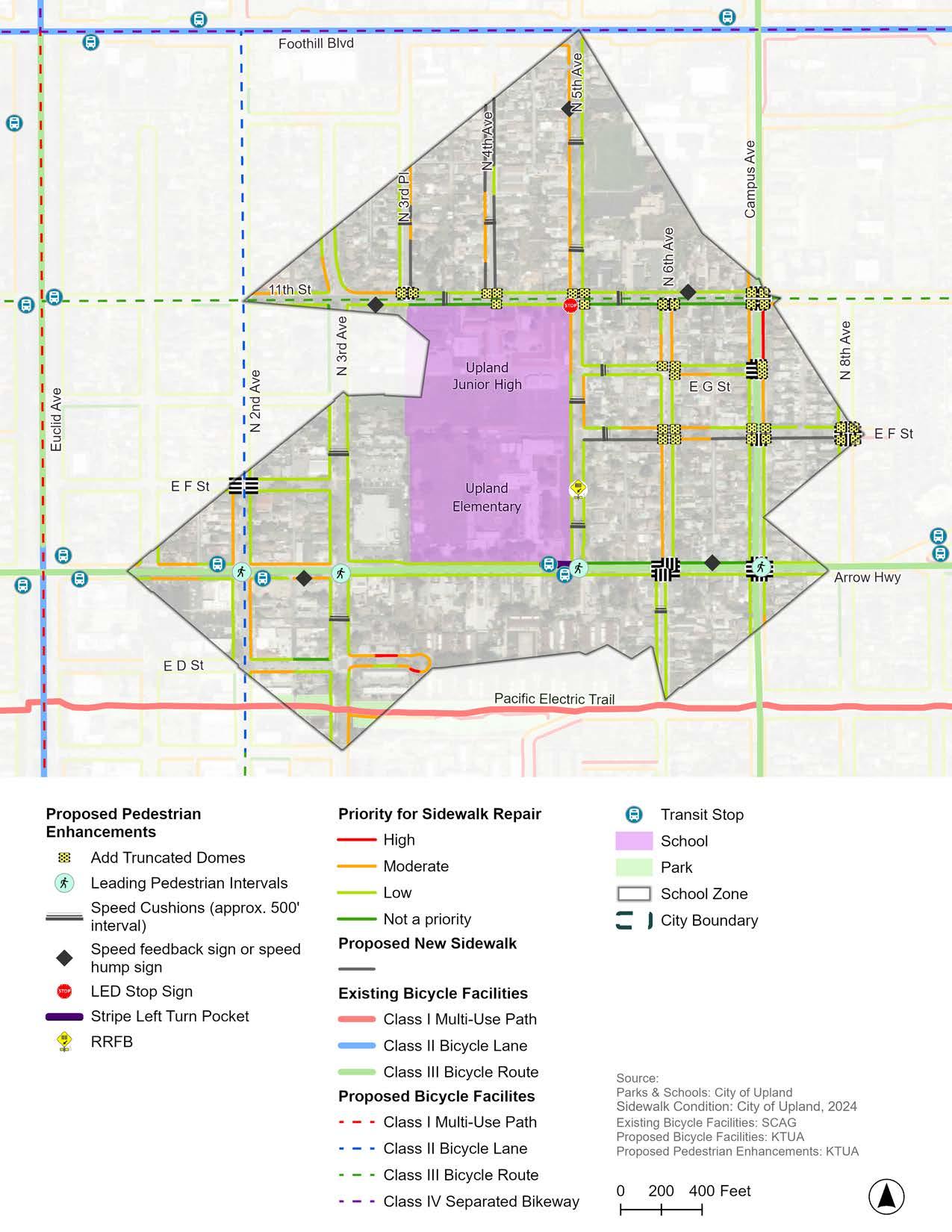
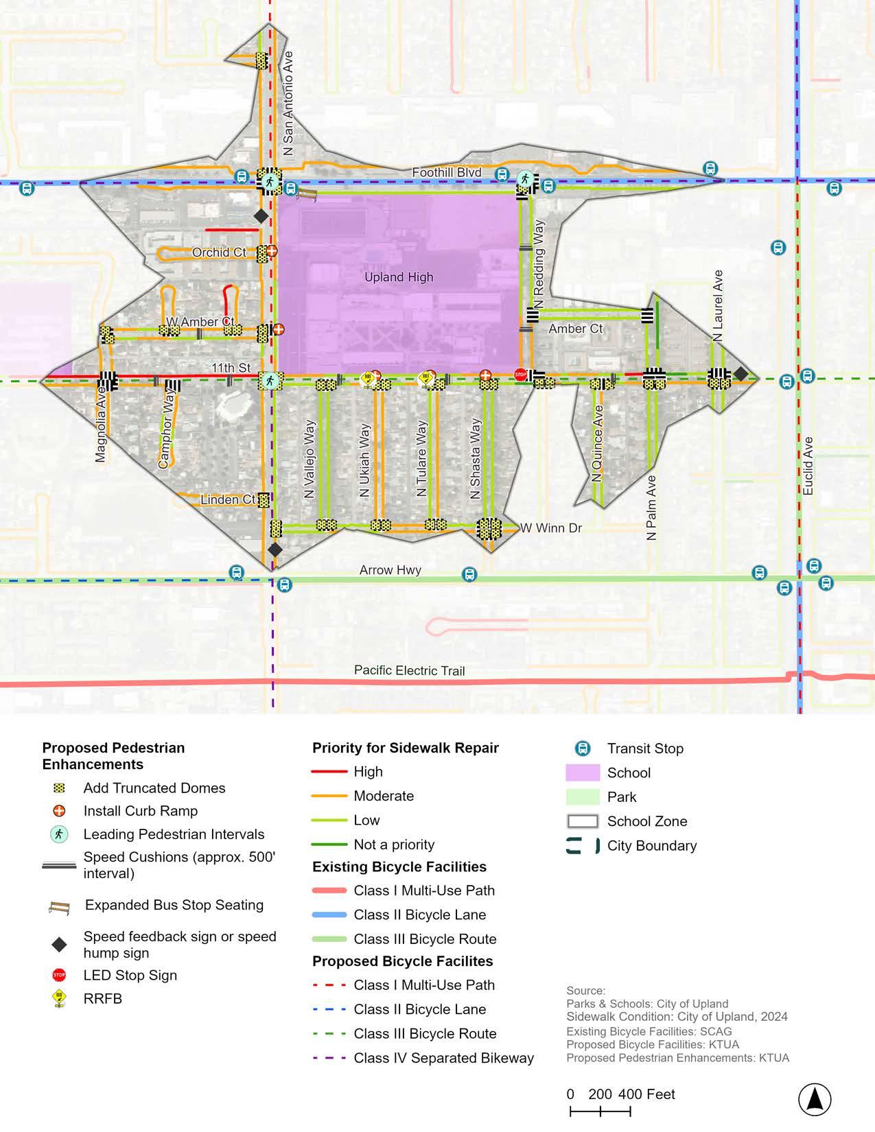
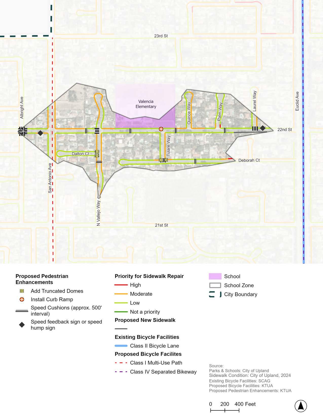
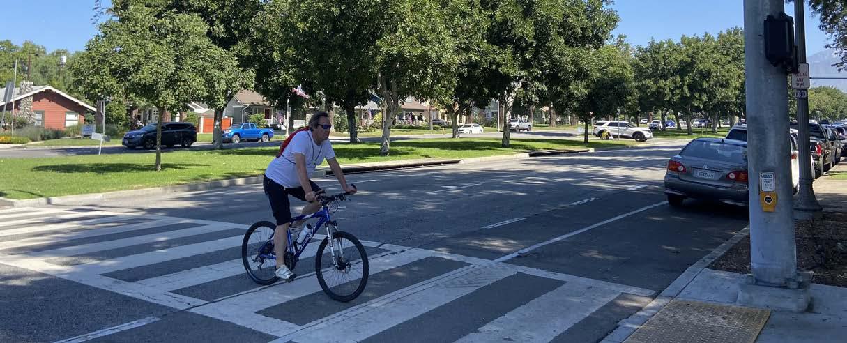
The Plan proposes roughly 62 miles of new bicycle facilities to expand and upgrade Upland’s existing bicycle network (shown in Table 5-1 and Figure 5-16).
Developing the proposed bicycle network included a review of previous planning documents, including the 2015 Upland General Plan Circulation Element, 2020 San Bernardino County Active Transportation Plan, SBCTA Measure I Five Year Capital Improvement Program (Fiscal Years 2024/2025 through 2028/2029), and City of Upland Capital Improvement Projects, as well as findings of the existing conditions analysis and input collected from community members and stakeholders. Through this approach, ‘streets of importance’ were identified as candidates for bicycle facilities. Each street of importance was reviewed with the following considerations: existing pedestrian amenities and bicycle facilities; network gaps; connectivity to schools, parks, activity centers, and other destinations; community and stakeholder input; and existing road width, lane striping, and on-street parking.
This process resulted in an ambitious yet feasible proposed bicycle network for Upland. If implemented, the proposed bicycle network shown in Figure 5-16 will provide community members with bicycle connectivity to Upland’s major activity centers, offering residents viable options for bicycling to popular destinations.
Table 5-1: Proposed Bicycle Facilities
Bicycle Amenities
Community engagement participants expressed the desire for more bicycle parking near destinations, such as Downtown Upland and the Colonies Shopping Center. To support Upland’s bicyclists, the City is encouraged to install bicycle amenities, such as bicycle racks, bicycle lockers, and bicycle repair stations in Downtown Upland, around the Civic Center, near the Colonies Shopping Center, along the Pacific Electric Trail, and at the Metrolink Station.
Class IV: Separated Bikeway
*Buffered bicycle lanes can be implemented as an interim treatment if further funding is needed for physical separation.
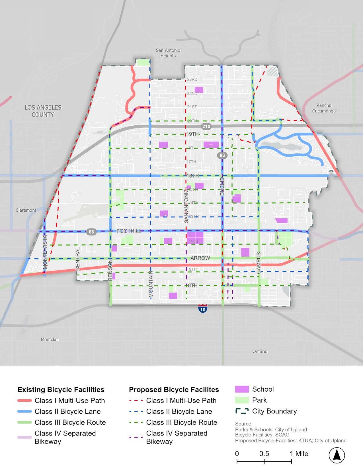
In addition to the proposed bicycle facilities at specific locations, the following overarching recommendations should be considered citywide:
f To the greatest extent possible, pair bicycle facilities with traffic calming measures, such as speed cushions, speed feedback signs, curb extensions, chicanes, neighborhood traffic circles, and roundabouts.
f Install green transition striping where bicycle facilities cross intersections and driveways to alert drivers that bicyclists may be crossing and to encourage slower vehicular speeds during merge conditions.
f Continue to evaluate opportunities to upgrade Class III bicycle routes to Class II bicycle lanes or Class IV separated bikeways through parking removal and road diets, where possible.
f Per SB 1216, Class III bicycle routes can only be installed on streets with a posted speed limit of 30 mph or less. To comply with State legislation and increase bicyclist safety, any proposed or existing Class III bicycle routes should be paired with a speed limit reduction to 30 mph or lower.
Note: The City will need to conduct a speed study prior to any speed limit reductions.
f Enhance existing and proposed Class III bicycle routes by reducing speed limit to 30 mph or lower (per SB 1216), installing sharrow pavement markings and ‘Share the Road’ signage, and implementing traffic calming measures.
f Install bicycle amenities, such as bicycle racks, bicycle lockers, and bicycle repair stations in Downtown Upland, around the Civic Center, near the Colonies Shopping Center, along the Pacific Electric Trail, and at the Metrolink Station.
f Consider updating the City of Upland Municipal Code to remove barriers to bicycle riding, such as requiring bicycle registration and prohibiting riding a bicycle on sidewalks (see Upland Municipal Code Chapter 10.64 and Section 12.16.070). See Chapter 6 for proposed modifications.
A prioritization analysis was conducted to rank proposed bicycle facilities in terms of need and importance. City staff and the TAC developed and refined the criteria. The City will use the results of the prioritization analysis to direct resources toward the highest-need and highestimpact projects. The prioritization analysis ranked projects based on the following criteria (listed in order of weight):
f Schools: How many schools are along the project corridor?
f Parks: How many parks are along the project corridor?
f Households with No Vehicle: How many households with no vehicles are within the project area?
f Gap closure: Does the project close a gap in the existing bicycle network?
f Commercial Land Use: How many mixed-use, commercial, and office land uses are along the project corridor?
f Collision History: How many bicycle and pedestrian-related collisions occurred along the project corridor?
f Transit Stops: How many bus stops are along the project corridor?
f Regional Network Connectivity: Does this project close a gap in connection to an adjacent community?
f Public Input: How many public comments were received for the project corridor?
f Projects that increase separation from motor vehicles: Is the project a Class I multi-use path or a Class IV separated bikeway?
f Population Density: How many people live in the project area?
f Child Density: How many children under 16 years old live in the project area?
f Senior Density: How many people age 65 or older live in the project area?
f Walk to Work: How many people walk to work in the project area?
f Bike to Work: How many people ride a bicycle to work in the project area?
f Transit to Work: How many people take transit to work in the project area?
f Disadvantaged Communities: Is this project within a State-defined Disadvantaged Community?
f Median Income: What percentage of the project falls within a census tract that has a median household income of less than $73,524/year (80% of statewide median from 20182022 ACS)?
f Identified in a Previous Project: Has this project been identified in another project (i.e., Circulation Element, SBCTA Non-Motorized Transportation Plan, etc.)?
Table 5-2 displays the proposed bicycle projects ranked in order of priority. For instances where the prioritization analysis resulted in ties between bicycle projects, the tie was broken based on site context, community need, and professional expertise. The City will use this list to direct the pursuit and allocation of funding sources toward projects in order of priority. Additionally, the City used the prioritization analysis results to help select the ten priority projects to examine more closely and develop conceptual designs.
While the ranking process provides prioritization through objective data analysis and qualitative community engagement, the City has the right to select the projects that move forward for conceptual design and even implementation based on capital improvement funding, grant opportunities and programs, and projects that can take advantage of bicycle lane striping such as street repaving or incoming development projects.
Planning-level conceptual drawings and high-level cost estimates were developed for ½-mile to 1-mile segments of ten priority projects to streamline future funding pursuits and project implementation. The priority projects shown in Table 5-3 and Figure 5-17 were selected for several reasons, including their role in providing connections to schools, parks, and commercial destinations; their need for safety improvement; and their importance to the community. The following section summarizes the bicycle facilities, pedestrian and ADA enhancements, and traffic calming measures proposed to facilitate safe and comfortable active transportation along key corridors. More detailed planning-level conceptual drawings are provided in Appendix D. As the City secures funding and initiates project implementation, projects will be integrated into the City’s Capital Improvement Program, which is updated each year in the Annual Adopted Budget and posted on the City’s website.
Table 5-3: Priority Projects
Certain segments within and adjacent to the priority projects in Table 5-3 have been identified by the City as high priority due to their proximity to Downtown Upland, the Upland Trail Station, and planned affordable housing development projects. The City has already secured grant funding for the design and/or construction of these projects (shown in black in Figure 5-17):
f Stowell Street (from Euclid Ave. to Sultana Ave.): Sidewalk, Class I multi-use path or other bicycle facility, and other improvements.
f 1st Avenue and 2nd Avenue (from Stowell St. to 7th St.): Wayfinding signage and traffic study for one-way couplet conversion on 1st Avenue and 2nd Avenue to create space for one-way bicycle facilities.
f 7th Street (from Euclid Ave. to 2nd Ave.): Wayfinding signage and a Class IV separated bikeway or other bicycle facility.
f 2nd Avenue (from Stowell St. to A St.), A Street (from 2nd Ave. to 1st Ave.), and 1st Avenue (between A St. and D St.): Class IV separated bikeway or other bicycle facility, bicycle/pedestrian connection to Pacific Electric Trail, enhanced crossing at A Street/1st Avenue, upgraded rail crossing with bicycle/pedestrian safety features, and other improvements.
f A Street (from 2nd Ave. to Campus Ave.), Campus Avenue (from A St. to Arrow Hwy.), and Arrow Highway (from Campus Ave. to 9th Ave.): Class IV separated bikeway or other bicycle facility, bicycle/pedestrian connection to Pacific Electric Trail, traffic signal modifications, wayfinding signage, and other improvements.
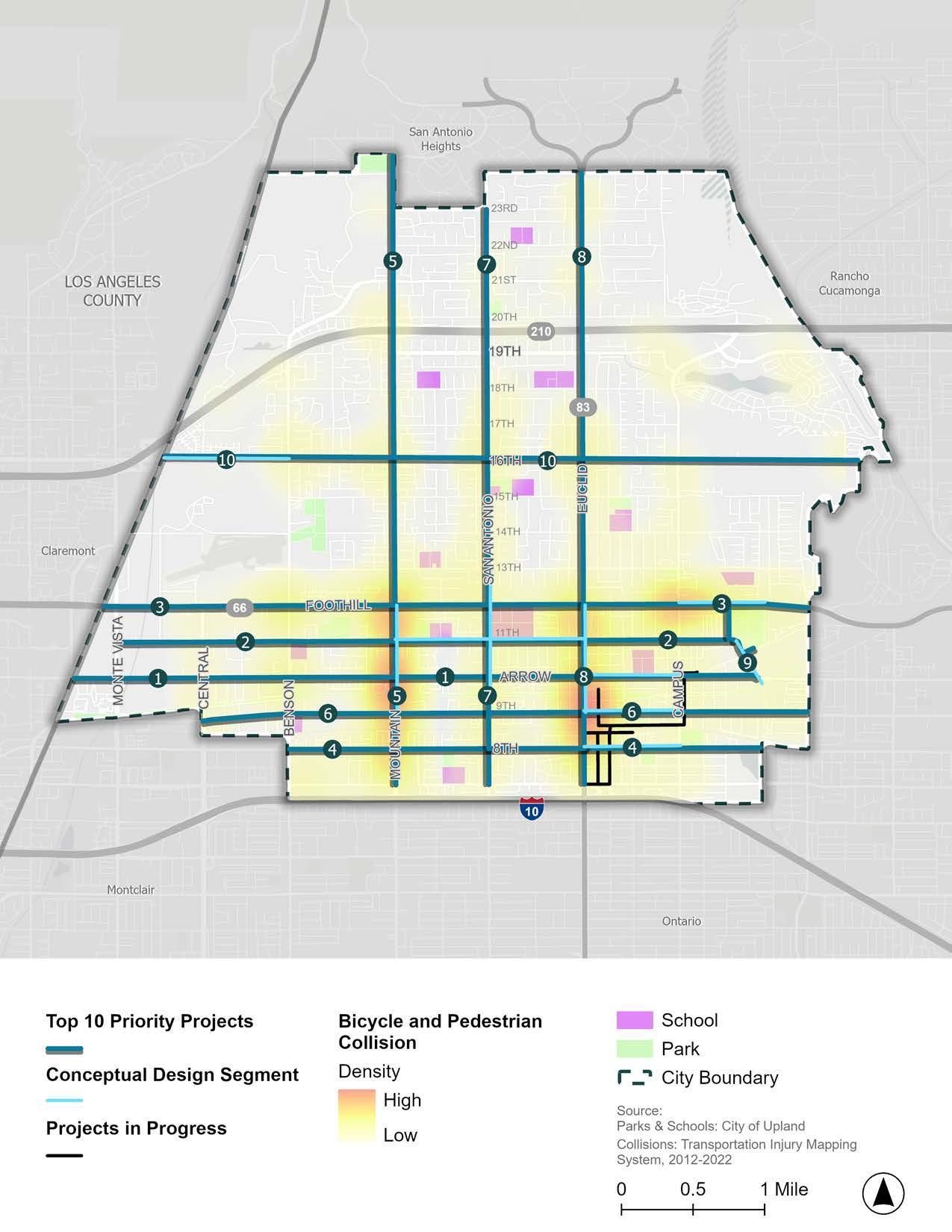
Conceptual Design Segments
Entire Project: Claremont Boulevard to Grove Avenue
Conceptual Design Segment: Euclid Avenue to Campus Avenue
Arrow Highway is a 2-lane to 4-lane secondary arterial that runs east to west with a posted speed limit of 25 to 40 mph. Arrow highway connects to major corridors that run north to south, such as Mountain Avenue, San Antonio Avenue, and Euclid Avenue. It contains a variety of residential, retail, restaurant, office, service, industrial, school, and entertainment uses. The corridor has 13 bus stops, a center turn lane in some segments, and is controlled by 14 signalized intersections. On-street parallel parking is permitted intermittently throughout the corridor, with parking prohibited in many areas. A Class III bicycle route exists along the entire corridor.
Recommendations are visualized in the Conceptual Design Segment and can be applied throughout the corridor as appropriate.
f New bicycle facilities and enhancements (i.e., Class II bicycle lanes, Class III bicycle route, speed limit reduction, pavement markings, signage, and traffic calming)
f Install Class II/IIB bicycle lanes (from Claremont Boulevard to San Antonio Avenue)
f Enhance existing Class III bicycle route with signage, pavement markings, and traffic calming measures (from San Antonio Avenue to Grove Avenue)
f Traffic calming measures (i.e., speed cushions, speed feedback signs, and curb extensions)
f Intersection improvements (i.e., hardened centerlines, signage, and high-visibility crosswalk markings)
f ADA improvements (i.e., ADA-compliant curb ramps, Pedestrian Push Buttons (PPBs), and bus stops)
f Bus stop amenities (i.e., shelters and trash receptacles)
f Maintenance (i.e., street tree maintenance)
Note: This priority project is adjacent to a project in progress on the following streets:
f A Street (from 2nd Ave. to Campus Ave.), Campus Avenue (from A St. to Arrow Hwy.), and Arrow Highway (from Campus Ave. to 9th Ave.)
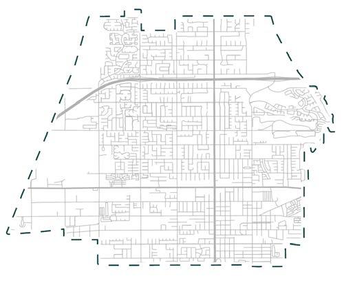
Entire Project
Conceptual Design Segment
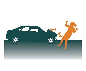
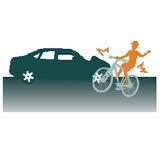
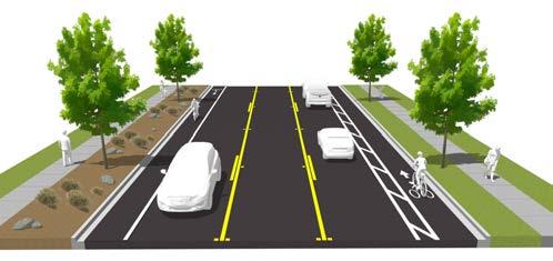
Upgrade existing signalized intersection with high-visibility crosswalks, ‘Keep Clear’ pavement marking, and hardened centerline. Realign curb ramps with crosswalks.
Install bus shelter and trash receptacles at bus stop and bring stop into ADA compliance. OmniTrans coordination needed. Enhance existing Class III bicycle route by reducing speed limit to 30 mph or lower (per SB 1216) and installing sharrow pavement markings and ‘Share the Road’ signage.
Restripe pavement markings, add a centerline, and a stop bar.
Upgrade existing signalized intersection by realigning curb ramps with crosswalks and adding hardened centerlines.
Upgrade existing signalized intersection with ‘Left Turn Yield on Green’ signage and hardened centerlines. Realign curb ramps with crosswalks.
Implement traffic calming measures approaching schools, such as speed cushions, speed feedback signs, and curb extensions.
Install bus shelter and trash receptacles at bus stop and bring stop into ADA compliance. OmniTrans coordination needed.
Upgrade existing signalized intersection with ‘Left Turn Yield on Green’ signage and hardened centerlines. Realign north-west curb ramp with crosswalks.
Replace (2) nonADA Pedestrian Push Buttons (PPBs) per Traffic Signal Master Plan (TSMP).
Maintain street trees to ensure signage visibility.
Upgrade existing signalized intersection with high-visibility crosswalks, ‘Left Turn Yield on Green’ signage and hardened centerlines. Realign curb ramps with crosswalks.
Replace (3) non-ADA PPBs per TSMP.
Install yellow highvisibility crosswalks at all crossings within a school zone distance (600 ft.).
Implement traffic calming measures approaching schools, such as speed cushions, speed feedback signs, and curb extensions.
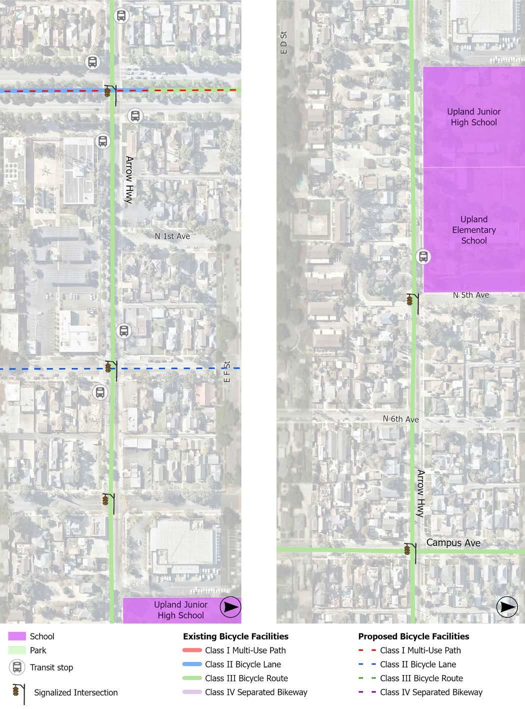
Note: Conceptual design segments demonstrate only a portion of the entire project length.
Entire Project: Monte Vista Avenue to Hospital Parkway
Conceptual Design Segment: Mountain Avenue to Euclid Avenue
11th Street is a 2-lane collector street that runs east to west with a posted speed limit of 35 mph. 11th Street connects to major corridors that run north to south such as Mountain Avenue, San Antonio Avenue, and Euclid Avenue. It contains a variety of residential, retail, restaurant, office, service, industrial, park, school, and entertainment uses. The corridor has no bus stops and is controlled by seven signalized intersections. On-street parallel parking is permitted intermittently throughout the corridor with parking prohibited in many areas. No bicycle facilities exist along the entire corridor.
Recommendations are visualized in the Conceptual Design Segment and can be applied throughout the corridor as appropriate.
f New bicycle facilities and enhancements (i.e., Class III bicycle route, speed limit reduction, pavement markings, signage, and traffic calming)
f Traffic calming measures (i.e., speed cushions, raised crosswalks, speed feedback signs, and curb extensions)
f Intersection improvements (i.e., hardened centerlines, signage, and high-visibility crosswalk markings)
f ADA improvements (i.e., ADA-compliant curb ramps, Pedestrian Push Buttons (PPBs), and bus stops)
f Bus stop amenities (i.e., shelters and trash receptacles)
f Crossing enhancements (i.e., RRFBs and high-visibility crosswalk markings)
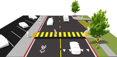
: 11th Street from Mountain Avenue to Euclid Avenue
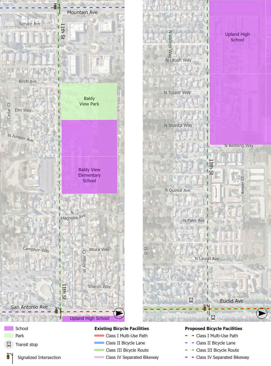
Install green transition striping at intersections for proposed Class II Bicycle Lanes.
Add a high-visibility crosswalk.
Upgrade existing signalized intersection with high-visibility crosswalks, ‘Left Turn Yield on Green’ signage and hardened centerlines. Realign curb ramps with crosswalks.
Replace (5) non-ADA PPBs per TSMP.
Upgrade east-west standard crosswalks to yellow highvisibility crosswalks.
Consider installing an RRFB for existing north-south crosswalk. Conduct a traffic study to determine if warranted.
Install ‘School Bus Stop Ahead’ signs.
Explore options to prevent flooding during rain events.
Upgrade existing crosswalks to highvisibility crosswalks.
Consider installing an RRFB for northsouth crosswalk. Conduct a traffic study to determine if warranted.
Add a yellow highvisibility crosswalks.
Install Class III bicycle route. Reduce speed limit to 30 mph or lower (per SB 1216) and install sharrow pavement markings and ‘Share the Road’ signage.
Implement traffic calming measures approaching schools, such as speed cushions, speed feedback signs, and curb extensions.
Upgrade existing signalized intersection with ‘Left Turn Yield on Green’ signage and hardened centerlines.
Realign curb ramps with crosswalks.
Consider east to west dedicated left turn. Conduct a traffic study to determine if warranted.
Replace (2) non-ADA PPBs per TSMP.
Upgrade all standard crosswalks to yellow high-visibility crosswalks when within school zone distance (600 ft.).
Add truncated domes to existing curb ramps where absent.
Consider installing an RRFB and raised crosswalk for existing north-south crosswalk. Conduct a traffic study to determine if warranted.
Install Class III bicycle route. Reduce speed limit to 30 mph or lower (per SB 1216) and install sharrow pavement markings and ‘Share the Road’ signage.
Upgrade existing signalized intersection with high-visibility crosswalks, ‘Keep Clear’ pavement marking, and hardened centerlines. Realign curb ramps with crosswalks.
Install bus shelter and trash receptacles at bus stop and bring stop into ADA compliance. OmniTrans coordination needed.
Implement traffic calming measures approaching schools, such as speed cushions, speed feedback signs, and curb extensions.
Note: Conceptual design segments demonstrate only a portion of the entire project length.
Bring bus stop into ADA compliance. OmniTrans coordination needed.
Entire Project: Western City limit to Grove Avenue
Conceptual Design Segment: Campus Avenue to Memorial Park
Foothill Boulevard is a 4-lane major arterial that runs east to west with a posted speed limit of 45 mph, except near Upland High School. Foothill Boulevard contains a variety of retail, restaurant, office, service, industrial, park, school, and entertainment uses. The corridor has 20 bus stops, a center turn lane or medians, frontage roads, and is controlled by 15 signalized intersections. Onstreet parking is not permitted and Class II bicycle lanes exist along the entire corridor.
RECOMMENDATIONS
Recommendations are visualized in the Conceptual Design Segment and can be applied throughout the corridor as appropriate.
f Bicycle facility upgrade (i.e., Class IV separated bikeways and green transition striping)
f Intersection improvements (i.e., hardened centerlines, signage, pedestrian safety islands, and high-visibility crosswalk markings)
f ADA improvements (i.e., ADA-compliant curb ramps, bus stops, and Pedestrian Push Buttons)
f Bus stop amenities (i.e., shelters and trash receptacles)
f Roadway modifications (i.e., lane narrowing and raised center median)
f Placemaking opportunities (i.e., street furnishing and public art)
Entire Project Conceptual Design Segment
PROPOSED CONDITIONS
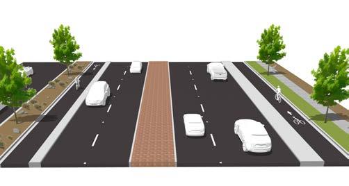
Install bus shelters at bus stop. OmniTrans coordination needed.
Upgrade existing signalized intersection with high-visibility crosswalks and pedestrian safety islands. Realign curb ramps with crosswalks or add truncated domes to existing curbs.
Install green transition striping at intersection and driveways.
Opportunity to install street furnishing or public art.
Upgrade striped center turn lane to a raised center median with planting.
Upgrade existing Class II Bicycle Lane to a Class IV Separated Bikeway.
Install green transition striping at intersections and driveways.
Consider reducing number of driveways along Foothill Boulevard to limit opportunities for conflicts between road users.
Upgrade existing signalized intersection with high-visibility crosswalks and hardened centerlines. Realign curb ramps with crosswalks or add truncated domes to existing curbs.
Upgrade existing signalized intersection with ‘Left Turn Yield on Green’ signage. Realign curb ramps with crosswalks or add truncated domes to existing curbs.
Replace (3) non-ADA PPBs per TSMP.
Install green transition striping at intersections and driveways.
Consider reducing number of driveways along Foothill Boulevard to limit opportunities for conflicts between road users.
Upgrade existing Class II Bicycle Lane to a Class IV Separated Bikeway.
Install bus shelters and trash receptacles at bus stops and bring stops into ADA compliance. OmniTrans coordination needed.
Upgrade striped center turn lanes to raised center medians with planting.
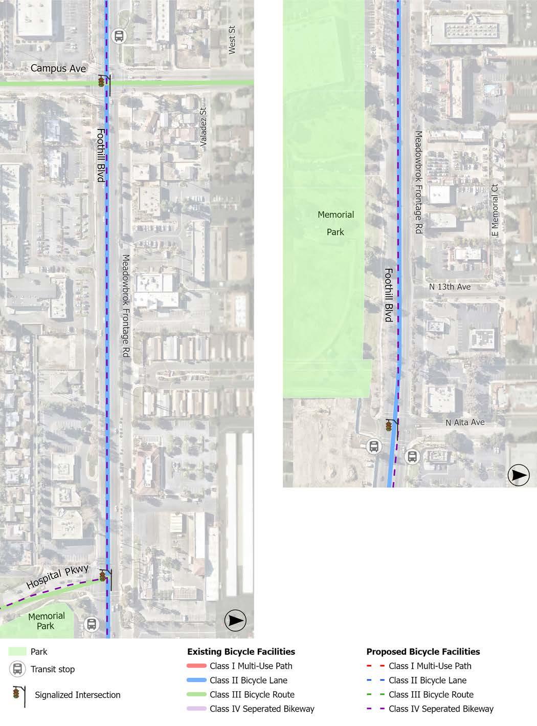
Note: Conceptual design segments demonstrate only a portion of the entire project length.
Entire Project: Benson Avenue to Eastern City limit
Conceptual Design Segment: Euclid Avenue to 8th Street Reservoir Park
8th Street is a 2-lane to 4-lane secondary arterial that runs east to west with a posted speed limit of 35 to 40 mph. It contains a variety of residential, retail, restaurant, park, school, and religious uses. The corridor has a center turn lane on most of the corridor and is controlled by five signalized intersections. On-street parking is permitted intermittently throughout the residential and recreational segments of the corridor, with parking prohibited in all other areas. A Class III bicycle route exists from Euclid Avenue to Campus Avenue.
Recommendations are visualized in the Conceptual Design Segment and can be applied throughout the corridor as appropriate.
f New bicycle facilities and enhancements (i.e., Class II bicycle lanes, Class III bicycle route, speed limit reduction, pavement markings, signage, and traffic calming)
f Traffic calming measures (i.e., speed cushions, raised crosswalks, neighborhood traffic circles, and curb extensions)
f Intersection improvements (i.e., hardened centerlines, signage, LED stop signs, and high-visibility crosswalk markings)
f Crossing enhancements (i.e., RRFBs and high-visibility crosswalk markings)
f ADA improvements (i.e., ADA-compliant curb ramps and bus stops)
Note: This priority project is adjacent to a project in progress on the following streets:
f 1st Avenue and 2nd Avenue (from Stowell St. to 7th St.)
Entire Project
Conceptual Design Segment
PROPOSED CONDITIONS
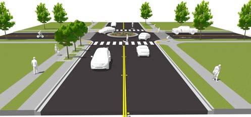
Upgrade existing signalized intersection with high-visibility crosswalks, ‘Keep Clear’ pavement marking, hardened centerlines. Realign curb ramps with crosswalks.
Bring bus stops into ADA compliance. OmniTrans coordination required.
Enhance existing Class III bicycle route by reducing speed limit to 30 mph or lower (per SB 1216) and installing sharrow pavement markings and 'Share the Road' signage.
Upgrade to LED stop signs, high-visibility crosswalks, and realign curb ramps with crosswalks or add truncated domes to existing curbs.
Consider installing RRFBs at existing uncontrolled northsouth crosswalks or converting to all-way stops or neighborhood traffic circles. Conduct a traffic study to determine if warranted.
Enhance existing Class III bicycle route by reducing speed limit to 30 mph or lower (per SB 1216) and installing sharrow pavement markings and 'Share the Road' signage.
Implement traffic calming measures, such as neighborhood traffic circles, speed cushions, speed feedback signs, and curb extensions.
Upgrade to LED stop signs, high-visibility crosswalks, and realign curb ramps with crosswalks or add truncated domes to existing curbs.
Alternatively, consider neighborhood traffic circles as traffic calming and for a continuous traffic flow.
Consider installing a mid-block crossing with advanced warning signs, a raised and highvisibility crosswalk, and an RRFB. Conduct a traffic study to determine if warranted.
Upgrade to LED stop signs, high-visibility crosswalks, and realign curb ramps with crosswalks or add truncated domes to existing curbs.
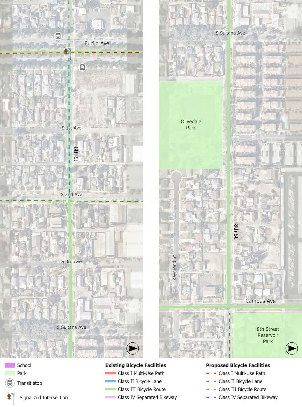
Note: Conceptual design segments demonstrate only a portion of the entire project length.
Entire Project: Mountain Lane to 7th Street
Conceptual Design Segment: Foothill Boulevard to 9th Street
Mountain Avenue is a 4-lane to 6-lane major arterial that runs north to south with a posted speed limit of 45 mph. Mountain Avenue contains a variety of residential, retail, restaurant, office, service, entertainment, park, school, and religious uses. The corridor has a center turn lane or median, a railroad crossing, and is controlled by 18 signalized intersections. On-street parking is not permitted and Class II bicycle lanes exist for a short stretch north and south of Interstate 210.
Recommendations are visualized in the Conceptual Design Segment and can be applied throughout the corridor as appropriate.
f New bicycle facilities (i.e., Class II bicycle lanes and green transition striping)
f Intersection improvements (i.e., hardened centerlines, signage, and pedestrian safety islands)
f ADA improvements (i.e., ADA-compliant curb ramps, bus stops, and pedestrian push buttons)
f Bus stop amenities (i.e., shelters and trash receptacles)
f Crossing Enhancements (i.e., signage)
Entire Project Conceptual Design Segment
CONDITIONS
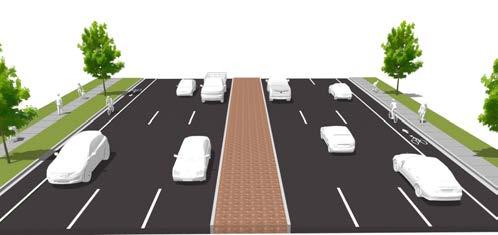
Design Segment: Mountain Avenue from Foothill Boulevard to 9th Street
Upgrade existing signalized intersection with Leading Pedestrian Intervals (LPIs), and a pedestrian safety island for east-west raised center medians. Realign curb ramps with crosswalks or add truncated domes to existing curbs.
Install green transition striping at intersection and driveways for proposed Class II Bicycle Lane.
Replace (1) non-ADA PPBs per TSMP.
Upgrade striped center turn lane approaching intersection to raised center median with planting.
Upgrade existing signalized intersection with hardened centerlines for 11th Street striping. Realign curb ramps with crosswalks or add truncated domes to existing curbs.
Replace (5) non-ADA PPBs per TSMP.
Upgrade existing striped center turn lanes to a raised center median.
Install Class II Bicycle Lane.
Install Class II Bicycle Lane.
Realign curb ramps with crosswalks or add truncated domes to existing curbs.
Install green transition striping at intersection and driveways for proposed Class II Bicycle Lane.
Replace (5) non-ADA PPBs per TSMP.
Install bus shelter and trash receptacle at bus stop and bring into ADA compliance. OmniTrans coordination needed.
Replace non-ADA PPB.
Add advanced warning signage for existing trail crossing.
Realign curb ramps with crosswalks or add truncated domes to existing curbs.
Add ‘Left
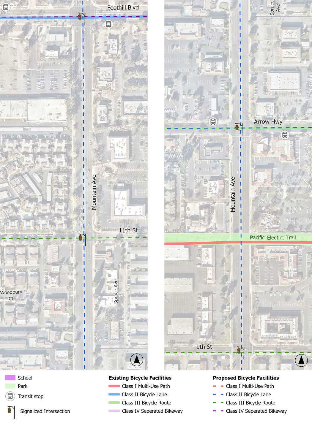
Note: Conceptual design segments demonstrate only a portion of the entire project length.
Entire Project: Central Avenue to Grove Avenue
Conceptual Design Segment: Euclid Avenue to Campus Avenue
9th Street is a 2-lane collector street that runs east to west with a posted speed limit of 35 mph, with a lower speed limit of 15 mph though Downtown Upland. 9th Street connects to Upland’s Historic Downtown and it contains a variety of residential, retail, restaurant, office, service, and entertainment uses. The corridor has a center turn lane or median on some segments and is controlled by eight signalized intersections. On-street parking is permitted intermittently throughout the residential portions of the corridor but prohibited in most other areas. No bicycle facilities exist along the entire corridor.
Recommendations are visualized in the Conceptual Design Segment and can be applied throughout the corridor as appropriate.
f New bicycle facilities (i.e., Class II bicycle lanes, Class III bicycle route, signage, and green transition striping)
f Install Class III bicycle route (from Central Avenue to 2nd Avenue)
f Install Class II bicycle lanes (from 2nd Avenue to Grove Avenue)
f Intersection improvements (i.e., hardened centerlines, signage, LED stop signs, and high-visibility crosswalk markings)
f Traffic calming measures (i.e., speed cushions, neighborhood traffic circles, and curb extensions)
f ADA improvements (i.e., ADA-compliant curb ramps and bus stops)
f Bus stop amenities (i.e., shelters)
f Crossing Enhancements (i.e., RRFBs, signage, and high-visibility crosswalk markings)
Note: This priority project is adjacent to two projects in progress on the following streets:
f 2nd Avenue (from Stowell St. to A St.), A Street (from 2nd Ave. to 1st Ave.), and 1st Avenue (between A St. and D St.)
f A Street (from 2nd Ave. to Campus Ave.), Campus Avenue (from A St. to Arrow Hwy.), and Arrow Highway (from Campus Ave. to 9th Ave.)
Entire Project
Conceptual Design Segment
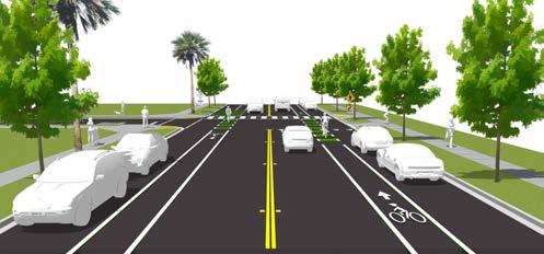
Install bus shelters at unshaded bus stop and bring both stops into ADA compliance. OmniTrans coordination needed.
Upgrade existing signalized intersection with high-visibility crosswalks, ‘Keep Clear’ pavement marking, and hardened centerlines. Realign curb ramps with crosswalks.
Upgrade to LED stop signs.
Add truncated domes to existing curb ramps, including curb ramps on central island of gazebo roundabout.
Implement traffic calming measures approaching, such as speed cushions, and curb extensions.
Upgrade existing striping with hardened centerlines.
Install Class III bicycle route. Reduce speed limit to 30 mph or lower (per SB 1216) and install sharrow pavement markings and ‘Share the Road’ signage
Install pedestrian crossing signs where utility pole obstructs view of pedestrians in the pedestrian safety island.
Consider pedestrian crossing signs for existing midblock crossing.
Install Class II Bicycle Lanes.
Upgrade existing striping with hardened centerlines.
Upgrade existing standard crosswalks to high-visibility crosswalks and realign east curb ramps with crosswalks.
Install Class II Bicycle Lanes.
Upgrade existing standard crosswalk with high-visibility crosswalks.
Upgrade existing standard crosswalk with high-visibility crosswalks.
Consider installing RRFBs at existing uncontrolled northsouth crosswalk. Conduct a traffic study to determine if warranted.
Upgrade standard crosswalks with highvisibility crosswalks and realign curb ramps with crosswalks.
Consider converting all-way stop to a neighborhood traffic circle. Conduct a traffic study to determine if warranted.
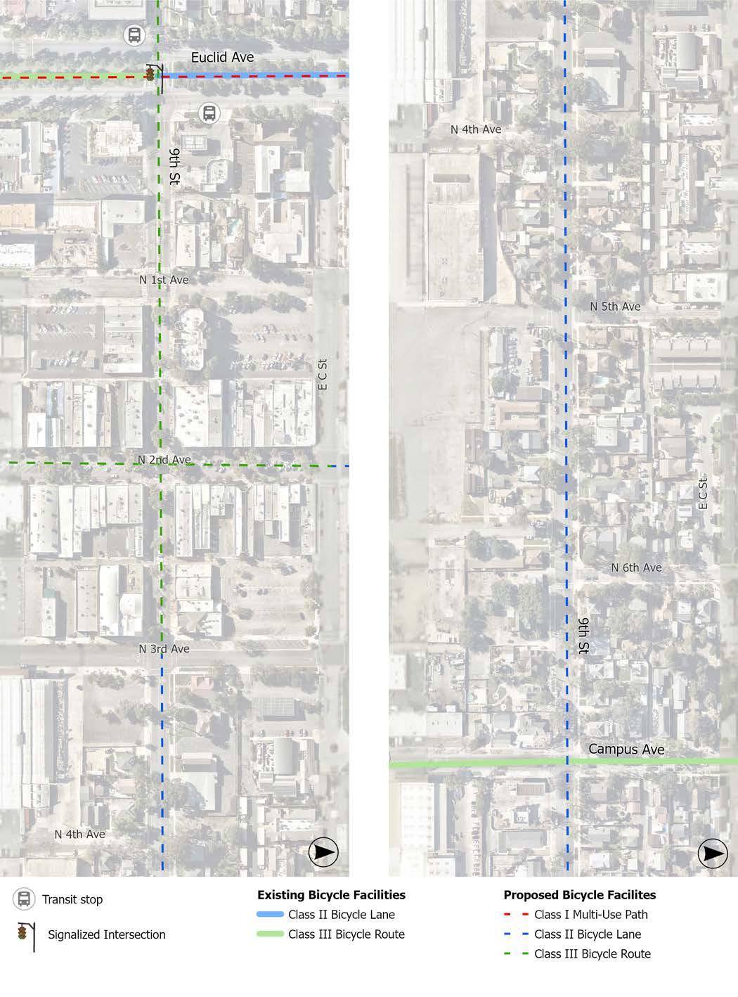
Note: Conceptual design segments demonstrate only a portion of the entire project length.
Entire Project: 23rd Street to 7th Street
Conceptual Design Segment: 13th Street to Pacific Electric Trail
San Antonio Avenue is a 2-lane to 4-lane secondary arterial that runs north to south with a posted speed limit of 35 mph. San Antonio Avenue contains a variety of residential, retail, restaurant, park, school, religious, and entertainment uses. The corridor has a center turn lane on a southern portion of the corridor, a railroad crossing, and it is controlled by seven signalized intersections. On-street parking is permitted intermittently throughout the residential portions of the corridor and prohibited in all other areas, except for a passenger loading zone adjacent to Upland High School. No bicycle facilities exist along the corridor.
RECOMMENDATIONS
Recommendations are visualized in the Conceptual Design Segment and can be applied throughout the corridor as appropriate.
f New bicycle facilities (i.e., Class I multi-use path, Class IV separated bikeways, Class III bicycle route, signage, and green transition striping)
f Install a Class I multi-use path (from 23rd Street to 11th Street)
f Install Class IV separated bikeways (from 11th Street to 8th Street)
f Install Class III bicycle route (from 8th Street to 7th Street)
f Intersection improvements (i.e., hardened centerlines, signage, stop sign replacement, and high-visibility crosswalk markings)
f Traffic calming measures (i.e., speed feedback signs and roundabouts)
f ADA improvements (i.e., ADA-compliant curb ramps, bus stops, and pedestrian push buttons)
f Bus stop amenities (i.e., shelters, trash receptacles, and expanded seating)
f Roadway modifications (i.e., road diet, lane narrowing, parking removal, and raised center median)
Entire Project
Conceptual Design Segment
CONDITIONS
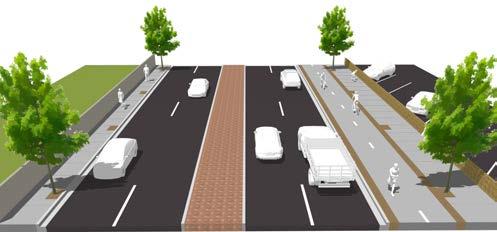
Install Class I MultiUse Path along east side of San Antonio Avenue. Combination of lane narrowing, parking removal, and/ or sidewalk expansion needed.
Add truncated domes and highvisibility crosswalks.
Upgrade existing signalized intersection with yellow high-visibility crosswalks and hardened centerlines for San Antonio Ave striping. Realign curb ramps with crosswalks or add truncated domes to existing curbs.
Replace (2) non-ADA PPBs per TSMP.
Part of the Foothill Blvd Rehabilitation Capital Improvement Project (CIP) which includes curb, gutter, sidewalks, curb ramps pavement markings, and other improvements.
Consider installing a roundabout at entrance to Upland High School parking lot. Conduct a traffic study to determine if warranted. Road diet may be needed.
Upgrade striped center turn lane to raised center median.
: San Antonio Avenue from 13th Street to Pacific Electric Trail
Upgrade existing standard crosswalks with high-visibility crosswalks, realign curb ramps with crosswalks or add truncated domes to existing curbs, and hardened centerlines.
Install green transition striping at intersections for proposed Class II Bicycle Lane.
Replace existing stop sings with larger stop signs per Local Roadway Safety Plan (LRSP).
Install bus shelters at both bus stops. Expand seating and add trash receptacle adjacent to Upland High School. OmniTrans coordination needed.
Upgrade existing signalized intersection with ‘Left Turn Yield on Green’ signage and hardened centerlines. Realign curb ramps with crosswalks or add truncated domes to existing curbs.
Replace (2) non-ADA PPBs per TSMP.
Alternatively, consider upgrading signalized intersection to a protected left turn signalized intersection. Traffic Study Required.
Upgrade existing signalized intersection with high-visibility crosswalks, ‘Left Turn Yield on Green’ signage, and hardened centerlines. Realign curb ramps with crosswalks or add truncated domes to existing curbs.
Replace (2) non-ADA PPBs per TSMP.
Install Class IV Separated Bikeway. Road diet and lane narrowing needed.
Install green transition striping at intersections and driveways.
Install speed feedback signs approaching school.
Add truncated domes to existing curb ramps and high-visibility crosswalks where absent.
Part of the Arrow Hwy Rehabilitation CIP which includes curb, gutter, sidewalks, curb ramps pavement markings, and other improvements.
Install green transition striping at intersection and driveways for proposed Class IV Separated Bikeway.
Upgrade existing signalized intersection with high-visibility crosswalks, ‘Left Turn Yield on Green’ signage, and hardened centerlines for Vernon Dr striping. Realign curb ramps with crosswalks or add truncated domes to existing curbs.
Explore opportunities to bring sidewalks near driveways on west side of San Antonio from 11th St to Vernon Dr into ADA compliance.
Redirect the Pacific Electric Trail to guide users to the intersection crossing.
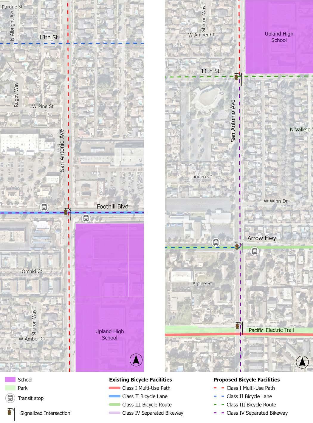
Note: Conceptual design segments demonstrate only a portion of the entire project length.
Entire Project: 24th Street to 7th Street
Conceptual Design Segment: Foothill Boulevard to 9th Street
Euclid Avenue is a 4-lane to 6-lane major arterial that runs north to south with a posted speed limit of 40 to 45 mph. Euclid Avenue contains residential, retail, restaurant, office, park, and religious uses. The southern half of the corridor has bus stops, a median with a natural surface trail and street trees, a railroad crossing, and is controlled by 13 signalized intersections. On-street parking is permitted along the entire corridor, except where room does not allow for it. Class II bicycle lanes and Class III bicycle routes vary throughout segments of the corridor.
Recommendations are visualized in the Conceptual Design Segment and can be applied throughout the corridor as appropriate.
f Bicycle facility upgrades (i.e., Class I multiuse path, Class IV separated bikeways, signage, and green transition striping)
f Upgrade Class II bicycle lanes to Class IV separated bikeways (from 24th Street to Foothill Boulevard)
f Install a Class I multi-use path in the center median (from Foothill Boulevard to 7th Street)
f Intersection improvements (i.e., hardened centerlines, signage, and high-visibility crosswalk markings)
f Intersection removal (i.e., removing unnecessary mid-block intersections that cut through the center median, such as one or fewer per block)
f ADA improvements (i.e., ADA-compliant curb ramps and bus stops)
f Bus stop amenities (i.e., shelters and trash receptacles)
Note: This priority project is adjacent to two projects in progress on the following streets: f Stowell Street (from Euclid Ave. to Sultana Ave.)
f 7th Street (from Euclid Ave. to 2nd Ave.)
Entire Project Conceptual Design Segment
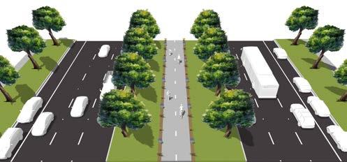
Upgrade existing signalized intersection with high-visibility crosswalks and ‘Left Turn Yield on Green’ signage. Realign curb ramps with crosswalks.
Provide signage help bicyclists navigate the transition from Class IV separated bikeway to Class I multi-use path.
Install bus shelter at bus stop. OmniTrans coordination needed.
Upgrade existing signalized intersection with high-visibility crosswalks, ‘Keep Clear’ pavement marking, and hardened centerlines.
Install trash receptacle and seating at southern bus stop and bring both stops into ADA compliance. OmniTrans coordination needed.
Install a Class I Multi-Use Path in the median and add high-visibility crosswalks and pedestrian warning signs where the path crosses travel lanes.
Consider reducing number of stop-controlled intersections in the median (e.g., <1 per every 1/4-mile block).
Add truncated domes and highvisibility crosswalks at intersections.
Upgrade existing signalized intersection with high-visibility crosswalks, ‘Keep Clear’ pavement marking, and hardened centerlines. Realign curb ramps with crosswalks.
Install bus shelter and trash receptacle at bus stop and bring into ADA compliance. OmniTrans coordination needed.
Install a Class I MultiUse Path in the median and add high-visibility crosswalks and pedestrian warning signs where the path crosses travel lanes. (in addition to the existing Class II Bicycle Lanes).
Consider reducing number of stopcontrolled intersections in the median (e.g., <1 per every 1/4-mile block).
Install a curb ramp at the southwest corner of the intersection; install up-to-date pedestrian signage for each approach along Euclid Avenue; and install high-visibility crosswalks with yield lines and standardized signage per SBCTA Points of Pedestrian Interest Plan.
Install bus shelters at unshaded bus stop and bring both stops into ADA compliance. OmniTrans coordination needed.
Install a Class I Multi-Use Path in the median.
Install bus shelter and at bus stop. OmniTrans coordination needed.
Upgrade existing standard crosswalk to a high-visibility crosswalk and realign curb ramps with crosswalks.
Upgrade existing signalized intersection with high-visibility crosswalks, ‘Keep Clear’ pavement marking, and hardened centerlines for 9th St. Realign curb ramps with crosswalks.
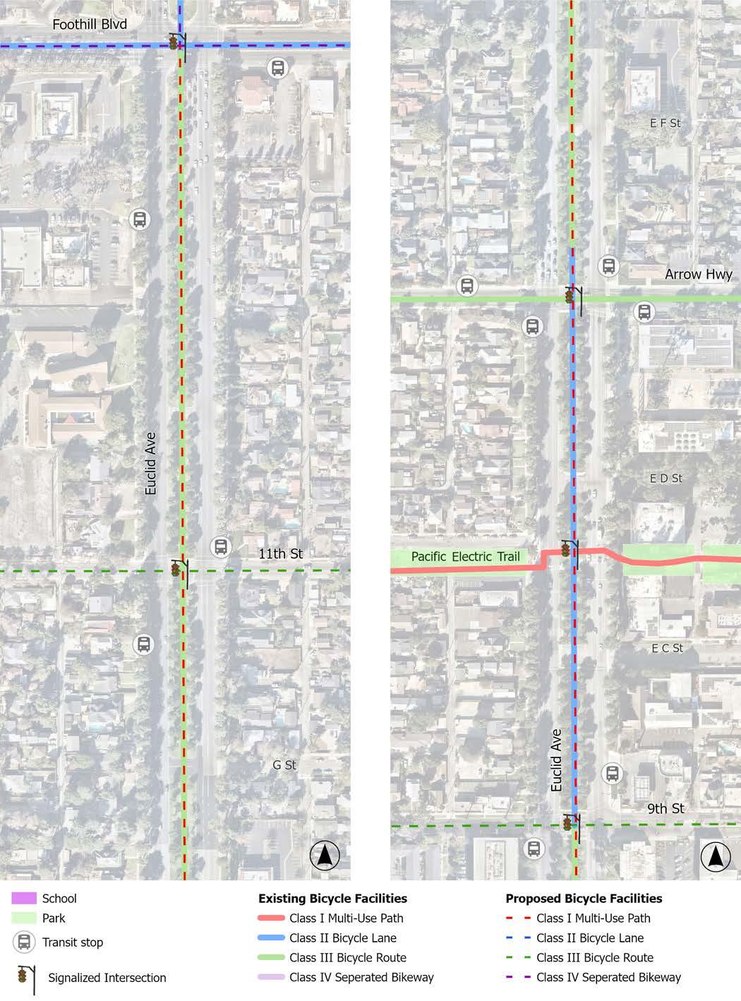
Note: Conceptual design segments demonstrate only a portion of the entire project length.
Entire Project: Foothill Boulevard to Pacific Electric Trail
Conceptual Design Segment: 11th Street to Pacific Electric Trail
EXISTING CONDITIONS
Memorial Park/13th Avenue/Hospital Parkway is not a designated road but an area of City owned parcels adjacent to Memorial Park and San Antonio Regional Hospital that intersects east to west roads such as Foothill Boulevard, 11th Street, San Bernardino Road, and Arrow Highway. The project area contains residential, medical, and park uses, including Memorial Park and San Antonio Regional Hospital. A single signalized intersection is located within this project area as well as the Pacific Electric Trail and bus stops on San Bernardino Road.
RECOMMENDATIONS
Recommendations for the entire project are visualized in the Conceptual Design Segment.
f New bicycle facilities (i.e., Class I multiuse path, Class IV separated bikeway, and Class III bicycle route)
f Intersection improvements (i.e., hardened centerlines, signage, and high-visibility crosswalk markings)
f Traffic calming measures (i.e., speed cushions, speed feedback signs, and chicanes)
f Crossing Enhancements (i.e., RRFBs and high-visibility crosswalk markings)
Entire Project Conceptual Design Segment
PROPOSED CONDITIONS
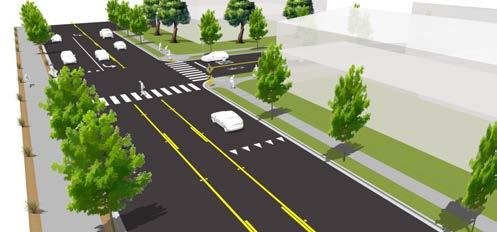
Upgrade existing standard crosswalk to high-visibility crosswalks, realign curb ramps with crosswalks or add truncated domes to existing curbs, and restripe pavement markings.
Install a Class III Bicycle Route through existing surface parking lot.
Consider installing a high-visibility crosswalk with an RRFB to facilitate north-south crossing. Conduct a traffic study to determine if warranted.
Install Class III Bicycle Route/Bike Boulevard. Reduce speed limit to 30 mph or lower (per SB 1216) and install sharrow pavement markings and ‘Share the Road’ signage.
Implement traffic calming measures, such as speed cushions and chicanes.
Transition Bike Boulevard to a Class I Multi-Use Path (or bike-friendly sidewalk) to direct users to the existing bike crossing for the Pacific Electric Trail.
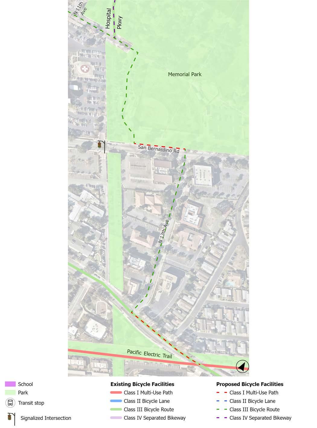
Note: This conceptual design segment demonstrates the entire project length.
Entire Project: City Limits to Tanglewood Avenue
Conceptual Design Segment: City Limits to Benson Avenue
EXISTING CONDITIONS
Baseline Road/16th Street is a 4-lane secondary arterial with a posted speed limit of 45 mph. Baseline Road connects directly to Interstate 210 and is near Cable Airport. It contains residential, retail, restaurant, office, park, and entertainment uses. The corridor has a center turn lane for the majority of the corridor, medians on the west end of the corridor, and is controlled by 11 signalized intersections. On-street parking is not permitted on the corridor. Class II bicycle lanes exist along most of the corridor, with a gap between Kelly Avenue and 2nd Avenue designated as a Class III bicycle route.
RECOMMENDATIONS
Recommendations are visualized in the Conceptual Design Segment and can be applied throughout the corridor as appropriate.
f Bicycle facility upgrades (i.e., Class IV separated bikeways, Class II bicycle lanes, and green transition striping)
f Upgrade Class II bicycle lanes to Class IV separated bikeways (from the western city limit to Benson Avenue)
f Upgrade Class III bicycle route to Class II bicycle lanes (from N. Kelly Avenue to N. 2nd Avenue)
f Intersection improvements (i.e., hardened centerlines, signage, and high-visibility crosswalk markings)
f ADA improvements (i.e., ADA-compliant curb ramps and Pedestrian Push Buttons)
Entire Project
Conceptual Design Segment
CONDITIONS
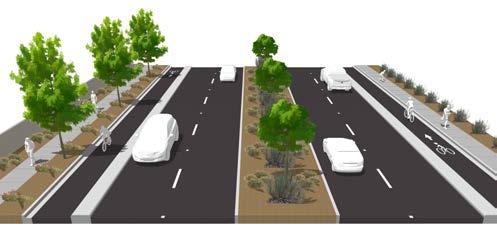
Install green transition striping for existing Class II Bicycle Lane.
Upgrade existing signalized intersection with high-visibility crosswalks and realign curb ramps with crosswalks.
Upgrade existing Class II Bicycle Lanes to Class IV Separated Bikeways.
Install high-visibility crosswalks at intersections.
Install green transition striping for existing Class II Bicycle Lanes/ Proposed Class IV Separated Bikeways at intersections.
Install high-visibility crosswalks at intersections.
Install green transition striping for existing Class II Bicycle Lanes/ Proposed Class IV Separated Bikeways at intersections.
Upgrade existing signalized intersection with high-visibility crosswalks and realign curb ramps with crosswalks.
Install green transition striping for existing Class II Bicycle Lane, a highvisibility crosswalk, and add truncated domes to existing curbs.
Upgrade existing signalized intersection with high-visibility crosswalks and hardened centerlines. Realign curb ramps with crosswalks or add truncated domes to existing curbs.
Replace (5) non-ADA PPBs per TSMP.
Upgrade existing Class II Bicycle Lanes to Class IV Separated Bikeways.
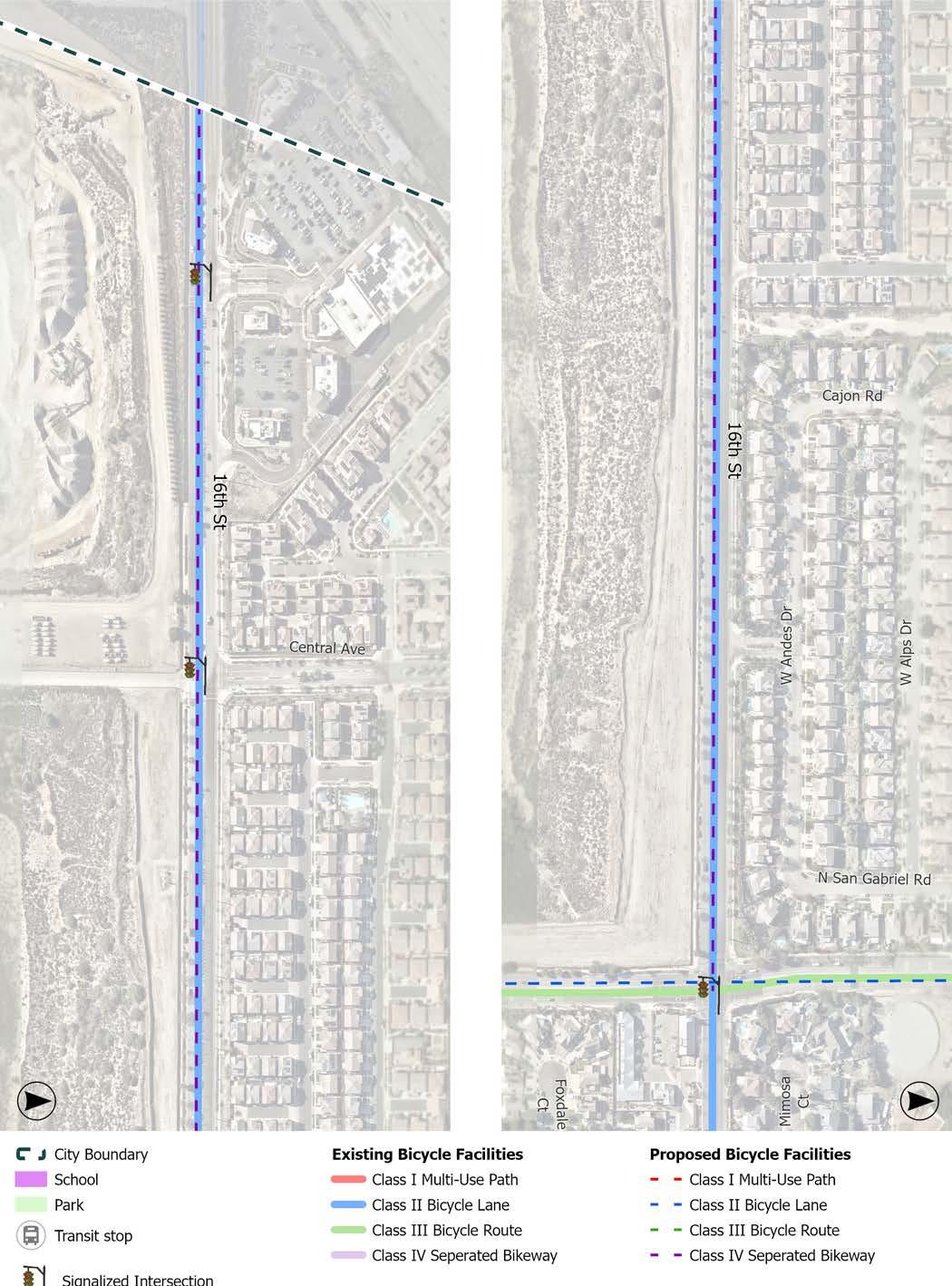

Note: Conceptual design segments demonstrate only a portion of the entire project length.
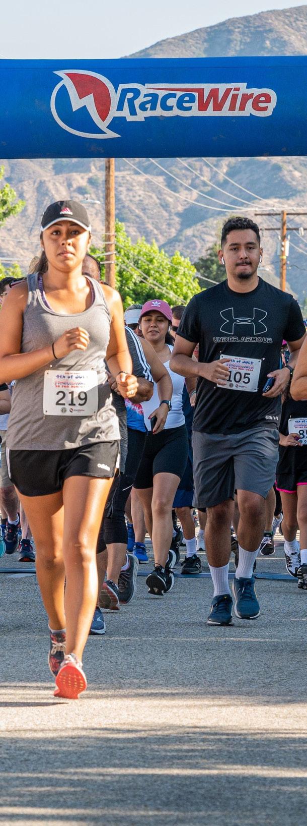
While infrastructure projects demonstrate the most tangible evidence of a walkable, bikeable, and transit-friendly city, they are brought to life by programs and events that encourage people to use them. The proposed infrastructure improvements outlined at the beginning of this chapter provide the foundation for a safe and convenient active transportation and public transit system. However, the City can encourage proper and widespread use of these facilities by hosting engaging and educational programs, events, campaigns, and more. Pairing infrastructure projects with encouragement and education programs can help generate community excitement and promote walking, bicycling, and taking public transit as attractive travel options.
The following programs are organized as a menu of recommendations for the City to consider throughout the implementation of this Plan. The programmatic recommendations are inspired by the original “Six E’s” of transportation planning developed by the Safe Routes Partnership: Encouragement, Education, Equity, Enforcement, Engineering, and Evaluation.
Encouragement programs are designed to make walking, bicycling, and taking public transit more fun and attractive. By actively encouraging Uplanders to walk, ride a bicycle, and take public transit through fun events and programs, the City can help people cultivate different travel habits and decrease motor vehicle usage over time. To achieve this, the City can collaborate with local partners to organize activities and events that promote active transportation and public transit.
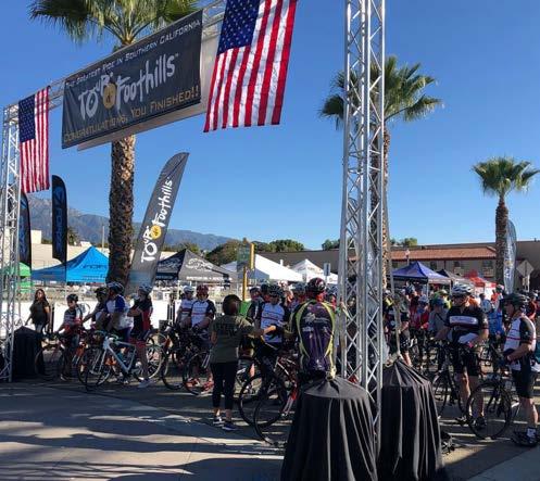
Participate in National Bike Month by hosting a community activity, such as a Bike Breakfast, Bike to Work Day, Bike Fridays, etc. During May, cities across the country organize events and campaigns to educate people about bicycling and to encourage them to ride bicycles to their destinations.
Host guided walks, hikes, and bicycle rides to encourage trail, pedestrian, and bicycle facility usage in a safe and welcoming setting. Events can be promoted as tours to local destinations, such as parks, trailheads, historical buildings, public art, or Downtown Upland. Events can include helpful tips about road safety and trail use and can be geared toward specific age groups (e.g., familyfriendly, seniors, etc.) or skill levels.
Partner with the Upland Unified School District to promote a ‘Walk to School Day’ and a ‘Bike to School Day’ that gives students and families the opportunity to socialize, start the day off with exercise and enthusiasm, build healthy habits, and form connections with other members of the community.
Encourage local schools to create a ‘Bike Bus’ to facilitate fun and safe bicycling to school. Bike buses are led by a “bus driver”—an adult on a bike— who guides a slowly moving group of bicyclists along a predefined route to school. Kids and their families can join the group as they pass by on their way to school.
Continue to host low-cost or free fivekilometer running and walking events, such as the Lemon Zest 5K. These events are an excellent way to encourage people to explore their city on foot. Post-race refreshments and healthy snacks can be provided to participants.
Host an ‘Open Streets’ event by temporarily closing a street to motor vehicles and opening it for active transportation. Open Streets events, also known as Ciclovias, allow for the reclamation of public space for community gathering, play, and movement. Open Streets events encourage physical activity, increase local business, and have a positive social impact on the community. These events can include live music, public art installations, outdoor games, food vendors, exercise classes, bicycle repair stations, and more.
Develop a public-facing map of bicycle and multi-use facilities and trails to help community members plan active transportation routes throughout the city.
Run interactive campaigns and challenges to encourage walking, bicycling, and public transit in Upland.
Encourage local businesses, such as coffee shops, restaurants, stores, and hotels, to become certified bike-friendly businesses through the League of American Bicyclists. This can be a way to advertise bike infrastructure that supports and encourages people to ride locally and support the local economy. Bike-friendly elements include but are not limited to bicycle parking or storage, bicycle maps or information, and bicycle repair stations. Incentivizing local businesses to provide discounts to patrons who arrive at their business by walking or bicycling can also boost these modes.
Collaborate with Omnitrans to promote public transit ridership. Promotional campaigns can include, but are not limited to a ‘Free Ride Day’ where everyone rides free, free bus passes for youth and students, and a promotional campaign to increase awareness of the OmniRide microtransit service.
Coordinate with Omnitrans and Metrolink to Improve First-Last Mile Mobility
Coordinate with Omnitrans and Metrolink to improve active transportation facilities along public transit routes to help address the first-last mile problem (i.e., the distance between a bus stop and the final destination) that often deters people from taking public transit. Examples of improvements include installing safe and comfortable bicycle facilities connecting bus stops to common destinations and other improvements to the built environment, such as landscaping, pedestrian-scale lighting, shade trees, and access to parks and recreation amenities. Where feasible, improve bus stop conditions such as adding bus shelters, lighting, and seating (see Bus Stop Improvements section earlier in this chapter).
Educational workshops and campaigns can be impactful tools to empower Uplanders to feel safe, comfortable, and confident walking, riding a bicycle, or taking public transit. These education campaigns can help teach motorists, pedestrians, and bicyclists how to share the road safely. Educational programs can be incorporated into regularly scheduled programs, such as the City’s Recreation and Community Services programs, hosted as stand-alone events, or held as a multi-part series. The City is encouraged to partner with local agencies and organizations on public education programs.
Explore areas to install educational signage (temporary or permanent) to inform motorists of pedestrian and bicycling safety. Messaging should encourage drivers to be more alert and mindful when sharing the road with bicyclists. For example, police departments often deploy trailer-based portable electronic sign platforms with customizable messages to address areas of speeding or DUIs with specific messages, that are then moved when other priority areas develop. Example messages are “Drive high, get a DUI” near dispensaries, or “Lycra and speeding don’t mix” on roads frequented by recreational bicyclists.
Conduct an ongoing pedestrian and bicycle safety education campaign to increase community-wide awareness and knowledge of how to safely share the road with users of different transportation modes. A campaign may include tabling at community events, hosting educational workshops, posting educational messages on social media, installing informational signage at bus stops, on Omnitrans buses, and other high-traffic public areas.
Provide family-friendly interactive training and infrastructure tours to increase the confidence of pedestrians and bicyclists. Participants can receive free helmets and bike lights and are taught about the bicycle rules of the road and how to be visible and predictable when riding.
Encourage the Upland Unified School District to collaborate with local businesses or organizations to provide on-bike education programs for students during physical education and to host safety assemblies that teach students foundational safety information, including the rules of the road and how to safely walk and ride a bicycle.
Collaborate with local businesses or organizations to host workshops such as “bike rodeos” that teach habits, skills, and tips for walking, hiking, and bicycling safely and comfortably. Workshops can cover lessons on street signs and infrastructure, rules and responsibilities of the road, “onbike” maneuvers, and more. Giveaways, such as free helmets, bicycle lights, or reflective gear, can be provided to support safe walking and bicycling.
Collaborate with local businesses or organizations to host bicycle maintenance workshops to teach riders how to fix and
ride a bicycle, as well as how to navigate the rules of the road. Workshops can be geared toward youth and/or adults. These workshops can offer giveaway items, such as a bicycle, helmet, lights, or repair tools.
Collaborate with local businesses or organizations to host an obstacle course to teach pedestrians and bicyclists how to identify different street signs and how to use street infrastructure to increase safety. Youth and children navigate the obstacle course to win free helmets and lights.
While this is a citywide Plan, it focuses on improving mobility in the areas of Upland in greatest need of multi-modal transportation solutions and resources. The Plan aims to address and remove barriers to the safe and easy use of active transportation and public transit facilities for recreation and transportation. In addition to constructing projects in underserved areas, it is important to integrate universal and accessible design features into new projects to the greatest extent possible. Efforts to advance equitable access to high-quality, well-maintained, and enjoyable pedestrian, bicycle, and public transit facilities are essential to a successful multi-modal transportation system.
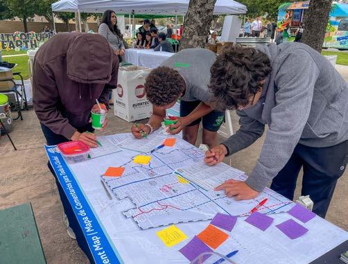
Continue to engage community members throughout the Plan implementation and monitoring.
Recognize the importance of addressing the barriers that prevent trips from being safe, especially for the youth, elderly, disabled, and lower-income populations who cannot afford, operate, or choose to forgo vehicle ownership.
Implement improvements in areas that are disproportionately affected by health and safety burdens, acknowledging that policies and designs that improve conditions for vulnerable groups can benefit everyone in the community.
Secure funding to distribute free equipment to support safe and easy walking, hiking, and bicycling in Upland. Equipment can include free bicycles, helmets, lights, first aid kits, etc.
Ensure that key messaging is translated to common non-English languages such as Spanish and Mandarin. Follow guidelines that may already exist at the City or Omnitrans.
Pedestrian and bicycle-related collisions are often a result of road user error, such as a vehicle, pedestrian, or bicycle failing to follow the rules of the road. While education is an essential first step towards improving collective understanding and awareness of how to properly share the road and interact with new active transportation infrastructure, enforcement can help reinforce the importance of pedestrian and bicycle safety. City staff can collaborate with the Police Department to ensure officers receive training on pedestrian and bicycle issues and solutions, as well as best practices for enforcement.
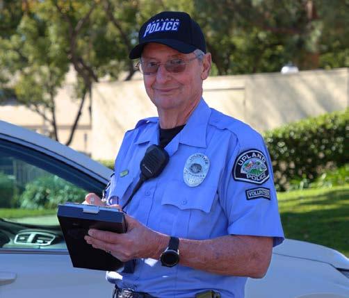
Partner with law enforcement to promote pedestrian and bicycle safety. Collaboration may include targeted enforcement to educate drivers, bicyclists, and pedestrians about applicable traffic laws and the need to share the road. This effort may include developing a brochure or tip card explaining each road user’s rights and responsibilities and selecting a designated law enforcement liaison to address pedestrian and bicycle safety issues and concerns.
Educate motorists on how to share the road with non-motorists and new bicycle and pedestrian or traffic calming infrastructure. This is particularly important for Class III
bicycle routes on many streets throughout Upland that may be enhanced with trafficcalming elements to create a bicycle boulevard, which is a road that prioritizes safe bicycle travel and where vehicles are an invited guest, at lower speeds consistent with California law.
Place speed feedback trailers at specific locations where pedestrians and bicyclists are frequently present. Speed feedback trailers help reduce speeding by warning motorists of their current speed and instructing them to slow down if they are going above the speed limit.
A variety of engineering tools can be used to make sure that the roadways in Upland are designed to keep bicyclists and pedestrians safe at all times while maintaining efficient travel throughout the city. Some of these tools include street design techniques that are meant to reduce traffic congestion, decrease vehicular speeds, and enhance pedestrian and bicycle safety and comfort. When designing and constructing active transportation facilities, the City can refer to design guidance from the California Department of Transportation (Caltrans) and the California Manual on Uniform Traffic Control Devices (CA MUTCD). National organizations also guide best practices, such as the National Association of City Transportation Officials (NACTO), the American Association of State Highway and Transportation Officials (AASHTO), and the Federal Highway Administration (FHWA).
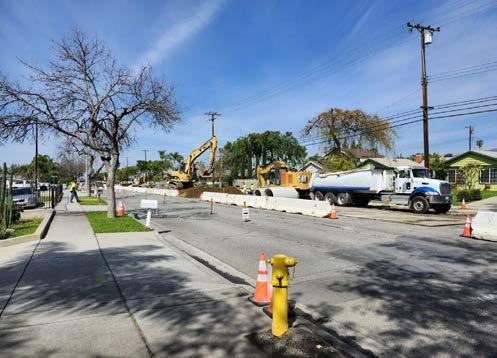
Regular evaluation is necessary to maintain and improve Upland’s active transportation and public transit facilities. Additionally, sharing and addressing evaluation findings with the public can help promote transparency and accountability for the City. The following examples include strategies the City can use to evaluate and monitor programs and infrastructure.
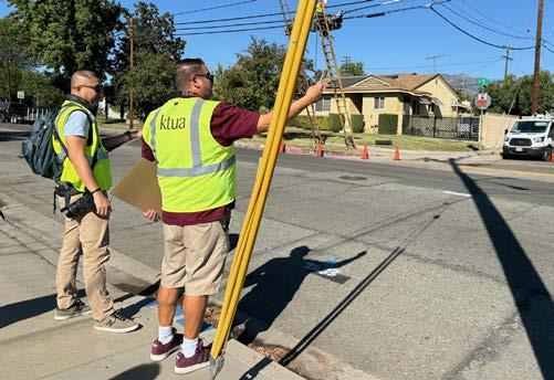
Consider establishing a committee composed of representatives from the neighboring cities of Rancho Cucamonga, La Verne, and Claremont to advance contiguous and seamless multimodal improvements along Foothill Boulevard and Baseline Road/16th Street. Regularly convening neighboring jurisdictions to discuss issues and develop mobility solutions for Foothill Boulevard and Baseline Road/16th Street will facilitate a consistent, safe, and enjoyable travel experience for all modes along some of the region’s most important corridors.
Consider creating a Mobility Advisory Committee to guide the ongoing implementation of this Plan. Many municipalities, including the City of Rancho Cucamonga, have developed similar advisory committees to address issues and opportunities related to walking, bicycling, and transit. This group can support City staff collaboration with residents and community partners to address issues and monitor Plan implementation.
Encourage the Police Department to monitor collision data, including existing data sources, such as the Transportation Injury Mapping System and California Traffic Safety Dashboard developed by UC Berkeley SafeTREC. Traffic collisions involving bicyclists and pedestrians should be regularly reviewed and analyzed to develop plans to reduce their frequency and severity. Any such plans should include Police Department involvement and be monitored to determine their effectiveness. Consider creating an online collision dashboard that tracks key collision trends on an annual basis, which can also serve as a public engagement tool.
Vision Zero is a safety strategy aimed at eliminating traffic fatalities and serious injuries while promoting safe, healthy, and equitable mobility for all. While there are specific steps to attaining Vision Zerosuch as the Mayor has publicly, officially committing to the cause - this Plan has elements that are a great first step on the road to Vision Zero.
Conduct regular bicyclist and pedestrian counts throughout Upland to determine baseline mode share and subsequent changes in travel behavior as the Plan is implemented. In particular, conducting counts before and after constructing active transportation projects is essential to monitoring the impact of new improvements on travel patterns and behaviors. Additionally, bicycle and pedestrian counts should be collected as part of existing traffic counts. Data from counts can be used to prioritize and justify projects when funding is solicited and received. Results should be regularly recorded for inclusion in a bicycle and pedestrian report card and shared with applicable databases (e.g., Active Transportation Database - ATDB.org).
Conduct regular monitoring of active transportation and public transit facility conditions to identify areas in need of maintenance, litter removal, beautification, or improvement. Address safety concerns and issues along facilities promptly to maintain a safe and enjoyable active transportation and public transit experience for community members.
Develop a mobility report card to measure the success of the Plan’s implementation. The report card could be used to identify the magnitude of accomplishments in the previous year and general trends. The report card could include, but not be limited to, keeping track of system completion, travel by bicycle or on foot (counts), number of collisions, public transit ridership, etc. This can be part of or complement an online collision dashboard, and both can be part of a Vision Zero effort.
Develop a working partnership with the Upland Unified School District to evaluate bicycle and pedestrian safety around and leading to Upland schools. Forming a strong relationship with the Upland Unified School District can help to identify and address SRTS needs and facilitate ongoing improvements.
Establish a communication process that encourages students and parents to notify the school and law enforcement of the occurrence of a crash or near-miss during school commute trips involving auto, bus, pedestrian, or bicycle transportation.
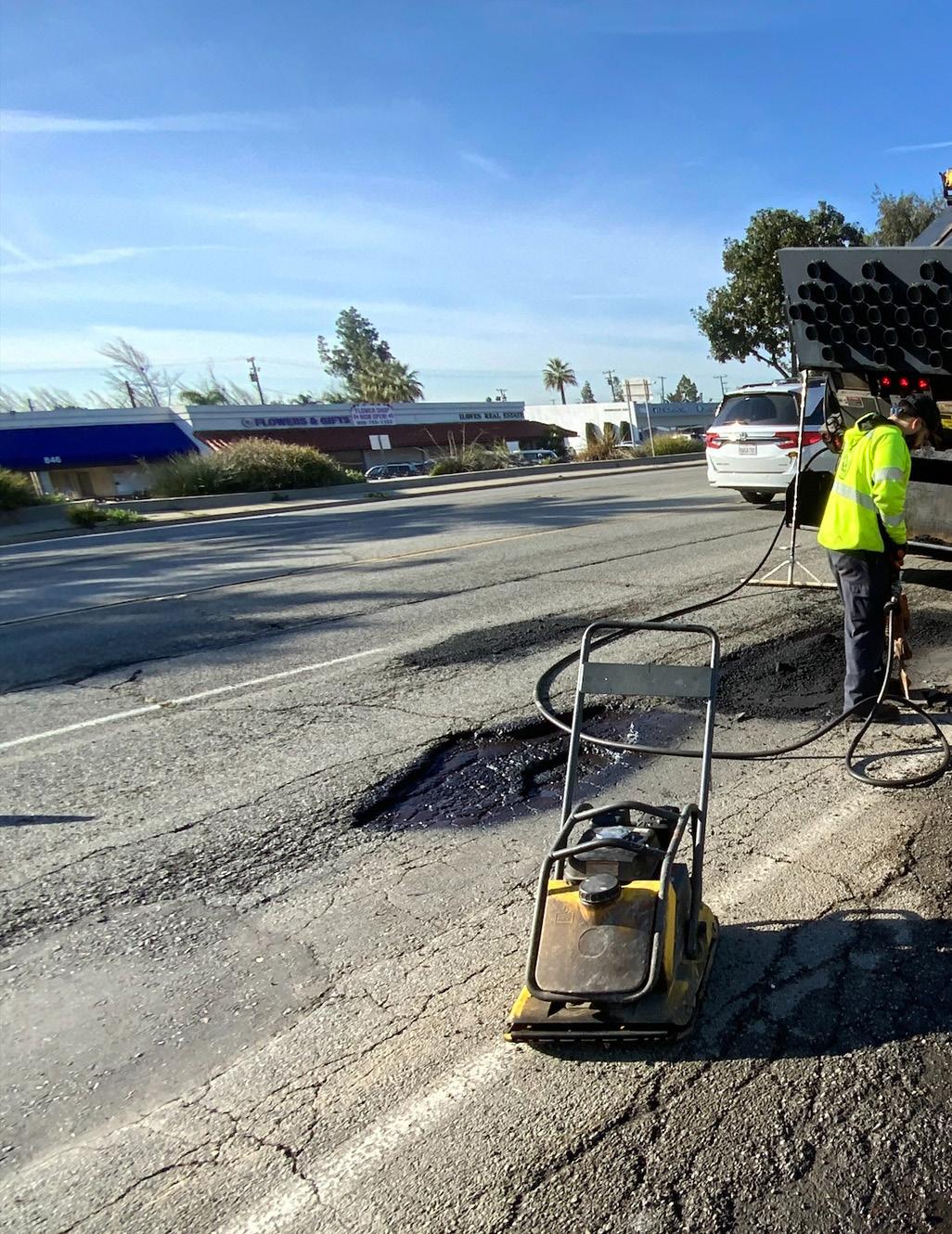
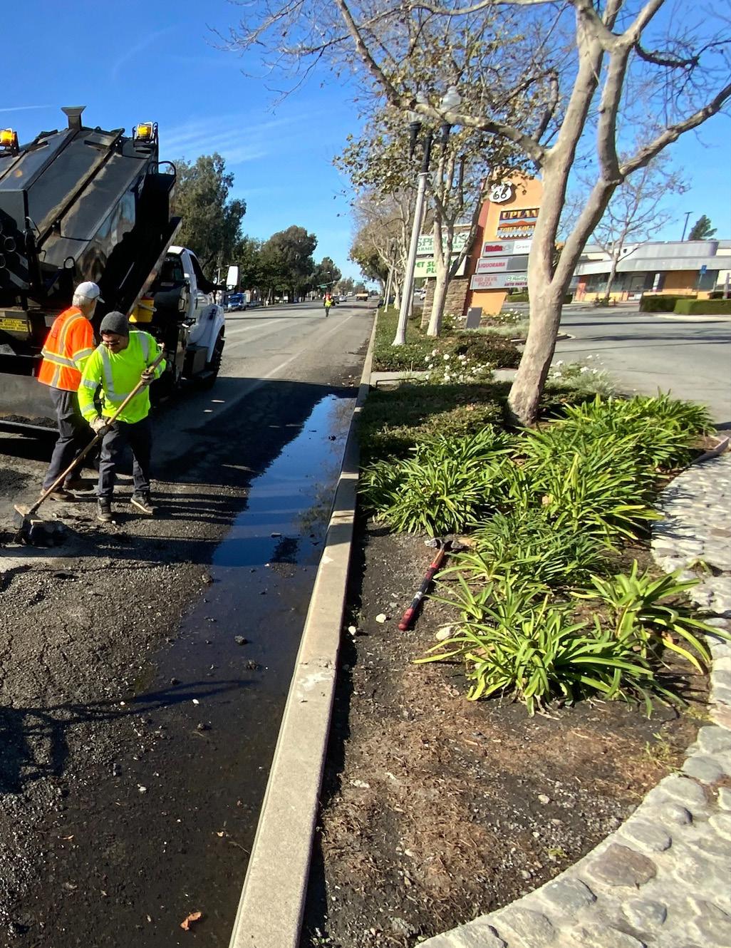
Chapter 6 contains several items to support the City’s implementation of the improvements proposed by this Plan, including an implementation strategy, updates to the General Plan and Municipal Code, and a funding source matrix.
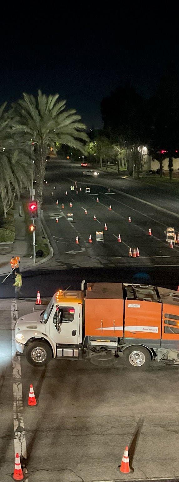
Chapter 6 contains several items to support the City’s implementation of the improvements proposed by this Plan, including an implementation strategy, updates to the General Plan and Municipal Code, a funding source matrix, and planning-level cost estimates and conceptual drawings for segments of the Plan’s ten priority projects. The City can use these tools to apply for, secure, and allocate funding to design and construct the mobility improvements proposed in this Plan.
Table 6-1 categorizes potential mobility infrastructure projects by short-term (0 to 2 years), mid-term (2 to 5 years), and long-term (5+ years) implementation timelines. The City can use Table 6-1 to guide project implementation and allocate resources as funding becomes available. This implementation table can be used alongside the Funding Source Matrix, described below, to help make informed decisions about the types of projects the Town can explore pursuing.
The City has already identified several roadway rehabilitation projects in its CIP budget, which include repairing or upgrading roadway surfaces, curbs and gutters, sidewalks, curb ramps, pavement markings, and more. To streamline the implementation of this Plan, the City is encouraged to integrate proposed infrastructure improvements, such as Class II bicycle lanes, Class IIB buffered bicycle lanes, Class III bicycle routes, and green transition striping, into existing roadway resurfacing and pavement marking projects, where identified in this Plan. The City is encouraged to review the infrastructure improvements proposed in this Plan and integrate them into maintenance and CIP projects wherever possible to expedite Plan implementation.
Short-Term (0-2 Years)
Quick-build projects, pilot projects, and small-scale site improvements.
Short-term projects allow agencies to design and install infrastructure improvements that have potential for faster execution, strong community support, and a significant impact on the community. Improvements can typically be incorporated within the existing street right-of-way.
ADA-compliant curb ramps with truncated domes
Sidewalk repair to uneven or cracked pavement
High-visibility crosswalks
Project Example:
Mid-Term (2-5 Years)
Corridor improvements and roadway modifications.
Project Example:
Install proposed Class IV separated bikeway along Foothill Boulevard. Install proposed Class I multi-use path along Euclid Avenue (south of Foothill Boulevard). Table 6-1:
Pedestrian amenities (e.g., hydration stations, pet waste stations, benches, street trees, and pedestrian-scale lighting)
Bicycle amenities (e.g., bicycle racks, lockers, storage, and fix-it stations)
Transit stop amenities (e.g., benches, shelters, real-time bus information)
Class II bicycle lanes, Class IIB buffered bicycle lanes, Class III bicycle routes
Green striping for bikeways (e.g., conflict striping through intersections and high-volume driveways, bike boxes, and two-stage left turn boxes)
Signage (e.g., regulatory, interpretive, and wayfinding)
Traffic calming measures (e.g., speed feedback signs, LED stop signs, reflective delineators, advanced warning signs)
Install bicycle racks at activity centers, such as Downtown Upland, the Colonies Shopping Center, and public buildings. Add amenities to the Pacific Electric Trail, including shade trees, seating, public art, etc. Include proposed Class II/IIB/III bicycle facilities and high-visibility crosswalks on planned roadway rehabilitation projects (e.g., Campus Avenue, Mountain Avenue, Arrow Highway, and 14th Street).
Mid-term projects are intended to impact corridors, not just spot locations, and are evaluated against other system-wide improvements. These projects may have minor impacts on a street’s right-of-way, utility easements, or contain other constraints that may need to be evaluated before implementation.
Class I multi-use paths
Class IV separated bikeways
Protected intersections
Raised curb extensions
Sidewalk gap infill
Pedestrian hybrid beacons (PHBs)
Traffic signal modifications (e.g., leading pedestrian intervals, crossing time modifications, bicycle signals, bicycle detection devices)
Traffic calming measures (e.g., neighborhood traffic calming circles/mini roundabouts, speed cushions, raised crosswalks)
PROJECT TYPE DESCRIPTION
Long-Term (5+ Years)
Corridor and system-wide improvements with extensive planning and civil engineering components
Project Example:
Long-term projects require extensive planning and resources for implementation. These projects require more attention in the engineering and design phases, or include the need for coordination with adjacent agencies or governing bodies.
New traffic signals
Roundabouts
OF INFRASTRUCTURE
Grade-separated crossings (e.g., pedestrian bridges, underpass tunnels, etc.)
Utility relocation/additions
Right-of-way acquisitions
Road diets or expansions
Conduct a road diet along San Antonio Avenue and install proposed Class IV separated bikeway.
To ensure consistency between the Upland Mobility Master Plan and the City’s General Plan Circulation Element, the following updates are recommended:
f Update the policies shown in Table 6-2 using the recommended modifications.
f Update Figure Cir-2 Bicycle Routes to reflect the existing and proposed bicycle facilities shown in Figure 5-16 of this document.
f Consider reclassifying streets in alignment with any future reductions to posted speed limits. Street reclassifications would require updating Figure Cir-1 Roadway System.
Table 6-2: Updates to the General Plan Circulation Element
CIRCULATION ELEMENT POLICY
Policy CIR-2.8
Policy CIR-2.9
Policy CIR-2.10
Policy CIR-3.3
RECOMMENDED MODIFICATION
Bicycle System. Implement and maintain a comprehensive bicycle system pursuant to the City’s Bicycle and Pedestrian Master Plan Mobility Master Plan, the San Bernardino County Non-Motorized Transportation Plan and Caltrans standards to reduce slope, sharp curves, and interference from vegetation, pedestrians, and motor vehicle traffic. Guidance from NACTO and AASHTO may also be referenced.
Bicycle Facilities. Incorporate bicycle facilities into the design of land use plans and capital improvement projects, including:
a. End of trip facilities (bicycle lockers, showers, where feasible, and changing rooms) within non-residential sites, including transit stations;
b. Bicycle parking within new multi-family and non-residential sites, including transit stations. Bicycle parking includes, but is not limited to bicycle racks, storage lockers, and storage rooms;
c. Publicly accessible bicycle parking and repair stations; and,
d. Signage and pavement markings for all bicycle routes.
Pedestrian System. Maintain a network of sidewalks, crosswalks, and other pedestrian facilities throughout the City as specified in the City’s Mobility Master Plan and the County’s Non-Motorized Transportation Plan, in accordance with the Americans with Disability Act (ADA) and other relevant accessibility guidelines.
Safe Routes to School. Collaborate with local school districts and private schools to identify and implement safety measures to improve safe travel to and from schools for students, parents, and school employees. See safety measures identified in the City’s Mobility Master Plan.
For many people, particularly children, riding a bicycle on the street, directly adjacent to cars, does not feel safe. In instances where separated or off-street bicycle facilities are absent, sidewalks can offer a more comfortable place to ride a bicycle. However, the City’s Municipal Code (§ 12.16.070) prohibits riding a bicycle on sidewalks. Additionally, the Municipal Code requires bicycle registration before riding, which is widely considered to be an outdated and hard-to-enforce regulation that creates hurdles for residents interested in riding a bicycle.
To remove barriers to riding a bicycle in Upland, the updates shown in Table 6-3 to the Upland Municipal Code are recommended.
§ 12.16.070
Riding bicycle on sidewalk.
No person shall ride a bicycle upon any of the public sidewalks within the limits of the city of Upland. Whenever any person is riding a bicycle upon a sidewalk, such person shall yield the right-of-way to any pedestrian and shall give an audible signal before overtaking and passing such pedestrian. At the intersection of two or more sidewalks, where the vision of the operator of a bicycle is restricted, the operator of a bicycle shall dismount and walk through the intersection of the sidewalks.
Chapter 10.64 Bicycles and Motorized Bicycles Repeal and remove Chapter 10.64
Registration required.
§ 10.64.010
§ 10.64.020
No person shall operate or use a bicycle or motorized bicycle upon any of the streets or ways of the city without first registering the same and obtaining from the chief of police a license therefor. The term “bicycle” means and includes such vehicles propelled by human power as defined or referred to in the Vehicle Code, but not required to be registered thereunder, and shall be given its ordinary application and meaning. The term “motorized bicycle” means and includes such vehicles having fully operative pedals for propulsion and an automatic transmission with an engine which produces less than two gross brake horsepower as defined or referred to in the Vehicle Code, but not required to be registered thereunder, and shall be given its ordinary application and meaning. The provisions of this chapter shall apply to all persons residing in the city, and to such others who may commonly operate bicycles or motorized bicycles upon its public ways.
Registration effective for three years.
The chief of police is authorized and directed to register all such bicycles and motorized bicycles and issue licenses upon written application therefor, and in each instance the license shall be effective for three years commencing January 1, 1979. Thereafter, in every instance, the license shall be subject to renewal every three years that the bicycle or motorized bicycle is used upon the streets and ways of the city. The fee for the registration shall be set by council resolution from time to time.
§ 10.64.030
Fees payable in advance—Transfer of license—Retailer information—Serial numbers.
All license fees shall be paid in advance, and such license may be transferred when the ownership of the bicycle has transferred, and a fee as set forth by council resolution shall be paid for the registration of any bicycle transfer. Upon the sale or other transfer of any bicycle, the parties thereto are required to register the facts of such transfer with the chief of police within 10 days of the sale or transfer, and thereupon the original registration card shall be cancelled and a new registration issued to the new owner. All persons engaged in the retail sale of new or secondhand bicycles in the city are directed to supply to each purchaser a record of the following information: name of retailer, year and make of bicycle, and serial number of bicycle. After December 31, 1974, no bicycle retailer shall sell any new bicycle in this city unless such bicycle has permanently stamped or cast on its frame a serial number unique to the particular bicycle of each manufacturer. Serial numbers shall be stamped or cast in the head of the frame, either side shall be stamped or cast in the head of the frame, either side of the seat down post tube, or the bottom sprocket bracket.
Rules and regulations.
§ 10.64.040
§ 10.64.050
The chief of police is also authorized and directed to make and issue appropriate rules and regulations pertaining to bicycles and the use thereof upon the public streets and ways of the city other than such rules and regulations as are required by the Vehicle Code of the state of California. Failure to reasonably observe the rules and regulations issued by the chief of police shall be sufficient cause for cancellation of the license, in the good judgment and discretion of the chief of police.
Control and supervision of registration and licensing.
The control and supervision of the registration and licensing of bicycles in the city is placed in the chief of police, and he or she is authorized and directed to secure appropriate license plates, together with registration cards, application blanks and any and all other necessary or convenient things that may be required in the due enforcement hereof. A license plate shall be attached to each bicycle, and the chief of police shall cause to be issued a corresponding registration card to each licensee upon the payment of the original license fee as above provided. Such license plate shall remain attached during the continuance of such licensing. The chief of police shall keep a record of the date of the issuing of each license, the number thereof, the name and address to whom issued, the serial number of the bicycle frame, and the make, type and model of the bicycle, and the chief of police is also fully authorized and empowered to take any and all necessary or convenient steps in connection with the registration and licensing of bicycles. If no serial number can be found upon any registered bicycle, or if the same is illegible or insufficient for identification purposes, the chief of police is authorized and directed to stamp a permanent distinguishing number thereon as provided by Section 10.64.030, as amended by Ordinance No. 1046.
Each year, federal, state, and local government agencies invest millions of dollars in active transportation, trails, and public transit projects nationwide. Table 6-4 contains an extensive list of potential federal, state, and local funding opportunities that may be used for a wide range of complete streets projects.
Funding sources for mobility projects vary in purpose and scope, but are intended to help the City plan, design, maintain, and implement projects and programming. The City is encouraged to use Table 6-4 to identify and pursue grant funding to implement this Plan. However, it is important to note that all funding sources are subject to change, and further research will be necessary to apply for grant funding, as not all funding sources apply to the recommended projects.
Congestion Mitigation and Air Quality Improvement Program*
Federal Highway Administration
The Congestion Mitigation and Air Quality Improvement Program provides funding to State and local governments for transportation projects and programs to help meet the requirements of the Clean Air Act. The program supports surface transportation projects and other efforts that contribute to air quality improvement and congestion relief.
Annual X X
Highway Safety Improvement Program*
Federal Highway Administration / Caltrans
The Highway Safety Improvement Program funds work on any public road or publicly owned bicycle or pedestrian pathway or trail, or on tribal lands for general use of tribal members, that improves the safety for its users.
Annual X
• Travel Demand Management to promote clean commutes
• Public Education and Outreach
• Bicycle amenities and facilities, such as Class I, II, III, & IV bike lanes
• Install hybrid pedestrian signals at trail crossings
• Install RRFBs at locations adjacent to parks, trails, and schools
• Improve pedestrian and bicycle safety at locations with uncontrolled crossings
*Note: Program is funded through the Bipartisan Infrastructure Law, also known as the Infrastructure Investment and Jobs Act (IIJA), and does not have permanent, entitled funding. The IIJA would need to be renewed or reauthorized for the program to continue past 2026.
* INF - Infrastructure PLN - Planning and Design PGM - Programming
U.S. Department of Transportation
The BUILD grant program provides grants for surface transportation infrastructure projects with significant local or regional impact. The eligibility requirements of BUILD allow project sponsors, including state and local governments, counties, Tribal governments, transit agencies, and port authorities, to pursue multi-modal and multi-jurisdictional projects that are more difficult to fund through other grant programs.
Annual X X
• Multi-modal and multijurisdictional projects that are more difficult to fund than other grant programs.
U.S. Department of Transportation
The Safe Streets and Road for All program funds regional, local, and Tribal initiatives through grants to prevent roadway deaths and serious injuries. The program offers two grant types: Implementation Grants and Planning and Demonstration Grants. Annual X X X
• Eligible Implementation Grant projects include developing bikeway networks, safety treatments, creating safe routes to school and public transit services, installing pedestrian safety enhancements, closing network gaps, running an education campaign, and more.
• Eligible Planning and Demonstration Grants fund the development or supplementation of a comprehensive safety action plan.
*Note: Program is funded through the Bipartisan Infrastructure Law, also known as the Infrastructure Investment and Jobs Act (IIJA), and does not have permanent, entitled funding. The IIJA would need to be renewed or reauthorized for the program to continue past 2026.
* INF - Infrastructure PLN - Planning and Design PGM - Programming
PROGRAM
Transportation Alternatives Set-Aside (TASA)*
Federal Highway Administration
The Transportation Alternatives Set-Aside from the Surface Transportation Block Grant Program provides funding for a variety of generally smaller-scale transportation projects.
Annual X X
• Pedestrian and bicycle facilities
• Construction of turnouts, overlooks, and viewing areas
• Community improvements such as historic preservation and vegetation management
• Environmental mitigation related to stormwater and habitat connectivity
• Recreational trails
• Safe Routes to School projects
• Vulnerable road user safety assessments
Urban and Community Forestry Program
U.S. Forest Service
The Urban and Community Forestry Program delivers nature-based solutions to ensure a resilient and equitable tree canopy in cities, towns, and suburbs where more than 84 percent of Americans live. 40 percent of the program’s investments are delivered through established and new partnerships working to support disadvantaged communities experiencing low tree canopy and environmental justice issues.
Annual X X
• Urban tree planting projects
• Urban forest planning and management and related activities (particularly in disadvantaged communities)
*Note: Program is funded through the Bipartisan Infrastructure Law, also known as the Infrastructure Investment and Jobs Act (IIJA), and does not have permanent, entitled funding. The IIJA would need to be renewed or reauthorized for the program to continue past 2026.
* INF - Infrastructure PLN - Planning and Design PGM - Programming
PROGRAM SOURCE
Active Transportation Program (ATP)
Caltrans
The Active Transportation Program provides funding to increase use of active modes of transportation by achieving the following goals: increase the proportion of trips accomplished by biking and walking, increase safety and mobility for nonmotorized users, advance active transportation efforts to achieve greenhouse gas reduction goals, enhance public health, ensure that disadvantaged communities fully share in the benefits of the program, and provide projects that benefit various types of active transportation users.
Annual X X X
Affordable Housing and Sustainable Communities Program (AHSC) Strategic Growth Council and Department of Housing and Community Development
The Affordable Housing and Sustainable Communities Program funds land use, housing, transportation, and land preservation projects to support infill and compact development that reduce greenhouse gas emissions.
Annual X X
• Safe Routes to School Plan
• Active Transportation Plan development
• Trail construction
• Bicycle and pedestrian facilities
* INF - Infrastructure PLN - Planning and Design PGM - Programming
• Class I, II, III, & IV bike lanes
• Active transportation projects to encourage connectivity to transit networks
• Bikeways and sidewalks to affordable housing and transit center
• Install dedicated bicycle facilities
• Pedestrian facilities such as bulb-outs
Clean Mobility Options Pilot Program
Coastal Conservancy Grants
California Air Resources Board
The Clean Mobility Options Pilot Program provides funding for zero emissions shared mobility projects (i.e., car sharing, bike sharing, and ondemand sharing) in disadvantaged and low-income communities, including some tribal and affordable housing communities.
Varies X X
Habitat Conservation Fund Program
State of California Coastal Conservancy
The Coastal Conservancy funds a wide variety of projects along the California coast, San Francisco Bay, and in coastal watersheds to increase availability of beaches, parks and trails for the public, protect and restore natural lands and wildlife habitat, preserve working lands, and increase community resilience to the impacts of climate change.
Ongoing X X X
• Bikeshare programs
• “Quick build” right-ofway safety improvements for bicycles and scooters
California Department of Parks and Recreation
The Habitat Conservation Fund provides funding to cities, counties, and districts to protect fish, wildlife, and native plant resources; to acquire or develop wildlife corridors and trails; and to provide for nature interpretation programs and other programs which bring urban residents into park and wildlife areas.
Annual X X
• Provide coastal experiences for communities who face barriers to coastal access
• Accessibility projects that reduce barriers to coastal access for people with disabilities
• Build regional trails
• Enhance coastal recreational amenities, such as restrooms, parking, picnic areas, interpretive centers, shade structures, etc.
• Build new trails
• Rehabilitate existing trails
• Install interpretive trail elements
• Install seating or lighting along trails
• Develop educational or interpretive activities or trips
PROGRAM
Land and Water Conservation Fund
California Department of Parks and Recreation/ National Park Service
The Land and Water Conservation Fund provides funding for the acquisition OR development of land to conserve irreplaceable lands and to create new outdoor recreation opportunities for the health and wellness of Californians.
Annual X X
• Land acquisition for a new park, an existing park expansion, a wildlife corridor with public viewing and outdoor recreational use, and/or a recreational/ active transportation corridor
• Development of recreation features and amenities for outdoor recreation
Local Partnership Program California Transportation Commission
The Local Partnership Program provides funding to counties, cities, districts, and regional transportation agencies in which voters have approved fees or taxes dedicated solely to transportation improvements or that have imposed fees, including uniform developer fees, dedicated solely to transportation improvements. Funding is intended to improve aging Infrastructure, road conditions, active transportation, transit and rail, health and safety benefits.
Annual X X
• Close sidewalk gap, install Class II bike lanes and cycle track, curb extensions, pedestrian enhancements, improvements to lighting and signage
• Construct 4 single-lane and 1 multi-lane roundabouts, and improvements to street, pedestrian and bicycle facilities
• Expressway pedestrian overcrossing
• Implement enhanced crosswalk signing and striping
Local Streets and Roads Program California Transportation Commission
The Local Streets and Roads Program provides funds to cities and counties for basic road maintenance, rehabilitation, and critical safety projects on the local streets and roads system.
Annual X X
• Create safety separation between motorists, bicyclists and pedestrians
• Design and construction of school access and safety improvements to six schools
PROGRAM
Office of Traffic Safety Grant Program
Outdoor Recreation Legacy Partnership Program
California Office of Traffic Safety
The Office of Traffic Safety Grant Program provides annual funds to prevent serious injury and death resulting from motor vehicle crashes so that all roadway users arrive at their destination safely. Funds can be used for bicycle and pedestrian safety.
Annual X X
Regional Early Action Planning Grants (REAP)
National Park Service (NPS)/ California Department of Parks and Recreation
The Outdoor Recreation Legacy Partnership Program is a federal National Park Service grant program administered by the California Department of Parks and Recreation. ORLP focuses on communities with little to no access to publicly available, close-by, outdoor recreation opportunities in urban areas. ORLP funds the acquisition or development of new parks/outdoor spaces, or substantial renovations to parks/ outdoor spaces in economically disadvantaged cities or towns of at least 30,000 people.
Annual X X
• Safety education and encouragement
• Campaigns to promote safety
• SRTS safety programs
California Department of Housing and Development / SCAG
REAP 2.0 seeks to accelerate progress toward state housing goals and climate commitments. REAP 2.0 funds support infill housing development, reduce vehicle miles traveled, increase housing supply, and implement adopted regional and local plans to achieve these goals.
Note: REAP 2.0 funds have been allocated X X X
• Land acquisition for outdoor recreation
• Development of recreation features and amenities for outdoor recreation
• Sidewalks
• Bicycle lanes
• Mobility hub
• Complete streets improvements
• Electric vehicle (EV) carports
• Transit pass voucher program
PROGRAM SOURCE
Recreational Trails Program (RTP)
State Highway Operations and Protection Program (SHOPP)
U.S. Department of Transportation Federal Highway Administration /California Department of Parks and Recreation
The Recreational Trails Program (RTP) is a federal U.S. Department of Transportation grant program administered by the California Department of Parks and Recreation. The RTP provides funding to develop and maintain recreational trails and trail-related facilities for both non-motorized and motorized recreational trail uses.
Annual X
State Transportation Improvement Program (STIP)
California Transportation Commission
The State Highway Operations and Protection Program funds repairs and preservation, emergency repairs, safety improvements, and some highway operational improvements on the State Highway System.
Biennial X
California Transportation Commission
The State Transportation Improvement Program provides funding for state highway improvements, intercity rail, and regional highway and transit improvements.
Biennial X X
• Land acquisition
• Development/ rehabilitation of trails, trailheads, and trail amenities
• Construction of new trails
• Maintenance of existing trails (motorized projects only)
• Upgrade sidewalks to ADA compliance
• Reconstruct damaged pavement
• Add bike lanes to updated corridors
• Upgrade pedestrian push buttons, refresh striping, and improve pedestrian and bicycle access
• Bike/ped Overcrossing and Access Improvements and bicycle and pedestrian bridge
• Class I, II, III, & IV bike lanes
• Shared-use paths
• Complete Streets improvements
Sustainable Transportation Planning Grant Program Caltrans
The Sustainable Transportation Planning Grant Program was created to support the Caltrans Mission: Provide a safe and reliable transportation network that serves all people and respects the environment. The Sustainable Transportation Planning Grant Program includes the Sustainable Communities Grants, Climate Adaptation Planning Grants, and the Strategic Partnership Grants.
Annual X
• Safe Routes to School Plan
• Active Transportation Plan
• Bike/ped Trail/ Path Feasibility Study
• Complete Streets Plan
• Sustainable Communities Plan
• Transit-Oriented Development Plan
• First/Last Mile Connectivity Plan
Wildlife Conservation Board Grants Wildlife Conservation Board
The Wildlife Conservation Board provides funding for fish and wildlife habitat acquisition, conservation, and restoration, as well as planning and development of compatible public access facilities. Project benefits should include one or more of the following: protected biodiversity, increased climate resilience, enhanced public access, conserved/enhanced working landscapes, conserved/enhanced water-related projects, and/or support of the State Wildlife Action Plan.
Ongoing X X
• Open-space corridors or trail linkages
• Publicly accessible hunting, fishing, wildlife viewing, and other wildlifedependent recreational opportunities
• Climate adaptation and resilience projects
• Habitat restoration
PROGRAM
Transportation Development Act (TDA) Article 3
San Bernardino County Transportation Authority (SBCTA)
SBCTA oversees the disbursement of 2% of the Local Transportation Funds (LTF) made available to counties and cities for facilities geared toward the exclusive use of pedestrians and bicyclists. 80% of LTF would be available for pedestrian and bicycle projects, and 20% would be available for projects that improve access to transit stops for pedestrians and persons with disabilities.
Biennial X X X
• Safe Routes to School and Active Transportation Plans
• Construction and maintenance of bicycle paths and sidewalks
• Transit stop improvements like wayfinding signs, trash receptacles, shelters, benches, etc.
Asphalt Art Initiative Bloomberg Philanthropies
Community Change Grants America Walks
The Asphalt Art Initiative grant program is designed to fund visual art on roadways, pedestrian spaces, and public infrastructure.
The Community Change Grants program supports the growing network of advocates, organizations, and agencies working to advance walkability. Grants are awarded to innovative and inclusive programs and projects that create change and opportunity for walking and movement at the community level.
Annual X X
Annual X X
• Painted curb extensions, pedestrian plazas, and crosswalks.
• Public space activations
• Traffic safety improvements
* INF - Infrastructure PLN - Planning and Design PGM - Programming
• Trail or walking path development
• Guided or selfguided walking, hiking, or cycling tours
• Design and installation of public art
Community Spark Grant Program League of American Bicyclists
The Community Spark Grant program supports the growing number of local grassroots changemakers and organizations nationwide working to improve their communities through better bicycling with $2,000 mini-grants.
Energize the Environment Grant Program Quadratec
Quadratec offers small one-time grants for projects that promote environmental connection, responsibility, and/or stewardship.
Annual X
• Community event or class (one time or series)
• Giveaways for bike equipment
• Temporary demonstration project
• End-of-trip facilities such as bike racks, bike parking, bike repair stations and bike storage
• Bike audit/ count
• Trail building or restoration projects
• Park beautification events
Annual X
Outdoor Access Initiative Yamaha
Yamaha provides funding to non-profit or tax exempt groups (clubs & associations), public riding areas (local, state and federal), outdoor enthusiast associations and land conservation organizations, and communities with an interest in protecting, improving, expanding and/or maintaining access for safe, responsible and sustainable use by motorized off-road vehicles.
* INF - Infrastructure PLN - Planning and Design PGM - Programming
• Environmental education projects
• Youth educational engagement events
• Trail development
• Trail signage
• Trail mapping/ map production
• wildlife and habitat management
• Establishing public access to land for outdoor recreation (including motorized recreation)
PeopleForBikes Community Grant Program
Placemaking Grant Program
PeopleForBikes
The PeopleForBikes Community Grant Program supports bicycle infrastructure projects and targeted initiatives that make it easier and safer for people of all ages and abilities to ride.
Annual X
Rails to Trails Grant Program
National Association of Realtors
Placemaking means many things to different people, but the National Association of Realtors (NAR) looks as placemaking as a way to make communities better places to live by transforming unused and underused sites and “eyesores” into welcoming destinations accessible to everyone in a community.
Annual X X
• Bike paths, lanes, trails and bridges
• Mountain bike facilities
• Bike parks and pump tracks
• BMX facilities
• End-of-trip facilities such as bike racks, bike parking, bike repair stations and bike storage
• Amenities (street furniture, paint, signage, materials, landscaping, murals, etc.)
• Site preparation
• Artist fees
Rails to Trails
Rails to Trails provides funding to organizations and local agencies that are working to develop and connect equitable trail network.
Annual X X
• Rail-trail
• Greenway
• Multi-use trail
• Shared-use path
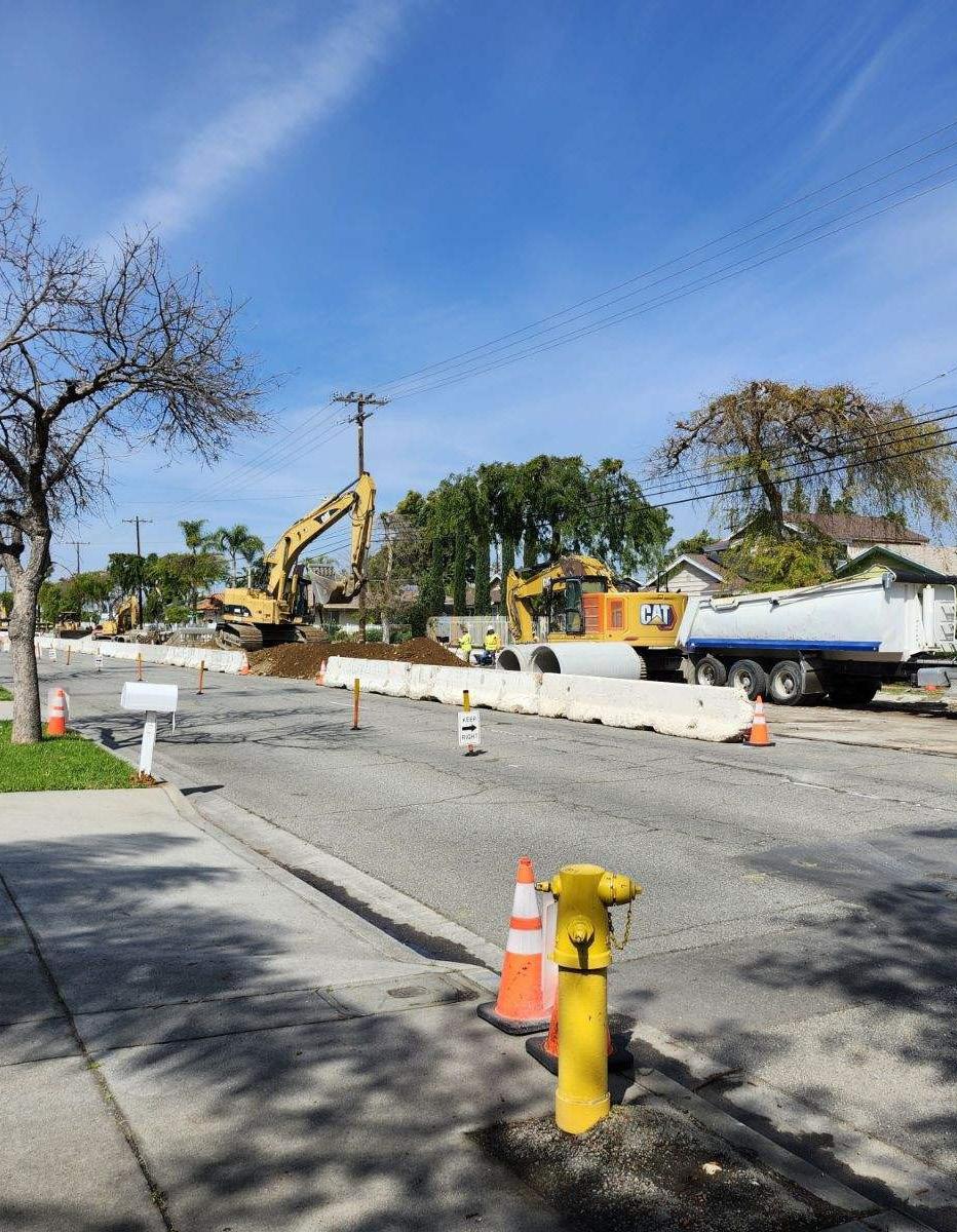
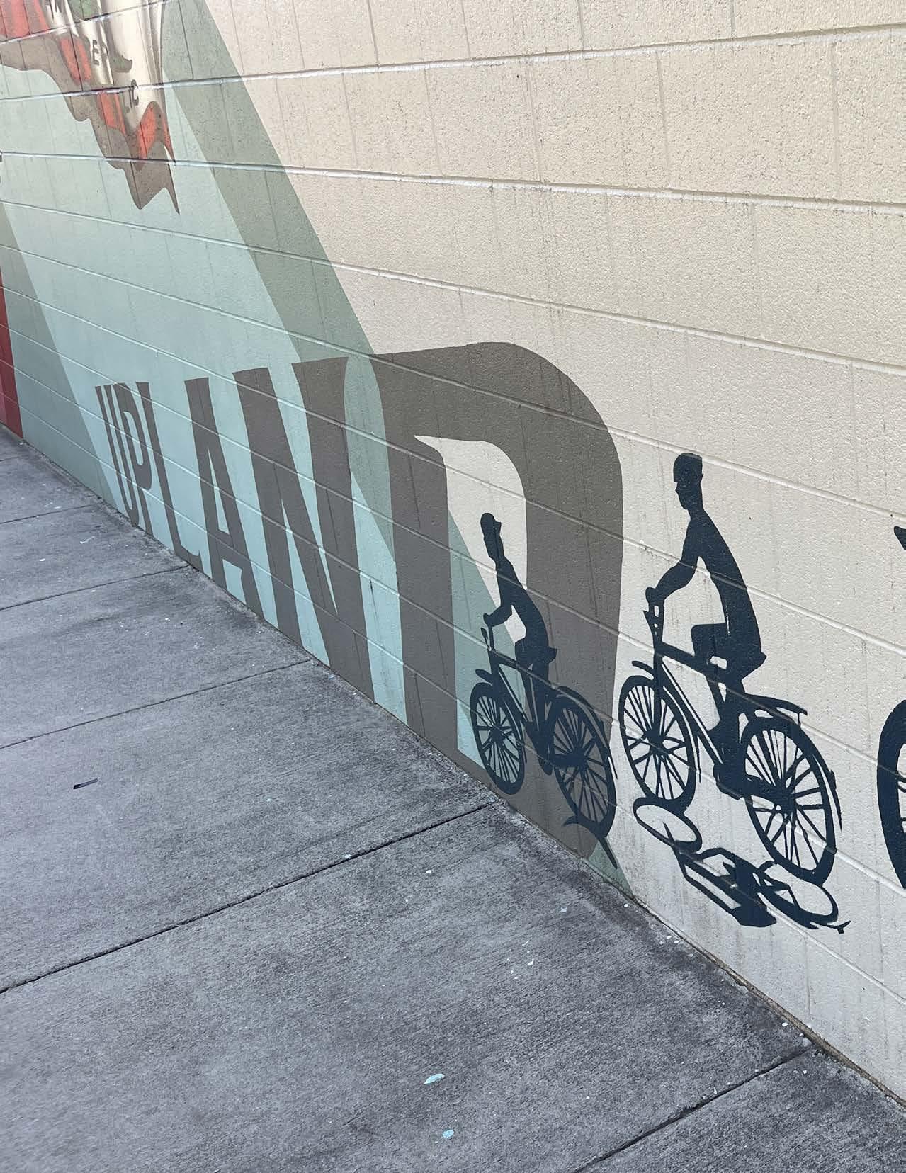
The Appendix contains descriptions of primary guidance and applicable legislation, complete results of community engagement efforts, and planning-level cost estimates and conceptual drawings for the Plan’s priority projects.
In 2014, the California Department of Transportation (Caltrans) updated the California Manual on Uniform Traffic Control Devices (CA MUTCD) to provide uniform standards and specifications for all official traffic control devices in California. Since 2014, the CA MUTCD has been updated eight times, most recently in January 2024. Caltrans is expected to release a revised CA MUTCD by January 2026 to conform with the new National MUTCD published by the FHWA in December 2023.
The purpose of the CA MUTCD is to improve safety and mobility for all travelers by setting minimum standards and providing guidance intended to balance safety and mobility options for everyone in traffic, including drivers, pedestrians, and bicyclists. The CA MUTCD contains the basic principles that govern the design and use of traffic control devices to promote highway safety and efficiency through the orderly movement of all road users on streets, highways, bikeways, and private roads open to public travel. Multimodal policies for safer crossings, work zones, and intersections are integrated into the CA MUTCD, with improvements including:
f Crosswalks Enhancements Policy
f Temporary Traffic Control Plans
f Traffic Control for School Areas
Additionally, NACTO guidance was analyzed to ensure flexibility and innovation in the design and operations of streets and highways in California. Much of the guidance provided in the CA MUTCD is consistent with the NACTO Urban Bikeway Design Guide.
AASHTO Guide for the Development of Bicycle Facilities (2024) & Guide for the Planning, Design, and Operation of Pedestrian Facilities (2021)
The American Association of State Highway and Transportation Officials (AASHTO) bicycle and pedestrian design guides are important national resources for planning, designing, and operating bicycle and pedestrian facilities. The NACTO Urban Bikeway Design Guide and the Institute of Transportation Engineers (ITE) Designing Urban Walkable Thoroughfares Guide build upon the flexibilities provided in the AASHTO guides, which can help communities plan and design safe and convenient facilities for pedestrians and cyclists.
FHWA supports the use of these resources to further develop non-motorized transportation networks, particularly in urban areas. Moreover, in August of 2013, the FHWA issued a memo on Bicycle and Pedestrian Facility Design Flexibility issuing their support for taking a flexible approach to bicycle and pedestrian facility design. Moving away from standards and towards flexibility in design using the designer’s judgment is an important step towards contextual design, implementing the appropriate facility based on location and context.
The California Active Transportation Program, created in 2013, consolidates existing federal and state transportation programs, including the Transportation Alternatives Program (TAP), Bicycle Transportation Account (BTA), and State Safe Routes to School (SRTS), into a single program with a focus to make California a national leader in active transportation. SB-1 stipulates that $100 million of revenues from the Road Maintenance and Rehabilitation Account will be available annually to the program. An additional $122.5 million in State and Federal funding is allocated to the program each year.
Program funding is distributed as follows: 50 percent to the State for a statewide competitive program; 40 percent to Metropolitan Planning Organizations in urban areas with populations greater than 200,000; and 10 percent to small urban and rural regions with populations of 200,000 or less. Additionally, State-designated Disadvantaged Communities (DACs) are guaranteed a minimum of 25 percent of the entire program’s funding. Eligible projects include infrastructure projects (capital improvement projects), non-infrastructure projects (education, encouragement, and enforcement activities, combination projects (infrastructure and non-infrastructure), and communitywide planning projects in DACs.
The California Transportation Plan 2050 (CTP) is a long-range plan completed in 2021 to provide a common framework for transportation decisions and investments throughout the state. It aims to meet the growing needs of California residents as it relates to travel accessibility, emissions, and economic impacts.
Deputy Directive 64-R2 is a policy statement affecting Caltrans mobility planning and projects requiring the agency to:
“…provide for the needs of travelers of all ages and abilities in all planning, programming, design, construction, operations, and maintenance activities and products on the State highway system. Caltrans views all transportation improvements as opportunities to improve safety, access. and mobility for all travelers in California and recognizes bicycle, pedestrian, and transit modes as integral elements of the transportation system.”
The directive goes on to mention the environmental, health, and economic benefits of more Complete Streets.
The Caltrans Design Information Bulletin (DIB) 89-02 is to provides design criteria and guidance on best practices related to separated bikeways to establish uniform guidance that will facilitate consistent user expectations. DIB 89-02 allows designers to exercise sound judgment when applying it while being consistent with the Caltrans Highway Design Manual and the CA MUTCD. DIB 89-02 is written to allow for flexibility in applying design criteria, taking into consideration the context of the project’s location, enabling designers to tailor the design and maximize safety and comfort.
Best practices from cities, states, and countries currently operating separated bikeways were used to formulate DIB 89-02. This DIB will be updated as necessary based on lessons learned from engineers and practitioners as they gain more experience with the use of separated bikeways. The Federal Highway Administration (FHWA) publication Separated Bike Lane Planning and Design Guide (FHWA Guide) should be used to design separated bikeways. Where DIB 89-02 is inconsistent with the FHWA Guide, DIB 89-02 should govern.
Caltrans Design Information Bulletin 94 (2024)
The Caltrans DIB-94 provides guidance for the scoping and design of Complete Streets projects on the State Highway System. DIB-94 identifies best practice and establishes standards for development of Complete Streets facilities to support the design of comfortable and convenient streetscapes by utilizing space-efficient forms of mobility such as people walking, biking, rolling, or accessing transit.
Based on Public Resources Code Section 15262 (Feasibility and Planning Studies) guidance, planning documents such as this ATP are exempt from CEQA analysis since they are planning and conceptual recommendations:
“A project involving only feasibility or planning studies for possible future actions which the agency, board, or commission has not approved, adopted, or funded does not require the preparation of an EIR or Negative Declaration but does require consideration of environmental factors.”
As individual recommendations move forward toward further design and implementation, the City will then need to determine if there are environmental impacts that may warrant an EIR. However, SB-288 exempts bicycle and pedestrian projects from CEQA requirements.
Chapter 1000 of the Caltrans Highway Design Manual serves as the official design standard for bikeways in California. This chapter defines a “bikeway” as a facility that is provided primarily for bicycle travel and recognizes its importance in improving bicycling safety and convenience. Chapter 1000 intends to help accommodate motor vehicle and bicycle traffic on the roadway system, or as a complement to the road system to meet the needs of bicyclists. This chapter classifies bikeway facilities into five different types that include:
f Shared Roadway (No Bikeway Designation)
f Class I Bikeway (Bike Path)
f Class II Bikeway (Bike Lane)
f Class III Bikeway (Bike Route)
f Class IV Bikeways (Separated Bikeways)
However, Chapter 1000 states that these designations should not be construed as a hierarchy of bikeways since each bikeway type has its appropriate application. Additionally, Chapter 1000 only provides design guidance for Class I bike paths, Class III bike routes, and trails.
The Federal Highway Administration (FHWA) Separated Bike Lane Planning and Design Guide (2015) is the most recent national bike lane design guide and for many, the primary national resource for planning and designing bicycle facilities. It captures the state of practice of bicycle facility design within the street right of way. It provides a menu of design options covering typical one and two-way cycle tracks and provides detailed intersection design information covering topics such as turning movement operations, signalization, signage, and on-road markings.
The FHWA Bikeway Selection Guide (2019) is an important complement to the FHWA Separated Bike Lane Planning and Design Guide. It has a focus on designing for all ages and abilities. It gives the designer additional tools such as matrices, flow charts, and graphs that facilitate the design of the appropriate bikeway based both on roadway characteristics and the intended type of bicyclist.
As transit gains a more prominent role in cities, more people are using buses, streetcars, and light rail than ever before. As a result, street design is shifting to give transit the space it deserves. The National Association of City Transportation Officials (NACTO) Transit Street Design Guide (2016) provides design guidance for the development of transit facilities on streets, as well as for prioritizing transit, improving its service quality, and supporting other related goals.
The majority of design elements included in this guide are consistent with MUTCD standards, including signage, markings, and signal elements that have received interim approval. These guidelines were developed using other design guidance as a basis, along with city case studies, best practices, research and evaluation of existing designs, and professional consensus.
The NACTO Urban Bikeway Design Guide (2012) and Urban Street Design Guide (2013) represent the industry standard for innovative bicycle and streetscape facilities and treatments in the United States. In 2014, Caltrans officially endorsed the NACTO Urban Street Design Guide and Urban Bikeway Design Guide as valuable toolkits for designing and constructing safe, attractive local streets. At the time, Caltrans was only the third State Department of Transportation to officially endorse the guides. It is also important to note that virtually all of the Urban Bikeway Design Guide design treatments (with two exceptions) are permitted under the Federal MUTCD.
The NACTO Urban Street Stormwater Guide (2017) provides guidelines on how to create streets that are resilient to climate impacts and also provide quality public spaces with social and economic benefits. This guide focuses on green infrastructure within urban streets, including the design and engineering of stormwater management practices that support and improve mobility. It also intends to reduce the impacts of stormwater runoff and human activity on natural ecological processes.
One of the main goals of this guide is to encourage interdepartmental partnerships around sustainable infrastructure, which includes communicating the benefits of such projects. However, this guide does not address stormwater management strategies on private property, nor does it address drainage and infiltration around controlled-access highways.
Several pieces of legislation support increased bicycling and walking in the State of California. Much of the legislation addresses greenhouse gas (GHG) reduction and employs bicycling and walking as a means to achieve reduction targets. Other legislation highlights the intrinsic worth of bicycling and walking and treats the safe and convenient accommodation of bicyclists and walkers as a matter of equity. The most relevant legislation concerning bicycle and pedestrian policy, planning, infrastructure, and programs are described in the following sections.
Intersection bicycle boxes are designated areas at signalized intersections that provide bicyclists with a space in which to wait in front of stopped motor vehicles during the red signal phase so that they are more visible to motorists. Since they are still considered experimental traffic control devices, the FHWA issued an Interim Approval to allow the provisional use of intersection bicycle boxes in October 2016. This Interim Approval does not create a new mandate compelling the use of intersection bicycle boxes but will allow agencies to install intersection bicycle boxes, pending official rulemaking revising the MUTCD, to facilitate more efficient operations at intersections. Interim Approval of a provisional device typically results in its inclusion in a future Notice of Proposed Amendments to revise the MUTCD. However, this Interim Approval does not guarantee the adoption of the provisional device, either in whole or in part, in any future rulemaking that revises the MUTCD.
In November 2021, Congress passed a new transportation bill, the Infrastructure Investment and Jobs Act of 2021, also known as the Bipartisan Infrastructure Law. The law targets a wide variety of infrastructure investments aimed at reducing GHG emissions from the nation’s transportation network and increasing the resilience of transportation infrastructure to extreme weather and climate impacts. Among other things, the law allocates $1.4 billion for the Transportation Alternatives Program in FY 2022, which will support pedestrian and bicycle infrastructure, recreational trails, safe routes to school, and more. Additionally, the law provides $1 billion in FY 2022 for the new Safe Streets and Roads for All program, which will provide funding directly to local and tribal governments to make streets safer with a particular focus on those walking, biking, and rolling.
AB-32 requires California to reduce its GHG emissions to 1990 levels by 2020. AB-32 also directs the California Air Resources Board (CARB) to develop specific early actions to reduce greenhouse gases while also preparing a scoping plan to identify how best to reach the 2020 limit.
AB-43 allows local jurisdictions to lower speed limits to make streets safer for people who walk and ride a bicycle. In particular, AB-43 gives local authorities more options for reducing speeding along high-injury streets and commercial districts.
AB-285 requires the California Transportation Plan (CTP), produced by Caltrans, to address how it will help meet state GHG emission and clean air goals. Starting in 2025, the CTP will have to forecast the potential impacts of future transportation technologies on infrastructure, access, and the overall transportation system. It will also be required to consider environmental justice in its planning for transportation and freight movement.
AB-361 allows local jurisdictions to install forward-facing parking control devices on cityowned parking enforcement vehicles and take photographs of parking violations in bicycle lanes. AB-361 enables local jurisdictions to review parking violations and issue citations to the registered owner of a vehicle within 15 calendar days.
AB-390 authorizes a pedestrian facing a flashing “DON’T WALK” or “WAIT” or approved “Upraised hand” symbol with a “countdown” signal to proceed, so long as the pedestrian completes the crossing before the display of the steady “DON’T WALK OR WALK” or “WAIT” or approved “Upraised Hand” symbol.
AB-413, also known as the Daylighting to Save Lives Bill, changes the California Vehicle Code to prohibit the stopping, standing, or parking of a vehicle within 20 feet of the vehicle approach side of any unmarked or marked crosswalk or 15 feet of any crosswalk where a curb extension is present. AB-413 will improve visibility for vehicles approaching crosswalks by giving them
more time to see and yield to a person approaching an intersection. Prior to January 1, 2025, AB-413 jurisdictions may only issue a warning for a violation unless the violation occurs in an area marked using paint or a sign.
AB-712 prohibits landlords from prohibiting a tenant from owning personal micromobility devices or from storing and recharging up to one personal micromobility device in their dwelling unit for each person occupying the unit.
AB-773 authorizes local authorities to adopt a rule or regulation to implement a slow streets program, which may include closures to vehicular traffic or through vehicular traffic of neighborhood local streets with connections to citywide bicycle networks, destinations that are within walking distance, or green space.
AB-902 allows any person of any age who commits an infraction not involving a motor vehicle to participate in a diversion program sanctioned by local law enforcement. The bill eliminates the requirement that such a program charge no fee, as well as other technical changes.
Prior law provided that a local authority may not allow a person who has committed a traffic violation under the Vehicle Code to participate in a driver awareness or education program as an alternative to the imposition of those penalties and procedures unless the program is a diversion program for a minor who commits an infraction not involving a motor vehicle and for which no fee is charged.
AB-1096 defines an “electric bicycle” as a bicycle with fully operable pedals and an electric motor of fewer than 750 watts and creates three classes of electric bicycles. AB-1096 prohibits the operation of the most powerful Class 3 electric bicycles on specified paths, lanes, or trails unless that operation is authorized by a local ordinance. AB-1096 also authorizes a local authority or governing body to prohibit, by ordinance, the operation of Class 1 or Class 2 electric bicycles on specified paths or trails. Prior law defined a “motorized bicycle” as a device that has fully operative pedals for propulsion by human power and has an electric motor that meets specified requirements.
AB-1193 amends various code sections, all relating to bikeways in general, specifically by recognizing a fourth class of bicycle facility, cycle tracks. However, another component of AB-1193 may be even more significant to future bikeway development. Prior law required Caltrans, in cooperation with county and city governments, to establish minimum safety design criteria for the planning and construction of bikeways, and requires the department to establish uniform specifications and symbols regarding bicycle travel and traffic-related matters. Prior law also required all city, county, regional, and other local agencies responsible for the development or operation of bikeways or roadways to utilize all of those minimum safety design criteria and uniform specifications and symbols.
AB-1193 revises these provisions to require Caltrans to establish minimum safety design criteria for each type of bikeway and also authorizes local agencies to utilize different minimum safety criteria if adopted by resolution at a public meeting.
AB-1266 aims to make it safer for bicycle riding in California at busy intersections. The bill requires Caltrans to develop standards for lane striping, pavement markings, and appropriate regulatory signs that allow bicyclists to go straight from a right or left turn lane and to safely cross outside of the high-traffic lanes.
AB-1358 requires the legislative body of a city or county, upon revision of the Circulation Element of their General Plan, to identify how the jurisdiction will provide for the routine accommodation of all users of the roadway including drivers, pedestrians, cyclists, individuals with disabilities, seniors, and public transit users. The bill also directs the California Governor’s Office of Planning and Research (OPR) to amend guidelines for General Plan Circulation Element development so that the building and operation of local transportation facilities safely and conveniently accommodate everyone, regardless of their travel mode.
AB-1371, widely referred to as the “Three Foot Passing Law,” requires drivers to provide at least three feet of clearance when passing bicyclists. If traffic or roadway conditions prevent drivers from giving bicyclists three feet of clearance, they must “slow to a speed that is reasonable and prudent” and wait until they reach a point where passing can occur without endangering the bicyclists. Violations are punishable by a $35 base fine, but drivers who collide with bicyclists and injure them in violation of the law are subject to a $220 fine.
AB-1774 prohibits the sale of electric bicycle modification devices that enable the electric motor to exceed 750 watts. This effectively ensures that electric bicyclists are complying with the maximum electric bicycle speed limit of twenty-eight miles per hour under Class 3, the fastest classification of electric bicycles.
AB-1778 regulates the use of Class 2 electric bicycles by setting the minimum age to operate a Class 2 electric bicycle to sixteen and requiring all Class 2 electric bicycle riders to wear a helmet. Riders under sixteen years of age are still legally allowed to ride Class I electric bicycles.
AB-1909 included four changes to the California Vehicle Code aimed at improving the rights of bicyclists to safely access public bikeways and streets. AB-1909 (1) requires vehicles to change lanes when passing someone on a bike if a lane is available; (2) allows Class 3 electric bicycles on a bicycle path or trail, bikeway, bicycle lane, equestrian trail, or hiking or recreational trail unless specifically prohibited by a local jurisdiction; (3) allows bicyclists to cross an intersection during a pedestrian walk signal; and (4) prohibits a jurisdiction from requiring bicycles operated within its jurisdiction to be licensed. Together, these four changes will make it easier and safer to ride a bicycle in California.
AB-2086 brings transparency to Caltrans spending by requiring the California Transportation Plan to contain a financial element that summarizes the full cost of plan implementation. To further increase transparency and accountability, information on how annual project investments advance the California Transportation Plan must be added to the existing public online dashboard on or before January 1, 2027.
AB-2147 prohibits a police officer from stopping a pedestrian for specified traffic infractions, such as jaywalking, unless the street crossing is truly dangerous. AB-2147 legalizes safe street crossings and eliminates an arbitrary traffic enforcement practice that disproportionately targeted people of color.
AB-2669 allows pedestrians, bicyclists, or people using personal micromobility devices to cross existing toll bridges in California without paying a fee.
AB-2863 requires the Department of Housing and Community Development, upon the next triennial update of the California Green Building Standards Code that occurs on or after January 1, 2023, to research and develop mandatory building standards for short-term and longterm bicycle parking in multifamily residential buildings, hotels, and motels.
SB-1 creates the Road Maintenance and Rehabilitation Program to address deferred maintenance on the state highway system and the local street and road system. A total of $5.4 billion will be invested annually over the next decade, which will address a backlog of repairs and upgrades. Additionally, cleaner and more sustainable travel networks will be ensured for the future, including upgrades to local roads, and transit agencies, and an expansion of the state’s growing network of pedestrians and bicycle routes.
SB-288 expands and extends exemptions from the California Environmental Quality Act (CEQA) environmental review requirements for transportation-related projects. Transportation-related projects exempt from CEQA requirements include, but are not limited to, pedestrian and bicycle facilities projects, charging infrastructure for zero-emission buses, and new rapid transit, bus, or light rail service.
SB-375 seeks to reduce vehicle miles traveled (VMT) through land use and planning incentives. Key provisions require the larger regional transportation planning agencies to develop more sophisticated transportation planning models and to use them to create “preferred growth scenarios” in their regional plans that reduce greenhouse gas emissions. The bill also provides incentives for local governments to incorporate these preferred growth scenarios into the transportation elements of their general land use plans.
SB-400 expands the eligible modes of transportation for which the Clean Cars 4 All (CC4A) program “mobility option” may include bike sharing and electric bikes. CC4A aims to reduce car emissions by increasing the turnover of existing vehicles and replacing them with newer, cleaner, and more efficient vehicles. Reducing emissions from existing vehicles is a component of California’s State Implementation Plan for meeting air quality standards and also supports efforts to meet the state’s 2030 climate change goals.
SB-672 indefinitely extends the requirement to install traffic-actuated signals to detect lawful bicycle or motorcycle traffic on the roadway. By indefinitely extending requirements regarding traffic-actuated signals applicable to local governments, SB-672 imposes a state-mandated local program. Existing law requires the state to reimburse local agencies and school districts for certain costs mandated by the state.
SB-743 changed the method of traffic analysis required through the California Environmental Quality Act (CEQA) for publicly and privately initiated projects. Before SB-743, transportation impacts were analyzed by quantifying traffic congestion as measured by the level of service (LOS), which resulted in mitigation measures to reduce traffic, such as building new roads or travel lanes, widening existing roads, adding turn lanes, and installing traffic control devices. Now, under SB-743, transportation impacts are assessed by quantifying how much and how far people drive, using a measure called Vehicle Miles Traveled (VMT). By measuring transportation impacts by VMT, mitigation measures can include opportunities to improve non-vehicular travel options, such as installing bicycle and pedestrian facilities, improving public transit access, and more.
When local governments want to add dedicated transit lanes, pedestrian walkways, or bicycle lanes to coastal areas, Local Coastal Programs are required documents that must be approved by the California Coastal Commission. SB-689 limits the ability of the Coastal Commission to block the development of new bikeways on existing roads in coastal areas by making it easier to amend Local Coastal Programs.
SB-922 extends until 2030 statutory exemptions to the California Environmental Quality Act for sustainable transportation projects, including improvements for walking, biking, public transit efficiency and wayfinding; rail stations; zero-emission transit refueling facilities; and carpooling.
SB-932 requires cities and counties, upon any substantive revision of a general plan circulation element, to develop bicycle plans, pedestrian plans, and traffic calming plans based on the policies and goals in the circulation element. SB-932 also requires cities and counties to begin implementation of a plan within two years of adoption; regularly review implementation progress; and consider revising the circulation element if the goals of the bicycle, pedestrian, or traffic calming plans will not be met within 25 years of circulation element adoption.
SB-960 requires Caltrans to set targets for active transportation and public transit improvements in State Highway Operation and Protection Program (SHOPP) projects, such as building bikeways, sidewalks, bus boarding islands, and more. SB-960 mandates that Caltrans consider the needs of people walking, biking, and taking transit when repairing state roadways.
Under SB 1000, cities and counties are required to adopt an Environmental Justice Element or integrate environmental just-related policies, objectives, and goals throughout other elements of their General Plan. The bill also includes a process for communities to become meaningfully involved in the decision-making processes that govern land use planning in their neighborhoods.
SB-1216 prohibits the creation of Class III Bikeways on roads with a posted speed limit greater than thirty miles per hour, except at or near an intersection for the purpose of connecting a Class I, Class II, or Class IV bikeway through the intersection. This new law will also limit the use of State funding to create Class III bikeways on high-speed corridors.
Beginning on January 1, 2026, SB-1271 requires all electric bicycles sold in California to have their batteries tested and certified for safety standards. SB-1271 also clarifies rules for the advertisement and sale of electric bicycles.
California Governor Gavin Newsom signed Executive Order N-19-19 on September 20, 2019, to require the State to continue efforts to reduce GHG emissions and mitigate climate change impacts while building a sustainable economy. The California State Transportation Agency is directed to leverage strategies toward lowering vehicle miles traveled by supporting active modes of transportation such as biking and walking that also benefit public health.
Table A-1: Railroad Crossing Inventory - Warning Devices (Passive and Active)
Table A-2: Railroad Crossing Inventory - Pedestrian and ADA Facilities
The community engagement results provided in Appendix C include public comments from community members as written. Public comments are provided for reference and do not represent the views of the City.
Pop-Up #1: Earth Day Celebration
Date: April 20, 2024
Location: Greenbelt Park
Table A-3: Citywide Map Activity Comments
LOCATION
11th Street
14th Street
15th Street
16th Street
16th Street
19th Street
2nd Avenue
6th Street
COMMENTS
Sidewalks! Crosswalks out of 11th/Monte Vista. Cannot walk to 11th and Arrow Center
CATEGORY
Pedestrian Concern
Missing curb ramps on north side 14th Street at Ukiah Way Missing Curb Ramp
15th to Fairwood to Coronado, cross Coronado, down Wedgewood - uneven sidewalk
Sidewalk uneven 16th & Mountain area
Sidewalks [between 16th and 24th] are lifted - unsafe for walkers and bike riders
Uneven sidewalks, no ADA, oak trees
ADA Concern
ADA Concern
Pedestrian Concern
ADA Concern
Need sidewalk infill on 2nd Avenue from 8th Street to A Street Missing Sidewalk
Enjoy walking dog several times a week around 6th between Euclid and Mountain, but that area has construction and no clear path for pedestrians - feels unsafe. No crosswalk during construction. Need a clear path for pedestrians.
Pedestrian Concern
Arrow Highway Bike parking near Upland Elementary School Bicyclist Concern
Baseline Road
Campus Avenue
Citywide
Citywide
Citywide
Downtown Upland
East - West trail along Baseline Road to connect schools
Better crosswalk with flashing RRFBs at Campus Avenue and Mesa Court
Pedestrian Concern
Pedestrian Concern
More bike lanes throughout - especially along Foothill! Bicyclist Concern
Infrastructure is important. Put our powerlines under ground instead of above. We don't need to be vulnerable to losing power.
Other
Not all cyclists stop at stop signs - road bikes in particular. Bicyclist Concern
Create complete streets in and leading to Downtown Upland
Pedestrian Concern
Downtown Upland Need flashing stoplights around schools downtown Pedestrian Concern
Euclid Trail
Extend Euclid path south of Foothill
Trail Access
Euclid Trail
Better access to Euclid Trail with pedestrian activated crossings near Pioneer High School Trail Access
Foothill Boulevard More bike lanes throughout - especially along Foothill! Bicyclist Concern
Foothill Boulevard Bike racks at bus stops on Foothill Bicyclist Concern
Foothill Boulevard
Potholes around High School on Foothill. Repaving needed. Driving Concern
Laurel Avenue Bad street surface Driving Concern
Mountain Avenue
Mountain Avenue
Mountain - west side. North of 15th, south of 16thTough for me to use wheelchair. Uneven sidewalk stops my wheelchair. ADA Concern
Bus line on Mountain near 15th/16th is not running anymore (or as often). Keeps people from volunteering at shelter. Bus Concern
Pacific Electric Trail Need safe crossing for Pacific Electric Trail around Benson Trail Access
Pacific Electric Trail Add DG along Pacific Electric Trail (like neighboring cities) Trail Access
Upland Elementary Better street lighting near Upland Elementary Pedestrian Concern
Upland High School Need clearly marked bike lanes around high school Bicyclist Concern
Pop-Up #2: Upland Lemon Festival
Date: June 14 and 15, 2024
Location: Downtown Upland
A-4: Safe Mobility Solution Voting Activity Results
9th Street Fell on sidewalk at 9th Street and 1st Avenue and broke front teeth. Very uneven. Pedestrian Concern
13th Street 13th Street is a bad street for sidewalks. Pedestrian Concern
14th Street 14th Street is a bad street for sidewalks. Pedestrian Concern
15th Street Bad streelight placement. Too far from corner, can't see people walking. Driving Concern
Arrow Highway Bad sidewalks on Arrow and 12th. Pedestrian Concern
Citywide Cars block driveways in private/residential driveways Other
Citywide
Lots of cities are making these improvements for pedestrians and bicyclists. Good to see this! Other
Citywide Thank you! Glad you guys are doing this. Other
Citywide
Less cul-de-sacs please! They feel more like mazes than actual living neighborhood. Other
Citywide More shade trees and native trees. Traffic Calming
Downtown Upland Better parking downtown (especially during Lemon Festival). Driving Concern
Downtown Upland Request bike corral/bike valet for Lemon Festival. Bicyclist Concern
Foothill Boulevard Bad pavement (Foothill & Benson) Driving Concern
Foothill Boulevard Uneven sidewalk at Foothill & Mountain. Pedestrian Concern
Foothill Boulevard Fix Foothill from Central to Campus Driving Concern
Foothill Boulevard Foothill!! Foothill!! Foothill!! Driving Concern
Foothill Boulevard Fix roads by Upland High School on Foothill Driving Concern
Foothill Boulevard Needs to be redone - rough (Euclid to Benson). East to Euclid is great Driving Concern
Foothill Boulevard
Starbucks before Mountain, very rough streets, between Foothill & Pine Driving Concern
Foothill Boulevard Between Benson and Mountain, grafitti along walkway. Pedestrian Concern
Foothill Boulevard
Foothill Boulevard
Laurel Avenue
Foothill road condition up Mountain to Foothill. Asphalt is rough. Driving Concern
Buffer zone on Foothill with trees between houses to help with fires. Other
Laurel Avenue & Emerson Street. Cannot go out on sidewalk because I am in a wheelchair. I have called to complain. 50 year resident of Upland.
ADA Concern
Pacific Electric Trail Please don't block bike trail during Lemon Festival Bicyclist Concern
Pacific Electric Trail
Maybe add bike station with tools on Pacific Electric Trail. Start at Upland: "Welcome to Upland Station". Know tools get stolen from bike stations. Bicyclist Concern
Pop-Up #3-5: Gibson Senior Center, Lemon Zest 5K, Upland Farmers Market
Comments for pop-up booths #3, #4, and #5 were combined and listed below.
Pop-Up #3: March 7th, 2025 at Gibson Senior Center
Pop-Up #4: March 8th, 2025 at Lemon Zest 5K & 1K at Magnolia Park
Pop-Up #5: March 8th, 2025 at Upland Farmers Market in Downtown Upland
General Comments
Parking
f Parking is needed near downtown, but we don’t want a multi-story garage.
f People park on sidewalks in residenKal areas. Specifically on Euclid, 7th and 8th.
f Repair speed bumps on Francis and near Sierra Vista Elementary School.
Sidewalks
f There are no sidewalks along 16th between Inglewood (?) and Campus on the North side and people run in bike lanes.
f Sidewalks raised from pine trees that cause interference with bikes/scooters.
Bicycle Facilities & Trails
f I love the ideas of bike paths. We currently have kids bike on the sidewalks since streets don’t feel safe.
f Pacific Trail could use more beautification.
f Pacific Trail is great, but I would like more shading along this trail.
f Bike lanes around creeks would be appreciated.
f Safety is a concern within the trails where at times there are transients hanging out.
f There is regularly glass along Stewart and 2nd, between Euclid and the liquor store. Ninth St as well.
f Poorly placed ped button at Mountain Avenue. There are decorative boulders that prevent wheelchairs and bikes access to the bueon.
f We want more bike paths (for our family of four).
f I am grateful for bike trail stop light at Campus. I love the dog park.
Other
f Fix traffic signal timing on Campus and 14th.
f Not enough trash cans by the Gibson Senior Center and there are a lot of homeless on Euclid by the School District, where there is also a lot of trash unlike Clairemont.
f Potholes on streets are a concern (comment from about 5 people).
Map Activity Comments: Mobility Issues and Opportunities Near the Gibson Senior Center (Pop-Up #3 only)
f 3rd and Arrow has the longest lastng light in the City – the issue on Arrow at 5pm is that one can’t get across the street.
f QR codes should be added to downtown sidewalks like Claremont has, to direct to more city info.
f I wish Upland had beeer crosswalks and better crossing signals.
f There are potholes on Foothill Blvd.
f The bike lane at Arrow by the hospital is confusing to cyclists, as it goes downhill and is hard to see people crossing the street.
f Electric bikes on Pacific Trail are fast and quiet, which is startling.
f The parking lot stripes at the Senior Center need repainKng.
f Several comments of appreciation and that nothing related to mobility needs improving.
Date: August 27, 2024
Location: Carnegie Library
Attendance: 32 attendees
Vision Statement Comments: In the future, Upland’s Mobility System will…
f Have safer areas for pedestrians and bicyclists to move.
f Integrate sustainable design (using native plants for tree canopies, bioswales, etc.) with behavioral design (increasing walkability and bikeability).
f Be inclusive to residents of all abilities.
Table A-9: Sticker Voting Results: What makes it hard for you to ride the bus in Upland?
Table A-10: Citywide Map Activity & General Comments
11th Street
16th Street
2nd Avenue and 11th Street
8th Street
Arrow Highway
Need bicycle boulevard along 11th
Better (but not polluting) pedestrian lighting along 11th
Protected bike lane!
Flashing stop signs
Flashing 4-way stop signs.
Safe crosswalk needed near Olivedale Park
Needs sidewalk, better pedestrian lighting, and better bike lane along Arrow Highway
Bicyclist Concern
Pedestrian Concern
Bicyclist Concern
Traffic Calming Needed
Pedestrian Concern
Pedestrian Concern
Pedestrian Concern
Bioswales, permeable pavers, urban tree canopy along Arrow Highway Other
Restrict speed limit on Campus Avenue
Campus Avenue
Campus Avenue/ Washington Street
Colonies Shopping Center
Cucamonga Creek Trail
Downtown Upland
More street lighting along Campus Avenue (Foothill down to 10 Fwy)
Campus & Washington - suggestion flashing light for cars to stop for pedestrians and bicyclists.
Not enough bike racks at the Colonies to shop or eat
Traffic Calming Needed
Pedestrian Concern
Traffic Calming Needed
Bicyclist Concern
No bike racks at The Colonies, if we want to eat or shop. Bicyclist Concern
Can't easily access lane from Cucamonga Creek Trail. Trail is blocked by a cable.
Improve sidewalks
Bicyclist Concern
Pedestrian Concern
Not enough bike racks while we eat at restaurants Bicyclist Concern
Foothill Boulevard
Euclid Trail should light up on the ground when a person is about to cross the street with solar lights. Maybe a sensor light could be added at the pole.
Euclid Trail needs a water station. I would like to see the ground of the crosswalk to have solar light on the ground and more light on poles and a sensor light for people.
Pedestrian Concern
General
Pedestrian Concern
There needs to be better light for bike riders on Euclid. Bicyclist Concern
I would like more solar stop signs on Euclid. Euclid and 16th Street intersection needs to be reengineered. It looks unsafe. I avoid the area.
There should be a blue light phone for emergencies on the Euclid Trail, like colleges do for safety. People do walk at night.
The roads between the marked streets on Euclid Trail need more markings. They are kind of hidden. I like the benches on the Euclid Trail.
Euclid Trail - There need to be signs that say please leash your dog. Maybe on the dog bag holder sign. There should be some kind of button to push to scare the coyotes away.
Continue bike lanes that Claremont has on Foothill Boulevard into Upland
Intersection mural at intersection of Monte Vista Avenue and Foothill Boulevard
Road surface is horrible/unsafe on Route 66
Horrible, dangerous sidewalks in Upland. People are afraid of walking on sidewalks. May get injured when people put in a work order. Please fix
Great safety ideas. Make seniors aware of travel discounts.
As a mom, it would be amazing to have a safe, stroller friendly trail.
Crosswalks in front of schools should have solar lights on the ground of the crosswalks and solar stop signs.
Upland Omnibus shuttle should connect to Omario. Needs to run on the weekend so we can go to church and shopping. I would like the heavy door van to be lighter to open and close.
Integrate sustainable design (using native plants for tree canopies, bioswales, etc.) with behavioral design (increasing walkability and bikeability).
Great ideas. Would like feeling safer.
Pedestrian Concern
Pedestrian Concern
Pedestrian Concern
Pedestrian Concern
Bicyclist Concern
Other
Bicyclist Concern
Pedestrian Concern
Bus Concern
Pedestrian Concern
Pedestrian Concern
Bus Concern
Other
Other Gibson Senior Center Not enough bike racks at Gibson Senior Center. We are seniors. Bicyclist Concern
LOCATION
Hospital Parkway
Monte Vista Avenue
Pacific Electric Trail
Pacific Electric Trail and Campus Avenue
San Antonio Avenue
COMMENTS
Crosswalk across Hospital Parkway is wide and NOT conspicuous.
Sidewalks on Monte Vista
From Foothill Boulevard to Pacific Electric Trail: urban tree canopy, rain gardens, permeable pavers, better lighting, better separation of bike and pedestrian trails (multi-use path?)
CATEGORY
Pedestrian Concern
Pedestrian Concern
Pedestrian Concern
Sidewalks both sides of Monte Vista from Arrow to Foothill. Missing Sidewalk
Make it beautiful
Better lighting
Trail maintenance
Signal crosswalk at Campus Avenue and Pacific Electric Trail
Want bike routes on San Antonio on north and south sides towards Foothill Boulevard.
San Antonio Creek Channel Class I multi-use path that follows San Antonio Creek from 210 to Pacific Electric Trail
Vons Store
Washington Street
The Vons store needs a Bench inside the store for ADA to sit and wait for their transportation.
Walking path from 3rd Street to 11th Street on Washington shared bike and pedestrian - suggest to separate bike lane from pedestrian.
Date: April 9, 2025
Location: Carnegie Library
Attendance: 42 attendees
A-11: Draft Program Recommendations Comments
Bike sharing
Resident discounts for bikes/maintenance
Bicyclist Concern
Bicyclist Concern
Bicyclist Concern
Pedestrian Concern
Bicyclist Concern
Trail Access
ADA Concern
Pedestrian Concern
Bicyclist Concern
Bicyclist Concern
Try to extend the GoSGV (Go San Gabriel Valley) bike program to Upland/San Bernardino County. Upland Resiudents are ineligible for bike rentals Bicyclist Concern
Promote "bike bus" programs over bike day. It's more sustaiable than a single day, which fewer people participate in
Recommend to the City to remove/revise parking minimums so that the big box stores don't get massive parking lots. This will free up space for more bike/pedestrian infrastructure.
Bicyclist Concern
Bicyclist Concern
COMMENTS
13th Street Speed humps + traffic calming on 13th too
13th Street
"13th needs traffic calming efforts - stop signs - flashing lights"
13th Street & Euclid Avenue Stoplight needed at 13th
19th Street
2nd Avenue
19th has a lot of freeway exist through traffic during afternoon rush hour. Need round about, speed sign, curb extension
Extend 2nd Ave bike facilities north of Foothill as alternative to Euclid up to Colonis (?)
2nd Avenue Alley along 2nd Ave could be alternative bike route with signage
Traffic Calming Needed
Traffic Calming Needed
Driving Concern
Traffic Calming Needed
Bicyclist Concern
Bicyclist Concern
Campus Avenue Allow 20th to connect Driving Concern
Campus Avenue - near proposed Class I multi-use path Linear park opportunity
Euclid Avenue
Euclid Avenue
Foothill Boulevard
Foothill Boulevard
Mountain Avenue
Mountain Avenue & San Antonio Avenue
San Antonio Avenue
Trees block light from street lights along Euclid. Unsafe at night
Pedestrian 'look' signage or 'stop for pedestrians' at Euclid path
Continue new bike/ped facility in Rancho on Foothill into Upland
Need Class I or IV bike lanes south of Foothill to connect with existing lanes north of Foothill
Does the volume/speed on Mountain Ave warrant more than stripe bike class 2 lanes?
Other
Other
Pedestrian Concern
Bicyclist Concern
Bicyclist Concern
Bicyclist Concern
Existing bike lanes @ Mountain & San Antonio are in the storm drains Bicyclist Concern
Look into roundabouts + traffic calming + road diet to slow speeding along San Antonio
Traffic Calming Needed
13th
13th
16th Avenue
16th
19th & O'Malley
19th & O'Malley
3rd Street & Campus Avenue
Carnegie Library
Euclid Avenue
Foothill Boulevard and San Antonio Avenue
Speed bumps are needed on 13th! Honestly police are some of the worst offenders :(
Traffic Calming Needed
Traffic calming on 13th to prevent bypassing foothill traffic Traffic Calming Needed
Need more signal controlled pedestrian crosswalks across 16th/Baseline Ave. Have to travel 1/2 mile to major intersections. Prevents kids from walking to Magnolia Elementry
Add bike island on 16th St for safety. Cars going too fast & riding on bike lane. Class IV bike lane
Pedestrian Concern
Bicyclist Concern
19th & O'Malley intersection missing crosswalk. It was not put back after City did patch repairs (2020!) Missing Sidewalk
19th st has major cut through traffic during afternoon rush hours. They get off 210 EB @ mountain and turn left on 19th, and continue onto Rancho. Need roundabouts, speed signs, curb extensions to slow speed!
Trash on bike trail between 3rd & Campus (needs trashcans)
This is a mobility workshop and there are no bike racks in this facility.
Euclid west side between arrow + 9th has 5+ generations, 4 generations. [Illegible] eliminate largetrucks semis + drag racing?
There is no wheelchair ramp at Foothill and San Antonio (Westbound). The City has been asked to fix this problem for some time. This intersection is hazardous to people in wheelchairs.
General Look into changing municipal code to allow biking on sidewalks. It currently prohibited
General Dangerous Ebikes (fast!) on bike trail
General Transportation for seniors. Bus to pick up seniors at home for those who cannot walk to specific OmniTrans pick up locations.
General Bike racks should be this kind (straight top) not this type (wavy top) - see image
General
Often rocks, litter, gravel, sand, potholes, etc. on street making it unsafe to bike
General Dedicated bike lanes w/ curbed out pathway
General All stop signs should be flashing, crosswalk clearly marked
General
General
Places with shade benches along bike & walking trails would make non-car travel more appealing & safer in high temps. Adding solar panels and outlets would be extra nice if that's feasible
There should be signs/an educational campagin for motorists to understand that pedestrians always have the right of way even if there is no crosswalk
Traffic Calming Needed
Bicyclist Concern
Bicyclist Concern
Driving Concern
ADA Concern
Other
Bicyclist Concern
Other
Bicyclist Concern
Bicyclist Concern
Bicyclist Concern
Pedestrian Concern
Other
Pedestrian Concern
General
Consider recommending to the City to revise the Upland Municipal Code to lower barriers to bike riding/ enforcement. UMC Sec 12.16.070, UMC Sec 10.64.010
Bicyclist Concern
General We need sidewalk ramps literally everywhere Missing Sidewalk
General Are drinking fountains or other resting ammenities covered in these grants. There are few places to rest/ refill for free along these routes. Also restrooms.
General App or hotline to report near hit & miss bike
Other
Bicyclist Concern
General Consider bike parking once we ride to a destination Bicyclist Concern
General Benches along trails would be helpful for disabed pedestrians & just nice to have for abled
General Additional traffic calming measures are neeed in all residential areas.
General Collision data include COVID lockdown (2020-2022) Why not shift it to 2009-2019?
ADA Concern
ADA Concern
Other
General We need bike parking nearly everywhere in Upland Bicyclist Concern
General I noticed no bike parking for this meeting… Bicyclist Concern
General
General
General
Pacific Electric Trail (near Monte Vista Avenue & Foothill Boulevard)
Pacific Electric Trail (Campus & N 11th)
Pacific Electric Trail
The City should have shuttle buses during massive special events. That would increase pedestrian safety and will cut down on emissions.
The City should plan long-term development, especially when it comes to issuing building permits. It would be good to discuss future positive and potentially negative impacts of, for example, warehouses.
What happened to the trash cans I asked for? It has been a while – Stacy Delosh
Western part of Upland (Monte Vista along Foothill) is growing more dense. Prioritizing more North/ South access to the Montclair trans center would be beneficial. Monte Vista and Central Avenue bike/ walking connections to PET would be helpful too. Thanks!
Bus Concern
Other
Other
Common Destination
Consider leveling out the Pacific Bike Path between Campus and N 11th Ave. too many bumps/curbs Bicyclist Concern
Please, more trees/shade for PE trail. How can we make that route more attractive and pleasant to use?
Pacific Electric Trail better lighting on Pacific Electric Trail after dark. Also, keeping motorcyclists off the trail
Pacific Electric Trail and 8th
San Antonio Avenue
The PE trail needs more shade for hot days and lighting for nights + evenings. Same for 8th street (especial east of Euclid)
San Antonio South from Upland High to 8th is an important area to improve for biking to/from the high school and underserved parts of Upland
Trail Access
Trail Access
Trail Access
Bicyclist Concern
Mountain Avenue
Mountain Avenue
Mountain Avenue
Mountain Avenue
Mountain Avenue
Mountain Avenue
Mountain Avenue
8th Street
8th Street
8th Street
8th Street
Euclid Ave
Euclid Ave
Euclid Ave
Mountain Avenue (Mountain Lane to 7th Street)
I've seen so many near collisions at the PE trail and Mountain and at 7th and Euclid. Recommend more lighting to make bike and pedestrians more visible
Make push button ADA accessble
Consider passive pad detection if ped/bike vol are high
-Recommend LP1 - Add dash lines to guide dual left turns
Not that safe to have a ped stage with a small median
Class IV - This street is very dangerous
Class IV lanes - Speed limit is 45 mph. Needs separated bikeway
8th Street (Benson Avenue to 11th Avenue)
Class II would be better than III. Install no parking signs since road in narrow
We need better bike access to Fern Reservoir Park and Citrus Park on 8th St
I wold like to see this section between San Antonio & Euclid improved! Thank you!
Class 4 bike lane
Euclid Avenue (24th Street to 7th Street)
I like Class I path idea in the median
Beautify w/ trees bike path west of Euclid
Install signage all the way up Euclicd informing or reminding pedestrian right to cross and need for carsa to stop even if no crosswalk
Bicyclist Concern
ADA Concern
Pedestrian Concern
Driving Concern
Pedestrian Concern
Bicyclist Concern
Bicyclist Concern
Bicyclist Concern
Bicyclist Concern
Other
Bicyclist Concern
Bicyclist Concern
Other
Pedestrian Concern
Euclid Ave Trees on Pacific bike trails bet - Euclid - San Antonio Other
Euclid Ave
Euclid Ave
Euclid Ave
Implement measures to slow down speed of traffic (e.g. drag racers, speeding, etc)
Remove tuck traffic from Euclid (Residents live here) to Mountain Ave)
Will the Class I path connect seamessly with Class II bike paths north of Foothill?
San Antonio Avenue (23rd Street to 7th Street)
San Antonio Avenue Bike lane please!
San Antonio Avenue
San Antonio Avenue
Add trees for heat shelter to bike path
Let the same light system work for road and bike path, like E Benson - keep PET straight w/o zig-zags
Driving Concern
Driving Concern
Bicyclist Concern
Bicyclist Concern
Bicyclist Concern
Bicyclist Concern
San Antonio Avenue Please improve San Antonio between 8th St and the Pacific Electric Trail. Thanks!
Other
San Antonio Avenue Add bike lane Bicyclist Concern
San Antonio Avenue
San Antonio Ave
Class 4 bike lane would be better Bicyclist Concern
Pacific Electric Trail should continue straight across. Not redirect via sidewalk & Vernon Dr Trail Access
Memorial Park/13th Ave (Memorial Park to Pacific Electric Trail)
Memorial Park/13th Ave Paths for walking dog & strollers
Memorial Park/13th Ave
Pedestrian Concern
Class III bike routes create confusion for cyclists and divers Bicyclist Concern
16th Street/Baseline Road Better bike lane needed here. Cars turning right block bike lane Bicyclist Concern
16th Street/Baseline Road Benson needs a bike lane on both south and north bound Bicyclist Concern
16th Street/Baseline Road Bike lane to connect with Claremont Bicyclist Concern
16th Street/Baseline Road
Give priority green lights so bikes can go before cars. Cars turn right onto 210 Fwy and create hazardous crossings Bicyclist Concern
9th Street (Central Avenue to Grove Avenue)
9th Street Consider bollards that can be raised to shut off vehicle access during town events
Other 11th Street (Monte Vista Avenue to Hospital Parkway)
11th Street Repave Redding Way. It leads to Foothill where it's possible to safely cross via bike/pedestrian
11th Street
School curb is often flooded, curb openings? To drain water?
11th Street Yes, please!
11th Street Yes, Please! Too may parents and kids cross where there is no crossing guard
Other
Other
Pedestrian Concern
Pedestrian Concern
11th Street Yes, please improve bike access to Upland high! Bicyclist Concern
11th Street I like idea of making 11th bike & ped friendly
11th Street Monte Vista and 11th needs paved sidewalk up to foothill and down to Arrow Hwy
Foothill Boulevard (Monte Vista Avenue to Grove Avenue)
Bicyclist Concern
Missing Sidewalk
Foothill Boulevard Yes, please! Pedestrian Concern
Foothill Boulevard
Meadowbrook Frontage Rd is the safest way to travel here via bike. Consider Class IV bikepath so that it connects with existing Class IV path in Rancho Cucamonga at Foothill & Grove Blvd
Bicyclist Concern
Foothill Boulevard Yes! More public art and benches!
Other
Foothill Boulevard Please continue what Rancho is doing past grove! :) Other
Foothill Boulevard
A high priority section should be the south side of Foothill near Central, where it is very unsafe to bike.
Arrow Highway (Claremont Boulevard to Grove Avenue)
Arrow Highway Class II would be better than III
Arrow Highway Orange grove st & Grove. No sidewalk
Arrow Highway Pacific Electric Trail. No sidewalk
TAC Meeting #1
Date: June 26, 2024
Location: Virtual via Zoom
Meeting Facilitators: KTUA and KPA (Consultant team)
Bicyclist Concern
Bicyclist Concern
Missing Sidewalk
Missing Sidewalk
Attendees: City of Upland Councilmember District 4, City of Upland Public Works Department, City of Upland Parks, Arts, Recreation, and Community Services Department, Historic Downtown Upland Merchants, Omnitrans, Pedego Electric Bikes Upland, San Bernardino County Fire District Division 1, Upland Chamber of Commerce, Upland Police Department, Upland Unified School District
Minutes
Q&A about the Project
f Public Works shared that Upland does not have any Class IV facilities yet, but Claremont has recently implemented nice facilities. Rancho Cucamonga is also installing a two-way Class IV on Foothill Boulevard.
f Public Works shared that the City has also almost completed its Sidewalk Inventory Plan, which will be used alongside the Mobility Master Plan to enhance grant applications.
f Public Works explained that the City wants to complete the plan by the end of 2025 because the State’s ATP grants occur every two years and the City wants to be ready to apply for the ATP Cycle 8 grant in 2026. The Mobility Master Plan will help the City develop competitive grant applications.
Guided Discussion
What kinds of mobility needs/wants does your organization have?
f Pedego Electric Bikes is excited about the project and has had the Pedego Electric Bikes business for seven years, which was intentionally located along the Pacific Electric (PE) Trail. Pedego Electric Bikes would like to see improved maintenance of the PE Trail in Upland (i.e., regular cleaning and upkeep), as well as enhancement projects (e.g., planting trees) to make it more attractive for bicyclists. The PE Trail is an asset for Upland and, if improved, presents an opportunity to attract more people and more business to Upland. Pedego Electric Bikes feels that there are not as many people walking and biking on the PE Trail due to its poor condition and even tells people to keep riding east past Grove Avenue so they
can get to the nice section of the PE Trail. More people riding along the PE Trail would stop in Upland if it was nicer. Pedego Electric Bikes has heard that there is more money and investment in the trail east of Euclid Avenue, but not to the west.
f Public Works responded to share that he will look into the maintenance opportunities on the PE Trail west of Euclid Avenue. The City is working with SBCTA for ramps in the Downtown and signal near Campus Avenue at Washington Blvd. However, all of these improvements are east of Euclid Avenue. Palm Street crossing was recently finished.
f Omnitrans shared that from a bus service perspective, one of the difficulties for Omnitrans has been that they do not have control over ADA improvements. They have a whole database that tracks which bus stops are not ADA-compliant. Infrastructure for sidewalks would need to come from the City. Omnitrans would like to collaborate with the City to install improvements for pedestrian improvements leading up to Omnitrans bus stops. Omnitrans can provide data and would like to work with the City to bring bus stops into ADA compliance.
f Public Works said that the City has worked with Omnitrans to make improvements, which usually takes place as a joint grant application. The City has the right-of-way and can widen sidewalks, etc., and is more than happy to work with Omnitrans.
Are there any projects or opportunities you’d like the City to be aware of?
f Pedego Electric Bikes says the City of Rancho Cucamonga is also developing an active transportation/mobility plan. The planning team rented bikes and rode around to experience the bike infrastructure. They offered to provide bikes to the planning team to ride around Upland.
f Pedego Electric Bikes shared that their business offers bike safety courses.
f Upland Police Department shared that the Police Department has made a couple of new positions, including Park Rangers. Their job is to patrol the parks along with the bike paths to help with any crime along the bike paths.
f Upland Police Department shared that the City of Carlsbad released a Safer Streets Together plan which is a great package deal that engages citizens to educate each other on bicycle and pedestrian safety. The Plan presents a very extensive and impressive program. They did a great job and have a lot of buy-in from the community.
f Omnitrans shared that they provide a micro-transit service (OmniRide) in Upland, which is similar to Uber, but provides service within a predetermined area.
f The OmniRide services Chino Hills, Upland, and Bloomington. Omniride is open to everyone. People can download and request rides via the app. Anyone can ride along fixed routes for $4 and seniors and people with disabilities can ride for $1. The OmniRide also extends service hours for special events, such as the Upland Lemon Festival. Omnitrans provides paratransit service.
What kinds of outcomes would you like to see in the Mobility Master Plan (e.g., infrastructure, policies, education, etc.)?
f Pedego Electric Bikes would like to see improvements to the PE Trail, better utilization of paths along floodway channels (e.g., formalize and maintain paths), and increased safety and maintenance along paths and trails. They hear that people choose not to ride bicycles because they do not feel safe.
f Upland City Councilmember asked if there was a possibility of providing a separate path along the PE Trail for pedestrians so that people walking can have a safe space without worrying about conflicts with bicyclists.
f KTUA responded that there appears to be space to add a DG trail and that is something that can be considered through the Mobility Master Plan.
f KTUA asked the Upland Police Department about the common bike/ped infractions seen within Upland.
f Upland Police Department responded that people ride on the sidewalk and ride bicycles against traffic, which is a big deal. Upland Police Department is concerned that, if there isn’t proper education, more traffic collisions may occur if more people start to ride bicycles. Education will be an important part of making biking more common in Upland.
f Upland Police Department shared that these issues occur citywide and do not appear to be concentrated in any particular area or street type.
f KTUA asked if there were any top issues from the Fire Department’s perspective.
f San Bernardino County Fire District Division 1 shared that the Fire Department is responding to the aftermath of safety issues. Uneducated drivers and distracted drivers are an issue, so that may be a problem with more cyclists on the road. It will be important to educate the community on any changes that are coming. The Fire Department can collaborate with the City to conduct outreach and spread bike safety education and awareness.
f KTUA asked if there are elements of traffic calming or countermeasures that the Fire Department dislikes or that might hinder emergency response vehicles.
f San Bernardino County Fire District Division 1 responded that speed bumps and humps can be an issue, but some HOAs have them and it isn’t a deal breaker and doesn’t slow response times too much. The Fire Department won’t be an obstacle to any mobility improvements as long as their rigs can get through. For example, speed humps with the wheel gaps are acceptable.
Who is missing at this meeting? Are there other agencies, organizations, or community champions that should be included in the TAC?
f Public Works would like to get more feedback from schools and has tried to make contact.
Is there anything else you would like to share?
f Chamber of Commerce encounters many businesses and will share the survey with the business community, which may get some great suggestions throughout Upland.
f KPA responded that KTUA/KPA will provide flyers and a short blurb about the survey that TAC members can use to promote the project.
f When asked about a collective vision statement for the Upland Mobility Master Plan, Upland Police Department emphasized the importance of safety. They want residents to think they can bike, walk, and travel safely in our City. They want people who come into the City to feel safe walking, rolling, or driving.
Date: September 11, 2024
Location: Virtual via Zoom
Meeting Facilitators: KTUA (Consultant team)
Attendees: City of Upland Councilmember District 4, City of Upland Public Works Department, Omnitrans, Roy’s Cyclery, San Bernardino County Transportation Authority, Upland Police Department, Upland Unified School District
f City council member asked if the current construction project for a walking path along the PE Trail was related to this project. City staff clarified that the project was funded by SBCTA and not a part of the Mobility Master Plan.
KTUA provided a community engagement update and invited TAC members to suggest potential audiences and routes for future walk audits.
f City staff suggested combining Upland Elementary School and Upland Middle School because they are back to back.
f City staff suggested doing walk audits at other schools, such as:
f Pioneer Middle School and Pepper Tree Elementary on 18th Street
f Cabrillo Elementary School and Baldy View Elementary School on 11th Street
f Omnitrans noted that a fixed route on Foothill Boulevard, near Euclid Avenue, may be a good location for a walk audit. KTUA suggested that this could be the walk audit location for TAC Meeting #3.
KTUA presented high-level findings from the Existing Conditions Analysis and invited TAC members to provide input.
f City staff noted that the existing bike facilities map is incorrect, specifically along Euclid Avenue where the Class II bike lane becomes a Class III bike route. KTUA responded that the map will be corrected.
f Omnitrans appreciated the mention of the OmniRide microtransit service and noted that while the service is available to Upland residents, not everyone knows about it. Additionally, people can take OmniRide and connect to a fixed route, including the Upland Train Station and Montclair Transit Center. KTUA also shared that there is not a fixed bus stop at the Upland Train Station because the buses cannot navigate the small area. However, there is a bus stop nearby on Euclid Avenue.
TAC Meeting #3
Date: November 14, 2024
Location: Intersection of Foothill Boulevard and 2nd Avenue
Meeting Facilitators: KTUA and Mark Thomas (Consultant team)
Attendees: Omnitrans, Upland Police Department, Caltrans, City of Upland Public Works Department
Minutes
TAC meeting #3 was held as an in-person walk audit along portions of Foothill Boulevard and Euclid Avenue. Notes from this walk audit are provided in the ‘Walk Audit’ section of the Appendix.
TAC Meeting #4
Date: January 23, 2025
Location: Virtual via Zoom
Meeting Facilitators: KTUA (Consultant team)
Attendees: Caltrans, City of Upland Public Works Department, Omnitrans, San Bernardino County Transportation Authority, Upland Police Department, Upland Unified School District
Minutes
KTUA provided a project update, including that the UMMP is on schedule and is on track to be presented to City Council for adoption in June.
KTUA provided a community engagement update, including events and participation to date, as well as key takeaways from community input so far.
KTUA shared the existing bike network and draft future bike network proposed by KTUA. The goal of the draft bike network is to provide better connections to key destinations and make transportation by bicycling safer and more comfortable for people of all ages and abilities.
KTUA shared the methodology used to develop the draft bicycle network, which included looking for opportunities to provide connections to key destinations (especially parks and schools) and evaluating what is feasible within the existing road constraints (e.g., curb-tocurb widths, number of lanes, lane striping, on-street parking, speed limit, etc.). KTUA noted the draft network is currently undergoing City review so it’s likely to change once the City provides comments on potential road diets, parking removal, and/or speed limit modifications. Major constraints include narrow residential streets with heavily utilized on-street parking, high-volume or high-speed corridors, and speed limits exceeding the thresholds for Class III bicycle routes (per SB 1216).
KTUA said that TAC members will receive the draft bike network to review on their own and share comments via email by February 5th. KTUA asked if anyone would like to share initial reactions.
f SBCTA asked if we considered bus stop locations or if that will be included in the prioritization process? KTUA responded that yes bus stop locations will be a criterion in the prioritization process.
f SBCTA asked where road diets are being proposed. KTUA responded that they are being explored along some corridors and KTUA is waiting for City feedback to refine the road diet list. KTUA will share the analysis spreadsheet that we are using to track potential road diet locations.
f SBCTA asked if the City code has parking requirements for new development and if those are being considered in the UMMP. KTUA responded that he was unsure, but is aware that on-street parking is important. SBCTA suggested including any changes to parking requirements for new developments that may be helpful for future grant applications.
f City staff asked why the Class III totals are going down from existing. KTUA responded that some Class III would be upgraded to different facilities and that the numbers shown in the ‘Proposed’ column of the table are new facilities, not a total of existing and proposed.
f City staff shared that the speed survey will be presented to the City Council. However, most of the speed limits will remain the same, except for three streets.
f City staff asked of the dashed green lines (Class III bike routes) would need to be 25 mph. KTUA responded that under new legislation, SB 1216 (confirmed by SBCTA), Class III bicycle are not favorable and are not eligible for grant funding. SB 1216 prohibits Class III bicycle routes from being implemented on roads with speed limits greater than 30 mph, which will affect the proposed Class III (green dashed lines) on the map unless speed limits are reduced.
f KTUA asked if the speed survey was going to City Council next week and City staff said yes, and it will only include three changes. City staff shared that one section of Arrow Highway, between San Antonio Avenue and Euclid Avenue, is being reduced to 30 mph and said two other roads will have the speed limits increased. The rest of the posted speed limits will remain unchanged.
f City staff asked if there is a possibility of converting two-way streets to one-way streets to add bike lanes (e.g., in residential areas). City staff shared an example along 2nd Street channeling people towards Downtown. KTUA responded that what they have heard from transportation engineers is that people tend to drive faster. KTUA said that it would be possible, but it would require more thought, design, and conversations with City staff to explore possibilities. KTUA said it could be a good candidate for a pilot/quick-build project, which SCAG likes to fund. SBCTA and KTUA suggested exploring one-way streets paired with traffic calming treatments (e.g. chicanes).
f City staff asked where the speed requirements for Class III come from. KTUA responded that they are coming from the recent legislation, SB 1216.
f KTUA mentioned that the UMMP will cover transit recommendations, including suggestions for expanding routes and improving bus stops based on what we’ve heard from community members and found in our data analysis.
KTUA shared the prioritization criteria list, which will ensure the UMMP includes which projects to include in CIP based on not just objective analysis, but also community engagement. KTUA said that TAC members will receive the prioritization criteria to review on their own and share comments via email by February 5th and asked if anyone would like to share initial reactions.
f Omnitrans asked about how ADA accessibility factors into the prioritization analysis and does it fall under connectivity or transit stops. KTUA answered that the ‘gap closure’ criteria is referring to gaps in the existing bike network and KTUA will modify language to make that clearer. KTUA said that while ADA accessibility is not included in the prioritization process, the UMMP will include an inventory of ADA accessibility needs and recommendations.
f SBCTA asked if the City has an ADA Transition Plan. City staff said the City had a light one and recently completed an updated version. The new version will be adopted soon and the City will be able to begin implementation. SBCTA suggested integrating the ADA Transition Plan into the UMMP.
f SBCTA asked if the UMMP considered previously planned projects, including the SBCTA Capital Project Needs Analysis (CPNA), Congestion Management Plan, and Measure I Funding. KTUA responded that we did do a policy review, including upcoming road improvements, as part of the Existing Conditions Analysis and have a map of previously proposed bicycle facilities. However, KTUA will review the plans SBCTA mentioned to ensure consistency.
f SBCTA shared that SBCTA is looking at revisions for Measure I and shared that Measure I funding can be used to fund bike projects, like the Highland/Redlands Connector Project (Class I multi-use path). SBCTA shared that revisions to Measure I (updated in 2040) will include a heavy emphasis on bicycle, pedestrian, and transit projects.
f SBCTA shared that SBCTA will be reaching out to the TTAC to ask cities what projects should be included in the SBCTA Long Range Multimodal Transportation Plan. SBCTA suggested that the City be prepared to share if any projects that they want to move quickly on and
that it is ok if the project isn’t in an adopted plan yet. If there is an important project, the City should have those ready to go. City staff said that they will talk to the appropriate staff member (on the TTAC contact list) about this.
Date: June 25, 2025
Location: Virtual via Zoom
Meeting Facilitators: KTUA and Mark Thomas (Consultant team)
Attendees: Caltrans, City of Upland (Public Works Department and Recreation and Community Services Department), City of Rancho Cucamonga Engineering Services, Omnitrans
Minutes
Welcome & Presentation
KTUA provided a presentation on the planning process and an overview of the draft Plan.
Group Discussion: Draft Mobility Master Plan
Note: TAC members were sent the draft Mobility Master Plan for review prior to the meeting.
f Caltrans and Omnitrans provided written comments on the draft Plan prior to the meeting related to formatting, clarity, and suggestions for updated data and additional guidance.
f City of Rancho Cucamonga shared that the draft Plan is an impressive document and they were pleased to see how the input from their Connect RC Bicycle Sub-Committee was integrated. They liked how the draft Plan identifies improvements for all travel modes and connectivity to neighboring communities and appreciate the proposed improvements to the Pacific Electric Trail.
f City staff and KTUA shared how impressive the City of Rancho Cucamonga’s Connect RC Bicycle Sub-Committee was and asked questions about their group ride events.
f City staff asked about speed limits on corridors with proposed Class III bicycle routes.
Figure A-1: Walk Audit Notes: Route #1

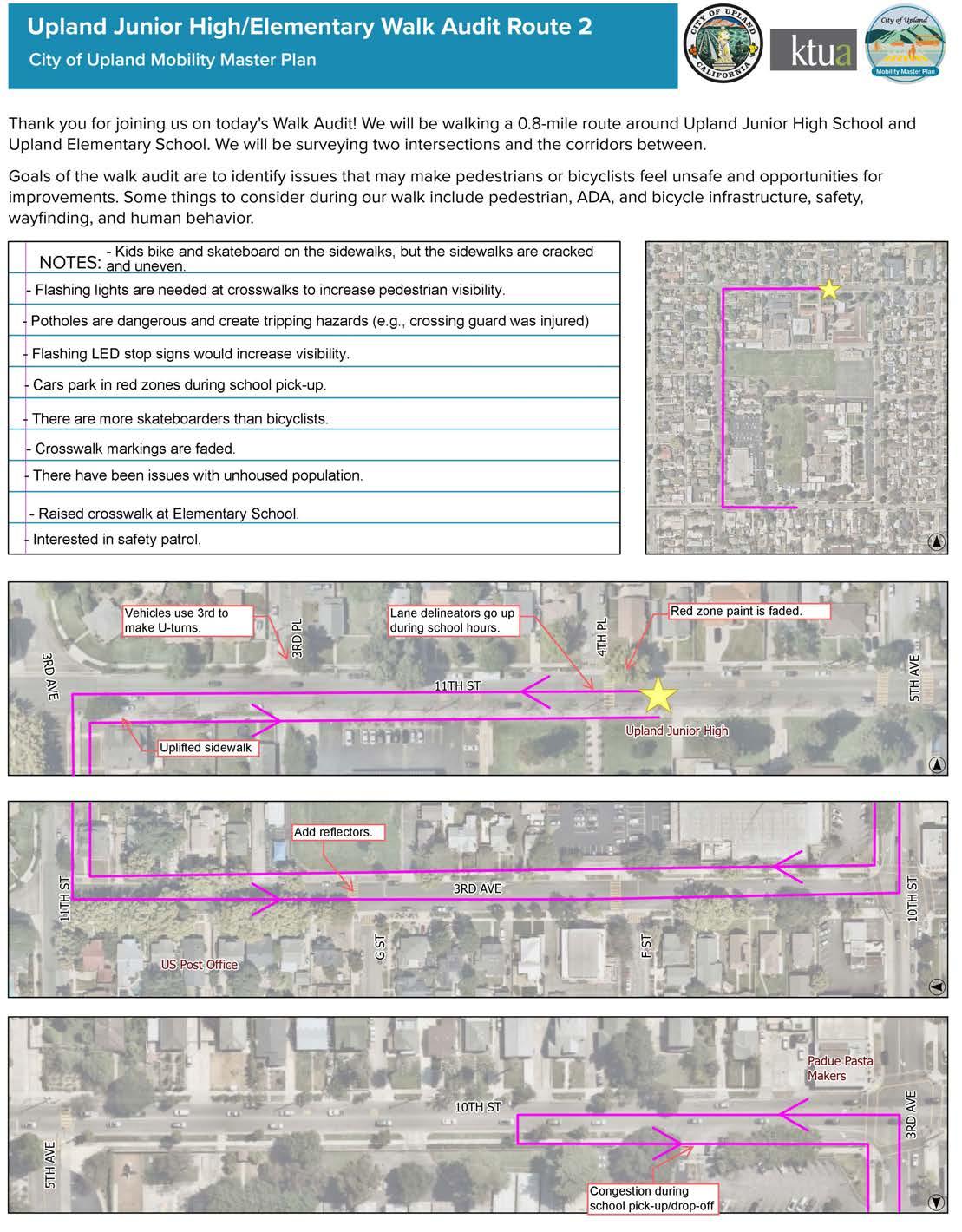
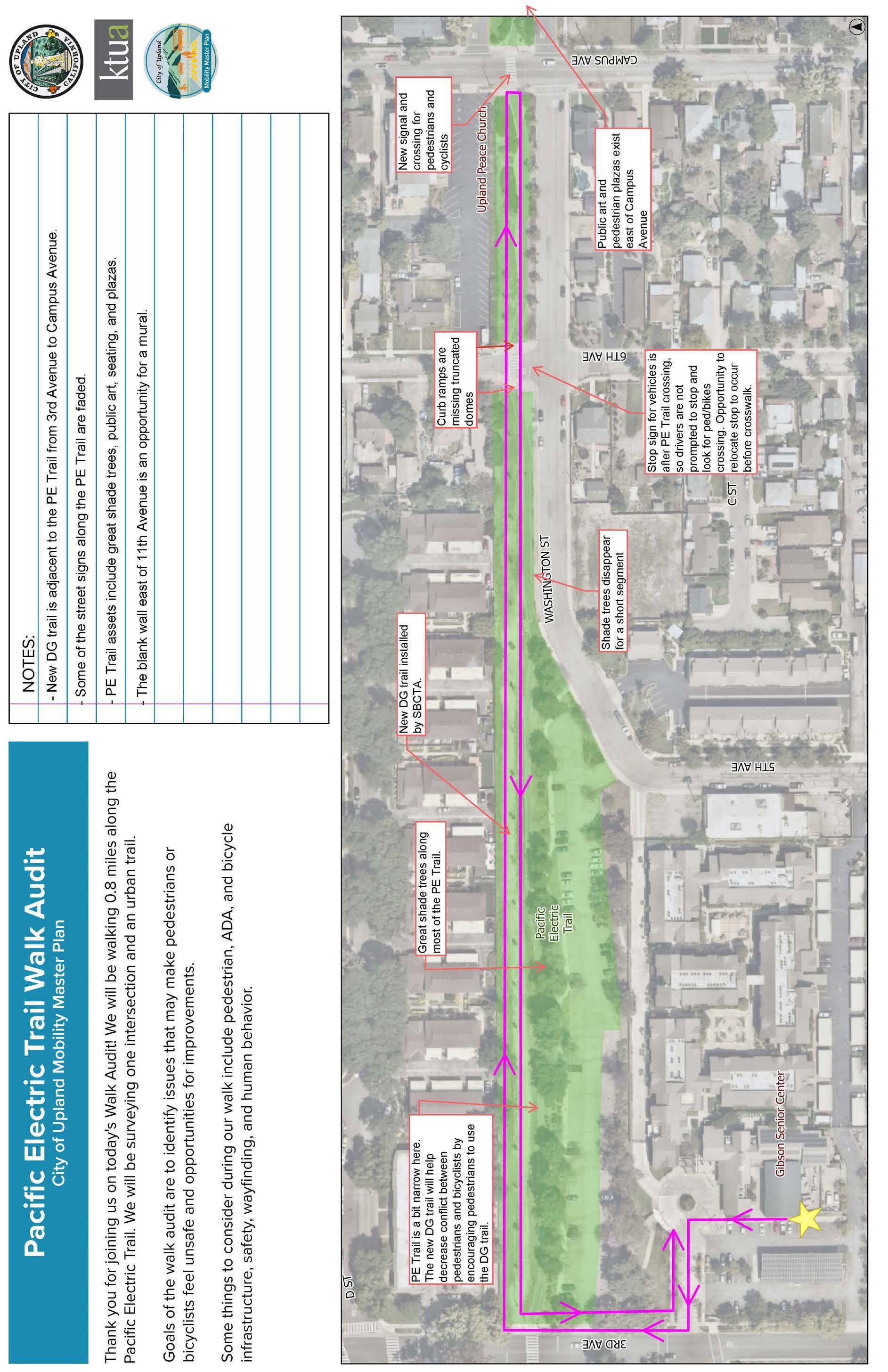
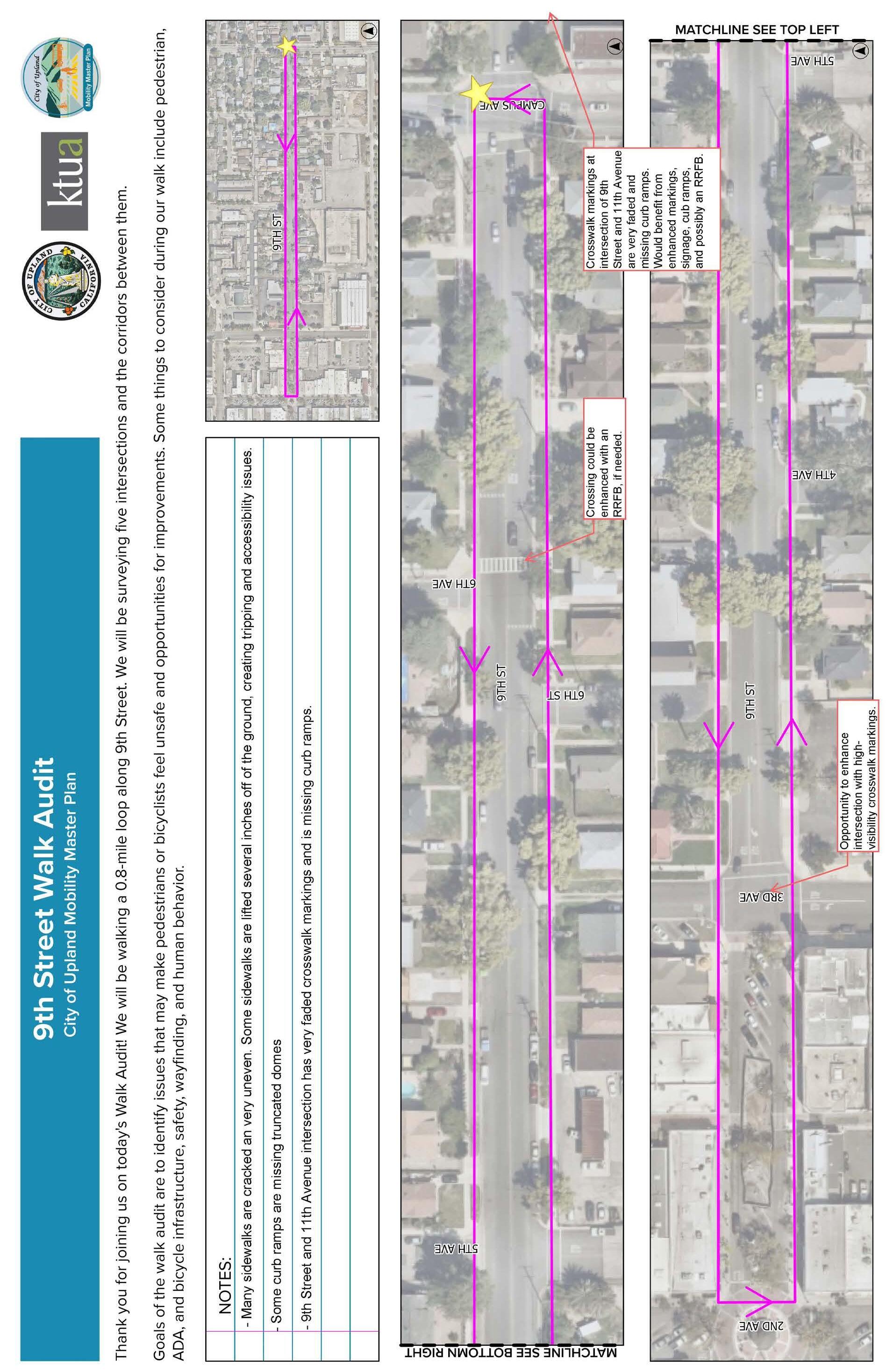
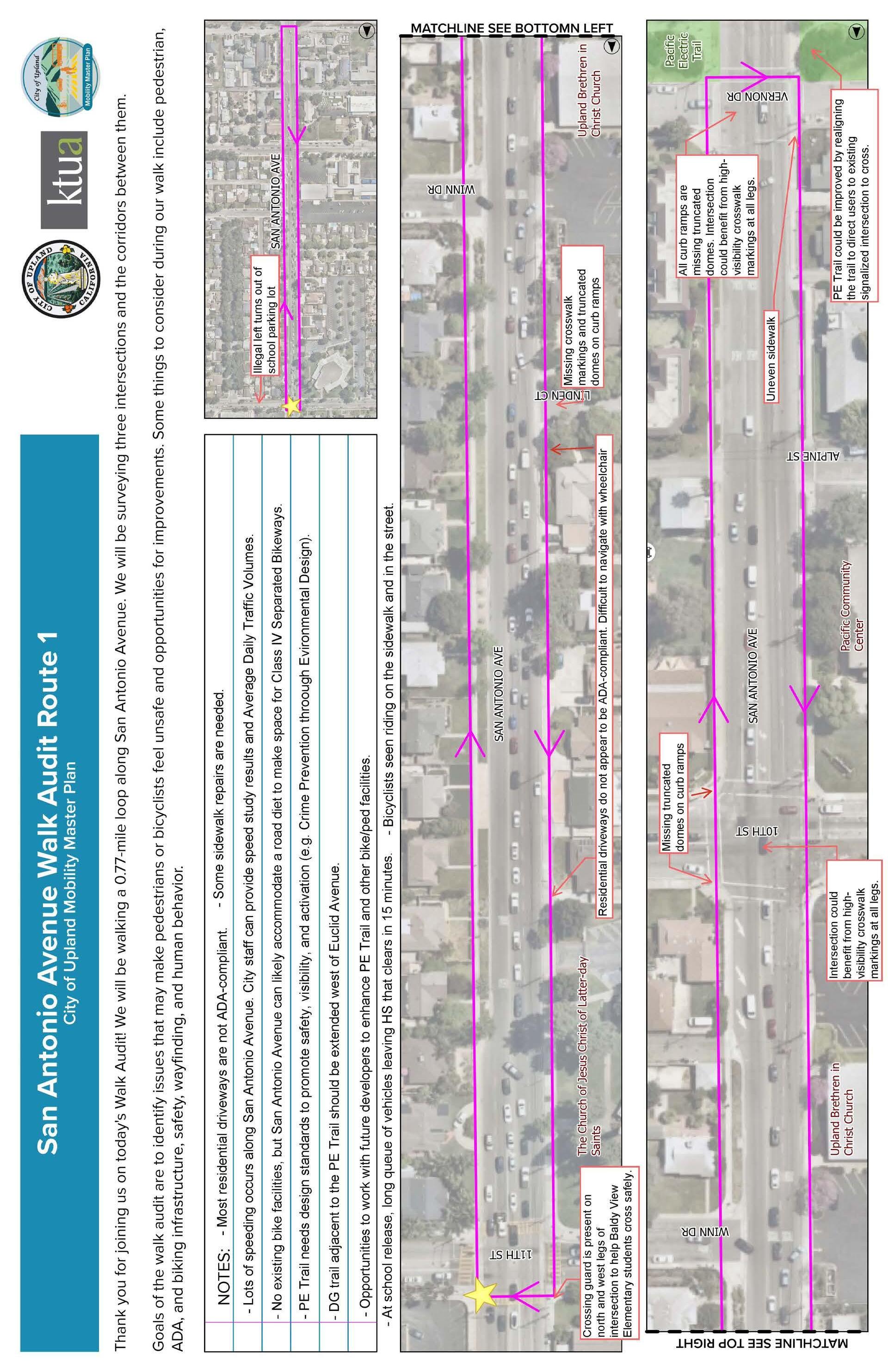
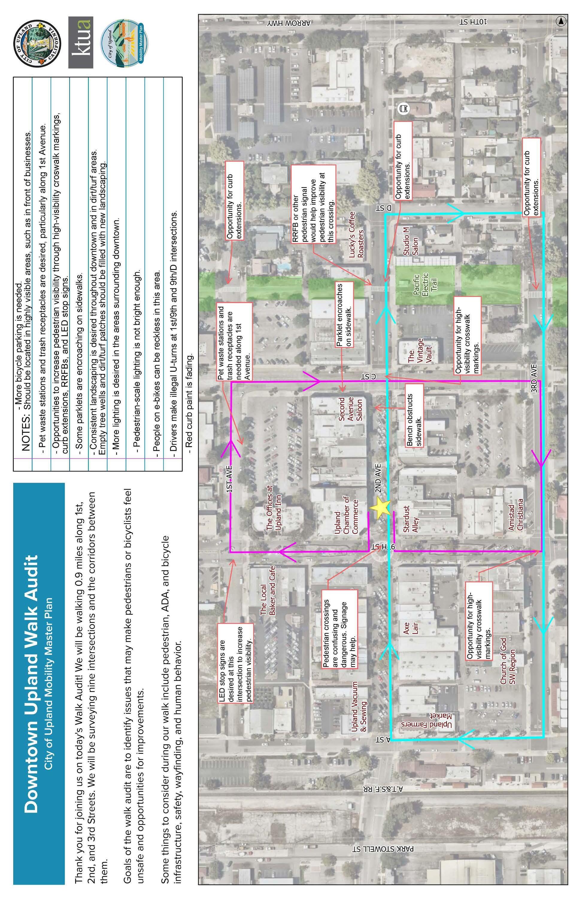
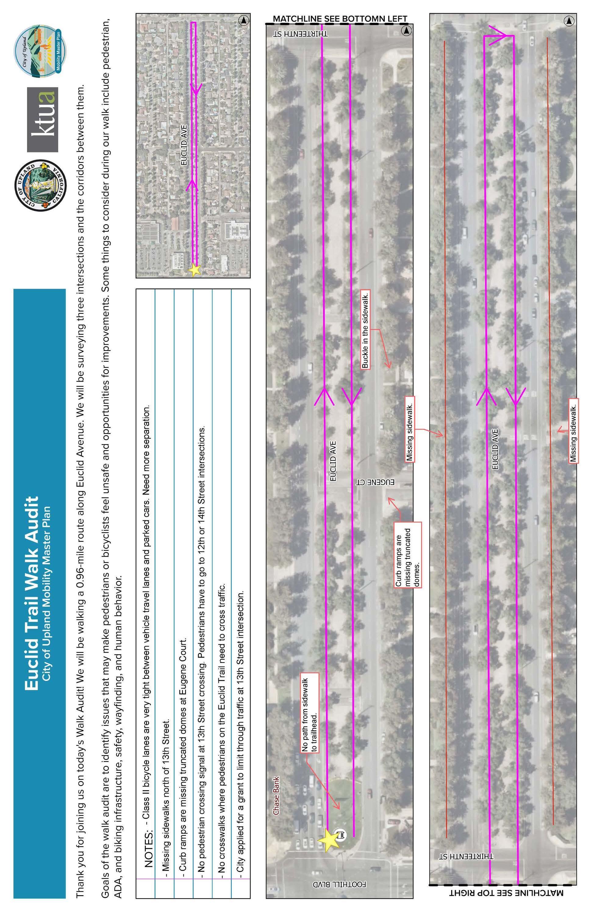
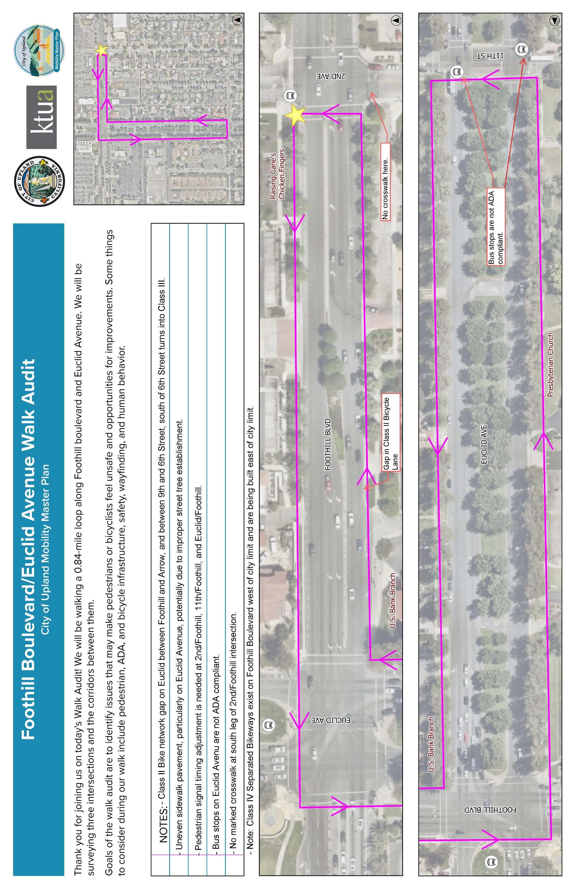
A-9: Walk Audit Notes: Route #10
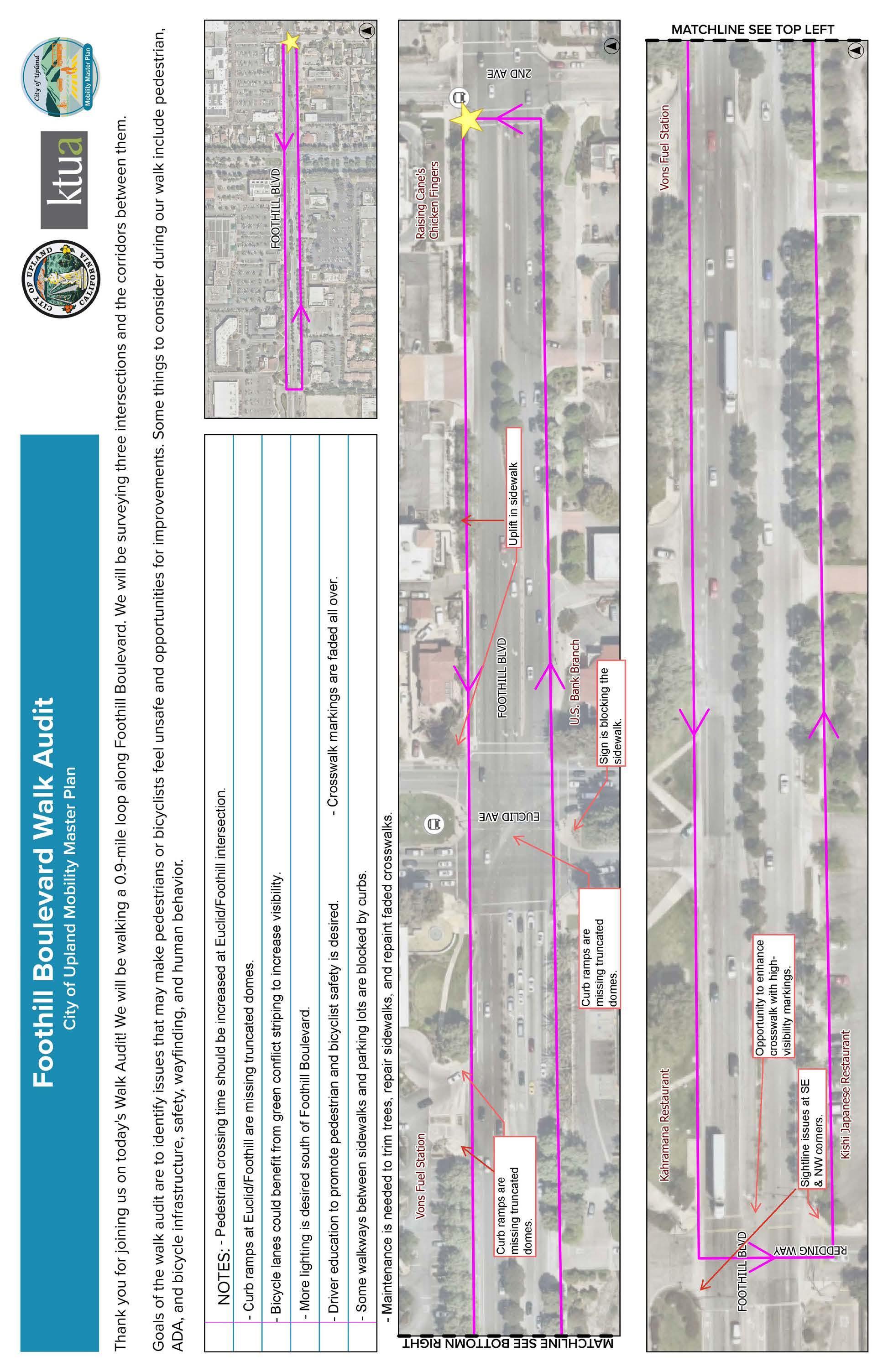
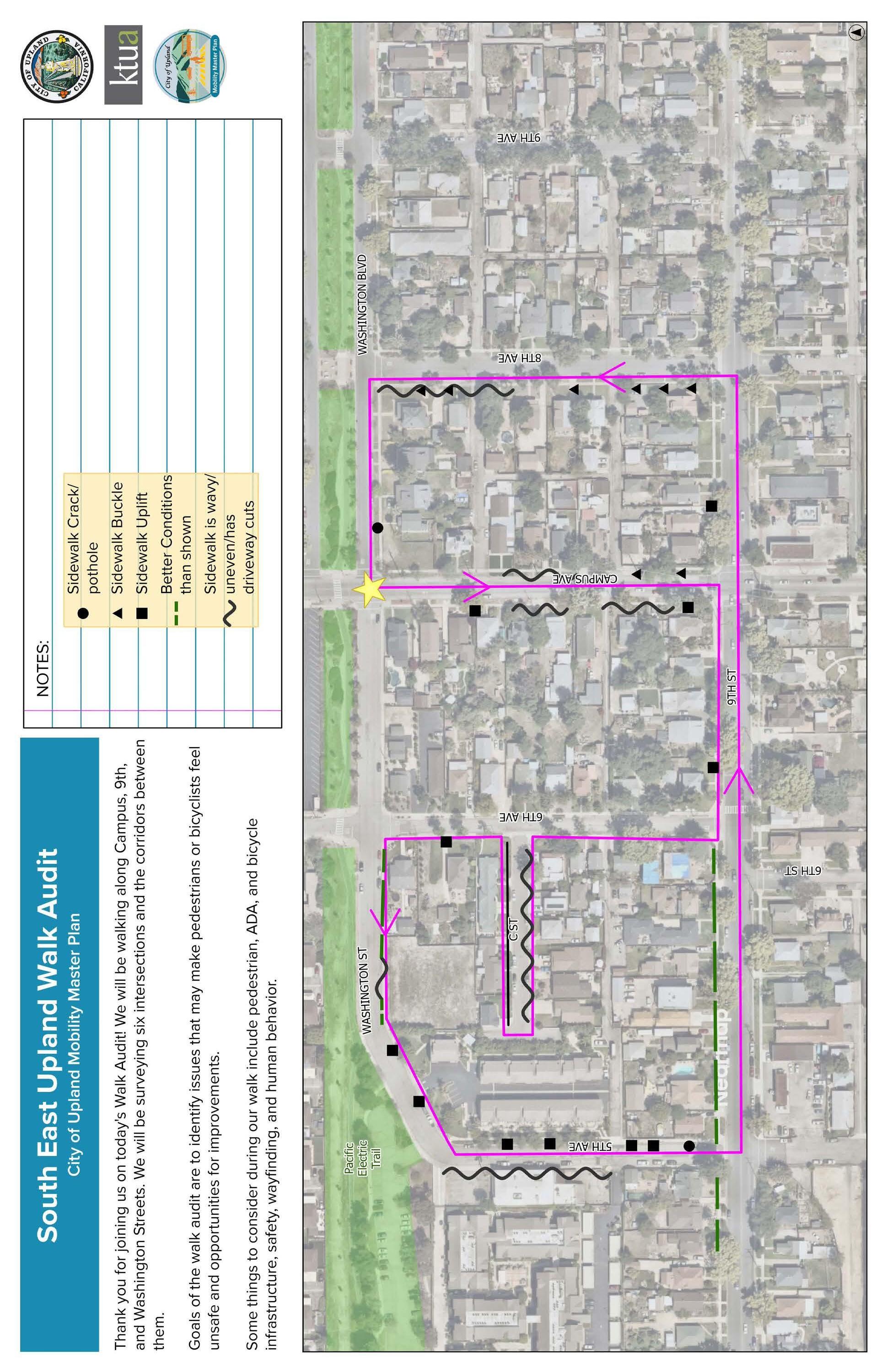
A-11: Walk Audit Notes: Route #12
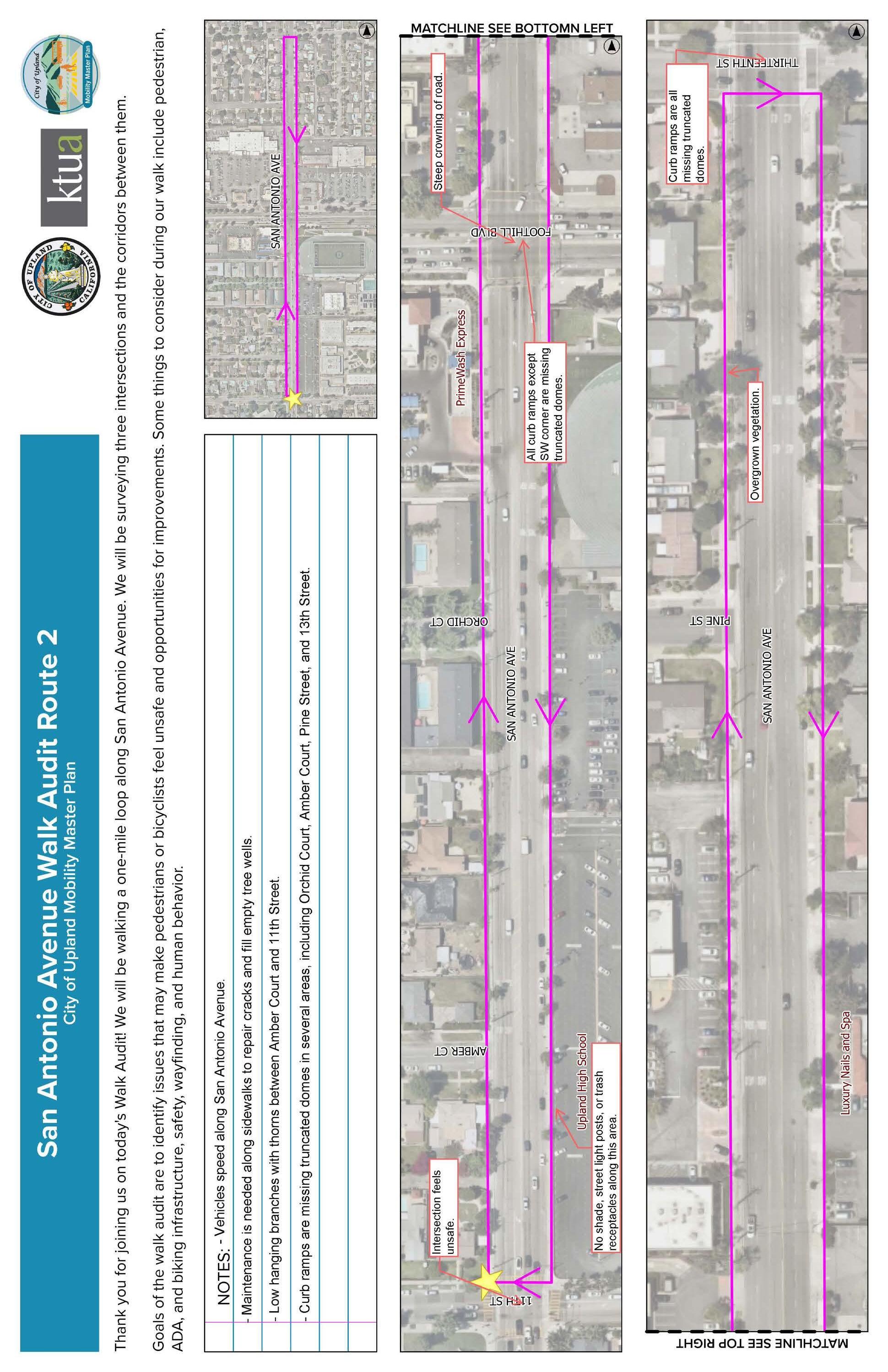
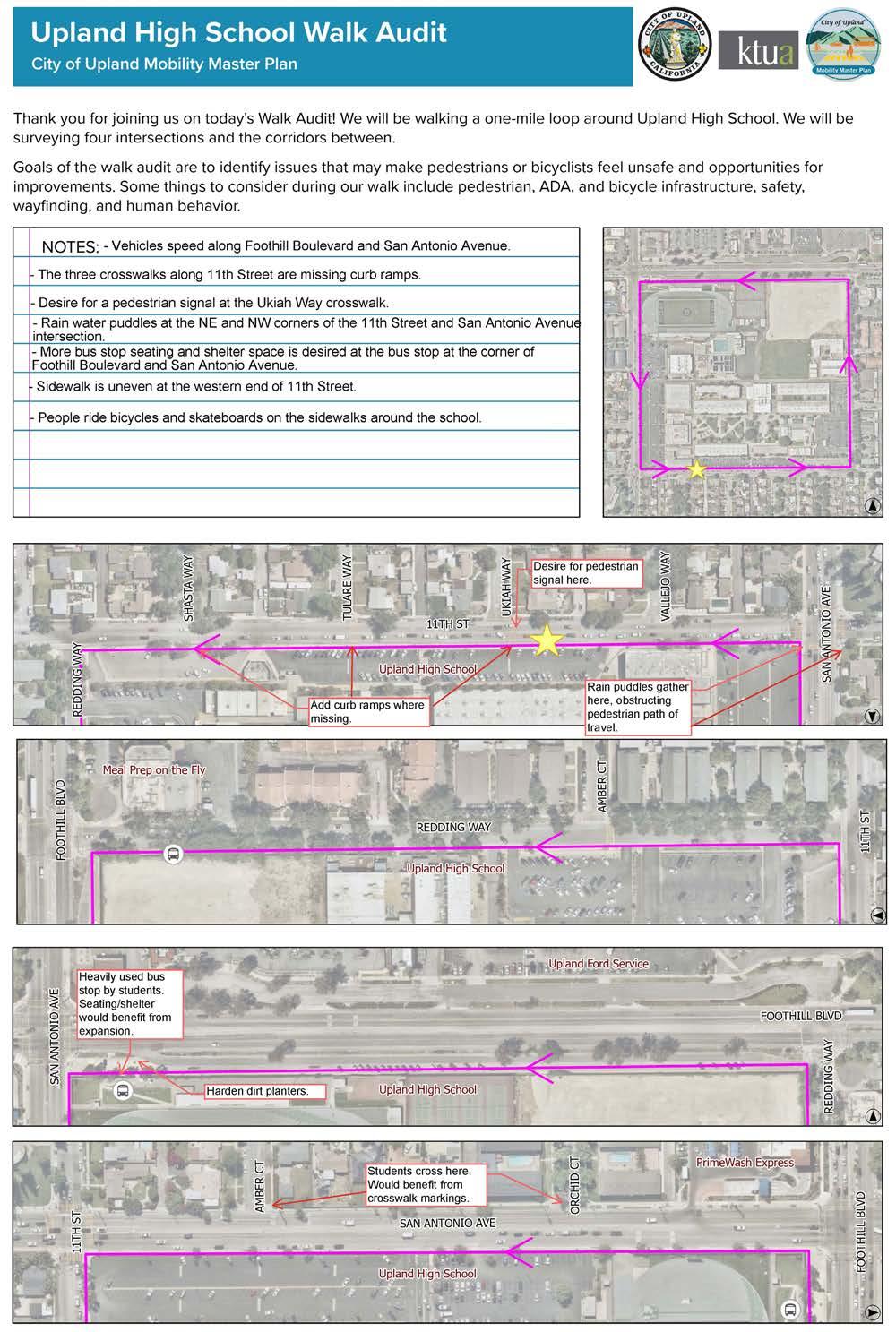
Figure A-13: Survey Question #1
What form(s) of transportation do you use in Upland, other than a car? Select all that apply.
Open-ended Responses:
f Inline Skates/Rollerblades
f I walk around my neighborhood for exercise and to enjoy outside
f Stroller
f Strollers
f Jog to the colonies
f I rely on others to get around due to disability. I generally try to avoid the bus as it is not only highly inconvenient, bus when I do use the bus, the drivers take off before I am able to take a seat causing me a great deal of pain for at least the rest of the day sometimes longer.
f Car
f Car
f Do not take car line away for any other purpose.
f Electric Vehicle
f E bike
f Family and friends
f Omi-ride &Omni-asses
f OmniRide
f Omni ride
f Car
f Walking specifically with a stroller
f Inline Skating
f Paratransit Access Services
f Roller skating
f Metro a line if it ever comes to upland
f Roller skates
f I do not bike bc I don’t feel safe doing so
f Rollerblading
f Car, Airplane (Cable Airport CCB)
f Car
f Omni on demand
f Uber/Lyft
f Use both car & walking
f Motorcycle
f Only a car to do errands, walk for exercise
f Rides from neighbors
f motorcycle
f I am 70 years old…your plan is absurd for the elderly!!! I will move if implemented; Upland changing too woke.
f Electric bike
f Uber
f Uber
f Uber
f Uber
Figure A-14: Survey Question #2
How often do you walk or roll (wheelchair, scooter, skateboard, etc.) in Upland?
A-15: Survey Question #3
I walk or roll in Upland for (Select all that apply):
Open-ended Responses:
f After practice
f Climbing gym(needs a better way to safely cross the railroad, through second street onto Stowell.
f Close food pick up
f Dinning
f Doctor appointments
f Doctor’s appointment
f Dog walk
f Dog walking
f Drinking downtown
f Dropping off kids to school
f Escuela
f Exercise
f Exercise
f Exercise and errandsi
f Fitness
f From parking lots to downtown restaurants
f Go out to eat /drink
f Going out to eat
f I am 70 years old…your plan is absurd for the elderly!!!
f I walk four or five times a week to the YMCA to exercise there.
f I’m unable to walk due to mobility issues it’s drive or stay home
f I’m a crossing guard
f Kid’s school
f Library
f Medical and therapy
f Medical Appointments
f School
f shopping eating in HDU
f Store
f street faires/events
f taking kids to school
f To and from work
f To be with friends
f To get around
f To get ice cream
f To go to local shops within walking distance
f Travel by train
f Use bicycle when possible
f Visiting businesses
f Visiting friends
f Volunteering at Fields of Upland Animal Shelter
f Walk dogs to parks
f Walk my dogs
f Walk my kids to school.
f Walk my son
f Walk to Downtown upland only
f Walk to restaurants etc
f Walking dogs
f Walking kids to school
f Walking kids to school
f Walking my dog
f Walking my dogs
f Walking the dog
f We will walk to downtown on occasion
f When car is at mechanic
f Work
f Work
Figure A-17: Survey Question #5
Places that I frequently travel to in Upland are too far to get to by walking or rolling.
Figure A-18: Survey Question #6
How often do you bike in Upland?
Figure A-19: Survey Question #7
I bike in Upland for (Select all that apply):
f And this is only in the neighborhoods, or up to the colonies for coffee. Also to Cable Airport for fun..Too crazy to attempt crossing Foothill and that area.
f Because it’s dangerous. Not just in Upland
f Bike lanes a waste of tax payer money
f Dinning
f Going out to eat
f I am too old to ride a bike.
A-20: Survey Question #8
A-21: Survey Question #9
f I do not bike bc I don’t feel safe biking
f I don’t bike through as much as I did because of flat tires and homeless
f I would like to bike but have not as yet
f I’m going to get an electric bike and will be using it but right now now
f Tandem bicycling I’m blind.
f to and from work to my home.
f To get ice cream
f We have a group that takes part in a Christmas bike ride, however we take the bike path to Claremont. DTU doesn’t offer much.
f Animals
f Any paint lines on 9th street from Grove to campus are very faint and hard to see. The road itself is very bad and needs to be repaved.
f As a driver these are the issues I see for bikes
f Bike flashing lights
f Bike should have barriers to separate from cars
f Bikes don’t follow the rules
f Damaged sidewalks or streets.
f Do not take traffic lanes away from motor vehicles to provide them for bicyclist. Motor vehicles will not be reduced even if more people ride bicycles.
f Don’t feel safe
f Don’t feel safe due to where the bike path is. My husband was almost accosted by a drug addicted person on the trail.
f Don’t have a bike
f Don’t know how to ride bike
f Drivers do not look for us bike riders crossing, I have to be extremely vigilant when crossing. We need the green lanes and SIGNAGE, please, like I see in Claremont.
f Drivers not stopping at marked bike crossings or driving through even when bike are going through on the bike path. Specifically those near downtown on 3rd, 2nd and 1st streets.
f hard to find place to park!!
f Hill
f Hills, things are far
f Homeless and drug use on the trail
f Homeless on bike trails
f Homeless on the bike paths
f homeless on the bike trail
f homeless people and illegal food vendors everywhere. SHUT THAT DOWN!!!
f Homeless population and trash along streets and trails
f How the heck am I at 70 years old to get groceries by bike…this is a crazy idea!!!!!!!
f I am a senior citizen and no longer ride a bike.
f I feel unsafe on the pacific electric trail
f I most bike on pacific electric bike path and so my comments were made above
f I use to ride the bike trial but I always got a flat tire while riding it
f I’m too old for the hills
f Kids on electric bikes using streets/sidewalks as playgrounds terrorizing people.
f Lots of cars, streets are for that purpose, they are big and busy to get over.
f Need bright colored bike baths like Rancho has
f Need class 1 or class 2 lanes to connect north upland to trail in downtown
f Need more bike lanes. North/south only Euclid. Need bike lanes on Mountain and Benson plus more East/West streets.
f Need my kids to be safe in order to ride
f Need real bike lanes
f Need to have traffic lights with turn signals PLEASE
f no designated bike lane. Streets have alot of tree roots coming up on the side of street. Road bumps.
f No enforcement at intersections on bike yrail
f No safe way to lock up a bike at the Metrolink station for day trips
f Not comfortable on busy streets, prefer sidewalks
f Not enough emphasis on the use of the green paint on the street
f Not enough protected bike paths. Need proper bike lanes that have barriers from car traffic.
f Only some section of the bike lanes army keep clean by the Pacific Trail
f Parked Cars often block bike lanes
f People purposely drive on the bike lane when Im on the bike lane and no cars in sight. People drive too close to the bike lane.
f Poor roads (same as in the car)
f Pot holes
f pot holes in bike lanes and homeless people on the bike trail
f Potholes
f Road are terrible
f Road diet please! San Antonio and every odd street!
f Roads are a mess
f Roads are not maintained.
f Roads are unsafe potholes uneven and dangerous
f See less fortunate people
f Some corners are blind.
f Streets are cracked and bumpy
f Streets are for cars not bikes
f Suspicious people on bike paths
f The bike lanes are rarely swept and I have had glass cut my tires multiple times.
f The bus service does not cover upland as it used to
f The Pike lands are filled with parked cars meeting you have to do is go around those cars and now we’re going into the flow of traffic if you go on the sidewalk which I feel much safer it’s like not like biking because there’s so many on even say, blocks bombs, cracks and people get upset when you’re on the sidewalk they want you to go out onto the street to get kill
f The portion of Foothill Blvd. near the old Buffalo Inn has no shoulder for bicycles and is especially dangerous at night.
f Too hilly to bike leisurely
f Too hilly/steep climb in elevation
f Too short to touch the pedal
f Transients
f Trash day makes riding in the street less safe
f Two non ADA signal call buttons at two different crossings
f Uphill incline
f With my relative I have been on the trail on e-bikes to go to Claremont, I was a bit scared bc of the drug ravaged people who live in there. Luckily we weren’t attacked.
Figure A-22: Survey Question #10
Places that I frequently travel to in Upland are too far to get to by bike.
Figure A-23: Survey Question #11
The following statement(s) are/is true of bus service, bus stops, and/or the OmniRide microtransit service in Upland (select all that apply):
f Bus stops are not covered for shade or protection from rain
f 1081 W. 22nd. St.elti
f 1256 North Redding Way
f 136 MORGAN WAY
f 16th and Euclid, Bus service that runs up and down Euclid Avenue above Foothill Blvd
f 16th and Mountain ave. Need bus stop there so I can get to work or go into Upland.
f 1701 Pinehurst Drive
f 17972 Merrill Avenue
f 1803 N. San Antonio Ave
f 1829 N 1st Ave
f 18th/Benson or 18th/Mountain
f 19th and campus Route 83 use to go to that area near the shops
f 19th street
f 19th street or Above
f 2026 Winston Ct.
f 2034 N. ALBRIGHT AVE.
f 22nd and Euclid
f 2327 Ridgemont Way
f 3rd Ave in front of senior center and housing
f 934 N Humboldt Ave
f Across mountain
f Along baseline into and past claremont.
f Another crazy idea! Our city was not set up for buses
f Arrow and fairwood
f Bring back bus stops north of Foothill BLVD
f Buses don’t go to downtown Upland (2nd St.) from anywhere but Arrow Hwy. The Colonies Crossroads Shopping Center (19th & Campus) has no bus access.
f Buses used to go all the way to the top of Euclid not because of the do-gooders buses don’t go about foothill foothill and Euclid
f Campus + 19th, Baseline
f Campus and 13th st
f Carnelian going to shops on Campus AVE
f Colonies
f Colonies
f Colonies
f Colonies service needs to be brought back
f Euclid and 21st Street
f Euclid and 24th
f Euclid and Arrow up to the Colonies
f Foothill and Benson
f From upland to San Bernardino
f go down 13Th st it is a main Street yo cut across town
f Hardly any Upland bus routes north of Foothill; why no stop at Metrolink station?!
f HDU
f Homeless bother you while waiting at bus stops
f I am blind need paratransit
f I don’t do buses
f I have a bariatric mobility scooter and it barely fits on the busses. I need assistance turning it around to be seatbelted in and driver’s refuse to assist. So I am not able to ride public transportation.
f I use Omni on demand or access
f I would rather walk when I can or drive because, as a woman, I get bothered waiting for the bus.
f It would be fantastic if a city shuttle was available to run north/south on Euclid. I believe it would encourage the community to shop/ dine/dentist/doctor locally. Currently if you live north of baseline, there is little option but to travel by car for errands. The distance plus incline make for a long walk or bike to foothill.
f Metrolink Station and ONT Airport
f Mountain Ave
f Mountain Ave and Foothill Bl
f Mountain, Whole Foods, San Antonio Hospital
f Near 18th and Benson
f Need real metro
f Needs to go to Colonies
f No issie for me but my aunt would love to be dropped off in front of the library instead of north of arrow and have to cross the street to get to the library/city hall.
f North of 16th
f North Upland!!
f North Upland/San Antonio Heights. Mountain and 23rd but much more regular service.
f Other cities
f Our city is a grid. Have them run north and south with stops every even block and then east west 19, 16, 14, foothill
f Popular bus stops have been removed such as on Northern Euclid and the colonies
f San Antonio , Metrolink station, and 24/7 easy access to Ontario airport
f San Antonio and 11th ,, at the high school
f SAN ANTONIO AVE, 9TH ST
f South of Arrow would be nice, also would be great to get to Claremont without having to change to Foothill Transit
f Target, colonies
f The closest bus stop to me that I use for particular errands I’d unsafe due to homelessness on that stretch of dirt road I have to walk through and it’s desolate too which is creepy when only 1 car drives past me slowly. I feel extremely unsafe.
f The Colonies, anywhere above foothill blvd, anywhere below arrow rte, Mountain and 8th st, and downtown claremont
f The sliding door of the Omni ride is too heavy and hard to open and clothes also one’s hand can get caught in the door handle.
f There are no buses on 8th or Benson- that could take you too anywhere in Upland or to the station. We are completely void of busses in south Upland.
f There are none in northern Upland. I need a car to get to the bus.
f There is no city bus that takes you the Metrolink in upland and the one to Montclair doesn’t run often to get me there in time for the bus that I need to catch
f There should be small buses available to go to the colonies from selected neighborhoods.
f unsafe!
f up to oakmont senior living & up on 16th/ baseline
f Upland hills country club
f We need bus service above 18th.
f Would love to see more local service from home to downtown, Colonies, doctors.
Survey Question #12: If you take the bus, please identify the bus stop that you use most frequently by providing the closest intersection or landmark:
f 19th & mountain
f 19th & Mountain (removed, before that,21st & Mountain-also removed(
f 19th and Kelly
f 19th street pizzeria
f 3rd and 9th at Euclid
f 40 on Euclid cuz they don’t go all the way to the top no more
f 85, but the times on transit too early which makes the busses arrive late.
f 8th / Benson or, Richton/Central
f 8th and Benson Ave
f 8th street and campus
f Arrow Hwy and San Antonio
f Arrow HWy and San Antonio Ave
f Arrow/Vineyard
f benson & arrow rte
f Benson @ Arrow
f By benson and 11th because my former bus stop at arrow and fairwood has been closed due to construction- I hope it opens back up asap
f Campus and Foothill
f Central and 9th street
f Claremont Transit center
f Euclid & 9th St.
f Euclid /Foothill
f Euclid and 15th
f Euclid and 19th and Target
f Euclid and 8th Street
f Euclid and A street
f Euclid and Foothill
f Euclid x/o 9th street
f Foothil @ Mountain near the Walgreens (I live off 16th)
f Foothill & Campus
f Foothill & Campus
f Foothill + Benson
f Foothill and Campus
f Foothill and Euclid
f Foothill and Euclid
f Foothill and Euclid.
f Foothill and Gove
f Foothill and mountain
f Foothill and mulberry
f Foothill and San Antonio
f Foothill Blvd and Euclid Ave
f Foothill Blvd./Euclid Ave. Omni Route 66
f Foothills and euclid
f Gibson senior center
f Grove & Foothill
f Grove Ave and Arrow Hwy
f Grove/Arrow
f Home Depot on Mountain, PCC at Arrow
f I actually don’t live in Upland, I live in Fontana. I was just a friend a favor.
f I am closer to Foothill/Benson or Foothill/ Mountain
f I only use the foothill route when I take my car in. No issues.
f Memorial Park foothill blvd
f Montclair station
f Montclair Transit Station
f Mountain & 7 th street
f Mountain and Foothill
f mountain/foothill
f Post Office
f Route 89
f San Antonio and Arrow
f San Bernardino Road & Grove Avenue
f Upland High School
Figure A-24: Survey Question #13
The route I use most often to get to this bus stop is missing:
Sidewalks Curb ramps
Crosswalks Bike lanes Street lighting I get dropped off near this bus stop (I don’t walk, roll, or bike) Not Applicable (I do not take the bus) Other (please specify)
f Bus shelter
f Bus stops have homeless
f Crosswalk paint is faint and not all crosswalks have reflectors
f I don’t think there is currently a bus that goes up and down Euclid but I think there should be and I will eventually use it
f I use door to door
f I used to take the Foothill bus in Montclair Transit Center
f Is missing the freedom of being hit up by meth heads
f It’s walkable
f Lack of street lighting and sidewalks on Fourth Ave between foothill and 11th street.
f My aunt takes the bus often
f Not safe
f Not the safest neighborhood
f Public transportation is not safe
f Seating
f Shade, Benches, and Lightning
f Sidewalks have tripping hazards
f There are no s stops within about 2 miles.
I commute by boarding the Metrolink at the Upland Station.
f A coffee shop nearby. A bathroom.
f A restroom
f A station to Pasadena
f Accessible public bathrooms
f Adding more seating or a “inside” would be helpful as well as more times that the train can be used to go to LA and elsewhere.
f Additional routes and trains to add usability and reliability.
f Allowing for use of some parking for events like the Lemon Festival
f Benches, trash cans with a station revamp
f Better parking ; more frequent trains
f Better train info
f Better walkways
f bring the a line down to upland! metrolink does not run often
f Clean up the station take pride in station areas
f Coffee shop
f Crosswalk on Stowell st, and adding a sidewalk on east side of 2nd Ave, north of stowell
f Discounted rides for students!
f Easier to use bike parking. Those old raggety black bike lock/racks dont work or are difficult to use.
f Free overnight parking for riders
f Free parking
f Free parking and more parking availability.
f Homeless hanging around boarding area
f I actually go to Montclair since the bus goes there and there are more transit options. I would use the Upland if I could take a bus from 18th/Mountain.station
Yes - please tell us improvements you would like to see at or around this station.
f I board at the Montclair station but sidewalk access to and around the station from the north is non existent on Monte Vista. This is my main reason for not being able to walk to the train station.
f I dont commute but I use the metrolink as much as possible. The lack of times is irriating as I could use it more often if more times were available.
f I have no issues with the Upland Station, other than I wish parking was free.
f I take it for day trips into the city but there always seems to be homeless people hanging out, taking loudly to themselves or asking for money
f I use Montclair because of parking
f I used to park in Upland but switched to Montclair when permits were required
f I wish a line ran along the 57 down to 91.
f I would like to see more destinations be available or more stops at this station.
f I would, but the station is too far in the opposite direction. I end up using Montclair station instead.
f If you go anywhere in LA, you have to return by 9:30 that’s the latest train that runs so if you go to a dodger game if you go to a concert anything you do out that you’re gonna miss the end of it because you have to get on so early to get back to the inland Empire. Also, if you want to go to the beach you have to go to union station and then take them another metro to the beach instead of going straight from Upland to the Beach
f Improved parking lot, better lightning, cleaner area
f Integrated bus stop and more readily available bike storage and bike infastructure near the station. Bike lanes that are separeated on euclid should be in place for students and those that do wish to bike to the station or historic downtown
f It’s adequate
f It’s perfect
f Just keep the area and train clean and maybe more shade and seating area for waiting
f lack of free parking. I am already paying for the ride, why do I also have to pay for parking? I ride for pleasure and recreation, not work.
f Lights
f Metro not safe once near LA
f Metrolink in montcalir and foothill transit
f More benches, shade, water station, more free parking, a bus stop on the station, hourly trains all day every day. More parking for bikes, more public lighting, cameras and more safety.
f More lighting, do a better job of removing homeless from the area (across from ihop and the parking lot on the way to metrolink station).
f More lights by the parking lot
f More parking and security
f More police patrol/presence
f More safety measures (security at night) and more lighting especially in the second parking lot.
f More seating while waiting fir a train
f More security
f More security enforcing no smoking
f More shade structures
f More signage or a specific board on when the metrolink will be closed. The metrolink needs to update their app when they are closed for repairs. It shouldn’t let me buy a ticket for that day from the upland station if it’s not running for that day.
f More train times
f More train times going east. More security. Feels unsafe before dawn and afternoon.
f More trees or awnings for shade please
f Neat things to look at while I’m ridding in the train along the route
f Need a sidewalk to go all the way down Monte vista
f None, it’s fine at the station.
f Not enough parking
f Parking
f parking
f Parking signs are not visible
f Parking!
f Place to park without cost
f Police in attendance 24/7
f Precovid had to drive because of infrequent
Euclid bus service
f Public restrooms added, more shade/cover, security
f Regular seating
f Restroom
f Restroom and vending machines
f Safety
f Safety at the station
f Screen displaying arrival times, as well as Omnitrans arrival times
f Security
f Security
f Security Guard
f Security. I feel like a sitting goose around the homeless and there’s no security.
f Shade, more seating and better security
f shaded benches
f Signage
f Station is fairly easy with plenty of parking. The issue I constantly see are the transients at the station and they harass passengers waiting for th train or their ride to pick them up. We know transients are there, make the security guards kick them out and make it uncomfortable for them to be there. interesting enough, at Union Stayion, they don’t allow loitering or transients to hang out. They are more strict about it than upland.
f The area feels unsafe for a single young woman especially at night
f There are no cross walks or stop signs to cross to the Metrolink station when crossing A street! Cars go very fast and do not stop.
f There is often trash on and around the tracks.
f Trains need to run more frequently
f Upland
f Upland
f Upland
f Upland
f Visible security
f We board in Montclair. Free easy parking.
f We need a renovated Metrolink station. More modern.
f We need the trolley line back that existed to get us around. More security, food and coffee options. The farmers market destroys any chance of parking on weekends and ruins access for us commuters. Move the farmers market to the parking lot north of down town. It just creates an inconvenience for business and commuters.
Figure A-26: Survey Question #15
Are you a K-12 student? Or are there any K-12 students in your household?
Figure A-27: Survey Question #16
Which school(s) do you or students in your household attend? Select all that apply.
f Banyan Elementary school
f BIC preschool
f carden
f Chaffey
f Chaffey Schools which use many of the same roads to get to.
f Charter in Rancho
f CHS, El Roble
f Claremont high
f Claremont High
f Claremont High
f Claremont school
f Damien High School
f Edison Elementary
f Edison Elementary Ontario (we are zoned here)
f Foothill country day school
f Homeschool
f homeschool (1) and St Lucy’s Glendora (1)
f Homeschool Charter
f I’m a crossing guard for Upland Jr. HIgh but am positioned between the Jr. High and high school
f Ipoly
f Ipoly Pomona
f Kimbark Elementary
f Mt Baldy
f Mt Baldy School
f Not in local district
f Out of district
f Out of district
f Past that stage all are graduated
Figure A-28: Survey Question #17
f Pomona Catholic
f Private school
f private schools
f Private sector
f Rancho Springs
f Saint joseph upland
f Spring Charter school in Rancho Cucamonga
f St. Joseph School Upland
f St. Joseph’s
f Wayne Ruble and Summit High
f WCHS your schools are unsafe. Upland High for example. TOOO Crowded!!! Stop building!!!
f Western Christian high school
How do you or students in your household most often get to school?
f Mom’s drop off and pick up
f Drive not carpool
f Drive there, bus stop home
f I carpool with my dad to the station To go to Cal State LA
f I don’t feel it’s safe enough to let my child walk to school
f I have to take them and often get in trouble with because we have any school bus transportation.
f One walks to pioneer but I have to drive the student to upland high because there is no bus from our neighborhood down to UHS. We live on 18th and SanAntonio.
f Scooter
f Scooter
f Walk to school bus stop
f We ride our scooters.
f When my child attended Upland schools I had to drive her. No school bus but too dangerous to cross Euclid to get to Upland Jr High. And to isolate to walk to Upland high school.
Survey Question #18: If applicable, please tell us improvements you would like to see at or around the schools you previously selected.
f “10frwy on-ramp on mountain is usually blocked by grid lock in the intersection of mountain and 7th.
f We live next to Citrus Elementary and the crosswalk on the bend of Harrington and 7th needs lights along the crosswalk. “
f 18th Street by Pepper Tree Elementary - the street is all a bumpy mess
f A business that travels along baseline through and past claremont.
f A marked space for the Omni ride to park when dropping off or picking up people.
f About a bus that goes there
f All students should have bis access. When my kids were in school there was no bus access & too far to walk especially Pioneer & UHS
f At major intersections have some indicator if the street crossing the intersection has a school or not to divy up work commuters from drop-off commuters creating natural rivers of purpose.
f Better bike parking at Upland High
f BETTER BUS SERVICE AND SIDEWALKS
f Better bus stops such as a covered area with a bench. A more clean bus stop. Improve safety as well
f Better control of flow of traffic. Have people directing traffic to mitigate some of the gridlock
f Better crosswalks
f Better drop off locations for residents that live north of foothill. Traffic in that area is bad and kids are crossing street from apartments along San Antonio to the high school staff parking lot creating unsafe conditions for everyone. A crosswalk beacon light is needed there along with a turning lane to the school that allows parents to drop off in student or staff parking lot.
f Better school transportation.
f Better sidewalks
f Better traffic flow going east on 9th at the light at euclid, the trafffic backs up at morning drop off terribly
f Better traffic flow with student flow, ie San Antonio and Foothill
f better traffic light engineering
f Bike lane near
f Bike routes with flashing lights
f Bus pass offered to all students. I wanted a bus pass for my daughters and was told we live too close. 0.9 miles from the school is not the that close for 2 girls to be walking home.
f bus stop on 11th! there are 3 schools on that street!
f Campus is one of the worst streets in Upland. All you guys do is patch up the holes that whole street needs to be ripped out and redone. It’s really hard on our cars.
f Clean sidewalks, police patrol during drop off and pick up times to monitor speeding drivers. Our kids are not safe n school zones because people drive ridiculous with walking children.
f Clean streets
f Cleaner area
f Cleaner areas, no litter, better looking build- ing/paint.
f Cleaner bike lanes/sidewalks/streets. Bikes constantly get flat tires due broken glass, spikes from trees/plants, etc.
f curb extensions, speed radar signs, decoy police vehicles
f Dedicated bike lanes. More cross guards.
f Easier accessibility to them, nicer streets that are paved
f Fix potholes and sidewalks
f Flashing cross walk on the street. Shade on the playground. Electronic marque
f Flashing lights crosswalks.People speed.
f Foothill and near by street repairs. Too many potholes
f Foothill/Route 66 is horrable right behind Upland High Schools main address. It should be beautiful, instead it one of the most embarrassing respresentations/example of a neglected city and a negative example for young adults.
f Four way stop at 7th and Sultana very dangerous- drivers don’t look for walkers. Blink- ing crosswalk/stop sign, crossing guard. Kids can’t walk alone.
f Gates make it feel safe here at school. I went to school here too (Upland Elementary)!
f Have a bus for students only from 22nd to 11th street thru Euclid regular buses are dangerous for teens a lot of transients, drunk or high . Jr high and high school are on 11th street when is hit I see a lot of teens walking under the hot sun , and on winter they get wet .
f I cross on the corner of Euclid and 11th. The signal/crosswalk does not give enough time to get all the way across Euclid, causing cars/ drivers to be impatient and speed through the intersection. Cars also disregard the red light because it takes too long to change. There have been times that cars disregard me and children in the crosswalk because they are too much in a hurry. I believe if the signal on 11th stayed on a little longer, the cars wouldn’t back up and would allow more people (drivers and children crossing) time to get across.
f Also, the lines on the road need to be repainted on the median part of 11th and Euclid. I have seen cars turn onto the wrong side of the road many times, not being able to decifer the line markings.
f I wish there was more places to cross cause I have to walk a lot.
f I would like for them to build sign to warn drivers to slow down while kids are present too many drivers speeding down the street. At least another crosswalk for parents who park far from the school to cross safely.
f I would like some police presence near the school when school starts and ends. Too many cars drive way too fast and don’t stop for crosswalks as children are attempting to cross. This is especially true at the crosswalk on 11th Street and Burch Ave.
f I would like to bike my son to school however I feel unsafe doing so without access to bike lanes
f I would like to have a sidewalk built on the corner of 5th St and G St. Reconfigure the parking lot at the front of the school so that the crosswalk is not where the drop off entrance is located.
f I’d love to see more people walking their kids to school. Less cars.
f Improved crosswalks
f Improvement to Foothill Blvd. There are huge potholes on both sides of the street.
f It’s too dangerous for my kids to ride their bike to school in the morning and afternoon. Parents are ultra aggressive with road rage, cutting lanes, excessive spending, turning with little care if someone is on the crosswalk. New high school drivers driving like maniacs with their big trucks and flags distracting others.
f Left arrow turning lights.
f Left signal turn on San Antonio and elven street, it will help to reduce traffic during school hours .
f Less dangerous parking lot and more traffic control
f Less transients. Get them help and off the streets!
f Lighted stop signs. Cars speed in the mornings. Or more crossgards. On rainy days we need something to keep our feet dry when crissing the streets to get to school
f Lighted/flashing amber lights on the cross walks/street for pedistrians to press and activate.
f Lights on 11th Street and on San Antonio where cars come in and out of the school parking lot. Especially in front of UHS on 11th street.
f Limit dropoff and pickup traffic so roads are not blocked.
f Maybe more crosswalks
f Monitoring of speed during drop off/pick up
f More cross walk guides
f More crossing guards, maybe some speed bumps for the street parents drive way too fast down residential street
f More crosswalk personnel along the routes.
f More crosswalks
f More crosswalks
f More crosswalks and bike lanes
f More enforcement of parking violations and those who double park they block streets and impede traffic
f More help controlling traffic around the school
f More police presence. To slow drivers down. Ensure parents follow the rules too
f More police presents to help rid, unsafe and erratic drivers
f more prominent crosswalks
f More safe
f More safety measure at my intersections like flashing lights or different pain just something more apparent to let drivers know there are kids around
f More school bus servicio
f More security
f More security
f More security although the area is mostly safe
f More security although the area is usually safe
f More shuttle options running north/south in upland
f More sidewalks. Sometimes my daughter walks from the school to home on foothill and there are missing sidewalks.
f More signage. Lower speed limits
f More stop signs…better signage around school areas, not just cones
f More street lights
f More student crosswalks and signs showing that there is a school there to slow cars down in that area
f More traffic control. More students using proper laws of crossing the streets and not jaywalking where they could get it. They also frequently cross the intersection at Foothill and San Antonio when it clearly is not legal to do so.
f More traffic safety at dropoff/pickup times.
f More trees in the school for shade.
f Most importantly, the roads are in terrible condition. Second, the lines of cars picking students up from school, especially around the high school, really impede all other drivers and make conditions dangerous.
f My kids are competitive cyclists. They ride their bikes in Upland regularly. The biggest problem I see or worry about with them riding their bikes in Upland is BAD DRIVERS. And we have remarkably good drivers in Upland! But when we have bad drivers, for example,
the jerks who have been RACING AND MAKING TONS OF NOISE, MARKING UP THE STREETS AND INTERSECTIONS WITH THEIR TIRES FRO YEARS NOW, Upland Police DOES NOTHING.
f I would like to see the improvement of the city and Upland police cracking down on those jerks racing their cars. They cause accidents and cause our city to be less desirable. I would also love to see more multi-use paths and trails. Bike lanes are not the answer.
f My school is fantastic, but the UPLAND school district is scary, understaffed, and overcrowded. This city puts all its money into the wrong things!!! Fix what is broken before you start creating more problems.
f N/A but it would be nice to see that the walking student have better crossing lights with flashing lights on the street when student cross on a stop sign intersection
f Narrow on 5th in front of school (Upland Elementary).
f Narrowing of streets, more trees / separation from roadways
f No, always good and bad drivers. Want people to recognize 5th & 11th one lane at stop signs. Passing on right needed.
f Streets on 1st, 2nd, and 3rd are dark near Upland Elementary School.
f No, very organized at Upland Elementary, for pick-up especially
f None
f Not an Upland school.
f Not Applicable
f One way traffic flow. More officials for traffic flow and ticket offenders. Kids crossing not controlled they walk out in front of you slowing or obstructing the flow of traffic.
f Parents park in red curb areas and walk across the street without crosswalks. Very dangerous
f Parking and wider streets on 11th street (Cabrillo Elementary)
f Particularly
f Patrol the drivers. Too many wreckless drivers while kids are around schools.
f Perfect!
f Pioneer: 18th street has two schools on it - pepper tree and Pioneer. It is in really bad shape with potholes and deteriorating pavement etc. from mountain to Euclid the street is bad. Lots of dropping off and picking up along this stretch of 18th yet no word of repaving, etc.
f Upland high: yes these kids are “big” however there still should be an attendant at the crosswalks on foothill and mountain in the mornings and afternoons. Is it budget constraints?? Unacceptable. Find the money. Another place where there should be a crosswalk attendant morning and afternoon is mountain and 11th. Really. Really!! These kids are on their phones, talking to friends, etc. don’t wait until someone
gets killed. Please this should be a priority.
f I’m a grandmother raising 2 girls one at pioneer and one at UHS. I have 5 more years of dropping off and picking up from the high school. Get a crossing guard so no student dies and no driver’s life is ruined for a minimum wage part time job.
f Please fix 18th Street. Horrible! Horrible!
f PLEASE put a 3-way stop sign on the corner of Foothill Knolls school. (13 Ave and Veterans?) I’ve witnessed the crossing guard trying to dodge crazy parents trying to make the turns to go down the street towards the school. Traffic ALWAYS backs up at that corner!!
f Please repair the road and curbs in front of the school so rain doesn’t accumulate in front of the school. the dropping area goes from N MAGNOLIA AVENUE to BIRCH AVENUE.
f Restrict car traffic and enforce speed restrictions
f Safe walking and bike conditions with less speeding cars and dedicated bike lanes
f Safer crosswalks signs
f Safety for the students that walk.
f Safety/Police
f School crossing guards, police presence for fast drivers, illegal Parker’s, or lane blockers.
f School zoning could use adjustments, I’m geographically closer to Magnolia but zoned for Sycamore. It would be a much safer walk to walk to the school that is closer.
f Señalización más marcada para seguidad peatonal
f Sidewalk improvements.
f Sidewalks
f Sidewalks are in terrible condition.
f Sidewalks create injuries when there are big gaps
f Speed bumps, something to control speedy drivers.
f Speed limits enforced, speed humps, stop sign enforcement
f the sidewalks in our area, speciffically on our street are damaged or uneven. My child tripped and injured herself this morning on our way to school and we had to come back home.
f The south west corner of Foothill and San Antonio in front of the car wash does not have a sidewalk for mobility scooters nor is there an exit ramp in the business parking west of the car wash. The sidewalk is old and has the old street lamps that hinder a mobility scooter as well as no ramp. This forces me to have to travel the parking lot and several times I have almost been hit by cars exiting the car wash or the vacuum areas.
f Also, the area just East of Vons on Foothill before the fast food restaurants, there is no sidewalk at all causing me to have to go
into Foothill when traveling eastbound on the north side of Foothill to get into that shopping center. Extremely dangerous. I can’t even use my scooter down Euclid Avenue due to the extreme sidewalk damage.
f The streets are messy and lots of potholes
f There are a lot of cracks in the sidewalk
f They are ok.
f Traffic is horrible around the high school and it’s very difficult to to get in with only one true flow
f Traffic is too fast and dangerous for kids to safely walk to school
f Turn signal at campus & 13th. Have seen too many accidents w people going on unprotected left turn
f Upland High School needs police present for arrival and dismissal. I know there are officers inside the school, but I suggest they patrol San Antonio south of foothill and Redding south of
Figure A-29: Survey Question #19
foothill. Every single day they have students jaywalking and cars making illegal left turns.
f The challenge that make UHS more difficult than other schools is students driving! Parents are late to work, students are driving like idiots, and I literally cringe the whole time I take my daughter or pick her up.
f Show our teen drivers that Upland has high expectations and driving like fools is not tolerated.
f Upland high should be safely bike accessible. 11th, San Antonio, and maybe 13th should have bike lanes and speed reducing designs.
f We need buses for jr high and high school. How are kids supposed to get home when parents works? We love 4 miles from high school
f We need to keep lots of crossing guards throughout the city. People drive so dangerously and it seems unsafe for children. You’ve done a great job in the last couple years, let’s not stop. Keep it up!!!
Where would you like to see better walking and bicycling routes to? Select four (4).
f All over town
f an actual class 4 line extending the side walk on campus to get to colonies and to PET from basline.
f Areas near empty dirt lots and sewer lake areas
f Benson and arrow
f Bike routes should still allow for street parking
and not narrow the street to much.
f Bike trail
f Claremont!
f Clever beautifying ways to pass over car traffic as a pedestrain.
f Coffee places, places to relax
f Create a biking and walking path in the North to better connect Rancho Cucamonga and Claremont. Currently biking to Claremont in
the North, only Baseline (16th) connects to Claremont. A path across in the North would be very helpful as to not have to ride miles out of the way. Same to be said for connecting Rancho Cucamonga North of the 210 Freeway. Riding on 19th St or Baseline (16th) is unsafe in my opinion.
f Euclid
f Everything is good
f Foothill
f Friend’s houses
f I know you said 4 but all 5 are needed
f I would like a closer bus stop
f I would like to see the roads repaved
f Lowes shopping center area
f Need more bike parking / locking downtown. Otherwise I’d bike there
f Need more security on the Pacific Electric Trail.
f None…city needs to deal with unleashed dogs and transients
f Not applicable
f Not interested
f Our children play on city recreation/sport leagues. It would be fantastic for them to walk/bike to games at Cabrillo/Greenbelt/ flowers field/magnolia
f Pacific electric trail is great but areas through upland feel unsafe specifically west of Euclid
f PET needs to be regulated. Too many homeless and it feels unsafe.
f Regularly spaced bike routes with grade separation.
f San Antonio needs a bike lane. 16th needs cones to protect the bike lane
f Someone needs to invent smaller buses like sprinter vans that look more modern. The mostly empty giant city buses are overkill and put out so much pollution / gas guzzling
f The library
f The pacific trail is not safe for women due to the unhoused. I would never go ride down there.
f There are vast residential neighborhoods without bus stops throughout the city
f This city does not need to spend MORE of my tax dollars on routes. You need to fix the overcrowding, illegal street vendors that block the sidewalks in my neighborhood, homelessness, and horrible schools.
f Vine avenue and surrounding streets
f We need to be able to access these trails. Signs are poor and weather-beaten. Safety is a high priority. Cars seem to get away with running red lights and stop signs. There seems to be people hanging out at the parks and on the Pacific electric trail. I just don’t feel safe.
f Whole foods
f Whole Foods, cable airport
Survey Question #20: Do you avoid certain streets to walk, roll, or bike on? If yes, please list locations and reasons why you avoid these locations. (ex. “Main Street due to lack of sidewalks”).
f - Benson - Foothill
f 1 due to intersection safety.
f “1)The corner of Campus and 14th Street NEEDS to have a turn arrow signal! Campus above Foothill is a raceway to 16th street. Many MANY people run the light. It’s scary to try to cross that intersection biking or walking.
f 2) 14 street from Campus to Grove is also a dangerous speedway. this speedway is especially dangerous between Campus and 13th Ave. stop sign. Drivers blow past the sign on 13th Ave where kids need to walk down to get to Foothill Knowls. Most kids will not walk because of that! A 3-way stop sign on the corner of 14th and Fernando would be an easy fix! It is not safe for anyone to bike or ride; many kids avoid walking or biking to try to go south on 13th Ave to go to Foothill Knowls school. Many drivers use 14th Street and speed to avoid all the lights on Foothill.”
f 1081 W. 22nd. St.
f 1326 Monte Vista Avenue Unit 3
f 1349 W 8th Street #4
f 13th street and Euclid, because the lack of safe crossing and lack of sidewalks. Looks like
the owners of the house took over the side walk and pedestrians can not walk unless is the trail but in order to get to the trail on Euclid pedestrians have to make a lot of crossings, that are not safe. Is not safe for people on wheelchairs or strollers.
f 1515 JOHNSON CT
f “1525 howard access rd
f suit d”
f 16th due to lack of bike lane.
f 16th from Benson to Campus. Drivers and parked cars. It would great to see a dedicated bike lane both ways
f “16th street
f San Antonio Ave
f Due to the terrible decisions by drivers and them not following the rules of the road. I also do not let my child walk to school because of the terrible drivers “
f 16th street because of narrow bike line and nonexistent in some areas.
f 16th street from Benson to Campus- no bike lanes and speeding cars; Benson from 16th street to Foothill (Walmart) speeding cars -
no bike lanes; Foothill blvd - road conditions.
f 16th, 19th
f 1803 N. San Antonio Ave
f 1829 N 1st Ave
f “1840 N Millsweet Dr
f Upland, CA 91784”
f 1883 Wilson Avenue
f 18th Street
f 18th street, foothill blvd, san Antonio. Bad roads.
f 19 th street
f 1993 Birkdale Avenue
f “19th is too busy, 16, Euclid and campus.
f 19th st, bikers do not obey traffic laws. They block traffic and run stop signs and traffic lights
f 19th street from Euclid to the colonies. Already a dangerous intersection at 19th and Euclid (without improvements) and the traffic is heavy.
f 2034 N. ALBRIGHT AVE.
f 2067 Katrina Way
f 2298 MILDURA AVE
f 23rd between Mountain and San Antonio
f 2nd Ave and streets through downtown upland do not have enough lights
f 2nd Ave due to sidewalk damage
f 3rd & 11th not four-way and others nearby are, so it’s confusing for drivers. And kids cross at 3rd & 11th, so especially unsafe.
f 474 West Alpine Street, 55
f 5th & 11th - people turn into 2 lanes, people pull out from curb and it’s hairy.
f 5th ave sidewalk terrible condition uneven, street has many pot holes and rough uneven.
f 693 Magnolia Ave.
f 7698 Pepper Street
f 7th Street due to the number of transients that appear to be under the influence of drugs.
f San Antonio, between 7th and 11th due to the narrow roads and narrow sidewalks.
f 7th street, Grove, 8th st passed 11 Ave. & near Memorial Park not safe
f 8th and Spencer sidewalk. I’ve fallen by tripping over raised sidewalk while running
f 8th between Grove and Euclid is a raceway. 8th by Olivedale Park has a homeless and vagrant issue right near the sidewalk. Euclid is a raceway and drivers are still too busy on their phones to see cyclists.
f 934 N Humboldt Ave
f 9th and Campus
f 9th between grove and 3rd street, too dark, crosswalks are dark, paint is not noticeable. 3 crosswalks one is a signal.
f 9TH ST, SAN ANTONIO AVE, AND ARROWDUE TO LACK OF BIKE LANES
f 9th St.; no sidewalk; dark at night
f 9th street. Very dangerous street. The times I have biked, it is not a safe street.
f A lot of sidewalks are lifting due to the roots from the trees. New sidewalks are needed to improve the safety of our community.
f ALL - uneven sidewalks are dangerous!
f All of them. All the streets are the same 5-7 lane car monstrosities. No street is designed for the purpose it serves
f Almost all the east/west streets between Mountain and Euclid allow cars to park and make biking unsafe, especially Arrow
f Any street lined with pine trees. Why, because the trees roots have lifted the sidewalks. Making it unsafe to use.
f Any streets below 9th street due to high crime in that area & poor lighting & sidewalks
f Anywhere there is a wide intersection with several turn lanes and traffic signal arrows. Even the drivers are confused. As a driver, with wide streets and pedestrians, waiting for them to cross takes forever, like the light at Mountain and Foothill. By the time they get across, the line of cars behind me is long and we all miss the light when turning right. It’s a hot mess.
f Apartments
f Appreciate help with homeless people - used to get nervous
f Around UHS - lack of crosswalks
f Arrow - the streets have potholes.
f Arrow (& above) at Central. Huge bumps.
f Arrow due to high traffic speeds.
f Grove due to lack of sidewalks and bike lanes
f Arrow due to limited crossings and poor sidewalk crossing at Euclid
f Arrow due to really bad, cracked sidewalks
f Foothill due to “bike lane” running out at Central Ave. with no warning or safe shoulder to regroup, and bike lanes are really, really sloped and unprotected.
f Arrow hwy
f Arrow hwy downtown always traffic backed up or cars excessive speed
f Arrow Hwy from each end of city limits. erratic and speeding drivers cause concern for my family’s safety.
f Arrow Hwy, super bumpy and dangerous! Also Euclid Ave crosswalks are too wide and the timer on the crosswalks are not long enough.
f Arrow Hwy. Foothill Blvd. Euclid Ave.
f “Arrow Hwy: No bike lane, narrow street with street parking
f Campus Ave (south of Foothill): Drivers not respecting allowing bike to take up a lane due to narrow streets with parked cars.
f Foothill: No bike lane. Traffic pattern moves too fast with cars not paying attn or allowing to share to road with bikes
f Pacific Electric Bike Path: The buttons to cross are inconveniently located. It makes it VERY difficult to cross due to needing to park your bike and walk up the street the push the button especially when traveling with kids (Mountain and Central)
f I bike multiple times a week with my children and will ONLY use the bike path through Upland. Even then I have DAILY issues with cars not stopping at marked/with a light or even when I am actively moving through a painted crossing prior to a car coming. I often have to stop in the middle of the intersection on the path near downtown because of cars that race through stop signs above or below the bike path and disregard bikes or people walking.
f I commonly ride through neighboring Foothill communities (Claremont, LaVerne, San Dimas, Glendora) without incident. If I detour from the bike path I immediately regret my decision because of lack of respect from drivers, no bike lanes, and poorly maintained roads.
f Arrow route &arrow hwy.
f Arrow rt. Campus,
f Arrow Rte between Central and Benson due to lack of sidewalk curb ramps, and at some points no sidewalk at all. Foothill between Central and Benson, for lack of sidewalks, Mountain Ave and Foothill blvd due to large intersection, I always almost get hit by a car there. Any streets that let cars turn left on a green yield, puts you at risk of someone speeding into the turn and not seeing you when you have right of way.
f Arrow Rte by the 7-Eleven. There is along stretch of dirt road that is covered in urine water bottles, trash, soiled clothing and blankets from homeless people. There needs to be more streetlights installed and cameras on those streetlights to make residents feel safe, prevent people from leaving trash, and discourage homelessness on this road. This road also needs a designated cement sidewalk on both sides of the street in front of the dirt areas/in front of the reservoir on Arrow Rte in Upland above the montclair metrolink station. The area I speak of is the road in front of the reservoir on Arrow Rte in Upland directly next to Arrow Vista Apartments in Upland. Please fix this street/road as soon as possible. Thank you.
f Arrow, Mountain, 9th St.,
f Arrow, mountain, benson, central …. bc of all the constant construction which also makes it hard to get to my busses
f Avoid Arrow between school and hospital (5th & 8th). Lots of traffic. Also Campus and Arrow.
f Avoid biking on Euclid Ave due to inadequate sidewalks, no bike lane and heavy vehicular traffic
f Avoid the bike trail from Euclid to the bridge going over foothill. Too secluded and lots of homeless. Also east side of second street by the railroad tracks. Go look at it. You basically walk on the street. Stowel street needs sidewalks!
f Baseline into Claremont no sidewalks
f Baseline near the 210. The sidewalk stops. Also other areas the side walks are uneven or broken up. I fall and get injured.
f “-Baseline through the entire city is risky in my opinion. I do ride my bike there but try to stay off the street.
f -19th East of Euclid.
f -I avoid almost all of Foothill as it is very dangerous. Claremont created barriers that does appear to help protect both car and bike traffic.”
f Baseline, Foothill and Euclid bc cars are driving too fast. These streets should add class 1 or 2 bike lanes as well as other traffic calming measures that prioritize pedestrians and not cars, especially baseline. Baseline is used as alternative for freeway and it’s a residential community
f “Baseline, foothill, arrow Highway due to lack of bike lanes
f Baseline/16th Foothill
f Benson and arrow the yield lights are dangerous i dont prefer them
f Benson and mountain. It’s hard to get from foothill down to the bike path, because the north/south roads have no shoulder
f Benson St - the intersection at Baseline is dangerous!
f Between N 1st ave and 9th st curb too high and made by rocks
f Bike trail between Benson, Mountain, San Antonio due to concerns about homeless.
f Bike trail to Claremont to many sticker which fatten my bike tires
f Bike we avoid: Foothill (unless in Claremont), campus, Euclid, mountain, Benson. Need more than a white line separating a bike land from traffic going more thank 25 mpg.
f Bike-Foothill, 16th, Mountain, Campus due to excessive fast moving traffic. 14th and Campus due to cars running red light and speed of traffic (mostly north/south bound traffic)
f Both sides of the street don’t have sidewalks in my neighborhood in No. Upland.
f C Street and 1st - the road is bad and hard to cross. This is a main entrance to downtown Upland and leaves a bad impression
f Campus and 15th - Cars are always running the red light at that intersection.
f Campus Ave - is a dangerous street to bike or park on - it is too narrow
f Campus ave.
f Campus avenue , arrow highway - no bike lanes. Speeding drivers, narrow road below foothill where I live. I see bike accidents from my window often at the intersection of campus Ave and the PET trail.
f Campus between 11th and Foothill because of potholes on street and uneven sidewalks.
f Campus from 21st south by Tesla. Hard turn and no sidewalk.
f Campus, due to dangerous conditions of cars speeding and not stopping at stop signs on a narrow street, construction, and traffic congestion at Arrow and Campus
f Campus/washington blvd
f Crossing Campus is dangerous, even at crosswalks (ones without signals)
f Crossing euclid at 13th is awful. Since there’s no sidewalk north of 13th on the west side you have to cross Euclid and pray you don’t die
f Downtown - railroad track, rock climbing place (Hangar 18) near new condos - bad spot.
f Downtown due to unsafe sidewalks and roads
f Downtown Upland
f Downtown upland at night. Due to poor lighting, vagrants and the lack of police presence. We need more officers to patrol not only residential streets but businesses and parks
f Downtown Upland because too many obstacles on sidewaljs
f Downtown Upland due to rude shop owners who act like they own the sidewalks. Nothing but negative vibes in that area.
f East side of Campus—shortage of sidewalks north of Foothill. Sporadic sidewalks on Euclid north of Foothill.
f Euclid & 19th - Pedestrian timing is far too short for crossing Euclid. I’m a fast walker and I have to jog to make it across in time.
f Euclid and 16th. That intersection is dangerous. Cars cannot figure out what is a turn lane and when to go stight when going West and East. That intersection is confusing. There should be better steet marking or better yet a green turn arrow added to the street signals lights.
f Euclid and foothill
f Euclid and Foothill and Euclid and Arrow Hwy during high traffic due to speeding cars and cars running red lights
f Euclid and San Antonio due to unsafe bike lanes. Euclid due to unsafe walking sidewalk
f Euclid Ave is dangerous and sections of bike lanes are missing. Foothill Blvd is also danger-
ous and the speeds are way too high for an unprotected bike line. Benson Ave is another street that is way too fast with sections of bike lane missing.
f Euclid Avenue - people drive crazy
f Euclid because too many lanes --> TOO MANY CARS!!! Plus terrible sidewalks and the overpass is sketchy.
f Euclid past 13th due to lack of sidewalks.
f Euclid, because the cars drive so fast
f Euclid, Foothill and Mountain
f Euclid, not smooth enough for stollers
f Euclid. Vehicles drive too fast and dangerous. It has become similar to a freeway. We have a business on Euclid Ave and sometimes walk to work, but must be extra careful when crossing the street.
f Footfill - scary, sometimes cars drive fast
f Foothill
f Foothill and Baseline and other busy streets. They do not feel safe.
f Foothill and baseline. Too much traffic. I stay on side streets.
f Foothill- bad street condition, poorly marked bike lanes and bad traffic
f Foothill because of missing sidewalks.
f Foothill because the road maintenance is terrible and dangerous
f Foothill Blvd
f Foothill Blvd due to the state of the road because if so many potholes and cracks in the road.
f Foothill Blvd due to unplaced roads and potholes
f Foothill Blvd is riddled with potholes drivers are forced to swerve causing them to drive where bikers are riding.
f Foothill Blvd, anywhere!
f Foothill Blvd, Monte Vista between transit center and foothill, central from foothill to arrow rte
f Foothill Blvd. between Euclid and Benson due to crack damaged street.
f Foothill Blvd. has no bike lines and Baseline has very narrow, often littered lanes.
f Foothill Blvd. uneven pavement and sidewalks
f Foothill blvd.avoided for safety
f Foothill does not have consistent sidewalks especially on the west side from Benson to Monte Vista
f Foothill due to excessive traffic. Many streets near downtown are in poor condition making riding a bike to the Pacific Electric Trail difficult
f Foothill due to lack of sidewalks and safe, separated bike lanes.
f Foothill due to unprotected bike lanes in busy high speed traffic
f Foothill going east from Euclid to the PCT
f Foothill lack of clear bike lane lines (Fire truck almost hit me and my son in August 2023). Mountain Ave from 13th to 19th sidewalk needs to be fixed. Yikes, to cross the 210 fwy bridge on Mountain is sketchy. I like San Antonio but theres no bike lane and I always fear that a parked car would take off or open the door as I ride my bike down the hill. Benson from 16th to Foothill. Going sound bound is very very dangerous because theres no bike lane. Going northbound theres no bike lane and cars drive way to fast and close to the invisible bike lane
f foothill to busy some parts no bike lanes
f Foothill too many homeless and thefts
f Foothill where there is no bike lane. Arrow Highway for the same reason.
f Foothill, Baseline, and even San Antonio are in such poor conditions that it is dangerous to bike on those streets. Also, there are not bike lanes.
f Foothill, benson, mountain and all parallel roads. Due to dangerous driving and lack of a barrier between bike lanes and cars, narrow bike lanes.
f Foothill, Mountain
f Foothill, sidewalks are inconsistent and bike lanes should be implemented. San Antonio does not need to be as big as it is and should have dedicated bike lanes. Campus also should have bike lanes as there are lots of interest spots and it could be way more bikable to the colonies.
f Foothill. Dangerous.
f Foothill-dangerous driving
f Mountain Ave- cars travel too fast and I do not feel safe in the bike lane on my e-bike.
f Euclid Ave- lack of bike lanes make me feel unsafe on the road.
f Grove Ave, South of Foothill and sadly I can’t walk at my park by myself. Memorial park is a mess. It makes me so sad, when we moved here 26 years ago, with our small children, we loved the park. Now we must watch our back there! I would love to be able to walk the park by myself in the morning but no matter the time, there are already people there. A couple weeks ago, there were people being sexual there while I walked the perimeter, near Foothill. Mid afternoon I was there with my grown daughter and grandchildren, a couple months ago and low and behold a man was cooking his drugs on a BBQ grill. I called the police but they came and looked and left. But the man stayed there cooking. Housing needs to be addressed and mental health services for people. I would never walk, and don’t much like to drive, near mountain and the 10 freeway. Last week I was at hobby lobby, with my husband thankfully, when an unhoused man strolled through the parking lot right next to us
asking for money. I’m fact my husband was confronted in our alley by a man who appeared unhoused, he was pissed because he asked for money but my husband didn’t give any and the guy called him a “fucken nigga”!! That is near campus and 11th St. So there are many places I would not walk to within our city. It’s more about people and cars than sidewalks but these are my thoughts.
f Grove between arrow and 9th street, it is missing sidewalk and Grove Ave cars travel at dangerous speed
f Harrington ave and bike trail, not enough lights and maintenance on trail is lacking.
f Homeless people on the bike path drinking and smoking. Littering and harassing me while walking with my children.
f Homeless people, illegal street vendors, potholes, jankee sidewalks
f I avoid all streets going east and west from the 10 fwy to Foothill Blvd except for Arrow Hwy as all of the sidewalks are damaged. The uneven sidewalks or lifted sidewalks from growing tree roots cause me to have to ride on residents lawns or have to turn around and backtrack to take another route. Also the sidewalk on Mountain Ave in from of Home Depot is extremely lifted which causes me to have to use Home Depot parking lot and I have almost been hit in there too by vehicles.
f I avoid arrow hwy and arrow route and Euclid ave due to the lack of space and the parked cars on the side of the street. Drivers can be unpredictable and leave parking spots quickly or open doors which can cause serious injury to cyclists.
f I avoid bike riding on Foothill. The traffic is too fast. There is not a secured bike lane.
f I avoid busy streets.
f I avoid crossing or riding on Euclid and San Antonio Avenues because drivers just do not see us! I have almost been hit at least twice a month at the corner of 15 and Mountain when cars are turning southbound; I am VERY cautious there, too.
f I avoid Foothill after dark, which makes it very difficult to bike home from work in the winter.
f I avoid Mountain, Benson, and Central avenues because of high speeds, no bike lanes, frequent construction, and poor pavement condition.
f I avoid routes that have less curb ramps. I avoid 16th/campus when at all possible, it’s so dangerous. Way too many people are running stop signs on san antonio, its quite unsafe.
f I avoid Stilwell street, the part that runs parallel to the metro, because it is very damaged and uneven with not a lot of lighting at night
f I avoid walking alone by bike trail due to random people hanging out late at night. Not great lighting either
f I avoid walking long distances around Upland because there are no public restrooms north of Foothill Blvd. I find this to be especially true along the Bridle Path on Euclid Ave. I have had several “emergencies” while walking. The nearest restroom is often a mile or two away.
f I can’t avoid 9th street between campus and Grove because that’s where I live. However if I could I would avoid it because it needs updated street paint and paving.
f I do not walk at night.
f I don’t walk because of homeless on streets, bike path
f I don’t walk or bike because of excessive driving speed of cars and lack of safe conditions such as dedicated bike lanes
f I feel like no one walks on Euclid.
f I hate to walk Euclid because the cars drive too fast and the lights to cross are too short or take to long to go green.
f I like foothill but it needs better bike lanes
f I sometimes add extra miles just to avoid the streets without bike lanes. I was hit by a car on mountain ave last year.
f I stopped bike riding on the bike path on arrow next to the Cherokee lumber yard because when the rehab facility opened up there were a lot of men hanging out in the bike path smoking cigarettes.
f I travel all of foothill Blvd (west to east and east to west) in our city. This roadway has needed asphalt rehab for decades. Southbound mountain Ave and Euclid (each from 19th street to foothill Blvd is ALWAYS a driving hazard in right most lane due to water build up in right most lanes - it impacts vehicles traveling and is a safety issue
f I won’t go near the Pacific Electric Trail and avoid any shopping areas with sketchy looking people or panhandlers.
f In my own residence block. Fourth Ave between foothill and 11th street. The street does not have adequate sidewalks and people do not follow no parking zones leaving us to walk in the street and hope that a car does turn fast and speed down the road.
f In the morning I avoid Arrow because of traffic and street construction.
f Lack of bicycle lane on Euclid between arrow and foothill
f Main streets due to erratic drivers
f Main streets like Foothill and Mountain
f Many parts of Euclid Ave north of 16th street have no sidewalks. North west corner of 16th and Euclid ave is a dangerous corner for any walker as an example
f Memorial Park due to homelessness. Bike trail - restroom are used as storage
f Memorial Park due to homelessness. Bike trail - restrooms are used as storage.
f Memorial Park due to homelessness. Bike trail - restrooms are used as storage.
f Memorial Parl due to homelessness. Bike trail and restrooms are used as storage.
f Monte Vista and parts of Foothill do not have sidewalks.
f Monte vista between foothill and arrow due to no sidewalks
f Monte Vista between Foothill and Arrow Route. Lack of paved sidewalks. The bike lane is too narrow & close to vehicular lane. It would feel safer if it was like the bike lane on Foothill between Claremont boulevard and mills - well defined, safely set apart from vehicular lanes using a mix of bollards and plants, using native fauna for sustainability
f Monte Vista due to lack of sidewalks and safe bike lanes
f most roads in general - as they lack clearly defined, well painted bike lanes, and lack signage educating drivers about how much space to give bicycles or to share the road.
f Most streets south of Foothill Blvd. are poorly maintained. There are potholes, trash, etc. When I drive north it’s a completely different Upland. We pay state and local taxes and should have a clean and debris free area as well.
f Mountain above the 210. Roadway is very bumpy and uneven. Cars drive in excess of the apples limit. Missing sidewalk is many places. Very uneven sidewalk in many places making it a tripping/falling hazard.
f Mountain and 11th because there’s no bus service
f Mountain and 13th St. Had a bad accident this past month and one on 16th and Mountain. Since 1990, adding the 210, Lowe’s and Upland Yard, there is too much traffic on 13th St. which is residential. Hate to see what happens if Amazon locates here. We also have a lot of children crossing Mountain at 13th since Sycamore School is there and students coming home from the high school.
f Mountain and foothill
f Mountain ave, benson, campus
f Mountain Ave.
f Mountain Ave. Benson Ave. bikes are unsafe on these streets
f Mountain Ave., Campus Ave., Foothill BLVD
f Mountain Avenue
f Mountain Avenue and Foothill Avenue, due to the high speed and erratic driving of too many vehicles.
f Mountain Ave—often broken glass along curbs, and drivers are not considerate of bicyclists
f Mountain because lack of bike lane. Baseline/16th too dangerous. I avoid Foothill for same reason
f Mountain. Too busy
f My neighborhood because the side walks are raised. Makes it hard to walk and also use a stroller.
f N Campus Ave and the Pacific Electric Trail. There is no way for bicycles to cross safely with traffic coming from both sides
f Near Memorial park, foothill blvd, due to homeless, crime and crazy drivers
f Near the railroad even though we live by it. Near Grove, there is basically no sidewalk.
f No
f No
f No
f No
f No
f No
f No
f No
f No
f No
f No
f No
f No
f No
f No safe bike lanes separated from cars.
f No.
f Non ADA signal call buttons at PET at Mountain Avenue and Central Avenue
f None
f Older streets with lifted and broken sidewalks
f On foothill in between Mountain and Central very dangerous area not a lot of sidewalks. Hard to get to your destinations.
f Pacific Electric Trail and Foothill Blvd
f Pacific electric trail due to feeling unsafe
f Pacific Electric Trail due to homeless and trash - doesn’t feel safe nor enjoyable
f Pacific electric trail due to the thorns and it does not feel safe. I’ve gotten a flat tire on it three times in one month.
f Pacific Electric Trail has some very sketchy areas that do not feel safe.
f Avoid parts of Foothill because sometimes the sidewalk is missing or it is difficult to cross.
f Pacific electric trail. Lots of loitering, feels unsafe.
f PET has homeless in certain areas
f Pet, poor lighting, weeds, sticuers (?) poor maintenance
f Please lower the curb at Palomino and Rodeo. I often walk there to visit a friend and the curb is still high where you cross at the corner. Some curbs in Upland have been lowered at the crosswalk area, this one has not but should be.
f Safety or distance to destination
f San Antonio and 9th
f Mountain and 7th
f San Antonio heights has little to no sidewalks, sidewalks missing ramps, and high speeding vehicles on the curve of mountain Ave/mountain Ln
f Shamrock and O’Malley just below 16th...sidewalks are damaged by trees. Sidewalks are elevated from trees and difficult to manage with walkers and manage with bike mini motor skate boards. traffic on sidewalk
f Stowell & 1st - Not enough sidewalk
f Stowell St is horrid and needs to be repaved.
f Stowell street in historic downtown is awful and I hope it’s replaced.
f Streets and sidewalks in terrible condition; pot holes and uneven pavement and crackssidewalks have numerous uneven areas because of tree roots uprooting them and they are not maintained they’re very bad tripping hazard
f Streets by the bike trail. Too dangerous and dark.
f The back of 9th street where the pacific trail is and the Sam’s liquors store . Not enough lighting and walking there at night is dangerous no cameras and it’s hidden with homeless around dirty street with beer cans and trash . As well as when you cross the street toward downtown homeless laying on the grass or they have a group of 3. With no cameras no lighting just dark and not safe especially if your a female .
f The bike path is dirty, not enough light, and not safe.
f The bike/walking path. I no longer feel safe due to homeless community always there.
f The Pacific Electric Trail in Upland is unsafe. Many people are getting high. There needs to be more monitoring along the route. I usually drive to Rancho Cucamonga and start from Central Park.
f The Pacific Trail in Uoland is dirty and dangerous
f The sidewalk runs out halfway down 16th towards Euclid, making it not a desirable walking path
f The sidewalks are a mess and you can only walk on them if you are constantly looking down. I tripped and fell from a raised sidewalk on the east side of approximately 1750area of Kelly Avenue.
f The sidewalks in my neighborhood are awful. We trip constantly on our walks. Greenfield Ct. Euclid to San Antonio between 7th and 8th
f The southbound Grove Avenue sidewalk between San Bernardino Road and Arrow Highway is unsafe due to many tree roots pushing up the sidewalk at extreme angles
f The trail from old town upland. There are some homeless and others that make the trail feel unsafe to walk alone.
f To Downtown from Foothill (at Benson) feels unsafe due to unsafe bike lanes, bad drivers and people with mental health issues/on drugs
f Too busy or feel dangerous due to speeding traffic, feel too unsafe due to unsavory elements and people
f Too many uneven sidewalks from tree branches
f Walking to Olivedale Park via Olive St., crossing at Sultana- lack of crosswalk and fast drivers. Campus Ave. due to skinny sidewalks and congestion.
f We avoid busy streets and locations that are unsafe in Upland.
f We would love the bike the pacific electric trail but there are dangerous and ghetto parts that I don’t trust my kids to go on alone.
f When it is hot, I avoid 2nd Ave between 14th and 15th St. because of lack of shade.
f Yes because people have died on main roads
f Yes Euclid when biking. Take 2nd Ave instead.
f Yes of course. When walking home from the Metrolink station, I avoid the intersection of 9th and Campus because of how congested it gets. I have almost been run over several times.
f Yes, Benson Ave (by the airport)
f Yes, beyond downtown can be sketchy on the trail. Well actually most of the trail in upland can be.
f Yes, busy streets like Baseline and Foothill. We don’t bike below foothill in Upland due to criminals and the mentally ill.
f Yes, Foothill. Because it’s for cars and buses, not bikes. I DON’T want more bike lanes. I see what they’re doing in Claremont, adding bike lanes to the streets, and I don’t like it. It is causing the lanes for cars to be narrower and more dangerous for drivers, plus they aren’t just painted narrower, there are actual curbs and physical barriers that cars can bang into. I think this will cause more car accidents, or more stress for drivers. Think of all the aged and aging drivers!!! Painted bike lanes are a joke. They’re dangerous for cyclists and confusing to drivers. Painted bike lanes give dumb and arrogant road cyclists the idea that they are somehow safe because they have right of way. They aren’t safe at all, painted bike lanes don’t protect them, but they pull into traffic or cut around cars like they’re invincible, which is dangerous to everybody. Road cyclists also act like jerks - they have long had a wellearned reputation for it - and drivers are fed up with them so they’re rude and dangerous to all cyclists. I don’t think there are enough bicyclists to warrant these changes they’re making in Claremont and I don’t want to see it here in Upland.
f Yes, Monte Vista South of 11th due to lack of sidewalks
f Yes. 1. The PET just east of Euclid and adjacent to the Gibson Sr. Center because of loiterers that are clearly there for transactions that feel illicit. 2. The PET between 11th Ave and Arrow is a long isolated stretch that I feel unsafe running along, have had people on bicycles shout at me along this section. 3. Lack of continuous sidewalks along Euclid north of Foothill.
f Yes. At night I avoid walking the bike trail on the Euclid intersection by the Upland Unified School District building because of the homeless people who congregate there.
f Yes. Foothill / San Antonio sidewalks are uneven, unclean, and unsafe.
f Yes. Large thoroughfares.
What would make it feel easier and safer for you to walk or roll (wheelchair, skateboard, etc.) more in Upland? Select four (4).
Open-ended Responses:
f Better streets. The potholes & debris is terrible.
f A bus that goes where I live like I used to
f A greater sense of safety along isolated sections of the PET, especially where it is bounded by long stretches of concrete walls bordering multifamily residences
f Absolutely would love a new bike path similar to paths Rancho has connected to the pacific electric trail.
f Better and more bike paths especially Euclid below Foothill.
f Better bus ride services
f better cuts at intersections, fewer medians in the middle of crosswalks, easier access to buttons on crosswalks from bike.
f Better paved streets
f Better sidewalks, less cracks and bumps
f bike lane
f bike lane
f Bike lanes
f Bike lanes with physical barriers
f Bikers need to use the bike lanes
f Bollards
f Bright paint for crosswalks, adding bollards, narrowing streets
f Cameras on streetlights that are obvious to those walking or driving by
f Caution signs
f Clean and damage free sidewalks
f Clean up the homeless and the drug activity
f Continue to keep streets and sidewalks clean and debris free.
f Cross walks, signs, and enforcement specifically at odd streets and Euclid. Cars should be stopping for pedestrians at these intersections but they never do. It’s a walking trail, make it feel safe to walk.
f Crossing lights on Pacific Electric Trail at Campus
f Crosswalk lights — left turn light — more patrol
f Crosswalk personnel
f Evaluate current paths of sidewalk travel and repair lifted cement, remove trash debris , and weeds.
f Even sidewalks. So many are broken or uneven
f Extend walking path on Euclid. Use decomposed granite.
f Fix current sidewalks
f Fix lifted and broken sidewalks from tree roots
f Fix sidewalks!
f Fix the sidewalks
f Fix the sidewalks between san antonio avenue and Euclid off of 9th street. The big pine trees have ruined them and prevent all of us residents from biking or moving about safely.
f Flatter surfaces
f Get rid of homeless
f Getting people to slow down - everyone is in a hurry!
f Having nice sidewalks. My scooter is sustained damage due to the damage of the sidewalk in Upland. If I dont have my scooter, I lose my mobility to get around.
f Higher activity of homeless and homeless on drugs
f Homeless population, more access to walking trails/parks
f I don’t feel safe on the Pacific Electric Trail. Security, homeless.
f I feel safe/it is easy as is
f I just don’t feel safe sharing the streets with cars. They are too big, fast, and dangerous. We need more multi-use paths to connect our city, especially above Foothill where there is no bus service.
f I just started using a scooter, but do not feel safe outside of my own neighborhood with careless drivers
f I love our trees, but they block street lights, I don’t want the trees impacted (at all) but maybe the street lights could be lower to allow light on pathways and maintain the beautiful tree lined streets.
f I love the Euclid multi-use “bridle path.” It’s great for everybody. Not all multi-use paths need to be paved!
f I think streets need to be reconfigured to prioritize active transportation over high speed driving. Speed humps, raised crosswalks, RRFBs, bulb-outs, roundabouts, traffic calming measures would make it feel safer to walk or bike.
f I’d like for the pacific trail to be safe from transients and cleaned more often
f Keep homeless away from bus and train stops.
f Less bums
f Less homeless
f Less homeless on sidewalks and trails
f Less obstructions on sidewaljsbb
f less people , less homeless problem, no more street vendors and solicitors!!!!!!!
f Less people with mental health issues/on drugs
f less raised areas in sidewalks to trip over
f Less to no trash and homeless people
f Light on the street ground where the people’s feet touch . Light on the side of the crosswalk. On the floor. They could be solar lights.
f Maintain sidewalks
f Maintenance for uneven sidewalks. I don’t want to trip and fall. For those rolling there are places they’d get stuck. Specifically referring to the area around Mountain/15th/Benson.
f More green space in upland but without turf. Native California vegetation please!! Rewind some spaces in upland that are now cracked cement, or pavement. Plan for 20 years from now people. No more concrete or turf. Let’s save the water, rain, moisture, etc.
f more greenery on things like bike trail!
f More patrolling
f More places to safely lock up bikes at businesses, shopping centers
f More places to walk to that are closer. But that would require changing the zoning to allow more businesses in zones not currently zoned commerical.
f More police presence
f More police presence
f More police presence for safety
f More trees and shade on bike path would be very nice even if they just cleaned it up in the upland area it’s so dirty looking. Rancho bike path is so nice in comparison.
f North Benson multi-use should extend all the way down to Lowes. And convert 16th to have a multi-use lane
f Not interested
f Other than the colonies, there arent nice shopping areas to bike to. I like the Sycamore Hills, but it is so busy.
f Please use native plants and the type of street lights that do not add to light pollution
f Police or security in areas with increased crime
f Protected bike lanes
f Removing Transients
f Repair raise sidewalks.
f Repair the sidewalks uneven because of tree roots.
f Repair/ replace streets
f Repaired sidewalks, there are so many broken and bumpy sidewalks it’s a huge falling hazard
f Repaired streets and side walks
f Repaved streets and sidewalks repaired.
f Roads need replacing in all areas of Upland
f Safe sidewalks (need repairs in many neighborhoods).
f Safe sidewalks that need to get fixed due to uprooted trees
f Safer driving on Mountain. I nearly got hit just crossing the street.
f Safer speeds and driving observed by drivers.
f Safety first…get rid of the crazy people roaming the streets and the loose dogs.
f SECURITY!
f Seeing less homeless/ possible gangs on them. I don’t feel safe walking downtown Upland, the bike trail, or the areas surrounding 9th st.due to high activity
f Sidewalks are a mess in Upland.
f Sidewalks are broken and uneven. This is especially true above the 210.
f Sidewalks are damaged
f Sidewalks in disrepair
f Sidewalks Not lifted by trees or broken sidewalk
f Sidewalks without holes and bumps from tree roots
f Slower car travel speed. More traffic calming measures since drivers dont pay attention.
f Smooth out crosswalks and sidewalks so wheelchairs can roll freely
f Smooth sidewalks
f Smoother sidewalks due to many uneven surfaces
f Sound signal
f Streets are dark
f The blinking lights that alerts drivers that someone is crossing. Also, slower driving to avoid roadkill incidents.
f The green delineated bike pathways (I see in Claremont), illuminated bike path signs for drivers to be cautious etc.
f The Pacific Electric Trail, and Euclid trail being perpendicular spines to a nervous system of intentional pedestrian/cycle traffic.
f The paths need to have structures / items to deter the homeless
f The sidewalks are in bad shape, please fix them. It’s safer to walk in the street where it’s flat.
f Things are fine.
f Ticket the highway speeders!
f undamaged sidewalks. Too many uneven sidewalks now.
f Updated paint and paving on roads (specifically on 9th street from campus to grove). Also a stop sign somewhere between there once the park on bodenhamner is made/ open.
f What ever it takes to slow down drivers from speeding!!!!
f Why were the trees trimmed in mid summer down the Euclid median? The shade provided was wonderful for walking. Someone really didn’t know what they were doing. Many residents are unhappy.
f You can’t cross Euclid going south at 14th because no sidewalk between 14th and 13th and then no light at 13th - poorly planned
f 5th - not a lot of light
f Better bike lane and path maintenance.
f Better paved roads
f Bike Parking. Need more bike parking in Upland. Like S shape for bike racks.
f Bollards
f Cement bumper
f class 4 lanes, painted bike lanes next to the road
f Class IV Seperated Bikeways
f Clean roads with less potholes.
f Cleaned up parts of pacific electric trail
f Designated bike path
f DON’T narrow the streets for bike lanes!
f fix pot holes on bike trail
f Fixing the current streets will help bikers feel safer
f Get rid of homeless
f Get rid of the crazy people roaming the streets and the loose dogs.
f Get tougher on bicycle and micro-mobility theft
f Have more places to park bikes once you get to a place like I’m gonna go to the lemon festival and I’m gonna ride my bike but I have no idea where I’m gonna be able to park it at
f Homeless
f I don’t trust crazy people in cars and there are way too many bad drivers, they should not have a drivers license
f I love biking! Upland is not a biking community. Upland streets are built for reckless driving.
f I personally feel safe riding my scooter, just fix the sidewalks. I can’t speak for some idiot drivers who are inconsiderate to pedestrians and the handicap. I have had several near misses due to their negligence.
f Improved streets
f Keep homeless mentally ill ppl off the paths. Lots are violent and under the influence not safe for older ppl and ppl with families
f Less homeless
f Less homeless people on the bike paths.
f less people , less homeless problem, no more street vendors and solicitors!!!!!!!
f Less people with mental health issues/ on drugs
f More bike parking downtown
f More crosswalk personnel
f More police presence to read, erratic, and unsafe drivers
f No more transients
f Not interested
f Please use native plants and the type of street lights that do not add to light pollution
f Potholes
f Protected bike lanes
f Safety from homeless people along paths
f Sang Han
f SECURITY!
f Signs for drivers, to be aware of bikes, signed education, ie., ‘Share the Road’ ‘Move over, it’s the Law’
f Street lights with turn arrow signals to try to get drivers to pay attention to when it is their time to turn.
f Traffic calming measures - raised crosswalks, speed humps, bulb-outs, roundabouts, lower design-speeds for motor vehicles.
f Trail needs flashing lights at campus
f Unsafe paving in the road.
f Updated paint and paving on roads (specifically on 9th street from campus to grove). Also a stop sign between there so I can cross the street easier.
f Widen Pacific Electric Trail and use DG path
How would you describe your relationship with Upland? Select all that apply.
I live here I go to school here I work here I am a business owner here Other (please specify)
f Born and raised in upland,
f Born and raised, my family lives here
f Born and raised, permanent address here
f Child goes to school here
f Coach softball
f Doctor’s appointments
f Family lives here and I volunteer for the Friends of Upland Animal Shelter and Upland CERT
f Frequently visit for errands and recreation
f Gennan Carabajal
f Home owner
f I commute through upland 4 times a week and frequent coffee shops and restaurants in upland.
f I do community service here
f I frequently shop there
f I go to church here
f I have lived in Upland for most of my life and I don’t like how it’s becoming since so many low class people have moved here by the thousands. Too many of them are rude, mean and or careless they are
f I live in a nearby town but travel to upland regularly
f I live in Rancho Cucamonga
f I live in Rancho Cucamonga and work in Claremont, so I pass through Upland every day. I also do much of my shopping in Upland and I often walk in Upland for exercise (such as Cucamonga Basin #6)
f I live near there
f I ride through
f I shop here
f I shop locally
f I try to shop here
f I use to live there and go back all the time
f I visit often for appointments and errands.
f I’m a neighbor
f Just to visit friends
f Live adjacent
f Live in neighboring city
f Live near Upland
f Lived here for 44 years
f My children go to school here
f My children grew up in Upland, attended Upland Schools K-12, and my son works in Upland. I have been an Upland resident since 1997.
f My daughter and grandchildren live here
f My mom leaves there
f Neighboring city
f Raising 2 granddaughters in Uusd schools
f Retired
f Shopping
f Vengo seguedo
f visit family
f Visit family here often
f VIsit often
f Visitor
f Work for bus agency that serves Upland
If you live in Upland, what area do you live in? See map.
Not applicable (I do not live in Upland), 6%
Survey Question #26: Is there anything else you would like to add?
f - Check out Strong Towns. - Let’s also improve housing here. - Cul-de-sacs suck.
f - Safer bike lanes. - Safe driving.
f 13-16th - Benson people drive really fast. Lighting good around Benson
f 13th needs more corner curb ramps(impossible to jog with a stroller unless in the street which is dangerous) that stop sign at 21st is ridiculous, people blow through it daily. And the Stowell and second street area needs WORK!
f 16th need a crosswalk between Benson and Mountain
f A lot of scary people out here. Maybe more security or police
f A pedestrian connection from Foothill south to the Montclair transit station and east, connecting to Claremont is needed. Right now sidewalks end making it impossible to connect to Montclair or Claremont from Monte Vista or Foothill.
f A safer connection from area 2 to area 1 would be great. I would also love to see a park or play area in the downtown area. I would feel more encouraged to stay, play, eat, and shop.
f Accessibility isn’t just about access, it is about dignity. If a person on wheels has to go in a different way or route than others, they lose dignity. Find ways to keep people together!
f Add a crosswalk for Greenbelt Park on 15th.
f Add bike lanes anywhere you can. We know from research this increases biking. It’s never a bad investment. People will be healthier, air
quality will get better, and people will explore more of upland (and consequently spend more money in upland)
f Add city bus routes
f adding more bike/pedestrian access to streets will bring upland traffic to a crawl. its a bad idea
f All roads need repair in Upland. There’s pot holes everywhere which is very sad and disturbing. Can we fix that?
f Area 4 is less taken care of and n comparison to North Upland. There’s more homelessness due to the freeway bridge construction attracting homeless to live in the exposed freeway embankments. Richland Avenue has more street trash and the city does not frequent this area to help with the cleaning.
f As citizen I don’t think we need to spend money on upgrades to the city. WE NEED SAFETY FROM CRIMINALS AND MENTALLY ILL HOMELESS. PPL DONT WANT RO PUT THEMSELVES IN HARMS WAY.
f As residents and business owners in Upland, we are grateful for all the improvements in downtown. Living in zone 4, near upland elementary and upland junior high, the city may want to consider a stop sign at 11th and 3rd Ave for the safety of the children. If a stop sign is not an option, speed bumps would slow down the speeding drivers on both streets. Thank you for the opportunity to share out suggestions.
f Before I came here to live with my sister six months ago, I lived in an area where I could take the bus everywhere. Or I would walk if something was close enough. Here it’s impossible for me to take the bus anywhere.
f Better bus system for seniors, better schedules, and on time (late up to 1 hr.). Drop off 1/2 block from home.
f Bike lanes need to be kept clear of debris.
f Bike path kept clean
f Bike paths are not safe for drivers. Troves of bikers ride and don’t respect the boundaries they come into traffic and they block things and they piss off drivers and they have no respect they think they own the road I would rather see them on the sidewalk and okay wider sidewalks would work. Take away the pedestrians right away and give it back to cars because they’re bigger. It would unclog the courts and the bike rider would have to have more respect and be safer
f Bike riders to obey all traffic laws, bikers on 19th think they can do what they want when they want. Maybe have traffic officers on 19th and San Antonio. Write tickets to bikers that fail to stop
f Bikes should not be on 19th street between campus and Euclid. It’s not safe and way too much traffic especially after 3pm.
f Bring back the trolley line. Extend it from Montclair when it ends there and extend it all the way through Upland further east or to the airport.
f Bus Access Should be up as high up near the foothills as much as we can to provide students and other people with transport. At least up to 21st Street to make the connection down to the colonies and/or Metrolink.
f Buses need to run more frequently (one every 10-15mins), more routes to make more places accessible, way better street lighting, trainings for bus drivers to educate them on the importance of waiting for a passenger to be seated. Improvement to all streets & sidewalks.
f Can’t really tell if I’m in area one or two I’m on San Antonio between 13th and 14th
f Check sidewalks for cracks and unevenness for those who walk. Thank you.
f City shuttles electric powered for community meme era to travel north/south. Stops at downtown, shopping districts, local parks!
f Clear the sidewalks especially the bike trail from all the tweakers that make it unsafe to freely travel which is a violation of my right as an American.
f Closer dog parks, benches to sit on covered , more police presence especially for those of us who w/c use a cane to walk across the street. Ive almost get hit weekly by drivers sitting in cross walks or those turning right! Finally, more time to cross!
f Consider closing part of downtown (old) Upland to vehicle traffic.
f Continue investing in DTU and clean up the parks.
f Crosswalk at the pacific electric trail on campus
f Don’t make the city too accessible to lower class people that will ride the bus up to destroy our community. Graffiti. Trash. Theft.
f Don’t take away vehicle lanes to add bike lanes. That would just increase traffic congestion.
f Don’t understand the map.I live in senior apts by Gibson senior center
f Expand Omniride hours
f Fix the non ADA access signal call buttons on the PET at Mountain Avenue and at PET and Central Avenue.
f Fix the potholes on the streets.
f Fix the STREETS! Ruining our cars !
f Fix/clean the ally’s. Transients dump trash and they don’t feel safe. Fix Stowell St near metro station. It needs repaving.
f Flashing intersection lights on crosswalk. Signage! Wayfinding!
f Foothill from San Bernardino Road to Central is horrible. Too many potholes
f From Omnitrans’ end, improving ADA accessibility is a focus for the agency. Improving stops with amenities is also an agency focus, but Omnitrans does not have a Passenger Amenities agreement with the city of Upland. So any amenities added I believe would fall under the City to maintain and upkeep. Also increasing the awareness of microtransit in Upland would be good. Thanks for the chance to support this project.
f Get the bus stops back on arrow !
f Get to work please Would like to see safe continuous sidewalks in Upland
f Good that you are planning
f Handicaped blue curb at 1388 w arrow hwy-since new curbs went in
f Has heard complaints about sidewalks and tree roots but doesn’t bother me. Foothill feels better - potholes fixed on it.
f Hedges/landscaping need to be maintained and kept from impeding onto sidewalks keeping required clearances clear
f Homeless and drug users are my main concern that I think Upland can do more to clean up. If you pay for labor like trash pickup by homeless and offer a piece of land for small living containers I think can help clean up the city. Pay $1.00 per bag of trash turned in. Or other labor job a homeless person could do and help motivate them.
f Homeless, pedestrians on drugs and crime are what prevent me from walking or biking especially with children
f Hopefully you’re aware of the August 8, 2024 announcement from Tesla regarding their Robo taxis. What a green feather in Upland’s cap if we could actually roll that out.
f How can anyone ride a bike or safely walk on Upland crumbling roads and sidewalks?
f I am so grateful that the City is looking into expanding and improving its alternate transportation routes. It has been a challenge get- ting around the City as a resident on 16th/Euclid without a car. Thank you for listening!
f I believe the mobility master plan would make it easier for unhomed people to access more parts of the city therefore driving crime rates up
f I don’t like the bike lanes set aside by planters on Foothill in Claremont. I am afraid drivers will not see me when they are turning right from foothill into a business. I feel safer in a regular bike lane with nothing hiding me from cars.
f I have a few comments. First and foremost, it is too late now but the decision to leave the dog park on 11th and then make the improvements is the worst decision ever. There are other parks (Magnolia and Cabrillo specifically) that do not have the same homeowner exposure as Baldy View and there is more space. That aside, if there is a way to keep the sidewalks cleaner and debris free that would be great.
f I have been fighting for more green spaces and bike routes above Foothill. Please we have families and many schools that would benefit.
f I live in SAH
f I live in upland because I’ve felt safe. Public safety is a priority for our household. If we feel safe we venture out into other areas in upland. Otherwise we stay home
f I love riding my bike around, dont do it for groceries, but go to coffee shops, Butter Cafe, colonies all for exercise and being outdoors. Try and stay off the main roads as much as possible, but dont ride on the sidewalks as much as possible as I know thats illegal. Thanks for trying to bring cohesiveness to the community.
f I read about the Upland Mobility Master Plan and I didn’t see so much investment in the bicycle paths. If on baseline, I think that’s 16th Street, if there were class 4 bike lanes, like a divider, cars would not get so close. Cars get super close to you when you bike. I do sports with my partner, my girlfriend, and we go take the Pacific Bike Trail. But where we live, which is on campus and 15th, we have to take baseline and we either take the sidewalk, which is illegal, I think, or we go on the bike lane and it’s super dangerous. I think anybody who says these are good should go out and try it. It’d be dangerous for your kids, for anybody, because there are a lot of reckless drivers. Also,
the Colonies Crossroads, I live, I can walk there, but I can’t take the bike because there are so many cars. It’s super dangerous unless I take the sidewalk. If there was a dedicated lane that goes all the way up, it would be more of a walkable community.
f There’s also lots of utility land that can be transformed into green space. I don’t think Upland has as much green space as it could. Say the utility space on campus where the power lines are. There are some nurseries there, but imagine if they were all parks and there was a path going from 16th Street up to the Colony’s crossroads. It would be like a perfect walkable long stretch of road with a great view.
f I think a free or affordable city Trolley would really help people who live in Upland use public transportation to visit different areas in Upland. If this trolley went to downtown upland, the major shopping centers, and trails/trailhead, my family and I would never drive within Upland. And who doesn’t love riding in a trolley. I always use the public trolleys in Monterey and San Diego when I visit those locations and never use my vehicle.
f I think Area 4 is severely neglected by Upland city planning and spending compared to 1 and 2. I hope there will be changes, frankly I suspect there won’t be.
f I think there should be electric scooter or e bike sharing to get around the city easier
f I very much hope to see improvements for those who use the Metrolink station! My biggest ask would be signage and crosswalks when crossing A St to get to the station.
f I want to specify that I don’t walk or bike or take the bus or train as often not out of preference. I would prefer these modes of travel but the city doesn’t have the best infrastructure for it. It makes it difficult to go anywhere without a car. I would be very happy to see more bus stops in this city and bike lanes.
f I work in all areas in upland schools
f I would like more mixed use (small markets and shops) throughout the city. I would like more dense housing in north Upland.
f I would like the Omni ride to run on the weekends. I would like to go to church past 21st and San Antonio Ave. I don’t think there is a bus rote that runs on Sunday at church time. I need the Omni ride to take me on the weekends.Also not everyone has someone to accompany them on weekdays around town.
f I would like to see a more public transportation oriented city; both within and in relationship to other surrounding cities.
f I would like to see Upland modernize and become more sustainable.
f I would love to be able to safely get to the bike trail without the unsafe Monte Vista road.
f I would love to bike, but am afraid of drivers not giving enough space on the roads
f I would love to walk and bike instead of drive to the historic downtown, our local park (Fern Reservoir Park), and my son’s school (BIC preschool) however lack or designated crosswalks, bike lanes and safety prevent me from doing so. The Pacific Electric Trail is very convenient path we wish to use more however its lack of development, shade, lighting and overall run down state of it make me feel unsafe with my small children.
f I would love to walk to more places. Traffic lights should have automatic walking signs. We shouldn’t have to push buttons to walk. Shops should have more street facing entrances. So much is catered to cars.
f I would really appreciate some dog waste bags. I see a lot of dog owners walking around the area near downtown, me being one of them and there are no disposable bags available or any trash cans near by. I think it would encourage people to clean up after their pets and make it easier to walk with them
f I would walk more often in Upland if I felt safe. Usually I walk in other places.
f “I’d like more consistency in police coverage. Under the frwy on mountain is awful. Beside the frwy off San Antonio consistently has an issue. The water pipe on 8th. Has people going in an out of the fence to stay in that water pipe. If there was consistency in police presence this wouldn’t be happening
f I’d love to see more law enforcement patrolling streets. Keeps criminals away and slows speeders
f I’m glad you’re doing this. Walking is good exercise and doesn’t burn gas.
f If there were places to lock up bikes that will keep them safe from getting stolen there I would ride more.
f If we create a new bike path, please consider naming it after Tom Thomas who I believe was the first to advocate for bike lanes in the city and would be an excellent way to honor our late and former Council Member.
f improve and repair sidewalks
f it would be a good idea to paint crosswalk and street lines some street are missing street lines when you are driving clear sample would be 9th street
f It would be nice if city officials put money towards fixing our streets especially downtown Upland and historic Route 66. What an embarrassment to see it in shambles while you all drive nice cars and live in nice houses.
f Keep doing the great work making Upland better!
f Less political police department.
f Love the Pacific Electric bike bath. Lots of improvements on 9th Ave - better than ever.
Grew up here and love it. Downtown - rr track rock climbing place near new condos is a bad spot
f Mail this survey
f Maintain or remove water fountains on Pacific Electric Trail
f Make the streets and roads smoother to cycle, scooter, and skate over.
f Make them quit hiring jerks & kooks to drive those Omnitrans buses
f Making Upland more accessible to everyone is very important to me and many people that I know. The efforts to do so are very appreciated and we will do as much as we can to help make Upland (and hopefully neighboring cities) much more accessible.
f Many streets being fixed at once makes traffic tough. Not everyone stops at stop signs or crosswalks.
f Monrovia had a Lyft program that helped residents get around the city or get and from the Metro station. Something similar could help and encourage me to take the Metro train.
f More “grant” taxpayer $ used on something that does not benefit everyone. Why not fix the potholes on 9th street.
f More bike lanes throughout the city. Dispensers for bags for dog poop in areas where dogs are walked. More designated trails for walking etc for exercise. People will find it difficult to bike or walk to run normal errands like shopping etc. how to bring home the stuff you buy. Therefore it should focus more on recreation. Buses and trains need to be more frequent and incentivized to get people to try it out for a month or so.
f More lights around Upland High.
f More lights on 9th street, alleys , and pacific trail
f More safer bike lanes away from traffic are needed. This is the #1 request I hear from the Upland community.
f More seating at bus stops
f More stop signs or lighting
f More street lighting needed on Euclid and smoother sidewalks on small streets like 5th Ave.
f More street lights!
f More street lights. I don’t feel safe walking at night when it’s so dark.
f More traffic control for N & S bound speeding cars on Mountain above Foothill to and from the freeway
f More trees, better placement of bike crossing buttons, pacific electric trail and campus needs a crossing light
f More trees/greenery would make upland more walkable and bikeable. The streets are so exposed to extreme heat. there is also a ton of trash (with little greenery and plenty of
rocks and concrete) in Area 4 where we live.
f Morr ramps are needed in residential areas
f My daughter has said the bus is frequently late.
f My street is horrible for walking and wheel chair use
f Need an easier way to bus for the blind in my area
f Need more police to enforce traffic violations, especially SPEEDING! Increase the amount for a traffic ticket, really make it hurt! (For years we have known that Claremont is notorious for penalizing speeding. Good for them! ) Have more electronic signs that show drivers their actual speed. Increase the amount of the ticket!
f No
f No
f No, everything mostly good here!
f No.
f Not at this time.
f OmniRide service during the 2023-2024 school year was very inconsistent and somewhat unreliable. I would order a ride in the OmniRide App, everything seemed okay and then all of a sudden my ride would show as canceled with no explanation given. Not reliable at all. Other times it was fine. Again very inconsistent and unreliable service.
f Our roads are bad and our sidewalks need repair.
f Our roads suck. Fix them first, before this other less important stuff !
f Overall I love the trees, the electric trail and the walking path on Euclid.
f Pave Foothill Blvd
f People run the red lights constantly.
f People should always have dog on leashes
f Please add sidewalks to monte vista between foothill and arrow. There are new neighborhoods here and we can’t access local businesses
f Please add traffic calming measures to residential neighborhoods
f Please allow all students to have bus passes especially if the parents want it to get their kids home safe from school.
f Please also fix the are on Foothill Ave in Upland at the crosswalk of Foothill & Central where there is a Mexican food restaurant and an establishment called, “Tropical Lei,” there is a dirt area near there on Foothill that makes walkers/bikers uncomfortable to cross in front of and there is no designated cement sidewalk in front of it. It looks like a farm of some sort or something. Please add cement side- walk there, streelight/camera, thank you. Also, please add more streetlights with cameras on the trail that’s next to the Montclair metrolink station in Upland, I believe it is still part of Up-
land. It has a lot of trash that needs to be picked up and needs to feel safer. Thank you.
f Please do something better. Thanks for the opportunity to provide feedback.
f Please fix (properly) the sidewalks in Upland. They are unsafe and I have tripped numerous times. Now I have to walk in the street which is not safe either.
f PLEASE FIX THE BROKEN SIDEWALKS!! AND EXTEND THE SIDEWALKS SO THAT I’M NOT FORCED TO RIDE MY WHEELCHAIR ON THE BIKE LANES IN THE STREET!!
f Please fix the cross walk call button accessibility on the PET for ADA bicycle
f Please fix the sidewalks and pave the street on n3rd!
f Please make our city great & safe! I think our city streets can use some cleaning…a clean area makes people feel safe & welcomed…as well as better lighting for evening walks/bike rides.
f Please make sidewalks more ADA compliant, there are way too many lifted sidewalks to roll safely on.
f PLEASE MORE PROTECTED BIKE LANES!!! TAKE CLAREMONT’S BIKE LANES AND COPY THEM!!! THERES NO REASON FOOTHILL’S BIKE LANES SHOULD BE COMPLETELY UNPROTECTED, SLOPED, AND COVERED IN BITS OF DEBRIS!!
f Please pave a new street/road on Foothill Blvd./Route 66 between Euclid and Central!! THANK YOU!
f Please pay attention to South upland. So many improvements just benefit north upland. We’re the ones who need safe alternatives to cars because of economics.
f Please repair the roads & continue to support safety so we feel safe shopping in Upland
f Please use native California plants and consult with the California Botanic Garden to be water wise and sustainable! and please use the type of street lights that do not add to light pollution.
f Please, a light at Euclid and 13th or sidewalk between 14th and 13th thank you
f Potholes and roads are horrid in this city. The colonies area gets the most attention leaving the rest of the community with crappy roads.
f Really glad you are thinking about mobility for people who may not have as much access to cars and rely on walking/public transit! It is really important!
f Road bikes need to obey stop sign laws.
f Road construction is a joke takes way too long disorganize rerouting is hazardous ie arrow hwy around mountain still not finished
f Rock & Roll
f Safer community in the colonies and add more popular and relevant stores.
f Sidewalks in our area need to be repaired. We
have mature trees uprooting these side walks. Speed bumps in our long alley would help to slow down cars. A turn light at San Antonio & 11th I feel would help with the UHS traffic and keep everyone safer.
f Sidewalks need repair
f Sidewalks need to be added to both sides of Monte Vista from foothill to arrow rte especially with the proposed construction of the sport park in the Claremont College quarry site and the northbound side of Monte Vista from arrow route to Foothill Blvd especially the corner of foothill and Monte Vista needs sidewalk on Monte Vista next to the pool supply business very dangerous to get to corner must step onto roadway to get to corner and crosswalks
f Some cyclists don’t understand that pedestrians have right of way on sidewalks
f Sprinter vans for transportation up and down Euclid but keep them clean and don’t allow homeless people to live on them. People must exit at downtown and only residents can exit at top of Euclid. Well I guess that won’t work so never mind, don’t bring buses or vans to Euclid or San Antonio, we don’t want homeless encampments. Buses and trains unfortunately draw homeless and drug ravaged people.
f Stop signs should be on all residential corners. One at S. 3rd Ave and 8th, Olive and Sultana. Drivers don’t think of Upland as walking friendly so they don’t look for walkers crossing. Clear space at intersection crossings with pedestrian crossing signage.
f STOP spending money in the wrong places! Stop building! Fix your schools! Get rid of the homeless problem, street vendors, illegal solicitors, and illegal fireworks. This city has gone downhill in the last twenty years and sidewalks and roads are not the biggest problems. FIX THE problems YOUR CITY OFFICIALS HAVE ALREADY CREATED!
f Streets often feel unsafe because of preteens and teens on electric scooters and electric bikes, riding and driving recklessly and often in the middle of traffic lanes. Need laws regarding use of these bikes by minors or better enforcement and an awareness campaign about existing laws.
f Terrible map to try to resd. Thanks
f Thank you for addressing this.
f Thank you for all you do for our city!
f Thanks for providing this survey! Wish something could be done to slow the traffic going up and down Mountain and Benson, people often run red lights and I seldom feel safe driving there.
f Thanks for your attention to improving mobility and safety for Upland residents!
f The alley behind hom is in pretty bad shape. Years again we got a letter in the mail saying to have all trash cans out of the alley because paving was going to be done. The pav-
ing never happened. It stopped on the alley across from ours. White ct in the name of the alley. Just south of 8th and green tree rd
f The drivers in the city can be very hostile to non-car operators. It shouldn’t be as hard as it is to get to places that are short distances but with the utter lack of established bus routes going north/south it’s impossible to get anywhere that’s not off arrow or foothill.
f the Foothill bike path they made in Claremont is horrible for drivers. First they widened the center divider, then they made safe bike lanes, but took away the width of lanes for cars. There would be no way for us to hook up with that system, there is industrial going west from lets say Benson.
f The Instagram page for strong towns is great resource to make upland for all its residents. Walkability is becoming a feature sought out by residents.
f The leaders of our city should drive the streets, walk the sidewalks, travel the metro, buses, and visit our parks in the day and night to see what’s needed. All streets, parks etc. should be maintained and repaired equally everything above Baseline Blvd. looks great However everything below Baseline needs major work. Stop spending funds that only serve as band aides do it right the first time and repair it completely and correctly. Thank you
f The mayor said downtown Upland would be his priority, yet it is still unsafe for walking.
f The streets and sidewalks in Upland are dangerous due to lack of upkeep and repair.
f The streets are a mess. The alleys are a mess. Too many parked cars on the street. No over night parking. No gas blowers. Look at our neighbor cities. Much better infrastructure.
f The streets are in terrible shape and seems like no one stops or hardly slows down at some stop signs (e.g. on San Antonio)
f There is too much light pollution. There once was a time when stars were very visible, now it is harder to see the night sky. We need to become a DARK SKY PLACE and bring back that peace to Upland.
f There’s so much space to repurpose our streets to work better for everyone. Narrower lanes slow people down. The Netherlands, heard of it? Roundabouts? When did Americans stop leading?
f This survey is biased and ignores the need for safer roads by reducing potholes and other barriers. Reducing car lanes to add bike lanes that aren’t use used and which create more traffic issues should not be part of this plan
f Too many speeding drivers in the morning during school drop offs. We need more police presence or means to slow speeders
f Trim trees to improve lighting. Fix sidewalks ticket vehicles blocking sidewalks dogs on leashes
f Trim trees way more often. Enforce laws (code enforcement)!
f UPD needs more traffic officers to address speeding and aggressive drivers.
f Upland is a beautiful city with much to offer, but it’s sprawling nature can make it feel hostile to those who walk, roll, or bike around town. It often feels like I’m surrounded by empty parking lots and wide highway-like streets.
f Upland is one of the cities you see a lot less homeless compared to other neighboring cities. It’s a lot more safer than alot of other cities but you still see them here especially pass foothill. I would not feel safe walking around (other than downtown) with my family due to the recent high violent activity in homeless.
f Upland needs to be more thoughtful about road construction. It is not uncommon for multiple north-south corridors to be closed at the same time. Also, I wish you had asked about sidewalk and street pavement condition, which is well short of good.
f Upland residents including children and youth would greatly benefit from a nature preserve and a community garden. And ways to bike or walk to them.
f use green paint for bike lanes - make it obvious. Street sweep bike lanes more. Have wider bike lanes. Make bike riding appealing by doing all you can.
f Was hit on my bike - now I prefer to ride on sidewalks. Don’t ride at night for safety reasons.
f We are thinking of moving to a different state because of the lack of outdoor friendly pedestrian and biking infrastructure as we have seen in Seattle or Denver.
f We have a great Bike/walking path thru town but don’t feel safe using it because of all the homeless people hanging out.
f We have small children so we frequently walk with a stroller. The sidewalks in upland are in such poor condition. They are either broken or tree roots are obstructing the walk way making it very difficult to use with strollers.
f We just want to feel safe when we leave our home. Dont want to encounter vagrants with mental health issues or weapons, dangerous dogs roaming, and kids on ebikes using the streets/sidewalks as playgrounds enjoying scaring adults.
f We love the trees in Upland, but sidewalk maintenance and repair moves much too slowly for the amount of trees creating very unsafe sidewalks.
f We need more electric vehicle charging stations on public property (parks, library, etc.)
f We need sidewalk on Grove Av between the back gate of “the Grovelands” to 9th street
f We need to clean up the streets and create safer bike paths.
f We really need a traffic light on 13th and Euclid, 15th and Euclid a lot of accidents. Also people run the stop sign on 2nd and 15th daily.
f We really need more about upkeep and care of the roads and sidewalks as that has been the biggest issue with me walking and biking more in my city.
f We were on the PET today and noticed construction. A worker said they are widening the bike path. I hope you follow the design that Rancho Cucamonga has done with a dirt path as well as a paved one. Many people prefer to run on dirt as it is easier on the joints, just look at all of the people jogging on N. Euclid. And speaking of Euclid, why not remove all of the grass south of Foothill so people can walk and bike the center like they do on the northern section. You would save on water, maintenance, and people would be able to use it. It is useless with the grass.
f What a waste of taxpayer money!
f What implementations will it be provided for Upland residents with disabilities in order to safely and effectively be able to participate and be included?
f When using the P.E.B.P. there is a noticeable different when the path enters Rancho Cucamonga. The amount of lightening is a ma- jor difference and pedestrian/bike signals at major street crossings.
f Why aren’t there benches at every bus stop?
f Would like to see a street lamp added between Sinclair and Spencer on 8th St. there’s a dark drive entrance/exit that is too dark when pedestrians walk by.
f Would love another walking trail/bike path somewhere!
f Would love to rin errands this way but am concerned about how i would carry groceries and such.
f Yeah quit listening to the do-gooders and bring back the buses that used to run up Euclid
f Young people are riding e-bikes like they are motorcycles with out helmets and in and out of traffic. Although more bike lanes may be nice taking traffic lanes away from automobiles will not help anyone. Your plan is ridiculous and would ruin Upland…there is nothing wrong with City…there has not been any growth to affect traffic for last 10 years…been here 40 years. Waste of money to implement… keep the woke out of this city!!!
Table A-15: Online Comment Map Results
2nd Avenue very limited bike parking downtown. Bicyclist Concern
No comment. Pin only.
No comment. Pin only.
7th Street
No comment. Pin only.
No comment. Pin only.
No comment. Pin only.
No comment. Pin only.
No comment. Pin only.
No comment. Pin only.
No comment. Pin only.
8th Street
9th Street
No comment. Pin only.
No comment. Pin only.
Would like to have a safe crosswalk across 8th Street near Fern Reservoir Park. Only marked crosswalks are at San Antonio and Euclid making it difficult to access the park on foot from south of 8th Street
There is no left turn only traffic lights. Left turn vehicles are usually backed up waiting for upcoming going straight cars to finish crossing, ending up waiting for multiple change of lights, or dangerously waiting in the middle of the intersection.
Between Benson and Mountain, 11th serves a park and elementary school, so should be safe for children to walk. However, wide, uninterrupted streets encourage high speeds for cars.
Traffic Calming needed
Traffic Calming needed
Traffic Calming needed
Traffic Calming needed
Traffic Calming needed
Traffic Calming needed
Traffic Calming needed
Traffic Calming needed
Traffic Calming needed
Traffic Calming needed
Traffic Calming needed
Pedestrian Concern
Driving Concern
11th Street
11th Street
Traffic Calming needed
No safe separated bike lanes for kids to ride to and from school. Bicyclist Concern
Signal is not long enough for the back up of cars to get through Driving Concern
Signal is not long enough for pedestrians to cross all of Euclid. It causes impatience with drivers, making them run the red lights and endangering pedestrians.
Other
13th Street
15th Street
During evening rush hour thirteenth becomes an alternate for aggressive drivers avoiding foothill between Benson and Campus. This bypassing the highway on residential streets creates hazards and traffic builds up at 13th and Euclid creating dangerous pe
Traffic Calming needed
Lacks Safe Separated bike lanes for kids to get to and from School Bicyclist Concern
Missing Sidewalk on 15th Street
Good location for curb extensions.
Good location for road diet.
No comment. Pin only.
No comment. Pin only.
18th Street
No comment. Pin only.
Finish 18th street through to Campus as a bike/pedestrian route. This will shorten any pedestrian sourced from between 17th and half way through 1800 block (Benson to Sunnybrook) when trying to reach retail zoning in the colonies. Bonus: add some open gr
Good location for curb extensions.
Good location for curb extensions.
The road is too narrow for biking so I use the sidewalk which is in poor repair and too narrow with overhanging trees. Can the open storm drain be covered to accommodate a bike lane?
Sidewalk lifting sidewalk and adjacent walls.
Cars drive through 19th at high rate of speed. Especially during afternoon rush hour, where all cars are bypassing freeway traffic and cutting through this street to get to Rancho Cucamonga.
There use to be a school crosswalk here for students to cross. It was removed when city did maintenance on the street. Now students are crossing without a crosswalk.
Missing Sidewalk
Pedestrian Concern
Driving Concern
Traffic Calming needed
Traffic Calming needed
Traffic Calming needed
Pedestrian Concern
Pedestrian Concern
Pedestrian Concern
Bicyclist Concern
ADA Concern
Traffic Calming needed
Pedestrian Concern
19th Street
Good location for road diet and bike lanes.
Good location for road diet and bike lanes.
Good location for road diet and bike lanes.
Good location for road diet and bike lanes.
Good location for road diet and bike lanes.
Good location for road diet and bike lanes.
Good location for road diet and bike lanes.
No comment. Pin only.
Driving Concern
Driving Concern
Driving Concern
Driving Concern
Driving Concern
Driving Concern
Driving Concern
Traffic Calming needed
19th Street
No comment. Pin only.
No comment. Pin only.
No comment. Pin only.
No comment. Pin only.
No comment. Pin only.
No comment. Pin only.
No Public Transit option available at all for a major shopping district.
Complete 20th as a bike/pedestrian walk to connect community to colonies (specifically In-n-Out)
20th Street
Airport Parkway
There is no street grid present for people who would want to walk/ drive/ bicycle between the cities of Upland and Rancho Cucamonga. Therefore all have to travel down to 19th street, below the freeway, which is generally congested for motor vehicles duri
In-N-Out Burger is always crowded full of cars trying to get there during meal periods. Would be great if people could walk or bike from the Cucamonga Channel Trail to 20th Street, as there's a fence in the way.
When approving plans to redevelop this lot, consider a bike path through to 13th street to connect retail with residential neighborhoods. Or a safer bike ride for those just leaving Claremont's divided bike path on Foothill to continue onto the tree line
No comment. Pin only.
No comment. Pin only.
No comment. Pin only.
No comment. Pin only.
Arrow Highway
Top speed is currently 45mph and is too fast for the street. The amount of bike traffic from the colleges and the amount of pedestrians expected with the new McKenna sports complex a slower speed limit would be recommended
Traffic Calming needed
Traffic Calming needed
Traffic Calming needed
Traffic Calming needed
Traffic Calming needed
Traffic Calming needed
Bus concern
Pedestrian Concern
Common destination
Common destination
Bicyclist Concern
Traffic Calming needed
Traffic Calming needed
Traffic Calming needed
Traffic Calming needed
Driving Concern
No comment. Pin only. Pedestrian Concern
No comment. Pin only.
Traffic Calming needed
Arrow Highway
No comment. Pin only.
Speeding drivers
Benson Avenue
Campus Avenue
Central Avenue
Traffic Calming needed
Traffic Calming needed
No sidewalk on west side of Benson between 13th and 15th Missing Sidewalk
Glass in bike lane, narrow bike lane on a 45 mph road but cars drive much faster than 45 mph
Bike lane ends. I am supposed to share the road on a 45 mph road?!?
North of this point there is a bike lane separated from the roadway. Can this continue on Benson south of the 210 to connect with the Pacific Electric Trail?
Narrow Bike lanes on Benson feel dangerous to ride in. Most people on bikes use sidewalk.
Cars never yield to the cross walk
A crosswalk light is needed here to stop traffic for pedestrians.
A crosswalk light is needed here to stop traffic for pedestrians.
No comment. Pin only.
No comment. Pin only.
Remove Parking lanes on Central and add dedicated bike lanes. Connects upland residential zones with Montclair retail and transit zones
Coolcrest Avenue Trip hazard-raised concrete
Ramps are needed to allow bikes to ride the path N/S without entering Euclid traffic lanes. This southern part of Euclid has high curbs.
Pedestrian crossing lights are not long enough to cross Euclid in one go.
Somewhere along this side of Euclid, sidewalks are missing, for a long stretch of distance.
Bicyclist Concern
Bicyclist Concern
Bicyclist Concern
Bicyclist Concern
Traffic Calming needed
Pedestrian Concern
Pedestrian Concern
Traffic Calming needed
Missing Sidewalk
Bicyclist Concern
Pedestrian Concern
Bicyclist Concern
Pedestrian Concern
Pedestrian Concern
Euclid Avenue
Euclid median to be made walkable/strollable like north of Foothill
High speeds traveled n/s
High speeds n/s
Missing Sidewalk on Euclid Ave
Missing Sidewalk on Euclid Ave
Missing Sidewalk on Euclid Ave
Pedestrian Concern
Pedestrian Concern
Pedestrian Concern
Missing Sidewalk
Missing Sidewalk
Missing Sidewalk
Euclid Avenue
Missing Sidewalk on Euclid Ave
Missing Sidewalk on Euclid Ave
Missing Sidewalk on Euclid Ave
Missing Sidewalk
Missing Sidewalk
Missing Sidewalk
Missing Sidewalk on Euclid Ave Missing Sidewalk
Missing Sidewalk on Euclid Ave Missing Sidewalk
Missing Sidewalk on Euclid Ave
Missing Sidewalk on Euclid Ave
Missing Sidewalk on Euclid Ave
Missing Sidewalk on Euclid Ave
Foothill Boulevard
Missing Sidewalk
Missing Sidewalk
Missing Sidewalk
Missing Sidewalk
Speeding Pedestrian Concern
Missing Sidewalk on Euclid Ave
Missing Crosswalks. Euclid is highly traffic'ed 45mph Street. Pedestrians have the right of way to cross at this intersection, but without a crosswark and/or signage cars will continue to create dangerous crossings to the center trail. Many folks cross s
Median and protected bike lanes needed along Foothill to slow traffic
Sidewalk suddenly ends along the south side of Foothill, west of Monte Vista. Sidewalk connection needed along Foothill between Claremont Blvd. and Monte Vista
Missing Sidewalks and median between Benson and Central on W. Foothill
Missing Sidewalk
Pedestrian Concern
Traffic Calming needed
Missing Sidewalk
Pedestrian Concern
Continue Claremont's grade separated bike path into Upland Bicyclist Concern
Cars drive fast on this street therefore I think some type of buffer would help with keeping pedestrians safe from potential accidents. The current sidewalk on foothill between benson and mountain puts pedestrians too close to such a major artery road. I
Pedestrian Concern
Side walk is sporadic on Foothill between Benson and Central Missing Sidewalk
Continue protected bike lanes along Foothill From Monte Vista continuing east like in Claremont along Foothill Bicyclist Concern
Metrolink There are not enough free parking spaces for Metrolink users.
Monte Vista Avenue
Driving Concern
Need a safer bike lane on this stretch of Monte Vista Bicyclist Concern
Sidewalk not paved - so is it really a sidewalk. For this stretch of Monte Vista from Arrow to Foothill. If we could make this stretch more pedestrian and bike friendly, it would be great for the city of Upland as we the Claremont Colleges right across f
Missing Sidewalk
Monte Vista Avenue
Mountain Avenue
Sidewalks are not paved and therefore not safe. It would be great to have a treelined median down Monte Vista and then a well-protected bike lane and sidewalk like they have along Foothill from Claremont Blvd. to Indian HIll. It's also great for the envi
Sidewalk needed to connect neighborhoods to shopping and train station in Montclair along Monte Vista. Currently no sidewalks or bike lanes along this section of Monte Vista
Pedestrian Concern
Missing Sidewalk
Protected bike lane and median needed along Monte Vista Bicyclist Concern
Tree root-lifted sidewalk blocks temporarily repaired with asphault - wear away and present danger to pedestrians , wheelchairs & walkers
During afternoon rush hours, many commuters get off the 210 congested freeway and use 19th to cut through to Rancho. The southbound left turn light should be adjusted so it does not have that much green time, to deter drivers from using 19th as cut throu
A lot of cars use southbound left turn onto 19th to by pass freeway traffic. They will even run the red light to make the turn.
Pedestrian Concern
Driving Concern
Pacific Electric Trail
Quince Avenue
San Antonio Avenue
Driving Concern
Would like more bike paths/trails in the North/South direction to make it easier to access the PE trail with children. Bicyclist Concern
Would like more lighting, police presence, and commercial development throughout the PE trail.
Can the pedestrian easement be opened up again? Encouraging alternative modes of transport requires bridging the residential and retail zoning. We need to fix these islands.
San Antonio could benefit from a road diet north of 13th. This is a thrufair for mostly high schoolers or local retail shopping. Plenty of room for 2 lanes of parked cars, divided bike lanes, and single lane of traffic for safe bike and pedestrian traffi
Shorewood Avenue Trip hazard-raised concrete
Other
Other
Pedestrian Concern
Pedestrian Concern
Email from Resident:
“The stop signs on the bike path are too small. Bike riders don’t stop for oncoming traffic. Perhaps no one has been run over yet, but I have seen many near miss situations where the bike riders won’t stop. This is a very dangerous situation. Perhaps the bike path stop signs should be blinking. Perhaps the riders should be ticketed. Thanks.”
Letters from Community Members:
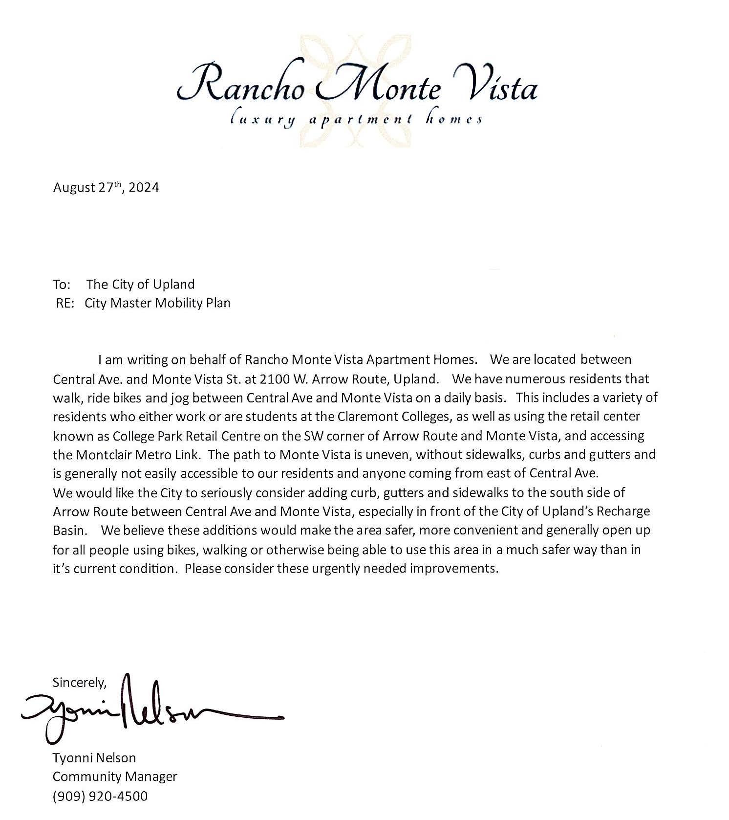
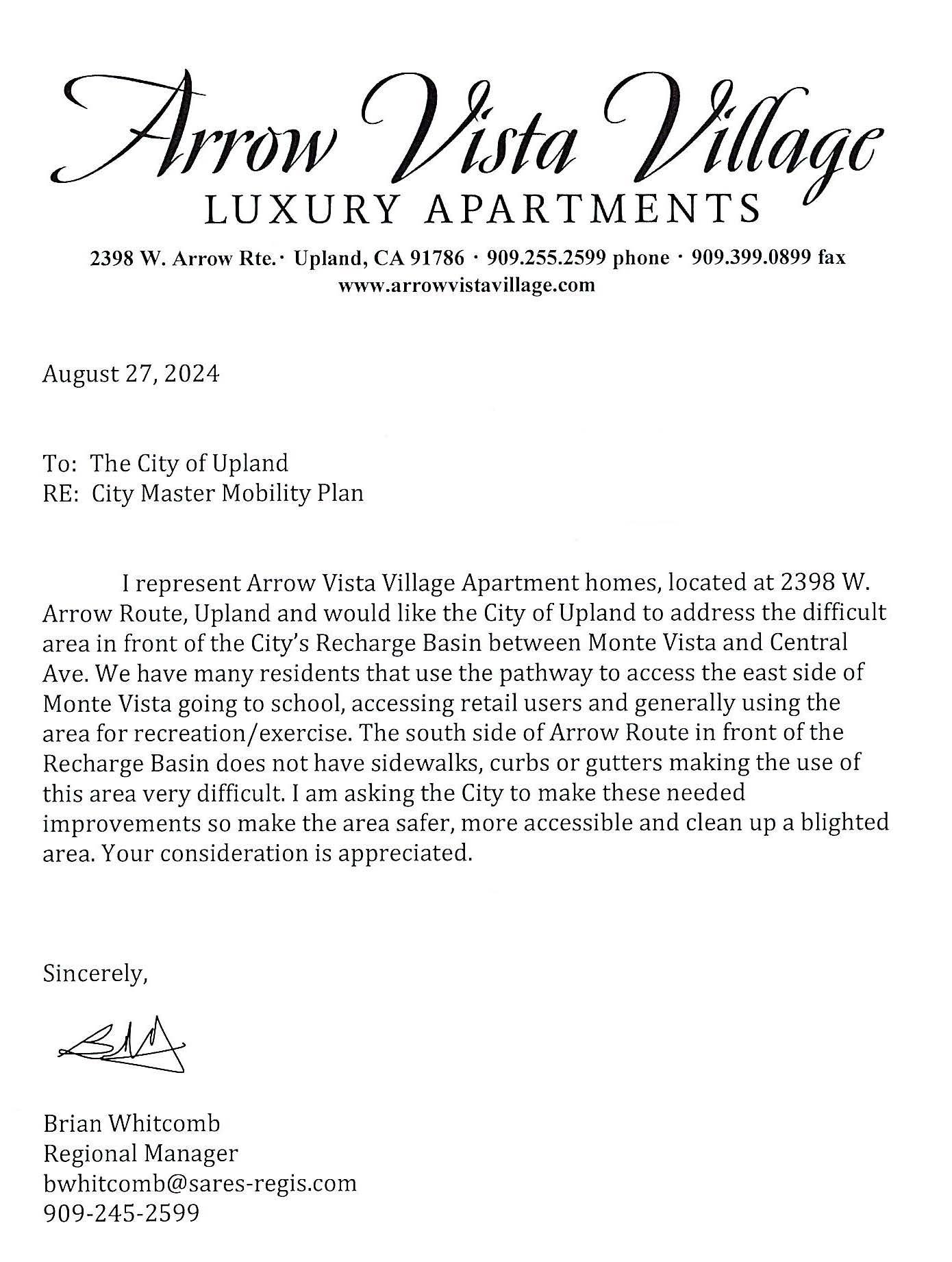
Conducting bicycle and pedestrian counts before and after constructing active transportation projects is essential to monitoring the impact of new improvements on travel patterns and behaviors. Active transportation counts were conducted at selected priority project intersections during the morning and evening peaks on Wednesday, June 4th, 2025. Table A-16 lists the count locations. Results are presented on the following pages.
A-16: Active Transportation Count Locations
2 Benson Avenue Baseline Road/16th Street
3 Campus Avenue 8th Street
4 Euclid Avenue Foothill Boulevard
5 Euclid Avenue Pacific Electric Trail
6 Euclid Avenue 9th Street
7 Hospital Parkway Foothill Boulevard
8 Hospital Parkway 11th Street
9 Mountain Avenue 11th Street 10 Mountain Avenue Arrow Highway 11 San Antonio Avenue Foothill Boulevard
12 San Antonio Avenue 11th Street
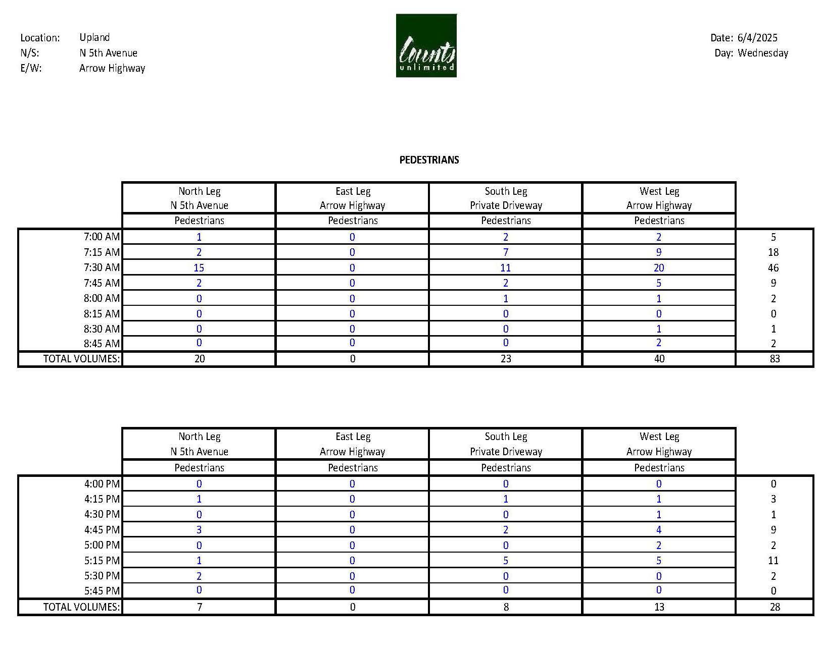
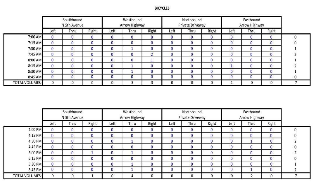
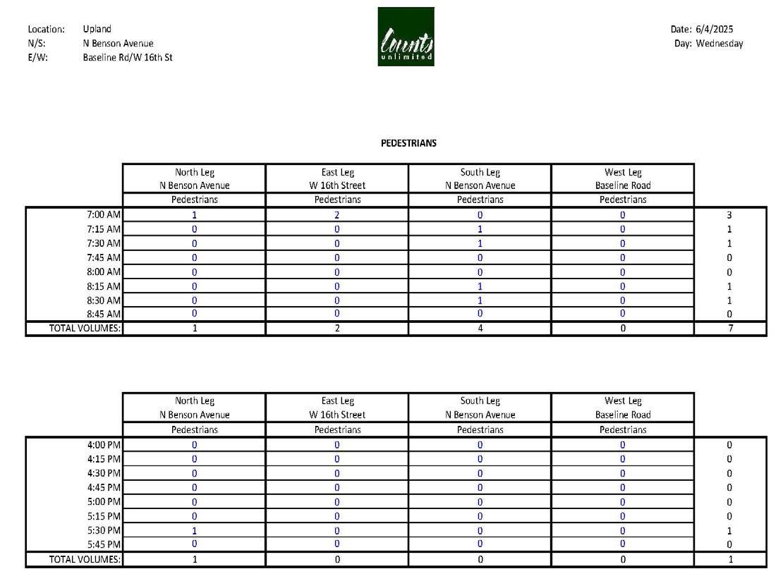

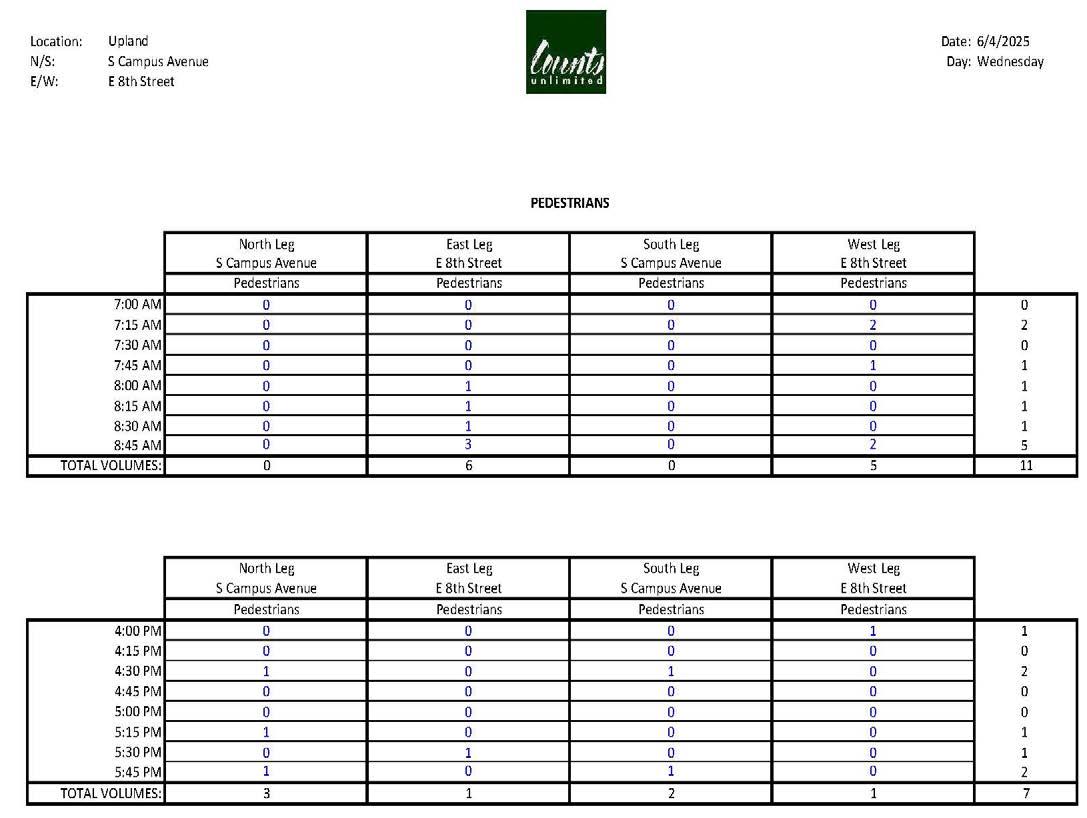
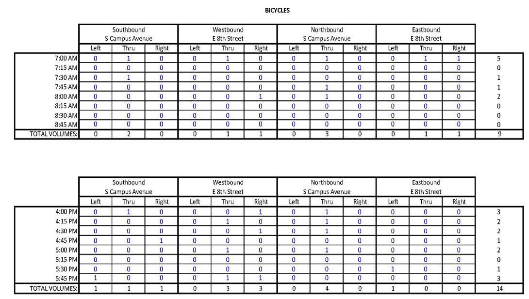
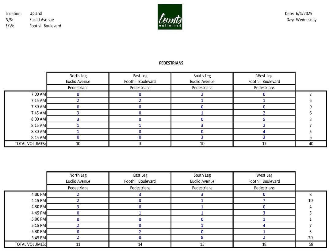
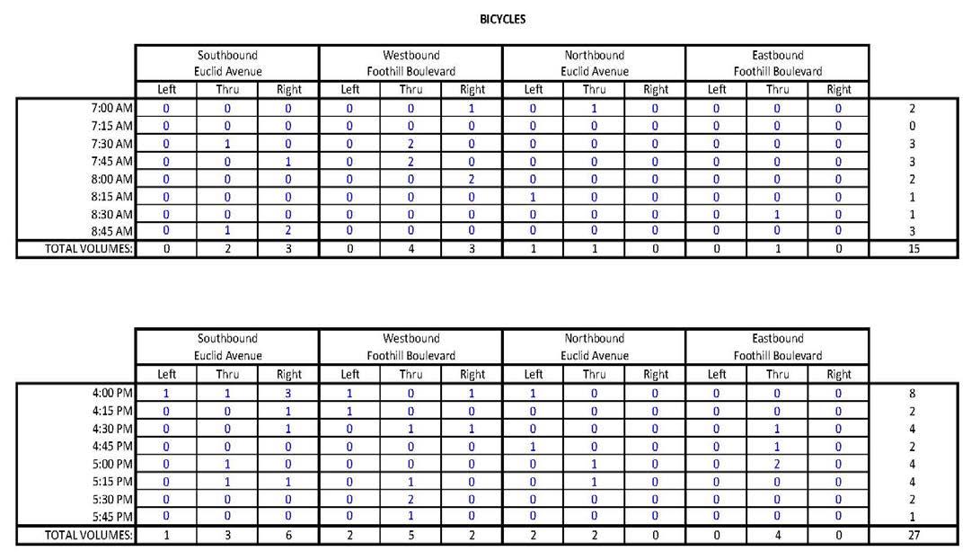
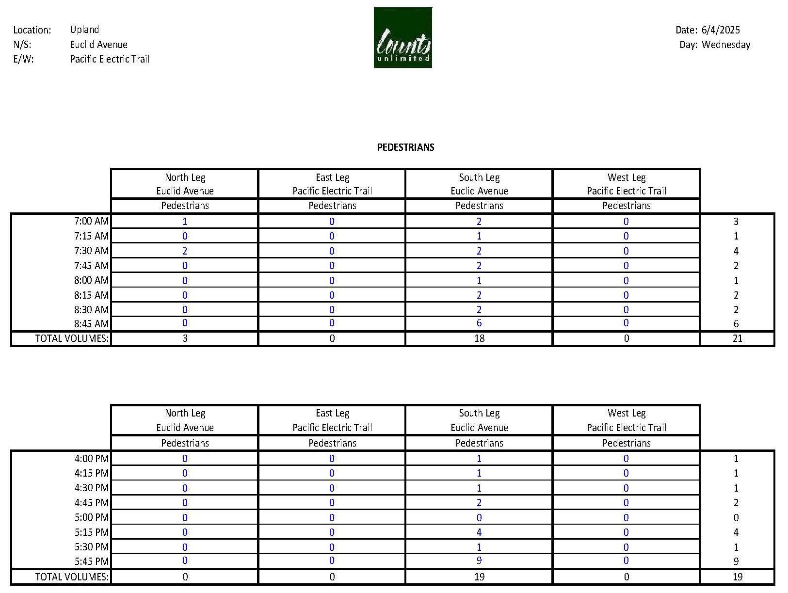
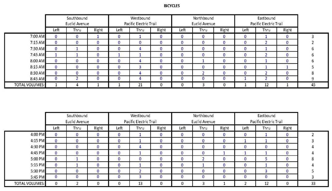
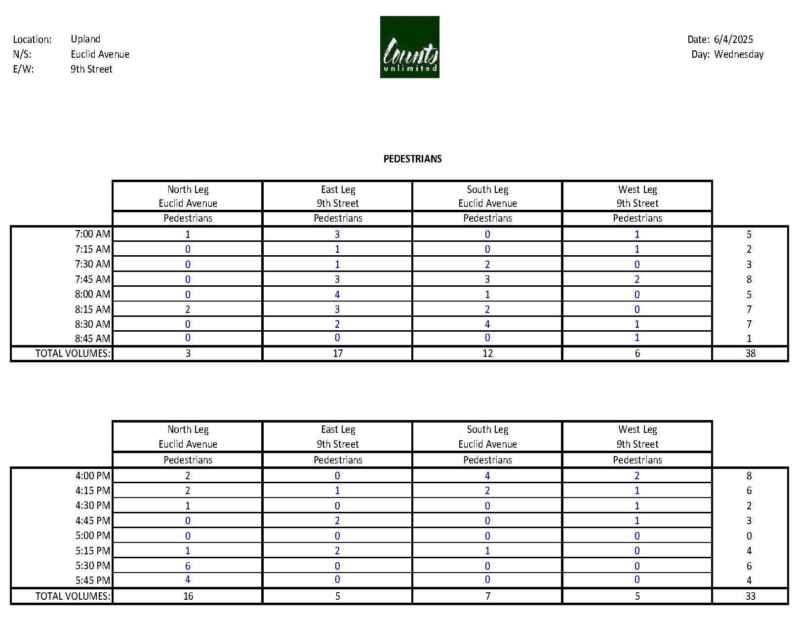
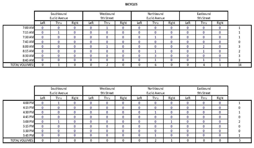
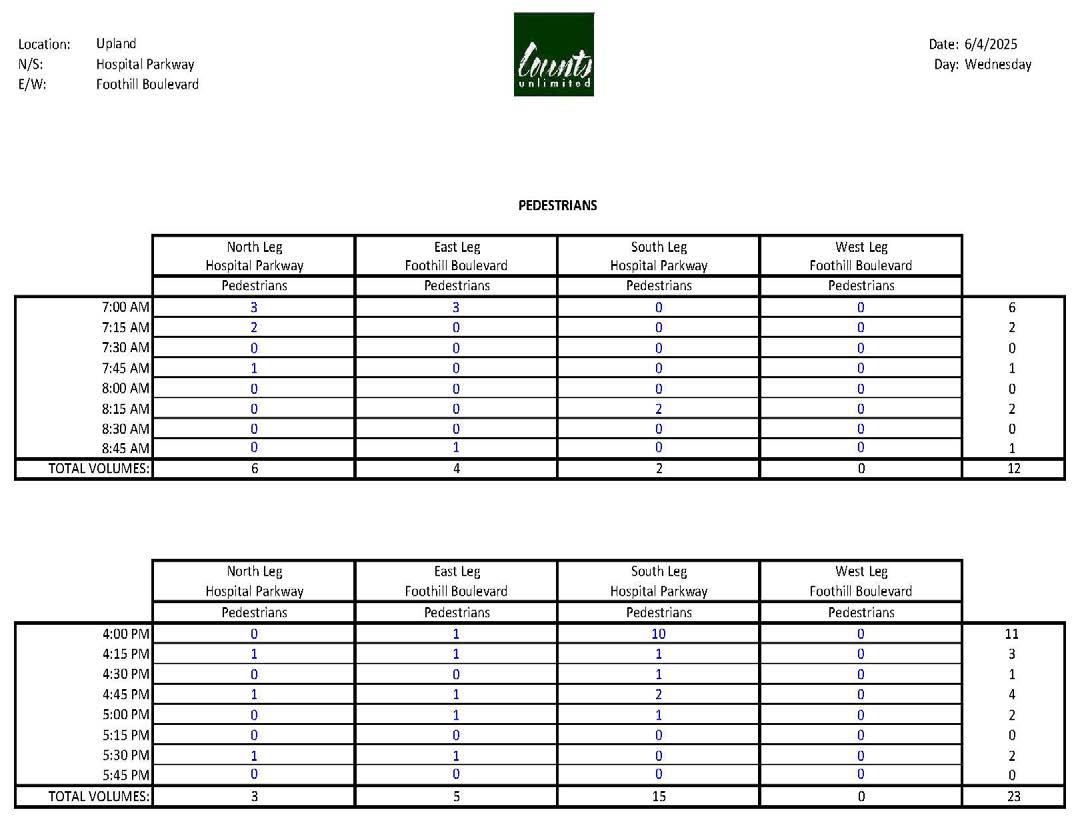
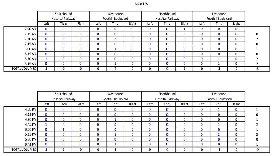
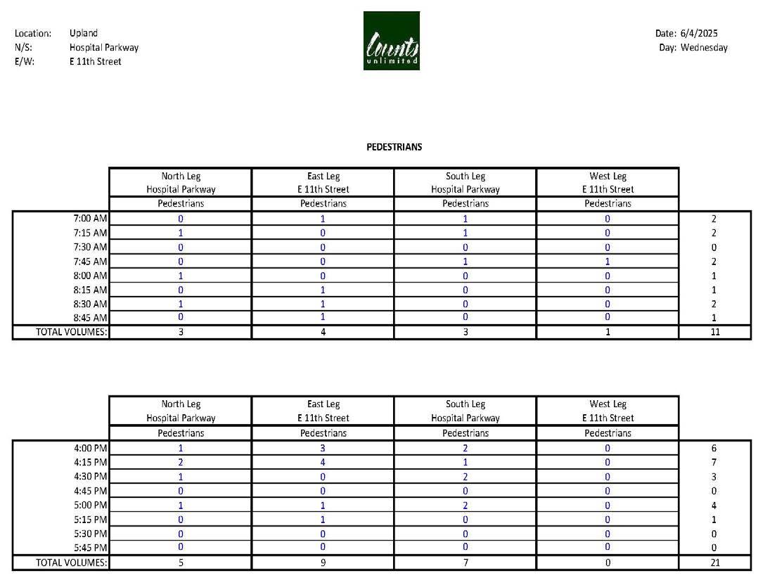
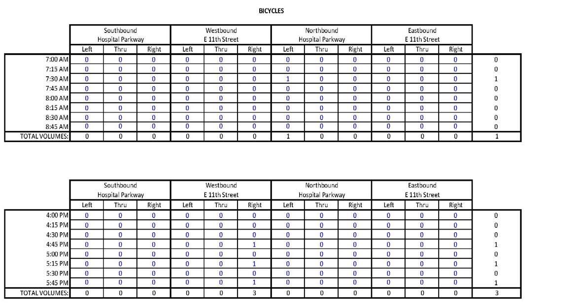
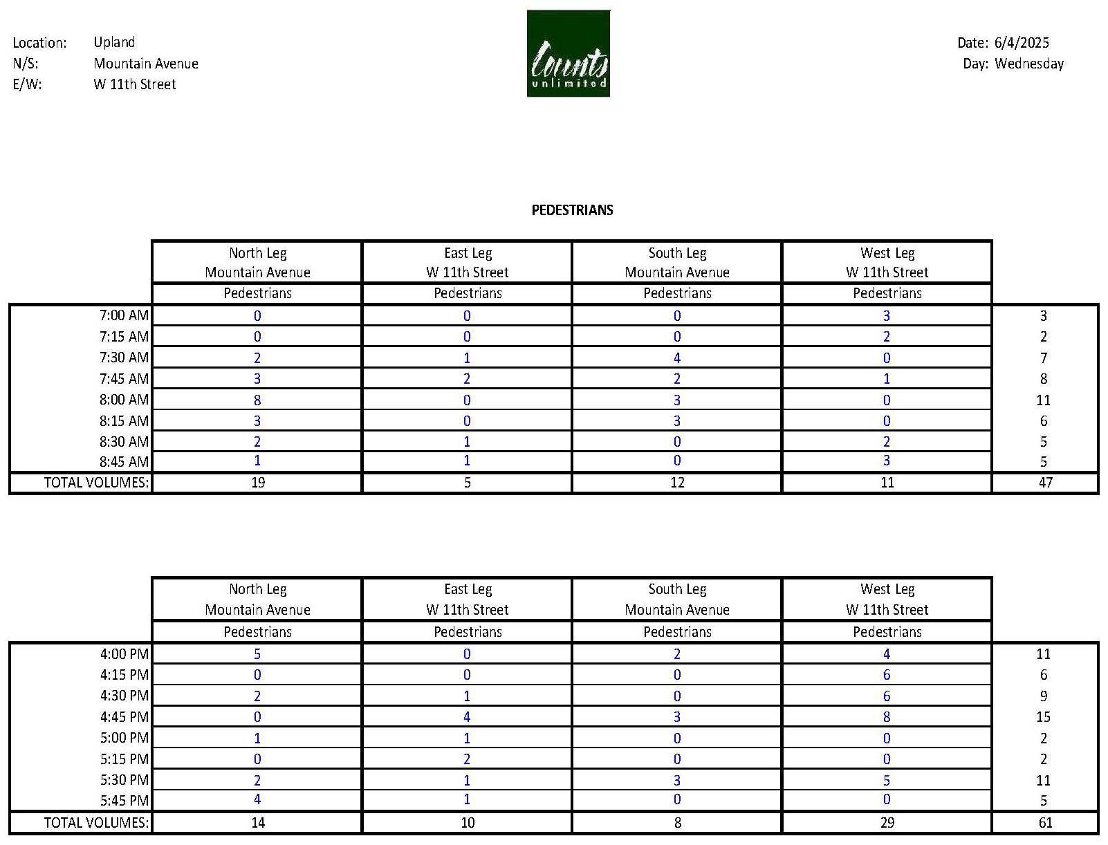
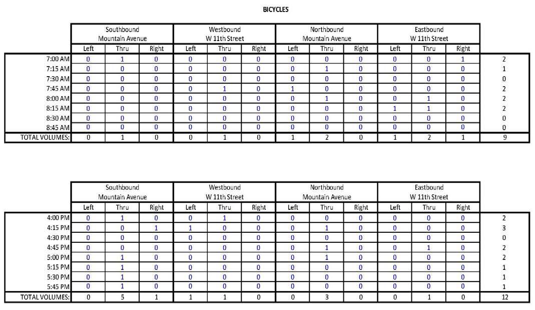

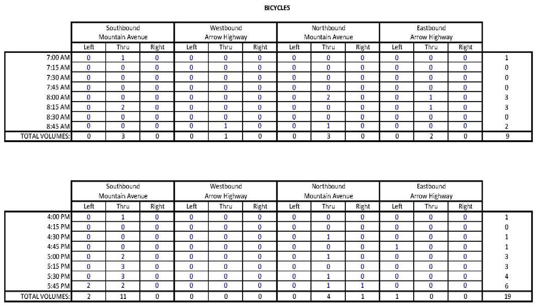
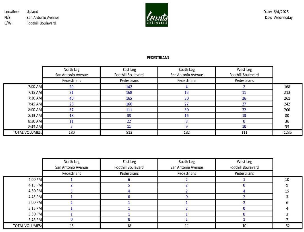
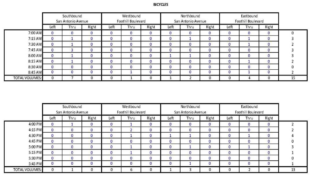
*Disclaimer: A special event occurred during the morning count timeframe, resulting in higher than typical volumes.
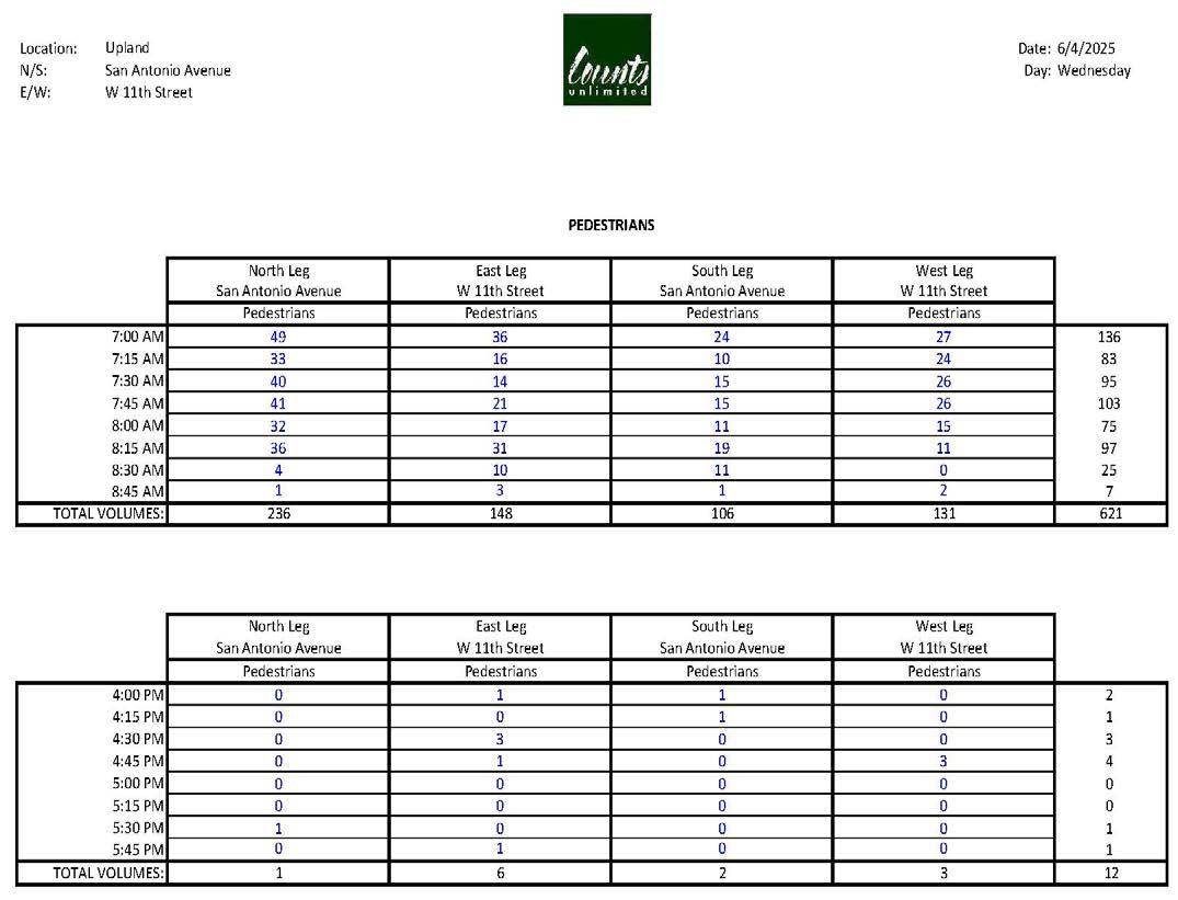
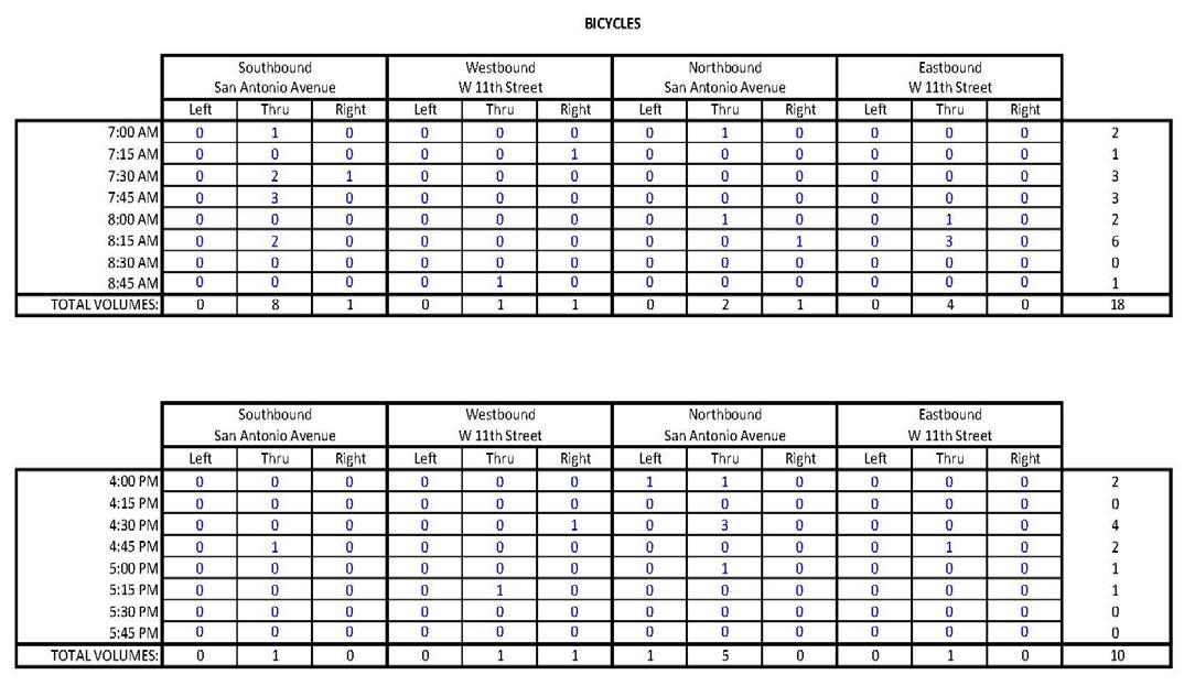
*Disclaimer: A special event occurred during the morning count timeframe, resulting in higher than typical volumes.
Planning-level cost estimates were developed for the Conceptual Design Segments of the Plan’s top ten priority projects. These preliminary cost estimates are subject to further evaluation.
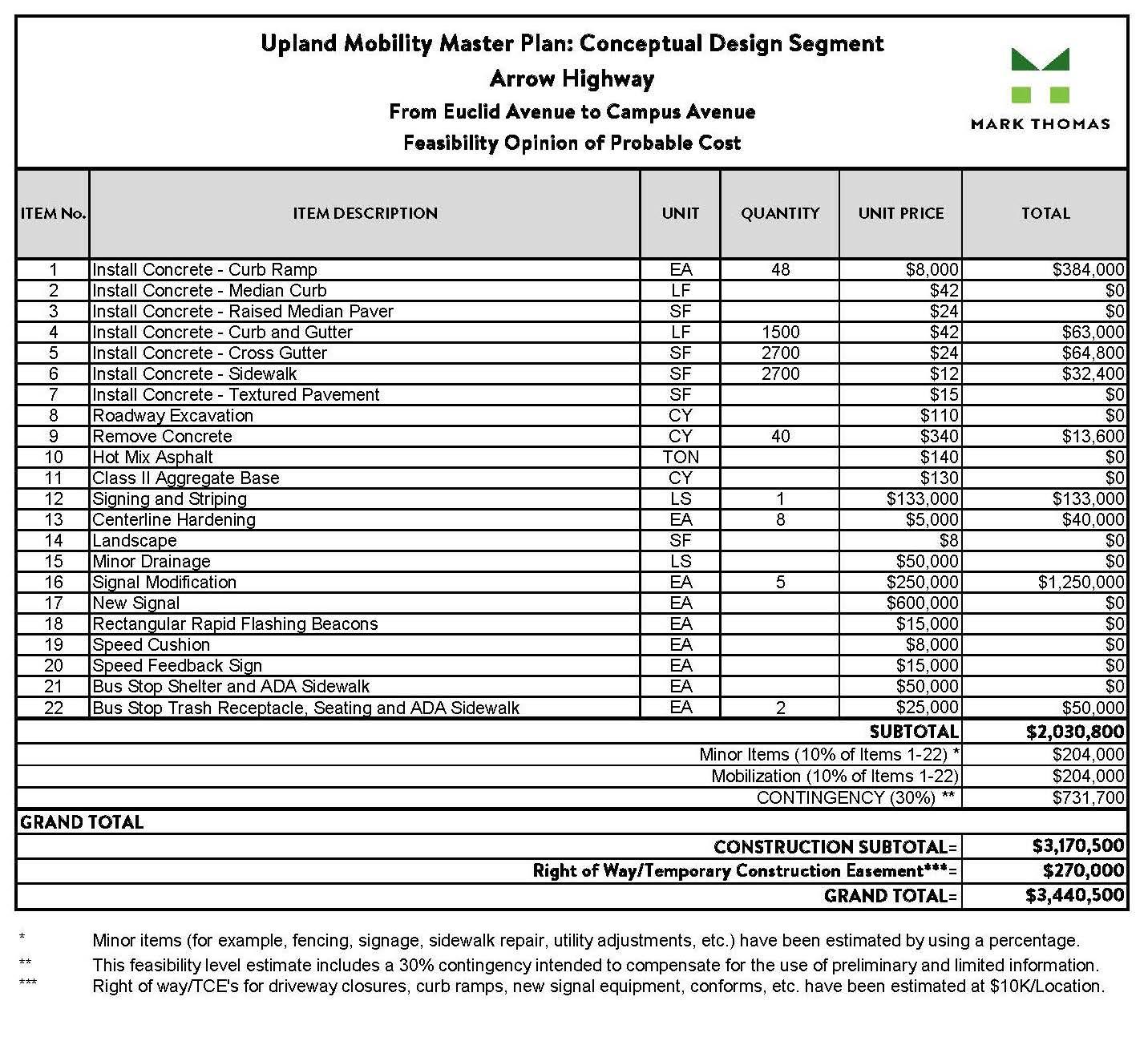
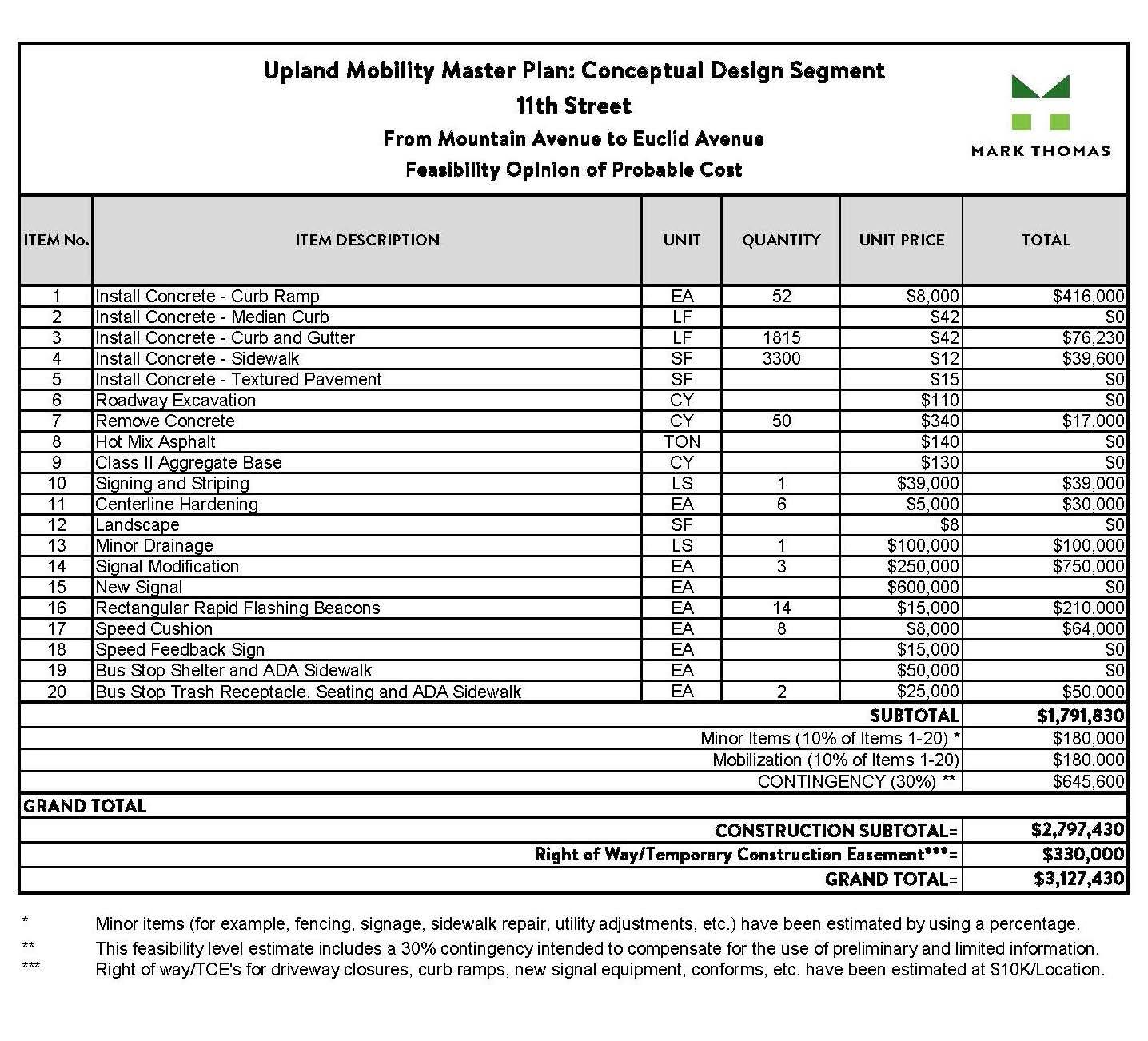
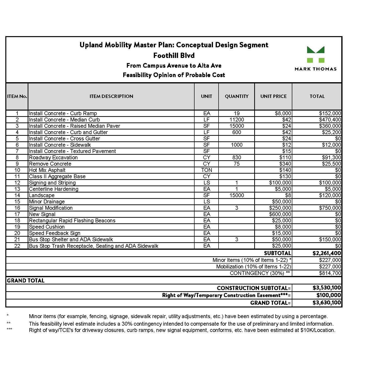
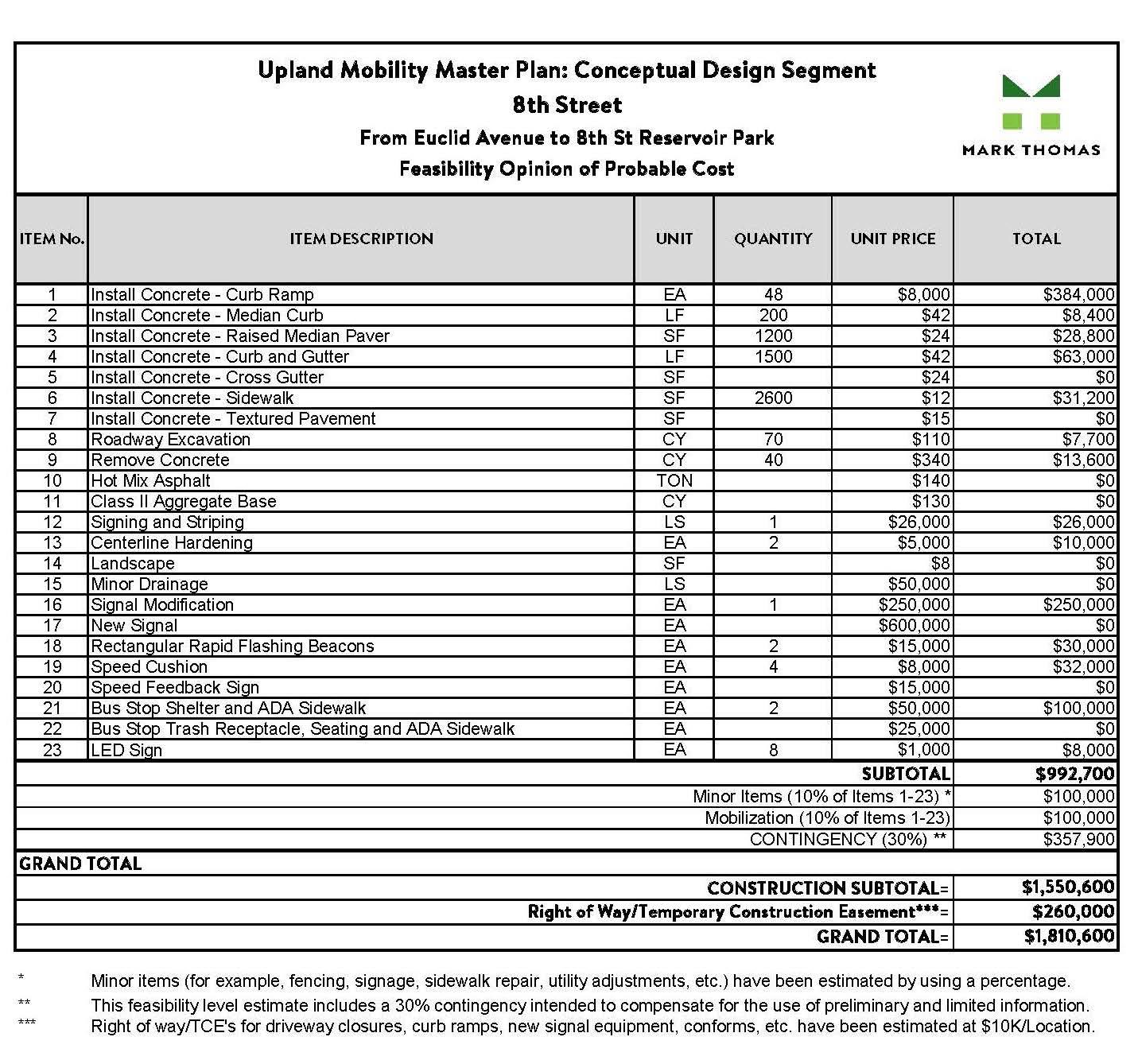
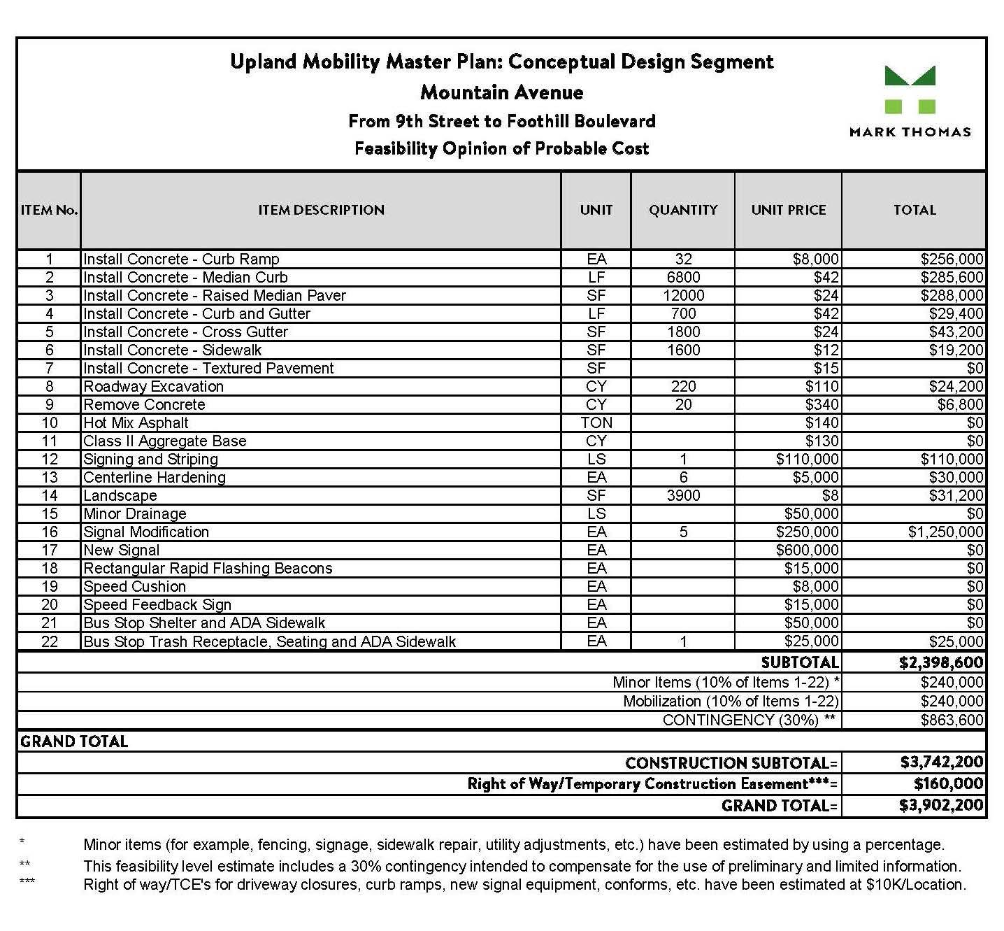
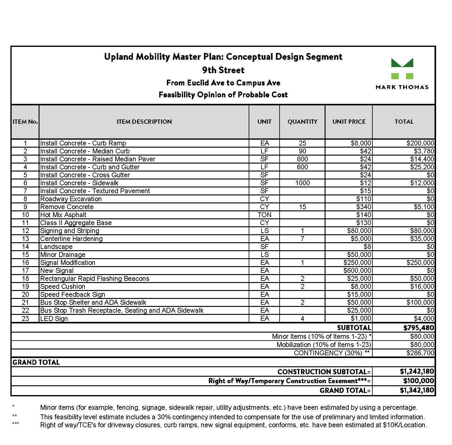
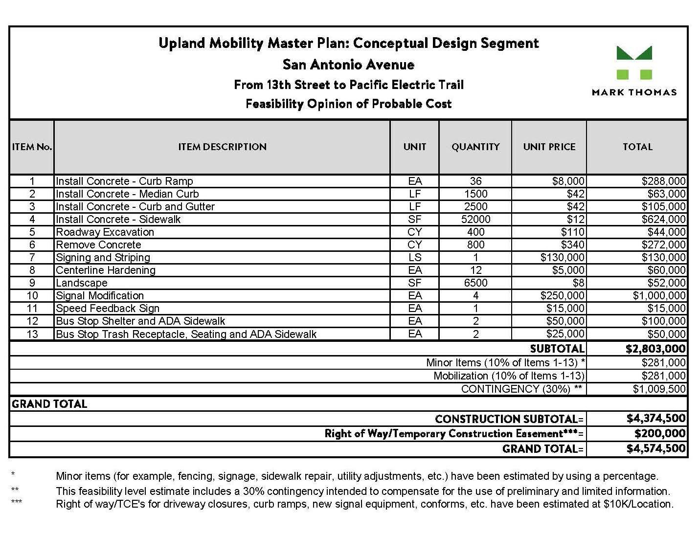
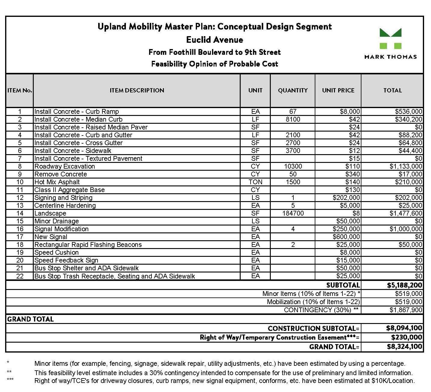
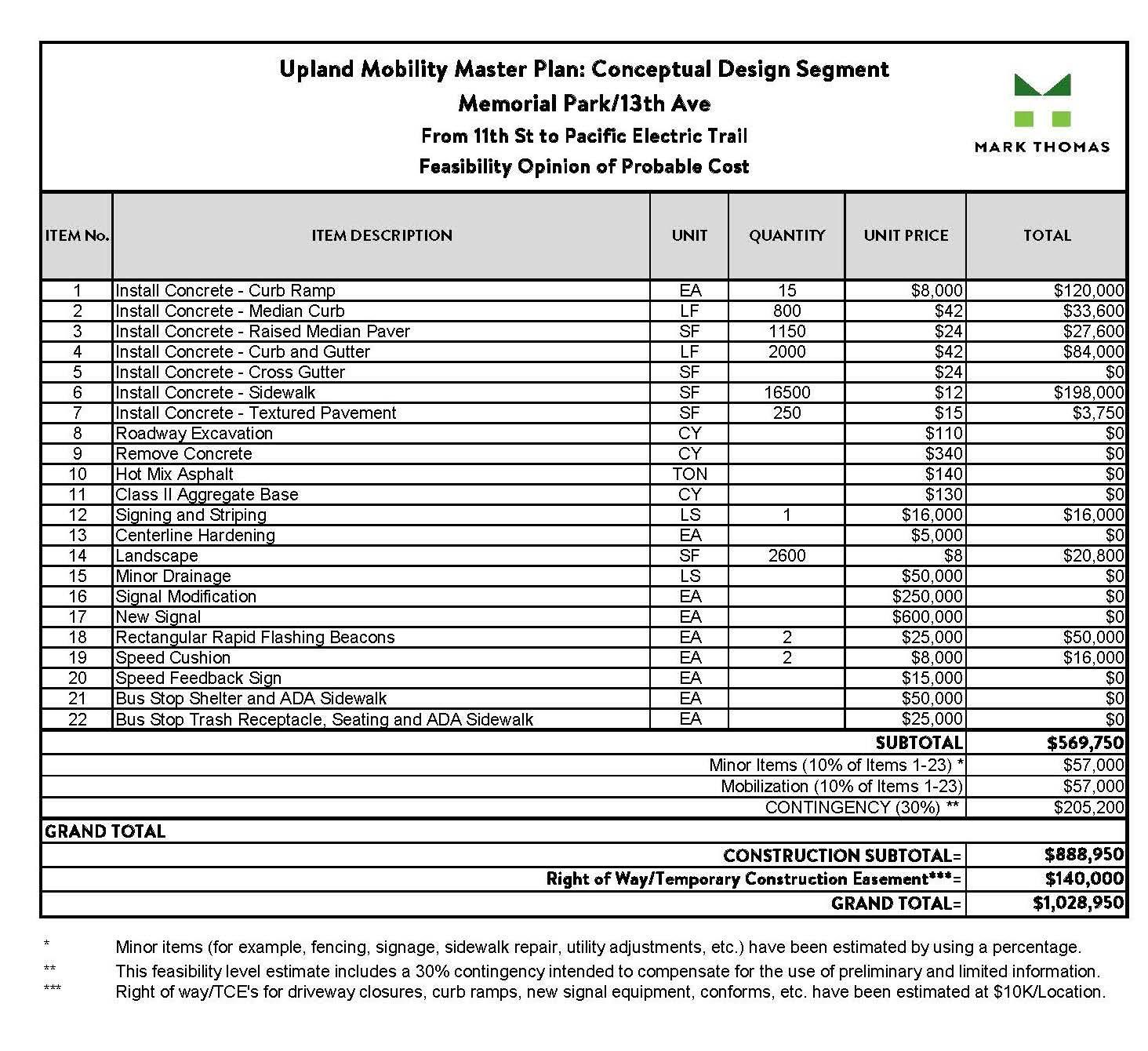
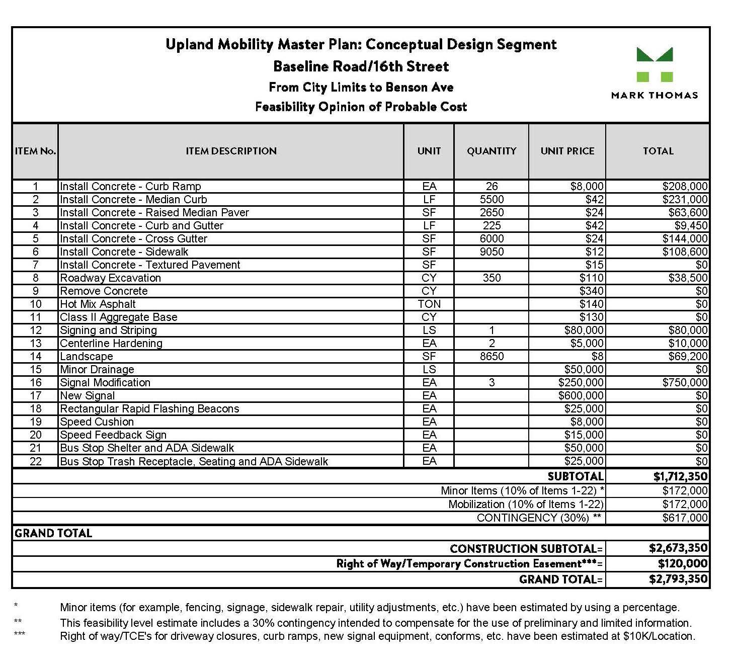
The following pages contain planning-level conceptual drawings for the Conceptual Design Segments of the Plan’s top ten priority projects, which can be used by the City to apply for and secure grant funding. All improvements shown in the conceptual drawings are subject to further evaluation. As the City begins the construction design process, the conceptual drawings presented in this Plan may be modified based on considerations for cost, maintenance, safety, feasibility, developer agreements, and availability of adequate right-of-way to install the improvements. While the Conceptual Design Segments may be positioned as “grantready” project options, the City reserves the right to implement projects at its discretion and/ or as funding opportunities become available.
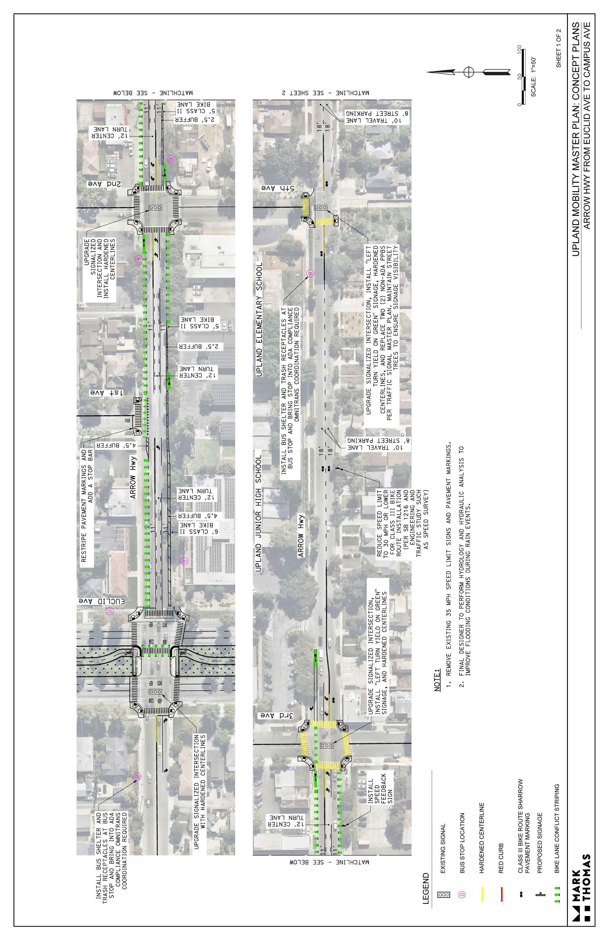
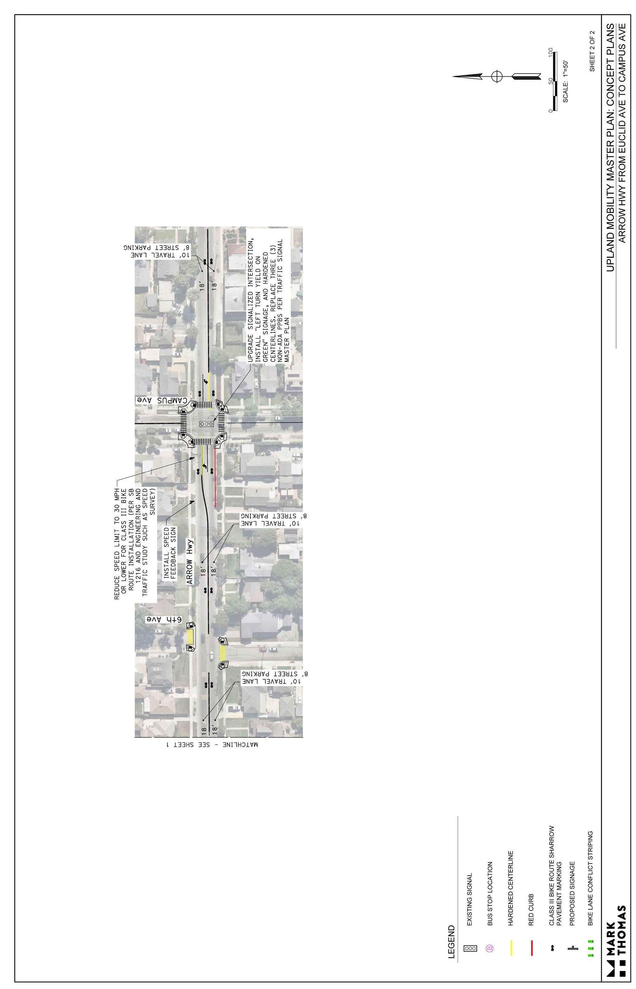
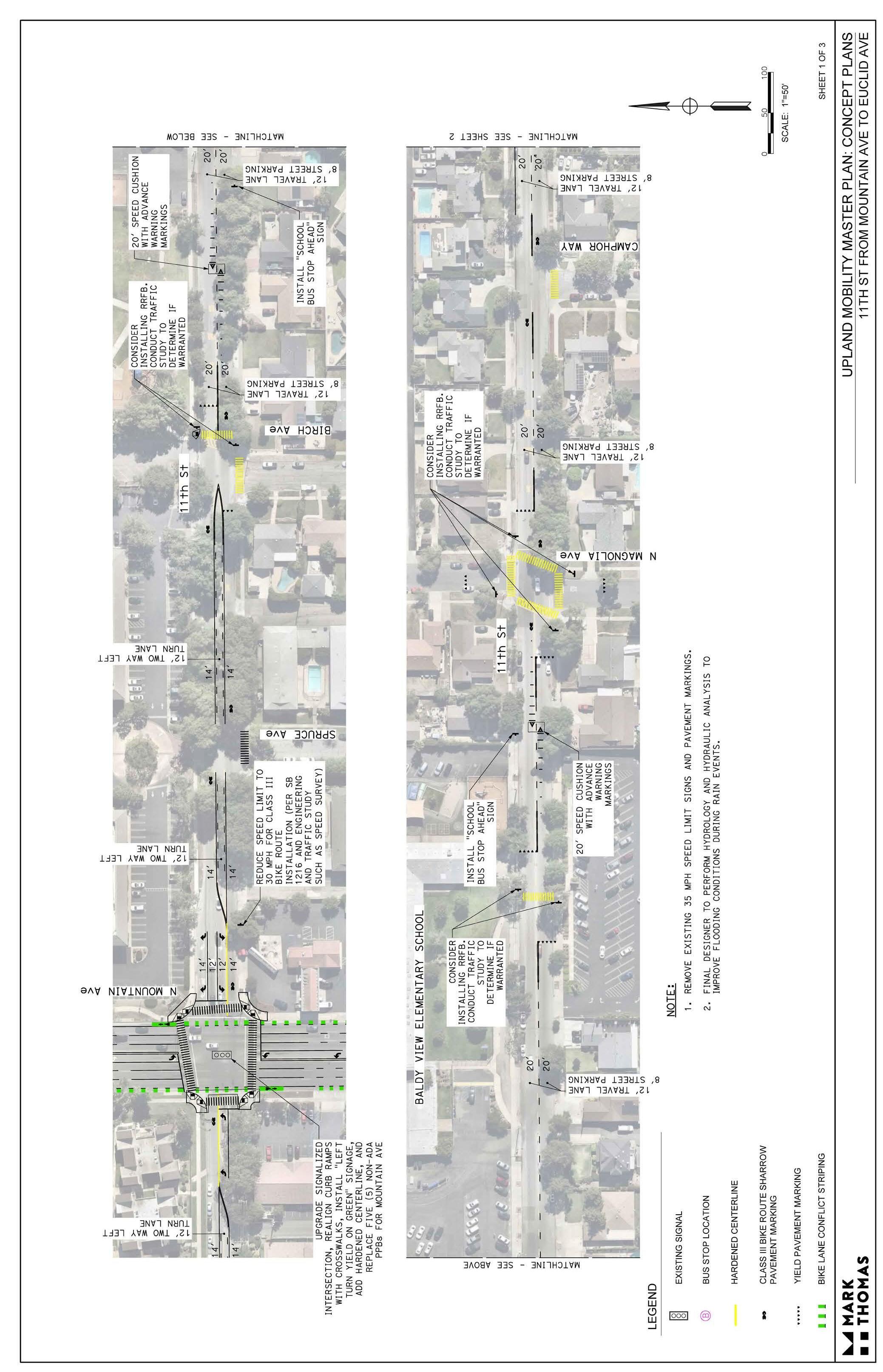
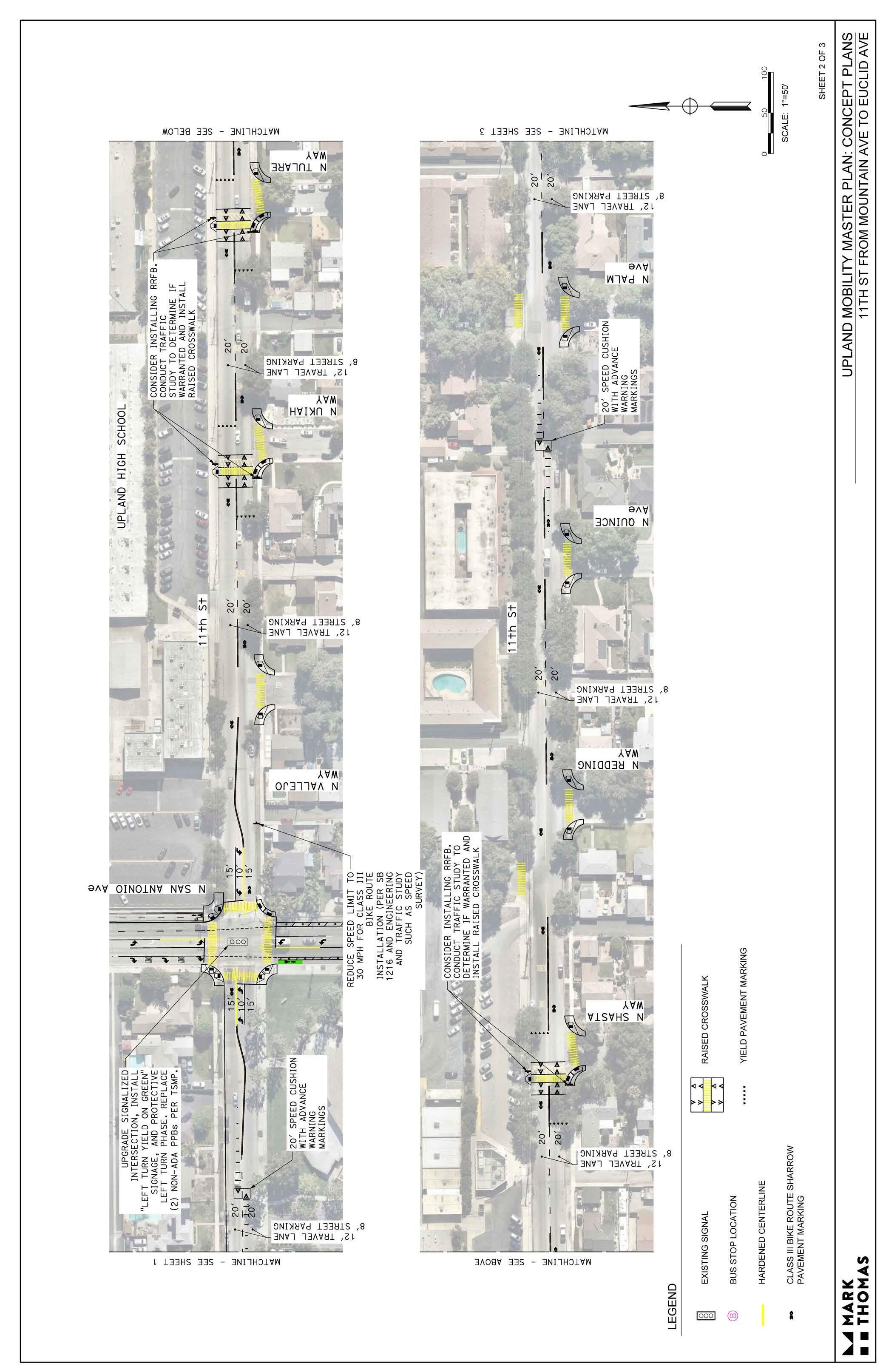
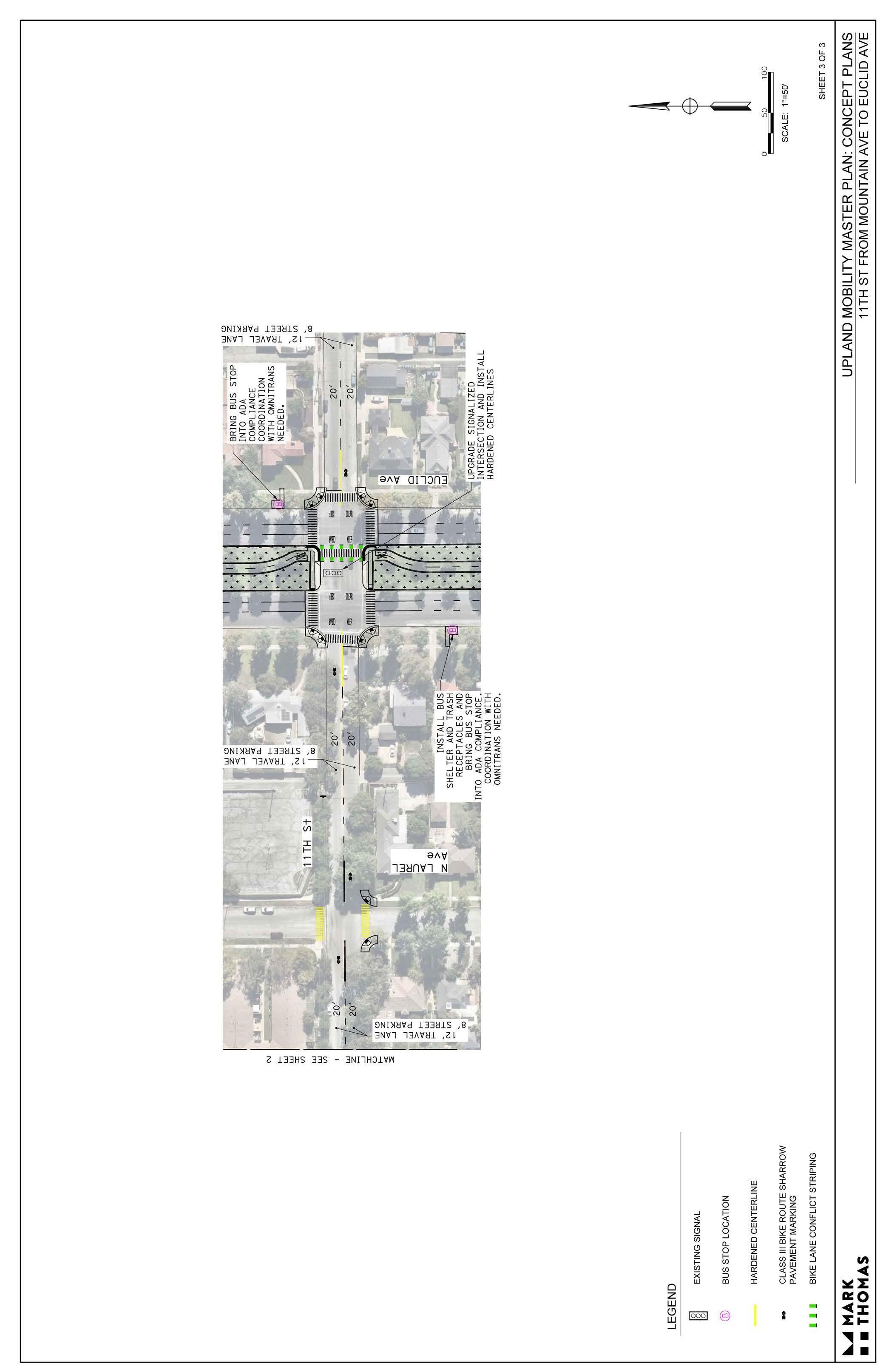
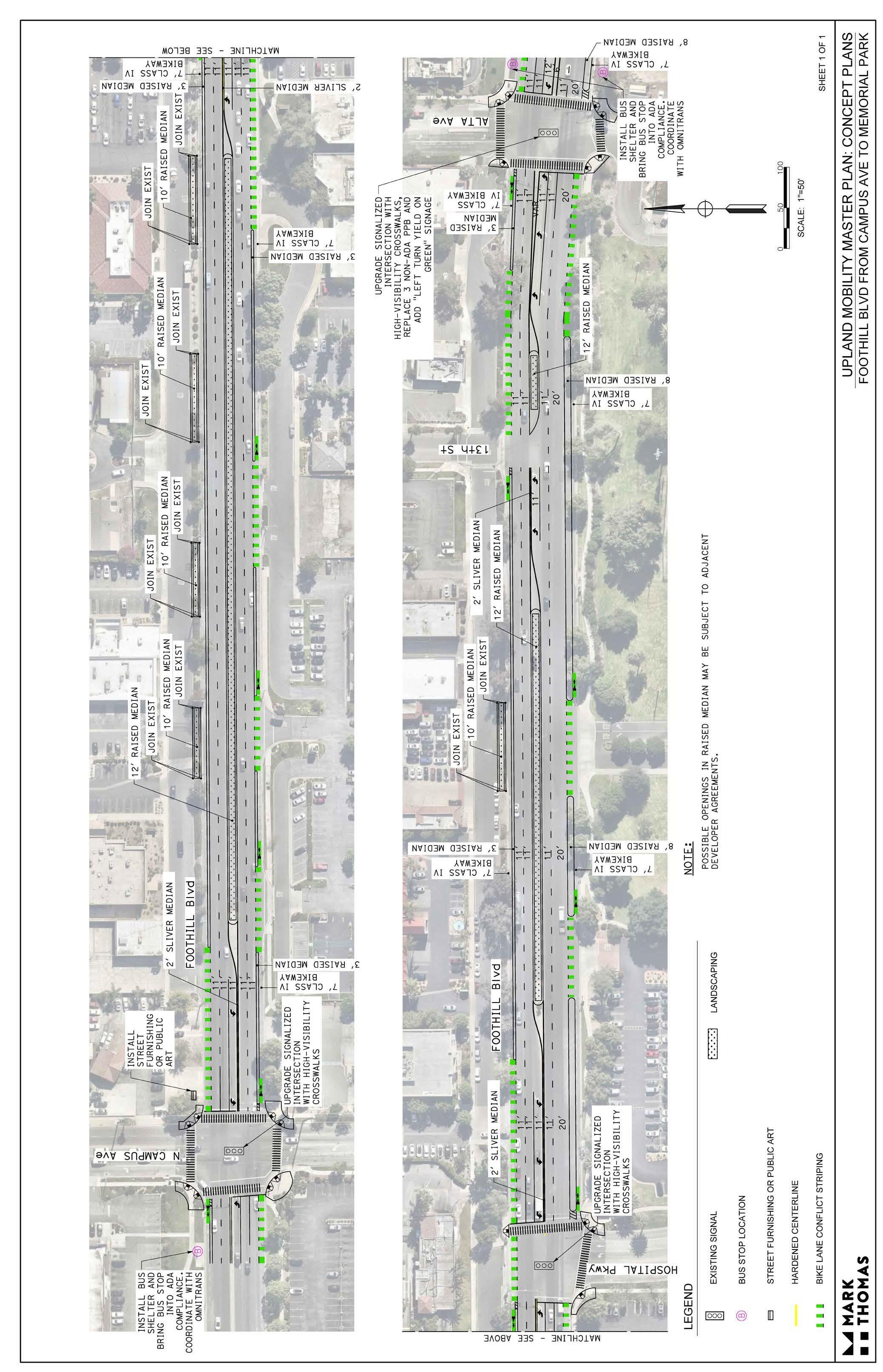
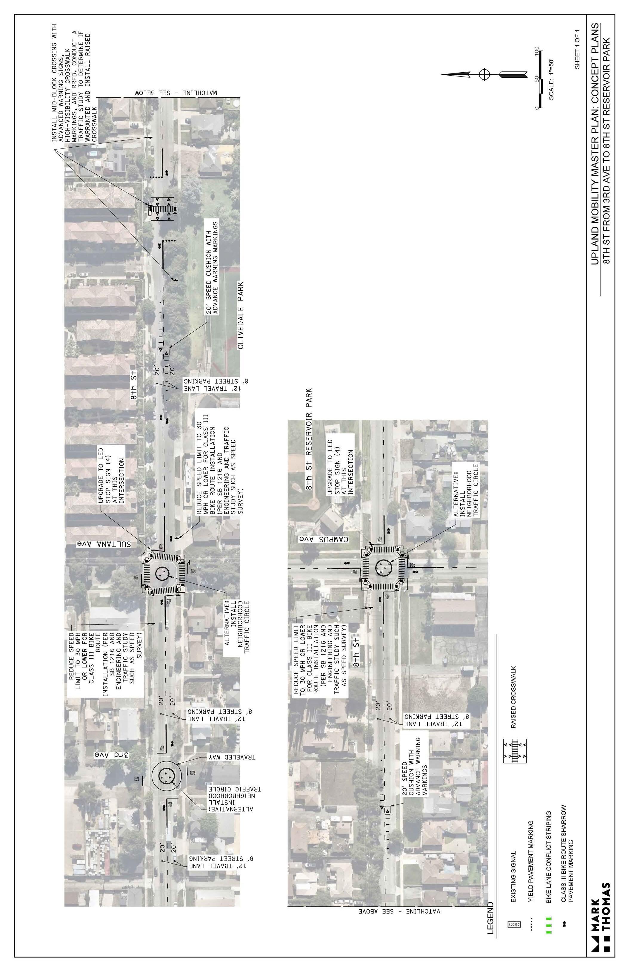
NOT e : The City is developing drawings for 8th Street from e uclid Avenue to 2nd Avenue through a separate grant-funded project.