Landscape
Architecture

MLA Studio Projects
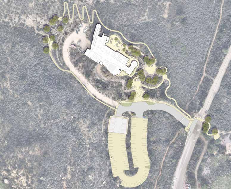
CEDAR CREEK
A. CABIN PARKING
B. WOODLAND PATHS
C. DISTILLERY
D. GREENHOUSE
E. AROMATIC HOUSE
F. WALKING SCENT GARDEN
G. SHADE STRUCTURE
H. RIPARIAN PATHWAY
Essential
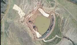
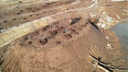
The premise of this studio design project is the transformation of the former strip mine site into an economical self-sustaining, land based enterprise, centered around craft. Overlaid in this exploration, is a focus on how a Landscape Architecturally-led development can support symbiotic relationships between humans, non-humans, and habitats, while generating holistic, systems and processes. The comprehensive strategy of Essential Extracts involves leveraging the unique properties of aromatic plants for hyperaccumulation, strategically paired with phyto-stabilizing trees and grasses. This powerful combination serves to remediate the soil and prevent the migration of heavy metal concentrations into nearby water bodies.
Interior to the design approach is community engagement, with hands-on activities situated to educate and empower locals and visitors. To further enhance this connection, we offer on-site accommodation options, inviting the community to become an integral part of the project.
HILLTOP
WOODLAND CABINS
Amelioration Process
Adding depth to the approach, the introduction of a bio-charring process not only reduces toxin bio availability but also enriches the soil in cultivated areas. The extraction of essential oils from these plants not only contributes to the craft but also serves as a tangible representation of the site’s improving health..
neededtomakeasingle15mLbottle of essenti
Aromatic Amelioration
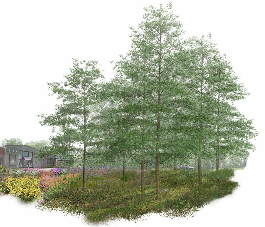
Moving beyond environmental remediation, the vision extends to the establishment of a littoral and riparian zone, seamlessly integrating land and water for a holistic ecological restoration. The history of this site is intricately woven into the design, offering visitors a profound understanding of both ecological and cultural transformations. This project transcends traditional remediation efforts, catalyzing a regenerative ecological reestablishment that is not only environmentally beneficial but also economically productive.


In the Periphery of Water
In this regional master planning studio we studied and visited Mexico City and it’s basin- once known as Lake Texcoco. Since the 17th century the lake has been manipulated to the point of complete drainage. My team’s focus was the highlands community where water’s transient presence is dictated by the steep topography, causing immediate runoff and minimal absorption into the ground. We identified distinctive landscape patterns in the highlands, and proposed methods for fostering humidity retention and generating organic matter. Considering the communal lifestyle in these areas, our aim was to design these strategies using locally sourced materials that could easily be implemented for individual families or by a choreographed communal effort.
Mexico City Basin
Lake Texcoco
Communal Strategy
Given that many families traverse their lands daily, we pinpointed specific communities and calculated distances from their central points to identify potential sites. We then analyzed site elements to devise approaches using local materials.
These approaches break down into 3 main elements
1. repurposing aggregate from unmanaged terraces
2. systems for generating organic matter
3. and strategic planting of native flora.
Diagram developed with Jose Tenorio
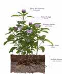
Family Garden
Material Soil Flora
Communal Alberca Eroded Hillside
Labor
Family Garden
Soil Flora Communal
Single Family Garden
Communal Labor
Communal Pocket Ejido
Material Soil Flora
Communal Alberca
Eroded Hillside
30 minute walk
Systems for the Future
While these three strategies function independently, they also co-evolve with each other. Their modular nature allows for a system that is resilient and allows communities to augment them in stages. Successive application of these strategies is meant to respond to the uncertainties around water present in the highland environment.
Work Experience
San Diego, CA
Student Housing
Design- Build Illustrative Plans
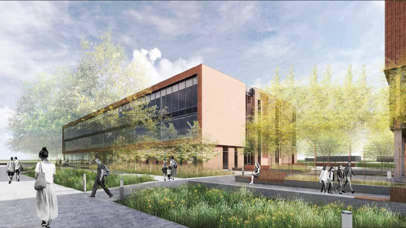
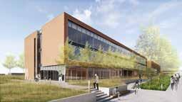
Working with a small team at Spurlock on a student housing project our design aims to create vibrant, student-centered environments, featuring a mix of first-year units, flex suites, and apartments. Two key locations for the development are “The Peninsula” and “University Towers East” which will together provide various types of student housing.
These drawings were completed with a team at Spurlock Landscape Architects.
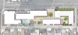
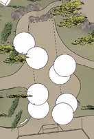
The Mission Trails Regional Park Foundation is working on improvements for the Visitor Center. The aim of this design is to enhance the guest experience by updating exhibits and improving the building’s entry and landscaping. The reassesses features such as views, shade, major exterior gathering spaces, interpretive trails and accessible pedestrian connections to parking.
Mission Trails Regional Park
Illustrative Site Plan
This drawing was completed with a team at Spurlock Landscape Architects.
San Diego, CA
MO
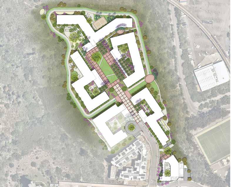
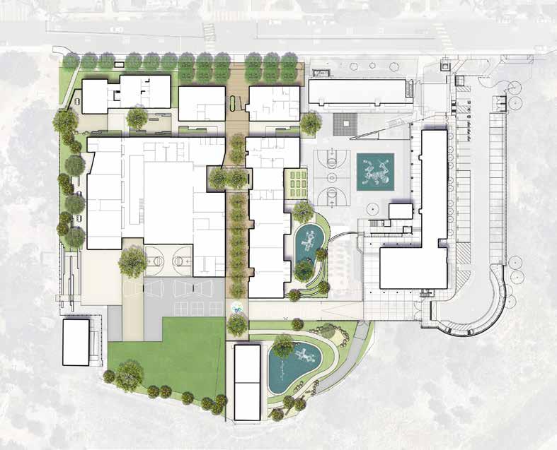
Grant Elementary School
Illustrative Landscape Concept Plan
This proposed landscape design for a modernized elementary school offers a new entry plaza, a central pedestrian promenade, expanded athletics fields and play areas, relocated basketball court, and outdoor collaboration spaces, ensuring a cohesive and enhanced campus environment.
This drawing was completed with a team at Spurlock Landscape Architects.
Kirkwood,
Beach, CA
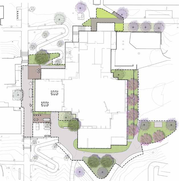
CSU-Hillside Dining
Schematic Design Illustrative Plan
The Hillside Dining Hall Expansion at CSULB seamlessly integrates with the campus’s park-like atmosphere and improves movement around the dining hall. Hardscape paving defines pathways, guiding people and transitioning from pedestrian zones to gathering areas. Surrounding plantings create inviting spaces for social interaction and relaxation. The landscape design enhances campus well-being and aligns with CSULB’s identity, encouraging outdoor gatherings.
This drawing was completed with a team at Spurlock Landscape Architects.
Long
KEY PLAN

MO
In this project for the campus of St Louis Community College I created two perspectives with our proposed planting design for a client presentation. The perspectives depict viewpoints from the west and east sides of the Financial Services Building. This site is part of a larger masterplan encompassing the southeast part of the campus that aims to provide a LEED certified landscape design, enhancing the site from it’s current condition.
Arbolope Studio Kirkwood,
STLCC Meramac Campus Planting Design Render
This masterplan design for a watershed pond supports erosion and filtration through strategic planting and integrating check dams into a functional layout. Goals of this project include creating a healthy pond watershed, diverse fish habitats, land stewardship, family and small-group recreation, and education while utilizing native materials. The design includes path networks, a kayak launch beach, ADA accessible pond boardwalk, and floating islands for an immersive kayaking experience.
Arbolope Studio Concept Design Plan
Mississippi Confluence, MO
MRL Pond


Park Programming
L103
Throughout the semester in this technology course, a comprehensive DD set was created for the redesign of Bobwhite Park. The plan encompassed a complete overhaul, incorporating features such as a perimeter path, connecting pathways, an ADAaccessible parking lot, a multipurpose court, bike racks, multiple play equipment pieces, and a shade structure, among other specified components.


Site Analysis
This regional site map was created during the research phase of ‘In the Periphery of Water’ using ArcGIS Pro. Looking into land types, historical uses, vegetation, and slope we could pinpoint areas (highlighted in orange) as advantageous sites for interventions.
Mexico City Basin
Lake Texcoco
Entrance View Plan View
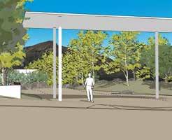
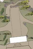
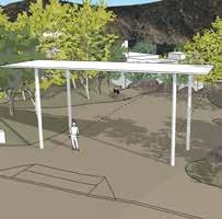
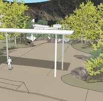
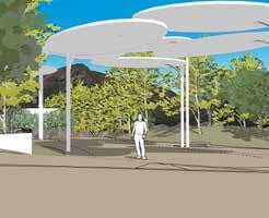
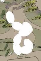
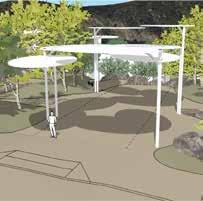
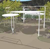
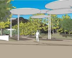
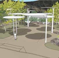
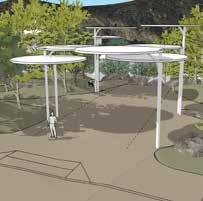
For the Mission Trails Regional Park project, a key improvement involved enhancing the entrance with a shade structure. Utilizing SketchUp, I created models of various shade structures at different times of the day to illustrate the varying outcomes to the client. The objective was to replicate the feeling of a tree canopy while preserving the view of the mountain range upon entrance.
SketchUp
St Louis, MO citygarden
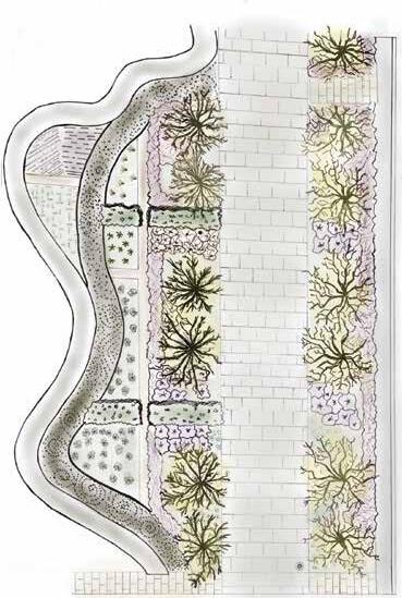
Reverse Engineering
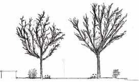
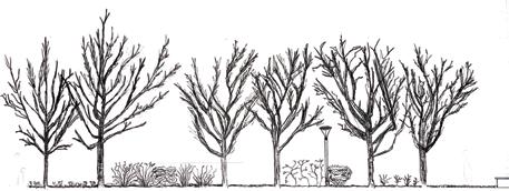
In an exercise to explore planting design and its evolution over time I deconstructed the existing site of citygarden. Analyzing the ground plan, shrubs/structural layer, and trees, I manually measured and sketched plantings in both plan and section, later adding digital annotations. This study aimed to document the variance between design intentions and the actual outcomes in terms of plant morphology, spacing, and their interaction with other constructed elements and human activities. It also considered the effects of time on plant growth, losses, maintenance practices like pruning, and spatial factors such as increased shade or plant crowding.

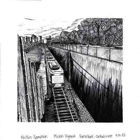
In a semester of representation I explored different mediums through observational drawings with themes surrounding texture, tone, atmosphere, and perspective. In representation II I explored native Missouri plants of a glade and their ecological attributes and benefits.
Opuntia compress Eastern Prickly Pear
Bouteloua curtipendula Side Oats Grama
Aster azerius Blue Star Aster
Castilleja coccinea Prarie Fire
Ruellia humilis Hairy Ruella