Menagerie
Kriti Shivagunde
Portfolio of Selected Design Works
1
URBANMIX
UrbanMix is a proptech start-up company catering to Real Estate Owners and Developers to optimize and streamline multiple back-office and turnover workflows. My role started initially as a Freelance 3D Specialist, to a Designer and at present, Product Manager.
Due to NDAs and company policy, only certain information can be shared outside the company. Certain data has been redacted where necessary.
ROLE: Designer / Product Manager
DURATION: 2 years
TEAM: Sharon, Ron, Daphna
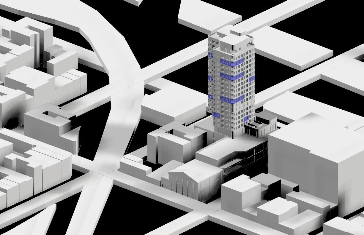
The UrbanMix software is essentially a managerial helping hand that guides property managers, owners, leasing agents and contractors with their roles within the real estate space. My role within the company primarily started with UI/UX design and 3D modeling of client portfolio with little to no data and drawings available to model the interior spaces. Over the two years at UrbanMix, I have modeled over 75 buildings through a self-established system of efficiency. The model gets further connected to live data to aid workflows.
I also took on the role of a UI/UX Designer for the system interface which involved thorough studying of the processes within our client companies and then creating the software to eradicate the gaps in time and money. We explored a heavily iterative process of task creation to visual optimization over Figma, 3js, and Blender.
My role now, as a product manager, is to develop an independent product that caters to our client in the Building sustainability sphere which includes systems design, site visit executions, and UI/UX design.
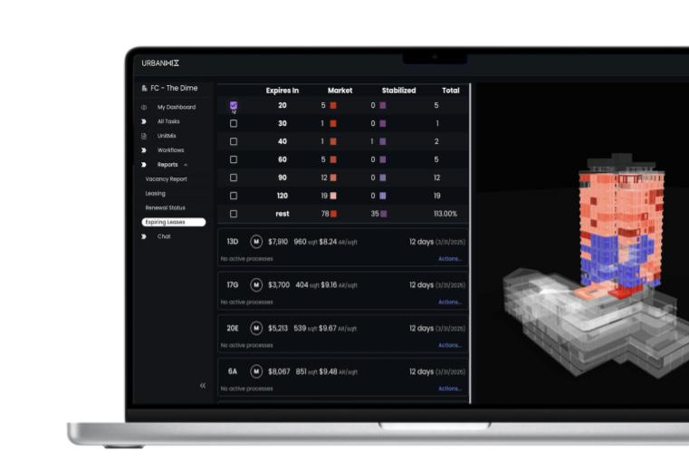
THE 3D SYSTEM
Scouting for Data
NYC Buildings often don’t have floor plans or accurate unit information available. Sometimes you get lucky, sometimes you have to derive data from Google Earth, refer to fire plans on site or patch floor plans together to begin the data.
Filling Data Gaps
Unless your client company has construction documents, there will be data gaps. Finding and filling these data gaps through previously mentioned sources and site visits becomes necessary.
Constructing the 3D
Once you have the data, or a semblance of it, you can start building on it with some company established guidelines.
Prepping the 3D
Each mesh in the model needs to be tagged accurately to smoothly connect spreadsheet data to it. It also needs to be exported to the right formats to seamlessly integrate to the platform
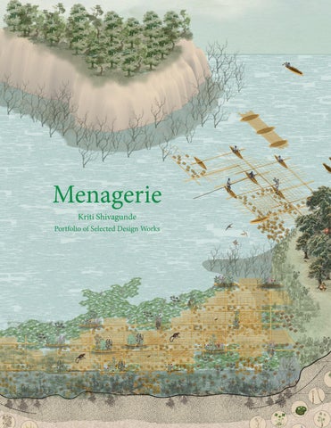
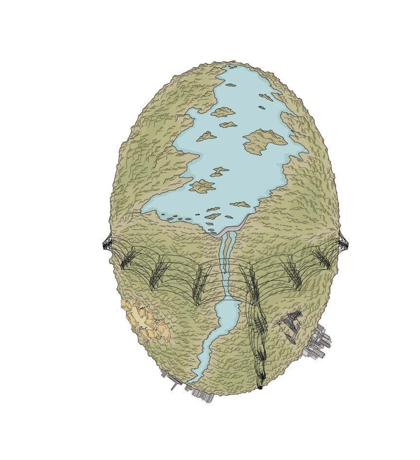
2HAUNTED LANDSCAPES AND THE
NEW AUTOCHTHONOUS
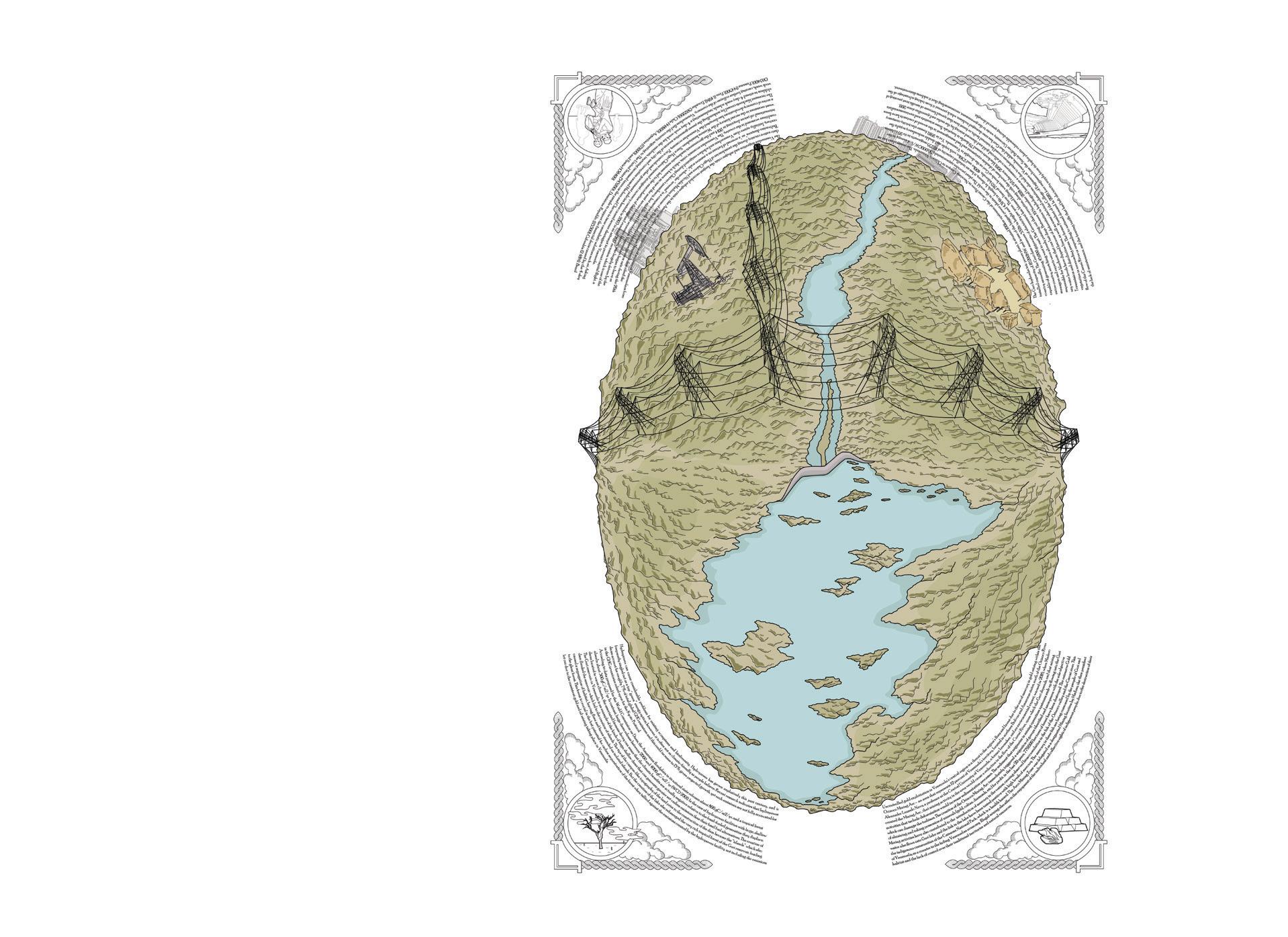
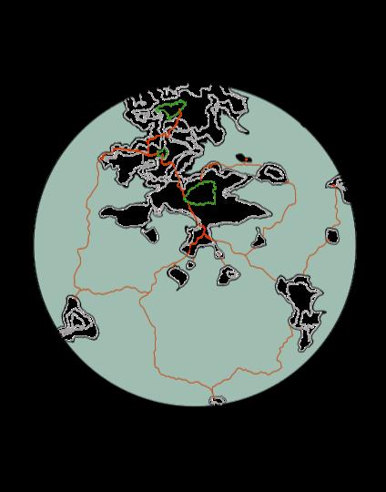
The heart of Venezuela’s electricity system is built on the Caroní River just before it pours into the mythical Orinoco, a reflective pool with a 4,000 square kilometer surface area that feeds the Simón Bolívar hydroelectric plant (Guri Dam) which inturn provides 70% of Venezuela’s electricity. Over a decade ago, the Venezuelan government issued the electrical emergency decree. Ever since, Guri has been at the center of controversy over the causes behind frequent power outages.
STUDIO: Capitalocene Energetic Landscapes
SEMESTER: Spring 2023, Advanced Studio VI
CRITICS: Mireia Luzarraga, Alejandro Muino, Andrea Molina
COLLABORATORS: Kriti Shivagunde, Javier Flores Flores
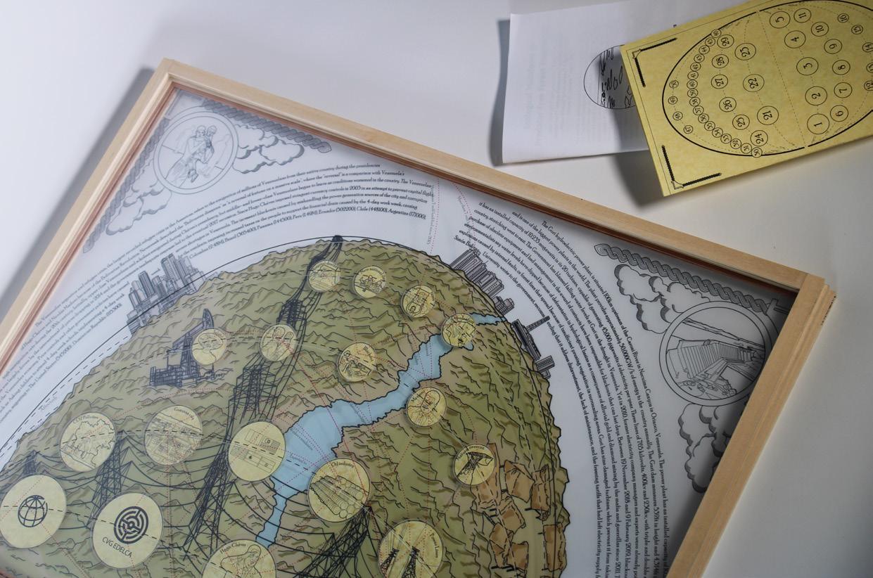
The Guri Dam finds itself symbolically and geographically located at the conjunction of urbanization and the tropical ecology of Venezuela. The cosmogram identifies the various socio-economic-political and ecological actors that impact and are impacted by the reservoirs and highlights their interconnected identities to flesh out a map of butterfly effects.
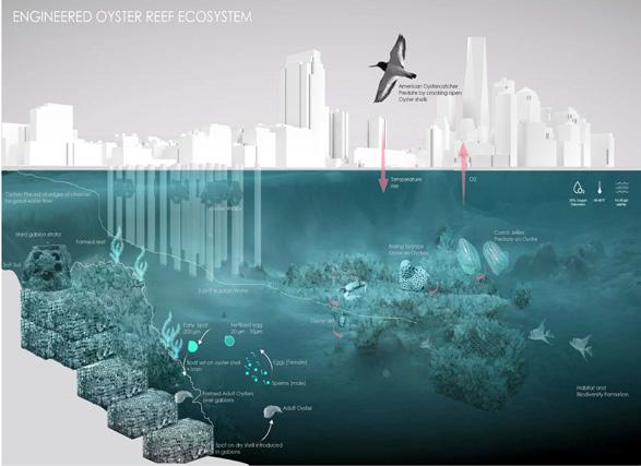
Exploring the ecological impacts, the construction of the dam immediately flooded the river, causing the tips of hills the become islands of fragmented habitats with terrestrial species starnded on these landmasses. It also created a ghost forest of lost carbon sequestration potential, as well as a departure of predators. This furthered a trophic cascade of overconsumption by leafeater and frugivorous species, uncontrolled population growth in the basence of predators and also declining vegetation-cover, overall extirpating the species on these islands. Mercury poisoning in the water caused by mining has made fishing and consumption impossible. The electrical lines from the power plant to the cities encroach on indigenous Pemon and Warao lands, and a recent drought decimated the water levels of Guri Lake causing a 7 day blackout in Venezuela causing further collapses in economy, political trust, and mass migrations.


The many actors involved in this cosmogram of Impacts and Impacted - offers multiple opportunities of intervention that could help the Guri Lake and its tangible and intangible environment. During the brainstorming process, we explored a hybrid structure of intervention that is interconnected in its effects - where Guri lake could them become a proxy landscape for the many waterbodies in and around Venezuela with similar problems and climate challenges.


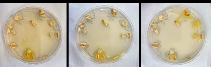
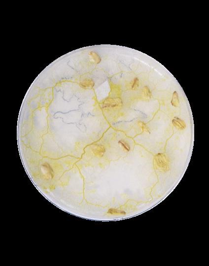
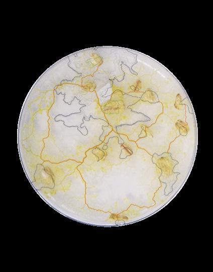
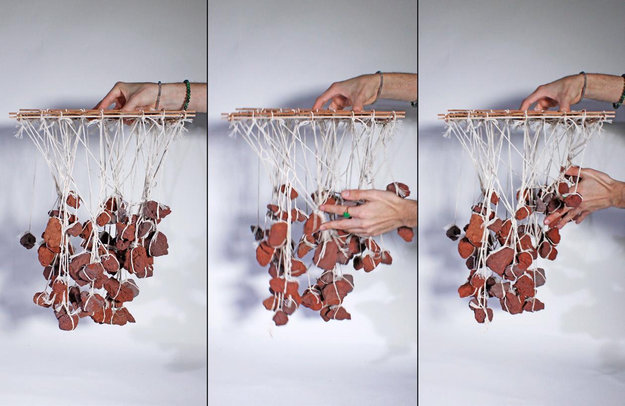
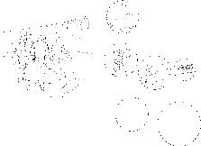
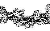
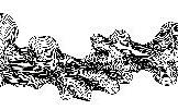
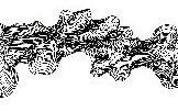
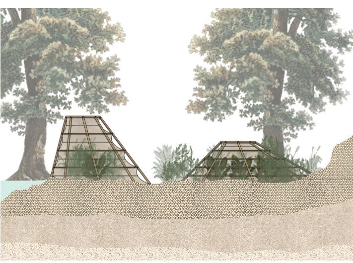
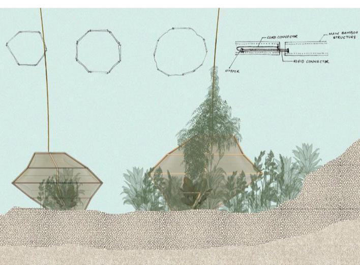
Slime molds are a species of intelligent fungi/mold that have assisted in optimal way finding operations in urban planning - especially the Tokyo metro system - due to their methods of connecting points efficiently. Using slime mold to identify effective connections between our islands we were able to further zone into our site, tracing the lines of mold to form the lines of our design. We traced a landscape of 1km radius, placing oats on the islands we wanted the slime molds to connect. The lab exercise was intended to design with an intelligence other than human - the petri dishes above show the molds growing in one direction, retreating and growing in another direction they find better suited. The lines we thus traced became spaces to insert our apparatus of species introduction and connection. The design deals with two systems - the pod and the raft. The species to be introduced and reintroduced are enclosed in a system of protection that unravels over time, decaying into organic matter as the species within grow and reproduce. These “pods” are connected to a deployment raft floating on the surface of the water. The raft is an interlocking grid of bamboo sourced within the forests of Guri, and
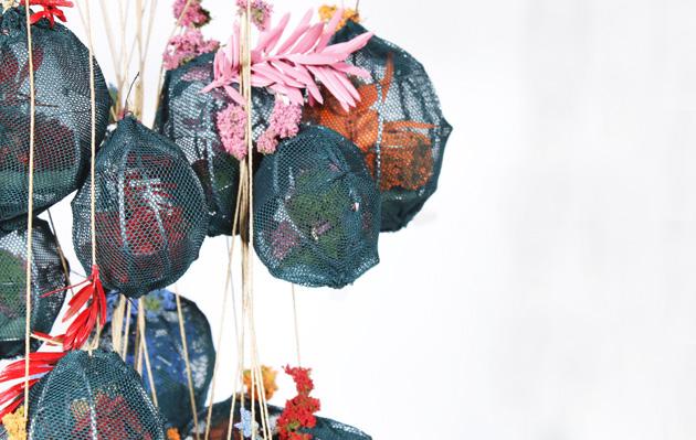
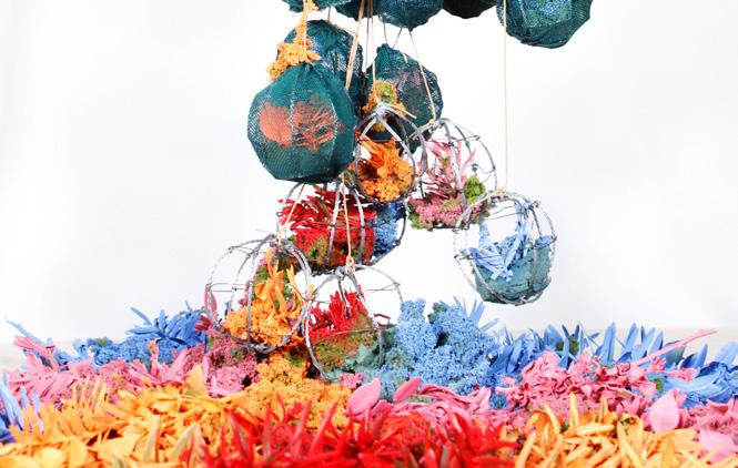
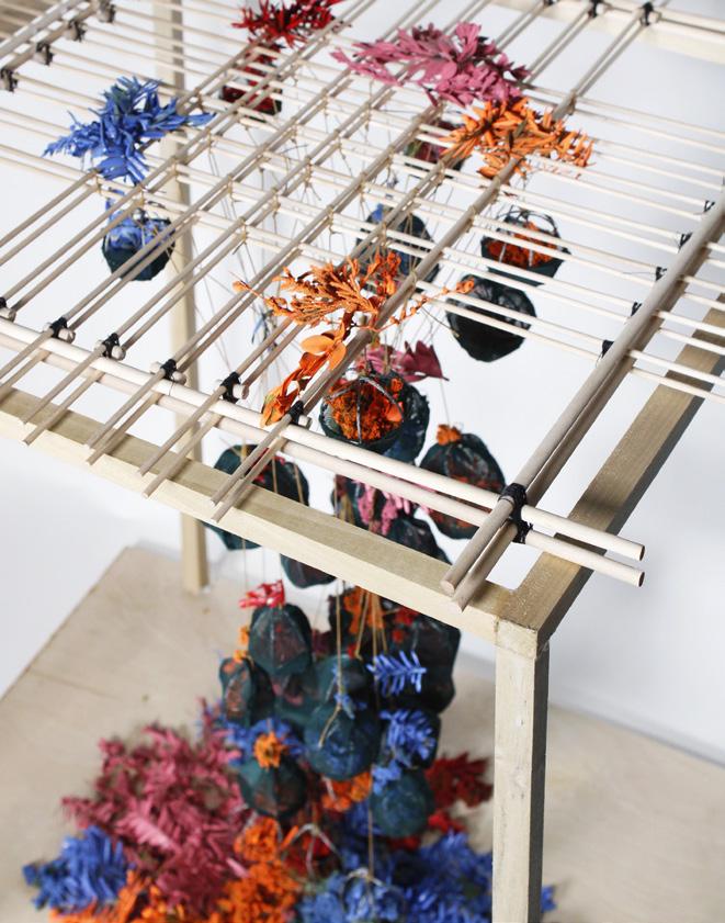
worked upon by the Pemon and Warao communities, floating atop dug-out canoes. The pods and their connector ropes are deployed into the water from the raft, and overtime, the water currents intertwine the pods to form porous entanglements underwater. The pods are designed as a collapsible bamboo apparatus held together with layers of Moriche fabric screens; the dissolution of the fabric over time in the water expands the pods, until only the bamboo structure remains and the plants grow beyond the constraints of the pod. The structures left behind as well as the entangled rope connectors act as collectors of sediment that gradually solidify into a freshwater reef, offering habitat for the aquatic species. The pods deployed on ground operate through decay, collapsing the structure, flattening it over time, allowing the plants to grow out of it. The autochthonous species introduced on site are classified as Floating, Intermediate, or Underwater species.
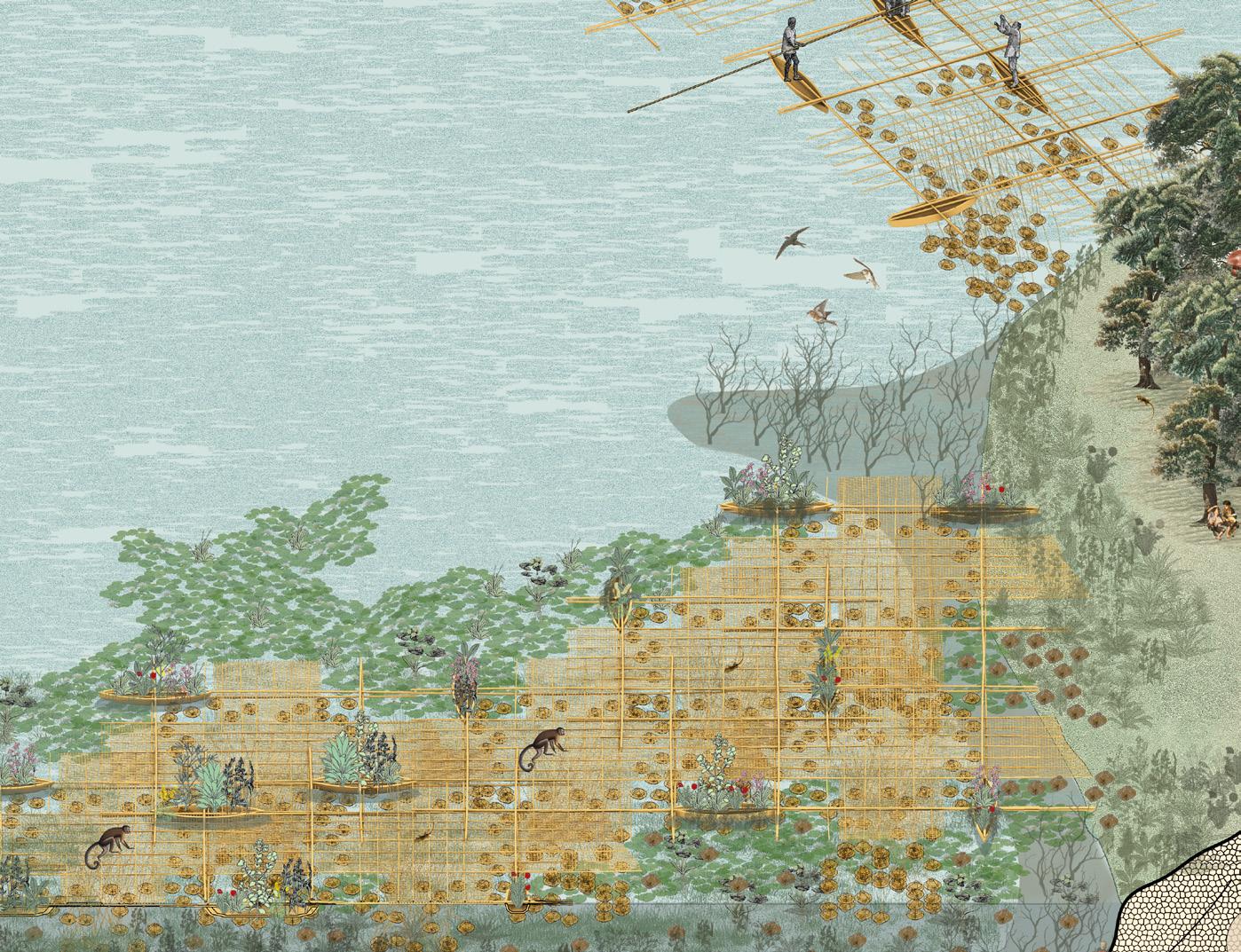
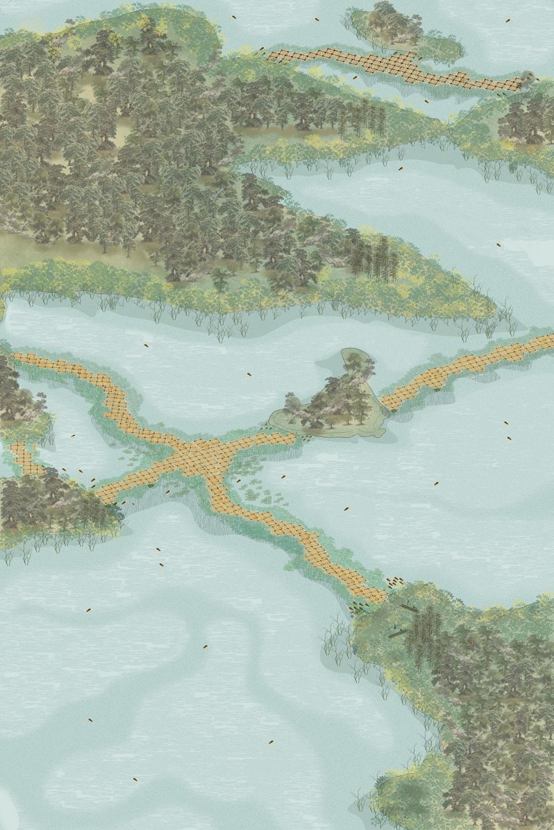
The species introduced help in the creation of new trophic chains that help the ecosystem to flourish. They make and provide food, construction materials, reproductive spaces for the many frugivorous birds and butterflies, mercury absorption etc. The rafts are constructed in dimensions sourced from the species on site - working with the girth, length and strength of the material.
Once the deployment is completed, the 15mm bamboo is used as a matted flooring over the gridlines of the base, to create a solid yet porous surface for the people to walk on.
The deployed raft is then connected to a new raft, and as newer rafts connect to the older deployed grids, the islands are bridged, with the surface acting as wildlife walkways between the fragmented ecosystem. The Guri Lake ecosystem is an unintentionally created experimental landscape, and to protect the species inhabiting these islands and the aquatic inbetweens is also an experimental endeavor that is constantly studied and supervised by researchers, aided by the government in reparation efforts.
3
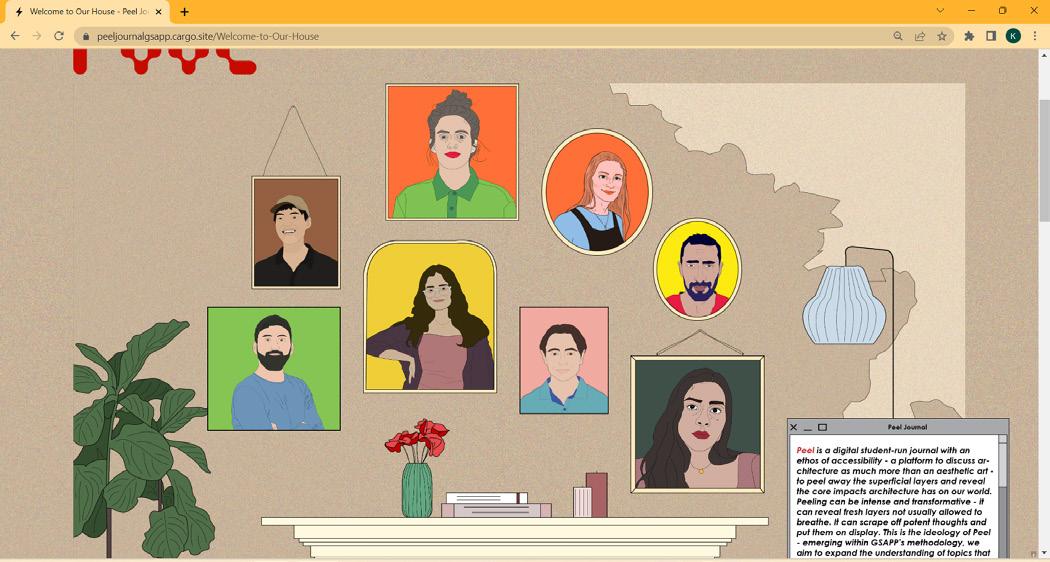
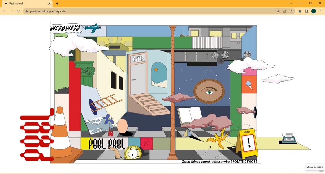
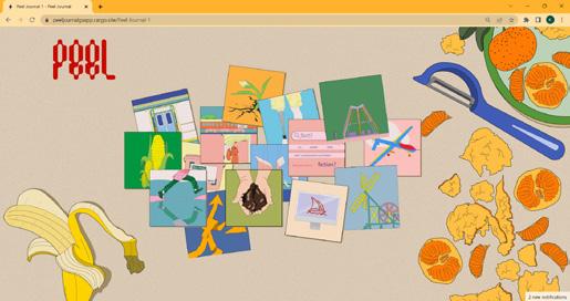
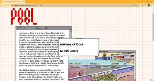
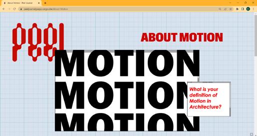
PEEL JOURNAL
Peel is a digital student-run journal with an ethos of accessibility - a platform to discuss architecture as much more than an aesthetic art - to peel away the superficial layers and reveal the core impacts architecture has on our world. Peeling can be intense and transformative - it can reveal fresh layers not usually allowed to breathe. It can scrape off potent thoughts and put them on display. This is the ideology of Peel - emerging within GSAPP’s methodology, we aim to expand the understanding of topics that can be engaged by architecture.
ROLE: Co-Founder
INSTITUTION: Columbia GSAPP
FACULTY REPRESENTATIVE: Mark Wigley
COLLABORATORS: Kriti Shivagunde, Niriksha Shetty, Lealla Solomon, Haseeb Amjad, Karolina Dohnalkova, Ted Pisutigamol, Alejandro Marin, Javier Flores

4URBANMIX INC
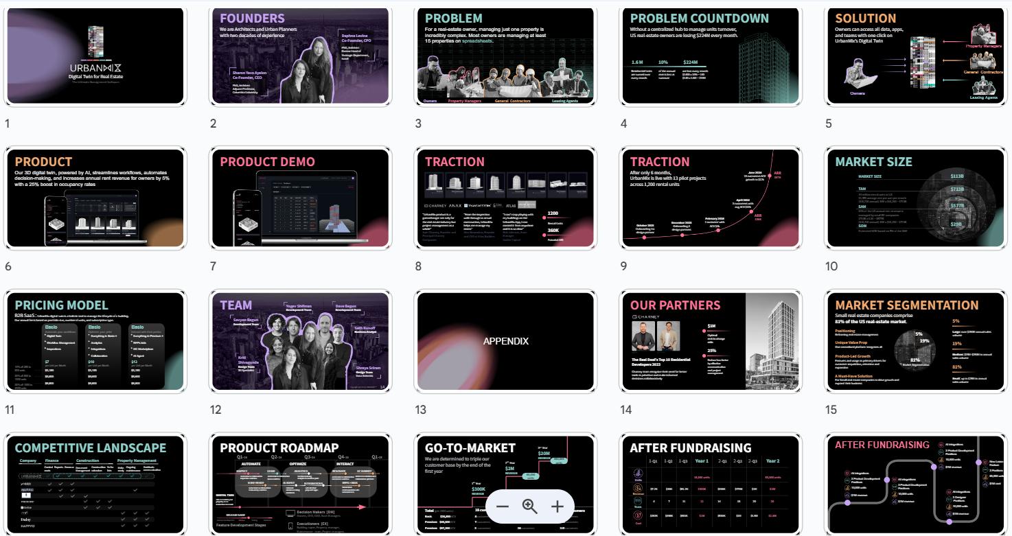
SLIDE DECK DESIGN
SAMPLE
The slide deck is still in use and hence all key data has been redacted.
The design needed to showcase a peek into the product while conveying an ease of workflow for the targeted users. The deck was one of many iterations at brand identity, playing with colors, void ratios and clearly emphasized data. UrbanMix being a women-owned and led business, with a larger female employee demographic, the deck was a great foray into catering the visuals to a male-dominated industry. The fundraising deck showcased various infographics that showed the firm’s projections, roadmaps, and market data with clear focus on brand identity that defined a fun yet crucial tool created by the company.
5SHUCKING THE SHELL
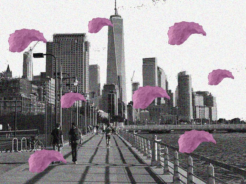
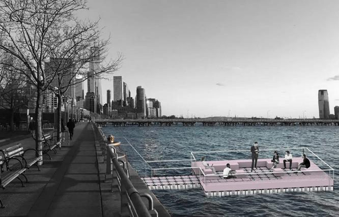
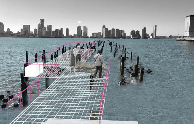
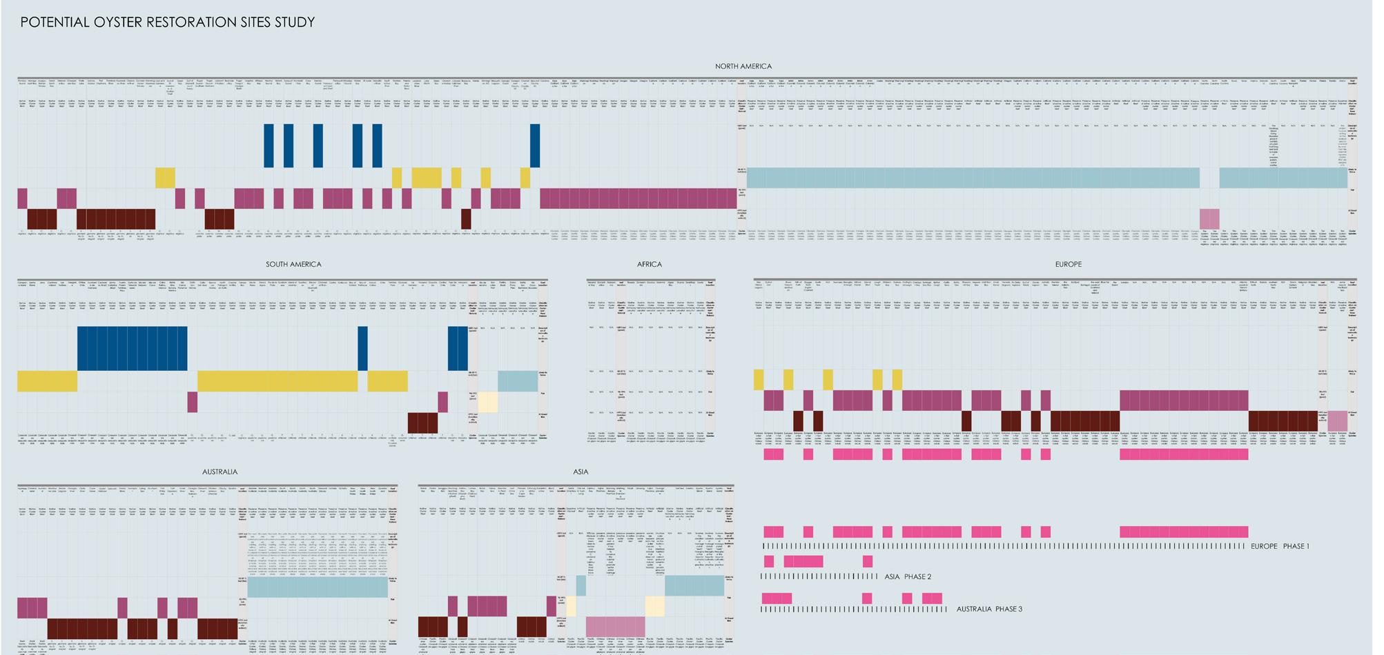
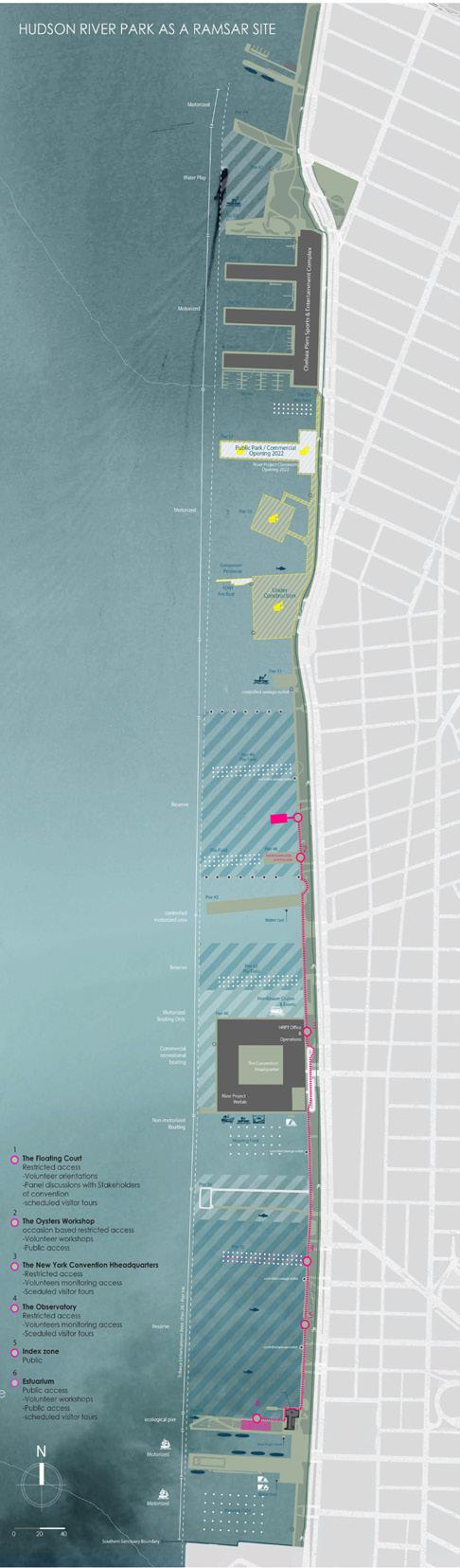
Analyzing the material and immaterial factors that form the artificial oyster reefs landscape in Hudson river park, one can observe that marketing and funding are a central factor for the success of the initiatives. Through these observations, we question the connection and feasibility of this proxy landscape in other contexts where it is needed due to climate change and habitat loss. How can we define these landscapes, and what are the parameters in these landscapes?
STUDIO: Proxy Landscapes
SEMESTER: Summer 2022, Advanced Studio
CRITICS: Marco Ferrari and Elise Hunchuck
COLLABORATORS: Kriti Shivagunde and Andy El Set
By analyzing the complex network of alliances and stewardships, funding bodies that economically flush the many initiatives, volunteers and student programs that carry out the execution, specialists that monitor the progress at the research stations, as well as the many supply
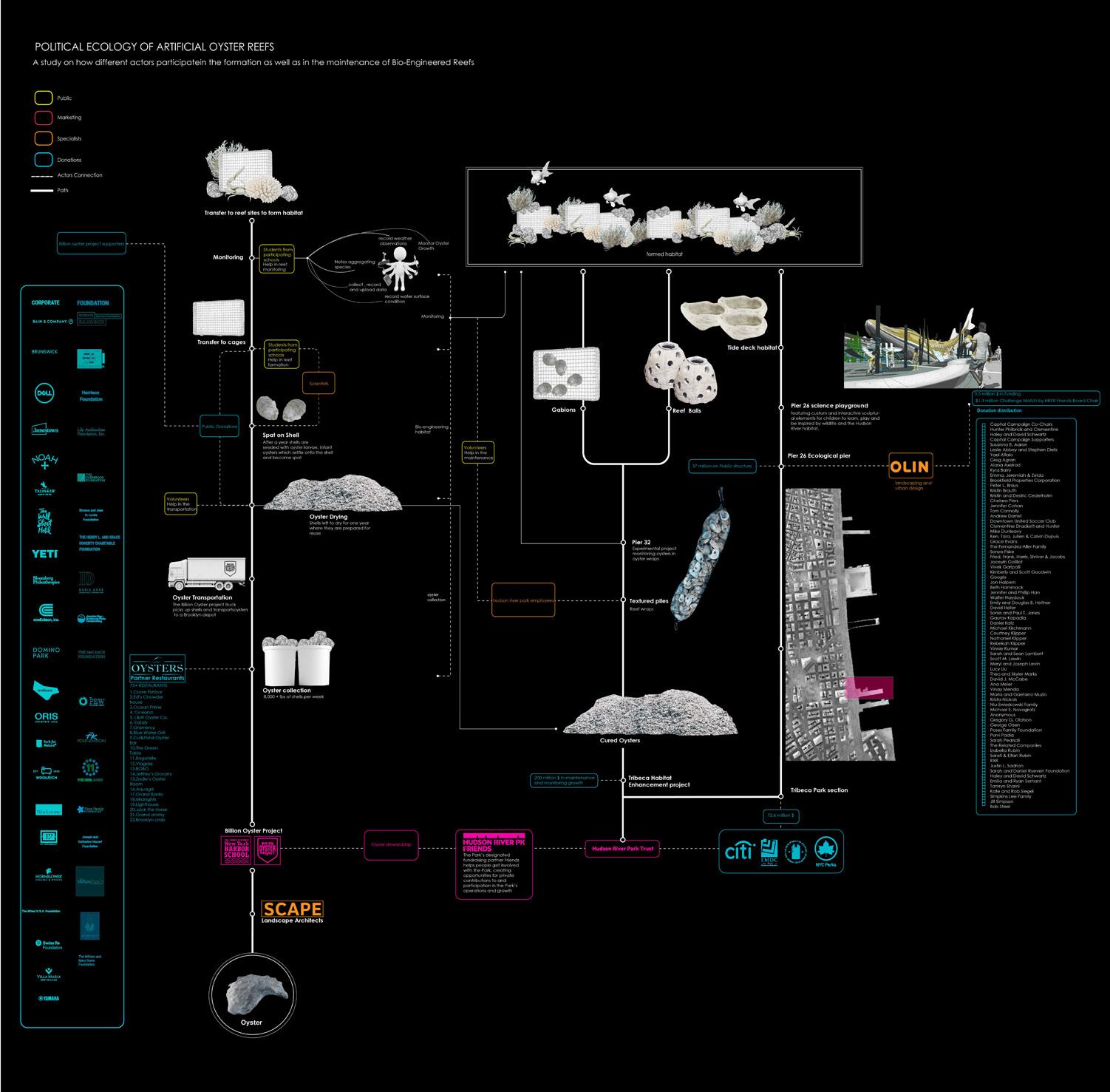
chains and donations that support the overall process that form the artificial landscape in Hudson River Park, we observed that marketing and funding are a central factor for the success of the initiatives. Much of the funds are targeting the Public, in a series of exhibitory structures.


Given the severity of oyster reef loss (85%) as compared to the 20-50% loss of other types of wetlands clarifies the urgency for action.The extent of oyster reef habitat loss justifies more explicit recognition in protected areas policies.
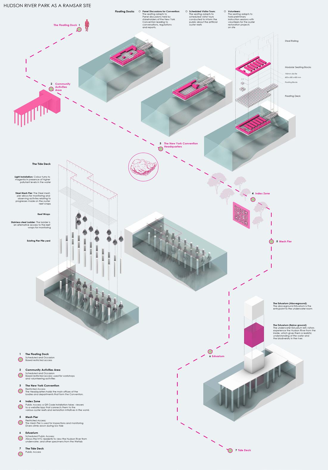
As a product of this, we propose the New York Convention on Oysters as a subset of the Ramsar Convention.
Through a sharing of resources and administrative bodies with the Ramsar, the New York Convention forms the
body that will regulate and stipulate guidelines for the creation and execution of the reefs from start to end. It also creates an index of oyster reef sites around the world, identifying the reefs that need immediate attention. Through connecting
Through connecting scientists, community initiatives, volunteers and local governments in the restoration process, the New York Convention acts as a central governing body that creates reports, sources funding, and helps monitor and study the reefs.

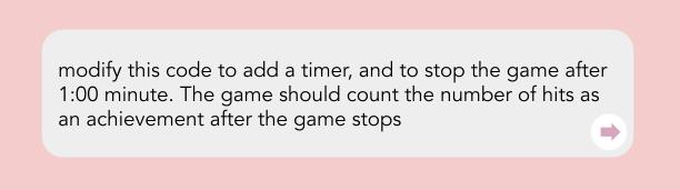
6WHACK-A-CODE
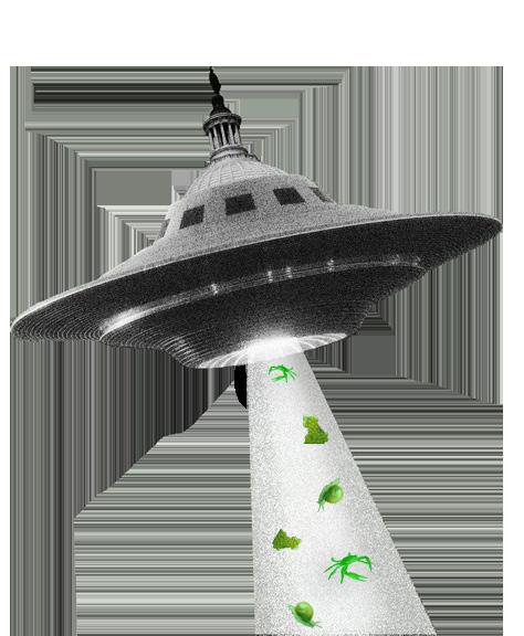
Whack-A-Code is the beginning of a learning endeavour that was undertaken as a part of informal company presentations. As a spatial designer, I was not directly exposed to programming and its languages. Through this project I attempted to understand how the code to a simple game works and changes with the help of AI. In this generation of artificial intelligence, the project started by asking for a code for a whack-a-mole game on ChatGPT, and then understanding some basics of coding by changing different parts of the code and viewing the output.
PROJECT TYPE:: Corporate / Personal
TOOLS: ChatGPT
TEAM: Sharon, Ron, Daphna
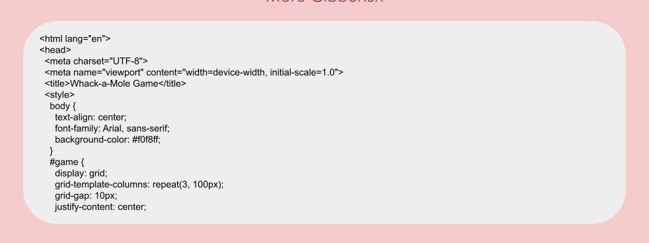
Through my AI outputs and studying the parts that changed after every prompt iteration, I could identify the general structure of code, and if not how to perfectly change the code, at least to locate where the code would need to be changed.
Here’s what I understood My Next Steps
HTML is the structure.
CSS is the style
JavaScript is the behavior
Variables: Hold data that changes, like score
Functions: Perform actions, like startGame().
Events: Things that happen, like “clicking a mole.”

Next, I tried to change something in the code to see if I really got it
Goal: Instead of making the “mole” in the game a circle, I decided to use a graphic mole to replace it At first my moles didn’t show up! A few tries later, they finally did.
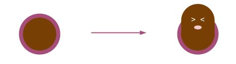
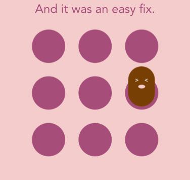
Except, they looked a bit weird! I now knew where to look, and I fixed it.
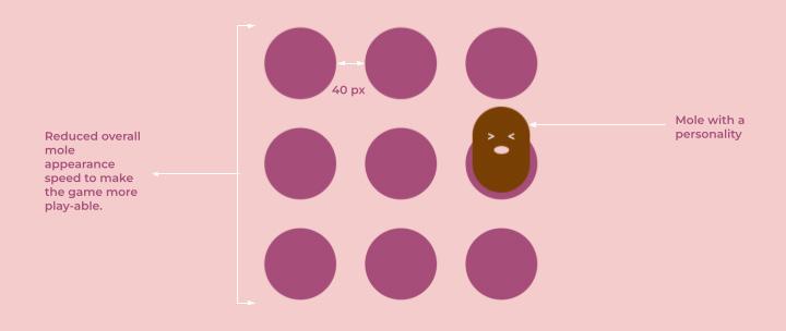
I made some more edits. And here’s a demonstration. I still don’t understand a lot, but I understand a lot more than I did before. My next steps for this project are to add some villain-elements to fumble the game and add sounds for every hit!
7ALIENS
IN THE ARCTIC
The Arctic is known for its unforgiving landscape, and many residents call this place their home. Though not extensive in their species diversity, there is an abundance in the population of the few species that inhabit these freezing lands. For these native organisms, Invasive species are an ecological threat, especially in the Arctic.
STUDIO: Are Icebergs Free
SEMESTER: Fall 2022, Advanced Studio V CRITICS: Leslie Gill and Khoi Nguyen
The North Pole’s anthropocenic existence is an ever-deteriorating identity, the collective convergence point of the consequences of human activities in the Arctic and elsewhere. The ice caps are melting, species’ behaviours are changing, shifting foraging grounds and affected migratory pathways are a few actors on a large network of geopolitical, socio-economic, and environmental collapses.
The invasive species coming into the Arctic are essentially products of human intervention and meddling. This begs the question - Are these species invasive, or are We?
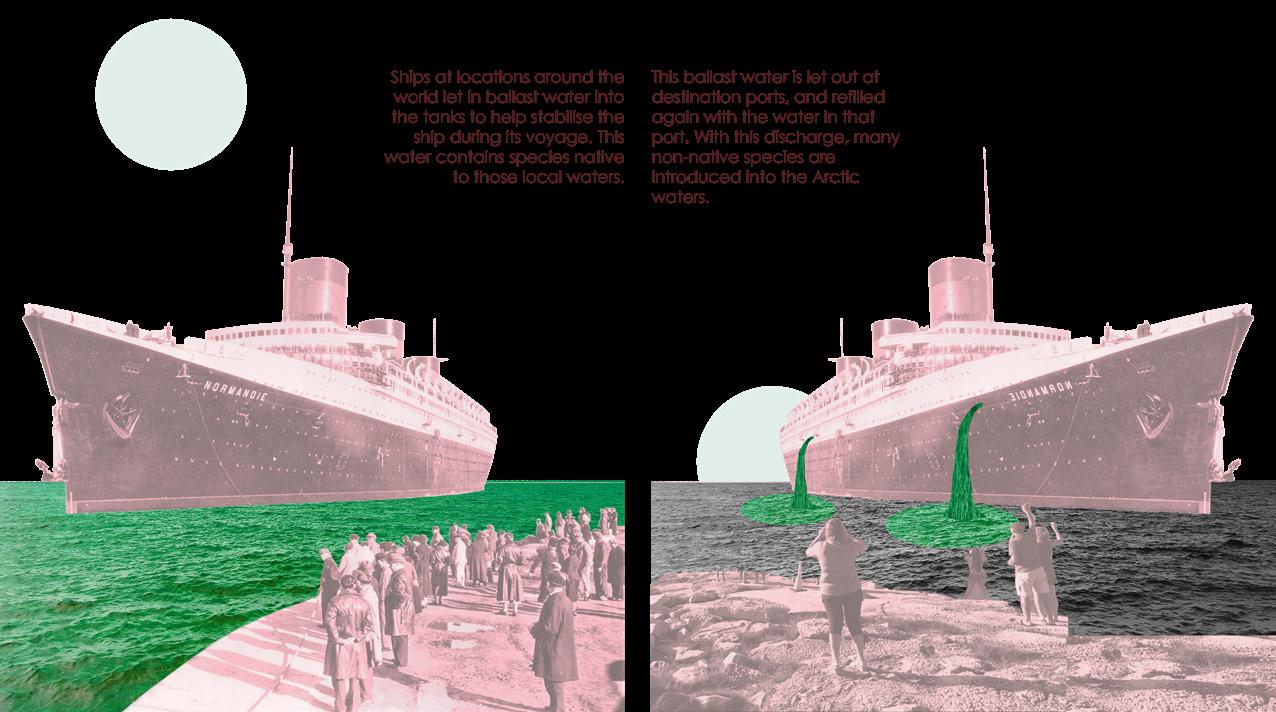
Ships at locations around the world let in ballast water into the tanks to help stabilize the ship during its voyage. This water contains species native to these local waters.
This ballast water is let out at destination ports and refilled again with the water in that port. With this discharge, many non-native species are introduced into the Arctic waters.

How do we decide good or bad nature? Are all invasives bad? Shifting foraging grounds through shifting microclimates can envision a coexistence between the Natives and Invasives.
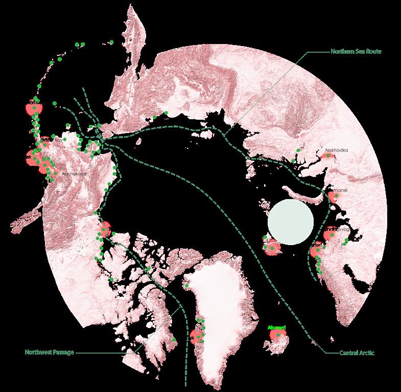
Because of the primary aquatic introduction of these invasives, the numerous Arctic Ports and their traffic in the waters became an important zone for research, overlaying it with the area of the Arctic that is projected to heat up the most in the near future. This heating zonewould make the area most conducive to invasive survivability.
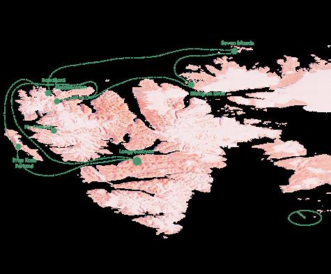
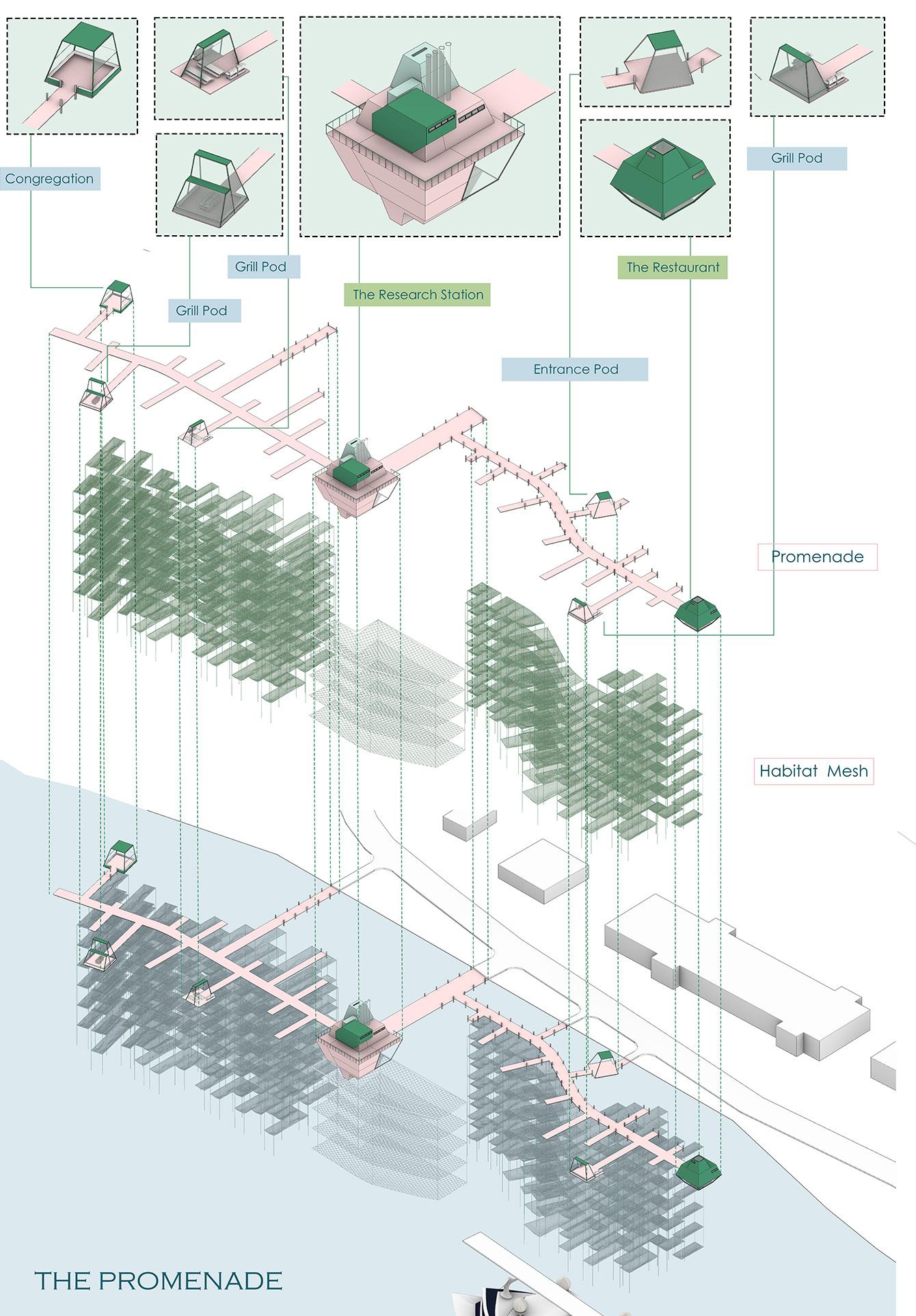
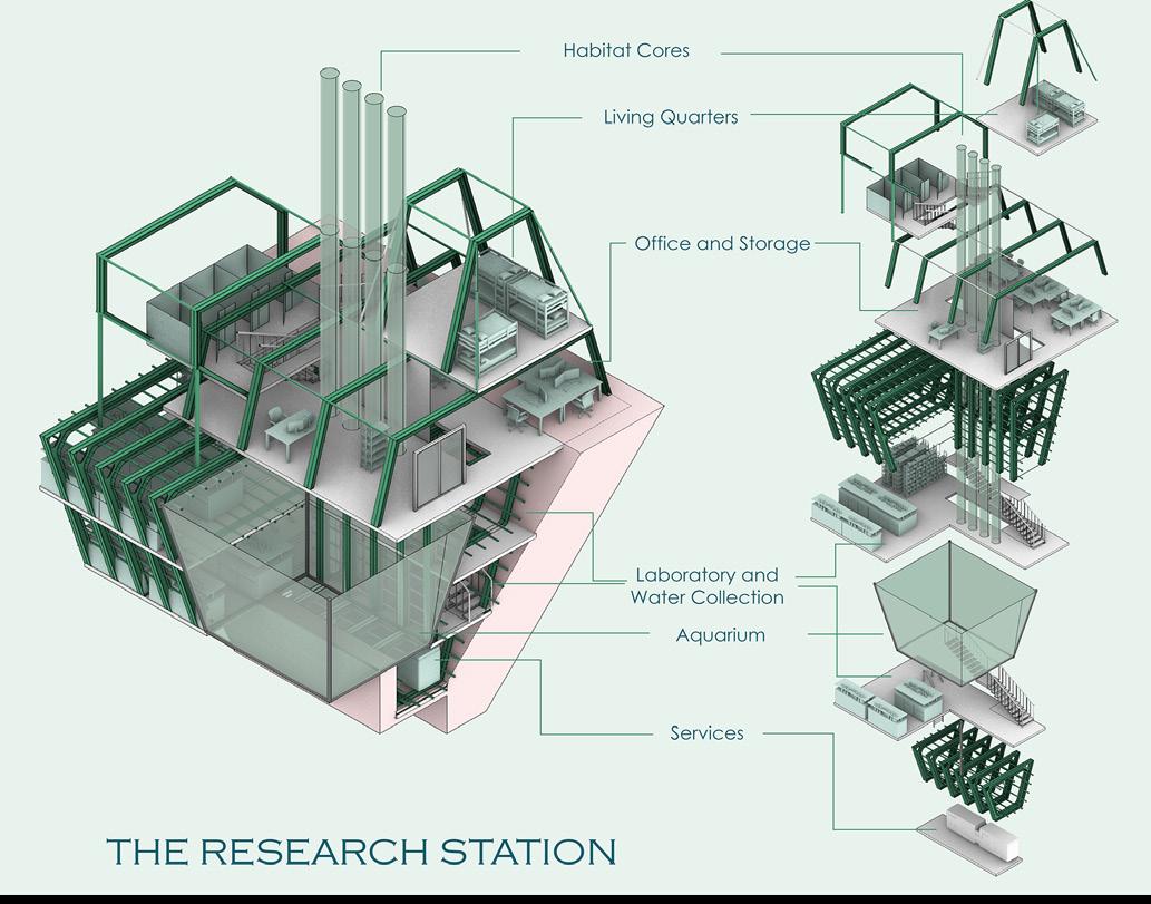
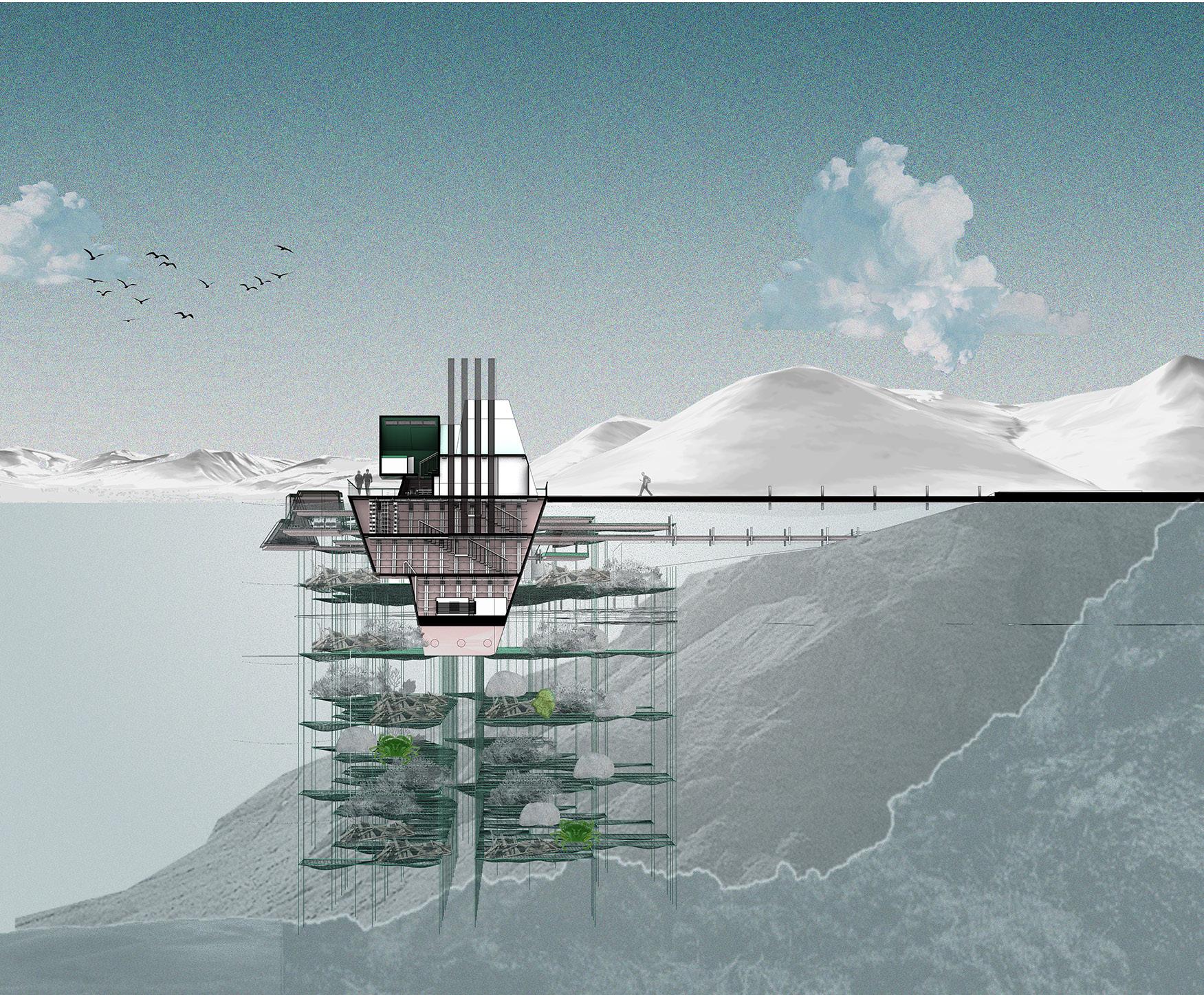
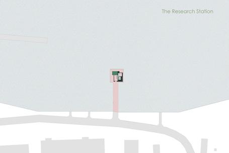
The first phase is the research station, which becomes the eye of the project that grows and expands temporally over the coastal landscape. Located right next to Longyearbyen port, the waters become an optimal sample collection resource. The Research Station is designed to be more than just a backdrop to the activities within - floating on the water by utilizing a ballast tank mechanism, the structure collects water in its ballast, which is then sampled from within the research labs.
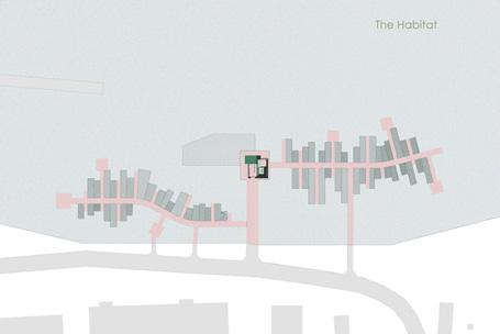
Water sampling, soil core sampling and indexing of the aquatic species of Longyearbyen is ongoing due to the Pol Nor project. The research station houses an aquarium and habitat cores designed to test the species collected from the water samples - they are tested in various temperatures, habitat conditions, lighting and oxygen levels to study their survivability in the recognized Arctic conditions of the future. As the research solidifies into a collection of predicted “invasives”, the second phase of the project begins - The Habitat Meshes.
The meshes create an ‘invasive apartment’esque aquatic undreground where habitats conducive to these invasives is provided to make Longyearbyen port an invasive trap, so that the collective congregation of the invasives in these cultivated habitats keeps the rest of the island shoreline safe from invasions.
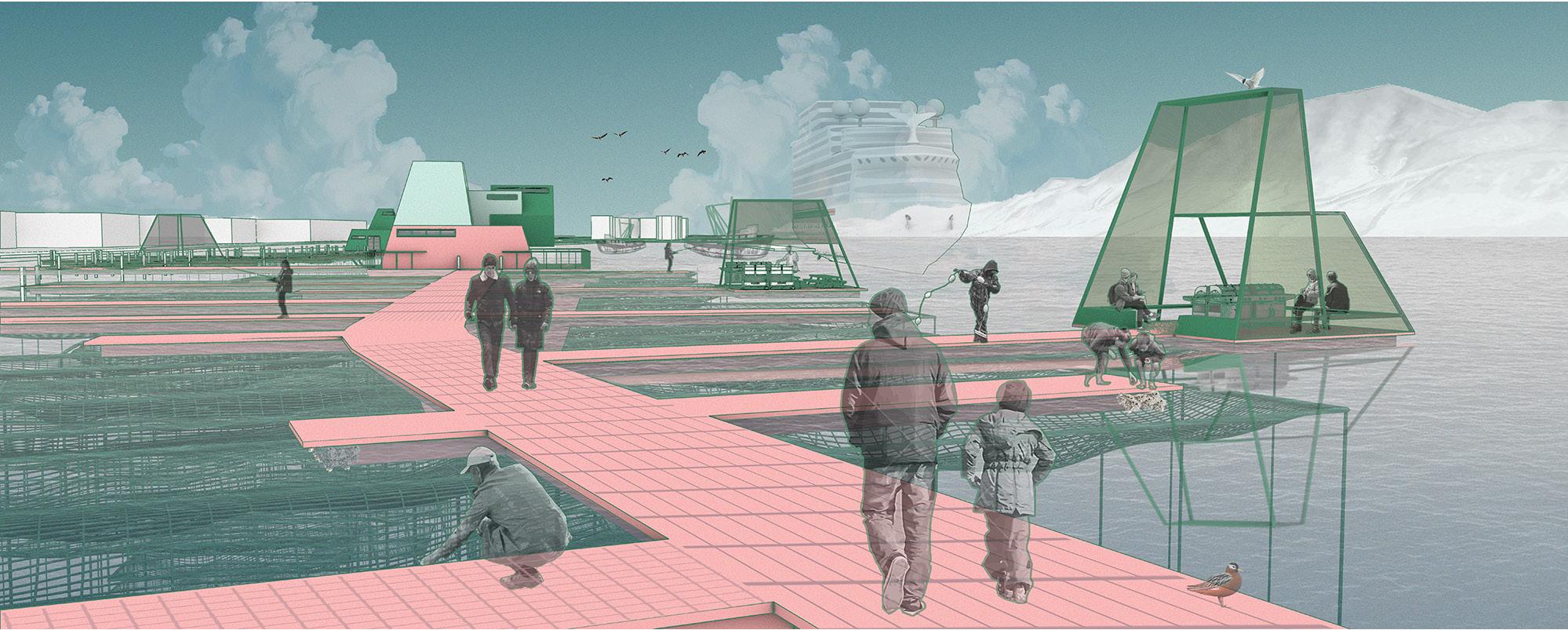
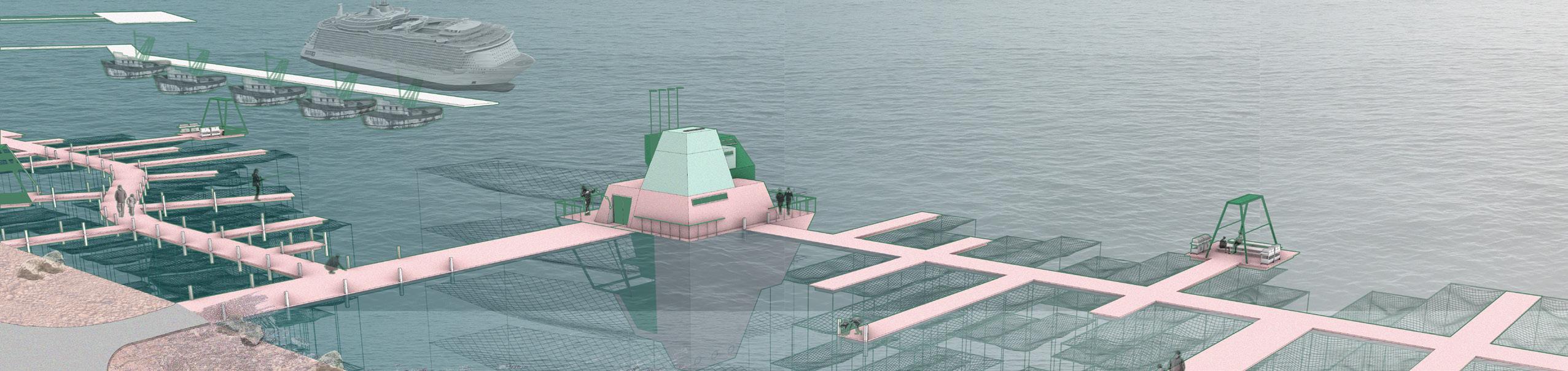
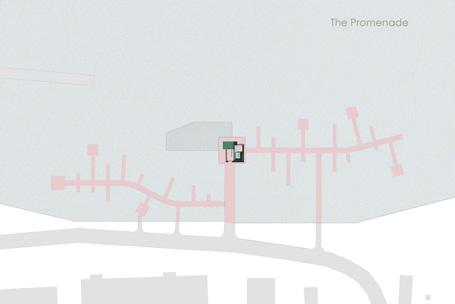
As the Habitat meshes layer onto each other with sedimentation and aquatic debris on the meshes, the third phase of the proposal, The Promenade, overlays on them. The promenade creates niches and platforms for people to interact with these invasives in their carefully inserted habitats, where they can fish the species out of the meshes, and further consume them.
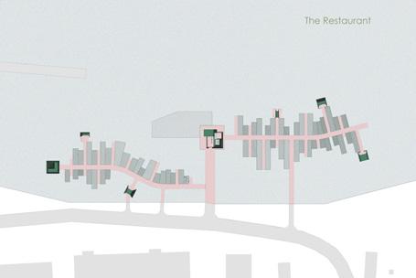
With cookouts and congregation spaces on the water, the proposal envisions an alternative to the problem of invasives, by introducing a consumption-based control and interaction-based research and public understanding of the very contexts of human residences in the Arctic. The project also proposes new recipes for the invasives fished on the promenade - to be consumed as part of a new cuisine that can keep these invasives in check.
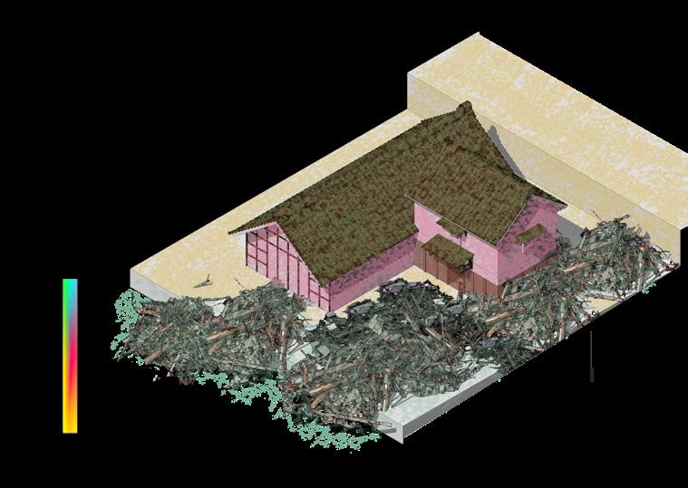
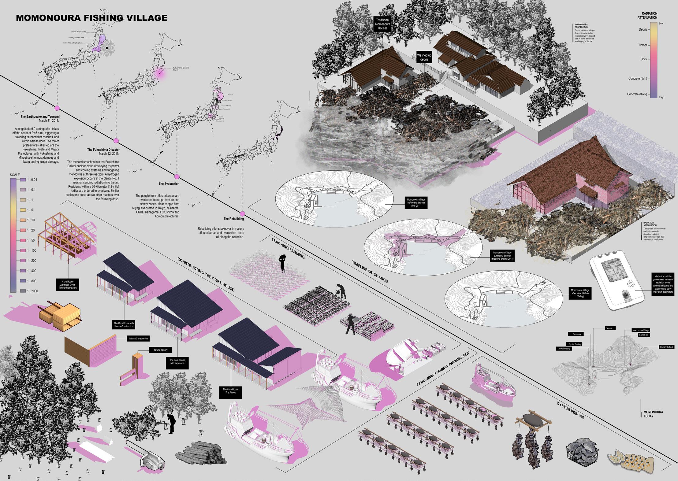
8RESEARCH: REBUILDING MOMONOURA
On March 11th 2011, a 9.0 magnitude earthquake hit Japan’s coast, 81 miles east of Sendai - the worst earth quake in Japan’s recorded history. The earthquake sent rolling tsunami waves towards the eastern coastline of Japan, decimating not only numerous coastal villages but also the Fukushima Daiichi nuclear reactors sitting behind an ineffective sea wall. What came after was a socio-political handling of the compounding natural and man-made disaster unfolding within coastal towns, but with impacts being lived miles inland, as well as beyond borders.
PROJECT: Fall AAD Research Assistantship
SEMESTER: Fall 2022
PROFESSOR: Dean Andres Jaque
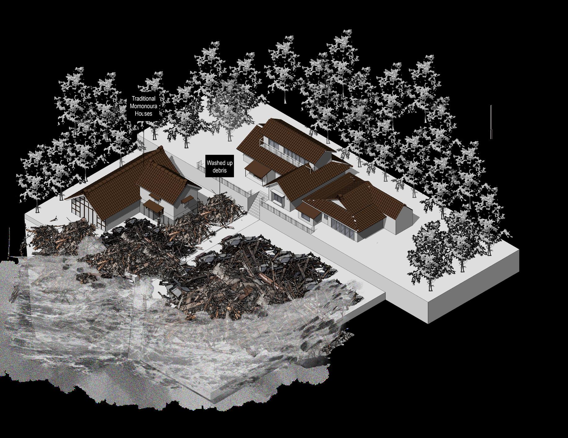
spaces. The village was revitalized into a fishing school, to draw more residents, educate them in the way of the village life and integrate them into a hand-to-mouth lifestyle. They introduced forestry school so that even though most of the village was washed away, the forests could still help them live.
but offers famiy-stays to visitors so their stories can be heard and their coastal lives lived. ArchiAid and Home For All deployed Community space designs throughout the afflicted Eastern shoreline, by bringing renowned architects to help the communities in their re-rooting of space and memory.
Many such neighboring villages underwent reconstruction that brought the people and their economies back to the residents. Rikuzentakata, a town much bigger than Momonoura is still underway with its restorations,

C O N T A C T
Kriti Shivagunde
Email: kritishivagunde@gmail.com
LinkedIn: https://www.linkedin.com/in/kriti-shivagunde-545398154