bachelor of landscape architecture (Honours) selected projects
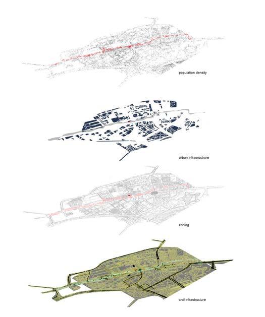
Urban Armature Noordhoek basin
Bosman interchange anti-monument on robben island liesbeek river rehabilitation
Post Graduate and personal selected projects
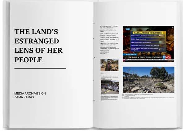
The index of Isles earth as material toxic superfluity
living archive projects
Born into a nation which is transitioning into democracy, but still today experiencing the effects of structural apartheid physical planning policies brought upon my interest in issues of resource scarcity and environmental damage. As we go through spatial design in accordance to applicable legilation and regulatory standars, it is clear that spatial design is fascilitated by state and market objectives. To address these neoliberal mechanisims, requires critical awareness about environmental damage. My intention is to navigate this paradigm shift by exploring extraction of raw material and considering the affects of the anthropocene in the Global South. More specifically, where I grew up.
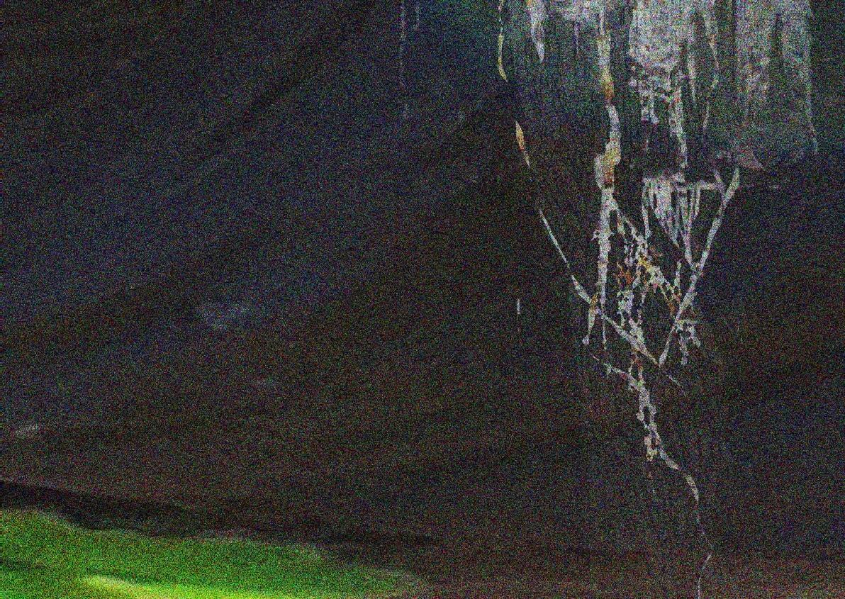
Living in Gauteng, South Africa gave me first-hand experience in observing how damaging the exploitation of land can be to a society, being as it is home to the deepest gold-mine in the world. The main agency of my pursuit, is to focus on vulnerable communities whose houses are placed next to mines where water, air, and other forms of pollution from mines make the planning of these residential areas ‘illegal’, because of environmental impact on these vulnerable communities.
Institutional reform and interventions, which aims to disrupt the environmental and climatic crisis, prevailing at a global scale, are needed. To do this effectively, inequality and existing social injustice practices must be systematically addressed - To have new modes of relationality at the centre of data gathering, to unlearn the monolithic ideas which imperialism had forced upon all forms of society. To not only challenge theories which are still under structures of sovereignty of the Imperial/social organisation [such as biopolitics], but to put the eradication into practice through addressing the mechanisms which withhold this power.
‘Translatability’ and sharing of power has the ability to shift the central order of how institutions and data is perceived. This value system is the main driver of climate change as policy is driven by profit without care of environment.
photo
bachelor of architecture major projects
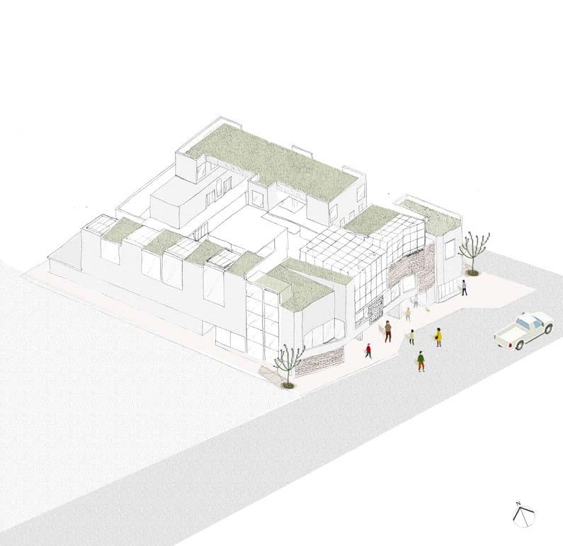
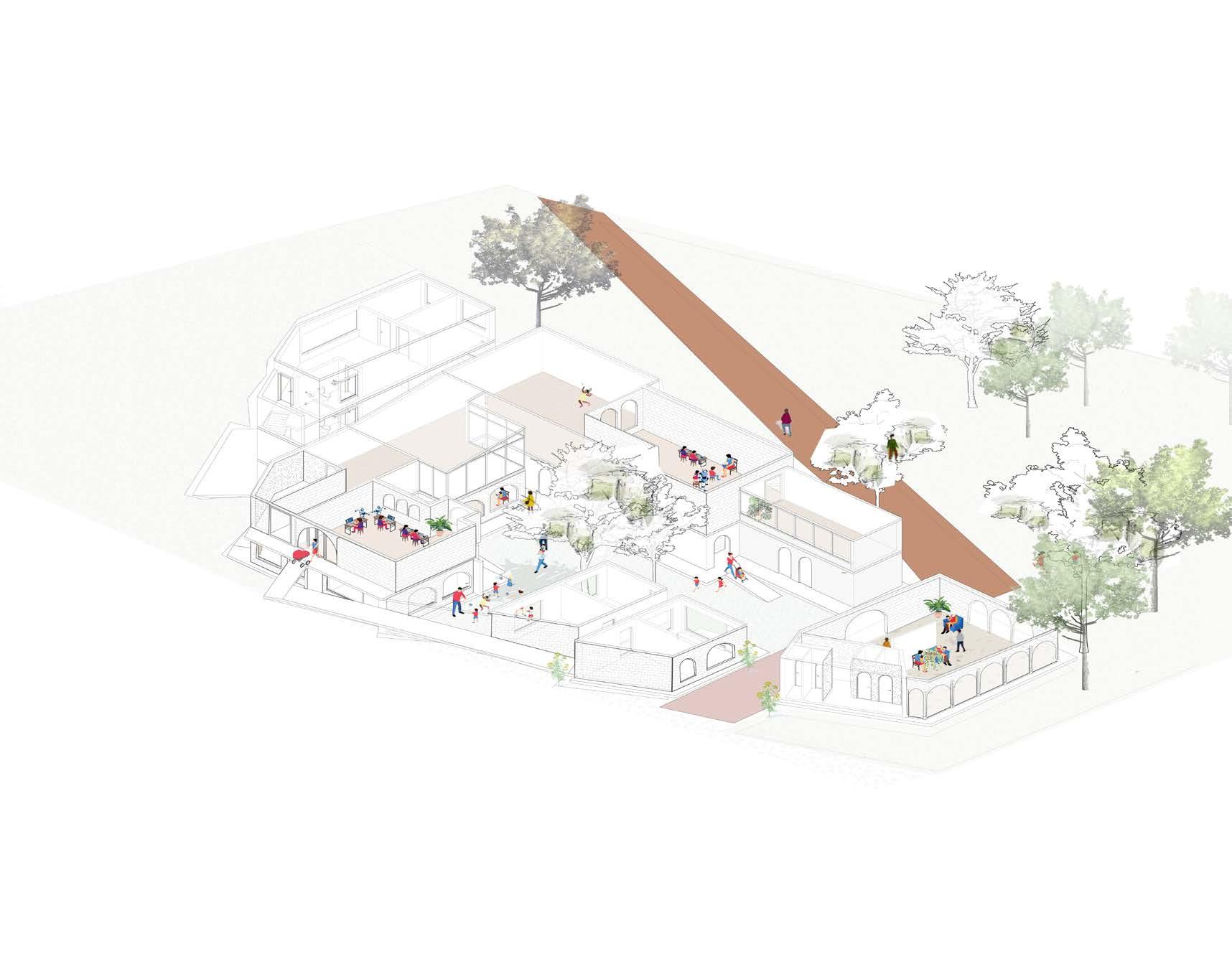
THE MEETING PLACE CRECHE-COMM
Thoughts behind major projects were influenced by a short course I partook, Social infrastructures at UCT. Social Infrastuctures, helped be grasp critical modes of analysing how ‘service’ cannot be looked at without considering the needs of people, of communities
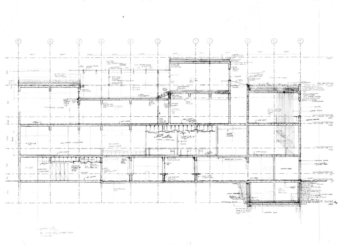
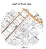
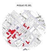
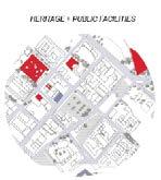
The Wynberg Railway Station and generally the public transport system due to Wynberg’s location and its easy access from the M3 Freeway made Wynberg a convenient point of access to other areas taking people in and out of Wynberg as a result no significant art and culture activities are established in Wynberg. The aim of this design is to break this culture of using Wynberg as a conduit pipe and make Wynberg a place of significance. The very public transport that was creating a challenge in the sense that it was moving people from point A to B without encouraging them to identify with Wynberg as a community, will be used to draw people to Wynberg for a reason and not for a passage. In the sense [articulated by Clint Abrahams], my design intends to turn Main Road that passes through Wynberg into functioning high-street and improve the socio-economic status of Wynberg. It will instill cohesiveness and show people that to co-exist is a progressive step. According to Clint Abrahams the objective of creating a functioning high-street is to identify an architectural program that can initiate the development of such streets in lower income areas. I am of the view that Wynberg Multipurpose Centre qualifies as such an architectural program.
mixed-use precint Public square daycare centre trading service walls
programmes: AutoDesk Revit, Adobe Photoshop
description: Rendered 3D model of multifunctional intervention
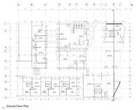
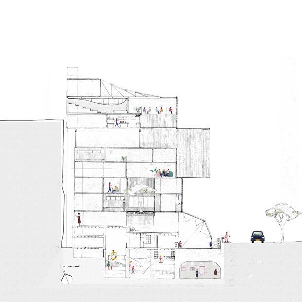
THE MEETING PLACE
Wynberg, CapeTown
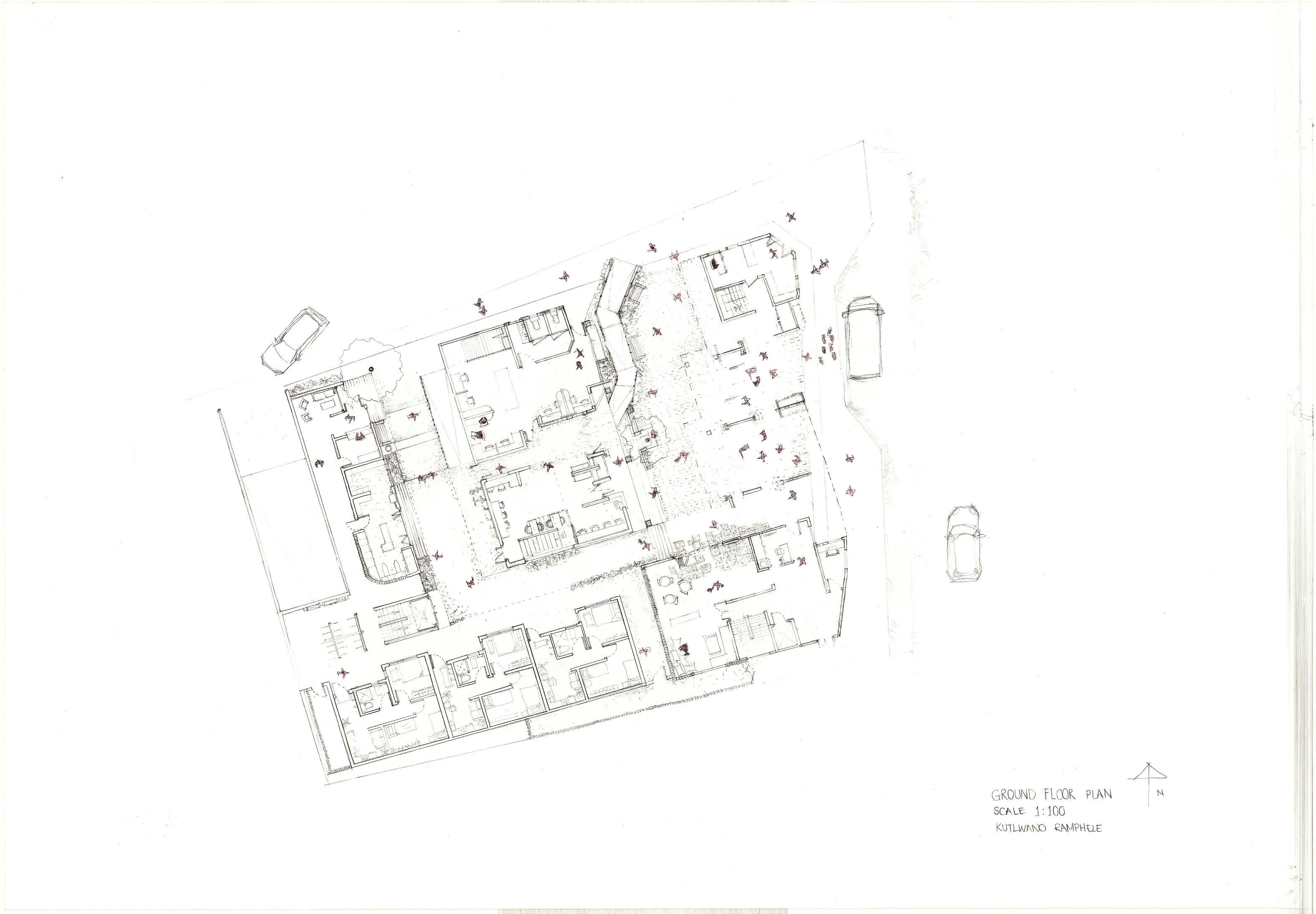
groundplan of the meeting place, open to public realm with semi-public programmes
tools: Pencil Drawing
The Facade of the multi-functional intervention leans to a semi-private communal space.Below is a public space, serving for informal traders, and going up to a semi-private communal space, for refugees in the Wynberg community. This serves as a refuge for immigrants, who are still in the process of gaining citizenship. Services and programmes to support this community is provided in the first floor.
Wynberg is a passage of convenience accessing railway station near the Main road. Activating the Main road as a green belt pedestrian friendly pipe between the station - supporting local trading done by refugees around this area. This section of the building caters to the refugees as a co-living space including a greenhouse for the inhabitants to cultivate produce to sell on ground level service walls
tools: AutoDesk Revit, Pencil Draughting
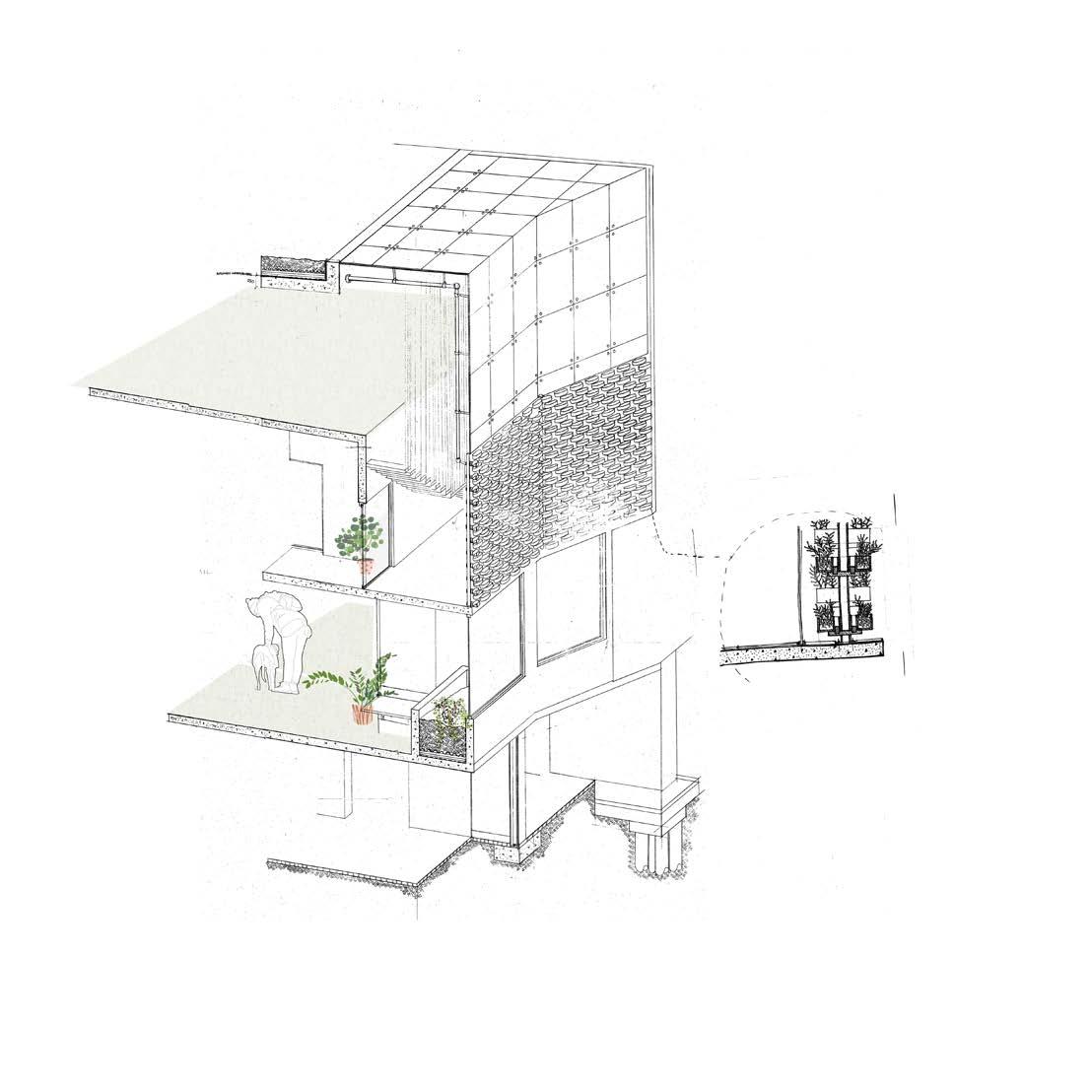
permeable wall structures highlited (fig a) and green screens implanted for air quality and circulation
landscape analysis projects
Landscape Architecture, University of CapeTown (2020) narrative cartogrophies
tools: Adobe Photoshop, ink painting description: Collage abstract focus on theories in macro to micro scale
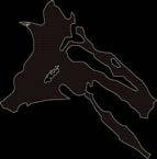
Urban armature focus on Cape Town kaizergracht str
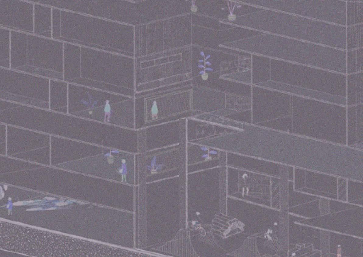
URBAN ARMATURE refugee centre project (year 3 architecture) plugged into Urban armature
REFUGEE CENTRE Zonnebloem, CapeTown
The objective of this project was to integrate refugees with local community of Zonnebloem, Cape Town. The urban hub would create job opportunities for local community, and allow integration with refugees, whilst it offer refugees a home during a period of transit. Exhibition space and skate park to create a new culture surrounded by the center and increase knowledge to the youth through exhibitions as well as using different modes of transport to move around the city. The project promotes interegration of cultures and discourages hostile design.
Highrise with load bearing on the first 3 floors, and timber structure for floors onward, this ensures a minimal amount of emissions caused in buidlng process. Inner layer of hempcrete blocks can be used for private spaces as you travel upwards in the building- creating more screened and well insulated spaces for residential purposes.
form development
tools: ink painting, 2mm cardboard handcutting model making, Adobe Photoshop
description: Collage to express views around the Lesely Greens manifesto and how these theories interlock in project
cross section of Zoonebloem
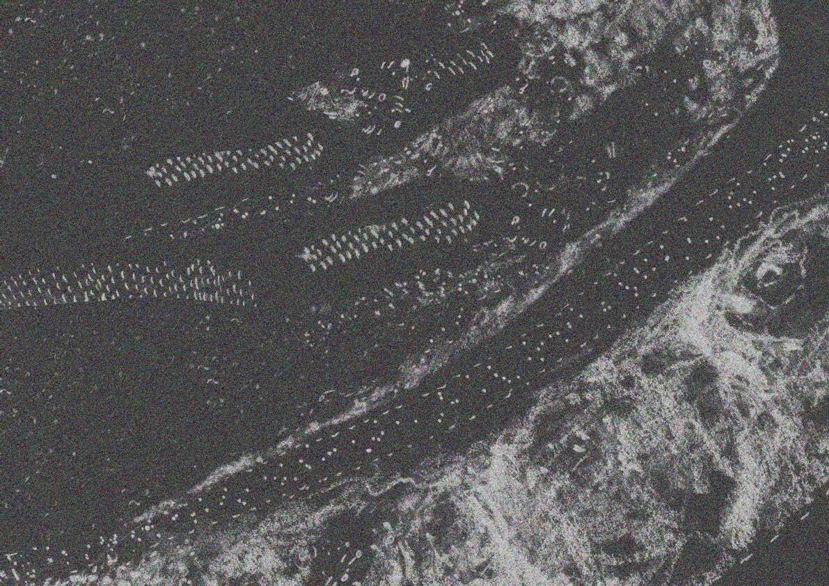
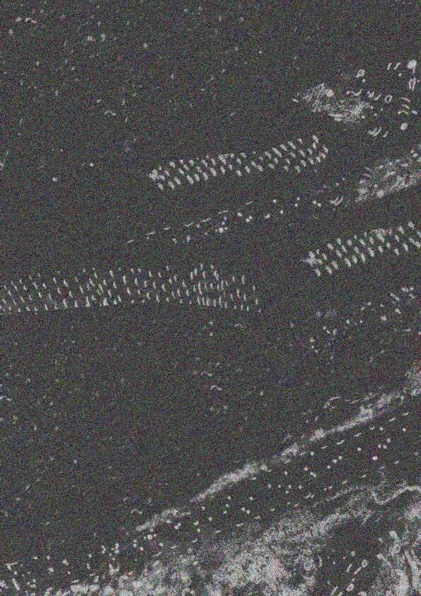
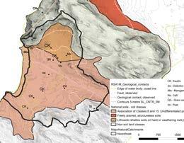
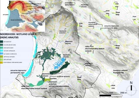
Visual analysis of GIS research and critical analysis, formulating performance analysis of bioregion. Sustainable solutions for the prevention of extinction through landscape performance can be implemented with knowledge of the risks and precautions one should undertake on the specific part of the bioregion.
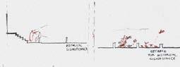
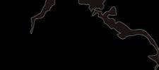
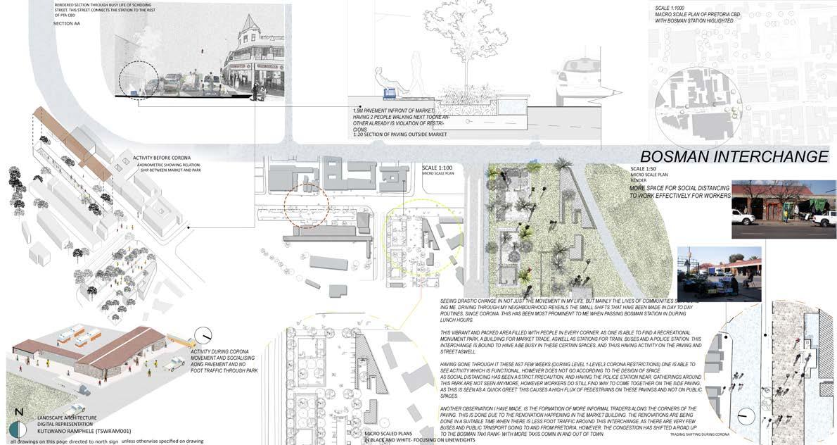
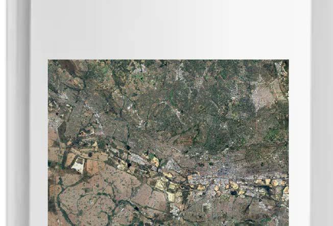
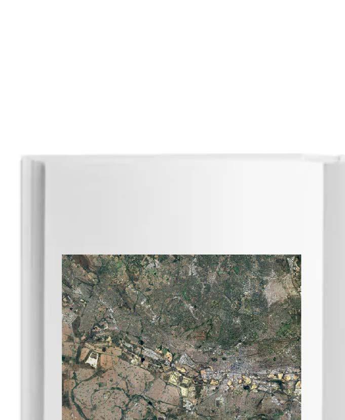
Urban analysis of Bosman interchange during covid-19 pandemic year
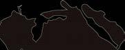
anti-monument on robben island
Landscape Architecture, University of Cape Town, Design Studio Awarded ‘Institute of Landcape architect of South Africa Prize: Best Landscape Design Portfolio in the First year of the Master of Landscape Architeture Programme’ (2020)
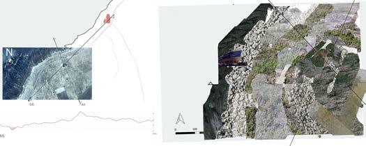
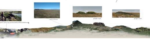
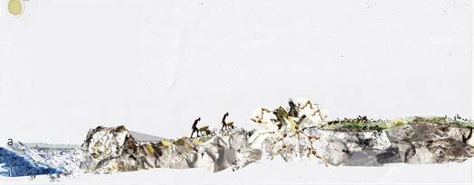
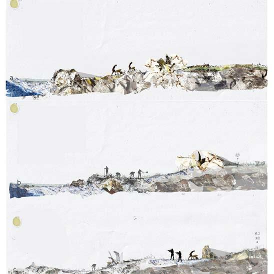
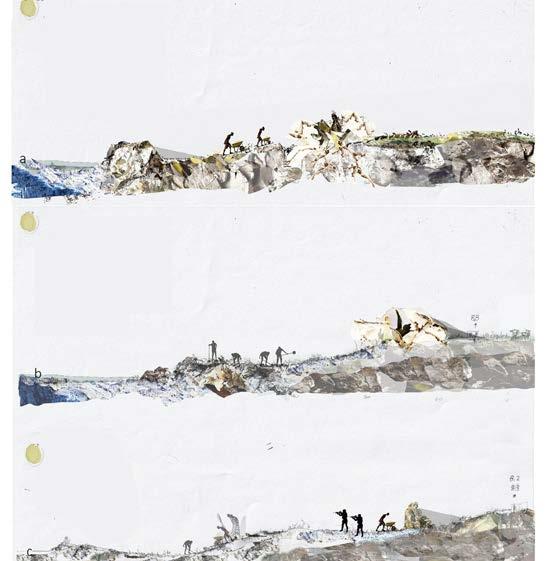
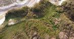
RESEARCH INVESTIGATION ON SITE, PICKING UP NUANCES THAT THE SITE HAS TO OFFER
textured collage investigation of site
situated between a shipwreck and blusetone quarry. this space is infamous to the ex-political prisoners of Robben Island for the torturous labour knyplyn, knyplyn (chipping stone to gravel, to dust) this was one of the torturous tasks given to the ex prisoners who mined at the blue stone quarry
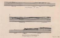
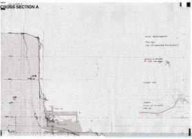
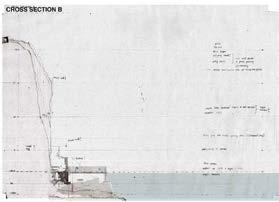
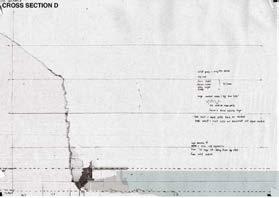
section through lowest longitudanal point relative to lowest point on site
section through lowest latitudinal point relative to lowest point on site
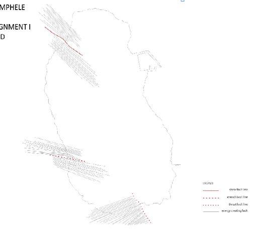
tools: QGIS,Adobe Illustrator, Adobe Photoshop description: Mapping on Robben Island site, showing geology, biodiversity as well as fault lines
A STORY OF PATIENCE AND RESILIENCE
“Rhetorical spaces carry the residue of history upon them...to characterise Robben Island as a rhetorical space is to emphasize the intectricably intertwined cultural, historical, and material geographies that make Robben Island significant as communicative event” R,Mountford. Robben Island was a place of hardship and struggle without dimeaning the horrid spaces that the prisoners went through, I would like to bring forward the stories that are missing. Class struggle- the habitual movement that many women wentthrough in daily lives to feed their community. Ihave used the action of knyplyn, as a way to express all struggle of this timeincluding the struggle of women [which is not documented to see]. Stitching the representation of ideas of creating equality in the representation of the struggle that some parts of society go through and went through. Robben Island is a good place to have this represented as it is seen as a beacon of our history [Rhetorical space]. Todays context, our generation is faced with alot of things to question- how we saw society, and how this will shape how our society runs today.
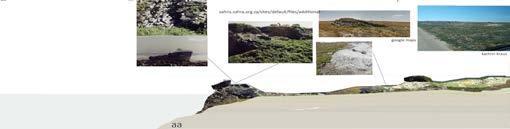
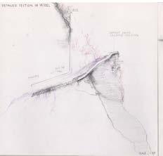
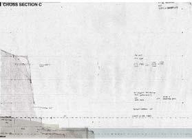
refraction on site collaged section c
The site also has remnants from a shooting range, which was present for warders towards the end of the improsonment.
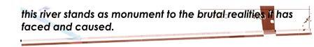
Site features a quarry which had been filled from sedimentation over the many decades, this is now the highest point on site, where one can view the significant views of the blue stone quarry and the borrowed landscape (Table mountain and the rest of Capetown). This quarry is no longer spoken of and known to play a part of the brtal realities that the ex-prisoners aslong as the minority had overcome in this spot, which is remanescant of how women are not represented on Robben Island as part of this struggle.
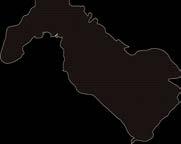
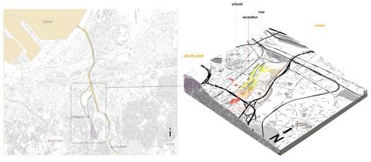
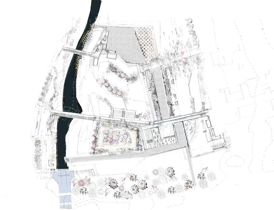
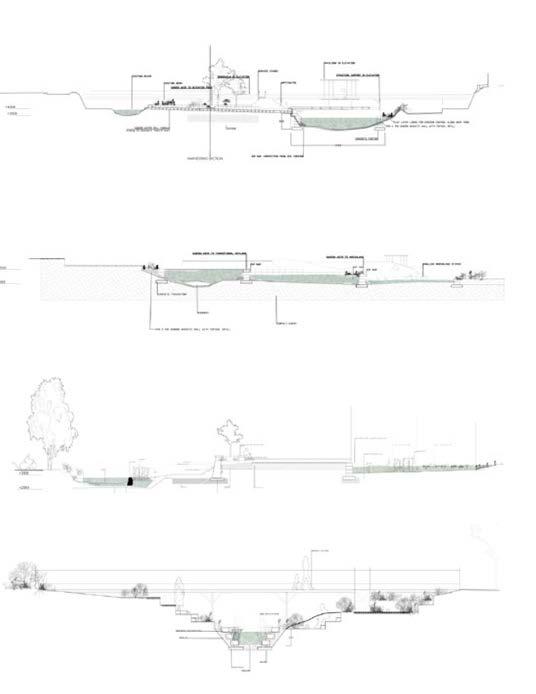
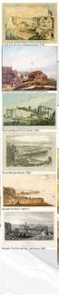
liesbeek river river rehabilitation
Landscape Architecture, University of Cape Town, Design Studio
Awarded ‘Institute of Landcape architect of South Africa Prize: Best Landscape Design Portfolio in the First year of the Master of Landscape Architeture Programme’ (2020)
photo by author
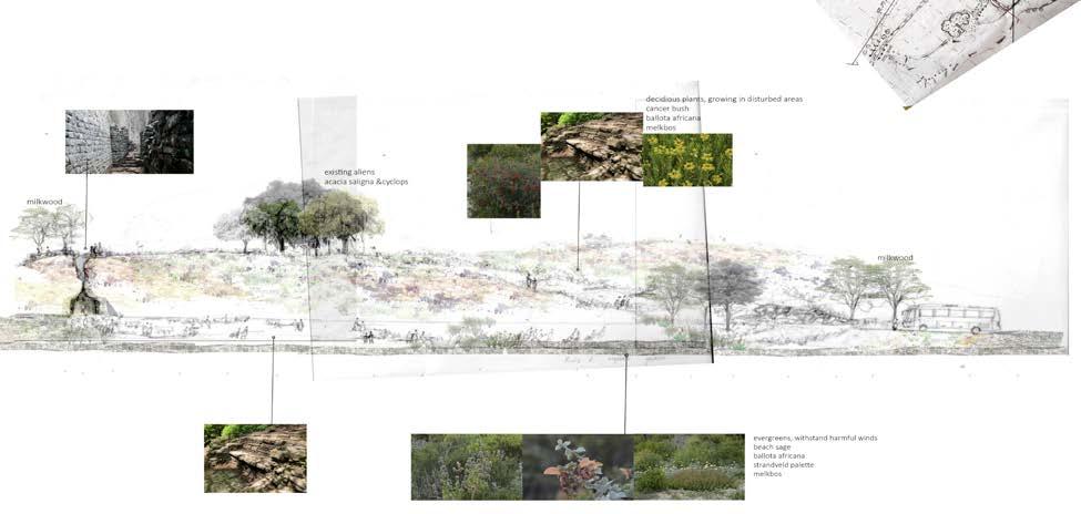
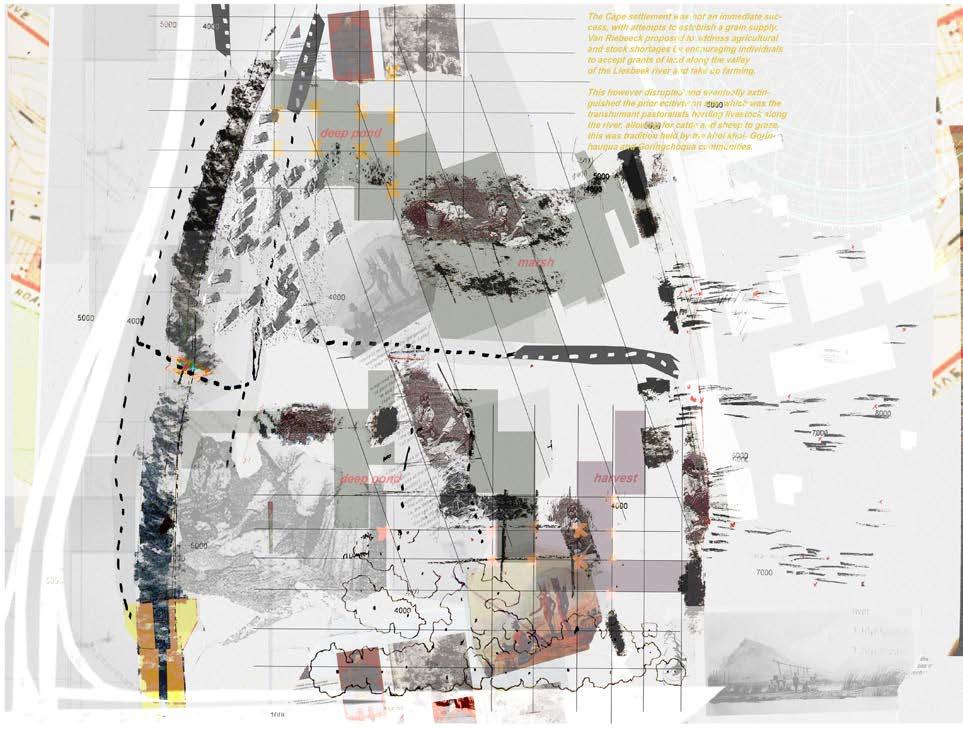
Liesbeek river held a large amount of rich material culture. The tranhumant communities based their lives on what surrounded them, and by doing so- worked with the land. What grows indigenous here is part of a broader framework which serves as expression of what the complexities of indigenous cultures live by.
During times of Slavery, the river was consumed by women who took on washing laundry as a domestic task. This was one of the ways natural resource could enhance livelihood when slavery was abolished, this was done as a means of making livelihoods for themselves and their families.
The river was a resources to wash clothes as a service for income. The river was then considered canalised for irrigation and other use within the suburban area. Due to the consol canalisaition the washer women were dislodged from running their service with the river as resource as this contaminated the water for irrigation purpose
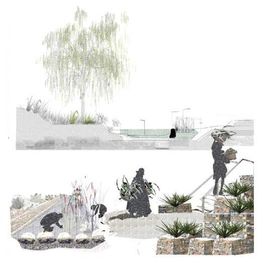
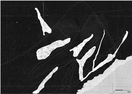
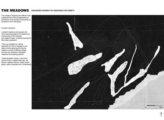
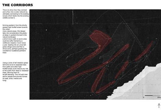
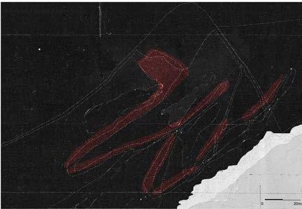
The river is a huge factor in the indigenous history of the landscape as it brings people together in shared experiences of collecting water and doing tasks ie. cleaning. There are huge oppurtunites orded to communitiy through the river, but this has unfortunatly been disregarded. This intervention is to harness the natural state of the river and by doing so supporting the biodiversity native to the land.
TRUP Liesbeek, CapeTown
RAPID URBANISATION
ECOLOGICAL
influx & rainwater level charge: high urban runoff or drought - drop of water levels resultuing to poor water quality
causing decrease of biodiversity (near extinction)
LAND & WATER MANIPULATION
SOCIAL
Canalization of river channel in 1942 and 1962 to facilitate urban development
Housing within centralised point dilemma
Access points to public transportation: Influx of squatters at circus site
Perminent evictions of Zipzap circus residents (socio-political tensions in close vicinity)
Abandonmant of circus school/neglect of heritage underdeveloped land of circus site
INTRODUCED
The purpose of this intervention is to improve the staus and function of the ecosystem within Liesbeek river. Urban river catchements are deteriorating worldwide, due to different factors sucha as contamination from heavy metals for stormwater runoff, decreasing biodiversity and support for habitat and declining ecological services.
Rapanea melanophloeos
Salix babylonica
Syzigium cordatum
Syzigium cordatum
Eucalyptus gomphocephela
Populus wislizenii
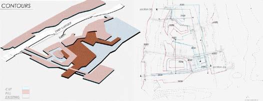
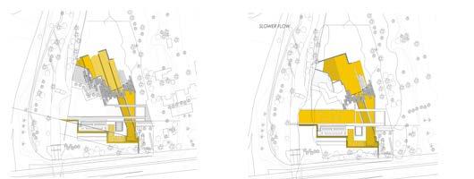
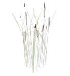
The purpose of this intervetion is to improve the status and function of the ecosystem within Liesbeek river. Worldwide, urban river catchments are deteriorating due to the different factors, such as, contamination from heavy metals from storm water runoff, decreasing biodiversity and support for habitat; and declining ecological services. Design Plan showing the water flow from original river to rehabilitation wetland systems, flowing back to the Liesbeek river. The wetland systems slow down the flow of the water, which allows for effective filtration to occur by sustaining the emergent vegetation present on site (i.e. Typha reeds) as well as introducing more bulbous plants for excess nutrient absorption.
tools: QGIS,AutoCad, Adobe Photoshop
description: rendered sketchplan showing water flow manipulation from beginneing to end of water filtertation intervention
Typha improves water quality through filtration but can be a threat to the ecosystem due to rapid growth. It is important to keep it under managment. It’s, however not easy nor cost effective to control this plant. recommeneded ways to do so include: applying herbacide at flowering stage (but this may have negative impacts to surronding fauna and flora. burning the reeds (which can be hazardrous) thus the most positivly effective solution is to manage the Typha reeds
Sections through river system, showing the water flow from original river to rehabilitation wetland systems, flowing back to the Liesbeek river. The wetland systems slow down the flow of the water, which allows for effective filtration to occur by sustaining the emergent vegetation present on site (i.e. Typha reeds) as well as introducing more bulbous plants for excess nutrient absorption.
tools: QGIS, AutoCad, Adobe Photoshop
description: Drawings analyising water flow, through contour manipulation, humaninteraction with water proposed at last stage of filtration intervention.
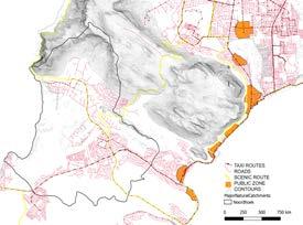
tools: QGIS Open data source Western Cape, Adobe Illustrator
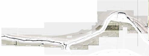
Description: Mapping urban-scape, biodiversity, waterbodies, human activity surrounding site
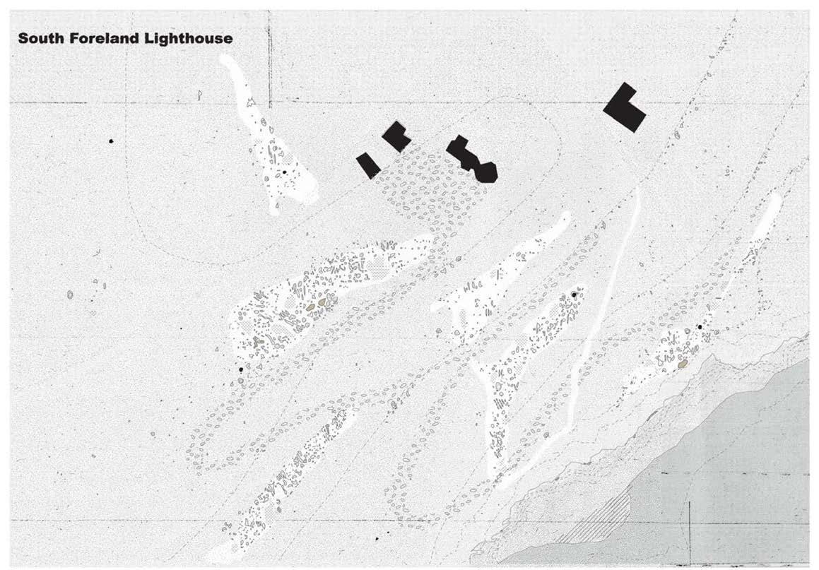
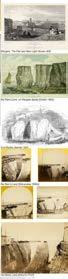
the index of isles
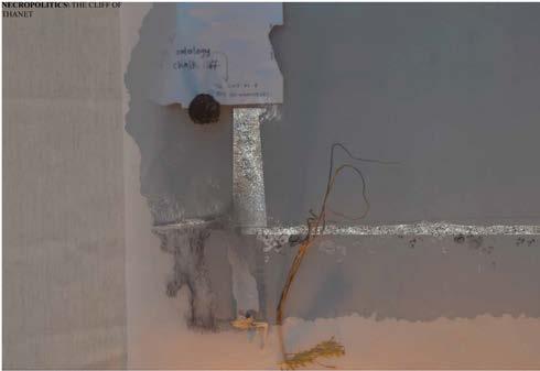
a valorising of channels the isle of thanet and the shadowed bright cliff
Landscape Architecture, Bartlett under studio 7 (2023/4) design exploartions on necropolitics of space
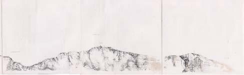
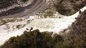
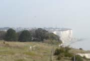
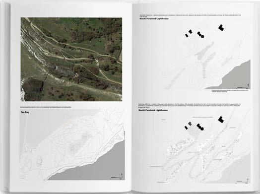
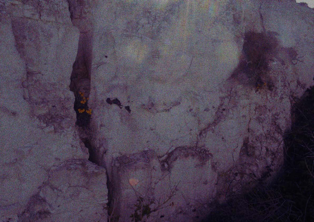
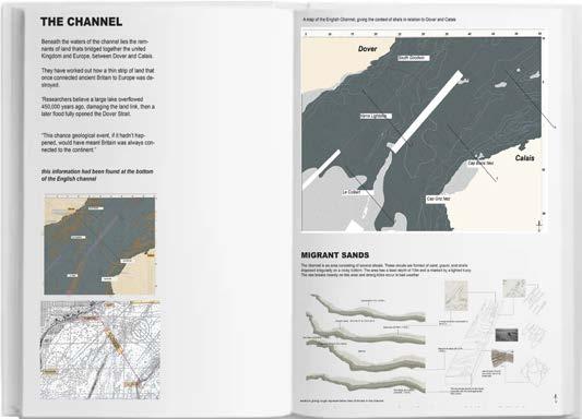
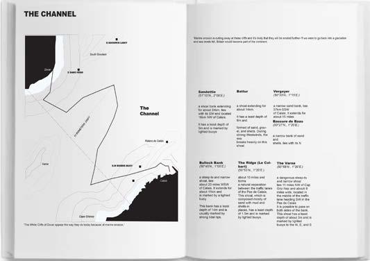
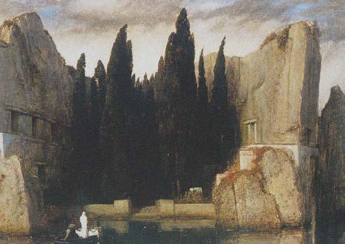
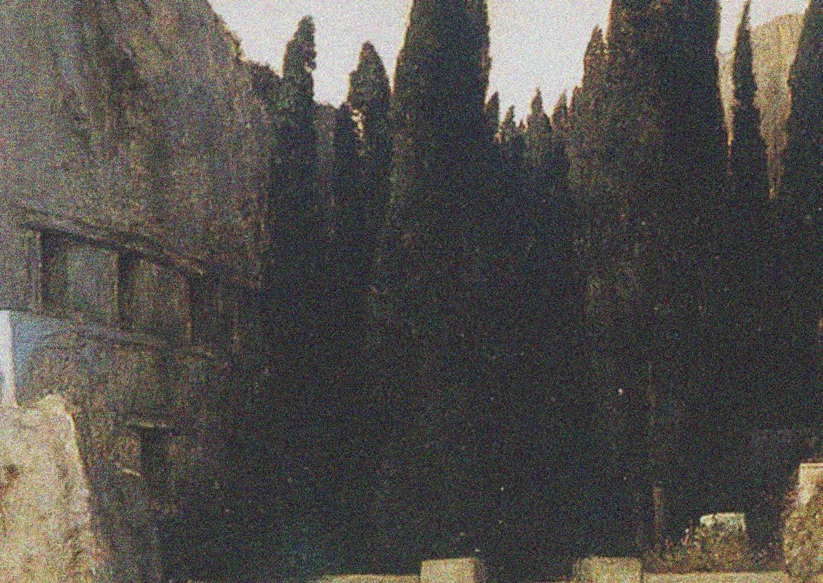
The Cliffs of Dover
photo by author
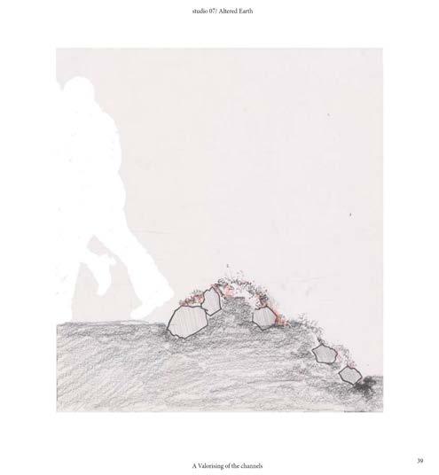
A VALORIZING OF THE CHANNELS
Dover, United Kingdom
INDEX OF THE ISLE
INDEX OF THE ISLE
A VALORISING OF CHANNELS
A VALORISING OF CHANNELS
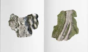
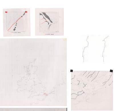
tools: QGIS, hand drawing, Earth studies, Archive collection, Photogrammetry, drone footage, description: collection od studied material collaged of the white cliffs of dover
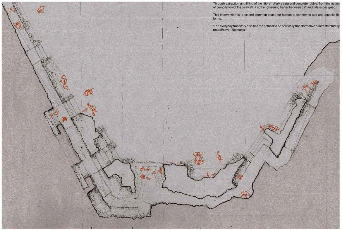
A lack of the acknowledgment of the ‘dead alive’ (borrowing from Achille Mbembe) who have moved through spaces, has obliged me to investiate was of creating channels from the coast to Dover - valorising the channels that come from the Isle. I labour under the view that ‘nobody must be socialy and legally invisible’. This is the basis of my landscape design project, which aims at reclaiming accessibility to land and restoring the natural phenomenon of mobility.
My design methodolgy rests on the principles of necropolitics, which defines the social, economic and political world we live in today, where aspects of physical life are characterised by the ‘dead alive’, leading to unjust systems of power underpinning the issues of mortality. Dover was one of the slave ports supporting the triangular slave trade journey, where slave ships were serviced and salvaged. The land itself comes as witness. Objects from slave trade migrations buried at the base of the cliff marks history of site and movement that took place through the channel. Today, Dover is still a site of migration, not through the slave trade but filled with new patterns still choosing to ignore the dead alive.
My body of work interrogates internal histories of spaces along Dover, which history permeates to the earth’s story. In my work, Landscape is presented as witness that captures and traces movement and links each movement to changes or formations that occured on earth. The research undertaken focused more on spaces of oppression and trauma through the hostility created through drawn line, border or edge, and the intersection interrelationship of such spaces with the English Channel.
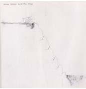
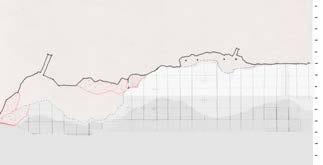
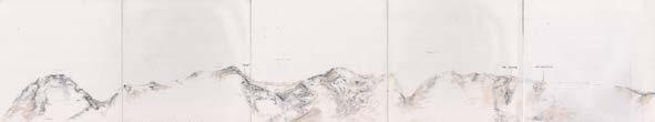
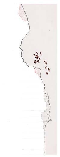
QGIS analysis demarkating the geological areas on the Great cliffs of Dover
A field study ongoingly studies along the coastline, between Port Dover and St Margerets bay. A beacon of bright cliffs as the entry to the isle, with a number of distinguishable landscapes. The landscapes current ecosystems shaped by the past and current colonial society are investigated with the aim to reimagine and dismantle these defensive landscapes. All these landscapes have witnessed change and reform following the unfolding of the ever eroding and moving lands and waters.
field studies, consisting of ecotope analysis, soil studies, and photographic mapping
geology map of Dover
EROSION AND FLOODING PRONE EDGES
In the index of the isles I use the landscape as the living archive, as it witnesses the natural phenomena of migration and erosion. I present site specific field studies that respond to ecological anxiety and navigating transnationalism in Brexit, drawing from these (hi)stories seen through the existing landscape and policy. Mbembe contends that there is one world, whether we want or not, we all shall share this world. “To build a world that we share, we must restore the humanity stolen from those who have historically been subjected to processes of abstraction and objectification. From this perspective, the concept of reparation is not only an economic project but also a process of repairing broken links.”
The landscape design project is rooted under the exploration of new materialism, through a lense of embracing necropolitical power structure and highlighting the negative facets brought about by biopolitics as a system in reality, which we face as a society. This defines the social, economic and political world we live in today, where aspects of physical life are characterised by the ‘alive’ and ‘dead alive’, leading to unjust systems of power underpinning the issues of mortality through the hostility created through drawn lines/walls/ policies or borders. These impact factors are through the design interpreted and illustrated through first, viewing the shadow of the shoreline cliff as a metaphor. The design introduces life to what is ordinarily viewed as ‘non-living’, seen as the shadow. My realisation when viewing the cliff that actually death is staring at me, inspired my design.
By analysing the existing routes/channels from the port to Dovervalorising the channels that come from the Isle. I labor under the view that “nobody must be socially and legally invisible”. This was the basis of my landscape design project, which aims at reclaiming accessibility to land and restoring the natural phenomenon of mobility.
The channels designed are for the mobility of human and non-human beings to find more accesible routes along the coastline of the isle. This existing defensible landscape has creates hars borders between each stewarded land.
This looks to realising the necessity of changes in policy inorder to chage the existing bordered scapes of the white cliffs of Dover.
The parellels of water and people movement through the English Channel into Britain are the centre of the design thought. Through bringing attention to the cliff, the design holds the history of the Isle of Thanet at its forefront, as well as depicts the cliff as a living being. The cliff’s quality of embracing the intraconnection of living and non-living elements is revealed through the study, and the stories that come with it are respected.
My interpretation of the cliff is based on the history of slavery that took place until 1807 the remains of the object carried to and lost from the lands and ships holding significance and now buried at sea. Many lives have been given to the area of Isle of Thanet (fossil bearing rock). The cliff signifies the history of devastating experiences of the transatlantic slave trade.
Regenerative design course and internship, Building Beond Borders Symposium: The Architecture of Extr-a-ction (2022/3)
Finalist of ‘the new European Bauhaus Prize’ - Building Beyond Borders team (2023)
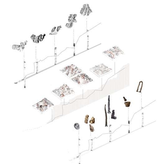
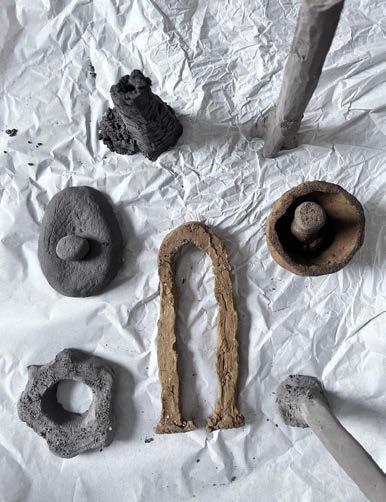
EXPLORATIONS WITH EARTH ON MATERIAL SCALE
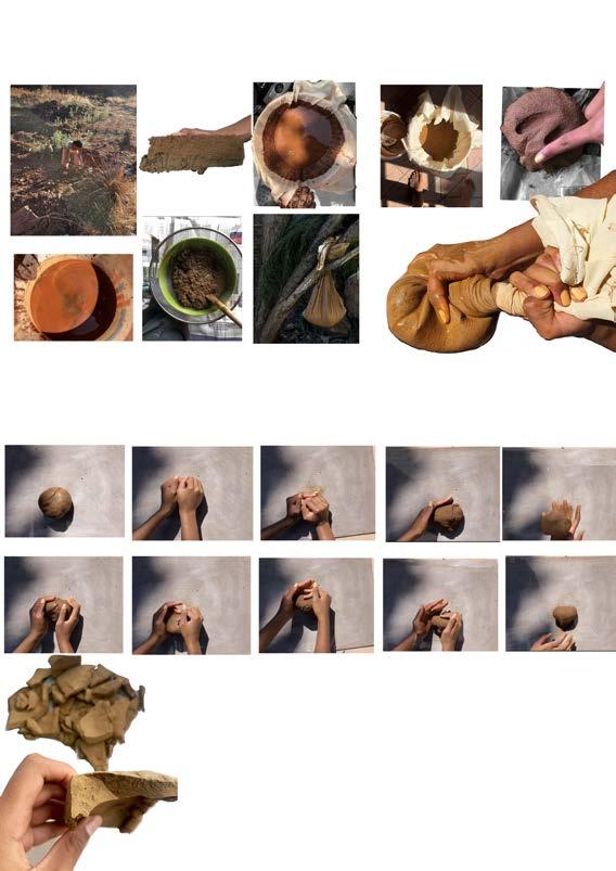
individual research: geo sourcing, clay harvesting Studio Assistant, Maintenance of studio, assisted my growth in actualising the processing of earth materials to clay and processing clay to a functional ware. This brought my attention to the significance of material we use in society everyday, and how to have more thought towards design at a material scale.
collecting local clays in areas of gauteng and processing them to clay aht can be used put me in the mindest of finding more information on contaminant and the issues around over fertilisation, eutrophicaton and lead found in earth in peripheries of Tshwane.
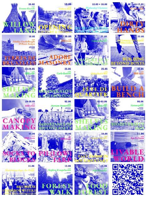
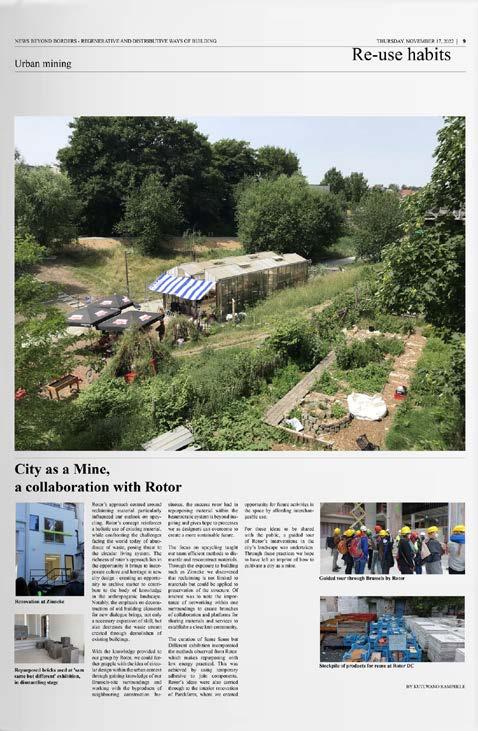
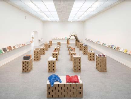
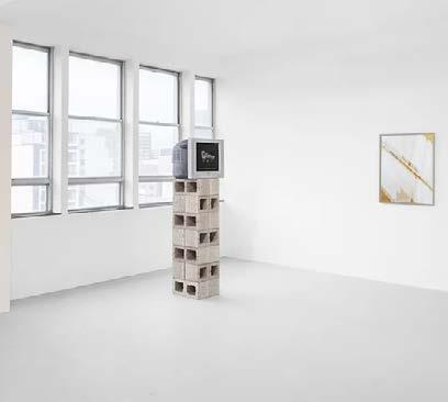
With my fascination in earth studies, I was part of producing the hyperlocal brick for the Z33 Exhbition, as well as coordinating, hosting and fascilitating the workshops at parckfarm, Brussels engaging the Molenbeek community in ways of incorporating these apporaches into the CBD.
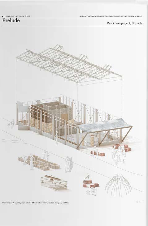
Working with earth at a material scale. Finding the proporties best suited for a hyperlocal brick in Molenbeek, Bruxelles. Done in a group following a symposium of regenerative design strategies for a circular economy in the Building Beyond Borders program. A 1:1 scale intervention for public use as well as an exhibition in Z33 is the outcome of the symposium. There were workshops and lectures as part of this program open to the Brussels public city which the Building Beyond Borders team had coordinated, and fascilitated.
An exhibiton and set of workshops and lectures curated by the Building Beyond Borders group the ‘same same but different’ exhbition collaborating with BC architects. I along with a group of 2 others had the role of geosourcing at a material scale. Testing the compostion of a hyperlocal unfired brick, which would be of a circular/ regenerative character. The mix was then transported to site, and built in Z33 House of Contemporary Art (April-August 2022) with the rest of the team, to form the podiums seen in exhbition photo below.
The Index of Isles, Clays from the white cliffs of Dover
experimenting with the different clays one can fin off the coast, this is an approach to learn about the sites history as well as observe the contaminants of the site, brought by farmland artificial fertilisers.
research paper
toxic superfluity
Landscape Thesis, The Bartlett School of Architecture (2023/4)
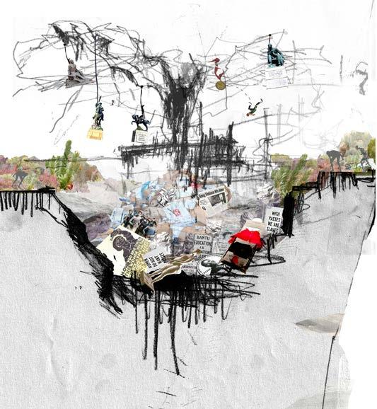
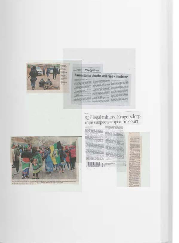
Operation Dudula extended its operations to be a nationwide movement. Operation Dudula is an unregistered community organisation, operating under a slogan, “Put South Africa First”. It is argued by reporters and researchers that Operation Dudula’s campaign was motivated by the burden faced by Black South African Society on public health services, job opportunities, social grants due to influx of Illegal Immigrants. The World Bank Report of 2022 titled “Inequality in South Africa”, supported the sentiment where it highlighted that inequality in South Africa is consistent with racial disparities. Hence, the approach adopted by this study that Xenophobia is one of legacies of mining capitalism. In its operations, Operation Dudula targets businesses which hire illegal foreigners, in pursuit of maintenance of low wage bill. The rise in anti-immigrant sentiment has left Immigrants and Refugees fearing for their life. (As reported by Aljazeera on 8 April 2022, Reporter: Thabo Myeni).
Xenophobia, presents itself as the second layer of racism, which is based on the principle of inferiorisation and deprivation and not racial in nature. Katsere (2019) states that Xenophobia is exploited as a tool to intentionally dehumanise marginal groups and to justify such inhumane treatment.1The mismanagement of exhausted mines naturally. attracted illegal immigrants, as digging minerals was a skill learned from the mines during the time of apartheid when mining companies were profiting from extraction of gold and other minerals. Operation Dudula Movement raised concerns of stirring xenophobic sentiments in the country; scapegoating immigrants as reason for compromised nationalistic values. The movement in their drive of “Put South Africa First” embarked on a campaign of exclusion of undocumented, non-South African Others. Ironically, Operational Dudula adopted the same colonial framework to dehumanise and exclude those who have been victims to the loss of land and knowledge systems that the power dynamics of imperialism extended to......Tracking the developments at Mintails mining site, gave clarity to the following statement by Achille Mbembe (2017) “To be black is to be stuck at the foot of a wall with no walls, thinking nonetheless that everything will open up in the end.
living archive projects worlding and post-nature
personal project, as m’lk collective awarded with Fakugesi conceptual digital art Award (2022) residency and workshops hosted in Newfoundland Canada (2024)
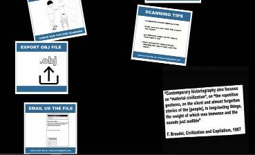
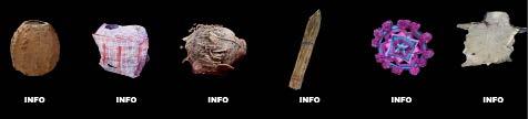
https://www.mlkshake.com/dintho
DINTHO was created for the purpose of providing a digital space where sharing of material culture can happen, with the aim of allowing for marginalized cultures and heritages to be showcased and understood further. With the fall of Rhodes statue in Cape Town and more recently the removal and defacing of statues in the US, UK and Europe, the question of who is allowed to contribute to the mainstream narrative of our global societies history, and culture is raised.
With ‘the digital’ creating the possibility for a
more collective writing of history we wanted to create a space where we could see this materialise. Each piece of material culture could potentially be a portal to understanding a part of marginalized society and with more understanding, there can be more support and thus a better chance of conservation of these stories.
together nearby families in the daily life, through the grinding of each household’s grains, serving as commonplace. The use of irrigation ditches and sluice boards to divert water flows are utilised without the consumption of the water, making it efficient, as the water can pass and still be used in fields for farming. FREELANCE RESEARCH AND MIXED MEDIA WORK
Snow in the atlas mountains melt in the spring and create torrents that feed irrigation systems called séguia. Water irrigation is important to Morocco because of the unreliable rainfall and the reliance on produce. Water from snow flows in the sequoia’s above the terraced fields and those with water rights are given water every 12-14 days.This is what makes the watermill in this region a necessary amenity which brings
Mill, Ourika Valley Series 005/ THE HIGH ATLAS REGION
exhibition held at Reservoir, film screening of Catalogue_ZAR. A collection of material culture in South Africa overlayed with a sounds of the city scape which these objects live in.
observation on archiving the intangible, focusing on what elements encompass the environment of the Eastern,coastal city of St John’s Nefoundland, explorations draw from weathering as concept, folklore,and local histories to build a world that protagonise the ephemera captured in the streets of St Johns,Newfoundland. This fictional world aims to speculate on future scenarios through fabulation of the existing.
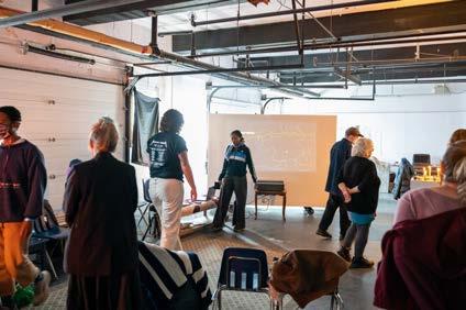
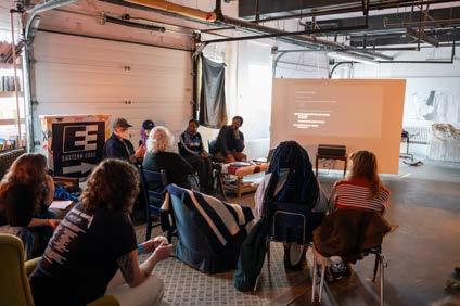
worlding and wayfaring workshops and introduction to 3D scanning hosted and fascilitated at Lawnya
and The
Vawnya festival (2024), Eastern Edge Gallery,
Rooms Museum, Newfoundland Canada.
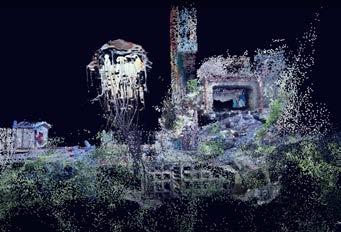
Moving through transient space: The Water Street Jellyfish filmed in the Anthro-coral of Downtown, St John’s.
Newfoundland, Canada
This short animation, interprets the texts of Tim Ingold, Jane Jacobs, Ursula K. LeGuin among other academic and indigenous thoughts and practices through the story of a fictional jellyfish that exists in a time after today’s epoch, where the existing beings have adapted to the post peak of a climate crisis. Within a raised coastline,The Waterstreet Jellyfish (made from a digital 3D scan of a woven rope piece made by the artists) emerges, serving as a medium moving through a post weathered, St. John’s, Newfoundland and aims to bring attention to the interrelations between weathering and socio-political infrastructures. The backdrop is a rhizome of digital scans and the protagonist interacts with some of the city’s material culture, namely a wooden carved sculpture, The Living Tree by Torbay artist Vince Jones, an Irving gas canisterand the ubiquitous rusted debris found in the city’s streets.
common names / Water Street Jelly Fish , W.S.Jellyfish, WYatfish, JaneJacobs JellyFish Janey Fish, Laura Jane Fish, Dandelion Jellyfish, Weathering Fish, Bobbing bullb turning brown
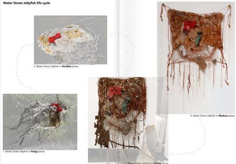
Through understanding the significance of St John’s Sea life, crafts,and how impactful weathering is in Downtown, the Rustacea Capillata, is created, with crab shells, rusted bits, and interacate crafting mesh, the jellyfish drift in Downtown, picking up the nuances of human intervention and thrives off of its atmosphere.
an·thro- /Anthropo- refers to, human-like -reef refers to a deposit
“language is not tossed like a ball from generation to generation, but it endures as a continuous process of becoming.”
https://www.youtube.com/watch?v=TAEHdWXBK08&t=1s
https://easternedge.ca/new-artists-in-residence-mlk/ https://www.lawnyavawnya.com/event-details-registration/mlk-dintho-workshop-1 Artists in residence, art installation and video piece. and workshops hosted. Hosted and fascilated workshops at: The Rooms, Museum and Art Centre; Eastern Edge Gallery and at Lawnya Vawnya Festival.
Rustacea Capillata
I seek to continue observing the mundane and intangible gestures which exist in spaces and giving platform to omitted experiences. Finding and sharing stories of a forgotten past by speculating for the purpose of futuring post-individual worlds.