All watercraft and fishing are prohibited in Yoho National Park. See p. 13
Également offert en français
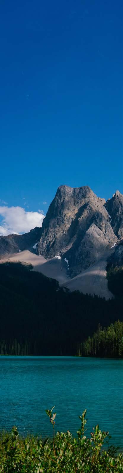
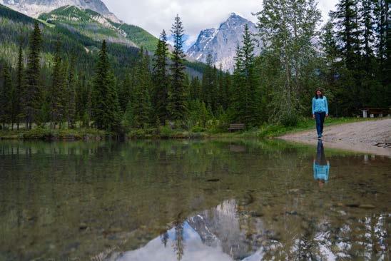
Sherbrooke Lake
Parks Canada respectfully acknowledges that Yoho National Park is located within the traditional lands of the Ktunaxa and Secwépemc Peoples.
Ktunaxa Nation
The Ktunaxa (k-too-nah-ha), also known as Kootenay, have occupied the lands around the Kootenay and Columbia rivers and Arrow Lakes for more than 10 000 years. Their Traditional Territory encompasses 70 000 km2 of south-eastern British Columbia, and includes parts of Alberta, Montana, Idaho, and Washington.
For thousands of years, and long before settlers arrived, the Ktunaxa harvested flora and fauna in the area that is now managed as Yoho National Park. The park lies within aknuqⱡuⱡam amak is (Land of the Eagle).
Ktunaxa stories teach their generations of seasonal migrations that occurred across the Rocky Mountains and on the Great Plains; of war and trade interactions with other Nations; of place names and landmarks; and of lessons and values.
The Ktunaxa language is a language isolate, meaning that it is one of a kind and unrelated to any other language in the world.
To learn more, visit ktunaxa.org
Secwépemc Nation
Weyt-k (hello)
The Kenpesq’t (ken-pesk-t) community, currently known as the Shuswap Band, is part of the Secwépemc (seck-wep-em) Nation. The Nation occupies traditional lands in British Columbia and Alberta.
The Secwépemc People traditionally fished, hunted and camped in the areas we now know as Yoho, Kootenay, Mt. Revelstoke, Glacier, Banff and Jasper national parks since time immemorial; long before settlers arrived.
Many of today’s roads and trails are Secwépemc travel routes. They served as connections to trade partners and areas for food and medicinal plant gathering. Indigenous guides created horse trails that evolved into major highways such as the Trans-Canada Highway in Yoho National Park. Today, the area encompassed by Yoho National Park continues to be an important site of oral history and Shuswap cultural practice.
Parks Canada and the Secwépemc Nation continue to foster a better working relationship that informs the management of natural resources and enhances the visitor experience for those exploring traditional lands.
To learn more, visit shuswapband.net
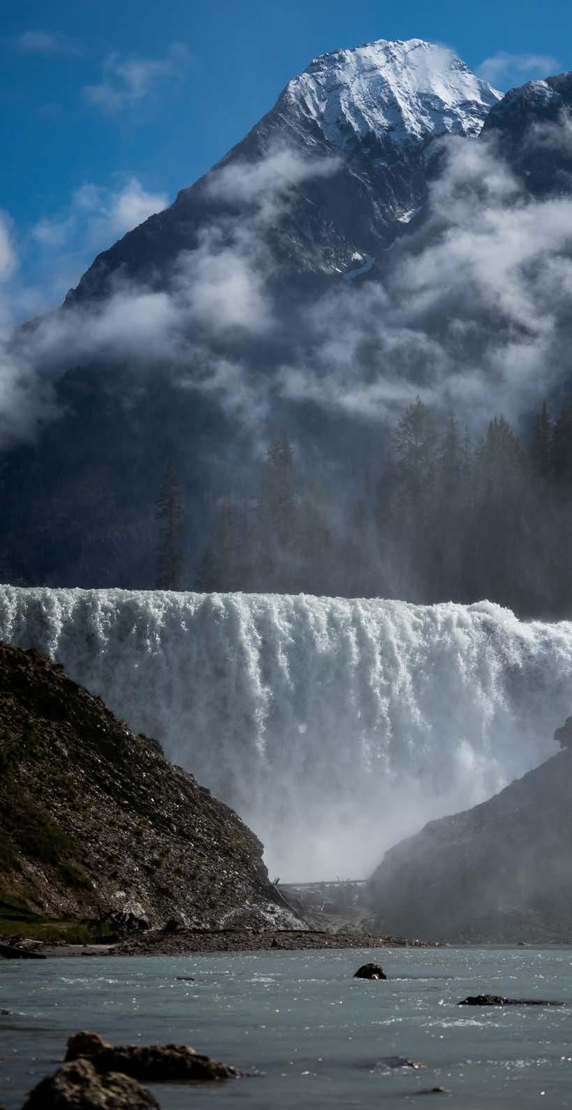
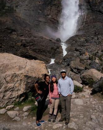
Wapta Falls
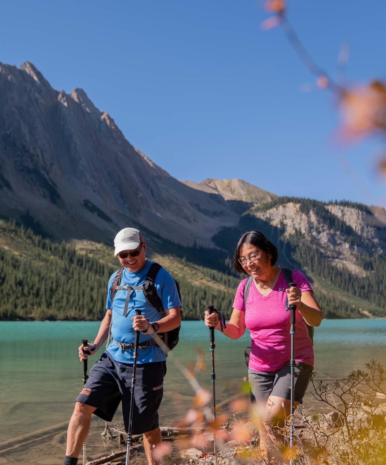
Welcome to Yoho National Park
The Rocky Mountains have been part of Indigenous Peoples’ homelands for thousands of years.
Only in very recent history did European settlers move into the area that we now know as Yoho National Park. A British expedition in 1858 relied on the help of Indigenous guides to navigate the challenging terrain. Back then, Dr. James Hector became the first European to map the pass that we know as Kicking Horse Pass today. This spectacular route received its name after Hector’s horse had knocked him over with a kick to the chest.
In the late 1800s, the Canadian Pacific Railway built a luxury hotel to welcome the first railway tourists in the community of Field. This is where Mount Stephen Reserve was established in 1886. The reserve became Yoho National Park in 1911.
In 1909 on Mount Wapta, Charles D. Walcott came across a layer of rock containing unusual fossils which he later named the Burgess Shale. Read more about the fossils that are older than dinosaurs on page 11.
Yoho National Park will take your breath away and you will want to come back. That’s a promise.
We invite you to explore the park’s natural and cultural treasures. Experience roaring waterfalls, the history of Canada’s railway and world-famous fossil beds, or bring a picnic and enjoy your beautiful surroundings. Whatever it is you came to Yoho for, we are glad you are here.
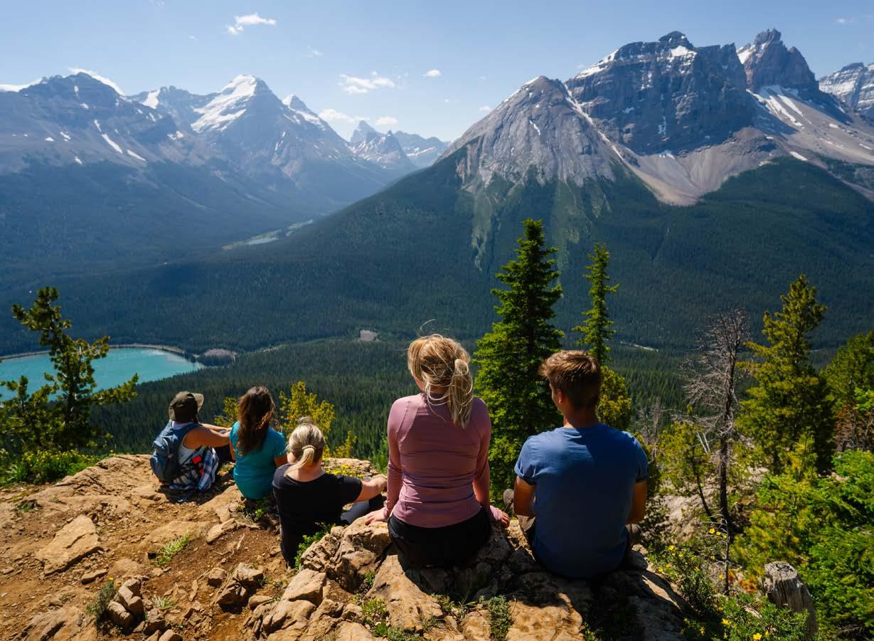
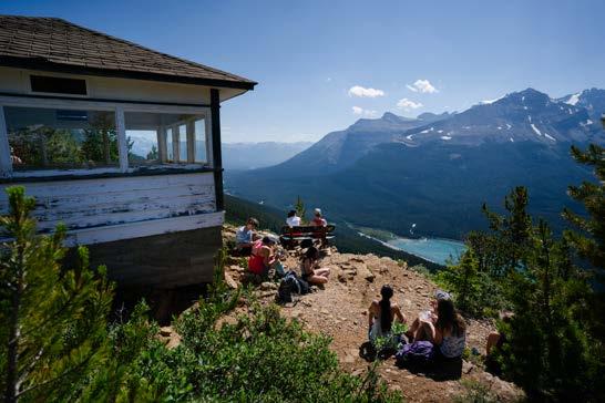
Paget Lookout
Plan your adventure
WHERE CAN I GET INFORMATION?
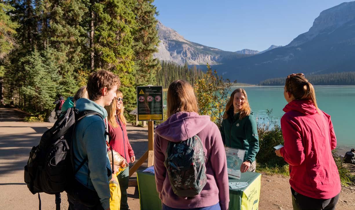
Keep this guide for travel inspiration and maps, and come chat with Parks Canada staff at the Yoho National Park Visitor Centre in Field, B.C. You can find us next to the Trans-Canada Highway.
Hours of operation are subject to change. Washroom facilities are open year-round.
YOUR SUPPORT MAKES A DIFFERENCE
Entry fees are charged at all national parks. Every time you visit a national park you are investing in its future, and in a legacy for future generations. Pick up your pass at any park gate, visitor centre or staffed campground kiosk.
DAILY ENTRY PASS
The daily entry pass is valid in Yoho, Kootenay, Banff, Jasper, Waterton Lakes, Mount Revelstoke and Glacier national parks. Regardless of time of entry, the pass is valid until 4 p.m. the following day.
WHAT’S YOUR TRAVEL STYLE?
Select your favourite activities:
Scenic driving and sightseeing
Camping and relaxing
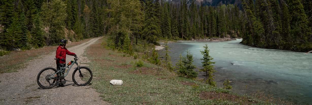
Hiking, biking and other outdoor activities
History, fossils and learning opportunities
Good news - Yoho ticks all your boxes! Visit parks.canada.ca/yoho and start planning today.
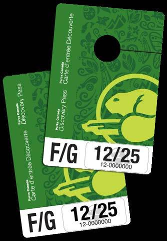
PARKS CANADA DISCOVERY PASS
This annual pass is valid for 12 months from the date of purchase, expiring on the last day of the month in which it was purchased. It gives you unlimited admission to over 80 Parks Canada administered places across the country.
DID YOU KNOW?
You must have a valid national park entry pass if you stop anywhere in a national park, and if you drive Yoho Valley Road or Emerald Lake Road.
PARKS CANADA IS HIRING
Upgrade your office view! You don’t need to be a scientist or a backcountry expert to build your career with Parks Canada. People with diverse backgrounds and interests are encouraged to apply. APPLY NOW!
parks.canada.ca/LLYK-jobs
Take the pledge
You play an important role in the future of the park. Yoho National Park has incredible natural and cultural heritage. It is a diverse landscape, a home to wildlife and a place of history.
WE NEED YOUR HELP TO KEEP IT THIS WAY!
I will store my food and scented items safely, and never feed wildlife.
WHY? Wildlife need to find their own natural food sources. Feeding wildlife, littering, or leaving scented items or food unattended, attracts them to human use areas. This is very dangerous. Dispose of recycling, trash and food in designated areas. It is illegal to feed wildlife!
I will give wildlife space.
WHY?
All wildlife can be dangerous, regardless of their size. Wild animals can lose their natural fear of humans after repeated interactions. If you see wildlife on the road: slow down, stay in your vehicle and move on. Chance animal encounters can happen anywhere. Carry bear spray and know how to use it.
I will protect lakes and rivers in the park.
WHY? Invasive species are non-native plants, animals and diseases that impact the land and waters of the park. National parks are home to many species at risk that rely on healthy ecosystems for their survival. Help prevent the spread of aquatic invasive species, see p.13.
I will leave plants, rocks, fossils, antlers and all other natural objects undisturbed.
WHY? Millions of people visit the mountain parks each year. A small act like picking a flower, when multiplied, can have lasting consequences for the ecosystem. To protect these natural and cultural treasures, always walk on marked trails and leave what you find for others to enjoy.
I will drive carefully and obey speed limits.
WHY? Slow down to prevent deadly collisions with animals. In high risk areas, no stopping zones are used to protect motorists and wildlife. Respect roadside signage, and only park in designated areas to avoid blocking traffic.
I will keep my dog on a leash and pick up after it.
WHY? To a wild animal, your pet is potentially a predator or prey. Wildlife may flee, endangering themselves or their young. An aggressive response from a wild animal could put you or your pet in danger.
I will follow park regulations.
WHY? The summer draws a high volume of visitors to the parks. Please respect regulations for the safety and enjoyment of everyone. To learn about park regulations, see back page.
Your pledge makes a big difference.
THANK YOU FOR TAKING ACTION!
Mountain safety
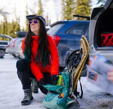
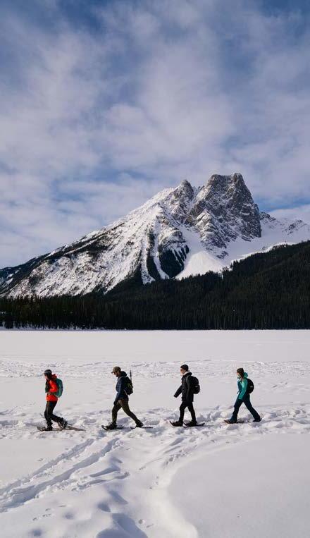
WINTER IN YOHO
Winter is a special time of the year to visit Yoho National Park. From snowshoeing to cross-country skiing, discover trails for all levels of ability. Get your winter activity fix and venture out on our network of winter trails. Visit parks.canada.ca/ yoho-winter to find out more.
SAFETY IS YOUR RESPONSIBILITY
• Be prepared for any weather.
• Bring extra food and water.
• Pack a first aid kit.
• Know where you’re going.
• Tell someone where you’re going, and when you’ll be back.
• Wear proper footwear.
BE SAFE IN THE MOUNTAINS
Natural hazards are a part of the national park experience. Safety is your responsibility! Come prepared and informed.
Tell somebody where you’re going, when you will be back and who to call if you don’t return.
PARKS CANADA DISPATCH
Non-emergency line: 403-762-1470
BACKCOUNTRY TRAVEL AND SAFETY: parks.canada.ca/mountain-safety
Avalanche season in the mountains extends from November to June, and even a short walk can take you into avalanche terrain. Whenever there is snow on a slope, there is potential for an avalanche.
Check the current avalanche forecast at parks.canada.ca/avalanche
Twin Falls, Whaleback Trail
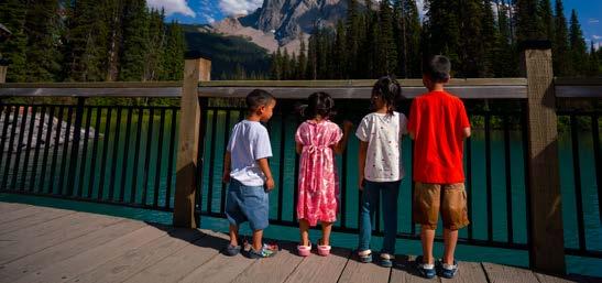
Emerald Lake
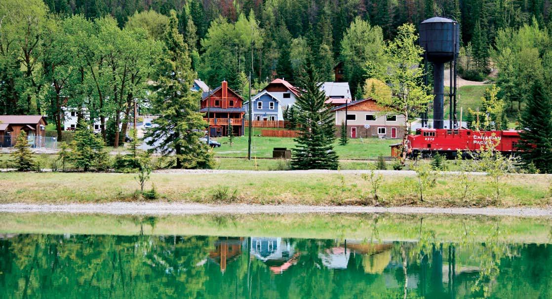
Community of Field
In the centre of Yoho National Park is Field. It is a charming community with fewer than 200 residents. It was established in the 1880s by the Canadian Pacific Railway. Field is an authentic mountain community with year-round accommodation, local art stores and lively restaurants. Don’t forget to check out the interpretive signs by the big water tower to learn about the history of Field. Visit field.ca to find out more.
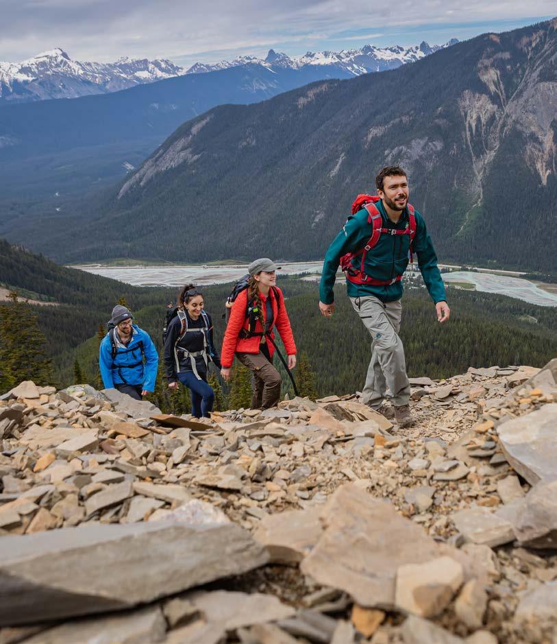
Park highlights
A PAGET LOOKOUT TRAIL
HIKES, WALKS, WATERFALLS, AND HISTORIC SITES
Create unforgettable memories. See pages 8-9 for a map of Yoho National Park.
One-way distance: 3.5 km Estimated time (return): 3 h
Elevation gain/loss: 525 m / 15 m
Take the steep but rewarding trail to an old fire lookout with the option to add on a side-trip to Sherbrooke Lake.
Park at Sherbrooke Lake trailhead. Eastbound traffic must turn around at Lake O’Hara
and drive back on Hwy 1 to make a right turn.
B LAKE O’HARA BUS PARKING
Access to the Lake O’Hara area is limited to protect its sensitive alpine environment. Advance bus reservations for day use or overnight accommodation reservations are required. Plan ahead and reserve as soon as reservations open for the season. Visit parks.canada.ca/lakeohara to find out about the four ways to visit the Lake O’Hara area. Lake O’Hara Road is closed to vehicles and bikes year-round.
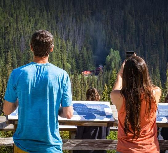
C SPIRAL TUNNELS VIEWPOINTS AND KICKING HORSE PASS NATIONAL HISTORIC SITE
The Spiral Tunnels are a pair of railway loops that were built over 100 years ago to get trains through the difficult mountain terrain. You will get a great view of the Lower Spiral Tunnel from the viewpoint on the Trans-Canada Highway and the Upper Spiral Tunnel from Yoho Valley Road.
DID YOU KNOW?
Kicking Horse Pass National Historic Site is a rail and highway transportation corridor from Lake Louise to Field. At 1627 m, it is the highest point on the entire Trans-Canada Highway!
One of the highest waterfalls in Canada (approx. 380 m), Takakkaw Falls is an impressive sight. This area is your starting point for many longer hikes in the Yoho Valley area, such as Laughing Falls and Twin Falls. Consider joining a guided hike to the famous Burgess Shale fossils at Walcott Quarry (see page 11).
Note: The road up to the Takakkaw Falls parking lot (Yoho Valley Road) is closed from early October to late June.
Vehicles over 7 m (23 ft) in length must reverse in order to navigate around the tight switchbacks. Trailers are not permitted!
D TAKAKKAW FALLS
the day
Walk along the Emerald Lakeshore Trail (5.2 km loop, 2 h return) for great photo opportunities (and to sneak away from the busy area by the bridge). Best time of the day to avoid the crowds? Early morning and late afternoon.
Note: Any watercraft (including SUPs) and fishing are prohibited! Canoe rentals available.
G FAEDER LAKE DAY-USE AREA
Sometimes you don’t have to go far off the highway to find a beautiful mountain scene. Bring your lunch and enjoy a picnic with a view at this lovely day-use area.
Note: The parking area is not suitable for large RVs or trailers. Westbound access only.
H WAPTA FALLS TRAIL
Make sure you plan a stop here to experience
impressive rock formation and the water rushing underneath it. Please be safe and stay on marked trails at all times. The rocks are not a safe place! If you want to go for a nice stroll or bike ride, start at the north end of the parking lot and walk on an old fire road along the Kicking Horse River.
One-way distance: 2.2 km Estimated time (return): 1.5 h Elevation gain/loss: 80 m / 115 m
Check out the widest waterfall on the Kicking Horse River! Hike to the viewpoint at the top (watch for roots along the way), or continue down a steep trail section to the Lower Viewpoint at the base of the falls.
Westbound
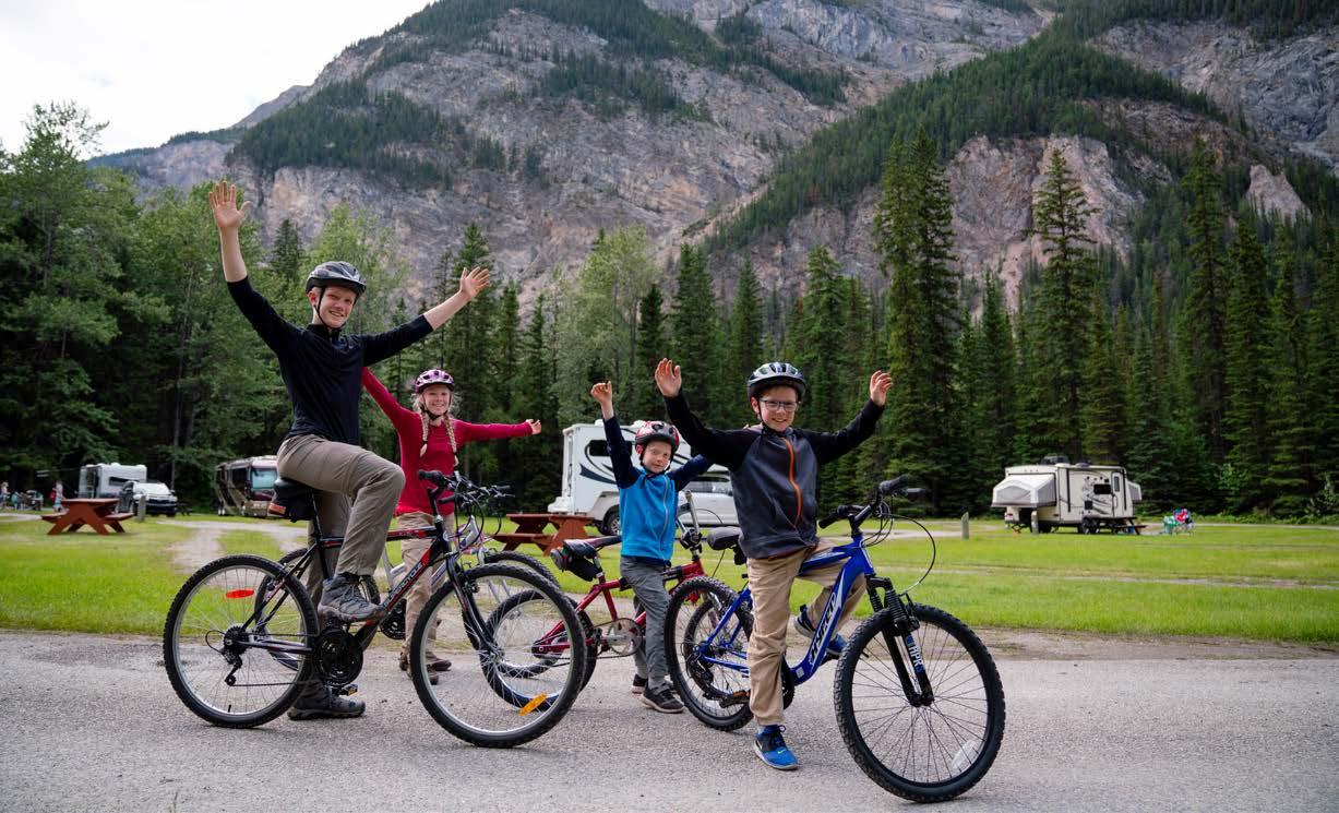
Create unforgettable memories with your family and friends.
Explore the park HIKES, WALKS, HISTORIC SITES AND SCENIC STOPS
See pages 6-7 for details.
The use of drones/ micro drones/UAVs without a valid national park drone permit is prohibited. M + S Winter tires (M&S) or chains are required by law for travel in B.C. from Oct. 1 to April 30 and on Hwy 93N (Ice elds Parkway) from Nov. 1 to March 31.
Cell phone coverage is not reliable. Some trailheads and picnic areas are only accessible from one direction on the TransCanada Highway. Left-hand turns are only allowed at signed intersections.
*On most hiking trails you will gain and lose elevation before you reach your destination. Elevation gain represents all the up and elevation loss all the down you will experience on a one-way hike.
Scan the code for a full hiking map: parks.canada.ca/yoho-brochures
Interpretive activities
ENHANCE YOUR VISIT
There is so much to experience in Yoho National Park. Be sure to look for interpretive experiences across the park:
• Explore the park’s natural and cultural history through exhibits at the visitor centre.
• Spot trains and admire the impressive engineering of the Spiral Tunnels.
• Journey to the spectacular Takakkaw Falls to better understand the importance of glaciers.
• Cruise to the Meeting of the Waters to observe the convergence of the Yoho and Kicking Horse rivers.
KNOW BEFORE YOU GO
• Takakkaw Falls is a very busy place in the summer. Come prepared with a backup plan if the parking lot is full.
• Yoho Valley Road is open from late June until early October (weather permitting).
• Vehicles over 7 m (23 ft) in length must reverse to navigate around the tight switchbacks.
• Trailers are not permitted. Longer RVs and buses are not recommended.
LISTEN NOW!
Connected: A Parks Canada Podcast Episodes about animals and plants in danger, and the Parks Canada specialists who protect them. parks.canada.ca/connected
EXPLORE. LEARN. CONNECT.
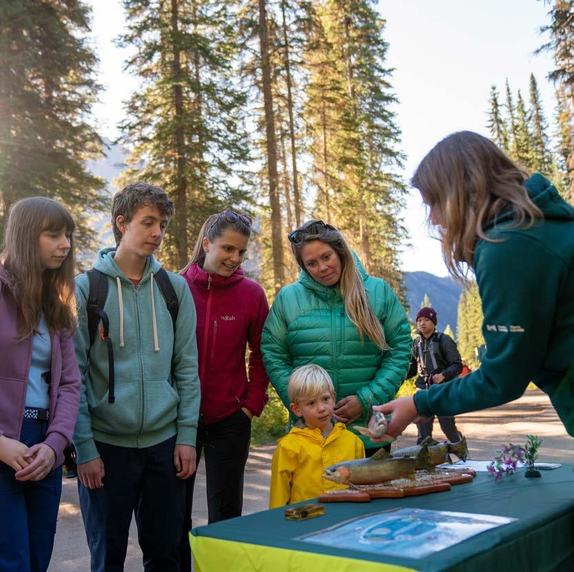
Park interpreters can’t wait to share fun and inspiring experiences with you. Would you like to learn about species at risk, human-wildlife coexistence, aquatic invasive species and other exciting topics? Join us for an evening program in campgrounds or an activity at popular dayuse areas.
EVENING PROGRAMS
Discover Yoho’s natural and cultural heritage. Interpretive programs are offered at Kicking Horse Campground in July and August, multiple evenings a week (check in with the visitor centre or campground kiosk for an up-to-date schedule). From game nights to speaker series and theatre shows, there’s something for everyone!
Programs are available to all visitors with a valid park entry pass. You don’t need to be staying in the campground to join in the fun!
Find out what’s on: parks.canada.ca/yoho-interpretation
Burgess Shale guided hikes
DISCOVER BURGESS SHALE FOSSILS
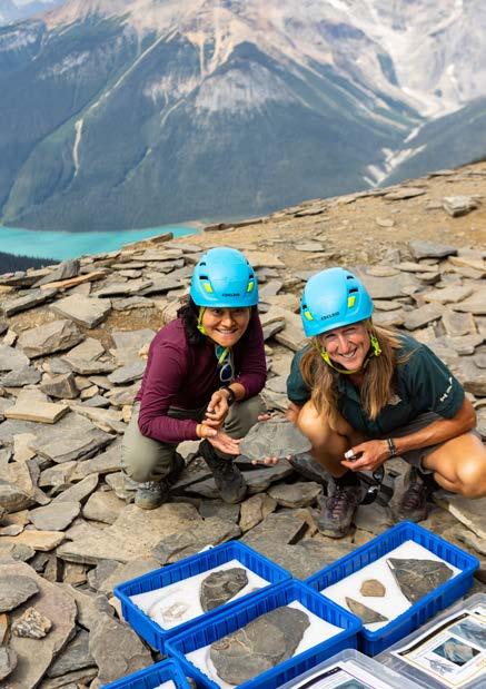
High in the mountains of Yoho and Kootenay national parks, the Burgess Shale fossils are the oldest evidence of complex life on Earth. These fossils are so important that they have been recognized as a key part of the UNESCO Canadian Rocky Mountain Parks World Heritage Site. Scientists are still making new discoveries, changing our understanding of early life and evolution!
Parks Canada protects these internationally significant treasures and offers guided hikes to three unique Burgess Shale fossil sites in Yoho and Kootenay national parks.
THE BURGESS SHALE FOSSILS ARE...
Old – Over five hundred million years. Way older than dinosaurs! Well preserved – You can see all sorts of really fine details like eyeballs and guts, brains and more. Your relatives – Our human ancestry can be traced back to these diverse ocean creatures.
WALCOTT QUARRY
Join a Parks Canada guide to meet your ancient ancestors and hold a piece of earth’s history on a guided hike to the restricted Walcott Quarry.
Difficulty: Difficult
Return distance: 24 km
Elevation gain: 900 m
Duration: 11 hours, 7 a.m. – 6 p.m.
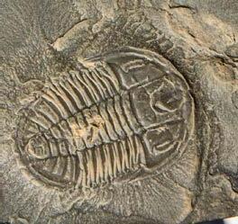
MOUNT STEPHEN
On this short and steep adventure you will hike to the Mount Stephen trilobite beds that overlook the community of Field, BC. This historic site is where railway workers reported finding ‘stone bugs’ in the 1880s.
Difficulty: Difficult
Return distance: 8 km
Elevation gain: 800 m
Duration: 7.5 hours, 7 a.m. – 2:30 p.m.
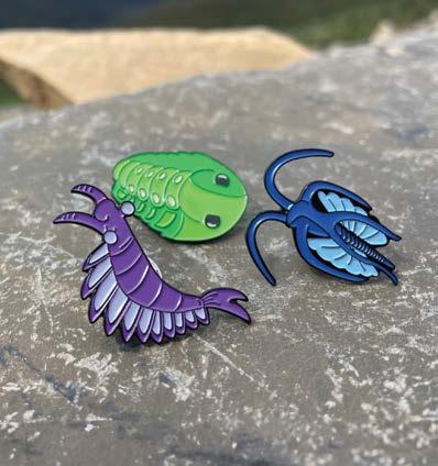
Reserve a guided hike with Parks Canada! parks.canada.ca/burgess-shale 1-877-RESERVE (737-3783)
COLLECTTHEMALL!
Receive a souvenir pin on each Burgess Shale adventure.
Mount Stephen fossil beds
Walcott Quarry fossil beds
Conservation stories
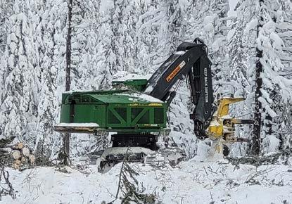
THE ROSS LAKE FIRE GUARD
In winter 2023/24, a fire guard was created in Yoho National Park, between Sink and Ross lakes. It is 1.1 km long, between 400 and 500 m wide, and was completed using mechanical tree removal. Fire guards are constructed in winter when frozen ground and snow will protect soils and vegetation. Upon completion, any constructed roads are fully rehabilitated.
WHY?
• Many years of fire suppression have created dense forests that are at high risk of forest fires.
• In the event of a wildfire, fire guards act as a break for the fire. They help reduce risk to the community of Field and the Bow Valley.
• This fire guard will improve overall forest health, ecological integrity and wildlife habitat.
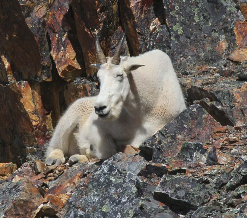
MOUNTAIN GOATS ON THE MOVE
Although mountain goats are common in Yoho National Park, they can be hard to spot - even for Parks Canada staff! They prefer to hang out in some of the park’s steepest terrain, away from curious eyes.
In 2018, wildlife cameras captured the mountain goats’ first use of a wildlife crossing in a Canadian national park. The photos captured them walking through a new underpass and standing on top of Yoho’s first overpass.
WILDLIFE AND YOU
If you see wildlife by the road:
• Slow down and use hazard lights to alert other drivers.
• Only stop when and where it is safe to do so. Pull over and do not block traffic.
• Stay in your vehicle.
• Watch for a few moments, take a photo from a safe distance and move on.
Photograph wildlife from a vehicle or safe distance:
• 30 m for deer, elk, moose and bighorn sheep
• 100 m for bears, wolves, coyotes and cougars
Do not feed wildlife, it is illegal. This includes littering and leaving food or scented items unattended. Fines of up to $25,000 may apply.
Do not approach wildlife. When taking photos, do not surround, crowd or follow an animal.
A no stopping zone protects wildlife and motorists in high risk areas. Watch for signs along the roadside and do not stop to view wildlife in this zone.
Ross Lake
Ross Lake Fire Guard
Mountain goat
Protect park waters
All waterbodies in Yoho and Kootenay national parks are closed to watercraft and angling until March 31, 2026 to reduce the spread of aquatic invasive species (AIS), including whirling disease. The closure applies to all lakes, streams, and rivers in Yoho and Kootenay national parks.
Scan the QR code or check parks.canada.ca/yoho-water-rules to find out about current closures and local regulations before planning your trip to a river or lake in Yoho National Park.
PROHIBITED ACTIVITIES:
Paddling and boating – This includes all watercraft such as canoes, kayaks, paddleboards, kiteboards, rowboats, and inflatable boats and toys (e.g., donuts, unicorns).
If it floats, it’s a boat.
Angling and angling equipment such as fishing rods, waders, boots, gloves and nets.
Violators may be charged and could pay fines up to $25,000 under the Canada National Parks Act.
PERMITTED ACTIVITIES:
Swimming – This includes the use of swimming aids and safety equipment, such as personal flotation devices, water shoes, wetsuits, gloves, snorkel equipment, throw bags and water wings.
Accessing beaches and shorelines – This includes the use of beach toys and taking pets on leash.
Using designated trail crossings and fords.
Collecting water for treatment.
Using rental canoes on Emerald Lake.
Visitors must Clean, Drain, Dry all equipment that comes into contact with water.
Parks Canada is committed to preventing aquatic invasive species from entering the park and regional waterways to maintain ecological integrity of the aquatic systems in the park and downstream areas.
THANK YOU FOR PROTECTING THESE SPECIAL PLACES!
Emerald Lake
Stay safe and protect wildlife
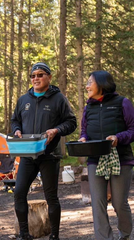
KEEP HUMAN FOOD AWAY FROM ANIMALS
• DO NOT LITTER. Use the wildlife-proof garbage bins for all unwanted items and food scraps.
• Store all food, food-related items and scented products in vehicles or storage lockers.
• Non-food related items such as lawn chairs, tables or lanterns may be left outside.
• Pour out dish water at designated sinks or sani dumps.
Parks Canada staff may enter open and plainly visible areas of an unattended campsite to remove and secure plainly visible wildlife attractants.
KEEP YOUR CAMPSITE AND PICNIC AREA CLEAN to reduce the risks to your personal safety and to wildlife.
ALL food-related and scented items MUST be stored away in a vehicle, a hard-sided trailer or RV, or in a campground food storage locker.
Sherbrooke Lake
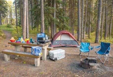
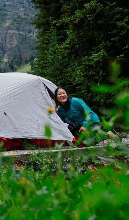
Camping in Yoho National Park
MAKE MEMORIES
Visit parks.canada.ca/yoho-camping to plan your stay at a Yoho National Park campground.
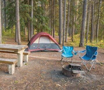
FRONTCOUNTRY CAMPING
Sleep under the stars at one of four scenic frontcountry campgrounds between mid-May and mid-October. Reservations are required for Kicking Horse and Takakkaw Falls campgrounds.
BACKCOUNTRY CAMPING
You need a reservation to stay at one of Yoho’s backcountry campgrounds: Yoho Lake, Laughing Falls, Twin Falls, Little Yoho and McArthur Creek. Same-day backcountry reservations can be made at a visitor centre. Visit parks.canada.ca/yoho-backcountry for more information.
DID YOU KNOW?
• Camping is only permitted in designated campsites.
• Remember! You must carry your camping permit with you at all times. There may be random patrol checks.
• Check-out time at all campgrounds is 11 a.m.
• A valid national park pass is required to camp in any national park.
• Quiet hours are from 11 p.m. to 7 a.m.
Kicking Horse Campground
There is limited cell service in many areas of the mountain national parks. All campgrounds on the Icefields Parkway (Hwy 93N) and along Hwy 93S through Kootenay National Park are outside of cell range. You can find emergency or pay phones at multiple locations. Look for the phone symbol on highway signs.
Camping in the mountain parks
How was your experience?
Scan the code to share your feedback with our team!
parks-parcs.simplesurvey.com/f/l/comment_card
Do not litter. Dispose of garbage or recycling in wildlife-proof bins, or pack it out.
No campfires outside of designated metal fire pits. Never leave a fire unattended unless it is completely extinguished. Be aware of national park fire bans.
Do not camp in pullouts, trailheads or day-use areas. Camp only in designated campgrounds with a valid camping permit and park entry pass. parks.canada.ca/yoho-camping
Do not enter closed areas. Closures are implemented and posted when visitors are at risk or wildlife need protection. Visit parks.canada.ca/yoho-bulletins
Do not remove natural objects. It is illegal to pick plants, to cut down trees and branches, to remove rocks, fossils and cultural artifacts or to otherwise cause damage.
Do not fly drones. The use of drones/micro drones/UAVs without a valid permit is prohibited anywhere in the national parks.
Firearms are prohibited in national parks. Firearms include pellet guns, bear bangers, bows, slingshots and similar items.
Do not consume alcohol and cannabis beyond your registered campsite. In campgrounds, there is a daily ban on alcohol and cannabis consumption during quiet hours, between 11 p.m. and 7 a.m. Be aware of extended bans during holiday weekends.
Law Enforcement
Park wardens enforce regulations as required by the Canada National Parks Act. Violators may be charged and could pay fines of up to $25,000.
To report violations, call 24 hours, 7 days per week:
1-888-WARDENS (927-3367) (Banff, Yoho and Kootenay) 1-877-852-3100 (Jasper, Mount Revelstoke and Glacier)
YOHO
Yoho Visitor Centre: 250-343-6783 | yoho.info@pc.gc.ca parks.canada.ca/yoho Accommodations and attractions in Field: field.ca