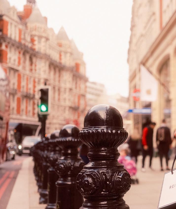
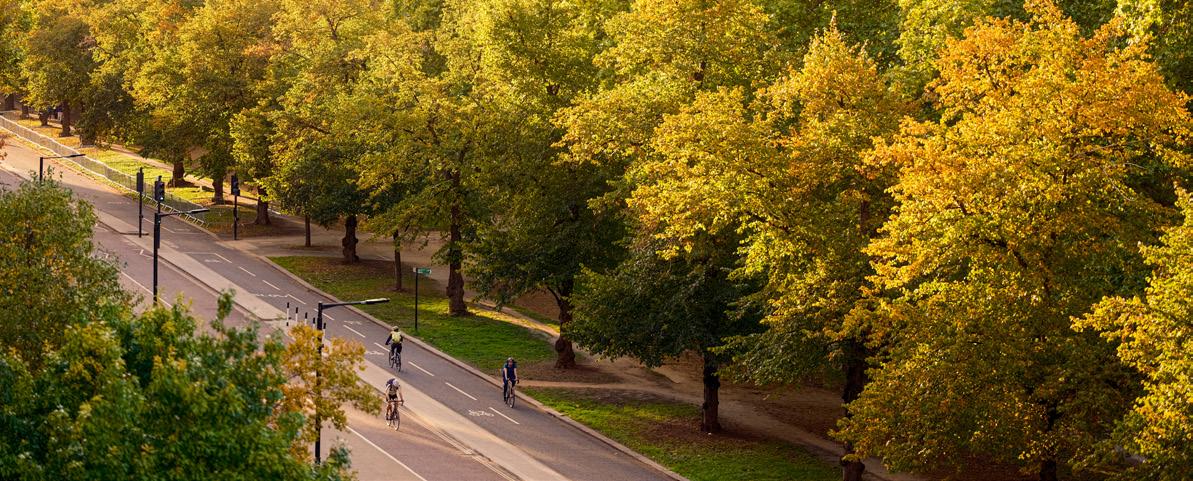
Photography by Rory Langdon-Down
Welcome to the Place and Public Realm Strategy for the world-renowned Knightsbridge district of London.
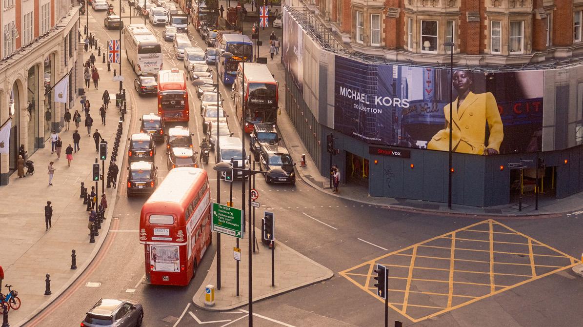
In recent decades, Knightsbridge lost its way, allowing competitor destinations to gain ground and competitive advantage. Together, we have responded by working with residents, community groups, the public sector, local businesses and property owners, to co-create a comprehensive strategy to put Knightsbridge back on the map as the best place globally to live, shop, visit, work and invest.
Our comprehensive five-strand strategy details an ambitious yet achievable flagship public realm scheme, a family of neighbourhood public realm schemes to create better spaces for everyone. The main roads through Knightsbridge have the potential to be transformed into elegant treelined, green boulevards, with spectacular gateways where the exclusive and luxury experience can be enjoyed from the point of arrival. This strategy will enable Knightsbridge to once again complete internationally as a luxury destination.
I am personally very grateful to everyone who gave their time, experience and ideas to help shape this strategy and I very much look forward to continuing to work with you in the next stages of design and delivery, so that we can in partnership deliver a revival across Knightsbridge, protecting and enhancing its uniquely British heritage and its global reputation.
STEVEN MEDWAY CEO
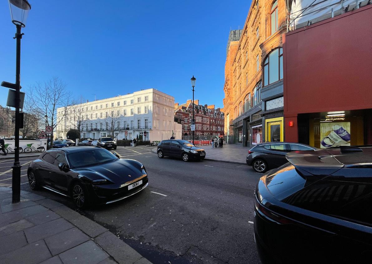
Knightsbridge
Partnership

Harrods is proud to be a member of the Knightsbridge Partnership and support the Place and Public Realm Strategy which will restore the status of Knightsbridge as the world’s leading luxury destination.
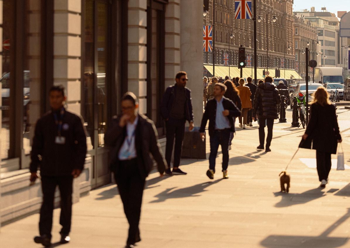
Every year, Harrods welcomes 15 million visitors to our Knightsbridge department store. We are acutely aware that customers, including international visitors, have a wide number of options when it comes to destinations that they can choose to visit.
The customers’ experience outside the store is as important as that inside. Environmental and social credentials of an area and visitors’ overall experience of a destination increasingly influence the attractiveness of destinations.
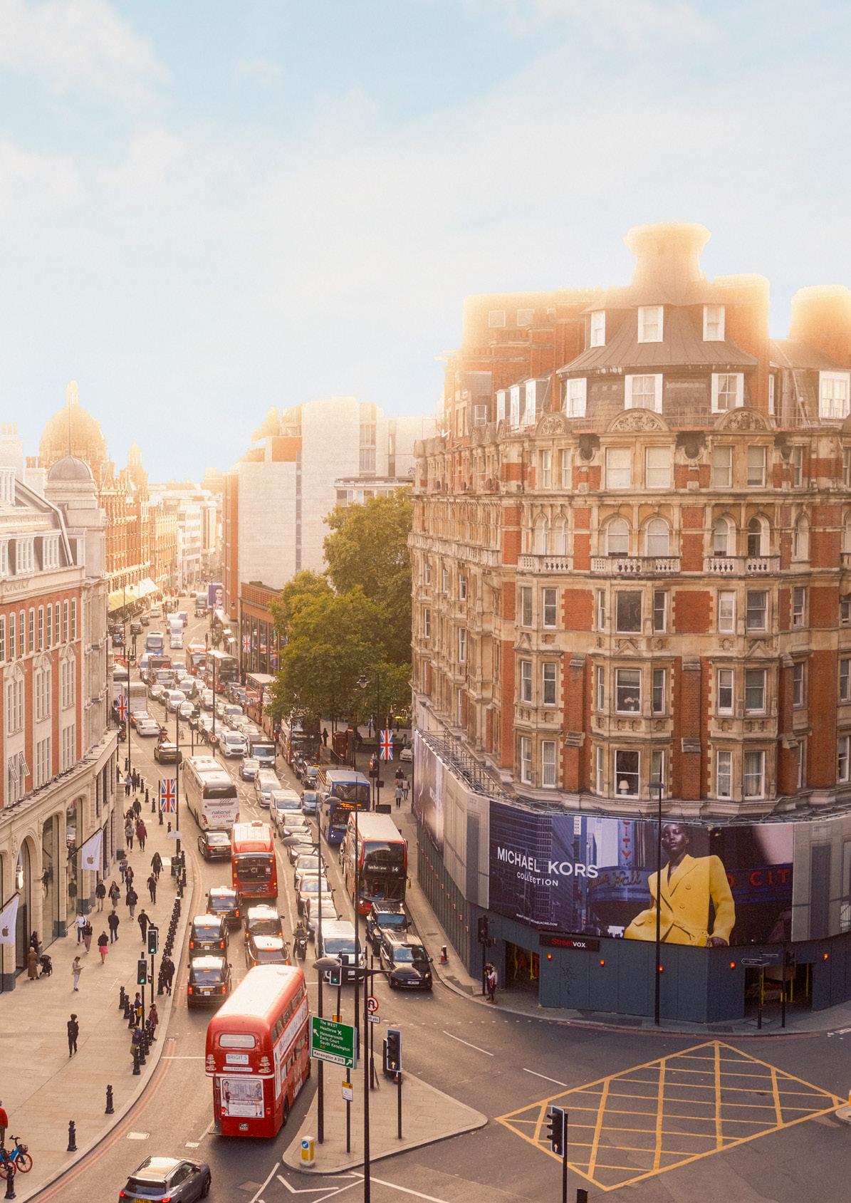
The Knightsbridge Place and Public Realm Strategy reimagines Brompton Road and many of the adjacent streets as safer, more sustainable and enjoyable routes and places for residents and workers, with less congestion, more trees and better air quality. The public realm proposals will contribute to attracting visitors, ensuring Knightsbridge remains a thriving local economy creating employment and opportunities across London and the UK. As such, the Place and Public Realm Strategy contributes tov Harrods’ commitment to positive environmental and social change.
MICHAEL WARD Managing Director Harrods Chair of Knightsbridge Partnership

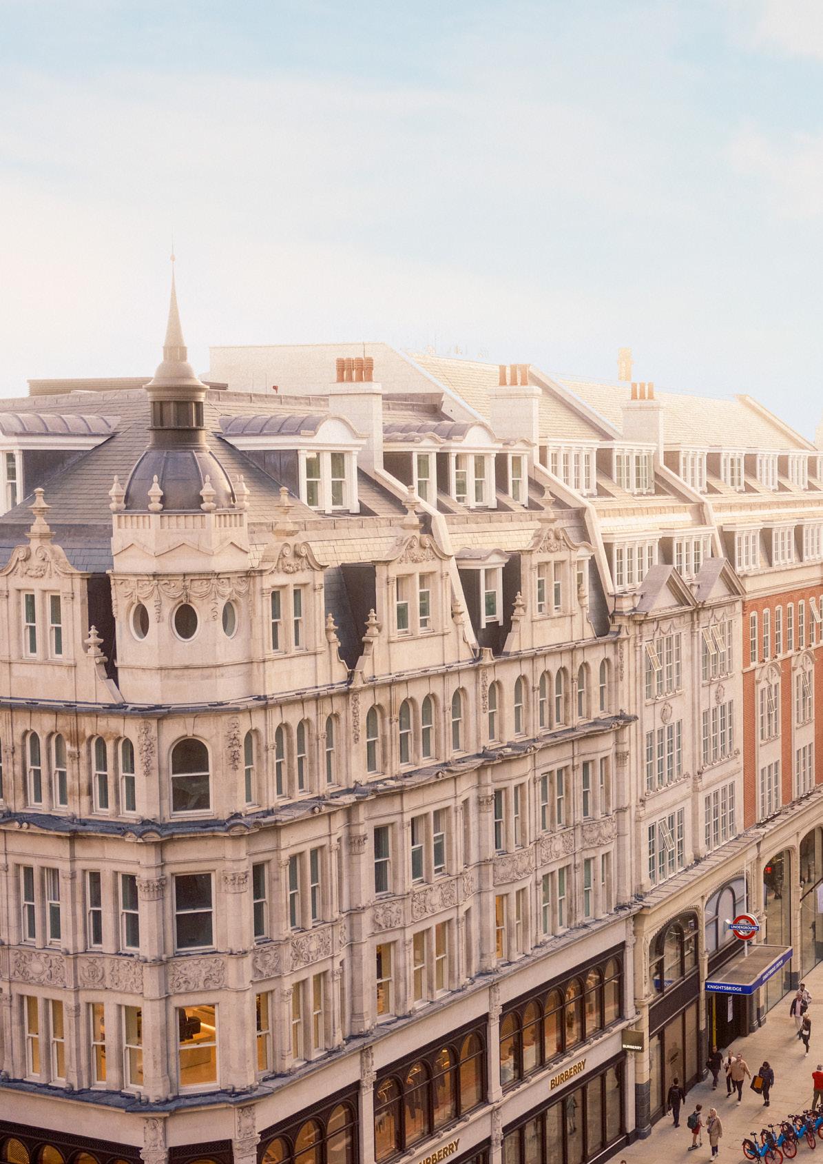
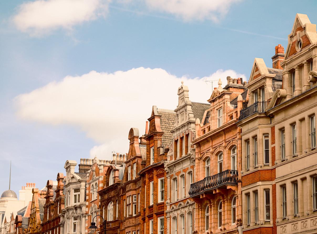
Knightsbridge is celebrated as one of the finest luxury shopping destinations in the world. It is also a place that many people call home.
Our benchmarking of Knightsbridge against other luxury destinations indicates the appeal of its rich and historic fabric, extraordinary wealth of architecture, and histories and stories. However, its public realm needs to be transformed in order for Knightsbridge to thrive as a luxury destination and as a place to live.
Knightsbridge is designated by the Mayor of London as one of the city’s two International Centres. In the face of strong international competition for tourists, high-net-worth shoppers, and inward investment, the Knightsbridge Place and Public Realm Strategy will enable the area to compete globally.
Discover how Knightsbridge compares with other leading international luxury destinations.

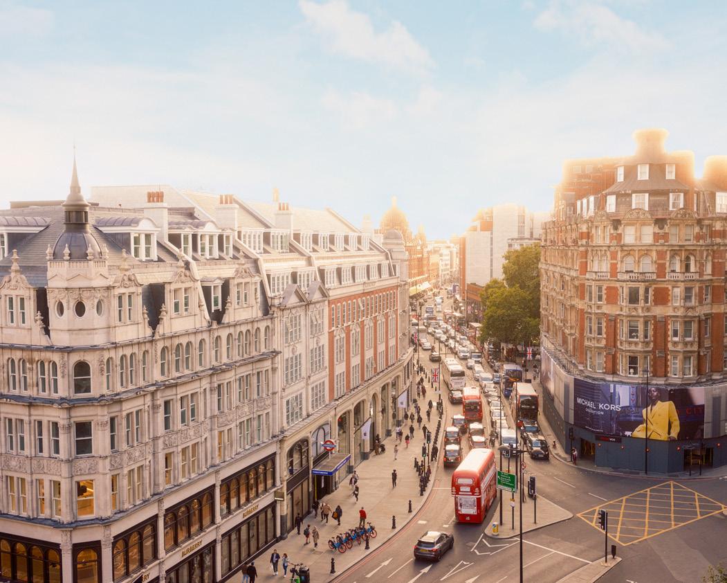
The vision for Knightsbridge is ambitious, a luxury global destination that rebalances the needs of people and nature, inviting people to spend time in its historic streets and places and to return again and again.


Knightsbridge is one of the jewels in London’s real estate crown – supporting our role as a global city, employing thousands of people and attracting visitors from across the world. Knightsbridge Partnership does vital work to support the area.
Their Healthy Streets proposal will help ensure a thriving future, providing Londoners including local residents with a better, safer and cleaner environment, new jobs and new business opportunities, as we work towards a fairer London for everyone.
Howard Dawber Deputy Mayor for Business and Growth
Before 1760, there was minimal development along Brompton’s turnpike road. The area was primarily dedicated to horticulture, much like Kensington, flourishing as nursery grounds with walled gardens and extensive cultivation. Amidst these gardens stood occasional cottages and numerous inns, akin to those seen along London’s main streets.
By the 1800s change had begun. In 1811, a survey documented the emergence of ‘New Brompton,’ just before a surge in construction. An illustration from this survey depicted houses on the north side of Brompton Road with spacious gardens, adorned with trees; few, as yet, were shops. Subsequently, in the boom of the 1820s, construction became denser, and by 1826–1829 ‘New Brompton’ welcomed its own church, Holy Trinity, slightly west of Brompton Square. The district was now distinct in character from its well-known neighbours and continued to enjoy prosperity.
The first substantial widening of Brompton Road commenced in 1862 to facilitate access to the 1862 International Exhibition. This expansion led to the disappearance of the small front gardens and started to urbanise the feel of the street. Reflecting these alterations, Brompton Road received official recognition as a named road in 1863. After this, commercial interests along the street gathered pace, with Tattersalls, the renowned horse auctioneers, relocating behind Knightsbridge Green in 1864.
Between 1893 and 1908, an extensive reconstruction of the entire south side of Brompton Road, including Harrods, took place. Small local shops still existed such as Spikings the bakers which included a tearoom, but they were increasingly competing with higher-end shops such as drapers like Tudor Brothers, Gooch, Owles, and Beaumont. There were also several arcades near to Knightsbridge – Park Mansions Arcade (1897–1900), Brompton Arcade (1903–4), and Knightsbridge Station Arcade (1903–4) - whose building coincided with the opening of the Piccadilly underground railway in 1906.
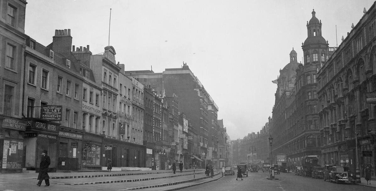
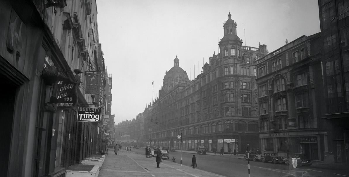
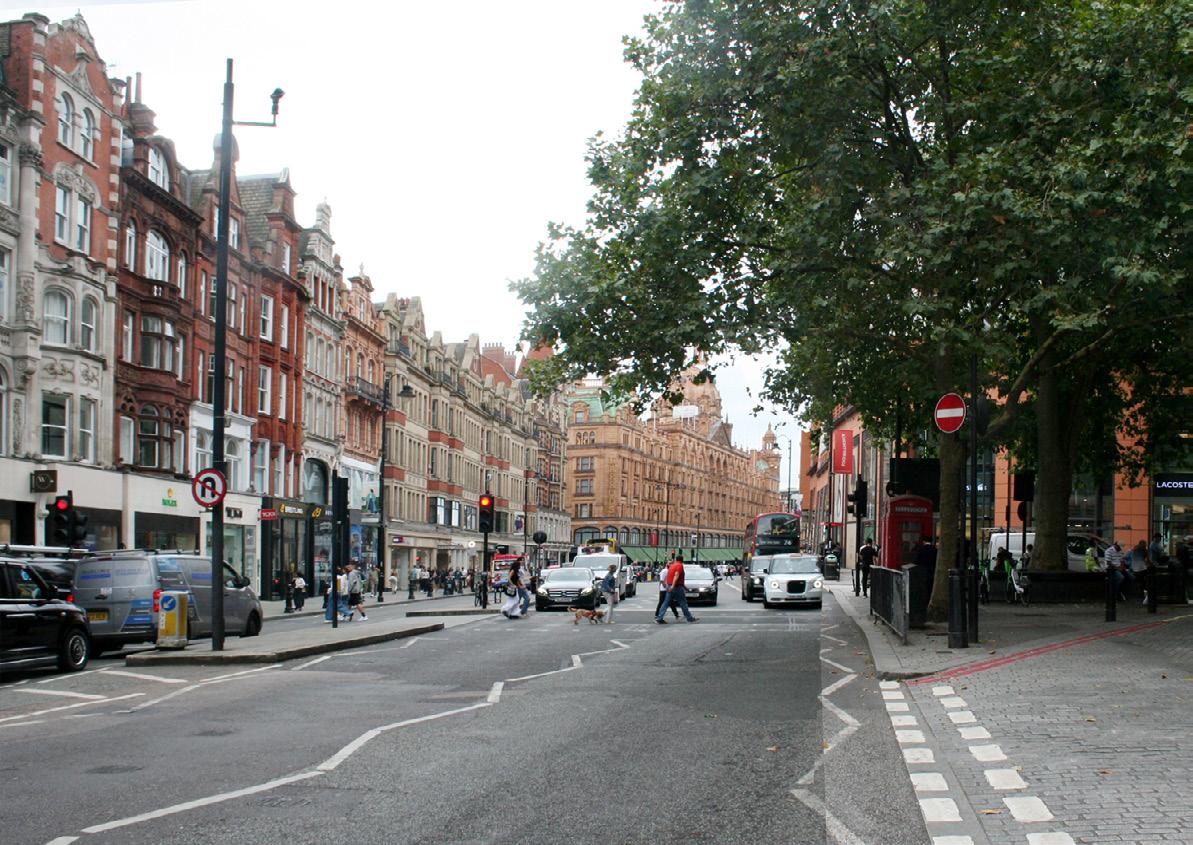
This railway, offering stations close to ‘Knightsbridge’ and ‘Brompton Road,’ significantly increased the road’s commercial significance. Formerly accessible only by horse omnibus, the shopping district suddenly became readily reachable. Numerous photographs since 1900 portray bustling pavements and thriving traffic along this segment of Brompton Road during the workweek as the area prospered.
Before the early 1800s London officially began at the Hyde Park Turnpike, situated until 1825 where Grosvenor Place meets Knightsbridge today; thus, Knightsbridge at that time was not in London.
Knights Bridge was never a parish or a manor, only a small hamlet, known from Saxon times as Kyngesburig, or Knightsbrigg. The bridge in question crossed the Westbourne River, one of London’s “lost rivers”, as it left Hyde Park, where it had been turned into the Serpentine. The Albert Gate of Hyde Park marks the point where it went under the road and William Street follows its line southwards.
If you had ventured this far in the time of the Tudors you would have encountered an appalling road, the “Waye to Reading”, mired so deep in mud that it contributed to the defeat of Sir Thomas Wyatt’s rebel army in the 1500s. Things did not greatly improve for centuries and even as late as 1842 reports describe pavements ankle-deep in mud.
The last highway robbery on Knightsbridge was as late as 1799, after which a light horse patrol was sent out from the barracks to patrol the road, which was one of the earliest to have street lighting. In a “History of Knightsbridge” (1854 by Mr. Davis) it’s recorded that even after the armed patrols were instituted, “pedestrians walked to and from Kensington in bands sufficient to ensure mutual protection, starting their journey only at known intervals, of which a bell gave due warning.”
Cecil Aldin’s map on the previous page provides a snapshot of Knightsbridge at this time. East is at the top and we begin with the Hyde Park Corner tollgate and just before it, at the junction with Grosvenor Place, is St George’s Hospital. That is still there, but is now the Lanesborough Hotel. The Park Tower Hotel sits on the site of a house owned by Mr Lowndes and behind it, where Lowndes Square is now, was a rural pleasure garden. The entrance to Old Barrack Yard was the access to a field behind the roadside waste where the footguards’ barracks was built around 1760. Nearby was Trinity Chapel which functioned as a hospital for the poor. Traditionally it was said to have taken in plague victims in 1665 and the dead were buried nearby under Knightsbridge Green at the present junction of Knightsbridge, Sloane Street and Brompton Road. This chapel was later moved to its current location further south along Brompton Road. The abolition in 1825 of the century-old turnpike across the east end of Knightsbridge at Hyde Park Corner removed a psychological as well as physical barrier between the hamlet and the rest of London.
Development from the late 1830s moved at an ever-increasing pace. The emphasis on architectural grandeur can be seen in the Italianate terraces of Rutland Gate and Princes Gate, and the mansions of Albert Gate.
By 1857, Knightsbridge could lay claim to some of the most prestigious and sought after addresses in London.
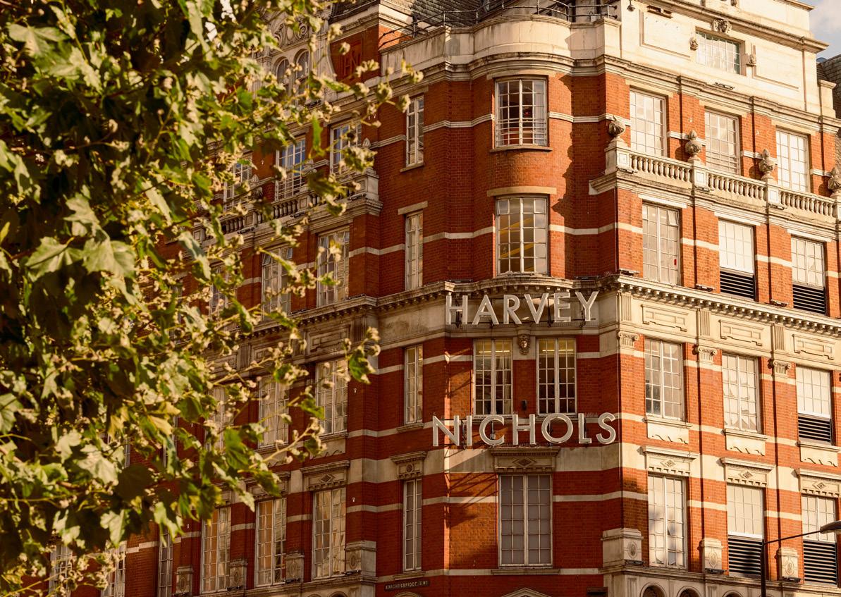
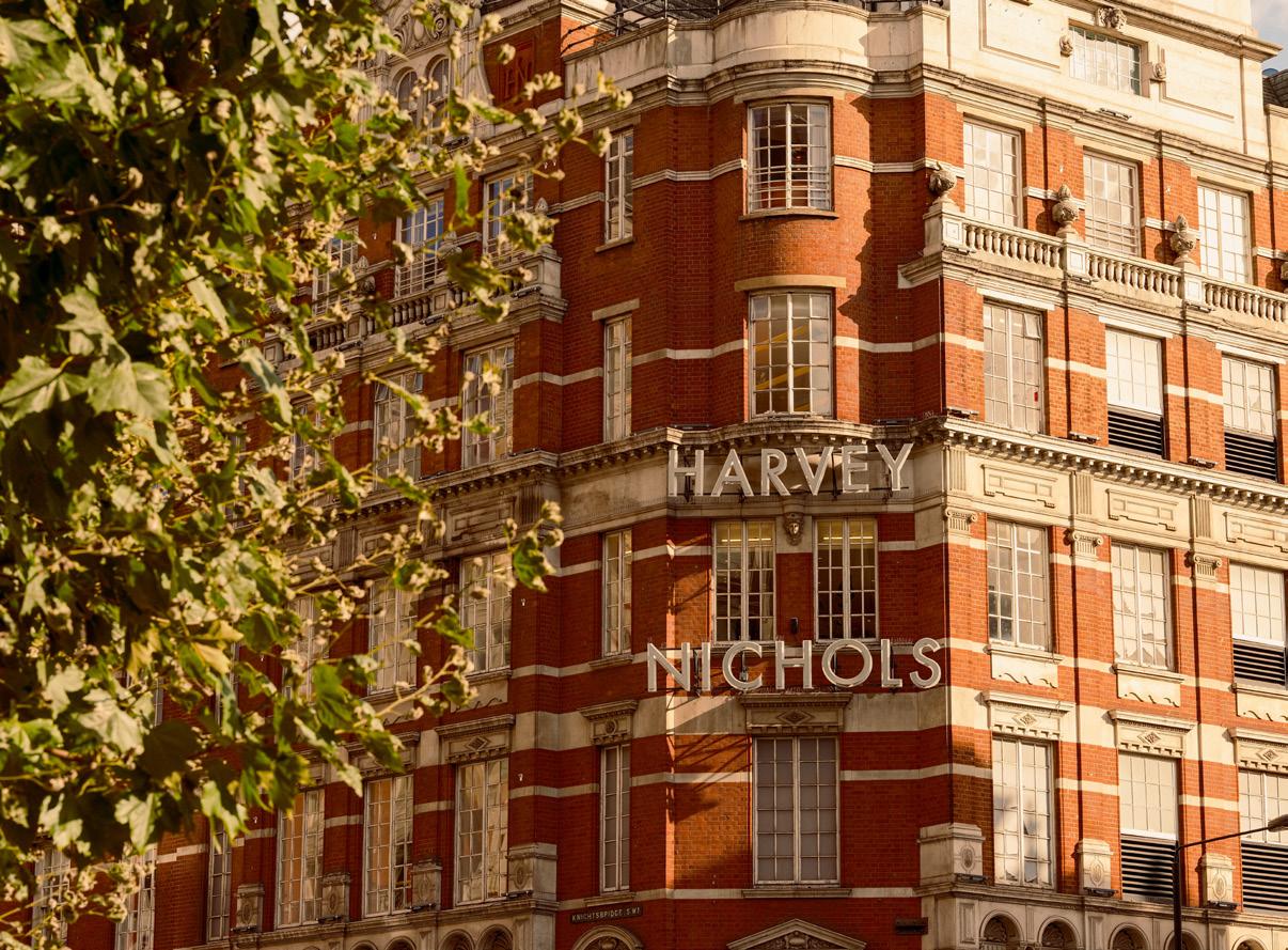
In 1831, the influx of wealthy West Enders inspired Benjamin Harvey to establish a linen shop in a terraced house on the corner of Knightsbridge and Sloane Street. Mr Nichols was employed by Harvey and was eventually promoted to become a director in 1845. In 1848 he married Harvey’s niece.
Alongside this, between 1860 and 1889, C.D. Harrod was in the process of transforming a small grocer’s shop into a great department store. In 1889 Harvey Nichols & Co. expanded to create the iconic building that can be seen today.
Knightsbridge and Brompton Road, or at least their southern sides, were thus becoming fashionable for shopping. By 1884 Harrods’ custom could be described as ‘world-wide’. Its premises then consisted of motley additions to the original houses built on William Browne’s estate a hundred years earlier. In 1890 the construction of the new Harrods building began, changing the face of Brompton Road.
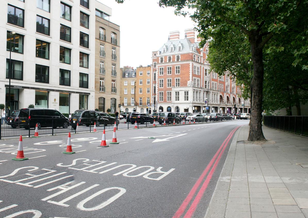
As the name suggests, once the village green for Knightsbridge, which held cattle markets and May dances, the Knightsbridge Green that can be seen today has been diminished and encroached upon by the surrounding development.
By 1857 the land was sold alongside the Tattersalls plot with plans showing it as apparently treeless, surrounded by a wall and iron railings. Plans by Westminster Vestry to plant the ‘vacant’ ground with trees in 1879 met with an angry response from local traders and cabmen who saw the improvement as likely to interfere with their business and they filled in the holes dug in preparation. By 1908 trees had been planted on the enclosure by Tattersalls.
After the Second World War Tattersalls also undertook a restoration of the enclosure, creating a ‘Temple Garden’ with a bronze figure. Intended as a contribution to the 1951 Festival of Britain, this project was carried out by Ralph Hancock & Son, landscape architects of Park Mansions Arcade, under the direction of Tattersalls’ architects, Stone, Toms & Partners.
Today the ‘Green’, as popularly understood – the triangular remnant of open space off Brompton Road – is a nondescript traffic island, occupied by plane trees.
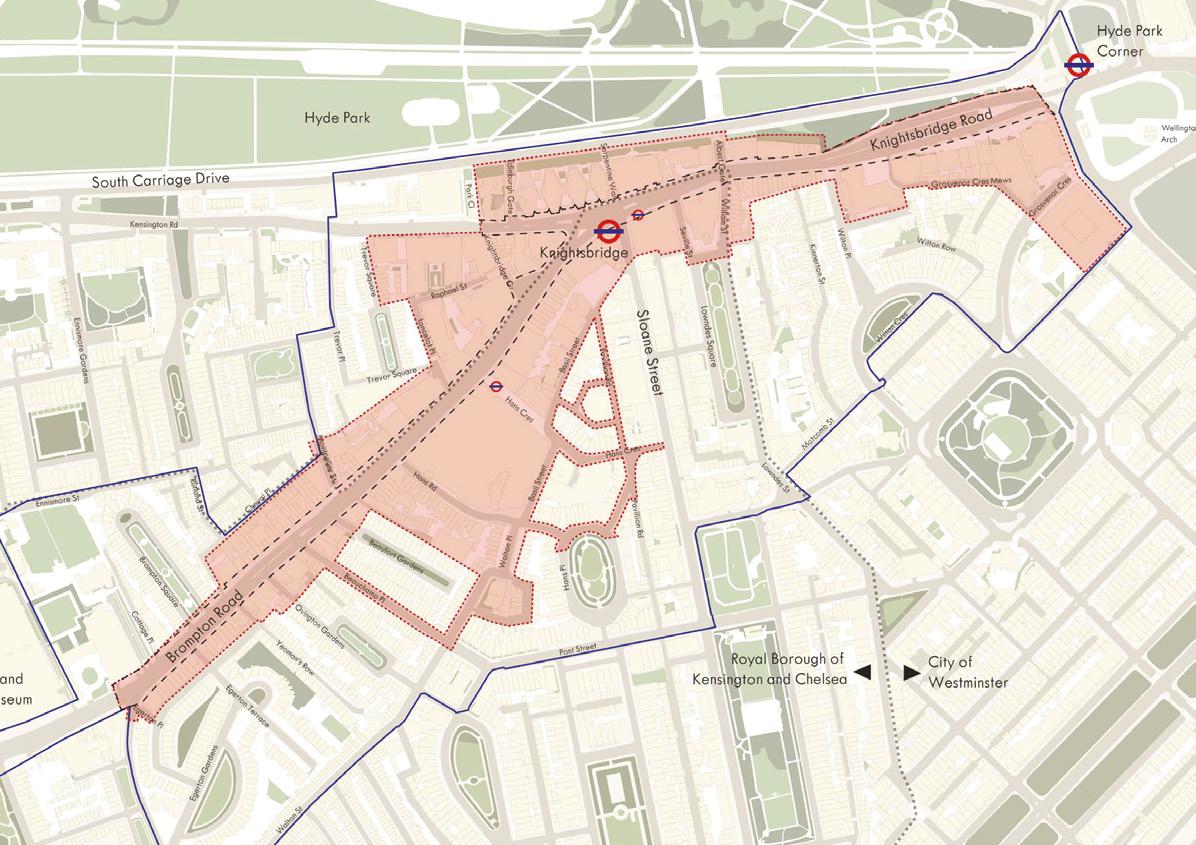
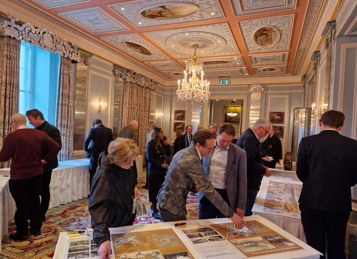
The Place and Public Realm Strategy for Knightsbridge was co-created in collaboration with residents, representatives from community groups, local property owners, businesses, Transport for London, Westminster City Council and Royal Borough of Kensington and Chelsea Council.
A range of engagement activities were undertaken, including an online survey available in nine languages, a drop-in session, walking tours, a focus group for UAE Emirati women, community meetings, presentations to community groups, and three co-design workshops.
The top priority to improve Knightsbridge, suggested by almost half of all respondents, was adding gardens and other green spaces, and planting trees. Improvements to the pedestrian environment were the next highest priorities: increasing footway widths, repairing pavements, and removing street clutter.
As other luxury global destinations and centres compete for Ultra High-Net-Worth Individuals (UHNWI) and aspirational markets, Knightsbridge needs to remain the international home of luxury and synonymous with an experience that feels special and varied, a distinct area linked together by its streets and public spaces.

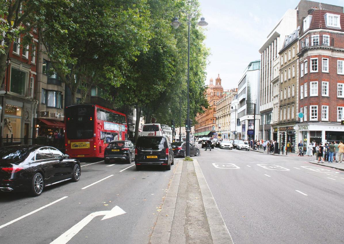
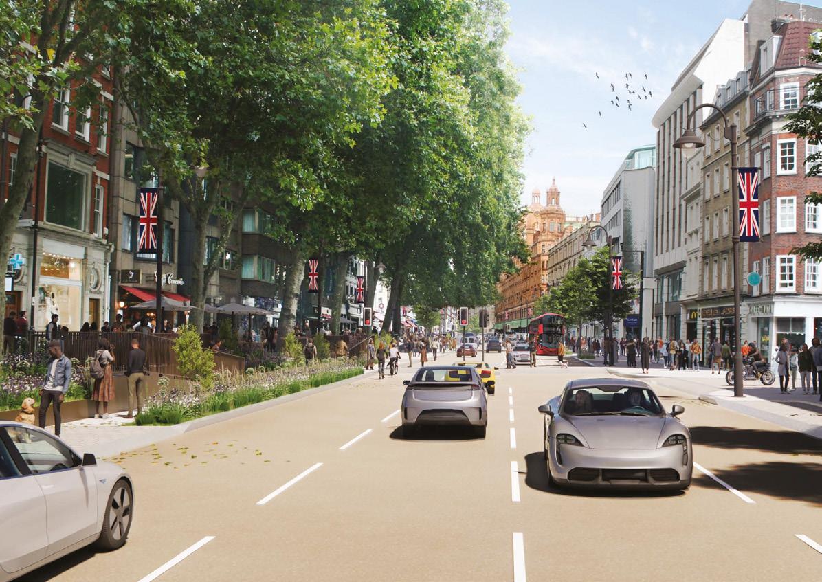
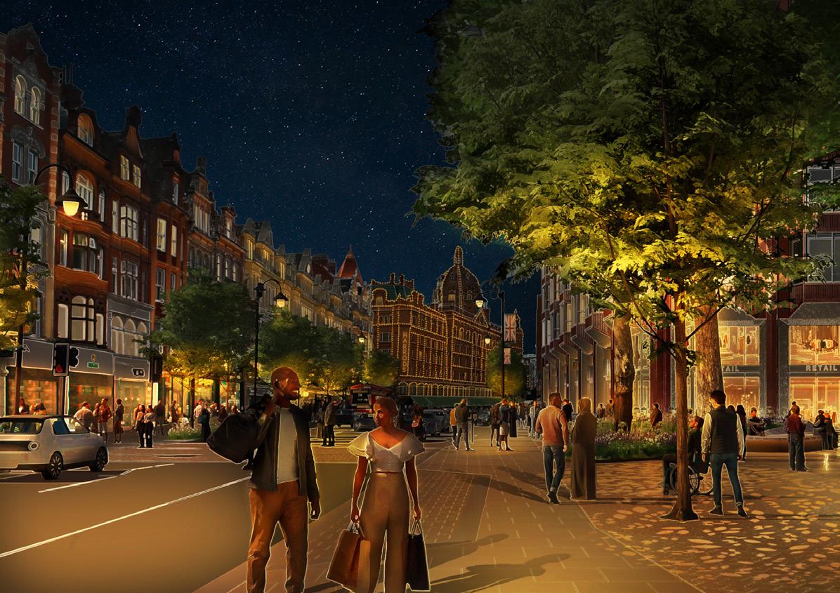
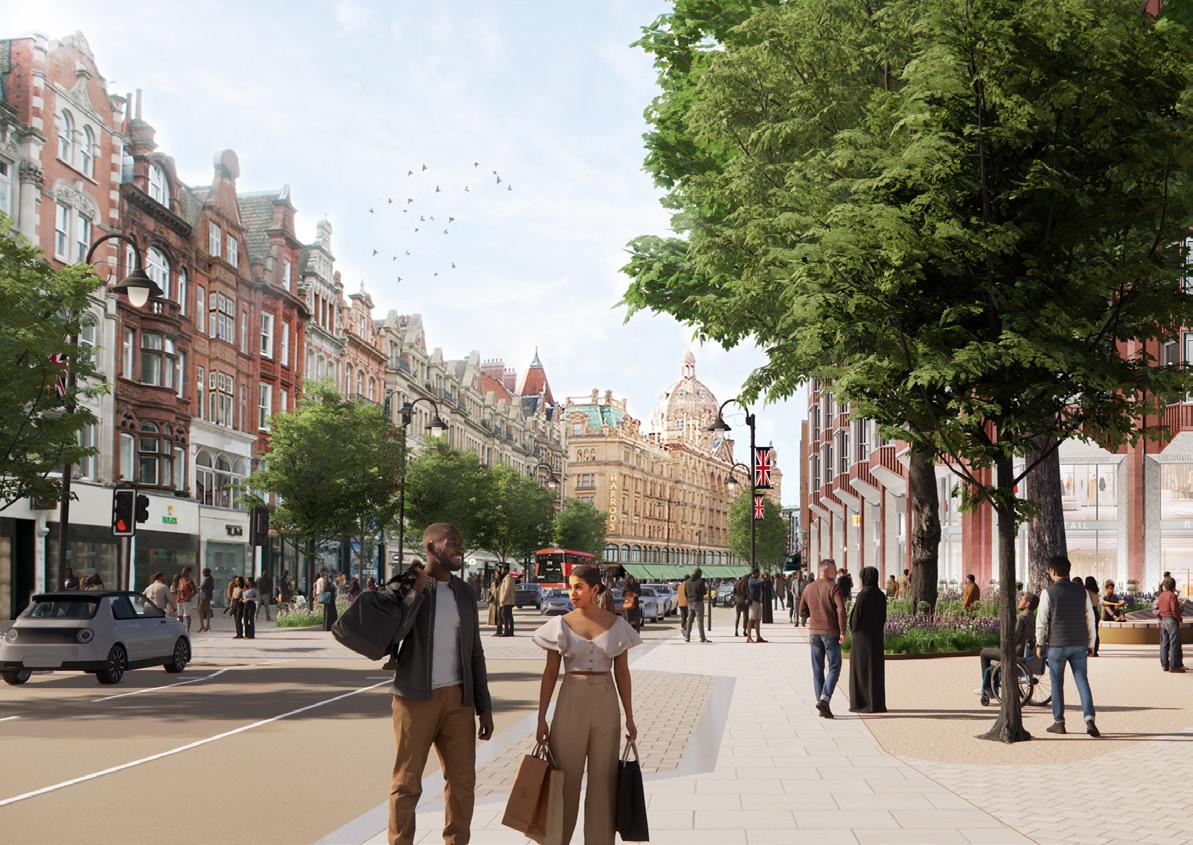
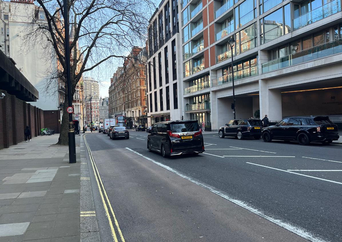
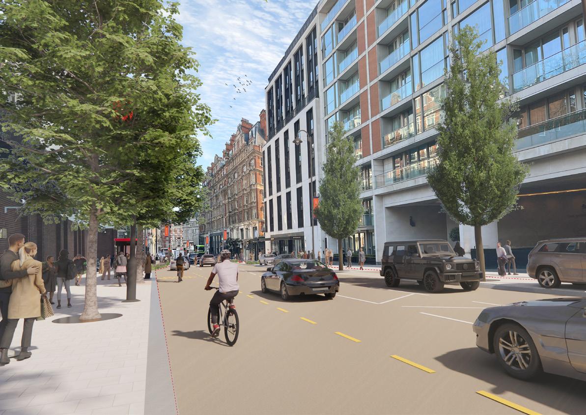
1. Flagship public realm scheme for Knightsbridge and Brompton Road
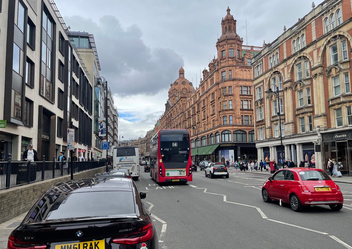
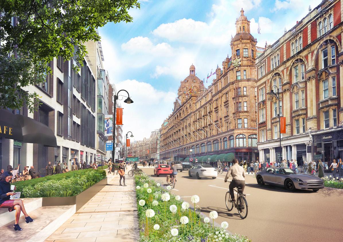
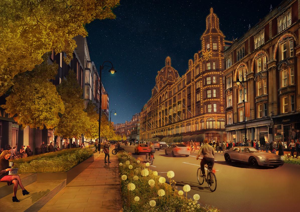
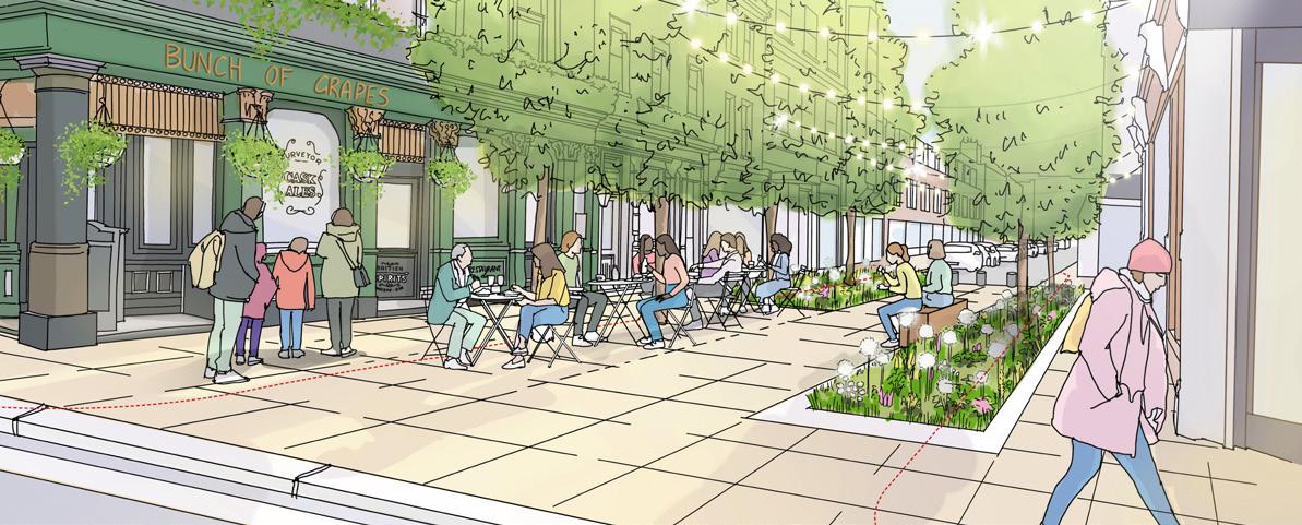
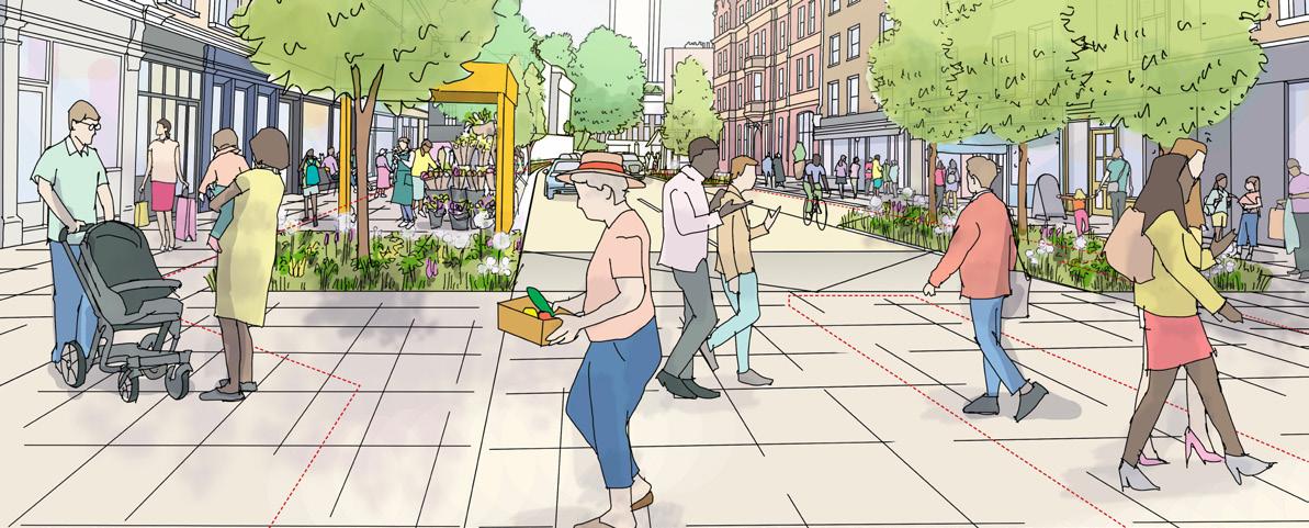
The mile long project will deliver a transformed Brompton Road and Knightsbridge, with widened and de-cluttered pavements and priority crossings. It will feel both exclusive yet also accessible and welcoming to everyone. The proposals will also ensure traffic flows on Brompton Road are well managed and residential roads remain quiet streets protected from rat-running traffic
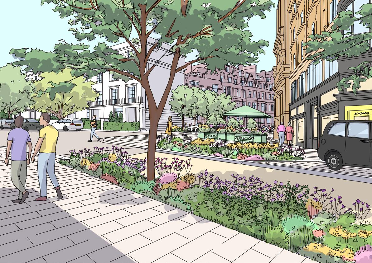
2. A family of neighbourhood public realm projects
These projects will protect and enhance many of the characterful streets off Brompton Road, providing spaces to dwell with new trees and planting
3. Placemaking to curate the Knightsbridge offer and visitor experience
This will include elevating the Knightsbridge visitor experience, enhancing the luxury wellness offer, unifying the evening economy, and implementing a digital and physical wayfinding strategy
4. Strategic and proactive place management
This harnesses new technologies to ensure the highest standards of cleansing, safety, green space and ecology management, and commercial vehicle management
5. The case for investment and funding strategy
Independent economists developed a compelling investment case, indicating that the public realm improvements will deliver significant returns for investors. The forecasted benefits are summarised in the next pages

They will
Restore Knightsbridge to its premier status as a world leading luxury destination and as an outstanding place to visit, live, work and invest
Deliver a thriving Knightsbridge day and evening economy which also provides growth opportunities for the London and UK economies
Create Healthy Streets which support cycling and walking and increase biodiversity the TfL Healthy Streets assessment score increases from 49 to 77 points
Reduce congestion through Knightsbridge and make it easier to visit Knightsbridge due to more spaces for taxis and private vehicle drop-off
Celebrate, protect and enhance the Knightsbridge area’s unique character and heritage
Attract people to spend time in its historic streets and places and invite people to return again and again
Contribute to improving local air quality
Contribute to climate adaptation and mitigation
Create a safe and welcoming place for all
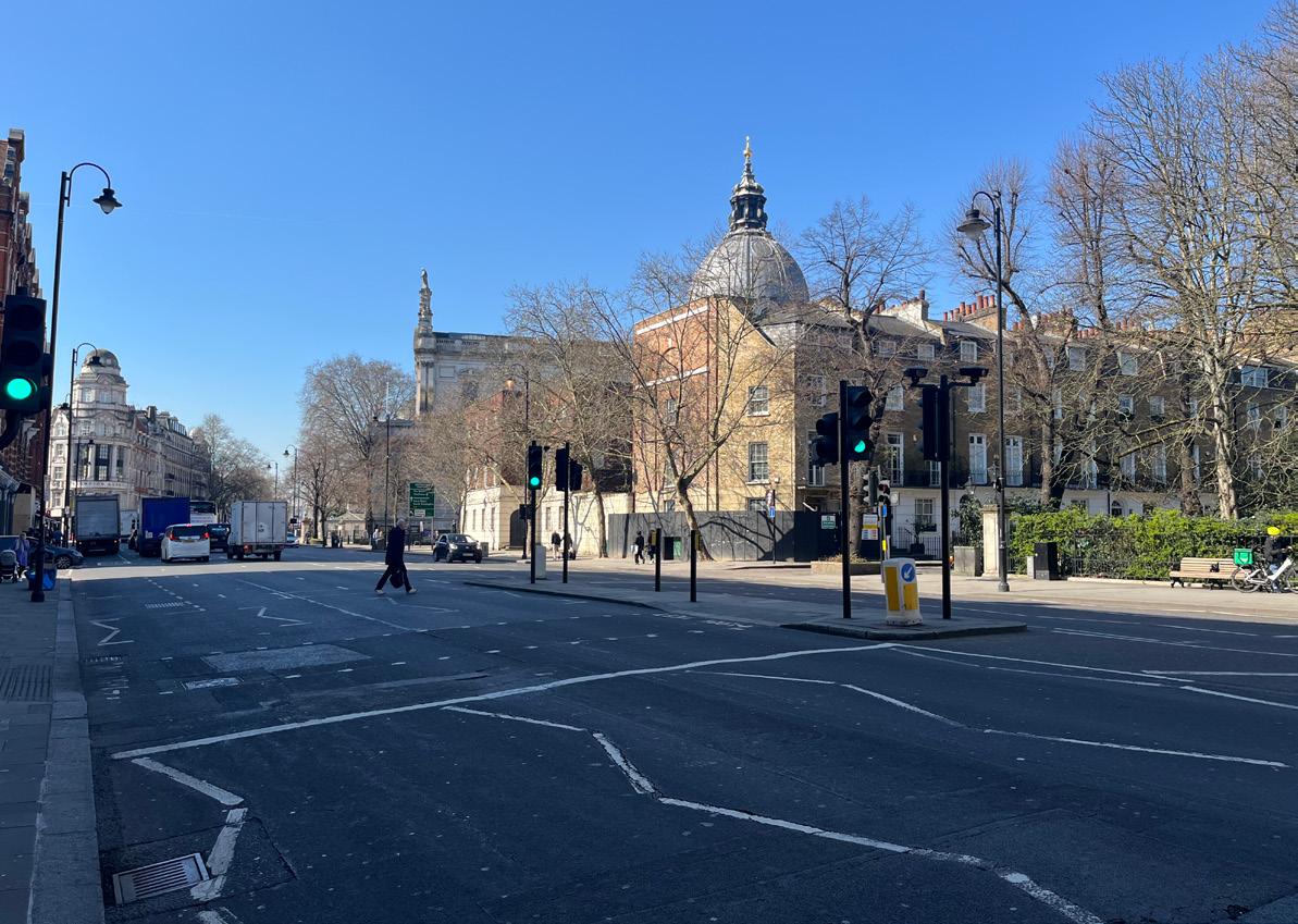
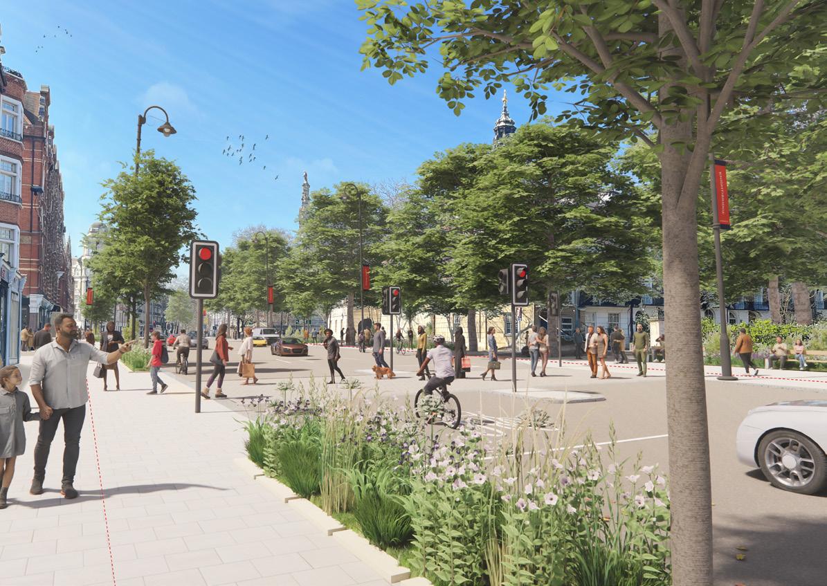
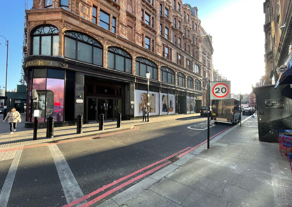
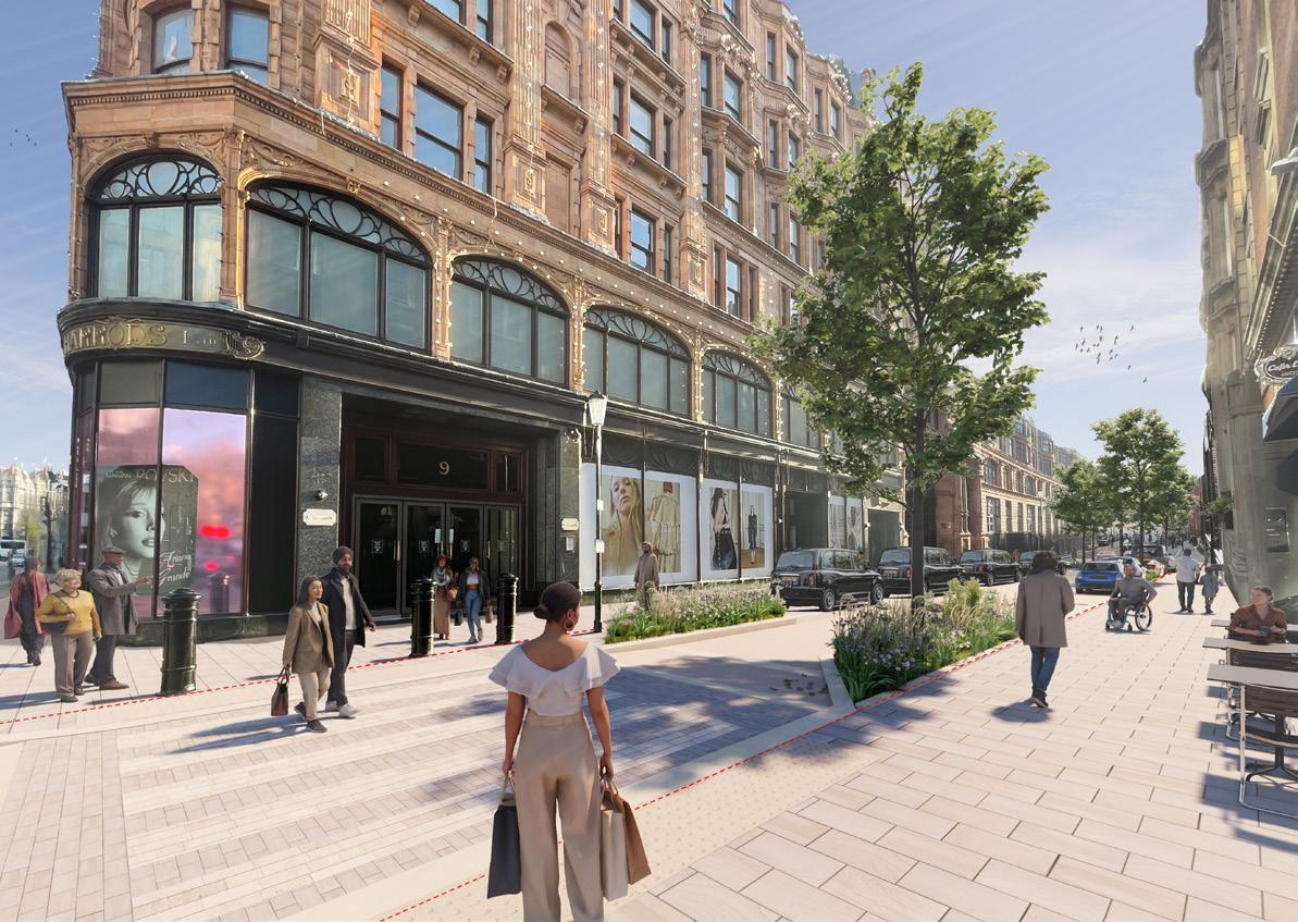
Brompton Road and Knightsbridge
• Raised crossings with high-quality paving
• Generous arrival space with public art to Hans Crescent
• Introduction of street planting trees and rain gardens
• Widened footways allow for improved spill-out space from adjacent businesses
• Grand crossing at Harrods
• Tree planting to carefully frame western frontage of Harrods
• New seating terrace to northern level change, steps to utilise level change, enhance alfresco dining on upper terrace
• Widen and declutter footpaths
Key projects on Brompton Road and Knightsbridge
1. South Kensington Gateway - Improved connections with South Kensington through new wayfinding opportunities, planting, widened footways and better crossings
2. Brompton High Pavement - New low-level footpath and ribbon of planting with widened and more accessible high pavement allowing increased space for café and restaurant outdoor dining
3. Brompton Road Central - Widened footways, new low-level planting, seating and realigned crossings transform the central section of Brompton Road. Connecting south and north to create a cohesive and enjoyable experience
4 . Scotch House Corner - Better traffic management, additional crossings to improve safety and accessibility, additional public realm and potential for public area
5. Hyde Park Corner Gateway - Gateway public realm with new public art, greening and enhanced pedestrian underpasses (cleansing, lighting, security, art, wayfinding)
6. Knightsbridge West - Widened footways, better crossings and additional trees A Family of Projects - Neighbourhood Projects
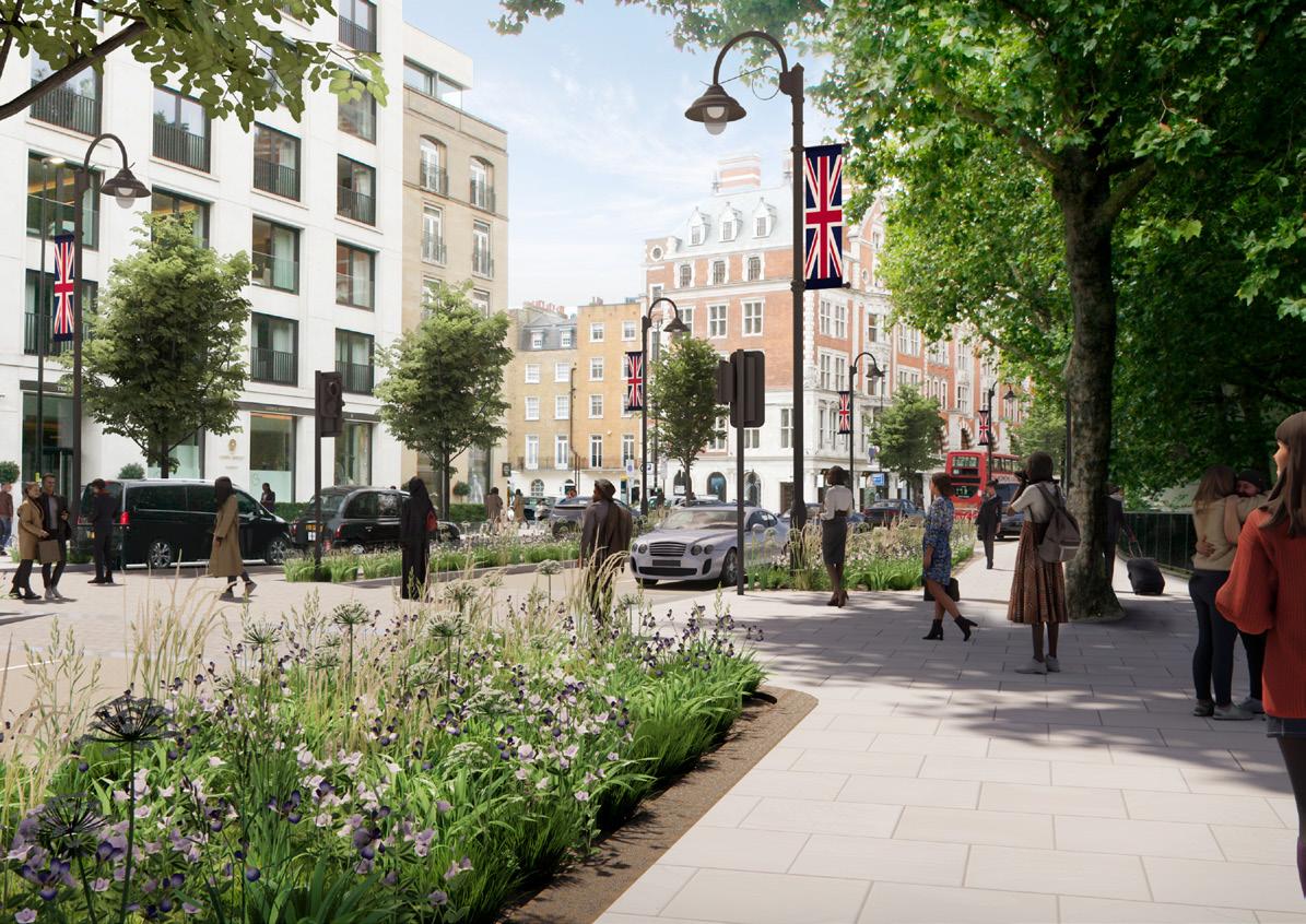
7. Knightsbridge Green - Create a new traffic-free public square off Brompton Road and restore the historic importance of the space
8. Hans Road - Widened footways, better and increased dropoff for Harrods customers and additional planting and trees
9. Basil Street South - Rationalised parking and potential for new zebra crossings at Hans Road and Walton Street junctions
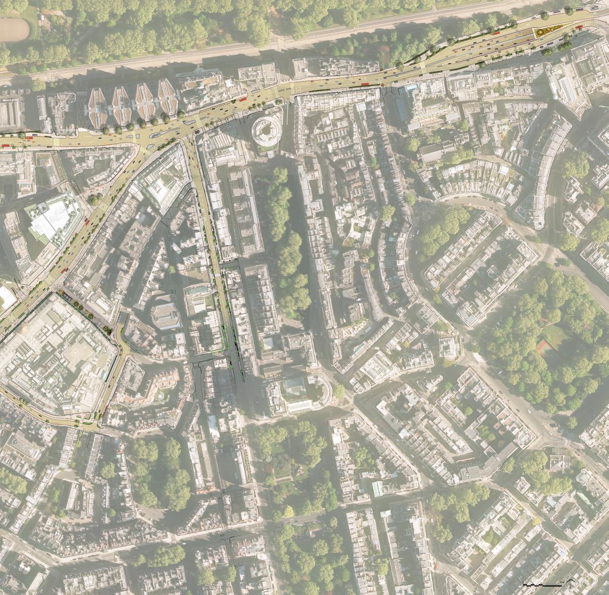
10. Raphael Street - New neighbourhood street with trees, planting and seating
11. Pavilion Road - Pedestrian route improvements to Basil Street from Sloane Square
12. Sloane Street - Northern section tie-in the design with the Scotch House Corner improvements
13. Montpelier Street - Opportunity to relocate the central taxi rank, widen footways and establish new planting and trees to create a garden gateway to Brompton Road
14. Yeoman’s Row - Gateway could be closed to through-traffic, creating a new space for seating and planting
Proposed/Planned Projects by Partners
15. South Carriage Drive - (Royal Parks scheme) Reopened to provide segregated cycling and one-way eastbound traffic
16. Beauchamp Place - Royal Borough of Kensington and Chelsea
17. Basil Street North (Completed) - The Knightsbridge Estate
18. Egerton Street - South Kensington Estates
19. Hans Crescent - The Knightsbridge Estate and Harrods
The collaborative approach to design at each stage has engaged residents, amenity societies, the neighbourhood forum, businesses and the area’s two local councils and TfL.
This has resulted in a remarkable shared vision and strategy that can create a truly sustainable place to live and ensure Knightsbridge retains its international status as a luxury district.
BIRKETT
“
The Knightsbridge Partnership’s much-needed strategy for the area outlines how it will enhance the public realm for the benefit of residents, businesses and visitors while sensitively protecting and restoring the neighbourhood’s architecture and heritage features.
MELVILLE HAGGARD Chair, The Knightsbridge Association
The Place and Public Realm strategy will revitalise streets in Knightsbridge, supporting the Mayor of London’s goal for 80% of journeys to be on foot, bike or public transport by 2040, raising the healthy street score from 49 to 77. The strategy aligns with local sustainable transport, climate, and air quality goals.
Funding will combine capital investment and revenue streams to maintain high public realm standards. Public-private partnerships will drive economic growth, create jobs and enhance Knightsbridge’s global status.
An independent team of economists has developed a compelling investment case, which indicates the public realm improvements will deliver significant social benefits and return for investment.
Footfall
Increase of up to 4.3m visitors a year, which equates to up to an additional 43m in footfall over a 10-year period.
Additional Spending
Up to £2.8bn in additional spending over 10 years, which is a 16% increase vs the baseline.
Office Rental Income1
Cumulative net present value increase of £4m to £8m over 20 years.
Residential Property Values1
Increase of at least £19m in the value of adjacent residential properties.
Retail and Leisure Property Value
Net increase of £270m to £500m (3.3% to 6.2% increase vs. baseline).
Retail Rental Income
Cumulative net present value increase of £8m to £18m over 20 years.
Office Property Value
Net increase of £25m to £47m (2.7% to 5.0% increase vs. the baseline).
Social Value2
£3m in social value benefits through unemployment and crime reduction, and public realm amenity benefits.
Business Rates Income
£8m to £18m cumulative net present value over 20 years.
Trees
Will deliver £900,000 value in terms of environmental benefits.
Gross Value Added (GVA)
£75m during construction, and £41m to £106m per annum following construction of the project.
Employment
Up to 950 permanent on-site and supply chain additional jobs in retail, leisure, and food & beverage sectors for London residents.
Temporary Jobs
400 temporary on-site and off-site supply chain job opportunities for London residents during construction.

STEVEN MEDWAY
Chief Executive Officer
steven@knightsbridgepartnership.com


Director of Place and Environment
rebecca@knightsbridgepartnership.com

Director of Marketing and Communications
katie@knightsbridgepartnership.com