1 minute read
Mullach


Mullach – an Iron Age fort with spectacular views
A walk on very quiet country roads and tracks from Dalswinton Village.
Advertisement
Although this route is straightforward, it is uphill almost all the way there Jun - Oct and downhill almost all the way back. There are four farm gates to go Distance 3.5 miles / 5.5km through. DG2 0XU Grid Ref NX934854 Allow 2 hours
Please be aware that some parts of this walk go through areas which are occasionally used for pheasant shoots between September and January.
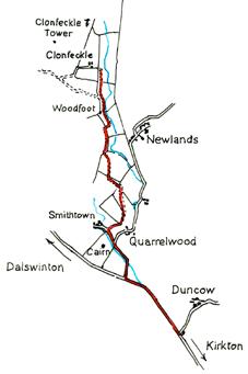
Park in Dalswinton Village. At the north end of the village is a minor road heading uphill between the old school and the school house. Walk up that road until you reach a fork. Take the left (rougher) track and again walk uphill. In the field on your left as you come round the bend you will see three ancient alder trees. These are shown on the earliest Ordnance Survey maps. The rise to your right here on the other side of the track is an Iron Age promontary fort, known as ‘The Belt’. Continue along the track and you will soon come to a T junction at Hightownhead Farm. Turn right and follow the track for a few hundred yards until you get to a place where there are field gates opposite each other. Ignore these, and in a few paces, on your left hand side at a right hand bend in the track, there is a gate leading into a field. Go through this gate and continue walking uphill through two more gates which are directly ahead. Once you are through both of these, head diagonally left towards the end of the line of trees over the brow where you will find another gate. Once through this, turn right and head up to the summit where you will find a cairn and some evidence of ramparts which show this to have been a substantial and important site. Once you have explored this site and admired the stunning views, return by the same route.