NOT READY? START NOW.

FLORIDA KEYS


NOT READY? START NOW.

FLORIDA KEYS


Bank anytime, anywhere. Manage your account 24/7 with Mobile Deposit, Direct Deposit, Bill Pay, person-to-person and bank-to-bank transfers. Log in or enroll today on our KeysBank Mobile App or at KeysBank.com.
Debit Cards
Use your debit card for quick cash access when banks are closed or if you have to evacuate. FSB does not charge a fee for using your debit card at any ATM* or Publix Presto! ATMs. You can also get cash back with purchases at many businesses. Instant Issue debit cards are available at all Keyswide locations.
Emergency Cash & Checkbook
Electronic means of payments may not be available if there is a power failure. Be sure to have cash and your checkbook on hand for purchases.
Make copies of your insurance papers, Social Security cards, birth certificates, mortgages, and other important documents. Originals can be stored in a First State Bank Safe Deposit Box.**
Hurricane Loans & Credit Cards
A Mortgage, Home Equity Line of Credit, or Personal Loan can provide money on hand to prepare and, if necessary, recover quickly from a hurricane. We also offer personal and business credit cards. Apply online at KeysBank.com.
Download the KeysBank Mobile App for access to your account 24/7


p.8 Here’s the plan
All the info you’ll need before, during & after a storm
p. 12 Know when to leave Keyswide evacuation zones
p. 16 Get ready Prep for pregnant women, babies and pets
p.18 Reentry Get your stickers now at these locations
p.20 Need a ride? Evacuation resources
p. 22 Give me shelter Locations and rules
p. 26 Check it twice Hurricane supply checklist
p.30 Let’s get digital Track the storm with weather apps
p. 32 What’s in a name? List of 2023 storm names
p.34 It’s electric Tips from the power pros

p.36 Storm surge Look out and stay alert
p.38 Trash it But do it correctly
p.46 Listen to locals
They’ve seen it all before
Publisher Jason Koler jason@keysweekly.com
Managing Partner Britt Myers britt@keysweekly.com
Creative Director Stephanie Mitchell stephanie@keysweekly.com
Editor Jim McCarthy jim@keysweekly.com
Art/Design Javier Reyes javier@keysweekly.com
Sta Writers Mandy Miles mandy@keysweekly.com
Alex Rickert alex@keysweekly.com
Copy Editor Mike Howie mike@keysweekly.com
Director of Sales
Manuela Carrillo Mobley manuela@keysweekly.com
Account Executives
Patti Childress patti@keysweekly.com
Jill Miranda Baker jill@keysweekly.com
Stephanie Mitchell stephanie@keysweekly.com
Production Manager Anneke Patterson anneke@keysweekly.com
Art/Design


Irene de Bruijn irene@keysweekly.com
Web Master Travis Cready travis@keysweekly.com
Executive Administrator Char Hruska char@keysweekly.com
Contributors
Kellie Butler Farrell
Brad Bertelli Mark Hedden
Digital Support Overseas Media Group
Middle Keys office 9709 Overseas Hwy. Marathon, FL. 33050 P. 305.743.0844
Lower Keys office 5450 MacDonald Ave. No. 5 Key West, FL. 33040 P. 305.453.6928
Upper Keys office 91760 Overseas Hwy. Tavernier, FL 33070 P. 305.363.2957








Every storm brings lessons for the areas in the bullseye to the places less devastated but noticeably affected by the outer bands. Hurricane Ian was no different, as the Category 4 storm brought unimaginable storm surge and destruction to Florida’s southwestern coast last September.
Ian rolled over the southwestern coast of Cuba on Sept. 27, 2022 as a Category 3 storm. Skirting up the Gulf of Mexico, Ian gained steam over the warm waters as maximum sustained winds reached 150 mph — just shy of a Category 5 storm.
By Sept. 28, Ian barreled into Florida’s southwestern coast near Cayo Costa with lifethreatening storm surge — reaching an unprecedented 12 to 18 feet above ground level. Ian was the fifth-strongest hurricane to ever strike the U.S., and it was the first Category 4 hurricane to slam the southwestern parts of the state since Charley in 2004.
In the days before Ian traveled past Cuba and up the Gulf of Mexico, Florida Keys officials closely monitored forecasts from the National Hurricane Center while receiving daily reports from Jon Rizzo, warning coordination meteorologist with the National Weather Service in Key West. Ian’s eye passed over Dry Tortugas National Park as it tracked toward Florida, bringing hurricane-force gusts and storm surge to parts of the Lower Keys and Key West.
Assessments were bad, as Greg Barroso, Key West emergency management chief, witnessed Wilma-like damage from Ian with downed trees, blown-off manhole covers and standing water. City officials had concerns over where liveaboards and the homeless would seek shelter with the possibility of storm surge and gusty winds. Eventually, the Key West High School opened, where roughly 100 people rode out the storm.
Before the start of hurricane season, the Monroe County Tourist Development Council and Lodging Association of the Florida Keys and Key West convened an annual storm conference for the tourism industry. A panel composed of Jamie Rhone, NHC deputy director, Rizzo and Shannon Weiner, county emergency management director, discussed some of the lessons learned from Ian.
LargewavescrashovertheSouthernmostPointbuoy asHurricaneIanpassestothewestofKeyWest.LARRY BLACKBURN/Contributed

Rhone said there’s an overreliance on the track forecast cone, which represents the probable track of the storm’s center. As the NHC notes, the storm center doesn’t show the size of the storm. Hazardous conditions can occur outside of the cone, as evidenced by Ian’s wrath on Key West.
“The cone provides the high-level executive summary of where the storm is and the general direction it will go, and nothing more,” he said. “The hurricane warnings to tropical storm warnings are the premiere tools you should be using when a storm threatens.”
Rizzo said storm surge watches mean there’s a potential for life-threatening storm surge with a depth of 3 feet above ground level. A storm surge warning means there’s danger for rising, life-threatening water.
“We all probably think of ourselves as 5-foot-6-to-6-foot adults, but you gotta remember the children who live in the community — 3 feet is a direct threat to life. When it comes to a storm, heed the warning.”
More than anything, Rhone said people must stop shopping for forecasts on amateur websites and viewing models. Trust the forecast from the National Weather Service and National Hurricane Center.
“When you look at models online, you see 5-10% of what we see at the (NHC). Then we add our expertise on top of it. There’s nothing you can dig up on the internet that will allow you to be the official forecast from the National Weather Service,” he said.


When a hurricane threatens the Keys, local emergency management officials spring into action. With a disaster preparedness plan in hand, municipalities spanning the island chain stand ready to protect the many residents within its beloved community and visitors enjoying a vacation. The multi-purpose plan aims to:
• Reduce vulnerability of people to damage, injury and loss of life and property.
• Prepare for prompt and efficient response and recovery.
• Prepare for prompt and efficient rescue, care and treatment of victims.
• Provide a setting of rapid and orderly restoration of service and rehabilitation of affected property.
• Provide for interagency coordination to facilitate immediate delivery of assistance.
The preparedness plan is put into action once the county officials declare a local state of emergency. Depending upon the level of the threat of the approaching storm, the various agencies will take action in coordination with Monroe County’s Emergency Operations Center (EOC).
At timed intervals before landfall, different parts of the plan will be implemented. These include early visitor, boater and special-needs evacuations; coordination of response and recovery teams; any necessary mandatory evacuations and all necessary interagency coordination.

City and county officials have a disaster preparedness plan for residents and visitors, and residents should prepare a plan for their loved ones and pets. Use the expansive resources in this guide to formulate your plan, and make sure you follow it when needed. A government-authored preparedness guide is also available online from FEMA.
MONROE COUNTY
www.monroecounty.fl.gov
305.294.4641
Facebook:
@MonroeCountyBOCC
Monroe Fire Rescue
305.289.6004
Monroe County Emergency Management
305.289.6018
HOTLINES
Monroe County Emergency Information
Hotline: 800.955.5504
www.monroecountyem.com
State of Florida Emergency Information: 800.342.3557
Poison Control: 800.222.1222
WEATHER
National Weather Service, Key West www.weather.gov/key
305.295.1316
Facebook: @NWSkeywest National Hurricane Center www.nhc.noaa.gov
Facebook: @NWSNHC
Monroe County Sheriff’s Office www.keysso.net
305.292.7000
Facebook: @ FloridaKeysSheriff
Monroe County School District: 305.293.1400
College of the Florida Keys 305.296.9081
SOCIAL SERVICES
Special Needs Evacuation
Assistance: 305.292.4591
Florida Keys American Red Cross: 305.294.9526
Florida Keys United Way
Keysunitedway.org
Monroe County Social Services: 305.292.4408
UTILITIES
Keys Energy Services
305.295.1000
Florida Keys Electric Coop 305.852.2431
Florida Keys Aqueduct
Authority: 305.296.2454
Key Largo Wastewater Treatment District
305.451.4019
MEDICAL
Mariners Hospital
305.434.3000
Fishermen’s Hospital
305.743.5533
STAY INFORMED
STAY INFORMED
The Monroe County Sheriff’s Office’s smartphone app keeps residents informed of emergency situations ranging from traffic accidents to hurricane evacuation. The app is available for both iPhone and Android users. Download it for free. Monroe County also has a free app called Alert! Monroe, available for Android and IOS devices. It provides alerts regarding severe weather, emergency road closures, boil water notices, water service interruption, missing persons and evacuations of neighborhoods. Monroe County Emergency Management uses the app Everbridge for the Special Needs Registry for shelter and evacuation assistance.


When Hurricane Ian struck Key West with strong winds, high surf and flooding, 45-year-old Carla Sanbe was on the hook, anchored aboard a 46-foot rented houseboat near Cow Key that she shared with her then-fiancé.

"My ex looked at me and said 'put on a life jacket,’ and I said ‘why, we're not going to survive out here,'” recalled Sanbe of the horrifying experience in September 2022. Sanbe, her fiancé and her dog did survive Mother Nature's wrath, but their houseboat did not. It ended up sinking, along with almost everything the couple owned.
"We lost most of our stuff," said Sanbe as she choked back tears. "We didn't even have shoes, we had no place to go."
Sanbe eventually left the fiancé and found another boat to live on, but her struggle was far from over. She had lost her dinghy motor during Ian, making it almost impossible for the mother of two grown sons to get to her waitressing job at Denny's.
"I was having a very hard time getting back and forth from work," explained Sanbe. She said without the dinghy, she was forced to kayak to shore, and some days that was just not possible.
This is where the Monroe County Community Organizations Active in Disasters (COAD) came into the picture and changed Sanbe's life. Loretta Geotis of the Salvation Army is on the board of COAD and was able to secure a dinghy motor for the stranded live-aboard. Sanbe was grateful.
"Just the peace of mind that I now have, knowing I can get back and forth to work if it's stormy or raining," said Sanbe. "I don't have to worry about kayaking in and out."
So exactly what is COAD and how does it work? For that answer, we spoke with Leah Stockton, Keys Area President with United Way of Collier and the Keys. She is an advisor for the nonprofit safety net that swoops into action immediately following a disaster, such as a hurricane.
"The point is a coordinated, collaborative effort to respond to whatever the disaster may be in our community," explained Stockton.
"We're all local, so we're most immediate," added Geotis.
What began as the keyswide long-term recovery group after Hurricane Irma in 2017 grew into the nonprofit Monroe County COAD in August 2022, one month before Ian hit.
"A COAD is the next step up from a long-term recovery group," explained Geotis.


There are currently more than 40 member organizations from Key West to North Key Largo collaborating to help residents immediately after a disaster. The membership is made up of faith-based groups, nonprofits, civic organizations and government agencies including Monroe County Emergency Management.
In the aftermath of Hurricane Ian, COAD was a game changer.
"We were there and we were boots on the ground before anyone else," said Geotis.
"We identified about 350 households that had Ian damage of some level and then that sort of became our marching orders for the COAD, that we now knew exactly who it was that we were helping," added Stockton.
To this day, the COAD case management team meets once a week and goes down the list of those still in need post Ian to ensure their needs are being met. This is a 100% nonprofit organization; everyone who contributes is a volunteer.
The Keys program has proven to be effective. Recently, Stockton was asked by FEMA to speak about COAD to organizations in California assisting residents with flooding.
“It's because our small close community works well together that we are able to so successfully help so many people in the event of an emergency," said Stockton.


During storm season: Hire a licensed and insured contractor to get your home and business ready.
After a storm: Hire licensed contractors to repair storm damaged structures.
• Do you have a Monroe County License?
• Do you have general liability and workman's comp insurance?
• Are you familiar with Monroe County Building Regulations?
• Will you pull a permit if my work requires it?
• Have you done this type of work before?
• Are you self performing the entire project?
• Will you supply releases of liens for your subcontractors and suppliers?
• Does your contract state the contractor will apply for the permit by a certain date?
• Does your contract state the contractor will start the job within a certain time period after the permit is issued?
• Does your contract state the contractor will complete the job within a certain time period?
• How many projects is the contractor working on now? Does he have the capacity to complete my work?
• Do you have recent examples of similar work or references I can call to evaluate your work?
ADHERE TO LOCAL MESSAGES AND ORDERS
Decisions by local officials to evacuate are never made lightly when an impending hurricane (Category 3 or higher) is barreling toward the island chain.
A detailed and phased evacuation plan exists to ensure everyone on the island exits safely. All Keys agencies and government offices work together, including the Navy, Coast Guard, hospitals, county health department, public works departments, utilities, schools and even volunteer charitable organizations. All decisions are made locally with heavy input from the National Weather Service office in Key West.
For years, Monroe County had a very simple evacuation plan based on hours to landfall, phases and zones. Per Emergency Management Director Shannon Weiner, “Generally, we call for the evacuation of visitors and special-needs populations first.”

In some scenarios — like a rapidly intensifying hurricane — county officials might not distinguish among population groups or zones of the Keys. For example, if a small storm has the potential to escalate, evacuations might be called more urgently.
In the event of a Category 3 to 5 storm, or if officials expect it to strengthen to those levels, evacuation is mandatory for everyone. County shelters are only open for a Category 1 or 2 storm (see page 22).
Staying put, even for a minor hurricane, won’t be pleasant. Grocery and drug stores could be closed. Power will likely be out and it will be hot. Water could be shut off. In other words, circumstances could be miserable. Residents should decide based on what’s proper for the most vulnerable person in their group — whether that is an elderly aunt or a newborn.
Monroe County has a comprehensive plan that calls for phased evacuation with five zones established from MM 0 to Ocean Reef. The evacuation plan is intended to avoid unnecessary evacuation if some zones are expected to be affected and others not. So, know your zone if local officials order evacuations. NOTE: Evacuation zones are different from re-entry zones after a hurricane.
Zone 1 : MM 0 to MM 6
Zone 2 : MM 6 to MM 40
Zone 3: MM 40 to MM 63
Zone 4: MM 63 to the three-way stop at County Road 905-A
Zone 5: County Road 905-A to mainland Monroe, including Ocean Reef
Monroe County Emergency Management officials, as well as other agencies, will disseminate pertinent hurricane information through a variety of media. Check the Keys Weekly’s Facebook page or website of your local municipality; tune in to channel 76 on Comcast Cable; friend the U.S. National Weather Service Key West on Facebook or call the hotline, 800-955-5504.


Whether ready to remodel, searching for that perfect piece of furniture, or looking to design your dream home and outdoor entertainment space—D’Asign Source is your one-stop shop. Our 25,000 square foot showroom has everything conveniently located under one roof with a dedicated staff to help you find exactly what you’re looking for.

305-743-7130 | DAsignSource.com | 11500 Overseas Hwy, Marathon | MM 53


Storm preparation shouldn’t happen at the last minute, especially if your family has an expectant mother, newborn or young child. As hurricane season begins June 1, keep the precious ones at the forefront by developing alternative plans if emergency management officials call for an evacuation, adding formula to the supply list and considering ways to soothe children during uneasy times.

According to the Florida Keys Healthy Start Coalition, pregnant women who may be giving birth at home should have an alternative plan in the event of an evacuation. During major storms, Monroe County officials could issue either a voluntary or a mandatory evacuation. Many local services such as emergency response and hospitals could be limited or even closed during evacuations, so pregnant women are encouraged to heed orders to leave.
An alternative birth plan should take into account finding a hospital that’s located away from the storm’s path, as well as having a place near the hospital to stay before the birth. Also, notify your local doctor about the hurricane plans.
Pregnant women should continue healthy habits such as exercising, reducing stress, taking prenatal vitamins, eating nutritious foods and following up on prenatal care during and after the storm.
For the baby, nutritional and comfort needs must be considered when creating a hurricane kit for the home or the car. Babies 6 months and younger need to have a supply of breast milk or formula. For babies who drink formula, the family needs to have a supply of safe drinking water and a method to sanitize bottles (or use disposable bottles). Pack at least three full days’ and nights’ worth of bottles, water and formula.
Consider packing comfort items for your child such as favorite blankets, pajamas or toys. Having the child’s comfort items and nutritional needs already planned for can ease some of the burden of the storm.
Last but not least, don’t forget to stock up on extra baby wipes and diapers. Supplies can be slow to restock in stores after a storm.
Children are affected by changes in mood and environment due to disasters just as much as adults. Fear, anxiety and stress may last long after the initial impact. That’s why parents should do everything they can to minimize the effect. Experts suggest parents limit a child’s exposure to media coverage of the storm, as well as listening to and comforting your child to ease their fears, and establishing routines and norms even if away from home. If evacuated, pack your child’s favorite things such as blankets, dolls or music to comfort him/her and include games or toys to help pass the time.
Your pets rely on you and the decisions you make. Hurricane Katrina in 2005, which ravaged New Orleans, revealed the folly of trying to separate humans from their animals. Many people and pets lost their lives.
Now, however, there’s legislation in place mandating space for animals at shelters. There is never a reason to leave behind domesticated animals when leaving your home during times of a hurricane. Here’s how to keep your pet safe in the event of a hurricane.
• Microchip your pet , plus have your pet wear a collar with an ID and a rabies tag. Carry photos of your pet to aid in the event they go missing.
• Consider a harness or leash for your cat . Allow time to get them used to wearing the harness before a storm approaches. Get a harness especially for cats that can wriggle out of anything else. It could prevent a stressedout, thunder-shy kitty from darting away to hide.
• Have an evacuation pack for your pet . It should include food and water for two to four weeks. Keep dry food sealed in waterproof containers and pack bowls of food and water as well as a can opener if necessary. Also, pack kitty litter and trays and bring bags to clean up after your pet.

• Choose a safe room for riding out the storm. Consider a room located toward the interior of the house and a place without windows.
• If you can , stay with the pet to provide comfort. If crated, ensure they have adequate water and food.

• Keep an emergency kit in the room . The kit should include food, water, litter and any medications.
• Know where your pet likes to run and hide.
• Secure exits to prevent the pet from darting outside.

• Remember, all Keys shelters are pet-friendly destinations. The shelters are located at Key West High School, Sugarloaf School, Marathon High School and Coral Shores High School.
AFTER THE STORM
• Ensure the storm has fully passed , no wires are down and there’s no major flooding before letting a pet out.
• Give your pets time to get reoriented if they haven’t been outside for several days.
• Keep pets away from downed power lines.
• To provide continuous comfort after a storm, find a safe and quiet environment, even if it’s not their home.
When a storm forces Keys residents to leave, reentry into the island chain — when it’s deemed safe and there are enough services — must be carried out in an orderly, staged manner.
Enter the resident reentry sticker.
The colored badge, which goes on the lower corner of the driver side’s windshield, denotes where a Monroe County resident lives, all while letting sheriff’s deputies manning checkpoints know that you’re legit and have a reason to come back. These stickers can be obtained by local residents at the Monroe County Tax Collector’s office.
When you go to obtain your sticker, bring proof of residency, such as a Florida driver’s license and vehicle registration. Out-of-county residents who have a home in the Keys can show a property tax bill to get a sticker for their vehicle.
When the Florida Keys are in the cone of a major hurricane, the last thing anyone wants to do is worry about the reentry decal system for your car. After all, those last few moments are spent bringing all the lawn furniture inside, buying clips for your storm shutters and extra food and water for your furry friends.
Shannon Weiner, county emergency management director, encourages residents to obtain a reentry sticker before a hurricane threatens the area — as hurricane season begins June 1. Stickers will not be available once a state of emergency is declared in Monroe County, which occurs several days before a storm is forecast to strike.
“The whole gist of the sticker is get people into the county faster and keep traffic moving into the Keys,” Weiner said.
Monroe County Sheriff’s Office substations are no longer distributing hurricane reentry vehicle stickers. The Monroe County Tax Collector’s office is responsible for providing reentry decals. Per Monroe County Emergency Management: Residents may obtain one


2023 hurricane season reentrystickersare availableatyourlocal tax collector’s office.
Residents from Ocean Reef to Stock Island: Stickers are available at the Monroe County Tax Collector’s office locations from 8 a.m. to 4:45 p.m. Monday through Friday.
TAX COLLECTOR LOCATIONS:
Key West - 1200 Truman Ave., Ste 101, or the DMV at 3304 N. Roosevelt Blvd. Marathon - 3015 O/S Hwy.
Big Pine Key – 247 Key Deer Blvd. (Tuesday through Thursday 9 a.m. to 3 p.m.)
Plantation Key
88800 O/S Hwy.
Key Largo - 101487 O/S Hwy.
sticker for each registered vehicle by providing proof of residency at a Monroe County Tax Collector’s office.
Those who don’t have a reentry sticker and want to reenter the Keys, be sure to have supporting documentation with you to show you’re a Keys resident. It can be a utility bill, tax bill, etc.
Stickers are barcoded and color-coded for zone-by-zone reentry. Stickers for Lower Keys residents from the south end of the Seven Mile Bridge to Stock Island (MM 40 to MM 4) are dark pink, while Middle Keys residents from the south end of the Long Key Bridge to the north end of the Seven Mile Bridge (MM 64 to MM 47) get aqua stickers. Upper Keys residents from the county line, including Ocean Reef, to the north end of the Long Key Bridge, (MM 113 to MM 64) will have a purple decal. The City of Key West requires its own sticker, which is white and has not changed.
Once you obtain the sticker, go ahead and put it on the lower driver side windshield of the vehicle it’s registered to. The sticker can’t be reused for reentry with another vehicle.

For those wondering when they’ll be able to return to the Keys, emergency management officials encourage people to sign up for the Alert! Monroe system. It enables people to receive emergency alerts and information via text messages, phone calls or emails. Sign up at www.monroecountyem.com/alertmonroe.
For more information, including the tax collector locations to get your reentry sticker, go to www.monroecounty-fl.gov/916/ReentryVehicle-Windshield-Stickers.


In meeting the special needs of residents with physical and mental challenges during evacuations and sheltering, Florida law requires each local emergency management agency in the state to maintain a registry of disabled persons in that agency’s jurisdiction.
“Our special-needs residents will be screened, transported, sheltered and cared for under the same precautions as the general population,” said Shannon Weiner, Monroe County Emergency Management director.
With Monroe County’s system, Everbridge, registrants will be notified by telephone, text, email or smartphone of a pending evacuation and be given specific instructions to follow when evacuating to the Special Needs Shelter. Officials will make every attempt to reach out via the methods the registrant prescribes when he or she registers.
Eligible conditions for the Special Needs Shelter include, but are not limited to: Being dependent on supplemental oxygen; limited mobility; needing assistance with daily activities such as feeding, medications and hygiene; moderate dementia; cognitive impairment; immobile or wheelchair-bound; in need of wound care and/or in need of constant supervision.

All applications will be reviewed by medical staff from the Department of Health and assessed for program eligibility. Ineligible applicants will be referred to applicable sheltering options, which may include a general population emergency shelter or a specialized medical facility or nursing home.
The Special Needs Registry is not a replacement for having an evacuation plan of your own. Residents should try and seek help or shelter from family, friends or neighbors in a hurricane or other disaster. Public shelters should be a last resort for those who have no other choice.
Residents who have registered and requested transportation assistance will be notified through a specified method of communication in advance of evacuation. At that time, the registrant must make a decision whether or not to evacuate with the help of county officials, as there will be no second phone call. Those who decide to take part will be directed to the nearest staging area or arrangements will be made to pick them up. Registrants must have belongings and supplies packed and ready to go.
Monroe County encourages individuals living in storm surge planning zones and mobile homes to have arrangements in place to stay outside of the areas called for phased evacuations during a tropical storm or hurricane. Monroe County Emergency Management will activate specific emergency evacuation bus pickup stops along U.S. 1 as directed by the Monroe County Sheriff’s Office.
“Monroe County regular bus service (Key West Transit and Miami-Dade Express) run free of charge, utilizing all regular stops, to the general population shelters designated open when a general population evacuation has been called,” Weiner said.
It is the responsibility of the residents to get to the designated pickup site. The buses placed into service for the evacuation will have displays that read “EMERGENCY EVACUATION” and these buses will only travel between the Keys and the out-of-county hurricane shelter.
The registration portal can be reached by visiting monroecountyem. com, clicking the “Preparedness” tab and selecting Special Needs Registry. Applicants may also download the Everbridge App for smartphones at everbridge.com/app or through the App Store for iPhone and Google Play for Android devices. If residents are unable to register on their own, or do not have access to the internet, they may seek assistance through a home health care provider, primary care physician, case manager, family or friends.
Special-needs registry takes care of most vulnerableBy Jim McCarthy
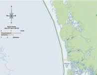
ApeakstormsurgeforecastgraphicreleasedbytheNational
Every passing storm season brings advancements in modeling and forecasts, which provide residents with more accurate information in advance of a storm’s arrival. It’s more than tracking an impending hurricane at the National Hurricane Center in Miami. The folks at the NHC are researchers and innovators of new technologies and products, of which some will make their debut this year.

A new forecast graphic experiment by the National Weather Service dating back to the 2020 storm season will go operational in 2023. When watches or warnings take effect in an area, this graphic will be released to depict the peak storm surge, the water above normally dry land, that’s forecast following an advisory. According to the NHC, a graphic depicting the peak storm surge forecast will be released 15 minutes after an advisory.
During hurricane season, the NHC provides a tropical weather outlook graphic that shows potential for a tropical cyclone formation. In 2023, the period covered by the outlook will extend from five days to seven days. Now, the NHC will provide two-day and seven-day outlooks to give residents and local officials more time to plan and prepare.
The National Hurricane Center said it is providing simultaneous live stream broadcasts via its YouTube, Facebook and Twitter accounts where there is an area of interest in the tropics that may pose a threat to land. Live streams will be provided more frequently when the media pool is activated. The media pool is typically activated when a hurricane watch is issued for any portion of the U.S. contiguous coastline.
— Your LOCAL Waste Management team of the Florida Keys
“Thank you Monroe County, Key West and Islamorada for trusting us as your provider.”
CATEGORY 1-2
HURRICANES
• Key West High School
2100 Flagler Avenue
• Sugarloaf School
MM 19, U.S. 1
• Marathon High School
MM 50, 350 Sombrero Beach Rd.
• Coral Shores High School
MM 90, U.S. 1
CATEGORY 3-5
HURRICANES
› You can register onsite.
› Residents will be assigned to a space.
• The E. Darwin Fuchs
University campus. Take the Fair & Expo Center.
• The E. Darwin Fuchs Pavilion, located adjacent to Florida International University campus. Take the Florida Turnpike north and take Exit No. 23. Follow the ramp right toward SW 40th Street (Bird Road). Bear left onto SW 117th Avenue. Turn right onto SW 40th Street. At SW 112th Avenue, make a left to head north and continue until you see signs for the Miami-Dade County Fair & Expo Center.

› No weapons, alcohol or illegal drugs.
› No smoking allowed in shelters.
› “Lights out” quiet time will be enforced.
› All county shelters are also pet-friendly. Animals must have appropriate crates and carriers, plus supplies. With the exception of service animals, pets may be kept in a separate area of the shelter. Pet owners will be allowed to visit pets as necessary, one at a time.
› Children must be attended at all times. Parents are not allowed to leave the premises without them.
› Water and food (multiple-day supply).
› Drinking water in plastic containers.
› Non-perishable food in cans or sealed containers.
› Special dietary foods, baby food, formula, manual can opener, paper products, utensils.
› Portable ice chest with ice.
› Clothing and bedding.
› Extra clothes and shoes.
› Sleeping bag, blanket, pillow, lightweight portable lounge chairs.
› Rain gear.
› Wash cloths, towels, soap, toothbrush, feminine products, paper towels, toilet paper.
BABY AND MEDICAL SUPPLIES
› Clothes, diapers, formula, bottles, food and blankets.
› Medications and first aid supplies.
› Medication clearly marked with your name, dosage, type of medication and doctor’s name. Persons must be able to self-administer all medications.
› First aid supplies in a waterproof box.
IMPORTANT PAPERS
› Name and address of doctors.
› Name and address of nearest relative.
› Identification and valuable papers.
› Games, cards, toys, battery-powered radios, flashlights.
› Games, cards, toys, battery-powered radios, flashlights.

› Shower and eat before leaving home.




Hurricanes aren’t human.
Despite our first-name basis, the behemoth storms aren’t comic book villains seeking world domination. They’re not rubbing their hands together in a secret lair, laughing maniacally and targeting certain cities for annihilation.
But it’s easy to view these freaks of nature with a bit of anthropomorphism, assigning them human characteristics and personalities.
Longtime Keys residents, veterans of several storms and practiced in evacuations, describe various hurricanes as unwelcome intruders who came barreling into town and left devastation in their wake. Some of us, at various times, are even guilty of blaming Africa, an entire continent, for spawning hurricanes off their coast and somehow “sending” them our way, across the Atlantic toward the Keys, Carolinas and Caribbean.
We’d watch The Weather Channel, and later, all manner of weather websites, watching the fierce radar blob make its trans-Atlantic crossing, as if stalking us. But then things seemed to change. In the past few years, more storms seem to simply appear, fully formed, in the Gulf of Mexico or the Caribbean Sea. Are we going crazy? Were we imagining this change in a storm’s source and course?
Never ones to trust our own memory, or scientific skills, the Keys Weekly brought our question to someone who actually knows, and understands better than anyone, that hurricanes aren’t human.
Jon Rizzo, warning coordination meteorologist for the National Weather Service in Key West, reassured us that we weren’t misremembering.
“It is true,” Rizzo said. “In the last few years, more of these storms have developed and formed in the western side of the Atlantic. But these patterns don’t typically last long.”
Conversely, Hurricane Irma in 2017, “was a long-track storm,” Rizzo said. “And I’d say within the next year or two, we’ll start seeing them cross the Atlantic again.”
What about the 2023 Atlantic hurricane season forecast? Rizzo explained that the first forecasts each year of a storm season’s volatility often come from researchers at Colorado State University in the first week of April.

“Our NOAA Outlook doesn’t come out until the last full week of May,” he said, adding that the data NOAA scientists review for their seasonal forecast “really requires waiting until May to gauge some of the data points NOAA uses, such as the air pressure in the Western Caribbean and preseason rainfall in West Africa.”
Still, Rizzo added, none of the seasonal forecasts for an active or slow hurricane season should be factored into someone’s hurricane preparedness plans. “That should never factor into how or whether we prepare for storms,” he said.
Keep in mind, he warned, 1992 was a ‘below-normal’ season.
“And we all know what happened in 1992. Hurricane Andrew was the first named storm of the season, and we were deep into August when that happened.”
“Let’s put it this way, I’ve never seen a season with ZERO storms.”
— Jon Rizzo


Going through your storm supplies is always a good idea as hurricane season begins June 1. For new residents who aren’t familiar with hurricane preparation, the following list will help you figure out what items to buy and stow away during those stormy days. Also, spend some time thinking about what to get if you need to leave the house and what you need to be properly supplied if you stay behind for a lesser storm. Remember those handy tools, jugs of water and some battery-powered lights. Here’s your full checklist.
FOOD
• Gas or charcoal for the grill
• Manual can opener
• Non-perishable foods such as
• Carbs: crackers, cereal, popcorn, chips
• Vegetables & fruit – canned vegetables and fruit
• Protein: canned tuna, soup or stew, peanut butter, beef jerky, canned sausage, nuts or ham
• Staples such as salt, pepper, sugar, mustard
• Drinking water, sport drinks
• Instant coffee
• Energy drinks
THE BASICS
• First aid kit
• Sunscreen
• Mosquito repellent
• Acetaminophen
• Prescription medicines
• A watertight, easy-to-carry container to store essentials and paperwork
TOOLS & SUPPLIES
• Cash
• Bleach
• Gasoline
• Gloves
• Disposable respirators
• Face masks
• Propane gas
• Coolers
• Heavy-duty garbage bags
• Battery-operated charging pack for cellphone
• Tools, such as a saw, rake, machete, pruning sheers, power drill, utility knife
• Duct tape, screws, nails, tarps, buckets
• Mess kits, paper cups, plates and plastic utensils
• NOAA weather radio with extra batteries
• Enough flashlights for everyone, with extra batteries
• Matches in a waterproof container
• Napkins, paper towels
• Aluminum foil
• THIS GUIDE
• Work clothes, heavy shoes, hat, sunglasses
TOWELS, BEDDING
SANITATION
• Toilet paper, towelettes
• Soap, liquid detergent
• Feminine supplies
• Toothbrush, toothpaste, hair brush, shaving supplies

SPECIAL NEEDS ITEMS
• Remember family members with special needs, such as infants and elderly or disabled persons
• Infant needs: formula, bottles, baby food, diapers, rash cream, fever medicine, decongestant, anti-diarrhea medicine
• Pets: papers, leash, collar with ID, crate, food, bowls, litter, bed
IMPORTANT DOCUMENTS
(Keep these documents in a waterproof, portable container)
• Will, insurance policies, contracts, deeds, stocks and bonds
• Passports, social security cards, immunization records
• Bank account numbers

• Credit card account information
• Important telephone numbers
• Family records (birth, marriage and death certificates)
• Proof of occupancy
• Pictures of your home pre-storm (for insurance purposes)
DISASTER KIT TIPS
• Water: Store water in sanitized bathtubs, washing machines and water heaters. Have at least one gallon of water per person, per day, for seven days.
• Cooking: Do not use charcoal or gas grills indoors.
• Do not run generators indoors.
EVACUATION SUPPLIES
• Gas cans (preferably filled)
• Important papers and photo albums
• Important recovery tools (chainsaw, drills, etc.)
• Pet crates
• Masks, gloves and sanitizer
• Immediate supplies of food, clothing, toiletries, medications




If there’s a hurricane, the best place for the boat is as far away as possible from the storm track. Many Keys residents with small- to mid-size boats choose to trailer their boat to a safer location. If that’s your plan, be ready to go early: Monroe County’s phased evacuation calls for high-profile vehicles to leave first. After that, boats are not allowed on the highway. And no one evacuating with kids and pets in a crowded car wants to be behind someone towing a boat the length of U.S. 1 during an evacuation. (Trust us on this.)
Captains who intend to sail to their evacuation destination must also leave early; at some point during a mandatory evacuation the Snake Creek drawbridge will be locked down so vehicular traffic flows smoothly out of the Keys, and, of course, the weather will get nasty.
If it’s not possible to sail or tow the boat away from the storm, take the boat out of the water and stow it in a garage or on the lee side of a building. Tie the boat to the trailer and the trailer to an immovable object — such as a palm tree. Do not fill the boat with water. Boats are designed to keep water out and filling it with water could cause structural damage.

If it’s not possible to stow the boat on land, find a spot in a protected harbor. Again, the early bird will get the best spot, though it’s recommended to keep checking on the vessel as the harbor fills with other boats to ensure safe clearances between vessels. Take everything off the boat — sails, electronics, etc. Heavy and extra anchors are needed for this option and enough line should be on hand to allow a scope of at least 10:1 for each anchor.
Many working Keys captains adhere to the time-honored tradition of stowing their vessels in a “hurricane hole,” or a narrow inlet lined with mangroves. These protected spots block the wind and provide a tie-off. The best location for a hurricane hole — preferably scouted ahead of time — is one far enough inland to avoid the most severe winds and tides, yet close enough to reach under short notice.
The last option mariners should consider is leaving the boat at the dock. In a strong storm, high winds and waves will batter the vessel against the dock or lift and destroy both. A better option is to tie off in the center of the canal, again using immovable objects on land and the strongest part of the boat such as a mast, not a cleat. This requires cooperation with other boat-owning neighbors to ensure each boat has sufficient room. Also, leave some slack in the lines to allow for tidal change. Use extra fenders and also chafe protection so the lines don’t get severed.
Never try to ride out the storm on the boat.
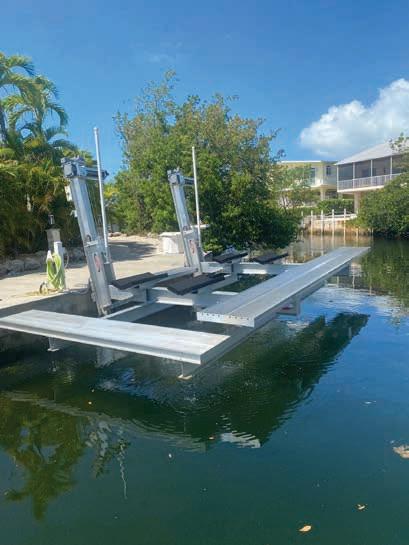
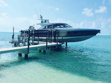
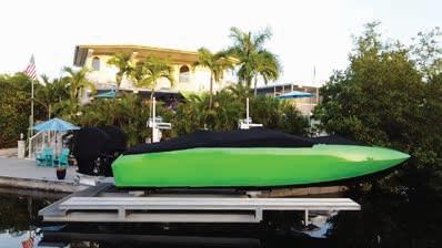
Whenever a threat exists during hurricane season, our service crew will strap down your boat until the threat has passed.
CALL US TODAY TO SIGN UP!


There are plenty of apps for mobile devices to help you stay informed during severe weather. Here are some that focus on the Keys and/or hurricanes.

MONROE COUNTY SHERIFF’S OFFICE
Stay informed of emergency situations in the Florida Keys during storm season such as hurricane evacuation. The app is available for Apple and Android users.
NATIONAL HURRICANE CENTER


This comprehensive hurricane tracker app includes satellite imagery animations, National Weather Service alerts, tropical weather push notifications and weather prediction center graphics. Download for free.
Powered
Betty Davis, the app brings you the latest and most accurate information on developing tropical systems to help keep you and your family safe. It’s free. View projected hurricane paths and more.
ALERT! MONROE Alert!Monroe is an Everbridge mass notification system used by Monroe County Emergency Management to share emergency notifications with residents quickly. Notifications can include severe weather, evacuation information, fires, and other emergencies, as well as general important routine county information and announcements. Sign up by visiting monroecountyem.com and click on the Alert! Monroe button.


NOAA WEATHER RADAR LIVE
This all-in-one weather tracker provides realtime radar images, severe weather alerts and much more to keep you safe. Monitor important National Weather Service watches, warnings and alerts. Download for free.
GAS BUDDY
Needing gas as you evacuate the Keys? Find the best prices with the gas map. Sort by price, location and important things like restrooms.


For drinking and cooking, save enough water for 7-10 days.
Fill bathtub and containers with water for non-drinking purposes.
STAY INFORMED
Follow us on Facebook, fkaa.com and the radio. Register for PRIORITY CALL at fkaa.com to receive neighborhood specific notices via phone, text, and email.


If a notice is issued, disinfect your water by either boiling for 1 minute, OR adding 1/8 tsp of bleach, OR using purification tablets (purchase at outdoor retailer).
EVACUATING? HERE’S WHAT TO DO. Shut off the home’s water valve (typically found on the exterior wall of the home). Some water heaters may also need to be shut off. Check with the manufacturer.
Customers with a low pressure sewer system pump on their property are asked to shut off the breaker to their grinder pump (located in the dedicated electric box outside of the home).
FOLLOWING THESE STEPS WILL ENSURE YOU HAVE A SUPPLEMENTAL WATER SUPPLY, MINIMIZE DAMAGES AND EXPEDITE RECOVERY.


Forecasters worldwide use short, distinctive names for tropical storms and hurricanes. The National Hurricane Center says the practice of naming storms is especially important when exchanging detailed weather information among hundreds of widely scattered weather stations, coastal bases and ships at sea.
Since the early 1950s, Atlantic tropical storms have been named from lists originated by the National Hurricane Center. The lists are used in rotation and recycled every six years (i.e., the 2023 list will be used again in 2029).
A list changes only if a storm is so deadly or costly that the future use of its name for a different storm would be inappropriate for reasons of sensitivity. Several storm names have been retired since the lists were created.
Hurricane Ian was a high-end Category 4 storm that skirted the Florida Keys. It inflicted some of its wrath on the Dry Tortugas, before making landfall south of Punta Gorda on Sept. 28, 2022 with 150-mph winds — just shy of a category 5 storm. Ian was responsible for more than 150 direct and indirect deaths and more than $112 billion in damage. It’s the costliest hurricane in Florida’s history and third costliest in the U.S.
In March, the World Meteorological Organization (WMO) Hurricane Committee retired Ian from the rotating lists of Atlantic tropical cyclone names due to the death and destruction caused not only in southwestern Florida, but also in Cuba.
The naming system for hurricanes has changed over time, according to Jon Rizzo, warning coordination meteorologist for the National Weather Service in Key West. Traditionally, in a system overseen by the World Meteorological Organization, lists of male and female names were used in a six-year rotation for Atlantic hurricanes. An active storm season can exhaust all names on the list. In the past, Greek letters were used to name storms after the list was exhausted. But that’s no longer the case.


Nothing is more important than the structural integrity of your home, and its repair requires a specialized process and a high level of expertise. We work closely with engineers and designers to carefully remove, repair and reinforce the structure so you can be assured of a sound home.


As with any steel reinforced concrete structure, exposure to the elements can cause irreversible, cosmetic as well as structural damage. Let us evaluate your seawall or dock, and give you expert recommendations for its repair.
We specialize in concrete repair and replacement. Each of these is a specialized process and requires a high level of expertise to achieve optimum results. When you work with Randy and his team of professionals, you will be assured that your job will be completed correctly and with no detail overlooked!

Before a threatening storm arrives, make sure to check the power lines surrounding your home. Take special notice of the “service drop” lines that connect your home to the nearest pole. If you see trees that could damage those lines in high winds, please contact FKEC or Keys Energy. Make a tree trim request. If you see vegetation posing a potential threat to power lines, FKEC customers can submit an online tree trim request at www. fkec.com/services/tree-management/ or by calling 305-852-2431. Keys Energy customers can call KEYS at 305-2951010 to submit a tree trimming request, or submit a tree trimming request online at www.keysenergy.com/customer-service-requests/#to-tab|1.
Preparing for every unexpected storm can be a difficult task. However, there are certain steps residents can take prior to the arrival of a hurricane. Florida Keys’ power companies are among the best in the world in restoring power after a hurricane. So when you see the Keys Energy and Florida Keys Electric Co-op trucks on the road after a storm, give them plenty of room to work — and thank those crews for what they’re doing. Take the time, now, to prevent outages when you can, and prepare for what may come.
During a storm, FKEC and Keys Energy Services will use all means of communication to keep customers informed. FKEC customers can sign up for outage texting. This service allows FKEC to send you power outage and restoration information as well as allowing you to report outages via text – your mobile number must be pre-registered with FKEC to report via text. More information is at www.fkec.com/outage-center. Keys Energy customers can find out information on outages by visiting keysenergy.com/ report-outage. Before, during and after a storm, FKEC will share valuable information at www.FKEC.com, on Facebook @FloridaKeysElectricCooperative and email on file. FKEC encourages members to have a current email address. FKEC members can update contact information through the SmartHub online/ mobile app or at fkec.com/access-youraccount. Keys Energy will provide information at keysenergy.com and on Facebook @keysenergy.
If you have internet access after a storm, Keys Energy Services and FKEC websites also feature an outage map that shows where power is out throughout the utilities’ service area. FKEC also has a live outage viewer map where you can track the status of power outages. There is a prominent link on the home page but the direct link is: http://12.237.166.68:91.
Implement meter-mounted surge protection. To protect your home from power surges, use a surge protector mounted at the electric meter in combination with plug-in surge protectors for individual voltage-sensitive electronic devices. Before a storm threatens, make sure you have all the equipment needed to secure your house or business. FKEC offers Meter-Treater Meter-Based Surge Protection which you can find more information about by visiting https://fkec. com/services/surge-protection/.
If you or someone in your home is dependent on electric-powered, life-sustaining medical equipment, it is your responsibility to have an emergency plan for backup power or a plan to relocate when a storm warning is issued. Residents are encouraged to seek safety and follow any evacuation orders set by Monroe County.
Like a ripple in the water, electricity from a downed line flows into the ground in a big circle up to 35 feet away. This means even getting near a downed power line can be deadly. Stay clear of all downed power lines or electrical equipment. Assume all cables and wires are energized and stay away. Call 911, FKEC at 305852-2431 or Keys Energy at 305-2951010 to report fallen power lines that present a clear and imminent danger to you or others.
Stay away from flooded areas, or standing water and debris, which could conceal live wires. Stay away from downed or sagging power lines, and do not touch anything that is on or near a power line (i.e., trees or tree limbs, cars, ladders).
Keep children and family pets away from areas where lines may have fallen.
Never connect a generator directly to your home’s wiring without a Generlink or other approved interconnect device. Power from a generator connected to a home’s wiring will “back feed” into utility lines and could seriously hurt power crews working to restore service.
Plug appliances directly into the generator’s outlet.
Don’t leave a running generator unattended; turn it off at night and when away from home. Never refuel a hot generator or one that is running; hot engine parts or exhaust can ignite gasoline. Turn off all connected appliances before starting your generator.
Turn connected appliances on one at a time, never exceeding the generator’s rated wattage. Overloading the generator can result in damage to appliances it is powering.
Remember, gasoline-powered generators produce deadly carbon monoxide fumes. Never run generators inside, in a garage, or any enclosed or partially enclosed areas. You cannot see or smell carbon monoxide (CO), and portable generators can produce high levels of the toxic gas very quickly.
Keep generators away from all open windows — including neighbors’ windows — so deadly exhaust (CO) does not enter their home or business. To be safe, buy a battery-operated carbon-monoxide alarm when you buy your generator. It works like a smoke alarm, sounding an alert if carbon monoxide levels become dangerous.
By Keys Weekly staffThe following tips from the Florida Keys Aqueduct Authority will ensure you have a supplemental water supply, minimize damages and expedite recovery. For more information, visit fkaa.com or call 305-296-2454.
Shut off the home’s water valve (typically found on the exterior wall of the home). Some water heaters may also need to be shut off. Check with the manufacturer. Customers with a low pressure sewer system pump on their property are asked to shut off the breaker to their grinder pump (located in the dedicated electric box outside of the home).
For drinking and cooking, save enough water for seven to 10 days. Fill the bathtub and containers with water for non-drinking purposes.
If a notice is issued, disinfect your water by either boiling for one minute, adding one-eighth teaspoon of bleach per gallon or using purification tablets (purchase at outdoor retailers).

Follow the Florida Keys Aqueduct Authority on Facebook and visit fkaa. com. Register for priority calls at fkaa. com to receive neighborhood specific notices via phone, text and email.
Storm surge from a hurricane is often the greatest threat to life and property along the coast. If history tells us anything, many deaths from major hurricanes have resulted from the rise of the ocean due to storm surge.
Hurricane Katrina, which hit New Orleans in 2005, is a prime example of the damage and destruction caused by the surge. Around 1,500 people lost their lives during Katrina and many of those deaths occurred directly and indirectly from storm surge.
During Hurricane Ian in 2022, storm surge pushed 15 feet of water from the Gulf of Mexico to the normally dry areas of Fort Myers, Florida.
Per the National Hurricane Center, storm surge is the abnormal rise of water that’s generated by a storm over and above the predicted astronomical tides. Storm tide is defined as the water level rise due to the combination of storm surge and astronomical tide.

The larger the storm, the higher the surge. This is because stronger winds from a larger storm are pushing on a larger area of the ocean. And those winds will stay around longer due to the storm’s size. The angle in which a storm approaches a coastline, winds and slope of the ocean bottom and coastline shape are other factors that contribute to surge from a given storm. On the open coast, a faster storm will produce a higher surge. And higher surge is produced in bays, sounds and other enclosed bodies of water with a slower storm.
Look out for storm surge watches and warnings. A storm surge watch indicates the possibility of life-threatening, rising water moving inland from the shoreline within a specified area, generally within 48 hours of a storm’s arrival. The watch may be issued earlier when other conditions, such as the onset of tropical storm-force winds, are expected to limit the time available to take protective actions for surge (e.g., evacuations).
A storm surge warning is the likelihood of life-threatening water that’s rising and moving inland from the shoreline within a specified area within 36 hours of a storm’s arrival. A warning could be issued earlier when other conditions such as the onset of tropical storm force winds are expected to limit the time available to take protective actions for surge, like evacuations.
Storm surge evacuation orders from local emergency management officials should be heeded immediately. Storm surges can cause water to rise quickly.





Never place debris directly under power and cable lines or on utility boxes (electric or water). Keep the debris away from fire hydrants and utility poles. Residents are urged not to place debris on vacant lots or other private property.
Only clear damaged vegetation that has fallen and/or constitutes a hazard to life or property. Take pictures to prove there was a hazard in case a complaint is filed.
By Jim McCarthyThere’s plenty to consider when cleaning and sorting debris for pickup following a hurricane. Following these specific guidelines when hauling hurricane-related debris and household garbage will make for an easier and quicker removal. FEMA-eligible, hurricanerelated debris will be picked up free of charge by Monroe County contractors in unincorporated areas, Layton, and Key Colony Beach. Key West, Islamorada and Marathon have contractors who will pick up debris free of charge.
Before hurricane season begins, make sure to prepare your yard by clearing coconuts from palms and trimming foliage. Waiting to trim and clear foliage days before an impending hurricane will not guarantee removal of foliage/vegetation.
Illegally dumping household appliances, construction materials, boats, trailers, RVs and vegetative debris on county-owned vacant land and rights-of-way and streets could land you in serious trouble — you very well could face a felony charge. The extra disposal cost is paid by Monroe County taxpayers for those who do not dispose of items properly.
Household appliances – beds, dressers, appliances, carpeting, etc. – can be removed by local haulers. Boats, boat trailers, RVs without motors, campers and other big items can be disposed of at one of Monroe County’s three transfer stations at a price per ton. Contact a transfer station regarding pricing: Cudjoe Key: 305745-2513; Long Key: 305-664-2263; and Key Largo: 305-367-4236.

Homeowners are asked to sort debris into the following categories :
Household garbage - items include bagged trash, discarded food, packaging and papers.
Construction debris - building materials, drywall, lumber, carpet, furniture, mattresses, plumbing.
Vegetation debris - tree branches, leaves and logs.
Household hazardous waste - oil, batteries, pesticides, paints, cleaning supplies and compressed gas.
Appliances - refrigerators, washers, dryers, freezers, air conditions, stoves, water heaters and dishwashers.
Electronics - televisions, computers, radios.
For more information, visit monroecountyem.com/914/hurricane-debris-removal.
Every storm is different. Listen to local media, or read social media outlets, specifically radio and paper and county and city webpage and Facebook sites. These media outlets will provide for direction and instruction on how/when debris will be collected/ picked up.
Don’t wait until there is an emergency.
Bottled water for drinking, cooking, brushing teeth, etc Allocate at least one gallon per person per day. Non-perishable, canned foods, and manual can opener. Infant ready-to-eat formula.
Bottled water for drinking, cooking, brushing teeth, etc Allocate at least one gallon per person per day. Non-perishable, canned foods, and manual can opener.
Infant ready-to-eat formula.
Battery-powered or crank weather radio.
Battery-powered or crank weather radio.
Food, water, and medications for pets.
Food, water, and medications for for pets.
Gas-powered generators must never be used indoors, in a garage, or within 20 feet of windows or a window air conditioner. Have a battery- powered Carbon Monoxide alarm installed to prevent CO Poisoning. Cover your skin; Wear a longsleeved shirt, lightweight pants, and use insect repellant containing DEET, picaridin, or oil of lemon eucalyptus.
Gas-powered generators must never be used indoors, in a garage, or within 20 feet of windows or a window air conditioner.
Have a battery- powered Carbon Monoxide alarm installed to prevent CO Poisoning.
Cover your skin; Wear a longsleeved shirt, lightweight pants, and use insect repellant containing DEET, picaridin, or oil of lemon eucalyptus.
Drain standing water to prevent mosquitoes from breeding.
Drain standing water to prevent mosquitoes from breeding.
First Aid Kit
First Aid Kit
30-day supply of medications. List of medical conditions.
30-day supply of medications. List of medical conditions.
The Florida Department of Health in Monroe County in partnership with Monroe County Emergency Management and Monroe County Social Services provides care to those with disabilities during an evacuation and have no other sheltering options

These shelters should only be used as a back-up to personal sheltering plans.
The Florida Department of Health in Monroe County in partnership with Monroe County Emergency Management and Monroe County Social Services provides care to those with disabilities during an evacuation and have no other sheltering options These shelters should only be used as a back-up to personal sheltering plans.
To see if you qualify or to pre-register for the Special Needs Shelter, visit: tinyurl.com/monroespns
To see if you qualify or to pre-register for the Special Needs Shelter, visit: tinyurl.com/monroespns
For
The grotto’s reputation has grown since its early beginnings, and not just amongst Saint Mary Star of the Sea’s parishioners. As storms approach, Key Westers of all faiths, and some of no known faith whatsoever, will stop by to light a candle in hopes that the structure will continue its 101-year streak of warding off the worst of the storms.
Key West was not always such an easy place to live. When the first five nuns from the Sisters of the Holy Names of Jesus and Mary arrived from Canada in October of 1868, the freighter they arrived on, the “Sedgwidge,” unloaded them and their luggage, and some additional freight, and then set a course for Texas. The ship encountered trouble in the middle of the Gulf of Mexico, though, and sank with no survivors.
The nuns were welcomed in Key West and given use of an old barracks, which had since been converted into a public goat barn, to live. There were only two schools on the island at the time, and both were private and charged tuition. Within a month the sisters had cleaned and repaired the barracks, converted it into a tuition-free school, and enrolled their first 26 pupils in the Convent of Mary Immaculate. It was the first Catholic school in Florida.
Two months later there was a yellow fever epidemic, and the Sisters shut the school down and went to work as nurses. After the epidemic the school was reopened, and in 1871 they had their first graduation ceremony — for one student. By 1872 they had enrolled 150 students and, being the segregated south, started an additional school for black students. There was a smallpox epidemic that year, though, and the nurses shifted their duties from teaching to nursing again.
By 1897, when a 19-year-old Sister Luis Gabriel arrived, they’d built new facilities and had 609 students enrolled.
Over the next 25 years, Sister Gabriel was here when Domingo Rosillo made the first flight across the Florida Straits from Key West to Havana. She was here when Henry Flagler started work on the Overseas Railroad, and when he completed it and rode the length of it in his private rail car. She was here when World War I started and when it ended. She was here when the four waves of the Spanish
Influenza pandemic killed 25 to 50 million people across the globe, and at least 79 people in Key West.
But the thing that affected her the most during those years, the thing that made the place seem so vulnerable, were the hurricanes. The island had been hit by them in 1909, 1910 and 1919. The 1919 storm had winds estimated at 110 mph, destroying many homes and businesses, and sinking the “Valbanera” between the Dry Tortugas and Key West and taking the lives of all 488 people on board.
To celebrate the 25th anniversary of Sister Gabriel’s religious life, her family proposed to send her on a pilgrimage to Rome. She decided that she would rather do something for the Key West community and build a grotto dedicated to Our Lady of Lourdes.
"She was an educator, so what she did was, she engaged high school students to get coral rock from throughout the island. Which meant as soon as that happened, it was no longer her grotto, but it was the grotto of the people of Key West," Baker said.
At the grotto’s dedication on May 25, 1922, Sister Gabriel is said to have commented that as long as the shrine stands, Key West will not feel the full brunt of another hurricane.

Gabriel served the Convent of Mary Immaculate for another 25 years, noting that she knew everyone in Key West “except the transients.” She died here in 1948 and her ashes, as well as those of several other nuns from the order, are buried in a small cemetery next to the grotto. A week after her death, a hurricane with winds reaching 120 mph came barreling towards Key West, but veered east, the eye passing over the less populated Boca Chica, and Key West experienced little damage. Two weeks after that, a second hurricane followed a similar path, and veered further east.
That has pretty much been the story ever since. Key West has been hit by hurricanes, but it hasn’t experienced the full wrath of a serious storm.
“I think it was in Hurricane Wilma that a lot of trees went down and somebody said, you know, she failed. And I said, you know, it's still standing. The grotto – it's still standing,” Baker said.




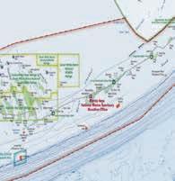
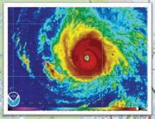


3Drenderings oftheupcoming MonroeCounty Emergency Operations Center,scheduled forcompletion before the 2024 hurricane season.

AJAX BUILDING COMPANY/ Contributed
Oppositepage: Elevatorshaftsand stairwells,which serve as anchor pointsfortherest ofthebuilding, areamongthe first structures constructed. ALEX
RICKERT/Keys Weekly
By Alex RickertTo say the phrase “hurricane rated” carries weight in the Florida Keys is the understatement of the century. Those two words can at once signify safety, a resilient community, and more often than not, a whopping price tag.
But for those of us – like this author – who know very little about construction, the phrase is somewhat a mystery. What exactly does a hurricane rating entail? What design features justify a particular classification? And just how tough are these buildings?
To answer some of these questions, the Keys Weekly sat down with Marshall Quarles, senior project manager for Ajax Building Company, the firm tasked with completing Monroe County’s upcoming Emergency Operations Center in Marathon. Though each building’s construction differs, Quarles took us through a few of the design elements that will enable the center to take on a 500-year storm with 220 mph winds.
When talking about hurricane construction, the Florida building code is just the beginning. In addition, FEMA, the Division of Emergency Management and the Department of Transportation have their own sets of guidelines. And when it comes to building shelters, the ICC 500 governs everything from the design and construction to
installation and inspection of both residential shelters –intended for 16 people or less – and communal gathering spaces.
Buildings are assigned a letter from A to D, as well as a number from 1 to 4, indicating both their risk and exposure during a storm. As a near-water shelter with direct ocean views tasked with housing critical emergency management personnel in a highly hurricane-prone area, Monroe County’s new EOC is a D4 building.
In order to resist lateral forces that could contort the building’s basic shape during high winds, the walls of the building’s four- or six-sided elevator shafts and stairwells are each poured in a single seamless process.
“You have those cores that ‘lock in’ the building,” Quarles explained. “That way, there can’t be any movement to torque the building in any way.”
Three-by-two-foot concrete beams tie these anchor points together and serve as supports for the floors and other walls. While typical rebar used in concrete walls and beams is “ 5/8 or ¾” in diameter, several bars used in the new shelter’s beams and critical anchor points measure 1-1/8” to 1- 3/8”.
The compressive strength of concrete used in most homes usually ranges between 2,500 and 3,000 pounds per square inch (psi). In contrast, aided by its higher cement ratio, the concrete used in the EOC – even on the roof – is rated at 5,000 psi. For comparison, that’s closer to the strength of concrete poured on high-stress areas of airport runways.
“5,000 is like, I’m going to run a concrete truck or garbage truck over this and I don’t want it to crack, and our whole building is built that way,” Quarles said.
A higher cement ratio in the concrete helps with waterproofing, and on top of this, many of the foundations and retaining walls have a product called Xypex in the mix. Designed to further aid in waterproofing, the product has a crystalline structure that fills the voids when small-scale cracks occur.
To meet the windborne debris missile criteria for a hurricane shelter, the building’s glass and openings must be able to withstand impacts from a nine-pound two-by-four propelled at 110 mph.

“That’s basically what a lot of doors, windows, gates and things like that go through that want the designation to be hurricane rated,” Quarles said. “They get tested in a lab where they literally shoot two-by-fours at products to verify they’re strong enough.”
Glass used in the EOC is more than two inches thick, with multiple layers providing strength. And though many think of “hurricanerated” fixtures, Quarles said a good deal of tests and ratings are actually geared towards tornadoes – a devastating accessory of hurricanes – that create higher loads at specific points during extreme events.
Even little elements can make all the difference when it comes to preventing a small breach that can evolve into a larger problem during a storm. In addition to lock-level latches on doors, additional supports extend to latch into the top and bottom of a door frame, for a total of three per door. And when it comes to double doors, having a central post to provide an all-around frame of support for each swinging door – as opposed to just a piece of felt or weather stripping where the two doors meet – is a big deal.
The roof of the new center utilizes two membranes, with insulation between them, over the thick concrete deck. Steel grating protects HVAC and other external mechanical equipment. When all is said and done, the roof can withstand more than 570 pounds per square foot of upward suction pressure, generated when winds up to 220 mph whip across its surface.

When a hurricane threatens to strike Key West, people are attracted to the grounds of The Basilica of Saint Mary Star of the Sea, where they stop to pray at what is sometimes called the Hurricane Grotto. Built by Sister Louis Gabriel, who arrived at the Key West church on Aug. 25, 1897, it is officially called Our Lady of Lourdes Grotto.
While there, she survived three hurricanes. After witnessing the storms’ destruction, she built the grotto in honor of the Blessed Mother Mary, hoping it would ward off future storms. Sister Gabriel built the structure from rocks found on the island, and when it was dedicated in 1922, she said that as long as the Grotto stood, Key West would be protected. To this day, when a storm threatens, the Grotto becomes a center for prayers of protection.
One of the hurricanes that did not strike Key West was the 1935 Labor Day Hurricane. The Category 5 storm that redefined the Florida Keys in general and the Upper Keys, in particular, remains the strongest hurricane to ever strike North America. The deadly hurricane was responsible for taking hundreds of lives, essentially wiped Islamorada off the map, and ended the run of Henry Flagler’s Over-Sea Railroad.
In response to the storm, the Florida Keys Memorial was erected on Upper Matecumbe Key to honor those who lost their lives in the devastating event. The iconic Islamorada landmark resulted from President Franklin D. Roosevelt’s Works Progress Administration. The Miami-based Harvey W. Seeds Post of the American Legion also helped raise money to build what is often referred to as the Hurricane Monument.
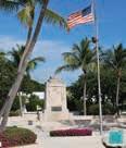
The monument’s obelisk and crypt were built out of keystone, a decorative limestone rock made by chiseling slabs of limestone substrate from quarries operating at sites contained within what is now the Windley Key Fossil Reef Geological State Park. The 18foot obelisk represents the approximate height of the tidal surge that swept across the area at about 8:25 p.m. on that fateful Labor Day.
Artist John Klinkenberg inscribed the bronze plaque attached to it: “Dedicated To The Memory Of The Civilians And The War Veterans Whose Lives Were Lost In The Hurricane Of September Second 1935.”
At the foot of the obelisk is a 22-foot-long crypt, decorated with a mosaic tile design created by Adela Gisbet. Her ceramic work represents the span of islands from Key Largo to Key Vaca, the area directly impacted by the hurricane. The ashes of an undetermined number of hurricane victims have been interred inside the crypt. The number is hard to determine because two years after the pine boxes containing the victims were stacked, burned and scattered in more than 20 cremation sites in the Islamorada area, the dust and dirt were recovered and placed within the crypt.
The 18-foot obelisk representsthe approximateheight ofthetidalsurgethat sweptacrossthearea atabout8:25p.m. on that fateful Labor Day.BRADBERTELLI/ Contributed
The monument was unveiled on Nov. 14, 1937. Faye Marie Parker, 9 years old and one of the hurricane’s survivors, was invited to pull the cord on the sheet covering the obelisk. She was helped by two Boy Scouts. As many as 4,000 people attended the event, including state dignitaries and mayors from Key West to Fort Lauderdale. At 1 p.m., Chaplain E.R. Reedy of the Henry Seeds Post, American Legion, began the service. A child-sized casket containing the remains of Herman Saulter, a World War I veteran from Philadelphia, was interred within the crypt. His remains were identified through discharge papers discovered tucked inside his coat pocket.
If you stop by this sobering roadside attraction, interpretive panels behind the monument reveal more of the devastation left behind by the 1935 Labor Day Hurricane.
 Main: The monument was unveiled on Nov. 14,1937.MONROE COUNTY LIBRARY COLLECTION






Is this your first hurricane season in the Florida Keys? Welcome to our world. Fortunately, plenty of people in our island chain have realworld experience with forecasts, watches, warnings, storm shutters, preparations, evacuations and the aftermath. We asked a few of those locals for some storm-related gadgets and essentials that could make your life easier.


John Schaefer, a mail carrier hailing from Marathon, made the decision to ride out Hurricane Irma in his second-floor condo, sleeping in his tub while wearing a life jacket and helmet with a kayak at the ready. For those who choose to “ride it out,” he stressed the importance of having a team of friends or family at the ready to help each other and address urgent needs both before and after the storm. In the potential absence of cell service, having a backup method of communication is key, as well as supplies to be self-sufficient. “We used walkie talkies,” he said. “That was huge, having a communication system.”
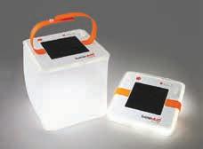
Key West Weekly editor Mandy Miles discovered these inflatable, collapsible, solar-powered, LED lights about a year before Hurricane Irma hit. So by the time the storm came in 2017, she had a whole drawer of the lights — and had given them as gifts to several friends and relatives. There are several brands and varieties, but they’re all pretty similar. They’re made of sturdy vinyl and collapse like a beach ball when not in use. When needed, just blow them up into a lightweight square and turn on the light. Float it in the pool, hang it from a hook or set a few all over the house when the power goes out. The latest versions even come with phone chargers.
Hurricane Irma’s destruction had to land somewhere, and when it did, thousands of roofing nails and other sharp objects landed in driveways and roadways, flattening countless tires. Just a month before the storm, Capt. Stan Miles had ordered a tire-inflator adapter that attaches to the top of a scuba tank. In the days following Hurricane Irma, Miles didn’t leave home without an air tank and his adaptor, which he used on two of his own tires, one of his wife’s and the tires of about seven other friends and neighbors. (In addition to the tire-inflator adaptor, he threw a couple tire plug kits into his trusty Ford F150 and got plenty of folks back on the road.) “That adapter was the best 12 bucks I ever spent,” Miles said. (Another pro tip? Fill buckets of water from the backyard pool and pour them into the toilet to flush the toilet if the water goes out, which happened during Hurricane Irma.)
While we’re all jealous of our friends with the giant generator system that snaps on in a second and powers the whole house (A/C included), it’s not a feasible (or affordable) option for everyone. But there are budget-friendly portable generators that will power your fridge/freezer (which means ice for drinks), some big box fans, phone chargers and radios. Just remember, always read the instructions, invest in some heavy-duty, weather-proof extension cords and don’t be stupid. Generators — and the carbon monoxide they produce — belong OUTSIDE.

Did the storm knock out your power? Do you want to keep the security camera rolling on your property or home in the time you have without Wi-Fi? With Arlo Go’s wireless security camera, hook it up to your cellular plan to keep an eye on your property. Get access to live video and twoway audio. And notifications immediately appear on your phone. It’s great not only for homes but also boats.
While many people have made the switch to satellite radio and streaming services, there’s no substitute during a storm for a regular FM radio to hear local news, advisories and weather reports. Make sure you have plenty of C or D batteries, whatever the old-school boombox requires.
Anyone who waded through flooded streets following Hurricane Ian, Irma or Wilma in the Florida Keys knows that waterproof, rubber rain boots (the taller, the better) are storm essentials.


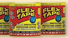


The Key Largo Wastewater Treatment District (KLWTD) and Islamorada, Village of Islands are at work before, during and after a storm to keep the central sewer collection system and processing plant fully operational.

KLWTD service area: Mile Marker 106 to the north end of the Tavernier Creek Bridge

Islamorada service area: south of the Tavernier Creek Bridge to the south end of Lower Matecumbe Key While the wastewater system is designed to operate during most significant storm events, there are a few conditions where service may be interrupted. It is important for our customers to understand these situations.
MANDATORY
and RECOVERY
WIDESPREAD None Reduced Usage Recommended Reduced Usage NECESSARY Reduced Usage NECESSARY
Rising water above the in-home drains can allow for the infiltration of large amounts of water into the sewer system. During periods of flooding, portions of the collection system may be temporarily shut down to avoid overwhelming the system.
During periods of mandatory evacuations, service may be interrupted. The system will be restored, usually before re-entry is allowed to the general public.
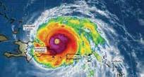
"Reduce Usage" means: Water usage should be for essential sanitary purposes only. Minimize toilet flushing, avoid use of washing machines and dishwashers.
✔ Do not park or place debris on or next to air terminals, utility boxes or manhole covers.
✔ Notify your wastewater district of leaks or system failures.
✔ Never drain storm waters into the sewer system – it’s against the law.