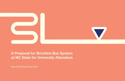
A Proposal for Brickline Bus System at NC State for University Attendees
Keya Shanbhag & Sena Celik
WL
IDEATION CUSTOM TO USER KEY TO WAYFINDING Personalization in Brickline Goals for Success Initial Stages Wireframing the App Route Nagivation System Nagivating Journeys BEGINNING B ROAD MAP TABLE OF CONTENTS R Introduction User Journey Task Analysis Personas Identifying the Problem I C K The Brickline Brand 1 2 7 11 15 Bus Route Structuring
L LIVE BUS ROUTE I N E INTERACTIVE MAP NEW SIGNAGE EXTERIOR OF BUS Signaling Bus Stop Technology Route Overview Kiosk Route Guidance Kiosk Interactions Bus Stop Signage & Mapping Brickline Bus Wrap 19 21 25 27
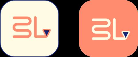
INTRODUCING BRICKLINE
EGINNING
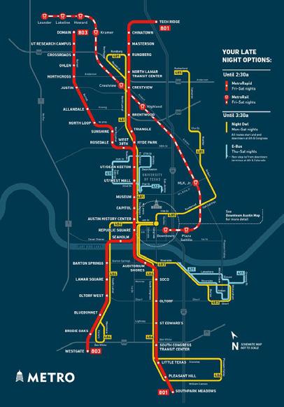
NC State University’s Wolfline Bus System is a free transportation service provided to students, faculty, and other campus attendees. In recent years, Wolfline users have experienced several inconveniences during their journeys riding the buses such as delayed arrivals, poor communication, and lack of accurate, updated information on the Transloc app, which is the platform that guides users through their journey on the bus.
In order to combat these problems, we have created a new application catered specifically to NC State transportation called the “Brickline”. The purpose of this app is to provide bus riders with a comfortable experience using campus transportation services with enhanced communication and clear wayfinding We created a new route mapping system that is concise and easy to understand for new users. Our goal is to create a welcoming and comfortable environment for users that experience anxiety due to inconveniences related to the bus system.
B
1
IDENTIFYING THE PROBLEM
The Transloc app is unreliable and confusing to users of the Wolfline Bus System. The lack of real-time tracking and personalized navigation information available to users negatively impacts their overall experience using public transportation systems due to their increased delay times and poor guide planning, which affects transportation staff and lowers ridership numbers.
Solution
A newly designed app to redine the route system and provide users with a simplyfied navigation ability. The new app would have personalization features along with guidance from the app, the user can go through their journey in an efficient and clear manner.
OAD MAP
2
R
W L
USER JOURNEY
Commuter student drives to school for class.
CURRENT PROPOSED
Student parks and looks at Transloc app to find bus.
Students has difficulty with bus arrival times due to app inaccuracy.
Student waits for bus for over 20 minutes due to bus shortage.
Student is late to class.
Commuter student drives to school for class.
Student parks and looks at Brickline app to find bus.
Student is able to find bus and sees real time information.
Student does not wait due to fixed routes and bus abundancy.
Student is on time for class.
3
TASK ANALYSIS
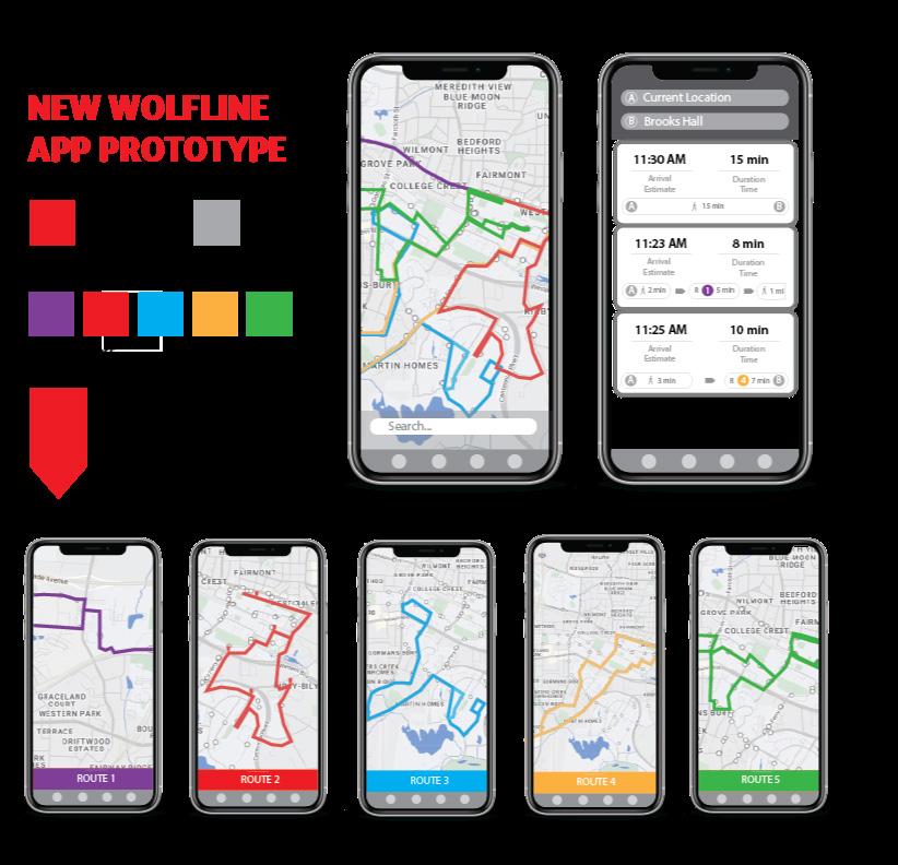
Route mapping/Navigation
User lands on home page as they open the Brickline app.
They either click on one of 5 routes (BRICK) or type in their intended destination
When they click on a route, they can toggle through looking at all routes or one at a time.
They can zoom into the route to see food, streets, and buildings near the route.
By tapping on a specific bus stop, they get access to more detailed information about the bus arrival and capacity.
Journey Personlization
After exploring these options, the user may also input information into the personalization tab of the app to make their journey more personable to them.
The user moves through the route page first by finding their respective route and bus. Then, they chose their location and journey to go to their final destination. This area could have directional information and additional details for going through their journey. Finally, they can personalize their route by adding classes, different locations, and add in alerts.
By searching their destination, they will go to the navigation page, which allows the user to get suggested jouneys to reach their location.
Once they pick a certain journey, they will either walk or walk and take the bus to a certain stop. The journey also gives them directions and more detailed information.
As they tap on the directions button, the journey starts and guides them through the steps to the bus stop and finally their destination.
They can input their home location (on/off campus), add their classes to to route their journey to the specific building they are held in, and build new journeys.
Users who need wheelchair access can also notify bus drivers ahead of time of their arrival on the bus to provide enough time for preparation of their onboarding.
4
PERSONAS
Jeff is a freshman who is relatively new to campus and has a hard time navigating bus routes. His classes are mostly close to this dorm and he uses the bus to go to Centennial Campus or to travel to a class farther away from his dorm.

He uses the bus two times a week at most and uses the Transloc app, but is unfamiliar with it and experiences problems. When he wants to use the bus on the weekends, he has difficulty finding a bus going to Centennial because of the bus driver shortage.
SARAH Undergrad Commuter

Sarah is a junior that lives 20 minutes from campus. She comes to campus three times a week. Her parking lot is a 15 minute walk from all her classes so she has to use the bus to get from parking lot to her class. She uses the Transloc app to find her bus. Because she does not come to campus every day, she does not know the campus very well.
She uses the same 2 bus routes. She doesn’t know how she can attain more knowledge about the bus routes and campus overall because she finds the maps very confusing. She is in a french club that meets weekly in different locations and does not know which route to take most weeks. She also has class after 5 pm, so she often has to wait over 30 minutes for a bus at the bus stop.
JEFF Undergrad on Campus 5
KAT
Grad student on Campus
Kat is a grad student living on campus who takes the Wolfline Bus to go to Centennial for some of her classes. She experiences frustration with getting on the bus and feels like a burden towards the driver and other passengers when entering the bus through the ramp procedure because it takes a while.
The drivers are usually stoic about communicating with her during the process and it is hard for her to get on the bus when it is crowded. She feels like she is not prioritized as a passenger and given the accommodations she needs, which makes her avoid riding the bus.

RAJ

Wolfline Bus Driver
Raj is a bus driver working at NC State for 2 years. Before working at NC State, he was a bus driver elsewhere for 7 years. Even though he had years of experience, he was put in an extensive training process that lasted weeks, to get hired at NC State. Greg fings being a bus driver easy, however, he does not like to interact with students much. He does not shy away from kicking students out if they are not following directions.
He works overtime due to the shortage of bus drivers and often falls behind in his bus route schedule due to overcrowding. Students come up to him to ask questions about the campus and bus routes but he does not know the campus very well other than the bus stops. Students get upset with him for things out of his control. He also is frustrated for not getting paid well.
6
INITIAL STAGES
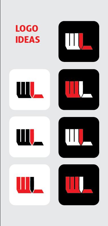
After finding inspiration from public transportation route signage, the main route system was established in a simplified way for users to nagivate the app in a efficient manner.
The initial logo and prototyping included a ridgid theme with more colors and hard edges. It was based on the orginal branding of the Wolfline bus system with red, black, white, and gray as the main colors.
DEATION
I
7
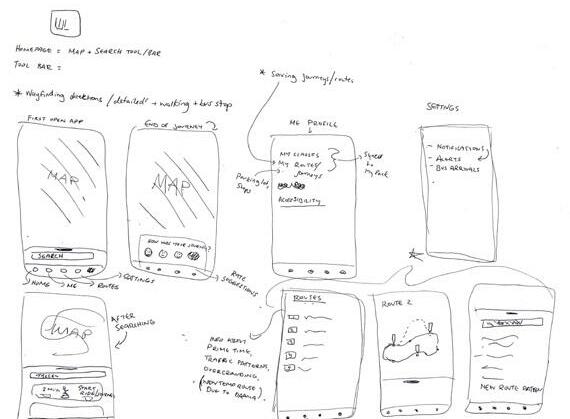
WIREFRAMING THE APP
The wireframing was done on Miro to understand the different interactions that could take place for users going through the app. We explored various layouts of displaying the route information to find the best way for users to access their destination details.
8
9 THE BRICKLINE BRAND #FF8C6F #E96A51 #EA4A32 #D13429 #A4251B #122679 #FFFDE7 Helvetica NeueOmnium abcdefghijklm nopqrstuvwxyz 0123456789 ABCDEFGHIJKLM NOPQRSTUVWXYZ abcdefghijklm nopqrstuvwxyz 0123456789 ABCDEFGHIJKLM NOPQRSTUVWXYZ #E6E6E6
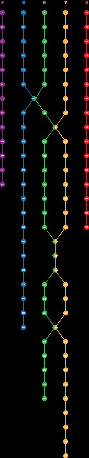
ROUTE STRUCTURING
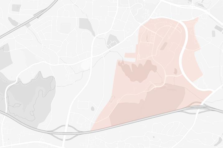
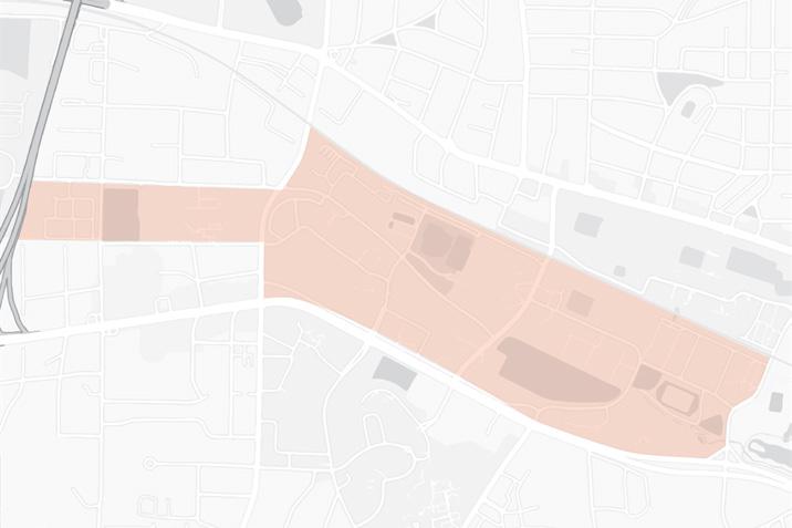
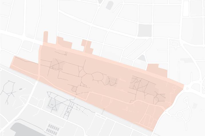
Due to the expansive nature of the original Wolfline route displays, the Brickline’s goal is to change it to make the routes easier to comprehend and follow for users.
By analyzing economic and diagramatic route mapping of other major transportation systems around the world, the Brickline route structure was meticulously designed to cover the overlapping of bus stops along with highlighting the stops with letters and numbers.
Along with the 5 route names being changed to BRICK, each bus stop is renamed to be easily recognized by their corresponding letter and number (ex. C6).
Initial Final
10
B1 B2 B8 B9 B10 B11 B12 B13 B14 B15 B16 B3 B4 B5 B6 B7 K4 K6 K8 K9 K10 K12 R2 R3 R5 R6 R8 R10 I1 I2 I3 I4 I8 I10 C2 C4 C5 C6 C7 C8 C10 K13R13 I13 C13 R15 I15 I16 RI7 IC9 IC17 R18 R20 R22 R23 I20 I24 I25 C20 C22 C25 I28 C27 C28 C29 IC18 IC19 IC23 C30 C32
BUS
PERSONALIZATION IN BRICKLINE
The ability to personalize the Brickline app is a touchpoint that will enable users to feel more connected to this app. Not only will they feel more connected, they will also find it more useful and relevant specifically to them. In the profile tab, there are four different categories that contain data that can be helpful for a user on this app.
USTOM TO USER
c
11
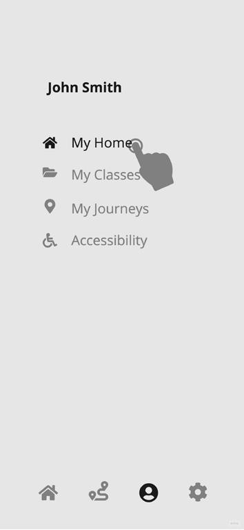
My Home My Classes
The ‘My Home’ page allows the user to input whether they are living on or off campus. If they live off campus, it will ask for their parking lot. If they are living on campus, it will ask for their residence hall. This information gets saved into the database and later is helpful when selecting a destination.
The ‘My Classes’ page allows the user to sync their classes to the app which has the information of the class buildings and locations. This feature allows the user to automatically build a journey that they can save and use when they need to get to class.
12
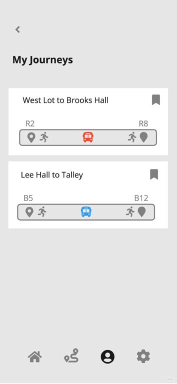
My Journeys Accessibility
The ‘My Journeys’ page allows the user to view their previous journeys that they save. This feature is helpful when they are frequent visitors of a place on campus. For example, a user can save the journey that takes them from their parking lot to their class building.
The ‘Accessibility’ page gives wheelchair users the opportunity to notify their driver in advance to avoid inconviences that might occur on the bus otherwise. This will allow the driver to prepare in advance and make room for a wheelchair user if the bus is crowded.
13
GOALS FOR SUCCESS
Alerts Feedback
The Brickline app has other features that will help maintain the most efficient experience for users. In the settings, there is an option to recieve notification alerts for route changes, bus shortages, late arrivals, Covid-19 updates. This will let the users know in advance for the latest updates regarding their bus. Another feature that will help achieve an efficient experience is the feedback feature. After every journey a user takes, they will be able to rate the journey.
14
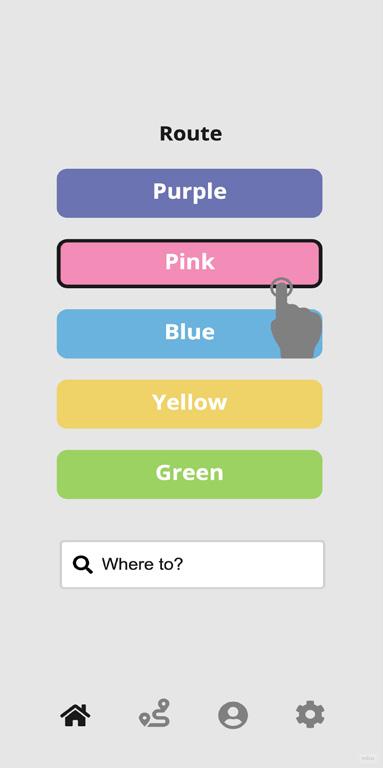
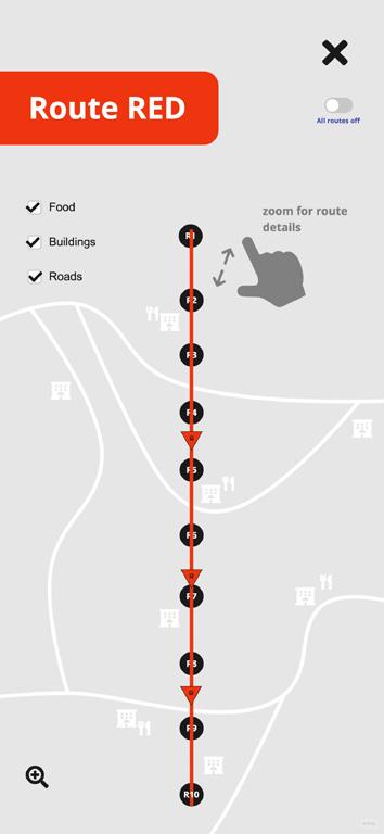
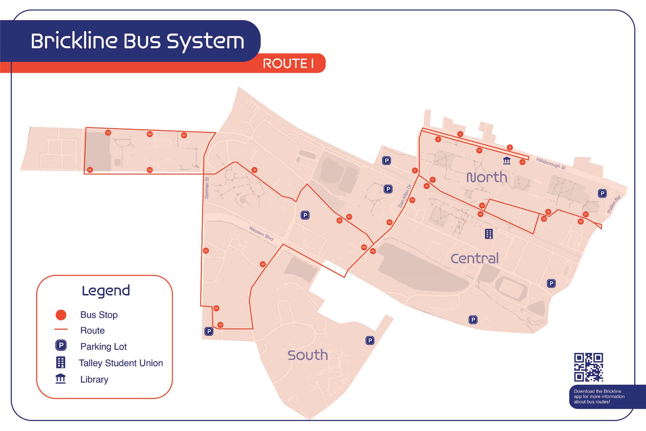
ROUTE MAPPING SYSTEM
The home page of the Brickline app features its five routes and a search bar for intended destinations. It allows for everyday users to access their usual route and understand where their bus is located, while new users can search their destination to find which route they would need to use.
15 K EY
TO WAYFINDING
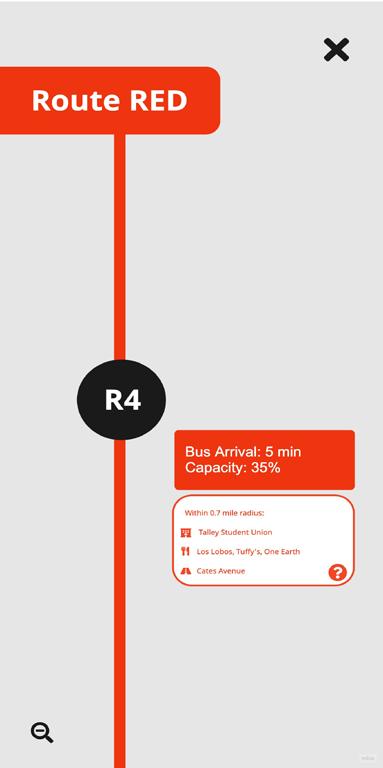
Each route is displayed vertically and provides food, building, and street information nearby as well as the nearest bus arrival. As the user zooms in, detailed information is revealed to give them a reference to where each bus stop lies.
The route system highlights the bus stops in a simplified fashion with overlapping stops between routes and the 4-5 buses that rotate through each stop. The all routes toggle can be clicked to display all five routes at once.
B1 B2
K2
K8 K9 K11 K12 R2 R3 R4 R5 R8 R11 I1 I2 I3 I5 I6 I8 I11 C2 C3 C4 C5 C7 C8 C11 R13 I13 R14 I14 C14 R16 I16 C16 R17 IC9 IC17 R19 R20 R23 I20 I22 I24 I25 C20 C22 C24 C25 I26 C26 C27 C29 IC18 IC23 C30 C32 C33
B8 B9 B11 B12 B13 B14 B15 B16 B3 B4 B5 B6 B7
K3 K4 K5 K6 K7
16
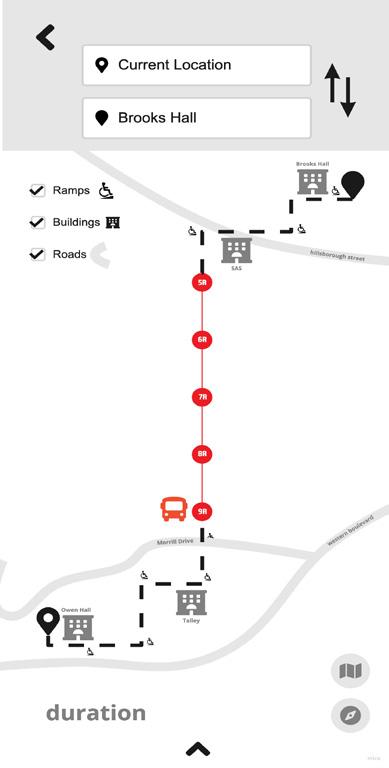
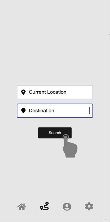
NAVIGATING JOURNEYS
In the navigation tab, users can find their respective journeys according to their current location and intended destination. It configures recommended journeys to take, included directional instructions, and additional information of wheelchair ramps, buildings, and streets nearby to make the overall expeirence easy to nagivate for users.
17
Directions are displayed at the top of the screen for users to click through and efficiently follow their mapped out journey. With a simplified walking path, bus route, and customizable information (ramps, buildings, and streets), the journey is much more straightforward.
Under the question mark bubble, users are guided through steps to understand the different interactions that are incoporated into the app’s interface to navigate their journey.
18
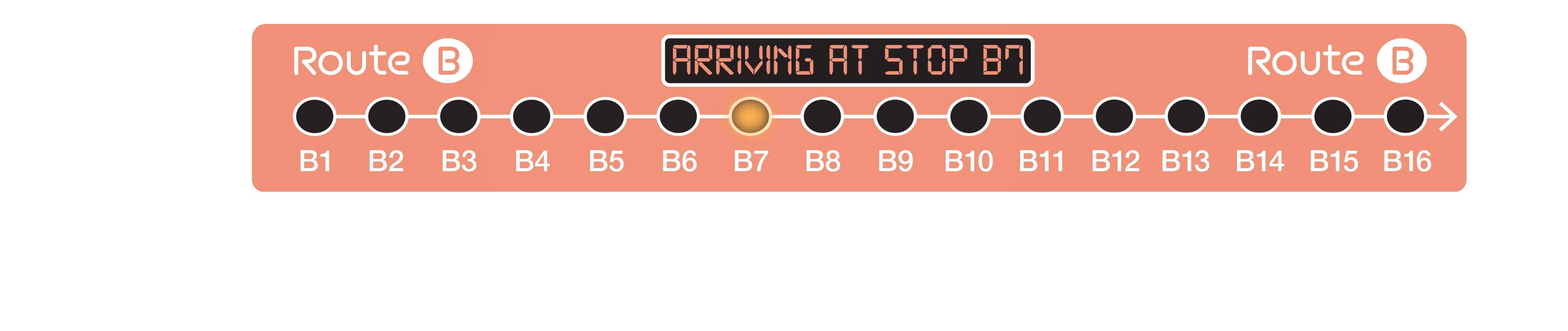
SIGNALING BUS STOP TECHNOLOGY
IVE BUS ROUTE
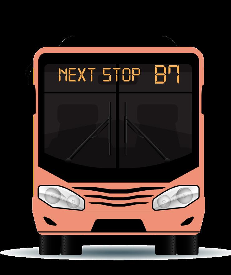
The live route map, located on the interior of the bus on the overhead panel, provides Brickline users with updates to the arrival of the following bus stop in order for them to follow along in real-time versus only on the app. The map also signals the arrival through sound with a pinging noise as well as an automated voice announcing the arrival in English and Spanish (nonEnglish speaking users).
The map displays the whole route and all of its stops in a horizontal orientation similar to the simple route mapping on the app, where users can follow along seamlessly. A yellow light moves as the bus approcahes a new stop and the map displays text stating “arriving at stop B7”.
19
L
20
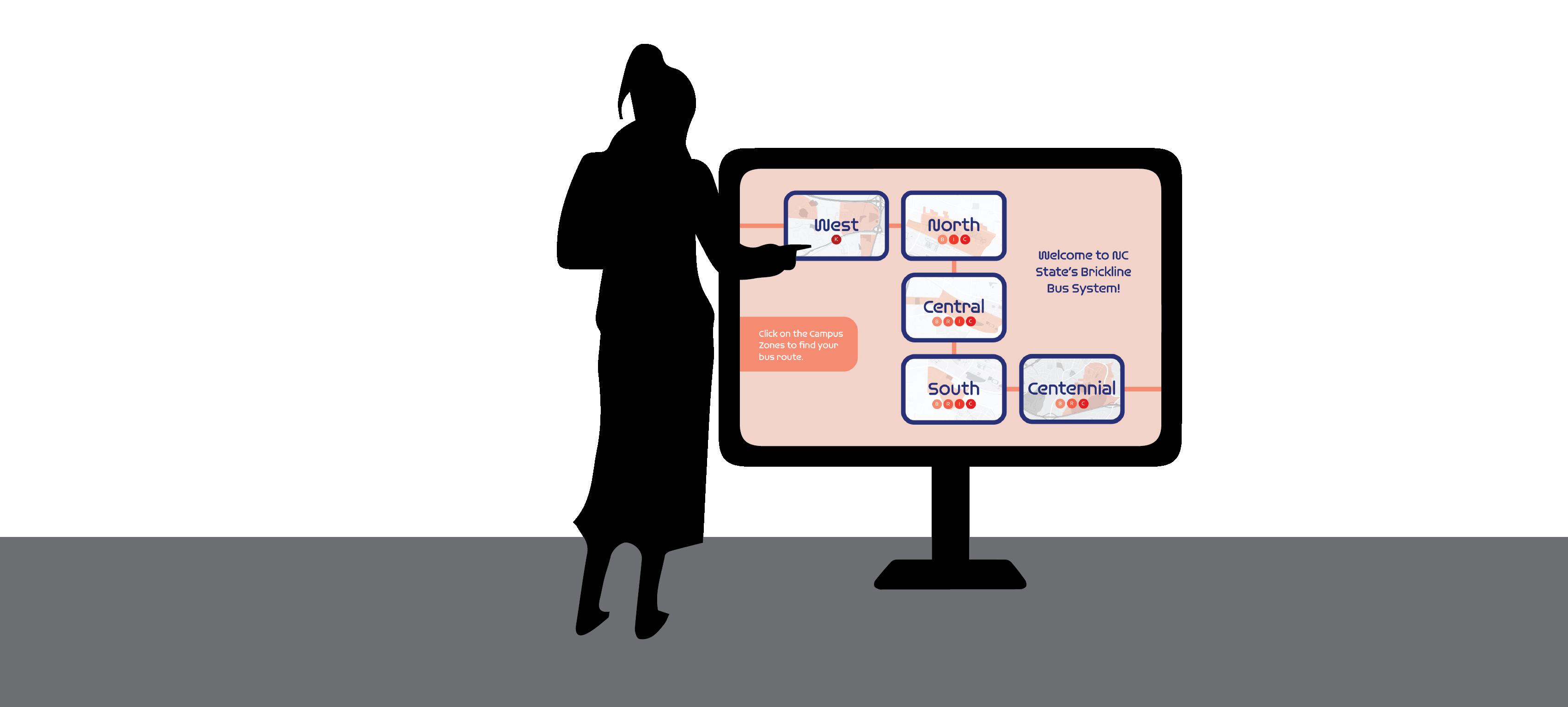
ROUTE OVERVIEW KIOSK
The interactive map kiosk will display the Brickline routes according to the campus zones they follow through. It will be located right outside Talley Student Union (central campus) towards Cates Avenue in order for users to see an example of a Brickline bus stop by Carmicheal Gym and get a little bit of a view of campus. Users will be able to click on different campus zones and toggle through the routes that pass through them in order to get a better understanding of the Brickline route mapping.
NTERACTIVE MAP
21
I
Campus Zones
Using a simple design structures for NC State campus and its surrounding areas, the map for which the Brickline routes guide through are spilt up into 5 zones highlighting West, North, Central, South and Centennial Campus. These zones help users identify which part of campus they would like find a Brickline route in and reduce the overwhelming, expansive surface area of NC State campus as well as the complexities of a traditional map.
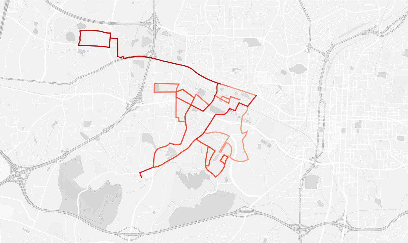
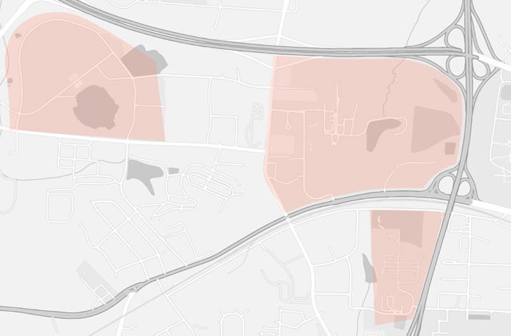
By dividing the routes into zones, it reduces the confusion of overlapping bus stops and finding which route follows to a certain location. With the routes specific color, they are distinguishable, but from far away they do tend to blend in with a thinner stroke.
22
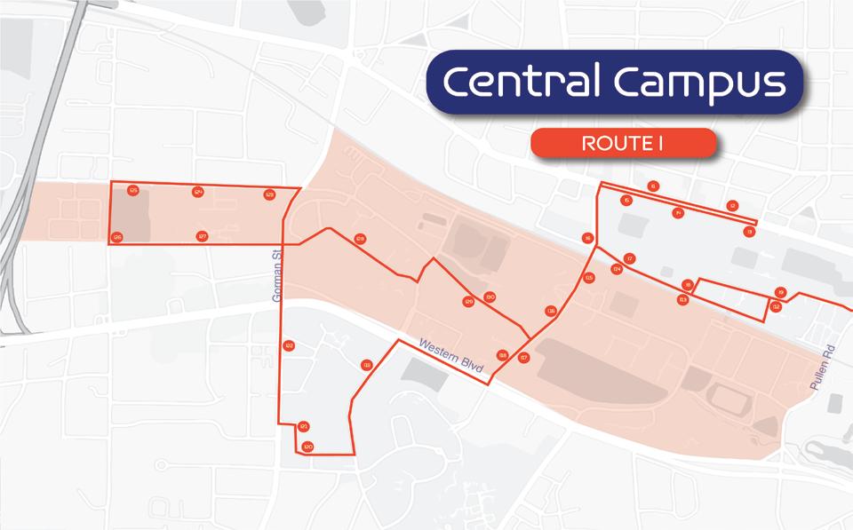
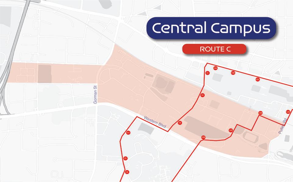
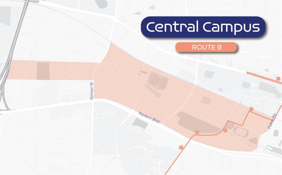
Central Campus

Each route display on the interactive kiosk has the section of the specific Brickline route along with its bus stops and a few important street names placed on a simplified campus map. The map is made grayscale to bring out the orange to red gradient of the routes and the low opacity orange of the campus zones. Additionally, each route has its bus stops placed on the route outline with the correct orientation.
For example, in route I (displayed on the left) passing through central campus, its bus stop letter and number are signified in the orange circles along with the side of the street they are oriented on. The street names provide a reference to where the route might be passing through the central part of campus.

Central Campus
KIOSK INTERACTIONS


Users can toggle through different route options depending on the particular ones that pass through their chosen campus zone. When they tap on a route circle, the interactive map will dissolve into showing the individual route and its respective bus stops. The selected route will enlarge to differenciate from the other routes that were not selected. The home button can be clicked to select a new campus zone.


24
B R C
Route B R C B I
Route R C B R
R B C
B R C I C B R R C B I R B C
Central Campus
Central Campus
Central Campus
Central Campus
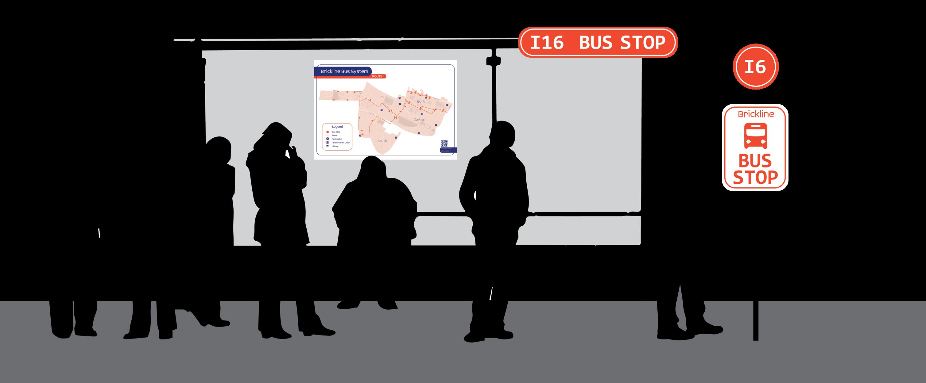
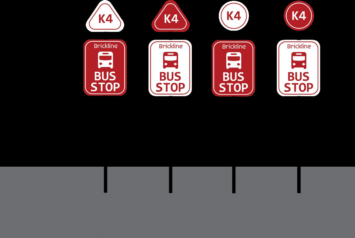
25 BUS STOP SIGNAGE & MAPPING EW SIGNAGEN
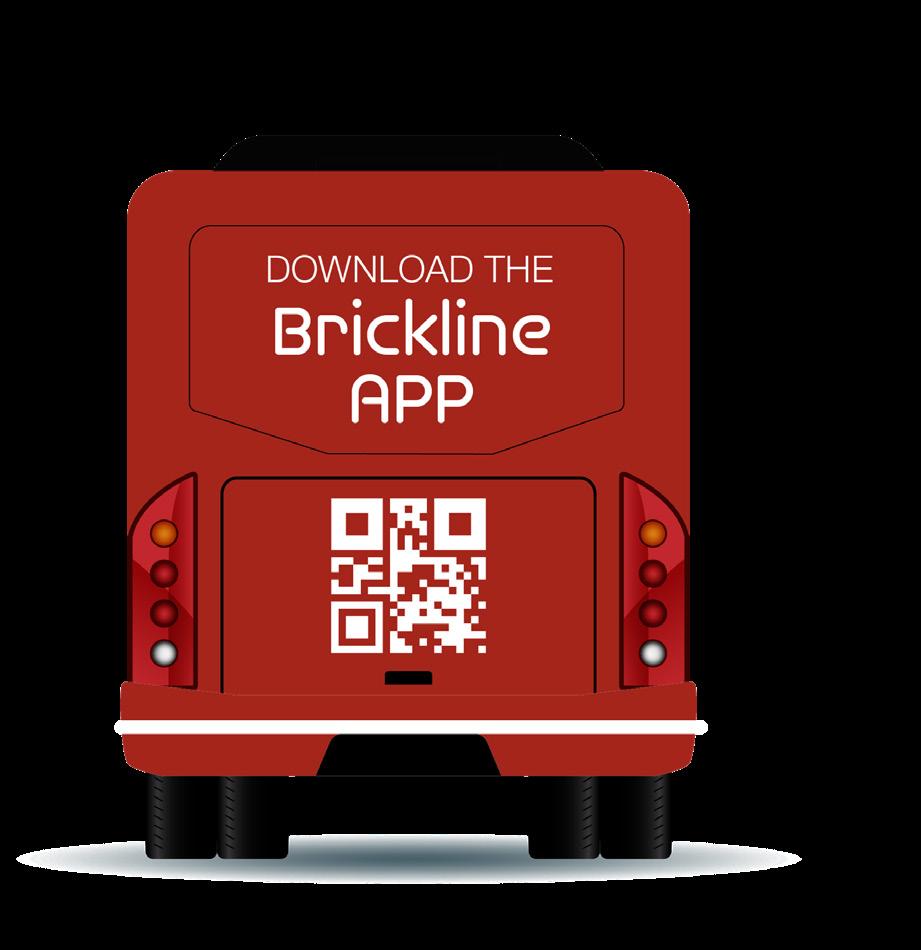
Brickline presents new and improved bus stop signage. The update bus stop signage includes the name of the route and the color of the route. This will help users identify the bus stop and know which route passes through it immediately. We also designed a new bus route map. Instead of including all routes at once and overwhelming the user, every bus stop has a bus map that includes the route that passes through that bus stop. The map has icons for popular buildings and parking as well. The map also includes a QR code that leads the user to download the Brickline app for further assitance on getting to their specific destination.
26
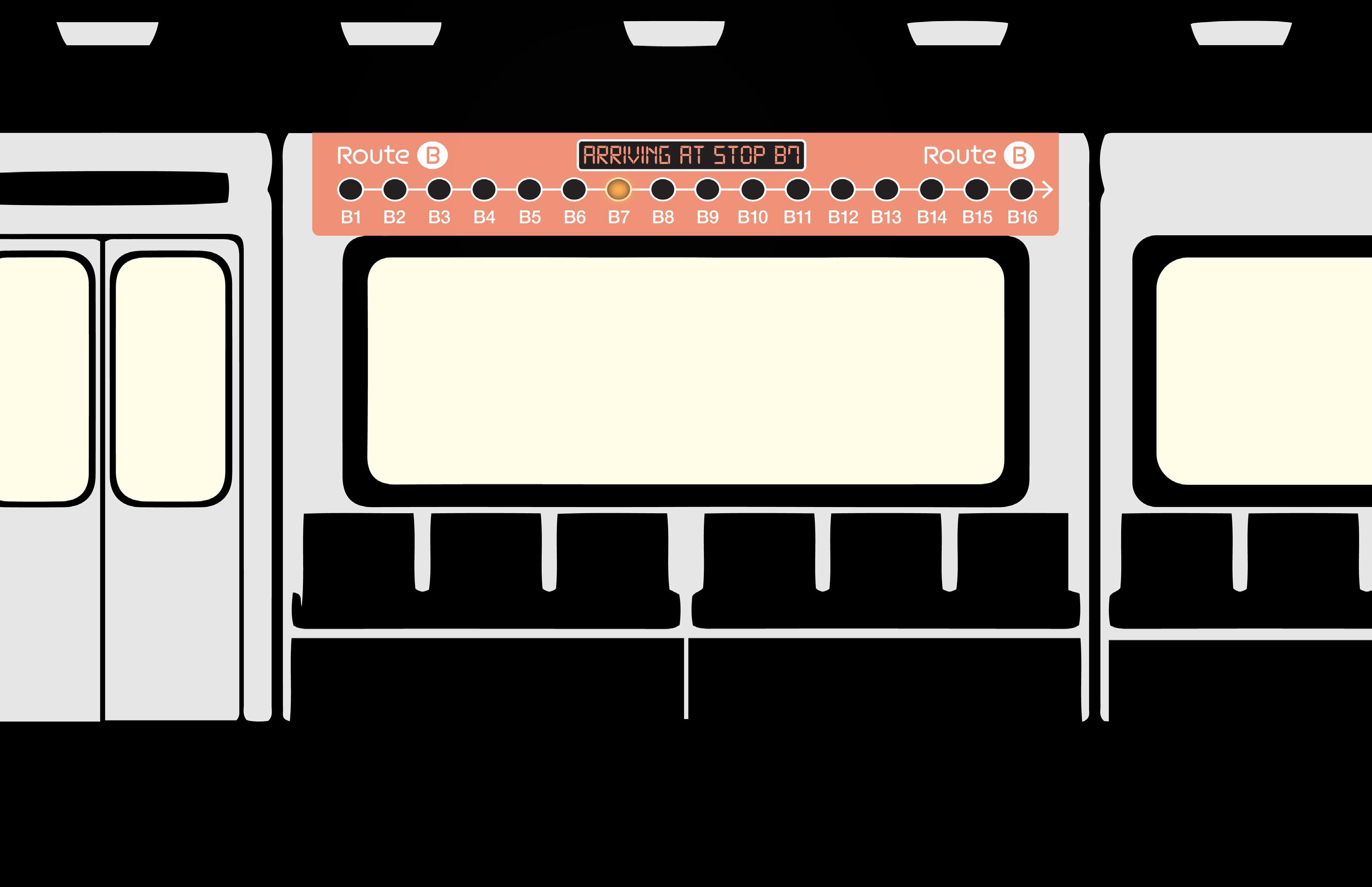
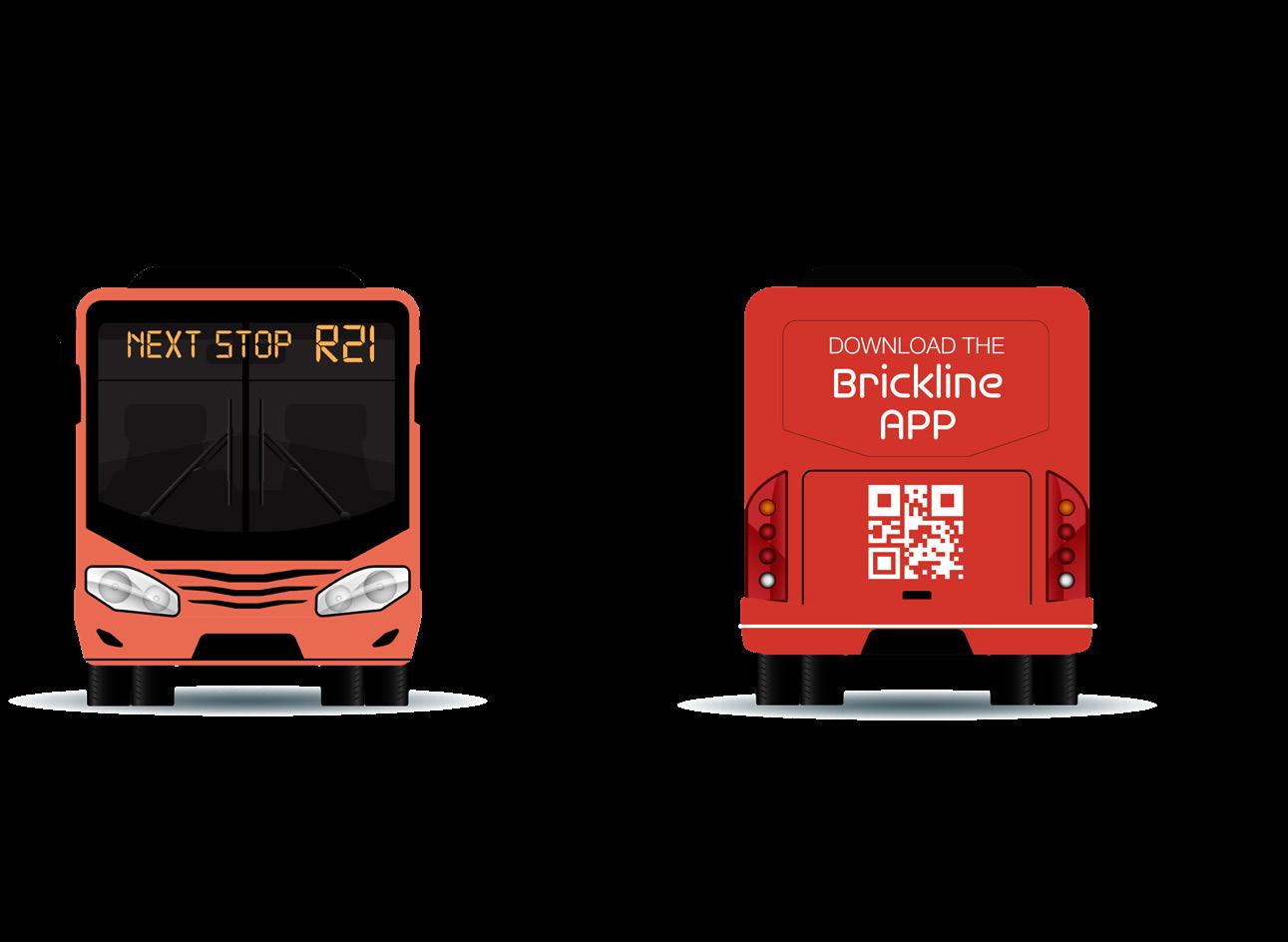
BRICKLINE BUS WRAP
XTERIOR OF BUS
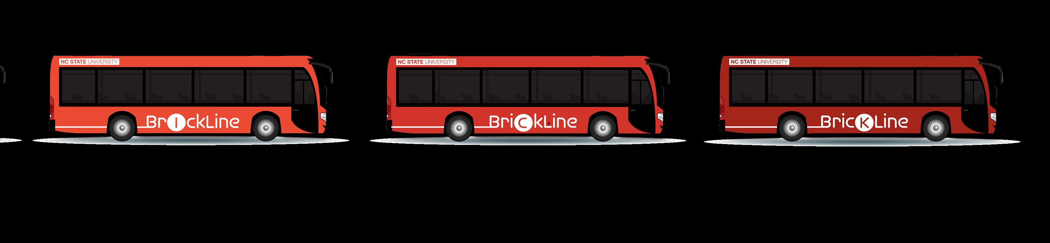
With the Brickline changing the NC State transportation system, the bus’ exterior is an important part of instilling this new brand. Since this new system incorporates 5 different routes, each bus would be paired with their respective color of the route from orange to red. This allows for users to easily identify the bus they need to take by the color of the route.
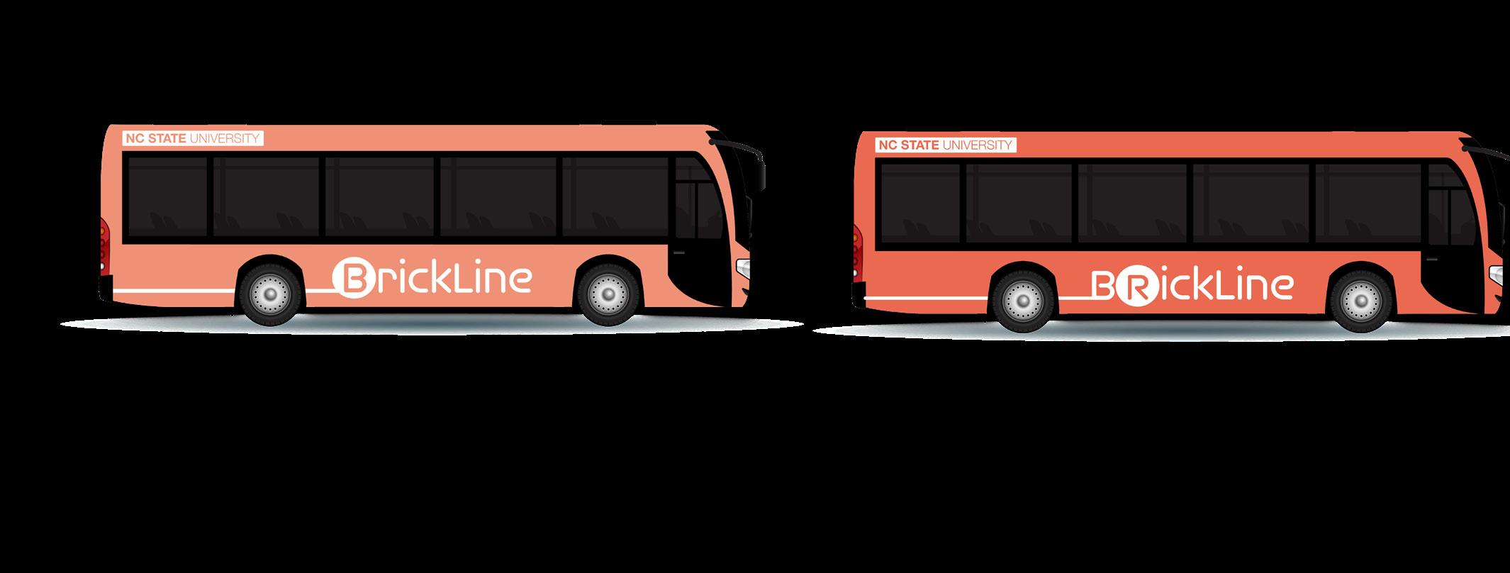
Some additional elements that help users board the right bus are the lighted signage on the front that indicates which stop the bus would travel to next (ex. “next stop B7”) . The back of the bus includes a barcode to market the Brickline app to those who are unaware of it.
The branding stays cohesive with the route color scheme and make for a simple, economic bus wrap design.
27
E
28