Kevin J. Enríquez


Kevin J. Enríquez
Master of Landscape Architecture Student
Bachelor of Architecture
Spanish - Native
English - Advanced
French - Initial
Digital Tools
AutoCad
SketchUp
Photoshop
Illustrator
Revit
V-Ray
Photography
ArcGIS
Microsoft Office Suite
I consider myself a person who likes challenges and explores the different areas of life.
On a personal level, I like to be near people that fight for them goals, perseverance is closely linked to how I live day to day and I always keep in mind that more can be learned.
On a collective level I am always committed to group work, I look for solutions to problems showing my perspective, but at the same time listening to the opinions of others.
My purpose is to create create outdoor or indoor spaces that communities can take advantage of to live better.
01 (CEDS) naturalizing shorelines
grand isle masterplan leisure centre américas
03 02 04 ties of water riverfront park paseo de la fuente masterplan 05

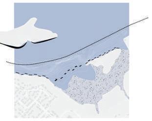
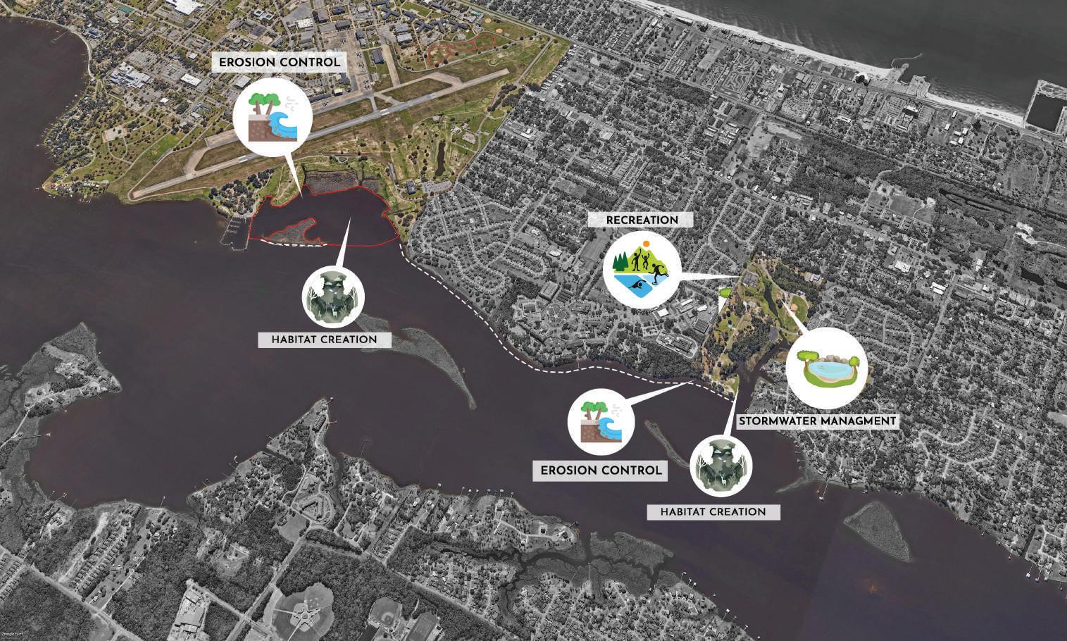
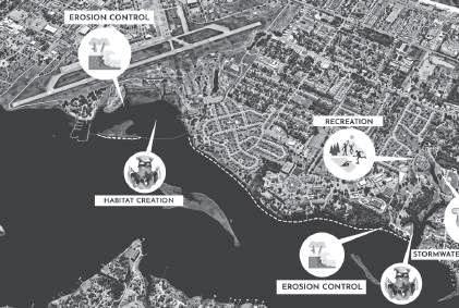
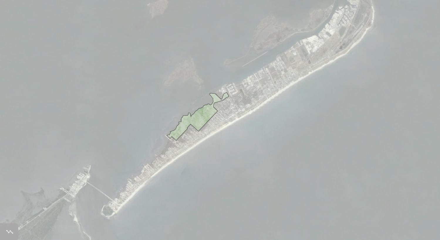
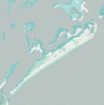
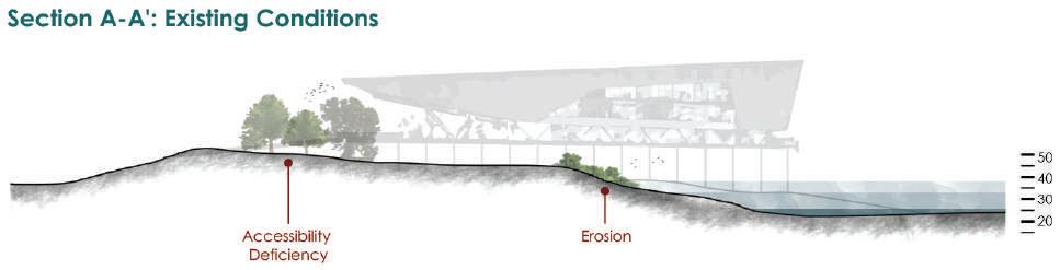
The Back Bay of Biloxi facilitates estuarine conditions between the Biloxi River and the Gulf of Mexico. Its unique position has provided a great source of protection to the Keesler Air Face Base and boat channel for private and industrial vessels. However, due to the changing climate conditions such as sea level rise and ocean temperatures, the asset of Back Bay also poses issues.
Storm surges and boat wake further coast erosion along the bay; while stormwater drainage from Biloxi residents drains into Bayou Laporte and Back Bay of Biloxi, contributing to nutrient pollution.
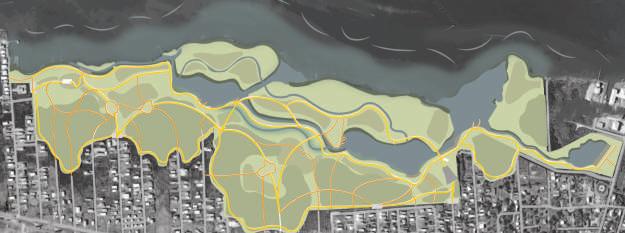
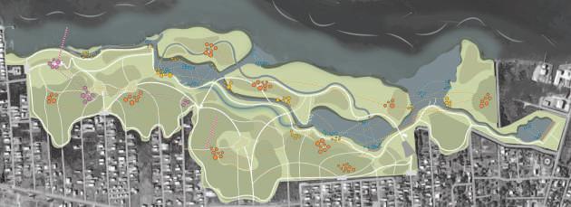
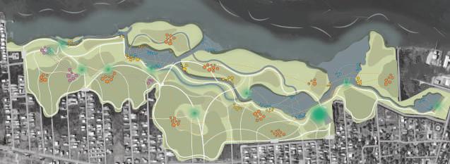
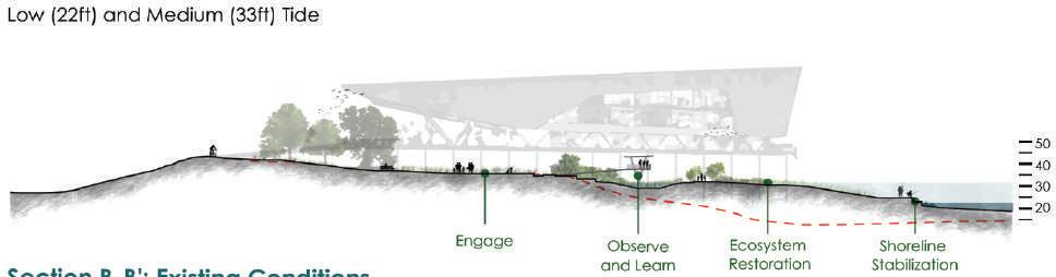
Through natural feature processes, flood protection, biodiversity, and clean water services went through process design and iteration with community input at various stages.
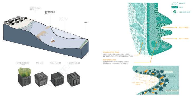
The proyect specialize in conceptualizing ecosystem functions and services, optimizing recreation and addressing water quality. With expertise in park design, the project enhance stormwater storage, promote biodiversity restoration, and create recreational opportunities. Design interventions, such as living breakwaters, offer risk reduction, improved water quality, and increased habitat for fishing and recreation.

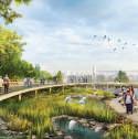
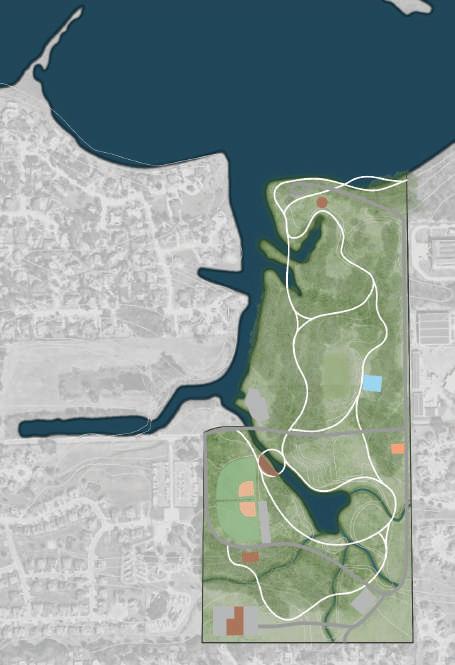

The strategy to transform Hiller Park involved implementing dry ponds for efficient stormwater filtration, mitigating erosion by improving the sinuosity of post-drainage pipes, and revitalizing recreation areas. The increase in walking trails aims to boost community participation, fostering a safer and more enjoyable park experience.
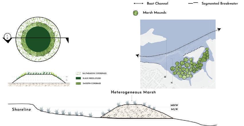
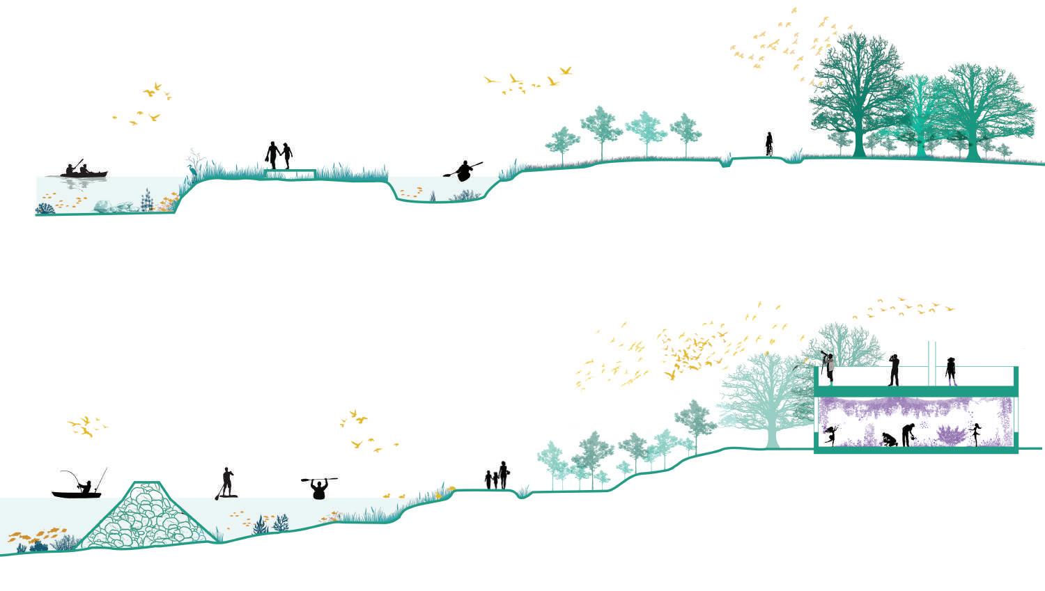
Optimizing coastal resilience, we explore segmented breakwaters for sediment capture. Utilizing sediment mounds, we enhance intertidal marshes, fostering marine habitat and minimizing the need for breakwaters in sensitive areas.
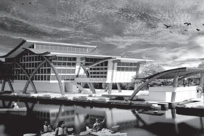
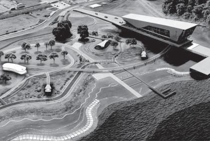
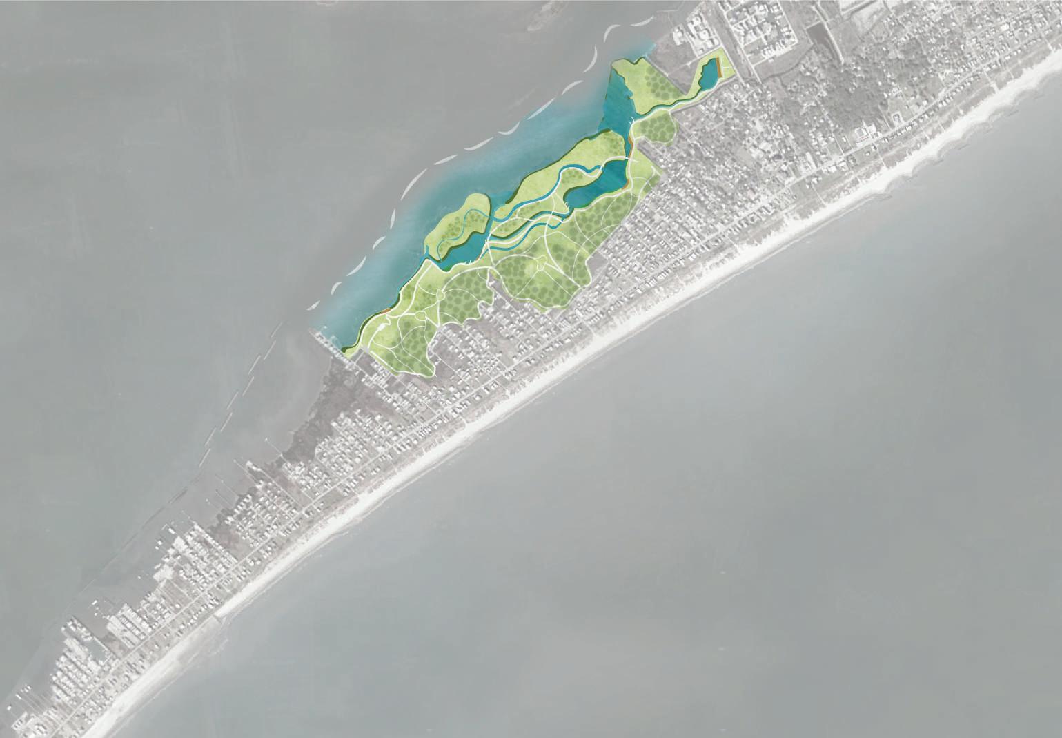
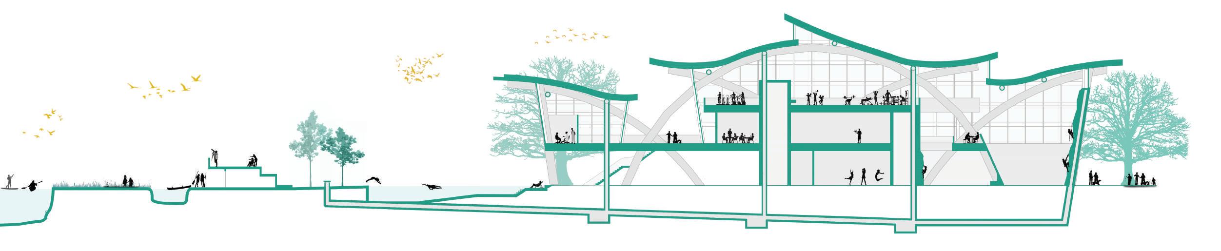
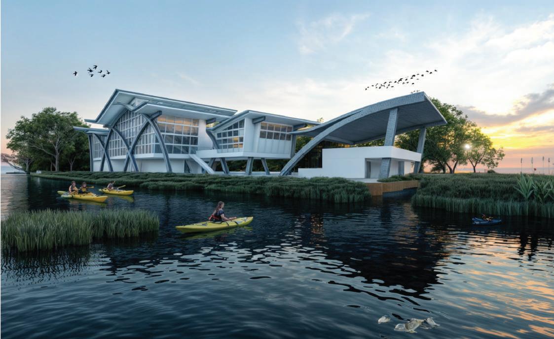
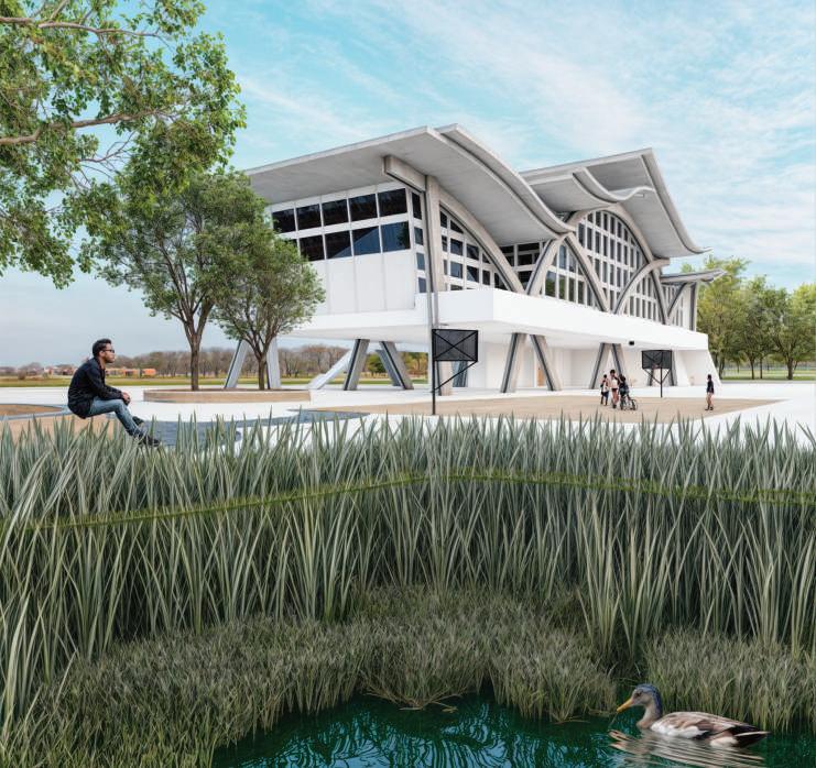
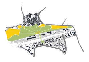
The project is inspired in the resilience and how the people of Grand Isle look for continue their life on the island, but at the same time seek to have a better lifestyle. In this way, based on threats and weaknesses, but at the same time looking for natural opportunities; this master plan was proposed. The intervention main goal is to generate a solution to such a significant problem on the island as erosion. In turn, a project of this size must solve solutions for more than one problem, which is why on a macro-scale this park will help the longitudinal mobility of pedestrians, give them a sense of belonging, recreational activities in different " moments” of the park and will help generate more diverse and sustainable ecosystems.
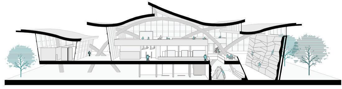
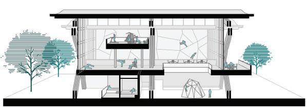
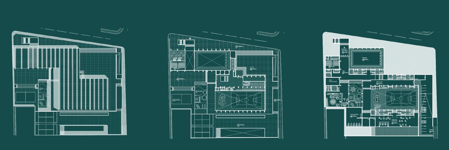
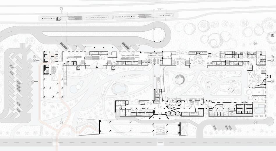
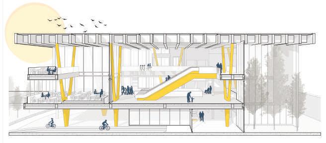
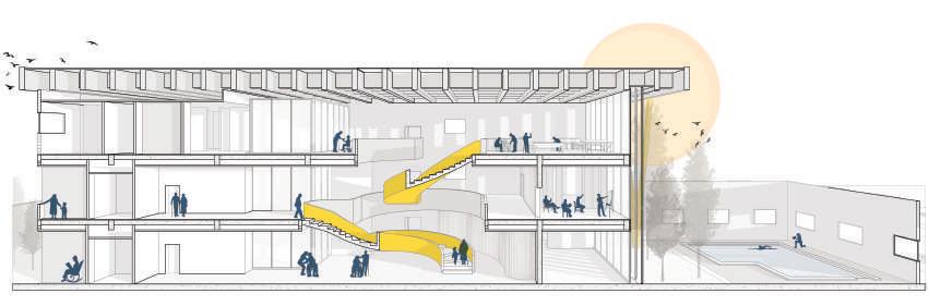
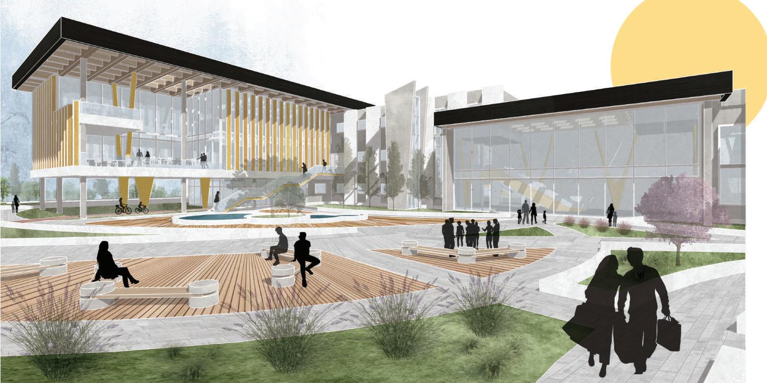
On a micro-scale, this park will have a recreation center where activities will be generated to solve the weaknesses of the island, of the inhabitants and, in turn, capture the attention of tourists. The main program will have a gym with its respective amenities; a food court; an adventure and awareness center; kayaks and fishing areas; a health center; outdoor pool, basket court and as the main attraction a climbing space. Furthermore, the building will provide a passive lighting and ventilation system to strengthen the sustainability and innovation goal.


natural barriers
based sections
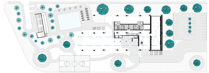
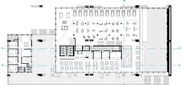
On a micro scale, this park will have a recreation center where activities will be generated to solve the weaknesses of the island, of the inhabitants and, in turn, capture the attention of tourists. The main program will have a gym with its respective amenities; a food court; an adventure and awareness center; kayaks and fishing areas; A health center; outdoor pool, basketball court and as the main attraction a climbing area. In addition, the building will provide a passive lighting and ventilation system to strengthen the goal of sustainability and innovation.
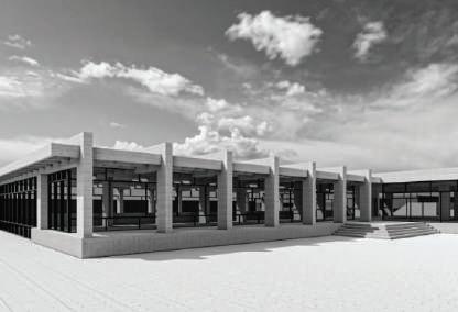
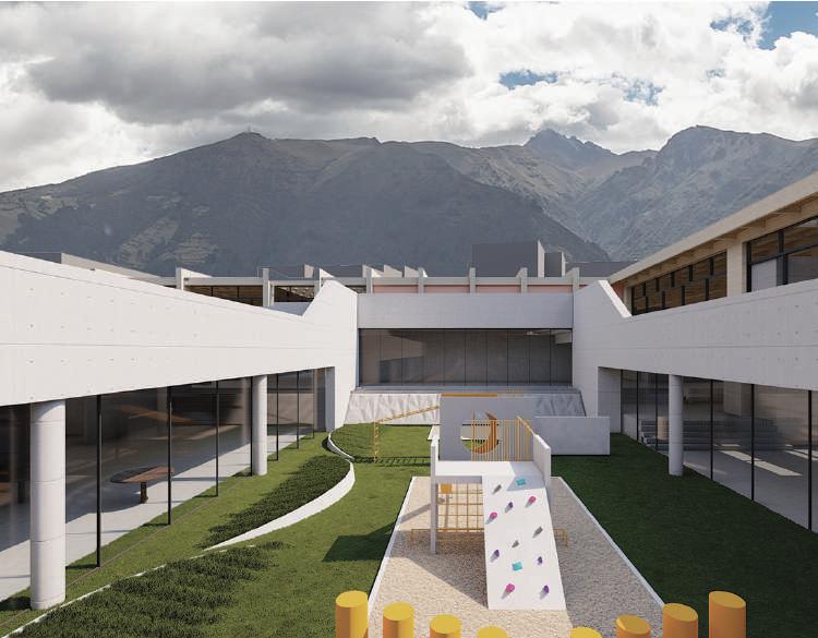
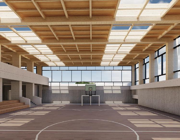
The Leisure Centre Américas had the challenge of reinterpreting “La Granja” sector in the city of Quito, Ecuador. This project understands the lack of public spaces for the city around rest and physical activation.
Therefore, it takes classic elements of the city, such as the squares, plazas and creates a focal point where the occupants of the sector can develop alternative activities to what has historically characterized the sector, such as academic institutions and residential life in the sector of La Granja.
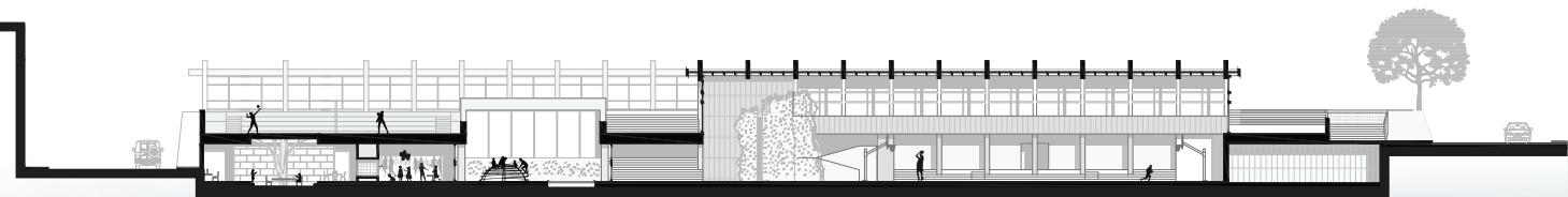
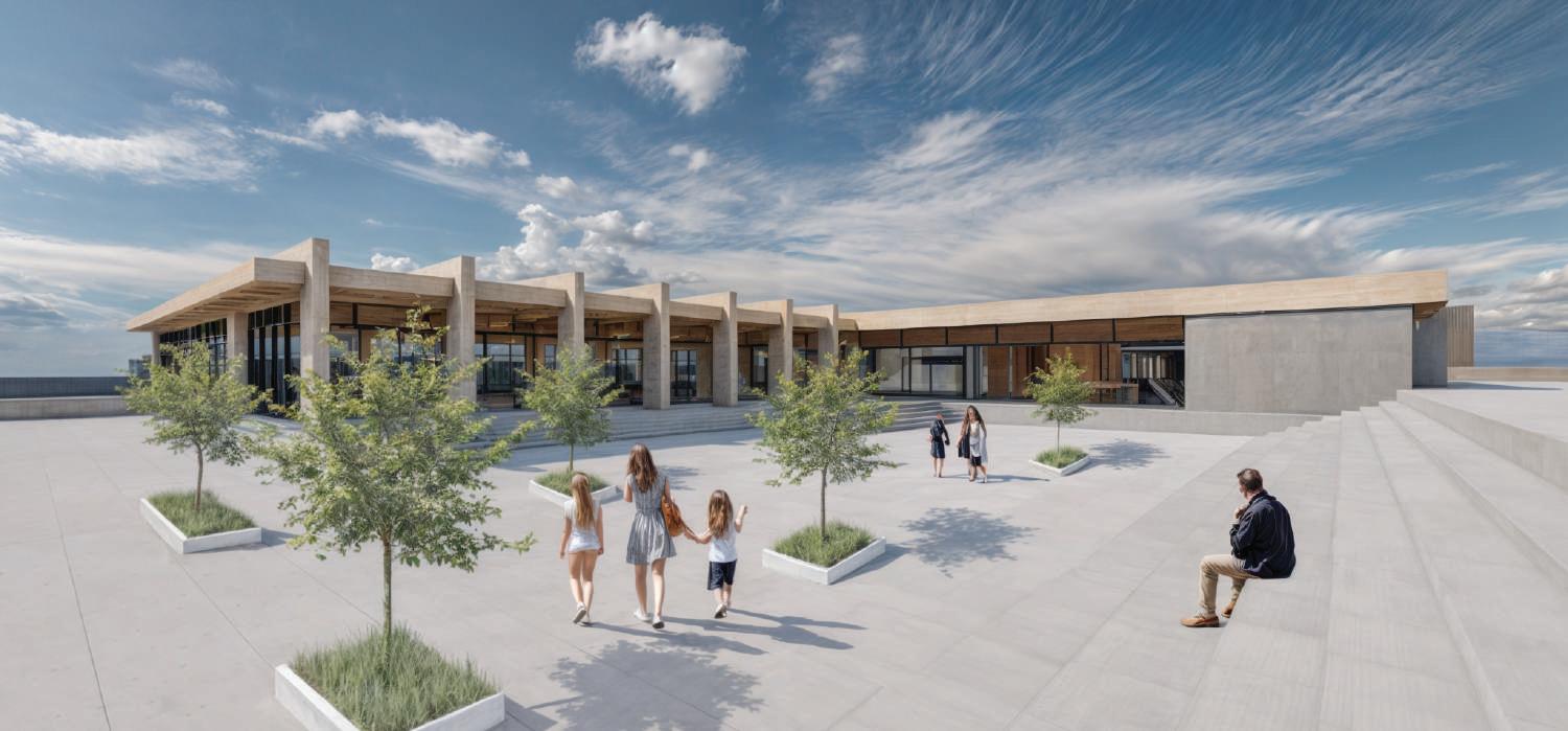
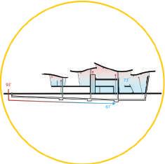
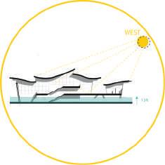
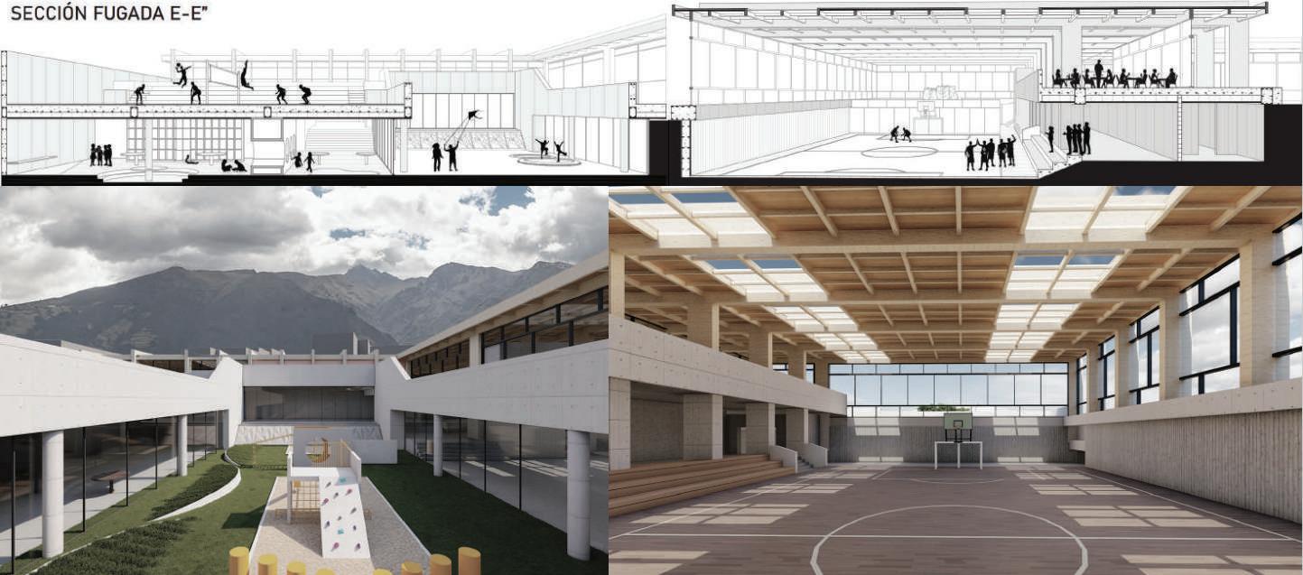
The style of this building is characterized by its prominent use of unadorned concrete and simple geometric shapes; to the adapt to the context. The leisure Center would be made up of a series of interconnected concrete structures, creating a complex that combines various recreational and entertainment facilities. The upper wrap seeks to lighten thestructure so wooden elements are used to minimize energy loss and mitigate the acoustics of sports practice.
Grand Isle, Louisiana Before
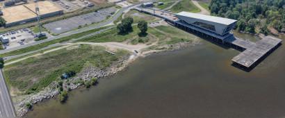
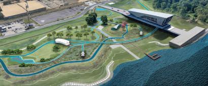
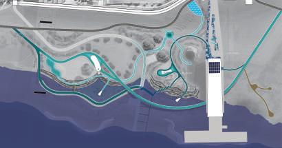
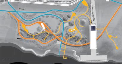
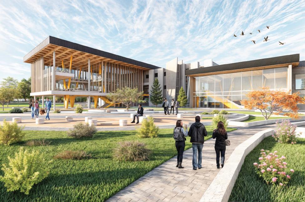
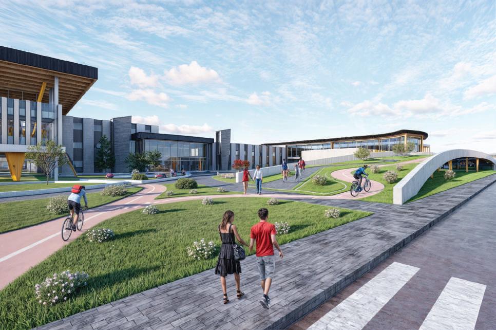
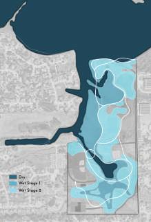
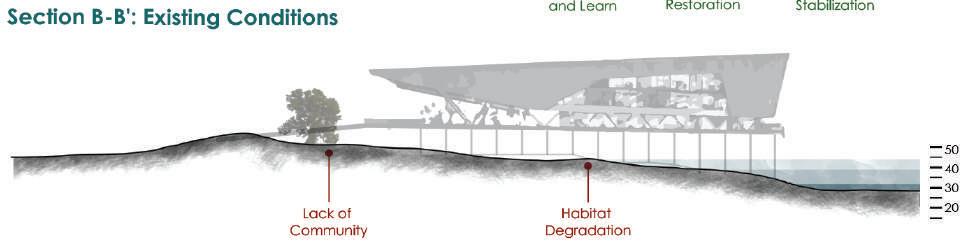
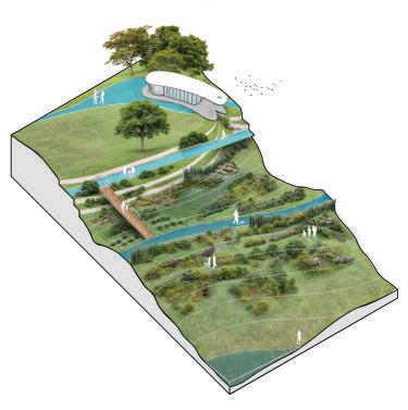
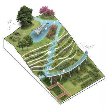
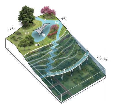
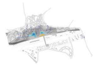
The proposed design primarely focuse on giving a true meaning to “the Water Campus” name. The name suggests a strong connection to water, however, the current site lacks sufficient water feature typologies that reflect the importance of those ties with water in Louisiana. Therefore, the proposal will transform the riverfront space into a site that includes various water features that will make connections and engage with the public. These water elements will not only serve as visual attractions but also as educational and didactic
tools, with not only the goal of raising awareness and knowledge about water and its crucial role in local ecosystems; but also integrating the water features into the restoration of ecosystems and erosion mitigation. Finally, the project seeks to make visitors learn about the water cycle, and the services that ecosystems provide. It will be a model of sustainability by integrating natural systems that clean water from pollutants contributing to the ecological resilience of the area and improving water quality.
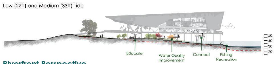
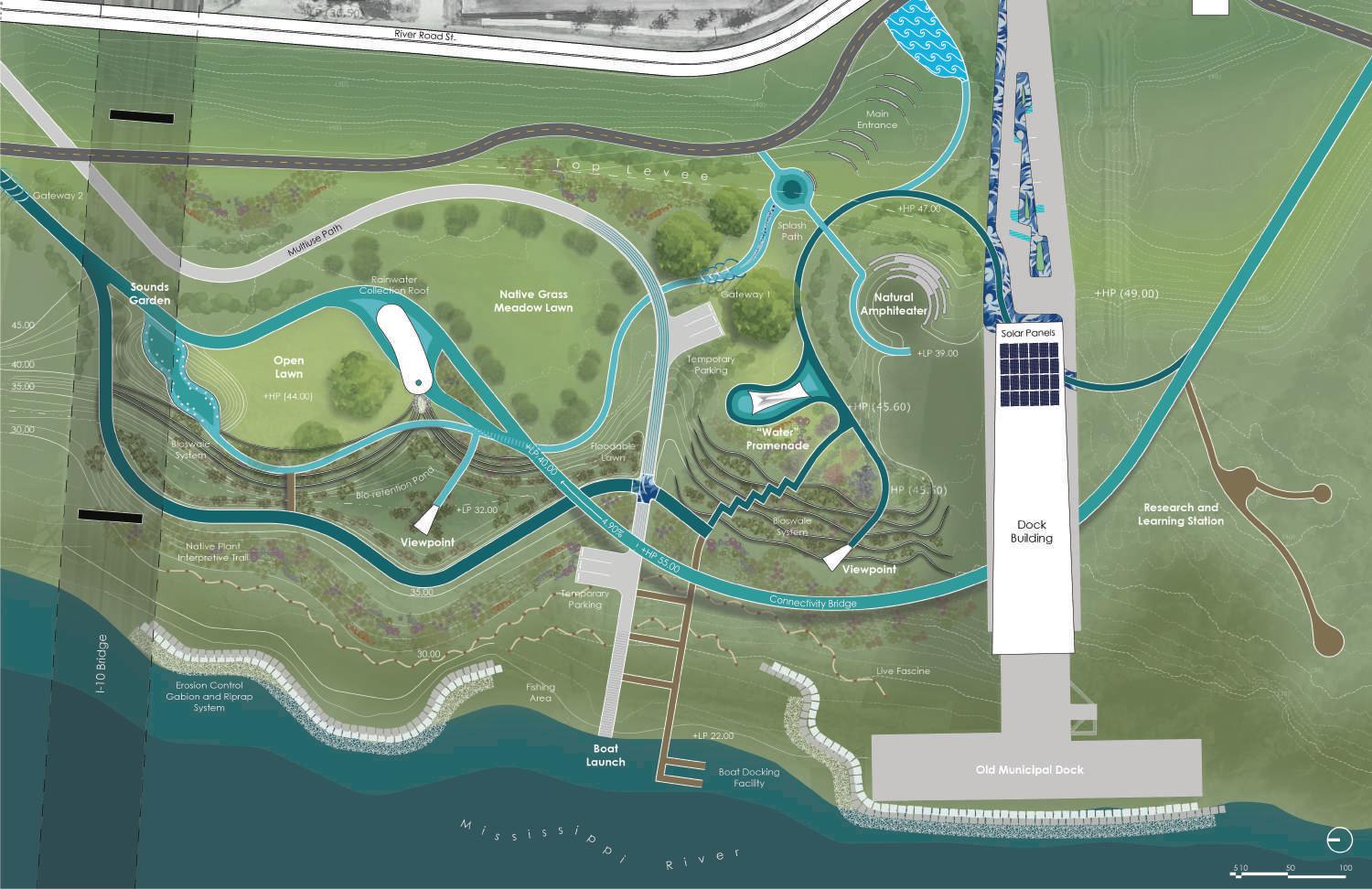
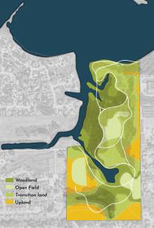
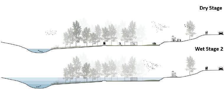
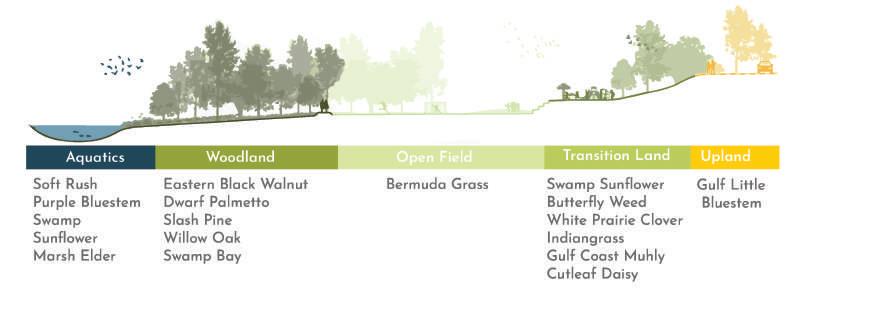
The design allows for observation of how the plants filter and clean the water during low tide. During high tide elevated areas can be used as recreational spaces, while the bridge serves as a view point and connecting way, in any tidal conditions.
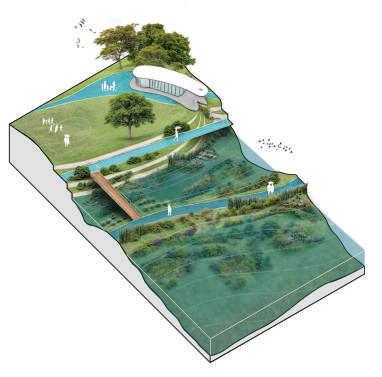
Visitors can engage with the landscape by exploring natural pathways through native plantings during low tide, while medium tide offers opportunities to observe and learn about diverse water features.
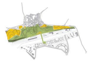
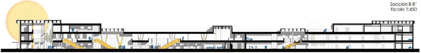
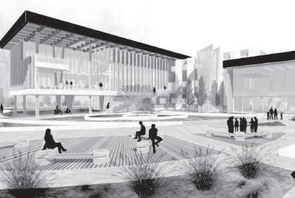
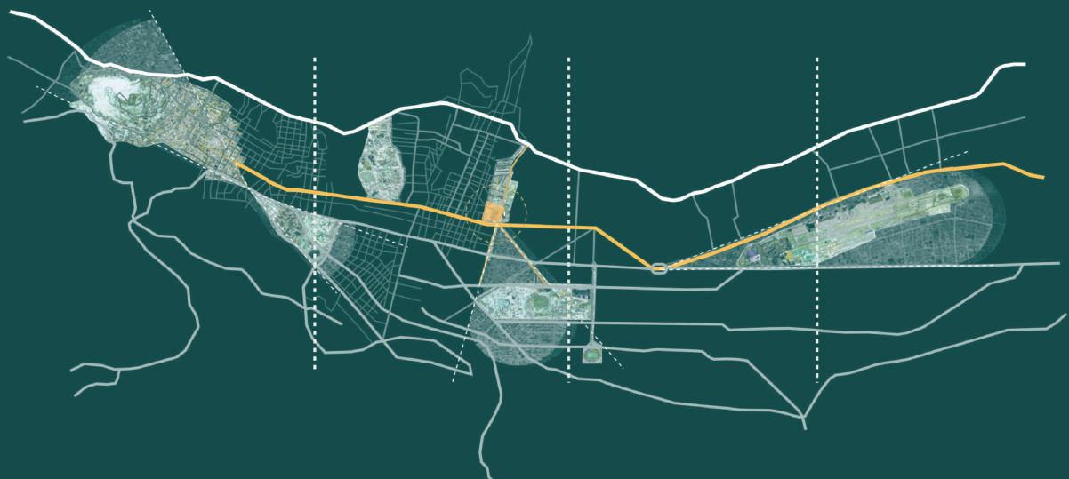
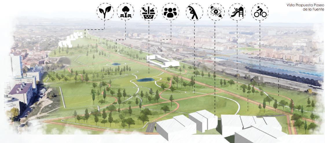
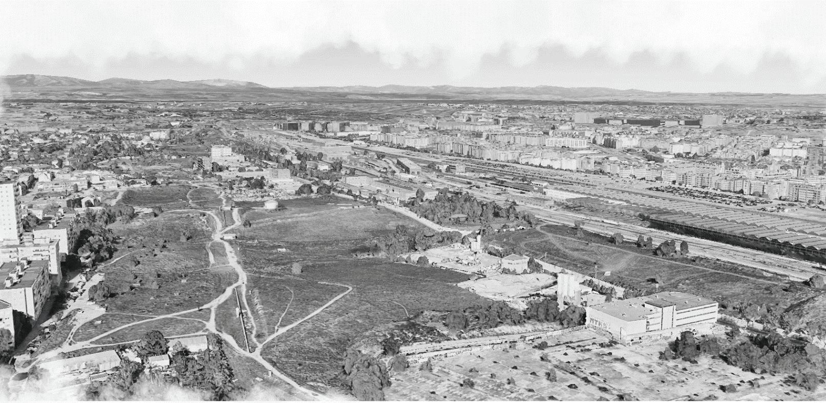
"Paseo de la Fuente" is situated in Valverde, a district within Fuencarral - El Pardo, in the northern part of Madrid, Spain. Inspired by the history of Fuencarral – El Pardo, where the site provided direct access to water sources crucial for historical pilgrimages, this project integrates the site's demographics, equipment deficiencies, and neighborhood fragmentation into a comprehensive master plan.
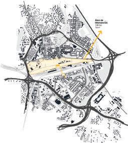
The project aims to enhance the quality of life for residents across different neighborhoods in this district, promoting community well-being, a sense of cultural belonging, decarbonization, flood prevention, transportation infrastructure, and the reintegration of older adults into the community. This includes restoring dignity to aging individuals through the rehabilitation of the former Cuartel de Zapadores Ferroviarios.
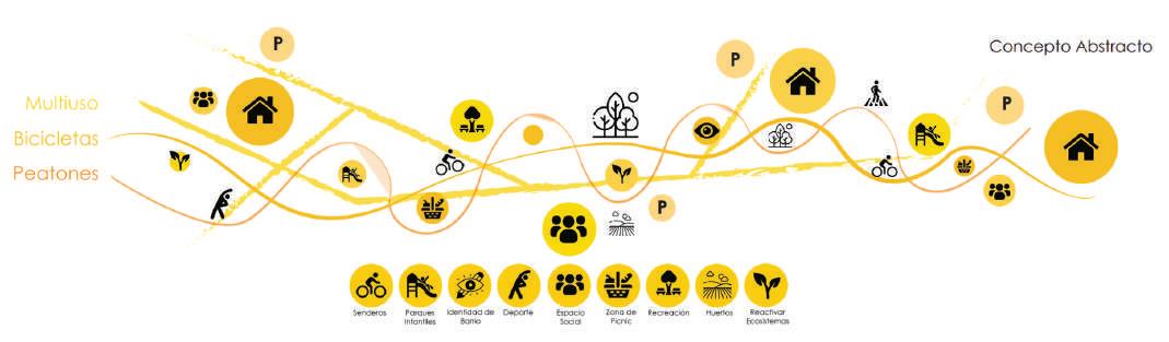
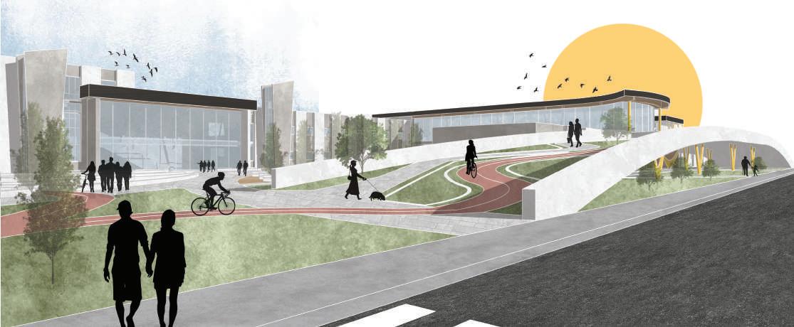
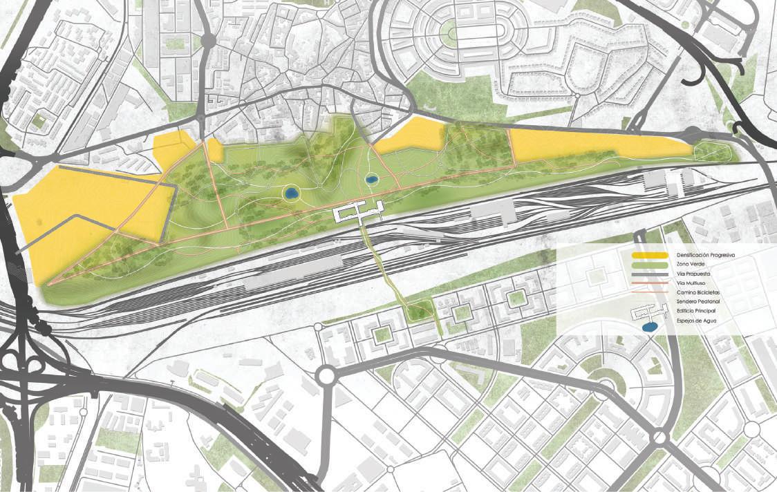
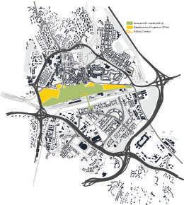
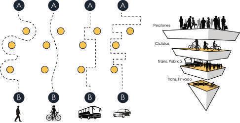
The project's design concept not only focuses on the quantity of green space but also on its equitable distribution and inclusion of diverse facilities related to different transportation modes within the project. Playgrounds, sports courts, multi-use trails (for vehicles, pedestrians, cyclists), pedestrian paths or biking, picnic
areas, and outdoor event spaces are integral parts of the services promoted by Paseo de la Fuente. The design strategy aims not only at the physical and mental well-being of the residents but also fosters social interaction, granting a communal identity to these benefited neighborhoods.
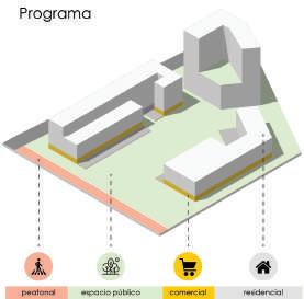
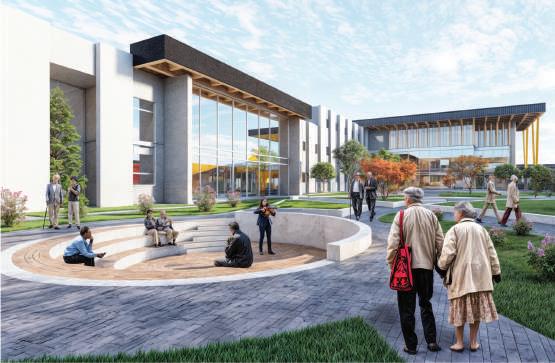
Proposing a mixed-use growth strategy to enhance community connection and resilience. Emphasizing residential usage while recognizing the importance of commercial development, fostering accessibility, and promoting a sustainable urban and landscape vision.
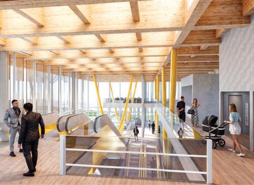
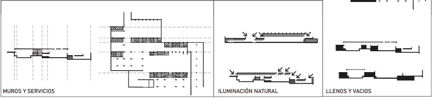
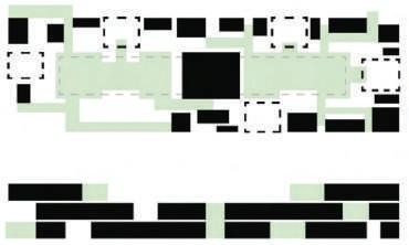
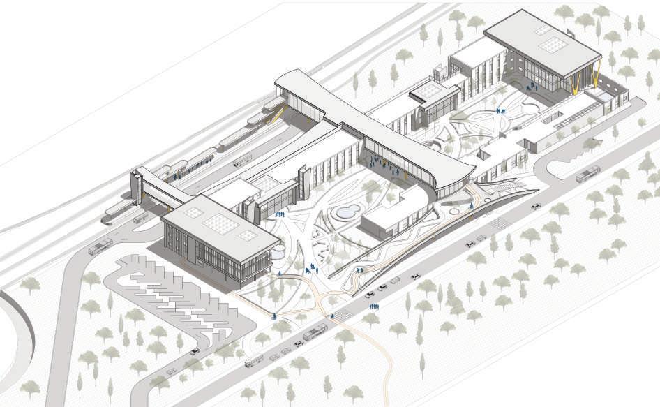
Integrating natural elements benefits both a transportation hub and geriatric center, enhancing user well-being. Vegetation serves aesthetically and acoustically in the transport hub, while promoting recreation, physical activity, and mental health in the geriatric center, fostering a sustainable and comfortable environment.
The building transitions from an introverted to an extroverted volumetric typology, with a green grid divided by a bridge connecting community facilities, resulting in a final volumetric design with defined relationships.
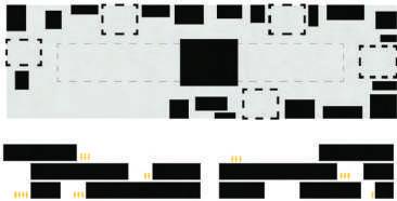
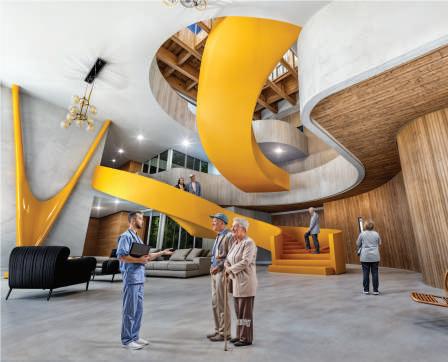
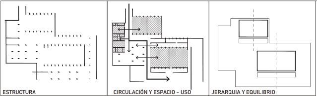
Analyzing centrality and periphery based on pre-existing morphology. Harmonizing microcenters is crucial to respond to a main centrality landmark.
Grouped organization with expansion and compression circulation. Microcenters, with varying heights, mark expansions leading to compressed peripheries.
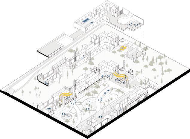
For this project, two types of circulation concepts are established. On one hand, there's the fast flow, optimizing times and distances. On the other hand, the sculptural flow prioritizes enhancing the development and quality of life for senior center users, creating visual attractions during their journey. These flow concepts incorporate fluidity and containment, emphasizing centers and distributing to peripheries, achieving homogeneity in the project without diminishing essential typologies for each program.