Ward 6 Town Hall


Summer Capital Improvements

Councillor Dominique O’Rourke
Councillor Ken Yee Chew
Project Engineer Jackie Kay
June 17, 2024

City Hall, Guelph, ON

Councillor Dominique O’Rourke
Councillor Ken Yee Chew
Project Engineer Jackie Kay
June 17, 2024
City Hall, Guelph, ON
Welcome 6:30 - 6:35pm
Gordon Street Improvements 6:35 - 7:00pm
Q&A 7:00 - 7:30pm
General Updates 7:30 - 7:40pm
Mix and Mingle 7:40 - 8:00pm
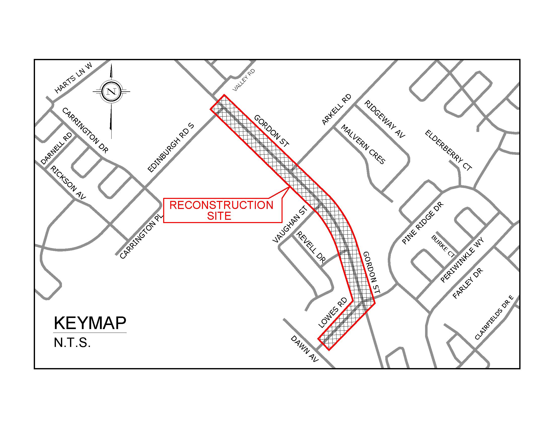
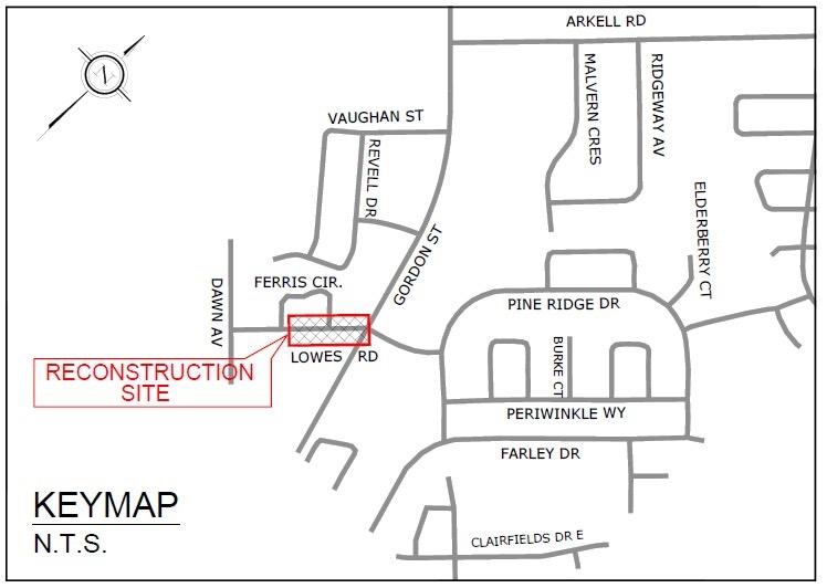
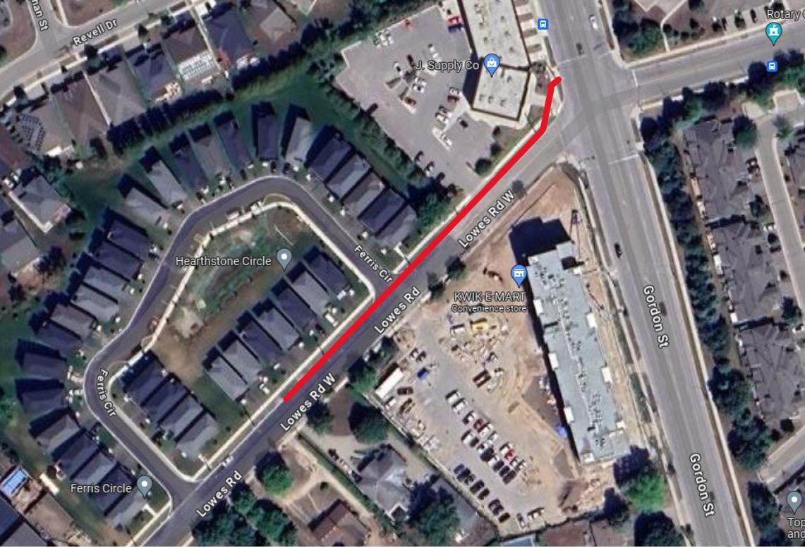
• Lowes Road drains to the north side of the road
• Install storm sewers on the north side of Road that will outlet with a temporary connection to Gordon Street.
• Temporary outlet will provide stormwater outlet and reduce need to pumping during heavy rains.
• Construction is anticipated to begin in fall 2024 and be completed by the end of the year.
• June/July 2024 - Geotechnical investigation
• September 2024 - Tender the project
• October/November 2024 – Start construction
• December 2024 - Phase 1 construction complete
• June/July 2024 - Geotechnical investigation
• September 2024 - Tender the project
• October/November 2024 – Start construction
• December 2024 - Phase 1 construction complete
• Lowering sewer on Gordon Street
• Providing final storm sewer connection to Gordon Street
• Work will be completed with the Gordon Street widening work
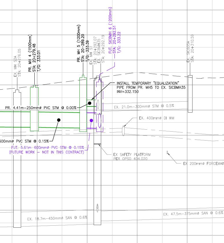
Phase 1 – Temporary Connection to Gordon Street
Phase 2 – Final connection to lowered storm sewer on Gordon Street
speed of 50 km/hour north of Hands Drive and 60 km/hour south of Hands Road. The posted speed increases to 70 km/hour south of Clair Road. Gordon carries approximately 27,000 vehicles per day north of Arkell Road and 23,000 per day south of Arkell Road (as of 2016 traffic counts) and has a right-of metres.
As discussed in Section 1.4.6, Gordon Street was previously widened from lanes between Harts Lane to Clair Road, completed as an urban cross-section
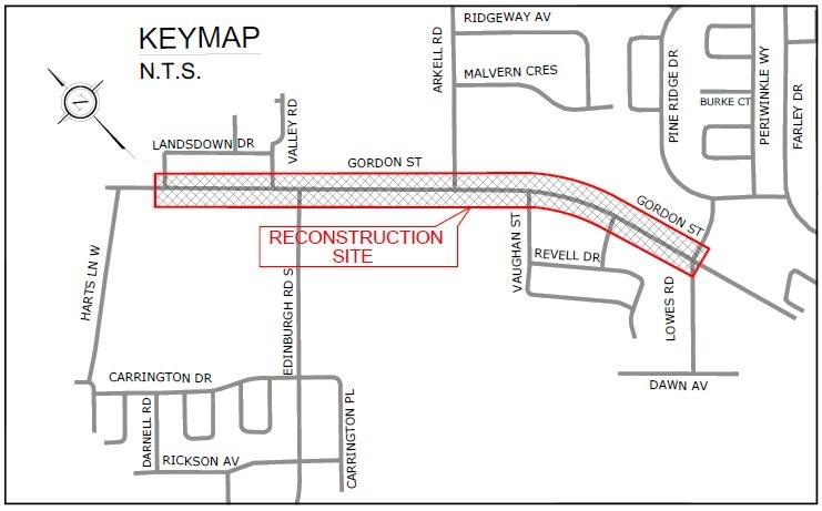
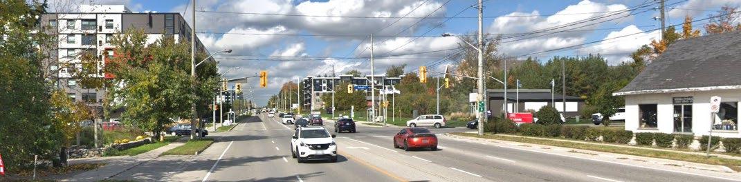
• Several studies have been completed along the Gordon St. corridor include:
Municipal Class EA – 2020
Transportation Mater Plan – 2022
Protected Cycling Network Study - 2023
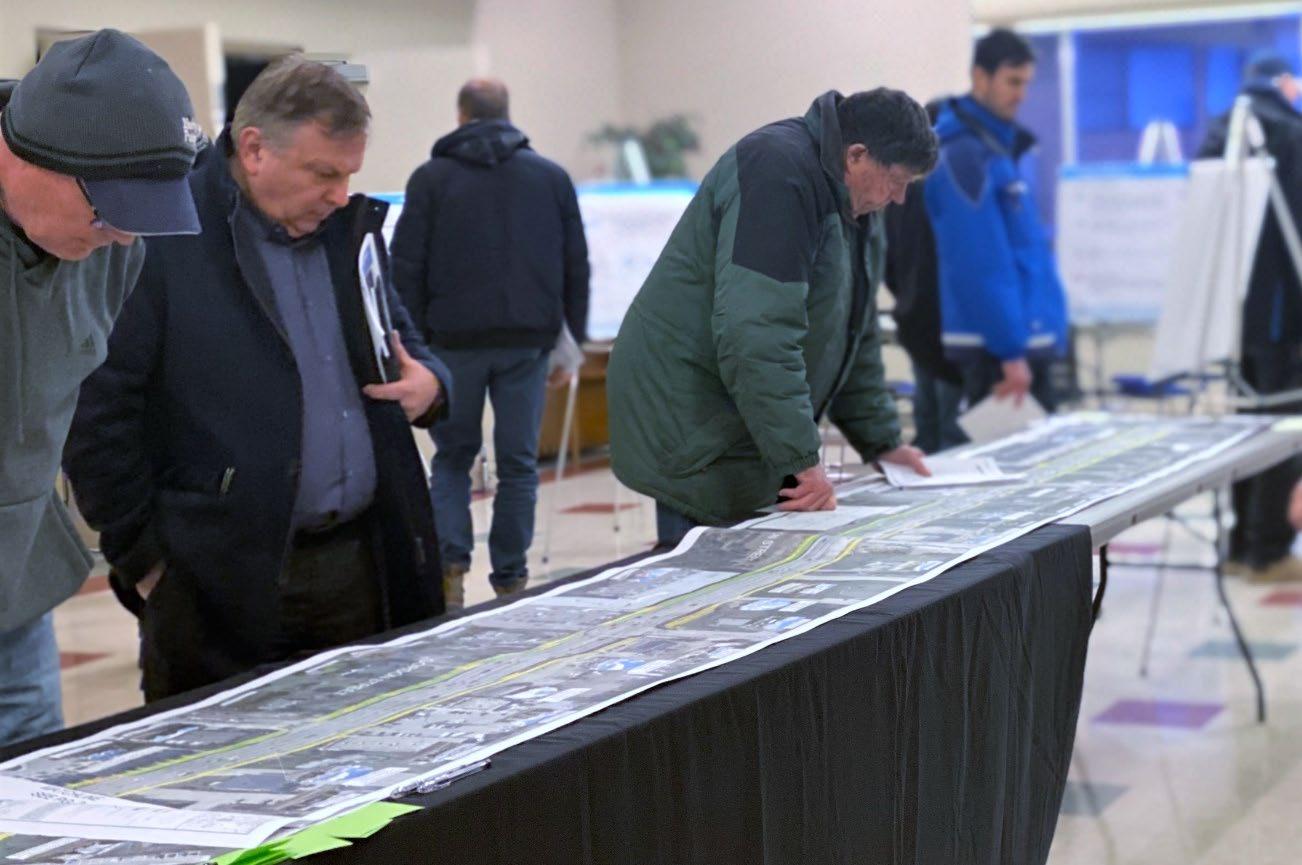
PIC #2 was held on February 20, 2020 at the same venue as PIC #1, at the Army Guelph Citadel & Nursery School.
Similar to PIC #1, PIC #2 was a drop-in open house format where members project team and City staff were available to speak with individuals and small about the study, and to address any questions and concerns. A total of 49 individuals were in attendance (of which 45 signed in), which was similar to the attendance #1.
Display boards were setup around the room, providing details on the Study. aerial map of the study area was also laid along a table in the centre of the attendees could review the preferred solution in detail, and leave location-based comments.
• Investigated the need for safety/operational improvements and traffic management for Gordon Street and considered
• Two community engagement touch points
• Recommended a centre turning lane and multi-use paths on both sides of Gordon Street
Participants at PIC #2
The PIC #2 Survey was provided to attendees. The PIC #2 Survey included respondent profile and top concern questions from PIC #1 to serve as a comparison, well as a question about whether the proposed solution addresses the top concerns identified in the PIC #1 Survey. The PIC #2 Survey also included the solicitation comments on the study findings and overall support for the Preferred Option there were any additional considerations that should be addressed prior to detailed
• Defines how our transportation system will support the community as Guelph continues to grow.
• Four points of community engagement
• Identified Gordon Street as part of the cycling spine network and recommended all ages and abilities (AAA) cycling facilities along Gordon Street


• Looks at ways to provide safe, continuous connections for cycling and micro-mobility, such as scooters, to and from community destinations, including major transit stops
• Two community engagement touch points
• Recommended cycle tracks and sidewalk along the entire Gordon Street corridor
• Develop road cross sections and identify impacts along Gordon Street - 2024
• Design intersection and signal improvements – 2024/2025
• Utility relocations and/or land acquisition - 2024/2025
• Construction of road widening and Phase 2 Lowes Road – 2025/2026
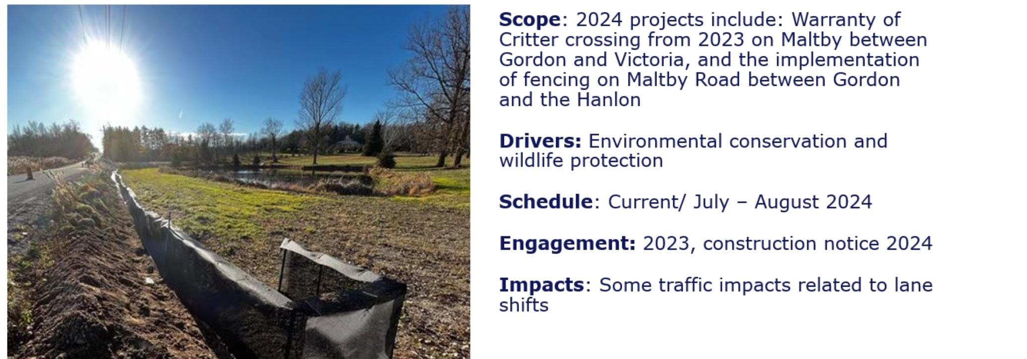
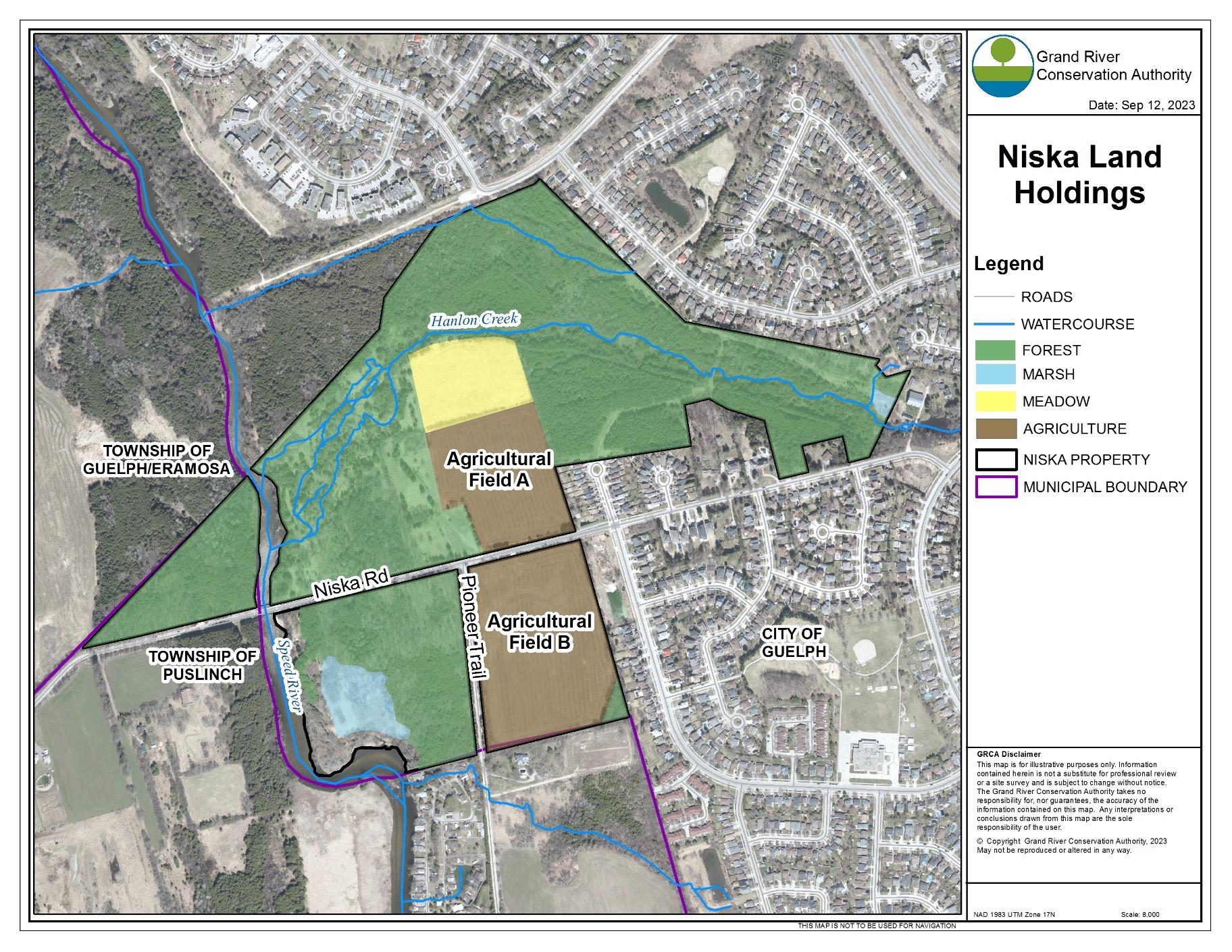
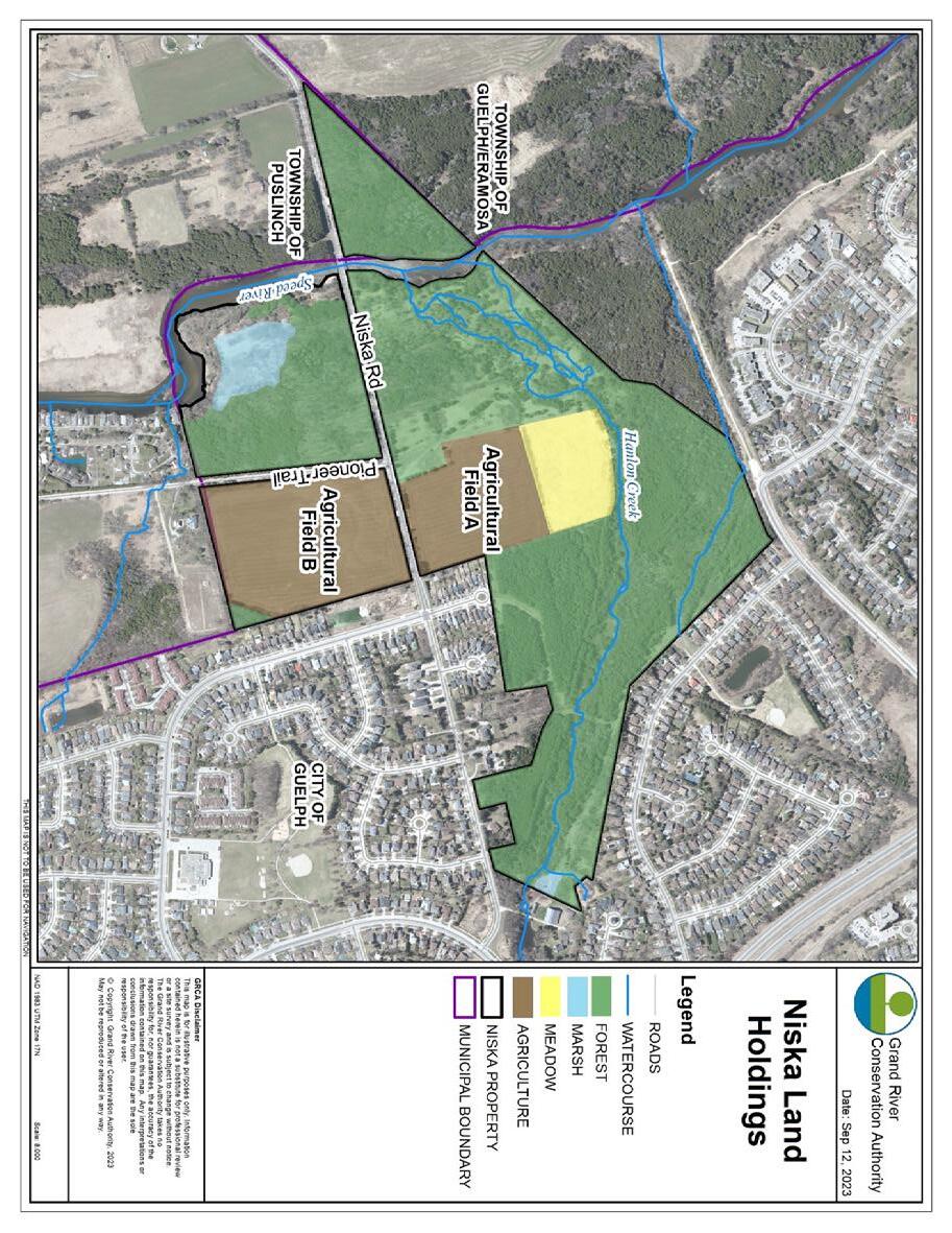
Maltby Road Wildlife Crossing
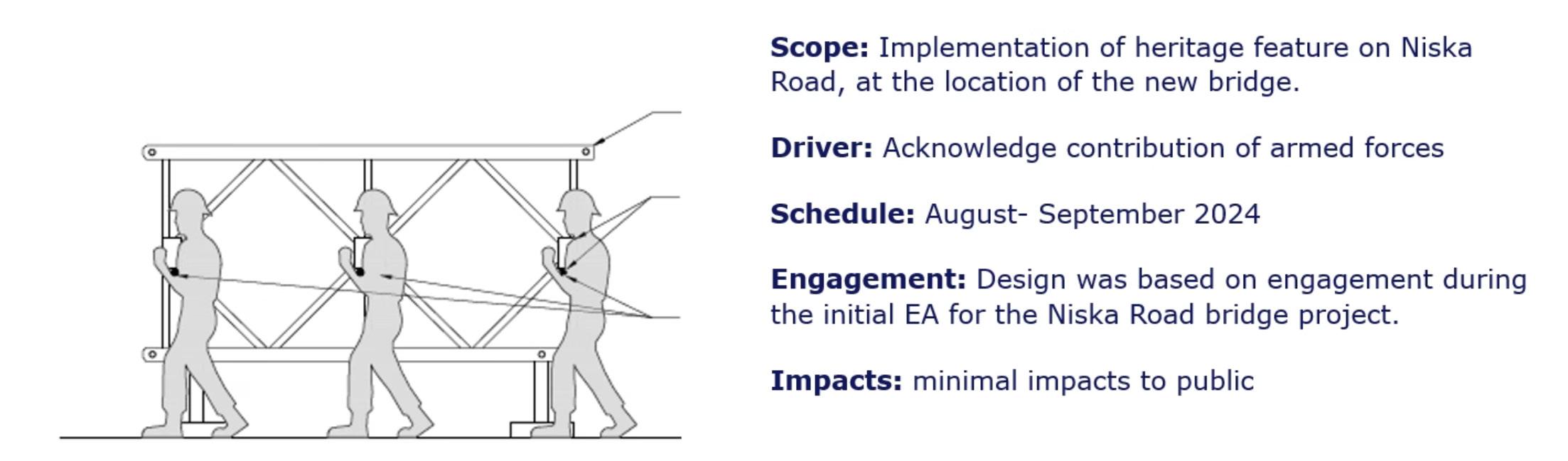
Niska Bridge Heritage Feature
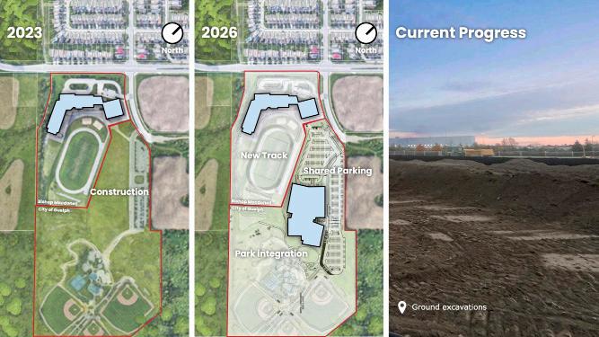
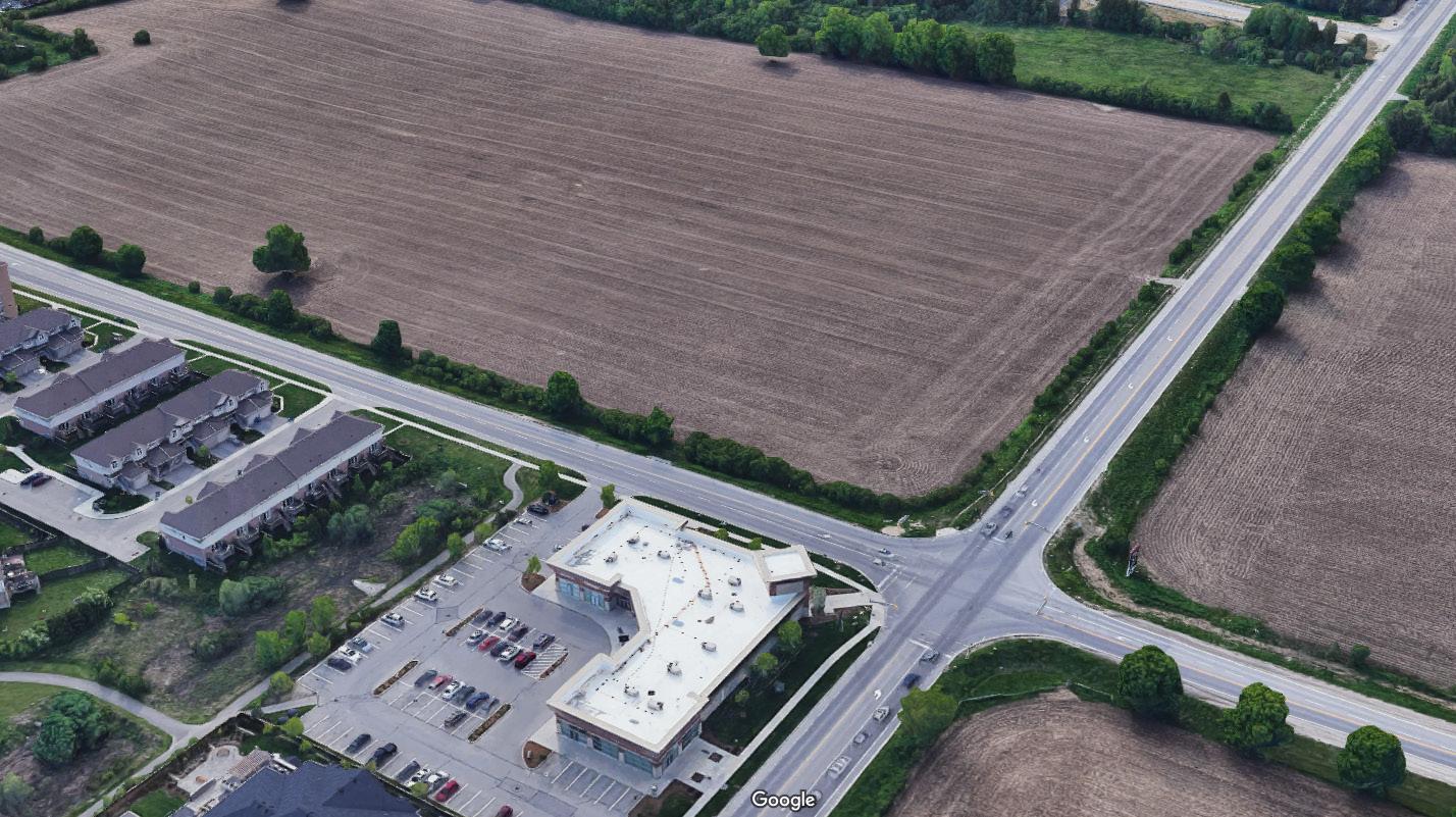
South End Community Centre
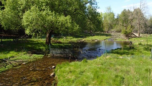
GRCA Niska Management Plan
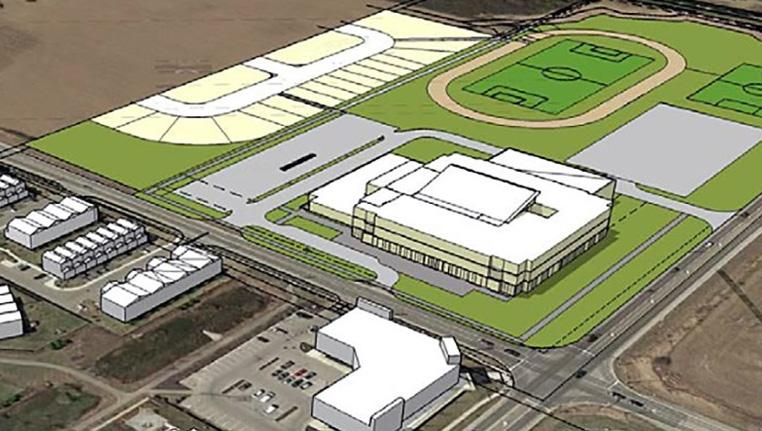
New UGDSB High School

Ground excavations and foundation
• 117 acres of forest
• 5 acres of marsh
• 117 acres of forest
• 7.5 acres of meadow
• 5 acres of marsh
• 7.5 acres of meadow
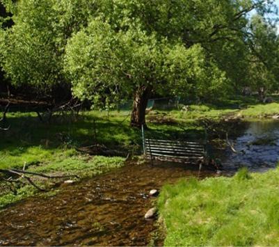
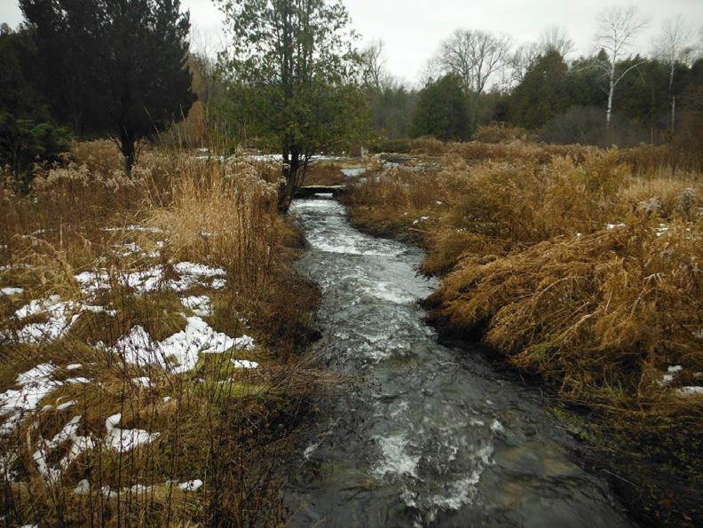
• Hanlon Creek - cold water stream
• Hanlon Creek - cold water stream
• 31 acres of leased agricultural land
• 31 acres of leased agricultural land
• In 2018 the GRCA Board directs staff to develop MP.
• Draft MP released for public comment May 2023
• Public comments presented to GRCA Board with Draft MP
• Final version to be brought forward to the board June 21, 2024


New UGDSB School Location