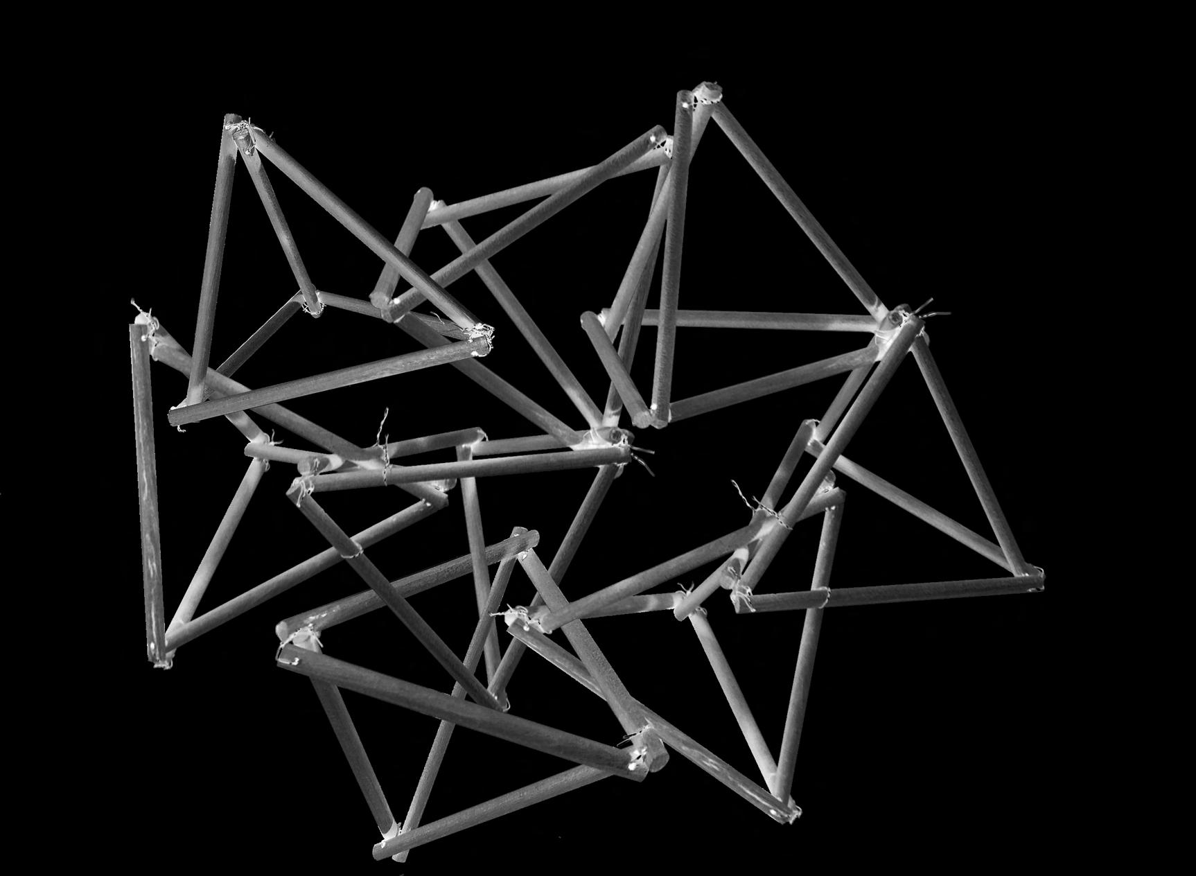
PORTFOLIO 2020 - 2024
KANWAR GILL
Carleton University
ARCHITECTURAL DESIGNER

CONTACT


647-980-6162
kanwar.gill.at@gmail.com
linkedin.com/in/kanwar-g-d131999
My name is Kanwar (Ken), and I am a fourth-year architecture student eager to gain hands-on experience through an internship. My curiosity drives me to explore diverse interests, which has helped me develop a well-rounded approach to architectural design.
Through my education and practical experience working on both building design and urban design scales, I have gained a solid understanding of architecture. This has helped me think about design in a more complete way, and I’m excited to bring this perspective to a professional setting.
CARLETON UNIVERSITY
Ottawa, Ontario, Canada
Bachelors of Architectural Studies - Urbanism
HUMBER COLLEGE
Etobicoke, Ontario, Canada
Advanced Diploma in Architectural Technology
2021 - Present
2017-2020
SKILLSETS
Technical/Design
Revit AutoCAD
Microstation
SketchUp Rhino
D5 Render
Twinmotion
Adobe Creative Suite
Microsoft Office Suite
WESTON CONSULTING
Vaughan, Ontario, Canada
Student Designer - Co op
NATIONAL CAPITAL COMMISSION
Ottawa, Ontario, Canada
Intern Architect - Co op
May 2024 - December 2024
May 2023 - September 2023
INTERESTS
Laser Cutting Music
Model Making
Reading Fashion
Technology Researching By-laws
AWARDS
FINALIST
Ottawa, Ontario, Canada
Terraviva Competitions - Tactical Urbanism Now!
BUILDING 22 NOMINATION
Ottawa, Ontario, Canada
Urban Placemaking - Carleton University
DEAN’S HONOUR LIST
Ottawa, Ontario, Canada
Carleton University
BUILDING 22 SELECTION
Ottawa, Ontario, Canada
The Layered City - Carleton University
June 2023
July 2023
2024, 2023, 2022, 2021
October 2024
Ottawa
Ottawa
Ottawa
RESIDENTIAL TECHNICAL DRAWINGS
Hypothetical
Ottawa | Ontario | Canada
Fall 2023
Done By: Kanwar Gill, Daniel Ganesh, Kasper Barynin, Charbel Gagnon, Amos Stapper
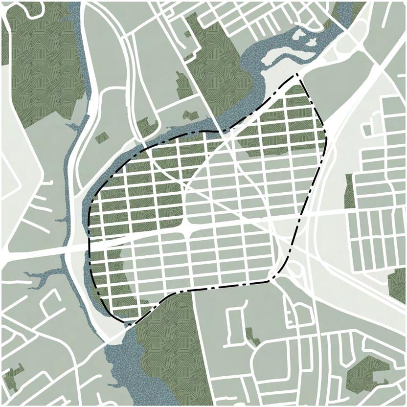
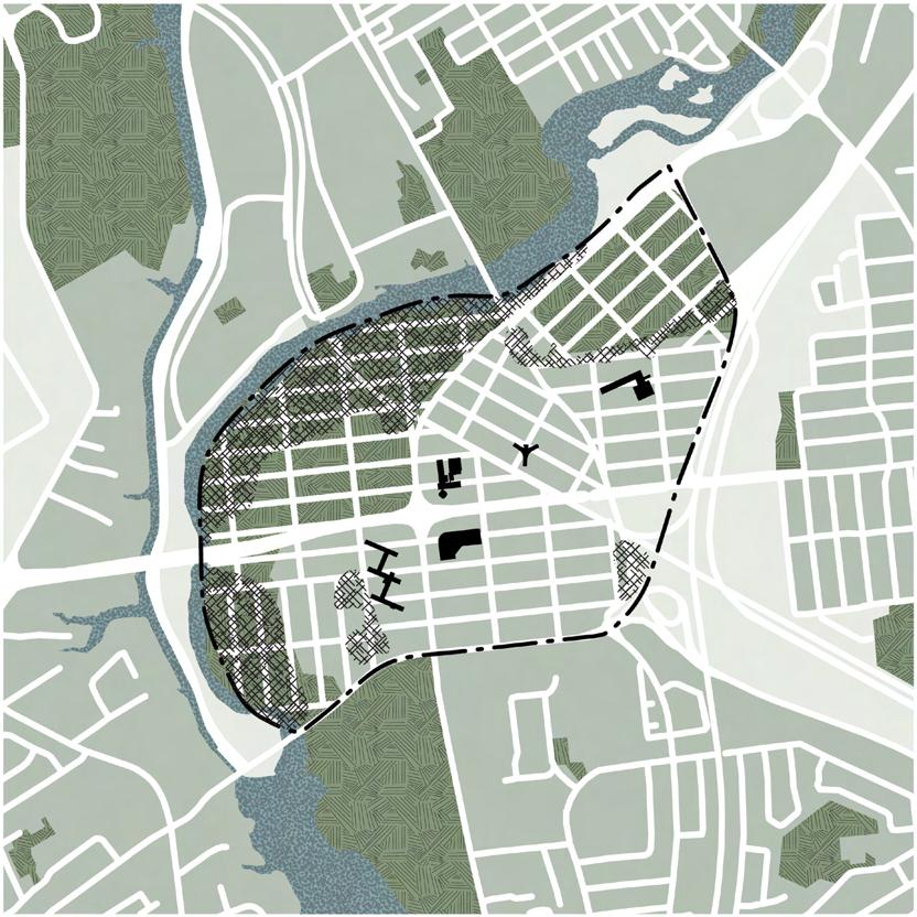
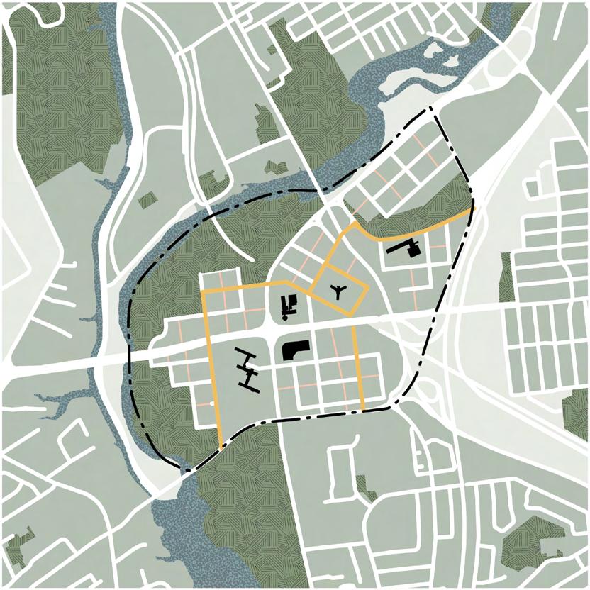
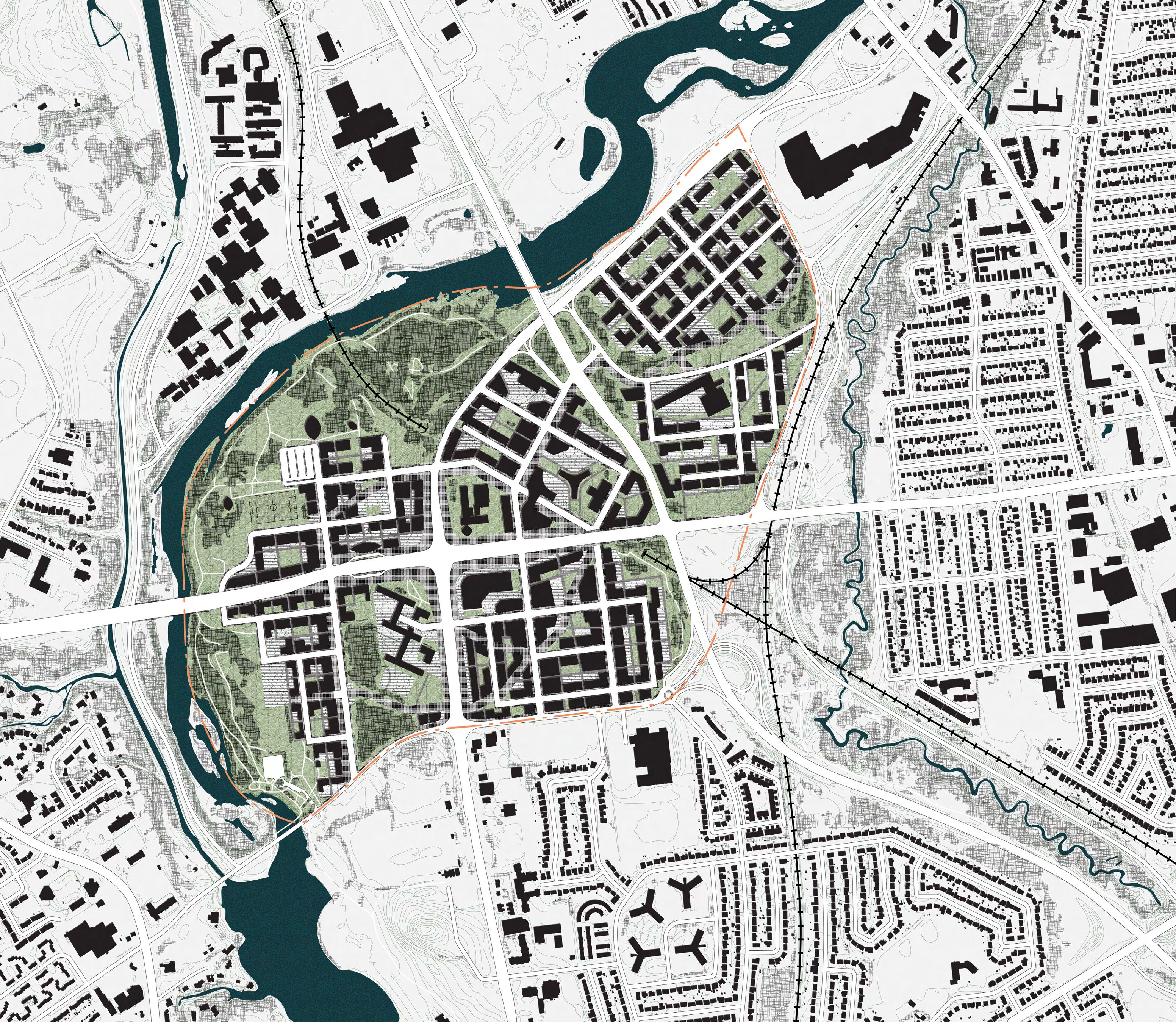
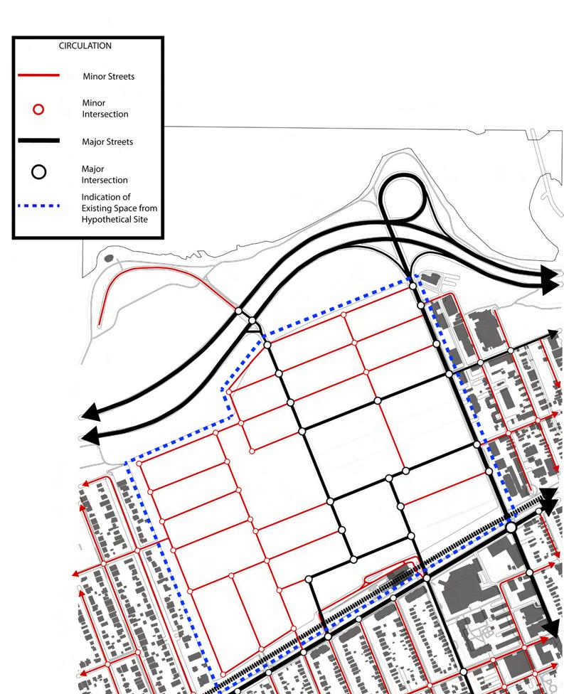
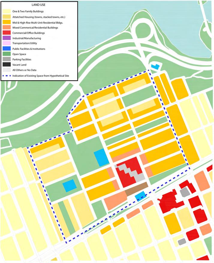
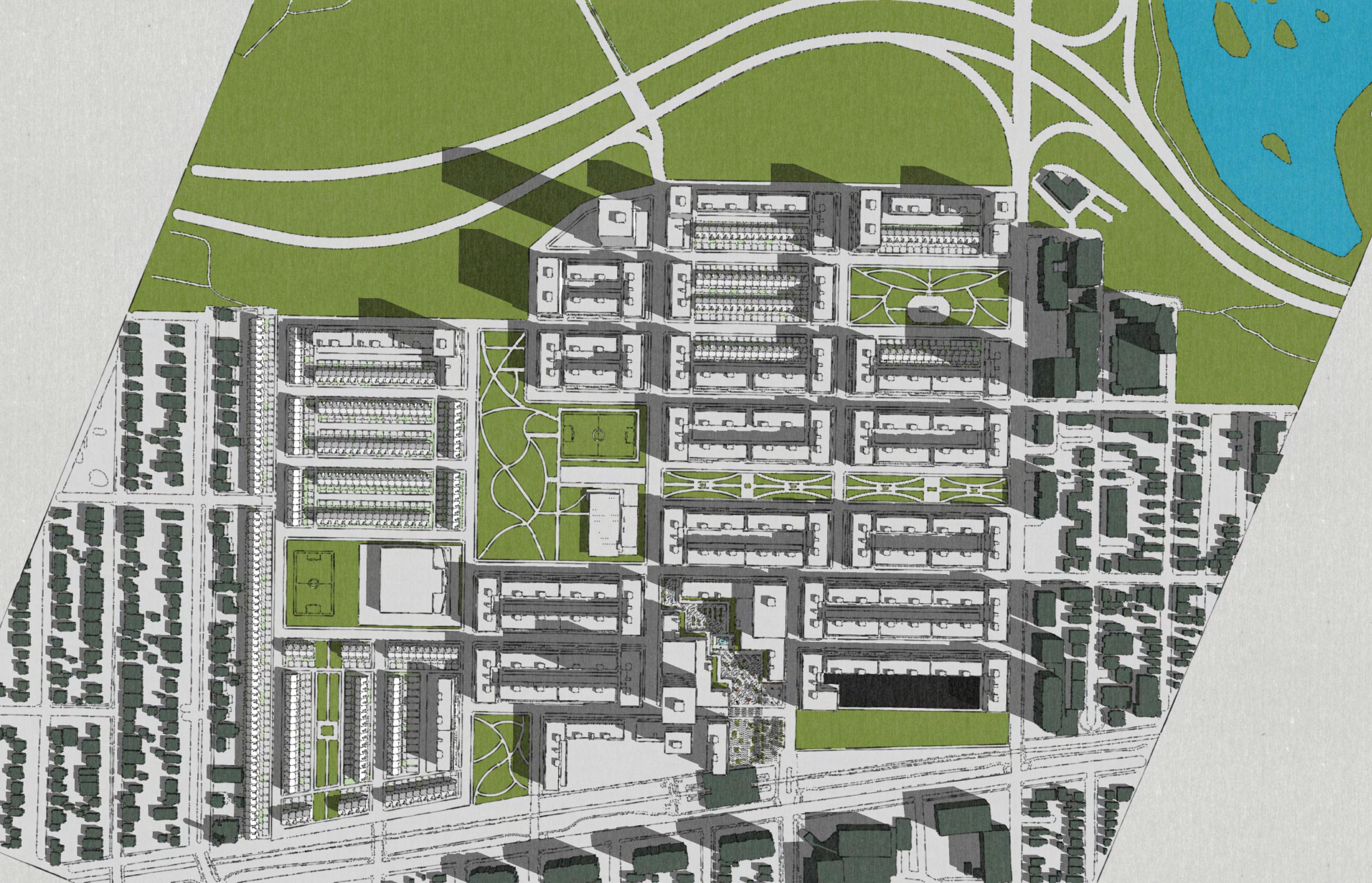
Consisting of 186 hectares, Confederation Heights is a employment hub located south of Carleton University. Consisting of majority government buildings, the site has become underutilized due to government workers now primarily working from home. This has led to most buildings to being empty most of the week. Combined with the already empty heritage buildings on the site, the employment hub is more of a ghost town.
The objective of this project was to redesign the site so that it would become a multi use site where people live, work and play. The aim was to create a space that could accommodate 350-500 PPA through the introduce of new buildings and the reuse of abandoned heritage buildings.
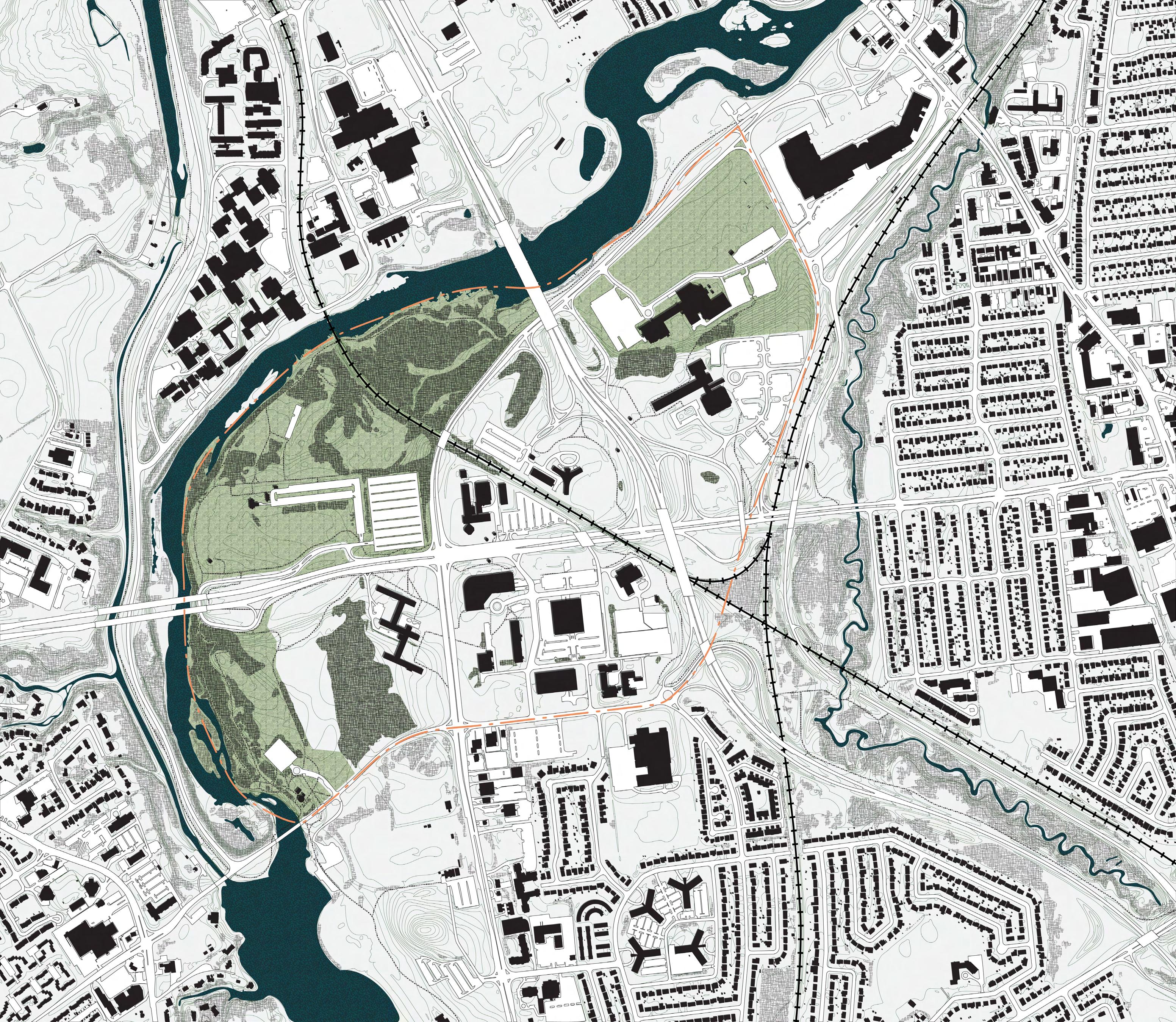
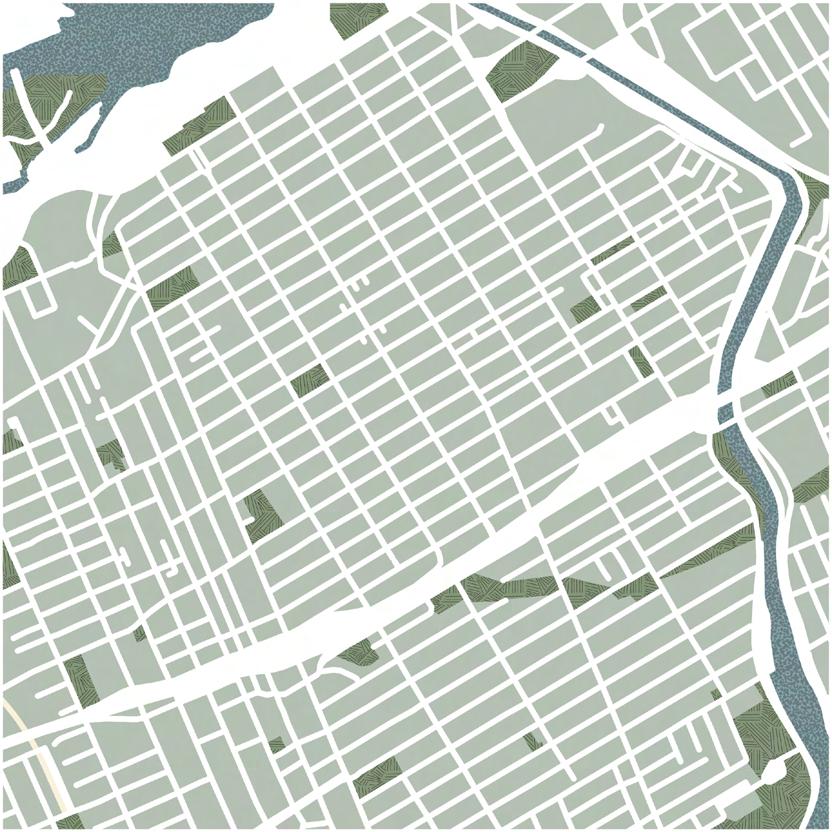
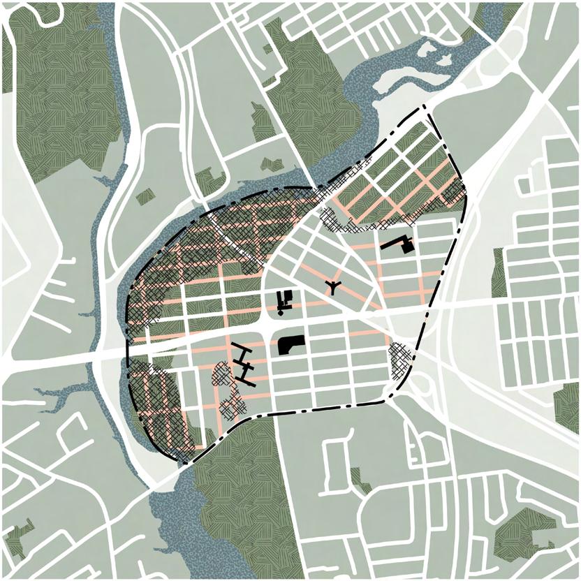

Our design strategy for developing the site began with studying downtown Ottawa as a precedent. The existing site had a PPH (persons per hectare) of zero, which was incompatible with our vision of creating a vibrant mixed-use development. Downtown Ottawa served as an ideal reference point due to its comparable density to our target for Confederation Heights. By overlaying downtown Ottawa’s block structure onto our site, we identified and eliminated elements that didn’t align with our goals. Through this iterative process, we refined the layout to achieve a design that met our objectives and expectations.


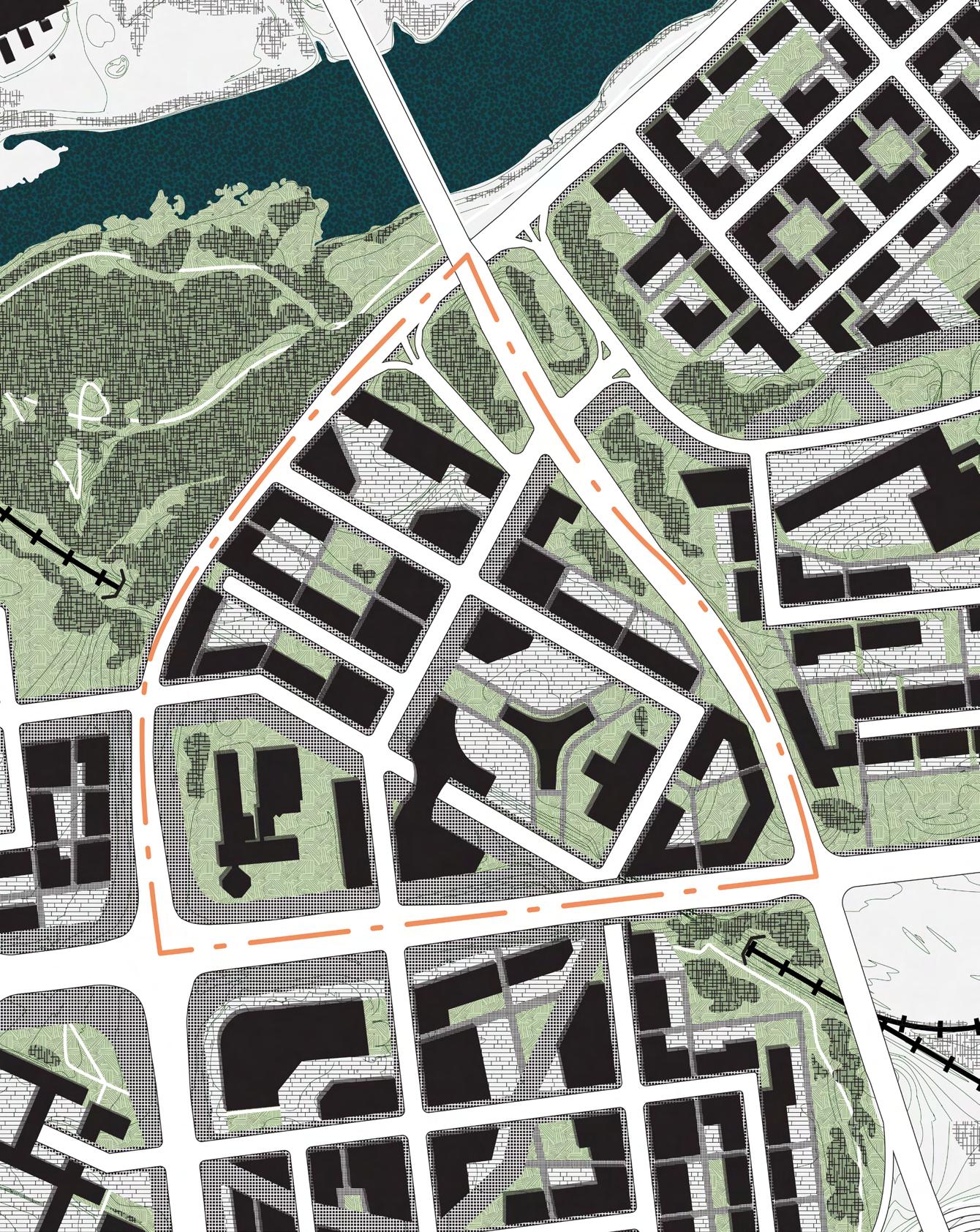
Blocks Rotated to fit individual sites

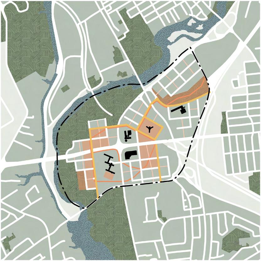
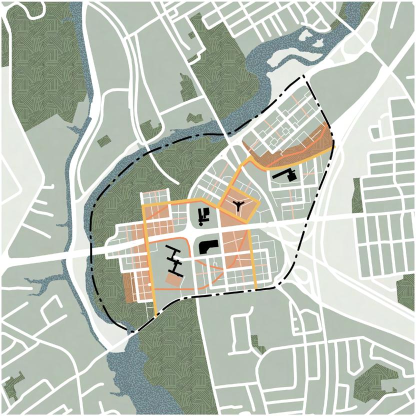
Guidelines were established to dictate how and where buildings were to be laid out.
Open space had to be well connected throughout the site and evenly dispersed for connectivity. It was to be prioritized along the length and inside of the blocks and around density. Lastly, open space must be activated and accessible at all times.
Through infrastructure, a pedestrian lane way is introduced that helps create permeability by cutting the typical block. Along side this, public transit and bike paths are to be prioritized over cars, moving most car parking underground.
New buildings need to have activated facades fronting onto roads and open spaces while heritage buildings are repurposed. The interiors of the these buildings need to have transformable uses while also prioritizing commercial at grade.
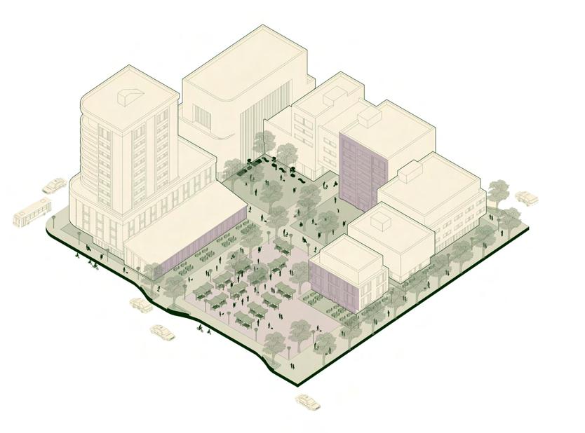
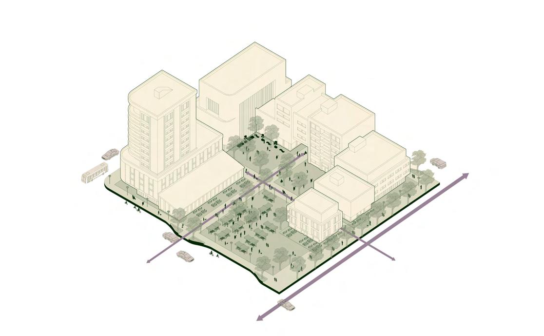
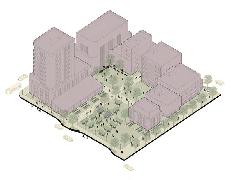
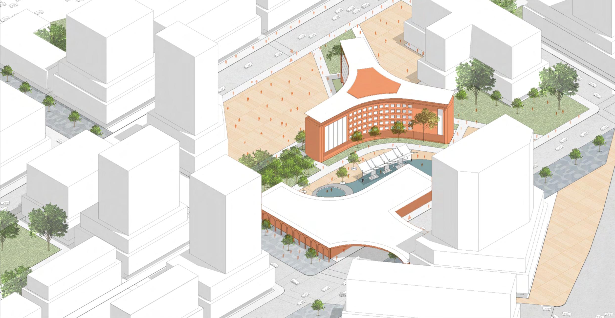
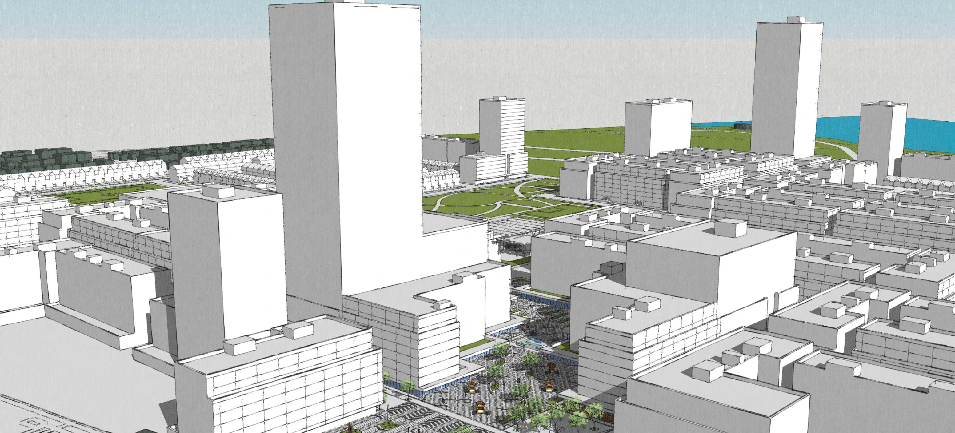
There being 5 sections to the entire site and 5 members in the group, each person got a section to further flesh out. My site was central to the others and consisted of 2 heritage buildings. It also had a LRT line running through it that had as station on the site directly below mine.
My site being in the centre of everything made it as a facilitator to the other sections. It was less important as a destination but more as a connection to the other sites. This is why we decided to move the LRT station to my site. We also moved the LRT line underground to help with development and created a plaza above it to create a transportation hub.
Ottawa | Ontario | Canada
Summer 2023
Tactical Urbanism Now! Competition
Done By: Sarah Chichon, Charbel Gangnon, Kanwar Gill, Amos Stapper, Ikemefuna Onyiuke
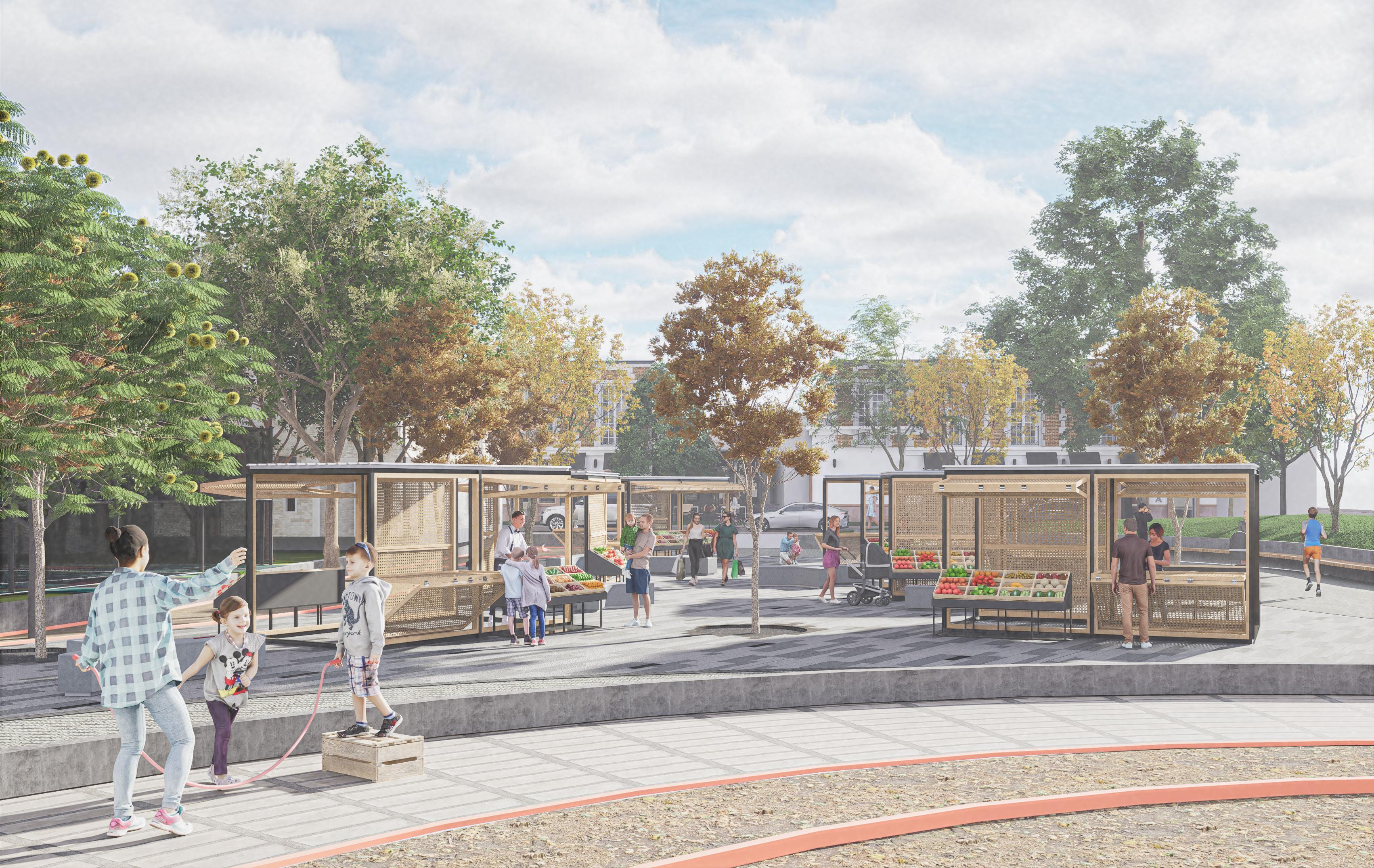
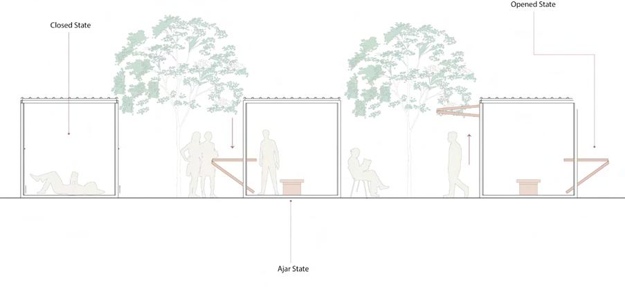
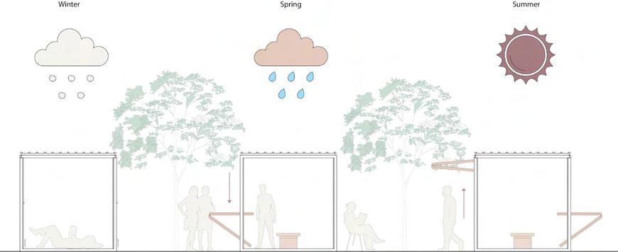
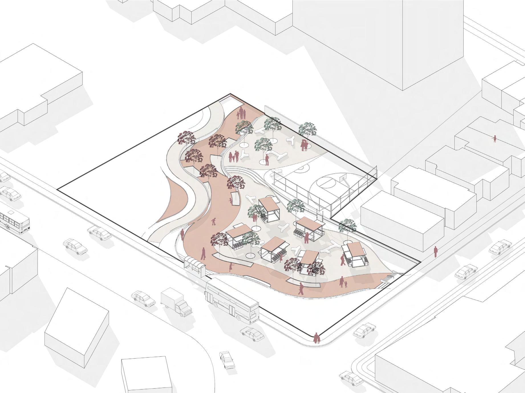
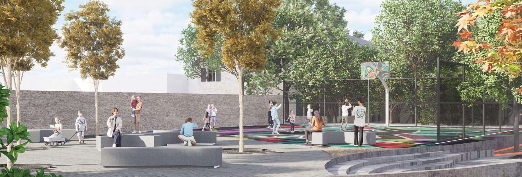
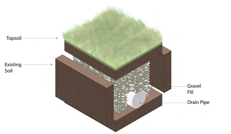
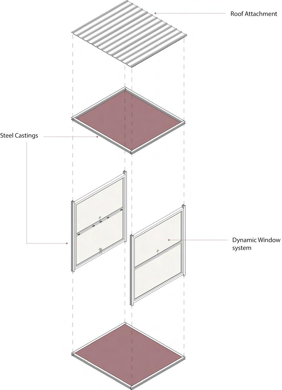
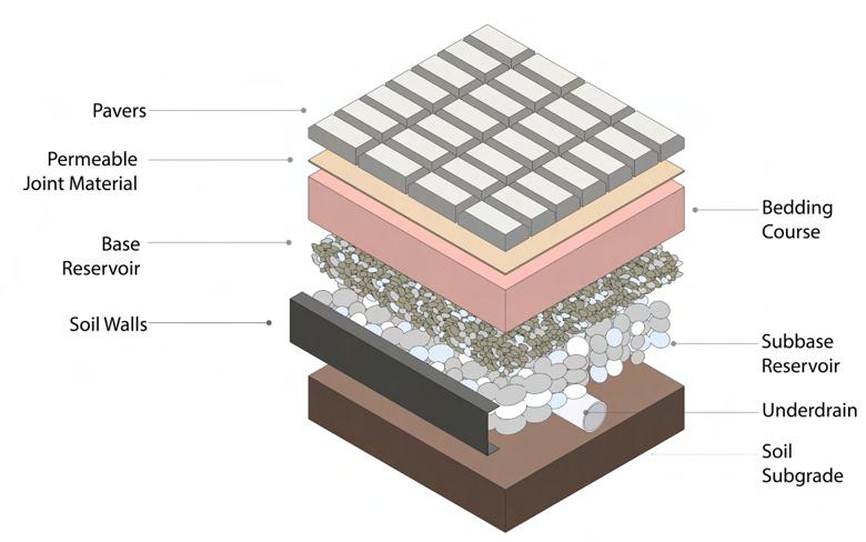
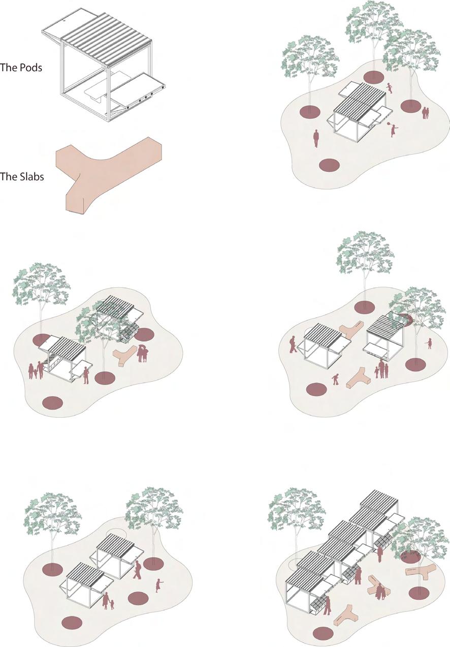
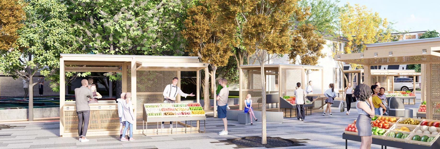
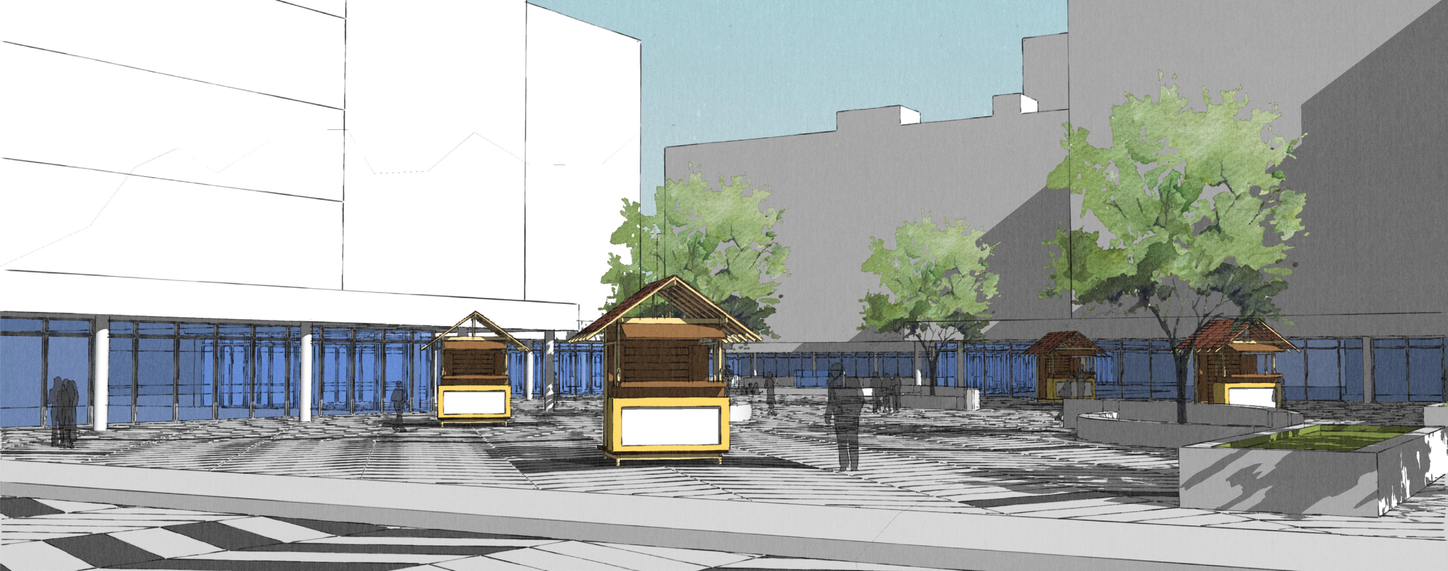
Completed for the competition hosted by Terraviva the prompt was t o create a public space that was resilient and inclusive. Using this information, we took an abandoned parking lot in downtown Ottawa and transformed it into a multi used public plaza. Firstly, It would host a community market through the use of transformable stalls. Secondly, it would incorporate community recreational activities. For this we introduced a multi use sports court. Lastly, there would be a public planting initiative where trees that produced native fruits would be planted based on the season for residents to pick. The original parking lot also acted a snow bank in the winter. To continue this form of usage, we incorporated open paver and french drain systems. We would go onto be one of the finalists in this international competition
Ottawa | Ontario | Canada
Fall 2022
Done By: Kanwar Gill, Daniel Ganesh
The objective of the project was to take a hypothetical space modeled after a real-life location and as a group of two fill in the missing fabric. The space provided was modeled after Tunney’s Pasture in Ottawa. Incorporating multiple building types and uses that would seem feasible in a real world scenario. The challenge in this project was to first reflect on the edges of the site the same type of buildings as its surroundings. From there we had to meet a variety of metrics such as PPH and GFA
The Idea behind the design was to make a way for pedestrians to be able to move through the urban fabric as easily as it would be for a car. This is why we designed green spaces that connect different parts of the plan and also a pathway that cuts through the main commercial hub. The west side of the site was low density town houses top reflect the houses surrounding the western site edge. The density would then slowly increase as you traveled east. Town houses would turn into mid rises and then into high rises at the site’s centre
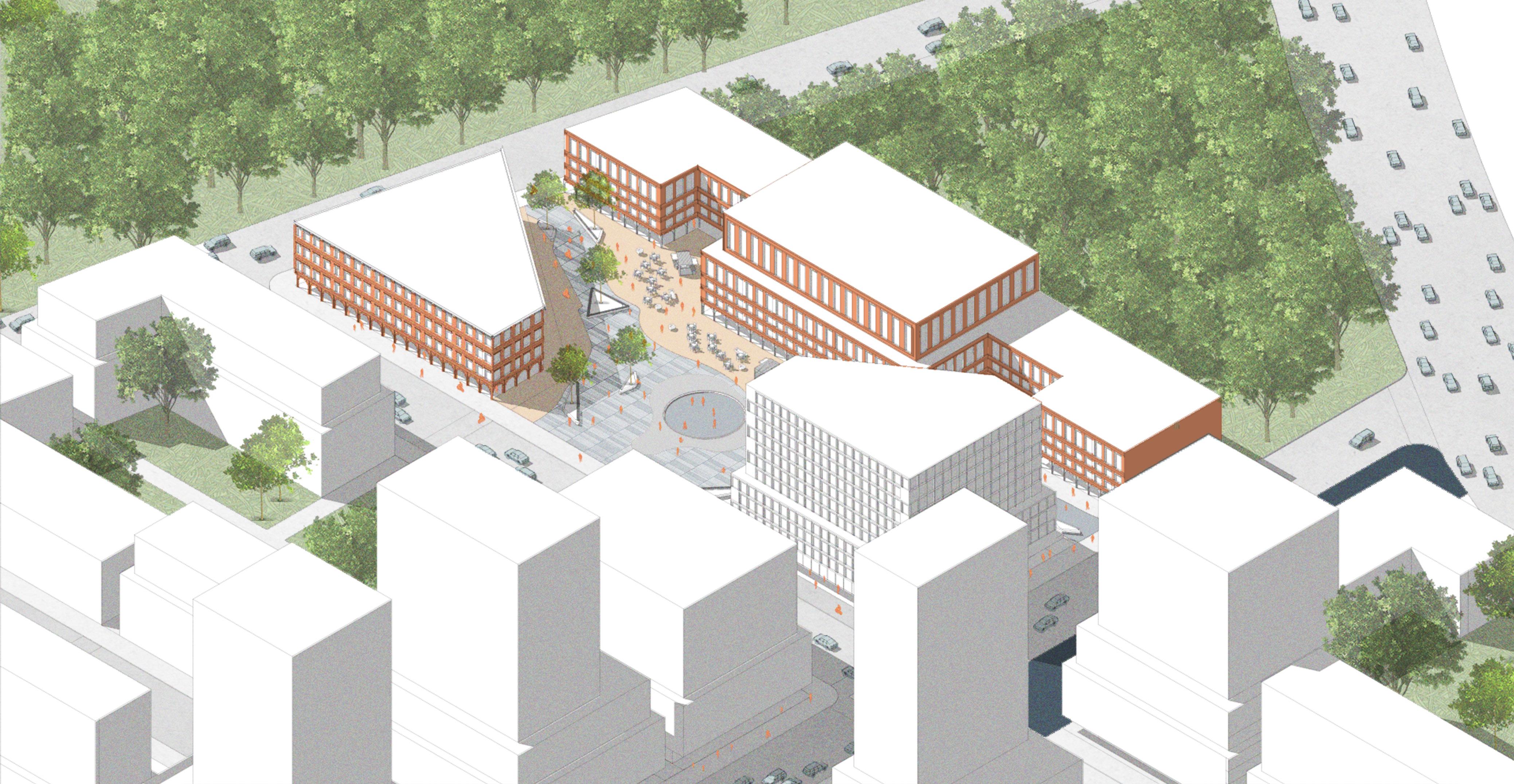
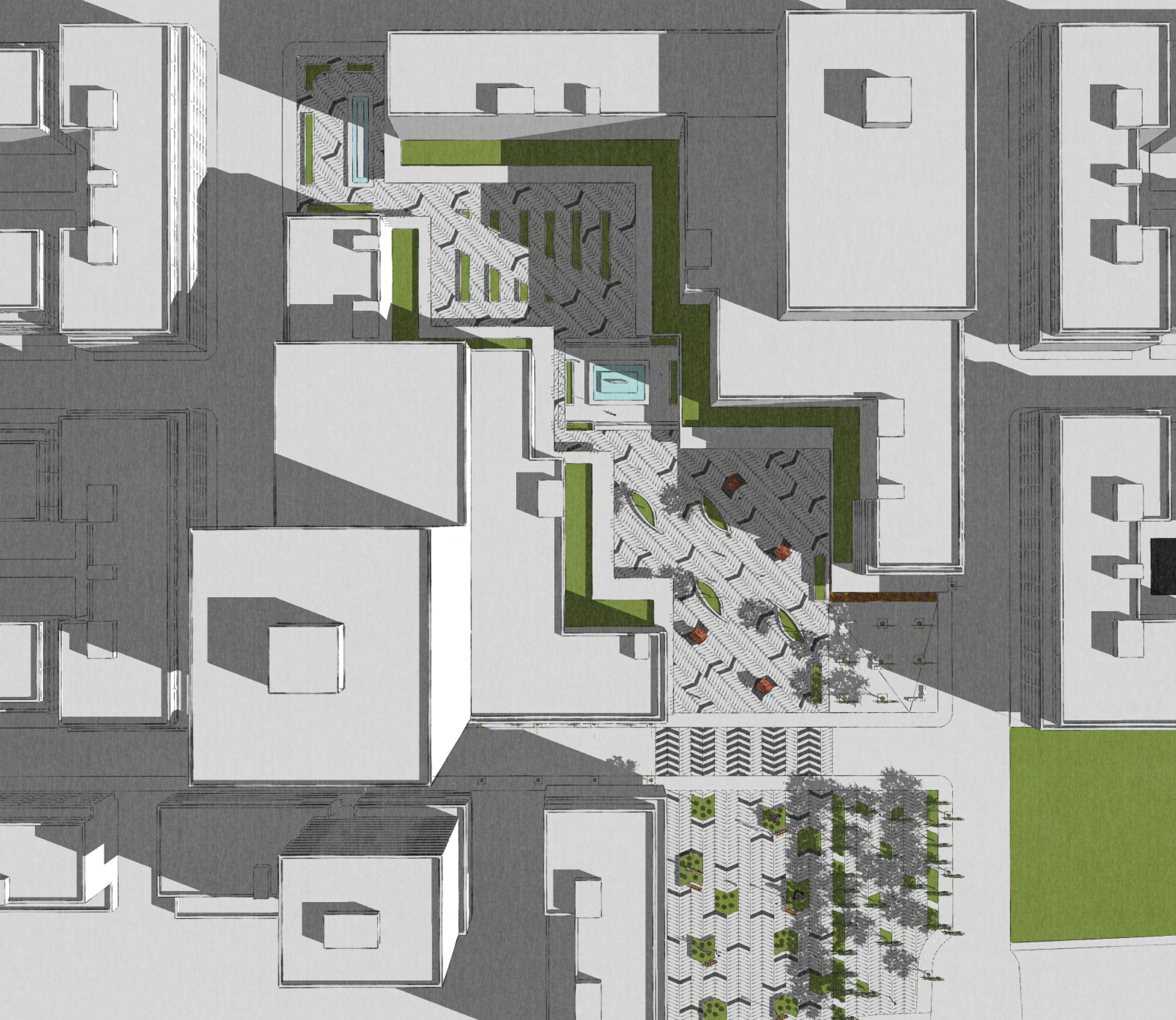
We were then asked to focus on a specific area of our design and further develop it. For Our design, we decided to focus on the path that cut through the main commercial area.
The idea was to create a pedestrian pathway through the commercial hub of the urban pathway. This allowed a straight connection between the park and the train station. This further played into the pedestrian-focused design we produced for the entire area. The paving and landscaping gave a subtle nudge to where people were to go while not constraining them to the path. The cut-through also allowed outdoor shopping as stalls could be set up and stores opened up into the passage.
Hypothetical | Canada
Winter 2020
Done by:Kanwar Gill, Rebecca Jarvis
Done in the last semester of my college degree. The objective was to learn how to create technical drawings package for a typical house in North America. Using autoCAD we create various drawings that ranged from building elevations to wall sections. The challenge behind this project was referencing the OBC for material and dimension standards as the house had to be feasible in a Canadian climate.

6479806162
kanwar.gill.at@gmail.com CONTACT
linkedin.com/in/kanwar-g-d131999