LANDSCAPE ARCHITECTURE PORTFOLIO
kaylee major spring 2024
REFLECTION
Landscape architecture stands as a testament to humanity’s enduring quest to harmonize with the natural world, crafting spaces that transcend mere functionality to embrace the soul-stirring beauty of our planet. Through the skilled hands and visionary minds of landscape architects, barren plots transform into verdant sanctuaries, bustling cityscapes find solace in pockets of greenery, and forgotten corners of urban sprawl are imbued with new life. Beyond mere aesthetics, these meticulously planned landscapes serve as catalysts for societal cohesion, fostering connections between individuals and their environment while nurturing a profound sense of belonging. From the majestic parks that offer respite from the urban hustle to the sustainable designs that champion ecological stewardship, landscape architecture serves as an ever-evolving testament to humanity’s reverence for the Earth and its boundless capacity to inspire, uplift, and unite us all.

TABLE OF CONTENTS
DOWNTOWN MONTEZUMA’S REVITALIZATION
Project Introduction
Masterplan and Tactics for Revitalization
Focus Area Masterplan + Sections
Focus Area Planting Plan
LOTTIE MALL WATERFRONT PARK CREATION
Project Introduction
Case Studies and Concept Graphics
Masterplan + Sections
NEW EVOLUTION A SUSTAINABLE COMMUNITY
Project Introduction + Site Conditions
Community Planting Plan + Housing Typeology
Masterplan + Supporting Graphics
GWINNETT COUNTY GICH
FOCUS AREA
Project Introduction
Focus Areas
Issues at State+ Redevelopment Proposals
Empty Lot Masterplan
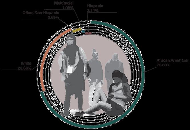
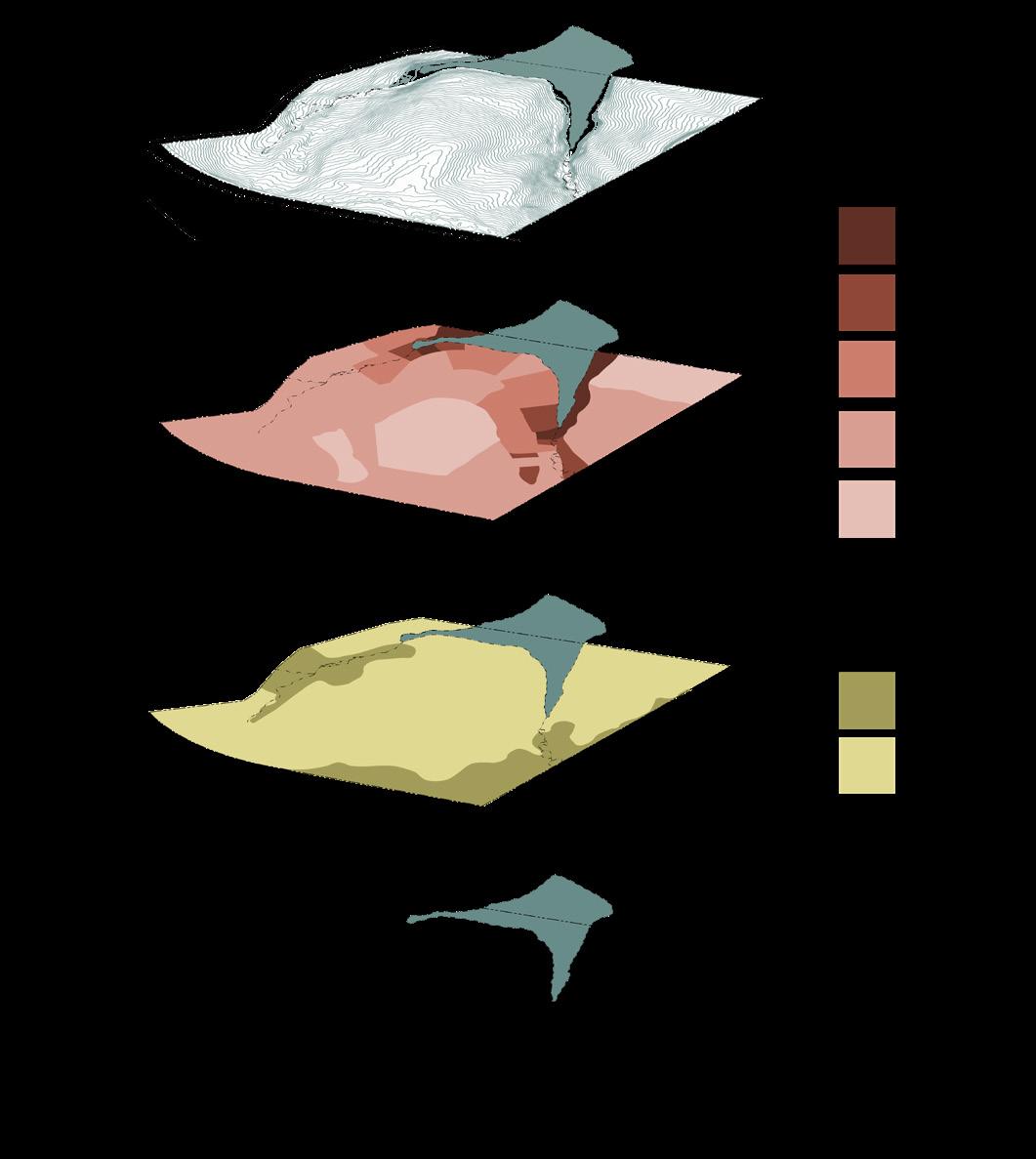
Inventory + Analysis 1 4 3 2
DOWNTOWN MONTEZUMA’S REVITALIZATION
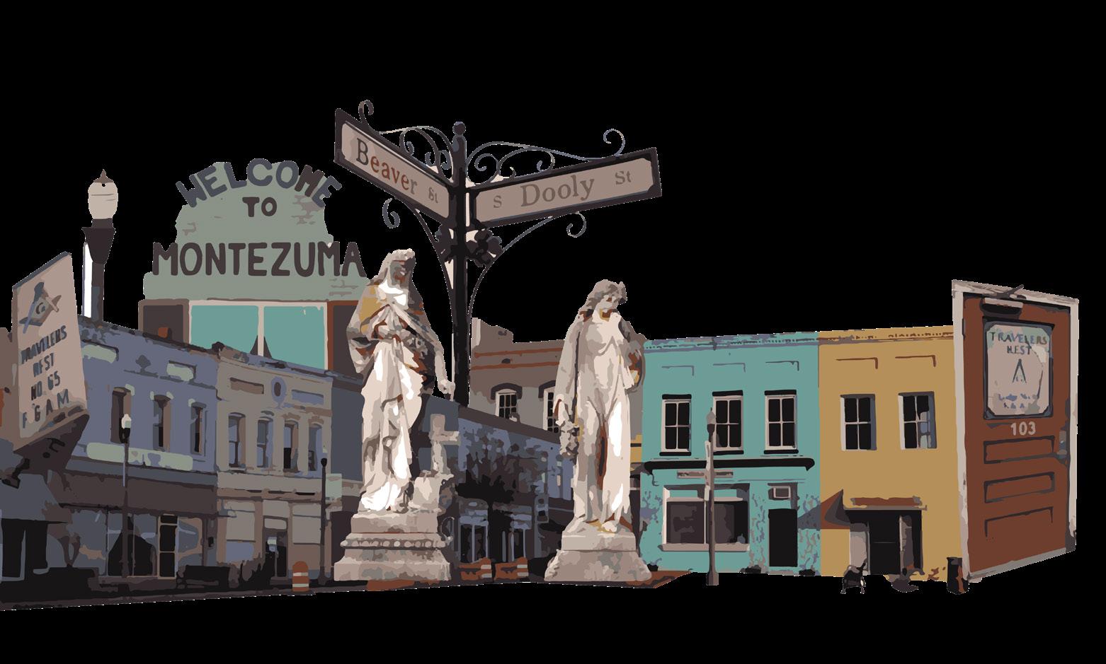
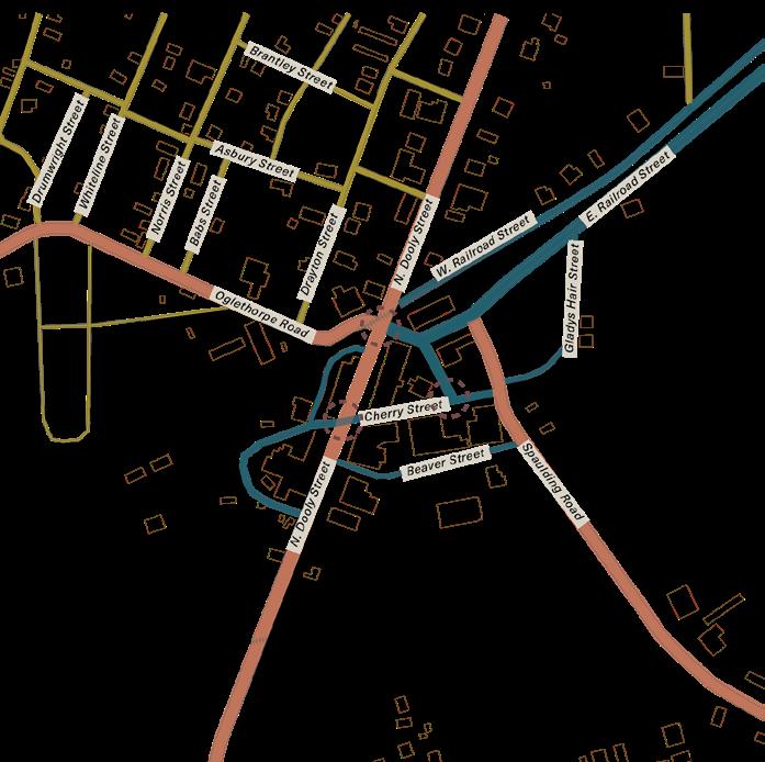
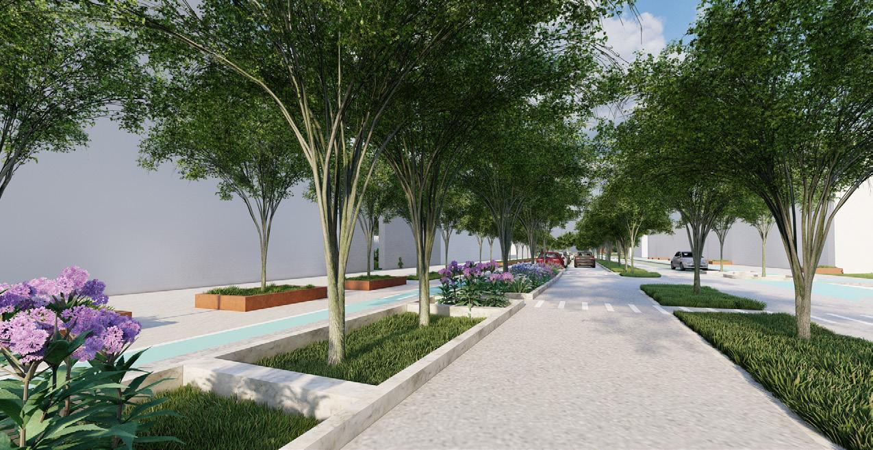
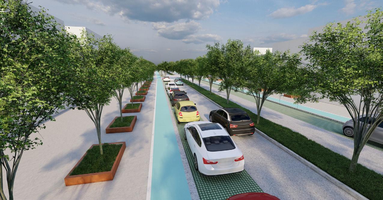
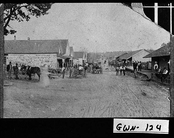
The City of Montezuma is situated in the heart of Southern Georgia. Once a vibrant town bustling with visitors travelling the Dixie Highway, Montezuma has become a beautiful encapsulation of small town community and strength. Devistated by a flood in 1994, Montezuma has not yet fully recovered, but has a promising future. Montezuma has a bustling community enriched by historic architecture, and stunning natural resources. The goal is to create a downtown space that encourages current residents and visitors to experience Downtowns existing beauty and new commercial, cultural, and recreational opportunities. These opportunities will also bring a rise in employment options for Montezuma residents. This plan focuses around revitalizing unused spaces, curating an arrangement of successul businesses, restoring essential waterways, incoorperating local artists, increasing pedestrian safety, connecting the town through a system of updated pedestrian walkways and recreational and historic sites through an all encompassing trail system.
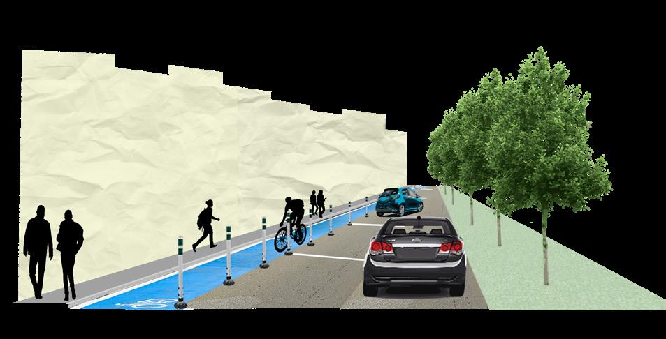
The goal for Montezumas roadways is to reduce the size of the lanes and the amount of lanes to create a pedeestrian friendly downtown area. This includes installation of bike lanes, pervious parallel parking, vegetated medians, marked crosswalks, and speed-tables through all major intersections to decrease automobile speeds.
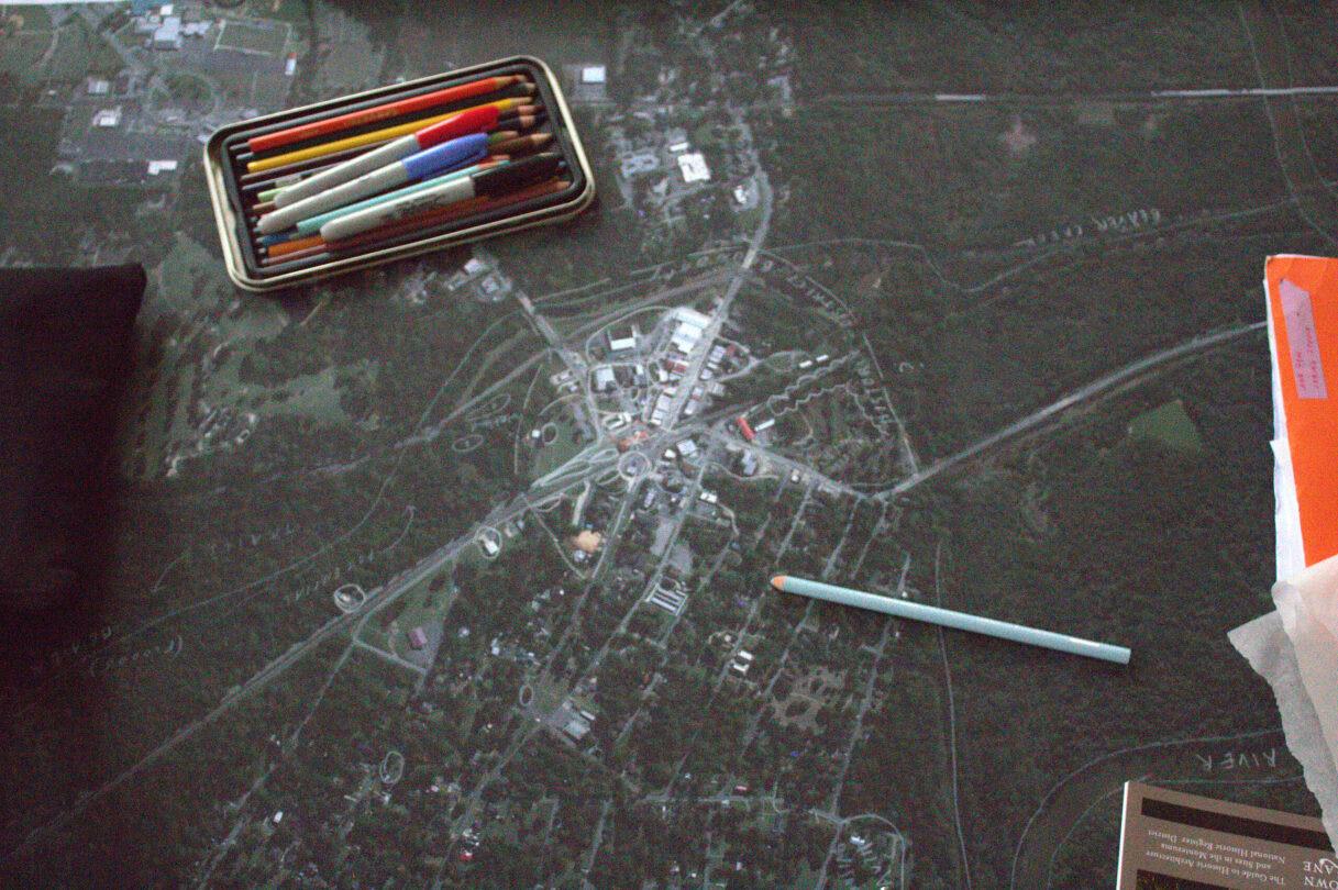 Photo Creds: Ash Daniel
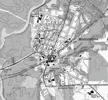
INVENTORY + ANALYSIS
Montezuma is a small town in South Georgia with a population of just over 3,000 people. The following Inventory and Analyses are the result of a three-day site visit to the quaint town in February of 2023. We focused on collecting local information: from informal street interviews to photography of downtown materiality. Through a series of maps and collages, the following graphics speak to the current state of Montezuma’s downtown center, and evoke some ideas for future revitalization
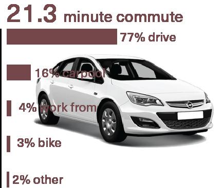
. commute time
The majority of residents drive to work to neighboring cities, although there are bikers and especially since the pandemic, people working from home.
land use
We analyzed the current designation of land in Montezuma has mixed-use, commercial, residential, and greenspace.
iconography
The signs, recurring visuals, and intricate facades of Montezuma create a sense of place and add to the ephemeral nature of the city.
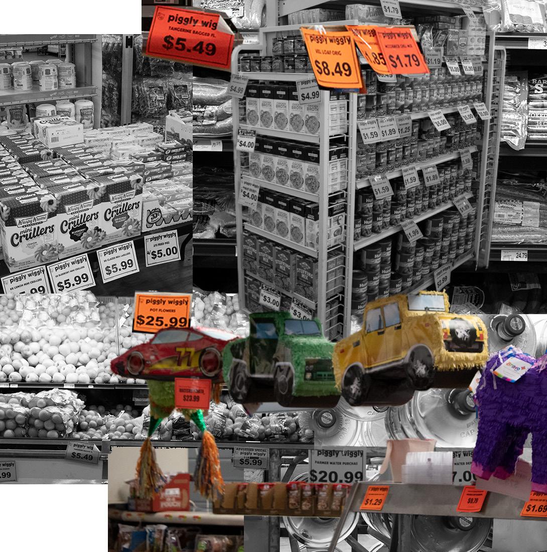
local food inaccessibility
After visiting the local Piggly Wiggly, we discovered that food prices in Montezuma are outrageous compared to bigger towns in the area.


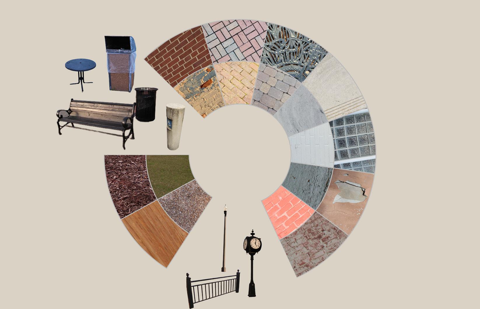

GROUNDPLANE SERUTCURTS ENALPDNUORG O U T D OOR FURNITURE OUTDOOR FURNITURE MATERIALITY STRUCTURES
A group project by Kaylee Major, Alexa Pfeiffer, Brooke Freeman, and Patricia Quinonez

DOWNTOWN MONTEZUMA’S
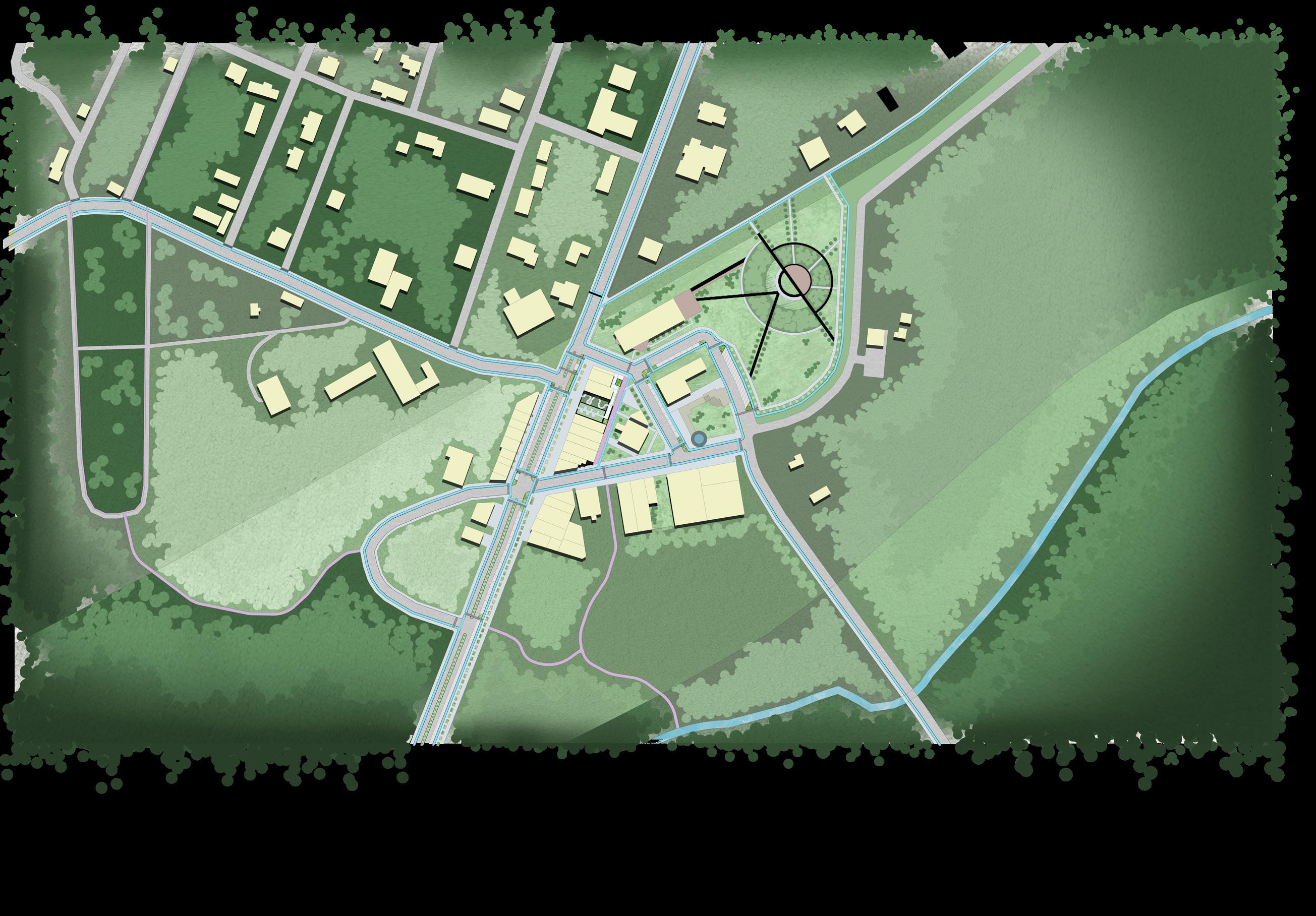
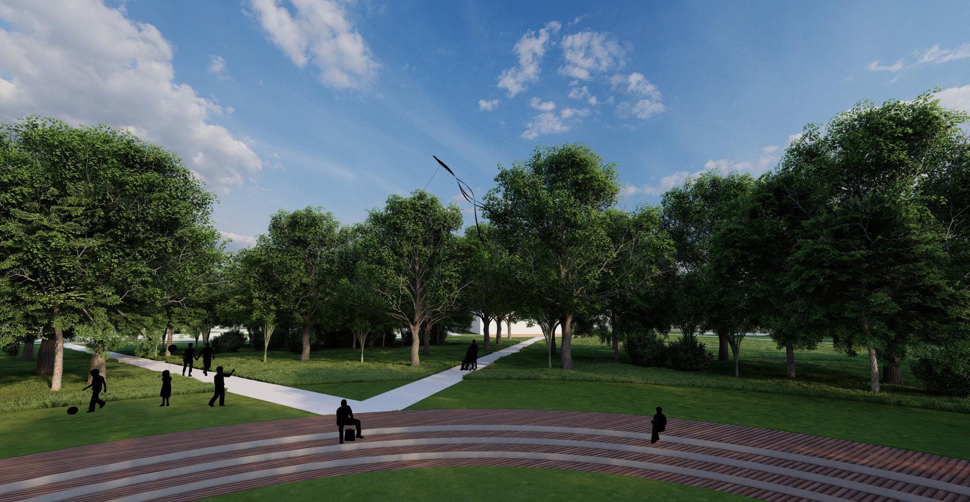
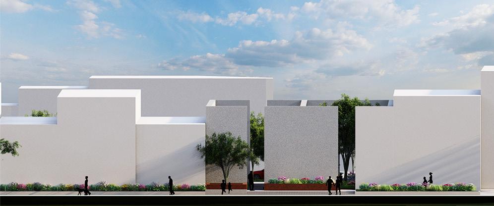
Masterplan 1. Focus Area 2. Pedestrian and Bike Only Path 3. Trailhead for The Montezuma Trail 4. Mixed-Use Residential Building 5. Speed Table 6. Parallel Parking 7. Vegetated Median 8. Retail and Restaurant Mix 9. City of Montezuma Municipal Building 10. Carnegie Library use returns to library 11. Depot Porch and Activation Space 12. Train Watching Platform 13. Sunken Forested Amphitheater 14. Parking lot for Headstone Business 15. Trail Continuation 16. Beginning of Trail to Historic Cemetary 17. Trail to Beaver Creek 18. Restored Beaver Creek 19. Trail to Historic Cemetary 20. Trail introduced to Historic Cemetary 21. Forested Park 22. Trail to Historic D.F. Douglass School 23. Boys and Girls Club 24. Reconstructed Road Perpendicular to Dooly 25. Restaurants and Bars Preservation Recreation Connectivity Restoration 1 2 3 4 5 6 7 8 10 9 11 12 13 14 15 16 17 18 19 20 21 22 23 24 25 8 5 Rendered with AutoCAD and Photoshop and Lumion
REVITIALIZATION
FOCUS AREA
The vision for this focus area is to create a space that is attractive to residents and visitors alike.
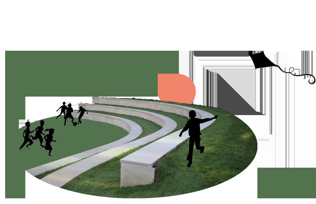
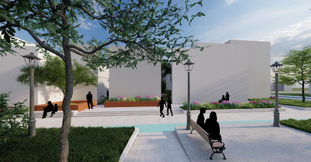
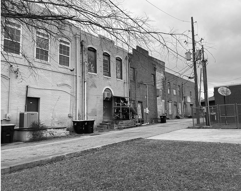
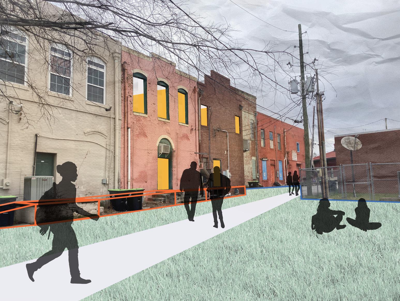
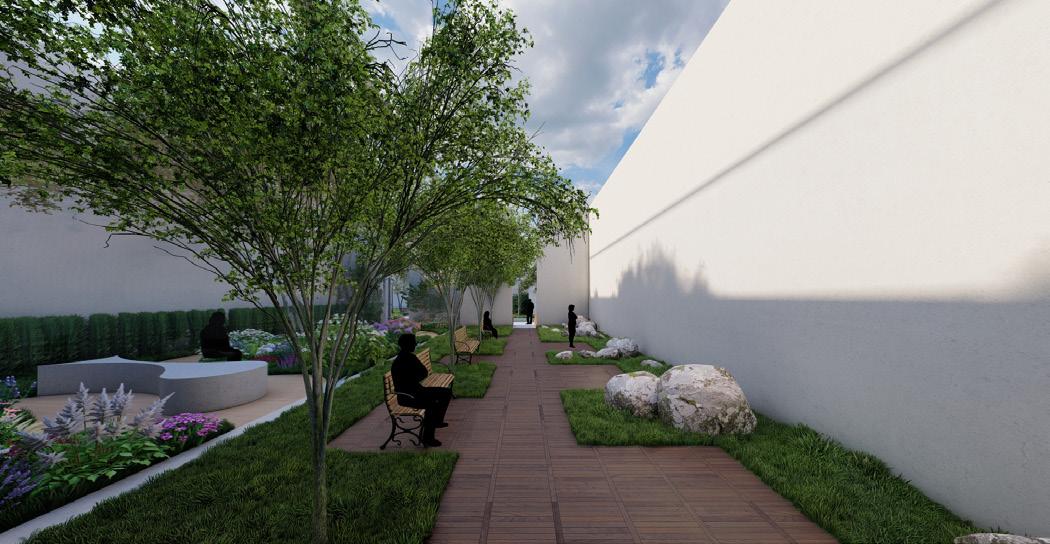
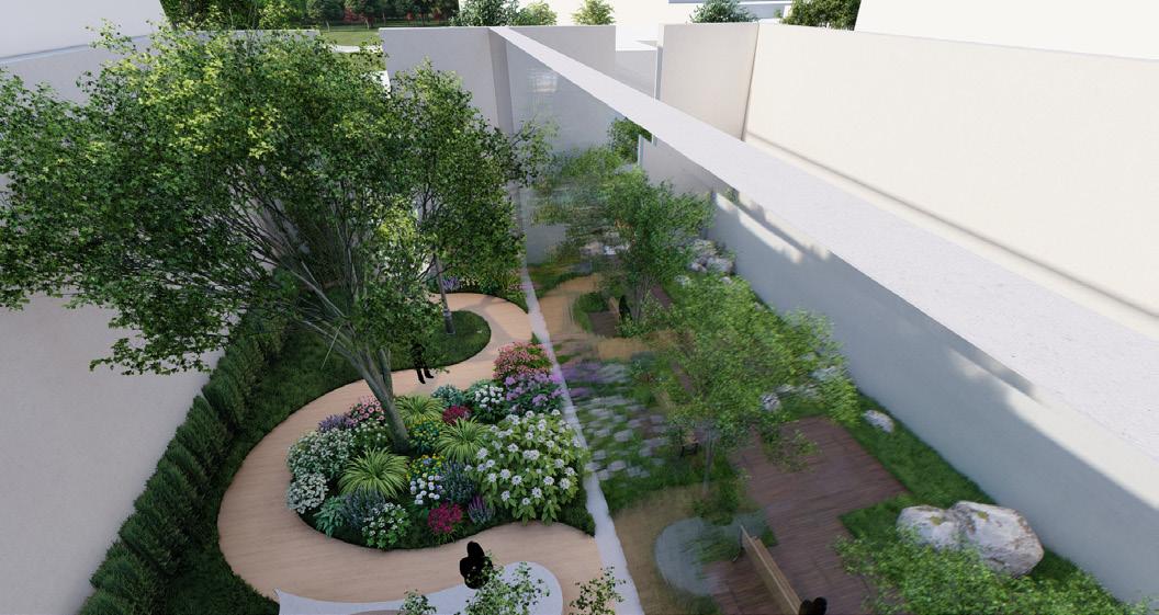
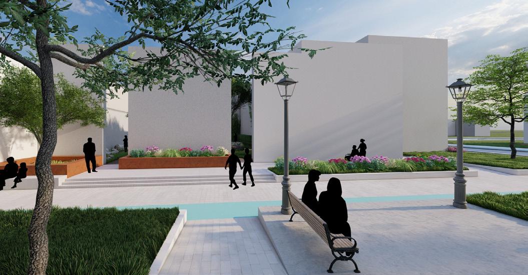
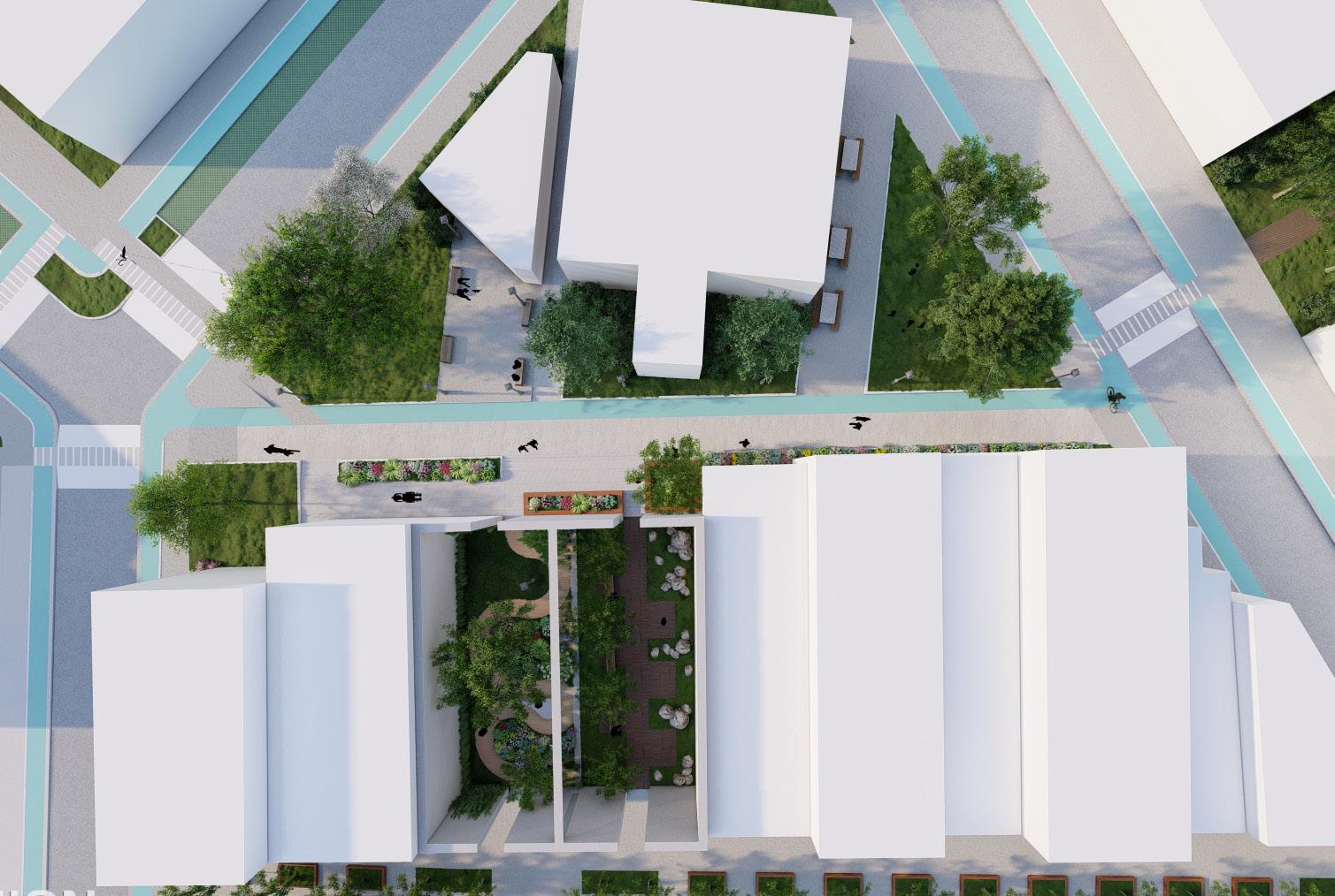
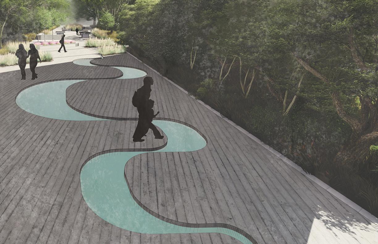
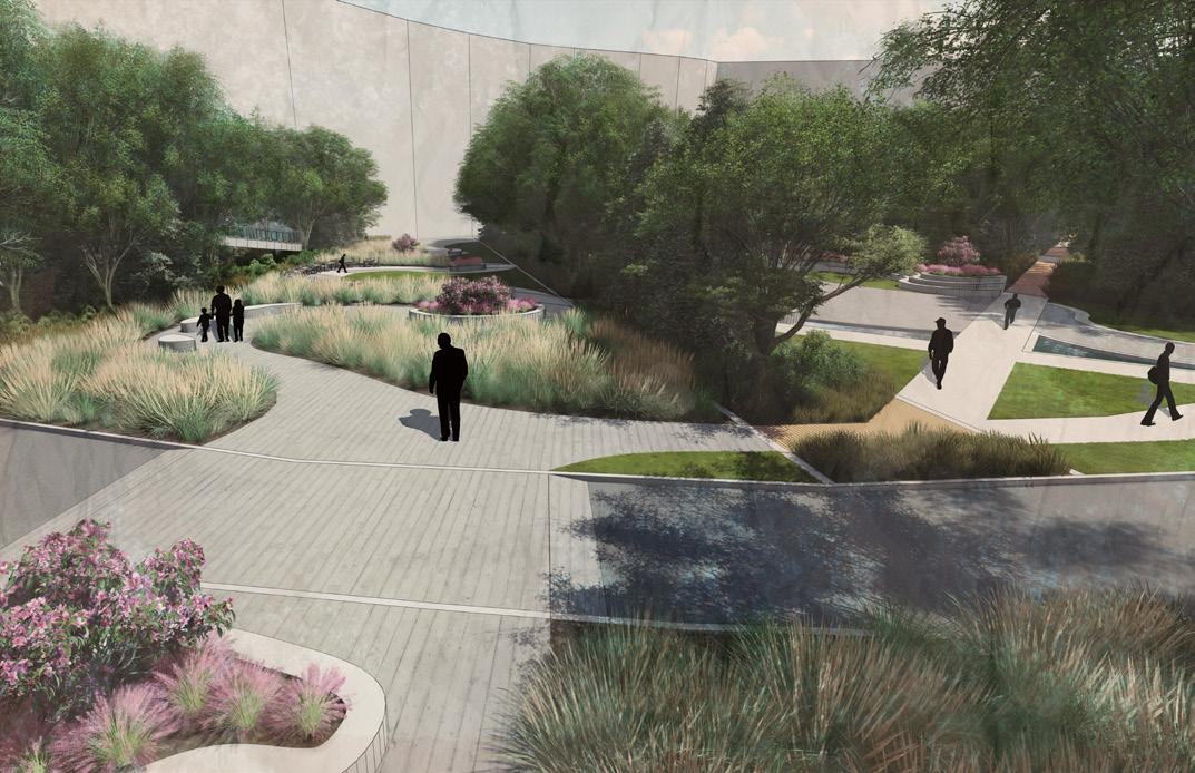
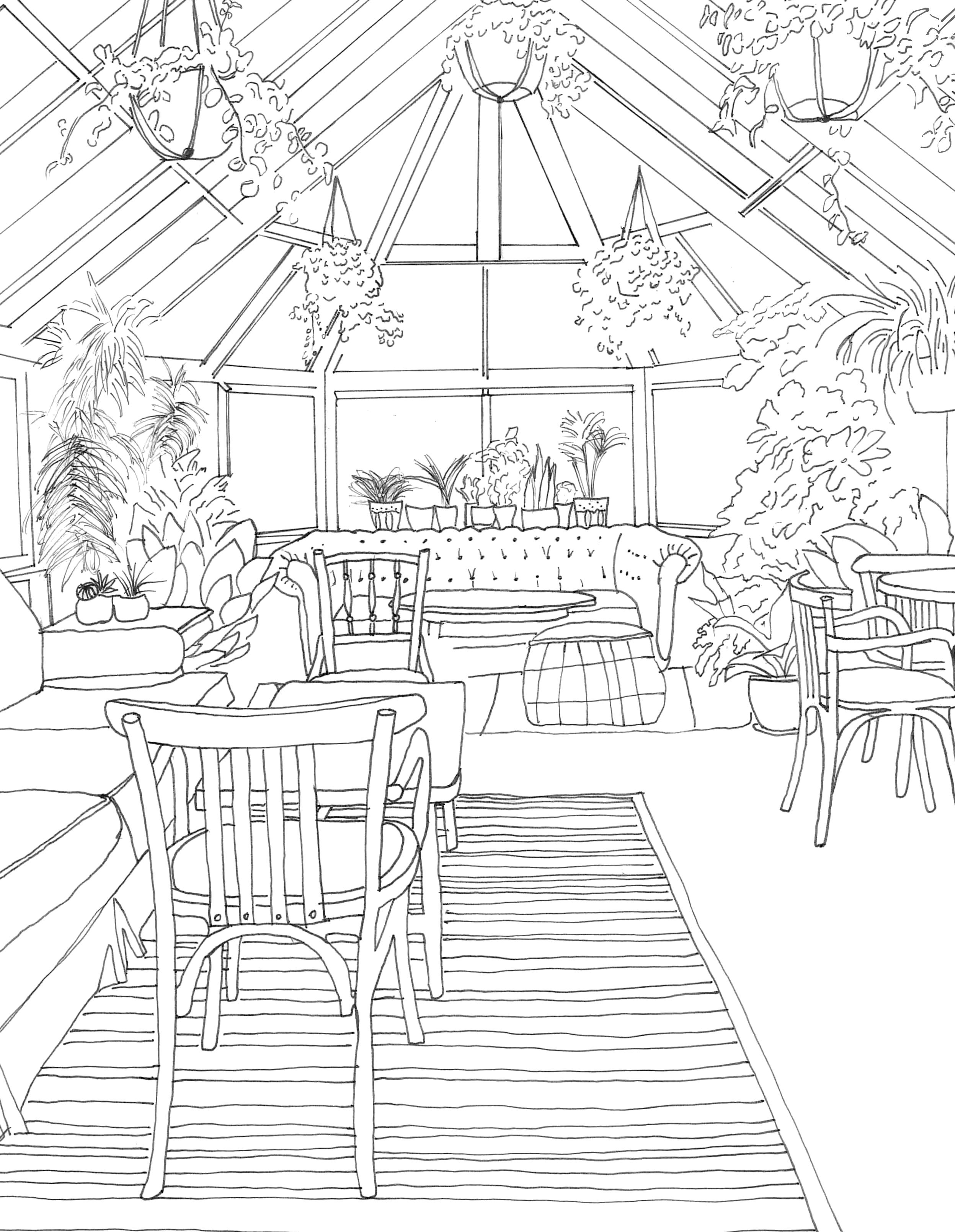
Two of the building interiors have been gutted, removing the roof, to expose an opportunity for vibrant gardens reflecting the struggles and triumphs of the city with a glass wall between each space to encourage reflection and celebration. The building facades of these renovated plaza spaces will be preserved as is. The multimodal path behind the interior garden spaces is planted and includes two small plaza areas for community gatherings, connection and integration to festivals, and relaxation. These areas connect the currently disconnected Dooly Street to the already bustling Cherry Street. This current space is an unused alleyway behind a section of unused buildings. This space changes the perspective of the alleyway to a space of community, relaxation, and reflection. This design also references its roots by including an alleyway that will be adorned with community memebers works of art. This design is intended to connect not only the current infrastructure but also the community and educate visitors on the beautiful history of Montezuma.
Rendered with Lumion and Photoshop
FOCUS AREA
7
PRESERVATION
Monte-
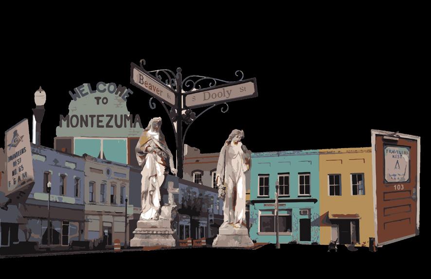
zuma is enveloped in rich history and iconic architecture. At the same time, many of the historic builidings are falling into ruin. The revitalization of Montezuma would not be just without absolute care, consideration, and preservation of these timeless structures.
RECREATION
Informal interviews conducted during the site visit revealed the majority of residents feel that they do not have adequate access to recreational activities. Downtown Montezuma has immediate access to Beaver Creek; however, due to the pollution of the creek, swimming is not an option for residents. This design seeks to open access to the creek while providing other options for recreational activities.
CONNECTIVITY
Walkability and bikeability are sparse throughout Montezuma. Traversing the small town can be dangerous for pedestrians and bicyclists alike. The intervententions employed for this theme place safety first while also improving aesthetics throughout town.
RESTORATION
With the history of devestating floods, especially that of 1994, it was important to prioritoze river management and health. This first begins with assuring residents feel a sense of safety when interacting with Beaver Creek. The next step after safety is celebration. This includes revitalizing the downtown area to reflect the resilence of this small town.
1 2 3 4 6 7 10 9 8 5
1. Celebration Garden 2. Reflection Garden 3. Multi-Modal Path 4. Space for Small Events 5. Art Alley 6. Seating Area 7. Crosswalk with Speed Tables 8. Park Connecting to Beaver Creek 9. Ramp Connecting indoor gardens to Multi-Modal path 10. Crosswalk connecting to Depot
Rendered with Lumion
PLANT SCHEDULE A B C D A B C D FOCUS AREA PLANTING PLAN AutoCAD and LandFX
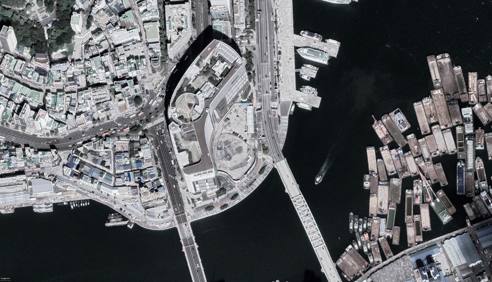
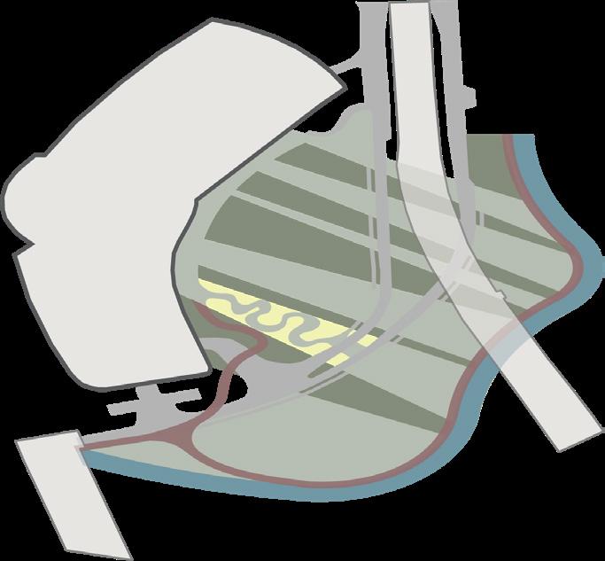
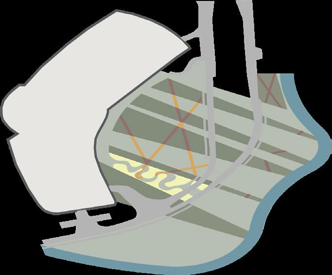
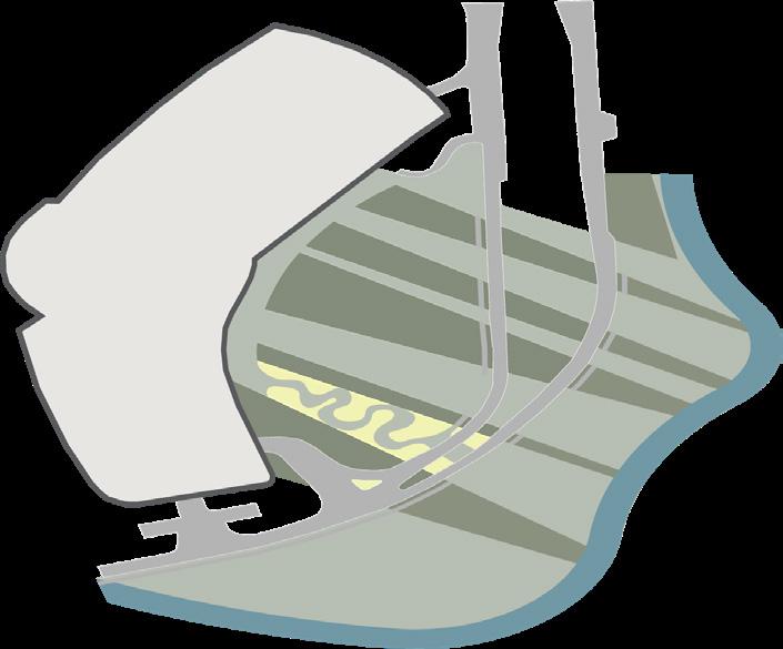
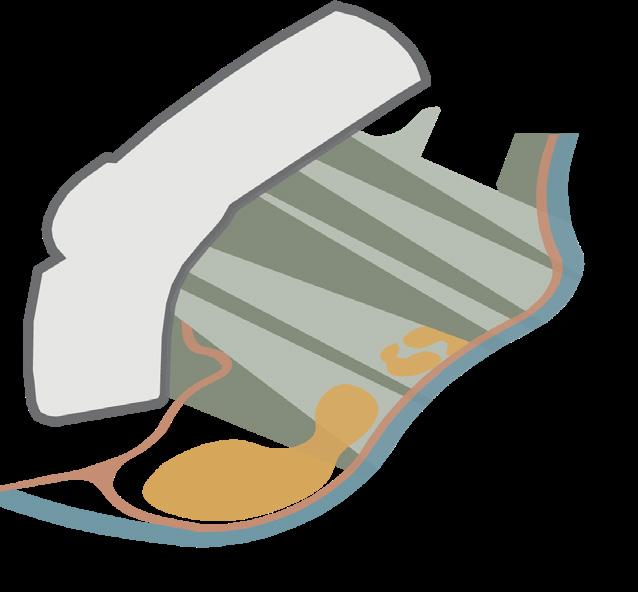
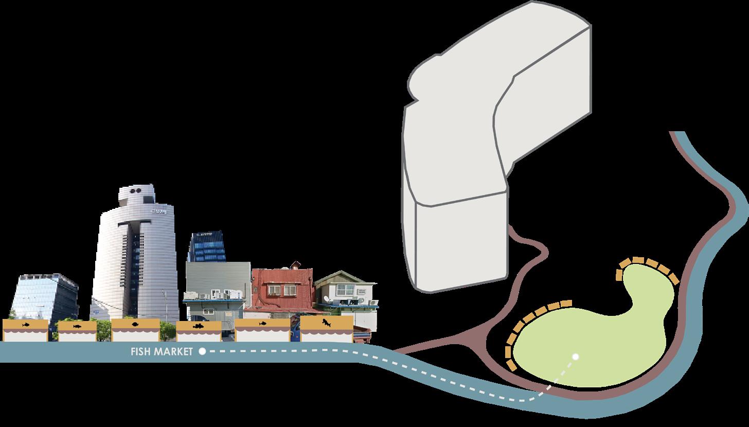
LOTTIE MALL WATERFRONT PARK CREEATION
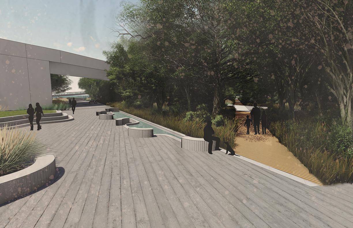
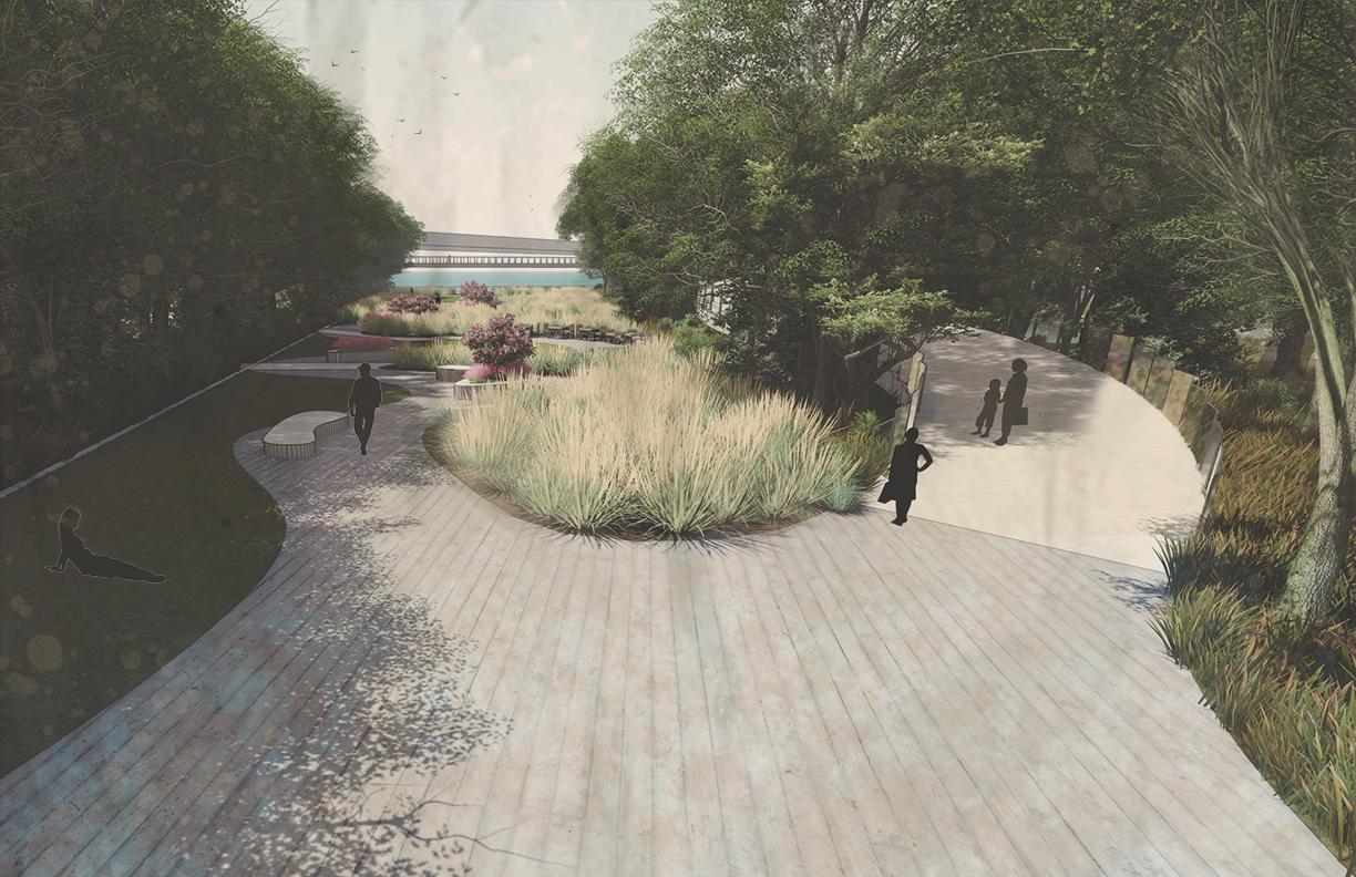
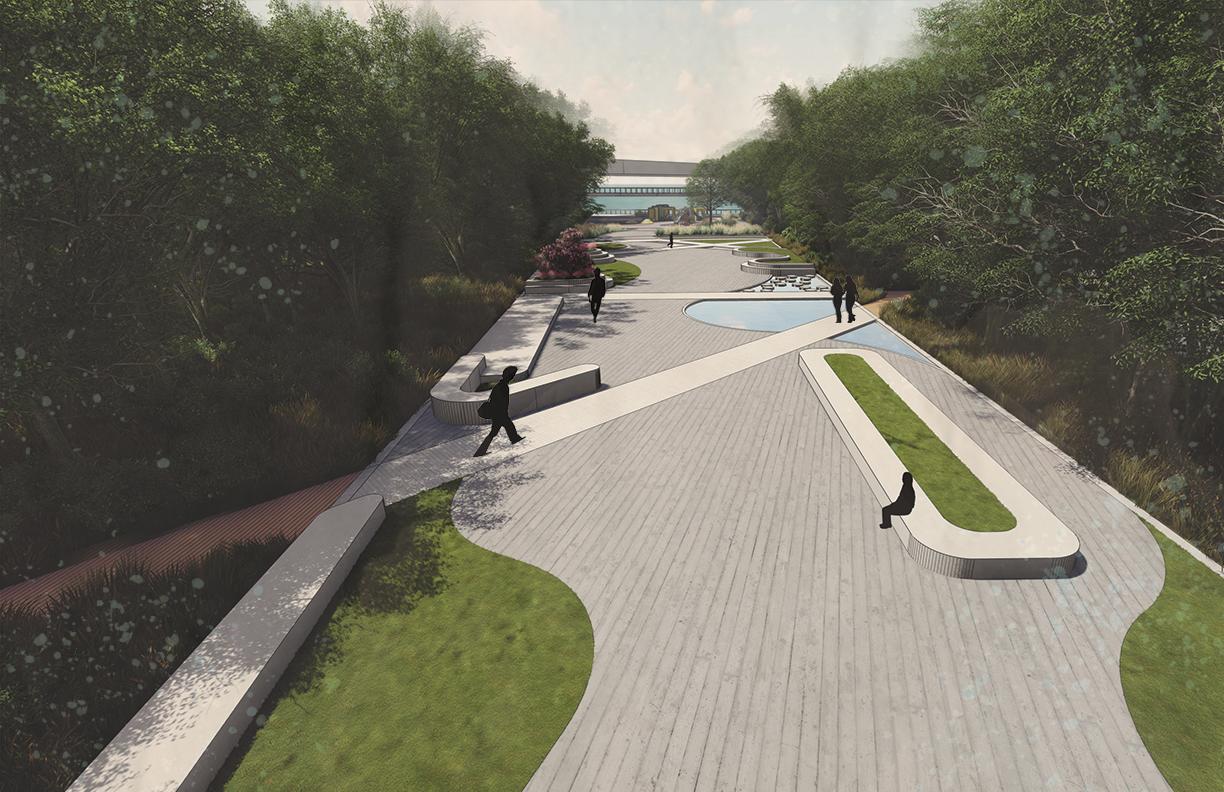
The Lotte Department Store site presents a unique opportunity to provide the City of Busan, South Korea, with a waterfront park. This park development provides an opportunity for the historical fish market to be re-established. Since the Lottie Mall is a tourist attraction, the park will offer a connection to the Eastern and Western side of town as there is no current pedestrian connection. The open lot between the mall and waterfront is an opportunity to reunite the urban waterfront with natural aesthetics and the function of a riparian buffer. Currently in a preconstruction state, the site is almost entirely impervious surface and exposed dirt with no green space to be found. Our goal was to provide the people of Busan with a park that fulfills as many of their needs as possible. First, we needed to restore urban green space. The benefits of urban tree groves as it pertains to carbon sequestration and the cleansing of storm water runoff are unmatched. Second, we wanted to provide the city with as many opportunities for recreation as possible. We designed areas for children’s play, a chess garden, and even a table tennis plaza to encourage many age groups to get active in the park. Third, we wanted to establish ample areas for people to walk and enjoy the dense foliage, namely the boardwalk system across the site.
A group project by Kaylee Major, Clarrisa Costen, Carter Gilson, and Taylor Titshaw
DESIGN PROCESS
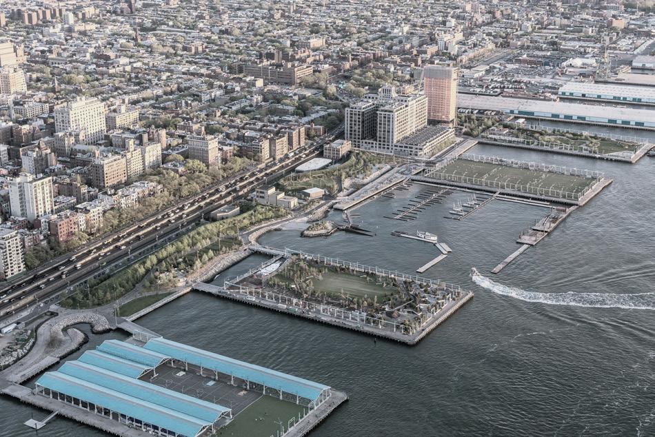
Brooklyn Bridge Park
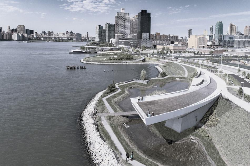
Early on, we became enamored with the impressive lookout over the water and the change in elevation throughout Hunter’s Point Waterfront Park. It was a unique precedent because it offered a similar landscape to the Lotte Department Store site. The topography change of Hunter’s Point inspired our raised boardwalk lookout. However, since we wanted to maximize the amount of area on site that could act as a lookout, we opted for a long raised boardwalk, instead of one smaller lookout. This alloed for the whole boardwalk to offer views across the water and the park.
Brooklyn Bridge Park was the inspiration for the pier-style outcrop into the Busan Port waterway. In addition to adding more land area for our site, the pier accentuates the interaction between land and water than Busan was built upon as a port city. The form of the pier is an organic reiteration of the traditional pier with two areas that jut into the water. We worked an organic edge into the landscape to improve the experience of the walker. Someone traversing the waterfront boardwalk will much prefer a meandering walk instead of one framed by edges and corners.
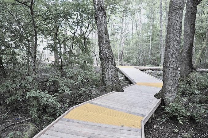
Arninge-Ullne Riparian Park was the inspiration for our boardwalk network. The park disperses a series of boardwalks throughout a wooded riparian area. The similar site characteristics caught our eye and we used the boardwalk to play a crucial role in the circulation of our site. The raised boardwalks allow our groves to function as bioretention areas and filter stormwater runoff. Also, the boardwalks, allow for the user to be immersed in greenery. This experience is not common in the city of Busan due to a lack of green space, especially along the industrialized waterfront.
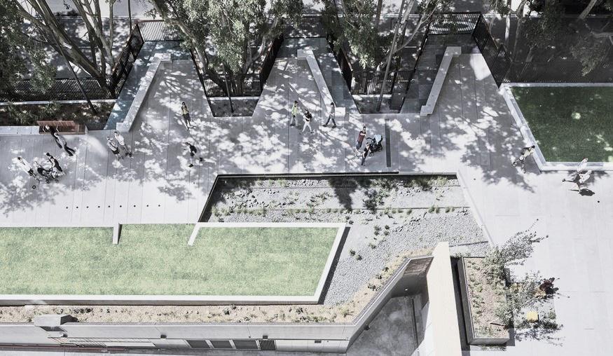
The paved areas in the park are linear and bordered by planted beds, seating, activities, and trees. This design follows the same idea as The Goods Line which provides an interactive space in a long linear way. Pedestrians can experience different forms of recreation spaces along the line. The planted beds are in the form of Arc and Tangent creating intimate nooks with benches bordered by planted grasses and turf. The Arc and Tangent form gives the space soft corners and the wide area a narrow and direct walkway.
Elevation Experience
Top Level: Raised Boardwalk
Mid Level: Forest Boardwalk
Bottom Level: Forest Boardwalk
Design Interventions
User Group: TOURIST Views
Connectivity
Destinations

CITY DWELLER
Native Vegetation
Intimate Space

CHILDREN
Interactive Areas
Recreation
Wildlife Education

LOCAL WORKERS
Secluded Seating


Definition of Space All
Formal Space
Accessibility
Hunters Point Waterfront Park
Arninge-Ullna Riparian Park
The Good Line
Made with Illustrator
Graphics
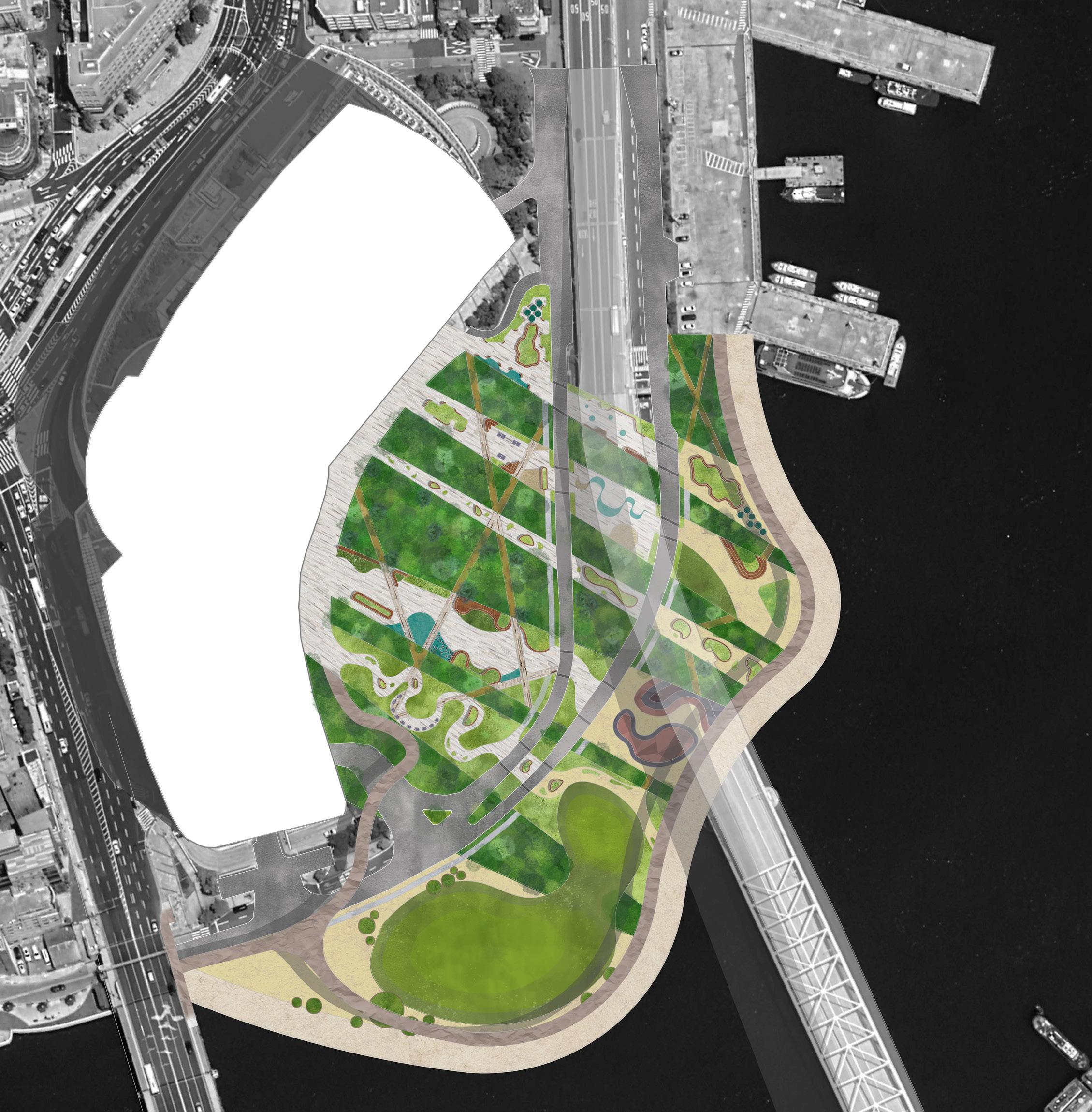
MASTERPLAN PERSPECTIVES
1 2 3 4 5 6 7 8 9 10 11 12 13 14 15 16 1. Raised Boardwalk 2. Skatepark 3. Open Greenspace for Recreation 4. Tree Grove 5. Chess Garden with Wildflower Meadows 6. Tree Grove 7. Plaza Space with Interactive Water Features 8. Dense Tree Groves 9. Plaza Space with Seating 10. Tree Grove 11. Plaza Space 12. Tree Grove 13. Plaza Space 14. Tree Grove 15. Waterfront Access 16. Childrens Playground
Lumion Rendering by Kaylee Major, Clarrisa Costen and Carter Gilson
Grove Boardwalk Entrance Raised Boardwalk Entrance
Recreation Lawn Shade Garden
Chess Garden Pond Walk
NEW EVOLUTION
A SUSTAINABLE COMMUNITY


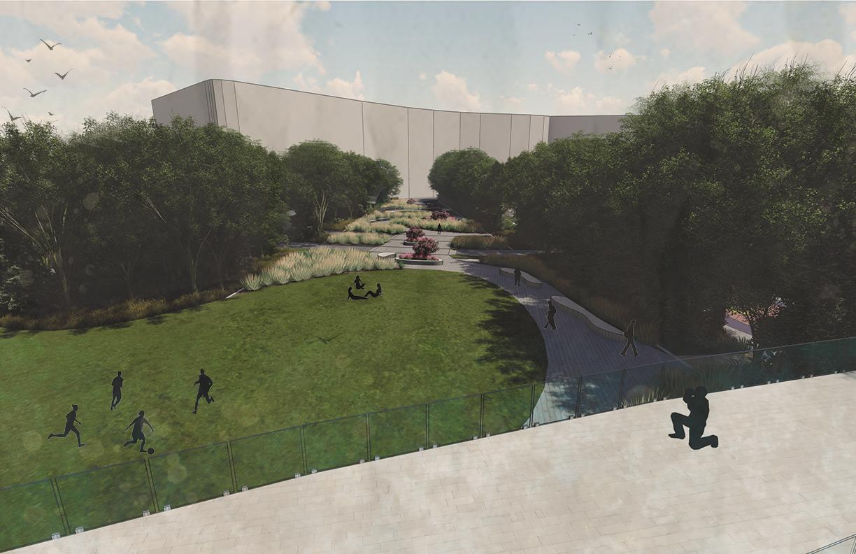
New Evolution is a community built for the individual. New Evolution focuses on building community relationships through the use of community gardens, open green space that allows for programming, communal greenhouses, and restaurants catered to the community. There is enough space within the community gardens to supply fresh foods to the residents, all excess would be given to the restaurants within the community. Housing will be constructed with shipping containers and will each be eight hundred square feet. This keeps the cost of the homes low while also maximizing the amount of lots that can be built on the site. New Evolution is a sustainable community due to the amount of green spce and tree canopy that will be saved during construction. The residents will also have the choice to participate in the community gardens which should be able to provide enough fresh foods for all residents needs. This negates residents need to drive to the grocery store for basic fresh fruits and vegetables.
The traffic circulation of New Evolution is an innovative way to combat the loss of greenspace/ tree canopy to parking lots. There is a traffic circle within the center of the community which is underground. This is connected to an underground parking garage which leads into each residents home via elevator. there is also a few stairways leading to the central greenspace. There are wildlife crossings above the roads which lead into New Evolution to decrease the amount of animal related accidents and encourage native species to cohabitate with the residents of this community.

 Community Planting Planmade with AutoCAD
Single Lot Planting Plan Hand Rendered
Community Planting Planmade with AutoCAD
Single Lot Planting Plan Hand Rendered
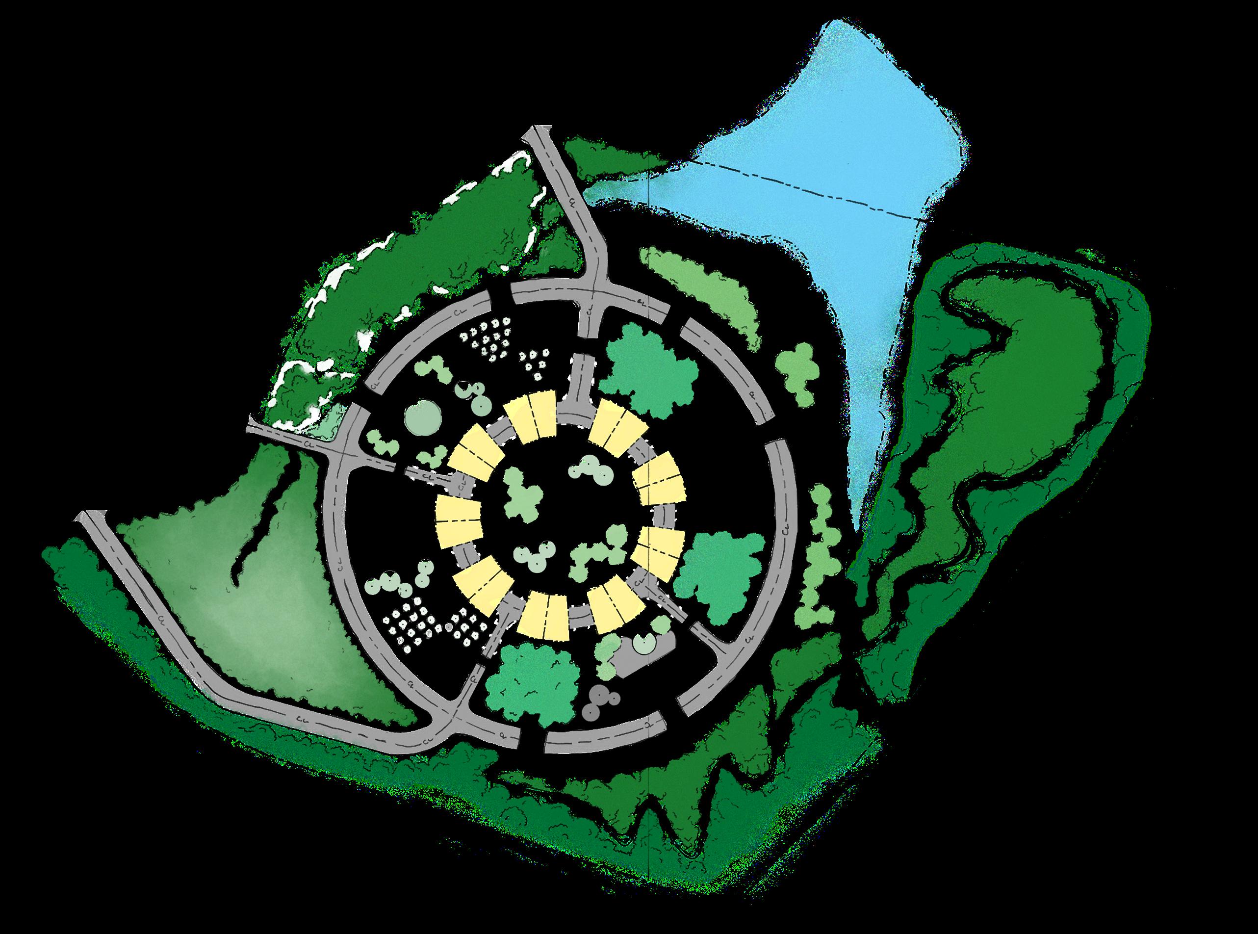
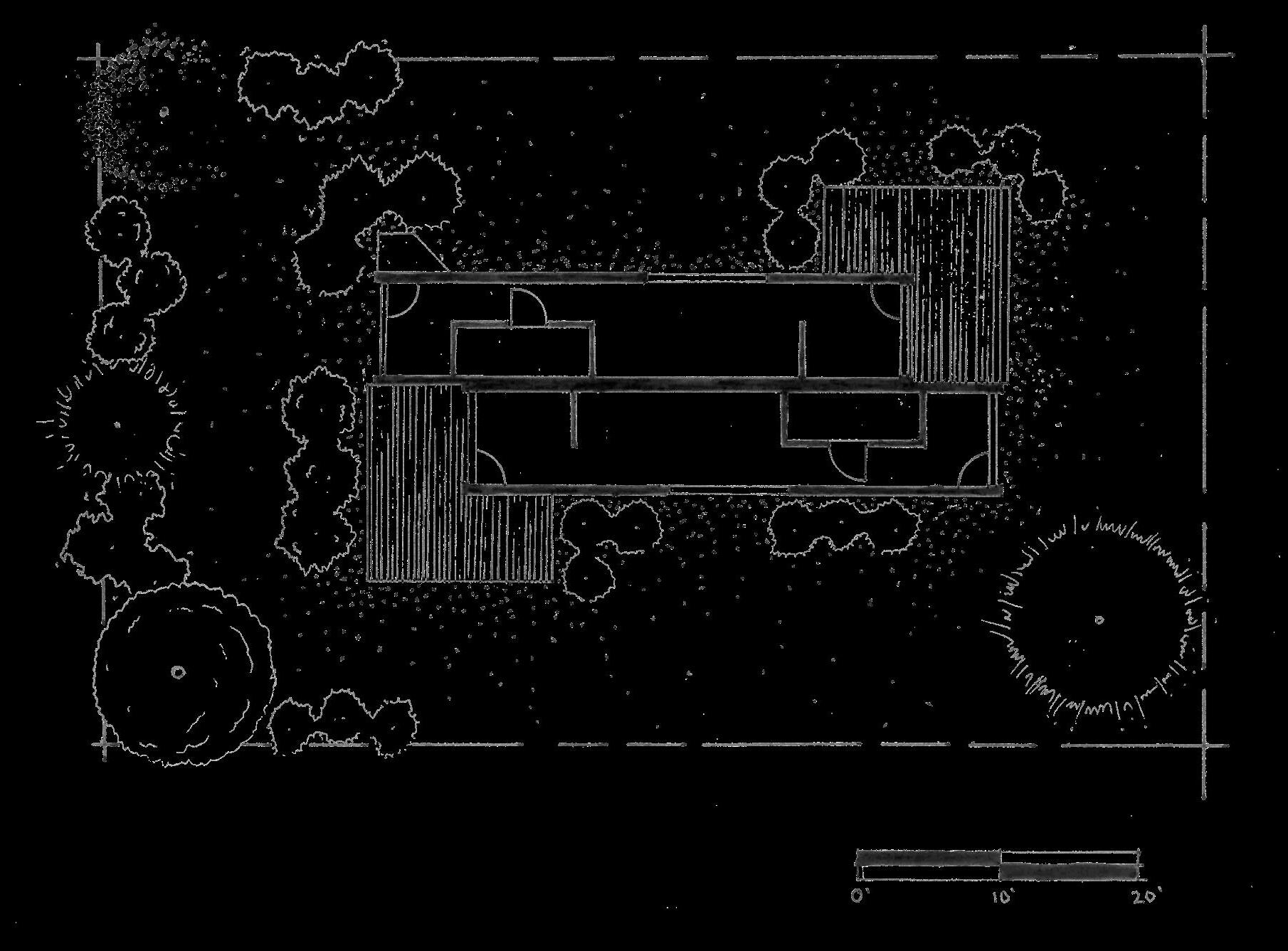
Hand Rendered Hand Rendered Linework Hand Rendered /Color done with Photoshop 1 1. Large Greenspace 2. Lots for Container Homes 3. Community Gardens 4. Orchards 5. Greenhouses 2 3 4 5 7 6 8 9 6. Restaurant Space 7. Wildlife Crossings 8. Trail System 9.Beaches by Lake. Masterplan Container Homes Interior of Greenhouse
GWINNETT COUNTY GICH FOCUS AREA
focus area: phyical capital
Physical Capital shapes the sense of place. It is the roads, buildings (houses, warehouses, businesses), and other physical features (railroad tracks, bridges, vacant land). Physical capital consists of the tangible elements that create space. In the context of community development, it refers to the stock of buildings and infrastructure in a locality. The main type of physical capital within community development is housing. Transportation and infrastructure are also apart of physical capital. Our focus in this report primarily surrounds the housing portion of physical capital. Physical Capital is important for community development because it makes up the physical attributes of the locality (stock of buildings). It is where people live. Housing is the most important physical capital because it has been one of the main concerns among community-based organizations specifically affordable housing. Housing is also mainly the only category of physical capital that community-based organizations deal with. Physical Capital is rooted in place. It’s immobility endures over long periods of time. As stated in Asset Building and Community Development , “Housing is the largest investment people make and comprises a majority of most families net worth.”
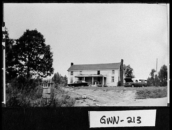
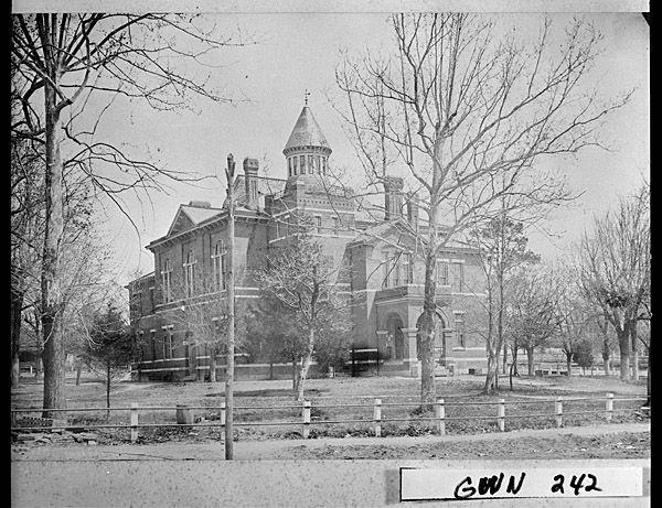
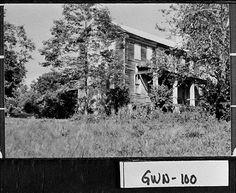
 Photos taken from Gwinnett County Historical Society
A group project by Kaylee Major, Anna Wilson and Ash Daniel
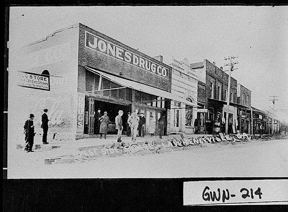
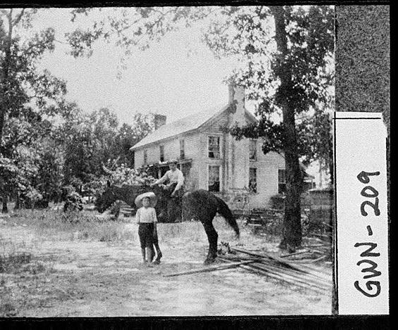
Photos taken from Gwinnett County Historical Society
A group project by Kaylee Major, Anna Wilson and Ash Daniel
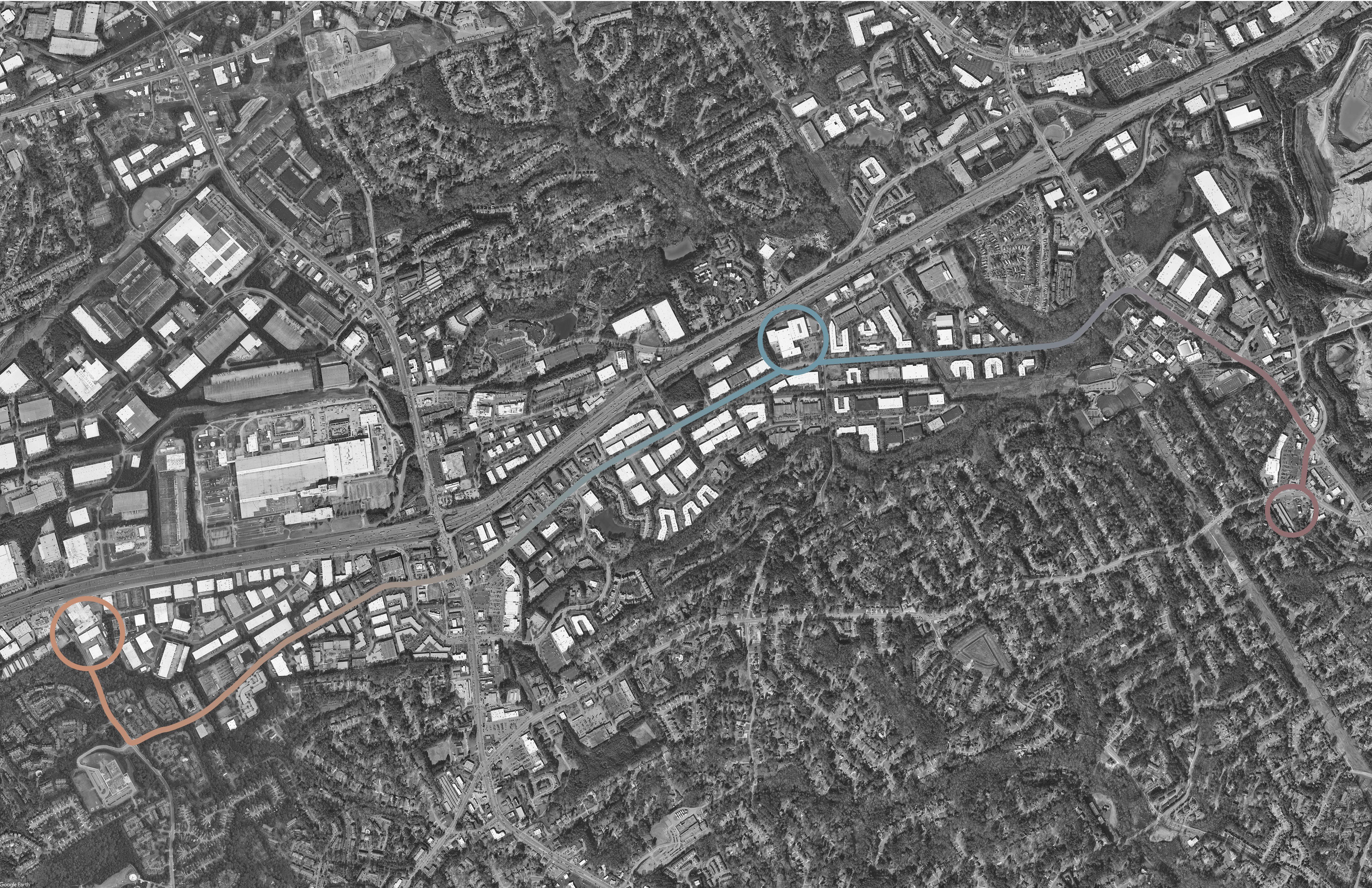
Legend Abandoned Warehouse- 6624 Dawson Boulevard Canon Offices- 5625 Oakbrook Parkway Empty Lot- 5068 Singleton Road 3 1 2 2 3 1
Rendered with Photoshop
AREAS FOR REDEVELOPMENT
HOUSING ISSUES
Affordability
Housing Affordability refers to the median housing price within a community in relation to household income. Reagan and Nixon era made affordable housing state and local governments responsibility which is commonly referred to as block grants.
Tax deductions on private homes only benefit homeowners. Because of this, private housing developers unwilling to rehabilitate or construct affordable housing in low- income neighborhoods. There are currently less than 30k affordable housing units produced each year compared to 150k in the 70s.
Adequacy
Housing Adequacy consists of the actual physical condition and age of the housing stock in a community. There is currently no preservation of affordable housing because of the lack of capital improvement and investment in affordable housing.
Public housing uses 38% more energy than privately owned housing for the same floor space. Low-income residents also pay more for utilities than the average homeowner or renter.
Availability
Housing availability refers to the distribution of the actual housing stock by type. In the 1960s and 1970s, there were single-room occupancy (SROs) units being built. According to the Asset Building and Community Development text, “Filtering is the process by which high-income households buy and move into new homes, leaving behind a house that is bought by someone of slightly lesser means, who in turn leaves behind a house that is bought by someone of lesser means.” Community-based organizations (CBOs) are helping to slow the filtering process. Demand side model means that is assumed there is an adequate supply of housing. However low-income households do not have the adequate income to afford available units. Under the Fair Housing Act, lenders are unable to discriminate based on race, religion, nationality, sex, disability status, and family status.
Community Gentrification
Gentrification is the process when higher-income residents move to previously lower-income areas. The first new residents to the neighborhood are called urban pioneers. Urban pioneers are usually artists or other young professionals. Because of the influx of new wealthier residents, lower income residents are forced out of their homes due to rising housing costs. Additionally, these neighborhoods are predominantly minority and the new residents are majority white. Filtering occurs because of the increased property taxes, rent and tax assessments. With the new residents comes new businesses. These businesses arrive catering to high income residents. The tight housing markets in cities may drive residents to neighborhoods where housing costs are lower. Gentrification usually occurs where the housing stock has high architectural value, there are a large number of renters, and low housing values. Community Development Block Grants (CDBG), states and localities must use 25% of received funds to redevelop abandoned or foreclosed properties. Tighter credit for housing Organizations shifting their focus to rentals rather than privately owned homes.
Residential Segregation
Racial discrimination continues to be prevalent in the housing market, lenders and realtor’s may hold racial stereotypes. Index of Dissimilarity is the measure of evenness with which two groups are distributed across an area. Social Isolation Measure is the level of social isolation through census tracts. Minorities often lack information on the cost of housing in white neighborhoods. Income Residential Segregation is when income inequality leads to class segregation. Inclusionary zoning requires developers to produce a certain percentage of units considered affordable housing (the Beltline).
Housing Crisis of 2008
The Housing Crisis of 2008 occurred because of the large ammount of subprime loans. Subprime loans are high risk loans, based on a lack of capital, a high debt to asset ratio, and a non-desirable credit history. In 2008, there were more than 2.9 million foreclosures. Inner-city neighborhoods experienced an increase in abandonment which decreased the price of surrounding properties. The housing crisis caused tighter credit for housing and organizations to shift their focus to rentals rather than privately owned homes.
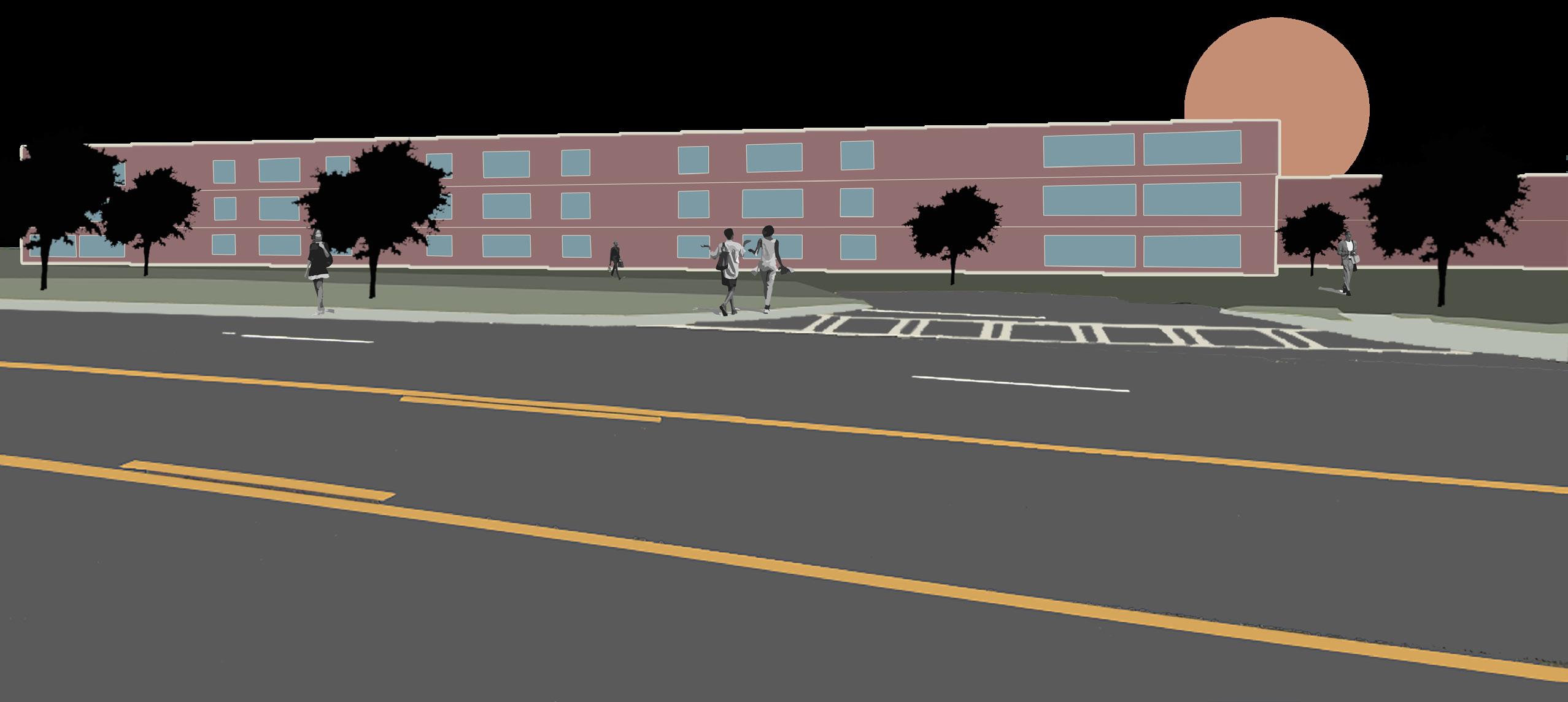
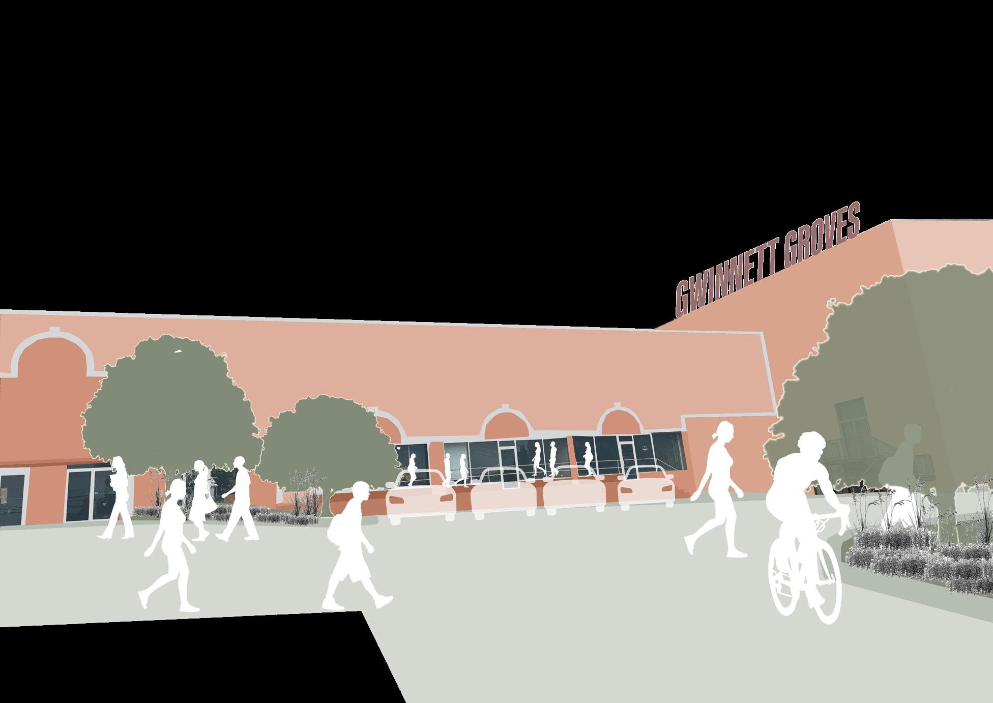
Cannon Office Spaces Redevelopment
Warehouse Redevelopment Rendered by Anna Wilson
Rendered with Photoshop
EMPTY LOT REDEVELOPMENT
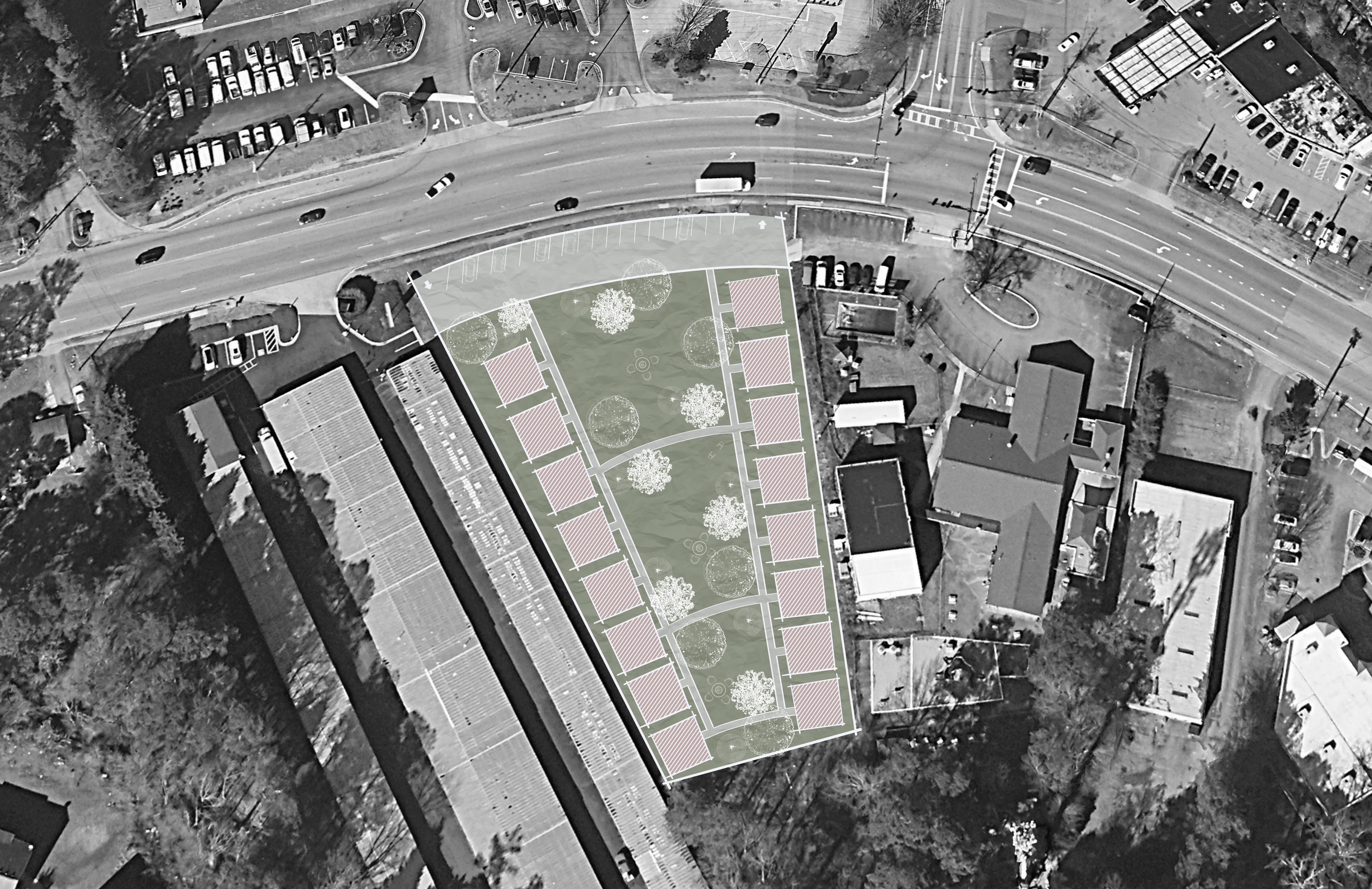
Legend
16 Two story cottage houses
20 parking spaces with a one way in and out
Large greenspace with a firepit and seating
Medium greenspace with a firepit and seating
Small greenspace with a firepit and seating
1 2 3 4 5 5 4 3 2 1
Rendered with Photoshop

Thank You!