
Choi Design Studio VI | NJIT Hillier College of Architecture & Design table of contents final spread overview assignment iii (final & midterm) assignment ii assignment i concluding thoughts 1 2 3 21 27 30
ECOLOGICAL RESEARCH AND


MUSEUM

Kathy Trinh | ARCH 396 | Spring 2023


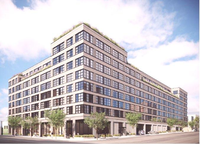
The Nexus Center is a mixed use hub that takes the idea of transitional space and turns them into points of interest. The building is composed of two main cores, the research center and the public museum, with an interconnecting gallery hall serving as the building’s spine and bridging the two separate types of program together. The emphasis on these in between spaces derives from the surrounding Gowanus neighborhood, and it’s gradual shift in rezoning and cleaning up of the nearby canal in the near future. The redevelopment of the neighborhood showcases its history, from a sewage ridden flood zone to a clean mixed-use area, and how the current transition is integral to the understanding of how to move forward. The center also features a sunken plaza, which is transformed into a retention pond when flooded, along with an outdoor research center that uses constructed marshlands to measure climate change and its impacts on the canal.

flood levels: 2020s vs 2080s sunken plaza: stormwater basin high tides outdoor research center nts
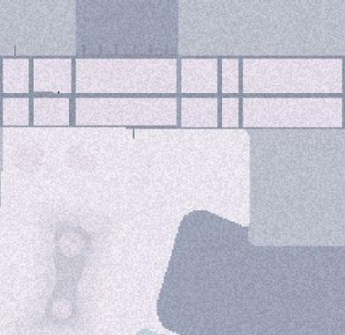
north elevation scale: 3/32” = 1’0” 2 2 3 3 4 4 5 5 steel rigid frame rooftop skylight glazing aluminum fins concrete panels brick facade section bb scale: 3/32” = 1’0” OFFICES GALLERY SPACE ORE CAFE REST ROOM PUBLIC EVENTS WASH ROOM MECHANICAL & ELECTRICAL ROOM ADMIN OFFICES MEETING ROOMS LABORATORY 1250 1250 PRESENTATION CLASS ROOMS TECH SUPPORT PRESENTATION SPACELIVI N G GUEST 700 5000 1200 1000 1000 1500 1600 250 200 ROOM REST ROOM 250 PRESENTATION SPACE 1500 research branch access points 7850 sf 7200 sf 11500 sf 26550 sf total: gallery spine public branch includes circulation concept model early sketches first iteration model site plan scale: 1/32” = 1’0” N gowanus canal fifth street high tide 2020s high tide 2050s high tide 2080s 2020s 2050s 2080s flood levels over time -12’ canal bottom 0’ sea level 2020s sloped edge 2’6” 5’ lower marshlands 12’ design flood building 9’ high marshlands SLR 2080s SLR 2050s SLR 2020s marshlands useweeds, dogwood shrubs, primroses, research uses the marshchange, and how that level rise, temperature, effects on plants. level02 level03 level01 N floor plans scale: /16” = 1’0” community redevelopment the “nexus” research and public land and sea humans and water redeveloping under new zoning; mixed use buildings section aa scale: 3/32” = 1’0” 1 final spread
The Nexus Center is a mixed use hub that takes the idea of transitional space and turns them into points of interest. The building is composed of two main cores, the research center and the public museum, with an interconnecting gallery hall serving as the building’s spine and bridging the two separate types of program together. The emphasis on these in between spaces derives from the surrounding Gowanus neighborhood, and it’s gradual shift in rezoning and cleaning up of the nearby canal in the near future. The redevelopment of the neighborhood showcases its history, from a sewage ridden flood zone to a clean mixed-use area, and how the current transition is integral to the understanding of how to move forward.

The center also features a sunken plaza, which is transformed into a retention pond when flooded, along with an outdoor research center that uses constructed marshlands to measure climate change and its impacts on the canal.

2 overview
1 2 3 program distribution 3 assignment iii (final)


assignment iii (final)
floor plans
scale: 1/32” = 1’0”
5 assignment iii (final)
scale: 1/32” = 1’0”
floor plans (cont.) north elevation
scale: 1/32” = 1’0”
6
assignment iii (final)
section bb
scale: 1/32” = 1’0”
section aa
scale: 1/16” = 1’0”
7
assignment iii (final)
8
assignment iii (final)
flood levels over time
research and public

The gallery space, which is a long spine across the entire building, serves as the transitional link between the research center and the museum.

This space is also where the main circulation takes place, where researchers can go to display the findings of their lab work, and where the public go to explore and learn about research on the Gowanus.


9
assignment iii (final)
humans and water


The outdoor plaza serves as a public attraction in the back of the building. During the dry season (top), the area provides a sunken area to relax and walk around. During the flood seaonwhen the plaza is flooded with rainwater (bottom), the area become a retention basin while aslso still maintaing as a public attraction.

10
assignment iii (final)
land and sea


The outdoor research center uses constructed marshlands, inspired by the canal’s past, to focus on climate change, and how that can affect the canal’s sea level rise, temperature, and effects on plants. The sea level rise can be measured through the flooding of the canal over time (above). These marshlands will use native flora of the area such as thimbleweeds, dogwood shrubs, primroses, and deertongue grass to better connect with the site.


11
2020s 2080s assignment iii (final)
assembly material
12
assignment iii (final)
1/16” scale model


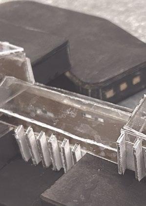

painted chipboard and acrylic


13
assignment iii (final)
gallery research library
1/32” scale model with surrounding context

14
assignment iii (final)
midterm: floor plans
level one | scale: 3/64” =1’0” |
15 assignment iii (midterm)
midterm: floor plans
program list (cont.)
16 assignment iii
(midterm)
|
level two | scale: 3/64” =1’0”
midterm: floor plans
level three | scale: 3/64” =1’0” |
program list (cont.)
17 assignment iii
(midterm)
midterm: section aa & flood levels
scale: 3/64” =1’0”
18 2080 s 2050 s current
assignment iii (midterm) current 2050s 2080s
midterm:
high tides over time
scale: 3/256” =1’0”
QOWO ¶ QOTO ¶ ⁄‚··ƒfl•
19 assignment iii (midterm) current
2050s 2080s
midterm: site plan & perspectives


plan scale: 3/512” = 1’0”


20 assignment iii (midterm)
CURRENT ZONING
21 assignment ii


22 assignment ii COMMERCIAL
& INDUSTRIAL REDEVELOPMENT


23 assignment ii RESIDENTIAL REDEVELOPMENT


24 assignment ii MIXED USE WALKING DISTANCES


25 assignment ii E
3+145'67#.4 89:6';<=>''?@A'BC'DE?
26 assignment ii SECTION DENSITY & TIDES !"#$%&'()(**+','(!"#$%&'().**+','("@"@' "@A@' "@B@' "!@@' '0:(*,5&9 9)09&@! 9)09&@" ! ! ? 3+145'67#.4 89:6';<=>''?@A'BC'DE?
Storm Drains / Catch Basins
Storm drains a re a t ype o f catch basin t hat are a ditches and c urb inlets a bove g round. T hese connect t o channels and pipes t hat carr y the stormwater deep underground. W hen w ater content is untreated stormwater w ill e mpty water.

Process
There are two types o f systems - a separate and c ombined one. The separate s ystem ensures t hat waste and storm water are separated, while the c ombined s ystem can pollutants into t he w ater.

Pros Cons
- Debris not s eparated when going t hrough t he drain can cause pollution.
- The unintentional mix of wastewater with stormwater c ontaminates rivers, causing pollution, and potentially killing aquatic life.

FLOOD PREVENTION TECHNIQUES - 1
27 assignment i
- A llows for safer travel o n the roads d uring the drain before freezing into ice.
Ra in Gardens
Ra in gardens a re shallow, landscaped spaces that consists of n ative shrubs, perennials, and grasses also designed perpendicular to the slope of the land roofs, lawns, patios, and driveways. Ra in gardens are normally d ry and only hold water af ter rainfall. Although t hey can b e placed in most spaces, r ain gardens shouldn’t be placed 10 ft within a building’s foundation or 25 f t from the septic system.
Process
They are planted in a small depression, which is generally formed on a l ow point of a natural slope. S and and gravel are then added t o make the rain garden work more
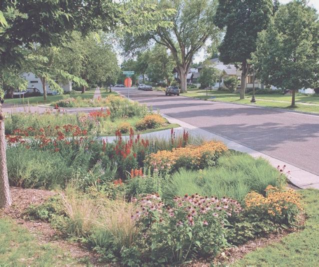
underground through the soil and deep -rooted plants and help r emove watershed.
Pros Cons
- A sustainable draining system (SuDS) t hat is heavy rainfall.


- Like storm drains, it collect s rainwater from roofs
- Improper construc tion can l ead t o drainage
- Increased erosion rates.
- Hard to design in areas with steep slopes.
-Spans only 100-400 sq.ft, so heavier rainfall would be hard to absorb.
FLOOD PREVENTION TECHNIQUES - 2
28 assignment i
Sea Wall Barrier s

Implementation o f a sea w all a llows for safe protection against a c oast and its c ommunity. The sea wall is c onstructed o f concrete and p laced

Process
anchored to ensure i t doesn’t topple over. Weep holes are then placed in the wall to allow for water drainage and preventing pressure behind the wall. The bottom of t he w all is set into the w ater ground, with r ip raps ( small rocks) p laced for suppor t in front of the wall.
Pros Cons
- Seawalls a re not a s expensive as l andscaping ground.

- They p
- The walls are sturdy and does not crack easily.
- Requires high maintainance to perf orm well.
- O vert opping can o ccur if sea l evel r ises past the wall height.
coast outside of the wall.
FLOOD PREVENTION TECHNIQUES - 3
29 assignment i
concluding thou ghts
what did you learn from your project?
this project really helped me gain more insight on flooding techniques and how to incorporate them into my building and concept design. it was also a huge step out of what i was used to due to the strong focus on the water’s edge and how that affects the architecture.
what did you think you were doing during the semester when you were immersed in it?
i wanted my building to have a big focus on human interaction and appreciating the surrounding site more, since it was something i took note of when first doing the site visit at gowanus.
what do you think you actually did during the semester now that the project is over and you have some perspective?
i think i was focused too much on the building itself and how the program and circulation would work on the interior, that in reality, i spent very little time developing the outdoor landscape and flooding part. i found myself iterating the building over and over, but the outdoor felt very rigid throughout the semester.
are there architectural problems / ideas / issues that you discovered during the semester that you would like to continue investigating in your future projects?
in future projects, i defintely would like to focus more on water collectiopin techniques, and how i can use them in a way that makes the interaction between humans and water more pronounced.
30 concluding thoughts
