SURFURBIA
term: second year 1st term class: arch 202a type: urban planning professor: hallie black partners: darius prince & valerie gahman-vergara

Inspired by Reyner Banham’s The Architecture of Four Ecologies, this project explores the ecology of Surfurbia as a mile by mile project in Santa Monica, California. Through practicing urban planning with a lense of superfuturistic goals, the project envisions the region in 25-100 years through radical propositions.
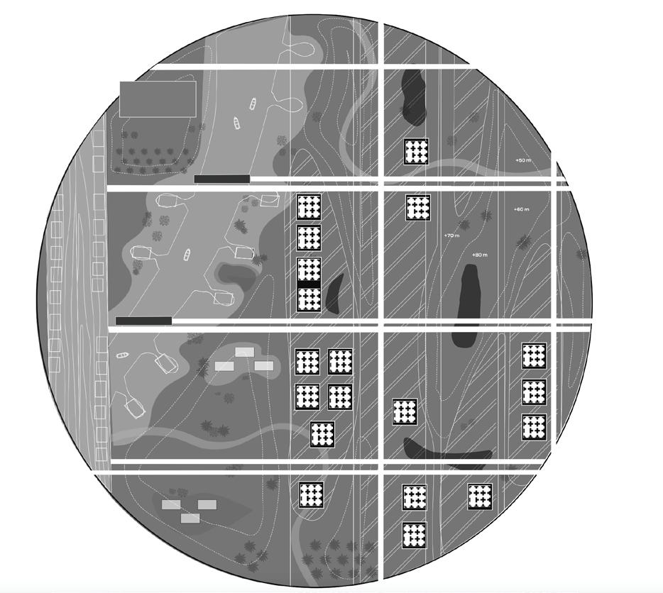
3d printed superblock gridscape
SURFURBIA STATE PARK
The project carves out a state park space to increase public recreation and reduce congestion and emissions. Within the park is a canal system that not only supports mobility but also mitigates sea level rise. Complementing this is a reimagined public transportation network, featuring high-speed rail and raised trolleys, designed to improve efciency while reducing congestion and emissions.

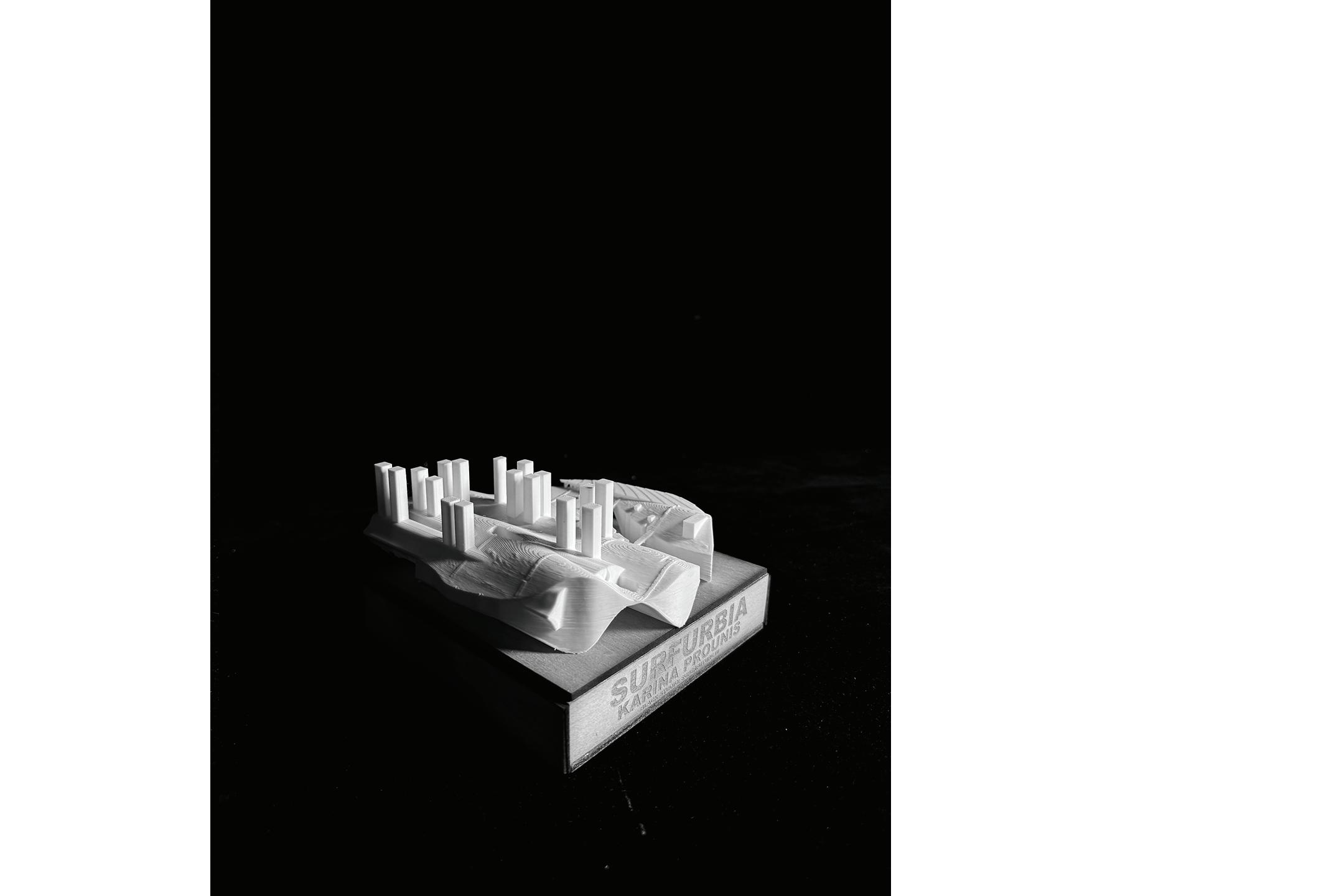
3D Pritned and 4” x 4” basswood study model
A CITY OF CAVERNS & CAVES
term: second year 1st term class: arch 202a type: urban planning professor: hallie black

Plan view with overlayed render of individual sector design.
The next part of the project focuses on the development of specifc chunk. The highlighted region yields an earthform topography driven landscape.
SECTOR DESIGN


LOWER LEVEL PLAN
The design of the individual sector resulted in a city sculpted from caverns and caves, creating a unique interplay between natural forms and urban development. This segment plans of the project showcase the variety of program that occurs on each level of the city.
TRANSPORTATION SYSTEM DIAGRAMS
TRANSVERSALITY
CIRCULATION
Every aspect of surfurbia is transversable by foot, bus, car, boat, or any other futuristic form of transportation. The two exposed layers of transportation are separated by pedestrian, topographic, paths and automobile, rigid, paths. The circulation system imposes an organi ed grid system amidst a uid unpredictable landscape. Each indicated stop marks a maximum 10 minute walking radius.
PIER NETWORK
The pier extension slices through the landscape of surfurbia, providing a major hub for pedestrian programming and commerce. The connected routes branch o of the pier and provide travel opportunities for the most populated area.
STRUCTURE
The landform architecture creates spatial opportunities in a sophisticated way in the greater context of urban planning. High rise buildings sprawl from the earth and dip down to the lowest layer of surfurbia to maximize F.A.R.
TOPOGRAPHY
The topography takes a uid and rippling form on the surface and a consistent sinusoidal form on the bottom. The topography drives the function and appeal of surfurbia, especially the cavernous openings that act as sources of light to the caves below.
TOPOGRAPHY ACCESS POINTS
CIRCULATION PEDESTRIAN
Regular circulation; topographic; most accsessible
AUTO
TRAIN
Automobile and public transport; cuts across and through landscape Train system embedded in landscape; cuts through topography
SUB-TERRAINIAN
Lowest level of transport; aids boats and underwater systems
CANAL
The canal is the main artery of surfurbia that provides programming, transportation, and essential ecological services. The canal desalinates the ocean water while simultaneously mitigating sea level rise, dispersing water incrementally throughout Southern California. The canal is boat friendly and obtains tide pool pods that branch out to house program and ecological restoration as well as docking opportunities.
UNDERGROUND NETWORK
The underground network is a lower level continuation of the upper level circulation routes, targetting submersible and seafearing travel. The underground ntwork is eqipped with docks and port.
ACCESS POINTS
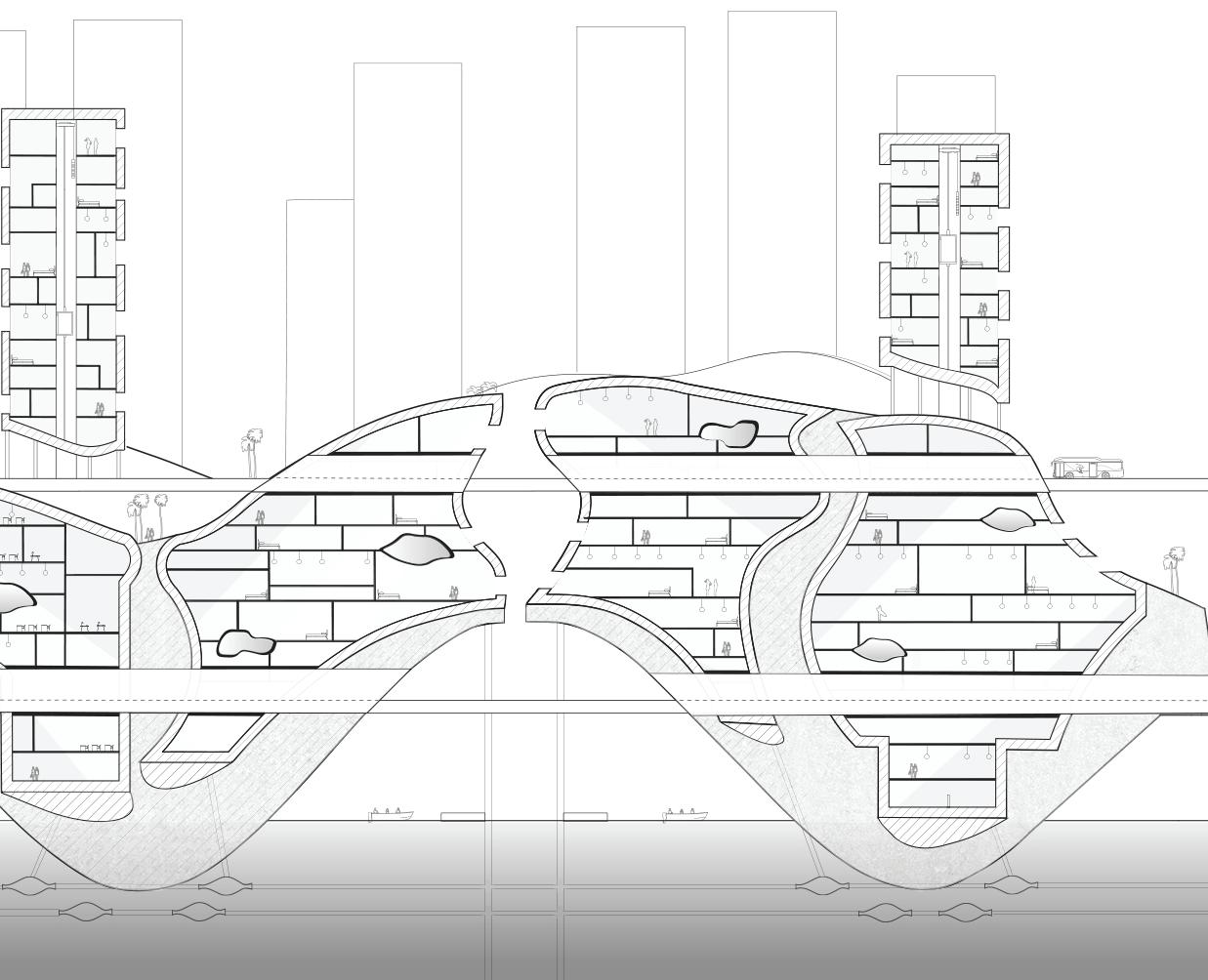
SECTIONS
The sections display the details of Surfurbia living, highlighting functionality, transportation, and lifestyle .

OVERALL SECTION
DIAGRAM SECTION


PERSPECTIVE RENDERS
URBAN PLAN MODEL
4” x 4” 3D printed study model of the proposed urban plan
Location of chunk in the site model to be developed
URBAN PLAN MODEL
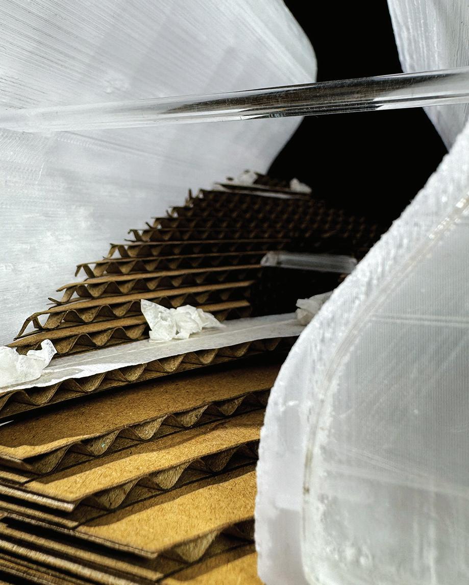
7” x 7” x 12” chunk model made from stacked cardboard, acrylic, and mirror, with 3D printed forms
1” = 32’


STRATA STATION
term: frst year 2nd term class: arch 102b type: public professor: kate chiu
This project envisions a gas station addition to Mercado La Paloma in Downtown Los Angeles, reimagining the station as both a functional hub and a visually compelling landmark. The project obtains 700 square feet of retail space and a market place.


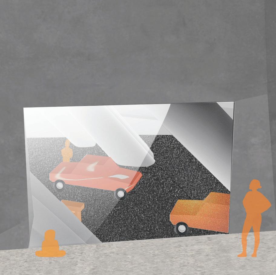
Beyond functionality, the design redefnes the gas station experience, positioning it as a destination for both highway travelers and urban residents. PERSPECTIVE

3D printed model spray painted with corrugated plastic facade
12” x 6” x 6”


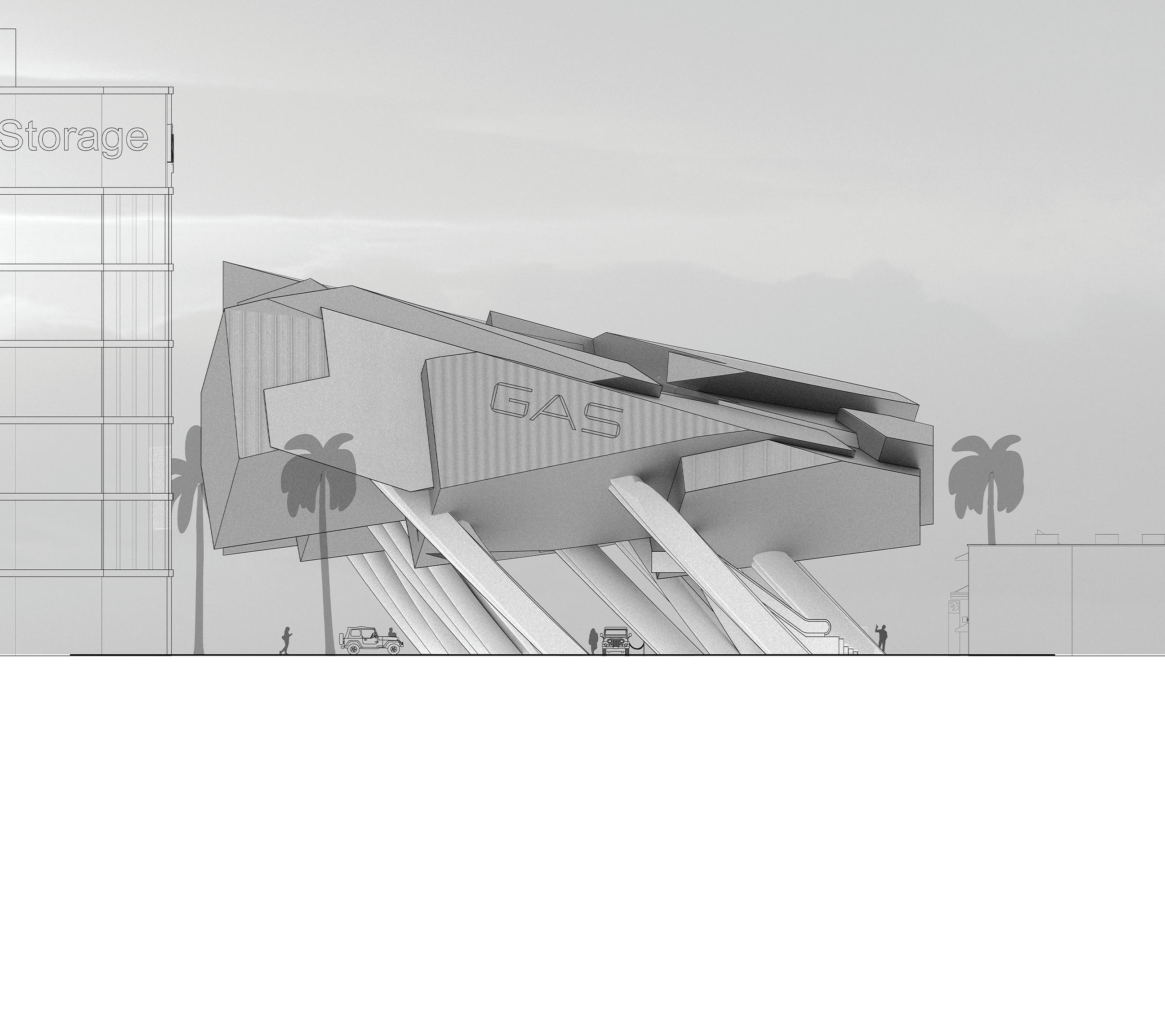
WEST ELEVATION
PLAN VIEW
DOWNWARD DWELLING
term: frst year 2nd term class: arch 102b type: dwelling professor: gillian shafer-lutsko
Dwelling project designed to be a unifed circulating ramp, transversible from any point. The project was driven by the concept of folding and leaning.


KARINA
PHOTOGRAPHY & DIGITAL EXPLORATION
Photography projects with digital manipulation in photoshop and illustrator.

