Date & Institution: Fall/ Summer 2019, Florida Atlantic University Tools Used: Rhino, AutoCAD, Adobe Photoshop, Adobe Illustrator, Adobe Indesign
Project Description:
A “Place-based Framework” generated from a partnership between the City of West Palm Beach, the FAU School of Urban and Regional Planning, and The FAU School of Architecture for the Jefferson Terminal District area.
The District is located just southwest of West Palm Beach’s Downtown area and is rich with development potential concerning housing, transportation, and public urban design.
Initially, Researchers within the FAU School of Urban and Regional Planning conducted a contextual analysis and developed future land use and transportation recommendations for the city.
Then, a focused design team from the FAU School of Architecture addressed the task of compiling the written findings into a report format and producing further urban design recommendations, organized into a set
of three possible masterplan arrangements.
The following work focuses on the urban design content produced by the Architecture team, as well as the final book design.
Jefferson Terminal District main challenges:
Jefferson Terminal District main challenges:
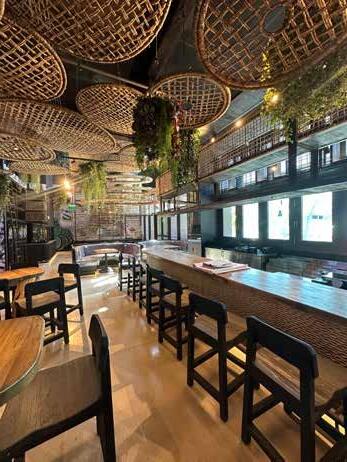
Maintaining the Grit
Maintaining the Grit
The “Maker Economy” within the Jefferson Terminal District provides a unique and concentrated activity center unlike any other area in the city.
The “Maker Economy” within the Jefferson Terminal District provides a unique and concentrated activity center unlike any other area in the city.
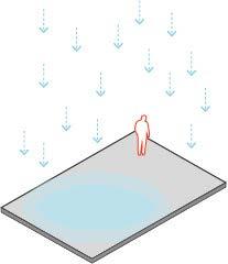
Flooding Issues
Flooding Issues
The district faces large scale flooding issues that impair commerce and mobility.
The toolkit of urban interventions ranges from tactical strategies of public infrastructure to large scale, long-term solutions for JTD. It allows the residents and the city the ability to utilize the options as needed and customize the items to specific locations within the scenarios in a way that contributes meaningfully to the character of the district.
Project Goals:
1) Maintain Character
2) Mitigate Flooding
3) Increase Density
Residential Density
Residential Density
The toolkit
The toolkit
The toolkit of urban interventions ranges from tactical strategies of public infrastructure to large scale, long-term solutions for JTD. It allows the residents and the city the ability to utilize the options as needed and customize the items to specific locations within the scenarios in a way that contributes meaningfully to the character of the district.
The toolkit of urban interventions ranges from tactical strategies of public infrastructure to large scale, long-term solutions for JTD. It allows the residents and the city the ability to utilize the options as needed and customize the items to specific locations within the scenarios in a way that contributes meaningfully to the character of the district.