JULIA SHREEVE

LANDSCAPE ARCHITECTURE PORTFOLIO
I acknowledge the Cammeraygal and Gadigal peoples of the Eora Nation as the traditional custodians of the unceded lands in which I have lived, worked and studied on.
I pay my respects to Elders past, present and emerging and I would like to acknowledge their generous contributions and sharing of culture, values and practices to the landscape architecture profession. I would also like to thank them for sharing their deep knowledge, wisdom and spiritual connection of the unique local Australian landscape that allows us as landscape architects to better understand our land.
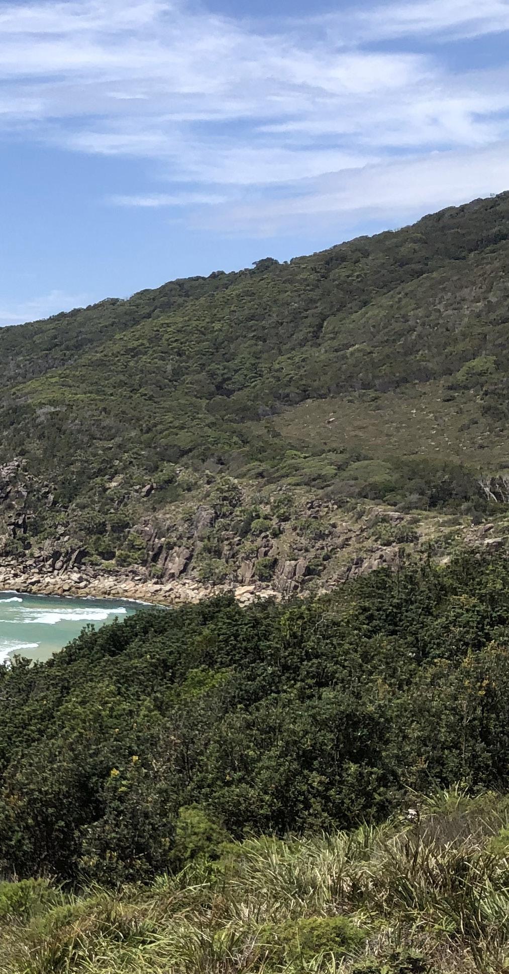
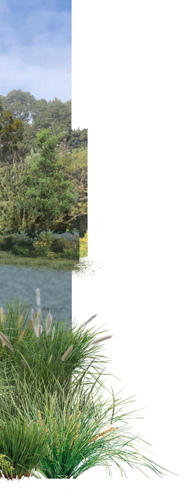
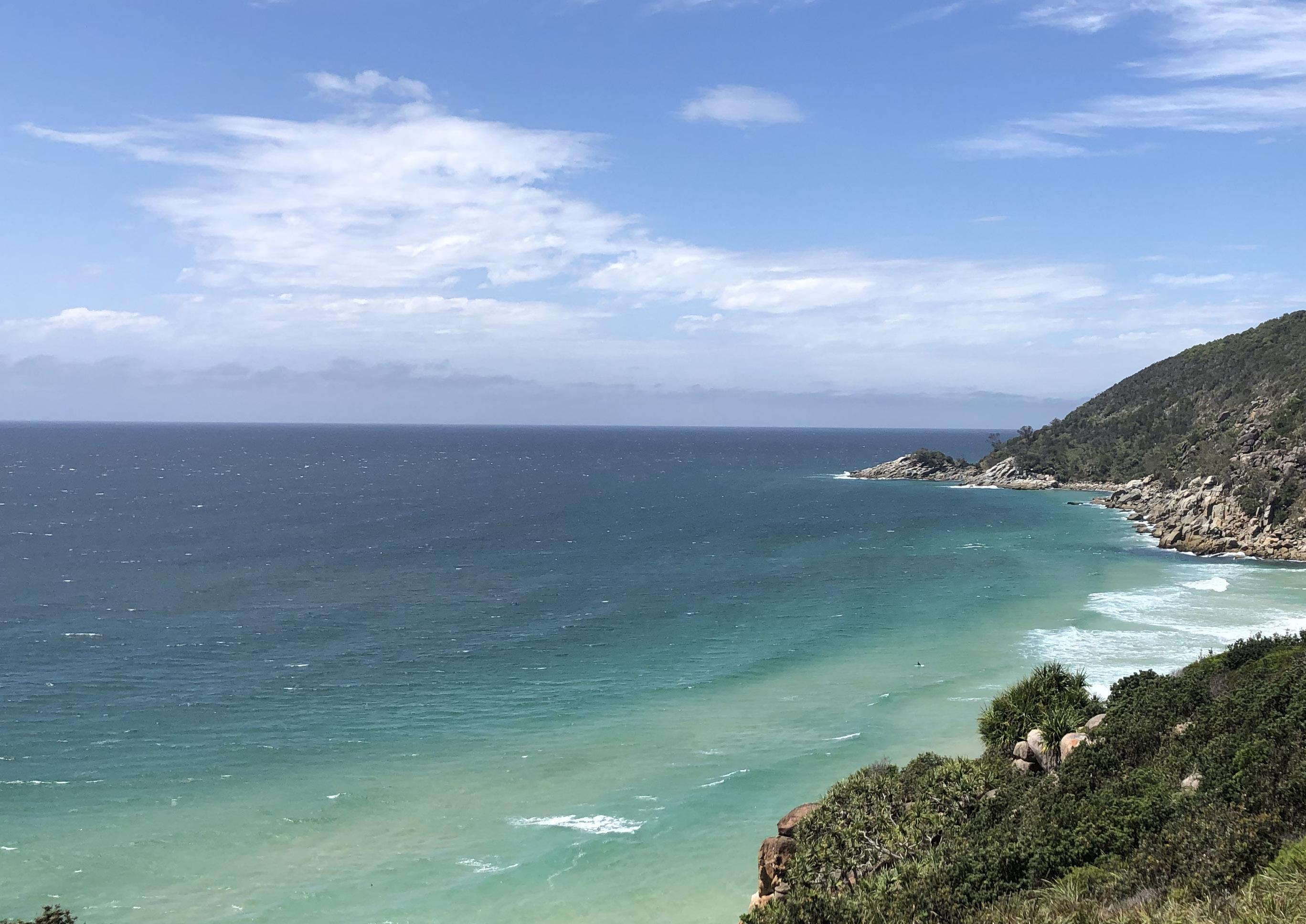 Photograph: Arakoon National Park (Shreeve, 2022)
‘THE JUMPING GROUND’
LANDSCAPE STUDIO 7: DESIGN WITH A COMPLEX PROGRAM
‘ECOLOGICALLY HEALTHY ANGUS’ LANDSCAPE STUDIO 5/6: SITE PLANNING - LANDSCAPE SYSTEMS, PERFORMANCE & SITE DESIGN
‘GEARING UP GREEN’
LANDSCAPE STUDIO 4: DESIGN DETAIL - RESOLUTION & REPRESENTATION
LANDSCAPE STUDIO 2: DESIGN PROCESS
DESIGN & DOCUMENTATION 1/2
My name is Julia Shreeve and I am currently in my third year of a Bachelor of Landscape Architecture (Honours) at the University of New South Wales.
Working as a nursery hand at Alpine Nurseries in Dural has provided me with a comprehensive knowledge base of plants and horticulture and all aspects of the industry, from plant mainte nance and potting to despatch and sales in the trade-market. In addition, I have been able to develop my interpersonal and communication skills, enabling me to work in both a team setting and autonomously.
I have always loved exploring and learning about the Australian landscape. It is something I hold dear to my heart and I hope that as a landscape architect I can preserve it for both future generations and the diverse flora and fauna species that call Australia home.
On top of my core landscape architecture courses, I have taken a number of elective cours es to further my interests and understanding in climate change, living architecture and land scapes for health and wellbeing. As such, I have developed a particular passion and drive to address climate-positive design, sustainability and landscape design to combat declining biodiversity. In my professional practice I hope to continue working, contributing and making an impact in these fields.
I also recognise the importance and value of First Nations design-led thinking and the role landscape architecture can have in reconciliation and facilitating connection to Country. I look forward to furthering my skills in this field as I prepare to begin my student landscape architect position with Arcadia Landscape Architecture in Pyrmont in the new year.
International Baccalaureate

Monte Sant’ Angelo Mercy College, North Sydney 2014 - 2019
Bachelor of Landscape Architecture (Honours) University of New South Wales 2020 - 2023 (currently in third year)
DSA Consulting (Mechanical Engineering Office), Part-Time Administration Assistant Nov 2020 - Current


Alpine Nurseries, Casual Nursery Hand Feb 2022 - Current
Alpine Nurseries, Work Experience 50 days from Sept 2021 - Feb 2022

Built Environment Dean’s List UNSW, 2021
Built Environment Dean’s List UNSW, 2020
38/45 (96.45 ATAR) in the International Baccalaureate (IB) Monte Sant’ Angelo Mercy College, 2019

Dance, netball, swimming, bush walking, travelling & gardening
REFEREE
Sophie Mitchell
Office Manager
DSA Consulting P: (02) 9436 3500
E: sophie.mitchell@dsaconsulting.com.au
Grade A for the IB Extended Essay (green walls for wellbeing) Monte Sant’ Angelo Mercy College, 2019
Equal First Place in school in Higher Level Design and Technology Monte Sant’ Angelo Mercy College, 2019
First Place in school in Catholic Studies Monte Sant’ Angelo Mercy College, 2019
50 hours of community and service as part of IB requirements Monte Sant’ Angelo Mercy College, 2018-2019
Grade 7 (out of 8) for the IB MYP Personal Project (designed & landscaped a garden)
Monte Sant’ Angelo Mercy College, 2017
Mobile: 0422 012 589


Email: jshreeve01@gmail.com
LinkedIn: https://www.linkedin.com/in/ju lia-shreeve-348473254/ Chatswood, NSW


Able to orientate well to new situations Excellent attention to detail
Well organised and good work ethic
Fast learner
Strong horticulture knowledge Strong written skills
LAND2313: LANDSCAPE STUDIO 7 DESIGN WITH A COMPLEX PROGRAM
LOCATION: MOORE PARK GOLF COURSE, SYDNEY
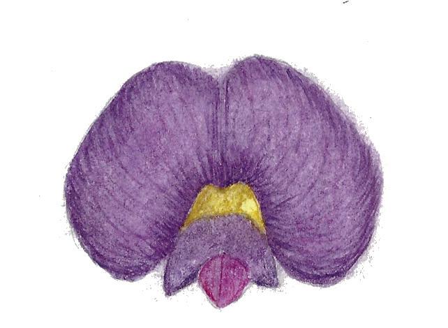
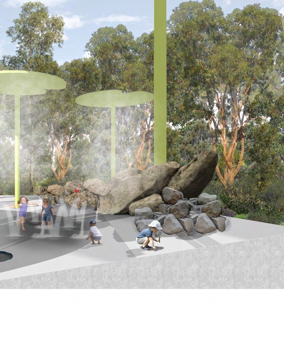
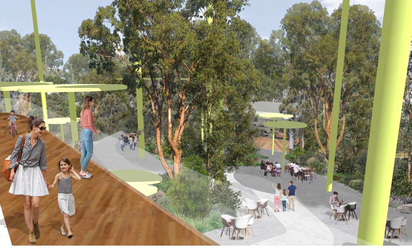
PROJECT VISION: A RESTORATIVE EXPERIENCE FOR HUMANS AND FROGS TO JUMP IN!
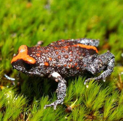
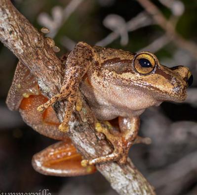
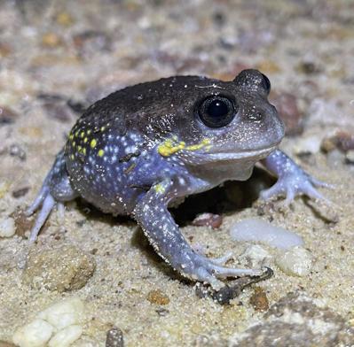
CONTEXT/DESIGN BRIEF: TO CREATE A ‘DRAWCARD’ PUBLIC OPEN SPACE WITH A COMPLEX PROGRAM FROM THE MOORE PARK GOLF COURSE. MY AIM WAS TO CREATE A LANDSCAPE FOR VULNERABLE FROGS OF THE INDIGENOUS EASTERN SUBURBS BANKSIA SCRUB BY CREATING APPROPRIATE HABITAT & IMPROVING WATER QUALITY; AND TO INTEGRATE SPECIES-SENSITIVE PROGRAM, FOSTER LEARNING & EXTEND SPECIES PRIORITY MANAGEMENT AREAS BACK INTO METROPOLITAN SYDNEY.
SKILLS DEVELOPED:
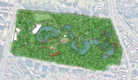
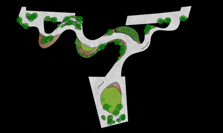
Figure 1: Group masterplan (contributed to design of spaces) with ‘The Jumping Ground’ (Nearmaps, 2022) (Scale 1:10000)
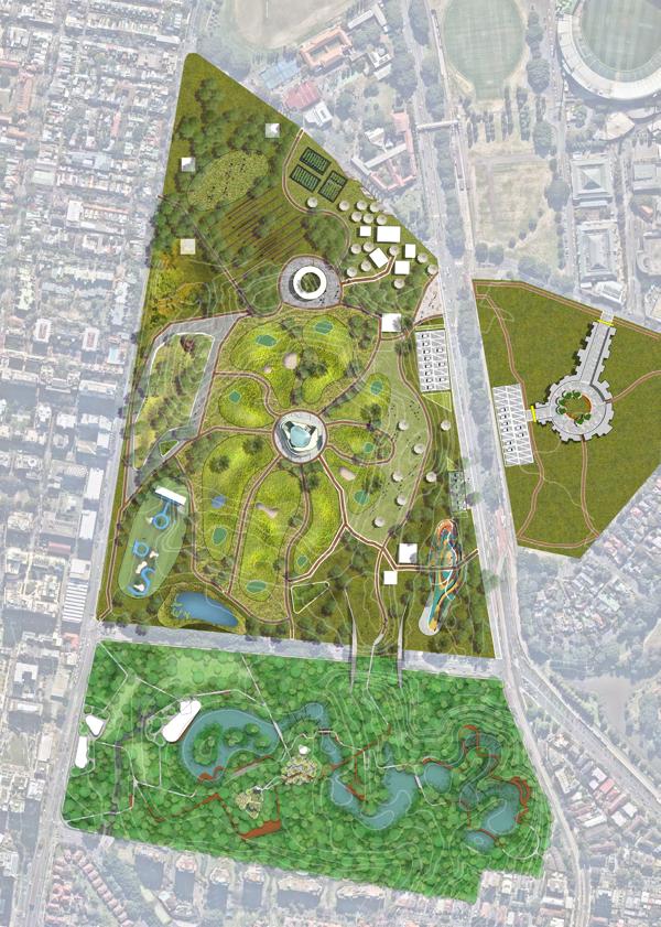
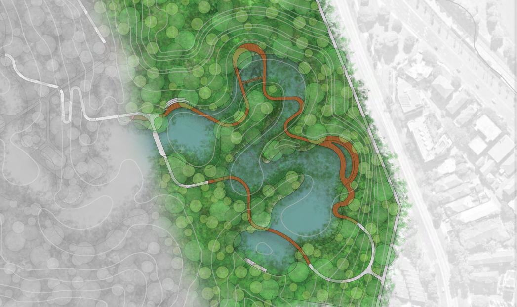
Figure 2: ‘The Jumping Ground’ Masterplan (Nearmaps, 2022) (Scale 1:1600)
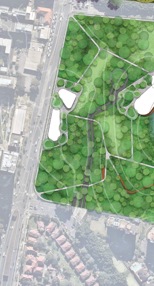
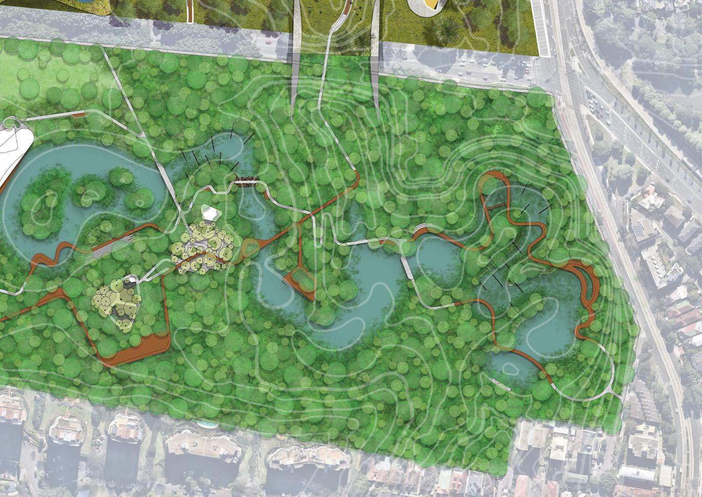
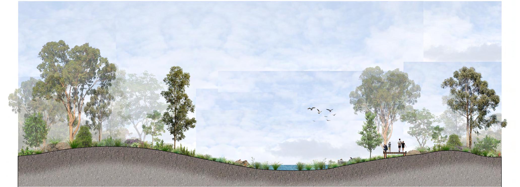
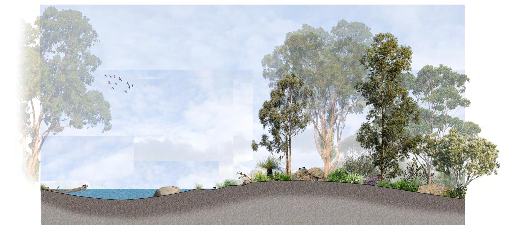
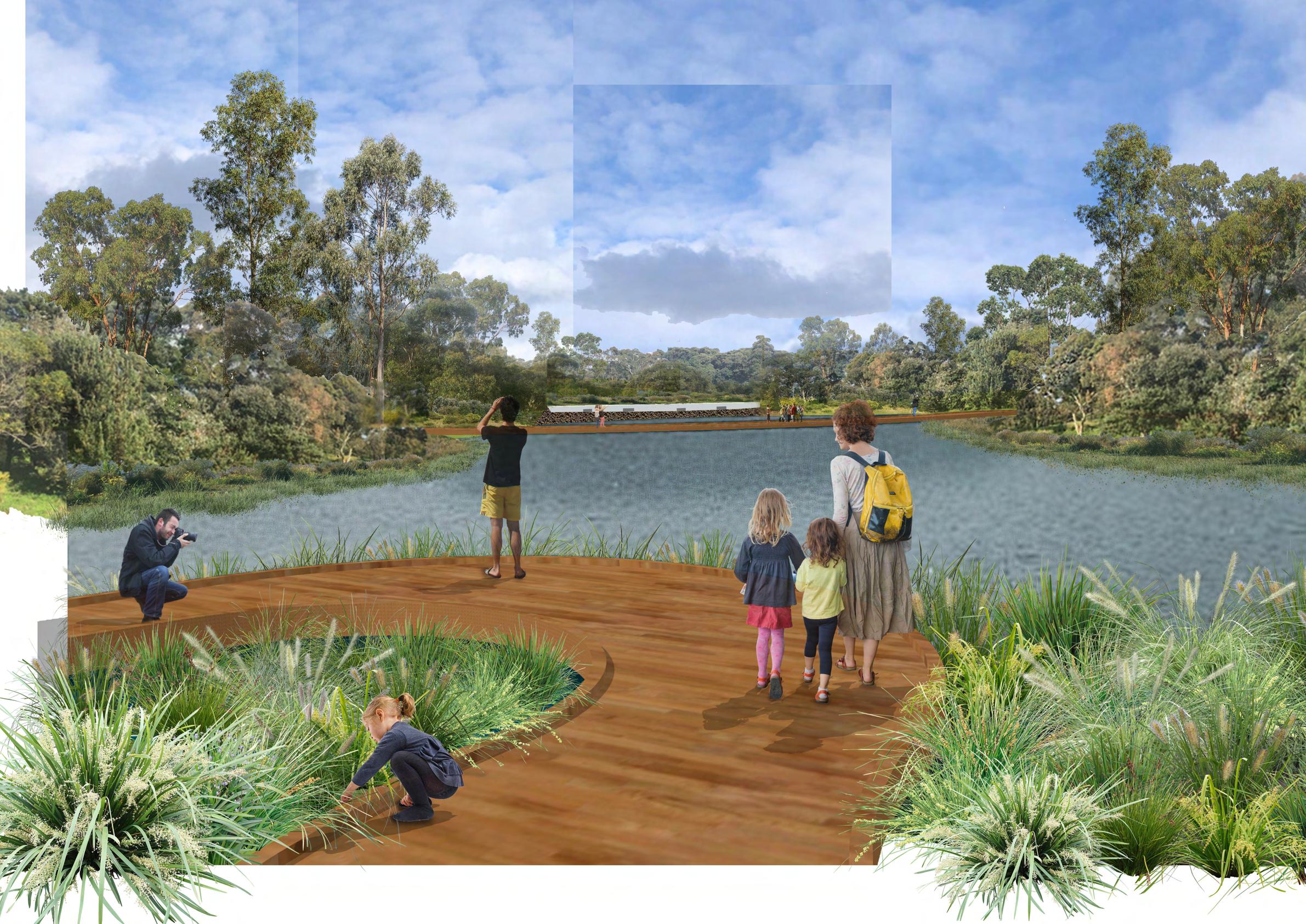 Figure 3: 3D perspective A of constructed wetlands stormwater outlet, sediment basin and inlet pond (NTS)
REDIRECTED RESIDENTIAL STORMWATER OUTLET IN SEDIMENT BASIN
Figure 3: 3D perspective A of constructed wetlands stormwater outlet, sediment basin and inlet pond (NTS)
REDIRECTED RESIDENTIAL STORMWATER OUTLET IN SEDIMENT BASIN
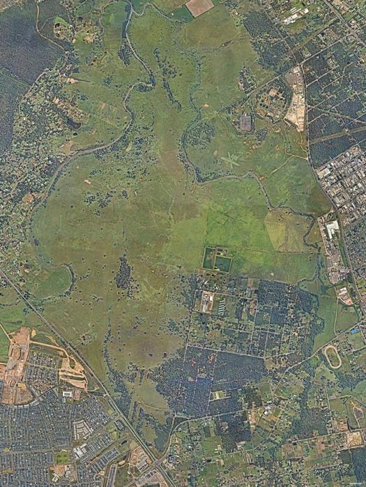
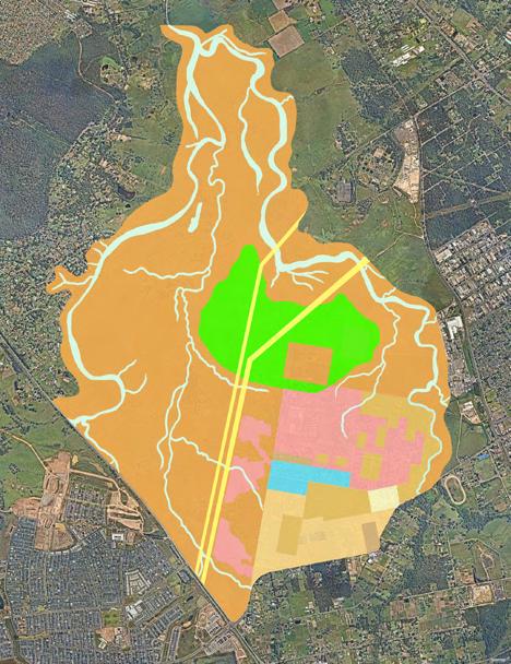
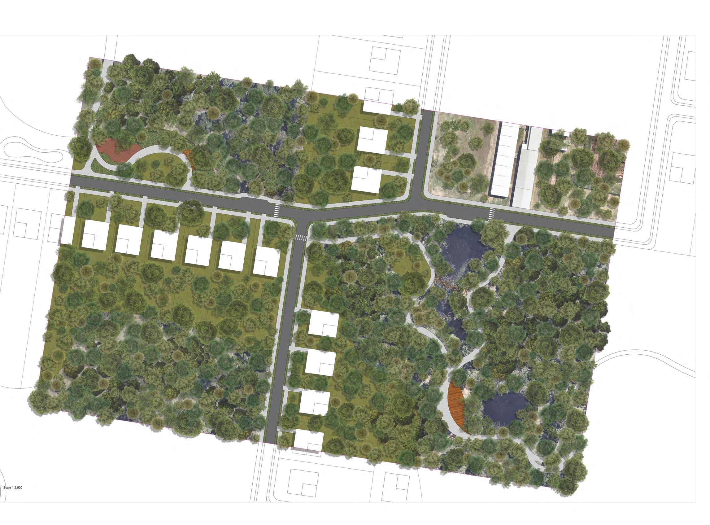
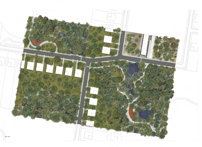
LOCATION: ANGUS, MARSDEN PARK NORTH, SYDNEY
VISION: ENRICH THE ECOLOGICAL INTEGRITY OF THE RIPARIAN CORRIDOR TO PROMOTE AN INCLUSIVE, SUSTAINABLE AND RESILIENT COMMUNITY AND HEALTHY BUILT ENVIRONMENT. CONTEXT/DESIGN BRIEF: TO DEVELOP A COMPREHENSIVE LANDSCAPE - LED MASTERPLAN FOR ANGUS THAT RESPONDS TO LOCAL SITE CONDITIONS AND IDEAS OF SOCIAL EQUITY, ENVIRONMENTAL JUSTICE AND SUSTAINABILITY.
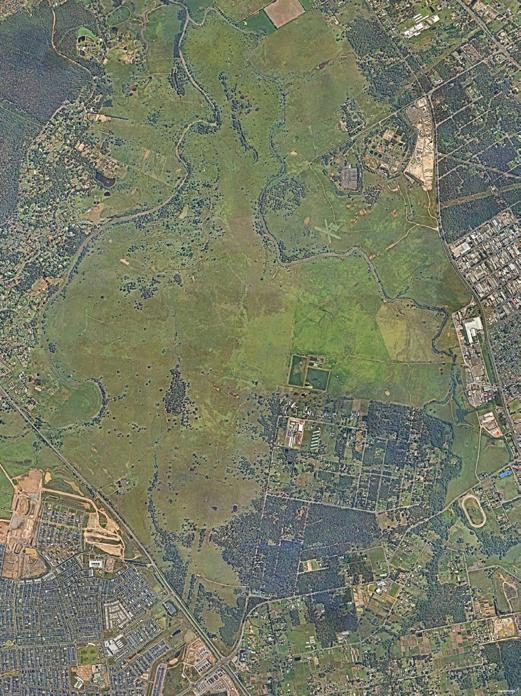
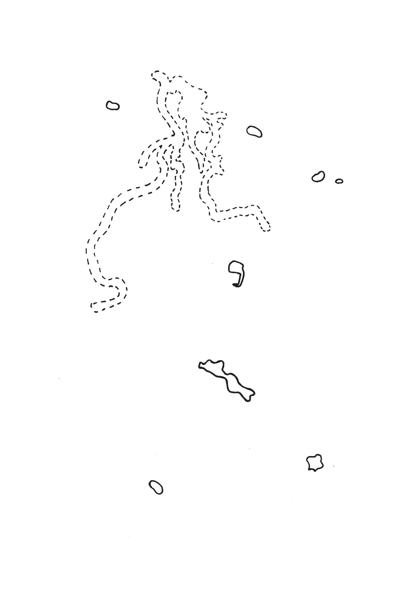
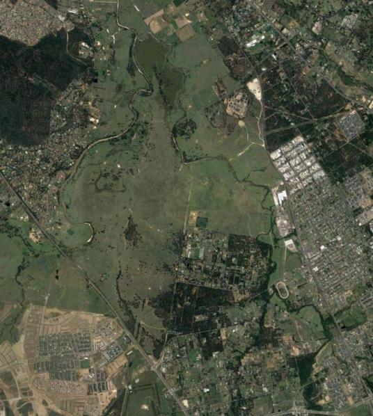
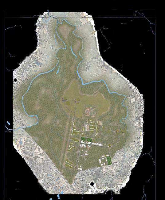
Figure 8: Flood extents in Angus (Nearmaps, 2022) Scale 1:25000 Scale 1:10,000
Adapted from Shreeve, 2022 - LAND2311: Assessment 3
2022; Nearmaps, 2022) (Scale 1:50000)
Small Flooding
Very Large Flooding Biggest Possible Flooding Waterway
LEGEND 1 in 100 Year Flood Extent
Small Flooding Very Large Flooding Biggest Possible Flooding Waterway
LEGEND 1 in 100 Year Flood Extent
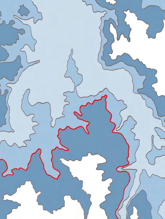
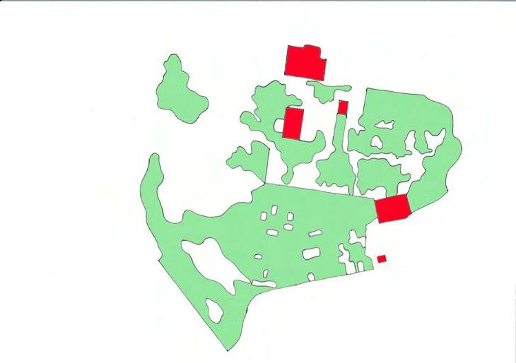
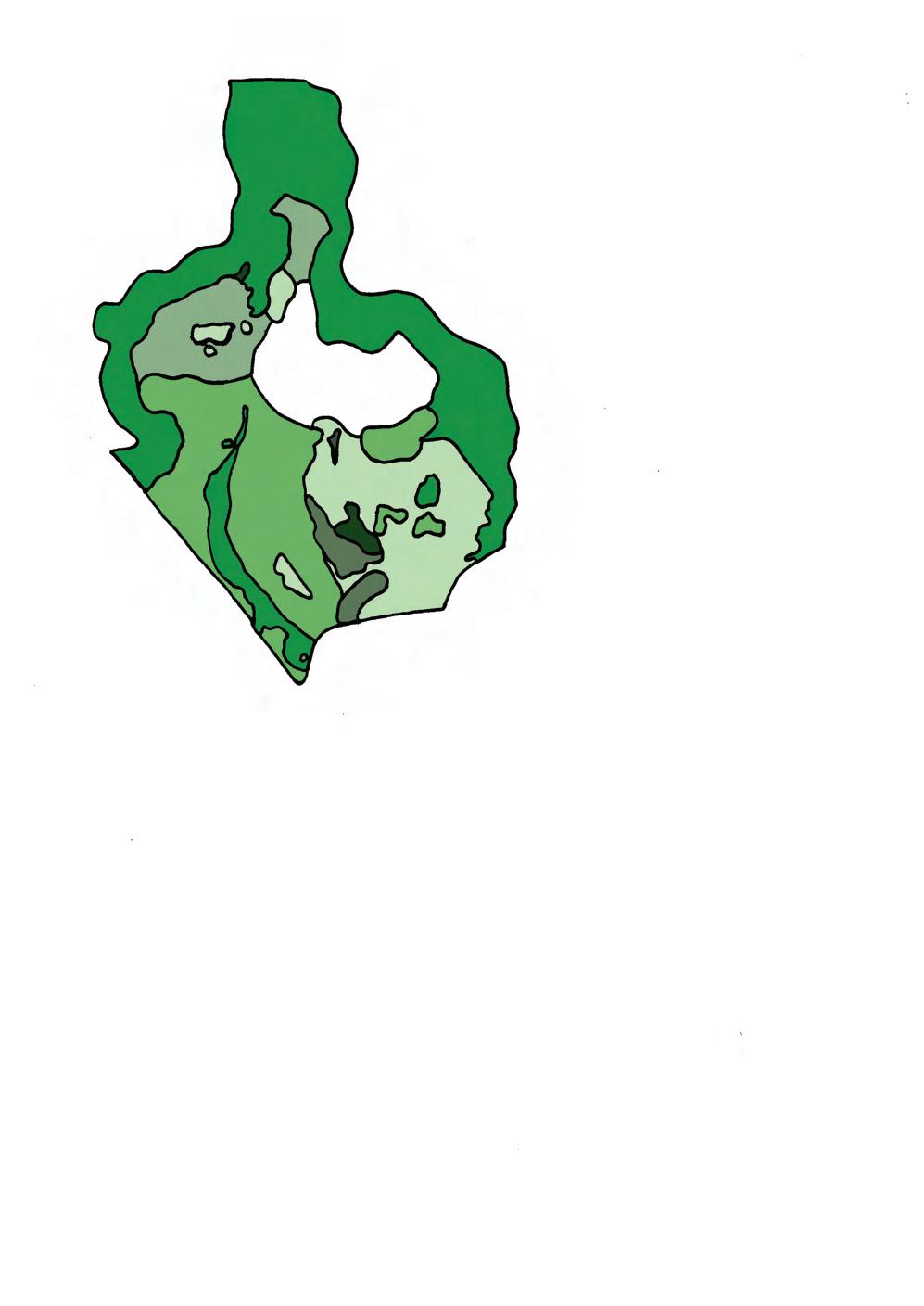
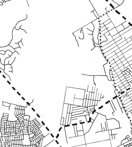
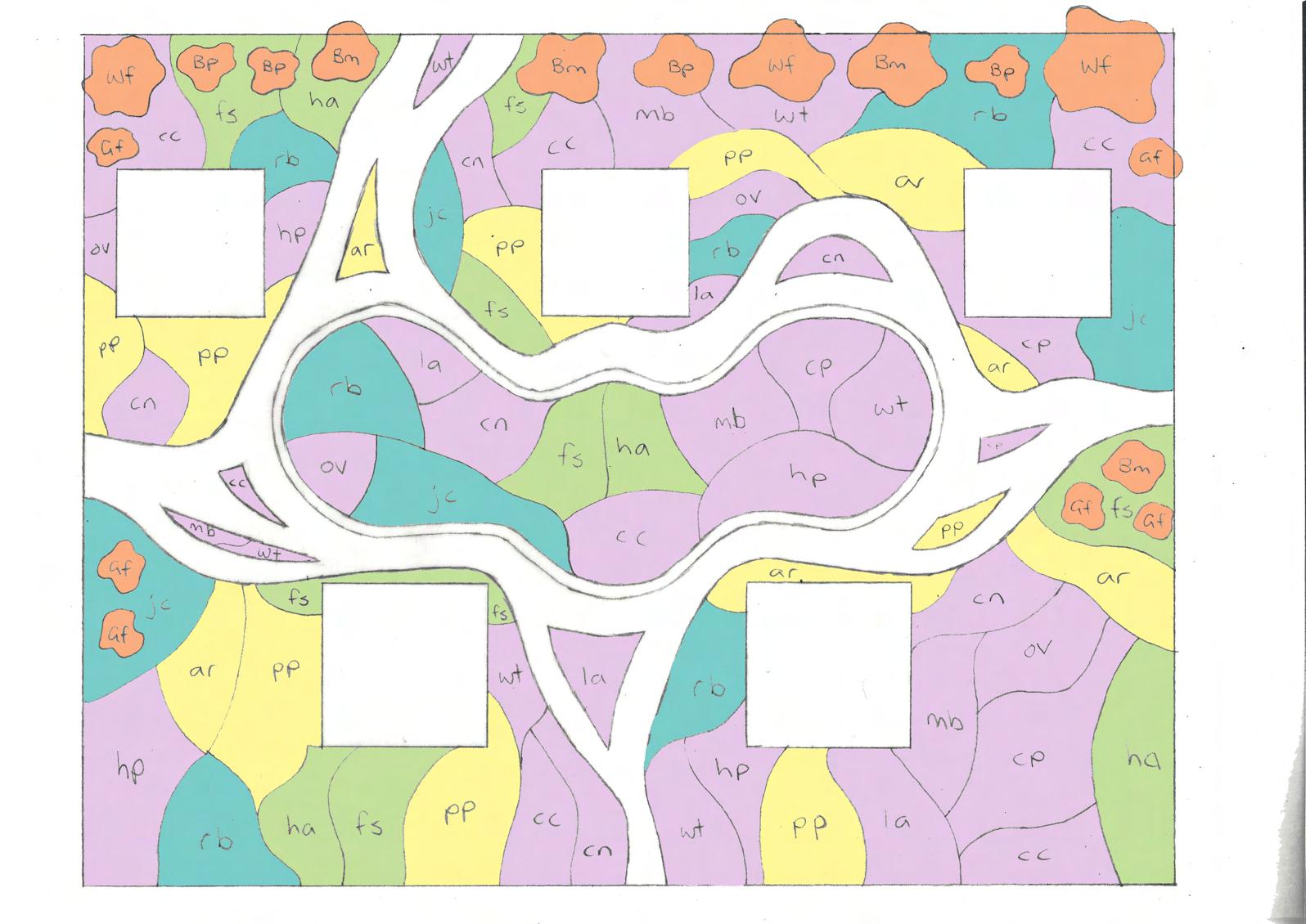
Figure 14: Site analysis demonstrating how road network was informed by high quality vegetation patches and important sites (Nearmaps, 2022) (Scale 1:50000)
Low Points
High Points Relative Embankments/ Steep Slope
Low Points High Points
Embankment Aspect Direction
Relative Embankments/ Steep Slope
Relative Floodplains/ Ridgetops Minimal Slope
Relative Floodplains/ Ridgetops Minimal Slope
Embankment Aspect Direction Ecologically
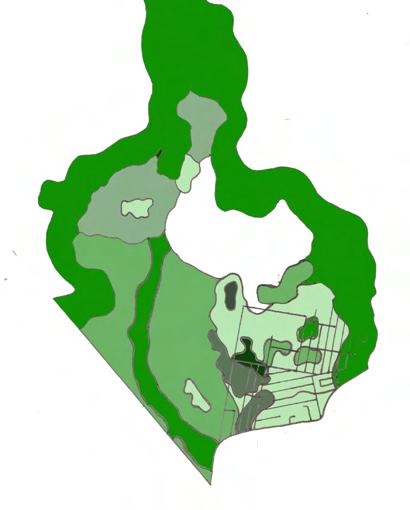
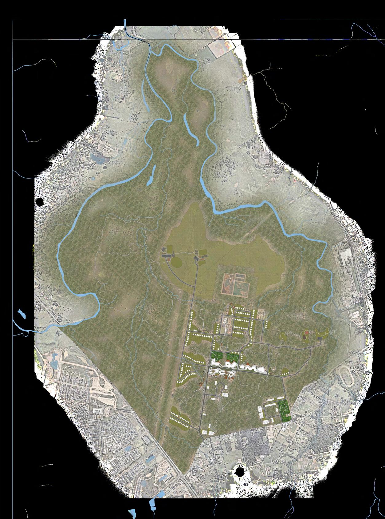
Figure 15: Structure Plan of Angus (Marsden Park North) to NSW Standard Instrument (Local Environ mental Plans) (NSW Gov, 2022; Nearmaps, 2022) (NTS)
In addition
this, the pathway acts as an educational journey, highlighting the importance of the riparian corridor and its inhabitats through educational signage, differing vegetation experiental qualities and observation.
The residential development within Angus will be capped, similar to the 2018 Proposed Masterplan for Marsden Park. The road network in Angus will allow for some expansion of residential housing, but with no further road development and minimal vegetation clearing for new housing.
This scenario also addresses or aligns with the goals of the Sydney Green Grid and the Western Sydney Parkland Proposals connection of green spaces. The expanded riparian corridor scenario provides an additional green space along one of Sydney’s key waterway systems, as well as addressing key urban issues such as liveability, urban heat mitigation, access to open spaces, enhancing ecological resilience etc.
In terms of how the scenario will perform in the future, it must be acknowledged that despite the projected increase in frequency and intensity of flooding in Angus, this scenario will be almost completely submerged. However, in small flooding scenario, the enhanced riparian corridor can mitigate and soak up some of this excess water through its permeable soils. It’s also likely that with more frequent extreme flooding,
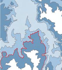
Figure 16: Preliminary Scenario Plan - Revegetating Angus’ riparian corridor and introducing an ac cessible pathway to immerse and educate visitors (Nearmaps, 2022; EcoLogical, 2018; Transport for NSW, 2022) (NTS) PATHWAY
ENVIRONMENTAL MANAGEMENT OF REMNANT CUMBERLAND PLAIN WOODLAND ECOLOGICAL COMMUNITY
MINIMUM 40% CANOPY COVER OF ENDEMIC TREE SPECIES PER BLOCK TO MAINTAIN HABITAT CONNECTIVITY WITH SURROUNDING CUMBERLAND PLAIN WOODLAND ECOLOGICAL COMMUNITY
ACCESSIBLE, WELL CONNECTED SHARED PATHWAY THAT ENCOURAGES ACTIVE TRANSIT THROUGHOUT NEIGHBOURHOOD
SHADED GRASS AREA IN LOCAL PARK THAT ENCOURAGES A RANGE OF RECREATIONAL USES AND CONNECTION WITH NATURE & COMMUNITY RAIN GARDEN ALONG ROAD EDGE TO PROVIDE HABITAT CONNECTIVITY, REDUCE RUNOFF & PROVIDE SAFETY BARRIER
ENVIRONMENTAL MANAGEMENT OF REMNANT CUMBERLAND PLAIN WOODLAND ECOLOGICAL COMMUNITY
ACCESSIBLE PATHWAY THROUGH BUSHLAND, AROUND WATERCOURSE & WELL CONNECTED TO NEARBY RESIDENTIAL AREAS AND SCHOOL
IMMERSIVE STEPPING STONES ACROSS WATERWAY TO ENCOURAGE EXPLORATION AND ENGAGEMENT WITH NATURE
SHADED GRASSED SPACE THAT PROVIDES A PLACE TO REST AND OPPORTUNITIES FOR RECREATION
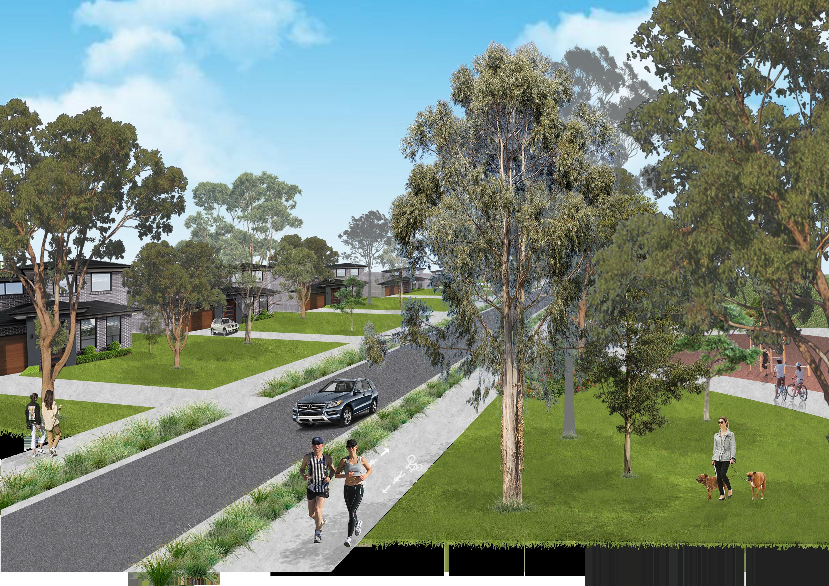 Figure 21: 3D perspective C of future living conditions and character of ‘Ecological Living’ Area in Angus (NTS)
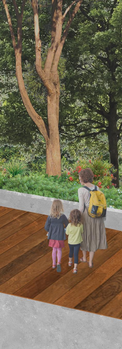
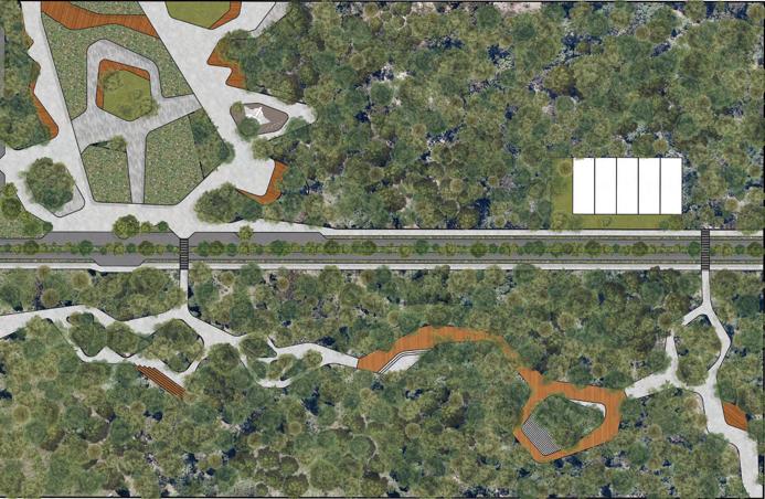
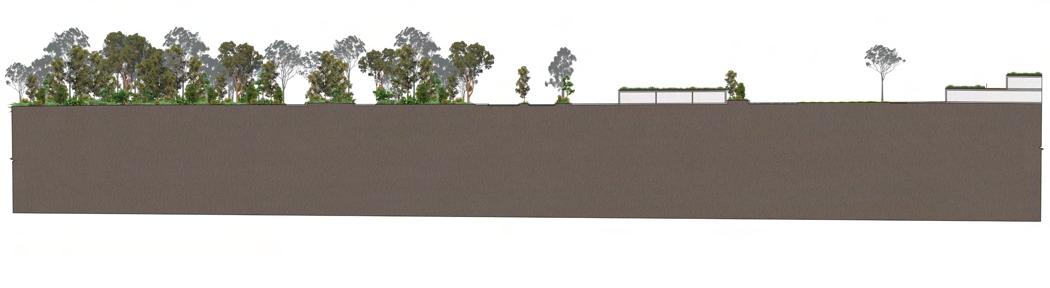
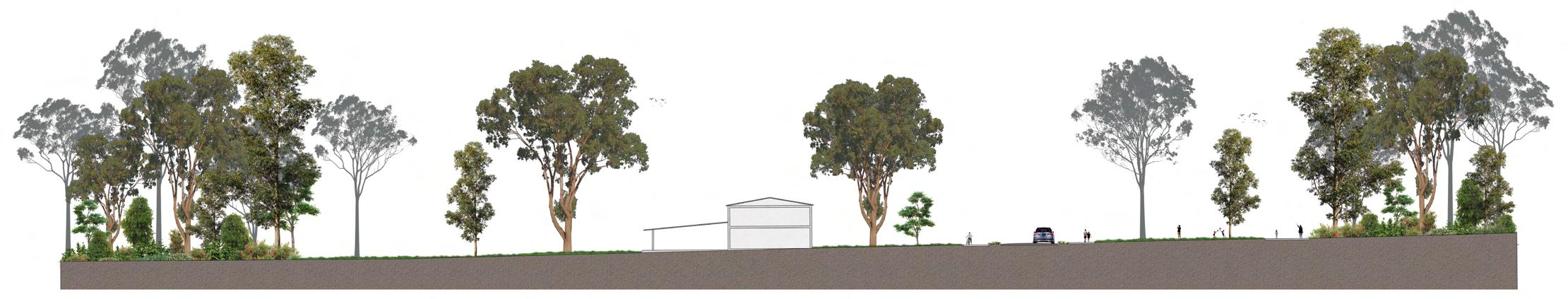
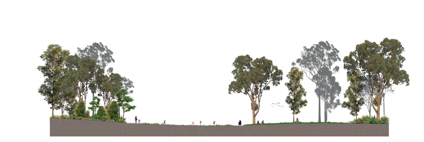
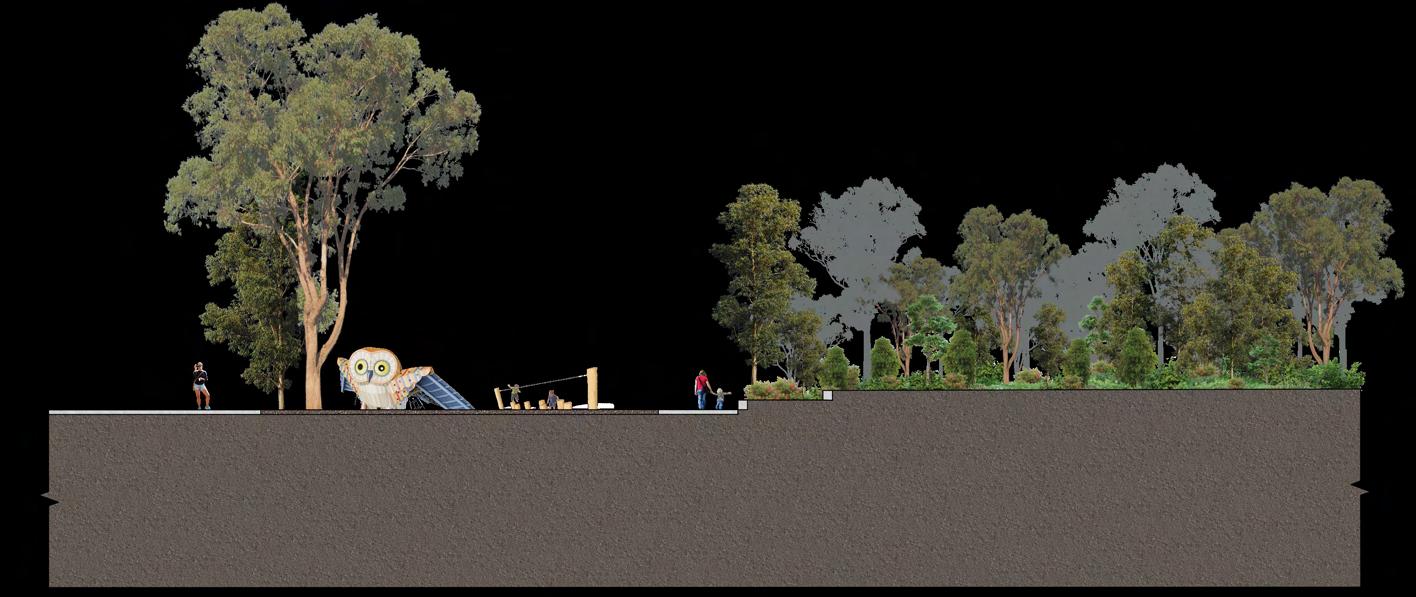 Figure 23: Section AA from ‘(Bio)diverse Public Spaces’ (Scale 1:1000)
Figure 24: Section CC from ‘(Bio)diverse Public Spaces’ (Scale 1:200)
Figure 23: Section AA from ‘(Bio)diverse Public Spaces’ (Scale 1:1000)
Figure 24: Section CC from ‘(Bio)diverse Public Spaces’ (Scale 1:200)
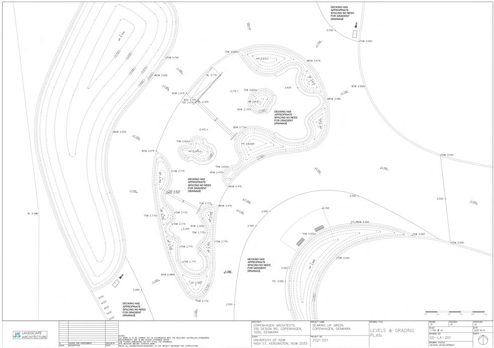
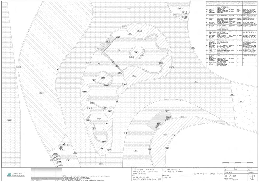
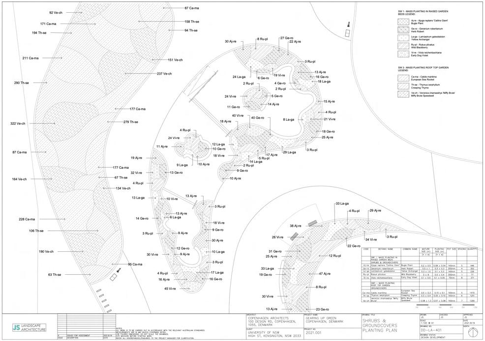
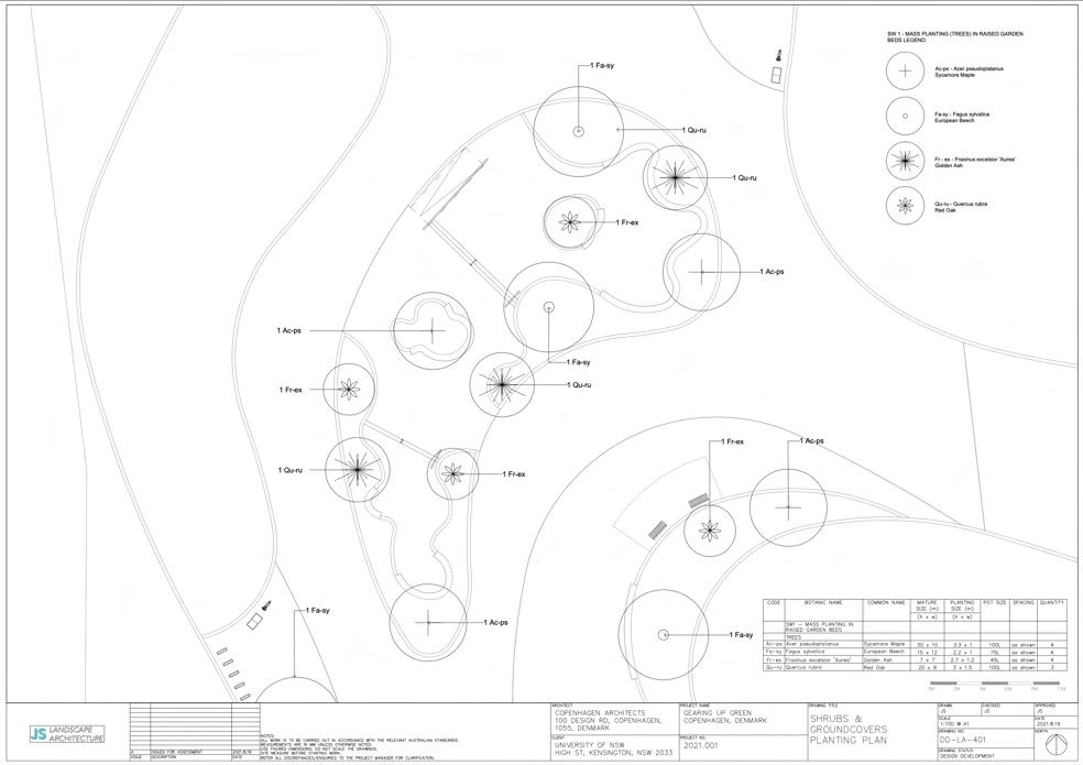
LAND2202: LANDSCAPE STUDIO 4 DESIGN DETAIL: RESOLUTION & REPRESENTATION
LOCATION: COPENHAGEN, DENMARK
PROJECT VISION: COMMUNITY AND CYCLING AS A CATALYST TO GREEN THE CITY
CONTEXT/DESIGN BRIEF:
TO DESIGN A BRIDGE FOR PEOPLE THAT IS NOT LIMITED TO CIRCULATION, BUT RATHER IS A DESTINATION, A POWERFUL AND ENGAGING PUBLIC SPACE, THAT CELEBRATES ALL THINGS CYCLING. THE BRIDGE SHOULD BE A PLACE TO MEET, TO SOCIALISE, TO EAT, TO WATCH, TO GATHER. AT ITS HEART IT MUST EXPRESS CYCLING AS A CATALYST FOR SOCIAL CONNECTION, SHARED EXPERIENCES AND FOR THE RECLAMATION OF PUBLIC SPACES. IT MUST PROVIDE OPPORTUNITIES FOR CYCLING TO BE CELEBRATED AS A SPORT, AS PERFORMANCE, AS EXERCISE, AS AN ENVIRONMENTALLY-SENSITIVE TRANSPORT MODE, AND AS SOMETHING THAT HAS THE CAPACITY TO BRING JOY TO MILLIONS.
SKILLS DEVELOPED:
Figure 26: Process sketches and design development (NTS)
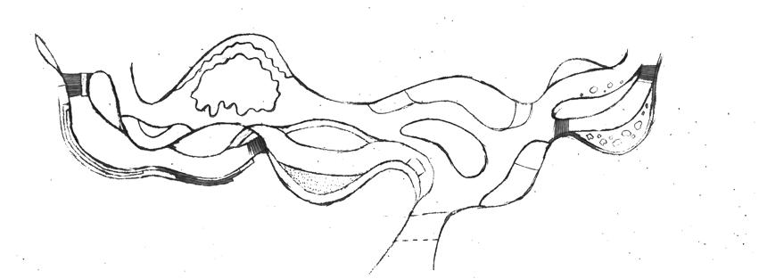
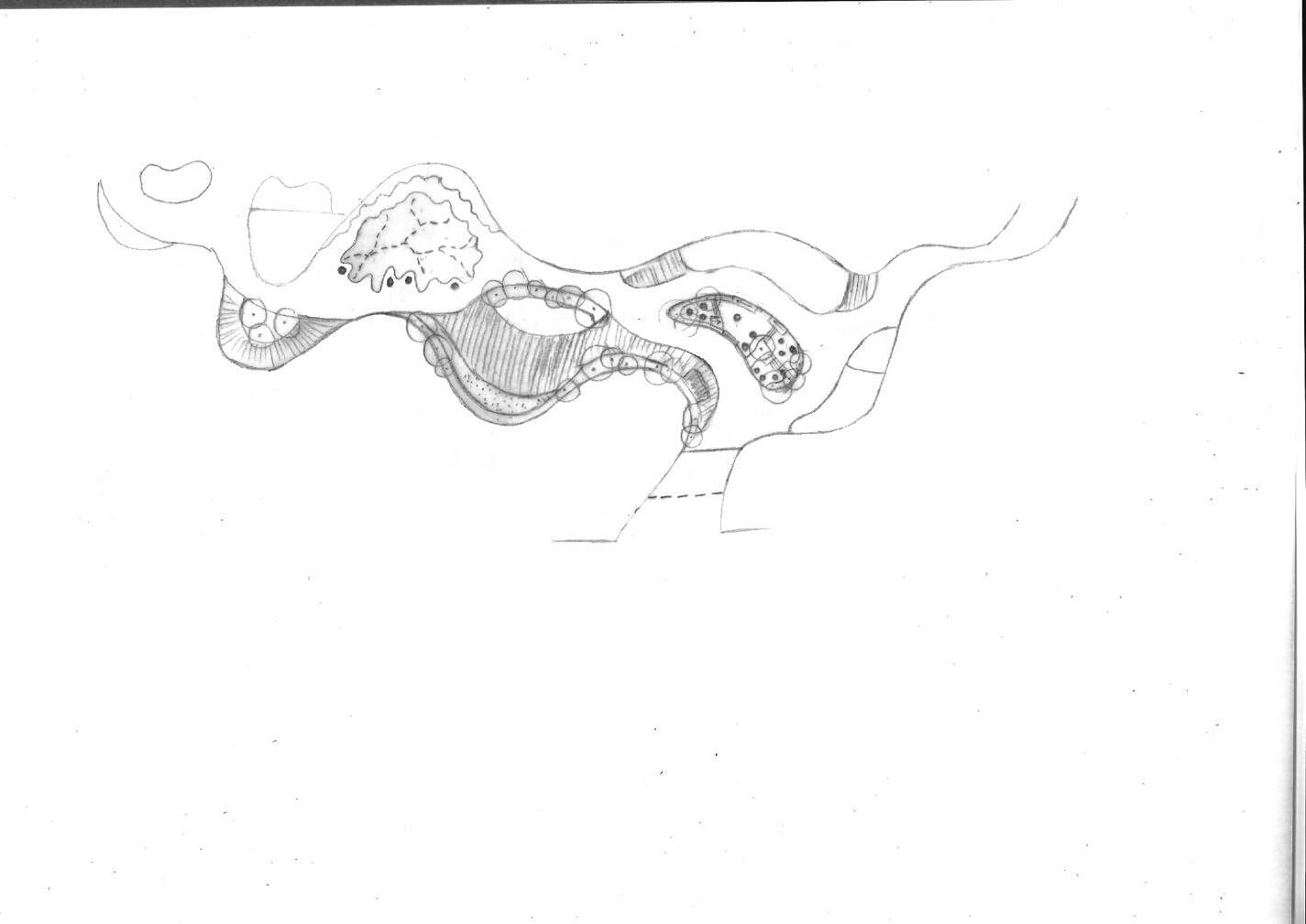
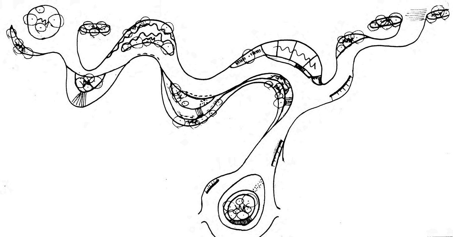


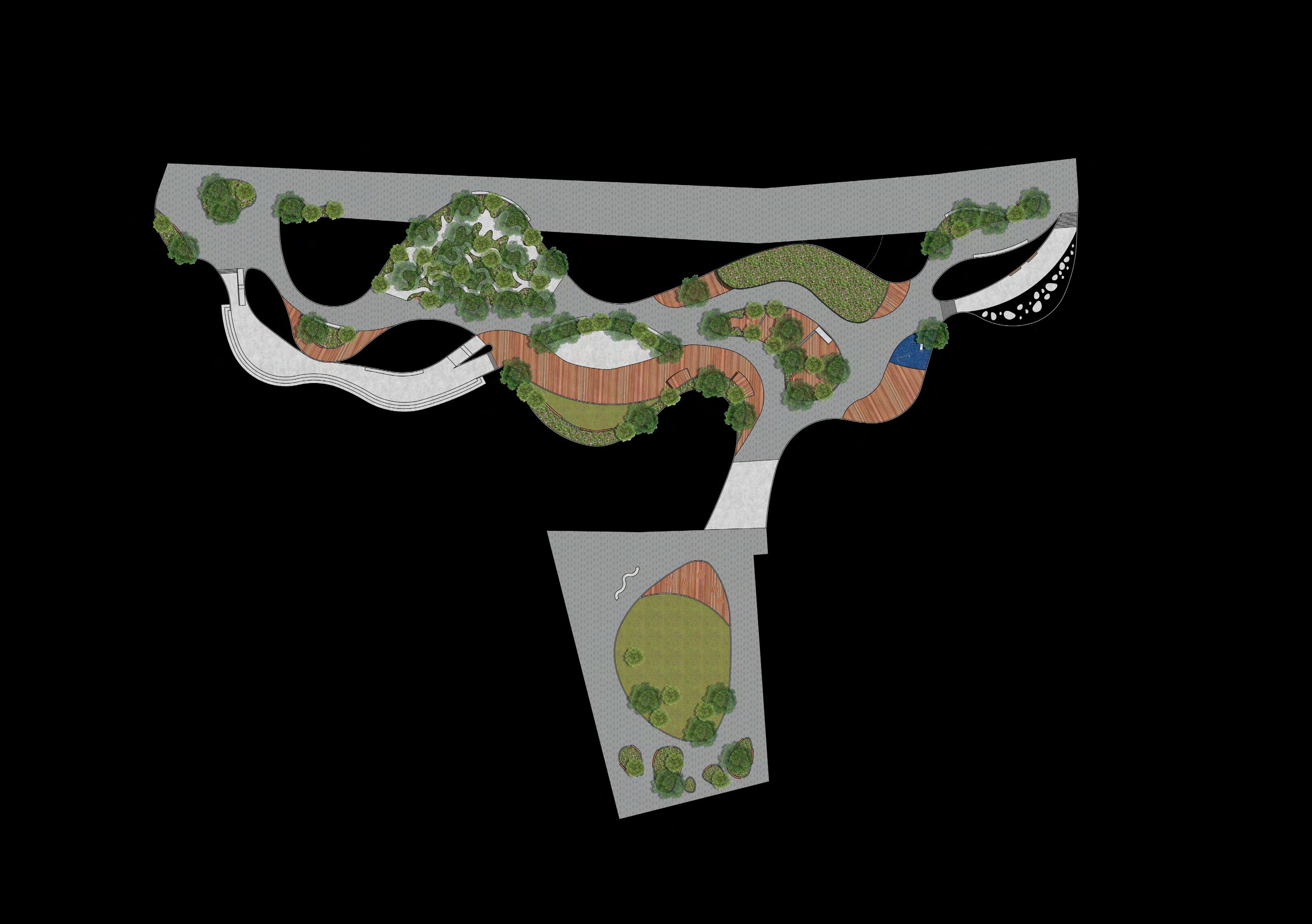
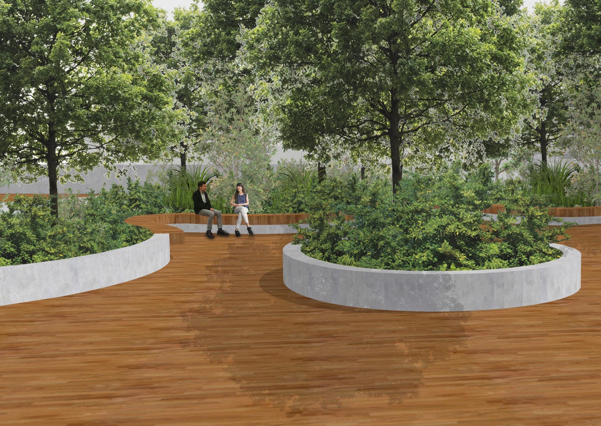
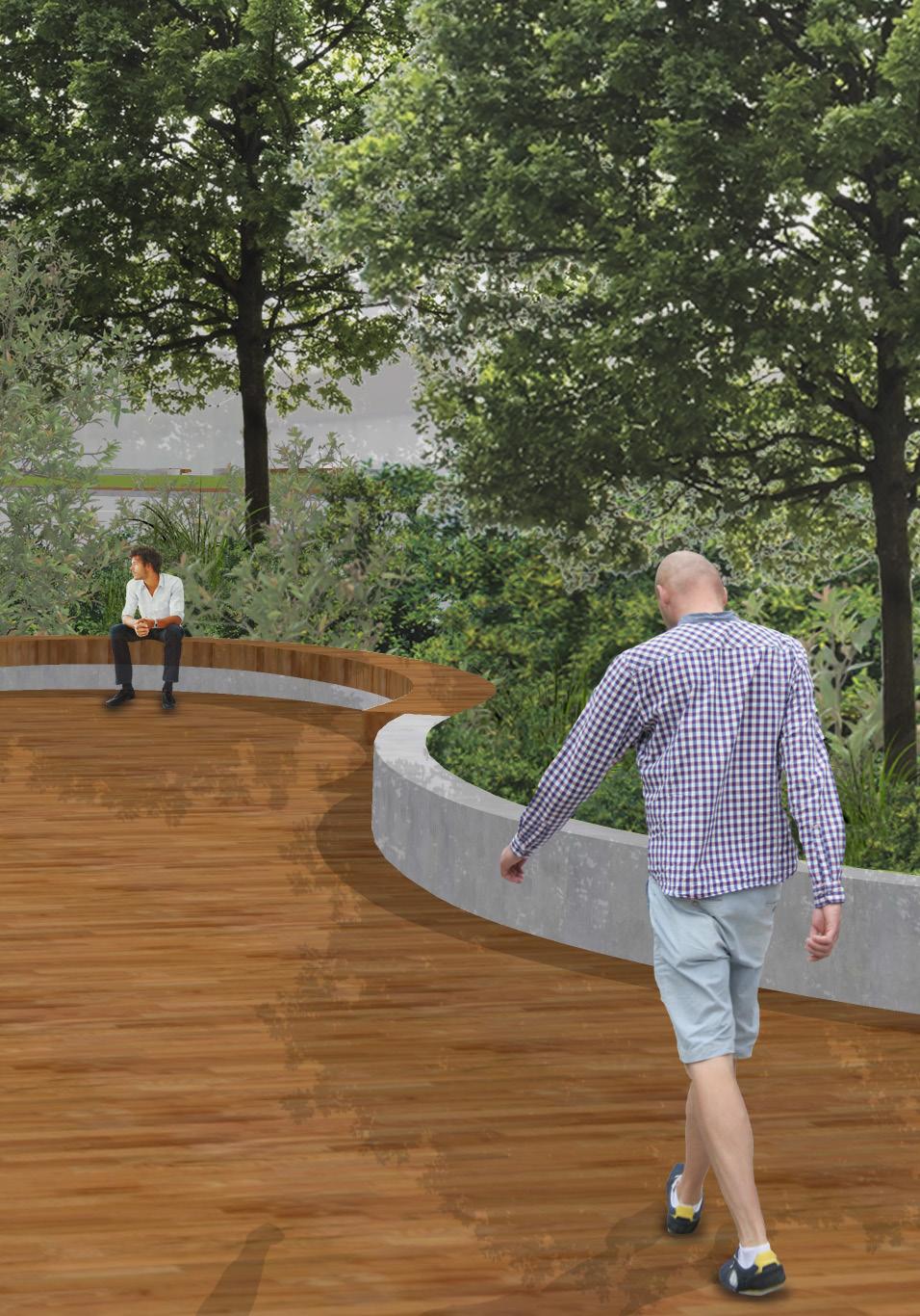
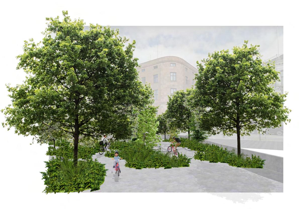
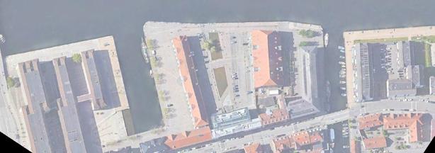
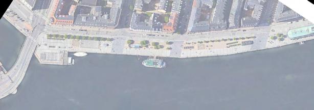
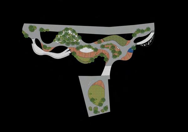
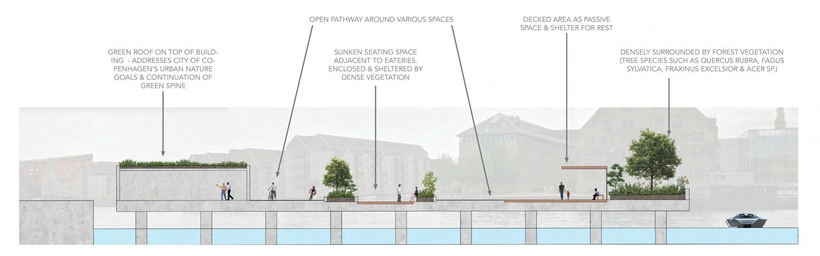
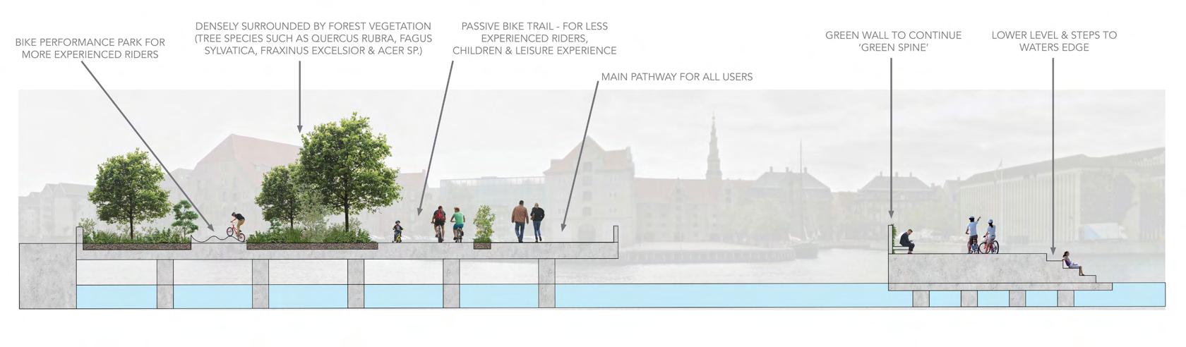
Figure 30: Section CC (Scale 1:2500)
Figure 31: Section DD (Scale 1:2500)
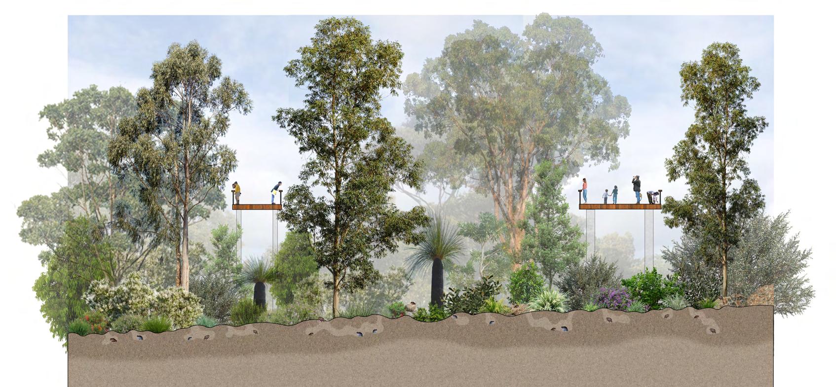
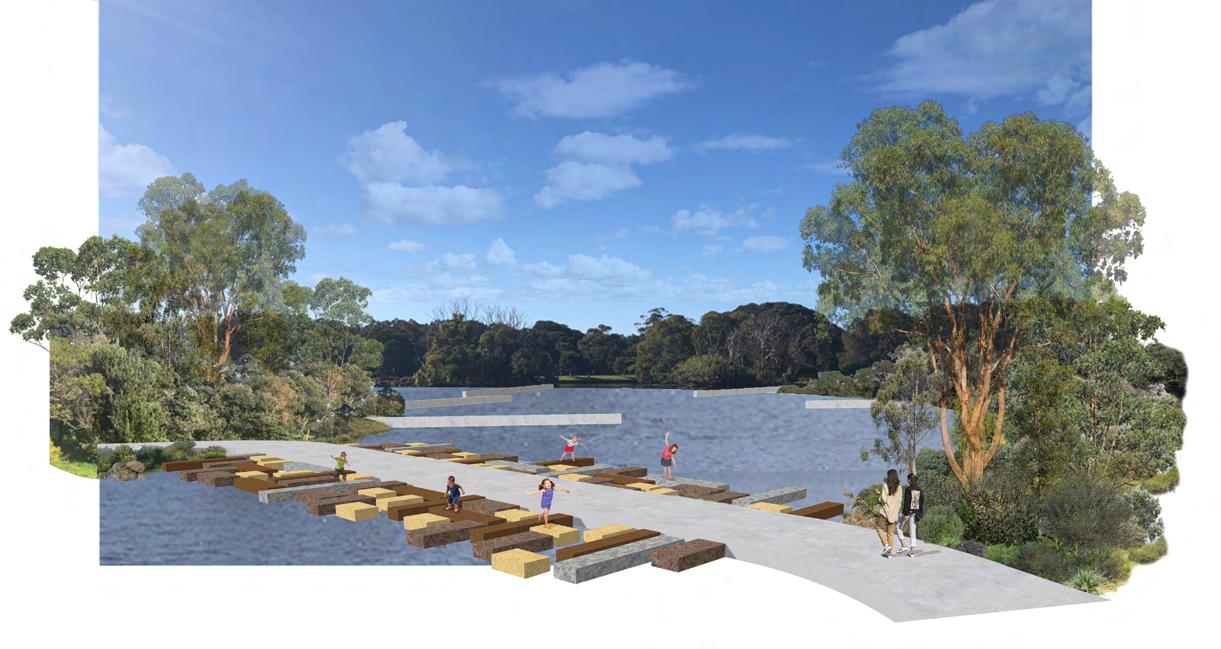
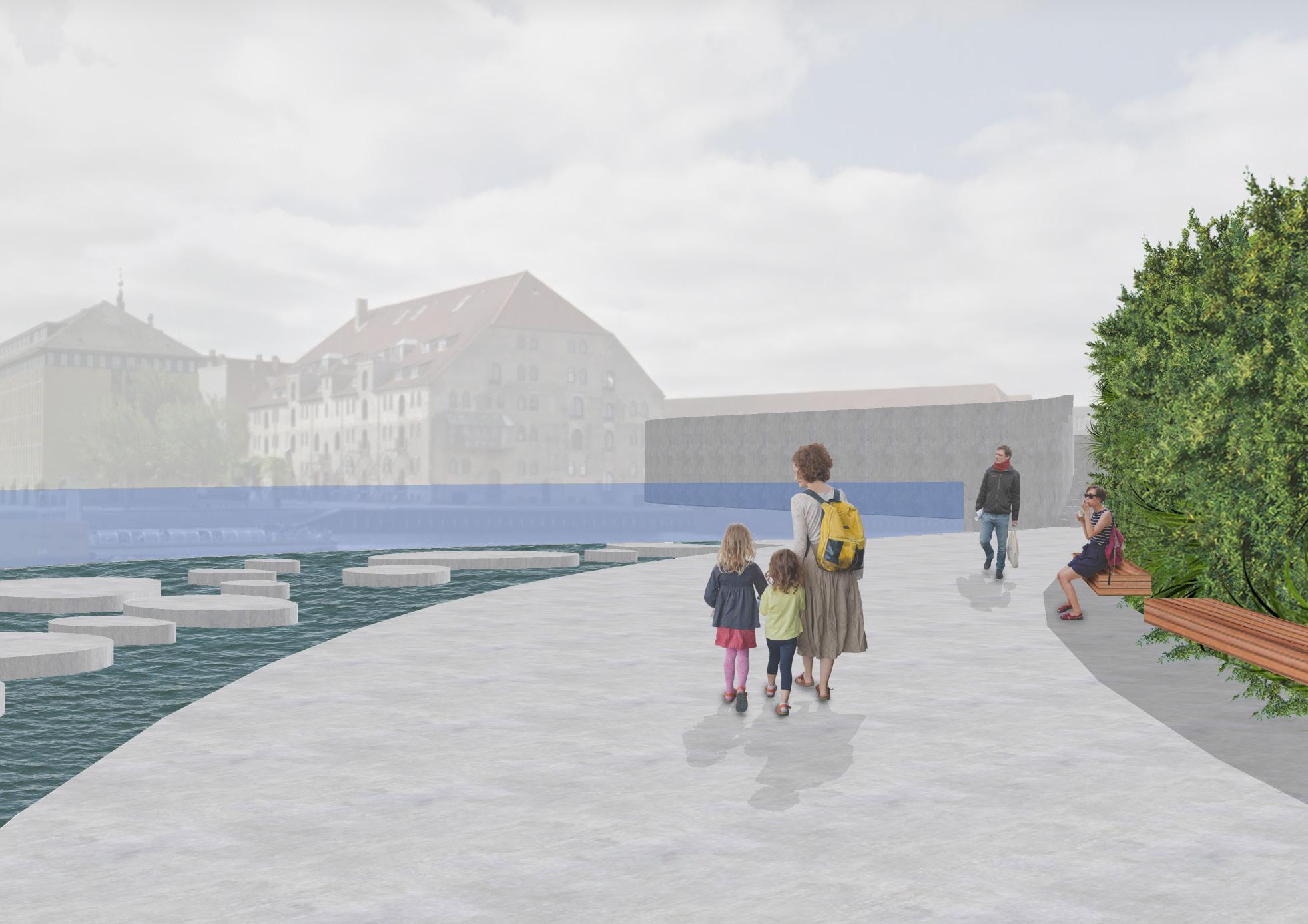
Figure 32 (right): 3D perspective E of interactive water stepping stones space and green wall (NTS)

LAND2102: LANDSCAPE STUDIO 2 DESIGN PROCESS
LOCATION: COCKATOO ISLAND (WAREAMAH), SYDNEY
PROJECT VISION: ENHANCE IDEAS OF SEGMENTATION AND ENRICH CONNECTIONS BETWEEN EXISTING, UNIQUE SITE FEATURES AND INTERVENTIONS.
CONTEXT/DESIGN BRIEF: TO EXPLORE THE UNIQUE QUALITIES OF COCKATOO ISLAND THROUGH A LANDSCAPE INTERVENTION (PLACE), PATH, LANDING AND PROSPECT POINT, THAT REVEALS, ENHANCES OR TRANSFORMS A SPECIFIC QUALITY OF THE SITE.
SKILLS DEVELOPED:
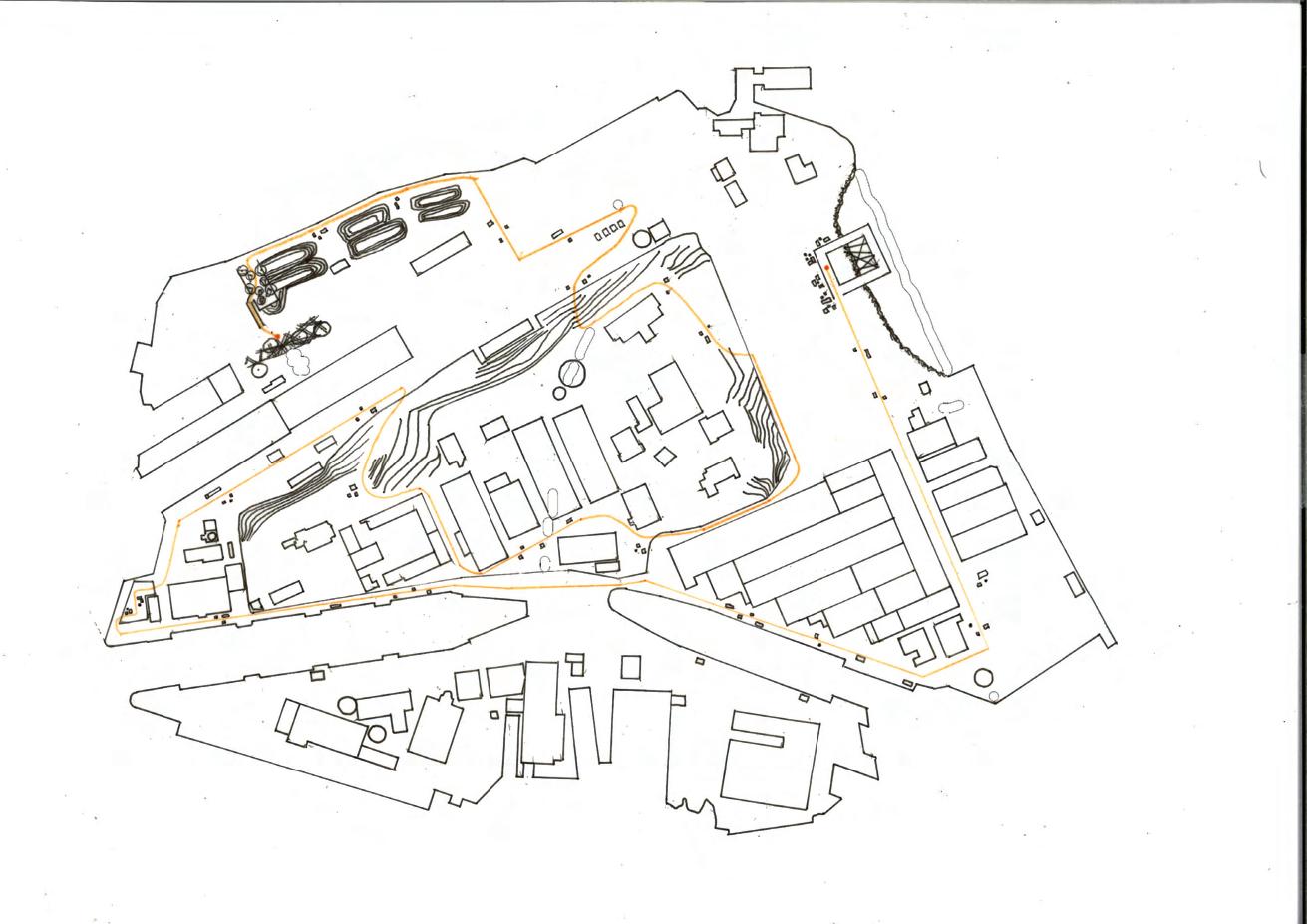
Figure 35: Process sketches of idea generation to final design (NTS)
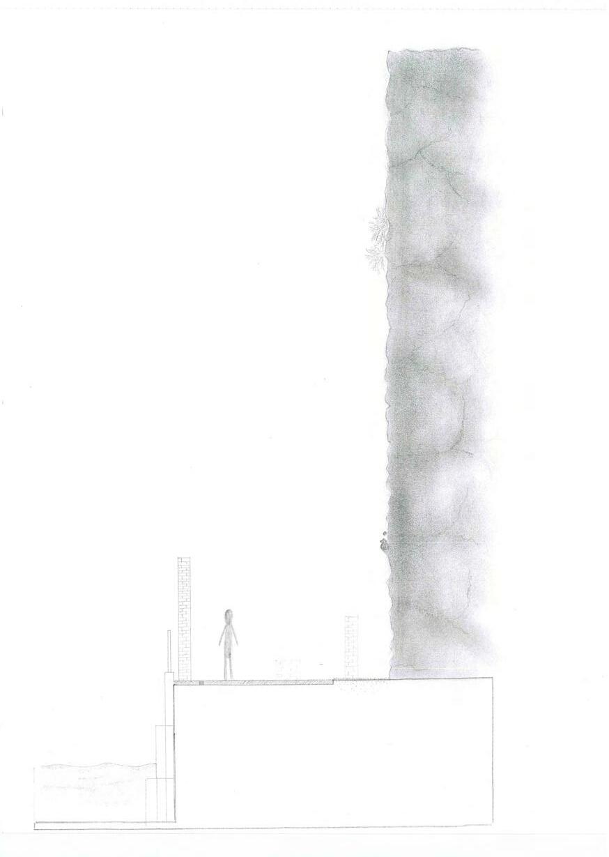
Figure 34: Sketch section of path intervention next to sandstone cliff face near dockyards (NTS)
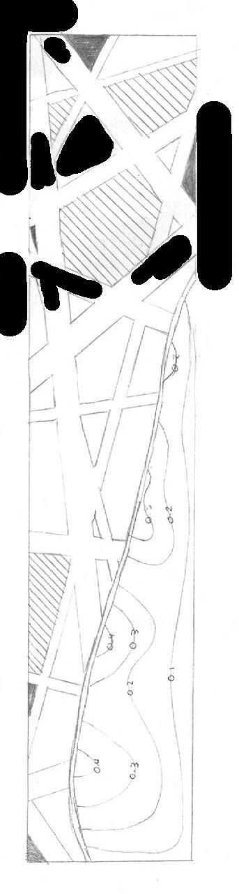
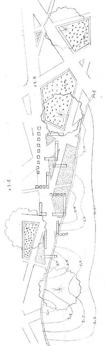
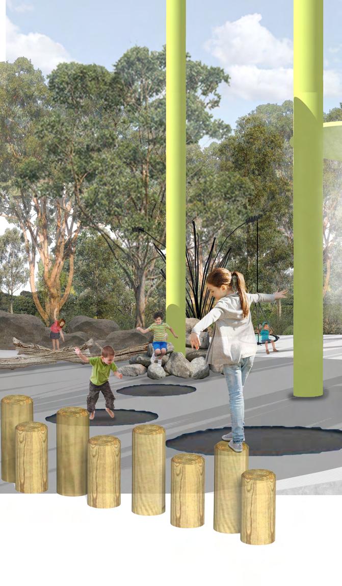
Figure 36: Illustrative perspective B of place intervention (NTS) Figure 37: Illustrative perspective C of place intervention (NTS)
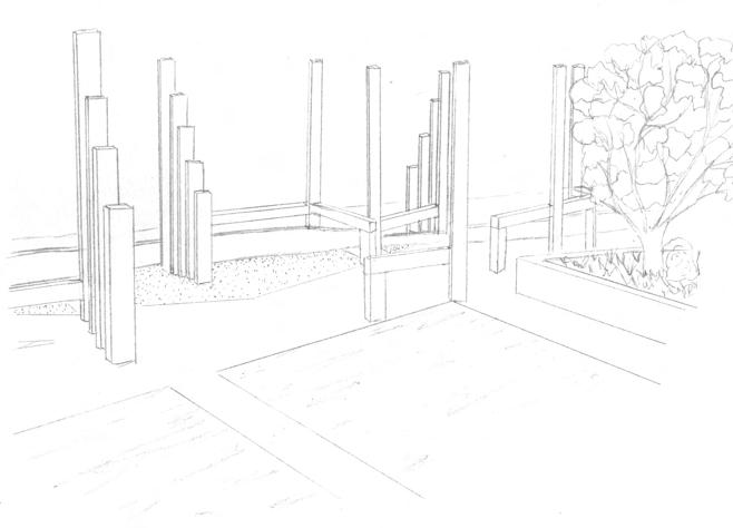
Figure 38: Illustrative section AA of place intervention (Scale 1:150)

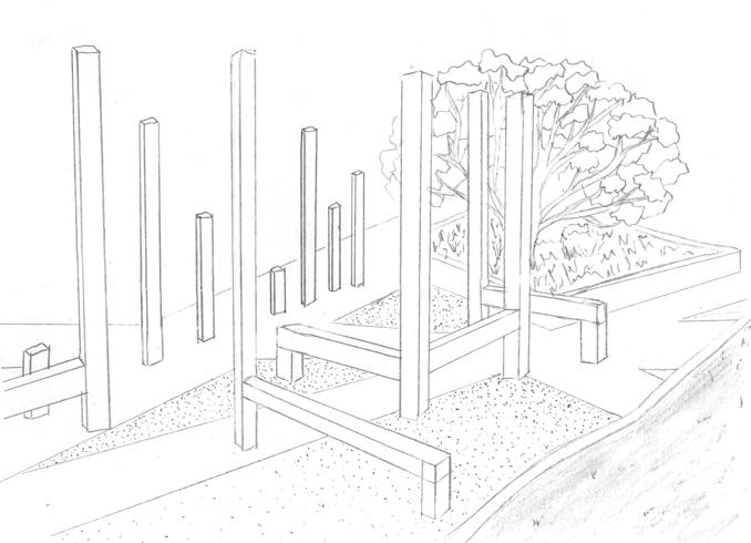
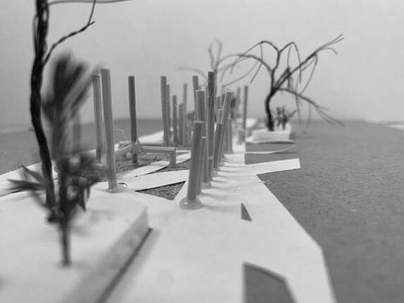
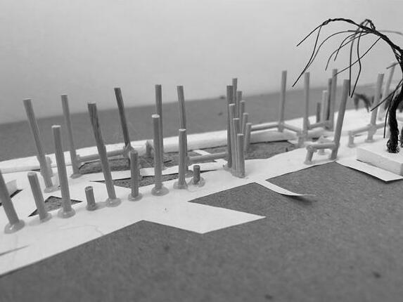
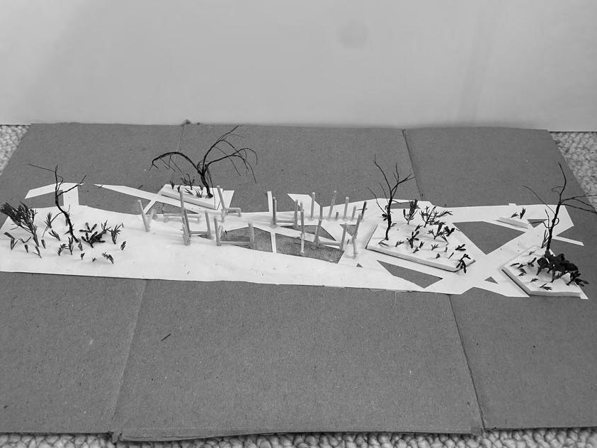
Figure 39: Photographs of model of place intervention (NTS)
LAND2152: PLANTS & DESIGN
LOCATION: WAVERTON COAL LOADER, BALLS HEAD, SYDNEY
PROJECT VISION:
TO CREATE A SENSORY GARDEN THAT UTILISES A RANGE OF PLANT SPECIES TO POSITIVELY ENGAGE ONES SENSES OF SMELL, TOUCH AND SIGHT.
CONTEXT/DESIGN BRIEF:

TO DEVELOP A DETAILED PLANTING PLAN AND SCHEDULE FOR AN AREA ON THE COAL LOADER PLATFORM AT BALLS HEAD. THE DESIGN SHOULD UTILISE BOTH INDIGENOUS AND EXOTIC SPECIES AND A RANGE OF PLANT FORMS.
SKILLS DEVELOPED:
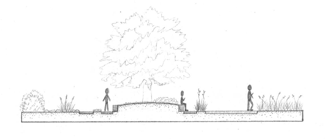
Low lying spreading groundcovers between pathways to allow for easy movement and wayfinding
Plants selected based on microclimate (strong westerly winds & harsh sun exposure)
Figure 40: Site analysis of Waverton Coal Loader and concept design plan
Pennisetum advena rubrum
Shrubs to create sense of enclosure and privacy Origanum vulgare
Trees for shade and protection from harsh sun and winds
400mm high concrete seating wall under trees for a sheltered place to rest
200mm rise in soil depth from seating wall to centre of bed creating a total soil depth of 600mm for trees
Concrete pathway provides sinuous, sensory experience throughout space compared to otherwise geometric landscape of the Coal Loader platform
Low lying vegetation on westerly side for uninterupted views of harbour Significant views to Sydney Harbour
Acacia baileyana purpurea
Figure 42: Detailed planting design plan for site on Waverton
Westringia fruticosa
Chamaemelum nobile treneague
Thymus pseudolanuginosus
Carpobrutus Pink Passion Helichrysum petiolare
Anigozanthos ‘Big Red’
Pennisetum advena rubrum
Figure 41: Section AA of planting design on Waverton Coal Loader Platform
8 X 150MM DEEP HOT DIPPED GALVANISED STEEL EDGE. FLUSH FINISH WITH ADJACENT MATERIALS. M10 GALVANISED STEEL FIXING, SET IN MIN 60MM TO CONCRETE SLAB.
812 X 406 X 20MM HERON BLUESTONE PAVERS, STRETCHER BOND. 5MM MORTAR JOINTS.
30MM MORTAR BED PRECAST OFF-FORM CONCRETE BASE REINFORCING & DEPTH TO CIVIL ENGINEERS SPECIFICATIONS.
1 PAVING TYPE 2 - AUSTRALIAN SPOTTED GUM TIMBER DECKING SECTION
Scale 1:10 @
R10
20MM THICK, 100MM WIDE HOT DIP GALVANISED FLAT BAR STEEL BIKE SUPPORT FRAME. POWDER COATED PRAINT FINISH DANDELION YELLOW A205.845MM HEIGHT FROM EXISTING GROUND, 900MM LENGTH. SUBSURFACE FIXED WITH EPOXY RESIN.
BIKE WHEEL CUT-OUT 120MM W X 500MM L X 190MM D
EXISTING CONCRETE PLANKS
REINFORCED CONCRETE FOOTING TO CIVIL ENGINEERS SPECIFICATIONS
COMPACTED SUBGRADE TO ENGINEERS SPECIFICATIONS
BIKE RACK TYPE 1 - METAL BICYCLE PARKING DEVICE SECTION
Scale 1:10 @ A3
3000 X 50 X 96MM TIMBER PLANKS. M10 GLAVANISED STEEL FIXING SET IN MIN 30MM INTO STEEL SUPPORT TO CIVIL ENGINEERS SPECIFICATIONS.
40 X 90MM RECTANGULAR HOLLOW STEEL SUPPORT. SPACED EVERY 1.5M APART. M10 GALVANISED STEEL FIXING TO STEEL PLATE, SET IN MIN 60MM TO CIVIL ENGINEERS SPECIFICATIONS.
250 X 320MM INSITU CONCRETE WALL, TROWEL FINISH. M10 GALVANISED STEEL FIXING, SET IN MIN 60MM TO CONCRETE BASE TO CIVIL ENGINEERS SPECIFICATIONS.
OFF-FORM
BASE
& DEPTH TO CIVIL ENGINEERS SPECIFICATIONS.
LENGTH VARIES REFER TO PLAN
3000 X 96 X 50MM TIMBER PLANK SEAT. 5MM SPACING.
40 X 90MM RECTANGULAR HOLLOW STEEL SUPPORT. SPACED EVERY 1.5M APART. M10 GALVANISED STEEL FIXING TO STEEL PLATE, SET IN MIN 60MM TO CIVIL ENGINEERS SPECIFICATIONS.
250 X 320MM INSITU CONCRETE WALL, TROWEL FINISH. M10 GALVANISED STEEL FIXING, SET IN MIN 60MM TO CONCRETE BASE TO CIVIL ENGINEERS SPECIFICATIONS.
BENCH TYPE 1 - TIMBER BENCH ON RAISED GARDEN WALL AXO Scale 1:10 @ A3