PORTFOLIO
 By Juan Alexis Caballero Vidal
ARCHITECTURE + URBANISM

By Juan Alexis Caballero Vidal
SHELTER IN HIGH ANDEAN AREAS 003 005
FROM AGRARIAN PARK TO COLLSEROLA
FROM COLONIZATION TO COOPERATION OF THE TERRITORY 009 014
THE CORNER
CASA PUENTE 017 020
THE LINE 022 M1

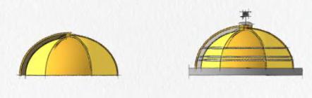

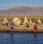
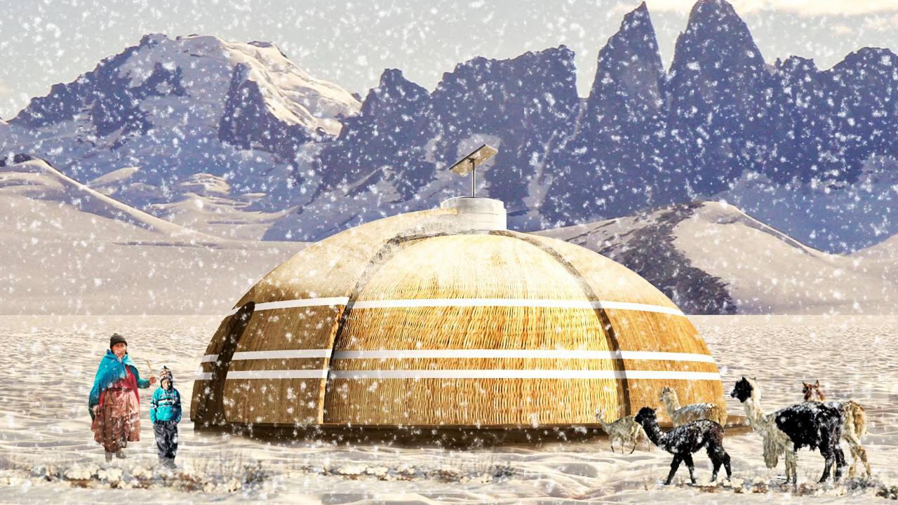
Location:
Puno, Perú
Maricielo Guzmán, Shanam Meza, Erick Bazán, Team: Cristhina Centurión, Arturo Paredes.
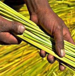
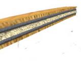
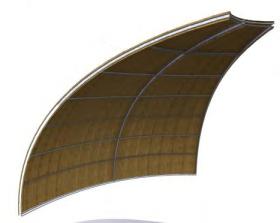
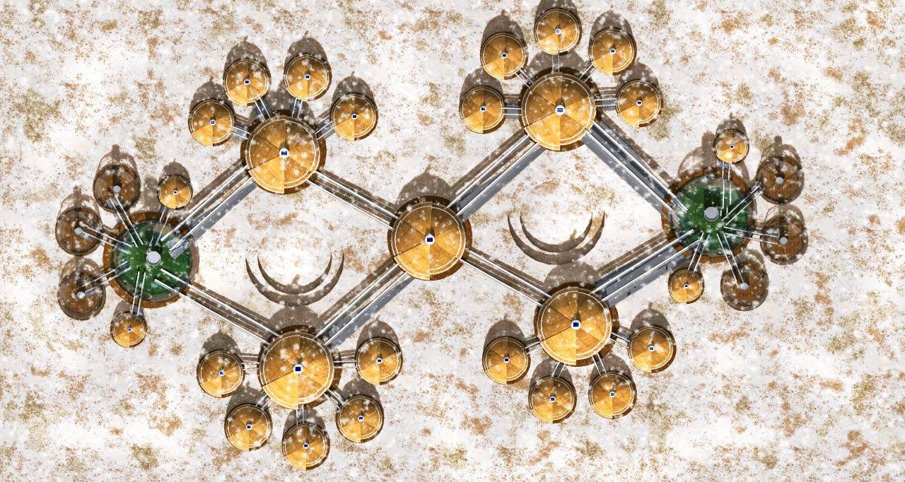
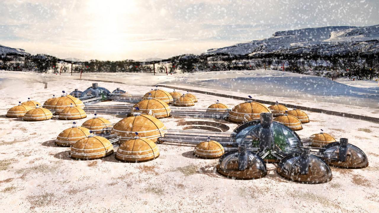
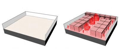
With the passing of the years, the weather has presented various changes such as the cycles of global warming and cooling, the study of these climatic variations allow us to determine the modifications that the Earth has presented, as well as the conditions of habitability on the planet which makes it easier to predict future behavior of weather through sciences such as meteorology and climatology. In this way, being human can take the necessary considerations to adapt his life according to to climatic changes presented by the environment.
For this reason, the development of proposals for shelters that allow mitigate the damage caused by low temperatures through the construction of modular infrastructures to provide shelter and security for families and animals affected by low temperatures.


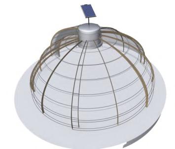

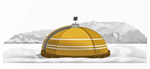
Year: 2018
Location: Barcelona, España.
Team: Ana Laura González, Natalia Ordoñez, Claudia Pérez.
FROM
PERMEABILITY - TREATMENT OF FRONTS LINKED TO NATURAL ELEMENTS
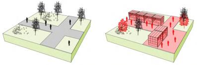
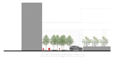
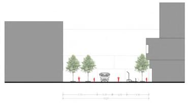
First of all, these estrategies are a result of the previous investigation, where the areas that work as a possible stage need to have some estrategies of intervention. some of those in public space, and others in private space. These estrategies will help to redefine a new way of living in this type of places around the city of Barcelona that are getting forgotten, and also don’t have urbanity and the sense of a city, a health and sustainable city
REURBANIZATION REMODELATION PERMEABILITY POROSITY
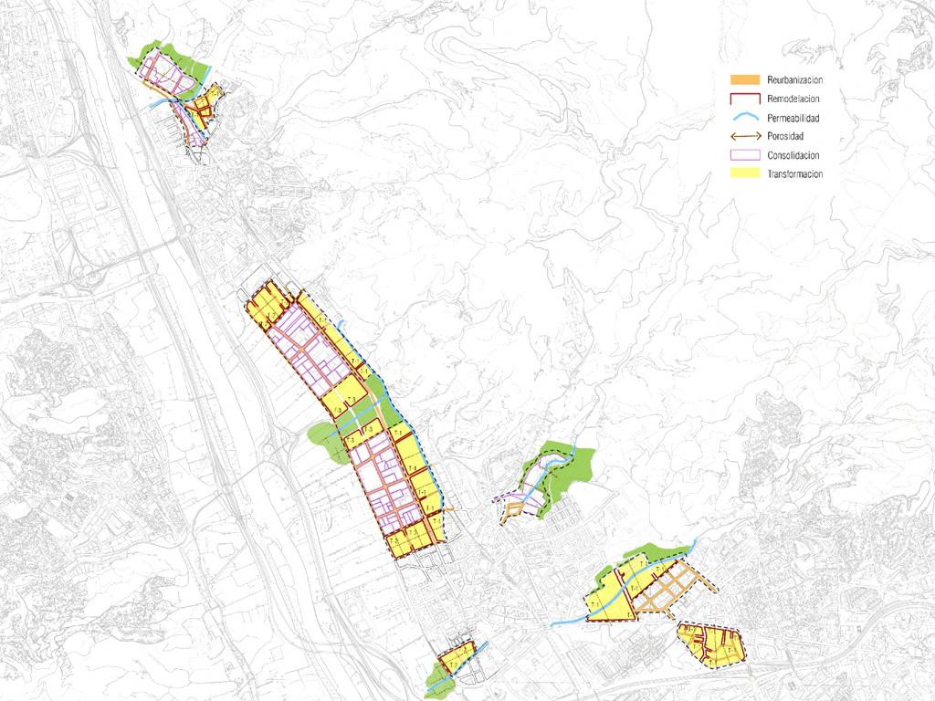
CONSOLIDATION TRANSFORMATION
POROSITY - GENERATE OPEN SPACES ON THE BLOCK
REMODELATION - TREATMENT OF BUILT-IN FRONT FLOORS ON GROUND FLOORS
CONSOLIDATION - IMPROVE ACTIVITIES

TRANSFORMATION - CHANGE OF USE
PROGRESSIVE TRANSFORMATION
de la
de la salut area
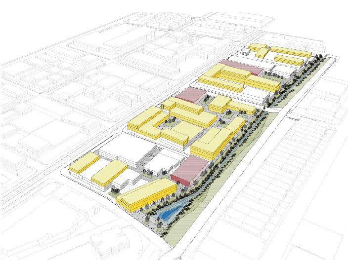
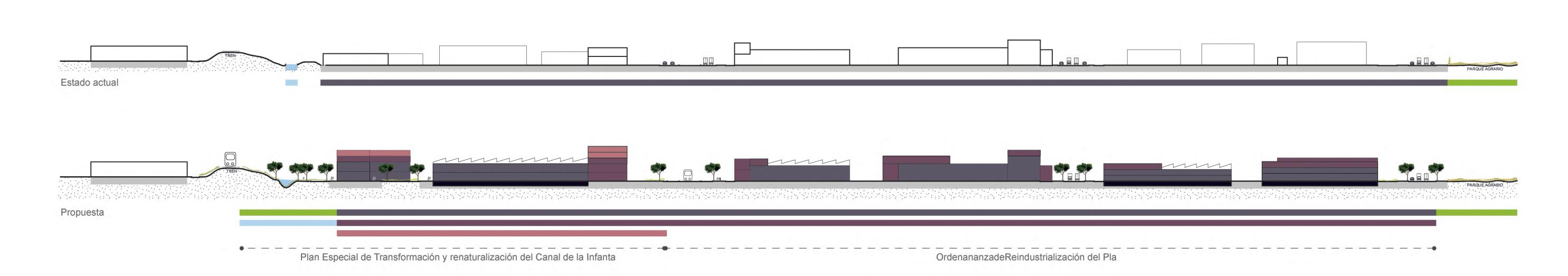
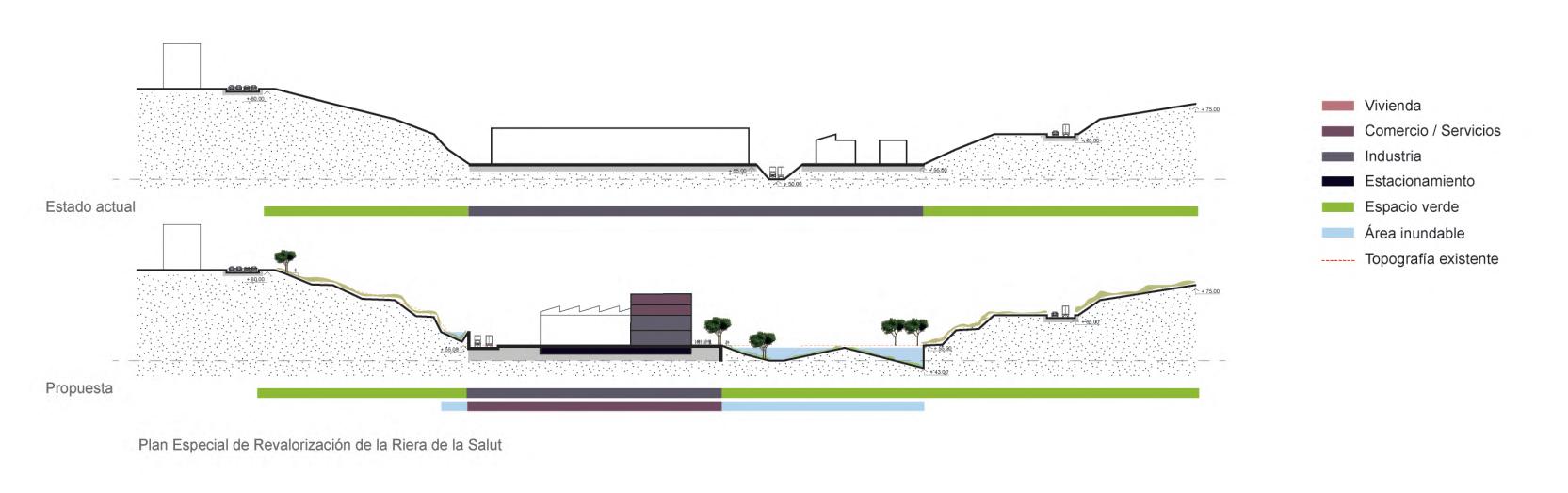
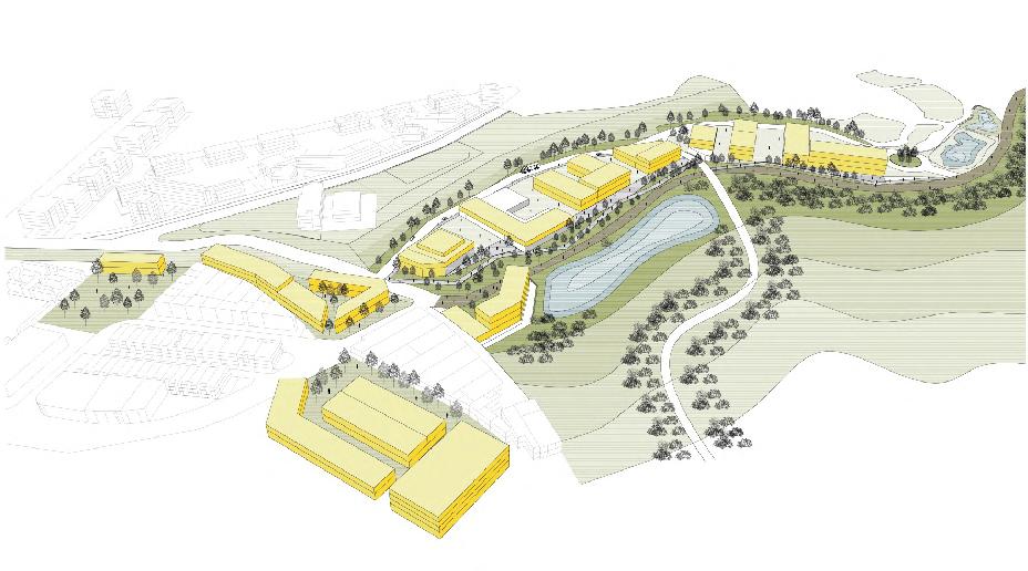
of
Pla”
Year 2019
Location Barcelona, España.
Team Karel Van Oordt, Sofía Di Lulo.
Faced with the overexploitation of natural resources that has the effect of the climate and civilizational crisis right now(Hickel, 2018), there is a necessity to test alternatives to the developmental paradigm with measures that regulate our habits of production and consumption of resources and waste, reduce our working time and generate more profit and equal income (O'Neill, 2017).
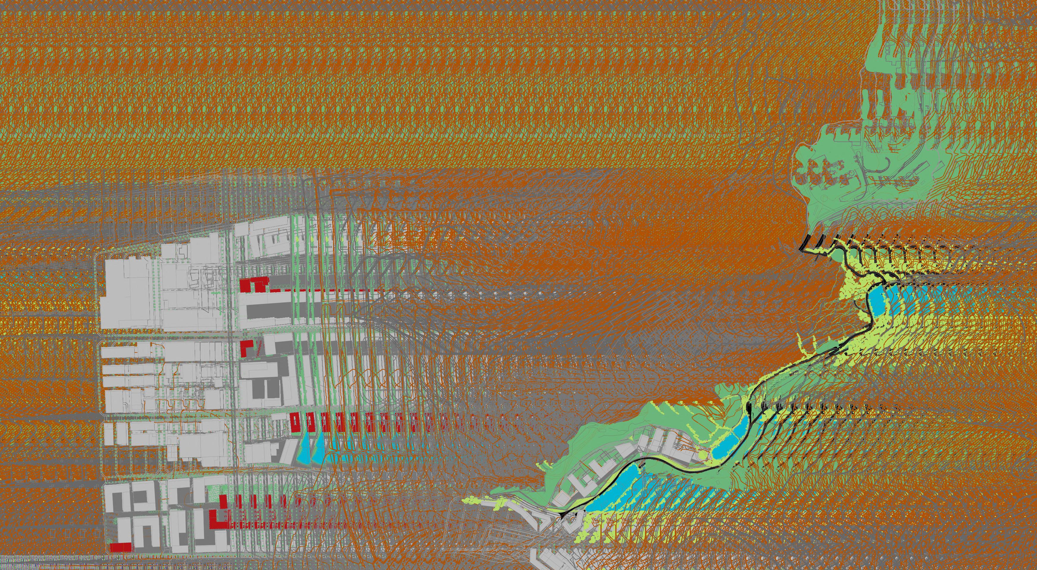
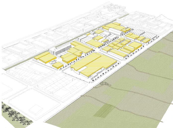
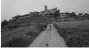
Therefore, it is proposed to regenerate the socio-ecological link of the territory through holistic cooperation resources and agents as a response to the paradigm of singular colonization from a commitment to Infrastructures or Structural support, a theme chosen by the Module and which is linked to the work carried out by The shape of the territory and The settlements and activities.
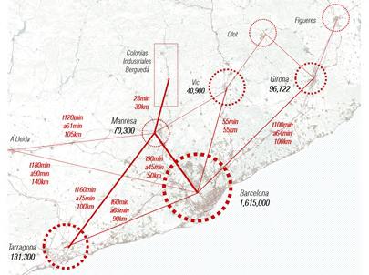
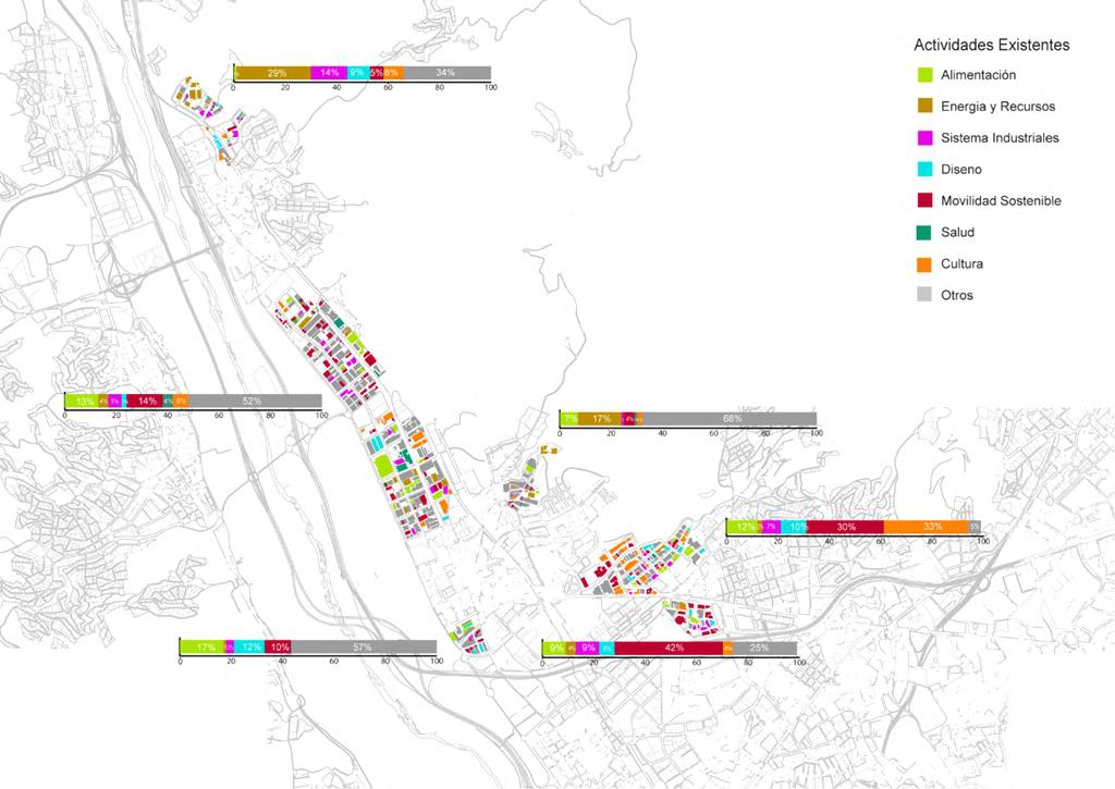
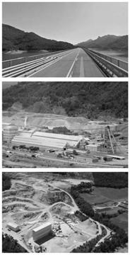
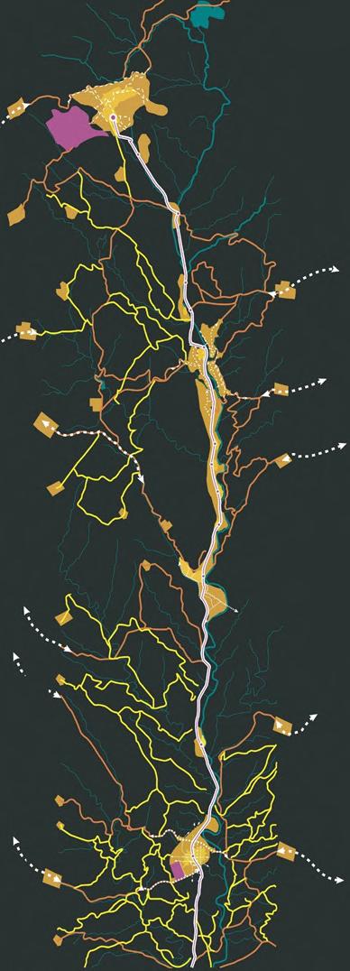
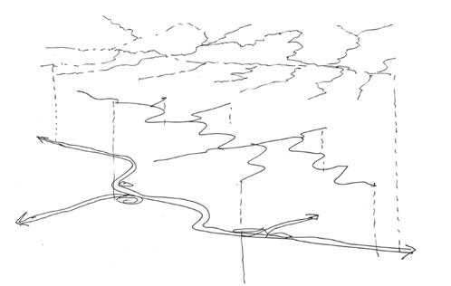
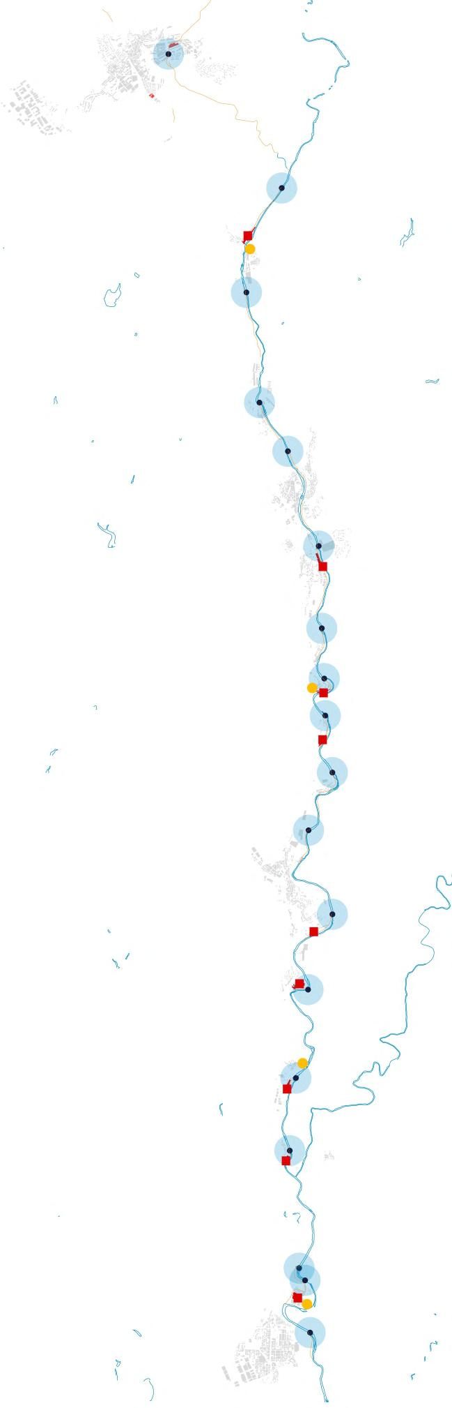
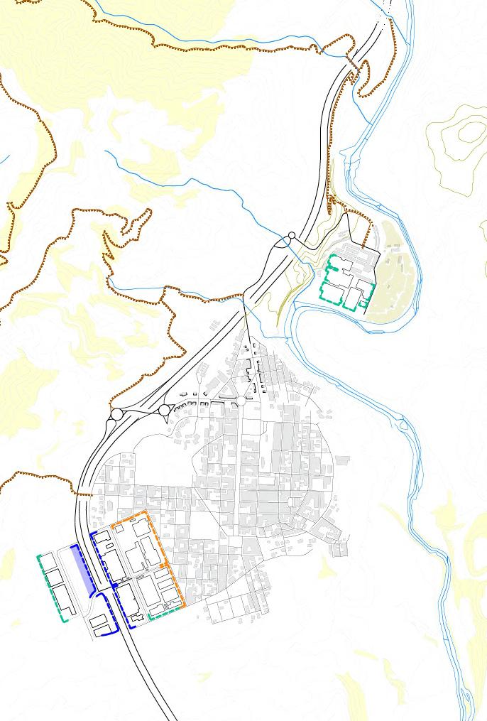
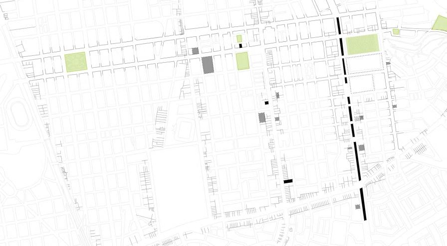
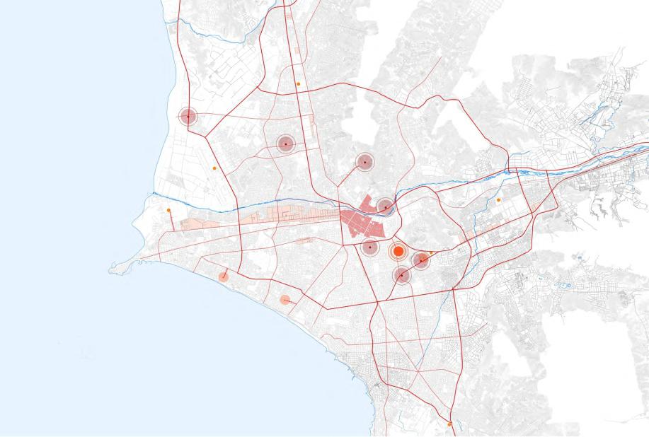
This study of Infrastructures has a greater emphasis on mobility and a lesser one on energy, waste, water-sanitation and telecommunications. In this context, the study begins by asking: How was the infrastructure in the territory formed -historically? .
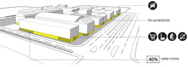
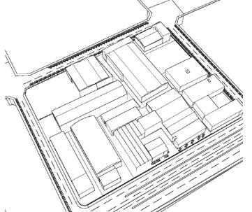
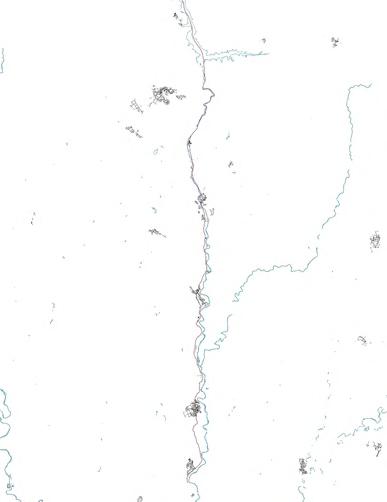
Within the question that arises on the subject of structural support and its evolution, how do we rebalance the mosaic? There are certain factors to analyze and interpret the relationship of these industrial estates with the highway, which despite being a "fracturing" element of the ecological matrix, serves to reorder and characterize the different estates located along the Llobregat corridor (Berga - Navás).
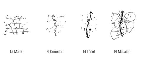
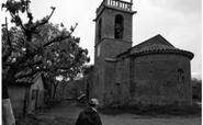
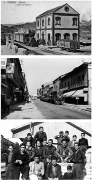
This came to a certain extent to understand how the activities have been conditioned by the connection infrastructures that comprise it. For example, the mesh arranged at the beginning of the first settlements had certain characteristics that organized the settlements in a non-linear way, making a very blocked route, without a linear axis that organized the route of this section. Then the roads and the colonies, with a less blocked route from the axis, and taking as reference the factories of the colonies as elements of population attraction, which, as in different parts of the world throughout history, industrial activities were determining factors for different types of settlements and demographic indicators.
Then, in recent years with the implementation of the highway, other types of activities have benefited up to a certain point; however, there are problems generated from this new element that runs through the entire corridor, more directly and quickly in terms of speed and time, curves and less steep slopes, perceiving a "practical" route for those who cross it.
Finally, the mosaic, which seeks the rebalancing between these three types of speeds through another layer of memory, which throughout history have been overlapping one another but without taking into account some guidelines that allow the three to coexist. in a better way.
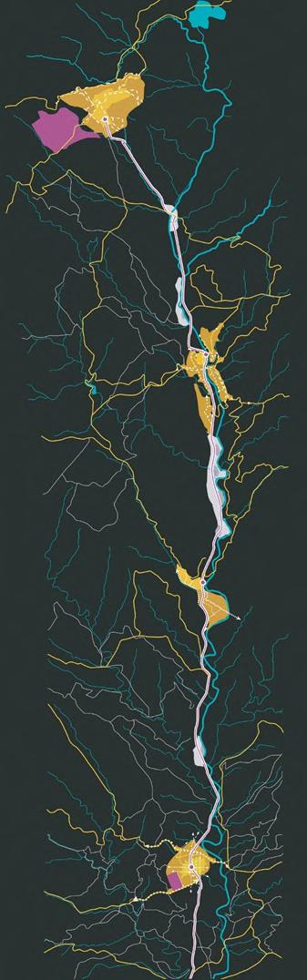
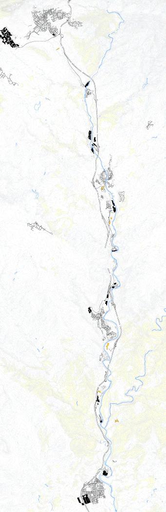
Map of the roads and Carrrilet- Manresa Olva
Map of the C-16 highway and nodes
Map of main rural roads
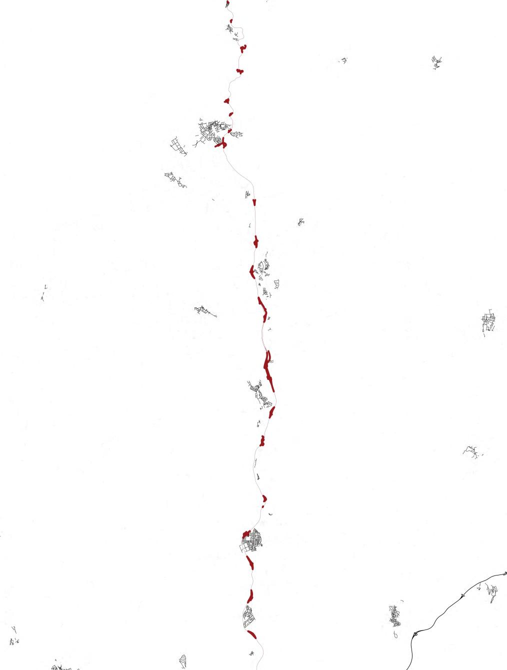
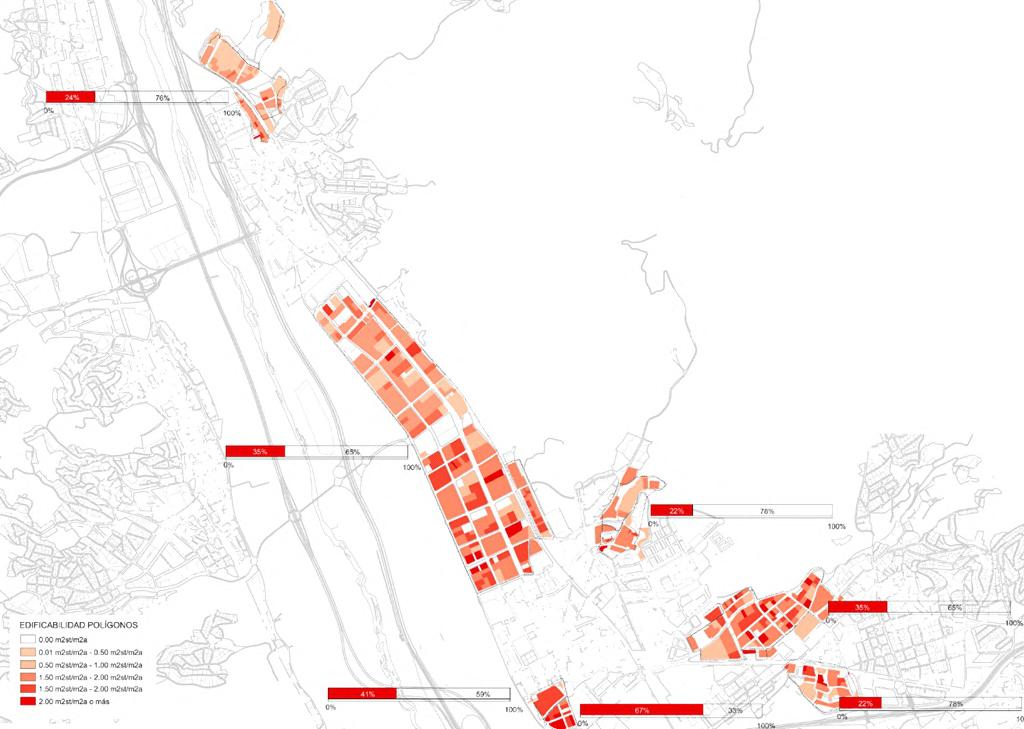
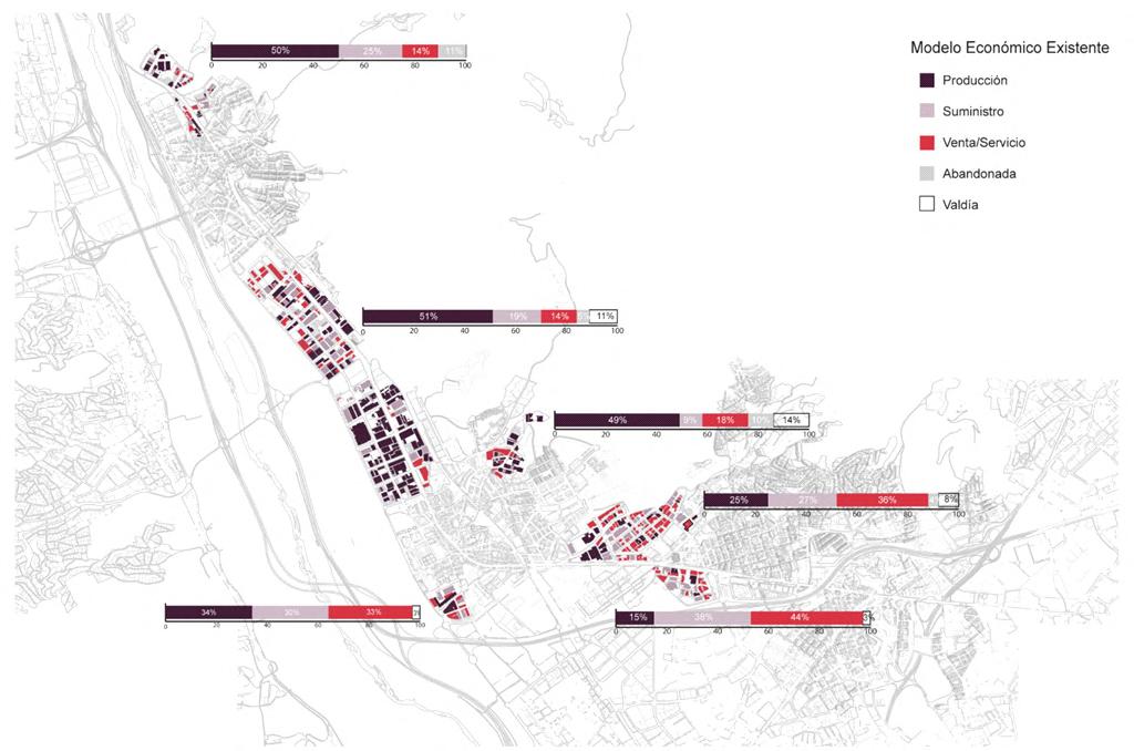
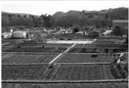
Low communication between colonies and transverse disart culation Here, in add tion, var ous rural roads lose their character, becoming part of the urban fabr c of certa n centers and ne ghborhoods Ecologica matrix disturbed by infrastructure and sett ements (Fig 9 ) Here the highway generates a greater visual / spatia disturbance of the andscape Likewise, the streams located in Puig-Reig and Berga have been d sturbed by urban settlements, being ocated under current urban roads. Center-per phery structural segregation relationship. (Fig. 10) This is manifested in the differences of scarce equipment - low indices of well-being, settlement densities - depopulation of the colonies and the high index of older population and lack of attraction for young population in the colonies mainly. Low diversity of economic activities / lack of job opportunity and means of subsistence. This is related to the deficient access points along the corridor, added to the disarticulation of the economic activity areas.
On the other hand the ordering of the economic activity po ygons fo lows more the logic of fast speed (h ghway) and not the terr tor al log c of its l mits with the environment.
In summary, the analysis and characterizat on serve to demonstrate how the evolution of nfrastructure n the territory has resulted n an unbalanced terr tor a mosa c, where nuclei and colon es, the ecolog cal matrix and industrial deve opment have asymmetric relationships. t is from th s character zation that the specific vocations that can become projects for each nucleus, colony or system that relate them are outlined. This gives rise to the intentions of which and how many interventions the colonies as a whole could have.
"Our overvaluation of speed (time here, just as money) has robbed us of a lot of things that are at least as valuable."
Doreen Massey, The future of landscape
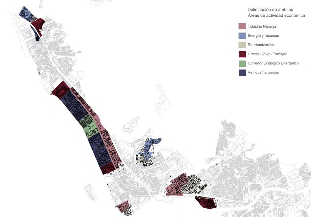
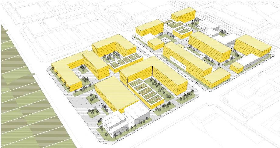
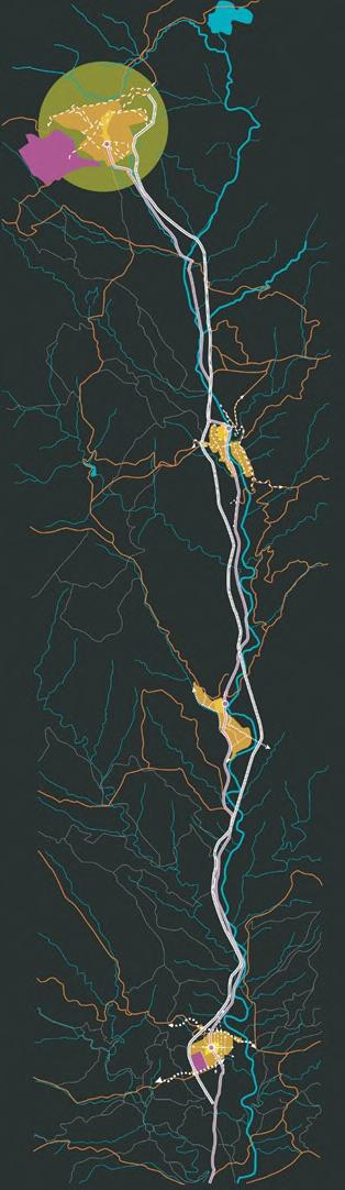
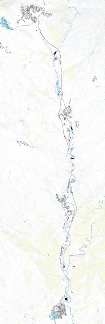
Based on the characterization of the territory, four scenarios are proposed to rebalance the territorial mosaic. These scenarios are built from a matrix inscribed in the framework of degrowth theories in which there is more or less diversity and more or less decentralization as variables, giving way to 4 quadrants with their own dynamics.
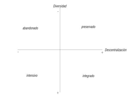
Abandoned
Preserved
Intensive Integrated Diversity
Abandonment and Centralization PRESERV THE VALLEY The linear city on a Metropolitan Scale
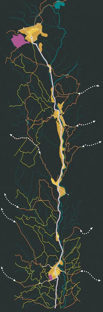
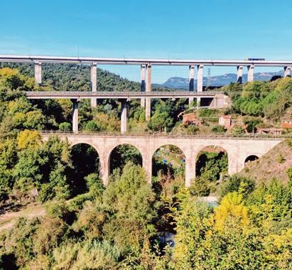
The three speeds starting with the fast in the lower part, the medium in place and the slow in the upper part.
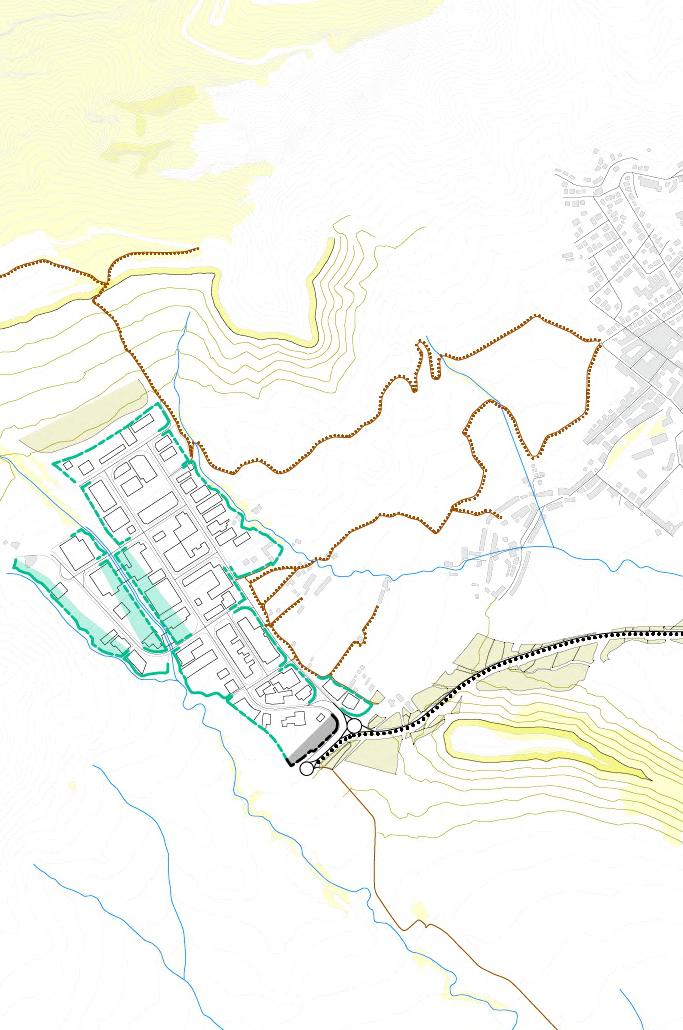
Renaturalización de los frentes de manzana
Renaturation of block fronts
Tejido industrial – tejido mixto
Transition industry to mixed use
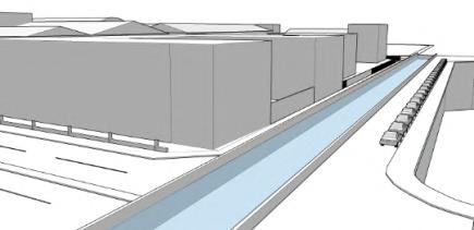
Highway showcase facade
Fachada escaparate Autovía
Roads showcase facade
Fachada escaparate Carreteras
Conection to rural roads
Conexión con caminos rurales
Acces roads to intervention areas
Vías de acceso a polígono caracterizadas (vocación)
Límite Bosque
Límite Huertos
Límite fluvial
Forest Grove Rivers
Recuperación límite fluvial
Recuperation of river
Renaturalización de los frentes de manzana
Renaturation of block fronts
Tejido industrial – tejido mixto
Transition industry to mixed use
Highway showcase facade
Fachada escaparate Autovía
Roads showcase facade
Fachada escaparate Carreteras
Conection to rural roads
Conexión con caminos rurales
Acces roads to intervention areas
Vías de acceso a polígono caracterizadas (vocación)
Límite Bosque
Límite Huertos
Forest Grove Rivers
Límite fluvial
Recuperación límite fluvial
Recuperation of river
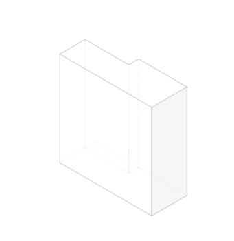
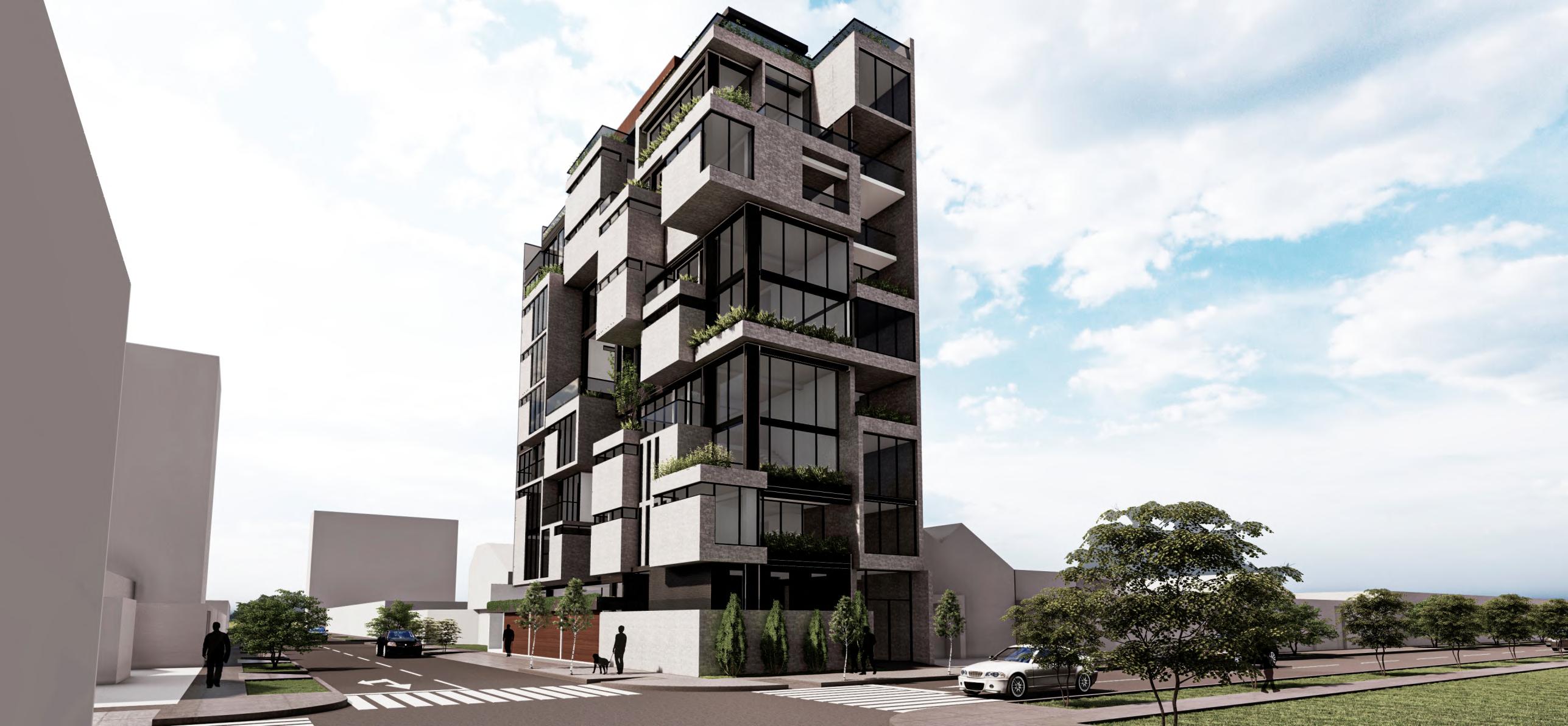
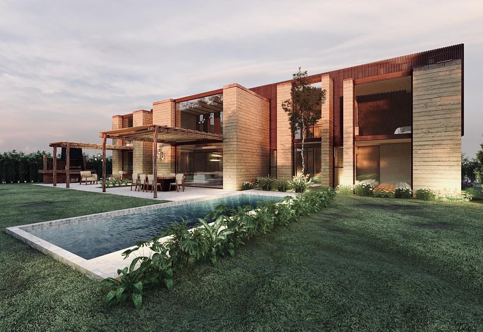
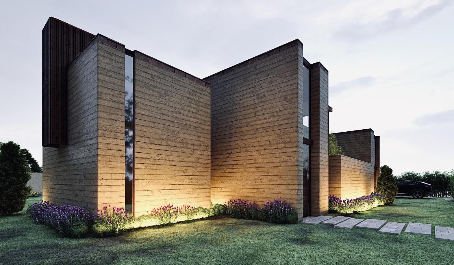
Year 2020
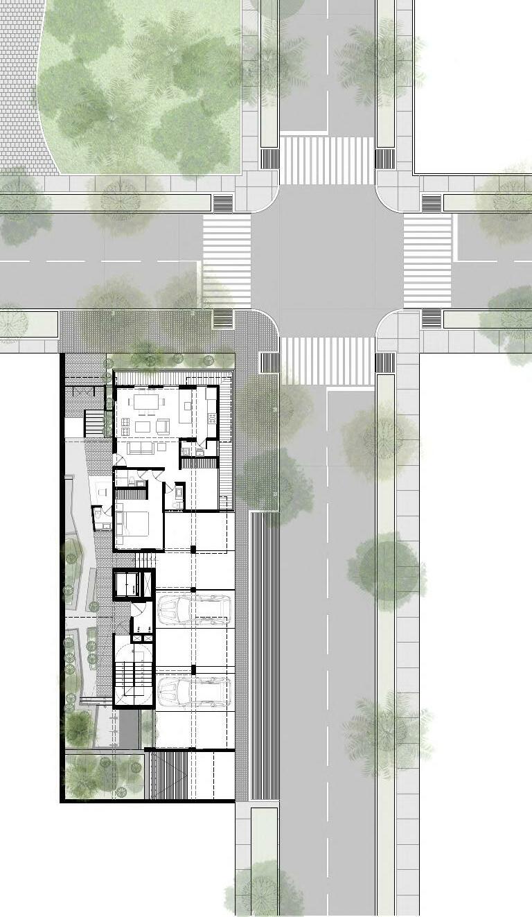
Location Trujillo, Perú Team --------------------
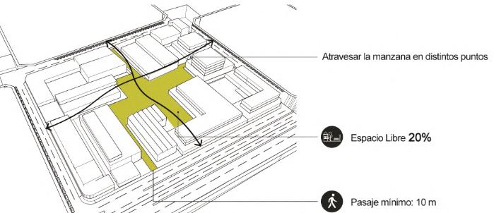
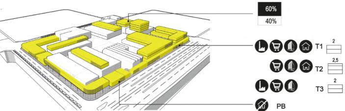
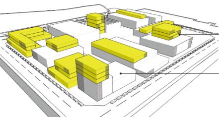
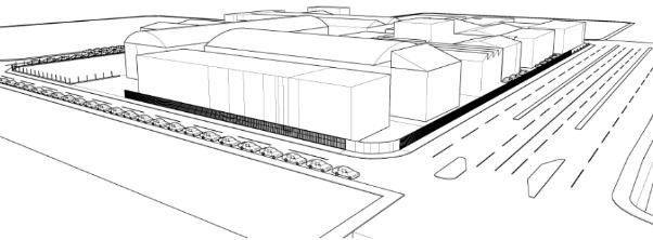
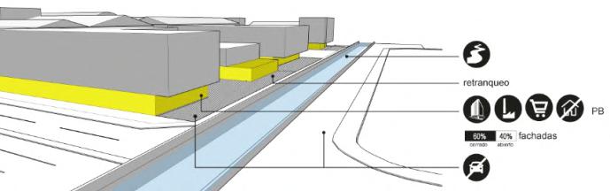
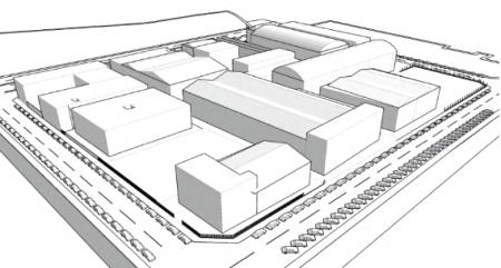
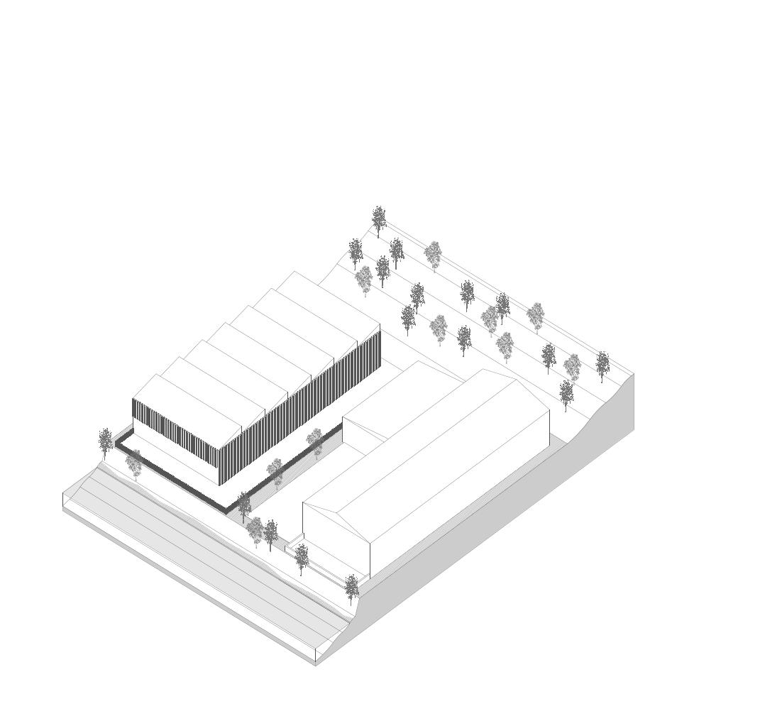
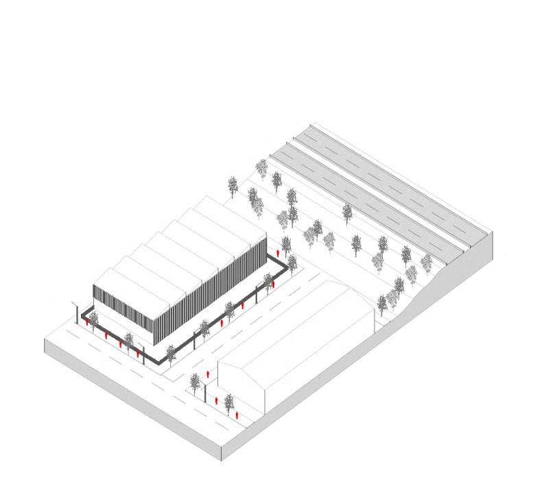
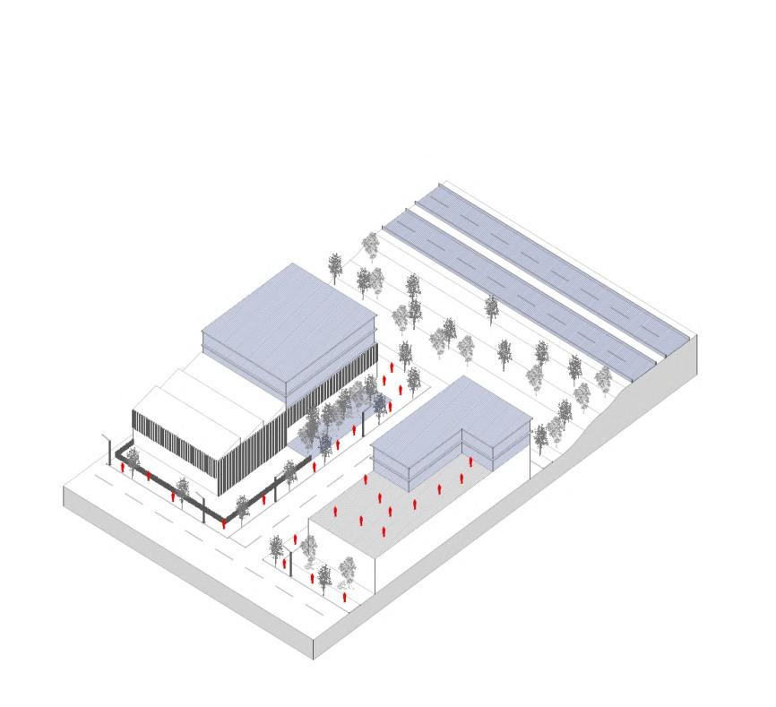
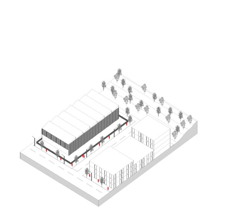
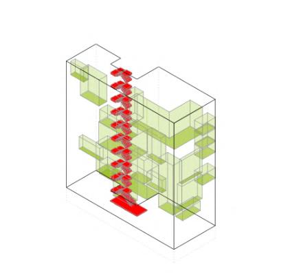
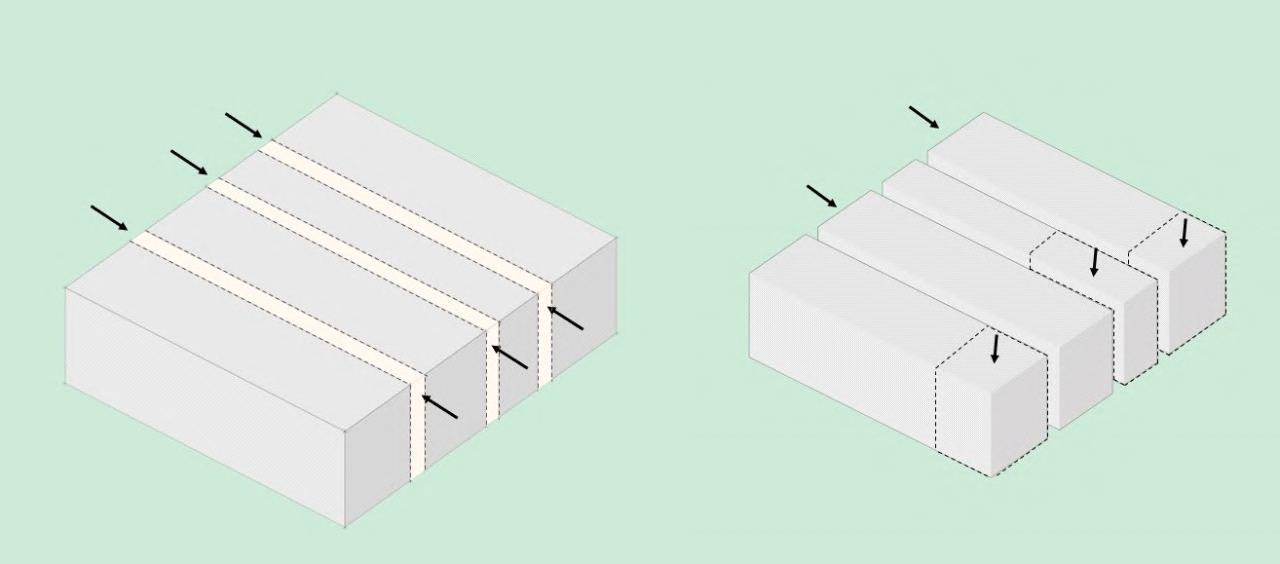
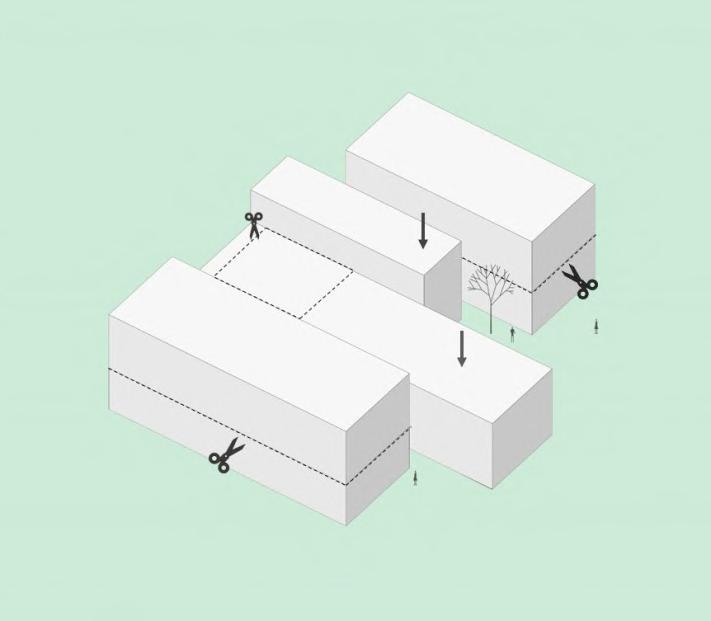
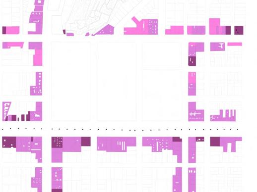
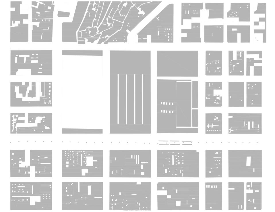
The location of the project is in one of the most exclusive areas of Trujillo, very close to El Golf avenue, Golf & Country Club, and with a very privileged view in front of one of the most outstanding parks in the city.
Despite having various real estate projects that have gone developing in this sector of the city, many times not consider the added value of an environment in conditions of enrich the building, and the building itself.
That is why an idea is developed taking into account the en as a guiding element that configures and proposes an ar can live up to the user's expectations, understand the immediate context as an elementary axis to propose spaces on a human scale, where the user can perceive a direct relationship with the context, despite being inside the building, which will be benefited based on the activities that are proposed inside it.
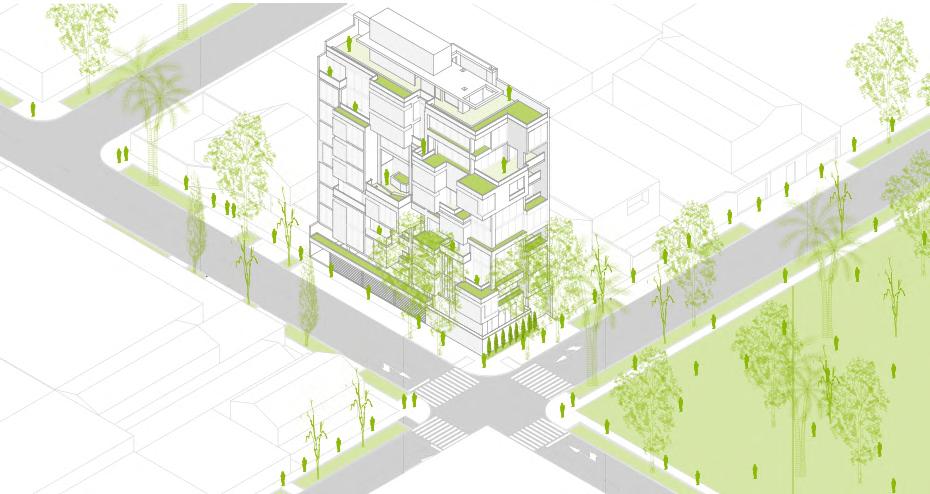
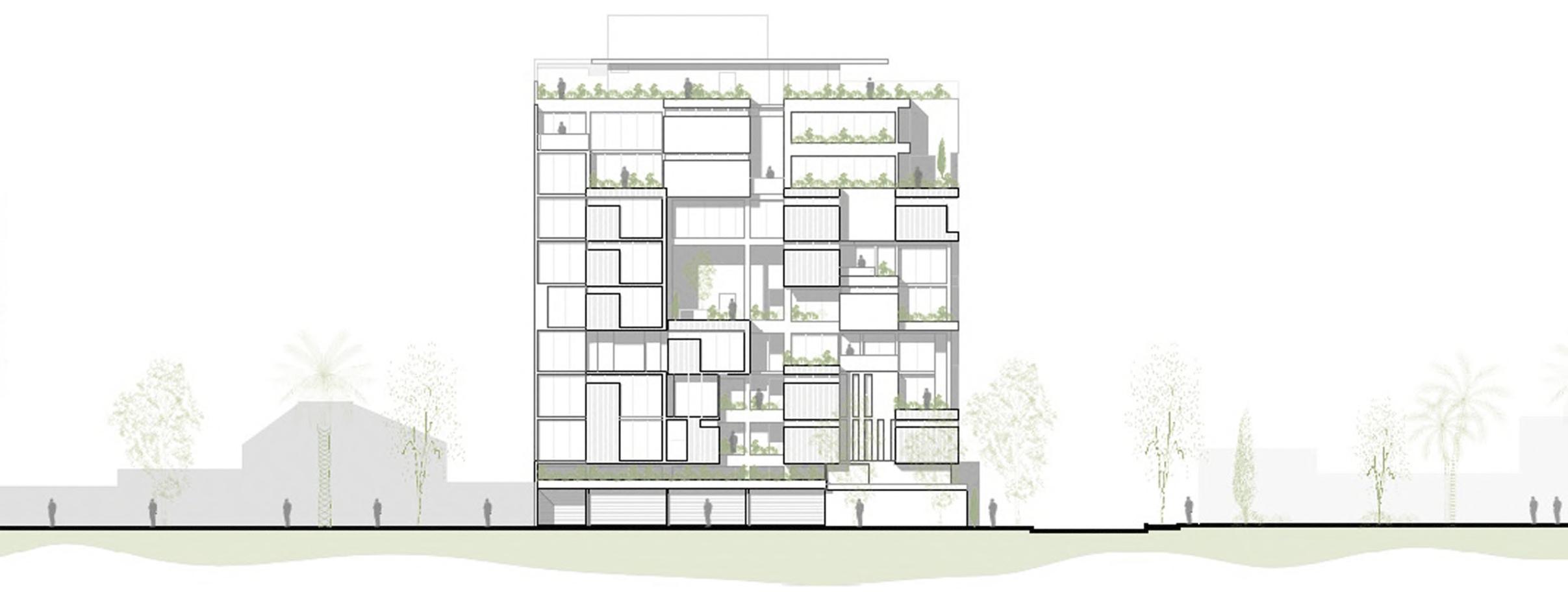
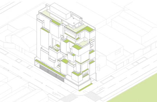
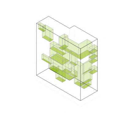
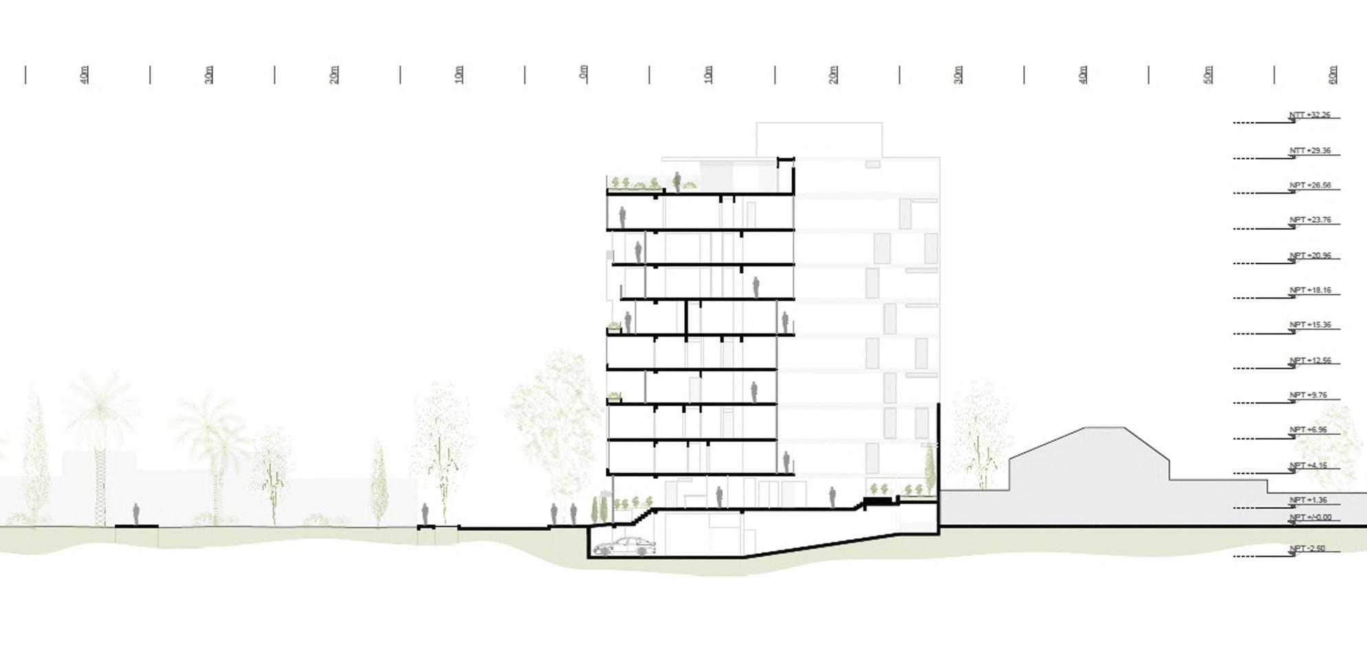
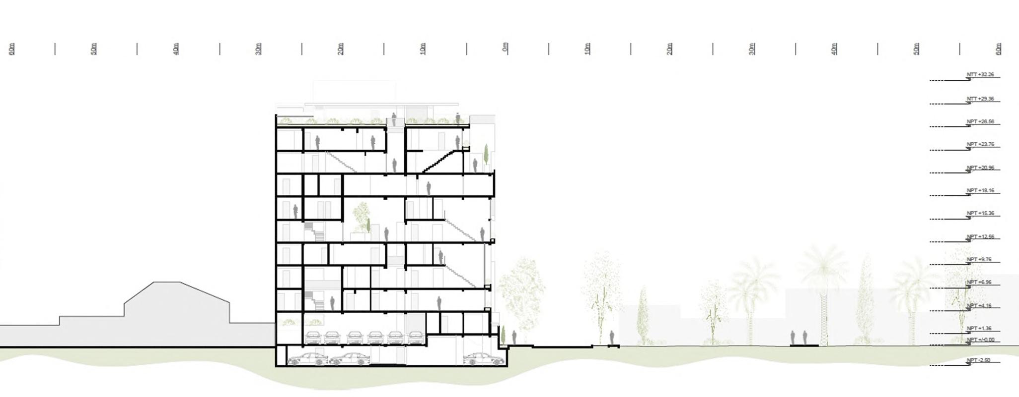
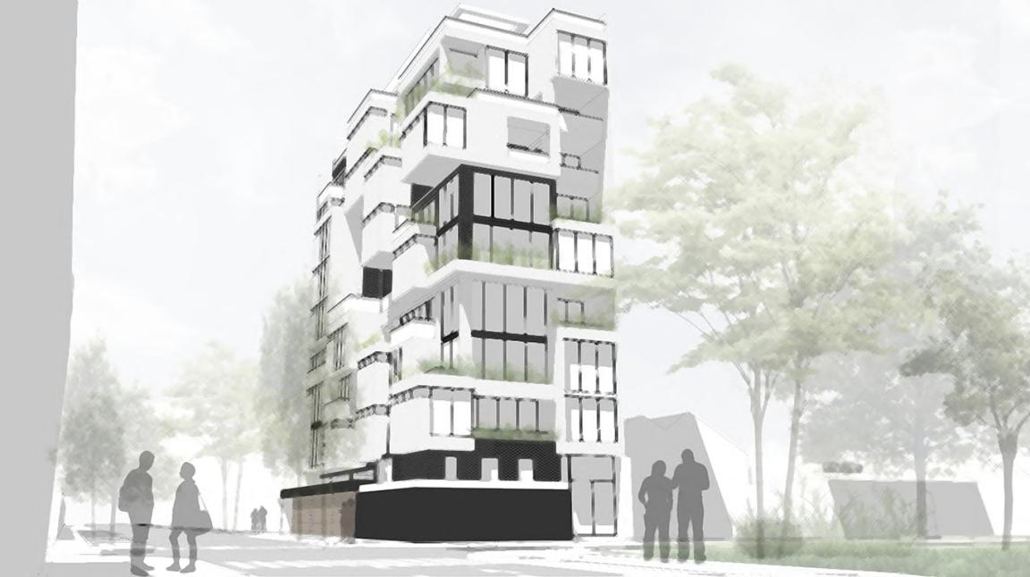
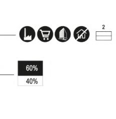
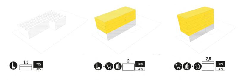
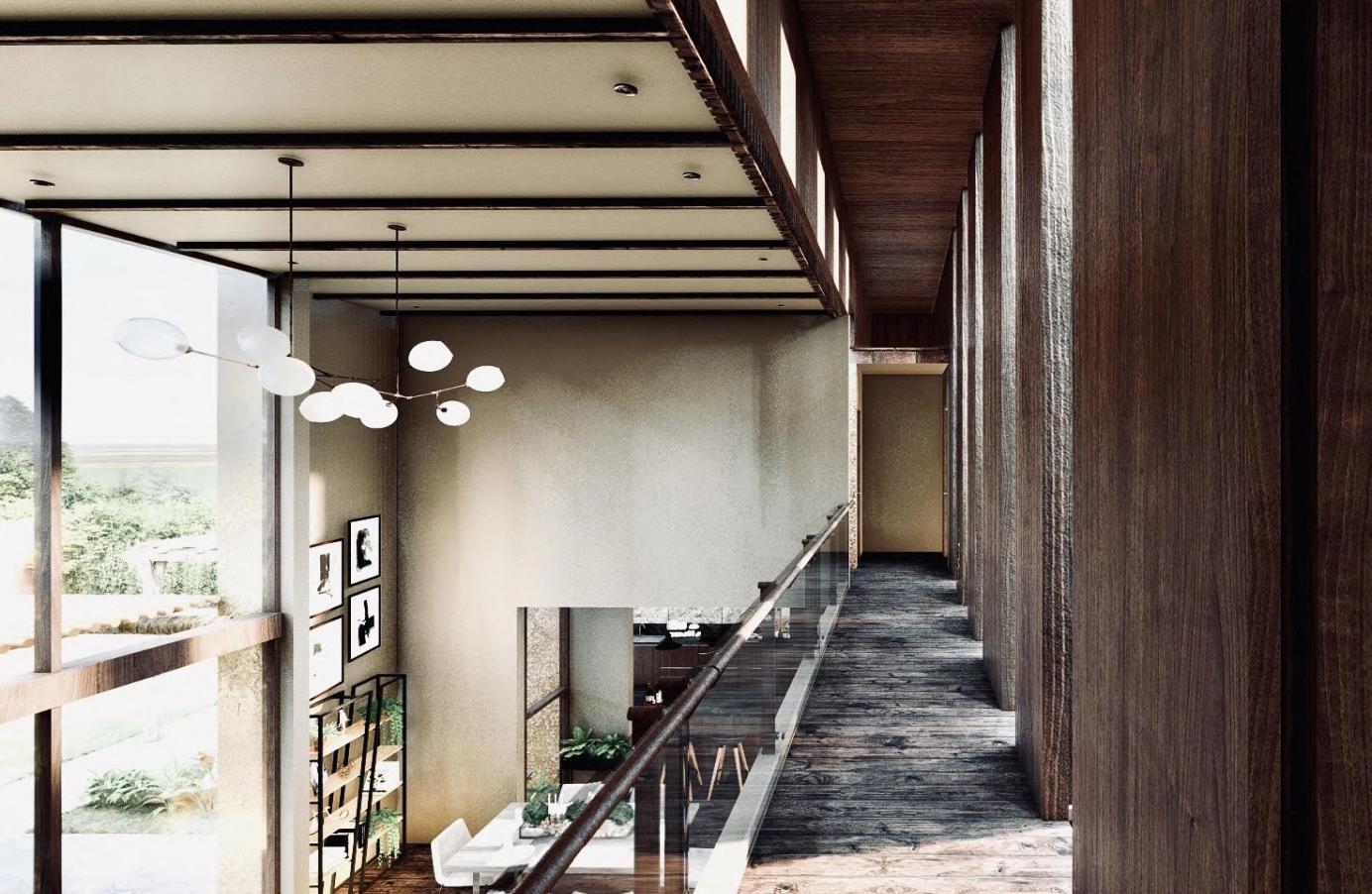
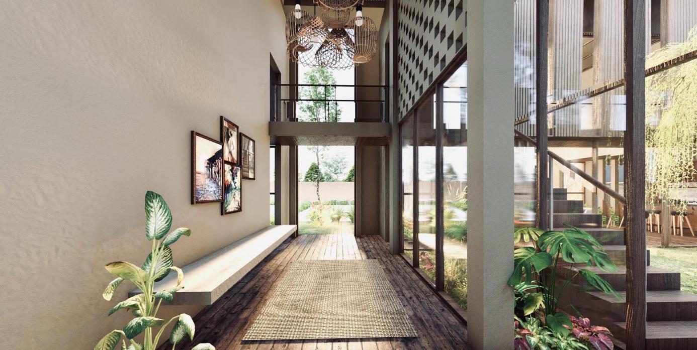
The building mainly proposes to manage as a maximum of 03 types of materials or textures. In first place, it is proposed that the elements (protruding blocks) highlight and contain the most important material, from a principle, it was proposed by an exposed concrete for these blocks, translucent windows, and wood texture for the part where the blocks are not located, and the another option to have black bricks.
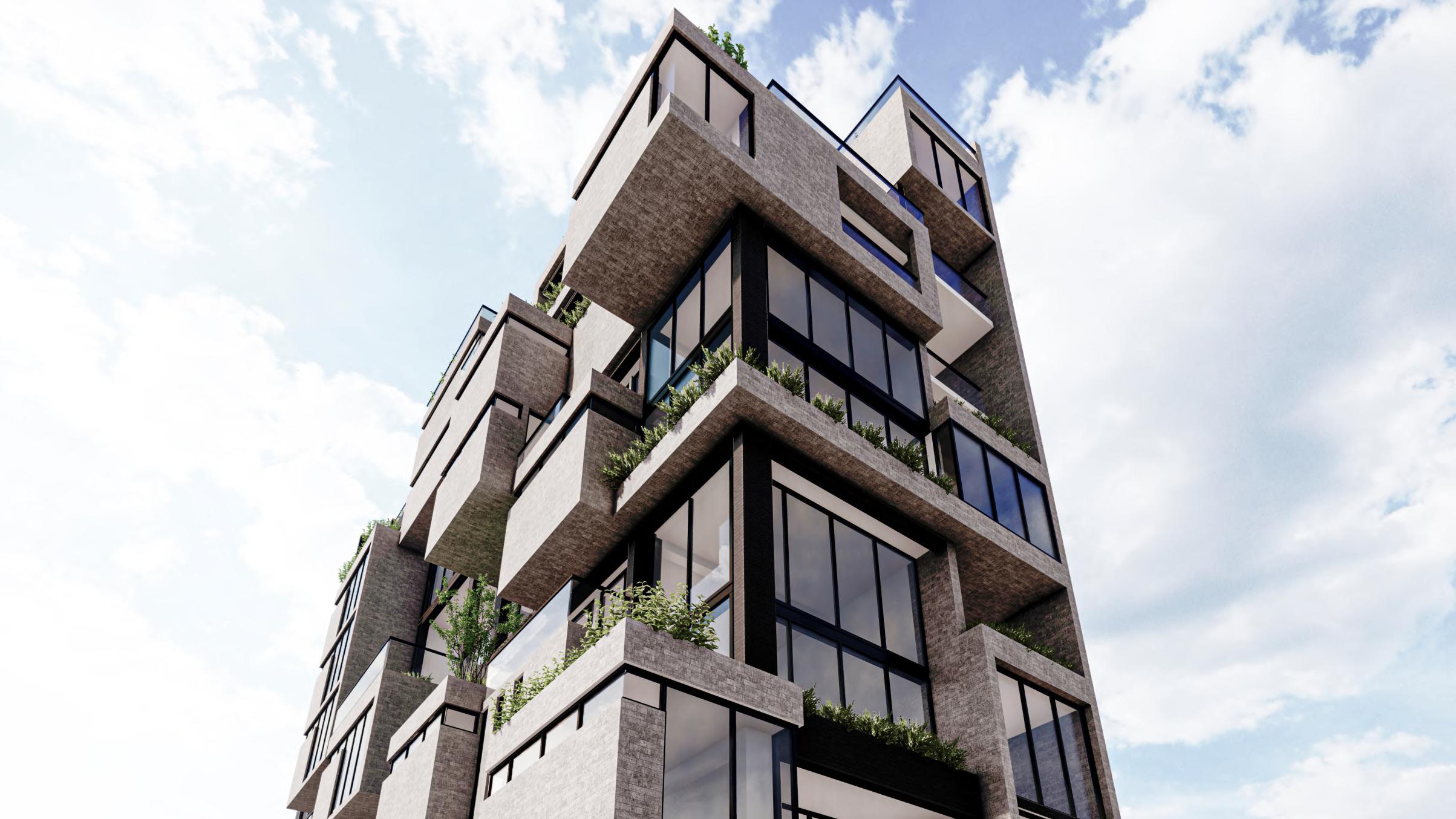
The other proposal, proposes that the blocks be of one color dark gray made of modulated aluminum material and to contrast the wooden porcelain tile on the remaining surfaces.
Designing a house for a family is like a portrait made of paint. It seeks to interpret in a generic way the new needs that we face the challenges of today and tomorrow.
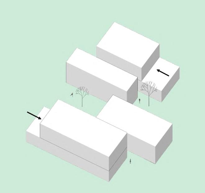
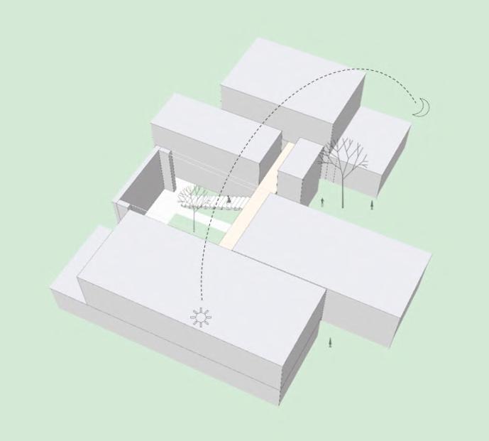
“Casa Puente” project seeks to break with the typical paradigm func�onality of a packaged home. "Bridge House" Its main objec�ve is to make housing an experience comfortable based on user func�ons.
In this case, the "bridge" which is proposed within the project and It will be the organizing axis of the same, it fits very well to this new sense of func�onality within the contemporary home; without losing the country concept in which the property is located
Vivienda convencional compuesta mediante un pasadizo que distribuye a habitaciones o espacios de la vivienda.
Conven�onal house composed by a passageway that distributes to spaces of the house
Propuesta de nueva �pología de vivienda campestre para mayor integración con el espacio exterior
proposal of a new type of country house for greater integra�on with the context.
proposal of a new type of country house for greater integra�on with the context.
Propuesta de nueva �pología de vivienda campestre para mayor integración con el espacio exterior

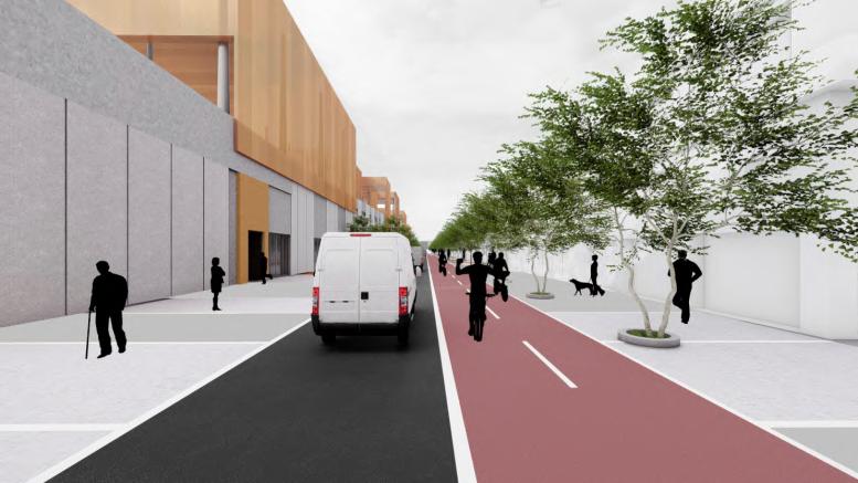
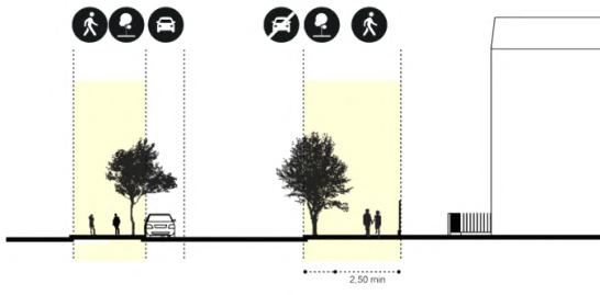
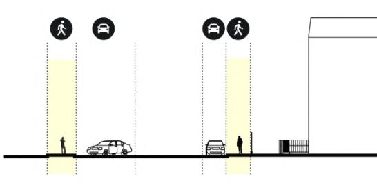
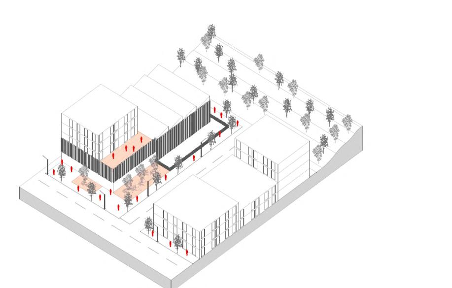
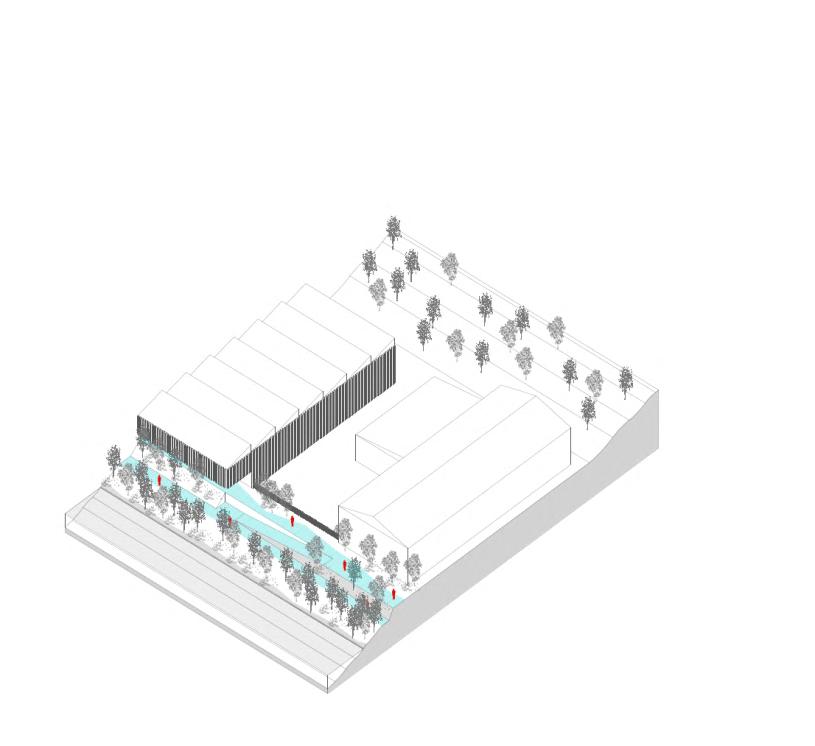
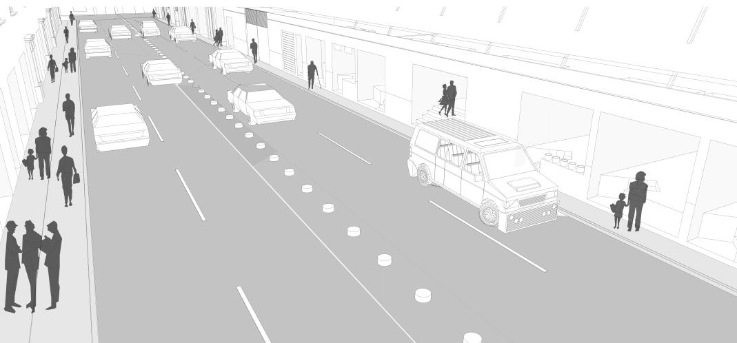
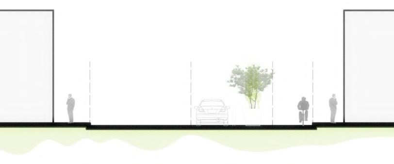
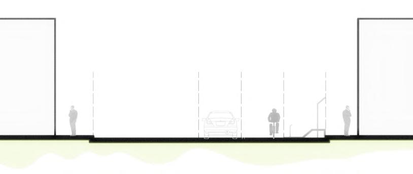
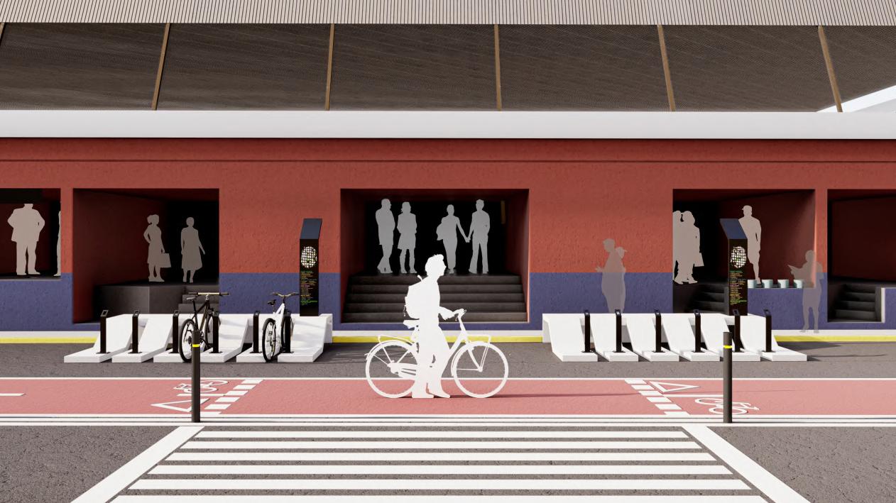
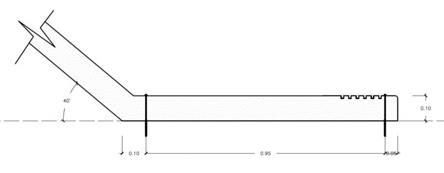
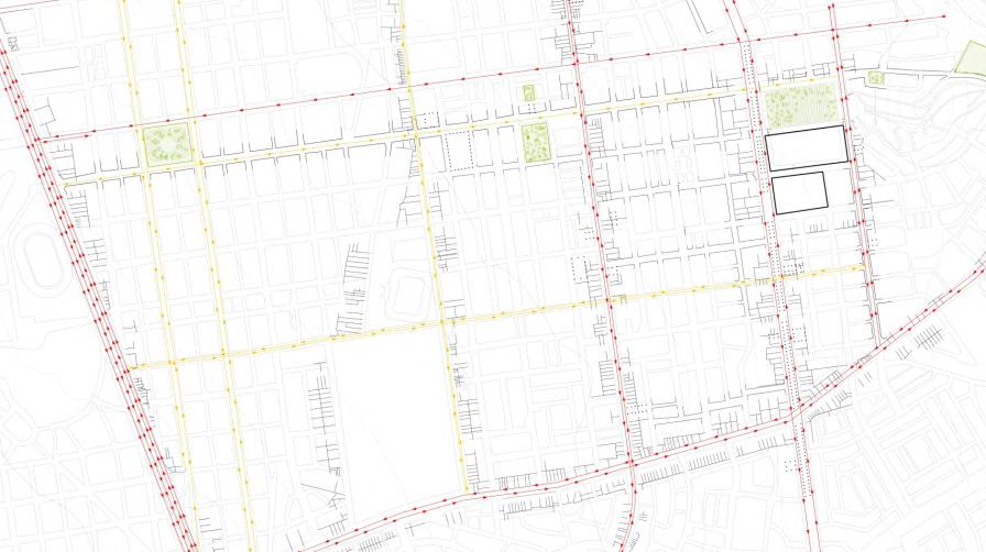
The city and its fac lities over the years have been alien to be considered within the des gn of the adjacent pub c space, sustainable alternative mobility measures that can reconcile and relate the space with mobility Within the prem ses that it ra ses better I n o r d e r t o i m p r o v e t h e c o n d t i o n s o f u r b a n l i f e , t h e current problems of the sector and the place, interpreting that, beyond of furniture, the city does not have an efficient bicycle lane system that a l l o w t h e e f fi c i e n t t r a n s i t o f u s e r s , s o t h e p r o p o s a not only covers furniture, but also how it is proposed as a suggestion, the ngredients that make up and consol date a system of sustainable transpor t, where each of the elements has a important role within the development of the city and activities.
taking consideration, the project outlines certain the design premises in reference to the permeability that can generate the building at the same time that it can be well located, and be fully visible, looking for elements that are easy to identify, without the need to disturb the visibility of the passerby
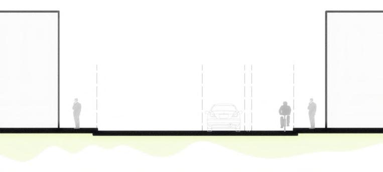
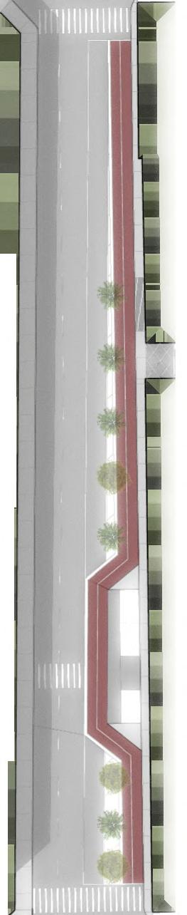
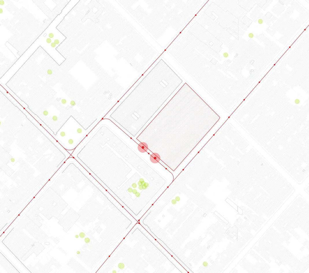
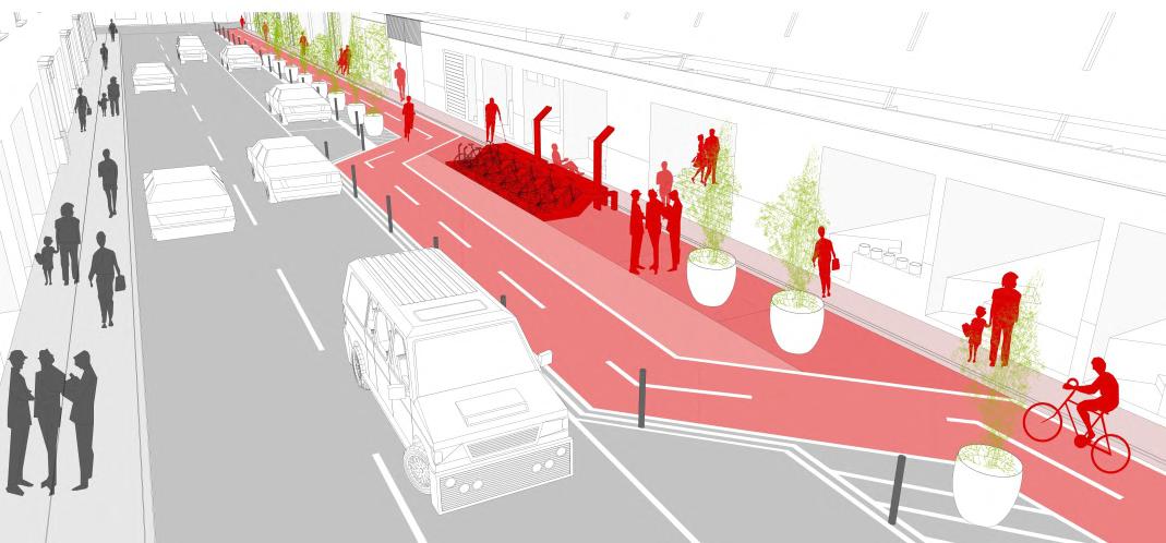
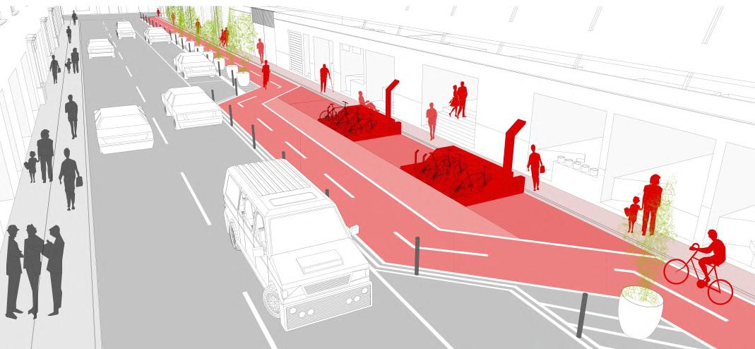
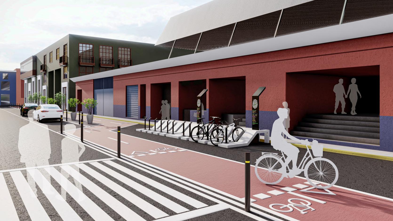
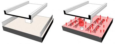
Singularity as a key of the proposal
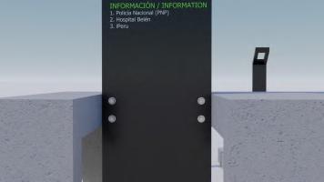
Taking reference of the previous lines, the urban furniture like the one proposed, must answer to complexities in a global way, understanding it as a system between the person who walks, till the one who rests and the one who links them, the proposal is understood by a sculpted volume that adapts to this generated relationship between the market and the public space, adopting the function of bicycle parking, as a rest, without generating any fracture, but achieving the necessary prominence from the uniqueness o f a " To t e m " , w h i c h s e r v e s a s a n i n f o r m a t i v e e l e m e n t that allows to be identified in the whole field, guarantees identity, and complement the furniture raised.
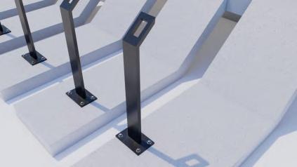
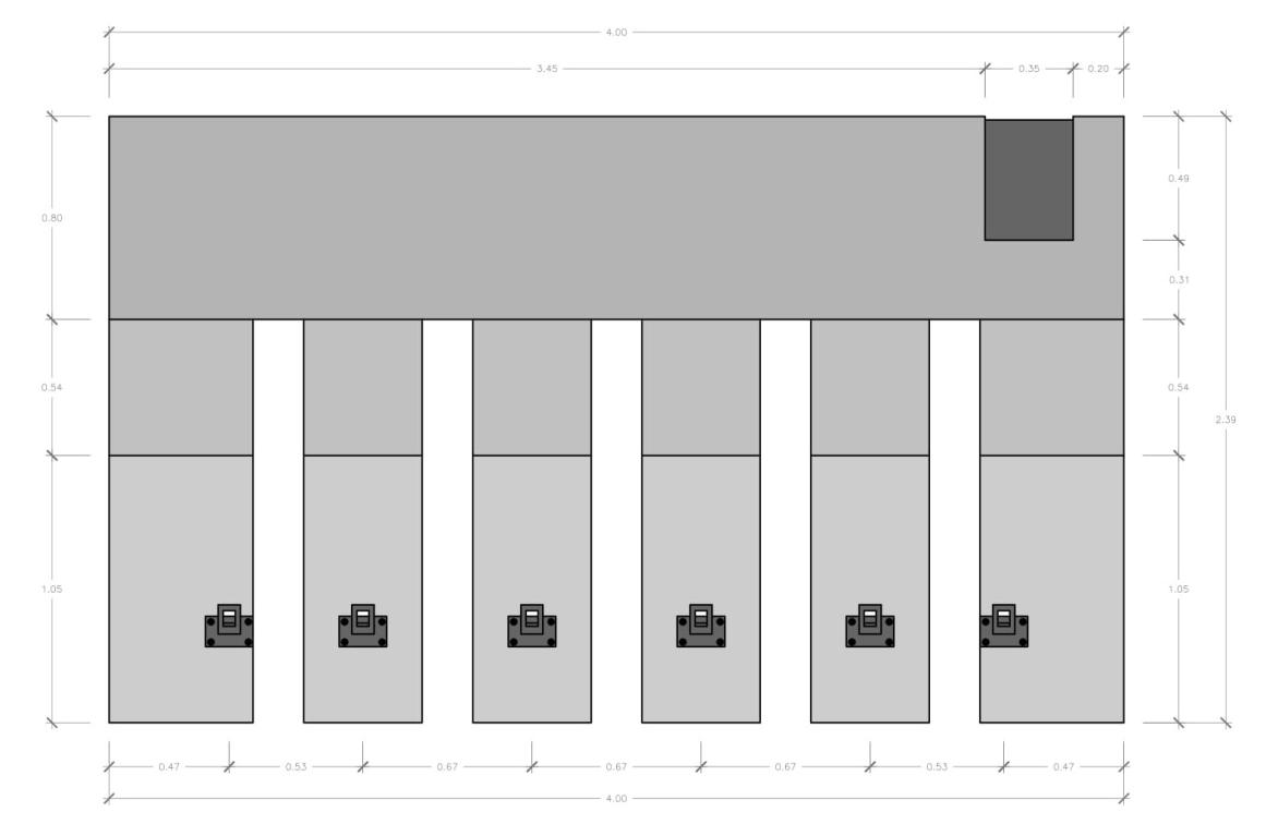
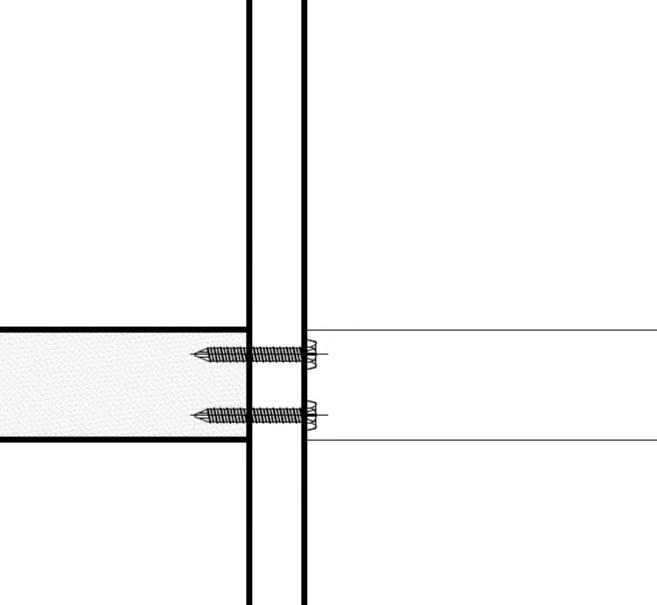
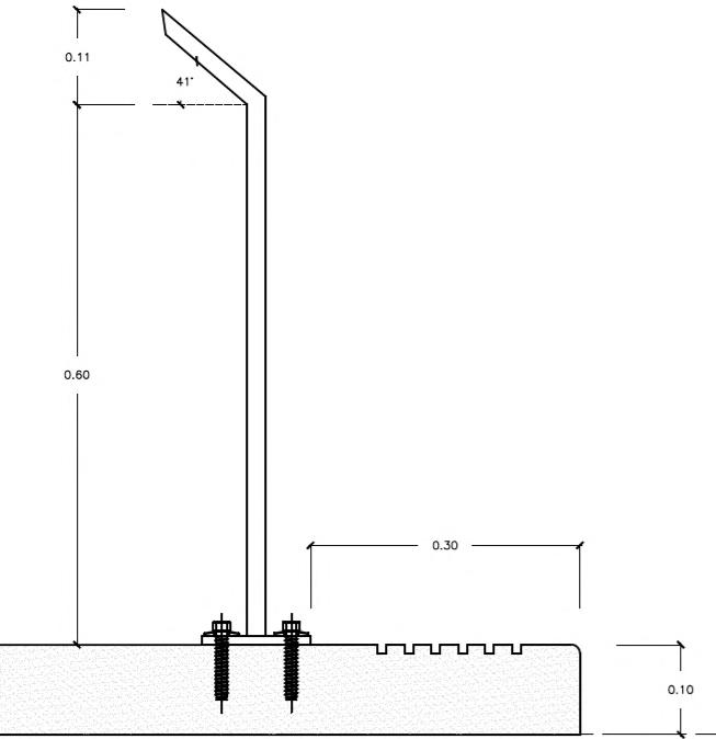
In the first place, it was thought of a material that above all things could be resistant over time, can be easily modulated and replicated, plus to have a quick installation To do this, it is proposed to manufactured as the central structure of the parking lot. Adhered to concrete, there are black iron studs to hold and secure the bicycles. Finally, it is proposed for the distinctive or singular element, called "Totem", a black steel metal structure attached through an assembly system to the parking lot. Furthermore, this element will have an information panel built into the top.
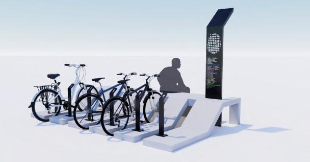
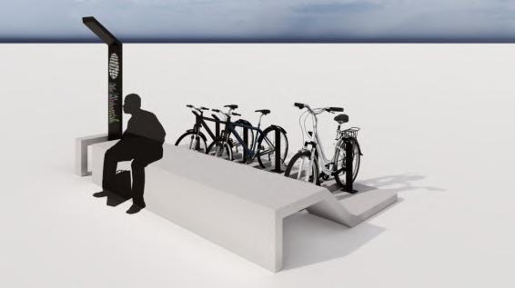
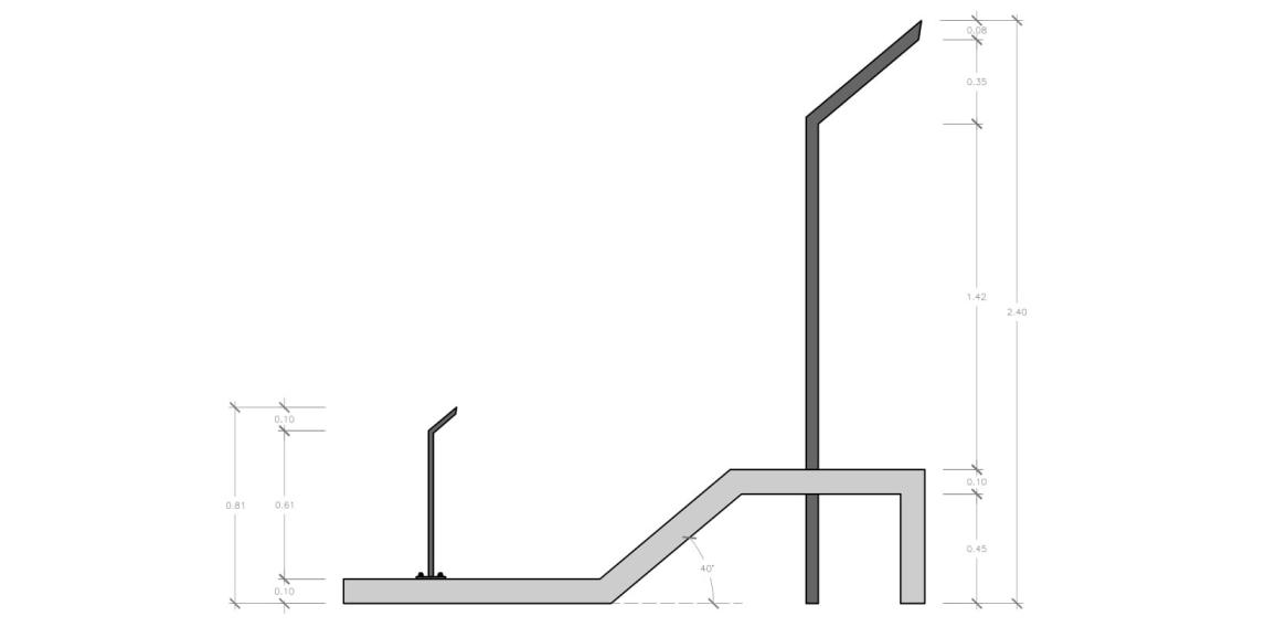

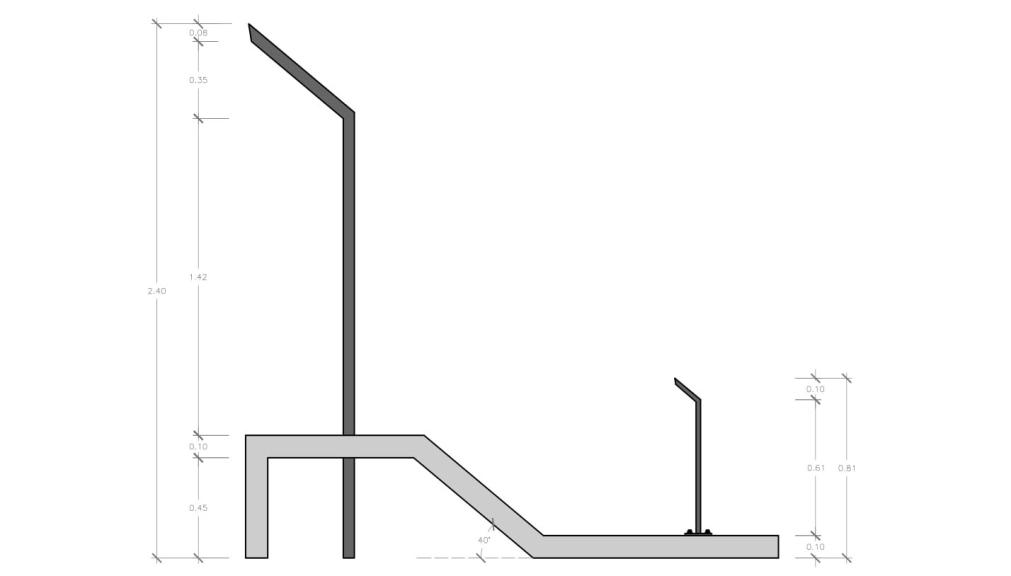
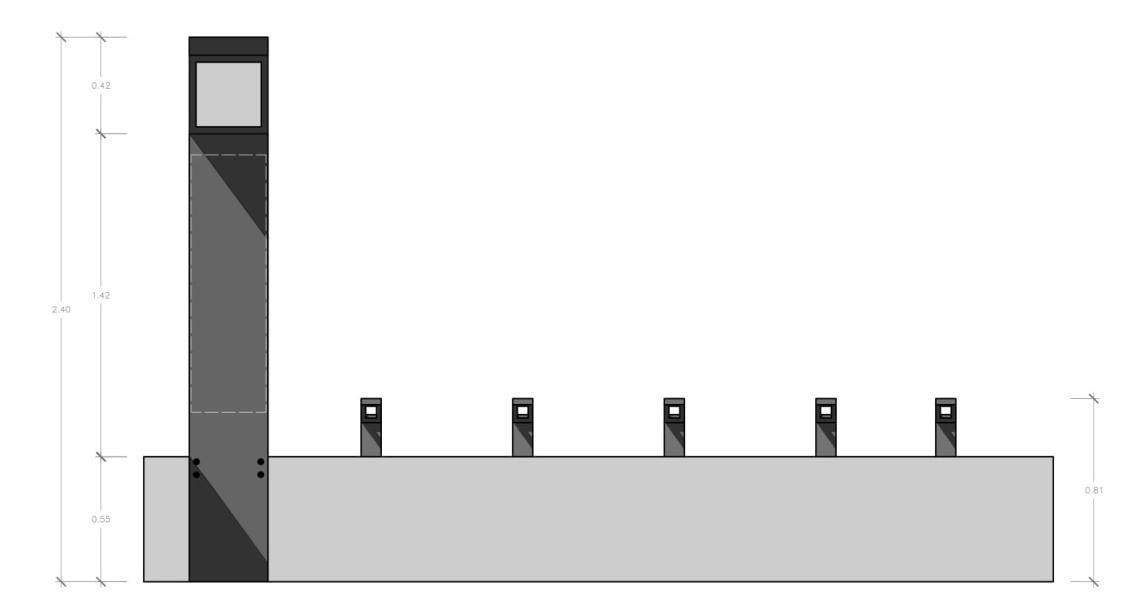
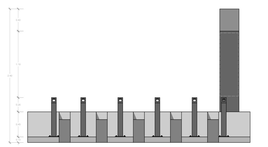
high The "Totem" being this a sheet with a thickness of 5cm, with a width of 35cm and a height of 2.40m.
wide and
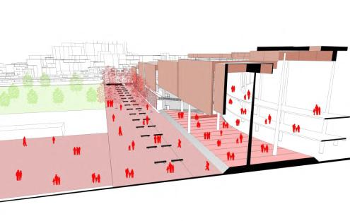
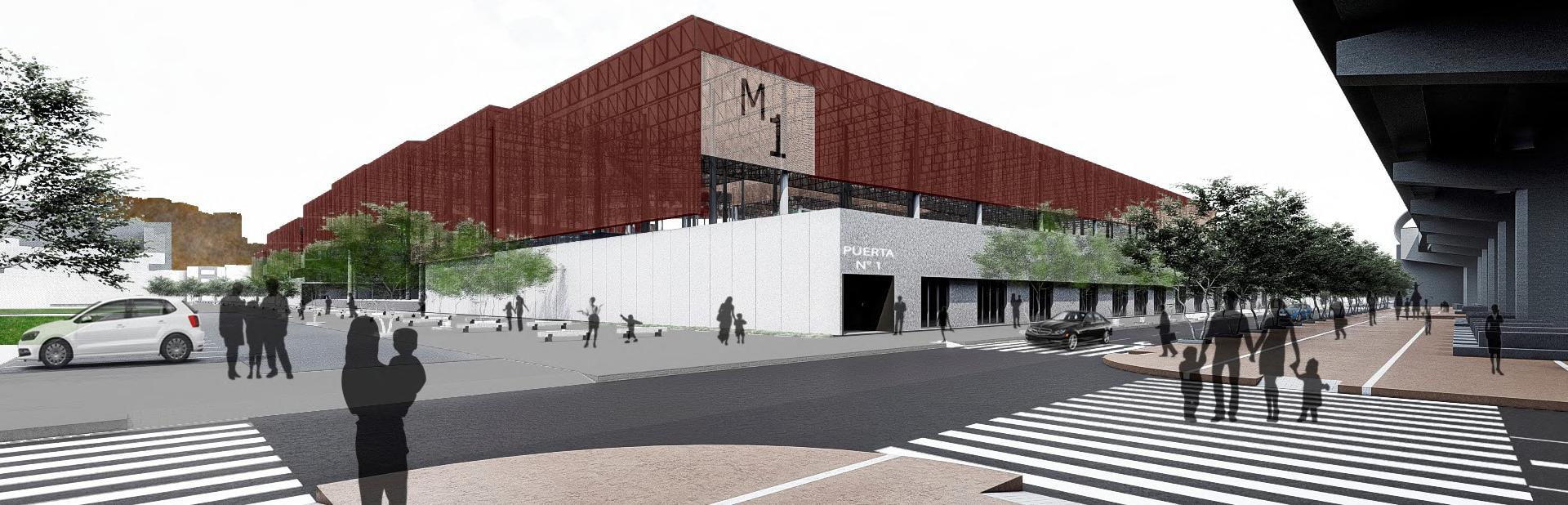
En el marco de la pandemia, diversos lugares de aglomeración, a pesar de seguir con los protocolos sanitarios pertinentes han sido foco infeccioso por las condiciones espaciales las cuales no son las idóneas para este tipo de contexto en el cual ha afectado entre otras cosas la salud y la economía del país. Más allá de poder implementar y mejorar las condiciones espaciales y del entorno del mercado el problema va más lejos de lo que se puede evidenciar
En base a los análisis previos, se concluye que el mercado es mucho más que 4 paredes, el mercado es, y ha sido el espacio tanto privado como público in�uenciado en muchas manzanas a su al rededor Más allá de eso muchos mercados suelen situarse de manera centralizada. El propósito de estos análisis han sido para determinar su vocación y el papel que desempeña el mercado tanto en la ciudad como en el distrito y cómo saber implementar nuevas estrategias que vayan de la mano con la sociedad y los mismos comerciantes.

Dentro de la nueva propuesta Urbana-distrital. El mercado tiene que cumplir un papel mucho más importante que el de abastecer son tiempos distintos donde los usos evolucionan, y el mercado como tal necesita ser un centro de operaciones logísticos que abastezca y potencie a nivel distrital y de red urbana que mejore las condiciones tanto del mercado como del entorno inmediato con micro-mercados barriales que complementen al mercado y una red logística de servicios acorde con lo propuesto generando de esta manera sinergias en el distrito
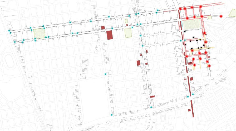
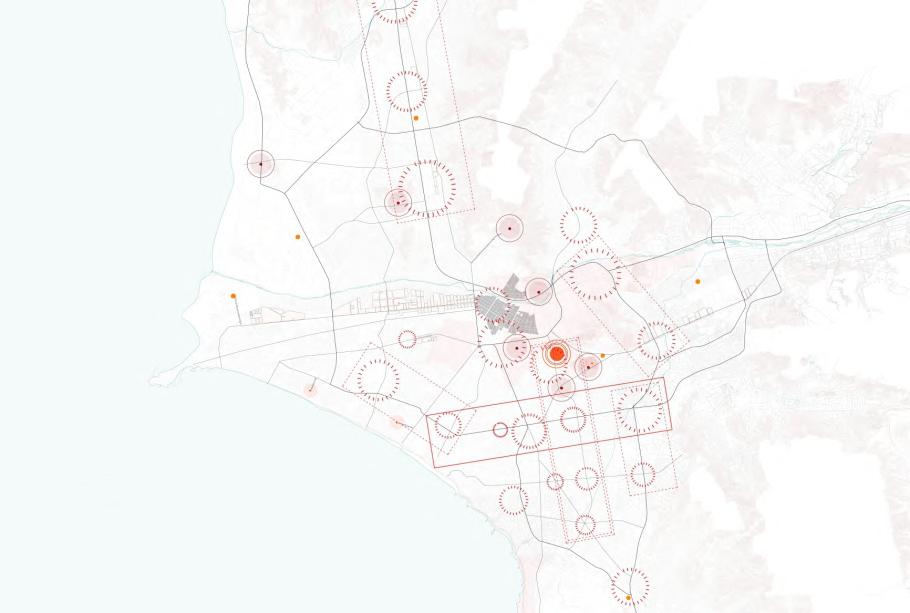
El diagrama de funcionamiento muestra al mercado como iniciador de procesos, el cual mediante un aplicativo soportado por la tecnología sirva de herramienta para ofrecer a los usuarios opciones tanto de productos y de centros de abastos poco aglomerados, así como la función de delivery
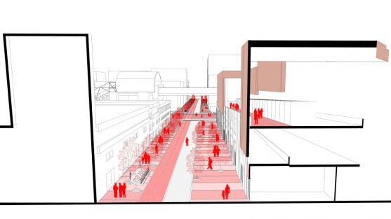
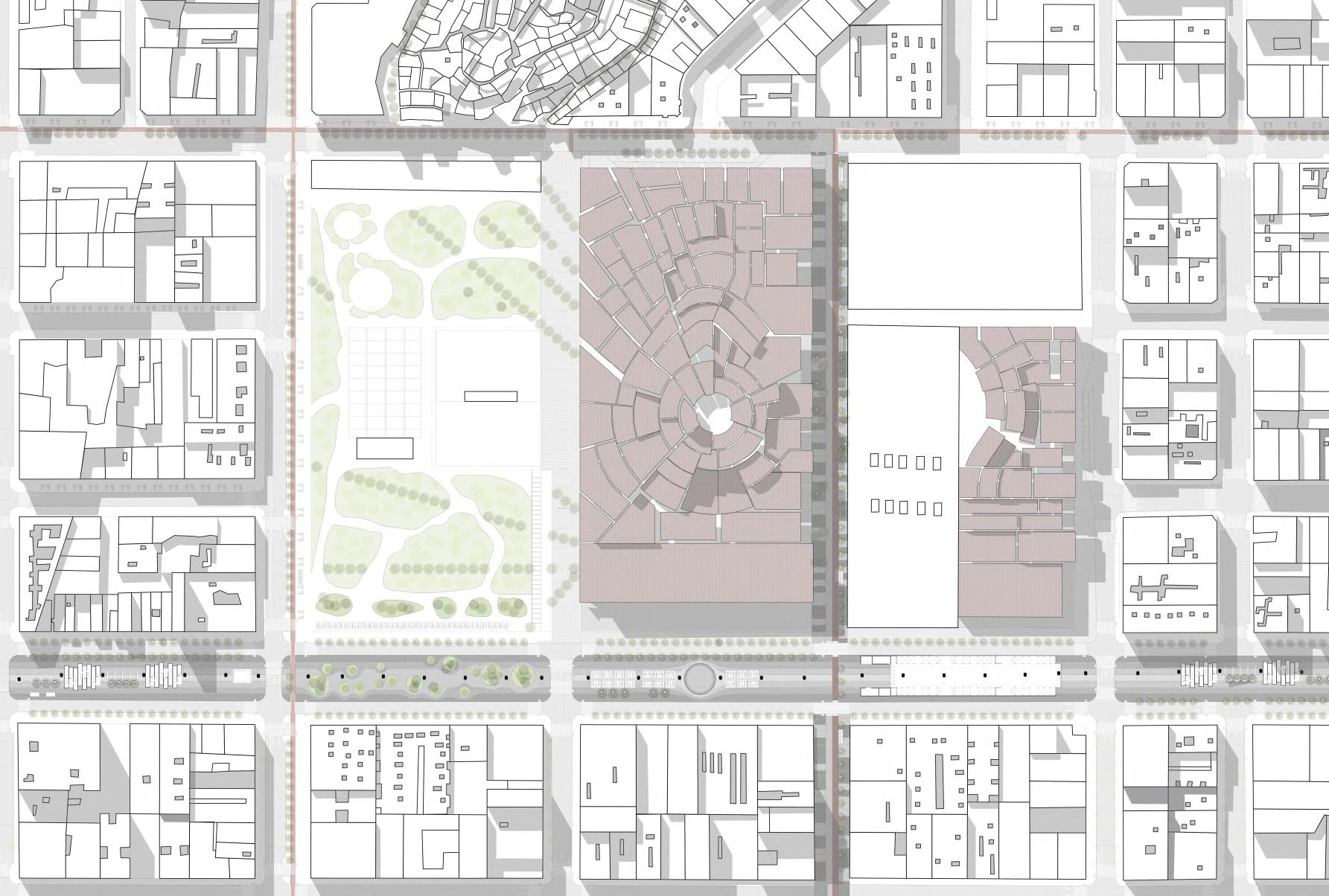
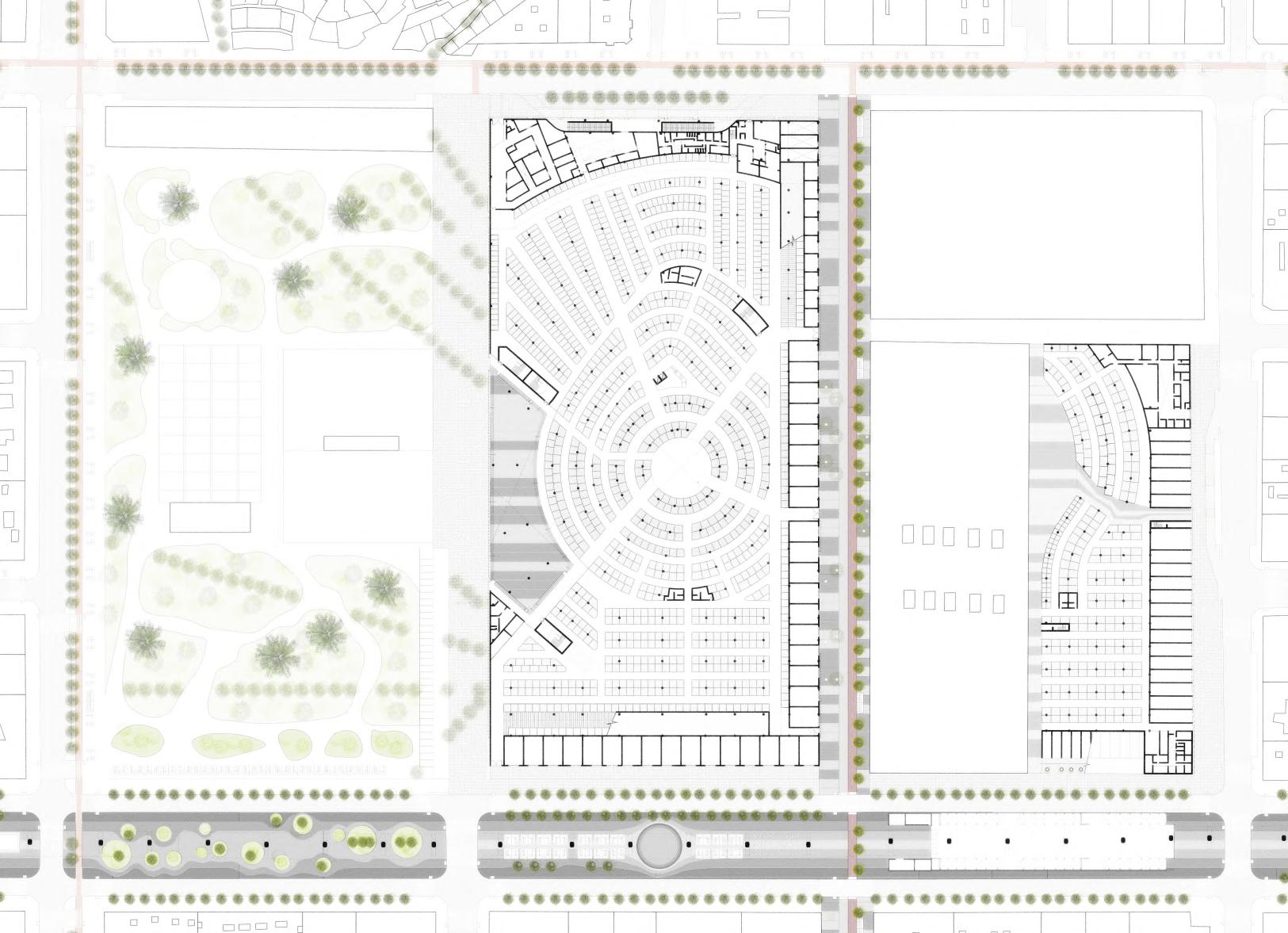
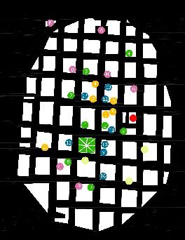
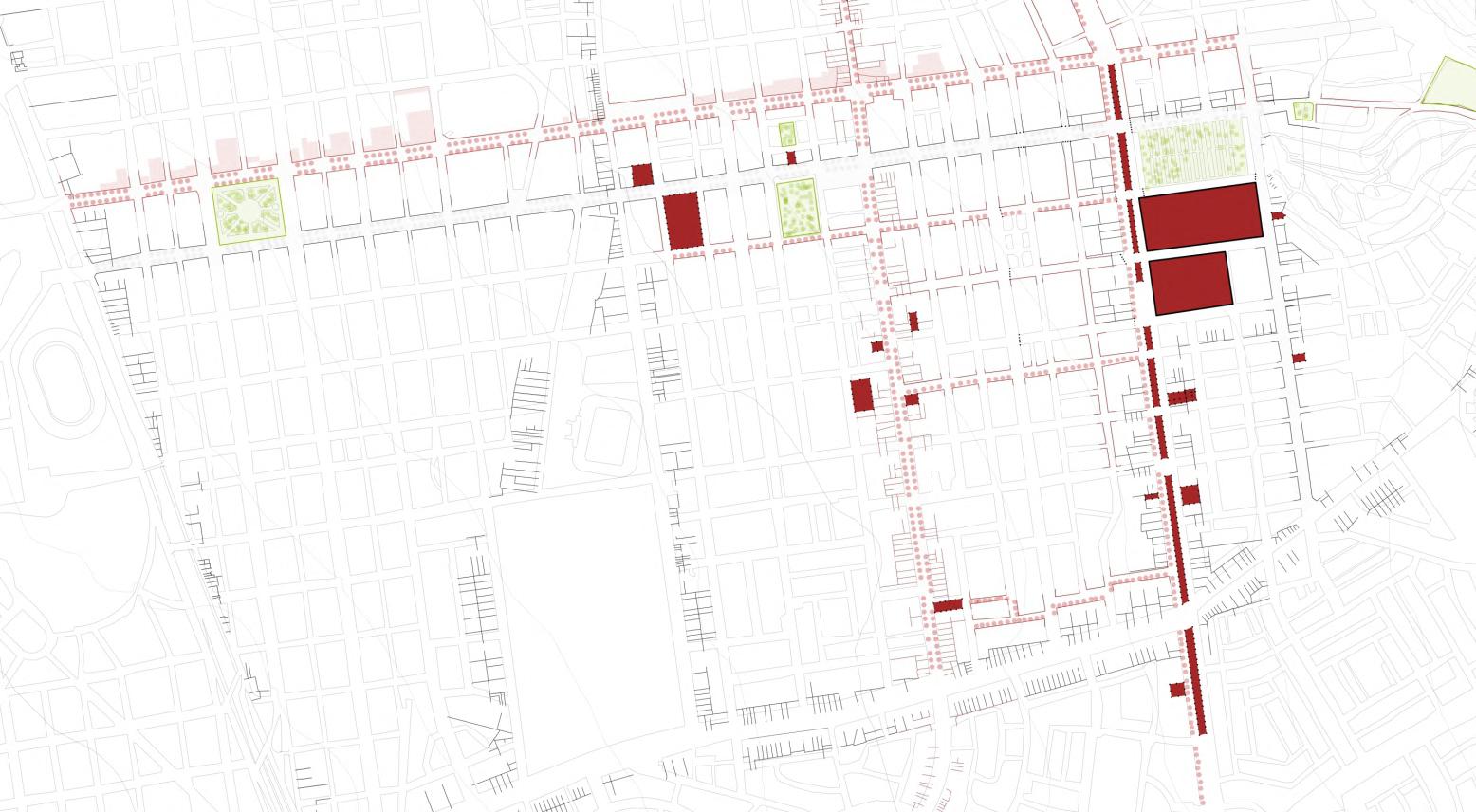
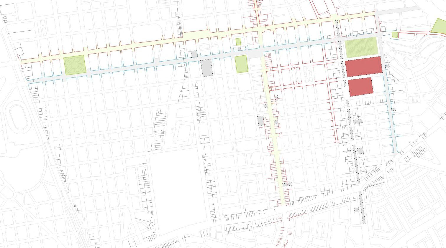
El plano de llenos y vacíos evidencia una gran área libre adyacente al mercado 1 y otro vacío dejado por el puente ubicado en la avenida aviación. También se ve un cambio notorio en la con�guración de los espacios libres entre el cerro san cosme y la malla regular inmediata al mercado 1 y 3 de febrero
La actividad predominante re�ere a un uso relacionado a servicios donde se encuentran ubicados principalmente en la avenida Aviación. estas actividades van complementadas de las distribuidoras ubicadas en las mismas avenidas, pero con menos predominancia. Por último los almacenes, ubicados en la av San pablo una avenida netamente de servicio por lo cual las actividades son condicionadas por los accesos del distrito
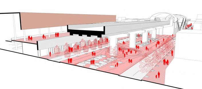
Se evidencia una oportunidad de permeabilidad en los espacios ubicados debajo del tren, el cual pueden ser aprovechados y tratados de una manera más accesible en términos de gestión. Así mismo estos espacios serían las zonas

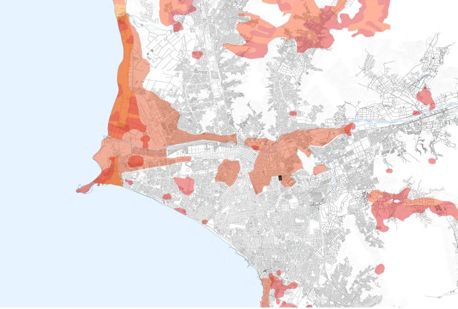
Espacios encontrados en el tejido urbano que están siendo utilizados como estacionamientos o terrenos en desuso Se propone implementar módulos de mercado con variedad de productos, así como un tratamiento al espacio para que sean más amigables con el usuario y siguiendo el concepto y el lenguaje de los mercados principales
ha tomado en consideración el efecto colateral que re�ere a espacios infrautilizados ocasionados por el tren en la parte inferior del mismo
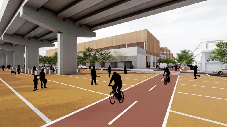
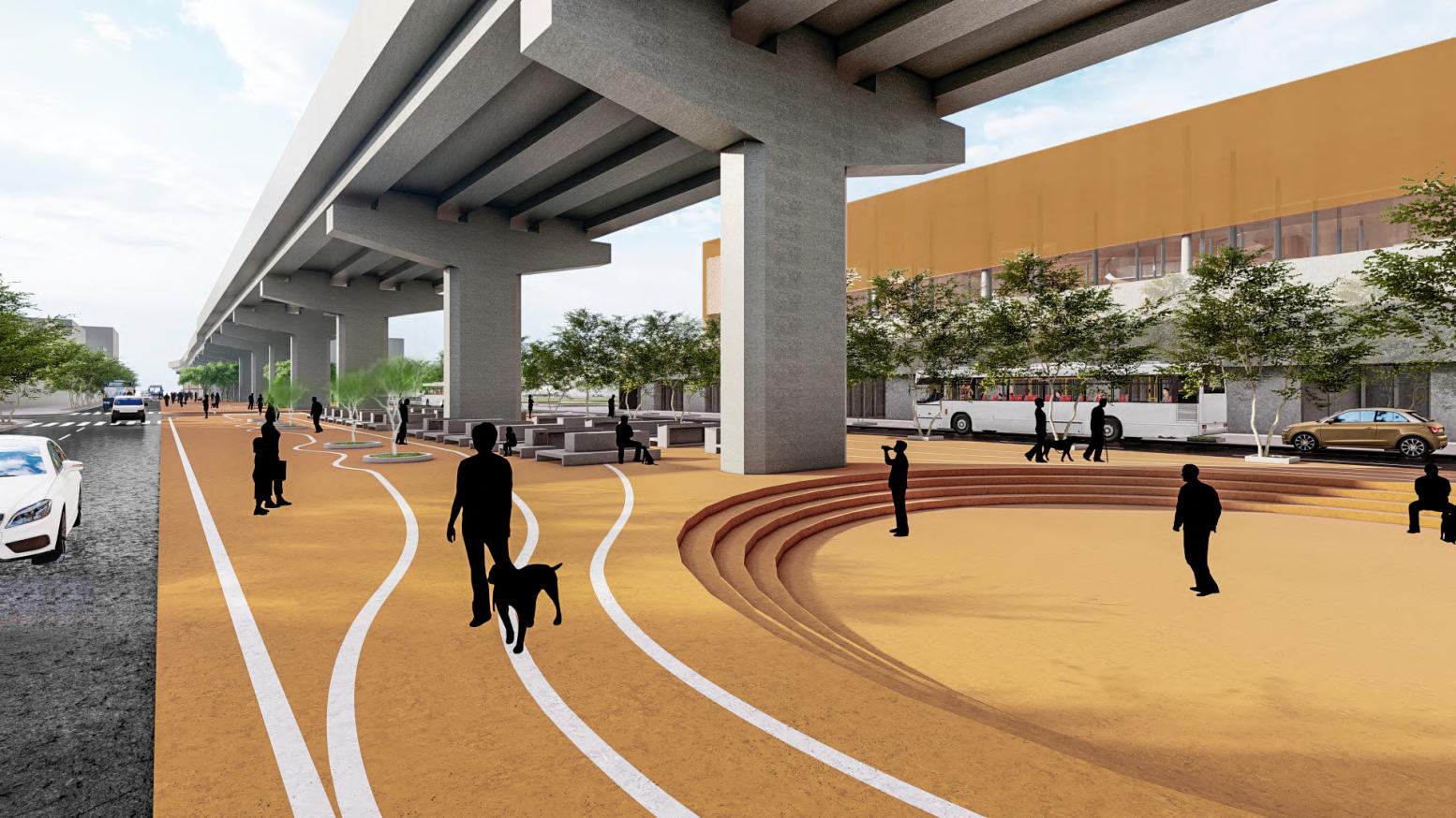
Actualmente, estos espacios no tienen un uso especí�co y tienen un gran potencial para ser explotados a lo largo de este eje que conecta gran parte de la ciudad. La iniciativa del grupo es la recuperación tanto de este espacio que complemente al mercado con actividades similares y/o recreativas o de transición para enriquecer el entorno inmediato Además de la recuperación de dichos espacios, se propuso mejorar y reurbanizar las vías adyacentes a los mercados, la implementación de ciclovías que conecten la ciudad con el mercado y el barrio al mismo tiempo


Dentro de lapropuesta del módulo ambulantes se planteó que fuese multipropósito no solo para los mismos comerciantes, también para los momentos donde no son utilizados para venta de productos, sino en horas del día donde puedan servir como bancas para el transeunte.