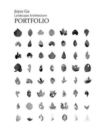
PORTFOLIO
CONTENTS
This portfolio contains selected works from my time at UPenn’s Master of Landscape Architecture program and summer internship experience. Coming from an environmental engineering background, I have witnessed the detrimental effects that humans and industries have had on the groundwater and soils of many communities. As I continue through my journey as an aspiring landscape architect, I hope to use design as a way to remedy those harms, retell site histories, and reimagine the future.
02 03 04 05 06
FISHTOWN WATERS
Fishtown, Philadelphia, PA
Waterfront Park
Landscape Studio 502, Spring 2025
S HIFTING SOURCES
Staten Island, NY
Regional Planning
Landscape Studio 601, Fall 2025
FOREST OF MULTITUDES
Wissahickon Valley Park, Philadelphia PA Garden
Landscape Studio 501, Fall 2024
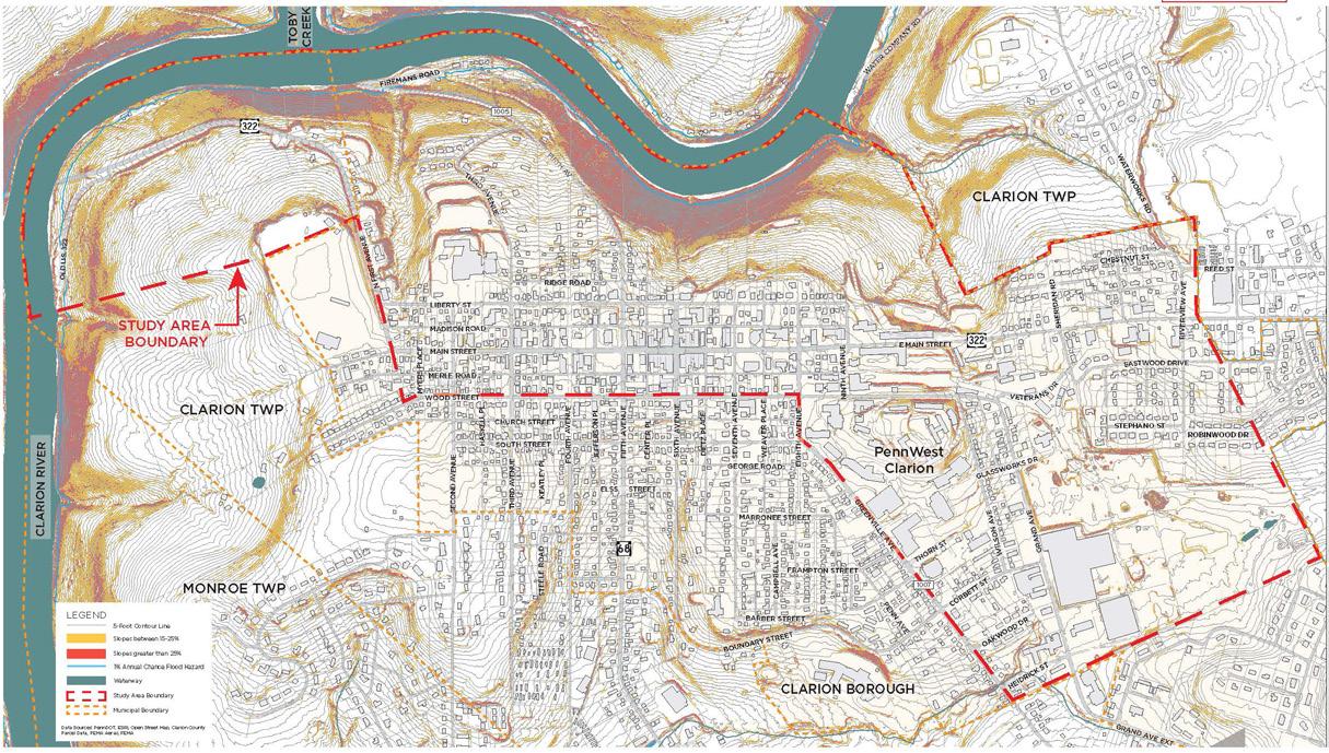
CLARION AREA-WIDE PLAN
Clarion, Pennsylvania
Regional Planning and Design
Professional Internship Work, Summer 2025
Stromberg, Garrigan, and Associates (SGA)
CUESTA COLLECTIVE
Pennypack, Philadelphia, PA
Grading and Planting Design
Workshop II, Spring 2025
MEDIA EXPLORATIONS
Digital Techniques
Media II and III, 2025
FISHTOWN WATERS
Fishtown, Philadelphia PA
Waterfront Park
Landscape Studio 502, Spring 2025
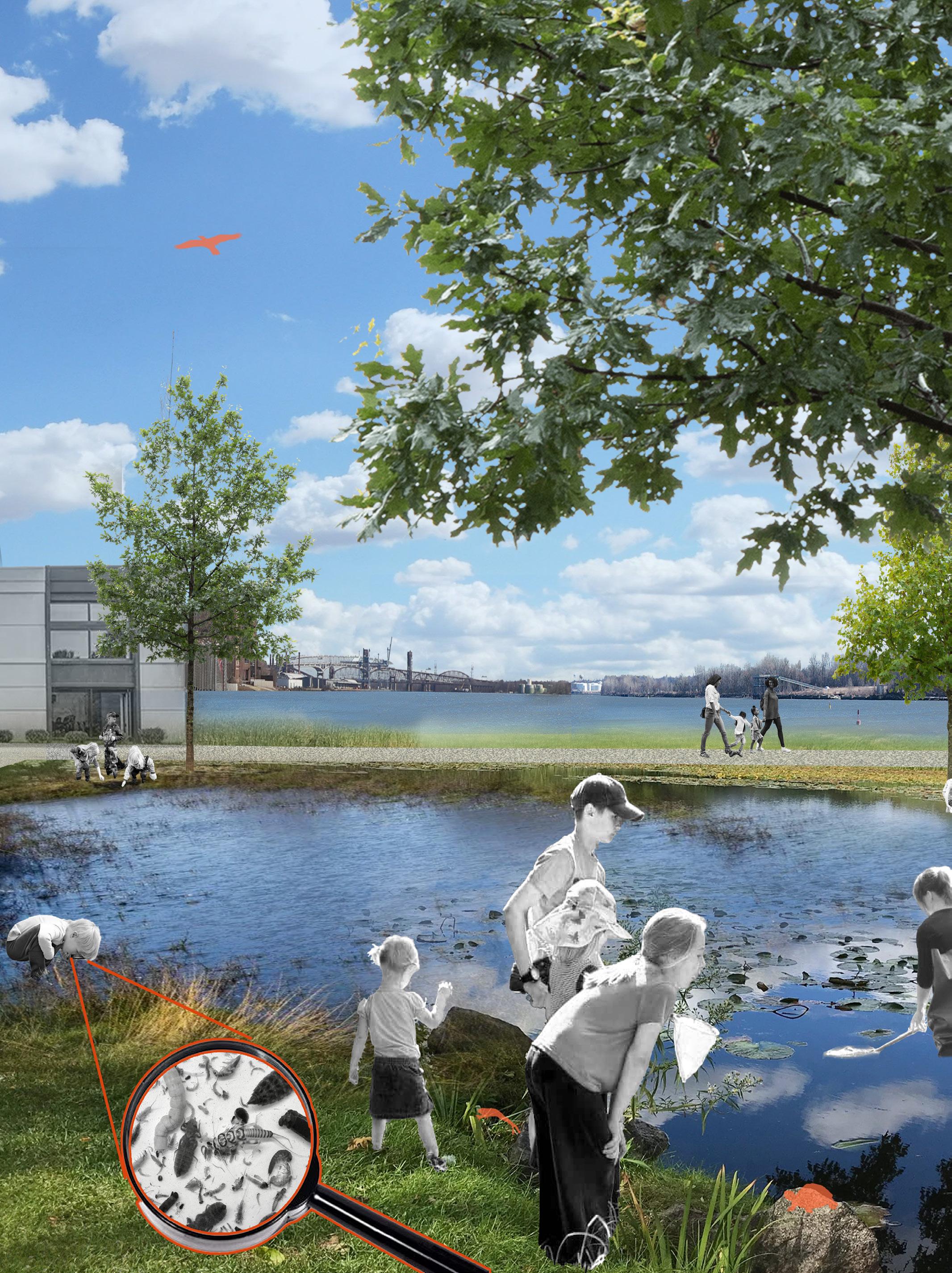
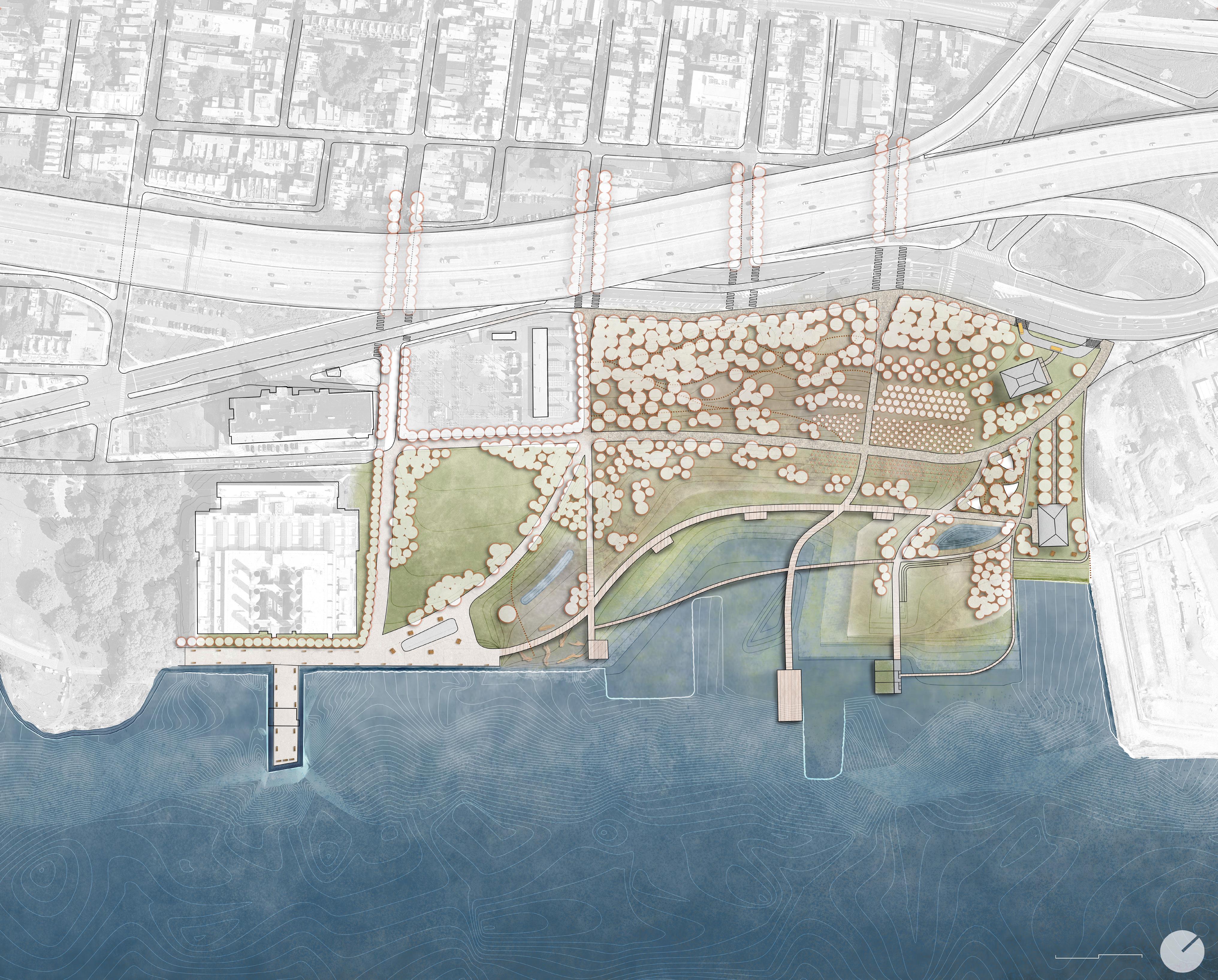
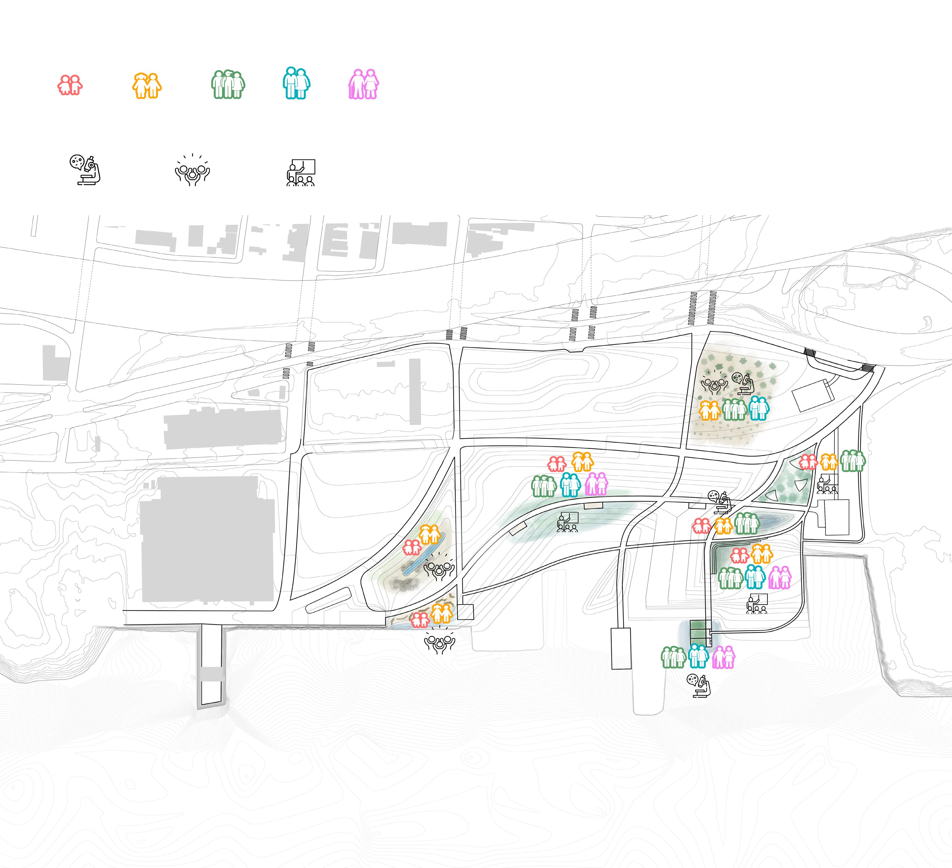
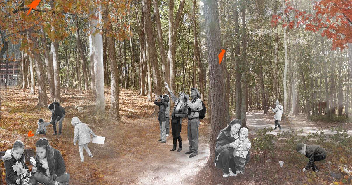
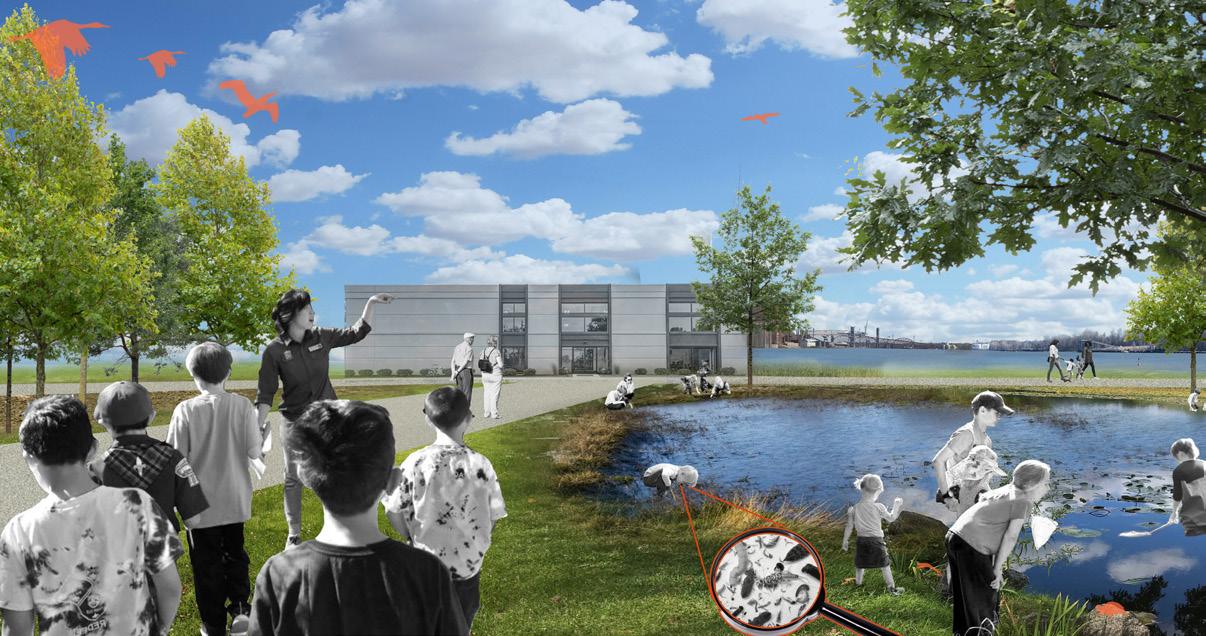
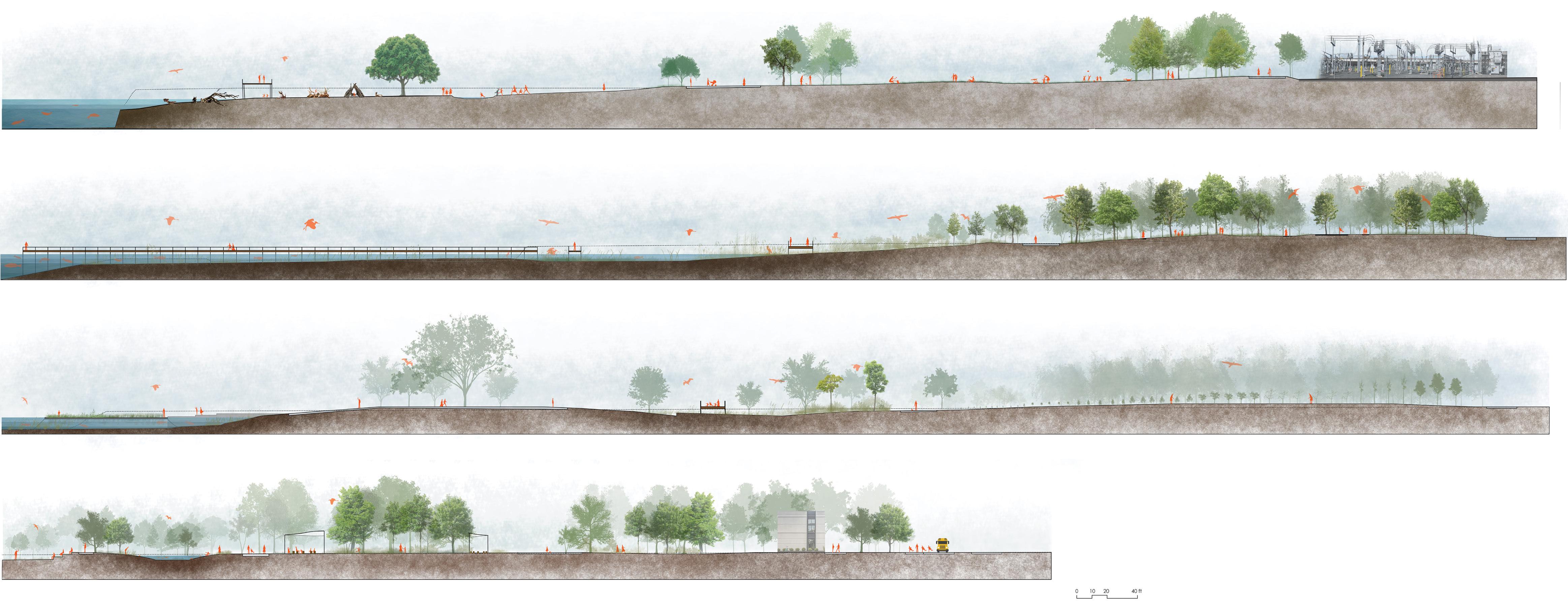
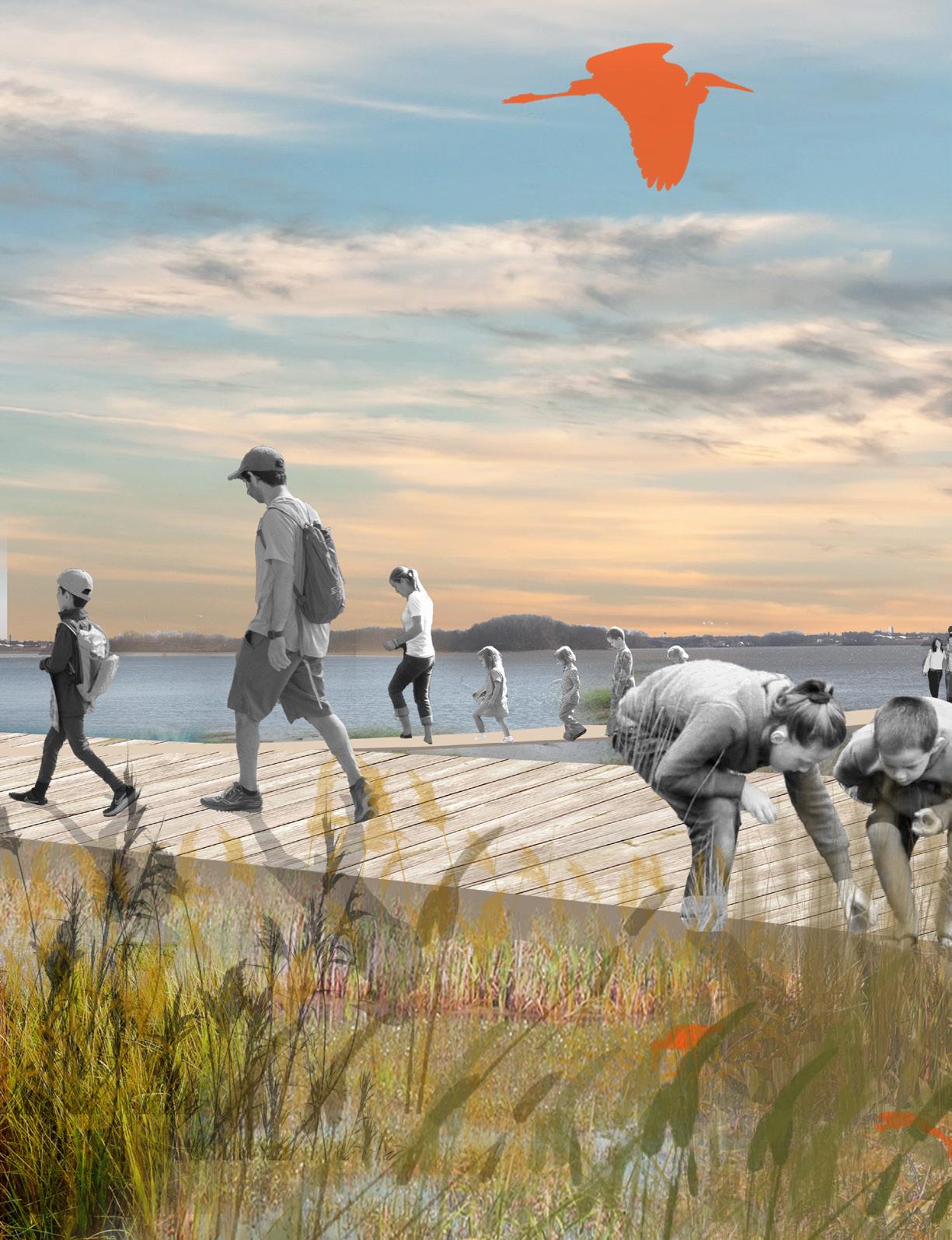
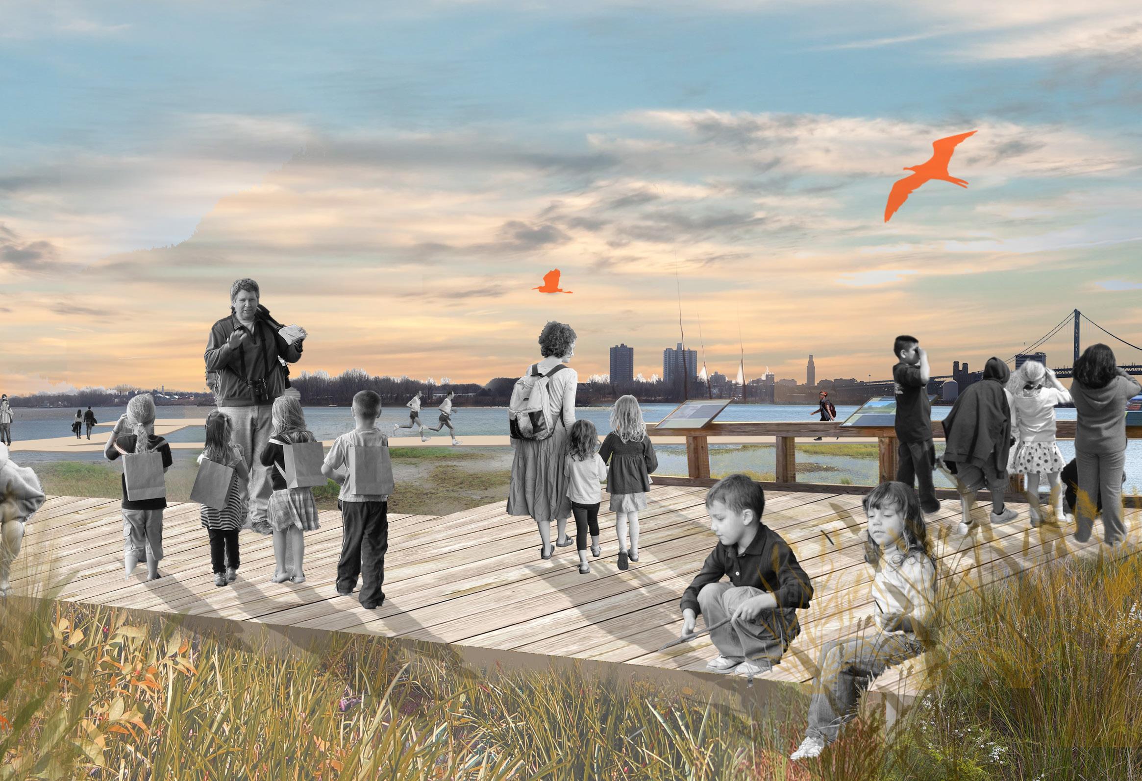
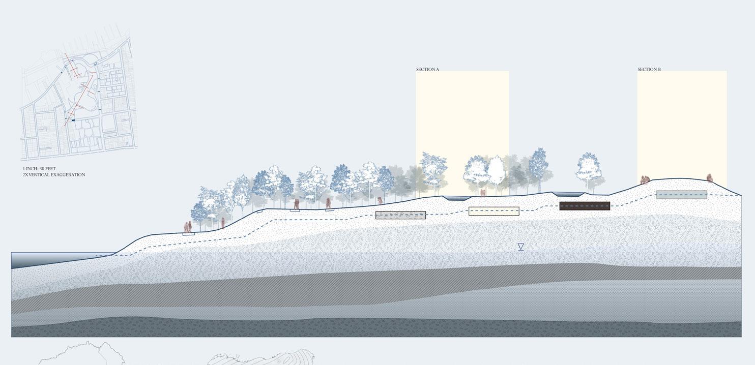
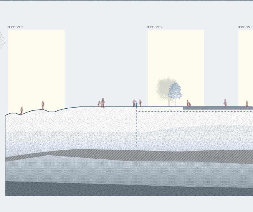
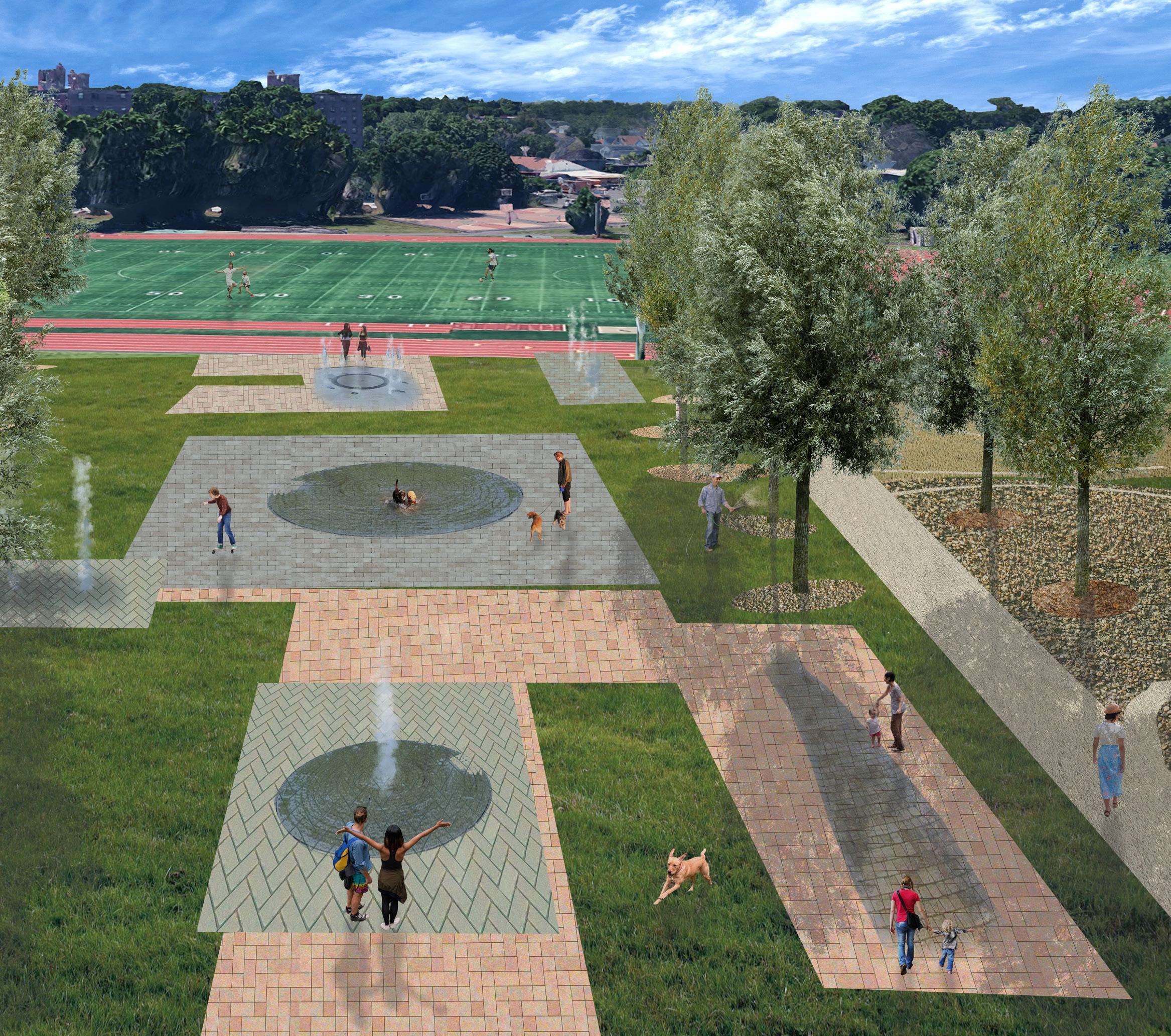
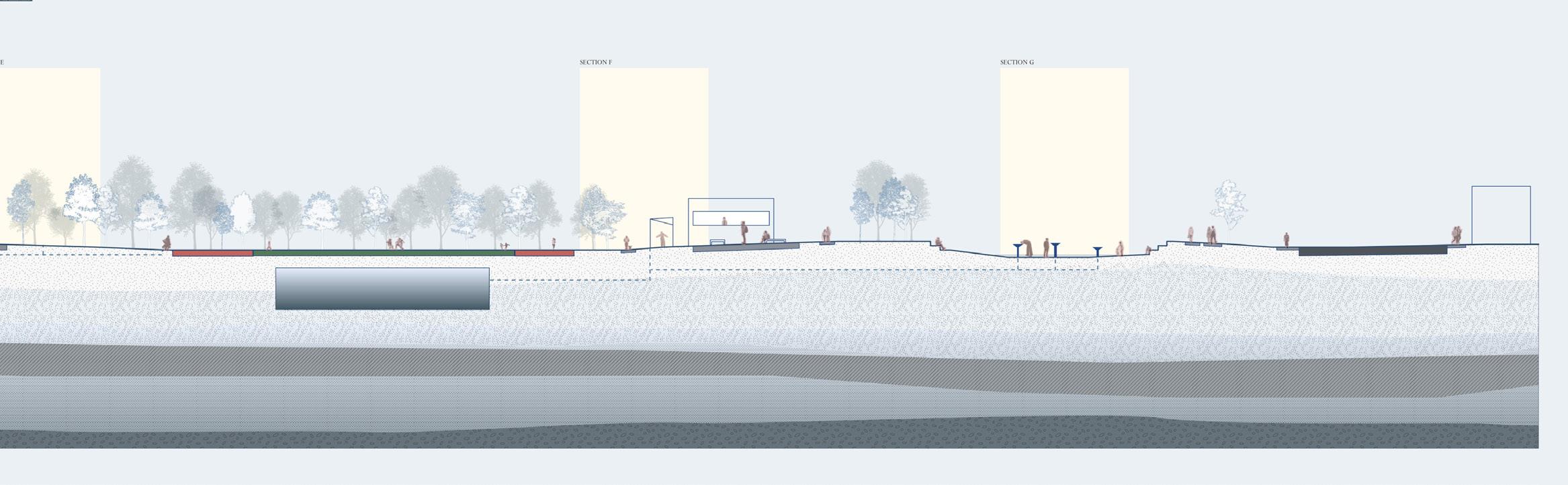
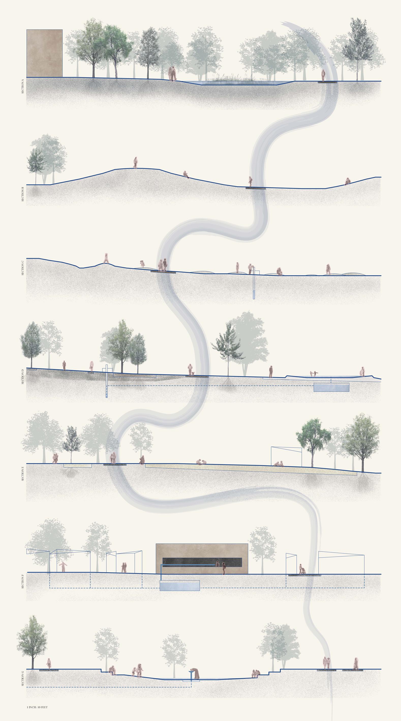
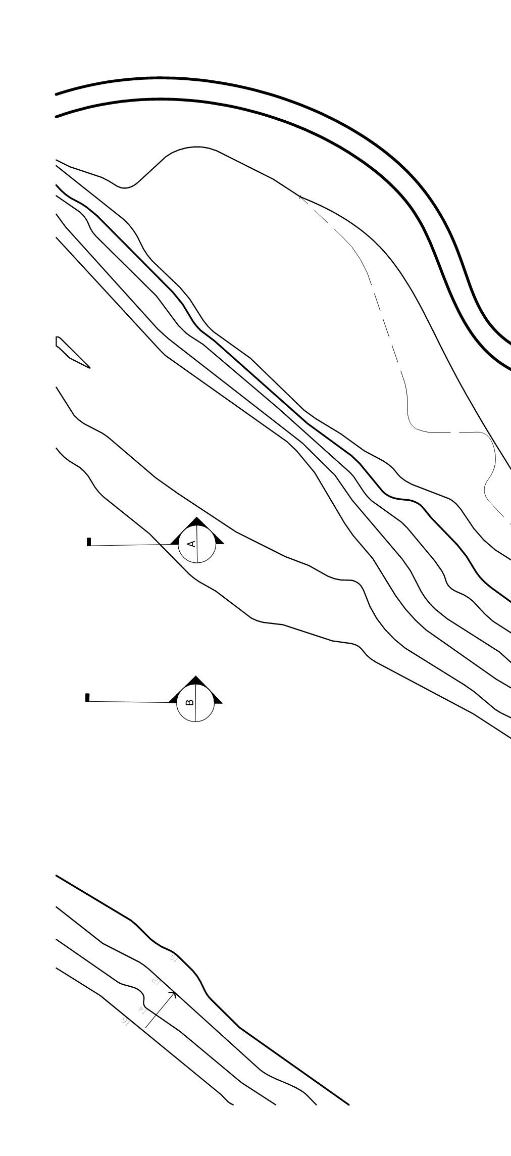
The Fishtown Waters project aims to fill a gap in the city of Philadelphia as the city’s first environmental educational space on the Delaware Riverfront. As technology becomes more prevalent in the lives of children and nature is sparse in the urban setting, it becomes increasingly important to provide access to places of wilderness and the ecological services and systems that come from those places.
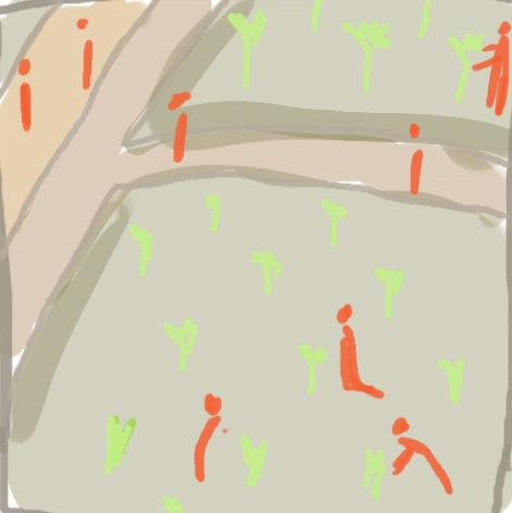
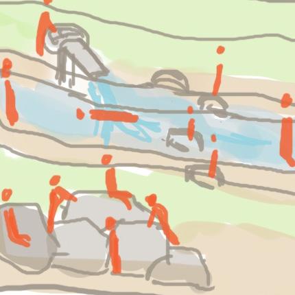
The project allows for a wide range of educational experiences for visitors of all ages through programming. Along the elevated boardwalks, various zones of wetland vegetation can be observed as aquatic birds wade through the grasses and turtles hide in the shrubs. School groups wander through the forest clearings, allowing young children to explore at their own pace, gathering leaves and spotting birds’ nests in the trees. Nestled into the woods are outdoor classrooms for storytelling sessions, and out in the open amphitheater, a scientist presents their findings. Even the runners who jog by on their loop can take in the changing biota and illuminated ecologies of the park.
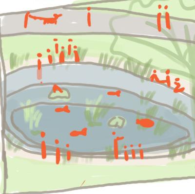
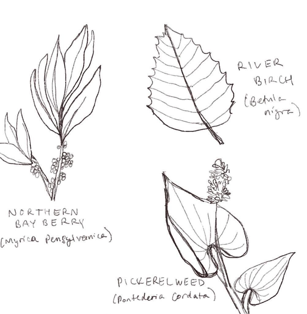
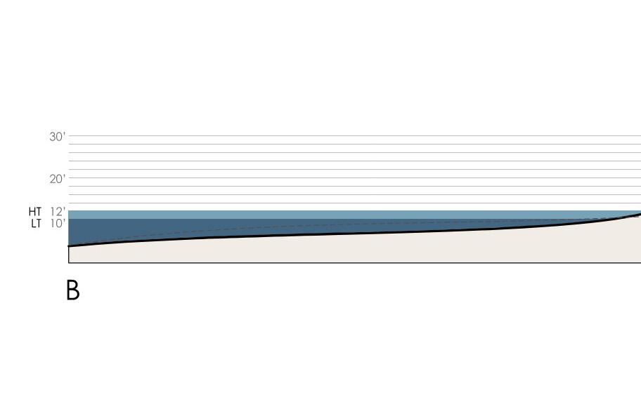
Site observation and analysis - present and past
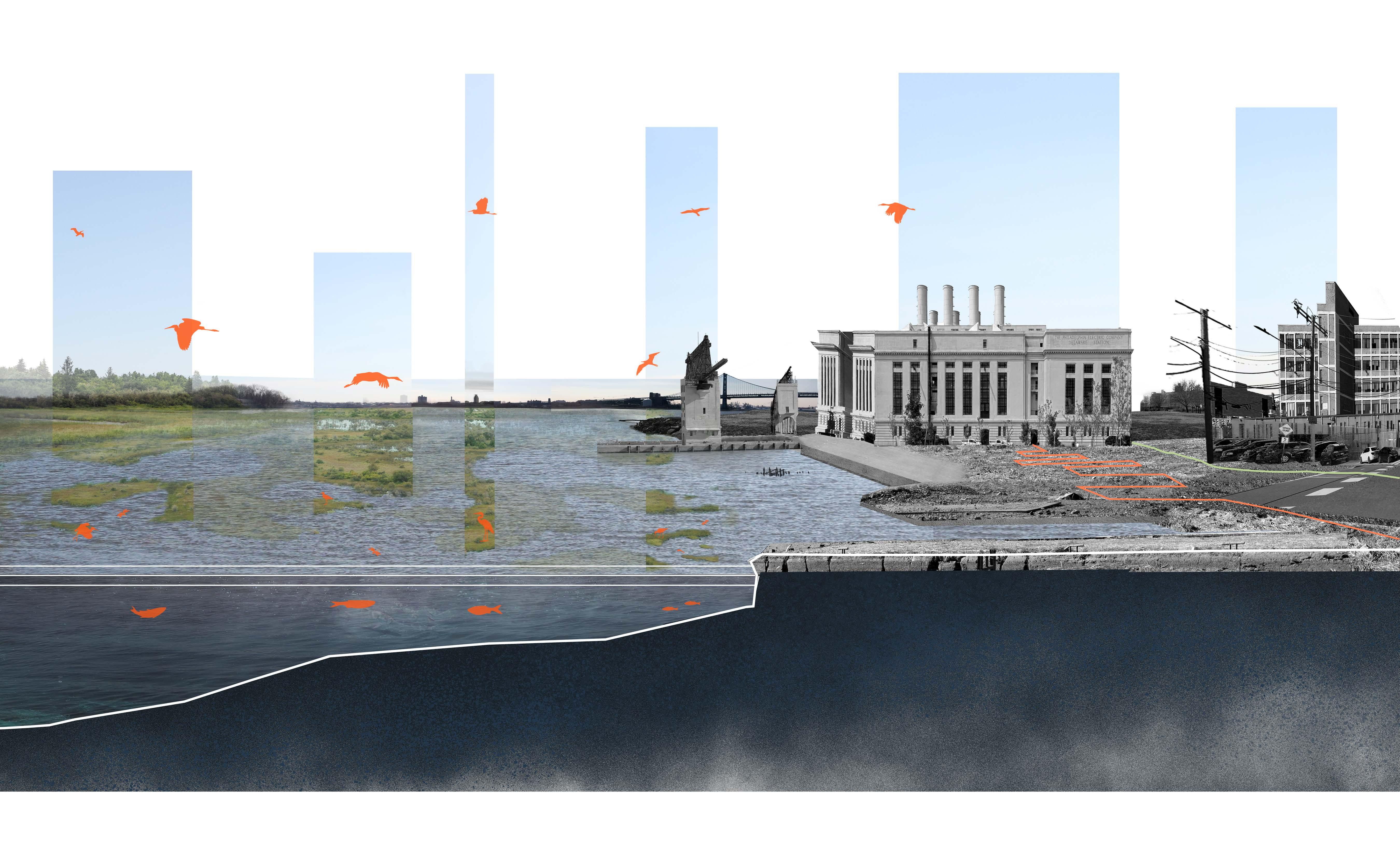
Mean Lower-Low Water (-3.10 ft relative to NAVD88)
Mean High Water (3.19 ft relative to NAVD88)
NAVD88 (0 ft)
Brook Trout
Atlantic Sturgeon
Striped Bass
American Shad
Blue Dasher
American Bittern
Great Egret
Snowy Egret
Great Blue Heron
Canada Goose
Caspian Tern
Black-Crowned Night Heron
Laughing Gull
American Oystercatcher
1750 Shoreline
1846 Shoreline
American Bullfrog
Herring Gull
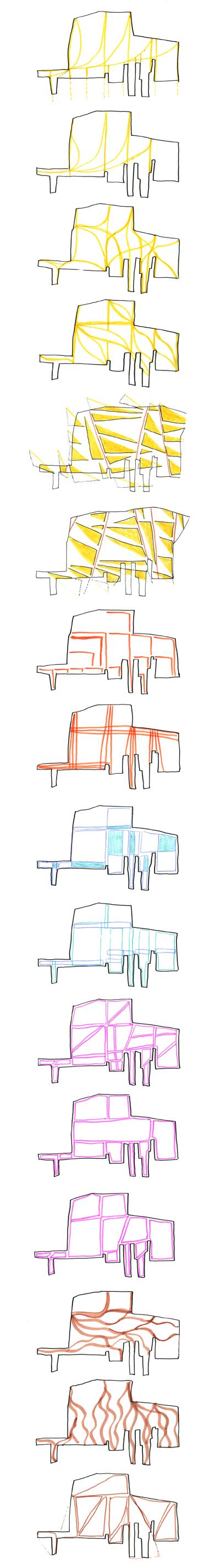
Parti iterations and final site plan
Sample Environmental Curricula
Filtration Imagination: From Pump to Pureness
Dreams: Creating Art From Nature
Ecosystem Services of the Wetland Environment


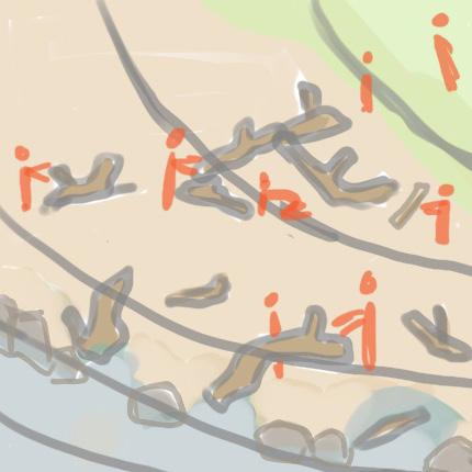

Driftwood Grounds
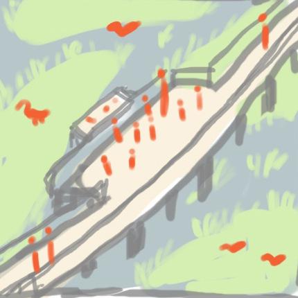
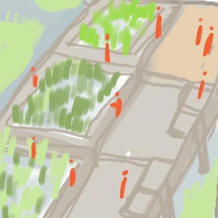
Birdwatching Platform 1. Urban Reforestation Tree Plot 4. Eco-Playscape 2. Outdoor Classrooms
7. Floating Wetlands
Driftwood
Washed Ashore: Lessons in Erosion
Eco-Splash! Free Play
Wetland Habitat Explorers Birds and Binoculars in Focus
River Flow: Understanding the Delaware Watershed
| Fishtown Waters
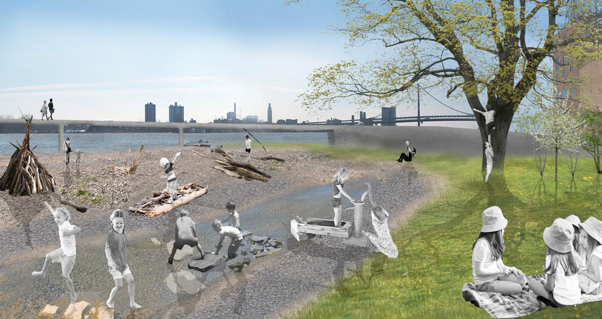
Eco-play driftwood grounds
Urban reforestation tree plots Forest ramble
3. Exploratory Pond
8. Teaching Amphitheater
Floating Wetlands: How do they Function?
The History of Petty Island
Woodland Friends Storytime
Exploratory pond


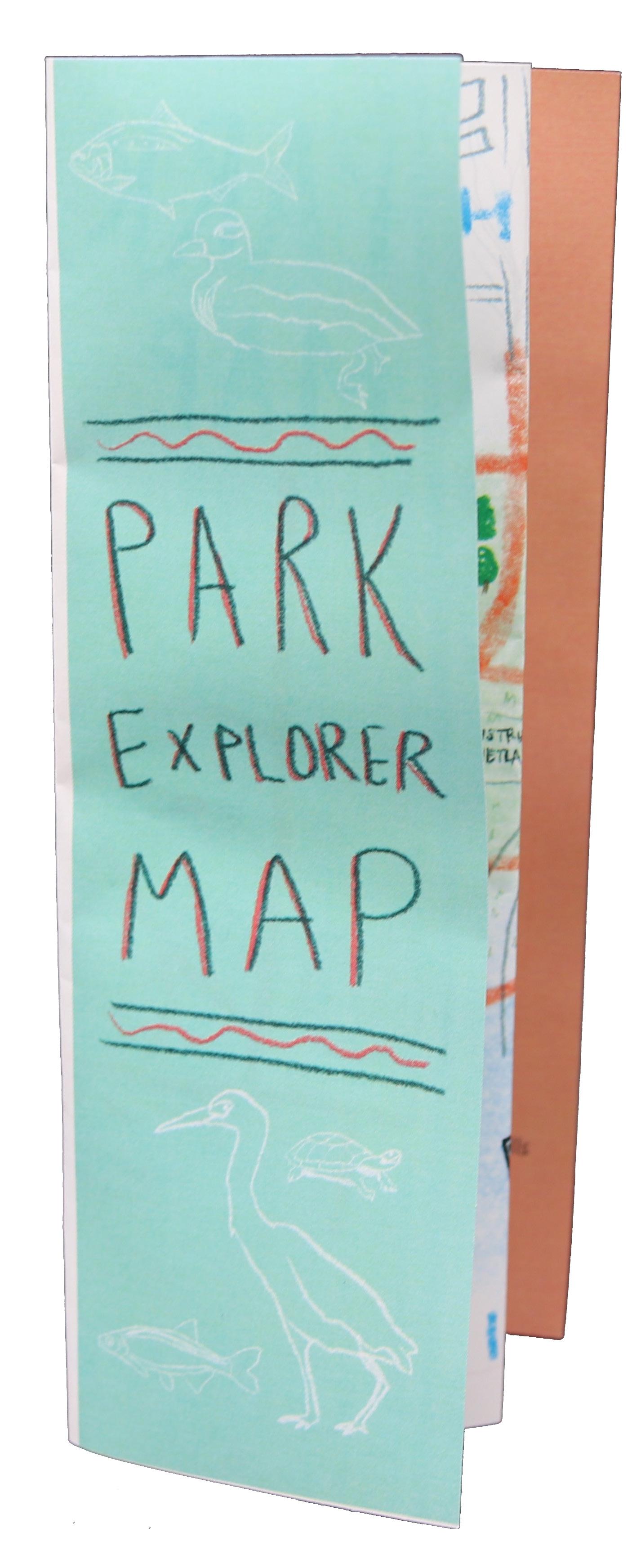
A handheld Park Explorer Map provides space for children to
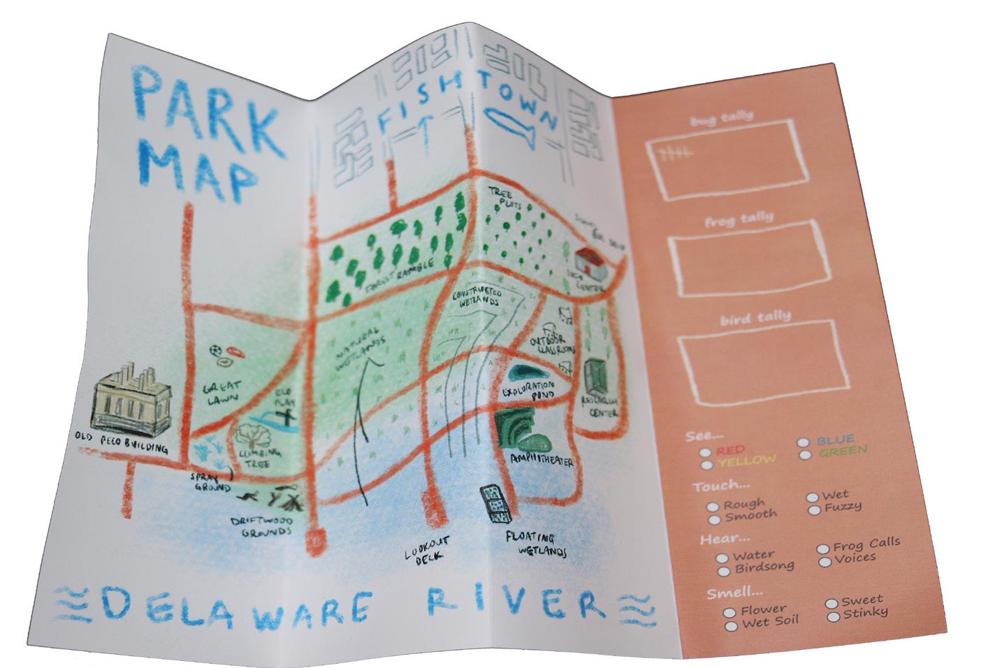
to understand and record what they see in the park
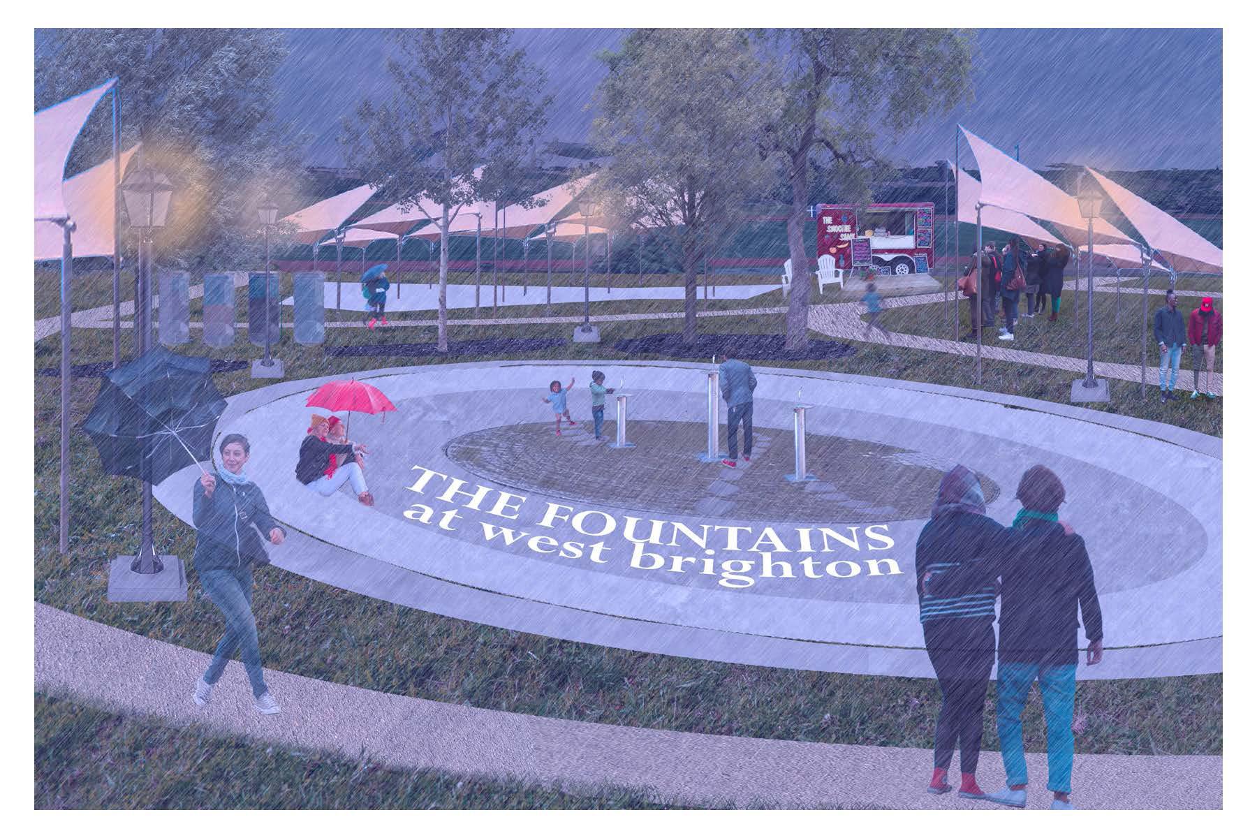
SHIFTING SOURCES
Staten Island NY
Regional Planning
Landscape Studio 601, Fall 2025
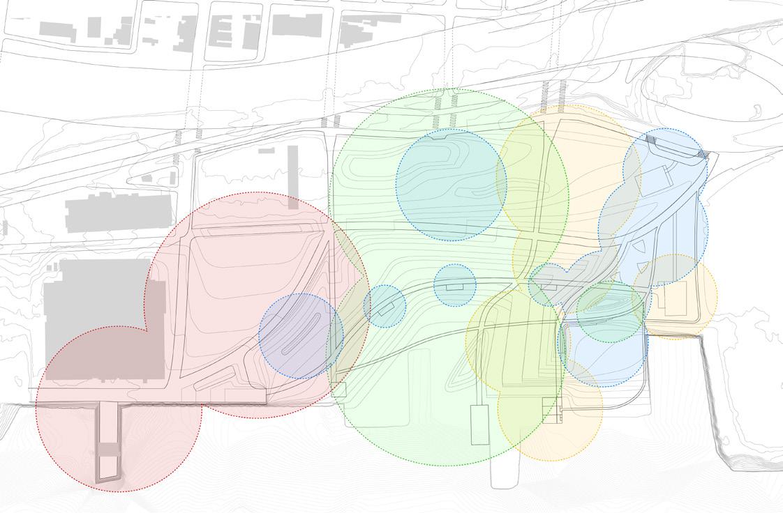
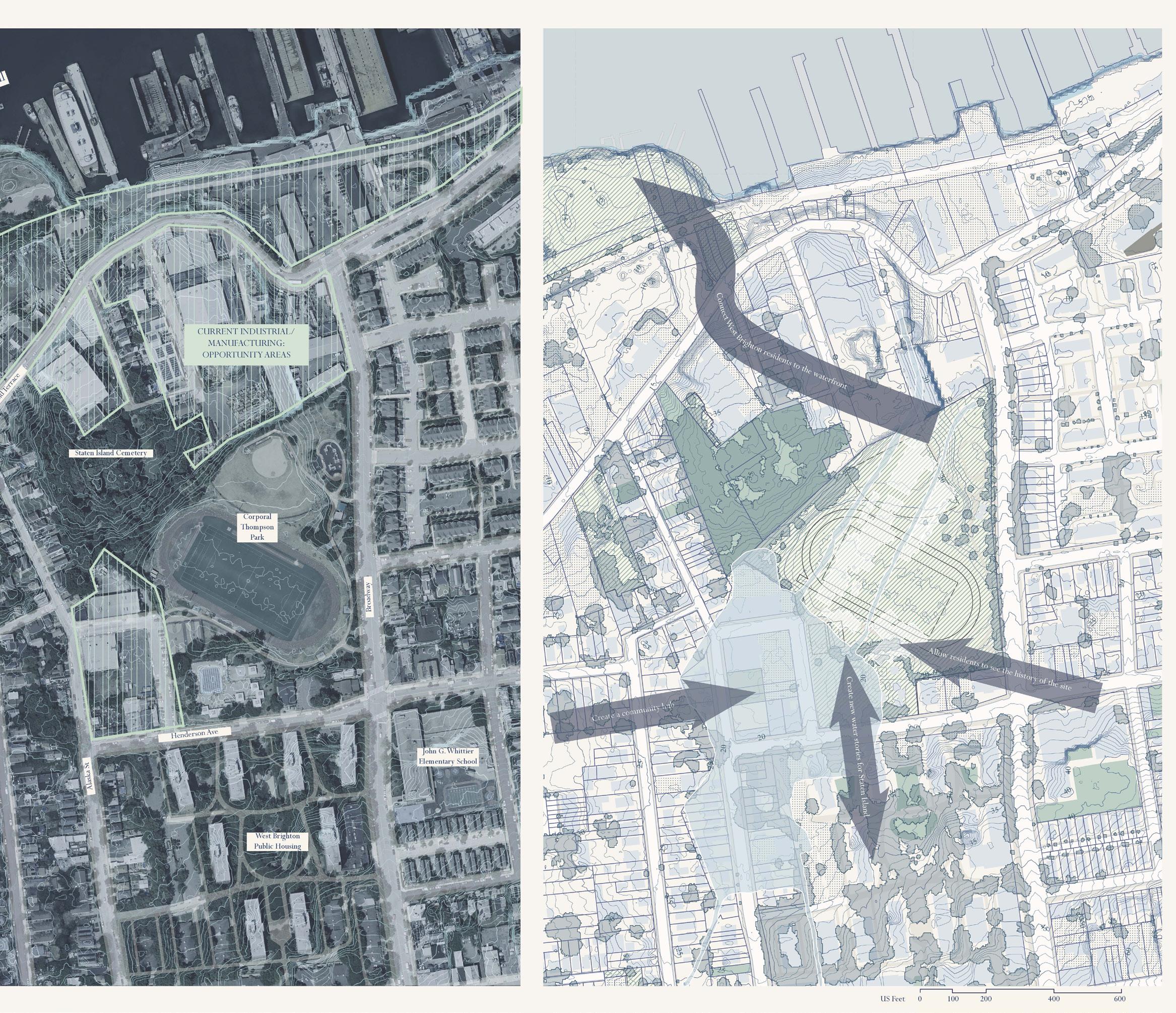
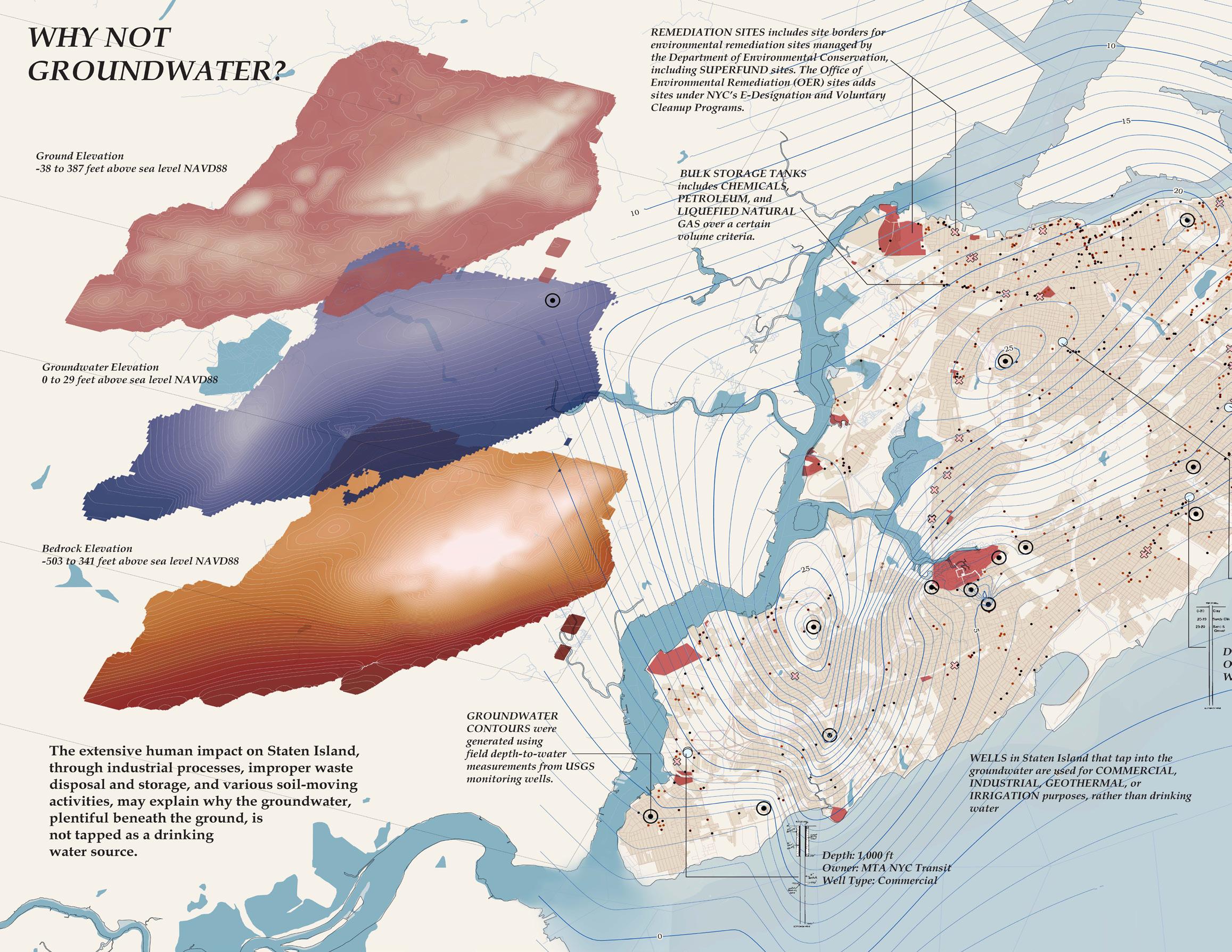
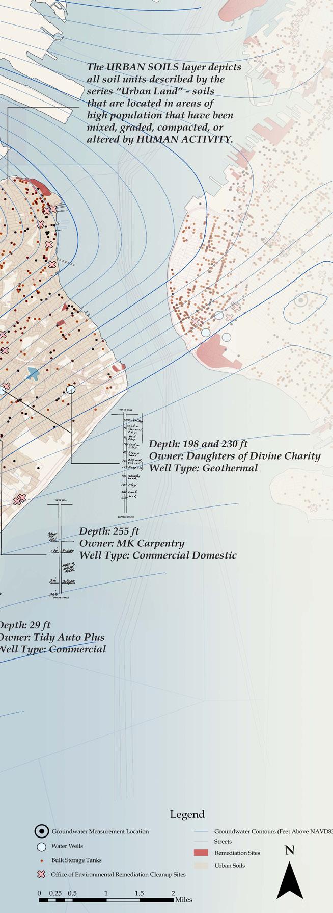
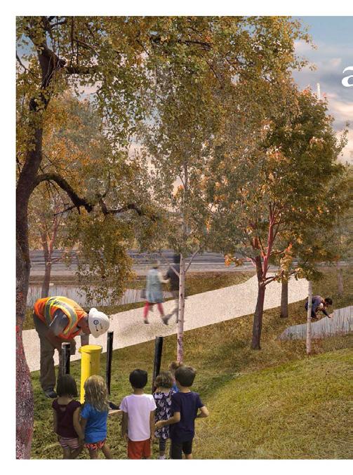
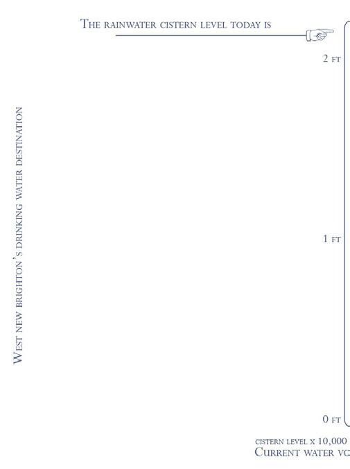
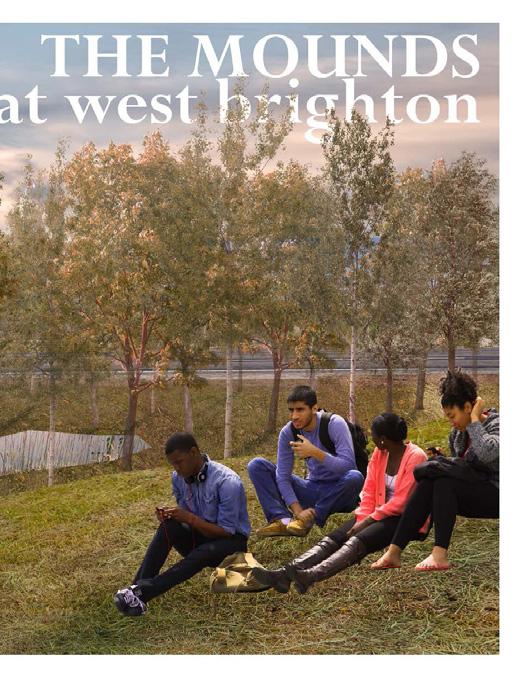
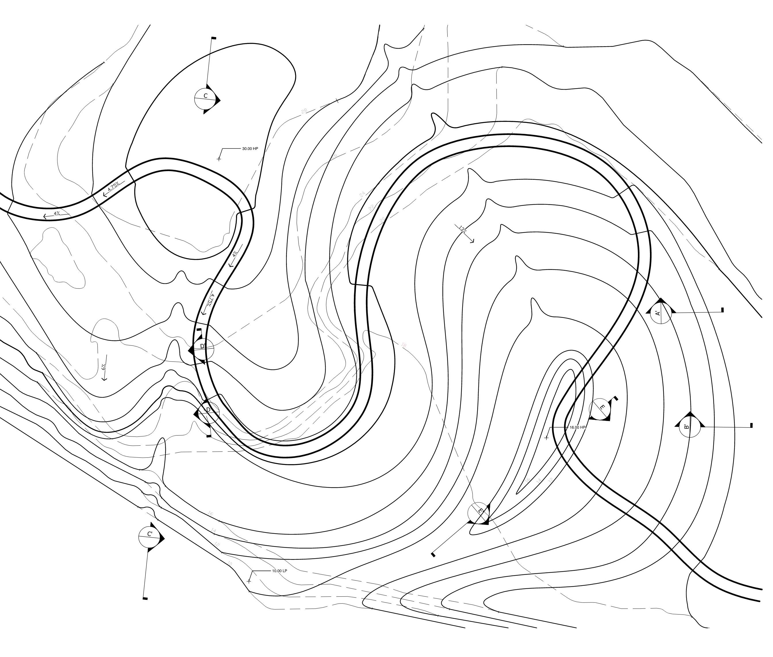
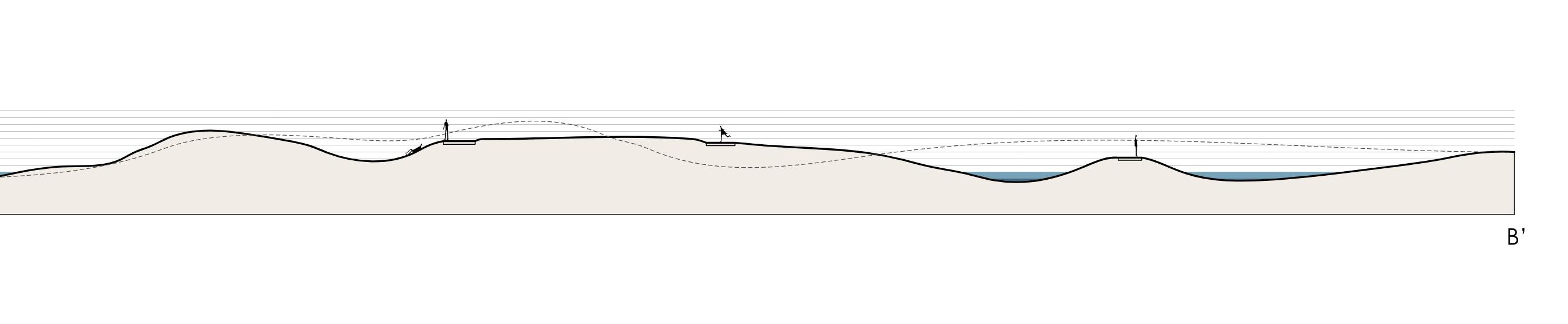
Staten Island, within the greater city of New York, has undergone a series of inflection point events that have pushed its drinking water source more than 100 miles away upstate, having polluted the historically fresh ponds and lakes of the island and bypassing and ignoring the present-day groundwater sources beneath the city. Currently, the drinking water system is centralized, efficient, one-size-fits-all, highly controlled, hidden underground and invisible. What would it look like for it to be sitebased, human-scale, personal, liberated, and legible?
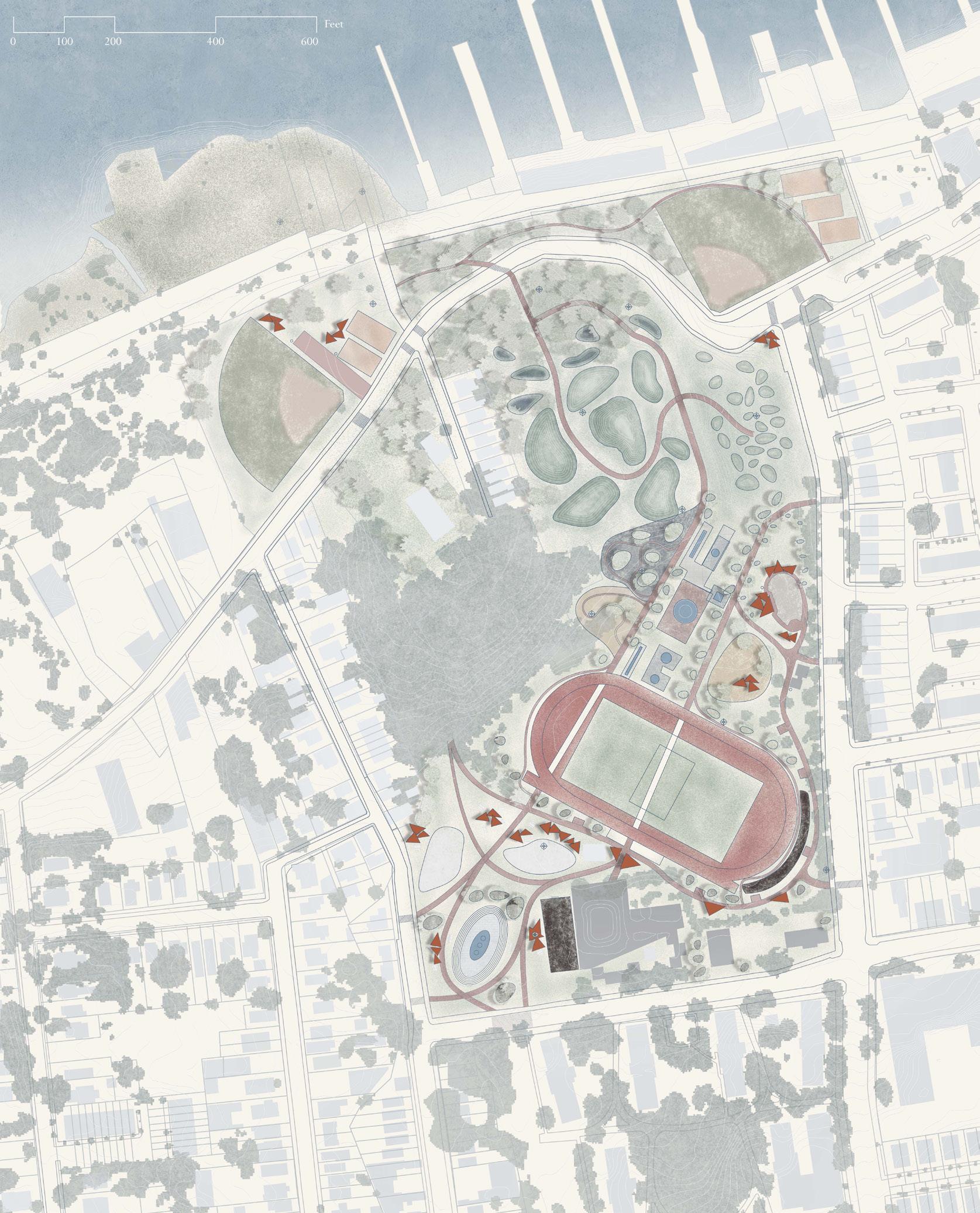
Focusing on the footprint of the former Factory Pond in West New Brighton, I aim to establish a drinking water destination - a civic gathering space that connects people to each other and reconnects people to water. Considering the histories of industry and water pumping, hydrogeologic processes under the ground, and broader site contexts and barriers, the design explores a layering of various water purification processes, water usages, and participatory programs within the site.
Positioning a regional intervention on a site
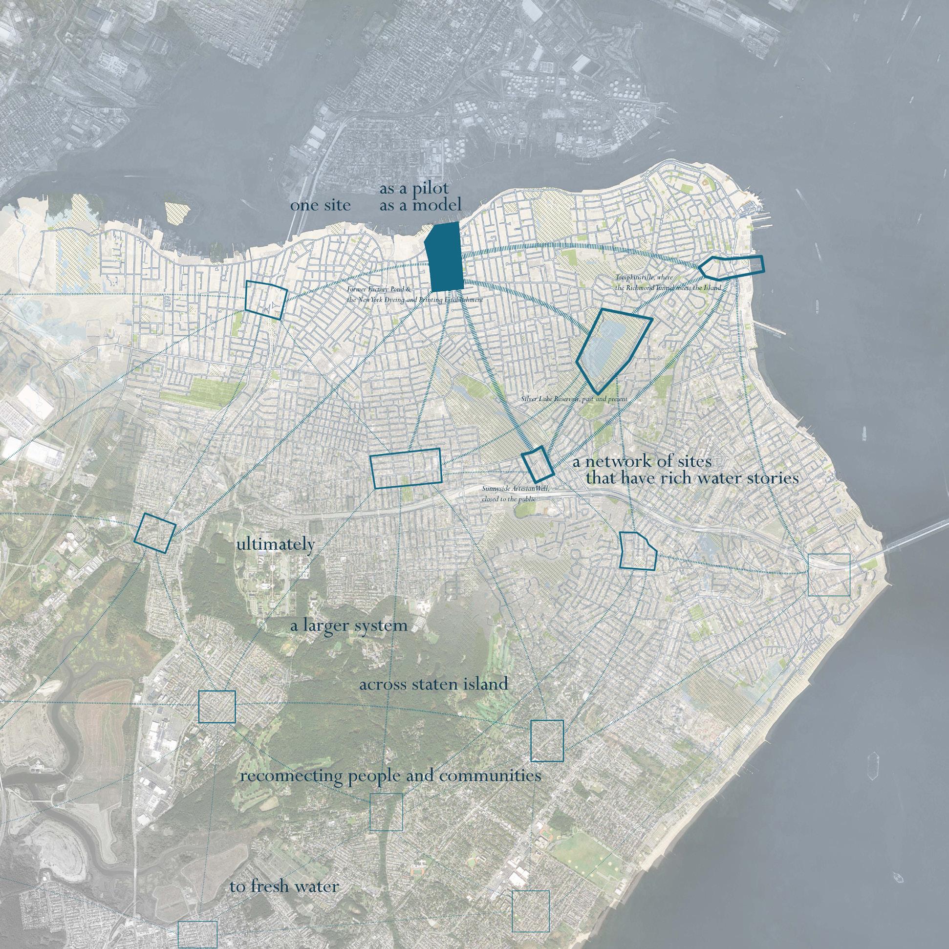
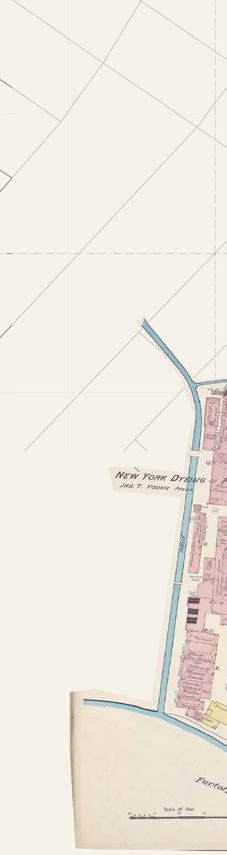
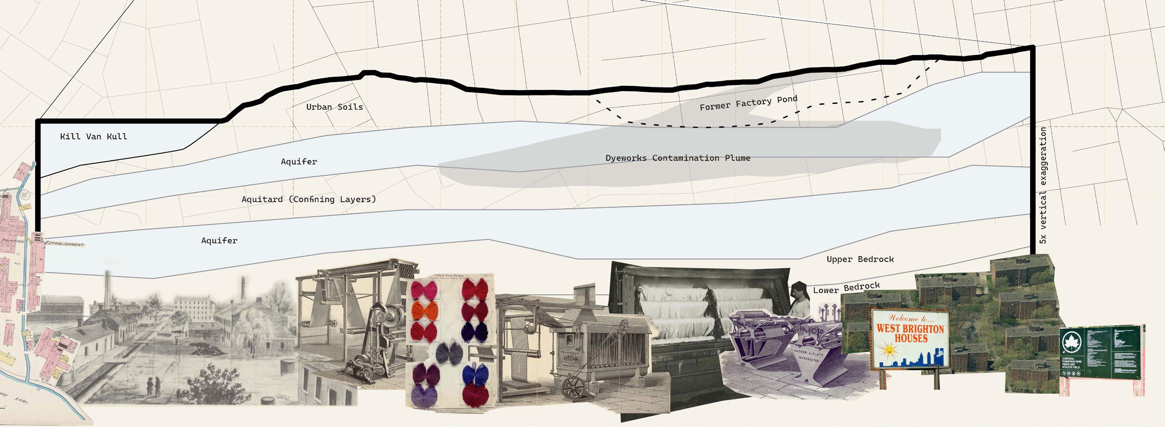
For my project, I focused on a site in West New Brighton which includes the footprint of the former Factory Pond, used during the mid-1800s in the processes of the New York Dyeing and Printing Company. This site represents one out of many sites that hold unique “water stories”. The strategies that I proposed here on this pilot site, I imagine will be repurposed and adapted to other sites to create a larger network of water hubs across the island.
The Factory Pond supplied fresh water to the dyeing process, but eventually the pollutants output by the factory made the water unusable and the pond had to be filled in. Though the historic industrial aspect was the starting point of my site selection and analysis, looking at the current site conditions opened up a lot of opportunity for design as well. Currently on the site is Corporal Thompson Park, a great community resource, the West Brighton Housing projects which is part of the NYC Housing Authority PACT (Permanent Affordability Commitment Together) program, and various industrial lots and buildings sprinkled throughout. 18 | Shifting Sources
The water “quenchification” process as plan parti
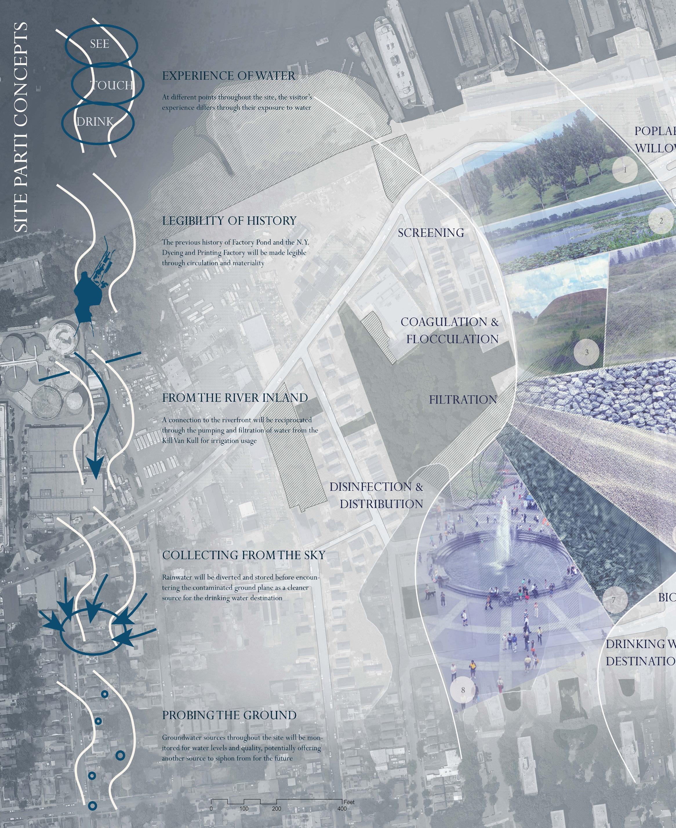
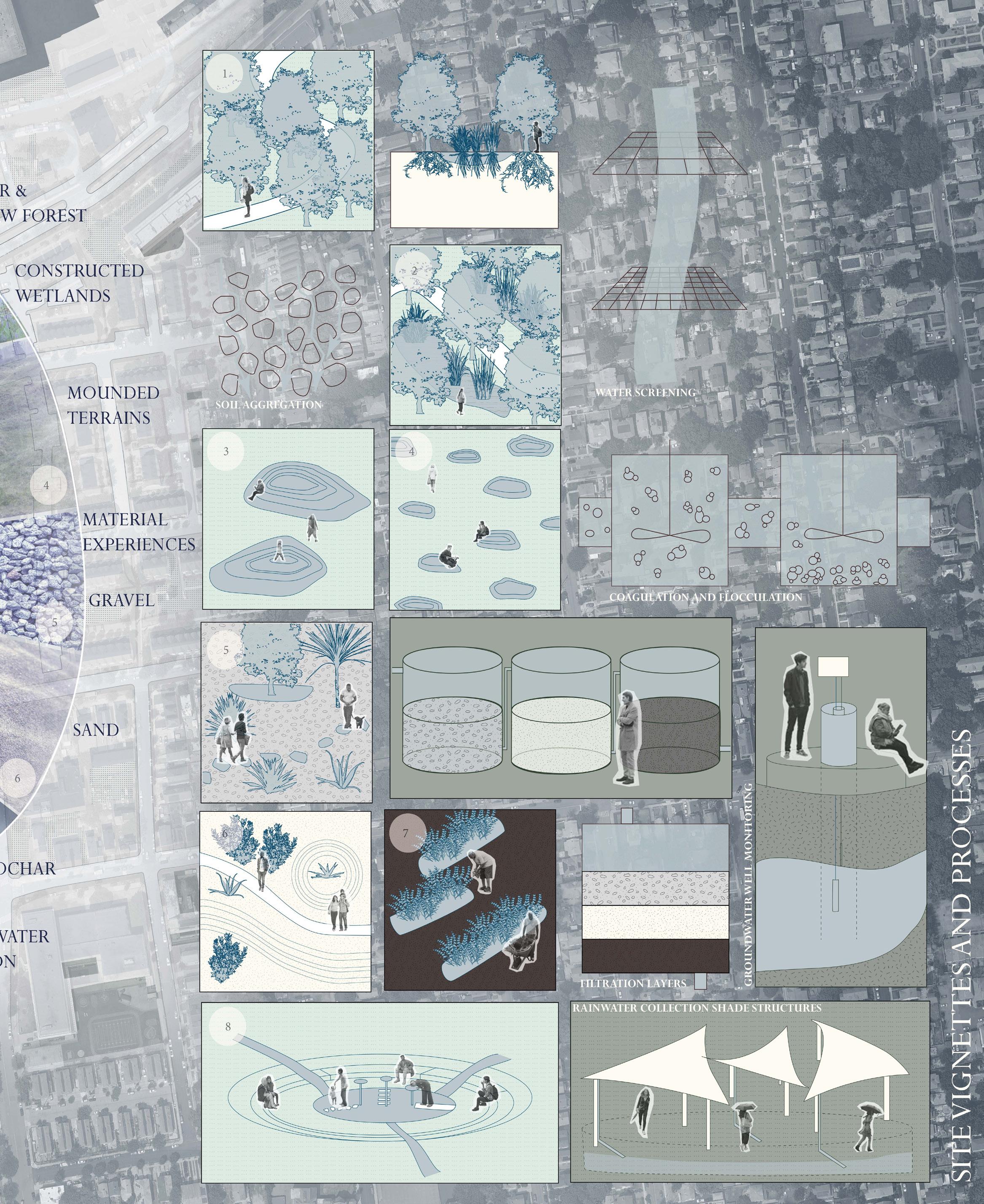
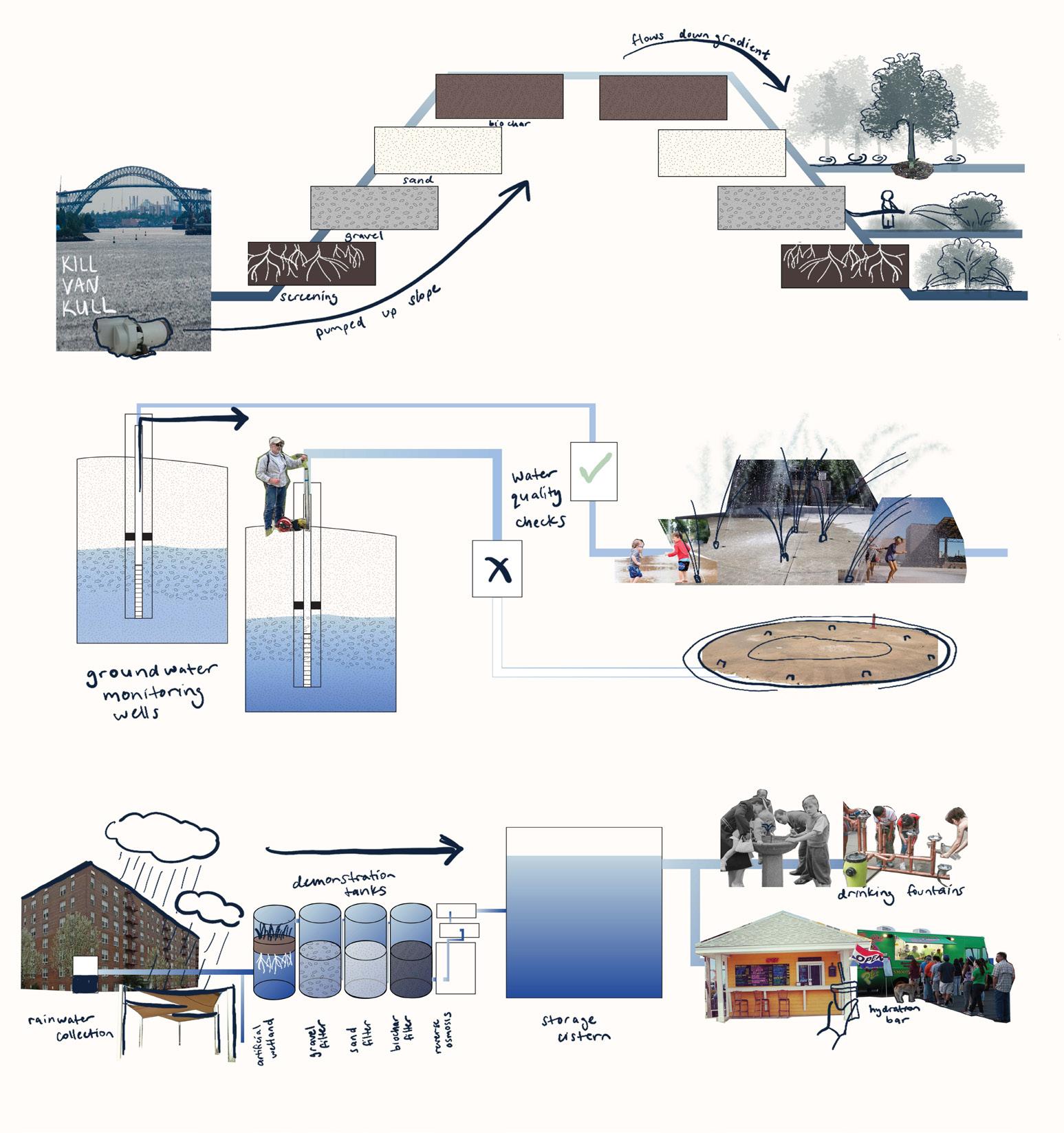
Separating out water infrastructure streams for usage on site

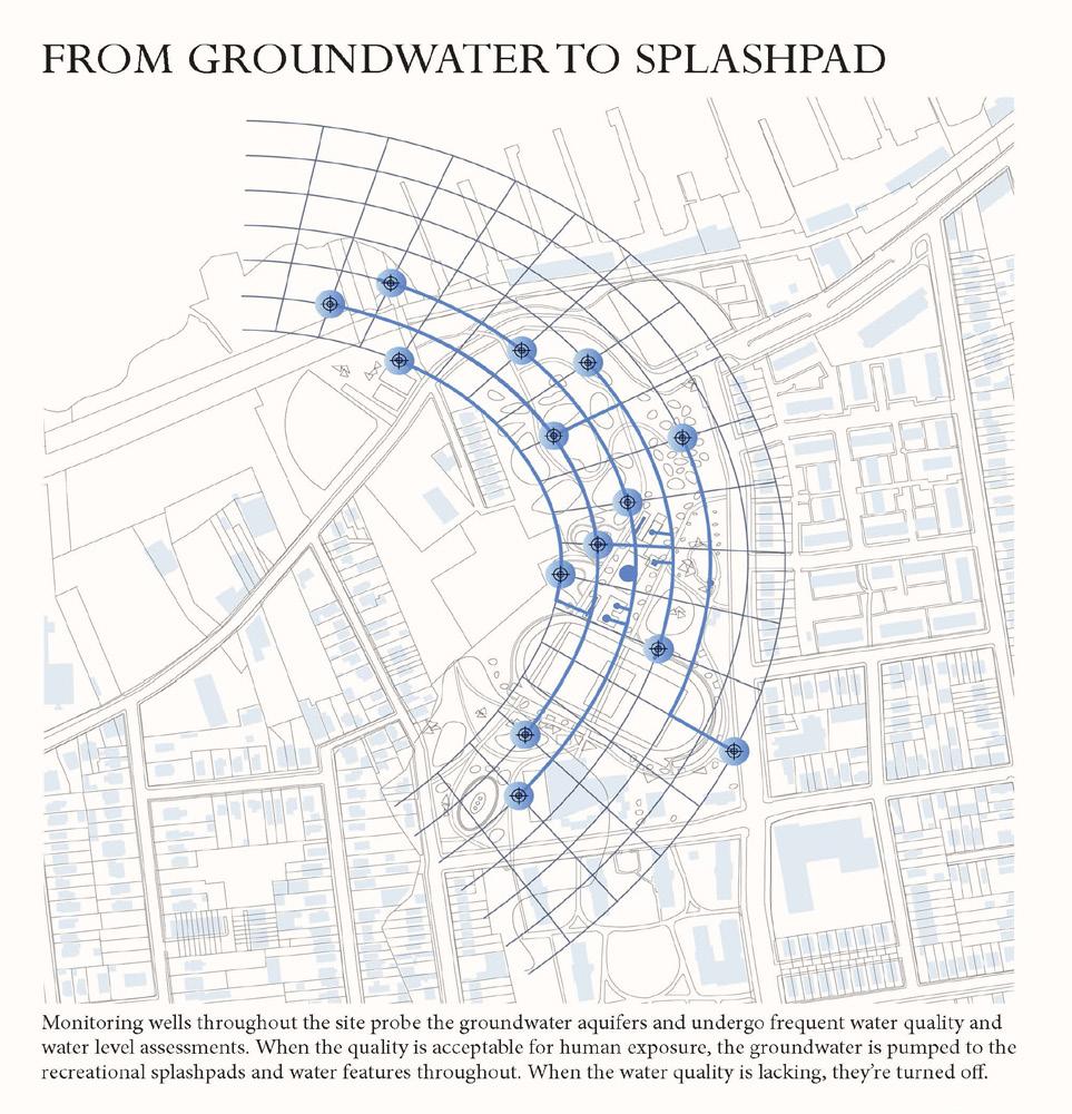
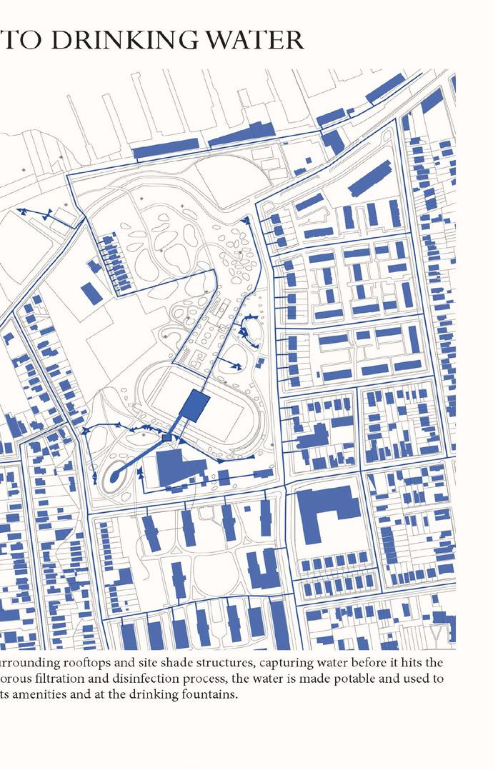
The landscape and materials do the work, filtering the water just enough to be used in the irrigation system of the park. The water is pumped uphill through various screening and clarifying steps, then gravity takes it back downhill to the tree beds and forested areas. Monitoring wells throughout the site probe the groundwater aquifers and undergo frequent water quality and water level assessments. When the quality is acceptable for human exposure, the groundwater is pumped to the recreational splashpads and water features throughout. When the water quality is lacking, they’re turned off.
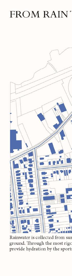
Rainwater is collected from surrounding Through the most rigorous filtration tion by the sports amenities and
The West New Brighton site acts as a pilot, paving the way for the design elements on site to be repurposed and adapted across Staten Island in a network of local water hubs, united in the celebration of drinking water access. These new regimes hope to kindle a deeper awareness, appreciation and awe for clean water, a resource and privilege that is often overlooked and unseen.
The design reimagines the logistical water system within the site and its surrounding area. Going back to the broader NYC system – that one-size-fits-all approach treats all of its water to the same potable standard, disregarding the differing uses it may have. This site design works to separate out different water sources and different end uses, so each stream has a different purification level and process.
The three systems are 1) Pumping water from the river to use for irrigation, 2) extracting groundwater from aquifers in a system of monitoring wells for onsite water features, and 3) harvesting rainwater from nearby rooftops and shade structures as potable drinking water. These three systems exemplify the differentiation of how I want to guide people’s experiences with water – to see, to touch, and to drink.
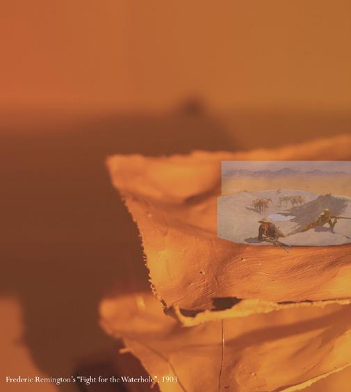

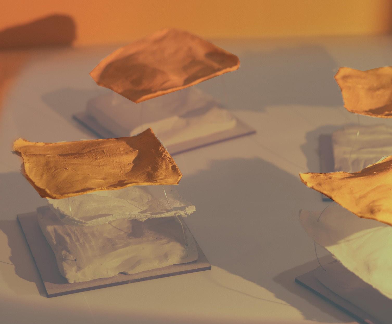
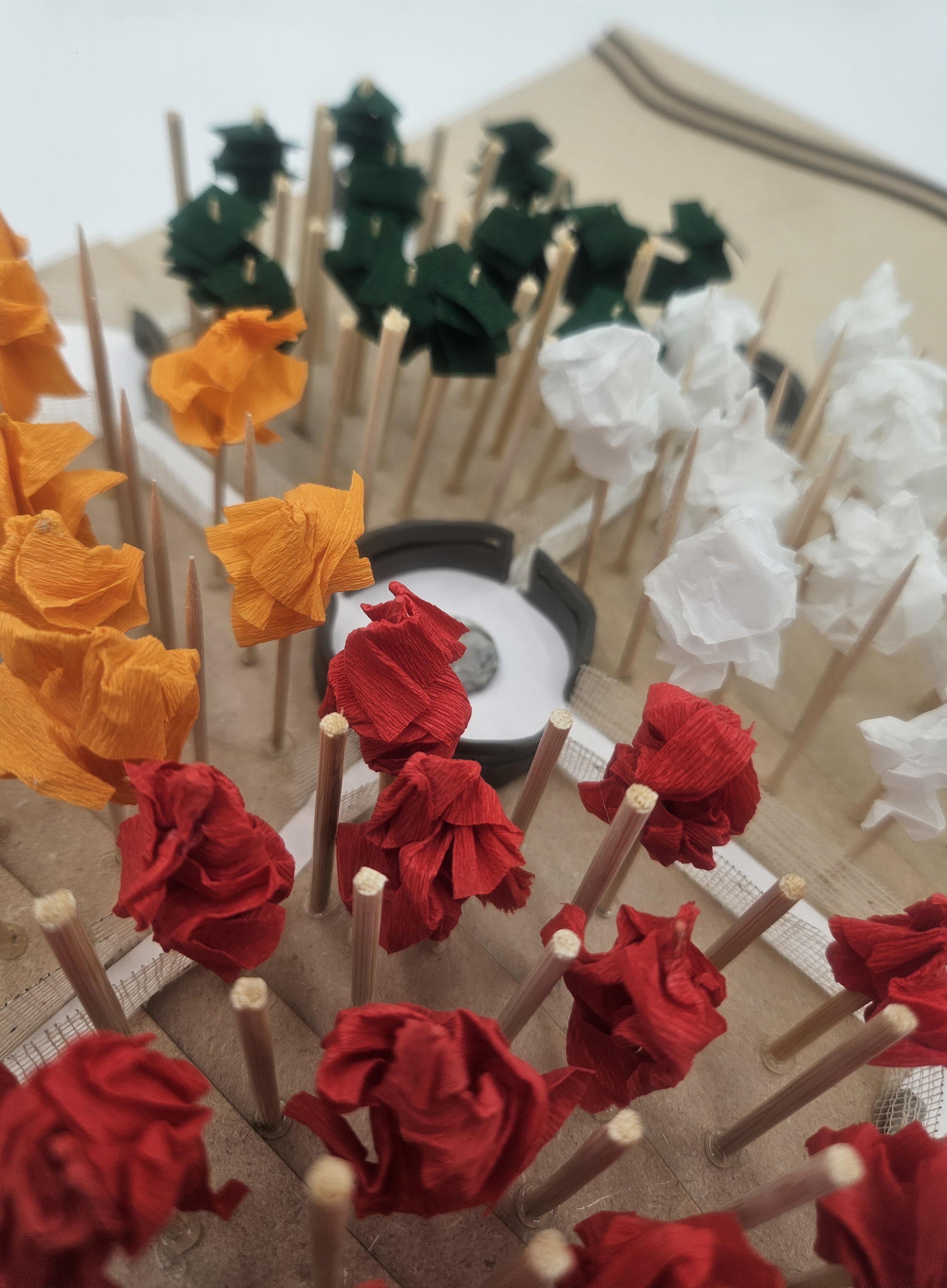
Through this set of plaster
Postcards depict key experiences

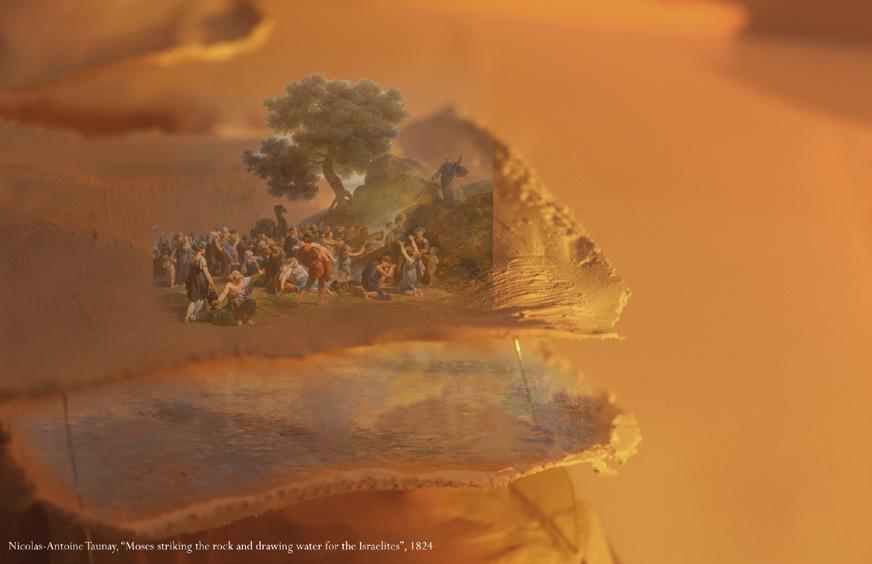
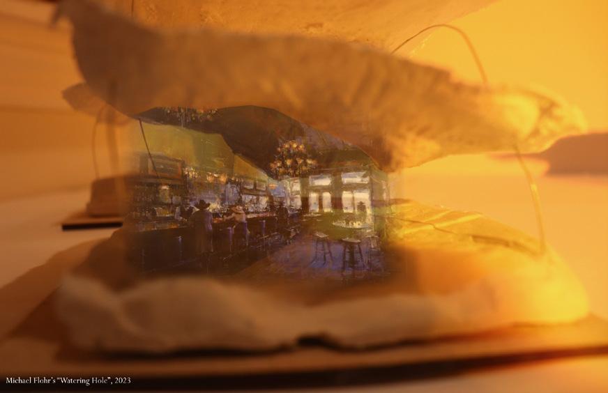
models and scenes, I hoped to invoke the deep ties that exist and have always existed between humans and water

experiences and sense of place on the site and invite community participation with the processes of water
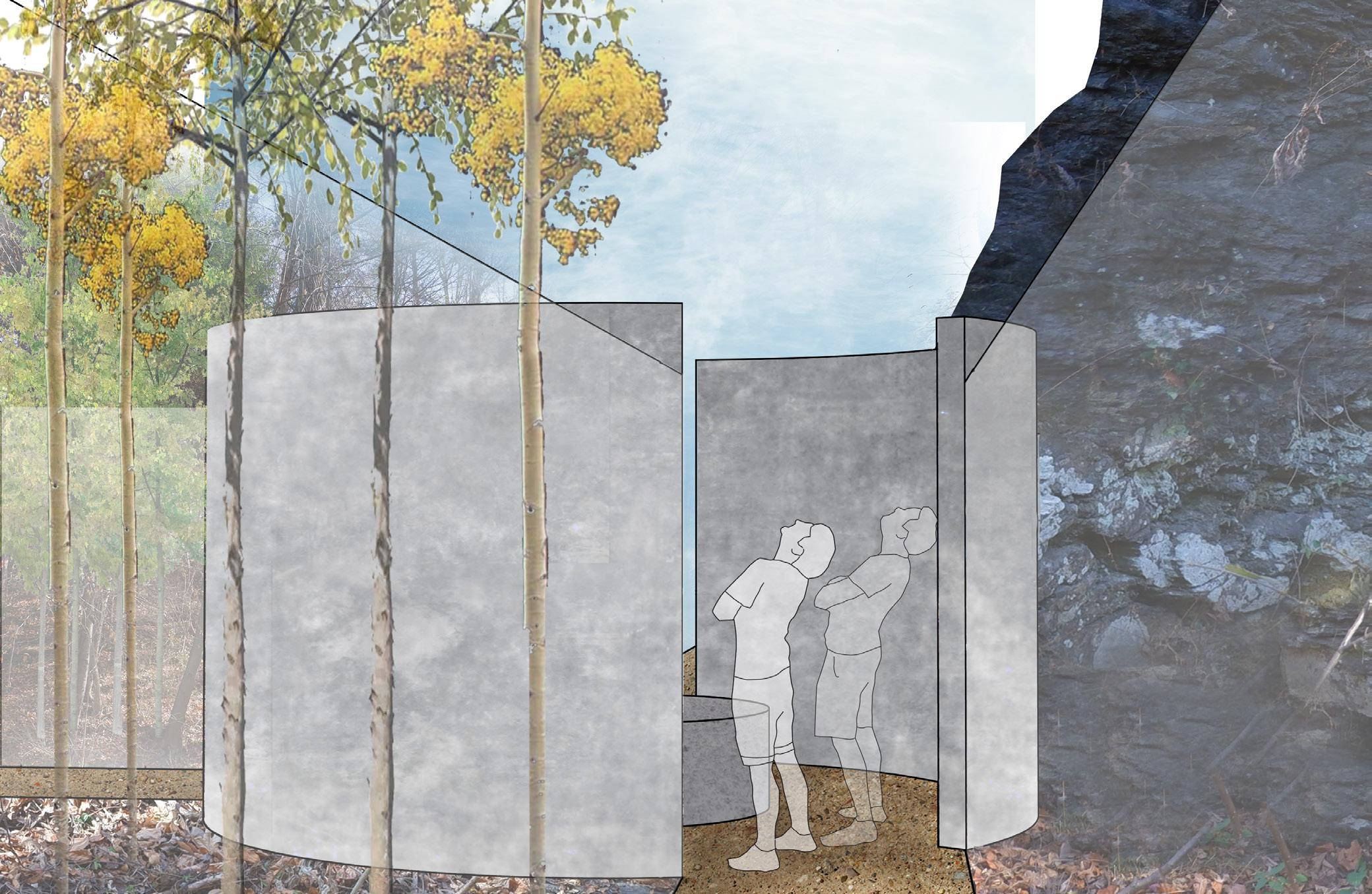
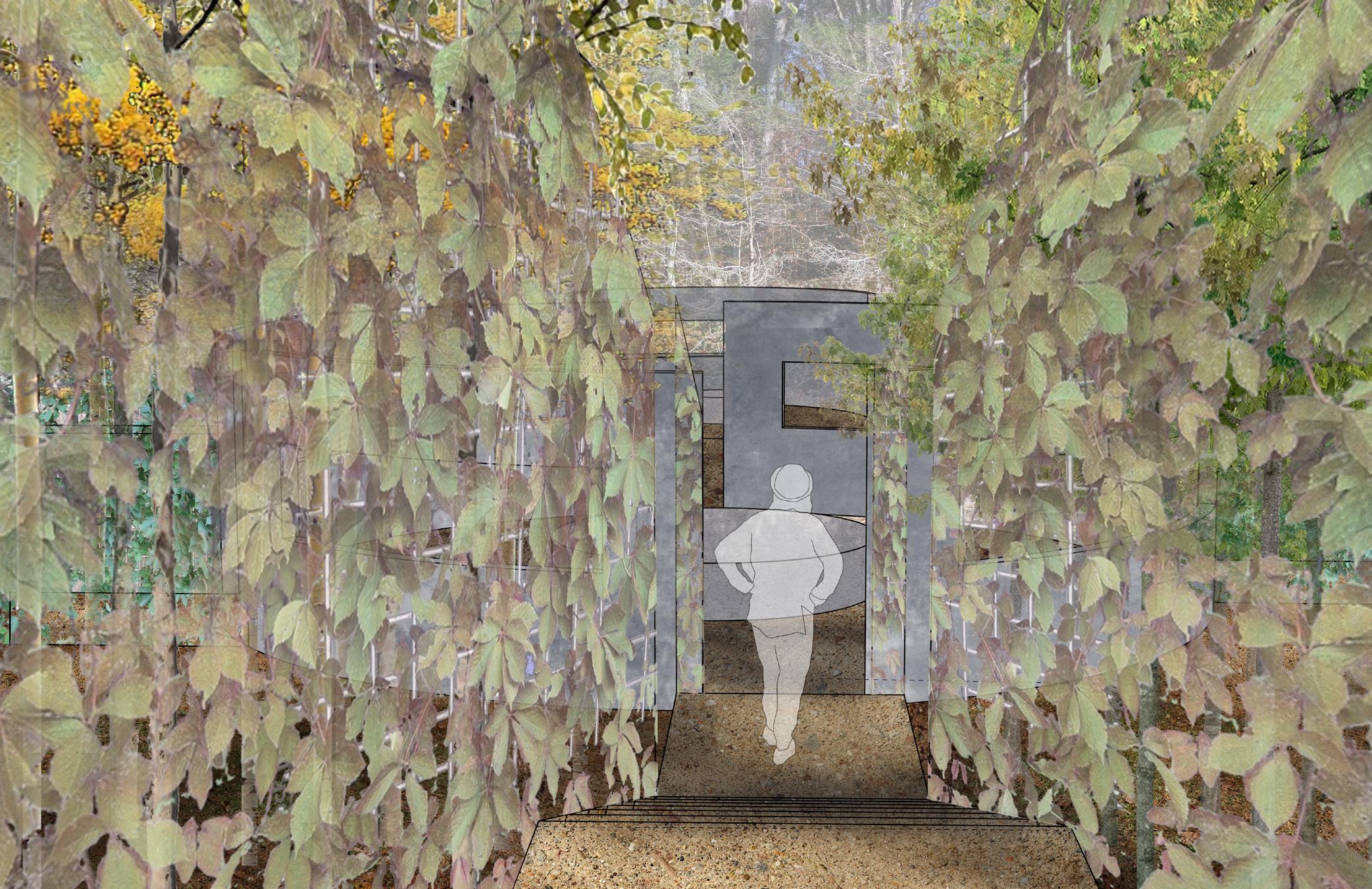
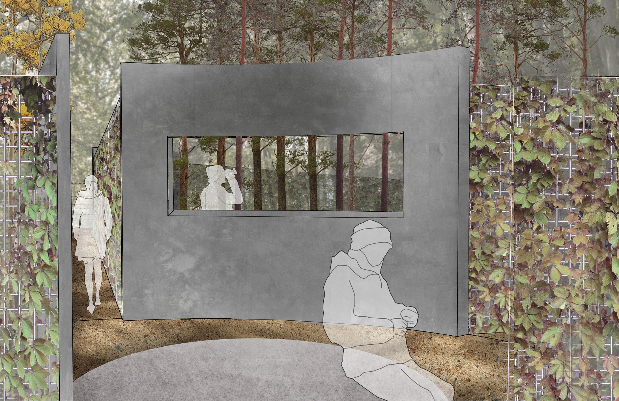
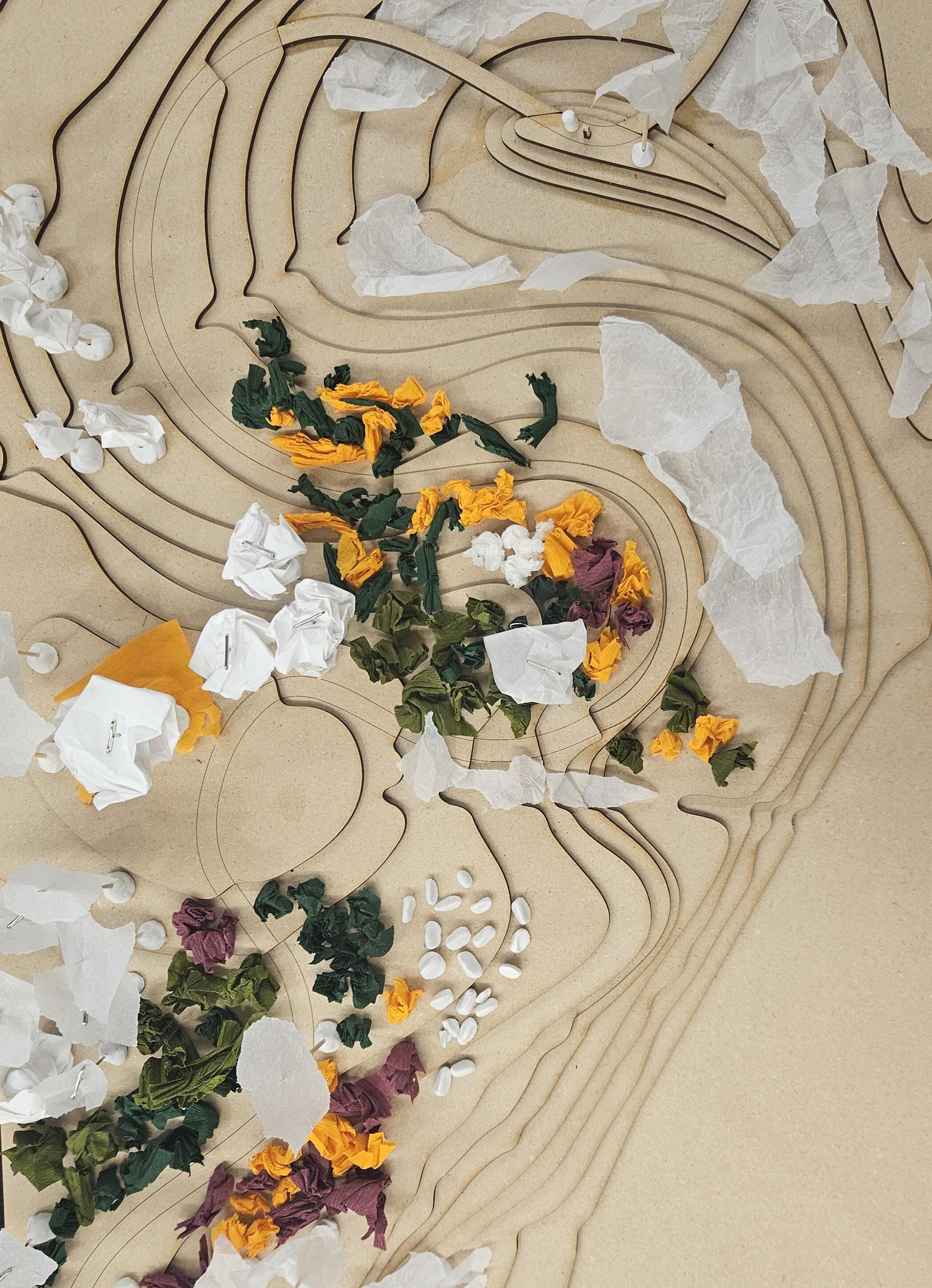
FOREST OF MULTITUDES
Wissahickon Valley Park, Philadelphia PA
Garden
Landscape Studio 501, Fall 2024
My garden explores the theme of infinity through the lenses of infinite time, space, and plantings. Through the enclosed pathways, there is disorientation as endless trees are glimpsed through the vines and the way ahead seems unknowable. The paths lead to rooms where windows allow for new, unobstructed views of four variations of infinite forest, created by grids of trees. At the creek-side, sightlines direct to elements that invoke the feeling, “I could stay here and watch this forever”: rushing rapids, dappled reflections off the water onto the bridge, and the passing of hikers on paths across the river.
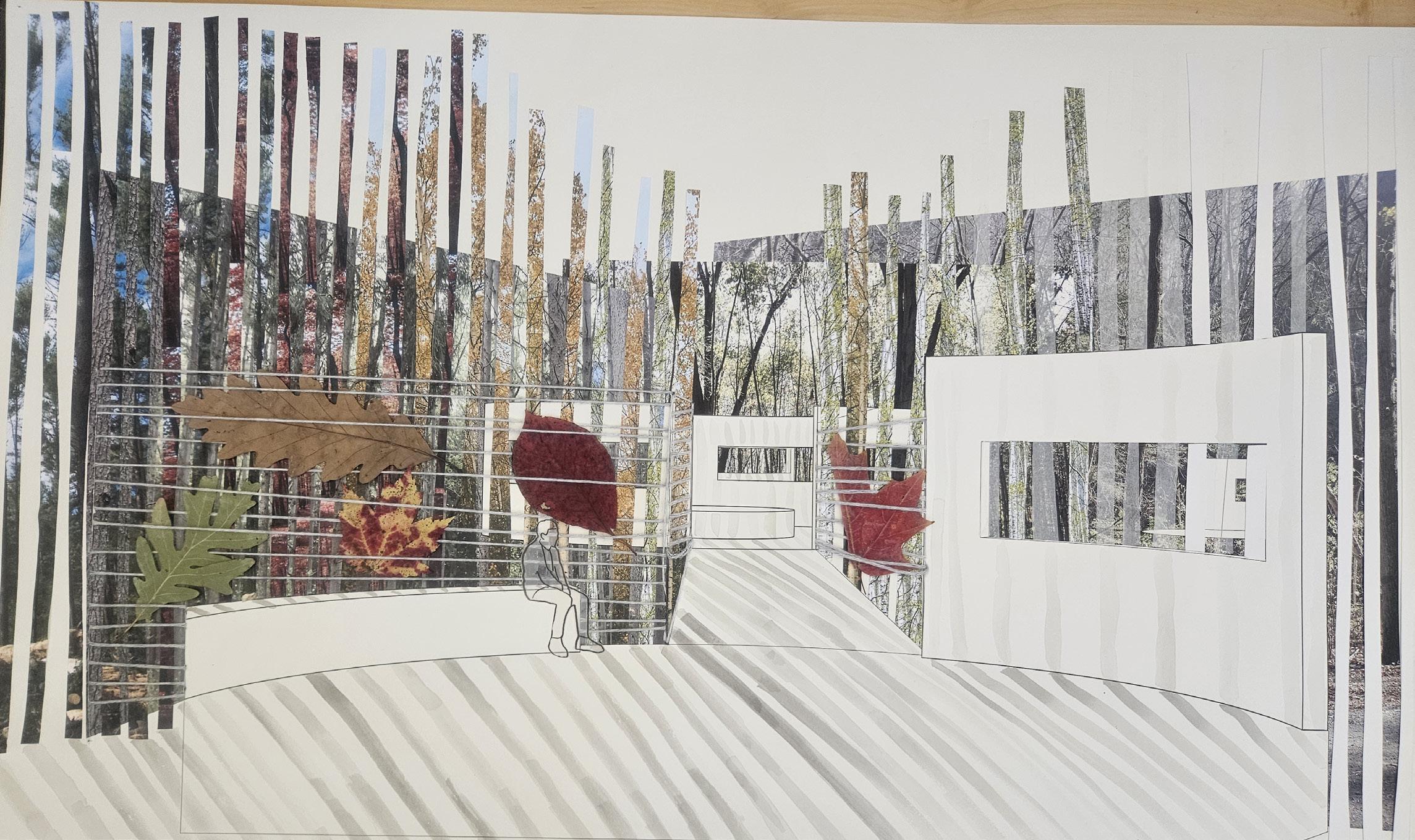
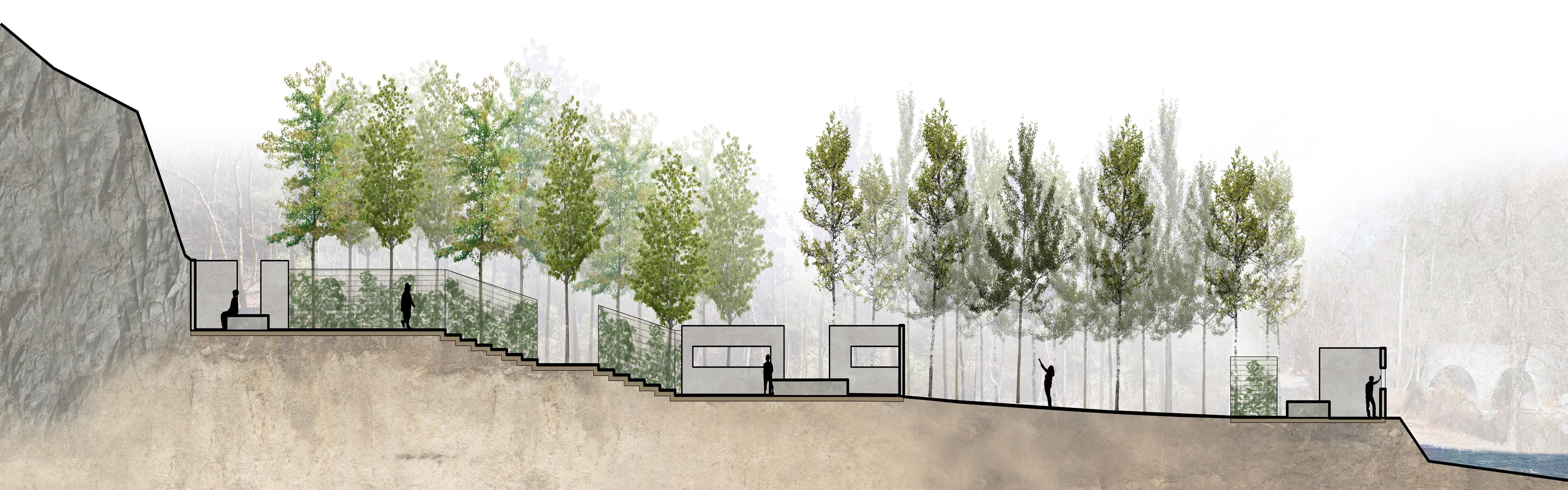
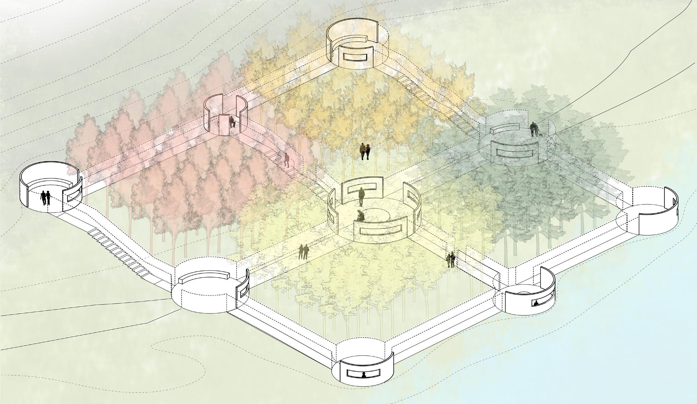
Enclosure
Creekside Enclosure
Black Birch Stand
Laying out rooms of varying characteristics through repeated planting structures
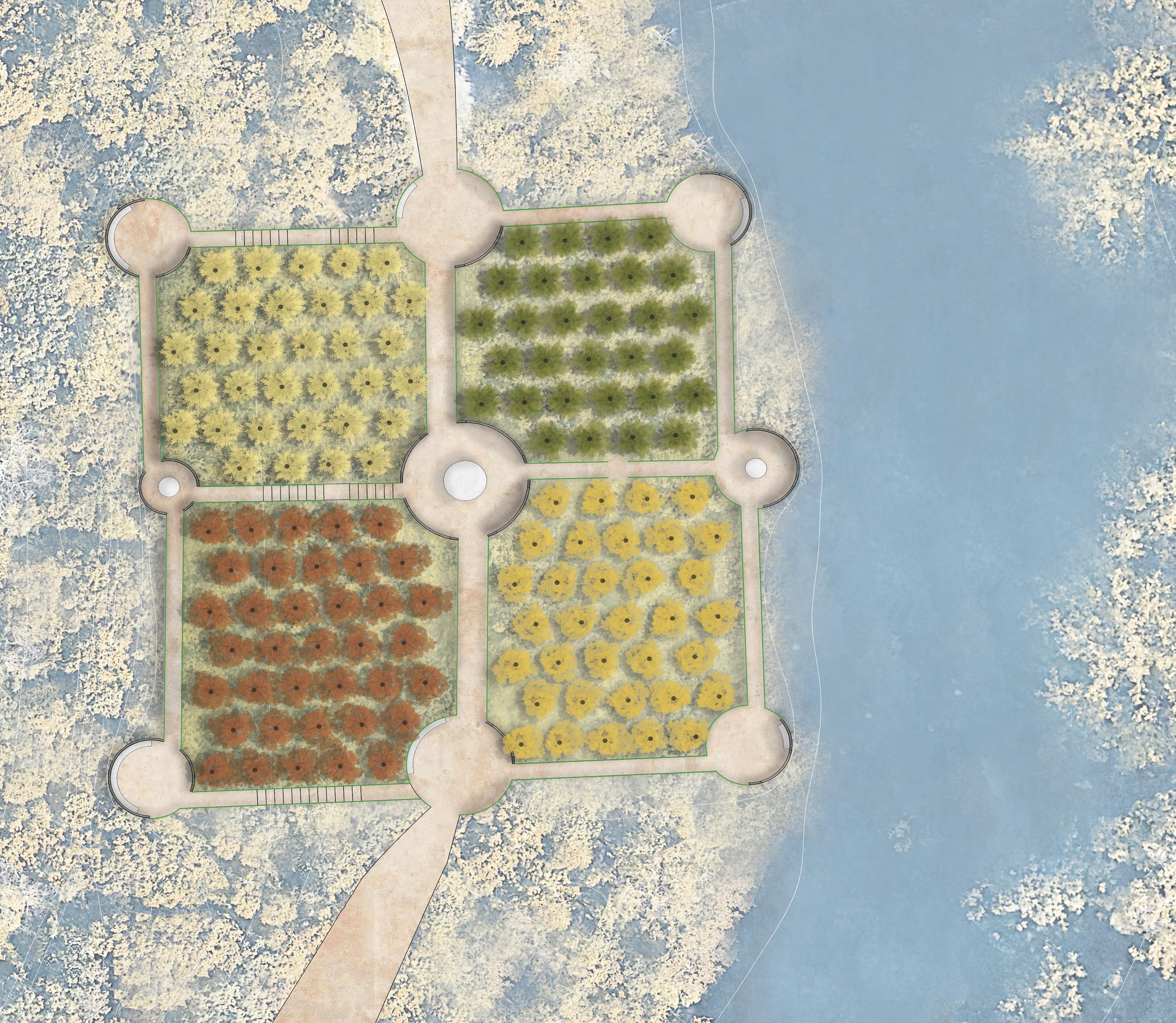


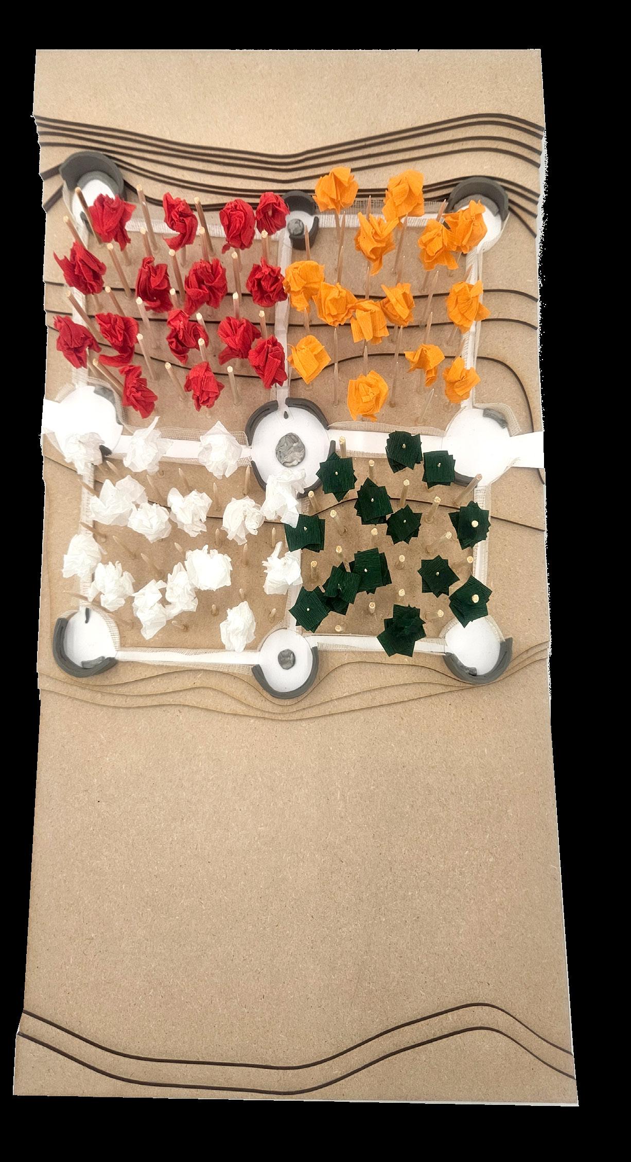
Quaking Aspen Grove
Red Maple Woods Black Birch Stand
Wissahickon Creek
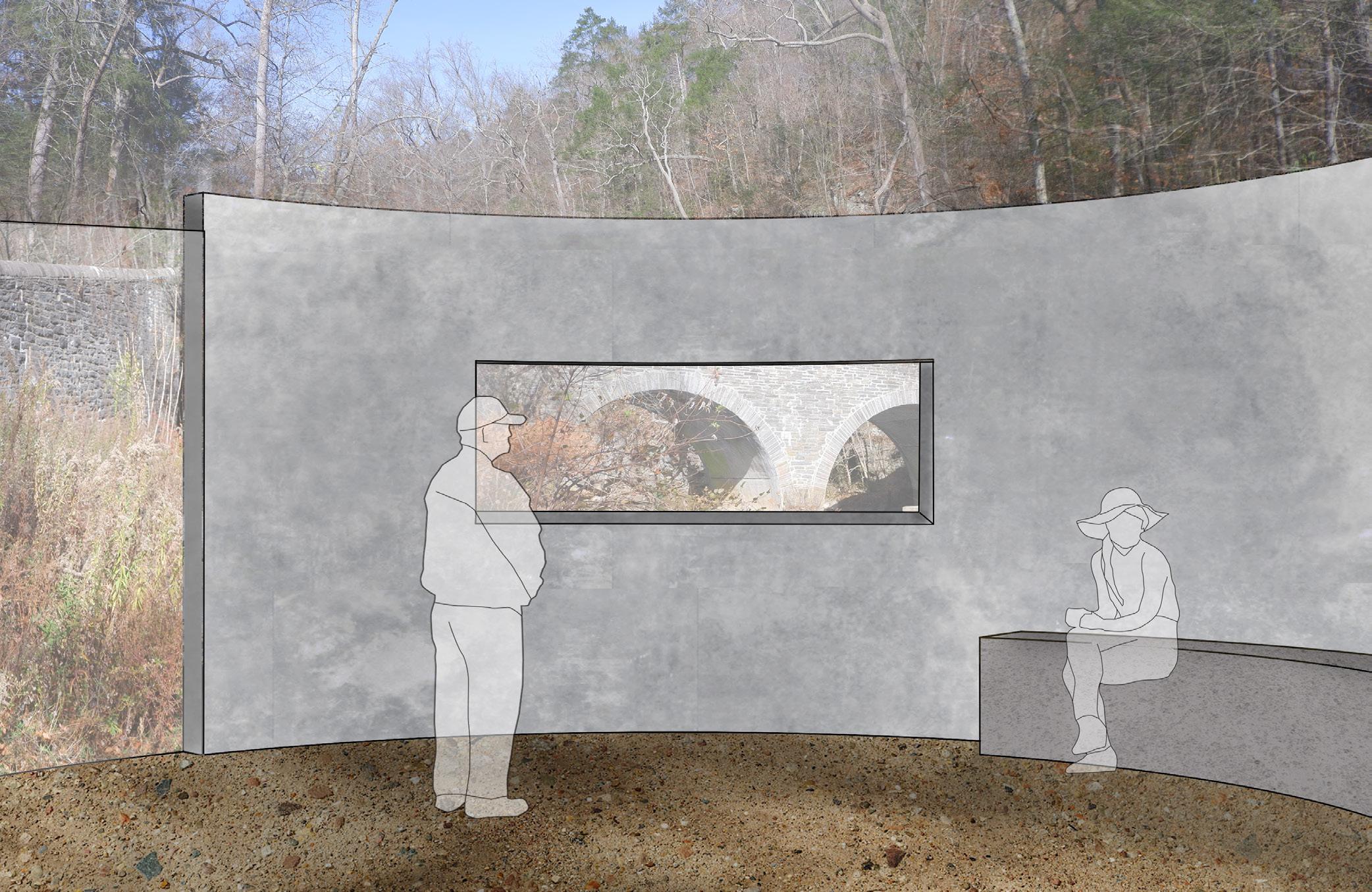
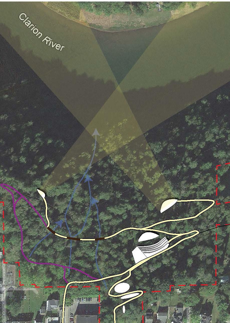
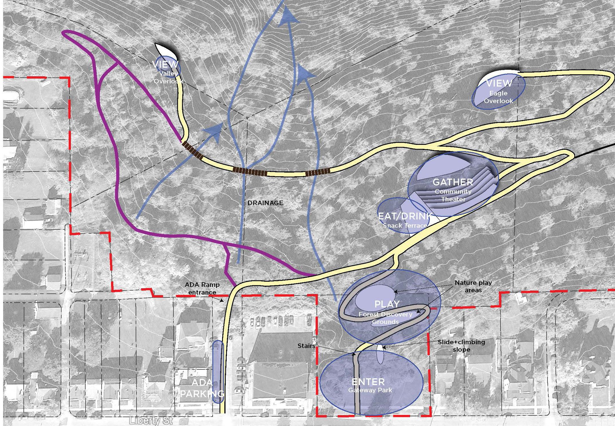
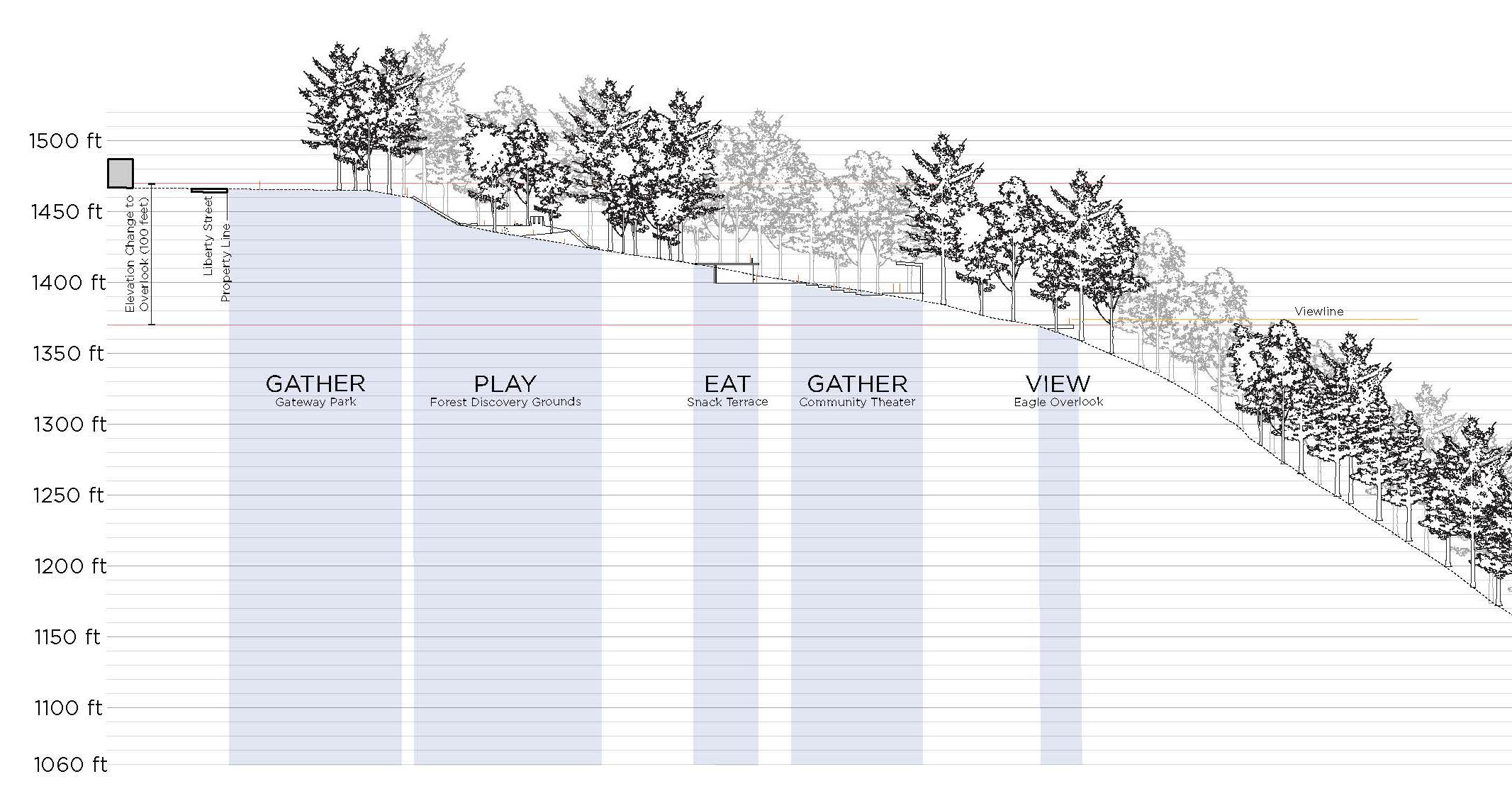
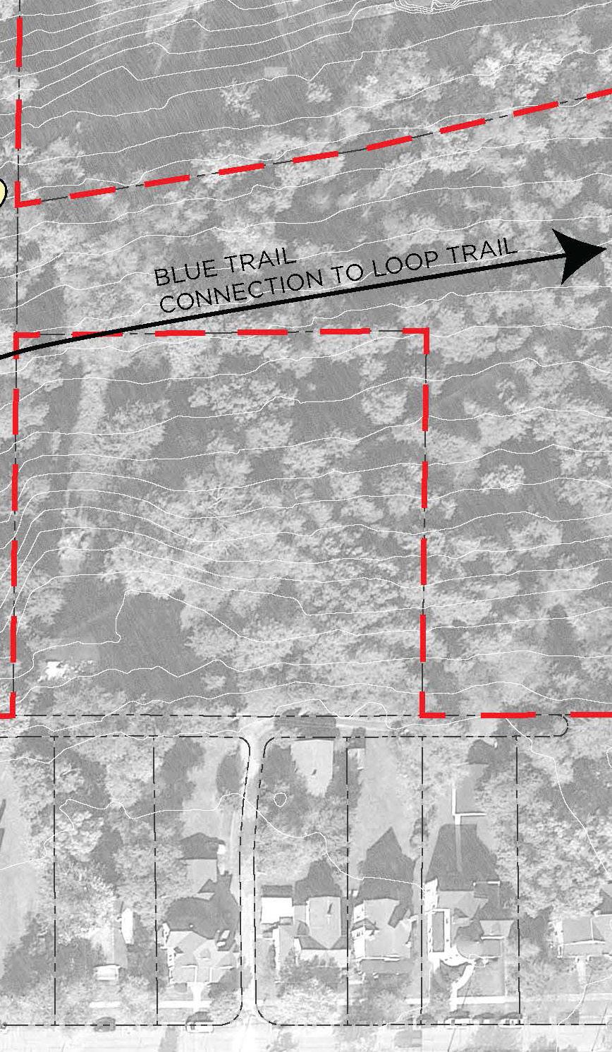
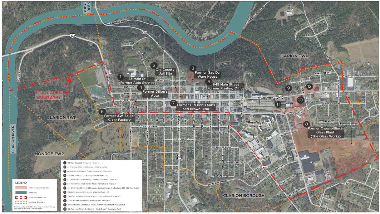
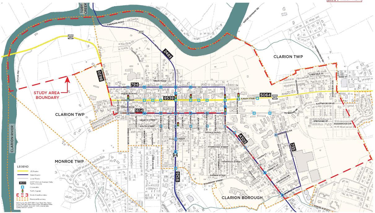
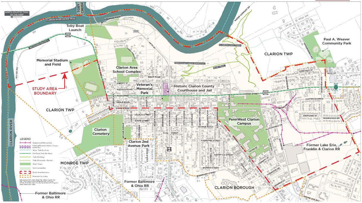
CLARION AREA-WIDE PLAN
Clarion, Pennsylvania
Regional Planning and Brownfield Redevelopment
Professional Internship Work, Summer 2025
Stromberg, Garrigan, and Associates (SGA)
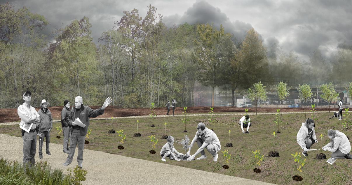
SGA, a landscape architecture and urban planning company located in Jenkintown, works closely with small communities in northwestern Pennsylvania. This project, part of the Clarion Area-Wide-Plan and partnering with Clarion County, began to investigate potential brownfield properties in select towns. Once the brownfield sites were identified, SGA is able to strategically use grant funding and landscape architecture proposals to redevelop those areas as well as provide economic benefits to the town.
My role within the Clarion AWP project was to develop layers of basemapping in GIS, parse through Sanborn maps and historical documents to identify potential brownfield sites, and design a concept for a riverfront trail connection and overlook.

CUESTA COLLECTIVE
Pennypack, Philadelphia, PA
Grading and Planting Design
Workshop II, Spring 2025
Work completed in collaboration with Reed Putnam and Sayli Limaye, MLA ‘27
The site, located along the Pennypack River in Northern Philadelphia, provided an opportunity for visitors to engage with the water’s edge. Additionally, the Pennypack is tidal, which was a unique condition for planting and dynamic water behavior.
With group members Reed Putnam and Sayli Limaye, a grading plan was developed that enhanced the curvature of the existing landform, taking inspiration from cuesta typologies. We aimed to use variation in slope and convex-concave forms to allow changing bodily experiences and views to emerge when walking through the space.


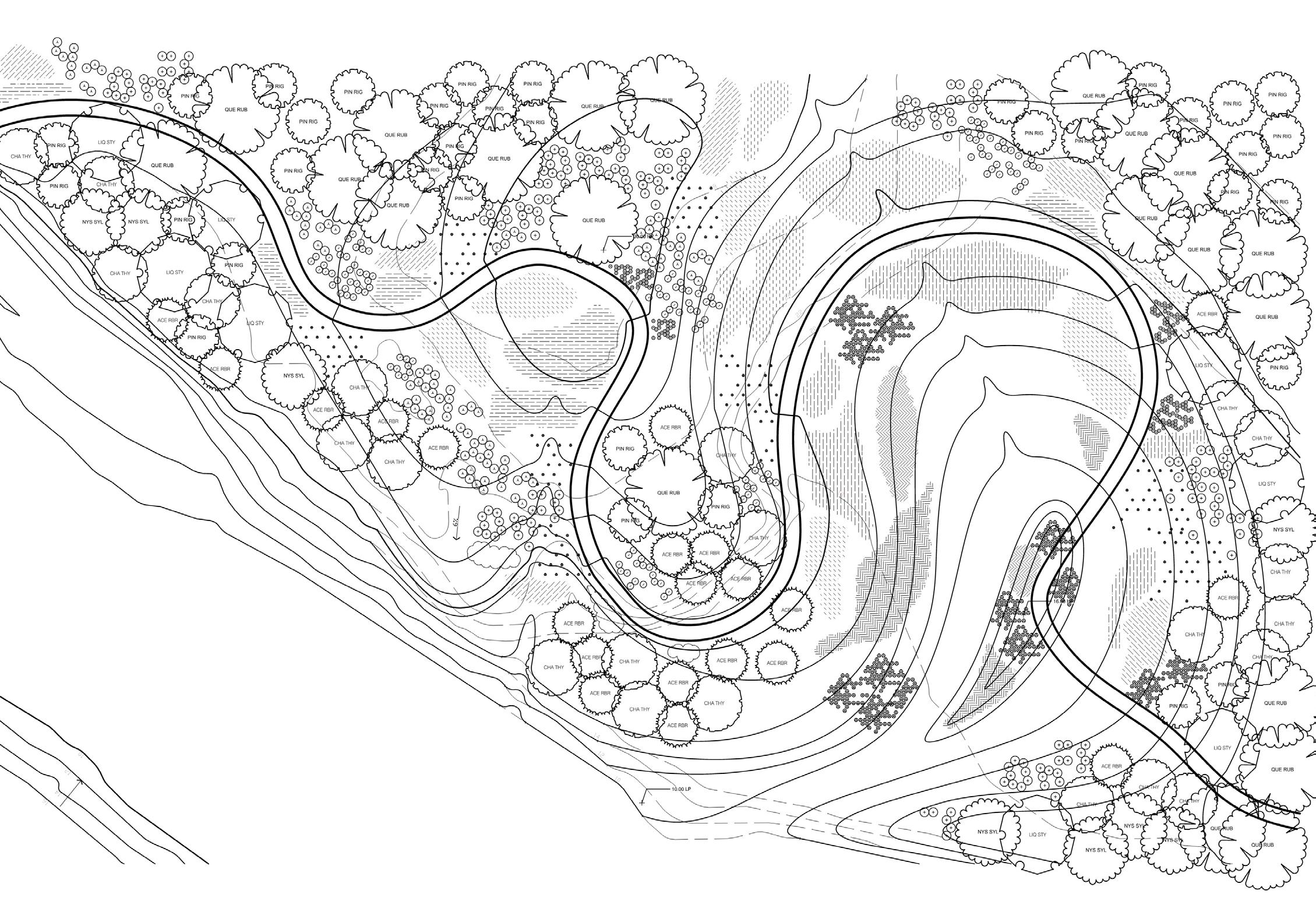
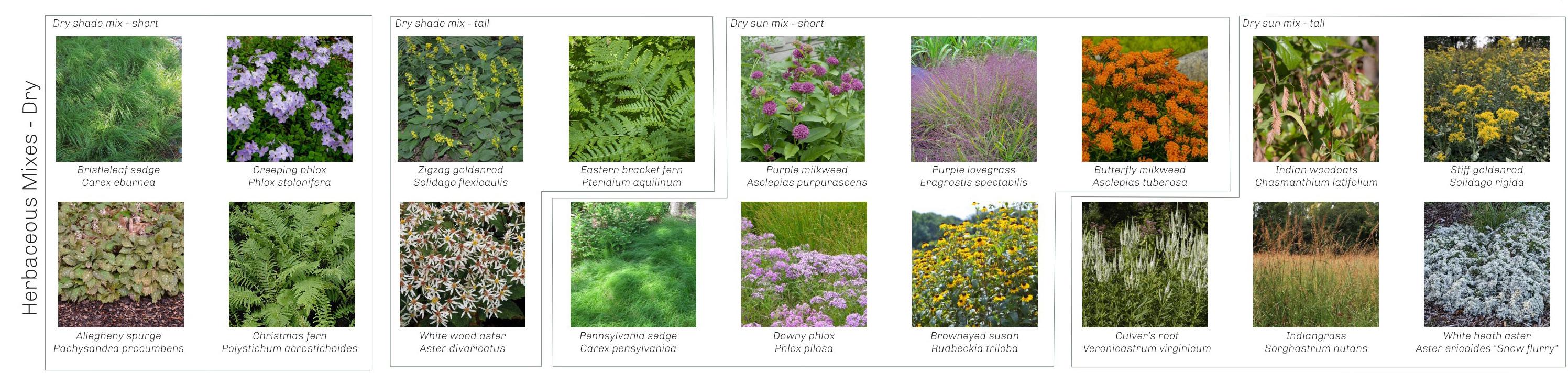
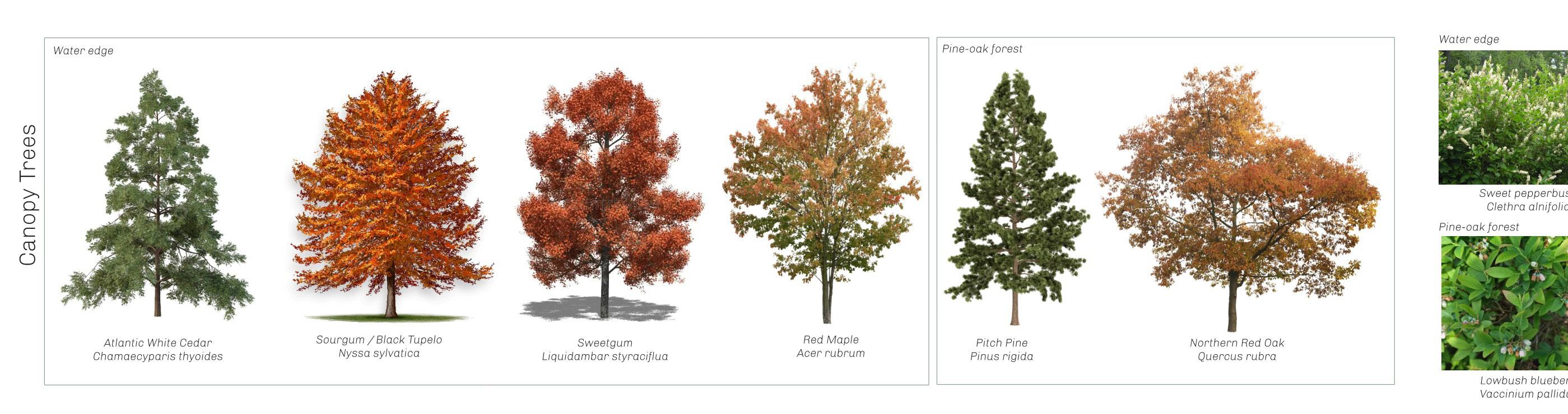
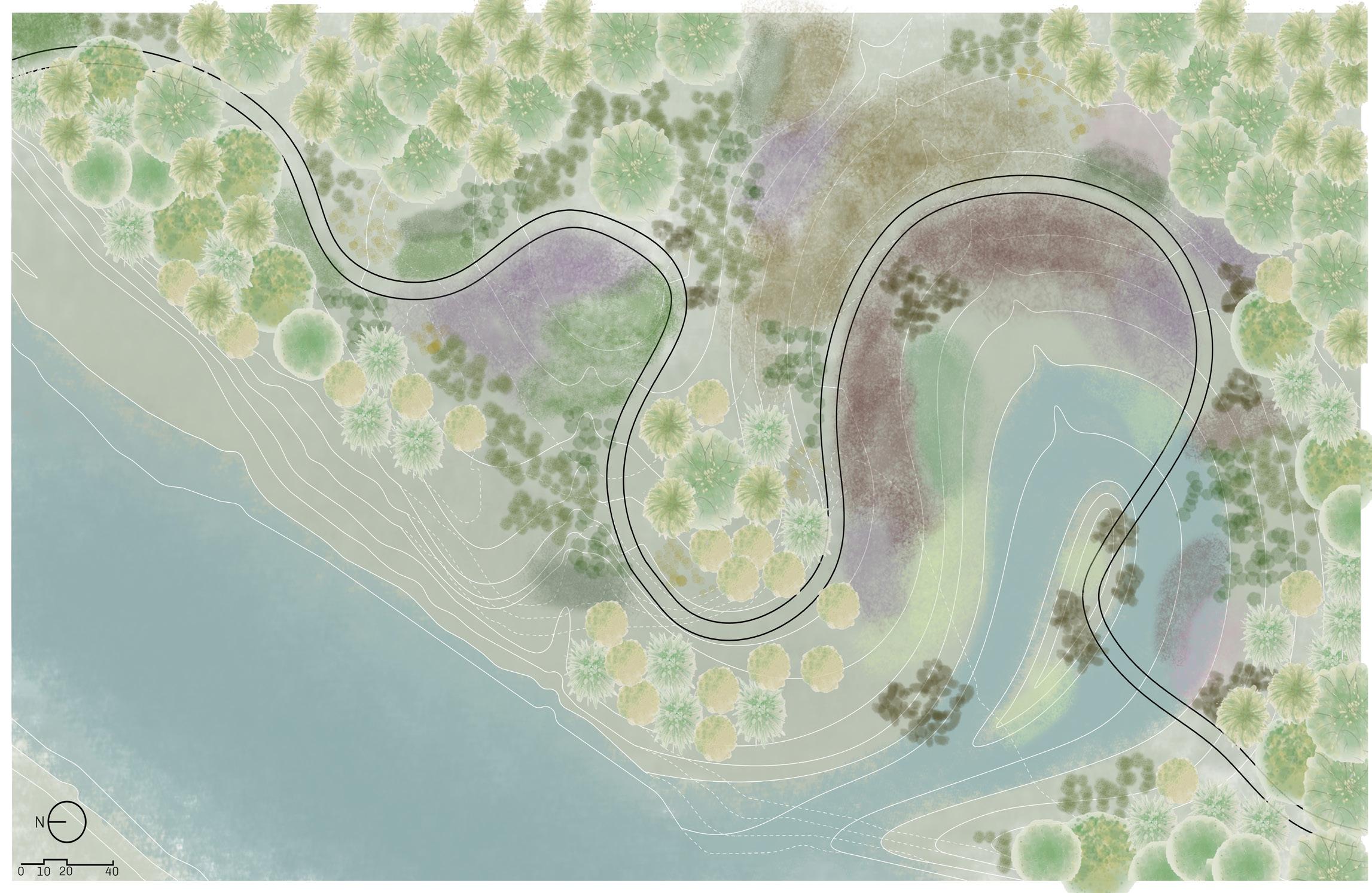
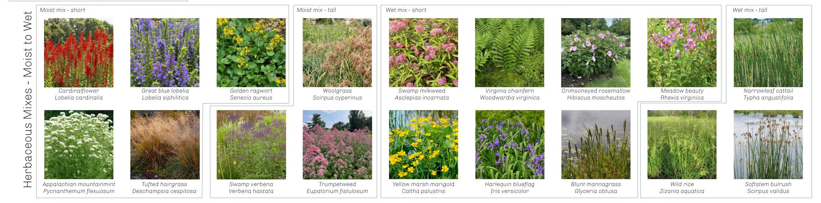
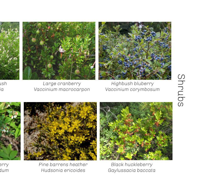
The inspiration behind the planting plan for the site arose from previous field trips taken to the Pine Barrens in New Jersey. Along the Wading River, moments of compression and release, constraint and expanse, were observed while kayakingwe wanted to replicate that experience along our winding paths. The plant selection follows wetland classification codes according to moisture and sunlight exposure, and various plant mixes were developed. The result is a layered landscape full of textural and colorful whimsy.
MEDIA EXPLORATIONS
Digital Techniques
Media II and III, 2025
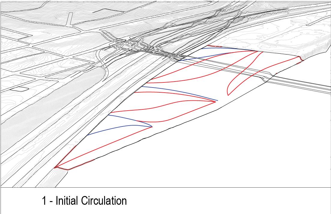
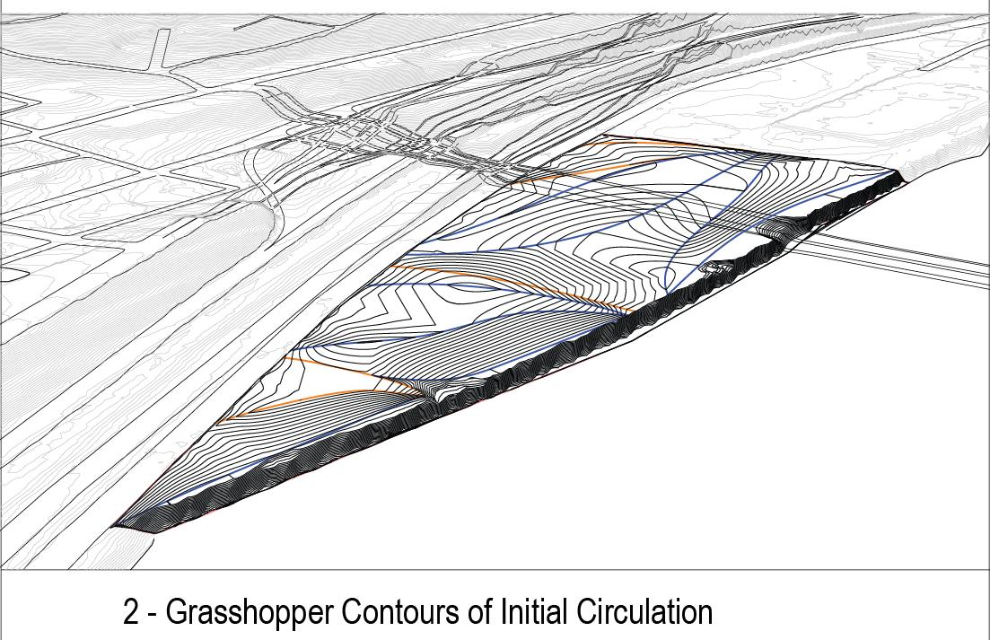
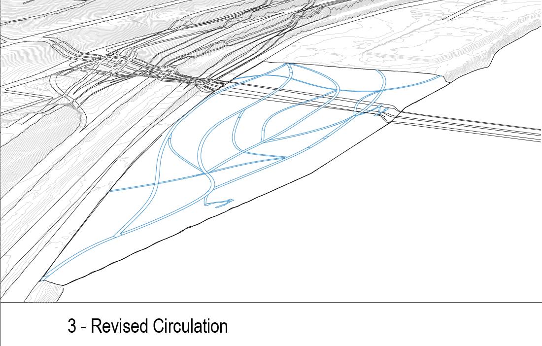
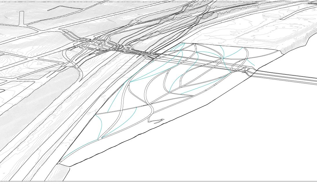
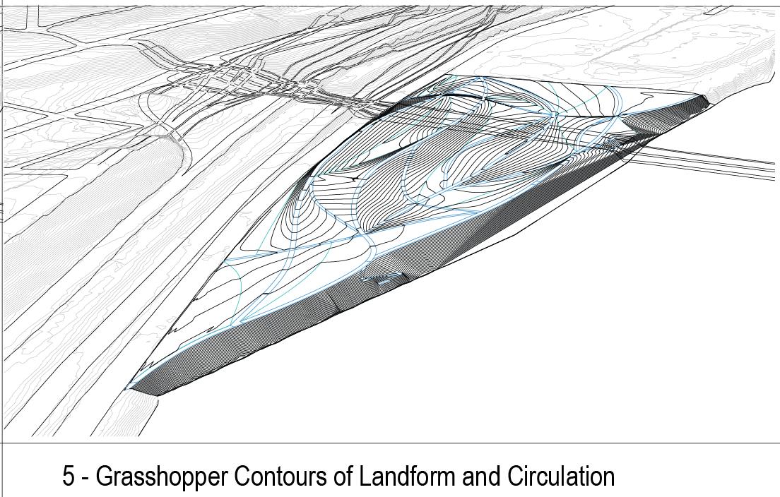
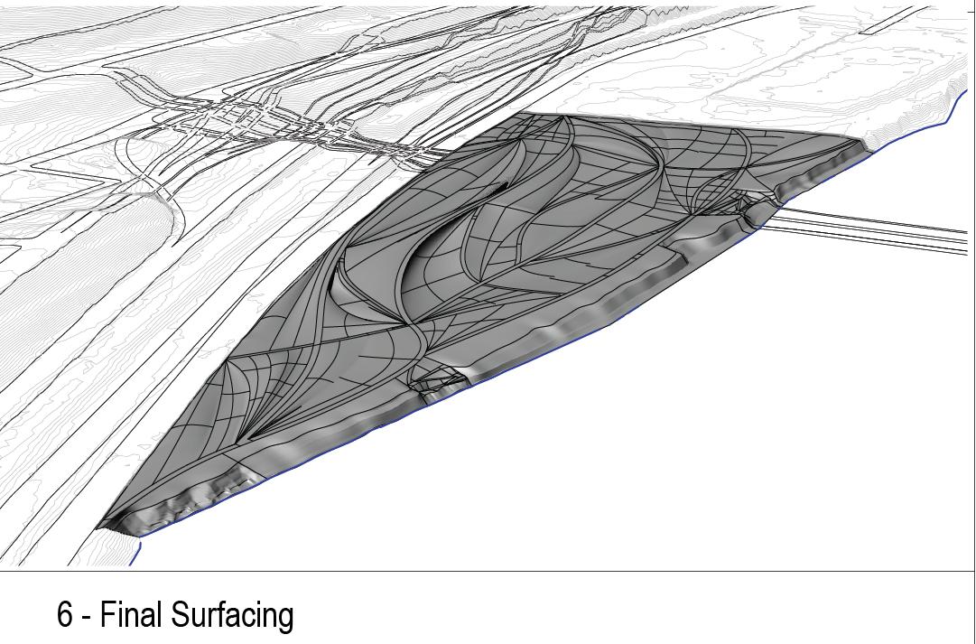
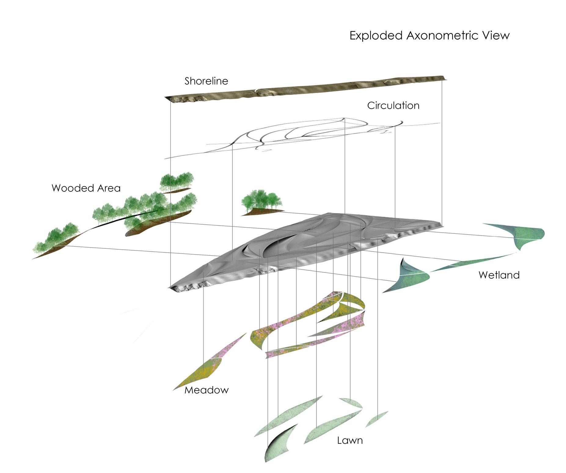
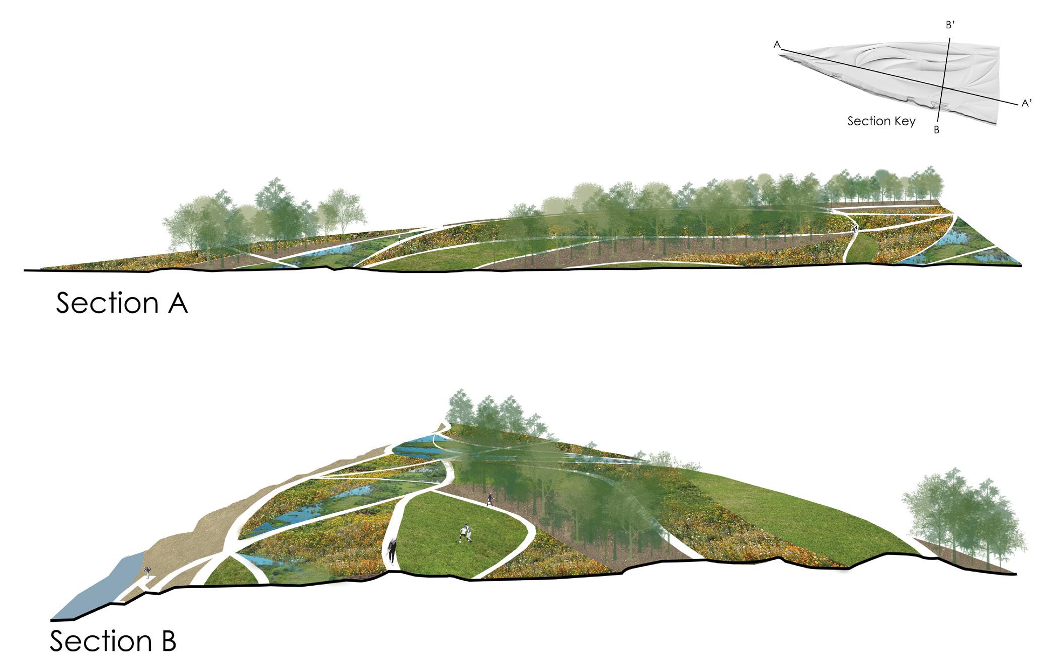
The Media course series at Penn aims to develop our usage of design software, while pushing for beautiful compositions. The selection from Media II moves through a workflow of Grasshopper, Rhino, and Adobe Suite applications. Within a site situated in Pittsburgh, Pennsylvania, a “playscape” was laid out, focusing highly on the form and circulation throughout the space. Using Rhino and Grasshopper, various terrain moves were explored along the ground and eventually modeled into a continuous surface. Atop the playscape, layers of programming were imagined and rendered.
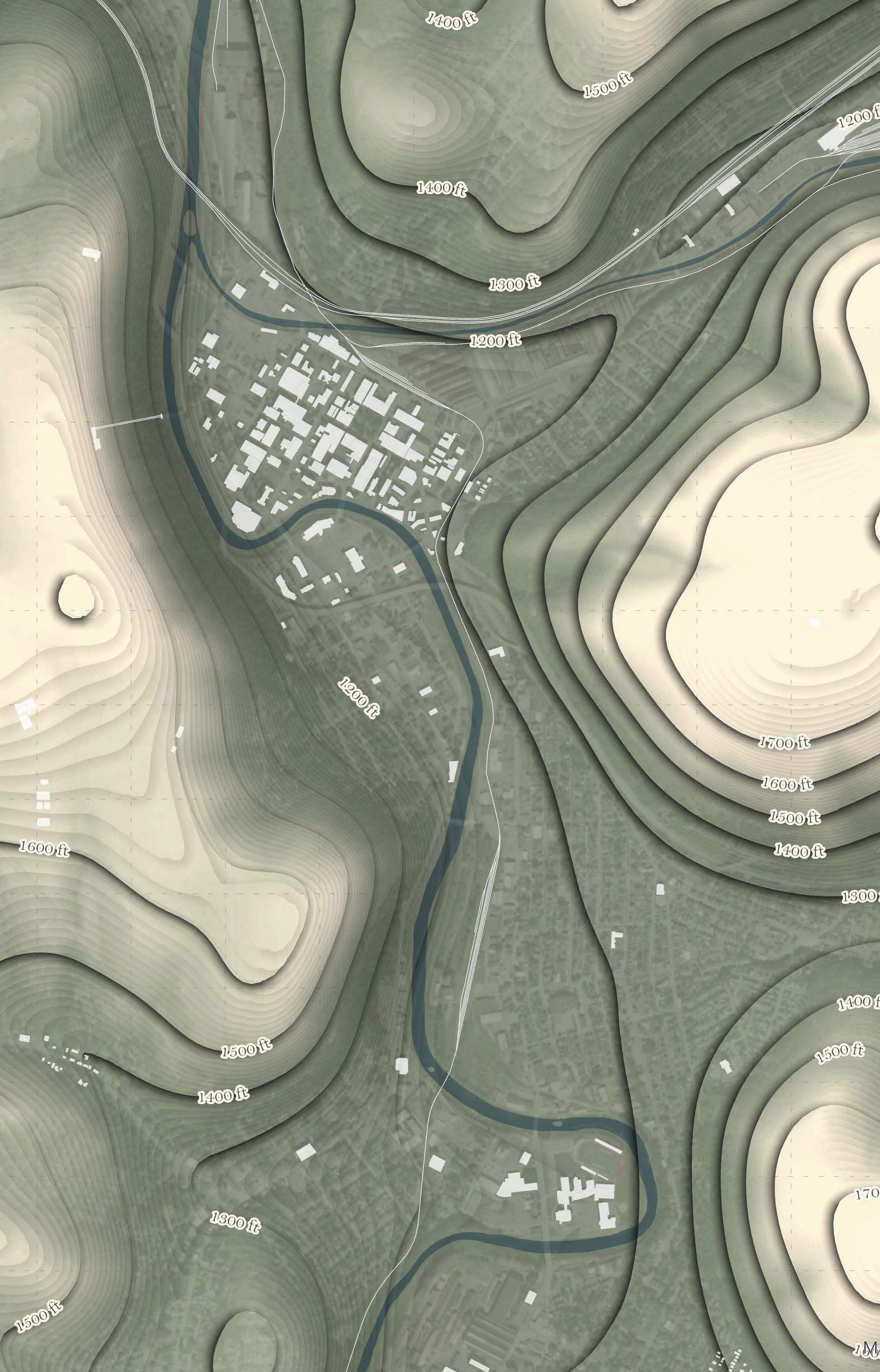
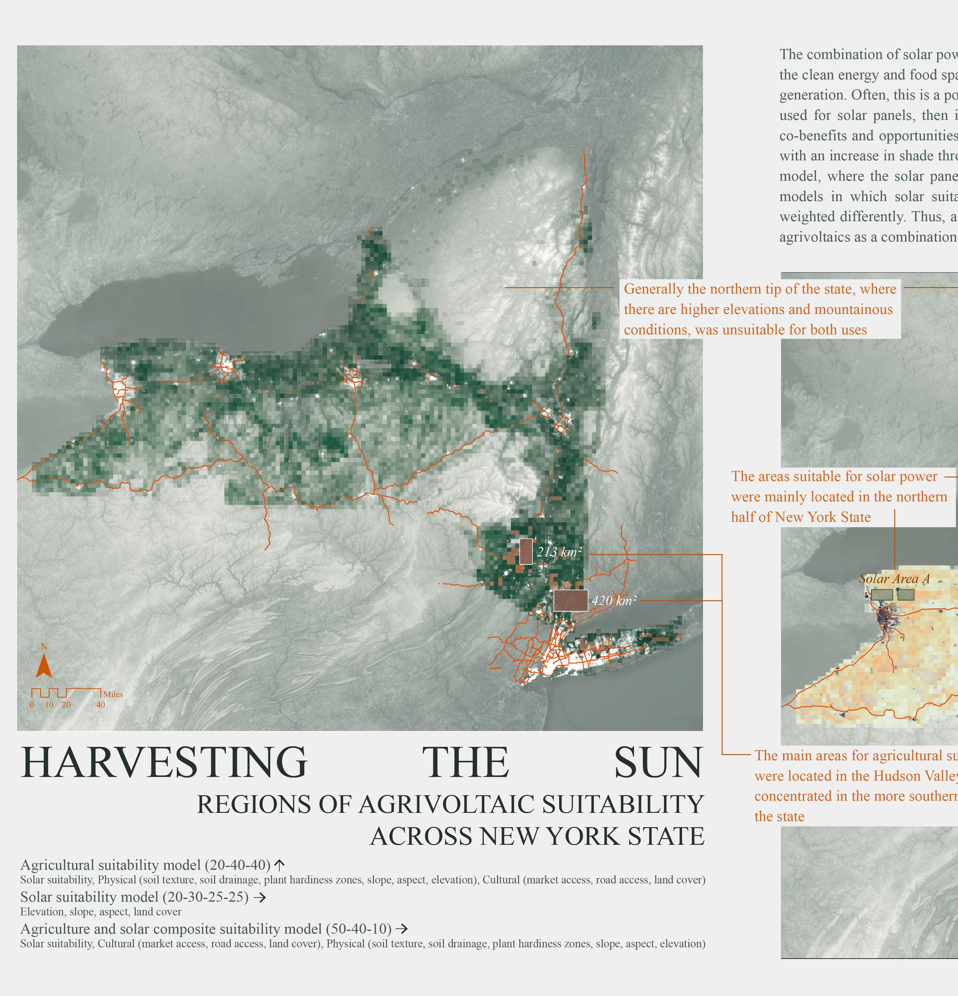
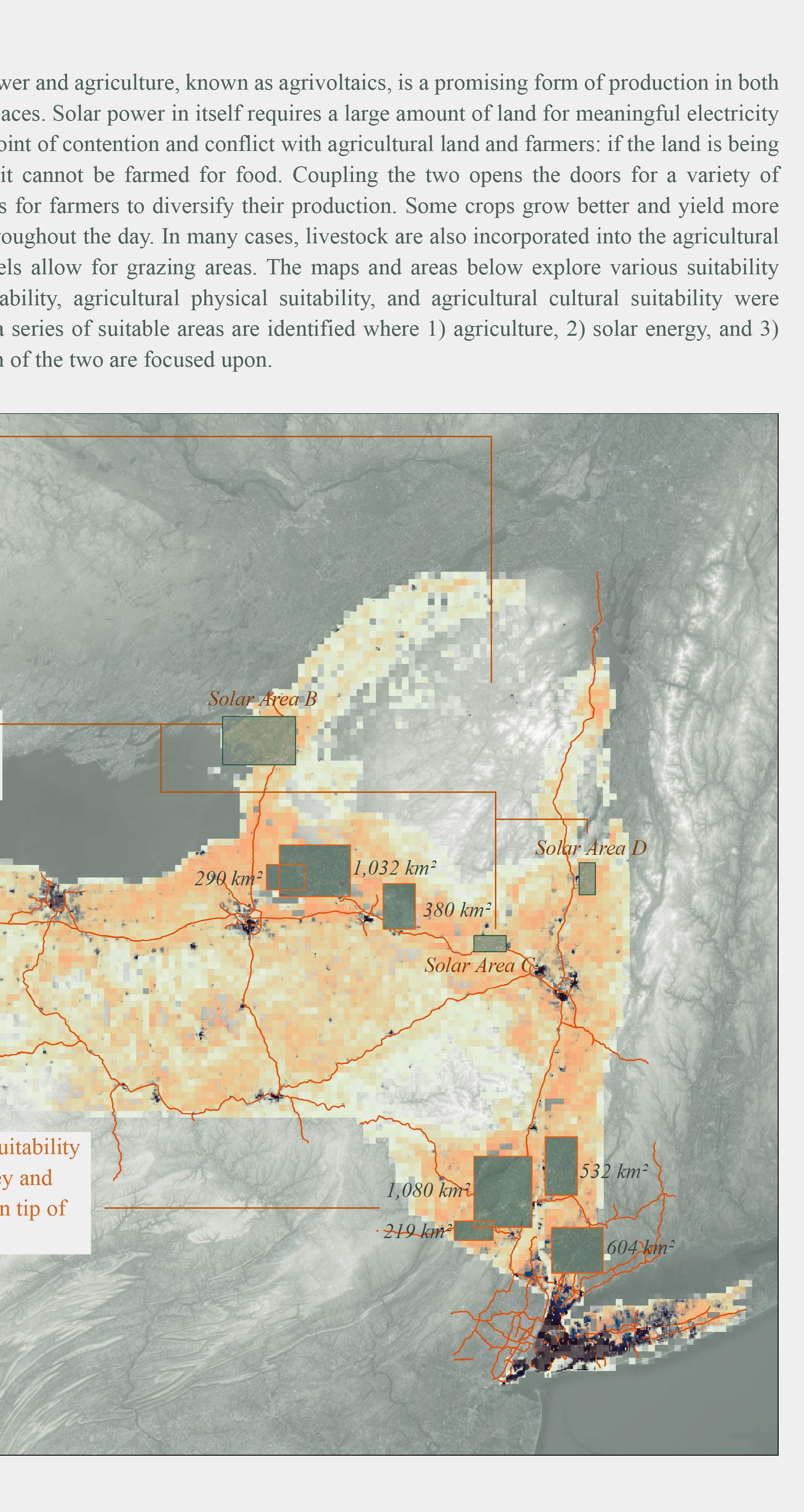
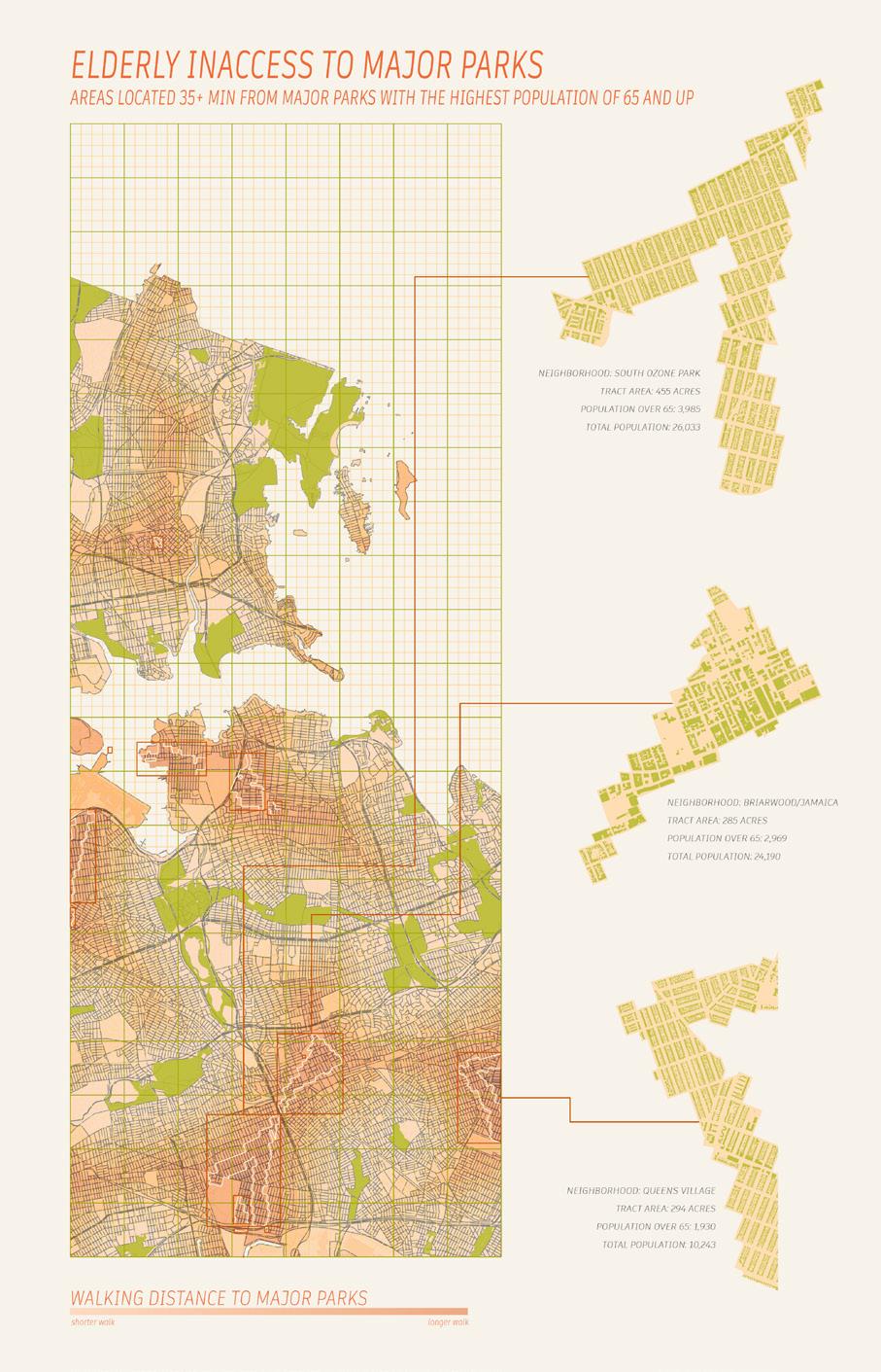
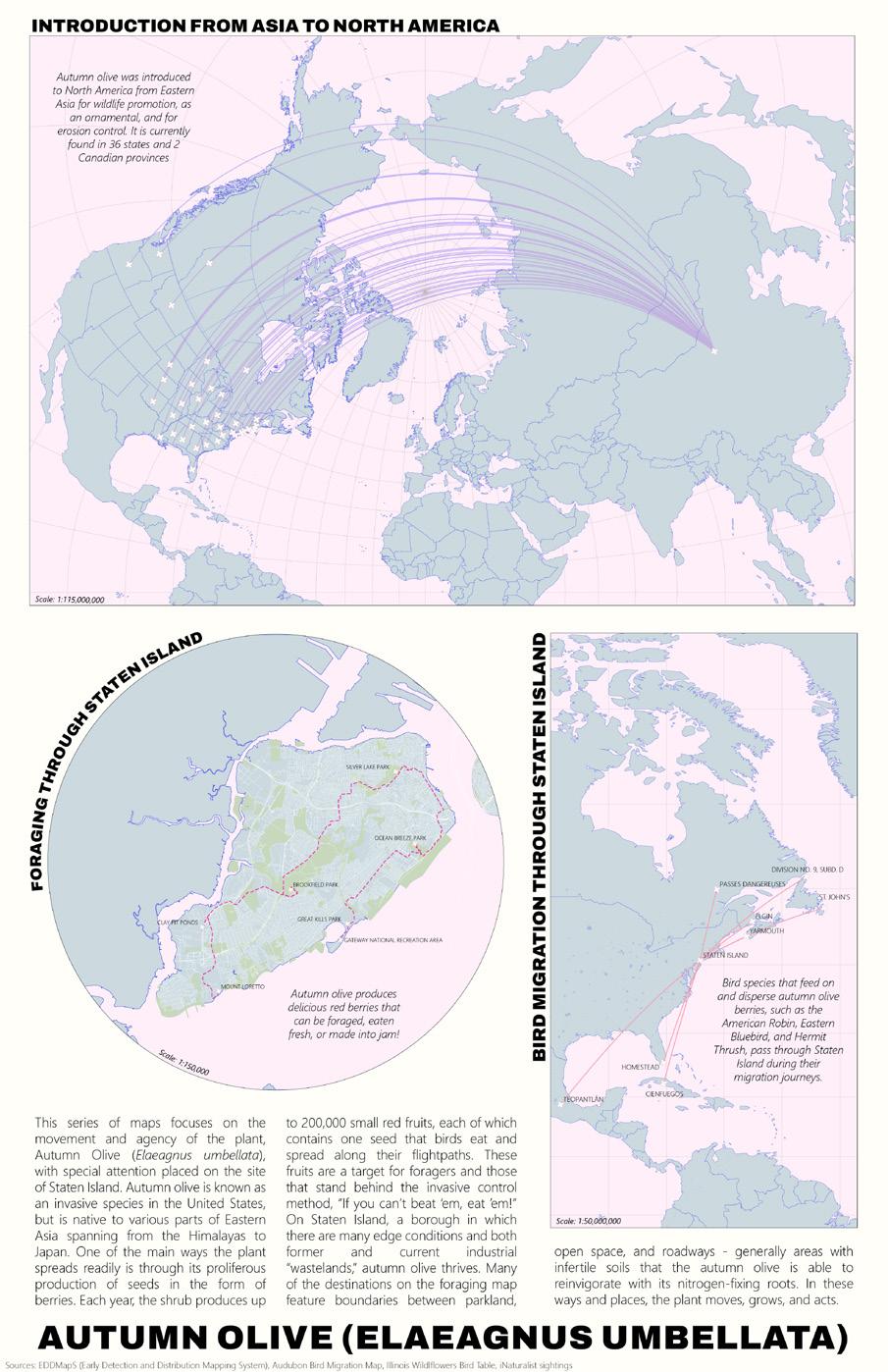
The Media III course explores mapping as an aesthetic. Using GIS, Rhino, and the Adobe Suite, data is analyzed and manipulated, and color, lineweight, and lighting is used to amplify the data being shown. The selection shown here includes projects about population and land access analysis in New York City, invasive species movement across the globe, suitability analyiss modeling for agriculture and solar power, and contour visualization in Johnstown, Pennsylvania (image to the left).
Joyce Gu
Master of Landscape Architecture
Philadelphia, Pennsylvania
joycegu@upenn.edu +1 484-522-0571
jgulandscape.cargo.site
Full portfolio on issuu:
