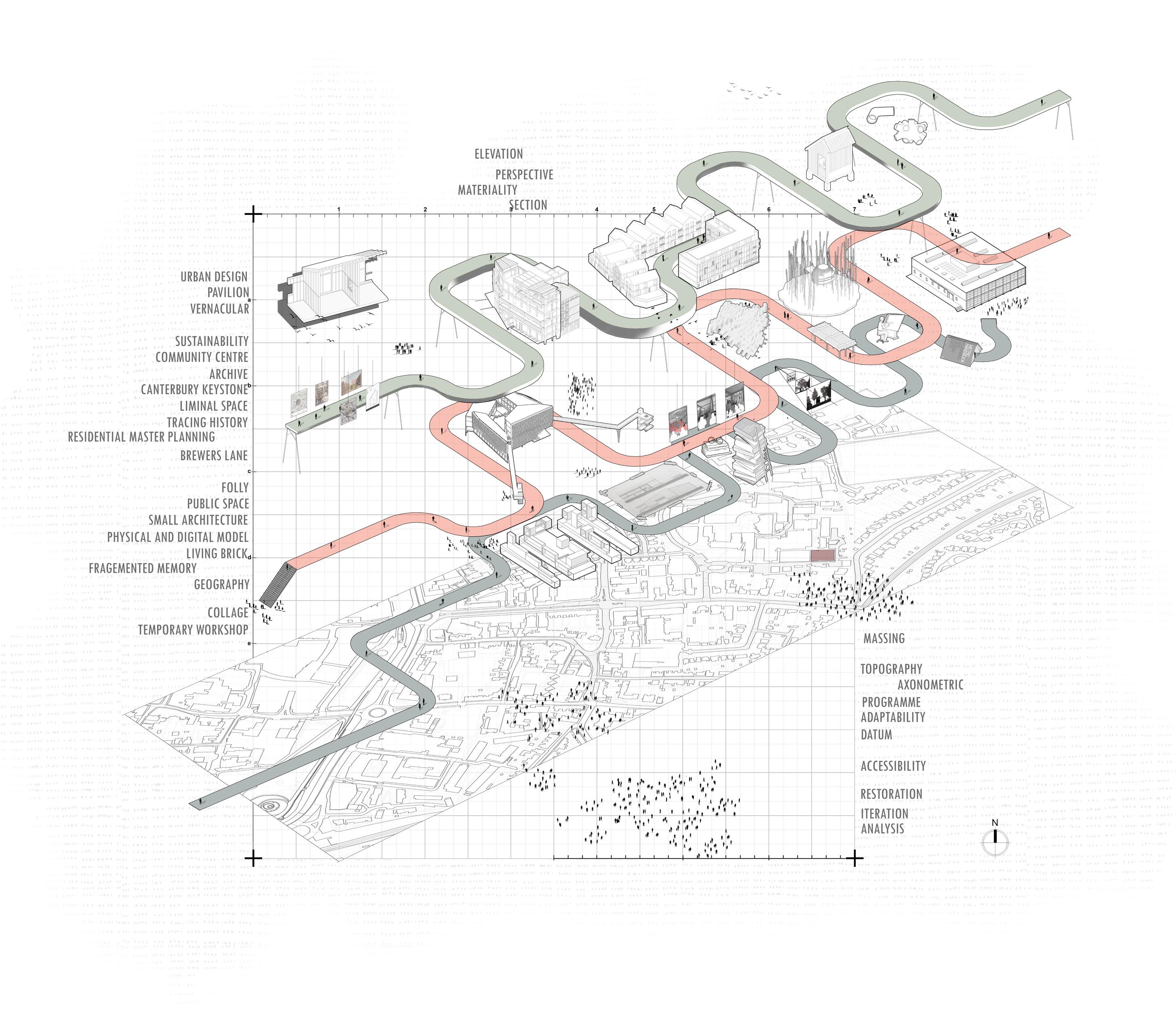
TRACING HISTORY
THIRD YEAR - URBAN DESIGN - FINAL PROJECT
Nominated for Architects Journal 2023 Student Prize Tutor Statement - “Jordan’s project investigated the nuance and complexities in representing history. His site research uncovered former occupations and building forms which were used to form a geography of patterns and excavations. The proposal used these to form fragments of a new building which sits above a sculptural ground floor landscape. The proposal is a fascinating assemblage of site histories in form and material, speculating how a layered approach to referencing site history can develop a new model for Valencia’s future.”
OVERVIEW
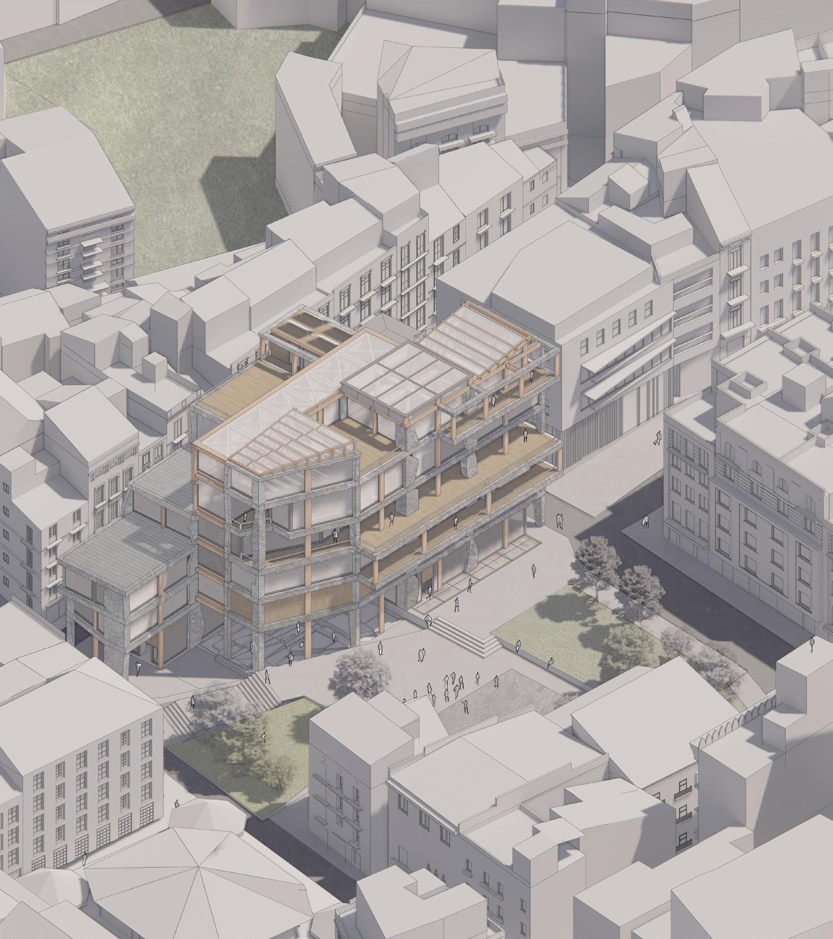
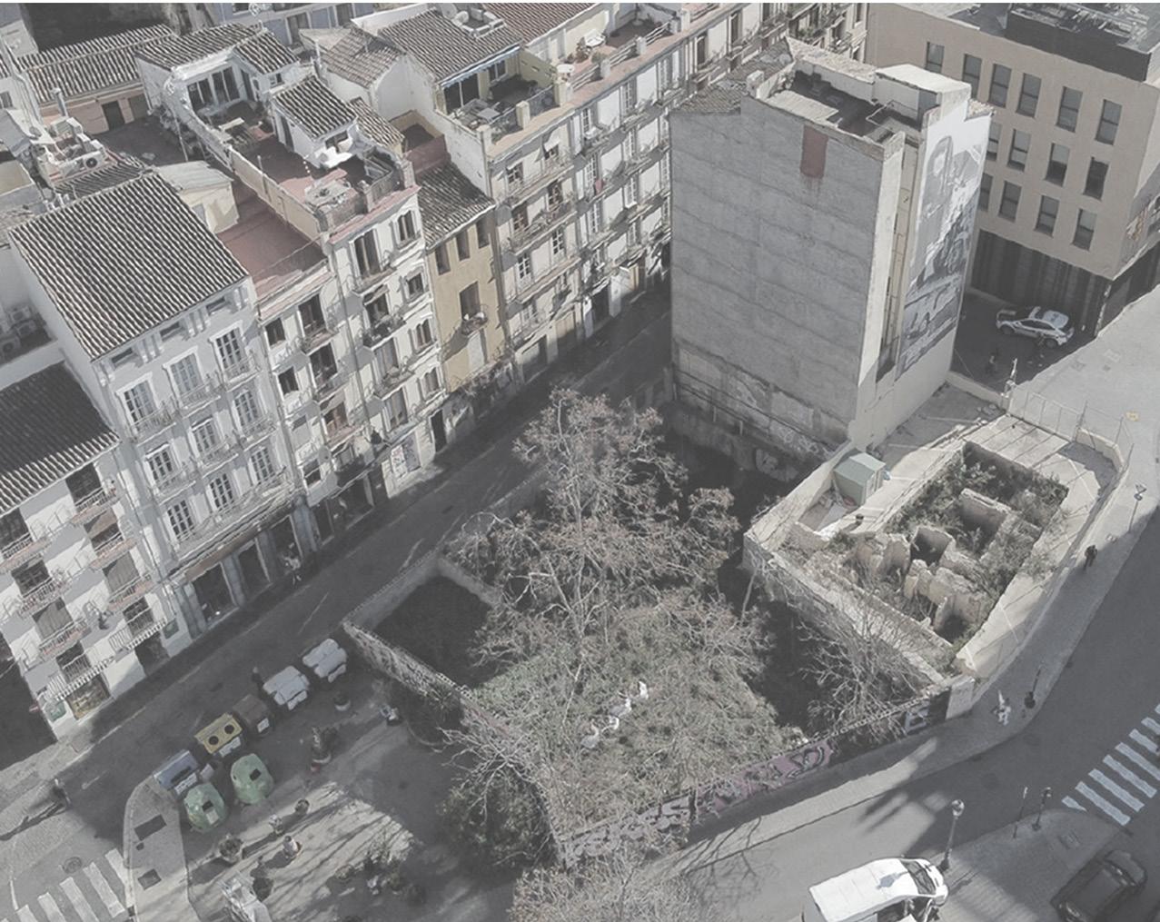
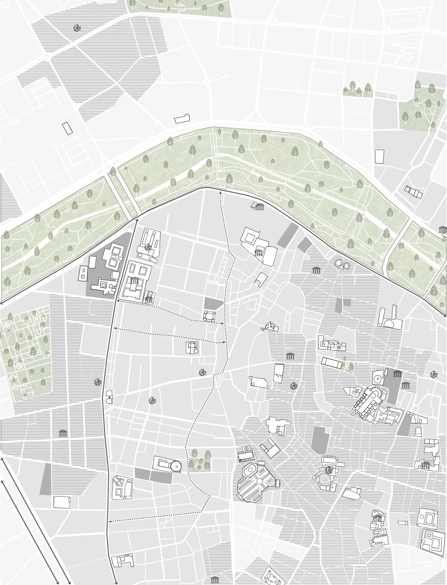
Tracing History is a project which explores issues of cultural heritage, local identity and civic pride. The proposal situated in Valencia’s historic Old Town is designed to act as a temporary exhibition centre for the 20th Triannual International Committee of Museums, hosted this year in Valencia, and following this as a new headquarters for the Department of Conservation and Restoration of Cultural Heritage and Cultural Assets, currently accommodated at the Universitat Politècnica de Valencia. The brief also responds to the UNESCO Forum Declaration of Valencia (1996) which promotes cultural heritage protection, conservation as a clear goal of the preserving the cities’ rich historic identity.
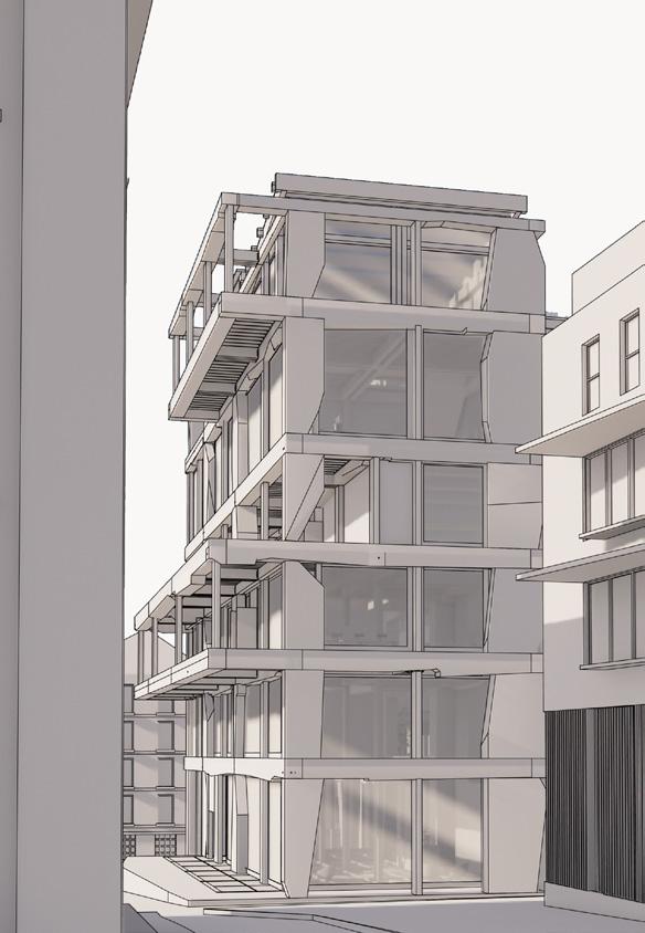
Historical context and heritage influences have been the core idea of the project. The building’s form is derived from the site’s historical massing over the years, with each layer representing a different period. These layers are stacked to create the floor plates, resulting in a structure whereas you move upward you journey through the site’s architectural history.
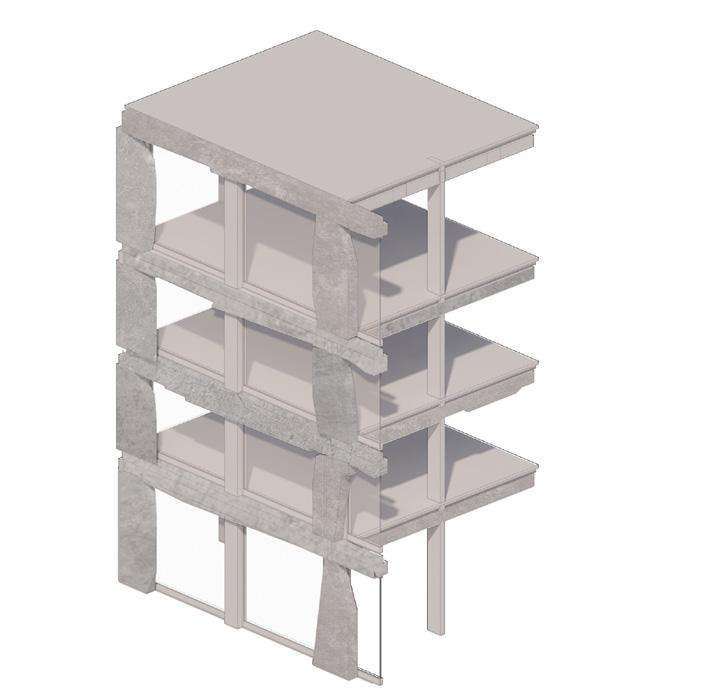
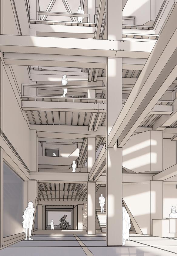
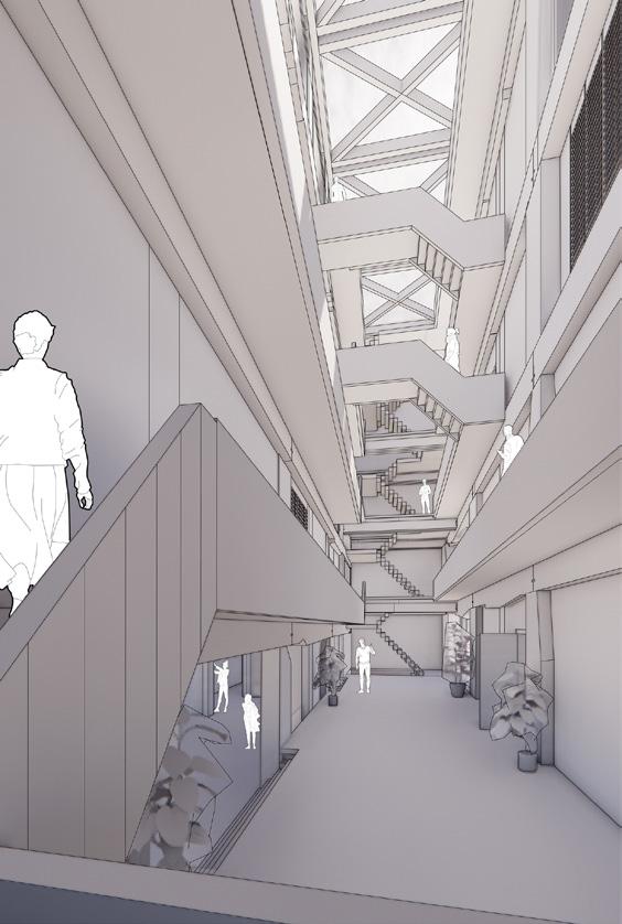
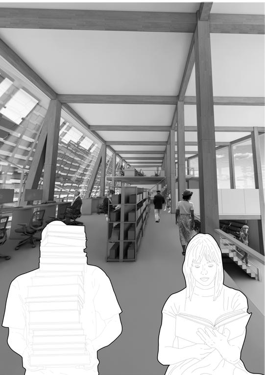
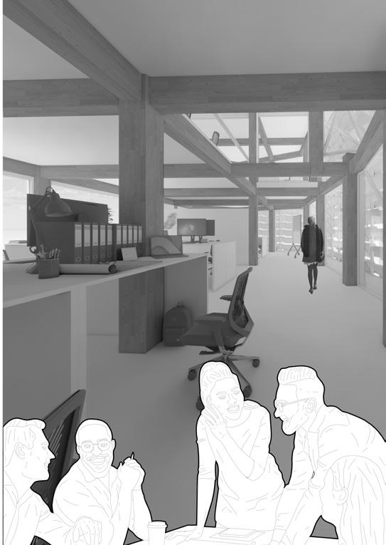
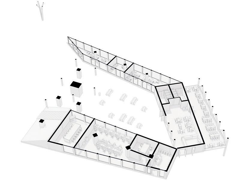
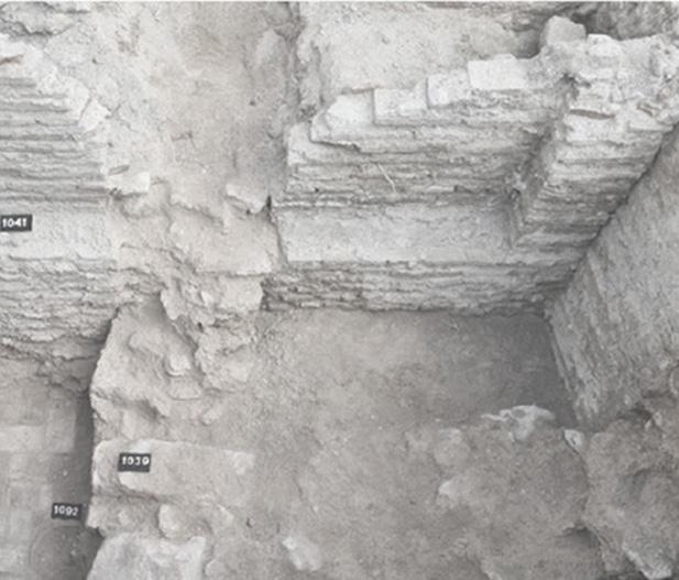
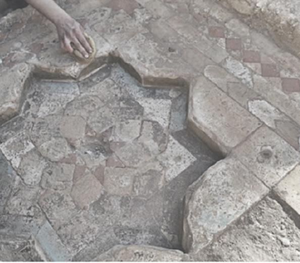
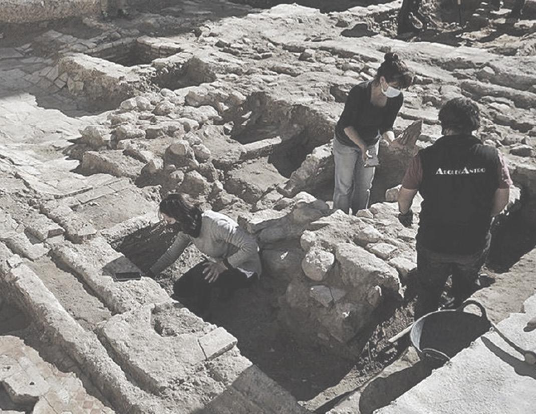
The building offers event spaces, galleries, archives, laboratories, workshops, lecture theatres and teaching spaces with a focus on exploration of new techniques of conservation and restoration. It serves as an educational hub for both students and professionals to restore artefacts and artworks for local museums and galleries within Valencia and beyond. In addition, the ground floor entrance celebrates the existing archaeological excavation on the site which uncovered the remains of a 13th century Moorish family house with display glass flooring. The plan combines flexible, temporary and permanent programmes around a central fixed circulation core to balance public integration and private services housed within the building. The building uses locally sourced limestone as its principal structure with a secondary support and infill of Glulam timber.


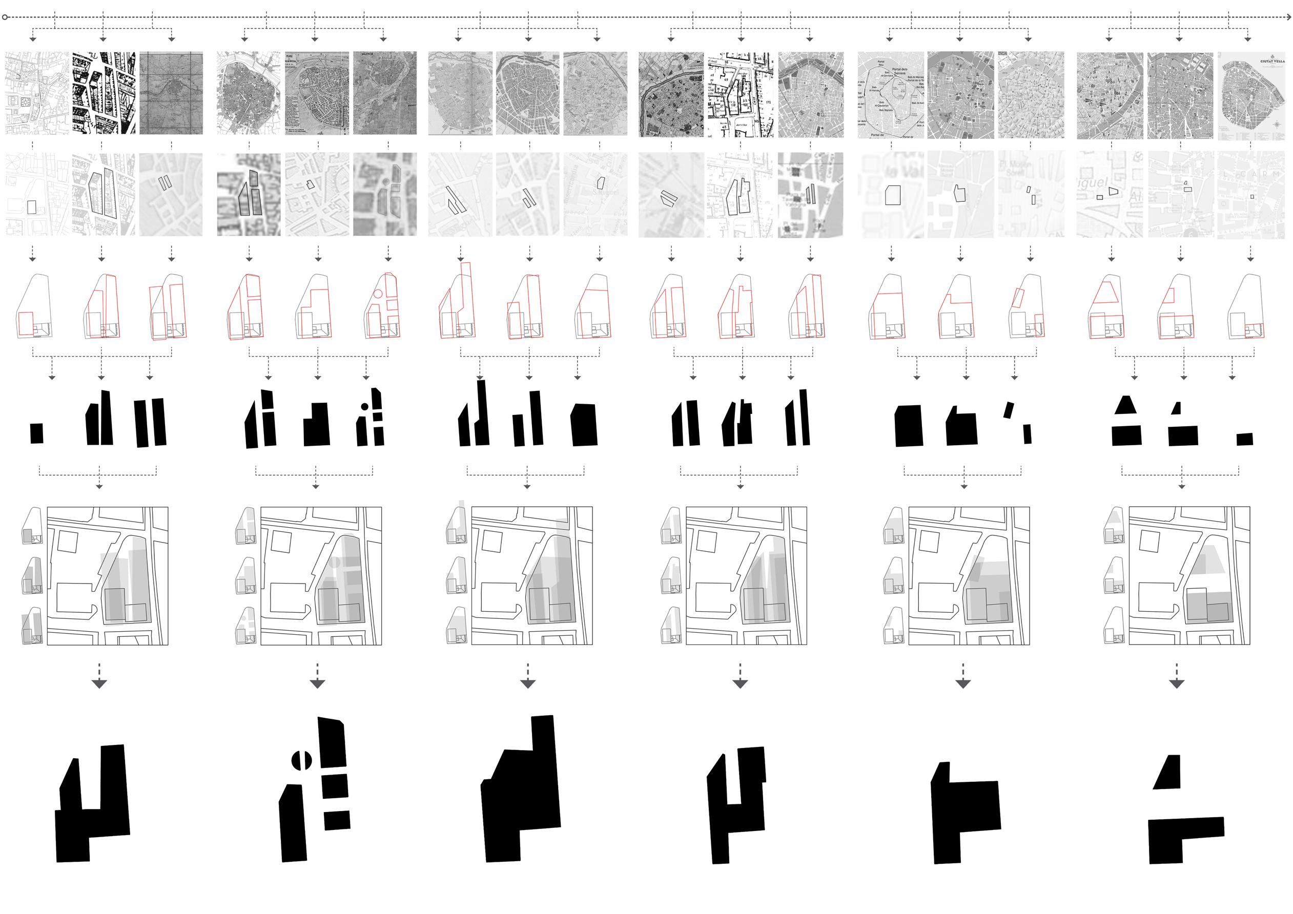
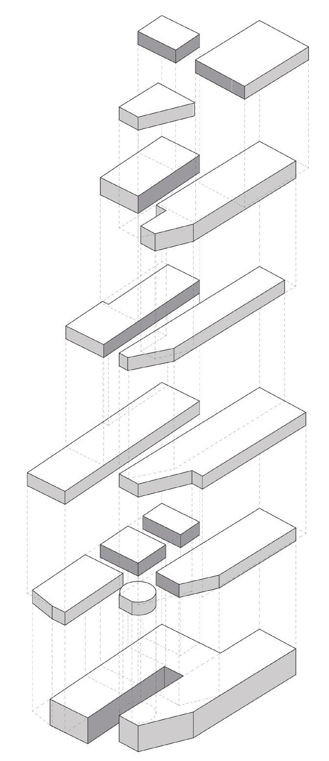
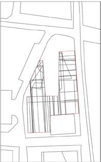
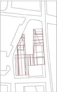
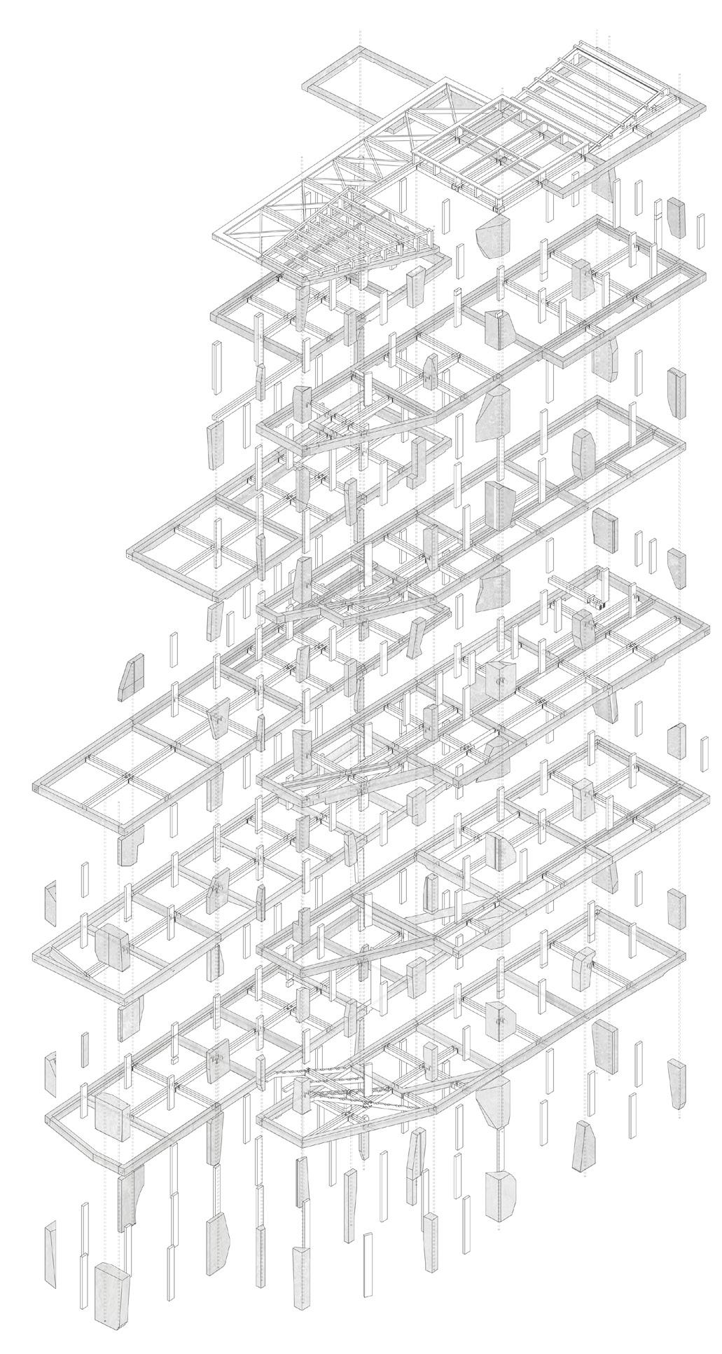
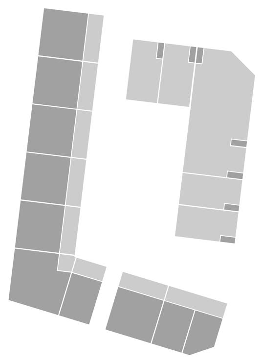
Massing Development Translated Into Floor Massing’s. Eighteen site changes were mapped and grouped into three chronological sets, producing six floor plans from past to present. By overlaying these groupings the common spaces were revealed and extruded into six floor massings stacked in order from oldest to newest massings.
Building Massing Form - Each floor is layered to reflect a phase in the site’s evolution. As users move upward through the building, they experience the chronological development and transformation of the site massing over time.
Final
01. Ground Floor Massing
First Floor Massing
Second Floor Massing
Third Floor Massing
Fourth Floor Massing
Fifth Floor Massing
Historic
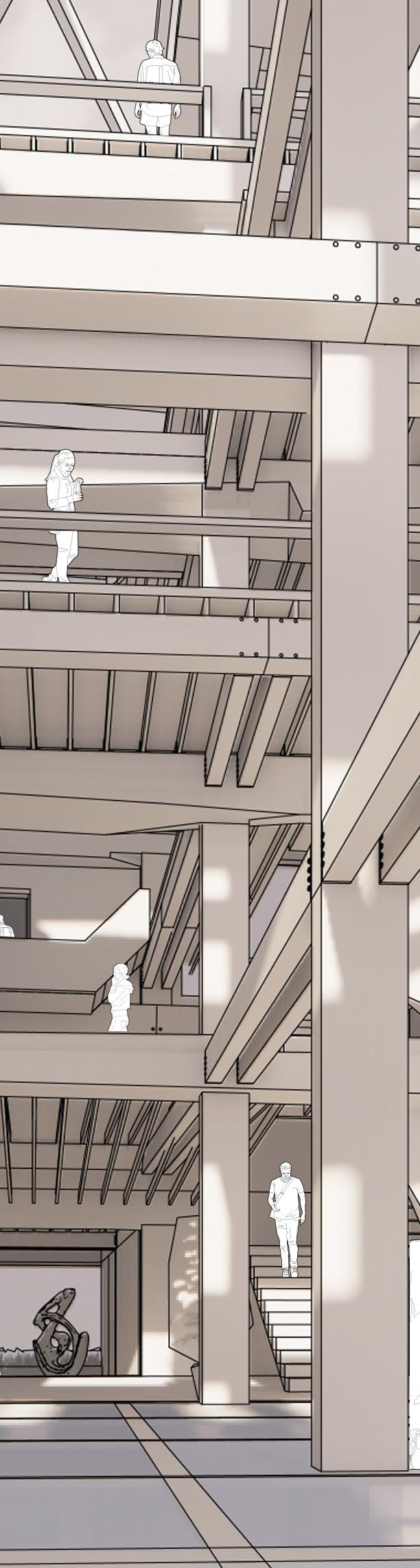
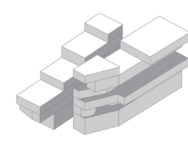
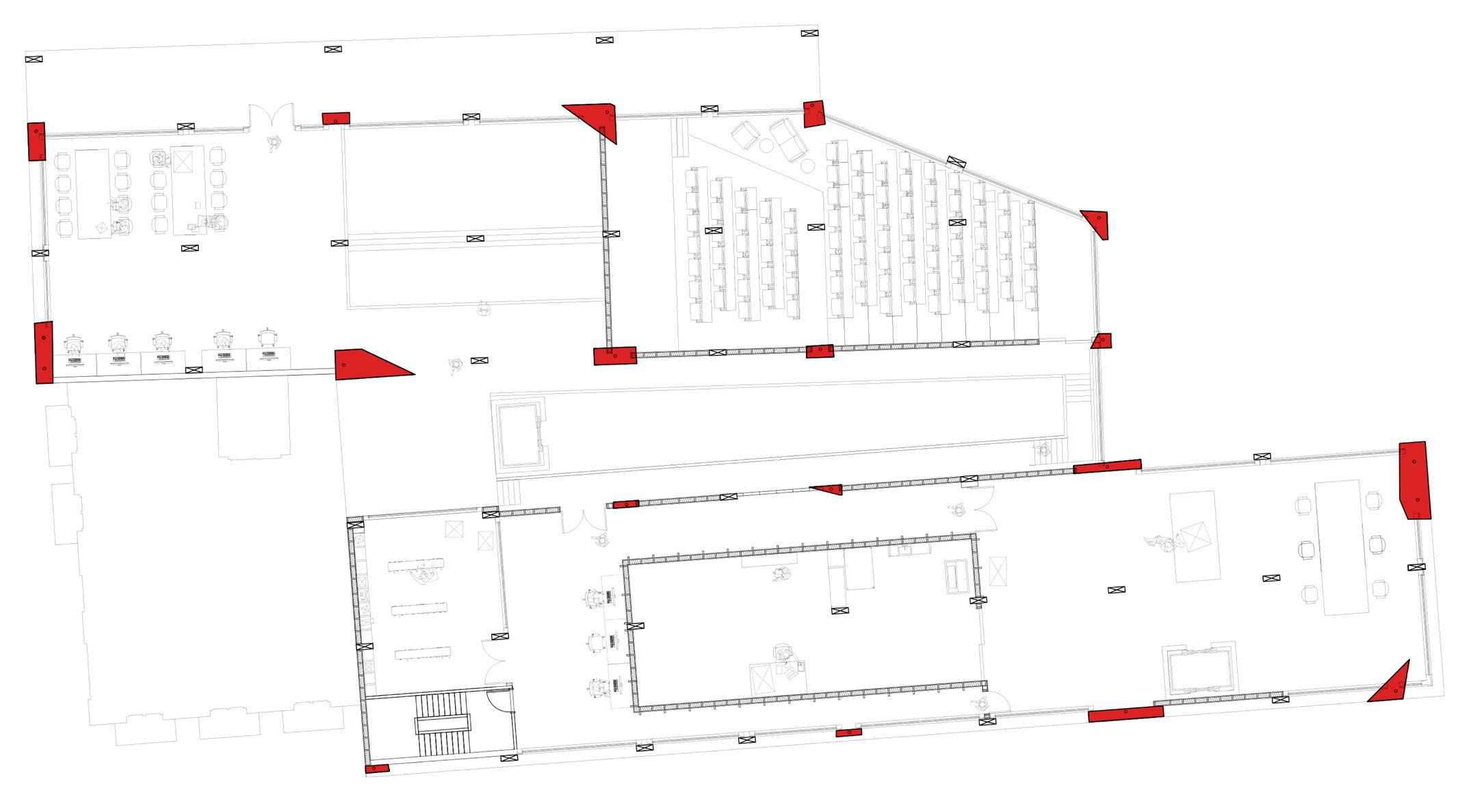
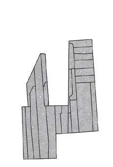
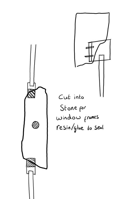
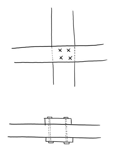
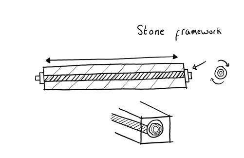
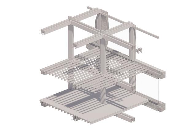
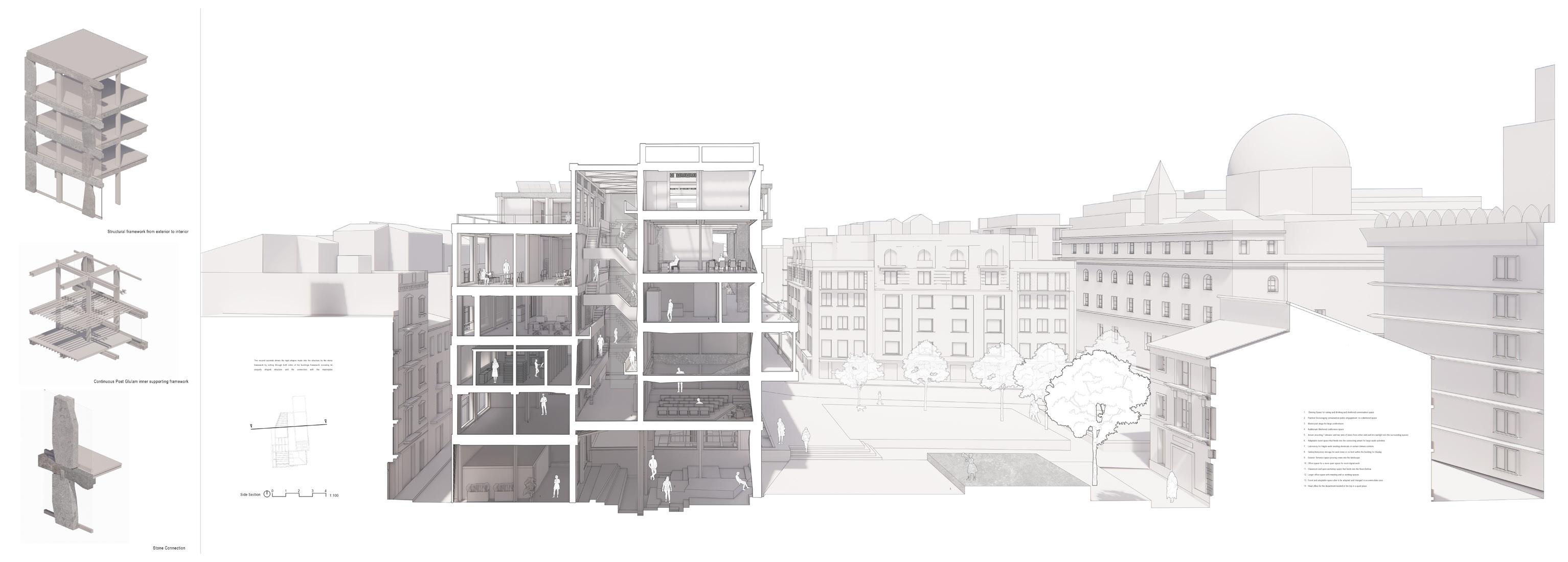
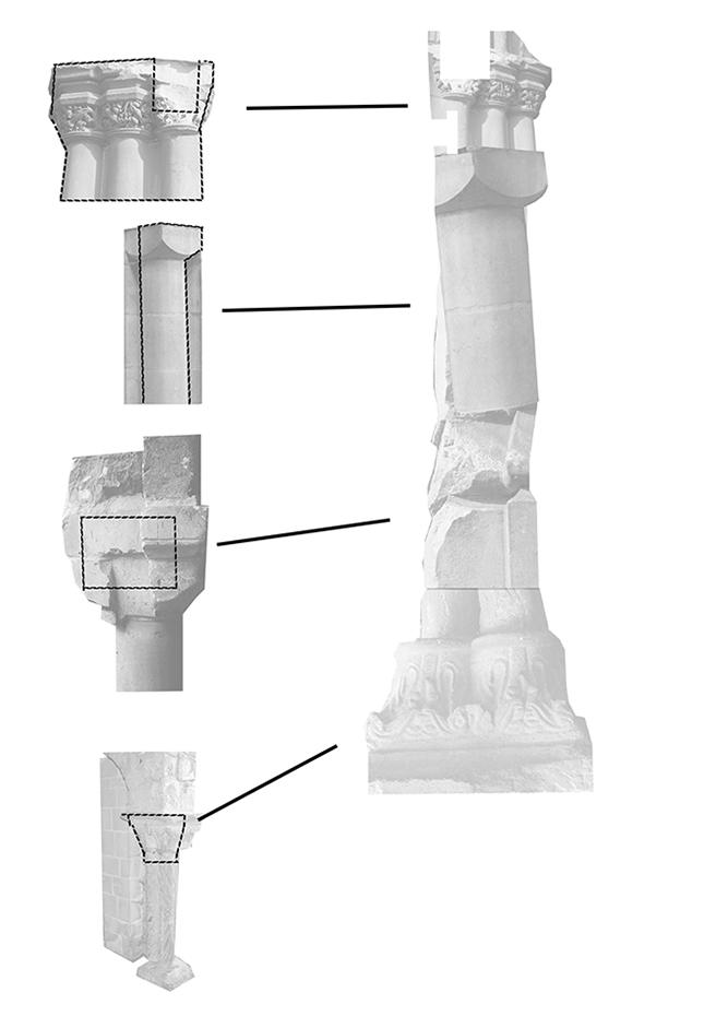
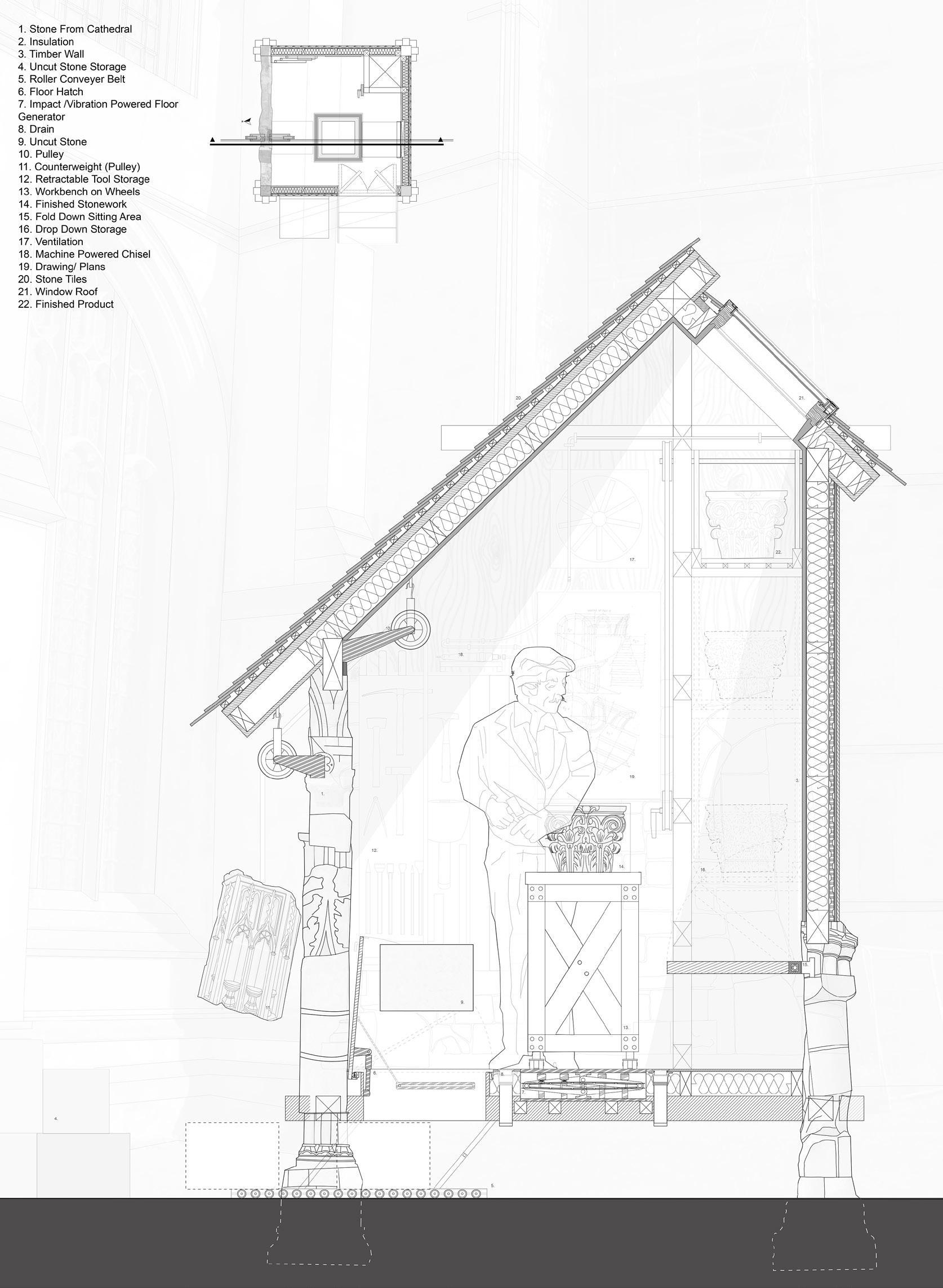
STONE STRUCTURAL FRAMEWORK DEVELOPMENT
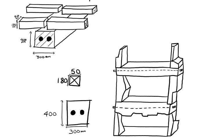
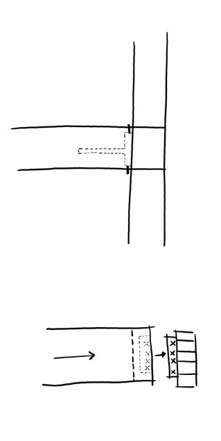
The stone structure is composed of 18 vertical columns which run through the building. This runs in combination with the floor framework which outlines each floors massing hinting to the sites massing floorplates as discussed on the previous page.
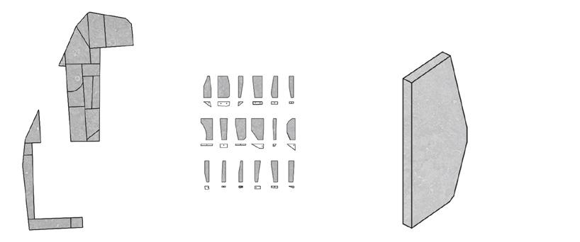
Vertical Stone Columns Process
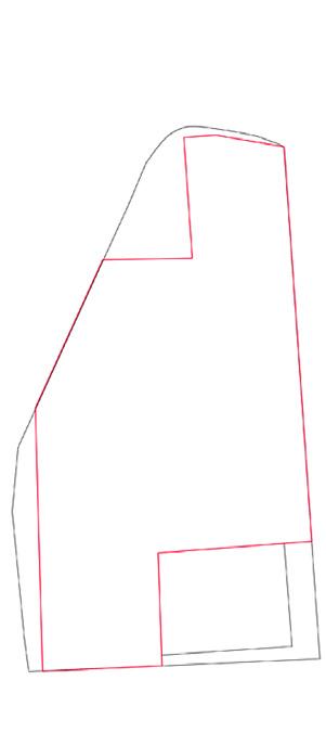
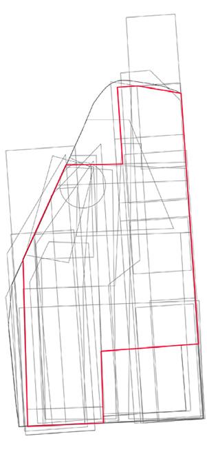
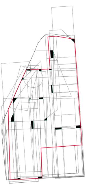
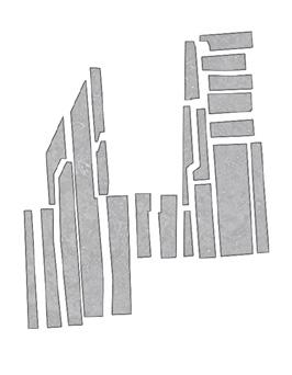
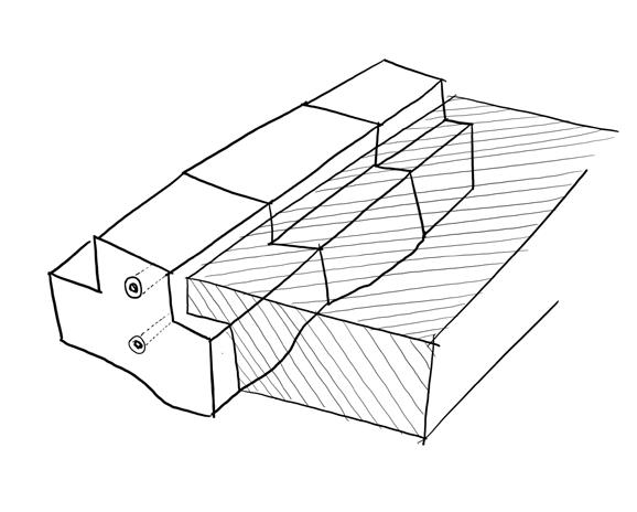
The plan for the 18 columns was developed by overlaying all the site’s historic massings onto the current floor plan. From this overlay, 18 distinct shapes were extracted. These shapes form the uniformed column plans for all floors, as seen below By removing the area of the current floor plate from the overlay, the remaining portions of the historic outlines were divided into 18 forms. Each form became the elevation/vertical form for a column, maintaining its plan shape across floors but varying in elevation according to the remaining historic outlines left in each floor plans overlay.
Stone Floor Framework Process
The floor framework was developed in a similar manner. The site’s historic outlines were overlaid once again; however, only the areas covered by the current floor plate were used. From these intersecting regions, the resulting shapes were extracted to generate the framework of each floor, shaped to each floors massing, as seen in the bottom right of the page this process.
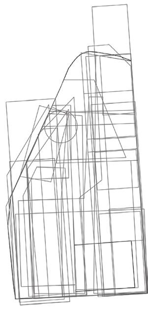
All 18 historic site massing outlines overlaid together
Largest floor plan massing outline
Overlaying both layers together
Extracting 18 shapes from the combined plan
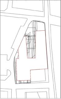
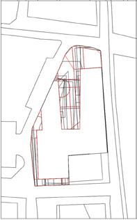
Third Floor plan with the 18 stone columns highlighted in red
Third floor structural framework: stone floor and column construction process
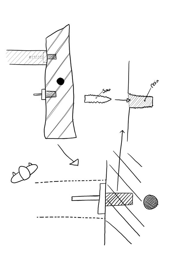
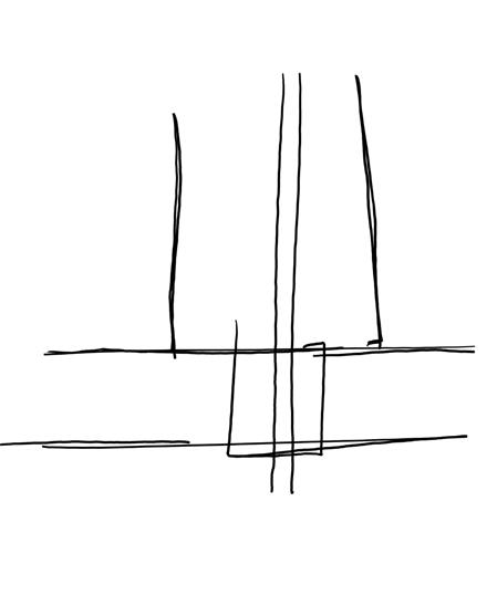
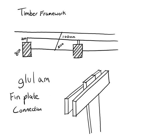
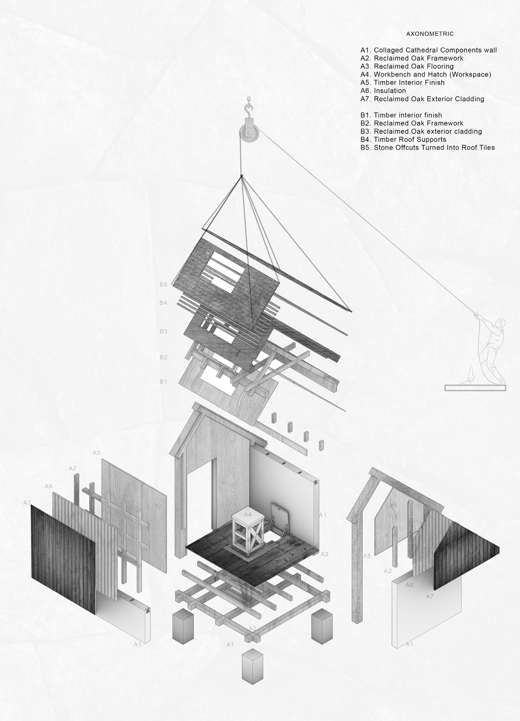
INITIAL STRUCTURAL DEVELOPMENT SKETCHES
The following sketches illustrate the progression from massing form making towards the practical build up, capturing the raw, iterative thinking that shaped the final proposal Working from the site overlays and early spatial studies, I began to sketch how the stone and timber framework might emerge from the geometry of the plan, testing different approaches to the column and floor connections.
Throughout this stage, I worked closely with a structural engineer and specialist who has worked on similar projects to understand how each element could be constructed and joined, developing a series of quick sketches to explore alternative solutions. These studies focused on refining the junctions, understanding load paths/bearings, and testing how to maintain continuity within the framework while preventing cold bridging and maintaining a constant sealed envelope using the stone frame.
Each sketch represents a step in this process from the early conceptual diagrams mapping out the column grid and floor build ups, to more detailed connection drawings examining the stone to timber connections.
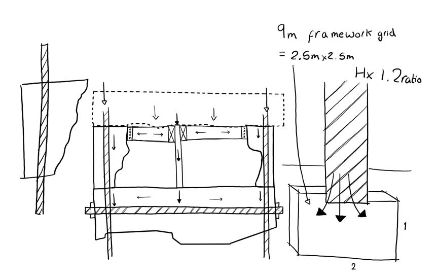
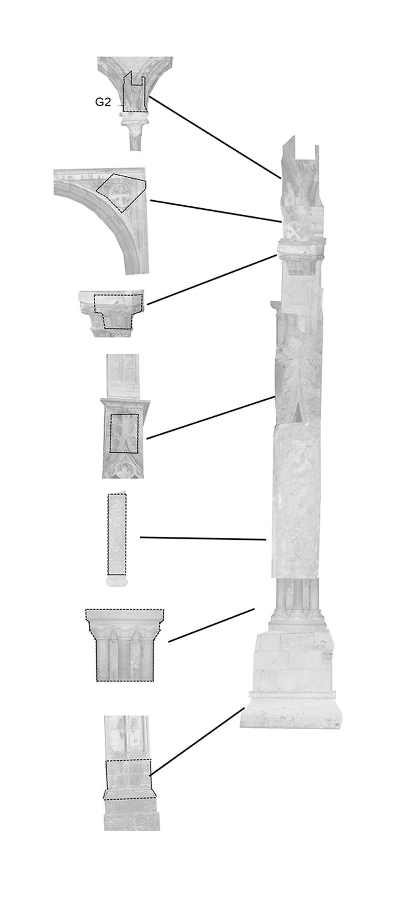
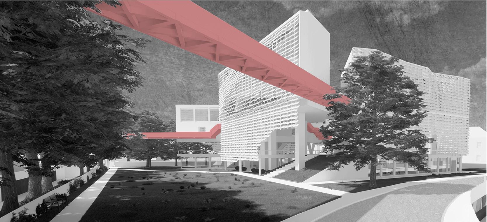
STRUCTURAL FRAMEWORK AND SITE AERIAL VIEW
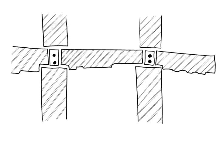
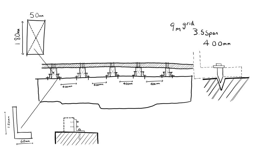
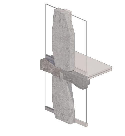
The above extracts highlight the stone envelope’s connection to the supporting glulam frame, the CLT flooring and window frames connection to the stone columns, ensuring continuous insulation and preventing thermal cold bridging at junctions.
The final structural framework combines stone columns with inner metal supports along side a continuous glulam post inner frame. Collaborating with a structural engineer and specialist, to evenly distributes loads to the foundation.
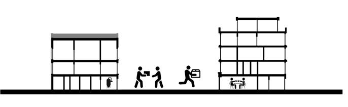
The above shows the proposal within its context highlighting how it sits comfortably within the urban fabric. You can see the adjacent plaza space and how the building is positioned to gently rise above the streetscape level without appearing overbearing.
Continuous post glulam inner secondary supporting framework
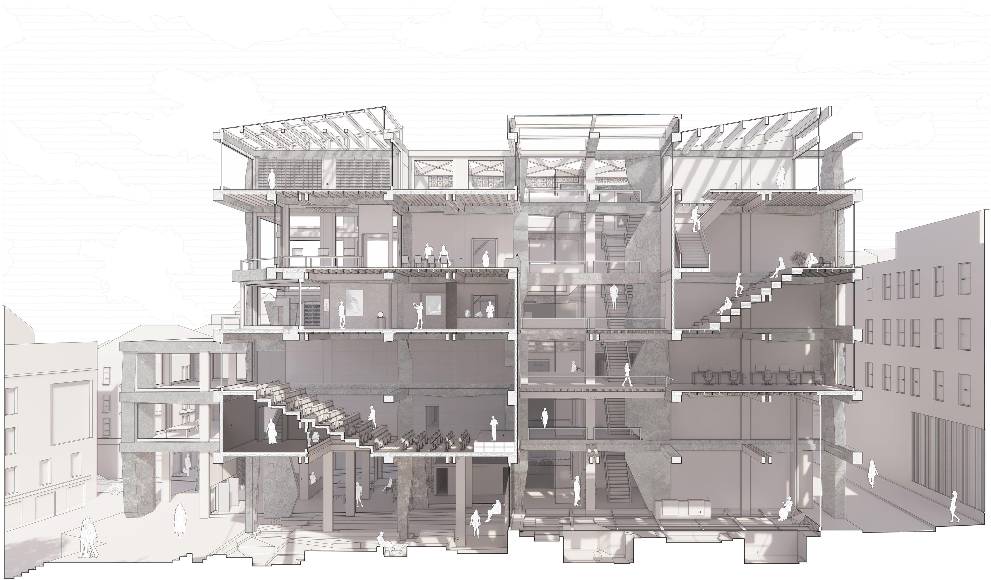
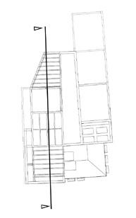
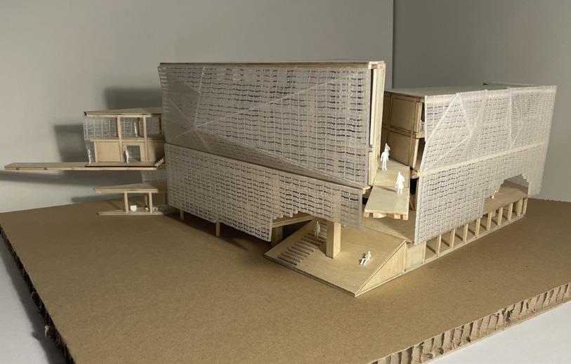
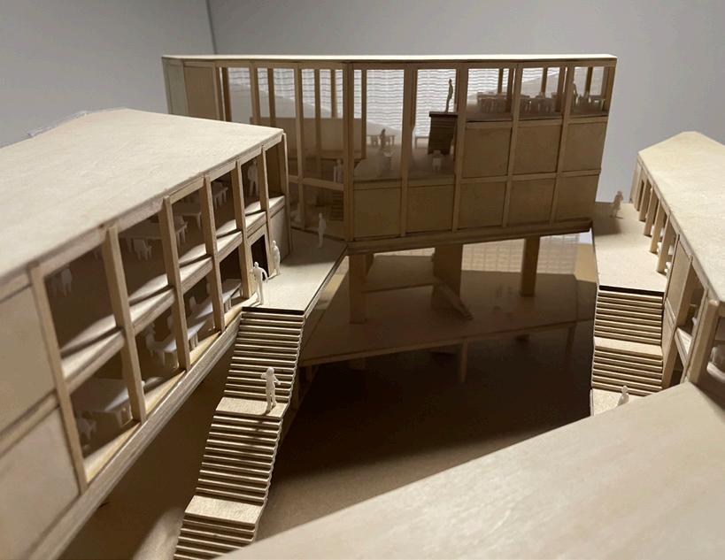
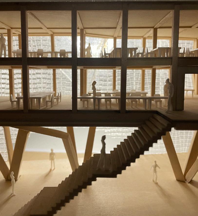
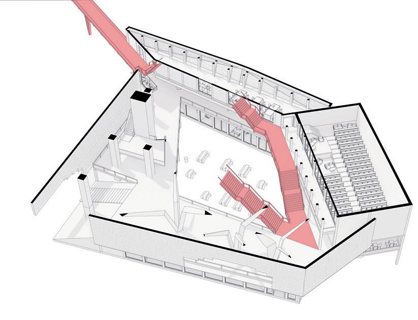
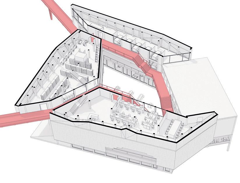
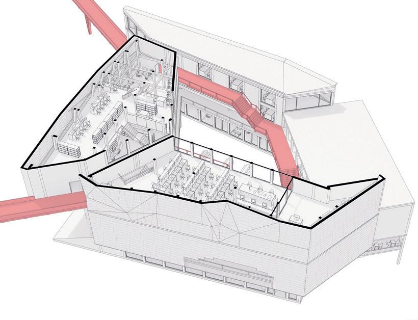
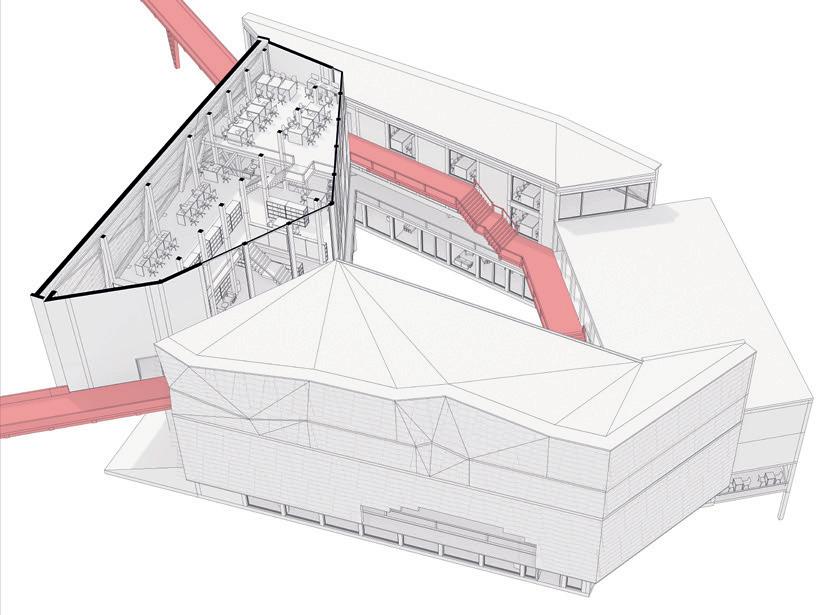
CROSS SITE SECTION AND KEY PERSPECTIVE VIEWS
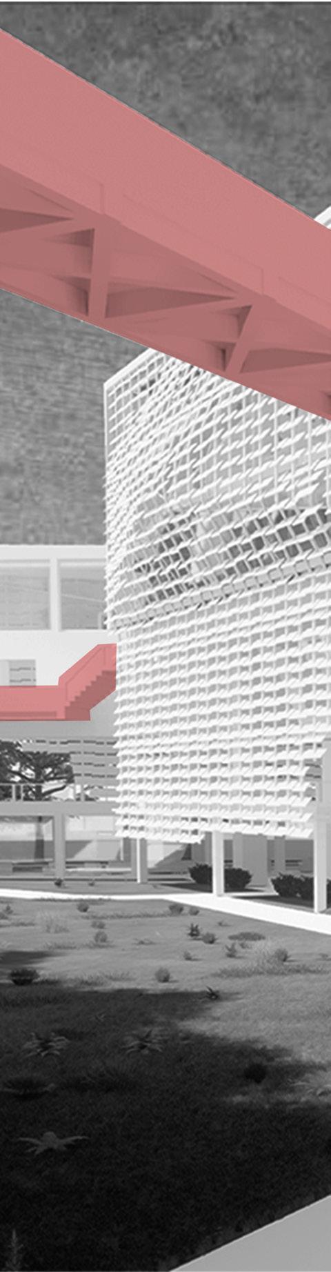
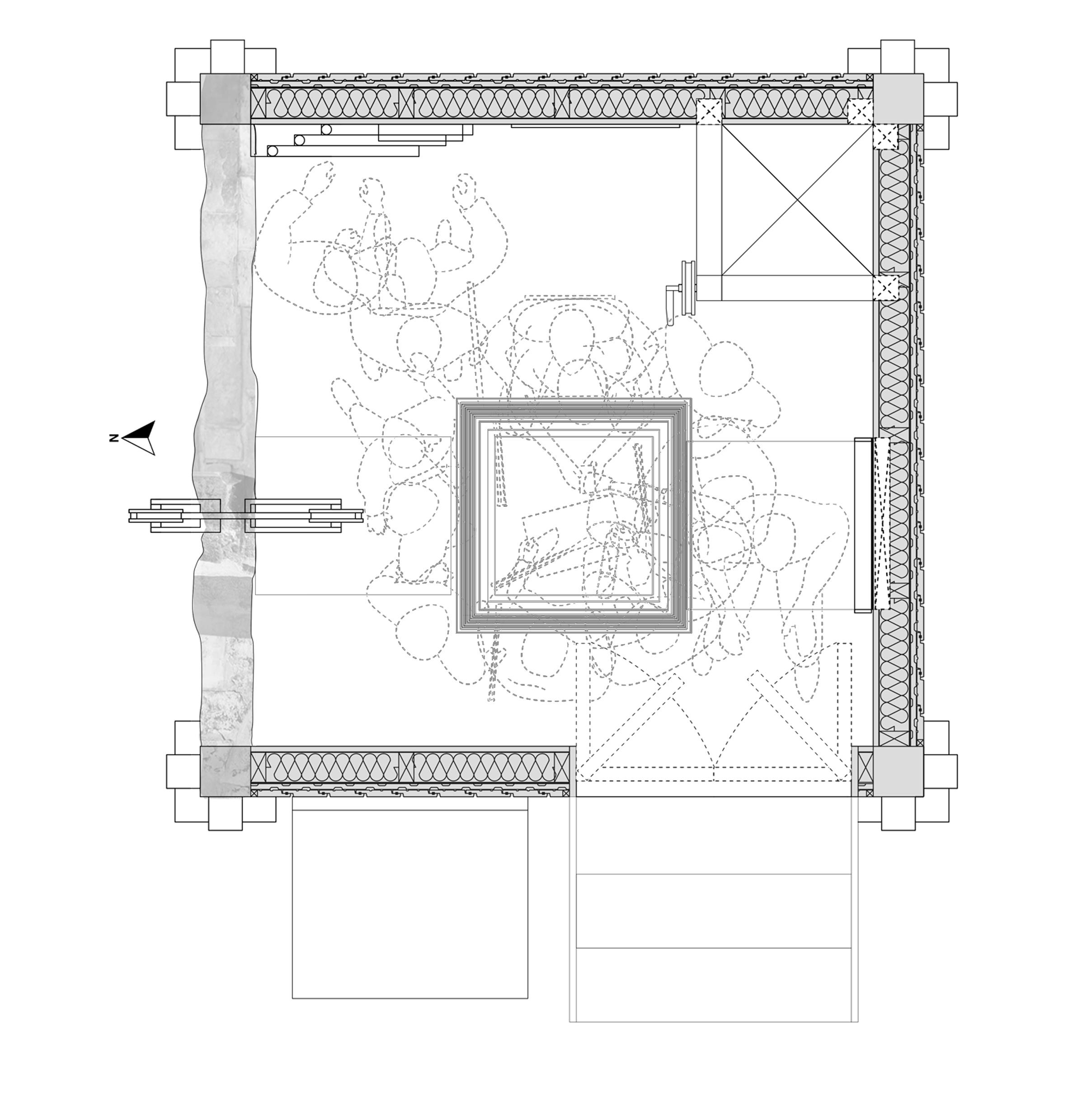
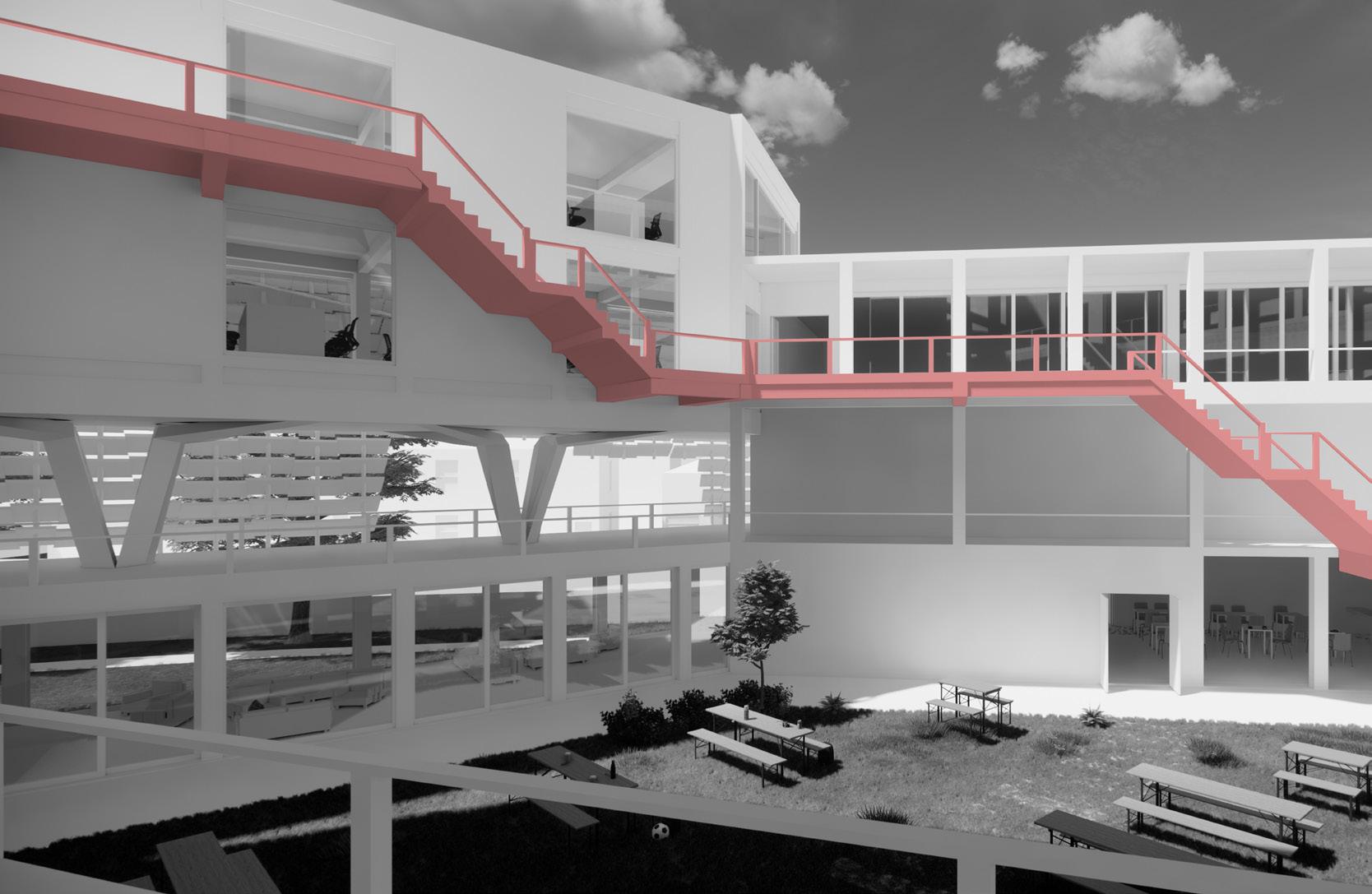
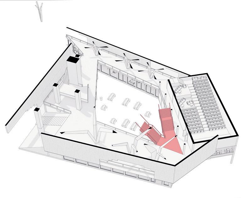
This cross-section cuts through the full site, exposing unique stone columns from and floor frameworks that root the design. At the core of the building sits a lightweight timber circulation space, bridging between heavier stone structures that house public and private functions. The site’s slope of a 1m level change is negotiated by a sculptural stair that wraps through the central space, weaving the programs together.
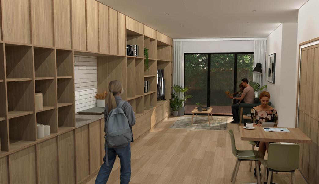
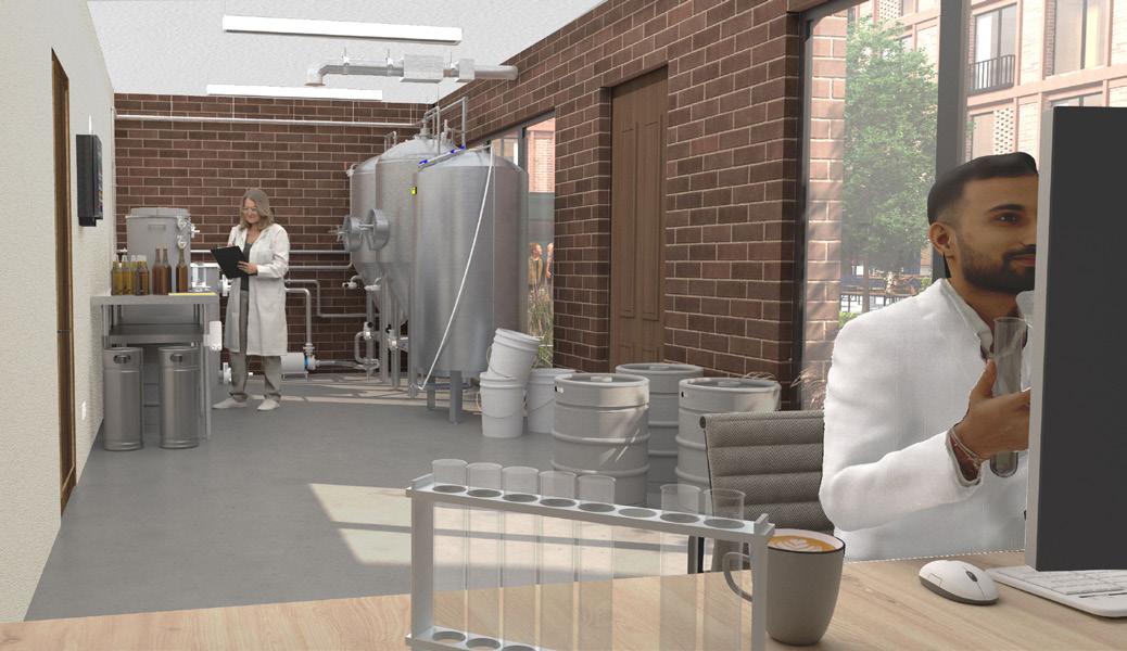
On the east (left side), street-facing side include predominantly private uses from the ground floor dining and café space to the upper floor adaptable event space, followed by a lab, offices and finally the head of department office at the top floor.
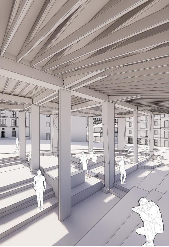
On the west (Right Side), facing onto the masterplan, houses the public functions. At ground floor a pavilion/conservation space with an adjacent plaza and informal stage formed from the landscaping provides outdoor setting for conferences enclosed by a ring of trees that buffer wind and noise while also framing the site. At the upper floors an auditorium and gallery space along with an educational space and adaptable function space at top floor taking advantage of the natural light and privacy.
Snapshots of the proposal
Leisure
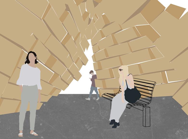
Preserved Archaeological dig (13th century Islamic residence) now a focal point to the entrance.
Pavilion carving into the ground using the site’s massing history creating a landscape for conversation space.
Large auditorium space for formal lectures and conferences. 7. Public assessable physical and digital library that includes the work and archive within the building. 8. Gallery holding temporary storage of artefacts for public viewing to see the work on hold. 9. Informal conference space and relaxation area with more open natural lighting and informal seating 10. Classroom and workshop space focusing on education and teaching restoration to the uni students. 11. Adaptable event space with revolving door slides and exterior access with a quiet space.
Secondary event space with more natural lighting for exhibition work.
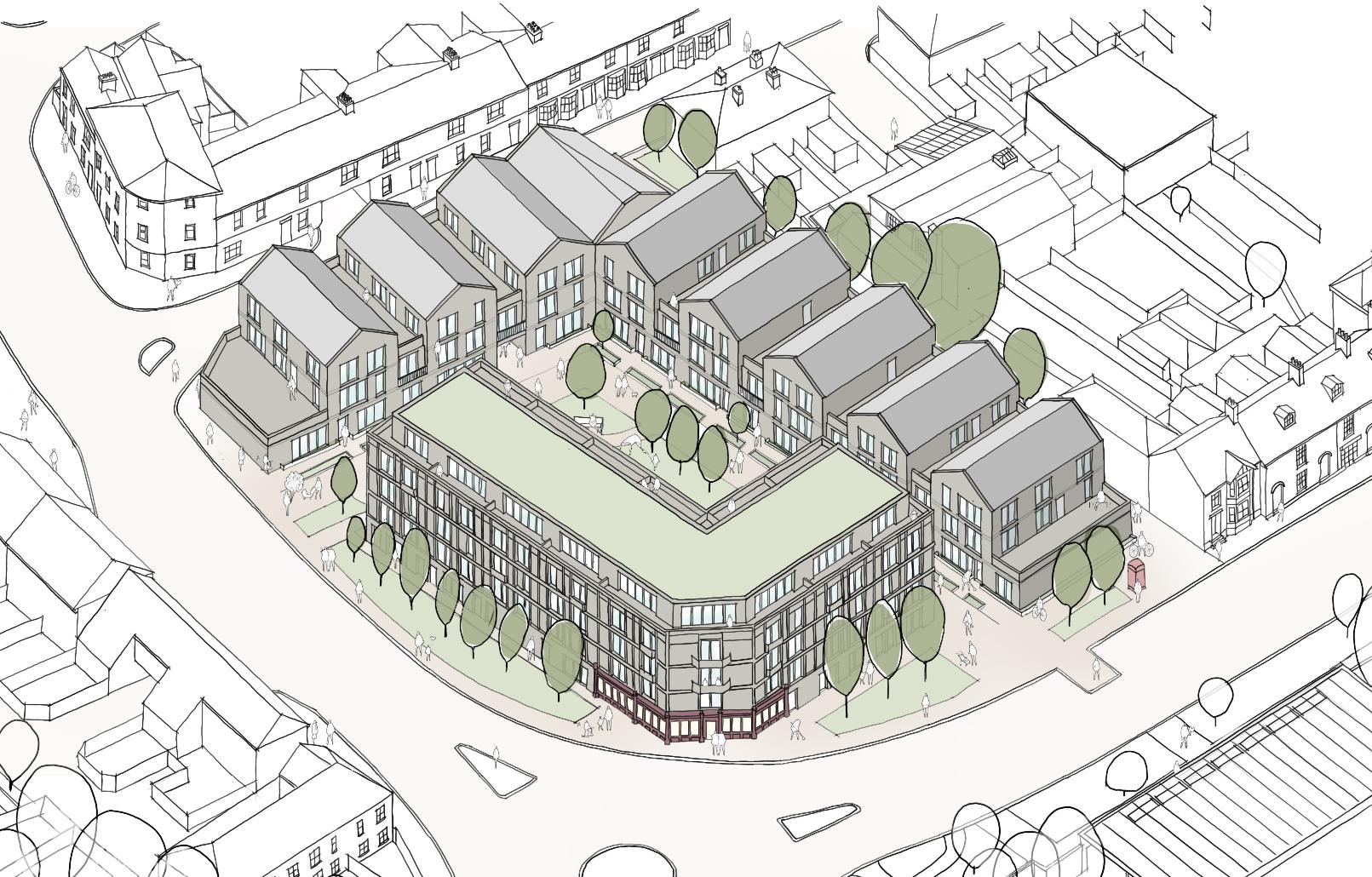
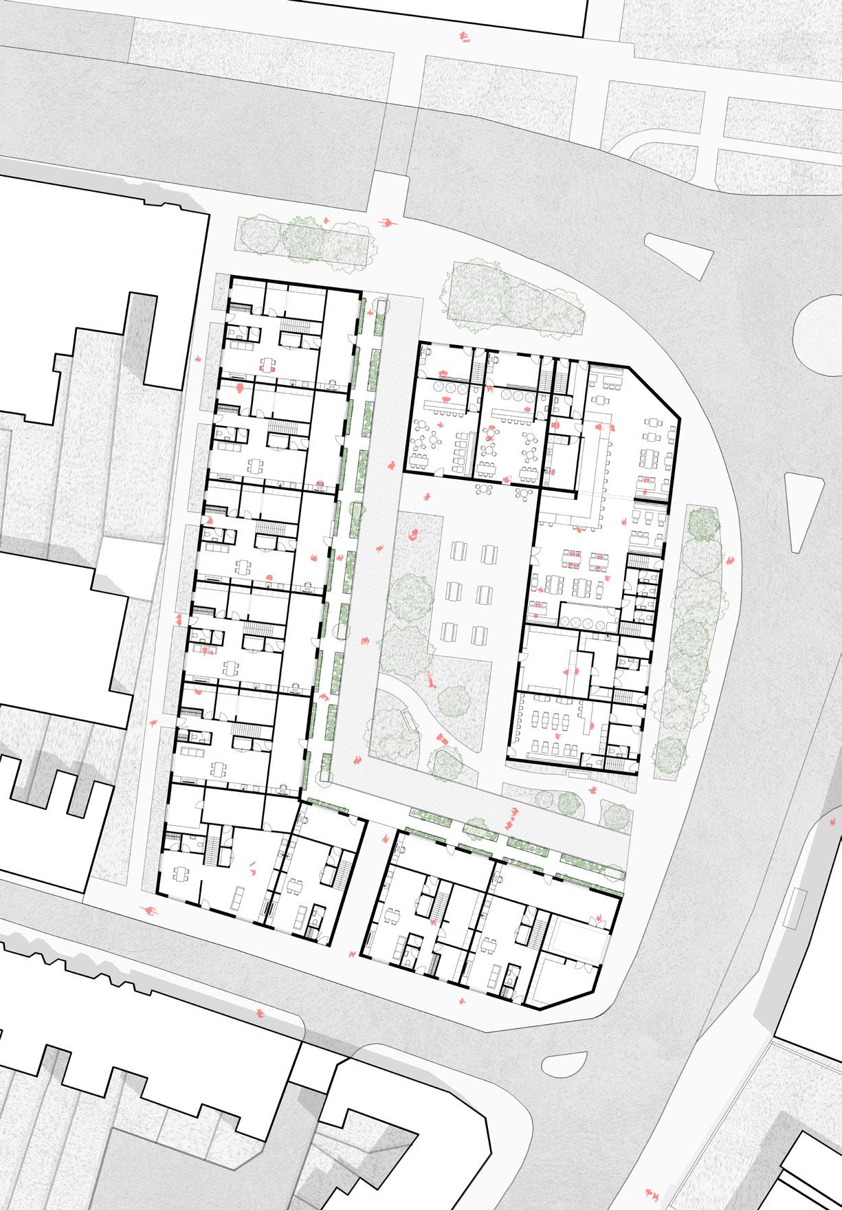
THIRD YEAR - RESIDENTIAL MASTERPLAN
OVERVIEW
The Brief for this project was to create a residential masterplan for a community of home-based workers, responding to the post-pandemic shift toward working from home. Situated on a corner plot within Canterbury currently a car park and between two universities.
PROPOSAL
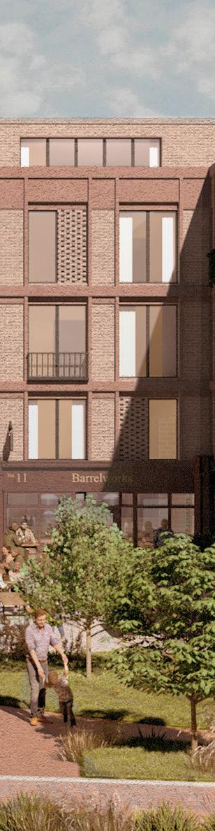
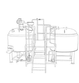
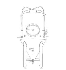
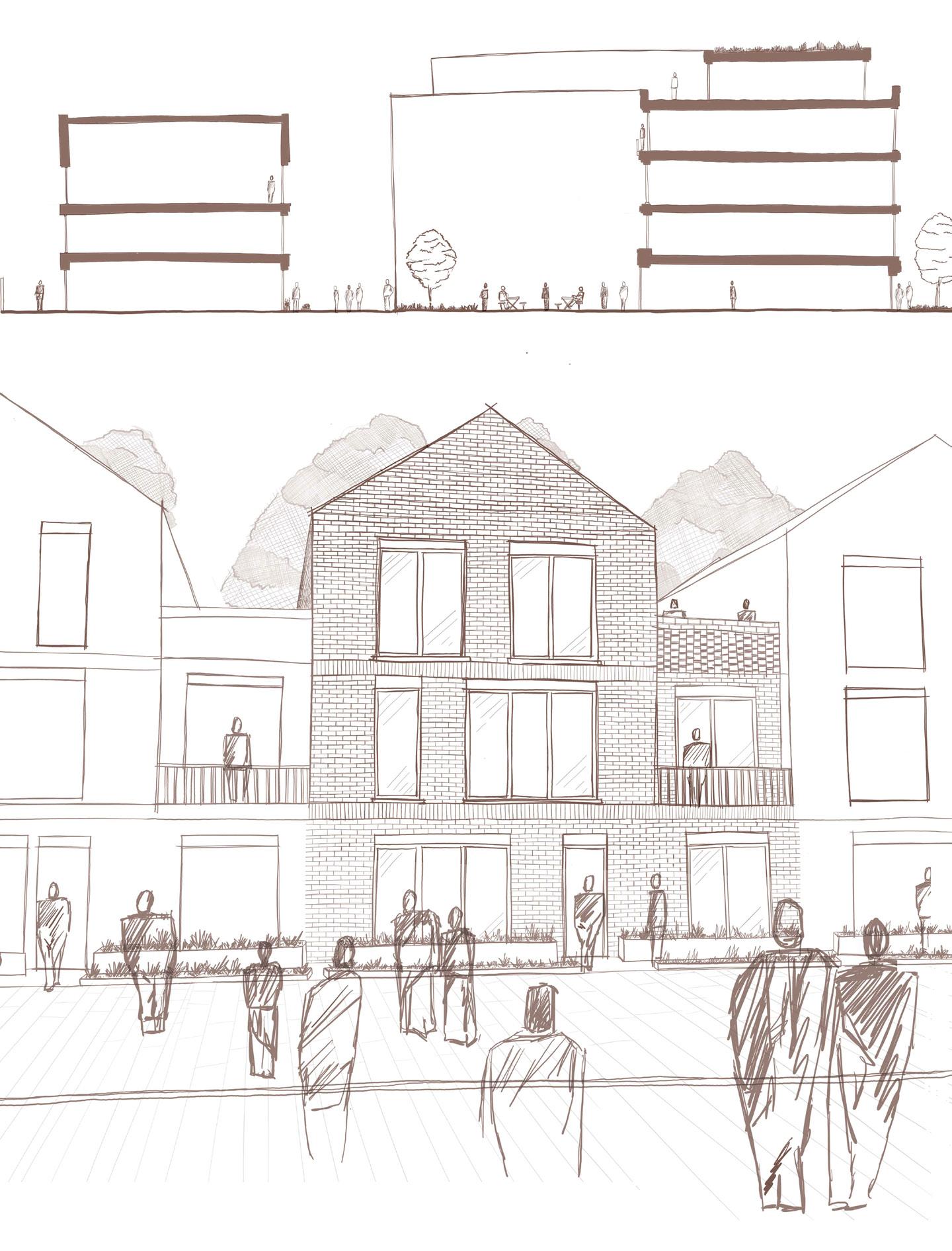
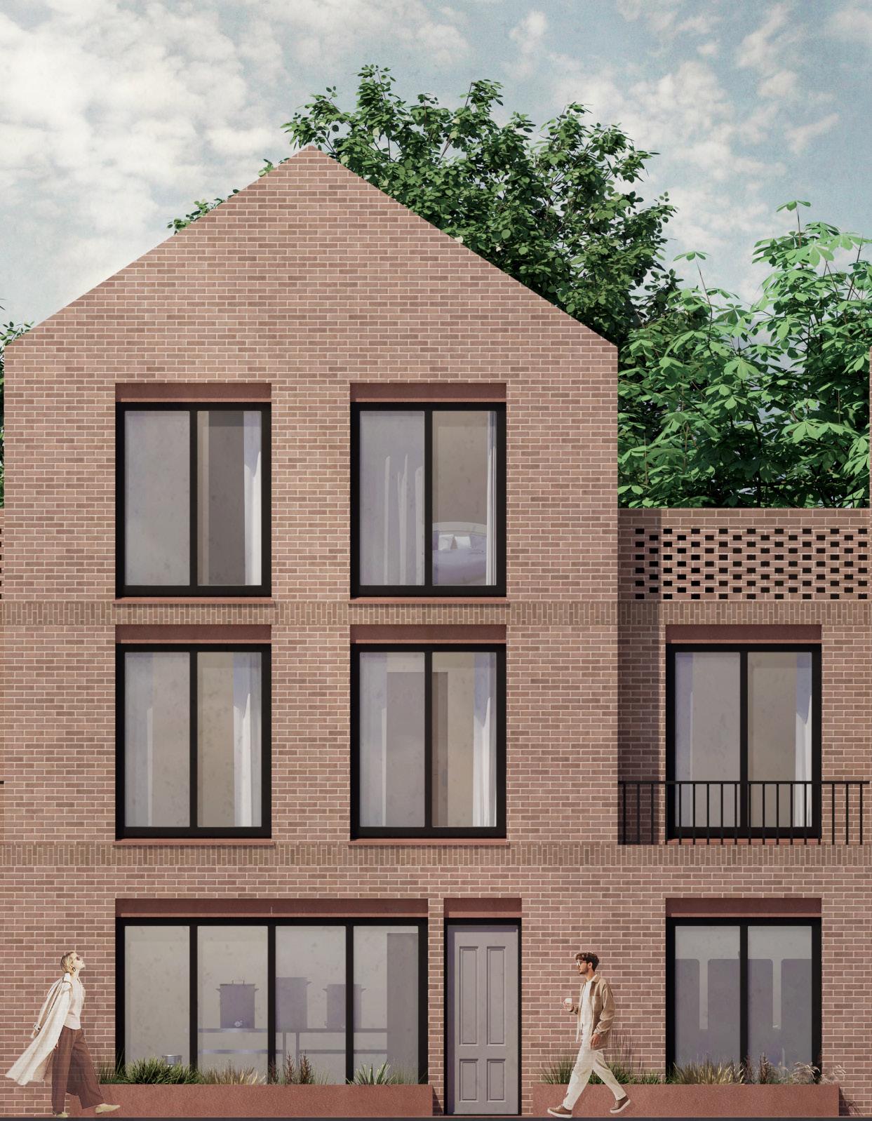
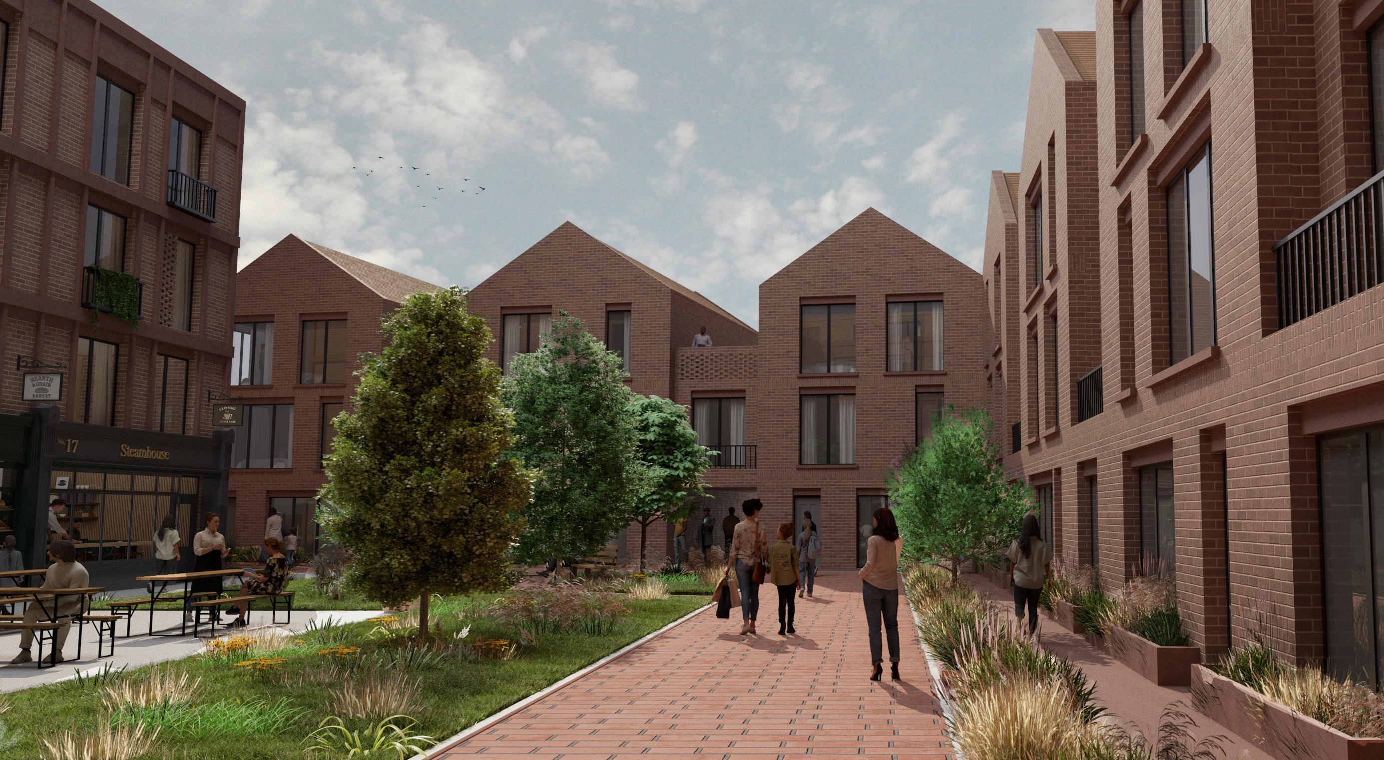
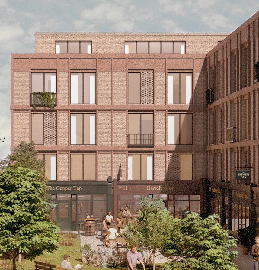
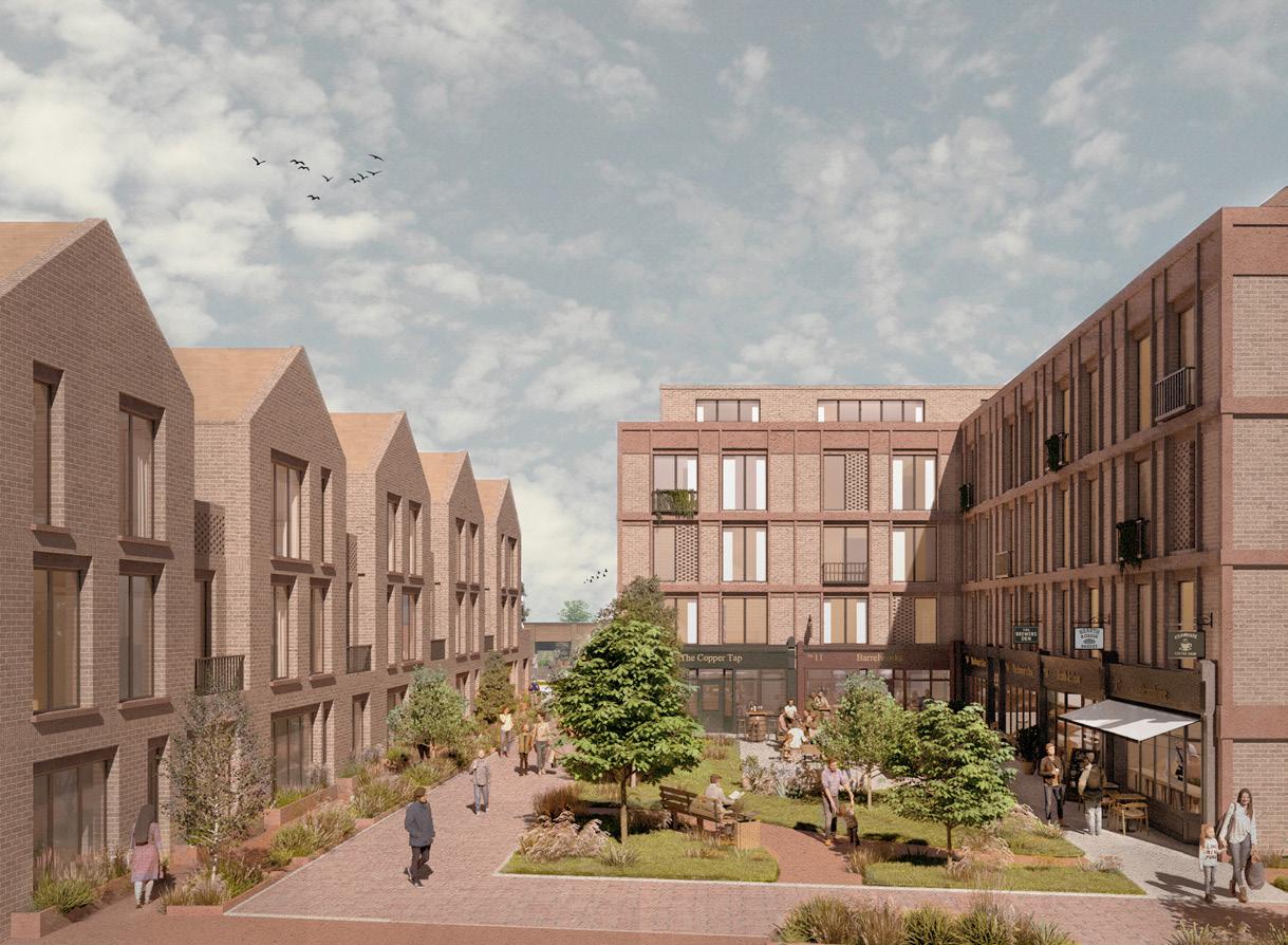
Brewers Lane reimagines the corner as an integrated live/ work neighbourhood centred on collaboration, craftsmanship, and collective communal engagement. Each home serves both as a home and micro production space, with the community collectively engaged in brewing beer (a nod to the site pre-war brewery and pub) , balancing both private and public spatial interactions.
Inspired by the social dynamics of German beer gardens, the architectural language balances privacy with shared production, living spaces address the street, anchoring the homes within the city, while workspaces open inward toward the communal core. The Units inhabit a flexible design to adapt to shifting domestic and professional needs, fostering a dynamic and resilient model of cohabitation.
By embedding work into the domestic fabric, the project questions capitalist ideals of ownership and productivity. It proposes a more democratic spatial model cooperative, selfsustaining, and future-proof where the masterplan/community becomes a framework for an evolving social and economic system formed of makers.
Figure 1. Aerial View Sketch
Figure 2. Massing Concept
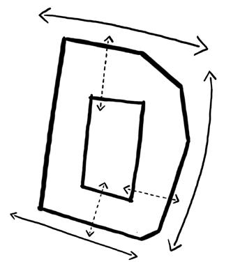
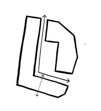
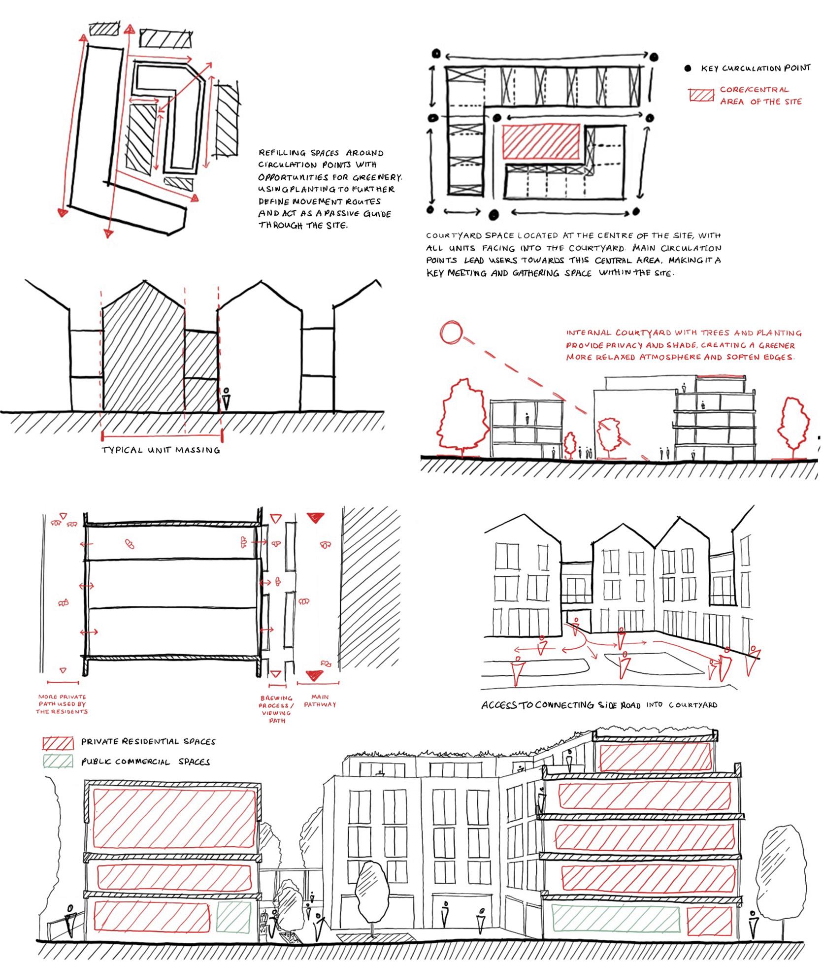
The above sketches act as snapshots of the design’s development following the initial massing seen on the previous page. Facades are broken into distinct units while maintaining overall uniformity. The massing and form help frame views in and out of the site. Greenery guides circulation, linking the courtyard and providing passive wayfinding. Strategic planting softens edges and offers screening. Public spaces face the courtyard, while circulation balances public and resident access: quiet rear paths for residents, main routes for visitors to view the workshops, and transitional routes for the passersby.
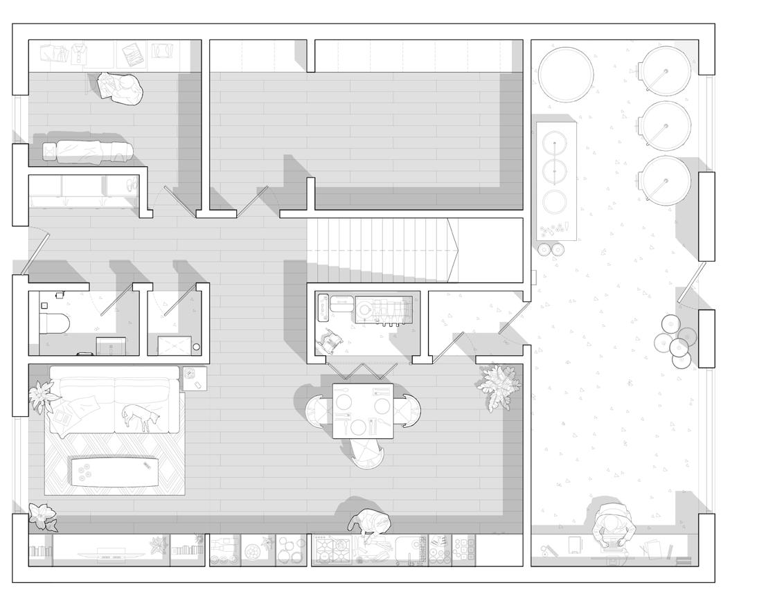
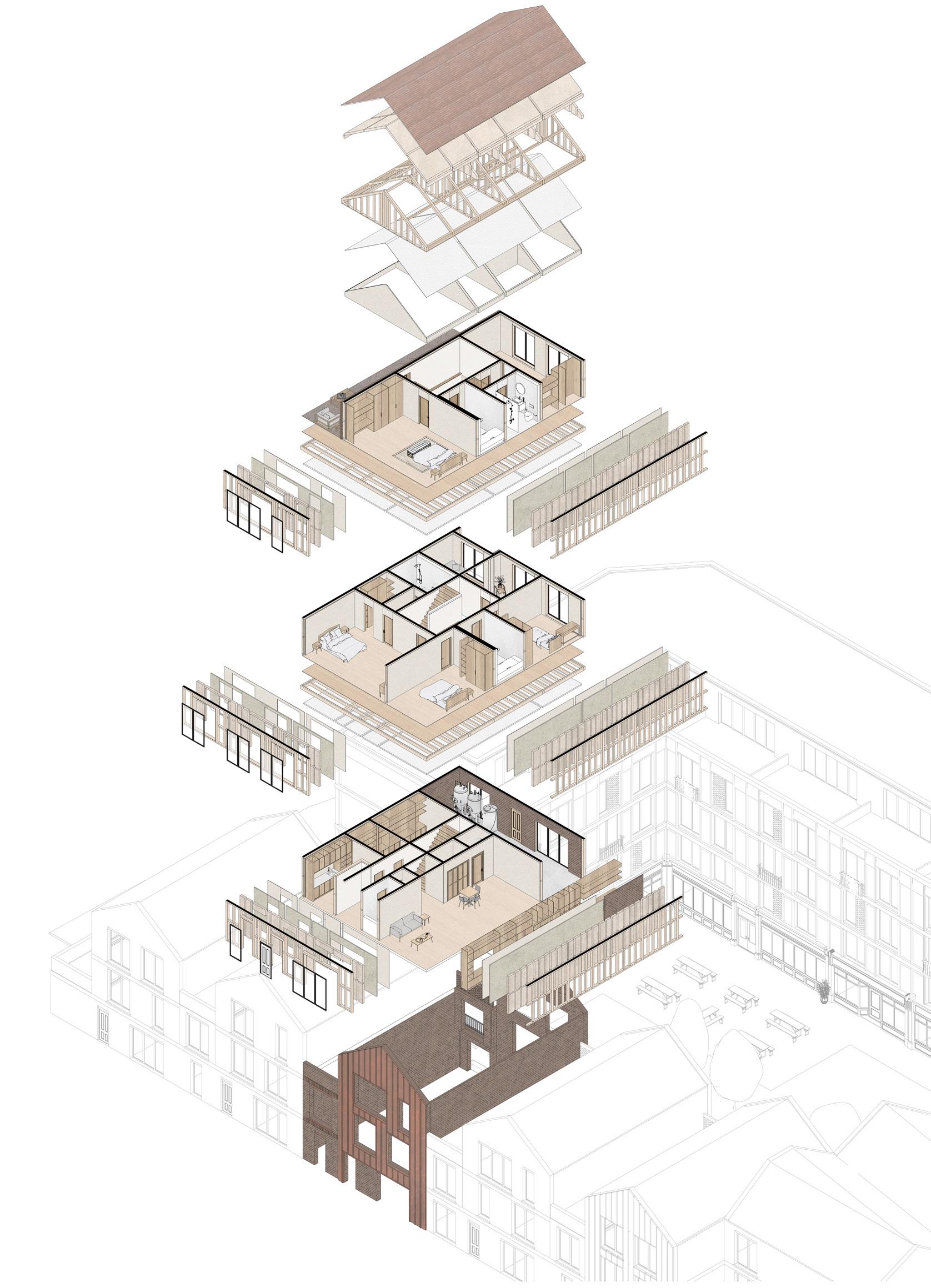
BREWERY PRODUCTION PROCESS (COMMUNAL MODEL)
LAYOUT
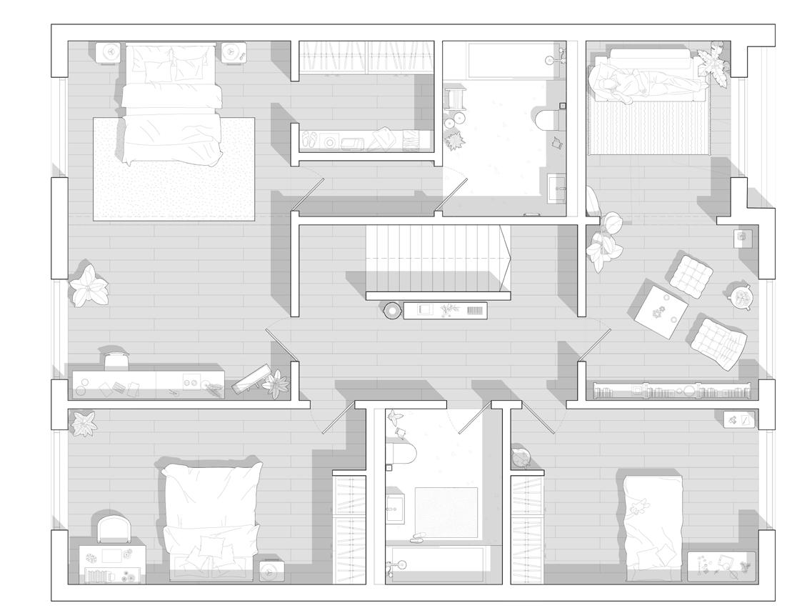
Each unit is made up of two main parts private and public uses. The private side includes the residential spaces like bedrooms and living areas, while the public side functions as the production/maker workshops. As shown to the right, the workshops sit on the ground floor, with the residential spaces placed above. This ensures both functions connect to the central space while still giving a sense of privacy.
PRODUCTION PROCESS
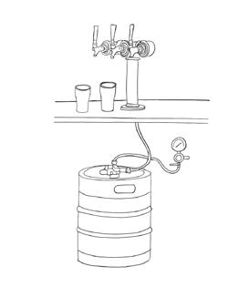
The masterplan allows for an adaptable workshop/ production space within each unit. For this proposal, the spaces have been proposed as a communal production model, where each unit serves to facilitate a step in the production. Each works together to create the product, which is then sold in the adjacent commercial frontages, creating a communal product where the makers get to see the full life of their work and witness its impact on their community and the public/customers who enjoy the communal space.
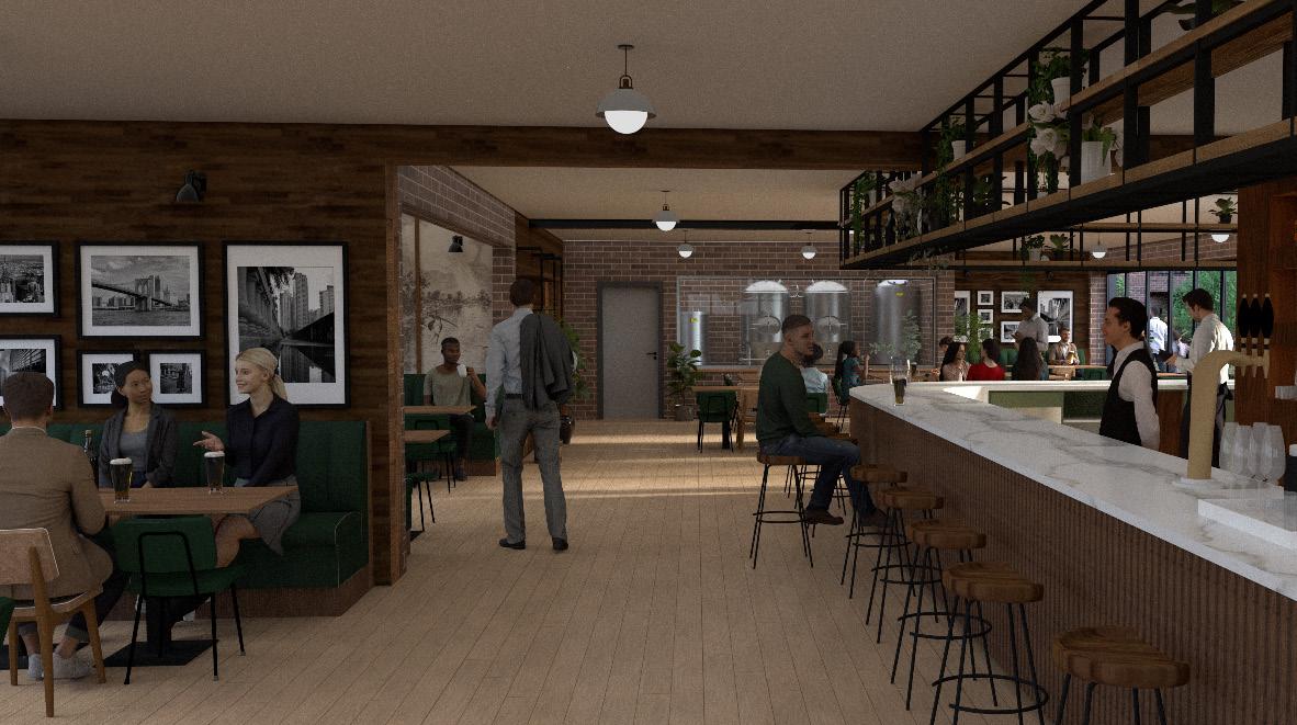
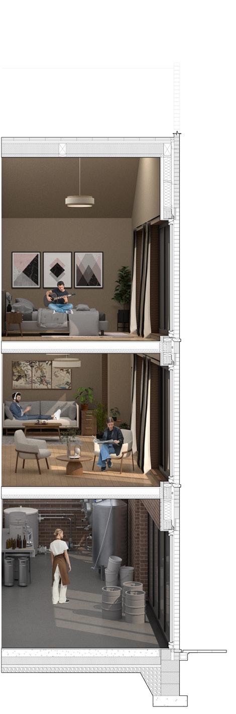
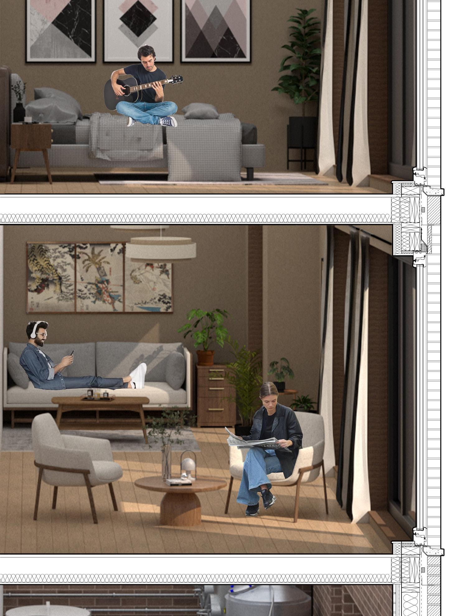
Main corner pub interior visualization
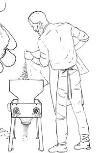
Milling
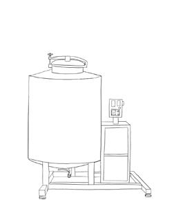
Lautering
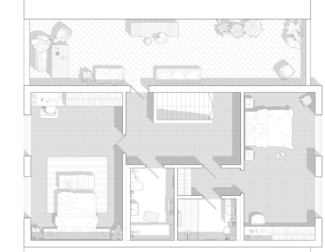
The layout promotes fluid circulation with an Open-plan living, kitchen and dining space priorities flexibility, through the use of Integrated wall storage and kitchen utilities. At the rear the production space is located separated with a small lobby to ensure clear spatial separation between living and working spaces. A utility room and a flexible room to accommodate varied uses such as an office.
Four adaptable bedrooms with built-in storage surround the landing with a shared bathroom and lounge/leisure rooms. Generous room proportions exceed minimum standards, allowing for long-term flexibility and private enjoyment. The floor balances privacy and informal interaction, with the courtyard below that encourage primary/longer-used rooms to orient toward the courtyard.
The top floor houses a raised garden space providing residents with a private outdoor space with opens to views of the city. The floor includes two bedrooms positioned on either side of the floor, one featuring an en-suite. High ceilings create a sense of openness and allow further natural light to fill the space enhancing the overall spatial quality.
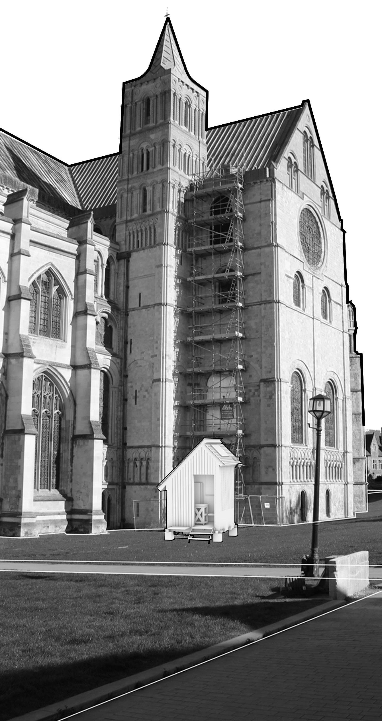
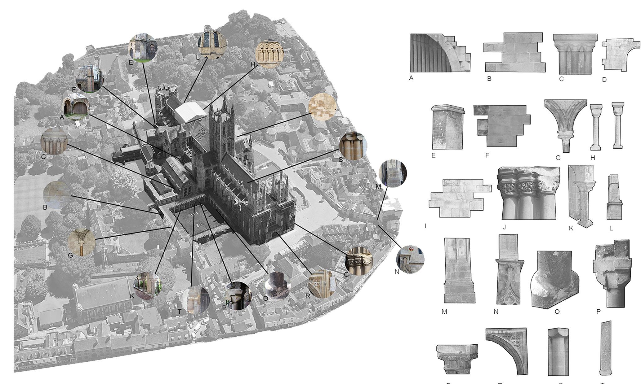
CANTERBURY KEYSTONE MODEL
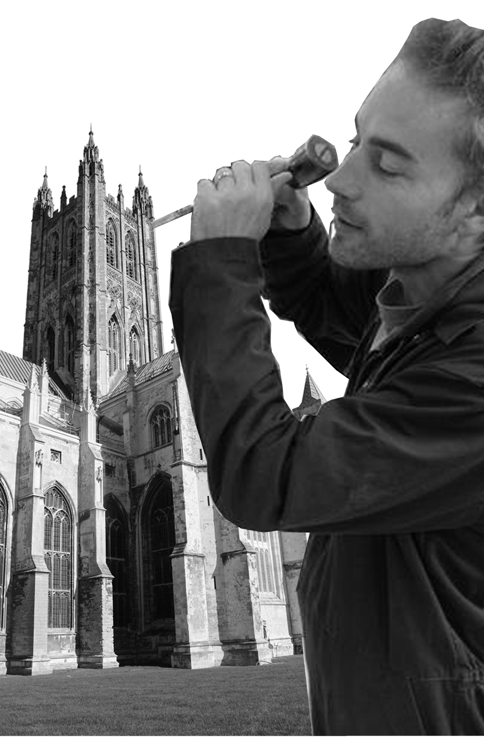
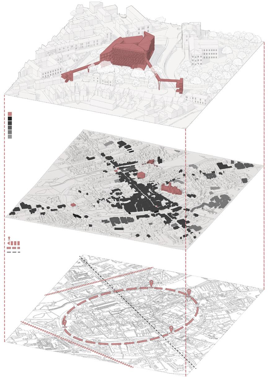
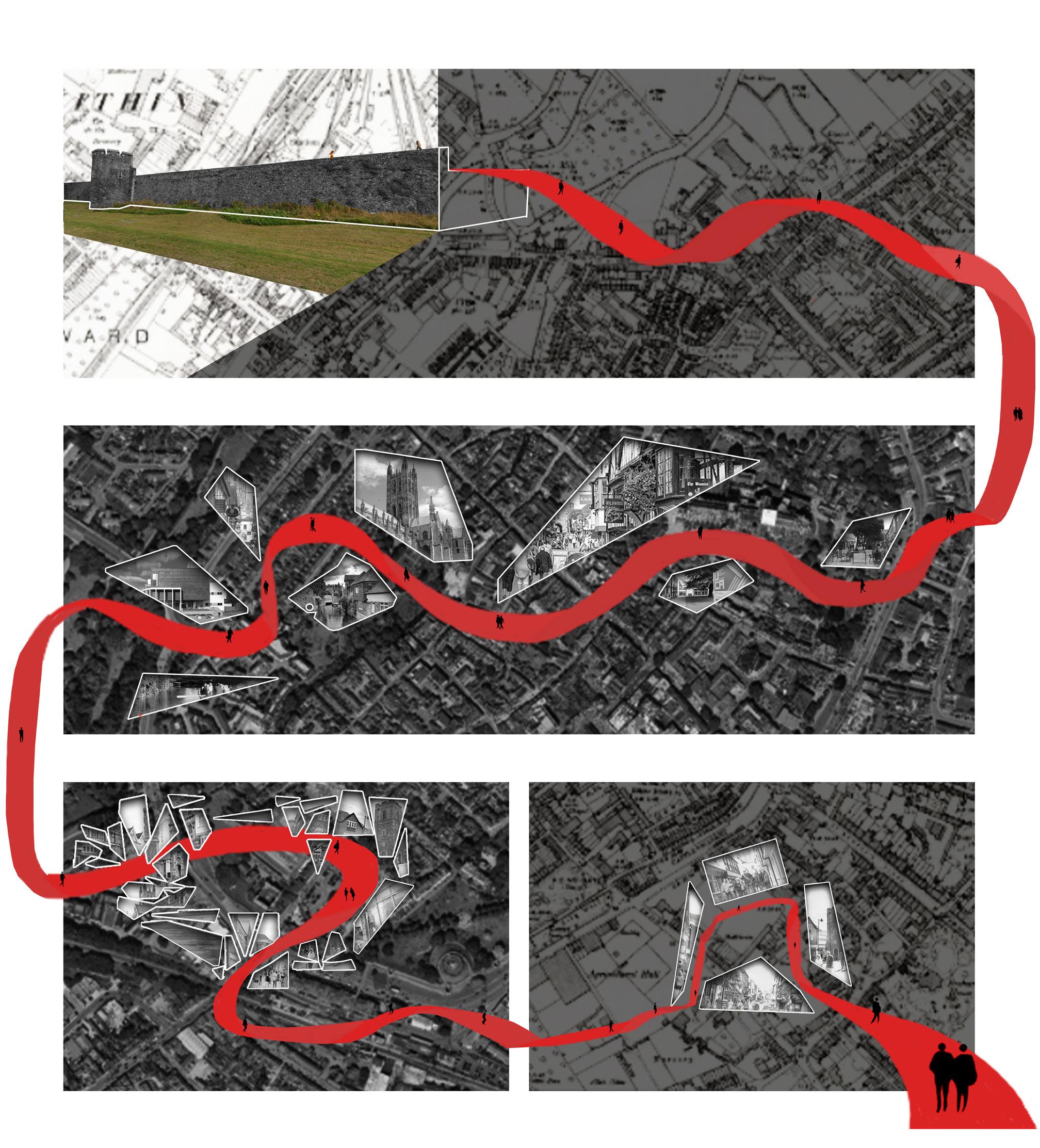
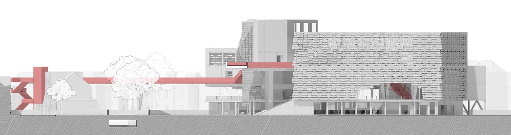
The adjacent illustrations convey the project’s concept, a red ribbon that weaves through the city of Canterbury, collecting missing connections like shards gathering and binding them together to form a shard like structure of reconnection.
1. The path begins by extending from Canterbury’s historic stone walls which wrap the city.
2. As the ribbon travels through the city it tears through the urban fabric city uncovering and collecting lost fragments as symbolic shards that reflect Canterbury’s identity.
3. Upon arriving at the site the shards categorise into similar functions around the ribbon forming collective uses.
4. The shards begin to assemble into a coherent structure around the path connecting to the gap within the city walls which has been lost through time acting to reinstate the circle around the city.
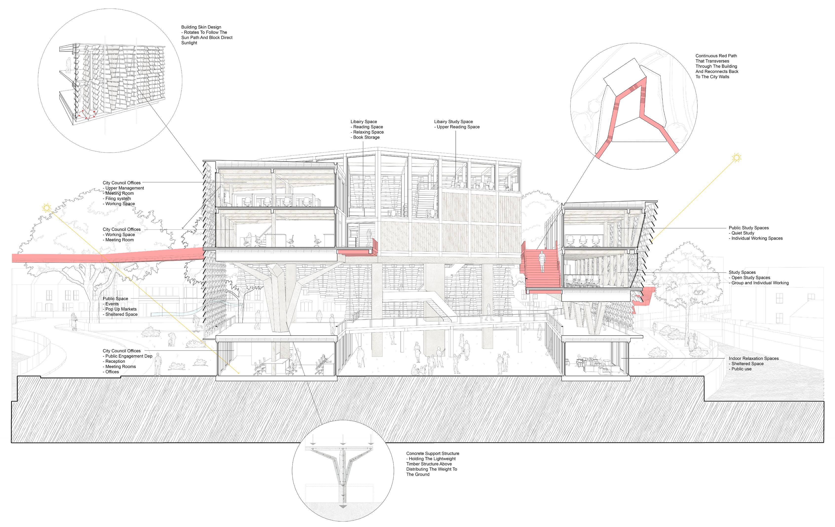
“A connection which would bind the community together” The archive is composed of three core aspects, the community, the city council, and the city’s identity itself. Together, these elements represent the archiving of Canterbury through both civic and public identities, encapsulated within the physical archive that the building embodies as expanded on previously.
The council’s/civic presence is captured through the city council department departmental and a city document archive that anchor the buildings governmental presence. The community’s/ social identity is reflected in the public spaces integrated both within and outside of the building, which include pop-up market areas, communal speaking spaces, a public library, and study areas, unified by an elevated red pathway which acts as the main connection point.
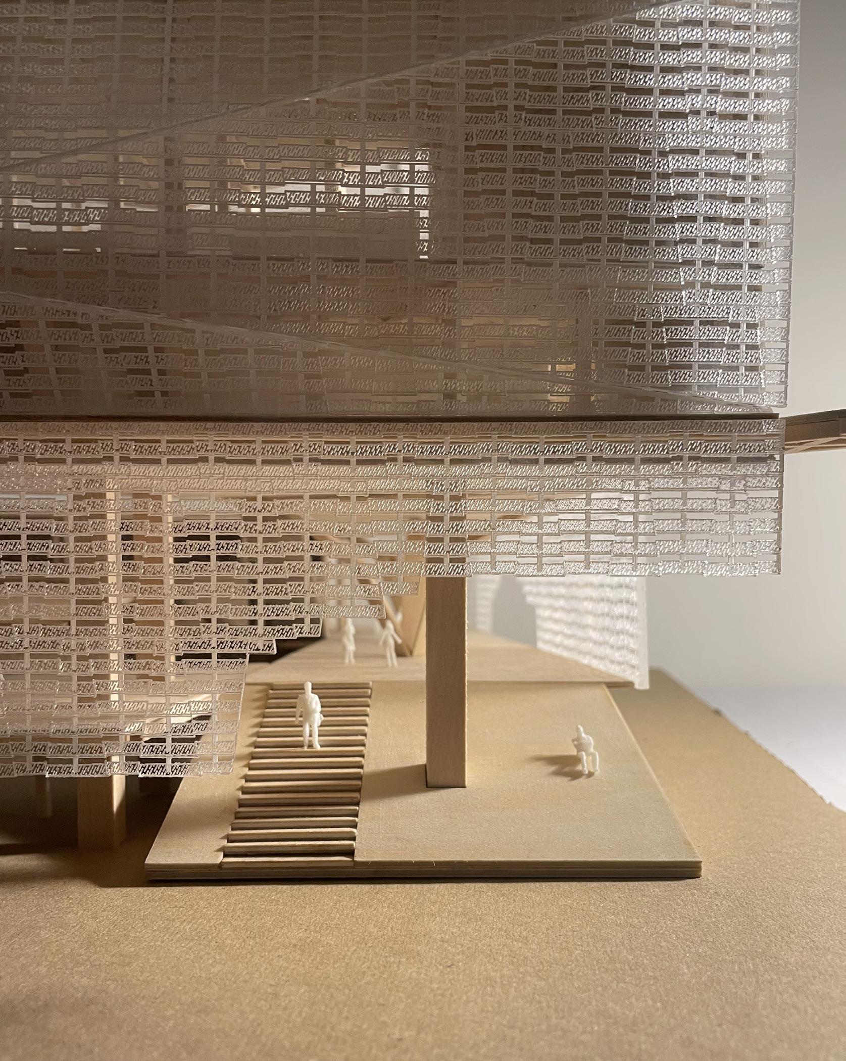
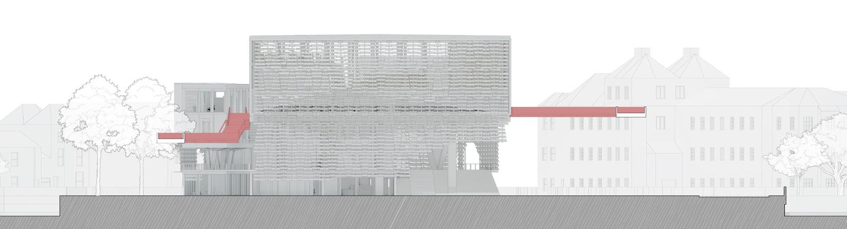
The floors are transversed using the path that extends from the city walls to the building and leaves to reconnect back to the wall completing the broken ring created by the city’s historic walls circulating the city. The building would be draped in a moving skin that would reflect a shard like design each moving to
shelter the space from the sun opening views to the surrounding site and city as it turns to face the sun as it moves thought the day. The structural design of the building mirrors the shard like formations in not only its shape connected to the path but by its triangular structural supports and skin, reflecting Canterbury.
The adjacent renders highlight the final design, showing the proposed archive from street level with the red path running overhead. The building’s perforated facade is shaped to capture sunlight and reveal the internal spaces at ground floor. The footprint is kept minimal to preserve existing open space, replacing the car park, while any impact on the landscape is compensated within the building’s central core. The form stacks like shards, reflecting the geometry of the envelope.
Figure 2. Street view from the main site entrance.
PUBLIC COMMUNITY CANTERBURY CITY CITY COUNCIL
Figure 1. View of the central courtyard space.
Ground Floor – Existing circulation points have been preserved and extended towards the central courtyard, which promotes public engagement spaces in the form of a café external and internal seating areas and the city council departments office for public engagement/interactions encourage the ground floor as a fluid conversation space.
First Floor - Accessible via ramp and staircase at the facade adaptable external sheltered space is provided, situated around the upper floors support columns the space provided elevated views of the site. Along with access to the main circulation path and the main public lecture hall.
Second Floor - Upper floors support columns continues the public engagement space with group study areas for students as the secondary floor to the lecture hall.
Third Floor - The library a core space comprised of curated digital and physical collections for nearby universities. Adjacent site the upper city council department offices and Independent quite study spaces/rooms.
Fourth Floor - Continuing the library floors providing more seating and computer spaces along with the upper city council offices sitting adjacent.
Fifth Floor - The highest floor in the building which serves as quiet retreat from the more active zones within the building providing seating space for studying and reading with elevated views outward towards the city.
PROPOSAL
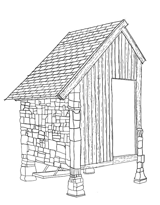
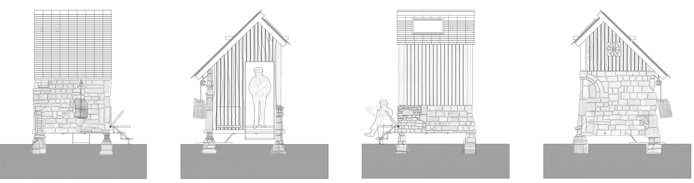
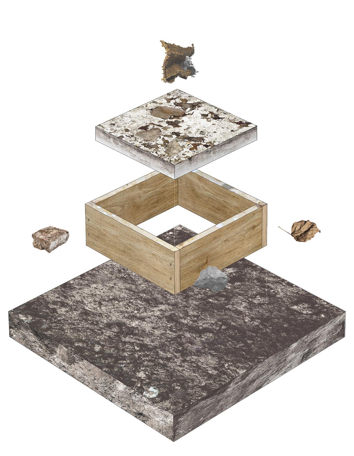
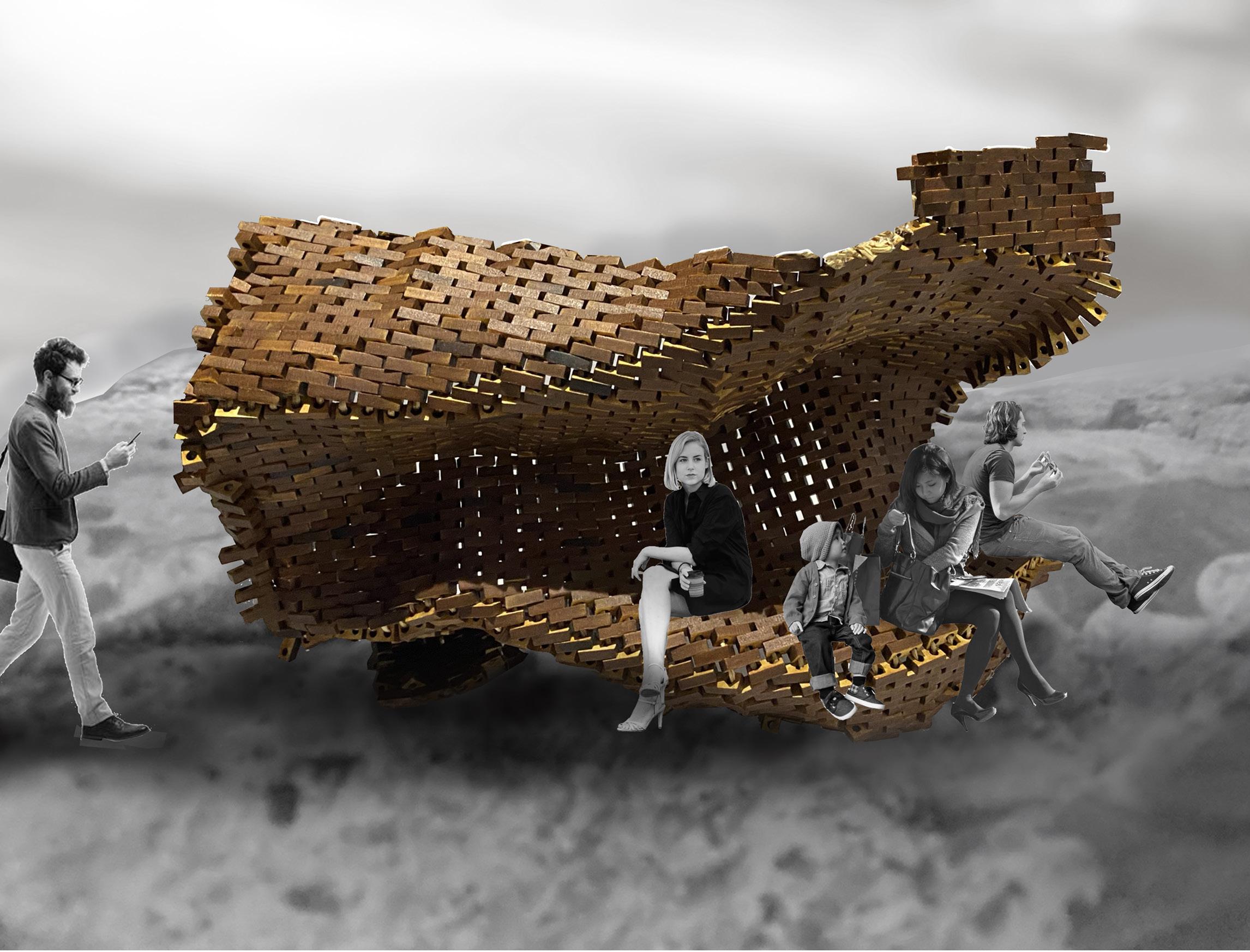
The projects exploration focused on two parts the first: The experimentation of creating landscapes through the medium of casting on a range of surfaces, extracting the typography a responding landscape. After experimenting with multiple different environments my chosen landscape consisted of a patch of land with construction residue laid within and on the surface, in the forms of broken bricks, leaves and stones set on unsettled soil, which created a landscape with diverse forms and voids/recessed to react to. The second part was to explore the introduction of domestication to the unoccupied landscape through the use of a Folly/Pavilion. Inspired by the work of Richard Serra and his use of organic form manipulation while retaining structural stability and weight distribution through argumentation at different geometric points along a
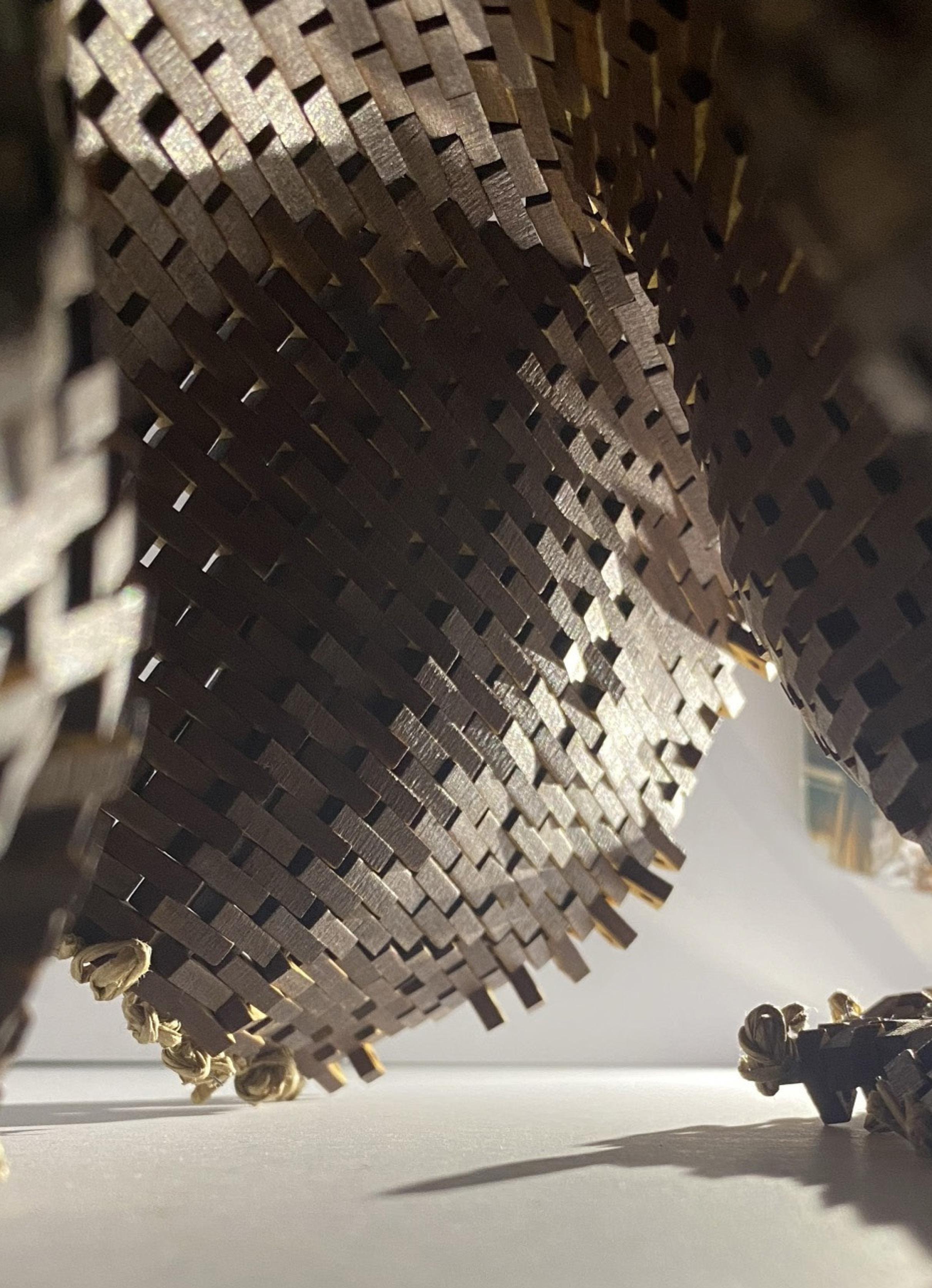
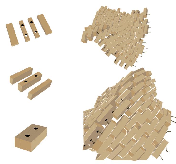
shape, allowing a structure to stand independently while in a constituted thin material. As well as taking inspiration from the Folly For A Flyover and its bead curtain design. My proposal acted to respond in a similar manner by responding to the site’s distinctive brick composition, I explored experimenting with transforming typically solid material forms into organic shapes in contrast to how they are typically perceived. My aim was to capture both the structured brick patterning of the landscape and the natural curvature shaped by its topography. I used lightweight timber bricks with a flexible rope joint system and integrated metal pipes at key points in place of rope, allowing both anchored and free-standing configurations, which evolved into a sitting pavilion with the key focus on temporary and recyclable structural composition.
Landscape Extraction Method (Casting)
Perspective Side View Of The Final Pavilion Design Illustrating The Publics Interaction With The Final Form.
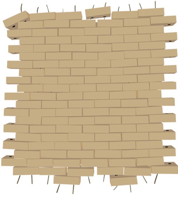
Creating Structures By Manipulating The Form Of The Wall.
Stitching The Timber Bricks To Form A Wall.
Timber Brick Construction Method (Model).
Studio Kyson is a contemporary architectural practice based in central London, working across the city and surrounding counties since 2006. The studio has extensive expertise in adapting, restoring, and remodelling existing buildings, including heritage and conservation sites, as well as developing projects in sensitive countryside settings, particularly within the Metropolitan Green Belt.
The team comprises 14 members: two Part 1 Architectural Assistants, two Architects, two Associate Directors, two Directors, one Studio Manager, one Technical Engineer, and one Visualiser. Studio Kyson’s approach balances programmatic requirements with careful attention to place, space, light, and materials, producing architecture that is both functional and visually considered. Sustainability and energy-conscious design are central to every project, supported by landscaping strategies that enhance biodiversity and respect the surrounding landscape. Over the years, the practice has built a strong portfolio of countryside and urban projects, recognized through industry awards, reflecting its commitment to architecture that is contextually rooted, environmentally responsive, and true to its time.
My experience at Studio Kyson has provided me with handson involvement across a wide range of project types, including Urban Design, Heritage & Listed Buildings, Residential, Commercial, Green Belt & Grey Belt, and Hospitality projects, primarily in London and Epping. Over the past year and a
half, I have contributed to circa 30 projects at various stages of development (RIBA Stages 0–5), allowing me to grow as a designer and continue my development toward becoming a Chartered Architect.
I have worked closely with the Associate Director on most projects as part of a two-person team, with occasional fourmember teams for larger projects, and have supported multiple design teams where needed. This has allowed me to take on greater responsibility in proposals, contributing to design decisions, preparing key documentation, and helping to move projects forward. My commitment to understanding the broader context of each project has helped me deliver thoughtful and accurate outcomes.
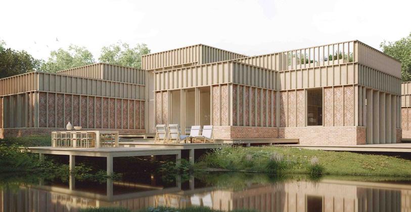
For example, the Bracken Wood Lodge project involved the entire studio. I was responsible for researching material selections for the proposal and its delivery, evaluating sustainability advantages and disadvantages, including U-values, and researching foundation construction techniques that supported both sustainable design principles and the sloped site. This research informed the final material selection and overall sustainability strategy, which was central to the project’s success.
The following pages provide a summary of my design exposure and the key documentation and policy standards I have become familiar with through my experience at Studio Kyson.
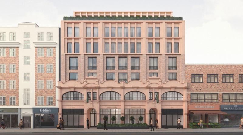
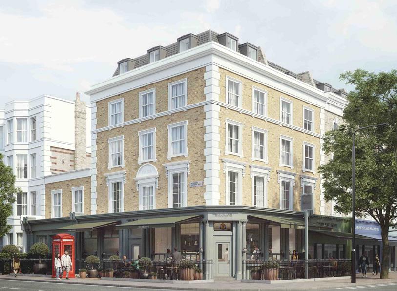
Blind Beggar
New Collage Parade
Bracken Wood Lodge
Salt House Pub
DESIGN EXPOSURE
The following is a brief summary of the project types I have worked on during my time across RIBA Stages 0–5, primarily focused on planning with some technical/construction packages.
• Feasibility plans/studies across multiple class uses
• Small & large-scale residential schemes.
• Residential masterplans.
• Strategic land development appraisals.
• Fire strategy and fire damage assessments.
• Listed building refurbishment and extensions.
• Commercial and hotel mixed-use buildings
• Large scale hotel refurbishment
• Property and Land Sale brochures
• High-level sustainable materials and techniques documentation , (inc U-value and wall build up assessments).
• Heritage design considerations and sensitive site designs.
• Two Independently led planning applications for a roof terrace conversion and a conversion of 3 existing containers to serve the local council (both granted permission)
TECHNICAL AND DOCUMENTATION EXPOSURE
The following outlines the documentation and drawings I have worked on at each stage of a project, from the proposal to planning and, following approval, through to the tender and construction phases.
•
• Land Appraisal / Strategic Development Document
• Feasibility Plan/Study
• Stage 1 Reports
• Design & Access Statements
• Assisted in writing Planning Statements
• Public consultation brochure
• Pre-Application Meetings with the council– Attended inperson sessions with council planning officers.
• Assisted on a Heritage Statement
• Accessibility Management Plan
• Proposed and Existing area schedules
• Assisted on Fire Remedial Works Document
• Planning Condition Brochures
• Property Sale Brochure
Drawings Packages:
• Existing Formal Drawings
• Proposed Formal Drawings
• As Built Formal Drawings
• Demolition Formal Drawings
• Tender issue Drawings
• Construction issue Drawings
• Construction Technical Drawings
• Tender Drawings Package
• Drainage Strategy Plans
• Assisted on Fire Risk Assessment (FRA)
• Condition Drawings
REGULATIONS, POLICY & PROCEDURES
The policies below have played a crucial role in many of the proposals I have worked on. Having a clear understanding of both the previous and existing conditions as well as any potential changes to each of these policies has been key while working at Studio Kyson, enabling me to assess relevant planning policies and bring them to the design team. Such as:
• Green Belt
• Grey Belt - EFDC Stage 1 and 2 Assessments
• Previously Developed Land (PDL)
• Limited Infilling
• High-Risk Buildings (HRB)
• Tree protection Orders (TPOs)
• Flood Zone and Surface Water Flooding
• Conservation of Habitats and Species Regulations 2017
• Full planning Application
• Householders application
• Permitted Development
• Certificate of Lawfulness
• Change of Use
• Section 73
Literature:
• Essex design guide (EDG)
• London housing design standards
• London local plan & parking Standards
• Epping forest Local plan 2033
• Epping - Section 106
• Conservation areas guidance in London and Epping
• Major and Minor Sustainability Checklist
• Local Building Validation Requirements
• NPPF
• Building Regulations
ADDITIONAL EXPERIENCE
I’m familiar with the following documents below, which are typically prepared by specialist consultants during the planning stages. I’m able to assess their impact on a proposal, identify possible mitigation measures, and converse with consultants to ensure all requirements are met to ensure a proposals compliance.
• Biodiversity Net Gain (BNG)
• Preliminary Ecology Appraisal (PEA)
• Habitats Regulations Assessment (HRA)
• Arboriculture and Tree Protection Plans/Surveys
• Air Quality Assessment
• Noise and Vibration Assessment
• Daylight and Sunlight Assessment
• Transport/Highways Assessment
• Sustainability Statement
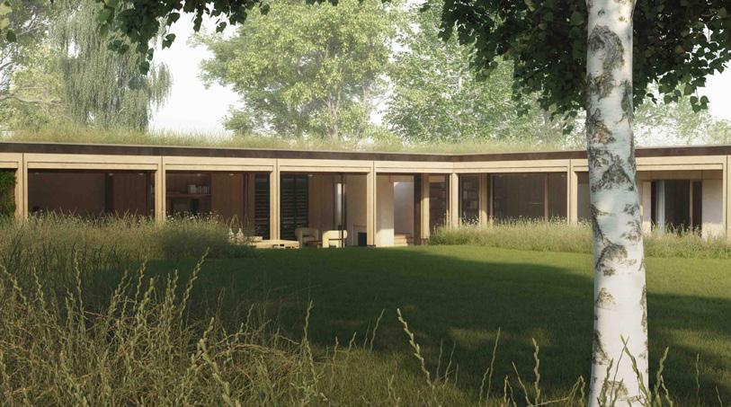
Warlies Park House
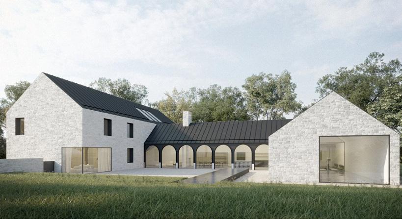
Leckhampton
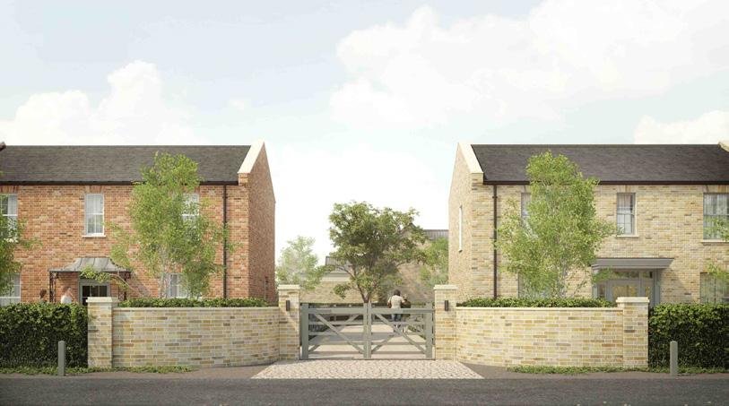
New Park Road
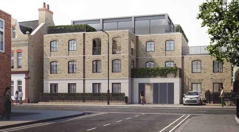
Balaam Street