Portfolio
Strategic Landscape Planning
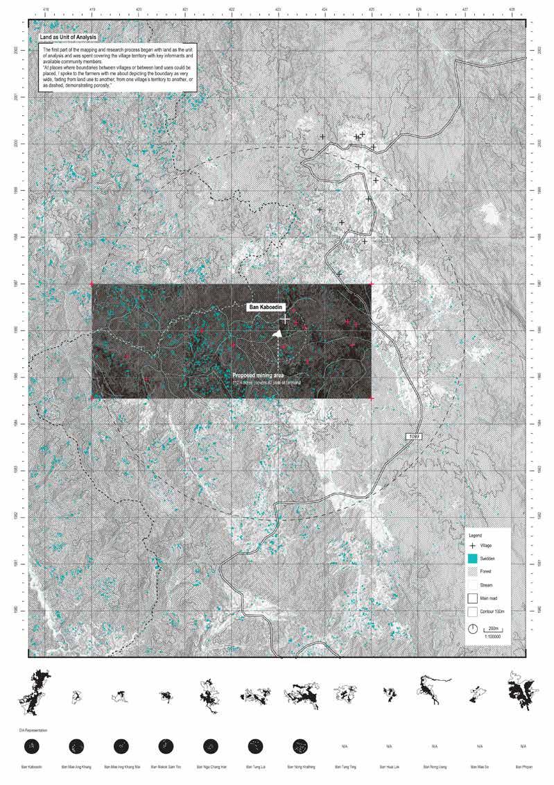
Dimensioning indigenous knowledge: A village mapping toolkit for countering rapid assessment of Karen communities at Omkoi, Chiang Mai province
Dimensioning Indigenous Knowledge: A village mapping toolkit for countering rapid assessments of Karen communities at Omkoi, Chiang Mai province
Studio: Thai-myanmar border studio
Instructor: Ashley Scott Kelly
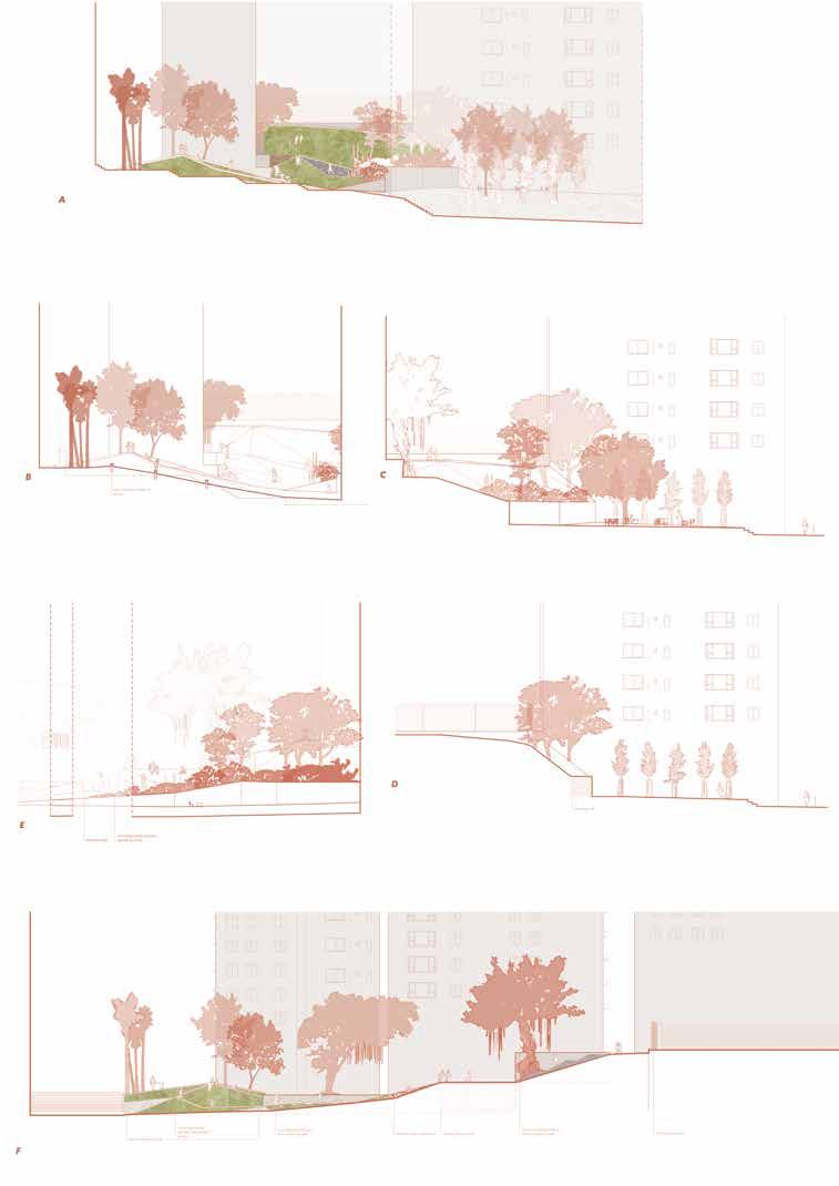
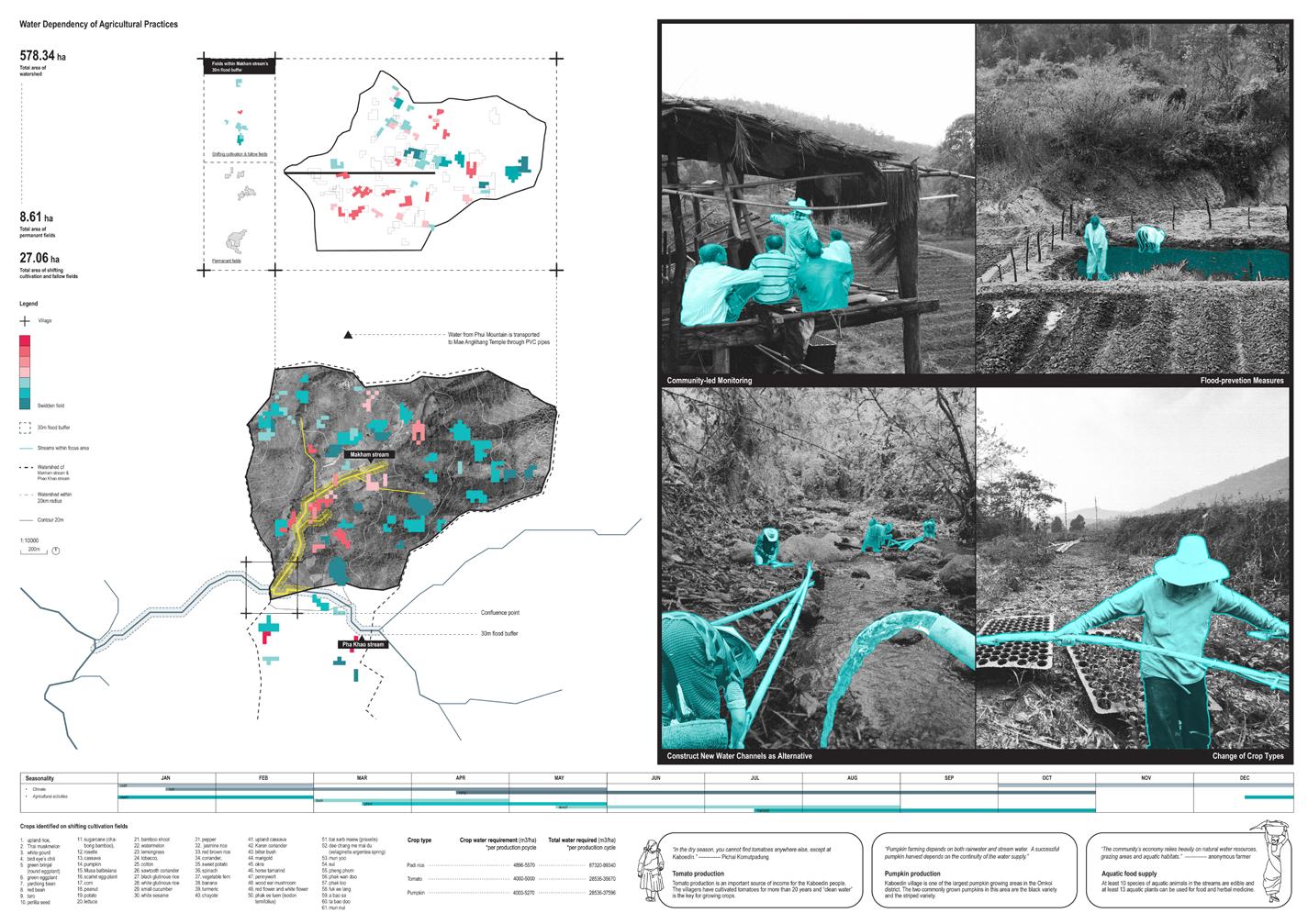
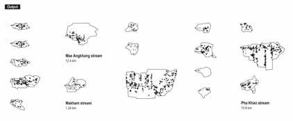
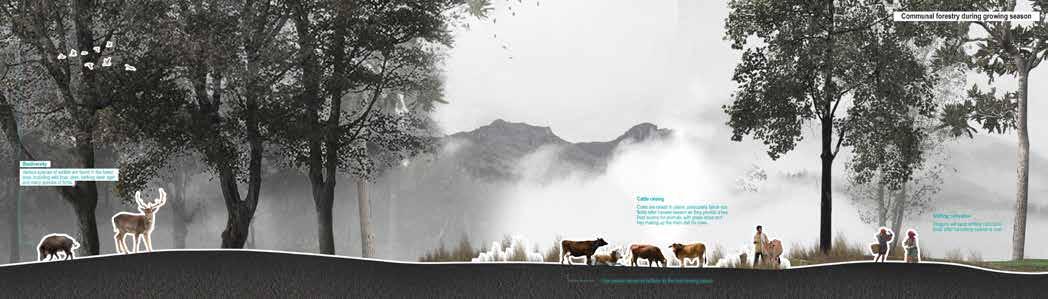
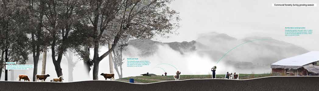
This study examines the dimensioning of indigenous knowledge through community mapping in the context of countering rapid assessments of Karen communities in Omkoi, Chiang Mai province. The research is motivated by the conflict between Kaboedin Village and a Thailand-based coal mining company, which sought a concession to mine in the area. In 2008-2010, an Environmental Impact Assessment (EIA) was conducted, which was later deemed incomprehensive and inaccurate. In 2019, the company returned to the village without notification, prompting community members from Kaboedin and surrounding villages to produce a Community Impact Assessment (CIA) in 2020 to counter the official EIA and to halt the concession. The community-led CIA included a water map called “Theeng Khu Tae Chee Water Map,” which was developed through five months of community mapping. While the current concession is temporarily suspended, future approval may be granted for the mining project, making it essential to provide Karen communities with a mapping toolkit to resist rapid assessments and understand village spatiality.
Drawing on the case studies of Insom Village and Nira Village of Mae Tho National Park, this study also examines the tenure conflicts and struggles faced by Karen communities. A 2007 research paper by Robin Roth, a specialist in forest governance and indigenous-led conservation, titled “Two dimensional maps in multi-dimensional worlds: A case study of community-based mapping in Northern Thailand,” discusses the mapping of village space. The paper problematizes the conventional two-dimensional mapping of villages and suggests mapping of dwelling space as an alternative to document space, understand village tenure institutions, and secure land. The strategies proposed by Roth serve as a starting point to develop mapping strategies applicable to the Kaboedin community.
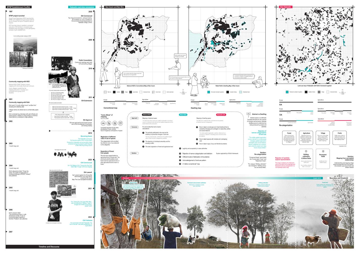
Spatial analysis of swidden fields and exploration of village boundary representation
Spatial analysis of swidden fields and exploration of village boundary representation
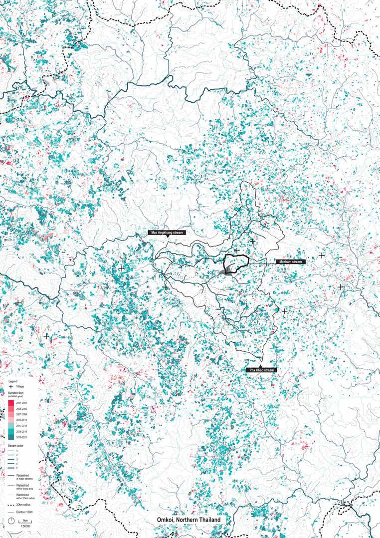
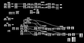
Agricultural practices shown in spatial-temporal representation that are incompatible with EIA
Bibliography
Journal
Roth, R. J. (2008). “Fixing” the forest: The spatiality of conservation conflict in Thailand. Annals of the Association of American Geographers, 98(2), 373–391. https://doi.org/10.1080/00045600801925557
Roth, R. J. (2007). The challenges of mapping complex indigenous spatiality: From abstract space to dwelling space. Cultural Geographies, 14(1), 81-111. https://doi.org/10.1177/1474474008101517
Report
Greenpeace Thailand. (2021). Kaboedin - The land of wonder. Greenpeace Thailand. https://www.greenpeace.org/static/planet4-thailand-stateless/2022/04/b29c2b22-kaboedin-community-report-full-english.pdf
Smart EIA+. (2011). Coal mining project Omkoi Subdistrict, Omkoi District, Chiang Mai province of 99 Thuwanon Company Limited. Environmental impact assessment information center by the Office of Natural Resources and Environmental Policy and Planning. https://eia.onep.go.th/eia/detail?id=4147
Dataset
Hansen, M. C., Potapov, P. V., Moore, R., Hancher, M., Turubanova, S. A., Tyukavina, A., Thau, D., Stehman, S. V., Goetz, S. J., Loveland, T. R., Kommareddy, A., Egorov, A., Chini, L., Justice, C. O., & Townshend, J. R. G. (2013). High-resolution global maps of 21st-century forest cover change. Science, 342(6160), 850-853. https://doi. org/10.1126/science.1244693
Department of Primary Industries and Mines. (n.d.). DPIM GIS. https://gisweb.dpim.go.th/main/GISLogin.aspx
Catenery Exploration
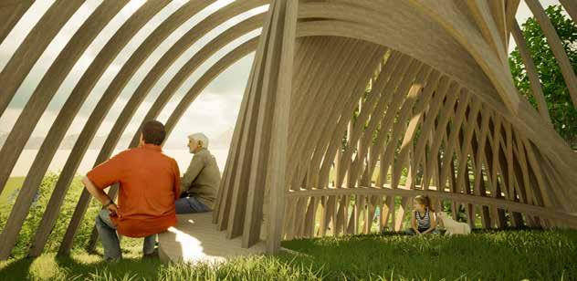
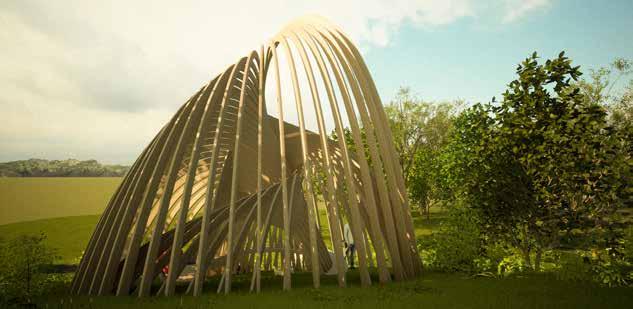
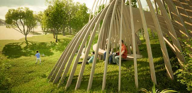
The pavilion at Mount Davis features a catenary structure measuring 10m x 10m x 12m, designed to combine aesthetic appeal with functional comfort. Supported by 50 large wooden beams constructed from smaller wood beams, the pavilion provides a warm and inviting atmosphere. A unique spiral seating arrangement circulates around the inner beams, allowing visitors to relax and socialize in a spacious environment. The catenary shape not only ensures structural integrity but also creates a visually striking form that enhances the overall experience.
A key feature of the pavilion is its ability to manipulate light, casting intricate parallel shadows on the ground as sunlight filters through the beams. This dynamic interplay of light and shadow enriches the visitor experience, making each visit unique. Overall, the pavilion invites visitors to engage with the space and the natural surroundings, providing a blend of comfort, beauty, and interaction.
Auditory X Olfactory Pavilion
Lai Chi Wo Children Theatre pre-show space
Instructor: Wallace Chang
The increasing popularity of returning to rural areas due to dissatisfaction with urban lifestyles has led to the revival of once-abandoned villages such as Lai Chi Wo. This revival has given rise to the concept of art villages, festivals, and leisure farming. The desire to return to a simpler lifestyle and finding one’s roots could be said to be limited to those born and raised in the city. Thus, the negotiation between the interests of the original villagers and the newcomers, and the relationship between man and nature are then both important conversations to be held.
Is there a fine line between reviving the village by capitalizing its unique location and disrupting the lives of the original villagers? How could we as designers be responsive and aware of the local cultures and natural habitats to create an eco-friendly and sustainable design?
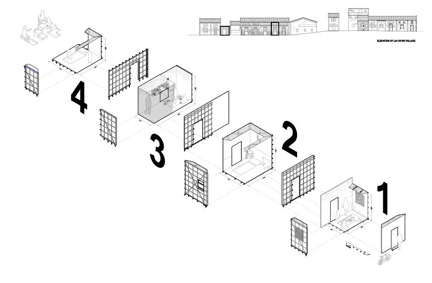
Design concept
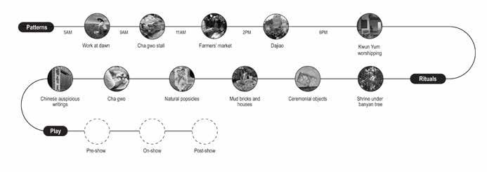
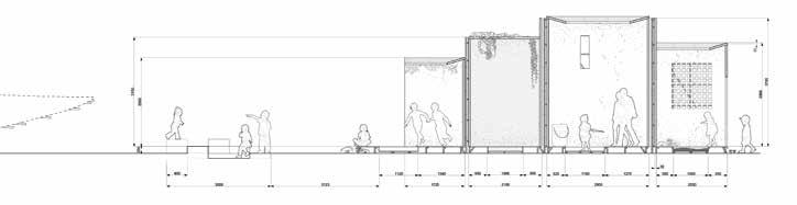
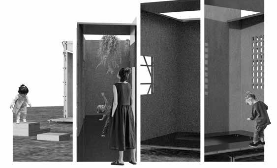
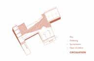
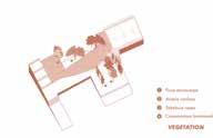
The proposed pavilion design draws inspiration from the rich traditions and ritualistic practices of the Hakka village community. By deconstructing the iconic Hakka house structure and integrating its key elements into a series of interconnected courtyards, the design seeks to evoke a heightened awareness and appreciation for the natural environment among visitors. Leveraging a multisensory approach, the pavilion will employ sounds, auditory cues, olfactory stimuli, and tactile experiences to immerse visitors in a deeply engaging encounter.
Furthermore, the pavilion is envisioned to serve as a captivating pre-show space, designed to excite and prepare both parents and children before the main event. This pre-show space will use sensory elements to create a sense of anticipation and wonder, preparing visitors for a transformative and impactful experience.
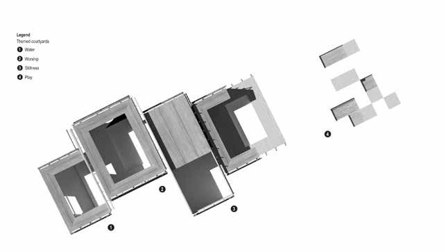
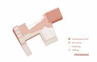
1/ Water
A Hakka Village’s Origins and Intricable Linkage with Water
A pool of water gathered in the courtyard is a auspicious symbol. The presence of water is emphasized with the small windows and fragmented bamboo detail on the roof which serve as drains to gather water into a small stream.The lowest segment of the scheme, its dimensions are based on a small Hakka village house.
2/ Worship
3/ Stillness
4/ Play
Tradition
This is where the smell of incenses originate and small sounds of worship routines can be heard. The dimensions of this segment is based on the Wong family altar, next to Aunt Kwan Ying’s residence.
Desolation and decay
While situated in a site undergoing rebirth (in the form of agriculture), the shaded segment is populated with dead dried flowers. They also stand in contrast to the small weeds grown at the courtyard - a vignette of the resilient weeds that grow at the edge.
Revitalization
The half-formed courtyard opens up to a play area, the pools of which would gather water during rainy days.
Spontaneous Spaces
Studio: Landscape design studio 4
Instructor: Susanne Trumpf
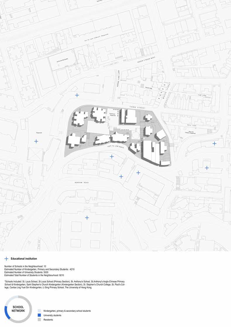
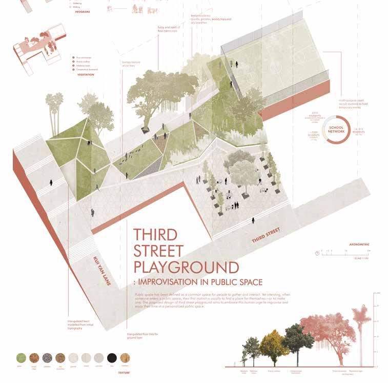
The design proposal for Third Street Playground seeks to embrace the innate human desire for improvisation and personalization within public spaces. By recognizing the tendency of individuals to seek out or create their own unique spaces within a public setting, the design aims to provide a playground that caters to these needs, fostering a sense of ownership and enjoyment among users.
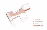
The design for Third Street Playground draws inspiration from pocket parks, integrating movable furniture and distinct triangulated planes to facilitate personalization and group occupation. This arrangement allows individuals to personalize their park experience, finding their own preferred spot for socializing, relaxation, or other activities. By providing opportunities for individuals to personalize their park experience and fostering interactive play elements, the design encourages spontaneity, sustainability, and a strong sense of community engagement.
Design concept
The design of Third Street Playground strategically addresses the concept of public space as a platform for personal interaction and creativity. By incorporating flexible seating and gathering areas inspired by Parley Park, the playground invites visitors to create their own spaces, fostering informal gatherings and personalized experiences. The inclusion of triangulated planes caters to diverse groups, providing unique areas for individual engagement and socialization. Furthermore, the use of upcycled materials sourced from the neighborhood—such as tires, bamboo sticks, and repurposed chairs— promotes sustainability while enhancing the playful atmosphere. The transformation of the upper-level basketball court into a versatile multi-purpose area allows for a variety of activities, enabling students from nearby schools to manage events and facilitate community engagement.