ACADEMIC PORTFOLIO
 JOANA VASCONCELOS BARBOSA
JOANA VASCONCELOS BARBOSA
COLLECTIVE HOUSING IN BOAVISTA | PORTO
Subject | Project III 2018-2019
STUDENT RESIDENCE IN BONFIM | PORTO
Subject | Project IV 2019-2020
TWO HOUSES IN JOÃO DE BARROS STREET ANALYSIS AND 3D MODELING

Subject | Construction II 2018-2019
URBAN PROJECT OLIVEIRA DE AZEMÉIS
Subject | Project IV 2020-2021
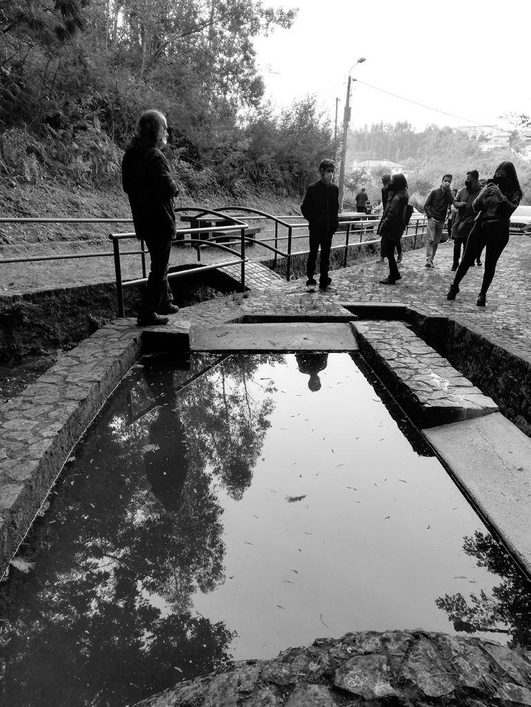
VILA D’ESTE: PORTRAIT OF A PECULIAR PUBLIC SPACE MASTER THESIS
Subject | Dissertation 2021-2022
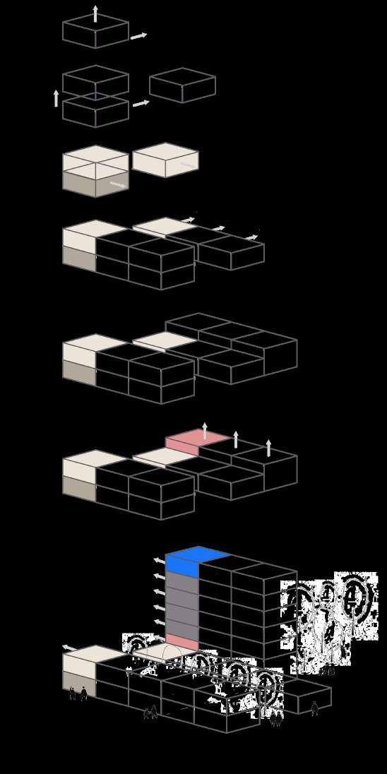
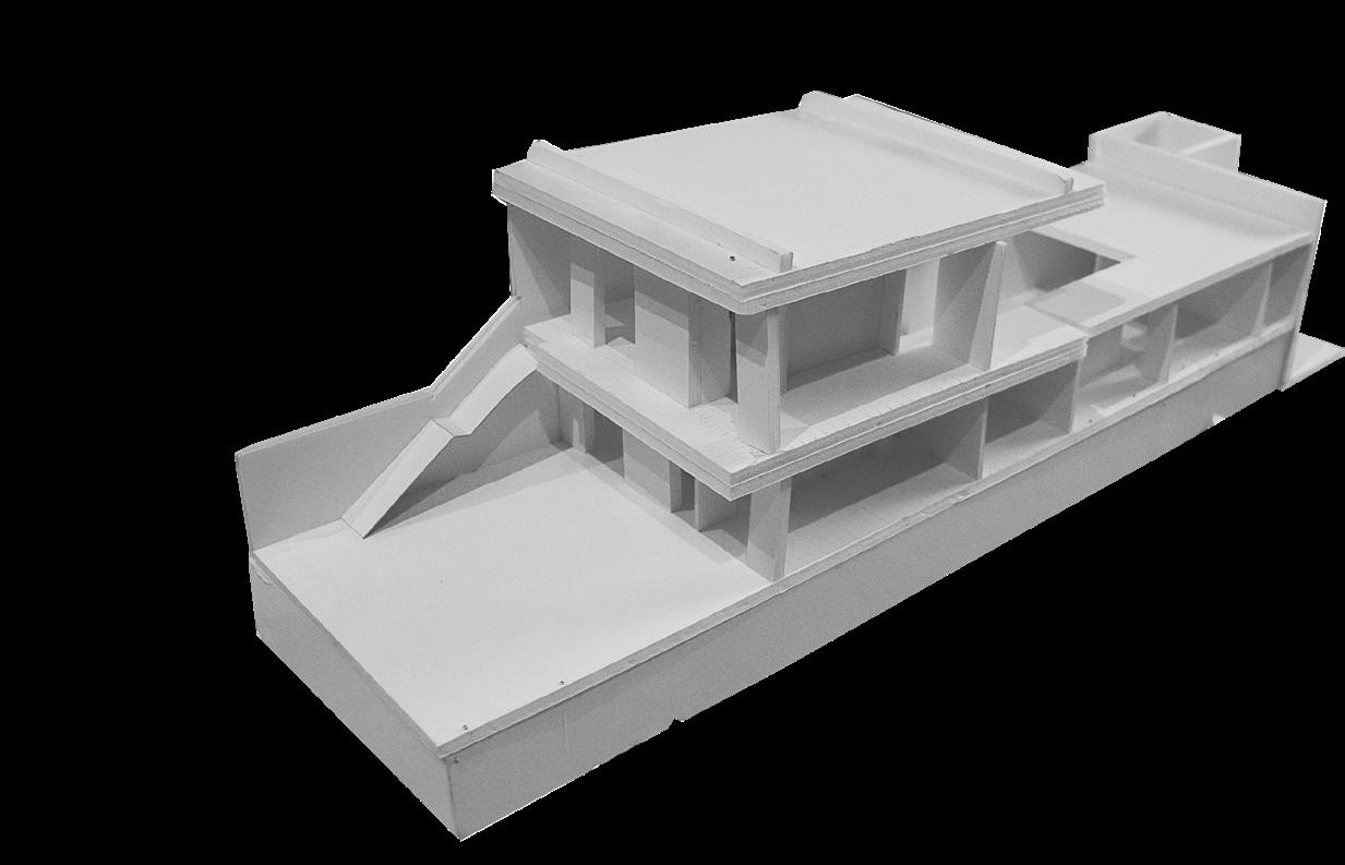
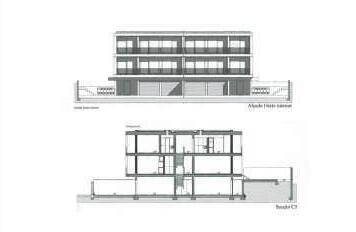
The presented project is the culmination of three phases of work. An inicial phase, of conceptual nature (due to the absence of a real urban context), included the development of three distinct solutions for the aggregation of dwellings (“direct access”, “gallery access” and “multiple vertical access” systems). This phase supported the two last phases of the exercise, in which, from the solutions obtained in the beginning, it was possible to formulate a proposal for the urban implantation of the idealized housing complex. At the same time, solutions for public space, access and circulation were developed, aiming the organization of the intervention area. In turn, the last phase of the exercise comprised
the development of one of the designed buildings, both in its shape, volumetry and details (constructive and structural).

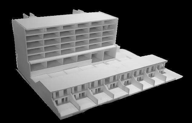
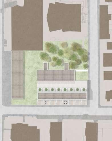
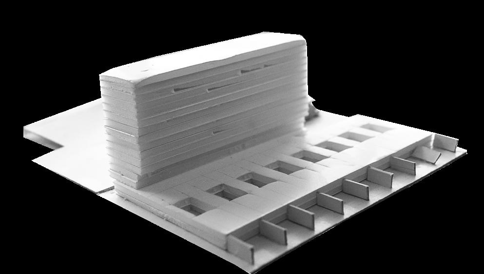
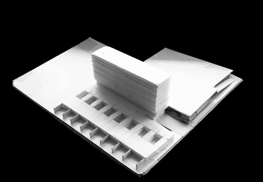
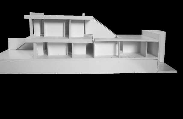
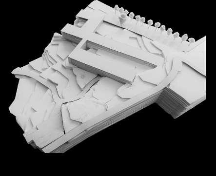
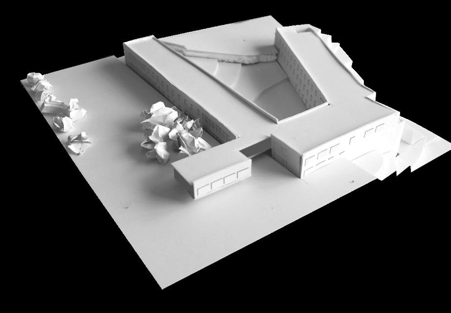
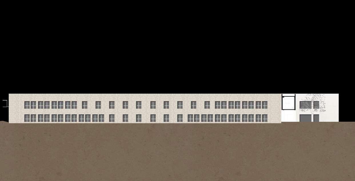
The scale models presented in the following page illustrate part of the development process of this exercise, from the global scale to the particular scale, from the whole building (composed by three volumes), to the development of the module of the “direct access” linear dwelling. In a terrain configured by three circulation roads (to the north by Avenida da Boavista, to the south by Rua António Patrício and to the west by Rua António Cardo-
so) I designed an intervention proposal of three buildings, in which each one corresponds to a distinct access system. The implantation of the 1st building (“multiple vertical” access system), adjacent to Avenida da Boavista, seeks, on one hand, to resolve the gable of the adjoining building and, on the other hand, to establish a visual continuity that would otherwise be lost. The other buildings proposed were conceived and implanted in an east/ west direction, in order to ensure a favourable solar exposure for the flats and to establish some order in the territory.
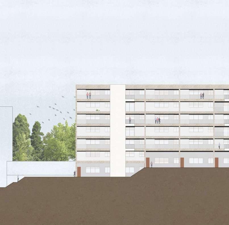
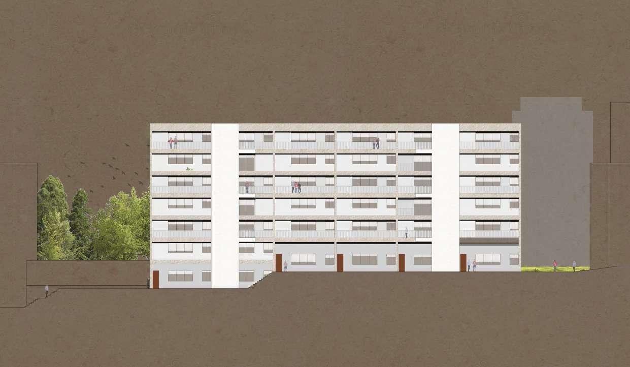
One of these buildings establishes a relationship, in height, with the building adjacent to Rotunda da Boavista, although it is positioned perpendicularly to it. As the dwellings are orientated east/west, and given the shallowness of the building, I opted for a gallery access system (facing east) that would allow, through a common space, easier access to the largest number of dwellings (as a system of multiple staircases would not be favourable to the intended layout of the dwellings).
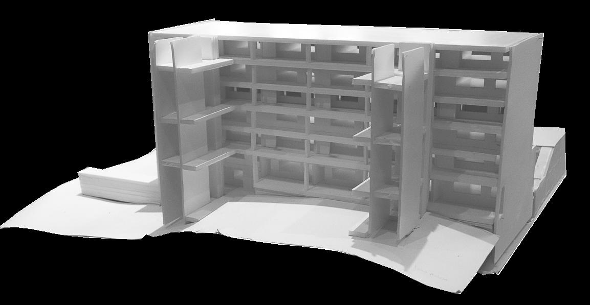

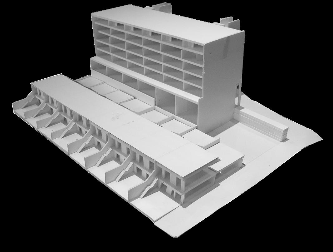
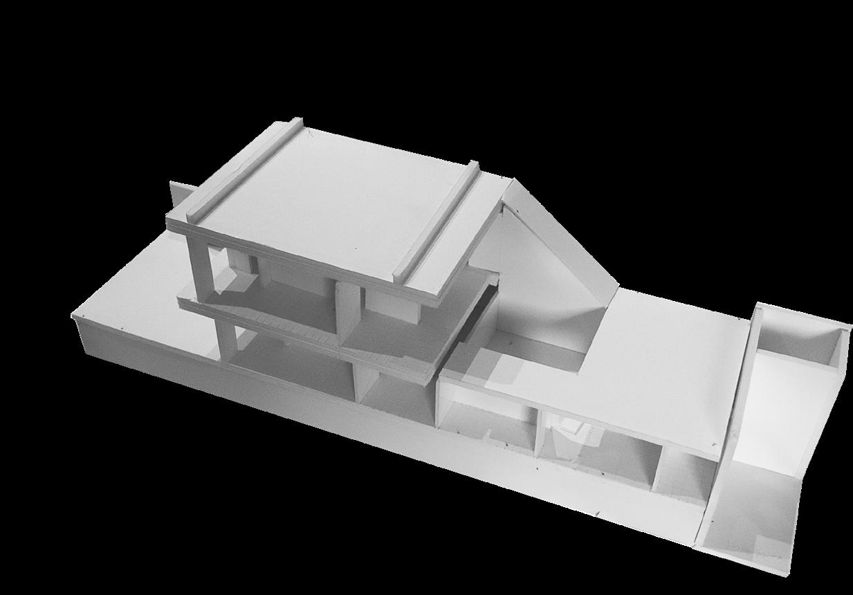
West elevation. At the front, a group of row houses (“direct access” system). Behind, the residential building with a “gallery access” system.
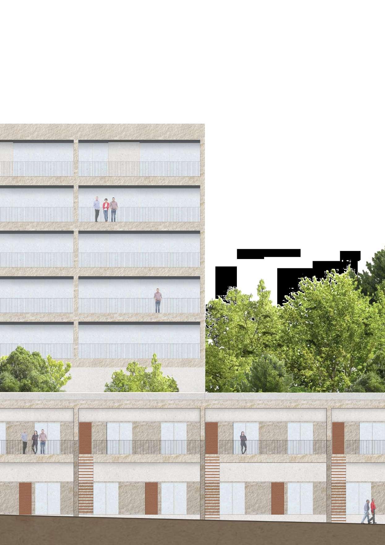
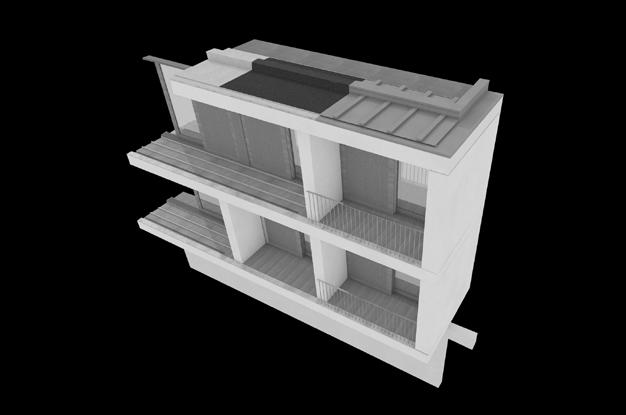
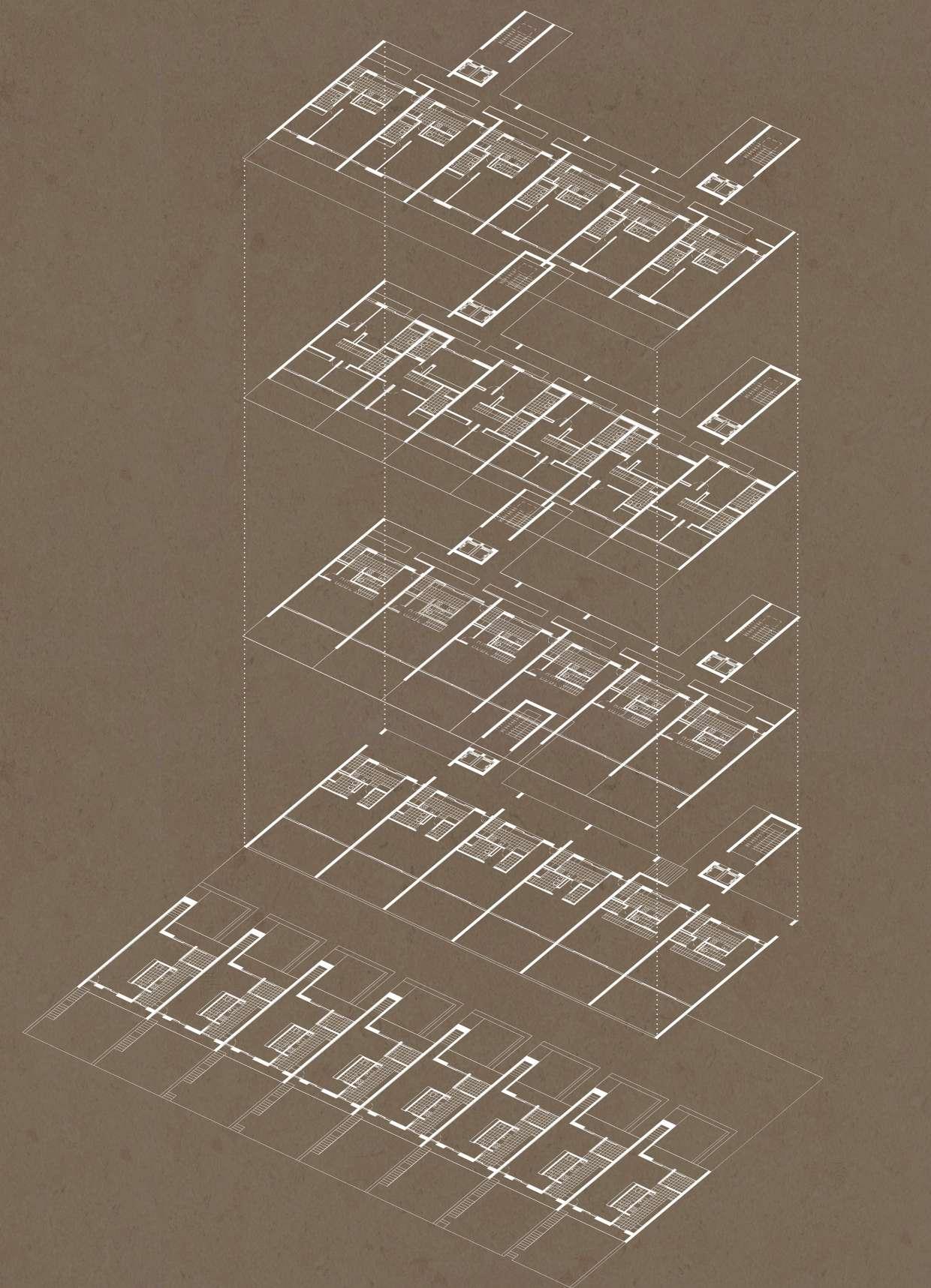
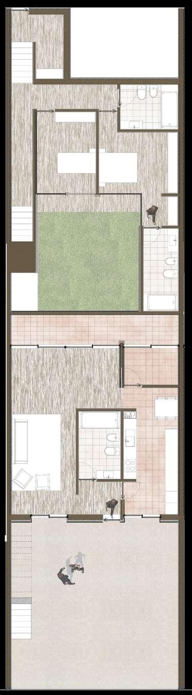
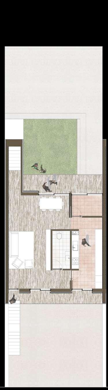
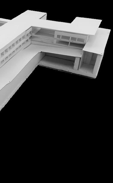
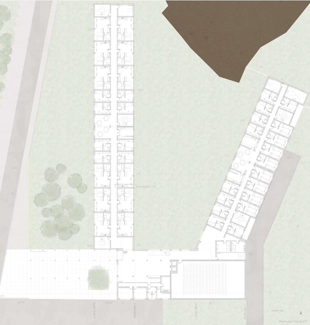
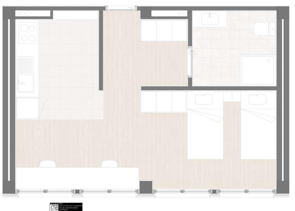
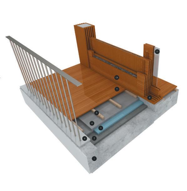
In turn, the row house complex was designed in order to establish a close relationship with the surrounding area of rua António Cardoso (which comprises, for the most part, single family residential buildings). Integrating studios of typology T0 (ground floor) and T2 duplex (1st floor and ground floor), each module includes an interior patio that, being accessible only from the double bedroom duplex flat, from the bedrooms’ area, also allows light to enter the T0 appartment. The plans of this module, further developed in the last phase of the exercise, are shown on the right.

On the left, the ground floor plan of the module (“direct access system”), includes a T0 flat and the bedroom area of the T2 appartment.
Below, the plan of the 1st floor of the two bedroom flat. The access to the ground floor, where the bedrooms are located, is made through the staircase starting from the living room.


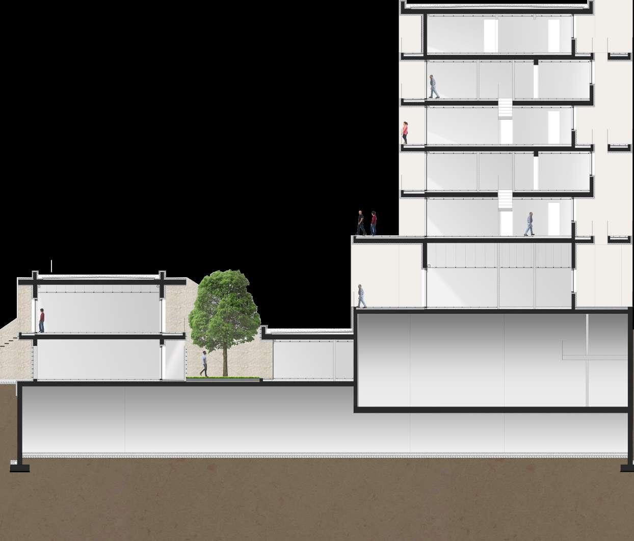


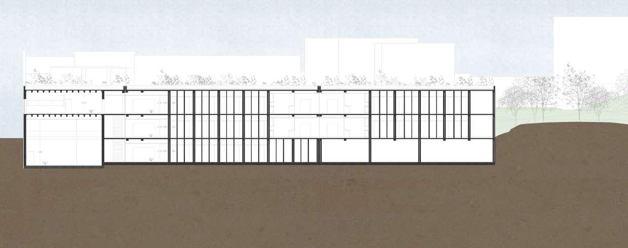
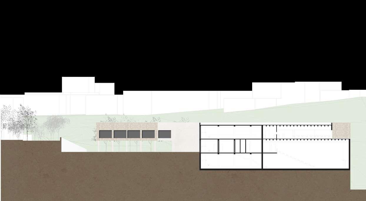
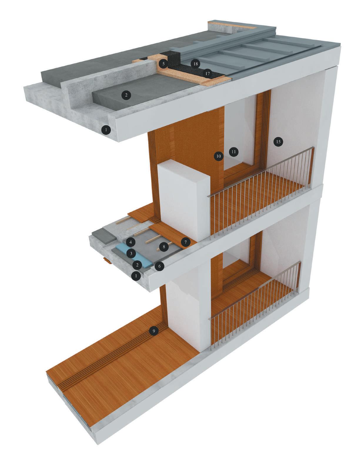
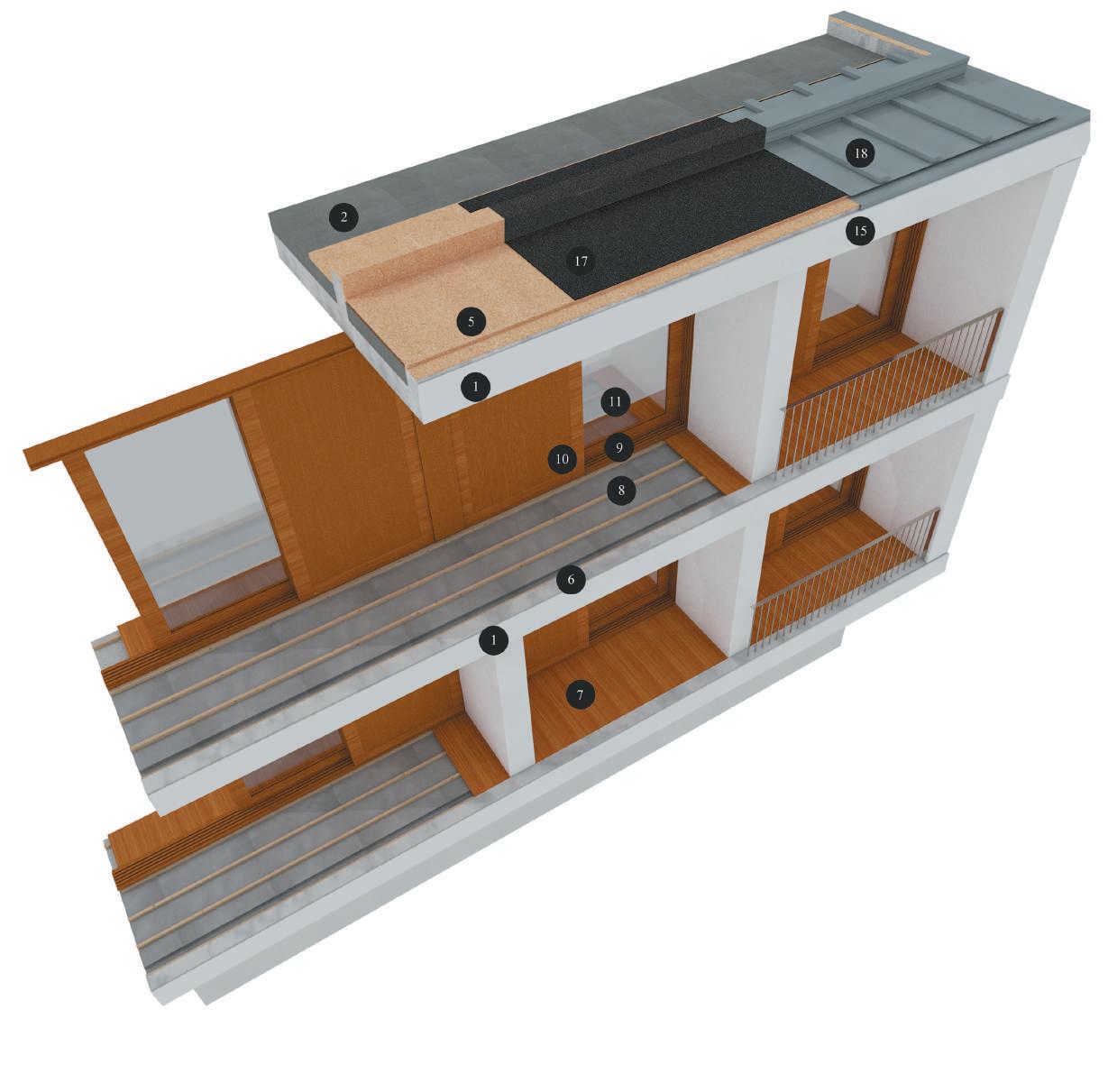
The proposal presented for a student residence in Bonfim, Porto, is the product of the aggregation of three volumes that articulate with each other in order to incorporate the building into the unstable topography of that territory, so that neither the solution proposed for the building nor the land that embraces it were compromised or subjugated in function of the other. Of the whole, two longilinear modules accommodate the students’ bedrooms, dining areas and kitchens, with one of the modules facing east/west and the other, which suffers a torsion, facing northwest/ southwest. The torsion of this “arm” was intended, on the one hand, to create some distance between the bedrooms of the two volumes, which gain some pri-
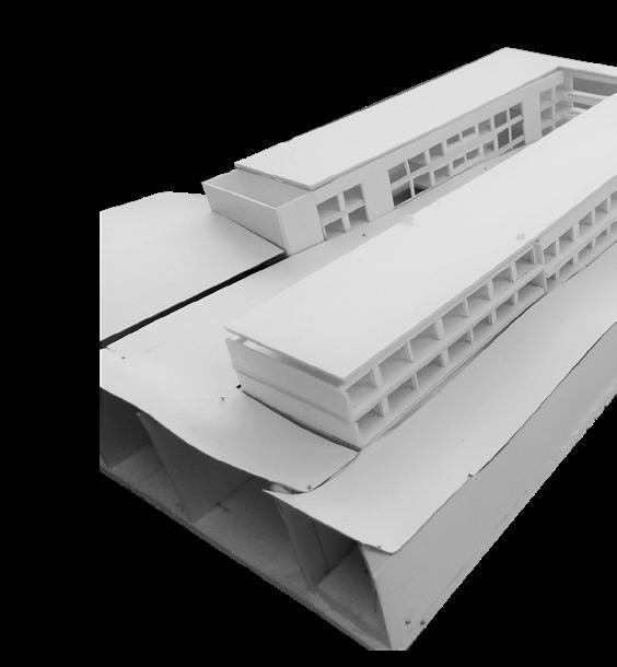


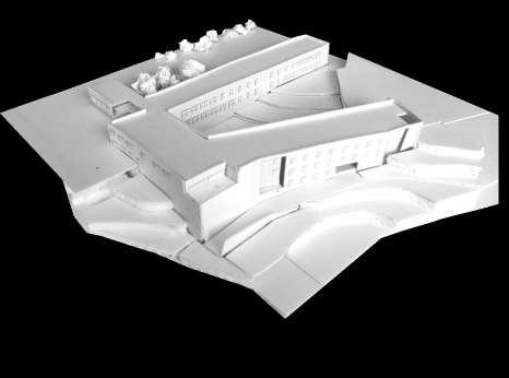
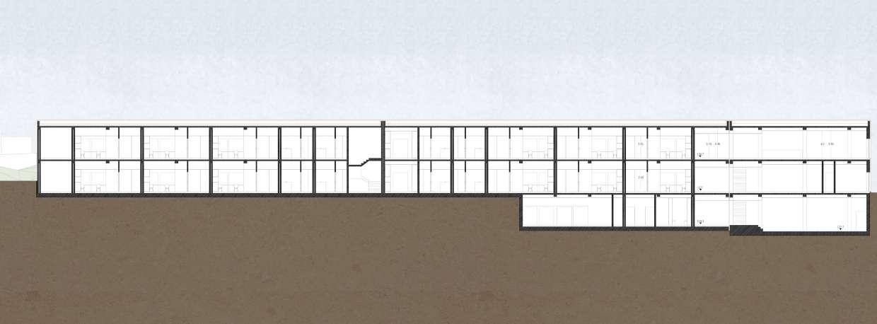

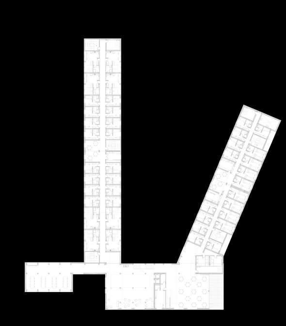
vacy, and on the other, to increase the green area between them.

Finally, the third volume, which allows the entrance to the building, constitutes the group’s aggregating module, the nucleus where the administrative spaces, the living and study area and the auditorium are located. Intentionally placed next to the circulation route, it allows parking in a covered parking area and access to a loading dock that serves the building. In
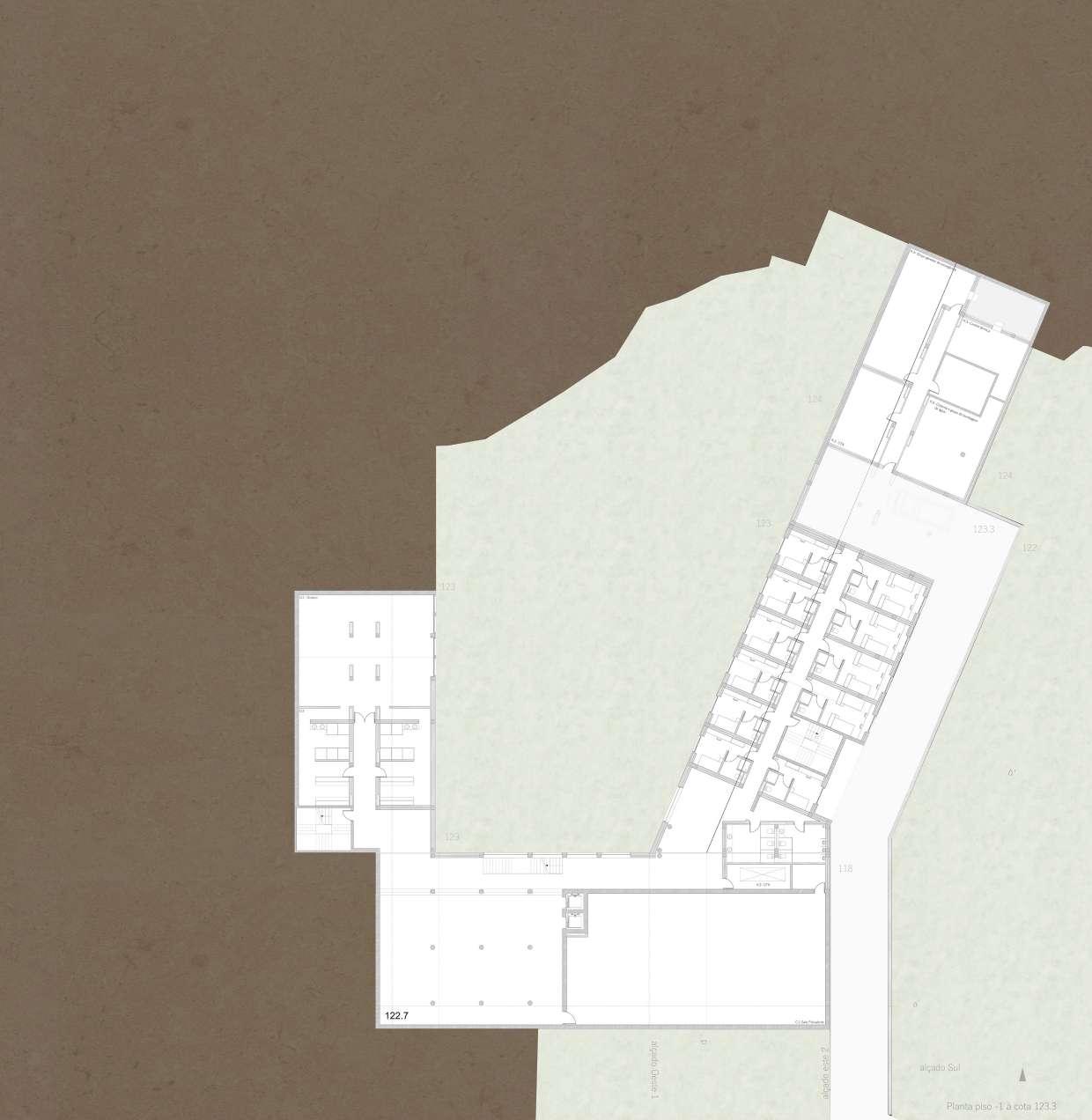
a complex interaction between the topographic irregularity of the territory and the complex program that a building of this typology entails, it was sought, above all, to integrate the building coherently in its urban context, to create accessible public spaces to residents and to establish a relation of continuity with the (residential) surroundings that characterize that territory.


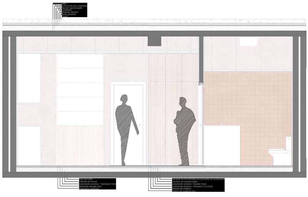

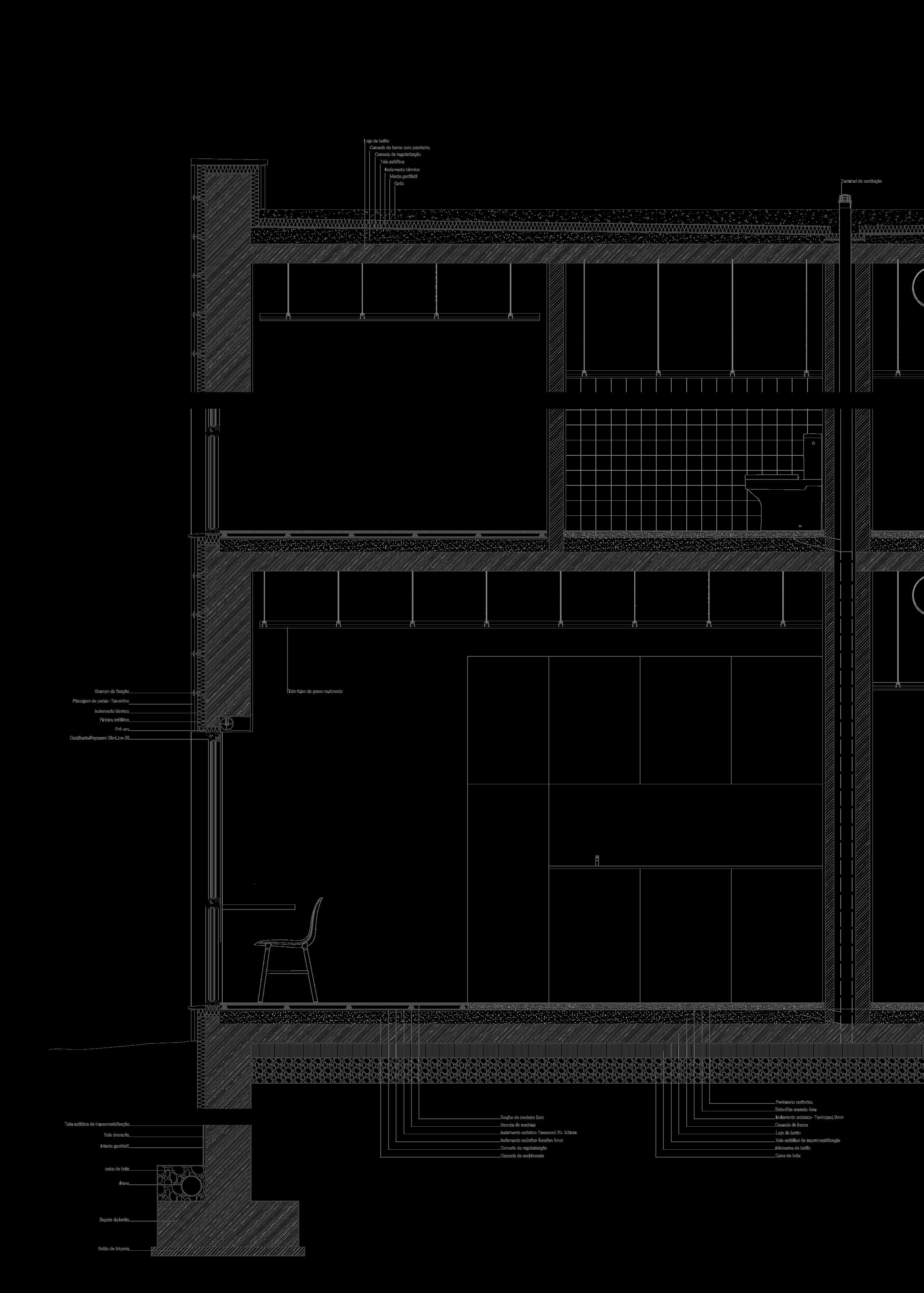

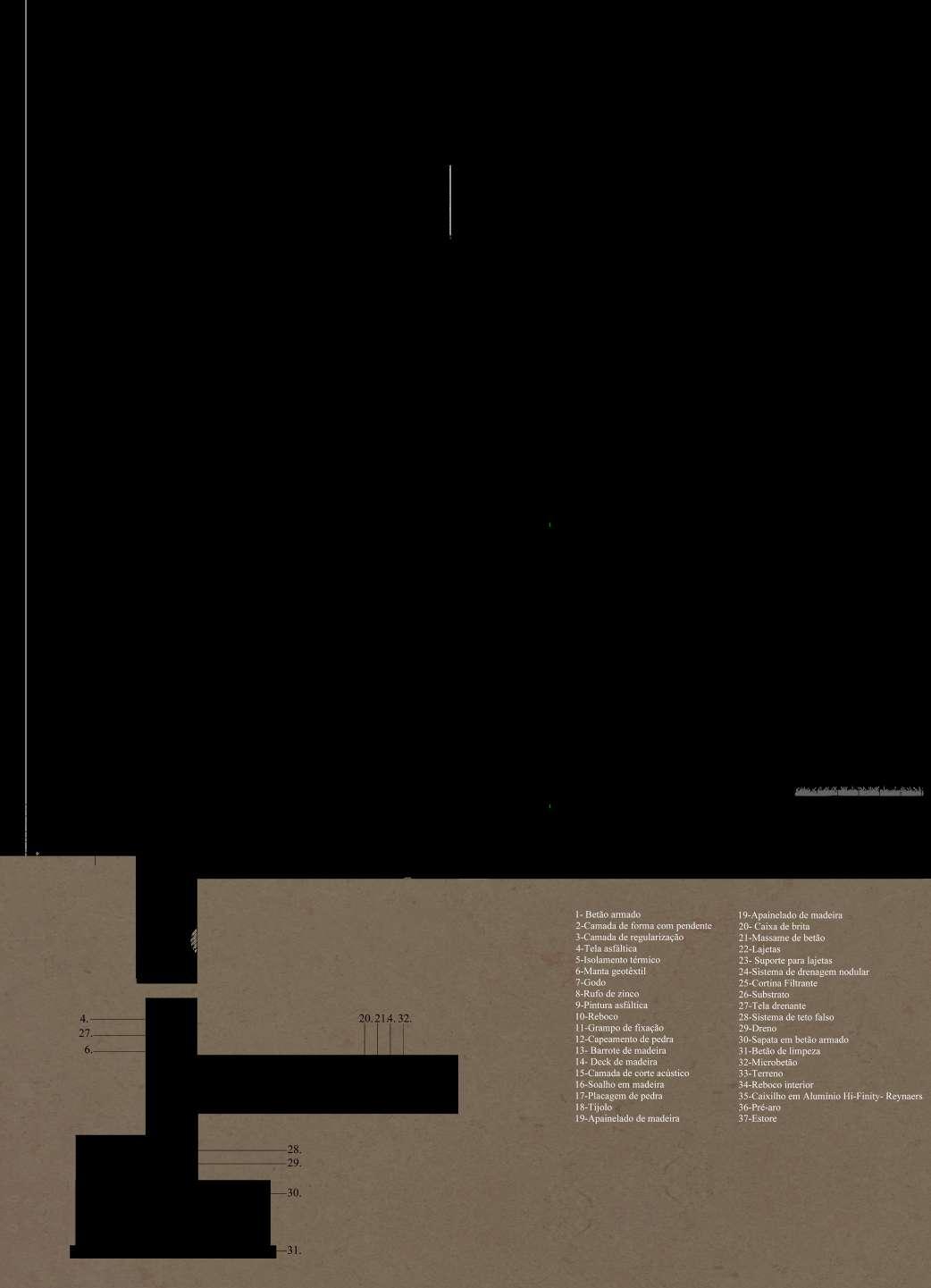
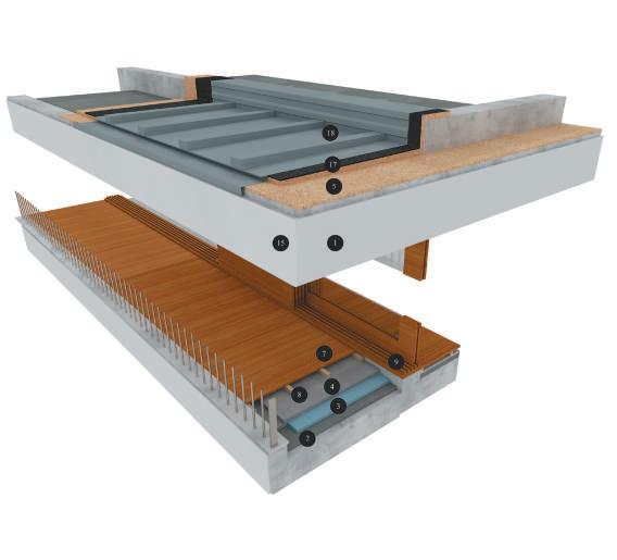
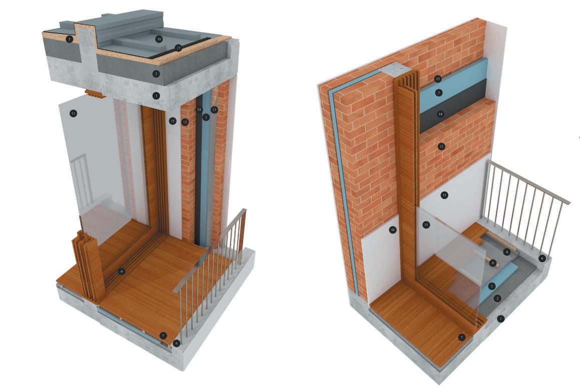
Developed in the course “Construction II”, this exercise focused on the acquisition of analytical and three-dimensional representation skills, on the basis of a construction detail of a project of the student’s choice. In particular, the aim of this exercise was to improve the understanding of the execution processes, construction techniques, characteristics and physical dimensions of the elements, knowledge of textures, and many others.
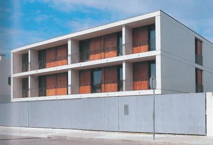
Designed by the architect João Álvaro Rocha, the project depicted is located in the district of Porto and comprises two symmetrical dwellings. The volume of the work, defined by alignments and the height of the elevation, materialised a set that stands out, on the one hand, for its (apparent) simplicity and, on the other, for its geometric rigour, in its part and as a whole.
Essentially, the project establishes a relationship between two different levels, that of the street, to the southwest, and that of the land, inside the lot. In this way, the garage, the laundry and the work space are designed at street level. In turn, the main floor, which integrates the living room and kitchen, constitutes, in relation to the street, the first floor, and, in relation to the posterior terrain, the ground floor. Even so, this floor is slightly elevated to allow light into the laundry and work space, this floor, in a clear demonstration of the importance that, in this context, the
management of different heights acquires in the spatial organization of the project.
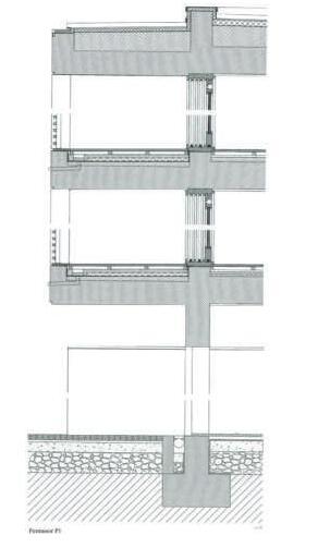
At the same time, with regard to the treatment of the facade, there is an evident unity in the elevation, both because of the continuous slabs, which bring the building together, and because of the wooden shutters, which simultaneously favour a homogeneous reading of the project and allow a variation of the facade throughout the day, depending on whether it is opened or closed.
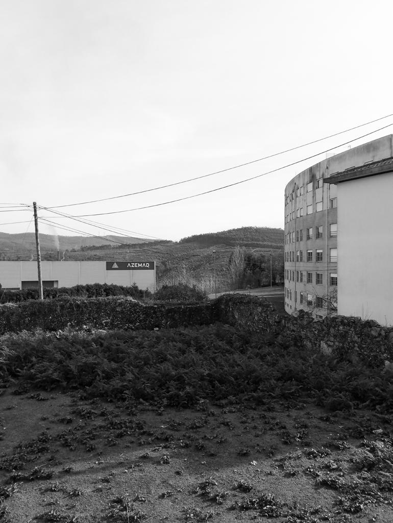
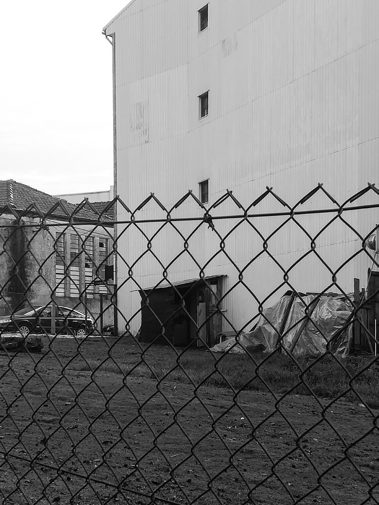
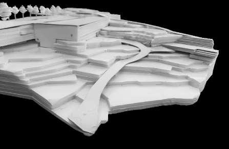
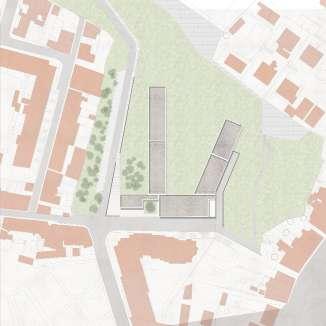
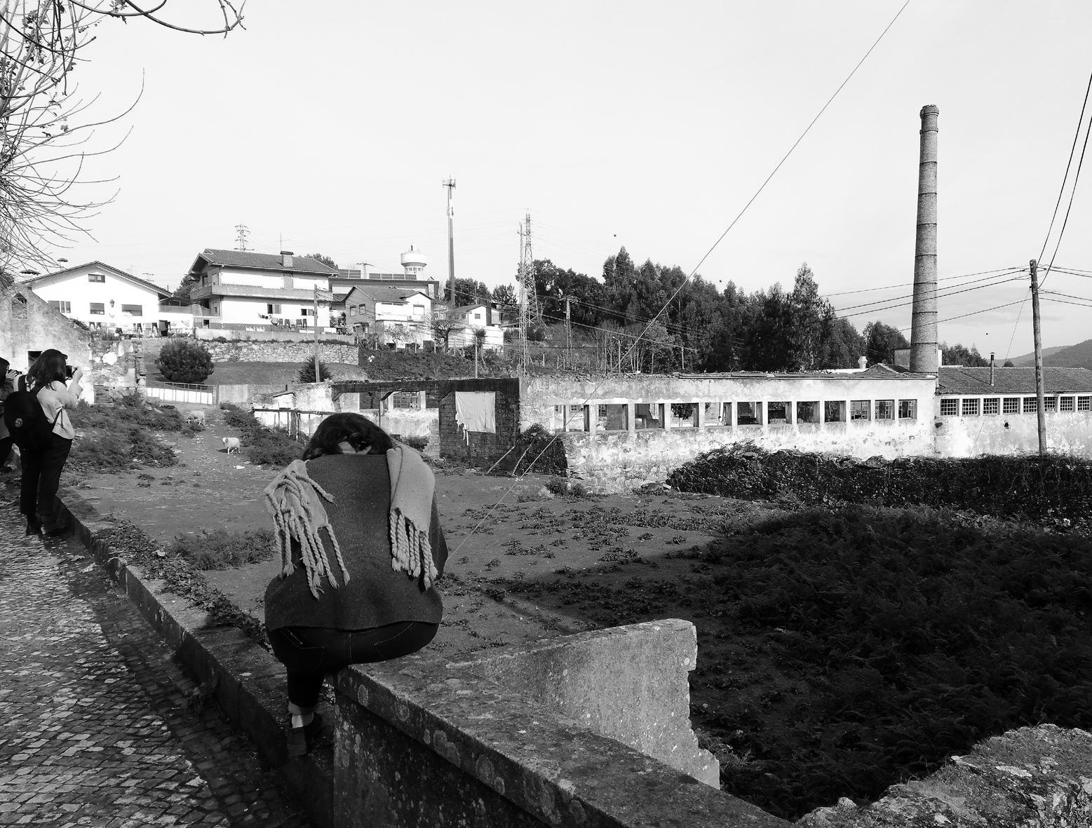
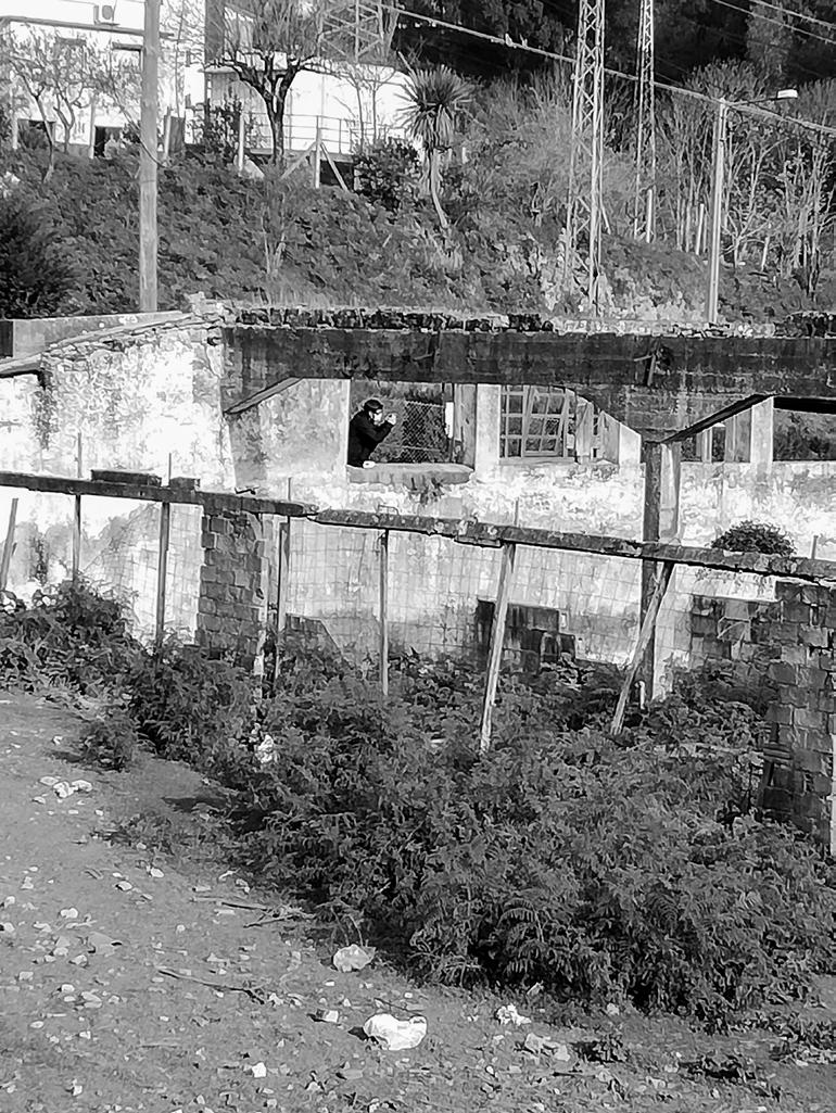
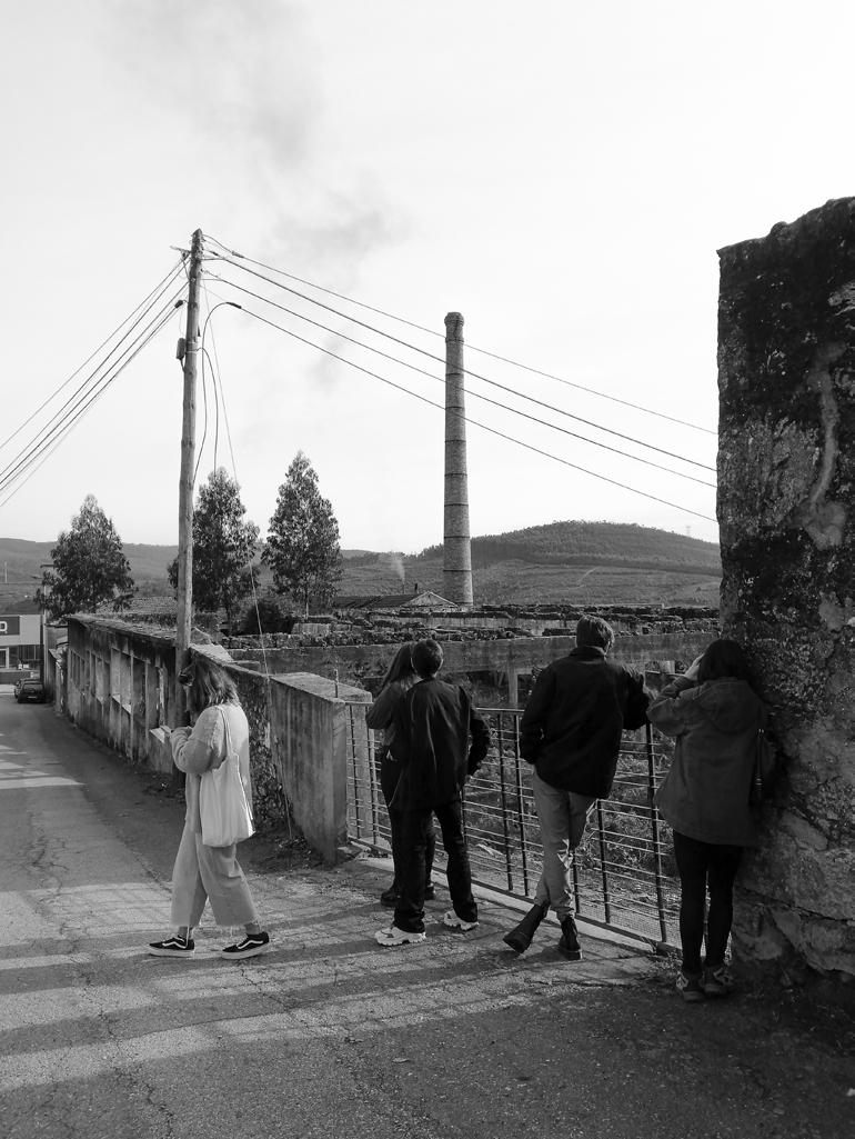
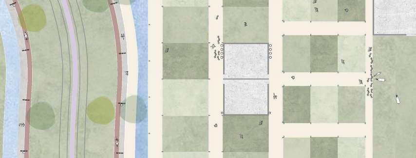
In an educational context in which the aim was to reflect in depth on city and territory, “Dismantling Borders, Healing territories” is the concept that gives the motto to the exercise of analysis and development of proposals for the selected case study: Oliveira de Azeméis.
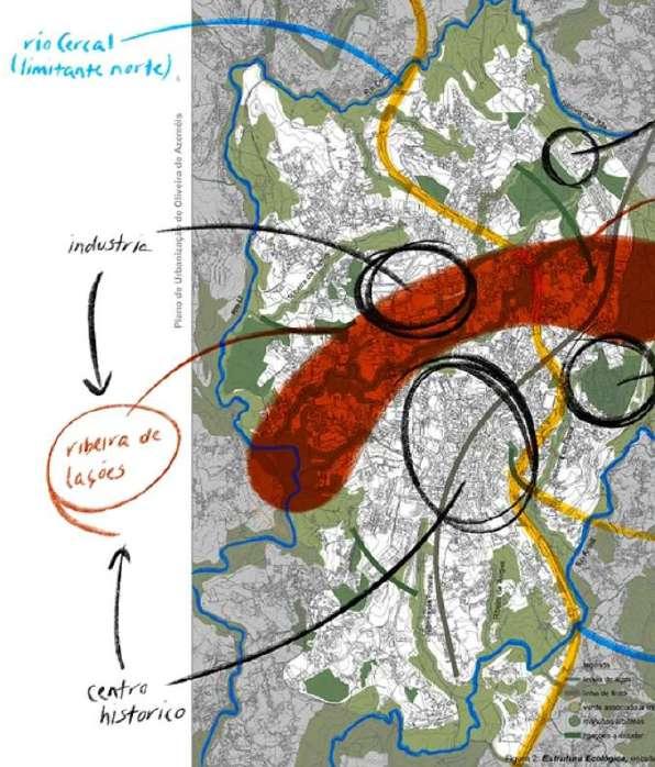
“Dismantling borders” because, above all, it was important to reflect on the borders (natural or not) that, to a greater or lesser extent, divide the territory, not only internally but also in relation to the surrounding contexts. In turn, with “Healing Territories” we intend, on the one hand, to expose a range of issues that, together, prevent the creation of a coherent and homogeneous territory and, on the other hand, to present potential solutions to the issues identified.
Starting from a global (and prospective) analysis of the Municipality, this exercise proceeded with the formulation of hypothesis for transforming the territory, with the purpose of addressing the problems identified.
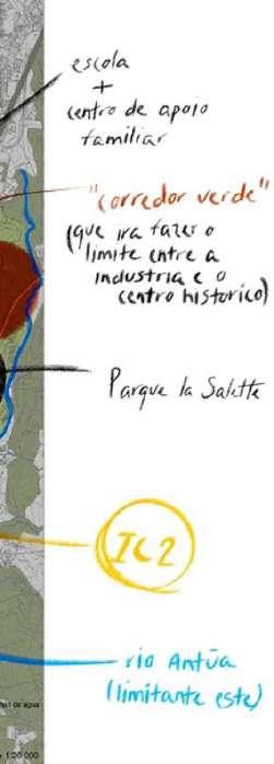
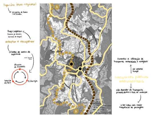

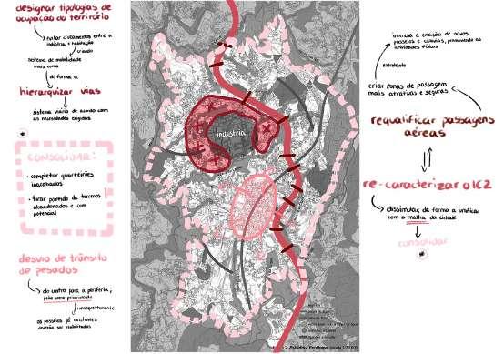
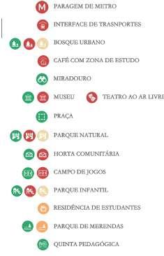
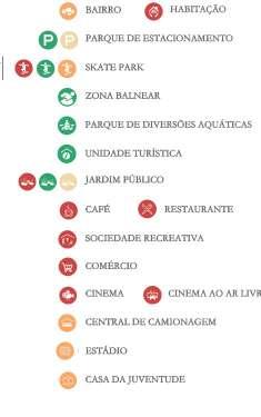
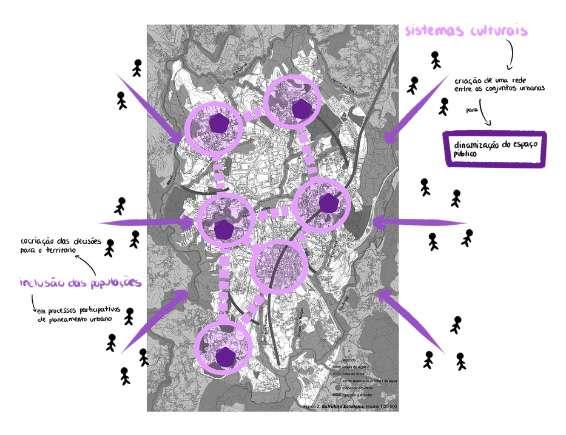
Based on the identified needs, the exercise proceeded with the definition of three operational units (mobility unit, IC2 unit and the green corridor unit) that address some of the key issues identified. The development of these three thematic spheres made it possible to reflect on potential solutions for the Municipality and to outline numerous proposals, of which we highlight the improvement of the public transport network, the insertion of missing equipment (commercial, leisure, recreational, etc.), green spaces for public use (parks and gardens), educational spaces (educational farm) and housing (for students and families).
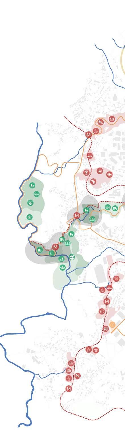
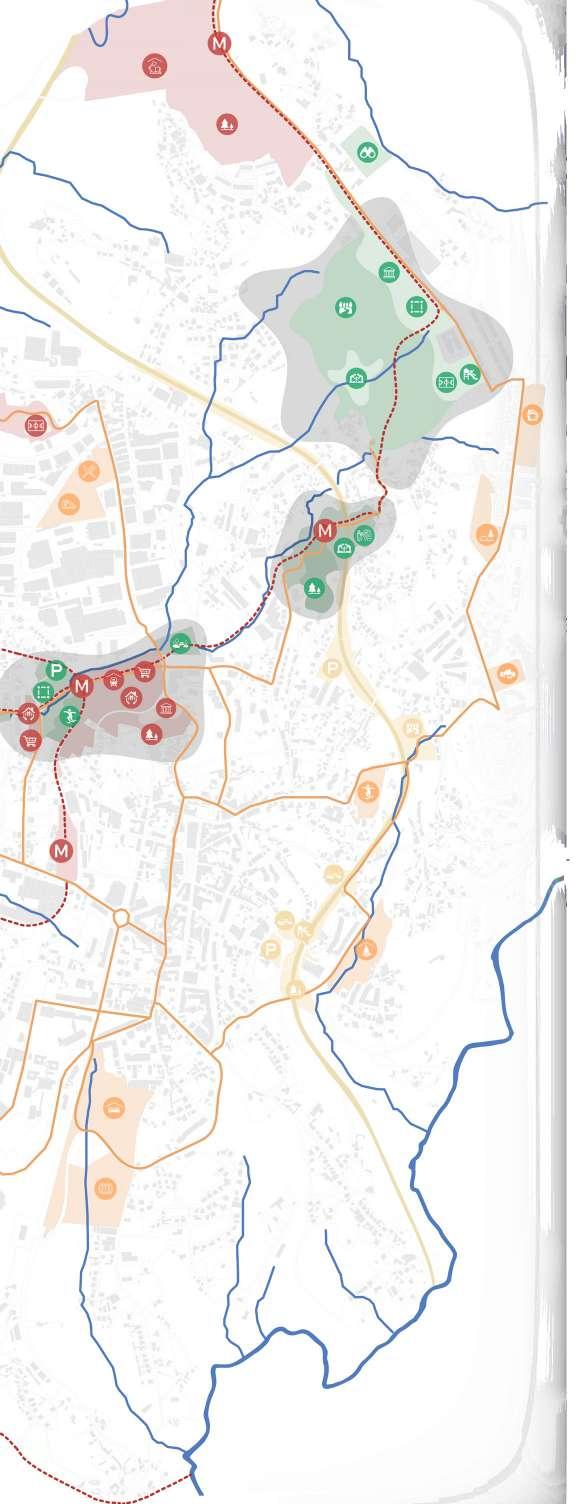
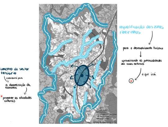
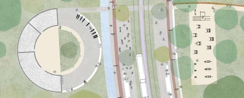
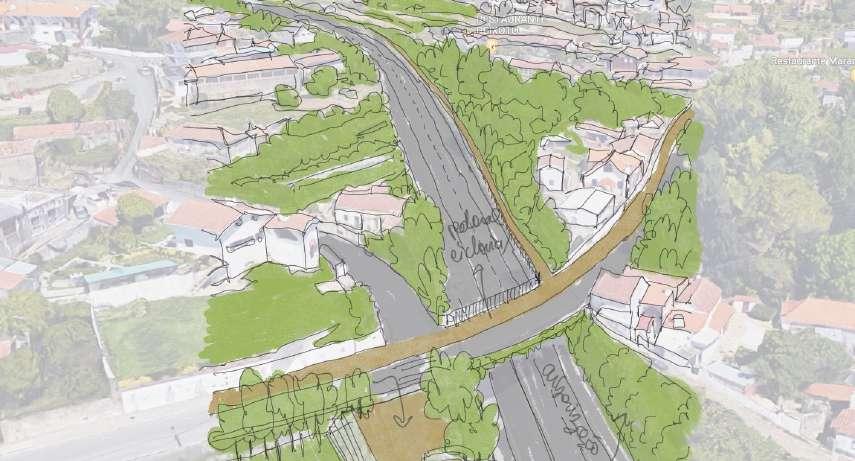
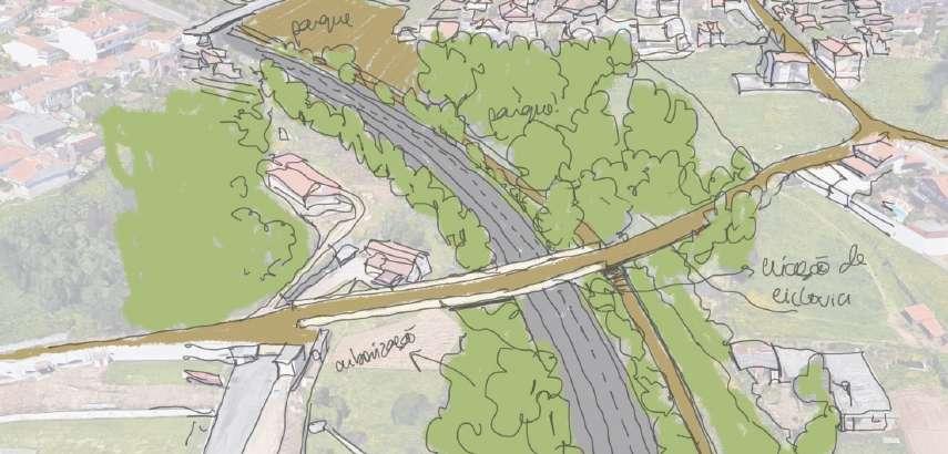
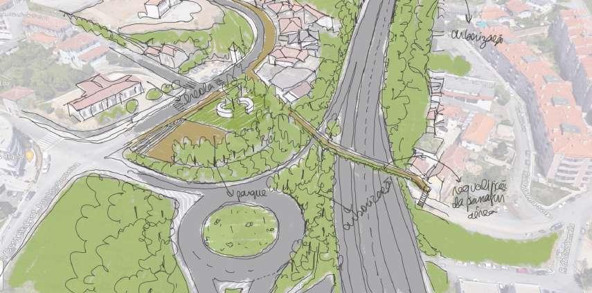
Individually, I had the opportunity to further study the IC2 unit (a linear unit alongside the IC2 highway), in which I proposed (in collaboration with the rest of the working group) its improvement and requalification, in order to promote its value and potential as an aggregating (rather than fracturing) axis of the territory.
In fact, if, on one hand, this axis reveals itself essential in the articulation of Oliveira
de Azeméis with the surrounding contexts, it also represents a symbolic obstacle to the communication between distinct areas of the Municipality, divided by this axis (which crosses the territory from north to south).
For this very reason, it was important to study solutions that, on one hand, integrated this axis in the territory where it is inserted and, on the other hand, reduced the symbolic distance between the
clusters separated by it. Thus, we proposed the naturalisation and requalification of the IC2 margins, starting at the insertion of low vegetation and forestation, in order to moderate its imposing character on the landscape and to reduce its physical and environmental impact on the Municipality.
In parallel, we proposed the requalification of specific crossings (pedestrian or not) under and over the IC2, as well as the creation of new crossings (road, rail, pedestrian and
cycling crossings) at strategic points, in order to approximate the eastern and western areas divided by the IC2. At the same time, with the aim of making this axis an integral part of the territory and promoting its adjacent spaces, we selected some areas bordering the IC2, in which we proposed the development of different types of spaces (gardens, parks and community gardens) that could add value to the Municipality.
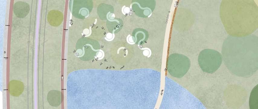
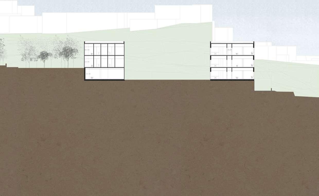
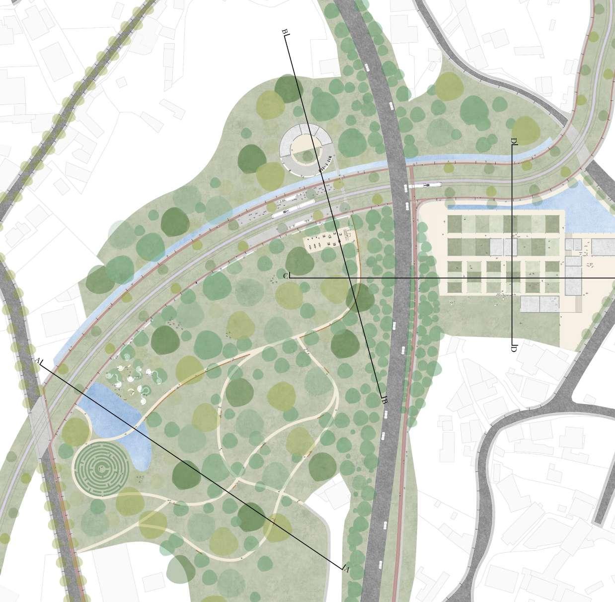
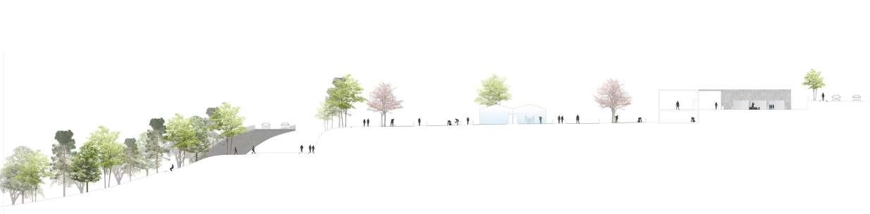
Section A. This section offers an approximation to a small part of the proposed park (designed to the west of the IC2 highway) and helps to assess the relationship between the different proposed programmes (park, metro line, promenade and cycle track).
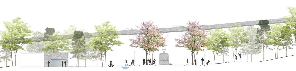
Section B. Part of the IC2 highway, converted into a viaduct, guaranteeing direct communication between the eastern and western parts of the municipality (through pedestrian, cycling and rail connections). The IC2 becomes an integral part of the landscape.
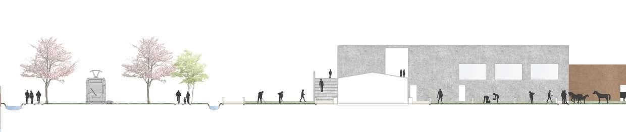
Section C. Shows the relation between the eastern and western areas of the IC2, in this case, between the park and the pedagogical farm. Simultaneously, it illustrates the way the cycle track and the pedestrian promenade (designed along the IC2) are integrated in the context and relate with the proposed program.
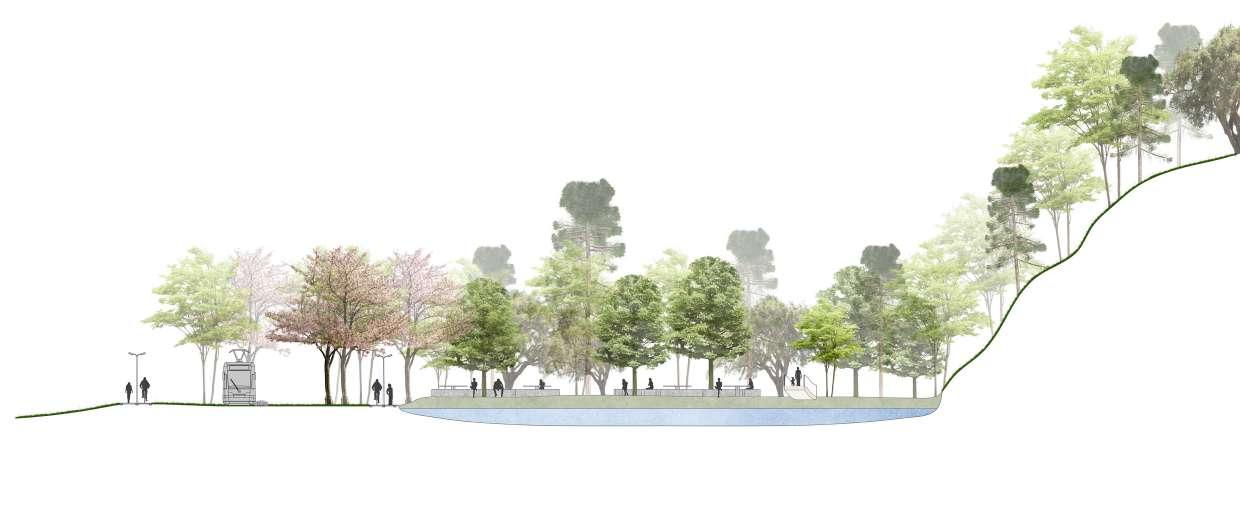 Section D. Illustrates the smooth transition between the different programmes proposed (metro line, promenade, cycle path and the educational farm).
Studies on the renaturalisation of the IC2 highway. Reflection on the possibility of transforming this road into a “green corridor”, through the planting of trees along its margins, with the purpose of safeguarding the adjacent houses and land (which are in direct contact with this road), but also serving an environmental purpose, increasing air quality, reducing noise pollution and fostering local biodiversity.
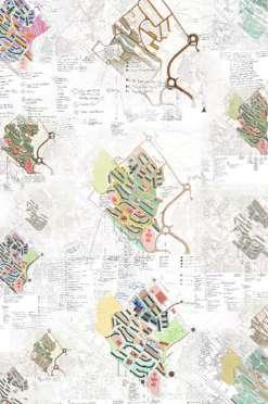
As the final work for the conclusion of the course, the dissertation I present here was born out of a growing curiosity about the topic of “public space” and the types of social organisation that are reflected in it. The selection of the case study - Vila d’Este -, was based on a diverse range of issues, of which I highlight the size of the settlement, the large number of residents and their heterogeneity, as well as the richness that this heterogeneity generates in the public space. Furthermore, the 40 years of existence of the complex, the vicissitudes in the development over the decades, the physical and social enclosure and the later opening to the exterior, as well as the characteristics of the implantation of the complex made Vila d’Este the ideal laboratory to inform a work that intended, above all, to observe and question.
Thus, I set out to elaborate an ethnographic portrait of the public space in question, from the exposition of the facts observed in the place and the conduction of interviews to the residents, who shared valuable points of view that helped conduct this research.
Based on the facts observed, I could verify that continuity, coherence or homogeneity are (often) atypical concepts in the public space and that the modalities of social organization in the space are often different from what is expected, being from this mismatch between expectation and reality that the most interesting forms of appropriation of the space are born. Precisely because public space is hete-
rogeneous and the stage of various conflicts, it is important, when studying it (from the analysis to the formulation and implementation of urban or architectural proposals) to adopt a multifactorial vision, in which variables such as social differentiation, territorial, historical and economic context and even the morphological characteristics of the place, the new virtual communication methods, the daily workday life and, simply, the free will of the citizens, should be taken into account, since they greatly impact the frequency, quality and, above all, the characteristics of the use and appropriation of space.
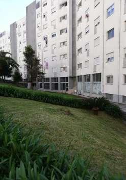
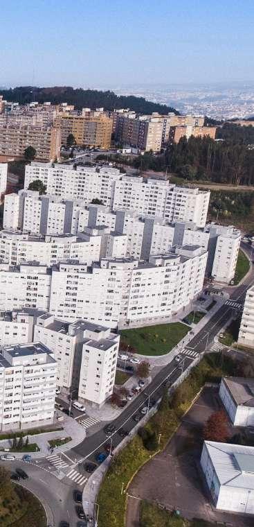


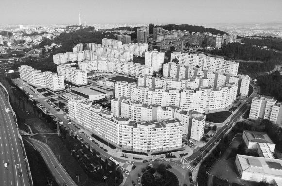
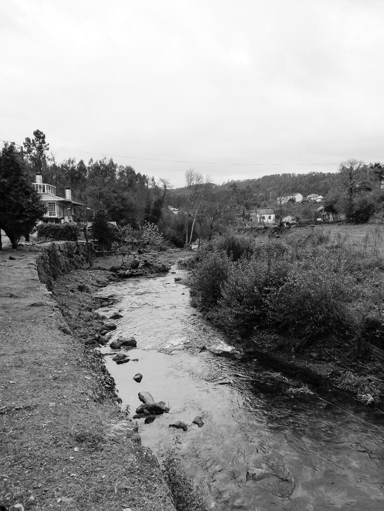
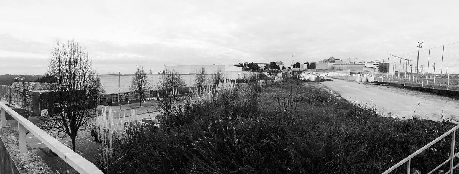
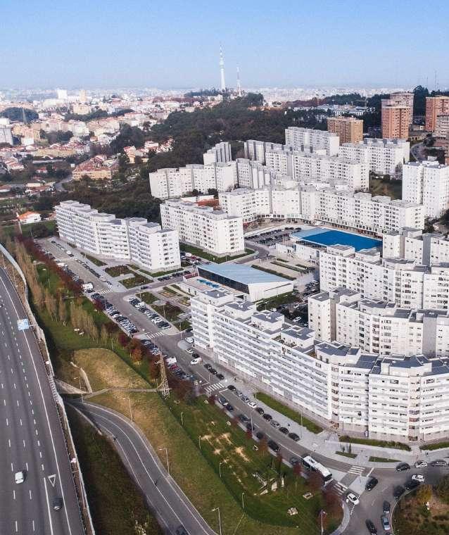
Vila d’Este is a large-scale housing complex located in Vila Nova de Gaia, in the parish of Vilar de Andorinho. Begun in the 1980s, the construction of the main nucleus of this urbanisation was carried out in stages up to the 1990s. Home to approximately 16 thousand people, this complex is, on its scale, a small town, home to a population where diversity and multiculturalism prevail. However, as the years went by, Vila d’Este suffered years of neglect by the State, resulting not only in the degradation of its housing stock (which did not receive any kind of maintenance) but also the isolation of its population, which was growing without access to infrastructures or social institutions, and therefore more and more distant from the surrounding context. Afterwards, and until today, Vila d’Este has gone through two great cycles of intervention that included operations in the buildings, commercial spaces and public space, and the integration of important equipment for the area (such as schools,
swimming pool, municipal pavilion, etc.). Still, despite the apparent satisfaction of the residents with the place where they live, according to what it was possible to observe at the site, the intensity of use of public space remained relatively limited, which may be related to issues of structural nature that supplant the positive effects of any requalification project.
Surrounded in one of its faces by the Gaia Hospital Centre and by a wooded land and, in the remaining faces, by roads, Vila d’Este has a particular implantation that, associated with other factors, may have had some importance in the isolation of the urbanization, not only at physical level, but mainly at social level.


Delimited by the physical limits that the surrounding land and the roads compose, the population was mainly punished by the “symbolic” closure that came from the stigmatization associated to the urbanization and its resident population. However, with time and with the efforts of building requalification and social integration, there was a significant improvement of the habitability conditions and the urbanization progressively opened to the exterior. Even so, Vila d’Este still presents some signs of isolation that may be related not only to the above mentioned constraints, but also to the fact that this is a predominantly residential nucleus.

The public space of Vila d’Este is mainly used as a transitory space for daily life activities. In conversation with residents it became clear that the general opinion is that the lack of people in collective spaces is related to the fact that Vila d’Este is a predominantly residential nucleus.

Consequently, it is possible to identify a significant number of unoccupied commercial spaces. Following a vicious circle of difficult resolution, the absence of commerce in these points aggravates the low intensity usage of the surrounding spaces, which in turn reinforces the inability to establish new businesses. As an aggravating factor, some of these spaces are distant from the street and partially hidden from the sidewalk because they are at a lower level than the road. At the same time, some of the residents do their shopping on their way home, and end up not taking advantage of the local amenities available.

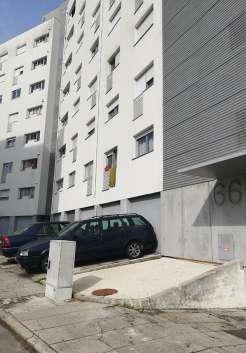
The system of public spaces in Vila d’Este is not a permeable system. The buildings (especially the linear ones) are inserted in the territory as vertical cutting plans that configure a discontinuous public space. Furthermore, the elevation or sinking of the ground floor of the buildings in relation to the street creates some distance between the public exterior space and the private interior space.
At the same time, at no time is it possible to find housing on the ground floor, and at the passer-by level there are only
a few commercial spaces, store-room windows or garage gates, which contribute little to the dynamisation of the public space. The remaining ground floor is enclosed and closed to the outside, alienating itself from the street and the public space.


The irregular topography of the territory has led to the design of a public space that is also irregular, composed of surfaces at different levels that are moulded to the morphology of the terrain. The pedestrian network and the staircases establish the transition between levels. Depending on their size, the latter may constitute an obstacle to circulation, particularly for those with mobility problems. For this very reason, it is relatively common to find footpaths which seek to overcome these obstacles.


Because the enjoyment of the public space system of Vila d’Este is mainly related to commuting from one point to another, it proved pertinent to analyse the issue of pedestrian circulation and the relationship of the pedestrian with the car, whose presence marks the urbanization landscape in a remarkable way.

More than in movement, the presence of the car is noticed, above all, by its permanence in the public space (in parking spaces, on the pavement and on the public thoroughfare), and the frequent appropriation of the sidewalk as a parking place prevents it from assuming an active role as a space of public use.

Even though the car apparently impacts the quality of the public space, it would not be productive to devalue its importance in that community, particularly in an urbanization with the topographic characteristics enunciated, since many residents find in motorized circulation a fundamental instrument in their autonomy.
The imposing presence of the vehicles (which occupy a significant part of the public space), and the inclusion of elements (particularly flowerpots) to prevent abusive parking.


The 2011 public space rehabilitation project comprised the insertion of new street furniture that increased seating opportunities, particularly in the western part of the urbanisation. However, sometimes their particular implantation in places unattractive to permanence leads them to be scarcely used. Conversely, elements whose function is not to provide opportunities for sitting (such as walls or staircases) end up playing this role, which demonstrates the importance of the “choice” factor in urban design, which gives citizens the freedom and autonomy to appropriate the public space in whatever way suits them best.


Although there are no areas in Vila d’Este reserved exclusively for children and there is a relative feeling of insecurity due to the constant presence of cars, the younger generations appropriate any space that allows them to carry out their favourite activities. From the promenade to the urban gardens of Vila d’Este, passing through the streets or the fountain (in the summer), the appropriation of the public space by children is heterogeneous and happens mainly where such appropriation was not planned. On the contrary, the few spaces that are supposed to attract the youngest, such as the sports fields, were, on one hand, closed due to vandalism or are scarcely used.

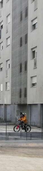
Young children enjoy the public space, where they engage in numerous activities: playing, cycling, playing football, etc.


Cared for by the residents, these spaces mirror the residents’ need to participate in the construction of the place where they live. This is noticeable, above all, in the peculiar treatment of the vegetationwhich includes trees, bushes and flowers - but also in the act of inserting objects such as statues, crosses, etc. In an urbanization that leaves little space for community intervention in the construction or transformation of the environment where they live, these spaces constitute blank canvases that can be appropriated without being subject to strict guidelines, allowing an exercise of freedom that is certainly relevant not only for the sense of belonging to the place but also for the perception of their importance as active agents in the transformation of the place where they live.
The interest of this setting resides, above all, in the way the residents appropriated that land in a spontaneous and progressive way, having, over time, trimmed the existing vegetation, divided the land into parcels and identified a given parcel as their own, without any kind of superior regulation. From the way they defined and delimited their fractions, to the objects they incorporated (access doors, swings, scarecrows, cisterns and signboards), the

residents fabricated and constructed the identity of their spaces, showing that what makes a space truly “public” is its public use, and not its legal classification.


Although this dissertation is essentially ethnographic in nature, it was possible to recognize the relevance that both the experience of going to the site and the engagement of the community have in identifying the problems associated with certain contexts and in possible solutions to be developed later.


Precisely because in architecture and urbanism expectation and reality (often) do
not go hand in hand, it seems necessary to follow a multifactorial strategy and vision, in which variables as distinct as the territorial, historical, social and economic context, the morphological characteristics of the place, the new virtual modes of communication and even the daily workday life are factors that have an effective impact on the frequency, quality and characteristics of the forms of use and appropriation of public space (which, ultimately, cannot be fully outlined).