
RUBY KHIVIANGU JIRONGO SKILLS
Mobile No.:+254 729 213 987
email: jirongoruby@gmail.com
A Graduate Architect from the University of Nairobi Department of Architecture and Building Science. A highly organised and efficient individual whose thorough and precise approach to projects has yielded ideal results. Mildly ambitious with an interest in improving upon urban issues through architectural design.
WORK EXPERIENCE
LAAP ARCHITECTS - 2022-2023
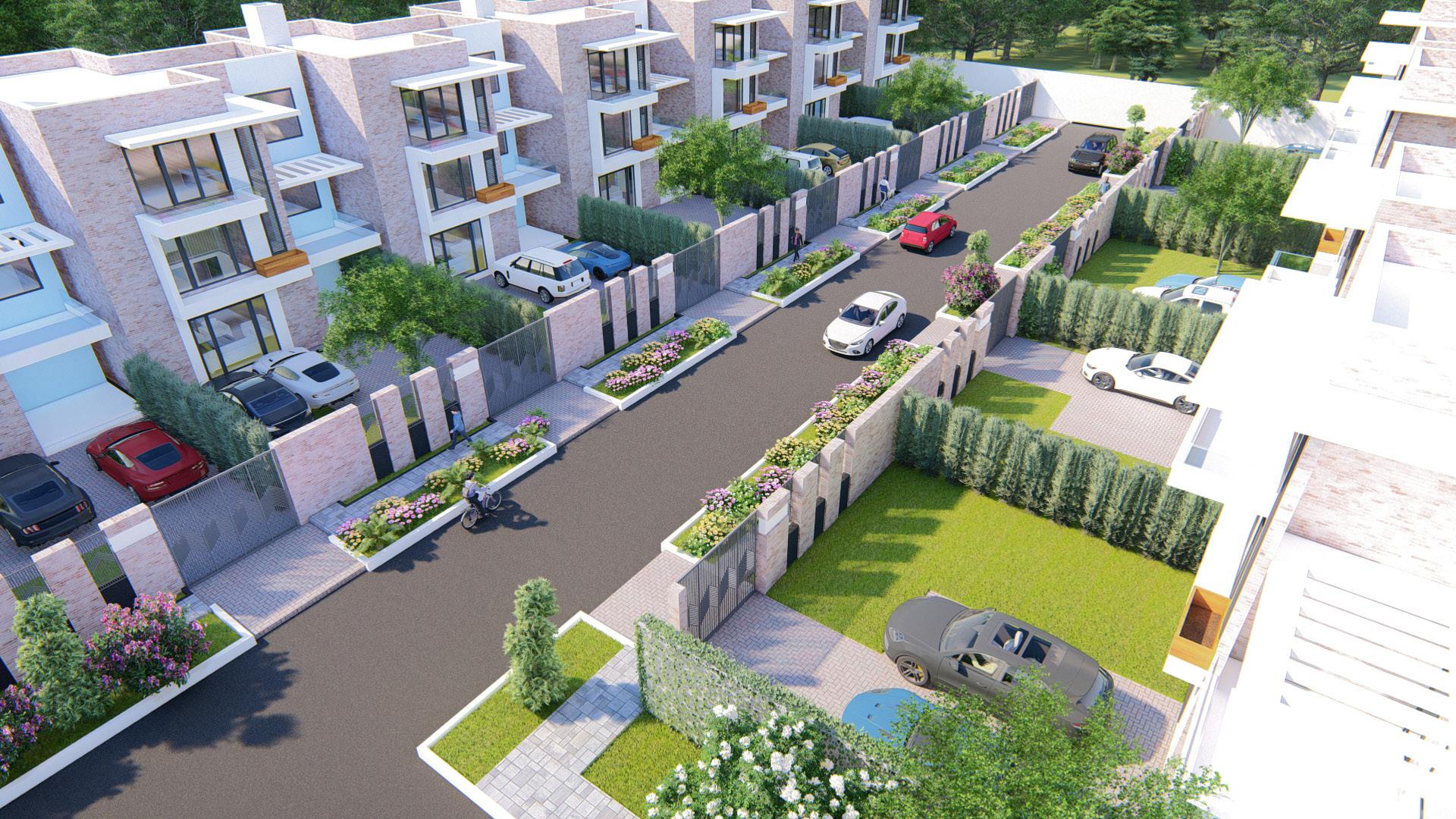
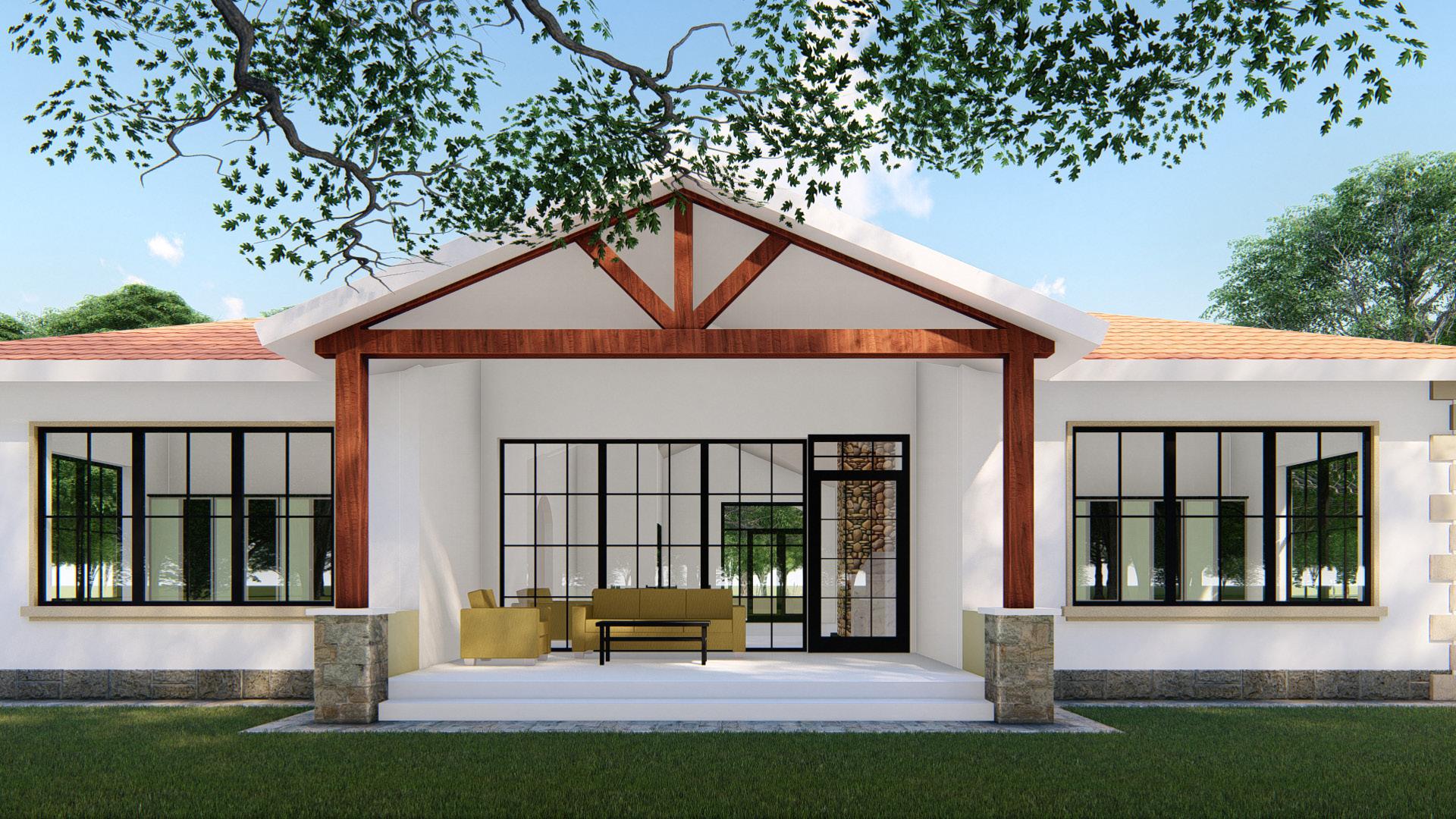
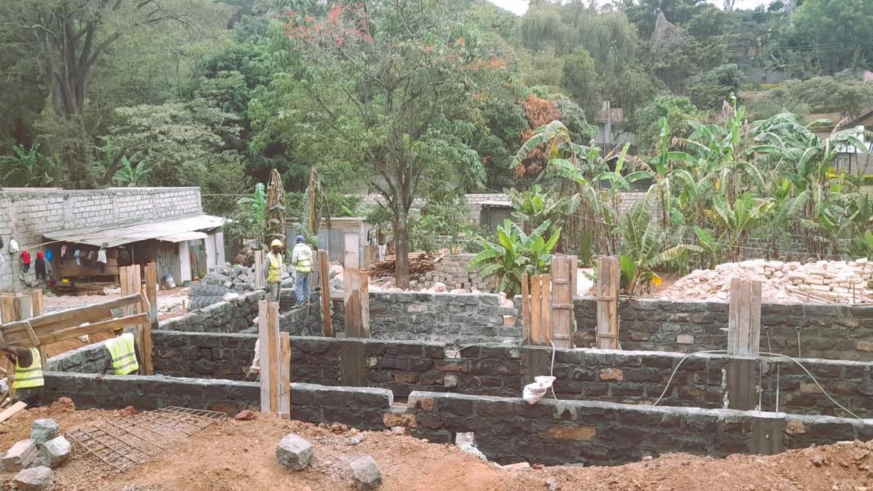
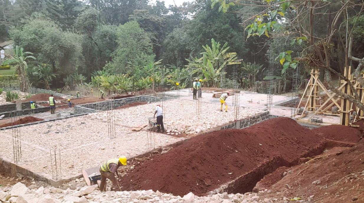
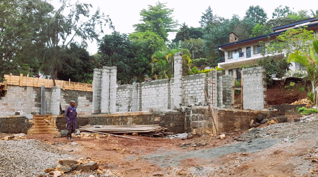
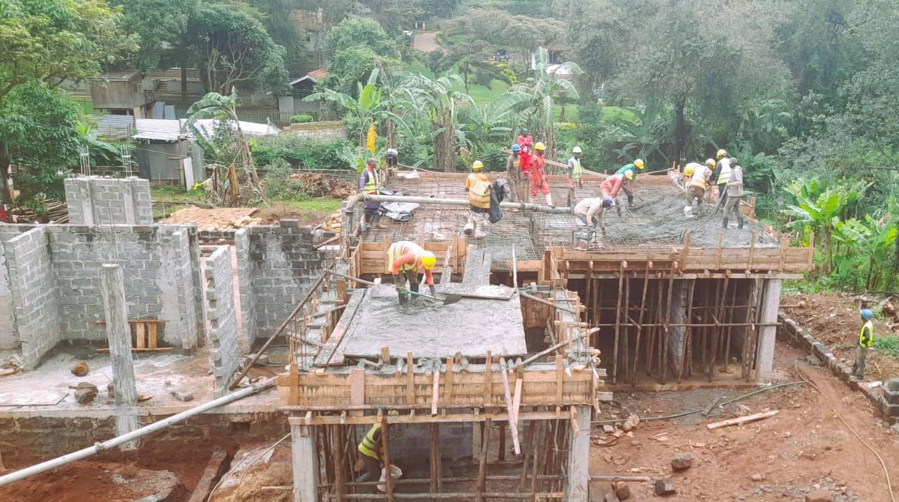
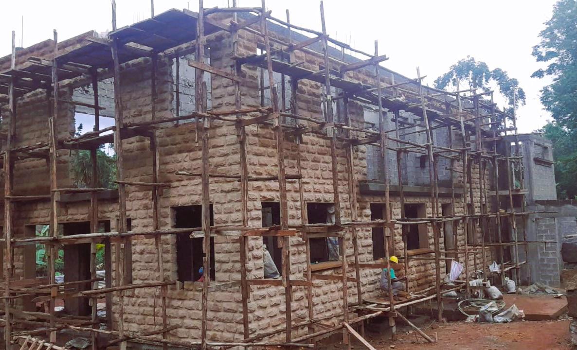
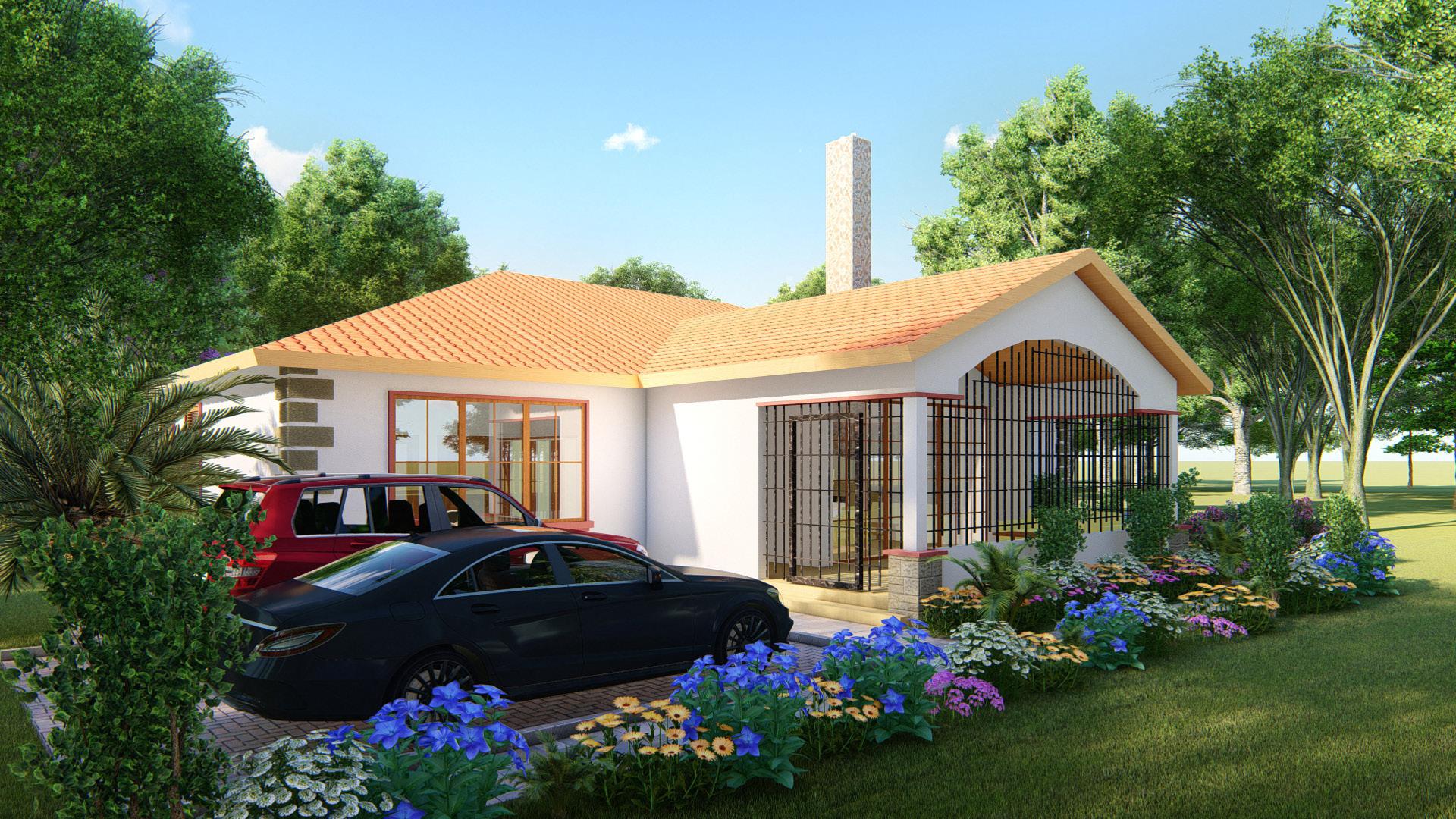
Extensive on-site experience as a Graduate Architect with frequent meetings involving the client, site contractors and the foreman to varying degrees of involvement. Continued use and practical application of CAD based design based on the direct changes happening on site. Preparation of working drawings for various contractors as well as architectural visualization in the form of 3D renders for the proposal.
SCOPE DESIGN SYSTEMS - 2016-2020
Long term attachment program which includes preparation of design and working drawings for submission as well as architectural visualization in the form of 3D renders and architectural proposal videos for client meetings and presentations. Exposure to the entire architectural process from inception to project completion including site visits and prepation of project boards to liase with contractors and clients
LAAP ARCHITECTS - 2014-2015
4 month attachment program which includes onsite experience as a casual labourer for 2 months and revision of Bills of Quantities. Involved an introduction into CAD based design and frequent site visits.


EDUCATION
UNIVERSITY OF NAIROBI
Department of Architecture and Building Science Sept 2014 - Sept 2021
Bachelor of Architecture - Second Class Honors, Upper Division(2021)
Bachelor of Architectural Studies - Second Class Honors, Lower Division(2019)
INTERESTS


THE KENYA HIGH SCHOOL
2009 - 2012
KCSE Certificate Passed 74/84 points.
A-
MAKINI NGONG ROAD PRIMARY SCHOOL
1998 - 2008
KCPE Certificate Passed 406/500 points.



REFEREES
ARCH. B. LADU
LAAP ARCHITECTS, DIRECTOR
+254 722 526 471
ARCH. KIUNGA KUMARY
BOWMAN ASSOCIATES: ARCHITECTS (BAA)
+254 726 057 201
ARCH. P. J. KURIA
SCOPE DESIGN SYSTEMS LIMITED, DIRECTOR
info@scopeprojects.co.ke
+254 720 012 418
ARCH. ISAAC R. KAMAU
SCOPE DESIGN SYSTEMS LIMITED, DIRECTOR
info@scopeprojects.co.ke
+254 721 296 291
ACADEMIC PORTFOLIO
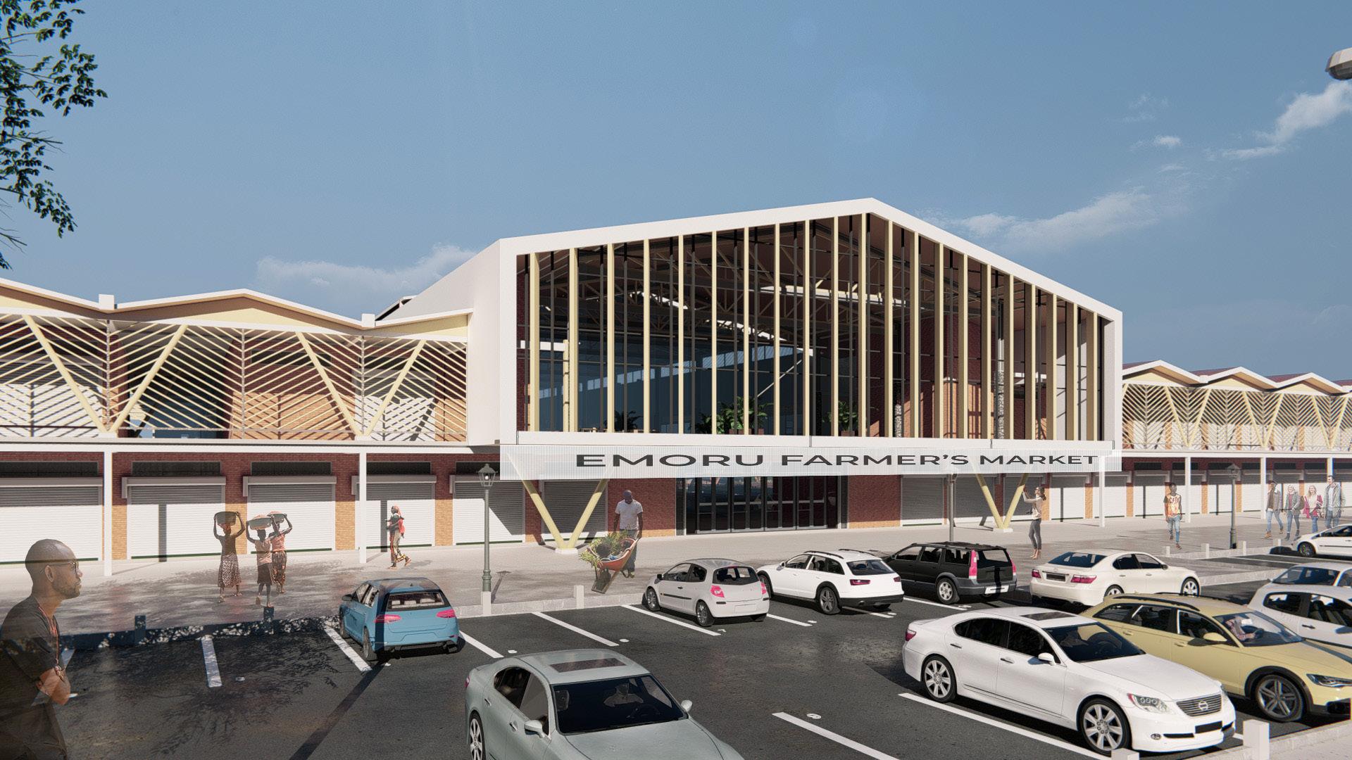
Markets are the physical expression of the marketing system involving a complex mixture of social, management and economic factors.
Proposed growth nodes found within the Kitale Integrated Urban Development Plan indicate that they will be sub-CBDs at selected existing market centres based on their strategic location and comparative advantage, one of which is within the selected Kibomet area. With this in mind, the site identified for the project is the existing Emoru open market site, where the county government has proposed to construct market stalls to serve the community in the immediate surroundings.
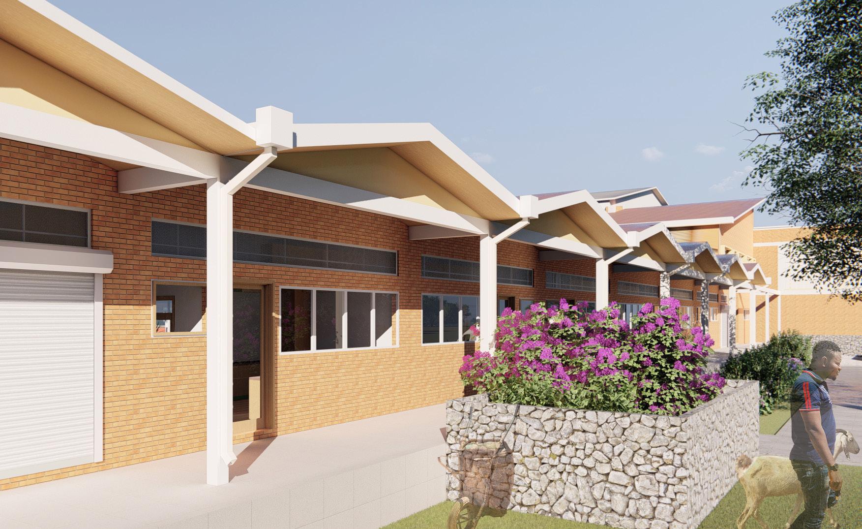
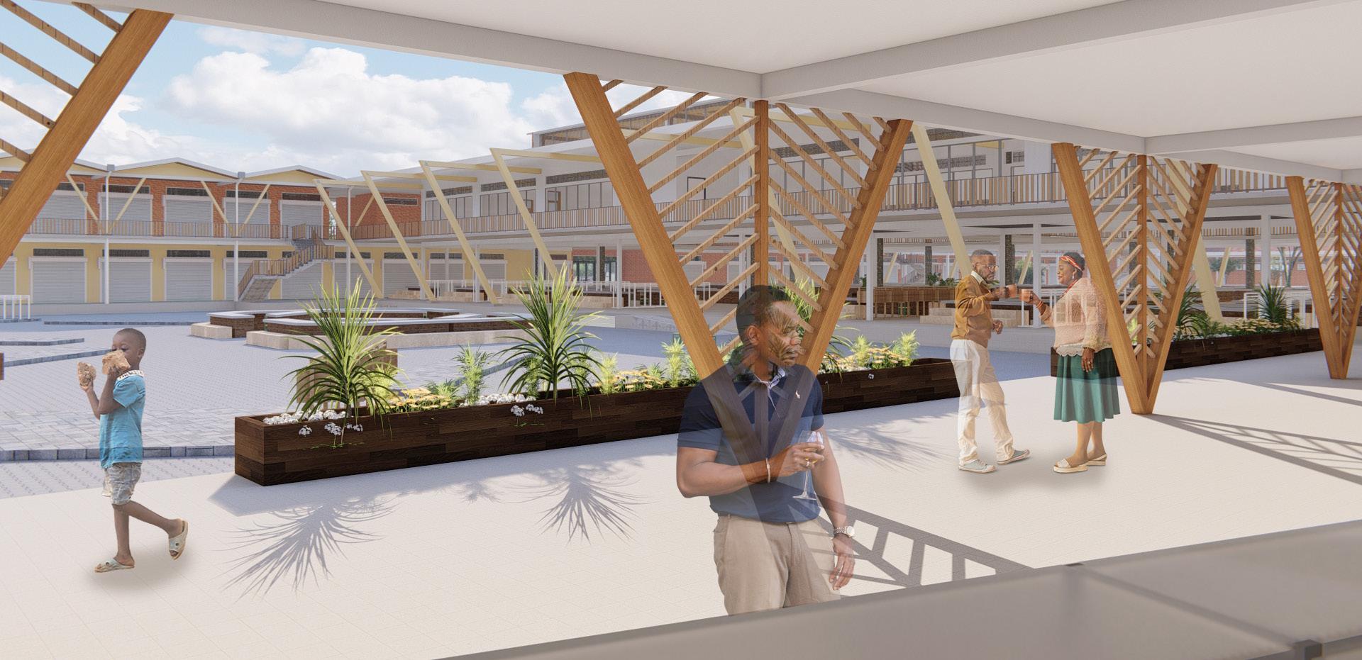
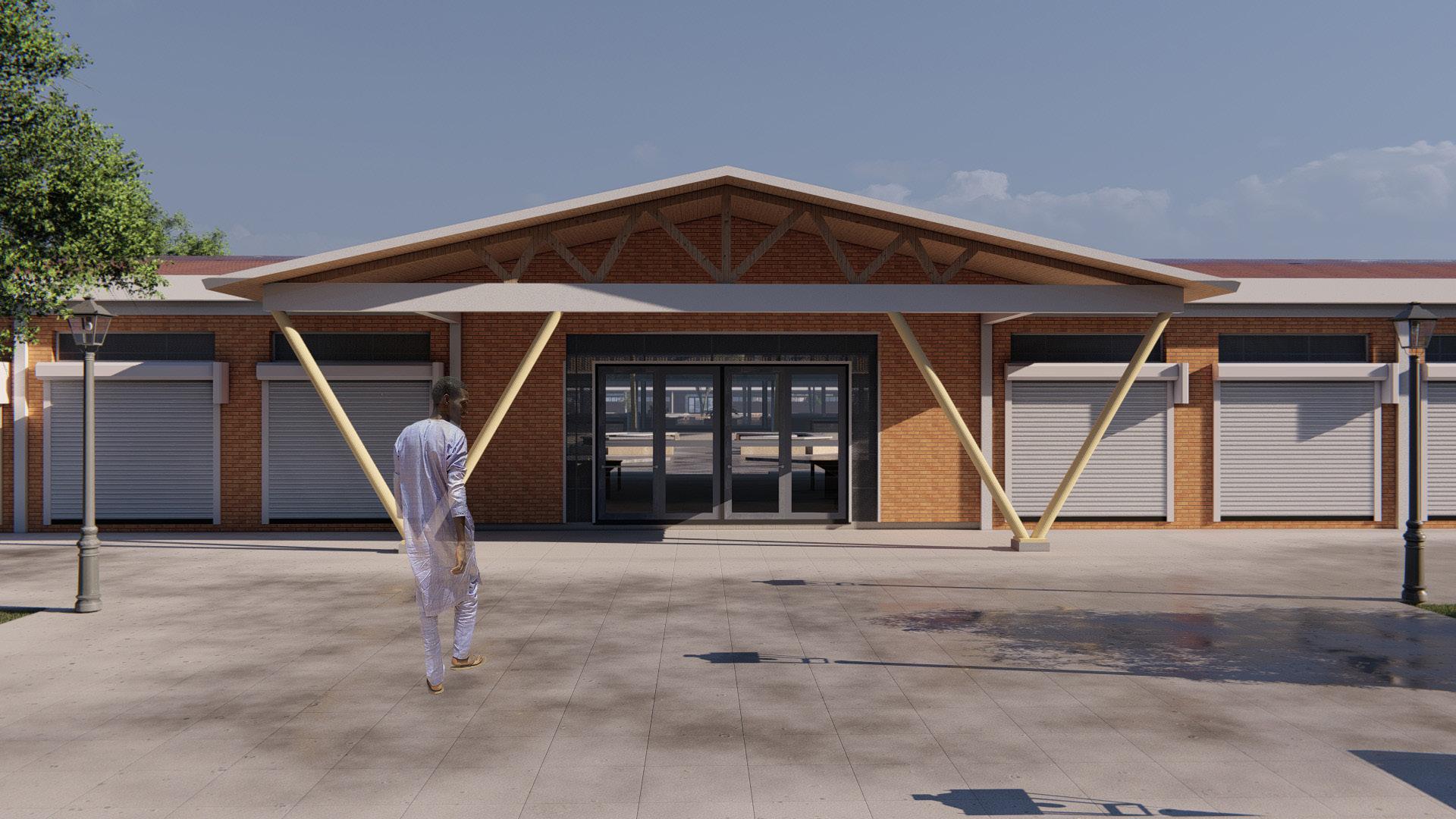
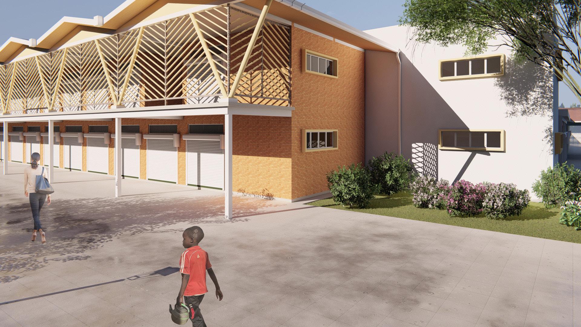
The market design is intended to create not just a functional space but also a landmark that will impact greatly in the architectural expression of the neighbourhood.
The proposed market provides 450 fixed market stalls, 121 of which are enclosed and potential for 100 temporary stalls within designated spaces. It will house or accommodate several other activities both internal and external activities, the following shows the accommodation schedule developed from the activities of the existing markets within the region
1. Administrative and Management Facilities - A space to be responsible for operating and maintaining the facility, this includes: -Security Office -Cleaners closet
2. Retail Market Stalls.
3. Recreational Spaces
4. Public Parking
5. Private, Public & staff washrooms and staff changing rooms
6. Storage Facilities
7. Banking facilities
8. Mini Convenience Store
9. Circulation space
Recreational Field
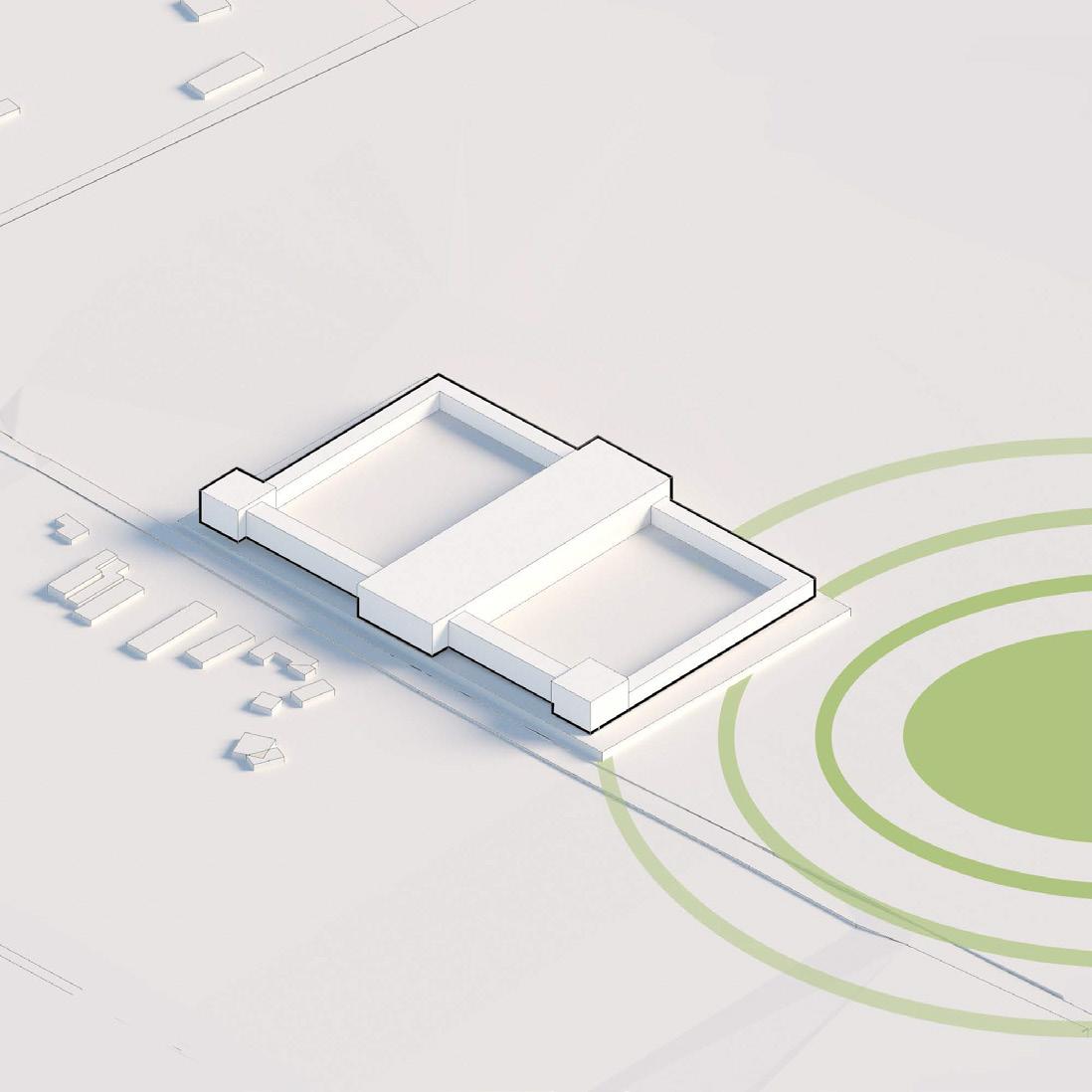
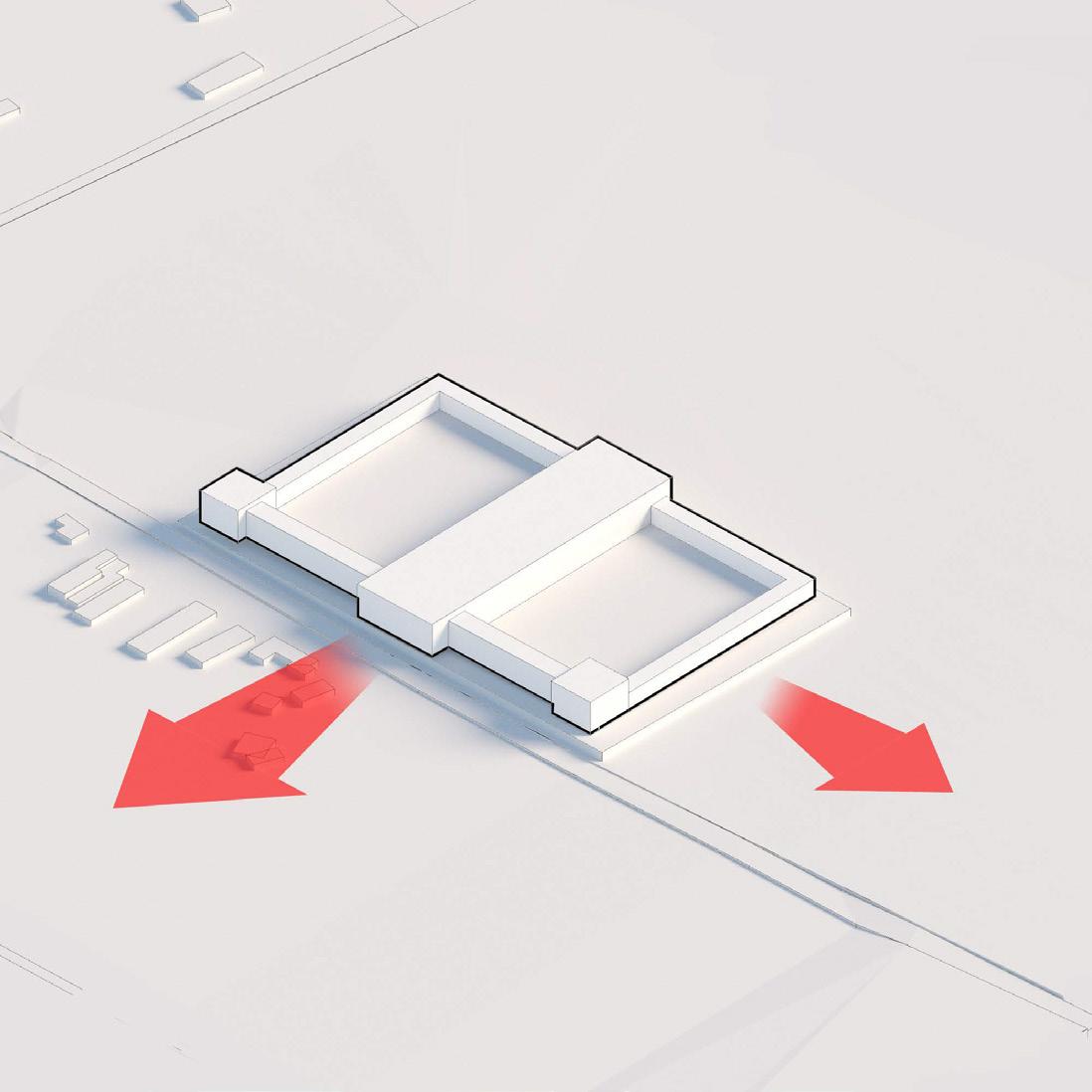
The primary aspects considered within the context of the site are the main circulation corridor which is the A1 KitaleKapenguria road and the recreational field A connection between the market and recreational field would serve to further promote a sense of community
Main views in the market face the main road and the recreational field These shall serve as the main pedestrian paths of circulation around the market
a)
The proposed Emoru Farmer The new market is an upgrading of the existing open accommodates a larger number of traders and diverse market operations while maintaining the best aspects of the open market different types of goods core of which are agricultural farmer second hand clothing noted to be the largest sellers in the region crafts will also be sold within the market to invite tourists into the market in with the expected development of the region as a tourism and conferencing node
b) Connection between the market and the existing recreational c)
The design for the market was in experienced in the existing markets within the region identi
maintenance facilities among others
i). Use of courtyards
ii). Hierarchy for space de iii). Material change for space definition
d) ency and reducing congestion by the adoption of an organized approach to tra
e) Space provision to allow both for future expansion needs and for adjusting the space utilization of the market to meet changing social and economic circumstances of traders and consumers
The market design is intended to create not just a functional space but also a landmark that will impact greatly in the architectural expression in the neighbourhood and also make a bold statement of space making to solve challenges facing the local community nature principle of
The proposal is to utilize the core part of the site that will have the new market building while the other half will be reserved for future expansion
The market layout is inspired by the circulation patterns within the existing open market located on the site functions and e The following design principles were applied
the
PROJECT OBJECTIVES
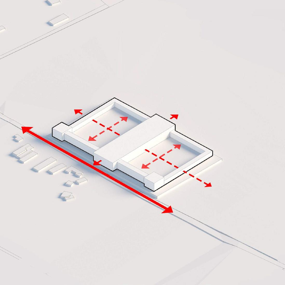
Vehicular traffic is expected to primarily come from the A1 Kitale-Kapenguria Road Pedestrian traffic will be centredon movement along the central market hall and cutting across the market parallel to the existing recreational field
a) Adequate space provision for sales areas administration, circulation and parking
b) Connection between the market and the existing recreational field
c) Building designs that will allow flexibility for change;
d) Maximizing market effic ency and reducing congestion by the adoption of an organized approach to traffic control and by using controlled parking.
e) Space provision to allow both for future expansion needs and for adjusting the space utilization of the market to meet changing social and economic circumstances of traders and consumers;
The proposal is to utilize the core part of the site that will have the new market building while the other half will be reserved for future expansion
CONCEPT DEVELOPMENT
CONCEPT DEVELOPMENT
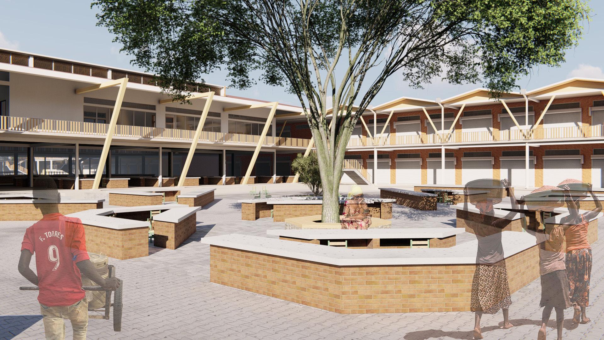
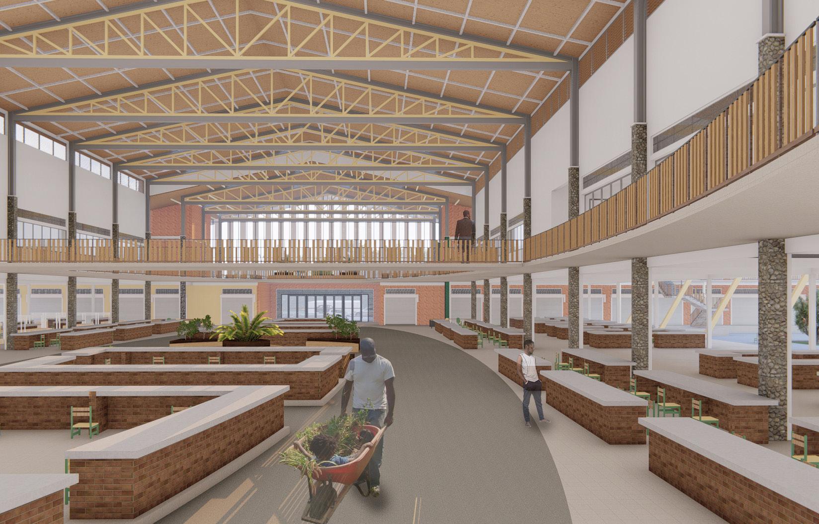
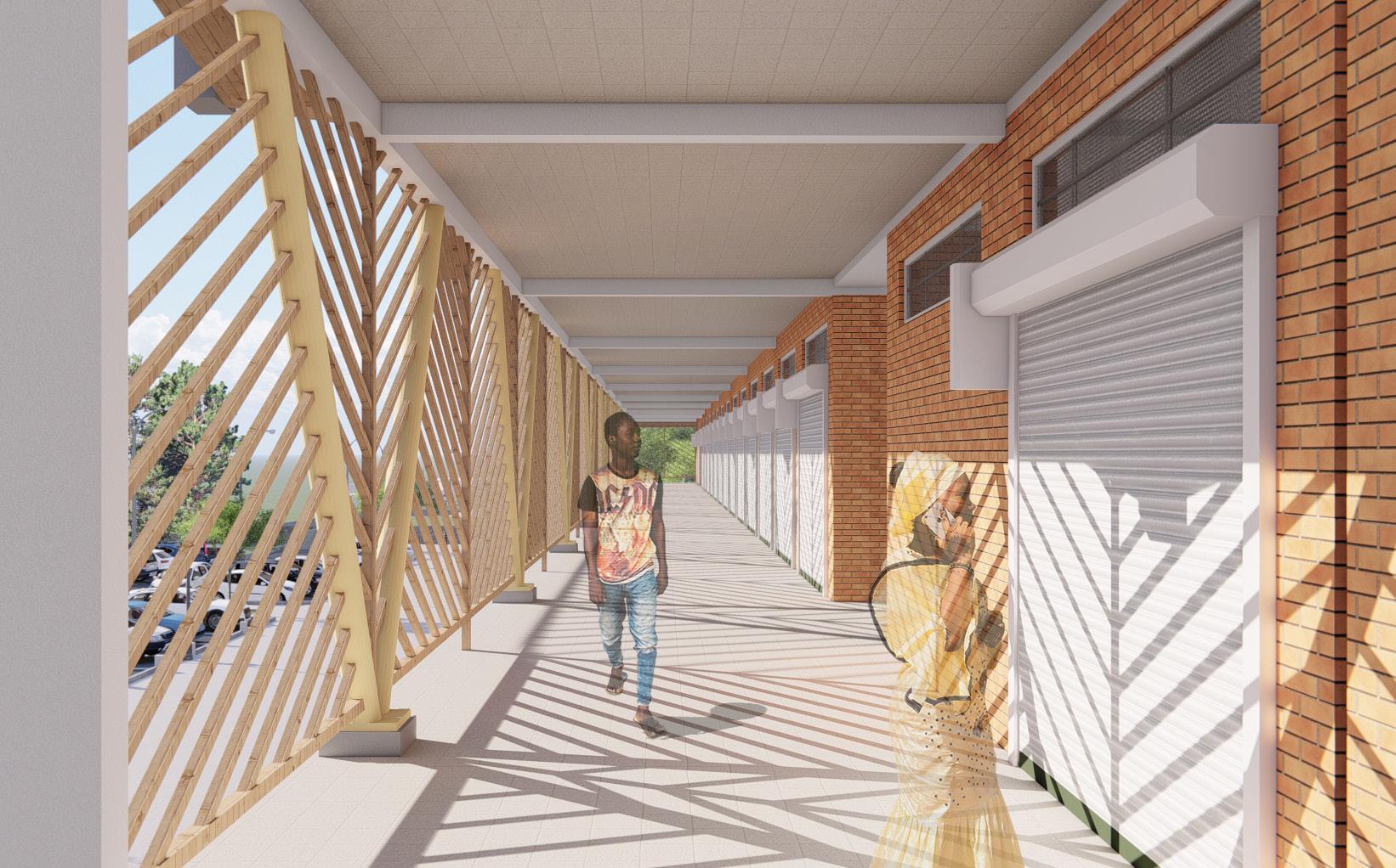
The core concept used in the design of the market is openness The proposal aims to create visual and physical permeability to the public by limitting restrictions in the basic form of the market The central part of the market is the market hall supported by the open courtyards surrounding it Acting as the core of the design, solid forms radiate from them enclosing the spaces where necessary The degree of enclosure similarly radiates from the centre with the area surrounding the market hall having no walls to limit movements or visibility of the courtyards from one end to the other Placement of market stalls within the Market hall is at the centre serving to anchor the purpose of a market; the buying and selling of goods Open stalls in the courtyards radiate from the market hall with enclosed stalls found surronding them


AFFORDABLE HOUSING PROGRAMME - PANGANI
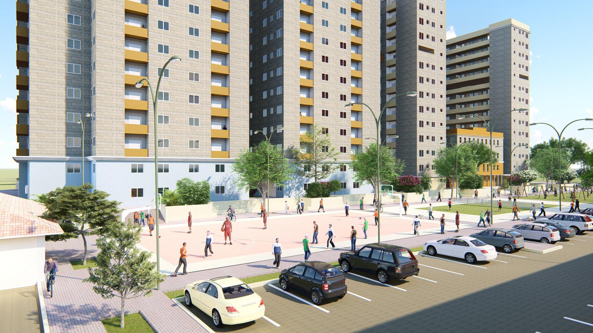
A large number of the Kenyan population migrate from the rural area to cities such as Nairobi, Nakuru and Eldoret, seeking the amenities and opportunities found in them. But as city populations increase, so does the cost of living, leaving low-income earners with few decent choices for affordable housing. the current ruling government’s development promise dictates the provision on 500, 000 affordable housing units primarily in urban areas before 2022. Historically, affordable housing complexes started to be constructed in the mid 20th century. Unfortunately, while architects may have had the best intentions, their preference for imposing structures devoid of human scale often led to complexes that discouraged strong communities and were isolating in appearance and experience.
With response to the concept of affordable housing in respect to the living conditions of Kenya’s urban poor, this project seeks to give a viable solution to the challenge presented by the big 4 agenda aspiration by the government incorporating sustainable features and building technologies that reduce the cost of construction and maintenance, empowering its residents and connecting them to outside resources with attention to human scale and connection to the public street and community in the vicinity
THE PLANNING SOLUTION PROVIDED IS THE LINEAR CITY THE BLOCKS FOCUS ON VERTICALITY TO SATISFY THE 10 000 PLUS POPULATION TO BE SHELTERED WHILE OFFERING VARIOUS ARCHITECTURAL VARIATIONS IN BLOCK TYPOLOGIES AND BUILDING HEIGHTS THE SITE SLOPES FROM JUJA
IS SPLIT INTO THREE LEVELS TO CAPITALIZE ON THE NATURAL SLOPE OF THE SITE S TOPOGRAPHY
LEVEL PUBLIC AND SEMI-PUBLIC COMMERCIAL EDUCATIONAL MIXED USE AND RECREATIONAL ACTIVITIES
The planning solution provided is the linear city. The blocks focus on verticality to satisfy the 10, 000 plus population to be sheltered while offering various architectural variations in block typologies and building heights. The site slopes from juja road to ring road ngara with a maximum drop of 2m and minimum drop of 1m. The development is split into three levels to capitalize on the natural slope of the site’s topography.
THE PLANNING SOLUTION PROVIDED IS THE LINEAR CITY THE BLOCKS FOCUS ON VERTICALITY TO SATISFY THE 10, 000 PLUS POPULATION TO BE SHELTERED WHILE OFFERING VARIOUS ARCHITECTURAL VARIATIONS IN BLOCK TYPOLOGIES AND BUILDING HEIGHTS THE SITE SLOPES FROM JUJA ROAD TO RING ROAD NGARA WITH A MAXIMUM DROP OF 2m AND MINIMUM DROP OF 1m THE DEVELOPMENT IS SPLIT INTO THREE LEVELS TO CAPITALIZE ON THE NATURAL SLOPE OF THE SITE S TOPOGRAPHY
UPPER LEVEL SEMI-PUBLIC AND PRIVATE MIXED USE, COMMUNITY FACILITIES AND RECREATIONAL ACTIVITIES
GROUND LEVEL PUBLIC AND SEMI-PUBLIC COMMERCIAL EDUCATIONAL MIXED USE AND RECREATIONAL ACTIVITIES
LOWER LEVEL[ - 1500mm]: SEMI-PUBLIC AND PRIVATE PARKING SPACES COMMUNITY FACILITIES AND RECREATIONAL ACTIVITIES

KEY PRINCIPLES IMPLIMENTED IN THE DESIGN
WALKABILITY
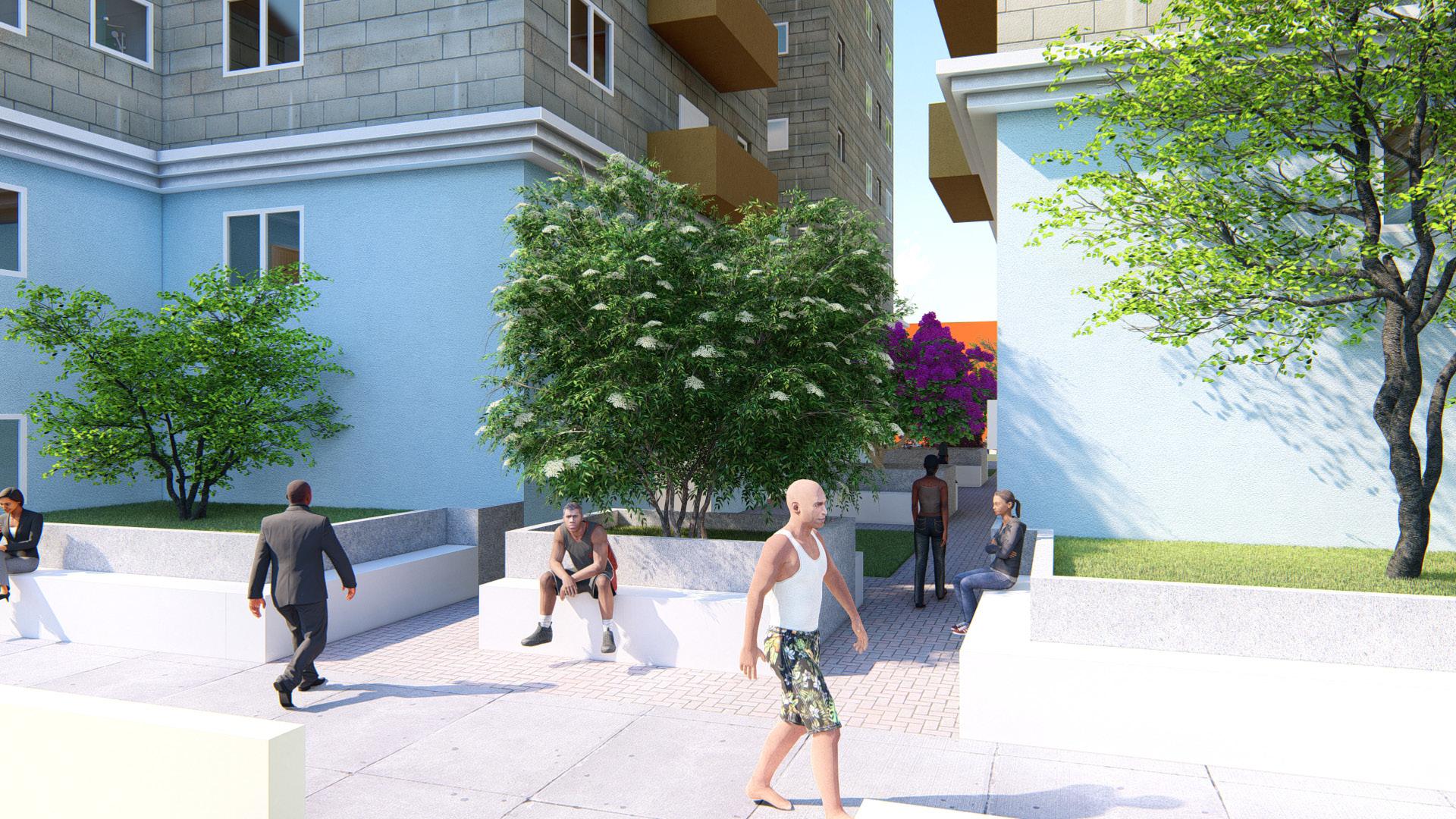
There has been an increase in the notion that a walkable city is a desirable city. Cars used to represent freedom, today wifi does. More feet on the street has been core to the master planning of this Pangani Affordable Housing Project with the focus being on pedestrian amenities. Attention to the human scale seeks to provide the resident with a comfortoble yet dynamic experience encouraging walking for a healthier and more interactive community. Increased pedestrian movement on site also seeks to increase the potential for economic growth for retail facilities provided within residential blocks
INFILL PROJECTS
Car culture in the country has resulted in open spaces in housing projects primarily being used for parking. Their absence however leaves the space bare and unoccupied. To counter this, parking facilities are located 1.5 Meters below ground level ina ccordance with the existing slope of the land. Part of the residential facilities are raised by 1.5 Meters to create a 3 meter high vacuum in which vehicleS and bicycles can be parked. In their absence, the space can be used for recreation such as biking and skating, the sunken community facilities assist in keeping the space open, well ventillated and lit. Accesibility via tunnels for ground level residents is also possible.
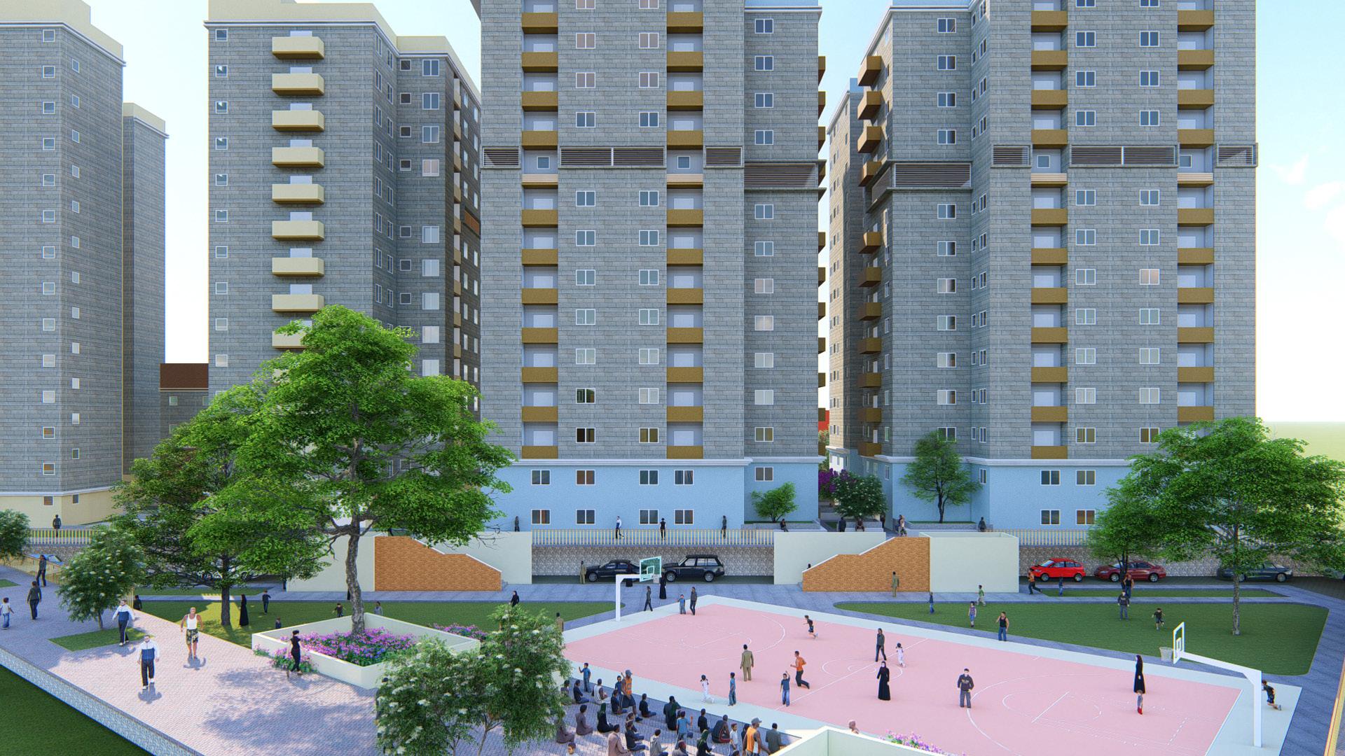
The development provides mixed use facilities in order to capitalize on the generated pedestrian traffic within the site and connect to the public street and community. Proximity to public transportation channels is catered for along every public road with clearly defined public bus stops as well as pedestrian and vehicular access routes into the development. As car usage and ownership continues to increase in Kenya, there has been a decline on the global scale. Urban populations opt for alternative transportation modes. This is considered in the provision of a well defined bicycle path, public transit access and pedestrian walkways on site.
From case studies carried out within existing housing developments in Nairobi, it was made clear that economic benefits trump green or recreational space for low income earners. This was seen in that any open green space was quickly occupied by shanties in the slum areas. Unoccupied green space would be used for individual farming or construcion regardless of whether it was private or public. To counter this, mixed use blocks are proposed with retail facilities and office space is provided on the lower levels within each block. The rooftop is designated for rooftop farming. This is in order to provide various economic possibilities for the residents

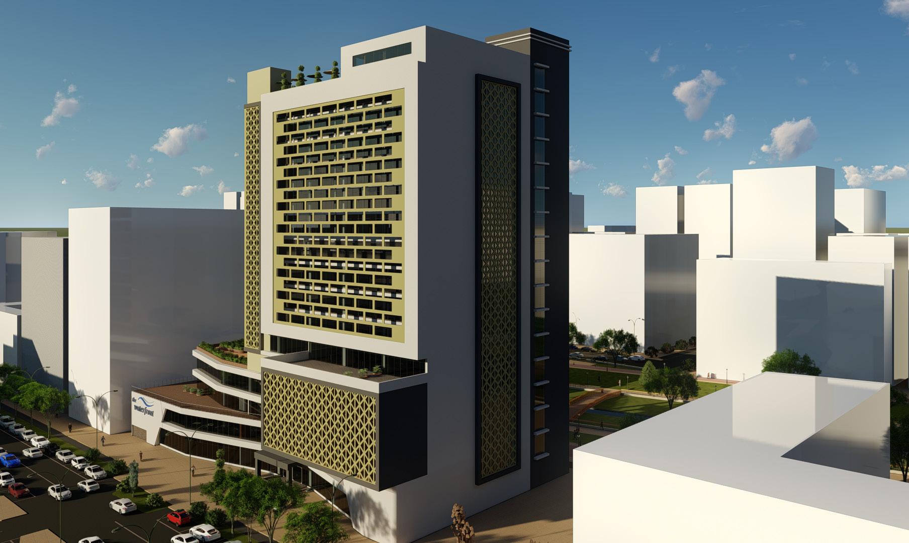
URBAN PLANNING AND DESIGN - THE WATERFRONT - NAIROBI
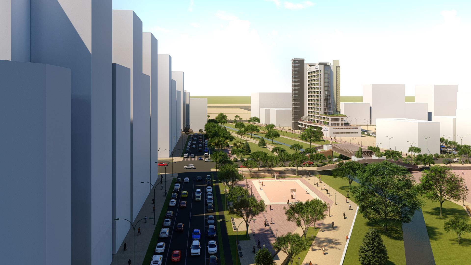

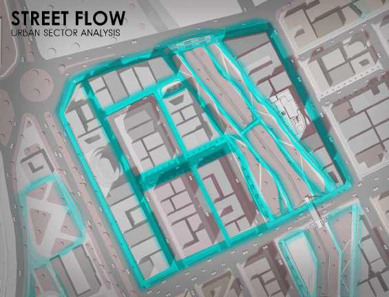
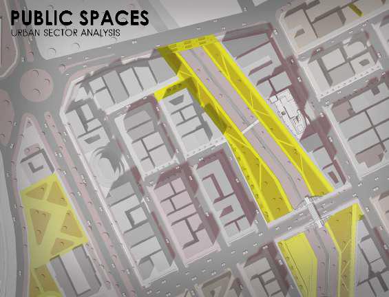
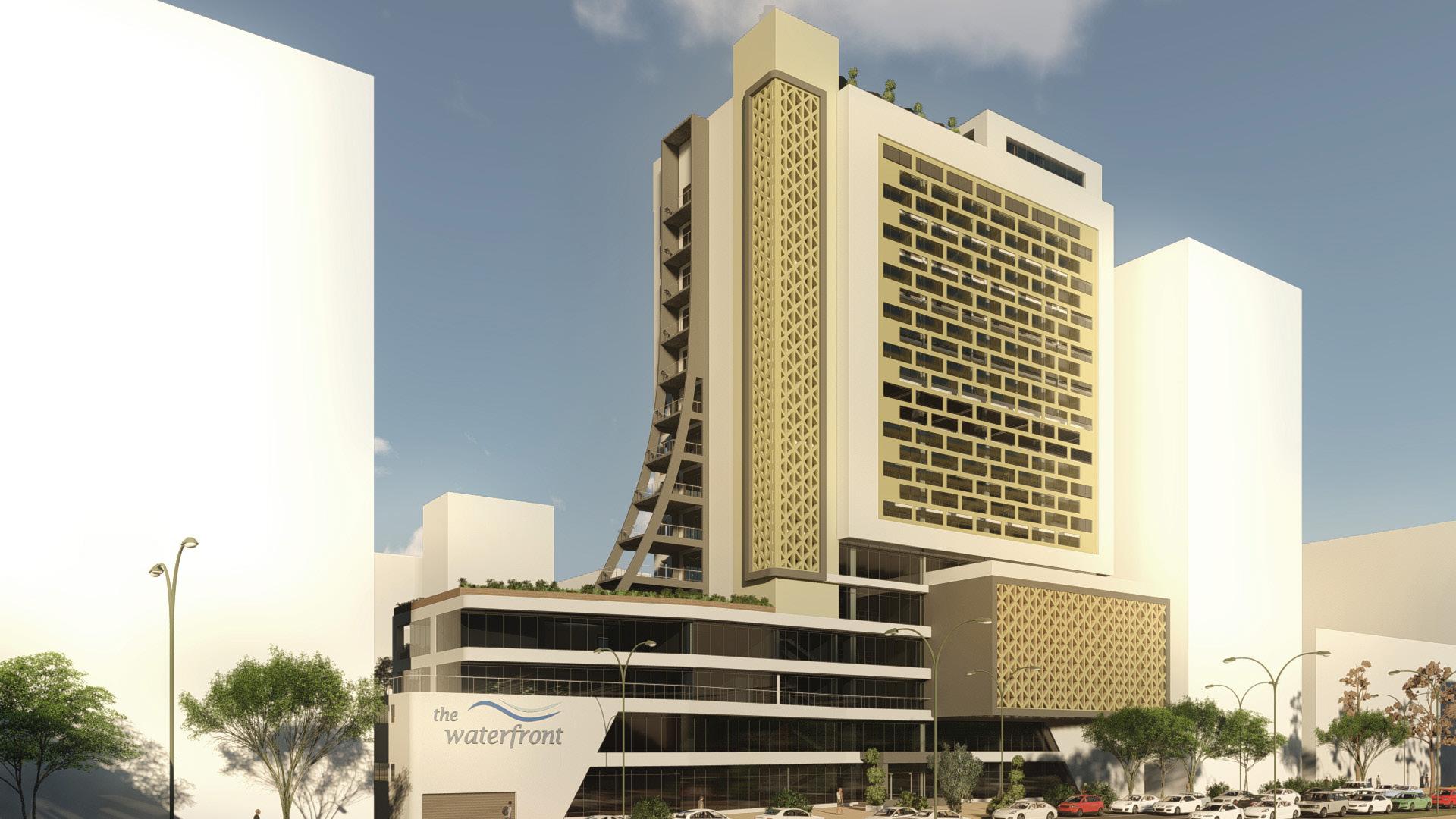
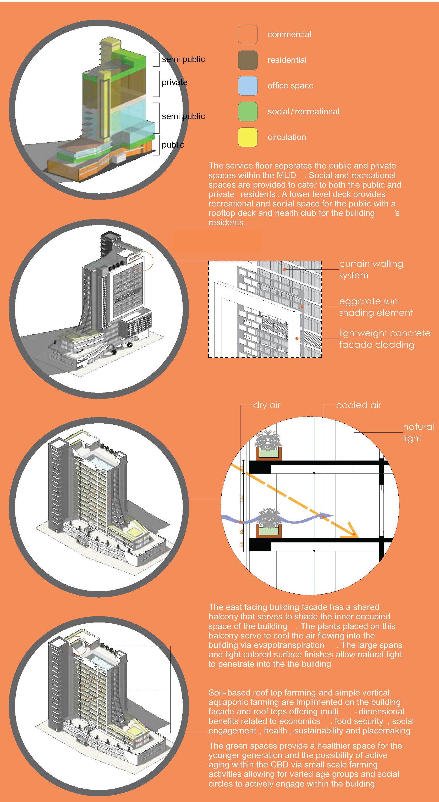
The proposed city aims to provide a multi-purpose centre for culture and recreation within the fast paced, busy environs of the Nairobi Central Business District. Located within the extended CBD and bordering the proposed Railway City, the city offers a junction for tourism, sports and cultural development that supports social, cultural, physical, and entertainment activities for all ages, indoors and out. The proposal is developed with its focus on providing:
- Sports Resources for Tourism, Local and International Sports Events
- Natural Landscape suitable for Tourism
- Variety of Attraction Points for Cultural and Recreational Activities
- Suitable mix of activities based on the city zoning








PROFESSIONAL PORTFOLIO


RHYTHM CITY NAIROBI INTERIOR DESIGN - PERSONAL PROJECT


EXISTING INTERIOR

PROPOSED DESIGN

PROPOSED DESIGN
ELAGA HOTEL - TEAM PROJECT


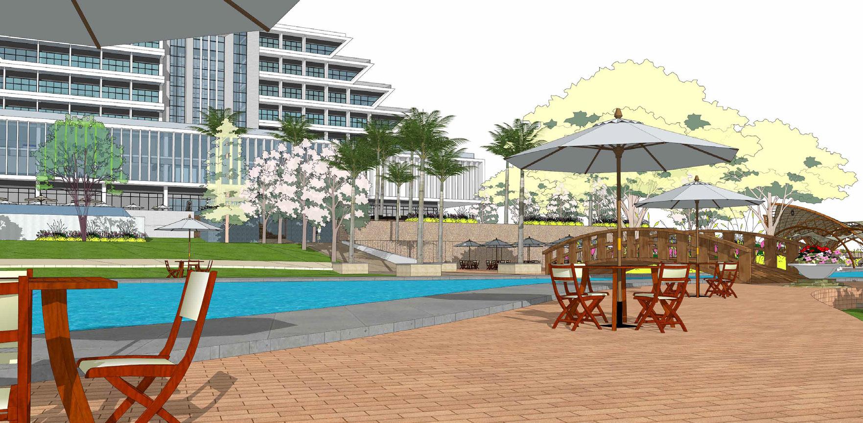
 LANDSCAPING CONCEPT + ANCILLARY DESIGNS

