INNOVATOR
In This Issue
What’s New Project Manager Spotlight
Let’s Get Flying
From the Field:
• Sidewalk & Ramp Improvements, Hammonton, NJ
• Rt 130 & Georges Rd Improvements, Middlesex Co., NJ

• MTA Harlem River Line Truss Bridges-Aerial LiDAR Project
Puzzle
Answer Due by Midnight on Friday, Dec. 23, 2022
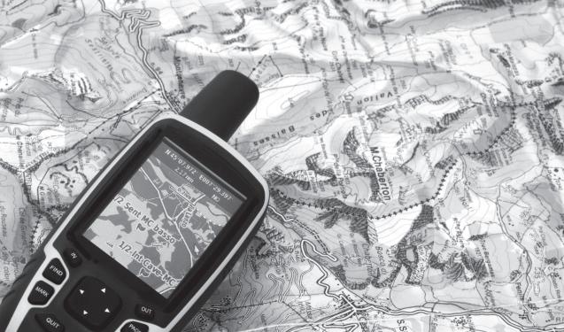
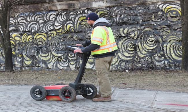
GEOD Provides
• 3D Laser Scanning
• Aerial Photography / Photogrammetric & LiDAR Mapping

• Drone Surveying
• Land Surveying
• Subsurface Utility Markouts
As of October 2021, GEOD Corporation became an affiliated company of MFS Consulting Engineers & Surveyor, DPC (MFS Engineers & Surveyors), a multidiscipline, MBE/DBE/SBE certified civil engineering firm. Visit www.mfsengineers.com.

FALL 2022
AN AFFILIATE
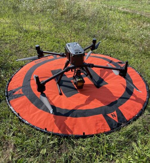
WHAT’S NEW?
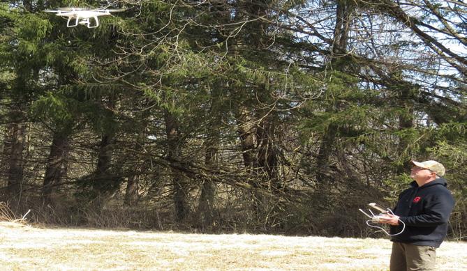
GEOD Strengthens
In-House
Drone-Based
LiDAR Capabilities
that provides airborne LiDAR scanning at rates up to 240,000 pts/s using multiple returns. This results in the capability to acquire dense, accurate point cloud data in both open and forested landscapes. Newly acquired post-processing software from DJI and Terrasolid will help in the QA/QC of this data. The new RGB camera payload for the M300 RTK provides highly accurate geo-tagged imagery through the use of RTK positioning. Images will now be acquired with photo center coordinates down to near centimeter level accuracy. This will help to both reduce the number of groundbased control targets and facilitate photogrammetric mapping in both traditional and challenging terrain.
With the new M300 RTK drone and it’s two state of the art payloads, GEOD continues to provide it’s clients with the very latest in data acquisition technologies, to facilitate the most accurate and efficient workflows for client deliverables.
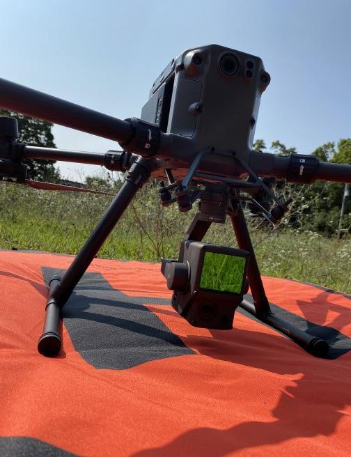

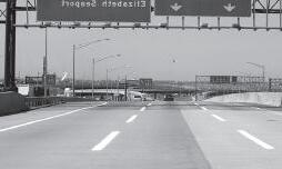
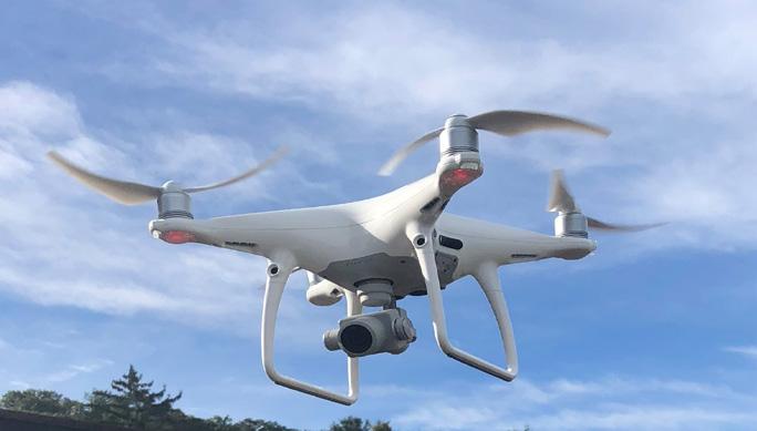
GEOD has recently increased its operational capabilities with the addition of an enterprise level drone (sUAS), new payloads, and new post-processing software packages. The new drone was added to our fleet to specifically address the needs in both our surveying and photogrammetry departments.
For years, GEOD has used its current drone fleet to perform and supplement traditional field surveys with high resolution, geo-referenced imagery and their derived geo-spatial data products. Our new drone, a DJI Matrice 300 RTK, will further increase our ability to produce these products through the use of multiple payloads with additional on-board technologies. With new LiDAR and RGB sensor payloads, GEOD now has a wide range of both active and passive systems to capture and derive highly accurate point clouds to be used for geo-spatial product generation. The LiDAR payload for the M300 RTK is an active system
INNOVATOR 1 FALL 2022 ISSUE
AN AFFILIATE
PROJECT MANAGER SPOTLIGHT


Scott Dey, CST
Scott Dey has been with GEOD Corp. since 1988— a total of 12,410 days.

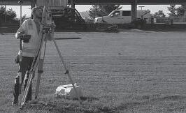
Scott is a Certified Survey Technical Level II certified by the National Society of Professional Surveyors. He oversees GEOD projects and ensures they are performed accurately and timely. He prepares technical proposals and budget estimates, as well as performs drafting and data analysis, as needed.
Over these 34 years, Scott obviously has seen and done it all, but one of his memorable experiences has been performing field surveys as the Crew Chief for the Whitestone, Throgsneck, Triboro, and Verrazano bridges Projects. A portion of the surveys required them to walk the suspension cables to obtain distances from the suspension cables to the structural steel. Another time was while performing a field survey at a hazardous site, the instrument person and Scott had to survey a platform, which was located within an acid pond. The plan was to use a Jon Boat to get to the platform and Scott to grab the platform and hold the boat there, while the instrument person climbed onto the platform. “Not

quite sure why, but as we approached the platform my instrument person stood up and jumped towards the platform,” expressed Scott. “Needless to say, his jump kicked the boat away from the platform and he was clinging to the platform support post. I pulled the boat back and helped him get onto the platform. Luckily, there weren’t any injuries. To this day, I still don’t know why he jumped, but looking back and picturing him hanging there was pretty funny. We both joked afterward.”
Currently, Scott is working on a survey and mapping project for a bridge deck replacement project on Route 78. The project involves aerial mapping, a field edit of a portion of the mapping, re-establishment of the roadway alignment and right-of-way, cross sections of the river, 3D terrestrial scanning of specific portions of the roadway and bridge superstructure. “I like the project because my team knows exactly what is needed, and the best methods of obtaining the information,” Scott explains proudly. “What makes continues on next page.....
2 FALL 2022 ISSUE
INNOVATOR
“My prior time in the military and working with maps is what inspired me to pursue this career.”
— Scott Dey
AN AFFILIATE
INNOVATOR
SPOTLIGHT CONTINUED
the project difficult is the river water levels have been running high, which prevents us from collecting some of the needed data. We must wait until the river level dropped sufficiently for us to collect the data. I've learned to include additional time on certain projects due to natural events.”
Scott’s favorite project is the Transportation Alternatives Program (TAP) project they recently performed in Marlboro Twp., NJ. The project included recovering survey control from others, topographic mapping, boundary and roadway alignment. Scott recalls it was a good project because everything went well and without any problems.
Personally, Scott has two adult daughters who live out of state. When he is not working, you can usually find Scott taking care of his three cats, maintaining his home and yard, as well as going on a long motorcycle rides.
Over the past couple of years, Scott has taken up
As things begin to fall
wood working, as a hobby, and has created some furniture and box-type items. Scott cares deeply about the state of current affairs, specifically regarding our Bill of Rights and civil liberties.

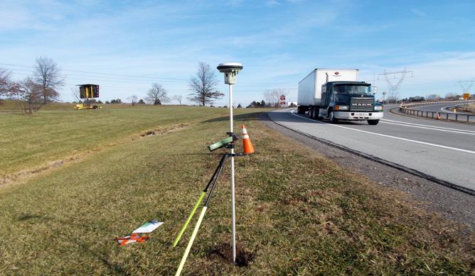
Many consider Fall the best season to survey. The weather is pleasant and not too wet. But there’s one other thing that makes surveying in the Fall better, reliable, and more efficient.....falling leaves.

Call GEOD at 973-697-2122 to discuss your aerial photogrammetric needs today!

3
FALL 2022 ISSUE AN
AFFILIATE
INNOVATOR FROM THE FIELD
2018 Safe Routes to School, Sooy Elementary School Area Side Walk and ADA Ramp Improvements
Hammonton, Atlantic County, NJ
Safe Routes to School (SRTS) is a federal, state and local effort to enable and encourage children, including those with disabilities, to walk and bicycle to school. SRTS facilitates the planning, development and implementation of projects that improve safety and air quality, as well as reduce traffic and fuel consumption around schools.
GEOD set and established aerial photo control. GEOD had performed the requested NJDOT Preliminary Engineering tasks, to include providing aerial base mapping, performing a field edit of aerial mapping, supplemental ground survey to provide a detailed Digital Terrain Model (DTM), survey of demarcated wetland areas and establish the ROW of the project corridor. Project Owner: Town of Hammonton/NJDOT
4
FALL 2022 ISSUE AN AFFILIATE
INNOVATOR FROM THE FIELD
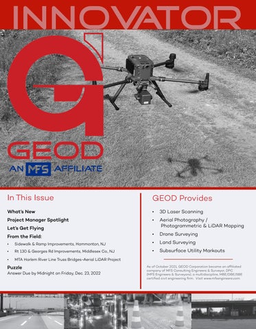
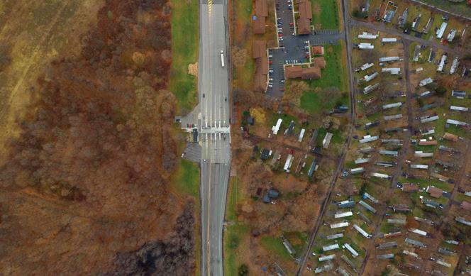
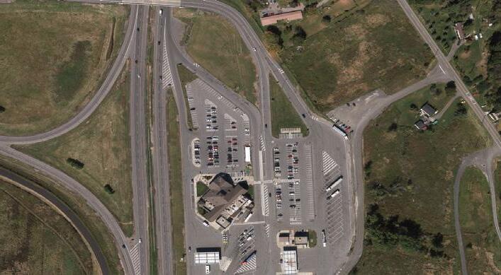
Rt 130 & Georges Road Township of South Brunswick & Cranbury Project
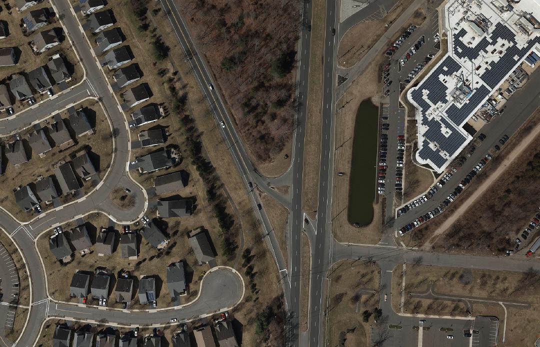
Middlesex County, NJ
The recommended improvements for the TP-323, Route 130 Georges roadway realignment project in Dayton, South Brunswick Township, Middlesex County are located along US Route 130, Georges Road, Wheeling Road (CR 679) in Dayton, Township of South Brunswick, Middlesex County, New Jersey. The intersection is at mile post 75.19 on US Route 130.
The purpose of the overall project was to mitigate any potential traffic hazards at the Route 130 & Georges Road intersection, while improving overall safety of the roadway and traffic flow. During the Concept Development phase, Right-of Way impacts were identified for construction activities. Right-of Way impacts were refined during the Preliminary Engineering phase. This report summarized the ROW impacts based on NJDOT ROW Design Standards. Project Owner: NJDOT.
5
FALL 2022 ISSUE
AN AFFILIATE
INNOVATOR FROM THE FIELD
MTA Harlem River Line Truss Bridges – Aerial LiDAR Project
Bronxville and Scarsdale, NY
For this project, GEOD was contracted to provide topographic mapping of the Railroad Right-Of-Way for 3,800 linear feet in Bronxville and 13,150 linear feet in Scarsdale in Westchester County, NY.
Because the time frame for this project was July thru October, 2022 (summer months in full foliage conditions), a combination of 12 ppm² Aerial LiDAR and 3.6cm GSD Aerial Imagery was harnessed to develop the base-mapping, with the LiDAR specifically being used to model the terrain in obscured areas. Mapping was delivered in MicroStation V8i at 1”=30’ scale with 1ft contours created from a SelectCAD feature based DTM.
Project Owner: Metropolitan Transit Authority.
6 FALL 2022 ISSUE AN AFFILIATE
FALL PUZZLE
We’ve decided to step away from the math or geometry based puzzles we’ve been using of late, so here for your solving pleasure, is a Celebrity Cryptogram.
Who is the person, and what did they say?

A random winner will be drawn from the correct entries, and will receive a $200 Amazon gift card. As always, if you are precluded from accepting such a prize, we’ll be delighted to donate a check for $200 to the charity of your choice.


Because we’re nice guys, here’s a hint: ROT1.
Enjoy the puzzle and good luck! Of course, as always the decision of the judges is final!
7
Visit www.geodcorp.com for the winner and solution to the puzzle.
Kanouse Road | Newfoundland, NJ 07435
973.697.2122 | Email: info@geodcorp.com Visit us at: www.geodcorp.com FALL 2022 ISSUE Email your answer to marketing@geodcorp.com by midnight on
2022.
24
Phone:
Friday, December 23,
ZPV DPNF UP B GPSL JO UIF SPBE, UBLF JU - ZPHJ CFSSB
XIFO