Part II Architectural Assistant
MArch Architecture (RIBA/ARB Part II)
The Bartlett School of Architecture, UCL
Email: Jiawei.fan.21@alumni.ucl.ac.uk
Tel: +44 07762857037
JIAWEI FAN
Part II Architectural Assistant
MArch Architecture (RIBA/ARB Part II)
The Bartlett School of Architecture, UCL
Email: Jiawei.fan.21@alumni.ucl.ac.uk
Tel: +44 07762857037
Flood, Infrastructure, Landscape
Artificial Washland
Academic 2023-2024
Individual Work
a flood-management landscape that embodies an alternative approach to addressing coastal erosion.
Flood, Waste, Land Reclamation
Curating Landfills
Academic 2022-2023 Individual Work
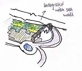
a restoration facility which breaches the sea wall and acts as a buffer to the landscape behind.
Energy, Residential, Biotech
Naturalbuild, Shanghai Professional 2021 01 04 02 05 03 06
Biomorphic Living System:
Academic 2019-2020
Individual Work
an integrated environment to grow algae and nurture a selfsustaining ecosystem within a residential building.
Culture, Hertiage, Museum
Mulberry Grove
Academic 2019-2020
Individual Work
a masterplan of eighty thousand squaremeters and a small silk museum serving the landscape.
BDP, Shanghai Professional 2021 07
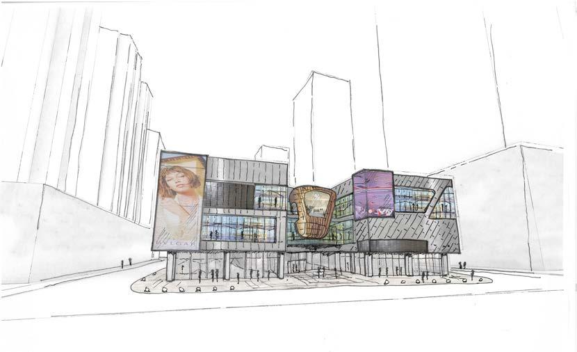
Retail, Commercial
Ecology, Garden, Infrastructure
The Pink Island Professional 2020
a garden attractive not only to people but also to pollinators and other species.
Commercial, Hotel
Academic 2023-2024
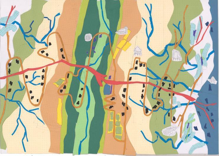
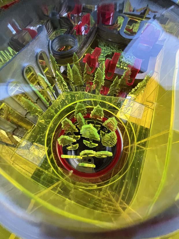
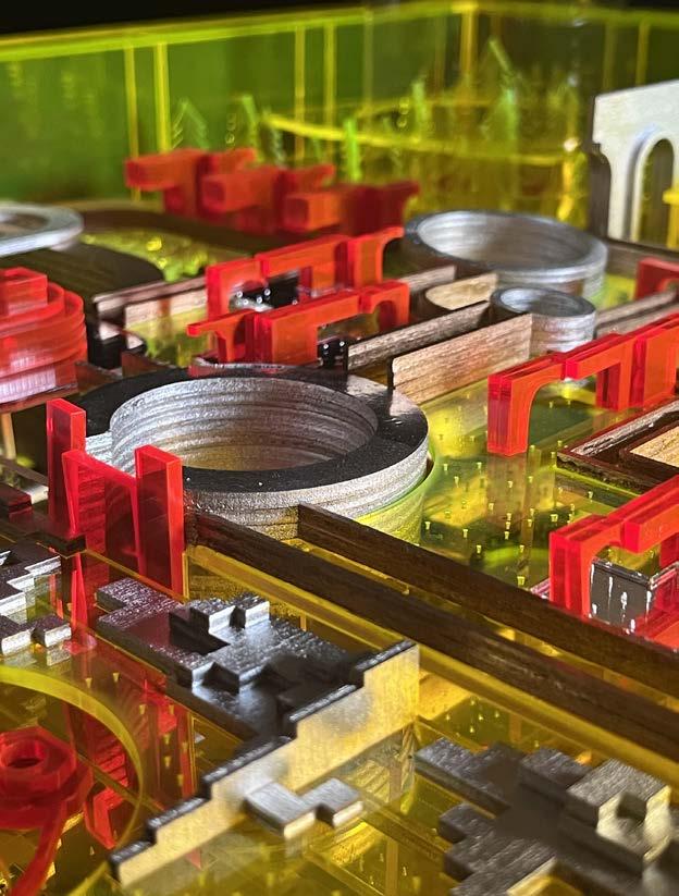
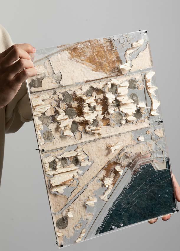
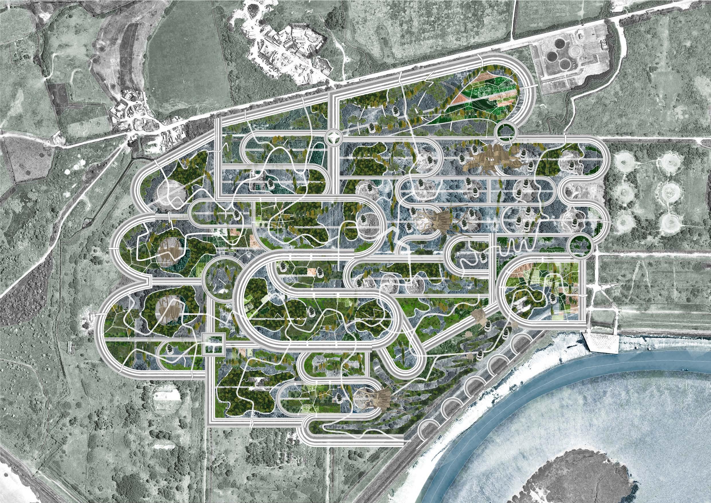
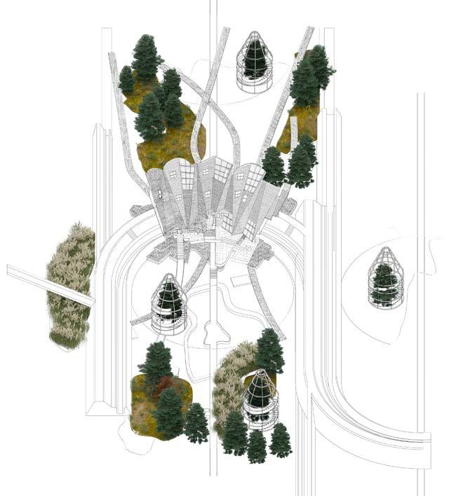
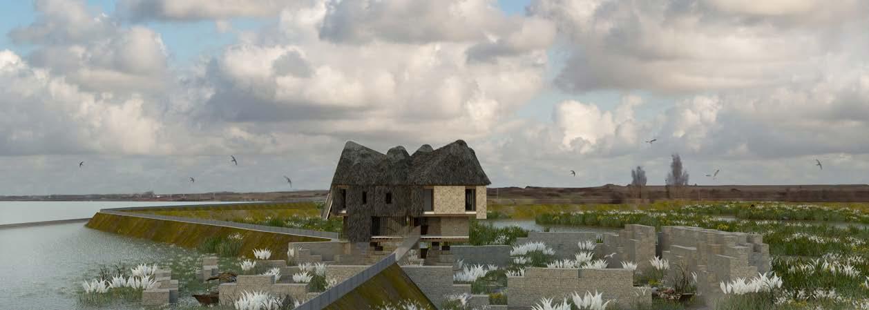
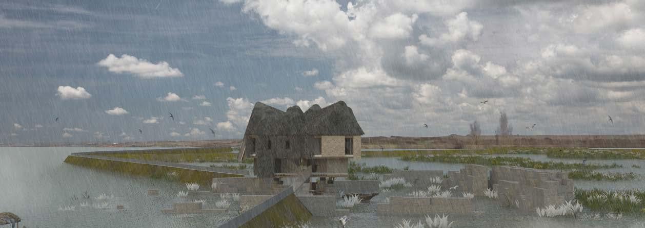
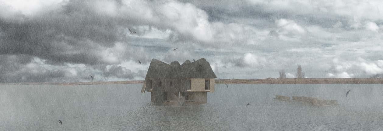
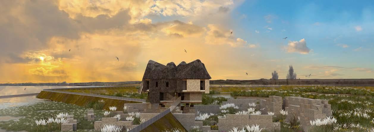
This project proposes a flood-management landscape that embodies an alternative approach to addressing coastal erosion. It investigates Canvey Wick to tackle the ‘Wicked Problem’ of flood management and biodiversity preservation.
The proposal is developed using toned hand drawings and a layered model. It forms a playful and participatory design technique where a dialogue unfolds between biodiversity hotspots, flood infrastructures, and a network of public buildings.
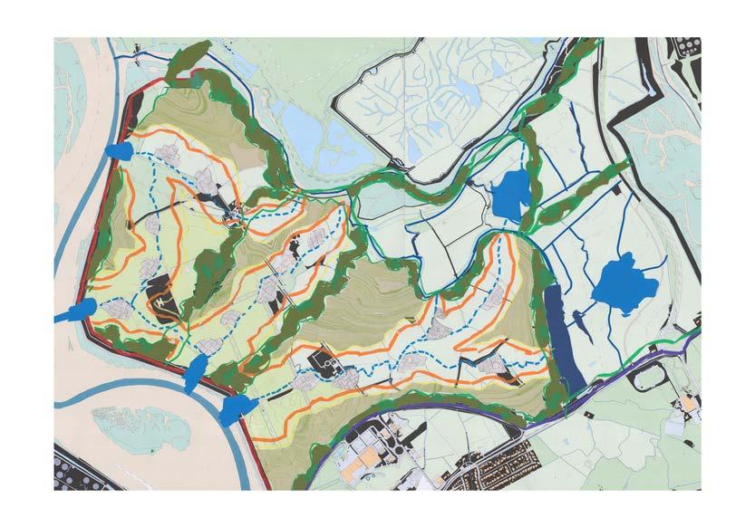
Canvey Wick, once a brownfield site, has flourished into a nature reserve following years of transformation. However, the Thames Estuary 2100 Plan designated it as a flood storage area, meaning the original inhabitants will go extinct when the floods occur. The design uses collage and mapping as key research technique to speculate alternative inhabitation towards a flooding future.
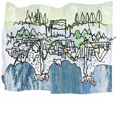
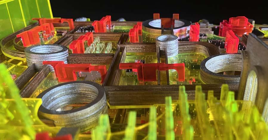
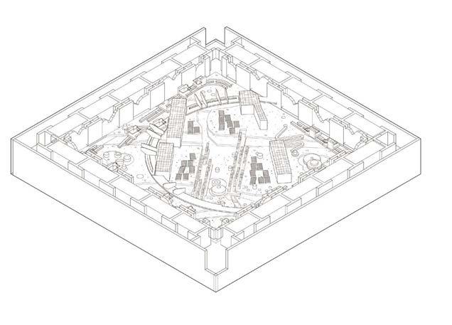
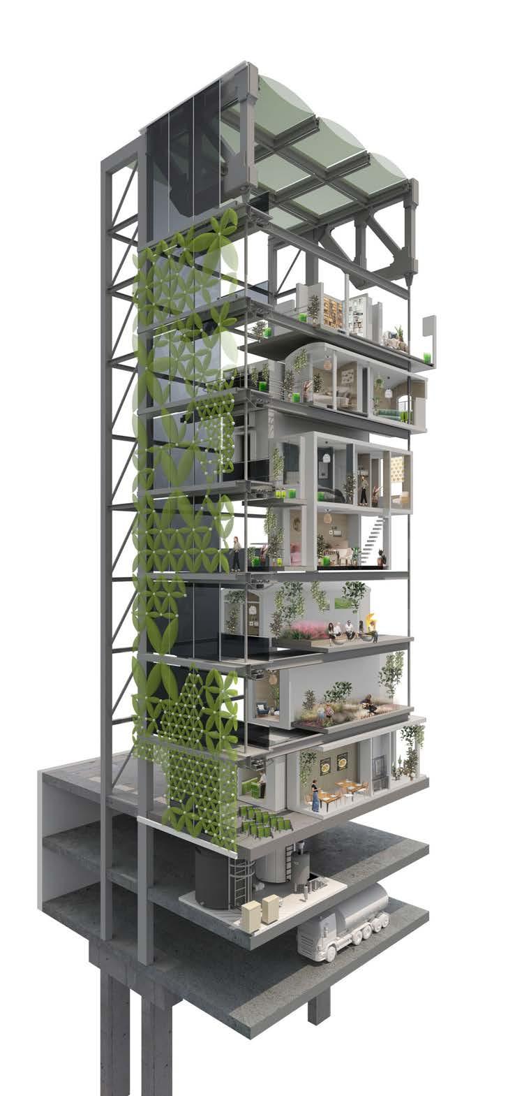
1. Canvey Wick reimagined at 1:3000
2. one stripe zoomed in with diverse natural and cultural elements
3. folding agriculture
4. forest sanctuary
5. Mapping as a collaborative process between different shakeholders
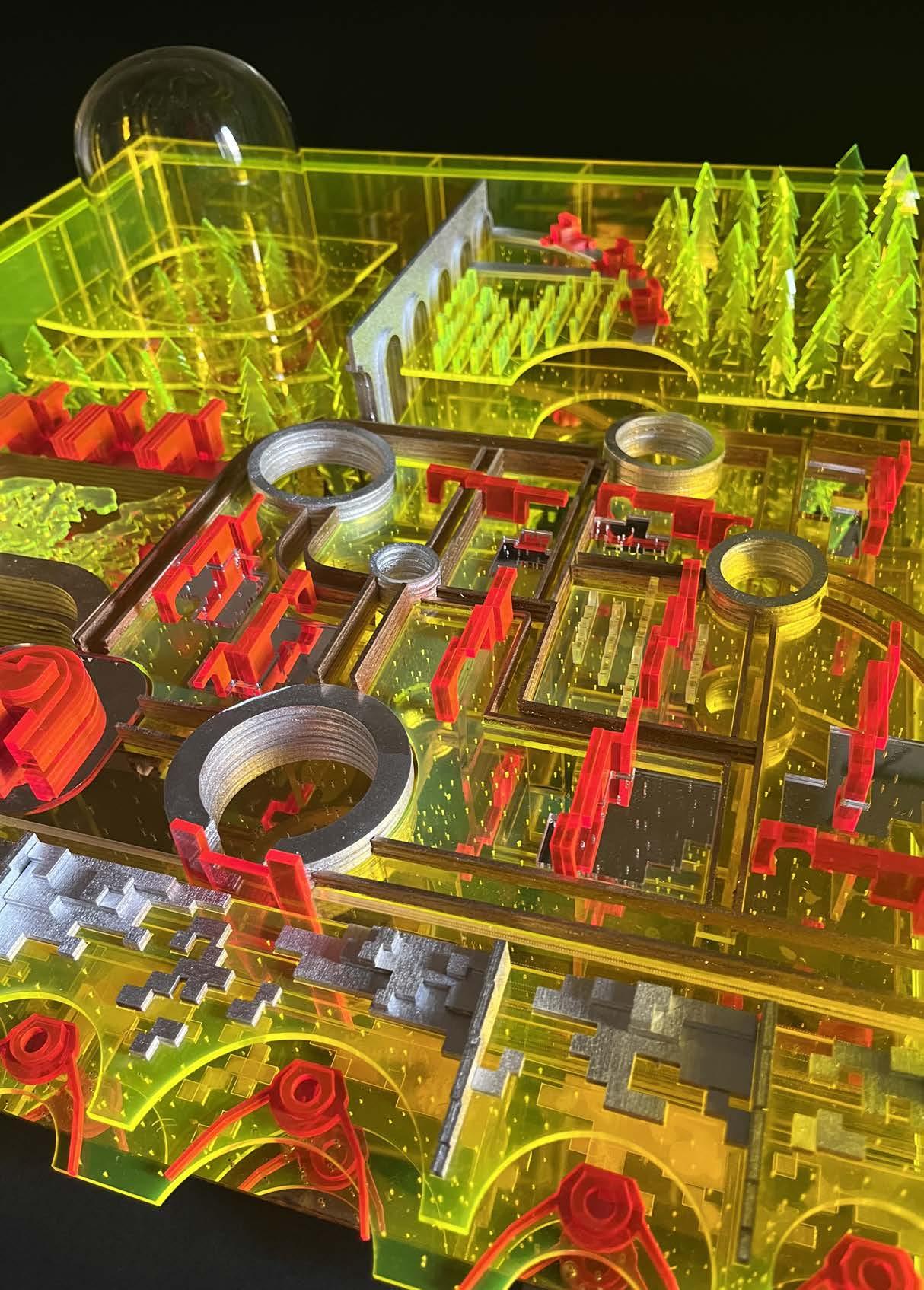
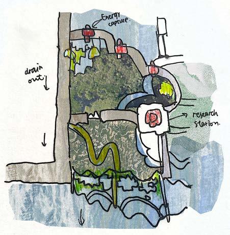
A. Wave Energy Harvest
B. Break Water
C. Gabion Garden
D. Sluice Gate
E. Retention Pool
F. Research Facility
G. Pump Station
H. Plant Medium
I. Hydraulic Garden
J. Turn Locker
K. Water Channel
L. Protected Marsh
M. Residential
N. Raised Woodland
O. Physic Garden
P. Aquaduct
Q. Farm House
R.Wet Biome Laboratory
S. Seawall
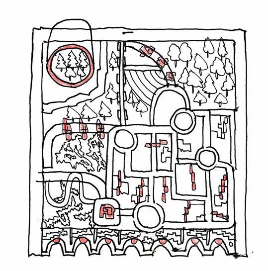
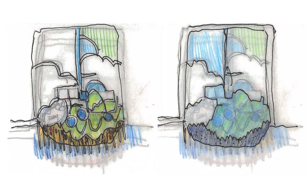
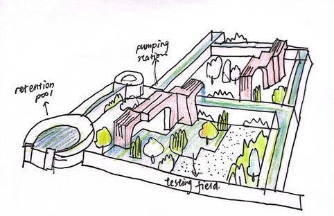
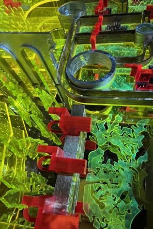
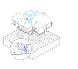
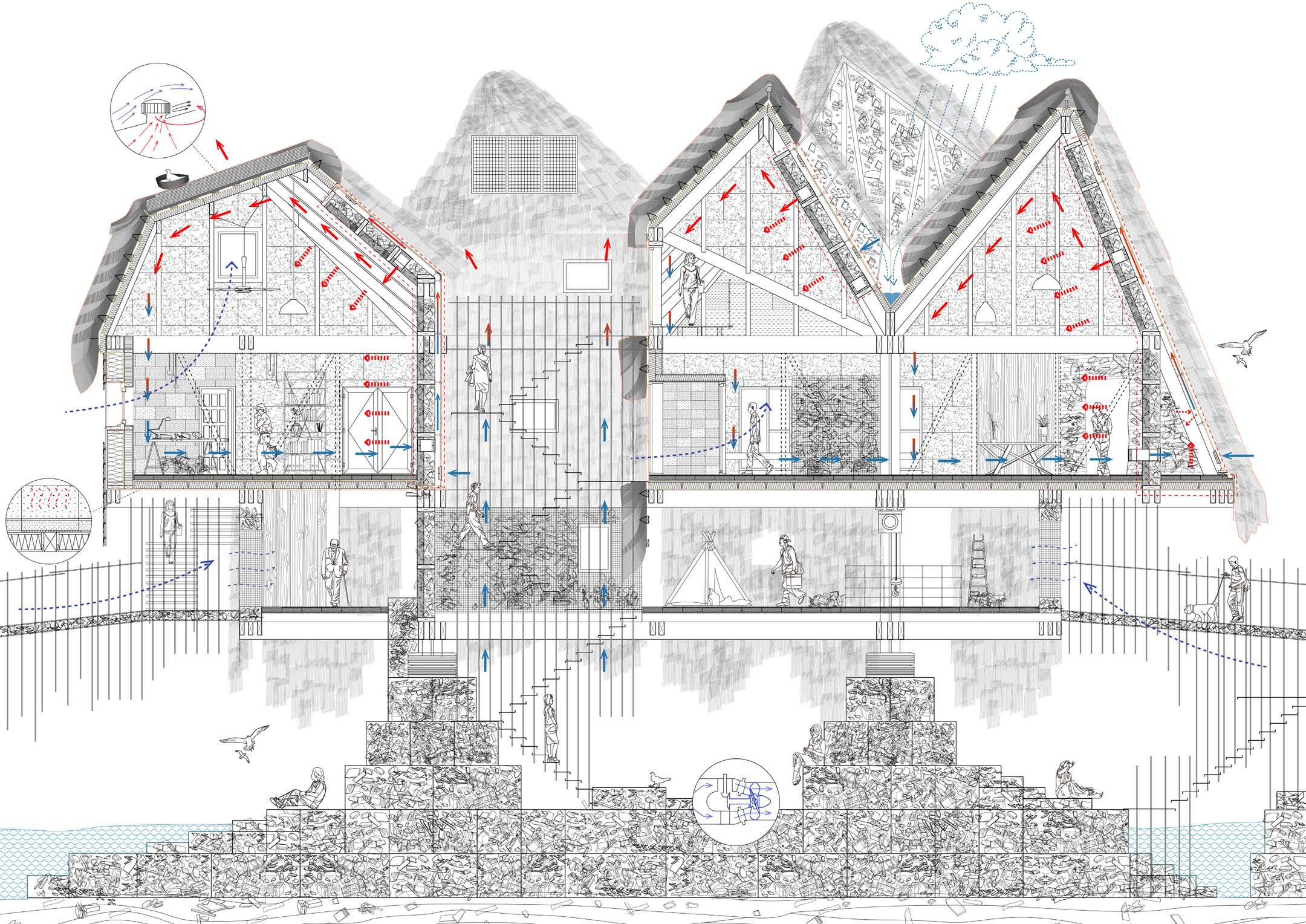
The design starts to speculate the washland scenarios through the experiment of a system diagram. The soft border captures sea wave energy, channeling water into the hydraulic matrix garden to nurture salt-resistant species. The raised woodland preserves original biodiversity, while the inundationproof laboratory studies natural processes. The protected marsh stores excess brackish water.
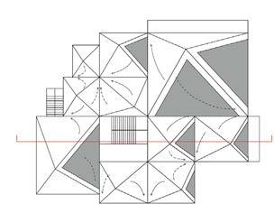
1. a catalogue of infrastructure is embodied within the landscape
2. pencil drawing shows the infrastructure distribution
3. five elements are introduced to form this system diagram

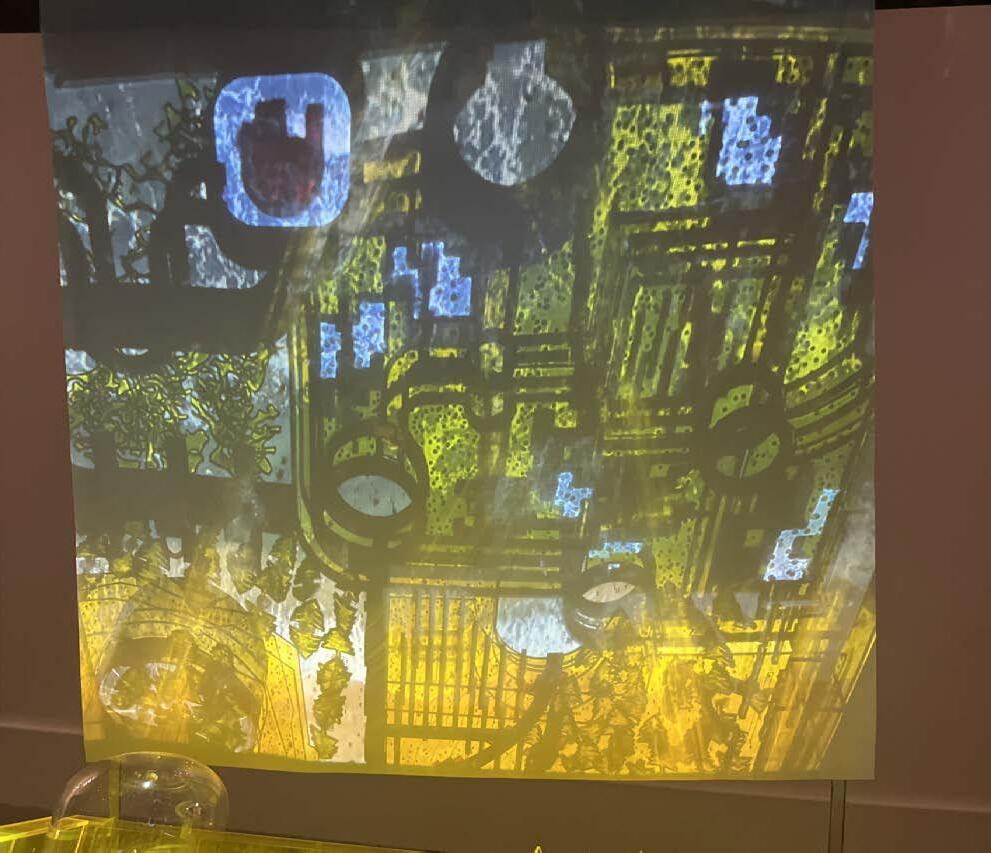
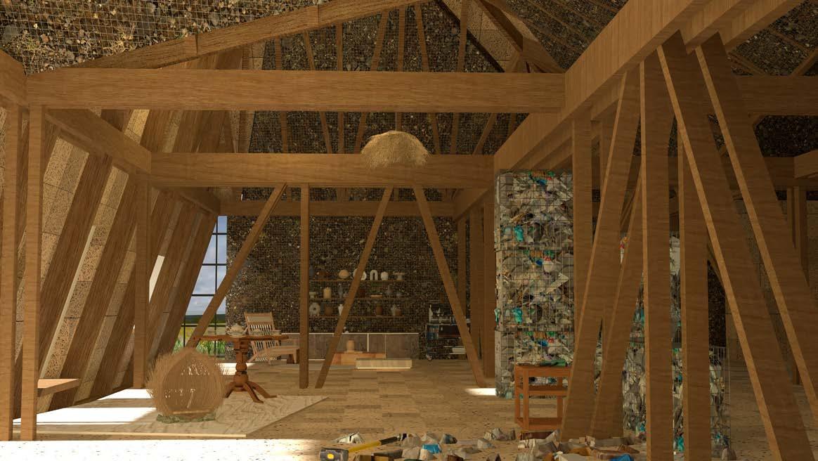
Mixed visual narratives through drawings and models are fundamentally a form of design inquiry that helps transform the fields of knowledge, contextualize the phase of changes,and examine the feasibility of the hypothesis. Photography, sketch,rendering, animation, and model generated within this research do not end in themselves but become a strong narrative tool where a new coastal architectural landscape takes form.
1. wet biome indunated laboratory draws inspiration from the whole tree chamber
2. hydraulic maxtrix consists numbers of watery fields
3. permeable border
4. each bit of the landscape interweaves
5. wet and dry dynamics
6. gabions as buffer
7. trees grow within the water field as process of landscape experimentss
8. excess brackish water drains out from the flood pockets
9. arrangement of trees, pumps, channels within the testing fields
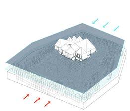
The ebb and flow of tides create a dynamic landscape where areas transition between wet and dry conditions, shaping a habitat that is both habitable and inhabitable at different times. During high tides, certain areas become submerged, fostering unique wetland ecosystems, while low tides reveal dry expanses suitable for recreational and ecological activities.
It could be investigated from the model how carefully designed channels, weirs, and flood storage areas contribute to effective flood control.As you navigate through the catalogue, witness the synergy of nature and engineering, showcasing a harmonious approach to water management that ensures ecological health and resilience in the face of dynamic hydrological conditions.
Academic 2023-2024
Individual Work
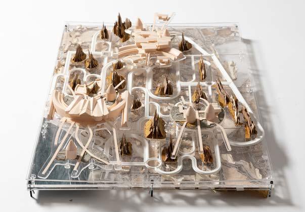
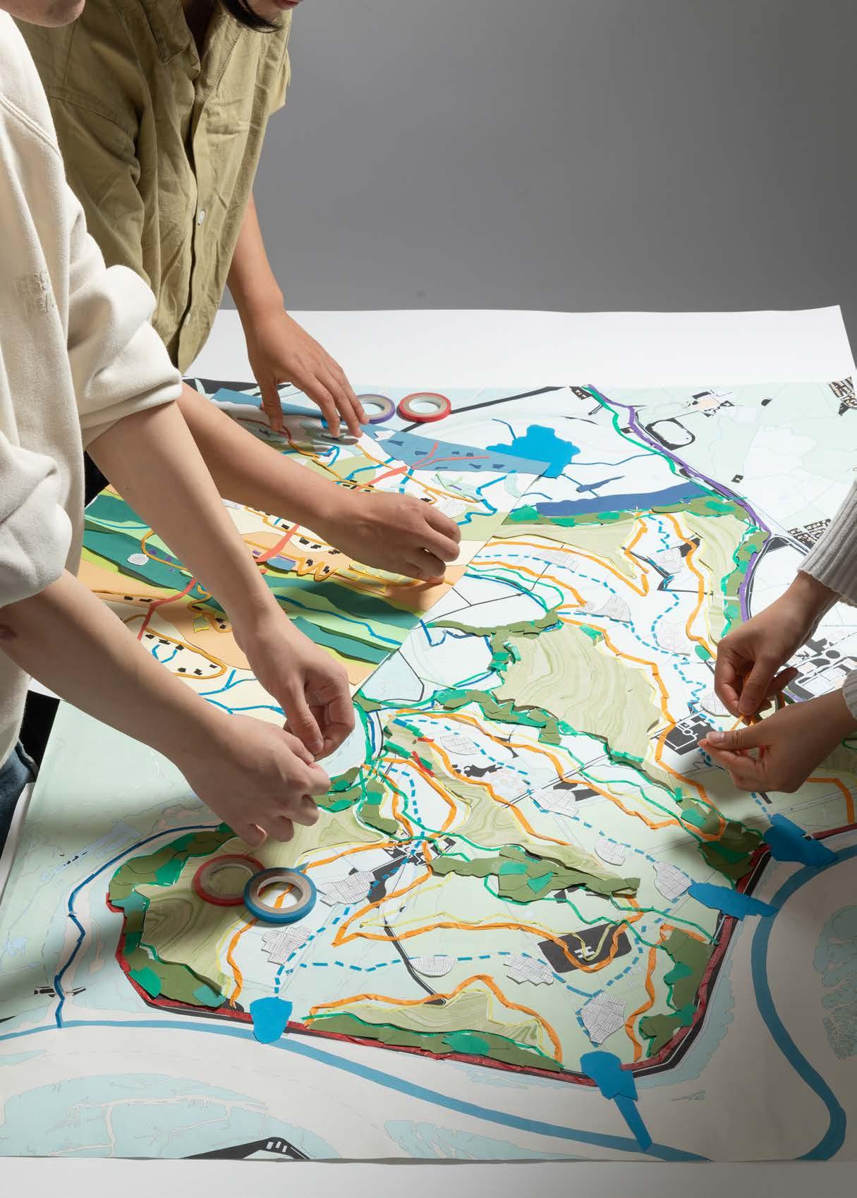
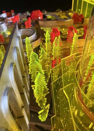
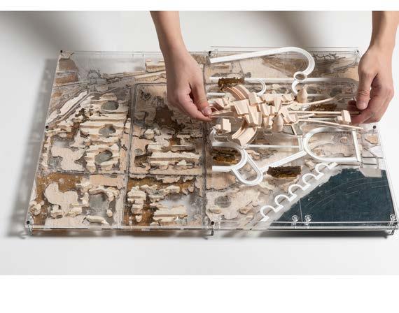
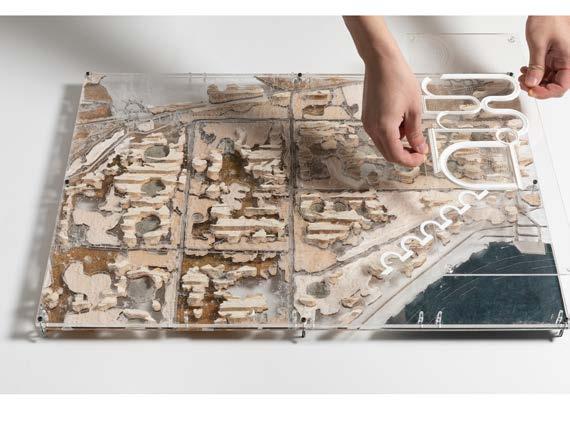
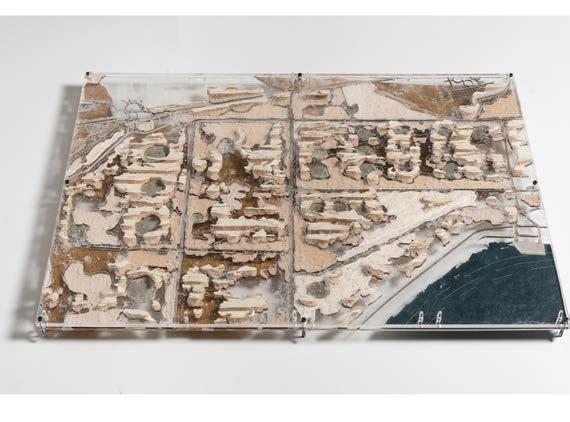
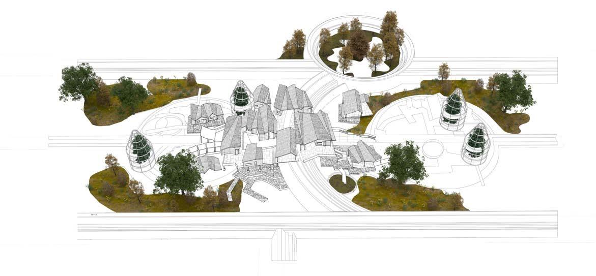
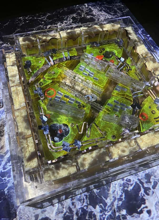
The multi-layer model, integrating various scales, inspires a playful and participatory design process. Over this imaginary landscape, a dynamic dialogue unfolds among existing vegetated masses, emerging biodiversity hotspots, diverse flood infrastructures, and a network of roofed structures.
Layer 1: Unfolding Existing Attributes
Layer 2: Mapping Flood Tanks
Layer 3: Biodiversity Canvas
Layer 4: Research Lines
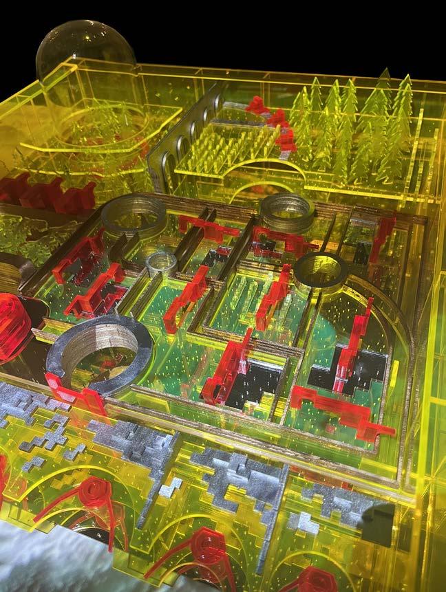
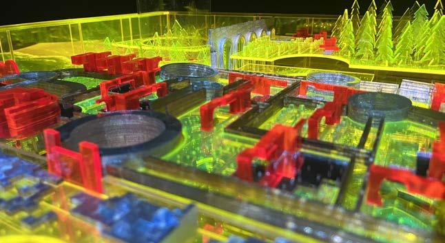
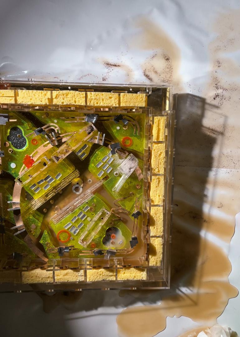
1. layered model top view
2. axonometric shows the composition of diverse elements
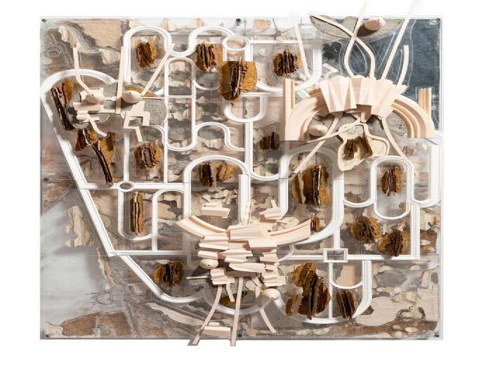
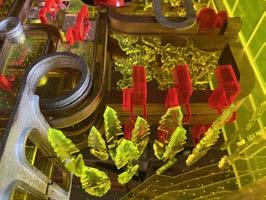
The model consists of various site layers, each featuring distinct textured materials to represent different spatial qualities of the site. The bottom layer illustrates the plan layout of elements.The middle layer depicts the density distribution of plants. The top layer presents the elevation of trees. These layered plates collectively demonstrate the spatial characteristics and organization of the site.
1. existing material plate
2. prototype test
3. identifying key biodiversity assets

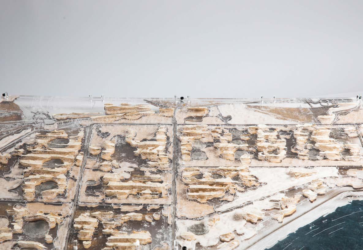

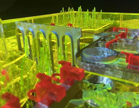
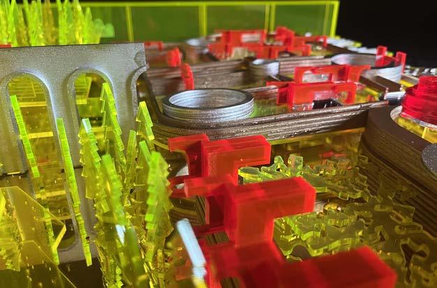
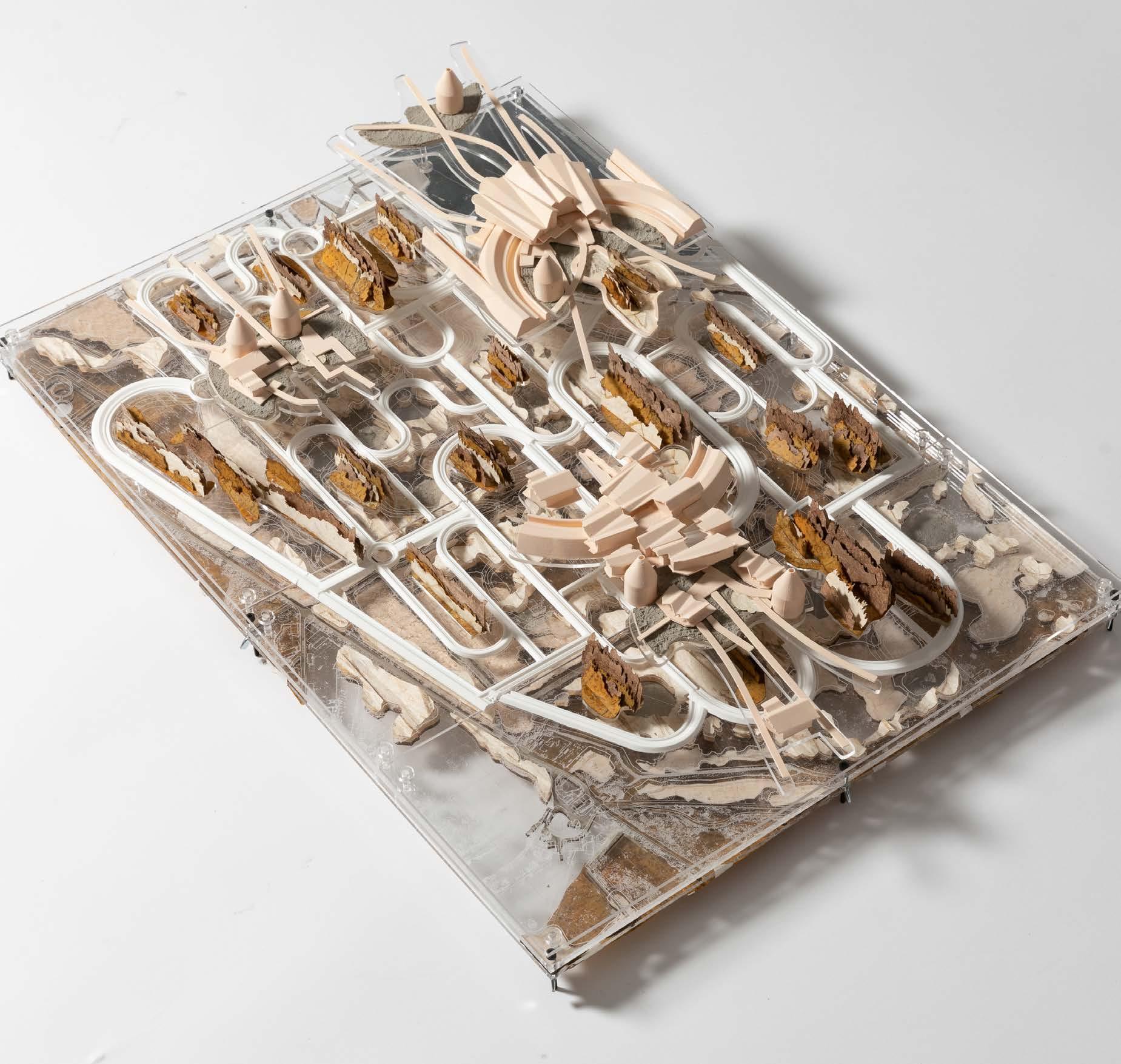
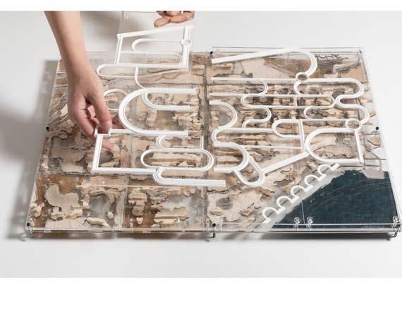
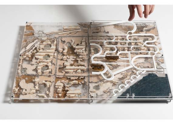
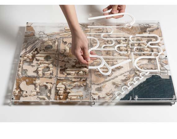
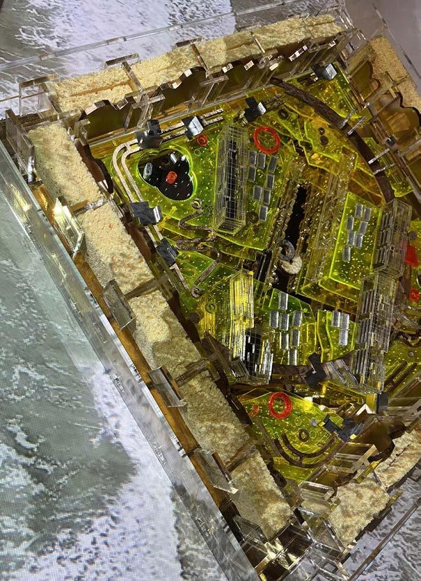
Four types of flood tanks, each with different dimensions, are mapped onto the site based on the locations of trees and circular plots. Geometries comprised of interlocking ribbons are designed as a response to the historical and ecological attributes present on the site.

4. mapping flood tanks
5. flood tank seawall model 1:200
6. seawall ribbons with integrated water channels
7. Stored flood water
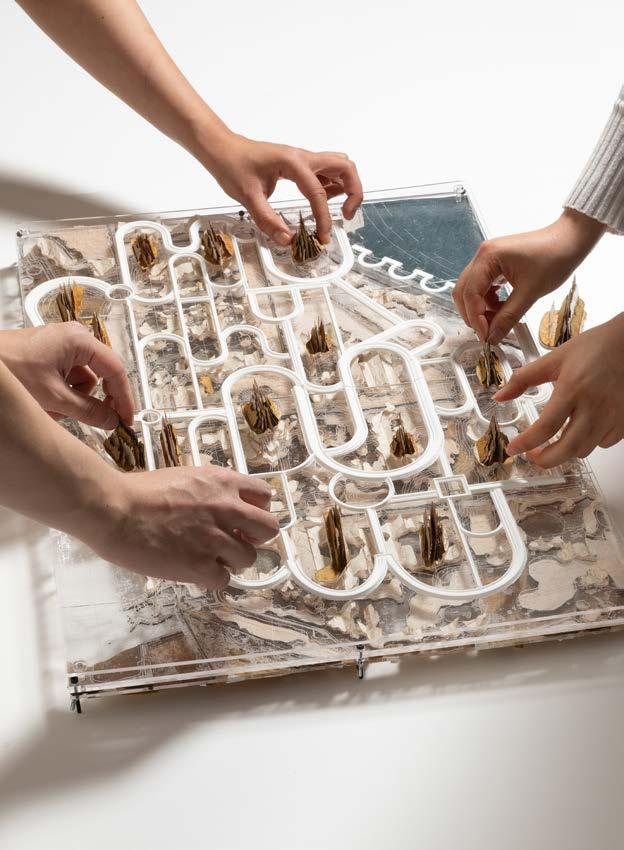
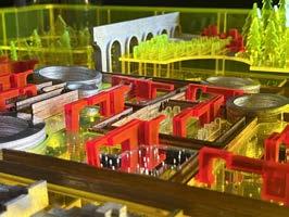
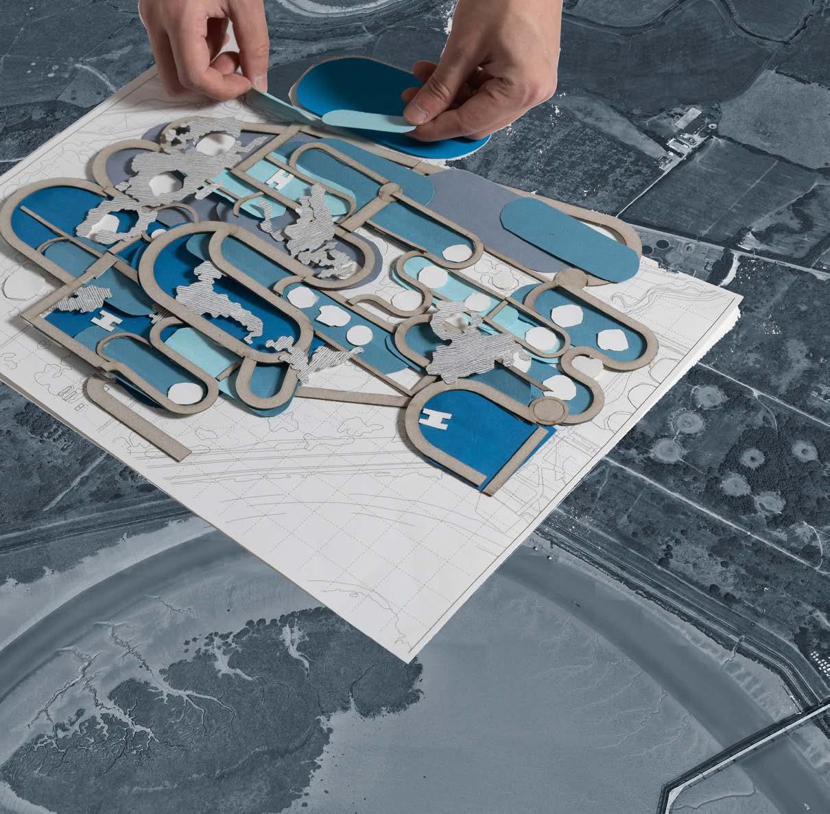
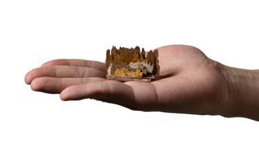
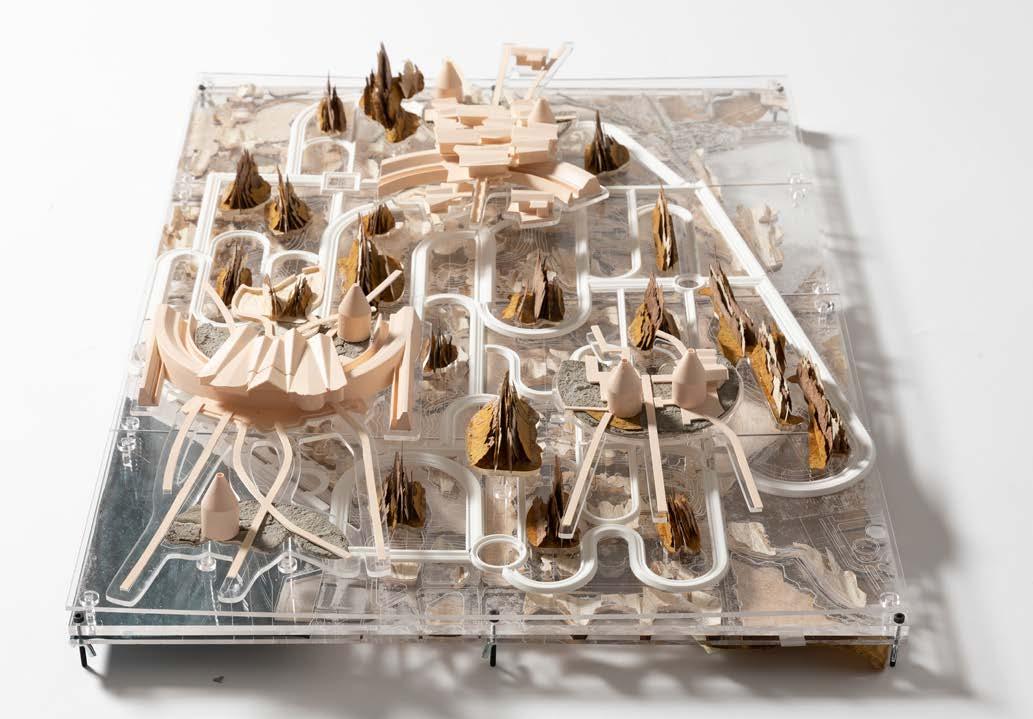
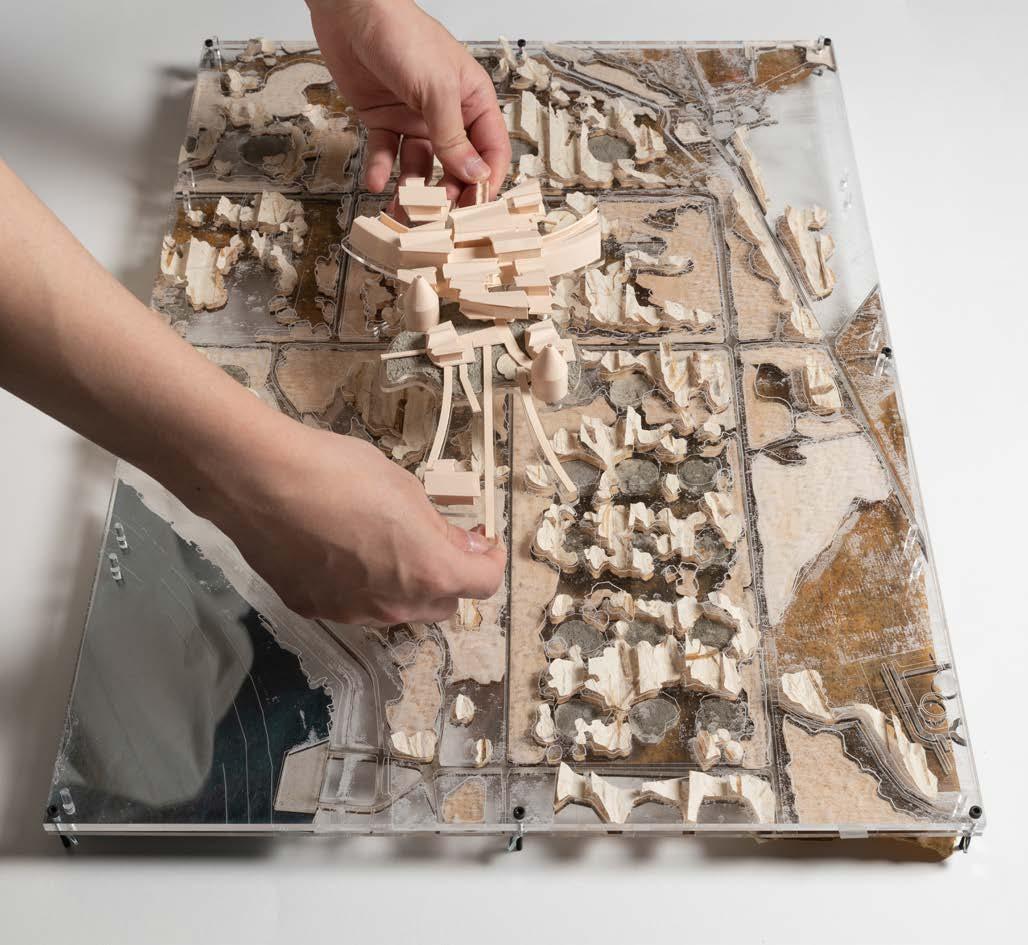
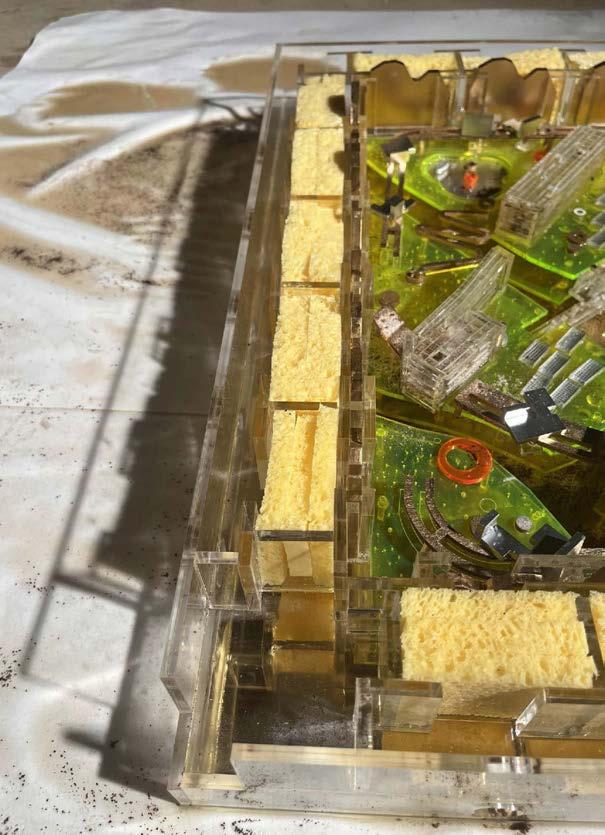
The Zoning and Seed Pool Model has been selected as the primary biodiversity strategy. Small new forest clusters are visualized as physical models, which can be added or relocated above the flood reservoir plate. This ecourages a gaming process between different shakeholders to reimagine the landscape futures.
1. biodiversity board game
2. wet forest tree species are identified as the new inhabitats adaptable to varying water levels.
3. the provided model is a three dimensional canvas in which patterns and ornament are translated and edited as potential landscape features
4-11. the model is conceived as an interactive surreal landscape
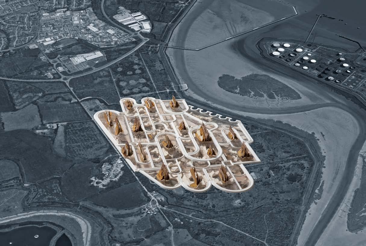


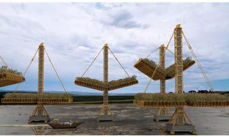
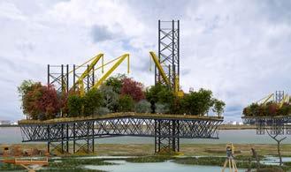
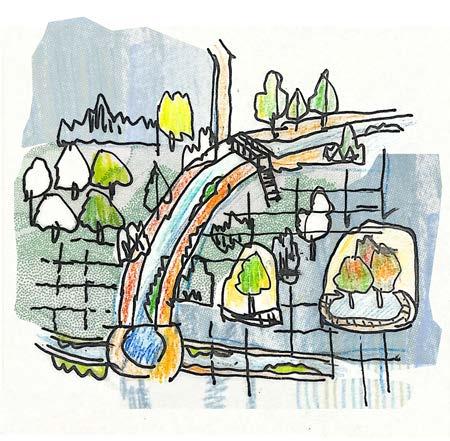
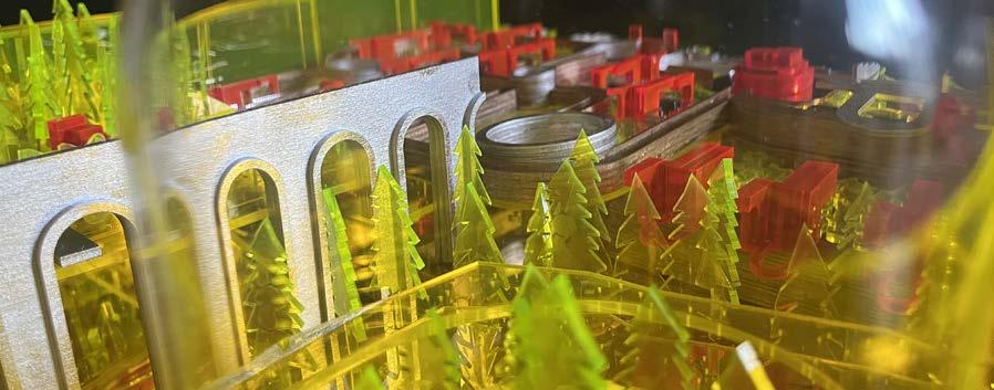
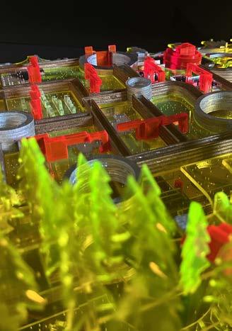
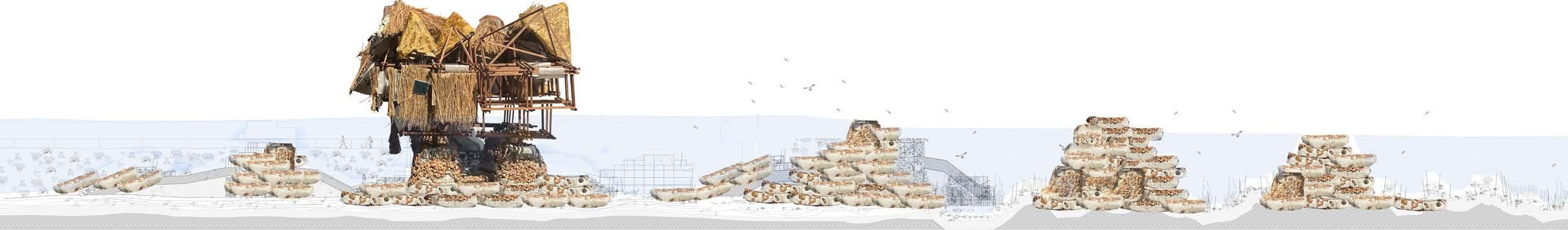
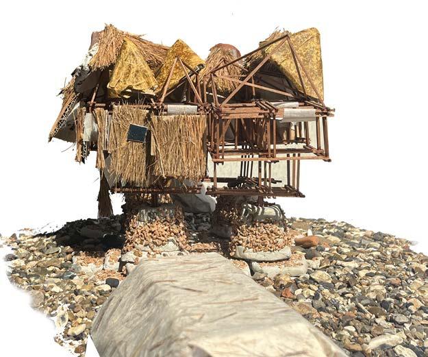
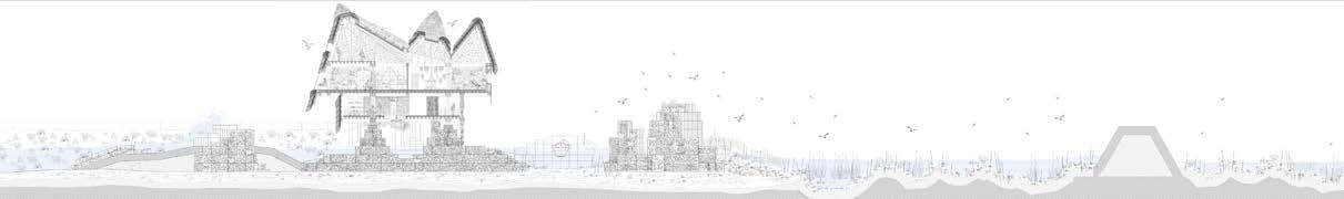
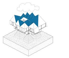
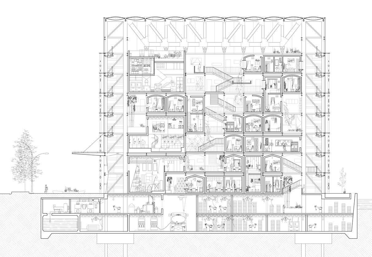
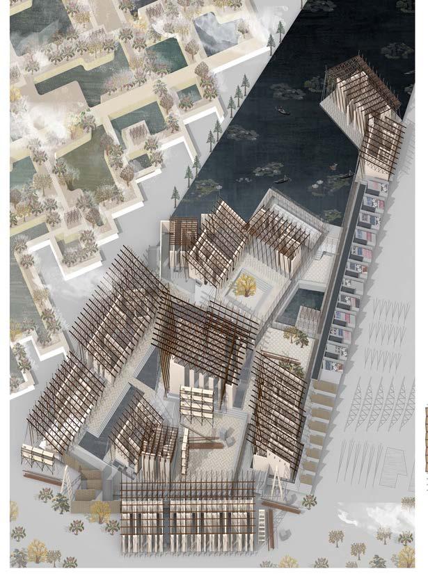
A flood reservoir scheme is outlined through a network of flood tanks, connecting industrial remnants while fostering the emergence of biodiversity hotspots. Accessible pathways weave through the landscape, offering diverse journeys for discovery.
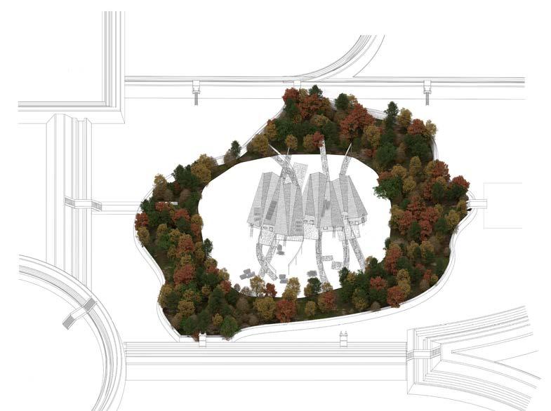
A series of practical laboratories and public buildings scatter across the landscape, working together to address the climate crisis and facilitate ecological succession. Each building acts as a nexus, filtering through a myriad of journeys.
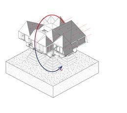
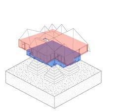
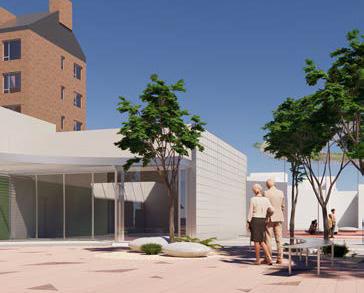
1. site view from the east
2. architectural layers are incorporated into the landscape
3. research center
4. farm house
5. community activity center
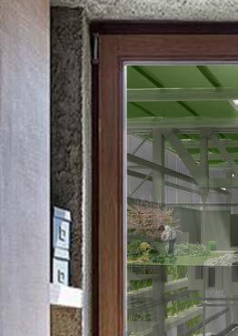
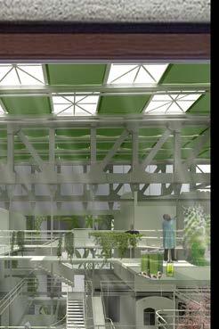
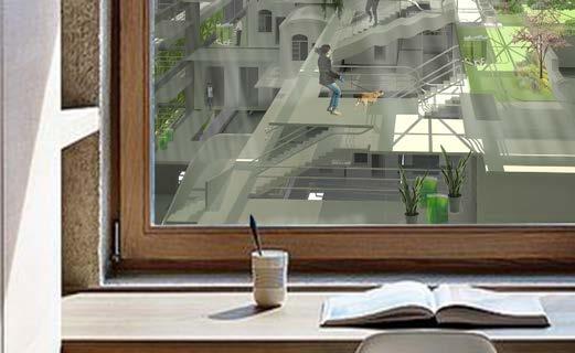
Over 1,000 historical landfill sites in the UK are at increasing risk of being breached by erosion. Global sea level rise has forced us into a critical position to rethink our relationship with flooding. This project, instead of inventing a defensive structure, attempts to propose a permeable border at a landfill site.
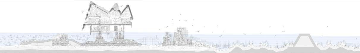
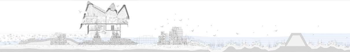
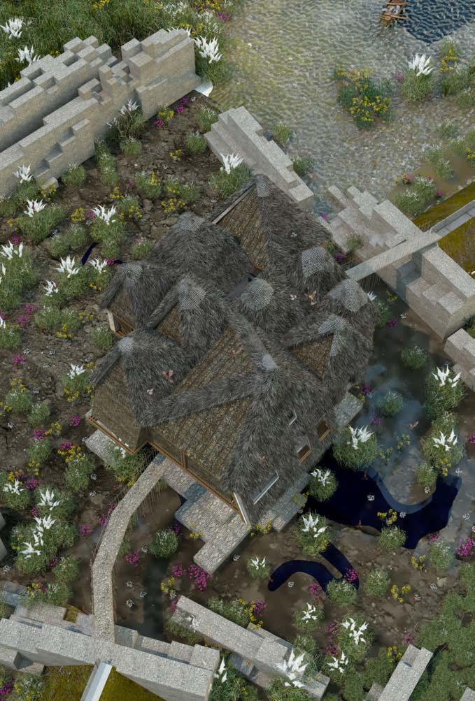
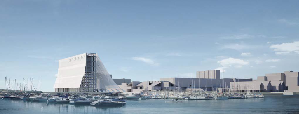
In response to the managed retreat plan at the East Tilbury Landfill, Curating Landfills envisions a restoration facility which breaches the sea wall and acts as a buffer to the landscape behind. Through repurposing the inert waste from the site, the proposal attempts to explore an alternative inhabitation to the interstitial zone between the wet and dry in a coastal landfill.
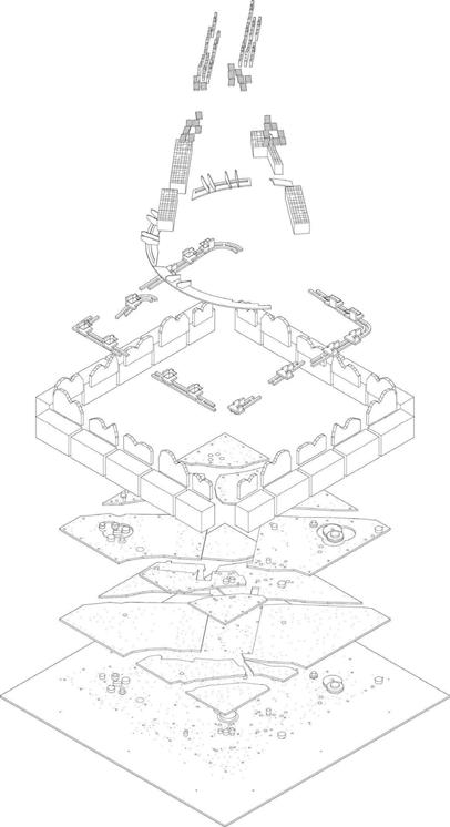
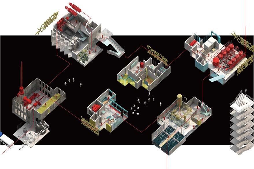
A urban-scale device is proposed based on the site vistit to Tollesbury, UK. Develops from sponge concept, the design attemptsto breach the seawall and act as water inlet. A number of critial infrastructures is designed to generate energy, produce food, provide residence and regenerate the nature environment by making use of this refreshed water tides. An alternative inhabitation to this interstitial zone between the wet and dry is reimagined and tested through the prototype design.
1. machinery landscape exploded view
2. sponge city sits on the seawall, blending with the sea waves
3. The force of waves is gradually dissipated through the buffer space.
4. mudness after the tidal events
5. the central landscapes are protected by the building structure
6. machinery landscape at high tide
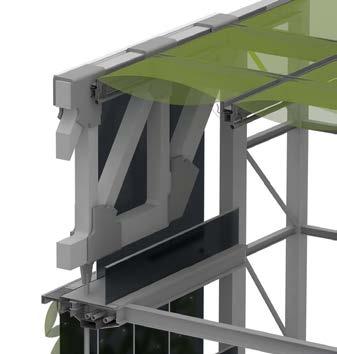
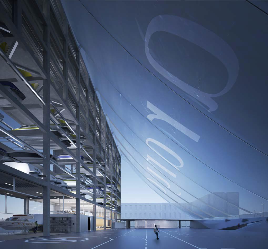
The building demonstrates the construction possibility through a well considered gabion foundation systems which caters to the melody of landscape. It proves the structure feasibility by redefining all the structural members and performing like a integrated mega truss. A flexible joinery is designed between the building truss and the sinking foundation to pursue a surreality where building vibrates rhythmically with sea wave. 1. building and landscape: 50 years later

building as a rigid truss
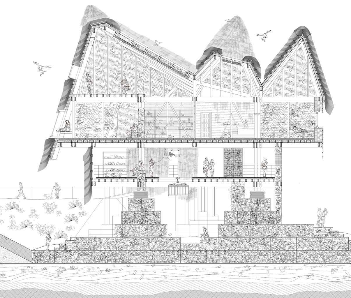
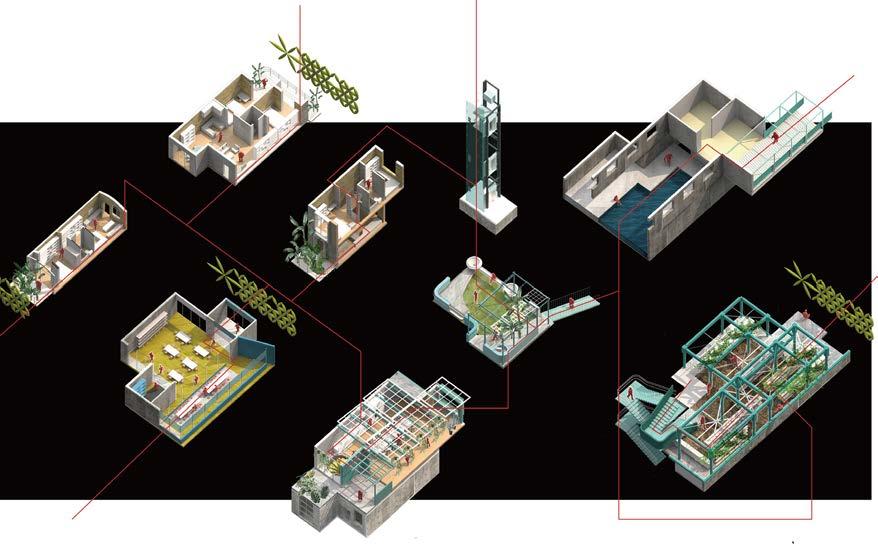
The design attempts to repurpose the waste and redefine the wasteland commons through the lens of architecture. A visual journey is constructed in this section to demonstrate how building react to the surrounding environment with the changing weather, water levels and human activity.
Acting as a soft water inlet, the building reconnects the wasteland and the sea. It helps to harvest the sediment and prevent the hazardous substance from being washed into the sea. As a restoration process, the inert waste material is collected from the land and transformed into new building material. At the same time, the building integrates itself into the landscape and performed as the paradise for birds, insects and other wildlife.
1. clock envelope caters to the lunar cycle 2. building repurposes the waste as the construction material
3. 6am cloudy water level: +2m
4. 7am rainy water level: +2.5m
5. 11am rainy water level: +6.4m
6. 5pm sunny water level: +1.5m
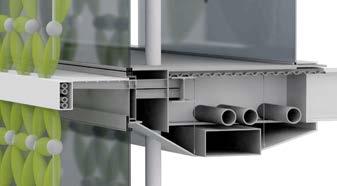
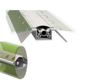
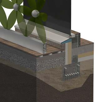
Northern facade is designed with thicker wall and small window to minimize heat loss.
Natural ventilation through the window and rooflight.
The floor is designed as thermal mass waste plate consisted with reclaimed concrete and terrazzo surface. Sufficient thermal and accoustic insulation is added in the construction
Nature human interaction platfrom: observing the bird,feeling the wind, touching the plants, experiencing the tide.
Southern facade is designed with the trombe wall system which could adjust the indoor thermal comfort. It could also facilitate the ventilation by supplying fresh air and extract stale air through the vent system. In summer, the shading system could be open to prevent overheating.
The staircase is made from reclaimed roof and metal plate. It hangs by the rebar on to the buidling primary beams.
Academic 2019-2020 1st Semester
Individual Work
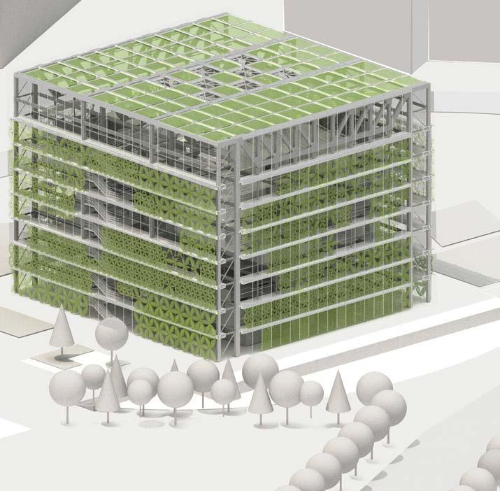
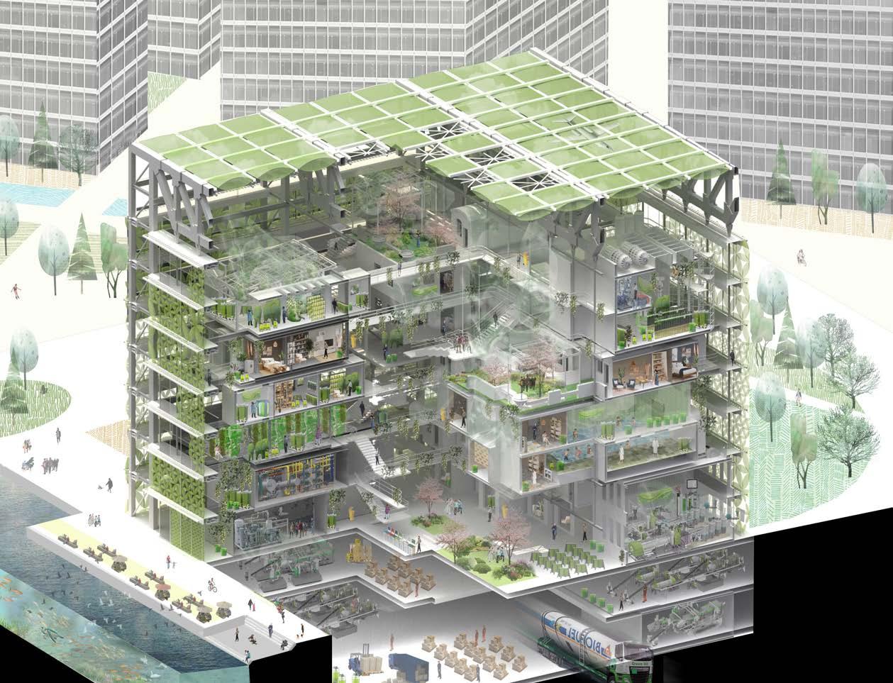
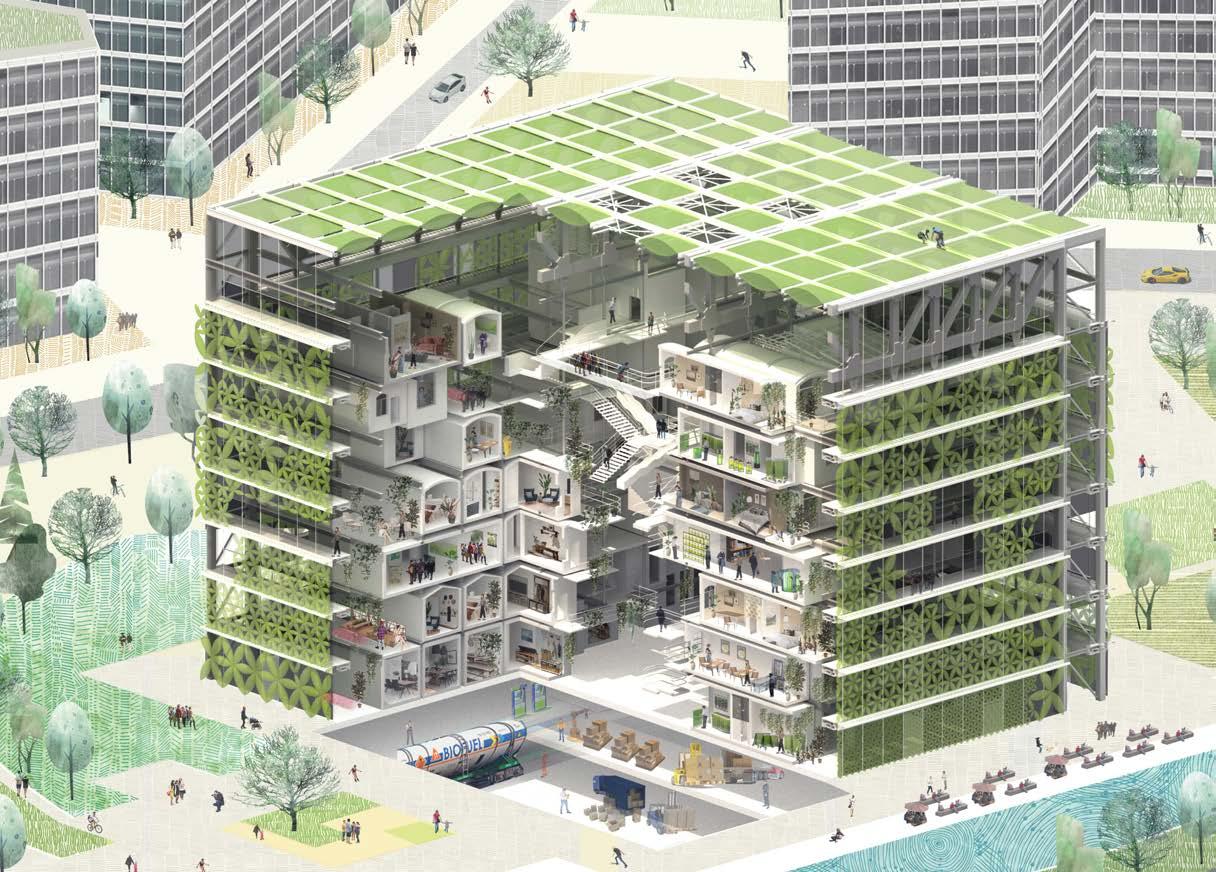
Combining structure and ecology, the project envisIons an integrated environment to grow algae and nurture a self-sustaining ecosystem within a building complex. Algae colonies are superefficient absorbers of carbon dioxide and producers of biomass, which means they combat climate change and generate fuel for the structures they adorn.
At the same time, the biofuel and other by-products from algae cycle could be transported to the airport, pushing the development of Zhengzhou Aerotropolis. It is expected that these biomes will generate social and environmental transformation at the levels of human experience, public health, and rural-urban integration.
1. plug-in catalogue: journey from algae's eye
2. algae facade
3. interior courtyard
4. section shows algae dynamic equilibrium
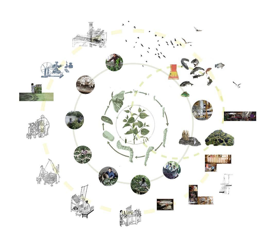
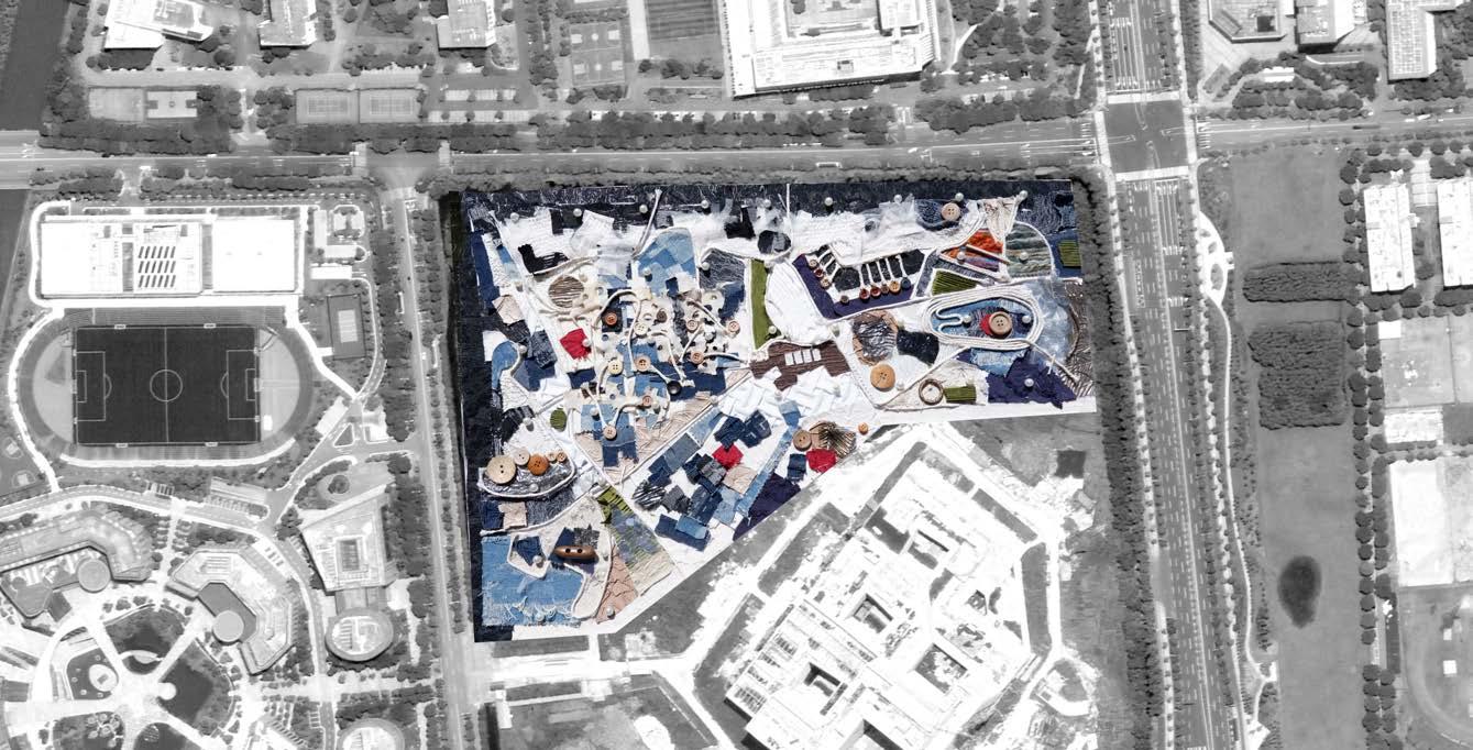
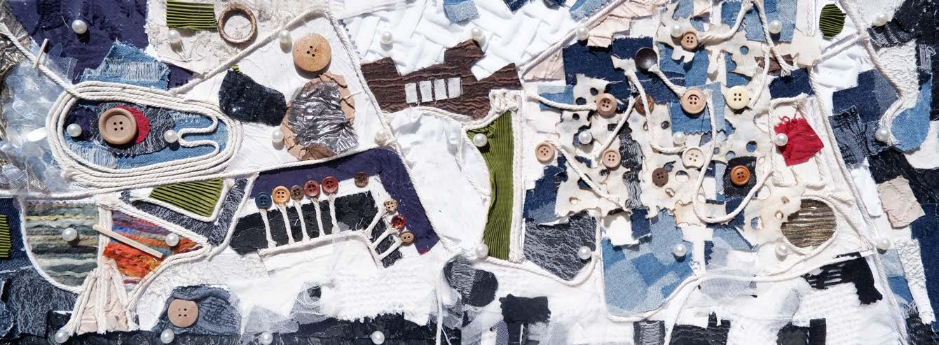
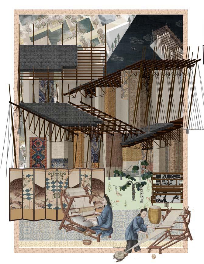
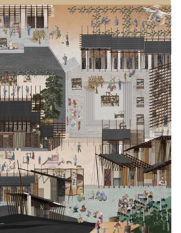
To imagine the New Silk Road, we have to revisit the Old Silk Road. We envison a unconvential silk museum which integrate itself into a scroll of landscape in the dense urban environment. It involves designs in two layers——a masterplan of eighty thousand squaremeters and a small scale vistor's complex serving the landscape.
Deferring from traditional notion of museum as a storage for artwork, the proposal sees it as a place for the flow of art events, a theater where there is no clear boundary between the stage and the space of the audience. By connecting all the silk manufacturing process in one park, the silk musemn interweaves them into everyday life and proposes a new mode for the contemporary cultural heritage
1. silk production and mulberry cycle: from cradle to grave
2. silk study: a digital approach
3. weaving mythology into urban fabric
4. material landscape: conceptualizing intangible cultural heritage as a new common

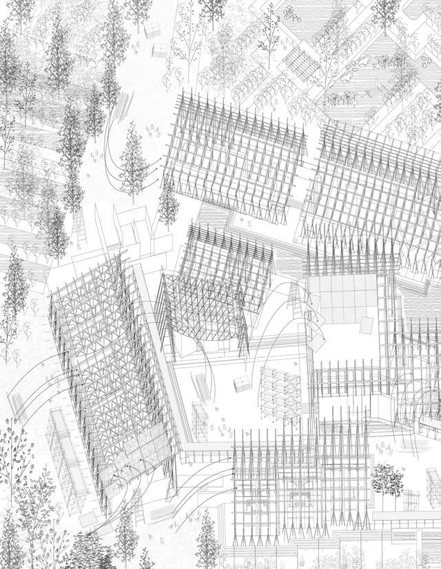
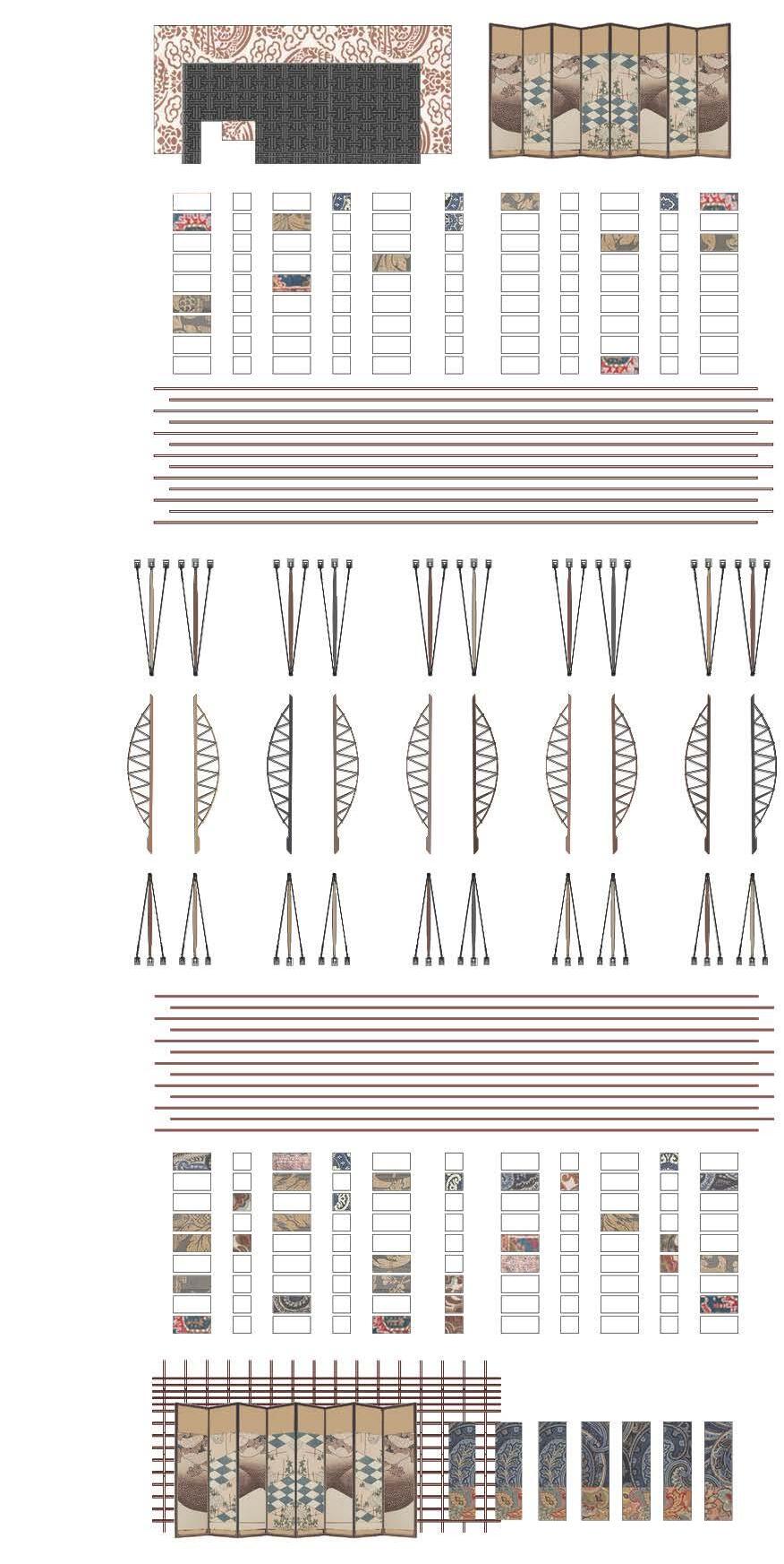
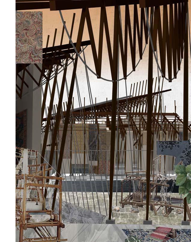
The museum is not only an archive of silk artwork but also a place for silk craft. Various silk avtivities are located in different space of the building complexs, linking indoor and outdoor environment. The purpose is to educate the public about the making process and make art fluid, to synchronize it with the flow of time.
1. tectonics: to transform and transcend from the sewing machine
2. museum is not only a storage place for artwork, but a stage for the flow of art events
3. this musem inscribes the exhibited artworks in this contingent material space; the medium becomes the content
4. a self-built museum that evolves over time
5. construction process as an inversion of ruins
6. material manual
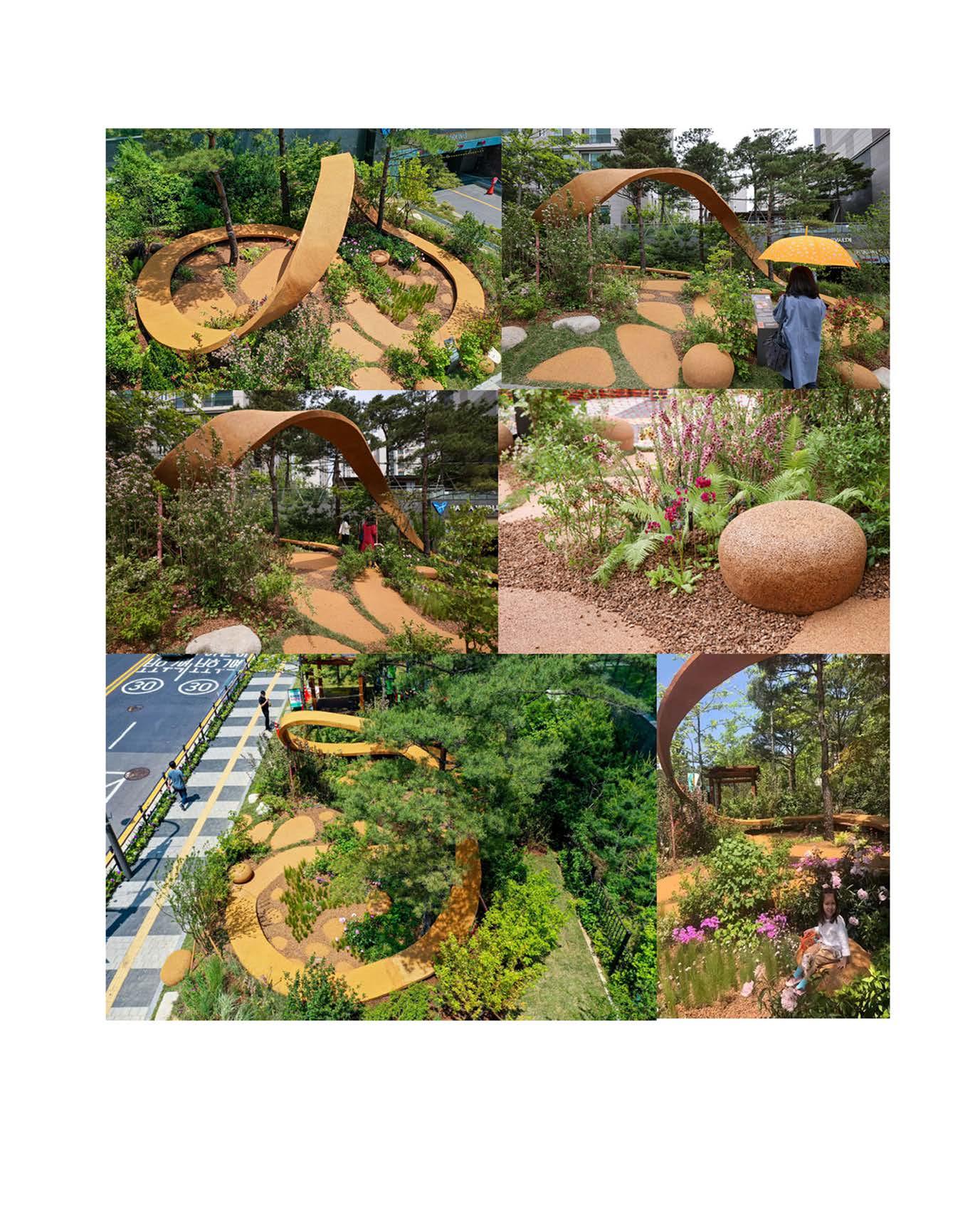
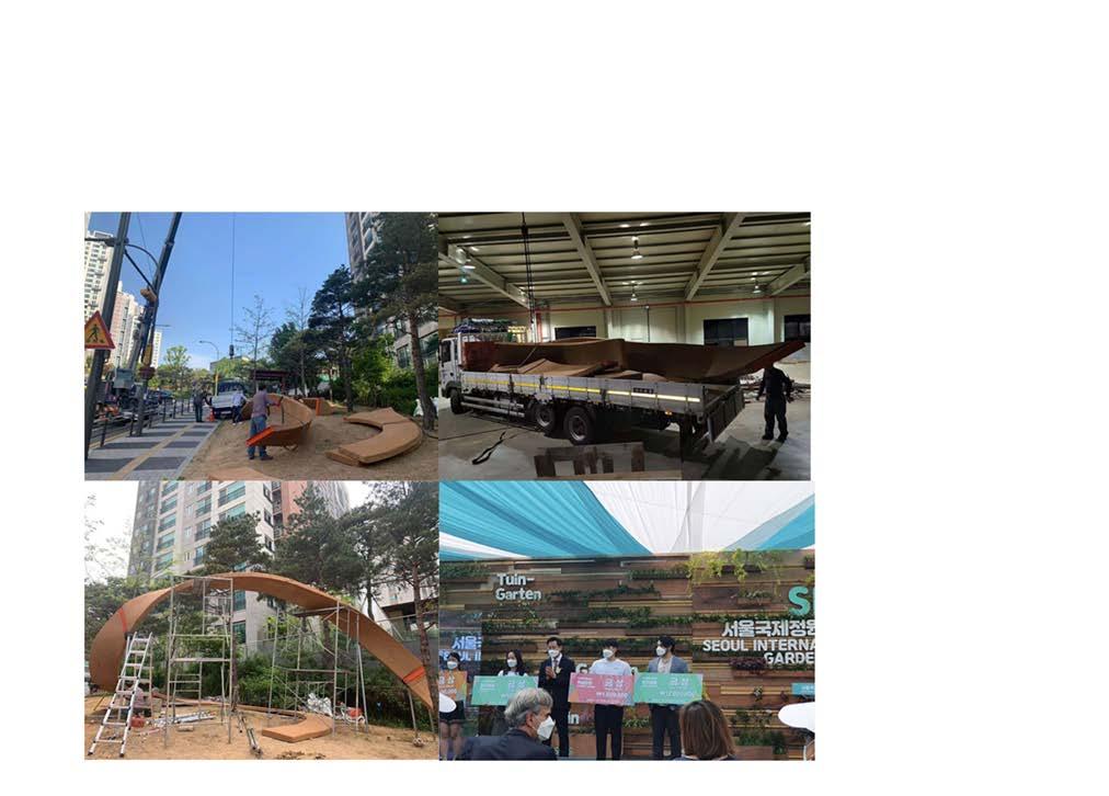
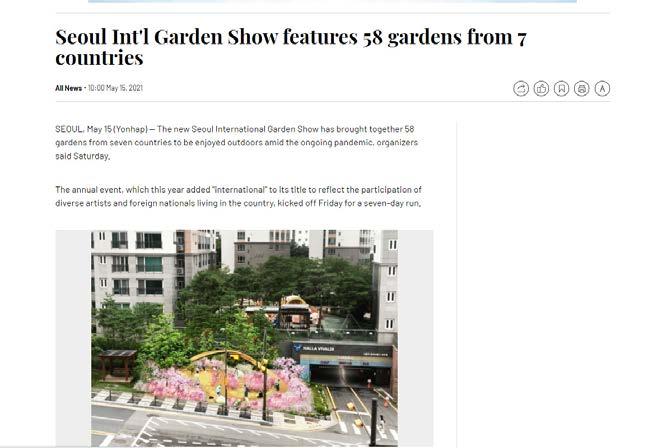
Top prize at Seoul International Garden Show
Professional 2020
The Pink Island is based on the idea of coexistence between humans and non-humans, acknowledging our entanglements with other forms of life and the need for providing inclusive, complex, and balanced ecosystems.
Professional 2021
Shanghai