
| Selected Academic Work and Personal Project | SUNY ESF Landscape Architecture 2019-2024
Henriquez Portfolio
Joselfy

Farming Thornden Flora and Fona of Oswego County
Material Construction Design Piedra Tosca Park 2022
Additional Work
Community Scale Design - Building Lot, Street, Block,hoodNeighbor-
LSA 226 Foundation Design Studio (2020) Syracuse, NY, United States Instructor: Rachel Leibowitz Group Academic Project
Foundation Design Studio is a major class course that focuses on skills and knowledge necessary to visualize and communicate 2-D and 3-D design ideas using appropriate traditional or digital graphic tools, techniques and technology. An emphasis is placed on the development of a working graphic and spatial design vocabulary and an introduction and application of fundamental design principles and the design process.
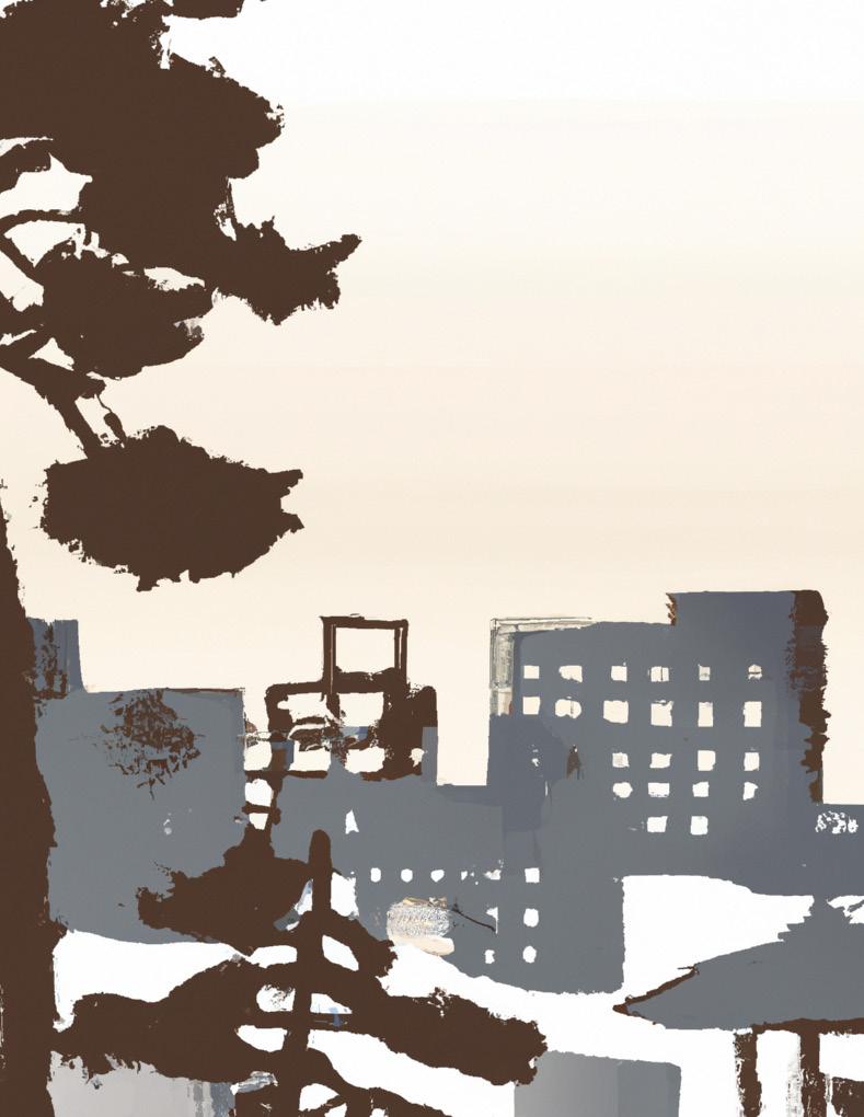
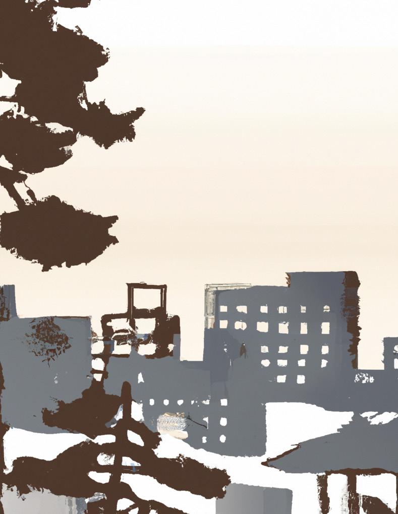
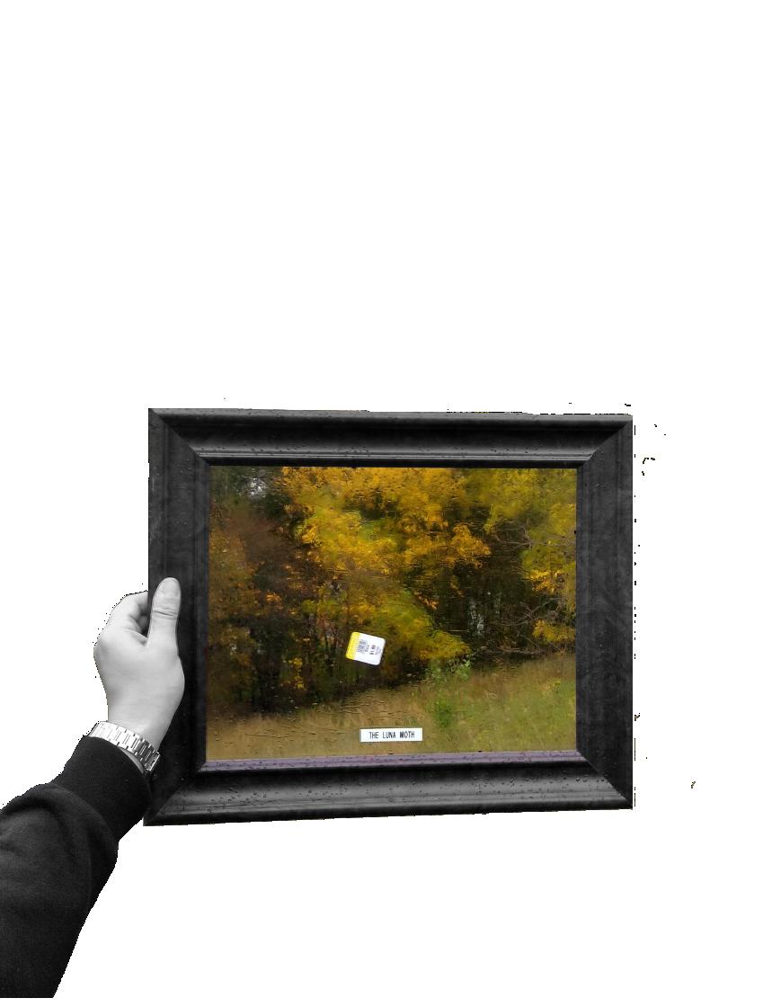
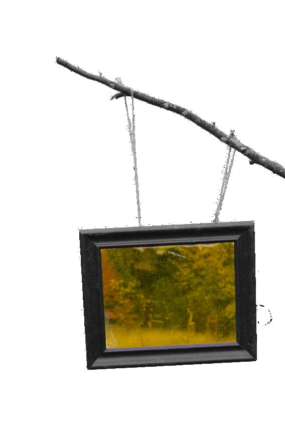
In the course, Foundation Design Studio, we will be creating small designs on one of the parks near SUNY ESF campus, Thornden Park. Thornden Park is a 76-acre park located in Syracuse, NY, which is the second largest in the city after Burnet Park. It is well known for its flower garden and its’ amphitheater, however, during snow events it makes the perfect park to sled due to Syracuse’s drumlins.
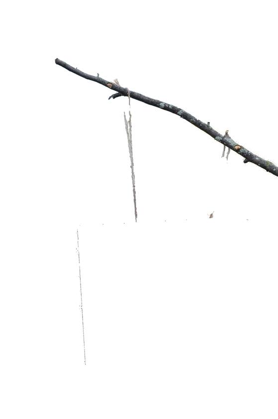
In this project we ended up creating a trail that emphasis the senses of the existing greeneries. Throughout the site we created pathways with tinted frames in certain views that when peered through the only certain colors starts to appear which were the flowers and or bulbs.
 GABRIEL COHEN JOSELFY HENRIQUEZ ELISA GUTIERREZ
WITHIN THE FRAMES THROUGHOUT THE INTERVENTION, OBSERVERS ARE SHOWN THE GRADIENTS THAT EXIST WITHIN THORNDEN; PHYSICAL , VISUAL , AND EXPERIENTIAL

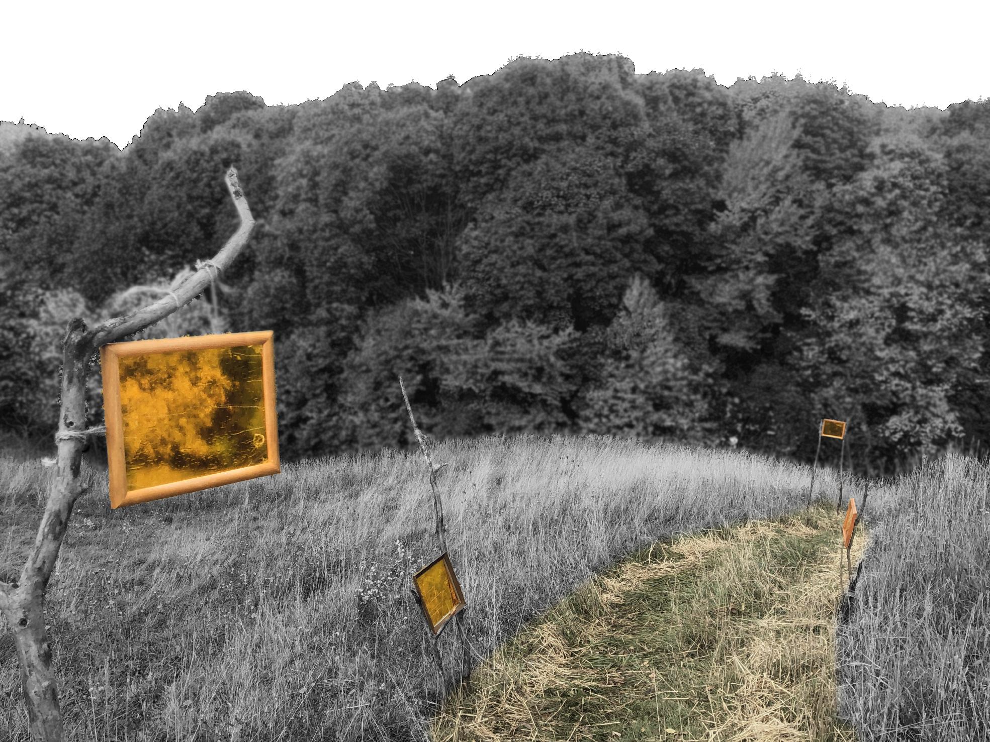
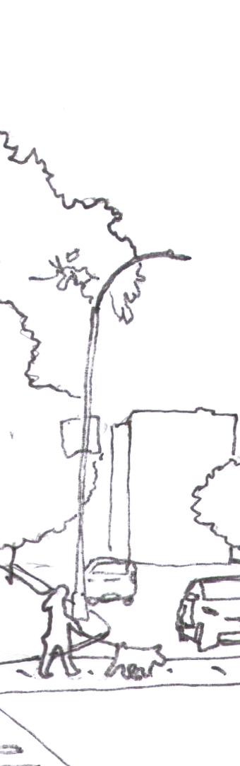
Surrounded by variety of weeds and trees; this path creates a wild atmosphere were when traversing. The crunch of the leaves as one walk down the hill is the prominent sound that takes up area. Besides the leaves, fallen logs and overgrown branches creates an enclosed perimeter that limits ones movement.
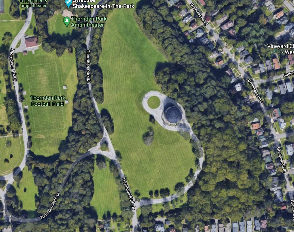
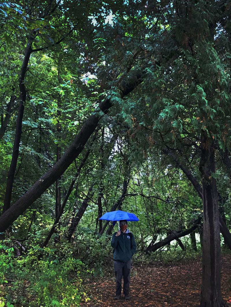
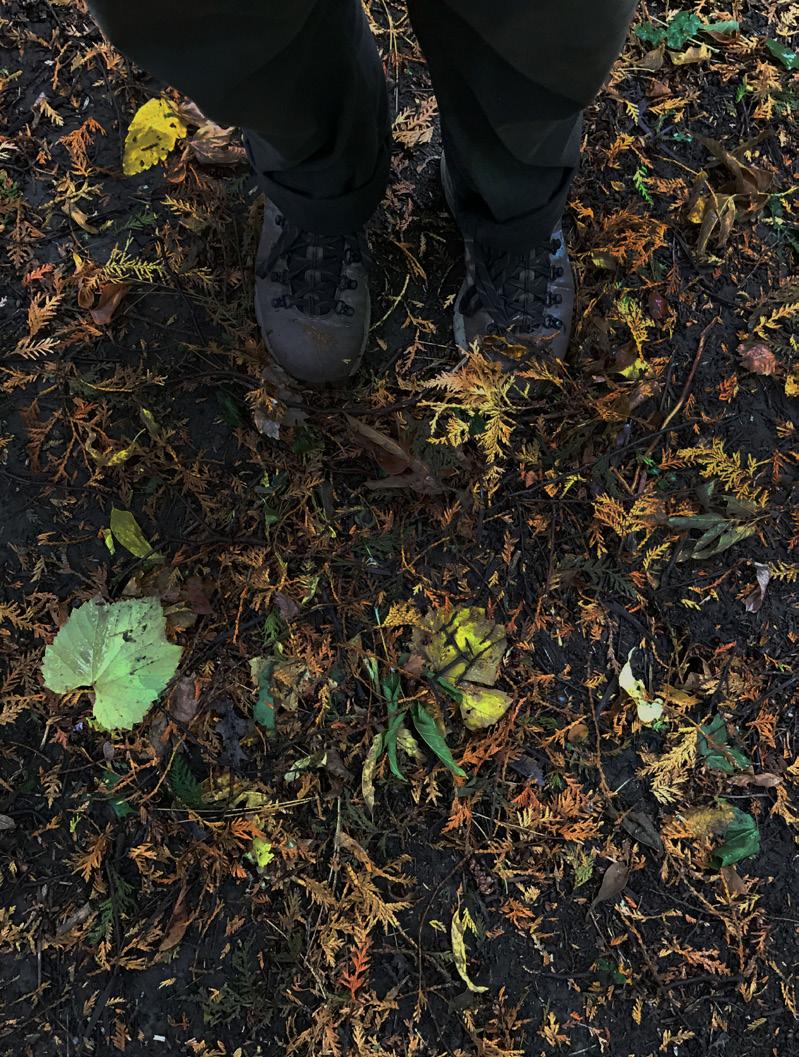
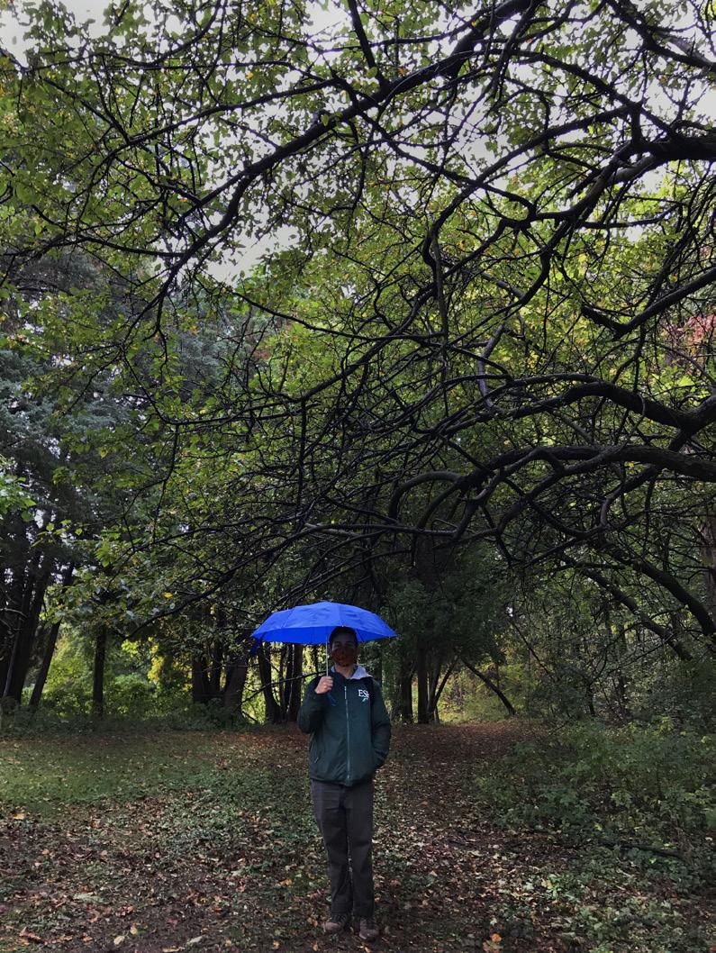 Figure 1. Entrance to the path
Figure 2. Ground cover near entrance
Figure 3. Exit of the path before the incline
Figure 1. Entrance to the path
Figure 2. Ground cover near entrance
Figure 3. Exit of the path before the incline
LSA 226 Foundation Design Studio (2020) Syracuse, NY, United States Instructor: Emanuel J. Carter, Jr. Group/Individual Academic Project
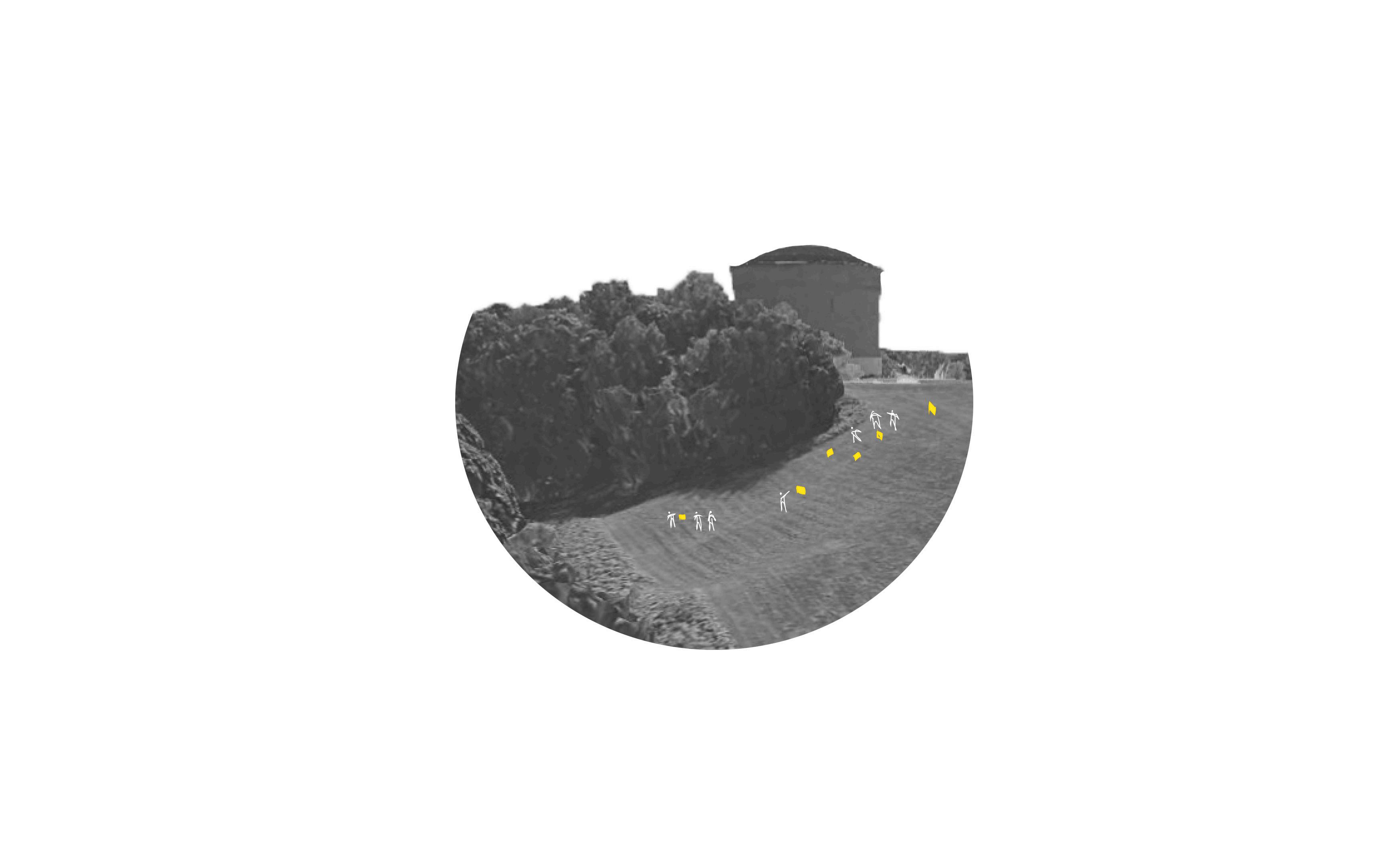
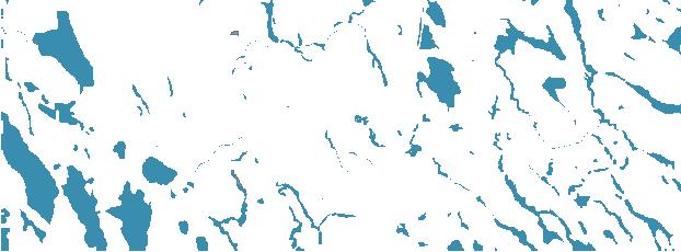
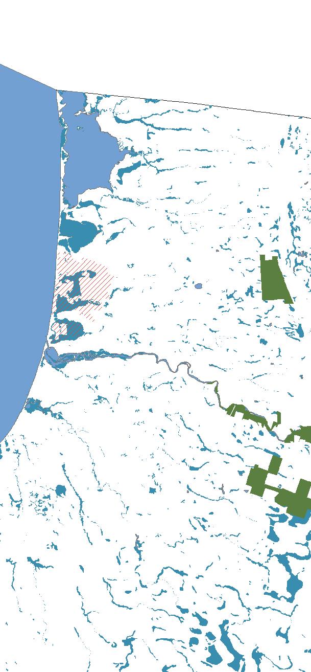
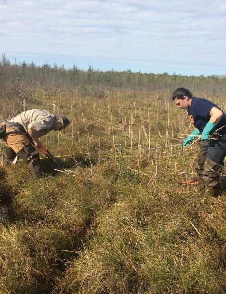
In this project, we were assigned to examine the unique area that is the Salmon River, located in Oswego County. A little the Lighthouse Hill Reservoir in Altmar to where it empties into Lake Ontario at Port Ontario. There are 12 miles of Public Fishing Rights along the river. Near the river corridor, there are salmon hatcheries, primary hatches of trout and salmon species, that refuel the river during the fishing season. The DEC manages the river and currently owns land that surrounds the 1,700 acres which border much of the river between the Lighthouse Hill Reservoir and the Village of Pulaski.
As a class we were task to create an analysis of the site based on existing conditions and create a design that takes account of the new DEC building which would replace the old ranger training grounds near the site.
Wildlife Analysis of Salmon River, Oswego County, NY 2021


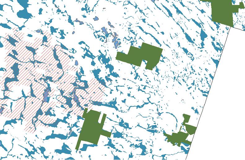
Understanding the habitats of a site is essential to successful, ecologically-minded design. Oswego County has several habitats, highlighted below, that are particularly susceptible to human impact - especially because they contain some of New York State’s most endangered species.
Exported ARC GIS data than used illustrator to fill out the shape and color


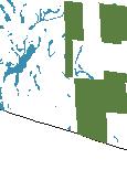
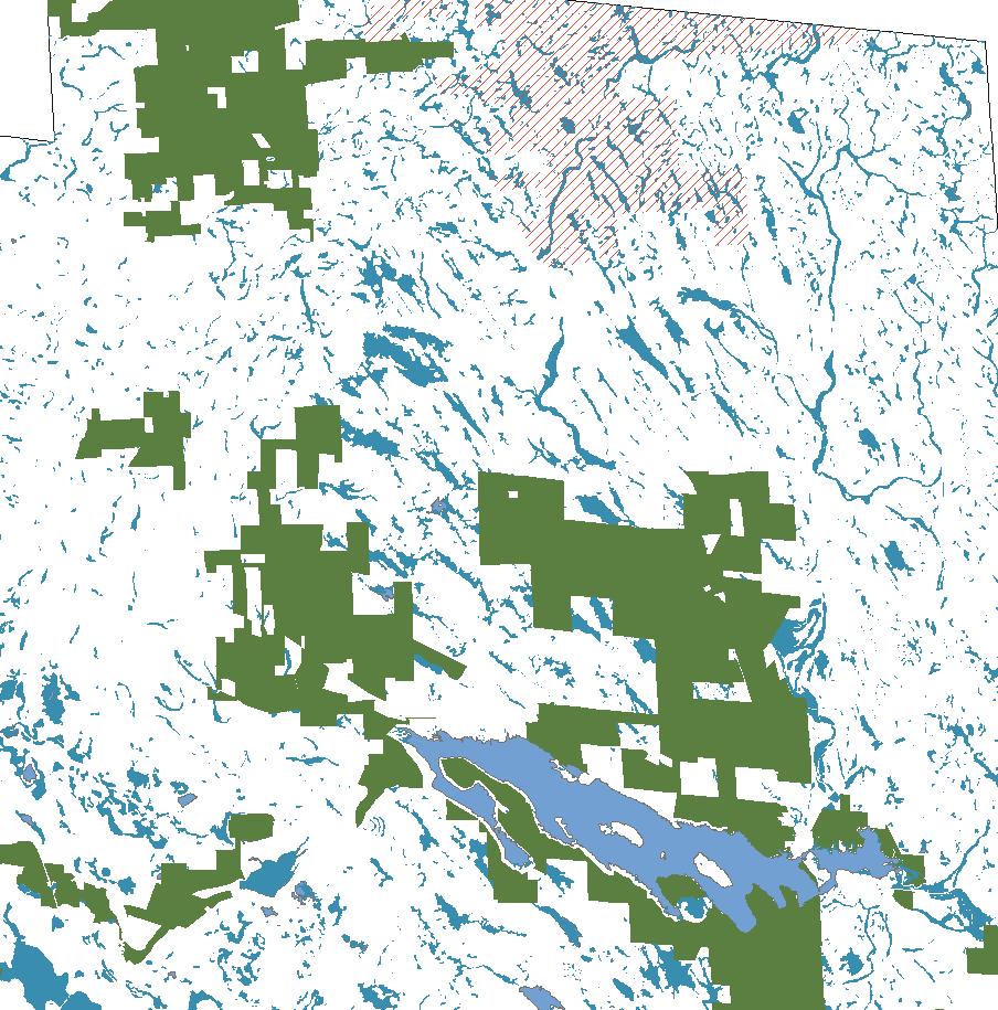
Exported ARC GIS data of New York than edited in photoshop
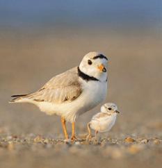
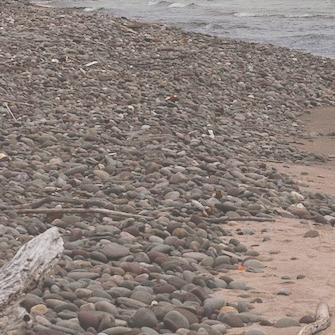
Home to the endangered piping plover and numerous other endangered species, the eastern Lake Ontario shoreline is a fragile system that stretches from the mouth of the Salmon River north to the outlet of Black Pond. Protected by NYS, the area strives to balance its thriving summer tourist populations and delicate ecological communities: dunes, wetlands, creeks, and ponds.
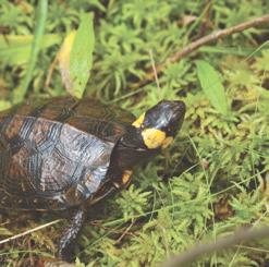
A medium fen located in Oswego County is believed to be the last in the state to host a population of the rare bog buckmoth. Bog turtles, too, are very particular about their habitats; they prefer fens and red-maple tamarack peat swamps, habitats that are vulnerable to fragmentation and invasive species. Here, a group of SUNY Oswego students remove cattails from a local fen, allowing more room for the bog buckmoth’s host plant, bog buckbean.
 Bog Turtle
Piping Plover
Eastern Lake Ontario Dunes and Wetland Area
Bodies of water Wetland State Forest
Bog Turtle
Piping Plover
Eastern Lake Ontario Dunes and Wetland Area
Bodies of water Wetland State Forest
In North America, the black tern’s breeding range covers most of the northern states and into Canada. They winter in marine and coastal areas of Central America and northern South America.
Spring through fall.
In the 1960s, a series of dams in the St. Lawrence River were constructed to generate hydropower, stabilize Lake Ontario water levels, and protect shoreline real estate from flooding. However, these limited the annual flux of water levels that nesting black terns relied on to produce semi-marsh conditions.
Invasive species management and water level manipulations.

There are only three locations where piping plovers nest in North America: the shoreline of the Great Lakes, shores of rivers and lakes in the Northern Great Plains, and along the Atlantic Coast. They winter along the southeast coast of the US and into Mexico.
Seasonal Presence
Late spring through summer.
Loss of Breeding Habitat
Many coastal beaches used by piping plovers as nesting grounds were lost to commercial, residential, and recreational developments. Dams, too, led to nest flooding. Finally, nests are commonly disturbed by humans or ransacked by predators, leading parents to abandon the nest.
Moving Forward
Educating the public on piping plovers and controlling human access to nesting sites.
Range
The northern populations of bog turtles range from New York and western Massachusetts, south to Maryland.
All year; hibernate from mid-September through mid-April.
Loss of Breeding Habitat
Bog turtles require unpolluted, fragmented habitats, such as spring-fed fens, marshy meadows, and sphagnum bogs. Unfortunately, many of these areas have been sliced by roads and other developments. Additionally, invasive species such as purple loose strife dry out suitable habitats. Finally, the bog turtle is threatened by collection for illegal wildlife trade.
Invasive species management, public education, and protection of the bog turtles’ habitat and breeding grounds.

Location
Can be found in most shallow emergent marsh Wetland
Cattails are native species near the salmon river, however, due to its nature it tends to outcompete the other species.
The removal of cattails can cause serious damage to an ecosystem. However, to prevent them from out competing other plant species; it is best to perform spot reduction in certain location
Can be found in most shallow emergent marsh Wetland
Clogs up waterways, diverts stream, can cause loss of native fish, wildlife and tree species, and are risk to public safety.
To combat the impacts of invasive species, DEC created and supports the Bureau of Invasive Species and Ecosystem Health (BISEH) within the Division of Lands and Forests. This group works across the state by providing expertise, assistance and action where invasive species are a threat.
Can be found along roadsides and in wetlands. Most common in marsh land.
Given the right condition they can rapidly establish and replace native vegetation.
To combat the impacts of non native species invasive species follow regulation implemented by the DEC and or follow BISEH guidelines.
Outcompetes cattails, causing decrease in population
Common Reed Phragmites australis
Phragmites is an aggressive, invasive weed originally from Europe.
Outcompetes Bog Turtle, causing decrease in population
Broadleaf Cattail Typha latifolia
Cattails (Typha) are native aquatic plants that can provides homes for various wildlife, but can have invasive tendencies, as well.
Outcompetes
Bog Buck Bean, causing decrease in population
Bog Turtle Glyptemys muhlenbergii
Bog BuckbeanMenyanthes trifoliata
Bog Buckbean is a fen-loving native species, host to the rare bog buckmoth.
Decrease in Bog Buckbean causes decrease in Bog Buckmoth
Bog BuckmothHemileuca maia
Bog Buckmoth is a New York State endangered moth, typically found in fens and sphagnum bogs.
Landscape Materials and Structures (2021) Syracuse, NY, United States Instructor: C. Thomas Hogge Group Academic Project
The Landscape Materials and Structures course introduces the properties of various “hardscape” design materials used in landscape architectural construction, as well as the appropriate structural systems and design detailing typical for design elements.
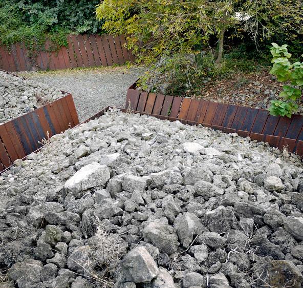
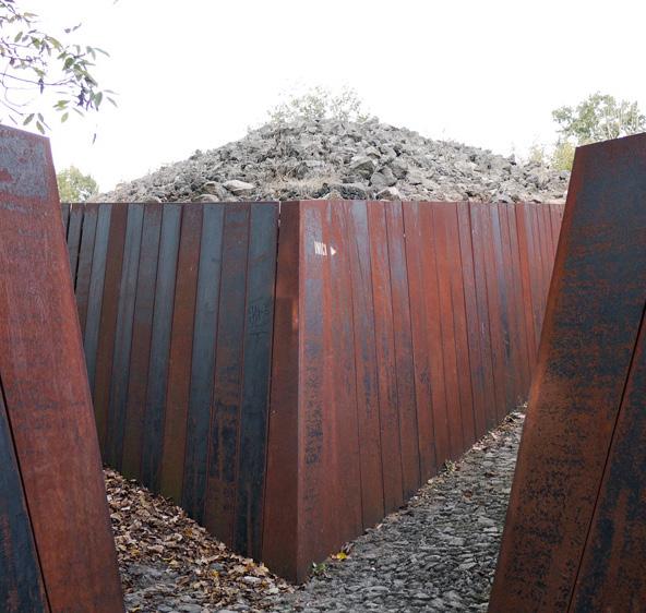
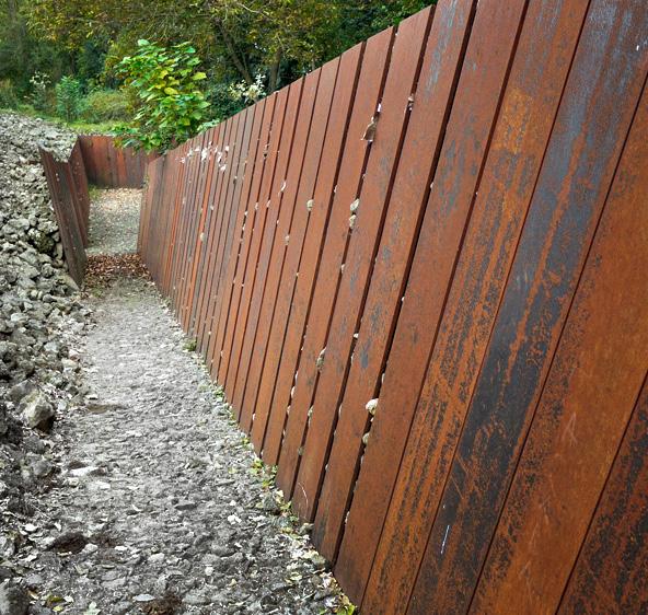
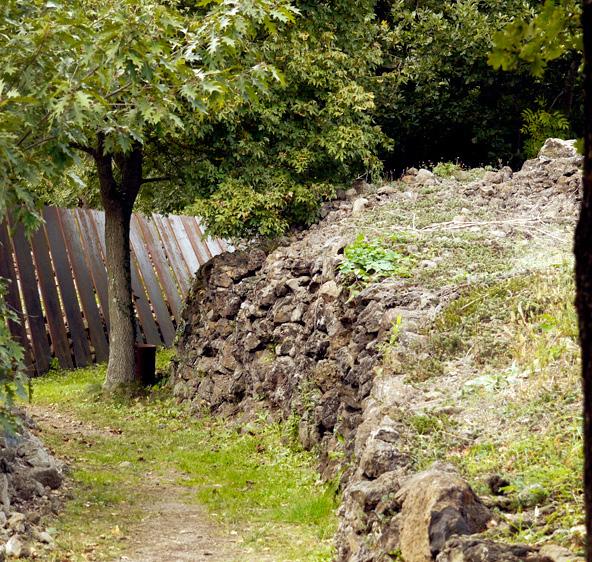
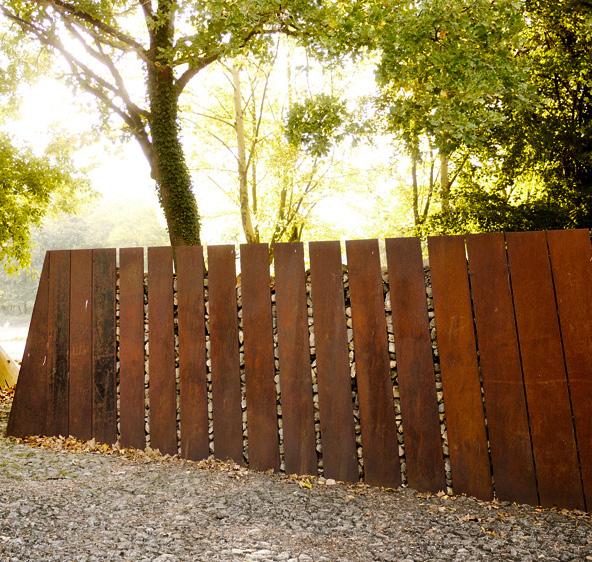
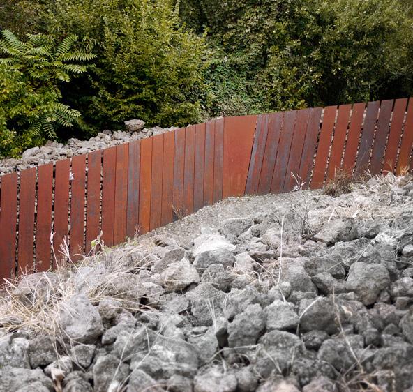
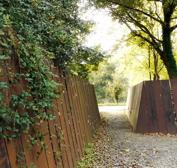
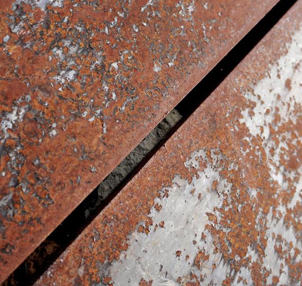
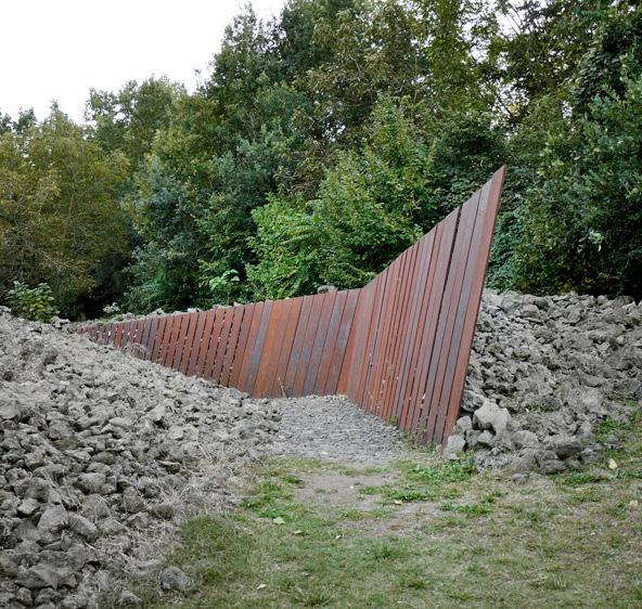
This course, Landscape Materials, and Structures will be looking at various sites around the world with interesting installation practices. One said site we looked at was, Piedra Tosca Park, located at Garroxta Volcanic Zone natural park in Les Press, Spain. The area of the site was created by basaltic wash from the Croscat Volcano and the hardships of a man trying to cultivate the land. This site was designed by RCR Architects, a Spanish architecture firm founded in 1987 in Olot, Spain to enhance the natural features of this landscape and capture its beauty and uniqueness. Narrow walkways with steel panel walls that break the form of the landscape initiate the factor of surprise as you move through the rocky masses little by little. The stones and rough texture of the landscape are used to clean it of weeds and undergrowth to strengthen the character it holds. The zig-zag paths that traverse through the landscape are about 1.5 meters wide and the corten steel panels that encase them are about 2.5 meters tall.
MATERIAL CONSTRUCTION DESIGN PIEDRA TOSCA PARK 2022
VIEW 1
Segment of the wall supporting the large smooth stone behind
Segment of the reenforced wall and a section showing how the wall is being supported underground
Using AutoCAD I sketched up a segment of the park walls while figureing out theh height and length of the reinforced panels using google earth.
1)
3)
6)
7)
9)
 Pedra Tosca Park by RCR. Landezine. (n.d.). RetrievedMarch 23, 2022, from https://landezine.com/pedra-toscapark-by-rcr/
2) Pedra Tosca Park by RCR. Landezine. (n.d.). RetrievedMarch 23, 2022, from https://landezine.com/pedra-toscapark-by-rcr/
Pedra Tosca Park by RCR. Landezine. (n.d.). RetrievedMarch 23, 2022, from https://landezine.com/pedra-toscapark-by-rcr/
4) Pedra Tosca Park by RCR. Landezine. (n.d.). RetrievedMarch 23, 2022, from https://landezine.com/pedra-toscapark-by-rcr/
5) Pedra Tosca Park by RCR. Landezine. (n.d.). RetrievedMarch 23, 2022, from https://landezine.com/pedra-toscapark-by-rcr/
Pedra Tosca Park by RCR. Landezine. (n.d.). RetrievedMarch 23, 2022, from https://landezine.com/pedra-toscapark-by-rcr/
Pedra Tosca Park by RCR. Landezine. (n.d.). RetrievedMarch 23, 2022, from https://landezine.com/pedra-toscapark-by-rcr/
8) Pedra Tosca Park by RCR. Landezine. (n.d.). RetrievedMarch 23, 2022, from https://landezine.com/pedra-toscapark-by-rcr/
Pedra Tosca Park by RCR. Landezine. (n.d.). RetrievedMarch 23, 2022, from https://landezine.com/pedra-toscapark-by-rcr/
Pedra Tosca Park by RCR. Landezine. (n.d.). RetrievedMarch 23, 2022, from https://landezine.com/pedra-toscapark-by-rcr/
2) Pedra Tosca Park by RCR. Landezine. (n.d.). RetrievedMarch 23, 2022, from https://landezine.com/pedra-toscapark-by-rcr/
Pedra Tosca Park by RCR. Landezine. (n.d.). RetrievedMarch 23, 2022, from https://landezine.com/pedra-toscapark-by-rcr/
4) Pedra Tosca Park by RCR. Landezine. (n.d.). RetrievedMarch 23, 2022, from https://landezine.com/pedra-toscapark-by-rcr/
5) Pedra Tosca Park by RCR. Landezine. (n.d.). RetrievedMarch 23, 2022, from https://landezine.com/pedra-toscapark-by-rcr/
Pedra Tosca Park by RCR. Landezine. (n.d.). RetrievedMarch 23, 2022, from https://landezine.com/pedra-toscapark-by-rcr/
Pedra Tosca Park by RCR. Landezine. (n.d.). RetrievedMarch 23, 2022, from https://landezine.com/pedra-toscapark-by-rcr/
8) Pedra Tosca Park by RCR. Landezine. (n.d.). RetrievedMarch 23, 2022, from https://landezine.com/pedra-toscapark-by-rcr/
Pedra Tosca Park by RCR. Landezine. (n.d.). RetrievedMarch 23, 2022, from https://landezine.com/pedra-toscapark-by-rcr/
Landscape Architectural Design Studio III (2022) Syracuse, NY, United States
Instructor: Scott Shannon
Individual Academic Project
Landscape Architectural Design Studio III introduces and applies concepts of urban and regional planning, environmental planning, and landscape ecology, in the context of large-scale landscape architectural, community, and urban design. Emphasis will be placed upon the application of appropriate technologies and strategies to foster environmentally and economically sustainable community forms, as well as greater environmental and social equity.
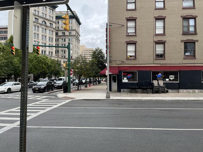
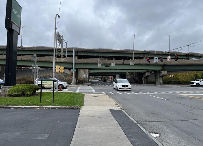
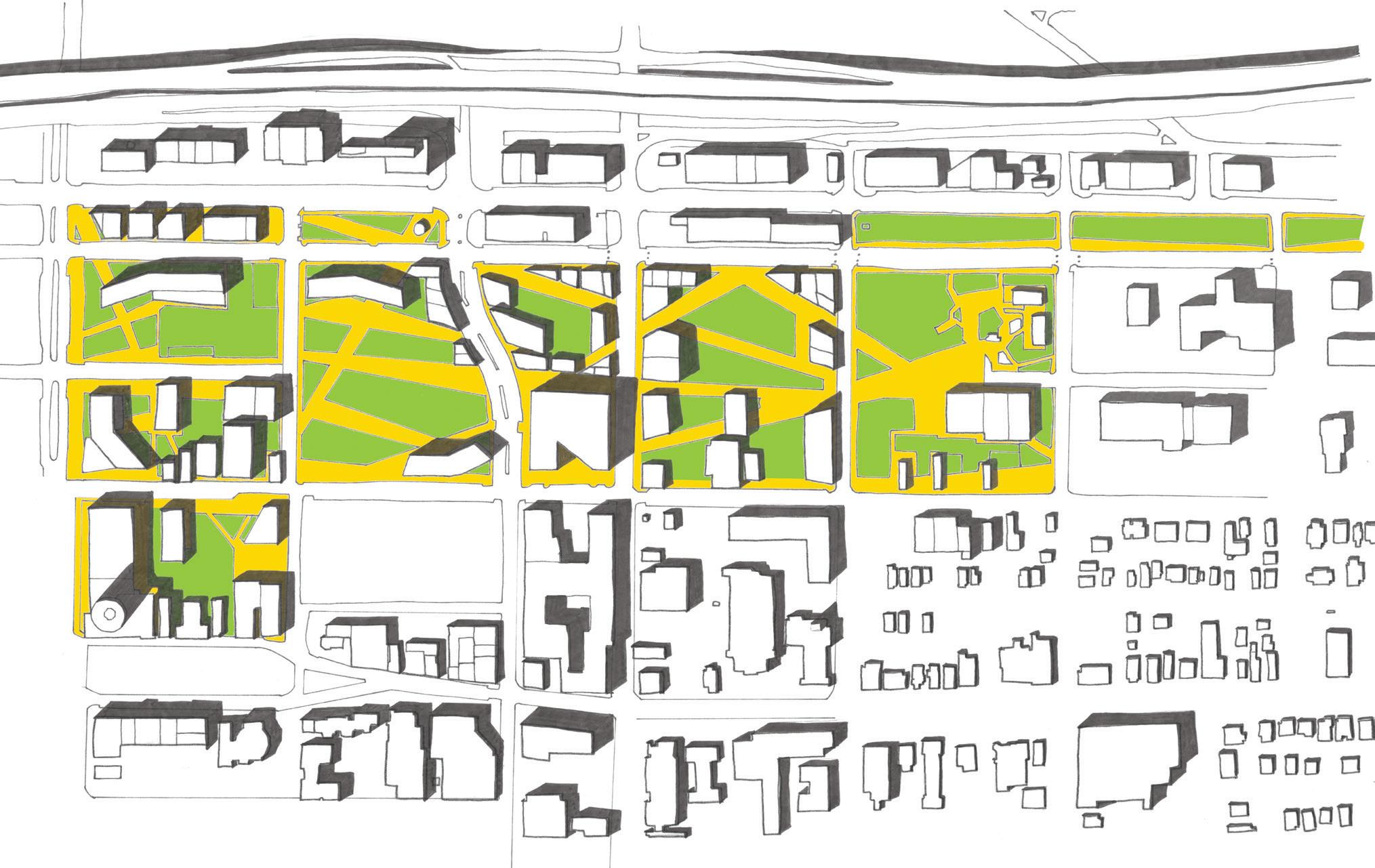
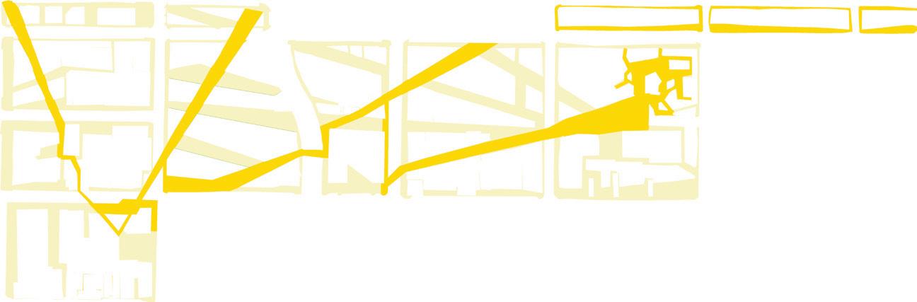
In this project, we focus on the smallest element in community design- a single private property and the building(s) and outdoor spaces contained within that single parcel of land. In this case, the project site was located approximately ¼ mile north and east of our studio on Harrison Street, encompassing the area bounded by the current I-81 viaduct to the west, I-690 to the north, Genesee Street to the south, Walnut Street to the east. Historically, this approximately 15-block area has been comprised of commercial/ retail corridors along Erie, Genesee, and Almond streets, bisected by a historic rail line along the Washington Street corridor (relocated several blocks northward in the 1930s along what is now I-690, before finally moving to the northern suburbs near I-90 in the early 1960s). This area forms the transition from “downtown” to the first ring suburban residential neighborhood dating to the late 19th and early 20th century. The entire area was heavily impacted by the construction of the two interstate highways, which act as both physical and psychological edges of the neighborhood.
The main educational goal for this project is to expand your understanding of design at small human scales and apply this to larger-scale development within the broader context of “the building blocks” of community design and the “urban transect” model of context-driven community form.
PERSPECTIVE Sketch Drawing of a possible perspective when I-81 is no longer there
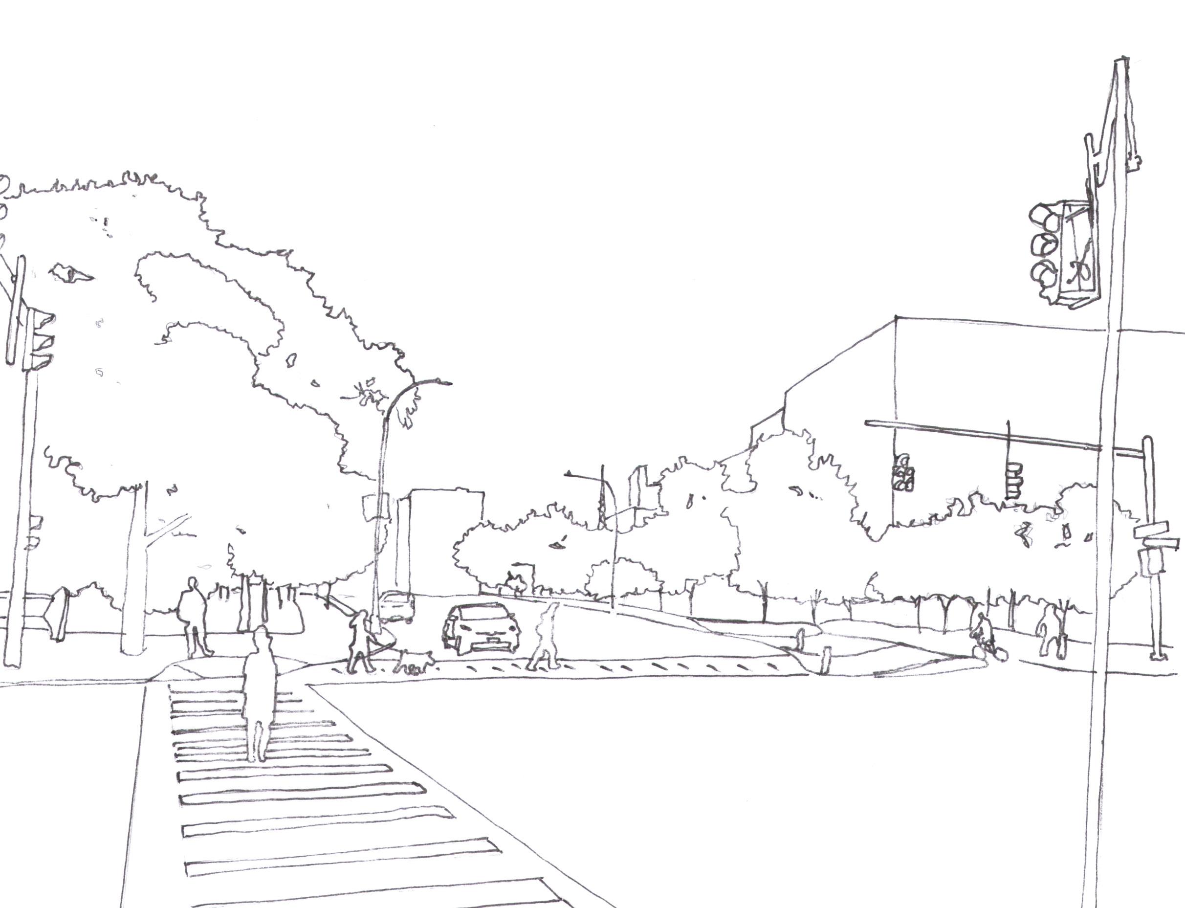
1. in this intersection there is a lot of cars crossing and or turning. unfortunately, there is a lack of pedestrian cross walk. in this intersection the road is also a bit too wide for the timer to allow people to cross the road safely.
It is a 4-way intersection where people turn right on red.
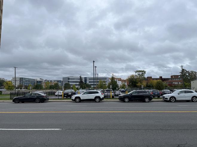
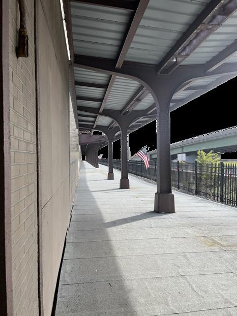
2. Mounds are made up artificially to support the old rail that became highway I-690. The underground tunnel that connects to the old train station remains till this day.
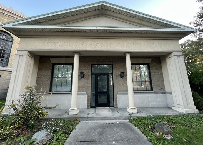
3. On east Fayette st. there are two popular Asian restaurant that is usually a gathering spot for many Syracuse international students. Next door there is a grocery store that serves to a community. As for the parks nearby, it is one of may disjointed parks around the area. Cram’s doghouse is just a dog park with a baseball field surrounded by a metal fence. Sadly, it does not correlate with the area around it.
pink indicates centro bus route. there are some routes that are not applicable anymore
floor design is very strong on this area is it possible to spread the motif ?
4. On Erie Blvd Industrial zones are the most prominent building infrastructure throughout it’s length.
New block facing the road?
Irving has prominent chance on becoming an axel
there’s a lot of green space that could turn into a connected park
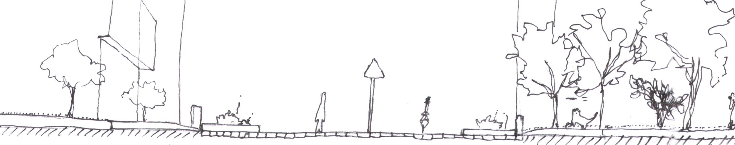
As you walk east from Geneses st. you start to realize that the T5, urban, is gradually changing into T4. You start to get more houses spread away from each other and more private own parking lots start to emerge
5. This area is under construction for a new residential housing. Almost the size of the whole block will be turned into a residential zone. Great spot to connect and or add adjacent retail stores. If they leave the tree the same, it can be use as a connected corridor from Forman park to Cram’s Doghouse.
*Narrow sidewalk with no to little pedestrian streetlight to aid on crossing to the other sidewalk
*There is a lot of potential of refurbishing and reenlisting old buildings to serve new purpose with its surrounding, emergence of an expanding T5: urban center zone.
*Wide roadways in areas that does not need a 4-way road intersection.
*Syracuse, New York central railroad passenger station identify as a historic site of Syracuse history.
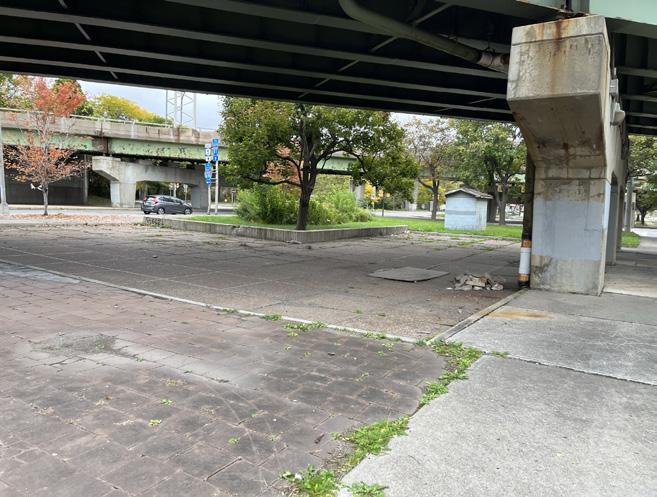
*Under I-81 there are a lot of green space with stone and brick texture layout. These stone and brick layout should stay as a pattern throughout the park site.
*Syracuse T6 and T5 zones all share similar sidewalk texture as you get closer to historic sites.
Syracuse is well-documented to be a car-centric city. To travel to most places within Syracuse city scape you will require a car. Unfortunately, if you do not have a car then you will either have to take the bus or any other means of transportation.
Similar to the too many cars on the street of Syracuse is facing. They also have an abundance of parking lots making up most of Syracuse’s landscape.
Unfortunately, Syracuse’s layout follows a single function use or sometimes does not allow people to stay outside on the street or sidewalk for an extended period of time.
The scale of Syracuse does not fit with the current scale they are trying to achieve. As of right now most of Syracuse’s design ideas steams from the T4 layout: house spread, people have to drive to get to places, and sidewalks are too narrow to take a causal stroll around the neighborhoods.
Students from Syracuse University as well as any students around the area should be able to travel to and from campus to the downtown at a reasonable time. As more and more students apply for Syracuse schools the city, Syracuse should adapt to the increasing student size as the year progresses.
Work Professionals
With a potential of an increased boon of economic wealth with the fall of I-81 and the erection of the new park systems, jobs such as retailers, medical, safety, and general food, it is safe to say new infrastructure would be necessary.
As much as establishing new infrastructure sounds great. The current infrastructure on Erie Blvd is an industrialization zone. That said keeping jobs such as metalworking, the arts, and auto repair stores are crucial for the development of the community. Fortunately, this niche is filling a need that community needs. However, it does not mean we can not build upon it.
As highway I-81 comes down and the new park line gets established, Syracuse will be experiencing an economic boon. If done correctly, Syracuse could become a significant green city such as Boston. However, to ensure its future development, the city of Syracuse must allocate resources within its’ road.

this design you might have noticed that there are individual axes connecting to existing or planed infrastructure to one focal point. These axis acts as a gateway to an existing ally which will leave you close to Forman park.
4ft
292ft 152 ft
AutoCAD Sketch
Compacted Aggregate Compacted Soil Subgrade Metal Fence Retaining Metal Fence Top Soil Stone sidewalk 32ft
1 ft 20 ft 2 ft
2688ft 1196ft
Practice sketch drawings in Autocad in the course LSA 343 Landscape Materials and Structures
6ft
AutoCAD Sketch
14 5ft 56 ft 4 ft 7 ft 7 ft 4 ft 4 In 14 ft 8 ft
7ft
AutoCAD Sketch
Practice sketch drawings in Autocad in the course LSA 343 Landscape Materials and Structures
20ft
25
LSA 226 Foundation Design Studio model of the based on the metaphors derived from“The old man and the giant wing” (2020)
After the course LSA 226 Foundation Design Studio we made a model based on the story we were assigned in this course. For this project I was assigned the short story “The old man and the giant wings”.
LSA 226 Foundation Design Studio model of the based on the metaphors derived from“The old man and the giant wing” (2020)
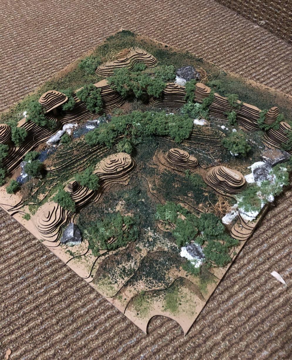
 Model Photos
Johenriq@syr.edu (347) 299-4587 111 Wadsworth Ave, New York, NY10033