
Northeastern University BLA in Urban Landscape


Northeastern University BLA in Urban Landscape
montgomery.je@northeastern.edu 404-966-5138
Jess Montgomery is a 4th year Landscape Architecture student at Northeastern University. Their projects have centered on combating extreme urban heat, envisioning modes of block-scale food sovereignty, and linking play and social stewardship to coastal habitat recuperation.
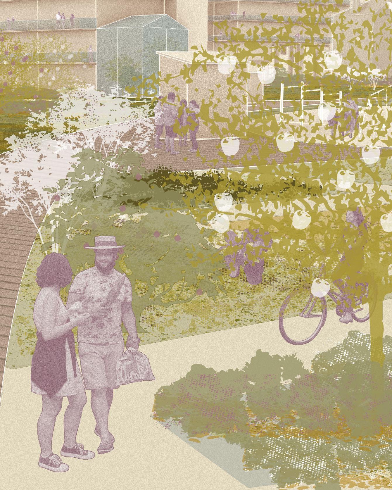
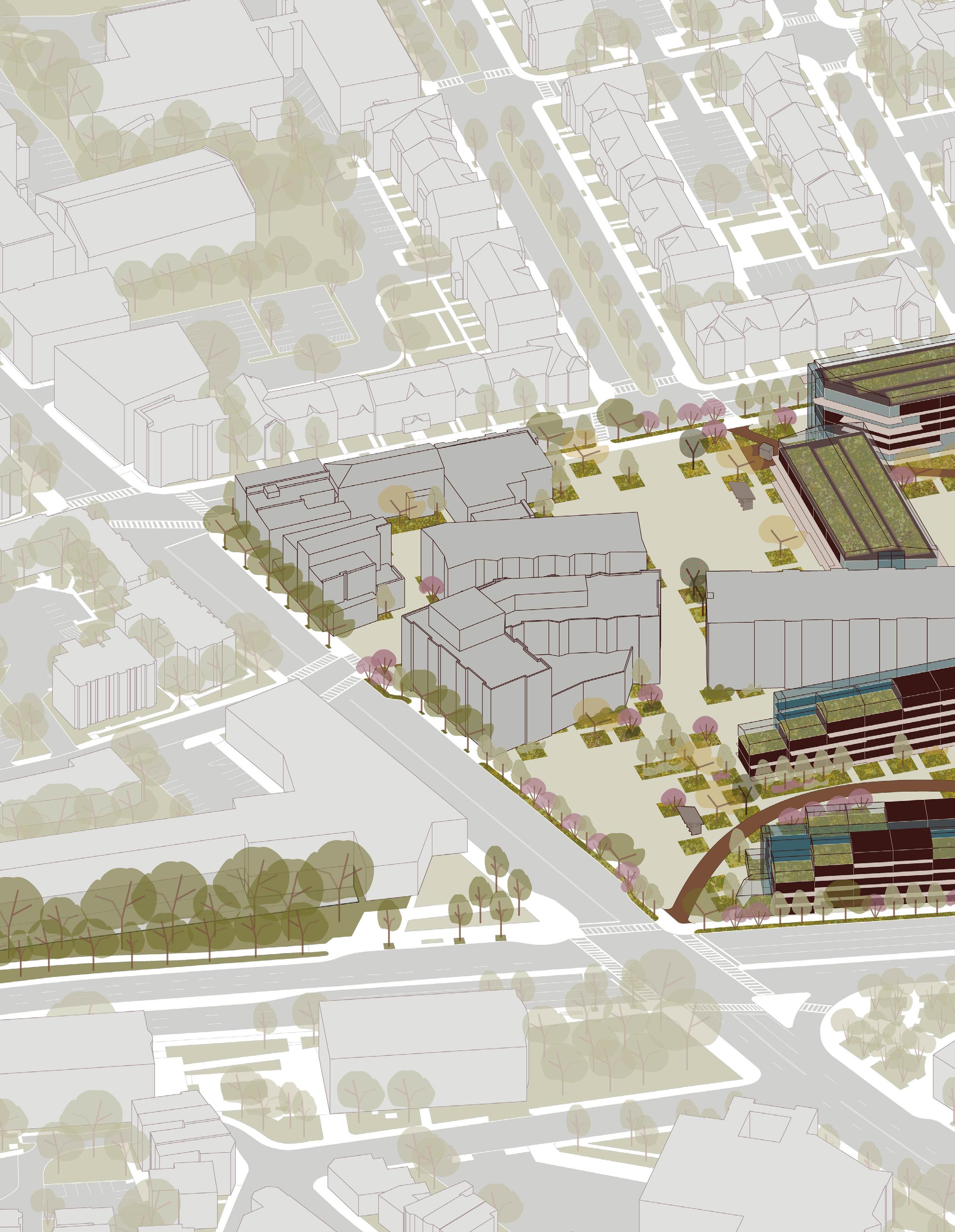
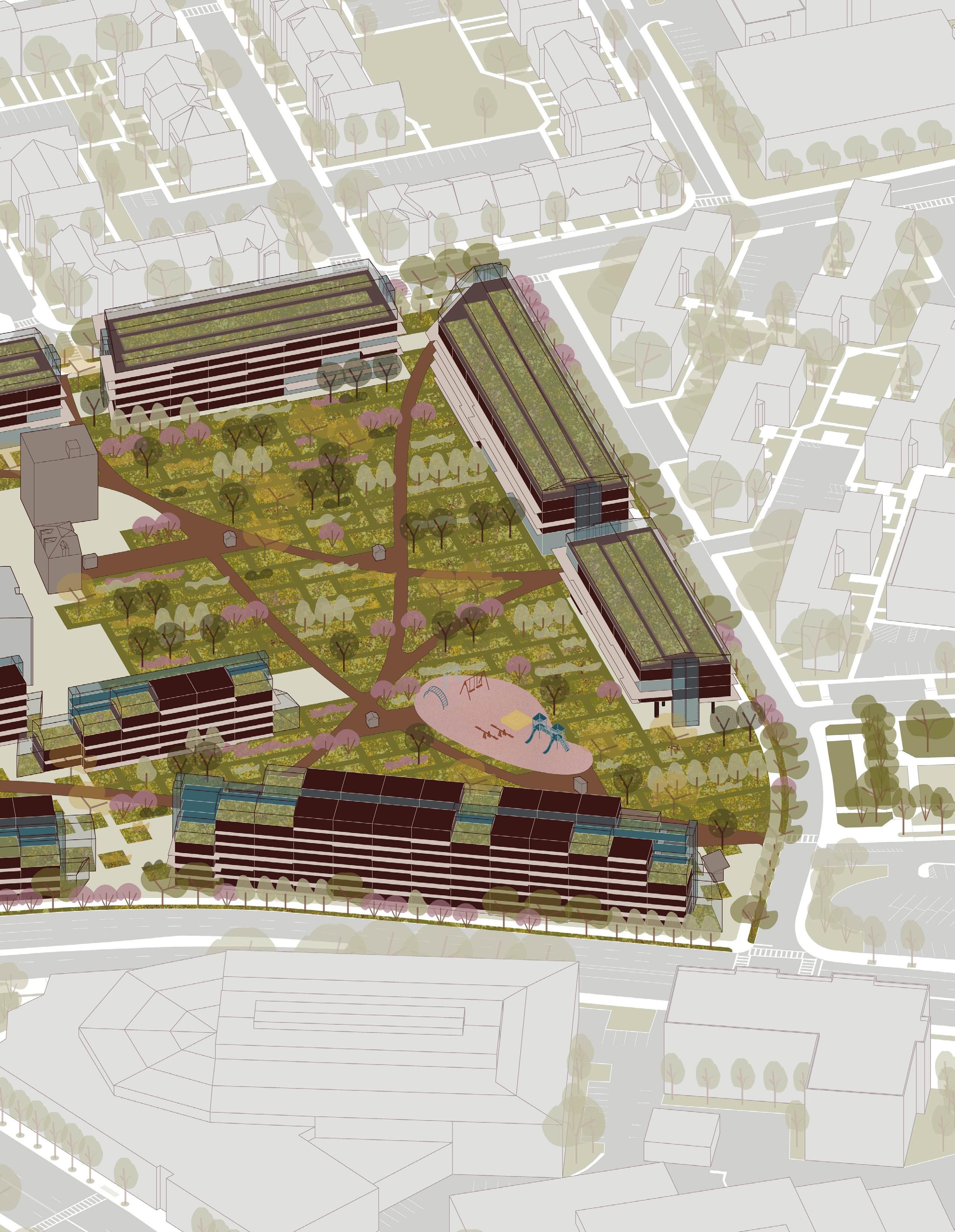
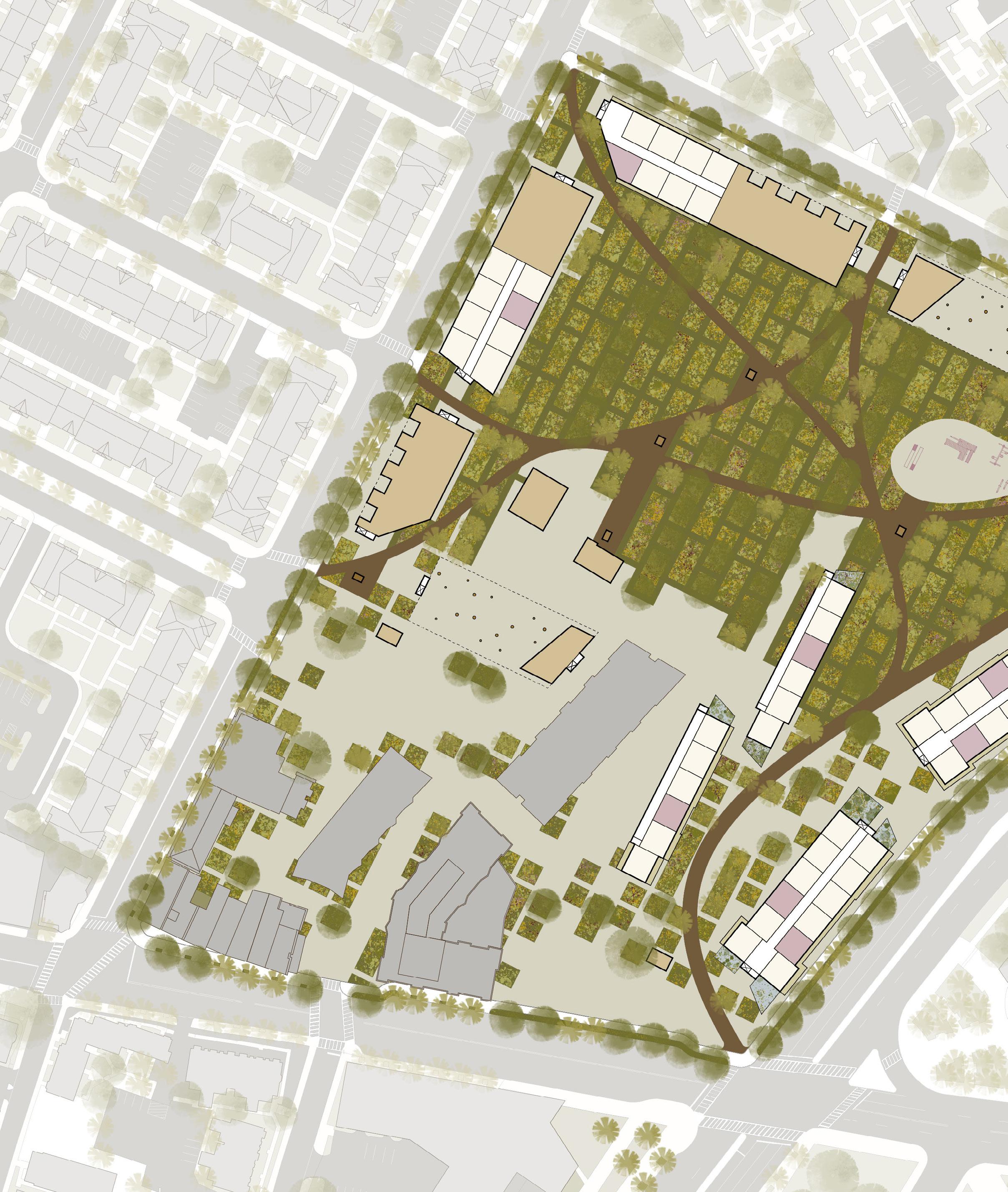
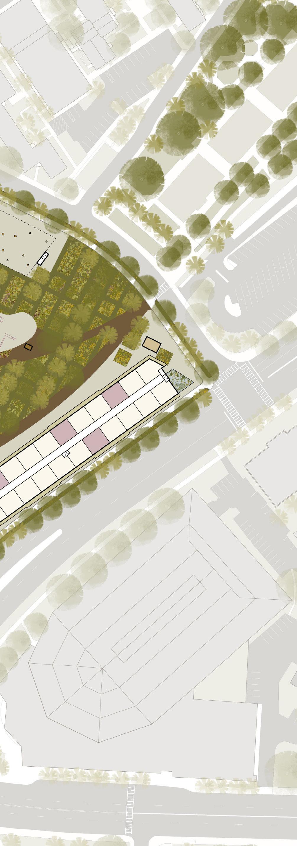
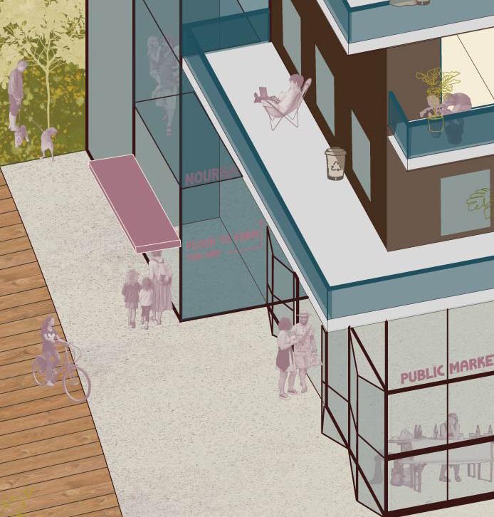
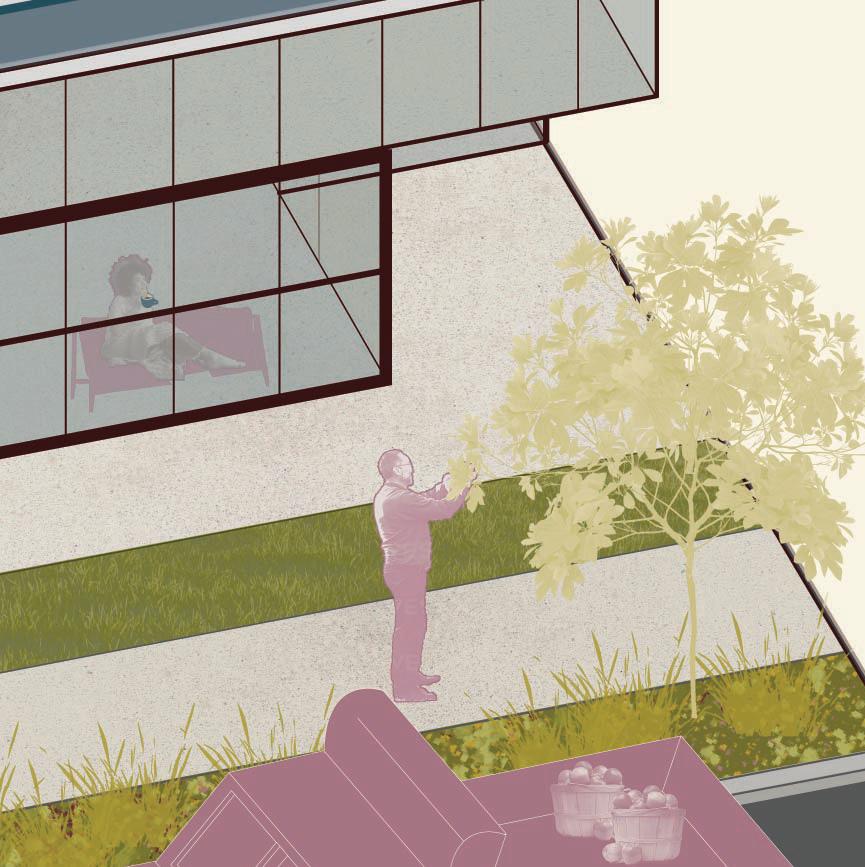
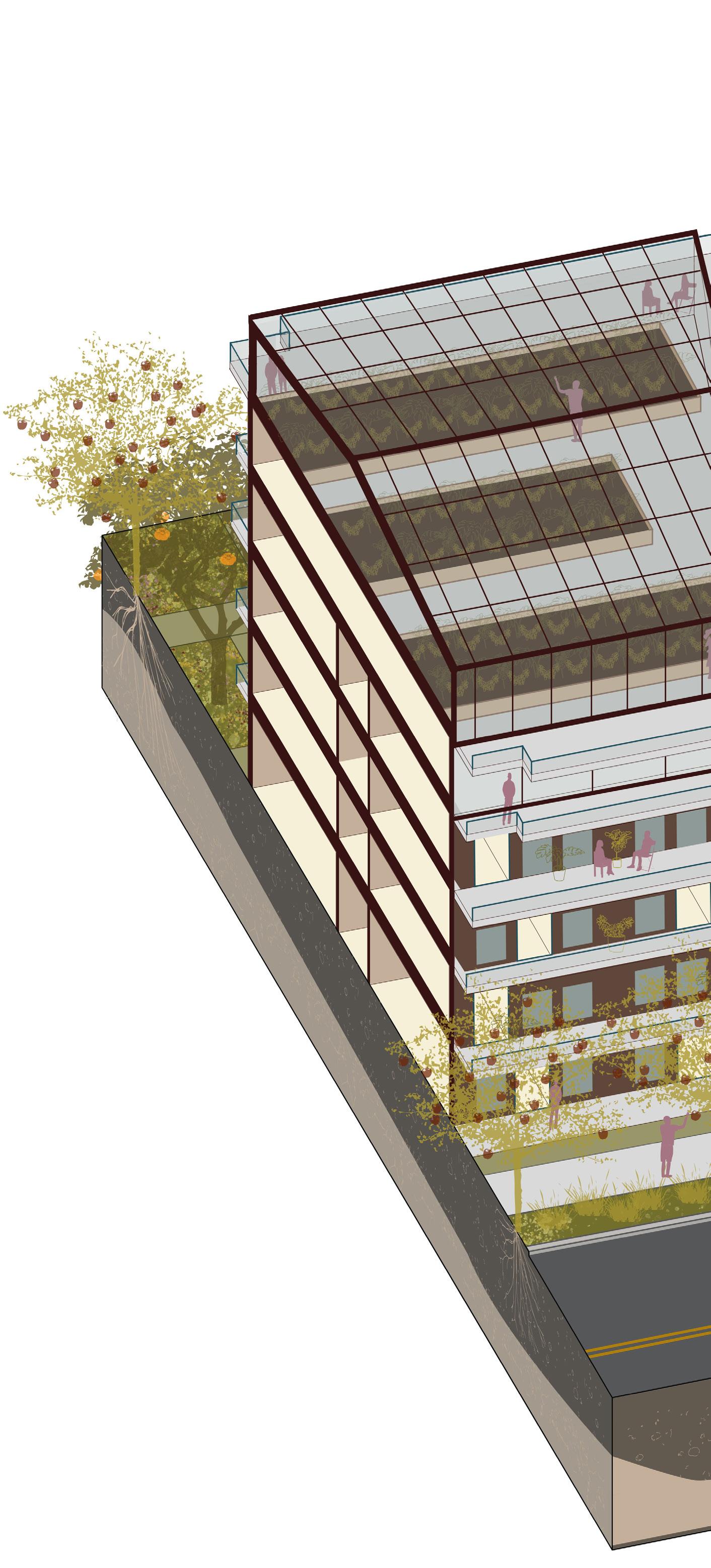
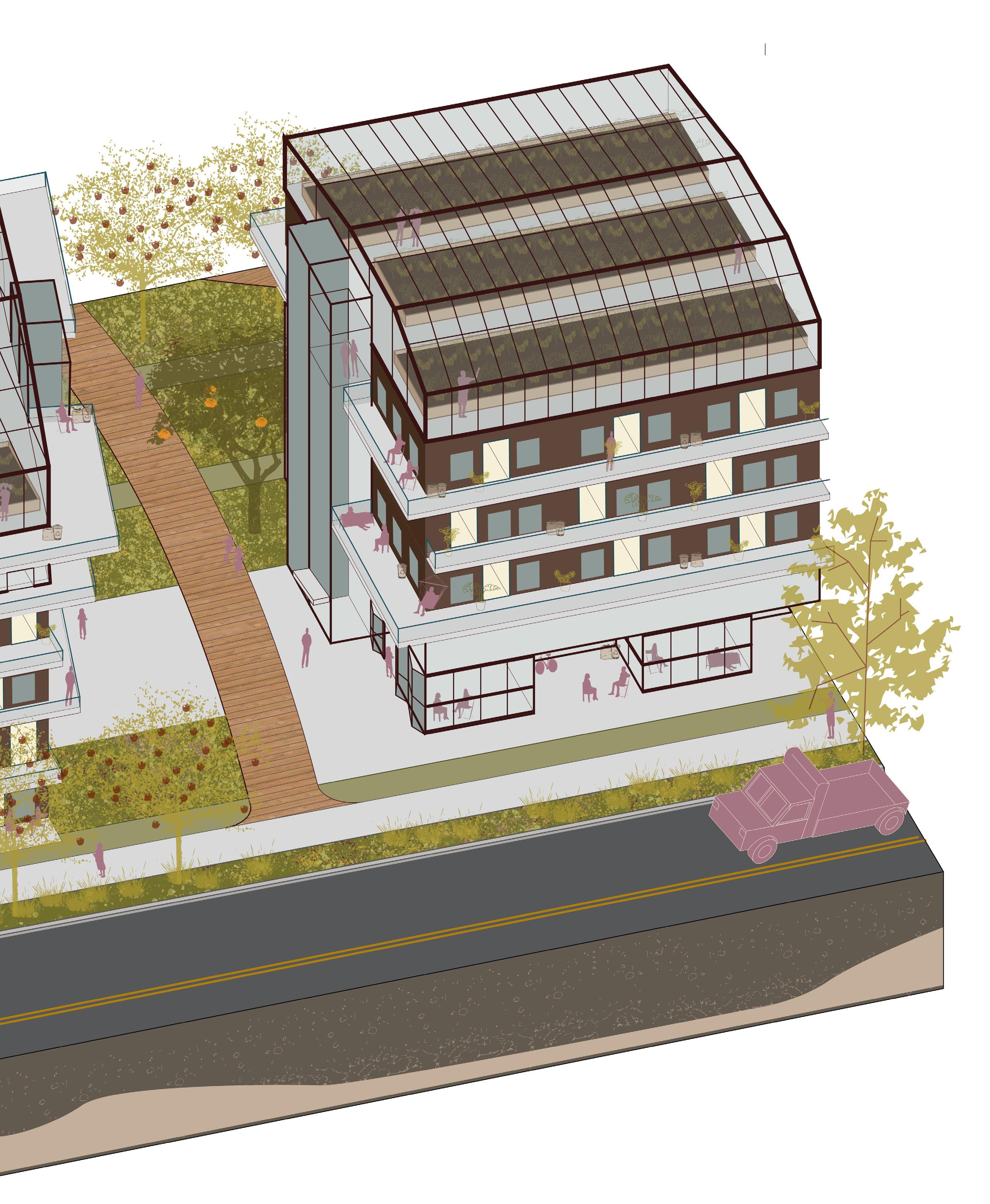
A research-based investigation into the plausibility of city-scale food sovereignty, Tending the Grid envisions a new urban form and redevelopment strategy within a public housing/food forest superblock. Co-designed with Hannah Young Chung, the project reimagines a patchwork of institutionally-managed parking in Mission Hill, building upon a legacy of Boston social movements from the 1960s through early 2000s that transformed vacant lots into nodes of nourishment.
Food’s universality makes it a natural mediator of social resilience, embodying the interplay between human and ecological systems. Nourishing and culturally-appropriate food should be universally accessible, localized, and produced through reciprocal labor systems and relational ecologies. People live in, work in, and occupy the city; the tools they need to do so — food tools — ought to be near and under their autonomous direction. Following this understanding, an urban block foregrounding food production in spatial and conceptual proximity to food consumption could provide physical and psychological urban resilience in the climate crisis.
The project integrates techniques like vertical layering, cyclical farming, and companion planting to maximize productive yield of the site without compromising ecological health. Tending the Grid imagines a thoroughly social production of space in its planning for scalar maintenance capacity and a deeply temporal understanding of how built infrastructure scaffolds neighborly resilience.
SUBSIDIZED CO-OP STIPEND UNITS
SCATTERED ACROSS ALL HOUSING TYPES
MAINTENANCE
MEDIATED BY SOCIO-SPATIAL PROXIMITY

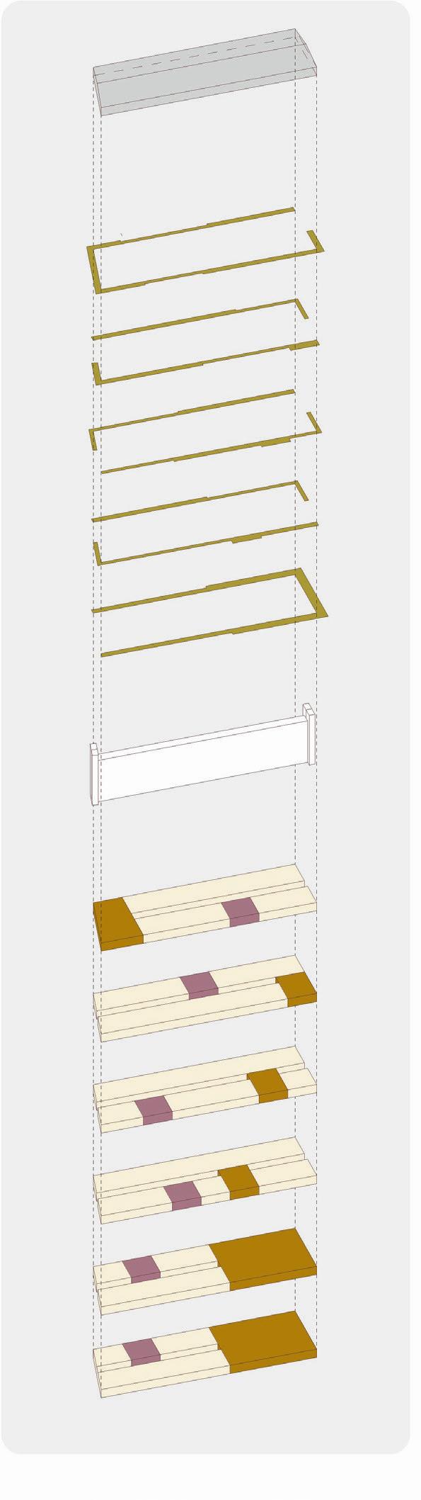
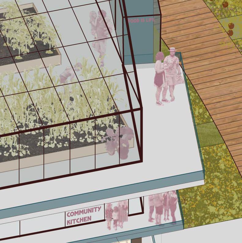
greenhouse publically accessible via freight elevator
balcony network variable widths: ammenities: 9’
group of 3+ units: 6’
group of <3 units: 4.5’
circulation “farm to floor” freight elevators
units
408 standard units
50 scattered subsidized cooperative units for maintenance stewards
shared ammenities
community kitchen
seed library
community pantry public market
sightlines
pedestrian/bike boardwalk “breadcrumb ammenities”
- micro-greenhouses
- public restrooms
- community pantries
- maintenance sheds
- compost hub
- community kitchen
- playground
ground plane
structured grass “plaza” food forest tapestry
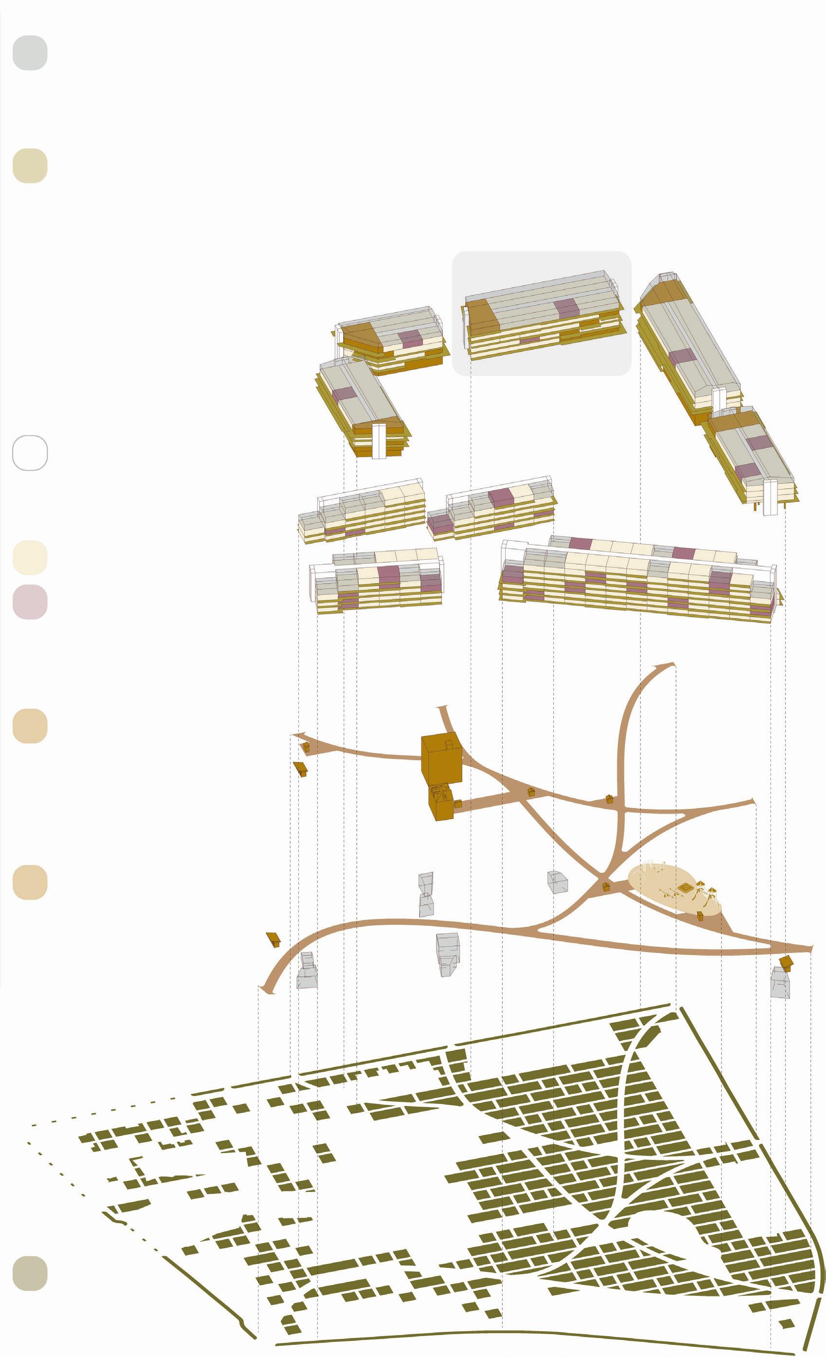
FOOD production processing consumption
shared amenity maintenance unit
MALCOM X BLVD
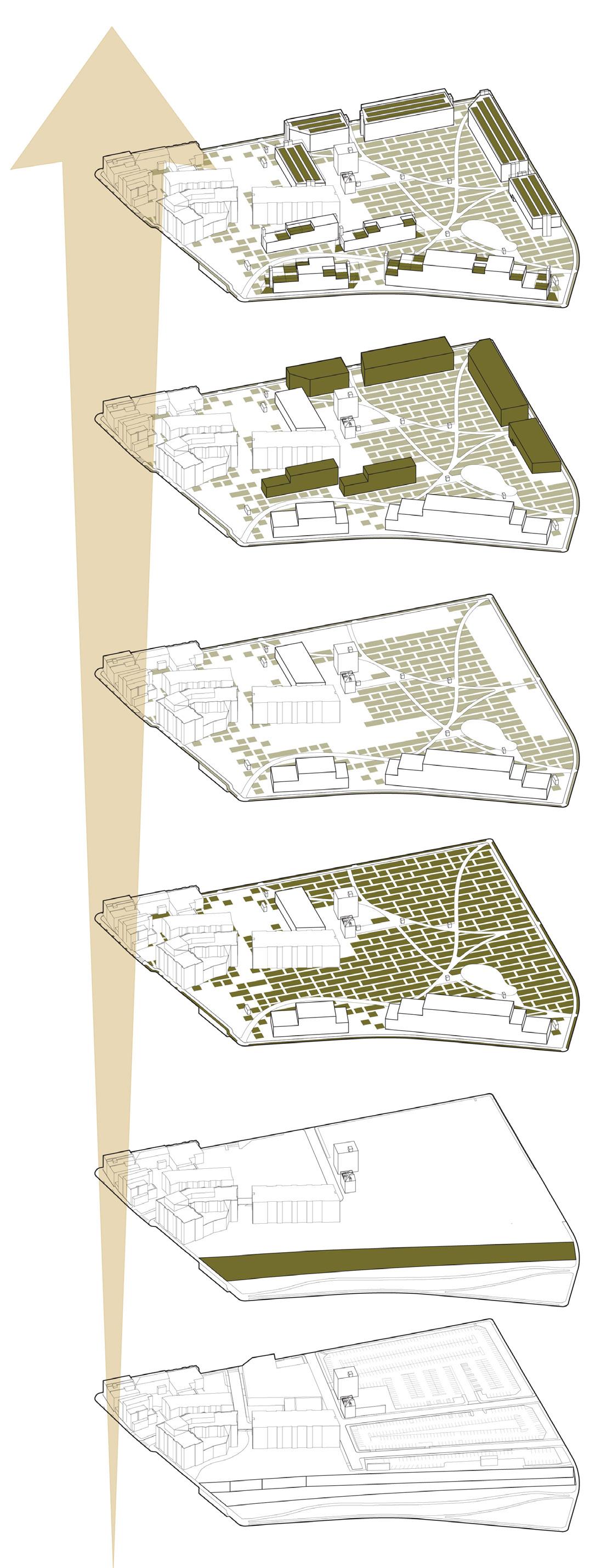
5: food moves up!
4: housing construction
3: plot-by-plot de-installation
2: food forest installation
1: rail cover & soil infill
0: existing condition

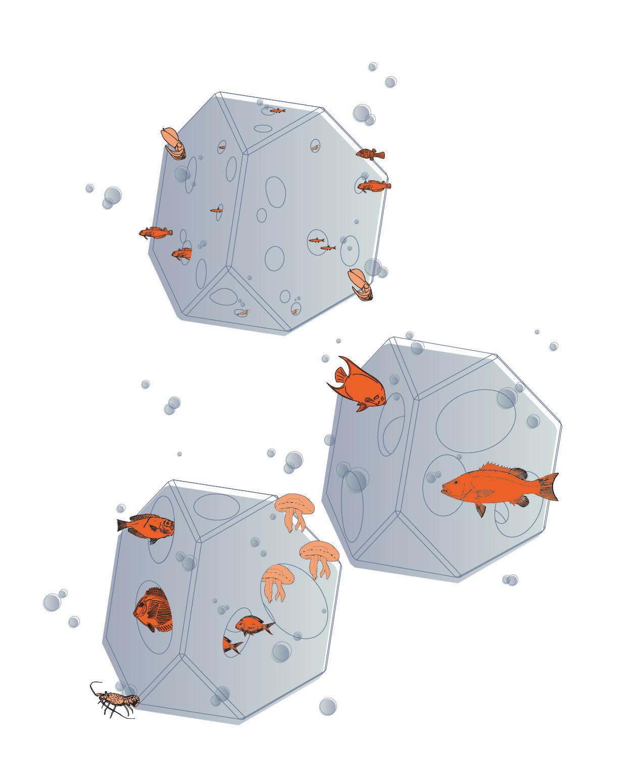
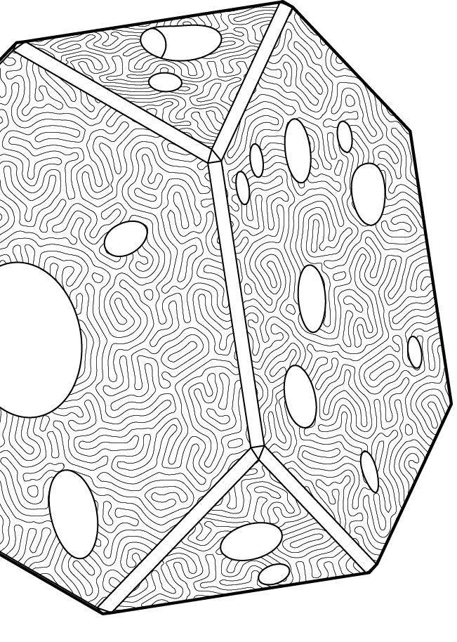
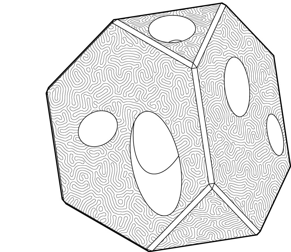
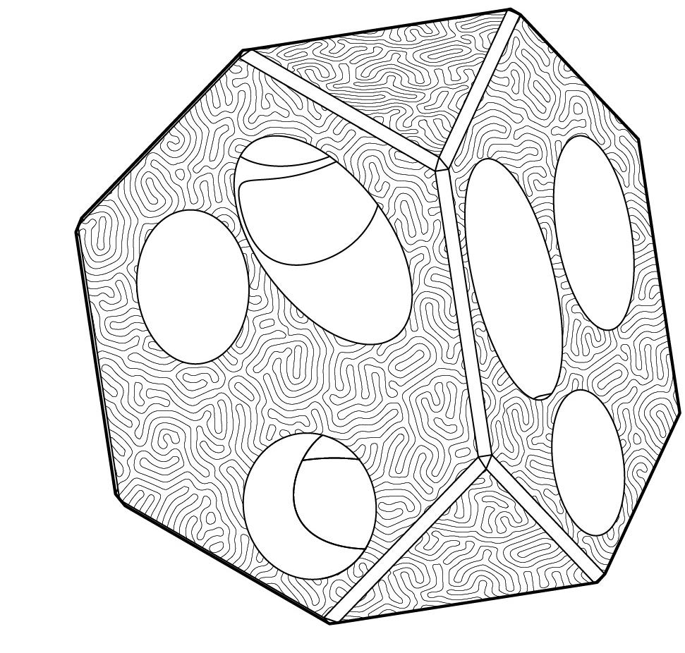
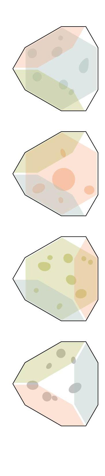
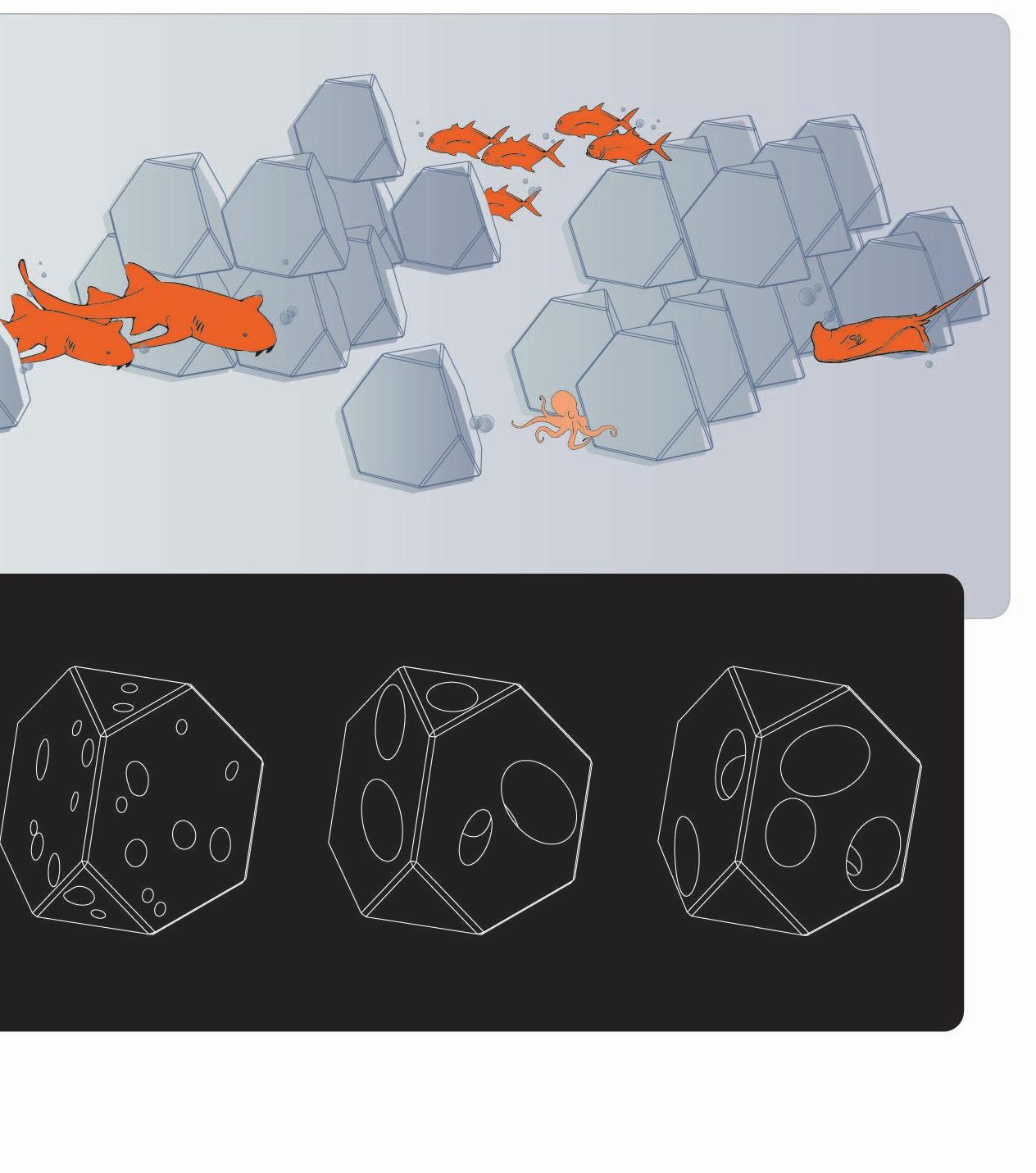
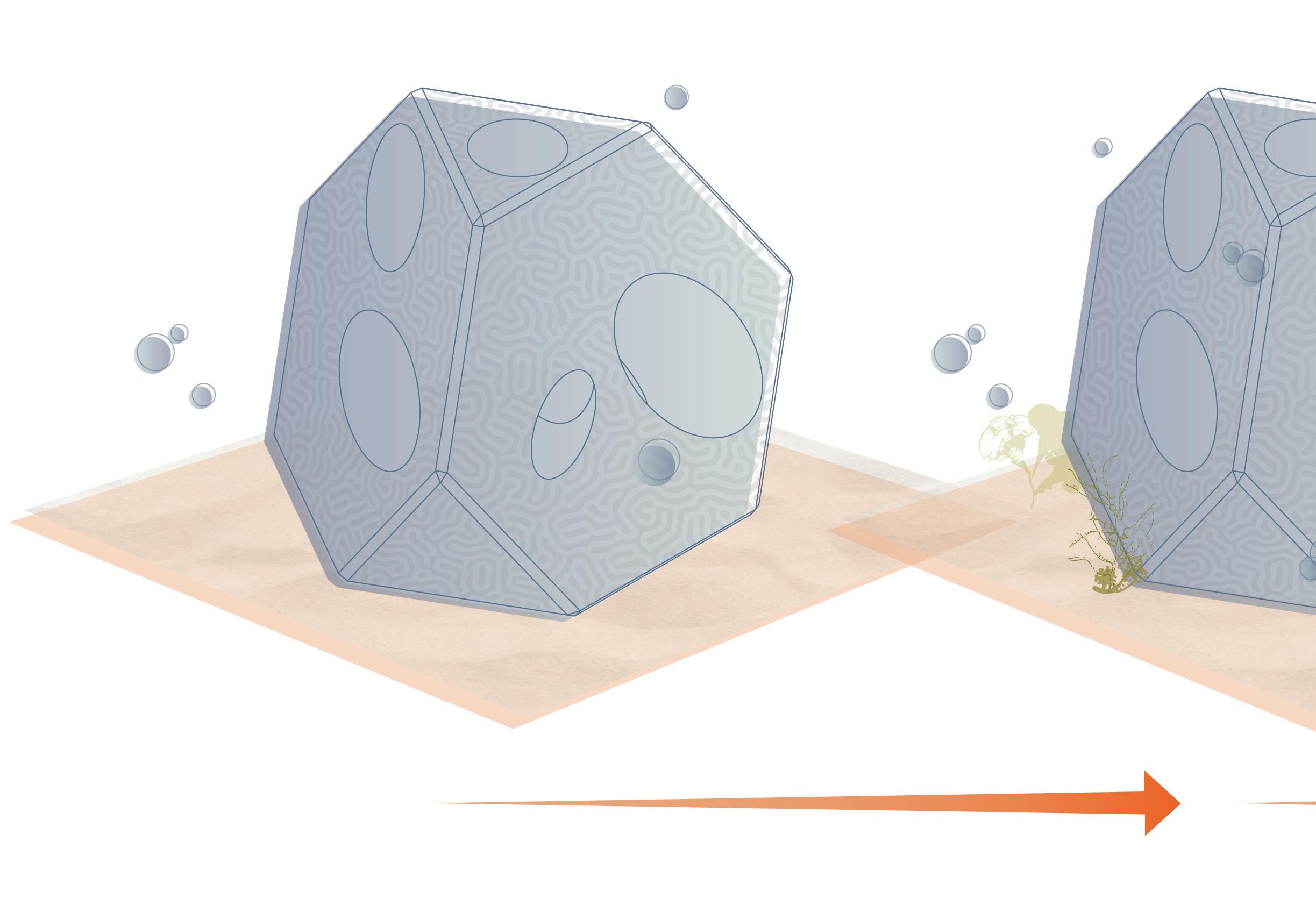
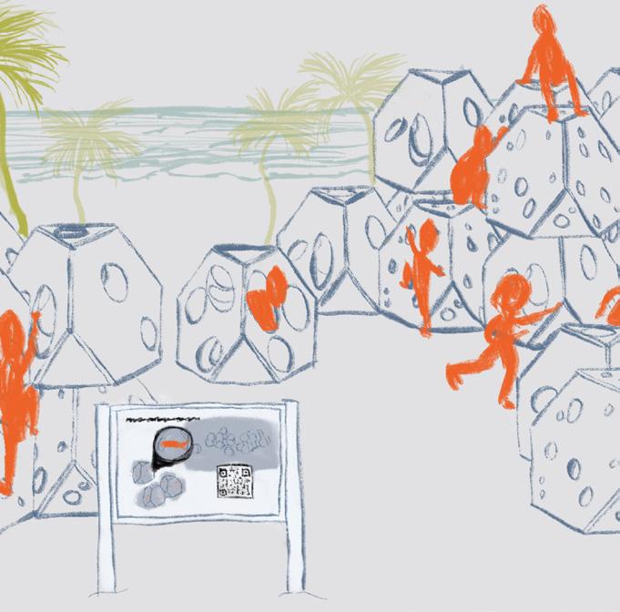
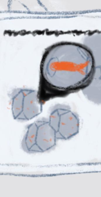
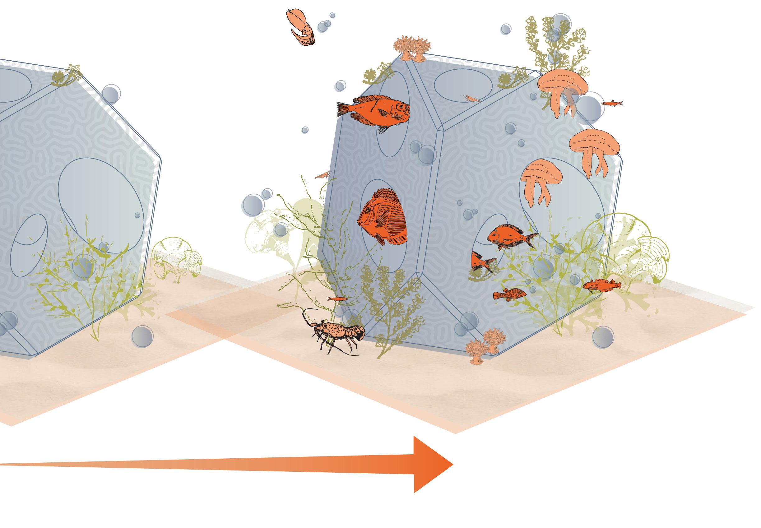
Just off the coast of San Juan lies La Reserva Marina Arrecife de la Isla Verde (RMAIV). Reefs at Play proposes a modular assemblage 3D-printed from calcium carbonate deployed for marine habitat restoration at RMAIV. Across the world, coral reefs are nearing unprecedented tipping points due to climate change, pollution, and human activities.
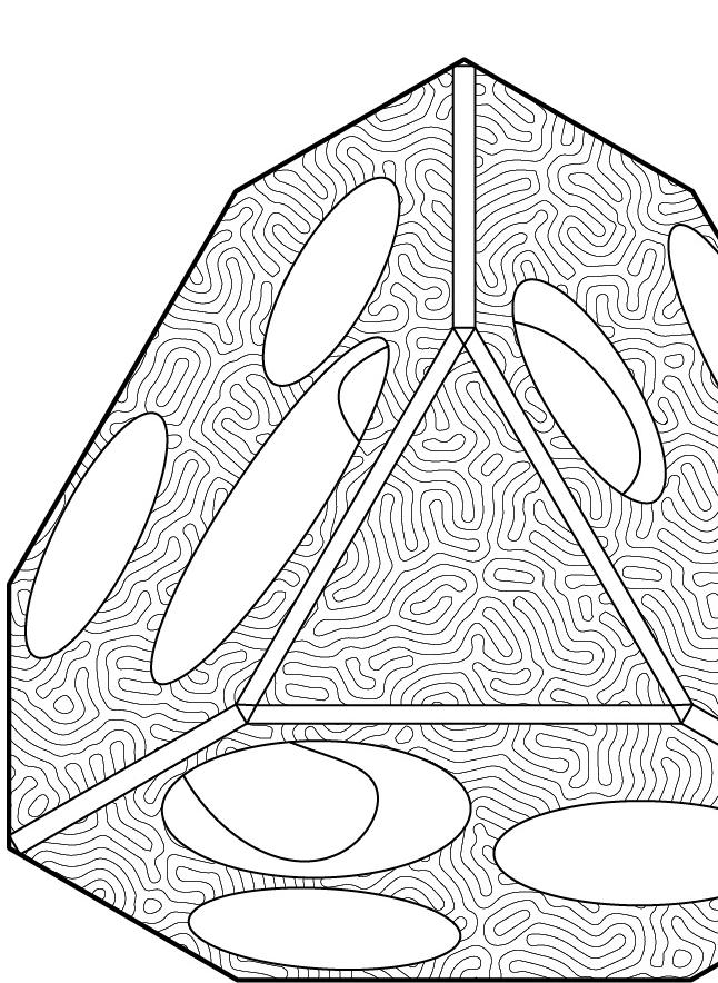
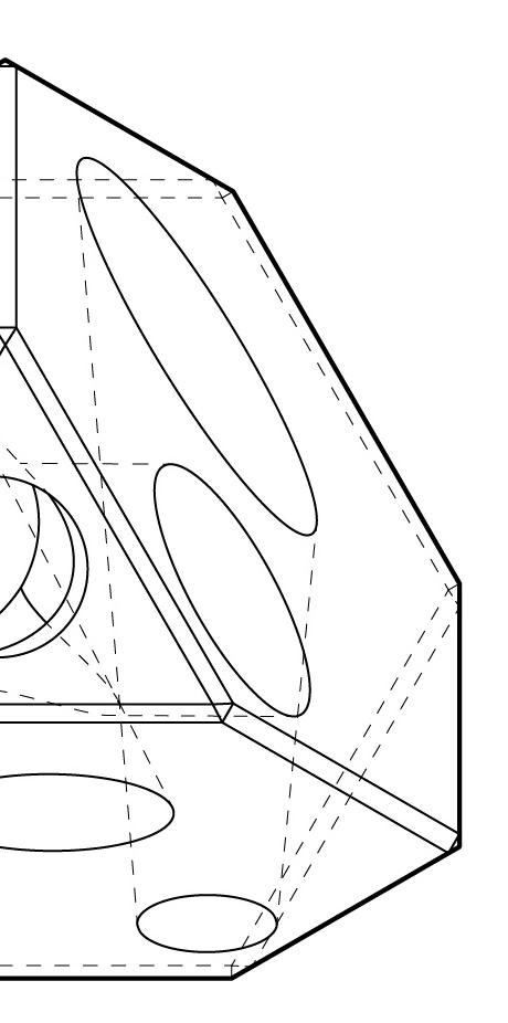
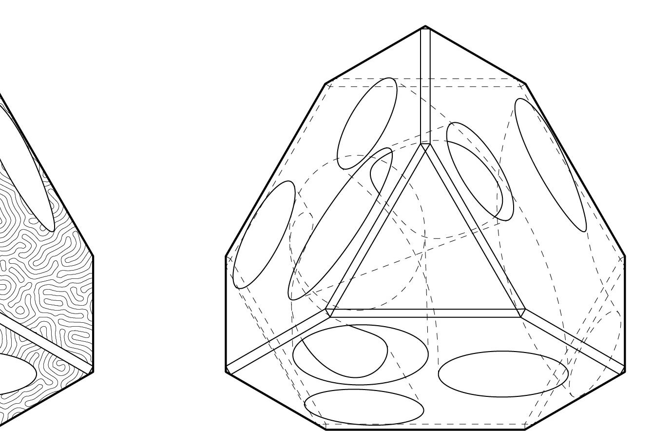
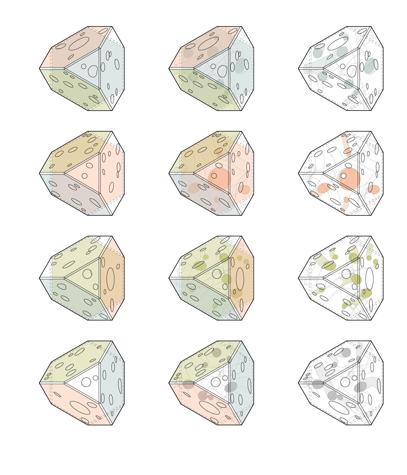
Grouping data from 119 species documented within the RMAIV site, Reefs at Play features three modules each supporting the habitat needs of different trophic levels of fish and invertebrates. The habitat needs of larger predators, like nurse sharks and manta rays, are accounted for in the space between assemblages, mimicking the dynamics of naturally occuring coral reefs.
The modules’ fundamental structure of a modified pyramid lends intrinsic structural stability. Coupled with aperture schemes that allow for viable circulation regardless of which of the four main sides the module rests on, these assemblages are resilient to an increasing frequency and severity of storm events and require minimal maintenance once deployed.
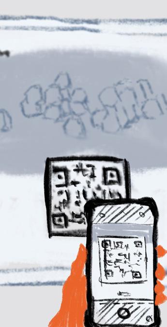
The system incorporates an interactive virtual monitoring system whose feed can be viewed from a parallel assemblage playground on Carolina beach.

6-12cm apertures
15-20cm apertures
LARGE
30-40cm apertures
Alpheus spp.
Cyphoma gibbosum
Cinetorhynchus manningi
Mytrax sculptus
Spirobranchus giganteus
Bispira brunnea
Octopus briareus
Acanthopleura granulata
Stenophus hispidus
Hermodice carunculata
Sepioteuthis sepioidea
Carpilius corallinus
Atherinomorus stipes
Grama loreto
Anchoa lyolepis
Chaetodon capistratus
Opistognathus aurifrons
Stegastes leucostictus
Apogon maculatus
Canthigaster rostrata
Snapping shrimp
Flamingo tongue
Red night shrimp
Green clinging crab
Christmas tree worm
Social feather duster
Caribbean reef octopus
Fuzzy chiton
Banded coral shrimp
Bearded fireworm
Caribbean reef squid
Batwing coral crab
Hardhead silverside
Fairy basslet
Dusky anchovy
Foureye butterflyfish
Yellowhead jawfish
Beaugregory
With research compiled on the average and maximum sizes of 81 fish and 38 invertabrates documented in the RMAIV site, species were classified into three groups along natural breaks in the data. These breaks informed diameter ranges for apertures in the trophic modules. Listed above is the data set for the small apertures module.
6-12cm apertures
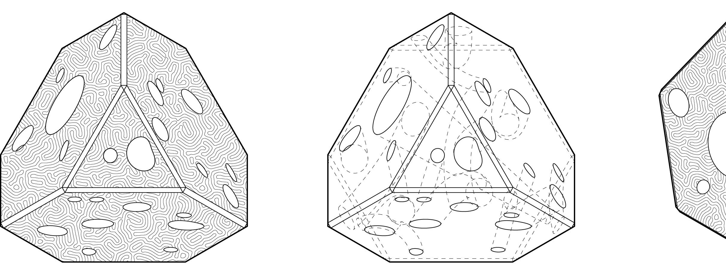
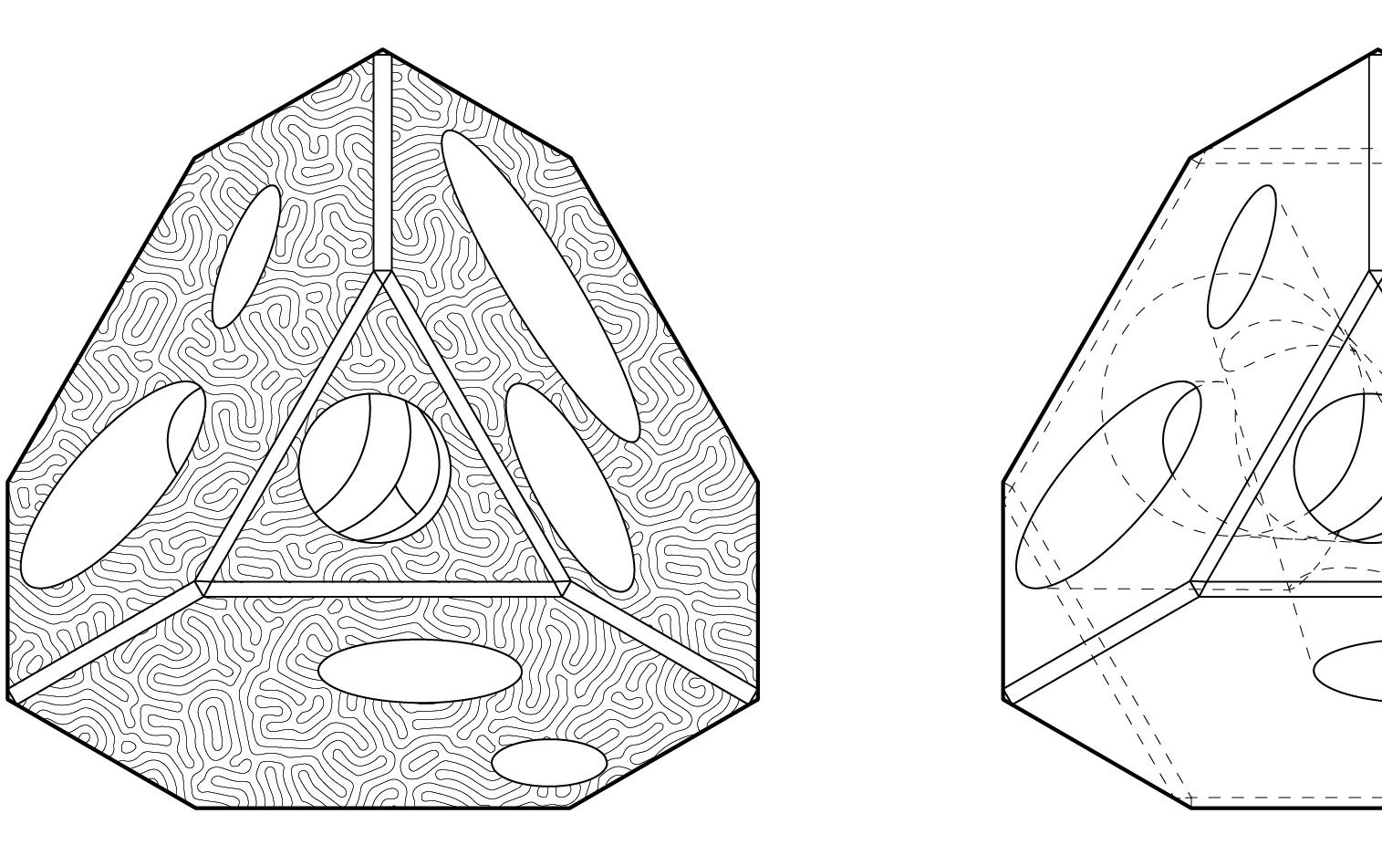
15-20cm apertures
LARGE
30-40cm apertures
+ Efficient installation
+ Organic compostion
+ Low maintenance
+ Topographic flexibility
+ Current/storm adaptability
- Lower stability
- Inconsistent monitoring
+ Structural stability
+ Consistent monitoring
- Precise installation
- Higher maintenance
- Needs flat site
- Low adaptability

Module surface texture invites interaction from smaller organisms, algae, and sessile invertebrates.
Primary consumers interact most directly with coral and are the most populous trophic level in marine ecosystems, so the assemblage provides more habitat down the trophic pyramid.
Animation: https://tinyurl.com/ReefsAtPlay


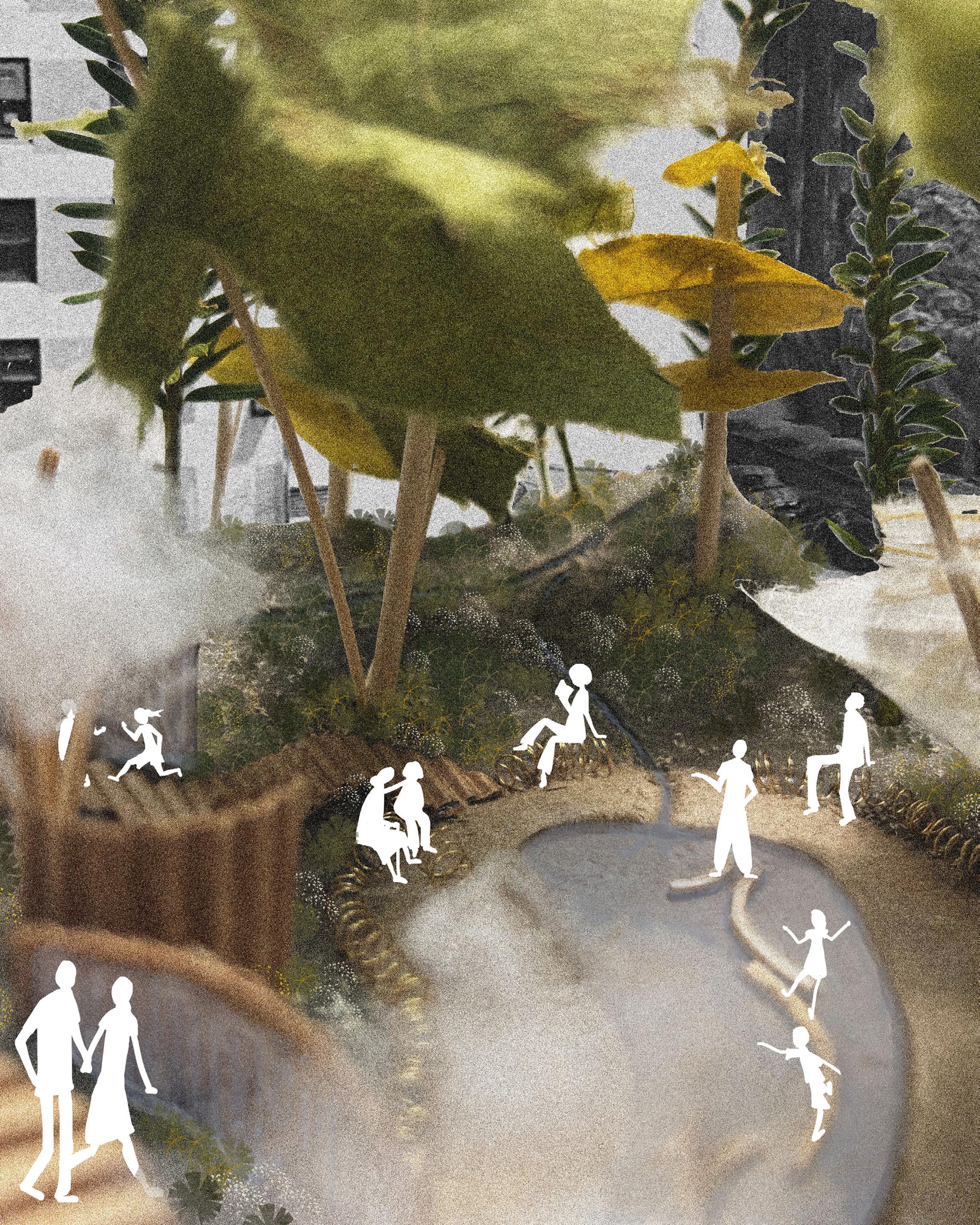
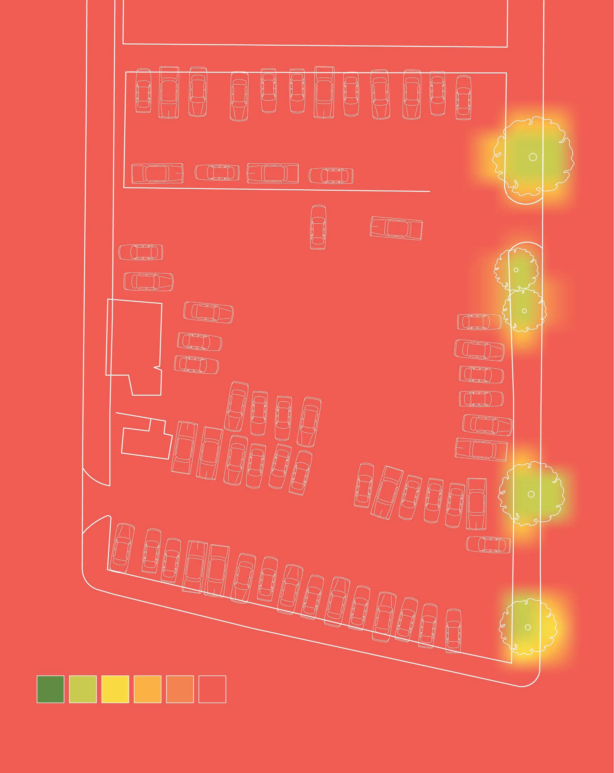
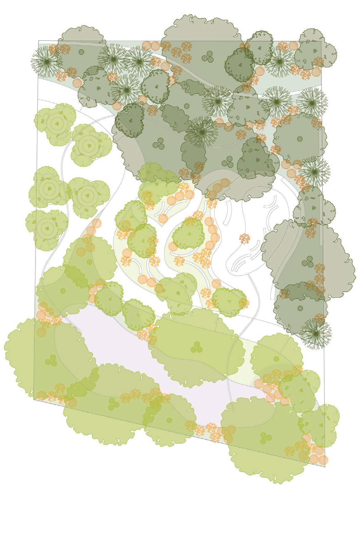
Chinatown Cool transforms a parking lot into a pocket park in one of Boston’s neighborhoods with the fewest trees, least access to green space, and highest risk of extreme heat exposure. Nearby highways contribute to air and noise pollution in an area with high densities of nonwhite, low-income, and linguistically isolated residents, creating conditions of environmental injustice.
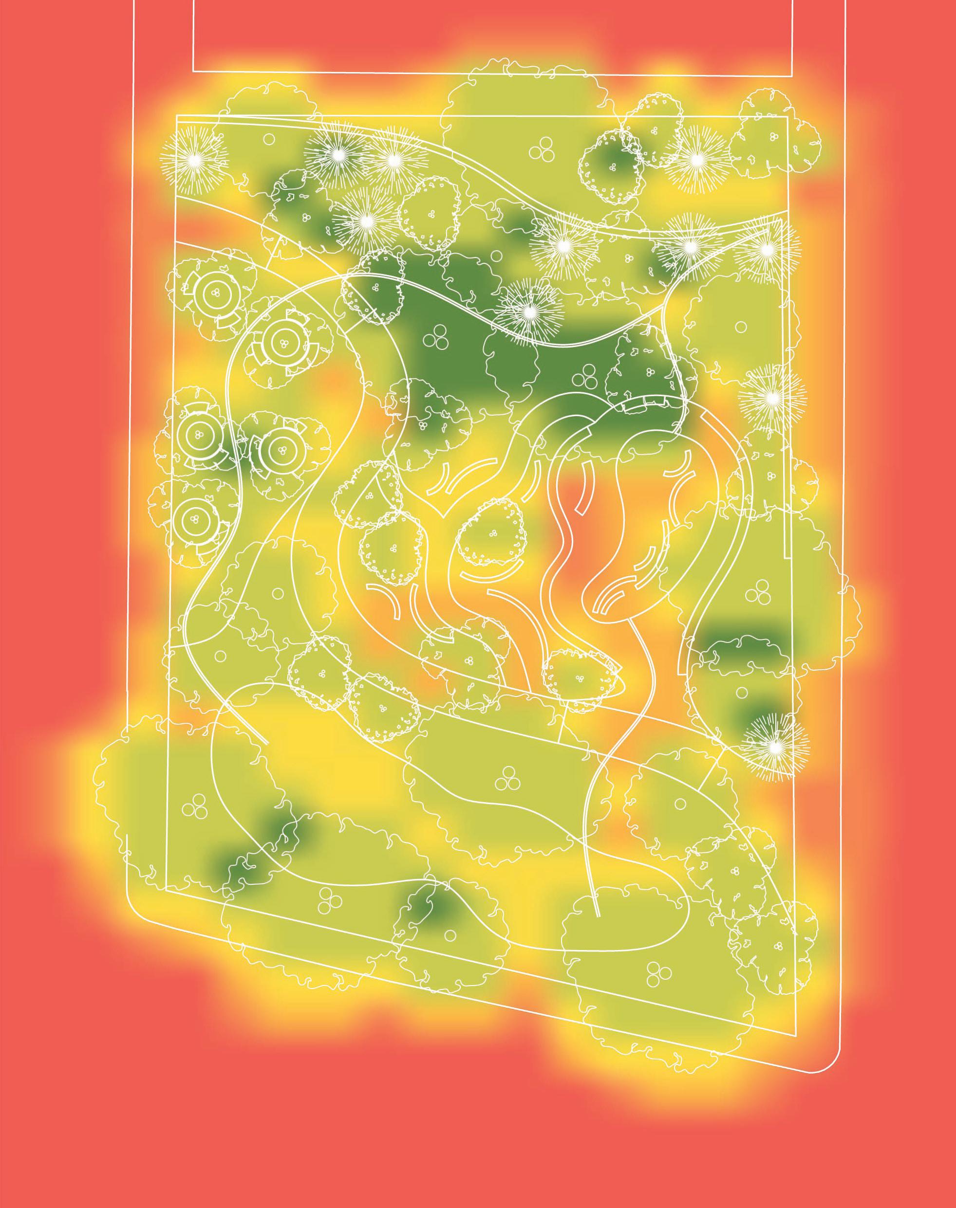
Reimagining this half-acre site, the design fosters microclimatic cooling through interactive water features, including a stepping-stone reflection pool, water sculpture path, and stream-channel plazas. Heat is mitigated through an integrated network of shade, evapotranspiration, and water elements. Visitors are enveloped by thickly vegetated buffers that frame both site and program, while a bank of steep, constructed topography on the north side supports a Miyawaki forest, creating a sense of cool, sheltered enclosure.
PROPOSED: POCKET PARK
STREAM CHANNEL PLAZA
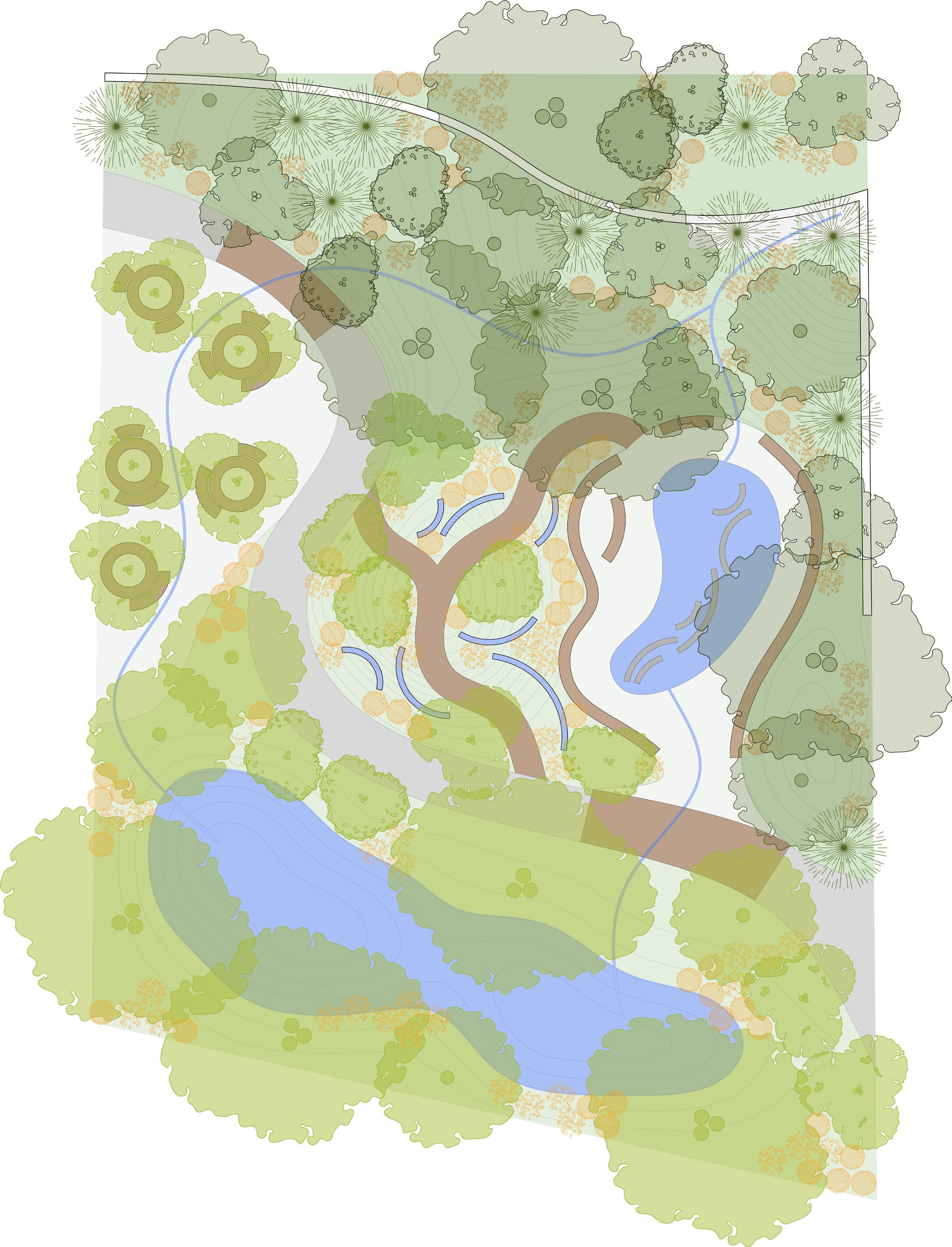
WATER SCULPTURE PATH
REFLECTION POOL PLAZA
FLOODABLE ZONE SLOPED LAWN
Symphyotrichum cordifolium
Eurybia divaricata
Polystichum acrostichoides
Rhus aromatica
Maianthemum racemosum
Maianthemum canadense
Symphyotrichum novae-angliae
Symphyotrichum novi-belgii
Geranium maculatum
Sporobolus heterolepis
Maianthemum canadense
Rhus aromatica
Rubus hispidus
Carex pensylvanica
Betula nigra
Sassafras albidum
Amelanchier canadensis
Betula populifolia ‘Whitespire’
Clethra alnifolia
Aronia melanocarpa
Pinus rigida
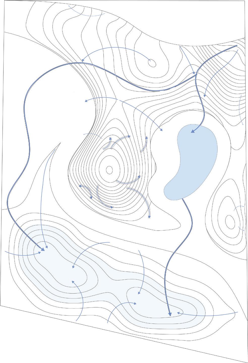
Primary flow
Secondary flow
Tertiary flow
Permanent water body
Ephemeral water body
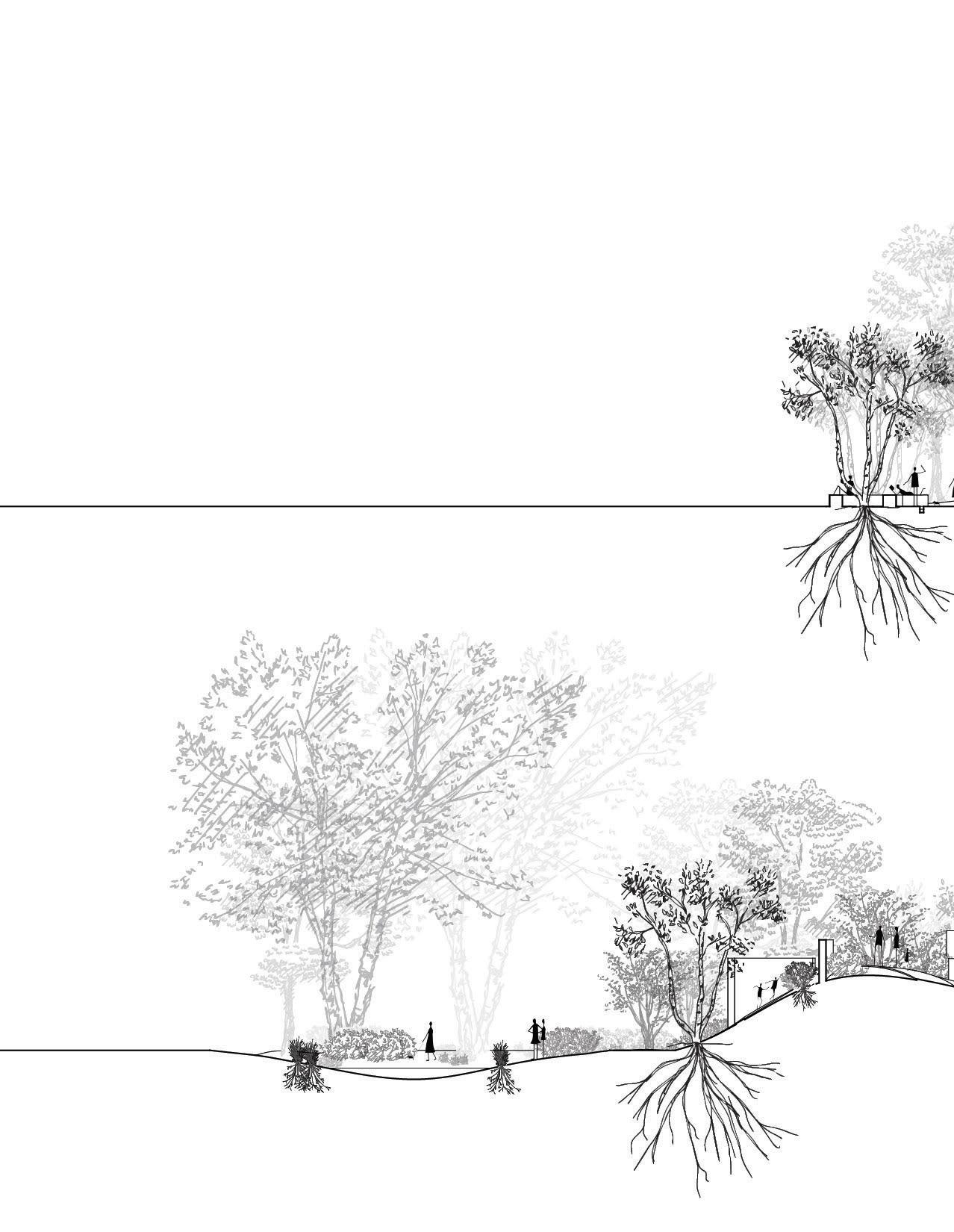
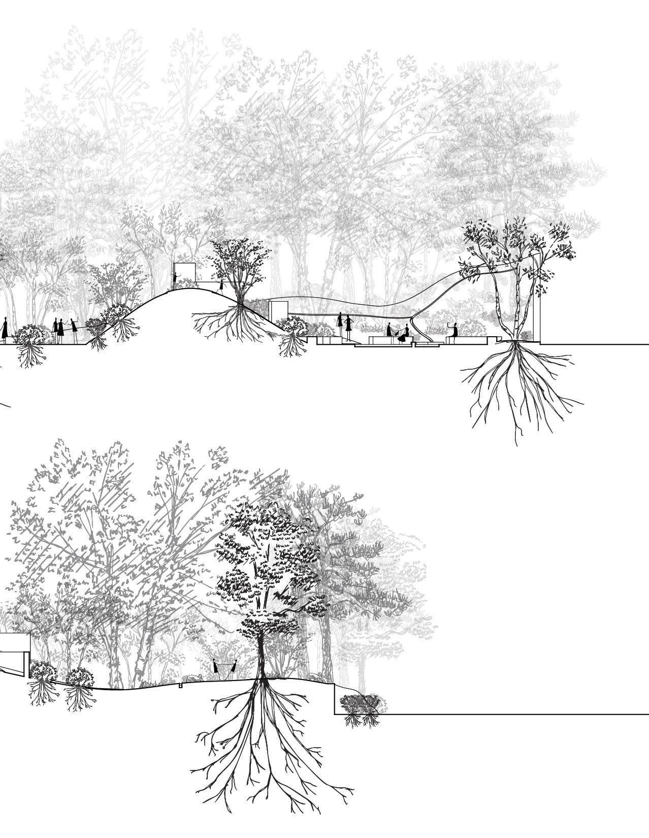
Restrooms and a maintenance shed tuck into the park’s constructed topography. Here, along the retaining wall, the forest floor can be explored at eye level.
STOSS Landscape Urbanism
Renderings
Providence, RI
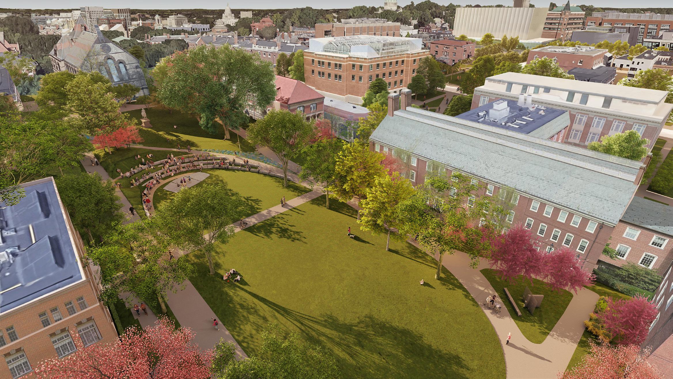
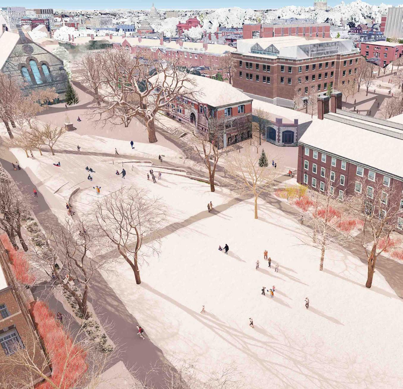
I developed a series of renderings of the new terraced amphitheater, accessible circulation routes, and stormwater infrastructure integrated into the renovation of Simmons Quad in Brown’s historic campus. Using Rhino 3D, Lumion, and Adobe Photoshop, I generated perspective views that emphasized the technical resolution of grading transitions, stone detailing, and seating configurations. These renderings supported coordination between design, construction, and client teams and were instrumental in exploring potentials for layered event programming, outdoor learning, and seasonal variations in landscape use.
STOSS Landscape Urbanism
Berm Feasibility Studies
Boston, MA
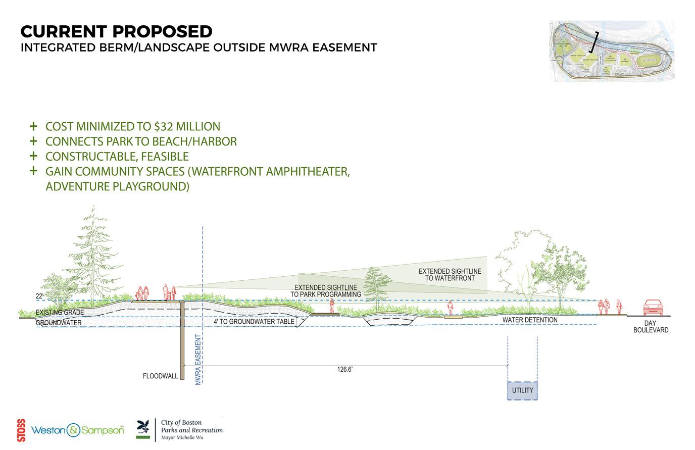
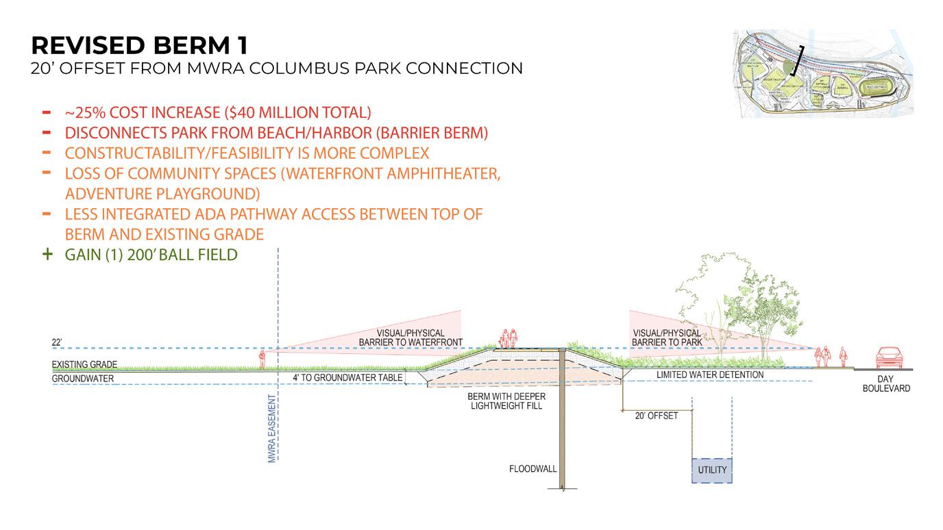
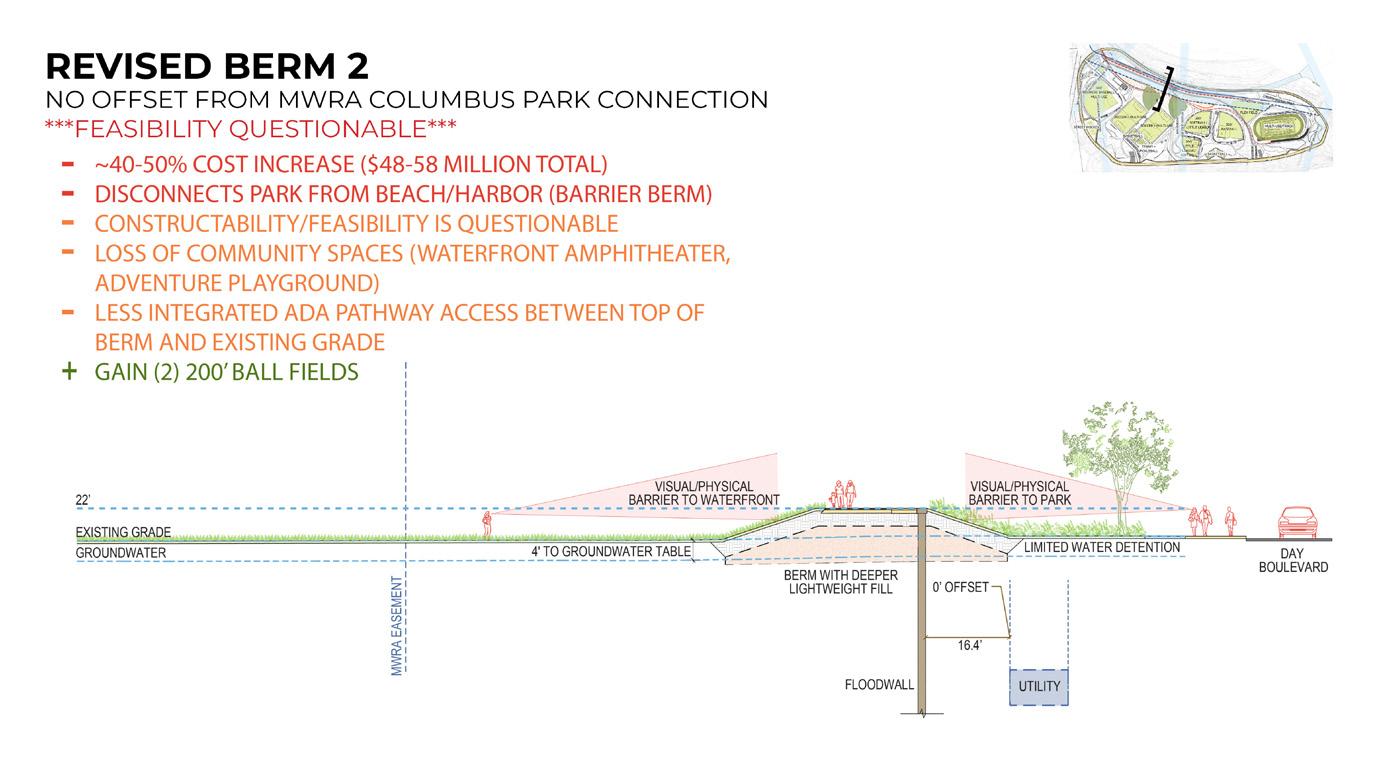
I developed a series of sectional feasibility studies and corresponding plans examining the strengths and limitations of various coastal resilience intervention schemes for the redevelopment of Moakley Park in South Boston. I compared the conditions of our proposed gradual coastal dune landscape with two alternative vegetated berm options, offset at 20’ and 0’ from a buried Massachusetts Water Resource Authority utility. We found that while active programming potential was marginally increased by 1-2 little league fields in the berm options, they introduced significant drawbacks, including higher costs, reduced harbor connectivity, construction complexity, lack of community spaces, and loss of ADAintegrated pathways between the top of berm and existing grade.
STOSS Landscape Urbanism
Physical Model
Boston, MA
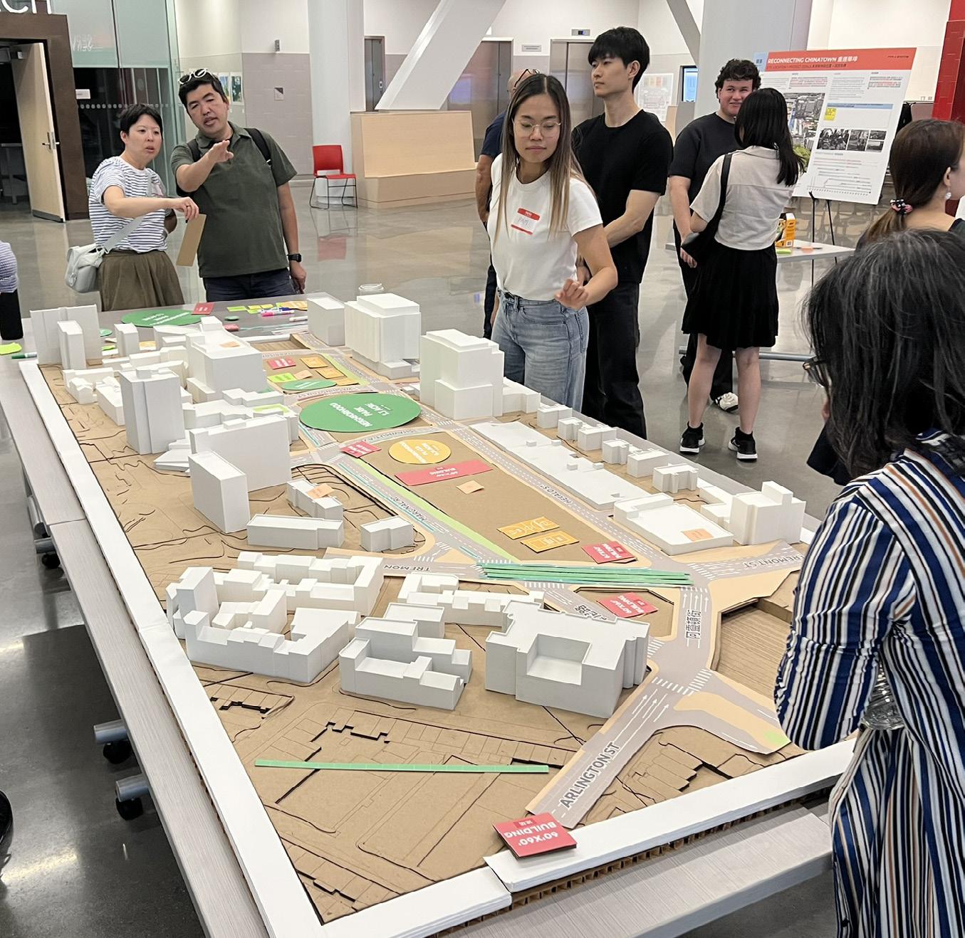
I constructed a 9’ x 4’ participatory planning model to support community engagement in a City of Boston initiative to reconnect Chinatown across the I-90 corridor through new open space, green infrastructure, and air-rights development. The model represented four key parcels (19–22) spanning the Turnpike trench and was used in public meetings to visualize decking feasibility, circulation, and design guidelines. I processed LiDAR-based topographical data in ArcGIS Pro and Rhino 3D, then laser-cut and stacked chipboard panels with slots for 3D-printed building massings. Overlays of cut paper diagrams developed in Adobe Illustrator illustrated schemes for parks, pedestrian routes, and commercial development.
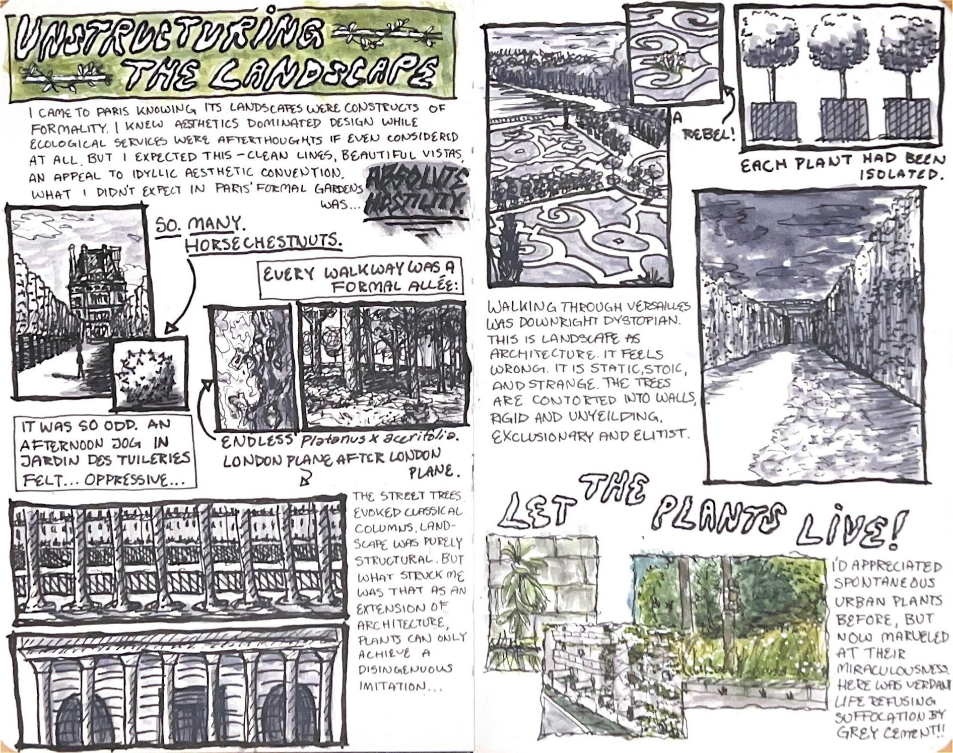
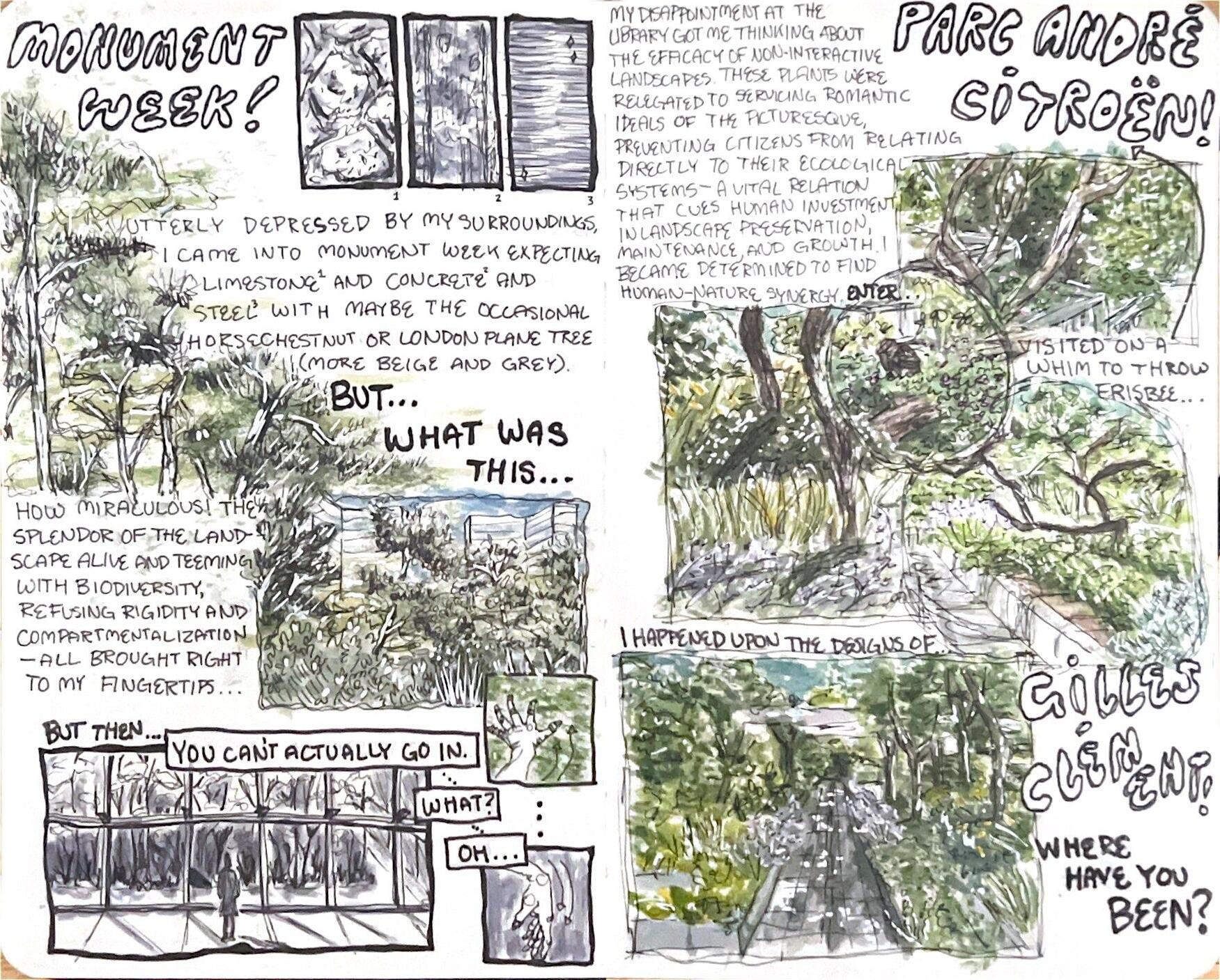
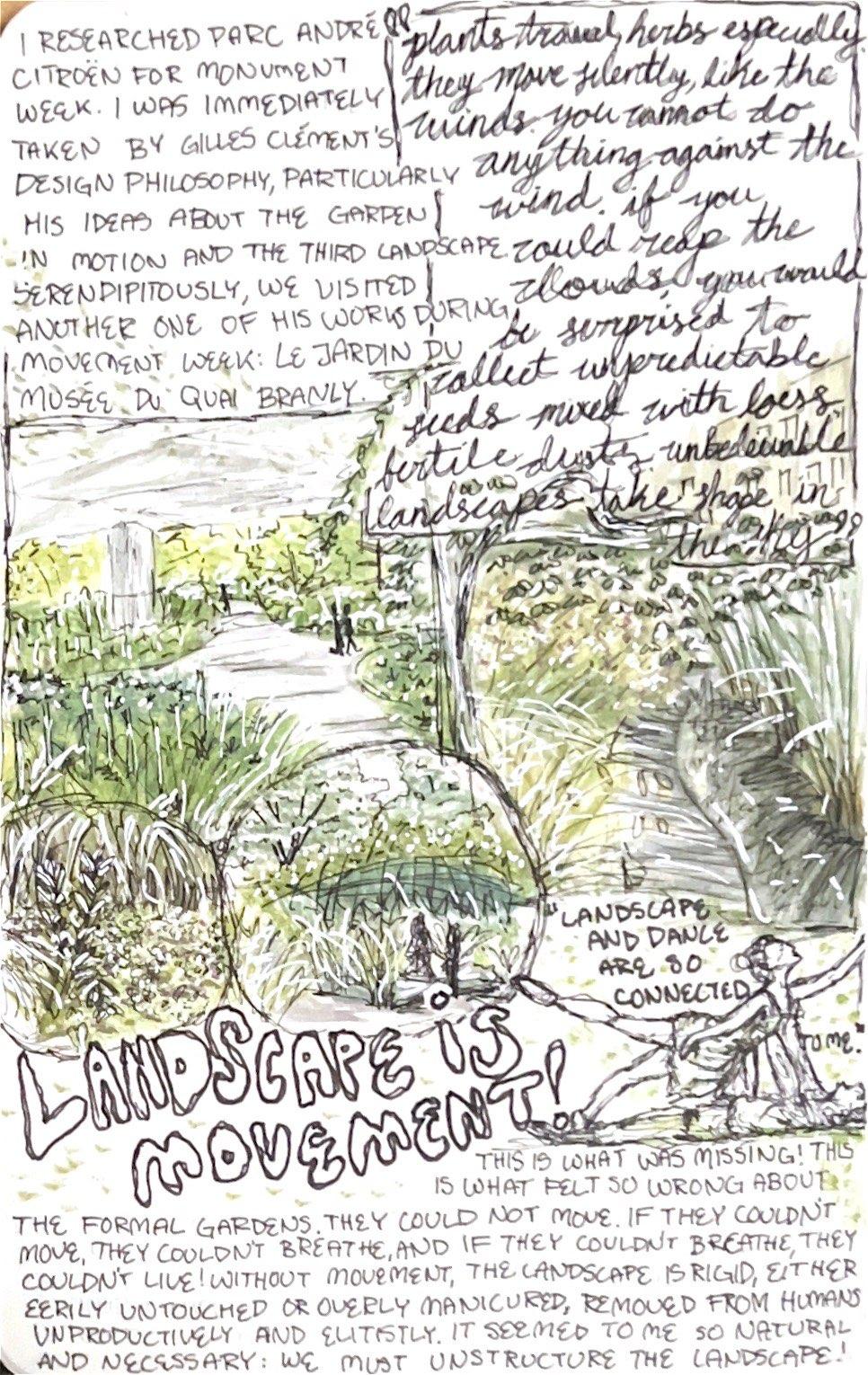
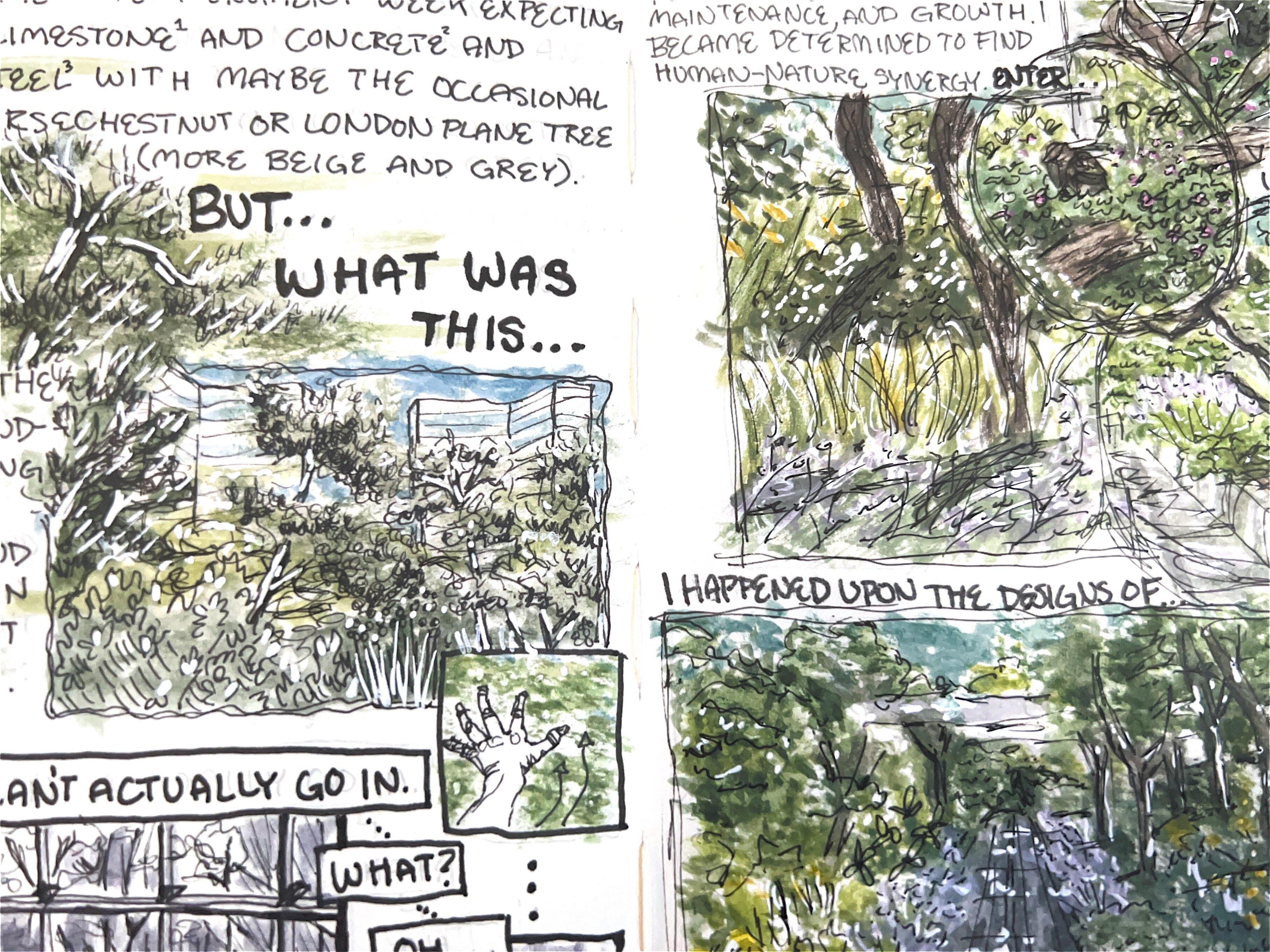
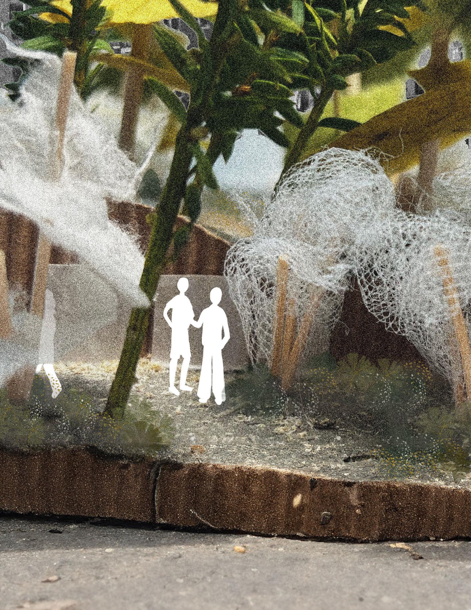
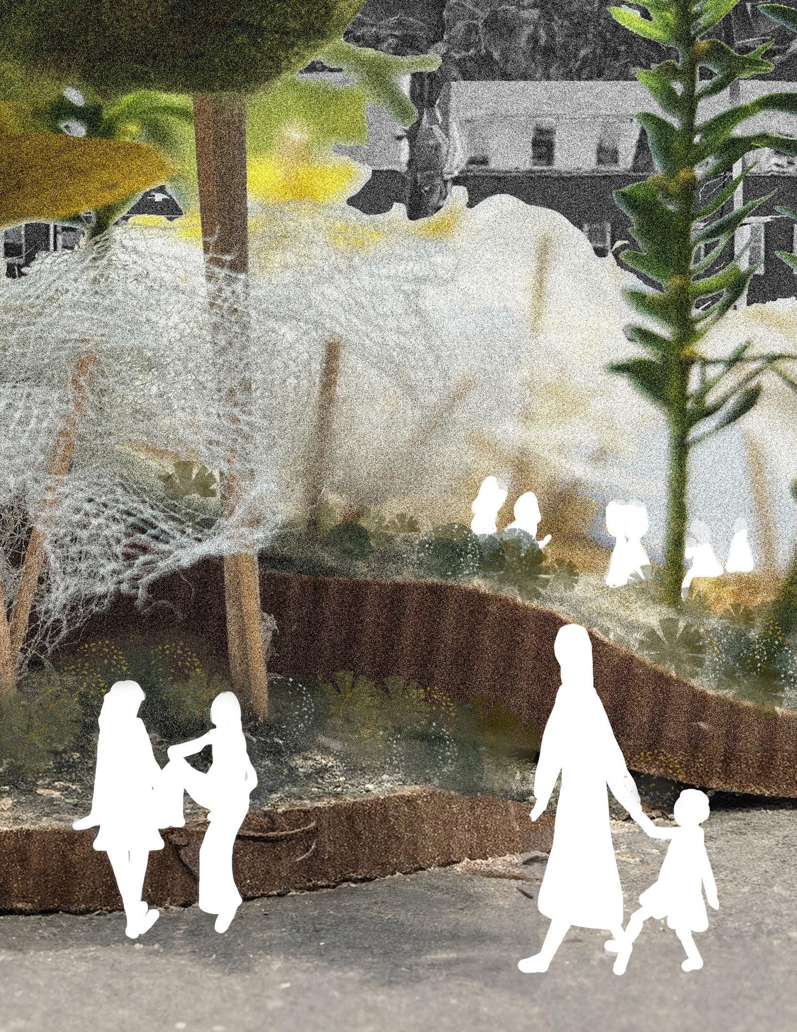
Reflecting on my July 2023 study abroad, Understanding Design in Paris, I developed an experiential mapping comic that chronicles the establishment of core tenents within my design ethos for landscape architecture early in my education. Unstructuring the landscape explores the necessity of dynamism and capacity for movement within the landscape. The comic contrasts the rigidity of traditional French formal gardens with contemporary philosophies of French landscape architecture like Gilles Clément’s “Moving Garden.”