QUICKSILVER SHORES

FIGHTING MERCURY CONTAMINATION THROUGH PHYTOREMEDIATION AT ALMADEN LAKE PARK Jessica Vanden Beukel jessicalvdbeukel@gmail.com June 12th, 2024
2 TABLE OF CONTENTS 5 6 9 10 14 17 17 18 19 20 26 36 37 38 39 40 44 45 Abstract Project Description Goals + Objectives Project Location, Context, + Site Plan Site Photos Contextual + Support Material Introduction Demographics User Profiles Theory and Literature review Precedent Studies Rational + Reasoning Six Word Memoir Professional Contacts Proposed Timeline Annotated Bibliography Cover Letter Resume
How do we right the wrongs of the past to bring a healthier and safer future?
3
ABSTRACT
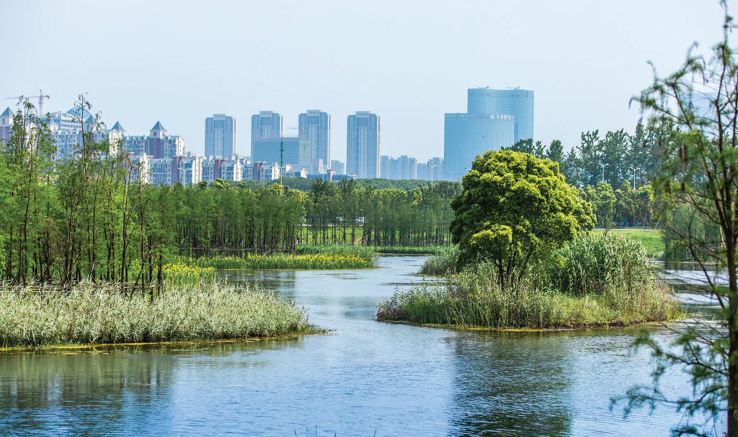
In many cities, hints of their history can be found in the landscape. The architecture of buildings, the width of roads, and the state of natural resources are a few examples. History has taught us that for many generations, natural resources have been taken advantage of and taken for granted. This is where the story of Almaden Lake Park starts.
In the late 1840s during the California Gold Rush, the New Almaden Quicksilver Mines were established to extract liquid mercury from ore. Over the course of 25 years, 46 million pounds of mercury were taken from rocks found in the hills of Almaden. Waste products from mining left mercury-contaminated sediment free to be washed into streams and reservoirs. Between 1850 and 1970, about 6,500 tons of mercury from the New Almaden Quicksilver Mines were released into local creeks and rivers in the Guadalupe Watershed. Today, mercury contamination is still present in the Guadalupe River watershed.
Almaden Lake was never planned to be a lake. Large pits were created in the ground by gravel quarry operations along Alamitos Creek (part of the Guadalupe River watershed). Around the 1960s, after gravel quarry operations ceased, a large storm caused the levee between the quarry and creek to break, resulting in water filling the gravel pits and creating the lake. The uneven bottom of the lake causes poor circulation and with mercury sediment from the mines washing into the lake, there has become an accumulation of toxins. Most concerning is the formation of methylmercury in the lake which is caused by the low oxygen conditions.
This large body of water and the surrounding park provides acres of green space for nearby communities. With the health risks of the water, the park exists in limbo of becoming a wasteland or being rejuvenated into a clean landscape for the public to utilize.
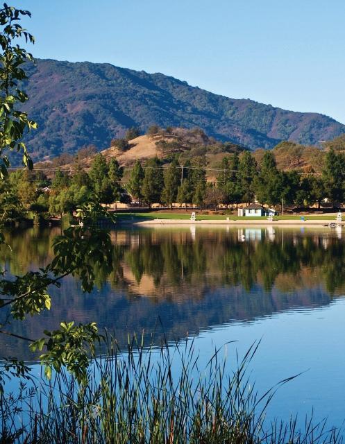
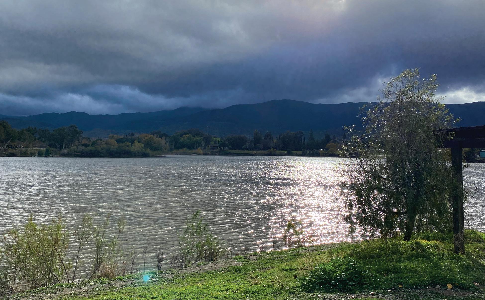
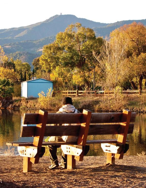
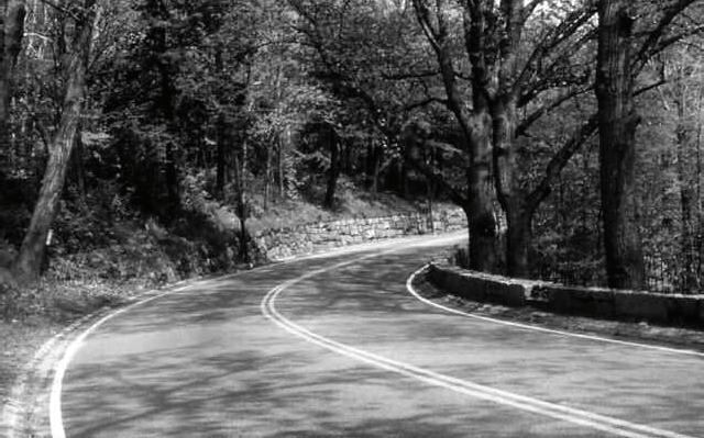
Current photo of scenic views at Almaden Lake.
5
PROJECT DESCRIPTION
Introduction
Located in San Jose, CA, Almaden Lake Park is a 32-acre public park serving multiple neighborhoods by providing outdoor recreational space. Appearing ordinary to the everyday eye, the lake is filled with toxic mercury-contaminated water, preventing visitors from engaging with the soft waves. With its prime location and large area, this park is brimming with potential to become an unforgettable piece of the landscape.
The two main ecological issues with Almaden Lake Park are the mercurycontaminated water and its man-made construction. While there is no way to completely stop mercury from entering the site due to a contaminated watershed, there are ways to improve existing conditions. The lake was formed by a breached gravel quarry, meaning it was not designed as a functioning water body, so by altering the shape of the lake there may be ways to improve its circulation and functioning. Additionally, since the lake was not formed naturally, it does not have a proper ecosystem to support itself. There is an opportunity to turn the lake into a beautiful native habitat that supports biodiversity, adding a touch of pristine environment to a sprawling suburban landscape. With the improvement of water quality and a self-sustaining ecosystem, the park will become a priceless piece of the community.
In addition to the ecological issues with the site, there are also chances to improve upon the user experience of the park. Due to its size and proximity to residential areas, the park is a fundamental and irreplaceable part of the community. Access to green space is essential for communities, so ensuring that the green spaces are safe, accessible, and meet the needs of the community is very important. New routes to access the park from nearby neighborhoods and connecting the park with trail systems will connect the park to its community in new ways. Circulation and wayfinding within the park can be improved to create a variety of engaging user experiences. By improving upon the existing programmatic elements, the park will become a place treasured by the community.
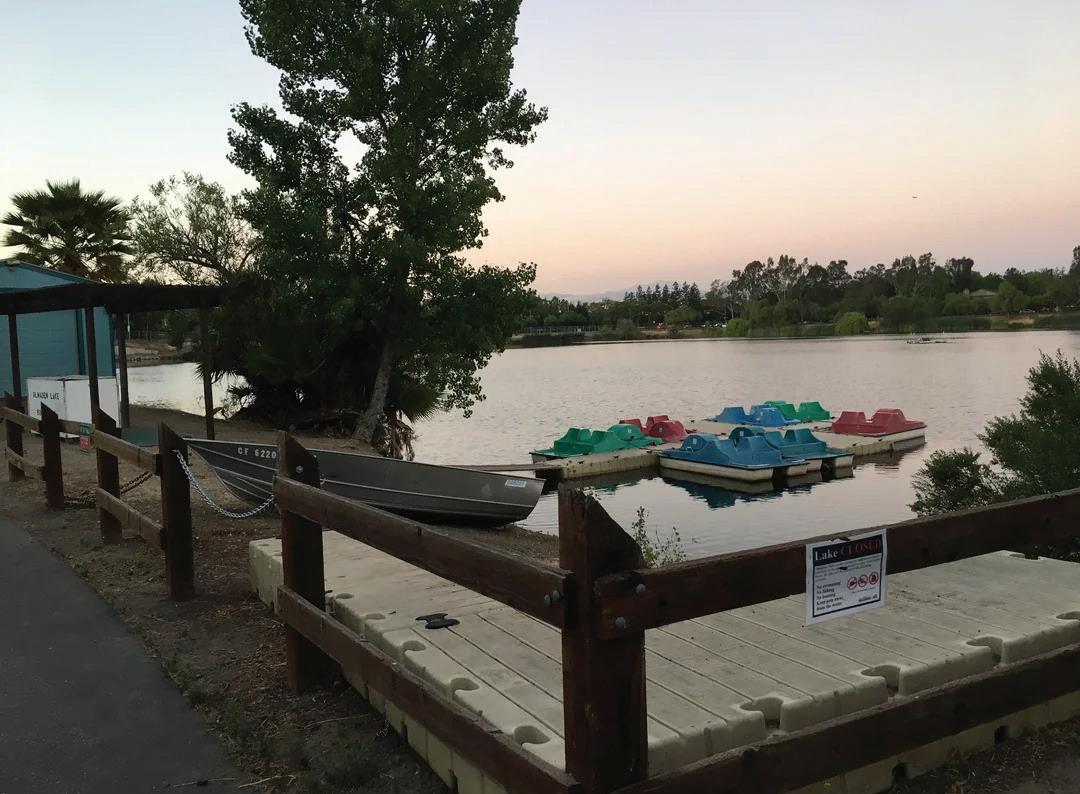
Unused pedal boats sitting on Almaden Lake, circa 2018.
6
Project Need
The largest concern within the site is the mercury-contaminated water which is a health risk for humans and wildlife. Cleaning up the water and preventing the accumulation of heavy metals is important for the health and safety of the community. Fish and wildlife that live in or around the lake suffer from mercury poisoning due to the water. In addition to its health risks, the mercury-contaminated water prevents the site from reaching its full potential as an educational and recreational amenity for the community. Green space is essential for communities and should be valued and utilized to its fullest potential. Being allowed to touch the water will open up a variety of new activities for visitors to experience. Cleaning up the water will allow visitors to experience the beauty of a healthy ecosystem for visual pleasure and learn through observations about biodiversity and ecological systems.
7
Design Approach
The design approach will be divided into two categories: ecological and social. There are two main components of the project which include addressing the toxicity of the lake and improving the surrounding ecosystem as well as creating a park that serves the recreational needs of the community. By dividing the project there can be a clear focus on the different needs that need to be addressed. The ecological side of the project will work on phytoremediation and design solutions to address the mercury contamination of the lake while also creating native habitats to improve biodiversity and create a self-sustaining ecosystem. The social side of the project will work on improving connections to the park, circulation within, and creating programmatic elements that allow visitors to interact with the unique ecosystem. The hope is that the lake can mimic a native environment that teaches residents about the value of biodiversity and healthy ecosystems.
8
GOALS + OBJECTIVES
◊ Reduce concentration of mercury and methylmercury in lake/water bodies
• Alter lake bed to improve circulation and prevent accumulation of toxins
• Plant vegetation that can filter (or store) heavy metals
• Remove animals (invasive fish) that are contaminated
◊ Create a self sustaining native ecosystem to improve biodiversity
• Plant vegetation that is native to the area
• Remove invasive species
• Change water body shape to mimic natural lakes/streams/ wetlands
◊ Teach locals and visitors about healthy native ecosystems
• Add interactive educational signage describing the ecosystem and its species
• Include designated walking paths that allow for visibility of waterways, various plantings, and habitats
• Create habitat barriers to prevent habitat damage from park visitors
◊ Create a park that is easily accessible, inside and out, for nearby residents and visitors from farther away
• Include consistent and simple wayfinding that visually captures the identity of the park
• Improve connection points from nearby neighborhoods to park by adding entrances by crosswalks and trails
• Make all programmatic elements ADA accessible
◊ Design a park for both everyday use and special events
• Create multifunctional spaces that allow for flexibility of use such as open plaza space or sports field
• Have programmatic elements that can handle large capacity events
• Have moments and smaller scale spaces within large areas
9
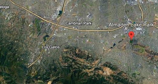
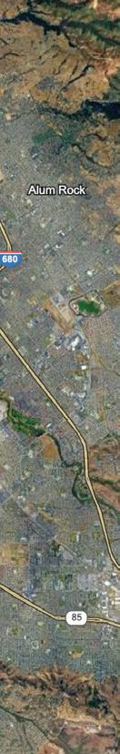
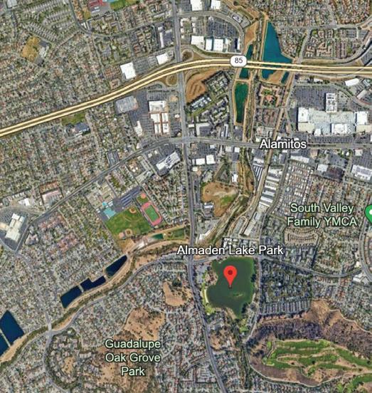
PROJECT LOCATION, CONTEXT, SITE PLAN
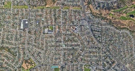
Located on the edges of the Almaden neighborhood in San Jose, the park is adjacent to many residential neighborhoods. Many residents visit the park daily to use the playgrounds, walk on the trails, or host get-togethers at the picnic areas. Additionally, the park is loved as a venue for large events including 4th of July fireworks celebrations, annual water lantern festivals, and art and wine festivals.
Almaden Lake is a non-naturally occurring lake formed by a gravel quarry that was breached by an adjacent creek during a storm about 60 years ago. The Guadalupe watershed that feeds Alamitos Creek (which feeds into the lake) is contaminated with mercury that was released during the gold rush. The lake does not currently function ecologically the way a lake should. In addition to not percolating, the uneven depths of the lake bottom cause a lack of circulation and accumulation of sediment which deprives the water of oxygen, creating the neurotoxin methylmercury. This toxin accumulates in the tissues of organisms that live in the lake.
In 2008, the San Francisco Bay Regional Water Quality Control Board adopted specific water quality objectives in its 2008 Basin Amendment Plan. Conditions of Almaden Lake did not meet those objectives, leading to the development of a project to address the issues of mercury levels. From 2012 to 2020, a plan was developed to repair the water body by separating it from the creek, reducing levels of methylmercury and mercury, and improving conditions for wildlife. Construction was to take place between 2020 and 2023. In 2023, the project was indefinitely postponed due to rising costs.
The previous postponed project plan offers priceless insight into the current conditions of the lake and desirable outcomes in remediation. The contamination of water is not only a hazard for humans but also native fish. The problems of pollutants, lack of circulation, warm temperatures, and invasive fish all hurt native fish and wildlife. By fixing issues of the water quality, the surrounding park can improve as well. The proposal reveals one way of viewing the project which is a helpful resource for understanding the motives behind design choices. Despite the thoughtful design proposal, I believe there is untapped potential to remediate the lake (and the ecosystem that’s developed around it) by other means.
10
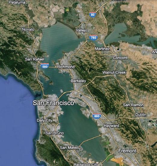
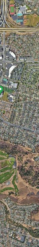
Bay Area, CA
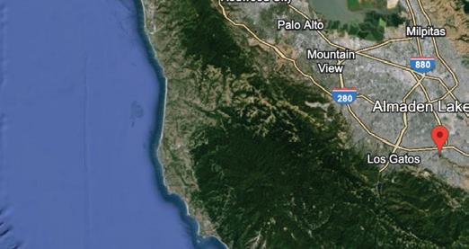
San Jose, CA
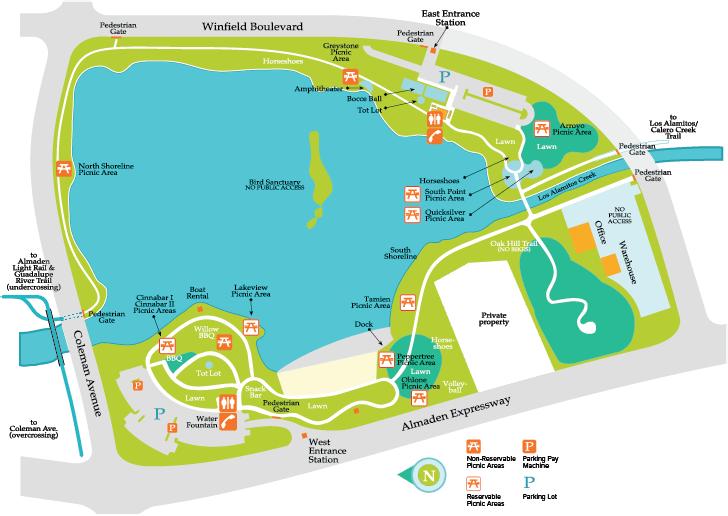
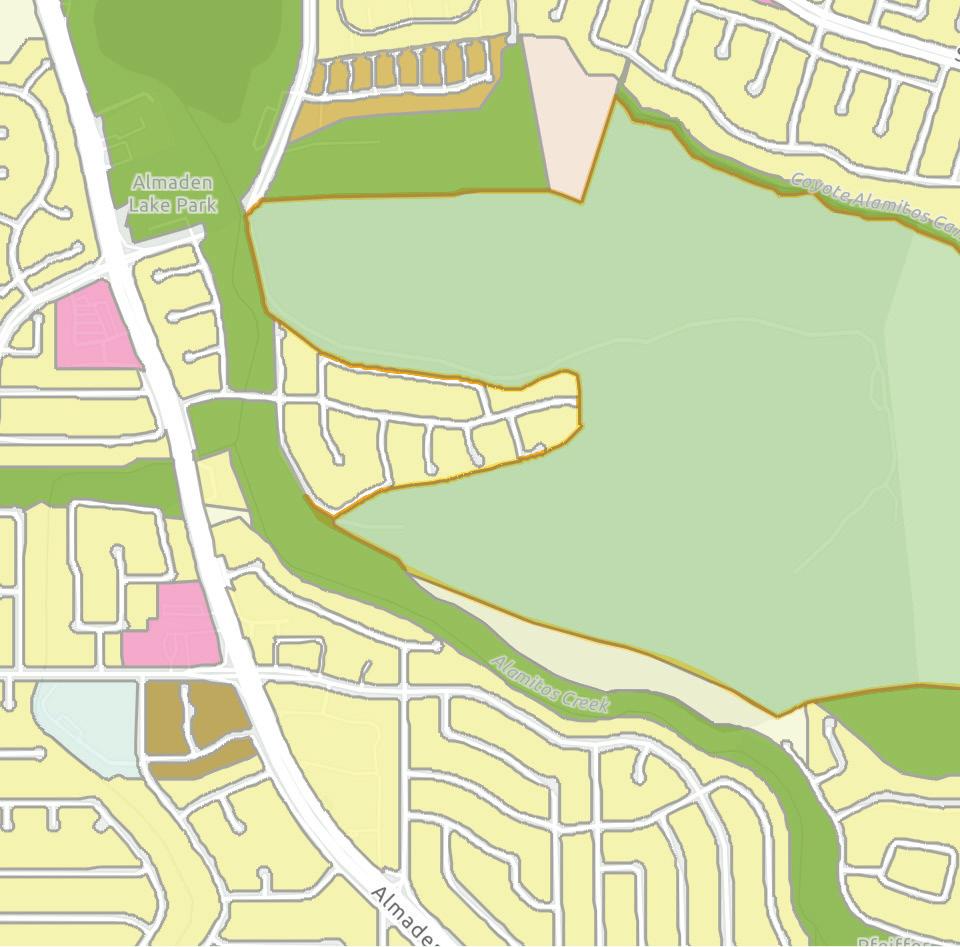
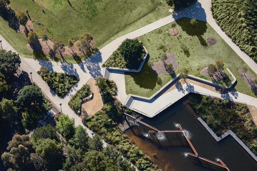
Site Plan
This map shows a diagram of existing amenities at the park and circulation paths. There are two parking lots, multiple picnic areas, and trails. The adjacent roads are labeled. This map is a helpful summary of the existing conditions of the site.
11
Almaden Lake Park
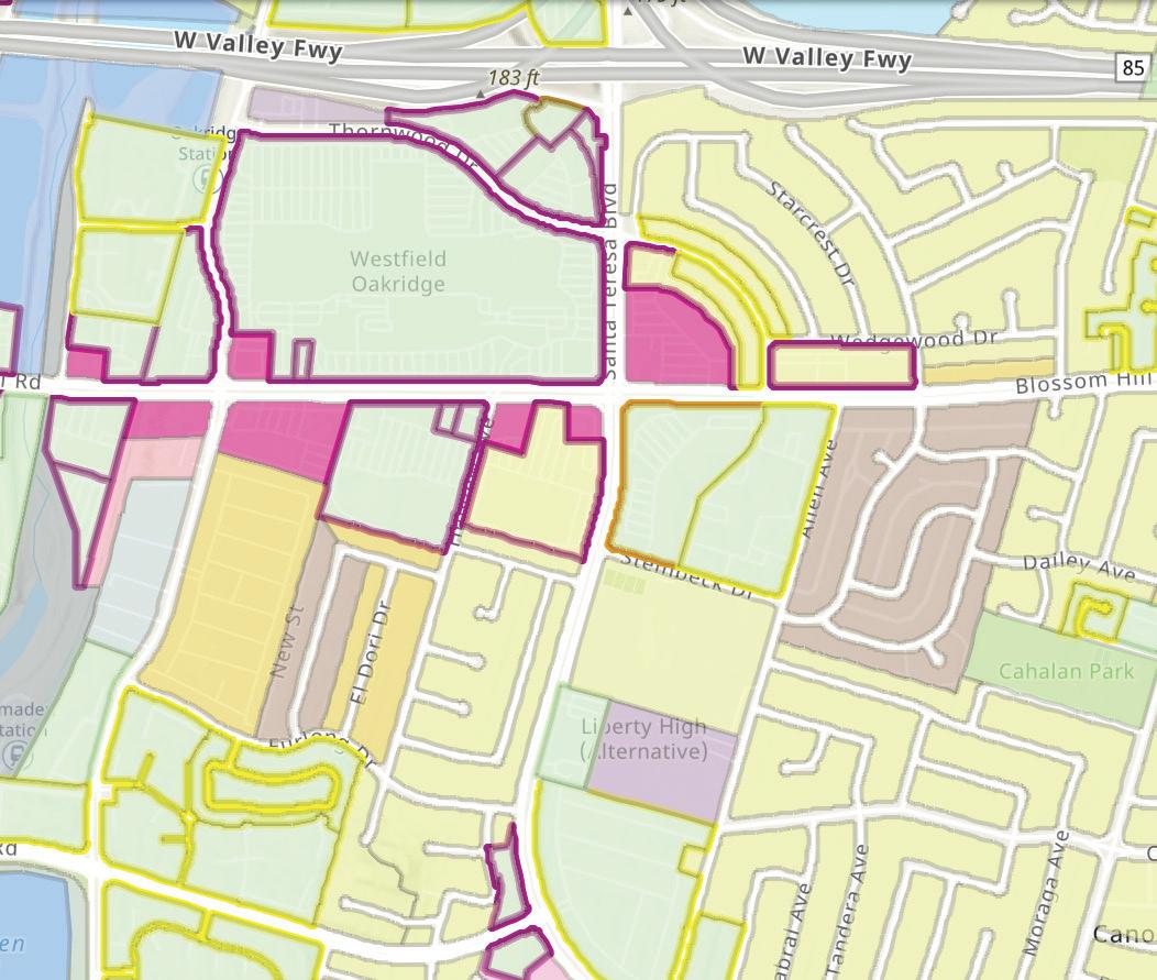
San Jose General Plan 2040 Map

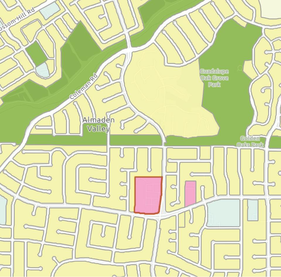
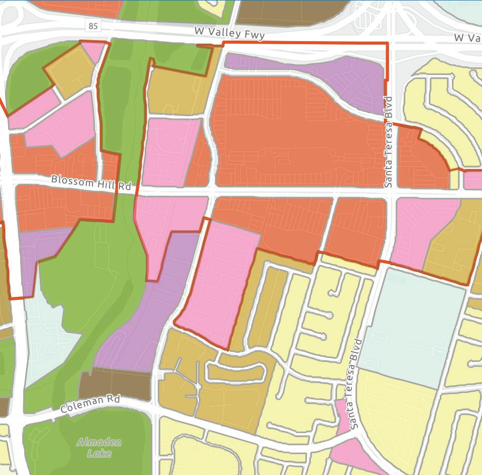
12 Project Location N^
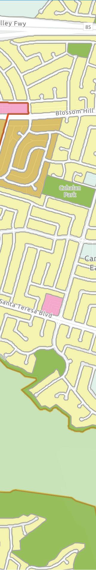
San Jose Zoning Map
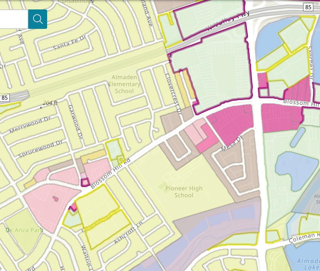
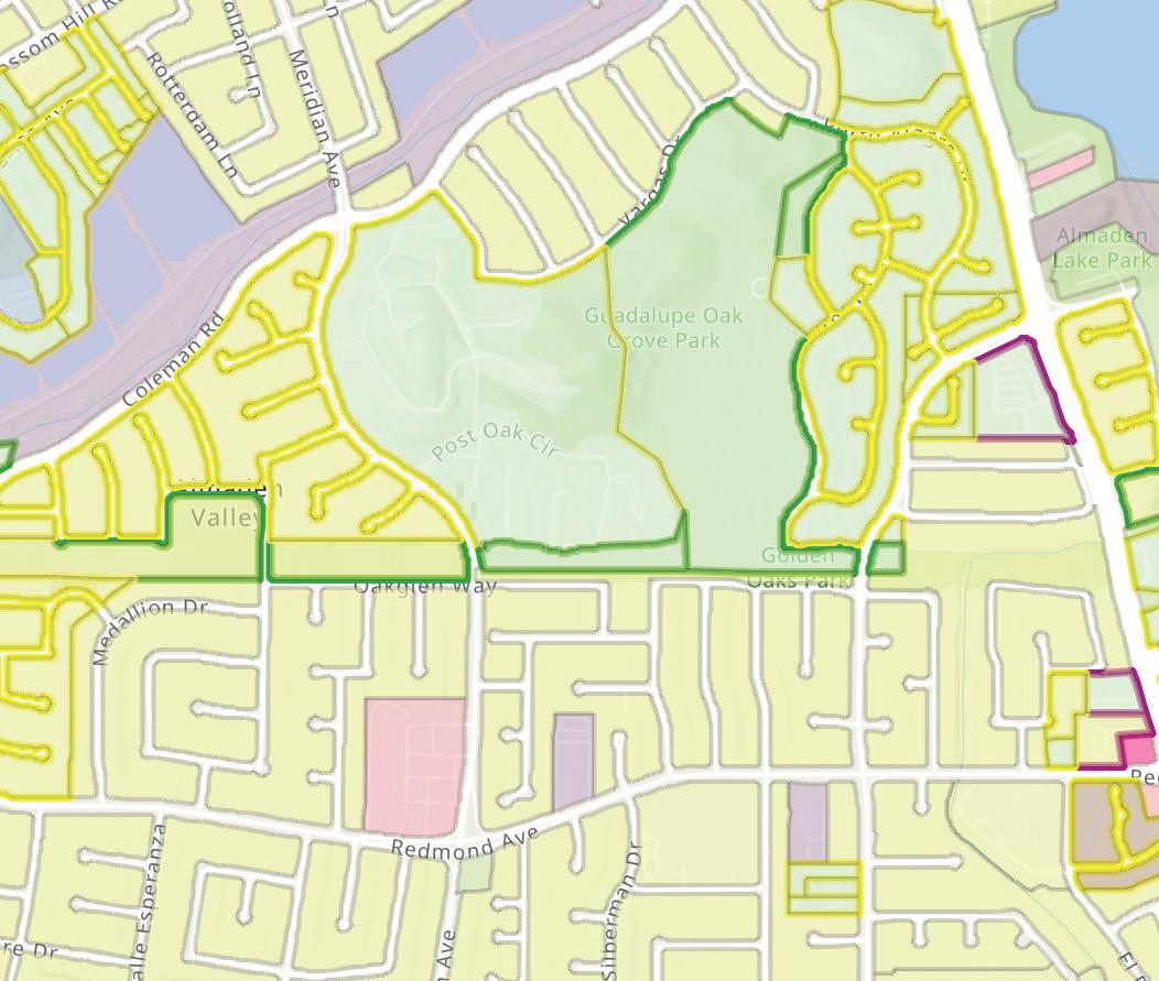
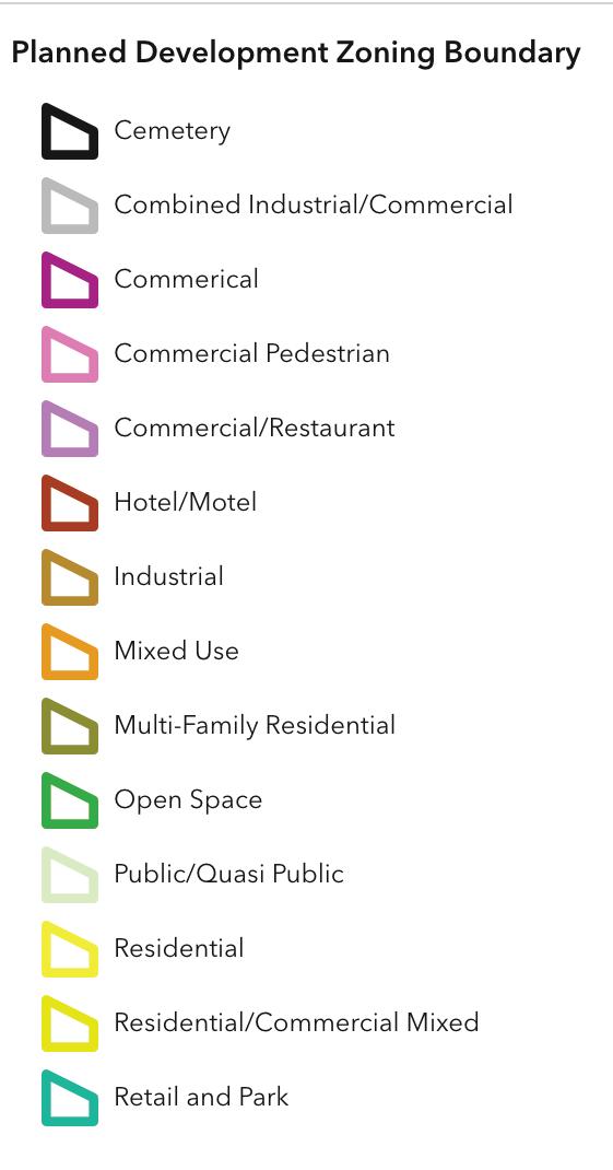
Project Location N^
13
SITE PHOTOS
14
Almaden Lake on a cloudy day in December, 2021.
Photos courtesy of Jennifer Vanden Beukel
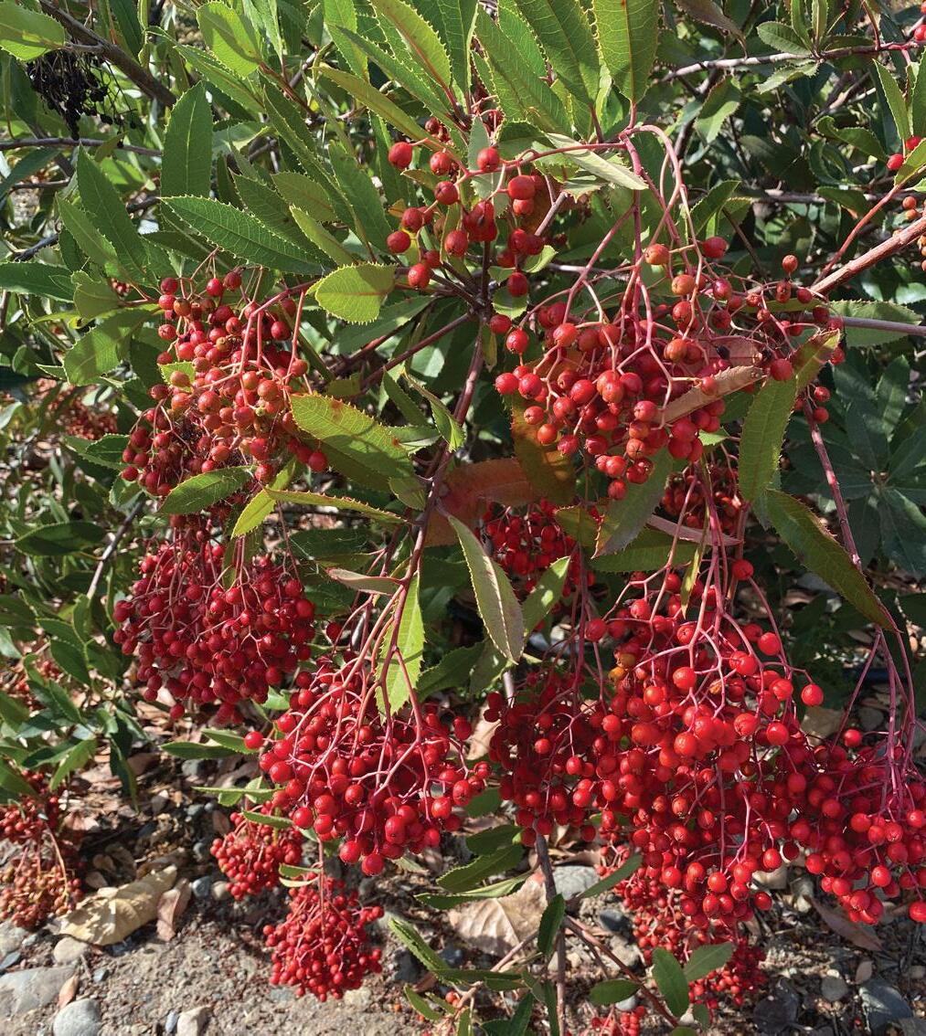
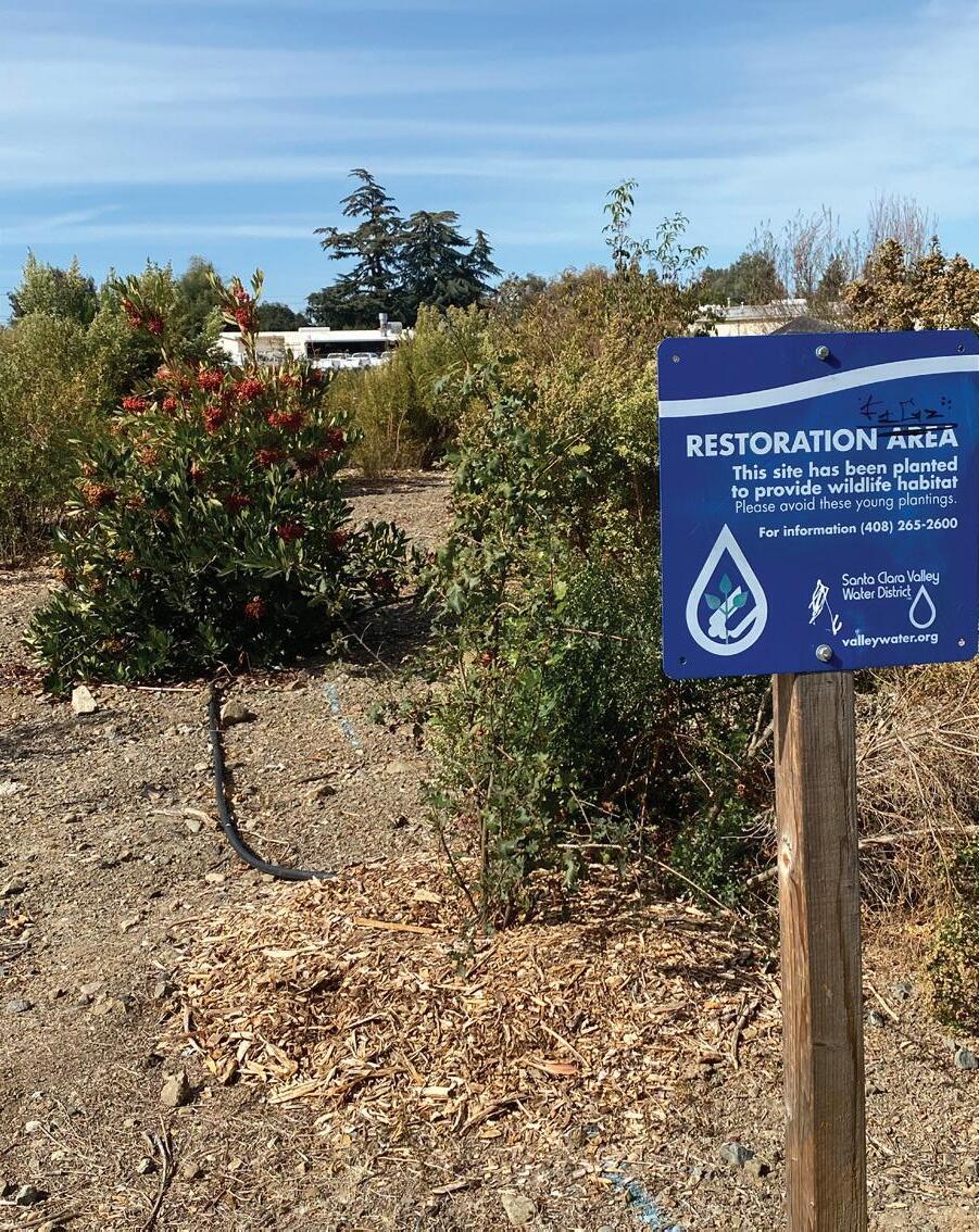
Toyon at a restoration area at Alamden Lake Park.
15
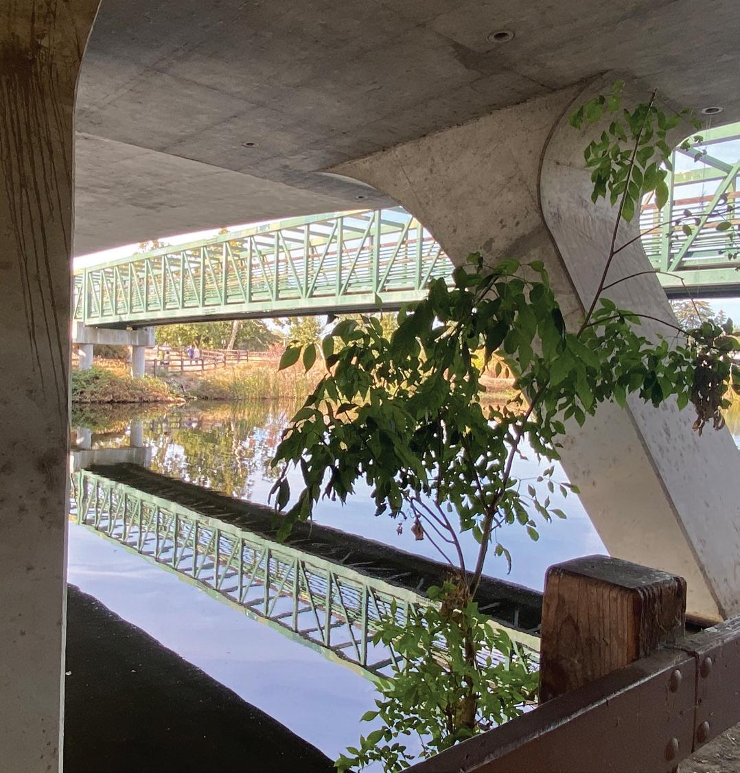
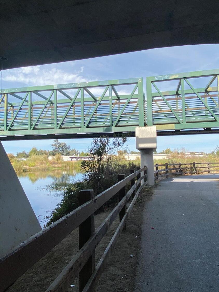
Pedestrian bridge that connects the Guadalupe River Trail across the lake. The bridge runs parallel to Coleman Road.
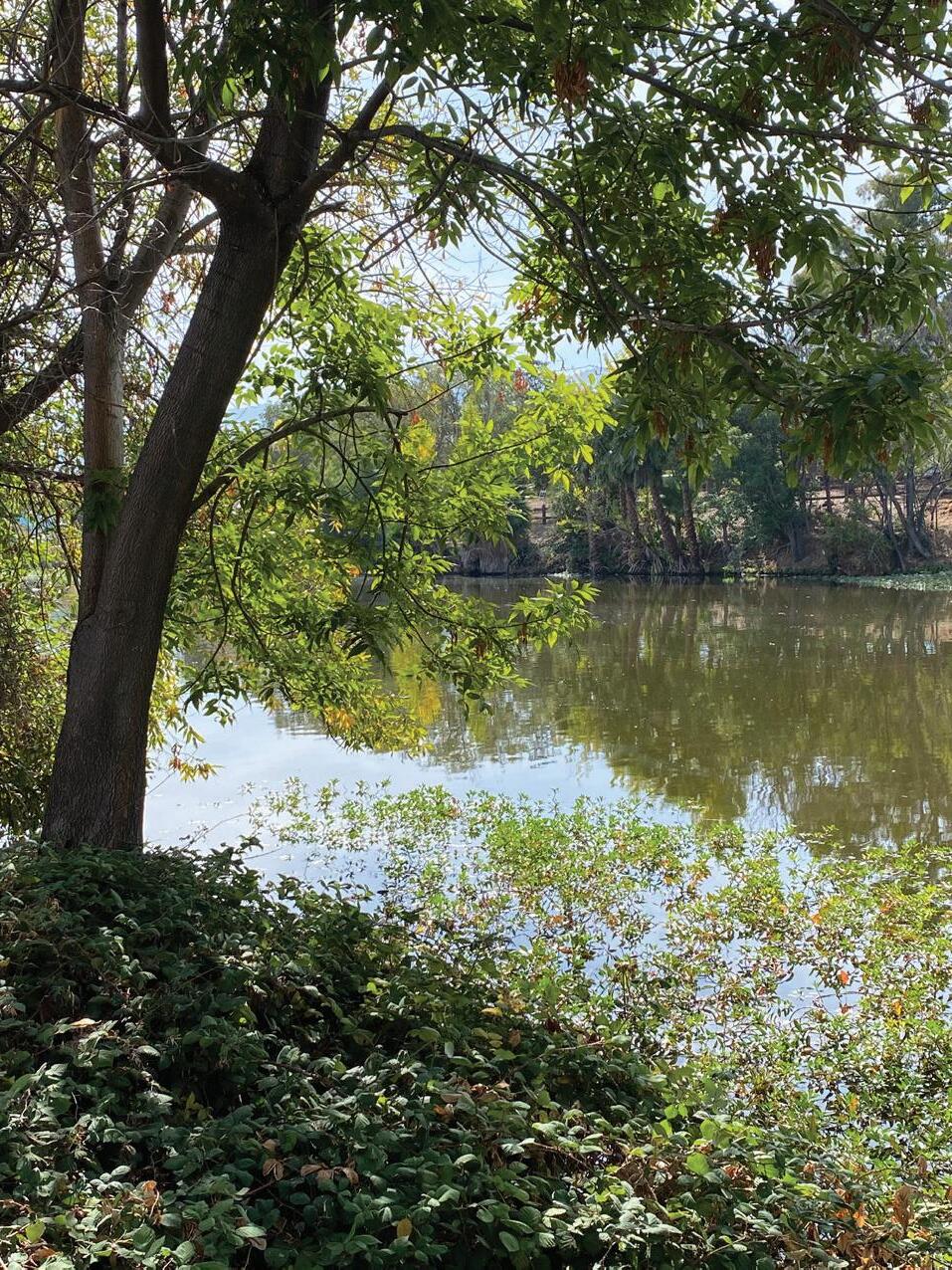
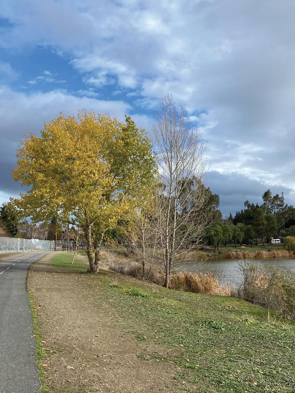
Vegetation at the park in mid and late fall. Photo left, October 2023. Photo right, December 2021.
CONTEXTUAL + SUPPORT MATERIAL
Introduction
To further understand how to improve conditions at Almaden Lake Park, it is important to understand the users of the site, reflect on design theories, and research previous landscape architecture projects that tackle similar issues. All of these resources are critical for creating a thoughtful and thorough design approach. By properly analyzing these resources, their knowledge can be applied to create a successful project.
The demographics take inventory of the current residents that live near Almaden Lake Park. By understanding who lives there, design choices can be made to address their needs. Additionally, user profiles were created to show the potential of the site to be a resource for people with a variety of needs.
The theory and literature review analyzes the works of landscape architects and applies them to the case of Almaden Lake Park. These works challenge how landscape architects view design, intending to create better and more thoughtful projects. Reading through these works was impactful in finding purpose and creating goals for this project.
The case studies presented in this report look at projects that address similar issues found at Almaden Lake Park. By revising these projects, there are lessons to be learned and inspiration that can be gained. Understanding how past projects created solutions can provide insight into ways to solve problems at Almaden Lake.
The rationale and reasoning look at rhetorical questions and dilemmathesis statements. The rhetorical questions are meant to question and find the purpose of the project. The dilemma-thesis statements dig deep into current problems and ways to solve them. Both of these inspire the project goals.
Visitor watching the water in the early morning at Almaden Lake.
17
DEMOGRAPHICS TOTAL POP:
MOST COMMON NONENGLISH
LANGUAGES
1. SPANISH(11.6%)
2. CHINESE(7.49%)
3. VIETNAMESE(3.49%)
HISPANIC/LATINO
HISPANIC/ LATINO NOT HISPANIC/ LATINO
72.9%
HOMEOWNERSHIP
Data + Connection
AVERAGE NUMBER OF CARS PER HOUSEHOLD
Data shows that the neighborhood around the park has a large population. There is a mixture of races and ethnicities with white and Asian on top. 40% of households speak a non-English language at home, showing how multicultural the area is. With almost 75%, the area is dominated by homeowners instead of renters. There is an average of 2 cars per household showing that the primary way of moving around is via personal vehicles. This data is helpful to begin understanding the demographics of the surrounding area to better meet the needs and concerns of residents. There are a lot of homeowners, showing the need to design for families and residents. While residents are the primary users, the park should be designed to be enjoyed by anyone who stops by for occasional events.
18
115,185
WHITE OTHER BLACK 2 OR MORE ASIAN
RACE
USER PROFILE
USER: Sam
Sam is a student at the nearby high school. As a teenager, he doesn’t have access to a car, limiting his hang out options. Since the park is only a few blocks from his house, he is able to walk there. He can spend time with friends relaxing at picnic tables after school or run along the trails for a morning workout.
USER: Alex
Alex is a stay at home mom of two children. Living by the park is convenient for taking her kids to play at the playground. Her youngest is still in a stroller and the walking trails are perfect to stroll along. When her partner is off work, their whole family is able to enjoy the parks amenities together.
USER: Ryan
Ryan is an office worker in downtown, living near his workplace. He heard about a concert happening at the park and due to its close proximity, he was able to drive there after work on a Friday night. Although he doesn’t frequent the park, he is able to enjoy its beauty and amenities through easy way finding.
19
THEORY AND LITERATURE REVIEW
“A park is not just a park”
Toward counter-narratives to advance equitable green space policy in the United States by Alessandro Rigolon, Elva Yañez, Manal J. Aboelata, & Rachel Bennett
Summary
In the article “A park is not just a park,” the authors provide the argument that green space is an essential part of communities that can provide equitable and inclusive spaces, serving communities beyond just being a park. When discussing policy and funding around green spaces, there are dominant narratives that green spaces are “nice to have” or “universally good.” This has created issues including but not limited to the idea that green spaces are a luxury plus a lack of awareness and sensitivity in creating green spaces.
The narrative that green spaces are a luxury is problematic in many ways. Since green spaces are not seen as essential parts of a community, inequity amongst disadvantaged or impoverished communities is perpetuated. Disadvantaged communities with less economic investment, particularly those of color, are less likely to receive support in developing green spaces or in rehabilitating dilapidated green spaces. As a result, only wealthy, affluent neighborhoods can have access to new and wellmaintained green space. Green spaces are essential for more than providing the health benefits of experiencing the outdoors. Green spaces are multifunctional. They can support communities by providing space for supportive agendas, such as providing food, offering vaccines, and serving as an emergency site. Public green spaces become areas for communities to come together in good times and bad. The narrative of green spaces not being essential continues structures of systemic racism as communities of color have less access to multifunctional spaces that service their community.
The idea that green spaces are universally good is another significant issue. If you build a park in a disadvantaged neighborhood, haven’t you solved the problems of inequity? Not really. Since green spaces are so desirable (and they are not yet seen as essential) they do a great job facilitating gentrification. This problem stems from a lack of awareness about the side effects caused by economic investment. Prejudice towards low-income communities or communities of color makes their neighborhoods be seen as undesirable. A lack of investment
20
in undesirable neighborhoods makes them more undesirable and the cycle perpetuates. If you create desirable traits in an undesirable neighborhood, more people begin to care about that space, meaning it’s more valuable. These existing communities do not have the money to continue living in an area where prices begin to increase, facing the risk of being succeeded by outsiders. This issue can be solved by appropriate planning to prevent the gentrification of neighborhoods. What is most effective is putting policies in place that prevent rent increases or allot for low-income housing. Communities can then receive monetary investment in the green space that they deserve without the threat of displacement.
Green spaces are essential for communities and existing access to them should not be taken for granted. Adding green spaces to communities must be done with sensitivity to avoid displacing existing communities. Oversimplification of green spaces and their benefits has led to narratives that reinforce inequities in green spaces. These narratives must be shifted to recognize that green spaces are essential and must be intentionally planned, otherwise the issue of green space inequities will perpetuate.
Connection
This article does a good job of explaining how important green spaces are to communities. They are essential. Many cities and towns fall flat delivering well-designed and maintained parks and open spaces for residents. Since parks are essential parts of a community’s infrastructure, ensuring that residents have access to safe/healthy places is important. I would like to help a community reclaim toxic green space to be a valuable amenity. While ecological restoration plays a large part in that, it is also important to recognize the social and cultural functions of a park. While many can appreciate ecological restoration, the site may be used only for its social functions by some residents. Knowing how important green space is means I need to approach the site/project holistically, analyzing ecological, social, cultural, and economic opportunities and the effects of design choices.
21
THEORY AND LITERATURE REVIEW
Landscapes of Infrastructure
by Elizabeth Mossop from Landscape Urbanism Reader
Summary
In “Landscapes of Infrastructure” by Elizabeth Mossop, the author discusses how infrastructure is one of the most meaningful ways to observe the relationship between natural processes and cities. Rather than seeing landscapes full of infrastructure, we should think of the landscape as an infrastructure itself to create a framework for designing urban systems. Many designs, when peeled back, reveal the strong relationship between city form and natural landscape structure. Reading the landscape can provide insight into the ways design has subconsciously begun to work melding nature and humans.
Mossop explains how landscape architecture as a profession has been plagued by boundaries when its defining quality is its ability to cross disciplinary boundaries. Most prevalent is the need for the unification of ecology and design. Landscape architecture is held back by two festering points of view. One is that humans are separate from the natural world and the other is the separation of environment and design (within landscape architecture). For a long time, humans and nature have been seen as different entities, when in reality we are interconnected. As much as we’d like to think urban infrastructure has no impact on virgin ecosystems, that is not the case. The natural world has been considered superior to any form of human design, but it is not realistic to live in a world free of human influence. Rather than viewing nature as an almighty entity that can’t be touched (in terms of efficiency and beauty) there needs to be more productive conversations surrounding design problems of urban landscapes. For example, infrastructure that has been viewed as only serving one function, such as a road or parking lot, should be looked at through new lenses to create multiple uses. The failure to see ecology and design connected with each other has prevented the profession of landscape architecture from engaging (with creativity, intentionality, and purpose) with the created landscape of urban spaces.
Urban infrastructure can enhance the natural world. Bridging the divide between ecology and design leads the way for hybrid systems that work with natural processes and human design. Urban infrastructure can work with ecological systems to produce landscapes that function socially and ecologically. Designed landscapes should be a hybrid of natural
22
Olmsted’s design of Boston’s Emerald Necklace combined infrastructure, engineering, health, recreation, and scenery. Image from text.
processes and human systems in a way that incorporates both, not dominantly one or the other.
Connection
This article provides relevant commentary on issues plaguing the profession of landscape architecture. Particularly the discontent with ecology, the environment, and natural systems compared to culture, design, and human infrastructure. When thinking about projects that aim to create a lost ecosystem, it is important to keep in mind the balance of nature and human function. While it is tempting to create a pristine ecosystem that doesn’t appear to be influenced by human creation, it is not a realistic way of thinking about designed landscapes. Time should be spent researching the ways wildlife can thrive in artificially created spaces (that don’t perfectly replicate natural ecosystems). It is important to bridge the ecological and human functions of space to create spaces that are purposeful in multiple ways. Creating sustainable and resilient landscapes involves thinking about ecological processes and human uses to create landscapes that will live on beyond a single generation.
23
THEORY AND LITERATURE REVIEW
Nature into Landscape into Art
by Lawrence Halprin
Summary
Lawrence Halprin describes the contrast of nature being viewed as an almighty force while the landscape is something cultivated, the result of human choices. Both of these types of spaces evoke emotional responses in the user. Halprin suggests that, “the motivating force of landscape design is to evoke a deep emotional response,” just like the way other art forms do. Designing landscapes is a special form of art as it engages with human’s primal connection to nature. For many, nature and natural processes (without human influence) just seem right. If that is the case, then this should be the source of design inspiration. For Halprin, to make landscape into art, he focuses on nature’s primitive processes that tap into the human psyche of needs and desires.
To make a landscape into art and not merely imitate nature, there must be a transformation of natural landscape experiences into human-made environments. Rather than nature itself being the source of inspiration, it is the experience felt in nature that is valuable to be captured and used as the basis of design. Halprin emphasizes that designed landscapes should showcase the results of the processes that take place in nature. What makes landscape design an art form is capturing human empathy and compassion for nature and reinterpreting it for others in created (not naturally occurring) spaces. Designed landscapes open the door to appreciating nature in urban and unnatural settings, allowing people to develop their own connection with the natural world and natural process.
Creating feelings within people is the purpose of design. Capturing the essence of nature is an unrealistic task to take on as design is not meant to imitate nature. Landscape design should focus on replicating experiences felt in nature. This could include forms that mimic nature, but in the context of human design, they take on new meaning. Humans have a powerful and often indescribable connection to nature that is often referred to as biological. Whether one views nature as perfect or not, it creates a feeling within. This should be treasured.
24
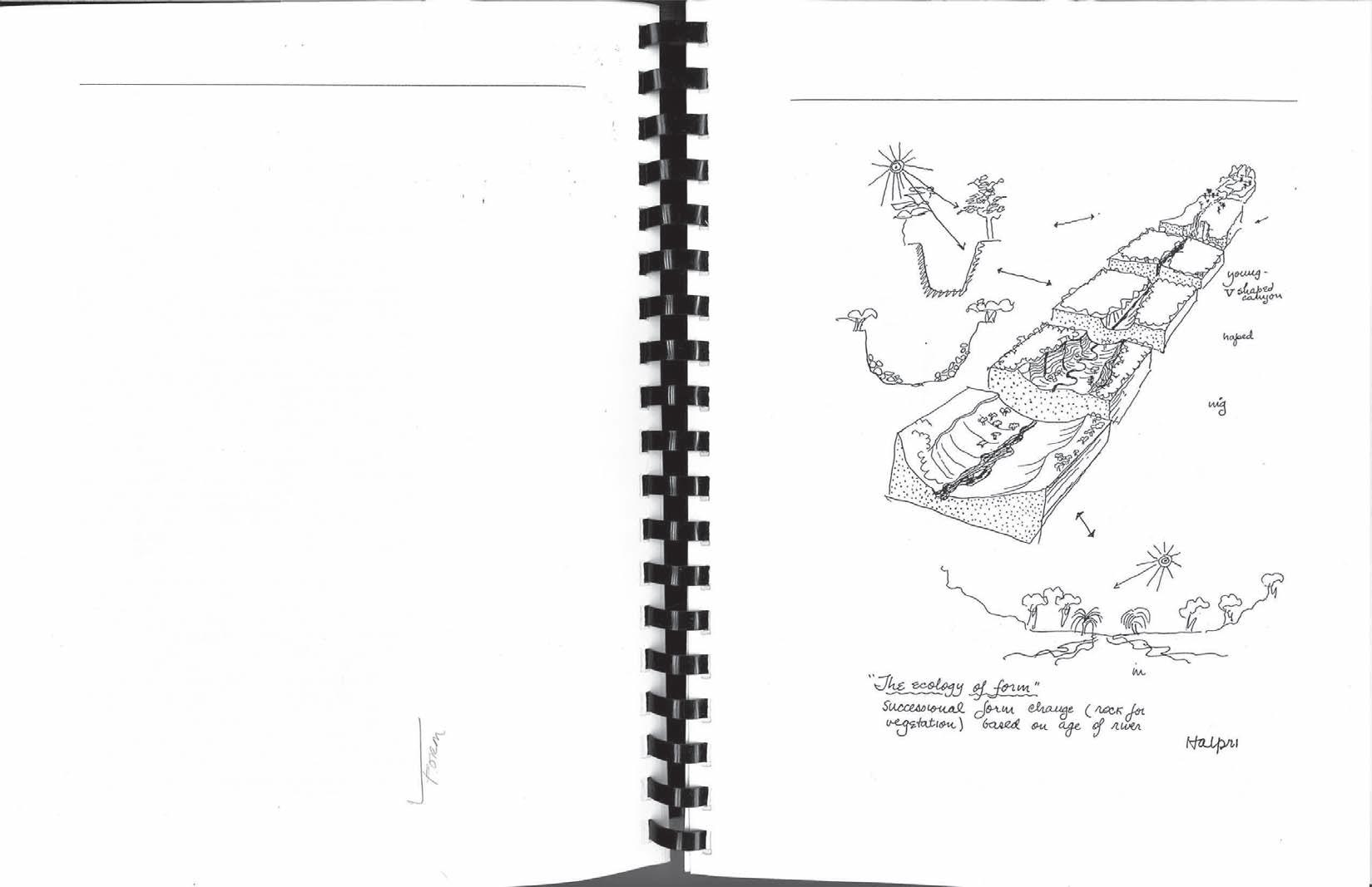
must decide how closely the finished design will replicate an untouched ecosystem. As designers, it is not our role to artificially create nature, but rather create spaces that can be resilient to natural processes, such as weather. Since restoration should not be replication, it is important to capture the feeling of being in nature. Fixing ecosystems is very beneficial to the environment but there is an emotional human connection that is important to capture as well for these redesigned landscapes to be successful. There is an increasing need to create hybrid landscapes that bridge nature and human living into a single shared space. Creating places that capture the experience of nature is a form of connecting natural processes and human function.
25
Diagram of “The ecology of form” by Halprin.
PRECEDENT STUDIES
South Los Angeles Wetland Park, CA
by Mia Lehrer + Associates
Summary
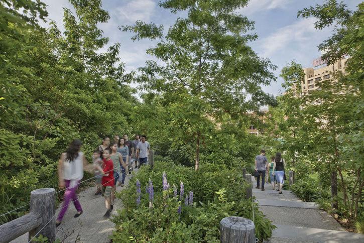
Formerly a bus yard and brownfield, this piece of land has been transformed into an attractive and functional park. Through riparian and marsh habitats, the site captures and treats urban stormwater runoff from the Los Angeles River Watershed. Water first enters an underground pretreatment system where sediment, trash, oil, grease, gasoline, and heavy metals are filtered before circulating through the wetland pools. Plants were specially selected to withstand both flooding and drought. Visitors to the park can learn about the different types of planting zones as well as how stormwater moves and is cleaned throughout the site through educational signage. This signage provides an educational opportunity for the nearby schools. The park provides essential green space to a historically underserved community, including recreational amenities such as trails, boardwalks, observation decks, and picnic areas.
Successes Of The Project
» Treats up to 14,000 gallons of stormwater runoff daily
» Removes oil and grease, bacteria, suspended solids, nitrate, and phosphorus from stormwater runoff
» Increased resident access to green space
» Provides space for recreational and social activities
Takeaways To Apply Or Outcomes To Be Achieved At Almaden Lake Park
» Water treatment through riparian and wetland habitat
» Removes contaminants from waterways
» Neighborhood rejuvenating amenity
» Educational signage teaches visitors about water treatment at the site as well as different types of planting areas
» Include signage in multiple languages to make them accessible to as many people as possible
» Project is an educational resource for nearby schools
26
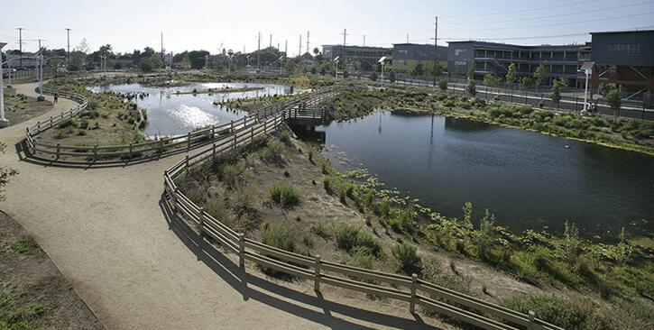
The completed wetland park offers wandering pathways and scenic views that engage visitors with the space. Vegetation along the basins features native plants with signage scattered around describing the plants.
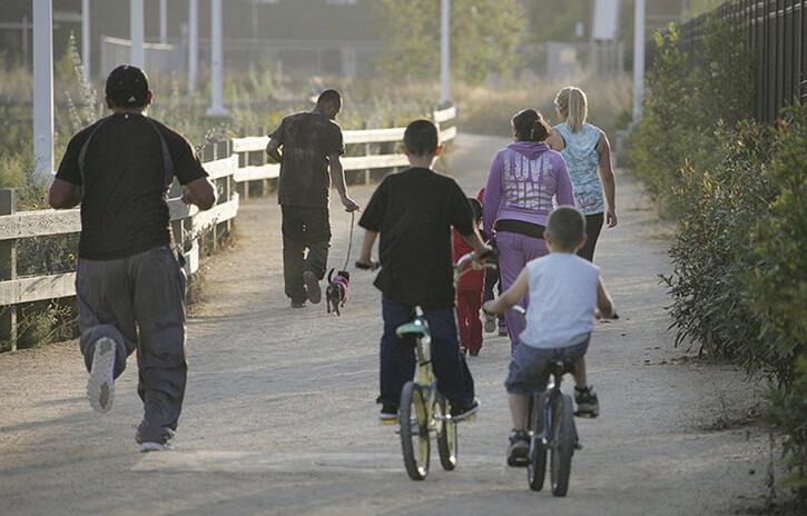
The park provides recreational outdoor space for the community to utilize. Residents of all ages can engage in various activities such as walking, jogging, and bird-watching.
27
PRECEDENT STUDIES
Fish Tail Park, China
by Turenscape
Summary
Once a fish farm and dumping site for coal ash from power plants, this landscape has been transformed into a resilient park that can withstand annual monsoons and floods. Mud from the site was used to construct forested islands that serve as an interactive feature for guests with networks of walkways. Some islands are undisturbed habitats for migratory birds and avian species. The site has become a priceless social space for the community and fosters a sense of place through artistic elements including bridges and sculptures.
Successes Of The Project
» Improves water quality with a reduction in total nitrogen, chemical oxygen demand, and total organic carbon
» Treats 50,000 tons of water a day
» Creates a site that is resilient to water level fluctuations and floods
» Increases flood storage capacity
» Utilized soil on site to create a “floating forest” of forested islands, half of which are accessible to the public and half which are protected habitat
» Creates habitat for birds by meeting foraging and nesting needs
» Lowers temperatures within the park and the park’s peripheral pathways
» Decreases noise levels by 10.8 decibels from the outside to the inside
» A network of pathways allows visitors to experience nature up close
» Has profitable leasable commercial spaces that support the park’s identity and provide financial support
» The public recognizes the project as a respectable form of land stewardship
Takeaways To Apply Or Outcomes To Be Achieved At Almaden Lake Park
» Improves water quality and creates habitat for wildlife
» Reduces noise levels of surrounding streets
» Has event areas that reinforce the park’s identity
» Provides unique amenities that engage visitors
» Creates an accessible and welcoming outdoor space for the community and tourists to enjoy
28
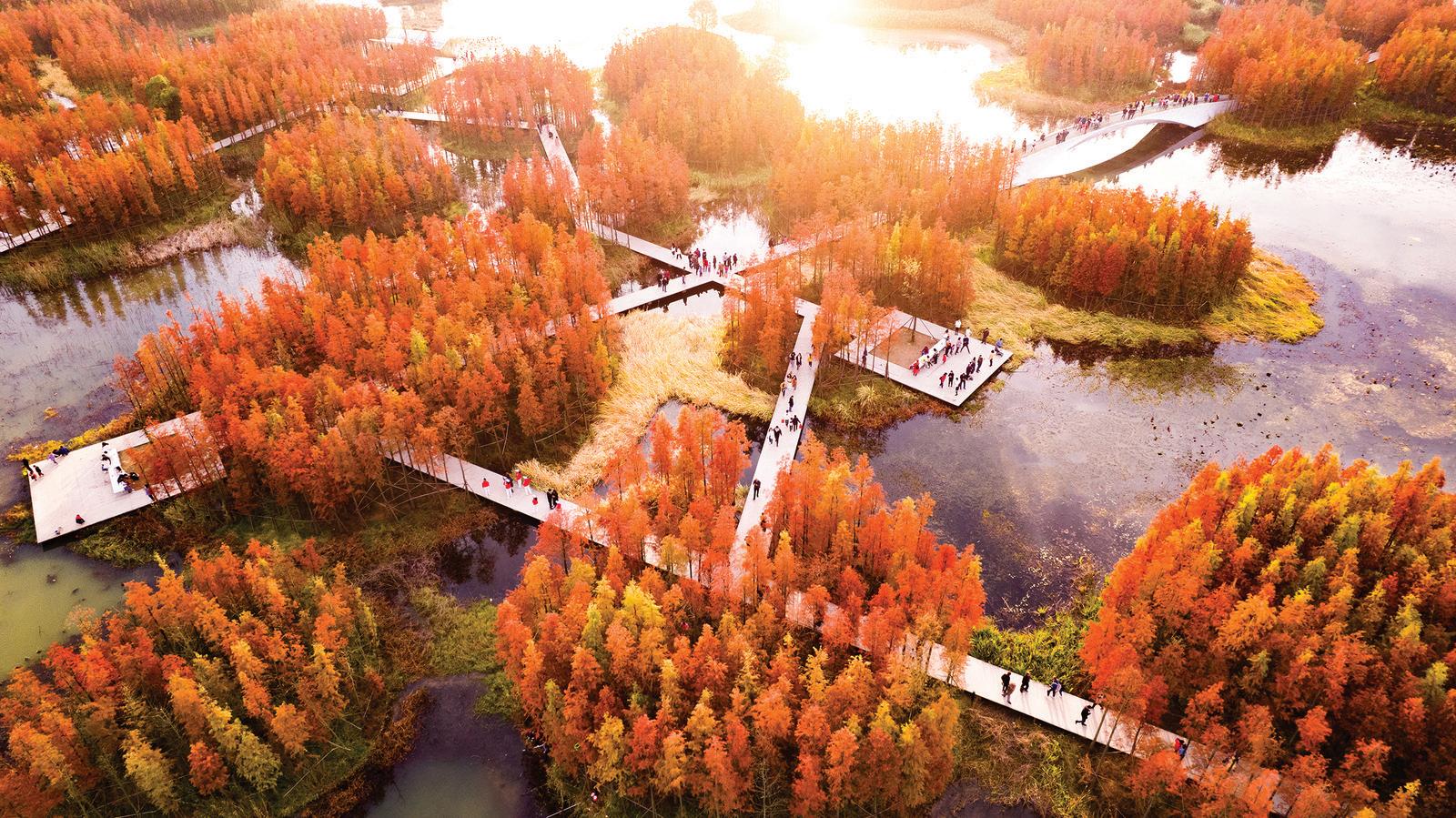
A network of pathways allows visitors to be immersed in nature and witness scenic views. The walkways can be submerged during flooding events and annual monsoons.
Areas of the park are not accessible to visitors and are reserved as protected habitat. The lush landscape has a backdrop of the city skyline showing the park's place in an urban location.
29
PRECEDENT STUDIES
Lurie Garden at Millennium Park, IL
by Gustafson Guthrie Nichol; Terry Guen Design Associates
Summary
Located at the Millennium Park in Chicago, the Lurie Garden is a twoacre native garden that brings habitat into the urban city, reclaiming land within a concrete jungle. The garden attracts birds, butterflies, and bees with plants from the Midwest, acting as an important resource for local wildlife. The planting design is both functional and beautiful. The garden attracts tourists with its year-round seasonal interest and creates a sense of place with local materials that pay homage to the midwestern prairie. It provides priceless educational opportunities for visitors to learn about native plants, something lacking in the city.
Successes Of The Project
» Increased public open space in downtown Chicago
» Saves 890,000 gallons of water annually by using native plants
» Plant selection requires no insecticides, fungicides, or herbicides to maintain the garden
» Attracts over 27 species of birds as well as butterflies and bees
» Provides educational opportunities to visitors
» Used locally sourced materials (limestone, soil, plants)
» Contributes to Millennium Park’s positive economic impact on the city
Takeaways To Apply Or Outcomes To Be Achieved At Almaden Lake Park
» Creating native habitat in man-made conditions
» Reclaiming land in urban areas
» Use of regional materials to create a sense of place that matches the location of the project
» Provides educational value and sparked interest in native plantings
» Year-round interest through plantings
30
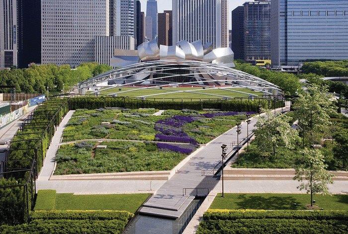
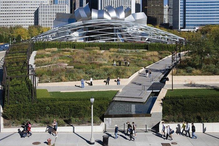
Photos showing Lurie Garden's year-round interest via the planting design. On the left, the garden is full of purple salvia in the spring and summer. On the right, the garden experiences an explosion of texture and color in autumn.
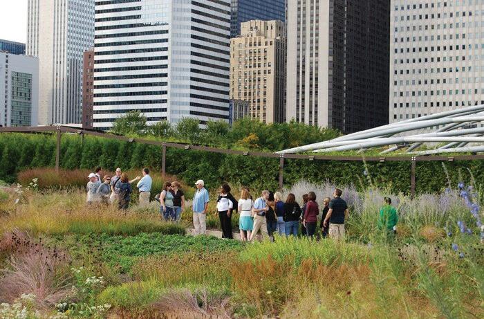
Visitors can observe and learn about native Midwestern prairie plants in the garden. Volunteers wander around the garden to answer questions from visitors.
31
PRECEDENT STUDIES
Brooklyn Bridge Park, NY
by Michael Van Valkenburgh Associates
Summary
Brooklyn Bridge Park was once a cargo shipping and storage facility that has been transformed into an 85-acre public landscape. The linear park that spans 1.3 miles along the East River connects neighborhoods previously separated by an expressway. Offering space for outdoor recreational activities and events the park has rejuvenated communities and brought people together. The park manages stormwater and creates habitat through swaths of plantings. The design uses trees to bring a human scale to the park which is surrounded by large industrial structures. Using materials salvaged from the former use of the site, the park develops a sense of identity that pays homage to its past.
Successes Of The Project
» Reduces stormwater runoff
» Provides habitat for over 100 species of birds who nest on the site or use it as a migratory stopover
» Increases ecological quality
» Used recycled materials from the site saving them from the landfill
» Attracts over 150,000 visitors weekly in the summer months
» Hosts over 660 programs and events annually
» Reduces noise levels by 10.4 decibels from adjacent expressway traffic
Takeaways To Apply Or Outcomes To Be Achieved At Almaden Lake Park
» Reclaim space in the urban matrix for public use
» Provides habitat for wildlife in an urban setting
» Provides space for active and passive outdoor recreational use
» Increases biodiversity
» Uses design elements to frame views
» Links green spaces across the city
» Reduces noise levels of nearby roads
» Materials from the site are reused and recycled into new elements
32
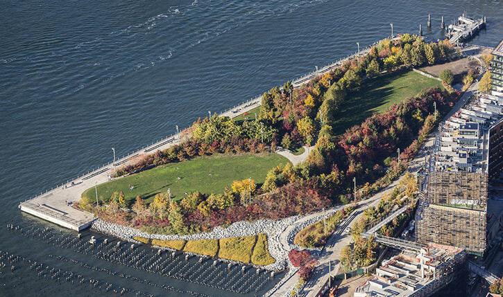
Different types of soil were brought on-site to cater to the different plant communities included in the park.
The planting design creates an immersive experience within the park, hiding the urban surroundings.
33
Sydney Park Water Re-use Project, Australia
by Turf Design Studio and Environmental Partnership
Summary
Part of Sydney Park in Sydney, Australia, this water reuse project is designed to reduce the city’s reliance on potable water. The site treats stormwater and circulates it within the park. Stormwater is either pumped into a vegetated swale and diverted to a wetland or the water is treated by a pollutant trap before being directed to a wetland to be filtered. The project uses almost 50,000 square feet of native plant species. Lizard lounges, frog ponds, and nesting boxes for birds and possums are integrated into the bioretention system. The construction of the project allows for scenic views of the water system at work while also highlighting the beauty of water through art pieces. Visitors can interact with the wetlands through paths, lookouts, boardwalks, bridges, stepping stones, platforms, and seating areas.
Successes Of The Project
» Reduces levels of copper, nickel, nitrogen, and zinc in water
» Increased number of bird species
» Increased acreage of freshwater wetland habitat and gully forest habitat
» Increases public awareness of environmental issues, environmental systems, and water management
Takeaways To Apply Or Outcomes To Be Achieved At Almaden Lake Park
» Clean pollutants out of water bodies
» Increase habitat for local wildlife
» Provide educational opportunities to learn about ecological systems and water management
» Highlight the importance of water through art
» Provide space for physical activities
» Improve connectivity and circulation within the park system
» Showcase scenic views
» Create a sense of place through material use, art, and water features
34
PRECEDENT STUDIES
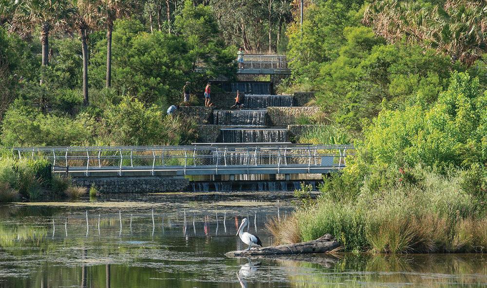
A bridge between the cascading wetlands encourages visitors to interact with the space. It also offers a closer look at the water system at work.
Pathways and outlooks allow visitors to view waterways and appreciate sculptures from multiple angles.
35
RATIONAL + REASONING
Rhetorical Questions
» How can healthy landscapes promote healthy lives?
» Does access to green space foster appreciation for native ecosystems and wildlife?
» Can the unnatural be turned natural?
» How can hybridizing natural processes with human infrastructure create healthy landscapes?
» What can be learned from observing the landscape?
» Can nature fix man-made mistakes?
Dilemma-Thesis Statements
Dilemma: Many people are unaware of the native wildlife and ecology where they live.
Thesis: To increase appreciation for native ecosystem services, people should have easy access to healthy functioning green spaces where they can observe wildlife. Learning about native wildlife requires leaving the classroom to explore and experience firsthand.
Dilemma: Ignorance and mismanagement of human practices have polluted landscapes.
Thesis: To create healthy and safe green spaces, polluted ecosystems should be remediated. Polluted landscapes are lost but have the potential to be found and flourish, providing communities with well-deserved access to green space.
Dilemma: Many green spaces do not have the maintenance to prevent them from becoming dilapidated.
Thesis: Green spaces should be designed to be self-sustaining, harnessing natural processes and systems to be resilient to change.
36
Six-Word Memoir
PROFESSIONAL CONTACTS
Jon Cicirelli
Director of San Jose Parks, Recreation, and Neighborhood Services jon.cicirelli@sanjoseca.gov
408-793-5553
Kerrie Romanow
Director of San Jose Environmental Services Department kerrie.Romanow@sanjoseca.gov
408-535-8552
Erin Baker
Contact representative for Santa Clara Valley Water for Almaden Lake Improvement Project ebaker@valleywater.org
408-630-2608
Jim Beall
Director of District 4 (home to Almaden Lake) of Santa Clara Valley Water Districts jbeall@valleywater.org
Michael Martin
Water Resource Specialist at Santa Clara Valley Water District michaelmartin@valleywater.org
408-630-3095
Roxanne Grillo
Project Manager for Santa Clara Valley Water for Almaden Lake Improvement Project rgrillo@valleywater.org
408-630-3078
Cal Engineering & Geology
Company has conducted geotechnical investigation of lake (408) 440-4542
38
PROPOSED TIMELINE
JUNE - AUG
» Conduct multiple site visits throughout summer to collect inventory and conduct site analysis
» Attend community events hosted at the park
» Expand research of site and phytoremediation
» Find additional case studies
» Brainstorm project deliverables
SEPT-DEC
» Continue research
» Solidify project goals and objectives
» Begin schematic design
» Finalized programmatic elements
» Finalized site master plan
» Begin producing supporting graphics
JAN-MAR
» Start board layout
» Produce supporting graphics and refine diagrams
» Compile assets into booklet
» Practice project presentation
» Complete project boards
» Present project at senior showcase
39
ANNOTATED BIBLIOGRAPHY
(2018). Reddit. photograph, Almaden Lake Park. Retrieved from https:// www.reddit.com/r/SanJose/comments/8rgua9/almaden_lake_park_ looking_beautiful_today_anyone/.
Image seen on page 7.
Almaden Lake Improvement Project Public Meeting Presentation. Santa Clara Valley Water. (2020, January 8). https://www.valleywater.org/sites/ default/files/AlmadenLakeImprovementProjectDEIR_PPJan2020PDF.pdf
This source was used for information about an on-hold improvement project for the park as well as research conducted for a draft environmental impact report.
Almaden Lake Improvement Project. Santa Clara Valley Water. (2023). https://www.valleywater.org/project-updates/almaden-lakeimprovement-project
This source was used for background information about Almaden Lake Park as well as information about an on-hold improvement project for the park.
Almaden Lake Regional Park. City of San Jose. (n.d.). https:// www.sanjoseca.gov/Home/Components/FacilityDirectory/ FacilityDirectory/2082/2028
Official website with park information. This source was used for information about (picnic areas, parking lots, etc.) and maps of Almaden Lake Park as a form of site inventory.
DeBold, D. (2011). Almaden Lake Morning. Flickr. photograph, Almaden Lake Park. Retrieved from https://www.flickr.com/photos/ ddebold/6457402401.
Image seen on page 16.
DeBold, D. (2012). Almaden Lake Park. Flickr. photograph, Almaden Lake Park. Retrieved from https://www.flickr.com/photos/ ddebold/8133770673/.
Image seen on page 4.
40
Evans, C., Corkery, L., Kjaersgaard, S. P., & Zheng, L. (2020, August). Sydney Park Water Re-use Project. Landscape Performance Series. https://doi.org/10.31353/cs1670
This source was used for the Sydney Park Water Re-use Project case study. The page discusses the environmental, social, and economic successes of the project. It also mentions the design goals, process, and lessons learned while completing the project. Images used for the case study were from this website.
General Plan 2040. City of San Jose ArcGIS. (n.d.). https://csj.maps.arcgis. com/apps/instant/lookup/index.html?appid=ef685f767b484eb6bcfc70f8 fb651ef6
Map of San Jose’s General Plan. Used for site inventory and analysis.
Halprin, L. (1995). Chapter 16: Nature into Landscape into Art. In Landscape in America (pp. 241–248). essay, Univ. of Texas Press. This source was used for the theory and literature review. The author discusses the ability of spaces to create feelings within users and how to harness that feeling to turn the landscape into art.
Hinai, H. A., & Wang, Y. (2023, August). Fish Tail Park. Landscape Performance Series. https://www.landscapeperformance.org/casestudy-briefs/fish-tail-park#overview
This source was used for the Fish Tail Park case study. The page discusses the environmental, social, and economic successes of the project. It also mentions the design goals, process, and lessons learned while completing the project. Images used for the case study were from this website.
Landscape Architecture Foundation. (2011, January). The Lurie Garden at Millennium Park. Landscape Performance Series. https://www. landscapeperformance.org/case-study-briefs/the-lurie-garden-atmillennium-park#challenge-solution
This source was used for the Lurie Garden case study. The page discusses the environmental, social, and economic successes of the project. It also mentions the design goals, process, and lessons learned while completing the project. Images used for the case study were from this website.
41
ANNOTATED BIBLIOGRAPHY CONTINUED
Maps Commonly Used for Planning | City of San José. City of San Jose. (n.d.). https://www.sanjoseca.gov/your-government/departmentsoffices/planning-building-code-enforcement/planning-division/mapscommonly-used-for-planning
This source was used for finding maps of San Jose depicting different characteristics as a form of site inventory.
Mossop, E. (2006). Landscapes of Infrastructure. In Landscape Urbanism Reader (pp. 163–177). essay, Princeton Architectural Press.
This source was used for the theory and literature review. The author discusses pitfalls in the point of view of landscape architects and landscape architecture as a profession as a way to bridge the landscapes of urban infrastructure (human) and nature in design.
Pevzner, N., & Mckay, S. (2016). Brooklyn Bridge Park: Pier 1 & Pier 3-4 uplands. Landscape Performance Series. https://doi.org/10.31353/cs1100
This source was used for the Brooklyn Bridge Park case study. The page discusses the environmental, social, and economic successes of the project. It also mentions the design goals, process, and lessons learned while completing the project. Images used for the case study were from this website.
Richard, C. (n.d.). The Legacy of the Mercury Mines. Oakland Museum of California. https://explore.museumca.org/creeks/z-mercurymines.html
This source was used for history of the New Almaden Mines and how mercury contamination came to be in the Guadalupe River Watershed.
Rigolon, A., Yañez, E., Aboelata, M. J., & Bennett, R. (2022). “A park is not just a park”: Toward counter-narratives to advance equitable green space policy in the United States. Cities, 128, 103792. https://doi. org/10.1016/j.cities.2022.103792
This source was used for the theory and literature review. The article discusses how green space is seen as a luxury but argues that it is essential for communities. Additionally the article tackles the issue of green spaces being seen as universally good when in reality, green spaces must be designed and planned properly to avoid adverse affects on communities.
42
San Jose City (Southwest/Almaden Valley) Census Data. Data USA. (n.d.). https://datausa.io/profile/geo/san-jose-city-southwestalmaden-valleypuma-ca#demographics
This source was used for demographic data of Almaden Valley.
San Jose Zoning Map. City of San Jose ArcGIS. (n.d.). https://experience. arcgis.com/experience/c23301b236d041d5a5358a5dce1e989d
Zoning Map of the city of San Jose. Used for site inventory and analysis.
Shannon, K., & Hood, C. (2016, August). South Los Angeles Wetland Park. Landscape Performance Series. https://doi.org/10.31353/cs1130
This source was used for the South Los Angeles Wetland Park case study. The page discusses the environmental, social, and economic successes of the project. It also mentions the design goals, process, and lessons learned while completing the project. Images used for the case study were from this website.
43
COVER LETTER
Growing up in the Bay Area of California, I am no stranger to the landscape of urban sprawl. While surrounded by suburbs, I was fortunate to be located near many natural landscapes within driving distance, including the beaches of Santa Cruz, redwood forests north of San Francisco, and majestic oak forests beyond the hills in my backyard. My access to these beautiful landscapes created an appreciation for healthy ecosystems that support biodiversity and the knowledge that experiencing nature can be lifechanging.
As I’ve gone through my college education, I have learned about the importance of access to green space and how many communities lack it. This was the inspiration for my senior project. So many landscapes are lost to urban sprawl. Underfunded, unmaintained, forgotten, and abandoned. These landscapes have so much potential to change the lives of communities as staples of the urban fabric. Located in my hometown is the opportunity of a lifetime to restore a park from an accident of human creation to an ecosystem brimming with biodiversity that provides healthy green space for the community to enjoy for generations to come.
44
Jessica Vanden Beukel
408-838-9654 | jessicalvdbeukel@gmail.com
Landscape architecture student passionate about providing communities with well-loved outdoor spaces that are environmentally sensitive and educate communities about sustainability and native ecosystems
EDUCATION
California Polytechnic State University, San Luis Obispo
Bachelor of Landscape Architecture Sept 2020 - Jun 2025
Sustainable Environments Minor
EXPERIENCE
Callander Associates, San Jose
Landscape Architecture Intern Jun 2023 - Sept 2023
Assistant in all aspects of projects, including concept development, rendering concepts, construction documents (occupancy load, demolition, grading, irrigation, site construction, layout, planting, details) and cost estimate sheets Participation in site visits, office meetings, and work for company ’ s other offices
United Movement, San Luis Obispo
Creative Director Sept 2021 - Jun 2022
Brand Advisor Sept 2022 - Jun 2023
Board member for dance team creating digital social media assets and merchandise Leader of graphics committee for annual showcase responsible for theme and asset production
Target, San Jose
Specialty Sales Team Member July 2022 - Oct 2023
Responsible for zoning, remerchandising, and expertise in the style department Engagement with guests to answer questions and solve problems
INTERESTS
Clara B. Rees Iris Society,
Region 14 of American Iris Society
Member 2016, 2020 - PRESENT
Region 14 Scholarship Recipient 2022
Growing iris and participation in iris competitions for quality specimens and floral arrangement
Mosaic Volunteer,
Magical Bridge Playground, Redwood City 2020
Participation in creating community-based mosaic mural at park
SOFTWARE
AutoCAD
Photoshop
Illustrator
InDesign
Rhino
Lumion
ArcGIS Pro
SKILLS
Organization
Collaboration
Problem Solving
HONORS
President’s List
2020-2021
2021-2022
2022-2023
Dean’s Honors List
Fall 2020
Winter, Spring, Fall 2021
Winter, Spring, Fall 2022
Winter, Spring, Fall 2023
Winter 2024
45
QUICKSILVER SHORES